Deprecated: Creation of dynamic property Zend_View::$sMode is deprecated in /var/www/stall-frei/htdocs/staging.stall-frei.de/library/vendor/shardj/zf1-future/library/Zend/View/Abstract.php on line 308
Stallplatz oder Offenstall in Erle
Gesucht wird in "45891 Erle"
6.332 Einträge
Deprecated: Creation of dynamic property Zend_View::$listObjects is deprecated in /var/www/stall-frei/htdocs/staging.stall-frei.de/library/vendor/shardj/zf1-future/library/Zend/View/Abstract.php on line 308
Gesponsort


Deprecated: Creation of dynamic property Zend_View::$listMode is deprecated in /var/www/stall-frei/htdocs/staging.stall-frei.de/library/vendor/shardj/zf1-future/library/Zend/View/Abstract.php on line 308
Deprecated: Creation of dynamic property Zend_View::$renderedObjects is deprecated in /var/www/stall-frei/htdocs/staging.stall-frei.de/library/vendor/shardj/zf1-future/library/Zend/View/Abstract.php on line 308
Deprecated: Creation of dynamic property Zend_View::$index is deprecated in /var/www/stall-frei/htdocs/staging.stall-frei.de/library/vendor/shardj/zf1-future/library/Zend/View/Abstract.php on line 308
Deprecated: Creation of dynamic property Zend_View::$displayMode is deprecated in /var/www/stall-frei/htdocs/staging.stall-frei.de/library/vendor/shardj/zf1-future/library/Zend/View/Abstract.php on line 308
Deprecated: Creation of dynamic property Zend_View::$remarketingIds is deprecated in /var/www/stall-frei/htdocs/staging.stall-frei.de/library/vendor/shardj/zf1-future/library/Zend/View/Abstract.php on line 308
Deprecated: Creation of dynamic property Zend_View::$listItem is deprecated in /var/www/stall-frei/htdocs/staging.stall-frei.de/library/vendor/shardj/zf1-future/library/Zend/View/Abstract.php on line 308
Deprecated: Creation of dynamic property Zend_View::$object is deprecated in /var/www/stall-frei/htdocs/staging.stall-frei.de/library/vendor/shardj/zf1-future/library/Zend/View/Abstract.php on line 308
Deprecated: Creation of dynamic property Zend_View::$attributes is deprecated in /var/www/stall-frei/htdocs/staging.stall-frei.de/library/vendor/shardj/zf1-future/library/Zend/View/Abstract.php on line 308

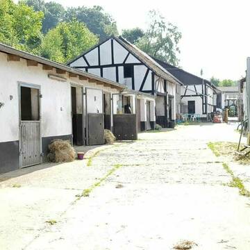
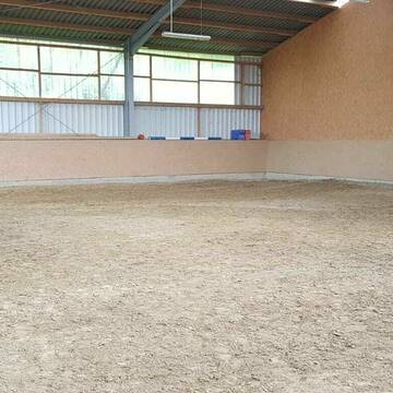
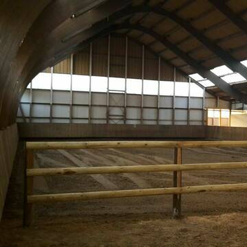
Pferdebox zwischen Herten und Recklinghausen
Herten
Philipp Schulte-Schedding
@Reiterhof-Schulte-Schedding
FN-Mitglied
Freizeitstall
Vermieten
Hunde willkommen
Krankenbox
Notfallboxen
17 weitere...
P
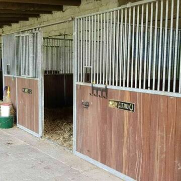
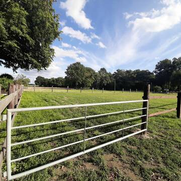
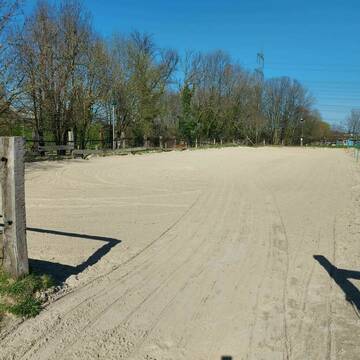
Boxen frei
Herne
Hubbert-Heiko
@Hubbert-Heiko
Freizeitstall
Reitlehrer und -unterricht
Vermieten
Hunde willkommen
Longierzirkel/Roundpen
Außenbox mit Paddock
Außenboxen
10 weitere...
P+
Deprecated: Creation of dynamic property Zend_View_Helper_Ads::$adLink is deprecated in /var/www/stall-frei/htdocs/staging.stall-frei.de/library/Psf/View/Helper/Ads.php on line 108

Persönlichkeitsentwicklung mit Pferden
Bad Salzuflen
Katja Dors
@Pferdezeiten
Begleite andere auf ihrem Entwicklungsweg und entdecke die transformative Kraft der pferdegestützten Persönlichkeitsentwicklung !
neu
R

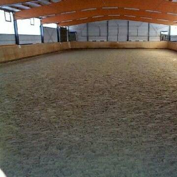
Paddockbox – Exzellente Haltung & Training
Marl
Hengststation Heiner Rohmann
@Rohmann
FN-Mitglied
Geländestrecke
Vermieten
Führanlage
Hunde willkommen
Notfallboxen
Pferdezucht
20 weitere...
P
Grönings Hof
Marl
Grönings-Hof
@Groenings-Hof
Fahrstall, Kutschwagen
Freizeitstall
Verpachten
Hunde willkommen
Longierzirkel/Roundpen
Pferdezucht
22 weitere...
P
Reiterhof Fleige
Bochum
Michaela-Fleige
@Michaela-Fleige
FN-Mitglied
Freizeitstall
Vermieten
Hunde willkommen
Longierzirkel/Roundpen
Hufrehe geeignet
21 weitere...
P+

Futtersack HeuToy, Fressbremse in pink
Mechtersen
STALL-FREIde Marketing
@STALL-FREI-Marketing
Stundenlange Beschäftigung die
Koliken vorbeugt, geringe Staubinhalation mit
steuerbarer Futterentnahme
Hof Becker in Kirchhellen Feldhausen
Bottrop
Christopher-Becker
@Christopher-Becker
Vermieten
Führanlage
Paddock
Außenbox mit Paddock
Außenboxen
Vollpension
11 weitere...
P
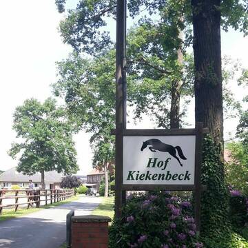
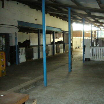
Hof Kiekenbeck
Dorsten
Hof Kiekenbeck
@HofKiekenbeck
Reitlehrer und -unterricht
Führanlage
Longierzirkel/Roundpen
Außenboxen
Innenbox
Vollpension
9 weitere...
P+
Leider kein Vorschaubild
Leider kein Vorschaubild
Offenstallplatz für Kleinpferdewallach frei
Gelsenkirchen
Ziegenmichelhof
@Ziegenmichelhof
Freizeitstall
Gangpferdereiten
Vermieten
Hunde willkommen
Longierzirkel/Roundpen
Hufrehe geeignet
16 weitere...
B
Reitanlage Altendorf-Ulfkotte GmbH
Dorsten
Reitanlage-Altendorf-Ulfkotte
@Reitanlage-Altendorf-Ulfkotte-
FN-Mitglied
Freizeitstall
Vermieten
Verpachten
Hunde willkommen
Longierzirkel/Roundpen
Innenbox
Offenstall
17 weitere...
P
Werde Teil von STALL-FREI.de
Du hast eine Pferdebox frei? Freie Plätze im Offenstall, Pferdestall oder der Reitanlage kostenlos anbieten.
Deprecated: Creation of dynamic property Zend_View::$pageCount is deprecated in /var/www/stall-frei/htdocs/staging.stall-frei.de/library/vendor/shardj/zf1-future/library/Zend/View/Abstract.php on line 308
Deprecated: Creation of dynamic property Zend_View::$itemCountPerPage is deprecated in /var/www/stall-frei/htdocs/staging.stall-frei.de/library/vendor/shardj/zf1-future/library/Zend/View/Abstract.php on line 308
Deprecated: Creation of dynamic property Zend_View::$first is deprecated in /var/www/stall-frei/htdocs/staging.stall-frei.de/library/vendor/shardj/zf1-future/library/Zend/View/Abstract.php on line 308
Deprecated: Creation of dynamic property Zend_View::$current is deprecated in /var/www/stall-frei/htdocs/staging.stall-frei.de/library/vendor/shardj/zf1-future/library/Zend/View/Abstract.php on line 308
Deprecated: Creation of dynamic property Zend_View::$last is deprecated in /var/www/stall-frei/htdocs/staging.stall-frei.de/library/vendor/shardj/zf1-future/library/Zend/View/Abstract.php on line 308
Deprecated: Creation of dynamic property Zend_View::$previous is deprecated in /var/www/stall-frei/htdocs/staging.stall-frei.de/library/vendor/shardj/zf1-future/library/Zend/View/Abstract.php on line 308
Deprecated: Creation of dynamic property Zend_View::$next is deprecated in /var/www/stall-frei/htdocs/staging.stall-frei.de/library/vendor/shardj/zf1-future/library/Zend/View/Abstract.php on line 308
Deprecated: Creation of dynamic property Zend_View::$pagesInRange is deprecated in /var/www/stall-frei/htdocs/staging.stall-frei.de/library/vendor/shardj/zf1-future/library/Zend/View/Abstract.php on line 308
Deprecated: Creation of dynamic property Zend_View::$firstPageInRange is deprecated in /var/www/stall-frei/htdocs/staging.stall-frei.de/library/vendor/shardj/zf1-future/library/Zend/View/Abstract.php on line 308
Deprecated: Creation of dynamic property Zend_View::$lastPageInRange is deprecated in /var/www/stall-frei/htdocs/staging.stall-frei.de/library/vendor/shardj/zf1-future/library/Zend/View/Abstract.php on line 308
Deprecated: Creation of dynamic property Zend_View::$currentItemCount is deprecated in /var/www/stall-frei/htdocs/staging.stall-frei.de/library/vendor/shardj/zf1-future/library/Zend/View/Abstract.php on line 308
Deprecated: Creation of dynamic property Zend_View::$totalItemCount is deprecated in /var/www/stall-frei/htdocs/staging.stall-frei.de/library/vendor/shardj/zf1-future/library/Zend/View/Abstract.php on line 308
Deprecated: Creation of dynamic property Zend_View::$firstItemNumber is deprecated in /var/www/stall-frei/htdocs/staging.stall-frei.de/library/vendor/shardj/zf1-future/library/Zend/View/Abstract.php on line 308
Deprecated: Creation of dynamic property Zend_View::$lastItemNumber is deprecated in /var/www/stall-frei/htdocs/staging.stall-frei.de/library/vendor/shardj/zf1-future/library/Zend/View/Abstract.php on line 308
Deprecated: Creation of dynamic property Zend_View::$router is deprecated in /var/www/stall-frei/htdocs/staging.stall-frei.de/library/vendor/shardj/zf1-future/library/Zend/View/Abstract.php on line 308
Deprecated: Creation of dynamic property Zend_View::$urlParams is deprecated in /var/www/stall-frei/htdocs/staging.stall-frei.de/library/vendor/shardj/zf1-future/library/Zend/View/Abstract.php on line 308
Deprecated: Creation of dynamic property Zend_View::$showAds is deprecated in /var/www/stall-frei/htdocs/staging.stall-frei.de/library/vendor/shardj/zf1-future/library/Zend/View/Abstract.php on line 308
Deprecated: Creation of dynamic property Zend_View::$objectIds is deprecated in /var/www/stall-frei/htdocs/staging.stall-frei.de/library/vendor/shardj/zf1-future/library/Zend/View/Abstract.php on line 308
Deprecated: Creation of dynamic property Zend_View::$showNavbar is deprecated in /var/www/stall-frei/htdocs/staging.stall-frei.de/library/vendor/shardj/zf1-future/library/Zend/View/Abstract.php on line 308
Deprecated: Creation of dynamic property Zend_View::$showBreadcrumb is deprecated in /var/www/stall-frei/htdocs/staging.stall-frei.de/library/vendor/shardj/zf1-future/library/Zend/View/Abstract.php on line 308
Deprecated: Creation of dynamic property Zend_View::$showFooter is deprecated in /var/www/stall-frei/htdocs/staging.stall-frei.de/library/vendor/shardj/zf1-future/library/Zend/View/Abstract.php on line 308
Deprecated: Creation of dynamic property Zend_View::$showInternalAds is deprecated in /var/www/stall-frei/htdocs/staging.stall-frei.de/library/vendor/shardj/zf1-future/library/Zend/View/Abstract.php on line 308
Deprecated: Creation of dynamic property Zend_View::$blNoContent is deprecated in /var/www/stall-frei/htdocs/staging.stall-frei.de/library/vendor/shardj/zf1-future/library/Zend/View/Abstract.php on line 308
Deprecated: Creation of dynamic property Zend_View::$sMetaDesc is deprecated in /var/www/stall-frei/htdocs/staging.stall-frei.de/library/vendor/shardj/zf1-future/library/Zend/View/Abstract.php on line 308
Deprecated: Creation of dynamic property Zend_View::$useGmaps is deprecated in /var/www/stall-frei/htdocs/staging.stall-frei.de/library/vendor/shardj/zf1-future/library/Zend/View/Abstract.php on line 308
Deprecated: Creation of dynamic property Zend_View::$touches is deprecated in /var/www/stall-frei/htdocs/staging.stall-frei.de/library/vendor/shardj/zf1-future/library/Zend/View/Abstract.php on line 308
Deprecated: Creation of dynamic property Zend_View::$oProject is deprecated in /var/www/stall-frei/htdocs/staging.stall-frei.de/library/vendor/shardj/zf1-future/library/Zend/View/Abstract.php on line 308
Deprecated: Creation of dynamic property Zend_View::$pageHeadline is deprecated in /var/www/stall-frei/htdocs/staging.stall-frei.de/library/vendor/shardj/zf1-future/library/Zend/View/Abstract.php on line 308
Deprecated: Creation of dynamic property Zend_View::$disableLocationField is deprecated in /var/www/stall-frei/htdocs/staging.stall-frei.de/library/vendor/shardj/zf1-future/library/Zend/View/Abstract.php on line 308
Deprecated: Creation of dynamic property Zend_View::$isSearch is deprecated in /var/www/stall-frei/htdocs/staging.stall-frei.de/library/vendor/shardj/zf1-future/library/Zend/View/Abstract.php on line 308
Deprecated: Creation of dynamic property Zend_View::$pageTitle is deprecated in /var/www/stall-frei/htdocs/staging.stall-frei.de/library/vendor/shardj/zf1-future/library/Zend/View/Abstract.php on line 308
Deprecated: Creation of dynamic property Psf_Form_Element_Text::$class is deprecated in /var/www/stall-frei/htdocs/staging.stall-frei.de/library/vendor/shardj/zf1-future/library/Zend/Form/Element.php on line 874
Deprecated: Creation of dynamic property Psf_Form_Element_Text::$size is deprecated in /var/www/stall-frei/htdocs/staging.stall-frei.de/library/vendor/shardj/zf1-future/library/Zend/Form/Element.php on line 874
Deprecated: Creation of dynamic property Psf_Form_Element_Text::$placeholder is deprecated in /var/www/stall-frei/htdocs/staging.stall-frei.de/library/vendor/shardj/zf1-future/library/Zend/Form/Element.php on line 874
Deprecated: Creation of dynamic property Psf_Form_Element_Hidden::$class is deprecated in /var/www/stall-frei/htdocs/staging.stall-frei.de/library/vendor/shardj/zf1-future/library/Zend/Form/Element.php on line 874
Deprecated: Creation of dynamic property Psf_Form_Element_Hidden::$class is deprecated in /var/www/stall-frei/htdocs/staging.stall-frei.de/library/vendor/shardj/zf1-future/library/Zend/Form/Element.php on line 874
Deprecated: Creation of dynamic property Psf_Form_Element_Hidden::$class is deprecated in /var/www/stall-frei/htdocs/staging.stall-frei.de/library/vendor/shardj/zf1-future/library/Zend/Form/Element.php on line 874
Deprecated: Creation of dynamic property Psf_Form_Element_Hidden::$class is deprecated in /var/www/stall-frei/htdocs/staging.stall-frei.de/library/vendor/shardj/zf1-future/library/Zend/Form/Element.php on line 874
Deprecated: Creation of dynamic property Psf_Form_Element_Select::$class is deprecated in /var/www/stall-frei/htdocs/staging.stall-frei.de/library/vendor/shardj/zf1-future/library/Zend/Form/Element.php on line 874
Deprecated: Creation of dynamic property Psf_Form_Element_Select::$class is deprecated in /var/www/stall-frei/htdocs/staging.stall-frei.de/library/vendor/shardj/zf1-future/library/Zend/Form/Element.php on line 874
Deprecated: Creation of dynamic property Psf_Form_Element_Select::$class is deprecated in /var/www/stall-frei/htdocs/staging.stall-frei.de/library/vendor/shardj/zf1-future/library/Zend/Form/Element.php on line 874
Deprecated: Creation of dynamic property Psf_Form_Element_Select::$class is deprecated in /var/www/stall-frei/htdocs/staging.stall-frei.de/library/vendor/shardj/zf1-future/library/Zend/Form/Element.php on line 874
Deprecated: Creation of dynamic property Psf_Form_Element_Text::$class is deprecated in /var/www/stall-frei/htdocs/staging.stall-frei.de/library/vendor/shardj/zf1-future/library/Zend/Form/Element.php on line 874
Deprecated: Creation of dynamic property Psf_Form_Element_Checkbox::$label is deprecated in /var/www/stall-frei/htdocs/staging.stall-frei.de/library/vendor/shardj/zf1-future/library/Zend/Form/Element.php on line 874
Deprecated: Creation of dynamic property Zend_View::$sort is deprecated in /var/www/stall-frei/htdocs/staging.stall-frei.de/library/vendor/shardj/zf1-future/library/Zend/View/Abstract.php on line 308
Deprecated: Creation of dynamic property Zend_View::$searchLocation is deprecated in /var/www/stall-frei/htdocs/staging.stall-frei.de/library/vendor/shardj/zf1-future/library/Zend/View/Abstract.php on line 308
Deprecated: Creation of dynamic property Zend_View::$locationHint is deprecated in /var/www/stall-frei/htdocs/staging.stall-frei.de/library/vendor/shardj/zf1-future/library/Zend/View/Abstract.php on line 308
Psf_GeoCoder_Abstract::getLocation: Erle Get Location CachedOrLive
Psf_GeoCoder_Abstract::getCachedOrLive: Erle
Psf_GeoCoder_Abstract::convertLocationResult
{"documentation":"https:\/\/opencagedata.com\/api","licenses":[{"name":"see attribution guide","url":"https:\/\/opencagedata.com\/credits"}],"results":[{"bounds":{"northeast":{"lat":51.5771252,"lng":7.1061437},"southwest":{"lat":51.539004,"lng":7.0592297}},"components":{"ISO_3166-1_alpha-2":"DE","ISO_3166-1_alpha-3":"DEU","ISO_3166-2":["DE-NW"],"_category":"place","_normalized_city":"Gelsenkirchen","_type":"neighbourhood","city":"Gelsenkirchen","city_district":"Gelsenkirchen-Ost","continent":"Europe","country":"Deutschland","country_code":"de","political_union":"European Union","postcode":"45891","state":"Nordrhein-Westfalen","state_code":"NW","suburb":"Erle"},"confidence":7,"formatted":"45891 Gelsenkirchen, Deutschland","geometry":{"lat":51.5591959,"lng":7.0892779}},{"bounds":{"northeast":{"lat":51.7668426,"lng":6.8860593},"southwest":{"lat":51.7268426,"lng":6.8460593}},"components":{"ISO_3166-1_alpha-2":"DE","ISO_3166-1_alpha-3":"DEU","ISO_3166-2":["DE-NW"],"_category":"place","_normalized_city":"Raesfeld","_type":"village","continent":"Europe","country":"Deutschland","country_code":"de","county":"Kreis Borken","political_union":"European Union","postcode":"46348","state":"Nordrhein-Westfalen","state_code":"NW","town":"Raesfeld","village":"Erle"},"confidence":7,"formatted":"46348 Erle, Deutschland","geometry":{"lat":51.7468426,"lng":6.8660593}},{"bounds":{"northeast":{"lat":50.6121737,"lng":10.7588557},"southwest":{"lat":50.5080318,"lng":10.7361661}},"components":{"ISO_3166-1_alpha-2":"DE","ISO_3166-1_alpha-3":"DEU","ISO_3166-2":["DE-TH"],"_category":"natural\/water","_normalized_city":"St. Kilian","_type":"river","continent":"Europe","country":"Deutschland","country_code":"de","county":"Landkreis Hildburghausen","municipality":"Schleusingen","political_union":"European Union","river":"Erle","state":"Th\u00fcringen","state_code":"TH","village":"St. Kilian"},"confidence":7,"formatted":"Erle, St. Kilian, Th\u00fcringen, Deutschland","geometry":{"lat":50.5530971,"lng":10.7434897}},{"bounds":{"northeast":{"lat":51.5264399,"lng":14.6515356},"southwest":{"lat":51.5249688,"lng":14.6489223}},"components":{"ISO_3166-1_alpha-2":"DE","ISO_3166-1_alpha-3":"DEU","ISO_3166-2":["DE-SN"],"_category":"natural\/water","_normalized_city":"Wei\u00dfwasser\/Oberlausitz","_type":"water","continent":"Europe","country":"Deutschland","country_code":"de","county":"G\u00f6rlitz","municipality":"Wei\u00dfwasser\/Oberlausitz","political_union":"European Union","postcode":"02943","state":"Sachsen","state_code":"SN","town":"Wei\u00dfwasser\/Oberlausitz","water":"Erle"},"confidence":9,"formatted":"Erle, 02943 Wei\u00dfwasser\/Oberlausitz, Deutschland","geometry":{"lat":51.5257783,"lng":14.6500549}},{"bounds":{"northeast":{"lat":51.0760464,"lng":9.4131421},"southwest":{"lat":51.0734123,"lng":9.4087013}},"components":{"ISO_3166-1_alpha-2":"DE","ISO_3166-1_alpha-3":"DEU","ISO_3166-2":["DE-HE"],"_category":"natural\/water","_normalized_city":"Wabern","_type":"meadow","continent":"Europe","country":"Deutschland","country_code":"de","county":"Schwalm-Eder-Kreis","hamlet":"Rockshausen","meadow":"Erle","municipality":"Wabern","political_union":"European Union","postcode":"34590","state":"Hessen","state_code":"HE"},"confidence":9,"formatted":"Erle, Rockshausen, 34590 Wabern, Deutschland","geometry":{"lat":51.074713,"lng":9.4105045}},{"bounds":{"northeast":{"lat":51.1735773,"lng":10.97431},"southwest":{"lat":51.1721968,"lng":10.9719093}},"components":{"ISO_3166-1_alpha-2":"DE","ISO_3166-1_alpha-3":"DEU","ISO_3166-2":["DE-TH"],"_category":"natural\/water","_normalized_city":"Strau\u00dffurt","_type":"forest","continent":"Europe","country":"Deutschland","country_code":"de","county":"Landkreis S\u00f6mmerda","forest":"Erle","municipality":"Strau\u00dffurt","political_union":"European Union","postcode":"99634","state":"Th\u00fcringen","state_code":"TH","town":"Strau\u00dffurt","village":"Strau\u00dffurt"},"confidence":9,"formatted":"Erle, 99634 Strau\u00dffurt, Deutschland","geometry":{"lat":51.1729073,"lng":10.9729788}},{"bounds":{"northeast":{"lat":50.1653853,"lng":8.795719},"southwest":{"lat":50.1453853,"lng":8.775719}},"components":{"ISO_3166-1_alpha-2":"DE","ISO_3166-1_alpha-3":"DEU","ISO_3166-2":["DE-HE"],"_category":"place","_normalized_city":"Bischofsheim","_type":"hamlet","continent":"Europe","country":"Deutschland","country_code":"de","county":"Main-Kinzig-Kreis","locality":"Erle","municipality":"Maintal","political_union":"European Union","postcode":"63477","state":"Hessen","state_code":"HE","town":"Bischofsheim"},"confidence":8,"formatted":"Erle, 63477 Bischofsheim, Deutschland","geometry":{"lat":50.1553853,"lng":8.785719}},{"bounds":{"northeast":{"lat":49.6597822,"lng":9.5040198},"southwest":{"lat":49.6397822,"lng":9.4840198}},"components":{"ISO_3166-1_alpha-2":"DE","ISO_3166-1_alpha-3":"DEU","ISO_3166-2":["DE-BW"],"_category":"place","_normalized_city":"K\u00fclsheim","_type":"hamlet","continent":"Europe","country":"Deutschland","country_code":"de","county":"Main-Tauber-Kreis","locality":"Erle","political_union":"European Union","postcode":"97900","state":"Baden-W\u00fcrttemberg","state_code":"BW","town":"K\u00fclsheim"},"confidence":8,"formatted":"Erle, 97900 K\u00fclsheim, Deutschland","geometry":{"lat":49.6497822,"lng":9.4940198}},{"components":{"ISO_3166-1_alpha-2":"FR","ISO_3166-1_alpha-3":"FRA","ISO_3166-2":["FR-GES","FR-6AE","FR-68"],"_category":"road","_normalized_city":"Soultzeren","_type":"road","city":"Soultzeren","continent":"Europe","country":"France","country_code":"fr","county":"Haut-Rhin","local_authority":"Communaut\u00e9 de communes de la Vall\u00e9e de Munster","political_union":"European Union","postcode":"68140","road":"Rue Erl\u00e9","state":"Grand Est","state_code":"GES"},"confidence":2,"formatted":"Rue Erl\u00e9, 68140 Soultzeren, France","geometry":{"lat":48.061328,"lng":7.104282}},{"components":{"ISO_3166-1_alpha-2":"FR","ISO_3166-1_alpha-3":"FRA","ISO_3166-2":["FR-GES","FR-88"],"_category":"road","_normalized_city":"Nayemont-les-Fosses","_type":"road","city":"Nayemont-les-Fosses","continent":"Europe","country":"France","country_code":"fr","county":"Vosges","local_authority":"Communaut\u00e9 d'agglom\u00e9ration de Saint-Di\u00e9-des-Vosges","political_union":"European Union","postcode":"88100","road":"Chemin de la Roelle","state":"Grand Est","state_code":"GES"},"confidence":2,"formatted":"Chemin de la Roelle, 88100 Nayemont-les-Fosses, France","geometry":{"lat":48.294735,"lng":7.005261}}],"status":{"code":200,"message":"OK"},"stay_informed":{"blog":"https:\/\/blog.opencagedata.com","mastodon":"https:\/\/en.osm.town\/@opencage"},"thanks":"For using an OpenCage API","timestamp":{"created_http":"Sun, 08 Feb 2026 19:23:43 GMT","created_unix":1770578623},"total_results":10}Array
(
[0] => stdClass Object
(
[bounds] => stdClass Object
(
[northeast] => stdClass Object
(
[lat] => 51.5771252
[lng] => 7.1061437
)
[southwest] => stdClass Object
(
[lat] => 51.539004
[lng] => 7.0592297
)
)
[components] => stdClass Object
(
[ISO_3166-1_alpha-2] => DE
[ISO_3166-1_alpha-3] => DEU
[ISO_3166-2] => Array
(
[0] => DE-NW
)
[_category] => place
[_normalized_city] => Gelsenkirchen
[_type] => neighbourhood
[city] => Gelsenkirchen
[city_district] => Gelsenkirchen-Ost
[continent] => Europe
[country] => Deutschland
[country_code] => de
[political_union] => European Union
[postcode] => 45891
[state] => Nordrhein-Westfalen
[state_code] => NW
[suburb] => Erle
)
[confidence] => 7
[formatted] => 45891 Gelsenkirchen, Deutschland
[geometry] => stdClass Object
(
[lat] => 51.5591959
[lng] => 7.0892779
)
)
[1] => stdClass Object
(
[bounds] => stdClass Object
(
[northeast] => stdClass Object
(
[lat] => 51.7668426
[lng] => 6.8860593
)
[southwest] => stdClass Object
(
[lat] => 51.7268426
[lng] => 6.8460593
)
)
[components] => stdClass Object
(
[ISO_3166-1_alpha-2] => DE
[ISO_3166-1_alpha-3] => DEU
[ISO_3166-2] => Array
(
[0] => DE-NW
)
[_category] => place
[_normalized_city] => Raesfeld
[_type] => village
[continent] => Europe
[country] => Deutschland
[country_code] => de
[county] => Kreis Borken
[political_union] => European Union
[postcode] => 46348
[state] => Nordrhein-Westfalen
[state_code] => NW
[town] => Raesfeld
[village] => Erle
)
[confidence] => 7
[formatted] => 46348 Erle, Deutschland
[geometry] => stdClass Object
(
[lat] => 51.7468426
[lng] => 6.8660593
)
)
[2] => stdClass Object
(
[bounds] => stdClass Object
(
[northeast] => stdClass Object
(
[lat] => 50.6121737
[lng] => 10.7588557
)
[southwest] => stdClass Object
(
[lat] => 50.5080318
[lng] => 10.7361661
)
)
[components] => stdClass Object
(
[ISO_3166-1_alpha-2] => DE
[ISO_3166-1_alpha-3] => DEU
[ISO_3166-2] => Array
(
[0] => DE-TH
)
[_category] => natural/water
[_normalized_city] => St. Kilian
[_type] => river
[continent] => Europe
[country] => Deutschland
[country_code] => de
[county] => Landkreis Hildburghausen
[municipality] => Schleusingen
[political_union] => European Union
[river] => Erle
[state] => Thüringen
[state_code] => TH
[village] => St. Kilian
)
[confidence] => 7
[formatted] => Erle, St. Kilian, Thüringen, Deutschland
[geometry] => stdClass Object
(
[lat] => 50.5530971
[lng] => 10.7434897
)
)
[3] => stdClass Object
(
[bounds] => stdClass Object
(
[northeast] => stdClass Object
(
[lat] => 51.5264399
[lng] => 14.6515356
)
[southwest] => stdClass Object
(
[lat] => 51.5249688
[lng] => 14.6489223
)
)
[components] => stdClass Object
(
[ISO_3166-1_alpha-2] => DE
[ISO_3166-1_alpha-3] => DEU
[ISO_3166-2] => Array
(
[0] => DE-SN
)
[_category] => natural/water
[_normalized_city] => Weißwasser/Oberlausitz
[_type] => water
[continent] => Europe
[country] => Deutschland
[country_code] => de
[county] => Görlitz
[municipality] => Weißwasser/Oberlausitz
[political_union] => European Union
[postcode] => 02943
[state] => Sachsen
[state_code] => SN
[town] => Weißwasser/Oberlausitz
[water] => Erle
)
[confidence] => 9
[formatted] => Erle, 02943 Weißwasser/Oberlausitz, Deutschland
[geometry] => stdClass Object
(
[lat] => 51.5257783
[lng] => 14.6500549
)
)
[4] => stdClass Object
(
[bounds] => stdClass Object
(
[northeast] => stdClass Object
(
[lat] => 51.0760464
[lng] => 9.4131421
)
[southwest] => stdClass Object
(
[lat] => 51.0734123
[lng] => 9.4087013
)
)
[components] => stdClass Object
(
[ISO_3166-1_alpha-2] => DE
[ISO_3166-1_alpha-3] => DEU
[ISO_3166-2] => Array
(
[0] => DE-HE
)
[_category] => natural/water
[_normalized_city] => Wabern
[_type] => meadow
[continent] => Europe
[country] => Deutschland
[country_code] => de
[county] => Schwalm-Eder-Kreis
[hamlet] => Rockshausen
[meadow] => Erle
[municipality] => Wabern
[political_union] => European Union
[postcode] => 34590
[state] => Hessen
[state_code] => HE
)
[confidence] => 9
[formatted] => Erle, Rockshausen, 34590 Wabern, Deutschland
[geometry] => stdClass Object
(
[lat] => 51.074713
[lng] => 9.4105045
)
)
[5] => stdClass Object
(
[bounds] => stdClass Object
(
[northeast] => stdClass Object
(
[lat] => 51.1735773
[lng] => 10.97431
)
[southwest] => stdClass Object
(
[lat] => 51.1721968
[lng] => 10.9719093
)
)
[components] => stdClass Object
(
[ISO_3166-1_alpha-2] => DE
[ISO_3166-1_alpha-3] => DEU
[ISO_3166-2] => Array
(
[0] => DE-TH
)
[_category] => natural/water
[_normalized_city] => Straußfurt
[_type] => forest
[continent] => Europe
[country] => Deutschland
[country_code] => de
[county] => Landkreis Sömmerda
[forest] => Erle
[municipality] => Straußfurt
[political_union] => European Union
[postcode] => 99634
[state] => Thüringen
[state_code] => TH
[town] => Straußfurt
[village] => Straußfurt
)
[confidence] => 9
[formatted] => Erle, 99634 Straußfurt, Deutschland
[geometry] => stdClass Object
(
[lat] => 51.1729073
[lng] => 10.9729788
)
)
[6] => stdClass Object
(
[bounds] => stdClass Object
(
[northeast] => stdClass Object
(
[lat] => 50.1653853
[lng] => 8.795719
)
[southwest] => stdClass Object
(
[lat] => 50.1453853
[lng] => 8.775719
)
)
[components] => stdClass Object
(
[ISO_3166-1_alpha-2] => DE
[ISO_3166-1_alpha-3] => DEU
[ISO_3166-2] => Array
(
[0] => DE-HE
)
[_category] => place
[_normalized_city] => Bischofsheim
[_type] => hamlet
[continent] => Europe
[country] => Deutschland
[country_code] => de
[county] => Main-Kinzig-Kreis
[locality] => Erle
[municipality] => Maintal
[political_union] => European Union
[postcode] => 63477
[state] => Hessen
[state_code] => HE
[town] => Bischofsheim
)
[confidence] => 8
[formatted] => Erle, 63477 Bischofsheim, Deutschland
[geometry] => stdClass Object
(
[lat] => 50.1553853
[lng] => 8.785719
)
)
[7] => stdClass Object
(
[bounds] => stdClass Object
(
[northeast] => stdClass Object
(
[lat] => 49.6597822
[lng] => 9.5040198
)
[southwest] => stdClass Object
(
[lat] => 49.6397822
[lng] => 9.4840198
)
)
[components] => stdClass Object
(
[ISO_3166-1_alpha-2] => DE
[ISO_3166-1_alpha-3] => DEU
[ISO_3166-2] => Array
(
[0] => DE-BW
)
[_category] => place
[_normalized_city] => Külsheim
[_type] => hamlet
[continent] => Europe
[country] => Deutschland
[country_code] => de
[county] => Main-Tauber-Kreis
[locality] => Erle
[political_union] => European Union
[postcode] => 97900
[state] => Baden-Württemberg
[state_code] => BW
[town] => Külsheim
)
[confidence] => 8
[formatted] => Erle, 97900 Külsheim, Deutschland
[geometry] => stdClass Object
(
[lat] => 49.6497822
[lng] => 9.4940198
)
)
[8] => stdClass Object
(
[components] => stdClass Object
(
[ISO_3166-1_alpha-2] => FR
[ISO_3166-1_alpha-3] => FRA
[ISO_3166-2] => Array
(
[0] => FR-GES
[1] => FR-6AE
[2] => FR-68
)
[_category] => road
[_normalized_city] => Soultzeren
[_type] => road
[city] => Soultzeren
[continent] => Europe
[country] => France
[country_code] => fr
[county] => Haut-Rhin
[local_authority] => Communauté de communes de la Vallée de Munster
[political_union] => European Union
[postcode] => 68140
[road] => Rue Erlé
[state] => Grand Est
[state_code] => GES
)
[confidence] => 2
[formatted] => Rue Erlé, 68140 Soultzeren, France
[geometry] => stdClass Object
(
[lat] => 48.061328
[lng] => 7.104282
)
)
[9] => stdClass Object
(
[components] => stdClass Object
(
[ISO_3166-1_alpha-2] => FR
[ISO_3166-1_alpha-3] => FRA
[ISO_3166-2] => Array
(
[0] => FR-GES
[1] => FR-88
)
[_category] => road
[_normalized_city] => Nayemont-les-Fosses
[_type] => road
[city] => Nayemont-les-Fosses
[continent] => Europe
[country] => France
[country_code] => fr
[county] => Vosges
[local_authority] => Communauté d'agglomération de Saint-Dié-des-Vosges
[political_union] => European Union
[postcode] => 88100
[road] => Chemin de la Roelle
[state] => Grand Est
[state_code] => GES
)
[confidence] => 2
[formatted] => Chemin de la Roelle, 88100 Nayemont-les-Fosses, France
[geometry] => stdClass Object
(
[lat] => 48.294735
[lng] => 7.005261
)
)
)
Psf_GeoCoder_OpenCageData::getKeyMap: 0
stdClass Object
(
    [bounds] => stdClass Object
        (
            [northeast] => stdClass Object
                (
                    [lat] => 51.5771252
                    [lng] => 7.1061437
                )

            [southwest] => stdClass Object
                (
                    [lat] => 51.539004
                    [lng] => 7.0592297
                )

        )

    [components] => stdClass Object
        (
            [ISO_3166-1_alpha-2] => DE
            [ISO_3166-1_alpha-3] => DEU
            [ISO_3166-2] => Array
                (
                    [0] => DE-NW
                )

            [_category] => place
            [_normalized_city] => Gelsenkirchen
            [_type] => neighbourhood
            [city] => Gelsenkirchen
            [city_district] => Gelsenkirchen-Ost
            [continent] => Europe
            [country] => Deutschland
            [country_code] => de
            [political_union] => European Union
            [postcode] => 45891
            [state] => Nordrhein-Westfalen
            [state_code] => NW
            [suburb] => Erle
        )

    [confidence] => 7
    [formatted] => 45891 Gelsenkirchen, Deutschland
    [geometry] => stdClass Object
        (
            [lat] => 51.5591959
            [lng] => 7.0892779
        )

)
Psf_GeoCoder_OpenCageData::getCounty: Gelsenkirchen
Psf_GeoCoder_OpenCageData::addMissingData REFETCH!
Array
(
    [address] => 45891 Gelsenkirchen, Deutschland
    [type] => neighbourhood
    [street] =>
    [city] => Erle
    [county] => Gelsenkirchen
    [state] => Nordrhein-Westfalen
    [zip] => 45891
    [country] => Deutschland
    [suburb] => Erle
    [countrycode] => de
    [latitude] => 51.5591959
    [longitude] => 7.0892779
    [accuracy] => 1
    [confidence] => 7
    [bounds] => stdClass Object
        (
            [northeast] => stdClass Object
                (
                    [lat] => 51.5771252
                    [lng] => 7.1061437
                )

            [southwest] => stdClass Object
                (
                    [lat] => 51.539004
                    [lng] => 7.0592297
                )

        )

)
reformat!
Array
(
    [address] => 45891 Erle
    [type] => neighbourhood
    [street] =>
    [city] => Erle
    [county] => Gelsenkirchen
    [state] => Nordrhein-Westfalen
    [zip] => 45891
    [country] => Deutschland
    [suburb] => Erle
    [countrycode] => de
    [latitude] => 51.5591959
    [longitude] => 7.0892779
    [accuracy] => 1
    [confidence] => 7
    [bounds] => stdClass Object
        (
            [northeast] => stdClass Object
                (
                    [lat] => 51.5771252
                    [lng] => 7.1061437
                )

            [southwest] => stdClass Object
                (
                    [lat] => 51.539004
                    [lng] => 7.0592297
                )

        )

    [place] => 45891 Erle, Nordrhein-Westfalen
    [hash] => 5bb2632d4a1ce7d7438e39613d5871f1
)
Psf_GeoCoder_OpenCageData::getKeyMap: 1
stdClass Object
(
    [bounds] => stdClass Object
        (
            [northeast] => stdClass Object
                (
                    [lat] => 51.7668426
                    [lng] => 6.8860593
                )

            [southwest] => stdClass Object
                (
                    [lat] => 51.7268426
                    [lng] => 6.8460593
                )

        )

    [components] => stdClass Object
        (
            [ISO_3166-1_alpha-2] => DE
            [ISO_3166-1_alpha-3] => DEU
            [ISO_3166-2] => Array
                (
                    [0] => DE-NW
                )

            [_category] => place
            [_normalized_city] => Raesfeld
            [_type] => village
            [continent] => Europe
            [country] => Deutschland
            [country_code] => de
            [county] => Kreis Borken
            [political_union] => European Union
            [postcode] => 46348
            [state] => Nordrhein-Westfalen
            [state_code] => NW
            [town] => Raesfeld
            [village] => Erle
        )

    [confidence] => 7
    [formatted] => 46348 Erle, Deutschland
    [geometry] => stdClass Object
        (
            [lat] => 51.7468426
            [lng] => 6.8660593
        )

)
Psf_GeoCoder_OpenCageData::getCounty: Borken
Psf_GeoCoder_OpenCageData::addMissingData REFETCH!
Array
(
    [address] => 46348 Erle, Deutschland
    [type] => village
    [street] =>
    [city] => Raesfeld
    [county] => Borken
    [state] => Nordrhein-Westfalen
    [zip] => 46348
    [country] => Deutschland
    [suburb] =>
    [countrycode] => de
    [latitude] => 51.7468426
    [longitude] => 6.8660593
    [accuracy] => 1
    [confidence] => 7
    [bounds] => stdClass Object
        (
            [northeast] => stdClass Object
                (
                    [lat] => 51.7668426
                    [lng] => 6.8860593
                )

            [southwest] => stdClass Object
                (
                    [lat] => 51.7268426
                    [lng] => 6.8460593
                )

        )

)
reformat!
Array
(
    [address] => 46348 Raesfeld
    [type] => village
    [street] =>
    [city] => Raesfeld
    [county] => Borken
    [state] => Nordrhein-Westfalen
    [zip] => 46348
    [country] => Deutschland
    [suburb] =>
    [countrycode] => de
    [latitude] => 51.7468426
    [longitude] => 6.8660593
    [accuracy] => 1
    [confidence] => 7
    [bounds] => stdClass Object
        (
            [northeast] => stdClass Object
                (
                    [lat] => 51.7668426
                    [lng] => 6.8860593
                )

            [southwest] => stdClass Object
                (
                    [lat] => 51.7268426
                    [lng] => 6.8460593
                )

        )

    [place] => 46348 Raesfeld, Nordrhein-Westfalen
    [hash] => 58448c4bb8e77a2d87cf62bd65234a7e
)
Psf_GeoCoder_OpenCageData::getKeyMap: 2
stdClass Object
(
    [bounds] => stdClass Object
        (
            [northeast] => stdClass Object
                (
                    [lat] => 50.6121737
                    [lng] => 10.7588557
                )

            [southwest] => stdClass Object
                (
                    [lat] => 50.5080318
                    [lng] => 10.7361661
                )

        )

    [components] => stdClass Object
        (
            [ISO_3166-1_alpha-2] => DE
            [ISO_3166-1_alpha-3] => DEU
            [ISO_3166-2] => Array
                (
                    [0] => DE-TH
                )

            [_category] => natural/water
            [_normalized_city] => St. Kilian
            [_type] => river
            [continent] => Europe
            [country] => Deutschland
            [country_code] => de
            [county] => Landkreis Hildburghausen
            [municipality] => Schleusingen
            [political_union] => European Union
            [river] => Erle
            [state] => Thüringen
            [state_code] => TH
            [village] => St. Kilian
        )

    [confidence] => 7
    [formatted] => Erle, St. Kilian, Thüringen, Deutschland
    [geometry] => stdClass Object
        (
            [lat] => 50.5530971
            [lng] => 10.7434897
        )

)
Psf_GeoCoder_OpenCageData::getCounty: Hildburghausen
Psf_GeoCoder_OpenCageData::addMissingData REFETCH!
Array
(
    [address] => Erle, St. Kilian, Thüringen, Deutschland
    [type] => river
    [street] =>
    [city] => St. Kilian
    [county] => Hildburghausen
    [state] => Thüringen
    [zip] =>
    [country] => Deutschland
    [suburb] =>
    [countrycode] => de
    [latitude] => 50.5530971
    [longitude] => 10.7434897
    [accuracy] => 1
    [confidence] => 7
    [bounds] => stdClass Object
        (
            [northeast] => stdClass Object
                (
                    [lat] => 50.6121737
                    [lng] => 10.7588557
                )

            [southwest] => stdClass Object
                (
                    [lat] => 50.5080318
                    [lng] => 10.7361661
                )

        )

)
reformat!
Array
(
    [address] => Erle, St. Kilian, Thüringen, Deutschland
    [type] => river
    [street] =>
    [city] => St. Kilian
    [county] => Hildburghausen
    [state] => Thüringen
    [zip] =>
    [country] => Deutschland
    [suburb] =>
    [countrycode] => de
    [latitude] => 50.5530971
    [longitude] => 10.7434897
    [accuracy] => 1
    [confidence] => 7
    [bounds] => stdClass Object
        (
            [northeast] => stdClass Object
                (
                    [lat] => 50.6121737
                    [lng] => 10.7588557
                )

            [southwest] => stdClass Object
                (
                    [lat] => 50.5080318
                    [lng] => 10.7361661
                )

        )

    [place] => St. Kilian, Thüringen
    [hash] => e8fffc17f1abc9ea9efcbd9f945fc9c0
)
Psf_GeoCoder_OpenCageData::getKeyMap: 3
stdClass Object
(
    [bounds] => stdClass Object
        (
            [northeast] => stdClass Object
                (
                    [lat] => 51.5264399
                    [lng] => 14.6515356
                )

            [southwest] => stdClass Object
                (
                    [lat] => 51.5249688
                    [lng] => 14.6489223
                )

        )

    [components] => stdClass Object
        (
            [ISO_3166-1_alpha-2] => DE
            [ISO_3166-1_alpha-3] => DEU
            [ISO_3166-2] => Array
                (
                    [0] => DE-SN
                )

            [_category] => natural/water
            [_normalized_city] => Weißwasser/Oberlausitz
            [_type] => water
            [continent] => Europe
            [country] => Deutschland
            [country_code] => de
            [county] => Görlitz
            [municipality] => Weißwasser/Oberlausitz
            [political_union] => European Union
            [postcode] => 02943
            [state] => Sachsen
            [state_code] => SN
            [town] => Weißwasser/Oberlausitz
            [water] => Erle
        )

    [confidence] => 9
    [formatted] => Erle, 02943 Weißwasser/Oberlausitz, Deutschland
    [geometry] => stdClass Object
        (
            [lat] => 51.5257783
            [lng] => 14.6500549
        )

)
Psf_GeoCoder_OpenCageData::getCounty: Görlitz
Psf_GeoCoder_OpenCageData::addMissingData REFETCH!
Array
(
    [address] => Erle, 02943 Weißwasser/Oberlausitz, Deutschland
    [type] => water
    [street] =>
    [city] => Weißwasser/Oberlausitz
    [county] => Görlitz
    [state] => Sachsen
    [zip] => 02943
    [country] => Deutschland
    [suburb] =>
    [countrycode] => de
    [latitude] => 51.5257783
    [longitude] => 14.6500549
    [accuracy] => 1
    [confidence] => 9
    [bounds] => stdClass Object
        (
            [northeast] => stdClass Object
                (
                    [lat] => 51.5264399
                    [lng] => 14.6515356
                )

            [southwest] => stdClass Object
                (
                    [lat] => 51.5249688
                    [lng] => 14.6489223
                )

        )

)
reformat!
Array
(
    [address] => Erle, 02943 Weißwasser/Oberlausitz, Deutschland
    [type] => water
    [street] =>
    [city] => Weißwasser/Oberlausitz
    [county] => Görlitz
    [state] => Sachsen
    [zip] => 02943
    [country] => Deutschland
    [suburb] =>
    [countrycode] => de
    [latitude] => 51.5257783
    [longitude] => 14.6500549
    [accuracy] => 1
    [confidence] => 9
    [bounds] => stdClass Object
        (
            [northeast] => stdClass Object
                (
                    [lat] => 51.5264399
                    [lng] => 14.6515356
                )

            [southwest] => stdClass Object
                (
                    [lat] => 51.5249688
                    [lng] => 14.6489223
                )

        )

    [place] => 02943 Weißwasser/Oberlausitz, Sachsen
    [hash] => 9c65f4eb47e201c07be61bc0682c0b0e
)
Psf_GeoCoder_OpenCageData::getKeyMap: 4
stdClass Object
(
    [bounds] => stdClass Object
        (
            [northeast] => stdClass Object
                (
                    [lat] => 51.0760464
                    [lng] => 9.4131421
                )

            [southwest] => stdClass Object
                (
                    [lat] => 51.0734123
                    [lng] => 9.4087013
                )

        )

    [components] => stdClass Object
        (
            [ISO_3166-1_alpha-2] => DE
            [ISO_3166-1_alpha-3] => DEU
            [ISO_3166-2] => Array
                (
                    [0] => DE-HE
                )

            [_category] => natural/water
            [_normalized_city] => Wabern
            [_type] => meadow
            [continent] => Europe
            [country] => Deutschland
            [country_code] => de
            [county] => Schwalm-Eder-Kreis
            [hamlet] => Rockshausen
            [meadow] => Erle
            [municipality] => Wabern
            [political_union] => European Union
            [postcode] => 34590
            [state] => Hessen
            [state_code] => HE
        )

    [confidence] => 9
    [formatted] => Erle, Rockshausen, 34590 Wabern, Deutschland
    [geometry] => stdClass Object
        (
            [lat] => 51.074713
            [lng] => 9.4105045
        )

)
Psf_GeoCoder_OpenCageData::getCounty: Schwalm-Eder-Kreis
Psf_GeoCoder_OpenCageData::addMissingData REFETCH!
Array
(
    [address] => Erle, Rockshausen, 34590 Wabern, Deutschland
    [type] => meadow
    [street] => Rockshausen
    [city] =>
    [county] => Schwalm-Eder-Kreis
    [state] => Hessen
    [zip] => 34590
    [country] => Deutschland
    [suburb] =>
    [countrycode] => de
    [latitude] => 51.074713
    [longitude] => 9.4105045
    [accuracy] => 1
    [confidence] => 9
    [bounds] => stdClass Object
        (
            [northeast] => stdClass Object
                (
                    [lat] => 51.0760464
                    [lng] => 9.4131421
                )

            [southwest] => stdClass Object
                (
                    [lat] => 51.0734123
                    [lng] => 9.4087013
                )

        )

)
reformat!
Array
(
    [address] => Erle, Rockshausen, 34590 Wabern, Deutschland
    [type] => meadow
    [street] => Rockshausen
    [city] =>
    [county] => Schwalm-Eder-Kreis
    [state] => Hessen
    [zip] => 34590
    [country] => Deutschland
    [suburb] =>
    [countrycode] => de
    [latitude] => 51.074713
    [longitude] => 9.4105045
    [accuracy] => 1
    [confidence] => 9
    [bounds] => stdClass Object
        (
            [northeast] => stdClass Object
                (
                    [lat] => 51.0760464
                    [lng] => 9.4131421
                )

            [southwest] => stdClass Object
                (
                    [lat] => 51.0734123
                    [lng] => 9.4087013
                )

        )

    [place] => Rockshausen, 34590 , Hessen
    [hash] => a208be62d6f5f493747f1e2ded7cef81
)
Psf_GeoCoder_OpenCageData::getKeyMap: 5
stdClass Object
(
    [bounds] => stdClass Object
        (
            [northeast] => stdClass Object
                (
                    [lat] => 51.1735773
                    [lng] => 10.97431
                )

            [southwest] => stdClass Object
                (
                    [lat] => 51.1721968
                    [lng] => 10.9719093
                )

        )

    [components] => stdClass Object
        (
            [ISO_3166-1_alpha-2] => DE
            [ISO_3166-1_alpha-3] => DEU
            [ISO_3166-2] => Array
                (
                    [0] => DE-TH
                )

            [_category] => natural/water
            [_normalized_city] => Straußfurt
            [_type] => forest
            [continent] => Europe
            [country] => Deutschland
            [country_code] => de
            [county] => Landkreis Sömmerda
            [forest] => Erle
            [municipality] => Straußfurt
            [political_union] => European Union
            [postcode] => 99634
            [state] => Thüringen
            [state_code] => TH
            [town] => Straußfurt
            [village] => Straußfurt
        )

    [confidence] => 9
    [formatted] => Erle, 99634 Straußfurt, Deutschland
    [geometry] => stdClass Object
        (
            [lat] => 51.1729073
            [lng] => 10.9729788
        )

)
Psf_GeoCoder_OpenCageData::getCounty: Sömmerda
Psf_GeoCoder_OpenCageData::addMissingData REFETCH!
Array
(
    [address] => Erle, 99634 Straußfurt, Deutschland
    [type] => forest
    [street] =>
    [city] => Straußfurt
    [county] => Sömmerda
    [state] => Thüringen
    [zip] => 99634
    [country] => Deutschland
    [suburb] =>
    [countrycode] => de
    [latitude] => 51.1729073
    [longitude] => 10.9729788
    [accuracy] => 1
    [confidence] => 9
    [bounds] => stdClass Object
        (
            [northeast] => stdClass Object
                (
                    [lat] => 51.1735773
                    [lng] => 10.97431
                )

            [southwest] => stdClass Object
                (
                    [lat] => 51.1721968
                    [lng] => 10.9719093
                )

        )

)
reformat!
Array
(
    [address] => Erle, 99634 Straußfurt, Deutschland
    [type] => forest
    [street] =>
    [city] => Straußfurt
    [county] => Sömmerda
    [state] => Thüringen
    [zip] => 99634
    [country] => Deutschland
    [suburb] =>
    [countrycode] => de
    [latitude] => 51.1729073
    [longitude] => 10.9729788
    [accuracy] => 1
    [confidence] => 9
    [bounds] => stdClass Object
        (
            [northeast] => stdClass Object
                (
                    [lat] => 51.1735773
                    [lng] => 10.97431
                )

            [southwest] => stdClass Object
                (
                    [lat] => 51.1721968
                    [lng] => 10.9719093
                )

        )

    [place] => 99634 Straußfurt, Thüringen
    [hash] => 57215416efc66a7ae7da7b0375302652
)
Psf_GeoCoder_OpenCageData::getKeyMap: 6
stdClass Object
(
    [bounds] => stdClass Object
        (
            [northeast] => stdClass Object
                (
                    [lat] => 50.1653853
                    [lng] => 8.795719
                )

            [southwest] => stdClass Object
                (
                    [lat] => 50.1453853
                    [lng] => 8.775719
                )

        )

    [components] => stdClass Object
        (
            [ISO_3166-1_alpha-2] => DE
            [ISO_3166-1_alpha-3] => DEU
            [ISO_3166-2] => Array
                (
                    [0] => DE-HE
                )

            [_category] => place
            [_normalized_city] => Bischofsheim
            [_type] => hamlet
            [continent] => Europe
            [country] => Deutschland
            [country_code] => de
            [county] => Main-Kinzig-Kreis
            [locality] => Erle
            [municipality] => Maintal
            [political_union] => European Union
            [postcode] => 63477
            [state] => Hessen
            [state_code] => HE
            [town] => Bischofsheim
        )

    [confidence] => 8
    [formatted] => Erle, 63477 Bischofsheim, Deutschland
    [geometry] => stdClass Object
        (
            [lat] => 50.1553853
            [lng] => 8.785719
        )

)
Psf_GeoCoder_OpenCageData::getCounty: Main-Kinzig-Kreis
Psf_GeoCoder_OpenCageData::addMissingData REFETCH!
Array
(
    [address] => Erle, 63477 Bischofsheim, Deutschland
    [type] => hamlet
    [street] =>
    [city] => Bischofsheim
    [county] => Main-Kinzig-Kreis
    [state] => Hessen
    [zip] => 63477
    [country] => Deutschland
    [suburb] =>
    [countrycode] => de
    [latitude] => 50.1553853
    [longitude] => 8.785719
    [accuracy] => 1
    [confidence] => 8
    [bounds] => stdClass Object
        (
            [northeast] => stdClass Object
                (
                    [lat] => 50.1653853
                    [lng] => 8.795719
                )

            [southwest] => stdClass Object
                (
                    [lat] => 50.1453853
                    [lng] => 8.775719
                )

        )

)
reformat!
Array
(
    [address] => Erle, 63477 Bischofsheim, Deutschland
    [type] => hamlet
    [street] =>
    [city] => Bischofsheim
    [county] => Main-Kinzig-Kreis
    [state] => Hessen
    [zip] => 63477
    [country] => Deutschland
    [suburb] =>
    [countrycode] => de
    [latitude] => 50.1553853
    [longitude] => 8.785719
    [accuracy] => 1
    [confidence] => 8
    [bounds] => stdClass Object
        (
            [northeast] => stdClass Object
                (
                    [lat] => 50.1653853
                    [lng] => 8.795719
                )

            [southwest] => stdClass Object
                (
                    [lat] => 50.1453853
                    [lng] => 8.775719
                )

        )

    [place] => 63477 Bischofsheim, Hessen
    [hash] => 5fb4289f2debb6de1baafc4ab93302d6
)
Psf_GeoCoder_OpenCageData::getKeyMap: 7
stdClass Object
(
    [bounds] => stdClass Object
        (
            [northeast] => stdClass Object
                (
                    [lat] => 49.6597822
                    [lng] => 9.5040198
                )

            [southwest] => stdClass Object
                (
                    [lat] => 49.6397822
                    [lng] => 9.4840198
                )

        )

    [components] => stdClass Object
        (
            [ISO_3166-1_alpha-2] => DE
            [ISO_3166-1_alpha-3] => DEU
            [ISO_3166-2] => Array
                (
                    [0] => DE-BW
                )

            [_category] => place
            [_normalized_city] => Külsheim
            [_type] => hamlet
            [continent] => Europe
            [country] => Deutschland
            [country_code] => de
            [county] => Main-Tauber-Kreis
            [locality] => Erle
            [political_union] => European Union
            [postcode] => 97900
            [state] => Baden-Württemberg
            [state_code] => BW
            [town] => Külsheim
        )

    [confidence] => 8
    [formatted] => Erle, 97900 Külsheim, Deutschland
    [geometry] => stdClass Object
        (
            [lat] => 49.6497822
            [lng] => 9.4940198
        )

)
Psf_GeoCoder_OpenCageData::getCounty: Main-Tauber-Kreis
Psf_GeoCoder_OpenCageData::addMissingData REFETCH!
Array
(
    [address] => Erle, 97900 Külsheim, Deutschland
    [type] => hamlet
    [street] =>
    [city] => Külsheim
    [county] => Main-Tauber-Kreis
    [state] => Baden-Württemberg
    [zip] => 97900
    [country] => Deutschland
    [suburb] =>
    [countrycode] => de
    [latitude] => 49.6497822
    [longitude] => 9.4940198
    [accuracy] => 1
    [confidence] => 8
    [bounds] => stdClass Object
        (
            [northeast] => stdClass Object
                (
                    [lat] => 49.6597822
                    [lng] => 9.5040198
                )

            [southwest] => stdClass Object
                (
                    [lat] => 49.6397822
                    [lng] => 9.4840198
                )

        )

)
reformat!
Array
(
    [address] => Erle, 97900 Külsheim, Deutschland
    [type] => hamlet
    [street] =>
    [city] => Külsheim
    [county] => Main-Tauber-Kreis
    [state] => Baden-Württemberg
    [zip] => 97900
    [country] => Deutschland
    [suburb] =>
    [countrycode] => de
    [latitude] => 49.6497822
    [longitude] => 9.4940198
    [accuracy] => 1
    [confidence] => 8
    [bounds] => stdClass Object
        (
            [northeast] => stdClass Object
                (
                    [lat] => 49.6597822
                    [lng] => 9.5040198
                )

            [southwest] => stdClass Object
                (
                    [lat] => 49.6397822
                    [lng] => 9.4840198
                )

        )

    [place] => 97900 Külsheim, Baden-Württemberg
    [hash] => 4f22eedcf9cf89c8270765383e00b0d0
)
Psf_GeoCoder_OpenCageData::getKeyMap: 8
stdClass Object
(
    [components] => stdClass Object
        (
            [ISO_3166-1_alpha-2] => FR
            [ISO_3166-1_alpha-3] => FRA
            [ISO_3166-2] => Array
                (
                    [0] => FR-GES
                    [1] => FR-6AE
                    [2] => FR-68
                )

            [_category] => road
            [_normalized_city] => Soultzeren
            [_type] => road
            [city] => Soultzeren
            [continent] => Europe
            [country] => France
            [country_code] => fr
            [county] => Haut-Rhin
            [local_authority] => Communauté de communes de la Vallée de Munster
            [political_union] => European Union
            [postcode] => 68140
            [road] => Rue Erlé
            [state] => Grand Est
            [state_code] => GES
        )

    [confidence] => 2
    [formatted] => Rue Erlé, 68140 Soultzeren, France
    [geometry] => stdClass Object
        (
            [lat] => 48.061328
            [lng] => 7.104282
        )

)
Psf_GeoCoder_OpenCageData::getCounty: Haut-Rhin
Psf_GeoCoder_OpenCageData::addMissingData REFETCH!
Array
(
    [address] => Rue Erlé, 68140 Soultzeren, France
    [type] => road
    [street] => Rue Erlé
    [city] => Soultzeren
    [county] => Haut-Rhin
    [state] => Grand Est
    [zip] => 68140
    [country] => France
    [suburb] =>
    [countrycode] => fr
    [latitude] => 48.061328
    [longitude] => 7.104282
    [accuracy] => 1
    [confidence] => 2
    [bounds] =>
)
reformat!
Array
(
    [address] => Rue Erlé, 68140 Soultzeren, France
    [type] => road
    [street] => Rue Erlé
    [city] => Soultzeren
    [county] => Haut-Rhin
    [state] => Grand Est
    [zip] => 68140
    [country] => France
    [suburb] =>
    [countrycode] => fr
    [latitude] => 48.061328
    [longitude] => 7.104282
    [accuracy] => 1
    [confidence] => 2
    [bounds] =>
    [place] => Rue Erlé, 68140 Soultzeren, Grand Est
    [hash] => 0c76f4f467967cc9a44f18cebef89d49
)
Psf_GeoCoder_OpenCageData::getKeyMap: 9
stdClass Object
(
    [components] => stdClass Object
        (
            [ISO_3166-1_alpha-2] => FR
            [ISO_3166-1_alpha-3] => FRA
            [ISO_3166-2] => Array
                (
                    [0] => FR-GES
                    [1] => FR-88
                )

            [_category] => road
            [_normalized_city] => Nayemont-les-Fosses
            [_type] => road
            [city] => Nayemont-les-Fosses
            [continent] => Europe
            [country] => France
            [country_code] => fr
            [county] => Vosges
            [local_authority] => Communauté d'agglomération de Saint-Dié-des-Vosges
            [political_union] => European Union
            [postcode] => 88100
            [road] => Chemin de la Roelle
            [state] => Grand Est
            [state_code] => GES
        )

    [confidence] => 2
    [formatted] => Chemin de la Roelle, 88100 Nayemont-les-Fosses, France
    [geometry] => stdClass Object
        (
            [lat] => 48.294735
            [lng] => 7.005261
        )

)
Psf_GeoCoder_OpenCageData::getCounty: Vosges
Psf_GeoCoder_OpenCageData::addMissingData REFETCH!
Array
(
    [address] => Chemin de la Roelle, 88100 Nayemont-les-Fosses, France
    [type] => road
    [street] => Chemin de la Roelle
    [city] => Nayemont-les-Fosses
    [county] => Vosges
    [state] => Grand Est
    [zip] => 88100
    [country] => France
    [suburb] =>
    [countrycode] => fr
    [latitude] => 48.294735
    [longitude] => 7.005261
    [accuracy] => 1
    [confidence] => 2
    [bounds] =>
)
reformat!
Array
(
    [address] => Chemin de la Roelle, 88100 Nayemont-les-Fosses, France
    [type] => road
    [street] => Chemin de la Roelle
    [city] => Nayemont-les-Fosses
    [county] => Vosges
    [state] => Grand Est
    [zip] => 88100
    [country] => France
    [suburb] =>
    [countrycode] => fr
    [latitude] => 48.294735
    [longitude] => 7.005261
    [accuracy] => 1
    [confidence] => 2
    [bounds] =>
    [place] => Chemin de la Roelle, 88100 Nayemont-les-Fosses, Grand Est
    [hash] => aa49c9fb475b9c791c31659b6aecb2b8
)
Deprecated: Creation of dynamic property Zend_View::$locationHintStyle is deprecated in /var/www/stall-frei/htdocs/staging.stall-frei.de/library/vendor/shardj/zf1-future/library/Zend/View/Abstract.php on line 308
Deprecated: Creation of dynamic property Zend_View::$adGeoLocation is deprecated in /var/www/stall-frei/htdocs/staging.stall-frei.de/library/vendor/shardj/zf1-future/library/Zend/View/Abstract.php on line 308
Deprecated: Creation of dynamic property Zend_View::$recordCount is deprecated in /var/www/stall-frei/htdocs/staging.stall-frei.de/library/vendor/shardj/zf1-future/library/Zend/View/Abstract.php on line 308
Deprecated: Creation of dynamic property Zend_View::$paginationParams is deprecated in /var/www/stall-frei/htdocs/staging.stall-frei.de/library/vendor/shardj/zf1-future/library/Zend/View/Abstract.php on line 308
Deprecated: Creation of dynamic property Zend_View::$objectPaginator is deprecated in /var/www/stall-frei/htdocs/staging.stall-frei.de/library/vendor/shardj/zf1-future/library/Zend/View/Abstract.php on line 308
Deprecated: Creation of dynamic property Zend_View::$featuredObjects is deprecated in /var/www/stall-frei/htdocs/staging.stall-frei.de/library/vendor/shardj/zf1-future/library/Zend/View/Abstract.php on line 308
Deprecated: Creation of dynamic property Zend_View::$hints is deprecated in /var/www/stall-frei/htdocs/staging.stall-frei.de/library/vendor/shardj/zf1-future/library/Zend/View/Abstract.php on line 308
Deprecated: Creation of dynamic property Zend_View::$attributeHints is deprecated in /var/www/stall-frei/htdocs/staging.stall-frei.de/library/vendor/shardj/zf1-future/library/Zend/View/Abstract.php on line 308
Deprecated: Creation of dynamic property Zend_View::$oSearchForm is deprecated in /var/www/stall-frei/htdocs/staging.stall-frei.de/library/vendor/shardj/zf1-future/library/Zend/View/Abstract.php on line 308