Deprecated: Creation of dynamic property Zend_View::$sMode is deprecated in /var/www/stall-frei/htdocs/staging.stall-frei.de/library/vendor/shardj/zf1-future/library/Zend/View/Abstract.php on line 308
Stallplatz oder Offenstall in Levern
Gesucht wird in "32351 Levern, Deutschland"
6.330 Einträge
Deprecated: Creation of dynamic property Zend_View::$listObjects is deprecated in /var/www/stall-frei/htdocs/staging.stall-frei.de/library/vendor/shardj/zf1-future/library/Zend/View/Abstract.php on line 308
Gesponsort


Deprecated: Creation of dynamic property Zend_View::$listMode is deprecated in /var/www/stall-frei/htdocs/staging.stall-frei.de/library/vendor/shardj/zf1-future/library/Zend/View/Abstract.php on line 308
Deprecated: Creation of dynamic property Zend_View::$renderedObjects is deprecated in /var/www/stall-frei/htdocs/staging.stall-frei.de/library/vendor/shardj/zf1-future/library/Zend/View/Abstract.php on line 308
Deprecated: Creation of dynamic property Zend_View::$index is deprecated in /var/www/stall-frei/htdocs/staging.stall-frei.de/library/vendor/shardj/zf1-future/library/Zend/View/Abstract.php on line 308
Deprecated: Creation of dynamic property Zend_View::$displayMode is deprecated in /var/www/stall-frei/htdocs/staging.stall-frei.de/library/vendor/shardj/zf1-future/library/Zend/View/Abstract.php on line 308
Deprecated: Creation of dynamic property Zend_View::$remarketingIds is deprecated in /var/www/stall-frei/htdocs/staging.stall-frei.de/library/vendor/shardj/zf1-future/library/Zend/View/Abstract.php on line 308
Deprecated: Creation of dynamic property Zend_View::$listItem is deprecated in /var/www/stall-frei/htdocs/staging.stall-frei.de/library/vendor/shardj/zf1-future/library/Zend/View/Abstract.php on line 308
Deprecated: Creation of dynamic property Zend_View::$object is deprecated in /var/www/stall-frei/htdocs/staging.stall-frei.de/library/vendor/shardj/zf1-future/library/Zend/View/Abstract.php on line 308
Deprecated: Creation of dynamic property Zend_View::$attributes is deprecated in /var/www/stall-frei/htdocs/staging.stall-frei.de/library/vendor/shardj/zf1-future/library/Zend/View/Abstract.php on line 308


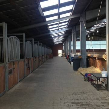
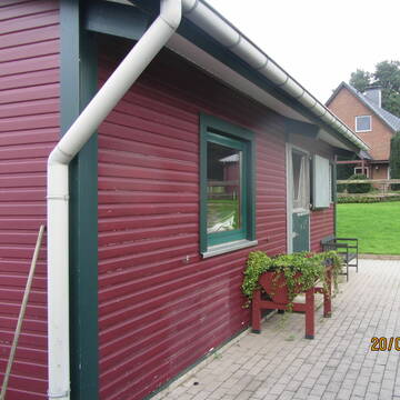
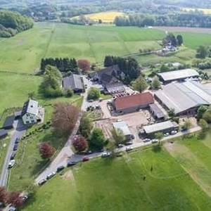
Schöner Offenstall in ruhiger Lage
Warmsen
Janine Bredemeier
@Janine83
Freizeitstall
Krankenbox
Longierzirkel/Roundpen
Allergikerstall
Hufrehe geeignet
Außenbox mit Paddock
Innenbox
12 weitere...
P+
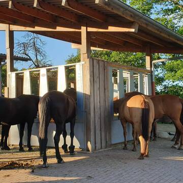
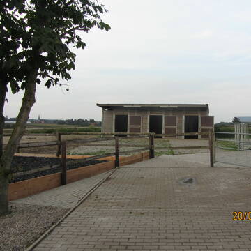
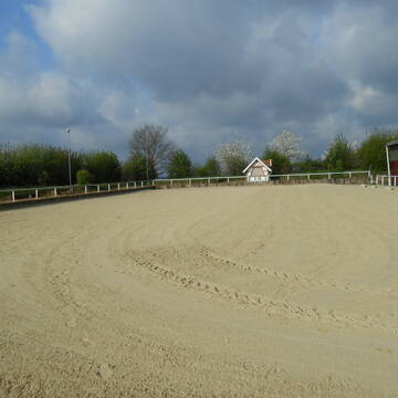
Pferdehof Rottmann in Venne
Ostercappeln
Pferdehof Rottmann
@Pferdehof-Rottmann
Pferdeausbildung
Reitlehrer und -unterricht
Vermieten
Longierzirkel/Roundpen
Paddock
Allergikerstall
Hufrehe geeignet
16 weitere...
P
Deprecated: Creation of dynamic property Zend_View_Helper_Ads::$adLink is deprecated in /var/www/stall-frei/htdocs/staging.stall-frei.de/library/Psf/View/Helper/Ads.php on line 108

Futtersack HeuToy, Fressbremse in pink
Mechtersen
STALL-FREIde Marketing
@STALL-FREI-Marketing
Stundenlange Beschäftigung die
Koliken vorbeugt, geringe Staubinhalation mit
steuerbarer Futterentnahme

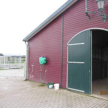
RV Bünde - Boxen frei
Bünde
Reit- u. Fahrverein Buende
@rv-buende
Reitlehrer und -unterricht
Reitschule
Paddock
Parkplatz für Pferdeanhänger
Notfallboxen
Außenboxen
Innenbox
9 weitere...
P


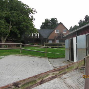
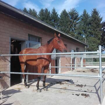
Hof Hagemann-Krystosek - pferdegerecht
Melle
Hof-Hagemann-Krystosek
@Hof-Hagemann-Krystosek
FN-Mitglied
Freizeitstall
Vermieten
Verpachten
Hunde willkommen
Krankenbox
Allergikerstall
Gnadenbrothof
35 weitere...
P+
Leider kein Vorschaubild
Leider kein Vorschaubild
Pferdebox frei
Schöphörster
@Schoephoerster
Pensions- und Gastboxen
Waschplatz, Pferdedusche
Außenboxen
Selbstversorgung
Einzelne Boxen oder Stallplätze
1 weitere...
B
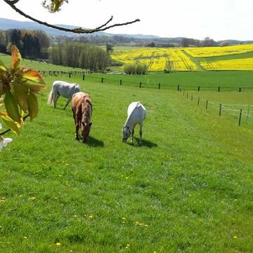
Offenstall für Wallache
Spenge
Heins
@Heins
Freizeitstall
Geländestrecke
Vermieten
Hunde willkommen
Krankenbox
Gnadenbrothof
Notfallboxen
18 weitere...
P+

Mitarbeiter gesucht?
Mechtersen
STALL-FREIde Marketing
@STALL-FREI-Marketing
Stellenangebote kostenlos veröffentlichen!

Entdecke den perfekten Ort für dein Pferd! 🌟
Bissendorf
Reiterhof Meyer-zu-Reckendorf
@Daniel-Meyer-zu-Reckendorf
FN-Mitglied
Freizeitstall
Vermieten
Führanlage
Hunde willkommen
Allergikerstall
28 weitere...
P+

Westernreitstall in Steinbrink
Diepenau
Frank-Hesse
@Frank-Hesse
Pferdeausbildung
Reitlehrer und -unterricht
Hunde willkommen
Longierzirkel/Roundpen
Zuchtstutenhaltung möglich
Außenbox mit Paddock
11 weitere...
P

Paddockboxen auf wunderschöner Anlage zu vermiet...
Bünde
Reitanlage Bausch
@Sebastian-Bausch
Freizeitstall
Reitlehrer und -unterricht
Vermieten
Führanlage
Hunde willkommen
bedampftes/gewaschenes Heu
Hengsthaltung möglich
23 weitere...
P

Stall/Offenstall frei
Bünde
Weinzierl
@PferdepensionWeinzierl
Freizeitstall
Vermieten
Hunde willkommen
Krankenbox
Notfallboxen
13 weitere...
P
Werde Teil von STALL-FREI.de
Du hast eine Pferdebox frei? Freie Plätze im Offenstall, Pferdestall oder der Reitanlage kostenlos anbieten.
Deprecated: Creation of dynamic property Zend_View::$pageCount is deprecated in /var/www/stall-frei/htdocs/staging.stall-frei.de/library/vendor/shardj/zf1-future/library/Zend/View/Abstract.php on line 308
Deprecated: Creation of dynamic property Zend_View::$itemCountPerPage is deprecated in /var/www/stall-frei/htdocs/staging.stall-frei.de/library/vendor/shardj/zf1-future/library/Zend/View/Abstract.php on line 308
Deprecated: Creation of dynamic property Zend_View::$first is deprecated in /var/www/stall-frei/htdocs/staging.stall-frei.de/library/vendor/shardj/zf1-future/library/Zend/View/Abstract.php on line 308
Deprecated: Creation of dynamic property Zend_View::$current is deprecated in /var/www/stall-frei/htdocs/staging.stall-frei.de/library/vendor/shardj/zf1-future/library/Zend/View/Abstract.php on line 308
Deprecated: Creation of dynamic property Zend_View::$last is deprecated in /var/www/stall-frei/htdocs/staging.stall-frei.de/library/vendor/shardj/zf1-future/library/Zend/View/Abstract.php on line 308
Deprecated: Creation of dynamic property Zend_View::$previous is deprecated in /var/www/stall-frei/htdocs/staging.stall-frei.de/library/vendor/shardj/zf1-future/library/Zend/View/Abstract.php on line 308
Deprecated: Creation of dynamic property Zend_View::$next is deprecated in /var/www/stall-frei/htdocs/staging.stall-frei.de/library/vendor/shardj/zf1-future/library/Zend/View/Abstract.php on line 308
Deprecated: Creation of dynamic property Zend_View::$pagesInRange is deprecated in /var/www/stall-frei/htdocs/staging.stall-frei.de/library/vendor/shardj/zf1-future/library/Zend/View/Abstract.php on line 308
Deprecated: Creation of dynamic property Zend_View::$firstPageInRange is deprecated in /var/www/stall-frei/htdocs/staging.stall-frei.de/library/vendor/shardj/zf1-future/library/Zend/View/Abstract.php on line 308
Deprecated: Creation of dynamic property Zend_View::$lastPageInRange is deprecated in /var/www/stall-frei/htdocs/staging.stall-frei.de/library/vendor/shardj/zf1-future/library/Zend/View/Abstract.php on line 308
Deprecated: Creation of dynamic property Zend_View::$currentItemCount is deprecated in /var/www/stall-frei/htdocs/staging.stall-frei.de/library/vendor/shardj/zf1-future/library/Zend/View/Abstract.php on line 308
Deprecated: Creation of dynamic property Zend_View::$totalItemCount is deprecated in /var/www/stall-frei/htdocs/staging.stall-frei.de/library/vendor/shardj/zf1-future/library/Zend/View/Abstract.php on line 308
Deprecated: Creation of dynamic property Zend_View::$firstItemNumber is deprecated in /var/www/stall-frei/htdocs/staging.stall-frei.de/library/vendor/shardj/zf1-future/library/Zend/View/Abstract.php on line 308
Deprecated: Creation of dynamic property Zend_View::$lastItemNumber is deprecated in /var/www/stall-frei/htdocs/staging.stall-frei.de/library/vendor/shardj/zf1-future/library/Zend/View/Abstract.php on line 308
Deprecated: Creation of dynamic property Zend_View::$router is deprecated in /var/www/stall-frei/htdocs/staging.stall-frei.de/library/vendor/shardj/zf1-future/library/Zend/View/Abstract.php on line 308
Deprecated: Creation of dynamic property Zend_View::$urlParams is deprecated in /var/www/stall-frei/htdocs/staging.stall-frei.de/library/vendor/shardj/zf1-future/library/Zend/View/Abstract.php on line 308
Deprecated: Creation of dynamic property Zend_View::$showAds is deprecated in /var/www/stall-frei/htdocs/staging.stall-frei.de/library/vendor/shardj/zf1-future/library/Zend/View/Abstract.php on line 308
Deprecated: Creation of dynamic property Zend_View::$objectIds is deprecated in /var/www/stall-frei/htdocs/staging.stall-frei.de/library/vendor/shardj/zf1-future/library/Zend/View/Abstract.php on line 308
Deprecated: Creation of dynamic property Zend_View::$showNavbar is deprecated in /var/www/stall-frei/htdocs/staging.stall-frei.de/library/vendor/shardj/zf1-future/library/Zend/View/Abstract.php on line 308
Deprecated: Creation of dynamic property Zend_View::$showBreadcrumb is deprecated in /var/www/stall-frei/htdocs/staging.stall-frei.de/library/vendor/shardj/zf1-future/library/Zend/View/Abstract.php on line 308
Deprecated: Creation of dynamic property Zend_View::$showFooter is deprecated in /var/www/stall-frei/htdocs/staging.stall-frei.de/library/vendor/shardj/zf1-future/library/Zend/View/Abstract.php on line 308
Deprecated: Creation of dynamic property Zend_View::$showInternalAds is deprecated in /var/www/stall-frei/htdocs/staging.stall-frei.de/library/vendor/shardj/zf1-future/library/Zend/View/Abstract.php on line 308
Deprecated: Creation of dynamic property Zend_View::$blNoContent is deprecated in /var/www/stall-frei/htdocs/staging.stall-frei.de/library/vendor/shardj/zf1-future/library/Zend/View/Abstract.php on line 308
Deprecated: Creation of dynamic property Zend_View::$sMetaDesc is deprecated in /var/www/stall-frei/htdocs/staging.stall-frei.de/library/vendor/shardj/zf1-future/library/Zend/View/Abstract.php on line 308
Deprecated: Creation of dynamic property Zend_View::$useGmaps is deprecated in /var/www/stall-frei/htdocs/staging.stall-frei.de/library/vendor/shardj/zf1-future/library/Zend/View/Abstract.php on line 308
Deprecated: Creation of dynamic property Zend_View::$touches is deprecated in /var/www/stall-frei/htdocs/staging.stall-frei.de/library/vendor/shardj/zf1-future/library/Zend/View/Abstract.php on line 308
Deprecated: Creation of dynamic property Zend_View::$oProject is deprecated in /var/www/stall-frei/htdocs/staging.stall-frei.de/library/vendor/shardj/zf1-future/library/Zend/View/Abstract.php on line 308
Deprecated: Creation of dynamic property Zend_View::$pageHeadline is deprecated in /var/www/stall-frei/htdocs/staging.stall-frei.de/library/vendor/shardj/zf1-future/library/Zend/View/Abstract.php on line 308
Deprecated: Creation of dynamic property Zend_View::$disableLocationField is deprecated in /var/www/stall-frei/htdocs/staging.stall-frei.de/library/vendor/shardj/zf1-future/library/Zend/View/Abstract.php on line 308
Deprecated: Creation of dynamic property Zend_View::$isSearch is deprecated in /var/www/stall-frei/htdocs/staging.stall-frei.de/library/vendor/shardj/zf1-future/library/Zend/View/Abstract.php on line 308
Deprecated: Creation of dynamic property Zend_View::$pageTitle is deprecated in /var/www/stall-frei/htdocs/staging.stall-frei.de/library/vendor/shardj/zf1-future/library/Zend/View/Abstract.php on line 308
Deprecated: Creation of dynamic property Psf_Form_Element_Text::$class is deprecated in /var/www/stall-frei/htdocs/staging.stall-frei.de/library/vendor/shardj/zf1-future/library/Zend/Form/Element.php on line 874
Deprecated: Creation of dynamic property Psf_Form_Element_Text::$size is deprecated in /var/www/stall-frei/htdocs/staging.stall-frei.de/library/vendor/shardj/zf1-future/library/Zend/Form/Element.php on line 874
Deprecated: Creation of dynamic property Psf_Form_Element_Text::$placeholder is deprecated in /var/www/stall-frei/htdocs/staging.stall-frei.de/library/vendor/shardj/zf1-future/library/Zend/Form/Element.php on line 874
Deprecated: Creation of dynamic property Psf_Form_Element_Hidden::$class is deprecated in /var/www/stall-frei/htdocs/staging.stall-frei.de/library/vendor/shardj/zf1-future/library/Zend/Form/Element.php on line 874
Deprecated: Creation of dynamic property Psf_Form_Element_Hidden::$class is deprecated in /var/www/stall-frei/htdocs/staging.stall-frei.de/library/vendor/shardj/zf1-future/library/Zend/Form/Element.php on line 874
Deprecated: Creation of dynamic property Psf_Form_Element_Hidden::$class is deprecated in /var/www/stall-frei/htdocs/staging.stall-frei.de/library/vendor/shardj/zf1-future/library/Zend/Form/Element.php on line 874
Deprecated: Creation of dynamic property Psf_Form_Element_Hidden::$class is deprecated in /var/www/stall-frei/htdocs/staging.stall-frei.de/library/vendor/shardj/zf1-future/library/Zend/Form/Element.php on line 874
Deprecated: Creation of dynamic property Psf_Form_Element_Select::$class is deprecated in /var/www/stall-frei/htdocs/staging.stall-frei.de/library/vendor/shardj/zf1-future/library/Zend/Form/Element.php on line 874
Deprecated: Creation of dynamic property Psf_Form_Element_Select::$class is deprecated in /var/www/stall-frei/htdocs/staging.stall-frei.de/library/vendor/shardj/zf1-future/library/Zend/Form/Element.php on line 874
Deprecated: Creation of dynamic property Psf_Form_Element_Select::$class is deprecated in /var/www/stall-frei/htdocs/staging.stall-frei.de/library/vendor/shardj/zf1-future/library/Zend/Form/Element.php on line 874
Deprecated: Creation of dynamic property Psf_Form_Element_Select::$class is deprecated in /var/www/stall-frei/htdocs/staging.stall-frei.de/library/vendor/shardj/zf1-future/library/Zend/Form/Element.php on line 874
Deprecated: Creation of dynamic property Psf_Form_Element_Text::$class is deprecated in /var/www/stall-frei/htdocs/staging.stall-frei.de/library/vendor/shardj/zf1-future/library/Zend/Form/Element.php on line 874
Deprecated: Creation of dynamic property Psf_Form_Element_Checkbox::$label is deprecated in /var/www/stall-frei/htdocs/staging.stall-frei.de/library/vendor/shardj/zf1-future/library/Zend/Form/Element.php on line 874
Deprecated: Creation of dynamic property Zend_View::$sort is deprecated in /var/www/stall-frei/htdocs/staging.stall-frei.de/library/vendor/shardj/zf1-future/library/Zend/View/Abstract.php on line 308
Deprecated: Creation of dynamic property Zend_View::$searchLocation is deprecated in /var/www/stall-frei/htdocs/staging.stall-frei.de/library/vendor/shardj/zf1-future/library/Zend/View/Abstract.php on line 308
Deprecated: Creation of dynamic property Zend_View::$locationHint is deprecated in /var/www/stall-frei/htdocs/staging.stall-frei.de/library/vendor/shardj/zf1-future/library/Zend/View/Abstract.php on line 308
Psf_GeoCoder_Abstract::getLocation: Levern Get Location CachedOrLive
Psf_GeoCoder_Abstract::getCachedOrLive: Levern
Psf_GeoCoder_Abstract::convertLocationResult
{"documentation":"https:\/\/opencagedata.com\/api","licenses":[{"name":"see attribution guide","url":"https:\/\/opencagedata.com\/credits"}],"results":[{"bounds":{"northeast":{"lat":52.3942733,"lng":8.474561},"southwest":{"lat":52.3542733,"lng":8.434561}},"components":{"ISO_3166-1_alpha-2":"DE","ISO_3166-1_alpha-3":"DEU","ISO_3166-2":["DE-NW"],"_category":"place","_normalized_city":"Levern","_type":"village","continent":"Europe","country":"Deutschland","country_code":"de","county":"Kreis Minden-L\u00fcbbecke","municipality":"Stemwede","political_union":"European Union","postcode":"32351","state":"Nordrhein-Westfalen","state_code":"NW","village":"Levern"},"confidence":7,"formatted":"32351 Levern, Deutschland","geometry":{"lat":52.3742733,"lng":8.454561}},{"bounds":{"northeast":{"lat":52.3999498,"lng":8.4798766},"southwest":{"lat":52.360405,"lng":8.4083583}},"components":{"ISO_3166-1_alpha-2":"DE","ISO_3166-1_alpha-3":"DEU","ISO_3166-2":["DE-NW"],"_category":"place","_normalized_city":"Levern","_type":"city","continent":"Europe","country":"Deutschland","country_code":"de","county":"Kreis Minden-L\u00fcbbecke","municipality":"Stemwede","political_union":"European Union","state":"Nordrhein-Westfalen","state_code":"NW","town":"Levern"},"confidence":7,"formatted":"Levern, Nordrhein-Westfalen, Deutschland","geometry":{"lat":52.3797652,"lng":8.4544013}},{"bounds":{"northeast":{"lat":53.0485649,"lng":9.7754327},"southwest":{"lat":53.0085649,"lng":9.7354327}},"components":{"ISO_3166-1_alpha-2":"DE","ISO_3166-1_alpha-3":"DEU","ISO_3166-2":["DE-NI"],"_category":"place","_normalized_city":"Neuenkirchen","_type":"city","city":"Neuenkirchen","continent":"Europe","country":"Deutschland","country_code":"de","county":"Heidekreis","political_union":"European Union","postcode":"29463","state":"Niedersachsen","state_code":"NI"},"confidence":7,"formatted":"Neuenkirchen, Niedersachsen, Deutschland","geometry":{"lat":53.0285649,"lng":9.7554327}},{"components":{"ISO_3166-1_alpha-2":"FR","ISO_3166-1_alpha-3":"FRA","ISO_3166-2":["FR-OCC","FR-12"],"_category":"road","_normalized_city":"Entraygues-sur-Truy\u00e8re","_type":"road","city":"Entraygues-sur-Truy\u00e8re","continent":"Europe","country":"France","country_code":"fr","county":"Aveyron","local_authority":"Communaut\u00e9 de communes Comtal Lot et Truy\u00e8re","political_union":"European Union","postcode":"12140","road":"Chemin de Lavernhe","state":"Occitanie","state_code":"OCC"},"confidence":3,"formatted":"Chemin de Lavernhe, 12140 Entraygues-sur-Truy\u00e8re, France","geometry":{"lat":44.646831,"lng":2.569723}},{"components":{"ISO_3166-1_alpha-2":"FR","ISO_3166-1_alpha-3":"FRA","ISO_3166-2":["FR-OCC","FR-12"],"_category":"road","_normalized_city":"Le Bas S\u00e9gala","_type":"road","city":"Le Bas S\u00e9gala","continent":"Europe","country":"France","country_code":"fr","county":"Aveyron","local_authority":"Communaut\u00e9 de communes Aveyron Bas S\u00e9gala Viaur","political_union":"European Union","postcode":"12200","road":"Chemin de Lavernhe","state":"Occitanie","state_code":"OCC"},"confidence":3,"formatted":"Chemin de Lavernhe, 12200 Le Bas S\u00e9gala, France","geometry":{"lat":44.343828,"lng":2.121245}},{"components":{"ISO_3166-1_alpha-2":"FR","ISO_3166-1_alpha-3":"FRA","ISO_3166-2":["FR-OCC","FR-12"],"_category":"road","_normalized_city":"Salmiech","_type":"road","city":"Salmiech","continent":"Europe","country":"France","country_code":"fr","county":"Aveyron","local_authority":"Pays de Salars","political_union":"European Union","postcode":"12120","road":"Chemin de Lavernhe","state":"Occitanie","state_code":"OCC"},"confidence":3,"formatted":"Chemin de Lavernhe, 12120 Salmiech, France","geometry":{"lat":44.199144,"lng":2.591068}},{"components":{"ISO_3166-1_alpha-2":"FR","ISO_3166-1_alpha-3":"FRA","ISO_3166-2":["FR-OCC","FR-12"],"_category":"road","_normalized_city":"Caban\u00e8s","_type":"road","city":"Caban\u00e8s","continent":"Europe","country":"France","country_code":"fr","county":"Aveyron","local_authority":"Communaut\u00e9 de communes Pays S\u00e9gali","political_union":"European Union","postcode":"12800","road":"Chemin de Lavernhe","state":"Occitanie","state_code":"OCC"},"confidence":3,"formatted":"Chemin de Lavernhe, 12800 Caban\u00e8s, France","geometry":{"lat":44.20615,"lng":2.287487}},{"components":{"ISO_3166-1_alpha-2":"FR","ISO_3166-1_alpha-3":"FRA","ISO_3166-2":["FR-OCC","FR-12"],"_category":"road","_normalized_city":"Cransac","_type":"road","city":"Cransac","continent":"Europe","country":"France","country_code":"fr","county":"Aveyron","local_authority":"Decazeville Communaut\u00e9","political_union":"European Union","postcode":"12110","road":"Chemin de Lavernhe Haute","state":"Occitanie","state_code":"OCC"},"confidence":3,"formatted":"Chemin de Lavernhe Haute, 12110 Cransac, France","geometry":{"lat":44.520298,"lng":2.266772}},{"components":{"ISO_3166-1_alpha-2":"FR","ISO_3166-1_alpha-3":"FRA","ISO_3166-2":["FR-OCC","FR-12"],"_category":"road","_normalized_city":"S\u00e9nergues","_type":"road","city":"S\u00e9nergues","continent":"Europe","country":"France","country_code":"fr","county":"Aveyron","local_authority":"Communaut\u00e9 de communes Conques-Marcillac","political_union":"European Union","postcode":"12320","road":"Chemin de Lavernhe Haute","state":"Occitanie","state_code":"OCC"},"confidence":2,"formatted":"Chemin de Lavernhe Haute, 12320 S\u00e9nergues, France","geometry":{"lat":44.622138,"lng":2.488815}},{"components":{"ISO_3166-1_alpha-2":"FR","ISO_3166-1_alpha-3":"FRA","ISO_3166-2":["FR-OCC","FR-12"],"_category":"road","_normalized_city":"Druelle Balsac","_type":"road","city":"Druelle Balsac","continent":"Europe","country":"France","country_code":"fr","county":"Aveyron","local_authority":"Rodez Agglom\u00e9ration","political_union":"European Union","postcode":"12510","road":"Route de Lavernhe","state":"Occitanie","state_code":"OCC"},"confidence":2,"formatted":"Route de Lavernhe, 12510 Druelle Balsac, France","geometry":{"lat":44.346623,"lng":2.475234}}],"status":{"code":200,"message":"OK"},"stay_informed":{"blog":"https:\/\/blog.opencagedata.com","mastodon":"https:\/\/en.osm.town\/@opencage"},"thanks":"For using an OpenCage API","timestamp":{"created_http":"Sun, 08 Feb 2026 06:33:35 GMT","created_unix":1770532415},"total_results":10}Array
(
[0] => stdClass Object
(
[bounds] => stdClass Object
(
[northeast] => stdClass Object
(
[lat] => 52.3942733
[lng] => 8.474561
)
[southwest] => stdClass Object
(
[lat] => 52.3542733
[lng] => 8.434561
)
)
[components] => stdClass Object
(
[ISO_3166-1_alpha-2] => DE
[ISO_3166-1_alpha-3] => DEU
[ISO_3166-2] => Array
(
[0] => DE-NW
)
[_category] => place
[_normalized_city] => Levern
[_type] => village
[continent] => Europe
[country] => Deutschland
[country_code] => de
[county] => Kreis Minden-Lübbecke
[municipality] => Stemwede
[political_union] => European Union
[postcode] => 32351
[state] => Nordrhein-Westfalen
[state_code] => NW
[village] => Levern
)
[confidence] => 7
[formatted] => 32351 Levern, Deutschland
[geometry] => stdClass Object
(
[lat] => 52.3742733
[lng] => 8.454561
)
)
[1] => stdClass Object
(
[bounds] => stdClass Object
(
[northeast] => stdClass Object
(
[lat] => 52.3999498
[lng] => 8.4798766
)
[southwest] => stdClass Object
(
[lat] => 52.360405
[lng] => 8.4083583
)
)
[components] => stdClass Object
(
[ISO_3166-1_alpha-2] => DE
[ISO_3166-1_alpha-3] => DEU
[ISO_3166-2] => Array
(
[0] => DE-NW
)
[_category] => place
[_normalized_city] => Levern
[_type] => city
[continent] => Europe
[country] => Deutschland
[country_code] => de
[county] => Kreis Minden-Lübbecke
[municipality] => Stemwede
[political_union] => European Union
[state] => Nordrhein-Westfalen
[state_code] => NW
[town] => Levern
)
[confidence] => 7
[formatted] => Levern, Nordrhein-Westfalen, Deutschland
[geometry] => stdClass Object
(
[lat] => 52.3797652
[lng] => 8.4544013
)
)
[2] => stdClass Object
(
[bounds] => stdClass Object
(
[northeast] => stdClass Object
(
[lat] => 53.0485649
[lng] => 9.7754327
)
[southwest] => stdClass Object
(
[lat] => 53.0085649
[lng] => 9.7354327
)
)
[components] => stdClass Object
(
[ISO_3166-1_alpha-2] => DE
[ISO_3166-1_alpha-3] => DEU
[ISO_3166-2] => Array
(
[0] => DE-NI
)
[_category] => place
[_normalized_city] => Neuenkirchen
[_type] => city
[city] => Neuenkirchen
[continent] => Europe
[country] => Deutschland
[country_code] => de
[county] => Heidekreis
[political_union] => European Union
[postcode] => 29463
[state] => Niedersachsen
[state_code] => NI
)
[confidence] => 7
[formatted] => Neuenkirchen, Niedersachsen, Deutschland
[geometry] => stdClass Object
(
[lat] => 53.0285649
[lng] => 9.7554327
)
)
[3] => stdClass Object
(
[components] => stdClass Object
(
[ISO_3166-1_alpha-2] => FR
[ISO_3166-1_alpha-3] => FRA
[ISO_3166-2] => Array
(
[0] => FR-OCC
[1] => FR-12
)
[_category] => road
[_normalized_city] => Entraygues-sur-Truyère
[_type] => road
[city] => Entraygues-sur-Truyère
[continent] => Europe
[country] => France
[country_code] => fr
[county] => Aveyron
[local_authority] => Communauté de communes Comtal Lot et Truyère
[political_union] => European Union
[postcode] => 12140
[road] => Chemin de Lavernhe
[state] => Occitanie
[state_code] => OCC
)
[confidence] => 3
[formatted] => Chemin de Lavernhe, 12140 Entraygues-sur-Truyère, France
[geometry] => stdClass Object
(
[lat] => 44.646831
[lng] => 2.569723
)
)
[4] => stdClass Object
(
[components] => stdClass Object
(
[ISO_3166-1_alpha-2] => FR
[ISO_3166-1_alpha-3] => FRA
[ISO_3166-2] => Array
(
[0] => FR-OCC
[1] => FR-12
)
[_category] => road
[_normalized_city] => Le Bas Ségala
[_type] => road
[city] => Le Bas Ségala
[continent] => Europe
[country] => France
[country_code] => fr
[county] => Aveyron
[local_authority] => Communauté de communes Aveyron Bas Ségala Viaur
[political_union] => European Union
[postcode] => 12200
[road] => Chemin de Lavernhe
[state] => Occitanie
[state_code] => OCC
)
[confidence] => 3
[formatted] => Chemin de Lavernhe, 12200 Le Bas Ségala, France
[geometry] => stdClass Object
(
[lat] => 44.343828
[lng] => 2.121245
)
)
[5] => stdClass Object
(
[components] => stdClass Object
(
[ISO_3166-1_alpha-2] => FR
[ISO_3166-1_alpha-3] => FRA
[ISO_3166-2] => Array
(
[0] => FR-OCC
[1] => FR-12
)
[_category] => road
[_normalized_city] => Salmiech
[_type] => road
[city] => Salmiech
[continent] => Europe
[country] => France
[country_code] => fr
[county] => Aveyron
[local_authority] => Pays de Salars
[political_union] => European Union
[postcode] => 12120
[road] => Chemin de Lavernhe
[state] => Occitanie
[state_code] => OCC
)
[confidence] => 3
[formatted] => Chemin de Lavernhe, 12120 Salmiech, France
[geometry] => stdClass Object
(
[lat] => 44.199144
[lng] => 2.591068
)
)
[6] => stdClass Object
(
[components] => stdClass Object
(
[ISO_3166-1_alpha-2] => FR
[ISO_3166-1_alpha-3] => FRA
[ISO_3166-2] => Array
(
[0] => FR-OCC
[1] => FR-12
)
[_category] => road
[_normalized_city] => Cabanès
[_type] => road
[city] => Cabanès
[continent] => Europe
[country] => France
[country_code] => fr
[county] => Aveyron
[local_authority] => Communauté de communes Pays Ségali
[political_union] => European Union
[postcode] => 12800
[road] => Chemin de Lavernhe
[state] => Occitanie
[state_code] => OCC
)
[confidence] => 3
[formatted] => Chemin de Lavernhe, 12800 Cabanès, France
[geometry] => stdClass Object
(
[lat] => 44.20615
[lng] => 2.287487
)
)
[7] => stdClass Object
(
[components] => stdClass Object
(
[ISO_3166-1_alpha-2] => FR
[ISO_3166-1_alpha-3] => FRA
[ISO_3166-2] => Array
(
[0] => FR-OCC
[1] => FR-12
)
[_category] => road
[_normalized_city] => Cransac
[_type] => road
[city] => Cransac
[continent] => Europe
[country] => France
[country_code] => fr
[county] => Aveyron
[local_authority] => Decazeville Communauté
[political_union] => European Union
[postcode] => 12110
[road] => Chemin de Lavernhe Haute
[state] => Occitanie
[state_code] => OCC
)
[confidence] => 3
[formatted] => Chemin de Lavernhe Haute, 12110 Cransac, France
[geometry] => stdClass Object
(
[lat] => 44.520298
[lng] => 2.266772
)
)
[8] => stdClass Object
(
[components] => stdClass Object
(
[ISO_3166-1_alpha-2] => FR
[ISO_3166-1_alpha-3] => FRA
[ISO_3166-2] => Array
(
[0] => FR-OCC
[1] => FR-12
)
[_category] => road
[_normalized_city] => Sénergues
[_type] => road
[city] => Sénergues
[continent] => Europe
[country] => France
[country_code] => fr
[county] => Aveyron
[local_authority] => Communauté de communes Conques-Marcillac
[political_union] => European Union
[postcode] => 12320
[road] => Chemin de Lavernhe Haute
[state] => Occitanie
[state_code] => OCC
)
[confidence] => 2
[formatted] => Chemin de Lavernhe Haute, 12320 Sénergues, France
[geometry] => stdClass Object
(
[lat] => 44.622138
[lng] => 2.488815
)
)
[9] => stdClass Object
(
[components] => stdClass Object
(
[ISO_3166-1_alpha-2] => FR
[ISO_3166-1_alpha-3] => FRA
[ISO_3166-2] => Array
(
[0] => FR-OCC
[1] => FR-12
)
[_category] => road
[_normalized_city] => Druelle Balsac
[_type] => road
[city] => Druelle Balsac
[continent] => Europe
[country] => France
[country_code] => fr
[county] => Aveyron
[local_authority] => Rodez Agglomération
[political_union] => European Union
[postcode] => 12510
[road] => Route de Lavernhe
[state] => Occitanie
[state_code] => OCC
)
[confidence] => 2
[formatted] => Route de Lavernhe, 12510 Druelle Balsac, France
[geometry] => stdClass Object
(
[lat] => 44.346623
[lng] => 2.475234
)
)
)
Psf_GeoCoder_OpenCageData::getKeyMap: 0
stdClass Object
(
    [bounds] => stdClass Object
        (
            [northeast] => stdClass Object
                (
                    [lat] => 52.3942733
                    [lng] => 8.474561
                )

            [southwest] => stdClass Object
                (
                    [lat] => 52.3542733
                    [lng] => 8.434561
                )

        )

    [components] => stdClass Object
        (
            [ISO_3166-1_alpha-2] => DE
            [ISO_3166-1_alpha-3] => DEU
            [ISO_3166-2] => Array
                (
                    [0] => DE-NW
                )

            [_category] => place
            [_normalized_city] => Levern
            [_type] => village
            [continent] => Europe
            [country] => Deutschland
            [country_code] => de
            [county] => Kreis Minden-Lübbecke
            [municipality] => Stemwede
            [political_union] => European Union
            [postcode] => 32351
            [state] => Nordrhein-Westfalen
            [state_code] => NW
            [village] => Levern
        )

    [confidence] => 7
    [formatted] => 32351 Levern, Deutschland
    [geometry] => stdClass Object
        (
            [lat] => 52.3742733
            [lng] => 8.454561
        )

)
Psf_GeoCoder_OpenCageData::getCounty: Minden-Lübbecke
Psf_GeoCoder_OpenCageData::addMissingData REFETCH!
Array
(
    [address] => 32351 Levern, Deutschland
    [type] => village
    [street] =>
    [city] => Levern
    [county] => Minden-Lübbecke
    [state] => Nordrhein-Westfalen
    [zip] => 32351
    [country] => Deutschland
    [suburb] =>
    [countrycode] => de
    [latitude] => 52.3742733
    [longitude] => 8.454561
    [accuracy] => 1
    [confidence] => 7
    [bounds] => stdClass Object
        (
            [northeast] => stdClass Object
                (
                    [lat] => 52.3942733
                    [lng] => 8.474561
                )

            [southwest] => stdClass Object
                (
                    [lat] => 52.3542733
                    [lng] => 8.434561
                )

        )

)
reformat!
Array
(
    [address] => 32351 Levern, Deutschland
    [type] => village
    [street] =>
    [city] => Levern
    [county] => Minden-Lübbecke
    [state] => Nordrhein-Westfalen
    [zip] => 32351
    [country] => Deutschland
    [suburb] =>
    [countrycode] => de
    [latitude] => 52.3742733
    [longitude] => 8.454561
    [accuracy] => 1
    [confidence] => 7
    [bounds] => stdClass Object
        (
            [northeast] => stdClass Object
                (
                    [lat] => 52.3942733
                    [lng] => 8.474561
                )

            [southwest] => stdClass Object
                (
                    [lat] => 52.3542733
                    [lng] => 8.434561
                )

        )

    [place] => 32351 Levern, Nordrhein-Westfalen
    [hash] => 9f08eaf0521d9d571ca93f35d5df5dd1
)
Psf_GeoCoder_OpenCageData::getKeyMap: 1
stdClass Object
(
    [bounds] => stdClass Object
        (
            [northeast] => stdClass Object
                (
                    [lat] => 52.3999498
                    [lng] => 8.4798766
                )

            [southwest] => stdClass Object
                (
                    [lat] => 52.360405
                    [lng] => 8.4083583
                )

        )

    [components] => stdClass Object
        (
            [ISO_3166-1_alpha-2] => DE
            [ISO_3166-1_alpha-3] => DEU
            [ISO_3166-2] => Array
                (
                    [0] => DE-NW
                )

            [_category] => place
            [_normalized_city] => Levern
            [_type] => city
            [continent] => Europe
            [country] => Deutschland
            [country_code] => de
            [county] => Kreis Minden-Lübbecke
            [municipality] => Stemwede
            [political_union] => European Union
            [state] => Nordrhein-Westfalen
            [state_code] => NW
            [town] => Levern
        )

    [confidence] => 7
    [formatted] => Levern, Nordrhein-Westfalen, Deutschland
    [geometry] => stdClass Object
        (
            [lat] => 52.3797652
            [lng] => 8.4544013
        )

)
Psf_GeoCoder_OpenCageData::getCounty: Minden-Lübbecke
Psf_GeoCoder_OpenCageData::addMissingData REFETCH!
Array
(
    [address] => Levern, Nordrhein-Westfalen, Deutschland
    [type] => city
    [street] =>
    [city] => Levern
    [county] => Minden-Lübbecke
    [state] => Nordrhein-Westfalen
    [zip] =>
    [country] => Deutschland
    [suburb] =>
    [countrycode] => de
    [latitude] => 52.3797652
    [longitude] => 8.4544013
    [accuracy] => 1
    [confidence] => 7
    [bounds] => stdClass Object
        (
            [northeast] => stdClass Object
                (
                    [lat] => 52.3999498
                    [lng] => 8.4798766
                )

            [southwest] => stdClass Object
                (
                    [lat] => 52.360405
                    [lng] => 8.4083583
                )

        )

)
reformat!
Array
(
    [address] => Levern, Nordrhein-Westfalen, Deutschland
    [type] => city
    [street] =>
    [city] => Levern
    [county] => Minden-Lübbecke
    [state] => Nordrhein-Westfalen
    [zip] =>
    [country] => Deutschland
    [suburb] =>
    [countrycode] => de
    [latitude] => 52.3797652
    [longitude] => 8.4544013
    [accuracy] => 1
    [confidence] => 7
    [bounds] => stdClass Object
        (
            [northeast] => stdClass Object
                (
                    [lat] => 52.3999498
                    [lng] => 8.4798766
                )

            [southwest] => stdClass Object
                (
                    [lat] => 52.360405
                    [lng] => 8.4083583
                )

        )

    [place] => Levern, Nordrhein-Westfalen
    [hash] => 149608b231de2f21c9aae71edd6a31e9
)
Psf_GeoCoder_OpenCageData::getKeyMap: 2
stdClass Object
(
    [bounds] => stdClass Object
        (
            [northeast] => stdClass Object
                (
                    [lat] => 53.0485649
                    [lng] => 9.7754327
                )

            [southwest] => stdClass Object
                (
                    [lat] => 53.0085649
                    [lng] => 9.7354327
                )

        )

    [components] => stdClass Object
        (
            [ISO_3166-1_alpha-2] => DE
            [ISO_3166-1_alpha-3] => DEU
            [ISO_3166-2] => Array
                (
                    [0] => DE-NI
                )

            [_category] => place
            [_normalized_city] => Neuenkirchen
            [_type] => city
            [city] => Neuenkirchen
            [continent] => Europe
            [country] => Deutschland
            [country_code] => de
            [county] => Heidekreis
            [political_union] => European Union
            [postcode] => 29463
            [state] => Niedersachsen
            [state_code] => NI
        )

    [confidence] => 7
    [formatted] => Neuenkirchen, Niedersachsen, Deutschland
    [geometry] => stdClass Object
        (
            [lat] => 53.0285649
            [lng] => 9.7554327
        )

)
Psf_GeoCoder_OpenCageData::getCounty: Heidekreis
Psf_GeoCoder_OpenCageData::addMissingData REFETCH!
Array
(
    [address] => Neuenkirchen, Niedersachsen, Deutschland
    [type] => city
    [street] =>
    [city] => Neuenkirchen
    [county] => Heidekreis
    [state] => Niedersachsen
    [zip] => 29463
    [country] => Deutschland
    [suburb] =>
    [countrycode] => de
    [latitude] => 53.0285649
    [longitude] => 9.7554327
    [accuracy] => 1
    [confidence] => 7
    [bounds] => stdClass Object
        (
            [northeast] => stdClass Object
                (
                    [lat] => 53.0485649
                    [lng] => 9.7754327
                )

            [southwest] => stdClass Object
                (
                    [lat] => 53.0085649
                    [lng] => 9.7354327
                )

        )

)
reformat!
Array
(
    [address] => Neuenkirchen, Niedersachsen, Deutschland
    [type] => city
    [street] =>
    [city] => Neuenkirchen
    [county] => Heidekreis
    [state] => Niedersachsen
    [zip] => 29463
    [country] => Deutschland
    [suburb] =>
    [countrycode] => de
    [latitude] => 53.0285649
    [longitude] => 9.7554327
    [accuracy] => 1
    [confidence] => 7
    [bounds] => stdClass Object
        (
            [northeast] => stdClass Object
                (
                    [lat] => 53.0485649
                    [lng] => 9.7754327
                )

            [southwest] => stdClass Object
                (
                    [lat] => 53.0085649
                    [lng] => 9.7354327
                )

        )

    [place] => 29463 Neuenkirchen, Niedersachsen
    [hash] => 459bd7c2992d7a6c95bd0893f2f473b7
)
Psf_GeoCoder_OpenCageData::getKeyMap: 3
stdClass Object
(
    [components] => stdClass Object
        (
            [ISO_3166-1_alpha-2] => FR
            [ISO_3166-1_alpha-3] => FRA
            [ISO_3166-2] => Array
                (
                    [0] => FR-OCC
                    [1] => FR-12
                )

            [_category] => road
            [_normalized_city] => Entraygues-sur-Truyère
            [_type] => road
            [city] => Entraygues-sur-Truyère
            [continent] => Europe
            [country] => France
            [country_code] => fr
            [county] => Aveyron
            [local_authority] => Communauté de communes Comtal Lot et Truyère
            [political_union] => European Union
            [postcode] => 12140
            [road] => Chemin de Lavernhe
            [state] => Occitanie
            [state_code] => OCC
        )

    [confidence] => 3
    [formatted] => Chemin de Lavernhe, 12140 Entraygues-sur-Truyère, France
    [geometry] => stdClass Object
        (
            [lat] => 44.646831
            [lng] => 2.569723
        )

)
Psf_GeoCoder_OpenCageData::getCounty: Aveyron
Psf_GeoCoder_OpenCageData::addMissingData REFETCH!
Array
(
    [address] => Chemin de Lavernhe, 12140 Entraygues-sur-Truyère, France
    [type] => road
    [street] => Chemin de Lavernhe
    [city] => Entraygues-sur-Truyère
    [county] => Aveyron
    [state] => Occitanie
    [zip] => 12140
    [country] => France
    [suburb] =>
    [countrycode] => fr
    [latitude] => 44.646831
    [longitude] => 2.569723
    [accuracy] => 1
    [confidence] => 3
    [bounds] =>
)
reformat!
Array
(
    [address] => Chemin de Lavernhe, 12140 Entraygues-sur-Truyère, France
    [type] => road
    [street] => Chemin de Lavernhe
    [city] => Entraygues-sur-Truyère
    [county] => Aveyron
    [state] => Occitanie
    [zip] => 12140
    [country] => France
    [suburb] =>
    [countrycode] => fr
    [latitude] => 44.646831
    [longitude] => 2.569723
    [accuracy] => 1
    [confidence] => 3
    [bounds] =>
    [place] => Chemin de Lavernhe, 12140 Entraygues-sur-Truyère, Occitanie
    [hash] => 8f62696c425ca9f1ce5bb7f5832f6ae3
)
Psf_GeoCoder_OpenCageData::getKeyMap: 4
stdClass Object
(
    [components] => stdClass Object
        (
            [ISO_3166-1_alpha-2] => FR
            [ISO_3166-1_alpha-3] => FRA
            [ISO_3166-2] => Array
                (
                    [0] => FR-OCC
                    [1] => FR-12
                )

            [_category] => road
            [_normalized_city] => Le Bas Ségala
            [_type] => road
            [city] => Le Bas Ségala
            [continent] => Europe
            [country] => France
            [country_code] => fr
            [county] => Aveyron
            [local_authority] => Communauté de communes Aveyron Bas Ségala Viaur
            [political_union] => European Union
            [postcode] => 12200
            [road] => Chemin de Lavernhe
            [state] => Occitanie
            [state_code] => OCC
        )

    [confidence] => 3
    [formatted] => Chemin de Lavernhe, 12200 Le Bas Ségala, France
    [geometry] => stdClass Object
        (
            [lat] => 44.343828
            [lng] => 2.121245
        )

)
Psf_GeoCoder_OpenCageData::getCounty: Aveyron
Psf_GeoCoder_OpenCageData::addMissingData REFETCH!
Array
(
    [address] => Chemin de Lavernhe, 12200 Le Bas Ségala, France
    [type] => road
    [street] => Chemin de Lavernhe
    [city] => Le Bas Ségala
    [county] => Aveyron
    [state] => Occitanie
    [zip] => 12200
    [country] => France
    [suburb] =>
    [countrycode] => fr
    [latitude] => 44.343828
    [longitude] => 2.121245
    [accuracy] => 1
    [confidence] => 3
    [bounds] =>
)
reformat!
Array
(
    [address] => Chemin de Lavernhe, 12200 Le Bas Ségala, France
    [type] => road
    [street] => Chemin de Lavernhe
    [city] => Le Bas Ségala
    [county] => Aveyron
    [state] => Occitanie
    [zip] => 12200
    [country] => France
    [suburb] =>
    [countrycode] => fr
    [latitude] => 44.343828
    [longitude] => 2.121245
    [accuracy] => 1
    [confidence] => 3
    [bounds] =>
    [place] => Chemin de Lavernhe, 12200 Le Bas Ségala, Occitanie
    [hash] => d835c3783914595d66544133ef400299
)
Psf_GeoCoder_OpenCageData::getKeyMap: 5
stdClass Object
(
    [components] => stdClass Object
        (
            [ISO_3166-1_alpha-2] => FR
            [ISO_3166-1_alpha-3] => FRA
            [ISO_3166-2] => Array
                (
                    [0] => FR-OCC
                    [1] => FR-12
                )

            [_category] => road
            [_normalized_city] => Salmiech
            [_type] => road
            [city] => Salmiech
            [continent] => Europe
            [country] => France
            [country_code] => fr
            [county] => Aveyron
            [local_authority] => Pays de Salars
            [political_union] => European Union
            [postcode] => 12120
            [road] => Chemin de Lavernhe
            [state] => Occitanie
            [state_code] => OCC
        )

    [confidence] => 3
    [formatted] => Chemin de Lavernhe, 12120 Salmiech, France
    [geometry] => stdClass Object
        (
            [lat] => 44.199144
            [lng] => 2.591068
        )

)
Psf_GeoCoder_OpenCageData::getCounty: Aveyron
Psf_GeoCoder_OpenCageData::addMissingData REFETCH!
Array
(
    [address] => Chemin de Lavernhe, 12120 Salmiech, France
    [type] => road
    [street] => Chemin de Lavernhe
    [city] => Salmiech
    [county] => Aveyron
    [state] => Occitanie
    [zip] => 12120
    [country] => France
    [suburb] =>
    [countrycode] => fr
    [latitude] => 44.199144
    [longitude] => 2.591068
    [accuracy] => 1
    [confidence] => 3
    [bounds] =>
)
reformat!
Array
(
    [address] => Chemin de Lavernhe, 12120 Salmiech, France
    [type] => road
    [street] => Chemin de Lavernhe
    [city] => Salmiech
    [county] => Aveyron
    [state] => Occitanie
    [zip] => 12120
    [country] => France
    [suburb] =>
    [countrycode] => fr
    [latitude] => 44.199144
    [longitude] => 2.591068
    [accuracy] => 1
    [confidence] => 3
    [bounds] =>
    [place] => Chemin de Lavernhe, 12120 Salmiech, Occitanie
    [hash] => 453ceae9858e2478adbc324f11fbdbff
)
Psf_GeoCoder_OpenCageData::getKeyMap: 6
stdClass Object
(
    [components] => stdClass Object
        (
            [ISO_3166-1_alpha-2] => FR
            [ISO_3166-1_alpha-3] => FRA
            [ISO_3166-2] => Array
                (
                    [0] => FR-OCC
                    [1] => FR-12
                )

            [_category] => road
            [_normalized_city] => Cabanès
            [_type] => road
            [city] => Cabanès
            [continent] => Europe
            [country] => France
            [country_code] => fr
            [county] => Aveyron
            [local_authority] => Communauté de communes Pays Ségali
            [political_union] => European Union
            [postcode] => 12800
            [road] => Chemin de Lavernhe
            [state] => Occitanie
            [state_code] => OCC
        )

    [confidence] => 3
    [formatted] => Chemin de Lavernhe, 12800 Cabanès, France
    [geometry] => stdClass Object
        (
            [lat] => 44.20615
            [lng] => 2.287487
        )

)
Psf_GeoCoder_OpenCageData::getCounty: Aveyron
Psf_GeoCoder_OpenCageData::addMissingData REFETCH!
Array
(
    [address] => Chemin de Lavernhe, 12800 Cabanès, France
    [type] => road
    [street] => Chemin de Lavernhe
    [city] => Cabanès
    [county] => Aveyron
    [state] => Occitanie
    [zip] => 12800
    [country] => France
    [suburb] =>
    [countrycode] => fr
    [latitude] => 44.20615
    [longitude] => 2.287487
    [accuracy] => 1
    [confidence] => 3
    [bounds] =>
)
reformat!
Array
(
    [address] => Chemin de Lavernhe, 12800 Cabanès, France
    [type] => road
    [street] => Chemin de Lavernhe
    [city] => Cabanès
    [county] => Aveyron
    [state] => Occitanie
    [zip] => 12800
    [country] => France
    [suburb] =>
    [countrycode] => fr
    [latitude] => 44.20615
    [longitude] => 2.287487
    [accuracy] => 1
    [confidence] => 3
    [bounds] =>
    [place] => Chemin de Lavernhe, 12800 Cabanès, Occitanie
    [hash] => e8d04eea15ae66cca0d87b4b95c2cf12
)
Psf_GeoCoder_OpenCageData::getKeyMap: 7
stdClass Object
(
    [components] => stdClass Object
        (
            [ISO_3166-1_alpha-2] => FR
            [ISO_3166-1_alpha-3] => FRA
            [ISO_3166-2] => Array
                (
                    [0] => FR-OCC
                    [1] => FR-12
                )

            [_category] => road
            [_normalized_city] => Cransac
            [_type] => road
            [city] => Cransac
            [continent] => Europe
            [country] => France
            [country_code] => fr
            [county] => Aveyron
            [local_authority] => Decazeville Communauté
            [political_union] => European Union
            [postcode] => 12110
            [road] => Chemin de Lavernhe Haute
            [state] => Occitanie
            [state_code] => OCC
        )

    [confidence] => 3
    [formatted] => Chemin de Lavernhe Haute, 12110 Cransac, France
    [geometry] => stdClass Object
        (
            [lat] => 44.520298
            [lng] => 2.266772
        )

)
Psf_GeoCoder_OpenCageData::getCounty: Aveyron
Psf_GeoCoder_OpenCageData::addMissingData REFETCH!
Array
(
    [address] => Chemin de Lavernhe Haute, 12110 Cransac, France
    [type] => road
    [street] => Chemin de Lavernhe Haute
    [city] => Cransac
    [county] => Aveyron
    [state] => Occitanie
    [zip] => 12110
    [country] => France
    [suburb] =>
    [countrycode] => fr
    [latitude] => 44.520298
    [longitude] => 2.266772
    [accuracy] => 1
    [confidence] => 3
    [bounds] =>
)
reformat!
Array
(
    [address] => Chemin de Lavernhe Haute, 12110 Cransac, France
    [type] => road
    [street] => Chemin de Lavernhe Haute
    [city] => Cransac
    [county] => Aveyron
    [state] => Occitanie
    [zip] => 12110
    [country] => France
    [suburb] =>
    [countrycode] => fr
    [latitude] => 44.520298
    [longitude] => 2.266772
    [accuracy] => 1
    [confidence] => 3
    [bounds] =>
    [place] => Chemin de Lavernhe Haute, 12110 Cransac, Occitanie
    [hash] => 71f71c53b4d72561024476e3abd57a75
)
Psf_GeoCoder_OpenCageData::getKeyMap: 8
stdClass Object
(
    [components] => stdClass Object
        (
            [ISO_3166-1_alpha-2] => FR
            [ISO_3166-1_alpha-3] => FRA
            [ISO_3166-2] => Array
                (
                    [0] => FR-OCC
                    [1] => FR-12
                )

            [_category] => road
            [_normalized_city] => Sénergues
            [_type] => road
            [city] => Sénergues
            [continent] => Europe
            [country] => France
            [country_code] => fr
            [county] => Aveyron
            [local_authority] => Communauté de communes Conques-Marcillac
            [political_union] => European Union
            [postcode] => 12320
            [road] => Chemin de Lavernhe Haute
            [state] => Occitanie
            [state_code] => OCC
        )

    [confidence] => 2
    [formatted] => Chemin de Lavernhe Haute, 12320 Sénergues, France
    [geometry] => stdClass Object
        (
            [lat] => 44.622138
            [lng] => 2.488815
        )

)
Psf_GeoCoder_OpenCageData::getCounty: Aveyron
Psf_GeoCoder_OpenCageData::addMissingData REFETCH!
Array
(
    [address] => Chemin de Lavernhe Haute, 12320 Sénergues, France
    [type] => road
    [street] => Chemin de Lavernhe Haute
    [city] => Sénergues
    [county] => Aveyron
    [state] => Occitanie
    [zip] => 12320
    [country] => France
    [suburb] =>
    [countrycode] => fr
    [latitude] => 44.622138
    [longitude] => 2.488815
    [accuracy] => 1
    [confidence] => 2
    [bounds] =>
)
reformat!
Array
(
    [address] => Chemin de Lavernhe Haute, 12320 Sénergues, France
    [type] => road
    [street] => Chemin de Lavernhe Haute
    [city] => Sénergues
    [county] => Aveyron
    [state] => Occitanie
    [zip] => 12320
    [country] => France
    [suburb] =>
    [countrycode] => fr
    [latitude] => 44.622138
    [longitude] => 2.488815
    [accuracy] => 1
    [confidence] => 2
    [bounds] =>
    [place] => Chemin de Lavernhe Haute, 12320 Sénergues, Occitanie
    [hash] => c8ab6cd1db0478d3ac9e0a1d2bc14919
)
Psf_GeoCoder_OpenCageData::getKeyMap: 9
stdClass Object
(
    [components] => stdClass Object
        (
            [ISO_3166-1_alpha-2] => FR
            [ISO_3166-1_alpha-3] => FRA
            [ISO_3166-2] => Array
                (
                    [0] => FR-OCC
                    [1] => FR-12
                )

            [_category] => road
            [_normalized_city] => Druelle Balsac
            [_type] => road
            [city] => Druelle Balsac
            [continent] => Europe
            [country] => France
            [country_code] => fr
            [county] => Aveyron
            [local_authority] => Rodez Agglomération
            [political_union] => European Union
            [postcode] => 12510
            [road] => Route de Lavernhe
            [state] => Occitanie
            [state_code] => OCC
        )

    [confidence] => 2
    [formatted] => Route de Lavernhe, 12510 Druelle Balsac, France
    [geometry] => stdClass Object
        (
            [lat] => 44.346623
            [lng] => 2.475234
        )

)
Psf_GeoCoder_OpenCageData::getCounty: Aveyron
Psf_GeoCoder_OpenCageData::addMissingData REFETCH!
Array
(
    [address] => Route de Lavernhe, 12510 Druelle Balsac, France
    [type] => road
    [street] => Route de Lavernhe
    [city] => Druelle Balsac
    [county] => Aveyron
    [state] => Occitanie
    [zip] => 12510
    [country] => France
    [suburb] =>
    [countrycode] => fr
    [latitude] => 44.346623
    [longitude] => 2.475234
    [accuracy] => 1
    [confidence] => 2
    [bounds] =>
)
reformat!
Array
(
    [address] => Route de Lavernhe, 12510 Druelle Balsac, France
    [type] => road
    [street] => Route de Lavernhe
    [city] => Druelle Balsac
    [county] => Aveyron
    [state] => Occitanie
    [zip] => 12510
    [country] => France
    [suburb] =>
    [countrycode] => fr
    [latitude] => 44.346623
    [longitude] => 2.475234
    [accuracy] => 1
    [confidence] => 2
    [bounds] =>
    [place] => Route de Lavernhe, 12510 Druelle Balsac, Occitanie
    [hash] => 72f599d24ce627efcd9febb65b62a4d6
)
Deprecated: Creation of dynamic property Zend_View::$locationHintStyle is deprecated in /var/www/stall-frei/htdocs/staging.stall-frei.de/library/vendor/shardj/zf1-future/library/Zend/View/Abstract.php on line 308
Deprecated: Creation of dynamic property Zend_View::$adGeoLocation is deprecated in /var/www/stall-frei/htdocs/staging.stall-frei.de/library/vendor/shardj/zf1-future/library/Zend/View/Abstract.php on line 308
Deprecated: Creation of dynamic property Zend_View::$recordCount is deprecated in /var/www/stall-frei/htdocs/staging.stall-frei.de/library/vendor/shardj/zf1-future/library/Zend/View/Abstract.php on line 308
Deprecated: Creation of dynamic property Zend_View::$paginationParams is deprecated in /var/www/stall-frei/htdocs/staging.stall-frei.de/library/vendor/shardj/zf1-future/library/Zend/View/Abstract.php on line 308
Deprecated: Creation of dynamic property Zend_View::$objectPaginator is deprecated in /var/www/stall-frei/htdocs/staging.stall-frei.de/library/vendor/shardj/zf1-future/library/Zend/View/Abstract.php on line 308
Deprecated: Creation of dynamic property Zend_View::$featuredObjects is deprecated in /var/www/stall-frei/htdocs/staging.stall-frei.de/library/vendor/shardj/zf1-future/library/Zend/View/Abstract.php on line 308
Deprecated: Creation of dynamic property Zend_View::$hints is deprecated in /var/www/stall-frei/htdocs/staging.stall-frei.de/library/vendor/shardj/zf1-future/library/Zend/View/Abstract.php on line 308
Deprecated: Creation of dynamic property Zend_View::$attributeHints is deprecated in /var/www/stall-frei/htdocs/staging.stall-frei.de/library/vendor/shardj/zf1-future/library/Zend/View/Abstract.php on line 308
Deprecated: Creation of dynamic property Zend_View::$oSearchForm is deprecated in /var/www/stall-frei/htdocs/staging.stall-frei.de/library/vendor/shardj/zf1-future/library/Zend/View/Abstract.php on line 308