Deprecated: Creation of dynamic property Zend_View::$sMode is deprecated in /var/www/stall-frei/htdocs/staging.stall-frei.de/library/vendor/shardj/zf1-future/library/Zend/View/Abstract.php on line 308
Stallplatz oder Offenstall in Hasel
Gesucht wird in "79686 Hasel, Deutschland"
6.329 Einträge
Deprecated: Creation of dynamic property Zend_View::$listObjects is deprecated in /var/www/stall-frei/htdocs/staging.stall-frei.de/library/vendor/shardj/zf1-future/library/Zend/View/Abstract.php on line 308
Gesponsort


Deprecated: Creation of dynamic property Zend_View::$listMode is deprecated in /var/www/stall-frei/htdocs/staging.stall-frei.de/library/vendor/shardj/zf1-future/library/Zend/View/Abstract.php on line 308
Deprecated: Creation of dynamic property Zend_View::$renderedObjects is deprecated in /var/www/stall-frei/htdocs/staging.stall-frei.de/library/vendor/shardj/zf1-future/library/Zend/View/Abstract.php on line 308
Deprecated: Creation of dynamic property Zend_View::$index is deprecated in /var/www/stall-frei/htdocs/staging.stall-frei.de/library/vendor/shardj/zf1-future/library/Zend/View/Abstract.php on line 308
Deprecated: Creation of dynamic property Zend_View::$displayMode is deprecated in /var/www/stall-frei/htdocs/staging.stall-frei.de/library/vendor/shardj/zf1-future/library/Zend/View/Abstract.php on line 308
Deprecated: Creation of dynamic property Zend_View::$remarketingIds is deprecated in /var/www/stall-frei/htdocs/staging.stall-frei.de/library/vendor/shardj/zf1-future/library/Zend/View/Abstract.php on line 308
Deprecated: Creation of dynamic property Zend_View::$listItem is deprecated in /var/www/stall-frei/htdocs/staging.stall-frei.de/library/vendor/shardj/zf1-future/library/Zend/View/Abstract.php on line 308
Deprecated: Creation of dynamic property Zend_View::$object is deprecated in /var/www/stall-frei/htdocs/staging.stall-frei.de/library/vendor/shardj/zf1-future/library/Zend/View/Abstract.php on line 308
Deprecated: Creation of dynamic property Zend_View::$attributes is deprecated in /var/www/stall-frei/htdocs/staging.stall-frei.de/library/vendor/shardj/zf1-future/library/Zend/View/Abstract.php on line 308
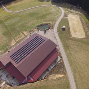
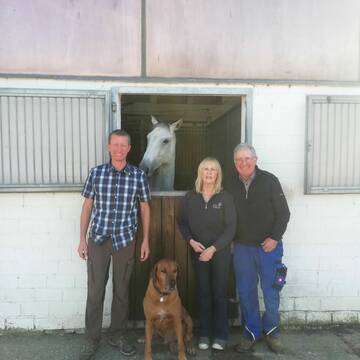
Freie Paddockboxen mit Reithalle, Reitplatz, Weide
Weilheim- Remetschwiel
Reitstall-Thoma
@Reitstall-Thoma
Fahrstall, Kutschwagen
FN-Mitglied
Vermieten
Hunde willkommen
Krankenbox
bedampftes/gewaschenes Heu
Gnadenbrothof
39 weitere...
P
Deprecated: Creation of dynamic property Zend_View_Helper_Ads::$adLink is deprecated in /var/www/stall-frei/htdocs/staging.stall-frei.de/library/Psf/View/Helper/Ads.php on line 108

Frisches Stroh zu verkaufen!
Mechtersen
STALL-FREIde Marketing
@STALL-FREI-Marketing
Kaufe frisches Stroh für dein Pferd!

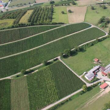
Ein Platz für eine Stute auf unserem Traumhof
Weilheim-Remetschwiel
Andrea Horner-Siebold
@AndreaHorner
Rehabilitationsstall
Vermieten
Hunde willkommen
Longierzirkel/Roundpen
Fohlenaufzucht möglich
Gnadenbrothof
19 weitere...
P


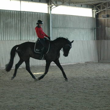
Reitstall Hemmer
Efringen-Kirchen
Jürgen Hemmer Reitlehrer FN
@JuergenHemmerReitlehrerFN
FN-Mitglied
Geländestrecke
Vermieten
Hunde willkommen
Longierzirkel/Roundpen
Außenbox mit Paddock
Außenboxen
15 weitere...
P+
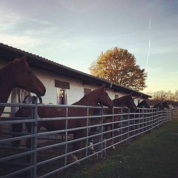
Offenstall mit großem Auslauf
Schliengen
Luisa Schieferstein
@Luisa-Schieferstein
Freizeitstall
Geländestrecke
Krankenbox
Paddock
Notfallboxen
Laufstall
Offenstall
6 weitere...
P
Leider kein Vorschaubild
Leider kein Vorschaubild
Top Plätze wie in der Natur – Exzellente Pflege
Dachsberg
Badger's Hill Ranch
@BadgersHillRanch
Freizeitstall
Geländestrecke
Vermieten
Longierzirkel/Roundpen
Paddock
Fohlenaufzucht möglich
Pferdezucht
15 weitere...
B
Leider kein Vorschaubild
Leider kein Vorschaubild
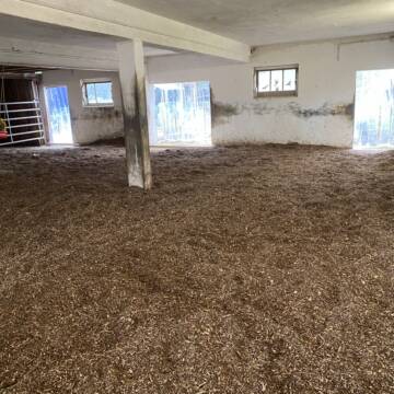
Plätze im Offenstall, 79774 Albbruck-Unteralpfen
Albbruck
Michael Kaiser
@MichaelKaiser
Freizeitstall
Krankenbox
Parkplatz für Pferdeanhänger
Notfallboxen
Offenstall
10 weitere...
B
Reitsportzentrum Lehmann
Weil am Rhein
Peter-Lehmann
@Peter-Lehmann
FN-Mitglied
Gastronomie
Vermieten
Führanlage
Longierzirkel/Roundpen
Außenboxen
Innenbox
13 weitere...
P

Heu und Heulage verkaufen
Mechtersen
STALL-FREIde Marketing
@STALL-FREI-Marketing
Verkaufen Sie Ihr Heu und Ihre Heulage direkt an Reiter, Pferdeställe und Reitanlagen
Leider kein Vorschaubild
Leider kein Vorschaubild
Pferdebox mit Paddock zu vermieten
Bernau
Reitstall Hubertus
@ReitstallHubertus1
Vermieten
Hunde willkommen
Paddock
Außenbox mit Paddock
Innenbox
Vollpension
6 weitere...
B
Paradies in den Reben
Schliengen Mauchen
Andreas Krüßelin
@PferdepensionHaldenhofMauchen
Freizeitstall
Geländestrecke
Vermieten
Hunde willkommen
Krankenbox
Notfallboxen
24 weitere...
P

Falkenhof Pferdepension Gamp
Weilheim
Falkenhof Pferdepension Gamp
@PferdepensionG
FN-Mitglied
Freizeitstall
Vermieten
Verpachten
Longierzirkel/Roundpen
Paddock
Gnadenbrothof
Hufrehe geeignet
22 weitere...
P
Deprecated: Creation of dynamic property Zend_View::$pageCount is deprecated in /var/www/stall-frei/htdocs/staging.stall-frei.de/library/vendor/shardj/zf1-future/library/Zend/View/Abstract.php on line 308
Deprecated: Creation of dynamic property Zend_View::$itemCountPerPage is deprecated in /var/www/stall-frei/htdocs/staging.stall-frei.de/library/vendor/shardj/zf1-future/library/Zend/View/Abstract.php on line 308
Deprecated: Creation of dynamic property Zend_View::$first is deprecated in /var/www/stall-frei/htdocs/staging.stall-frei.de/library/vendor/shardj/zf1-future/library/Zend/View/Abstract.php on line 308
Deprecated: Creation of dynamic property Zend_View::$current is deprecated in /var/www/stall-frei/htdocs/staging.stall-frei.de/library/vendor/shardj/zf1-future/library/Zend/View/Abstract.php on line 308
Deprecated: Creation of dynamic property Zend_View::$last is deprecated in /var/www/stall-frei/htdocs/staging.stall-frei.de/library/vendor/shardj/zf1-future/library/Zend/View/Abstract.php on line 308
Deprecated: Creation of dynamic property Zend_View::$previous is deprecated in /var/www/stall-frei/htdocs/staging.stall-frei.de/library/vendor/shardj/zf1-future/library/Zend/View/Abstract.php on line 308
Deprecated: Creation of dynamic property Zend_View::$next is deprecated in /var/www/stall-frei/htdocs/staging.stall-frei.de/library/vendor/shardj/zf1-future/library/Zend/View/Abstract.php on line 308
Deprecated: Creation of dynamic property Zend_View::$pagesInRange is deprecated in /var/www/stall-frei/htdocs/staging.stall-frei.de/library/vendor/shardj/zf1-future/library/Zend/View/Abstract.php on line 308
Deprecated: Creation of dynamic property Zend_View::$firstPageInRange is deprecated in /var/www/stall-frei/htdocs/staging.stall-frei.de/library/vendor/shardj/zf1-future/library/Zend/View/Abstract.php on line 308
Deprecated: Creation of dynamic property Zend_View::$lastPageInRange is deprecated in /var/www/stall-frei/htdocs/staging.stall-frei.de/library/vendor/shardj/zf1-future/library/Zend/View/Abstract.php on line 308
Deprecated: Creation of dynamic property Zend_View::$currentItemCount is deprecated in /var/www/stall-frei/htdocs/staging.stall-frei.de/library/vendor/shardj/zf1-future/library/Zend/View/Abstract.php on line 308
Deprecated: Creation of dynamic property Zend_View::$totalItemCount is deprecated in /var/www/stall-frei/htdocs/staging.stall-frei.de/library/vendor/shardj/zf1-future/library/Zend/View/Abstract.php on line 308
Deprecated: Creation of dynamic property Zend_View::$firstItemNumber is deprecated in /var/www/stall-frei/htdocs/staging.stall-frei.de/library/vendor/shardj/zf1-future/library/Zend/View/Abstract.php on line 308
Deprecated: Creation of dynamic property Zend_View::$lastItemNumber is deprecated in /var/www/stall-frei/htdocs/staging.stall-frei.de/library/vendor/shardj/zf1-future/library/Zend/View/Abstract.php on line 308
Deprecated: Creation of dynamic property Zend_View::$router is deprecated in /var/www/stall-frei/htdocs/staging.stall-frei.de/library/vendor/shardj/zf1-future/library/Zend/View/Abstract.php on line 308
Deprecated: Creation of dynamic property Zend_View::$urlParams is deprecated in /var/www/stall-frei/htdocs/staging.stall-frei.de/library/vendor/shardj/zf1-future/library/Zend/View/Abstract.php on line 308
Deprecated: Creation of dynamic property Zend_View::$showAds is deprecated in /var/www/stall-frei/htdocs/staging.stall-frei.de/library/vendor/shardj/zf1-future/library/Zend/View/Abstract.php on line 308
Deprecated: Creation of dynamic property Zend_View::$objectIds is deprecated in /var/www/stall-frei/htdocs/staging.stall-frei.de/library/vendor/shardj/zf1-future/library/Zend/View/Abstract.php on line 308
Deprecated: Creation of dynamic property Zend_View::$showNavbar is deprecated in /var/www/stall-frei/htdocs/staging.stall-frei.de/library/vendor/shardj/zf1-future/library/Zend/View/Abstract.php on line 308
Deprecated: Creation of dynamic property Zend_View::$showBreadcrumb is deprecated in /var/www/stall-frei/htdocs/staging.stall-frei.de/library/vendor/shardj/zf1-future/library/Zend/View/Abstract.php on line 308
Deprecated: Creation of dynamic property Zend_View::$showFooter is deprecated in /var/www/stall-frei/htdocs/staging.stall-frei.de/library/vendor/shardj/zf1-future/library/Zend/View/Abstract.php on line 308
Deprecated: Creation of dynamic property Zend_View::$showInternalAds is deprecated in /var/www/stall-frei/htdocs/staging.stall-frei.de/library/vendor/shardj/zf1-future/library/Zend/View/Abstract.php on line 308
Deprecated: Creation of dynamic property Zend_View::$blNoContent is deprecated in /var/www/stall-frei/htdocs/staging.stall-frei.de/library/vendor/shardj/zf1-future/library/Zend/View/Abstract.php on line 308
Deprecated: Creation of dynamic property Zend_View::$sMetaDesc is deprecated in /var/www/stall-frei/htdocs/staging.stall-frei.de/library/vendor/shardj/zf1-future/library/Zend/View/Abstract.php on line 308
Deprecated: Creation of dynamic property Zend_View::$useGmaps is deprecated in /var/www/stall-frei/htdocs/staging.stall-frei.de/library/vendor/shardj/zf1-future/library/Zend/View/Abstract.php on line 308
Deprecated: Creation of dynamic property Zend_View::$touches is deprecated in /var/www/stall-frei/htdocs/staging.stall-frei.de/library/vendor/shardj/zf1-future/library/Zend/View/Abstract.php on line 308
Deprecated: Creation of dynamic property Zend_View::$oProject is deprecated in /var/www/stall-frei/htdocs/staging.stall-frei.de/library/vendor/shardj/zf1-future/library/Zend/View/Abstract.php on line 308
Deprecated: Creation of dynamic property Zend_View::$pageHeadline is deprecated in /var/www/stall-frei/htdocs/staging.stall-frei.de/library/vendor/shardj/zf1-future/library/Zend/View/Abstract.php on line 308
Deprecated: Creation of dynamic property Zend_View::$disableLocationField is deprecated in /var/www/stall-frei/htdocs/staging.stall-frei.de/library/vendor/shardj/zf1-future/library/Zend/View/Abstract.php on line 308
Deprecated: Creation of dynamic property Zend_View::$isSearch is deprecated in /var/www/stall-frei/htdocs/staging.stall-frei.de/library/vendor/shardj/zf1-future/library/Zend/View/Abstract.php on line 308
Deprecated: Creation of dynamic property Zend_View::$pageTitle is deprecated in /var/www/stall-frei/htdocs/staging.stall-frei.de/library/vendor/shardj/zf1-future/library/Zend/View/Abstract.php on line 308
Deprecated: Creation of dynamic property Psf_Form_Element_Text::$class is deprecated in /var/www/stall-frei/htdocs/staging.stall-frei.de/library/vendor/shardj/zf1-future/library/Zend/Form/Element.php on line 874
Deprecated: Creation of dynamic property Psf_Form_Element_Text::$size is deprecated in /var/www/stall-frei/htdocs/staging.stall-frei.de/library/vendor/shardj/zf1-future/library/Zend/Form/Element.php on line 874
Deprecated: Creation of dynamic property Psf_Form_Element_Text::$placeholder is deprecated in /var/www/stall-frei/htdocs/staging.stall-frei.de/library/vendor/shardj/zf1-future/library/Zend/Form/Element.php on line 874
Deprecated: Creation of dynamic property Psf_Form_Element_Hidden::$class is deprecated in /var/www/stall-frei/htdocs/staging.stall-frei.de/library/vendor/shardj/zf1-future/library/Zend/Form/Element.php on line 874
Deprecated: Creation of dynamic property Psf_Form_Element_Hidden::$class is deprecated in /var/www/stall-frei/htdocs/staging.stall-frei.de/library/vendor/shardj/zf1-future/library/Zend/Form/Element.php on line 874
Deprecated: Creation of dynamic property Psf_Form_Element_Hidden::$class is deprecated in /var/www/stall-frei/htdocs/staging.stall-frei.de/library/vendor/shardj/zf1-future/library/Zend/Form/Element.php on line 874
Deprecated: Creation of dynamic property Psf_Form_Element_Hidden::$class is deprecated in /var/www/stall-frei/htdocs/staging.stall-frei.de/library/vendor/shardj/zf1-future/library/Zend/Form/Element.php on line 874
Deprecated: Creation of dynamic property Psf_Form_Element_Select::$class is deprecated in /var/www/stall-frei/htdocs/staging.stall-frei.de/library/vendor/shardj/zf1-future/library/Zend/Form/Element.php on line 874
Deprecated: Creation of dynamic property Psf_Form_Element_Select::$class is deprecated in /var/www/stall-frei/htdocs/staging.stall-frei.de/library/vendor/shardj/zf1-future/library/Zend/Form/Element.php on line 874
Deprecated: Creation of dynamic property Psf_Form_Element_Select::$class is deprecated in /var/www/stall-frei/htdocs/staging.stall-frei.de/library/vendor/shardj/zf1-future/library/Zend/Form/Element.php on line 874
Deprecated: Creation of dynamic property Psf_Form_Element_Select::$class is deprecated in /var/www/stall-frei/htdocs/staging.stall-frei.de/library/vendor/shardj/zf1-future/library/Zend/Form/Element.php on line 874
Deprecated: Creation of dynamic property Psf_Form_Element_Text::$class is deprecated in /var/www/stall-frei/htdocs/staging.stall-frei.de/library/vendor/shardj/zf1-future/library/Zend/Form/Element.php on line 874
Deprecated: Creation of dynamic property Psf_Form_Element_Checkbox::$label is deprecated in /var/www/stall-frei/htdocs/staging.stall-frei.de/library/vendor/shardj/zf1-future/library/Zend/Form/Element.php on line 874
Deprecated: Creation of dynamic property Zend_View::$sort is deprecated in /var/www/stall-frei/htdocs/staging.stall-frei.de/library/vendor/shardj/zf1-future/library/Zend/View/Abstract.php on line 308
Deprecated: Creation of dynamic property Zend_View::$searchLocation is deprecated in /var/www/stall-frei/htdocs/staging.stall-frei.de/library/vendor/shardj/zf1-future/library/Zend/View/Abstract.php on line 308
Deprecated: Creation of dynamic property Zend_View::$locationHint is deprecated in /var/www/stall-frei/htdocs/staging.stall-frei.de/library/vendor/shardj/zf1-future/library/Zend/View/Abstract.php on line 308
Psf_GeoCoder_Abstract::getLocation: Hasel Get Location CachedOrLive
Psf_GeoCoder_Abstract::getCachedOrLive: Hasel
Psf_GeoCoder_Abstract::convertLocationResult
{"documentation":"https:\/\/opencagedata.com\/api","licenses":[{"name":"see attribution guide","url":"https:\/\/opencagedata.com\/credits"}],"results":[{"bounds":{"northeast":{"lat":47.6890737,"lng":7.9171713},"southwest":{"lat":47.6421754,"lng":7.8686675}},"components":{"ISO_3166-1_alpha-2":"DE","ISO_3166-1_alpha-3":"DEU","ISO_3166-2":["DE-BW"],"_category":"place","_normalized_city":"Hasel","_type":"village","continent":"Europe","country":"Deutschland","country_code":"de","county":"Landkreis L\u00f6rrach","municipality":"VVG der Stadt Schopfheim","political_union":"European Union","postcode":"79686","state":"Baden-W\u00fcrttemberg","state_code":"BW","village":"Hasel"},"confidence":7,"formatted":"79686 Hasel, Deutschland","geometry":{"lat":47.6526083,"lng":7.8969746}},{"bounds":{"northeast":{"lat":50.6072846,"lng":10.6926687},"southwest":{"lat":50.5255241,"lng":10.4544653}},"components":{"ISO_3166-1_alpha-2":"DE","ISO_3166-1_alpha-3":"DEU","ISO_3166-2":["DE-TH"],"_category":"natural\/water","_normalized_city":"Dillst\u00e4dt","_type":"river","continent":"Europe","country":"Deutschland","country_code":"de","county":"Landkreis Schmalkalden-Meiningen","municipality":"Dolmar-Salzbr\u00fccke","political_union":"European Union","river":"Hasel","state":"Th\u00fcringen","state_code":"TH","village":"Dillst\u00e4dt"},"confidence":6,"formatted":"Hasel, Dillst\u00e4dt, Th\u00fcringen, Deutschland","geometry":{"lat":50.5941466,"lng":10.5586593}},{"bounds":{"northeast":{"lat":52.753149,"lng":10.0104158},"southwest":{"lat":52.7093394,"lng":9.9376254}},"components":{"ISO_3166-1_alpha-2":"DE","ISO_3166-1_alpha-3":"DEU","ISO_3166-2":["DE-NI"],"_category":"place","_normalized_city":"Bergen","_type":"village","continent":"Europe","country":"Deutschland","country_code":"de","county":"Landkreis Celle","political_union":"European Union","state":"Niedersachsen","state_code":"NI","town":"Bergen","village":"Hasel"},"confidence":7,"formatted":"Hasel, Niedersachsen, Deutschland","geometry":{"lat":52.7368897,"lng":9.9854473}},{"bounds":{"northeast":{"lat":48.2278832,"lng":10.4215504},"southwest":{"lat":48.2056216,"lng":10.4048992}},"components":{"ISO_3166-1_alpha-2":"DE","ISO_3166-1_alpha-3":"DEU","ISO_3166-2":["DE-BY"],"_category":"natural\/water","_normalized_city":"Aletshausen","_type":"stream","city":"Aletshausen","continent":"Europe","country":"Deutschland","country_code":"de","county":"Landkreis G\u00fcnzburg","municipality":"Krumbach (Schwaben) (VGem)","political_union":"European Union","state":"Bayern","state_code":"BY","stream":"Hasel"},"confidence":8,"formatted":"Hasel, Aletshausen, Bayern, Deutschland","geometry":{"lat":48.2154692,"lng":10.4146969}},{"bounds":{"northeast":{"lat":48.2842237,"lng":10.4118803},"southwest":{"lat":48.265546,"lng":10.4021335}},"components":{"ISO_3166-1_alpha-2":"DE","ISO_3166-1_alpha-3":"DEU","ISO_3166-2":["DE-BY"],"_category":"natural\/water","_normalized_city":"Krumbach (Schwaben)","_type":"stream","city_district":"Gemarkung Attenhausen","continent":"Europe","country":"Deutschland","country_code":"de","county":"Landkreis G\u00fcnzburg","political_union":"European Union","postcode":"86381","state":"Bayern","state_code":"BY","stream":"Hasel","town":"Krumbach (Schwaben)"},"confidence":8,"formatted":"Hasel, 86381 Krumbach (Schwaben), Deutschland","geometry":{"lat":48.2752948,"lng":10.4083192}},{"bounds":{"northeast":{"lat":48.2055591,"lng":10.4123567},"southwest":{"lat":48.1971501,"lng":10.4042179}},"components":{"ISO_3166-1_alpha-2":"DE","ISO_3166-1_alpha-3":"DEU","ISO_3166-2":["DE-BY"],"_category":"natural\/water","_normalized_city":"Aletshausen","_type":"stream","city":"Aletshausen","continent":"Europe","country":"Deutschland","country_code":"de","county":"Landkreis G\u00fcnzburg","municipality":"Krumbach (Schwaben) (VGem)","political_union":"European Union","postcode":"86480","state":"Bayern","state_code":"BY","stream":"Hasel"},"confidence":9,"formatted":"Hasel, 86480 Aletshausen, Deutschland","geometry":{"lat":48.2004535,"lng":10.4069538}},{"bounds":{"northeast":{"lat":48.2843118,"lng":10.4021345},"southwest":{"lat":48.2842237,"lng":10.4021335}},"components":{"ISO_3166-1_alpha-2":"DE","ISO_3166-1_alpha-3":"DEU","ISO_3166-2":["DE-BY"],"_category":"natural\/water","_normalized_city":"Neuburg an der Kammel","_type":"stream","city":"Neuburg an der Kammel","continent":"Europe","country":"Deutschland","country_code":"de","county":"Landkreis G\u00fcnzburg","political_union":"European Union","postcode":"86476","state":"Bayern","state_code":"BY","stream":"Hasel"},"confidence":9,"formatted":"Hasel, 86476 Neuburg an der Kammel, Deutschland","geometry":{"lat":48.2842678,"lng":10.402134}},{"components":{"ISO_3166-1_alpha-2":"FR","ISO_3166-1_alpha-3":"FRA","ISO_3166-2":["FR-GES","FR-6AE","FR-67"],"_category":"road","_normalized_city":"Oberhaslach","_type":"road","city":"Oberhaslach","continent":"Europe","country":"France","country_code":"fr","county":"Bas-Rhin","local_authority":"Communaut\u00e9 de communes de la R\u00e9gion de Molsheim-Mutzig","political_union":"European Union","postcode":"67280","road":"Rue de la Hasel","state":"Grand Est","state_code":"GES"},"confidence":3,"formatted":"Rue de la Hasel, 67280 Oberhaslach, France","geometry":{"lat":48.547102,"lng":7.335214}},{"components":{"ISO_3166-1_alpha-2":"FR","ISO_3166-1_alpha-3":"FRA","ISO_3166-2":["FR-OCC","FR-48"],"_category":"road","_normalized_city":"Grandrieu","_type":"road","city":"Grandrieu","continent":"Europe","country":"France","country_code":"fr","county":"Loz\u00e8re","local_authority":"Communaut\u00e9 de communes Randon-Margeride","political_union":"European Union","postcode":"48600","road":"Chemin de l'Azel","state":"Occitanie","state_code":"OCC"},"confidence":2,"formatted":"Chemin de l'Azel, 48600 Grandrieu, France","geometry":{"lat":44.782212,"lng":3.594744}},{"components":{"ISO_3166-1_alpha-2":"FR","ISO_3166-1_alpha-3":"FRA","ISO_3166-2":["FR-GES","FR-51"],"_category":"road","_normalized_city":"Sainte-Menehould","_type":"road","city":"Sainte-Menehould","continent":"Europe","country":"France","country_code":"fr","county":"Marne","local_authority":"Communaut\u00e9 de communes de l'Argonne Champenoise","political_union":"European Union","postcode":"51800","road":"Impasse des Hazelles","state":"Grand Est","state_code":"GES"},"confidence":2,"formatted":"Impasse des Hazelles, 51800 Sainte-Menehould, France","geometry":{"lat":49.09077,"lng":4.902476}}],"status":{"code":200,"message":"OK"},"stay_informed":{"blog":"https:\/\/blog.opencagedata.com","mastodon":"https:\/\/en.osm.town\/@opencage"},"thanks":"For using an OpenCage API","timestamp":{"created_http":"Sun, 08 Feb 2026 06:11:14 GMT","created_unix":1770531074},"total_results":10}Array
(
[0] => stdClass Object
(
[bounds] => stdClass Object
(
[northeast] => stdClass Object
(
[lat] => 47.6890737
[lng] => 7.9171713
)
[southwest] => stdClass Object
(
[lat] => 47.6421754
[lng] => 7.8686675
)
)
[components] => stdClass Object
(
[ISO_3166-1_alpha-2] => DE
[ISO_3166-1_alpha-3] => DEU
[ISO_3166-2] => Array
(
[0] => DE-BW
)
[_category] => place
[_normalized_city] => Hasel
[_type] => village
[continent] => Europe
[country] => Deutschland
[country_code] => de
[county] => Landkreis Lörrach
[municipality] => VVG der Stadt Schopfheim
[political_union] => European Union
[postcode] => 79686
[state] => Baden-Württemberg
[state_code] => BW
[village] => Hasel
)
[confidence] => 7
[formatted] => 79686 Hasel, Deutschland
[geometry] => stdClass Object
(
[lat] => 47.6526083
[lng] => 7.8969746
)
)
[1] => stdClass Object
(
[bounds] => stdClass Object
(
[northeast] => stdClass Object
(
[lat] => 50.6072846
[lng] => 10.6926687
)
[southwest] => stdClass Object
(
[lat] => 50.5255241
[lng] => 10.4544653
)
)
[components] => stdClass Object
(
[ISO_3166-1_alpha-2] => DE
[ISO_3166-1_alpha-3] => DEU
[ISO_3166-2] => Array
(
[0] => DE-TH
)
[_category] => natural/water
[_normalized_city] => Dillstädt
[_type] => river
[continent] => Europe
[country] => Deutschland
[country_code] => de
[county] => Landkreis Schmalkalden-Meiningen
[municipality] => Dolmar-Salzbrücke
[political_union] => European Union
[river] => Hasel
[state] => Thüringen
[state_code] => TH
[village] => Dillstädt
)
[confidence] => 6
[formatted] => Hasel, Dillstädt, Thüringen, Deutschland
[geometry] => stdClass Object
(
[lat] => 50.5941466
[lng] => 10.5586593
)
)
[2] => stdClass Object
(
[bounds] => stdClass Object
(
[northeast] => stdClass Object
(
[lat] => 52.753149
[lng] => 10.0104158
)
[southwest] => stdClass Object
(
[lat] => 52.7093394
[lng] => 9.9376254
)
)
[components] => stdClass Object
(
[ISO_3166-1_alpha-2] => DE
[ISO_3166-1_alpha-3] => DEU
[ISO_3166-2] => Array
(
[0] => DE-NI
)
[_category] => place
[_normalized_city] => Bergen
[_type] => village
[continent] => Europe
[country] => Deutschland
[country_code] => de
[county] => Landkreis Celle
[political_union] => European Union
[state] => Niedersachsen
[state_code] => NI
[town] => Bergen
[village] => Hasel
)
[confidence] => 7
[formatted] => Hasel, Niedersachsen, Deutschland
[geometry] => stdClass Object
(
[lat] => 52.7368897
[lng] => 9.9854473
)
)
[3] => stdClass Object
(
[bounds] => stdClass Object
(
[northeast] => stdClass Object
(
[lat] => 48.2278832
[lng] => 10.4215504
)
[southwest] => stdClass Object
(
[lat] => 48.2056216
[lng] => 10.4048992
)
)
[components] => stdClass Object
(
[ISO_3166-1_alpha-2] => DE
[ISO_3166-1_alpha-3] => DEU
[ISO_3166-2] => Array
(
[0] => DE-BY
)
[_category] => natural/water
[_normalized_city] => Aletshausen
[_type] => stream
[city] => Aletshausen
[continent] => Europe
[country] => Deutschland
[country_code] => de
[county] => Landkreis Günzburg
[municipality] => Krumbach (Schwaben) (VGem)
[political_union] => European Union
[state] => Bayern
[state_code] => BY
[stream] => Hasel
)
[confidence] => 8
[formatted] => Hasel, Aletshausen, Bayern, Deutschland
[geometry] => stdClass Object
(
[lat] => 48.2154692
[lng] => 10.4146969
)
)
[4] => stdClass Object
(
[bounds] => stdClass Object
(
[northeast] => stdClass Object
(
[lat] => 48.2842237
[lng] => 10.4118803
)
[southwest] => stdClass Object
(
[lat] => 48.265546
[lng] => 10.4021335
)
)
[components] => stdClass Object
(
[ISO_3166-1_alpha-2] => DE
[ISO_3166-1_alpha-3] => DEU
[ISO_3166-2] => Array
(
[0] => DE-BY
)
[_category] => natural/water
[_normalized_city] => Krumbach (Schwaben)
[_type] => stream
[city_district] => Gemarkung Attenhausen
[continent] => Europe
[country] => Deutschland
[country_code] => de
[county] => Landkreis Günzburg
[political_union] => European Union
[postcode] => 86381
[state] => Bayern
[state_code] => BY
[stream] => Hasel
[town] => Krumbach (Schwaben)
)
[confidence] => 8
[formatted] => Hasel, 86381 Krumbach (Schwaben), Deutschland
[geometry] => stdClass Object
(
[lat] => 48.2752948
[lng] => 10.4083192
)
)
[5] => stdClass Object
(
[bounds] => stdClass Object
(
[northeast] => stdClass Object
(
[lat] => 48.2055591
[lng] => 10.4123567
)
[southwest] => stdClass Object
(
[lat] => 48.1971501
[lng] => 10.4042179
)
)
[components] => stdClass Object
(
[ISO_3166-1_alpha-2] => DE
[ISO_3166-1_alpha-3] => DEU
[ISO_3166-2] => Array
(
[0] => DE-BY
)
[_category] => natural/water
[_normalized_city] => Aletshausen
[_type] => stream
[city] => Aletshausen
[continent] => Europe
[country] => Deutschland
[country_code] => de
[county] => Landkreis Günzburg
[municipality] => Krumbach (Schwaben) (VGem)
[political_union] => European Union
[postcode] => 86480
[state] => Bayern
[state_code] => BY
[stream] => Hasel
)
[confidence] => 9
[formatted] => Hasel, 86480 Aletshausen, Deutschland
[geometry] => stdClass Object
(
[lat] => 48.2004535
[lng] => 10.4069538
)
)
[6] => stdClass Object
(
[bounds] => stdClass Object
(
[northeast] => stdClass Object
(
[lat] => 48.2843118
[lng] => 10.4021345
)
[southwest] => stdClass Object
(
[lat] => 48.2842237
[lng] => 10.4021335
)
)
[components] => stdClass Object
(
[ISO_3166-1_alpha-2] => DE
[ISO_3166-1_alpha-3] => DEU
[ISO_3166-2] => Array
(
[0] => DE-BY
)
[_category] => natural/water
[_normalized_city] => Neuburg an der Kammel
[_type] => stream
[city] => Neuburg an der Kammel
[continent] => Europe
[country] => Deutschland
[country_code] => de
[county] => Landkreis Günzburg
[political_union] => European Union
[postcode] => 86476
[state] => Bayern
[state_code] => BY
[stream] => Hasel
)
[confidence] => 9
[formatted] => Hasel, 86476 Neuburg an der Kammel, Deutschland
[geometry] => stdClass Object
(
[lat] => 48.2842678
[lng] => 10.402134
)
)
[7] => stdClass Object
(
[components] => stdClass Object
(
[ISO_3166-1_alpha-2] => FR
[ISO_3166-1_alpha-3] => FRA
[ISO_3166-2] => Array
(
[0] => FR-GES
[1] => FR-6AE
[2] => FR-67
)
[_category] => road
[_normalized_city] => Oberhaslach
[_type] => road
[city] => Oberhaslach
[continent] => Europe
[country] => France
[country_code] => fr
[county] => Bas-Rhin
[local_authority] => Communauté de communes de la Région de Molsheim-Mutzig
[political_union] => European Union
[postcode] => 67280
[road] => Rue de la Hasel
[state] => Grand Est
[state_code] => GES
)
[confidence] => 3
[formatted] => Rue de la Hasel, 67280 Oberhaslach, France
[geometry] => stdClass Object
(
[lat] => 48.547102
[lng] => 7.335214
)
)
[8] => stdClass Object
(
[components] => stdClass Object
(
[ISO_3166-1_alpha-2] => FR
[ISO_3166-1_alpha-3] => FRA
[ISO_3166-2] => Array
(
[0] => FR-OCC
[1] => FR-48
)
[_category] => road
[_normalized_city] => Grandrieu
[_type] => road
[city] => Grandrieu
[continent] => Europe
[country] => France
[country_code] => fr
[county] => Lozère
[local_authority] => Communauté de communes Randon-Margeride
[political_union] => European Union
[postcode] => 48600
[road] => Chemin de l'Azel
[state] => Occitanie
[state_code] => OCC
)
[confidence] => 2
[formatted] => Chemin de l'Azel, 48600 Grandrieu, France
[geometry] => stdClass Object
(
[lat] => 44.782212
[lng] => 3.594744
)
)
[9] => stdClass Object
(
[components] => stdClass Object
(
[ISO_3166-1_alpha-2] => FR
[ISO_3166-1_alpha-3] => FRA
[ISO_3166-2] => Array
(
[0] => FR-GES
[1] => FR-51
)
[_category] => road
[_normalized_city] => Sainte-Menehould
[_type] => road
[city] => Sainte-Menehould
[continent] => Europe
[country] => France
[country_code] => fr
[county] => Marne
[local_authority] => Communauté de communes de l'Argonne Champenoise
[political_union] => European Union
[postcode] => 51800
[road] => Impasse des Hazelles
[state] => Grand Est
[state_code] => GES
)
[confidence] => 2
[formatted] => Impasse des Hazelles, 51800 Sainte-Menehould, France
[geometry] => stdClass Object
(
[lat] => 49.09077
[lng] => 4.902476
)
)
)
Psf_GeoCoder_OpenCageData::getKeyMap: 0
stdClass Object
(
    [bounds] => stdClass Object
        (
            [northeast] => stdClass Object
                (
                    [lat] => 47.6890737
                    [lng] => 7.9171713
                )

            [southwest] => stdClass Object
                (
                    [lat] => 47.6421754
                    [lng] => 7.8686675
                )

        )

    [components] => stdClass Object
        (
            [ISO_3166-1_alpha-2] => DE
            [ISO_3166-1_alpha-3] => DEU
            [ISO_3166-2] => Array
                (
                    [0] => DE-BW
                )

            [_category] => place
            [_normalized_city] => Hasel
            [_type] => village
            [continent] => Europe
            [country] => Deutschland
            [country_code] => de
            [county] => Landkreis Lörrach
            [municipality] => VVG der Stadt Schopfheim
            [political_union] => European Union
            [postcode] => 79686
            [state] => Baden-Württemberg
            [state_code] => BW
            [village] => Hasel
        )

    [confidence] => 7
    [formatted] => 79686 Hasel, Deutschland
    [geometry] => stdClass Object
        (
            [lat] => 47.6526083
            [lng] => 7.8969746
        )

)
Psf_GeoCoder_OpenCageData::getCounty: Lörrach
Psf_GeoCoder_OpenCageData::addMissingData REFETCH!
Array
(
    [address] => 79686 Hasel, Deutschland
    [type] => village
    [street] =>
    [city] => Hasel
    [county] => Lörrach
    [state] => Baden-Württemberg
    [zip] => 79686
    [country] => Deutschland
    [suburb] =>
    [countrycode] => de
    [latitude] => 47.6526083
    [longitude] => 7.8969746
    [accuracy] => 1
    [confidence] => 7
    [bounds] => stdClass Object
        (
            [northeast] => stdClass Object
                (
                    [lat] => 47.6890737
                    [lng] => 7.9171713
                )

            [southwest] => stdClass Object
                (
                    [lat] => 47.6421754
                    [lng] => 7.8686675
                )

        )

)
reformat!
Array
(
    [address] => 79686 Hasel, Deutschland
    [type] => village
    [street] =>
    [city] => Hasel
    [county] => Lörrach
    [state] => Baden-Württemberg
    [zip] => 79686
    [country] => Deutschland
    [suburb] =>
    [countrycode] => de
    [latitude] => 47.6526083
    [longitude] => 7.8969746
    [accuracy] => 1
    [confidence] => 7
    [bounds] => stdClass Object
        (
            [northeast] => stdClass Object
                (
                    [lat] => 47.6890737
                    [lng] => 7.9171713
                )

            [southwest] => stdClass Object
                (
                    [lat] => 47.6421754
                    [lng] => 7.8686675
                )

        )

    [place] => 79686 Hasel, Baden-Württemberg
    [hash] => ad4d5da27d03fa534bd5ed4f5f805616
)
Psf_GeoCoder_OpenCageData::getKeyMap: 1
stdClass Object
(
    [bounds] => stdClass Object
        (
            [northeast] => stdClass Object
                (
                    [lat] => 50.6072846
                    [lng] => 10.6926687
                )

            [southwest] => stdClass Object
                (
                    [lat] => 50.5255241
                    [lng] => 10.4544653
                )

        )

    [components] => stdClass Object
        (
            [ISO_3166-1_alpha-2] => DE
            [ISO_3166-1_alpha-3] => DEU
            [ISO_3166-2] => Array
                (
                    [0] => DE-TH
                )

            [_category] => natural/water
            [_normalized_city] => Dillstädt
            [_type] => river
            [continent] => Europe
            [country] => Deutschland
            [country_code] => de
            [county] => Landkreis Schmalkalden-Meiningen
            [municipality] => Dolmar-Salzbrücke
            [political_union] => European Union
            [river] => Hasel
            [state] => Thüringen
            [state_code] => TH
            [village] => Dillstädt
        )

    [confidence] => 6
    [formatted] => Hasel, Dillstädt, Thüringen, Deutschland
    [geometry] => stdClass Object
        (
            [lat] => 50.5941466
            [lng] => 10.5586593
        )

)
Psf_GeoCoder_OpenCageData::getCounty: Schmalkalden-Meiningen
Psf_GeoCoder_OpenCageData::addMissingData REFETCH!
Array
(
    [address] => Hasel, Dillstädt, Thüringen, Deutschland
    [type] => river
    [street] =>
    [city] => Dillstädt
    [county] => Schmalkalden-Meiningen
    [state] => Thüringen
    [zip] =>
    [country] => Deutschland
    [suburb] =>
    [countrycode] => de
    [latitude] => 50.5941466
    [longitude] => 10.5586593
    [accuracy] => 1
    [confidence] => 6
    [bounds] => stdClass Object
        (
            [northeast] => stdClass Object
                (
                    [lat] => 50.6072846
                    [lng] => 10.6926687
                )

            [southwest] => stdClass Object
                (
                    [lat] => 50.5255241
                    [lng] => 10.4544653
                )

        )

)
reformat!
Array
(
    [address] => Hasel, Dillstädt, Thüringen, Deutschland
    [type] => river
    [street] =>
    [city] => Dillstädt
    [county] => Schmalkalden-Meiningen
    [state] => Thüringen
    [zip] =>
    [country] => Deutschland
    [suburb] =>
    [countrycode] => de
    [latitude] => 50.5941466
    [longitude] => 10.5586593
    [accuracy] => 1
    [confidence] => 6
    [bounds] => stdClass Object
        (
            [northeast] => stdClass Object
                (
                    [lat] => 50.6072846
                    [lng] => 10.6926687
                )

            [southwest] => stdClass Object
                (
                    [lat] => 50.5255241
                    [lng] => 10.4544653
                )

        )

    [place] => Dillstädt, Thüringen
    [hash] => b28756793666653d5311627eb7c56979
)
Psf_GeoCoder_OpenCageData::getKeyMap: 2
stdClass Object
(
    [bounds] => stdClass Object
        (
            [northeast] => stdClass Object
                (
                    [lat] => 52.753149
                    [lng] => 10.0104158
                )

            [southwest] => stdClass Object
                (
                    [lat] => 52.7093394
                    [lng] => 9.9376254
                )

        )

    [components] => stdClass Object
        (
            [ISO_3166-1_alpha-2] => DE
            [ISO_3166-1_alpha-3] => DEU
            [ISO_3166-2] => Array
                (
                    [0] => DE-NI
                )

            [_category] => place
            [_normalized_city] => Bergen
            [_type] => village
            [continent] => Europe
            [country] => Deutschland
            [country_code] => de
            [county] => Landkreis Celle
            [political_union] => European Union
            [state] => Niedersachsen
            [state_code] => NI
            [town] => Bergen
            [village] => Hasel
        )

    [confidence] => 7
    [formatted] => Hasel, Niedersachsen, Deutschland
    [geometry] => stdClass Object
        (
            [lat] => 52.7368897
            [lng] => 9.9854473
        )

)
Psf_GeoCoder_OpenCageData::getCounty: Celle
Psf_GeoCoder_OpenCageData::addMissingData REFETCH!
Array
(
    [address] => Hasel, Niedersachsen, Deutschland
    [type] => village
    [street] =>
    [city] => Bergen
    [county] => Celle
    [state] => Niedersachsen
    [zip] =>
    [country] => Deutschland
    [suburb] =>
    [countrycode] => de
    [latitude] => 52.7368897
    [longitude] => 9.9854473
    [accuracy] => 1
    [confidence] => 7
    [bounds] => stdClass Object
        (
            [northeast] => stdClass Object
                (
                    [lat] => 52.753149
                    [lng] => 10.0104158
                )

            [southwest] => stdClass Object
                (
                    [lat] => 52.7093394
                    [lng] => 9.9376254
                )

        )

)
reformat!
Array
(
    [address] => Bergen
    [type] => village
    [street] =>
    [city] => Bergen
    [county] => Celle
    [state] => Niedersachsen
    [zip] =>
    [country] => Deutschland
    [suburb] =>
    [countrycode] => de
    [latitude] => 52.7368897
    [longitude] => 9.9854473
    [accuracy] => 1
    [confidence] => 7
    [bounds] => stdClass Object
        (
            [northeast] => stdClass Object
                (
                    [lat] => 52.753149
                    [lng] => 10.0104158
                )

            [southwest] => stdClass Object
                (
                    [lat] => 52.7093394
                    [lng] => 9.9376254
                )

        )

    [place] => Bergen, Niedersachsen
    [hash] => f55795b22d24c49fa94141c3a983aa7c
)
Psf_GeoCoder_OpenCageData::getKeyMap: 3
stdClass Object
(
    [bounds] => stdClass Object
        (
            [northeast] => stdClass Object
                (
                    [lat] => 48.2278832
                    [lng] => 10.4215504
                )

            [southwest] => stdClass Object
                (
                    [lat] => 48.2056216
                    [lng] => 10.4048992
                )

        )

    [components] => stdClass Object
        (
            [ISO_3166-1_alpha-2] => DE
            [ISO_3166-1_alpha-3] => DEU
            [ISO_3166-2] => Array
                (
                    [0] => DE-BY
                )

            [_category] => natural/water
            [_normalized_city] => Aletshausen
            [_type] => stream
            [city] => Aletshausen
            [continent] => Europe
            [country] => Deutschland
            [country_code] => de
            [county] => Landkreis Günzburg
            [municipality] => Krumbach (Schwaben) (VGem)
            [political_union] => European Union
            [state] => Bayern
            [state_code] => BY
            [stream] => Hasel
        )

    [confidence] => 8
    [formatted] => Hasel, Aletshausen, Bayern, Deutschland
    [geometry] => stdClass Object
        (
            [lat] => 48.2154692
            [lng] => 10.4146969
        )

)
Psf_GeoCoder_OpenCageData::getCounty: Günzburg
Psf_GeoCoder_OpenCageData::addMissingData REFETCH!
Array
(
    [address] => Hasel, Aletshausen, Bayern, Deutschland
    [type] => stream
    [street] =>
    [city] => Aletshausen
    [county] => Günzburg
    [state] => Bayern
    [zip] =>
    [country] => Deutschland
    [suburb] =>
    [countrycode] => de
    [latitude] => 48.2154692
    [longitude] => 10.4146969
    [accuracy] => 1
    [confidence] => 8
    [bounds] => stdClass Object
        (
            [northeast] => stdClass Object
                (
                    [lat] => 48.2278832
                    [lng] => 10.4215504
                )

            [southwest] => stdClass Object
                (
                    [lat] => 48.2056216
                    [lng] => 10.4048992
                )

        )

)
reformat!
Array
(
    [address] => Hasel, Aletshausen, Bayern, Deutschland
    [type] => stream
    [street] =>
    [city] => Aletshausen
    [county] => Günzburg
    [state] => Bayern
    [zip] =>
    [country] => Deutschland
    [suburb] =>
    [countrycode] => de
    [latitude] => 48.2154692
    [longitude] => 10.4146969
    [accuracy] => 1
    [confidence] => 8
    [bounds] => stdClass Object
        (
            [northeast] => stdClass Object
                (
                    [lat] => 48.2278832
                    [lng] => 10.4215504
                )

            [southwest] => stdClass Object
                (
                    [lat] => 48.2056216
                    [lng] => 10.4048992
                )

        )

    [place] => Aletshausen, Bayern
    [hash] => 4c4b921ae7e2ae1e4b54d4d14c2fd827
)
Psf_GeoCoder_OpenCageData::getKeyMap: 4
stdClass Object
(
    [bounds] => stdClass Object
        (
            [northeast] => stdClass Object
                (
                    [lat] => 48.2842237
                    [lng] => 10.4118803
                )

            [southwest] => stdClass Object
                (
                    [lat] => 48.265546
                    [lng] => 10.4021335
                )

        )

    [components] => stdClass Object
        (
            [ISO_3166-1_alpha-2] => DE
            [ISO_3166-1_alpha-3] => DEU
            [ISO_3166-2] => Array
                (
                    [0] => DE-BY
                )

            [_category] => natural/water
            [_normalized_city] => Krumbach (Schwaben)
            [_type] => stream
            [city_district] => Gemarkung Attenhausen
            [continent] => Europe
            [country] => Deutschland
            [country_code] => de
            [county] => Landkreis Günzburg
            [political_union] => European Union
            [postcode] => 86381
            [state] => Bayern
            [state_code] => BY
            [stream] => Hasel
            [town] => Krumbach (Schwaben)
        )

    [confidence] => 8
    [formatted] => Hasel, 86381 Krumbach (Schwaben), Deutschland
    [geometry] => stdClass Object
        (
            [lat] => 48.2752948
            [lng] => 10.4083192
        )

)
Psf_GeoCoder_OpenCageData::getCounty: Günzburg
Psf_GeoCoder_OpenCageData::addMissingData REFETCH!
Array
(
    [address] => Hasel, 86381 Krumbach (Schwaben), Deutschland
    [type] => stream
    [street] =>
    [city] => Krumbach (Schwaben)
    [county] => Günzburg
    [state] => Bayern
    [zip] => 86381
    [country] => Deutschland
    [suburb] =>
    [countrycode] => de
    [latitude] => 48.2752948
    [longitude] => 10.4083192
    [accuracy] => 1
    [confidence] => 8
    [bounds] => stdClass Object
        (
            [northeast] => stdClass Object
                (
                    [lat] => 48.2842237
                    [lng] => 10.4118803
                )

            [southwest] => stdClass Object
                (
                    [lat] => 48.265546
                    [lng] => 10.4021335
                )

        )

)
reformat!
Array
(
    [address] => Hasel, 86381 Krumbach (Schwaben), Deutschland
    [type] => stream
    [street] =>
    [city] => Krumbach (Schwaben)
    [county] => Günzburg
    [state] => Bayern
    [zip] => 86381
    [country] => Deutschland
    [suburb] =>
    [countrycode] => de
    [latitude] => 48.2752948
    [longitude] => 10.4083192
    [accuracy] => 1
    [confidence] => 8
    [bounds] => stdClass Object
        (
            [northeast] => stdClass Object
                (
                    [lat] => 48.2842237
                    [lng] => 10.4118803
                )

            [southwest] => stdClass Object
                (
                    [lat] => 48.265546
                    [lng] => 10.4021335
                )

        )

    [place] => 86381 Krumbach (Schwaben), Bayern
    [hash] => fa1faf4b1d3870e16d3f9f2b4c0ebd31
)
Psf_GeoCoder_OpenCageData::getKeyMap: 5
stdClass Object
(
    [bounds] => stdClass Object
        (
            [northeast] => stdClass Object
                (
                    [lat] => 48.2055591
                    [lng] => 10.4123567
                )

            [southwest] => stdClass Object
                (
                    [lat] => 48.1971501
                    [lng] => 10.4042179
                )

        )

    [components] => stdClass Object
        (
            [ISO_3166-1_alpha-2] => DE
            [ISO_3166-1_alpha-3] => DEU
            [ISO_3166-2] => Array
                (
                    [0] => DE-BY
                )

            [_category] => natural/water
            [_normalized_city] => Aletshausen
            [_type] => stream
            [city] => Aletshausen
            [continent] => Europe
            [country] => Deutschland
            [country_code] => de
            [county] => Landkreis Günzburg
            [municipality] => Krumbach (Schwaben) (VGem)
            [political_union] => European Union
            [postcode] => 86480
            [state] => Bayern
            [state_code] => BY
            [stream] => Hasel
        )

    [confidence] => 9
    [formatted] => Hasel, 86480 Aletshausen, Deutschland
    [geometry] => stdClass Object
        (
            [lat] => 48.2004535
            [lng] => 10.4069538
        )

)
Psf_GeoCoder_OpenCageData::getCounty: Günzburg
Psf_GeoCoder_OpenCageData::addMissingData REFETCH!
Array
(
    [address] => Hasel, 86480 Aletshausen, Deutschland
    [type] => stream
    [street] =>
    [city] => Aletshausen
    [county] => Günzburg
    [state] => Bayern
    [zip] => 86480
    [country] => Deutschland
    [suburb] =>
    [countrycode] => de
    [latitude] => 48.2004535
    [longitude] => 10.4069538
    [accuracy] => 1
    [confidence] => 9
    [bounds] => stdClass Object
        (
            [northeast] => stdClass Object
                (
                    [lat] => 48.2055591
                    [lng] => 10.4123567
                )

            [southwest] => stdClass Object
                (
                    [lat] => 48.1971501
                    [lng] => 10.4042179
                )

        )

)
reformat!
Array
(
    [address] => Hasel, 86480 Aletshausen, Deutschland
    [type] => stream
    [street] =>
    [city] => Aletshausen
    [county] => Günzburg
    [state] => Bayern
    [zip] => 86480
    [country] => Deutschland
    [suburb] =>
    [countrycode] => de
    [latitude] => 48.2004535
    [longitude] => 10.4069538
    [accuracy] => 1
    [confidence] => 9
    [bounds] => stdClass Object
        (
            [northeast] => stdClass Object
                (
                    [lat] => 48.2055591
                    [lng] => 10.4123567
                )

            [southwest] => stdClass Object
                (
                    [lat] => 48.1971501
                    [lng] => 10.4042179
                )

        )

    [place] => 86480 Aletshausen, Bayern
    [hash] => eb5d7e44f6a83e04663bad4a36d8f918
)
Psf_GeoCoder_OpenCageData::getKeyMap: 6
stdClass Object
(
    [bounds] => stdClass Object
        (
            [northeast] => stdClass Object
                (
                    [lat] => 48.2843118
                    [lng] => 10.4021345
                )

            [southwest] => stdClass Object
                (
                    [lat] => 48.2842237
                    [lng] => 10.4021335
                )

        )

    [components] => stdClass Object
        (
            [ISO_3166-1_alpha-2] => DE
            [ISO_3166-1_alpha-3] => DEU
            [ISO_3166-2] => Array
                (
                    [0] => DE-BY
                )

            [_category] => natural/water
            [_normalized_city] => Neuburg an der Kammel
            [_type] => stream
            [city] => Neuburg an der Kammel
            [continent] => Europe
            [country] => Deutschland
            [country_code] => de
            [county] => Landkreis Günzburg
            [political_union] => European Union
            [postcode] => 86476
            [state] => Bayern
            [state_code] => BY
            [stream] => Hasel
        )

    [confidence] => 9
    [formatted] => Hasel, 86476 Neuburg an der Kammel, Deutschland
    [geometry] => stdClass Object
        (
            [lat] => 48.2842678
            [lng] => 10.402134
        )

)
Psf_GeoCoder_OpenCageData::getCounty: Günzburg
Psf_GeoCoder_OpenCageData::addMissingData REFETCH!
Array
(
    [address] => Hasel, 86476 Neuburg an der Kammel, Deutschland
    [type] => stream
    [street] =>
    [city] => Neuburg an der Kammel
    [county] => Günzburg
    [state] => Bayern
    [zip] => 86476
    [country] => Deutschland
    [suburb] =>
    [countrycode] => de
    [latitude] => 48.2842678
    [longitude] => 10.402134
    [accuracy] => 1
    [confidence] => 9
    [bounds] => stdClass Object
        (
            [northeast] => stdClass Object
                (
                    [lat] => 48.2843118
                    [lng] => 10.4021345
                )

            [southwest] => stdClass Object
                (
                    [lat] => 48.2842237
                    [lng] => 10.4021335
                )

        )

)
reformat!
Array
(
    [address] => Hasel, 86476 Neuburg an der Kammel, Deutschland
    [type] => stream
    [street] =>
    [city] => Neuburg an der Kammel
    [county] => Günzburg
    [state] => Bayern
    [zip] => 86476
    [country] => Deutschland
    [suburb] =>
    [countrycode] => de
    [latitude] => 48.2842678
    [longitude] => 10.402134
    [accuracy] => 1
    [confidence] => 9
    [bounds] => stdClass Object
        (
            [northeast] => stdClass Object
                (
                    [lat] => 48.2843118
                    [lng] => 10.4021345
                )

            [southwest] => stdClass Object
                (
                    [lat] => 48.2842237
                    [lng] => 10.4021335
                )

        )

    [place] => 86476 Neuburg an der Kammel, Bayern
    [hash] => 1394acb689458001c223c631d71b1031
)
Psf_GeoCoder_OpenCageData::getKeyMap: 7
stdClass Object
(
    [components] => stdClass Object
        (
            [ISO_3166-1_alpha-2] => FR
            [ISO_3166-1_alpha-3] => FRA
            [ISO_3166-2] => Array
                (
                    [0] => FR-GES
                    [1] => FR-6AE
                    [2] => FR-67
                )

            [_category] => road
            [_normalized_city] => Oberhaslach
            [_type] => road
            [city] => Oberhaslach
            [continent] => Europe
            [country] => France
            [country_code] => fr
            [county] => Bas-Rhin
            [local_authority] => Communauté de communes de la Région de Molsheim-Mutzig
            [political_union] => European Union
            [postcode] => 67280
            [road] => Rue de la Hasel
            [state] => Grand Est
            [state_code] => GES
        )

    [confidence] => 3
    [formatted] => Rue de la Hasel, 67280 Oberhaslach, France
    [geometry] => stdClass Object
        (
            [lat] => 48.547102
            [lng] => 7.335214
        )

)
Psf_GeoCoder_OpenCageData::getCounty: Bas-Rhin
Psf_GeoCoder_OpenCageData::addMissingData REFETCH!
Array
(
    [address] => Rue de la Hasel, 67280 Oberhaslach, France
    [type] => road
    [street] => Rue de la Hasel
    [city] => Oberhaslach
    [county] => Bas-Rhin
    [state] => Grand Est
    [zip] => 67280
    [country] => France
    [suburb] =>
    [countrycode] => fr
    [latitude] => 48.547102
    [longitude] => 7.335214
    [accuracy] => 1
    [confidence] => 3
    [bounds] =>
)
reformat!
Array
(
    [address] => Rue de la Hasel, 67280 Oberhaslach, France
    [type] => road
    [street] => Rue de la Hasel
    [city] => Oberhaslach
    [county] => Bas-Rhin
    [state] => Grand Est
    [zip] => 67280
    [country] => France
    [suburb] =>
    [countrycode] => fr
    [latitude] => 48.547102
    [longitude] => 7.335214
    [accuracy] => 1
    [confidence] => 3
    [bounds] =>
    [place] => Rue de la Hasel, 67280 Oberhaslach, Grand Est
    [hash] => 3a0139ad8fc602de22ab23315083a293
)
Psf_GeoCoder_OpenCageData::getKeyMap: 8
stdClass Object
(
    [components] => stdClass Object
        (
            [ISO_3166-1_alpha-2] => FR
            [ISO_3166-1_alpha-3] => FRA
            [ISO_3166-2] => Array
                (
                    [0] => FR-OCC
                    [1] => FR-48
                )

            [_category] => road
            [_normalized_city] => Grandrieu
            [_type] => road
            [city] => Grandrieu
            [continent] => Europe
            [country] => France
            [country_code] => fr
            [county] => Lozère
            [local_authority] => Communauté de communes Randon-Margeride
            [political_union] => European Union
            [postcode] => 48600
            [road] => Chemin de l'Azel
            [state] => Occitanie
            [state_code] => OCC
        )

    [confidence] => 2
    [formatted] => Chemin de l'Azel, 48600 Grandrieu, France
    [geometry] => stdClass Object
        (
            [lat] => 44.782212
            [lng] => 3.594744
        )

)
Psf_GeoCoder_OpenCageData::getCounty: Lozère
Psf_GeoCoder_OpenCageData::addMissingData REFETCH!
Array
(
    [address] => Chemin de l'Azel, 48600 Grandrieu, France
    [type] => road
    [street] => Chemin de l'Azel
    [city] => Grandrieu
    [county] => Lozère
    [state] => Occitanie
    [zip] => 48600
    [country] => France
    [suburb] =>
    [countrycode] => fr
    [latitude] => 44.782212
    [longitude] => 3.594744
    [accuracy] => 1
    [confidence] => 2
    [bounds] =>
)
reformat!
Array
(
    [address] => Chemin de l'Azel, 48600 Grandrieu, France
    [type] => road
    [street] => Chemin de l'Azel
    [city] => Grandrieu
    [county] => Lozère
    [state] => Occitanie
    [zip] => 48600
    [country] => France
    [suburb] =>
    [countrycode] => fr
    [latitude] => 44.782212
    [longitude] => 3.594744
    [accuracy] => 1
    [confidence] => 2
    [bounds] =>
    [place] => Chemin de l'Azel, 48600 Grandrieu, Occitanie
    [hash] => 74cd0577aa2e309d3406b448b33a7769
)
Psf_GeoCoder_OpenCageData::getKeyMap: 9
stdClass Object
(
    [components] => stdClass Object
        (
            [ISO_3166-1_alpha-2] => FR
            [ISO_3166-1_alpha-3] => FRA
            [ISO_3166-2] => Array
                (
                    [0] => FR-GES
                    [1] => FR-51
                )

            [_category] => road
            [_normalized_city] => Sainte-Menehould
            [_type] => road
            [city] => Sainte-Menehould
            [continent] => Europe
            [country] => France
            [country_code] => fr
            [county] => Marne
            [local_authority] => Communauté de communes de l'Argonne Champenoise
            [political_union] => European Union
            [postcode] => 51800
            [road] => Impasse des Hazelles
            [state] => Grand Est
            [state_code] => GES
        )

    [confidence] => 2
    [formatted] => Impasse des Hazelles, 51800 Sainte-Menehould, France
    [geometry] => stdClass Object
        (
            [lat] => 49.09077
            [lng] => 4.902476
        )

)
Psf_GeoCoder_OpenCageData::getCounty: Marne
Psf_GeoCoder_OpenCageData::addMissingData REFETCH!
Array
(
    [address] => Impasse des Hazelles, 51800 Sainte-Menehould, France
    [type] => road
    [street] => Impasse des Hazelles
    [city] => Sainte-Menehould
    [county] => Marne
    [state] => Grand Est
    [zip] => 51800
    [country] => France
    [suburb] =>
    [countrycode] => fr
    [latitude] => 49.09077
    [longitude] => 4.902476
    [accuracy] => 1
    [confidence] => 2
    [bounds] =>
)
reformat!
Array
(
    [address] => Impasse des Hazelles, 51800 Sainte-Menehould, France
    [type] => road
    [street] => Impasse des Hazelles
    [city] => Sainte-Menehould
    [county] => Marne
    [state] => Grand Est
    [zip] => 51800
    [country] => France
    [suburb] =>
    [countrycode] => fr
    [latitude] => 49.09077
    [longitude] => 4.902476
    [accuracy] => 1
    [confidence] => 2
    [bounds] =>
    [place] => Impasse des Hazelles, 51800 Sainte-Menehould, Grand Est
    [hash] => 30e5d2a9772488e4c1ea2478ea5f72d6
)
Deprecated: Creation of dynamic property Zend_View::$locationHintStyle is deprecated in /var/www/stall-frei/htdocs/staging.stall-frei.de/library/vendor/shardj/zf1-future/library/Zend/View/Abstract.php on line 308
Deprecated: Creation of dynamic property Zend_View::$adGeoLocation is deprecated in /var/www/stall-frei/htdocs/staging.stall-frei.de/library/vendor/shardj/zf1-future/library/Zend/View/Abstract.php on line 308
Deprecated: Creation of dynamic property Zend_View::$recordCount is deprecated in /var/www/stall-frei/htdocs/staging.stall-frei.de/library/vendor/shardj/zf1-future/library/Zend/View/Abstract.php on line 308
Deprecated: Creation of dynamic property Zend_View::$paginationParams is deprecated in /var/www/stall-frei/htdocs/staging.stall-frei.de/library/vendor/shardj/zf1-future/library/Zend/View/Abstract.php on line 308
Deprecated: Creation of dynamic property Zend_View::$objectPaginator is deprecated in /var/www/stall-frei/htdocs/staging.stall-frei.de/library/vendor/shardj/zf1-future/library/Zend/View/Abstract.php on line 308
Deprecated: Creation of dynamic property Zend_View::$featuredObjects is deprecated in /var/www/stall-frei/htdocs/staging.stall-frei.de/library/vendor/shardj/zf1-future/library/Zend/View/Abstract.php on line 308
Deprecated: Creation of dynamic property Zend_View::$hints is deprecated in /var/www/stall-frei/htdocs/staging.stall-frei.de/library/vendor/shardj/zf1-future/library/Zend/View/Abstract.php on line 308
Deprecated: Creation of dynamic property Zend_View::$attributeHints is deprecated in /var/www/stall-frei/htdocs/staging.stall-frei.de/library/vendor/shardj/zf1-future/library/Zend/View/Abstract.php on line 308
Deprecated: Creation of dynamic property Zend_View::$oSearchForm is deprecated in /var/www/stall-frei/htdocs/staging.stall-frei.de/library/vendor/shardj/zf1-future/library/Zend/View/Abstract.php on line 308