Deprecated: Creation of dynamic property Zend_View::$sMode is deprecated in /var/www/stall-frei/htdocs/staging.stall-frei.de/library/vendor/shardj/zf1-future/library/Zend/View/Abstract.php on line 308
Stallplatz oder Offenstall in Herrieden
Gesucht wird in "91567 Herrieden"
6.328 Einträge
Deprecated: Creation of dynamic property Zend_View::$listObjects is deprecated in /var/www/stall-frei/htdocs/staging.stall-frei.de/library/vendor/shardj/zf1-future/library/Zend/View/Abstract.php on line 308
Gesponsort


Deprecated: Creation of dynamic property Zend_View::$listMode is deprecated in /var/www/stall-frei/htdocs/staging.stall-frei.de/library/vendor/shardj/zf1-future/library/Zend/View/Abstract.php on line 308
Deprecated: Creation of dynamic property Zend_View::$renderedObjects is deprecated in /var/www/stall-frei/htdocs/staging.stall-frei.de/library/vendor/shardj/zf1-future/library/Zend/View/Abstract.php on line 308
Deprecated: Creation of dynamic property Zend_View::$index is deprecated in /var/www/stall-frei/htdocs/staging.stall-frei.de/library/vendor/shardj/zf1-future/library/Zend/View/Abstract.php on line 308
Deprecated: Creation of dynamic property Zend_View::$displayMode is deprecated in /var/www/stall-frei/htdocs/staging.stall-frei.de/library/vendor/shardj/zf1-future/library/Zend/View/Abstract.php on line 308
Deprecated: Creation of dynamic property Zend_View::$remarketingIds is deprecated in /var/www/stall-frei/htdocs/staging.stall-frei.de/library/vendor/shardj/zf1-future/library/Zend/View/Abstract.php on line 308
Deprecated: Creation of dynamic property Zend_View::$listItem is deprecated in /var/www/stall-frei/htdocs/staging.stall-frei.de/library/vendor/shardj/zf1-future/library/Zend/View/Abstract.php on line 308
Deprecated: Creation of dynamic property Zend_View::$object is deprecated in /var/www/stall-frei/htdocs/staging.stall-frei.de/library/vendor/shardj/zf1-future/library/Zend/View/Abstract.php on line 308
Deprecated: Creation of dynamic property Zend_View::$attributes is deprecated in /var/www/stall-frei/htdocs/staging.stall-frei.de/library/vendor/shardj/zf1-future/library/Zend/View/Abstract.php on line 308

Paddockboxen, Innenboxen & Stalltrakt-Verpac...
Wört
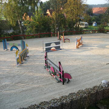
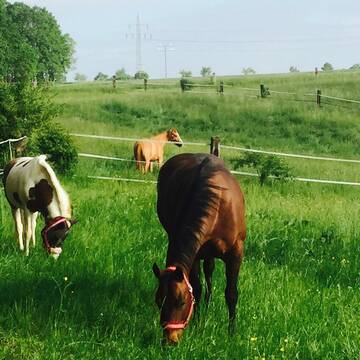
Pferdestall Schirrle
@Tobias_S
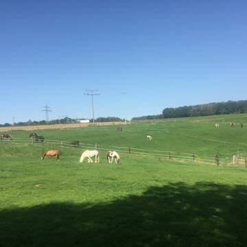
Freizeitstall
Gangpferdereiten
Vermieten
Verpachten
Hunde willkommen
Krankenbox
bedampftes/gewaschenes Heu
Fohlenaufzucht möglich
20 weitere...
P
Leider kein Vorschaubild
Leider kein Vorschaubild
B
Deprecated: Creation of dynamic property Zend_View_Helper_Ads::$adLink is deprecated in /var/www/stall-frei/htdocs/staging.stall-frei.de/library/Psf/View/Helper/Ads.php on line 108

Futtersack HeuToy, Fressbremse in pink
Mechtersen
STALL-FREIde Marketing
@STALL-FREI-Marketing
Stundenlange Beschäftigung die
Koliken vorbeugt, geringe Staubinhalation mit
steuerbarer Futterentnahme
Leider kein Vorschaubild
Leider kein Vorschaubild
Bieten Offenstallplatz für Wallach an
Schnelldorf
Sarah
@srh_hld
Freizeitstall
Gangpferdereiten
Vermieten
Hunde willkommen
Krankenbox
Notfallboxen
12 weitere...
B
ab 1.3.24 1 Box frei !
Abenberg
Alexander-Urmoneit
@Alexander-Urmoneit
FN-Mitglied
Freizeitstall
Führanlage
Longierzirkel/Roundpen
Außenboxen
Offenstall
Vollpension
13 weitere...
P

Freie Pferdebox
Langenzenn
Dietmar-Bernhardt
@Dietmar-Bernhardt
Freizeitstall
Hunde willkommen
Krankenbox
Außenboxen
Innenbox
Vollpension
10 weitere...
P+


Mitarbeiter gesucht?
Mechtersen
STALL-FREIde Marketing
@STALL-FREI-Marketing
Stellenangebote kostenlos veröffentlichen!


Horses oasis of Well being❤️Liebe zu den Pferden...
Ellingen
Team TJ
@Horsesoasisofwellbeing
Freizeitstall
Geländestrecke
Vermieten
Hunde willkommen
Krankenbox
Allergikerstall
bedampftes/gewaschenes Heu
24 weitere...
P+
Leider kein Vorschaubild
Leider kein Vorschaubild
Boxen und Offenstall
Ehingen am Ries
Albert-Seefried
@Albert-Seefried
Freizeitstall
Vermieten
Verpachten
Führanlage
Krankenbox
Außenbox mit Paddock
Außenboxen
14 weitere...
P


Pferde am Kretschmannshof
Oberasbach
Sebastian Weißkopf
@Pferde-am-Kretschmannshof
Vermieten
Hunde willkommen
Paddock
Offenstall
Halbpension
10 weitere...
P+


Gut von Esbach - Bullenheim
Ippesheim
Merkel
@K.Merkel
Freizeitstall
Rehabilitationsstall
Vermieten
Hunde willkommen
Paddock
Allergikerstall
14 weitere...
S
Veröffentliche deine Suche als Gesuch und Suchauftrag, dann erhältst du Angebote, neue Treffer und Änderungen per E-Mail.
Diese Suche als Gesuch veröffentlichenDeprecated: Creation of dynamic property Zend_View::$pageCount is deprecated in /var/www/stall-frei/htdocs/staging.stall-frei.de/library/vendor/shardj/zf1-future/library/Zend/View/Abstract.php on line 308
Deprecated: Creation of dynamic property Zend_View::$itemCountPerPage is deprecated in /var/www/stall-frei/htdocs/staging.stall-frei.de/library/vendor/shardj/zf1-future/library/Zend/View/Abstract.php on line 308
Deprecated: Creation of dynamic property Zend_View::$first is deprecated in /var/www/stall-frei/htdocs/staging.stall-frei.de/library/vendor/shardj/zf1-future/library/Zend/View/Abstract.php on line 308
Deprecated: Creation of dynamic property Zend_View::$current is deprecated in /var/www/stall-frei/htdocs/staging.stall-frei.de/library/vendor/shardj/zf1-future/library/Zend/View/Abstract.php on line 308
Deprecated: Creation of dynamic property Zend_View::$last is deprecated in /var/www/stall-frei/htdocs/staging.stall-frei.de/library/vendor/shardj/zf1-future/library/Zend/View/Abstract.php on line 308
Deprecated: Creation of dynamic property Zend_View::$previous is deprecated in /var/www/stall-frei/htdocs/staging.stall-frei.de/library/vendor/shardj/zf1-future/library/Zend/View/Abstract.php on line 308
Deprecated: Creation of dynamic property Zend_View::$next is deprecated in /var/www/stall-frei/htdocs/staging.stall-frei.de/library/vendor/shardj/zf1-future/library/Zend/View/Abstract.php on line 308
Deprecated: Creation of dynamic property Zend_View::$pagesInRange is deprecated in /var/www/stall-frei/htdocs/staging.stall-frei.de/library/vendor/shardj/zf1-future/library/Zend/View/Abstract.php on line 308
Deprecated: Creation of dynamic property Zend_View::$firstPageInRange is deprecated in /var/www/stall-frei/htdocs/staging.stall-frei.de/library/vendor/shardj/zf1-future/library/Zend/View/Abstract.php on line 308
Deprecated: Creation of dynamic property Zend_View::$lastPageInRange is deprecated in /var/www/stall-frei/htdocs/staging.stall-frei.de/library/vendor/shardj/zf1-future/library/Zend/View/Abstract.php on line 308
Deprecated: Creation of dynamic property Zend_View::$currentItemCount is deprecated in /var/www/stall-frei/htdocs/staging.stall-frei.de/library/vendor/shardj/zf1-future/library/Zend/View/Abstract.php on line 308
Deprecated: Creation of dynamic property Zend_View::$totalItemCount is deprecated in /var/www/stall-frei/htdocs/staging.stall-frei.de/library/vendor/shardj/zf1-future/library/Zend/View/Abstract.php on line 308
Deprecated: Creation of dynamic property Zend_View::$firstItemNumber is deprecated in /var/www/stall-frei/htdocs/staging.stall-frei.de/library/vendor/shardj/zf1-future/library/Zend/View/Abstract.php on line 308
Deprecated: Creation of dynamic property Zend_View::$lastItemNumber is deprecated in /var/www/stall-frei/htdocs/staging.stall-frei.de/library/vendor/shardj/zf1-future/library/Zend/View/Abstract.php on line 308
Deprecated: Creation of dynamic property Zend_View::$router is deprecated in /var/www/stall-frei/htdocs/staging.stall-frei.de/library/vendor/shardj/zf1-future/library/Zend/View/Abstract.php on line 308
Deprecated: Creation of dynamic property Zend_View::$urlParams is deprecated in /var/www/stall-frei/htdocs/staging.stall-frei.de/library/vendor/shardj/zf1-future/library/Zend/View/Abstract.php on line 308
Deprecated: Creation of dynamic property Zend_View::$showAds is deprecated in /var/www/stall-frei/htdocs/staging.stall-frei.de/library/vendor/shardj/zf1-future/library/Zend/View/Abstract.php on line 308
Deprecated: Creation of dynamic property Zend_View::$objectIds is deprecated in /var/www/stall-frei/htdocs/staging.stall-frei.de/library/vendor/shardj/zf1-future/library/Zend/View/Abstract.php on line 308
Deprecated: Creation of dynamic property Zend_View::$showNavbar is deprecated in /var/www/stall-frei/htdocs/staging.stall-frei.de/library/vendor/shardj/zf1-future/library/Zend/View/Abstract.php on line 308
Deprecated: Creation of dynamic property Zend_View::$showBreadcrumb is deprecated in /var/www/stall-frei/htdocs/staging.stall-frei.de/library/vendor/shardj/zf1-future/library/Zend/View/Abstract.php on line 308
Deprecated: Creation of dynamic property Zend_View::$showFooter is deprecated in /var/www/stall-frei/htdocs/staging.stall-frei.de/library/vendor/shardj/zf1-future/library/Zend/View/Abstract.php on line 308
Deprecated: Creation of dynamic property Zend_View::$showInternalAds is deprecated in /var/www/stall-frei/htdocs/staging.stall-frei.de/library/vendor/shardj/zf1-future/library/Zend/View/Abstract.php on line 308
Deprecated: Creation of dynamic property Zend_View::$blNoContent is deprecated in /var/www/stall-frei/htdocs/staging.stall-frei.de/library/vendor/shardj/zf1-future/library/Zend/View/Abstract.php on line 308
Deprecated: Creation of dynamic property Zend_View::$sMetaDesc is deprecated in /var/www/stall-frei/htdocs/staging.stall-frei.de/library/vendor/shardj/zf1-future/library/Zend/View/Abstract.php on line 308
Deprecated: Creation of dynamic property Zend_View::$useGmaps is deprecated in /var/www/stall-frei/htdocs/staging.stall-frei.de/library/vendor/shardj/zf1-future/library/Zend/View/Abstract.php on line 308
Deprecated: Creation of dynamic property Zend_View::$touches is deprecated in /var/www/stall-frei/htdocs/staging.stall-frei.de/library/vendor/shardj/zf1-future/library/Zend/View/Abstract.php on line 308
Deprecated: Creation of dynamic property Zend_View::$oProject is deprecated in /var/www/stall-frei/htdocs/staging.stall-frei.de/library/vendor/shardj/zf1-future/library/Zend/View/Abstract.php on line 308
Deprecated: Creation of dynamic property Zend_View::$pageHeadline is deprecated in /var/www/stall-frei/htdocs/staging.stall-frei.de/library/vendor/shardj/zf1-future/library/Zend/View/Abstract.php on line 308
Deprecated: Creation of dynamic property Zend_View::$disableLocationField is deprecated in /var/www/stall-frei/htdocs/staging.stall-frei.de/library/vendor/shardj/zf1-future/library/Zend/View/Abstract.php on line 308
Deprecated: Creation of dynamic property Zend_View::$isSearch is deprecated in /var/www/stall-frei/htdocs/staging.stall-frei.de/library/vendor/shardj/zf1-future/library/Zend/View/Abstract.php on line 308
Deprecated: Creation of dynamic property Zend_View::$pageTitle is deprecated in /var/www/stall-frei/htdocs/staging.stall-frei.de/library/vendor/shardj/zf1-future/library/Zend/View/Abstract.php on line 308
Deprecated: Creation of dynamic property Psf_Form_Element_Text::$class is deprecated in /var/www/stall-frei/htdocs/staging.stall-frei.de/library/vendor/shardj/zf1-future/library/Zend/Form/Element.php on line 874
Deprecated: Creation of dynamic property Psf_Form_Element_Text::$size is deprecated in /var/www/stall-frei/htdocs/staging.stall-frei.de/library/vendor/shardj/zf1-future/library/Zend/Form/Element.php on line 874
Deprecated: Creation of dynamic property Psf_Form_Element_Text::$placeholder is deprecated in /var/www/stall-frei/htdocs/staging.stall-frei.de/library/vendor/shardj/zf1-future/library/Zend/Form/Element.php on line 874
Deprecated: Creation of dynamic property Psf_Form_Element_Hidden::$class is deprecated in /var/www/stall-frei/htdocs/staging.stall-frei.de/library/vendor/shardj/zf1-future/library/Zend/Form/Element.php on line 874
Deprecated: Creation of dynamic property Psf_Form_Element_Hidden::$class is deprecated in /var/www/stall-frei/htdocs/staging.stall-frei.de/library/vendor/shardj/zf1-future/library/Zend/Form/Element.php on line 874
Deprecated: Creation of dynamic property Psf_Form_Element_Hidden::$class is deprecated in /var/www/stall-frei/htdocs/staging.stall-frei.de/library/vendor/shardj/zf1-future/library/Zend/Form/Element.php on line 874
Deprecated: Creation of dynamic property Psf_Form_Element_Hidden::$class is deprecated in /var/www/stall-frei/htdocs/staging.stall-frei.de/library/vendor/shardj/zf1-future/library/Zend/Form/Element.php on line 874
Deprecated: Creation of dynamic property Psf_Form_Element_Select::$class is deprecated in /var/www/stall-frei/htdocs/staging.stall-frei.de/library/vendor/shardj/zf1-future/library/Zend/Form/Element.php on line 874
Deprecated: Creation of dynamic property Psf_Form_Element_Select::$class is deprecated in /var/www/stall-frei/htdocs/staging.stall-frei.de/library/vendor/shardj/zf1-future/library/Zend/Form/Element.php on line 874
Deprecated: Creation of dynamic property Psf_Form_Element_Select::$class is deprecated in /var/www/stall-frei/htdocs/staging.stall-frei.de/library/vendor/shardj/zf1-future/library/Zend/Form/Element.php on line 874
Deprecated: Creation of dynamic property Psf_Form_Element_Select::$class is deprecated in /var/www/stall-frei/htdocs/staging.stall-frei.de/library/vendor/shardj/zf1-future/library/Zend/Form/Element.php on line 874
Deprecated: Creation of dynamic property Psf_Form_Element_Text::$class is deprecated in /var/www/stall-frei/htdocs/staging.stall-frei.de/library/vendor/shardj/zf1-future/library/Zend/Form/Element.php on line 874
Deprecated: Creation of dynamic property Psf_Form_Element_Checkbox::$label is deprecated in /var/www/stall-frei/htdocs/staging.stall-frei.de/library/vendor/shardj/zf1-future/library/Zend/Form/Element.php on line 874
Deprecated: Creation of dynamic property Zend_View::$sort is deprecated in /var/www/stall-frei/htdocs/staging.stall-frei.de/library/vendor/shardj/zf1-future/library/Zend/View/Abstract.php on line 308
Deprecated: Creation of dynamic property Zend_View::$searchLocation is deprecated in /var/www/stall-frei/htdocs/staging.stall-frei.de/library/vendor/shardj/zf1-future/library/Zend/View/Abstract.php on line 308
Deprecated: Creation of dynamic property Zend_View::$locationHint is deprecated in /var/www/stall-frei/htdocs/staging.stall-frei.de/library/vendor/shardj/zf1-future/library/Zend/View/Abstract.php on line 308
Psf_GeoCoder_Abstract::getLocation: Hohenberg Get Location CachedOrLive
Psf_GeoCoder_Abstract::getCachedOrLive: Hohenberg
Psf_GeoCoder_Abstract::convertLocationResult
{"documentation":"https:\/\/opencagedata.com\/api","licenses":[{"name":"see attribution guide","url":"https:\/\/opencagedata.com\/credits"}],"results":[{"bounds":{"northeast":{"lat":49.2656884,"lng":10.5313515},"southwest":{"lat":49.2256884,"lng":10.4913515}},"components":{"ISO_3166-1_alpha-2":"DE","ISO_3166-1_alpha-3":"DEU","ISO_3166-2":["DE-BY"],"_category":"place","_normalized_city":"Herrieden","_type":"village","continent":"Europe","country":"Deutschland","country_code":"de","county":"Landkreis Ansbach","political_union":"European Union","postcode":"91567","state":"Bayern","state_code":"BY","town":"Herrieden","village":"Hohenberg"},"confidence":7,"formatted":"91567 Hohenberg, Deutschland","geometry":{"lat":49.2456884,"lng":10.5113515}},{"bounds":{"northeast":{"lat":50.2183236,"lng":11.6725141},"southwest":{"lat":50.1783236,"lng":11.6325141}},"components":{"ISO_3166-1_alpha-2":"DE","ISO_3166-1_alpha-3":"DEU","ISO_3166-2":["DE-BY"],"_category":"place","_normalized_city":"Marktleugast","_type":"village","city":"Marktleugast","continent":"Europe","country":"Deutschland","country_code":"de","county":"Landkreis Kulmbach","municipality":"Marktleugast (VGem)","political_union":"European Union","postcode":"95352","state":"Bayern","state_code":"BY","village":"Hohenberg"},"confidence":7,"formatted":"95352 Hohenberg, Deutschland","geometry":{"lat":50.1983236,"lng":11.6525141}},{"bounds":{"northeast":{"lat":49.0027003,"lng":10.041503},"southwest":{"lat":49.0026003,"lng":10.041403}},"components":{"ISO_3166-1_alpha-2":"DE","ISO_3166-1_alpha-3":"DEU","ISO_3166-2":["DE-BW"],"_category":"natural\/water","_normalized_city":"Rosenberg","_type":"peak","continent":"Europe","country":"Deutschland","country_code":"de","county":"Ostalbkreis","municipality":"VVG der Stadt Ellwangen (Jagst)","peak":"Hohenberg","political_union":"European Union","postcode":"73494","state":"Baden-W\u00fcrttemberg","state_code":"BW","village":"Rosenberg"},"confidence":9,"formatted":"Hohenberg, 73494 Rosenberg, Deutschland","geometry":{"lat":49.0026503,"lng":10.041453}},{"bounds":{"northeast":{"lat":49.0217653,"lng":10.0658458},"southwest":{"lat":48.9817653,"lng":10.0258458}},"components":{"ISO_3166-1_alpha-2":"DE","ISO_3166-1_alpha-3":"DEU","ISO_3166-2":["DE-BW"],"_category":"place","_normalized_city":"Rosenberg","_type":"village","city":"Rosenberg","continent":"Europe","country":"Deutschland","country_code":"de","county":"Ostalbkreis","municipality":"VVG der Stadt Ellwangen (Jagst)","political_union":"European Union","postcode":"73494","state":"Baden-W\u00fcrttemberg","state_code":"BW","village":"Hohenberg"},"confidence":7,"formatted":"73494 Hohenberg, Deutschland","geometry":{"lat":49.0017653,"lng":10.0458458}},{"bounds":{"northeast":{"lat":49.2027666,"lng":8.0051973},"southwest":{"lat":49.2026666,"lng":8.0050973}},"components":{"ISO_3166-1_alpha-2":"DE","ISO_3166-1_alpha-3":"DEU","ISO_3166-2":["DE-RP"],"_category":"natural\/water","_normalized_city":"Birkweiler","_type":"peak","continent":"Europe","country":"Deutschland","country_code":"de","county":"Landkreis S\u00fcdliche Weinstra\u00dfe","municipality":"Landau-Land","peak":"Hohenberg","political_union":"European Union","postcode":"76855","state":"Rheinland-Pfalz","state_code":"RP","village":"Birkweiler"},"confidence":9,"formatted":"Hohenberg, 76855 Birkweiler, Deutschland","geometry":{"lat":49.2027166,"lng":8.0051473}},{"bounds":{"northeast":{"lat":50.0402051,"lng":11.5247635},"southwest":{"lat":50.0401051,"lng":11.5246635}},"components":{"ISO_3166-1_alpha-2":"DE","ISO_3166-1_alpha-3":"DEU","ISO_3166-2":["DE-BY"],"_category":"natural\/water","_normalized_city":"Neudrossenfeld","_type":"peak","continent":"Europe","country":"Deutschland","country_code":"de","county":"Landkreis Kulmbach","peak":"Hohenberg","political_union":"European Union","postcode":"95512","state":"Bayern","state_code":"BY","village":"Neudrossenfeld"},"confidence":9,"formatted":"Hohenberg, 95512 Neudrossenfeld, Deutschland","geometry":{"lat":50.0401551,"lng":11.5247135}},{"bounds":{"northeast":{"lat":48.8452248,"lng":11.9430742},"southwest":{"lat":48.8451248,"lng":11.9429742}},"components":{"ISO_3166-1_alpha-2":"DE","ISO_3166-1_alpha-3":"DEU","ISO_3166-2":["DE-BY"],"_category":"natural\/water","_normalized_city":"Saal a.d.Donau","_type":"peak","city":"Saal a.d.Donau","continent":"Europe","country":"Deutschland","country_code":"de","county":"Landkreis Kelheim","municipality":"Saal an der Donau (VGem)","peak":"Hohenberg","political_union":"European Union","postcode":"93345","state":"Bayern","state_code":"BY"},"confidence":9,"formatted":"Hohenberg, 93345 Saal a.d.Donau, Deutschland","geometry":{"lat":48.8451748,"lng":11.9430242}},{"bounds":{"northeast":{"lat":47.8040887,"lng":11.2677625},"southwest":{"lat":47.8039887,"lng":11.2676625}},"components":{"ISO_3166-1_alpha-2":"DE","ISO_3166-1_alpha-3":"DEU","ISO_3166-2":["DE-BY"],"_category":"natural\/water","_normalized_city":"Seeshaupt","_type":"peak","continent":"Europe","country":"Deutschland","country_code":"de","county":"Landkreis Weilheim-Schongau","municipality":"Seeshaupt (VGem)","peak":"Hohenberg","political_union":"European Union","postcode":"82402","state":"Bayern","state_code":"BY","village":"Seeshaupt"},"confidence":9,"formatted":"Hohenberg, 82402 Seeshaupt, Deutschland","geometry":{"lat":47.8040387,"lng":11.2677125}},{"bounds":{"northeast":{"lat":49.5249241,"lng":12.1588521},"southwest":{"lat":49.5248241,"lng":12.1587521}},"components":{"ISO_3166-1_alpha-2":"DE","ISO_3166-1_alpha-3":"DEU","ISO_3166-2":["DE-BY"],"_category":"natural\/water","_normalized_city":"Wernberg-K\u00f6blitz","_type":"peak","continent":"Europe","country":"Deutschland","country_code":"de","county":"Landkreis Schwandorf","municipality":"Wernberg-K\u00f6blitz","peak":"Hohenberg","political_union":"European Union","postcode":"92533","state":"Bayern","state_code":"BY"},"confidence":9,"formatted":"Hohenberg, 92533 Wernberg-K\u00f6blitz, Deutschland","geometry":{"lat":49.5248741,"lng":12.1588021}},{"components":{"ISO_3166-1_alpha-2":"FR","ISO_3166-1_alpha-3":"FRA","ISO_3166-2":["FR-ARA","FR-63"],"_category":"road","_normalized_city":"Ambert","_type":"road","city":"Ambert","continent":"Europe","country":"France","country_code":"fr","county":"Puy-de-D\u00f4me","local_authority":"Communaut\u00e9 de communes Ambert Livradois Forez","political_union":"European Union","postcode":"63600","road":"Route de la Chardie","state":"Auvergne-Rh\u00f4ne-Alpes","state_code":"ARA"},"confidence":2,"formatted":"Route de la Chardie, 63600 Ambert, France","geometry":{"lat":45.563897,"lng":3.706407}}],"status":{"code":200,"message":"OK"},"stay_informed":{"blog":"https:\/\/blog.opencagedata.com","mastodon":"https:\/\/en.osm.town\/@opencage"},"thanks":"For using an OpenCage API","timestamp":{"created_http":"Sat, 07 Feb 2026 22:07:47 GMT","created_unix":1770502067},"total_results":10}Array
(
[0] => stdClass Object
(
[bounds] => stdClass Object
(
[northeast] => stdClass Object
(
[lat] => 49.2656884
[lng] => 10.5313515
)
[southwest] => stdClass Object
(
[lat] => 49.2256884
[lng] => 10.4913515
)
)
[components] => stdClass Object
(
[ISO_3166-1_alpha-2] => DE
[ISO_3166-1_alpha-3] => DEU
[ISO_3166-2] => Array
(
[0] => DE-BY
)
[_category] => place
[_normalized_city] => Herrieden
[_type] => village
[continent] => Europe
[country] => Deutschland
[country_code] => de
[county] => Landkreis Ansbach
[political_union] => European Union
[postcode] => 91567
[state] => Bayern
[state_code] => BY
[town] => Herrieden
[village] => Hohenberg
)
[confidence] => 7
[formatted] => 91567 Hohenberg, Deutschland
[geometry] => stdClass Object
(
[lat] => 49.2456884
[lng] => 10.5113515
)
)
[1] => stdClass Object
(
[bounds] => stdClass Object
(
[northeast] => stdClass Object
(
[lat] => 50.2183236
[lng] => 11.6725141
)
[southwest] => stdClass Object
(
[lat] => 50.1783236
[lng] => 11.6325141
)
)
[components] => stdClass Object
(
[ISO_3166-1_alpha-2] => DE
[ISO_3166-1_alpha-3] => DEU
[ISO_3166-2] => Array
(
[0] => DE-BY
)
[_category] => place
[_normalized_city] => Marktleugast
[_type] => village
[city] => Marktleugast
[continent] => Europe
[country] => Deutschland
[country_code] => de
[county] => Landkreis Kulmbach
[municipality] => Marktleugast (VGem)
[political_union] => European Union
[postcode] => 95352
[state] => Bayern
[state_code] => BY
[village] => Hohenberg
)
[confidence] => 7
[formatted] => 95352 Hohenberg, Deutschland
[geometry] => stdClass Object
(
[lat] => 50.1983236
[lng] => 11.6525141
)
)
[2] => stdClass Object
(
[bounds] => stdClass Object
(
[northeast] => stdClass Object
(
[lat] => 49.0027003
[lng] => 10.041503
)
[southwest] => stdClass Object
(
[lat] => 49.0026003
[lng] => 10.041403
)
)
[components] => stdClass Object
(
[ISO_3166-1_alpha-2] => DE
[ISO_3166-1_alpha-3] => DEU
[ISO_3166-2] => Array
(
[0] => DE-BW
)
[_category] => natural/water
[_normalized_city] => Rosenberg
[_type] => peak
[continent] => Europe
[country] => Deutschland
[country_code] => de
[county] => Ostalbkreis
[municipality] => VVG der Stadt Ellwangen (Jagst)
[peak] => Hohenberg
[political_union] => European Union
[postcode] => 73494
[state] => Baden-Württemberg
[state_code] => BW
[village] => Rosenberg
)
[confidence] => 9
[formatted] => Hohenberg, 73494 Rosenberg, Deutschland
[geometry] => stdClass Object
(
[lat] => 49.0026503
[lng] => 10.041453
)
)
[3] => stdClass Object
(
[bounds] => stdClass Object
(
[northeast] => stdClass Object
(
[lat] => 49.0217653
[lng] => 10.0658458
)
[southwest] => stdClass Object
(
[lat] => 48.9817653
[lng] => 10.0258458
)
)
[components] => stdClass Object
(
[ISO_3166-1_alpha-2] => DE
[ISO_3166-1_alpha-3] => DEU
[ISO_3166-2] => Array
(
[0] => DE-BW
)
[_category] => place
[_normalized_city] => Rosenberg
[_type] => village
[city] => Rosenberg
[continent] => Europe
[country] => Deutschland
[country_code] => de
[county] => Ostalbkreis
[municipality] => VVG der Stadt Ellwangen (Jagst)
[political_union] => European Union
[postcode] => 73494
[state] => Baden-Württemberg
[state_code] => BW
[village] => Hohenberg
)
[confidence] => 7
[formatted] => 73494 Hohenberg, Deutschland
[geometry] => stdClass Object
(
[lat] => 49.0017653
[lng] => 10.0458458
)
)
[4] => stdClass Object
(
[bounds] => stdClass Object
(
[northeast] => stdClass Object
(
[lat] => 49.2027666
[lng] => 8.0051973
)
[southwest] => stdClass Object
(
[lat] => 49.2026666
[lng] => 8.0050973
)
)
[components] => stdClass Object
(
[ISO_3166-1_alpha-2] => DE
[ISO_3166-1_alpha-3] => DEU
[ISO_3166-2] => Array
(
[0] => DE-RP
)
[_category] => natural/water
[_normalized_city] => Birkweiler
[_type] => peak
[continent] => Europe
[country] => Deutschland
[country_code] => de
[county] => Landkreis Südliche Weinstraße
[municipality] => Landau-Land
[peak] => Hohenberg
[political_union] => European Union
[postcode] => 76855
[state] => Rheinland-Pfalz
[state_code] => RP
[village] => Birkweiler
)
[confidence] => 9
[formatted] => Hohenberg, 76855 Birkweiler, Deutschland
[geometry] => stdClass Object
(
[lat] => 49.2027166
[lng] => 8.0051473
)
)
[5] => stdClass Object
(
[bounds] => stdClass Object
(
[northeast] => stdClass Object
(
[lat] => 50.0402051
[lng] => 11.5247635
)
[southwest] => stdClass Object
(
[lat] => 50.0401051
[lng] => 11.5246635
)
)
[components] => stdClass Object
(
[ISO_3166-1_alpha-2] => DE
[ISO_3166-1_alpha-3] => DEU
[ISO_3166-2] => Array
(
[0] => DE-BY
)
[_category] => natural/water
[_normalized_city] => Neudrossenfeld
[_type] => peak
[continent] => Europe
[country] => Deutschland
[country_code] => de
[county] => Landkreis Kulmbach
[peak] => Hohenberg
[political_union] => European Union
[postcode] => 95512
[state] => Bayern
[state_code] => BY
[village] => Neudrossenfeld
)
[confidence] => 9
[formatted] => Hohenberg, 95512 Neudrossenfeld, Deutschland
[geometry] => stdClass Object
(
[lat] => 50.0401551
[lng] => 11.5247135
)
)
[6] => stdClass Object
(
[bounds] => stdClass Object
(
[northeast] => stdClass Object
(
[lat] => 48.8452248
[lng] => 11.9430742
)
[southwest] => stdClass Object
(
[lat] => 48.8451248
[lng] => 11.9429742
)
)
[components] => stdClass Object
(
[ISO_3166-1_alpha-2] => DE
[ISO_3166-1_alpha-3] => DEU
[ISO_3166-2] => Array
(
[0] => DE-BY
)
[_category] => natural/water
[_normalized_city] => Saal a.d.Donau
[_type] => peak
[city] => Saal a.d.Donau
[continent] => Europe
[country] => Deutschland
[country_code] => de
[county] => Landkreis Kelheim
[municipality] => Saal an der Donau (VGem)
[peak] => Hohenberg
[political_union] => European Union
[postcode] => 93345
[state] => Bayern
[state_code] => BY
)
[confidence] => 9
[formatted] => Hohenberg, 93345 Saal a.d.Donau, Deutschland
[geometry] => stdClass Object
(
[lat] => 48.8451748
[lng] => 11.9430242
)
)
[7] => stdClass Object
(
[bounds] => stdClass Object
(
[northeast] => stdClass Object
(
[lat] => 47.8040887
[lng] => 11.2677625
)
[southwest] => stdClass Object
(
[lat] => 47.8039887
[lng] => 11.2676625
)
)
[components] => stdClass Object
(
[ISO_3166-1_alpha-2] => DE
[ISO_3166-1_alpha-3] => DEU
[ISO_3166-2] => Array
(
[0] => DE-BY
)
[_category] => natural/water
[_normalized_city] => Seeshaupt
[_type] => peak
[continent] => Europe
[country] => Deutschland
[country_code] => de
[county] => Landkreis Weilheim-Schongau
[municipality] => Seeshaupt (VGem)
[peak] => Hohenberg
[political_union] => European Union
[postcode] => 82402
[state] => Bayern
[state_code] => BY
[village] => Seeshaupt
)
[confidence] => 9
[formatted] => Hohenberg, 82402 Seeshaupt, Deutschland
[geometry] => stdClass Object
(
[lat] => 47.8040387
[lng] => 11.2677125
)
)
[8] => stdClass Object
(
[bounds] => stdClass Object
(
[northeast] => stdClass Object
(
[lat] => 49.5249241
[lng] => 12.1588521
)
[southwest] => stdClass Object
(
[lat] => 49.5248241
[lng] => 12.1587521
)
)
[components] => stdClass Object
(
[ISO_3166-1_alpha-2] => DE
[ISO_3166-1_alpha-3] => DEU
[ISO_3166-2] => Array
(
[0] => DE-BY
)
[_category] => natural/water
[_normalized_city] => Wernberg-Köblitz
[_type] => peak
[continent] => Europe
[country] => Deutschland
[country_code] => de
[county] => Landkreis Schwandorf
[municipality] => Wernberg-Köblitz
[peak] => Hohenberg
[political_union] => European Union
[postcode] => 92533
[state] => Bayern
[state_code] => BY
)
[confidence] => 9
[formatted] => Hohenberg, 92533 Wernberg-Köblitz, Deutschland
[geometry] => stdClass Object
(
[lat] => 49.5248741
[lng] => 12.1588021
)
)
[9] => stdClass Object
(
[components] => stdClass Object
(
[ISO_3166-1_alpha-2] => FR
[ISO_3166-1_alpha-3] => FRA
[ISO_3166-2] => Array
(
[0] => FR-ARA
[1] => FR-63
)
[_category] => road
[_normalized_city] => Ambert
[_type] => road
[city] => Ambert
[continent] => Europe
[country] => France
[country_code] => fr
[county] => Puy-de-Dôme
[local_authority] => Communauté de communes Ambert Livradois Forez
[political_union] => European Union
[postcode] => 63600
[road] => Route de la Chardie
[state] => Auvergne-Rhône-Alpes
[state_code] => ARA
)
[confidence] => 2
[formatted] => Route de la Chardie, 63600 Ambert, France
[geometry] => stdClass Object
(
[lat] => 45.563897
[lng] => 3.706407
)
)
)
Psf_GeoCoder_OpenCageData::getKeyMap: 0
stdClass Object
(
    [bounds] => stdClass Object
        (
            [northeast] => stdClass Object
                (
                    [lat] => 49.2656884
                    [lng] => 10.5313515
                )

            [southwest] => stdClass Object
                (
                    [lat] => 49.2256884
                    [lng] => 10.4913515
                )

        )

    [components] => stdClass Object
        (
            [ISO_3166-1_alpha-2] => DE
            [ISO_3166-1_alpha-3] => DEU
            [ISO_3166-2] => Array
                (
                    [0] => DE-BY
                )

            [_category] => place
            [_normalized_city] => Herrieden
            [_type] => village
            [continent] => Europe
            [country] => Deutschland
            [country_code] => de
            [county] => Landkreis Ansbach
            [political_union] => European Union
            [postcode] => 91567
            [state] => Bayern
            [state_code] => BY
            [town] => Herrieden
            [village] => Hohenberg
        )

    [confidence] => 7
    [formatted] => 91567 Hohenberg, Deutschland
    [geometry] => stdClass Object
        (
            [lat] => 49.2456884
            [lng] => 10.5113515
        )

)
Psf_GeoCoder_OpenCageData::getCounty: Ansbach
Psf_GeoCoder_OpenCageData::addMissingData REFETCH!
Array
(
    [address] => 91567 Hohenberg, Deutschland
    [type] => village
    [street] =>
    [city] => Herrieden
    [county] => Ansbach
    [state] => Bayern
    [zip] => 91567
    [country] => Deutschland
    [suburb] =>
    [countrycode] => de
    [latitude] => 49.2456884
    [longitude] => 10.5113515
    [accuracy] => 1
    [confidence] => 7
    [bounds] => stdClass Object
        (
            [northeast] => stdClass Object
                (
                    [lat] => 49.2656884
                    [lng] => 10.5313515
                )

            [southwest] => stdClass Object
                (
                    [lat] => 49.2256884
                    [lng] => 10.4913515
                )

        )

)
reformat!
Array
(
    [address] => 91567 Herrieden
    [type] => village
    [street] =>
    [city] => Herrieden
    [county] => Ansbach
    [state] => Bayern
    [zip] => 91567
    [country] => Deutschland
    [suburb] =>
    [countrycode] => de
    [latitude] => 49.2456884
    [longitude] => 10.5113515
    [accuracy] => 1
    [confidence] => 7
    [bounds] => stdClass Object
        (
            [northeast] => stdClass Object
                (
                    [lat] => 49.2656884
                    [lng] => 10.5313515
                )

            [southwest] => stdClass Object
                (
                    [lat] => 49.2256884
                    [lng] => 10.4913515
                )

        )

    [place] => 91567 Herrieden, Bayern
    [hash] => 28d3e24ba5f99a659f82931bc7c190ae
)
Psf_GeoCoder_OpenCageData::getKeyMap: 1
stdClass Object
(
    [bounds] => stdClass Object
        (
            [northeast] => stdClass Object
                (
                    [lat] => 50.2183236
                    [lng] => 11.6725141
                )

            [southwest] => stdClass Object
                (
                    [lat] => 50.1783236
                    [lng] => 11.6325141
                )

        )

    [components] => stdClass Object
        (
            [ISO_3166-1_alpha-2] => DE
            [ISO_3166-1_alpha-3] => DEU
            [ISO_3166-2] => Array
                (
                    [0] => DE-BY
                )

            [_category] => place
            [_normalized_city] => Marktleugast
            [_type] => village
            [city] => Marktleugast
            [continent] => Europe
            [country] => Deutschland
            [country_code] => de
            [county] => Landkreis Kulmbach
            [municipality] => Marktleugast (VGem)
            [political_union] => European Union
            [postcode] => 95352
            [state] => Bayern
            [state_code] => BY
            [village] => Hohenberg
        )

    [confidence] => 7
    [formatted] => 95352 Hohenberg, Deutschland
    [geometry] => stdClass Object
        (
            [lat] => 50.1983236
            [lng] => 11.6525141
        )

)
Psf_GeoCoder_OpenCageData::getCounty: Kulmbach
Psf_GeoCoder_OpenCageData::addMissingData REFETCH!
Array
(
    [address] => 95352 Hohenberg, Deutschland
    [type] => village
    [street] =>
    [city] => Hohenberg
    [county] => Kulmbach
    [state] => Bayern
    [zip] => 95352
    [country] => Deutschland
    [suburb] =>
    [countrycode] => de
    [latitude] => 50.1983236
    [longitude] => 11.6525141
    [accuracy] => 1
    [confidence] => 7
    [bounds] => stdClass Object
        (
            [northeast] => stdClass Object
                (
                    [lat] => 50.2183236
                    [lng] => 11.6725141
                )

            [southwest] => stdClass Object
                (
                    [lat] => 50.1783236
                    [lng] => 11.6325141
                )

        )

)
reformat!
Array
(
    [address] => 95352 Hohenberg, Deutschland
    [type] => village
    [street] =>
    [city] => Hohenberg
    [county] => Kulmbach
    [state] => Bayern
    [zip] => 95352
    [country] => Deutschland
    [suburb] =>
    [countrycode] => de
    [latitude] => 50.1983236
    [longitude] => 11.6525141
    [accuracy] => 1
    [confidence] => 7
    [bounds] => stdClass Object
        (
            [northeast] => stdClass Object
                (
                    [lat] => 50.2183236
                    [lng] => 11.6725141
                )

            [southwest] => stdClass Object
                (
                    [lat] => 50.1783236
                    [lng] => 11.6325141
                )

        )

    [place] => 95352 Hohenberg, Bayern
    [hash] => 5e8d889c65201b000de0af6aed91903c
)
Psf_GeoCoder_OpenCageData::getKeyMap: 2
stdClass Object
(
    [bounds] => stdClass Object
        (
            [northeast] => stdClass Object
                (
                    [lat] => 49.0027003
                    [lng] => 10.041503
                )

            [southwest] => stdClass Object
                (
                    [lat] => 49.0026003
                    [lng] => 10.041403
                )

        )

    [components] => stdClass Object
        (
            [ISO_3166-1_alpha-2] => DE
            [ISO_3166-1_alpha-3] => DEU
            [ISO_3166-2] => Array
                (
                    [0] => DE-BW
                )

            [_category] => natural/water
            [_normalized_city] => Rosenberg
            [_type] => peak
            [continent] => Europe
            [country] => Deutschland
            [country_code] => de
            [county] => Ostalbkreis
            [municipality] => VVG der Stadt Ellwangen (Jagst)
            [peak] => Hohenberg
            [political_union] => European Union
            [postcode] => 73494
            [state] => Baden-Württemberg
            [state_code] => BW
            [village] => Rosenberg
        )

    [confidence] => 9
    [formatted] => Hohenberg, 73494 Rosenberg, Deutschland
    [geometry] => stdClass Object
        (
            [lat] => 49.0026503
            [lng] => 10.041453
        )

)
Psf_GeoCoder_OpenCageData::getCounty: Ostalbkreis
Psf_GeoCoder_OpenCageData::addMissingData REFETCH!
Array
(
    [address] => Hohenberg, 73494 Rosenberg, Deutschland
    [type] => peak
    [street] =>
    [city] => Rosenberg
    [county] => Ostalbkreis
    [state] => Baden-Württemberg
    [zip] => 73494
    [country] => Deutschland
    [suburb] =>
    [countrycode] => de
    [latitude] => 49.0026503
    [longitude] => 10.041453
    [accuracy] => 1
    [confidence] => 9
    [bounds] => stdClass Object
        (
            [northeast] => stdClass Object
                (
                    [lat] => 49.0027003
                    [lng] => 10.041503
                )

            [southwest] => stdClass Object
                (
                    [lat] => 49.0026003
                    [lng] => 10.041403
                )

        )

)
reformat!
Array
(
    [address] => Hohenberg, 73494 Rosenberg, Deutschland
    [type] => peak
    [street] =>
    [city] => Rosenberg
    [county] => Ostalbkreis
    [state] => Baden-Württemberg
    [zip] => 73494
    [country] => Deutschland
    [suburb] =>
    [countrycode] => de
    [latitude] => 49.0026503
    [longitude] => 10.041453
    [accuracy] => 1
    [confidence] => 9
    [bounds] => stdClass Object
        (
            [northeast] => stdClass Object
                (
                    [lat] => 49.0027003
                    [lng] => 10.041503
                )

            [southwest] => stdClass Object
                (
                    [lat] => 49.0026003
                    [lng] => 10.041403
                )

        )

    [place] => 73494 Rosenberg, Baden-Württemberg
    [hash] => ebeb87d1c9104288ab29364290131ce9
)
Psf_GeoCoder_OpenCageData::getKeyMap: 3
stdClass Object
(
    [bounds] => stdClass Object
        (
            [northeast] => stdClass Object
                (
                    [lat] => 49.0217653
                    [lng] => 10.0658458
                )

            [southwest] => stdClass Object
                (
                    [lat] => 48.9817653
                    [lng] => 10.0258458
                )

        )

    [components] => stdClass Object
        (
            [ISO_3166-1_alpha-2] => DE
            [ISO_3166-1_alpha-3] => DEU
            [ISO_3166-2] => Array
                (
                    [0] => DE-BW
                )

            [_category] => place
            [_normalized_city] => Rosenberg
            [_type] => village
            [city] => Rosenberg
            [continent] => Europe
            [country] => Deutschland
            [country_code] => de
            [county] => Ostalbkreis
            [municipality] => VVG der Stadt Ellwangen (Jagst)
            [political_union] => European Union
            [postcode] => 73494
            [state] => Baden-Württemberg
            [state_code] => BW
            [village] => Hohenberg
        )

    [confidence] => 7
    [formatted] => 73494 Hohenberg, Deutschland
    [geometry] => stdClass Object
        (
            [lat] => 49.0017653
            [lng] => 10.0458458
        )

)
Psf_GeoCoder_OpenCageData::getCounty: Ostalbkreis
Psf_GeoCoder_OpenCageData::addMissingData REFETCH!
Array
(
    [address] => 73494 Hohenberg, Deutschland
    [type] => village
    [street] =>
    [city] => Hohenberg
    [county] => Ostalbkreis
    [state] => Baden-Württemberg
    [zip] => 73494
    [country] => Deutschland
    [suburb] =>
    [countrycode] => de
    [latitude] => 49.0017653
    [longitude] => 10.0458458
    [accuracy] => 1
    [confidence] => 7
    [bounds] => stdClass Object
        (
            [northeast] => stdClass Object
                (
                    [lat] => 49.0217653
                    [lng] => 10.0658458
                )

            [southwest] => stdClass Object
                (
                    [lat] => 48.9817653
                    [lng] => 10.0258458
                )

        )

)
reformat!
Array
(
    [address] => 73494 Hohenberg, Deutschland
    [type] => village
    [street] =>
    [city] => Hohenberg
    [county] => Ostalbkreis
    [state] => Baden-Württemberg
    [zip] => 73494
    [country] => Deutschland
    [suburb] =>
    [countrycode] => de
    [latitude] => 49.0017653
    [longitude] => 10.0458458
    [accuracy] => 1
    [confidence] => 7
    [bounds] => stdClass Object
        (
            [northeast] => stdClass Object
                (
                    [lat] => 49.0217653
                    [lng] => 10.0658458
                )

            [southwest] => stdClass Object
                (
                    [lat] => 48.9817653
                    [lng] => 10.0258458
                )

        )

    [place] => 73494 Hohenberg, Baden-Württemberg
    [hash] => 095fb77b1d3cd966db7e9e77a9f30234
)
Psf_GeoCoder_OpenCageData::getKeyMap: 4
stdClass Object
(
    [bounds] => stdClass Object
        (
            [northeast] => stdClass Object
                (
                    [lat] => 49.2027666
                    [lng] => 8.0051973
                )

            [southwest] => stdClass Object
                (
                    [lat] => 49.2026666
                    [lng] => 8.0050973
                )

        )

    [components] => stdClass Object
        (
            [ISO_3166-1_alpha-2] => DE
            [ISO_3166-1_alpha-3] => DEU
            [ISO_3166-2] => Array
                (
                    [0] => DE-RP
                )

            [_category] => natural/water
            [_normalized_city] => Birkweiler
            [_type] => peak
            [continent] => Europe
            [country] => Deutschland
            [country_code] => de
            [county] => Landkreis Südliche Weinstraße
            [municipality] => Landau-Land
            [peak] => Hohenberg
            [political_union] => European Union
            [postcode] => 76855
            [state] => Rheinland-Pfalz
            [state_code] => RP
            [village] => Birkweiler
        )

    [confidence] => 9
    [formatted] => Hohenberg, 76855 Birkweiler, Deutschland
    [geometry] => stdClass Object
        (
            [lat] => 49.2027166
            [lng] => 8.0051473
        )

)
Psf_GeoCoder_OpenCageData::getCounty: Südliche Weinstraße
Psf_GeoCoder_OpenCageData::addMissingData REFETCH!
Array
(
    [address] => Hohenberg, 76855 Birkweiler, Deutschland
    [type] => peak
    [street] =>
    [city] => Birkweiler
    [county] => Südliche Weinstraße
    [state] => Rheinland-Pfalz
    [zip] => 76855
    [country] => Deutschland
    [suburb] =>
    [countrycode] => de
    [latitude] => 49.2027166
    [longitude] => 8.0051473
    [accuracy] => 1
    [confidence] => 9
    [bounds] => stdClass Object
        (
            [northeast] => stdClass Object
                (
                    [lat] => 49.2027666
                    [lng] => 8.0051973
                )

            [southwest] => stdClass Object
                (
                    [lat] => 49.2026666
                    [lng] => 8.0050973
                )

        )

)
reformat!
Array
(
    [address] => Hohenberg, 76855 Birkweiler, Deutschland
    [type] => peak
    [street] =>
    [city] => Birkweiler
    [county] => Südliche Weinstraße
    [state] => Rheinland-Pfalz
    [zip] => 76855
    [country] => Deutschland
    [suburb] =>
    [countrycode] => de
    [latitude] => 49.2027166
    [longitude] => 8.0051473
    [accuracy] => 1
    [confidence] => 9
    [bounds] => stdClass Object
        (
            [northeast] => stdClass Object
                (
                    [lat] => 49.2027666
                    [lng] => 8.0051973
                )

            [southwest] => stdClass Object
                (
                    [lat] => 49.2026666
                    [lng] => 8.0050973
                )

        )

    [place] => 76855 Birkweiler, Rheinland-Pfalz
    [hash] => 90273dd89a53b24f12a5d5fde8a49b34
)
Psf_GeoCoder_OpenCageData::getKeyMap: 5
stdClass Object
(
    [bounds] => stdClass Object
        (
            [northeast] => stdClass Object
                (
                    [lat] => 50.0402051
                    [lng] => 11.5247635
                )

            [southwest] => stdClass Object
                (
                    [lat] => 50.0401051
                    [lng] => 11.5246635
                )

        )

    [components] => stdClass Object
        (
            [ISO_3166-1_alpha-2] => DE
            [ISO_3166-1_alpha-3] => DEU
            [ISO_3166-2] => Array
                (
                    [0] => DE-BY
                )

            [_category] => natural/water
            [_normalized_city] => Neudrossenfeld
            [_type] => peak
            [continent] => Europe
            [country] => Deutschland
            [country_code] => de
            [county] => Landkreis Kulmbach
            [peak] => Hohenberg
            [political_union] => European Union
            [postcode] => 95512
            [state] => Bayern
            [state_code] => BY
            [village] => Neudrossenfeld
        )

    [confidence] => 9
    [formatted] => Hohenberg, 95512 Neudrossenfeld, Deutschland
    [geometry] => stdClass Object
        (
            [lat] => 50.0401551
            [lng] => 11.5247135
        )

)
Psf_GeoCoder_OpenCageData::getCounty: Kulmbach
Psf_GeoCoder_OpenCageData::addMissingData REFETCH!
Array
(
    [address] => Hohenberg, 95512 Neudrossenfeld, Deutschland
    [type] => peak
    [street] =>
    [city] => Neudrossenfeld
    [county] => Kulmbach
    [state] => Bayern
    [zip] => 95512
    [country] => Deutschland
    [suburb] =>
    [countrycode] => de
    [latitude] => 50.0401551
    [longitude] => 11.5247135
    [accuracy] => 1
    [confidence] => 9
    [bounds] => stdClass Object
        (
            [northeast] => stdClass Object
                (
                    [lat] => 50.0402051
                    [lng] => 11.5247635
                )

            [southwest] => stdClass Object
                (
                    [lat] => 50.0401051
                    [lng] => 11.5246635
                )

        )

)
reformat!
Array
(
    [address] => Hohenberg, 95512 Neudrossenfeld, Deutschland
    [type] => peak
    [street] =>
    [city] => Neudrossenfeld
    [county] => Kulmbach
    [state] => Bayern
    [zip] => 95512
    [country] => Deutschland
    [suburb] =>
    [countrycode] => de
    [latitude] => 50.0401551
    [longitude] => 11.5247135
    [accuracy] => 1
    [confidence] => 9
    [bounds] => stdClass Object
        (
            [northeast] => stdClass Object
                (
                    [lat] => 50.0402051
                    [lng] => 11.5247635
                )

            [southwest] => stdClass Object
                (
                    [lat] => 50.0401051
                    [lng] => 11.5246635
                )

        )

    [place] => 95512 Neudrossenfeld, Bayern
    [hash] => 41653097cc3f450032fa00e9e6049f39
)
Psf_GeoCoder_OpenCageData::getKeyMap: 6
stdClass Object
(
    [bounds] => stdClass Object
        (
            [northeast] => stdClass Object
                (
                    [lat] => 48.8452248
                    [lng] => 11.9430742
                )

            [southwest] => stdClass Object
                (
                    [lat] => 48.8451248
                    [lng] => 11.9429742
                )

        )

    [components] => stdClass Object
        (
            [ISO_3166-1_alpha-2] => DE
            [ISO_3166-1_alpha-3] => DEU
            [ISO_3166-2] => Array
                (
                    [0] => DE-BY
                )

            [_category] => natural/water
            [_normalized_city] => Saal a.d.Donau
            [_type] => peak
            [city] => Saal a.d.Donau
            [continent] => Europe
            [country] => Deutschland
            [country_code] => de
            [county] => Landkreis Kelheim
            [municipality] => Saal an der Donau (VGem)
            [peak] => Hohenberg
            [political_union] => European Union
            [postcode] => 93345
            [state] => Bayern
            [state_code] => BY
        )

    [confidence] => 9
    [formatted] => Hohenberg, 93345 Saal a.d.Donau, Deutschland
    [geometry] => stdClass Object
        (
            [lat] => 48.8451748
            [lng] => 11.9430242
        )

)
Psf_GeoCoder_OpenCageData::getCounty: Kelheim
Psf_GeoCoder_OpenCageData::addMissingData REFETCH!
Array
(
    [address] => Hohenberg, 93345 Saal a.d.Donau, Deutschland
    [type] => peak
    [street] =>
    [city] => Saal a.d.Donau
    [county] => Kelheim
    [state] => Bayern
    [zip] => 93345
    [country] => Deutschland
    [suburb] =>
    [countrycode] => de
    [latitude] => 48.8451748
    [longitude] => 11.9430242
    [accuracy] => 1
    [confidence] => 9
    [bounds] => stdClass Object
        (
            [northeast] => stdClass Object
                (
                    [lat] => 48.8452248
                    [lng] => 11.9430742
                )

            [southwest] => stdClass Object
                (
                    [lat] => 48.8451248
                    [lng] => 11.9429742
                )

        )

)
reformat!
Array
(
    [address] => Hohenberg, 93345 Saal a.d.Donau, Deutschland
    [type] => peak
    [street] =>
    [city] => Saal a.d.Donau
    [county] => Kelheim
    [state] => Bayern
    [zip] => 93345
    [country] => Deutschland
    [suburb] =>
    [countrycode] => de
    [latitude] => 48.8451748
    [longitude] => 11.9430242
    [accuracy] => 1
    [confidence] => 9
    [bounds] => stdClass Object
        (
            [northeast] => stdClass Object
                (
                    [lat] => 48.8452248
                    [lng] => 11.9430742
                )

            [southwest] => stdClass Object
                (
                    [lat] => 48.8451248
                    [lng] => 11.9429742
                )

        )

    [place] => 93345 Saal a.d.Donau, Bayern
    [hash] => 05e55d4cabf78dbf378e89ba545f5719
)
Psf_GeoCoder_OpenCageData::getKeyMap: 7
stdClass Object
(
    [bounds] => stdClass Object
        (
            [northeast] => stdClass Object
                (
                    [lat] => 47.8040887
                    [lng] => 11.2677625
                )

            [southwest] => stdClass Object
                (
                    [lat] => 47.8039887
                    [lng] => 11.2676625
                )

        )

    [components] => stdClass Object
        (
            [ISO_3166-1_alpha-2] => DE
            [ISO_3166-1_alpha-3] => DEU
            [ISO_3166-2] => Array
                (
                    [0] => DE-BY
                )

            [_category] => natural/water
            [_normalized_city] => Seeshaupt
            [_type] => peak
            [continent] => Europe
            [country] => Deutschland
            [country_code] => de
            [county] => Landkreis Weilheim-Schongau
            [municipality] => Seeshaupt (VGem)
            [peak] => Hohenberg
            [political_union] => European Union
            [postcode] => 82402
            [state] => Bayern
            [state_code] => BY
            [village] => Seeshaupt
        )

    [confidence] => 9
    [formatted] => Hohenberg, 82402 Seeshaupt, Deutschland
    [geometry] => stdClass Object
        (
            [lat] => 47.8040387
            [lng] => 11.2677125
        )

)
Psf_GeoCoder_OpenCageData::getCounty: Weilheim-Schongau
Psf_GeoCoder_OpenCageData::addMissingData REFETCH!
Array
(
    [address] => Hohenberg, 82402 Seeshaupt, Deutschland
    [type] => peak
    [street] =>
    [city] => Seeshaupt
    [county] => Weilheim-Schongau
    [state] => Bayern
    [zip] => 82402
    [country] => Deutschland
    [suburb] =>
    [countrycode] => de
    [latitude] => 47.8040387
    [longitude] => 11.2677125
    [accuracy] => 1
    [confidence] => 9
    [bounds] => stdClass Object
        (
            [northeast] => stdClass Object
                (
                    [lat] => 47.8040887
                    [lng] => 11.2677625
                )

            [southwest] => stdClass Object
                (
                    [lat] => 47.8039887
                    [lng] => 11.2676625
                )

        )

)
reformat!
Array
(
    [address] => Hohenberg, 82402 Seeshaupt, Deutschland
    [type] => peak
    [street] =>
    [city] => Seeshaupt
    [county] => Weilheim-Schongau
    [state] => Bayern
    [zip] => 82402
    [country] => Deutschland
    [suburb] =>
    [countrycode] => de
    [latitude] => 47.8040387
    [longitude] => 11.2677125
    [accuracy] => 1
    [confidence] => 9
    [bounds] => stdClass Object
        (
            [northeast] => stdClass Object
                (
                    [lat] => 47.8040887
                    [lng] => 11.2677625
                )

            [southwest] => stdClass Object
                (
                    [lat] => 47.8039887
                    [lng] => 11.2676625
                )

        )

    [place] => 82402 Seeshaupt, Bayern
    [hash] => e328308bfe2d221d7a31d53c5738c0b4
)
Psf_GeoCoder_OpenCageData::getKeyMap: 8
stdClass Object
(
    [bounds] => stdClass Object
        (
            [northeast] => stdClass Object
                (
                    [lat] => 49.5249241
                    [lng] => 12.1588521
                )

            [southwest] => stdClass Object
                (
                    [lat] => 49.5248241
                    [lng] => 12.1587521
                )

        )

    [components] => stdClass Object
        (
            [ISO_3166-1_alpha-2] => DE
            [ISO_3166-1_alpha-3] => DEU
            [ISO_3166-2] => Array
                (
                    [0] => DE-BY
                )

            [_category] => natural/water
            [_normalized_city] => Wernberg-Köblitz
            [_type] => peak
            [continent] => Europe
            [country] => Deutschland
            [country_code] => de
            [county] => Landkreis Schwandorf
            [municipality] => Wernberg-Köblitz
            [peak] => Hohenberg
            [political_union] => European Union
            [postcode] => 92533
            [state] => Bayern
            [state_code] => BY
        )

    [confidence] => 9
    [formatted] => Hohenberg, 92533 Wernberg-Köblitz, Deutschland
    [geometry] => stdClass Object
        (
            [lat] => 49.5248741
            [lng] => 12.1588021
        )

)
Psf_GeoCoder_OpenCageData::getCounty: Schwandorf
Psf_GeoCoder_OpenCageData::addMissingData REFETCH!
Array
(
    [address] => Hohenberg, 92533 Wernberg-Köblitz, Deutschland
    [type] => peak
    [street] =>
    [city] =>
    [county] => Schwandorf
    [state] => Bayern
    [zip] => 92533
    [country] => Deutschland
    [suburb] =>
    [countrycode] => de
    [latitude] => 49.5248741
    [longitude] => 12.1588021
    [accuracy] => 1
    [confidence] => 9
    [bounds] => stdClass Object
        (
            [northeast] => stdClass Object
                (
                    [lat] => 49.5249241
                    [lng] => 12.1588521
                )

            [southwest] => stdClass Object
                (
                    [lat] => 49.5248241
                    [lng] => 12.1587521
                )

        )

)
reformat!
Array
(
    [address] => Hohenberg, 92533 Wernberg-Köblitz, Deutschland
    [type] => peak
    [street] =>
    [city] =>
    [county] => Schwandorf
    [state] => Bayern
    [zip] => 92533
    [country] => Deutschland
    [suburb] =>
    [countrycode] => de
    [latitude] => 49.5248741
    [longitude] => 12.1588021
    [accuracy] => 1
    [confidence] => 9
    [bounds] => stdClass Object
        (
            [northeast] => stdClass Object
                (
                    [lat] => 49.5249241
                    [lng] => 12.1588521
                )

            [southwest] => stdClass Object
                (
                    [lat] => 49.5248241
                    [lng] => 12.1587521
                )

        )

    [place] => 92533 , Bayern
    [hash] => 9edcaf6181ed594c98d6492180cc1b05
)
Psf_GeoCoder_OpenCageData::getKeyMap: 9
stdClass Object
(
    [components] => stdClass Object
        (
            [ISO_3166-1_alpha-2] => FR
            [ISO_3166-1_alpha-3] => FRA
            [ISO_3166-2] => Array
                (
                    [0] => FR-ARA
                    [1] => FR-63
                )

            [_category] => road
            [_normalized_city] => Ambert
            [_type] => road
            [city] => Ambert
            [continent] => Europe
            [country] => France
            [country_code] => fr
            [county] => Puy-de-Dôme
            [local_authority] => Communauté de communes Ambert Livradois Forez
            [political_union] => European Union
            [postcode] => 63600
            [road] => Route de la Chardie
            [state] => Auvergne-Rhône-Alpes
            [state_code] => ARA
        )

    [confidence] => 2
    [formatted] => Route de la Chardie, 63600 Ambert, France
    [geometry] => stdClass Object
        (
            [lat] => 45.563897
            [lng] => 3.706407
        )

)
Psf_GeoCoder_OpenCageData::getCounty: Puy-de-Dôme
Psf_GeoCoder_OpenCageData::addMissingData REFETCH!
Array
(
    [address] => Route de la Chardie, 63600 Ambert, France
    [type] => road
    [street] => Route de la Chardie
    [city] => Ambert
    [county] => Puy-de-Dôme
    [state] => Auvergne-Rhône-Alpes
    [zip] => 63600
    [country] => France
    [suburb] =>
    [countrycode] => fr
    [latitude] => 45.563897
    [longitude] => 3.706407
    [accuracy] => 1
    [confidence] => 2
    [bounds] =>
)
reformat!
Array
(
    [address] => Route de la Chardie, 63600 Ambert, France
    [type] => road
    [street] => Route de la Chardie
    [city] => Ambert
    [county] => Puy-de-Dôme
    [state] => Auvergne-Rhône-Alpes
    [zip] => 63600
    [country] => France
    [suburb] =>
    [countrycode] => fr
    [latitude] => 45.563897
    [longitude] => 3.706407
    [accuracy] => 1
    [confidence] => 2
    [bounds] =>
    [place] => Route de la Chardie, 63600 Ambert, Auvergne-Rhône-Alpes
    [hash] => 07ece965117c54501d0b24ac83f644bd
)
Deprecated: Creation of dynamic property Zend_View::$locationHintStyle is deprecated in /var/www/stall-frei/htdocs/staging.stall-frei.de/library/vendor/shardj/zf1-future/library/Zend/View/Abstract.php on line 308
Deprecated: Creation of dynamic property Zend_View::$adGeoLocation is deprecated in /var/www/stall-frei/htdocs/staging.stall-frei.de/library/vendor/shardj/zf1-future/library/Zend/View/Abstract.php on line 308
Deprecated: Creation of dynamic property Zend_View::$recordCount is deprecated in /var/www/stall-frei/htdocs/staging.stall-frei.de/library/vendor/shardj/zf1-future/library/Zend/View/Abstract.php on line 308
Deprecated: Creation of dynamic property Zend_View::$paginationParams is deprecated in /var/www/stall-frei/htdocs/staging.stall-frei.de/library/vendor/shardj/zf1-future/library/Zend/View/Abstract.php on line 308
Deprecated: Creation of dynamic property Zend_View::$objectPaginator is deprecated in /var/www/stall-frei/htdocs/staging.stall-frei.de/library/vendor/shardj/zf1-future/library/Zend/View/Abstract.php on line 308
Deprecated: Creation of dynamic property Zend_View::$featuredObjects is deprecated in /var/www/stall-frei/htdocs/staging.stall-frei.de/library/vendor/shardj/zf1-future/library/Zend/View/Abstract.php on line 308
Deprecated: Creation of dynamic property Zend_View::$hints is deprecated in /var/www/stall-frei/htdocs/staging.stall-frei.de/library/vendor/shardj/zf1-future/library/Zend/View/Abstract.php on line 308
Deprecated: Creation of dynamic property Zend_View::$attributeHints is deprecated in /var/www/stall-frei/htdocs/staging.stall-frei.de/library/vendor/shardj/zf1-future/library/Zend/View/Abstract.php on line 308
Deprecated: Creation of dynamic property Zend_View::$oSearchForm is deprecated in /var/www/stall-frei/htdocs/staging.stall-frei.de/library/vendor/shardj/zf1-future/library/Zend/View/Abstract.php on line 308