Deprecated: Creation of dynamic property Zend_View::$sMode is deprecated in /var/www/stall-frei/htdocs/staging.stall-frei.de/library/vendor/shardj/zf1-future/library/Zend/View/Abstract.php on line 308
Stallplatz oder Offenstall in Herrenberg
Gesucht wird in "71083 Herrenberg, Deutschland"
6.329 Einträge
Deprecated: Creation of dynamic property Zend_View::$listObjects is deprecated in /var/www/stall-frei/htdocs/staging.stall-frei.de/library/vendor/shardj/zf1-future/library/Zend/View/Abstract.php on line 308
Gesponsort


Deprecated: Creation of dynamic property Zend_View::$listMode is deprecated in /var/www/stall-frei/htdocs/staging.stall-frei.de/library/vendor/shardj/zf1-future/library/Zend/View/Abstract.php on line 308
Deprecated: Creation of dynamic property Zend_View::$renderedObjects is deprecated in /var/www/stall-frei/htdocs/staging.stall-frei.de/library/vendor/shardj/zf1-future/library/Zend/View/Abstract.php on line 308
Deprecated: Creation of dynamic property Zend_View::$index is deprecated in /var/www/stall-frei/htdocs/staging.stall-frei.de/library/vendor/shardj/zf1-future/library/Zend/View/Abstract.php on line 308
Deprecated: Creation of dynamic property Zend_View::$displayMode is deprecated in /var/www/stall-frei/htdocs/staging.stall-frei.de/library/vendor/shardj/zf1-future/library/Zend/View/Abstract.php on line 308
Deprecated: Creation of dynamic property Zend_View::$remarketingIds is deprecated in /var/www/stall-frei/htdocs/staging.stall-frei.de/library/vendor/shardj/zf1-future/library/Zend/View/Abstract.php on line 308
Deprecated: Creation of dynamic property Zend_View::$listItem is deprecated in /var/www/stall-frei/htdocs/staging.stall-frei.de/library/vendor/shardj/zf1-future/library/Zend/View/Abstract.php on line 308
Deprecated: Creation of dynamic property Zend_View::$object is deprecated in /var/www/stall-frei/htdocs/staging.stall-frei.de/library/vendor/shardj/zf1-future/library/Zend/View/Abstract.php on line 308
Deprecated: Creation of dynamic property Zend_View::$attributes is deprecated in /var/www/stall-frei/htdocs/staging.stall-frei.de/library/vendor/shardj/zf1-future/library/Zend/View/Abstract.php on line 308

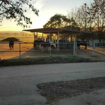
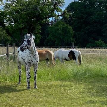
Reitstall WENNINGER HOF
Grafenau
Reiterhof-Wenninger-Hof
@Reiterhof-Wenninger-Hof
FN-Mitglied
Vermieten
Führanlage
Hunde willkommen
Notfallboxen
19 weitere...
P
Deprecated: Creation of dynamic property Zend_View_Helper_Ads::$adLink is deprecated in /var/www/stall-frei/htdocs/staging.stall-frei.de/library/Psf/View/Helper/Ads.php on line 108

Paddockbox in kleiner Stallgemeinschaft frei
Rutesheim
Carolin-Hoerning
@Carolin-Hoerning
Wir sind ein kleiner Stall mit nur 13 Boxen in Rutesheim.
Aktuell haben wir eine Paddockbox frei.
neu
R
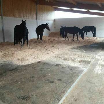


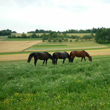
Stallplatz Reitanlage Grötzinger
Renningen
Eberhard-Groetzinger
@Eberhard-Groetzinger
Freizeitstall
Geländestrecke
Vermieten
Hunde willkommen
Krankenbox
Außenbox mit Paddock
Außenboxen
20 weitere...
P+
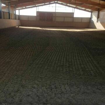
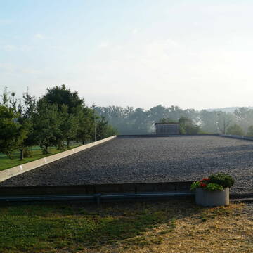
HIT-Aktivlaufstall
Weil der Stadt
Biolandhof-Doeffinger
@Biolandhof-Doeffinger
Freizeitstall
Vermieten
Krankenbox
Reithalle
Bewegungsstall
Laufstall
7 weitere...
P
Leider kein Vorschaubild
Leider kein Vorschaubild
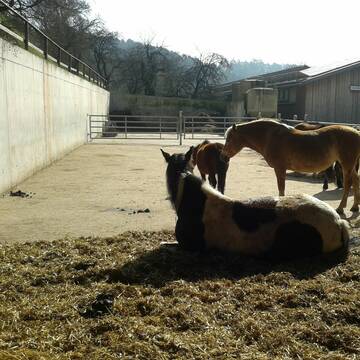
2 Offenstallplätze frei in Wallachherde
Aidlingen
Stall-Aidlingen
@Stall-Aidlingen
Freizeitstall
Wanderreiten
Krankenbox
Sommerweide
Notfallboxen
Offenstall
1 weitere...
B
2 Offenstallplätze ab Februar 2026 frei
Neubulach
Reitanlage-Schanzenhof
@Reitanlage-Schanzenhof
Fahrstall, Kutschwagen
Freizeitstall
Vermieten
Paddock
Sattelkammer/Sattelschränke
Offenstall
5 weitere...
P
Pferdepension Schweichinger Hof Althengstett
Althengstett
Christina Schmid
@Fam-Nonnenmann-Schmid
Freizeitstall
Geländestrecke
Vermieten
Longierzirkel/Roundpen
Parkplatz für Pferdeanhänger
Außenboxen
Innenbox
14 weitere...
P

Offenstallplatz
Bühl
Martha Raidt
@MarthaR
Freizeitstall
Hunde willkommen
Krankenbox
Gnadenbrothof
Notfallboxen
Bewegungsstall
Laufstall
9 weitere...
P
WOLFHOF Reitstall in zentraler Lage
Schönaich
Wolfhof
@Wolfhof
FN-Mitglied
Freizeitstall
Vermieten
Krankenbox
Longierzirkel/Roundpen
Außenbox mit Paddock
Außenboxen
22 weitere...
P

Futtersack HeuToy, Fressbremse in pink
Mechtersen
STALL-FREIde Marketing
@STALL-FREI-Marketing
Stundenlange Beschäftigung die
Koliken vorbeugt, geringe Staubinhalation mit
steuerbarer Futterentnahme
Toller Offenstall mit großen Weiden und Reitplatz
Tübingen
Stefanie Fritz
@SF-Weiherhof
Geländestrecke
Paddock
Pensions- und Gastboxen
Bewegungsstall
Laufstall
Vollpension
7 weitere...
aktuell
P

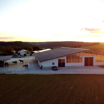
Großer Offenstall ( gemischte Herde)
Weil im Schönbuch
Pensionsstall Reishalde 1
@Pensionsstall-Reishalde
Freizeitstall
Vermieten
Hunde willkommen
Krankenbox
Notfallboxen
Zuchtstutenhaltung möglich
12 weitere...
P
Newsletter abonnieren
Melde Dich für unseren Newsletter an und verpasse keine Neuigkeiten!
Deprecated: Creation of dynamic property Zend_View::$pageCount is deprecated in /var/www/stall-frei/htdocs/staging.stall-frei.de/library/vendor/shardj/zf1-future/library/Zend/View/Abstract.php on line 308
Deprecated: Creation of dynamic property Zend_View::$itemCountPerPage is deprecated in /var/www/stall-frei/htdocs/staging.stall-frei.de/library/vendor/shardj/zf1-future/library/Zend/View/Abstract.php on line 308
Deprecated: Creation of dynamic property Zend_View::$first is deprecated in /var/www/stall-frei/htdocs/staging.stall-frei.de/library/vendor/shardj/zf1-future/library/Zend/View/Abstract.php on line 308
Deprecated: Creation of dynamic property Zend_View::$current is deprecated in /var/www/stall-frei/htdocs/staging.stall-frei.de/library/vendor/shardj/zf1-future/library/Zend/View/Abstract.php on line 308
Deprecated: Creation of dynamic property Zend_View::$last is deprecated in /var/www/stall-frei/htdocs/staging.stall-frei.de/library/vendor/shardj/zf1-future/library/Zend/View/Abstract.php on line 308
Deprecated: Creation of dynamic property Zend_View::$previous is deprecated in /var/www/stall-frei/htdocs/staging.stall-frei.de/library/vendor/shardj/zf1-future/library/Zend/View/Abstract.php on line 308
Deprecated: Creation of dynamic property Zend_View::$next is deprecated in /var/www/stall-frei/htdocs/staging.stall-frei.de/library/vendor/shardj/zf1-future/library/Zend/View/Abstract.php on line 308
Deprecated: Creation of dynamic property Zend_View::$pagesInRange is deprecated in /var/www/stall-frei/htdocs/staging.stall-frei.de/library/vendor/shardj/zf1-future/library/Zend/View/Abstract.php on line 308
Deprecated: Creation of dynamic property Zend_View::$firstPageInRange is deprecated in /var/www/stall-frei/htdocs/staging.stall-frei.de/library/vendor/shardj/zf1-future/library/Zend/View/Abstract.php on line 308
Deprecated: Creation of dynamic property Zend_View::$lastPageInRange is deprecated in /var/www/stall-frei/htdocs/staging.stall-frei.de/library/vendor/shardj/zf1-future/library/Zend/View/Abstract.php on line 308
Deprecated: Creation of dynamic property Zend_View::$currentItemCount is deprecated in /var/www/stall-frei/htdocs/staging.stall-frei.de/library/vendor/shardj/zf1-future/library/Zend/View/Abstract.php on line 308
Deprecated: Creation of dynamic property Zend_View::$totalItemCount is deprecated in /var/www/stall-frei/htdocs/staging.stall-frei.de/library/vendor/shardj/zf1-future/library/Zend/View/Abstract.php on line 308
Deprecated: Creation of dynamic property Zend_View::$firstItemNumber is deprecated in /var/www/stall-frei/htdocs/staging.stall-frei.de/library/vendor/shardj/zf1-future/library/Zend/View/Abstract.php on line 308
Deprecated: Creation of dynamic property Zend_View::$lastItemNumber is deprecated in /var/www/stall-frei/htdocs/staging.stall-frei.de/library/vendor/shardj/zf1-future/library/Zend/View/Abstract.php on line 308
Deprecated: Creation of dynamic property Zend_View::$router is deprecated in /var/www/stall-frei/htdocs/staging.stall-frei.de/library/vendor/shardj/zf1-future/library/Zend/View/Abstract.php on line 308
Deprecated: Creation of dynamic property Zend_View::$urlParams is deprecated in /var/www/stall-frei/htdocs/staging.stall-frei.de/library/vendor/shardj/zf1-future/library/Zend/View/Abstract.php on line 308
Deprecated: Creation of dynamic property Zend_View::$showAds is deprecated in /var/www/stall-frei/htdocs/staging.stall-frei.de/library/vendor/shardj/zf1-future/library/Zend/View/Abstract.php on line 308
Deprecated: Creation of dynamic property Zend_View::$objectIds is deprecated in /var/www/stall-frei/htdocs/staging.stall-frei.de/library/vendor/shardj/zf1-future/library/Zend/View/Abstract.php on line 308
Deprecated: Creation of dynamic property Zend_View::$showNavbar is deprecated in /var/www/stall-frei/htdocs/staging.stall-frei.de/library/vendor/shardj/zf1-future/library/Zend/View/Abstract.php on line 308
Deprecated: Creation of dynamic property Zend_View::$showBreadcrumb is deprecated in /var/www/stall-frei/htdocs/staging.stall-frei.de/library/vendor/shardj/zf1-future/library/Zend/View/Abstract.php on line 308
Deprecated: Creation of dynamic property Zend_View::$showFooter is deprecated in /var/www/stall-frei/htdocs/staging.stall-frei.de/library/vendor/shardj/zf1-future/library/Zend/View/Abstract.php on line 308
Deprecated: Creation of dynamic property Zend_View::$showInternalAds is deprecated in /var/www/stall-frei/htdocs/staging.stall-frei.de/library/vendor/shardj/zf1-future/library/Zend/View/Abstract.php on line 308
Deprecated: Creation of dynamic property Zend_View::$blNoContent is deprecated in /var/www/stall-frei/htdocs/staging.stall-frei.de/library/vendor/shardj/zf1-future/library/Zend/View/Abstract.php on line 308
Deprecated: Creation of dynamic property Zend_View::$sMetaDesc is deprecated in /var/www/stall-frei/htdocs/staging.stall-frei.de/library/vendor/shardj/zf1-future/library/Zend/View/Abstract.php on line 308
Deprecated: Creation of dynamic property Zend_View::$useGmaps is deprecated in /var/www/stall-frei/htdocs/staging.stall-frei.de/library/vendor/shardj/zf1-future/library/Zend/View/Abstract.php on line 308
Deprecated: Creation of dynamic property Zend_View::$touches is deprecated in /var/www/stall-frei/htdocs/staging.stall-frei.de/library/vendor/shardj/zf1-future/library/Zend/View/Abstract.php on line 308
Deprecated: Creation of dynamic property Zend_View::$oProject is deprecated in /var/www/stall-frei/htdocs/staging.stall-frei.de/library/vendor/shardj/zf1-future/library/Zend/View/Abstract.php on line 308
Deprecated: Creation of dynamic property Zend_View::$pageHeadline is deprecated in /var/www/stall-frei/htdocs/staging.stall-frei.de/library/vendor/shardj/zf1-future/library/Zend/View/Abstract.php on line 308
Deprecated: Creation of dynamic property Zend_View::$disableLocationField is deprecated in /var/www/stall-frei/htdocs/staging.stall-frei.de/library/vendor/shardj/zf1-future/library/Zend/View/Abstract.php on line 308
Deprecated: Creation of dynamic property Zend_View::$isSearch is deprecated in /var/www/stall-frei/htdocs/staging.stall-frei.de/library/vendor/shardj/zf1-future/library/Zend/View/Abstract.php on line 308
Deprecated: Creation of dynamic property Zend_View::$pageTitle is deprecated in /var/www/stall-frei/htdocs/staging.stall-frei.de/library/vendor/shardj/zf1-future/library/Zend/View/Abstract.php on line 308
Deprecated: Creation of dynamic property Psf_Form_Element_Text::$class is deprecated in /var/www/stall-frei/htdocs/staging.stall-frei.de/library/vendor/shardj/zf1-future/library/Zend/Form/Element.php on line 874
Deprecated: Creation of dynamic property Psf_Form_Element_Text::$size is deprecated in /var/www/stall-frei/htdocs/staging.stall-frei.de/library/vendor/shardj/zf1-future/library/Zend/Form/Element.php on line 874
Deprecated: Creation of dynamic property Psf_Form_Element_Text::$placeholder is deprecated in /var/www/stall-frei/htdocs/staging.stall-frei.de/library/vendor/shardj/zf1-future/library/Zend/Form/Element.php on line 874
Deprecated: Creation of dynamic property Psf_Form_Element_Hidden::$class is deprecated in /var/www/stall-frei/htdocs/staging.stall-frei.de/library/vendor/shardj/zf1-future/library/Zend/Form/Element.php on line 874
Deprecated: Creation of dynamic property Psf_Form_Element_Hidden::$class is deprecated in /var/www/stall-frei/htdocs/staging.stall-frei.de/library/vendor/shardj/zf1-future/library/Zend/Form/Element.php on line 874
Deprecated: Creation of dynamic property Psf_Form_Element_Hidden::$class is deprecated in /var/www/stall-frei/htdocs/staging.stall-frei.de/library/vendor/shardj/zf1-future/library/Zend/Form/Element.php on line 874
Deprecated: Creation of dynamic property Psf_Form_Element_Hidden::$class is deprecated in /var/www/stall-frei/htdocs/staging.stall-frei.de/library/vendor/shardj/zf1-future/library/Zend/Form/Element.php on line 874
Deprecated: Creation of dynamic property Psf_Form_Element_Select::$class is deprecated in /var/www/stall-frei/htdocs/staging.stall-frei.de/library/vendor/shardj/zf1-future/library/Zend/Form/Element.php on line 874
Deprecated: Creation of dynamic property Psf_Form_Element_Select::$class is deprecated in /var/www/stall-frei/htdocs/staging.stall-frei.de/library/vendor/shardj/zf1-future/library/Zend/Form/Element.php on line 874
Deprecated: Creation of dynamic property Psf_Form_Element_Select::$class is deprecated in /var/www/stall-frei/htdocs/staging.stall-frei.de/library/vendor/shardj/zf1-future/library/Zend/Form/Element.php on line 874
Deprecated: Creation of dynamic property Psf_Form_Element_Select::$class is deprecated in /var/www/stall-frei/htdocs/staging.stall-frei.de/library/vendor/shardj/zf1-future/library/Zend/Form/Element.php on line 874
Deprecated: Creation of dynamic property Psf_Form_Element_Text::$class is deprecated in /var/www/stall-frei/htdocs/staging.stall-frei.de/library/vendor/shardj/zf1-future/library/Zend/Form/Element.php on line 874
Deprecated: Creation of dynamic property Psf_Form_Element_Checkbox::$label is deprecated in /var/www/stall-frei/htdocs/staging.stall-frei.de/library/vendor/shardj/zf1-future/library/Zend/Form/Element.php on line 874
Deprecated: Creation of dynamic property Zend_View::$sort is deprecated in /var/www/stall-frei/htdocs/staging.stall-frei.de/library/vendor/shardj/zf1-future/library/Zend/View/Abstract.php on line 308
Deprecated: Creation of dynamic property Zend_View::$searchLocation is deprecated in /var/www/stall-frei/htdocs/staging.stall-frei.de/library/vendor/shardj/zf1-future/library/Zend/View/Abstract.php on line 308
Deprecated: Creation of dynamic property Zend_View::$locationHint is deprecated in /var/www/stall-frei/htdocs/staging.stall-frei.de/library/vendor/shardj/zf1-future/library/Zend/View/Abstract.php on line 308
Psf_GeoCoder_Abstract::getLocation: Herrenberg Get Location CachedOrLive
Psf_GeoCoder_Abstract::getCachedOrLive: Herrenberg
Psf_GeoCoder_Abstract::convertLocationResult
{"documentation":"https:\/\/opencagedata.com\/api","licenses":[{"name":"see attribution guide","url":"https:\/\/opencagedata.com\/credits"}],"results":[{"bounds":{"northeast":{"lat":48.6392506,"lng":8.9818199},"southwest":{"lat":48.5602164,"lng":8.7897396}},"components":{"ISO_3166-1_alpha-2":"DE","ISO_3166-1_alpha-3":"DEU","ISO_3166-2":["DE-BW"],"_category":"place","_normalized_city":"Herrenberg","_type":"city","continent":"Europe","country":"Deutschland","country_code":"de","county":"Landkreis B\u00f6blingen","municipality":"VVG der Stadt Herrenberg","political_union":"European Union","postcode":"71083","state":"Baden-W\u00fcrttemberg","state_code":"BW","town":"Herrenberg"},"confidence":6,"formatted":"71083 Herrenberg, Deutschland","geometry":{"lat":48.5963819,"lng":8.8702368}},{"bounds":{"northeast":{"lat":50.9648939,"lng":11.101066},"southwest":{"lat":50.946998,"lng":11.052474}},"components":{"ISO_3166-1_alpha-2":"DE","ISO_3166-1_alpha-3":"DEU","ISO_3166-2":["DE-TH"],"_category":"place","_normalized_city":"Erfurt","_type":"neighbourhood","city":"Erfurt","continent":"Europe","country":"Deutschland","country_code":"de","political_union":"European Union","state":"Th\u00fcringen","state_code":"TH","suburb":"Herrenberg"},"confidence":7,"formatted":"Herrenberg, Erfurt, Th\u00fcringen, Deutschland","geometry":{"lat":50.9577896,"lng":11.0665186}},{"bounds":{"northeast":{"lat":50.0811109,"lng":9.1671228},"southwest":{"lat":50.0810109,"lng":9.1670228}},"components":{"ISO_3166-1_alpha-2":"DE","ISO_3166-1_alpha-3":"DEU","ISO_3166-2":["DE-BY"],"_category":"natural\/water","_normalized_city":"M\u00f6mbris","_type":"peak","continent":"Europe","country":"Deutschland","country_code":"de","county":"Landkreis Aschaffenburg","peak":"Herrenberg","political_union":"European Union","postcode":"63776","state":"Bayern","state_code":"BY","town":"M\u00f6mbris"},"confidence":9,"formatted":"Herrenberg, 63776 M\u00f6mbris, Deutschland","geometry":{"lat":50.0810609,"lng":9.1670728}},{"bounds":{"northeast":{"lat":50.8758883,"lng":8.2614412},"southwest":{"lat":50.8757883,"lng":8.2613412}},"components":{"ISO_3166-1_alpha-2":"DE","ISO_3166-1_alpha-3":"DEU","ISO_3166-2":["DE-HE"],"_category":"natural\/water","_normalized_city":"Dietzh\u00f6lztal","_type":"peak","continent":"Europe","country":"Deutschland","country_code":"de","county":"Lahn-Dill-Kreis","municipality":"Dietzh\u00f6lztal","peak":"Herrenberg","political_union":"European Union","state":"Hessen","state_code":"HE"},"confidence":9,"formatted":"Herrenberg, Dietzh\u00f6lztal, Hessen, Deutschland","geometry":{"lat":50.8758383,"lng":8.2613912}},{"bounds":{"northeast":{"lat":50.0835931,"lng":11.4472108},"southwest":{"lat":50.0834931,"lng":11.4471108}},"components":{"ISO_3166-1_alpha-2":"DE","ISO_3166-1_alpha-3":"DEU","ISO_3166-2":["DE-BY"],"_category":"natural\/water","_normalized_city":"Kulmbach","_type":"peak","continent":"Europe","country":"Deutschland","country_code":"de","county":"Landkreis Kulmbach","peak":"Herrenberg","political_union":"European Union","postcode":"95326","state":"Bayern","state_code":"BY","town":"Kulmbach"},"confidence":9,"formatted":"Herrenberg, 95326 Kulmbach, Deutschland","geometry":{"lat":50.0835431,"lng":11.4471608}},{"bounds":{"northeast":{"lat":51.0679947,"lng":13.2433068},"southwest":{"lat":51.0678947,"lng":13.2432068}},"components":{"ISO_3166-1_alpha-2":"DE","ISO_3166-1_alpha-3":"DEU","ISO_3166-2":["DE-SN"],"_category":"natural\/water","_normalized_city":"Ro\u00dfwein","_type":"peak","continent":"Europe","country":"Deutschland","country_code":"de","county":"Mittelsachsen","peak":"Herrenberg","political_union":"European Union","state":"Sachsen","state_code":"SN","village":"Ro\u00dfwein"},"confidence":9,"formatted":"Herrenberg, Ro\u00dfwein, Sachsen, Deutschland","geometry":{"lat":51.0679447,"lng":13.2432568}},{"bounds":{"northeast":{"lat":50.3610871,"lng":12.4278831},"southwest":{"lat":50.3609871,"lng":12.4277831}},"components":{"ISO_3166-1_alpha-2":"DE","ISO_3166-1_alpha-3":"DEU","ISO_3166-2":["DE-SN"],"_category":"natural\/water","_normalized_city":"Klingenthal","_type":"peak","continent":"Europe","country":"Deutschland","country_code":"de","county":"Vogtlandkreis","peak":"Herrenberg","political_union":"European Union","postcode":"08267","state":"Sachsen","state_code":"SN","town":"Klingenthal"},"confidence":9,"formatted":"Herrenberg, 08267 Klingenthal, Deutschland","geometry":{"lat":50.3610371,"lng":12.4278331}},{"bounds":{"northeast":{"lat":51.9595217,"lng":10.9575833},"southwest":{"lat":51.9594217,"lng":10.9574833}},"components":{"ISO_3166-1_alpha-2":"DE","ISO_3166-1_alpha-3":"DEU","ISO_3166-2":["DE-ST"],"_category":"natural\/water","_normalized_city":"Huy","_type":"peak","city":"Huy","continent":"Europe","country":"Deutschland","country_code":"de","county":"Landkreis Harz","peak":"Herrenberg","political_union":"European Union","state":"Sachsen-Anhalt","state_code":"ST"},"confidence":9,"formatted":"Herrenberg, Huy, Sachsen-Anhalt, Deutschland","geometry":{"lat":51.9594717,"lng":10.9575333}},{"bounds":{"northeast":{"lat":49.5131981,"lng":11.5284721},"southwest":{"lat":49.5130981,"lng":11.5283721}},"components":{"ISO_3166-1_alpha-2":"DE","ISO_3166-1_alpha-3":"DEU","ISO_3166-2":["DE-BY"],"_category":"natural\/water","_normalized_city":"Pommelsbrunn","_type":"peak","continent":"Europe","country":"Deutschland","country_code":"de","county":"Landkreis N\u00fcrnberger Land","peak":"Herrenberg","political_union":"European Union","postcode":"91224","state":"Bayern","state_code":"BY","village":"Pommelsbrunn"},"confidence":9,"formatted":"Herrenberg, 91224 Pommelsbrunn, Deutschland","geometry":{"lat":49.5131481,"lng":11.5284221}},{"components":{"ISO_3166-1_alpha-2":"FR","ISO_3166-1_alpha-3":"FRA","ISO_3166-2":["FR-ARA","FR-69"],"_category":"road","_normalized_city":"Tarare","_type":"road","city":"Tarare","continent":"Europe","country":"France","country_code":"fr","county":"Rh\u00f4ne","local_authority":"Communaut\u00e9 d'agglom\u00e9ration de l'Ouest Rhodanien","political_union":"European Union","postcode":"69170","road":"Place D'HERRENBERG","state":"Auvergne-Rh\u00f4ne-Alpes","state_code":"ARA"},"confidence":4,"formatted":"Place D'HERRENBERG, 69170 Tarare, France","geometry":{"lat":45.896531,"lng":4.432494}}],"status":{"code":200,"message":"OK"},"stay_informed":{"blog":"https:\/\/blog.opencagedata.com","mastodon":"https:\/\/en.osm.town\/@opencage"},"thanks":"For using an OpenCage API","timestamp":{"created_http":"Sun, 08 Feb 2026 06:22:14 GMT","created_unix":1770531734},"total_results":10}Array
(
[0] => stdClass Object
(
[bounds] => stdClass Object
(
[northeast] => stdClass Object
(
[lat] => 48.6392506
[lng] => 8.9818199
)
[southwest] => stdClass Object
(
[lat] => 48.5602164
[lng] => 8.7897396
)
)
[components] => stdClass Object
(
[ISO_3166-1_alpha-2] => DE
[ISO_3166-1_alpha-3] => DEU
[ISO_3166-2] => Array
(
[0] => DE-BW
)
[_category] => place
[_normalized_city] => Herrenberg
[_type] => city
[continent] => Europe
[country] => Deutschland
[country_code] => de
[county] => Landkreis Böblingen
[municipality] => VVG der Stadt Herrenberg
[political_union] => European Union
[postcode] => 71083
[state] => Baden-Württemberg
[state_code] => BW
[town] => Herrenberg
)
[confidence] => 6
[formatted] => 71083 Herrenberg, Deutschland
[geometry] => stdClass Object
(
[lat] => 48.5963819
[lng] => 8.8702368
)
)
[1] => stdClass Object
(
[bounds] => stdClass Object
(
[northeast] => stdClass Object
(
[lat] => 50.9648939
[lng] => 11.101066
)
[southwest] => stdClass Object
(
[lat] => 50.946998
[lng] => 11.052474
)
)
[components] => stdClass Object
(
[ISO_3166-1_alpha-2] => DE
[ISO_3166-1_alpha-3] => DEU
[ISO_3166-2] => Array
(
[0] => DE-TH
)
[_category] => place
[_normalized_city] => Erfurt
[_type] => neighbourhood
[city] => Erfurt
[continent] => Europe
[country] => Deutschland
[country_code] => de
[political_union] => European Union
[state] => Thüringen
[state_code] => TH
[suburb] => Herrenberg
)
[confidence] => 7
[formatted] => Herrenberg, Erfurt, Thüringen, Deutschland
[geometry] => stdClass Object
(
[lat] => 50.9577896
[lng] => 11.0665186
)
)
[2] => stdClass Object
(
[bounds] => stdClass Object
(
[northeast] => stdClass Object
(
[lat] => 50.0811109
[lng] => 9.1671228
)
[southwest] => stdClass Object
(
[lat] => 50.0810109
[lng] => 9.1670228
)
)
[components] => stdClass Object
(
[ISO_3166-1_alpha-2] => DE
[ISO_3166-1_alpha-3] => DEU
[ISO_3166-2] => Array
(
[0] => DE-BY
)
[_category] => natural/water
[_normalized_city] => Mömbris
[_type] => peak
[continent] => Europe
[country] => Deutschland
[country_code] => de
[county] => Landkreis Aschaffenburg
[peak] => Herrenberg
[political_union] => European Union
[postcode] => 63776
[state] => Bayern
[state_code] => BY
[town] => Mömbris
)
[confidence] => 9
[formatted] => Herrenberg, 63776 Mömbris, Deutschland
[geometry] => stdClass Object
(
[lat] => 50.0810609
[lng] => 9.1670728
)
)
[3] => stdClass Object
(
[bounds] => stdClass Object
(
[northeast] => stdClass Object
(
[lat] => 50.8758883
[lng] => 8.2614412
)
[southwest] => stdClass Object
(
[lat] => 50.8757883
[lng] => 8.2613412
)
)
[components] => stdClass Object
(
[ISO_3166-1_alpha-2] => DE
[ISO_3166-1_alpha-3] => DEU
[ISO_3166-2] => Array
(
[0] => DE-HE
)
[_category] => natural/water
[_normalized_city] => Dietzhölztal
[_type] => peak
[continent] => Europe
[country] => Deutschland
[country_code] => de
[county] => Lahn-Dill-Kreis
[municipality] => Dietzhölztal
[peak] => Herrenberg
[political_union] => European Union
[state] => Hessen
[state_code] => HE
)
[confidence] => 9
[formatted] => Herrenberg, Dietzhölztal, Hessen, Deutschland
[geometry] => stdClass Object
(
[lat] => 50.8758383
[lng] => 8.2613912
)
)
[4] => stdClass Object
(
[bounds] => stdClass Object
(
[northeast] => stdClass Object
(
[lat] => 50.0835931
[lng] => 11.4472108
)
[southwest] => stdClass Object
(
[lat] => 50.0834931
[lng] => 11.4471108
)
)
[components] => stdClass Object
(
[ISO_3166-1_alpha-2] => DE
[ISO_3166-1_alpha-3] => DEU
[ISO_3166-2] => Array
(
[0] => DE-BY
)
[_category] => natural/water
[_normalized_city] => Kulmbach
[_type] => peak
[continent] => Europe
[country] => Deutschland
[country_code] => de
[county] => Landkreis Kulmbach
[peak] => Herrenberg
[political_union] => European Union
[postcode] => 95326
[state] => Bayern
[state_code] => BY
[town] => Kulmbach
)
[confidence] => 9
[formatted] => Herrenberg, 95326 Kulmbach, Deutschland
[geometry] => stdClass Object
(
[lat] => 50.0835431
[lng] => 11.4471608
)
)
[5] => stdClass Object
(
[bounds] => stdClass Object
(
[northeast] => stdClass Object
(
[lat] => 51.0679947
[lng] => 13.2433068
)
[southwest] => stdClass Object
(
[lat] => 51.0678947
[lng] => 13.2432068
)
)
[components] => stdClass Object
(
[ISO_3166-1_alpha-2] => DE
[ISO_3166-1_alpha-3] => DEU
[ISO_3166-2] => Array
(
[0] => DE-SN
)
[_category] => natural/water
[_normalized_city] => Roßwein
[_type] => peak
[continent] => Europe
[country] => Deutschland
[country_code] => de
[county] => Mittelsachsen
[peak] => Herrenberg
[political_union] => European Union
[state] => Sachsen
[state_code] => SN
[village] => Roßwein
)
[confidence] => 9
[formatted] => Herrenberg, Roßwein, Sachsen, Deutschland
[geometry] => stdClass Object
(
[lat] => 51.0679447
[lng] => 13.2432568
)
)
[6] => stdClass Object
(
[bounds] => stdClass Object
(
[northeast] => stdClass Object
(
[lat] => 50.3610871
[lng] => 12.4278831
)
[southwest] => stdClass Object
(
[lat] => 50.3609871
[lng] => 12.4277831
)
)
[components] => stdClass Object
(
[ISO_3166-1_alpha-2] => DE
[ISO_3166-1_alpha-3] => DEU
[ISO_3166-2] => Array
(
[0] => DE-SN
)
[_category] => natural/water
[_normalized_city] => Klingenthal
[_type] => peak
[continent] => Europe
[country] => Deutschland
[country_code] => de
[county] => Vogtlandkreis
[peak] => Herrenberg
[political_union] => European Union
[postcode] => 08267
[state] => Sachsen
[state_code] => SN
[town] => Klingenthal
)
[confidence] => 9
[formatted] => Herrenberg, 08267 Klingenthal, Deutschland
[geometry] => stdClass Object
(
[lat] => 50.3610371
[lng] => 12.4278331
)
)
[7] => stdClass Object
(
[bounds] => stdClass Object
(
[northeast] => stdClass Object
(
[lat] => 51.9595217
[lng] => 10.9575833
)
[southwest] => stdClass Object
(
[lat] => 51.9594217
[lng] => 10.9574833
)
)
[components] => stdClass Object
(
[ISO_3166-1_alpha-2] => DE
[ISO_3166-1_alpha-3] => DEU
[ISO_3166-2] => Array
(
[0] => DE-ST
)
[_category] => natural/water
[_normalized_city] => Huy
[_type] => peak
[city] => Huy
[continent] => Europe
[country] => Deutschland
[country_code] => de
[county] => Landkreis Harz
[peak] => Herrenberg
[political_union] => European Union
[state] => Sachsen-Anhalt
[state_code] => ST
)
[confidence] => 9
[formatted] => Herrenberg, Huy, Sachsen-Anhalt, Deutschland
[geometry] => stdClass Object
(
[lat] => 51.9594717
[lng] => 10.9575333
)
)
[8] => stdClass Object
(
[bounds] => stdClass Object
(
[northeast] => stdClass Object
(
[lat] => 49.5131981
[lng] => 11.5284721
)
[southwest] => stdClass Object
(
[lat] => 49.5130981
[lng] => 11.5283721
)
)
[components] => stdClass Object
(
[ISO_3166-1_alpha-2] => DE
[ISO_3166-1_alpha-3] => DEU
[ISO_3166-2] => Array
(
[0] => DE-BY
)
[_category] => natural/water
[_normalized_city] => Pommelsbrunn
[_type] => peak
[continent] => Europe
[country] => Deutschland
[country_code] => de
[county] => Landkreis Nürnberger Land
[peak] => Herrenberg
[political_union] => European Union
[postcode] => 91224
[state] => Bayern
[state_code] => BY
[village] => Pommelsbrunn
)
[confidence] => 9
[formatted] => Herrenberg, 91224 Pommelsbrunn, Deutschland
[geometry] => stdClass Object
(
[lat] => 49.5131481
[lng] => 11.5284221
)
)
[9] => stdClass Object
(
[components] => stdClass Object
(
[ISO_3166-1_alpha-2] => FR
[ISO_3166-1_alpha-3] => FRA
[ISO_3166-2] => Array
(
[0] => FR-ARA
[1] => FR-69
)
[_category] => road
[_normalized_city] => Tarare
[_type] => road
[city] => Tarare
[continent] => Europe
[country] => France
[country_code] => fr
[county] => Rhône
[local_authority] => Communauté d'agglomération de l'Ouest Rhodanien
[political_union] => European Union
[postcode] => 69170
[road] => Place D'HERRENBERG
[state] => Auvergne-Rhône-Alpes
[state_code] => ARA
)
[confidence] => 4
[formatted] => Place D'HERRENBERG, 69170 Tarare, France
[geometry] => stdClass Object
(
[lat] => 45.896531
[lng] => 4.432494
)
)
)
Psf_GeoCoder_OpenCageData::getKeyMap: 0
stdClass Object
(
    [bounds] => stdClass Object
        (
            [northeast] => stdClass Object
                (
                    [lat] => 48.6392506
                    [lng] => 8.9818199
                )

            [southwest] => stdClass Object
                (
                    [lat] => 48.5602164
                    [lng] => 8.7897396
                )

        )

    [components] => stdClass Object
        (
            [ISO_3166-1_alpha-2] => DE
            [ISO_3166-1_alpha-3] => DEU
            [ISO_3166-2] => Array
                (
                    [0] => DE-BW
                )

            [_category] => place
            [_normalized_city] => Herrenberg
            [_type] => city
            [continent] => Europe
            [country] => Deutschland
            [country_code] => de
            [county] => Landkreis Böblingen
            [municipality] => VVG der Stadt Herrenberg
            [political_union] => European Union
            [postcode] => 71083
            [state] => Baden-Württemberg
            [state_code] => BW
            [town] => Herrenberg
        )

    [confidence] => 6
    [formatted] => 71083 Herrenberg, Deutschland
    [geometry] => stdClass Object
        (
            [lat] => 48.5963819
            [lng] => 8.8702368
        )

)
Psf_GeoCoder_OpenCageData::getCounty: Böblingen
Psf_GeoCoder_OpenCageData::addMissingData REFETCH!
Array
(
    [address] => 71083 Herrenberg, Deutschland
    [type] => city
    [street] =>
    [city] => Herrenberg
    [county] => Böblingen
    [state] => Baden-Württemberg
    [zip] => 71083
    [country] => Deutschland
    [suburb] =>
    [countrycode] => de
    [latitude] => 48.5963819
    [longitude] => 8.8702368
    [accuracy] => 1
    [confidence] => 6
    [bounds] => stdClass Object
        (
            [northeast] => stdClass Object
                (
                    [lat] => 48.6392506
                    [lng] => 8.9818199
                )

            [southwest] => stdClass Object
                (
                    [lat] => 48.5602164
                    [lng] => 8.7897396
                )

        )

)
reformat!
Array
(
    [address] => 71083 Herrenberg, Deutschland
    [type] => city
    [street] =>
    [city] => Herrenberg
    [county] => Böblingen
    [state] => Baden-Württemberg
    [zip] => 71083
    [country] => Deutschland
    [suburb] =>
    [countrycode] => de
    [latitude] => 48.5963819
    [longitude] => 8.8702368
    [accuracy] => 1
    [confidence] => 6
    [bounds] => stdClass Object
        (
            [northeast] => stdClass Object
                (
                    [lat] => 48.6392506
                    [lng] => 8.9818199
                )

            [southwest] => stdClass Object
                (
                    [lat] => 48.5602164
                    [lng] => 8.7897396
                )

        )

    [place] => 71083 Herrenberg, Baden-Württemberg
    [hash] => 0d8e3864ac554d24090fc3c25ce7b78c
)
Psf_GeoCoder_OpenCageData::getKeyMap: 1
stdClass Object
(
    [bounds] => stdClass Object
        (
            [northeast] => stdClass Object
                (
                    [lat] => 50.9648939
                    [lng] => 11.101066
                )

            [southwest] => stdClass Object
                (
                    [lat] => 50.946998
                    [lng] => 11.052474
                )

        )

    [components] => stdClass Object
        (
            [ISO_3166-1_alpha-2] => DE
            [ISO_3166-1_alpha-3] => DEU
            [ISO_3166-2] => Array
                (
                    [0] => DE-TH
                )

            [_category] => place
            [_normalized_city] => Erfurt
            [_type] => neighbourhood
            [city] => Erfurt
            [continent] => Europe
            [country] => Deutschland
            [country_code] => de
            [political_union] => European Union
            [state] => Thüringen
            [state_code] => TH
            [suburb] => Herrenberg
        )

    [confidence] => 7
    [formatted] => Herrenberg, Erfurt, Thüringen, Deutschland
    [geometry] => stdClass Object
        (
            [lat] => 50.9577896
            [lng] => 11.0665186
        )

)
Psf_GeoCoder_OpenCageData::getCounty: Erfurt
Psf_GeoCoder_OpenCageData::addMissingData REFETCH!
Array
(
    [address] => Herrenberg, Erfurt, Thüringen, Deutschland
    [type] => neighbourhood
    [street] =>
    [city] => Herrenberg
    [county] => Erfurt
    [state] => Thüringen
    [zip] =>
    [country] => Deutschland
    [suburb] => Herrenberg
    [countrycode] => de
    [latitude] => 50.9577896
    [longitude] => 11.0665186
    [accuracy] => 1
    [confidence] => 7
    [bounds] => stdClass Object
        (
            [northeast] => stdClass Object
                (
                    [lat] => 50.9648939
                    [lng] => 11.101066
                )

            [southwest] => stdClass Object
                (
                    [lat] => 50.946998
                    [lng] => 11.052474
                )

        )

)
reformat!
Array
(
    [address] => Herrenberg, Erfurt, Thüringen, Deutschland
    [type] => neighbourhood
    [street] =>
    [city] => Herrenberg
    [county] => Erfurt
    [state] => Thüringen
    [zip] =>
    [country] => Deutschland
    [suburb] => Herrenberg
    [countrycode] => de
    [latitude] => 50.9577896
    [longitude] => 11.0665186
    [accuracy] => 1
    [confidence] => 7
    [bounds] => stdClass Object
        (
            [northeast] => stdClass Object
                (
                    [lat] => 50.9648939
                    [lng] => 11.101066
                )

            [southwest] => stdClass Object
                (
                    [lat] => 50.946998
                    [lng] => 11.052474
                )

        )

    [place] => Herrenberg, Thüringen
    [hash] => cef8e0f2d7ed65d754f5bcbce83d5f38
)
Psf_GeoCoder_OpenCageData::getKeyMap: 2
stdClass Object
(
    [bounds] => stdClass Object
        (
            [northeast] => stdClass Object
                (
                    [lat] => 50.0811109
                    [lng] => 9.1671228
                )

            [southwest] => stdClass Object
                (
                    [lat] => 50.0810109
                    [lng] => 9.1670228
                )

        )

    [components] => stdClass Object
        (
            [ISO_3166-1_alpha-2] => DE
            [ISO_3166-1_alpha-3] => DEU
            [ISO_3166-2] => Array
                (
                    [0] => DE-BY
                )

            [_category] => natural/water
            [_normalized_city] => Mömbris
            [_type] => peak
            [continent] => Europe
            [country] => Deutschland
            [country_code] => de
            [county] => Landkreis Aschaffenburg
            [peak] => Herrenberg
            [political_union] => European Union
            [postcode] => 63776
            [state] => Bayern
            [state_code] => BY
            [town] => Mömbris
        )

    [confidence] => 9
    [formatted] => Herrenberg, 63776 Mömbris, Deutschland
    [geometry] => stdClass Object
        (
            [lat] => 50.0810609
            [lng] => 9.1670728
        )

)
Psf_GeoCoder_OpenCageData::getCounty: Aschaffenburg
Psf_GeoCoder_OpenCageData::addMissingData REFETCH!
Array
(
    [address] => Herrenberg, 63776 Mömbris, Deutschland
    [type] => peak
    [street] =>
    [city] => Mömbris
    [county] => Aschaffenburg
    [state] => Bayern
    [zip] => 63776
    [country] => Deutschland
    [suburb] =>
    [countrycode] => de
    [latitude] => 50.0810609
    [longitude] => 9.1670728
    [accuracy] => 1
    [confidence] => 9
    [bounds] => stdClass Object
        (
            [northeast] => stdClass Object
                (
                    [lat] => 50.0811109
                    [lng] => 9.1671228
                )

            [southwest] => stdClass Object
                (
                    [lat] => 50.0810109
                    [lng] => 9.1670228
                )

        )

)
reformat!
Array
(
    [address] => Herrenberg, 63776 Mömbris, Deutschland
    [type] => peak
    [street] =>
    [city] => Mömbris
    [county] => Aschaffenburg
    [state] => Bayern
    [zip] => 63776
    [country] => Deutschland
    [suburb] =>
    [countrycode] => de
    [latitude] => 50.0810609
    [longitude] => 9.1670728
    [accuracy] => 1
    [confidence] => 9
    [bounds] => stdClass Object
        (
            [northeast] => stdClass Object
                (
                    [lat] => 50.0811109
                    [lng] => 9.1671228
                )

            [southwest] => stdClass Object
                (
                    [lat] => 50.0810109
                    [lng] => 9.1670228
                )

        )

    [place] => 63776 Mömbris, Bayern
    [hash] => c7dcd88287f3062c3e73cdb6d6090e77
)
Psf_GeoCoder_OpenCageData::getKeyMap: 3
stdClass Object
(
    [bounds] => stdClass Object
        (
            [northeast] => stdClass Object
                (
                    [lat] => 50.8758883
                    [lng] => 8.2614412
                )

            [southwest] => stdClass Object
                (
                    [lat] => 50.8757883
                    [lng] => 8.2613412
                )

        )

    [components] => stdClass Object
        (
            [ISO_3166-1_alpha-2] => DE
            [ISO_3166-1_alpha-3] => DEU
            [ISO_3166-2] => Array
                (
                    [0] => DE-HE
                )

            [_category] => natural/water
            [_normalized_city] => Dietzhölztal
            [_type] => peak
            [continent] => Europe
            [country] => Deutschland
            [country_code] => de
            [county] => Lahn-Dill-Kreis
            [municipality] => Dietzhölztal
            [peak] => Herrenberg
            [political_union] => European Union
            [state] => Hessen
            [state_code] => HE
        )

    [confidence] => 9
    [formatted] => Herrenberg, Dietzhölztal, Hessen, Deutschland
    [geometry] => stdClass Object
        (
            [lat] => 50.8758383
            [lng] => 8.2613912
        )

)
Psf_GeoCoder_OpenCageData::getCounty: Lahn-Dill-Kreis
Psf_GeoCoder_OpenCageData::addMissingData REFETCH!
Array
(
    [address] => Herrenberg, Dietzhölztal, Hessen, Deutschland
    [type] => peak
    [street] =>
    [city] =>
    [county] => Lahn-Dill-Kreis
    [state] => Hessen
    [zip] =>
    [country] => Deutschland
    [suburb] =>
    [countrycode] => de
    [latitude] => 50.8758383
    [longitude] => 8.2613912
    [accuracy] => 1
    [confidence] => 9
    [bounds] => stdClass Object
        (
            [northeast] => stdClass Object
                (
                    [lat] => 50.8758883
                    [lng] => 8.2614412
                )

            [southwest] => stdClass Object
                (
                    [lat] => 50.8757883
                    [lng] => 8.2613412
                )

        )

)
reformat!
Array
(
    [address] => Herrenberg, Dietzhölztal, Hessen, Deutschland
    [type] => peak
    [street] =>
    [city] =>
    [county] => Lahn-Dill-Kreis
    [state] => Hessen
    [zip] =>
    [country] => Deutschland
    [suburb] =>
    [countrycode] => de
    [latitude] => 50.8758383
    [longitude] => 8.2613912
    [accuracy] => 1
    [confidence] => 9
    [bounds] => stdClass Object
        (
            [northeast] => stdClass Object
                (
                    [lat] => 50.8758883
                    [lng] => 8.2614412
                )

            [southwest] => stdClass Object
                (
                    [lat] => 50.8757883
                    [lng] => 8.2613412
                )

        )

    [place] => , Hessen
    [hash] => 61e28d1e986546c74d36de69ad5618a0
)
Psf_GeoCoder_OpenCageData::getKeyMap: 4
stdClass Object
(
    [bounds] => stdClass Object
        (
            [northeast] => stdClass Object
                (
                    [lat] => 50.0835931
                    [lng] => 11.4472108
                )

            [southwest] => stdClass Object
                (
                    [lat] => 50.0834931
                    [lng] => 11.4471108
                )

        )

    [components] => stdClass Object
        (
            [ISO_3166-1_alpha-2] => DE
            [ISO_3166-1_alpha-3] => DEU
            [ISO_3166-2] => Array
                (
                    [0] => DE-BY
                )

            [_category] => natural/water
            [_normalized_city] => Kulmbach
            [_type] => peak
            [continent] => Europe
            [country] => Deutschland
            [country_code] => de
            [county] => Landkreis Kulmbach
            [peak] => Herrenberg
            [political_union] => European Union
            [postcode] => 95326
            [state] => Bayern
            [state_code] => BY
            [town] => Kulmbach
        )

    [confidence] => 9
    [formatted] => Herrenberg, 95326 Kulmbach, Deutschland
    [geometry] => stdClass Object
        (
            [lat] => 50.0835431
            [lng] => 11.4471608
        )

)
Psf_GeoCoder_OpenCageData::getCounty: Kulmbach
Psf_GeoCoder_OpenCageData::addMissingData REFETCH!
Array
(
    [address] => Herrenberg, 95326 Kulmbach, Deutschland
    [type] => peak
    [street] =>
    [city] => Kulmbach
    [county] => Kulmbach
    [state] => Bayern
    [zip] => 95326
    [country] => Deutschland
    [suburb] =>
    [countrycode] => de
    [latitude] => 50.0835431
    [longitude] => 11.4471608
    [accuracy] => 1
    [confidence] => 9
    [bounds] => stdClass Object
        (
            [northeast] => stdClass Object
                (
                    [lat] => 50.0835931
                    [lng] => 11.4472108
                )

            [southwest] => stdClass Object
                (
                    [lat] => 50.0834931
                    [lng] => 11.4471108
                )

        )

)
reformat!
Array
(
    [address] => Herrenberg, 95326 Kulmbach, Deutschland
    [type] => peak
    [street] =>
    [city] => Kulmbach
    [county] => Kulmbach
    [state] => Bayern
    [zip] => 95326
    [country] => Deutschland
    [suburb] =>
    [countrycode] => de
    [latitude] => 50.0835431
    [longitude] => 11.4471608
    [accuracy] => 1
    [confidence] => 9
    [bounds] => stdClass Object
        (
            [northeast] => stdClass Object
                (
                    [lat] => 50.0835931
                    [lng] => 11.4472108
                )

            [southwest] => stdClass Object
                (
                    [lat] => 50.0834931
                    [lng] => 11.4471108
                )

        )

    [place] => 95326 Kulmbach, Bayern
    [hash] => 53ce5655e00a7b78031d4217641f4cf0
)
Psf_GeoCoder_OpenCageData::getKeyMap: 5
stdClass Object
(
    [bounds] => stdClass Object
        (
            [northeast] => stdClass Object
                (
                    [lat] => 51.0679947
                    [lng] => 13.2433068
                )

            [southwest] => stdClass Object
                (
                    [lat] => 51.0678947
                    [lng] => 13.2432068
                )

        )

    [components] => stdClass Object
        (
            [ISO_3166-1_alpha-2] => DE
            [ISO_3166-1_alpha-3] => DEU
            [ISO_3166-2] => Array
                (
                    [0] => DE-SN
                )

            [_category] => natural/water
            [_normalized_city] => Roßwein
            [_type] => peak
            [continent] => Europe
            [country] => Deutschland
            [country_code] => de
            [county] => Mittelsachsen
            [peak] => Herrenberg
            [political_union] => European Union
            [state] => Sachsen
            [state_code] => SN
            [village] => Roßwein
        )

    [confidence] => 9
    [formatted] => Herrenberg, Roßwein, Sachsen, Deutschland
    [geometry] => stdClass Object
        (
            [lat] => 51.0679447
            [lng] => 13.2432568
        )

)
Psf_GeoCoder_OpenCageData::getCounty: Mittelsachsen
Psf_GeoCoder_OpenCageData::addMissingData REFETCH!
Array
(
    [address] => Herrenberg, Roßwein, Sachsen, Deutschland
    [type] => peak
    [street] =>
    [city] => Roßwein
    [county] => Mittelsachsen
    [state] => Sachsen
    [zip] =>
    [country] => Deutschland
    [suburb] =>
    [countrycode] => de
    [latitude] => 51.0679447
    [longitude] => 13.2432568
    [accuracy] => 1
    [confidence] => 9
    [bounds] => stdClass Object
        (
            [northeast] => stdClass Object
                (
                    [lat] => 51.0679947
                    [lng] => 13.2433068
                )

            [southwest] => stdClass Object
                (
                    [lat] => 51.0678947
                    [lng] => 13.2432068
                )

        )

)
reformat!
Array
(
    [address] => Herrenberg, Roßwein, Sachsen, Deutschland
    [type] => peak
    [street] =>
    [city] => Roßwein
    [county] => Mittelsachsen
    [state] => Sachsen
    [zip] =>
    [country] => Deutschland
    [suburb] =>
    [countrycode] => de
    [latitude] => 51.0679447
    [longitude] => 13.2432568
    [accuracy] => 1
    [confidence] => 9
    [bounds] => stdClass Object
        (
            [northeast] => stdClass Object
                (
                    [lat] => 51.0679947
                    [lng] => 13.2433068
                )

            [southwest] => stdClass Object
                (
                    [lat] => 51.0678947
                    [lng] => 13.2432068
                )

        )

    [place] => Roßwein, Sachsen
    [hash] => 68f8ae02faf5800f833de2ae9eebafd5
)
Psf_GeoCoder_OpenCageData::getKeyMap: 6
stdClass Object
(
    [bounds] => stdClass Object
        (
            [northeast] => stdClass Object
                (
                    [lat] => 50.3610871
                    [lng] => 12.4278831
                )

            [southwest] => stdClass Object
                (
                    [lat] => 50.3609871
                    [lng] => 12.4277831
                )

        )

    [components] => stdClass Object
        (
            [ISO_3166-1_alpha-2] => DE
            [ISO_3166-1_alpha-3] => DEU
            [ISO_3166-2] => Array
                (
                    [0] => DE-SN
                )

            [_category] => natural/water
            [_normalized_city] => Klingenthal
            [_type] => peak
            [continent] => Europe
            [country] => Deutschland
            [country_code] => de
            [county] => Vogtlandkreis
            [peak] => Herrenberg
            [political_union] => European Union
            [postcode] => 08267
            [state] => Sachsen
            [state_code] => SN
            [town] => Klingenthal
        )

    [confidence] => 9
    [formatted] => Herrenberg, 08267 Klingenthal, Deutschland
    [geometry] => stdClass Object
        (
            [lat] => 50.3610371
            [lng] => 12.4278331
        )

)
Psf_GeoCoder_OpenCageData::getCounty: Vogtlandkreis
Psf_GeoCoder_OpenCageData::addMissingData REFETCH!
Array
(
    [address] => Herrenberg, 08267 Klingenthal, Deutschland
    [type] => peak
    [street] =>
    [city] => Klingenthal
    [county] => Vogtlandkreis
    [state] => Sachsen
    [zip] => 08267
    [country] => Deutschland
    [suburb] =>
    [countrycode] => de
    [latitude] => 50.3610371
    [longitude] => 12.4278331
    [accuracy] => 1
    [confidence] => 9
    [bounds] => stdClass Object
        (
            [northeast] => stdClass Object
                (
                    [lat] => 50.3610871
                    [lng] => 12.4278831
                )

            [southwest] => stdClass Object
                (
                    [lat] => 50.3609871
                    [lng] => 12.4277831
                )

        )

)
reformat!
Array
(
    [address] => Herrenberg, 08267 Klingenthal, Deutschland
    [type] => peak
    [street] =>
    [city] => Klingenthal
    [county] => Vogtlandkreis
    [state] => Sachsen
    [zip] => 08267
    [country] => Deutschland
    [suburb] =>
    [countrycode] => de
    [latitude] => 50.3610371
    [longitude] => 12.4278331
    [accuracy] => 1
    [confidence] => 9
    [bounds] => stdClass Object
        (
            [northeast] => stdClass Object
                (
                    [lat] => 50.3610871
                    [lng] => 12.4278831
                )

            [southwest] => stdClass Object
                (
                    [lat] => 50.3609871
                    [lng] => 12.4277831
                )

        )

    [place] => 08267 Klingenthal, Sachsen
    [hash] => 6e0cf5895645c04f7048c3222cc09ea7
)
Psf_GeoCoder_OpenCageData::getKeyMap: 7
stdClass Object
(
    [bounds] => stdClass Object
        (
            [northeast] => stdClass Object
                (
                    [lat] => 51.9595217
                    [lng] => 10.9575833
                )

            [southwest] => stdClass Object
                (
                    [lat] => 51.9594217
                    [lng] => 10.9574833
                )

        )

    [components] => stdClass Object
        (
            [ISO_3166-1_alpha-2] => DE
            [ISO_3166-1_alpha-3] => DEU
            [ISO_3166-2] => Array
                (
                    [0] => DE-ST
                )

            [_category] => natural/water
            [_normalized_city] => Huy
            [_type] => peak
            [city] => Huy
            [continent] => Europe
            [country] => Deutschland
            [country_code] => de
            [county] => Landkreis Harz
            [peak] => Herrenberg
            [political_union] => European Union
            [state] => Sachsen-Anhalt
            [state_code] => ST
        )

    [confidence] => 9
    [formatted] => Herrenberg, Huy, Sachsen-Anhalt, Deutschland
    [geometry] => stdClass Object
        (
            [lat] => 51.9594717
            [lng] => 10.9575333
        )

)
Psf_GeoCoder_OpenCageData::getCounty: Harz
Psf_GeoCoder_OpenCageData::addMissingData REFETCH!
Array
(
    [address] => Herrenberg, Huy, Sachsen-Anhalt, Deutschland
    [type] => peak
    [street] =>
    [city] => Huy
    [county] => Harz
    [state] => Sachsen-Anhalt
    [zip] =>
    [country] => Deutschland
    [suburb] =>
    [countrycode] => de
    [latitude] => 51.9594717
    [longitude] => 10.9575333
    [accuracy] => 1
    [confidence] => 9
    [bounds] => stdClass Object
        (
            [northeast] => stdClass Object
                (
                    [lat] => 51.9595217
                    [lng] => 10.9575833
                )

            [southwest] => stdClass Object
                (
                    [lat] => 51.9594217
                    [lng] => 10.9574833
                )

        )

)
reformat!
Array
(
    [address] => Herrenberg, Huy, Sachsen-Anhalt, Deutschland
    [type] => peak
    [street] =>
    [city] => Huy
    [county] => Harz
    [state] => Sachsen-Anhalt
    [zip] =>
    [country] => Deutschland
    [suburb] =>
    [countrycode] => de
    [latitude] => 51.9594717
    [longitude] => 10.9575333
    [accuracy] => 1
    [confidence] => 9
    [bounds] => stdClass Object
        (
            [northeast] => stdClass Object
                (
                    [lat] => 51.9595217
                    [lng] => 10.9575833
                )

            [southwest] => stdClass Object
                (
                    [lat] => 51.9594217
                    [lng] => 10.9574833
                )

        )

    [place] => Huy, Sachsen-Anhalt
    [hash] => e8dc91bc2fabff74c22c32de7da595ae
)
Psf_GeoCoder_OpenCageData::getKeyMap: 8
stdClass Object
(
    [bounds] => stdClass Object
        (
            [northeast] => stdClass Object
                (
                    [lat] => 49.5131981
                    [lng] => 11.5284721
                )

            [southwest] => stdClass Object
                (
                    [lat] => 49.5130981
                    [lng] => 11.5283721
                )

        )

    [components] => stdClass Object
        (
            [ISO_3166-1_alpha-2] => DE
            [ISO_3166-1_alpha-3] => DEU
            [ISO_3166-2] => Array
                (
                    [0] => DE-BY
                )

            [_category] => natural/water
            [_normalized_city] => Pommelsbrunn
            [_type] => peak
            [continent] => Europe
            [country] => Deutschland
            [country_code] => de
            [county] => Landkreis Nürnberger Land
            [peak] => Herrenberg
            [political_union] => European Union
            [postcode] => 91224
            [state] => Bayern
            [state_code] => BY
            [village] => Pommelsbrunn
        )

    [confidence] => 9
    [formatted] => Herrenberg, 91224 Pommelsbrunn, Deutschland
    [geometry] => stdClass Object
        (
            [lat] => 49.5131481
            [lng] => 11.5284221
        )

)
Psf_GeoCoder_OpenCageData::getCounty: Nürnberger Land
Psf_GeoCoder_OpenCageData::addMissingData REFETCH!
Array
(
    [address] => Herrenberg, 91224 Pommelsbrunn, Deutschland
    [type] => peak
    [street] =>
    [city] => Pommelsbrunn
    [county] => Nürnberger Land
    [state] => Bayern
    [zip] => 91224
    [country] => Deutschland
    [suburb] =>
    [countrycode] => de
    [latitude] => 49.5131481
    [longitude] => 11.5284221
    [accuracy] => 1
    [confidence] => 9
    [bounds] => stdClass Object
        (
            [northeast] => stdClass Object
                (
                    [lat] => 49.5131981
                    [lng] => 11.5284721
                )

            [southwest] => stdClass Object
                (
                    [lat] => 49.5130981
                    [lng] => 11.5283721
                )

        )

)
reformat!
Array
(
    [address] => Herrenberg, 91224 Pommelsbrunn, Deutschland
    [type] => peak
    [street] =>
    [city] => Pommelsbrunn
    [county] => Nürnberger Land
    [state] => Bayern
    [zip] => 91224
    [country] => Deutschland
    [suburb] =>
    [countrycode] => de
    [latitude] => 49.5131481
    [longitude] => 11.5284221
    [accuracy] => 1
    [confidence] => 9
    [bounds] => stdClass Object
        (
            [northeast] => stdClass Object
                (
                    [lat] => 49.5131981
                    [lng] => 11.5284721
                )

            [southwest] => stdClass Object
                (
                    [lat] => 49.5130981
                    [lng] => 11.5283721
                )

        )

    [place] => 91224 Pommelsbrunn, Bayern
    [hash] => 2e20bbd146e4ab98016e7f8cc84a66a9
)
Psf_GeoCoder_OpenCageData::getKeyMap: 9
stdClass Object
(
    [components] => stdClass Object
        (
            [ISO_3166-1_alpha-2] => FR
            [ISO_3166-1_alpha-3] => FRA
            [ISO_3166-2] => Array
                (
                    [0] => FR-ARA
                    [1] => FR-69
                )

            [_category] => road
            [_normalized_city] => Tarare
            [_type] => road
            [city] => Tarare
            [continent] => Europe
            [country] => France
            [country_code] => fr
            [county] => Rhône
            [local_authority] => Communauté d'agglomération de l'Ouest Rhodanien
            [political_union] => European Union
            [postcode] => 69170
            [road] => Place D'HERRENBERG
            [state] => Auvergne-Rhône-Alpes
            [state_code] => ARA
        )

    [confidence] => 4
    [formatted] => Place D'HERRENBERG, 69170 Tarare, France
    [geometry] => stdClass Object
        (
            [lat] => 45.896531
            [lng] => 4.432494
        )

)
Psf_GeoCoder_OpenCageData::getCounty: Rhône
Psf_GeoCoder_OpenCageData::addMissingData REFETCH!
Array
(
    [address] => Place D'HERRENBERG, 69170 Tarare, France
    [type] => road
    [street] => Place D'HERRENBERG
    [city] => Tarare
    [county] => Rhône
    [state] => Auvergne-Rhône-Alpes
    [zip] => 69170
    [country] => France
    [suburb] =>
    [countrycode] => fr
    [latitude] => 45.896531
    [longitude] => 4.432494
    [accuracy] => 1
    [confidence] => 4
    [bounds] =>
)
reformat!
Array
(
    [address] => Place D'HERRENBERG, 69170 Tarare, France
    [type] => road
    [street] => Place D'HERRENBERG
    [city] => Tarare
    [county] => Rhône
    [state] => Auvergne-Rhône-Alpes
    [zip] => 69170
    [country] => France
    [suburb] =>
    [countrycode] => fr
    [latitude] => 45.896531
    [longitude] => 4.432494
    [accuracy] => 1
    [confidence] => 4
    [bounds] =>
    [place] => Place D'HERRENBERG, 69170 Tarare, Auvergne-Rhône-Alpes
    [hash] => 54d0b4872eb839a33c85188049e9bc4d
)
Deprecated: Creation of dynamic property Zend_View::$locationHintStyle is deprecated in /var/www/stall-frei/htdocs/staging.stall-frei.de/library/vendor/shardj/zf1-future/library/Zend/View/Abstract.php on line 308
Deprecated: Creation of dynamic property Zend_View::$adGeoLocation is deprecated in /var/www/stall-frei/htdocs/staging.stall-frei.de/library/vendor/shardj/zf1-future/library/Zend/View/Abstract.php on line 308
Deprecated: Creation of dynamic property Zend_View::$recordCount is deprecated in /var/www/stall-frei/htdocs/staging.stall-frei.de/library/vendor/shardj/zf1-future/library/Zend/View/Abstract.php on line 308
Deprecated: Creation of dynamic property Zend_View::$paginationParams is deprecated in /var/www/stall-frei/htdocs/staging.stall-frei.de/library/vendor/shardj/zf1-future/library/Zend/View/Abstract.php on line 308
Deprecated: Creation of dynamic property Zend_View::$objectPaginator is deprecated in /var/www/stall-frei/htdocs/staging.stall-frei.de/library/vendor/shardj/zf1-future/library/Zend/View/Abstract.php on line 308
Deprecated: Creation of dynamic property Zend_View::$featuredObjects is deprecated in /var/www/stall-frei/htdocs/staging.stall-frei.de/library/vendor/shardj/zf1-future/library/Zend/View/Abstract.php on line 308
Deprecated: Creation of dynamic property Zend_View::$hints is deprecated in /var/www/stall-frei/htdocs/staging.stall-frei.de/library/vendor/shardj/zf1-future/library/Zend/View/Abstract.php on line 308
Deprecated: Creation of dynamic property Zend_View::$attributeHints is deprecated in /var/www/stall-frei/htdocs/staging.stall-frei.de/library/vendor/shardj/zf1-future/library/Zend/View/Abstract.php on line 308
Deprecated: Creation of dynamic property Zend_View::$oSearchForm is deprecated in /var/www/stall-frei/htdocs/staging.stall-frei.de/library/vendor/shardj/zf1-future/library/Zend/View/Abstract.php on line 308