Deprecated: Creation of dynamic property Zend_View::$sMode is deprecated in /var/www/stall-frei/htdocs/staging.stall-frei.de/library/vendor/shardj/zf1-future/library/Zend/View/Abstract.php on line 308
Stallplatz oder Offenstall in Heilbronn
Gesucht wird in "Wartberg, 74076 Heilbronn, Deutschland"
6.334 Einträge
Deprecated: Creation of dynamic property Zend_View::$listObjects is deprecated in /var/www/stall-frei/htdocs/staging.stall-frei.de/library/vendor/shardj/zf1-future/library/Zend/View/Abstract.php on line 308
Gesponsort


Deprecated: Creation of dynamic property Zend_View::$listMode is deprecated in /var/www/stall-frei/htdocs/staging.stall-frei.de/library/vendor/shardj/zf1-future/library/Zend/View/Abstract.php on line 308
Deprecated: Creation of dynamic property Zend_View::$renderedObjects is deprecated in /var/www/stall-frei/htdocs/staging.stall-frei.de/library/vendor/shardj/zf1-future/library/Zend/View/Abstract.php on line 308
Deprecated: Creation of dynamic property Zend_View::$index is deprecated in /var/www/stall-frei/htdocs/staging.stall-frei.de/library/vendor/shardj/zf1-future/library/Zend/View/Abstract.php on line 308
Deprecated: Creation of dynamic property Zend_View::$displayMode is deprecated in /var/www/stall-frei/htdocs/staging.stall-frei.de/library/vendor/shardj/zf1-future/library/Zend/View/Abstract.php on line 308
Deprecated: Creation of dynamic property Zend_View::$remarketingIds is deprecated in /var/www/stall-frei/htdocs/staging.stall-frei.de/library/vendor/shardj/zf1-future/library/Zend/View/Abstract.php on line 308
Deprecated: Creation of dynamic property Zend_View::$listItem is deprecated in /var/www/stall-frei/htdocs/staging.stall-frei.de/library/vendor/shardj/zf1-future/library/Zend/View/Abstract.php on line 308
Deprecated: Creation of dynamic property Zend_View::$object is deprecated in /var/www/stall-frei/htdocs/staging.stall-frei.de/library/vendor/shardj/zf1-future/library/Zend/View/Abstract.php on line 308
Deprecated: Creation of dynamic property Zend_View::$attributes is deprecated in /var/www/stall-frei/htdocs/staging.stall-frei.de/library/vendor/shardj/zf1-future/library/Zend/View/Abstract.php on line 308
Leider kein Vorschaubild
Leider kein Vorschaubild
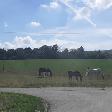
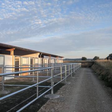
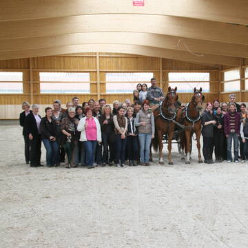
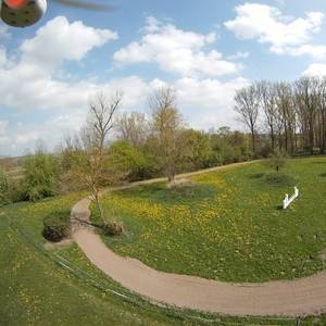
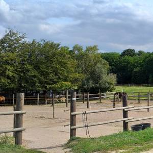
Stellplatz frei
Bad Rappenau
Franziska Voit
@Franzi09
Vermieten
Krankenbox
Longierzirkel/Roundpen
Notfallboxen
Außenbox mit Paddock
12 weitere...
B
Deprecated: Creation of dynamic property Zend_View_Helper_Ads::$adLink is deprecated in /var/www/stall-frei/htdocs/staging.stall-frei.de/library/Psf/View/Helper/Ads.php on line 108

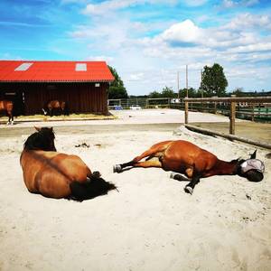
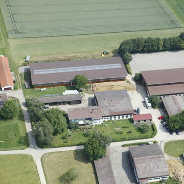
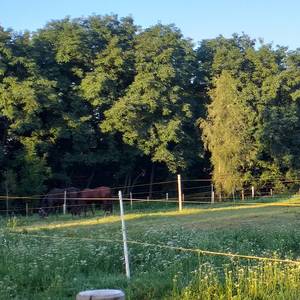
Pferdepension Hit Aktivstall Kürmerhof
Hohenkammer
Kuermerhof
@Kuermerhof
*******JETZT NEU MIT ENTSTAUBTEM BIOHEU*********
*******Demnächst mit einem Abenteuerspielplatz für Pferde ( Extrem Trail/Pa


Altersruhesitz für Senioren und (Früh)Rentner
Neckarbischofsheim
Pferdehof Heidäcker
@Pferdehof-Heidaeckersiedlung
FN-Mitglied
Freizeitstall
Vermieten
Paddock
Parkplatz für Pferdeanhänger
Allergikerstall
bedampftes/gewaschenes Heu
19 weitere...
P+
Leider kein Vorschaubild
Leider kein Vorschaubild
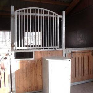
Reitstall Kölle GbR
Bönnigheim
Wolfgang-Reitstall-Koelle-GbR
@Wolfgang-Reitstall-Koelle-GbR
FN-Mitglied
Pflegepferd
Vermieten
Hunde willkommen
Krankenbox
Außenbox mit Paddock
Bewegungsstall
16 weitere...
B
Reitstall Heininger Solebox,Solarium,Bemerdecke
Billigheim - Sulzbach
Torsten-und-Anita-Heininger
@Torsten-und-Anita-Heininger
Freizeitstall
Westernreiten
Vermieten
Krankenbox
Longierzirkel/Roundpen
Gnadenbrothof
Hengsthaltung möglich
20 weitere...
P

Aktivstall Scheufler
Neuenstein
Scheufler-GbR
@Scheufler-GbR
FN-Mitglied
Freizeitstall
Vermieten
Hunde willkommen
Krankenbox
Gnadenbrothof
Hengsthaltung möglich
25 weitere...
P+

Mitarbeiter gesucht?
Mechtersen
STALL-FREIde Marketing
@STALL-FREI-Marketing
Stellenangebote kostenlos veröffentlichen!
Reitstall Schuler
K-Münchingen
Rainer-Schuler
@Rainer-Schuler
Pferdeausbildung
Reitlehrer und -unterricht
Laufband
Paddock
Pferdezucht
Zuchtstutenhaltung möglich
Außenbox mit Paddock
Außenboxen
14 weitere...
S

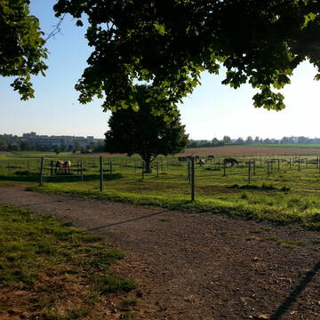
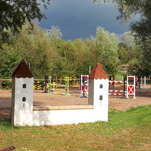
Reitanlage Freiberg am Neckar
Freiberg am Neckar
Reitclub-Freiberg
@Reitclub-Freiberg
Gastronomie
Pferdeausbildung
Vermieten
Führanlage
Ovalbahn
Hengsthaltung möglich
Hufrehe geeignet
12 weitere...
P+
Hier dürfen Pferde noch Pferde sein!
Tamm
Reitanlage-Hausser
@Reitanlage-Hausser
Freizeitstall
Reitschule
Paddock
Parkplatz für Pferdeanhänger
Hengsthaltung möglich
Außenbox mit Paddock
8 weitere...
P+
Leider kein Vorschaubild
Leider kein Vorschaubild
April 2026 frei! Nur Wallach Isi oder Kleinpferd
OBERSTENFELD
Kurtz
@Kurtz
Freizeitstall
Geländestrecke
Vermieten
Krankenbox
Longierzirkel/Roundpen
bedampftes/gewaschenes Heu
7 weitere...
aktuell
B

RCM Reitclub Mosbach e.V.
Mosbach
RCM-Reitclub-Mosbach-e-V
@RCM-Reitclub-Mosbach-e-V
FN-Mitglied
Freizeitstall
Vermieten
Führanlage
Hunde willkommen
Notfallboxen
26 weitere...
P
Veröffentliche deine Suche als Gesuch und Suchauftrag, dann erhältst du Angebote, neue Treffer und Änderungen per E-Mail.
Diese Suche als Gesuch veröffentlichenDeprecated: Creation of dynamic property Zend_View::$pageCount is deprecated in /var/www/stall-frei/htdocs/staging.stall-frei.de/library/vendor/shardj/zf1-future/library/Zend/View/Abstract.php on line 308
Deprecated: Creation of dynamic property Zend_View::$itemCountPerPage is deprecated in /var/www/stall-frei/htdocs/staging.stall-frei.de/library/vendor/shardj/zf1-future/library/Zend/View/Abstract.php on line 308
Deprecated: Creation of dynamic property Zend_View::$first is deprecated in /var/www/stall-frei/htdocs/staging.stall-frei.de/library/vendor/shardj/zf1-future/library/Zend/View/Abstract.php on line 308
Deprecated: Creation of dynamic property Zend_View::$current is deprecated in /var/www/stall-frei/htdocs/staging.stall-frei.de/library/vendor/shardj/zf1-future/library/Zend/View/Abstract.php on line 308
Deprecated: Creation of dynamic property Zend_View::$last is deprecated in /var/www/stall-frei/htdocs/staging.stall-frei.de/library/vendor/shardj/zf1-future/library/Zend/View/Abstract.php on line 308
Deprecated: Creation of dynamic property Zend_View::$previous is deprecated in /var/www/stall-frei/htdocs/staging.stall-frei.de/library/vendor/shardj/zf1-future/library/Zend/View/Abstract.php on line 308
Deprecated: Creation of dynamic property Zend_View::$next is deprecated in /var/www/stall-frei/htdocs/staging.stall-frei.de/library/vendor/shardj/zf1-future/library/Zend/View/Abstract.php on line 308
Deprecated: Creation of dynamic property Zend_View::$pagesInRange is deprecated in /var/www/stall-frei/htdocs/staging.stall-frei.de/library/vendor/shardj/zf1-future/library/Zend/View/Abstract.php on line 308
Deprecated: Creation of dynamic property Zend_View::$firstPageInRange is deprecated in /var/www/stall-frei/htdocs/staging.stall-frei.de/library/vendor/shardj/zf1-future/library/Zend/View/Abstract.php on line 308
Deprecated: Creation of dynamic property Zend_View::$lastPageInRange is deprecated in /var/www/stall-frei/htdocs/staging.stall-frei.de/library/vendor/shardj/zf1-future/library/Zend/View/Abstract.php on line 308
Deprecated: Creation of dynamic property Zend_View::$currentItemCount is deprecated in /var/www/stall-frei/htdocs/staging.stall-frei.de/library/vendor/shardj/zf1-future/library/Zend/View/Abstract.php on line 308
Deprecated: Creation of dynamic property Zend_View::$totalItemCount is deprecated in /var/www/stall-frei/htdocs/staging.stall-frei.de/library/vendor/shardj/zf1-future/library/Zend/View/Abstract.php on line 308
Deprecated: Creation of dynamic property Zend_View::$firstItemNumber is deprecated in /var/www/stall-frei/htdocs/staging.stall-frei.de/library/vendor/shardj/zf1-future/library/Zend/View/Abstract.php on line 308
Deprecated: Creation of dynamic property Zend_View::$lastItemNumber is deprecated in /var/www/stall-frei/htdocs/staging.stall-frei.de/library/vendor/shardj/zf1-future/library/Zend/View/Abstract.php on line 308
Deprecated: Creation of dynamic property Zend_View::$router is deprecated in /var/www/stall-frei/htdocs/staging.stall-frei.de/library/vendor/shardj/zf1-future/library/Zend/View/Abstract.php on line 308
Deprecated: Creation of dynamic property Zend_View::$urlParams is deprecated in /var/www/stall-frei/htdocs/staging.stall-frei.de/library/vendor/shardj/zf1-future/library/Zend/View/Abstract.php on line 308
Deprecated: Creation of dynamic property Zend_View::$showAds is deprecated in /var/www/stall-frei/htdocs/staging.stall-frei.de/library/vendor/shardj/zf1-future/library/Zend/View/Abstract.php on line 308
Deprecated: Creation of dynamic property Zend_View::$objectIds is deprecated in /var/www/stall-frei/htdocs/staging.stall-frei.de/library/vendor/shardj/zf1-future/library/Zend/View/Abstract.php on line 308
Deprecated: Creation of dynamic property Zend_View::$showNavbar is deprecated in /var/www/stall-frei/htdocs/staging.stall-frei.de/library/vendor/shardj/zf1-future/library/Zend/View/Abstract.php on line 308
Deprecated: Creation of dynamic property Zend_View::$showBreadcrumb is deprecated in /var/www/stall-frei/htdocs/staging.stall-frei.de/library/vendor/shardj/zf1-future/library/Zend/View/Abstract.php on line 308
Deprecated: Creation of dynamic property Zend_View::$showFooter is deprecated in /var/www/stall-frei/htdocs/staging.stall-frei.de/library/vendor/shardj/zf1-future/library/Zend/View/Abstract.php on line 308
Deprecated: Creation of dynamic property Zend_View::$showInternalAds is deprecated in /var/www/stall-frei/htdocs/staging.stall-frei.de/library/vendor/shardj/zf1-future/library/Zend/View/Abstract.php on line 308
Deprecated: Creation of dynamic property Zend_View::$blNoContent is deprecated in /var/www/stall-frei/htdocs/staging.stall-frei.de/library/vendor/shardj/zf1-future/library/Zend/View/Abstract.php on line 308
Deprecated: Creation of dynamic property Zend_View::$sMetaDesc is deprecated in /var/www/stall-frei/htdocs/staging.stall-frei.de/library/vendor/shardj/zf1-future/library/Zend/View/Abstract.php on line 308
Deprecated: Creation of dynamic property Zend_View::$useGmaps is deprecated in /var/www/stall-frei/htdocs/staging.stall-frei.de/library/vendor/shardj/zf1-future/library/Zend/View/Abstract.php on line 308
Deprecated: Creation of dynamic property Zend_View::$touches is deprecated in /var/www/stall-frei/htdocs/staging.stall-frei.de/library/vendor/shardj/zf1-future/library/Zend/View/Abstract.php on line 308
Deprecated: Creation of dynamic property Zend_View::$oProject is deprecated in /var/www/stall-frei/htdocs/staging.stall-frei.de/library/vendor/shardj/zf1-future/library/Zend/View/Abstract.php on line 308
Deprecated: Creation of dynamic property Zend_View::$pageHeadline is deprecated in /var/www/stall-frei/htdocs/staging.stall-frei.de/library/vendor/shardj/zf1-future/library/Zend/View/Abstract.php on line 308
Deprecated: Creation of dynamic property Zend_View::$disableLocationField is deprecated in /var/www/stall-frei/htdocs/staging.stall-frei.de/library/vendor/shardj/zf1-future/library/Zend/View/Abstract.php on line 308
Deprecated: Creation of dynamic property Zend_View::$isSearch is deprecated in /var/www/stall-frei/htdocs/staging.stall-frei.de/library/vendor/shardj/zf1-future/library/Zend/View/Abstract.php on line 308
Deprecated: Creation of dynamic property Zend_View::$pageTitle is deprecated in /var/www/stall-frei/htdocs/staging.stall-frei.de/library/vendor/shardj/zf1-future/library/Zend/View/Abstract.php on line 308
Deprecated: Creation of dynamic property Psf_Form_Element_Text::$class is deprecated in /var/www/stall-frei/htdocs/staging.stall-frei.de/library/vendor/shardj/zf1-future/library/Zend/Form/Element.php on line 874
Deprecated: Creation of dynamic property Psf_Form_Element_Text::$size is deprecated in /var/www/stall-frei/htdocs/staging.stall-frei.de/library/vendor/shardj/zf1-future/library/Zend/Form/Element.php on line 874
Deprecated: Creation of dynamic property Psf_Form_Element_Text::$placeholder is deprecated in /var/www/stall-frei/htdocs/staging.stall-frei.de/library/vendor/shardj/zf1-future/library/Zend/Form/Element.php on line 874
Deprecated: Creation of dynamic property Psf_Form_Element_Hidden::$class is deprecated in /var/www/stall-frei/htdocs/staging.stall-frei.de/library/vendor/shardj/zf1-future/library/Zend/Form/Element.php on line 874
Deprecated: Creation of dynamic property Psf_Form_Element_Hidden::$class is deprecated in /var/www/stall-frei/htdocs/staging.stall-frei.de/library/vendor/shardj/zf1-future/library/Zend/Form/Element.php on line 874
Deprecated: Creation of dynamic property Psf_Form_Element_Hidden::$class is deprecated in /var/www/stall-frei/htdocs/staging.stall-frei.de/library/vendor/shardj/zf1-future/library/Zend/Form/Element.php on line 874
Deprecated: Creation of dynamic property Psf_Form_Element_Hidden::$class is deprecated in /var/www/stall-frei/htdocs/staging.stall-frei.de/library/vendor/shardj/zf1-future/library/Zend/Form/Element.php on line 874
Deprecated: Creation of dynamic property Psf_Form_Element_Select::$class is deprecated in /var/www/stall-frei/htdocs/staging.stall-frei.de/library/vendor/shardj/zf1-future/library/Zend/Form/Element.php on line 874
Deprecated: Creation of dynamic property Psf_Form_Element_Select::$class is deprecated in /var/www/stall-frei/htdocs/staging.stall-frei.de/library/vendor/shardj/zf1-future/library/Zend/Form/Element.php on line 874
Deprecated: Creation of dynamic property Psf_Form_Element_Select::$class is deprecated in /var/www/stall-frei/htdocs/staging.stall-frei.de/library/vendor/shardj/zf1-future/library/Zend/Form/Element.php on line 874
Deprecated: Creation of dynamic property Psf_Form_Element_Select::$class is deprecated in /var/www/stall-frei/htdocs/staging.stall-frei.de/library/vendor/shardj/zf1-future/library/Zend/Form/Element.php on line 874
Deprecated: Creation of dynamic property Psf_Form_Element_Text::$class is deprecated in /var/www/stall-frei/htdocs/staging.stall-frei.de/library/vendor/shardj/zf1-future/library/Zend/Form/Element.php on line 874
Deprecated: Creation of dynamic property Psf_Form_Element_Checkbox::$label is deprecated in /var/www/stall-frei/htdocs/staging.stall-frei.de/library/vendor/shardj/zf1-future/library/Zend/Form/Element.php on line 874
Deprecated: Creation of dynamic property Zend_View::$sort is deprecated in /var/www/stall-frei/htdocs/staging.stall-frei.de/library/vendor/shardj/zf1-future/library/Zend/View/Abstract.php on line 308
Deprecated: Creation of dynamic property Zend_View::$searchLocation is deprecated in /var/www/stall-frei/htdocs/staging.stall-frei.de/library/vendor/shardj/zf1-future/library/Zend/View/Abstract.php on line 308
Deprecated: Creation of dynamic property Zend_View::$locationHint is deprecated in /var/www/stall-frei/htdocs/staging.stall-frei.de/library/vendor/shardj/zf1-future/library/Zend/View/Abstract.php on line 308
Psf_GeoCoder_Abstract::getLocation: Wartberg Get Location CachedOrLive
Psf_GeoCoder_Abstract::getCachedOrLive: Wartberg
Psf_GeoCoder_Abstract::convertLocationResult
{"documentation":"https:\/\/opencagedata.com\/api","licenses":[{"name":"see attribution guide","url":"https:\/\/opencagedata.com\/credits"}],"results":[{"bounds":{"northeast":{"lat":49.1597539,"lng":9.2354686},"southwest":{"lat":49.1596539,"lng":9.2353686}},"components":{"ISO_3166-1_alpha-2":"DE","ISO_3166-1_alpha-3":"DEU","ISO_3166-2":["DE-BW"],"_category":"natural\/water","_normalized_city":"Heilbronn","_type":"peak","city":"Heilbronn","continent":"Europe","country":"Deutschland","country_code":"de","peak":"Wartberg","political_union":"European Union","postcode":"74076","state":"Baden-W\u00fcrttemberg","state_code":"BW"},"confidence":9,"formatted":"Wartberg, 74076 Heilbronn, Deutschland","geometry":{"lat":49.1597039,"lng":9.2354186}},{"bounds":{"northeast":{"lat":49.7743774,"lng":9.5232146},"southwest":{"lat":49.7343774,"lng":9.4832146}},"components":{"ISO_3166-1_alpha-2":"DE","ISO_3166-1_alpha-3":"DEU","ISO_3166-2":["DE-BW"],"_category":"place","_normalized_city":"Wertheim","_type":"neighbourhood","continent":"Europe","country":"Deutschland","country_code":"de","county":"Main-Tauber-Kreis","political_union":"European Union","postcode":"97877","state":"Baden-W\u00fcrttemberg","state_code":"BW","suburb":"Wartberg","town":"Wertheim"},"confidence":7,"formatted":"97877 Wertheim, Deutschland","geometry":{"lat":49.7543774,"lng":9.5032146}},{"bounds":{"northeast":{"lat":51.1922724,"lng":9.304257},"southwest":{"lat":51.1921724,"lng":9.304157}},"components":{"ISO_3166-1_alpha-2":"DE","ISO_3166-1_alpha-3":"DEU","ISO_3166-2":["DE-HE"],"_category":"natural\/water","_normalized_city":"Kirchberg","_type":"peak","continent":"Europe","country":"Deutschland","country_code":"de","county":"Schwalm-Eder-Kreis","municipality":"Niedenstein","peak":"Wartberg","political_union":"European Union","postcode":"34305","state":"Hessen","state_code":"HE","village":"Kirchberg"},"confidence":9,"formatted":"Wartberg, 34305 Kirchberg, Deutschland","geometry":{"lat":51.1922224,"lng":9.304207}},{"bounds":{"northeast":{"lat":49.4378429,"lng":9.4212228},"southwest":{"lat":49.4377429,"lng":9.4211228}},"components":{"ISO_3166-1_alpha-2":"DE","ISO_3166-1_alpha-3":"DEU","ISO_3166-2":["DE-BW"],"_category":"natural\/water","_normalized_city":"Osterburken","_type":"peak","continent":"Europe","country":"Deutschland","country_code":"de","county":"Neckar-Odenwald-Kreis","municipality":"GVV Osterburken","peak":"Wartberg","political_union":"European Union","postcode":"74706","state":"Baden-W\u00fcrttemberg","state_code":"BW","town":"Osterburken"},"confidence":9,"formatted":"Wartberg, 74706 Osterburken, Deutschland","geometry":{"lat":49.4377929,"lng":9.4211728}},{"bounds":{"northeast":{"lat":49.5121078,"lng":9.3416087},"southwest":{"lat":49.5120078,"lng":9.3415087}},"components":{"ISO_3166-1_alpha-2":"DE","ISO_3166-1_alpha-3":"DEU","ISO_3166-2":["DE-BW"],"_category":"natural\/water","_normalized_city":"Buchen (Odenwald)","_type":"peak","continent":"Europe","country":"Deutschland","country_code":"de","county":"Neckar-Odenwald-Kreis","peak":"Wartberg","political_union":"European Union","postcode":"74722","state":"Baden-W\u00fcrttemberg","state_code":"BW","town":"Buchen (Odenwald)"},"confidence":9,"formatted":"Wartberg, 74722 Buchen (Odenwald), Deutschland","geometry":{"lat":49.5120578,"lng":9.3415587}},{"bounds":{"northeast":{"lat":50.9426215,"lng":11.1014245},"southwest":{"lat":50.9425215,"lng":11.1013245}},"components":{"ISO_3166-1_alpha-2":"DE","ISO_3166-1_alpha-3":"DEU","ISO_3166-2":["DE-TH"],"_category":"natural\/water","_normalized_city":"Erfurt","_type":"peak","city":"Erfurt","continent":"Europe","country":"Deutschland","country_code":"de","peak":"Wartberg","political_union":"European Union","postcode":"99099","state":"Th\u00fcringen","state_code":"TH"},"confidence":9,"formatted":"Wartberg, 99099 Erfurt, Deutschland","geometry":{"lat":50.9425715,"lng":11.1013745}},{"bounds":{"northeast":{"lat":50.3258088,"lng":8.7482976},"southwest":{"lat":50.3257088,"lng":8.7481976}},"components":{"ISO_3166-1_alpha-2":"DE","ISO_3166-1_alpha-3":"DEU","ISO_3166-2":["DE-HE"],"_category":"natural\/water","_normalized_city":"Friedberg","_type":"peak","continent":"Europe","country":"Deutschland","country_code":"de","county":"Wetteraukreis","municipality":"Friedberg (Hessen)","peak":"Wartberg","political_union":"European Union","postcode":"61169","state":"Hessen","state_code":"HE","town":"Friedberg"},"confidence":9,"formatted":"Wartberg, 61169 Friedberg, Deutschland","geometry":{"lat":50.3257588,"lng":8.7482476}},{"bounds":{"northeast":{"lat":50.4612087,"lng":12.0023635},"southwest":{"lat":50.4611087,"lng":12.0022635}},"components":{"ISO_3166-1_alpha-2":"DE","ISO_3166-1_alpha-3":"DEU","ISO_3166-2":["DE-SN"],"_category":"natural\/water","_normalized_city":"Weischlitz","_type":"peak","continent":"Europe","country":"Deutschland","country_code":"de","county":"Vogtlandkreis","municipality":"Weischlitz","peak":"Wartberg","political_union":"European Union","postcode":"08538","state":"Sachsen","state_code":"SN"},"confidence":9,"formatted":"Wartberg, 08538 Weischlitz, Deutschland","geometry":{"lat":50.4611587,"lng":12.0023135}},{"bounds":{"northeast":{"lat":49.2348488,"lng":9.1012627},"southwest":{"lat":49.2347488,"lng":9.1011627}},"components":{"ISO_3166-1_alpha-2":"DE","ISO_3166-1_alpha-3":"DEU","ISO_3166-2":["DE-BW"],"_category":"natural\/water","_normalized_city":"Bad Rappenau","_type":"peak","continent":"Europe","country":"Deutschland","country_code":"de","county":"Landkreis Heilbronn","municipality":"VVG der Stadt Bad Rappenau","peak":"Wartberg","political_union":"European Union","postcode":"74906","state":"Baden-W\u00fcrttemberg","state_code":"BW","town":"Bad Rappenau"},"confidence":9,"formatted":"Wartberg, 74906 Bad Rappenau, Deutschland","geometry":{"lat":49.2347988,"lng":9.1012127}},{"bounds":{"northeast":{"lat":51.1016188,"lng":8.9880489},"southwest":{"lat":51.1015188,"lng":8.9879489}},"components":{"ISO_3166-1_alpha-2":"DE","ISO_3166-1_alpha-3":"DEU","ISO_3166-2":["DE-HE"],"_category":"natural\/water","_normalized_city":"Frebershausen","_type":"peak","continent":"Europe","country":"Deutschland","country_code":"de","county":"Landkreis Waldeck-Frankenberg","municipality":"Bad Wildungen","peak":"Wartberg","political_union":"European Union","state":"Hessen","state_code":"HE","village":"Frebershausen"},"confidence":9,"formatted":"Wartberg, Frebershausen, Hessen, Deutschland","geometry":{"lat":51.1015688,"lng":8.9879989}}],"status":{"code":200,"message":"OK"},"stay_informed":{"blog":"https:\/\/blog.opencagedata.com","mastodon":"https:\/\/en.osm.town\/@opencage"},"thanks":"For using an OpenCage API","timestamp":{"created_http":"Sat, 07 Feb 2026 12:33:38 GMT","created_unix":1770467618},"total_results":10}Array
(
[0] => stdClass Object
(
[bounds] => stdClass Object
(
[northeast] => stdClass Object
(
[lat] => 49.1597539
[lng] => 9.2354686
)
[southwest] => stdClass Object
(
[lat] => 49.1596539
[lng] => 9.2353686
)
)
[components] => stdClass Object
(
[ISO_3166-1_alpha-2] => DE
[ISO_3166-1_alpha-3] => DEU
[ISO_3166-2] => Array
(
[0] => DE-BW
)
[_category] => natural/water
[_normalized_city] => Heilbronn
[_type] => peak
[city] => Heilbronn
[continent] => Europe
[country] => Deutschland
[country_code] => de
[peak] => Wartberg
[political_union] => European Union
[postcode] => 74076
[state] => Baden-Württemberg
[state_code] => BW
)
[confidence] => 9
[formatted] => Wartberg, 74076 Heilbronn, Deutschland
[geometry] => stdClass Object
(
[lat] => 49.1597039
[lng] => 9.2354186
)
)
[1] => stdClass Object
(
[bounds] => stdClass Object
(
[northeast] => stdClass Object
(
[lat] => 49.7743774
[lng] => 9.5232146
)
[southwest] => stdClass Object
(
[lat] => 49.7343774
[lng] => 9.4832146
)
)
[components] => stdClass Object
(
[ISO_3166-1_alpha-2] => DE
[ISO_3166-1_alpha-3] => DEU
[ISO_3166-2] => Array
(
[0] => DE-BW
)
[_category] => place
[_normalized_city] => Wertheim
[_type] => neighbourhood
[continent] => Europe
[country] => Deutschland
[country_code] => de
[county] => Main-Tauber-Kreis
[political_union] => European Union
[postcode] => 97877
[state] => Baden-Württemberg
[state_code] => BW
[suburb] => Wartberg
[town] => Wertheim
)
[confidence] => 7
[formatted] => 97877 Wertheim, Deutschland
[geometry] => stdClass Object
(
[lat] => 49.7543774
[lng] => 9.5032146
)
)
[2] => stdClass Object
(
[bounds] => stdClass Object
(
[northeast] => stdClass Object
(
[lat] => 51.1922724
[lng] => 9.304257
)
[southwest] => stdClass Object
(
[lat] => 51.1921724
[lng] => 9.304157
)
)
[components] => stdClass Object
(
[ISO_3166-1_alpha-2] => DE
[ISO_3166-1_alpha-3] => DEU
[ISO_3166-2] => Array
(
[0] => DE-HE
)
[_category] => natural/water
[_normalized_city] => Kirchberg
[_type] => peak
[continent] => Europe
[country] => Deutschland
[country_code] => de
[county] => Schwalm-Eder-Kreis
[municipality] => Niedenstein
[peak] => Wartberg
[political_union] => European Union
[postcode] => 34305
[state] => Hessen
[state_code] => HE
[village] => Kirchberg
)
[confidence] => 9
[formatted] => Wartberg, 34305 Kirchberg, Deutschland
[geometry] => stdClass Object
(
[lat] => 51.1922224
[lng] => 9.304207
)
)
[3] => stdClass Object
(
[bounds] => stdClass Object
(
[northeast] => stdClass Object
(
[lat] => 49.4378429
[lng] => 9.4212228
)
[southwest] => stdClass Object
(
[lat] => 49.4377429
[lng] => 9.4211228
)
)
[components] => stdClass Object
(
[ISO_3166-1_alpha-2] => DE
[ISO_3166-1_alpha-3] => DEU
[ISO_3166-2] => Array
(
[0] => DE-BW
)
[_category] => natural/water
[_normalized_city] => Osterburken
[_type] => peak
[continent] => Europe
[country] => Deutschland
[country_code] => de
[county] => Neckar-Odenwald-Kreis
[municipality] => GVV Osterburken
[peak] => Wartberg
[political_union] => European Union
[postcode] => 74706
[state] => Baden-Württemberg
[state_code] => BW
[town] => Osterburken
)
[confidence] => 9
[formatted] => Wartberg, 74706 Osterburken, Deutschland
[geometry] => stdClass Object
(
[lat] => 49.4377929
[lng] => 9.4211728
)
)
[4] => stdClass Object
(
[bounds] => stdClass Object
(
[northeast] => stdClass Object
(
[lat] => 49.5121078
[lng] => 9.3416087
)
[southwest] => stdClass Object
(
[lat] => 49.5120078
[lng] => 9.3415087
)
)
[components] => stdClass Object
(
[ISO_3166-1_alpha-2] => DE
[ISO_3166-1_alpha-3] => DEU
[ISO_3166-2] => Array
(
[0] => DE-BW
)
[_category] => natural/water
[_normalized_city] => Buchen (Odenwald)
[_type] => peak
[continent] => Europe
[country] => Deutschland
[country_code] => de
[county] => Neckar-Odenwald-Kreis
[peak] => Wartberg
[political_union] => European Union
[postcode] => 74722
[state] => Baden-Württemberg
[state_code] => BW
[town] => Buchen (Odenwald)
)
[confidence] => 9
[formatted] => Wartberg, 74722 Buchen (Odenwald), Deutschland
[geometry] => stdClass Object
(
[lat] => 49.5120578
[lng] => 9.3415587
)
)
[5] => stdClass Object
(
[bounds] => stdClass Object
(
[northeast] => stdClass Object
(
[lat] => 50.9426215
[lng] => 11.1014245
)
[southwest] => stdClass Object
(
[lat] => 50.9425215
[lng] => 11.1013245
)
)
[components] => stdClass Object
(
[ISO_3166-1_alpha-2] => DE
[ISO_3166-1_alpha-3] => DEU
[ISO_3166-2] => Array
(
[0] => DE-TH
)
[_category] => natural/water
[_normalized_city] => Erfurt
[_type] => peak
[city] => Erfurt
[continent] => Europe
[country] => Deutschland
[country_code] => de
[peak] => Wartberg
[political_union] => European Union
[postcode] => 99099
[state] => Thüringen
[state_code] => TH
)
[confidence] => 9
[formatted] => Wartberg, 99099 Erfurt, Deutschland
[geometry] => stdClass Object
(
[lat] => 50.9425715
[lng] => 11.1013745
)
)
[6] => stdClass Object
(
[bounds] => stdClass Object
(
[northeast] => stdClass Object
(
[lat] => 50.3258088
[lng] => 8.7482976
)
[southwest] => stdClass Object
(
[lat] => 50.3257088
[lng] => 8.7481976
)
)
[components] => stdClass Object
(
[ISO_3166-1_alpha-2] => DE
[ISO_3166-1_alpha-3] => DEU
[ISO_3166-2] => Array
(
[0] => DE-HE
)
[_category] => natural/water
[_normalized_city] => Friedberg
[_type] => peak
[continent] => Europe
[country] => Deutschland
[country_code] => de
[county] => Wetteraukreis
[municipality] => Friedberg (Hessen)
[peak] => Wartberg
[political_union] => European Union
[postcode] => 61169
[state] => Hessen
[state_code] => HE
[town] => Friedberg
)
[confidence] => 9
[formatted] => Wartberg, 61169 Friedberg, Deutschland
[geometry] => stdClass Object
(
[lat] => 50.3257588
[lng] => 8.7482476
)
)
[7] => stdClass Object
(
[bounds] => stdClass Object
(
[northeast] => stdClass Object
(
[lat] => 50.4612087
[lng] => 12.0023635
)
[southwest] => stdClass Object
(
[lat] => 50.4611087
[lng] => 12.0022635
)
)
[components] => stdClass Object
(
[ISO_3166-1_alpha-2] => DE
[ISO_3166-1_alpha-3] => DEU
[ISO_3166-2] => Array
(
[0] => DE-SN
)
[_category] => natural/water
[_normalized_city] => Weischlitz
[_type] => peak
[continent] => Europe
[country] => Deutschland
[country_code] => de
[county] => Vogtlandkreis
[municipality] => Weischlitz
[peak] => Wartberg
[political_union] => European Union
[postcode] => 08538
[state] => Sachsen
[state_code] => SN
)
[confidence] => 9
[formatted] => Wartberg, 08538 Weischlitz, Deutschland
[geometry] => stdClass Object
(
[lat] => 50.4611587
[lng] => 12.0023135
)
)
[8] => stdClass Object
(
[bounds] => stdClass Object
(
[northeast] => stdClass Object
(
[lat] => 49.2348488
[lng] => 9.1012627
)
[southwest] => stdClass Object
(
[lat] => 49.2347488
[lng] => 9.1011627
)
)
[components] => stdClass Object
(
[ISO_3166-1_alpha-2] => DE
[ISO_3166-1_alpha-3] => DEU
[ISO_3166-2] => Array
(
[0] => DE-BW
)
[_category] => natural/water
[_normalized_city] => Bad Rappenau
[_type] => peak
[continent] => Europe
[country] => Deutschland
[country_code] => de
[county] => Landkreis Heilbronn
[municipality] => VVG der Stadt Bad Rappenau
[peak] => Wartberg
[political_union] => European Union
[postcode] => 74906
[state] => Baden-Württemberg
[state_code] => BW
[town] => Bad Rappenau
)
[confidence] => 9
[formatted] => Wartberg, 74906 Bad Rappenau, Deutschland
[geometry] => stdClass Object
(
[lat] => 49.2347988
[lng] => 9.1012127
)
)
[9] => stdClass Object
(
[bounds] => stdClass Object
(
[northeast] => stdClass Object
(
[lat] => 51.1016188
[lng] => 8.9880489
)
[southwest] => stdClass Object
(
[lat] => 51.1015188
[lng] => 8.9879489
)
)
[components] => stdClass Object
(
[ISO_3166-1_alpha-2] => DE
[ISO_3166-1_alpha-3] => DEU
[ISO_3166-2] => Array
(
[0] => DE-HE
)
[_category] => natural/water
[_normalized_city] => Frebershausen
[_type] => peak
[continent] => Europe
[country] => Deutschland
[country_code] => de
[county] => Landkreis Waldeck-Frankenberg
[municipality] => Bad Wildungen
[peak] => Wartberg
[political_union] => European Union
[state] => Hessen
[state_code] => HE
[village] => Frebershausen
)
[confidence] => 9
[formatted] => Wartberg, Frebershausen, Hessen, Deutschland
[geometry] => stdClass Object
(
[lat] => 51.1015688
[lng] => 8.9879989
)
)
)
Psf_GeoCoder_OpenCageData::getKeyMap: 0
stdClass Object
(
    [bounds] => stdClass Object
        (
            [northeast] => stdClass Object
                (
                    [lat] => 49.1597539
                    [lng] => 9.2354686
                )

            [southwest] => stdClass Object
                (
                    [lat] => 49.1596539
                    [lng] => 9.2353686
                )

        )

    [components] => stdClass Object
        (
            [ISO_3166-1_alpha-2] => DE
            [ISO_3166-1_alpha-3] => DEU
            [ISO_3166-2] => Array
                (
                    [0] => DE-BW
                )

            [_category] => natural/water
            [_normalized_city] => Heilbronn
            [_type] => peak
            [city] => Heilbronn
            [continent] => Europe
            [country] => Deutschland
            [country_code] => de
            [peak] => Wartberg
            [political_union] => European Union
            [postcode] => 74076
            [state] => Baden-Württemberg
            [state_code] => BW
        )

    [confidence] => 9
    [formatted] => Wartberg, 74076 Heilbronn, Deutschland
    [geometry] => stdClass Object
        (
            [lat] => 49.1597039
            [lng] => 9.2354186
        )

)
Psf_GeoCoder_OpenCageData::getCounty: Heilbronn
Psf_GeoCoder_OpenCageData::addMissingData REFETCH!
Array
(
    [address] => Wartberg, 74076 Heilbronn, Deutschland
    [type] => peak
    [street] =>
    [city] => Heilbronn
    [county] => Heilbronn
    [state] => Baden-Württemberg
    [zip] => 74076
    [country] => Deutschland
    [suburb] =>
    [countrycode] => de
    [latitude] => 49.1597039
    [longitude] => 9.2354186
    [accuracy] => 1
    [confidence] => 9
    [bounds] => stdClass Object
        (
            [northeast] => stdClass Object
                (
                    [lat] => 49.1597539
                    [lng] => 9.2354686
                )

            [southwest] => stdClass Object
                (
                    [lat] => 49.1596539
                    [lng] => 9.2353686
                )

        )

)
reformat!
Array
(
    [address] => Wartberg, 74076 Heilbronn, Deutschland
    [type] => peak
    [street] =>
    [city] => Heilbronn
    [county] => Heilbronn
    [state] => Baden-Württemberg
    [zip] => 74076
    [country] => Deutschland
    [suburb] =>
    [countrycode] => de
    [latitude] => 49.1597039
    [longitude] => 9.2354186
    [accuracy] => 1
    [confidence] => 9
    [bounds] => stdClass Object
        (
            [northeast] => stdClass Object
                (
                    [lat] => 49.1597539
                    [lng] => 9.2354686
                )

            [southwest] => stdClass Object
                (
                    [lat] => 49.1596539
                    [lng] => 9.2353686
                )

        )

    [place] => 74076 Heilbronn, Baden-Württemberg
    [hash] => 0c6b69a8e5c238a8507780e5af480451
)
Psf_GeoCoder_OpenCageData::getKeyMap: 1
stdClass Object
(
    [bounds] => stdClass Object
        (
            [northeast] => stdClass Object
                (
                    [lat] => 49.7743774
                    [lng] => 9.5232146
                )

            [southwest] => stdClass Object
                (
                    [lat] => 49.7343774
                    [lng] => 9.4832146
                )

        )

    [components] => stdClass Object
        (
            [ISO_3166-1_alpha-2] => DE
            [ISO_3166-1_alpha-3] => DEU
            [ISO_3166-2] => Array
                (
                    [0] => DE-BW
                )

            [_category] => place
            [_normalized_city] => Wertheim
            [_type] => neighbourhood
            [continent] => Europe
            [country] => Deutschland
            [country_code] => de
            [county] => Main-Tauber-Kreis
            [political_union] => European Union
            [postcode] => 97877
            [state] => Baden-Württemberg
            [state_code] => BW
            [suburb] => Wartberg
            [town] => Wertheim
        )

    [confidence] => 7
    [formatted] => 97877 Wertheim, Deutschland
    [geometry] => stdClass Object
        (
            [lat] => 49.7543774
            [lng] => 9.5032146
        )

)
Psf_GeoCoder_OpenCageData::getCounty: Main-Tauber-Kreis
Psf_GeoCoder_OpenCageData::addMissingData REFETCH!
Array
(
    [address] => 97877 Wertheim, Deutschland
    [type] => neighbourhood
    [street] =>
    [city] => Wertheim
    [county] => Main-Tauber-Kreis
    [state] => Baden-Württemberg
    [zip] => 97877
    [country] => Deutschland
    [suburb] => Wartberg
    [countrycode] => de
    [latitude] => 49.7543774
    [longitude] => 9.5032146
    [accuracy] => 1
    [confidence] => 7
    [bounds] => stdClass Object
        (
            [northeast] => stdClass Object
                (
                    [lat] => 49.7743774
                    [lng] => 9.5232146
                )

            [southwest] => stdClass Object
                (
                    [lat] => 49.7343774
                    [lng] => 9.4832146
                )

        )

)
reformat!
Array
(
    [address] => 97877 Wertheim, Deutschland
    [type] => neighbourhood
    [street] =>
    [city] => Wertheim
    [county] => Main-Tauber-Kreis
    [state] => Baden-Württemberg
    [zip] => 97877
    [country] => Deutschland
    [suburb] => Wartberg
    [countrycode] => de
    [latitude] => 49.7543774
    [longitude] => 9.5032146
    [accuracy] => 1
    [confidence] => 7
    [bounds] => stdClass Object
        (
            [northeast] => stdClass Object
                (
                    [lat] => 49.7743774
                    [lng] => 9.5232146
                )

            [southwest] => stdClass Object
                (
                    [lat] => 49.7343774
                    [lng] => 9.4832146
                )

        )

    [place] => 97877 Wertheim, Baden-Württemberg
    [hash] => 06d8376e91e1fbf310b655da0e532edc
)
Psf_GeoCoder_OpenCageData::getKeyMap: 2
stdClass Object
(
    [bounds] => stdClass Object
        (
            [northeast] => stdClass Object
                (
                    [lat] => 51.1922724
                    [lng] => 9.304257
                )

            [southwest] => stdClass Object
                (
                    [lat] => 51.1921724
                    [lng] => 9.304157
                )

        )

    [components] => stdClass Object
        (
            [ISO_3166-1_alpha-2] => DE
            [ISO_3166-1_alpha-3] => DEU
            [ISO_3166-2] => Array
                (
                    [0] => DE-HE
                )

            [_category] => natural/water
            [_normalized_city] => Kirchberg
            [_type] => peak
            [continent] => Europe
            [country] => Deutschland
            [country_code] => de
            [county] => Schwalm-Eder-Kreis
            [municipality] => Niedenstein
            [peak] => Wartberg
            [political_union] => European Union
            [postcode] => 34305
            [state] => Hessen
            [state_code] => HE
            [village] => Kirchberg
        )

    [confidence] => 9
    [formatted] => Wartberg, 34305 Kirchberg, Deutschland
    [geometry] => stdClass Object
        (
            [lat] => 51.1922224
            [lng] => 9.304207
        )

)
Psf_GeoCoder_OpenCageData::getCounty: Schwalm-Eder-Kreis
Psf_GeoCoder_OpenCageData::addMissingData REFETCH!
Array
(
    [address] => Wartberg, 34305 Kirchberg, Deutschland
    [type] => peak
    [street] =>
    [city] => Kirchberg
    [county] => Schwalm-Eder-Kreis
    [state] => Hessen
    [zip] => 34305
    [country] => Deutschland
    [suburb] =>
    [countrycode] => de
    [latitude] => 51.1922224
    [longitude] => 9.304207
    [accuracy] => 1
    [confidence] => 9
    [bounds] => stdClass Object
        (
            [northeast] => stdClass Object
                (
                    [lat] => 51.1922724
                    [lng] => 9.304257
                )

            [southwest] => stdClass Object
                (
                    [lat] => 51.1921724
                    [lng] => 9.304157
                )

        )

)
reformat!
Array
(
    [address] => Wartberg, 34305 Kirchberg, Deutschland
    [type] => peak
    [street] =>
    [city] => Kirchberg
    [county] => Schwalm-Eder-Kreis
    [state] => Hessen
    [zip] => 34305
    [country] => Deutschland
    [suburb] =>
    [countrycode] => de
    [latitude] => 51.1922224
    [longitude] => 9.304207
    [accuracy] => 1
    [confidence] => 9
    [bounds] => stdClass Object
        (
            [northeast] => stdClass Object
                (
                    [lat] => 51.1922724
                    [lng] => 9.304257
                )

            [southwest] => stdClass Object
                (
                    [lat] => 51.1921724
                    [lng] => 9.304157
                )

        )

    [place] => 34305 Kirchberg, Hessen
    [hash] => 91efe54f263f2a8469ed52110009528b
)
Psf_GeoCoder_OpenCageData::getKeyMap: 3
stdClass Object
(
    [bounds] => stdClass Object
        (
            [northeast] => stdClass Object
                (
                    [lat] => 49.4378429
                    [lng] => 9.4212228
                )

            [southwest] => stdClass Object
                (
                    [lat] => 49.4377429
                    [lng] => 9.4211228
                )

        )

    [components] => stdClass Object
        (
            [ISO_3166-1_alpha-2] => DE
            [ISO_3166-1_alpha-3] => DEU
            [ISO_3166-2] => Array
                (
                    [0] => DE-BW
                )

            [_category] => natural/water
            [_normalized_city] => Osterburken
            [_type] => peak
            [continent] => Europe
            [country] => Deutschland
            [country_code] => de
            [county] => Neckar-Odenwald-Kreis
            [municipality] => GVV Osterburken
            [peak] => Wartberg
            [political_union] => European Union
            [postcode] => 74706
            [state] => Baden-Württemberg
            [state_code] => BW
            [town] => Osterburken
        )

    [confidence] => 9
    [formatted] => Wartberg, 74706 Osterburken, Deutschland
    [geometry] => stdClass Object
        (
            [lat] => 49.4377929
            [lng] => 9.4211728
        )

)
Psf_GeoCoder_OpenCageData::getCounty: Neckar-Odenwald-Kreis
Psf_GeoCoder_OpenCageData::addMissingData REFETCH!
Array
(
    [address] => Wartberg, 74706 Osterburken, Deutschland
    [type] => peak
    [street] =>
    [city] => Osterburken
    [county] => Neckar-Odenwald-Kreis
    [state] => Baden-Württemberg
    [zip] => 74706
    [country] => Deutschland
    [suburb] =>
    [countrycode] => de
    [latitude] => 49.4377929
    [longitude] => 9.4211728
    [accuracy] => 1
    [confidence] => 9
    [bounds] => stdClass Object
        (
            [northeast] => stdClass Object
                (
                    [lat] => 49.4378429
                    [lng] => 9.4212228
                )

            [southwest] => stdClass Object
                (
                    [lat] => 49.4377429
                    [lng] => 9.4211228
                )

        )

)
reformat!
Array
(
    [address] => Wartberg, 74706 Osterburken, Deutschland
    [type] => peak
    [street] =>
    [city] => Osterburken
    [county] => Neckar-Odenwald-Kreis
    [state] => Baden-Württemberg
    [zip] => 74706
    [country] => Deutschland
    [suburb] =>
    [countrycode] => de
    [latitude] => 49.4377929
    [longitude] => 9.4211728
    [accuracy] => 1
    [confidence] => 9
    [bounds] => stdClass Object
        (
            [northeast] => stdClass Object
                (
                    [lat] => 49.4378429
                    [lng] => 9.4212228
                )

            [southwest] => stdClass Object
                (
                    [lat] => 49.4377429
                    [lng] => 9.4211228
                )

        )

    [place] => 74706 Osterburken, Baden-Württemberg
    [hash] => 1613f2be8061e3c4d5a633ef01d68b52
)
Psf_GeoCoder_OpenCageData::getKeyMap: 4
stdClass Object
(
    [bounds] => stdClass Object
        (
            [northeast] => stdClass Object
                (
                    [lat] => 49.5121078
                    [lng] => 9.3416087
                )

            [southwest] => stdClass Object
                (
                    [lat] => 49.5120078
                    [lng] => 9.3415087
                )

        )

    [components] => stdClass Object
        (
            [ISO_3166-1_alpha-2] => DE
            [ISO_3166-1_alpha-3] => DEU
            [ISO_3166-2] => Array
                (
                    [0] => DE-BW
                )

            [_category] => natural/water
            [_normalized_city] => Buchen (Odenwald)
            [_type] => peak
            [continent] => Europe
            [country] => Deutschland
            [country_code] => de
            [county] => Neckar-Odenwald-Kreis
            [peak] => Wartberg
            [political_union] => European Union
            [postcode] => 74722
            [state] => Baden-Württemberg
            [state_code] => BW
            [town] => Buchen (Odenwald)
        )

    [confidence] => 9
    [formatted] => Wartberg, 74722 Buchen (Odenwald), Deutschland
    [geometry] => stdClass Object
        (
            [lat] => 49.5120578
            [lng] => 9.3415587
        )

)
Psf_GeoCoder_OpenCageData::getCounty: Neckar-Odenwald-Kreis
Psf_GeoCoder_OpenCageData::addMissingData REFETCH!
Array
(
    [address] => Wartberg, 74722 Buchen (Odenwald), Deutschland
    [type] => peak
    [street] =>
    [city] => Buchen (Odenwald)
    [county] => Neckar-Odenwald-Kreis
    [state] => Baden-Württemberg
    [zip] => 74722
    [country] => Deutschland
    [suburb] =>
    [countrycode] => de
    [latitude] => 49.5120578
    [longitude] => 9.3415587
    [accuracy] => 1
    [confidence] => 9
    [bounds] => stdClass Object
        (
            [northeast] => stdClass Object
                (
                    [lat] => 49.5121078
                    [lng] => 9.3416087
                )

            [southwest] => stdClass Object
                (
                    [lat] => 49.5120078
                    [lng] => 9.3415087
                )

        )

)
reformat!
Array
(
    [address] => Wartberg, 74722 Buchen (Odenwald), Deutschland
    [type] => peak
    [street] =>
    [city] => Buchen (Odenwald)
    [county] => Neckar-Odenwald-Kreis
    [state] => Baden-Württemberg
    [zip] => 74722
    [country] => Deutschland
    [suburb] =>
    [countrycode] => de
    [latitude] => 49.5120578
    [longitude] => 9.3415587
    [accuracy] => 1
    [confidence] => 9
    [bounds] => stdClass Object
        (
            [northeast] => stdClass Object
                (
                    [lat] => 49.5121078
                    [lng] => 9.3416087
                )

            [southwest] => stdClass Object
                (
                    [lat] => 49.5120078
                    [lng] => 9.3415087
                )

        )

    [place] => 74722 Buchen (Odenwald), Baden-Württemberg
    [hash] => 2f53ad2e0aee235c2e4ca7e5c52402f4
)
Psf_GeoCoder_OpenCageData::getKeyMap: 5
stdClass Object
(
    [bounds] => stdClass Object
        (
            [northeast] => stdClass Object
                (
                    [lat] => 50.9426215
                    [lng] => 11.1014245
                )

            [southwest] => stdClass Object
                (
                    [lat] => 50.9425215
                    [lng] => 11.1013245
                )

        )

    [components] => stdClass Object
        (
            [ISO_3166-1_alpha-2] => DE
            [ISO_3166-1_alpha-3] => DEU
            [ISO_3166-2] => Array
                (
                    [0] => DE-TH
                )

            [_category] => natural/water
            [_normalized_city] => Erfurt
            [_type] => peak
            [city] => Erfurt
            [continent] => Europe
            [country] => Deutschland
            [country_code] => de
            [peak] => Wartberg
            [political_union] => European Union
            [postcode] => 99099
            [state] => Thüringen
            [state_code] => TH
        )

    [confidence] => 9
    [formatted] => Wartberg, 99099 Erfurt, Deutschland
    [geometry] => stdClass Object
        (
            [lat] => 50.9425715
            [lng] => 11.1013745
        )

)
Psf_GeoCoder_OpenCageData::getCounty: Erfurt
Psf_GeoCoder_OpenCageData::addMissingData REFETCH!
Array
(
    [address] => Wartberg, 99099 Erfurt, Deutschland
    [type] => peak
    [street] =>
    [city] => Erfurt
    [county] => Erfurt
    [state] => Thüringen
    [zip] => 99099
    [country] => Deutschland
    [suburb] =>
    [countrycode] => de
    [latitude] => 50.9425715
    [longitude] => 11.1013745
    [accuracy] => 1
    [confidence] => 9
    [bounds] => stdClass Object
        (
            [northeast] => stdClass Object
                (
                    [lat] => 50.9426215
                    [lng] => 11.1014245
                )

            [southwest] => stdClass Object
                (
                    [lat] => 50.9425215
                    [lng] => 11.1013245
                )

        )

)
reformat!
Array
(
    [address] => Wartberg, 99099 Erfurt, Deutschland
    [type] => peak
    [street] =>
    [city] => Erfurt
    [county] => Erfurt
    [state] => Thüringen
    [zip] => 99099
    [country] => Deutschland
    [suburb] =>
    [countrycode] => de
    [latitude] => 50.9425715
    [longitude] => 11.1013745
    [accuracy] => 1
    [confidence] => 9
    [bounds] => stdClass Object
        (
            [northeast] => stdClass Object
                (
                    [lat] => 50.9426215
                    [lng] => 11.1014245
                )

            [southwest] => stdClass Object
                (
                    [lat] => 50.9425215
                    [lng] => 11.1013245
                )

        )

    [place] => 99099 Erfurt, Thüringen
    [hash] => 2899965381fb05b3bb3584a19999867f
)
Psf_GeoCoder_OpenCageData::getKeyMap: 6
stdClass Object
(
    [bounds] => stdClass Object
        (
            [northeast] => stdClass Object
                (
                    [lat] => 50.3258088
                    [lng] => 8.7482976
                )

            [southwest] => stdClass Object
                (
                    [lat] => 50.3257088
                    [lng] => 8.7481976
                )

        )

    [components] => stdClass Object
        (
            [ISO_3166-1_alpha-2] => DE
            [ISO_3166-1_alpha-3] => DEU
            [ISO_3166-2] => Array
                (
                    [0] => DE-HE
                )

            [_category] => natural/water
            [_normalized_city] => Friedberg
            [_type] => peak
            [continent] => Europe
            [country] => Deutschland
            [country_code] => de
            [county] => Wetteraukreis
            [municipality] => Friedberg (Hessen)
            [peak] => Wartberg
            [political_union] => European Union
            [postcode] => 61169
            [state] => Hessen
            [state_code] => HE
            [town] => Friedberg
        )

    [confidence] => 9
    [formatted] => Wartberg, 61169 Friedberg, Deutschland
    [geometry] => stdClass Object
        (
            [lat] => 50.3257588
            [lng] => 8.7482476
        )

)
Psf_GeoCoder_OpenCageData::getCounty: Wetteraukreis
Psf_GeoCoder_OpenCageData::addMissingData REFETCH!
Array
(
    [address] => Wartberg, 61169 Friedberg, Deutschland
    [type] => peak
    [street] =>
    [city] => Friedberg
    [county] => Wetteraukreis
    [state] => Hessen
    [zip] => 61169
    [country] => Deutschland
    [suburb] =>
    [countrycode] => de
    [latitude] => 50.3257588
    [longitude] => 8.7482476
    [accuracy] => 1
    [confidence] => 9
    [bounds] => stdClass Object
        (
            [northeast] => stdClass Object
                (
                    [lat] => 50.3258088
                    [lng] => 8.7482976
                )

            [southwest] => stdClass Object
                (
                    [lat] => 50.3257088
                    [lng] => 8.7481976
                )

        )

)
reformat!
Array
(
    [address] => Wartberg, 61169 Friedberg, Deutschland
    [type] => peak
    [street] =>
    [city] => Friedberg
    [county] => Wetteraukreis
    [state] => Hessen
    [zip] => 61169
    [country] => Deutschland
    [suburb] =>
    [countrycode] => de
    [latitude] => 50.3257588
    [longitude] => 8.7482476
    [accuracy] => 1
    [confidence] => 9
    [bounds] => stdClass Object
        (
            [northeast] => stdClass Object
                (
                    [lat] => 50.3258088
                    [lng] => 8.7482976
                )

            [southwest] => stdClass Object
                (
                    [lat] => 50.3257088
                    [lng] => 8.7481976
                )

        )

    [place] => 61169 Friedberg, Hessen
    [hash] => e41c966557f7b0c57d3a3864d3b52ca2
)
Psf_GeoCoder_OpenCageData::getKeyMap: 7
stdClass Object
(
    [bounds] => stdClass Object
        (
            [northeast] => stdClass Object
                (
                    [lat] => 50.4612087
                    [lng] => 12.0023635
                )

            [southwest] => stdClass Object
                (
                    [lat] => 50.4611087
                    [lng] => 12.0022635
                )

        )

    [components] => stdClass Object
        (
            [ISO_3166-1_alpha-2] => DE
            [ISO_3166-1_alpha-3] => DEU
            [ISO_3166-2] => Array
                (
                    [0] => DE-SN
                )

            [_category] => natural/water
            [_normalized_city] => Weischlitz
            [_type] => peak
            [continent] => Europe
            [country] => Deutschland
            [country_code] => de
            [county] => Vogtlandkreis
            [municipality] => Weischlitz
            [peak] => Wartberg
            [political_union] => European Union
            [postcode] => 08538
            [state] => Sachsen
            [state_code] => SN
        )

    [confidence] => 9
    [formatted] => Wartberg, 08538 Weischlitz, Deutschland
    [geometry] => stdClass Object
        (
            [lat] => 50.4611587
            [lng] => 12.0023135
        )

)
Psf_GeoCoder_OpenCageData::getCounty: Vogtlandkreis
Psf_GeoCoder_OpenCageData::addMissingData REFETCH!
Array
(
    [address] => Wartberg, 08538 Weischlitz, Deutschland
    [type] => peak
    [street] =>
    [city] =>
    [county] => Vogtlandkreis
    [state] => Sachsen
    [zip] => 08538
    [country] => Deutschland
    [suburb] =>
    [countrycode] => de
    [latitude] => 50.4611587
    [longitude] => 12.0023135
    [accuracy] => 1
    [confidence] => 9
    [bounds] => stdClass Object
        (
            [northeast] => stdClass Object
                (
                    [lat] => 50.4612087
                    [lng] => 12.0023635
                )

            [southwest] => stdClass Object
                (
                    [lat] => 50.4611087
                    [lng] => 12.0022635
                )

        )

)
reformat!
Array
(
    [address] => Wartberg, 08538 Weischlitz, Deutschland
    [type] => peak
    [street] =>
    [city] =>
    [county] => Vogtlandkreis
    [state] => Sachsen
    [zip] => 08538
    [country] => Deutschland
    [suburb] =>
    [countrycode] => de
    [latitude] => 50.4611587
    [longitude] => 12.0023135
    [accuracy] => 1
    [confidence] => 9
    [bounds] => stdClass Object
        (
            [northeast] => stdClass Object
                (
                    [lat] => 50.4612087
                    [lng] => 12.0023635
                )

            [southwest] => stdClass Object
                (
                    [lat] => 50.4611087
                    [lng] => 12.0022635
                )

        )

    [place] => 08538 , Sachsen
    [hash] => dc878f826d498e4ad9d96e2cf05e8fb4
)
Psf_GeoCoder_OpenCageData::getKeyMap: 8
stdClass Object
(
    [bounds] => stdClass Object
        (
            [northeast] => stdClass Object
                (
                    [lat] => 49.2348488
                    [lng] => 9.1012627
                )

            [southwest] => stdClass Object
                (
                    [lat] => 49.2347488
                    [lng] => 9.1011627
                )

        )

    [components] => stdClass Object
        (
            [ISO_3166-1_alpha-2] => DE
            [ISO_3166-1_alpha-3] => DEU
            [ISO_3166-2] => Array
                (
                    [0] => DE-BW
                )

            [_category] => natural/water
            [_normalized_city] => Bad Rappenau
            [_type] => peak
            [continent] => Europe
            [country] => Deutschland
            [country_code] => de
            [county] => Landkreis Heilbronn
            [municipality] => VVG der Stadt Bad Rappenau
            [peak] => Wartberg
            [political_union] => European Union
            [postcode] => 74906
            [state] => Baden-Württemberg
            [state_code] => BW
            [town] => Bad Rappenau
        )

    [confidence] => 9
    [formatted] => Wartberg, 74906 Bad Rappenau, Deutschland
    [geometry] => stdClass Object
        (
            [lat] => 49.2347988
            [lng] => 9.1012127
        )

)
Psf_GeoCoder_OpenCageData::getCounty: Heilbronn
Psf_GeoCoder_OpenCageData::addMissingData REFETCH!
Array
(
    [address] => Wartberg, 74906 Bad Rappenau, Deutschland
    [type] => peak
    [street] =>
    [city] => Bad Rappenau
    [county] => Heilbronn
    [state] => Baden-Württemberg
    [zip] => 74906
    [country] => Deutschland
    [suburb] =>
    [countrycode] => de
    [latitude] => 49.2347988
    [longitude] => 9.1012127
    [accuracy] => 1
    [confidence] => 9
    [bounds] => stdClass Object
        (
            [northeast] => stdClass Object
                (
                    [lat] => 49.2348488
                    [lng] => 9.1012627
                )

            [southwest] => stdClass Object
                (
                    [lat] => 49.2347488
                    [lng] => 9.1011627
                )

        )

)
reformat!
Array
(
    [address] => Wartberg, 74906 Bad Rappenau, Deutschland
    [type] => peak
    [street] =>
    [city] => Bad Rappenau
    [county] => Heilbronn
    [state] => Baden-Württemberg
    [zip] => 74906
    [country] => Deutschland
    [suburb] =>
    [countrycode] => de
    [latitude] => 49.2347988
    [longitude] => 9.1012127
    [accuracy] => 1
    [confidence] => 9
    [bounds] => stdClass Object
        (
            [northeast] => stdClass Object
                (
                    [lat] => 49.2348488
                    [lng] => 9.1012627
                )

            [southwest] => stdClass Object
                (
                    [lat] => 49.2347488
                    [lng] => 9.1011627
                )

        )

    [place] => 74906 Bad Rappenau, Baden-Württemberg
    [hash] => 23122c713af179042fe6d690d94ae209
)
Psf_GeoCoder_OpenCageData::getKeyMap: 9
stdClass Object
(
    [bounds] => stdClass Object
        (
            [northeast] => stdClass Object
                (
                    [lat] => 51.1016188
                    [lng] => 8.9880489
                )

            [southwest] => stdClass Object
                (
                    [lat] => 51.1015188
                    [lng] => 8.9879489
                )

        )

    [components] => stdClass Object
        (
            [ISO_3166-1_alpha-2] => DE
            [ISO_3166-1_alpha-3] => DEU
            [ISO_3166-2] => Array
                (
                    [0] => DE-HE
                )

            [_category] => natural/water
            [_normalized_city] => Frebershausen
            [_type] => peak
            [continent] => Europe
            [country] => Deutschland
            [country_code] => de
            [county] => Landkreis Waldeck-Frankenberg
            [municipality] => Bad Wildungen
            [peak] => Wartberg
            [political_union] => European Union
            [state] => Hessen
            [state_code] => HE
            [village] => Frebershausen
        )

    [confidence] => 9
    [formatted] => Wartberg, Frebershausen, Hessen, Deutschland
    [geometry] => stdClass Object
        (
            [lat] => 51.1015688
            [lng] => 8.9879989
        )

)
Psf_GeoCoder_OpenCageData::getCounty: Waldeck-Frankenberg
Psf_GeoCoder_OpenCageData::addMissingData REFETCH!
Array
(
    [address] => Wartberg, Frebershausen, Hessen, Deutschland
    [type] => peak
    [street] =>
    [city] => Frebershausen
    [county] => Waldeck-Frankenberg
    [state] => Hessen
    [zip] =>
    [country] => Deutschland
    [suburb] =>
    [countrycode] => de
    [latitude] => 51.1015688
    [longitude] => 8.9879989
    [accuracy] => 1
    [confidence] => 9
    [bounds] => stdClass Object
        (
            [northeast] => stdClass Object
                (
                    [lat] => 51.1016188
                    [lng] => 8.9880489
                )

            [southwest] => stdClass Object
                (
                    [lat] => 51.1015188
                    [lng] => 8.9879489
                )

        )

)
reformat!
Array
(
    [address] => Wartberg, Frebershausen, Hessen, Deutschland
    [type] => peak
    [street] =>
    [city] => Frebershausen
    [county] => Waldeck-Frankenberg
    [state] => Hessen
    [zip] =>
    [country] => Deutschland
    [suburb] =>
    [countrycode] => de
    [latitude] => 51.1015688
    [longitude] => 8.9879989
    [accuracy] => 1
    [confidence] => 9
    [bounds] => stdClass Object
        (
            [northeast] => stdClass Object
                (
                    [lat] => 51.1016188
                    [lng] => 8.9880489
                )

            [southwest] => stdClass Object
                (
                    [lat] => 51.1015188
                    [lng] => 8.9879489
                )

        )

    [place] => Frebershausen, Hessen
    [hash] => 2ff00b9c8930f776bca2644181ae045d
)
Deprecated: Creation of dynamic property Zend_View::$locationHintStyle is deprecated in /var/www/stall-frei/htdocs/staging.stall-frei.de/library/vendor/shardj/zf1-future/library/Zend/View/Abstract.php on line 308
Deprecated: Creation of dynamic property Zend_View::$adGeoLocation is deprecated in /var/www/stall-frei/htdocs/staging.stall-frei.de/library/vendor/shardj/zf1-future/library/Zend/View/Abstract.php on line 308
Deprecated: Creation of dynamic property Zend_View::$recordCount is deprecated in /var/www/stall-frei/htdocs/staging.stall-frei.de/library/vendor/shardj/zf1-future/library/Zend/View/Abstract.php on line 308
Deprecated: Creation of dynamic property Zend_View::$paginationParams is deprecated in /var/www/stall-frei/htdocs/staging.stall-frei.de/library/vendor/shardj/zf1-future/library/Zend/View/Abstract.php on line 308
Deprecated: Creation of dynamic property Zend_View::$objectPaginator is deprecated in /var/www/stall-frei/htdocs/staging.stall-frei.de/library/vendor/shardj/zf1-future/library/Zend/View/Abstract.php on line 308
Deprecated: Creation of dynamic property Zend_View::$featuredObjects is deprecated in /var/www/stall-frei/htdocs/staging.stall-frei.de/library/vendor/shardj/zf1-future/library/Zend/View/Abstract.php on line 308
Deprecated: Creation of dynamic property Zend_View::$hints is deprecated in /var/www/stall-frei/htdocs/staging.stall-frei.de/library/vendor/shardj/zf1-future/library/Zend/View/Abstract.php on line 308
Deprecated: Creation of dynamic property Zend_View::$attributeHints is deprecated in /var/www/stall-frei/htdocs/staging.stall-frei.de/library/vendor/shardj/zf1-future/library/Zend/View/Abstract.php on line 308
Deprecated: Creation of dynamic property Zend_View::$oSearchForm is deprecated in /var/www/stall-frei/htdocs/staging.stall-frei.de/library/vendor/shardj/zf1-future/library/Zend/View/Abstract.php on line 308