Deprecated: Creation of dynamic property Zend_View::$sMode is deprecated in /var/www/stall-frei/htdocs/staging.stall-frei.de/library/vendor/shardj/zf1-future/library/Zend/View/Abstract.php on line 308
Stallplatz oder Offenstall in Harsberg
Gesucht wird in "74629 Harsberg, Deutschland"
6.328 Einträge
Deprecated: Creation of dynamic property Zend_View::$listObjects is deprecated in /var/www/stall-frei/htdocs/staging.stall-frei.de/library/vendor/shardj/zf1-future/library/Zend/View/Abstract.php on line 308
Gesponsort


Deprecated: Creation of dynamic property Zend_View::$listMode is deprecated in /var/www/stall-frei/htdocs/staging.stall-frei.de/library/vendor/shardj/zf1-future/library/Zend/View/Abstract.php on line 308
Deprecated: Creation of dynamic property Zend_View::$renderedObjects is deprecated in /var/www/stall-frei/htdocs/staging.stall-frei.de/library/vendor/shardj/zf1-future/library/Zend/View/Abstract.php on line 308
Deprecated: Creation of dynamic property Zend_View::$index is deprecated in /var/www/stall-frei/htdocs/staging.stall-frei.de/library/vendor/shardj/zf1-future/library/Zend/View/Abstract.php on line 308
Deprecated: Creation of dynamic property Zend_View::$displayMode is deprecated in /var/www/stall-frei/htdocs/staging.stall-frei.de/library/vendor/shardj/zf1-future/library/Zend/View/Abstract.php on line 308
Deprecated: Creation of dynamic property Zend_View::$remarketingIds is deprecated in /var/www/stall-frei/htdocs/staging.stall-frei.de/library/vendor/shardj/zf1-future/library/Zend/View/Abstract.php on line 308
Deprecated: Creation of dynamic property Zend_View::$listItem is deprecated in /var/www/stall-frei/htdocs/staging.stall-frei.de/library/vendor/shardj/zf1-future/library/Zend/View/Abstract.php on line 308
Deprecated: Creation of dynamic property Zend_View::$object is deprecated in /var/www/stall-frei/htdocs/staging.stall-frei.de/library/vendor/shardj/zf1-future/library/Zend/View/Abstract.php on line 308
Deprecated: Creation of dynamic property Zend_View::$attributes is deprecated in /var/www/stall-frei/htdocs/staging.stall-frei.de/library/vendor/shardj/zf1-future/library/Zend/View/Abstract.php on line 308

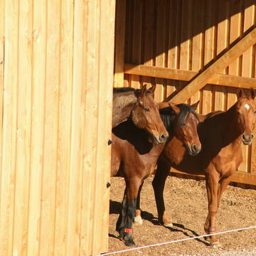
Offenstallplätze auf Westernreitanlage
Oppenweiler
Hide Away Ranch
@Hide_Away_Ranch
Freizeitstall
Pferdeausbildung
Vermieten
Führanlage
Paddock
Fohlenaufzucht möglich
Pferdezucht
20 weitere...
aktuell
P
Deprecated: Creation of dynamic property Zend_View_Helper_Ads::$adLink is deprecated in /var/www/stall-frei/htdocs/staging.stall-frei.de/library/Psf/View/Helper/Ads.php on line 108

Paddockbox in kleiner Stallgemeinschaft frei
Rutesheim
Carolin-Hoerning
@Carolin-Hoerning
Wir sind ein kleiner Stall mit nur 13 Boxen in Rutesheim.
Aktuell haben wir eine Paddockbox frei.
neu
R
Leider kein Vorschaubild
Leider kein Vorschaubild
Harmonische Herdenhaltung mit nachts Einzelboxen
Oberrot
Wieland
@Wieland
Freizeitstall
Krankenbox
Paddock
bedampftes/gewaschenes Heu
Notfallboxen
Innenbox
Offenstall
11 weitere...
B
Leider kein Vorschaubild
Leider kein Vorschaubild
Platz im Offenstall mit großen Weideflächen
Oberrot
Wieland
@Wieland
Freizeitstall
Krankenbox
Paddock
bedampftes/gewaschenes Heu
Notfallboxen
Innenbox
Offenstall
11 weitere...
B
Leider kein Vorschaubild
Leider kein Vorschaubild
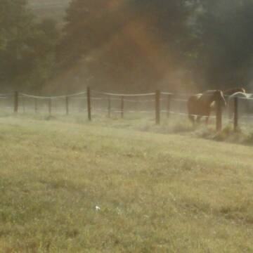
Offenstall-Platz in Wallachherde frei
Spiegelberg-Jux
Sven-Wahl
@Sven-Wahl
Sommerweide
Weide
Offenstall
Vollpension
1 weitere...
aktuell
B
Bewegungsstall Willig
Möckmühl
ReitstallWillig
@ReitstallWillig
Pferdeausbildung
Reitlehrer und -unterricht
Krankenbox
Longierzirkel/Roundpen
Notfallboxen
Außenbox mit Paddock
Bewegungsstall
19 weitere...
P

Schöntal-Ranch
Schöntal
Tanja Sautter
@SchoentalRanch
Freizeitstall
Pferdeausbildung
Vermieten
Verpachten
Krankenbox
Paddock
Allergikerstall
bedampftes/gewaschenes Heu
26 weitere...
ganz aktuell
P

Pferdepension Hit Aktivstall Kürmerhof
Hohenkammer
Kuermerhof
@Kuermerhof
*******JETZT NEU MIT ENTSTAUBTEM BIOHEU*********
*******Demnächst mit einem Abenteuerspielplatz für Pferde ( Extrem Trail/Pa

REITANLAGE WELLERHOF
Aspach
Reitanlage Wellerhof
@Reitanlage-Wellerhof
Freizeitstall
Gangpferdereiten
Vermieten
Verpachten
Krankenbox
Laufband
Notfallboxen
26 weitere...
P
Offenstall in traumhafter Lage ab Ende April
Neudenau-Kreßbach
Lang-GbR
@Lang-GbR
Geländestrecke
Vermieten
Hunde willkommen
Paddock
Bewegungsstall
Laufstall
10 weitere...
aktuell
P
Westernreitstall/Jungpferde/Allergiker/Rentner
Backnang
Frau-Sandra-Wieland
@Frau-Sandra-Wieland
Freizeitstall
Geländestrecke
Vermieten
Krankenbox
Longierzirkel/Roundpen
Allergikerstall
Fohlenaufzucht möglich
30 weitere...
P
Leider kein Vorschaubild
Leider kein Vorschaubild
Pferdehof Wilhelmsglück
Rosengarten
Pferdehof-Wilhelmsglueck
@Pferdehof-Wilhelmsglueck
FN-Mitglied
Freizeitstall
Vermieten
Paddock
Parkplatz für Pferdeanhänger
Gnadenbrothof
16 weitere...
B
Newsletter abonnieren
Melde Dich für unseren Newsletter an und verpasse keine Neuigkeiten!
Deprecated: Creation of dynamic property Zend_View::$pageCount is deprecated in /var/www/stall-frei/htdocs/staging.stall-frei.de/library/vendor/shardj/zf1-future/library/Zend/View/Abstract.php on line 308
Deprecated: Creation of dynamic property Zend_View::$itemCountPerPage is deprecated in /var/www/stall-frei/htdocs/staging.stall-frei.de/library/vendor/shardj/zf1-future/library/Zend/View/Abstract.php on line 308
Deprecated: Creation of dynamic property Zend_View::$first is deprecated in /var/www/stall-frei/htdocs/staging.stall-frei.de/library/vendor/shardj/zf1-future/library/Zend/View/Abstract.php on line 308
Deprecated: Creation of dynamic property Zend_View::$current is deprecated in /var/www/stall-frei/htdocs/staging.stall-frei.de/library/vendor/shardj/zf1-future/library/Zend/View/Abstract.php on line 308
Deprecated: Creation of dynamic property Zend_View::$last is deprecated in /var/www/stall-frei/htdocs/staging.stall-frei.de/library/vendor/shardj/zf1-future/library/Zend/View/Abstract.php on line 308
Deprecated: Creation of dynamic property Zend_View::$previous is deprecated in /var/www/stall-frei/htdocs/staging.stall-frei.de/library/vendor/shardj/zf1-future/library/Zend/View/Abstract.php on line 308
Deprecated: Creation of dynamic property Zend_View::$next is deprecated in /var/www/stall-frei/htdocs/staging.stall-frei.de/library/vendor/shardj/zf1-future/library/Zend/View/Abstract.php on line 308
Deprecated: Creation of dynamic property Zend_View::$pagesInRange is deprecated in /var/www/stall-frei/htdocs/staging.stall-frei.de/library/vendor/shardj/zf1-future/library/Zend/View/Abstract.php on line 308
Deprecated: Creation of dynamic property Zend_View::$firstPageInRange is deprecated in /var/www/stall-frei/htdocs/staging.stall-frei.de/library/vendor/shardj/zf1-future/library/Zend/View/Abstract.php on line 308
Deprecated: Creation of dynamic property Zend_View::$lastPageInRange is deprecated in /var/www/stall-frei/htdocs/staging.stall-frei.de/library/vendor/shardj/zf1-future/library/Zend/View/Abstract.php on line 308
Deprecated: Creation of dynamic property Zend_View::$currentItemCount is deprecated in /var/www/stall-frei/htdocs/staging.stall-frei.de/library/vendor/shardj/zf1-future/library/Zend/View/Abstract.php on line 308
Deprecated: Creation of dynamic property Zend_View::$totalItemCount is deprecated in /var/www/stall-frei/htdocs/staging.stall-frei.de/library/vendor/shardj/zf1-future/library/Zend/View/Abstract.php on line 308
Deprecated: Creation of dynamic property Zend_View::$firstItemNumber is deprecated in /var/www/stall-frei/htdocs/staging.stall-frei.de/library/vendor/shardj/zf1-future/library/Zend/View/Abstract.php on line 308
Deprecated: Creation of dynamic property Zend_View::$lastItemNumber is deprecated in /var/www/stall-frei/htdocs/staging.stall-frei.de/library/vendor/shardj/zf1-future/library/Zend/View/Abstract.php on line 308
Deprecated: Creation of dynamic property Zend_View::$router is deprecated in /var/www/stall-frei/htdocs/staging.stall-frei.de/library/vendor/shardj/zf1-future/library/Zend/View/Abstract.php on line 308
Deprecated: Creation of dynamic property Zend_View::$urlParams is deprecated in /var/www/stall-frei/htdocs/staging.stall-frei.de/library/vendor/shardj/zf1-future/library/Zend/View/Abstract.php on line 308
Deprecated: Creation of dynamic property Zend_View::$showAds is deprecated in /var/www/stall-frei/htdocs/staging.stall-frei.de/library/vendor/shardj/zf1-future/library/Zend/View/Abstract.php on line 308
Deprecated: Creation of dynamic property Zend_View::$objectIds is deprecated in /var/www/stall-frei/htdocs/staging.stall-frei.de/library/vendor/shardj/zf1-future/library/Zend/View/Abstract.php on line 308
Deprecated: Creation of dynamic property Zend_View::$showNavbar is deprecated in /var/www/stall-frei/htdocs/staging.stall-frei.de/library/vendor/shardj/zf1-future/library/Zend/View/Abstract.php on line 308
Deprecated: Creation of dynamic property Zend_View::$showBreadcrumb is deprecated in /var/www/stall-frei/htdocs/staging.stall-frei.de/library/vendor/shardj/zf1-future/library/Zend/View/Abstract.php on line 308
Deprecated: Creation of dynamic property Zend_View::$showFooter is deprecated in /var/www/stall-frei/htdocs/staging.stall-frei.de/library/vendor/shardj/zf1-future/library/Zend/View/Abstract.php on line 308
Deprecated: Creation of dynamic property Zend_View::$showInternalAds is deprecated in /var/www/stall-frei/htdocs/staging.stall-frei.de/library/vendor/shardj/zf1-future/library/Zend/View/Abstract.php on line 308
Deprecated: Creation of dynamic property Zend_View::$blNoContent is deprecated in /var/www/stall-frei/htdocs/staging.stall-frei.de/library/vendor/shardj/zf1-future/library/Zend/View/Abstract.php on line 308
Deprecated: Creation of dynamic property Zend_View::$sMetaDesc is deprecated in /var/www/stall-frei/htdocs/staging.stall-frei.de/library/vendor/shardj/zf1-future/library/Zend/View/Abstract.php on line 308
Deprecated: Creation of dynamic property Zend_View::$useGmaps is deprecated in /var/www/stall-frei/htdocs/staging.stall-frei.de/library/vendor/shardj/zf1-future/library/Zend/View/Abstract.php on line 308
Deprecated: Creation of dynamic property Zend_View::$touches is deprecated in /var/www/stall-frei/htdocs/staging.stall-frei.de/library/vendor/shardj/zf1-future/library/Zend/View/Abstract.php on line 308
Deprecated: Creation of dynamic property Zend_View::$oProject is deprecated in /var/www/stall-frei/htdocs/staging.stall-frei.de/library/vendor/shardj/zf1-future/library/Zend/View/Abstract.php on line 308
Deprecated: Creation of dynamic property Zend_View::$pageHeadline is deprecated in /var/www/stall-frei/htdocs/staging.stall-frei.de/library/vendor/shardj/zf1-future/library/Zend/View/Abstract.php on line 308
Deprecated: Creation of dynamic property Zend_View::$disableLocationField is deprecated in /var/www/stall-frei/htdocs/staging.stall-frei.de/library/vendor/shardj/zf1-future/library/Zend/View/Abstract.php on line 308
Deprecated: Creation of dynamic property Zend_View::$isSearch is deprecated in /var/www/stall-frei/htdocs/staging.stall-frei.de/library/vendor/shardj/zf1-future/library/Zend/View/Abstract.php on line 308
Deprecated: Creation of dynamic property Zend_View::$pageTitle is deprecated in /var/www/stall-frei/htdocs/staging.stall-frei.de/library/vendor/shardj/zf1-future/library/Zend/View/Abstract.php on line 308
Deprecated: Creation of dynamic property Psf_Form_Element_Text::$class is deprecated in /var/www/stall-frei/htdocs/staging.stall-frei.de/library/vendor/shardj/zf1-future/library/Zend/Form/Element.php on line 874
Deprecated: Creation of dynamic property Psf_Form_Element_Text::$size is deprecated in /var/www/stall-frei/htdocs/staging.stall-frei.de/library/vendor/shardj/zf1-future/library/Zend/Form/Element.php on line 874
Deprecated: Creation of dynamic property Psf_Form_Element_Text::$placeholder is deprecated in /var/www/stall-frei/htdocs/staging.stall-frei.de/library/vendor/shardj/zf1-future/library/Zend/Form/Element.php on line 874
Deprecated: Creation of dynamic property Psf_Form_Element_Hidden::$class is deprecated in /var/www/stall-frei/htdocs/staging.stall-frei.de/library/vendor/shardj/zf1-future/library/Zend/Form/Element.php on line 874
Deprecated: Creation of dynamic property Psf_Form_Element_Hidden::$class is deprecated in /var/www/stall-frei/htdocs/staging.stall-frei.de/library/vendor/shardj/zf1-future/library/Zend/Form/Element.php on line 874
Deprecated: Creation of dynamic property Psf_Form_Element_Hidden::$class is deprecated in /var/www/stall-frei/htdocs/staging.stall-frei.de/library/vendor/shardj/zf1-future/library/Zend/Form/Element.php on line 874
Deprecated: Creation of dynamic property Psf_Form_Element_Hidden::$class is deprecated in /var/www/stall-frei/htdocs/staging.stall-frei.de/library/vendor/shardj/zf1-future/library/Zend/Form/Element.php on line 874
Deprecated: Creation of dynamic property Psf_Form_Element_Select::$class is deprecated in /var/www/stall-frei/htdocs/staging.stall-frei.de/library/vendor/shardj/zf1-future/library/Zend/Form/Element.php on line 874
Deprecated: Creation of dynamic property Psf_Form_Element_Select::$class is deprecated in /var/www/stall-frei/htdocs/staging.stall-frei.de/library/vendor/shardj/zf1-future/library/Zend/Form/Element.php on line 874
Deprecated: Creation of dynamic property Psf_Form_Element_Select::$class is deprecated in /var/www/stall-frei/htdocs/staging.stall-frei.de/library/vendor/shardj/zf1-future/library/Zend/Form/Element.php on line 874
Deprecated: Creation of dynamic property Psf_Form_Element_Select::$class is deprecated in /var/www/stall-frei/htdocs/staging.stall-frei.de/library/vendor/shardj/zf1-future/library/Zend/Form/Element.php on line 874
Deprecated: Creation of dynamic property Psf_Form_Element_Text::$class is deprecated in /var/www/stall-frei/htdocs/staging.stall-frei.de/library/vendor/shardj/zf1-future/library/Zend/Form/Element.php on line 874
Deprecated: Creation of dynamic property Psf_Form_Element_Checkbox::$label is deprecated in /var/www/stall-frei/htdocs/staging.stall-frei.de/library/vendor/shardj/zf1-future/library/Zend/Form/Element.php on line 874
Deprecated: Creation of dynamic property Zend_View::$sort is deprecated in /var/www/stall-frei/htdocs/staging.stall-frei.de/library/vendor/shardj/zf1-future/library/Zend/View/Abstract.php on line 308
Deprecated: Creation of dynamic property Zend_View::$searchLocation is deprecated in /var/www/stall-frei/htdocs/staging.stall-frei.de/library/vendor/shardj/zf1-future/library/Zend/View/Abstract.php on line 308
Deprecated: Creation of dynamic property Zend_View::$locationHint is deprecated in /var/www/stall-frei/htdocs/staging.stall-frei.de/library/vendor/shardj/zf1-future/library/Zend/View/Abstract.php on line 308
Psf_GeoCoder_Abstract::getLocation: Harsberg Get Location CachedOrLive
Psf_GeoCoder_Abstract::getCachedOrLive: Harsberg
Psf_GeoCoder_Abstract::convertLocationResult
{"documentation":"https:\/\/opencagedata.com\/api","licenses":[{"name":"see attribution guide","url":"https:\/\/opencagedata.com\/credits"}],"results":[{"bounds":{"northeast":{"lat":49.1750263,"lng":9.5779977},"southwest":{"lat":49.1401425,"lng":9.5106157}},"components":{"ISO_3166-1_alpha-2":"DE","ISO_3166-1_alpha-3":"DEU","ISO_3166-2":["DE-BW"],"_category":"place","_normalized_city":"Pfedelbach","_type":"village","city":"Pfedelbach","continent":"Europe","country":"Deutschland","country_code":"de","county":"Hohenlohekreis","municipality":"VVG der Stadt \u00d6hringen","political_union":"European Union","postcode":"74629","state":"Baden-W\u00fcrttemberg","state_code":"BW","village":"Harsberg"},"confidence":7,"formatted":"74629 Harsberg, Deutschland","geometry":{"lat":49.156087,"lng":9.5393816}},{"bounds":{"northeast":{"lat":49.4807405,"lng":8.0466192},"southwest":{"lat":49.4806405,"lng":8.0465192}},"components":{"ISO_3166-1_alpha-2":"DE","ISO_3166-1_alpha-3":"DEU","ISO_3166-2":["DE-RP"],"_category":"natural\/water","_normalized_city":"Kirchheim an der Weinstra\u00dfe","_type":"peak","continent":"Europe","country":"Deutschland","country_code":"de","county":"Landkreis Bad D\u00fcrkheim","municipality":"Leiningerland","peak":"Harsberg","political_union":"European Union","postcode":"67316","state":"Rheinland-Pfalz","state_code":"RP","village":"Kirchheim an der Weinstra\u00dfe"},"confidence":9,"formatted":"Harsberg, 67316 Kirchheim an der Weinstra\u00dfe, Deutschland","geometry":{"lat":49.4806905,"lng":8.0465692}},{"bounds":{"northeast":{"lat":49.3535356,"lng":7.6088043},"southwest":{"lat":49.3135356,"lng":7.5688043}},"components":{"ISO_3166-1_alpha-2":"DE","ISO_3166-1_alpha-3":"DEU","ISO_3166-2":["DE-RP"],"_category":"place","_normalized_city":"Weselberg","_type":"village","city":"Weselberg","continent":"Europe","country":"Deutschland","country_code":"de","county":"S\u00fcdwestpfalz","municipality":"Thaleischweiler-Wallhalben","political_union":"European Union","postcode":"66919","state":"Rheinland-Pfalz","state_code":"RP","village":"Harsberg"},"confidence":7,"formatted":"66919 Harsberg, Deutschland","geometry":{"lat":49.3335356,"lng":7.5888043}},{"bounds":{"northeast":{"lat":51.0778352,"lng":10.3702906},"southwest":{"lat":51.0777352,"lng":10.3701906}},"components":{"ISO_3166-1_alpha-2":"DE","ISO_3166-1_alpha-3":"DEU","ISO_3166-2":["DE-TH"],"_category":"natural\/water","_normalized_city":"Amt Creuzburg","_type":"peak","continent":"Europe","country":"Deutschland","country_code":"de","county":"Wartburgkreis","municipality":"Amt Creuzburg","peak":"Harsberg","political_union":"European Union","postcode":"99826","state":"Th\u00fcringen","state_code":"TH"},"confidence":9,"formatted":"Harsberg, 99826 Amt Creuzburg, Deutschland","geometry":{"lat":51.0777852,"lng":10.3702406}},{"components":{"ISO_3166-1_alpha-2":"FR","ISO_3166-1_alpha-3":"FRA","ISO_3166-2":["FR-IDF","FR-92"],"_category":"road","_normalized_city":"Levallois-Perret","_type":"road","city":"Levallois-Perret","continent":"Europe","country":"France","country_code":"fr","county":"Hauts-de-Seine","local_authority":"M\u00e9tropole du Grand Paris","political_union":"European Union","postcode":"92300","road":"Rue Charles Deutschmann","state":"\u00cele-de-France","state_code":"IDF"},"confidence":3,"formatted":"Rue Charles Deutschmann, 92300 Levallois-Perret, France","geometry":{"lat":48.900049,"lng":2.2842}},{"components":{"ISO_3166-1_alpha-2":"FR","ISO_3166-1_alpha-3":"FRA","ISO_3166-2":["FR-GES","FR-57"],"_category":"road","_normalized_city":"Walscheid","_type":"road","city":"Walscheid","continent":"Europe","country":"France","country_code":"fr","county":"Moselle","local_authority":"Communaut\u00e9 de communes Sarrebourg Moselle Sud","political_union":"European Union","postcode":"57870","road":"Route de Harreberg","state":"Grand Est","state_code":"GES"},"confidence":3,"formatted":"Route de Harreberg, 57870 Walscheid, France","geometry":{"lat":48.654504,"lng":7.155466}},{"components":{"ISO_3166-1_alpha-2":"FR","ISO_3166-1_alpha-3":"FRA","ISO_3166-2":["FR-GES","FR-6AE","FR-68"],"_category":"place","_normalized_city":"Sondernach","_type":"place","city":"Sondernach","continent":"Europe","country":"France","country_code":"fr","county":"Haut-Rhin","local_authority":"Communaut\u00e9 de communes de la Vall\u00e9e de Munster","place":"Absberg","political_union":"European Union","postcode":"68380","state":"Grand Est","state_code":"GES"},"confidence":2,"formatted":"Absberg, 68380 Sondernach, France","geometry":{"lat":47.990479,"lng":7.054768}},{"components":{"ISO_3166-1_alpha-2":"FR","ISO_3166-1_alpha-3":"FRA","ISO_3166-2":["FR-GES","FR-57"],"_category":"road","_normalized_city":"Harreberg","_type":"road","city":"Harreberg","continent":"Europe","country":"France","country_code":"fr","county":"Moselle","local_authority":"Communaut\u00e9 de communes Sarrebourg Moselle Sud","political_union":"European Union","postcode":"57870","road":"Rue de la Chapelle","state":"Grand Est","state_code":"GES"},"confidence":2,"formatted":"Rue de la Chapelle, 57870 Harreberg, France","geometry":{"lat":48.675511,"lng":7.139025}},{"components":{"ISO_3166-1_alpha-2":"FR","ISO_3166-1_alpha-3":"FRA","ISO_3166-2":["FR-GES","FR-6AE","FR-67"],"_category":"road","_normalized_city":"Domfessel","_type":"road","city":"Domfessel","continent":"Europe","country":"France","country_code":"fr","county":"Bas-Rhin","local_authority":"Communaut\u00e9 de communes de l'Alsace Bossue","political_union":"European Union","postcode":"67430","road":"Chemin du Hardberg","state":"Grand Est","state_code":"GES"},"confidence":2,"formatted":"Chemin du Hardberg, 67430 Domfessel, France","geometry":{"lat":48.955521,"lng":7.15401}},{"components":{"ISO_3166-1_alpha-2":"FR","ISO_3166-1_alpha-3":"FRA","ISO_3166-2":["FR-GES","FR-57"],"_category":"road","_normalized_city":"Harreberg","_type":"road","city":"Harreberg","continent":"Europe","country":"France","country_code":"fr","county":"Moselle","local_authority":"Communaut\u00e9 de communes Sarrebourg Moselle Sud","political_union":"European Union","postcode":"57870","road":"Rue de la For\u00eat","state":"Grand Est","state_code":"GES"},"confidence":2,"formatted":"Rue de la For\u00eat, 57870 Harreberg, France","geometry":{"lat":48.674614,"lng":7.143813}}],"status":{"code":200,"message":"OK"},"stay_informed":{"blog":"https:\/\/blog.opencagedata.com","mastodon":"https:\/\/en.osm.town\/@opencage"},"thanks":"For using an OpenCage API","timestamp":{"created_http":"Sun, 08 Feb 2026 06:48:20 GMT","created_unix":1770533300},"total_results":10}Array
(
[0] => stdClass Object
(
[bounds] => stdClass Object
(
[northeast] => stdClass Object
(
[lat] => 49.1750263
[lng] => 9.5779977
)
[southwest] => stdClass Object
(
[lat] => 49.1401425
[lng] => 9.5106157
)
)
[components] => stdClass Object
(
[ISO_3166-1_alpha-2] => DE
[ISO_3166-1_alpha-3] => DEU
[ISO_3166-2] => Array
(
[0] => DE-BW
)
[_category] => place
[_normalized_city] => Pfedelbach
[_type] => village
[city] => Pfedelbach
[continent] => Europe
[country] => Deutschland
[country_code] => de
[county] => Hohenlohekreis
[municipality] => VVG der Stadt Öhringen
[political_union] => European Union
[postcode] => 74629
[state] => Baden-Württemberg
[state_code] => BW
[village] => Harsberg
)
[confidence] => 7
[formatted] => 74629 Harsberg, Deutschland
[geometry] => stdClass Object
(
[lat] => 49.156087
[lng] => 9.5393816
)
)
[1] => stdClass Object
(
[bounds] => stdClass Object
(
[northeast] => stdClass Object
(
[lat] => 49.4807405
[lng] => 8.0466192
)
[southwest] => stdClass Object
(
[lat] => 49.4806405
[lng] => 8.0465192
)
)
[components] => stdClass Object
(
[ISO_3166-1_alpha-2] => DE
[ISO_3166-1_alpha-3] => DEU
[ISO_3166-2] => Array
(
[0] => DE-RP
)
[_category] => natural/water
[_normalized_city] => Kirchheim an der Weinstraße
[_type] => peak
[continent] => Europe
[country] => Deutschland
[country_code] => de
[county] => Landkreis Bad Dürkheim
[municipality] => Leiningerland
[peak] => Harsberg
[political_union] => European Union
[postcode] => 67316
[state] => Rheinland-Pfalz
[state_code] => RP
[village] => Kirchheim an der Weinstraße
)
[confidence] => 9
[formatted] => Harsberg, 67316 Kirchheim an der Weinstraße, Deutschland
[geometry] => stdClass Object
(
[lat] => 49.4806905
[lng] => 8.0465692
)
)
[2] => stdClass Object
(
[bounds] => stdClass Object
(
[northeast] => stdClass Object
(
[lat] => 49.3535356
[lng] => 7.6088043
)
[southwest] => stdClass Object
(
[lat] => 49.3135356
[lng] => 7.5688043
)
)
[components] => stdClass Object
(
[ISO_3166-1_alpha-2] => DE
[ISO_3166-1_alpha-3] => DEU
[ISO_3166-2] => Array
(
[0] => DE-RP
)
[_category] => place
[_normalized_city] => Weselberg
[_type] => village
[city] => Weselberg
[continent] => Europe
[country] => Deutschland
[country_code] => de
[county] => Südwestpfalz
[municipality] => Thaleischweiler-Wallhalben
[political_union] => European Union
[postcode] => 66919
[state] => Rheinland-Pfalz
[state_code] => RP
[village] => Harsberg
)
[confidence] => 7
[formatted] => 66919 Harsberg, Deutschland
[geometry] => stdClass Object
(
[lat] => 49.3335356
[lng] => 7.5888043
)
)
[3] => stdClass Object
(
[bounds] => stdClass Object
(
[northeast] => stdClass Object
(
[lat] => 51.0778352
[lng] => 10.3702906
)
[southwest] => stdClass Object
(
[lat] => 51.0777352
[lng] => 10.3701906
)
)
[components] => stdClass Object
(
[ISO_3166-1_alpha-2] => DE
[ISO_3166-1_alpha-3] => DEU
[ISO_3166-2] => Array
(
[0] => DE-TH
)
[_category] => natural/water
[_normalized_city] => Amt Creuzburg
[_type] => peak
[continent] => Europe
[country] => Deutschland
[country_code] => de
[county] => Wartburgkreis
[municipality] => Amt Creuzburg
[peak] => Harsberg
[political_union] => European Union
[postcode] => 99826
[state] => Thüringen
[state_code] => TH
)
[confidence] => 9
[formatted] => Harsberg, 99826 Amt Creuzburg, Deutschland
[geometry] => stdClass Object
(
[lat] => 51.0777852
[lng] => 10.3702406
)
)
[4] => stdClass Object
(
[components] => stdClass Object
(
[ISO_3166-1_alpha-2] => FR
[ISO_3166-1_alpha-3] => FRA
[ISO_3166-2] => Array
(
[0] => FR-IDF
[1] => FR-92
)
[_category] => road
[_normalized_city] => Levallois-Perret
[_type] => road
[city] => Levallois-Perret
[continent] => Europe
[country] => France
[country_code] => fr
[county] => Hauts-de-Seine
[local_authority] => Métropole du Grand Paris
[political_union] => European Union
[postcode] => 92300
[road] => Rue Charles Deutschmann
[state] => Île-de-France
[state_code] => IDF
)
[confidence] => 3
[formatted] => Rue Charles Deutschmann, 92300 Levallois-Perret, France
[geometry] => stdClass Object
(
[lat] => 48.900049
[lng] => 2.2842
)
)
[5] => stdClass Object
(
[components] => stdClass Object
(
[ISO_3166-1_alpha-2] => FR
[ISO_3166-1_alpha-3] => FRA
[ISO_3166-2] => Array
(
[0] => FR-GES
[1] => FR-57
)
[_category] => road
[_normalized_city] => Walscheid
[_type] => road
[city] => Walscheid
[continent] => Europe
[country] => France
[country_code] => fr
[county] => Moselle
[local_authority] => Communauté de communes Sarrebourg Moselle Sud
[political_union] => European Union
[postcode] => 57870
[road] => Route de Harreberg
[state] => Grand Est
[state_code] => GES
)
[confidence] => 3
[formatted] => Route de Harreberg, 57870 Walscheid, France
[geometry] => stdClass Object
(
[lat] => 48.654504
[lng] => 7.155466
)
)
[6] => stdClass Object
(
[components] => stdClass Object
(
[ISO_3166-1_alpha-2] => FR
[ISO_3166-1_alpha-3] => FRA
[ISO_3166-2] => Array
(
[0] => FR-GES
[1] => FR-6AE
[2] => FR-68
)
[_category] => place
[_normalized_city] => Sondernach
[_type] => place
[city] => Sondernach
[continent] => Europe
[country] => France
[country_code] => fr
[county] => Haut-Rhin
[local_authority] => Communauté de communes de la Vallée de Munster
[place] => Absberg
[political_union] => European Union
[postcode] => 68380
[state] => Grand Est
[state_code] => GES
)
[confidence] => 2
[formatted] => Absberg, 68380 Sondernach, France
[geometry] => stdClass Object
(
[lat] => 47.990479
[lng] => 7.054768
)
)
[7] => stdClass Object
(
[components] => stdClass Object
(
[ISO_3166-1_alpha-2] => FR
[ISO_3166-1_alpha-3] => FRA
[ISO_3166-2] => Array
(
[0] => FR-GES
[1] => FR-57
)
[_category] => road
[_normalized_city] => Harreberg
[_type] => road
[city] => Harreberg
[continent] => Europe
[country] => France
[country_code] => fr
[county] => Moselle
[local_authority] => Communauté de communes Sarrebourg Moselle Sud
[political_union] => European Union
[postcode] => 57870
[road] => Rue de la Chapelle
[state] => Grand Est
[state_code] => GES
)
[confidence] => 2
[formatted] => Rue de la Chapelle, 57870 Harreberg, France
[geometry] => stdClass Object
(
[lat] => 48.675511
[lng] => 7.139025
)
)
[8] => stdClass Object
(
[components] => stdClass Object
(
[ISO_3166-1_alpha-2] => FR
[ISO_3166-1_alpha-3] => FRA
[ISO_3166-2] => Array
(
[0] => FR-GES
[1] => FR-6AE
[2] => FR-67
)
[_category] => road
[_normalized_city] => Domfessel
[_type] => road
[city] => Domfessel
[continent] => Europe
[country] => France
[country_code] => fr
[county] => Bas-Rhin
[local_authority] => Communauté de communes de l'Alsace Bossue
[political_union] => European Union
[postcode] => 67430
[road] => Chemin du Hardberg
[state] => Grand Est
[state_code] => GES
)
[confidence] => 2
[formatted] => Chemin du Hardberg, 67430 Domfessel, France
[geometry] => stdClass Object
(
[lat] => 48.955521
[lng] => 7.15401
)
)
[9] => stdClass Object
(
[components] => stdClass Object
(
[ISO_3166-1_alpha-2] => FR
[ISO_3166-1_alpha-3] => FRA
[ISO_3166-2] => Array
(
[0] => FR-GES
[1] => FR-57
)
[_category] => road
[_normalized_city] => Harreberg
[_type] => road
[city] => Harreberg
[continent] => Europe
[country] => France
[country_code] => fr
[county] => Moselle
[local_authority] => Communauté de communes Sarrebourg Moselle Sud
[political_union] => European Union
[postcode] => 57870
[road] => Rue de la Forêt
[state] => Grand Est
[state_code] => GES
)
[confidence] => 2
[formatted] => Rue de la Forêt, 57870 Harreberg, France
[geometry] => stdClass Object
(
[lat] => 48.674614
[lng] => 7.143813
)
)
)
Psf_GeoCoder_OpenCageData::getKeyMap: 0
stdClass Object
(
    [bounds] => stdClass Object
        (
            [northeast] => stdClass Object
                (
                    [lat] => 49.1750263
                    [lng] => 9.5779977
                )

            [southwest] => stdClass Object
                (
                    [lat] => 49.1401425
                    [lng] => 9.5106157
                )

        )

    [components] => stdClass Object
        (
            [ISO_3166-1_alpha-2] => DE
            [ISO_3166-1_alpha-3] => DEU
            [ISO_3166-2] => Array
                (
                    [0] => DE-BW
                )

            [_category] => place
            [_normalized_city] => Pfedelbach
            [_type] => village
            [city] => Pfedelbach
            [continent] => Europe
            [country] => Deutschland
            [country_code] => de
            [county] => Hohenlohekreis
            [municipality] => VVG der Stadt Öhringen
            [political_union] => European Union
            [postcode] => 74629
            [state] => Baden-Württemberg
            [state_code] => BW
            [village] => Harsberg
        )

    [confidence] => 7
    [formatted] => 74629 Harsberg, Deutschland
    [geometry] => stdClass Object
        (
            [lat] => 49.156087
            [lng] => 9.5393816
        )

)
Psf_GeoCoder_OpenCageData::getCounty: Hohenlohekreis
Psf_GeoCoder_OpenCageData::addMissingData REFETCH!
Array
(
    [address] => 74629 Harsberg, Deutschland
    [type] => village
    [street] =>
    [city] => Harsberg
    [county] => Hohenlohekreis
    [state] => Baden-Württemberg
    [zip] => 74629
    [country] => Deutschland
    [suburb] =>
    [countrycode] => de
    [latitude] => 49.156087
    [longitude] => 9.5393816
    [accuracy] => 1
    [confidence] => 7
    [bounds] => stdClass Object
        (
            [northeast] => stdClass Object
                (
                    [lat] => 49.1750263
                    [lng] => 9.5779977
                )

            [southwest] => stdClass Object
                (
                    [lat] => 49.1401425
                    [lng] => 9.5106157
                )

        )

)
reformat!
Array
(
    [address] => 74629 Harsberg, Deutschland
    [type] => village
    [street] =>
    [city] => Harsberg
    [county] => Hohenlohekreis
    [state] => Baden-Württemberg
    [zip] => 74629
    [country] => Deutschland
    [suburb] =>
    [countrycode] => de
    [latitude] => 49.156087
    [longitude] => 9.5393816
    [accuracy] => 1
    [confidence] => 7
    [bounds] => stdClass Object
        (
            [northeast] => stdClass Object
                (
                    [lat] => 49.1750263
                    [lng] => 9.5779977
                )

            [southwest] => stdClass Object
                (
                    [lat] => 49.1401425
                    [lng] => 9.5106157
                )

        )

    [place] => 74629 Harsberg, Baden-Württemberg
    [hash] => 8581777a900906bedd5803ce0c97c15f
)
Psf_GeoCoder_OpenCageData::getKeyMap: 1
stdClass Object
(
    [bounds] => stdClass Object
        (
            [northeast] => stdClass Object
                (
                    [lat] => 49.4807405
                    [lng] => 8.0466192
                )

            [southwest] => stdClass Object
                (
                    [lat] => 49.4806405
                    [lng] => 8.0465192
                )

        )

    [components] => stdClass Object
        (
            [ISO_3166-1_alpha-2] => DE
            [ISO_3166-1_alpha-3] => DEU
            [ISO_3166-2] => Array
                (
                    [0] => DE-RP
                )

            [_category] => natural/water
            [_normalized_city] => Kirchheim an der Weinstraße
            [_type] => peak
            [continent] => Europe
            [country] => Deutschland
            [country_code] => de
            [county] => Landkreis Bad Dürkheim
            [municipality] => Leiningerland
            [peak] => Harsberg
            [political_union] => European Union
            [postcode] => 67316
            [state] => Rheinland-Pfalz
            [state_code] => RP
            [village] => Kirchheim an der Weinstraße
        )

    [confidence] => 9
    [formatted] => Harsberg, 67316 Kirchheim an der Weinstraße, Deutschland
    [geometry] => stdClass Object
        (
            [lat] => 49.4806905
            [lng] => 8.0465692
        )

)
Psf_GeoCoder_OpenCageData::getCounty: Bad Dürkheim
Psf_GeoCoder_OpenCageData::addMissingData REFETCH!
Array
(
    [address] => Harsberg, 67316 Kirchheim an der Weinstraße, Deutschland
    [type] => peak
    [street] =>
    [city] => Kirchheim an der Weinstraße
    [county] => Bad Dürkheim
    [state] => Rheinland-Pfalz
    [zip] => 67316
    [country] => Deutschland
    [suburb] =>
    [countrycode] => de
    [latitude] => 49.4806905
    [longitude] => 8.0465692
    [accuracy] => 1
    [confidence] => 9
    [bounds] => stdClass Object
        (
            [northeast] => stdClass Object
                (
                    [lat] => 49.4807405
                    [lng] => 8.0466192
                )

            [southwest] => stdClass Object
                (
                    [lat] => 49.4806405
                    [lng] => 8.0465192
                )

        )

)
reformat!
Array
(
    [address] => Harsberg, 67316 Kirchheim an der Weinstraße, Deutschland
    [type] => peak
    [street] =>
    [city] => Kirchheim an der Weinstraße
    [county] => Bad Dürkheim
    [state] => Rheinland-Pfalz
    [zip] => 67316
    [country] => Deutschland
    [suburb] =>
    [countrycode] => de
    [latitude] => 49.4806905
    [longitude] => 8.0465692
    [accuracy] => 1
    [confidence] => 9
    [bounds] => stdClass Object
        (
            [northeast] => stdClass Object
                (
                    [lat] => 49.4807405
                    [lng] => 8.0466192
                )

            [southwest] => stdClass Object
                (
                    [lat] => 49.4806405
                    [lng] => 8.0465192
                )

        )

    [place] => 67316 Kirchheim an der Weinstraße, Rheinland-Pfalz
    [hash] => a5c0b5008ae47088ed8de3f6f0f8a5c5
)
Psf_GeoCoder_OpenCageData::getKeyMap: 2
stdClass Object
(
    [bounds] => stdClass Object
        (
            [northeast] => stdClass Object
                (
                    [lat] => 49.3535356
                    [lng] => 7.6088043
                )

            [southwest] => stdClass Object
                (
                    [lat] => 49.3135356
                    [lng] => 7.5688043
                )

        )

    [components] => stdClass Object
        (
            [ISO_3166-1_alpha-2] => DE
            [ISO_3166-1_alpha-3] => DEU
            [ISO_3166-2] => Array
                (
                    [0] => DE-RP
                )

            [_category] => place
            [_normalized_city] => Weselberg
            [_type] => village
            [city] => Weselberg
            [continent] => Europe
            [country] => Deutschland
            [country_code] => de
            [county] => Südwestpfalz
            [municipality] => Thaleischweiler-Wallhalben
            [political_union] => European Union
            [postcode] => 66919
            [state] => Rheinland-Pfalz
            [state_code] => RP
            [village] => Harsberg
        )

    [confidence] => 7
    [formatted] => 66919 Harsberg, Deutschland
    [geometry] => stdClass Object
        (
            [lat] => 49.3335356
            [lng] => 7.5888043
        )

)
Psf_GeoCoder_OpenCageData::getCounty: Südwestpfalz
Psf_GeoCoder_OpenCageData::addMissingData REFETCH!
Array
(
    [address] => 66919 Harsberg, Deutschland
    [type] => village
    [street] =>
    [city] => Harsberg
    [county] => Südwestpfalz
    [state] => Rheinland-Pfalz
    [zip] => 66919
    [country] => Deutschland
    [suburb] =>
    [countrycode] => de
    [latitude] => 49.3335356
    [longitude] => 7.5888043
    [accuracy] => 1
    [confidence] => 7
    [bounds] => stdClass Object
        (
            [northeast] => stdClass Object
                (
                    [lat] => 49.3535356
                    [lng] => 7.6088043
                )

            [southwest] => stdClass Object
                (
                    [lat] => 49.3135356
                    [lng] => 7.5688043
                )

        )

)
reformat!
Array
(
    [address] => 66919 Harsberg, Deutschland
    [type] => village
    [street] =>
    [city] => Harsberg
    [county] => Südwestpfalz
    [state] => Rheinland-Pfalz
    [zip] => 66919
    [country] => Deutschland
    [suburb] =>
    [countrycode] => de
    [latitude] => 49.3335356
    [longitude] => 7.5888043
    [accuracy] => 1
    [confidence] => 7
    [bounds] => stdClass Object
        (
            [northeast] => stdClass Object
                (
                    [lat] => 49.3535356
                    [lng] => 7.6088043
                )

            [southwest] => stdClass Object
                (
                    [lat] => 49.3135356
                    [lng] => 7.5688043
                )

        )

    [place] => 66919 Harsberg, Rheinland-Pfalz
    [hash] => 0c8ce8ce81621336bfe7da5edcdf84be
)
Psf_GeoCoder_OpenCageData::getKeyMap: 3
stdClass Object
(
    [bounds] => stdClass Object
        (
            [northeast] => stdClass Object
                (
                    [lat] => 51.0778352
                    [lng] => 10.3702906
                )

            [southwest] => stdClass Object
                (
                    [lat] => 51.0777352
                    [lng] => 10.3701906
                )

        )

    [components] => stdClass Object
        (
            [ISO_3166-1_alpha-2] => DE
            [ISO_3166-1_alpha-3] => DEU
            [ISO_3166-2] => Array
                (
                    [0] => DE-TH
                )

            [_category] => natural/water
            [_normalized_city] => Amt Creuzburg
            [_type] => peak
            [continent] => Europe
            [country] => Deutschland
            [country_code] => de
            [county] => Wartburgkreis
            [municipality] => Amt Creuzburg
            [peak] => Harsberg
            [political_union] => European Union
            [postcode] => 99826
            [state] => Thüringen
            [state_code] => TH
        )

    [confidence] => 9
    [formatted] => Harsberg, 99826 Amt Creuzburg, Deutschland
    [geometry] => stdClass Object
        (
            [lat] => 51.0777852
            [lng] => 10.3702406
        )

)
Psf_GeoCoder_OpenCageData::getCounty: Wartburgkreis
Psf_GeoCoder_OpenCageData::addMissingData REFETCH!
Array
(
    [address] => Harsberg, 99826 Amt Creuzburg, Deutschland
    [type] => peak
    [street] =>
    [city] =>
    [county] => Wartburgkreis
    [state] => Thüringen
    [zip] => 99826
    [country] => Deutschland
    [suburb] =>
    [countrycode] => de
    [latitude] => 51.0777852
    [longitude] => 10.3702406
    [accuracy] => 1
    [confidence] => 9
    [bounds] => stdClass Object
        (
            [northeast] => stdClass Object
                (
                    [lat] => 51.0778352
                    [lng] => 10.3702906
                )

            [southwest] => stdClass Object
                (
                    [lat] => 51.0777352
                    [lng] => 10.3701906
                )

        )

)
reformat!
Array
(
    [address] => Harsberg, 99826 Amt Creuzburg, Deutschland
    [type] => peak
    [street] =>
    [city] =>
    [county] => Wartburgkreis
    [state] => Thüringen
    [zip] => 99826
    [country] => Deutschland
    [suburb] =>
    [countrycode] => de
    [latitude] => 51.0777852
    [longitude] => 10.3702406
    [accuracy] => 1
    [confidence] => 9
    [bounds] => stdClass Object
        (
            [northeast] => stdClass Object
                (
                    [lat] => 51.0778352
                    [lng] => 10.3702906
                )

            [southwest] => stdClass Object
                (
                    [lat] => 51.0777352
                    [lng] => 10.3701906
                )

        )

    [place] => 99826 , Thüringen
    [hash] => 6223c8870df2469d79ba163d606e508c
)
Psf_GeoCoder_OpenCageData::getKeyMap: 4
stdClass Object
(
    [components] => stdClass Object
        (
            [ISO_3166-1_alpha-2] => FR
            [ISO_3166-1_alpha-3] => FRA
            [ISO_3166-2] => Array
                (
                    [0] => FR-IDF
                    [1] => FR-92
                )

            [_category] => road
            [_normalized_city] => Levallois-Perret
            [_type] => road
            [city] => Levallois-Perret
            [continent] => Europe
            [country] => France
            [country_code] => fr
            [county] => Hauts-de-Seine
            [local_authority] => Métropole du Grand Paris
            [political_union] => European Union
            [postcode] => 92300
            [road] => Rue Charles Deutschmann
            [state] => Île-de-France
            [state_code] => IDF
        )

    [confidence] => 3
    [formatted] => Rue Charles Deutschmann, 92300 Levallois-Perret, France
    [geometry] => stdClass Object
        (
            [lat] => 48.900049
            [lng] => 2.2842
        )

)
Psf_GeoCoder_OpenCageData::getCounty: Hauts-de-Seine
Psf_GeoCoder_OpenCageData::addMissingData REFETCH!
Array
(
    [address] => Rue Charles Deutschmann, 92300 Levallois-Perret, France
    [type] => road
    [street] => Rue Charles Deutschmann
    [city] => Levallois-Perret
    [county] => Hauts-de-Seine
    [state] => Île-de-France
    [zip] => 92300
    [country] => France
    [suburb] =>
    [countrycode] => fr
    [latitude] => 48.900049
    [longitude] => 2.2842
    [accuracy] => 1
    [confidence] => 3
    [bounds] =>
)
reformat!
Array
(
    [address] => Rue Charles Deutschmann, 92300 Levallois-Perret, France
    [type] => road
    [street] => Rue Charles Deutschmann
    [city] => Levallois-Perret
    [county] => Hauts-de-Seine
    [state] => Île-de-France
    [zip] => 92300
    [country] => France
    [suburb] =>
    [countrycode] => fr
    [latitude] => 48.900049
    [longitude] => 2.2842
    [accuracy] => 1
    [confidence] => 3
    [bounds] =>
    [place] => Rue Charles Deutschmann, 92300 Levallois-Perret, Île-de-France
    [hash] => b7dc44def3990e8a7eaf18e019eca466
)
Psf_GeoCoder_OpenCageData::getKeyMap: 5
stdClass Object
(
    [components] => stdClass Object
        (
            [ISO_3166-1_alpha-2] => FR
            [ISO_3166-1_alpha-3] => FRA
            [ISO_3166-2] => Array
                (
                    [0] => FR-GES
                    [1] => FR-57
                )

            [_category] => road
            [_normalized_city] => Walscheid
            [_type] => road
            [city] => Walscheid
            [continent] => Europe
            [country] => France
            [country_code] => fr
            [county] => Moselle
            [local_authority] => Communauté de communes Sarrebourg Moselle Sud
            [political_union] => European Union
            [postcode] => 57870
            [road] => Route de Harreberg
            [state] => Grand Est
            [state_code] => GES
        )

    [confidence] => 3
    [formatted] => Route de Harreberg, 57870 Walscheid, France
    [geometry] => stdClass Object
        (
            [lat] => 48.654504
            [lng] => 7.155466
        )

)
Psf_GeoCoder_OpenCageData::getCounty: Moselle
Psf_GeoCoder_OpenCageData::addMissingData REFETCH!
Array
(
    [address] => Route de Harreberg, 57870 Walscheid, France
    [type] => road
    [street] => Route de Harreberg
    [city] => Walscheid
    [county] => Moselle
    [state] => Grand Est
    [zip] => 57870
    [country] => France
    [suburb] =>
    [countrycode] => fr
    [latitude] => 48.654504
    [longitude] => 7.155466
    [accuracy] => 1
    [confidence] => 3
    [bounds] =>
)
reformat!
Array
(
    [address] => Route de Harreberg, 57870 Walscheid, France
    [type] => road
    [street] => Route de Harreberg
    [city] => Walscheid
    [county] => Moselle
    [state] => Grand Est
    [zip] => 57870
    [country] => France
    [suburb] =>
    [countrycode] => fr
    [latitude] => 48.654504
    [longitude] => 7.155466
    [accuracy] => 1
    [confidence] => 3
    [bounds] =>
    [place] => Route de Harreberg, 57870 Walscheid, Grand Est
    [hash] => 15a9783276de6e6a234f9f913fb30a2c
)
Psf_GeoCoder_OpenCageData::getKeyMap: 6
stdClass Object
(
    [components] => stdClass Object
        (
            [ISO_3166-1_alpha-2] => FR
            [ISO_3166-1_alpha-3] => FRA
            [ISO_3166-2] => Array
                (
                    [0] => FR-GES
                    [1] => FR-6AE
                    [2] => FR-68
                )

            [_category] => place
            [_normalized_city] => Sondernach
            [_type] => place
            [city] => Sondernach
            [continent] => Europe
            [country] => France
            [country_code] => fr
            [county] => Haut-Rhin
            [local_authority] => Communauté de communes de la Vallée de Munster
            [place] => Absberg
            [political_union] => European Union
            [postcode] => 68380
            [state] => Grand Est
            [state_code] => GES
        )

    [confidence] => 2
    [formatted] => Absberg, 68380 Sondernach, France
    [geometry] => stdClass Object
        (
            [lat] => 47.990479
            [lng] => 7.054768
        )

)
Psf_GeoCoder_OpenCageData::getCounty: Haut-Rhin
Psf_GeoCoder_OpenCageData::addMissingData REFETCH!
Array
(
    [address] => Absberg, 68380 Sondernach, France
    [type] => place
    [street] =>
    [city] => Sondernach
    [county] => Haut-Rhin
    [state] => Grand Est
    [zip] => 68380
    [country] => France
    [suburb] =>
    [countrycode] => fr
    [latitude] => 47.990479
    [longitude] => 7.054768
    [accuracy] => 1
    [confidence] => 2
    [bounds] =>
)
reformat!
Array
(
    [address] => Absberg, 68380 Sondernach, France
    [type] => place
    [street] =>
    [city] => Sondernach
    [county] => Haut-Rhin
    [state] => Grand Est
    [zip] => 68380
    [country] => France
    [suburb] =>
    [countrycode] => fr
    [latitude] => 47.990479
    [longitude] => 7.054768
    [accuracy] => 1
    [confidence] => 2
    [bounds] =>
    [place] => 68380 Sondernach, Grand Est
    [hash] => 557559ce2cfac7e938bf2922b9c47d2b
)
Psf_GeoCoder_OpenCageData::getKeyMap: 7
stdClass Object
(
    [components] => stdClass Object
        (
            [ISO_3166-1_alpha-2] => FR
            [ISO_3166-1_alpha-3] => FRA
            [ISO_3166-2] => Array
                (
                    [0] => FR-GES
                    [1] => FR-57
                )

            [_category] => road
            [_normalized_city] => Harreberg
            [_type] => road
            [city] => Harreberg
            [continent] => Europe
            [country] => France
            [country_code] => fr
            [county] => Moselle
            [local_authority] => Communauté de communes Sarrebourg Moselle Sud
            [political_union] => European Union
            [postcode] => 57870
            [road] => Rue de la Chapelle
            [state] => Grand Est
            [state_code] => GES
        )

    [confidence] => 2
    [formatted] => Rue de la Chapelle, 57870 Harreberg, France
    [geometry] => stdClass Object
        (
            [lat] => 48.675511
            [lng] => 7.139025
        )

)
Psf_GeoCoder_OpenCageData::getCounty: Moselle
Psf_GeoCoder_OpenCageData::addMissingData REFETCH!
Array
(
    [address] => Rue de la Chapelle, 57870 Harreberg, France
    [type] => road
    [street] => Rue de la Chapelle
    [city] => Harreberg
    [county] => Moselle
    [state] => Grand Est
    [zip] => 57870
    [country] => France
    [suburb] =>
    [countrycode] => fr
    [latitude] => 48.675511
    [longitude] => 7.139025
    [accuracy] => 1
    [confidence] => 2
    [bounds] =>
)
reformat!
Array
(
    [address] => Rue de la Chapelle, 57870 Harreberg, France
    [type] => road
    [street] => Rue de la Chapelle
    [city] => Harreberg
    [county] => Moselle
    [state] => Grand Est
    [zip] => 57870
    [country] => France
    [suburb] =>
    [countrycode] => fr
    [latitude] => 48.675511
    [longitude] => 7.139025
    [accuracy] => 1
    [confidence] => 2
    [bounds] =>
    [place] => Rue de la Chapelle, 57870 Harreberg, Grand Est
    [hash] => 1548df37611ebc323f8db60b3d81428c
)
Psf_GeoCoder_OpenCageData::getKeyMap: 8
stdClass Object
(
    [components] => stdClass Object
        (
            [ISO_3166-1_alpha-2] => FR
            [ISO_3166-1_alpha-3] => FRA
            [ISO_3166-2] => Array
                (
                    [0] => FR-GES
                    [1] => FR-6AE
                    [2] => FR-67
                )

            [_category] => road
            [_normalized_city] => Domfessel
            [_type] => road
            [city] => Domfessel
            [continent] => Europe
            [country] => France
            [country_code] => fr
            [county] => Bas-Rhin
            [local_authority] => Communauté de communes de l'Alsace Bossue
            [political_union] => European Union
            [postcode] => 67430
            [road] => Chemin du Hardberg
            [state] => Grand Est
            [state_code] => GES
        )

    [confidence] => 2
    [formatted] => Chemin du Hardberg, 67430 Domfessel, France
    [geometry] => stdClass Object
        (
            [lat] => 48.955521
            [lng] => 7.15401
        )

)
Psf_GeoCoder_OpenCageData::getCounty: Bas-Rhin
Psf_GeoCoder_OpenCageData::addMissingData REFETCH!
Array
(
    [address] => Chemin du Hardberg, 67430 Domfessel, France
    [type] => road
    [street] => Chemin du Hardberg
    [city] => Domfessel
    [county] => Bas-Rhin
    [state] => Grand Est
    [zip] => 67430
    [country] => France
    [suburb] =>
    [countrycode] => fr
    [latitude] => 48.955521
    [longitude] => 7.15401
    [accuracy] => 1
    [confidence] => 2
    [bounds] =>
)
reformat!
Array
(
    [address] => Chemin du Hardberg, 67430 Domfessel, France
    [type] => road
    [street] => Chemin du Hardberg
    [city] => Domfessel
    [county] => Bas-Rhin
    [state] => Grand Est
    [zip] => 67430
    [country] => France
    [suburb] =>
    [countrycode] => fr
    [latitude] => 48.955521
    [longitude] => 7.15401
    [accuracy] => 1
    [confidence] => 2
    [bounds] =>
    [place] => Chemin du Hardberg, 67430 Domfessel, Grand Est
    [hash] => 1935ae9baafe1edeadf4933f81570165
)
Psf_GeoCoder_OpenCageData::getKeyMap: 9
stdClass Object
(
    [components] => stdClass Object
        (
            [ISO_3166-1_alpha-2] => FR
            [ISO_3166-1_alpha-3] => FRA
            [ISO_3166-2] => Array
                (
                    [0] => FR-GES
                    [1] => FR-57
                )

            [_category] => road
            [_normalized_city] => Harreberg
            [_type] => road
            [city] => Harreberg
            [continent] => Europe
            [country] => France
            [country_code] => fr
            [county] => Moselle
            [local_authority] => Communauté de communes Sarrebourg Moselle Sud
            [political_union] => European Union
            [postcode] => 57870
            [road] => Rue de la Forêt
            [state] => Grand Est
            [state_code] => GES
        )

    [confidence] => 2
    [formatted] => Rue de la Forêt, 57870 Harreberg, France
    [geometry] => stdClass Object
        (
            [lat] => 48.674614
            [lng] => 7.143813
        )

)
Psf_GeoCoder_OpenCageData::getCounty: Moselle
Psf_GeoCoder_OpenCageData::addMissingData REFETCH!
Array
(
    [address] => Rue de la Forêt, 57870 Harreberg, France
    [type] => road
    [street] => Rue de la Forêt
    [city] => Harreberg
    [county] => Moselle
    [state] => Grand Est
    [zip] => 57870
    [country] => France
    [suburb] =>
    [countrycode] => fr
    [latitude] => 48.674614
    [longitude] => 7.143813
    [accuracy] => 1
    [confidence] => 2
    [bounds] =>
)
reformat!
Array
(
    [address] => Rue de la Forêt, 57870 Harreberg, France
    [type] => road
    [street] => Rue de la Forêt
    [city] => Harreberg
    [county] => Moselle
    [state] => Grand Est
    [zip] => 57870
    [country] => France
    [suburb] =>
    [countrycode] => fr
    [latitude] => 48.674614
    [longitude] => 7.143813
    [accuracy] => 1
    [confidence] => 2
    [bounds] =>
    [place] => Rue de la Forêt, 57870 Harreberg, Grand Est
    [hash] => 22a3810054988a31b8000f804d3bb122
)
Deprecated: Creation of dynamic property Zend_View::$locationHintStyle is deprecated in /var/www/stall-frei/htdocs/staging.stall-frei.de/library/vendor/shardj/zf1-future/library/Zend/View/Abstract.php on line 308
Deprecated: Creation of dynamic property Zend_View::$adGeoLocation is deprecated in /var/www/stall-frei/htdocs/staging.stall-frei.de/library/vendor/shardj/zf1-future/library/Zend/View/Abstract.php on line 308
Deprecated: Creation of dynamic property Zend_View::$recordCount is deprecated in /var/www/stall-frei/htdocs/staging.stall-frei.de/library/vendor/shardj/zf1-future/library/Zend/View/Abstract.php on line 308
Deprecated: Creation of dynamic property Zend_View::$paginationParams is deprecated in /var/www/stall-frei/htdocs/staging.stall-frei.de/library/vendor/shardj/zf1-future/library/Zend/View/Abstract.php on line 308
Deprecated: Creation of dynamic property Zend_View::$objectPaginator is deprecated in /var/www/stall-frei/htdocs/staging.stall-frei.de/library/vendor/shardj/zf1-future/library/Zend/View/Abstract.php on line 308
Deprecated: Creation of dynamic property Zend_View::$featuredObjects is deprecated in /var/www/stall-frei/htdocs/staging.stall-frei.de/library/vendor/shardj/zf1-future/library/Zend/View/Abstract.php on line 308
Deprecated: Creation of dynamic property Zend_View::$hints is deprecated in /var/www/stall-frei/htdocs/staging.stall-frei.de/library/vendor/shardj/zf1-future/library/Zend/View/Abstract.php on line 308
Deprecated: Creation of dynamic property Zend_View::$attributeHints is deprecated in /var/www/stall-frei/htdocs/staging.stall-frei.de/library/vendor/shardj/zf1-future/library/Zend/View/Abstract.php on line 308
Deprecated: Creation of dynamic property Zend_View::$oSearchForm is deprecated in /var/www/stall-frei/htdocs/staging.stall-frei.de/library/vendor/shardj/zf1-future/library/Zend/View/Abstract.php on line 308