Deprecated: Creation of dynamic property Zend_View::$sMode is deprecated in /var/www/stall-frei/htdocs/staging.stall-frei.de/library/vendor/shardj/zf1-future/library/Zend/View/Abstract.php on line 308
Stallplatz oder Offenstall in Ruschberg
Gesucht wird in "55776 Ruschberg, Deutschland"
6.331 Einträge
Deprecated: Creation of dynamic property Zend_View::$listObjects is deprecated in /var/www/stall-frei/htdocs/staging.stall-frei.de/library/vendor/shardj/zf1-future/library/Zend/View/Abstract.php on line 308
Gesponsort


Deprecated: Creation of dynamic property Zend_View::$listMode is deprecated in /var/www/stall-frei/htdocs/staging.stall-frei.de/library/vendor/shardj/zf1-future/library/Zend/View/Abstract.php on line 308
Deprecated: Creation of dynamic property Zend_View::$renderedObjects is deprecated in /var/www/stall-frei/htdocs/staging.stall-frei.de/library/vendor/shardj/zf1-future/library/Zend/View/Abstract.php on line 308
Deprecated: Creation of dynamic property Zend_View::$index is deprecated in /var/www/stall-frei/htdocs/staging.stall-frei.de/library/vendor/shardj/zf1-future/library/Zend/View/Abstract.php on line 308
Deprecated: Creation of dynamic property Zend_View::$displayMode is deprecated in /var/www/stall-frei/htdocs/staging.stall-frei.de/library/vendor/shardj/zf1-future/library/Zend/View/Abstract.php on line 308
Deprecated: Creation of dynamic property Zend_View::$remarketingIds is deprecated in /var/www/stall-frei/htdocs/staging.stall-frei.de/library/vendor/shardj/zf1-future/library/Zend/View/Abstract.php on line 308
Deprecated: Creation of dynamic property Zend_View::$listItem is deprecated in /var/www/stall-frei/htdocs/staging.stall-frei.de/library/vendor/shardj/zf1-future/library/Zend/View/Abstract.php on line 308
Deprecated: Creation of dynamic property Zend_View::$object is deprecated in /var/www/stall-frei/htdocs/staging.stall-frei.de/library/vendor/shardj/zf1-future/library/Zend/View/Abstract.php on line 308
Deprecated: Creation of dynamic property Zend_View::$attributes is deprecated in /var/www/stall-frei/htdocs/staging.stall-frei.de/library/vendor/shardj/zf1-future/library/Zend/View/Abstract.php on line 308
Leider kein Vorschaubild
Leider kein Vorschaubild
Boxen Frei
Offenbach-Hundheim
Uwe Brandenburg
@Wiesengrundhof2
Fahrstall, Kutschwagen
Freizeitstall
Vermieten
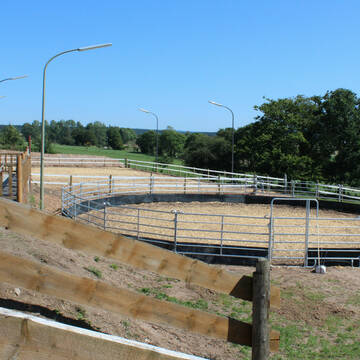
Longierzirkel/Roundpen
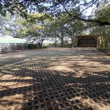
Paddock
Gnadenbrothof
Zuchtstutenhaltung möglich
18 weitere...
B
Deprecated: Creation of dynamic property Zend_View_Helper_Ads::$adLink is deprecated in /var/www/stall-frei/htdocs/staging.stall-frei.de/library/Psf/View/Helper/Ads.php on line 108

Das Beste für die Hufe
Mechtersen
STALL-FREIde Marketing
@STALL-FREI-Marketing
Hufschmiede und Hufpfleger in Ihrer Nähe


Großzügige Boxen und Weiden mit Rundumservice
Schönberg
Rosenhof-Ranch
@Rosenhof-Ranch
Freizeitstall
Geländestrecke
Vermieten
Führanlage
Hunde willkommen
Allergikerstall
bedampftes/gewaschenes Heu
28 weitere...
P+

Der Pferdestall
Einöllen
Dirk Meier Westhoff
@Der-Pferdestall
Vermieten
Hunde willkommen
Krankenbox
Außenboxen
Innenbox
Halbpension
Selbstversorgung
19 weitere...
P
Pferdepension Römerhof
Hermeskeil
Roemerhof-Hermeskeil
@Roemerhof-Hermeskeil
Freizeitstall
Reitlehrer und -unterricht
Longierzirkel/Roundpen
Parkplatz für Pferdeanhänger
bedampftes/gewaschenes Heu
Gnadenbrothof
Innenbox
12 weitere...
P
Allergikerstall, 2 Plätze frei
Bescheid
Manuela-Lohse
@Manuela-Lohse
Freizeitstall
Pflegepferd
Krankenbox
Longierzirkel/Roundpen
Allergikerstall
Notfallboxen
Bewegungsstall
9 weitere...
P+


Goldbergerhof - Pferde artgerecht halten
Schmelz
Markus Herrmann
@Markus-Herrmann
Fahrstall, Kutschwagen
FN-Mitglied
Vermieten
Hunde willkommen
Laufband
Allergikerstall
bedampftes/gewaschenes Heu
35 weitere...
S

Futtersack HeuToy, Fressbremse in pink
Mechtersen
STALL-FREIde Marketing
@STALL-FREI-Marketing
Stundenlange Beschäftigung die
Koliken vorbeugt, geringe Staubinhalation mit
steuerbarer Futterentnahme
Leider kein Vorschaubild
Leider kein Vorschaubild
Esel und Muliherberge - Paddocktrail für Langohr...
Heimweiler
Katja Scherer
@Eselpension
Rehabilitationsstall
Vermieten
Krankenbox
Paddock
Allergikerstall
Gnadenbrothof
11 weitere...
B
Reitstall Klein
Niederbexbach
Jürgen Klein
@Juergen-Klein
Vermieten
Krankenbox
Longierzirkel/Roundpen
Einhornhaltung möglich
Notfallboxen
Außenbox mit Paddock
13 weitere...
P+
Leider kein Vorschaubild
Leider kein Vorschaubild
Offenstallplätze frei
Breitenbach
Sindy
@Sindy98
Freizeitstall
Vermieten
Hunde willkommen
Reitplatz (z.B. Dressur, Springen, Reining)
Innenbox
Offenstall
7 weitere...
B


Pferdepension, Ortsweilerhof
Bexbach
Ortsweilerhof
@Ortsweilerhof
Freizeitstall
Gangpferdereiten
Vermieten
Führanlage
Hunde willkommen
Allergikerstall
Hufrehe geeignet
19 weitere...
P+
Veröffentliche deine Suche als Gesuch und Suchauftrag, dann erhältst du Angebote, neue Treffer und Änderungen per E-Mail.
Diese Suche als Gesuch veröffentlichenDeprecated: Creation of dynamic property Zend_View::$pageCount is deprecated in /var/www/stall-frei/htdocs/staging.stall-frei.de/library/vendor/shardj/zf1-future/library/Zend/View/Abstract.php on line 308
Deprecated: Creation of dynamic property Zend_View::$itemCountPerPage is deprecated in /var/www/stall-frei/htdocs/staging.stall-frei.de/library/vendor/shardj/zf1-future/library/Zend/View/Abstract.php on line 308
Deprecated: Creation of dynamic property Zend_View::$first is deprecated in /var/www/stall-frei/htdocs/staging.stall-frei.de/library/vendor/shardj/zf1-future/library/Zend/View/Abstract.php on line 308
Deprecated: Creation of dynamic property Zend_View::$current is deprecated in /var/www/stall-frei/htdocs/staging.stall-frei.de/library/vendor/shardj/zf1-future/library/Zend/View/Abstract.php on line 308
Deprecated: Creation of dynamic property Zend_View::$last is deprecated in /var/www/stall-frei/htdocs/staging.stall-frei.de/library/vendor/shardj/zf1-future/library/Zend/View/Abstract.php on line 308
Deprecated: Creation of dynamic property Zend_View::$previous is deprecated in /var/www/stall-frei/htdocs/staging.stall-frei.de/library/vendor/shardj/zf1-future/library/Zend/View/Abstract.php on line 308
Deprecated: Creation of dynamic property Zend_View::$next is deprecated in /var/www/stall-frei/htdocs/staging.stall-frei.de/library/vendor/shardj/zf1-future/library/Zend/View/Abstract.php on line 308
Deprecated: Creation of dynamic property Zend_View::$pagesInRange is deprecated in /var/www/stall-frei/htdocs/staging.stall-frei.de/library/vendor/shardj/zf1-future/library/Zend/View/Abstract.php on line 308
Deprecated: Creation of dynamic property Zend_View::$firstPageInRange is deprecated in /var/www/stall-frei/htdocs/staging.stall-frei.de/library/vendor/shardj/zf1-future/library/Zend/View/Abstract.php on line 308
Deprecated: Creation of dynamic property Zend_View::$lastPageInRange is deprecated in /var/www/stall-frei/htdocs/staging.stall-frei.de/library/vendor/shardj/zf1-future/library/Zend/View/Abstract.php on line 308
Deprecated: Creation of dynamic property Zend_View::$currentItemCount is deprecated in /var/www/stall-frei/htdocs/staging.stall-frei.de/library/vendor/shardj/zf1-future/library/Zend/View/Abstract.php on line 308
Deprecated: Creation of dynamic property Zend_View::$totalItemCount is deprecated in /var/www/stall-frei/htdocs/staging.stall-frei.de/library/vendor/shardj/zf1-future/library/Zend/View/Abstract.php on line 308
Deprecated: Creation of dynamic property Zend_View::$firstItemNumber is deprecated in /var/www/stall-frei/htdocs/staging.stall-frei.de/library/vendor/shardj/zf1-future/library/Zend/View/Abstract.php on line 308
Deprecated: Creation of dynamic property Zend_View::$lastItemNumber is deprecated in /var/www/stall-frei/htdocs/staging.stall-frei.de/library/vendor/shardj/zf1-future/library/Zend/View/Abstract.php on line 308
Deprecated: Creation of dynamic property Zend_View::$router is deprecated in /var/www/stall-frei/htdocs/staging.stall-frei.de/library/vendor/shardj/zf1-future/library/Zend/View/Abstract.php on line 308
Deprecated: Creation of dynamic property Zend_View::$urlParams is deprecated in /var/www/stall-frei/htdocs/staging.stall-frei.de/library/vendor/shardj/zf1-future/library/Zend/View/Abstract.php on line 308
Deprecated: Creation of dynamic property Zend_View::$showAds is deprecated in /var/www/stall-frei/htdocs/staging.stall-frei.de/library/vendor/shardj/zf1-future/library/Zend/View/Abstract.php on line 308
Deprecated: Creation of dynamic property Zend_View::$objectIds is deprecated in /var/www/stall-frei/htdocs/staging.stall-frei.de/library/vendor/shardj/zf1-future/library/Zend/View/Abstract.php on line 308
Deprecated: Creation of dynamic property Zend_View::$showNavbar is deprecated in /var/www/stall-frei/htdocs/staging.stall-frei.de/library/vendor/shardj/zf1-future/library/Zend/View/Abstract.php on line 308
Deprecated: Creation of dynamic property Zend_View::$showBreadcrumb is deprecated in /var/www/stall-frei/htdocs/staging.stall-frei.de/library/vendor/shardj/zf1-future/library/Zend/View/Abstract.php on line 308
Deprecated: Creation of dynamic property Zend_View::$showFooter is deprecated in /var/www/stall-frei/htdocs/staging.stall-frei.de/library/vendor/shardj/zf1-future/library/Zend/View/Abstract.php on line 308
Deprecated: Creation of dynamic property Zend_View::$showInternalAds is deprecated in /var/www/stall-frei/htdocs/staging.stall-frei.de/library/vendor/shardj/zf1-future/library/Zend/View/Abstract.php on line 308
Deprecated: Creation of dynamic property Zend_View::$blNoContent is deprecated in /var/www/stall-frei/htdocs/staging.stall-frei.de/library/vendor/shardj/zf1-future/library/Zend/View/Abstract.php on line 308
Deprecated: Creation of dynamic property Zend_View::$sMetaDesc is deprecated in /var/www/stall-frei/htdocs/staging.stall-frei.de/library/vendor/shardj/zf1-future/library/Zend/View/Abstract.php on line 308
Deprecated: Creation of dynamic property Zend_View::$useGmaps is deprecated in /var/www/stall-frei/htdocs/staging.stall-frei.de/library/vendor/shardj/zf1-future/library/Zend/View/Abstract.php on line 308
Deprecated: Creation of dynamic property Zend_View::$touches is deprecated in /var/www/stall-frei/htdocs/staging.stall-frei.de/library/vendor/shardj/zf1-future/library/Zend/View/Abstract.php on line 308
Deprecated: Creation of dynamic property Zend_View::$oProject is deprecated in /var/www/stall-frei/htdocs/staging.stall-frei.de/library/vendor/shardj/zf1-future/library/Zend/View/Abstract.php on line 308
Deprecated: Creation of dynamic property Zend_View::$pageHeadline is deprecated in /var/www/stall-frei/htdocs/staging.stall-frei.de/library/vendor/shardj/zf1-future/library/Zend/View/Abstract.php on line 308
Deprecated: Creation of dynamic property Zend_View::$disableLocationField is deprecated in /var/www/stall-frei/htdocs/staging.stall-frei.de/library/vendor/shardj/zf1-future/library/Zend/View/Abstract.php on line 308
Deprecated: Creation of dynamic property Zend_View::$isSearch is deprecated in /var/www/stall-frei/htdocs/staging.stall-frei.de/library/vendor/shardj/zf1-future/library/Zend/View/Abstract.php on line 308
Deprecated: Creation of dynamic property Zend_View::$pageTitle is deprecated in /var/www/stall-frei/htdocs/staging.stall-frei.de/library/vendor/shardj/zf1-future/library/Zend/View/Abstract.php on line 308
Deprecated: Creation of dynamic property Psf_Form_Element_Text::$class is deprecated in /var/www/stall-frei/htdocs/staging.stall-frei.de/library/vendor/shardj/zf1-future/library/Zend/Form/Element.php on line 874
Deprecated: Creation of dynamic property Psf_Form_Element_Text::$size is deprecated in /var/www/stall-frei/htdocs/staging.stall-frei.de/library/vendor/shardj/zf1-future/library/Zend/Form/Element.php on line 874
Deprecated: Creation of dynamic property Psf_Form_Element_Text::$placeholder is deprecated in /var/www/stall-frei/htdocs/staging.stall-frei.de/library/vendor/shardj/zf1-future/library/Zend/Form/Element.php on line 874
Deprecated: Creation of dynamic property Psf_Form_Element_Hidden::$class is deprecated in /var/www/stall-frei/htdocs/staging.stall-frei.de/library/vendor/shardj/zf1-future/library/Zend/Form/Element.php on line 874
Deprecated: Creation of dynamic property Psf_Form_Element_Hidden::$class is deprecated in /var/www/stall-frei/htdocs/staging.stall-frei.de/library/vendor/shardj/zf1-future/library/Zend/Form/Element.php on line 874
Deprecated: Creation of dynamic property Psf_Form_Element_Hidden::$class is deprecated in /var/www/stall-frei/htdocs/staging.stall-frei.de/library/vendor/shardj/zf1-future/library/Zend/Form/Element.php on line 874
Deprecated: Creation of dynamic property Psf_Form_Element_Hidden::$class is deprecated in /var/www/stall-frei/htdocs/staging.stall-frei.de/library/vendor/shardj/zf1-future/library/Zend/Form/Element.php on line 874
Deprecated: Creation of dynamic property Psf_Form_Element_Select::$class is deprecated in /var/www/stall-frei/htdocs/staging.stall-frei.de/library/vendor/shardj/zf1-future/library/Zend/Form/Element.php on line 874
Deprecated: Creation of dynamic property Psf_Form_Element_Select::$class is deprecated in /var/www/stall-frei/htdocs/staging.stall-frei.de/library/vendor/shardj/zf1-future/library/Zend/Form/Element.php on line 874
Deprecated: Creation of dynamic property Psf_Form_Element_Select::$class is deprecated in /var/www/stall-frei/htdocs/staging.stall-frei.de/library/vendor/shardj/zf1-future/library/Zend/Form/Element.php on line 874
Deprecated: Creation of dynamic property Psf_Form_Element_Select::$class is deprecated in /var/www/stall-frei/htdocs/staging.stall-frei.de/library/vendor/shardj/zf1-future/library/Zend/Form/Element.php on line 874
Deprecated: Creation of dynamic property Psf_Form_Element_Text::$class is deprecated in /var/www/stall-frei/htdocs/staging.stall-frei.de/library/vendor/shardj/zf1-future/library/Zend/Form/Element.php on line 874
Deprecated: Creation of dynamic property Psf_Form_Element_Checkbox::$label is deprecated in /var/www/stall-frei/htdocs/staging.stall-frei.de/library/vendor/shardj/zf1-future/library/Zend/Form/Element.php on line 874
Deprecated: Creation of dynamic property Zend_View::$sort is deprecated in /var/www/stall-frei/htdocs/staging.stall-frei.de/library/vendor/shardj/zf1-future/library/Zend/View/Abstract.php on line 308
Deprecated: Creation of dynamic property Zend_View::$searchLocation is deprecated in /var/www/stall-frei/htdocs/staging.stall-frei.de/library/vendor/shardj/zf1-future/library/Zend/View/Abstract.php on line 308
Deprecated: Creation of dynamic property Zend_View::$locationHint is deprecated in /var/www/stall-frei/htdocs/staging.stall-frei.de/library/vendor/shardj/zf1-future/library/Zend/View/Abstract.php on line 308
Psf_GeoCoder_Abstract::getLocation: Ruschberg Get Location CachedOrLive
Psf_GeoCoder_Abstract::getCachedOrLive: Ruschberg
Psf_GeoCoder_Abstract::convertLocationResult
{"documentation":"https:\/\/opencagedata.com\/api","licenses":[{"name":"see attribution guide","url":"https:\/\/opencagedata.com\/credits"}],"results":[{"bounds":{"northeast":{"lat":49.6394572,"lng":7.3149948},"southwest":{"lat":49.6042464,"lng":7.2613957}},"components":{"ISO_3166-1_alpha-2":"DE","ISO_3166-1_alpha-3":"DEU","ISO_3166-2":["DE-RP"],"_category":"place","_normalized_city":"Ruschberg","_type":"village","continent":"Europe","country":"Deutschland","country_code":"de","county":"Landkreis Birkenfeld","municipality":"Baumholder","political_union":"European Union","postcode":"55776","state":"Rheinland-Pfalz","state_code":"RP","village":"Ruschberg"},"confidence":7,"formatted":"55776 Ruschberg, Deutschland","geometry":{"lat":49.6207996,"lng":7.2907913}},{"bounds":{"northeast":{"lat":52.1518634,"lng":8.8864875},"southwest":{"lat":52.1517634,"lng":8.8863875}},"components":{"ISO_3166-1_alpha-2":"DE","ISO_3166-1_alpha-3":"DEU","ISO_3166-2":["DE-NW"],"_category":"natural\/water","_normalized_city":"Vlotho","_type":"peak","continent":"Europe","country":"Deutschland","country_code":"de","county":"Kreis Herford","peak":"Ruschberg","political_union":"European Union","postcode":"32602","state":"Nordrhein-Westfalen","state_code":"NW","town":"Vlotho"},"confidence":9,"formatted":"Ruschberg, 32602 Vlotho, Deutschland","geometry":{"lat":52.1518134,"lng":8.8864375}},{"components":{"ISO_3166-1_alpha-2":"FR","ISO_3166-1_alpha-3":"FRA","ISO_3166-2":["FR-GES","FR-6AE","FR-67"],"_category":"road","_normalized_city":"Grendelbruch","_type":"road","city":"Grendelbruch","continent":"Europe","country":"France","country_code":"fr","county":"Bas-Rhin","local_authority":"Communaut\u00e9 de communes des Portes de Rosheim","political_union":"European Union","postcode":"67190","road":"Rue du Bruchberg","state":"Grand Est","state_code":"GES"},"confidence":3,"formatted":"Rue du Bruchberg, 67190 Grendelbruch, France","geometry":{"lat":48.491613,"lng":7.317128}},{"components":{"ISO_3166-1_alpha-2":"FR","ISO_3166-1_alpha-3":"FRA","ISO_3166-2":["FR-GES","FR-6AE","FR-67"],"_category":"road","_normalized_city":"Butten","_type":"road","city":"Butten","continent":"Europe","country":"France","country_code":"fr","county":"Bas-Rhin","local_authority":"Communaut\u00e9 de communes de l'Alsace Bossue","political_union":"European Union","postcode":"67430","road":"Bruchberg","state":"Grand Est","state_code":"GES"},"confidence":2,"formatted":"Bruchberg, 67430 Butten, France","geometry":{"lat":48.972121,"lng":7.228566}},{"components":{"ISO_3166-1_alpha-2":"FR","ISO_3166-1_alpha-3":"FRA","ISO_3166-2":["FR-GES","FR-6AE","FR-68"],"_category":"road","_normalized_city":"Rimbach-pr\u00e8s-Masevaux","_type":"road","city":"Rimbach-pr\u00e8s-Masevaux","continent":"Europe","country":"France","country_code":"fr","county":"Haut-Rhin","local_authority":"Communaut\u00e9 de communes de la Vall\u00e9e de la Doller et du Soultzbach","political_union":"European Union","postcode":"68290","road":"Ruchberg","state":"Grand Est","state_code":"GES"},"confidence":2,"formatted":"Ruchberg, 68290 Rimbach-pr\u00e8s-Masevaux, France","geometry":{"lat":47.830199,"lng":6.952401}},{"components":{"ISO_3166-1_alpha-2":"FR","ISO_3166-1_alpha-3":"FRA","ISO_3166-2":["FR-IDF","FR-91"],"_category":"road","_normalized_city":"Vayres-sur-Essonne","_type":"road","city":"Vayres-sur-Essonne","continent":"Europe","country":"France","country_code":"fr","county":"Essonne","local_authority":"Communaut\u00e9 de communes du Val d'Essonne","political_union":"European Union","postcode":"91820","road":"Route de la Ruch\u00e8re","state":"\u00cele-de-France","state_code":"IDF"},"confidence":2,"formatted":"Route de la Ruch\u00e8re, 91820 Vayres-sur-Essonne, France","geometry":{"lat":48.434955,"lng":2.364947}},{"components":{"ISO_3166-1_alpha-2":"FR","ISO_3166-1_alpha-3":"FRA","ISO_3166-2":["FR-ARA","FR-38"],"_category":"road","_normalized_city":"Saint-Christophe-sur-Guiers","_type":"road","city":"Saint-Christophe-sur-Guiers","continent":"Europe","country":"France","country_code":"fr","county":"Is\u00e8re","local_authority":"C\u0153ur de Chartreuse","political_union":"European Union","postcode":"38380","road":"Route de la Ruch\u00e8re","state":"Auvergne-Rh\u00f4ne-Alpes","state_code":"ARA"},"confidence":2,"formatted":"Route de la Ruch\u00e8re, 38380 Saint-Christophe-sur-Guiers, France","geometry":{"lat":45.411797,"lng":5.803408}},{"components":{"ISO_3166-1_alpha-2":"FR","ISO_3166-1_alpha-3":"FRA","ISO_3166-2":["FR-GES","FR-6AE","FR-67"],"_category":"road","_normalized_city":"Marmoutier","_type":"road","city":"Marmoutier","continent":"Europe","country":"France","country_code":"fr","county":"Bas-Rhin","local_authority":"Communaut\u00e9 de communes du Pays de Saverne","political_union":"European Union","postcode":"67440","road":"Buchberg","state":"Grand Est","state_code":"GES"},"confidence":2,"formatted":"Buchberg, 67440 Marmoutier, France","geometry":{"lat":48.672553,"lng":7.339778}},{"components":{"ISO_3166-1_alpha-2":"FR","ISO_3166-1_alpha-3":"FRA","ISO_3166-2":["FR-GES","FR-6AE","FR-67"],"_category":"road","_normalized_city":"Hengwiller","_type":"road","city":"Hengwiller","continent":"Europe","country":"France","country_code":"fr","county":"Bas-Rhin","local_authority":"Communaut\u00e9 de communes du Pays de Saverne","political_union":"European Union","postcode":"67440","road":"Chemin du Buchberg","state":"Grand Est","state_code":"GES"},"confidence":2,"formatted":"Chemin du Buchberg, 67440 Hengwiller, France","geometry":{"lat":48.669168,"lng":7.339598}},{"components":{"ISO_3166-1_alpha-2":"FR","ISO_3166-1_alpha-3":"FRA","ISO_3166-2":["FR-GES","FR-88"],"_category":"road","_normalized_city":"G\u00e9rardmer","_type":"road","city":"G\u00e9rardmer","continent":"Europe","country":"France","country_code":"fr","county":"Vosges","local_authority":"Communaut\u00e9 de communes G\u00e9rardmer Hautes Vosges","political_union":"European Union","postcode":"88400","road":"Chemin des Ruchers","state":"Grand Est","state_code":"GES"},"confidence":2,"formatted":"Chemin des Ruchers, 88400 G\u00e9rardmer, France","geometry":{"lat":48.086049,"lng":6.886529}}],"status":{"code":200,"message":"OK"},"stay_informed":{"blog":"https:\/\/blog.opencagedata.com","mastodon":"https:\/\/en.osm.town\/@opencage"},"thanks":"For using an OpenCage API","timestamp":{"created_http":"Sat, 07 Feb 2026 10:35:50 GMT","created_unix":1770460550},"total_results":10}Array
(
[0] => stdClass Object
(
[bounds] => stdClass Object
(
[northeast] => stdClass Object
(
[lat] => 49.6394572
[lng] => 7.3149948
)
[southwest] => stdClass Object
(
[lat] => 49.6042464
[lng] => 7.2613957
)
)
[components] => stdClass Object
(
[ISO_3166-1_alpha-2] => DE
[ISO_3166-1_alpha-3] => DEU
[ISO_3166-2] => Array
(
[0] => DE-RP
)
[_category] => place
[_normalized_city] => Ruschberg
[_type] => village
[continent] => Europe
[country] => Deutschland
[country_code] => de
[county] => Landkreis Birkenfeld
[municipality] => Baumholder
[political_union] => European Union
[postcode] => 55776
[state] => Rheinland-Pfalz
[state_code] => RP
[village] => Ruschberg
)
[confidence] => 7
[formatted] => 55776 Ruschberg, Deutschland
[geometry] => stdClass Object
(
[lat] => 49.6207996
[lng] => 7.2907913
)
)
[1] => stdClass Object
(
[bounds] => stdClass Object
(
[northeast] => stdClass Object
(
[lat] => 52.1518634
[lng] => 8.8864875
)
[southwest] => stdClass Object
(
[lat] => 52.1517634
[lng] => 8.8863875
)
)
[components] => stdClass Object
(
[ISO_3166-1_alpha-2] => DE
[ISO_3166-1_alpha-3] => DEU
[ISO_3166-2] => Array
(
[0] => DE-NW
)
[_category] => natural/water
[_normalized_city] => Vlotho
[_type] => peak
[continent] => Europe
[country] => Deutschland
[country_code] => de
[county] => Kreis Herford
[peak] => Ruschberg
[political_union] => European Union
[postcode] => 32602
[state] => Nordrhein-Westfalen
[state_code] => NW
[town] => Vlotho
)
[confidence] => 9
[formatted] => Ruschberg, 32602 Vlotho, Deutschland
[geometry] => stdClass Object
(
[lat] => 52.1518134
[lng] => 8.8864375
)
)
[2] => stdClass Object
(
[components] => stdClass Object
(
[ISO_3166-1_alpha-2] => FR
[ISO_3166-1_alpha-3] => FRA
[ISO_3166-2] => Array
(
[0] => FR-GES
[1] => FR-6AE
[2] => FR-67
)
[_category] => road
[_normalized_city] => Grendelbruch
[_type] => road
[city] => Grendelbruch
[continent] => Europe
[country] => France
[country_code] => fr
[county] => Bas-Rhin
[local_authority] => Communauté de communes des Portes de Rosheim
[political_union] => European Union
[postcode] => 67190
[road] => Rue du Bruchberg
[state] => Grand Est
[state_code] => GES
)
[confidence] => 3
[formatted] => Rue du Bruchberg, 67190 Grendelbruch, France
[geometry] => stdClass Object
(
[lat] => 48.491613
[lng] => 7.317128
)
)
[3] => stdClass Object
(
[components] => stdClass Object
(
[ISO_3166-1_alpha-2] => FR
[ISO_3166-1_alpha-3] => FRA
[ISO_3166-2] => Array
(
[0] => FR-GES
[1] => FR-6AE
[2] => FR-67
)
[_category] => road
[_normalized_city] => Butten
[_type] => road
[city] => Butten
[continent] => Europe
[country] => France
[country_code] => fr
[county] => Bas-Rhin
[local_authority] => Communauté de communes de l'Alsace Bossue
[political_union] => European Union
[postcode] => 67430
[road] => Bruchberg
[state] => Grand Est
[state_code] => GES
)
[confidence] => 2
[formatted] => Bruchberg, 67430 Butten, France
[geometry] => stdClass Object
(
[lat] => 48.972121
[lng] => 7.228566
)
)
[4] => stdClass Object
(
[components] => stdClass Object
(
[ISO_3166-1_alpha-2] => FR
[ISO_3166-1_alpha-3] => FRA
[ISO_3166-2] => Array
(
[0] => FR-GES
[1] => FR-6AE
[2] => FR-68
)
[_category] => road
[_normalized_city] => Rimbach-près-Masevaux
[_type] => road
[city] => Rimbach-près-Masevaux
[continent] => Europe
[country] => France
[country_code] => fr
[county] => Haut-Rhin
[local_authority] => Communauté de communes de la Vallée de la Doller et du Soultzbach
[political_union] => European Union
[postcode] => 68290
[road] => Ruchberg
[state] => Grand Est
[state_code] => GES
)
[confidence] => 2
[formatted] => Ruchberg, 68290 Rimbach-près-Masevaux, France
[geometry] => stdClass Object
(
[lat] => 47.830199
[lng] => 6.952401
)
)
[5] => stdClass Object
(
[components] => stdClass Object
(
[ISO_3166-1_alpha-2] => FR
[ISO_3166-1_alpha-3] => FRA
[ISO_3166-2] => Array
(
[0] => FR-IDF
[1] => FR-91
)
[_category] => road
[_normalized_city] => Vayres-sur-Essonne
[_type] => road
[city] => Vayres-sur-Essonne
[continent] => Europe
[country] => France
[country_code] => fr
[county] => Essonne
[local_authority] => Communauté de communes du Val d'Essonne
[political_union] => European Union
[postcode] => 91820
[road] => Route de la Ruchère
[state] => Île-de-France
[state_code] => IDF
)
[confidence] => 2
[formatted] => Route de la Ruchère, 91820 Vayres-sur-Essonne, France
[geometry] => stdClass Object
(
[lat] => 48.434955
[lng] => 2.364947
)
)
[6] => stdClass Object
(
[components] => stdClass Object
(
[ISO_3166-1_alpha-2] => FR
[ISO_3166-1_alpha-3] => FRA
[ISO_3166-2] => Array
(
[0] => FR-ARA
[1] => FR-38
)
[_category] => road
[_normalized_city] => Saint-Christophe-sur-Guiers
[_type] => road
[city] => Saint-Christophe-sur-Guiers
[continent] => Europe
[country] => France
[country_code] => fr
[county] => Isère
[local_authority] => Cœur de Chartreuse
[political_union] => European Union
[postcode] => 38380
[road] => Route de la Ruchère
[state] => Auvergne-Rhône-Alpes
[state_code] => ARA
)
[confidence] => 2
[formatted] => Route de la Ruchère, 38380 Saint-Christophe-sur-Guiers, France
[geometry] => stdClass Object
(
[lat] => 45.411797
[lng] => 5.803408
)
)
[7] => stdClass Object
(
[components] => stdClass Object
(
[ISO_3166-1_alpha-2] => FR
[ISO_3166-1_alpha-3] => FRA
[ISO_3166-2] => Array
(
[0] => FR-GES
[1] => FR-6AE
[2] => FR-67
)
[_category] => road
[_normalized_city] => Marmoutier
[_type] => road
[city] => Marmoutier
[continent] => Europe
[country] => France
[country_code] => fr
[county] => Bas-Rhin
[local_authority] => Communauté de communes du Pays de Saverne
[political_union] => European Union
[postcode] => 67440
[road] => Buchberg
[state] => Grand Est
[state_code] => GES
)
[confidence] => 2
[formatted] => Buchberg, 67440 Marmoutier, France
[geometry] => stdClass Object
(
[lat] => 48.672553
[lng] => 7.339778
)
)
[8] => stdClass Object
(
[components] => stdClass Object
(
[ISO_3166-1_alpha-2] => FR
[ISO_3166-1_alpha-3] => FRA
[ISO_3166-2] => Array
(
[0] => FR-GES
[1] => FR-6AE
[2] => FR-67
)
[_category] => road
[_normalized_city] => Hengwiller
[_type] => road
[city] => Hengwiller
[continent] => Europe
[country] => France
[country_code] => fr
[county] => Bas-Rhin
[local_authority] => Communauté de communes du Pays de Saverne
[political_union] => European Union
[postcode] => 67440
[road] => Chemin du Buchberg
[state] => Grand Est
[state_code] => GES
)
[confidence] => 2
[formatted] => Chemin du Buchberg, 67440 Hengwiller, France
[geometry] => stdClass Object
(
[lat] => 48.669168
[lng] => 7.339598
)
)
[9] => stdClass Object
(
[components] => stdClass Object
(
[ISO_3166-1_alpha-2] => FR
[ISO_3166-1_alpha-3] => FRA
[ISO_3166-2] => Array
(
[0] => FR-GES
[1] => FR-88
)
[_category] => road
[_normalized_city] => Gérardmer
[_type] => road
[city] => Gérardmer
[continent] => Europe
[country] => France
[country_code] => fr
[county] => Vosges
[local_authority] => Communauté de communes Gérardmer Hautes Vosges
[political_union] => European Union
[postcode] => 88400
[road] => Chemin des Ruchers
[state] => Grand Est
[state_code] => GES
)
[confidence] => 2
[formatted] => Chemin des Ruchers, 88400 Gérardmer, France
[geometry] => stdClass Object
(
[lat] => 48.086049
[lng] => 6.886529
)
)
)
Psf_GeoCoder_OpenCageData::getKeyMap: 0
stdClass Object
(
    [bounds] => stdClass Object
        (
            [northeast] => stdClass Object
                (
                    [lat] => 49.6394572
                    [lng] => 7.3149948
                )

            [southwest] => stdClass Object
                (
                    [lat] => 49.6042464
                    [lng] => 7.2613957
                )

        )

    [components] => stdClass Object
        (
            [ISO_3166-1_alpha-2] => DE
            [ISO_3166-1_alpha-3] => DEU
            [ISO_3166-2] => Array
                (
                    [0] => DE-RP
                )

            [_category] => place
            [_normalized_city] => Ruschberg
            [_type] => village
            [continent] => Europe
            [country] => Deutschland
            [country_code] => de
            [county] => Landkreis Birkenfeld
            [municipality] => Baumholder
            [political_union] => European Union
            [postcode] => 55776
            [state] => Rheinland-Pfalz
            [state_code] => RP
            [village] => Ruschberg
        )

    [confidence] => 7
    [formatted] => 55776 Ruschberg, Deutschland
    [geometry] => stdClass Object
        (
            [lat] => 49.6207996
            [lng] => 7.2907913
        )

)
Psf_GeoCoder_OpenCageData::getCounty: Birkenfeld
Psf_GeoCoder_OpenCageData::addMissingData REFETCH!
Array
(
    [address] => 55776 Ruschberg, Deutschland
    [type] => village
    [street] =>
    [city] => Ruschberg
    [county] => Birkenfeld
    [state] => Rheinland-Pfalz
    [zip] => 55776
    [country] => Deutschland
    [suburb] =>
    [countrycode] => de
    [latitude] => 49.6207996
    [longitude] => 7.2907913
    [accuracy] => 1
    [confidence] => 7
    [bounds] => stdClass Object
        (
            [northeast] => stdClass Object
                (
                    [lat] => 49.6394572
                    [lng] => 7.3149948
                )

            [southwest] => stdClass Object
                (
                    [lat] => 49.6042464
                    [lng] => 7.2613957
                )

        )

)
reformat!
Array
(
    [address] => 55776 Ruschberg, Deutschland
    [type] => village
    [street] =>
    [city] => Ruschberg
    [county] => Birkenfeld
    [state] => Rheinland-Pfalz
    [zip] => 55776
    [country] => Deutschland
    [suburb] =>
    [countrycode] => de
    [latitude] => 49.6207996
    [longitude] => 7.2907913
    [accuracy] => 1
    [confidence] => 7
    [bounds] => stdClass Object
        (
            [northeast] => stdClass Object
                (
                    [lat] => 49.6394572
                    [lng] => 7.3149948
                )

            [southwest] => stdClass Object
                (
                    [lat] => 49.6042464
                    [lng] => 7.2613957
                )

        )

    [place] => 55776 Ruschberg, Rheinland-Pfalz
    [hash] => 82d2d80814b9c7dcfebf941bd307f415
)
Psf_GeoCoder_OpenCageData::getKeyMap: 1
stdClass Object
(
    [bounds] => stdClass Object
        (
            [northeast] => stdClass Object
                (
                    [lat] => 52.1518634
                    [lng] => 8.8864875
                )

            [southwest] => stdClass Object
                (
                    [lat] => 52.1517634
                    [lng] => 8.8863875
                )

        )

    [components] => stdClass Object
        (
            [ISO_3166-1_alpha-2] => DE
            [ISO_3166-1_alpha-3] => DEU
            [ISO_3166-2] => Array
                (
                    [0] => DE-NW
                )

            [_category] => natural/water
            [_normalized_city] => Vlotho
            [_type] => peak
            [continent] => Europe
            [country] => Deutschland
            [country_code] => de
            [county] => Kreis Herford
            [peak] => Ruschberg
            [political_union] => European Union
            [postcode] => 32602
            [state] => Nordrhein-Westfalen
            [state_code] => NW
            [town] => Vlotho
        )

    [confidence] => 9
    [formatted] => Ruschberg, 32602 Vlotho, Deutschland
    [geometry] => stdClass Object
        (
            [lat] => 52.1518134
            [lng] => 8.8864375
        )

)
Psf_GeoCoder_OpenCageData::getCounty: Herford
Psf_GeoCoder_OpenCageData::addMissingData REFETCH!
Array
(
    [address] => Ruschberg, 32602 Vlotho, Deutschland
    [type] => peak
    [street] =>
    [city] => Vlotho
    [county] => Herford
    [state] => Nordrhein-Westfalen
    [zip] => 32602
    [country] => Deutschland
    [suburb] =>
    [countrycode] => de
    [latitude] => 52.1518134
    [longitude] => 8.8864375
    [accuracy] => 1
    [confidence] => 9
    [bounds] => stdClass Object
        (
            [northeast] => stdClass Object
                (
                    [lat] => 52.1518634
                    [lng] => 8.8864875
                )

            [southwest] => stdClass Object
                (
                    [lat] => 52.1517634
                    [lng] => 8.8863875
                )

        )

)
reformat!
Array
(
    [address] => Ruschberg, 32602 Vlotho, Deutschland
    [type] => peak
    [street] =>
    [city] => Vlotho
    [county] => Herford
    [state] => Nordrhein-Westfalen
    [zip] => 32602
    [country] => Deutschland
    [suburb] =>
    [countrycode] => de
    [latitude] => 52.1518134
    [longitude] => 8.8864375
    [accuracy] => 1
    [confidence] => 9
    [bounds] => stdClass Object
        (
            [northeast] => stdClass Object
                (
                    [lat] => 52.1518634
                    [lng] => 8.8864875
                )

            [southwest] => stdClass Object
                (
                    [lat] => 52.1517634
                    [lng] => 8.8863875
                )

        )

    [place] => 32602 Vlotho, Nordrhein-Westfalen
    [hash] => c2ab96076619201f0c9e549ac9796d56
)
Psf_GeoCoder_OpenCageData::getKeyMap: 2
stdClass Object
(
    [components] => stdClass Object
        (
            [ISO_3166-1_alpha-2] => FR
            [ISO_3166-1_alpha-3] => FRA
            [ISO_3166-2] => Array
                (
                    [0] => FR-GES
                    [1] => FR-6AE
                    [2] => FR-67
                )

            [_category] => road
            [_normalized_city] => Grendelbruch
            [_type] => road
            [city] => Grendelbruch
            [continent] => Europe
            [country] => France
            [country_code] => fr
            [county] => Bas-Rhin
            [local_authority] => Communauté de communes des Portes de Rosheim
            [political_union] => European Union
            [postcode] => 67190
            [road] => Rue du Bruchberg
            [state] => Grand Est
            [state_code] => GES
        )

    [confidence] => 3
    [formatted] => Rue du Bruchberg, 67190 Grendelbruch, France
    [geometry] => stdClass Object
        (
            [lat] => 48.491613
            [lng] => 7.317128
        )

)
Psf_GeoCoder_OpenCageData::getCounty: Bas-Rhin
Psf_GeoCoder_OpenCageData::addMissingData REFETCH!
Array
(
    [address] => Rue du Bruchberg, 67190 Grendelbruch, France
    [type] => road
    [street] => Rue du Bruchberg
    [city] => Grendelbruch
    [county] => Bas-Rhin
    [state] => Grand Est
    [zip] => 67190
    [country] => France
    [suburb] =>
    [countrycode] => fr
    [latitude] => 48.491613
    [longitude] => 7.317128
    [accuracy] => 1
    [confidence] => 3
    [bounds] =>
)
reformat!
Array
(
    [address] => Rue du Bruchberg, 67190 Grendelbruch, France
    [type] => road
    [street] => Rue du Bruchberg
    [city] => Grendelbruch
    [county] => Bas-Rhin
    [state] => Grand Est
    [zip] => 67190
    [country] => France
    [suburb] =>
    [countrycode] => fr
    [latitude] => 48.491613
    [longitude] => 7.317128
    [accuracy] => 1
    [confidence] => 3
    [bounds] =>
    [place] => Rue du Bruchberg, 67190 Grendelbruch, Grand Est
    [hash] => 52de530c74e88ee86cf6cb7f1c908ae3
)
Psf_GeoCoder_OpenCageData::getKeyMap: 3
stdClass Object
(
    [components] => stdClass Object
        (
            [ISO_3166-1_alpha-2] => FR
            [ISO_3166-1_alpha-3] => FRA
            [ISO_3166-2] => Array
                (
                    [0] => FR-GES
                    [1] => FR-6AE
                    [2] => FR-67
                )

            [_category] => road
            [_normalized_city] => Butten
            [_type] => road
            [city] => Butten
            [continent] => Europe
            [country] => France
            [country_code] => fr
            [county] => Bas-Rhin
            [local_authority] => Communauté de communes de l'Alsace Bossue
            [political_union] => European Union
            [postcode] => 67430
            [road] => Bruchberg
            [state] => Grand Est
            [state_code] => GES
        )

    [confidence] => 2
    [formatted] => Bruchberg, 67430 Butten, France
    [geometry] => stdClass Object
        (
            [lat] => 48.972121
            [lng] => 7.228566
        )

)
Psf_GeoCoder_OpenCageData::getCounty: Bas-Rhin
Psf_GeoCoder_OpenCageData::addMissingData REFETCH!
Array
(
    [address] => Bruchberg, 67430 Butten, France
    [type] => road
    [street] => Bruchberg
    [city] => Butten
    [county] => Bas-Rhin
    [state] => Grand Est
    [zip] => 67430
    [country] => France
    [suburb] =>
    [countrycode] => fr
    [latitude] => 48.972121
    [longitude] => 7.228566
    [accuracy] => 1
    [confidence] => 2
    [bounds] =>
)
reformat!
Array
(
    [address] => Bruchberg, 67430 Butten, France
    [type] => road
    [street] => Bruchberg
    [city] => Butten
    [county] => Bas-Rhin
    [state] => Grand Est
    [zip] => 67430
    [country] => France
    [suburb] =>
    [countrycode] => fr
    [latitude] => 48.972121
    [longitude] => 7.228566
    [accuracy] => 1
    [confidence] => 2
    [bounds] =>
    [place] => Bruchberg, 67430 Butten, Grand Est
    [hash] => b2a46d3f7dcc68536aa1aa96bfde075d
)
Psf_GeoCoder_OpenCageData::getKeyMap: 4
stdClass Object
(
    [components] => stdClass Object
        (
            [ISO_3166-1_alpha-2] => FR
            [ISO_3166-1_alpha-3] => FRA
            [ISO_3166-2] => Array
                (
                    [0] => FR-GES
                    [1] => FR-6AE
                    [2] => FR-68
                )

            [_category] => road
            [_normalized_city] => Rimbach-près-Masevaux
            [_type] => road
            [city] => Rimbach-près-Masevaux
            [continent] => Europe
            [country] => France
            [country_code] => fr
            [county] => Haut-Rhin
            [local_authority] => Communauté de communes de la Vallée de la Doller et du Soultzbach
            [political_union] => European Union
            [postcode] => 68290
            [road] => Ruchberg
            [state] => Grand Est
            [state_code] => GES
        )

    [confidence] => 2
    [formatted] => Ruchberg, 68290 Rimbach-près-Masevaux, France
    [geometry] => stdClass Object
        (
            [lat] => 47.830199
            [lng] => 6.952401
        )

)
Psf_GeoCoder_OpenCageData::getCounty: Haut-Rhin
Psf_GeoCoder_OpenCageData::addMissingData REFETCH!
Array
(
    [address] => Ruchberg, 68290 Rimbach-près-Masevaux, France
    [type] => road
    [street] => Ruchberg
    [city] => Rimbach-près-Masevaux
    [county] => Haut-Rhin
    [state] => Grand Est
    [zip] => 68290
    [country] => France
    [suburb] =>
    [countrycode] => fr
    [latitude] => 47.830199
    [longitude] => 6.952401
    [accuracy] => 1
    [confidence] => 2
    [bounds] =>
)
reformat!
Array
(
    [address] => Ruchberg, 68290 Rimbach-près-Masevaux, France
    [type] => road
    [street] => Ruchberg
    [city] => Rimbach-près-Masevaux
    [county] => Haut-Rhin
    [state] => Grand Est
    [zip] => 68290
    [country] => France
    [suburb] =>
    [countrycode] => fr
    [latitude] => 47.830199
    [longitude] => 6.952401
    [accuracy] => 1
    [confidence] => 2
    [bounds] =>
    [place] => Ruchberg, 68290 Rimbach-près-Masevaux, Grand Est
    [hash] => ad3db9e0a4b1f3e849553de99548d3ef
)
Psf_GeoCoder_OpenCageData::getKeyMap: 5
stdClass Object
(
    [components] => stdClass Object
        (
            [ISO_3166-1_alpha-2] => FR
            [ISO_3166-1_alpha-3] => FRA
            [ISO_3166-2] => Array
                (
                    [0] => FR-IDF
                    [1] => FR-91
                )

            [_category] => road
            [_normalized_city] => Vayres-sur-Essonne
            [_type] => road
            [city] => Vayres-sur-Essonne
            [continent] => Europe
            [country] => France
            [country_code] => fr
            [county] => Essonne
            [local_authority] => Communauté de communes du Val d'Essonne
            [political_union] => European Union
            [postcode] => 91820
            [road] => Route de la Ruchère
            [state] => Île-de-France
            [state_code] => IDF
        )

    [confidence] => 2
    [formatted] => Route de la Ruchère, 91820 Vayres-sur-Essonne, France
    [geometry] => stdClass Object
        (
            [lat] => 48.434955
            [lng] => 2.364947
        )

)
Psf_GeoCoder_OpenCageData::getCounty: Essonne
Psf_GeoCoder_OpenCageData::addMissingData REFETCH!
Array
(
    [address] => Route de la Ruchère, 91820 Vayres-sur-Essonne, France
    [type] => road
    [street] => Route de la Ruchère
    [city] => Vayres-sur-Essonne
    [county] => Essonne
    [state] => Île-de-France
    [zip] => 91820
    [country] => France
    [suburb] =>
    [countrycode] => fr
    [latitude] => 48.434955
    [longitude] => 2.364947
    [accuracy] => 1
    [confidence] => 2
    [bounds] =>
)
reformat!
Array
(
    [address] => Route de la Ruchère, 91820 Vayres-sur-Essonne, France
    [type] => road
    [street] => Route de la Ruchère
    [city] => Vayres-sur-Essonne
    [county] => Essonne
    [state] => Île-de-France
    [zip] => 91820
    [country] => France
    [suburb] =>
    [countrycode] => fr
    [latitude] => 48.434955
    [longitude] => 2.364947
    [accuracy] => 1
    [confidence] => 2
    [bounds] =>
    [place] => Route de la Ruchère, 91820 Vayres-sur-Essonne, Île-de-France
    [hash] => b1764efbcbcda3c29172da304a8866b5
)
Psf_GeoCoder_OpenCageData::getKeyMap: 6
stdClass Object
(
    [components] => stdClass Object
        (
            [ISO_3166-1_alpha-2] => FR
            [ISO_3166-1_alpha-3] => FRA
            [ISO_3166-2] => Array
                (
                    [0] => FR-ARA
                    [1] => FR-38
                )

            [_category] => road
            [_normalized_city] => Saint-Christophe-sur-Guiers
            [_type] => road
            [city] => Saint-Christophe-sur-Guiers
            [continent] => Europe
            [country] => France
            [country_code] => fr
            [county] => Isère
            [local_authority] => Cœur de Chartreuse
            [political_union] => European Union
            [postcode] => 38380
            [road] => Route de la Ruchère
            [state] => Auvergne-Rhône-Alpes
            [state_code] => ARA
        )

    [confidence] => 2
    [formatted] => Route de la Ruchère, 38380 Saint-Christophe-sur-Guiers, France
    [geometry] => stdClass Object
        (
            [lat] => 45.411797
            [lng] => 5.803408
        )

)
Psf_GeoCoder_OpenCageData::getCounty: Isère
Psf_GeoCoder_OpenCageData::addMissingData REFETCH!
Array
(
    [address] => Route de la Ruchère, 38380 Saint-Christophe-sur-Guiers, France
    [type] => road
    [street] => Route de la Ruchère
    [city] => Saint-Christophe-sur-Guiers
    [county] => Isère
    [state] => Auvergne-Rhône-Alpes
    [zip] => 38380
    [country] => France
    [suburb] =>
    [countrycode] => fr
    [latitude] => 45.411797
    [longitude] => 5.803408
    [accuracy] => 1
    [confidence] => 2
    [bounds] =>
)
reformat!
Array
(
    [address] => Route de la Ruchère, 38380 Saint-Christophe-sur-Guiers, France
    [type] => road
    [street] => Route de la Ruchère
    [city] => Saint-Christophe-sur-Guiers
    [county] => Isère
    [state] => Auvergne-Rhône-Alpes
    [zip] => 38380
    [country] => France
    [suburb] =>
    [countrycode] => fr
    [latitude] => 45.411797
    [longitude] => 5.803408
    [accuracy] => 1
    [confidence] => 2
    [bounds] =>
    [place] => Route de la Ruchère, 38380 Saint-Christophe-sur-Guiers, Auvergne-Rhône-Alpes
    [hash] => 453e127e266281b62821960635b9aa09
)
Psf_GeoCoder_OpenCageData::getKeyMap: 7
stdClass Object
(
    [components] => stdClass Object
        (
            [ISO_3166-1_alpha-2] => FR
            [ISO_3166-1_alpha-3] => FRA
            [ISO_3166-2] => Array
                (
                    [0] => FR-GES
                    [1] => FR-6AE
                    [2] => FR-67
                )

            [_category] => road
            [_normalized_city] => Marmoutier
            [_type] => road
            [city] => Marmoutier
            [continent] => Europe
            [country] => France
            [country_code] => fr
            [county] => Bas-Rhin
            [local_authority] => Communauté de communes du Pays de Saverne
            [political_union] => European Union
            [postcode] => 67440
            [road] => Buchberg
            [state] => Grand Est
            [state_code] => GES
        )

    [confidence] => 2
    [formatted] => Buchberg, 67440 Marmoutier, France
    [geometry] => stdClass Object
        (
            [lat] => 48.672553
            [lng] => 7.339778
        )

)
Psf_GeoCoder_OpenCageData::getCounty: Bas-Rhin
Psf_GeoCoder_OpenCageData::addMissingData REFETCH!
Array
(
    [address] => Buchberg, 67440 Marmoutier, France
    [type] => road
    [street] => Buchberg
    [city] => Marmoutier
    [county] => Bas-Rhin
    [state] => Grand Est
    [zip] => 67440
    [country] => France
    [suburb] =>
    [countrycode] => fr
    [latitude] => 48.672553
    [longitude] => 7.339778
    [accuracy] => 1
    [confidence] => 2
    [bounds] =>
)
reformat!
Array
(
    [address] => Buchberg, 67440 Marmoutier, France
    [type] => road
    [street] => Buchberg
    [city] => Marmoutier
    [county] => Bas-Rhin
    [state] => Grand Est
    [zip] => 67440
    [country] => France
    [suburb] =>
    [countrycode] => fr
    [latitude] => 48.672553
    [longitude] => 7.339778
    [accuracy] => 1
    [confidence] => 2
    [bounds] =>
    [place] => Buchberg, 67440 Marmoutier, Grand Est
    [hash] => 6338ce365f9734f4db7129be472f2c27
)
Psf_GeoCoder_OpenCageData::getKeyMap: 8
stdClass Object
(
    [components] => stdClass Object
        (
            [ISO_3166-1_alpha-2] => FR
            [ISO_3166-1_alpha-3] => FRA
            [ISO_3166-2] => Array
                (
                    [0] => FR-GES
                    [1] => FR-6AE
                    [2] => FR-67
                )

            [_category] => road
            [_normalized_city] => Hengwiller
            [_type] => road
            [city] => Hengwiller
            [continent] => Europe
            [country] => France
            [country_code] => fr
            [county] => Bas-Rhin
            [local_authority] => Communauté de communes du Pays de Saverne
            [political_union] => European Union
            [postcode] => 67440
            [road] => Chemin du Buchberg
            [state] => Grand Est
            [state_code] => GES
        )

    [confidence] => 2
    [formatted] => Chemin du Buchberg, 67440 Hengwiller, France
    [geometry] => stdClass Object
        (
            [lat] => 48.669168
            [lng] => 7.339598
        )

)
Psf_GeoCoder_OpenCageData::getCounty: Bas-Rhin
Psf_GeoCoder_OpenCageData::addMissingData REFETCH!
Array
(
    [address] => Chemin du Buchberg, 67440 Hengwiller, France
    [type] => road
    [street] => Chemin du Buchberg
    [city] => Hengwiller
    [county] => Bas-Rhin
    [state] => Grand Est
    [zip] => 67440
    [country] => France
    [suburb] =>
    [countrycode] => fr
    [latitude] => 48.669168
    [longitude] => 7.339598
    [accuracy] => 1
    [confidence] => 2
    [bounds] =>
)
reformat!
Array
(
    [address] => Chemin du Buchberg, 67440 Hengwiller, France
    [type] => road
    [street] => Chemin du Buchberg
    [city] => Hengwiller
    [county] => Bas-Rhin
    [state] => Grand Est
    [zip] => 67440
    [country] => France
    [suburb] =>
    [countrycode] => fr
    [latitude] => 48.669168
    [longitude] => 7.339598
    [accuracy] => 1
    [confidence] => 2
    [bounds] =>
    [place] => Chemin du Buchberg, 67440 Hengwiller, Grand Est
    [hash] => 7d30dcdd9c52b1940119a5d0ab14d119
)
Psf_GeoCoder_OpenCageData::getKeyMap: 9
stdClass Object
(
    [components] => stdClass Object
        (
            [ISO_3166-1_alpha-2] => FR
            [ISO_3166-1_alpha-3] => FRA
            [ISO_3166-2] => Array
                (
                    [0] => FR-GES
                    [1] => FR-88
                )

            [_category] => road
            [_normalized_city] => Gérardmer
            [_type] => road
            [city] => Gérardmer
            [continent] => Europe
            [country] => France
            [country_code] => fr
            [county] => Vosges
            [local_authority] => Communauté de communes Gérardmer Hautes Vosges
            [political_union] => European Union
            [postcode] => 88400
            [road] => Chemin des Ruchers
            [state] => Grand Est
            [state_code] => GES
        )

    [confidence] => 2
    [formatted] => Chemin des Ruchers, 88400 Gérardmer, France
    [geometry] => stdClass Object
        (
            [lat] => 48.086049
            [lng] => 6.886529
        )

)
Psf_GeoCoder_OpenCageData::getCounty: Vosges
Psf_GeoCoder_OpenCageData::addMissingData REFETCH!
Array
(
    [address] => Chemin des Ruchers, 88400 Gérardmer, France
    [type] => road
    [street] => Chemin des Ruchers
    [city] => Gérardmer
    [county] => Vosges
    [state] => Grand Est
    [zip] => 88400
    [country] => France
    [suburb] =>
    [countrycode] => fr
    [latitude] => 48.086049
    [longitude] => 6.886529
    [accuracy] => 1
    [confidence] => 2
    [bounds] =>
)
reformat!
Array
(
    [address] => Chemin des Ruchers, 88400 Gérardmer, France
    [type] => road
    [street] => Chemin des Ruchers
    [city] => Gérardmer
    [county] => Vosges
    [state] => Grand Est
    [zip] => 88400
    [country] => France
    [suburb] =>
    [countrycode] => fr
    [latitude] => 48.086049
    [longitude] => 6.886529
    [accuracy] => 1
    [confidence] => 2
    [bounds] =>
    [place] => Chemin des Ruchers, 88400 Gérardmer, Grand Est
    [hash] => 5b9c6cf3add33de148968d67fef60b03
)
Deprecated: Creation of dynamic property Zend_View::$locationHintStyle is deprecated in /var/www/stall-frei/htdocs/staging.stall-frei.de/library/vendor/shardj/zf1-future/library/Zend/View/Abstract.php on line 308
Deprecated: Creation of dynamic property Zend_View::$adGeoLocation is deprecated in /var/www/stall-frei/htdocs/staging.stall-frei.de/library/vendor/shardj/zf1-future/library/Zend/View/Abstract.php on line 308
Deprecated: Creation of dynamic property Zend_View::$recordCount is deprecated in /var/www/stall-frei/htdocs/staging.stall-frei.de/library/vendor/shardj/zf1-future/library/Zend/View/Abstract.php on line 308
Deprecated: Creation of dynamic property Zend_View::$paginationParams is deprecated in /var/www/stall-frei/htdocs/staging.stall-frei.de/library/vendor/shardj/zf1-future/library/Zend/View/Abstract.php on line 308
Deprecated: Creation of dynamic property Zend_View::$objectPaginator is deprecated in /var/www/stall-frei/htdocs/staging.stall-frei.de/library/vendor/shardj/zf1-future/library/Zend/View/Abstract.php on line 308
Deprecated: Creation of dynamic property Zend_View::$featuredObjects is deprecated in /var/www/stall-frei/htdocs/staging.stall-frei.de/library/vendor/shardj/zf1-future/library/Zend/View/Abstract.php on line 308
Deprecated: Creation of dynamic property Zend_View::$hints is deprecated in /var/www/stall-frei/htdocs/staging.stall-frei.de/library/vendor/shardj/zf1-future/library/Zend/View/Abstract.php on line 308
Deprecated: Creation of dynamic property Zend_View::$attributeHints is deprecated in /var/www/stall-frei/htdocs/staging.stall-frei.de/library/vendor/shardj/zf1-future/library/Zend/View/Abstract.php on line 308
Deprecated: Creation of dynamic property Zend_View::$oSearchForm is deprecated in /var/www/stall-frei/htdocs/staging.stall-frei.de/library/vendor/shardj/zf1-future/library/Zend/View/Abstract.php on line 308