Deprecated: Creation of dynamic property Zend_View::$sMode is deprecated in /var/www/stall-frei/htdocs/staging.stall-frei.de/library/vendor/shardj/zf1-future/library/Zend/View/Abstract.php on line 308
Stallplatz oder Offenstall in Kammerich
Gesucht wird in "53809 Kammerich, Deutschland"
6.334 Einträge
Deprecated: Creation of dynamic property Zend_View::$listObjects is deprecated in /var/www/stall-frei/htdocs/staging.stall-frei.de/library/vendor/shardj/zf1-future/library/Zend/View/Abstract.php on line 308
Gesponsort


Deprecated: Creation of dynamic property Zend_View::$listMode is deprecated in /var/www/stall-frei/htdocs/staging.stall-frei.de/library/vendor/shardj/zf1-future/library/Zend/View/Abstract.php on line 308
Deprecated: Creation of dynamic property Zend_View::$renderedObjects is deprecated in /var/www/stall-frei/htdocs/staging.stall-frei.de/library/vendor/shardj/zf1-future/library/Zend/View/Abstract.php on line 308
Deprecated: Creation of dynamic property Zend_View::$index is deprecated in /var/www/stall-frei/htdocs/staging.stall-frei.de/library/vendor/shardj/zf1-future/library/Zend/View/Abstract.php on line 308
Deprecated: Creation of dynamic property Zend_View::$displayMode is deprecated in /var/www/stall-frei/htdocs/staging.stall-frei.de/library/vendor/shardj/zf1-future/library/Zend/View/Abstract.php on line 308
Deprecated: Creation of dynamic property Zend_View::$remarketingIds is deprecated in /var/www/stall-frei/htdocs/staging.stall-frei.de/library/vendor/shardj/zf1-future/library/Zend/View/Abstract.php on line 308
Deprecated: Creation of dynamic property Zend_View::$listItem is deprecated in /var/www/stall-frei/htdocs/staging.stall-frei.de/library/vendor/shardj/zf1-future/library/Zend/View/Abstract.php on line 308
Deprecated: Creation of dynamic property Zend_View::$object is deprecated in /var/www/stall-frei/htdocs/staging.stall-frei.de/library/vendor/shardj/zf1-future/library/Zend/View/Abstract.php on line 308
Deprecated: Creation of dynamic property Zend_View::$attributes is deprecated in /var/www/stall-frei/htdocs/staging.stall-frei.de/library/vendor/shardj/zf1-future/library/Zend/View/Abstract.php on line 308
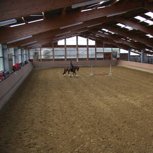
Pensionspferdehaltung in Zuchtstall mit Reithalle
Windeck
Al Najma Stud
@Al Najma Stud
Fahrstall, Kutschwagen
FN-Mitglied
Laufband
Paddock
Hengsthaltung möglich
Hufrehe geeignet
Außenbox mit Paddock
Außenboxen
21 weitere...
P
Deprecated: Creation of dynamic property Zend_View_Helper_Ads::$adLink is deprecated in /var/www/stall-frei/htdocs/staging.stall-frei.de/library/Psf/View/Helper/Ads.php on line 108

Persönlichkeitsentwicklung mit Pferden
Bad Salzuflen
Katja Dors
@Pferdezeiten
Begleite andere auf ihrem Entwicklungsweg und entdecke die transformative Kraft der pferdegestützten Persönlichkeitsentwicklung !
neu
R
Leider kein Vorschaubild
Leider kein Vorschaubild
Jansenhof, Vollvers.Halle,Platz,Weiden,Winterausl.
Buchholz
Clemens Jansen
@Jansenhof
FN-Mitglied
Reitlehrer und -unterricht
Longierzirkel/Roundpen
Paddock
Gnadenbrothof
Außenboxen
Innenbox
9 weitere...
P

Pferdebox mit Außenpaddock
Windeck
Al_Najma_Stud
@Al_Najma_Stud
Fahrstall, Kutschwagen
FN-Mitglied
Vermieten
Longierzirkel/Roundpen
Paddock
bedampftes/gewaschenes Heu
Fohlenaufzucht möglich
21 weitere...
P
Leider kein Vorschaubild
Leider kein Vorschaubild
Stallplatz Box
Much
Lessenich
@Lessenich
Freizeitstall
Vermieten
Hunde willkommen
Krankenbox
Allergikerstall
bedampftes/gewaschenes Heu
19 weitere...
B
Leider kein Vorschaubild
Leider kein Vorschaubild
Stallplatz Box
Much
Lessenich
@Lessenich
Freizeitstall
Geländestrecke
Vermieten
Krankenbox
Longierzirkel/Roundpen
bedampftes/gewaschenes Heu
Gnadenbrothof
14 weitere...
B

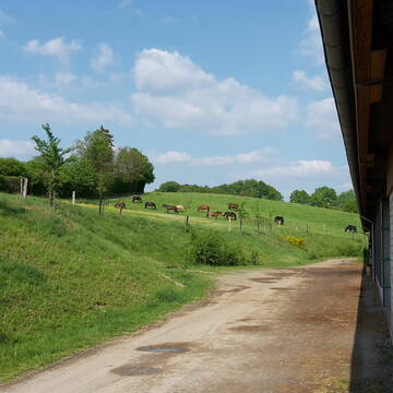
Platz für Rentner im Offenstall
Nümbrecht
Stephanie Lingemann
@SteffiLingemann
Freizeitstall
Geländestrecke
Vermieten
Sommerweide
Weide
Offenstall
4 weitere...
ganz aktuell
P

Vollpensionsboxen mit ganzjährigem Weidegang
Hennef
Löbach Pensionsstall
@LoebachPensionsTrainingsstall
Freizeitstall
Pferdeausbildung
Vermieten
Krankenbox
Longierzirkel/Roundpen
Allergikerstall
Gnadenbrothof
17 weitere...
P

Das Beste für die Hufe
Mechtersen
STALL-FREIde Marketing
@STALL-FREI-Marketing
Hufschmiede und Hufpfleger in Ihrer Nähe
Reitstall Broich
Lohmar
Reitstall-Broich
@Reitstall-Broich
Paddock
Parkplatz für Pferdeanhänger
Bewegungsstall
Laufstall
Vollpension
Einzelne Boxen oder Stallplätze
7 weitere...
P

Reitanlage Schwalbenhof
51674
Kirsten Genglawski
@KirstenGenglawski
Freizeitstall
Geländestrecke
Vermieten
Hunde willkommen
Paddock
Gnadenbrothof
Hengsthaltung möglich
19 weitere...
P

Pferdeboxen (Gruppen/Einzel) ganzjährig Weidegang
Wiehl
Stallgemeinschaft-Immerkopf
@Stallgemeinschaft-Immerkopf
Freizeitstall
Geländestrecke
Vermieten
Hunde willkommen
Paddock
Allergikerstall
Hufrehe geeignet
18 weitere...
aktuell
P
Werde Teil von STALL-FREI.de
Du hast eine Pferdebox frei? Freie Plätze im Offenstall, Pferdestall oder der Reitanlage kostenlos anbieten.
Deprecated: Creation of dynamic property Zend_View::$pageCount is deprecated in /var/www/stall-frei/htdocs/staging.stall-frei.de/library/vendor/shardj/zf1-future/library/Zend/View/Abstract.php on line 308
Deprecated: Creation of dynamic property Zend_View::$itemCountPerPage is deprecated in /var/www/stall-frei/htdocs/staging.stall-frei.de/library/vendor/shardj/zf1-future/library/Zend/View/Abstract.php on line 308
Deprecated: Creation of dynamic property Zend_View::$first is deprecated in /var/www/stall-frei/htdocs/staging.stall-frei.de/library/vendor/shardj/zf1-future/library/Zend/View/Abstract.php on line 308
Deprecated: Creation of dynamic property Zend_View::$current is deprecated in /var/www/stall-frei/htdocs/staging.stall-frei.de/library/vendor/shardj/zf1-future/library/Zend/View/Abstract.php on line 308
Deprecated: Creation of dynamic property Zend_View::$last is deprecated in /var/www/stall-frei/htdocs/staging.stall-frei.de/library/vendor/shardj/zf1-future/library/Zend/View/Abstract.php on line 308
Deprecated: Creation of dynamic property Zend_View::$previous is deprecated in /var/www/stall-frei/htdocs/staging.stall-frei.de/library/vendor/shardj/zf1-future/library/Zend/View/Abstract.php on line 308
Deprecated: Creation of dynamic property Zend_View::$next is deprecated in /var/www/stall-frei/htdocs/staging.stall-frei.de/library/vendor/shardj/zf1-future/library/Zend/View/Abstract.php on line 308
Deprecated: Creation of dynamic property Zend_View::$pagesInRange is deprecated in /var/www/stall-frei/htdocs/staging.stall-frei.de/library/vendor/shardj/zf1-future/library/Zend/View/Abstract.php on line 308
Deprecated: Creation of dynamic property Zend_View::$firstPageInRange is deprecated in /var/www/stall-frei/htdocs/staging.stall-frei.de/library/vendor/shardj/zf1-future/library/Zend/View/Abstract.php on line 308
Deprecated: Creation of dynamic property Zend_View::$lastPageInRange is deprecated in /var/www/stall-frei/htdocs/staging.stall-frei.de/library/vendor/shardj/zf1-future/library/Zend/View/Abstract.php on line 308
Deprecated: Creation of dynamic property Zend_View::$currentItemCount is deprecated in /var/www/stall-frei/htdocs/staging.stall-frei.de/library/vendor/shardj/zf1-future/library/Zend/View/Abstract.php on line 308
Deprecated: Creation of dynamic property Zend_View::$totalItemCount is deprecated in /var/www/stall-frei/htdocs/staging.stall-frei.de/library/vendor/shardj/zf1-future/library/Zend/View/Abstract.php on line 308
Deprecated: Creation of dynamic property Zend_View::$firstItemNumber is deprecated in /var/www/stall-frei/htdocs/staging.stall-frei.de/library/vendor/shardj/zf1-future/library/Zend/View/Abstract.php on line 308
Deprecated: Creation of dynamic property Zend_View::$lastItemNumber is deprecated in /var/www/stall-frei/htdocs/staging.stall-frei.de/library/vendor/shardj/zf1-future/library/Zend/View/Abstract.php on line 308
Deprecated: Creation of dynamic property Zend_View::$router is deprecated in /var/www/stall-frei/htdocs/staging.stall-frei.de/library/vendor/shardj/zf1-future/library/Zend/View/Abstract.php on line 308
Deprecated: Creation of dynamic property Zend_View::$urlParams is deprecated in /var/www/stall-frei/htdocs/staging.stall-frei.de/library/vendor/shardj/zf1-future/library/Zend/View/Abstract.php on line 308
Deprecated: Creation of dynamic property Zend_View::$showAds is deprecated in /var/www/stall-frei/htdocs/staging.stall-frei.de/library/vendor/shardj/zf1-future/library/Zend/View/Abstract.php on line 308
Deprecated: Creation of dynamic property Zend_View::$objectIds is deprecated in /var/www/stall-frei/htdocs/staging.stall-frei.de/library/vendor/shardj/zf1-future/library/Zend/View/Abstract.php on line 308
Deprecated: Creation of dynamic property Zend_View::$showNavbar is deprecated in /var/www/stall-frei/htdocs/staging.stall-frei.de/library/vendor/shardj/zf1-future/library/Zend/View/Abstract.php on line 308
Deprecated: Creation of dynamic property Zend_View::$showBreadcrumb is deprecated in /var/www/stall-frei/htdocs/staging.stall-frei.de/library/vendor/shardj/zf1-future/library/Zend/View/Abstract.php on line 308
Deprecated: Creation of dynamic property Zend_View::$showFooter is deprecated in /var/www/stall-frei/htdocs/staging.stall-frei.de/library/vendor/shardj/zf1-future/library/Zend/View/Abstract.php on line 308
Deprecated: Creation of dynamic property Zend_View::$showInternalAds is deprecated in /var/www/stall-frei/htdocs/staging.stall-frei.de/library/vendor/shardj/zf1-future/library/Zend/View/Abstract.php on line 308
Deprecated: Creation of dynamic property Zend_View::$blNoContent is deprecated in /var/www/stall-frei/htdocs/staging.stall-frei.de/library/vendor/shardj/zf1-future/library/Zend/View/Abstract.php on line 308
Deprecated: Creation of dynamic property Zend_View::$sMetaDesc is deprecated in /var/www/stall-frei/htdocs/staging.stall-frei.de/library/vendor/shardj/zf1-future/library/Zend/View/Abstract.php on line 308
Deprecated: Creation of dynamic property Zend_View::$useGmaps is deprecated in /var/www/stall-frei/htdocs/staging.stall-frei.de/library/vendor/shardj/zf1-future/library/Zend/View/Abstract.php on line 308
Deprecated: Creation of dynamic property Zend_View::$touches is deprecated in /var/www/stall-frei/htdocs/staging.stall-frei.de/library/vendor/shardj/zf1-future/library/Zend/View/Abstract.php on line 308
Deprecated: Creation of dynamic property Zend_View::$oProject is deprecated in /var/www/stall-frei/htdocs/staging.stall-frei.de/library/vendor/shardj/zf1-future/library/Zend/View/Abstract.php on line 308
Deprecated: Creation of dynamic property Zend_View::$pageHeadline is deprecated in /var/www/stall-frei/htdocs/staging.stall-frei.de/library/vendor/shardj/zf1-future/library/Zend/View/Abstract.php on line 308
Deprecated: Creation of dynamic property Zend_View::$disableLocationField is deprecated in /var/www/stall-frei/htdocs/staging.stall-frei.de/library/vendor/shardj/zf1-future/library/Zend/View/Abstract.php on line 308
Deprecated: Creation of dynamic property Zend_View::$isSearch is deprecated in /var/www/stall-frei/htdocs/staging.stall-frei.de/library/vendor/shardj/zf1-future/library/Zend/View/Abstract.php on line 308
Deprecated: Creation of dynamic property Zend_View::$pageTitle is deprecated in /var/www/stall-frei/htdocs/staging.stall-frei.de/library/vendor/shardj/zf1-future/library/Zend/View/Abstract.php on line 308
Deprecated: Creation of dynamic property Psf_Form_Element_Text::$class is deprecated in /var/www/stall-frei/htdocs/staging.stall-frei.de/library/vendor/shardj/zf1-future/library/Zend/Form/Element.php on line 874
Deprecated: Creation of dynamic property Psf_Form_Element_Text::$size is deprecated in /var/www/stall-frei/htdocs/staging.stall-frei.de/library/vendor/shardj/zf1-future/library/Zend/Form/Element.php on line 874
Deprecated: Creation of dynamic property Psf_Form_Element_Text::$placeholder is deprecated in /var/www/stall-frei/htdocs/staging.stall-frei.de/library/vendor/shardj/zf1-future/library/Zend/Form/Element.php on line 874
Deprecated: Creation of dynamic property Psf_Form_Element_Hidden::$class is deprecated in /var/www/stall-frei/htdocs/staging.stall-frei.de/library/vendor/shardj/zf1-future/library/Zend/Form/Element.php on line 874
Deprecated: Creation of dynamic property Psf_Form_Element_Hidden::$class is deprecated in /var/www/stall-frei/htdocs/staging.stall-frei.de/library/vendor/shardj/zf1-future/library/Zend/Form/Element.php on line 874
Deprecated: Creation of dynamic property Psf_Form_Element_Hidden::$class is deprecated in /var/www/stall-frei/htdocs/staging.stall-frei.de/library/vendor/shardj/zf1-future/library/Zend/Form/Element.php on line 874
Deprecated: Creation of dynamic property Psf_Form_Element_Hidden::$class is deprecated in /var/www/stall-frei/htdocs/staging.stall-frei.de/library/vendor/shardj/zf1-future/library/Zend/Form/Element.php on line 874
Deprecated: Creation of dynamic property Psf_Form_Element_Select::$class is deprecated in /var/www/stall-frei/htdocs/staging.stall-frei.de/library/vendor/shardj/zf1-future/library/Zend/Form/Element.php on line 874
Deprecated: Creation of dynamic property Psf_Form_Element_Select::$class is deprecated in /var/www/stall-frei/htdocs/staging.stall-frei.de/library/vendor/shardj/zf1-future/library/Zend/Form/Element.php on line 874
Deprecated: Creation of dynamic property Psf_Form_Element_Select::$class is deprecated in /var/www/stall-frei/htdocs/staging.stall-frei.de/library/vendor/shardj/zf1-future/library/Zend/Form/Element.php on line 874
Deprecated: Creation of dynamic property Psf_Form_Element_Select::$class is deprecated in /var/www/stall-frei/htdocs/staging.stall-frei.de/library/vendor/shardj/zf1-future/library/Zend/Form/Element.php on line 874
Deprecated: Creation of dynamic property Psf_Form_Element_Text::$class is deprecated in /var/www/stall-frei/htdocs/staging.stall-frei.de/library/vendor/shardj/zf1-future/library/Zend/Form/Element.php on line 874
Deprecated: Creation of dynamic property Psf_Form_Element_Checkbox::$label is deprecated in /var/www/stall-frei/htdocs/staging.stall-frei.de/library/vendor/shardj/zf1-future/library/Zend/Form/Element.php on line 874
Deprecated: Creation of dynamic property Zend_View::$sort is deprecated in /var/www/stall-frei/htdocs/staging.stall-frei.de/library/vendor/shardj/zf1-future/library/Zend/View/Abstract.php on line 308
Deprecated: Creation of dynamic property Zend_View::$searchLocation is deprecated in /var/www/stall-frei/htdocs/staging.stall-frei.de/library/vendor/shardj/zf1-future/library/Zend/View/Abstract.php on line 308
Deprecated: Creation of dynamic property Zend_View::$locationHint is deprecated in /var/www/stall-frei/htdocs/staging.stall-frei.de/library/vendor/shardj/zf1-future/library/Zend/View/Abstract.php on line 308
Psf_GeoCoder_Abstract::getLocation: Kammerich Get Location CachedOrLive
Psf_GeoCoder_Abstract::getCachedOrLive: Kammerich
Psf_GeoCoder_Abstract::convertLocationResult
{"documentation":"https:\/\/opencagedata.com\/api","licenses":[{"name":"see attribution guide","url":"https:\/\/opencagedata.com\/credits"}],"results":[{"bounds":{"northeast":{"lat":50.8545205,"lng":7.4745021},"southwest":{"lat":50.8145205,"lng":7.4345021}},"components":{"ISO_3166-1_alpha-2":"DE","ISO_3166-1_alpha-3":"DEU","ISO_3166-2":["DE-NW"],"_category":"place","_normalized_city":"Ruppichteroth","_type":"village","city":"Ruppichteroth","continent":"Europe","country":"Deutschland","country_code":"de","county":"Rhein-Sieg-Kreis","political_union":"European Union","postcode":"53809","state":"Nordrhein-Westfalen","state_code":"NW","village":"Kammerich"},"confidence":7,"formatted":"53809 Kammerich, Deutschland","geometry":{"lat":50.8345205,"lng":7.4545021}},{"bounds":{"northeast":{"lat":49.8909199,"lng":9.7374861},"southwest":{"lat":49.8908199,"lng":9.7373861}},"components":{"ISO_3166-1_alpha-2":"DE","ISO_3166-1_alpha-3":"DEU","ISO_3166-2":["DE-BY"],"_category":"natural\/water","_normalized_city":"Zellingen","_type":"peak","continent":"Europe","country":"Deutschland","country_code":"de","county":"Landkreis Main-Spessart","municipality":"Verwaltungsgemeinschaft Zellingen","peak":"K\u00e4mmerich","political_union":"European Union","postcode":"97225","state":"Bayern","state_code":"BY","village":"Zellingen"},"confidence":9,"formatted":"K\u00e4mmerich, 97225 Zellingen, Deutschland","geometry":{"lat":49.8908699,"lng":9.7374361}},{"bounds":{"northeast":{"lat":53.8971532,"lng":12.7919696},"southwest":{"lat":53.8571532,"lng":12.7519696}},"components":{"ISO_3166-1_alpha-2":"DE","ISO_3166-1_alpha-3":"DEU","ISO_3166-2":["DE-MV"],"_category":"place","_normalized_city":"Altkalen","_type":"city","city":"Altkalen","continent":"Europe","country":"Deutschland","country_code":"de","county":"Landkreis Rostock","municipality":"Gnoien","political_union":"European Union","state":"Mecklenburg-Vorpommern","state_code":"MV"},"confidence":7,"formatted":"Altkalen, Mecklenburg-Vorpommern, Deutschland","geometry":{"lat":53.8771532,"lng":12.7719696}},{"components":{"ISO_3166-1_alpha-2":"FR","ISO_3166-1_alpha-3":"FRA","ISO_3166-2":["FR-NAQ","FR-47"],"_category":"road","_normalized_city":"Tournon-d'Agenais","_type":"road","city":"Tournon-d'Agenais","continent":"Europe","country":"France","country_code":"fr","county":"Lot-et-Garonne","local_authority":"Communaut\u00e9 de communes Fumel Vall\u00e9e du Lot","political_union":"European Union","postcode":"47370","road":"Chemin de Lam\u00e9ric","state":"Nouvelle-Aquitaine","state_code":"NAQ"},"confidence":3,"formatted":"Chemin de Lam\u00e9ric, 47370 Tournon-d'Agenais, France","geometry":{"lat":44.401923,"lng":0.986047}},{"components":{"ISO_3166-1_alpha-2":"FR","ISO_3166-1_alpha-3":"FRA","ISO_3166-2":["FR-IDF","FR-92"],"_category":"road","_normalized_city":"Levallois-Perret","_type":"road","city":"Levallois-Perret","continent":"Europe","country":"France","country_code":"fr","county":"Hauts-de-Seine","local_authority":"M\u00e9tropole du Grand Paris","political_union":"European Union","postcode":"92300","road":"Rue Charles Deutschmann","state":"\u00cele-de-France","state_code":"IDF"},"confidence":2,"formatted":"Rue Charles Deutschmann, 92300 Levallois-Perret, France","geometry":{"lat":48.900049,"lng":2.2842}},{"components":{"ISO_3166-1_alpha-2":"FR","ISO_3166-1_alpha-3":"FRA","ISO_3166-2":["FR-NAQ","FR-47"],"_category":"road","_normalized_city":"Monclar","_type":"road","city":"Monclar","continent":"Europe","country":"France","country_code":"fr","county":"Lot-et-Garonne","local_authority":"Communaut\u00e9 de communes Lot et Tolzac","political_union":"European Union","postcode":"47380","road":"Route de Lam\u00e9rique","state":"Nouvelle-Aquitaine","state_code":"NAQ"},"confidence":2,"formatted":"Route de Lam\u00e9rique, 47380 Monclar, France","geometry":{"lat":44.468025,"lng":0.514657}},{"components":{"ISO_3166-1_alpha-2":"FR","ISO_3166-1_alpha-3":"FRA","ISO_3166-2":["FR-NAQ","FR-47"],"_category":"road","_normalized_city":"Montastruc","_type":"road","city":"Montastruc","continent":"Europe","country":"France","country_code":"fr","county":"Lot-et-Garonne","local_authority":"Communaut\u00e9 de communes Lot et Tolzac","political_union":"European Union","postcode":"47380","road":"route de lam\u00e9rique","state":"Nouvelle-Aquitaine","state_code":"NAQ"},"confidence":2,"formatted":"route de lam\u00e9rique, 47380 Montastruc, France","geometry":{"lat":44.476253,"lng":0.50259}},{"components":{"ISO_3166-1_alpha-2":"FR","ISO_3166-1_alpha-3":"FRA","ISO_3166-2":["FR-ARA","FR-74"],"_category":"road","_normalized_city":"Boussy","_type":"road","city":"Boussy","continent":"Europe","country":"France","country_code":"fr","county":"Haute-Savoie","local_authority":"Communaut\u00e9 de communes Rumilly Terre de Savoie","political_union":"European Union","postcode":"74150","road":"Chemin de Lam\u00e9rique","state":"Auvergne-Rh\u00f4ne-Alpes","state_code":"ARA"},"confidence":2,"formatted":"Chemin de Lam\u00e9rique, 74150 Boussy, France","geometry":{"lat":45.860864,"lng":5.983448}},{"components":{"ISO_3166-1_alpha-2":"GF","ISO_3166-1_alpha-3":"GUF","ISO_3166-2":["FR-973"],"_category":"road","_normalized_city":"Kourou","_type":"road","city":"Kourou","continent":"South America","country":"France","country_code":"fr","county":"Guyane","local_authority":"Communaut\u00e9 de communes des Savanes","political_union":"European Union","postcode":"97310","road":"Place des Ameriques","state":null},"confidence":2,"formatted":"Place des Ameriques, 97310 Kourou, France","geometry":{"lat":5.154681,"lng":-52.654932}},{"components":{"ISO_3166-1_alpha-2":"FR","ISO_3166-1_alpha-3":"FRA","ISO_3166-2":["FR-NAQ","FR-40"],"_category":"road","_normalized_city":"Pomarez","_type":"road","city":"Pomarez","continent":"Europe","country":"France","country_code":"fr","county":"Landes","local_authority":"Communaut\u00e9 de communes Coteaux et Vall\u00e9es des Luys","political_union":"European Union","postcode":"40360","road":"Route de l'Amerique","state":"Nouvelle-Aquitaine","state_code":"NAQ"},"confidence":2,"formatted":"Route de l'Amerique, 40360 Pomarez, France","geometry":{"lat":43.614637,"lng":-0.840226}}],"status":{"code":200,"message":"OK"},"stay_informed":{"blog":"https:\/\/blog.opencagedata.com","mastodon":"https:\/\/en.osm.town\/@opencage"},"thanks":"For using an OpenCage API","timestamp":{"created_http":"Sat, 07 Feb 2026 10:37:04 GMT","created_unix":1770460624},"total_results":10}Array
(
[0] => stdClass Object
(
[bounds] => stdClass Object
(
[northeast] => stdClass Object
(
[lat] => 50.8545205
[lng] => 7.4745021
)
[southwest] => stdClass Object
(
[lat] => 50.8145205
[lng] => 7.4345021
)
)
[components] => stdClass Object
(
[ISO_3166-1_alpha-2] => DE
[ISO_3166-1_alpha-3] => DEU
[ISO_3166-2] => Array
(
[0] => DE-NW
)
[_category] => place
[_normalized_city] => Ruppichteroth
[_type] => village
[city] => Ruppichteroth
[continent] => Europe
[country] => Deutschland
[country_code] => de
[county] => Rhein-Sieg-Kreis
[political_union] => European Union
[postcode] => 53809
[state] => Nordrhein-Westfalen
[state_code] => NW
[village] => Kammerich
)
[confidence] => 7
[formatted] => 53809 Kammerich, Deutschland
[geometry] => stdClass Object
(
[lat] => 50.8345205
[lng] => 7.4545021
)
)
[1] => stdClass Object
(
[bounds] => stdClass Object
(
[northeast] => stdClass Object
(
[lat] => 49.8909199
[lng] => 9.7374861
)
[southwest] => stdClass Object
(
[lat] => 49.8908199
[lng] => 9.7373861
)
)
[components] => stdClass Object
(
[ISO_3166-1_alpha-2] => DE
[ISO_3166-1_alpha-3] => DEU
[ISO_3166-2] => Array
(
[0] => DE-BY
)
[_category] => natural/water
[_normalized_city] => Zellingen
[_type] => peak
[continent] => Europe
[country] => Deutschland
[country_code] => de
[county] => Landkreis Main-Spessart
[municipality] => Verwaltungsgemeinschaft Zellingen
[peak] => Kämmerich
[political_union] => European Union
[postcode] => 97225
[state] => Bayern
[state_code] => BY
[village] => Zellingen
)
[confidence] => 9
[formatted] => Kämmerich, 97225 Zellingen, Deutschland
[geometry] => stdClass Object
(
[lat] => 49.8908699
[lng] => 9.7374361
)
)
[2] => stdClass Object
(
[bounds] => stdClass Object
(
[northeast] => stdClass Object
(
[lat] => 53.8971532
[lng] => 12.7919696
)
[southwest] => stdClass Object
(
[lat] => 53.8571532
[lng] => 12.7519696
)
)
[components] => stdClass Object
(
[ISO_3166-1_alpha-2] => DE
[ISO_3166-1_alpha-3] => DEU
[ISO_3166-2] => Array
(
[0] => DE-MV
)
[_category] => place
[_normalized_city] => Altkalen
[_type] => city
[city] => Altkalen
[continent] => Europe
[country] => Deutschland
[country_code] => de
[county] => Landkreis Rostock
[municipality] => Gnoien
[political_union] => European Union
[state] => Mecklenburg-Vorpommern
[state_code] => MV
)
[confidence] => 7
[formatted] => Altkalen, Mecklenburg-Vorpommern, Deutschland
[geometry] => stdClass Object
(
[lat] => 53.8771532
[lng] => 12.7719696
)
)
[3] => stdClass Object
(
[components] => stdClass Object
(
[ISO_3166-1_alpha-2] => FR
[ISO_3166-1_alpha-3] => FRA
[ISO_3166-2] => Array
(
[0] => FR-NAQ
[1] => FR-47
)
[_category] => road
[_normalized_city] => Tournon-d'Agenais
[_type] => road
[city] => Tournon-d'Agenais
[continent] => Europe
[country] => France
[country_code] => fr
[county] => Lot-et-Garonne
[local_authority] => Communauté de communes Fumel Vallée du Lot
[political_union] => European Union
[postcode] => 47370
[road] => Chemin de Laméric
[state] => Nouvelle-Aquitaine
[state_code] => NAQ
)
[confidence] => 3
[formatted] => Chemin de Laméric, 47370 Tournon-d'Agenais, France
[geometry] => stdClass Object
(
[lat] => 44.401923
[lng] => 0.986047
)
)
[4] => stdClass Object
(
[components] => stdClass Object
(
[ISO_3166-1_alpha-2] => FR
[ISO_3166-1_alpha-3] => FRA
[ISO_3166-2] => Array
(
[0] => FR-IDF
[1] => FR-92
)
[_category] => road
[_normalized_city] => Levallois-Perret
[_type] => road
[city] => Levallois-Perret
[continent] => Europe
[country] => France
[country_code] => fr
[county] => Hauts-de-Seine
[local_authority] => Métropole du Grand Paris
[political_union] => European Union
[postcode] => 92300
[road] => Rue Charles Deutschmann
[state] => Île-de-France
[state_code] => IDF
)
[confidence] => 2
[formatted] => Rue Charles Deutschmann, 92300 Levallois-Perret, France
[geometry] => stdClass Object
(
[lat] => 48.900049
[lng] => 2.2842
)
)
[5] => stdClass Object
(
[components] => stdClass Object
(
[ISO_3166-1_alpha-2] => FR
[ISO_3166-1_alpha-3] => FRA
[ISO_3166-2] => Array
(
[0] => FR-NAQ
[1] => FR-47
)
[_category] => road
[_normalized_city] => Monclar
[_type] => road
[city] => Monclar
[continent] => Europe
[country] => France
[country_code] => fr
[county] => Lot-et-Garonne
[local_authority] => Communauté de communes Lot et Tolzac
[political_union] => European Union
[postcode] => 47380
[road] => Route de Lamérique
[state] => Nouvelle-Aquitaine
[state_code] => NAQ
)
[confidence] => 2
[formatted] => Route de Lamérique, 47380 Monclar, France
[geometry] => stdClass Object
(
[lat] => 44.468025
[lng] => 0.514657
)
)
[6] => stdClass Object
(
[components] => stdClass Object
(
[ISO_3166-1_alpha-2] => FR
[ISO_3166-1_alpha-3] => FRA
[ISO_3166-2] => Array
(
[0] => FR-NAQ
[1] => FR-47
)
[_category] => road
[_normalized_city] => Montastruc
[_type] => road
[city] => Montastruc
[continent] => Europe
[country] => France
[country_code] => fr
[county] => Lot-et-Garonne
[local_authority] => Communauté de communes Lot et Tolzac
[political_union] => European Union
[postcode] => 47380
[road] => route de lamérique
[state] => Nouvelle-Aquitaine
[state_code] => NAQ
)
[confidence] => 2
[formatted] => route de lamérique, 47380 Montastruc, France
[geometry] => stdClass Object
(
[lat] => 44.476253
[lng] => 0.50259
)
)
[7] => stdClass Object
(
[components] => stdClass Object
(
[ISO_3166-1_alpha-2] => FR
[ISO_3166-1_alpha-3] => FRA
[ISO_3166-2] => Array
(
[0] => FR-ARA
[1] => FR-74
)
[_category] => road
[_normalized_city] => Boussy
[_type] => road
[city] => Boussy
[continent] => Europe
[country] => France
[country_code] => fr
[county] => Haute-Savoie
[local_authority] => Communauté de communes Rumilly Terre de Savoie
[political_union] => European Union
[postcode] => 74150
[road] => Chemin de Lamérique
[state] => Auvergne-Rhône-Alpes
[state_code] => ARA
)
[confidence] => 2
[formatted] => Chemin de Lamérique, 74150 Boussy, France
[geometry] => stdClass Object
(
[lat] => 45.860864
[lng] => 5.983448
)
)
[8] => stdClass Object
(
[components] => stdClass Object
(
[ISO_3166-1_alpha-2] => GF
[ISO_3166-1_alpha-3] => GUF
[ISO_3166-2] => Array
(
[0] => FR-973
)
[_category] => road
[_normalized_city] => Kourou
[_type] => road
[city] => Kourou
[continent] => South America
[country] => France
[country_code] => fr
[county] => Guyane
[local_authority] => Communauté de communes des Savanes
[political_union] => European Union
[postcode] => 97310
[road] => Place des Ameriques
[state] =>
)
[confidence] => 2
[formatted] => Place des Ameriques, 97310 Kourou, France
[geometry] => stdClass Object
(
[lat] => 5.154681
[lng] => -52.654932
)
)
[9] => stdClass Object
(
[components] => stdClass Object
(
[ISO_3166-1_alpha-2] => FR
[ISO_3166-1_alpha-3] => FRA
[ISO_3166-2] => Array
(
[0] => FR-NAQ
[1] => FR-40
)
[_category] => road
[_normalized_city] => Pomarez
[_type] => road
[city] => Pomarez
[continent] => Europe
[country] => France
[country_code] => fr
[county] => Landes
[local_authority] => Communauté de communes Coteaux et Vallées des Luys
[political_union] => European Union
[postcode] => 40360
[road] => Route de l'Amerique
[state] => Nouvelle-Aquitaine
[state_code] => NAQ
)
[confidence] => 2
[formatted] => Route de l'Amerique, 40360 Pomarez, France
[geometry] => stdClass Object
(
[lat] => 43.614637
[lng] => -0.840226
)
)
)
Psf_GeoCoder_OpenCageData::getKeyMap: 0
stdClass Object
(
    [bounds] => stdClass Object
        (
            [northeast] => stdClass Object
                (
                    [lat] => 50.8545205
                    [lng] => 7.4745021
                )

            [southwest] => stdClass Object
                (
                    [lat] => 50.8145205
                    [lng] => 7.4345021
                )

        )

    [components] => stdClass Object
        (
            [ISO_3166-1_alpha-2] => DE
            [ISO_3166-1_alpha-3] => DEU
            [ISO_3166-2] => Array
                (
                    [0] => DE-NW
                )

            [_category] => place
            [_normalized_city] => Ruppichteroth
            [_type] => village
            [city] => Ruppichteroth
            [continent] => Europe
            [country] => Deutschland
            [country_code] => de
            [county] => Rhein-Sieg-Kreis
            [political_union] => European Union
            [postcode] => 53809
            [state] => Nordrhein-Westfalen
            [state_code] => NW
            [village] => Kammerich
        )

    [confidence] => 7
    [formatted] => 53809 Kammerich, Deutschland
    [geometry] => stdClass Object
        (
            [lat] => 50.8345205
            [lng] => 7.4545021
        )

)
Psf_GeoCoder_OpenCageData::getCounty: Rhein-Sieg-Kreis
Psf_GeoCoder_OpenCageData::addMissingData REFETCH!
Array
(
    [address] => 53809 Kammerich, Deutschland
    [type] => village
    [street] =>
    [city] => Kammerich
    [county] => Rhein-Sieg-Kreis
    [state] => Nordrhein-Westfalen
    [zip] => 53809
    [country] => Deutschland
    [suburb] =>
    [countrycode] => de
    [latitude] => 50.8345205
    [longitude] => 7.4545021
    [accuracy] => 1
    [confidence] => 7
    [bounds] => stdClass Object
        (
            [northeast] => stdClass Object
                (
                    [lat] => 50.8545205
                    [lng] => 7.4745021
                )

            [southwest] => stdClass Object
                (
                    [lat] => 50.8145205
                    [lng] => 7.4345021
                )

        )

)
reformat!
Array
(
    [address] => 53809 Kammerich, Deutschland
    [type] => village
    [street] =>
    [city] => Kammerich
    [county] => Rhein-Sieg-Kreis
    [state] => Nordrhein-Westfalen
    [zip] => 53809
    [country] => Deutschland
    [suburb] =>
    [countrycode] => de
    [latitude] => 50.8345205
    [longitude] => 7.4545021
    [accuracy] => 1
    [confidence] => 7
    [bounds] => stdClass Object
        (
            [northeast] => stdClass Object
                (
                    [lat] => 50.8545205
                    [lng] => 7.4745021
                )

            [southwest] => stdClass Object
                (
                    [lat] => 50.8145205
                    [lng] => 7.4345021
                )

        )

    [place] => 53809 Kammerich, Nordrhein-Westfalen
    [hash] => d4a8babfaaa1b0fbf1be00795de92834
)
Psf_GeoCoder_OpenCageData::getKeyMap: 1
stdClass Object
(
    [bounds] => stdClass Object
        (
            [northeast] => stdClass Object
                (
                    [lat] => 49.8909199
                    [lng] => 9.7374861
                )

            [southwest] => stdClass Object
                (
                    [lat] => 49.8908199
                    [lng] => 9.7373861
                )

        )

    [components] => stdClass Object
        (
            [ISO_3166-1_alpha-2] => DE
            [ISO_3166-1_alpha-3] => DEU
            [ISO_3166-2] => Array
                (
                    [0] => DE-BY
                )

            [_category] => natural/water
            [_normalized_city] => Zellingen
            [_type] => peak
            [continent] => Europe
            [country] => Deutschland
            [country_code] => de
            [county] => Landkreis Main-Spessart
            [municipality] => Verwaltungsgemeinschaft Zellingen
            [peak] => Kämmerich
            [political_union] => European Union
            [postcode] => 97225
            [state] => Bayern
            [state_code] => BY
            [village] => Zellingen
        )

    [confidence] => 9
    [formatted] => Kämmerich, 97225 Zellingen, Deutschland
    [geometry] => stdClass Object
        (
            [lat] => 49.8908699
            [lng] => 9.7374361
        )

)
Psf_GeoCoder_OpenCageData::getCounty: Main-Spessart
Psf_GeoCoder_OpenCageData::addMissingData REFETCH!
Array
(
    [address] => Kämmerich, 97225 Zellingen, Deutschland
    [type] => peak
    [street] =>
    [city] => Zellingen
    [county] => Main-Spessart
    [state] => Bayern
    [zip] => 97225
    [country] => Deutschland
    [suburb] =>
    [countrycode] => de
    [latitude] => 49.8908699
    [longitude] => 9.7374361
    [accuracy] => 1
    [confidence] => 9
    [bounds] => stdClass Object
        (
            [northeast] => stdClass Object
                (
                    [lat] => 49.8909199
                    [lng] => 9.7374861
                )

            [southwest] => stdClass Object
                (
                    [lat] => 49.8908199
                    [lng] => 9.7373861
                )

        )

)
reformat!
Array
(
    [address] => Kämmerich, 97225 Zellingen, Deutschland
    [type] => peak
    [street] =>
    [city] => Zellingen
    [county] => Main-Spessart
    [state] => Bayern
    [zip] => 97225
    [country] => Deutschland
    [suburb] =>
    [countrycode] => de
    [latitude] => 49.8908699
    [longitude] => 9.7374361
    [accuracy] => 1
    [confidence] => 9
    [bounds] => stdClass Object
        (
            [northeast] => stdClass Object
                (
                    [lat] => 49.8909199
                    [lng] => 9.7374861
                )

            [southwest] => stdClass Object
                (
                    [lat] => 49.8908199
                    [lng] => 9.7373861
                )

        )

    [place] => 97225 Zellingen, Bayern
    [hash] => b4fe125978b9e83029b3ddfcc29a8419
)
Psf_GeoCoder_OpenCageData::getKeyMap: 2
stdClass Object
(
    [bounds] => stdClass Object
        (
            [northeast] => stdClass Object
                (
                    [lat] => 53.8971532
                    [lng] => 12.7919696
                )

            [southwest] => stdClass Object
                (
                    [lat] => 53.8571532
                    [lng] => 12.7519696
                )

        )

    [components] => stdClass Object
        (
            [ISO_3166-1_alpha-2] => DE
            [ISO_3166-1_alpha-3] => DEU
            [ISO_3166-2] => Array
                (
                    [0] => DE-MV
                )

            [_category] => place
            [_normalized_city] => Altkalen
            [_type] => city
            [city] => Altkalen
            [continent] => Europe
            [country] => Deutschland
            [country_code] => de
            [county] => Landkreis Rostock
            [municipality] => Gnoien
            [political_union] => European Union
            [state] => Mecklenburg-Vorpommern
            [state_code] => MV
        )

    [confidence] => 7
    [formatted] => Altkalen, Mecklenburg-Vorpommern, Deutschland
    [geometry] => stdClass Object
        (
            [lat] => 53.8771532
            [lng] => 12.7719696
        )

)
Psf_GeoCoder_OpenCageData::getCounty: Rostock
Psf_GeoCoder_OpenCageData::addMissingData REFETCH!
Array
(
    [address] => Altkalen, Mecklenburg-Vorpommern, Deutschland
    [type] => city
    [street] =>
    [city] => Altkalen
    [county] => Rostock
    [state] => Mecklenburg-Vorpommern
    [zip] =>
    [country] => Deutschland
    [suburb] =>
    [countrycode] => de
    [latitude] => 53.8771532
    [longitude] => 12.7719696
    [accuracy] => 1
    [confidence] => 7
    [bounds] => stdClass Object
        (
            [northeast] => stdClass Object
                (
                    [lat] => 53.8971532
                    [lng] => 12.7919696
                )

            [southwest] => stdClass Object
                (
                    [lat] => 53.8571532
                    [lng] => 12.7519696
                )

        )

)
reformat!
Array
(
    [address] => Altkalen, Mecklenburg-Vorpommern, Deutschland
    [type] => city
    [street] =>
    [city] => Altkalen
    [county] => Rostock
    [state] => Mecklenburg-Vorpommern
    [zip] =>
    [country] => Deutschland
    [suburb] =>
    [countrycode] => de
    [latitude] => 53.8771532
    [longitude] => 12.7719696
    [accuracy] => 1
    [confidence] => 7
    [bounds] => stdClass Object
        (
            [northeast] => stdClass Object
                (
                    [lat] => 53.8971532
                    [lng] => 12.7919696
                )

            [southwest] => stdClass Object
                (
                    [lat] => 53.8571532
                    [lng] => 12.7519696
                )

        )

    [place] => Altkalen, Mecklenburg-Vorpommern
    [hash] => ff9b61856121e1b07d6553d2e010aa8a
)
Psf_GeoCoder_OpenCageData::getKeyMap: 3
stdClass Object
(
    [components] => stdClass Object
        (
            [ISO_3166-1_alpha-2] => FR
            [ISO_3166-1_alpha-3] => FRA
            [ISO_3166-2] => Array
                (
                    [0] => FR-NAQ
                    [1] => FR-47
                )

            [_category] => road
            [_normalized_city] => Tournon-d'Agenais
            [_type] => road
            [city] => Tournon-d'Agenais
            [continent] => Europe
            [country] => France
            [country_code] => fr
            [county] => Lot-et-Garonne
            [local_authority] => Communauté de communes Fumel Vallée du Lot
            [political_union] => European Union
            [postcode] => 47370
            [road] => Chemin de Laméric
            [state] => Nouvelle-Aquitaine
            [state_code] => NAQ
        )

    [confidence] => 3
    [formatted] => Chemin de Laméric, 47370 Tournon-d'Agenais, France
    [geometry] => stdClass Object
        (
            [lat] => 44.401923
            [lng] => 0.986047
        )

)
Psf_GeoCoder_OpenCageData::getCounty: Lot-et-Garonne
Psf_GeoCoder_OpenCageData::addMissingData REFETCH!
Array
(
    [address] => Chemin de Laméric, 47370 Tournon-d'Agenais, France
    [type] => road
    [street] => Chemin de Laméric
    [city] => Tournon-d'Agenais
    [county] => Lot-et-Garonne
    [state] => Nouvelle-Aquitaine
    [zip] => 47370
    [country] => France
    [suburb] =>
    [countrycode] => fr
    [latitude] => 44.401923
    [longitude] => 0.986047
    [accuracy] => 1
    [confidence] => 3
    [bounds] =>
)
reformat!
Array
(
    [address] => Chemin de Laméric, 47370 Tournon-d'Agenais, France
    [type] => road
    [street] => Chemin de Laméric
    [city] => Tournon-d'Agenais
    [county] => Lot-et-Garonne
    [state] => Nouvelle-Aquitaine
    [zip] => 47370
    [country] => France
    [suburb] =>
    [countrycode] => fr
    [latitude] => 44.401923
    [longitude] => 0.986047
    [accuracy] => 1
    [confidence] => 3
    [bounds] =>
    [place] => Chemin de Laméric, 47370 Tournon-d'Agenais, Nouvelle-Aquitaine
    [hash] => 67f1b8f17a3cc7fbbde77f828d50cc54
)
Psf_GeoCoder_OpenCageData::getKeyMap: 4
stdClass Object
(
    [components] => stdClass Object
        (
            [ISO_3166-1_alpha-2] => FR
            [ISO_3166-1_alpha-3] => FRA
            [ISO_3166-2] => Array
                (
                    [0] => FR-IDF
                    [1] => FR-92
                )

            [_category] => road
            [_normalized_city] => Levallois-Perret
            [_type] => road
            [city] => Levallois-Perret
            [continent] => Europe
            [country] => France
            [country_code] => fr
            [county] => Hauts-de-Seine
            [local_authority] => Métropole du Grand Paris
            [political_union] => European Union
            [postcode] => 92300
            [road] => Rue Charles Deutschmann
            [state] => Île-de-France
            [state_code] => IDF
        )

    [confidence] => 2
    [formatted] => Rue Charles Deutschmann, 92300 Levallois-Perret, France
    [geometry] => stdClass Object
        (
            [lat] => 48.900049
            [lng] => 2.2842
        )

)
Psf_GeoCoder_OpenCageData::getCounty: Hauts-de-Seine
Psf_GeoCoder_OpenCageData::addMissingData REFETCH!
Array
(
    [address] => Rue Charles Deutschmann, 92300 Levallois-Perret, France
    [type] => road
    [street] => Rue Charles Deutschmann
    [city] => Levallois-Perret
    [county] => Hauts-de-Seine
    [state] => Île-de-France
    [zip] => 92300
    [country] => France
    [suburb] =>
    [countrycode] => fr
    [latitude] => 48.900049
    [longitude] => 2.2842
    [accuracy] => 1
    [confidence] => 2
    [bounds] =>
)
reformat!
Array
(
    [address] => Rue Charles Deutschmann, 92300 Levallois-Perret, France
    [type] => road
    [street] => Rue Charles Deutschmann
    [city] => Levallois-Perret
    [county] => Hauts-de-Seine
    [state] => Île-de-France
    [zip] => 92300
    [country] => France
    [suburb] =>
    [countrycode] => fr
    [latitude] => 48.900049
    [longitude] => 2.2842
    [accuracy] => 1
    [confidence] => 2
    [bounds] =>
    [place] => Rue Charles Deutschmann, 92300 Levallois-Perret, Île-de-France
    [hash] => b7dc44def3990e8a7eaf18e019eca466
)
Psf_GeoCoder_OpenCageData::getKeyMap: 5
stdClass Object
(
    [components] => stdClass Object
        (
            [ISO_3166-1_alpha-2] => FR
            [ISO_3166-1_alpha-3] => FRA
            [ISO_3166-2] => Array
                (
                    [0] => FR-NAQ
                    [1] => FR-47
                )

            [_category] => road
            [_normalized_city] => Monclar
            [_type] => road
            [city] => Monclar
            [continent] => Europe
            [country] => France
            [country_code] => fr
            [county] => Lot-et-Garonne
            [local_authority] => Communauté de communes Lot et Tolzac
            [political_union] => European Union
            [postcode] => 47380
            [road] => Route de Lamérique
            [state] => Nouvelle-Aquitaine
            [state_code] => NAQ
        )

    [confidence] => 2
    [formatted] => Route de Lamérique, 47380 Monclar, France
    [geometry] => stdClass Object
        (
            [lat] => 44.468025
            [lng] => 0.514657
        )

)
Psf_GeoCoder_OpenCageData::getCounty: Lot-et-Garonne
Psf_GeoCoder_OpenCageData::addMissingData REFETCH!
Array
(
    [address] => Route de Lamérique, 47380 Monclar, France
    [type] => road
    [street] => Route de Lamérique
    [city] => Monclar
    [county] => Lot-et-Garonne
    [state] => Nouvelle-Aquitaine
    [zip] => 47380
    [country] => France
    [suburb] =>
    [countrycode] => fr
    [latitude] => 44.468025
    [longitude] => 0.514657
    [accuracy] => 1
    [confidence] => 2
    [bounds] =>
)
reformat!
Array
(
    [address] => Route de Lamérique, 47380 Monclar, France
    [type] => road
    [street] => Route de Lamérique
    [city] => Monclar
    [county] => Lot-et-Garonne
    [state] => Nouvelle-Aquitaine
    [zip] => 47380
    [country] => France
    [suburb] =>
    [countrycode] => fr
    [latitude] => 44.468025
    [longitude] => 0.514657
    [accuracy] => 1
    [confidence] => 2
    [bounds] =>
    [place] => Route de Lamérique, 47380 Monclar, Nouvelle-Aquitaine
    [hash] => 48fb4e6ec4038ce7d8466975606a25e9
)
Psf_GeoCoder_OpenCageData::getKeyMap: 6
stdClass Object
(
    [components] => stdClass Object
        (
            [ISO_3166-1_alpha-2] => FR
            [ISO_3166-1_alpha-3] => FRA
            [ISO_3166-2] => Array
                (
                    [0] => FR-NAQ
                    [1] => FR-47
                )

            [_category] => road
            [_normalized_city] => Montastruc
            [_type] => road
            [city] => Montastruc
            [continent] => Europe
            [country] => France
            [country_code] => fr
            [county] => Lot-et-Garonne
            [local_authority] => Communauté de communes Lot et Tolzac
            [political_union] => European Union
            [postcode] => 47380
            [road] => route de lamérique
            [state] => Nouvelle-Aquitaine
            [state_code] => NAQ
        )

    [confidence] => 2
    [formatted] => route de lamérique, 47380 Montastruc, France
    [geometry] => stdClass Object
        (
            [lat] => 44.476253
            [lng] => 0.50259
        )

)
Psf_GeoCoder_OpenCageData::getCounty: Lot-et-Garonne
Psf_GeoCoder_OpenCageData::addMissingData REFETCH!
Array
(
    [address] => route de lamérique, 47380 Montastruc, France
    [type] => road
    [street] => route de lamérique
    [city] => Montastruc
    [county] => Lot-et-Garonne
    [state] => Nouvelle-Aquitaine
    [zip] => 47380
    [country] => France
    [suburb] =>
    [countrycode] => fr
    [latitude] => 44.476253
    [longitude] => 0.50259
    [accuracy] => 1
    [confidence] => 2
    [bounds] =>
)
reformat!
Array
(
    [address] => route de lamérique, 47380 Montastruc, France
    [type] => road
    [street] => route de lamérique
    [city] => Montastruc
    [county] => Lot-et-Garonne
    [state] => Nouvelle-Aquitaine
    [zip] => 47380
    [country] => France
    [suburb] =>
    [countrycode] => fr
    [latitude] => 44.476253
    [longitude] => 0.50259
    [accuracy] => 1
    [confidence] => 2
    [bounds] =>
    [place] => route de lamérique, 47380 Montastruc, Nouvelle-Aquitaine
    [hash] => ef4d69ee433e41541a3e49bd5af11d7b
)
Psf_GeoCoder_OpenCageData::getKeyMap: 7
stdClass Object
(
    [components] => stdClass Object
        (
            [ISO_3166-1_alpha-2] => FR
            [ISO_3166-1_alpha-3] => FRA
            [ISO_3166-2] => Array
                (
                    [0] => FR-ARA
                    [1] => FR-74
                )

            [_category] => road
            [_normalized_city] => Boussy
            [_type] => road
            [city] => Boussy
            [continent] => Europe
            [country] => France
            [country_code] => fr
            [county] => Haute-Savoie
            [local_authority] => Communauté de communes Rumilly Terre de Savoie
            [political_union] => European Union
            [postcode] => 74150
            [road] => Chemin de Lamérique
            [state] => Auvergne-Rhône-Alpes
            [state_code] => ARA
        )

    [confidence] => 2
    [formatted] => Chemin de Lamérique, 74150 Boussy, France
    [geometry] => stdClass Object
        (
            [lat] => 45.860864
            [lng] => 5.983448
        )

)
Psf_GeoCoder_OpenCageData::getCounty: Haute-Savoie
Psf_GeoCoder_OpenCageData::addMissingData REFETCH!
Array
(
    [address] => Chemin de Lamérique, 74150 Boussy, France
    [type] => road
    [street] => Chemin de Lamérique
    [city] => Boussy
    [county] => Haute-Savoie
    [state] => Auvergne-Rhône-Alpes
    [zip] => 74150
    [country] => France
    [suburb] =>
    [countrycode] => fr
    [latitude] => 45.860864
    [longitude] => 5.983448
    [accuracy] => 1
    [confidence] => 2
    [bounds] =>
)
reformat!
Array
(
    [address] => Chemin de Lamérique, 74150 Boussy, France
    [type] => road
    [street] => Chemin de Lamérique
    [city] => Boussy
    [county] => Haute-Savoie
    [state] => Auvergne-Rhône-Alpes
    [zip] => 74150
    [country] => France
    [suburb] =>
    [countrycode] => fr
    [latitude] => 45.860864
    [longitude] => 5.983448
    [accuracy] => 1
    [confidence] => 2
    [bounds] =>
    [place] => Chemin de Lamérique, 74150 Boussy, Auvergne-Rhône-Alpes
    [hash] => bcef1ef757988044e57eda2d12d911d3
)
Psf_GeoCoder_OpenCageData::getKeyMap: 8
stdClass Object
(
    [components] => stdClass Object
        (
            [ISO_3166-1_alpha-2] => GF
            [ISO_3166-1_alpha-3] => GUF
            [ISO_3166-2] => Array
                (
                    [0] => FR-973
                )

            [_category] => road
            [_normalized_city] => Kourou
            [_type] => road
            [city] => Kourou
            [continent] => South America
            [country] => France
            [country_code] => fr
            [county] => Guyane
            [local_authority] => Communauté de communes des Savanes
            [political_union] => European Union
            [postcode] => 97310
            [road] => Place des Ameriques
            [state] =>
        )

    [confidence] => 2
    [formatted] => Place des Ameriques, 97310 Kourou, France
    [geometry] => stdClass Object
        (
            [lat] => 5.154681
            [lng] => -52.654932
        )

)
Psf_GeoCoder_OpenCageData::getCounty: Guyane
Psf_GeoCoder_OpenCageData::addMissingData REFETCH!
Array
(
    [address] => Place des Ameriques, 97310 Kourou, France
    [type] => road
    [street] => Place des Ameriques
    [city] => Kourou
    [county] => Guyane
    [state] =>
    [zip] => 97310
    [country] => France
    [suburb] =>
    [countrycode] => fr
    [latitude] => 5.154681
    [longitude] => -52.654932
    [accuracy] => 1
    [confidence] => 2
    [bounds] =>
)
reformat!
Array
(
    [address] => Place des Ameriques, 97310 Kourou, France
    [type] => road
    [street] => Place des Ameriques
    [city] => Kourou
    [county] => Guyane
    [state] =>
    [zip] => 97310
    [country] => France
    [suburb] =>
    [countrycode] => fr
    [latitude] => 5.154681
    [longitude] => -52.654932
    [accuracy] => 1
    [confidence] => 2
    [bounds] =>
    [place] => Place des Ameriques, 97310 Kourou, France
    [hash] => 67adf95abc7a994025a082439209a796
)
Psf_GeoCoder_OpenCageData::getKeyMap: 9
stdClass Object
(
    [components] => stdClass Object
        (
            [ISO_3166-1_alpha-2] => FR
            [ISO_3166-1_alpha-3] => FRA
            [ISO_3166-2] => Array
                (
                    [0] => FR-NAQ
                    [1] => FR-40
                )

            [_category] => road
            [_normalized_city] => Pomarez
            [_type] => road
            [city] => Pomarez
            [continent] => Europe
            [country] => France
            [country_code] => fr
            [county] => Landes
            [local_authority] => Communauté de communes Coteaux et Vallées des Luys
            [political_union] => European Union
            [postcode] => 40360
            [road] => Route de l'Amerique
            [state] => Nouvelle-Aquitaine
            [state_code] => NAQ
        )

    [confidence] => 2
    [formatted] => Route de l'Amerique, 40360 Pomarez, France
    [geometry] => stdClass Object
        (
            [lat] => 43.614637
            [lng] => -0.840226
        )

)
Psf_GeoCoder_OpenCageData::getCounty: Landes
Psf_GeoCoder_OpenCageData::addMissingData REFETCH!
Array
(
    [address] => Route de l'Amerique, 40360 Pomarez, France
    [type] => road
    [street] => Route de l'Amerique
    [city] => Pomarez
    [county] => Landes
    [state] => Nouvelle-Aquitaine
    [zip] => 40360
    [country] => France
    [suburb] =>
    [countrycode] => fr
    [latitude] => 43.614637
    [longitude] => -0.840226
    [accuracy] => 1
    [confidence] => 2
    [bounds] =>
)
reformat!
Array
(
    [address] => Route de l'Amerique, 40360 Pomarez, France
    [type] => road
    [street] => Route de l'Amerique
    [city] => Pomarez
    [county] => Landes
    [state] => Nouvelle-Aquitaine
    [zip] => 40360
    [country] => France
    [suburb] =>
    [countrycode] => fr
    [latitude] => 43.614637
    [longitude] => -0.840226
    [accuracy] => 1
    [confidence] => 2
    [bounds] =>
    [place] => Route de l'Amerique, 40360 Pomarez, Nouvelle-Aquitaine
    [hash] => 819fe03ff8d1d76d6cd91ac3f90daa00
)
Deprecated: Creation of dynamic property Zend_View::$locationHintStyle is deprecated in /var/www/stall-frei/htdocs/staging.stall-frei.de/library/vendor/shardj/zf1-future/library/Zend/View/Abstract.php on line 308
Deprecated: Creation of dynamic property Zend_View::$adGeoLocation is deprecated in /var/www/stall-frei/htdocs/staging.stall-frei.de/library/vendor/shardj/zf1-future/library/Zend/View/Abstract.php on line 308
Deprecated: Creation of dynamic property Zend_View::$recordCount is deprecated in /var/www/stall-frei/htdocs/staging.stall-frei.de/library/vendor/shardj/zf1-future/library/Zend/View/Abstract.php on line 308
Deprecated: Creation of dynamic property Zend_View::$paginationParams is deprecated in /var/www/stall-frei/htdocs/staging.stall-frei.de/library/vendor/shardj/zf1-future/library/Zend/View/Abstract.php on line 308
Deprecated: Creation of dynamic property Zend_View::$objectPaginator is deprecated in /var/www/stall-frei/htdocs/staging.stall-frei.de/library/vendor/shardj/zf1-future/library/Zend/View/Abstract.php on line 308
Deprecated: Creation of dynamic property Zend_View::$featuredObjects is deprecated in /var/www/stall-frei/htdocs/staging.stall-frei.de/library/vendor/shardj/zf1-future/library/Zend/View/Abstract.php on line 308
Deprecated: Creation of dynamic property Zend_View::$hints is deprecated in /var/www/stall-frei/htdocs/staging.stall-frei.de/library/vendor/shardj/zf1-future/library/Zend/View/Abstract.php on line 308
Deprecated: Creation of dynamic property Zend_View::$attributeHints is deprecated in /var/www/stall-frei/htdocs/staging.stall-frei.de/library/vendor/shardj/zf1-future/library/Zend/View/Abstract.php on line 308
Deprecated: Creation of dynamic property Zend_View::$oSearchForm is deprecated in /var/www/stall-frei/htdocs/staging.stall-frei.de/library/vendor/shardj/zf1-future/library/Zend/View/Abstract.php on line 308