Deprecated: Creation of dynamic property Zend_View::$sMode is deprecated in /var/www/stall-frei/htdocs/staging.stall-frei.de/library/vendor/shardj/zf1-future/library/Zend/View/Abstract.php on line 308
Stallplatz oder Offenstall in Freudenberg
Gesucht wird in "57258 Freudenberg, Deutschland"
6.345 Einträge
Deprecated: Creation of dynamic property Zend_View::$listObjects is deprecated in /var/www/stall-frei/htdocs/staging.stall-frei.de/library/vendor/shardj/zf1-future/library/Zend/View/Abstract.php on line 308
Gesponsort


Deprecated: Creation of dynamic property Zend_View::$listMode is deprecated in /var/www/stall-frei/htdocs/staging.stall-frei.de/library/vendor/shardj/zf1-future/library/Zend/View/Abstract.php on line 308
Deprecated: Creation of dynamic property Zend_View::$renderedObjects is deprecated in /var/www/stall-frei/htdocs/staging.stall-frei.de/library/vendor/shardj/zf1-future/library/Zend/View/Abstract.php on line 308
Deprecated: Creation of dynamic property Zend_View::$index is deprecated in /var/www/stall-frei/htdocs/staging.stall-frei.de/library/vendor/shardj/zf1-future/library/Zend/View/Abstract.php on line 308
Deprecated: Creation of dynamic property Zend_View::$displayMode is deprecated in /var/www/stall-frei/htdocs/staging.stall-frei.de/library/vendor/shardj/zf1-future/library/Zend/View/Abstract.php on line 308
Deprecated: Creation of dynamic property Zend_View::$remarketingIds is deprecated in /var/www/stall-frei/htdocs/staging.stall-frei.de/library/vendor/shardj/zf1-future/library/Zend/View/Abstract.php on line 308
Deprecated: Creation of dynamic property Zend_View::$listItem is deprecated in /var/www/stall-frei/htdocs/staging.stall-frei.de/library/vendor/shardj/zf1-future/library/Zend/View/Abstract.php on line 308
Deprecated: Creation of dynamic property Zend_View::$object is deprecated in /var/www/stall-frei/htdocs/staging.stall-frei.de/library/vendor/shardj/zf1-future/library/Zend/View/Abstract.php on line 308
Deprecated: Creation of dynamic property Zend_View::$attributes is deprecated in /var/www/stall-frei/htdocs/staging.stall-frei.de/library/vendor/shardj/zf1-future/library/Zend/View/Abstract.php on line 308

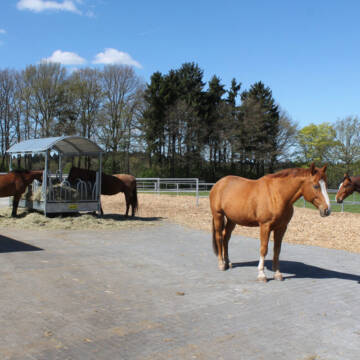
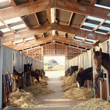
Ab Februar 2026 sind 2 Wallachplätze frei.
Reichshof-Feld
Felder Pferdehof
@FelderPferdehof
FN-Mitglied
Freizeitstall
Vermieten
Paddock
Pensions- und Gastboxen
Gnadenbrothof
Hufrehe geeignet
15 weitere...
aktuell
P
Deprecated: Creation of dynamic property Zend_View_Helper_Ads::$adLink is deprecated in /var/www/stall-frei/htdocs/staging.stall-frei.de/library/Psf/View/Helper/Ads.php on line 108

Persönlichkeitsentwicklung mit Pferden
Bad Salzuflen
Katja Dors
@Pferdezeiten
Begleite andere auf ihrem Entwicklungsweg und entdecke die transformative Kraft der pferdegestützten Persönlichkeitsentwicklung !
neu
R
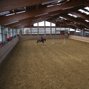
Hof-Silberberg in Daaden
Daaden
Hof-Silberberg-Daaden
@Hof-Silberberg-Daaden
Freizeitstall
Reitlehrer und -unterricht
Vermieten
Paddock
Pensions- und Gastboxen
Außenbox mit Paddock
Laufbox
13 weitere...
P

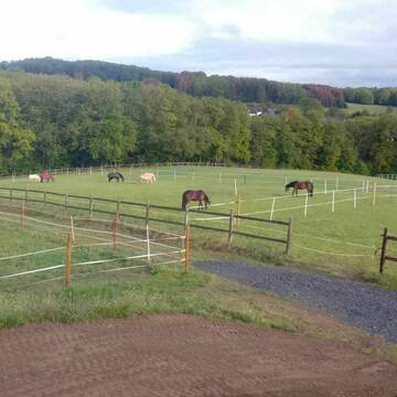
Pferdebox mit Außenpaddock
Windeck
Al_Najma_Stud
@Al_Najma_Stud
Fahrstall, Kutschwagen
FN-Mitglied
Vermieten
Longierzirkel/Roundpen
Paddock
bedampftes/gewaschenes Heu
Fohlenaufzucht möglich
21 weitere...
P
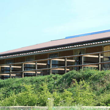
Pensionspferdehaltung in Zuchtstall mit Reithalle
Windeck
Al Najma Stud
@Al Najma Stud
Fahrstall, Kutschwagen
FN-Mitglied
Laufband
Paddock
Hengsthaltung möglich
Hufrehe geeignet
Außenbox mit Paddock
Außenboxen
21 weitere...
P
Reitanlage bietet große Paddockboxen-Rehe geeign...
Birkenbeul
Reitanlage-Weissenbruechen
@Reitanlage-Weissenbruechen
FN-Mitglied
Freizeitstall
Vermieten
Verpachten
Hunde willkommen
Longierzirkel/Roundpen
Allergikerstall
Hufrehe geeignet
28 weitere...
P+
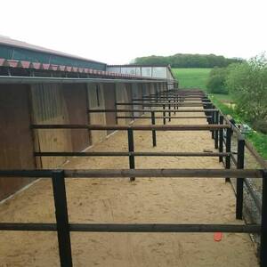
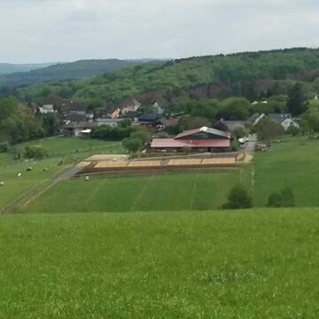
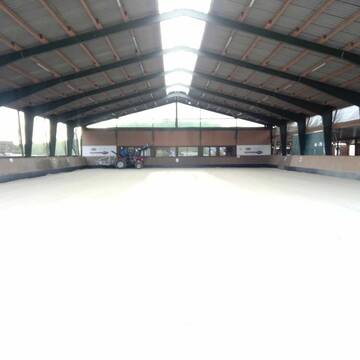
Paddockbox auf der Reitsportanlage Steffens frei
Bergneustadt
Reitsportanlage Steffens
@Reitsportanlage Steffens
FN-Mitglied
Freizeitstall
Führanlage
Longierzirkel/Roundpen
Hengsthaltung möglich
Außenbox mit Paddock
15 weitere...
P
HOF FRÖHLING, Paddockboxen, Offenstall, Aufzucht
Windeck-Hurst
Hof-Froehling
@Hof-Froehling
FN-Mitglied
Freizeitstall
Vermieten
Paddock
Pensions- und Gastboxen
Pferdezucht
Zuchtstutenhaltung möglich
32 weitere...
P
Leider kein Vorschaubild
Leider kein Vorschaubild
Offenstallplatz frei (auch für Hufrehe-Ponys)
Reichshof
Melina Heide
@melina-heide
Vermieten
Hunde willkommen
Paddock
Einhornhaltung möglich
Gnadenbrothof
Offenstall
Paddock Trail
5 weitere...
aktuell
B

Futtersack HeuToy, Fressbremse in pink
Mechtersen
STALL-FREIde Marketing
@STALL-FREI-Marketing
Stundenlange Beschäftigung die
Koliken vorbeugt, geringe Staubinhalation mit
steuerbarer Futterentnahme
Leider kein Vorschaubild
Leider kein Vorschaubild
Offenstallplatz in Selbstversorgung
Mittelhof
Nutztierarche Westerwald
@NutztierarcheWesterwald
Vermieten
Parkplatz für Pferdeanhänger
Sattelkammer/Sattelschränke
Allergikerstall
Gnadenbrothof
Offenstall
6 weitere...
B

Platz für Rentner im Offenstall
Nümbrecht
Stephanie Lingemann
@SteffiLingemann
Freizeitstall
Geländestrecke
Vermieten
Sommerweide
Weide
Offenstall
4 weitere...
ganz aktuell
P
Newsletter abonnieren
Melde Dich für unseren Newsletter an und verpasse keine Neuigkeiten!
Deprecated: Creation of dynamic property Zend_View::$pageCount is deprecated in /var/www/stall-frei/htdocs/staging.stall-frei.de/library/vendor/shardj/zf1-future/library/Zend/View/Abstract.php on line 308
Deprecated: Creation of dynamic property Zend_View::$itemCountPerPage is deprecated in /var/www/stall-frei/htdocs/staging.stall-frei.de/library/vendor/shardj/zf1-future/library/Zend/View/Abstract.php on line 308
Deprecated: Creation of dynamic property Zend_View::$first is deprecated in /var/www/stall-frei/htdocs/staging.stall-frei.de/library/vendor/shardj/zf1-future/library/Zend/View/Abstract.php on line 308
Deprecated: Creation of dynamic property Zend_View::$current is deprecated in /var/www/stall-frei/htdocs/staging.stall-frei.de/library/vendor/shardj/zf1-future/library/Zend/View/Abstract.php on line 308
Deprecated: Creation of dynamic property Zend_View::$last is deprecated in /var/www/stall-frei/htdocs/staging.stall-frei.de/library/vendor/shardj/zf1-future/library/Zend/View/Abstract.php on line 308
Deprecated: Creation of dynamic property Zend_View::$previous is deprecated in /var/www/stall-frei/htdocs/staging.stall-frei.de/library/vendor/shardj/zf1-future/library/Zend/View/Abstract.php on line 308
Deprecated: Creation of dynamic property Zend_View::$next is deprecated in /var/www/stall-frei/htdocs/staging.stall-frei.de/library/vendor/shardj/zf1-future/library/Zend/View/Abstract.php on line 308
Deprecated: Creation of dynamic property Zend_View::$pagesInRange is deprecated in /var/www/stall-frei/htdocs/staging.stall-frei.de/library/vendor/shardj/zf1-future/library/Zend/View/Abstract.php on line 308
Deprecated: Creation of dynamic property Zend_View::$firstPageInRange is deprecated in /var/www/stall-frei/htdocs/staging.stall-frei.de/library/vendor/shardj/zf1-future/library/Zend/View/Abstract.php on line 308
Deprecated: Creation of dynamic property Zend_View::$lastPageInRange is deprecated in /var/www/stall-frei/htdocs/staging.stall-frei.de/library/vendor/shardj/zf1-future/library/Zend/View/Abstract.php on line 308
Deprecated: Creation of dynamic property Zend_View::$currentItemCount is deprecated in /var/www/stall-frei/htdocs/staging.stall-frei.de/library/vendor/shardj/zf1-future/library/Zend/View/Abstract.php on line 308
Deprecated: Creation of dynamic property Zend_View::$totalItemCount is deprecated in /var/www/stall-frei/htdocs/staging.stall-frei.de/library/vendor/shardj/zf1-future/library/Zend/View/Abstract.php on line 308
Deprecated: Creation of dynamic property Zend_View::$firstItemNumber is deprecated in /var/www/stall-frei/htdocs/staging.stall-frei.de/library/vendor/shardj/zf1-future/library/Zend/View/Abstract.php on line 308
Deprecated: Creation of dynamic property Zend_View::$lastItemNumber is deprecated in /var/www/stall-frei/htdocs/staging.stall-frei.de/library/vendor/shardj/zf1-future/library/Zend/View/Abstract.php on line 308
Deprecated: Creation of dynamic property Zend_View::$router is deprecated in /var/www/stall-frei/htdocs/staging.stall-frei.de/library/vendor/shardj/zf1-future/library/Zend/View/Abstract.php on line 308
Deprecated: Creation of dynamic property Zend_View::$urlParams is deprecated in /var/www/stall-frei/htdocs/staging.stall-frei.de/library/vendor/shardj/zf1-future/library/Zend/View/Abstract.php on line 308
Deprecated: Creation of dynamic property Zend_View::$showAds is deprecated in /var/www/stall-frei/htdocs/staging.stall-frei.de/library/vendor/shardj/zf1-future/library/Zend/View/Abstract.php on line 308
Deprecated: Creation of dynamic property Zend_View::$objectIds is deprecated in /var/www/stall-frei/htdocs/staging.stall-frei.de/library/vendor/shardj/zf1-future/library/Zend/View/Abstract.php on line 308
Deprecated: Creation of dynamic property Zend_View::$showNavbar is deprecated in /var/www/stall-frei/htdocs/staging.stall-frei.de/library/vendor/shardj/zf1-future/library/Zend/View/Abstract.php on line 308
Deprecated: Creation of dynamic property Zend_View::$showBreadcrumb is deprecated in /var/www/stall-frei/htdocs/staging.stall-frei.de/library/vendor/shardj/zf1-future/library/Zend/View/Abstract.php on line 308
Deprecated: Creation of dynamic property Zend_View::$showFooter is deprecated in /var/www/stall-frei/htdocs/staging.stall-frei.de/library/vendor/shardj/zf1-future/library/Zend/View/Abstract.php on line 308
Deprecated: Creation of dynamic property Zend_View::$showInternalAds is deprecated in /var/www/stall-frei/htdocs/staging.stall-frei.de/library/vendor/shardj/zf1-future/library/Zend/View/Abstract.php on line 308
Deprecated: Creation of dynamic property Zend_View::$blNoContent is deprecated in /var/www/stall-frei/htdocs/staging.stall-frei.de/library/vendor/shardj/zf1-future/library/Zend/View/Abstract.php on line 308
Deprecated: Creation of dynamic property Zend_View::$sMetaDesc is deprecated in /var/www/stall-frei/htdocs/staging.stall-frei.de/library/vendor/shardj/zf1-future/library/Zend/View/Abstract.php on line 308
Deprecated: Creation of dynamic property Zend_View::$useGmaps is deprecated in /var/www/stall-frei/htdocs/staging.stall-frei.de/library/vendor/shardj/zf1-future/library/Zend/View/Abstract.php on line 308
Deprecated: Creation of dynamic property Zend_View::$touches is deprecated in /var/www/stall-frei/htdocs/staging.stall-frei.de/library/vendor/shardj/zf1-future/library/Zend/View/Abstract.php on line 308
Deprecated: Creation of dynamic property Zend_View::$oProject is deprecated in /var/www/stall-frei/htdocs/staging.stall-frei.de/library/vendor/shardj/zf1-future/library/Zend/View/Abstract.php on line 308
Deprecated: Creation of dynamic property Zend_View::$pageHeadline is deprecated in /var/www/stall-frei/htdocs/staging.stall-frei.de/library/vendor/shardj/zf1-future/library/Zend/View/Abstract.php on line 308
Deprecated: Creation of dynamic property Zend_View::$disableLocationField is deprecated in /var/www/stall-frei/htdocs/staging.stall-frei.de/library/vendor/shardj/zf1-future/library/Zend/View/Abstract.php on line 308
Deprecated: Creation of dynamic property Zend_View::$isSearch is deprecated in /var/www/stall-frei/htdocs/staging.stall-frei.de/library/vendor/shardj/zf1-future/library/Zend/View/Abstract.php on line 308
Deprecated: Creation of dynamic property Zend_View::$pageTitle is deprecated in /var/www/stall-frei/htdocs/staging.stall-frei.de/library/vendor/shardj/zf1-future/library/Zend/View/Abstract.php on line 308
Deprecated: Creation of dynamic property Psf_Form_Element_Text::$class is deprecated in /var/www/stall-frei/htdocs/staging.stall-frei.de/library/vendor/shardj/zf1-future/library/Zend/Form/Element.php on line 874
Deprecated: Creation of dynamic property Psf_Form_Element_Text::$size is deprecated in /var/www/stall-frei/htdocs/staging.stall-frei.de/library/vendor/shardj/zf1-future/library/Zend/Form/Element.php on line 874
Deprecated: Creation of dynamic property Psf_Form_Element_Text::$placeholder is deprecated in /var/www/stall-frei/htdocs/staging.stall-frei.de/library/vendor/shardj/zf1-future/library/Zend/Form/Element.php on line 874
Deprecated: Creation of dynamic property Psf_Form_Element_Hidden::$class is deprecated in /var/www/stall-frei/htdocs/staging.stall-frei.de/library/vendor/shardj/zf1-future/library/Zend/Form/Element.php on line 874
Deprecated: Creation of dynamic property Psf_Form_Element_Hidden::$class is deprecated in /var/www/stall-frei/htdocs/staging.stall-frei.de/library/vendor/shardj/zf1-future/library/Zend/Form/Element.php on line 874
Deprecated: Creation of dynamic property Psf_Form_Element_Hidden::$class is deprecated in /var/www/stall-frei/htdocs/staging.stall-frei.de/library/vendor/shardj/zf1-future/library/Zend/Form/Element.php on line 874
Deprecated: Creation of dynamic property Psf_Form_Element_Hidden::$class is deprecated in /var/www/stall-frei/htdocs/staging.stall-frei.de/library/vendor/shardj/zf1-future/library/Zend/Form/Element.php on line 874
Deprecated: Creation of dynamic property Psf_Form_Element_Select::$class is deprecated in /var/www/stall-frei/htdocs/staging.stall-frei.de/library/vendor/shardj/zf1-future/library/Zend/Form/Element.php on line 874
Deprecated: Creation of dynamic property Psf_Form_Element_Select::$class is deprecated in /var/www/stall-frei/htdocs/staging.stall-frei.de/library/vendor/shardj/zf1-future/library/Zend/Form/Element.php on line 874
Deprecated: Creation of dynamic property Psf_Form_Element_Select::$class is deprecated in /var/www/stall-frei/htdocs/staging.stall-frei.de/library/vendor/shardj/zf1-future/library/Zend/Form/Element.php on line 874
Deprecated: Creation of dynamic property Psf_Form_Element_Select::$class is deprecated in /var/www/stall-frei/htdocs/staging.stall-frei.de/library/vendor/shardj/zf1-future/library/Zend/Form/Element.php on line 874
Deprecated: Creation of dynamic property Psf_Form_Element_Text::$class is deprecated in /var/www/stall-frei/htdocs/staging.stall-frei.de/library/vendor/shardj/zf1-future/library/Zend/Form/Element.php on line 874
Deprecated: Creation of dynamic property Psf_Form_Element_Checkbox::$label is deprecated in /var/www/stall-frei/htdocs/staging.stall-frei.de/library/vendor/shardj/zf1-future/library/Zend/Form/Element.php on line 874
Deprecated: Creation of dynamic property Zend_View::$sort is deprecated in /var/www/stall-frei/htdocs/staging.stall-frei.de/library/vendor/shardj/zf1-future/library/Zend/View/Abstract.php on line 308
Deprecated: Creation of dynamic property Zend_View::$searchLocation is deprecated in /var/www/stall-frei/htdocs/staging.stall-frei.de/library/vendor/shardj/zf1-future/library/Zend/View/Abstract.php on line 308
Deprecated: Creation of dynamic property Zend_View::$locationHint is deprecated in /var/www/stall-frei/htdocs/staging.stall-frei.de/library/vendor/shardj/zf1-future/library/Zend/View/Abstract.php on line 308
Psf_GeoCoder_Abstract::getLocation: Freudenberg Get Location CachedOrLive
Psf_GeoCoder_Abstract::getCachedOrLive: Freudenberg
Psf_GeoCoder_Abstract::convertLocationResult
{"documentation":"https:\/\/opencagedata.com\/api","licenses":[{"name":"see attribution guide","url":"https:\/\/opencagedata.com\/credits"}],"results":[{"bounds":{"northeast":{"lat":50.9345774,"lng":7.9606236},"southwest":{"lat":50.8442989,"lng":7.8273206}},"components":{"ISO_3166-1_alpha-2":"DE","ISO_3166-1_alpha-3":"DEU","ISO_3166-2":["DE-NW"],"_category":"place","_normalized_city":"Freudenberg","_type":"city","continent":"Europe","country":"Deutschland","country_code":"de","county":"Kreis Siegen-Wittgenstein","political_union":"European Union","postcode":"57258","state":"Nordrhein-Westfalen","state_code":"NW","town":"Freudenberg"},"confidence":7,"formatted":"57258 Freudenberg, Deutschland","geometry":{"lat":50.8983662,"lng":7.8773745}},{"bounds":{"northeast":{"lat":49.7791868,"lng":9.4210421},"southwest":{"lat":49.7034677,"lng":9.2956877}},"components":{"ISO_3166-1_alpha-2":"DE","ISO_3166-1_alpha-3":"DEU","ISO_3166-2":["DE-BW"],"_category":"place","_normalized_city":"Freudenberg","_type":"city","continent":"Europe","country":"Deutschland","country_code":"de","county":"Main-Tauber-Kreis","political_union":"European Union","postcode":"97896","state":"Baden-W\u00fcrttemberg","state_code":"BW","town":"Freudenberg"},"confidence":7,"formatted":"97896 Freudenberg, Deutschland","geometry":{"lat":49.7486131,"lng":9.3261061}},{"bounds":{"northeast":{"lat":49.5135936,"lng":12.0417457},"southwest":{"lat":49.4142913,"lng":11.8730362}},"components":{"ISO_3166-1_alpha-2":"DE","ISO_3166-1_alpha-3":"DEU","ISO_3166-2":["DE-BY"],"_category":"place","_normalized_city":"Freudenberg","_type":"village","continent":"Europe","country":"Deutschland","country_code":"de","county":"Landkreis Amberg-Sulzbach","political_union":"European Union","postcode":"92272","state":"Bayern","state_code":"BY","village":"Freudenberg"},"confidence":6,"formatted":"92272 Freudenberg, Deutschland","geometry":{"lat":49.4799549,"lng":11.9796023}},{"bounds":{"northeast":{"lat":52.7195785,"lng":13.8374592},"southwest":{"lat":52.6795785,"lng":13.7974592}},"components":{"ISO_3166-1_alpha-2":"DE","ISO_3166-1_alpha-3":"DEU","ISO_3166-2":["DE-BB"],"_category":"place","_normalized_city":"Beiersdorf-Freudenberg","_type":"village","city":"Beiersdorf-Freudenberg","continent":"Europe","country":"Deutschland","country_code":"de","county":"M\u00e4rkisch-Oderland","municipality":"Falkenberg-H\u00f6he","political_union":"European Union","postcode":"16259","state":"Brandenburg","state_code":"BB","village":"Freudenberg"},"confidence":7,"formatted":"16259 Freudenberg, Deutschland","geometry":{"lat":52.6995785,"lng":13.8174592}},{"bounds":{"northeast":{"lat":52.7153885,"lng":13.8671443},"southwest":{"lat":52.6780848,"lng":13.8055662}},"components":{"ISO_3166-1_alpha-2":"DE","ISO_3166-1_alpha-3":"DEU","ISO_3166-2":["DE-BB"],"_category":"place","_normalized_city":"Beiersdorf-Freudenberg","_type":"village","city":"Beiersdorf-Freudenberg","continent":"Europe","country":"Deutschland","country_code":"de","county":"M\u00e4rkisch-Oderland","municipality":"Falkenberg-H\u00f6he","political_union":"European Union","state":"Brandenburg","state_code":"BB","village":"Freudenberg"},"confidence":7,"formatted":"Freudenberg, Brandenburg, Deutschland","geometry":{"lat":52.6966891,"lng":13.8335014}},{"bounds":{"northeast":{"lat":51.0436857,"lng":8.6622515},"southwest":{"lat":51.0435857,"lng":8.6621515}},"components":{"ISO_3166-1_alpha-2":"DE","ISO_3166-1_alpha-3":"DEU","ISO_3166-2":["DE-HE"],"_category":"natural\/water","_normalized_city":"Allendorf (Eder)","_type":"peak","continent":"Europe","country":"Deutschland","country_code":"de","county":"Landkreis Waldeck-Frankenberg","municipality":"Allendorf (Eder)","peak":"Freudenberg","political_union":"European Union","postcode":"35108","state":"Hessen","state_code":"HE","town":"Allendorf (Eder)"},"confidence":9,"formatted":"Freudenberg, 35108 Allendorf (Eder), Deutschland","geometry":{"lat":51.0436357,"lng":8.6622015}},{"bounds":{"northeast":{"lat":49.541042,"lng":8.961093},"southwest":{"lat":49.540942,"lng":8.960993}},"components":{"ISO_3166-1_alpha-2":"DE","ISO_3166-1_alpha-3":"DEU","ISO_3166-2":["DE-HE"],"_category":"natural\/water","_normalized_city":"Gammelsbach","_type":"peak","continent":"Europe","country":"Deutschland","country_code":"de","county":"Odenwaldkreis","municipality":"Oberzent","peak":"Freudenberg","political_union":"European Union","postcode":"64760","state":"Hessen","state_code":"HE","village":"Gammelsbach"},"confidence":9,"formatted":"Freudenberg, 64760 Gammelsbach, Deutschland","geometry":{"lat":49.540992,"lng":8.961043}},{"bounds":{"northeast":{"lat":49.0372066,"lng":9.2939812},"southwest":{"lat":49.0371066,"lng":9.2938812}},"components":{"ISO_3166-1_alpha-2":"DE","ISO_3166-1_alpha-3":"DEU","ISO_3166-2":["DE-BW"],"_category":"natural\/water","_normalized_city":"Beilstein","_type":"peak","continent":"Europe","country":"Deutschland","country_code":"de","county":"Landkreis Heilbronn","municipality":"GVV Schozach-Bottwartal","peak":"Freudenberg","political_union":"European Union","postcode":"71717","state":"Baden-W\u00fcrttemberg","state_code":"BW","town":"Beilstein"},"confidence":9,"formatted":"Freudenberg, 71717 Beilstein, Deutschland","geometry":{"lat":49.0371566,"lng":9.2939312}},{"bounds":{"northeast":{"lat":53.2831197,"lng":11.9951282},"southwest":{"lat":53.2830197,"lng":11.9950282}},"components":{"ISO_3166-1_alpha-2":"DE","ISO_3166-1_alpha-3":"DEU","ISO_3166-2":["DE-BB"],"_category":"natural\/water","_normalized_city":"Putlitz","_type":"peak","continent":"Europe","country":"Deutschland","country_code":"de","county":"Prignitz","municipality":"Putlitz-Berge","peak":"Freudenberg","political_union":"European Union","state":"Brandenburg","state_code":"BB","town":"Putlitz"},"confidence":9,"formatted":"Freudenberg, Putlitz, Brandenburg, Deutschland","geometry":{"lat":53.2830697,"lng":11.9950782}},{"bounds":{"northeast":{"lat":54.252597,"lng":12.5167345},"southwest":{"lat":54.212597,"lng":12.4767345}},"components":{"ISO_3166-1_alpha-2":"DE","ISO_3166-1_alpha-3":"DEU","ISO_3166-2":["DE-MV"],"_category":"place","_normalized_city":"Ribnitz-Damgarten","_type":"village","continent":"Europe","country":"Deutschland","country_code":"de","county":"Vorpommern-R\u00fcgen","municipality":"Ribnitz-Damgarten","political_union":"European Union","state":"Mecklenburg-Vorpommern","state_code":"MV","town":"Ribnitz-Damgarten","village":"Freudenberg"},"confidence":7,"formatted":"Freudenberg, Mecklenburg-Vorpommern, Deutschland","geometry":{"lat":54.232597,"lng":12.4967345}}],"status":{"code":200,"message":"OK"},"stay_informed":{"blog":"https:\/\/blog.opencagedata.com","mastodon":"https:\/\/en.osm.town\/@opencage"},"thanks":"For using an OpenCage API","timestamp":{"created_http":"Sat, 07 Feb 2026 01:28:24 GMT","created_unix":1770427704},"total_results":10}Array
(
[0] => stdClass Object
(
[bounds] => stdClass Object
(
[northeast] => stdClass Object
(
[lat] => 50.9345774
[lng] => 7.9606236
)
[southwest] => stdClass Object
(
[lat] => 50.8442989
[lng] => 7.8273206
)
)
[components] => stdClass Object
(
[ISO_3166-1_alpha-2] => DE
[ISO_3166-1_alpha-3] => DEU
[ISO_3166-2] => Array
(
[0] => DE-NW
)
[_category] => place
[_normalized_city] => Freudenberg
[_type] => city
[continent] => Europe
[country] => Deutschland
[country_code] => de
[county] => Kreis Siegen-Wittgenstein
[political_union] => European Union
[postcode] => 57258
[state] => Nordrhein-Westfalen
[state_code] => NW
[town] => Freudenberg
)
[confidence] => 7
[formatted] => 57258 Freudenberg, Deutschland
[geometry] => stdClass Object
(
[lat] => 50.8983662
[lng] => 7.8773745
)
)
[1] => stdClass Object
(
[bounds] => stdClass Object
(
[northeast] => stdClass Object
(
[lat] => 49.7791868
[lng] => 9.4210421
)
[southwest] => stdClass Object
(
[lat] => 49.7034677
[lng] => 9.2956877
)
)
[components] => stdClass Object
(
[ISO_3166-1_alpha-2] => DE
[ISO_3166-1_alpha-3] => DEU
[ISO_3166-2] => Array
(
[0] => DE-BW
)
[_category] => place
[_normalized_city] => Freudenberg
[_type] => city
[continent] => Europe
[country] => Deutschland
[country_code] => de
[county] => Main-Tauber-Kreis
[political_union] => European Union
[postcode] => 97896
[state] => Baden-Württemberg
[state_code] => BW
[town] => Freudenberg
)
[confidence] => 7
[formatted] => 97896 Freudenberg, Deutschland
[geometry] => stdClass Object
(
[lat] => 49.7486131
[lng] => 9.3261061
)
)
[2] => stdClass Object
(
[bounds] => stdClass Object
(
[northeast] => stdClass Object
(
[lat] => 49.5135936
[lng] => 12.0417457
)
[southwest] => stdClass Object
(
[lat] => 49.4142913
[lng] => 11.8730362
)
)
[components] => stdClass Object
(
[ISO_3166-1_alpha-2] => DE
[ISO_3166-1_alpha-3] => DEU
[ISO_3166-2] => Array
(
[0] => DE-BY
)
[_category] => place
[_normalized_city] => Freudenberg
[_type] => village
[continent] => Europe
[country] => Deutschland
[country_code] => de
[county] => Landkreis Amberg-Sulzbach
[political_union] => European Union
[postcode] => 92272
[state] => Bayern
[state_code] => BY
[village] => Freudenberg
)
[confidence] => 6
[formatted] => 92272 Freudenberg, Deutschland
[geometry] => stdClass Object
(
[lat] => 49.4799549
[lng] => 11.9796023
)
)
[3] => stdClass Object
(
[bounds] => stdClass Object
(
[northeast] => stdClass Object
(
[lat] => 52.7195785
[lng] => 13.8374592
)
[southwest] => stdClass Object
(
[lat] => 52.6795785
[lng] => 13.7974592
)
)
[components] => stdClass Object
(
[ISO_3166-1_alpha-2] => DE
[ISO_3166-1_alpha-3] => DEU
[ISO_3166-2] => Array
(
[0] => DE-BB
)
[_category] => place
[_normalized_city] => Beiersdorf-Freudenberg
[_type] => village
[city] => Beiersdorf-Freudenberg
[continent] => Europe
[country] => Deutschland
[country_code] => de
[county] => Märkisch-Oderland
[municipality] => Falkenberg-Höhe
[political_union] => European Union
[postcode] => 16259
[state] => Brandenburg
[state_code] => BB
[village] => Freudenberg
)
[confidence] => 7
[formatted] => 16259 Freudenberg, Deutschland
[geometry] => stdClass Object
(
[lat] => 52.6995785
[lng] => 13.8174592
)
)
[4] => stdClass Object
(
[bounds] => stdClass Object
(
[northeast] => stdClass Object
(
[lat] => 52.7153885
[lng] => 13.8671443
)
[southwest] => stdClass Object
(
[lat] => 52.6780848
[lng] => 13.8055662
)
)
[components] => stdClass Object
(
[ISO_3166-1_alpha-2] => DE
[ISO_3166-1_alpha-3] => DEU
[ISO_3166-2] => Array
(
[0] => DE-BB
)
[_category] => place
[_normalized_city] => Beiersdorf-Freudenberg
[_type] => village
[city] => Beiersdorf-Freudenberg
[continent] => Europe
[country] => Deutschland
[country_code] => de
[county] => Märkisch-Oderland
[municipality] => Falkenberg-Höhe
[political_union] => European Union
[state] => Brandenburg
[state_code] => BB
[village] => Freudenberg
)
[confidence] => 7
[formatted] => Freudenberg, Brandenburg, Deutschland
[geometry] => stdClass Object
(
[lat] => 52.6966891
[lng] => 13.8335014
)
)
[5] => stdClass Object
(
[bounds] => stdClass Object
(
[northeast] => stdClass Object
(
[lat] => 51.0436857
[lng] => 8.6622515
)
[southwest] => stdClass Object
(
[lat] => 51.0435857
[lng] => 8.6621515
)
)
[components] => stdClass Object
(
[ISO_3166-1_alpha-2] => DE
[ISO_3166-1_alpha-3] => DEU
[ISO_3166-2] => Array
(
[0] => DE-HE
)
[_category] => natural/water
[_normalized_city] => Allendorf (Eder)
[_type] => peak
[continent] => Europe
[country] => Deutschland
[country_code] => de
[county] => Landkreis Waldeck-Frankenberg
[municipality] => Allendorf (Eder)
[peak] => Freudenberg
[political_union] => European Union
[postcode] => 35108
[state] => Hessen
[state_code] => HE
[town] => Allendorf (Eder)
)
[confidence] => 9
[formatted] => Freudenberg, 35108 Allendorf (Eder), Deutschland
[geometry] => stdClass Object
(
[lat] => 51.0436357
[lng] => 8.6622015
)
)
[6] => stdClass Object
(
[bounds] => stdClass Object
(
[northeast] => stdClass Object
(
[lat] => 49.541042
[lng] => 8.961093
)
[southwest] => stdClass Object
(
[lat] => 49.540942
[lng] => 8.960993
)
)
[components] => stdClass Object
(
[ISO_3166-1_alpha-2] => DE
[ISO_3166-1_alpha-3] => DEU
[ISO_3166-2] => Array
(
[0] => DE-HE
)
[_category] => natural/water
[_normalized_city] => Gammelsbach
[_type] => peak
[continent] => Europe
[country] => Deutschland
[country_code] => de
[county] => Odenwaldkreis
[municipality] => Oberzent
[peak] => Freudenberg
[political_union] => European Union
[postcode] => 64760
[state] => Hessen
[state_code] => HE
[village] => Gammelsbach
)
[confidence] => 9
[formatted] => Freudenberg, 64760 Gammelsbach, Deutschland
[geometry] => stdClass Object
(
[lat] => 49.540992
[lng] => 8.961043
)
)
[7] => stdClass Object
(
[bounds] => stdClass Object
(
[northeast] => stdClass Object
(
[lat] => 49.0372066
[lng] => 9.2939812
)
[southwest] => stdClass Object
(
[lat] => 49.0371066
[lng] => 9.2938812
)
)
[components] => stdClass Object
(
[ISO_3166-1_alpha-2] => DE
[ISO_3166-1_alpha-3] => DEU
[ISO_3166-2] => Array
(
[0] => DE-BW
)
[_category] => natural/water
[_normalized_city] => Beilstein
[_type] => peak
[continent] => Europe
[country] => Deutschland
[country_code] => de
[county] => Landkreis Heilbronn
[municipality] => GVV Schozach-Bottwartal
[peak] => Freudenberg
[political_union] => European Union
[postcode] => 71717
[state] => Baden-Württemberg
[state_code] => BW
[town] => Beilstein
)
[confidence] => 9
[formatted] => Freudenberg, 71717 Beilstein, Deutschland
[geometry] => stdClass Object
(
[lat] => 49.0371566
[lng] => 9.2939312
)
)
[8] => stdClass Object
(
[bounds] => stdClass Object
(
[northeast] => stdClass Object
(
[lat] => 53.2831197
[lng] => 11.9951282
)
[southwest] => stdClass Object
(
[lat] => 53.2830197
[lng] => 11.9950282
)
)
[components] => stdClass Object
(
[ISO_3166-1_alpha-2] => DE
[ISO_3166-1_alpha-3] => DEU
[ISO_3166-2] => Array
(
[0] => DE-BB
)
[_category] => natural/water
[_normalized_city] => Putlitz
[_type] => peak
[continent] => Europe
[country] => Deutschland
[country_code] => de
[county] => Prignitz
[municipality] => Putlitz-Berge
[peak] => Freudenberg
[political_union] => European Union
[state] => Brandenburg
[state_code] => BB
[town] => Putlitz
)
[confidence] => 9
[formatted] => Freudenberg, Putlitz, Brandenburg, Deutschland
[geometry] => stdClass Object
(
[lat] => 53.2830697
[lng] => 11.9950782
)
)
[9] => stdClass Object
(
[bounds] => stdClass Object
(
[northeast] => stdClass Object
(
[lat] => 54.252597
[lng] => 12.5167345
)
[southwest] => stdClass Object
(
[lat] => 54.212597
[lng] => 12.4767345
)
)
[components] => stdClass Object
(
[ISO_3166-1_alpha-2] => DE
[ISO_3166-1_alpha-3] => DEU
[ISO_3166-2] => Array
(
[0] => DE-MV
)
[_category] => place
[_normalized_city] => Ribnitz-Damgarten
[_type] => village
[continent] => Europe
[country] => Deutschland
[country_code] => de
[county] => Vorpommern-Rügen
[municipality] => Ribnitz-Damgarten
[political_union] => European Union
[state] => Mecklenburg-Vorpommern
[state_code] => MV
[town] => Ribnitz-Damgarten
[village] => Freudenberg
)
[confidence] => 7
[formatted] => Freudenberg, Mecklenburg-Vorpommern, Deutschland
[geometry] => stdClass Object
(
[lat] => 54.232597
[lng] => 12.4967345
)
)
)
Psf_GeoCoder_OpenCageData::getKeyMap: 0
stdClass Object
(
    [bounds] => stdClass Object
        (
            [northeast] => stdClass Object
                (
                    [lat] => 50.9345774
                    [lng] => 7.9606236
                )

            [southwest] => stdClass Object
                (
                    [lat] => 50.8442989
                    [lng] => 7.8273206
                )

        )

    [components] => stdClass Object
        (
            [ISO_3166-1_alpha-2] => DE
            [ISO_3166-1_alpha-3] => DEU
            [ISO_3166-2] => Array
                (
                    [0] => DE-NW
                )

            [_category] => place
            [_normalized_city] => Freudenberg
            [_type] => city
            [continent] => Europe
            [country] => Deutschland
            [country_code] => de
            [county] => Kreis Siegen-Wittgenstein
            [political_union] => European Union
            [postcode] => 57258
            [state] => Nordrhein-Westfalen
            [state_code] => NW
            [town] => Freudenberg
        )

    [confidence] => 7
    [formatted] => 57258 Freudenberg, Deutschland
    [geometry] => stdClass Object
        (
            [lat] => 50.8983662
            [lng] => 7.8773745
        )

)
Psf_GeoCoder_OpenCageData::getCounty: Siegen-Wittgenstein
Psf_GeoCoder_OpenCageData::addMissingData REFETCH!
Array
(
    [address] => 57258 Freudenberg, Deutschland
    [type] => city
    [street] =>
    [city] => Freudenberg
    [county] => Siegen-Wittgenstein
    [state] => Nordrhein-Westfalen
    [zip] => 57258
    [country] => Deutschland
    [suburb] =>
    [countrycode] => de
    [latitude] => 50.8983662
    [longitude] => 7.8773745
    [accuracy] => 1
    [confidence] => 7
    [bounds] => stdClass Object
        (
            [northeast] => stdClass Object
                (
                    [lat] => 50.9345774
                    [lng] => 7.9606236
                )

            [southwest] => stdClass Object
                (
                    [lat] => 50.8442989
                    [lng] => 7.8273206
                )

        )

)
reformat!
Array
(
    [address] => 57258 Freudenberg, Deutschland
    [type] => city
    [street] =>
    [city] => Freudenberg
    [county] => Siegen-Wittgenstein
    [state] => Nordrhein-Westfalen
    [zip] => 57258
    [country] => Deutschland
    [suburb] =>
    [countrycode] => de
    [latitude] => 50.8983662
    [longitude] => 7.8773745
    [accuracy] => 1
    [confidence] => 7
    [bounds] => stdClass Object
        (
            [northeast] => stdClass Object
                (
                    [lat] => 50.9345774
                    [lng] => 7.9606236
                )

            [southwest] => stdClass Object
                (
                    [lat] => 50.8442989
                    [lng] => 7.8273206
                )

        )

    [place] => 57258 Freudenberg, Nordrhein-Westfalen
    [hash] => e3c6e7010ed60ced731e4f6e72f66ba6
)
Psf_GeoCoder_OpenCageData::getKeyMap: 1
stdClass Object
(
    [bounds] => stdClass Object
        (
            [northeast] => stdClass Object
                (
                    [lat] => 49.7791868
                    [lng] => 9.4210421
                )

            [southwest] => stdClass Object
                (
                    [lat] => 49.7034677
                    [lng] => 9.2956877
                )

        )

    [components] => stdClass Object
        (
            [ISO_3166-1_alpha-2] => DE
            [ISO_3166-1_alpha-3] => DEU
            [ISO_3166-2] => Array
                (
                    [0] => DE-BW
                )

            [_category] => place
            [_normalized_city] => Freudenberg
            [_type] => city
            [continent] => Europe
            [country] => Deutschland
            [country_code] => de
            [county] => Main-Tauber-Kreis
            [political_union] => European Union
            [postcode] => 97896
            [state] => Baden-Württemberg
            [state_code] => BW
            [town] => Freudenberg
        )

    [confidence] => 7
    [formatted] => 97896 Freudenberg, Deutschland
    [geometry] => stdClass Object
        (
            [lat] => 49.7486131
            [lng] => 9.3261061
        )

)
Psf_GeoCoder_OpenCageData::getCounty: Main-Tauber-Kreis
Psf_GeoCoder_OpenCageData::addMissingData REFETCH!
Array
(
    [address] => 97896 Freudenberg, Deutschland
    [type] => city
    [street] =>
    [city] => Freudenberg
    [county] => Main-Tauber-Kreis
    [state] => Baden-Württemberg
    [zip] => 97896
    [country] => Deutschland
    [suburb] =>
    [countrycode] => de
    [latitude] => 49.7486131
    [longitude] => 9.3261061
    [accuracy] => 1
    [confidence] => 7
    [bounds] => stdClass Object
        (
            [northeast] => stdClass Object
                (
                    [lat] => 49.7791868
                    [lng] => 9.4210421
                )

            [southwest] => stdClass Object
                (
                    [lat] => 49.7034677
                    [lng] => 9.2956877
                )

        )

)
reformat!
Array
(
    [address] => 97896 Freudenberg, Deutschland
    [type] => city
    [street] =>
    [city] => Freudenberg
    [county] => Main-Tauber-Kreis
    [state] => Baden-Württemberg
    [zip] => 97896
    [country] => Deutschland
    [suburb] =>
    [countrycode] => de
    [latitude] => 49.7486131
    [longitude] => 9.3261061
    [accuracy] => 1
    [confidence] => 7
    [bounds] => stdClass Object
        (
            [northeast] => stdClass Object
                (
                    [lat] => 49.7791868
                    [lng] => 9.4210421
                )

            [southwest] => stdClass Object
                (
                    [lat] => 49.7034677
                    [lng] => 9.2956877
                )

        )

    [place] => 97896 Freudenberg, Baden-Württemberg
    [hash] => 21bfe3cedc4df30d3594575452853734
)
Psf_GeoCoder_OpenCageData::getKeyMap: 2
stdClass Object
(
    [bounds] => stdClass Object
        (
            [northeast] => stdClass Object
                (
                    [lat] => 49.5135936
                    [lng] => 12.0417457
                )

            [southwest] => stdClass Object
                (
                    [lat] => 49.4142913
                    [lng] => 11.8730362
                )

        )

    [components] => stdClass Object
        (
            [ISO_3166-1_alpha-2] => DE
            [ISO_3166-1_alpha-3] => DEU
            [ISO_3166-2] => Array
                (
                    [0] => DE-BY
                )

            [_category] => place
            [_normalized_city] => Freudenberg
            [_type] => village
            [continent] => Europe
            [country] => Deutschland
            [country_code] => de
            [county] => Landkreis Amberg-Sulzbach
            [political_union] => European Union
            [postcode] => 92272
            [state] => Bayern
            [state_code] => BY
            [village] => Freudenberg
        )

    [confidence] => 6
    [formatted] => 92272 Freudenberg, Deutschland
    [geometry] => stdClass Object
        (
            [lat] => 49.4799549
            [lng] => 11.9796023
        )

)
Psf_GeoCoder_OpenCageData::getCounty: Amberg-Sulzbach
Psf_GeoCoder_OpenCageData::addMissingData REFETCH!
Array
(
    [address] => 92272 Freudenberg, Deutschland
    [type] => village
    [street] =>
    [city] => Freudenberg
    [county] => Amberg-Sulzbach
    [state] => Bayern
    [zip] => 92272
    [country] => Deutschland
    [suburb] =>
    [countrycode] => de
    [latitude] => 49.4799549
    [longitude] => 11.9796023
    [accuracy] => 1
    [confidence] => 6
    [bounds] => stdClass Object
        (
            [northeast] => stdClass Object
                (
                    [lat] => 49.5135936
                    [lng] => 12.0417457
                )

            [southwest] => stdClass Object
                (
                    [lat] => 49.4142913
                    [lng] => 11.8730362
                )

        )

)
reformat!
Array
(
    [address] => 92272 Freudenberg, Deutschland
    [type] => village
    [street] =>
    [city] => Freudenberg
    [county] => Amberg-Sulzbach
    [state] => Bayern
    [zip] => 92272
    [country] => Deutschland
    [suburb] =>
    [countrycode] => de
    [latitude] => 49.4799549
    [longitude] => 11.9796023
    [accuracy] => 1
    [confidence] => 6
    [bounds] => stdClass Object
        (
            [northeast] => stdClass Object
                (
                    [lat] => 49.5135936
                    [lng] => 12.0417457
                )

            [southwest] => stdClass Object
                (
                    [lat] => 49.4142913
                    [lng] => 11.8730362
                )

        )

    [place] => 92272 Freudenberg, Bayern
    [hash] => 912098ce2cffc8bbb9f79dbbcd9f9357
)
Psf_GeoCoder_OpenCageData::getKeyMap: 3
stdClass Object
(
    [bounds] => stdClass Object
        (
            [northeast] => stdClass Object
                (
                    [lat] => 52.7195785
                    [lng] => 13.8374592
                )

            [southwest] => stdClass Object
                (
                    [lat] => 52.6795785
                    [lng] => 13.7974592
                )

        )

    [components] => stdClass Object
        (
            [ISO_3166-1_alpha-2] => DE
            [ISO_3166-1_alpha-3] => DEU
            [ISO_3166-2] => Array
                (
                    [0] => DE-BB
                )

            [_category] => place
            [_normalized_city] => Beiersdorf-Freudenberg
            [_type] => village
            [city] => Beiersdorf-Freudenberg
            [continent] => Europe
            [country] => Deutschland
            [country_code] => de
            [county] => Märkisch-Oderland
            [municipality] => Falkenberg-Höhe
            [political_union] => European Union
            [postcode] => 16259
            [state] => Brandenburg
            [state_code] => BB
            [village] => Freudenberg
        )

    [confidence] => 7
    [formatted] => 16259 Freudenberg, Deutschland
    [geometry] => stdClass Object
        (
            [lat] => 52.6995785
            [lng] => 13.8174592
        )

)
Psf_GeoCoder_OpenCageData::getCounty: Märkisch-Oderland
Psf_GeoCoder_OpenCageData::addMissingData REFETCH!
Array
(
    [address] => 16259 Freudenberg, Deutschland
    [type] => village
    [street] =>
    [city] => Freudenberg
    [county] => Märkisch-Oderland
    [state] => Brandenburg
    [zip] => 16259
    [country] => Deutschland
    [suburb] =>
    [countrycode] => de
    [latitude] => 52.6995785
    [longitude] => 13.8174592
    [accuracy] => 1
    [confidence] => 7
    [bounds] => stdClass Object
        (
            [northeast] => stdClass Object
                (
                    [lat] => 52.7195785
                    [lng] => 13.8374592
                )

            [southwest] => stdClass Object
                (
                    [lat] => 52.6795785
                    [lng] => 13.7974592
                )

        )

)
reformat!
Array
(
    [address] => 16259 Freudenberg, Deutschland
    [type] => village
    [street] =>
    [city] => Freudenberg
    [county] => Märkisch-Oderland
    [state] => Brandenburg
    [zip] => 16259
    [country] => Deutschland
    [suburb] =>
    [countrycode] => de
    [latitude] => 52.6995785
    [longitude] => 13.8174592
    [accuracy] => 1
    [confidence] => 7
    [bounds] => stdClass Object
        (
            [northeast] => stdClass Object
                (
                    [lat] => 52.7195785
                    [lng] => 13.8374592
                )

            [southwest] => stdClass Object
                (
                    [lat] => 52.6795785
                    [lng] => 13.7974592
                )

        )

    [place] => 16259 Freudenberg, Brandenburg
    [hash] => 0ee887e4b07af400a8b202bdb3b75a09
)
Psf_GeoCoder_OpenCageData::getKeyMap: 4
stdClass Object
(
    [bounds] => stdClass Object
        (
            [northeast] => stdClass Object
                (
                    [lat] => 52.7153885
                    [lng] => 13.8671443
                )

            [southwest] => stdClass Object
                (
                    [lat] => 52.6780848
                    [lng] => 13.8055662
                )

        )

    [components] => stdClass Object
        (
            [ISO_3166-1_alpha-2] => DE
            [ISO_3166-1_alpha-3] => DEU
            [ISO_3166-2] => Array
                (
                    [0] => DE-BB
                )

            [_category] => place
            [_normalized_city] => Beiersdorf-Freudenberg
            [_type] => village
            [city] => Beiersdorf-Freudenberg
            [continent] => Europe
            [country] => Deutschland
            [country_code] => de
            [county] => Märkisch-Oderland
            [municipality] => Falkenberg-Höhe
            [political_union] => European Union
            [state] => Brandenburg
            [state_code] => BB
            [village] => Freudenberg
        )

    [confidence] => 7
    [formatted] => Freudenberg, Brandenburg, Deutschland
    [geometry] => stdClass Object
        (
            [lat] => 52.6966891
            [lng] => 13.8335014
        )

)
Psf_GeoCoder_OpenCageData::getCounty: Märkisch-Oderland
Psf_GeoCoder_OpenCageData::addMissingData REFETCH!
Array
(
    [address] => Freudenberg, Brandenburg, Deutschland
    [type] => village
    [street] =>
    [city] => Freudenberg
    [county] => Märkisch-Oderland
    [state] => Brandenburg
    [zip] =>
    [country] => Deutschland
    [suburb] =>
    [countrycode] => de
    [latitude] => 52.6966891
    [longitude] => 13.8335014
    [accuracy] => 1
    [confidence] => 7
    [bounds] => stdClass Object
        (
            [northeast] => stdClass Object
                (
                    [lat] => 52.7153885
                    [lng] => 13.8671443
                )

            [southwest] => stdClass Object
                (
                    [lat] => 52.6780848
                    [lng] => 13.8055662
                )

        )

)
reformat!
Array
(
    [address] => Freudenberg, Brandenburg, Deutschland
    [type] => village
    [street] =>
    [city] => Freudenberg
    [county] => Märkisch-Oderland
    [state] => Brandenburg
    [zip] =>
    [country] => Deutschland
    [suburb] =>
    [countrycode] => de
    [latitude] => 52.6966891
    [longitude] => 13.8335014
    [accuracy] => 1
    [confidence] => 7
    [bounds] => stdClass Object
        (
            [northeast] => stdClass Object
                (
                    [lat] => 52.7153885
                    [lng] => 13.8671443
                )

            [southwest] => stdClass Object
                (
                    [lat] => 52.6780848
                    [lng] => 13.8055662
                )

        )

    [place] => Freudenberg, Brandenburg
    [hash] => 3bff5f66995d82d594038cbd98bd356c
)
Psf_GeoCoder_OpenCageData::getKeyMap: 5
stdClass Object
(
    [bounds] => stdClass Object
        (
            [northeast] => stdClass Object
                (
                    [lat] => 51.0436857
                    [lng] => 8.6622515
                )

            [southwest] => stdClass Object
                (
                    [lat] => 51.0435857
                    [lng] => 8.6621515
                )

        )

    [components] => stdClass Object
        (
            [ISO_3166-1_alpha-2] => DE
            [ISO_3166-1_alpha-3] => DEU
            [ISO_3166-2] => Array
                (
                    [0] => DE-HE
                )

            [_category] => natural/water
            [_normalized_city] => Allendorf (Eder)
            [_type] => peak
            [continent] => Europe
            [country] => Deutschland
            [country_code] => de
            [county] => Landkreis Waldeck-Frankenberg
            [municipality] => Allendorf (Eder)
            [peak] => Freudenberg
            [political_union] => European Union
            [postcode] => 35108
            [state] => Hessen
            [state_code] => HE
            [town] => Allendorf (Eder)
        )

    [confidence] => 9
    [formatted] => Freudenberg, 35108 Allendorf (Eder), Deutschland
    [geometry] => stdClass Object
        (
            [lat] => 51.0436357
            [lng] => 8.6622015
        )

)
Psf_GeoCoder_OpenCageData::getCounty: Waldeck-Frankenberg
Psf_GeoCoder_OpenCageData::addMissingData REFETCH!
Array
(
    [address] => Freudenberg, 35108 Allendorf (Eder), Deutschland
    [type] => peak
    [street] =>
    [city] => Allendorf (Eder)
    [county] => Waldeck-Frankenberg
    [state] => Hessen
    [zip] => 35108
    [country] => Deutschland
    [suburb] =>
    [countrycode] => de
    [latitude] => 51.0436357
    [longitude] => 8.6622015
    [accuracy] => 1
    [confidence] => 9
    [bounds] => stdClass Object
        (
            [northeast] => stdClass Object
                (
                    [lat] => 51.0436857
                    [lng] => 8.6622515
                )

            [southwest] => stdClass Object
                (
                    [lat] => 51.0435857
                    [lng] => 8.6621515
                )

        )

)
reformat!
Array
(
    [address] => Freudenberg, 35108 Allendorf (Eder), Deutschland
    [type] => peak
    [street] =>
    [city] => Allendorf (Eder)
    [county] => Waldeck-Frankenberg
    [state] => Hessen
    [zip] => 35108
    [country] => Deutschland
    [suburb] =>
    [countrycode] => de
    [latitude] => 51.0436357
    [longitude] => 8.6622015
    [accuracy] => 1
    [confidence] => 9
    [bounds] => stdClass Object
        (
            [northeast] => stdClass Object
                (
                    [lat] => 51.0436857
                    [lng] => 8.6622515
                )

            [southwest] => stdClass Object
                (
                    [lat] => 51.0435857
                    [lng] => 8.6621515
                )

        )

    [place] => 35108 Allendorf (Eder), Hessen
    [hash] => 9be96b79ced91b4f6dfb4e07d1c3a1ad
)
Psf_GeoCoder_OpenCageData::getKeyMap: 6
stdClass Object
(
    [bounds] => stdClass Object
        (
            [northeast] => stdClass Object
                (
                    [lat] => 49.541042
                    [lng] => 8.961093
                )

            [southwest] => stdClass Object
                (
                    [lat] => 49.540942
                    [lng] => 8.960993
                )

        )

    [components] => stdClass Object
        (
            [ISO_3166-1_alpha-2] => DE
            [ISO_3166-1_alpha-3] => DEU
            [ISO_3166-2] => Array
                (
                    [0] => DE-HE
                )

            [_category] => natural/water
            [_normalized_city] => Gammelsbach
            [_type] => peak
            [continent] => Europe
            [country] => Deutschland
            [country_code] => de
            [county] => Odenwaldkreis
            [municipality] => Oberzent
            [peak] => Freudenberg
            [political_union] => European Union
            [postcode] => 64760
            [state] => Hessen
            [state_code] => HE
            [village] => Gammelsbach
        )

    [confidence] => 9
    [formatted] => Freudenberg, 64760 Gammelsbach, Deutschland
    [geometry] => stdClass Object
        (
            [lat] => 49.540992
            [lng] => 8.961043
        )

)
Psf_GeoCoder_OpenCageData::getCounty: Odenwaldkreis
Psf_GeoCoder_OpenCageData::addMissingData REFETCH!
Array
(
    [address] => Freudenberg, 64760 Gammelsbach, Deutschland
    [type] => peak
    [street] =>
    [city] => Gammelsbach
    [county] => Odenwaldkreis
    [state] => Hessen
    [zip] => 64760
    [country] => Deutschland
    [suburb] =>
    [countrycode] => de
    [latitude] => 49.540992
    [longitude] => 8.961043
    [accuracy] => 1
    [confidence] => 9
    [bounds] => stdClass Object
        (
            [northeast] => stdClass Object
                (
                    [lat] => 49.541042
                    [lng] => 8.961093
                )

            [southwest] => stdClass Object
                (
                    [lat] => 49.540942
                    [lng] => 8.960993
                )

        )

)
reformat!
Array
(
    [address] => Freudenberg, 64760 Gammelsbach, Deutschland
    [type] => peak
    [street] =>
    [city] => Gammelsbach
    [county] => Odenwaldkreis
    [state] => Hessen
    [zip] => 64760
    [country] => Deutschland
    [suburb] =>
    [countrycode] => de
    [latitude] => 49.540992
    [longitude] => 8.961043
    [accuracy] => 1
    [confidence] => 9
    [bounds] => stdClass Object
        (
            [northeast] => stdClass Object
                (
                    [lat] => 49.541042
                    [lng] => 8.961093
                )

            [southwest] => stdClass Object
                (
                    [lat] => 49.540942
                    [lng] => 8.960993
                )

        )

    [place] => 64760 Gammelsbach, Hessen
    [hash] => 828b6183b5e32fbdd98057a720d3151e
)
Psf_GeoCoder_OpenCageData::getKeyMap: 7
stdClass Object
(
    [bounds] => stdClass Object
        (
            [northeast] => stdClass Object
                (
                    [lat] => 49.0372066
                    [lng] => 9.2939812
                )

            [southwest] => stdClass Object
                (
                    [lat] => 49.0371066
                    [lng] => 9.2938812
                )

        )

    [components] => stdClass Object
        (
            [ISO_3166-1_alpha-2] => DE
            [ISO_3166-1_alpha-3] => DEU
            [ISO_3166-2] => Array
                (
                    [0] => DE-BW
                )

            [_category] => natural/water
            [_normalized_city] => Beilstein
            [_type] => peak
            [continent] => Europe
            [country] => Deutschland
            [country_code] => de
            [county] => Landkreis Heilbronn
            [municipality] => GVV Schozach-Bottwartal
            [peak] => Freudenberg
            [political_union] => European Union
            [postcode] => 71717
            [state] => Baden-Württemberg
            [state_code] => BW
            [town] => Beilstein
        )

    [confidence] => 9
    [formatted] => Freudenberg, 71717 Beilstein, Deutschland
    [geometry] => stdClass Object
        (
            [lat] => 49.0371566
            [lng] => 9.2939312
        )

)
Psf_GeoCoder_OpenCageData::getCounty: Heilbronn
Psf_GeoCoder_OpenCageData::addMissingData REFETCH!
Array
(
    [address] => Freudenberg, 71717 Beilstein, Deutschland
    [type] => peak
    [street] =>
    [city] => Beilstein
    [county] => Heilbronn
    [state] => Baden-Württemberg
    [zip] => 71717
    [country] => Deutschland
    [suburb] =>
    [countrycode] => de
    [latitude] => 49.0371566
    [longitude] => 9.2939312
    [accuracy] => 1
    [confidence] => 9
    [bounds] => stdClass Object
        (
            [northeast] => stdClass Object
                (
                    [lat] => 49.0372066
                    [lng] => 9.2939812
                )

            [southwest] => stdClass Object
                (
                    [lat] => 49.0371066
                    [lng] => 9.2938812
                )

        )

)
reformat!
Array
(
    [address] => Freudenberg, 71717 Beilstein, Deutschland
    [type] => peak
    [street] =>
    [city] => Beilstein
    [county] => Heilbronn
    [state] => Baden-Württemberg
    [zip] => 71717
    [country] => Deutschland
    [suburb] =>
    [countrycode] => de
    [latitude] => 49.0371566
    [longitude] => 9.2939312
    [accuracy] => 1
    [confidence] => 9
    [bounds] => stdClass Object
        (
            [northeast] => stdClass Object
                (
                    [lat] => 49.0372066
                    [lng] => 9.2939812
                )

            [southwest] => stdClass Object
                (
                    [lat] => 49.0371066
                    [lng] => 9.2938812
                )

        )

    [place] => 71717 Beilstein, Baden-Württemberg
    [hash] => 63ddf4d602173942cfcf554f9d3307db
)
Psf_GeoCoder_OpenCageData::getKeyMap: 8
stdClass Object
(
    [bounds] => stdClass Object
        (
            [northeast] => stdClass Object
                (
                    [lat] => 53.2831197
                    [lng] => 11.9951282
                )

            [southwest] => stdClass Object
                (
                    [lat] => 53.2830197
                    [lng] => 11.9950282
                )

        )

    [components] => stdClass Object
        (
            [ISO_3166-1_alpha-2] => DE
            [ISO_3166-1_alpha-3] => DEU
            [ISO_3166-2] => Array
                (
                    [0] => DE-BB
                )

            [_category] => natural/water
            [_normalized_city] => Putlitz
            [_type] => peak
            [continent] => Europe
            [country] => Deutschland
            [country_code] => de
            [county] => Prignitz
            [municipality] => Putlitz-Berge
            [peak] => Freudenberg
            [political_union] => European Union
            [state] => Brandenburg
            [state_code] => BB
            [town] => Putlitz
        )

    [confidence] => 9
    [formatted] => Freudenberg, Putlitz, Brandenburg, Deutschland
    [geometry] => stdClass Object
        (
            [lat] => 53.2830697
            [lng] => 11.9950782
        )

)
Psf_GeoCoder_OpenCageData::getCounty: Prignitz
Psf_GeoCoder_OpenCageData::addMissingData REFETCH!
Array
(
    [address] => Freudenberg, Putlitz, Brandenburg, Deutschland
    [type] => peak
    [street] =>
    [city] => Putlitz
    [county] => Prignitz
    [state] => Brandenburg
    [zip] =>
    [country] => Deutschland
    [suburb] =>
    [countrycode] => de
    [latitude] => 53.2830697
    [longitude] => 11.9950782
    [accuracy] => 1
    [confidence] => 9
    [bounds] => stdClass Object
        (
            [northeast] => stdClass Object
                (
                    [lat] => 53.2831197
                    [lng] => 11.9951282
                )

            [southwest] => stdClass Object
                (
                    [lat] => 53.2830197
                    [lng] => 11.9950282
                )

        )

)
reformat!
Array
(
    [address] => Freudenberg, Putlitz, Brandenburg, Deutschland
    [type] => peak
    [street] =>
    [city] => Putlitz
    [county] => Prignitz
    [state] => Brandenburg
    [zip] =>
    [country] => Deutschland
    [suburb] =>
    [countrycode] => de
    [latitude] => 53.2830697
    [longitude] => 11.9950782
    [accuracy] => 1
    [confidence] => 9
    [bounds] => stdClass Object
        (
            [northeast] => stdClass Object
                (
                    [lat] => 53.2831197
                    [lng] => 11.9951282
                )

            [southwest] => stdClass Object
                (
                    [lat] => 53.2830197
                    [lng] => 11.9950282
                )

        )

    [place] => Putlitz, Brandenburg
    [hash] => ab87828c42614defe333a8b4120c9338
)
Psf_GeoCoder_OpenCageData::getKeyMap: 9
stdClass Object
(
    [bounds] => stdClass Object
        (
            [northeast] => stdClass Object
                (
                    [lat] => 54.252597
                    [lng] => 12.5167345
                )

            [southwest] => stdClass Object
                (
                    [lat] => 54.212597
                    [lng] => 12.4767345
                )

        )

    [components] => stdClass Object
        (
            [ISO_3166-1_alpha-2] => DE
            [ISO_3166-1_alpha-3] => DEU
            [ISO_3166-2] => Array
                (
                    [0] => DE-MV
                )

            [_category] => place
            [_normalized_city] => Ribnitz-Damgarten
            [_type] => village
            [continent] => Europe
            [country] => Deutschland
            [country_code] => de
            [county] => Vorpommern-Rügen
            [municipality] => Ribnitz-Damgarten
            [political_union] => European Union
            [state] => Mecklenburg-Vorpommern
            [state_code] => MV
            [town] => Ribnitz-Damgarten
            [village] => Freudenberg
        )

    [confidence] => 7
    [formatted] => Freudenberg, Mecklenburg-Vorpommern, Deutschland
    [geometry] => stdClass Object
        (
            [lat] => 54.232597
            [lng] => 12.4967345
        )

)
Psf_GeoCoder_OpenCageData::getCounty: Vorpommern-Rügen
Psf_GeoCoder_OpenCageData::addMissingData REFETCH!
Array
(
    [address] => Freudenberg, Mecklenburg-Vorpommern, Deutschland
    [type] => village
    [street] =>
    [city] => Ribnitz-Damgarten
    [county] => Vorpommern-Rügen
    [state] => Mecklenburg-Vorpommern
    [zip] =>
    [country] => Deutschland
    [suburb] =>
    [countrycode] => de
    [latitude] => 54.232597
    [longitude] => 12.4967345
    [accuracy] => 1
    [confidence] => 7
    [bounds] => stdClass Object
        (
            [northeast] => stdClass Object
                (
                    [lat] => 54.252597
                    [lng] => 12.5167345
                )

            [southwest] => stdClass Object
                (
                    [lat] => 54.212597
                    [lng] => 12.4767345
                )

        )

)
reformat!
Array
(
    [address] => Ribnitz-Damgarten
    [type] => village
    [street] =>
    [city] => Ribnitz-Damgarten
    [county] => Vorpommern-Rügen
    [state] => Mecklenburg-Vorpommern
    [zip] =>
    [country] => Deutschland
    [suburb] =>
    [countrycode] => de
    [latitude] => 54.232597
    [longitude] => 12.4967345
    [accuracy] => 1
    [confidence] => 7
    [bounds] => stdClass Object
        (
            [northeast] => stdClass Object
                (
                    [lat] => 54.252597
                    [lng] => 12.5167345
                )

            [southwest] => stdClass Object
                (
                    [lat] => 54.212597
                    [lng] => 12.4767345
                )

        )

    [place] => Ribnitz-Damgarten, Mecklenburg-Vorpommern
    [hash] => da048b773b807d1e640bc415f9f864e7
)
Deprecated: Creation of dynamic property Zend_View::$locationHintStyle is deprecated in /var/www/stall-frei/htdocs/staging.stall-frei.de/library/vendor/shardj/zf1-future/library/Zend/View/Abstract.php on line 308
Deprecated: Creation of dynamic property Zend_View::$adGeoLocation is deprecated in /var/www/stall-frei/htdocs/staging.stall-frei.de/library/vendor/shardj/zf1-future/library/Zend/View/Abstract.php on line 308
Deprecated: Creation of dynamic property Zend_View::$recordCount is deprecated in /var/www/stall-frei/htdocs/staging.stall-frei.de/library/vendor/shardj/zf1-future/library/Zend/View/Abstract.php on line 308
Deprecated: Creation of dynamic property Zend_View::$paginationParams is deprecated in /var/www/stall-frei/htdocs/staging.stall-frei.de/library/vendor/shardj/zf1-future/library/Zend/View/Abstract.php on line 308
Deprecated: Creation of dynamic property Zend_View::$objectPaginator is deprecated in /var/www/stall-frei/htdocs/staging.stall-frei.de/library/vendor/shardj/zf1-future/library/Zend/View/Abstract.php on line 308
Deprecated: Creation of dynamic property Zend_View::$featuredObjects is deprecated in /var/www/stall-frei/htdocs/staging.stall-frei.de/library/vendor/shardj/zf1-future/library/Zend/View/Abstract.php on line 308
Deprecated: Creation of dynamic property Zend_View::$hints is deprecated in /var/www/stall-frei/htdocs/staging.stall-frei.de/library/vendor/shardj/zf1-future/library/Zend/View/Abstract.php on line 308
Deprecated: Creation of dynamic property Zend_View::$attributeHints is deprecated in /var/www/stall-frei/htdocs/staging.stall-frei.de/library/vendor/shardj/zf1-future/library/Zend/View/Abstract.php on line 308
Deprecated: Creation of dynamic property Zend_View::$oSearchForm is deprecated in /var/www/stall-frei/htdocs/staging.stall-frei.de/library/vendor/shardj/zf1-future/library/Zend/View/Abstract.php on line 308