Deprecated: Creation of dynamic property Zend_View::$sMode is deprecated in /var/www/stall-frei/htdocs/staging.stall-frei.de/library/vendor/shardj/zf1-future/library/Zend/View/Abstract.php on line 308
Stallplatz oder Offenstall in Höhenberg
Gesucht wird in "Höhenberg, Köln, Nordrhein-Westfalen, Deutschland"
6.330 Einträge
Deprecated: Creation of dynamic property Zend_View::$listObjects is deprecated in /var/www/stall-frei/htdocs/staging.stall-frei.de/library/vendor/shardj/zf1-future/library/Zend/View/Abstract.php on line 308
Gesponsort


Deprecated: Creation of dynamic property Zend_View::$listMode is deprecated in /var/www/stall-frei/htdocs/staging.stall-frei.de/library/vendor/shardj/zf1-future/library/Zend/View/Abstract.php on line 308
Deprecated: Creation of dynamic property Zend_View::$renderedObjects is deprecated in /var/www/stall-frei/htdocs/staging.stall-frei.de/library/vendor/shardj/zf1-future/library/Zend/View/Abstract.php on line 308
Deprecated: Creation of dynamic property Zend_View::$index is deprecated in /var/www/stall-frei/htdocs/staging.stall-frei.de/library/vendor/shardj/zf1-future/library/Zend/View/Abstract.php on line 308
Deprecated: Creation of dynamic property Zend_View::$displayMode is deprecated in /var/www/stall-frei/htdocs/staging.stall-frei.de/library/vendor/shardj/zf1-future/library/Zend/View/Abstract.php on line 308
Deprecated: Creation of dynamic property Zend_View::$remarketingIds is deprecated in /var/www/stall-frei/htdocs/staging.stall-frei.de/library/vendor/shardj/zf1-future/library/Zend/View/Abstract.php on line 308
Deprecated: Creation of dynamic property Zend_View::$listItem is deprecated in /var/www/stall-frei/htdocs/staging.stall-frei.de/library/vendor/shardj/zf1-future/library/Zend/View/Abstract.php on line 308
Deprecated: Creation of dynamic property Zend_View::$object is deprecated in /var/www/stall-frei/htdocs/staging.stall-frei.de/library/vendor/shardj/zf1-future/library/Zend/View/Abstract.php on line 308
Deprecated: Creation of dynamic property Zend_View::$attributes is deprecated in /var/www/stall-frei/htdocs/staging.stall-frei.de/library/vendor/shardj/zf1-future/library/Zend/View/Abstract.php on line 308

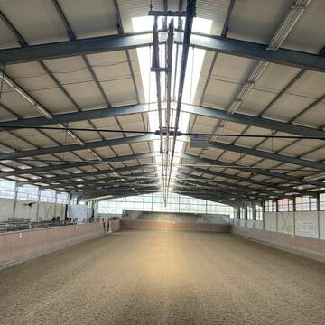
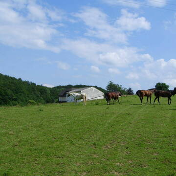
Offenstallplatz
Rösrath
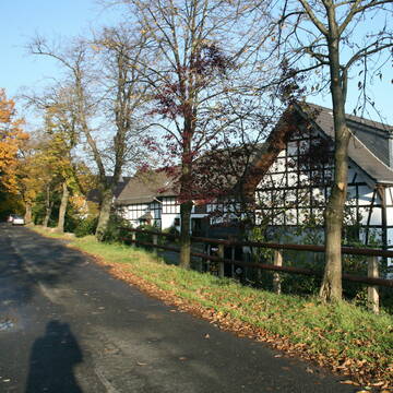
Lemmerhof
@Lemmerhof
Freizeitstall
Krankenbox
Paddock
Allergikerstall
bedampftes/gewaschenes Heu
Laufstall
Offenstall
10 weitere...
P
Deprecated: Creation of dynamic property Zend_View_Helper_Ads::$adLink is deprecated in /var/www/stall-frei/htdocs/staging.stall-frei.de/library/Psf/View/Helper/Ads.php on line 108

Das Beste für die Hufe
Mechtersen
STALL-FREIde Marketing
@STALL-FREI-Marketing
Hufschmiede und Hufpfleger in Ihrer Nähe
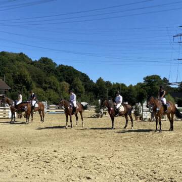
Reitanlage Gut Horst
Bergisch Gladbach
Gut-Horst
@Gut-Horst
Pferdeausbildung
Reitlehrer und -unterricht
Paddock
Parkplatz für Pferdeanhänger
Pferdezucht
Außenboxen
Innenbox
9 weitere...
P

Pferdeboxen-Vermietung
Leichlingen
Leichlinger Reit- u.Fahrverein
@LeichlingerReitverein
FN-Mitglied
Freizeitstall
Vermieten
Longierzirkel/Roundpen
Paddock
Außenbox mit Paddock
Außenboxen
16 weitere...
P+

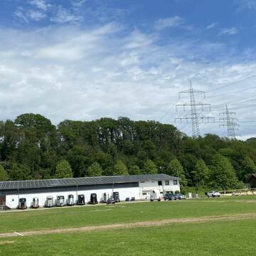
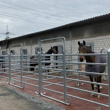
Boxen frei im Sportpferdezentrum Köln
Köln
Brüse GbR
@SportpferdezentrumKoeln
FN-Mitglied
Freizeitstall
Vermieten
Führanlage
Krankenbox
Notfallboxen
22 weitere...
P
Schöner Offenstallplatz
Overath
Die Offenstallpferde Overath
@Die-Offenstallpferde-Overath
Freizeitstall
Geländestrecke
Longierzirkel/Roundpen
Paddock
Bewegungsstall
Offenstall
Selbstversorgung
Vollpension
9 weitere...
P+

***Reitstall Birkenhof*** Pferdegerechte Haltung
Köln
Daniele-Fazzi
@Daniele-Fazzi
Herzlich Willkommen
auf dem Reitstall Birkenhof
Jetzt neu ‼️ auf dem Birkenhof:
Private Geländestrecke rund um unser

Reitstall Mühlenhof
Hürth
Manu Wirbeleit
@Manu-Wirbeleit
Reitplatz (z.B. Dressur, Springen, Reining)
Sattelkammer/Sattelschränke
Offenstall
Einzelne Boxen oder Stallplätze
2 weitere...
P
Pferdeland-Wiebertshof
Leverkusen
Reiner-Poschen
@Reiner-Poschen
FN-Mitglied
Freizeitstall
Vermieten
Führanlage
Longierzirkel/Roundpen
Hengsthaltung möglich
19 weitere...
P
Reitanlage Büchelterhof
Bergisch Gladbach
IngaK
@IngaK
Pferdeausbildung
Reitlehrer und -unterricht
Führanlage
Longierzirkel/Roundpen
Pferdezucht
Außenbox mit Paddock
Außenboxen
11 weitere...
P

Reitanlage Martinshof in Pulheim hat Boxen frei
Pulheim
Melanie Engelbrecht
@Melanie51
Vermieten
Führanlage
Hunde willkommen
Außenbox mit Paddock
Außenboxen
Vollpension
10 weitere...
P+


Platz frei in Wallachgruppe
Rommerskirchen
Gut Neu-Ikoven
@Neu-Ikoven
Freizeitstall
Vermieten
Hunde willkommen
Krankenbox
Bewegungsstall
Laufstall
13 weitere...
S
Werde Teil von STALL-FREI.de
Du hast eine Pferdebox frei? Freie Plätze im Offenstall, Pferdestall oder der Reitanlage kostenlos anbieten.
Deprecated: Creation of dynamic property Zend_View::$pageCount is deprecated in /var/www/stall-frei/htdocs/staging.stall-frei.de/library/vendor/shardj/zf1-future/library/Zend/View/Abstract.php on line 308
Deprecated: Creation of dynamic property Zend_View::$itemCountPerPage is deprecated in /var/www/stall-frei/htdocs/staging.stall-frei.de/library/vendor/shardj/zf1-future/library/Zend/View/Abstract.php on line 308
Deprecated: Creation of dynamic property Zend_View::$first is deprecated in /var/www/stall-frei/htdocs/staging.stall-frei.de/library/vendor/shardj/zf1-future/library/Zend/View/Abstract.php on line 308
Deprecated: Creation of dynamic property Zend_View::$current is deprecated in /var/www/stall-frei/htdocs/staging.stall-frei.de/library/vendor/shardj/zf1-future/library/Zend/View/Abstract.php on line 308
Deprecated: Creation of dynamic property Zend_View::$last is deprecated in /var/www/stall-frei/htdocs/staging.stall-frei.de/library/vendor/shardj/zf1-future/library/Zend/View/Abstract.php on line 308
Deprecated: Creation of dynamic property Zend_View::$previous is deprecated in /var/www/stall-frei/htdocs/staging.stall-frei.de/library/vendor/shardj/zf1-future/library/Zend/View/Abstract.php on line 308
Deprecated: Creation of dynamic property Zend_View::$next is deprecated in /var/www/stall-frei/htdocs/staging.stall-frei.de/library/vendor/shardj/zf1-future/library/Zend/View/Abstract.php on line 308
Deprecated: Creation of dynamic property Zend_View::$pagesInRange is deprecated in /var/www/stall-frei/htdocs/staging.stall-frei.de/library/vendor/shardj/zf1-future/library/Zend/View/Abstract.php on line 308
Deprecated: Creation of dynamic property Zend_View::$firstPageInRange is deprecated in /var/www/stall-frei/htdocs/staging.stall-frei.de/library/vendor/shardj/zf1-future/library/Zend/View/Abstract.php on line 308
Deprecated: Creation of dynamic property Zend_View::$lastPageInRange is deprecated in /var/www/stall-frei/htdocs/staging.stall-frei.de/library/vendor/shardj/zf1-future/library/Zend/View/Abstract.php on line 308
Deprecated: Creation of dynamic property Zend_View::$currentItemCount is deprecated in /var/www/stall-frei/htdocs/staging.stall-frei.de/library/vendor/shardj/zf1-future/library/Zend/View/Abstract.php on line 308
Deprecated: Creation of dynamic property Zend_View::$totalItemCount is deprecated in /var/www/stall-frei/htdocs/staging.stall-frei.de/library/vendor/shardj/zf1-future/library/Zend/View/Abstract.php on line 308
Deprecated: Creation of dynamic property Zend_View::$firstItemNumber is deprecated in /var/www/stall-frei/htdocs/staging.stall-frei.de/library/vendor/shardj/zf1-future/library/Zend/View/Abstract.php on line 308
Deprecated: Creation of dynamic property Zend_View::$lastItemNumber is deprecated in /var/www/stall-frei/htdocs/staging.stall-frei.de/library/vendor/shardj/zf1-future/library/Zend/View/Abstract.php on line 308
Deprecated: Creation of dynamic property Zend_View::$router is deprecated in /var/www/stall-frei/htdocs/staging.stall-frei.de/library/vendor/shardj/zf1-future/library/Zend/View/Abstract.php on line 308
Deprecated: Creation of dynamic property Zend_View::$urlParams is deprecated in /var/www/stall-frei/htdocs/staging.stall-frei.de/library/vendor/shardj/zf1-future/library/Zend/View/Abstract.php on line 308
Deprecated: Creation of dynamic property Zend_View::$showAds is deprecated in /var/www/stall-frei/htdocs/staging.stall-frei.de/library/vendor/shardj/zf1-future/library/Zend/View/Abstract.php on line 308
Deprecated: Creation of dynamic property Zend_View::$objectIds is deprecated in /var/www/stall-frei/htdocs/staging.stall-frei.de/library/vendor/shardj/zf1-future/library/Zend/View/Abstract.php on line 308
Deprecated: Creation of dynamic property Zend_View::$showNavbar is deprecated in /var/www/stall-frei/htdocs/staging.stall-frei.de/library/vendor/shardj/zf1-future/library/Zend/View/Abstract.php on line 308
Deprecated: Creation of dynamic property Zend_View::$showBreadcrumb is deprecated in /var/www/stall-frei/htdocs/staging.stall-frei.de/library/vendor/shardj/zf1-future/library/Zend/View/Abstract.php on line 308
Deprecated: Creation of dynamic property Zend_View::$showFooter is deprecated in /var/www/stall-frei/htdocs/staging.stall-frei.de/library/vendor/shardj/zf1-future/library/Zend/View/Abstract.php on line 308
Deprecated: Creation of dynamic property Zend_View::$showInternalAds is deprecated in /var/www/stall-frei/htdocs/staging.stall-frei.de/library/vendor/shardj/zf1-future/library/Zend/View/Abstract.php on line 308
Deprecated: Creation of dynamic property Zend_View::$blNoContent is deprecated in /var/www/stall-frei/htdocs/staging.stall-frei.de/library/vendor/shardj/zf1-future/library/Zend/View/Abstract.php on line 308
Deprecated: Creation of dynamic property Zend_View::$sMetaDesc is deprecated in /var/www/stall-frei/htdocs/staging.stall-frei.de/library/vendor/shardj/zf1-future/library/Zend/View/Abstract.php on line 308
Deprecated: Creation of dynamic property Zend_View::$useGmaps is deprecated in /var/www/stall-frei/htdocs/staging.stall-frei.de/library/vendor/shardj/zf1-future/library/Zend/View/Abstract.php on line 308
Deprecated: Creation of dynamic property Zend_View::$touches is deprecated in /var/www/stall-frei/htdocs/staging.stall-frei.de/library/vendor/shardj/zf1-future/library/Zend/View/Abstract.php on line 308
Deprecated: Creation of dynamic property Zend_View::$oProject is deprecated in /var/www/stall-frei/htdocs/staging.stall-frei.de/library/vendor/shardj/zf1-future/library/Zend/View/Abstract.php on line 308
Deprecated: Creation of dynamic property Zend_View::$pageHeadline is deprecated in /var/www/stall-frei/htdocs/staging.stall-frei.de/library/vendor/shardj/zf1-future/library/Zend/View/Abstract.php on line 308
Deprecated: Creation of dynamic property Zend_View::$disableLocationField is deprecated in /var/www/stall-frei/htdocs/staging.stall-frei.de/library/vendor/shardj/zf1-future/library/Zend/View/Abstract.php on line 308
Deprecated: Creation of dynamic property Zend_View::$isSearch is deprecated in /var/www/stall-frei/htdocs/staging.stall-frei.de/library/vendor/shardj/zf1-future/library/Zend/View/Abstract.php on line 308
Deprecated: Creation of dynamic property Zend_View::$pageTitle is deprecated in /var/www/stall-frei/htdocs/staging.stall-frei.de/library/vendor/shardj/zf1-future/library/Zend/View/Abstract.php on line 308
Deprecated: Creation of dynamic property Psf_Form_Element_Text::$class is deprecated in /var/www/stall-frei/htdocs/staging.stall-frei.de/library/vendor/shardj/zf1-future/library/Zend/Form/Element.php on line 874
Deprecated: Creation of dynamic property Psf_Form_Element_Text::$size is deprecated in /var/www/stall-frei/htdocs/staging.stall-frei.de/library/vendor/shardj/zf1-future/library/Zend/Form/Element.php on line 874
Deprecated: Creation of dynamic property Psf_Form_Element_Text::$placeholder is deprecated in /var/www/stall-frei/htdocs/staging.stall-frei.de/library/vendor/shardj/zf1-future/library/Zend/Form/Element.php on line 874
Deprecated: Creation of dynamic property Psf_Form_Element_Hidden::$class is deprecated in /var/www/stall-frei/htdocs/staging.stall-frei.de/library/vendor/shardj/zf1-future/library/Zend/Form/Element.php on line 874
Deprecated: Creation of dynamic property Psf_Form_Element_Hidden::$class is deprecated in /var/www/stall-frei/htdocs/staging.stall-frei.de/library/vendor/shardj/zf1-future/library/Zend/Form/Element.php on line 874
Deprecated: Creation of dynamic property Psf_Form_Element_Hidden::$class is deprecated in /var/www/stall-frei/htdocs/staging.stall-frei.de/library/vendor/shardj/zf1-future/library/Zend/Form/Element.php on line 874
Deprecated: Creation of dynamic property Psf_Form_Element_Hidden::$class is deprecated in /var/www/stall-frei/htdocs/staging.stall-frei.de/library/vendor/shardj/zf1-future/library/Zend/Form/Element.php on line 874
Deprecated: Creation of dynamic property Psf_Form_Element_Select::$class is deprecated in /var/www/stall-frei/htdocs/staging.stall-frei.de/library/vendor/shardj/zf1-future/library/Zend/Form/Element.php on line 874
Deprecated: Creation of dynamic property Psf_Form_Element_Select::$class is deprecated in /var/www/stall-frei/htdocs/staging.stall-frei.de/library/vendor/shardj/zf1-future/library/Zend/Form/Element.php on line 874
Deprecated: Creation of dynamic property Psf_Form_Element_Select::$class is deprecated in /var/www/stall-frei/htdocs/staging.stall-frei.de/library/vendor/shardj/zf1-future/library/Zend/Form/Element.php on line 874
Deprecated: Creation of dynamic property Psf_Form_Element_Select::$class is deprecated in /var/www/stall-frei/htdocs/staging.stall-frei.de/library/vendor/shardj/zf1-future/library/Zend/Form/Element.php on line 874
Deprecated: Creation of dynamic property Psf_Form_Element_Text::$class is deprecated in /var/www/stall-frei/htdocs/staging.stall-frei.de/library/vendor/shardj/zf1-future/library/Zend/Form/Element.php on line 874
Deprecated: Creation of dynamic property Psf_Form_Element_Checkbox::$label is deprecated in /var/www/stall-frei/htdocs/staging.stall-frei.de/library/vendor/shardj/zf1-future/library/Zend/Form/Element.php on line 874
Deprecated: Creation of dynamic property Zend_View::$sort is deprecated in /var/www/stall-frei/htdocs/staging.stall-frei.de/library/vendor/shardj/zf1-future/library/Zend/View/Abstract.php on line 308
Deprecated: Creation of dynamic property Zend_View::$searchLocation is deprecated in /var/www/stall-frei/htdocs/staging.stall-frei.de/library/vendor/shardj/zf1-future/library/Zend/View/Abstract.php on line 308
Deprecated: Creation of dynamic property Zend_View::$locationHint is deprecated in /var/www/stall-frei/htdocs/staging.stall-frei.de/library/vendor/shardj/zf1-future/library/Zend/View/Abstract.php on line 308
Psf_GeoCoder_Abstract::getLocation: Höhenberg Get Location CachedOrLive
Psf_GeoCoder_Abstract::getCachedOrLive: Höhenberg
Psf_GeoCoder_Abstract::convertLocationResult
{"documentation":"https:\/\/opencagedata.com\/api","licenses":[{"name":"see attribution guide","url":"https:\/\/opencagedata.com\/credits"}],"results":[{"bounds":{"northeast":{"lat":50.9525117,"lng":7.0416789},"southwest":{"lat":50.9355643,"lng":7.0164183}},"components":{"ISO_3166-1_alpha-2":"DE","ISO_3166-1_alpha-3":"DEU","ISO_3166-2":["DE-NW"],"_category":"place","_normalized_city":"K\u00f6ln","_type":"neighbourhood","city":"K\u00f6ln","city_district":"Kalk","continent":"Europe","country":"Deutschland","country_code":"de","political_union":"European Union","state":"Nordrhein-Westfalen","state_code":"NW","suburb":"H\u00f6henberg"},"confidence":8,"formatted":"H\u00f6henberg, K\u00f6ln, Nordrhein-Westfalen, Deutschland","geometry":{"lat":50.9410028,"lng":7.0262147}},{"bounds":{"northeast":{"lat":48.2714384,"lng":12.0906162},"southwest":{"lat":48.2314384,"lng":12.0506162}},"components":{"ISO_3166-1_alpha-2":"DE","ISO_3166-1_alpha-3":"DEU","ISO_3166-2":["DE-BY"],"_category":"place","_normalized_city":"Lengdorf","_type":"hamlet","city":"Lengdorf","continent":"Europe","country":"Deutschland","country_code":"de","county":"Landkreis Erding","hamlet":"H\u00f6henberg","political_union":"European Union","postcode":"84435","state":"Bayern","state_code":"BY"},"confidence":7,"formatted":"H\u00f6henberg, 84435 Lengdorf, Deutschland","geometry":{"lat":48.2514384,"lng":12.0706162}},{"bounds":{"northeast":{"lat":49.0662742,"lng":11.6316288},"southwest":{"lat":49.0661742,"lng":11.6315288}},"components":{"ISO_3166-1_alpha-2":"DE","ISO_3166-1_alpha-3":"DEU","ISO_3166-2":["DE-BY"],"_category":"building","_normalized_city":"Breitenbrunn","_type":"building","city":"Breitenbrunn","continent":"Europe","country":"Deutschland","country_code":"de","county":"Landkreis Neumarkt in der Oberpfalz","isolated_dwelling":"H\u00f6henberg","political_union":"European Union","postcode":"92363","state":"Bayern","state_code":"BY"},"confidence":10,"formatted":"H\u00f6henberg, 92363 Breitenbrunn, Deutschland","geometry":{"lat":49.0662242,"lng":11.6315788}},{"bounds":{"northeast":{"lat":48.0217626,"lng":11.2376896},"southwest":{"lat":48.0216626,"lng":11.2375896}},"components":{"ISO_3166-1_alpha-2":"DE","ISO_3166-1_alpha-3":"DEU","ISO_3166-2":["DE-BY"],"_category":"natural\/water","_normalized_city":"Seefeld","_type":"peak","continent":"Europe","country":"Deutschland","country_code":"de","county":"Landkreis Starnberg","peak":"H\u00f6henberg","political_union":"European Union","postcode":"82229","state":"Bayern","state_code":"BY","village":"Seefeld"},"confidence":9,"formatted":"H\u00f6henberg, 82229 Seefeld, Deutschland","geometry":{"lat":48.0217126,"lng":11.2376396}},{"bounds":{"northeast":{"lat":48.7493744,"lng":13.3618101},"southwest":{"lat":48.7492744,"lng":13.3617101}},"components":{"ISO_3166-1_alpha-2":"DE","ISO_3166-1_alpha-3":"DEU","ISO_3166-2":["DE-BY"],"_category":"natural\/water","_normalized_city":"Tittling","_type":"peak","continent":"Europe","country":"Deutschland","country_code":"de","county":"Landkreis Passau","municipality":"Tittling (VGem)","peak":"H\u00f6henberg","political_union":"European Union","postcode":"94163","state":"Bayern","state_code":"BY","town":"Tittling"},"confidence":9,"formatted":"H\u00f6henberg, 94163 Tittling, Deutschland","geometry":{"lat":48.7493244,"lng":13.3617601}},{"bounds":{"northeast":{"lat":50.3042064,"lng":10.3604202},"southwest":{"lat":50.3041064,"lng":10.3603202}},"components":{"ISO_3166-1_alpha-2":"DE","ISO_3166-1_alpha-3":"DEU","ISO_3166-2":["DE-BY"],"_category":"natural\/water","_normalized_city":"Saal an der Saale","_type":"peak","continent":"Europe","country":"Deutschland","country_code":"de","county":"Landkreis Rh\u00f6n-Grabfeld","municipality":"Saal an der Saale (VGem)","peak":"H\u00f6henberg","political_union":"European Union","state":"Bayern","state_code":"BY","village":"Saal an der Saale"},"confidence":9,"formatted":"H\u00f6henberg, Saal an der Saale, Bayern, Deutschland","geometry":{"lat":50.3041564,"lng":10.3603702}},{"bounds":{"northeast":{"lat":48.0822737,"lng":11.2419386},"southwest":{"lat":48.0821737,"lng":11.2418386}},"components":{"ISO_3166-1_alpha-2":"DE","ISO_3166-1_alpha-3":"DEU","ISO_3166-2":["DE-BY"],"_category":"natural\/water","_normalized_city":"We\u00dfling","_type":"peak","continent":"Europe","country":"Deutschland","country_code":"de","county":"Landkreis Starnberg","peak":"H\u00f6henberg","political_union":"European Union","postcode":"82234","state":"Bayern","state_code":"BY","village":"We\u00dfling"},"confidence":9,"formatted":"H\u00f6henberg, 82234 We\u00dfling, Deutschland","geometry":{"lat":48.0822237,"lng":11.2418886}},{"bounds":{"northeast":{"lat":48.1447778,"lng":10.4177522},"southwest":{"lat":48.1446778,"lng":10.4176522}},"components":{"ISO_3166-1_alpha-2":"DE","ISO_3166-1_alpha-3":"DEU","ISO_3166-2":["DE-BY"],"_category":"natural\/water","_normalized_city":"Pfaffenhausen","_type":"peak","continent":"Europe","country":"Deutschland","country_code":"de","county":"Landkreis Unterallg\u00e4u","municipality":"Pfaffenhausen","peak":"H\u00f6henberg","political_union":"European Union","postcode":"87772","state":"Bayern","state_code":"BY","village":"Pfaffenhausen"},"confidence":9,"formatted":"H\u00f6henberg, 87772 Pfaffenhausen, Deutschland","geometry":{"lat":48.1447278,"lng":10.4177022}},{"bounds":{"northeast":{"lat":49.3877413,"lng":10.3148697},"southwest":{"lat":49.3876413,"lng":10.3147697}},"components":{"ISO_3166-1_alpha-2":"DE","ISO_3166-1_alpha-3":"DEU","ISO_3166-2":["DE-BY"],"_category":"natural\/water","_normalized_city":"Windelsbach","_type":"peak","continent":"Europe","country":"Deutschland","country_code":"de","county":"Landkreis Ansbach","municipality":"Rothenburg ob der Tauber (VGem)","peak":"H\u00f6henberg","political_union":"European Union","postcode":"91635","state":"Bayern","state_code":"BY","village":"Windelsbach"},"confidence":9,"formatted":"H\u00f6henberg, 91635 Windelsbach, Deutschland","geometry":{"lat":49.3876913,"lng":10.3148197}},{"bounds":{"northeast":{"lat":50.3173489,"lng":6.7354055},"southwest":{"lat":50.3172489,"lng":6.7353055}},"components":{"ISO_3166-1_alpha-2":"DE","ISO_3166-1_alpha-3":"DEU","ISO_3166-2":["DE-RP"],"_category":"natural\/water","_normalized_city":"Kerpen (Eifel)","_type":"peak","continent":"Europe","country":"Deutschland","country_code":"de","county":"Landkreis Vulkaneifel","municipality":"Gerolstein","peak":"H\u00f6henberg","political_union":"European Union","postcode":"54579","state":"Rheinland-Pfalz","state_code":"RP","village":"Kerpen (Eifel)"},"confidence":9,"formatted":"H\u00f6henberg, 54579 Kerpen (Eifel), Deutschland","geometry":{"lat":50.3172989,"lng":6.7353555}}],"status":{"code":200,"message":"OK"},"stay_informed":{"blog":"https:\/\/blog.opencagedata.com","mastodon":"https:\/\/en.osm.town\/@opencage"},"thanks":"For using an OpenCage API","timestamp":{"created_http":"Sun, 08 Feb 2026 03:04:02 GMT","created_unix":1770519842},"total_results":10}Array
(
[0] => stdClass Object
(
[bounds] => stdClass Object
(
[northeast] => stdClass Object
(
[lat] => 50.9525117
[lng] => 7.0416789
)
[southwest] => stdClass Object
(
[lat] => 50.9355643
[lng] => 7.0164183
)
)
[components] => stdClass Object
(
[ISO_3166-1_alpha-2] => DE
[ISO_3166-1_alpha-3] => DEU
[ISO_3166-2] => Array
(
[0] => DE-NW
)
[_category] => place
[_normalized_city] => Köln
[_type] => neighbourhood
[city] => Köln
[city_district] => Kalk
[continent] => Europe
[country] => Deutschland
[country_code] => de
[political_union] => European Union
[state] => Nordrhein-Westfalen
[state_code] => NW
[suburb] => Höhenberg
)
[confidence] => 8
[formatted] => Höhenberg, Köln, Nordrhein-Westfalen, Deutschland
[geometry] => stdClass Object
(
[lat] => 50.9410028
[lng] => 7.0262147
)
)
[1] => stdClass Object
(
[bounds] => stdClass Object
(
[northeast] => stdClass Object
(
[lat] => 48.2714384
[lng] => 12.0906162
)
[southwest] => stdClass Object
(
[lat] => 48.2314384
[lng] => 12.0506162
)
)
[components] => stdClass Object
(
[ISO_3166-1_alpha-2] => DE
[ISO_3166-1_alpha-3] => DEU
[ISO_3166-2] => Array
(
[0] => DE-BY
)
[_category] => place
[_normalized_city] => Lengdorf
[_type] => hamlet
[city] => Lengdorf
[continent] => Europe
[country] => Deutschland
[country_code] => de
[county] => Landkreis Erding
[hamlet] => Höhenberg
[political_union] => European Union
[postcode] => 84435
[state] => Bayern
[state_code] => BY
)
[confidence] => 7
[formatted] => Höhenberg, 84435 Lengdorf, Deutschland
[geometry] => stdClass Object
(
[lat] => 48.2514384
[lng] => 12.0706162
)
)
[2] => stdClass Object
(
[bounds] => stdClass Object
(
[northeast] => stdClass Object
(
[lat] => 49.0662742
[lng] => 11.6316288
)
[southwest] => stdClass Object
(
[lat] => 49.0661742
[lng] => 11.6315288
)
)
[components] => stdClass Object
(
[ISO_3166-1_alpha-2] => DE
[ISO_3166-1_alpha-3] => DEU
[ISO_3166-2] => Array
(
[0] => DE-BY
)
[_category] => building
[_normalized_city] => Breitenbrunn
[_type] => building
[city] => Breitenbrunn
[continent] => Europe
[country] => Deutschland
[country_code] => de
[county] => Landkreis Neumarkt in der Oberpfalz
[isolated_dwelling] => Höhenberg
[political_union] => European Union
[postcode] => 92363
[state] => Bayern
[state_code] => BY
)
[confidence] => 10
[formatted] => Höhenberg, 92363 Breitenbrunn, Deutschland
[geometry] => stdClass Object
(
[lat] => 49.0662242
[lng] => 11.6315788
)
)
[3] => stdClass Object
(
[bounds] => stdClass Object
(
[northeast] => stdClass Object
(
[lat] => 48.0217626
[lng] => 11.2376896
)
[southwest] => stdClass Object
(
[lat] => 48.0216626
[lng] => 11.2375896
)
)
[components] => stdClass Object
(
[ISO_3166-1_alpha-2] => DE
[ISO_3166-1_alpha-3] => DEU
[ISO_3166-2] => Array
(
[0] => DE-BY
)
[_category] => natural/water
[_normalized_city] => Seefeld
[_type] => peak
[continent] => Europe
[country] => Deutschland
[country_code] => de
[county] => Landkreis Starnberg
[peak] => Höhenberg
[political_union] => European Union
[postcode] => 82229
[state] => Bayern
[state_code] => BY
[village] => Seefeld
)
[confidence] => 9
[formatted] => Höhenberg, 82229 Seefeld, Deutschland
[geometry] => stdClass Object
(
[lat] => 48.0217126
[lng] => 11.2376396
)
)
[4] => stdClass Object
(
[bounds] => stdClass Object
(
[northeast] => stdClass Object
(
[lat] => 48.7493744
[lng] => 13.3618101
)
[southwest] => stdClass Object
(
[lat] => 48.7492744
[lng] => 13.3617101
)
)
[components] => stdClass Object
(
[ISO_3166-1_alpha-2] => DE
[ISO_3166-1_alpha-3] => DEU
[ISO_3166-2] => Array
(
[0] => DE-BY
)
[_category] => natural/water
[_normalized_city] => Tittling
[_type] => peak
[continent] => Europe
[country] => Deutschland
[country_code] => de
[county] => Landkreis Passau
[municipality] => Tittling (VGem)
[peak] => Höhenberg
[political_union] => European Union
[postcode] => 94163
[state] => Bayern
[state_code] => BY
[town] => Tittling
)
[confidence] => 9
[formatted] => Höhenberg, 94163 Tittling, Deutschland
[geometry] => stdClass Object
(
[lat] => 48.7493244
[lng] => 13.3617601
)
)
[5] => stdClass Object
(
[bounds] => stdClass Object
(
[northeast] => stdClass Object
(
[lat] => 50.3042064
[lng] => 10.3604202
)
[southwest] => stdClass Object
(
[lat] => 50.3041064
[lng] => 10.3603202
)
)
[components] => stdClass Object
(
[ISO_3166-1_alpha-2] => DE
[ISO_3166-1_alpha-3] => DEU
[ISO_3166-2] => Array
(
[0] => DE-BY
)
[_category] => natural/water
[_normalized_city] => Saal an der Saale
[_type] => peak
[continent] => Europe
[country] => Deutschland
[country_code] => de
[county] => Landkreis Rhön-Grabfeld
[municipality] => Saal an der Saale (VGem)
[peak] => Höhenberg
[political_union] => European Union
[state] => Bayern
[state_code] => BY
[village] => Saal an der Saale
)
[confidence] => 9
[formatted] => Höhenberg, Saal an der Saale, Bayern, Deutschland
[geometry] => stdClass Object
(
[lat] => 50.3041564
[lng] => 10.3603702
)
)
[6] => stdClass Object
(
[bounds] => stdClass Object
(
[northeast] => stdClass Object
(
[lat] => 48.0822737
[lng] => 11.2419386
)
[southwest] => stdClass Object
(
[lat] => 48.0821737
[lng] => 11.2418386
)
)
[components] => stdClass Object
(
[ISO_3166-1_alpha-2] => DE
[ISO_3166-1_alpha-3] => DEU
[ISO_3166-2] => Array
(
[0] => DE-BY
)
[_category] => natural/water
[_normalized_city] => Weßling
[_type] => peak
[continent] => Europe
[country] => Deutschland
[country_code] => de
[county] => Landkreis Starnberg
[peak] => Höhenberg
[political_union] => European Union
[postcode] => 82234
[state] => Bayern
[state_code] => BY
[village] => Weßling
)
[confidence] => 9
[formatted] => Höhenberg, 82234 Weßling, Deutschland
[geometry] => stdClass Object
(
[lat] => 48.0822237
[lng] => 11.2418886
)
)
[7] => stdClass Object
(
[bounds] => stdClass Object
(
[northeast] => stdClass Object
(
[lat] => 48.1447778
[lng] => 10.4177522
)
[southwest] => stdClass Object
(
[lat] => 48.1446778
[lng] => 10.4176522
)
)
[components] => stdClass Object
(
[ISO_3166-1_alpha-2] => DE
[ISO_3166-1_alpha-3] => DEU
[ISO_3166-2] => Array
(
[0] => DE-BY
)
[_category] => natural/water
[_normalized_city] => Pfaffenhausen
[_type] => peak
[continent] => Europe
[country] => Deutschland
[country_code] => de
[county] => Landkreis Unterallgäu
[municipality] => Pfaffenhausen
[peak] => Höhenberg
[political_union] => European Union
[postcode] => 87772
[state] => Bayern
[state_code] => BY
[village] => Pfaffenhausen
)
[confidence] => 9
[formatted] => Höhenberg, 87772 Pfaffenhausen, Deutschland
[geometry] => stdClass Object
(
[lat] => 48.1447278
[lng] => 10.4177022
)
)
[8] => stdClass Object
(
[bounds] => stdClass Object
(
[northeast] => stdClass Object
(
[lat] => 49.3877413
[lng] => 10.3148697
)
[southwest] => stdClass Object
(
[lat] => 49.3876413
[lng] => 10.3147697
)
)
[components] => stdClass Object
(
[ISO_3166-1_alpha-2] => DE
[ISO_3166-1_alpha-3] => DEU
[ISO_3166-2] => Array
(
[0] => DE-BY
)
[_category] => natural/water
[_normalized_city] => Windelsbach
[_type] => peak
[continent] => Europe
[country] => Deutschland
[country_code] => de
[county] => Landkreis Ansbach
[municipality] => Rothenburg ob der Tauber (VGem)
[peak] => Höhenberg
[political_union] => European Union
[postcode] => 91635
[state] => Bayern
[state_code] => BY
[village] => Windelsbach
)
[confidence] => 9
[formatted] => Höhenberg, 91635 Windelsbach, Deutschland
[geometry] => stdClass Object
(
[lat] => 49.3876913
[lng] => 10.3148197
)
)
[9] => stdClass Object
(
[bounds] => stdClass Object
(
[northeast] => stdClass Object
(
[lat] => 50.3173489
[lng] => 6.7354055
)
[southwest] => stdClass Object
(
[lat] => 50.3172489
[lng] => 6.7353055
)
)
[components] => stdClass Object
(
[ISO_3166-1_alpha-2] => DE
[ISO_3166-1_alpha-3] => DEU
[ISO_3166-2] => Array
(
[0] => DE-RP
)
[_category] => natural/water
[_normalized_city] => Kerpen (Eifel)
[_type] => peak
[continent] => Europe
[country] => Deutschland
[country_code] => de
[county] => Landkreis Vulkaneifel
[municipality] => Gerolstein
[peak] => Höhenberg
[political_union] => European Union
[postcode] => 54579
[state] => Rheinland-Pfalz
[state_code] => RP
[village] => Kerpen (Eifel)
)
[confidence] => 9
[formatted] => Höhenberg, 54579 Kerpen (Eifel), Deutschland
[geometry] => stdClass Object
(
[lat] => 50.3172989
[lng] => 6.7353555
)
)
)
Psf_GeoCoder_OpenCageData::getKeyMap: 0
stdClass Object
(
    [bounds] => stdClass Object
        (
            [northeast] => stdClass Object
                (
                    [lat] => 50.9525117
                    [lng] => 7.0416789
                )

            [southwest] => stdClass Object
                (
                    [lat] => 50.9355643
                    [lng] => 7.0164183
                )

        )

    [components] => stdClass Object
        (
            [ISO_3166-1_alpha-2] => DE
            [ISO_3166-1_alpha-3] => DEU
            [ISO_3166-2] => Array
                (
                    [0] => DE-NW
                )

            [_category] => place
            [_normalized_city] => Köln
            [_type] => neighbourhood
            [city] => Köln
            [city_district] => Kalk
            [continent] => Europe
            [country] => Deutschland
            [country_code] => de
            [political_union] => European Union
            [state] => Nordrhein-Westfalen
            [state_code] => NW
            [suburb] => Höhenberg
        )

    [confidence] => 8
    [formatted] => Höhenberg, Köln, Nordrhein-Westfalen, Deutschland
    [geometry] => stdClass Object
        (
            [lat] => 50.9410028
            [lng] => 7.0262147
        )

)
Psf_GeoCoder_OpenCageData::getCounty: Köln
Psf_GeoCoder_OpenCageData::addMissingData REFETCH!
Array
(
    [address] => Höhenberg, Köln, Nordrhein-Westfalen, Deutschland
    [type] => neighbourhood
    [street] =>
    [city] => Höhenberg
    [county] => Köln
    [state] => Nordrhein-Westfalen
    [zip] =>
    [country] => Deutschland
    [suburb] => Höhenberg
    [countrycode] => de
    [latitude] => 50.9410028
    [longitude] => 7.0262147
    [accuracy] => 1
    [confidence] => 8
    [bounds] => stdClass Object
        (
            [northeast] => stdClass Object
                (
                    [lat] => 50.9525117
                    [lng] => 7.0416789
                )

            [southwest] => stdClass Object
                (
                    [lat] => 50.9355643
                    [lng] => 7.0164183
                )

        )

)
reformat!
Array
(
    [address] => Höhenberg, Köln, Nordrhein-Westfalen, Deutschland
    [type] => neighbourhood
    [street] =>
    [city] => Höhenberg
    [county] => Köln
    [state] => Nordrhein-Westfalen
    [zip] =>
    [country] => Deutschland
    [suburb] => Höhenberg
    [countrycode] => de
    [latitude] => 50.9410028
    [longitude] => 7.0262147
    [accuracy] => 1
    [confidence] => 8
    [bounds] => stdClass Object
        (
            [northeast] => stdClass Object
                (
                    [lat] => 50.9525117
                    [lng] => 7.0416789
                )

            [southwest] => stdClass Object
                (
                    [lat] => 50.9355643
                    [lng] => 7.0164183
                )

        )

    [place] => Höhenberg, Nordrhein-Westfalen
    [hash] => 1910c4262ae091869bda8197290be3b0
)
Psf_GeoCoder_OpenCageData::getKeyMap: 1
stdClass Object
(
    [bounds] => stdClass Object
        (
            [northeast] => stdClass Object
                (
                    [lat] => 48.2714384
                    [lng] => 12.0906162
                )

            [southwest] => stdClass Object
                (
                    [lat] => 48.2314384
                    [lng] => 12.0506162
                )

        )

    [components] => stdClass Object
        (
            [ISO_3166-1_alpha-2] => DE
            [ISO_3166-1_alpha-3] => DEU
            [ISO_3166-2] => Array
                (
                    [0] => DE-BY
                )

            [_category] => place
            [_normalized_city] => Lengdorf
            [_type] => hamlet
            [city] => Lengdorf
            [continent] => Europe
            [country] => Deutschland
            [country_code] => de
            [county] => Landkreis Erding
            [hamlet] => Höhenberg
            [political_union] => European Union
            [postcode] => 84435
            [state] => Bayern
            [state_code] => BY
        )

    [confidence] => 7
    [formatted] => Höhenberg, 84435 Lengdorf, Deutschland
    [geometry] => stdClass Object
        (
            [lat] => 48.2514384
            [lng] => 12.0706162
        )

)
Psf_GeoCoder_OpenCageData::getCounty: Erding
Psf_GeoCoder_OpenCageData::addMissingData REFETCH!
Array
(
    [address] => Höhenberg, 84435 Lengdorf, Deutschland
    [type] => hamlet
    [street] => Höhenberg
    [city] => Lengdorf
    [county] => Erding
    [state] => Bayern
    [zip] => 84435
    [country] => Deutschland
    [suburb] =>
    [countrycode] => de
    [latitude] => 48.2514384
    [longitude] => 12.0706162
    [accuracy] => 1
    [confidence] => 7
    [bounds] => stdClass Object
        (
            [northeast] => stdClass Object
                (
                    [lat] => 48.2714384
                    [lng] => 12.0906162
                )

            [southwest] => stdClass Object
                (
                    [lat] => 48.2314384
                    [lng] => 12.0506162
                )

        )

)
reformat!
Array
(
    [address] => Höhenberg, 84435 Lengdorf, Deutschland
    [type] => hamlet
    [street] => Höhenberg
    [city] => Lengdorf
    [county] => Erding
    [state] => Bayern
    [zip] => 84435
    [country] => Deutschland
    [suburb] =>
    [countrycode] => de
    [latitude] => 48.2514384
    [longitude] => 12.0706162
    [accuracy] => 1
    [confidence] => 7
    [bounds] => stdClass Object
        (
            [northeast] => stdClass Object
                (
                    [lat] => 48.2714384
                    [lng] => 12.0906162
                )

            [southwest] => stdClass Object
                (
                    [lat] => 48.2314384
                    [lng] => 12.0506162
                )

        )

    [place] => Höhenberg, 84435 Lengdorf, Bayern
    [hash] => 5bfa568c56300c89c9ea8f4dc7f1aecc
)
Psf_GeoCoder_OpenCageData::getKeyMap: 2
stdClass Object
(
    [bounds] => stdClass Object
        (
            [northeast] => stdClass Object
                (
                    [lat] => 49.0662742
                    [lng] => 11.6316288
                )

            [southwest] => stdClass Object
                (
                    [lat] => 49.0661742
                    [lng] => 11.6315288
                )

        )

    [components] => stdClass Object
        (
            [ISO_3166-1_alpha-2] => DE
            [ISO_3166-1_alpha-3] => DEU
            [ISO_3166-2] => Array
                (
                    [0] => DE-BY
                )

            [_category] => building
            [_normalized_city] => Breitenbrunn
            [_type] => building
            [city] => Breitenbrunn
            [continent] => Europe
            [country] => Deutschland
            [country_code] => de
            [county] => Landkreis Neumarkt in der Oberpfalz
            [isolated_dwelling] => Höhenberg
            [political_union] => European Union
            [postcode] => 92363
            [state] => Bayern
            [state_code] => BY
        )

    [confidence] => 10
    [formatted] => Höhenberg, 92363 Breitenbrunn, Deutschland
    [geometry] => stdClass Object
        (
            [lat] => 49.0662242
            [lng] => 11.6315788
        )

)
Psf_GeoCoder_OpenCageData::getCounty: Neumarkt in der Oberpfalz
Psf_GeoCoder_OpenCageData::addMissingData REFETCH!
Array
(
    [address] => Höhenberg, 92363 Breitenbrunn, Deutschland
    [type] => building
    [street] =>
    [city] => Breitenbrunn
    [county] => Neumarkt in der Oberpfalz
    [state] => Bayern
    [zip] => 92363
    [country] => Deutschland
    [suburb] =>
    [countrycode] => de
    [latitude] => 49.0662242
    [longitude] => 11.6315788
    [accuracy] => 1
    [confidence] => 10
    [bounds] => stdClass Object
        (
            [northeast] => stdClass Object
                (
                    [lat] => 49.0662742
                    [lng] => 11.6316288
                )

            [southwest] => stdClass Object
                (
                    [lat] => 49.0661742
                    [lng] => 11.6315288
                )

        )

)
reformat!
Array
(
    [address] => Höhenberg, 92363 Breitenbrunn, Deutschland
    [type] => building
    [street] =>
    [city] => Breitenbrunn
    [county] => Neumarkt in der Oberpfalz
    [state] => Bayern
    [zip] => 92363
    [country] => Deutschland
    [suburb] =>
    [countrycode] => de
    [latitude] => 49.0662242
    [longitude] => 11.6315788
    [accuracy] => 1
    [confidence] => 10
    [bounds] => stdClass Object
        (
            [northeast] => stdClass Object
                (
                    [lat] => 49.0662742
                    [lng] => 11.6316288
                )

            [southwest] => stdClass Object
                (
                    [lat] => 49.0661742
                    [lng] => 11.6315288
                )

        )

    [place] => 92363 Breitenbrunn, Bayern
    [hash] => cece9cd05e1f9fd8fee02debbbe0f6d8
)
Psf_GeoCoder_OpenCageData::getKeyMap: 3
stdClass Object
(
    [bounds] => stdClass Object
        (
            [northeast] => stdClass Object
                (
                    [lat] => 48.0217626
                    [lng] => 11.2376896
                )

            [southwest] => stdClass Object
                (
                    [lat] => 48.0216626
                    [lng] => 11.2375896
                )

        )

    [components] => stdClass Object
        (
            [ISO_3166-1_alpha-2] => DE
            [ISO_3166-1_alpha-3] => DEU
            [ISO_3166-2] => Array
                (
                    [0] => DE-BY
                )

            [_category] => natural/water
            [_normalized_city] => Seefeld
            [_type] => peak
            [continent] => Europe
            [country] => Deutschland
            [country_code] => de
            [county] => Landkreis Starnberg
            [peak] => Höhenberg
            [political_union] => European Union
            [postcode] => 82229
            [state] => Bayern
            [state_code] => BY
            [village] => Seefeld
        )

    [confidence] => 9
    [formatted] => Höhenberg, 82229 Seefeld, Deutschland
    [geometry] => stdClass Object
        (
            [lat] => 48.0217126
            [lng] => 11.2376396
        )

)
Psf_GeoCoder_OpenCageData::getCounty: Starnberg
Psf_GeoCoder_OpenCageData::addMissingData REFETCH!
Array
(
    [address] => Höhenberg, 82229 Seefeld, Deutschland
    [type] => peak
    [street] =>
    [city] => Seefeld
    [county] => Starnberg
    [state] => Bayern
    [zip] => 82229
    [country] => Deutschland
    [suburb] =>
    [countrycode] => de
    [latitude] => 48.0217126
    [longitude] => 11.2376396
    [accuracy] => 1
    [confidence] => 9
    [bounds] => stdClass Object
        (
            [northeast] => stdClass Object
                (
                    [lat] => 48.0217626
                    [lng] => 11.2376896
                )

            [southwest] => stdClass Object
                (
                    [lat] => 48.0216626
                    [lng] => 11.2375896
                )

        )

)
reformat!
Array
(
    [address] => Höhenberg, 82229 Seefeld, Deutschland
    [type] => peak
    [street] =>
    [city] => Seefeld
    [county] => Starnberg
    [state] => Bayern
    [zip] => 82229
    [country] => Deutschland
    [suburb] =>
    [countrycode] => de
    [latitude] => 48.0217126
    [longitude] => 11.2376396
    [accuracy] => 1
    [confidence] => 9
    [bounds] => stdClass Object
        (
            [northeast] => stdClass Object
                (
                    [lat] => 48.0217626
                    [lng] => 11.2376896
                )

            [southwest] => stdClass Object
                (
                    [lat] => 48.0216626
                    [lng] => 11.2375896
                )

        )

    [place] => 82229 Seefeld, Bayern
    [hash] => 830bc9633b7573aceb5792f1cdd58b4b
)
Psf_GeoCoder_OpenCageData::getKeyMap: 4
stdClass Object
(
    [bounds] => stdClass Object
        (
            [northeast] => stdClass Object
                (
                    [lat] => 48.7493744
                    [lng] => 13.3618101
                )

            [southwest] => stdClass Object
                (
                    [lat] => 48.7492744
                    [lng] => 13.3617101
                )

        )

    [components] => stdClass Object
        (
            [ISO_3166-1_alpha-2] => DE
            [ISO_3166-1_alpha-3] => DEU
            [ISO_3166-2] => Array
                (
                    [0] => DE-BY
                )

            [_category] => natural/water
            [_normalized_city] => Tittling
            [_type] => peak
            [continent] => Europe
            [country] => Deutschland
            [country_code] => de
            [county] => Landkreis Passau
            [municipality] => Tittling (VGem)
            [peak] => Höhenberg
            [political_union] => European Union
            [postcode] => 94163
            [state] => Bayern
            [state_code] => BY
            [town] => Tittling
        )

    [confidence] => 9
    [formatted] => Höhenberg, 94163 Tittling, Deutschland
    [geometry] => stdClass Object
        (
            [lat] => 48.7493244
            [lng] => 13.3617601
        )

)
Psf_GeoCoder_OpenCageData::getCounty: Passau
Psf_GeoCoder_OpenCageData::addMissingData REFETCH!
Array
(
    [address] => Höhenberg, 94163 Tittling, Deutschland
    [type] => peak
    [street] =>
    [city] => Tittling
    [county] => Passau
    [state] => Bayern
    [zip] => 94163
    [country] => Deutschland
    [suburb] =>
    [countrycode] => de
    [latitude] => 48.7493244
    [longitude] => 13.3617601
    [accuracy] => 1
    [confidence] => 9
    [bounds] => stdClass Object
        (
            [northeast] => stdClass Object
                (
                    [lat] => 48.7493744
                    [lng] => 13.3618101
                )

            [southwest] => stdClass Object
                (
                    [lat] => 48.7492744
                    [lng] => 13.3617101
                )

        )

)
reformat!
Array
(
    [address] => Höhenberg, 94163 Tittling, Deutschland
    [type] => peak
    [street] =>
    [city] => Tittling
    [county] => Passau
    [state] => Bayern
    [zip] => 94163
    [country] => Deutschland
    [suburb] =>
    [countrycode] => de
    [latitude] => 48.7493244
    [longitude] => 13.3617601
    [accuracy] => 1
    [confidence] => 9
    [bounds] => stdClass Object
        (
            [northeast] => stdClass Object
                (
                    [lat] => 48.7493744
                    [lng] => 13.3618101
                )

            [southwest] => stdClass Object
                (
                    [lat] => 48.7492744
                    [lng] => 13.3617101
                )

        )

    [place] => 94163 Tittling, Bayern
    [hash] => 94a4cdd833f3554706c72355341e0cec
)
Psf_GeoCoder_OpenCageData::getKeyMap: 5
stdClass Object
(
    [bounds] => stdClass Object
        (
            [northeast] => stdClass Object
                (
                    [lat] => 50.3042064
                    [lng] => 10.3604202
                )

            [southwest] => stdClass Object
                (
                    [lat] => 50.3041064
                    [lng] => 10.3603202
                )

        )

    [components] => stdClass Object
        (
            [ISO_3166-1_alpha-2] => DE
            [ISO_3166-1_alpha-3] => DEU
            [ISO_3166-2] => Array
                (
                    [0] => DE-BY
                )

            [_category] => natural/water
            [_normalized_city] => Saal an der Saale
            [_type] => peak
            [continent] => Europe
            [country] => Deutschland
            [country_code] => de
            [county] => Landkreis Rhön-Grabfeld
            [municipality] => Saal an der Saale (VGem)
            [peak] => Höhenberg
            [political_union] => European Union
            [state] => Bayern
            [state_code] => BY
            [village] => Saal an der Saale
        )

    [confidence] => 9
    [formatted] => Höhenberg, Saal an der Saale, Bayern, Deutschland
    [geometry] => stdClass Object
        (
            [lat] => 50.3041564
            [lng] => 10.3603702
        )

)
Psf_GeoCoder_OpenCageData::getCounty: Rhön-Grabfeld
Psf_GeoCoder_OpenCageData::addMissingData REFETCH!
Array
(
    [address] => Höhenberg, Saal an der Saale, Bayern, Deutschland
    [type] => peak
    [street] =>
    [city] => Saal an der Saale
    [county] => Rhön-Grabfeld
    [state] => Bayern
    [zip] =>
    [country] => Deutschland
    [suburb] =>
    [countrycode] => de
    [latitude] => 50.3041564
    [longitude] => 10.3603702
    [accuracy] => 1
    [confidence] => 9
    [bounds] => stdClass Object
        (
            [northeast] => stdClass Object
                (
                    [lat] => 50.3042064
                    [lng] => 10.3604202
                )

            [southwest] => stdClass Object
                (
                    [lat] => 50.3041064
                    [lng] => 10.3603202
                )

        )

)
reformat!
Array
(
    [address] => Höhenberg, Saal an der Saale, Bayern, Deutschland
    [type] => peak
    [street] =>
    [city] => Saal an der Saale
    [county] => Rhön-Grabfeld
    [state] => Bayern
    [zip] =>
    [country] => Deutschland
    [suburb] =>
    [countrycode] => de
    [latitude] => 50.3041564
    [longitude] => 10.3603702
    [accuracy] => 1
    [confidence] => 9
    [bounds] => stdClass Object
        (
            [northeast] => stdClass Object
                (
                    [lat] => 50.3042064
                    [lng] => 10.3604202
                )

            [southwest] => stdClass Object
                (
                    [lat] => 50.3041064
                    [lng] => 10.3603202
                )

        )

    [place] => Saal an der Saale, Bayern
    [hash] => e38ab8cf757b9d1c3ff0d6e3c770ce62
)
Psf_GeoCoder_OpenCageData::getKeyMap: 6
stdClass Object
(
    [bounds] => stdClass Object
        (
            [northeast] => stdClass Object
                (
                    [lat] => 48.0822737
                    [lng] => 11.2419386
                )

            [southwest] => stdClass Object
                (
                    [lat] => 48.0821737
                    [lng] => 11.2418386
                )

        )

    [components] => stdClass Object
        (
            [ISO_3166-1_alpha-2] => DE
            [ISO_3166-1_alpha-3] => DEU
            [ISO_3166-2] => Array
                (
                    [0] => DE-BY
                )

            [_category] => natural/water
            [_normalized_city] => Weßling
            [_type] => peak
            [continent] => Europe
            [country] => Deutschland
            [country_code] => de
            [county] => Landkreis Starnberg
            [peak] => Höhenberg
            [political_union] => European Union
            [postcode] => 82234
            [state] => Bayern
            [state_code] => BY
            [village] => Weßling
        )

    [confidence] => 9
    [formatted] => Höhenberg, 82234 Weßling, Deutschland
    [geometry] => stdClass Object
        (
            [lat] => 48.0822237
            [lng] => 11.2418886
        )

)
Psf_GeoCoder_OpenCageData::getCounty: Starnberg
Psf_GeoCoder_OpenCageData::addMissingData REFETCH!
Array
(
    [address] => Höhenberg, 82234 Weßling, Deutschland
    [type] => peak
    [street] =>
    [city] => Weßling
    [county] => Starnberg
    [state] => Bayern
    [zip] => 82234
    [country] => Deutschland
    [suburb] =>
    [countrycode] => de
    [latitude] => 48.0822237
    [longitude] => 11.2418886
    [accuracy] => 1
    [confidence] => 9
    [bounds] => stdClass Object
        (
            [northeast] => stdClass Object
                (
                    [lat] => 48.0822737
                    [lng] => 11.2419386
                )

            [southwest] => stdClass Object
                (
                    [lat] => 48.0821737
                    [lng] => 11.2418386
                )

        )

)
reformat!
Array
(
    [address] => Höhenberg, 82234 Weßling, Deutschland
    [type] => peak
    [street] =>
    [city] => Weßling
    [county] => Starnberg
    [state] => Bayern
    [zip] => 82234
    [country] => Deutschland
    [suburb] =>
    [countrycode] => de
    [latitude] => 48.0822237
    [longitude] => 11.2418886
    [accuracy] => 1
    [confidence] => 9
    [bounds] => stdClass Object
        (
            [northeast] => stdClass Object
                (
                    [lat] => 48.0822737
                    [lng] => 11.2419386
                )

            [southwest] => stdClass Object
                (
                    [lat] => 48.0821737
                    [lng] => 11.2418386
                )

        )

    [place] => 82234 Weßling, Bayern
    [hash] => d2a9b7ec66d5191c097a51e13f6f5937
)
Psf_GeoCoder_OpenCageData::getKeyMap: 7
stdClass Object
(
    [bounds] => stdClass Object
        (
            [northeast] => stdClass Object
                (
                    [lat] => 48.1447778
                    [lng] => 10.4177522
                )

            [southwest] => stdClass Object
                (
                    [lat] => 48.1446778
                    [lng] => 10.4176522
                )

        )

    [components] => stdClass Object
        (
            [ISO_3166-1_alpha-2] => DE
            [ISO_3166-1_alpha-3] => DEU
            [ISO_3166-2] => Array
                (
                    [0] => DE-BY
                )

            [_category] => natural/water
            [_normalized_city] => Pfaffenhausen
            [_type] => peak
            [continent] => Europe
            [country] => Deutschland
            [country_code] => de
            [county] => Landkreis Unterallgäu
            [municipality] => Pfaffenhausen
            [peak] => Höhenberg
            [political_union] => European Union
            [postcode] => 87772
            [state] => Bayern
            [state_code] => BY
            [village] => Pfaffenhausen
        )

    [confidence] => 9
    [formatted] => Höhenberg, 87772 Pfaffenhausen, Deutschland
    [geometry] => stdClass Object
        (
            [lat] => 48.1447278
            [lng] => 10.4177022
        )

)
Psf_GeoCoder_OpenCageData::getCounty: Unterallgäu
Psf_GeoCoder_OpenCageData::addMissingData REFETCH!
Array
(
    [address] => Höhenberg, 87772 Pfaffenhausen, Deutschland
    [type] => peak
    [street] =>
    [city] => Pfaffenhausen
    [county] => Unterallgäu
    [state] => Bayern
    [zip] => 87772
    [country] => Deutschland
    [suburb] =>
    [countrycode] => de
    [latitude] => 48.1447278
    [longitude] => 10.4177022
    [accuracy] => 1
    [confidence] => 9
    [bounds] => stdClass Object
        (
            [northeast] => stdClass Object
                (
                    [lat] => 48.1447778
                    [lng] => 10.4177522
                )

            [southwest] => stdClass Object
                (
                    [lat] => 48.1446778
                    [lng] => 10.4176522
                )

        )

)
reformat!
Array
(
    [address] => Höhenberg, 87772 Pfaffenhausen, Deutschland
    [type] => peak
    [street] =>
    [city] => Pfaffenhausen
    [county] => Unterallgäu
    [state] => Bayern
    [zip] => 87772
    [country] => Deutschland
    [suburb] =>
    [countrycode] => de
    [latitude] => 48.1447278
    [longitude] => 10.4177022
    [accuracy] => 1
    [confidence] => 9
    [bounds] => stdClass Object
        (
            [northeast] => stdClass Object
                (
                    [lat] => 48.1447778
                    [lng] => 10.4177522
                )

            [southwest] => stdClass Object
                (
                    [lat] => 48.1446778
                    [lng] => 10.4176522
                )

        )

    [place] => 87772 Pfaffenhausen, Bayern
    [hash] => e01ee98ee5c8f614d52dd33ec383719c
)
Psf_GeoCoder_OpenCageData::getKeyMap: 8
stdClass Object
(
    [bounds] => stdClass Object
        (
            [northeast] => stdClass Object
                (
                    [lat] => 49.3877413
                    [lng] => 10.3148697
                )

            [southwest] => stdClass Object
                (
                    [lat] => 49.3876413
                    [lng] => 10.3147697
                )

        )

    [components] => stdClass Object
        (
            [ISO_3166-1_alpha-2] => DE
            [ISO_3166-1_alpha-3] => DEU
            [ISO_3166-2] => Array
                (
                    [0] => DE-BY
                )

            [_category] => natural/water
            [_normalized_city] => Windelsbach
            [_type] => peak
            [continent] => Europe
            [country] => Deutschland
            [country_code] => de
            [county] => Landkreis Ansbach
            [municipality] => Rothenburg ob der Tauber (VGem)
            [peak] => Höhenberg
            [political_union] => European Union
            [postcode] => 91635
            [state] => Bayern
            [state_code] => BY
            [village] => Windelsbach
        )

    [confidence] => 9
    [formatted] => Höhenberg, 91635 Windelsbach, Deutschland
    [geometry] => stdClass Object
        (
            [lat] => 49.3876913
            [lng] => 10.3148197
        )

)
Psf_GeoCoder_OpenCageData::getCounty: Ansbach
Psf_GeoCoder_OpenCageData::addMissingData REFETCH!
Array
(
    [address] => Höhenberg, 91635 Windelsbach, Deutschland
    [type] => peak
    [street] =>
    [city] => Windelsbach
    [county] => Ansbach
    [state] => Bayern
    [zip] => 91635
    [country] => Deutschland
    [suburb] =>
    [countrycode] => de
    [latitude] => 49.3876913
    [longitude] => 10.3148197
    [accuracy] => 1
    [confidence] => 9
    [bounds] => stdClass Object
        (
            [northeast] => stdClass Object
                (
                    [lat] => 49.3877413
                    [lng] => 10.3148697
                )

            [southwest] => stdClass Object
                (
                    [lat] => 49.3876413
                    [lng] => 10.3147697
                )

        )

)
reformat!
Array
(
    [address] => Höhenberg, 91635 Windelsbach, Deutschland
    [type] => peak
    [street] =>
    [city] => Windelsbach
    [county] => Ansbach
    [state] => Bayern
    [zip] => 91635
    [country] => Deutschland
    [suburb] =>
    [countrycode] => de
    [latitude] => 49.3876913
    [longitude] => 10.3148197
    [accuracy] => 1
    [confidence] => 9
    [bounds] => stdClass Object
        (
            [northeast] => stdClass Object
                (
                    [lat] => 49.3877413
                    [lng] => 10.3148697
                )

            [southwest] => stdClass Object
                (
                    [lat] => 49.3876413
                    [lng] => 10.3147697
                )

        )

    [place] => 91635 Windelsbach, Bayern
    [hash] => 254fa8d6a5cf1de6276dcb34edc734d7
)
Psf_GeoCoder_OpenCageData::getKeyMap: 9
stdClass Object
(
    [bounds] => stdClass Object
        (
            [northeast] => stdClass Object
                (
                    [lat] => 50.3173489
                    [lng] => 6.7354055
                )

            [southwest] => stdClass Object
                (
                    [lat] => 50.3172489
                    [lng] => 6.7353055
                )

        )

    [components] => stdClass Object
        (
            [ISO_3166-1_alpha-2] => DE
            [ISO_3166-1_alpha-3] => DEU
            [ISO_3166-2] => Array
                (
                    [0] => DE-RP
                )

            [_category] => natural/water
            [_normalized_city] => Kerpen (Eifel)
            [_type] => peak
            [continent] => Europe
            [country] => Deutschland
            [country_code] => de
            [county] => Landkreis Vulkaneifel
            [municipality] => Gerolstein
            [peak] => Höhenberg
            [political_union] => European Union
            [postcode] => 54579
            [state] => Rheinland-Pfalz
            [state_code] => RP
            [village] => Kerpen (Eifel)
        )

    [confidence] => 9
    [formatted] => Höhenberg, 54579 Kerpen (Eifel), Deutschland
    [geometry] => stdClass Object
        (
            [lat] => 50.3172989
            [lng] => 6.7353555
        )

)
Psf_GeoCoder_OpenCageData::getCounty: Vulkaneifel
Psf_GeoCoder_OpenCageData::addMissingData REFETCH!
Array
(
    [address] => Höhenberg, 54579 Kerpen (Eifel), Deutschland
    [type] => peak
    [street] =>
    [city] => Kerpen (Eifel)
    [county] => Vulkaneifel
    [state] => Rheinland-Pfalz
    [zip] => 54579
    [country] => Deutschland
    [suburb] =>
    [countrycode] => de
    [latitude] => 50.3172989
    [longitude] => 6.7353555
    [accuracy] => 1
    [confidence] => 9
    [bounds] => stdClass Object
        (
            [northeast] => stdClass Object
                (
                    [lat] => 50.3173489
                    [lng] => 6.7354055
                )

            [southwest] => stdClass Object
                (
                    [lat] => 50.3172489
                    [lng] => 6.7353055
                )

        )

)
reformat!
Array
(
    [address] => Höhenberg, 54579 Kerpen (Eifel), Deutschland
    [type] => peak
    [street] =>
    [city] => Kerpen (Eifel)
    [county] => Vulkaneifel
    [state] => Rheinland-Pfalz
    [zip] => 54579
    [country] => Deutschland
    [suburb] =>
    [countrycode] => de
    [latitude] => 50.3172989
    [longitude] => 6.7353555
    [accuracy] => 1
    [confidence] => 9
    [bounds] => stdClass Object
        (
            [northeast] => stdClass Object
                (
                    [lat] => 50.3173489
                    [lng] => 6.7354055
                )

            [southwest] => stdClass Object
                (
                    [lat] => 50.3172489
                    [lng] => 6.7353055
                )

        )

    [place] => 54579 Kerpen (Eifel), Rheinland-Pfalz
    [hash] => d7e5d81546e84f58108d2b024cf86e5f
)
Deprecated: Creation of dynamic property Zend_View::$locationHintStyle is deprecated in /var/www/stall-frei/htdocs/staging.stall-frei.de/library/vendor/shardj/zf1-future/library/Zend/View/Abstract.php on line 308
Deprecated: Creation of dynamic property Zend_View::$adGeoLocation is deprecated in /var/www/stall-frei/htdocs/staging.stall-frei.de/library/vendor/shardj/zf1-future/library/Zend/View/Abstract.php on line 308
Deprecated: Creation of dynamic property Zend_View::$recordCount is deprecated in /var/www/stall-frei/htdocs/staging.stall-frei.de/library/vendor/shardj/zf1-future/library/Zend/View/Abstract.php on line 308
Deprecated: Creation of dynamic property Zend_View::$paginationParams is deprecated in /var/www/stall-frei/htdocs/staging.stall-frei.de/library/vendor/shardj/zf1-future/library/Zend/View/Abstract.php on line 308
Deprecated: Creation of dynamic property Zend_View::$objectPaginator is deprecated in /var/www/stall-frei/htdocs/staging.stall-frei.de/library/vendor/shardj/zf1-future/library/Zend/View/Abstract.php on line 308
Deprecated: Creation of dynamic property Zend_View::$featuredObjects is deprecated in /var/www/stall-frei/htdocs/staging.stall-frei.de/library/vendor/shardj/zf1-future/library/Zend/View/Abstract.php on line 308
Deprecated: Creation of dynamic property Zend_View::$hints is deprecated in /var/www/stall-frei/htdocs/staging.stall-frei.de/library/vendor/shardj/zf1-future/library/Zend/View/Abstract.php on line 308
Deprecated: Creation of dynamic property Zend_View::$attributeHints is deprecated in /var/www/stall-frei/htdocs/staging.stall-frei.de/library/vendor/shardj/zf1-future/library/Zend/View/Abstract.php on line 308
Deprecated: Creation of dynamic property Zend_View::$oSearchForm is deprecated in /var/www/stall-frei/htdocs/staging.stall-frei.de/library/vendor/shardj/zf1-future/library/Zend/View/Abstract.php on line 308