Deprecated: Creation of dynamic property Zend_View::$sMode is deprecated in /var/www/stall-frei/htdocs/staging.stall-frei.de/library/vendor/shardj/zf1-future/library/Zend/View/Abstract.php on line 308
Stallplatz oder Offenstall in Lauenburg/Elbe
Gesucht wird in "21481 Lauenburg/Elbe, Deutschland"
6.330 Einträge
Deprecated: Creation of dynamic property Zend_View::$listObjects is deprecated in /var/www/stall-frei/htdocs/staging.stall-frei.de/library/vendor/shardj/zf1-future/library/Zend/View/Abstract.php on line 308
Gesponsort


Deprecated: Creation of dynamic property Zend_View::$listMode is deprecated in /var/www/stall-frei/htdocs/staging.stall-frei.de/library/vendor/shardj/zf1-future/library/Zend/View/Abstract.php on line 308
Deprecated: Creation of dynamic property Zend_View::$renderedObjects is deprecated in /var/www/stall-frei/htdocs/staging.stall-frei.de/library/vendor/shardj/zf1-future/library/Zend/View/Abstract.php on line 308
Deprecated: Creation of dynamic property Zend_View::$index is deprecated in /var/www/stall-frei/htdocs/staging.stall-frei.de/library/vendor/shardj/zf1-future/library/Zend/View/Abstract.php on line 308
Deprecated: Creation of dynamic property Zend_View::$displayMode is deprecated in /var/www/stall-frei/htdocs/staging.stall-frei.de/library/vendor/shardj/zf1-future/library/Zend/View/Abstract.php on line 308
Deprecated: Creation of dynamic property Zend_View::$remarketingIds is deprecated in /var/www/stall-frei/htdocs/staging.stall-frei.de/library/vendor/shardj/zf1-future/library/Zend/View/Abstract.php on line 308
Deprecated: Creation of dynamic property Zend_View::$listItem is deprecated in /var/www/stall-frei/htdocs/staging.stall-frei.de/library/vendor/shardj/zf1-future/library/Zend/View/Abstract.php on line 308
Deprecated: Creation of dynamic property Zend_View::$object is deprecated in /var/www/stall-frei/htdocs/staging.stall-frei.de/library/vendor/shardj/zf1-future/library/Zend/View/Abstract.php on line 308
Deprecated: Creation of dynamic property Zend_View::$attributes is deprecated in /var/www/stall-frei/htdocs/staging.stall-frei.de/library/vendor/shardj/zf1-future/library/Zend/View/Abstract.php on line 308
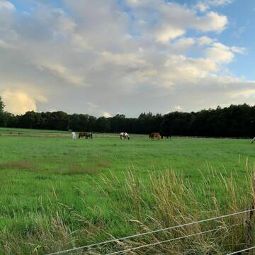

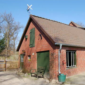
Kiehns Hof - Ganzjähriger Weidegang (Sommer 24h)
Wohltorf
Kiehns Hof
@Kiehns_Hof
Freizeitstall
Vermieten
Paddock
Parkplatz für Pferdeanhänger
Außenboxen
8 weitere...
P+
Deprecated: Creation of dynamic property Zend_View_Helper_Ads::$adLink is deprecated in /var/www/stall-frei/htdocs/staging.stall-frei.de/library/Psf/View/Helper/Ads.php on line 108

Pferdehof Fricke
Lüneburg
Pferdehof-Fricke
@Pferdehof-Fricke
FN-Mitglied
Freizeitstall
Vermieten
Longierzirkel/Roundpen
Paddock
Außenboxen
Innenbox
9 weitere...
P
Leider kein Vorschaubild
Leider kein Vorschaubild
Aufztplätze SF in übersichtlicher Gruppe Privats...
Handorf
natalie-doering
@natalie-doering
Hunde willkommen
Longierzirkel/Roundpen
Pferdezucht
Zuchtstutenhaltung möglich
Laufstall
Offenstall
8 weitere...
B
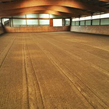
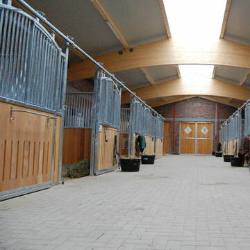
Reitstall Pensionsstall Box
Havekost
Reitstall-Timm
@Reitstall-Timm
FN-Mitglied
Freizeitstall
Vermieten
Hunde willkommen
Krankenbox
Außenboxen
Innenbox
22 weitere...
P


NEU Diät-Stall Soorbeckenhof
Vierhöfen
Klaus-Peter-Albers
@Klaus-Peter-Albers
FN-Mitglied
Freizeitstall
Hunde willkommen
Krankenbox
Allergikerstall
Hufrehe geeignet
Bewegungsstall
Laufstall
20 weitere...
P+
Traumhafte Privatanlage in Radbruch
Radbruch
Stefanie-Goehrt
@Stefanie-Goehrt
Vermieten
Paddock
Parkplatz für Pferdeanhänger
Allergikerstall
bedampftes/gewaschenes Heu
Außenboxen
12 weitere...
P

Heu und Heulage verkaufen
Mechtersen
STALL-FREIde Marketing
@STALL-FREI-Marketing
Verkaufen Sie Ihr Heu und Ihre Heulage direkt an Reiter, Pferdeställe und Reitanlagen

Reitanlage Gellermann Dachtmissen
Dachtmissen
Martin Gellermann
@Gellermann-Dachtmissen
FN-Mitglied
Freizeitstall
Vermieten
Hunde willkommen
Longierzirkel/Roundpen
Fohlenaufzucht möglich
Zuchtstutenhaltung möglich
19 weitere...
P
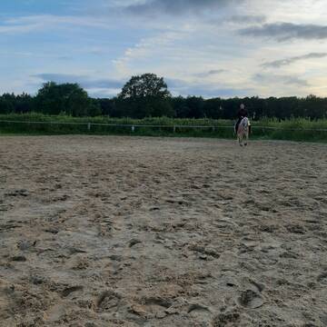
Boxen- und Offenstallplätze in Kröppelshagen
Kröppelshagen-Fahrendorf
Christina-Meyer
@Christina-Meyer
Freizeitstall
Geländestrecke
Longierzirkel/Roundpen
Paddock
Außenboxen
Offenstall
Halbpension
8 weitere...
aktuell
P
Leider kein Vorschaubild
Leider kein Vorschaubild
Pony Platz im Offenstall mit Horseagility
Bleckede
Pony Ranch Elbstrand
@Pony-Ranch-Elbstrand
Freizeitstall
Pferdeausbildung
Vermieten
Hunde willkommen
Krankenbox
Hufrehe geeignet
Notfallboxen
10 weitere...
B
Leider kein Vorschaubild
Leider kein Vorschaubild
Ponywallach Offenstall, Rehegeeignet
Grabau
johannawkr
@johannawkr
Paddock
Reithalle
Hufrehe geeignet
Offenstall
Vollpension
3 weitere...
B
Veröffentliche deine Suche als Gesuch und Suchauftrag, dann erhältst du Angebote, neue Treffer und Änderungen per E-Mail.
Diese Suche als Gesuch veröffentlichenDeprecated: Creation of dynamic property Zend_View::$pageCount is deprecated in /var/www/stall-frei/htdocs/staging.stall-frei.de/library/vendor/shardj/zf1-future/library/Zend/View/Abstract.php on line 308
Deprecated: Creation of dynamic property Zend_View::$itemCountPerPage is deprecated in /var/www/stall-frei/htdocs/staging.stall-frei.de/library/vendor/shardj/zf1-future/library/Zend/View/Abstract.php on line 308
Deprecated: Creation of dynamic property Zend_View::$first is deprecated in /var/www/stall-frei/htdocs/staging.stall-frei.de/library/vendor/shardj/zf1-future/library/Zend/View/Abstract.php on line 308
Deprecated: Creation of dynamic property Zend_View::$current is deprecated in /var/www/stall-frei/htdocs/staging.stall-frei.de/library/vendor/shardj/zf1-future/library/Zend/View/Abstract.php on line 308
Deprecated: Creation of dynamic property Zend_View::$last is deprecated in /var/www/stall-frei/htdocs/staging.stall-frei.de/library/vendor/shardj/zf1-future/library/Zend/View/Abstract.php on line 308
Deprecated: Creation of dynamic property Zend_View::$previous is deprecated in /var/www/stall-frei/htdocs/staging.stall-frei.de/library/vendor/shardj/zf1-future/library/Zend/View/Abstract.php on line 308
Deprecated: Creation of dynamic property Zend_View::$next is deprecated in /var/www/stall-frei/htdocs/staging.stall-frei.de/library/vendor/shardj/zf1-future/library/Zend/View/Abstract.php on line 308
Deprecated: Creation of dynamic property Zend_View::$pagesInRange is deprecated in /var/www/stall-frei/htdocs/staging.stall-frei.de/library/vendor/shardj/zf1-future/library/Zend/View/Abstract.php on line 308
Deprecated: Creation of dynamic property Zend_View::$firstPageInRange is deprecated in /var/www/stall-frei/htdocs/staging.stall-frei.de/library/vendor/shardj/zf1-future/library/Zend/View/Abstract.php on line 308
Deprecated: Creation of dynamic property Zend_View::$lastPageInRange is deprecated in /var/www/stall-frei/htdocs/staging.stall-frei.de/library/vendor/shardj/zf1-future/library/Zend/View/Abstract.php on line 308
Deprecated: Creation of dynamic property Zend_View::$currentItemCount is deprecated in /var/www/stall-frei/htdocs/staging.stall-frei.de/library/vendor/shardj/zf1-future/library/Zend/View/Abstract.php on line 308
Deprecated: Creation of dynamic property Zend_View::$totalItemCount is deprecated in /var/www/stall-frei/htdocs/staging.stall-frei.de/library/vendor/shardj/zf1-future/library/Zend/View/Abstract.php on line 308
Deprecated: Creation of dynamic property Zend_View::$firstItemNumber is deprecated in /var/www/stall-frei/htdocs/staging.stall-frei.de/library/vendor/shardj/zf1-future/library/Zend/View/Abstract.php on line 308
Deprecated: Creation of dynamic property Zend_View::$lastItemNumber is deprecated in /var/www/stall-frei/htdocs/staging.stall-frei.de/library/vendor/shardj/zf1-future/library/Zend/View/Abstract.php on line 308
Deprecated: Creation of dynamic property Zend_View::$router is deprecated in /var/www/stall-frei/htdocs/staging.stall-frei.de/library/vendor/shardj/zf1-future/library/Zend/View/Abstract.php on line 308
Deprecated: Creation of dynamic property Zend_View::$urlParams is deprecated in /var/www/stall-frei/htdocs/staging.stall-frei.de/library/vendor/shardj/zf1-future/library/Zend/View/Abstract.php on line 308
Deprecated: Creation of dynamic property Zend_View::$showAds is deprecated in /var/www/stall-frei/htdocs/staging.stall-frei.de/library/vendor/shardj/zf1-future/library/Zend/View/Abstract.php on line 308
Deprecated: Creation of dynamic property Zend_View::$objectIds is deprecated in /var/www/stall-frei/htdocs/staging.stall-frei.de/library/vendor/shardj/zf1-future/library/Zend/View/Abstract.php on line 308
Deprecated: Creation of dynamic property Zend_View::$showNavbar is deprecated in /var/www/stall-frei/htdocs/staging.stall-frei.de/library/vendor/shardj/zf1-future/library/Zend/View/Abstract.php on line 308
Deprecated: Creation of dynamic property Zend_View::$showBreadcrumb is deprecated in /var/www/stall-frei/htdocs/staging.stall-frei.de/library/vendor/shardj/zf1-future/library/Zend/View/Abstract.php on line 308
Deprecated: Creation of dynamic property Zend_View::$showFooter is deprecated in /var/www/stall-frei/htdocs/staging.stall-frei.de/library/vendor/shardj/zf1-future/library/Zend/View/Abstract.php on line 308
Deprecated: Creation of dynamic property Zend_View::$showInternalAds is deprecated in /var/www/stall-frei/htdocs/staging.stall-frei.de/library/vendor/shardj/zf1-future/library/Zend/View/Abstract.php on line 308
Deprecated: Creation of dynamic property Zend_View::$blNoContent is deprecated in /var/www/stall-frei/htdocs/staging.stall-frei.de/library/vendor/shardj/zf1-future/library/Zend/View/Abstract.php on line 308
Deprecated: Creation of dynamic property Zend_View::$sMetaDesc is deprecated in /var/www/stall-frei/htdocs/staging.stall-frei.de/library/vendor/shardj/zf1-future/library/Zend/View/Abstract.php on line 308
Deprecated: Creation of dynamic property Zend_View::$useGmaps is deprecated in /var/www/stall-frei/htdocs/staging.stall-frei.de/library/vendor/shardj/zf1-future/library/Zend/View/Abstract.php on line 308
Deprecated: Creation of dynamic property Zend_View::$touches is deprecated in /var/www/stall-frei/htdocs/staging.stall-frei.de/library/vendor/shardj/zf1-future/library/Zend/View/Abstract.php on line 308
Deprecated: Creation of dynamic property Zend_View::$oProject is deprecated in /var/www/stall-frei/htdocs/staging.stall-frei.de/library/vendor/shardj/zf1-future/library/Zend/View/Abstract.php on line 308
Deprecated: Creation of dynamic property Zend_View::$pageHeadline is deprecated in /var/www/stall-frei/htdocs/staging.stall-frei.de/library/vendor/shardj/zf1-future/library/Zend/View/Abstract.php on line 308
Deprecated: Creation of dynamic property Zend_View::$disableLocationField is deprecated in /var/www/stall-frei/htdocs/staging.stall-frei.de/library/vendor/shardj/zf1-future/library/Zend/View/Abstract.php on line 308
Deprecated: Creation of dynamic property Zend_View::$isSearch is deprecated in /var/www/stall-frei/htdocs/staging.stall-frei.de/library/vendor/shardj/zf1-future/library/Zend/View/Abstract.php on line 308
Deprecated: Creation of dynamic property Zend_View::$pageTitle is deprecated in /var/www/stall-frei/htdocs/staging.stall-frei.de/library/vendor/shardj/zf1-future/library/Zend/View/Abstract.php on line 308
Deprecated: Creation of dynamic property Psf_Form_Element_Text::$class is deprecated in /var/www/stall-frei/htdocs/staging.stall-frei.de/library/vendor/shardj/zf1-future/library/Zend/Form/Element.php on line 874
Deprecated: Creation of dynamic property Psf_Form_Element_Text::$size is deprecated in /var/www/stall-frei/htdocs/staging.stall-frei.de/library/vendor/shardj/zf1-future/library/Zend/Form/Element.php on line 874
Deprecated: Creation of dynamic property Psf_Form_Element_Text::$placeholder is deprecated in /var/www/stall-frei/htdocs/staging.stall-frei.de/library/vendor/shardj/zf1-future/library/Zend/Form/Element.php on line 874
Deprecated: Creation of dynamic property Psf_Form_Element_Hidden::$class is deprecated in /var/www/stall-frei/htdocs/staging.stall-frei.de/library/vendor/shardj/zf1-future/library/Zend/Form/Element.php on line 874
Deprecated: Creation of dynamic property Psf_Form_Element_Hidden::$class is deprecated in /var/www/stall-frei/htdocs/staging.stall-frei.de/library/vendor/shardj/zf1-future/library/Zend/Form/Element.php on line 874
Deprecated: Creation of dynamic property Psf_Form_Element_Hidden::$class is deprecated in /var/www/stall-frei/htdocs/staging.stall-frei.de/library/vendor/shardj/zf1-future/library/Zend/Form/Element.php on line 874
Deprecated: Creation of dynamic property Psf_Form_Element_Hidden::$class is deprecated in /var/www/stall-frei/htdocs/staging.stall-frei.de/library/vendor/shardj/zf1-future/library/Zend/Form/Element.php on line 874
Deprecated: Creation of dynamic property Psf_Form_Element_Select::$class is deprecated in /var/www/stall-frei/htdocs/staging.stall-frei.de/library/vendor/shardj/zf1-future/library/Zend/Form/Element.php on line 874
Deprecated: Creation of dynamic property Psf_Form_Element_Select::$class is deprecated in /var/www/stall-frei/htdocs/staging.stall-frei.de/library/vendor/shardj/zf1-future/library/Zend/Form/Element.php on line 874
Deprecated: Creation of dynamic property Psf_Form_Element_Select::$class is deprecated in /var/www/stall-frei/htdocs/staging.stall-frei.de/library/vendor/shardj/zf1-future/library/Zend/Form/Element.php on line 874
Deprecated: Creation of dynamic property Psf_Form_Element_Select::$class is deprecated in /var/www/stall-frei/htdocs/staging.stall-frei.de/library/vendor/shardj/zf1-future/library/Zend/Form/Element.php on line 874
Deprecated: Creation of dynamic property Psf_Form_Element_Text::$class is deprecated in /var/www/stall-frei/htdocs/staging.stall-frei.de/library/vendor/shardj/zf1-future/library/Zend/Form/Element.php on line 874
Deprecated: Creation of dynamic property Psf_Form_Element_Checkbox::$label is deprecated in /var/www/stall-frei/htdocs/staging.stall-frei.de/library/vendor/shardj/zf1-future/library/Zend/Form/Element.php on line 874
Deprecated: Creation of dynamic property Zend_View::$sort is deprecated in /var/www/stall-frei/htdocs/staging.stall-frei.de/library/vendor/shardj/zf1-future/library/Zend/View/Abstract.php on line 308
Deprecated: Creation of dynamic property Zend_View::$searchLocation is deprecated in /var/www/stall-frei/htdocs/staging.stall-frei.de/library/vendor/shardj/zf1-future/library/Zend/View/Abstract.php on line 308
Deprecated: Creation of dynamic property Zend_View::$locationHint is deprecated in /var/www/stall-frei/htdocs/staging.stall-frei.de/library/vendor/shardj/zf1-future/library/Zend/View/Abstract.php on line 308
Psf_GeoCoder_Abstract::getLocation: Unterstadt Get Location CachedOrLive
Psf_GeoCoder_Abstract::getCachedOrLive: Unterstadt
Psf_GeoCoder_Abstract::convertLocationResult
{"documentation":"https:\/\/opencagedata.com\/api","licenses":[{"name":"see attribution guide","url":"https:\/\/opencagedata.com\/credits"}],"results":[{"bounds":{"northeast":{"lat":53.3903425,"lng":10.5768946},"southwest":{"lat":53.3503425,"lng":10.5368946}},"components":{"ISO_3166-1_alpha-2":"DE","ISO_3166-1_alpha-3":"DEU","ISO_3166-2":["DE-SH"],"_category":"place","_normalized_city":"Lauenburg\/Elbe","_type":"neighbourhood","continent":"Europe","country":"Deutschland","country_code":"de","county":"Kreis Herzogtum Lauenburg","political_union":"European Union","postcode":"21481","state":"Schleswig-Holstein","state_code":"SH","suburb":"Unterstadt","town":"Lauenburg\/Elbe"},"confidence":7,"formatted":"21481 Lauenburg\/Elbe, Deutschland","geometry":{"lat":53.3703425,"lng":10.5568946}},{"bounds":{"northeast":{"lat":51.8112981,"lng":6.157888},"southwest":{"lat":51.7712981,"lng":6.117888}},"components":{"ISO_3166-1_alpha-2":"DE","ISO_3166-1_alpha-3":"DEU","ISO_3166-2":["DE-NW"],"_category":"place","_normalized_city":"Kleve","_type":"neighbourhood","continent":"Europe","country":"Deutschland","country_code":"de","county":"Kreis Kleve","municipality":"Bedburg-Hau","political_union":"European Union","postcode":"47533","state":"Nordrhein-Westfalen","state_code":"NW","suburb":"Unterstadt","town":"Kleve"},"confidence":7,"formatted":"47533 Kleve, Deutschland","geometry":{"lat":51.7912981,"lng":6.137888}},{"bounds":{"northeast":{"lat":51.5159144,"lng":10.8078437},"southwest":{"lat":51.4759144,"lng":10.7678437}},"components":{"ISO_3166-1_alpha-2":"DE","ISO_3166-1_alpha-3":"DEU","ISO_3166-2":["DE-TH"],"_category":"place","_normalized_city":"Nordhausen","_type":"neighbourhood","continent":"Europe","country":"Deutschland","country_code":"de","county":"Landkreis Nordhausen","political_union":"European Union","postcode":"99734","state":"Th\u00fcringen","state_code":"TH","suburb":"Unterstadt","town":"Nordhausen"},"confidence":7,"formatted":"99734 Nordhausen, Deutschland","geometry":{"lat":51.4959144,"lng":10.7878437}},{"bounds":{"northeast":{"lat":51.3638199,"lng":7.0528276},"southwest":{"lat":51.3238199,"lng":7.0128276}},"components":{"ISO_3166-1_alpha-2":"DE","ISO_3166-1_alpha-3":"DEU","ISO_3166-2":["DE-NW"],"_category":"place","_normalized_city":"Velbert","_type":"neighbourhood","city_district":"Velbert-Mitte","continent":"Europe","country":"Deutschland","country_code":"de","county":"Kreis Mettmann","political_union":"European Union","postcode":"42550","state":"Nordrhein-Westfalen","state_code":"NW","suburb":"Unterstadt","town":"Velbert"},"confidence":7,"formatted":"42550 Velbert, Deutschland","geometry":{"lat":51.3438199,"lng":7.0328276}},{"bounds":{"northeast":{"lat":48.6967644,"lng":9.0177125},"southwest":{"lat":48.6767644,"lng":8.9977125}},"components":{"ISO_3166-1_alpha-2":"DE","ISO_3166-1_alpha-3":"DEU","ISO_3166-2":["DE-BW"],"_category":"place","_normalized_city":"B\u00f6blingen","_type":"neighbourhood","continent":"Europe","country":"Deutschland","country_code":"de","county":"Landkreis B\u00f6blingen","political_union":"European Union","postcode":"71034","quarter":"Unterstadt","state":"Baden-W\u00fcrttemberg","state_code":"BW","suburb":"B\u00f6blingen (Kernstadt)","town":"B\u00f6blingen"},"confidence":8,"formatted":"71034 B\u00f6blingen, Deutschland","geometry":{"lat":48.6867644,"lng":9.0077125}},{"bounds":{"northeast":{"lat":51.350879,"lng":7.04391},"southwest":{"lat":51.3412156,"lng":7.0239544}},"components":{"ISO_3166-1_alpha-2":"DE","ISO_3166-1_alpha-3":"DEU","ISO_3166-2":["DE-NW"],"_category":"place","_normalized_city":"Velbert","_type":"neighbourhood","city_district":"Velbert-Mitte","continent":"Europe","country":"Deutschland","country_code":"de","county":"Kreis Mettmann","neighbourhood":"Unterstadt","political_union":"European Union","state":"Nordrhein-Westfalen","state_code":"NW","town":"Velbert"},"confidence":8,"formatted":"Velbert-Mitte, Velbert, Nordrhein-Westfalen, Deutschland","geometry":{"lat":51.3462218,"lng":7.0294119}},{"bounds":{"northeast":{"lat":47.694379,"lng":9.272418},"southwest":{"lat":47.6921032,"lng":9.2689575}},"components":{"ISO_3166-1_alpha-2":"DE","ISO_3166-1_alpha-3":"DEU","ISO_3166-2":["DE-BW"],"_category":"place","_normalized_city":"Meersburg","_type":"neighbourhood","continent":"Europe","country":"Deutschland","country_code":"de","county":"Bodenseekreis","municipality":"GVV Meersburg","neighbourhood":"Unterstadt","political_union":"European Union","postcode":"88709","state":"Baden-W\u00fcrttemberg","state_code":"BW","town":"Meersburg"},"confidence":9,"formatted":"88709 Meersburg, Deutschland","geometry":{"lat":47.6932311,"lng":9.2702038}},{"bounds":{"northeast":{"lat":51.057938,"lng":8.4002427},"southwest":{"lat":51.037938,"lng":8.3802427}},"components":{"ISO_3166-1_alpha-2":"DE","ISO_3166-1_alpha-3":"DEU","ISO_3166-2":["DE-NW"],"_category":"place","_normalized_city":"Bad Berleburg","_type":"neighbourhood","continent":"Europe","country":"Deutschland","country_code":"de","county":"Kreis Siegen-Wittgenstein","neighbourhood":"Unterstadt","political_union":"European Union","postcode":"57319","state":"Nordrhein-Westfalen","state_code":"NW","suburb":"Bad Berleburg","town":"Bad Berleburg"},"confidence":8,"formatted":"57319 Bad Berleburg, Deutschland","geometry":{"lat":51.047938,"lng":8.3902427}},{"bounds":{"northeast":{"lat":48.137041,"lng":7.8532353},"southwest":{"lat":48.117041,"lng":7.8332353}},"components":{"ISO_3166-1_alpha-2":"DE","ISO_3166-1_alpha-3":"DEU","ISO_3166-2":["DE-BW"],"_category":"place","_normalized_city":"Emmendingen","_type":"neighbourhood","city":"Emmendingen","continent":"Europe","country":"Deutschland","country_code":"de","county":"Landkreis Emmendingen","municipality":"VVG der Stadt Emmendingen","neighbourhood":"Unterstadt","political_union":"European Union","postcode":"79312","state":"Baden-W\u00fcrttemberg","state_code":"BW","town":"Emmendingen (Kernstadt)"},"confidence":8,"formatted":"79312 Emmendingen (Kernstadt), Deutschland","geometry":{"lat":48.127041,"lng":7.8432353}},{"bounds":{"northeast":{"lat":48.3763681,"lng":8.8136965},"southwest":{"lat":48.3563681,"lng":8.7936965}},"components":{"ISO_3166-1_alpha-2":"DE","ISO_3166-1_alpha-3":"DEU","ISO_3166-2":["DE-BW"],"_category":"place","_normalized_city":"Haigerloch","_type":"neighbourhood","continent":"Europe","country":"Deutschland","country_code":"de","county":"Zollernalbkreis","neighbourhood":"Unterstadt","political_union":"European Union","postcode":"72401","state":"Baden-W\u00fcrttemberg","state_code":"BW","town":"Haigerloch"},"confidence":8,"formatted":"72401 Haigerloch, Deutschland","geometry":{"lat":48.3663681,"lng":8.8036965}}],"status":{"code":200,"message":"OK"},"stay_informed":{"blog":"https:\/\/blog.opencagedata.com","mastodon":"https:\/\/en.osm.town\/@opencage"},"thanks":"For using an OpenCage API","timestamp":{"created_http":"Sun, 08 Feb 2026 09:34:35 GMT","created_unix":1770543275},"total_results":10}Array
(
[0] => stdClass Object
(
[bounds] => stdClass Object
(
[northeast] => stdClass Object
(
[lat] => 53.3903425
[lng] => 10.5768946
)
[southwest] => stdClass Object
(
[lat] => 53.3503425
[lng] => 10.5368946
)
)
[components] => stdClass Object
(
[ISO_3166-1_alpha-2] => DE
[ISO_3166-1_alpha-3] => DEU
[ISO_3166-2] => Array
(
[0] => DE-SH
)
[_category] => place
[_normalized_city] => Lauenburg/Elbe
[_type] => neighbourhood
[continent] => Europe
[country] => Deutschland
[country_code] => de
[county] => Kreis Herzogtum Lauenburg
[political_union] => European Union
[postcode] => 21481
[state] => Schleswig-Holstein
[state_code] => SH
[suburb] => Unterstadt
[town] => Lauenburg/Elbe
)
[confidence] => 7
[formatted] => 21481 Lauenburg/Elbe, Deutschland
[geometry] => stdClass Object
(
[lat] => 53.3703425
[lng] => 10.5568946
)
)
[1] => stdClass Object
(
[bounds] => stdClass Object
(
[northeast] => stdClass Object
(
[lat] => 51.8112981
[lng] => 6.157888
)
[southwest] => stdClass Object
(
[lat] => 51.7712981
[lng] => 6.117888
)
)
[components] => stdClass Object
(
[ISO_3166-1_alpha-2] => DE
[ISO_3166-1_alpha-3] => DEU
[ISO_3166-2] => Array
(
[0] => DE-NW
)
[_category] => place
[_normalized_city] => Kleve
[_type] => neighbourhood
[continent] => Europe
[country] => Deutschland
[country_code] => de
[county] => Kreis Kleve
[municipality] => Bedburg-Hau
[political_union] => European Union
[postcode] => 47533
[state] => Nordrhein-Westfalen
[state_code] => NW
[suburb] => Unterstadt
[town] => Kleve
)
[confidence] => 7
[formatted] => 47533 Kleve, Deutschland
[geometry] => stdClass Object
(
[lat] => 51.7912981
[lng] => 6.137888
)
)
[2] => stdClass Object
(
[bounds] => stdClass Object
(
[northeast] => stdClass Object
(
[lat] => 51.5159144
[lng] => 10.8078437
)
[southwest] => stdClass Object
(
[lat] => 51.4759144
[lng] => 10.7678437
)
)
[components] => stdClass Object
(
[ISO_3166-1_alpha-2] => DE
[ISO_3166-1_alpha-3] => DEU
[ISO_3166-2] => Array
(
[0] => DE-TH
)
[_category] => place
[_normalized_city] => Nordhausen
[_type] => neighbourhood
[continent] => Europe
[country] => Deutschland
[country_code] => de
[county] => Landkreis Nordhausen
[political_union] => European Union
[postcode] => 99734
[state] => Thüringen
[state_code] => TH
[suburb] => Unterstadt
[town] => Nordhausen
)
[confidence] => 7
[formatted] => 99734 Nordhausen, Deutschland
[geometry] => stdClass Object
(
[lat] => 51.4959144
[lng] => 10.7878437
)
)
[3] => stdClass Object
(
[bounds] => stdClass Object
(
[northeast] => stdClass Object
(
[lat] => 51.3638199
[lng] => 7.0528276
)
[southwest] => stdClass Object
(
[lat] => 51.3238199
[lng] => 7.0128276
)
)
[components] => stdClass Object
(
[ISO_3166-1_alpha-2] => DE
[ISO_3166-1_alpha-3] => DEU
[ISO_3166-2] => Array
(
[0] => DE-NW
)
[_category] => place
[_normalized_city] => Velbert
[_type] => neighbourhood
[city_district] => Velbert-Mitte
[continent] => Europe
[country] => Deutschland
[country_code] => de
[county] => Kreis Mettmann
[political_union] => European Union
[postcode] => 42550
[state] => Nordrhein-Westfalen
[state_code] => NW
[suburb] => Unterstadt
[town] => Velbert
)
[confidence] => 7
[formatted] => 42550 Velbert, Deutschland
[geometry] => stdClass Object
(
[lat] => 51.3438199
[lng] => 7.0328276
)
)
[4] => stdClass Object
(
[bounds] => stdClass Object
(
[northeast] => stdClass Object
(
[lat] => 48.6967644
[lng] => 9.0177125
)
[southwest] => stdClass Object
(
[lat] => 48.6767644
[lng] => 8.9977125
)
)
[components] => stdClass Object
(
[ISO_3166-1_alpha-2] => DE
[ISO_3166-1_alpha-3] => DEU
[ISO_3166-2] => Array
(
[0] => DE-BW
)
[_category] => place
[_normalized_city] => Böblingen
[_type] => neighbourhood
[continent] => Europe
[country] => Deutschland
[country_code] => de
[county] => Landkreis Böblingen
[political_union] => European Union
[postcode] => 71034
[quarter] => Unterstadt
[state] => Baden-Württemberg
[state_code] => BW
[suburb] => Böblingen (Kernstadt)
[town] => Böblingen
)
[confidence] => 8
[formatted] => 71034 Böblingen, Deutschland
[geometry] => stdClass Object
(
[lat] => 48.6867644
[lng] => 9.0077125
)
)
[5] => stdClass Object
(
[bounds] => stdClass Object
(
[northeast] => stdClass Object
(
[lat] => 51.350879
[lng] => 7.04391
)
[southwest] => stdClass Object
(
[lat] => 51.3412156
[lng] => 7.0239544
)
)
[components] => stdClass Object
(
[ISO_3166-1_alpha-2] => DE
[ISO_3166-1_alpha-3] => DEU
[ISO_3166-2] => Array
(
[0] => DE-NW
)
[_category] => place
[_normalized_city] => Velbert
[_type] => neighbourhood
[city_district] => Velbert-Mitte
[continent] => Europe
[country] => Deutschland
[country_code] => de
[county] => Kreis Mettmann
[neighbourhood] => Unterstadt
[political_union] => European Union
[state] => Nordrhein-Westfalen
[state_code] => NW
[town] => Velbert
)
[confidence] => 8
[formatted] => Velbert-Mitte, Velbert, Nordrhein-Westfalen, Deutschland
[geometry] => stdClass Object
(
[lat] => 51.3462218
[lng] => 7.0294119
)
)
[6] => stdClass Object
(
[bounds] => stdClass Object
(
[northeast] => stdClass Object
(
[lat] => 47.694379
[lng] => 9.272418
)
[southwest] => stdClass Object
(
[lat] => 47.6921032
[lng] => 9.2689575
)
)
[components] => stdClass Object
(
[ISO_3166-1_alpha-2] => DE
[ISO_3166-1_alpha-3] => DEU
[ISO_3166-2] => Array
(
[0] => DE-BW
)
[_category] => place
[_normalized_city] => Meersburg
[_type] => neighbourhood
[continent] => Europe
[country] => Deutschland
[country_code] => de
[county] => Bodenseekreis
[municipality] => GVV Meersburg
[neighbourhood] => Unterstadt
[political_union] => European Union
[postcode] => 88709
[state] => Baden-Württemberg
[state_code] => BW
[town] => Meersburg
)
[confidence] => 9
[formatted] => 88709 Meersburg, Deutschland
[geometry] => stdClass Object
(
[lat] => 47.6932311
[lng] => 9.2702038
)
)
[7] => stdClass Object
(
[bounds] => stdClass Object
(
[northeast] => stdClass Object
(
[lat] => 51.057938
[lng] => 8.4002427
)
[southwest] => stdClass Object
(
[lat] => 51.037938
[lng] => 8.3802427
)
)
[components] => stdClass Object
(
[ISO_3166-1_alpha-2] => DE
[ISO_3166-1_alpha-3] => DEU
[ISO_3166-2] => Array
(
[0] => DE-NW
)
[_category] => place
[_normalized_city] => Bad Berleburg
[_type] => neighbourhood
[continent] => Europe
[country] => Deutschland
[country_code] => de
[county] => Kreis Siegen-Wittgenstein
[neighbourhood] => Unterstadt
[political_union] => European Union
[postcode] => 57319
[state] => Nordrhein-Westfalen
[state_code] => NW
[suburb] => Bad Berleburg
[town] => Bad Berleburg
)
[confidence] => 8
[formatted] => 57319 Bad Berleburg, Deutschland
[geometry] => stdClass Object
(
[lat] => 51.047938
[lng] => 8.3902427
)
)
[8] => stdClass Object
(
[bounds] => stdClass Object
(
[northeast] => stdClass Object
(
[lat] => 48.137041
[lng] => 7.8532353
)
[southwest] => stdClass Object
(
[lat] => 48.117041
[lng] => 7.8332353
)
)
[components] => stdClass Object
(
[ISO_3166-1_alpha-2] => DE
[ISO_3166-1_alpha-3] => DEU
[ISO_3166-2] => Array
(
[0] => DE-BW
)
[_category] => place
[_normalized_city] => Emmendingen
[_type] => neighbourhood
[city] => Emmendingen
[continent] => Europe
[country] => Deutschland
[country_code] => de
[county] => Landkreis Emmendingen
[municipality] => VVG der Stadt Emmendingen
[neighbourhood] => Unterstadt
[political_union] => European Union
[postcode] => 79312
[state] => Baden-Württemberg
[state_code] => BW
[town] => Emmendingen (Kernstadt)
)
[confidence] => 8
[formatted] => 79312 Emmendingen (Kernstadt), Deutschland
[geometry] => stdClass Object
(
[lat] => 48.127041
[lng] => 7.8432353
)
)
[9] => stdClass Object
(
[bounds] => stdClass Object
(
[northeast] => stdClass Object
(
[lat] => 48.3763681
[lng] => 8.8136965
)
[southwest] => stdClass Object
(
[lat] => 48.3563681
[lng] => 8.7936965
)
)
[components] => stdClass Object
(
[ISO_3166-1_alpha-2] => DE
[ISO_3166-1_alpha-3] => DEU
[ISO_3166-2] => Array
(
[0] => DE-BW
)
[_category] => place
[_normalized_city] => Haigerloch
[_type] => neighbourhood
[continent] => Europe
[country] => Deutschland
[country_code] => de
[county] => Zollernalbkreis
[neighbourhood] => Unterstadt
[political_union] => European Union
[postcode] => 72401
[state] => Baden-Württemberg
[state_code] => BW
[town] => Haigerloch
)
[confidence] => 8
[formatted] => 72401 Haigerloch, Deutschland
[geometry] => stdClass Object
(
[lat] => 48.3663681
[lng] => 8.8036965
)
)
)
Psf_GeoCoder_OpenCageData::getKeyMap: 0
stdClass Object
(
    [bounds] => stdClass Object
        (
            [northeast] => stdClass Object
                (
                    [lat] => 53.3903425
                    [lng] => 10.5768946
                )

            [southwest] => stdClass Object
                (
                    [lat] => 53.3503425
                    [lng] => 10.5368946
                )

        )

    [components] => stdClass Object
        (
            [ISO_3166-1_alpha-2] => DE
            [ISO_3166-1_alpha-3] => DEU
            [ISO_3166-2] => Array
                (
                    [0] => DE-SH
                )

            [_category] => place
            [_normalized_city] => Lauenburg/Elbe
            [_type] => neighbourhood
            [continent] => Europe
            [country] => Deutschland
            [country_code] => de
            [county] => Kreis Herzogtum Lauenburg
            [political_union] => European Union
            [postcode] => 21481
            [state] => Schleswig-Holstein
            [state_code] => SH
            [suburb] => Unterstadt
            [town] => Lauenburg/Elbe
        )

    [confidence] => 7
    [formatted] => 21481 Lauenburg/Elbe, Deutschland
    [geometry] => stdClass Object
        (
            [lat] => 53.3703425
            [lng] => 10.5568946
        )

)
Psf_GeoCoder_OpenCageData::getCounty: Herzogtum Lauenburg
Psf_GeoCoder_OpenCageData::addMissingData REFETCH!
Array
(
    [address] => 21481 Lauenburg/Elbe, Deutschland
    [type] => neighbourhood
    [street] =>
    [city] => Lauenburg/Elbe
    [county] => Herzogtum Lauenburg
    [state] => Schleswig-Holstein
    [zip] => 21481
    [country] => Deutschland
    [suburb] => Unterstadt
    [countrycode] => de
    [latitude] => 53.3703425
    [longitude] => 10.5568946
    [accuracy] => 1
    [confidence] => 7
    [bounds] => stdClass Object
        (
            [northeast] => stdClass Object
                (
                    [lat] => 53.3903425
                    [lng] => 10.5768946
                )

            [southwest] => stdClass Object
                (
                    [lat] => 53.3503425
                    [lng] => 10.5368946
                )

        )

)
reformat!
Array
(
    [address] => 21481 Lauenburg/Elbe, Deutschland
    [type] => neighbourhood
    [street] =>
    [city] => Lauenburg/Elbe
    [county] => Herzogtum Lauenburg
    [state] => Schleswig-Holstein
    [zip] => 21481
    [country] => Deutschland
    [suburb] => Unterstadt
    [countrycode] => de
    [latitude] => 53.3703425
    [longitude] => 10.5568946
    [accuracy] => 1
    [confidence] => 7
    [bounds] => stdClass Object
        (
            [northeast] => stdClass Object
                (
                    [lat] => 53.3903425
                    [lng] => 10.5768946
                )

            [southwest] => stdClass Object
                (
                    [lat] => 53.3503425
                    [lng] => 10.5368946
                )

        )

    [place] => 21481 Lauenburg/Elbe, Schleswig-Holstein
    [hash] => f8c57f86be4d8195b007bb2a678c6be8
)
Psf_GeoCoder_OpenCageData::getKeyMap: 1
stdClass Object
(
    [bounds] => stdClass Object
        (
            [northeast] => stdClass Object
                (
                    [lat] => 51.8112981
                    [lng] => 6.157888
                )

            [southwest] => stdClass Object
                (
                    [lat] => 51.7712981
                    [lng] => 6.117888
                )

        )

    [components] => stdClass Object
        (
            [ISO_3166-1_alpha-2] => DE
            [ISO_3166-1_alpha-3] => DEU
            [ISO_3166-2] => Array
                (
                    [0] => DE-NW
                )

            [_category] => place
            [_normalized_city] => Kleve
            [_type] => neighbourhood
            [continent] => Europe
            [country] => Deutschland
            [country_code] => de
            [county] => Kreis Kleve
            [municipality] => Bedburg-Hau
            [political_union] => European Union
            [postcode] => 47533
            [state] => Nordrhein-Westfalen
            [state_code] => NW
            [suburb] => Unterstadt
            [town] => Kleve
        )

    [confidence] => 7
    [formatted] => 47533 Kleve, Deutschland
    [geometry] => stdClass Object
        (
            [lat] => 51.7912981
            [lng] => 6.137888
        )

)
Psf_GeoCoder_OpenCageData::getCounty: Kleve
Psf_GeoCoder_OpenCageData::addMissingData REFETCH!
Array
(
    [address] => 47533 Kleve, Deutschland
    [type] => neighbourhood
    [street] =>
    [city] => Kleve
    [county] => Kleve
    [state] => Nordrhein-Westfalen
    [zip] => 47533
    [country] => Deutschland
    [suburb] => Unterstadt
    [countrycode] => de
    [latitude] => 51.7912981
    [longitude] => 6.137888
    [accuracy] => 1
    [confidence] => 7
    [bounds] => stdClass Object
        (
            [northeast] => stdClass Object
                (
                    [lat] => 51.8112981
                    [lng] => 6.157888
                )

            [southwest] => stdClass Object
                (
                    [lat] => 51.7712981
                    [lng] => 6.117888
                )

        )

)
reformat!
Array
(
    [address] => 47533 Kleve, Deutschland
    [type] => neighbourhood
    [street] =>
    [city] => Kleve
    [county] => Kleve
    [state] => Nordrhein-Westfalen
    [zip] => 47533
    [country] => Deutschland
    [suburb] => Unterstadt
    [countrycode] => de
    [latitude] => 51.7912981
    [longitude] => 6.137888
    [accuracy] => 1
    [confidence] => 7
    [bounds] => stdClass Object
        (
            [northeast] => stdClass Object
                (
                    [lat] => 51.8112981
                    [lng] => 6.157888
                )

            [southwest] => stdClass Object
                (
                    [lat] => 51.7712981
                    [lng] => 6.117888
                )

        )

    [place] => 47533 Kleve, Nordrhein-Westfalen
    [hash] => 93036108c258b256cfe0196741a61756
)
Psf_GeoCoder_OpenCageData::getKeyMap: 2
stdClass Object
(
    [bounds] => stdClass Object
        (
            [northeast] => stdClass Object
                (
                    [lat] => 51.5159144
                    [lng] => 10.8078437
                )

            [southwest] => stdClass Object
                (
                    [lat] => 51.4759144
                    [lng] => 10.7678437
                )

        )

    [components] => stdClass Object
        (
            [ISO_3166-1_alpha-2] => DE
            [ISO_3166-1_alpha-3] => DEU
            [ISO_3166-2] => Array
                (
                    [0] => DE-TH
                )

            [_category] => place
            [_normalized_city] => Nordhausen
            [_type] => neighbourhood
            [continent] => Europe
            [country] => Deutschland
            [country_code] => de
            [county] => Landkreis Nordhausen
            [political_union] => European Union
            [postcode] => 99734
            [state] => Thüringen
            [state_code] => TH
            [suburb] => Unterstadt
            [town] => Nordhausen
        )

    [confidence] => 7
    [formatted] => 99734 Nordhausen, Deutschland
    [geometry] => stdClass Object
        (
            [lat] => 51.4959144
            [lng] => 10.7878437
        )

)
Psf_GeoCoder_OpenCageData::getCounty: Nordhausen
Psf_GeoCoder_OpenCageData::addMissingData REFETCH!
Array
(
    [address] => 99734 Nordhausen, Deutschland
    [type] => neighbourhood
    [street] =>
    [city] => Nordhausen
    [county] => Nordhausen
    [state] => Thüringen
    [zip] => 99734
    [country] => Deutschland
    [suburb] => Unterstadt
    [countrycode] => de
    [latitude] => 51.4959144
    [longitude] => 10.7878437
    [accuracy] => 1
    [confidence] => 7
    [bounds] => stdClass Object
        (
            [northeast] => stdClass Object
                (
                    [lat] => 51.5159144
                    [lng] => 10.8078437
                )

            [southwest] => stdClass Object
                (
                    [lat] => 51.4759144
                    [lng] => 10.7678437
                )

        )

)
reformat!
Array
(
    [address] => 99734 Nordhausen, Deutschland
    [type] => neighbourhood
    [street] =>
    [city] => Nordhausen
    [county] => Nordhausen
    [state] => Thüringen
    [zip] => 99734
    [country] => Deutschland
    [suburb] => Unterstadt
    [countrycode] => de
    [latitude] => 51.4959144
    [longitude] => 10.7878437
    [accuracy] => 1
    [confidence] => 7
    [bounds] => stdClass Object
        (
            [northeast] => stdClass Object
                (
                    [lat] => 51.5159144
                    [lng] => 10.8078437
                )

            [southwest] => stdClass Object
                (
                    [lat] => 51.4759144
                    [lng] => 10.7678437
                )

        )

    [place] => 99734 Nordhausen, Thüringen
    [hash] => d6481c97b8b16ad1cb002430db95b97b
)
Psf_GeoCoder_OpenCageData::getKeyMap: 3
stdClass Object
(
    [bounds] => stdClass Object
        (
            [northeast] => stdClass Object
                (
                    [lat] => 51.3638199
                    [lng] => 7.0528276
                )

            [southwest] => stdClass Object
                (
                    [lat] => 51.3238199
                    [lng] => 7.0128276
                )

        )

    [components] => stdClass Object
        (
            [ISO_3166-1_alpha-2] => DE
            [ISO_3166-1_alpha-3] => DEU
            [ISO_3166-2] => Array
                (
                    [0] => DE-NW
                )

            [_category] => place
            [_normalized_city] => Velbert
            [_type] => neighbourhood
            [city_district] => Velbert-Mitte
            [continent] => Europe
            [country] => Deutschland
            [country_code] => de
            [county] => Kreis Mettmann
            [political_union] => European Union
            [postcode] => 42550
            [state] => Nordrhein-Westfalen
            [state_code] => NW
            [suburb] => Unterstadt
            [town] => Velbert
        )

    [confidence] => 7
    [formatted] => 42550 Velbert, Deutschland
    [geometry] => stdClass Object
        (
            [lat] => 51.3438199
            [lng] => 7.0328276
        )

)
Psf_GeoCoder_OpenCageData::getCounty: Mettmann
Psf_GeoCoder_OpenCageData::addMissingData REFETCH!
Array
(
    [address] => 42550 Velbert, Deutschland
    [type] => neighbourhood
    [street] =>
    [city] => Velbert
    [county] => Mettmann
    [state] => Nordrhein-Westfalen
    [zip] => 42550
    [country] => Deutschland
    [suburb] => Unterstadt
    [countrycode] => de
    [latitude] => 51.3438199
    [longitude] => 7.0328276
    [accuracy] => 1
    [confidence] => 7
    [bounds] => stdClass Object
        (
            [northeast] => stdClass Object
                (
                    [lat] => 51.3638199
                    [lng] => 7.0528276
                )

            [southwest] => stdClass Object
                (
                    [lat] => 51.3238199
                    [lng] => 7.0128276
                )

        )

)
reformat!
Array
(
    [address] => 42550 Velbert, Deutschland
    [type] => neighbourhood
    [street] =>
    [city] => Velbert
    [county] => Mettmann
    [state] => Nordrhein-Westfalen
    [zip] => 42550
    [country] => Deutschland
    [suburb] => Unterstadt
    [countrycode] => de
    [latitude] => 51.3438199
    [longitude] => 7.0328276
    [accuracy] => 1
    [confidence] => 7
    [bounds] => stdClass Object
        (
            [northeast] => stdClass Object
                (
                    [lat] => 51.3638199
                    [lng] => 7.0528276
                )

            [southwest] => stdClass Object
                (
                    [lat] => 51.3238199
                    [lng] => 7.0128276
                )

        )

    [place] => 42550 Velbert, Nordrhein-Westfalen
    [hash] => f8dee3b5aedf992a8113575e4ebecc2a
)
Psf_GeoCoder_OpenCageData::getKeyMap: 4
stdClass Object
(
    [bounds] => stdClass Object
        (
            [northeast] => stdClass Object
                (
                    [lat] => 48.6967644
                    [lng] => 9.0177125
                )

            [southwest] => stdClass Object
                (
                    [lat] => 48.6767644
                    [lng] => 8.9977125
                )

        )

    [components] => stdClass Object
        (
            [ISO_3166-1_alpha-2] => DE
            [ISO_3166-1_alpha-3] => DEU
            [ISO_3166-2] => Array
                (
                    [0] => DE-BW
                )

            [_category] => place
            [_normalized_city] => Böblingen
            [_type] => neighbourhood
            [continent] => Europe
            [country] => Deutschland
            [country_code] => de
            [county] => Landkreis Böblingen
            [political_union] => European Union
            [postcode] => 71034
            [quarter] => Unterstadt
            [state] => Baden-Württemberg
            [state_code] => BW
            [suburb] => Böblingen (Kernstadt)
            [town] => Böblingen
        )

    [confidence] => 8
    [formatted] => 71034 Böblingen, Deutschland
    [geometry] => stdClass Object
        (
            [lat] => 48.6867644
            [lng] => 9.0077125
        )

)
Psf_GeoCoder_OpenCageData::getCounty: Böblingen
Psf_GeoCoder_OpenCageData::addMissingData REFETCH!
Array
(
    [address] => 71034 Böblingen, Deutschland
    [type] => neighbourhood
    [street] =>
    [city] => Böblingen
    [county] => Böblingen
    [state] => Baden-Württemberg
    [zip] => 71034
    [country] => Deutschland
    [suburb] => Böblingen (Kernstadt)
    [countrycode] => de
    [latitude] => 48.6867644
    [longitude] => 9.0077125
    [accuracy] => 1
    [confidence] => 8
    [bounds] => stdClass Object
        (
            [northeast] => stdClass Object
                (
                    [lat] => 48.6967644
                    [lng] => 9.0177125
                )

            [southwest] => stdClass Object
                (
                    [lat] => 48.6767644
                    [lng] => 8.9977125
                )

        )

)
reformat!
Array
(
    [address] => 71034 Böblingen, Deutschland
    [type] => neighbourhood
    [street] =>
    [city] => Böblingen
    [county] => Böblingen
    [state] => Baden-Württemberg
    [zip] => 71034
    [country] => Deutschland
    [suburb] => Böblingen (Kernstadt)
    [countrycode] => de
    [latitude] => 48.6867644
    [longitude] => 9.0077125
    [accuracy] => 1
    [confidence] => 8
    [bounds] => stdClass Object
        (
            [northeast] => stdClass Object
                (
                    [lat] => 48.6967644
                    [lng] => 9.0177125
                )

            [southwest] => stdClass Object
                (
                    [lat] => 48.6767644
                    [lng] => 8.9977125
                )

        )

    [place] => 71034 Böblingen, Baden-Württemberg
    [hash] => e1c97f1d6f325888cd6529a69c2d3a96
)
Psf_GeoCoder_OpenCageData::getKeyMap: 5
stdClass Object
(
    [bounds] => stdClass Object
        (
            [northeast] => stdClass Object
                (
                    [lat] => 51.350879
                    [lng] => 7.04391
                )

            [southwest] => stdClass Object
                (
                    [lat] => 51.3412156
                    [lng] => 7.0239544
                )

        )

    [components] => stdClass Object
        (
            [ISO_3166-1_alpha-2] => DE
            [ISO_3166-1_alpha-3] => DEU
            [ISO_3166-2] => Array
                (
                    [0] => DE-NW
                )

            [_category] => place
            [_normalized_city] => Velbert
            [_type] => neighbourhood
            [city_district] => Velbert-Mitte
            [continent] => Europe
            [country] => Deutschland
            [country_code] => de
            [county] => Kreis Mettmann
            [neighbourhood] => Unterstadt
            [political_union] => European Union
            [state] => Nordrhein-Westfalen
            [state_code] => NW
            [town] => Velbert
        )

    [confidence] => 8
    [formatted] => Velbert-Mitte, Velbert, Nordrhein-Westfalen, Deutschland
    [geometry] => stdClass Object
        (
            [lat] => 51.3462218
            [lng] => 7.0294119
        )

)
Psf_GeoCoder_OpenCageData::getCounty: Mettmann
Psf_GeoCoder_OpenCageData::addMissingData REFETCH!
Array
(
    [address] => Velbert-Mitte, Velbert, Nordrhein-Westfalen, Deutschland
    [type] => neighbourhood
    [street] =>
    [city] => Velbert
    [county] => Mettmann
    [state] => Nordrhein-Westfalen
    [zip] =>
    [country] => Deutschland
    [suburb] =>
    [countrycode] => de
    [latitude] => 51.3462218
    [longitude] => 7.0294119
    [accuracy] => 1
    [confidence] => 8
    [bounds] => stdClass Object
        (
            [northeast] => stdClass Object
                (
                    [lat] => 51.350879
                    [lng] => 7.04391
                )

            [southwest] => stdClass Object
                (
                    [lat] => 51.3412156
                    [lng] => 7.0239544
                )

        )

)
reformat!
Array
(
    [address] => Velbert-Mitte, Velbert, Nordrhein-Westfalen, Deutschland
    [type] => neighbourhood
    [street] =>
    [city] => Velbert
    [county] => Mettmann
    [state] => Nordrhein-Westfalen
    [zip] =>
    [country] => Deutschland
    [suburb] =>
    [countrycode] => de
    [latitude] => 51.3462218
    [longitude] => 7.0294119
    [accuracy] => 1
    [confidence] => 8
    [bounds] => stdClass Object
        (
            [northeast] => stdClass Object
                (
                    [lat] => 51.350879
                    [lng] => 7.04391
                )

            [southwest] => stdClass Object
                (
                    [lat] => 51.3412156
                    [lng] => 7.0239544
                )

        )

    [place] => Velbert, Nordrhein-Westfalen
    [hash] => d7e48b08c005f0110fa8f593de92f25b
)
Psf_GeoCoder_OpenCageData::getKeyMap: 6
stdClass Object
(
    [bounds] => stdClass Object
        (
            [northeast] => stdClass Object
                (
                    [lat] => 47.694379
                    [lng] => 9.272418
                )

            [southwest] => stdClass Object
                (
                    [lat] => 47.6921032
                    [lng] => 9.2689575
                )

        )

    [components] => stdClass Object
        (
            [ISO_3166-1_alpha-2] => DE
            [ISO_3166-1_alpha-3] => DEU
            [ISO_3166-2] => Array
                (
                    [0] => DE-BW
                )

            [_category] => place
            [_normalized_city] => Meersburg
            [_type] => neighbourhood
            [continent] => Europe
            [country] => Deutschland
            [country_code] => de
            [county] => Bodenseekreis
            [municipality] => GVV Meersburg
            [neighbourhood] => Unterstadt
            [political_union] => European Union
            [postcode] => 88709
            [state] => Baden-Württemberg
            [state_code] => BW
            [town] => Meersburg
        )

    [confidence] => 9
    [formatted] => 88709 Meersburg, Deutschland
    [geometry] => stdClass Object
        (
            [lat] => 47.6932311
            [lng] => 9.2702038
        )

)
Psf_GeoCoder_OpenCageData::getCounty: Bodenseekreis
Psf_GeoCoder_OpenCageData::addMissingData REFETCH!
Array
(
    [address] => 88709 Meersburg, Deutschland
    [type] => neighbourhood
    [street] =>
    [city] => Meersburg
    [county] => Bodenseekreis
    [state] => Baden-Württemberg
    [zip] => 88709
    [country] => Deutschland
    [suburb] =>
    [countrycode] => de
    [latitude] => 47.6932311
    [longitude] => 9.2702038
    [accuracy] => 1
    [confidence] => 9
    [bounds] => stdClass Object
        (
            [northeast] => stdClass Object
                (
                    [lat] => 47.694379
                    [lng] => 9.272418
                )

            [southwest] => stdClass Object
                (
                    [lat] => 47.6921032
                    [lng] => 9.2689575
                )

        )

)
reformat!
Array
(
    [address] => 88709 Meersburg, Deutschland
    [type] => neighbourhood
    [street] =>
    [city] => Meersburg
    [county] => Bodenseekreis
    [state] => Baden-Württemberg
    [zip] => 88709
    [country] => Deutschland
    [suburb] =>
    [countrycode] => de
    [latitude] => 47.6932311
    [longitude] => 9.2702038
    [accuracy] => 1
    [confidence] => 9
    [bounds] => stdClass Object
        (
            [northeast] => stdClass Object
                (
                    [lat] => 47.694379
                    [lng] => 9.272418
                )

            [southwest] => stdClass Object
                (
                    [lat] => 47.6921032
                    [lng] => 9.2689575
                )

        )

    [place] => 88709 Meersburg, Baden-Württemberg
    [hash] => 1ec629c69b41785dccc1cbda254acc11
)
Psf_GeoCoder_OpenCageData::getKeyMap: 7
stdClass Object
(
    [bounds] => stdClass Object
        (
            [northeast] => stdClass Object
                (
                    [lat] => 51.057938
                    [lng] => 8.4002427
                )

            [southwest] => stdClass Object
                (
                    [lat] => 51.037938
                    [lng] => 8.3802427
                )

        )

    [components] => stdClass Object
        (
            [ISO_3166-1_alpha-2] => DE
            [ISO_3166-1_alpha-3] => DEU
            [ISO_3166-2] => Array
                (
                    [0] => DE-NW
                )

            [_category] => place
            [_normalized_city] => Bad Berleburg
            [_type] => neighbourhood
            [continent] => Europe
            [country] => Deutschland
            [country_code] => de
            [county] => Kreis Siegen-Wittgenstein
            [neighbourhood] => Unterstadt
            [political_union] => European Union
            [postcode] => 57319
            [state] => Nordrhein-Westfalen
            [state_code] => NW
            [suburb] => Bad Berleburg
            [town] => Bad Berleburg
        )

    [confidence] => 8
    [formatted] => 57319 Bad Berleburg, Deutschland
    [geometry] => stdClass Object
        (
            [lat] => 51.047938
            [lng] => 8.3902427
        )

)
Psf_GeoCoder_OpenCageData::getCounty: Siegen-Wittgenstein
Psf_GeoCoder_OpenCageData::addMissingData REFETCH!
Array
(
    [address] => 57319 Bad Berleburg, Deutschland
    [type] => neighbourhood
    [street] =>
    [city] => Bad Berleburg
    [county] => Siegen-Wittgenstein
    [state] => Nordrhein-Westfalen
    [zip] => 57319
    [country] => Deutschland
    [suburb] => Bad Berleburg
    [countrycode] => de
    [latitude] => 51.047938
    [longitude] => 8.3902427
    [accuracy] => 1
    [confidence] => 8
    [bounds] => stdClass Object
        (
            [northeast] => stdClass Object
                (
                    [lat] => 51.057938
                    [lng] => 8.4002427
                )

            [southwest] => stdClass Object
                (
                    [lat] => 51.037938
                    [lng] => 8.3802427
                )

        )

)
reformat!
Array
(
    [address] => 57319 Bad Berleburg, Deutschland
    [type] => neighbourhood
    [street] =>
    [city] => Bad Berleburg
    [county] => Siegen-Wittgenstein
    [state] => Nordrhein-Westfalen
    [zip] => 57319
    [country] => Deutschland
    [suburb] => Bad Berleburg
    [countrycode] => de
    [latitude] => 51.047938
    [longitude] => 8.3902427
    [accuracy] => 1
    [confidence] => 8
    [bounds] => stdClass Object
        (
            [northeast] => stdClass Object
                (
                    [lat] => 51.057938
                    [lng] => 8.4002427
                )

            [southwest] => stdClass Object
                (
                    [lat] => 51.037938
                    [lng] => 8.3802427
                )

        )

    [place] => 57319 Bad Berleburg, Nordrhein-Westfalen
    [hash] => 3e071f3831dddfb2da09bfb46ed9d72b
)
Psf_GeoCoder_OpenCageData::getKeyMap: 8
stdClass Object
(
    [bounds] => stdClass Object
        (
            [northeast] => stdClass Object
                (
                    [lat] => 48.137041
                    [lng] => 7.8532353
                )

            [southwest] => stdClass Object
                (
                    [lat] => 48.117041
                    [lng] => 7.8332353
                )

        )

    [components] => stdClass Object
        (
            [ISO_3166-1_alpha-2] => DE
            [ISO_3166-1_alpha-3] => DEU
            [ISO_3166-2] => Array
                (
                    [0] => DE-BW
                )

            [_category] => place
            [_normalized_city] => Emmendingen
            [_type] => neighbourhood
            [city] => Emmendingen
            [continent] => Europe
            [country] => Deutschland
            [country_code] => de
            [county] => Landkreis Emmendingen
            [municipality] => VVG der Stadt Emmendingen
            [neighbourhood] => Unterstadt
            [political_union] => European Union
            [postcode] => 79312
            [state] => Baden-Württemberg
            [state_code] => BW
            [town] => Emmendingen (Kernstadt)
        )

    [confidence] => 8
    [formatted] => 79312 Emmendingen (Kernstadt), Deutschland
    [geometry] => stdClass Object
        (
            [lat] => 48.127041
            [lng] => 7.8432353
        )

)
Psf_GeoCoder_OpenCageData::getCounty: Emmendingen
Psf_GeoCoder_OpenCageData::addMissingData REFETCH!
Array
(
    [address] => 79312 Emmendingen (Kernstadt), Deutschland
    [type] => neighbourhood
    [street] =>
    [city] => Emmendingen (Kernstadt)
    [county] => Emmendingen
    [state] => Baden-Württemberg
    [zip] => 79312
    [country] => Deutschland
    [suburb] =>
    [countrycode] => de
    [latitude] => 48.127041
    [longitude] => 7.8432353
    [accuracy] => 1
    [confidence] => 8
    [bounds] => stdClass Object
        (
            [northeast] => stdClass Object
                (
                    [lat] => 48.137041
                    [lng] => 7.8532353
                )

            [southwest] => stdClass Object
                (
                    [lat] => 48.117041
                    [lng] => 7.8332353
                )

        )

)
reformat!
Array
(
    [address] => 79312 Emmendingen (Kernstadt), Deutschland
    [type] => neighbourhood
    [street] =>
    [city] => Emmendingen (Kernstadt)
    [county] => Emmendingen
    [state] => Baden-Württemberg
    [zip] => 79312
    [country] => Deutschland
    [suburb] =>
    [countrycode] => de
    [latitude] => 48.127041
    [longitude] => 7.8432353
    [accuracy] => 1
    [confidence] => 8
    [bounds] => stdClass Object
        (
            [northeast] => stdClass Object
                (
                    [lat] => 48.137041
                    [lng] => 7.8532353
                )

            [southwest] => stdClass Object
                (
                    [lat] => 48.117041
                    [lng] => 7.8332353
                )

        )

    [place] => 79312 Emmendingen (Kernstadt), Baden-Württemberg
    [hash] => 0ea1687fafcb8e8d94018fe8de00bdc0
)
Psf_GeoCoder_OpenCageData::getKeyMap: 9
stdClass Object
(
    [bounds] => stdClass Object
        (
            [northeast] => stdClass Object
                (
                    [lat] => 48.3763681
                    [lng] => 8.8136965
                )

            [southwest] => stdClass Object
                (
                    [lat] => 48.3563681
                    [lng] => 8.7936965
                )

        )

    [components] => stdClass Object
        (
            [ISO_3166-1_alpha-2] => DE
            [ISO_3166-1_alpha-3] => DEU
            [ISO_3166-2] => Array
                (
                    [0] => DE-BW
                )

            [_category] => place
            [_normalized_city] => Haigerloch
            [_type] => neighbourhood
            [continent] => Europe
            [country] => Deutschland
            [country_code] => de
            [county] => Zollernalbkreis
            [neighbourhood] => Unterstadt
            [political_union] => European Union
            [postcode] => 72401
            [state] => Baden-Württemberg
            [state_code] => BW
            [town] => Haigerloch
        )

    [confidence] => 8
    [formatted] => 72401 Haigerloch, Deutschland
    [geometry] => stdClass Object
        (
            [lat] => 48.3663681
            [lng] => 8.8036965
        )

)
Psf_GeoCoder_OpenCageData::getCounty: Zollernalbkreis
Psf_GeoCoder_OpenCageData::addMissingData REFETCH!
Array
(
    [address] => 72401 Haigerloch, Deutschland
    [type] => neighbourhood
    [street] =>
    [city] => Haigerloch
    [county] => Zollernalbkreis
    [state] => Baden-Württemberg
    [zip] => 72401
    [country] => Deutschland
    [suburb] =>
    [countrycode] => de
    [latitude] => 48.3663681
    [longitude] => 8.8036965
    [accuracy] => 1
    [confidence] => 8
    [bounds] => stdClass Object
        (
            [northeast] => stdClass Object
                (
                    [lat] => 48.3763681
                    [lng] => 8.8136965
                )

            [southwest] => stdClass Object
                (
                    [lat] => 48.3563681
                    [lng] => 8.7936965
                )

        )

)
reformat!
Array
(
    [address] => 72401 Haigerloch, Deutschland
    [type] => neighbourhood
    [street] =>
    [city] => Haigerloch
    [county] => Zollernalbkreis
    [state] => Baden-Württemberg
    [zip] => 72401
    [country] => Deutschland
    [suburb] =>
    [countrycode] => de
    [latitude] => 48.3663681
    [longitude] => 8.8036965
    [accuracy] => 1
    [confidence] => 8
    [bounds] => stdClass Object
        (
            [northeast] => stdClass Object
                (
                    [lat] => 48.3763681
                    [lng] => 8.8136965
                )

            [southwest] => stdClass Object
                (
                    [lat] => 48.3563681
                    [lng] => 8.7936965
                )

        )

    [place] => 72401 Haigerloch, Baden-Württemberg
    [hash] => 3c0b7e53595983d59c4731ea73f39cca
)
Deprecated: Creation of dynamic property Zend_View::$locationHintStyle is deprecated in /var/www/stall-frei/htdocs/staging.stall-frei.de/library/vendor/shardj/zf1-future/library/Zend/View/Abstract.php on line 308
Deprecated: Creation of dynamic property Zend_View::$adGeoLocation is deprecated in /var/www/stall-frei/htdocs/staging.stall-frei.de/library/vendor/shardj/zf1-future/library/Zend/View/Abstract.php on line 308
Deprecated: Creation of dynamic property Zend_View::$recordCount is deprecated in /var/www/stall-frei/htdocs/staging.stall-frei.de/library/vendor/shardj/zf1-future/library/Zend/View/Abstract.php on line 308
Deprecated: Creation of dynamic property Zend_View::$paginationParams is deprecated in /var/www/stall-frei/htdocs/staging.stall-frei.de/library/vendor/shardj/zf1-future/library/Zend/View/Abstract.php on line 308
Deprecated: Creation of dynamic property Zend_View::$objectPaginator is deprecated in /var/www/stall-frei/htdocs/staging.stall-frei.de/library/vendor/shardj/zf1-future/library/Zend/View/Abstract.php on line 308
Deprecated: Creation of dynamic property Zend_View::$featuredObjects is deprecated in /var/www/stall-frei/htdocs/staging.stall-frei.de/library/vendor/shardj/zf1-future/library/Zend/View/Abstract.php on line 308
Deprecated: Creation of dynamic property Zend_View::$hints is deprecated in /var/www/stall-frei/htdocs/staging.stall-frei.de/library/vendor/shardj/zf1-future/library/Zend/View/Abstract.php on line 308
Deprecated: Creation of dynamic property Zend_View::$attributeHints is deprecated in /var/www/stall-frei/htdocs/staging.stall-frei.de/library/vendor/shardj/zf1-future/library/Zend/View/Abstract.php on line 308
Deprecated: Creation of dynamic property Zend_View::$oSearchForm is deprecated in /var/www/stall-frei/htdocs/staging.stall-frei.de/library/vendor/shardj/zf1-future/library/Zend/View/Abstract.php on line 308