Deprecated: Creation of dynamic property Zend_View::$sMode is deprecated in /var/www/stall-frei/htdocs/staging.stall-frei.de/library/vendor/shardj/zf1-future/library/Zend/View/Abstract.php on line 308
Stallplatz oder Offenstall in Vils
Gesucht wird in "6682 Vils, Österreich"
6.328 Einträge
Deprecated: Creation of dynamic property Zend_View::$listObjects is deprecated in /var/www/stall-frei/htdocs/staging.stall-frei.de/library/vendor/shardj/zf1-future/library/Zend/View/Abstract.php on line 308
Gesponsort


Deprecated: Creation of dynamic property Zend_View::$listMode is deprecated in /var/www/stall-frei/htdocs/staging.stall-frei.de/library/vendor/shardj/zf1-future/library/Zend/View/Abstract.php on line 308
Deprecated: Creation of dynamic property Zend_View::$renderedObjects is deprecated in /var/www/stall-frei/htdocs/staging.stall-frei.de/library/vendor/shardj/zf1-future/library/Zend/View/Abstract.php on line 308
Deprecated: Creation of dynamic property Zend_View::$index is deprecated in /var/www/stall-frei/htdocs/staging.stall-frei.de/library/vendor/shardj/zf1-future/library/Zend/View/Abstract.php on line 308
Deprecated: Creation of dynamic property Zend_View::$displayMode is deprecated in /var/www/stall-frei/htdocs/staging.stall-frei.de/library/vendor/shardj/zf1-future/library/Zend/View/Abstract.php on line 308
Deprecated: Creation of dynamic property Zend_View::$remarketingIds is deprecated in /var/www/stall-frei/htdocs/staging.stall-frei.de/library/vendor/shardj/zf1-future/library/Zend/View/Abstract.php on line 308
Deprecated: Creation of dynamic property Zend_View::$listItem is deprecated in /var/www/stall-frei/htdocs/staging.stall-frei.de/library/vendor/shardj/zf1-future/library/Zend/View/Abstract.php on line 308
Deprecated: Creation of dynamic property Zend_View::$object is deprecated in /var/www/stall-frei/htdocs/staging.stall-frei.de/library/vendor/shardj/zf1-future/library/Zend/View/Abstract.php on line 308
Deprecated: Creation of dynamic property Zend_View::$attributes is deprecated in /var/www/stall-frei/htdocs/staging.stall-frei.de/library/vendor/shardj/zf1-future/library/Zend/View/Abstract.php on line 308
Leider kein Vorschaubild
Leider kein Vorschaubild
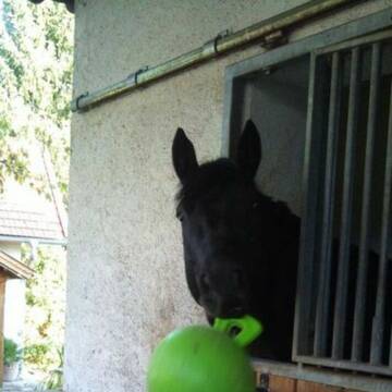
Reitstall Riesner
Grainau
Reitstall Riesner
@ReitstallRiesner
Freizeitstall
VFD-Mitglied
Hunde willkommen
Longierzirkel/Roundpen
Außenbox mit Paddock
Innenbox
Schauer-Bewegungsstall
11 weitere...
B
Deprecated: Creation of dynamic property Zend_View_Helper_Ads::$adLink is deprecated in /var/www/stall-frei/htdocs/staging.stall-frei.de/library/Psf/View/Helper/Ads.php on line 108

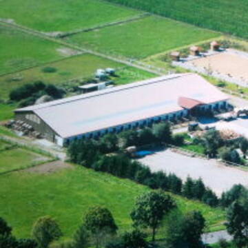
Aktivstall Blaslhof , der Weg lohnt sich!!
Uffing am Staffelsee
Blaslhof Aktivstall
@Blaslhof
Unser HIT Aktivstall ist 2008 mit 5 Stallsternen, der höchstmöglichen Auszeichnung für Artgerechte Pferdehaltung belohnt worde


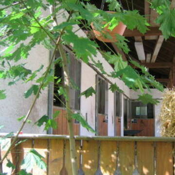
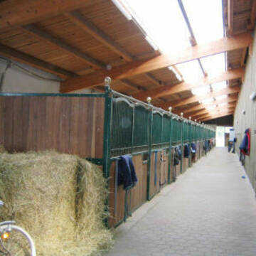
Reitsportzentrum Honsolgen
Buchloe
Reitsportzentrum-Honsolgen
@Reitsportzentrum-Honsolgen
Freizeitstall
Pferdeausbildung
Vermieten
Führanlage
Krankenbox
Hengsthaltung möglich
Hufrehe geeignet
15 weitere...
S
Pferdestall Paddock Paradise
Hohenpeißenberg
Peter-Tanzer
@Peter-Tanzer
Freizeitstall
VFD-Mitglied
Krankenbox
Paddock
Notfallboxen
Offenstall
Paddock Trail
7 weitere...
P
Leider kein Vorschaubild
Leider kein Vorschaubild
reitanlage-dassler
Buchenberg
Gut-Buchenhof1
@Gut-Buchenhof1
Pferdeausbildung
Vermieten
Führanlage
Paddock
Hengsthaltung möglich
Pferdezucht
21 weitere...
B
Leider kein Vorschaubild
Leider kein Vorschaubild
Pferdebox / Einsteller gesucht
Haldenwang
Christina-Dirr
@Christina-Dirr
Freizeitstall
Vermieten
Hunde willkommen
Paddock
Innenbox
10 weitere...
B

Heu und Heulage verkaufen
Mechtersen
STALL-FREIde Marketing
@STALL-FREI-Marketing
Verkaufen Sie Ihr Heu und Ihre Heulage direkt an Reiter, Pferdeställe und Reitanlagen
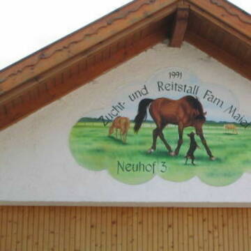
Reitsportanlage Maier - familiär und idyllisch
Denklingen-Epfach
Reitsportanlage-Maier
@Reitsportanlage-Maier
FN-Mitglied
Pferdeausbildung
Führanlage
Longierzirkel/Roundpen
Hengsthaltung möglich
Zuchtstutenhaltung möglich
Außenbox mit Paddock
Außenboxen
16 weitere...
P+
Dressurstall Gestüt alte Mühle Dösingen
Dösingen
Cronauer-andy
@Cronauer-andy
Reitlehrer und -unterricht
Vermieten
Longierzirkel/Roundpen
Parkplatz für Pferdeanhänger
Notfallboxen
14 weitere...
P


SCHOCHENHOF - Pferdesenioren & Reha
Ottobeuren
SCHOCHENHOF
@SCHOCHENHOF
Freizeitstall
Geländestrecke
Vermieten
Krankenbox
Paddock
Hufrehe geeignet
Zuchtstutenhaltung möglich
22 weitere...
P+
Leider kein Vorschaubild
Leider kein Vorschaubild
Wanderreitstation Millstream-Ranch
Buchenberg
Millstream-Ranch
@Millstream-Ranch
Freizeitstall
Geländestrecke
Paddock
Parkplatz für Pferdeanhänger
Innenbox
Paddock Trail
Biofutter
Halbpension
12 weitere...
B
Leider kein Vorschaubild
Leider kein Vorschaubild
GUT JÄGERHAUS Bad Kohlgrub
Bad Kohlgrub
Gut-Jaegerhaus1
@Gut-Jaegerhaus1
Freizeitstall
Geländestrecke
Paddock
Parkplatz für Pferdeanhänger
Pferdezucht
Außenbox mit Paddock
Innenbox
15 weitere...
B
Reitschulen mit Einzelne Boxen oder Stallplätze
Reiterhöfe mit Paddock
Reitanlagen mit Außenbox mit Paddock
Deprecated: Creation of dynamic property Zend_View::$pageCount is deprecated in /var/www/stall-frei/htdocs/staging.stall-frei.de/library/vendor/shardj/zf1-future/library/Zend/View/Abstract.php on line 308
Deprecated: Creation of dynamic property Zend_View::$itemCountPerPage is deprecated in /var/www/stall-frei/htdocs/staging.stall-frei.de/library/vendor/shardj/zf1-future/library/Zend/View/Abstract.php on line 308
Deprecated: Creation of dynamic property Zend_View::$first is deprecated in /var/www/stall-frei/htdocs/staging.stall-frei.de/library/vendor/shardj/zf1-future/library/Zend/View/Abstract.php on line 308
Deprecated: Creation of dynamic property Zend_View::$current is deprecated in /var/www/stall-frei/htdocs/staging.stall-frei.de/library/vendor/shardj/zf1-future/library/Zend/View/Abstract.php on line 308
Deprecated: Creation of dynamic property Zend_View::$last is deprecated in /var/www/stall-frei/htdocs/staging.stall-frei.de/library/vendor/shardj/zf1-future/library/Zend/View/Abstract.php on line 308
Deprecated: Creation of dynamic property Zend_View::$previous is deprecated in /var/www/stall-frei/htdocs/staging.stall-frei.de/library/vendor/shardj/zf1-future/library/Zend/View/Abstract.php on line 308
Deprecated: Creation of dynamic property Zend_View::$next is deprecated in /var/www/stall-frei/htdocs/staging.stall-frei.de/library/vendor/shardj/zf1-future/library/Zend/View/Abstract.php on line 308
Deprecated: Creation of dynamic property Zend_View::$pagesInRange is deprecated in /var/www/stall-frei/htdocs/staging.stall-frei.de/library/vendor/shardj/zf1-future/library/Zend/View/Abstract.php on line 308
Deprecated: Creation of dynamic property Zend_View::$firstPageInRange is deprecated in /var/www/stall-frei/htdocs/staging.stall-frei.de/library/vendor/shardj/zf1-future/library/Zend/View/Abstract.php on line 308
Deprecated: Creation of dynamic property Zend_View::$lastPageInRange is deprecated in /var/www/stall-frei/htdocs/staging.stall-frei.de/library/vendor/shardj/zf1-future/library/Zend/View/Abstract.php on line 308
Deprecated: Creation of dynamic property Zend_View::$currentItemCount is deprecated in /var/www/stall-frei/htdocs/staging.stall-frei.de/library/vendor/shardj/zf1-future/library/Zend/View/Abstract.php on line 308
Deprecated: Creation of dynamic property Zend_View::$totalItemCount is deprecated in /var/www/stall-frei/htdocs/staging.stall-frei.de/library/vendor/shardj/zf1-future/library/Zend/View/Abstract.php on line 308
Deprecated: Creation of dynamic property Zend_View::$firstItemNumber is deprecated in /var/www/stall-frei/htdocs/staging.stall-frei.de/library/vendor/shardj/zf1-future/library/Zend/View/Abstract.php on line 308
Deprecated: Creation of dynamic property Zend_View::$lastItemNumber is deprecated in /var/www/stall-frei/htdocs/staging.stall-frei.de/library/vendor/shardj/zf1-future/library/Zend/View/Abstract.php on line 308
Deprecated: Creation of dynamic property Zend_View::$router is deprecated in /var/www/stall-frei/htdocs/staging.stall-frei.de/library/vendor/shardj/zf1-future/library/Zend/View/Abstract.php on line 308
Deprecated: Creation of dynamic property Zend_View::$urlParams is deprecated in /var/www/stall-frei/htdocs/staging.stall-frei.de/library/vendor/shardj/zf1-future/library/Zend/View/Abstract.php on line 308
Deprecated: Creation of dynamic property Zend_View::$showAds is deprecated in /var/www/stall-frei/htdocs/staging.stall-frei.de/library/vendor/shardj/zf1-future/library/Zend/View/Abstract.php on line 308
Deprecated: Creation of dynamic property Zend_View::$objectIds is deprecated in /var/www/stall-frei/htdocs/staging.stall-frei.de/library/vendor/shardj/zf1-future/library/Zend/View/Abstract.php on line 308
Deprecated: Creation of dynamic property Zend_View::$showNavbar is deprecated in /var/www/stall-frei/htdocs/staging.stall-frei.de/library/vendor/shardj/zf1-future/library/Zend/View/Abstract.php on line 308
Deprecated: Creation of dynamic property Zend_View::$showBreadcrumb is deprecated in /var/www/stall-frei/htdocs/staging.stall-frei.de/library/vendor/shardj/zf1-future/library/Zend/View/Abstract.php on line 308
Deprecated: Creation of dynamic property Zend_View::$showFooter is deprecated in /var/www/stall-frei/htdocs/staging.stall-frei.de/library/vendor/shardj/zf1-future/library/Zend/View/Abstract.php on line 308
Deprecated: Creation of dynamic property Zend_View::$showInternalAds is deprecated in /var/www/stall-frei/htdocs/staging.stall-frei.de/library/vendor/shardj/zf1-future/library/Zend/View/Abstract.php on line 308
Deprecated: Creation of dynamic property Zend_View::$blNoContent is deprecated in /var/www/stall-frei/htdocs/staging.stall-frei.de/library/vendor/shardj/zf1-future/library/Zend/View/Abstract.php on line 308
Deprecated: Creation of dynamic property Zend_View::$sMetaDesc is deprecated in /var/www/stall-frei/htdocs/staging.stall-frei.de/library/vendor/shardj/zf1-future/library/Zend/View/Abstract.php on line 308
Deprecated: Creation of dynamic property Zend_View::$useGmaps is deprecated in /var/www/stall-frei/htdocs/staging.stall-frei.de/library/vendor/shardj/zf1-future/library/Zend/View/Abstract.php on line 308
Deprecated: Creation of dynamic property Zend_View::$touches is deprecated in /var/www/stall-frei/htdocs/staging.stall-frei.de/library/vendor/shardj/zf1-future/library/Zend/View/Abstract.php on line 308
Deprecated: Creation of dynamic property Zend_View::$oProject is deprecated in /var/www/stall-frei/htdocs/staging.stall-frei.de/library/vendor/shardj/zf1-future/library/Zend/View/Abstract.php on line 308
Deprecated: Creation of dynamic property Zend_View::$pageHeadline is deprecated in /var/www/stall-frei/htdocs/staging.stall-frei.de/library/vendor/shardj/zf1-future/library/Zend/View/Abstract.php on line 308
Deprecated: Creation of dynamic property Zend_View::$disableLocationField is deprecated in /var/www/stall-frei/htdocs/staging.stall-frei.de/library/vendor/shardj/zf1-future/library/Zend/View/Abstract.php on line 308
Deprecated: Creation of dynamic property Zend_View::$isSearch is deprecated in /var/www/stall-frei/htdocs/staging.stall-frei.de/library/vendor/shardj/zf1-future/library/Zend/View/Abstract.php on line 308
Deprecated: Creation of dynamic property Zend_View::$pageTitle is deprecated in /var/www/stall-frei/htdocs/staging.stall-frei.de/library/vendor/shardj/zf1-future/library/Zend/View/Abstract.php on line 308
Deprecated: Creation of dynamic property Psf_Form_Element_Text::$class is deprecated in /var/www/stall-frei/htdocs/staging.stall-frei.de/library/vendor/shardj/zf1-future/library/Zend/Form/Element.php on line 874
Deprecated: Creation of dynamic property Psf_Form_Element_Text::$size is deprecated in /var/www/stall-frei/htdocs/staging.stall-frei.de/library/vendor/shardj/zf1-future/library/Zend/Form/Element.php on line 874
Deprecated: Creation of dynamic property Psf_Form_Element_Text::$placeholder is deprecated in /var/www/stall-frei/htdocs/staging.stall-frei.de/library/vendor/shardj/zf1-future/library/Zend/Form/Element.php on line 874
Deprecated: Creation of dynamic property Psf_Form_Element_Hidden::$class is deprecated in /var/www/stall-frei/htdocs/staging.stall-frei.de/library/vendor/shardj/zf1-future/library/Zend/Form/Element.php on line 874
Deprecated: Creation of dynamic property Psf_Form_Element_Hidden::$class is deprecated in /var/www/stall-frei/htdocs/staging.stall-frei.de/library/vendor/shardj/zf1-future/library/Zend/Form/Element.php on line 874
Deprecated: Creation of dynamic property Psf_Form_Element_Hidden::$class is deprecated in /var/www/stall-frei/htdocs/staging.stall-frei.de/library/vendor/shardj/zf1-future/library/Zend/Form/Element.php on line 874
Deprecated: Creation of dynamic property Psf_Form_Element_Hidden::$class is deprecated in /var/www/stall-frei/htdocs/staging.stall-frei.de/library/vendor/shardj/zf1-future/library/Zend/Form/Element.php on line 874
Deprecated: Creation of dynamic property Psf_Form_Element_Select::$class is deprecated in /var/www/stall-frei/htdocs/staging.stall-frei.de/library/vendor/shardj/zf1-future/library/Zend/Form/Element.php on line 874
Deprecated: Creation of dynamic property Psf_Form_Element_Select::$class is deprecated in /var/www/stall-frei/htdocs/staging.stall-frei.de/library/vendor/shardj/zf1-future/library/Zend/Form/Element.php on line 874
Deprecated: Creation of dynamic property Psf_Form_Element_Select::$class is deprecated in /var/www/stall-frei/htdocs/staging.stall-frei.de/library/vendor/shardj/zf1-future/library/Zend/Form/Element.php on line 874
Deprecated: Creation of dynamic property Psf_Form_Element_Select::$class is deprecated in /var/www/stall-frei/htdocs/staging.stall-frei.de/library/vendor/shardj/zf1-future/library/Zend/Form/Element.php on line 874
Deprecated: Creation of dynamic property Psf_Form_Element_Text::$class is deprecated in /var/www/stall-frei/htdocs/staging.stall-frei.de/library/vendor/shardj/zf1-future/library/Zend/Form/Element.php on line 874
Deprecated: Creation of dynamic property Psf_Form_Element_Checkbox::$label is deprecated in /var/www/stall-frei/htdocs/staging.stall-frei.de/library/vendor/shardj/zf1-future/library/Zend/Form/Element.php on line 874
Deprecated: Creation of dynamic property Zend_View::$sort is deprecated in /var/www/stall-frei/htdocs/staging.stall-frei.de/library/vendor/shardj/zf1-future/library/Zend/View/Abstract.php on line 308
Deprecated: Creation of dynamic property Zend_View::$searchLocation is deprecated in /var/www/stall-frei/htdocs/staging.stall-frei.de/library/vendor/shardj/zf1-future/library/Zend/View/Abstract.php on line 308
Deprecated: Creation of dynamic property Zend_View::$locationHint is deprecated in /var/www/stall-frei/htdocs/staging.stall-frei.de/library/vendor/shardj/zf1-future/library/Zend/View/Abstract.php on line 308
Psf_GeoCoder_Abstract::getLocation: Stadtgemeinde Vils Get Location CachedOrLive
Psf_GeoCoder_Abstract::getCachedOrLive: Stadtgemeinde Vils
Psf_GeoCoder_Abstract::convertLocationResult
{"documentation":"https:\/\/opencagedata.com\/api","licenses":[{"name":"see attribution guide","url":"https:\/\/opencagedata.com\/credits"}],"results":[{"bounds":{"northeast":{"lat":47.5697413,"lng":10.6780074},"southwest":{"lat":47.5109342,"lng":10.5610858}},"components":{"ISO_3166-1_alpha-2":"AT","ISO_3166-1_alpha-3":"AUT","ISO_3166-2":["AT-7"],"_category":"place","_normalized_city":"Vils","_type":"city","continent":"Europe","country":"\u00d6sterreich","country_code":"at","county":"Bezirk Reutte","political_union":"European Union","postcode":"6682","state":"Tirol","state_code":"7","town":"Vils"},"confidence":7,"formatted":"6682 Vils, \u00d6sterreich","geometry":{"lat":47.5493283,"lng":10.6304727}},{"components":{"ISO_3166-1_alpha-2":"FR","ISO_3166-1_alpha-3":"FRA","ISO_3166-2":["FR-OCC","FR-31"],"_category":"road","_normalized_city":"Toulouse","_type":"road","city":"Toulouse","continent":"Europe","country":"France","country_code":"fr","county":"Haute-Garonne","local_authority":"Toulouse M\u00e9tropole","political_union":"European Union","postcode":"31100","road":"Chemin de Villenouvelle","state":"Occitanie","state_code":"OCC"},"confidence":2,"formatted":"Chemin de Villenouvelle, 31100 Toulouse, France","geometry":{"lat":43.551269,"lng":1.371503}},{"components":{"ISO_3166-1_alpha-2":"FR","ISO_3166-1_alpha-3":"FRA","ISO_3166-2":["FR-PDL","FR-53"],"_category":"road","_normalized_city":"Voutr\u00e9","_type":"road","city":"Voutr\u00e9","continent":"Europe","country":"France","country_code":"fr","county":"Mayenne","local_authority":"Communaut\u00e9 de communes des Co\u00ebvrons","political_union":"European Union","postcode":"53600","road":"Chemin de Vilmatier","state":"Pays de la Loire","state_code":"PDL"},"confidence":2,"formatted":"Chemin de Vilmatier, 53600 Voutr\u00e9, France","geometry":{"lat":48.139393,"lng":-0.292753}},{"components":{"ISO_3166-1_alpha-2":"FR","ISO_3166-1_alpha-3":"FRA","ISO_3166-2":["FR-PAC","FR-06"],"_category":"place","_normalized_city":"Luc\u00e9ram","_type":"place","city":"Luc\u00e9ram","continent":"Europe","country":"France","country_code":"fr","county":"Alpes-Maritimes","local_authority":"Communaut\u00e9 de communes du Pays des Paillons","place":"Ouest de Villatalla","political_union":"European Union","postcode":"06440","state":"Provence-Alpes-C\u00f4te d'Azur","state_code":"PAC"},"confidence":2,"formatted":"Ouest de Villatalla, 06440 Luc\u00e9ram, France","geometry":{"lat":43.855146,"lng":7.361991}},{"components":{"ISO_3166-1_alpha-2":"FR","ISO_3166-1_alpha-3":"FRA","ISO_3166-2":["FR-PDL","FR-53"],"_category":"road","_normalized_city":"Ass\u00e9-le-B\u00e9renger","_type":"road","city":"Ass\u00e9-le-B\u00e9renger","continent":"Europe","country":"France","country_code":"fr","county":"Mayenne","local_authority":"Communaut\u00e9 de communes des Co\u00ebvrons","political_union":"European Union","postcode":"53600","road":"Chemin de Vilmatier","state":"Pays de la Loire","state_code":"PDL"},"confidence":2,"formatted":"Chemin de Vilmatier, 53600 Ass\u00e9-le-B\u00e9renger, France","geometry":{"lat":48.140566,"lng":-0.294853}},{"components":{"ISO_3166-1_alpha-2":"FR","ISO_3166-1_alpha-3":"FRA","ISO_3166-2":["FR-PDL","FR-72"],"_category":"road","_normalized_city":"Vibraye","_type":"road","city":"Vibraye","continent":"Europe","country":"France","country_code":"fr","county":"Sarthe","local_authority":"Communaut\u00e9 de communes des Vall\u00e9es de la Braye et de l'Anille","political_union":"European Union","postcode":"72320","road":"Chemin de Villemaigre","state":"Pays de la Loire","state_code":"PDL"},"confidence":2,"formatted":"Chemin de Villemaigre, 72320 Vibraye, France","geometry":{"lat":48.048355,"lng":0.732417}},{"components":{"ISO_3166-1_alpha-2":"FR","ISO_3166-1_alpha-3":"FRA","ISO_3166-2":["FR-OCC","FR-31"],"_category":"road","_normalized_city":"Cugnaux","_type":"road","city":"Cugnaux","continent":"Europe","country":"France","country_code":"fr","county":"Haute-Garonne","local_authority":"Toulouse M\u00e9tropole","political_union":"European Union","postcode":"31270","road":"Chemin de Villenouvelle","state":"Occitanie","state_code":"OCC"},"confidence":2,"formatted":"Chemin de Villenouvelle, 31270 Cugnaux, France","geometry":{"lat":43.550612,"lng":1.369516}},{"components":{"ISO_3166-1_alpha-2":"FR","ISO_3166-1_alpha-3":"FRA","ISO_3166-2":["FR-ARA","FR-26"],"_category":"road","_normalized_city":"Saint-Jean-en-Royans","_type":"road","city":"Saint-Jean-en-Royans","continent":"Europe","country":"France","country_code":"fr","county":"Dr\u00f4me","local_authority":"Communaut\u00e9 de communes du Royans-Vercors","political_union":"European Union","postcode":"26190","road":"Chemin de Villemaigre","state":"Auvergne-Rh\u00f4ne-Alpes","state_code":"ARA"},"confidence":2,"formatted":"Chemin de Villemaigre, 26190 Saint-Jean-en-Royans, France","geometry":{"lat":45.01461,"lng":5.29898}},{"components":{"ISO_3166-1_alpha-2":"FR","ISO_3166-1_alpha-3":"FRA","ISO_3166-2":["FR-OCC","FR-31"],"_category":"road","_normalized_city":"Portet-sur-Garonne","_type":"road","city":"Portet-sur-Garonne","continent":"Europe","country":"France","country_code":"fr","county":"Haute-Garonne","local_authority":"Le Muretain Agglo","political_union":"European Union","postcode":"31120","road":"Chemin de Villenouvelle","state":"Occitanie","state_code":"OCC"},"confidence":2,"formatted":"Chemin de Villenouvelle, 31120 Portet-sur-Garonne, France","geometry":{"lat":43.549673,"lng":1.367529}},{"components":{"ISO_3166-1_alpha-2":"FR","ISO_3166-1_alpha-3":"FRA","ISO_3166-2":["FR-OCC","FR-31"],"_category":"road","_normalized_city":"Montgaillard-Lauragais","_type":"road","city":"Montgaillard-Lauragais","continent":"Europe","country":"France","country_code":"fr","county":"Haute-Garonne","local_authority":"Communaut\u00e9 de communes des Terres du Lauragais","political_union":"European Union","postcode":"31290","road":"Chemin de Villenouvelle","state":"Occitanie","state_code":"OCC"},"confidence":2,"formatted":"Chemin de Villenouvelle, 31290 Montgaillard-Lauragais, France","geometry":{"lat":43.432363,"lng":1.688415}}],"status":{"code":200,"message":"OK"},"stay_informed":{"blog":"https:\/\/blog.opencagedata.com","mastodon":"https:\/\/en.osm.town\/@opencage"},"thanks":"For using an OpenCage API","timestamp":{"created_http":"Sun, 08 Feb 2026 04:42:29 GMT","created_unix":1770525749},"total_results":10}Array
(
[0] => stdClass Object
(
[bounds] => stdClass Object
(
[northeast] => stdClass Object
(
[lat] => 47.5697413
[lng] => 10.6780074
)
[southwest] => stdClass Object
(
[lat] => 47.5109342
[lng] => 10.5610858
)
)
[components] => stdClass Object
(
[ISO_3166-1_alpha-2] => AT
[ISO_3166-1_alpha-3] => AUT
[ISO_3166-2] => Array
(
[0] => AT-7
)
[_category] => place
[_normalized_city] => Vils
[_type] => city
[continent] => Europe
[country] => Österreich
[country_code] => at
[county] => Bezirk Reutte
[political_union] => European Union
[postcode] => 6682
[state] => Tirol
[state_code] => 7
[town] => Vils
)
[confidence] => 7
[formatted] => 6682 Vils, Österreich
[geometry] => stdClass Object
(
[lat] => 47.5493283
[lng] => 10.6304727
)
)
[1] => stdClass Object
(
[components] => stdClass Object
(
[ISO_3166-1_alpha-2] => FR
[ISO_3166-1_alpha-3] => FRA
[ISO_3166-2] => Array
(
[0] => FR-OCC
[1] => FR-31
)
[_category] => road
[_normalized_city] => Toulouse
[_type] => road
[city] => Toulouse
[continent] => Europe
[country] => France
[country_code] => fr
[county] => Haute-Garonne
[local_authority] => Toulouse Métropole
[political_union] => European Union
[postcode] => 31100
[road] => Chemin de Villenouvelle
[state] => Occitanie
[state_code] => OCC
)
[confidence] => 2
[formatted] => Chemin de Villenouvelle, 31100 Toulouse, France
[geometry] => stdClass Object
(
[lat] => 43.551269
[lng] => 1.371503
)
)
[2] => stdClass Object
(
[components] => stdClass Object
(
[ISO_3166-1_alpha-2] => FR
[ISO_3166-1_alpha-3] => FRA
[ISO_3166-2] => Array
(
[0] => FR-PDL
[1] => FR-53
)
[_category] => road
[_normalized_city] => Voutré
[_type] => road
[city] => Voutré
[continent] => Europe
[country] => France
[country_code] => fr
[county] => Mayenne
[local_authority] => Communauté de communes des Coëvrons
[political_union] => European Union
[postcode] => 53600
[road] => Chemin de Vilmatier
[state] => Pays de la Loire
[state_code] => PDL
)
[confidence] => 2
[formatted] => Chemin de Vilmatier, 53600 Voutré, France
[geometry] => stdClass Object
(
[lat] => 48.139393
[lng] => -0.292753
)
)
[3] => stdClass Object
(
[components] => stdClass Object
(
[ISO_3166-1_alpha-2] => FR
[ISO_3166-1_alpha-3] => FRA
[ISO_3166-2] => Array
(
[0] => FR-PAC
[1] => FR-06
)
[_category] => place
[_normalized_city] => Lucéram
[_type] => place
[city] => Lucéram
[continent] => Europe
[country] => France
[country_code] => fr
[county] => Alpes-Maritimes
[local_authority] => Communauté de communes du Pays des Paillons
[place] => Ouest de Villatalla
[political_union] => European Union
[postcode] => 06440
[state] => Provence-Alpes-Côte d'Azur
[state_code] => PAC
)
[confidence] => 2
[formatted] => Ouest de Villatalla, 06440 Lucéram, France
[geometry] => stdClass Object
(
[lat] => 43.855146
[lng] => 7.361991
)
)
[4] => stdClass Object
(
[components] => stdClass Object
(
[ISO_3166-1_alpha-2] => FR
[ISO_3166-1_alpha-3] => FRA
[ISO_3166-2] => Array
(
[0] => FR-PDL
[1] => FR-53
)
[_category] => road
[_normalized_city] => Assé-le-Bérenger
[_type] => road
[city] => Assé-le-Bérenger
[continent] => Europe
[country] => France
[country_code] => fr
[county] => Mayenne
[local_authority] => Communauté de communes des Coëvrons
[political_union] => European Union
[postcode] => 53600
[road] => Chemin de Vilmatier
[state] => Pays de la Loire
[state_code] => PDL
)
[confidence] => 2
[formatted] => Chemin de Vilmatier, 53600 Assé-le-Bérenger, France
[geometry] => stdClass Object
(
[lat] => 48.140566
[lng] => -0.294853
)
)
[5] => stdClass Object
(
[components] => stdClass Object
(
[ISO_3166-1_alpha-2] => FR
[ISO_3166-1_alpha-3] => FRA
[ISO_3166-2] => Array
(
[0] => FR-PDL
[1] => FR-72
)
[_category] => road
[_normalized_city] => Vibraye
[_type] => road
[city] => Vibraye
[continent] => Europe
[country] => France
[country_code] => fr
[county] => Sarthe
[local_authority] => Communauté de communes des Vallées de la Braye et de l'Anille
[political_union] => European Union
[postcode] => 72320
[road] => Chemin de Villemaigre
[state] => Pays de la Loire
[state_code] => PDL
)
[confidence] => 2
[formatted] => Chemin de Villemaigre, 72320 Vibraye, France
[geometry] => stdClass Object
(
[lat] => 48.048355
[lng] => 0.732417
)
)
[6] => stdClass Object
(
[components] => stdClass Object
(
[ISO_3166-1_alpha-2] => FR
[ISO_3166-1_alpha-3] => FRA
[ISO_3166-2] => Array
(
[0] => FR-OCC
[1] => FR-31
)
[_category] => road
[_normalized_city] => Cugnaux
[_type] => road
[city] => Cugnaux
[continent] => Europe
[country] => France
[country_code] => fr
[county] => Haute-Garonne
[local_authority] => Toulouse Métropole
[political_union] => European Union
[postcode] => 31270
[road] => Chemin de Villenouvelle
[state] => Occitanie
[state_code] => OCC
)
[confidence] => 2
[formatted] => Chemin de Villenouvelle, 31270 Cugnaux, France
[geometry] => stdClass Object
(
[lat] => 43.550612
[lng] => 1.369516
)
)
[7] => stdClass Object
(
[components] => stdClass Object
(
[ISO_3166-1_alpha-2] => FR
[ISO_3166-1_alpha-3] => FRA
[ISO_3166-2] => Array
(
[0] => FR-ARA
[1] => FR-26
)
[_category] => road
[_normalized_city] => Saint-Jean-en-Royans
[_type] => road
[city] => Saint-Jean-en-Royans
[continent] => Europe
[country] => France
[country_code] => fr
[county] => Drôme
[local_authority] => Communauté de communes du Royans-Vercors
[political_union] => European Union
[postcode] => 26190
[road] => Chemin de Villemaigre
[state] => Auvergne-Rhône-Alpes
[state_code] => ARA
)
[confidence] => 2
[formatted] => Chemin de Villemaigre, 26190 Saint-Jean-en-Royans, France
[geometry] => stdClass Object
(
[lat] => 45.01461
[lng] => 5.29898
)
)
[8] => stdClass Object
(
[components] => stdClass Object
(
[ISO_3166-1_alpha-2] => FR
[ISO_3166-1_alpha-3] => FRA
[ISO_3166-2] => Array
(
[0] => FR-OCC
[1] => FR-31
)
[_category] => road
[_normalized_city] => Portet-sur-Garonne
[_type] => road
[city] => Portet-sur-Garonne
[continent] => Europe
[country] => France
[country_code] => fr
[county] => Haute-Garonne
[local_authority] => Le Muretain Agglo
[political_union] => European Union
[postcode] => 31120
[road] => Chemin de Villenouvelle
[state] => Occitanie
[state_code] => OCC
)
[confidence] => 2
[formatted] => Chemin de Villenouvelle, 31120 Portet-sur-Garonne, France
[geometry] => stdClass Object
(
[lat] => 43.549673
[lng] => 1.367529
)
)
[9] => stdClass Object
(
[components] => stdClass Object
(
[ISO_3166-1_alpha-2] => FR
[ISO_3166-1_alpha-3] => FRA
[ISO_3166-2] => Array
(
[0] => FR-OCC
[1] => FR-31
)
[_category] => road
[_normalized_city] => Montgaillard-Lauragais
[_type] => road
[city] => Montgaillard-Lauragais
[continent] => Europe
[country] => France
[country_code] => fr
[county] => Haute-Garonne
[local_authority] => Communauté de communes des Terres du Lauragais
[political_union] => European Union
[postcode] => 31290
[road] => Chemin de Villenouvelle
[state] => Occitanie
[state_code] => OCC
)
[confidence] => 2
[formatted] => Chemin de Villenouvelle, 31290 Montgaillard-Lauragais, France
[geometry] => stdClass Object
(
[lat] => 43.432363
[lng] => 1.688415
)
)
)
Psf_GeoCoder_OpenCageData::getKeyMap: 0
stdClass Object
(
    [bounds] => stdClass Object
        (
            [northeast] => stdClass Object
                (
                    [lat] => 47.5697413
                    [lng] => 10.6780074
                )

            [southwest] => stdClass Object
                (
                    [lat] => 47.5109342
                    [lng] => 10.5610858
                )

        )

    [components] => stdClass Object
        (
            [ISO_3166-1_alpha-2] => AT
            [ISO_3166-1_alpha-3] => AUT
            [ISO_3166-2] => Array
                (
                    [0] => AT-7
                )

            [_category] => place
            [_normalized_city] => Vils
            [_type] => city
            [continent] => Europe
            [country] => Österreich
            [country_code] => at
            [county] => Bezirk Reutte
            [political_union] => European Union
            [postcode] => 6682
            [state] => Tirol
            [state_code] => 7
            [town] => Vils
        )

    [confidence] => 7
    [formatted] => 6682 Vils, Österreich
    [geometry] => stdClass Object
        (
            [lat] => 47.5493283
            [lng] => 10.6304727
        )

)
Psf_GeoCoder_OpenCageData::getCounty: Bezirk Reutte
Psf_GeoCoder_OpenCageData::addMissingData REFETCH!
Array
(
    [address] => 6682 Vils, Österreich
    [type] => city
    [street] =>
    [city] => Vils
    [county] => Bezirk Reutte
    [state] => Tirol
    [zip] => 6682
    [country] => Österreich
    [suburb] =>
    [countrycode] => at
    [latitude] => 47.5493283
    [longitude] => 10.6304727
    [accuracy] => 1
    [confidence] => 7
    [bounds] => stdClass Object
        (
            [northeast] => stdClass Object
                (
                    [lat] => 47.5697413
                    [lng] => 10.6780074
                )

            [southwest] => stdClass Object
                (
                    [lat] => 47.5109342
                    [lng] => 10.5610858
                )

        )

)
reformat!
Array
(
    [address] => 6682 Vils, Österreich
    [type] => city
    [street] =>
    [city] => Vils
    [county] => Bezirk Reutte
    [state] => Tirol
    [zip] => 6682
    [country] => Österreich
    [suburb] =>
    [countrycode] => at
    [latitude] => 47.5493283
    [longitude] => 10.6304727
    [accuracy] => 1
    [confidence] => 7
    [bounds] => stdClass Object
        (
            [northeast] => stdClass Object
                (
                    [lat] => 47.5697413
                    [lng] => 10.6780074
                )

            [southwest] => stdClass Object
                (
                    [lat] => 47.5109342
                    [lng] => 10.5610858
                )

        )

    [place] => 6682 Vils, Tirol
    [hash] => fada7d9783462bf0e176433db55fe07b
)
Psf_GeoCoder_OpenCageData::getKeyMap: 1
stdClass Object
(
    [components] => stdClass Object
        (
            [ISO_3166-1_alpha-2] => FR
            [ISO_3166-1_alpha-3] => FRA
            [ISO_3166-2] => Array
                (
                    [0] => FR-OCC
                    [1] => FR-31
                )

            [_category] => road
            [_normalized_city] => Toulouse
            [_type] => road
            [city] => Toulouse
            [continent] => Europe
            [country] => France
            [country_code] => fr
            [county] => Haute-Garonne
            [local_authority] => Toulouse Métropole
            [political_union] => European Union
            [postcode] => 31100
            [road] => Chemin de Villenouvelle
            [state] => Occitanie
            [state_code] => OCC
        )

    [confidence] => 2
    [formatted] => Chemin de Villenouvelle, 31100 Toulouse, France
    [geometry] => stdClass Object
        (
            [lat] => 43.551269
            [lng] => 1.371503
        )

)
Psf_GeoCoder_OpenCageData::getCounty: Haute-Garonne
Psf_GeoCoder_OpenCageData::addMissingData REFETCH!
Array
(
    [address] => Chemin de Villenouvelle, 31100 Toulouse, France
    [type] => road
    [street] => Chemin de Villenouvelle
    [city] => Toulouse
    [county] => Haute-Garonne
    [state] => Occitanie
    [zip] => 31100
    [country] => France
    [suburb] =>
    [countrycode] => fr
    [latitude] => 43.551269
    [longitude] => 1.371503
    [accuracy] => 1
    [confidence] => 2
    [bounds] =>
)
reformat!
Array
(
    [address] => Chemin de Villenouvelle, 31100 Toulouse, France
    [type] => road
    [street] => Chemin de Villenouvelle
    [city] => Toulouse
    [county] => Haute-Garonne
    [state] => Occitanie
    [zip] => 31100
    [country] => France
    [suburb] =>
    [countrycode] => fr
    [latitude] => 43.551269
    [longitude] => 1.371503
    [accuracy] => 1
    [confidence] => 2
    [bounds] =>
    [place] => Chemin de Villenouvelle, 31100 Toulouse, Occitanie
    [hash] => 8775b71c921cc48408bd8aac36367469
)
Psf_GeoCoder_OpenCageData::getKeyMap: 2
stdClass Object
(
    [components] => stdClass Object
        (
            [ISO_3166-1_alpha-2] => FR
            [ISO_3166-1_alpha-3] => FRA
            [ISO_3166-2] => Array
                (
                    [0] => FR-PDL
                    [1] => FR-53
                )

            [_category] => road
            [_normalized_city] => Voutré
            [_type] => road
            [city] => Voutré
            [continent] => Europe
            [country] => France
            [country_code] => fr
            [county] => Mayenne
            [local_authority] => Communauté de communes des Coëvrons
            [political_union] => European Union
            [postcode] => 53600
            [road] => Chemin de Vilmatier
            [state] => Pays de la Loire
            [state_code] => PDL
        )

    [confidence] => 2
    [formatted] => Chemin de Vilmatier, 53600 Voutré, France
    [geometry] => stdClass Object
        (
            [lat] => 48.139393
            [lng] => -0.292753
        )

)
Psf_GeoCoder_OpenCageData::getCounty: Mayenne
Psf_GeoCoder_OpenCageData::addMissingData REFETCH!
Array
(
    [address] => Chemin de Vilmatier, 53600 Voutré, France
    [type] => road
    [street] => Chemin de Vilmatier
    [city] => Voutré
    [county] => Mayenne
    [state] => Pays de la Loire
    [zip] => 53600
    [country] => France
    [suburb] =>
    [countrycode] => fr
    [latitude] => 48.139393
    [longitude] => -0.292753
    [accuracy] => 1
    [confidence] => 2
    [bounds] =>
)
reformat!
Array
(
    [address] => Chemin de Vilmatier, 53600 Voutré, France
    [type] => road
    [street] => Chemin de Vilmatier
    [city] => Voutré
    [county] => Mayenne
    [state] => Pays de la Loire
    [zip] => 53600
    [country] => France
    [suburb] =>
    [countrycode] => fr
    [latitude] => 48.139393
    [longitude] => -0.292753
    [accuracy] => 1
    [confidence] => 2
    [bounds] =>
    [place] => Chemin de Vilmatier, 53600 Voutré, Pays de la Loire
    [hash] => 0b1705c56523ae3fe22ccf971cea5902
)
Psf_GeoCoder_OpenCageData::getKeyMap: 3
stdClass Object
(
    [components] => stdClass Object
        (
            [ISO_3166-1_alpha-2] => FR
            [ISO_3166-1_alpha-3] => FRA
            [ISO_3166-2] => Array
                (
                    [0] => FR-PAC
                    [1] => FR-06
                )

            [_category] => place
            [_normalized_city] => Lucéram
            [_type] => place
            [city] => Lucéram
            [continent] => Europe
            [country] => France
            [country_code] => fr
            [county] => Alpes-Maritimes
            [local_authority] => Communauté de communes du Pays des Paillons
            [place] => Ouest de Villatalla
            [political_union] => European Union
            [postcode] => 06440
            [state] => Provence-Alpes-Côte d'Azur
            [state_code] => PAC
        )

    [confidence] => 2
    [formatted] => Ouest de Villatalla, 06440 Lucéram, France
    [geometry] => stdClass Object
        (
            [lat] => 43.855146
            [lng] => 7.361991
        )

)
Psf_GeoCoder_OpenCageData::getCounty: Alpes-Maritimes
Psf_GeoCoder_OpenCageData::addMissingData REFETCH!
Array
(
    [address] => Ouest de Villatalla, 06440 Lucéram, France
    [type] => place
    [street] =>
    [city] => Lucéram
    [county] => Alpes-Maritimes
    [state] => Provence-Alpes-Côte d'Azur
    [zip] => 06440
    [country] => France
    [suburb] =>
    [countrycode] => fr
    [latitude] => 43.855146
    [longitude] => 7.361991
    [accuracy] => 1
    [confidence] => 2
    [bounds] =>
)
reformat!
Array
(
    [address] => Ouest de Villatalla, 06440 Lucéram, France
    [type] => place
    [street] =>
    [city] => Lucéram
    [county] => Alpes-Maritimes
    [state] => Provence-Alpes-Côte d'Azur
    [zip] => 06440
    [country] => France
    [suburb] =>
    [countrycode] => fr
    [latitude] => 43.855146
    [longitude] => 7.361991
    [accuracy] => 1
    [confidence] => 2
    [bounds] =>
    [place] => 06440 Lucéram, Provence-Alpes-Côte d'Azur
    [hash] => d72800ecfac55b458873925fcf0c9d2e
)
Psf_GeoCoder_OpenCageData::getKeyMap: 4
stdClass Object
(
    [components] => stdClass Object
        (
            [ISO_3166-1_alpha-2] => FR
            [ISO_3166-1_alpha-3] => FRA
            [ISO_3166-2] => Array
                (
                    [0] => FR-PDL
                    [1] => FR-53
                )

            [_category] => road
            [_normalized_city] => Assé-le-Bérenger
            [_type] => road
            [city] => Assé-le-Bérenger
            [continent] => Europe
            [country] => France
            [country_code] => fr
            [county] => Mayenne
            [local_authority] => Communauté de communes des Coëvrons
            [political_union] => European Union
            [postcode] => 53600
            [road] => Chemin de Vilmatier
            [state] => Pays de la Loire
            [state_code] => PDL
        )

    [confidence] => 2
    [formatted] => Chemin de Vilmatier, 53600 Assé-le-Bérenger, France
    [geometry] => stdClass Object
        (
            [lat] => 48.140566
            [lng] => -0.294853
        )

)
Psf_GeoCoder_OpenCageData::getCounty: Mayenne
Psf_GeoCoder_OpenCageData::addMissingData REFETCH!
Array
(
    [address] => Chemin de Vilmatier, 53600 Assé-le-Bérenger, France
    [type] => road
    [street] => Chemin de Vilmatier
    [city] => Assé-le-Bérenger
    [county] => Mayenne
    [state] => Pays de la Loire
    [zip] => 53600
    [country] => France
    [suburb] =>
    [countrycode] => fr
    [latitude] => 48.140566
    [longitude] => -0.294853
    [accuracy] => 1
    [confidence] => 2
    [bounds] =>
)
reformat!
Array
(
    [address] => Chemin de Vilmatier, 53600 Assé-le-Bérenger, France
    [type] => road
    [street] => Chemin de Vilmatier
    [city] => Assé-le-Bérenger
    [county] => Mayenne
    [state] => Pays de la Loire
    [zip] => 53600
    [country] => France
    [suburb] =>
    [countrycode] => fr
    [latitude] => 48.140566
    [longitude] => -0.294853
    [accuracy] => 1
    [confidence] => 2
    [bounds] =>
    [place] => Chemin de Vilmatier, 53600 Assé-le-Bérenger, Pays de la Loire
    [hash] => 651d61035f45533bf847c7f4194db287
)
Psf_GeoCoder_OpenCageData::getKeyMap: 5
stdClass Object
(
    [components] => stdClass Object
        (
            [ISO_3166-1_alpha-2] => FR
            [ISO_3166-1_alpha-3] => FRA
            [ISO_3166-2] => Array
                (
                    [0] => FR-PDL
                    [1] => FR-72
                )

            [_category] => road
            [_normalized_city] => Vibraye
            [_type] => road
            [city] => Vibraye
            [continent] => Europe
            [country] => France
            [country_code] => fr
            [county] => Sarthe
            [local_authority] => Communauté de communes des Vallées de la Braye et de l'Anille
            [political_union] => European Union
            [postcode] => 72320
            [road] => Chemin de Villemaigre
            [state] => Pays de la Loire
            [state_code] => PDL
        )

    [confidence] => 2
    [formatted] => Chemin de Villemaigre, 72320 Vibraye, France
    [geometry] => stdClass Object
        (
            [lat] => 48.048355
            [lng] => 0.732417
        )

)
Psf_GeoCoder_OpenCageData::getCounty: Sarthe
Psf_GeoCoder_OpenCageData::addMissingData REFETCH!
Array
(
    [address] => Chemin de Villemaigre, 72320 Vibraye, France
    [type] => road
    [street] => Chemin de Villemaigre
    [city] => Vibraye
    [county] => Sarthe
    [state] => Pays de la Loire
    [zip] => 72320
    [country] => France
    [suburb] =>
    [countrycode] => fr
    [latitude] => 48.048355
    [longitude] => 0.732417
    [accuracy] => 1
    [confidence] => 2
    [bounds] =>
)
reformat!
Array
(
    [address] => Chemin de Villemaigre, 72320 Vibraye, France
    [type] => road
    [street] => Chemin de Villemaigre
    [city] => Vibraye
    [county] => Sarthe
    [state] => Pays de la Loire
    [zip] => 72320
    [country] => France
    [suburb] =>
    [countrycode] => fr
    [latitude] => 48.048355
    [longitude] => 0.732417
    [accuracy] => 1
    [confidence] => 2
    [bounds] =>
    [place] => Chemin de Villemaigre, 72320 Vibraye, Pays de la Loire
    [hash] => fe071665c6b5a71556697576dabb0e01
)
Psf_GeoCoder_OpenCageData::getKeyMap: 6
stdClass Object
(
    [components] => stdClass Object
        (
            [ISO_3166-1_alpha-2] => FR
            [ISO_3166-1_alpha-3] => FRA
            [ISO_3166-2] => Array
                (
                    [0] => FR-OCC
                    [1] => FR-31
                )

            [_category] => road
            [_normalized_city] => Cugnaux
            [_type] => road
            [city] => Cugnaux
            [continent] => Europe
            [country] => France
            [country_code] => fr
            [county] => Haute-Garonne
            [local_authority] => Toulouse Métropole
            [political_union] => European Union
            [postcode] => 31270
            [road] => Chemin de Villenouvelle
            [state] => Occitanie
            [state_code] => OCC
        )

    [confidence] => 2
    [formatted] => Chemin de Villenouvelle, 31270 Cugnaux, France
    [geometry] => stdClass Object
        (
            [lat] => 43.550612
            [lng] => 1.369516
        )

)
Psf_GeoCoder_OpenCageData::getCounty: Haute-Garonne
Psf_GeoCoder_OpenCageData::addMissingData REFETCH!
Array
(
    [address] => Chemin de Villenouvelle, 31270 Cugnaux, France
    [type] => road
    [street] => Chemin de Villenouvelle
    [city] => Cugnaux
    [county] => Haute-Garonne
    [state] => Occitanie
    [zip] => 31270
    [country] => France
    [suburb] =>
    [countrycode] => fr
    [latitude] => 43.550612
    [longitude] => 1.369516
    [accuracy] => 1
    [confidence] => 2
    [bounds] =>
)
reformat!
Array
(
    [address] => Chemin de Villenouvelle, 31270 Cugnaux, France
    [type] => road
    [street] => Chemin de Villenouvelle
    [city] => Cugnaux
    [county] => Haute-Garonne
    [state] => Occitanie
    [zip] => 31270
    [country] => France
    [suburb] =>
    [countrycode] => fr
    [latitude] => 43.550612
    [longitude] => 1.369516
    [accuracy] => 1
    [confidence] => 2
    [bounds] =>
    [place] => Chemin de Villenouvelle, 31270 Cugnaux, Occitanie
    [hash] => 6ad6650f773b92b83336a89a2116f68e
)
Psf_GeoCoder_OpenCageData::getKeyMap: 7
stdClass Object
(
    [components] => stdClass Object
        (
            [ISO_3166-1_alpha-2] => FR
            [ISO_3166-1_alpha-3] => FRA
            [ISO_3166-2] => Array
                (
                    [0] => FR-ARA
                    [1] => FR-26
                )

            [_category] => road
            [_normalized_city] => Saint-Jean-en-Royans
            [_type] => road
            [city] => Saint-Jean-en-Royans
            [continent] => Europe
            [country] => France
            [country_code] => fr
            [county] => Drôme
            [local_authority] => Communauté de communes du Royans-Vercors
            [political_union] => European Union
            [postcode] => 26190
            [road] => Chemin de Villemaigre
            [state] => Auvergne-Rhône-Alpes
            [state_code] => ARA
        )

    [confidence] => 2
    [formatted] => Chemin de Villemaigre, 26190 Saint-Jean-en-Royans, France
    [geometry] => stdClass Object
        (
            [lat] => 45.01461
            [lng] => 5.29898
        )

)
Psf_GeoCoder_OpenCageData::getCounty: Drôme
Psf_GeoCoder_OpenCageData::addMissingData REFETCH!
Array
(
    [address] => Chemin de Villemaigre, 26190 Saint-Jean-en-Royans, France
    [type] => road
    [street] => Chemin de Villemaigre
    [city] => Saint-Jean-en-Royans
    [county] => Drôme
    [state] => Auvergne-Rhône-Alpes
    [zip] => 26190
    [country] => France
    [suburb] =>
    [countrycode] => fr
    [latitude] => 45.01461
    [longitude] => 5.29898
    [accuracy] => 1
    [confidence] => 2
    [bounds] =>
)
reformat!
Array
(
    [address] => Chemin de Villemaigre, 26190 Saint-Jean-en-Royans, France
    [type] => road
    [street] => Chemin de Villemaigre
    [city] => Saint-Jean-en-Royans
    [county] => Drôme
    [state] => Auvergne-Rhône-Alpes
    [zip] => 26190
    [country] => France
    [suburb] =>
    [countrycode] => fr
    [latitude] => 45.01461
    [longitude] => 5.29898
    [accuracy] => 1
    [confidence] => 2
    [bounds] =>
    [place] => Chemin de Villemaigre, 26190 Saint-Jean-en-Royans, Auvergne-Rhône-Alpes
    [hash] => 96a172c88571b1aa8f061f4b0db9e500
)
Psf_GeoCoder_OpenCageData::getKeyMap: 8
stdClass Object
(
    [components] => stdClass Object
        (
            [ISO_3166-1_alpha-2] => FR
            [ISO_3166-1_alpha-3] => FRA
            [ISO_3166-2] => Array
                (
                    [0] => FR-OCC
                    [1] => FR-31
                )

            [_category] => road
            [_normalized_city] => Portet-sur-Garonne
            [_type] => road
            [city] => Portet-sur-Garonne
            [continent] => Europe
            [country] => France
            [country_code] => fr
            [county] => Haute-Garonne
            [local_authority] => Le Muretain Agglo
            [political_union] => European Union
            [postcode] => 31120
            [road] => Chemin de Villenouvelle
            [state] => Occitanie
            [state_code] => OCC
        )

    [confidence] => 2
    [formatted] => Chemin de Villenouvelle, 31120 Portet-sur-Garonne, France
    [geometry] => stdClass Object
        (
            [lat] => 43.549673
            [lng] => 1.367529
        )

)
Psf_GeoCoder_OpenCageData::getCounty: Haute-Garonne
Psf_GeoCoder_OpenCageData::addMissingData REFETCH!
Array
(
    [address] => Chemin de Villenouvelle, 31120 Portet-sur-Garonne, France
    [type] => road
    [street] => Chemin de Villenouvelle
    [city] => Portet-sur-Garonne
    [county] => Haute-Garonne
    [state] => Occitanie
    [zip] => 31120
    [country] => France
    [suburb] =>
    [countrycode] => fr
    [latitude] => 43.549673
    [longitude] => 1.367529
    [accuracy] => 1
    [confidence] => 2
    [bounds] =>
)
reformat!
Array
(
    [address] => Chemin de Villenouvelle, 31120 Portet-sur-Garonne, France
    [type] => road
    [street] => Chemin de Villenouvelle
    [city] => Portet-sur-Garonne
    [county] => Haute-Garonne
    [state] => Occitanie
    [zip] => 31120
    [country] => France
    [suburb] =>
    [countrycode] => fr
    [latitude] => 43.549673
    [longitude] => 1.367529
    [accuracy] => 1
    [confidence] => 2
    [bounds] =>
    [place] => Chemin de Villenouvelle, 31120 Portet-sur-Garonne, Occitanie
    [hash] => 18e8b31744415cdb9b3b0dd3fbe51c6a
)
Psf_GeoCoder_OpenCageData::getKeyMap: 9
stdClass Object
(
    [components] => stdClass Object
        (
            [ISO_3166-1_alpha-2] => FR
            [ISO_3166-1_alpha-3] => FRA
            [ISO_3166-2] => Array
                (
                    [0] => FR-OCC
                    [1] => FR-31
                )

            [_category] => road
            [_normalized_city] => Montgaillard-Lauragais
            [_type] => road
            [city] => Montgaillard-Lauragais
            [continent] => Europe
            [country] => France
            [country_code] => fr
            [county] => Haute-Garonne
            [local_authority] => Communauté de communes des Terres du Lauragais
            [political_union] => European Union
            [postcode] => 31290
            [road] => Chemin de Villenouvelle
            [state] => Occitanie
            [state_code] => OCC
        )

    [confidence] => 2
    [formatted] => Chemin de Villenouvelle, 31290 Montgaillard-Lauragais, France
    [geometry] => stdClass Object
        (
            [lat] => 43.432363
            [lng] => 1.688415
        )

)
Psf_GeoCoder_OpenCageData::getCounty: Haute-Garonne
Psf_GeoCoder_OpenCageData::addMissingData REFETCH!
Array
(
    [address] => Chemin de Villenouvelle, 31290 Montgaillard-Lauragais, France
    [type] => road
    [street] => Chemin de Villenouvelle
    [city] => Montgaillard-Lauragais
    [county] => Haute-Garonne
    [state] => Occitanie
    [zip] => 31290
    [country] => France
    [suburb] =>
    [countrycode] => fr
    [latitude] => 43.432363
    [longitude] => 1.688415
    [accuracy] => 1
    [confidence] => 2
    [bounds] =>
)
reformat!
Array
(
    [address] => Chemin de Villenouvelle, 31290 Montgaillard-Lauragais, France
    [type] => road
    [street] => Chemin de Villenouvelle
    [city] => Montgaillard-Lauragais
    [county] => Haute-Garonne
    [state] => Occitanie
    [zip] => 31290
    [country] => France
    [suburb] =>
    [countrycode] => fr
    [latitude] => 43.432363
    [longitude] => 1.688415
    [accuracy] => 1
    [confidence] => 2
    [bounds] =>
    [place] => Chemin de Villenouvelle, 31290 Montgaillard-Lauragais, Occitanie
    [hash] => 6f24dfe48dac59bbd67d842bde8cd4ed
)
Deprecated: Creation of dynamic property Zend_View::$locationHintStyle is deprecated in /var/www/stall-frei/htdocs/staging.stall-frei.de/library/vendor/shardj/zf1-future/library/Zend/View/Abstract.php on line 308
Deprecated: Creation of dynamic property Zend_View::$adGeoLocation is deprecated in /var/www/stall-frei/htdocs/staging.stall-frei.de/library/vendor/shardj/zf1-future/library/Zend/View/Abstract.php on line 308
Deprecated: Creation of dynamic property Zend_View::$recordCount is deprecated in /var/www/stall-frei/htdocs/staging.stall-frei.de/library/vendor/shardj/zf1-future/library/Zend/View/Abstract.php on line 308
Deprecated: Creation of dynamic property Zend_View::$paginationParams is deprecated in /var/www/stall-frei/htdocs/staging.stall-frei.de/library/vendor/shardj/zf1-future/library/Zend/View/Abstract.php on line 308
Deprecated: Creation of dynamic property Zend_View::$objectPaginator is deprecated in /var/www/stall-frei/htdocs/staging.stall-frei.de/library/vendor/shardj/zf1-future/library/Zend/View/Abstract.php on line 308
Deprecated: Creation of dynamic property Zend_View::$featuredObjects is deprecated in /var/www/stall-frei/htdocs/staging.stall-frei.de/library/vendor/shardj/zf1-future/library/Zend/View/Abstract.php on line 308
Deprecated: Creation of dynamic property Zend_View::$hints is deprecated in /var/www/stall-frei/htdocs/staging.stall-frei.de/library/vendor/shardj/zf1-future/library/Zend/View/Abstract.php on line 308
Deprecated: Creation of dynamic property Zend_View::$attributeHints is deprecated in /var/www/stall-frei/htdocs/staging.stall-frei.de/library/vendor/shardj/zf1-future/library/Zend/View/Abstract.php on line 308
Deprecated: Creation of dynamic property Zend_View::$oSearchForm is deprecated in /var/www/stall-frei/htdocs/staging.stall-frei.de/library/vendor/shardj/zf1-future/library/Zend/View/Abstract.php on line 308