Deprecated: Creation of dynamic property Zend_View::$sMode is deprecated in /var/www/stall-frei/htdocs/staging.stall-frei.de/library/vendor/shardj/zf1-future/library/Zend/View/Abstract.php on line 308
Stallplatz oder Offenstall in Lutzenberg
Gesucht wird in "86877 Lutzenberg, Deutschland"
6.328 Einträge
Deprecated: Creation of dynamic property Zend_View::$listObjects is deprecated in /var/www/stall-frei/htdocs/staging.stall-frei.de/library/vendor/shardj/zf1-future/library/Zend/View/Abstract.php on line 308
Gesponsort


Deprecated: Creation of dynamic property Zend_View::$listMode is deprecated in /var/www/stall-frei/htdocs/staging.stall-frei.de/library/vendor/shardj/zf1-future/library/Zend/View/Abstract.php on line 308
Deprecated: Creation of dynamic property Zend_View::$renderedObjects is deprecated in /var/www/stall-frei/htdocs/staging.stall-frei.de/library/vendor/shardj/zf1-future/library/Zend/View/Abstract.php on line 308
Deprecated: Creation of dynamic property Zend_View::$index is deprecated in /var/www/stall-frei/htdocs/staging.stall-frei.de/library/vendor/shardj/zf1-future/library/Zend/View/Abstract.php on line 308
Deprecated: Creation of dynamic property Zend_View::$displayMode is deprecated in /var/www/stall-frei/htdocs/staging.stall-frei.de/library/vendor/shardj/zf1-future/library/Zend/View/Abstract.php on line 308
Deprecated: Creation of dynamic property Zend_View::$remarketingIds is deprecated in /var/www/stall-frei/htdocs/staging.stall-frei.de/library/vendor/shardj/zf1-future/library/Zend/View/Abstract.php on line 308
Deprecated: Creation of dynamic property Zend_View::$listItem is deprecated in /var/www/stall-frei/htdocs/staging.stall-frei.de/library/vendor/shardj/zf1-future/library/Zend/View/Abstract.php on line 308
Deprecated: Creation of dynamic property Zend_View::$object is deprecated in /var/www/stall-frei/htdocs/staging.stall-frei.de/library/vendor/shardj/zf1-future/library/Zend/View/Abstract.php on line 308
Deprecated: Creation of dynamic property Zend_View::$attributes is deprecated in /var/www/stall-frei/htdocs/staging.stall-frei.de/library/vendor/shardj/zf1-future/library/Zend/View/Abstract.php on line 308
Leider kein Vorschaubild
Leider kein Vorschaubild
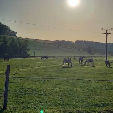
Offenstall
Obermeitingen
vogel1
@vogel1
Freizeitstall
Verpachten
Paddock
Parkplatz für Pferdeanhänger
Offenstall
7 weitere...
aktuell
B

Deprecated: Creation of dynamic property Zend_View_Helper_Ads::$adLink is deprecated in /var/www/stall-frei/htdocs/staging.stall-frei.de/library/Psf/View/Helper/Ads.php on line 108

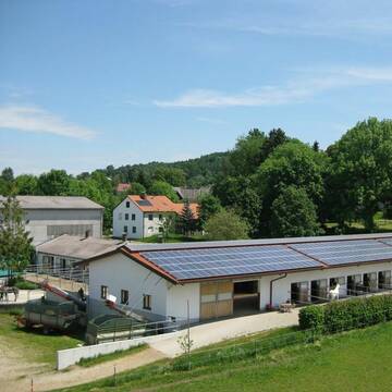
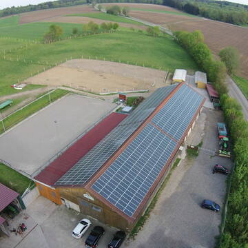
Pferdepension Hit Aktivstall Kürmerhof
Hohenkammer
Kuermerhof
@Kuermerhof
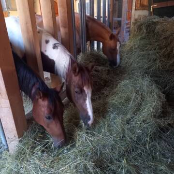
*******JETZT NEU MIT ENTSTAUBTEM BIOHEU*********
*******Demnächst mit einem Abenteuerspielplatz für Pferde ( Extrem Trail/Pa

Pferdeoffenstall-Kaufering GbR / Naturland-Hof
Kaufering/Bayern
Pferdeoffenstall-Kaufering-GbR
@Pferdeoffenstall-Kaufering-GbR
FN-Mitglied
Freizeitstall
Vermieten
Krankenbox
Paddock
Bewegungsstall
Laufstall
18 weitere...
P
Reitanlage Nerz
Neusäß
Andreas-Nerz
@Andreas-Nerz
Reitlehrer und -unterricht
Führanlage
Paddock
Außenbox mit Paddock
Außenboxen
Vollpension
9 weitere...
P
Reitanlage Diesenbacher: 1 Außenbox frei
Adelsried
Reitanlage-Diesenbacher
@Reitanlage-Diesenbacher
Geländestrecke
Führanlage
Paddock
Pferdezucht
Außenboxen
Innenbox
9 weitere...
P

Aktivstall Blaslhof , der Weg lohnt sich!!
Uffing am Staffelsee
Blaslhof Aktivstall
@Blaslhof
Unser HIT Aktivstall ist 2008 mit 5 Stallsternen, der höchstmöglichen Auszeichnung für Artgerechte Pferdehaltung belohnt worde


Große Box (Paddocktrail/bedampftes Heu
Fultenbach
Tochtermann-Manuela
@Tochtermann-Manuela
Freizeitstall
Vermieten
Paddock
Reitplatz (z.B. Dressur, Springen, Reining)
Allergikerstall
bedampftes/gewaschenes Heu
12 weitere...
P+
Leider kein Vorschaubild
Leider kein Vorschaubild
Bewegungsstall hat Plätze frei!
Jettingen-Scheppach
Moonlight-Ranch24
@Moonlight-Ranch24
Fahrstall, Kutschwagen
FN-Mitglied
Vermieten
Hunde willkommen
Krankenbox
Allergikerstall
Gnadenbrothof
34 weitere...
B
Reit- und Fahranlage Otto
Ichenhausen
Reit-und-Fahranlage-Otto
@Reit-und-Fahranlage-Otto
Fahrstall, Kutschwagen
FN-Mitglied
Vermieten
Parkplatz für Pferdeanhänger
Pensions- und Gastboxen
Außenboxen
Innenbox
20 weitere...
P
Leider kein Vorschaubild
Leider kein Vorschaubild
Paddockboxe frei
Buchloe
Ressl
@Ressl
Freizeitstall
Vermieten
Hunde willkommen
Paddock
Einzelne Boxen oder Stallplätze
7 weitere...
B


Pensionsplätze für Selbstmister, HP oder VP
Langenau
Zucht- und Pensionsstall Fetze
@ZuchtPensionFetzer
FN-Mitglied
Freizeitstall
Vermieten
Hunde willkommen
Krankenbox
Allergikerstall
Hengsthaltung möglich
18 weitere...
S
Veröffentliche deine Suche als Gesuch und Suchauftrag, dann erhältst du Angebote, neue Treffer und Änderungen per E-Mail.
Diese Suche als Gesuch veröffentlichenDeprecated: Creation of dynamic property Zend_View::$pageCount is deprecated in /var/www/stall-frei/htdocs/staging.stall-frei.de/library/vendor/shardj/zf1-future/library/Zend/View/Abstract.php on line 308
Deprecated: Creation of dynamic property Zend_View::$itemCountPerPage is deprecated in /var/www/stall-frei/htdocs/staging.stall-frei.de/library/vendor/shardj/zf1-future/library/Zend/View/Abstract.php on line 308
Deprecated: Creation of dynamic property Zend_View::$first is deprecated in /var/www/stall-frei/htdocs/staging.stall-frei.de/library/vendor/shardj/zf1-future/library/Zend/View/Abstract.php on line 308
Deprecated: Creation of dynamic property Zend_View::$current is deprecated in /var/www/stall-frei/htdocs/staging.stall-frei.de/library/vendor/shardj/zf1-future/library/Zend/View/Abstract.php on line 308
Deprecated: Creation of dynamic property Zend_View::$last is deprecated in /var/www/stall-frei/htdocs/staging.stall-frei.de/library/vendor/shardj/zf1-future/library/Zend/View/Abstract.php on line 308
Deprecated: Creation of dynamic property Zend_View::$previous is deprecated in /var/www/stall-frei/htdocs/staging.stall-frei.de/library/vendor/shardj/zf1-future/library/Zend/View/Abstract.php on line 308
Deprecated: Creation of dynamic property Zend_View::$next is deprecated in /var/www/stall-frei/htdocs/staging.stall-frei.de/library/vendor/shardj/zf1-future/library/Zend/View/Abstract.php on line 308
Deprecated: Creation of dynamic property Zend_View::$pagesInRange is deprecated in /var/www/stall-frei/htdocs/staging.stall-frei.de/library/vendor/shardj/zf1-future/library/Zend/View/Abstract.php on line 308
Deprecated: Creation of dynamic property Zend_View::$firstPageInRange is deprecated in /var/www/stall-frei/htdocs/staging.stall-frei.de/library/vendor/shardj/zf1-future/library/Zend/View/Abstract.php on line 308
Deprecated: Creation of dynamic property Zend_View::$lastPageInRange is deprecated in /var/www/stall-frei/htdocs/staging.stall-frei.de/library/vendor/shardj/zf1-future/library/Zend/View/Abstract.php on line 308
Deprecated: Creation of dynamic property Zend_View::$currentItemCount is deprecated in /var/www/stall-frei/htdocs/staging.stall-frei.de/library/vendor/shardj/zf1-future/library/Zend/View/Abstract.php on line 308
Deprecated: Creation of dynamic property Zend_View::$totalItemCount is deprecated in /var/www/stall-frei/htdocs/staging.stall-frei.de/library/vendor/shardj/zf1-future/library/Zend/View/Abstract.php on line 308
Deprecated: Creation of dynamic property Zend_View::$firstItemNumber is deprecated in /var/www/stall-frei/htdocs/staging.stall-frei.de/library/vendor/shardj/zf1-future/library/Zend/View/Abstract.php on line 308
Deprecated: Creation of dynamic property Zend_View::$lastItemNumber is deprecated in /var/www/stall-frei/htdocs/staging.stall-frei.de/library/vendor/shardj/zf1-future/library/Zend/View/Abstract.php on line 308
Deprecated: Creation of dynamic property Zend_View::$router is deprecated in /var/www/stall-frei/htdocs/staging.stall-frei.de/library/vendor/shardj/zf1-future/library/Zend/View/Abstract.php on line 308
Deprecated: Creation of dynamic property Zend_View::$urlParams is deprecated in /var/www/stall-frei/htdocs/staging.stall-frei.de/library/vendor/shardj/zf1-future/library/Zend/View/Abstract.php on line 308
Deprecated: Creation of dynamic property Zend_View::$showAds is deprecated in /var/www/stall-frei/htdocs/staging.stall-frei.de/library/vendor/shardj/zf1-future/library/Zend/View/Abstract.php on line 308
Deprecated: Creation of dynamic property Zend_View::$objectIds is deprecated in /var/www/stall-frei/htdocs/staging.stall-frei.de/library/vendor/shardj/zf1-future/library/Zend/View/Abstract.php on line 308
Deprecated: Creation of dynamic property Zend_View::$showNavbar is deprecated in /var/www/stall-frei/htdocs/staging.stall-frei.de/library/vendor/shardj/zf1-future/library/Zend/View/Abstract.php on line 308
Deprecated: Creation of dynamic property Zend_View::$showBreadcrumb is deprecated in /var/www/stall-frei/htdocs/staging.stall-frei.de/library/vendor/shardj/zf1-future/library/Zend/View/Abstract.php on line 308
Deprecated: Creation of dynamic property Zend_View::$showFooter is deprecated in /var/www/stall-frei/htdocs/staging.stall-frei.de/library/vendor/shardj/zf1-future/library/Zend/View/Abstract.php on line 308
Deprecated: Creation of dynamic property Zend_View::$showInternalAds is deprecated in /var/www/stall-frei/htdocs/staging.stall-frei.de/library/vendor/shardj/zf1-future/library/Zend/View/Abstract.php on line 308
Deprecated: Creation of dynamic property Zend_View::$blNoContent is deprecated in /var/www/stall-frei/htdocs/staging.stall-frei.de/library/vendor/shardj/zf1-future/library/Zend/View/Abstract.php on line 308
Deprecated: Creation of dynamic property Zend_View::$sMetaDesc is deprecated in /var/www/stall-frei/htdocs/staging.stall-frei.de/library/vendor/shardj/zf1-future/library/Zend/View/Abstract.php on line 308
Deprecated: Creation of dynamic property Zend_View::$useGmaps is deprecated in /var/www/stall-frei/htdocs/staging.stall-frei.de/library/vendor/shardj/zf1-future/library/Zend/View/Abstract.php on line 308
Deprecated: Creation of dynamic property Zend_View::$touches is deprecated in /var/www/stall-frei/htdocs/staging.stall-frei.de/library/vendor/shardj/zf1-future/library/Zend/View/Abstract.php on line 308
Deprecated: Creation of dynamic property Zend_View::$oProject is deprecated in /var/www/stall-frei/htdocs/staging.stall-frei.de/library/vendor/shardj/zf1-future/library/Zend/View/Abstract.php on line 308
Deprecated: Creation of dynamic property Zend_View::$pageHeadline is deprecated in /var/www/stall-frei/htdocs/staging.stall-frei.de/library/vendor/shardj/zf1-future/library/Zend/View/Abstract.php on line 308
Deprecated: Creation of dynamic property Zend_View::$disableLocationField is deprecated in /var/www/stall-frei/htdocs/staging.stall-frei.de/library/vendor/shardj/zf1-future/library/Zend/View/Abstract.php on line 308
Deprecated: Creation of dynamic property Zend_View::$isSearch is deprecated in /var/www/stall-frei/htdocs/staging.stall-frei.de/library/vendor/shardj/zf1-future/library/Zend/View/Abstract.php on line 308
Deprecated: Creation of dynamic property Zend_View::$pageTitle is deprecated in /var/www/stall-frei/htdocs/staging.stall-frei.de/library/vendor/shardj/zf1-future/library/Zend/View/Abstract.php on line 308
Deprecated: Creation of dynamic property Psf_Form_Element_Text::$class is deprecated in /var/www/stall-frei/htdocs/staging.stall-frei.de/library/vendor/shardj/zf1-future/library/Zend/Form/Element.php on line 874
Deprecated: Creation of dynamic property Psf_Form_Element_Text::$size is deprecated in /var/www/stall-frei/htdocs/staging.stall-frei.de/library/vendor/shardj/zf1-future/library/Zend/Form/Element.php on line 874
Deprecated: Creation of dynamic property Psf_Form_Element_Text::$placeholder is deprecated in /var/www/stall-frei/htdocs/staging.stall-frei.de/library/vendor/shardj/zf1-future/library/Zend/Form/Element.php on line 874
Deprecated: Creation of dynamic property Psf_Form_Element_Hidden::$class is deprecated in /var/www/stall-frei/htdocs/staging.stall-frei.de/library/vendor/shardj/zf1-future/library/Zend/Form/Element.php on line 874
Deprecated: Creation of dynamic property Psf_Form_Element_Hidden::$class is deprecated in /var/www/stall-frei/htdocs/staging.stall-frei.de/library/vendor/shardj/zf1-future/library/Zend/Form/Element.php on line 874
Deprecated: Creation of dynamic property Psf_Form_Element_Hidden::$class is deprecated in /var/www/stall-frei/htdocs/staging.stall-frei.de/library/vendor/shardj/zf1-future/library/Zend/Form/Element.php on line 874
Deprecated: Creation of dynamic property Psf_Form_Element_Hidden::$class is deprecated in /var/www/stall-frei/htdocs/staging.stall-frei.de/library/vendor/shardj/zf1-future/library/Zend/Form/Element.php on line 874
Deprecated: Creation of dynamic property Psf_Form_Element_Select::$class is deprecated in /var/www/stall-frei/htdocs/staging.stall-frei.de/library/vendor/shardj/zf1-future/library/Zend/Form/Element.php on line 874
Deprecated: Creation of dynamic property Psf_Form_Element_Select::$class is deprecated in /var/www/stall-frei/htdocs/staging.stall-frei.de/library/vendor/shardj/zf1-future/library/Zend/Form/Element.php on line 874
Deprecated: Creation of dynamic property Psf_Form_Element_Select::$class is deprecated in /var/www/stall-frei/htdocs/staging.stall-frei.de/library/vendor/shardj/zf1-future/library/Zend/Form/Element.php on line 874
Deprecated: Creation of dynamic property Psf_Form_Element_Select::$class is deprecated in /var/www/stall-frei/htdocs/staging.stall-frei.de/library/vendor/shardj/zf1-future/library/Zend/Form/Element.php on line 874
Deprecated: Creation of dynamic property Psf_Form_Element_Text::$class is deprecated in /var/www/stall-frei/htdocs/staging.stall-frei.de/library/vendor/shardj/zf1-future/library/Zend/Form/Element.php on line 874
Deprecated: Creation of dynamic property Psf_Form_Element_Checkbox::$label is deprecated in /var/www/stall-frei/htdocs/staging.stall-frei.de/library/vendor/shardj/zf1-future/library/Zend/Form/Element.php on line 874
Deprecated: Creation of dynamic property Zend_View::$sort is deprecated in /var/www/stall-frei/htdocs/staging.stall-frei.de/library/vendor/shardj/zf1-future/library/Zend/View/Abstract.php on line 308
Deprecated: Creation of dynamic property Zend_View::$searchLocation is deprecated in /var/www/stall-frei/htdocs/staging.stall-frei.de/library/vendor/shardj/zf1-future/library/Zend/View/Abstract.php on line 308
Deprecated: Creation of dynamic property Zend_View::$locationHint is deprecated in /var/www/stall-frei/htdocs/staging.stall-frei.de/library/vendor/shardj/zf1-future/library/Zend/View/Abstract.php on line 308
Psf_GeoCoder_Abstract::getLocation: Lutzenberg Get Location CachedOrLive
Psf_GeoCoder_Abstract::getCachedOrLive: Lutzenberg
Psf_GeoCoder_Abstract::convertLocationResult
{"documentation":"https:\/\/opencagedata.com\/api","licenses":[{"name":"see attribution guide","url":"https:\/\/opencagedata.com\/credits"}],"results":[{"bounds":{"northeast":{"lat":48.2285977,"lng":10.5984451},"southwest":{"lat":48.1885977,"lng":10.5584451}},"components":{"ISO_3166-1_alpha-2":"DE","ISO_3166-1_alpha-3":"DEU","ISO_3166-2":["DE-BY"],"_category":"place","_normalized_city":"Eppishausen","_type":"village","city":"Eppishausen","continent":"Europe","country":"Deutschland","country_code":"de","county":"Landkreis Unterallg\u00e4u","municipality":"Kirchheim in Schwaben","political_union":"European Union","postcode":"86877","state":"Bayern","state_code":"BY","village":"Lutzenberg"},"confidence":7,"formatted":"86877 Lutzenberg, Deutschland","geometry":{"lat":48.2085977,"lng":10.5784451}},{"bounds":{"northeast":{"lat":48.9366178,"lng":9.570758},"southwest":{"lat":48.8966178,"lng":9.530758}},"components":{"ISO_3166-1_alpha-2":"DE","ISO_3166-1_alpha-3":"DEU","ISO_3166-2":["DE-BW"],"_category":"place","_normalized_city":"Alth\u00fctte","_type":"hamlet","continent":"Europe","country":"Deutschland","country_code":"de","county":"Rems-Murr-Kreis","hamlet":"Lutzenberg","municipality":"VVG der Stadt Backnang","political_union":"European Union","postcode":"71566","state":"Baden-W\u00fcrttemberg","state_code":"BW","village":"Alth\u00fctte"},"confidence":7,"formatted":"Lutzenberg, 71566 Alth\u00fctte, Deutschland","geometry":{"lat":48.9166178,"lng":9.550758}},{"bounds":{"northeast":{"lat":48.1588331,"lng":12.4538802},"southwest":{"lat":48.1188331,"lng":12.4138802}},"components":{"ISO_3166-1_alpha-2":"DE","ISO_3166-1_alpha-3":"DEU","ISO_3166-2":["DE-BY"],"_category":"place","_normalized_city":"Taufkirchen","_type":"hamlet","continent":"Europe","country":"Deutschland","country_code":"de","county":"Landkreis M\u00fchldorf am Inn","hamlet":"Lutzenberg","municipality":"Kraiburg am Inn (VGem)","political_union":"European Union","postcode":"84574","state":"Bayern","state_code":"BY","village":"Taufkirchen"},"confidence":7,"formatted":"Lutzenberg, 84574 Taufkirchen, Deutschland","geometry":{"lat":48.1388331,"lng":12.4338802}},{"bounds":{"northeast":{"lat":48.2924159,"lng":12.4172077},"southwest":{"lat":48.2524159,"lng":12.3772077}},"components":{"ISO_3166-1_alpha-2":"DE","ISO_3166-1_alpha-3":"DEU","ISO_3166-2":["DE-BY"],"_category":"place","_normalized_city":"Ampfing","_type":"hamlet","city":"Ampfing","continent":"Europe","country":"Deutschland","country_code":"de","county":"Landkreis M\u00fchldorf am Inn","hamlet":"Lutzenberg","political_union":"European Union","postcode":"84539","state":"Bayern","state_code":"BY"},"confidence":7,"formatted":"Lutzenberg, 84539 Ampfing, Deutschland","geometry":{"lat":48.2724159,"lng":12.3972077}},{"bounds":{"northeast":{"lat":48.2732097,"lng":12.397395},"southwest":{"lat":48.2722467,"lng":12.3911164}},"components":{"ISO_3166-1_alpha-2":"DE","ISO_3166-1_alpha-3":"DEU","ISO_3166-2":["DE-BY"],"_category":"road","_normalized_city":"Ampfing","_type":"road","city":"Ampfing","continent":"Europe","country":"Deutschland","country_code":"de","county":"Landkreis M\u00fchldorf am Inn","hamlet":"Lutzenberg","political_union":"European Union","postcode":"84539","road":"Lutzenberg","state":"Bayern","state_code":"BY"},"confidence":9,"formatted":"Lutzenberg, 84539 Ampfing, Deutschland","geometry":{"lat":48.2725748,"lng":12.3946466}},{"bounds":{"northeast":{"lat":50.872383,"lng":6.4664261},"southwest":{"lat":50.871307,"lng":6.4653787}},"components":{"ISO_3166-1_alpha-2":"DE","ISO_3166-1_alpha-3":"DEU","ISO_3166-2":["DE-NW"],"_category":"road","_normalized_city":"Niederzier","_type":"road","city":"Niederzier","continent":"Europe","country":"Deutschland","country_code":"de","county":"Kreis D\u00fcren","political_union":"European Union","postcode":"52382","road":"Lutzenberg","road_type":"living_street","state":"Nordrhein-Westfalen","state_code":"NW"},"confidence":9,"formatted":"Lutzenberg, 52382 Niederzier, Deutschland","geometry":{"lat":50.8719649,"lng":6.465448}},{"bounds":{"northeast":{"lat":50.5024406,"lng":7.5037491},"southwest":{"lat":50.5023406,"lng":7.5036491}},"components":{"ISO_3166-1_alpha-2":"DE","ISO_3166-1_alpha-3":"DEU","ISO_3166-2":["DE-RP"],"_category":"natural\/water","_normalized_city":"Rengsdorf","_type":"peak","continent":"Europe","country":"Deutschland","country_code":"de","county":"Landkreis Neuwied","municipality":"Rengsdorf-Waldbreitbach","peak":"L\u00fctzenberg","political_union":"European Union","postcode":"56579","state":"Rheinland-Pfalz","state_code":"RP","village":"Rengsdorf"},"confidence":9,"formatted":"L\u00fctzenberg, 56579 Rengsdorf, Deutschland","geometry":{"lat":50.5023906,"lng":7.5036991}},{"bounds":{"northeast":{"lat":50.5393468,"lng":6.4847358},"southwest":{"lat":50.5367288,"lng":6.483238}},"components":{"ISO_3166-1_alpha-2":"DE","ISO_3166-1_alpha-3":"DEU","ISO_3166-2":["DE-NW"],"_category":"road","_normalized_city":"Schleiden","_type":"road","continent":"Europe","country":"Deutschland","country_code":"de","county":"Kreis Euskirchen","political_union":"European Union","postcode":"53937","road":"L\u00fctzenberg","road_type":"residential","state":"Nordrhein-Westfalen","state_code":"NW","town":"Schleiden"},"confidence":9,"formatted":"L\u00fctzenberg, 53937 Schleiden, Deutschland","geometry":{"lat":50.5369717,"lng":6.4841136}},{"components":{"ISO_3166-1_alpha-2":"FR","ISO_3166-1_alpha-3":"FRA","ISO_3166-2":["FR-GES","FR-6AE","FR-68"],"_category":"road","_normalized_city":"Turckheim","_type":"road","city":"Turckheim","continent":"Europe","country":"France","country_code":"fr","county":"Haut-Rhin","local_authority":"Colmar Agglom\u00e9ration","political_union":"European Union","postcode":"68230","road":"Rue du Letzenberg","state":"Grand Est","state_code":"GES"},"confidence":2,"formatted":"Rue du Letzenberg, 68230 Turckheim, France","geometry":{"lat":48.088301,"lng":7.28003}},{"components":{"ISO_3166-1_alpha-2":"FR","ISO_3166-1_alpha-3":"FRA","ISO_3166-2":["FR-IDF","FR-92"],"_category":"road","_normalized_city":"Levallois-Perret","_type":"road","city":"Levallois-Perret","continent":"Europe","country":"France","country_code":"fr","county":"Hauts-de-Seine","local_authority":"M\u00e9tropole du Grand Paris","political_union":"European Union","postcode":"92300","road":"Rue Charles Deutschmann","state":"\u00cele-de-France","state_code":"IDF"},"confidence":2,"formatted":"Rue Charles Deutschmann, 92300 Levallois-Perret, France","geometry":{"lat":48.900049,"lng":2.2842}}],"status":{"code":200,"message":"OK"},"stay_informed":{"blog":"https:\/\/blog.opencagedata.com","mastodon":"https:\/\/en.osm.town\/@opencage"},"thanks":"For using an OpenCage API","timestamp":{"created_http":"Sun, 08 Feb 2026 01:22:07 GMT","created_unix":1770513727},"total_results":10}Array
(
[0] => stdClass Object
(
[bounds] => stdClass Object
(
[northeast] => stdClass Object
(
[lat] => 48.2285977
[lng] => 10.5984451
)
[southwest] => stdClass Object
(
[lat] => 48.1885977
[lng] => 10.5584451
)
)
[components] => stdClass Object
(
[ISO_3166-1_alpha-2] => DE
[ISO_3166-1_alpha-3] => DEU
[ISO_3166-2] => Array
(
[0] => DE-BY
)
[_category] => place
[_normalized_city] => Eppishausen
[_type] => village
[city] => Eppishausen
[continent] => Europe
[country] => Deutschland
[country_code] => de
[county] => Landkreis Unterallgäu
[municipality] => Kirchheim in Schwaben
[political_union] => European Union
[postcode] => 86877
[state] => Bayern
[state_code] => BY
[village] => Lutzenberg
)
[confidence] => 7
[formatted] => 86877 Lutzenberg, Deutschland
[geometry] => stdClass Object
(
[lat] => 48.2085977
[lng] => 10.5784451
)
)
[1] => stdClass Object
(
[bounds] => stdClass Object
(
[northeast] => stdClass Object
(
[lat] => 48.9366178
[lng] => 9.570758
)
[southwest] => stdClass Object
(
[lat] => 48.8966178
[lng] => 9.530758
)
)
[components] => stdClass Object
(
[ISO_3166-1_alpha-2] => DE
[ISO_3166-1_alpha-3] => DEU
[ISO_3166-2] => Array
(
[0] => DE-BW
)
[_category] => place
[_normalized_city] => Althütte
[_type] => hamlet
[continent] => Europe
[country] => Deutschland
[country_code] => de
[county] => Rems-Murr-Kreis
[hamlet] => Lutzenberg
[municipality] => VVG der Stadt Backnang
[political_union] => European Union
[postcode] => 71566
[state] => Baden-Württemberg
[state_code] => BW
[village] => Althütte
)
[confidence] => 7
[formatted] => Lutzenberg, 71566 Althütte, Deutschland
[geometry] => stdClass Object
(
[lat] => 48.9166178
[lng] => 9.550758
)
)
[2] => stdClass Object
(
[bounds] => stdClass Object
(
[northeast] => stdClass Object
(
[lat] => 48.1588331
[lng] => 12.4538802
)
[southwest] => stdClass Object
(
[lat] => 48.1188331
[lng] => 12.4138802
)
)
[components] => stdClass Object
(
[ISO_3166-1_alpha-2] => DE
[ISO_3166-1_alpha-3] => DEU
[ISO_3166-2] => Array
(
[0] => DE-BY
)
[_category] => place
[_normalized_city] => Taufkirchen
[_type] => hamlet
[continent] => Europe
[country] => Deutschland
[country_code] => de
[county] => Landkreis Mühldorf am Inn
[hamlet] => Lutzenberg
[municipality] => Kraiburg am Inn (VGem)
[political_union] => European Union
[postcode] => 84574
[state] => Bayern
[state_code] => BY
[village] => Taufkirchen
)
[confidence] => 7
[formatted] => Lutzenberg, 84574 Taufkirchen, Deutschland
[geometry] => stdClass Object
(
[lat] => 48.1388331
[lng] => 12.4338802
)
)
[3] => stdClass Object
(
[bounds] => stdClass Object
(
[northeast] => stdClass Object
(
[lat] => 48.2924159
[lng] => 12.4172077
)
[southwest] => stdClass Object
(
[lat] => 48.2524159
[lng] => 12.3772077
)
)
[components] => stdClass Object
(
[ISO_3166-1_alpha-2] => DE
[ISO_3166-1_alpha-3] => DEU
[ISO_3166-2] => Array
(
[0] => DE-BY
)
[_category] => place
[_normalized_city] => Ampfing
[_type] => hamlet
[city] => Ampfing
[continent] => Europe
[country] => Deutschland
[country_code] => de
[county] => Landkreis Mühldorf am Inn
[hamlet] => Lutzenberg
[political_union] => European Union
[postcode] => 84539
[state] => Bayern
[state_code] => BY
)
[confidence] => 7
[formatted] => Lutzenberg, 84539 Ampfing, Deutschland
[geometry] => stdClass Object
(
[lat] => 48.2724159
[lng] => 12.3972077
)
)
[4] => stdClass Object
(
[bounds] => stdClass Object
(
[northeast] => stdClass Object
(
[lat] => 48.2732097
[lng] => 12.397395
)
[southwest] => stdClass Object
(
[lat] => 48.2722467
[lng] => 12.3911164
)
)
[components] => stdClass Object
(
[ISO_3166-1_alpha-2] => DE
[ISO_3166-1_alpha-3] => DEU
[ISO_3166-2] => Array
(
[0] => DE-BY
)
[_category] => road
[_normalized_city] => Ampfing
[_type] => road
[city] => Ampfing
[continent] => Europe
[country] => Deutschland
[country_code] => de
[county] => Landkreis Mühldorf am Inn
[hamlet] => Lutzenberg
[political_union] => European Union
[postcode] => 84539
[road] => Lutzenberg
[state] => Bayern
[state_code] => BY
)
[confidence] => 9
[formatted] => Lutzenberg, 84539 Ampfing, Deutschland
[geometry] => stdClass Object
(
[lat] => 48.2725748
[lng] => 12.3946466
)
)
[5] => stdClass Object
(
[bounds] => stdClass Object
(
[northeast] => stdClass Object
(
[lat] => 50.872383
[lng] => 6.4664261
)
[southwest] => stdClass Object
(
[lat] => 50.871307
[lng] => 6.4653787
)
)
[components] => stdClass Object
(
[ISO_3166-1_alpha-2] => DE
[ISO_3166-1_alpha-3] => DEU
[ISO_3166-2] => Array
(
[0] => DE-NW
)
[_category] => road
[_normalized_city] => Niederzier
[_type] => road
[city] => Niederzier
[continent] => Europe
[country] => Deutschland
[country_code] => de
[county] => Kreis Düren
[political_union] => European Union
[postcode] => 52382
[road] => Lutzenberg
[road_type] => living_street
[state] => Nordrhein-Westfalen
[state_code] => NW
)
[confidence] => 9
[formatted] => Lutzenberg, 52382 Niederzier, Deutschland
[geometry] => stdClass Object
(
[lat] => 50.8719649
[lng] => 6.465448
)
)
[6] => stdClass Object
(
[bounds] => stdClass Object
(
[northeast] => stdClass Object
(
[lat] => 50.5024406
[lng] => 7.5037491
)
[southwest] => stdClass Object
(
[lat] => 50.5023406
[lng] => 7.5036491
)
)
[components] => stdClass Object
(
[ISO_3166-1_alpha-2] => DE
[ISO_3166-1_alpha-3] => DEU
[ISO_3166-2] => Array
(
[0] => DE-RP
)
[_category] => natural/water
[_normalized_city] => Rengsdorf
[_type] => peak
[continent] => Europe
[country] => Deutschland
[country_code] => de
[county] => Landkreis Neuwied
[municipality] => Rengsdorf-Waldbreitbach
[peak] => Lützenberg
[political_union] => European Union
[postcode] => 56579
[state] => Rheinland-Pfalz
[state_code] => RP
[village] => Rengsdorf
)
[confidence] => 9
[formatted] => Lützenberg, 56579 Rengsdorf, Deutschland
[geometry] => stdClass Object
(
[lat] => 50.5023906
[lng] => 7.5036991
)
)
[7] => stdClass Object
(
[bounds] => stdClass Object
(
[northeast] => stdClass Object
(
[lat] => 50.5393468
[lng] => 6.4847358
)
[southwest] => stdClass Object
(
[lat] => 50.5367288
[lng] => 6.483238
)
)
[components] => stdClass Object
(
[ISO_3166-1_alpha-2] => DE
[ISO_3166-1_alpha-3] => DEU
[ISO_3166-2] => Array
(
[0] => DE-NW
)
[_category] => road
[_normalized_city] => Schleiden
[_type] => road
[continent] => Europe
[country] => Deutschland
[country_code] => de
[county] => Kreis Euskirchen
[political_union] => European Union
[postcode] => 53937
[road] => Lützenberg
[road_type] => residential
[state] => Nordrhein-Westfalen
[state_code] => NW
[town] => Schleiden
)
[confidence] => 9
[formatted] => Lützenberg, 53937 Schleiden, Deutschland
[geometry] => stdClass Object
(
[lat] => 50.5369717
[lng] => 6.4841136
)
)
[8] => stdClass Object
(
[components] => stdClass Object
(
[ISO_3166-1_alpha-2] => FR
[ISO_3166-1_alpha-3] => FRA
[ISO_3166-2] => Array
(
[0] => FR-GES
[1] => FR-6AE
[2] => FR-68
)
[_category] => road
[_normalized_city] => Turckheim
[_type] => road
[city] => Turckheim
[continent] => Europe
[country] => France
[country_code] => fr
[county] => Haut-Rhin
[local_authority] => Colmar Agglomération
[political_union] => European Union
[postcode] => 68230
[road] => Rue du Letzenberg
[state] => Grand Est
[state_code] => GES
)
[confidence] => 2
[formatted] => Rue du Letzenberg, 68230 Turckheim, France
[geometry] => stdClass Object
(
[lat] => 48.088301
[lng] => 7.28003
)
)
[9] => stdClass Object
(
[components] => stdClass Object
(
[ISO_3166-1_alpha-2] => FR
[ISO_3166-1_alpha-3] => FRA
[ISO_3166-2] => Array
(
[0] => FR-IDF
[1] => FR-92
)
[_category] => road
[_normalized_city] => Levallois-Perret
[_type] => road
[city] => Levallois-Perret
[continent] => Europe
[country] => France
[country_code] => fr
[county] => Hauts-de-Seine
[local_authority] => Métropole du Grand Paris
[political_union] => European Union
[postcode] => 92300
[road] => Rue Charles Deutschmann
[state] => Île-de-France
[state_code] => IDF
)
[confidence] => 2
[formatted] => Rue Charles Deutschmann, 92300 Levallois-Perret, France
[geometry] => stdClass Object
(
[lat] => 48.900049
[lng] => 2.2842
)
)
)
Psf_GeoCoder_OpenCageData::getKeyMap: 0
stdClass Object
(
    [bounds] => stdClass Object
        (
            [northeast] => stdClass Object
                (
                    [lat] => 48.2285977
                    [lng] => 10.5984451
                )

            [southwest] => stdClass Object
                (
                    [lat] => 48.1885977
                    [lng] => 10.5584451
                )

        )

    [components] => stdClass Object
        (
            [ISO_3166-1_alpha-2] => DE
            [ISO_3166-1_alpha-3] => DEU
            [ISO_3166-2] => Array
                (
                    [0] => DE-BY
                )

            [_category] => place
            [_normalized_city] => Eppishausen
            [_type] => village
            [city] => Eppishausen
            [continent] => Europe
            [country] => Deutschland
            [country_code] => de
            [county] => Landkreis Unterallgäu
            [municipality] => Kirchheim in Schwaben
            [political_union] => European Union
            [postcode] => 86877
            [state] => Bayern
            [state_code] => BY
            [village] => Lutzenberg
        )

    [confidence] => 7
    [formatted] => 86877 Lutzenberg, Deutschland
    [geometry] => stdClass Object
        (
            [lat] => 48.2085977
            [lng] => 10.5784451
        )

)
Psf_GeoCoder_OpenCageData::getCounty: Unterallgäu
Psf_GeoCoder_OpenCageData::addMissingData REFETCH!
Array
(
    [address] => 86877 Lutzenberg, Deutschland
    [type] => village
    [street] =>
    [city] => Lutzenberg
    [county] => Unterallgäu
    [state] => Bayern
    [zip] => 86877
    [country] => Deutschland
    [suburb] =>
    [countrycode] => de
    [latitude] => 48.2085977
    [longitude] => 10.5784451
    [accuracy] => 1
    [confidence] => 7
    [bounds] => stdClass Object
        (
            [northeast] => stdClass Object
                (
                    [lat] => 48.2285977
                    [lng] => 10.5984451
                )

            [southwest] => stdClass Object
                (
                    [lat] => 48.1885977
                    [lng] => 10.5584451
                )

        )

)
reformat!
Array
(
    [address] => 86877 Lutzenberg, Deutschland
    [type] => village
    [street] =>
    [city] => Lutzenberg
    [county] => Unterallgäu
    [state] => Bayern
    [zip] => 86877
    [country] => Deutschland
    [suburb] =>
    [countrycode] => de
    [latitude] => 48.2085977
    [longitude] => 10.5784451
    [accuracy] => 1
    [confidence] => 7
    [bounds] => stdClass Object
        (
            [northeast] => stdClass Object
                (
                    [lat] => 48.2285977
                    [lng] => 10.5984451
                )

            [southwest] => stdClass Object
                (
                    [lat] => 48.1885977
                    [lng] => 10.5584451
                )

        )

    [place] => 86877 Lutzenberg, Bayern
    [hash] => 4741729689fd62450e3220ddc18a4215
)
Psf_GeoCoder_OpenCageData::getKeyMap: 1
stdClass Object
(
    [bounds] => stdClass Object
        (
            [northeast] => stdClass Object
                (
                    [lat] => 48.9366178
                    [lng] => 9.570758
                )

            [southwest] => stdClass Object
                (
                    [lat] => 48.8966178
                    [lng] => 9.530758
                )

        )

    [components] => stdClass Object
        (
            [ISO_3166-1_alpha-2] => DE
            [ISO_3166-1_alpha-3] => DEU
            [ISO_3166-2] => Array
                (
                    [0] => DE-BW
                )

            [_category] => place
            [_normalized_city] => Althütte
            [_type] => hamlet
            [continent] => Europe
            [country] => Deutschland
            [country_code] => de
            [county] => Rems-Murr-Kreis
            [hamlet] => Lutzenberg
            [municipality] => VVG der Stadt Backnang
            [political_union] => European Union
            [postcode] => 71566
            [state] => Baden-Württemberg
            [state_code] => BW
            [village] => Althütte
        )

    [confidence] => 7
    [formatted] => Lutzenberg, 71566 Althütte, Deutschland
    [geometry] => stdClass Object
        (
            [lat] => 48.9166178
            [lng] => 9.550758
        )

)
Psf_GeoCoder_OpenCageData::getCounty: Rems-Murr-Kreis
Psf_GeoCoder_OpenCageData::addMissingData REFETCH!
Array
(
    [address] => Lutzenberg, 71566 Althütte, Deutschland
    [type] => hamlet
    [street] => Lutzenberg
    [city] => Althütte
    [county] => Rems-Murr-Kreis
    [state] => Baden-Württemberg
    [zip] => 71566
    [country] => Deutschland
    [suburb] =>
    [countrycode] => de
    [latitude] => 48.9166178
    [longitude] => 9.550758
    [accuracy] => 1
    [confidence] => 7
    [bounds] => stdClass Object
        (
            [northeast] => stdClass Object
                (
                    [lat] => 48.9366178
                    [lng] => 9.570758
                )

            [southwest] => stdClass Object
                (
                    [lat] => 48.8966178
                    [lng] => 9.530758
                )

        )

)
reformat!
Array
(
    [address] => Lutzenberg, 71566 Althütte, Deutschland
    [type] => hamlet
    [street] => Lutzenberg
    [city] => Althütte
    [county] => Rems-Murr-Kreis
    [state] => Baden-Württemberg
    [zip] => 71566
    [country] => Deutschland
    [suburb] =>
    [countrycode] => de
    [latitude] => 48.9166178
    [longitude] => 9.550758
    [accuracy] => 1
    [confidence] => 7
    [bounds] => stdClass Object
        (
            [northeast] => stdClass Object
                (
                    [lat] => 48.9366178
                    [lng] => 9.570758
                )

            [southwest] => stdClass Object
                (
                    [lat] => 48.8966178
                    [lng] => 9.530758
                )

        )

    [place] => Lutzenberg, 71566 Althütte, Baden-Württemberg
    [hash] => 2a20bf29e8e2dfc9811aabb0141fa9a6
)
Psf_GeoCoder_OpenCageData::getKeyMap: 2
stdClass Object
(
    [bounds] => stdClass Object
        (
            [northeast] => stdClass Object
                (
                    [lat] => 48.1588331
                    [lng] => 12.4538802
                )

            [southwest] => stdClass Object
                (
                    [lat] => 48.1188331
                    [lng] => 12.4138802
                )

        )

    [components] => stdClass Object
        (
            [ISO_3166-1_alpha-2] => DE
            [ISO_3166-1_alpha-3] => DEU
            [ISO_3166-2] => Array
                (
                    [0] => DE-BY
                )

            [_category] => place
            [_normalized_city] => Taufkirchen
            [_type] => hamlet
            [continent] => Europe
            [country] => Deutschland
            [country_code] => de
            [county] => Landkreis Mühldorf am Inn
            [hamlet] => Lutzenberg
            [municipality] => Kraiburg am Inn (VGem)
            [political_union] => European Union
            [postcode] => 84574
            [state] => Bayern
            [state_code] => BY
            [village] => Taufkirchen
        )

    [confidence] => 7
    [formatted] => Lutzenberg, 84574 Taufkirchen, Deutschland
    [geometry] => stdClass Object
        (
            [lat] => 48.1388331
            [lng] => 12.4338802
        )

)
Psf_GeoCoder_OpenCageData::getCounty: Mühldorf am Inn
Psf_GeoCoder_OpenCageData::addMissingData REFETCH!
Array
(
    [address] => Lutzenberg, 84574 Taufkirchen, Deutschland
    [type] => hamlet
    [street] => Lutzenberg
    [city] => Taufkirchen
    [county] => Mühldorf am Inn
    [state] => Bayern
    [zip] => 84574
    [country] => Deutschland
    [suburb] =>
    [countrycode] => de
    [latitude] => 48.1388331
    [longitude] => 12.4338802
    [accuracy] => 1
    [confidence] => 7
    [bounds] => stdClass Object
        (
            [northeast] => stdClass Object
                (
                    [lat] => 48.1588331
                    [lng] => 12.4538802
                )

            [southwest] => stdClass Object
                (
                    [lat] => 48.1188331
                    [lng] => 12.4138802
                )

        )

)
reformat!
Array
(
    [address] => Lutzenberg, 84574 Taufkirchen, Deutschland
    [type] => hamlet
    [street] => Lutzenberg
    [city] => Taufkirchen
    [county] => Mühldorf am Inn
    [state] => Bayern
    [zip] => 84574
    [country] => Deutschland
    [suburb] =>
    [countrycode] => de
    [latitude] => 48.1388331
    [longitude] => 12.4338802
    [accuracy] => 1
    [confidence] => 7
    [bounds] => stdClass Object
        (
            [northeast] => stdClass Object
                (
                    [lat] => 48.1588331
                    [lng] => 12.4538802
                )

            [southwest] => stdClass Object
                (
                    [lat] => 48.1188331
                    [lng] => 12.4138802
                )

        )

    [place] => Lutzenberg, 84574 Taufkirchen, Bayern
    [hash] => 00cccc267a41a9cca0dc237781c5e005
)
Psf_GeoCoder_OpenCageData::getKeyMap: 3
stdClass Object
(
    [bounds] => stdClass Object
        (
            [northeast] => stdClass Object
                (
                    [lat] => 48.2924159
                    [lng] => 12.4172077
                )

            [southwest] => stdClass Object
                (
                    [lat] => 48.2524159
                    [lng] => 12.3772077
                )

        )

    [components] => stdClass Object
        (
            [ISO_3166-1_alpha-2] => DE
            [ISO_3166-1_alpha-3] => DEU
            [ISO_3166-2] => Array
                (
                    [0] => DE-BY
                )

            [_category] => place
            [_normalized_city] => Ampfing
            [_type] => hamlet
            [city] => Ampfing
            [continent] => Europe
            [country] => Deutschland
            [country_code] => de
            [county] => Landkreis Mühldorf am Inn
            [hamlet] => Lutzenberg
            [political_union] => European Union
            [postcode] => 84539
            [state] => Bayern
            [state_code] => BY
        )

    [confidence] => 7
    [formatted] => Lutzenberg, 84539 Ampfing, Deutschland
    [geometry] => stdClass Object
        (
            [lat] => 48.2724159
            [lng] => 12.3972077
        )

)
Psf_GeoCoder_OpenCageData::getCounty: Mühldorf am Inn
Psf_GeoCoder_OpenCageData::addMissingData REFETCH!
Array
(
    [address] => Lutzenberg, 84539 Ampfing, Deutschland
    [type] => hamlet
    [street] => Lutzenberg
    [city] => Ampfing
    [county] => Mühldorf am Inn
    [state] => Bayern
    [zip] => 84539
    [country] => Deutschland
    [suburb] =>
    [countrycode] => de
    [latitude] => 48.2724159
    [longitude] => 12.3972077
    [accuracy] => 1
    [confidence] => 7
    [bounds] => stdClass Object
        (
            [northeast] => stdClass Object
                (
                    [lat] => 48.2924159
                    [lng] => 12.4172077
                )

            [southwest] => stdClass Object
                (
                    [lat] => 48.2524159
                    [lng] => 12.3772077
                )

        )

)
reformat!
Array
(
    [address] => Lutzenberg, 84539 Ampfing, Deutschland
    [type] => hamlet
    [street] => Lutzenberg
    [city] => Ampfing
    [county] => Mühldorf am Inn
    [state] => Bayern
    [zip] => 84539
    [country] => Deutschland
    [suburb] =>
    [countrycode] => de
    [latitude] => 48.2724159
    [longitude] => 12.3972077
    [accuracy] => 1
    [confidence] => 7
    [bounds] => stdClass Object
        (
            [northeast] => stdClass Object
                (
                    [lat] => 48.2924159
                    [lng] => 12.4172077
                )

            [southwest] => stdClass Object
                (
                    [lat] => 48.2524159
                    [lng] => 12.3772077
                )

        )

    [place] => Lutzenberg, 84539 Ampfing, Bayern
    [hash] => d22ef5d3e45ca318402eff57f49386d5
)
Psf_GeoCoder_OpenCageData::getKeyMap: 4
stdClass Object
(
    [bounds] => stdClass Object
        (
            [northeast] => stdClass Object
                (
                    [lat] => 48.2732097
                    [lng] => 12.397395
                )

            [southwest] => stdClass Object
                (
                    [lat] => 48.2722467
                    [lng] => 12.3911164
                )

        )

    [components] => stdClass Object
        (
            [ISO_3166-1_alpha-2] => DE
            [ISO_3166-1_alpha-3] => DEU
            [ISO_3166-2] => Array
                (
                    [0] => DE-BY
                )

            [_category] => road
            [_normalized_city] => Ampfing
            [_type] => road
            [city] => Ampfing
            [continent] => Europe
            [country] => Deutschland
            [country_code] => de
            [county] => Landkreis Mühldorf am Inn
            [hamlet] => Lutzenberg
            [political_union] => European Union
            [postcode] => 84539
            [road] => Lutzenberg
            [state] => Bayern
            [state_code] => BY
        )

    [confidence] => 9
    [formatted] => Lutzenberg, 84539 Ampfing, Deutschland
    [geometry] => stdClass Object
        (
            [lat] => 48.2725748
            [lng] => 12.3946466
        )

)
Psf_GeoCoder_OpenCageData::getCounty: Mühldorf am Inn
Psf_GeoCoder_OpenCageData::addMissingData REFETCH!
Array
(
    [address] => Lutzenberg, 84539 Ampfing, Deutschland
    [type] => road
    [street] => Lutzenberg
    [city] => Ampfing
    [county] => Mühldorf am Inn
    [state] => Bayern
    [zip] => 84539
    [country] => Deutschland
    [suburb] =>
    [countrycode] => de
    [latitude] => 48.2725748
    [longitude] => 12.3946466
    [accuracy] => 1
    [confidence] => 9
    [bounds] => stdClass Object
        (
            [northeast] => stdClass Object
                (
                    [lat] => 48.2732097
                    [lng] => 12.397395
                )

            [southwest] => stdClass Object
                (
                    [lat] => 48.2722467
                    [lng] => 12.3911164
                )

        )

)
reformat!
Array
(
    [address] => Lutzenberg, 84539 Ampfing, Deutschland
    [type] => road
    [street] => Lutzenberg
    [city] => Ampfing
    [county] => Mühldorf am Inn
    [state] => Bayern
    [zip] => 84539
    [country] => Deutschland
    [suburb] =>
    [countrycode] => de
    [latitude] => 48.2725748
    [longitude] => 12.3946466
    [accuracy] => 1
    [confidence] => 9
    [bounds] => stdClass Object
        (
            [northeast] => stdClass Object
                (
                    [lat] => 48.2732097
                    [lng] => 12.397395
                )

            [southwest] => stdClass Object
                (
                    [lat] => 48.2722467
                    [lng] => 12.3911164
                )

        )

    [place] => Lutzenberg, 84539 Ampfing, Bayern
    [hash] => d22ef5d3e45ca318402eff57f49386d5
)
Psf_GeoCoder_OpenCageData::getKeyMap: 5
stdClass Object
(
    [bounds] => stdClass Object
        (
            [northeast] => stdClass Object
                (
                    [lat] => 50.872383
                    [lng] => 6.4664261
                )

            [southwest] => stdClass Object
                (
                    [lat] => 50.871307
                    [lng] => 6.4653787
                )

        )

    [components] => stdClass Object
        (
            [ISO_3166-1_alpha-2] => DE
            [ISO_3166-1_alpha-3] => DEU
            [ISO_3166-2] => Array
                (
                    [0] => DE-NW
                )

            [_category] => road
            [_normalized_city] => Niederzier
            [_type] => road
            [city] => Niederzier
            [continent] => Europe
            [country] => Deutschland
            [country_code] => de
            [county] => Kreis Düren
            [political_union] => European Union
            [postcode] => 52382
            [road] => Lutzenberg
            [road_type] => living_street
            [state] => Nordrhein-Westfalen
            [state_code] => NW
        )

    [confidence] => 9
    [formatted] => Lutzenberg, 52382 Niederzier, Deutschland
    [geometry] => stdClass Object
        (
            [lat] => 50.8719649
            [lng] => 6.465448
        )

)
Psf_GeoCoder_OpenCageData::getCounty: Düren
Psf_GeoCoder_OpenCageData::addMissingData REFETCH!
Array
(
    [address] => Lutzenberg, 52382 Niederzier, Deutschland
    [type] => road
    [street] => Lutzenberg
    [city] => Niederzier
    [county] => Düren
    [state] => Nordrhein-Westfalen
    [zip] => 52382
    [country] => Deutschland
    [suburb] =>
    [countrycode] => de
    [latitude] => 50.8719649
    [longitude] => 6.465448
    [accuracy] => 1
    [confidence] => 9
    [bounds] => stdClass Object
        (
            [northeast] => stdClass Object
                (
                    [lat] => 50.872383
                    [lng] => 6.4664261
                )

            [southwest] => stdClass Object
                (
                    [lat] => 50.871307
                    [lng] => 6.4653787
                )

        )

)
reformat!
Array
(
    [address] => Lutzenberg, 52382 Niederzier, Deutschland
    [type] => road
    [street] => Lutzenberg
    [city] => Niederzier
    [county] => Düren
    [state] => Nordrhein-Westfalen
    [zip] => 52382
    [country] => Deutschland
    [suburb] =>
    [countrycode] => de
    [latitude] => 50.8719649
    [longitude] => 6.465448
    [accuracy] => 1
    [confidence] => 9
    [bounds] => stdClass Object
        (
            [northeast] => stdClass Object
                (
                    [lat] => 50.872383
                    [lng] => 6.4664261
                )

            [southwest] => stdClass Object
                (
                    [lat] => 50.871307
                    [lng] => 6.4653787
                )

        )

    [place] => Lutzenberg, 52382 Niederzier, Nordrhein-Westfalen
    [hash] => a31187ce88e6db7700a9017fe18c2963
)
Psf_GeoCoder_OpenCageData::getKeyMap: 6
stdClass Object
(
    [bounds] => stdClass Object
        (
            [northeast] => stdClass Object
                (
                    [lat] => 50.5024406
                    [lng] => 7.5037491
                )

            [southwest] => stdClass Object
                (
                    [lat] => 50.5023406
                    [lng] => 7.5036491
                )

        )

    [components] => stdClass Object
        (
            [ISO_3166-1_alpha-2] => DE
            [ISO_3166-1_alpha-3] => DEU
            [ISO_3166-2] => Array
                (
                    [0] => DE-RP
                )

            [_category] => natural/water
            [_normalized_city] => Rengsdorf
            [_type] => peak
            [continent] => Europe
            [country] => Deutschland
            [country_code] => de
            [county] => Landkreis Neuwied
            [municipality] => Rengsdorf-Waldbreitbach
            [peak] => Lützenberg
            [political_union] => European Union
            [postcode] => 56579
            [state] => Rheinland-Pfalz
            [state_code] => RP
            [village] => Rengsdorf
        )

    [confidence] => 9
    [formatted] => Lützenberg, 56579 Rengsdorf, Deutschland
    [geometry] => stdClass Object
        (
            [lat] => 50.5023906
            [lng] => 7.5036991
        )

)
Psf_GeoCoder_OpenCageData::getCounty: Neuwied
Psf_GeoCoder_OpenCageData::addMissingData REFETCH!
Array
(
    [address] => Lützenberg, 56579 Rengsdorf, Deutschland
    [type] => peak
    [street] =>
    [city] => Rengsdorf
    [county] => Neuwied
    [state] => Rheinland-Pfalz
    [zip] => 56579
    [country] => Deutschland
    [suburb] =>
    [countrycode] => de
    [latitude] => 50.5023906
    [longitude] => 7.5036991
    [accuracy] => 1
    [confidence] => 9
    [bounds] => stdClass Object
        (
            [northeast] => stdClass Object
                (
                    [lat] => 50.5024406
                    [lng] => 7.5037491
                )

            [southwest] => stdClass Object
                (
                    [lat] => 50.5023406
                    [lng] => 7.5036491
                )

        )

)
reformat!
Array
(
    [address] => Lützenberg, 56579 Rengsdorf, Deutschland
    [type] => peak
    [street] =>
    [city] => Rengsdorf
    [county] => Neuwied
    [state] => Rheinland-Pfalz
    [zip] => 56579
    [country] => Deutschland
    [suburb] =>
    [countrycode] => de
    [latitude] => 50.5023906
    [longitude] => 7.5036991
    [accuracy] => 1
    [confidence] => 9
    [bounds] => stdClass Object
        (
            [northeast] => stdClass Object
                (
                    [lat] => 50.5024406
                    [lng] => 7.5037491
                )

            [southwest] => stdClass Object
                (
                    [lat] => 50.5023406
                    [lng] => 7.5036491
                )

        )

    [place] => 56579 Rengsdorf, Rheinland-Pfalz
    [hash] => 45b855cc239cb63a93a3f0b5977ec1e1
)
Psf_GeoCoder_OpenCageData::getKeyMap: 7
stdClass Object
(
    [bounds] => stdClass Object
        (
            [northeast] => stdClass Object
                (
                    [lat] => 50.5393468
                    [lng] => 6.4847358
                )

            [southwest] => stdClass Object
                (
                    [lat] => 50.5367288
                    [lng] => 6.483238
                )

        )

    [components] => stdClass Object
        (
            [ISO_3166-1_alpha-2] => DE
            [ISO_3166-1_alpha-3] => DEU
            [ISO_3166-2] => Array
                (
                    [0] => DE-NW
                )

            [_category] => road
            [_normalized_city] => Schleiden
            [_type] => road
            [continent] => Europe
            [country] => Deutschland
            [country_code] => de
            [county] => Kreis Euskirchen
            [political_union] => European Union
            [postcode] => 53937
            [road] => Lützenberg
            [road_type] => residential
            [state] => Nordrhein-Westfalen
            [state_code] => NW
            [town] => Schleiden
        )

    [confidence] => 9
    [formatted] => Lützenberg, 53937 Schleiden, Deutschland
    [geometry] => stdClass Object
        (
            [lat] => 50.5369717
            [lng] => 6.4841136
        )

)
Psf_GeoCoder_OpenCageData::getCounty: Euskirchen
Psf_GeoCoder_OpenCageData::addMissingData REFETCH!
Array
(
    [address] => Lützenberg, 53937 Schleiden, Deutschland
    [type] => road
    [street] => Lützenberg
    [city] => Schleiden
    [county] => Euskirchen
    [state] => Nordrhein-Westfalen
    [zip] => 53937
    [country] => Deutschland
    [suburb] =>
    [countrycode] => de
    [latitude] => 50.5369717
    [longitude] => 6.4841136
    [accuracy] => 1
    [confidence] => 9
    [bounds] => stdClass Object
        (
            [northeast] => stdClass Object
                (
                    [lat] => 50.5393468
                    [lng] => 6.4847358
                )

            [southwest] => stdClass Object
                (
                    [lat] => 50.5367288
                    [lng] => 6.483238
                )

        )

)
reformat!
Array
(
    [address] => Lützenberg, 53937 Schleiden, Deutschland
    [type] => road
    [street] => Lützenberg
    [city] => Schleiden
    [county] => Euskirchen
    [state] => Nordrhein-Westfalen
    [zip] => 53937
    [country] => Deutschland
    [suburb] =>
    [countrycode] => de
    [latitude] => 50.5369717
    [longitude] => 6.4841136
    [accuracy] => 1
    [confidence] => 9
    [bounds] => stdClass Object
        (
            [northeast] => stdClass Object
                (
                    [lat] => 50.5393468
                    [lng] => 6.4847358
                )

            [southwest] => stdClass Object
                (
                    [lat] => 50.5367288
                    [lng] => 6.483238
                )

        )

    [place] => Lützenberg, 53937 Schleiden, Nordrhein-Westfalen
    [hash] => 9c740eda87c9f817735fdda4f4f7d8be
)
Psf_GeoCoder_OpenCageData::getKeyMap: 8
stdClass Object
(
    [components] => stdClass Object
        (
            [ISO_3166-1_alpha-2] => FR
            [ISO_3166-1_alpha-3] => FRA
            [ISO_3166-2] => Array
                (
                    [0] => FR-GES
                    [1] => FR-6AE
                    [2] => FR-68
                )

            [_category] => road
            [_normalized_city] => Turckheim
            [_type] => road
            [city] => Turckheim
            [continent] => Europe
            [country] => France
            [country_code] => fr
            [county] => Haut-Rhin
            [local_authority] => Colmar Agglomération
            [political_union] => European Union
            [postcode] => 68230
            [road] => Rue du Letzenberg
            [state] => Grand Est
            [state_code] => GES
        )

    [confidence] => 2
    [formatted] => Rue du Letzenberg, 68230 Turckheim, France
    [geometry] => stdClass Object
        (
            [lat] => 48.088301
            [lng] => 7.28003
        )

)
Psf_GeoCoder_OpenCageData::getCounty: Haut-Rhin
Psf_GeoCoder_OpenCageData::addMissingData REFETCH!
Array
(
    [address] => Rue du Letzenberg, 68230 Turckheim, France
    [type] => road
    [street] => Rue du Letzenberg
    [city] => Turckheim
    [county] => Haut-Rhin
    [state] => Grand Est
    [zip] => 68230
    [country] => France
    [suburb] =>
    [countrycode] => fr
    [latitude] => 48.088301
    [longitude] => 7.28003
    [accuracy] => 1
    [confidence] => 2
    [bounds] =>
)
reformat!
Array
(
    [address] => Rue du Letzenberg, 68230 Turckheim, France
    [type] => road
    [street] => Rue du Letzenberg
    [city] => Turckheim
    [county] => Haut-Rhin
    [state] => Grand Est
    [zip] => 68230
    [country] => France
    [suburb] =>
    [countrycode] => fr
    [latitude] => 48.088301
    [longitude] => 7.28003
    [accuracy] => 1
    [confidence] => 2
    [bounds] =>
    [place] => Rue du Letzenberg, 68230 Turckheim, Grand Est
    [hash] => abfaac7078fa52f775cca9f40e78a77a
)
Psf_GeoCoder_OpenCageData::getKeyMap: 9
stdClass Object
(
    [components] => stdClass Object
        (
            [ISO_3166-1_alpha-2] => FR
            [ISO_3166-1_alpha-3] => FRA
            [ISO_3166-2] => Array
                (
                    [0] => FR-IDF
                    [1] => FR-92
                )

            [_category] => road
            [_normalized_city] => Levallois-Perret
            [_type] => road
            [city] => Levallois-Perret
            [continent] => Europe
            [country] => France
            [country_code] => fr
            [county] => Hauts-de-Seine
            [local_authority] => Métropole du Grand Paris
            [political_union] => European Union
            [postcode] => 92300
            [road] => Rue Charles Deutschmann
            [state] => Île-de-France
            [state_code] => IDF
        )

    [confidence] => 2
    [formatted] => Rue Charles Deutschmann, 92300 Levallois-Perret, France
    [geometry] => stdClass Object
        (
            [lat] => 48.900049
            [lng] => 2.2842
        )

)
Psf_GeoCoder_OpenCageData::getCounty: Hauts-de-Seine
Psf_GeoCoder_OpenCageData::addMissingData REFETCH!
Array
(
    [address] => Rue Charles Deutschmann, 92300 Levallois-Perret, France
    [type] => road
    [street] => Rue Charles Deutschmann
    [city] => Levallois-Perret
    [county] => Hauts-de-Seine
    [state] => Île-de-France
    [zip] => 92300
    [country] => France
    [suburb] =>
    [countrycode] => fr
    [latitude] => 48.900049
    [longitude] => 2.2842
    [accuracy] => 1
    [confidence] => 2
    [bounds] =>
)
reformat!
Array
(
    [address] => Rue Charles Deutschmann, 92300 Levallois-Perret, France
    [type] => road
    [street] => Rue Charles Deutschmann
    [city] => Levallois-Perret
    [county] => Hauts-de-Seine
    [state] => Île-de-France
    [zip] => 92300
    [country] => France
    [suburb] =>
    [countrycode] => fr
    [latitude] => 48.900049
    [longitude] => 2.2842
    [accuracy] => 1
    [confidence] => 2
    [bounds] =>
    [place] => Rue Charles Deutschmann, 92300 Levallois-Perret, Île-de-France
    [hash] => b7dc44def3990e8a7eaf18e019eca466
)
Deprecated: Creation of dynamic property Zend_View::$locationHintStyle is deprecated in /var/www/stall-frei/htdocs/staging.stall-frei.de/library/vendor/shardj/zf1-future/library/Zend/View/Abstract.php on line 308
Deprecated: Creation of dynamic property Zend_View::$adGeoLocation is deprecated in /var/www/stall-frei/htdocs/staging.stall-frei.de/library/vendor/shardj/zf1-future/library/Zend/View/Abstract.php on line 308
Deprecated: Creation of dynamic property Zend_View::$recordCount is deprecated in /var/www/stall-frei/htdocs/staging.stall-frei.de/library/vendor/shardj/zf1-future/library/Zend/View/Abstract.php on line 308
Deprecated: Creation of dynamic property Zend_View::$paginationParams is deprecated in /var/www/stall-frei/htdocs/staging.stall-frei.de/library/vendor/shardj/zf1-future/library/Zend/View/Abstract.php on line 308
Deprecated: Creation of dynamic property Zend_View::$objectPaginator is deprecated in /var/www/stall-frei/htdocs/staging.stall-frei.de/library/vendor/shardj/zf1-future/library/Zend/View/Abstract.php on line 308
Deprecated: Creation of dynamic property Zend_View::$featuredObjects is deprecated in /var/www/stall-frei/htdocs/staging.stall-frei.de/library/vendor/shardj/zf1-future/library/Zend/View/Abstract.php on line 308
Deprecated: Creation of dynamic property Zend_View::$hints is deprecated in /var/www/stall-frei/htdocs/staging.stall-frei.de/library/vendor/shardj/zf1-future/library/Zend/View/Abstract.php on line 308
Deprecated: Creation of dynamic property Zend_View::$attributeHints is deprecated in /var/www/stall-frei/htdocs/staging.stall-frei.de/library/vendor/shardj/zf1-future/library/Zend/View/Abstract.php on line 308
Deprecated: Creation of dynamic property Zend_View::$oSearchForm is deprecated in /var/www/stall-frei/htdocs/staging.stall-frei.de/library/vendor/shardj/zf1-future/library/Zend/View/Abstract.php on line 308