Deprecated: Creation of dynamic property Zend_View::$sMode is deprecated in /var/www/stall-frei/htdocs/staging.stall-frei.de/library/vendor/shardj/zf1-future/library/Zend/View/Abstract.php on line 308
Stallplatz oder Offenstall in Bad Münstereifel
Gesucht wird in "Weißenstein, Hohn, Bad Münstereifel, Nordrhein-Westfalen, Deutschland"
6.334 Einträge
Deprecated: Creation of dynamic property Zend_View::$listObjects is deprecated in /var/www/stall-frei/htdocs/staging.stall-frei.de/library/vendor/shardj/zf1-future/library/Zend/View/Abstract.php on line 308
Gesponsort


Deprecated: Creation of dynamic property Zend_View::$listMode is deprecated in /var/www/stall-frei/htdocs/staging.stall-frei.de/library/vendor/shardj/zf1-future/library/Zend/View/Abstract.php on line 308
Deprecated: Creation of dynamic property Zend_View::$renderedObjects is deprecated in /var/www/stall-frei/htdocs/staging.stall-frei.de/library/vendor/shardj/zf1-future/library/Zend/View/Abstract.php on line 308
Deprecated: Creation of dynamic property Zend_View::$index is deprecated in /var/www/stall-frei/htdocs/staging.stall-frei.de/library/vendor/shardj/zf1-future/library/Zend/View/Abstract.php on line 308
Deprecated: Creation of dynamic property Zend_View::$displayMode is deprecated in /var/www/stall-frei/htdocs/staging.stall-frei.de/library/vendor/shardj/zf1-future/library/Zend/View/Abstract.php on line 308
Deprecated: Creation of dynamic property Zend_View::$remarketingIds is deprecated in /var/www/stall-frei/htdocs/staging.stall-frei.de/library/vendor/shardj/zf1-future/library/Zend/View/Abstract.php on line 308
Deprecated: Creation of dynamic property Zend_View::$listItem is deprecated in /var/www/stall-frei/htdocs/staging.stall-frei.de/library/vendor/shardj/zf1-future/library/Zend/View/Abstract.php on line 308
Deprecated: Creation of dynamic property Zend_View::$object is deprecated in /var/www/stall-frei/htdocs/staging.stall-frei.de/library/vendor/shardj/zf1-future/library/Zend/View/Abstract.php on line 308
Deprecated: Creation of dynamic property Zend_View::$attributes is deprecated in /var/www/stall-frei/htdocs/staging.stall-frei.de/library/vendor/shardj/zf1-future/library/Zend/View/Abstract.php on line 308
Leider kein Vorschaubild
Leider kein Vorschaubild
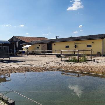
Aufzuchtplatz für Hengstjährling
Üxheim
Kristina Backs
@PferdeoaseBacks
Vermieten
Krankenbox
Paddock
Fohlenaufzucht möglich
Hengsthaltung möglich
Laufstall
8 weitere...
B
Leider kein Vorschaubild
Leider kein Vorschaubild
Rentnerplatz für Ponywallach mit Familienans.160...
hellenthal
Leonards
@Leonards
Pflegepferd
Wanderreiten
Paddock
Pensions- und Gastboxen
Allergikerstall
Gnadenbrothof
Außenboxen
Paddock Trail
11 weitere...
B
Deprecated: Creation of dynamic property Zend_View_Helper_Ads::$adLink is deprecated in /var/www/stall-frei/htdocs/staging.stall-frei.de/library/Psf/View/Helper/Ads.php on line 108

Futtersack HeuToy, Fressbremse in pink
Mechtersen
STALL-FREIde Marketing
@STALL-FREI-Marketing
Stundenlange Beschäftigung die
Koliken vorbeugt, geringe Staubinhalation mit
steuerbarer Futterentnahme
Leider kein Vorschaubild
Leider kein Vorschaubild
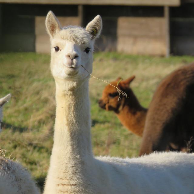
Offenstallplatz für soz. Wallach
Zülpich
Anke Lenz
@Tannenhof
Freizeitstall
Reitlehrer und -unterricht
Vermieten
Hunde willkommen
Krankenbox
Hufrehe geeignet
Notfallboxen
14 weitere...
B
Ein Stallplatz zu vermieten für Stuten
Weilerswist
Petra Kurth
@Kurth
Freizeitstall
Vermieten
Hunde willkommen
Krankenbox
Gnadenbrothof
Notfallboxen
13 weitere...
P

Reitschule Burg Sievernich
Vettweiß
Reitschule-Burg-Sievernich
@Reitschule-Burg-Sievernich
FN-Mitglied
Freizeitstall
Vermieten
Führanlage
Longierzirkel/Roundpen
bedampftes/gewaschenes Heu
Hengsthaltung möglich
23 weitere...
P
Job gesucht?
Mechtersen
STALL-FREIde Marketing
@STALL-FREI-Marketing
Sie suchen einen Job und arbeiten gerne mit Pferden oder auf Reitanlagen?
Besuchen Sie jetzt unseren Stellenmarkt!
Leider kein Vorschaubild
Leider kein Vorschaubild
Pferdeglück mit familiärer Stallgemeinschaft
Euskirchen
Halfter
@RSZEuskirchen
FN-Mitglied
Freizeitstall
Vermieten
Führanlage
Hunde willkommen
Fohlenaufzucht möglich
Hufrehe geeignet
21 weitere...
B
Gestüt Quarter-B51 / Offenstallreitanlage
Dahlem
Christina-Schneider
@Christina-Schneider
Freizeitstall
Pferdeausbildung
Vermieten
Krankenbox
Longierzirkel/Roundpen
Gnadenbrothof
Zuchtstutenhaltung möglich
18 weitere...
P


Stall-WG hat freie Stallplätze
Bornheim
Veronica Maacks-Cammarata
@StallWG
Freizeitstall
Hunde willkommen
Krankenbox
Innenbox
Offenstall
Halbpension
Selbstversorgung
7 weitere...
P+


Paddock-/ Innen-/ Außenboxen /Stallgasse zu verm...
Bliesheim
Peter Rösgen
@peterroesgen
Fahrstall, Kutschwagen
Freizeitstall
Vermieten
Hunde willkommen
Krankenbox
Allergikerstall
Fohlenaufzucht möglich
26 weitere...
P+

Gut Bentgerhof
Grafschaft
Oliver Heinen
@Oliver-Heinen1
Freizeitstall
Krankenbox
Longierzirkel/Roundpen
Allergikerstall
Hufrehe geeignet
Bewegungsstall
Offenstall
14 weitere...
P+
Newsletter abonnieren
Melde Dich für unseren Newsletter an und verpasse keine Neuigkeiten!
Deprecated: Creation of dynamic property Zend_View::$pageCount is deprecated in /var/www/stall-frei/htdocs/staging.stall-frei.de/library/vendor/shardj/zf1-future/library/Zend/View/Abstract.php on line 308
Deprecated: Creation of dynamic property Zend_View::$itemCountPerPage is deprecated in /var/www/stall-frei/htdocs/staging.stall-frei.de/library/vendor/shardj/zf1-future/library/Zend/View/Abstract.php on line 308
Deprecated: Creation of dynamic property Zend_View::$first is deprecated in /var/www/stall-frei/htdocs/staging.stall-frei.de/library/vendor/shardj/zf1-future/library/Zend/View/Abstract.php on line 308
Deprecated: Creation of dynamic property Zend_View::$current is deprecated in /var/www/stall-frei/htdocs/staging.stall-frei.de/library/vendor/shardj/zf1-future/library/Zend/View/Abstract.php on line 308
Deprecated: Creation of dynamic property Zend_View::$last is deprecated in /var/www/stall-frei/htdocs/staging.stall-frei.de/library/vendor/shardj/zf1-future/library/Zend/View/Abstract.php on line 308
Deprecated: Creation of dynamic property Zend_View::$previous is deprecated in /var/www/stall-frei/htdocs/staging.stall-frei.de/library/vendor/shardj/zf1-future/library/Zend/View/Abstract.php on line 308
Deprecated: Creation of dynamic property Zend_View::$next is deprecated in /var/www/stall-frei/htdocs/staging.stall-frei.de/library/vendor/shardj/zf1-future/library/Zend/View/Abstract.php on line 308
Deprecated: Creation of dynamic property Zend_View::$pagesInRange is deprecated in /var/www/stall-frei/htdocs/staging.stall-frei.de/library/vendor/shardj/zf1-future/library/Zend/View/Abstract.php on line 308
Deprecated: Creation of dynamic property Zend_View::$firstPageInRange is deprecated in /var/www/stall-frei/htdocs/staging.stall-frei.de/library/vendor/shardj/zf1-future/library/Zend/View/Abstract.php on line 308
Deprecated: Creation of dynamic property Zend_View::$lastPageInRange is deprecated in /var/www/stall-frei/htdocs/staging.stall-frei.de/library/vendor/shardj/zf1-future/library/Zend/View/Abstract.php on line 308
Deprecated: Creation of dynamic property Zend_View::$currentItemCount is deprecated in /var/www/stall-frei/htdocs/staging.stall-frei.de/library/vendor/shardj/zf1-future/library/Zend/View/Abstract.php on line 308
Deprecated: Creation of dynamic property Zend_View::$totalItemCount is deprecated in /var/www/stall-frei/htdocs/staging.stall-frei.de/library/vendor/shardj/zf1-future/library/Zend/View/Abstract.php on line 308
Deprecated: Creation of dynamic property Zend_View::$firstItemNumber is deprecated in /var/www/stall-frei/htdocs/staging.stall-frei.de/library/vendor/shardj/zf1-future/library/Zend/View/Abstract.php on line 308
Deprecated: Creation of dynamic property Zend_View::$lastItemNumber is deprecated in /var/www/stall-frei/htdocs/staging.stall-frei.de/library/vendor/shardj/zf1-future/library/Zend/View/Abstract.php on line 308
Deprecated: Creation of dynamic property Zend_View::$router is deprecated in /var/www/stall-frei/htdocs/staging.stall-frei.de/library/vendor/shardj/zf1-future/library/Zend/View/Abstract.php on line 308
Deprecated: Creation of dynamic property Zend_View::$urlParams is deprecated in /var/www/stall-frei/htdocs/staging.stall-frei.de/library/vendor/shardj/zf1-future/library/Zend/View/Abstract.php on line 308
Deprecated: Creation of dynamic property Zend_View::$showAds is deprecated in /var/www/stall-frei/htdocs/staging.stall-frei.de/library/vendor/shardj/zf1-future/library/Zend/View/Abstract.php on line 308
Deprecated: Creation of dynamic property Zend_View::$objectIds is deprecated in /var/www/stall-frei/htdocs/staging.stall-frei.de/library/vendor/shardj/zf1-future/library/Zend/View/Abstract.php on line 308
Deprecated: Creation of dynamic property Zend_View::$showNavbar is deprecated in /var/www/stall-frei/htdocs/staging.stall-frei.de/library/vendor/shardj/zf1-future/library/Zend/View/Abstract.php on line 308
Deprecated: Creation of dynamic property Zend_View::$showBreadcrumb is deprecated in /var/www/stall-frei/htdocs/staging.stall-frei.de/library/vendor/shardj/zf1-future/library/Zend/View/Abstract.php on line 308
Deprecated: Creation of dynamic property Zend_View::$showFooter is deprecated in /var/www/stall-frei/htdocs/staging.stall-frei.de/library/vendor/shardj/zf1-future/library/Zend/View/Abstract.php on line 308
Deprecated: Creation of dynamic property Zend_View::$showInternalAds is deprecated in /var/www/stall-frei/htdocs/staging.stall-frei.de/library/vendor/shardj/zf1-future/library/Zend/View/Abstract.php on line 308
Deprecated: Creation of dynamic property Zend_View::$blNoContent is deprecated in /var/www/stall-frei/htdocs/staging.stall-frei.de/library/vendor/shardj/zf1-future/library/Zend/View/Abstract.php on line 308
Deprecated: Creation of dynamic property Zend_View::$sMetaDesc is deprecated in /var/www/stall-frei/htdocs/staging.stall-frei.de/library/vendor/shardj/zf1-future/library/Zend/View/Abstract.php on line 308
Deprecated: Creation of dynamic property Zend_View::$useGmaps is deprecated in /var/www/stall-frei/htdocs/staging.stall-frei.de/library/vendor/shardj/zf1-future/library/Zend/View/Abstract.php on line 308
Deprecated: Creation of dynamic property Zend_View::$touches is deprecated in /var/www/stall-frei/htdocs/staging.stall-frei.de/library/vendor/shardj/zf1-future/library/Zend/View/Abstract.php on line 308
Deprecated: Creation of dynamic property Zend_View::$oProject is deprecated in /var/www/stall-frei/htdocs/staging.stall-frei.de/library/vendor/shardj/zf1-future/library/Zend/View/Abstract.php on line 308
Deprecated: Creation of dynamic property Zend_View::$pageHeadline is deprecated in /var/www/stall-frei/htdocs/staging.stall-frei.de/library/vendor/shardj/zf1-future/library/Zend/View/Abstract.php on line 308
Deprecated: Creation of dynamic property Zend_View::$disableLocationField is deprecated in /var/www/stall-frei/htdocs/staging.stall-frei.de/library/vendor/shardj/zf1-future/library/Zend/View/Abstract.php on line 308
Deprecated: Creation of dynamic property Zend_View::$isSearch is deprecated in /var/www/stall-frei/htdocs/staging.stall-frei.de/library/vendor/shardj/zf1-future/library/Zend/View/Abstract.php on line 308
Deprecated: Creation of dynamic property Zend_View::$pageTitle is deprecated in /var/www/stall-frei/htdocs/staging.stall-frei.de/library/vendor/shardj/zf1-future/library/Zend/View/Abstract.php on line 308
Deprecated: Creation of dynamic property Psf_Form_Element_Text::$class is deprecated in /var/www/stall-frei/htdocs/staging.stall-frei.de/library/vendor/shardj/zf1-future/library/Zend/Form/Element.php on line 874
Deprecated: Creation of dynamic property Psf_Form_Element_Text::$size is deprecated in /var/www/stall-frei/htdocs/staging.stall-frei.de/library/vendor/shardj/zf1-future/library/Zend/Form/Element.php on line 874
Deprecated: Creation of dynamic property Psf_Form_Element_Text::$placeholder is deprecated in /var/www/stall-frei/htdocs/staging.stall-frei.de/library/vendor/shardj/zf1-future/library/Zend/Form/Element.php on line 874
Deprecated: Creation of dynamic property Psf_Form_Element_Hidden::$class is deprecated in /var/www/stall-frei/htdocs/staging.stall-frei.de/library/vendor/shardj/zf1-future/library/Zend/Form/Element.php on line 874
Deprecated: Creation of dynamic property Psf_Form_Element_Hidden::$class is deprecated in /var/www/stall-frei/htdocs/staging.stall-frei.de/library/vendor/shardj/zf1-future/library/Zend/Form/Element.php on line 874
Deprecated: Creation of dynamic property Psf_Form_Element_Hidden::$class is deprecated in /var/www/stall-frei/htdocs/staging.stall-frei.de/library/vendor/shardj/zf1-future/library/Zend/Form/Element.php on line 874
Deprecated: Creation of dynamic property Psf_Form_Element_Hidden::$class is deprecated in /var/www/stall-frei/htdocs/staging.stall-frei.de/library/vendor/shardj/zf1-future/library/Zend/Form/Element.php on line 874
Deprecated: Creation of dynamic property Psf_Form_Element_Select::$class is deprecated in /var/www/stall-frei/htdocs/staging.stall-frei.de/library/vendor/shardj/zf1-future/library/Zend/Form/Element.php on line 874
Deprecated: Creation of dynamic property Psf_Form_Element_Select::$class is deprecated in /var/www/stall-frei/htdocs/staging.stall-frei.de/library/vendor/shardj/zf1-future/library/Zend/Form/Element.php on line 874
Deprecated: Creation of dynamic property Psf_Form_Element_Select::$class is deprecated in /var/www/stall-frei/htdocs/staging.stall-frei.de/library/vendor/shardj/zf1-future/library/Zend/Form/Element.php on line 874
Deprecated: Creation of dynamic property Psf_Form_Element_Select::$class is deprecated in /var/www/stall-frei/htdocs/staging.stall-frei.de/library/vendor/shardj/zf1-future/library/Zend/Form/Element.php on line 874
Deprecated: Creation of dynamic property Psf_Form_Element_Text::$class is deprecated in /var/www/stall-frei/htdocs/staging.stall-frei.de/library/vendor/shardj/zf1-future/library/Zend/Form/Element.php on line 874
Deprecated: Creation of dynamic property Psf_Form_Element_Checkbox::$label is deprecated in /var/www/stall-frei/htdocs/staging.stall-frei.de/library/vendor/shardj/zf1-future/library/Zend/Form/Element.php on line 874
Deprecated: Creation of dynamic property Zend_View::$sort is deprecated in /var/www/stall-frei/htdocs/staging.stall-frei.de/library/vendor/shardj/zf1-future/library/Zend/View/Abstract.php on line 308
Deprecated: Creation of dynamic property Zend_View::$searchLocation is deprecated in /var/www/stall-frei/htdocs/staging.stall-frei.de/library/vendor/shardj/zf1-future/library/Zend/View/Abstract.php on line 308
Deprecated: Creation of dynamic property Zend_View::$locationHint is deprecated in /var/www/stall-frei/htdocs/staging.stall-frei.de/library/vendor/shardj/zf1-future/library/Zend/View/Abstract.php on line 308
Psf_GeoCoder_Abstract::getLocation: Weißenstein Get Location CachedOrLive
Psf_GeoCoder_Abstract::getCachedOrLive: Weißenstein
Psf_GeoCoder_Abstract::convertLocationResult
{"documentation":"https:\/\/opencagedata.com\/api","licenses":[{"name":"see attribution guide","url":"https:\/\/opencagedata.com\/credits"}],"results":[{"bounds":{"northeast":{"lat":50.5363826,"lng":6.768314},"southwest":{"lat":50.4963826,"lng":6.728314}},"components":{"ISO_3166-1_alpha-2":"DE","ISO_3166-1_alpha-3":"DEU","ISO_3166-2":["DE-NW"],"_category":"place","_normalized_city":"Bad M\u00fcnstereifel","_type":"hamlet","city_district":"Hohn","continent":"Europe","country":"Deutschland","country_code":"de","county":"Kreis Euskirchen","hamlet":"Wei\u00dfenstein","political_union":"European Union","state":"Nordrhein-Westfalen","state_code":"NW","town":"Bad M\u00fcnstereifel"},"confidence":7,"formatted":"Wei\u00dfenstein, Hohn, Bad M\u00fcnstereifel, Nordrhein-Westfalen, Deutschland","geometry":{"lat":50.5163826,"lng":6.748314}},{"bounds":{"northeast":{"lat":50.1300246,"lng":11.6904944},"southwest":{"lat":50.1299246,"lng":11.6903944}},"components":{"ISO_3166-1_alpha-2":"DE","ISO_3166-1_alpha-3":"DEU","ISO_3166-2":["DE-BY"],"_category":"natural\/water","_normalized_city":"Stammbach","_type":"peak","continent":"Europe","country":"Deutschland","country_code":"de","county":"Landkreis Hof","peak":"Wei\u00dfenstein","political_union":"European Union","postcode":"95236","state":"Bayern","state_code":"BY","village":"Stammbach"},"confidence":9,"formatted":"Wei\u00dfenstein, 95236 Stammbach, Deutschland","geometry":{"lat":50.1299746,"lng":11.6904444}},{"bounds":{"northeast":{"lat":50.2424133,"lng":8.3132994},"southwest":{"lat":50.2423133,"lng":8.3131994}},"components":{"ISO_3166-1_alpha-2":"DE","ISO_3166-1_alpha-3":"DEU","ISO_3166-2":["DE-HE"],"_category":"natural\/water","_normalized_city":"Esch","_type":"peak","continent":"Europe","country":"Deutschland","country_code":"de","county":"Rheingau-Taunus-Kreis","municipality":"Waldems","peak":"Wei\u00dfenstein","political_union":"European Union","postcode":"65529","state":"Hessen","state_code":"HE","village":"Esch"},"confidence":9,"formatted":"Wei\u00dfenstein, 65529 Esch, Deutschland","geometry":{"lat":50.2423633,"lng":8.3132494}},{"bounds":{"northeast":{"lat":49.1312566,"lng":12.6835355},"southwest":{"lat":49.1311566,"lng":12.6834355}},"components":{"ISO_3166-1_alpha-2":"DE","ISO_3166-1_alpha-3":"DEU","ISO_3166-2":["DE-BY"],"_category":"natural\/water","_normalized_city":"Traitsching","_type":"peak","continent":"Europe","country":"Deutschland","country_code":"de","county":"Landkreis Cham","peak":"Weissenstein","political_union":"European Union","postcode":"93499","state":"Bayern","state_code":"BY","village":"Traitsching"},"confidence":9,"formatted":"Weissenstein, 93499 Traitsching, Deutschland","geometry":{"lat":49.1312066,"lng":12.6834855}},{"bounds":{"northeast":{"lat":49.6057288,"lng":11.5455194},"southwest":{"lat":49.6056288,"lng":11.5454194}},"components":{"ISO_3166-1_alpha-2":"DE","ISO_3166-1_alpha-3":"DEU","ISO_3166-2":["DE-BY"],"_category":"natural\/water","_normalized_city":"Hartenstein","_type":"peak","continent":"Europe","country":"Deutschland","country_code":"de","county":"Landkreis N\u00fcrnberger Land","municipality":"Velden (VGem)","peak":"Wei\u00dfenstein","political_union":"European Union","postcode":"91284","state":"Bayern","state_code":"BY","village":"Hartenstein"},"confidence":9,"formatted":"Wei\u00dfenstein, 91284 Hartenstein, Deutschland","geometry":{"lat":49.6056788,"lng":11.5454694}},{"bounds":{"northeast":{"lat":49.5293061,"lng":11.6197518},"southwest":{"lat":49.5292061,"lng":11.6196518}},"components":{"ISO_3166-1_alpha-2":"DE","ISO_3166-1_alpha-3":"DEU","ISO_3166-2":["DE-BY"],"_category":"natural\/water","_normalized_city":"Neukirchen bei Sulzbach-Rosenberg","_type":"peak","continent":"Europe","country":"Deutschland","country_code":"de","county":"Landkreis Amberg-Sulzbach","municipality":"Neukirchen bei Sulzbach-Rosenberg (VGem)","peak":"Wei\u00dfenstein","political_union":"European Union","postcode":"92259","state":"Bayern","state_code":"BY","village":"Neukirchen bei Sulzbach-Rosenberg"},"confidence":9,"formatted":"Wei\u00dfenstein, 92259 Neukirchen bei Sulzbach-Rosenberg, Deutschland","geometry":{"lat":49.5292561,"lng":11.6197018}},{"bounds":{"northeast":{"lat":51.8920287,"lng":10.5369807},"southwest":{"lat":51.8919287,"lng":10.5368807}},"components":{"ISO_3166-1_alpha-2":"DE","ISO_3166-1_alpha-3":"DEU","ISO_3166-2":["DE-NI"],"_category":"natural\/water","_normalized_city":"Bad Harzburg","_type":"peak","city":"Bad Harzburg","continent":"Europe","country":"Deutschland","country_code":"de","county":"Landkreis Goslar","peak":"Wei\u00dfenstein","political_union":"European Union","postcode":"38667","state":"Niedersachsen","state_code":"NI"},"confidence":9,"formatted":"Wei\u00dfenstein, 38667 Bad Harzburg, Deutschland","geometry":{"lat":51.8919787,"lng":10.5369307}},{"bounds":{"northeast":{"lat":50.8053743,"lng":7.9180382},"southwest":{"lat":50.8052743,"lng":7.9179382}},"components":{"ISO_3166-1_alpha-2":"DE","ISO_3166-1_alpha-3":"DEU","ISO_3166-2":["DE-RP"],"_category":"natural\/water","_normalized_city":"Kirchen (Sieg)","_type":"peak","continent":"Europe","country":"Deutschland","country_code":"de","county":"Landkreis Altenkirchen (Westerwald)","municipality":"Kirchen (Sieg)","peak":"Wei\u00dfenstein","political_union":"European Union","postcode":"57548","state":"Rheinland-Pfalz","state_code":"RP","village":"Kirchen (Sieg)"},"confidence":9,"formatted":"Wei\u00dfenstein, 57548 Kirchen (Sieg), Deutschland","geometry":{"lat":50.8053243,"lng":7.9179882}},{"bounds":{"northeast":{"lat":50.7097489,"lng":8.3696221},"southwest":{"lat":50.7096489,"lng":8.3695221}},"components":{"ISO_3166-1_alpha-2":"DE","ISO_3166-1_alpha-3":"DEU","ISO_3166-2":["DE-HE"],"_category":"natural\/water","_normalized_city":"Mittenaar","_type":"peak","continent":"Europe","country":"Deutschland","country_code":"de","county":"Lahn-Dill-Kreis","municipality":"Mittenaar","peak":"Wei\u00dfenstein","political_union":"European Union","postcode":"35756","state":"Hessen","state_code":"HE"},"confidence":9,"formatted":"Wei\u00dfenstein, 35756 Mittenaar, Deutschland","geometry":{"lat":50.7096989,"lng":8.3695721}},{"bounds":{"northeast":{"lat":48.7538733,"lng":9.9438069},"southwest":{"lat":48.6975116,"lng":9.8754468}},"components":{"ISO_3166-1_alpha-2":"DE","ISO_3166-1_alpha-3":"DEU","ISO_3166-2":["DE-BW"],"_category":"place","_normalized_city":"Wei\u00dfenstein","_type":"village","continent":"Europe","country":"Deutschland","country_code":"de","county":"Landkreis G\u00f6ppingen","municipality":"Lauterstein","political_union":"European Union","state":"Baden-W\u00fcrttemberg","state_code":"BW","village":"Wei\u00dfenstein"},"confidence":7,"formatted":"Wei\u00dfenstein, Baden-W\u00fcrttemberg, Deutschland","geometry":{"lat":48.7049831,"lng":9.8864628}}],"status":{"code":200,"message":"OK"},"stay_informed":{"blog":"https:\/\/blog.opencagedata.com","mastodon":"https:\/\/en.osm.town\/@opencage"},"thanks":"For using an OpenCage API","timestamp":{"created_http":"Sun, 08 Feb 2026 19:35:17 GMT","created_unix":1770579317},"total_results":10}Array
(
[0] => stdClass Object
(
[bounds] => stdClass Object
(
[northeast] => stdClass Object
(
[lat] => 50.5363826
[lng] => 6.768314
)
[southwest] => stdClass Object
(
[lat] => 50.4963826
[lng] => 6.728314
)
)
[components] => stdClass Object
(
[ISO_3166-1_alpha-2] => DE
[ISO_3166-1_alpha-3] => DEU
[ISO_3166-2] => Array
(
[0] => DE-NW
)
[_category] => place
[_normalized_city] => Bad Münstereifel
[_type] => hamlet
[city_district] => Hohn
[continent] => Europe
[country] => Deutschland
[country_code] => de
[county] => Kreis Euskirchen
[hamlet] => Weißenstein
[political_union] => European Union
[state] => Nordrhein-Westfalen
[state_code] => NW
[town] => Bad Münstereifel
)
[confidence] => 7
[formatted] => Weißenstein, Hohn, Bad Münstereifel, Nordrhein-Westfalen, Deutschland
[geometry] => stdClass Object
(
[lat] => 50.5163826
[lng] => 6.748314
)
)
[1] => stdClass Object
(
[bounds] => stdClass Object
(
[northeast] => stdClass Object
(
[lat] => 50.1300246
[lng] => 11.6904944
)
[southwest] => stdClass Object
(
[lat] => 50.1299246
[lng] => 11.6903944
)
)
[components] => stdClass Object
(
[ISO_3166-1_alpha-2] => DE
[ISO_3166-1_alpha-3] => DEU
[ISO_3166-2] => Array
(
[0] => DE-BY
)
[_category] => natural/water
[_normalized_city] => Stammbach
[_type] => peak
[continent] => Europe
[country] => Deutschland
[country_code] => de
[county] => Landkreis Hof
[peak] => Weißenstein
[political_union] => European Union
[postcode] => 95236
[state] => Bayern
[state_code] => BY
[village] => Stammbach
)
[confidence] => 9
[formatted] => Weißenstein, 95236 Stammbach, Deutschland
[geometry] => stdClass Object
(
[lat] => 50.1299746
[lng] => 11.6904444
)
)
[2] => stdClass Object
(
[bounds] => stdClass Object
(
[northeast] => stdClass Object
(
[lat] => 50.2424133
[lng] => 8.3132994
)
[southwest] => stdClass Object
(
[lat] => 50.2423133
[lng] => 8.3131994
)
)
[components] => stdClass Object
(
[ISO_3166-1_alpha-2] => DE
[ISO_3166-1_alpha-3] => DEU
[ISO_3166-2] => Array
(
[0] => DE-HE
)
[_category] => natural/water
[_normalized_city] => Esch
[_type] => peak
[continent] => Europe
[country] => Deutschland
[country_code] => de
[county] => Rheingau-Taunus-Kreis
[municipality] => Waldems
[peak] => Weißenstein
[political_union] => European Union
[postcode] => 65529
[state] => Hessen
[state_code] => HE
[village] => Esch
)
[confidence] => 9
[formatted] => Weißenstein, 65529 Esch, Deutschland
[geometry] => stdClass Object
(
[lat] => 50.2423633
[lng] => 8.3132494
)
)
[3] => stdClass Object
(
[bounds] => stdClass Object
(
[northeast] => stdClass Object
(
[lat] => 49.1312566
[lng] => 12.6835355
)
[southwest] => stdClass Object
(
[lat] => 49.1311566
[lng] => 12.6834355
)
)
[components] => stdClass Object
(
[ISO_3166-1_alpha-2] => DE
[ISO_3166-1_alpha-3] => DEU
[ISO_3166-2] => Array
(
[0] => DE-BY
)
[_category] => natural/water
[_normalized_city] => Traitsching
[_type] => peak
[continent] => Europe
[country] => Deutschland
[country_code] => de
[county] => Landkreis Cham
[peak] => Weissenstein
[political_union] => European Union
[postcode] => 93499
[state] => Bayern
[state_code] => BY
[village] => Traitsching
)
[confidence] => 9
[formatted] => Weissenstein, 93499 Traitsching, Deutschland
[geometry] => stdClass Object
(
[lat] => 49.1312066
[lng] => 12.6834855
)
)
[4] => stdClass Object
(
[bounds] => stdClass Object
(
[northeast] => stdClass Object
(
[lat] => 49.6057288
[lng] => 11.5455194
)
[southwest] => stdClass Object
(
[lat] => 49.6056288
[lng] => 11.5454194
)
)
[components] => stdClass Object
(
[ISO_3166-1_alpha-2] => DE
[ISO_3166-1_alpha-3] => DEU
[ISO_3166-2] => Array
(
[0] => DE-BY
)
[_category] => natural/water
[_normalized_city] => Hartenstein
[_type] => peak
[continent] => Europe
[country] => Deutschland
[country_code] => de
[county] => Landkreis Nürnberger Land
[municipality] => Velden (VGem)
[peak] => Weißenstein
[political_union] => European Union
[postcode] => 91284
[state] => Bayern
[state_code] => BY
[village] => Hartenstein
)
[confidence] => 9
[formatted] => Weißenstein, 91284 Hartenstein, Deutschland
[geometry] => stdClass Object
(
[lat] => 49.6056788
[lng] => 11.5454694
)
)
[5] => stdClass Object
(
[bounds] => stdClass Object
(
[northeast] => stdClass Object
(
[lat] => 49.5293061
[lng] => 11.6197518
)
[southwest] => stdClass Object
(
[lat] => 49.5292061
[lng] => 11.6196518
)
)
[components] => stdClass Object
(
[ISO_3166-1_alpha-2] => DE
[ISO_3166-1_alpha-3] => DEU
[ISO_3166-2] => Array
(
[0] => DE-BY
)
[_category] => natural/water
[_normalized_city] => Neukirchen bei Sulzbach-Rosenberg
[_type] => peak
[continent] => Europe
[country] => Deutschland
[country_code] => de
[county] => Landkreis Amberg-Sulzbach
[municipality] => Neukirchen bei Sulzbach-Rosenberg (VGem)
[peak] => Weißenstein
[political_union] => European Union
[postcode] => 92259
[state] => Bayern
[state_code] => BY
[village] => Neukirchen bei Sulzbach-Rosenberg
)
[confidence] => 9
[formatted] => Weißenstein, 92259 Neukirchen bei Sulzbach-Rosenberg, Deutschland
[geometry] => stdClass Object
(
[lat] => 49.5292561
[lng] => 11.6197018
)
)
[6] => stdClass Object
(
[bounds] => stdClass Object
(
[northeast] => stdClass Object
(
[lat] => 51.8920287
[lng] => 10.5369807
)
[southwest] => stdClass Object
(
[lat] => 51.8919287
[lng] => 10.5368807
)
)
[components] => stdClass Object
(
[ISO_3166-1_alpha-2] => DE
[ISO_3166-1_alpha-3] => DEU
[ISO_3166-2] => Array
(
[0] => DE-NI
)
[_category] => natural/water
[_normalized_city] => Bad Harzburg
[_type] => peak
[city] => Bad Harzburg
[continent] => Europe
[country] => Deutschland
[country_code] => de
[county] => Landkreis Goslar
[peak] => Weißenstein
[political_union] => European Union
[postcode] => 38667
[state] => Niedersachsen
[state_code] => NI
)
[confidence] => 9
[formatted] => Weißenstein, 38667 Bad Harzburg, Deutschland
[geometry] => stdClass Object
(
[lat] => 51.8919787
[lng] => 10.5369307
)
)
[7] => stdClass Object
(
[bounds] => stdClass Object
(
[northeast] => stdClass Object
(
[lat] => 50.8053743
[lng] => 7.9180382
)
[southwest] => stdClass Object
(
[lat] => 50.8052743
[lng] => 7.9179382
)
)
[components] => stdClass Object
(
[ISO_3166-1_alpha-2] => DE
[ISO_3166-1_alpha-3] => DEU
[ISO_3166-2] => Array
(
[0] => DE-RP
)
[_category] => natural/water
[_normalized_city] => Kirchen (Sieg)
[_type] => peak
[continent] => Europe
[country] => Deutschland
[country_code] => de
[county] => Landkreis Altenkirchen (Westerwald)
[municipality] => Kirchen (Sieg)
[peak] => Weißenstein
[political_union] => European Union
[postcode] => 57548
[state] => Rheinland-Pfalz
[state_code] => RP
[village] => Kirchen (Sieg)
)
[confidence] => 9
[formatted] => Weißenstein, 57548 Kirchen (Sieg), Deutschland
[geometry] => stdClass Object
(
[lat] => 50.8053243
[lng] => 7.9179882
)
)
[8] => stdClass Object
(
[bounds] => stdClass Object
(
[northeast] => stdClass Object
(
[lat] => 50.7097489
[lng] => 8.3696221
)
[southwest] => stdClass Object
(
[lat] => 50.7096489
[lng] => 8.3695221
)
)
[components] => stdClass Object
(
[ISO_3166-1_alpha-2] => DE
[ISO_3166-1_alpha-3] => DEU
[ISO_3166-2] => Array
(
[0] => DE-HE
)
[_category] => natural/water
[_normalized_city] => Mittenaar
[_type] => peak
[continent] => Europe
[country] => Deutschland
[country_code] => de
[county] => Lahn-Dill-Kreis
[municipality] => Mittenaar
[peak] => Weißenstein
[political_union] => European Union
[postcode] => 35756
[state] => Hessen
[state_code] => HE
)
[confidence] => 9
[formatted] => Weißenstein, 35756 Mittenaar, Deutschland
[geometry] => stdClass Object
(
[lat] => 50.7096989
[lng] => 8.3695721
)
)
[9] => stdClass Object
(
[bounds] => stdClass Object
(
[northeast] => stdClass Object
(
[lat] => 48.7538733
[lng] => 9.9438069
)
[southwest] => stdClass Object
(
[lat] => 48.6975116
[lng] => 9.8754468
)
)
[components] => stdClass Object
(
[ISO_3166-1_alpha-2] => DE
[ISO_3166-1_alpha-3] => DEU
[ISO_3166-2] => Array
(
[0] => DE-BW
)
[_category] => place
[_normalized_city] => Weißenstein
[_type] => village
[continent] => Europe
[country] => Deutschland
[country_code] => de
[county] => Landkreis Göppingen
[municipality] => Lauterstein
[political_union] => European Union
[state] => Baden-Württemberg
[state_code] => BW
[village] => Weißenstein
)
[confidence] => 7
[formatted] => Weißenstein, Baden-Württemberg, Deutschland
[geometry] => stdClass Object
(
[lat] => 48.7049831
[lng] => 9.8864628
)
)
)
Psf_GeoCoder_OpenCageData::getKeyMap: 0
stdClass Object
(
    [bounds] => stdClass Object
        (
            [northeast] => stdClass Object
                (
                    [lat] => 50.5363826
                    [lng] => 6.768314
                )

            [southwest] => stdClass Object
                (
                    [lat] => 50.4963826
                    [lng] => 6.728314
                )

        )

    [components] => stdClass Object
        (
            [ISO_3166-1_alpha-2] => DE
            [ISO_3166-1_alpha-3] => DEU
            [ISO_3166-2] => Array
                (
                    [0] => DE-NW
                )

            [_category] => place
            [_normalized_city] => Bad Münstereifel
            [_type] => hamlet
            [city_district] => Hohn
            [continent] => Europe
            [country] => Deutschland
            [country_code] => de
            [county] => Kreis Euskirchen
            [hamlet] => Weißenstein
            [political_union] => European Union
            [state] => Nordrhein-Westfalen
            [state_code] => NW
            [town] => Bad Münstereifel
        )

    [confidence] => 7
    [formatted] => Weißenstein, Hohn, Bad Münstereifel, Nordrhein-Westfalen, Deutschland
    [geometry] => stdClass Object
        (
            [lat] => 50.5163826
            [lng] => 6.748314
        )

)
Psf_GeoCoder_OpenCageData::getCounty: Euskirchen
Psf_GeoCoder_OpenCageData::addMissingData REFETCH!
Array
(
    [address] => Weißenstein, Hohn, Bad Münstereifel, Nordrhein-Westfalen, Deutschland
    [type] => hamlet
    [street] => Weißenstein
    [city] => Bad Münstereifel
    [county] => Euskirchen
    [state] => Nordrhein-Westfalen
    [zip] =>
    [country] => Deutschland
    [suburb] =>
    [countrycode] => de
    [latitude] => 50.5163826
    [longitude] => 6.748314
    [accuracy] => 1
    [confidence] => 7
    [bounds] => stdClass Object
        (
            [northeast] => stdClass Object
                (
                    [lat] => 50.5363826
                    [lng] => 6.768314
                )

            [southwest] => stdClass Object
                (
                    [lat] => 50.4963826
                    [lng] => 6.728314
                )

        )

)
reformat!
Array
(
    [address] => Weißenstein, Hohn, Bad Münstereifel, Nordrhein-Westfalen, Deutschland
    [type] => hamlet
    [street] => Weißenstein
    [city] => Bad Münstereifel
    [county] => Euskirchen
    [state] => Nordrhein-Westfalen
    [zip] =>
    [country] => Deutschland
    [suburb] =>
    [countrycode] => de
    [latitude] => 50.5163826
    [longitude] => 6.748314
    [accuracy] => 1
    [confidence] => 7
    [bounds] => stdClass Object
        (
            [northeast] => stdClass Object
                (
                    [lat] => 50.5363826
                    [lng] => 6.768314
                )

            [southwest] => stdClass Object
                (
                    [lat] => 50.4963826
                    [lng] => 6.728314
                )

        )

    [place] => Weißenstein, Bad Münstereifel, Nordrhein-Westfalen
    [hash] => b8686557457dfcdf1bed11c2eac9c69c
)
Psf_GeoCoder_OpenCageData::getKeyMap: 1
stdClass Object
(
    [bounds] => stdClass Object
        (
            [northeast] => stdClass Object
                (
                    [lat] => 50.1300246
                    [lng] => 11.6904944
                )

            [southwest] => stdClass Object
                (
                    [lat] => 50.1299246
                    [lng] => 11.6903944
                )

        )

    [components] => stdClass Object
        (
            [ISO_3166-1_alpha-2] => DE
            [ISO_3166-1_alpha-3] => DEU
            [ISO_3166-2] => Array
                (
                    [0] => DE-BY
                )

            [_category] => natural/water
            [_normalized_city] => Stammbach
            [_type] => peak
            [continent] => Europe
            [country] => Deutschland
            [country_code] => de
            [county] => Landkreis Hof
            [peak] => Weißenstein
            [political_union] => European Union
            [postcode] => 95236
            [state] => Bayern
            [state_code] => BY
            [village] => Stammbach
        )

    [confidence] => 9
    [formatted] => Weißenstein, 95236 Stammbach, Deutschland
    [geometry] => stdClass Object
        (
            [lat] => 50.1299746
            [lng] => 11.6904444
        )

)
Psf_GeoCoder_OpenCageData::getCounty: Hof
Psf_GeoCoder_OpenCageData::addMissingData REFETCH!
Array
(
    [address] => Weißenstein, 95236 Stammbach, Deutschland
    [type] => peak
    [street] =>
    [city] => Stammbach
    [county] => Hof
    [state] => Bayern
    [zip] => 95236
    [country] => Deutschland
    [suburb] =>
    [countrycode] => de
    [latitude] => 50.1299746
    [longitude] => 11.6904444
    [accuracy] => 1
    [confidence] => 9
    [bounds] => stdClass Object
        (
            [northeast] => stdClass Object
                (
                    [lat] => 50.1300246
                    [lng] => 11.6904944
                )

            [southwest] => stdClass Object
                (
                    [lat] => 50.1299246
                    [lng] => 11.6903944
                )

        )

)
reformat!
Array
(
    [address] => Weißenstein, 95236 Stammbach, Deutschland
    [type] => peak
    [street] =>
    [city] => Stammbach
    [county] => Hof
    [state] => Bayern
    [zip] => 95236
    [country] => Deutschland
    [suburb] =>
    [countrycode] => de
    [latitude] => 50.1299746
    [longitude] => 11.6904444
    [accuracy] => 1
    [confidence] => 9
    [bounds] => stdClass Object
        (
            [northeast] => stdClass Object
                (
                    [lat] => 50.1300246
                    [lng] => 11.6904944
                )

            [southwest] => stdClass Object
                (
                    [lat] => 50.1299246
                    [lng] => 11.6903944
                )

        )

    [place] => 95236 Stammbach, Bayern
    [hash] => 68b1d9729094a470a98ae0734b8f85a0
)
Psf_GeoCoder_OpenCageData::getKeyMap: 2
stdClass Object
(
    [bounds] => stdClass Object
        (
            [northeast] => stdClass Object
                (
                    [lat] => 50.2424133
                    [lng] => 8.3132994
                )

            [southwest] => stdClass Object
                (
                    [lat] => 50.2423133
                    [lng] => 8.3131994
                )

        )

    [components] => stdClass Object
        (
            [ISO_3166-1_alpha-2] => DE
            [ISO_3166-1_alpha-3] => DEU
            [ISO_3166-2] => Array
                (
                    [0] => DE-HE
                )

            [_category] => natural/water
            [_normalized_city] => Esch
            [_type] => peak
            [continent] => Europe
            [country] => Deutschland
            [country_code] => de
            [county] => Rheingau-Taunus-Kreis
            [municipality] => Waldems
            [peak] => Weißenstein
            [political_union] => European Union
            [postcode] => 65529
            [state] => Hessen
            [state_code] => HE
            [village] => Esch
        )

    [confidence] => 9
    [formatted] => Weißenstein, 65529 Esch, Deutschland
    [geometry] => stdClass Object
        (
            [lat] => 50.2423633
            [lng] => 8.3132494
        )

)
Psf_GeoCoder_OpenCageData::getCounty: Rheingau-Taunus-Kreis
Psf_GeoCoder_OpenCageData::addMissingData REFETCH!
Array
(
    [address] => Weißenstein, 65529 Esch, Deutschland
    [type] => peak
    [street] =>
    [city] => Esch
    [county] => Rheingau-Taunus-Kreis
    [state] => Hessen
    [zip] => 65529
    [country] => Deutschland
    [suburb] =>
    [countrycode] => de
    [latitude] => 50.2423633
    [longitude] => 8.3132494
    [accuracy] => 1
    [confidence] => 9
    [bounds] => stdClass Object
        (
            [northeast] => stdClass Object
                (
                    [lat] => 50.2424133
                    [lng] => 8.3132994
                )

            [southwest] => stdClass Object
                (
                    [lat] => 50.2423133
                    [lng] => 8.3131994
                )

        )

)
reformat!
Array
(
    [address] => Weißenstein, 65529 Esch, Deutschland
    [type] => peak
    [street] =>
    [city] => Esch
    [county] => Rheingau-Taunus-Kreis
    [state] => Hessen
    [zip] => 65529
    [country] => Deutschland
    [suburb] =>
    [countrycode] => de
    [latitude] => 50.2423633
    [longitude] => 8.3132494
    [accuracy] => 1
    [confidence] => 9
    [bounds] => stdClass Object
        (
            [northeast] => stdClass Object
                (
                    [lat] => 50.2424133
                    [lng] => 8.3132994
                )

            [southwest] => stdClass Object
                (
                    [lat] => 50.2423133
                    [lng] => 8.3131994
                )

        )

    [place] => 65529 Esch, Hessen
    [hash] => 68b2b998b03c8ec756e18f60b4181ef8
)
Psf_GeoCoder_OpenCageData::getKeyMap: 3
stdClass Object
(
    [bounds] => stdClass Object
        (
            [northeast] => stdClass Object
                (
                    [lat] => 49.1312566
                    [lng] => 12.6835355
                )

            [southwest] => stdClass Object
                (
                    [lat] => 49.1311566
                    [lng] => 12.6834355
                )

        )

    [components] => stdClass Object
        (
            [ISO_3166-1_alpha-2] => DE
            [ISO_3166-1_alpha-3] => DEU
            [ISO_3166-2] => Array
                (
                    [0] => DE-BY
                )

            [_category] => natural/water
            [_normalized_city] => Traitsching
            [_type] => peak
            [continent] => Europe
            [country] => Deutschland
            [country_code] => de
            [county] => Landkreis Cham
            [peak] => Weissenstein
            [political_union] => European Union
            [postcode] => 93499
            [state] => Bayern
            [state_code] => BY
            [village] => Traitsching
        )

    [confidence] => 9
    [formatted] => Weissenstein, 93499 Traitsching, Deutschland
    [geometry] => stdClass Object
        (
            [lat] => 49.1312066
            [lng] => 12.6834855
        )

)
Psf_GeoCoder_OpenCageData::getCounty: Cham
Psf_GeoCoder_OpenCageData::addMissingData REFETCH!
Array
(
    [address] => Weissenstein, 93499 Traitsching, Deutschland
    [type] => peak
    [street] =>
    [city] => Traitsching
    [county] => Cham
    [state] => Bayern
    [zip] => 93499
    [country] => Deutschland
    [suburb] =>
    [countrycode] => de
    [latitude] => 49.1312066
    [longitude] => 12.6834855
    [accuracy] => 1
    [confidence] => 9
    [bounds] => stdClass Object
        (
            [northeast] => stdClass Object
                (
                    [lat] => 49.1312566
                    [lng] => 12.6835355
                )

            [southwest] => stdClass Object
                (
                    [lat] => 49.1311566
                    [lng] => 12.6834355
                )

        )

)
reformat!
Array
(
    [address] => Weissenstein, 93499 Traitsching, Deutschland
    [type] => peak
    [street] =>
    [city] => Traitsching
    [county] => Cham
    [state] => Bayern
    [zip] => 93499
    [country] => Deutschland
    [suburb] =>
    [countrycode] => de
    [latitude] => 49.1312066
    [longitude] => 12.6834855
    [accuracy] => 1
    [confidence] => 9
    [bounds] => stdClass Object
        (
            [northeast] => stdClass Object
                (
                    [lat] => 49.1312566
                    [lng] => 12.6835355
                )

            [southwest] => stdClass Object
                (
                    [lat] => 49.1311566
                    [lng] => 12.6834355
                )

        )

    [place] => 93499 Traitsching, Bayern
    [hash] => f5ee9d5908770a174df456e9fa48d1ea
)
Psf_GeoCoder_OpenCageData::getKeyMap: 4
stdClass Object
(
    [bounds] => stdClass Object
        (
            [northeast] => stdClass Object
                (
                    [lat] => 49.6057288
                    [lng] => 11.5455194
                )

            [southwest] => stdClass Object
                (
                    [lat] => 49.6056288
                    [lng] => 11.5454194
                )

        )

    [components] => stdClass Object
        (
            [ISO_3166-1_alpha-2] => DE
            [ISO_3166-1_alpha-3] => DEU
            [ISO_3166-2] => Array
                (
                    [0] => DE-BY
                )

            [_category] => natural/water
            [_normalized_city] => Hartenstein
            [_type] => peak
            [continent] => Europe
            [country] => Deutschland
            [country_code] => de
            [county] => Landkreis Nürnberger Land
            [municipality] => Velden (VGem)
            [peak] => Weißenstein
            [political_union] => European Union
            [postcode] => 91284
            [state] => Bayern
            [state_code] => BY
            [village] => Hartenstein
        )

    [confidence] => 9
    [formatted] => Weißenstein, 91284 Hartenstein, Deutschland
    [geometry] => stdClass Object
        (
            [lat] => 49.6056788
            [lng] => 11.5454694
        )

)
Psf_GeoCoder_OpenCageData::getCounty: Nürnberger Land
Psf_GeoCoder_OpenCageData::addMissingData REFETCH!
Array
(
    [address] => Weißenstein, 91284 Hartenstein, Deutschland
    [type] => peak
    [street] =>
    [city] => Hartenstein
    [county] => Nürnberger Land
    [state] => Bayern
    [zip] => 91284
    [country] => Deutschland
    [suburb] =>
    [countrycode] => de
    [latitude] => 49.6056788
    [longitude] => 11.5454694
    [accuracy] => 1
    [confidence] => 9
    [bounds] => stdClass Object
        (
            [northeast] => stdClass Object
                (
                    [lat] => 49.6057288
                    [lng] => 11.5455194
                )

            [southwest] => stdClass Object
                (
                    [lat] => 49.6056288
                    [lng] => 11.5454194
                )

        )

)
reformat!
Array
(
    [address] => Weißenstein, 91284 Hartenstein, Deutschland
    [type] => peak
    [street] =>
    [city] => Hartenstein
    [county] => Nürnberger Land
    [state] => Bayern
    [zip] => 91284
    [country] => Deutschland
    [suburb] =>
    [countrycode] => de
    [latitude] => 49.6056788
    [longitude] => 11.5454694
    [accuracy] => 1
    [confidence] => 9
    [bounds] => stdClass Object
        (
            [northeast] => stdClass Object
                (
                    [lat] => 49.6057288
                    [lng] => 11.5455194
                )

            [southwest] => stdClass Object
                (
                    [lat] => 49.6056288
                    [lng] => 11.5454194
                )

        )

    [place] => 91284 Hartenstein, Bayern
    [hash] => 1671689caa0cca2a6547b50eb1368921
)
Psf_GeoCoder_OpenCageData::getKeyMap: 5
stdClass Object
(
    [bounds] => stdClass Object
        (
            [northeast] => stdClass Object
                (
                    [lat] => 49.5293061
                    [lng] => 11.6197518
                )

            [southwest] => stdClass Object
                (
                    [lat] => 49.5292061
                    [lng] => 11.6196518
                )

        )

    [components] => stdClass Object
        (
            [ISO_3166-1_alpha-2] => DE
            [ISO_3166-1_alpha-3] => DEU
            [ISO_3166-2] => Array
                (
                    [0] => DE-BY
                )

            [_category] => natural/water
            [_normalized_city] => Neukirchen bei Sulzbach-Rosenberg
            [_type] => peak
            [continent] => Europe
            [country] => Deutschland
            [country_code] => de
            [county] => Landkreis Amberg-Sulzbach
            [municipality] => Neukirchen bei Sulzbach-Rosenberg (VGem)
            [peak] => Weißenstein
            [political_union] => European Union
            [postcode] => 92259
            [state] => Bayern
            [state_code] => BY
            [village] => Neukirchen bei Sulzbach-Rosenberg
        )

    [confidence] => 9
    [formatted] => Weißenstein, 92259 Neukirchen bei Sulzbach-Rosenberg, Deutschland
    [geometry] => stdClass Object
        (
            [lat] => 49.5292561
            [lng] => 11.6197018
        )

)
Psf_GeoCoder_OpenCageData::getCounty: Amberg-Sulzbach
Psf_GeoCoder_OpenCageData::addMissingData REFETCH!
Array
(
    [address] => Weißenstein, 92259 Neukirchen bei Sulzbach-Rosenberg, Deutschland
    [type] => peak
    [street] =>
    [city] => Neukirchen bei Sulzbach-Rosenberg
    [county] => Amberg-Sulzbach
    [state] => Bayern
    [zip] => 92259
    [country] => Deutschland
    [suburb] =>
    [countrycode] => de
    [latitude] => 49.5292561
    [longitude] => 11.6197018
    [accuracy] => 1
    [confidence] => 9
    [bounds] => stdClass Object
        (
            [northeast] => stdClass Object
                (
                    [lat] => 49.5293061
                    [lng] => 11.6197518
                )

            [southwest] => stdClass Object
                (
                    [lat] => 49.5292061
                    [lng] => 11.6196518
                )

        )

)
reformat!
Array
(
    [address] => Weißenstein, 92259 Neukirchen bei Sulzbach-Rosenberg, Deutschland
    [type] => peak
    [street] =>
    [city] => Neukirchen bei Sulzbach-Rosenberg
    [county] => Amberg-Sulzbach
    [state] => Bayern
    [zip] => 92259
    [country] => Deutschland
    [suburb] =>
    [countrycode] => de
    [latitude] => 49.5292561
    [longitude] => 11.6197018
    [accuracy] => 1
    [confidence] => 9
    [bounds] => stdClass Object
        (
            [northeast] => stdClass Object
                (
                    [lat] => 49.5293061
                    [lng] => 11.6197518
                )

            [southwest] => stdClass Object
                (
                    [lat] => 49.5292061
                    [lng] => 11.6196518
                )

        )

    [place] => 92259 Neukirchen bei Sulzbach-Rosenberg, Bayern
    [hash] => d6c7c90d43e5bc6454913b10a7766fe0
)
Psf_GeoCoder_OpenCageData::getKeyMap: 6
stdClass Object
(
    [bounds] => stdClass Object
        (
            [northeast] => stdClass Object
                (
                    [lat] => 51.8920287
                    [lng] => 10.5369807
                )

            [southwest] => stdClass Object
                (
                    [lat] => 51.8919287
                    [lng] => 10.5368807
                )

        )

    [components] => stdClass Object
        (
            [ISO_3166-1_alpha-2] => DE
            [ISO_3166-1_alpha-3] => DEU
            [ISO_3166-2] => Array
                (
                    [0] => DE-NI
                )

            [_category] => natural/water
            [_normalized_city] => Bad Harzburg
            [_type] => peak
            [city] => Bad Harzburg
            [continent] => Europe
            [country] => Deutschland
            [country_code] => de
            [county] => Landkreis Goslar
            [peak] => Weißenstein
            [political_union] => European Union
            [postcode] => 38667
            [state] => Niedersachsen
            [state_code] => NI
        )

    [confidence] => 9
    [formatted] => Weißenstein, 38667 Bad Harzburg, Deutschland
    [geometry] => stdClass Object
        (
            [lat] => 51.8919787
            [lng] => 10.5369307
        )

)
Psf_GeoCoder_OpenCageData::getCounty: Goslar
Psf_GeoCoder_OpenCageData::addMissingData REFETCH!
Array
(
    [address] => Weißenstein, 38667 Bad Harzburg, Deutschland
    [type] => peak
    [street] =>
    [city] => Bad Harzburg
    [county] => Goslar
    [state] => Niedersachsen
    [zip] => 38667
    [country] => Deutschland
    [suburb] =>
    [countrycode] => de
    [latitude] => 51.8919787
    [longitude] => 10.5369307
    [accuracy] => 1
    [confidence] => 9
    [bounds] => stdClass Object
        (
            [northeast] => stdClass Object
                (
                    [lat] => 51.8920287
                    [lng] => 10.5369807
                )

            [southwest] => stdClass Object
                (
                    [lat] => 51.8919287
                    [lng] => 10.5368807
                )

        )

)
reformat!
Array
(
    [address] => Weißenstein, 38667 Bad Harzburg, Deutschland
    [type] => peak
    [street] =>
    [city] => Bad Harzburg
    [county] => Goslar
    [state] => Niedersachsen
    [zip] => 38667
    [country] => Deutschland
    [suburb] =>
    [countrycode] => de
    [latitude] => 51.8919787
    [longitude] => 10.5369307
    [accuracy] => 1
    [confidence] => 9
    [bounds] => stdClass Object
        (
            [northeast] => stdClass Object
                (
                    [lat] => 51.8920287
                    [lng] => 10.5369807
                )

            [southwest] => stdClass Object
                (
                    [lat] => 51.8919287
                    [lng] => 10.5368807
                )

        )

    [place] => 38667 Bad Harzburg, Niedersachsen
    [hash] => 23b333d486046ddb0f64814fcc04f1c7
)
Psf_GeoCoder_OpenCageData::getKeyMap: 7
stdClass Object
(
    [bounds] => stdClass Object
        (
            [northeast] => stdClass Object
                (
                    [lat] => 50.8053743
                    [lng] => 7.9180382
                )

            [southwest] => stdClass Object
                (
                    [lat] => 50.8052743
                    [lng] => 7.9179382
                )

        )

    [components] => stdClass Object
        (
            [ISO_3166-1_alpha-2] => DE
            [ISO_3166-1_alpha-3] => DEU
            [ISO_3166-2] => Array
                (
                    [0] => DE-RP
                )

            [_category] => natural/water
            [_normalized_city] => Kirchen (Sieg)
            [_type] => peak
            [continent] => Europe
            [country] => Deutschland
            [country_code] => de
            [county] => Landkreis Altenkirchen (Westerwald)
            [municipality] => Kirchen (Sieg)
            [peak] => Weißenstein
            [political_union] => European Union
            [postcode] => 57548
            [state] => Rheinland-Pfalz
            [state_code] => RP
            [village] => Kirchen (Sieg)
        )

    [confidence] => 9
    [formatted] => Weißenstein, 57548 Kirchen (Sieg), Deutschland
    [geometry] => stdClass Object
        (
            [lat] => 50.8053243
            [lng] => 7.9179882
        )

)
Psf_GeoCoder_OpenCageData::getCounty: Altenkirchen (Westerwald)
Psf_GeoCoder_OpenCageData::addMissingData REFETCH!
Array
(
    [address] => Weißenstein, 57548 Kirchen (Sieg), Deutschland
    [type] => peak
    [street] =>
    [city] => Kirchen (Sieg)
    [county] => Altenkirchen (Westerwald)
    [state] => Rheinland-Pfalz
    [zip] => 57548
    [country] => Deutschland
    [suburb] =>
    [countrycode] => de
    [latitude] => 50.8053243
    [longitude] => 7.9179882
    [accuracy] => 1
    [confidence] => 9
    [bounds] => stdClass Object
        (
            [northeast] => stdClass Object
                (
                    [lat] => 50.8053743
                    [lng] => 7.9180382
                )

            [southwest] => stdClass Object
                (
                    [lat] => 50.8052743
                    [lng] => 7.9179382
                )

        )

)
reformat!
Array
(
    [address] => Weißenstein, 57548 Kirchen (Sieg), Deutschland
    [type] => peak
    [street] =>
    [city] => Kirchen (Sieg)
    [county] => Altenkirchen (Westerwald)
    [state] => Rheinland-Pfalz
    [zip] => 57548
    [country] => Deutschland
    [suburb] =>
    [countrycode] => de
    [latitude] => 50.8053243
    [longitude] => 7.9179882
    [accuracy] => 1
    [confidence] => 9
    [bounds] => stdClass Object
        (
            [northeast] => stdClass Object
                (
                    [lat] => 50.8053743
                    [lng] => 7.9180382
                )

            [southwest] => stdClass Object
                (
                    [lat] => 50.8052743
                    [lng] => 7.9179382
                )

        )

    [place] => 57548 Kirchen (Sieg), Rheinland-Pfalz
    [hash] => e78ef5284d9c487ed11b04d13d98a667
)
Psf_GeoCoder_OpenCageData::getKeyMap: 8
stdClass Object
(
    [bounds] => stdClass Object
        (
            [northeast] => stdClass Object
                (
                    [lat] => 50.7097489
                    [lng] => 8.3696221
                )

            [southwest] => stdClass Object
                (
                    [lat] => 50.7096489
                    [lng] => 8.3695221
                )

        )

    [components] => stdClass Object
        (
            [ISO_3166-1_alpha-2] => DE
            [ISO_3166-1_alpha-3] => DEU
            [ISO_3166-2] => Array
                (
                    [0] => DE-HE
                )

            [_category] => natural/water
            [_normalized_city] => Mittenaar
            [_type] => peak
            [continent] => Europe
            [country] => Deutschland
            [country_code] => de
            [county] => Lahn-Dill-Kreis
            [municipality] => Mittenaar
            [peak] => Weißenstein
            [political_union] => European Union
            [postcode] => 35756
            [state] => Hessen
            [state_code] => HE
        )

    [confidence] => 9
    [formatted] => Weißenstein, 35756 Mittenaar, Deutschland
    [geometry] => stdClass Object
        (
            [lat] => 50.7096989
            [lng] => 8.3695721
        )

)
Psf_GeoCoder_OpenCageData::getCounty: Lahn-Dill-Kreis
Psf_GeoCoder_OpenCageData::addMissingData REFETCH!
Array
(
    [address] => Weißenstein, 35756 Mittenaar, Deutschland
    [type] => peak
    [street] =>
    [city] =>
    [county] => Lahn-Dill-Kreis
    [state] => Hessen
    [zip] => 35756
    [country] => Deutschland
    [suburb] =>
    [countrycode] => de
    [latitude] => 50.7096989
    [longitude] => 8.3695721
    [accuracy] => 1
    [confidence] => 9
    [bounds] => stdClass Object
        (
            [northeast] => stdClass Object
                (
                    [lat] => 50.7097489
                    [lng] => 8.3696221
                )

            [southwest] => stdClass Object
                (
                    [lat] => 50.7096489
                    [lng] => 8.3695221
                )

        )

)
reformat!
Array
(
    [address] => Weißenstein, 35756 Mittenaar, Deutschland
    [type] => peak
    [street] =>
    [city] =>
    [county] => Lahn-Dill-Kreis
    [state] => Hessen
    [zip] => 35756
    [country] => Deutschland
    [suburb] =>
    [countrycode] => de
    [latitude] => 50.7096989
    [longitude] => 8.3695721
    [accuracy] => 1
    [confidence] => 9
    [bounds] => stdClass Object
        (
            [northeast] => stdClass Object
                (
                    [lat] => 50.7097489
                    [lng] => 8.3696221
                )

            [southwest] => stdClass Object
                (
                    [lat] => 50.7096489
                    [lng] => 8.3695221
                )

        )

    [place] => 35756 , Hessen
    [hash] => a44361dac09761b700f18d4dac0549e1
)
Psf_GeoCoder_OpenCageData::getKeyMap: 9
stdClass Object
(
    [bounds] => stdClass Object
        (
            [northeast] => stdClass Object
                (
                    [lat] => 48.7538733
                    [lng] => 9.9438069
                )

            [southwest] => stdClass Object
                (
                    [lat] => 48.6975116
                    [lng] => 9.8754468
                )

        )

    [components] => stdClass Object
        (
            [ISO_3166-1_alpha-2] => DE
            [ISO_3166-1_alpha-3] => DEU
            [ISO_3166-2] => Array
                (
                    [0] => DE-BW
                )

            [_category] => place
            [_normalized_city] => Weißenstein
            [_type] => village
            [continent] => Europe
            [country] => Deutschland
            [country_code] => de
            [county] => Landkreis Göppingen
            [municipality] => Lauterstein
            [political_union] => European Union
            [state] => Baden-Württemberg
            [state_code] => BW
            [village] => Weißenstein
        )

    [confidence] => 7
    [formatted] => Weißenstein, Baden-Württemberg, Deutschland
    [geometry] => stdClass Object
        (
            [lat] => 48.7049831
            [lng] => 9.8864628
        )

)
Psf_GeoCoder_OpenCageData::getCounty: Göppingen
Psf_GeoCoder_OpenCageData::addMissingData REFETCH!
Array
(
    [address] => Weißenstein, Baden-Württemberg, Deutschland
    [type] => village
    [street] =>
    [city] => Weißenstein
    [county] => Göppingen
    [state] => Baden-Württemberg
    [zip] =>
    [country] => Deutschland
    [suburb] =>
    [countrycode] => de
    [latitude] => 48.7049831
    [longitude] => 9.8864628
    [accuracy] => 1
    [confidence] => 7
    [bounds] => stdClass Object
        (
            [northeast] => stdClass Object
                (
                    [lat] => 48.7538733
                    [lng] => 9.9438069
                )

            [southwest] => stdClass Object
                (
                    [lat] => 48.6975116
                    [lng] => 9.8754468
                )

        )

)
reformat!
Array
(
    [address] => Weißenstein, Baden-Württemberg, Deutschland
    [type] => village
    [street] =>
    [city] => Weißenstein
    [county] => Göppingen
    [state] => Baden-Württemberg
    [zip] =>
    [country] => Deutschland
    [suburb] =>
    [countrycode] => de
    [latitude] => 48.7049831
    [longitude] => 9.8864628
    [accuracy] => 1
    [confidence] => 7
    [bounds] => stdClass Object
        (
            [northeast] => stdClass Object
                (
                    [lat] => 48.7538733
                    [lng] => 9.9438069
                )

            [southwest] => stdClass Object
                (
                    [lat] => 48.6975116
                    [lng] => 9.8754468
                )

        )

    [place] => Weißenstein, Baden-Württemberg
    [hash] => f92ef6d1c41a7ff814eb4d9dc6b8a9bb
)
Deprecated: Creation of dynamic property Zend_View::$locationHintStyle is deprecated in /var/www/stall-frei/htdocs/staging.stall-frei.de/library/vendor/shardj/zf1-future/library/Zend/View/Abstract.php on line 308
Deprecated: Creation of dynamic property Zend_View::$adGeoLocation is deprecated in /var/www/stall-frei/htdocs/staging.stall-frei.de/library/vendor/shardj/zf1-future/library/Zend/View/Abstract.php on line 308
Deprecated: Creation of dynamic property Zend_View::$recordCount is deprecated in /var/www/stall-frei/htdocs/staging.stall-frei.de/library/vendor/shardj/zf1-future/library/Zend/View/Abstract.php on line 308
Deprecated: Creation of dynamic property Zend_View::$paginationParams is deprecated in /var/www/stall-frei/htdocs/staging.stall-frei.de/library/vendor/shardj/zf1-future/library/Zend/View/Abstract.php on line 308
Deprecated: Creation of dynamic property Zend_View::$objectPaginator is deprecated in /var/www/stall-frei/htdocs/staging.stall-frei.de/library/vendor/shardj/zf1-future/library/Zend/View/Abstract.php on line 308
Deprecated: Creation of dynamic property Zend_View::$featuredObjects is deprecated in /var/www/stall-frei/htdocs/staging.stall-frei.de/library/vendor/shardj/zf1-future/library/Zend/View/Abstract.php on line 308
Deprecated: Creation of dynamic property Zend_View::$hints is deprecated in /var/www/stall-frei/htdocs/staging.stall-frei.de/library/vendor/shardj/zf1-future/library/Zend/View/Abstract.php on line 308
Deprecated: Creation of dynamic property Zend_View::$attributeHints is deprecated in /var/www/stall-frei/htdocs/staging.stall-frei.de/library/vendor/shardj/zf1-future/library/Zend/View/Abstract.php on line 308
Deprecated: Creation of dynamic property Zend_View::$oSearchForm is deprecated in /var/www/stall-frei/htdocs/staging.stall-frei.de/library/vendor/shardj/zf1-future/library/Zend/View/Abstract.php on line 308