Deprecated: Creation of dynamic property Zend_View::$sMode is deprecated in /var/www/stall-frei/htdocs/staging.stall-frei.de/library/vendor/shardj/zf1-future/library/Zend/View/Abstract.php on line 308
Stallplatz oder Offenstall in Brilon
Gesucht wird in "Poppenberg, 59929 Brilon, Deutschland"
6.330 Einträge
Deprecated: Creation of dynamic property Zend_View::$listObjects is deprecated in /var/www/stall-frei/htdocs/staging.stall-frei.de/library/vendor/shardj/zf1-future/library/Zend/View/Abstract.php on line 308
Gesponsort


Deprecated: Creation of dynamic property Zend_View::$listMode is deprecated in /var/www/stall-frei/htdocs/staging.stall-frei.de/library/vendor/shardj/zf1-future/library/Zend/View/Abstract.php on line 308
Deprecated: Creation of dynamic property Zend_View::$renderedObjects is deprecated in /var/www/stall-frei/htdocs/staging.stall-frei.de/library/vendor/shardj/zf1-future/library/Zend/View/Abstract.php on line 308
Deprecated: Creation of dynamic property Zend_View::$index is deprecated in /var/www/stall-frei/htdocs/staging.stall-frei.de/library/vendor/shardj/zf1-future/library/Zend/View/Abstract.php on line 308
Deprecated: Creation of dynamic property Zend_View::$displayMode is deprecated in /var/www/stall-frei/htdocs/staging.stall-frei.de/library/vendor/shardj/zf1-future/library/Zend/View/Abstract.php on line 308
Deprecated: Creation of dynamic property Zend_View::$remarketingIds is deprecated in /var/www/stall-frei/htdocs/staging.stall-frei.de/library/vendor/shardj/zf1-future/library/Zend/View/Abstract.php on line 308
Deprecated: Creation of dynamic property Zend_View::$listItem is deprecated in /var/www/stall-frei/htdocs/staging.stall-frei.de/library/vendor/shardj/zf1-future/library/Zend/View/Abstract.php on line 308
Deprecated: Creation of dynamic property Zend_View::$object is deprecated in /var/www/stall-frei/htdocs/staging.stall-frei.de/library/vendor/shardj/zf1-future/library/Zend/View/Abstract.php on line 308
Deprecated: Creation of dynamic property Zend_View::$attributes is deprecated in /var/www/stall-frei/htdocs/staging.stall-frei.de/library/vendor/shardj/zf1-future/library/Zend/View/Abstract.php on line 308
Leider kein Vorschaubild
Leider kein Vorschaubild
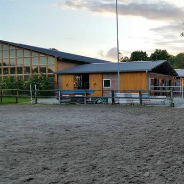
Offenstall„Hufhotel“Ponys u leichtfuttrige Pferd...
Möhnesee
Benutzer154
@Hufhotel
Freizeitstall
Vermieten
Hunde willkommen
Krankenbox
Hufrehe geeignet
Notfallboxen
10 weitere...
B
Deprecated: Creation of dynamic property Zend_View_Helper_Ads::$adLink is deprecated in /var/www/stall-frei/htdocs/staging.stall-frei.de/library/Psf/View/Helper/Ads.php on line 108

Das Beste für die Hufe
Mechtersen
STALL-FREIde Marketing
@STALL-FREI-Marketing
Hufschmiede und Hufpfleger in Ihrer Nähe

Dressurstall, Jungpferde und Rentnerbetreuung
Ense
Emily Küppers
@emilykueppers
Pferdeausbildung
Führanlage
Paddock
bedampftes/gewaschenes Heu
Hengsthaltung möglich
Außenboxen
Innenbox
15 weitere...
P+
Pferdepension zur Kummerwie
Bad Sassendorf
Zur-Kummerwie
@Zur-Kummerwie
Vermieten
Hunde willkommen
Paddock
Außenbox mit Paddock
Innenbox
Vollpension
11 weitere...
P
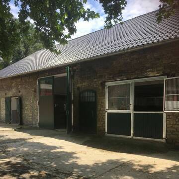
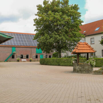
Reitsportanlage Neimen / Gut Dahlmann
Fröndenberg
Juliane-Dahlmann-Weber
@Juliane-Dahlmann-Weber
FN-Mitglied
Pferdeausbildung
Führanlage
Hunde willkommen
Außenboxen
Innenbox
Halbpension
Vollpension
19 weitere...
S
Leider kein Vorschaubild
Leider kein Vorschaubild
Boxen frei! Instagram: rv_salzkotten
Salzkotten
Zünkler
@Zuenkler
FN-Mitglied
Pferdeausbildung
Vermieten
Führanlage
Hunde willkommen
Außenboxen
Innenbox
16 weitere...
B
Leider kein Vorschaubild
Leider kein Vorschaubild
artgerechte Haltung, Reithalle 20x45, Aktivställe
Nordborchen
Reiterhof-Menke_K.Menke_H.Pack
@Reiterhof-Menke_K.Menke-H.Pack
Vermieten
Hunde willkommen
Krankenbox
bedampftes/gewaschenes Heu
Notfallboxen
Außenbox mit Paddock
Bewegungsstall
17 weitere...
B

Frisches Stroh zu verkaufen!
Mechtersen
STALL-FREIde Marketing
@STALL-FREI-Marketing
Kaufe frisches Stroh für dein Pferd!
Reitstall Bockholt
Soest
Reitanlage-Bockholt
@Reitanlage-Bockholt
FN-Mitglied
Freizeitstall
Führanlage
Longierzirkel/Roundpen
Pferdezucht
zuckerreduziertes Heu
Außenbox mit Paddock
Außenboxen
20 weitere...
P
Leider kein Vorschaubild
Leider kein Vorschaubild
Altrogge's Land- & Pferdewelt Offenstal...
Paderborn
Altrogge's Land- & Pferdewelt
@AltroggesLandPferdewelt
Freizeitstall
Vermieten
Hunde willkommen
Krankenbox
Allergikerstall
bedampftes/gewaschenes Heu
16 weitere...
B
Leider kein Vorschaubild
Leider kein Vorschaubild
Boxen mit ganzjährigem, täglichem Weidegang
Volkmarsen
Stall Becker
@Christina144
Vermieten
Hunde willkommen
Sattelkammer/Sattelschränke
Innenbox
Vollpension
4 weitere...
B
Hof Scheffer
Welver
Rita Scheffer
@Pensionstall-Scheffer
Freizeitstall
Vermieten
Hunde willkommen
Paddock
Pferdezucht
Zuchtstutenhaltung möglich
14 weitere...
P
Werde Teil von STALL-FREI.de
Du hast eine Pferdebox frei? Freie Plätze im Offenstall, Pferdestall oder der Reitanlage kostenlos anbieten.
Deprecated: Creation of dynamic property Zend_View::$pageCount is deprecated in /var/www/stall-frei/htdocs/staging.stall-frei.de/library/vendor/shardj/zf1-future/library/Zend/View/Abstract.php on line 308
Deprecated: Creation of dynamic property Zend_View::$itemCountPerPage is deprecated in /var/www/stall-frei/htdocs/staging.stall-frei.de/library/vendor/shardj/zf1-future/library/Zend/View/Abstract.php on line 308
Deprecated: Creation of dynamic property Zend_View::$first is deprecated in /var/www/stall-frei/htdocs/staging.stall-frei.de/library/vendor/shardj/zf1-future/library/Zend/View/Abstract.php on line 308
Deprecated: Creation of dynamic property Zend_View::$current is deprecated in /var/www/stall-frei/htdocs/staging.stall-frei.de/library/vendor/shardj/zf1-future/library/Zend/View/Abstract.php on line 308
Deprecated: Creation of dynamic property Zend_View::$last is deprecated in /var/www/stall-frei/htdocs/staging.stall-frei.de/library/vendor/shardj/zf1-future/library/Zend/View/Abstract.php on line 308
Deprecated: Creation of dynamic property Zend_View::$previous is deprecated in /var/www/stall-frei/htdocs/staging.stall-frei.de/library/vendor/shardj/zf1-future/library/Zend/View/Abstract.php on line 308
Deprecated: Creation of dynamic property Zend_View::$next is deprecated in /var/www/stall-frei/htdocs/staging.stall-frei.de/library/vendor/shardj/zf1-future/library/Zend/View/Abstract.php on line 308
Deprecated: Creation of dynamic property Zend_View::$pagesInRange is deprecated in /var/www/stall-frei/htdocs/staging.stall-frei.de/library/vendor/shardj/zf1-future/library/Zend/View/Abstract.php on line 308
Deprecated: Creation of dynamic property Zend_View::$firstPageInRange is deprecated in /var/www/stall-frei/htdocs/staging.stall-frei.de/library/vendor/shardj/zf1-future/library/Zend/View/Abstract.php on line 308
Deprecated: Creation of dynamic property Zend_View::$lastPageInRange is deprecated in /var/www/stall-frei/htdocs/staging.stall-frei.de/library/vendor/shardj/zf1-future/library/Zend/View/Abstract.php on line 308
Deprecated: Creation of dynamic property Zend_View::$currentItemCount is deprecated in /var/www/stall-frei/htdocs/staging.stall-frei.de/library/vendor/shardj/zf1-future/library/Zend/View/Abstract.php on line 308
Deprecated: Creation of dynamic property Zend_View::$totalItemCount is deprecated in /var/www/stall-frei/htdocs/staging.stall-frei.de/library/vendor/shardj/zf1-future/library/Zend/View/Abstract.php on line 308
Deprecated: Creation of dynamic property Zend_View::$firstItemNumber is deprecated in /var/www/stall-frei/htdocs/staging.stall-frei.de/library/vendor/shardj/zf1-future/library/Zend/View/Abstract.php on line 308
Deprecated: Creation of dynamic property Zend_View::$lastItemNumber is deprecated in /var/www/stall-frei/htdocs/staging.stall-frei.de/library/vendor/shardj/zf1-future/library/Zend/View/Abstract.php on line 308
Deprecated: Creation of dynamic property Zend_View::$router is deprecated in /var/www/stall-frei/htdocs/staging.stall-frei.de/library/vendor/shardj/zf1-future/library/Zend/View/Abstract.php on line 308
Deprecated: Creation of dynamic property Zend_View::$urlParams is deprecated in /var/www/stall-frei/htdocs/staging.stall-frei.de/library/vendor/shardj/zf1-future/library/Zend/View/Abstract.php on line 308
Deprecated: Creation of dynamic property Zend_View::$showAds is deprecated in /var/www/stall-frei/htdocs/staging.stall-frei.de/library/vendor/shardj/zf1-future/library/Zend/View/Abstract.php on line 308
Deprecated: Creation of dynamic property Zend_View::$objectIds is deprecated in /var/www/stall-frei/htdocs/staging.stall-frei.de/library/vendor/shardj/zf1-future/library/Zend/View/Abstract.php on line 308
Deprecated: Creation of dynamic property Zend_View::$showNavbar is deprecated in /var/www/stall-frei/htdocs/staging.stall-frei.de/library/vendor/shardj/zf1-future/library/Zend/View/Abstract.php on line 308
Deprecated: Creation of dynamic property Zend_View::$showBreadcrumb is deprecated in /var/www/stall-frei/htdocs/staging.stall-frei.de/library/vendor/shardj/zf1-future/library/Zend/View/Abstract.php on line 308
Deprecated: Creation of dynamic property Zend_View::$showFooter is deprecated in /var/www/stall-frei/htdocs/staging.stall-frei.de/library/vendor/shardj/zf1-future/library/Zend/View/Abstract.php on line 308
Deprecated: Creation of dynamic property Zend_View::$showInternalAds is deprecated in /var/www/stall-frei/htdocs/staging.stall-frei.de/library/vendor/shardj/zf1-future/library/Zend/View/Abstract.php on line 308
Deprecated: Creation of dynamic property Zend_View::$blNoContent is deprecated in /var/www/stall-frei/htdocs/staging.stall-frei.de/library/vendor/shardj/zf1-future/library/Zend/View/Abstract.php on line 308
Deprecated: Creation of dynamic property Zend_View::$sMetaDesc is deprecated in /var/www/stall-frei/htdocs/staging.stall-frei.de/library/vendor/shardj/zf1-future/library/Zend/View/Abstract.php on line 308
Deprecated: Creation of dynamic property Zend_View::$useGmaps is deprecated in /var/www/stall-frei/htdocs/staging.stall-frei.de/library/vendor/shardj/zf1-future/library/Zend/View/Abstract.php on line 308
Deprecated: Creation of dynamic property Zend_View::$touches is deprecated in /var/www/stall-frei/htdocs/staging.stall-frei.de/library/vendor/shardj/zf1-future/library/Zend/View/Abstract.php on line 308
Deprecated: Creation of dynamic property Zend_View::$oProject is deprecated in /var/www/stall-frei/htdocs/staging.stall-frei.de/library/vendor/shardj/zf1-future/library/Zend/View/Abstract.php on line 308
Deprecated: Creation of dynamic property Zend_View::$pageHeadline is deprecated in /var/www/stall-frei/htdocs/staging.stall-frei.de/library/vendor/shardj/zf1-future/library/Zend/View/Abstract.php on line 308
Deprecated: Creation of dynamic property Zend_View::$disableLocationField is deprecated in /var/www/stall-frei/htdocs/staging.stall-frei.de/library/vendor/shardj/zf1-future/library/Zend/View/Abstract.php on line 308
Deprecated: Creation of dynamic property Zend_View::$isSearch is deprecated in /var/www/stall-frei/htdocs/staging.stall-frei.de/library/vendor/shardj/zf1-future/library/Zend/View/Abstract.php on line 308
Deprecated: Creation of dynamic property Zend_View::$pageTitle is deprecated in /var/www/stall-frei/htdocs/staging.stall-frei.de/library/vendor/shardj/zf1-future/library/Zend/View/Abstract.php on line 308
Deprecated: Creation of dynamic property Psf_Form_Element_Text::$class is deprecated in /var/www/stall-frei/htdocs/staging.stall-frei.de/library/vendor/shardj/zf1-future/library/Zend/Form/Element.php on line 874
Deprecated: Creation of dynamic property Psf_Form_Element_Text::$size is deprecated in /var/www/stall-frei/htdocs/staging.stall-frei.de/library/vendor/shardj/zf1-future/library/Zend/Form/Element.php on line 874
Deprecated: Creation of dynamic property Psf_Form_Element_Text::$placeholder is deprecated in /var/www/stall-frei/htdocs/staging.stall-frei.de/library/vendor/shardj/zf1-future/library/Zend/Form/Element.php on line 874
Deprecated: Creation of dynamic property Psf_Form_Element_Hidden::$class is deprecated in /var/www/stall-frei/htdocs/staging.stall-frei.de/library/vendor/shardj/zf1-future/library/Zend/Form/Element.php on line 874
Deprecated: Creation of dynamic property Psf_Form_Element_Hidden::$class is deprecated in /var/www/stall-frei/htdocs/staging.stall-frei.de/library/vendor/shardj/zf1-future/library/Zend/Form/Element.php on line 874
Deprecated: Creation of dynamic property Psf_Form_Element_Hidden::$class is deprecated in /var/www/stall-frei/htdocs/staging.stall-frei.de/library/vendor/shardj/zf1-future/library/Zend/Form/Element.php on line 874
Deprecated: Creation of dynamic property Psf_Form_Element_Hidden::$class is deprecated in /var/www/stall-frei/htdocs/staging.stall-frei.de/library/vendor/shardj/zf1-future/library/Zend/Form/Element.php on line 874
Deprecated: Creation of dynamic property Psf_Form_Element_Select::$class is deprecated in /var/www/stall-frei/htdocs/staging.stall-frei.de/library/vendor/shardj/zf1-future/library/Zend/Form/Element.php on line 874
Deprecated: Creation of dynamic property Psf_Form_Element_Select::$class is deprecated in /var/www/stall-frei/htdocs/staging.stall-frei.de/library/vendor/shardj/zf1-future/library/Zend/Form/Element.php on line 874
Deprecated: Creation of dynamic property Psf_Form_Element_Select::$class is deprecated in /var/www/stall-frei/htdocs/staging.stall-frei.de/library/vendor/shardj/zf1-future/library/Zend/Form/Element.php on line 874
Deprecated: Creation of dynamic property Psf_Form_Element_Select::$class is deprecated in /var/www/stall-frei/htdocs/staging.stall-frei.de/library/vendor/shardj/zf1-future/library/Zend/Form/Element.php on line 874
Deprecated: Creation of dynamic property Psf_Form_Element_Text::$class is deprecated in /var/www/stall-frei/htdocs/staging.stall-frei.de/library/vendor/shardj/zf1-future/library/Zend/Form/Element.php on line 874
Deprecated: Creation of dynamic property Psf_Form_Element_Checkbox::$label is deprecated in /var/www/stall-frei/htdocs/staging.stall-frei.de/library/vendor/shardj/zf1-future/library/Zend/Form/Element.php on line 874
Deprecated: Creation of dynamic property Zend_View::$sort is deprecated in /var/www/stall-frei/htdocs/staging.stall-frei.de/library/vendor/shardj/zf1-future/library/Zend/View/Abstract.php on line 308
Deprecated: Creation of dynamic property Zend_View::$searchLocation is deprecated in /var/www/stall-frei/htdocs/staging.stall-frei.de/library/vendor/shardj/zf1-future/library/Zend/View/Abstract.php on line 308
Deprecated: Creation of dynamic property Zend_View::$locationHint is deprecated in /var/www/stall-frei/htdocs/staging.stall-frei.de/library/vendor/shardj/zf1-future/library/Zend/View/Abstract.php on line 308
Psf_GeoCoder_Abstract::getLocation: Poppenberg Get Location CachedOrLive
Psf_GeoCoder_Abstract::getCachedOrLive: Poppenberg
Psf_GeoCoder_Abstract::convertLocationResult
{"documentation":"https:\/\/opencagedata.com\/api","licenses":[{"name":"see attribution guide","url":"https:\/\/opencagedata.com\/credits"}],"results":[{"bounds":{"northeast":{"lat":51.3781759,"lng":8.5710159},"southwest":{"lat":51.3773007,"lng":8.5690643}},"components":{"ISO_3166-1_alpha-2":"DE","ISO_3166-1_alpha-3":"DEU","ISO_3166-2":["DE-NW"],"_category":"natural\/water","_normalized_city":"Brilon","_type":"nature_reserve","continent":"Europe","country":"Deutschland","country_code":"de","county":"Hochsauerlandkreis","nature_reserve":"Poppenberg","political_union":"European Union","postcode":"59929","state":"Nordrhein-Westfalen","state_code":"NW","suburb":"Brilon (Kernstadt)","town":"Brilon"},"confidence":9,"formatted":"Poppenberg, 59929 Brilon, Deutschland","geometry":{"lat":51.377629,"lng":8.5697821}},{"bounds":{"northeast":{"lat":51.5881611,"lng":10.8276611},"southwest":{"lat":51.5880611,"lng":10.8275611}},"components":{"ISO_3166-1_alpha-2":"DE","ISO_3166-1_alpha-3":"DEU","ISO_3166-2":["DE-TH"],"_category":"natural\/water","_normalized_city":"Harztor","_type":"peak","continent":"Europe","country":"Deutschland","country_code":"de","county":"Landkreis Nordhausen","municipality":"Harztor","peak":"Poppenberg","political_union":"European Union","postcode":"99762","state":"Th\u00fcringen","state_code":"TH"},"confidence":9,"formatted":"Poppenberg, 99762 Harztor, Deutschland","geometry":{"lat":51.5881111,"lng":10.8276111}},{"bounds":{"northeast":{"lat":51.1926433,"lng":8.5090359},"southwest":{"lat":51.1925433,"lng":8.5089359}},"components":{"ISO_3166-1_alpha-2":"DE","ISO_3166-1_alpha-3":"DEU","ISO_3166-2":["DE-NW"],"_category":"natural\/water","_normalized_city":"Winterberg","_type":"peak","continent":"Europe","country":"Deutschland","country_code":"de","county":"Hochsauerlandkreis","peak":"Poppenberg","political_union":"European Union","postcode":"59955","state":"Nordrhein-Westfalen","state_code":"NW","town":"Winterberg"},"confidence":9,"formatted":"Poppenberg, 59955 Winterberg, Deutschland","geometry":{"lat":51.1925933,"lng":8.5089859}},{"bounds":{"northeast":{"lat":48.8899323,"lng":11.7164012},"southwest":{"lat":48.8898323,"lng":11.7163012}},"components":{"ISO_3166-1_alpha-2":"DE","ISO_3166-1_alpha-3":"DEU","ISO_3166-2":["DE-BY"],"_category":"natural\/water","_normalized_city":"Altmannstein","_type":"peak","continent":"Europe","country":"Deutschland","country_code":"de","county":"Landkreis Eichst\u00e4tt","peak":"Poppenberg","political_union":"European Union","state":"Bayern","state_code":"BY","village":"Altmannstein"},"confidence":9,"formatted":"Poppenberg, Altmannstein, Bayern, Deutschland","geometry":{"lat":48.8898823,"lng":11.7163512}},{"bounds":{"northeast":{"lat":51.5309316,"lng":11.0918335},"southwest":{"lat":51.5308316,"lng":11.0917335}},"components":{"ISO_3166-1_alpha-2":"DE","ISO_3166-1_alpha-3":"DEU","ISO_3166-2":["DE-ST"],"_category":"natural\/water","_normalized_city":"S\u00fcdharz","_type":"peak","continent":"Europe","country":"Deutschland","country_code":"de","county":"Mansfeld-S\u00fcdharz","municipality":"S\u00fcdharz","peak":"Poppenberg","political_union":"European Union","state":"Sachsen-Anhalt","state_code":"ST"},"confidence":9,"formatted":"Poppenberg, S\u00fcdharz, Sachsen-Anhalt, Deutschland","geometry":{"lat":51.5308816,"lng":11.0917835}},{"bounds":{"northeast":{"lat":50.5602304,"lng":11.1736973},"southwest":{"lat":50.5601304,"lng":11.1735973}},"components":{"ISO_3166-1_alpha-2":"DE","ISO_3166-1_alpha-3":"DEU","ISO_3166-2":["DE-TH"],"_category":"natural\/water","_normalized_city":"Neuhaus am Rennweg","_type":"peak","continent":"Europe","country":"Deutschland","country_code":"de","county":"Landkreis Sonneberg","municipality":"Neuhaus am Rennweg","peak":"Poppenberg","political_union":"European Union","postcode":"98744","state":"Th\u00fcringen","state_code":"TH","town":"Neuhaus am Rennweg"},"confidence":9,"formatted":"Poppenberg, 98744 Neuhaus am Rennweg, Deutschland","geometry":{"lat":50.5601804,"lng":11.1736473}},{"bounds":{"northeast":{"lat":50.5974847,"lng":11.8666071},"southwest":{"lat":50.5973847,"lng":11.8665071}},"components":{"ISO_3166-1_alpha-2":"DE","ISO_3166-1_alpha-3":"DEU","ISO_3166-2":["DE-TH"],"_category":"natural\/water","_normalized_city":"L\u00f6hma","_type":"peak","continent":"Europe","country":"Deutschland","country_code":"de","county":"Saale-Orla-Kreis","municipality":"Seenplatte","peak":"Poppenberg","political_union":"European Union","postcode":"07907","state":"Th\u00fcringen","state_code":"TH","village":"L\u00f6hma"},"confidence":9,"formatted":"Poppenberg, 07907 L\u00f6hma, Deutschland","geometry":{"lat":50.5974347,"lng":11.8665571}},{"bounds":{"northeast":{"lat":51.3773245,"lng":8.567214},"southwest":{"lat":51.3772245,"lng":8.567114}},"components":{"ISO_3166-1_alpha-2":"DE","ISO_3166-1_alpha-3":"DEU","ISO_3166-2":["DE-NW"],"_category":"natural\/water","_normalized_city":"Brilon","_type":"peak","continent":"Europe","country":"Deutschland","country_code":"de","county":"Hochsauerlandkreis","peak":"Poppenberg","political_union":"European Union","postcode":"59929","state":"Nordrhein-Westfalen","state_code":"NW","town":"Brilon"},"confidence":9,"formatted":"Poppenberg, 59929 Brilon, Deutschland","geometry":{"lat":51.3772745,"lng":8.567164}},{"bounds":{"northeast":{"lat":48.7786534,"lng":13.1804333},"southwest":{"lat":48.7386534,"lng":13.1404333}},"components":{"ISO_3166-1_alpha-2":"DE","ISO_3166-1_alpha-3":"DEU","ISO_3166-2":["DE-BY"],"_category":"place","_normalized_city":"Sch\u00f6llnach","_type":"village","continent":"Europe","country":"Deutschland","country_code":"de","county":"Landkreis Deggendorf","municipality":"Sch\u00f6llnach (VGem)","political_union":"European Union","postcode":"94508","state":"Bayern","state_code":"BY","town":"Sch\u00f6llnach","village":"Poppenberg"},"confidence":7,"formatted":"94508 Poppenberg, Deutschland","geometry":{"lat":48.7586534,"lng":13.1604333}},{"bounds":{"northeast":{"lat":49.9564805,"lng":11.8431646},"southwest":{"lat":49.9164805,"lng":11.8031646}},"components":{"ISO_3166-1_alpha-2":"DE","ISO_3166-1_alpha-3":"DEU","ISO_3166-2":["DE-BY"],"_category":"place","_normalized_city":"Immenreuth","_type":"hamlet","continent":"Europe","country":"Deutschland","country_code":"de","county":"Landkreis Tirschenreuth","hamlet":"Poppenberg","political_union":"European Union","state":"Bayern","state_code":"BY","village":"Immenreuth"},"confidence":7,"formatted":"Poppenberg, Immenreuth, Bayern, Deutschland","geometry":{"lat":49.9364805,"lng":11.8231646}}],"status":{"code":200,"message":"OK"},"stay_informed":{"blog":"https:\/\/blog.opencagedata.com","mastodon":"https:\/\/en.osm.town\/@opencage"},"thanks":"For using an OpenCage API","timestamp":{"created_http":"Sun, 08 Feb 2026 06:11:43 GMT","created_unix":1770531103},"total_results":10}Array
(
[0] => stdClass Object
(
[bounds] => stdClass Object
(
[northeast] => stdClass Object
(
[lat] => 51.3781759
[lng] => 8.5710159
)
[southwest] => stdClass Object
(
[lat] => 51.3773007
[lng] => 8.5690643
)
)
[components] => stdClass Object
(
[ISO_3166-1_alpha-2] => DE
[ISO_3166-1_alpha-3] => DEU
[ISO_3166-2] => Array
(
[0] => DE-NW
)
[_category] => natural/water
[_normalized_city] => Brilon
[_type] => nature_reserve
[continent] => Europe
[country] => Deutschland
[country_code] => de
[county] => Hochsauerlandkreis
[nature_reserve] => Poppenberg
[political_union] => European Union
[postcode] => 59929
[state] => Nordrhein-Westfalen
[state_code] => NW
[suburb] => Brilon (Kernstadt)
[town] => Brilon
)
[confidence] => 9
[formatted] => Poppenberg, 59929 Brilon, Deutschland
[geometry] => stdClass Object
(
[lat] => 51.377629
[lng] => 8.5697821
)
)
[1] => stdClass Object
(
[bounds] => stdClass Object
(
[northeast] => stdClass Object
(
[lat] => 51.5881611
[lng] => 10.8276611
)
[southwest] => stdClass Object
(
[lat] => 51.5880611
[lng] => 10.8275611
)
)
[components] => stdClass Object
(
[ISO_3166-1_alpha-2] => DE
[ISO_3166-1_alpha-3] => DEU
[ISO_3166-2] => Array
(
[0] => DE-TH
)
[_category] => natural/water
[_normalized_city] => Harztor
[_type] => peak
[continent] => Europe
[country] => Deutschland
[country_code] => de
[county] => Landkreis Nordhausen
[municipality] => Harztor
[peak] => Poppenberg
[political_union] => European Union
[postcode] => 99762
[state] => Thüringen
[state_code] => TH
)
[confidence] => 9
[formatted] => Poppenberg, 99762 Harztor, Deutschland
[geometry] => stdClass Object
(
[lat] => 51.5881111
[lng] => 10.8276111
)
)
[2] => stdClass Object
(
[bounds] => stdClass Object
(
[northeast] => stdClass Object
(
[lat] => 51.1926433
[lng] => 8.5090359
)
[southwest] => stdClass Object
(
[lat] => 51.1925433
[lng] => 8.5089359
)
)
[components] => stdClass Object
(
[ISO_3166-1_alpha-2] => DE
[ISO_3166-1_alpha-3] => DEU
[ISO_3166-2] => Array
(
[0] => DE-NW
)
[_category] => natural/water
[_normalized_city] => Winterberg
[_type] => peak
[continent] => Europe
[country] => Deutschland
[country_code] => de
[county] => Hochsauerlandkreis
[peak] => Poppenberg
[political_union] => European Union
[postcode] => 59955
[state] => Nordrhein-Westfalen
[state_code] => NW
[town] => Winterberg
)
[confidence] => 9
[formatted] => Poppenberg, 59955 Winterberg, Deutschland
[geometry] => stdClass Object
(
[lat] => 51.1925933
[lng] => 8.5089859
)
)
[3] => stdClass Object
(
[bounds] => stdClass Object
(
[northeast] => stdClass Object
(
[lat] => 48.8899323
[lng] => 11.7164012
)
[southwest] => stdClass Object
(
[lat] => 48.8898323
[lng] => 11.7163012
)
)
[components] => stdClass Object
(
[ISO_3166-1_alpha-2] => DE
[ISO_3166-1_alpha-3] => DEU
[ISO_3166-2] => Array
(
[0] => DE-BY
)
[_category] => natural/water
[_normalized_city] => Altmannstein
[_type] => peak
[continent] => Europe
[country] => Deutschland
[country_code] => de
[county] => Landkreis Eichstätt
[peak] => Poppenberg
[political_union] => European Union
[state] => Bayern
[state_code] => BY
[village] => Altmannstein
)
[confidence] => 9
[formatted] => Poppenberg, Altmannstein, Bayern, Deutschland
[geometry] => stdClass Object
(
[lat] => 48.8898823
[lng] => 11.7163512
)
)
[4] => stdClass Object
(
[bounds] => stdClass Object
(
[northeast] => stdClass Object
(
[lat] => 51.5309316
[lng] => 11.0918335
)
[southwest] => stdClass Object
(
[lat] => 51.5308316
[lng] => 11.0917335
)
)
[components] => stdClass Object
(
[ISO_3166-1_alpha-2] => DE
[ISO_3166-1_alpha-3] => DEU
[ISO_3166-2] => Array
(
[0] => DE-ST
)
[_category] => natural/water
[_normalized_city] => Südharz
[_type] => peak
[continent] => Europe
[country] => Deutschland
[country_code] => de
[county] => Mansfeld-Südharz
[municipality] => Südharz
[peak] => Poppenberg
[political_union] => European Union
[state] => Sachsen-Anhalt
[state_code] => ST
)
[confidence] => 9
[formatted] => Poppenberg, Südharz, Sachsen-Anhalt, Deutschland
[geometry] => stdClass Object
(
[lat] => 51.5308816
[lng] => 11.0917835
)
)
[5] => stdClass Object
(
[bounds] => stdClass Object
(
[northeast] => stdClass Object
(
[lat] => 50.5602304
[lng] => 11.1736973
)
[southwest] => stdClass Object
(
[lat] => 50.5601304
[lng] => 11.1735973
)
)
[components] => stdClass Object
(
[ISO_3166-1_alpha-2] => DE
[ISO_3166-1_alpha-3] => DEU
[ISO_3166-2] => Array
(
[0] => DE-TH
)
[_category] => natural/water
[_normalized_city] => Neuhaus am Rennweg
[_type] => peak
[continent] => Europe
[country] => Deutschland
[country_code] => de
[county] => Landkreis Sonneberg
[municipality] => Neuhaus am Rennweg
[peak] => Poppenberg
[political_union] => European Union
[postcode] => 98744
[state] => Thüringen
[state_code] => TH
[town] => Neuhaus am Rennweg
)
[confidence] => 9
[formatted] => Poppenberg, 98744 Neuhaus am Rennweg, Deutschland
[geometry] => stdClass Object
(
[lat] => 50.5601804
[lng] => 11.1736473
)
)
[6] => stdClass Object
(
[bounds] => stdClass Object
(
[northeast] => stdClass Object
(
[lat] => 50.5974847
[lng] => 11.8666071
)
[southwest] => stdClass Object
(
[lat] => 50.5973847
[lng] => 11.8665071
)
)
[components] => stdClass Object
(
[ISO_3166-1_alpha-2] => DE
[ISO_3166-1_alpha-3] => DEU
[ISO_3166-2] => Array
(
[0] => DE-TH
)
[_category] => natural/water
[_normalized_city] => Löhma
[_type] => peak
[continent] => Europe
[country] => Deutschland
[country_code] => de
[county] => Saale-Orla-Kreis
[municipality] => Seenplatte
[peak] => Poppenberg
[political_union] => European Union
[postcode] => 07907
[state] => Thüringen
[state_code] => TH
[village] => Löhma
)
[confidence] => 9
[formatted] => Poppenberg, 07907 Löhma, Deutschland
[geometry] => stdClass Object
(
[lat] => 50.5974347
[lng] => 11.8665571
)
)
[7] => stdClass Object
(
[bounds] => stdClass Object
(
[northeast] => stdClass Object
(
[lat] => 51.3773245
[lng] => 8.567214
)
[southwest] => stdClass Object
(
[lat] => 51.3772245
[lng] => 8.567114
)
)
[components] => stdClass Object
(
[ISO_3166-1_alpha-2] => DE
[ISO_3166-1_alpha-3] => DEU
[ISO_3166-2] => Array
(
[0] => DE-NW
)
[_category] => natural/water
[_normalized_city] => Brilon
[_type] => peak
[continent] => Europe
[country] => Deutschland
[country_code] => de
[county] => Hochsauerlandkreis
[peak] => Poppenberg
[political_union] => European Union
[postcode] => 59929
[state] => Nordrhein-Westfalen
[state_code] => NW
[town] => Brilon
)
[confidence] => 9
[formatted] => Poppenberg, 59929 Brilon, Deutschland
[geometry] => stdClass Object
(
[lat] => 51.3772745
[lng] => 8.567164
)
)
[8] => stdClass Object
(
[bounds] => stdClass Object
(
[northeast] => stdClass Object
(
[lat] => 48.7786534
[lng] => 13.1804333
)
[southwest] => stdClass Object
(
[lat] => 48.7386534
[lng] => 13.1404333
)
)
[components] => stdClass Object
(
[ISO_3166-1_alpha-2] => DE
[ISO_3166-1_alpha-3] => DEU
[ISO_3166-2] => Array
(
[0] => DE-BY
)
[_category] => place
[_normalized_city] => Schöllnach
[_type] => village
[continent] => Europe
[country] => Deutschland
[country_code] => de
[county] => Landkreis Deggendorf
[municipality] => Schöllnach (VGem)
[political_union] => European Union
[postcode] => 94508
[state] => Bayern
[state_code] => BY
[town] => Schöllnach
[village] => Poppenberg
)
[confidence] => 7
[formatted] => 94508 Poppenberg, Deutschland
[geometry] => stdClass Object
(
[lat] => 48.7586534
[lng] => 13.1604333
)
)
[9] => stdClass Object
(
[bounds] => stdClass Object
(
[northeast] => stdClass Object
(
[lat] => 49.9564805
[lng] => 11.8431646
)
[southwest] => stdClass Object
(
[lat] => 49.9164805
[lng] => 11.8031646
)
)
[components] => stdClass Object
(
[ISO_3166-1_alpha-2] => DE
[ISO_3166-1_alpha-3] => DEU
[ISO_3166-2] => Array
(
[0] => DE-BY
)
[_category] => place
[_normalized_city] => Immenreuth
[_type] => hamlet
[continent] => Europe
[country] => Deutschland
[country_code] => de
[county] => Landkreis Tirschenreuth
[hamlet] => Poppenberg
[political_union] => European Union
[state] => Bayern
[state_code] => BY
[village] => Immenreuth
)
[confidence] => 7
[formatted] => Poppenberg, Immenreuth, Bayern, Deutschland
[geometry] => stdClass Object
(
[lat] => 49.9364805
[lng] => 11.8231646
)
)
)
Psf_GeoCoder_OpenCageData::getKeyMap: 0
stdClass Object
(
    [bounds] => stdClass Object
        (
            [northeast] => stdClass Object
                (
                    [lat] => 51.3781759
                    [lng] => 8.5710159
                )

            [southwest] => stdClass Object
                (
                    [lat] => 51.3773007
                    [lng] => 8.5690643
                )

        )

    [components] => stdClass Object
        (
            [ISO_3166-1_alpha-2] => DE
            [ISO_3166-1_alpha-3] => DEU
            [ISO_3166-2] => Array
                (
                    [0] => DE-NW
                )

            [_category] => natural/water
            [_normalized_city] => Brilon
            [_type] => nature_reserve
            [continent] => Europe
            [country] => Deutschland
            [country_code] => de
            [county] => Hochsauerlandkreis
            [nature_reserve] => Poppenberg
            [political_union] => European Union
            [postcode] => 59929
            [state] => Nordrhein-Westfalen
            [state_code] => NW
            [suburb] => Brilon (Kernstadt)
            [town] => Brilon
        )

    [confidence] => 9
    [formatted] => Poppenberg, 59929 Brilon, Deutschland
    [geometry] => stdClass Object
        (
            [lat] => 51.377629
            [lng] => 8.5697821
        )

)
Psf_GeoCoder_OpenCageData::getCounty: Hochsauerlandkreis
Psf_GeoCoder_OpenCageData::addMissingData REFETCH!
Array
(
    [address] => Poppenberg, 59929 Brilon, Deutschland
    [type] => nature_reserve
    [street] =>
    [city] => Brilon
    [county] => Hochsauerlandkreis
    [state] => Nordrhein-Westfalen
    [zip] => 59929
    [country] => Deutschland
    [suburb] => Brilon (Kernstadt)
    [countrycode] => de
    [latitude] => 51.377629
    [longitude] => 8.5697821
    [accuracy] => 1
    [confidence] => 9
    [bounds] => stdClass Object
        (
            [northeast] => stdClass Object
                (
                    [lat] => 51.3781759
                    [lng] => 8.5710159
                )

            [southwest] => stdClass Object
                (
                    [lat] => 51.3773007
                    [lng] => 8.5690643
                )

        )

)
reformat!
Array
(
    [address] => Poppenberg, 59929 Brilon, Deutschland
    [type] => nature_reserve
    [street] =>
    [city] => Brilon
    [county] => Hochsauerlandkreis
    [state] => Nordrhein-Westfalen
    [zip] => 59929
    [country] => Deutschland
    [suburb] => Brilon (Kernstadt)
    [countrycode] => de
    [latitude] => 51.377629
    [longitude] => 8.5697821
    [accuracy] => 1
    [confidence] => 9
    [bounds] => stdClass Object
        (
            [northeast] => stdClass Object
                (
                    [lat] => 51.3781759
                    [lng] => 8.5710159
                )

            [southwest] => stdClass Object
                (
                    [lat] => 51.3773007
                    [lng] => 8.5690643
                )

        )

    [place] => 59929 Brilon, Nordrhein-Westfalen
    [hash] => 307a9b48d029e6f1226900d093930218
)
Psf_GeoCoder_OpenCageData::getKeyMap: 1
stdClass Object
(
    [bounds] => stdClass Object
        (
            [northeast] => stdClass Object
                (
                    [lat] => 51.5881611
                    [lng] => 10.8276611
                )

            [southwest] => stdClass Object
                (
                    [lat] => 51.5880611
                    [lng] => 10.8275611
                )

        )

    [components] => stdClass Object
        (
            [ISO_3166-1_alpha-2] => DE
            [ISO_3166-1_alpha-3] => DEU
            [ISO_3166-2] => Array
                (
                    [0] => DE-TH
                )

            [_category] => natural/water
            [_normalized_city] => Harztor
            [_type] => peak
            [continent] => Europe
            [country] => Deutschland
            [country_code] => de
            [county] => Landkreis Nordhausen
            [municipality] => Harztor
            [peak] => Poppenberg
            [political_union] => European Union
            [postcode] => 99762
            [state] => Thüringen
            [state_code] => TH
        )

    [confidence] => 9
    [formatted] => Poppenberg, 99762 Harztor, Deutschland
    [geometry] => stdClass Object
        (
            [lat] => 51.5881111
            [lng] => 10.8276111
        )

)
Psf_GeoCoder_OpenCageData::getCounty: Nordhausen
Psf_GeoCoder_OpenCageData::addMissingData REFETCH!
Array
(
    [address] => Poppenberg, 99762 Harztor, Deutschland
    [type] => peak
    [street] =>
    [city] =>
    [county] => Nordhausen
    [state] => Thüringen
    [zip] => 99762
    [country] => Deutschland
    [suburb] =>
    [countrycode] => de
    [latitude] => 51.5881111
    [longitude] => 10.8276111
    [accuracy] => 1
    [confidence] => 9
    [bounds] => stdClass Object
        (
            [northeast] => stdClass Object
                (
                    [lat] => 51.5881611
                    [lng] => 10.8276611
                )

            [southwest] => stdClass Object
                (
                    [lat] => 51.5880611
                    [lng] => 10.8275611
                )

        )

)
reformat!
Array
(
    [address] => Poppenberg, 99762 Harztor, Deutschland
    [type] => peak
    [street] =>
    [city] =>
    [county] => Nordhausen
    [state] => Thüringen
    [zip] => 99762
    [country] => Deutschland
    [suburb] =>
    [countrycode] => de
    [latitude] => 51.5881111
    [longitude] => 10.8276111
    [accuracy] => 1
    [confidence] => 9
    [bounds] => stdClass Object
        (
            [northeast] => stdClass Object
                (
                    [lat] => 51.5881611
                    [lng] => 10.8276611
                )

            [southwest] => stdClass Object
                (
                    [lat] => 51.5880611
                    [lng] => 10.8275611
                )

        )

    [place] => 99762 , Thüringen
    [hash] => cd51ce20cbd6adc819e6532924559e34
)
Psf_GeoCoder_OpenCageData::getKeyMap: 2
stdClass Object
(
    [bounds] => stdClass Object
        (
            [northeast] => stdClass Object
                (
                    [lat] => 51.1926433
                    [lng] => 8.5090359
                )

            [southwest] => stdClass Object
                (
                    [lat] => 51.1925433
                    [lng] => 8.5089359
                )

        )

    [components] => stdClass Object
        (
            [ISO_3166-1_alpha-2] => DE
            [ISO_3166-1_alpha-3] => DEU
            [ISO_3166-2] => Array
                (
                    [0] => DE-NW
                )

            [_category] => natural/water
            [_normalized_city] => Winterberg
            [_type] => peak
            [continent] => Europe
            [country] => Deutschland
            [country_code] => de
            [county] => Hochsauerlandkreis
            [peak] => Poppenberg
            [political_union] => European Union
            [postcode] => 59955
            [state] => Nordrhein-Westfalen
            [state_code] => NW
            [town] => Winterberg
        )

    [confidence] => 9
    [formatted] => Poppenberg, 59955 Winterberg, Deutschland
    [geometry] => stdClass Object
        (
            [lat] => 51.1925933
            [lng] => 8.5089859
        )

)
Psf_GeoCoder_OpenCageData::getCounty: Hochsauerlandkreis
Psf_GeoCoder_OpenCageData::addMissingData REFETCH!
Array
(
    [address] => Poppenberg, 59955 Winterberg, Deutschland
    [type] => peak
    [street] =>
    [city] => Winterberg
    [county] => Hochsauerlandkreis
    [state] => Nordrhein-Westfalen
    [zip] => 59955
    [country] => Deutschland
    [suburb] =>
    [countrycode] => de
    [latitude] => 51.1925933
    [longitude] => 8.5089859
    [accuracy] => 1
    [confidence] => 9
    [bounds] => stdClass Object
        (
            [northeast] => stdClass Object
                (
                    [lat] => 51.1926433
                    [lng] => 8.5090359
                )

            [southwest] => stdClass Object
                (
                    [lat] => 51.1925433
                    [lng] => 8.5089359
                )

        )

)
reformat!
Array
(
    [address] => Poppenberg, 59955 Winterberg, Deutschland
    [type] => peak
    [street] =>
    [city] => Winterberg
    [county] => Hochsauerlandkreis
    [state] => Nordrhein-Westfalen
    [zip] => 59955
    [country] => Deutschland
    [suburb] =>
    [countrycode] => de
    [latitude] => 51.1925933
    [longitude] => 8.5089859
    [accuracy] => 1
    [confidence] => 9
    [bounds] => stdClass Object
        (
            [northeast] => stdClass Object
                (
                    [lat] => 51.1926433
                    [lng] => 8.5090359
                )

            [southwest] => stdClass Object
                (
                    [lat] => 51.1925433
                    [lng] => 8.5089359
                )

        )

    [place] => 59955 Winterberg, Nordrhein-Westfalen
    [hash] => 989081dfd4def8154a4c60dd3ab04788
)
Psf_GeoCoder_OpenCageData::getKeyMap: 3
stdClass Object
(
    [bounds] => stdClass Object
        (
            [northeast] => stdClass Object
                (
                    [lat] => 48.8899323
                    [lng] => 11.7164012
                )

            [southwest] => stdClass Object
                (
                    [lat] => 48.8898323
                    [lng] => 11.7163012
                )

        )

    [components] => stdClass Object
        (
            [ISO_3166-1_alpha-2] => DE
            [ISO_3166-1_alpha-3] => DEU
            [ISO_3166-2] => Array
                (
                    [0] => DE-BY
                )

            [_category] => natural/water
            [_normalized_city] => Altmannstein
            [_type] => peak
            [continent] => Europe
            [country] => Deutschland
            [country_code] => de
            [county] => Landkreis Eichstätt
            [peak] => Poppenberg
            [political_union] => European Union
            [state] => Bayern
            [state_code] => BY
            [village] => Altmannstein
        )

    [confidence] => 9
    [formatted] => Poppenberg, Altmannstein, Bayern, Deutschland
    [geometry] => stdClass Object
        (
            [lat] => 48.8898823
            [lng] => 11.7163512
        )

)
Psf_GeoCoder_OpenCageData::getCounty: Eichstätt
Psf_GeoCoder_OpenCageData::addMissingData REFETCH!
Array
(
    [address] => Poppenberg, Altmannstein, Bayern, Deutschland
    [type] => peak
    [street] =>
    [city] => Altmannstein
    [county] => Eichstätt
    [state] => Bayern
    [zip] =>
    [country] => Deutschland
    [suburb] =>
    [countrycode] => de
    [latitude] => 48.8898823
    [longitude] => 11.7163512
    [accuracy] => 1
    [confidence] => 9
    [bounds] => stdClass Object
        (
            [northeast] => stdClass Object
                (
                    [lat] => 48.8899323
                    [lng] => 11.7164012
                )

            [southwest] => stdClass Object
                (
                    [lat] => 48.8898323
                    [lng] => 11.7163012
                )

        )

)
reformat!
Array
(
    [address] => Poppenberg, Altmannstein, Bayern, Deutschland
    [type] => peak
    [street] =>
    [city] => Altmannstein
    [county] => Eichstätt
    [state] => Bayern
    [zip] =>
    [country] => Deutschland
    [suburb] =>
    [countrycode] => de
    [latitude] => 48.8898823
    [longitude] => 11.7163512
    [accuracy] => 1
    [confidence] => 9
    [bounds] => stdClass Object
        (
            [northeast] => stdClass Object
                (
                    [lat] => 48.8899323
                    [lng] => 11.7164012
                )

            [southwest] => stdClass Object
                (
                    [lat] => 48.8898323
                    [lng] => 11.7163012
                )

        )

    [place] => Altmannstein, Bayern
    [hash] => 548767e0b6a0511c40600220b46cdad0
)
Psf_GeoCoder_OpenCageData::getKeyMap: 4
stdClass Object
(
    [bounds] => stdClass Object
        (
            [northeast] => stdClass Object
                (
                    [lat] => 51.5309316
                    [lng] => 11.0918335
                )

            [southwest] => stdClass Object
                (
                    [lat] => 51.5308316
                    [lng] => 11.0917335
                )

        )

    [components] => stdClass Object
        (
            [ISO_3166-1_alpha-2] => DE
            [ISO_3166-1_alpha-3] => DEU
            [ISO_3166-2] => Array
                (
                    [0] => DE-ST
                )

            [_category] => natural/water
            [_normalized_city] => Südharz
            [_type] => peak
            [continent] => Europe
            [country] => Deutschland
            [country_code] => de
            [county] => Mansfeld-Südharz
            [municipality] => Südharz
            [peak] => Poppenberg
            [political_union] => European Union
            [state] => Sachsen-Anhalt
            [state_code] => ST
        )

    [confidence] => 9
    [formatted] => Poppenberg, Südharz, Sachsen-Anhalt, Deutschland
    [geometry] => stdClass Object
        (
            [lat] => 51.5308816
            [lng] => 11.0917835
        )

)
Psf_GeoCoder_OpenCageData::getCounty: Mansfeld-Südharz
Psf_GeoCoder_OpenCageData::addMissingData REFETCH!
Array
(
    [address] => Poppenberg, Südharz, Sachsen-Anhalt, Deutschland
    [type] => peak
    [street] =>
    [city] =>
    [county] => Mansfeld-Südharz
    [state] => Sachsen-Anhalt
    [zip] =>
    [country] => Deutschland
    [suburb] =>
    [countrycode] => de
    [latitude] => 51.5308816
    [longitude] => 11.0917835
    [accuracy] => 1
    [confidence] => 9
    [bounds] => stdClass Object
        (
            [northeast] => stdClass Object
                (
                    [lat] => 51.5309316
                    [lng] => 11.0918335
                )

            [southwest] => stdClass Object
                (
                    [lat] => 51.5308316
                    [lng] => 11.0917335
                )

        )

)
reformat!
Array
(
    [address] => Poppenberg, Südharz, Sachsen-Anhalt, Deutschland
    [type] => peak
    [street] =>
    [city] =>
    [county] => Mansfeld-Südharz
    [state] => Sachsen-Anhalt
    [zip] =>
    [country] => Deutschland
    [suburb] =>
    [countrycode] => de
    [latitude] => 51.5308816
    [longitude] => 11.0917835
    [accuracy] => 1
    [confidence] => 9
    [bounds] => stdClass Object
        (
            [northeast] => stdClass Object
                (
                    [lat] => 51.5309316
                    [lng] => 11.0918335
                )

            [southwest] => stdClass Object
                (
                    [lat] => 51.5308316
                    [lng] => 11.0917335
                )

        )

    [place] => , Sachsen-Anhalt
    [hash] => b6c026d7dcd3cde181d032eb697f68c7
)
Psf_GeoCoder_OpenCageData::getKeyMap: 5
stdClass Object
(
    [bounds] => stdClass Object
        (
            [northeast] => stdClass Object
                (
                    [lat] => 50.5602304
                    [lng] => 11.1736973
                )

            [southwest] => stdClass Object
                (
                    [lat] => 50.5601304
                    [lng] => 11.1735973
                )

        )

    [components] => stdClass Object
        (
            [ISO_3166-1_alpha-2] => DE
            [ISO_3166-1_alpha-3] => DEU
            [ISO_3166-2] => Array
                (
                    [0] => DE-TH
                )

            [_category] => natural/water
            [_normalized_city] => Neuhaus am Rennweg
            [_type] => peak
            [continent] => Europe
            [country] => Deutschland
            [country_code] => de
            [county] => Landkreis Sonneberg
            [municipality] => Neuhaus am Rennweg
            [peak] => Poppenberg
            [political_union] => European Union
            [postcode] => 98744
            [state] => Thüringen
            [state_code] => TH
            [town] => Neuhaus am Rennweg
        )

    [confidence] => 9
    [formatted] => Poppenberg, 98744 Neuhaus am Rennweg, Deutschland
    [geometry] => stdClass Object
        (
            [lat] => 50.5601804
            [lng] => 11.1736473
        )

)
Psf_GeoCoder_OpenCageData::getCounty: Sonneberg
Psf_GeoCoder_OpenCageData::addMissingData REFETCH!
Array
(
    [address] => Poppenberg, 98744 Neuhaus am Rennweg, Deutschland
    [type] => peak
    [street] =>
    [city] => Neuhaus am Rennweg
    [county] => Sonneberg
    [state] => Thüringen
    [zip] => 98744
    [country] => Deutschland
    [suburb] =>
    [countrycode] => de
    [latitude] => 50.5601804
    [longitude] => 11.1736473
    [accuracy] => 1
    [confidence] => 9
    [bounds] => stdClass Object
        (
            [northeast] => stdClass Object
                (
                    [lat] => 50.5602304
                    [lng] => 11.1736973
                )

            [southwest] => stdClass Object
                (
                    [lat] => 50.5601304
                    [lng] => 11.1735973
                )

        )

)
reformat!
Array
(
    [address] => Poppenberg, 98744 Neuhaus am Rennweg, Deutschland
    [type] => peak
    [street] =>
    [city] => Neuhaus am Rennweg
    [county] => Sonneberg
    [state] => Thüringen
    [zip] => 98744
    [country] => Deutschland
    [suburb] =>
    [countrycode] => de
    [latitude] => 50.5601804
    [longitude] => 11.1736473
    [accuracy] => 1
    [confidence] => 9
    [bounds] => stdClass Object
        (
            [northeast] => stdClass Object
                (
                    [lat] => 50.5602304
                    [lng] => 11.1736973
                )

            [southwest] => stdClass Object
                (
                    [lat] => 50.5601304
                    [lng] => 11.1735973
                )

        )

    [place] => 98744 Neuhaus am Rennweg, Thüringen
    [hash] => 95dfa560529aad7d227214a4dbd38aa6
)
Psf_GeoCoder_OpenCageData::getKeyMap: 6
stdClass Object
(
    [bounds] => stdClass Object
        (
            [northeast] => stdClass Object
                (
                    [lat] => 50.5974847
                    [lng] => 11.8666071
                )

            [southwest] => stdClass Object
                (
                    [lat] => 50.5973847
                    [lng] => 11.8665071
                )

        )

    [components] => stdClass Object
        (
            [ISO_3166-1_alpha-2] => DE
            [ISO_3166-1_alpha-3] => DEU
            [ISO_3166-2] => Array
                (
                    [0] => DE-TH
                )

            [_category] => natural/water
            [_normalized_city] => Löhma
            [_type] => peak
            [continent] => Europe
            [country] => Deutschland
            [country_code] => de
            [county] => Saale-Orla-Kreis
            [municipality] => Seenplatte
            [peak] => Poppenberg
            [political_union] => European Union
            [postcode] => 07907
            [state] => Thüringen
            [state_code] => TH
            [village] => Löhma
        )

    [confidence] => 9
    [formatted] => Poppenberg, 07907 Löhma, Deutschland
    [geometry] => stdClass Object
        (
            [lat] => 50.5974347
            [lng] => 11.8665571
        )

)
Psf_GeoCoder_OpenCageData::getCounty: Saale-Orla-Kreis
Psf_GeoCoder_OpenCageData::addMissingData REFETCH!
Array
(
    [address] => Poppenberg, 07907 Löhma, Deutschland
    [type] => peak
    [street] =>
    [city] => Löhma
    [county] => Saale-Orla-Kreis
    [state] => Thüringen
    [zip] => 07907
    [country] => Deutschland
    [suburb] =>
    [countrycode] => de
    [latitude] => 50.5974347
    [longitude] => 11.8665571
    [accuracy] => 1
    [confidence] => 9
    [bounds] => stdClass Object
        (
            [northeast] => stdClass Object
                (
                    [lat] => 50.5974847
                    [lng] => 11.8666071
                )

            [southwest] => stdClass Object
                (
                    [lat] => 50.5973847
                    [lng] => 11.8665071
                )

        )

)
reformat!
Array
(
    [address] => Poppenberg, 07907 Löhma, Deutschland
    [type] => peak
    [street] =>
    [city] => Löhma
    [county] => Saale-Orla-Kreis
    [state] => Thüringen
    [zip] => 07907
    [country] => Deutschland
    [suburb] =>
    [countrycode] => de
    [latitude] => 50.5974347
    [longitude] => 11.8665571
    [accuracy] => 1
    [confidence] => 9
    [bounds] => stdClass Object
        (
            [northeast] => stdClass Object
                (
                    [lat] => 50.5974847
                    [lng] => 11.8666071
                )

            [southwest] => stdClass Object
                (
                    [lat] => 50.5973847
                    [lng] => 11.8665071
                )

        )

    [place] => 07907 Löhma, Thüringen
    [hash] => 82f1ec5afeb978c31dd1e5af0753a489
)
Psf_GeoCoder_OpenCageData::getKeyMap: 7
stdClass Object
(
    [bounds] => stdClass Object
        (
            [northeast] => stdClass Object
                (
                    [lat] => 51.3773245
                    [lng] => 8.567214
                )

            [southwest] => stdClass Object
                (
                    [lat] => 51.3772245
                    [lng] => 8.567114
                )

        )

    [components] => stdClass Object
        (
            [ISO_3166-1_alpha-2] => DE
            [ISO_3166-1_alpha-3] => DEU
            [ISO_3166-2] => Array
                (
                    [0] => DE-NW
                )

            [_category] => natural/water
            [_normalized_city] => Brilon
            [_type] => peak
            [continent] => Europe
            [country] => Deutschland
            [country_code] => de
            [county] => Hochsauerlandkreis
            [peak] => Poppenberg
            [political_union] => European Union
            [postcode] => 59929
            [state] => Nordrhein-Westfalen
            [state_code] => NW
            [town] => Brilon
        )

    [confidence] => 9
    [formatted] => Poppenberg, 59929 Brilon, Deutschland
    [geometry] => stdClass Object
        (
            [lat] => 51.3772745
            [lng] => 8.567164
        )

)
Psf_GeoCoder_OpenCageData::getCounty: Hochsauerlandkreis
Psf_GeoCoder_OpenCageData::addMissingData REFETCH!
Array
(
    [address] => Poppenberg, 59929 Brilon, Deutschland
    [type] => peak
    [street] =>
    [city] => Brilon
    [county] => Hochsauerlandkreis
    [state] => Nordrhein-Westfalen
    [zip] => 59929
    [country] => Deutschland
    [suburb] =>
    [countrycode] => de
    [latitude] => 51.3772745
    [longitude] => 8.567164
    [accuracy] => 1
    [confidence] => 9
    [bounds] => stdClass Object
        (
            [northeast] => stdClass Object
                (
                    [lat] => 51.3773245
                    [lng] => 8.567214
                )

            [southwest] => stdClass Object
                (
                    [lat] => 51.3772245
                    [lng] => 8.567114
                )

        )

)
reformat!
Array
(
    [address] => Poppenberg, 59929 Brilon, Deutschland
    [type] => peak
    [street] =>
    [city] => Brilon
    [county] => Hochsauerlandkreis
    [state] => Nordrhein-Westfalen
    [zip] => 59929
    [country] => Deutschland
    [suburb] =>
    [countrycode] => de
    [latitude] => 51.3772745
    [longitude] => 8.567164
    [accuracy] => 1
    [confidence] => 9
    [bounds] => stdClass Object
        (
            [northeast] => stdClass Object
                (
                    [lat] => 51.3773245
                    [lng] => 8.567214
                )

            [southwest] => stdClass Object
                (
                    [lat] => 51.3772245
                    [lng] => 8.567114
                )

        )

    [place] => 59929 Brilon, Nordrhein-Westfalen
    [hash] => 307a9b48d029e6f1226900d093930218
)
Psf_GeoCoder_OpenCageData::getKeyMap: 8
stdClass Object
(
    [bounds] => stdClass Object
        (
            [northeast] => stdClass Object
                (
                    [lat] => 48.7786534
                    [lng] => 13.1804333
                )

            [southwest] => stdClass Object
                (
                    [lat] => 48.7386534
                    [lng] => 13.1404333
                )

        )

    [components] => stdClass Object
        (
            [ISO_3166-1_alpha-2] => DE
            [ISO_3166-1_alpha-3] => DEU
            [ISO_3166-2] => Array
                (
                    [0] => DE-BY
                )

            [_category] => place
            [_normalized_city] => Schöllnach
            [_type] => village
            [continent] => Europe
            [country] => Deutschland
            [country_code] => de
            [county] => Landkreis Deggendorf
            [municipality] => Schöllnach (VGem)
            [political_union] => European Union
            [postcode] => 94508
            [state] => Bayern
            [state_code] => BY
            [town] => Schöllnach
            [village] => Poppenberg
        )

    [confidence] => 7
    [formatted] => 94508 Poppenberg, Deutschland
    [geometry] => stdClass Object
        (
            [lat] => 48.7586534
            [lng] => 13.1604333
        )

)
Psf_GeoCoder_OpenCageData::getCounty: Deggendorf
Psf_GeoCoder_OpenCageData::addMissingData REFETCH!
Array
(
    [address] => 94508 Poppenberg, Deutschland
    [type] => village
    [street] =>
    [city] => Schöllnach
    [county] => Deggendorf
    [state] => Bayern
    [zip] => 94508
    [country] => Deutschland
    [suburb] =>
    [countrycode] => de
    [latitude] => 48.7586534
    [longitude] => 13.1604333
    [accuracy] => 1
    [confidence] => 7
    [bounds] => stdClass Object
        (
            [northeast] => stdClass Object
                (
                    [lat] => 48.7786534
                    [lng] => 13.1804333
                )

            [southwest] => stdClass Object
                (
                    [lat] => 48.7386534
                    [lng] => 13.1404333
                )

        )

)
reformat!
Array
(
    [address] => 94508 Schöllnach
    [type] => village
    [street] =>
    [city] => Schöllnach
    [county] => Deggendorf
    [state] => Bayern
    [zip] => 94508
    [country] => Deutschland
    [suburb] =>
    [countrycode] => de
    [latitude] => 48.7586534
    [longitude] => 13.1604333
    [accuracy] => 1
    [confidence] => 7
    [bounds] => stdClass Object
        (
            [northeast] => stdClass Object
                (
                    [lat] => 48.7786534
                    [lng] => 13.1804333
                )

            [southwest] => stdClass Object
                (
                    [lat] => 48.7386534
                    [lng] => 13.1404333
                )

        )

    [place] => 94508 Schöllnach, Bayern
    [hash] => ea60b4886d79803428159b76026f0f0b
)
Psf_GeoCoder_OpenCageData::getKeyMap: 9
stdClass Object
(
    [bounds] => stdClass Object
        (
            [northeast] => stdClass Object
                (
                    [lat] => 49.9564805
                    [lng] => 11.8431646
                )

            [southwest] => stdClass Object
                (
                    [lat] => 49.9164805
                    [lng] => 11.8031646
                )

        )

    [components] => stdClass Object
        (
            [ISO_3166-1_alpha-2] => DE
            [ISO_3166-1_alpha-3] => DEU
            [ISO_3166-2] => Array
                (
                    [0] => DE-BY
                )

            [_category] => place
            [_normalized_city] => Immenreuth
            [_type] => hamlet
            [continent] => Europe
            [country] => Deutschland
            [country_code] => de
            [county] => Landkreis Tirschenreuth
            [hamlet] => Poppenberg
            [political_union] => European Union
            [state] => Bayern
            [state_code] => BY
            [village] => Immenreuth
        )

    [confidence] => 7
    [formatted] => Poppenberg, Immenreuth, Bayern, Deutschland
    [geometry] => stdClass Object
        (
            [lat] => 49.9364805
            [lng] => 11.8231646
        )

)
Psf_GeoCoder_OpenCageData::getCounty: Tirschenreuth
Psf_GeoCoder_OpenCageData::addMissingData REFETCH!
Array
(
    [address] => Poppenberg, Immenreuth, Bayern, Deutschland
    [type] => hamlet
    [street] => Poppenberg
    [city] => Immenreuth
    [county] => Tirschenreuth
    [state] => Bayern
    [zip] =>
    [country] => Deutschland
    [suburb] =>
    [countrycode] => de
    [latitude] => 49.9364805
    [longitude] => 11.8231646
    [accuracy] => 1
    [confidence] => 7
    [bounds] => stdClass Object
        (
            [northeast] => stdClass Object
                (
                    [lat] => 49.9564805
                    [lng] => 11.8431646
                )

            [southwest] => stdClass Object
                (
                    [lat] => 49.9164805
                    [lng] => 11.8031646
                )

        )

)
reformat!
Array
(
    [address] => Poppenberg, Immenreuth, Bayern, Deutschland
    [type] => hamlet
    [street] => Poppenberg
    [city] => Immenreuth
    [county] => Tirschenreuth
    [state] => Bayern
    [zip] =>
    [country] => Deutschland
    [suburb] =>
    [countrycode] => de
    [latitude] => 49.9364805
    [longitude] => 11.8231646
    [accuracy] => 1
    [confidence] => 7
    [bounds] => stdClass Object
        (
            [northeast] => stdClass Object
                (
                    [lat] => 49.9564805
                    [lng] => 11.8431646
                )

            [southwest] => stdClass Object
                (
                    [lat] => 49.9164805
                    [lng] => 11.8031646
                )

        )

    [place] => Poppenberg, Immenreuth, Bayern
    [hash] => 1f2201f54942860e78de2699eece2f3f
)
Deprecated: Creation of dynamic property Zend_View::$locationHintStyle is deprecated in /var/www/stall-frei/htdocs/staging.stall-frei.de/library/vendor/shardj/zf1-future/library/Zend/View/Abstract.php on line 308
Deprecated: Creation of dynamic property Zend_View::$adGeoLocation is deprecated in /var/www/stall-frei/htdocs/staging.stall-frei.de/library/vendor/shardj/zf1-future/library/Zend/View/Abstract.php on line 308
Deprecated: Creation of dynamic property Zend_View::$recordCount is deprecated in /var/www/stall-frei/htdocs/staging.stall-frei.de/library/vendor/shardj/zf1-future/library/Zend/View/Abstract.php on line 308
Deprecated: Creation of dynamic property Zend_View::$paginationParams is deprecated in /var/www/stall-frei/htdocs/staging.stall-frei.de/library/vendor/shardj/zf1-future/library/Zend/View/Abstract.php on line 308
Deprecated: Creation of dynamic property Zend_View::$objectPaginator is deprecated in /var/www/stall-frei/htdocs/staging.stall-frei.de/library/vendor/shardj/zf1-future/library/Zend/View/Abstract.php on line 308
Deprecated: Creation of dynamic property Zend_View::$featuredObjects is deprecated in /var/www/stall-frei/htdocs/staging.stall-frei.de/library/vendor/shardj/zf1-future/library/Zend/View/Abstract.php on line 308
Deprecated: Creation of dynamic property Zend_View::$hints is deprecated in /var/www/stall-frei/htdocs/staging.stall-frei.de/library/vendor/shardj/zf1-future/library/Zend/View/Abstract.php on line 308
Deprecated: Creation of dynamic property Zend_View::$attributeHints is deprecated in /var/www/stall-frei/htdocs/staging.stall-frei.de/library/vendor/shardj/zf1-future/library/Zend/View/Abstract.php on line 308
Deprecated: Creation of dynamic property Zend_View::$oSearchForm is deprecated in /var/www/stall-frei/htdocs/staging.stall-frei.de/library/vendor/shardj/zf1-future/library/Zend/View/Abstract.php on line 308