Deprecated: Creation of dynamic property Zend_View::$sMode is deprecated in /var/www/stall-frei/htdocs/staging.stall-frei.de/library/vendor/shardj/zf1-future/library/Zend/View/Abstract.php on line 308
Stallplatz oder Offenstall in Hilgert
Gesucht wird in "56206 Hilgert, Deutschland"
6.347 Einträge
Deprecated: Creation of dynamic property Zend_View::$listObjects is deprecated in /var/www/stall-frei/htdocs/staging.stall-frei.de/library/vendor/shardj/zf1-future/library/Zend/View/Abstract.php on line 308
Gesponsort


Deprecated: Creation of dynamic property Zend_View::$listMode is deprecated in /var/www/stall-frei/htdocs/staging.stall-frei.de/library/vendor/shardj/zf1-future/library/Zend/View/Abstract.php on line 308
Deprecated: Creation of dynamic property Zend_View::$renderedObjects is deprecated in /var/www/stall-frei/htdocs/staging.stall-frei.de/library/vendor/shardj/zf1-future/library/Zend/View/Abstract.php on line 308
Deprecated: Creation of dynamic property Zend_View::$index is deprecated in /var/www/stall-frei/htdocs/staging.stall-frei.de/library/vendor/shardj/zf1-future/library/Zend/View/Abstract.php on line 308
Deprecated: Creation of dynamic property Zend_View::$displayMode is deprecated in /var/www/stall-frei/htdocs/staging.stall-frei.de/library/vendor/shardj/zf1-future/library/Zend/View/Abstract.php on line 308
Deprecated: Creation of dynamic property Zend_View::$remarketingIds is deprecated in /var/www/stall-frei/htdocs/staging.stall-frei.de/library/vendor/shardj/zf1-future/library/Zend/View/Abstract.php on line 308
Deprecated: Creation of dynamic property Zend_View::$listItem is deprecated in /var/www/stall-frei/htdocs/staging.stall-frei.de/library/vendor/shardj/zf1-future/library/Zend/View/Abstract.php on line 308
Deprecated: Creation of dynamic property Zend_View::$object is deprecated in /var/www/stall-frei/htdocs/staging.stall-frei.de/library/vendor/shardj/zf1-future/library/Zend/View/Abstract.php on line 308
Deprecated: Creation of dynamic property Zend_View::$attributes is deprecated in /var/www/stall-frei/htdocs/staging.stall-frei.de/library/vendor/shardj/zf1-future/library/Zend/View/Abstract.php on line 308
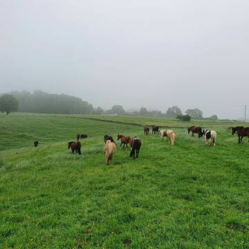
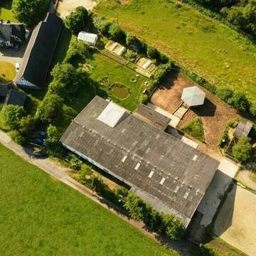
Hof Waldwiese 5 Sterne LAG-Stall
Kescheid
Melanie-Liebscher
@Melanie-Liebscher
Freizeitstall
Pferdeausbildung
Krankenbox
Longierzirkel/Roundpen
Gnadenbrothof
Außenbox mit Paddock
Außenboxen
19 weitere...
P+
Leider kein Vorschaubild
Leider kein Vorschaubild
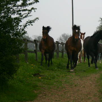
Offenstall 24/7 Draußen 200€ VP nur Wallach
Willroth
Susanne-Eul
@Susanne-Eul
Freizeitstall
Geländestrecke
Vermieten
Hunde willkommen
Krankenbox
Allergikerstall
Notfallboxen
6 weitere...
B
Deprecated: Creation of dynamic property Zend_View_Helper_Ads::$adLink is deprecated in /var/www/stall-frei/htdocs/staging.stall-frei.de/library/Psf/View/Helper/Ads.php on line 108

Leider kein Vorschaubild
Leider kein Vorschaubild
Boxen in Vollpension und Plätze im Aktivstall fr...
Lahnstein
Müller
@GestuetMueller
FN-Mitglied
Freizeitstall
Führanlage
Hunde willkommen
bedampftes/gewaschenes Heu
Außenbox mit Paddock
Außenboxen
17 weitere...
B
Gestüt Rosenhof Langenhahn-Hölzenhausen
Langenhahn-Hölzenhausen
Fabienne Lieselotte Seemüller
@Fabienne Lieselotte Seemüller
FN-Mitglied
Freizeitstall
Führanlage
Longierzirkel/Roundpen
Gnadenbrothof
Pferdezucht
Außenbox mit Paddock
Außenboxen
19 weitere...
P

Offenstall mit bef. Trail und Reitplatz
Wahlrod
Ann Christin Petry
@Ann-Christin4
Freizeitstall
Gastronomie
Vermieten
Hunde willkommen
Krankenbox
Notfallboxen
17 weitere...
P

kleiner familiärer PRIVATSTALL mit SERVICE
Siebenborn
HOF-Rheingoldbogen
@HOF-Rheingoldbogen
Freizeitstall
Reitlehrer und -unterricht
Vermieten
Paddock
Parkplatz für Pferdeanhänger
Allergikerstall
11 weitere...
P

Offenstall/Paddockbox für Pony oder Kleinpferd
Glashütten
Tatjana Bommersheim
@TatjanaBommersheim
Wir haben ab dem 1.04.26 eine Platz in einem unsere Offenställe (Wallach oder Stute)und eine unserer Paddockboxen (Wallach oder S
neu
R
Offenstall
Heistenbach
Pferdepension-Stein
@Pferdepension-Stein
Freizeitstall
Geländestrecke
Vermieten
Krankenbox
Longierzirkel/Roundpen
Notfallboxen
8 weitere...
P

Box in Privatstall frei
Hattert
Gäbler
@Ayleengaebler
Vermieten
Hunde willkommen
Paddock
Notfallboxen
Außenboxen
13 weitere...
P
Leider kein Vorschaubild
Leider kein Vorschaubild
2-3 Offenstallplätze zu vergeben
Neuwied
Simone Melsbach
@Mone89
FN-Mitglied
Freizeitstall
Vermieten
Krankenbox
Parkplatz für Pferdeanhänger
Notfallboxen
14 weitere...
B
Leider kein Vorschaubild
Leider kein Vorschaubild
Pensionsstall Birkenhof Dörnberg
Dörnberg
Kim Theuerkauf
@BirkenhofDoernberg
Freizeitstall
Westernreiten
Reithalle
Reitplatz (z.B. Dressur, Springen, Reining)
Fohlenaufzucht möglich
Hufrehe geeignet
Offenstall
7 weitere...
B
Deprecated: Creation of dynamic property Zend_View::$pageCount is deprecated in /var/www/stall-frei/htdocs/staging.stall-frei.de/library/vendor/shardj/zf1-future/library/Zend/View/Abstract.php on line 308
Deprecated: Creation of dynamic property Zend_View::$itemCountPerPage is deprecated in /var/www/stall-frei/htdocs/staging.stall-frei.de/library/vendor/shardj/zf1-future/library/Zend/View/Abstract.php on line 308
Deprecated: Creation of dynamic property Zend_View::$first is deprecated in /var/www/stall-frei/htdocs/staging.stall-frei.de/library/vendor/shardj/zf1-future/library/Zend/View/Abstract.php on line 308
Deprecated: Creation of dynamic property Zend_View::$current is deprecated in /var/www/stall-frei/htdocs/staging.stall-frei.de/library/vendor/shardj/zf1-future/library/Zend/View/Abstract.php on line 308
Deprecated: Creation of dynamic property Zend_View::$last is deprecated in /var/www/stall-frei/htdocs/staging.stall-frei.de/library/vendor/shardj/zf1-future/library/Zend/View/Abstract.php on line 308
Deprecated: Creation of dynamic property Zend_View::$previous is deprecated in /var/www/stall-frei/htdocs/staging.stall-frei.de/library/vendor/shardj/zf1-future/library/Zend/View/Abstract.php on line 308
Deprecated: Creation of dynamic property Zend_View::$next is deprecated in /var/www/stall-frei/htdocs/staging.stall-frei.de/library/vendor/shardj/zf1-future/library/Zend/View/Abstract.php on line 308
Deprecated: Creation of dynamic property Zend_View::$pagesInRange is deprecated in /var/www/stall-frei/htdocs/staging.stall-frei.de/library/vendor/shardj/zf1-future/library/Zend/View/Abstract.php on line 308
Deprecated: Creation of dynamic property Zend_View::$firstPageInRange is deprecated in /var/www/stall-frei/htdocs/staging.stall-frei.de/library/vendor/shardj/zf1-future/library/Zend/View/Abstract.php on line 308
Deprecated: Creation of dynamic property Zend_View::$lastPageInRange is deprecated in /var/www/stall-frei/htdocs/staging.stall-frei.de/library/vendor/shardj/zf1-future/library/Zend/View/Abstract.php on line 308
Deprecated: Creation of dynamic property Zend_View::$currentItemCount is deprecated in /var/www/stall-frei/htdocs/staging.stall-frei.de/library/vendor/shardj/zf1-future/library/Zend/View/Abstract.php on line 308
Deprecated: Creation of dynamic property Zend_View::$totalItemCount is deprecated in /var/www/stall-frei/htdocs/staging.stall-frei.de/library/vendor/shardj/zf1-future/library/Zend/View/Abstract.php on line 308
Deprecated: Creation of dynamic property Zend_View::$firstItemNumber is deprecated in /var/www/stall-frei/htdocs/staging.stall-frei.de/library/vendor/shardj/zf1-future/library/Zend/View/Abstract.php on line 308
Deprecated: Creation of dynamic property Zend_View::$lastItemNumber is deprecated in /var/www/stall-frei/htdocs/staging.stall-frei.de/library/vendor/shardj/zf1-future/library/Zend/View/Abstract.php on line 308
Deprecated: Creation of dynamic property Zend_View::$router is deprecated in /var/www/stall-frei/htdocs/staging.stall-frei.de/library/vendor/shardj/zf1-future/library/Zend/View/Abstract.php on line 308
Deprecated: Creation of dynamic property Zend_View::$urlParams is deprecated in /var/www/stall-frei/htdocs/staging.stall-frei.de/library/vendor/shardj/zf1-future/library/Zend/View/Abstract.php on line 308
Deprecated: Creation of dynamic property Zend_View::$showAds is deprecated in /var/www/stall-frei/htdocs/staging.stall-frei.de/library/vendor/shardj/zf1-future/library/Zend/View/Abstract.php on line 308
Deprecated: Creation of dynamic property Zend_View::$objectIds is deprecated in /var/www/stall-frei/htdocs/staging.stall-frei.de/library/vendor/shardj/zf1-future/library/Zend/View/Abstract.php on line 308
Deprecated: Creation of dynamic property Zend_View::$showNavbar is deprecated in /var/www/stall-frei/htdocs/staging.stall-frei.de/library/vendor/shardj/zf1-future/library/Zend/View/Abstract.php on line 308
Deprecated: Creation of dynamic property Zend_View::$showBreadcrumb is deprecated in /var/www/stall-frei/htdocs/staging.stall-frei.de/library/vendor/shardj/zf1-future/library/Zend/View/Abstract.php on line 308
Deprecated: Creation of dynamic property Zend_View::$showFooter is deprecated in /var/www/stall-frei/htdocs/staging.stall-frei.de/library/vendor/shardj/zf1-future/library/Zend/View/Abstract.php on line 308
Deprecated: Creation of dynamic property Zend_View::$showInternalAds is deprecated in /var/www/stall-frei/htdocs/staging.stall-frei.de/library/vendor/shardj/zf1-future/library/Zend/View/Abstract.php on line 308
Deprecated: Creation of dynamic property Zend_View::$blNoContent is deprecated in /var/www/stall-frei/htdocs/staging.stall-frei.de/library/vendor/shardj/zf1-future/library/Zend/View/Abstract.php on line 308
Deprecated: Creation of dynamic property Zend_View::$sMetaDesc is deprecated in /var/www/stall-frei/htdocs/staging.stall-frei.de/library/vendor/shardj/zf1-future/library/Zend/View/Abstract.php on line 308
Deprecated: Creation of dynamic property Zend_View::$useGmaps is deprecated in /var/www/stall-frei/htdocs/staging.stall-frei.de/library/vendor/shardj/zf1-future/library/Zend/View/Abstract.php on line 308
Deprecated: Creation of dynamic property Zend_View::$touches is deprecated in /var/www/stall-frei/htdocs/staging.stall-frei.de/library/vendor/shardj/zf1-future/library/Zend/View/Abstract.php on line 308
Deprecated: Creation of dynamic property Zend_View::$oProject is deprecated in /var/www/stall-frei/htdocs/staging.stall-frei.de/library/vendor/shardj/zf1-future/library/Zend/View/Abstract.php on line 308
Deprecated: Creation of dynamic property Zend_View::$pageHeadline is deprecated in /var/www/stall-frei/htdocs/staging.stall-frei.de/library/vendor/shardj/zf1-future/library/Zend/View/Abstract.php on line 308
Deprecated: Creation of dynamic property Zend_View::$disableLocationField is deprecated in /var/www/stall-frei/htdocs/staging.stall-frei.de/library/vendor/shardj/zf1-future/library/Zend/View/Abstract.php on line 308
Deprecated: Creation of dynamic property Zend_View::$isSearch is deprecated in /var/www/stall-frei/htdocs/staging.stall-frei.de/library/vendor/shardj/zf1-future/library/Zend/View/Abstract.php on line 308
Deprecated: Creation of dynamic property Zend_View::$pageTitle is deprecated in /var/www/stall-frei/htdocs/staging.stall-frei.de/library/vendor/shardj/zf1-future/library/Zend/View/Abstract.php on line 308
Deprecated: Creation of dynamic property Psf_Form_Element_Text::$class is deprecated in /var/www/stall-frei/htdocs/staging.stall-frei.de/library/vendor/shardj/zf1-future/library/Zend/Form/Element.php on line 874
Deprecated: Creation of dynamic property Psf_Form_Element_Text::$size is deprecated in /var/www/stall-frei/htdocs/staging.stall-frei.de/library/vendor/shardj/zf1-future/library/Zend/Form/Element.php on line 874
Deprecated: Creation of dynamic property Psf_Form_Element_Text::$placeholder is deprecated in /var/www/stall-frei/htdocs/staging.stall-frei.de/library/vendor/shardj/zf1-future/library/Zend/Form/Element.php on line 874
Deprecated: Creation of dynamic property Psf_Form_Element_Hidden::$class is deprecated in /var/www/stall-frei/htdocs/staging.stall-frei.de/library/vendor/shardj/zf1-future/library/Zend/Form/Element.php on line 874
Deprecated: Creation of dynamic property Psf_Form_Element_Hidden::$class is deprecated in /var/www/stall-frei/htdocs/staging.stall-frei.de/library/vendor/shardj/zf1-future/library/Zend/Form/Element.php on line 874
Deprecated: Creation of dynamic property Psf_Form_Element_Hidden::$class is deprecated in /var/www/stall-frei/htdocs/staging.stall-frei.de/library/vendor/shardj/zf1-future/library/Zend/Form/Element.php on line 874
Deprecated: Creation of dynamic property Psf_Form_Element_Hidden::$class is deprecated in /var/www/stall-frei/htdocs/staging.stall-frei.de/library/vendor/shardj/zf1-future/library/Zend/Form/Element.php on line 874
Deprecated: Creation of dynamic property Psf_Form_Element_Select::$class is deprecated in /var/www/stall-frei/htdocs/staging.stall-frei.de/library/vendor/shardj/zf1-future/library/Zend/Form/Element.php on line 874
Deprecated: Creation of dynamic property Psf_Form_Element_Select::$class is deprecated in /var/www/stall-frei/htdocs/staging.stall-frei.de/library/vendor/shardj/zf1-future/library/Zend/Form/Element.php on line 874
Deprecated: Creation of dynamic property Psf_Form_Element_Select::$class is deprecated in /var/www/stall-frei/htdocs/staging.stall-frei.de/library/vendor/shardj/zf1-future/library/Zend/Form/Element.php on line 874
Deprecated: Creation of dynamic property Psf_Form_Element_Select::$class is deprecated in /var/www/stall-frei/htdocs/staging.stall-frei.de/library/vendor/shardj/zf1-future/library/Zend/Form/Element.php on line 874
Deprecated: Creation of dynamic property Psf_Form_Element_Text::$class is deprecated in /var/www/stall-frei/htdocs/staging.stall-frei.de/library/vendor/shardj/zf1-future/library/Zend/Form/Element.php on line 874
Deprecated: Creation of dynamic property Psf_Form_Element_Checkbox::$label is deprecated in /var/www/stall-frei/htdocs/staging.stall-frei.de/library/vendor/shardj/zf1-future/library/Zend/Form/Element.php on line 874
Deprecated: Creation of dynamic property Zend_View::$sort is deprecated in /var/www/stall-frei/htdocs/staging.stall-frei.de/library/vendor/shardj/zf1-future/library/Zend/View/Abstract.php on line 308
Deprecated: Creation of dynamic property Zend_View::$searchLocation is deprecated in /var/www/stall-frei/htdocs/staging.stall-frei.de/library/vendor/shardj/zf1-future/library/Zend/View/Abstract.php on line 308
Deprecated: Creation of dynamic property Zend_View::$locationHint is deprecated in /var/www/stall-frei/htdocs/staging.stall-frei.de/library/vendor/shardj/zf1-future/library/Zend/View/Abstract.php on line 308
Psf_GeoCoder_Abstract::getLocation: Hilgert Get Location CachedOrLive
Psf_GeoCoder_Abstract::getCachedOrLive: Hilgert
Psf_GeoCoder_Abstract::convertLocationResult
{"documentation":"https:\/\/opencagedata.com\/api","licenses":[{"name":"see attribution guide","url":"https:\/\/opencagedata.com\/credits"}],"results":[{"bounds":{"northeast":{"lat":50.4715953,"lng":7.7081854},"southwest":{"lat":50.4447244,"lng":7.6738987}},"components":{"ISO_3166-1_alpha-2":"DE","ISO_3166-1_alpha-3":"DEU","ISO_3166-2":["DE-RP"],"_category":"place","_normalized_city":"Hilgert","_type":"village","continent":"Europe","country":"Deutschland","country_code":"de","county":"Westerwaldkreis","municipality":"H\u00f6hr-Grenzhausen","political_union":"European Union","postcode":"56206","state":"Rheinland-Pfalz","state_code":"RP","village":"Hilgert"},"confidence":7,"formatted":"56206 Hilgert, Deutschland","geometry":{"lat":50.4554645,"lng":7.6894013}},{"bounds":{"northeast":{"lat":49.5569257,"lng":7.4215961},"southwest":{"lat":49.5568257,"lng":7.4214961}},"components":{"ISO_3166-1_alpha-2":"DE","ISO_3166-1_alpha-3":"DEU","ISO_3166-2":["DE-RP"],"_category":"natural\/water","_normalized_city":"Altenglan","_type":"peak","continent":"Europe","country":"Deutschland","country_code":"de","county":"Landkreis Kusel","municipality":"Kusel-Altenglan","peak":"Hilgert","political_union":"European Union","postcode":"66869","state":"Rheinland-Pfalz","state_code":"RP","village":"Altenglan"},"confidence":9,"formatted":"Hilgert, 66869 Altenglan, Deutschland","geometry":{"lat":49.5568757,"lng":7.4215461}},{"components":{"ISO_3166-1_alpha-2":"FR","ISO_3166-1_alpha-3":"FRA","ISO_3166-2":["FR-IDF","FR-92"],"_category":"road","_normalized_city":"Levallois-Perret","_type":"road","city":"Levallois-Perret","continent":"Europe","country":"France","country_code":"fr","county":"Hauts-de-Seine","local_authority":"M\u00e9tropole du Grand Paris","political_union":"European Union","postcode":"92300","road":"Rue Charles Deutschmann","state":"\u00cele-de-France","state_code":"IDF"},"confidence":2,"formatted":"Rue Charles Deutschmann, 92300 Levallois-Perret, France","geometry":{"lat":48.900049,"lng":2.2842}},{"components":{"ISO_3166-1_alpha-2":"FR","ISO_3166-1_alpha-3":"FRA","ISO_3166-2":["FR-CVL","FR-45"],"_category":"road","_normalized_city":"Montliard","_type":"road","city":"Montliard","continent":"Europe","country":"France","country_code":"fr","county":"Loiret","local_authority":"Communaut\u00e9 de communes du Pithiverais-G\u00e2tinais","political_union":"European Union","postcode":"45340","road":"Chemin de la Lig\u00e8re","state":"Centre-Val de Loire","state_code":"CVL"},"confidence":2,"formatted":"Chemin de la Lig\u00e8re, 45340 Montliard, France","geometry":{"lat":48.007559,"lng":2.403676}},{"components":{"ISO_3166-1_alpha-2":"FR","ISO_3166-1_alpha-3":"FRA","ISO_3166-2":["FR-PDL","FR-72"],"_category":"road","_normalized_city":"Ballon-Saint Mars","_type":"road","city":"Ballon-Saint Mars","continent":"Europe","country":"France","country_code":"fr","county":"Sarthe","local_authority":"Communaut\u00e9 de communes Maine C\u0153ur de Sarthe","political_union":"European Union","postcode":"72290","road":"Lieu Dit Le Champ Liger","state":"Pays de la Loire","state_code":"PDL"},"confidence":10,"formatted":"Lieu Dit Le Champ Liger, 72290 Ballon-Saint Mars, France","geometry":{"lat":48.160832,"lng":0.270285}},{"components":{"ISO_3166-1_alpha-2":"FR","ISO_3166-1_alpha-3":"FRA","ISO_3166-2":["FR-PDL","FR-53"],"_category":"road","_normalized_city":"Larchamp","_type":"road","city":"Larchamp","continent":"Europe","country":"France","country_code":"fr","county":"Mayenne","local_authority":"Communaut\u00e9 de communes de l'Ern\u00e9e","political_union":"European Union","postcode":"53220","road":"le Pont Liger","state":"Pays de la Loire","state_code":"PDL"},"confidence":10,"formatted":"le Pont Liger, 53220 Larchamp, France","geometry":{"lat":48.368033,"lng":-0.980669}},{"components":{"ISO_3166-1_alpha-2":"FR","ISO_3166-1_alpha-3":"FRA","ISO_3166-2":["FR-BFC","FR-58"],"_category":"road","_normalized_city":"Bitry","_type":"road","city":"Bitry","continent":"Europe","country":"France","country_code":"fr","county":"Ni\u00e8vre","local_authority":"Communaut\u00e9 de communes de Puisaye-Forterre","political_union":"European Union","postcode":"58310","road":"Route du Tacot - LES LIGERS","state":"Bourgogne-Franche-Comt\u00e9","state_code":"BFC"},"confidence":10,"formatted":"Route du Tacot - LES LIGERS, 58310 Bitry, France","geometry":{"lat":47.499716,"lng":3.054108}},{"components":{"ISO_3166-1_alpha-2":"FR","ISO_3166-1_alpha-3":"FRA","ISO_3166-2":["FR-OCC","FR-31"],"_category":"place","_normalized_city":"Toulouse","_type":"place","city":"Toulouse","continent":"Europe","country":"France","country_code":"fr","county":"Haute-Garonne","local_authority":"Toulouse M\u00e9tropole","place":"Rue du Docteur Henri Liger","political_union":"European Union","postcode":"31000","state":"Occitanie","state_code":"OCC"},"confidence":10,"formatted":"Rue du Docteur Henri Liger, 31000 Toulouse, France","geometry":{"lat":43.599877,"lng":1.445448}},{"components":{"ISO_3166-1_alpha-2":"FR","ISO_3166-1_alpha-3":"FRA","ISO_3166-2":["FR-PDL","FR-53"],"_category":"road","_normalized_city":"Voutr\u00e9","_type":"road","city":"Voutr\u00e9","continent":"Europe","country":"France","country_code":"fr","county":"Mayenne","local_authority":"Communaut\u00e9 de communes des Co\u00ebvrons","political_union":"European Union","postcode":"53600","road":"Rue Ang\u00e8le Lig\u00e8re","state":"Pays de la Loire","state_code":"PDL"},"confidence":10,"formatted":"Rue Ang\u00e8le Lig\u00e8re, 53600 Voutr\u00e9, France","geometry":{"lat":48.13999,"lng":-0.286818}},{"components":{"ISO_3166-1_alpha-2":"FR","ISO_3166-1_alpha-3":"FRA","ISO_3166-2":["FR-NOR","FR-61"],"_category":"road","_normalized_city":"La Fert\u00e9-en-Ouche","_type":"road","city":"La Fert\u00e9-en-Ouche","continent":"Europe","country":"France","country_code":"fr","county":"Orne","local_authority":"Communaut\u00e9 de communes des Pays de L'Aigle","political_union":"European Union","postcode":"61550","road":"Rue Roger Liger","state":"Normandie","state_code":"NOR"},"confidence":10,"formatted":"Rue Roger Liger, 61550 La Fert\u00e9-en-Ouche, France","geometry":{"lat":48.854678,"lng":0.596745}}],"status":{"code":200,"message":"OK"},"stay_informed":{"blog":"https:\/\/blog.opencagedata.com","mastodon":"https:\/\/en.osm.town\/@opencage"},"thanks":"For using an OpenCage API","timestamp":{"created_http":"Fri, 06 Feb 2026 08:57:51 GMT","created_unix":1770368271},"total_results":10}Array
(
[0] => stdClass Object
(
[bounds] => stdClass Object
(
[northeast] => stdClass Object
(
[lat] => 50.4715953
[lng] => 7.7081854
)
[southwest] => stdClass Object
(
[lat] => 50.4447244
[lng] => 7.6738987
)
)
[components] => stdClass Object
(
[ISO_3166-1_alpha-2] => DE
[ISO_3166-1_alpha-3] => DEU
[ISO_3166-2] => Array
(
[0] => DE-RP
)
[_category] => place
[_normalized_city] => Hilgert
[_type] => village
[continent] => Europe
[country] => Deutschland
[country_code] => de
[county] => Westerwaldkreis
[municipality] => Höhr-Grenzhausen
[political_union] => European Union
[postcode] => 56206
[state] => Rheinland-Pfalz
[state_code] => RP
[village] => Hilgert
)
[confidence] => 7
[formatted] => 56206 Hilgert, Deutschland
[geometry] => stdClass Object
(
[lat] => 50.4554645
[lng] => 7.6894013
)
)
[1] => stdClass Object
(
[bounds] => stdClass Object
(
[northeast] => stdClass Object
(
[lat] => 49.5569257
[lng] => 7.4215961
)
[southwest] => stdClass Object
(
[lat] => 49.5568257
[lng] => 7.4214961
)
)
[components] => stdClass Object
(
[ISO_3166-1_alpha-2] => DE
[ISO_3166-1_alpha-3] => DEU
[ISO_3166-2] => Array
(
[0] => DE-RP
)
[_category] => natural/water
[_normalized_city] => Altenglan
[_type] => peak
[continent] => Europe
[country] => Deutschland
[country_code] => de
[county] => Landkreis Kusel
[municipality] => Kusel-Altenglan
[peak] => Hilgert
[political_union] => European Union
[postcode] => 66869
[state] => Rheinland-Pfalz
[state_code] => RP
[village] => Altenglan
)
[confidence] => 9
[formatted] => Hilgert, 66869 Altenglan, Deutschland
[geometry] => stdClass Object
(
[lat] => 49.5568757
[lng] => 7.4215461
)
)
[2] => stdClass Object
(
[components] => stdClass Object
(
[ISO_3166-1_alpha-2] => FR
[ISO_3166-1_alpha-3] => FRA
[ISO_3166-2] => Array
(
[0] => FR-IDF
[1] => FR-92
)
[_category] => road
[_normalized_city] => Levallois-Perret
[_type] => road
[city] => Levallois-Perret
[continent] => Europe
[country] => France
[country_code] => fr
[county] => Hauts-de-Seine
[local_authority] => Métropole du Grand Paris
[political_union] => European Union
[postcode] => 92300
[road] => Rue Charles Deutschmann
[state] => Île-de-France
[state_code] => IDF
)
[confidence] => 2
[formatted] => Rue Charles Deutschmann, 92300 Levallois-Perret, France
[geometry] => stdClass Object
(
[lat] => 48.900049
[lng] => 2.2842
)
)
[3] => stdClass Object
(
[components] => stdClass Object
(
[ISO_3166-1_alpha-2] => FR
[ISO_3166-1_alpha-3] => FRA
[ISO_3166-2] => Array
(
[0] => FR-CVL
[1] => FR-45
)
[_category] => road
[_normalized_city] => Montliard
[_type] => road
[city] => Montliard
[continent] => Europe
[country] => France
[country_code] => fr
[county] => Loiret
[local_authority] => Communauté de communes du Pithiverais-Gâtinais
[political_union] => European Union
[postcode] => 45340
[road] => Chemin de la Ligère
[state] => Centre-Val de Loire
[state_code] => CVL
)
[confidence] => 2
[formatted] => Chemin de la Ligère, 45340 Montliard, France
[geometry] => stdClass Object
(
[lat] => 48.007559
[lng] => 2.403676
)
)
[4] => stdClass Object
(
[components] => stdClass Object
(
[ISO_3166-1_alpha-2] => FR
[ISO_3166-1_alpha-3] => FRA
[ISO_3166-2] => Array
(
[0] => FR-PDL
[1] => FR-72
)
[_category] => road
[_normalized_city] => Ballon-Saint Mars
[_type] => road
[city] => Ballon-Saint Mars
[continent] => Europe
[country] => France
[country_code] => fr
[county] => Sarthe
[local_authority] => Communauté de communes Maine Cœur de Sarthe
[political_union] => European Union
[postcode] => 72290
[road] => Lieu Dit Le Champ Liger
[state] => Pays de la Loire
[state_code] => PDL
)
[confidence] => 10
[formatted] => Lieu Dit Le Champ Liger, 72290 Ballon-Saint Mars, France
[geometry] => stdClass Object
(
[lat] => 48.160832
[lng] => 0.270285
)
)
[5] => stdClass Object
(
[components] => stdClass Object
(
[ISO_3166-1_alpha-2] => FR
[ISO_3166-1_alpha-3] => FRA
[ISO_3166-2] => Array
(
[0] => FR-PDL
[1] => FR-53
)
[_category] => road
[_normalized_city] => Larchamp
[_type] => road
[city] => Larchamp
[continent] => Europe
[country] => France
[country_code] => fr
[county] => Mayenne
[local_authority] => Communauté de communes de l'Ernée
[political_union] => European Union
[postcode] => 53220
[road] => le Pont Liger
[state] => Pays de la Loire
[state_code] => PDL
)
[confidence] => 10
[formatted] => le Pont Liger, 53220 Larchamp, France
[geometry] => stdClass Object
(
[lat] => 48.368033
[lng] => -0.980669
)
)
[6] => stdClass Object
(
[components] => stdClass Object
(
[ISO_3166-1_alpha-2] => FR
[ISO_3166-1_alpha-3] => FRA
[ISO_3166-2] => Array
(
[0] => FR-BFC
[1] => FR-58
)
[_category] => road
[_normalized_city] => Bitry
[_type] => road
[city] => Bitry
[continent] => Europe
[country] => France
[country_code] => fr
[county] => Nièvre
[local_authority] => Communauté de communes de Puisaye-Forterre
[political_union] => European Union
[postcode] => 58310
[road] => Route du Tacot - LES LIGERS
[state] => Bourgogne-Franche-Comté
[state_code] => BFC
)
[confidence] => 10
[formatted] => Route du Tacot - LES LIGERS, 58310 Bitry, France
[geometry] => stdClass Object
(
[lat] => 47.499716
[lng] => 3.054108
)
)
[7] => stdClass Object
(
[components] => stdClass Object
(
[ISO_3166-1_alpha-2] => FR
[ISO_3166-1_alpha-3] => FRA
[ISO_3166-2] => Array
(
[0] => FR-OCC
[1] => FR-31
)
[_category] => place
[_normalized_city] => Toulouse
[_type] => place
[city] => Toulouse
[continent] => Europe
[country] => France
[country_code] => fr
[county] => Haute-Garonne
[local_authority] => Toulouse Métropole
[place] => Rue du Docteur Henri Liger
[political_union] => European Union
[postcode] => 31000
[state] => Occitanie
[state_code] => OCC
)
[confidence] => 10
[formatted] => Rue du Docteur Henri Liger, 31000 Toulouse, France
[geometry] => stdClass Object
(
[lat] => 43.599877
[lng] => 1.445448
)
)
[8] => stdClass Object
(
[components] => stdClass Object
(
[ISO_3166-1_alpha-2] => FR
[ISO_3166-1_alpha-3] => FRA
[ISO_3166-2] => Array
(
[0] => FR-PDL
[1] => FR-53
)
[_category] => road
[_normalized_city] => Voutré
[_type] => road
[city] => Voutré
[continent] => Europe
[country] => France
[country_code] => fr
[county] => Mayenne
[local_authority] => Communauté de communes des Coëvrons
[political_union] => European Union
[postcode] => 53600
[road] => Rue Angèle Ligère
[state] => Pays de la Loire
[state_code] => PDL
)
[confidence] => 10
[formatted] => Rue Angèle Ligère, 53600 Voutré, France
[geometry] => stdClass Object
(
[lat] => 48.13999
[lng] => -0.286818
)
)
[9] => stdClass Object
(
[components] => stdClass Object
(
[ISO_3166-1_alpha-2] => FR
[ISO_3166-1_alpha-3] => FRA
[ISO_3166-2] => Array
(
[0] => FR-NOR
[1] => FR-61
)
[_category] => road
[_normalized_city] => La Ferté-en-Ouche
[_type] => road
[city] => La Ferté-en-Ouche
[continent] => Europe
[country] => France
[country_code] => fr
[county] => Orne
[local_authority] => Communauté de communes des Pays de L'Aigle
[political_union] => European Union
[postcode] => 61550
[road] => Rue Roger Liger
[state] => Normandie
[state_code] => NOR
)
[confidence] => 10
[formatted] => Rue Roger Liger, 61550 La Ferté-en-Ouche, France
[geometry] => stdClass Object
(
[lat] => 48.854678
[lng] => 0.596745
)
)
)
Psf_GeoCoder_OpenCageData::getKeyMap: 0
stdClass Object
(
    [bounds] => stdClass Object
        (
            [northeast] => stdClass Object
                (
                    [lat] => 50.4715953
                    [lng] => 7.7081854
                )

            [southwest] => stdClass Object
                (
                    [lat] => 50.4447244
                    [lng] => 7.6738987
                )

        )

    [components] => stdClass Object
        (
            [ISO_3166-1_alpha-2] => DE
            [ISO_3166-1_alpha-3] => DEU
            [ISO_3166-2] => Array
                (
                    [0] => DE-RP
                )

            [_category] => place
            [_normalized_city] => Hilgert
            [_type] => village
            [continent] => Europe
            [country] => Deutschland
            [country_code] => de
            [county] => Westerwaldkreis
            [municipality] => Höhr-Grenzhausen
            [political_union] => European Union
            [postcode] => 56206
            [state] => Rheinland-Pfalz
            [state_code] => RP
            [village] => Hilgert
        )

    [confidence] => 7
    [formatted] => 56206 Hilgert, Deutschland
    [geometry] => stdClass Object
        (
            [lat] => 50.4554645
            [lng] => 7.6894013
        )

)
Psf_GeoCoder_OpenCageData::getCounty: Westerwaldkreis
Psf_GeoCoder_OpenCageData::addMissingData REFETCH!
Array
(
    [address] => 56206 Hilgert, Deutschland
    [type] => village
    [street] =>
    [city] => Hilgert
    [county] => Westerwaldkreis
    [state] => Rheinland-Pfalz
    [zip] => 56206
    [country] => Deutschland
    [suburb] =>
    [countrycode] => de
    [latitude] => 50.4554645
    [longitude] => 7.6894013
    [accuracy] => 1
    [confidence] => 7
    [bounds] => stdClass Object
        (
            [northeast] => stdClass Object
                (
                    [lat] => 50.4715953
                    [lng] => 7.7081854
                )

            [southwest] => stdClass Object
                (
                    [lat] => 50.4447244
                    [lng] => 7.6738987
                )

        )

)
reformat!
Array
(
    [address] => 56206 Hilgert, Deutschland
    [type] => village
    [street] =>
    [city] => Hilgert
    [county] => Westerwaldkreis
    [state] => Rheinland-Pfalz
    [zip] => 56206
    [country] => Deutschland
    [suburb] =>
    [countrycode] => de
    [latitude] => 50.4554645
    [longitude] => 7.6894013
    [accuracy] => 1
    [confidence] => 7
    [bounds] => stdClass Object
        (
            [northeast] => stdClass Object
                (
                    [lat] => 50.4715953
                    [lng] => 7.7081854
                )

            [southwest] => stdClass Object
                (
                    [lat] => 50.4447244
                    [lng] => 7.6738987
                )

        )

    [place] => 56206 Hilgert, Rheinland-Pfalz
    [hash] => 7495b6e1ac4fef82538ac7424f3a85a7
)
Psf_GeoCoder_OpenCageData::getKeyMap: 1
stdClass Object
(
    [bounds] => stdClass Object
        (
            [northeast] => stdClass Object
                (
                    [lat] => 49.5569257
                    [lng] => 7.4215961
                )

            [southwest] => stdClass Object
                (
                    [lat] => 49.5568257
                    [lng] => 7.4214961
                )

        )

    [components] => stdClass Object
        (
            [ISO_3166-1_alpha-2] => DE
            [ISO_3166-1_alpha-3] => DEU
            [ISO_3166-2] => Array
                (
                    [0] => DE-RP
                )

            [_category] => natural/water
            [_normalized_city] => Altenglan
            [_type] => peak
            [continent] => Europe
            [country] => Deutschland
            [country_code] => de
            [county] => Landkreis Kusel
            [municipality] => Kusel-Altenglan
            [peak] => Hilgert
            [political_union] => European Union
            [postcode] => 66869
            [state] => Rheinland-Pfalz
            [state_code] => RP
            [village] => Altenglan
        )

    [confidence] => 9
    [formatted] => Hilgert, 66869 Altenglan, Deutschland
    [geometry] => stdClass Object
        (
            [lat] => 49.5568757
            [lng] => 7.4215461
        )

)
Psf_GeoCoder_OpenCageData::getCounty: Kusel
Psf_GeoCoder_OpenCageData::addMissingData REFETCH!
Array
(
    [address] => Hilgert, 66869 Altenglan, Deutschland
    [type] => peak
    [street] =>
    [city] => Altenglan
    [county] => Kusel
    [state] => Rheinland-Pfalz
    [zip] => 66869
    [country] => Deutschland
    [suburb] =>
    [countrycode] => de
    [latitude] => 49.5568757
    [longitude] => 7.4215461
    [accuracy] => 1
    [confidence] => 9
    [bounds] => stdClass Object
        (
            [northeast] => stdClass Object
                (
                    [lat] => 49.5569257
                    [lng] => 7.4215961
                )

            [southwest] => stdClass Object
                (
                    [lat] => 49.5568257
                    [lng] => 7.4214961
                )

        )

)
reformat!
Array
(
    [address] => Hilgert, 66869 Altenglan, Deutschland
    [type] => peak
    [street] =>
    [city] => Altenglan
    [county] => Kusel
    [state] => Rheinland-Pfalz
    [zip] => 66869
    [country] => Deutschland
    [suburb] =>
    [countrycode] => de
    [latitude] => 49.5568757
    [longitude] => 7.4215461
    [accuracy] => 1
    [confidence] => 9
    [bounds] => stdClass Object
        (
            [northeast] => stdClass Object
                (
                    [lat] => 49.5569257
                    [lng] => 7.4215961
                )

            [southwest] => stdClass Object
                (
                    [lat] => 49.5568257
                    [lng] => 7.4214961
                )

        )

    [place] => 66869 Altenglan, Rheinland-Pfalz
    [hash] => a034d03e618dc96686921ea86128fbaa
)
Psf_GeoCoder_OpenCageData::getKeyMap: 2
stdClass Object
(
    [components] => stdClass Object
        (
            [ISO_3166-1_alpha-2] => FR
            [ISO_3166-1_alpha-3] => FRA
            [ISO_3166-2] => Array
                (
                    [0] => FR-IDF
                    [1] => FR-92
                )

            [_category] => road
            [_normalized_city] => Levallois-Perret
            [_type] => road
            [city] => Levallois-Perret
            [continent] => Europe
            [country] => France
            [country_code] => fr
            [county] => Hauts-de-Seine
            [local_authority] => Métropole du Grand Paris
            [political_union] => European Union
            [postcode] => 92300
            [road] => Rue Charles Deutschmann
            [state] => Île-de-France
            [state_code] => IDF
        )

    [confidence] => 2
    [formatted] => Rue Charles Deutschmann, 92300 Levallois-Perret, France
    [geometry] => stdClass Object
        (
            [lat] => 48.900049
            [lng] => 2.2842
        )

)
Psf_GeoCoder_OpenCageData::getCounty: Hauts-de-Seine
Psf_GeoCoder_OpenCageData::addMissingData REFETCH!
Array
(
    [address] => Rue Charles Deutschmann, 92300 Levallois-Perret, France
    [type] => road
    [street] => Rue Charles Deutschmann
    [city] => Levallois-Perret
    [county] => Hauts-de-Seine
    [state] => Île-de-France
    [zip] => 92300
    [country] => France
    [suburb] =>
    [countrycode] => fr
    [latitude] => 48.900049
    [longitude] => 2.2842
    [accuracy] => 1
    [confidence] => 2
    [bounds] =>
)
reformat!
Array
(
    [address] => Rue Charles Deutschmann, 92300 Levallois-Perret, France
    [type] => road
    [street] => Rue Charles Deutschmann
    [city] => Levallois-Perret
    [county] => Hauts-de-Seine
    [state] => Île-de-France
    [zip] => 92300
    [country] => France
    [suburb] =>
    [countrycode] => fr
    [latitude] => 48.900049
    [longitude] => 2.2842
    [accuracy] => 1
    [confidence] => 2
    [bounds] =>
    [place] => Rue Charles Deutschmann, 92300 Levallois-Perret, Île-de-France
    [hash] => b7dc44def3990e8a7eaf18e019eca466
)
Psf_GeoCoder_OpenCageData::getKeyMap: 3
stdClass Object
(
    [components] => stdClass Object
        (
            [ISO_3166-1_alpha-2] => FR
            [ISO_3166-1_alpha-3] => FRA
            [ISO_3166-2] => Array
                (
                    [0] => FR-CVL
                    [1] => FR-45
                )

            [_category] => road
            [_normalized_city] => Montliard
            [_type] => road
            [city] => Montliard
            [continent] => Europe
            [country] => France
            [country_code] => fr
            [county] => Loiret
            [local_authority] => Communauté de communes du Pithiverais-Gâtinais
            [political_union] => European Union
            [postcode] => 45340
            [road] => Chemin de la Ligère
            [state] => Centre-Val de Loire
            [state_code] => CVL
        )

    [confidence] => 2
    [formatted] => Chemin de la Ligère, 45340 Montliard, France
    [geometry] => stdClass Object
        (
            [lat] => 48.007559
            [lng] => 2.403676
        )

)
Psf_GeoCoder_OpenCageData::getCounty: Loiret
Psf_GeoCoder_OpenCageData::addMissingData REFETCH!
Array
(
    [address] => Chemin de la Ligère, 45340 Montliard, France
    [type] => road
    [street] => Chemin de la Ligère
    [city] => Montliard
    [county] => Loiret
    [state] => Centre-Val de Loire
    [zip] => 45340
    [country] => France
    [suburb] =>
    [countrycode] => fr
    [latitude] => 48.007559
    [longitude] => 2.403676
    [accuracy] => 1
    [confidence] => 2
    [bounds] =>
)
reformat!
Array
(
    [address] => Chemin de la Ligère, 45340 Montliard, France
    [type] => road
    [street] => Chemin de la Ligère
    [city] => Montliard
    [county] => Loiret
    [state] => Centre-Val de Loire
    [zip] => 45340
    [country] => France
    [suburb] =>
    [countrycode] => fr
    [latitude] => 48.007559
    [longitude] => 2.403676
    [accuracy] => 1
    [confidence] => 2
    [bounds] =>
    [place] => Chemin de la Ligère, 45340 Montliard, Centre-Val de Loire
    [hash] => a9b355aa0e8c3bba7f53b2806d1d90ec
)
Psf_GeoCoder_OpenCageData::getKeyMap: 4
stdClass Object
(
    [components] => stdClass Object
        (
            [ISO_3166-1_alpha-2] => FR
            [ISO_3166-1_alpha-3] => FRA
            [ISO_3166-2] => Array
                (
                    [0] => FR-PDL
                    [1] => FR-72
                )

            [_category] => road
            [_normalized_city] => Ballon-Saint Mars
            [_type] => road
            [city] => Ballon-Saint Mars
            [continent] => Europe
            [country] => France
            [country_code] => fr
            [county] => Sarthe
            [local_authority] => Communauté de communes Maine Cœur de Sarthe
            [political_union] => European Union
            [postcode] => 72290
            [road] => Lieu Dit Le Champ Liger
            [state] => Pays de la Loire
            [state_code] => PDL
        )

    [confidence] => 10
    [formatted] => Lieu Dit Le Champ Liger, 72290 Ballon-Saint Mars, France
    [geometry] => stdClass Object
        (
            [lat] => 48.160832
            [lng] => 0.270285
        )

)
Psf_GeoCoder_OpenCageData::getCounty: Sarthe
Psf_GeoCoder_OpenCageData::addMissingData REFETCH!
Array
(
    [address] => Lieu Dit Le Champ Liger, 72290 Ballon-Saint Mars, France
    [type] => road
    [street] => Lieu Dit Le Champ Liger
    [city] => Ballon-Saint Mars
    [county] => Sarthe
    [state] => Pays de la Loire
    [zip] => 72290
    [country] => France
    [suburb] =>
    [countrycode] => fr
    [latitude] => 48.160832
    [longitude] => 0.270285
    [accuracy] => 1
    [confidence] => 10
    [bounds] =>
)
reformat!
Array
(
    [address] => Lieu Dit Le Champ Liger, 72290 Ballon-Saint Mars, France
    [type] => road
    [street] => Lieu Dit Le Champ Liger
    [city] => Ballon-Saint Mars
    [county] => Sarthe
    [state] => Pays de la Loire
    [zip] => 72290
    [country] => France
    [suburb] =>
    [countrycode] => fr
    [latitude] => 48.160832
    [longitude] => 0.270285
    [accuracy] => 1
    [confidence] => 10
    [bounds] =>
    [place] => Lieu Dit Le Champ Liger, 72290 Ballon-Saint Mars, Pays de la Loire
    [hash] => 547a721808500fcc7e9bb916254ca45d
)
Psf_GeoCoder_OpenCageData::getKeyMap: 5
stdClass Object
(
    [components] => stdClass Object
        (
            [ISO_3166-1_alpha-2] => FR
            [ISO_3166-1_alpha-3] => FRA
            [ISO_3166-2] => Array
                (
                    [0] => FR-PDL
                    [1] => FR-53
                )

            [_category] => road
            [_normalized_city] => Larchamp
            [_type] => road
            [city] => Larchamp
            [continent] => Europe
            [country] => France
            [country_code] => fr
            [county] => Mayenne
            [local_authority] => Communauté de communes de l'Ernée
            [political_union] => European Union
            [postcode] => 53220
            [road] => le Pont Liger
            [state] => Pays de la Loire
            [state_code] => PDL
        )

    [confidence] => 10
    [formatted] => le Pont Liger, 53220 Larchamp, France
    [geometry] => stdClass Object
        (
            [lat] => 48.368033
            [lng] => -0.980669
        )

)
Psf_GeoCoder_OpenCageData::getCounty: Mayenne
Psf_GeoCoder_OpenCageData::addMissingData REFETCH!
Array
(
    [address] => le Pont Liger, 53220 Larchamp, France
    [type] => road
    [street] => le Pont Liger
    [city] => Larchamp
    [county] => Mayenne
    [state] => Pays de la Loire
    [zip] => 53220
    [country] => France
    [suburb] =>
    [countrycode] => fr
    [latitude] => 48.368033
    [longitude] => -0.980669
    [accuracy] => 1
    [confidence] => 10
    [bounds] =>
)
reformat!
Array
(
    [address] => le Pont Liger, 53220 Larchamp, France
    [type] => road
    [street] => le Pont Liger
    [city] => Larchamp
    [county] => Mayenne
    [state] => Pays de la Loire
    [zip] => 53220
    [country] => France
    [suburb] =>
    [countrycode] => fr
    [latitude] => 48.368033
    [longitude] => -0.980669
    [accuracy] => 1
    [confidence] => 10
    [bounds] =>
    [place] => le Pont Liger, 53220 Larchamp, Pays de la Loire
    [hash] => 77c830d2268436f394d5888831fa2d86
)
Psf_GeoCoder_OpenCageData::getKeyMap: 6
stdClass Object
(
    [components] => stdClass Object
        (
            [ISO_3166-1_alpha-2] => FR
            [ISO_3166-1_alpha-3] => FRA
            [ISO_3166-2] => Array
                (
                    [0] => FR-BFC
                    [1] => FR-58
                )

            [_category] => road
            [_normalized_city] => Bitry
            [_type] => road
            [city] => Bitry
            [continent] => Europe
            [country] => France
            [country_code] => fr
            [county] => Nièvre
            [local_authority] => Communauté de communes de Puisaye-Forterre
            [political_union] => European Union
            [postcode] => 58310
            [road] => Route du Tacot - LES LIGERS
            [state] => Bourgogne-Franche-Comté
            [state_code] => BFC
        )

    [confidence] => 10
    [formatted] => Route du Tacot - LES LIGERS, 58310 Bitry, France
    [geometry] => stdClass Object
        (
            [lat] => 47.499716
            [lng] => 3.054108
        )

)
Psf_GeoCoder_OpenCageData::getCounty: Nièvre
Psf_GeoCoder_OpenCageData::addMissingData REFETCH!
Array
(
    [address] => Route du Tacot - LES LIGERS, 58310 Bitry, France
    [type] => road
    [street] => Route du Tacot - LES LIGERS
    [city] => Bitry
    [county] => Nièvre
    [state] => Bourgogne-Franche-Comté
    [zip] => 58310
    [country] => France
    [suburb] =>
    [countrycode] => fr
    [latitude] => 47.499716
    [longitude] => 3.054108
    [accuracy] => 1
    [confidence] => 10
    [bounds] =>
)
reformat!
Array
(
    [address] => Route du Tacot - LES LIGERS, 58310 Bitry, France
    [type] => road
    [street] => Route du Tacot - LES LIGERS
    [city] => Bitry
    [county] => Nièvre
    [state] => Bourgogne-Franche-Comté
    [zip] => 58310
    [country] => France
    [suburb] =>
    [countrycode] => fr
    [latitude] => 47.499716
    [longitude] => 3.054108
    [accuracy] => 1
    [confidence] => 10
    [bounds] =>
    [place] => Route du Tacot - LES LIGERS, 58310 Bitry, Bourgogne-Franche-Comté
    [hash] => 87bd19b9d7a9e73f3c6e51b182f78ca2
)
Psf_GeoCoder_OpenCageData::getKeyMap: 7
stdClass Object
(
    [components] => stdClass Object
        (
            [ISO_3166-1_alpha-2] => FR
            [ISO_3166-1_alpha-3] => FRA
            [ISO_3166-2] => Array
                (
                    [0] => FR-OCC
                    [1] => FR-31
                )

            [_category] => place
            [_normalized_city] => Toulouse
            [_type] => place
            [city] => Toulouse
            [continent] => Europe
            [country] => France
            [country_code] => fr
            [county] => Haute-Garonne
            [local_authority] => Toulouse Métropole
            [place] => Rue du Docteur Henri Liger
            [political_union] => European Union
            [postcode] => 31000
            [state] => Occitanie
            [state_code] => OCC
        )

    [confidence] => 10
    [formatted] => Rue du Docteur Henri Liger, 31000 Toulouse, France
    [geometry] => stdClass Object
        (
            [lat] => 43.599877
            [lng] => 1.445448
        )

)
Psf_GeoCoder_OpenCageData::getCounty: Haute-Garonne
Psf_GeoCoder_OpenCageData::addMissingData REFETCH!
Array
(
    [address] => Rue du Docteur Henri Liger, 31000 Toulouse, France
    [type] => place
    [street] =>
    [city] => Toulouse
    [county] => Haute-Garonne
    [state] => Occitanie
    [zip] => 31000
    [country] => France
    [suburb] =>
    [countrycode] => fr
    [latitude] => 43.599877
    [longitude] => 1.445448
    [accuracy] => 1
    [confidence] => 10
    [bounds] =>
)
reformat!
Array
(
    [address] => Rue du Docteur Henri Liger, 31000 Toulouse, France
    [type] => place
    [street] =>
    [city] => Toulouse
    [county] => Haute-Garonne
    [state] => Occitanie
    [zip] => 31000
    [country] => France
    [suburb] =>
    [countrycode] => fr
    [latitude] => 43.599877
    [longitude] => 1.445448
    [accuracy] => 1
    [confidence] => 10
    [bounds] =>
    [place] => 31000 Toulouse, Occitanie
    [hash] => a63840ac43dd76f0268b9fb4208f4a93
)
Psf_GeoCoder_OpenCageData::getKeyMap: 8
stdClass Object
(
    [components] => stdClass Object
        (
            [ISO_3166-1_alpha-2] => FR
            [ISO_3166-1_alpha-3] => FRA
            [ISO_3166-2] => Array
                (
                    [0] => FR-PDL
                    [1] => FR-53
                )

            [_category] => road
            [_normalized_city] => Voutré
            [_type] => road
            [city] => Voutré
            [continent] => Europe
            [country] => France
            [country_code] => fr
            [county] => Mayenne
            [local_authority] => Communauté de communes des Coëvrons
            [political_union] => European Union
            [postcode] => 53600
            [road] => Rue Angèle Ligère
            [state] => Pays de la Loire
            [state_code] => PDL
        )

    [confidence] => 10
    [formatted] => Rue Angèle Ligère, 53600 Voutré, France
    [geometry] => stdClass Object
        (
            [lat] => 48.13999
            [lng] => -0.286818
        )

)
Psf_GeoCoder_OpenCageData::getCounty: Mayenne
Psf_GeoCoder_OpenCageData::addMissingData REFETCH!
Array
(
    [address] => Rue Angèle Ligère, 53600 Voutré, France
    [type] => road
    [street] => Rue Angèle Ligère
    [city] => Voutré
    [county] => Mayenne
    [state] => Pays de la Loire
    [zip] => 53600
    [country] => France
    [suburb] =>
    [countrycode] => fr
    [latitude] => 48.13999
    [longitude] => -0.286818
    [accuracy] => 1
    [confidence] => 10
    [bounds] =>
)
reformat!
Array
(
    [address] => Rue Angèle Ligère, 53600 Voutré, France
    [type] => road
    [street] => Rue Angèle Ligère
    [city] => Voutré
    [county] => Mayenne
    [state] => Pays de la Loire
    [zip] => 53600
    [country] => France
    [suburb] =>
    [countrycode] => fr
    [latitude] => 48.13999
    [longitude] => -0.286818
    [accuracy] => 1
    [confidence] => 10
    [bounds] =>
    [place] => Rue Angèle Ligère, 53600 Voutré, Pays de la Loire
    [hash] => db4a0df8e53ce1dae9ed4d4db48d4667
)
Psf_GeoCoder_OpenCageData::getKeyMap: 9
stdClass Object
(
    [components] => stdClass Object
        (
            [ISO_3166-1_alpha-2] => FR
            [ISO_3166-1_alpha-3] => FRA
            [ISO_3166-2] => Array
                (
                    [0] => FR-NOR
                    [1] => FR-61
                )

            [_category] => road
            [_normalized_city] => La Ferté-en-Ouche
            [_type] => road
            [city] => La Ferté-en-Ouche
            [continent] => Europe
            [country] => France
            [country_code] => fr
            [county] => Orne
            [local_authority] => Communauté de communes des Pays de L'Aigle
            [political_union] => European Union
            [postcode] => 61550
            [road] => Rue Roger Liger
            [state] => Normandie
            [state_code] => NOR
        )

    [confidence] => 10
    [formatted] => Rue Roger Liger, 61550 La Ferté-en-Ouche, France
    [geometry] => stdClass Object
        (
            [lat] => 48.854678
            [lng] => 0.596745
        )

)
Psf_GeoCoder_OpenCageData::getCounty: Orne
Psf_GeoCoder_OpenCageData::addMissingData REFETCH!
Array
(
    [address] => Rue Roger Liger, 61550 La Ferté-en-Ouche, France
    [type] => road
    [street] => Rue Roger Liger
    [city] => La Ferté-en-Ouche
    [county] => Orne
    [state] => Normandie
    [zip] => 61550
    [country] => France
    [suburb] =>
    [countrycode] => fr
    [latitude] => 48.854678
    [longitude] => 0.596745
    [accuracy] => 1
    [confidence] => 10
    [bounds] =>
)
reformat!
Array
(
    [address] => Rue Roger Liger, 61550 La Ferté-en-Ouche, France
    [type] => road
    [street] => Rue Roger Liger
    [city] => La Ferté-en-Ouche
    [county] => Orne
    [state] => Normandie
    [zip] => 61550
    [country] => France
    [suburb] =>
    [countrycode] => fr
    [latitude] => 48.854678
    [longitude] => 0.596745
    [accuracy] => 1
    [confidence] => 10
    [bounds] =>
    [place] => Rue Roger Liger, 61550 La Ferté-en-Ouche, Normandie
    [hash] => 7979f84c3d3ba317e2f48062ae322138
)
Deprecated: Creation of dynamic property Zend_View::$locationHintStyle is deprecated in /var/www/stall-frei/htdocs/staging.stall-frei.de/library/vendor/shardj/zf1-future/library/Zend/View/Abstract.php on line 308
Deprecated: Creation of dynamic property Zend_View::$adGeoLocation is deprecated in /var/www/stall-frei/htdocs/staging.stall-frei.de/library/vendor/shardj/zf1-future/library/Zend/View/Abstract.php on line 308
Deprecated: Creation of dynamic property Zend_View::$recordCount is deprecated in /var/www/stall-frei/htdocs/staging.stall-frei.de/library/vendor/shardj/zf1-future/library/Zend/View/Abstract.php on line 308
Deprecated: Creation of dynamic property Zend_View::$paginationParams is deprecated in /var/www/stall-frei/htdocs/staging.stall-frei.de/library/vendor/shardj/zf1-future/library/Zend/View/Abstract.php on line 308
Deprecated: Creation of dynamic property Zend_View::$objectPaginator is deprecated in /var/www/stall-frei/htdocs/staging.stall-frei.de/library/vendor/shardj/zf1-future/library/Zend/View/Abstract.php on line 308
Deprecated: Creation of dynamic property Zend_View::$featuredObjects is deprecated in /var/www/stall-frei/htdocs/staging.stall-frei.de/library/vendor/shardj/zf1-future/library/Zend/View/Abstract.php on line 308
Deprecated: Creation of dynamic property Zend_View::$hints is deprecated in /var/www/stall-frei/htdocs/staging.stall-frei.de/library/vendor/shardj/zf1-future/library/Zend/View/Abstract.php on line 308
Deprecated: Creation of dynamic property Zend_View::$attributeHints is deprecated in /var/www/stall-frei/htdocs/staging.stall-frei.de/library/vendor/shardj/zf1-future/library/Zend/View/Abstract.php on line 308
Deprecated: Creation of dynamic property Zend_View::$oSearchForm is deprecated in /var/www/stall-frei/htdocs/staging.stall-frei.de/library/vendor/shardj/zf1-future/library/Zend/View/Abstract.php on line 308