Deprecated: Creation of dynamic property Zend_View::$sMode is deprecated in /var/www/stall-frei/htdocs/staging.stall-frei.de/library/vendor/shardj/zf1-future/library/Zend/View/Abstract.php on line 308
Stallplatz oder Offenstall in Holtorf
Gesucht wird in "Bonn-Beuel, Holtorf, Nordrhein-Westfalen, Deutschland"
6.328 Einträge
Deprecated: Creation of dynamic property Zend_View::$listObjects is deprecated in /var/www/stall-frei/htdocs/staging.stall-frei.de/library/vendor/shardj/zf1-future/library/Zend/View/Abstract.php on line 308
Gesponsort


Deprecated: Creation of dynamic property Zend_View::$listMode is deprecated in /var/www/stall-frei/htdocs/staging.stall-frei.de/library/vendor/shardj/zf1-future/library/Zend/View/Abstract.php on line 308
Deprecated: Creation of dynamic property Zend_View::$renderedObjects is deprecated in /var/www/stall-frei/htdocs/staging.stall-frei.de/library/vendor/shardj/zf1-future/library/Zend/View/Abstract.php on line 308
Deprecated: Creation of dynamic property Zend_View::$index is deprecated in /var/www/stall-frei/htdocs/staging.stall-frei.de/library/vendor/shardj/zf1-future/library/Zend/View/Abstract.php on line 308
Deprecated: Creation of dynamic property Zend_View::$displayMode is deprecated in /var/www/stall-frei/htdocs/staging.stall-frei.de/library/vendor/shardj/zf1-future/library/Zend/View/Abstract.php on line 308
Deprecated: Creation of dynamic property Zend_View::$remarketingIds is deprecated in /var/www/stall-frei/htdocs/staging.stall-frei.de/library/vendor/shardj/zf1-future/library/Zend/View/Abstract.php on line 308
Deprecated: Creation of dynamic property Zend_View::$listItem is deprecated in /var/www/stall-frei/htdocs/staging.stall-frei.de/library/vendor/shardj/zf1-future/library/Zend/View/Abstract.php on line 308
Deprecated: Creation of dynamic property Zend_View::$object is deprecated in /var/www/stall-frei/htdocs/staging.stall-frei.de/library/vendor/shardj/zf1-future/library/Zend/View/Abstract.php on line 308
Deprecated: Creation of dynamic property Zend_View::$attributes is deprecated in /var/www/stall-frei/htdocs/staging.stall-frei.de/library/vendor/shardj/zf1-future/library/Zend/View/Abstract.php on line 308

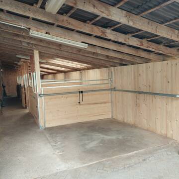
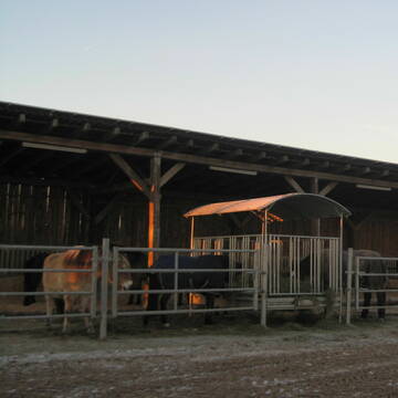
Offenstallplätze und (Paddock)Boxen in Privatsta...
Bad Honnef
Sylvia Adams
@Sylvia24
Freizeitstall
Vermieten
Hunde willkommen
Paddock
Hufrehe geeignet
14 weitere...
aktuell
P


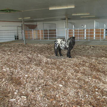
Historische Reitanlage in Köln-Dellbrück
Köln
RGS Kornspringer Köln e. V.
@Kornspringer
FN-Mitglied
Freizeitstall
Vermieten
Führanlage
Hunde willkommen
bedampftes/gewaschenes Heu
Notfallboxen
21 weitere...
S
Deprecated: Creation of dynamic property Zend_View_Helper_Ads::$adLink is deprecated in /var/www/stall-frei/htdocs/staging.stall-frei.de/library/Psf/View/Helper/Ads.php on line 108

Futtersack HeuToy, Fressbremse in pink
Mechtersen
STALL-FREIde Marketing
@STALL-FREI-Marketing
Stundenlange Beschäftigung die
Koliken vorbeugt, geringe Staubinhalation mit
steuerbarer Futterentnahme
Pferdebox frei! Täglicher Weidegang!
Hennef-Stadt Blankenberg
Bernhard und Ulrike Broich
@Broich
Freizeitstall
Vermieten
Paddock
Reitplatz (z.B. Dressur, Springen, Reining)
Außenboxen
6 weitere...
P
Leider kein Vorschaubild
Leider kein Vorschaubild
Offenstall
Hennef
Pferdepension-Fischer
@Pferdepension-Fischer
Freizeitstall
Geländestrecke
Vermieten
Paddock
Parkplatz für Pferdeanhänger
Offenstall
6 weitere...
B
Leider kein Vorschaubild
Leider kein Vorschaubild
Offenstall in Hennef
Hennef-Kümpel
Winiranch-Offenstall
@Winiranch-Robusthaltung-Hennef
Freizeitstall
Gangpferdereiten
Paddock
Parkplatz für Pferdeanhänger
Allergikerstall
Notfallboxen
Außenboxen
Offenstall
11 weitere...
B

Das Beste für die Hufe
Mechtersen
STALL-FREIde Marketing
@STALL-FREI-Marketing
Hufschmiede und Hufpfleger in Ihrer Nähe
Pferdepension Bahners
Rheinbach- Ramershoven
Andreas-Bahners
@Andreas-Bahners
Freizeitstall
Krankenbox
Longierzirkel/Roundpen
Allergikerstall
Fohlenaufzucht möglich
Laufstall
Offenstall
13 weitere...
P+
Aufzuchtplätze, Zuchtstutenplätze im Rheinland
Bornheim
Reiterhof am Brombeerweg
@Uwe-Heynmoeller
FN-Mitglied
Freizeitstall
Vermieten
Verpachten
Krankenbox
Longierzirkel/Roundpen
Pferdezucht
Zuchtstutenhaltung möglich
20 weitere...
P


Stall-WG hat freie Stallplätze
Bornheim
Veronica Maacks-Cammarata
@StallWG
Freizeitstall
Hunde willkommen
Krankenbox
Innenbox
Offenstall
Halbpension
Selbstversorgung
7 weitere...
P+
Leider kein Vorschaubild
Leider kein Vorschaubild
Shetty Platz
Hennef
Monika Schmidt
@monika-schmidt69
Freizeitstall
Verpachten
Reitplatz (z.B. Dressur, Springen, Reining)
Sommerweide
Offenstall
1 weitere...
B
Leider kein Vorschaubild
Leider kein Vorschaubild
Offenstall frei für eine Stute unter 150cm
Troisdorf
Monika
@Hanni
Freizeitstall
Geländestrecke
Vermieten
Longierzirkel/Roundpen
Paddock
Offenstall
Paddock Trail
6 weitere...
B
Newsletter abonnieren
Melde Dich für unseren Newsletter an und verpasse keine Neuigkeiten!
Deprecated: Creation of dynamic property Zend_View::$pageCount is deprecated in /var/www/stall-frei/htdocs/staging.stall-frei.de/library/vendor/shardj/zf1-future/library/Zend/View/Abstract.php on line 308
Deprecated: Creation of dynamic property Zend_View::$itemCountPerPage is deprecated in /var/www/stall-frei/htdocs/staging.stall-frei.de/library/vendor/shardj/zf1-future/library/Zend/View/Abstract.php on line 308
Deprecated: Creation of dynamic property Zend_View::$first is deprecated in /var/www/stall-frei/htdocs/staging.stall-frei.de/library/vendor/shardj/zf1-future/library/Zend/View/Abstract.php on line 308
Deprecated: Creation of dynamic property Zend_View::$current is deprecated in /var/www/stall-frei/htdocs/staging.stall-frei.de/library/vendor/shardj/zf1-future/library/Zend/View/Abstract.php on line 308
Deprecated: Creation of dynamic property Zend_View::$last is deprecated in /var/www/stall-frei/htdocs/staging.stall-frei.de/library/vendor/shardj/zf1-future/library/Zend/View/Abstract.php on line 308
Deprecated: Creation of dynamic property Zend_View::$previous is deprecated in /var/www/stall-frei/htdocs/staging.stall-frei.de/library/vendor/shardj/zf1-future/library/Zend/View/Abstract.php on line 308
Deprecated: Creation of dynamic property Zend_View::$next is deprecated in /var/www/stall-frei/htdocs/staging.stall-frei.de/library/vendor/shardj/zf1-future/library/Zend/View/Abstract.php on line 308
Deprecated: Creation of dynamic property Zend_View::$pagesInRange is deprecated in /var/www/stall-frei/htdocs/staging.stall-frei.de/library/vendor/shardj/zf1-future/library/Zend/View/Abstract.php on line 308
Deprecated: Creation of dynamic property Zend_View::$firstPageInRange is deprecated in /var/www/stall-frei/htdocs/staging.stall-frei.de/library/vendor/shardj/zf1-future/library/Zend/View/Abstract.php on line 308
Deprecated: Creation of dynamic property Zend_View::$lastPageInRange is deprecated in /var/www/stall-frei/htdocs/staging.stall-frei.de/library/vendor/shardj/zf1-future/library/Zend/View/Abstract.php on line 308
Deprecated: Creation of dynamic property Zend_View::$currentItemCount is deprecated in /var/www/stall-frei/htdocs/staging.stall-frei.de/library/vendor/shardj/zf1-future/library/Zend/View/Abstract.php on line 308
Deprecated: Creation of dynamic property Zend_View::$totalItemCount is deprecated in /var/www/stall-frei/htdocs/staging.stall-frei.de/library/vendor/shardj/zf1-future/library/Zend/View/Abstract.php on line 308
Deprecated: Creation of dynamic property Zend_View::$firstItemNumber is deprecated in /var/www/stall-frei/htdocs/staging.stall-frei.de/library/vendor/shardj/zf1-future/library/Zend/View/Abstract.php on line 308
Deprecated: Creation of dynamic property Zend_View::$lastItemNumber is deprecated in /var/www/stall-frei/htdocs/staging.stall-frei.de/library/vendor/shardj/zf1-future/library/Zend/View/Abstract.php on line 308
Deprecated: Creation of dynamic property Zend_View::$router is deprecated in /var/www/stall-frei/htdocs/staging.stall-frei.de/library/vendor/shardj/zf1-future/library/Zend/View/Abstract.php on line 308
Deprecated: Creation of dynamic property Zend_View::$urlParams is deprecated in /var/www/stall-frei/htdocs/staging.stall-frei.de/library/vendor/shardj/zf1-future/library/Zend/View/Abstract.php on line 308
Deprecated: Creation of dynamic property Zend_View::$showAds is deprecated in /var/www/stall-frei/htdocs/staging.stall-frei.de/library/vendor/shardj/zf1-future/library/Zend/View/Abstract.php on line 308
Deprecated: Creation of dynamic property Zend_View::$objectIds is deprecated in /var/www/stall-frei/htdocs/staging.stall-frei.de/library/vendor/shardj/zf1-future/library/Zend/View/Abstract.php on line 308
Deprecated: Creation of dynamic property Zend_View::$showNavbar is deprecated in /var/www/stall-frei/htdocs/staging.stall-frei.de/library/vendor/shardj/zf1-future/library/Zend/View/Abstract.php on line 308
Deprecated: Creation of dynamic property Zend_View::$showBreadcrumb is deprecated in /var/www/stall-frei/htdocs/staging.stall-frei.de/library/vendor/shardj/zf1-future/library/Zend/View/Abstract.php on line 308
Deprecated: Creation of dynamic property Zend_View::$showFooter is deprecated in /var/www/stall-frei/htdocs/staging.stall-frei.de/library/vendor/shardj/zf1-future/library/Zend/View/Abstract.php on line 308
Deprecated: Creation of dynamic property Zend_View::$showInternalAds is deprecated in /var/www/stall-frei/htdocs/staging.stall-frei.de/library/vendor/shardj/zf1-future/library/Zend/View/Abstract.php on line 308
Deprecated: Creation of dynamic property Zend_View::$blNoContent is deprecated in /var/www/stall-frei/htdocs/staging.stall-frei.de/library/vendor/shardj/zf1-future/library/Zend/View/Abstract.php on line 308
Deprecated: Creation of dynamic property Zend_View::$sMetaDesc is deprecated in /var/www/stall-frei/htdocs/staging.stall-frei.de/library/vendor/shardj/zf1-future/library/Zend/View/Abstract.php on line 308
Deprecated: Creation of dynamic property Zend_View::$useGmaps is deprecated in /var/www/stall-frei/htdocs/staging.stall-frei.de/library/vendor/shardj/zf1-future/library/Zend/View/Abstract.php on line 308
Deprecated: Creation of dynamic property Zend_View::$touches is deprecated in /var/www/stall-frei/htdocs/staging.stall-frei.de/library/vendor/shardj/zf1-future/library/Zend/View/Abstract.php on line 308
Deprecated: Creation of dynamic property Zend_View::$oProject is deprecated in /var/www/stall-frei/htdocs/staging.stall-frei.de/library/vendor/shardj/zf1-future/library/Zend/View/Abstract.php on line 308
Deprecated: Creation of dynamic property Zend_View::$pageHeadline is deprecated in /var/www/stall-frei/htdocs/staging.stall-frei.de/library/vendor/shardj/zf1-future/library/Zend/View/Abstract.php on line 308
Deprecated: Creation of dynamic property Zend_View::$disableLocationField is deprecated in /var/www/stall-frei/htdocs/staging.stall-frei.de/library/vendor/shardj/zf1-future/library/Zend/View/Abstract.php on line 308
Deprecated: Creation of dynamic property Zend_View::$isSearch is deprecated in /var/www/stall-frei/htdocs/staging.stall-frei.de/library/vendor/shardj/zf1-future/library/Zend/View/Abstract.php on line 308
Deprecated: Creation of dynamic property Zend_View::$pageTitle is deprecated in /var/www/stall-frei/htdocs/staging.stall-frei.de/library/vendor/shardj/zf1-future/library/Zend/View/Abstract.php on line 308
Deprecated: Creation of dynamic property Psf_Form_Element_Text::$class is deprecated in /var/www/stall-frei/htdocs/staging.stall-frei.de/library/vendor/shardj/zf1-future/library/Zend/Form/Element.php on line 874
Deprecated: Creation of dynamic property Psf_Form_Element_Text::$size is deprecated in /var/www/stall-frei/htdocs/staging.stall-frei.de/library/vendor/shardj/zf1-future/library/Zend/Form/Element.php on line 874
Deprecated: Creation of dynamic property Psf_Form_Element_Text::$placeholder is deprecated in /var/www/stall-frei/htdocs/staging.stall-frei.de/library/vendor/shardj/zf1-future/library/Zend/Form/Element.php on line 874
Deprecated: Creation of dynamic property Psf_Form_Element_Hidden::$class is deprecated in /var/www/stall-frei/htdocs/staging.stall-frei.de/library/vendor/shardj/zf1-future/library/Zend/Form/Element.php on line 874
Deprecated: Creation of dynamic property Psf_Form_Element_Hidden::$class is deprecated in /var/www/stall-frei/htdocs/staging.stall-frei.de/library/vendor/shardj/zf1-future/library/Zend/Form/Element.php on line 874
Deprecated: Creation of dynamic property Psf_Form_Element_Hidden::$class is deprecated in /var/www/stall-frei/htdocs/staging.stall-frei.de/library/vendor/shardj/zf1-future/library/Zend/Form/Element.php on line 874
Deprecated: Creation of dynamic property Psf_Form_Element_Hidden::$class is deprecated in /var/www/stall-frei/htdocs/staging.stall-frei.de/library/vendor/shardj/zf1-future/library/Zend/Form/Element.php on line 874
Deprecated: Creation of dynamic property Psf_Form_Element_Select::$class is deprecated in /var/www/stall-frei/htdocs/staging.stall-frei.de/library/vendor/shardj/zf1-future/library/Zend/Form/Element.php on line 874
Deprecated: Creation of dynamic property Psf_Form_Element_Select::$class is deprecated in /var/www/stall-frei/htdocs/staging.stall-frei.de/library/vendor/shardj/zf1-future/library/Zend/Form/Element.php on line 874
Deprecated: Creation of dynamic property Psf_Form_Element_Select::$class is deprecated in /var/www/stall-frei/htdocs/staging.stall-frei.de/library/vendor/shardj/zf1-future/library/Zend/Form/Element.php on line 874
Deprecated: Creation of dynamic property Psf_Form_Element_Select::$class is deprecated in /var/www/stall-frei/htdocs/staging.stall-frei.de/library/vendor/shardj/zf1-future/library/Zend/Form/Element.php on line 874
Deprecated: Creation of dynamic property Psf_Form_Element_Text::$class is deprecated in /var/www/stall-frei/htdocs/staging.stall-frei.de/library/vendor/shardj/zf1-future/library/Zend/Form/Element.php on line 874
Deprecated: Creation of dynamic property Psf_Form_Element_Checkbox::$label is deprecated in /var/www/stall-frei/htdocs/staging.stall-frei.de/library/vendor/shardj/zf1-future/library/Zend/Form/Element.php on line 874
Deprecated: Creation of dynamic property Zend_View::$sort is deprecated in /var/www/stall-frei/htdocs/staging.stall-frei.de/library/vendor/shardj/zf1-future/library/Zend/View/Abstract.php on line 308
Deprecated: Creation of dynamic property Zend_View::$searchLocation is deprecated in /var/www/stall-frei/htdocs/staging.stall-frei.de/library/vendor/shardj/zf1-future/library/Zend/View/Abstract.php on line 308
Deprecated: Creation of dynamic property Zend_View::$locationHint is deprecated in /var/www/stall-frei/htdocs/staging.stall-frei.de/library/vendor/shardj/zf1-future/library/Zend/View/Abstract.php on line 308
Psf_GeoCoder_Abstract::getLocation: Holtorf Get Location CachedOrLive
Psf_GeoCoder_Abstract::getCachedOrLive: Holtorf
Psf_GeoCoder_Abstract::convertLocationResult
{"documentation":"https:\/\/opencagedata.com\/api","licenses":[{"name":"see attribution guide","url":"https:\/\/opencagedata.com\/credits"}],"results":[{"bounds":{"northeast":{"lat":50.742268,"lng":7.1958269},"southwest":{"lat":50.7157403,"lng":7.1601819}},"components":{"ISO_3166-1_alpha-2":"DE","ISO_3166-1_alpha-3":"DEU","ISO_3166-2":["DE-NW"],"_category":"place","_normalized_city":"Bonn","_type":"village","city":"Bonn","continent":"Europe","country":"Deutschland","country_code":"de","political_union":"European Union","state":"Nordrhein-Westfalen","state_code":"NW","suburb":"Bonn-Beuel","village":"Holtorf"},"confidence":7,"formatted":"Bonn-Beuel, Holtorf, Nordrhein-Westfalen, Deutschland","geometry":{"lat":50.7312652,"lng":7.1848853}},{"bounds":{"northeast":{"lat":52.6887018,"lng":9.2815425},"southwest":{"lat":52.654776,"lng":9.1973622}},"components":{"ISO_3166-1_alpha-2":"DE","ISO_3166-1_alpha-3":"DEU","ISO_3166-2":["DE-NI"],"_category":"place","_normalized_city":"Nienburg\/Weser","_type":"neighbourhood","continent":"Europe","country":"Deutschland","country_code":"de","county":"Landkreis Nienburg\/Weser","political_union":"European Union","state":"Niedersachsen","state_code":"NI","suburb":"Holtorf (Nienburg)","town":"Nienburg\/Weser"},"confidence":7,"formatted":"Holtorf (Nienburg), Nienburg\/Weser, Niedersachsen, Deutschland","geometry":{"lat":52.6753869,"lng":9.2268377}},{"bounds":{"northeast":{"lat":53.0525345,"lng":11.5282226},"southwest":{"lat":53.0125345,"lng":11.4882226}},"components":{"ISO_3166-1_alpha-2":"DE","ISO_3166-1_alpha-3":"DEU","ISO_3166-2":["DE-NI"],"_category":"place","_normalized_city":"Schnackenburg","_type":"village","continent":"Europe","country":"Deutschland","country_code":"de","county":"Landkreis L\u00fcchow-Dannenberg","municipality":"Samtgemeinde Gartow","political_union":"European Union","postcode":"29493","state":"Niedersachsen","state_code":"NI","town":"Schnackenburg","village":"Holtorf"},"confidence":7,"formatted":"29493 Holtorf, Deutschland","geometry":{"lat":53.0325345,"lng":11.5082226}},{"bounds":{"northeast":{"lat":53.0490701,"lng":11.5361619},"southwest":{"lat":53.0190764,"lng":11.4898287}},"components":{"ISO_3166-1_alpha-2":"DE","ISO_3166-1_alpha-3":"DEU","ISO_3166-2":["DE-NI"],"_category":"place","_normalized_city":"Schnackenburg","_type":"village","continent":"Europe","country":"Deutschland","country_code":"de","county":"Landkreis L\u00fcchow-Dannenberg","municipality":"Samtgemeinde Gartow","political_union":"European Union","state":"Niedersachsen","state_code":"NI","town":"Schnackenburg","village":"Holtorf"},"confidence":7,"formatted":"Holtorf, Niedersachsen, Deutschland","geometry":{"lat":53.0341121,"lng":11.5107739}},{"bounds":{"northeast":{"lat":52.9777797,"lng":9.066645},"southwest":{"lat":52.9377797,"lng":9.026645}},"components":{"ISO_3166-1_alpha-2":"DE","ISO_3166-1_alpha-3":"DEU","ISO_3166-2":["DE-NI"],"_category":"place","_normalized_city":"Thedinghausen","_type":"hamlet","continent":"Europe","country":"Deutschland","country_code":"de","county":"Landkreis Verden","hamlet":"Holtorf","political_union":"European Union","postcode":"27321","state":"Niedersachsen","state_code":"NI","suburb":"Holtorf-Lunsen","town":"Thedinghausen"},"confidence":7,"formatted":"Holtorf, 27321 Thedinghausen, Deutschland","geometry":{"lat":52.9577797,"lng":9.046645}},{"bounds":{"northeast":{"lat":53.1565358,"lng":10.344143},"southwest":{"lat":53.1165358,"lng":10.304143}},"components":{"ISO_3166-1_alpha-2":"DE","ISO_3166-1_alpha-3":"DEU","ISO_3166-2":["DE-NI"],"_category":"place","_normalized_city":"Betzendorf","_type":"hamlet","continent":"Europe","country":"Deutschland","country_code":"de","county":"Landkreis L\u00fcneburg","hamlet":"Holtorf","municipality":"Samtgemeinde Amelinghausen","political_union":"European Union","postcode":"21386","state":"Niedersachsen","state_code":"NI","village":"Betzendorf"},"confidence":7,"formatted":"Holtorf, 21386 Betzendorf, Deutschland","geometry":{"lat":53.1365358,"lng":10.324143}},{"bounds":{"northeast":{"lat":52.8340733,"lng":8.5304663},"southwest":{"lat":52.7940733,"lng":8.4904663}},"components":{"ISO_3166-1_alpha-2":"DE","ISO_3166-1_alpha-3":"DEU","ISO_3166-2":["DE-NI"],"_category":"place","_normalized_city":"Colnrade","_type":"hamlet","continent":"Europe","country":"Deutschland","country_code":"de","county":"Landkreis Oldenburg","hamlet":"Holtorf","municipality":"Samtgemeinde Harpstedt","political_union":"European Union","state":"Niedersachsen","state_code":"NI","village":"Colnrade"},"confidence":7,"formatted":"Holtorf, Colnrade, Niedersachsen, Deutschland","geometry":{"lat":52.8140733,"lng":8.5104663}},{"components":{"ISO_3166-1_alpha-2":"FR","ISO_3166-1_alpha-3":"FRA","ISO_3166-2":["FR-IDF","FR-92"],"_category":"road","_normalized_city":"Levallois-Perret","_type":"road","city":"Levallois-Perret","continent":"Europe","country":"France","country_code":"fr","county":"Hauts-de-Seine","local_authority":"M\u00e9tropole du Grand Paris","political_union":"European Union","postcode":"92300","road":"Rue Charles Deutschmann","state":"\u00cele-de-France","state_code":"IDF"},"confidence":2,"formatted":"Rue Charles Deutschmann, 92300 Levallois-Perret, France","geometry":{"lat":48.900049,"lng":2.2842}},{"components":{"ISO_3166-1_alpha-2":"FR","ISO_3166-1_alpha-3":"FRA","ISO_3166-2":["FR-GES","FR-6AE","FR-67"],"_category":"road","_normalized_city":"Altorf","_type":"road","city":"Altorf","continent":"Europe","country":"France","country_code":"fr","county":"Bas-Rhin","local_authority":"Communaut\u00e9 de communes de la R\u00e9gion de Molsheim-Mutzig","political_union":"European Union","postcode":"67120","road":"Rue des Platanes","state":"Grand Est","state_code":"GES"},"confidence":2,"formatted":"Rue des Platanes, 67120 Altorf, France","geometry":{"lat":48.530623,"lng":7.523181}},{"components":{"ISO_3166-1_alpha-2":"FR","ISO_3166-1_alpha-3":"FRA","ISO_3166-2":["FR-GES","FR-6AE","FR-67"],"_category":"road","_normalized_city":"Molsheim","_type":"road","city":"Molsheim","continent":"Europe","country":"France","country_code":"fr","county":"Bas-Rhin","local_authority":"Communaut\u00e9 de communes de la R\u00e9gion de Molsheim-Mutzig","political_union":"European Union","postcode":"67120","road":"Chemin d'Altorf","state":"Grand Est","state_code":"GES"},"confidence":2,"formatted":"Chemin d'Altorf, 67120 Molsheim, France","geometry":{"lat":48.531588,"lng":7.514688}}],"status":{"code":200,"message":"OK"},"stay_informed":{"blog":"https:\/\/blog.opencagedata.com","mastodon":"https:\/\/en.osm.town\/@opencage"},"thanks":"For using an OpenCage API","timestamp":{"created_http":"Mon, 09 Feb 2026 01:02:06 GMT","created_unix":1770598926},"total_results":10}Array
(
[0] => stdClass Object
(
[bounds] => stdClass Object
(
[northeast] => stdClass Object
(
[lat] => 50.742268
[lng] => 7.1958269
)
[southwest] => stdClass Object
(
[lat] => 50.7157403
[lng] => 7.1601819
)
)
[components] => stdClass Object
(
[ISO_3166-1_alpha-2] => DE
[ISO_3166-1_alpha-3] => DEU
[ISO_3166-2] => Array
(
[0] => DE-NW
)
[_category] => place
[_normalized_city] => Bonn
[_type] => village
[city] => Bonn
[continent] => Europe
[country] => Deutschland
[country_code] => de
[political_union] => European Union
[state] => Nordrhein-Westfalen
[state_code] => NW
[suburb] => Bonn-Beuel
[village] => Holtorf
)
[confidence] => 7
[formatted] => Bonn-Beuel, Holtorf, Nordrhein-Westfalen, Deutschland
[geometry] => stdClass Object
(
[lat] => 50.7312652
[lng] => 7.1848853
)
)
[1] => stdClass Object
(
[bounds] => stdClass Object
(
[northeast] => stdClass Object
(
[lat] => 52.6887018
[lng] => 9.2815425
)
[southwest] => stdClass Object
(
[lat] => 52.654776
[lng] => 9.1973622
)
)
[components] => stdClass Object
(
[ISO_3166-1_alpha-2] => DE
[ISO_3166-1_alpha-3] => DEU
[ISO_3166-2] => Array
(
[0] => DE-NI
)
[_category] => place
[_normalized_city] => Nienburg/Weser
[_type] => neighbourhood
[continent] => Europe
[country] => Deutschland
[country_code] => de
[county] => Landkreis Nienburg/Weser
[political_union] => European Union
[state] => Niedersachsen
[state_code] => NI
[suburb] => Holtorf (Nienburg)
[town] => Nienburg/Weser
)
[confidence] => 7
[formatted] => Holtorf (Nienburg), Nienburg/Weser, Niedersachsen, Deutschland
[geometry] => stdClass Object
(
[lat] => 52.6753869
[lng] => 9.2268377
)
)
[2] => stdClass Object
(
[bounds] => stdClass Object
(
[northeast] => stdClass Object
(
[lat] => 53.0525345
[lng] => 11.5282226
)
[southwest] => stdClass Object
(
[lat] => 53.0125345
[lng] => 11.4882226
)
)
[components] => stdClass Object
(
[ISO_3166-1_alpha-2] => DE
[ISO_3166-1_alpha-3] => DEU
[ISO_3166-2] => Array
(
[0] => DE-NI
)
[_category] => place
[_normalized_city] => Schnackenburg
[_type] => village
[continent] => Europe
[country] => Deutschland
[country_code] => de
[county] => Landkreis Lüchow-Dannenberg
[municipality] => Samtgemeinde Gartow
[political_union] => European Union
[postcode] => 29493
[state] => Niedersachsen
[state_code] => NI
[town] => Schnackenburg
[village] => Holtorf
)
[confidence] => 7
[formatted] => 29493 Holtorf, Deutschland
[geometry] => stdClass Object
(
[lat] => 53.0325345
[lng] => 11.5082226
)
)
[3] => stdClass Object
(
[bounds] => stdClass Object
(
[northeast] => stdClass Object
(
[lat] => 53.0490701
[lng] => 11.5361619
)
[southwest] => stdClass Object
(
[lat] => 53.0190764
[lng] => 11.4898287
)
)
[components] => stdClass Object
(
[ISO_3166-1_alpha-2] => DE
[ISO_3166-1_alpha-3] => DEU
[ISO_3166-2] => Array
(
[0] => DE-NI
)
[_category] => place
[_normalized_city] => Schnackenburg
[_type] => village
[continent] => Europe
[country] => Deutschland
[country_code] => de
[county] => Landkreis Lüchow-Dannenberg
[municipality] => Samtgemeinde Gartow
[political_union] => European Union
[state] => Niedersachsen
[state_code] => NI
[town] => Schnackenburg
[village] => Holtorf
)
[confidence] => 7
[formatted] => Holtorf, Niedersachsen, Deutschland
[geometry] => stdClass Object
(
[lat] => 53.0341121
[lng] => 11.5107739
)
)
[4] => stdClass Object
(
[bounds] => stdClass Object
(
[northeast] => stdClass Object
(
[lat] => 52.9777797
[lng] => 9.066645
)
[southwest] => stdClass Object
(
[lat] => 52.9377797
[lng] => 9.026645
)
)
[components] => stdClass Object
(
[ISO_3166-1_alpha-2] => DE
[ISO_3166-1_alpha-3] => DEU
[ISO_3166-2] => Array
(
[0] => DE-NI
)
[_category] => place
[_normalized_city] => Thedinghausen
[_type] => hamlet
[continent] => Europe
[country] => Deutschland
[country_code] => de
[county] => Landkreis Verden
[hamlet] => Holtorf
[political_union] => European Union
[postcode] => 27321
[state] => Niedersachsen
[state_code] => NI
[suburb] => Holtorf-Lunsen
[town] => Thedinghausen
)
[confidence] => 7
[formatted] => Holtorf, 27321 Thedinghausen, Deutschland
[geometry] => stdClass Object
(
[lat] => 52.9577797
[lng] => 9.046645
)
)
[5] => stdClass Object
(
[bounds] => stdClass Object
(
[northeast] => stdClass Object
(
[lat] => 53.1565358
[lng] => 10.344143
)
[southwest] => stdClass Object
(
[lat] => 53.1165358
[lng] => 10.304143
)
)
[components] => stdClass Object
(
[ISO_3166-1_alpha-2] => DE
[ISO_3166-1_alpha-3] => DEU
[ISO_3166-2] => Array
(
[0] => DE-NI
)
[_category] => place
[_normalized_city] => Betzendorf
[_type] => hamlet
[continent] => Europe
[country] => Deutschland
[country_code] => de
[county] => Landkreis Lüneburg
[hamlet] => Holtorf
[municipality] => Samtgemeinde Amelinghausen
[political_union] => European Union
[postcode] => 21386
[state] => Niedersachsen
[state_code] => NI
[village] => Betzendorf
)
[confidence] => 7
[formatted] => Holtorf, 21386 Betzendorf, Deutschland
[geometry] => stdClass Object
(
[lat] => 53.1365358
[lng] => 10.324143
)
)
[6] => stdClass Object
(
[bounds] => stdClass Object
(
[northeast] => stdClass Object
(
[lat] => 52.8340733
[lng] => 8.5304663
)
[southwest] => stdClass Object
(
[lat] => 52.7940733
[lng] => 8.4904663
)
)
[components] => stdClass Object
(
[ISO_3166-1_alpha-2] => DE
[ISO_3166-1_alpha-3] => DEU
[ISO_3166-2] => Array
(
[0] => DE-NI
)
[_category] => place
[_normalized_city] => Colnrade
[_type] => hamlet
[continent] => Europe
[country] => Deutschland
[country_code] => de
[county] => Landkreis Oldenburg
[hamlet] => Holtorf
[municipality] => Samtgemeinde Harpstedt
[political_union] => European Union
[state] => Niedersachsen
[state_code] => NI
[village] => Colnrade
)
[confidence] => 7
[formatted] => Holtorf, Colnrade, Niedersachsen, Deutschland
[geometry] => stdClass Object
(
[lat] => 52.8140733
[lng] => 8.5104663
)
)
[7] => stdClass Object
(
[components] => stdClass Object
(
[ISO_3166-1_alpha-2] => FR
[ISO_3166-1_alpha-3] => FRA
[ISO_3166-2] => Array
(
[0] => FR-IDF
[1] => FR-92
)
[_category] => road
[_normalized_city] => Levallois-Perret
[_type] => road
[city] => Levallois-Perret
[continent] => Europe
[country] => France
[country_code] => fr
[county] => Hauts-de-Seine
[local_authority] => Métropole du Grand Paris
[political_union] => European Union
[postcode] => 92300
[road] => Rue Charles Deutschmann
[state] => Île-de-France
[state_code] => IDF
)
[confidence] => 2
[formatted] => Rue Charles Deutschmann, 92300 Levallois-Perret, France
[geometry] => stdClass Object
(
[lat] => 48.900049
[lng] => 2.2842
)
)
[8] => stdClass Object
(
[components] => stdClass Object
(
[ISO_3166-1_alpha-2] => FR
[ISO_3166-1_alpha-3] => FRA
[ISO_3166-2] => Array
(
[0] => FR-GES
[1] => FR-6AE
[2] => FR-67
)
[_category] => road
[_normalized_city] => Altorf
[_type] => road
[city] => Altorf
[continent] => Europe
[country] => France
[country_code] => fr
[county] => Bas-Rhin
[local_authority] => Communauté de communes de la Région de Molsheim-Mutzig
[political_union] => European Union
[postcode] => 67120
[road] => Rue des Platanes
[state] => Grand Est
[state_code] => GES
)
[confidence] => 2
[formatted] => Rue des Platanes, 67120 Altorf, France
[geometry] => stdClass Object
(
[lat] => 48.530623
[lng] => 7.523181
)
)
[9] => stdClass Object
(
[components] => stdClass Object
(
[ISO_3166-1_alpha-2] => FR
[ISO_3166-1_alpha-3] => FRA
[ISO_3166-2] => Array
(
[0] => FR-GES
[1] => FR-6AE
[2] => FR-67
)
[_category] => road
[_normalized_city] => Molsheim
[_type] => road
[city] => Molsheim
[continent] => Europe
[country] => France
[country_code] => fr
[county] => Bas-Rhin
[local_authority] => Communauté de communes de la Région de Molsheim-Mutzig
[political_union] => European Union
[postcode] => 67120
[road] => Chemin d'Altorf
[state] => Grand Est
[state_code] => GES
)
[confidence] => 2
[formatted] => Chemin d'Altorf, 67120 Molsheim, France
[geometry] => stdClass Object
(
[lat] => 48.531588
[lng] => 7.514688
)
)
)
Psf_GeoCoder_OpenCageData::getKeyMap: 0
stdClass Object
(
    [bounds] => stdClass Object
        (
            [northeast] => stdClass Object
                (
                    [lat] => 50.742268
                    [lng] => 7.1958269
                )

            [southwest] => stdClass Object
                (
                    [lat] => 50.7157403
                    [lng] => 7.1601819
                )

        )

    [components] => stdClass Object
        (
            [ISO_3166-1_alpha-2] => DE
            [ISO_3166-1_alpha-3] => DEU
            [ISO_3166-2] => Array
                (
                    [0] => DE-NW
                )

            [_category] => place
            [_normalized_city] => Bonn
            [_type] => village
            [city] => Bonn
            [continent] => Europe
            [country] => Deutschland
            [country_code] => de
            [political_union] => European Union
            [state] => Nordrhein-Westfalen
            [state_code] => NW
            [suburb] => Bonn-Beuel
            [village] => Holtorf
        )

    [confidence] => 7
    [formatted] => Bonn-Beuel, Holtorf, Nordrhein-Westfalen, Deutschland
    [geometry] => stdClass Object
        (
            [lat] => 50.7312652
            [lng] => 7.1848853
        )

)
Psf_GeoCoder_OpenCageData::getCounty: Bonn
Psf_GeoCoder_OpenCageData::addMissingData REFETCH!
Array
(
    [address] => Bonn-Beuel, Holtorf, Nordrhein-Westfalen, Deutschland
    [type] => village
    [street] =>
    [city] => Holtorf
    [county] => Bonn
    [state] => Nordrhein-Westfalen
    [zip] =>
    [country] => Deutschland
    [suburb] => Bonn-Beuel
    [countrycode] => de
    [latitude] => 50.7312652
    [longitude] => 7.1848853
    [accuracy] => 1
    [confidence] => 7
    [bounds] => stdClass Object
        (
            [northeast] => stdClass Object
                (
                    [lat] => 50.742268
                    [lng] => 7.1958269
                )

            [southwest] => stdClass Object
                (
                    [lat] => 50.7157403
                    [lng] => 7.1601819
                )

        )

)
reformat!
Array
(
    [address] => Bonn-Beuel, Holtorf, Nordrhein-Westfalen, Deutschland
    [type] => village
    [street] =>
    [city] => Holtorf
    [county] => Bonn
    [state] => Nordrhein-Westfalen
    [zip] =>
    [country] => Deutschland
    [suburb] => Bonn-Beuel
    [countrycode] => de
    [latitude] => 50.7312652
    [longitude] => 7.1848853
    [accuracy] => 1
    [confidence] => 7
    [bounds] => stdClass Object
        (
            [northeast] => stdClass Object
                (
                    [lat] => 50.742268
                    [lng] => 7.1958269
                )

            [southwest] => stdClass Object
                (
                    [lat] => 50.7157403
                    [lng] => 7.1601819
                )

        )

    [place] => Holtorf, Nordrhein-Westfalen
    [hash] => 984a50f7e332160c788ddd08829c5759
)
Psf_GeoCoder_OpenCageData::getKeyMap: 1
stdClass Object
(
    [bounds] => stdClass Object
        (
            [northeast] => stdClass Object
                (
                    [lat] => 52.6887018
                    [lng] => 9.2815425
                )

            [southwest] => stdClass Object
                (
                    [lat] => 52.654776
                    [lng] => 9.1973622
                )

        )

    [components] => stdClass Object
        (
            [ISO_3166-1_alpha-2] => DE
            [ISO_3166-1_alpha-3] => DEU
            [ISO_3166-2] => Array
                (
                    [0] => DE-NI
                )

            [_category] => place
            [_normalized_city] => Nienburg/Weser
            [_type] => neighbourhood
            [continent] => Europe
            [country] => Deutschland
            [country_code] => de
            [county] => Landkreis Nienburg/Weser
            [political_union] => European Union
            [state] => Niedersachsen
            [state_code] => NI
            [suburb] => Holtorf (Nienburg)
            [town] => Nienburg/Weser
        )

    [confidence] => 7
    [formatted] => Holtorf (Nienburg), Nienburg/Weser, Niedersachsen, Deutschland
    [geometry] => stdClass Object
        (
            [lat] => 52.6753869
            [lng] => 9.2268377
        )

)
Psf_GeoCoder_OpenCageData::getCounty: Nienburg/Weser
Psf_GeoCoder_OpenCageData::addMissingData REFETCH!
Array
(
    [address] => Holtorf (Nienburg), Nienburg/Weser, Niedersachsen, Deutschland
    [type] => neighbourhood
    [street] =>
    [city] => Nienburg/Weser
    [county] => Nienburg/Weser
    [state] => Niedersachsen
    [zip] =>
    [country] => Deutschland
    [suburb] => Holtorf (Nienburg)
    [countrycode] => de
    [latitude] => 52.6753869
    [longitude] => 9.2268377
    [accuracy] => 1
    [confidence] => 7
    [bounds] => stdClass Object
        (
            [northeast] => stdClass Object
                (
                    [lat] => 52.6887018
                    [lng] => 9.2815425
                )

            [southwest] => stdClass Object
                (
                    [lat] => 52.654776
                    [lng] => 9.1973622
                )

        )

)
reformat!
Array
(
    [address] => Holtorf (Nienburg), Nienburg/Weser, Niedersachsen, Deutschland
    [type] => neighbourhood
    [street] =>
    [city] => Nienburg/Weser
    [county] => Nienburg/Weser
    [state] => Niedersachsen
    [zip] =>
    [country] => Deutschland
    [suburb] => Holtorf (Nienburg)
    [countrycode] => de
    [latitude] => 52.6753869
    [longitude] => 9.2268377
    [accuracy] => 1
    [confidence] => 7
    [bounds] => stdClass Object
        (
            [northeast] => stdClass Object
                (
                    [lat] => 52.6887018
                    [lng] => 9.2815425
                )

            [southwest] => stdClass Object
                (
                    [lat] => 52.654776
                    [lng] => 9.1973622
                )

        )

    [place] => Nienburg/Weser, Niedersachsen
    [hash] => 6412edeec210c5c6829b7861ec1e41f2
)
Psf_GeoCoder_OpenCageData::getKeyMap: 2
stdClass Object
(
    [bounds] => stdClass Object
        (
            [northeast] => stdClass Object
                (
                    [lat] => 53.0525345
                    [lng] => 11.5282226
                )

            [southwest] => stdClass Object
                (
                    [lat] => 53.0125345
                    [lng] => 11.4882226
                )

        )

    [components] => stdClass Object
        (
            [ISO_3166-1_alpha-2] => DE
            [ISO_3166-1_alpha-3] => DEU
            [ISO_3166-2] => Array
                (
                    [0] => DE-NI
                )

            [_category] => place
            [_normalized_city] => Schnackenburg
            [_type] => village
            [continent] => Europe
            [country] => Deutschland
            [country_code] => de
            [county] => Landkreis Lüchow-Dannenberg
            [municipality] => Samtgemeinde Gartow
            [political_union] => European Union
            [postcode] => 29493
            [state] => Niedersachsen
            [state_code] => NI
            [town] => Schnackenburg
            [village] => Holtorf
        )

    [confidence] => 7
    [formatted] => 29493 Holtorf, Deutschland
    [geometry] => stdClass Object
        (
            [lat] => 53.0325345
            [lng] => 11.5082226
        )

)
Psf_GeoCoder_OpenCageData::getCounty: Lüchow-Dannenberg
Psf_GeoCoder_OpenCageData::addMissingData REFETCH!
Array
(
    [address] => 29493 Holtorf, Deutschland
    [type] => village
    [street] =>
    [city] => Schnackenburg
    [county] => Lüchow-Dannenberg
    [state] => Niedersachsen
    [zip] => 29493
    [country] => Deutschland
    [suburb] =>
    [countrycode] => de
    [latitude] => 53.0325345
    [longitude] => 11.5082226
    [accuracy] => 1
    [confidence] => 7
    [bounds] => stdClass Object
        (
            [northeast] => stdClass Object
                (
                    [lat] => 53.0525345
                    [lng] => 11.5282226
                )

            [southwest] => stdClass Object
                (
                    [lat] => 53.0125345
                    [lng] => 11.4882226
                )

        )

)
reformat!
Array
(
    [address] => 29493 Schnackenburg
    [type] => village
    [street] =>
    [city] => Schnackenburg
    [county] => Lüchow-Dannenberg
    [state] => Niedersachsen
    [zip] => 29493
    [country] => Deutschland
    [suburb] =>
    [countrycode] => de
    [latitude] => 53.0325345
    [longitude] => 11.5082226
    [accuracy] => 1
    [confidence] => 7
    [bounds] => stdClass Object
        (
            [northeast] => stdClass Object
                (
                    [lat] => 53.0525345
                    [lng] => 11.5282226
                )

            [southwest] => stdClass Object
                (
                    [lat] => 53.0125345
                    [lng] => 11.4882226
                )

        )

    [place] => 29493 Schnackenburg, Niedersachsen
    [hash] => df9689cc7bda851ce6f647a173c0ea59
)
Psf_GeoCoder_OpenCageData::getKeyMap: 3
stdClass Object
(
    [bounds] => stdClass Object
        (
            [northeast] => stdClass Object
                (
                    [lat] => 53.0490701
                    [lng] => 11.5361619
                )

            [southwest] => stdClass Object
                (
                    [lat] => 53.0190764
                    [lng] => 11.4898287
                )

        )

    [components] => stdClass Object
        (
            [ISO_3166-1_alpha-2] => DE
            [ISO_3166-1_alpha-3] => DEU
            [ISO_3166-2] => Array
                (
                    [0] => DE-NI
                )

            [_category] => place
            [_normalized_city] => Schnackenburg
            [_type] => village
            [continent] => Europe
            [country] => Deutschland
            [country_code] => de
            [county] => Landkreis Lüchow-Dannenberg
            [municipality] => Samtgemeinde Gartow
            [political_union] => European Union
            [state] => Niedersachsen
            [state_code] => NI
            [town] => Schnackenburg
            [village] => Holtorf
        )

    [confidence] => 7
    [formatted] => Holtorf, Niedersachsen, Deutschland
    [geometry] => stdClass Object
        (
            [lat] => 53.0341121
            [lng] => 11.5107739
        )

)
Psf_GeoCoder_OpenCageData::getCounty: Lüchow-Dannenberg
Psf_GeoCoder_OpenCageData::addMissingData REFETCH!
Array
(
    [address] => Holtorf, Niedersachsen, Deutschland
    [type] => village
    [street] =>
    [city] => Schnackenburg
    [county] => Lüchow-Dannenberg
    [state] => Niedersachsen
    [zip] =>
    [country] => Deutschland
    [suburb] =>
    [countrycode] => de
    [latitude] => 53.0341121
    [longitude] => 11.5107739
    [accuracy] => 1
    [confidence] => 7
    [bounds] => stdClass Object
        (
            [northeast] => stdClass Object
                (
                    [lat] => 53.0490701
                    [lng] => 11.5361619
                )

            [southwest] => stdClass Object
                (
                    [lat] => 53.0190764
                    [lng] => 11.4898287
                )

        )

)
reformat!
Array
(
    [address] => Schnackenburg
    [type] => village
    [street] =>
    [city] => Schnackenburg
    [county] => Lüchow-Dannenberg
    [state] => Niedersachsen
    [zip] =>
    [country] => Deutschland
    [suburb] =>
    [countrycode] => de
    [latitude] => 53.0341121
    [longitude] => 11.5107739
    [accuracy] => 1
    [confidence] => 7
    [bounds] => stdClass Object
        (
            [northeast] => stdClass Object
                (
                    [lat] => 53.0490701
                    [lng] => 11.5361619
                )

            [southwest] => stdClass Object
                (
                    [lat] => 53.0190764
                    [lng] => 11.4898287
                )

        )

    [place] => Schnackenburg, Niedersachsen
    [hash] => 1cc6d9be4ccb635cbbdee7521fc3e8d2
)
Psf_GeoCoder_OpenCageData::getKeyMap: 4
stdClass Object
(
    [bounds] => stdClass Object
        (
            [northeast] => stdClass Object
                (
                    [lat] => 52.9777797
                    [lng] => 9.066645
                )

            [southwest] => stdClass Object
                (
                    [lat] => 52.9377797
                    [lng] => 9.026645
                )

        )

    [components] => stdClass Object
        (
            [ISO_3166-1_alpha-2] => DE
            [ISO_3166-1_alpha-3] => DEU
            [ISO_3166-2] => Array
                (
                    [0] => DE-NI
                )

            [_category] => place
            [_normalized_city] => Thedinghausen
            [_type] => hamlet
            [continent] => Europe
            [country] => Deutschland
            [country_code] => de
            [county] => Landkreis Verden
            [hamlet] => Holtorf
            [political_union] => European Union
            [postcode] => 27321
            [state] => Niedersachsen
            [state_code] => NI
            [suburb] => Holtorf-Lunsen
            [town] => Thedinghausen
        )

    [confidence] => 7
    [formatted] => Holtorf, 27321 Thedinghausen, Deutschland
    [geometry] => stdClass Object
        (
            [lat] => 52.9577797
            [lng] => 9.046645
        )

)
Psf_GeoCoder_OpenCageData::getCounty: Verden
Psf_GeoCoder_OpenCageData::addMissingData REFETCH!
Array
(
    [address] => Holtorf, 27321 Thedinghausen, Deutschland
    [type] => hamlet
    [street] => Holtorf
    [city] => Thedinghausen
    [county] => Verden
    [state] => Niedersachsen
    [zip] => 27321
    [country] => Deutschland
    [suburb] => Holtorf-Lunsen
    [countrycode] => de
    [latitude] => 52.9577797
    [longitude] => 9.046645
    [accuracy] => 1
    [confidence] => 7
    [bounds] => stdClass Object
        (
            [northeast] => stdClass Object
                (
                    [lat] => 52.9777797
                    [lng] => 9.066645
                )

            [southwest] => stdClass Object
                (
                    [lat] => 52.9377797
                    [lng] => 9.026645
                )

        )

)
reformat!
Array
(
    [address] => Holtorf, 27321 Thedinghausen, Deutschland
    [type] => hamlet
    [street] => Holtorf
    [city] => Thedinghausen
    [county] => Verden
    [state] => Niedersachsen
    [zip] => 27321
    [country] => Deutschland
    [suburb] => Holtorf-Lunsen
    [countrycode] => de
    [latitude] => 52.9577797
    [longitude] => 9.046645
    [accuracy] => 1
    [confidence] => 7
    [bounds] => stdClass Object
        (
            [northeast] => stdClass Object
                (
                    [lat] => 52.9777797
                    [lng] => 9.066645
                )

            [southwest] => stdClass Object
                (
                    [lat] => 52.9377797
                    [lng] => 9.026645
                )

        )

    [place] => Holtorf, 27321 Thedinghausen, Niedersachsen
    [hash] => 5cdedf1206aa22ec87a8c8c4f3b11798
)
Psf_GeoCoder_OpenCageData::getKeyMap: 5
stdClass Object
(
    [bounds] => stdClass Object
        (
            [northeast] => stdClass Object
                (
                    [lat] => 53.1565358
                    [lng] => 10.344143
                )

            [southwest] => stdClass Object
                (
                    [lat] => 53.1165358
                    [lng] => 10.304143
                )

        )

    [components] => stdClass Object
        (
            [ISO_3166-1_alpha-2] => DE
            [ISO_3166-1_alpha-3] => DEU
            [ISO_3166-2] => Array
                (
                    [0] => DE-NI
                )

            [_category] => place
            [_normalized_city] => Betzendorf
            [_type] => hamlet
            [continent] => Europe
            [country] => Deutschland
            [country_code] => de
            [county] => Landkreis Lüneburg
            [hamlet] => Holtorf
            [municipality] => Samtgemeinde Amelinghausen
            [political_union] => European Union
            [postcode] => 21386
            [state] => Niedersachsen
            [state_code] => NI
            [village] => Betzendorf
        )

    [confidence] => 7
    [formatted] => Holtorf, 21386 Betzendorf, Deutschland
    [geometry] => stdClass Object
        (
            [lat] => 53.1365358
            [lng] => 10.324143
        )

)
Psf_GeoCoder_OpenCageData::getCounty: Lüneburg
Psf_GeoCoder_OpenCageData::addMissingData REFETCH!
Array
(
    [address] => Holtorf, 21386 Betzendorf, Deutschland
    [type] => hamlet
    [street] => Holtorf
    [city] => Betzendorf
    [county] => Lüneburg
    [state] => Niedersachsen
    [zip] => 21386
    [country] => Deutschland
    [suburb] =>
    [countrycode] => de
    [latitude] => 53.1365358
    [longitude] => 10.324143
    [accuracy] => 1
    [confidence] => 7
    [bounds] => stdClass Object
        (
            [northeast] => stdClass Object
                (
                    [lat] => 53.1565358
                    [lng] => 10.344143
                )

            [southwest] => stdClass Object
                (
                    [lat] => 53.1165358
                    [lng] => 10.304143
                )

        )

)
reformat!
Array
(
    [address] => Holtorf, 21386 Betzendorf, Deutschland
    [type] => hamlet
    [street] => Holtorf
    [city] => Betzendorf
    [county] => Lüneburg
    [state] => Niedersachsen
    [zip] => 21386
    [country] => Deutschland
    [suburb] =>
    [countrycode] => de
    [latitude] => 53.1365358
    [longitude] => 10.324143
    [accuracy] => 1
    [confidence] => 7
    [bounds] => stdClass Object
        (
            [northeast] => stdClass Object
                (
                    [lat] => 53.1565358
                    [lng] => 10.344143
                )

            [southwest] => stdClass Object
                (
                    [lat] => 53.1165358
                    [lng] => 10.304143
                )

        )

    [place] => Holtorf, 21386 Betzendorf, Niedersachsen
    [hash] => 55a18bbf2f46ba796760dfd2f7ac979b
)
Psf_GeoCoder_OpenCageData::getKeyMap: 6
stdClass Object
(
    [bounds] => stdClass Object
        (
            [northeast] => stdClass Object
                (
                    [lat] => 52.8340733
                    [lng] => 8.5304663
                )

            [southwest] => stdClass Object
                (
                    [lat] => 52.7940733
                    [lng] => 8.4904663
                )

        )

    [components] => stdClass Object
        (
            [ISO_3166-1_alpha-2] => DE
            [ISO_3166-1_alpha-3] => DEU
            [ISO_3166-2] => Array
                (
                    [0] => DE-NI
                )

            [_category] => place
            [_normalized_city] => Colnrade
            [_type] => hamlet
            [continent] => Europe
            [country] => Deutschland
            [country_code] => de
            [county] => Landkreis Oldenburg
            [hamlet] => Holtorf
            [municipality] => Samtgemeinde Harpstedt
            [political_union] => European Union
            [state] => Niedersachsen
            [state_code] => NI
            [village] => Colnrade
        )

    [confidence] => 7
    [formatted] => Holtorf, Colnrade, Niedersachsen, Deutschland
    [geometry] => stdClass Object
        (
            [lat] => 52.8140733
            [lng] => 8.5104663
        )

)
Psf_GeoCoder_OpenCageData::getCounty: Oldenburg
Psf_GeoCoder_OpenCageData::addMissingData REFETCH!
Array
(
    [address] => Holtorf, Colnrade, Niedersachsen, Deutschland
    [type] => hamlet
    [street] => Holtorf
    [city] => Colnrade
    [county] => Oldenburg
    [state] => Niedersachsen
    [zip] =>
    [country] => Deutschland
    [suburb] =>
    [countrycode] => de
    [latitude] => 52.8140733
    [longitude] => 8.5104663
    [accuracy] => 1
    [confidence] => 7
    [bounds] => stdClass Object
        (
            [northeast] => stdClass Object
                (
                    [lat] => 52.8340733
                    [lng] => 8.5304663
                )

            [southwest] => stdClass Object
                (
                    [lat] => 52.7940733
                    [lng] => 8.4904663
                )

        )

)
reformat!
Array
(
    [address] => Holtorf, Colnrade, Niedersachsen, Deutschland
    [type] => hamlet
    [street] => Holtorf
    [city] => Colnrade
    [county] => Oldenburg
    [state] => Niedersachsen
    [zip] =>
    [country] => Deutschland
    [suburb] =>
    [countrycode] => de
    [latitude] => 52.8140733
    [longitude] => 8.5104663
    [accuracy] => 1
    [confidence] => 7
    [bounds] => stdClass Object
        (
            [northeast] => stdClass Object
                (
                    [lat] => 52.8340733
                    [lng] => 8.5304663
                )

            [southwest] => stdClass Object
                (
                    [lat] => 52.7940733
                    [lng] => 8.4904663
                )

        )

    [place] => Holtorf, Colnrade, Niedersachsen
    [hash] => 830878d470e6de2809cd7a79a514ec82
)
Psf_GeoCoder_OpenCageData::getKeyMap: 7
stdClass Object
(
    [components] => stdClass Object
        (
            [ISO_3166-1_alpha-2] => FR
            [ISO_3166-1_alpha-3] => FRA
            [ISO_3166-2] => Array
                (
                    [0] => FR-IDF
                    [1] => FR-92
                )

            [_category] => road
            [_normalized_city] => Levallois-Perret
            [_type] => road
            [city] => Levallois-Perret
            [continent] => Europe
            [country] => France
            [country_code] => fr
            [county] => Hauts-de-Seine
            [local_authority] => Métropole du Grand Paris
            [political_union] => European Union
            [postcode] => 92300
            [road] => Rue Charles Deutschmann
            [state] => Île-de-France
            [state_code] => IDF
        )

    [confidence] => 2
    [formatted] => Rue Charles Deutschmann, 92300 Levallois-Perret, France
    [geometry] => stdClass Object
        (
            [lat] => 48.900049
            [lng] => 2.2842
        )

)
Psf_GeoCoder_OpenCageData::getCounty: Hauts-de-Seine
Psf_GeoCoder_OpenCageData::addMissingData REFETCH!
Array
(
    [address] => Rue Charles Deutschmann, 92300 Levallois-Perret, France
    [type] => road
    [street] => Rue Charles Deutschmann
    [city] => Levallois-Perret
    [county] => Hauts-de-Seine
    [state] => Île-de-France
    [zip] => 92300
    [country] => France
    [suburb] =>
    [countrycode] => fr
    [latitude] => 48.900049
    [longitude] => 2.2842
    [accuracy] => 1
    [confidence] => 2
    [bounds] =>
)
reformat!
Array
(
    [address] => Rue Charles Deutschmann, 92300 Levallois-Perret, France
    [type] => road
    [street] => Rue Charles Deutschmann
    [city] => Levallois-Perret
    [county] => Hauts-de-Seine
    [state] => Île-de-France
    [zip] => 92300
    [country] => France
    [suburb] =>
    [countrycode] => fr
    [latitude] => 48.900049
    [longitude] => 2.2842
    [accuracy] => 1
    [confidence] => 2
    [bounds] =>
    [place] => Rue Charles Deutschmann, 92300 Levallois-Perret, Île-de-France
    [hash] => b7dc44def3990e8a7eaf18e019eca466
)
Psf_GeoCoder_OpenCageData::getKeyMap: 8
stdClass Object
(
    [components] => stdClass Object
        (
            [ISO_3166-1_alpha-2] => FR
            [ISO_3166-1_alpha-3] => FRA
            [ISO_3166-2] => Array
                (
                    [0] => FR-GES
                    [1] => FR-6AE
                    [2] => FR-67
                )

            [_category] => road
            [_normalized_city] => Altorf
            [_type] => road
            [city] => Altorf
            [continent] => Europe
            [country] => France
            [country_code] => fr
            [county] => Bas-Rhin
            [local_authority] => Communauté de communes de la Région de Molsheim-Mutzig
            [political_union] => European Union
            [postcode] => 67120
            [road] => Rue des Platanes
            [state] => Grand Est
            [state_code] => GES
        )

    [confidence] => 2
    [formatted] => Rue des Platanes, 67120 Altorf, France
    [geometry] => stdClass Object
        (
            [lat] => 48.530623
            [lng] => 7.523181
        )

)
Psf_GeoCoder_OpenCageData::getCounty: Bas-Rhin
Psf_GeoCoder_OpenCageData::addMissingData REFETCH!
Array
(
    [address] => Rue des Platanes, 67120 Altorf, France
    [type] => road
    [street] => Rue des Platanes
    [city] => Altorf
    [county] => Bas-Rhin
    [state] => Grand Est
    [zip] => 67120
    [country] => France
    [suburb] =>
    [countrycode] => fr
    [latitude] => 48.530623
    [longitude] => 7.523181
    [accuracy] => 1
    [confidence] => 2
    [bounds] =>
)
reformat!
Array
(
    [address] => Rue des Platanes, 67120 Altorf, France
    [type] => road
    [street] => Rue des Platanes
    [city] => Altorf
    [county] => Bas-Rhin
    [state] => Grand Est
    [zip] => 67120
    [country] => France
    [suburb] =>
    [countrycode] => fr
    [latitude] => 48.530623
    [longitude] => 7.523181
    [accuracy] => 1
    [confidence] => 2
    [bounds] =>
    [place] => Rue des Platanes, 67120 Altorf, Grand Est
    [hash] => d8650553281aeb5926c42e25ae0736e1
)
Psf_GeoCoder_OpenCageData::getKeyMap: 9
stdClass Object
(
    [components] => stdClass Object
        (
            [ISO_3166-1_alpha-2] => FR
            [ISO_3166-1_alpha-3] => FRA
            [ISO_3166-2] => Array
                (
                    [0] => FR-GES
                    [1] => FR-6AE
                    [2] => FR-67
                )

            [_category] => road
            [_normalized_city] => Molsheim
            [_type] => road
            [city] => Molsheim
            [continent] => Europe
            [country] => France
            [country_code] => fr
            [county] => Bas-Rhin
            [local_authority] => Communauté de communes de la Région de Molsheim-Mutzig
            [political_union] => European Union
            [postcode] => 67120
            [road] => Chemin d'Altorf
            [state] => Grand Est
            [state_code] => GES
        )

    [confidence] => 2
    [formatted] => Chemin d'Altorf, 67120 Molsheim, France
    [geometry] => stdClass Object
        (
            [lat] => 48.531588
            [lng] => 7.514688
        )

)
Psf_GeoCoder_OpenCageData::getCounty: Bas-Rhin
Psf_GeoCoder_OpenCageData::addMissingData REFETCH!
Array
(
    [address] => Chemin d'Altorf, 67120 Molsheim, France
    [type] => road
    [street] => Chemin d'Altorf
    [city] => Molsheim
    [county] => Bas-Rhin
    [state] => Grand Est
    [zip] => 67120
    [country] => France
    [suburb] =>
    [countrycode] => fr
    [latitude] => 48.531588
    [longitude] => 7.514688
    [accuracy] => 1
    [confidence] => 2
    [bounds] =>
)
reformat!
Array
(
    [address] => Chemin d'Altorf, 67120 Molsheim, France
    [type] => road
    [street] => Chemin d'Altorf
    [city] => Molsheim
    [county] => Bas-Rhin
    [state] => Grand Est
    [zip] => 67120
    [country] => France
    [suburb] =>
    [countrycode] => fr
    [latitude] => 48.531588
    [longitude] => 7.514688
    [accuracy] => 1
    [confidence] => 2
    [bounds] =>
    [place] => Chemin d'Altorf, 67120 Molsheim, Grand Est
    [hash] => e071e90c3b4e7691455147df60e76c82
)
Deprecated: Creation of dynamic property Zend_View::$locationHintStyle is deprecated in /var/www/stall-frei/htdocs/staging.stall-frei.de/library/vendor/shardj/zf1-future/library/Zend/View/Abstract.php on line 308
Deprecated: Creation of dynamic property Zend_View::$adGeoLocation is deprecated in /var/www/stall-frei/htdocs/staging.stall-frei.de/library/vendor/shardj/zf1-future/library/Zend/View/Abstract.php on line 308
Deprecated: Creation of dynamic property Zend_View::$recordCount is deprecated in /var/www/stall-frei/htdocs/staging.stall-frei.de/library/vendor/shardj/zf1-future/library/Zend/View/Abstract.php on line 308
Deprecated: Creation of dynamic property Zend_View::$paginationParams is deprecated in /var/www/stall-frei/htdocs/staging.stall-frei.de/library/vendor/shardj/zf1-future/library/Zend/View/Abstract.php on line 308
Deprecated: Creation of dynamic property Zend_View::$objectPaginator is deprecated in /var/www/stall-frei/htdocs/staging.stall-frei.de/library/vendor/shardj/zf1-future/library/Zend/View/Abstract.php on line 308
Deprecated: Creation of dynamic property Zend_View::$featuredObjects is deprecated in /var/www/stall-frei/htdocs/staging.stall-frei.de/library/vendor/shardj/zf1-future/library/Zend/View/Abstract.php on line 308
Deprecated: Creation of dynamic property Zend_View::$hints is deprecated in /var/www/stall-frei/htdocs/staging.stall-frei.de/library/vendor/shardj/zf1-future/library/Zend/View/Abstract.php on line 308
Deprecated: Creation of dynamic property Zend_View::$attributeHints is deprecated in /var/www/stall-frei/htdocs/staging.stall-frei.de/library/vendor/shardj/zf1-future/library/Zend/View/Abstract.php on line 308
Deprecated: Creation of dynamic property Zend_View::$oSearchForm is deprecated in /var/www/stall-frei/htdocs/staging.stall-frei.de/library/vendor/shardj/zf1-future/library/Zend/View/Abstract.php on line 308