Deprecated: Creation of dynamic property Zend_View::$sMode is deprecated in /var/www/stall-frei/htdocs/staging.stall-frei.de/library/vendor/shardj/zf1-future/library/Zend/View/Abstract.php on line 308
Stallplatz oder Offenstall in Dittersdorf
Gesucht wird in "Dittersdorf, Thüringen, Deutschland"
6.328 Einträge
Deprecated: Creation of dynamic property Zend_View::$listObjects is deprecated in /var/www/stall-frei/htdocs/staging.stall-frei.de/library/vendor/shardj/zf1-future/library/Zend/View/Abstract.php on line 308
Gesponsort


Deprecated: Creation of dynamic property Zend_View::$listMode is deprecated in /var/www/stall-frei/htdocs/staging.stall-frei.de/library/vendor/shardj/zf1-future/library/Zend/View/Abstract.php on line 308
Deprecated: Creation of dynamic property Zend_View::$renderedObjects is deprecated in /var/www/stall-frei/htdocs/staging.stall-frei.de/library/vendor/shardj/zf1-future/library/Zend/View/Abstract.php on line 308
Deprecated: Creation of dynamic property Zend_View::$index is deprecated in /var/www/stall-frei/htdocs/staging.stall-frei.de/library/vendor/shardj/zf1-future/library/Zend/View/Abstract.php on line 308
Deprecated: Creation of dynamic property Zend_View::$displayMode is deprecated in /var/www/stall-frei/htdocs/staging.stall-frei.de/library/vendor/shardj/zf1-future/library/Zend/View/Abstract.php on line 308
Deprecated: Creation of dynamic property Zend_View::$remarketingIds is deprecated in /var/www/stall-frei/htdocs/staging.stall-frei.de/library/vendor/shardj/zf1-future/library/Zend/View/Abstract.php on line 308
Deprecated: Creation of dynamic property Zend_View::$listItem is deprecated in /var/www/stall-frei/htdocs/staging.stall-frei.de/library/vendor/shardj/zf1-future/library/Zend/View/Abstract.php on line 308
Deprecated: Creation of dynamic property Zend_View::$object is deprecated in /var/www/stall-frei/htdocs/staging.stall-frei.de/library/vendor/shardj/zf1-future/library/Zend/View/Abstract.php on line 308
Deprecated: Creation of dynamic property Zend_View::$attributes is deprecated in /var/www/stall-frei/htdocs/staging.stall-frei.de/library/vendor/shardj/zf1-future/library/Zend/View/Abstract.php on line 308
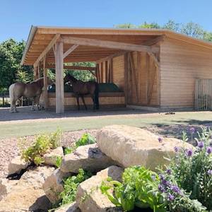

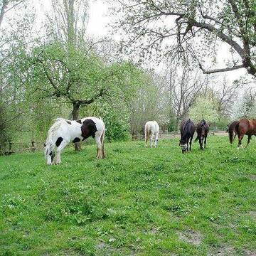
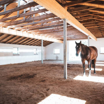
Paddocktrail-Offenstall-Gruppenhaltung-Reitanlage
Arnstadt
Triglishof
@Triglishof
Freizeitstall
Pferdeausbildung
Vermieten
Hunde willkommen
Krankenbox
Einhornhaltung möglich
Hufrehe geeignet
20 weitere...
P+

ganzj Weidestellplatz,Unterstand m matschfr. Zonen
Erfurt-Büßleben
janine lohbrandt
@JaLoh
Freizeitstall
Vermieten
Reitplatz (z.B. Dressur, Springen, Reining)
Sattelkammer/Sattelschränke
Offenstall
2 weitere...
P
Deprecated: Creation of dynamic property Zend_View_Helper_Ads::$adLink is deprecated in /var/www/stall-frei/htdocs/staging.stall-frei.de/library/Psf/View/Helper/Ads.php on line 108

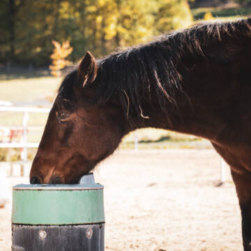
Das Beste für die Hufe
Mechtersen
STALL-FREIde Marketing
@STALL-FREI-Marketing
Hufschmiede und Hufpfleger in Ihrer Nähe
Leider kein Vorschaubild
Leider kein Vorschaubild
Selbstversorger Boxen oder Laufstallplatz frei
Kronach
Horse Power
@Horse-Power
FN-Mitglied
Vermieten
Parkplatz für Pferdeanhänger
Reithalle
Bewegungsstall
Innenbox
6 weitere...
B


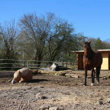
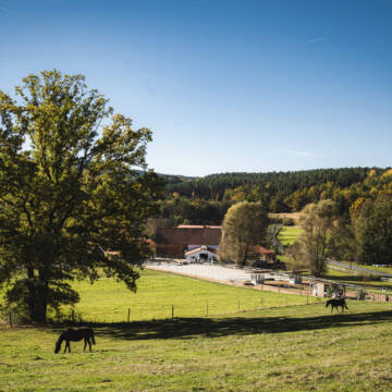
Pensionsplätze auf Ganzjahresweide im Bio-Betrieb
Frohburg/ OT Schönau
Reiterhof-Schoenau
@Reiterhof-Schoenau
FN-Mitglied
Freizeitstall
Hunde willkommen
Krankenbox
Notfallboxen
Camping: Zeltplatz
16 weitere...
P+
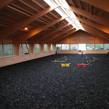
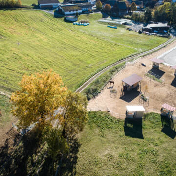
Reiterhof
Groitzsch
Koehlerhof
@Koehlerhof
Freizeitstall
Longierzirkel/Roundpen
Paddock
Außenboxen
Innenbox
4 weitere...
P
Leider kein Vorschaubild
Leider kein Vorschaubild
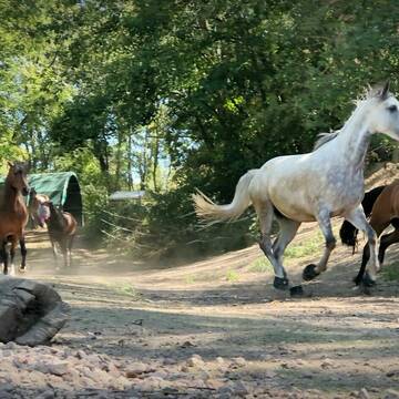
Paddocktrailhaltung, Kuraufenthalte mit Solekammer
Burkersroda
Hannas Pferdehof
@HannasPferdehof
Freizeitstall
Gastronomie
Vermieten
Hunde willkommen
Krankenbox
Hufrehe geeignet
Notfallboxen
30 weitere...
B
HIT-Aktivstall Ochsenhof Wüstenbuchau
Mainleus
Ochsenhof-GbR
@Ochsenhof-GbR
FN-Mitglied
Freizeitstall
Vermieten
Hunde willkommen
Krankenbox
Hufrehe geeignet
Notfallboxen
18 weitere...
P+

Pferdepension Hit Aktivstall Kürmerhof
Hohenkammer
Kuermerhof
@Kuermerhof
*******JETZT NEU MIT ENTSTAUBTEM BIOHEU*********
*******Demnächst mit einem Abenteuerspielplatz für Pferde ( Extrem Trail/Pa


Reit- und Therapiezentrum Obermain
Altenkunstadt
Frau Limmer S.
@ReitundTherapiezentrum
Freizeitstall
Pferdeausbildung
Hunde willkommen
Krankenbox
Notfallboxen
Bewegungsstall
Offenstall
11 weitere...
P+
Leider kein Vorschaubild
Leider kein Vorschaubild
Boxen mit täglichem, ganztägigen Weide/ Koppelga...
Hohenmölsen
Katharina Stür
@Katharina-Hartung
Freizeitstall
Pferdeausbildung
Vermieten
Krankenbox
Longierzirkel/Roundpen
Fohlenaufzucht möglich
Gnadenbrothof
19 weitere...
B


Reitsportanlage Gestüt Kahnsdorf
Kahnsdorf
Reitanlage "Gestüt Kahnsdorf"
@Marco_Bachmann
Pferdeausbildung
Reitlehrer und -unterricht
Führanlage
Krankenbox
Zuchtstutenhaltung möglich
Außenbox mit Paddock
19 weitere...
P+
Deprecated: Creation of dynamic property Zend_View::$pageCount is deprecated in /var/www/stall-frei/htdocs/staging.stall-frei.de/library/vendor/shardj/zf1-future/library/Zend/View/Abstract.php on line 308
Deprecated: Creation of dynamic property Zend_View::$itemCountPerPage is deprecated in /var/www/stall-frei/htdocs/staging.stall-frei.de/library/vendor/shardj/zf1-future/library/Zend/View/Abstract.php on line 308
Deprecated: Creation of dynamic property Zend_View::$first is deprecated in /var/www/stall-frei/htdocs/staging.stall-frei.de/library/vendor/shardj/zf1-future/library/Zend/View/Abstract.php on line 308
Deprecated: Creation of dynamic property Zend_View::$current is deprecated in /var/www/stall-frei/htdocs/staging.stall-frei.de/library/vendor/shardj/zf1-future/library/Zend/View/Abstract.php on line 308
Deprecated: Creation of dynamic property Zend_View::$last is deprecated in /var/www/stall-frei/htdocs/staging.stall-frei.de/library/vendor/shardj/zf1-future/library/Zend/View/Abstract.php on line 308
Deprecated: Creation of dynamic property Zend_View::$previous is deprecated in /var/www/stall-frei/htdocs/staging.stall-frei.de/library/vendor/shardj/zf1-future/library/Zend/View/Abstract.php on line 308
Deprecated: Creation of dynamic property Zend_View::$next is deprecated in /var/www/stall-frei/htdocs/staging.stall-frei.de/library/vendor/shardj/zf1-future/library/Zend/View/Abstract.php on line 308
Deprecated: Creation of dynamic property Zend_View::$pagesInRange is deprecated in /var/www/stall-frei/htdocs/staging.stall-frei.de/library/vendor/shardj/zf1-future/library/Zend/View/Abstract.php on line 308
Deprecated: Creation of dynamic property Zend_View::$firstPageInRange is deprecated in /var/www/stall-frei/htdocs/staging.stall-frei.de/library/vendor/shardj/zf1-future/library/Zend/View/Abstract.php on line 308
Deprecated: Creation of dynamic property Zend_View::$lastPageInRange is deprecated in /var/www/stall-frei/htdocs/staging.stall-frei.de/library/vendor/shardj/zf1-future/library/Zend/View/Abstract.php on line 308
Deprecated: Creation of dynamic property Zend_View::$currentItemCount is deprecated in /var/www/stall-frei/htdocs/staging.stall-frei.de/library/vendor/shardj/zf1-future/library/Zend/View/Abstract.php on line 308
Deprecated: Creation of dynamic property Zend_View::$totalItemCount is deprecated in /var/www/stall-frei/htdocs/staging.stall-frei.de/library/vendor/shardj/zf1-future/library/Zend/View/Abstract.php on line 308
Deprecated: Creation of dynamic property Zend_View::$firstItemNumber is deprecated in /var/www/stall-frei/htdocs/staging.stall-frei.de/library/vendor/shardj/zf1-future/library/Zend/View/Abstract.php on line 308
Deprecated: Creation of dynamic property Zend_View::$lastItemNumber is deprecated in /var/www/stall-frei/htdocs/staging.stall-frei.de/library/vendor/shardj/zf1-future/library/Zend/View/Abstract.php on line 308
Deprecated: Creation of dynamic property Zend_View::$router is deprecated in /var/www/stall-frei/htdocs/staging.stall-frei.de/library/vendor/shardj/zf1-future/library/Zend/View/Abstract.php on line 308
Deprecated: Creation of dynamic property Zend_View::$urlParams is deprecated in /var/www/stall-frei/htdocs/staging.stall-frei.de/library/vendor/shardj/zf1-future/library/Zend/View/Abstract.php on line 308
Deprecated: Creation of dynamic property Zend_View::$showAds is deprecated in /var/www/stall-frei/htdocs/staging.stall-frei.de/library/vendor/shardj/zf1-future/library/Zend/View/Abstract.php on line 308
Deprecated: Creation of dynamic property Zend_View::$objectIds is deprecated in /var/www/stall-frei/htdocs/staging.stall-frei.de/library/vendor/shardj/zf1-future/library/Zend/View/Abstract.php on line 308
Deprecated: Creation of dynamic property Zend_View::$showNavbar is deprecated in /var/www/stall-frei/htdocs/staging.stall-frei.de/library/vendor/shardj/zf1-future/library/Zend/View/Abstract.php on line 308
Deprecated: Creation of dynamic property Zend_View::$showBreadcrumb is deprecated in /var/www/stall-frei/htdocs/staging.stall-frei.de/library/vendor/shardj/zf1-future/library/Zend/View/Abstract.php on line 308
Deprecated: Creation of dynamic property Zend_View::$showFooter is deprecated in /var/www/stall-frei/htdocs/staging.stall-frei.de/library/vendor/shardj/zf1-future/library/Zend/View/Abstract.php on line 308
Deprecated: Creation of dynamic property Zend_View::$showInternalAds is deprecated in /var/www/stall-frei/htdocs/staging.stall-frei.de/library/vendor/shardj/zf1-future/library/Zend/View/Abstract.php on line 308
Deprecated: Creation of dynamic property Zend_View::$blNoContent is deprecated in /var/www/stall-frei/htdocs/staging.stall-frei.de/library/vendor/shardj/zf1-future/library/Zend/View/Abstract.php on line 308
Deprecated: Creation of dynamic property Zend_View::$sMetaDesc is deprecated in /var/www/stall-frei/htdocs/staging.stall-frei.de/library/vendor/shardj/zf1-future/library/Zend/View/Abstract.php on line 308
Deprecated: Creation of dynamic property Zend_View::$useGmaps is deprecated in /var/www/stall-frei/htdocs/staging.stall-frei.de/library/vendor/shardj/zf1-future/library/Zend/View/Abstract.php on line 308
Deprecated: Creation of dynamic property Zend_View::$touches is deprecated in /var/www/stall-frei/htdocs/staging.stall-frei.de/library/vendor/shardj/zf1-future/library/Zend/View/Abstract.php on line 308
Deprecated: Creation of dynamic property Zend_View::$oProject is deprecated in /var/www/stall-frei/htdocs/staging.stall-frei.de/library/vendor/shardj/zf1-future/library/Zend/View/Abstract.php on line 308
Deprecated: Creation of dynamic property Zend_View::$pageHeadline is deprecated in /var/www/stall-frei/htdocs/staging.stall-frei.de/library/vendor/shardj/zf1-future/library/Zend/View/Abstract.php on line 308
Deprecated: Creation of dynamic property Zend_View::$disableLocationField is deprecated in /var/www/stall-frei/htdocs/staging.stall-frei.de/library/vendor/shardj/zf1-future/library/Zend/View/Abstract.php on line 308
Deprecated: Creation of dynamic property Zend_View::$isSearch is deprecated in /var/www/stall-frei/htdocs/staging.stall-frei.de/library/vendor/shardj/zf1-future/library/Zend/View/Abstract.php on line 308
Deprecated: Creation of dynamic property Zend_View::$pageTitle is deprecated in /var/www/stall-frei/htdocs/staging.stall-frei.de/library/vendor/shardj/zf1-future/library/Zend/View/Abstract.php on line 308
Deprecated: Creation of dynamic property Psf_Form_Element_Text::$class is deprecated in /var/www/stall-frei/htdocs/staging.stall-frei.de/library/vendor/shardj/zf1-future/library/Zend/Form/Element.php on line 874
Deprecated: Creation of dynamic property Psf_Form_Element_Text::$size is deprecated in /var/www/stall-frei/htdocs/staging.stall-frei.de/library/vendor/shardj/zf1-future/library/Zend/Form/Element.php on line 874
Deprecated: Creation of dynamic property Psf_Form_Element_Text::$placeholder is deprecated in /var/www/stall-frei/htdocs/staging.stall-frei.de/library/vendor/shardj/zf1-future/library/Zend/Form/Element.php on line 874
Deprecated: Creation of dynamic property Psf_Form_Element_Hidden::$class is deprecated in /var/www/stall-frei/htdocs/staging.stall-frei.de/library/vendor/shardj/zf1-future/library/Zend/Form/Element.php on line 874
Deprecated: Creation of dynamic property Psf_Form_Element_Hidden::$class is deprecated in /var/www/stall-frei/htdocs/staging.stall-frei.de/library/vendor/shardj/zf1-future/library/Zend/Form/Element.php on line 874
Deprecated: Creation of dynamic property Psf_Form_Element_Hidden::$class is deprecated in /var/www/stall-frei/htdocs/staging.stall-frei.de/library/vendor/shardj/zf1-future/library/Zend/Form/Element.php on line 874
Deprecated: Creation of dynamic property Psf_Form_Element_Hidden::$class is deprecated in /var/www/stall-frei/htdocs/staging.stall-frei.de/library/vendor/shardj/zf1-future/library/Zend/Form/Element.php on line 874
Deprecated: Creation of dynamic property Psf_Form_Element_Select::$class is deprecated in /var/www/stall-frei/htdocs/staging.stall-frei.de/library/vendor/shardj/zf1-future/library/Zend/Form/Element.php on line 874
Deprecated: Creation of dynamic property Psf_Form_Element_Select::$class is deprecated in /var/www/stall-frei/htdocs/staging.stall-frei.de/library/vendor/shardj/zf1-future/library/Zend/Form/Element.php on line 874
Deprecated: Creation of dynamic property Psf_Form_Element_Select::$class is deprecated in /var/www/stall-frei/htdocs/staging.stall-frei.de/library/vendor/shardj/zf1-future/library/Zend/Form/Element.php on line 874
Deprecated: Creation of dynamic property Psf_Form_Element_Select::$class is deprecated in /var/www/stall-frei/htdocs/staging.stall-frei.de/library/vendor/shardj/zf1-future/library/Zend/Form/Element.php on line 874
Deprecated: Creation of dynamic property Psf_Form_Element_Text::$class is deprecated in /var/www/stall-frei/htdocs/staging.stall-frei.de/library/vendor/shardj/zf1-future/library/Zend/Form/Element.php on line 874
Deprecated: Creation of dynamic property Psf_Form_Element_Checkbox::$label is deprecated in /var/www/stall-frei/htdocs/staging.stall-frei.de/library/vendor/shardj/zf1-future/library/Zend/Form/Element.php on line 874
Deprecated: Creation of dynamic property Zend_View::$sort is deprecated in /var/www/stall-frei/htdocs/staging.stall-frei.de/library/vendor/shardj/zf1-future/library/Zend/View/Abstract.php on line 308
Deprecated: Creation of dynamic property Zend_View::$searchLocation is deprecated in /var/www/stall-frei/htdocs/staging.stall-frei.de/library/vendor/shardj/zf1-future/library/Zend/View/Abstract.php on line 308
Deprecated: Creation of dynamic property Zend_View::$locationHint is deprecated in /var/www/stall-frei/htdocs/staging.stall-frei.de/library/vendor/shardj/zf1-future/library/Zend/View/Abstract.php on line 308
Psf_GeoCoder_Abstract::getLocation: Dittersdorf Get Location CachedOrLive
Psf_GeoCoder_Abstract::getCachedOrLive: Dittersdorf
Psf_GeoCoder_Abstract::convertLocationResult
{"documentation":"https:\/\/opencagedata.com\/api","licenses":[{"name":"see attribution guide","url":"https:\/\/opencagedata.com\/credits"}],"results":[{"bounds":{"northeast":{"lat":50.6870594,"lng":11.8754984},"southwest":{"lat":50.6301518,"lng":11.7892097}},"components":{"ISO_3166-1_alpha-2":"DE","ISO_3166-1_alpha-3":"DEU","ISO_3166-2":["DE-TH"],"_category":"place","_normalized_city":"Dittersdorf","_type":"village","continent":"Europe","country":"Deutschland","country_code":"de","county":"Saale-Orla-Kreis","municipality":"Seenplatte","political_union":"European Union","state":"Th\u00fcringen","state_code":"TH","village":"Dittersdorf"},"confidence":7,"formatted":"Dittersdorf, Th\u00fcringen, Deutschland","geometry":{"lat":50.6433255,"lng":11.8171529}},{"bounds":{"northeast":{"lat":50.7713151,"lng":13.0138343},"southwest":{"lat":50.7313151,"lng":12.9738343}},"components":{"ISO_3166-1_alpha-2":"DE","ISO_3166-1_alpha-3":"DEU","ISO_3166-2":["DE-SN"],"_category":"place","_normalized_city":"Dittersdorf","_type":"village","continent":"Europe","country":"Deutschland","country_code":"de","county":"Erzgebirgskreis","municipality":"Amtsberg","political_union":"European Union","postcode":"09439","state":"Sachsen","state_code":"SN","village":"Dittersdorf"},"confidence":7,"formatted":"09439 Dittersdorf, Deutschland","geometry":{"lat":50.7513151,"lng":12.9938343}},{"bounds":{"northeast":{"lat":50.6699664,"lng":11.2565959},"southwest":{"lat":50.6299664,"lng":11.2165959}},"components":{"ISO_3166-1_alpha-2":"DE","ISO_3166-1_alpha-3":"DEU","ISO_3166-2":["DE-TH"],"_category":"place","_normalized_city":"Saalfeld\/Saale","_type":"village","continent":"Europe","country":"Deutschland","country_code":"de","county":"Landkreis Saalfeld-Rudolstadt","political_union":"European Union","postcode":"07422","state":"Th\u00fcringen","state_code":"TH","town":"Saalfeld\/Saale","village":"Dittersdorf"},"confidence":7,"formatted":"07422 Dittersdorf, Deutschland","geometry":{"lat":50.6499664,"lng":11.2365959}},{"bounds":{"northeast":{"lat":50.8483527,"lng":13.8261124},"southwest":{"lat":50.8083527,"lng":13.7861124}},"components":{"ISO_3166-1_alpha-2":"DE","ISO_3166-1_alpha-3":"DEU","ISO_3166-2":["DE-SN"],"_category":"place","_normalized_city":"Glash\u00fctte","_type":"village","continent":"Europe","country":"Deutschland","country_code":"de","county":"S\u00e4chsische Schweiz-Osterzgebirge","political_union":"European Union","postcode":"01768","state":"Sachsen","state_code":"SN","town":"Glash\u00fctte","village":"Dittersdorf"},"confidence":7,"formatted":"01768 Dittersdorf, Deutschland","geometry":{"lat":50.8283527,"lng":13.8061124}},{"bounds":{"northeast":{"lat":50.7662956,"lng":12.1386428},"southwest":{"lat":50.7262956,"lng":12.0986428}},"components":{"ISO_3166-1_alpha-2":"DE","ISO_3166-1_alpha-3":"DEU","ISO_3166-2":["DE-TH"],"_category":"place","_normalized_city":"Dittersdorf","_type":"village","continent":"Europe","country":"Deutschland","country_code":"de","county":"Greiz","municipality":"Berga-W\u00fcnschendorf","political_union":"European Union","postcode":"07980","state":"Th\u00fcringen","state_code":"TH","village":"Dittersdorf"},"confidence":7,"formatted":"07980 Dittersdorf, Deutschland","geometry":{"lat":50.7462956,"lng":12.1186428}},{"bounds":{"northeast":{"lat":50.6392309,"lng":12.7778785},"southwest":{"lat":50.5992309,"lng":12.7378785}},"components":{"ISO_3166-1_alpha-2":"DE","ISO_3166-1_alpha-3":"DEU","ISO_3166-2":["DE-SN"],"_category":"place","_normalized_city":"L\u00f6\u00dfnitz","_type":"neighbourhood","continent":"Europe","country":"Deutschland","country_code":"de","county":"Erzgebirgskreis","political_union":"European Union","postcode":"08294","state":"Sachsen","state_code":"SN","suburb":"Dittersdorf","town":"L\u00f6\u00dfnitz"},"confidence":7,"formatted":"08294 L\u00f6\u00dfnitz, Deutschland","geometry":{"lat":50.6192309,"lng":12.7578785}},{"bounds":{"northeast":{"lat":51.0464591,"lng":13.1606704},"southwest":{"lat":51.0064591,"lng":13.1206704}},"components":{"ISO_3166-1_alpha-2":"DE","ISO_3166-1_alpha-3":"DEU","ISO_3166-2":["DE-SN"],"_category":"place","_normalized_city":"Striegistal","_type":"village","city":"Striegistal","continent":"Europe","country":"Deutschland","country_code":"de","county":"Mittelsachsen","political_union":"European Union","postcode":"09661","state":"Sachsen","state_code":"SN","village":"Dittersdorf"},"confidence":7,"formatted":"09661 Dittersdorf, Deutschland","geometry":{"lat":51.0264591,"lng":13.1406704}},{"bounds":{"northeast":{"lat":50.6296186,"lng":12.7822051},"southwest":{"lat":50.602179,"lng":12.7394733}},"components":{"ISO_3166-1_alpha-2":"DE","ISO_3166-1_alpha-3":"DEU","ISO_3166-2":["DE-SN"],"_category":"place","_normalized_city":"L\u00f6\u00dfnitz","_type":"neighbourhood","continent":"Europe","country":"Deutschland","country_code":"de","county":"Erzgebirgskreis","political_union":"European Union","state":"Sachsen","state_code":"SN","suburb":"Dittersdorf (L\u00f6\u00dfnitz)","town":"L\u00f6\u00dfnitz"},"confidence":7,"formatted":"Dittersdorf (L\u00f6\u00dfnitz), L\u00f6\u00dfnitz, Sachsen, Deutschland","geometry":{"lat":50.6157381,"lng":12.7639932}},{"components":{"ISO_3166-1_alpha-2":"FR","ISO_3166-1_alpha-3":"FRA","ISO_3166-2":["FR-GES","FR-6AE","FR-68"],"_category":"road","_normalized_city":"Walheim","_type":"road","city":"Walheim","continent":"Europe","country":"France","country_code":"fr","county":"Haut-Rhin","local_authority":"Communaut\u00e9 de communes Sundgau","political_union":"European Union","postcode":"68130","road":"Rue de Wittersdorf","state":"Grand Est","state_code":"GES"},"confidence":4,"formatted":"Rue de Wittersdorf, 68130 Walheim, France","geometry":{"lat":47.639186,"lng":7.270277}},{"components":{"ISO_3166-1_alpha-2":"FR","ISO_3166-1_alpha-3":"FRA","ISO_3166-2":["FR-GES","FR-6AE","FR-68"],"_category":"road","_normalized_city":"Bettendorf","_type":"road","city":"Bettendorf","continent":"Europe","country":"France","country_code":"fr","county":"Haut-Rhin","local_authority":"Communaut\u00e9 de communes Sundgau","political_union":"European Union","postcode":"68560","road":"Rue de Wittersdorf","state":"Grand Est","state_code":"GES"},"confidence":3,"formatted":"Rue de Wittersdorf, 68560 Bettendorf, France","geometry":{"lat":47.5886,"lng":7.273782}}],"status":{"code":200,"message":"OK"},"stay_informed":{"blog":"https:\/\/blog.opencagedata.com","mastodon":"https:\/\/en.osm.town\/@opencage"},"thanks":"For using an OpenCage API","timestamp":{"created_http":"Sat, 07 Feb 2026 14:02:12 GMT","created_unix":1770472932},"total_results":10}Array
(
[0] => stdClass Object
(
[bounds] => stdClass Object
(
[northeast] => stdClass Object
(
[lat] => 50.6870594
[lng] => 11.8754984
)
[southwest] => stdClass Object
(
[lat] => 50.6301518
[lng] => 11.7892097
)
)
[components] => stdClass Object
(
[ISO_3166-1_alpha-2] => DE
[ISO_3166-1_alpha-3] => DEU
[ISO_3166-2] => Array
(
[0] => DE-TH
)
[_category] => place
[_normalized_city] => Dittersdorf
[_type] => village
[continent] => Europe
[country] => Deutschland
[country_code] => de
[county] => Saale-Orla-Kreis
[municipality] => Seenplatte
[political_union] => European Union
[state] => Thüringen
[state_code] => TH
[village] => Dittersdorf
)
[confidence] => 7
[formatted] => Dittersdorf, Thüringen, Deutschland
[geometry] => stdClass Object
(
[lat] => 50.6433255
[lng] => 11.8171529
)
)
[1] => stdClass Object
(
[bounds] => stdClass Object
(
[northeast] => stdClass Object
(
[lat] => 50.7713151
[lng] => 13.0138343
)
[southwest] => stdClass Object
(
[lat] => 50.7313151
[lng] => 12.9738343
)
)
[components] => stdClass Object
(
[ISO_3166-1_alpha-2] => DE
[ISO_3166-1_alpha-3] => DEU
[ISO_3166-2] => Array
(
[0] => DE-SN
)
[_category] => place
[_normalized_city] => Dittersdorf
[_type] => village
[continent] => Europe
[country] => Deutschland
[country_code] => de
[county] => Erzgebirgskreis
[municipality] => Amtsberg
[political_union] => European Union
[postcode] => 09439
[state] => Sachsen
[state_code] => SN
[village] => Dittersdorf
)
[confidence] => 7
[formatted] => 09439 Dittersdorf, Deutschland
[geometry] => stdClass Object
(
[lat] => 50.7513151
[lng] => 12.9938343
)
)
[2] => stdClass Object
(
[bounds] => stdClass Object
(
[northeast] => stdClass Object
(
[lat] => 50.6699664
[lng] => 11.2565959
)
[southwest] => stdClass Object
(
[lat] => 50.6299664
[lng] => 11.2165959
)
)
[components] => stdClass Object
(
[ISO_3166-1_alpha-2] => DE
[ISO_3166-1_alpha-3] => DEU
[ISO_3166-2] => Array
(
[0] => DE-TH
)
[_category] => place
[_normalized_city] => Saalfeld/Saale
[_type] => village
[continent] => Europe
[country] => Deutschland
[country_code] => de
[county] => Landkreis Saalfeld-Rudolstadt
[political_union] => European Union
[postcode] => 07422
[state] => Thüringen
[state_code] => TH
[town] => Saalfeld/Saale
[village] => Dittersdorf
)
[confidence] => 7
[formatted] => 07422 Dittersdorf, Deutschland
[geometry] => stdClass Object
(
[lat] => 50.6499664
[lng] => 11.2365959
)
)
[3] => stdClass Object
(
[bounds] => stdClass Object
(
[northeast] => stdClass Object
(
[lat] => 50.8483527
[lng] => 13.8261124
)
[southwest] => stdClass Object
(
[lat] => 50.8083527
[lng] => 13.7861124
)
)
[components] => stdClass Object
(
[ISO_3166-1_alpha-2] => DE
[ISO_3166-1_alpha-3] => DEU
[ISO_3166-2] => Array
(
[0] => DE-SN
)
[_category] => place
[_normalized_city] => Glashütte
[_type] => village
[continent] => Europe
[country] => Deutschland
[country_code] => de
[county] => Sächsische Schweiz-Osterzgebirge
[political_union] => European Union
[postcode] => 01768
[state] => Sachsen
[state_code] => SN
[town] => Glashütte
[village] => Dittersdorf
)
[confidence] => 7
[formatted] => 01768 Dittersdorf, Deutschland
[geometry] => stdClass Object
(
[lat] => 50.8283527
[lng] => 13.8061124
)
)
[4] => stdClass Object
(
[bounds] => stdClass Object
(
[northeast] => stdClass Object
(
[lat] => 50.7662956
[lng] => 12.1386428
)
[southwest] => stdClass Object
(
[lat] => 50.7262956
[lng] => 12.0986428
)
)
[components] => stdClass Object
(
[ISO_3166-1_alpha-2] => DE
[ISO_3166-1_alpha-3] => DEU
[ISO_3166-2] => Array
(
[0] => DE-TH
)
[_category] => place
[_normalized_city] => Dittersdorf
[_type] => village
[continent] => Europe
[country] => Deutschland
[country_code] => de
[county] => Greiz
[municipality] => Berga-Wünschendorf
[political_union] => European Union
[postcode] => 07980
[state] => Thüringen
[state_code] => TH
[village] => Dittersdorf
)
[confidence] => 7
[formatted] => 07980 Dittersdorf, Deutschland
[geometry] => stdClass Object
(
[lat] => 50.7462956
[lng] => 12.1186428
)
)
[5] => stdClass Object
(
[bounds] => stdClass Object
(
[northeast] => stdClass Object
(
[lat] => 50.6392309
[lng] => 12.7778785
)
[southwest] => stdClass Object
(
[lat] => 50.5992309
[lng] => 12.7378785
)
)
[components] => stdClass Object
(
[ISO_3166-1_alpha-2] => DE
[ISO_3166-1_alpha-3] => DEU
[ISO_3166-2] => Array
(
[0] => DE-SN
)
[_category] => place
[_normalized_city] => Lößnitz
[_type] => neighbourhood
[continent] => Europe
[country] => Deutschland
[country_code] => de
[county] => Erzgebirgskreis
[political_union] => European Union
[postcode] => 08294
[state] => Sachsen
[state_code] => SN
[suburb] => Dittersdorf
[town] => Lößnitz
)
[confidence] => 7
[formatted] => 08294 Lößnitz, Deutschland
[geometry] => stdClass Object
(
[lat] => 50.6192309
[lng] => 12.7578785
)
)
[6] => stdClass Object
(
[bounds] => stdClass Object
(
[northeast] => stdClass Object
(
[lat] => 51.0464591
[lng] => 13.1606704
)
[southwest] => stdClass Object
(
[lat] => 51.0064591
[lng] => 13.1206704
)
)
[components] => stdClass Object
(
[ISO_3166-1_alpha-2] => DE
[ISO_3166-1_alpha-3] => DEU
[ISO_3166-2] => Array
(
[0] => DE-SN
)
[_category] => place
[_normalized_city] => Striegistal
[_type] => village
[city] => Striegistal
[continent] => Europe
[country] => Deutschland
[country_code] => de
[county] => Mittelsachsen
[political_union] => European Union
[postcode] => 09661
[state] => Sachsen
[state_code] => SN
[village] => Dittersdorf
)
[confidence] => 7
[formatted] => 09661 Dittersdorf, Deutschland
[geometry] => stdClass Object
(
[lat] => 51.0264591
[lng] => 13.1406704
)
)
[7] => stdClass Object
(
[bounds] => stdClass Object
(
[northeast] => stdClass Object
(
[lat] => 50.6296186
[lng] => 12.7822051
)
[southwest] => stdClass Object
(
[lat] => 50.602179
[lng] => 12.7394733
)
)
[components] => stdClass Object
(
[ISO_3166-1_alpha-2] => DE
[ISO_3166-1_alpha-3] => DEU
[ISO_3166-2] => Array
(
[0] => DE-SN
)
[_category] => place
[_normalized_city] => Lößnitz
[_type] => neighbourhood
[continent] => Europe
[country] => Deutschland
[country_code] => de
[county] => Erzgebirgskreis
[political_union] => European Union
[state] => Sachsen
[state_code] => SN
[suburb] => Dittersdorf (Lößnitz)
[town] => Lößnitz
)
[confidence] => 7
[formatted] => Dittersdorf (Lößnitz), Lößnitz, Sachsen, Deutschland
[geometry] => stdClass Object
(
[lat] => 50.6157381
[lng] => 12.7639932
)
)
[8] => stdClass Object
(
[components] => stdClass Object
(
[ISO_3166-1_alpha-2] => FR
[ISO_3166-1_alpha-3] => FRA
[ISO_3166-2] => Array
(
[0] => FR-GES
[1] => FR-6AE
[2] => FR-68
)
[_category] => road
[_normalized_city] => Walheim
[_type] => road
[city] => Walheim
[continent] => Europe
[country] => France
[country_code] => fr
[county] => Haut-Rhin
[local_authority] => Communauté de communes Sundgau
[political_union] => European Union
[postcode] => 68130
[road] => Rue de Wittersdorf
[state] => Grand Est
[state_code] => GES
)
[confidence] => 4
[formatted] => Rue de Wittersdorf, 68130 Walheim, France
[geometry] => stdClass Object
(
[lat] => 47.639186
[lng] => 7.270277
)
)
[9] => stdClass Object
(
[components] => stdClass Object
(
[ISO_3166-1_alpha-2] => FR
[ISO_3166-1_alpha-3] => FRA
[ISO_3166-2] => Array
(
[0] => FR-GES
[1] => FR-6AE
[2] => FR-68
)
[_category] => road
[_normalized_city] => Bettendorf
[_type] => road
[city] => Bettendorf
[continent] => Europe
[country] => France
[country_code] => fr
[county] => Haut-Rhin
[local_authority] => Communauté de communes Sundgau
[political_union] => European Union
[postcode] => 68560
[road] => Rue de Wittersdorf
[state] => Grand Est
[state_code] => GES
)
[confidence] => 3
[formatted] => Rue de Wittersdorf, 68560 Bettendorf, France
[geometry] => stdClass Object
(
[lat] => 47.5886
[lng] => 7.273782
)
)
)
Psf_GeoCoder_OpenCageData::getKeyMap: 0
stdClass Object
(
    [bounds] => stdClass Object
        (
            [northeast] => stdClass Object
                (
                    [lat] => 50.6870594
                    [lng] => 11.8754984
                )

            [southwest] => stdClass Object
                (
                    [lat] => 50.6301518
                    [lng] => 11.7892097
                )

        )

    [components] => stdClass Object
        (
            [ISO_3166-1_alpha-2] => DE
            [ISO_3166-1_alpha-3] => DEU
            [ISO_3166-2] => Array
                (
                    [0] => DE-TH
                )

            [_category] => place
            [_normalized_city] => Dittersdorf
            [_type] => village
            [continent] => Europe
            [country] => Deutschland
            [country_code] => de
            [county] => Saale-Orla-Kreis
            [municipality] => Seenplatte
            [political_union] => European Union
            [state] => Thüringen
            [state_code] => TH
            [village] => Dittersdorf
        )

    [confidence] => 7
    [formatted] => Dittersdorf, Thüringen, Deutschland
    [geometry] => stdClass Object
        (
            [lat] => 50.6433255
            [lng] => 11.8171529
        )

)
Psf_GeoCoder_OpenCageData::getCounty: Saale-Orla-Kreis
Psf_GeoCoder_OpenCageData::addMissingData REFETCH!
Array
(
    [address] => Dittersdorf, Thüringen, Deutschland
    [type] => village
    [street] =>
    [city] => Dittersdorf
    [county] => Saale-Orla-Kreis
    [state] => Thüringen
    [zip] =>
    [country] => Deutschland
    [suburb] =>
    [countrycode] => de
    [latitude] => 50.6433255
    [longitude] => 11.8171529
    [accuracy] => 1
    [confidence] => 7
    [bounds] => stdClass Object
        (
            [northeast] => stdClass Object
                (
                    [lat] => 50.6870594
                    [lng] => 11.8754984
                )

            [southwest] => stdClass Object
                (
                    [lat] => 50.6301518
                    [lng] => 11.7892097
                )

        )

)
reformat!
Array
(
    [address] => Dittersdorf, Thüringen, Deutschland
    [type] => village
    [street] =>
    [city] => Dittersdorf
    [county] => Saale-Orla-Kreis
    [state] => Thüringen
    [zip] =>
    [country] => Deutschland
    [suburb] =>
    [countrycode] => de
    [latitude] => 50.6433255
    [longitude] => 11.8171529
    [accuracy] => 1
    [confidence] => 7
    [bounds] => stdClass Object
        (
            [northeast] => stdClass Object
                (
                    [lat] => 50.6870594
                    [lng] => 11.8754984
                )

            [southwest] => stdClass Object
                (
                    [lat] => 50.6301518
                    [lng] => 11.7892097
                )

        )

    [place] => Dittersdorf, Thüringen
    [hash] => a6d3f14b566df862bf11e51e62d71dc6
)
Psf_GeoCoder_OpenCageData::getKeyMap: 1
stdClass Object
(
    [bounds] => stdClass Object
        (
            [northeast] => stdClass Object
                (
                    [lat] => 50.7713151
                    [lng] => 13.0138343
                )

            [southwest] => stdClass Object
                (
                    [lat] => 50.7313151
                    [lng] => 12.9738343
                )

        )

    [components] => stdClass Object
        (
            [ISO_3166-1_alpha-2] => DE
            [ISO_3166-1_alpha-3] => DEU
            [ISO_3166-2] => Array
                (
                    [0] => DE-SN
                )

            [_category] => place
            [_normalized_city] => Dittersdorf
            [_type] => village
            [continent] => Europe
            [country] => Deutschland
            [country_code] => de
            [county] => Erzgebirgskreis
            [municipality] => Amtsberg
            [political_union] => European Union
            [postcode] => 09439
            [state] => Sachsen
            [state_code] => SN
            [village] => Dittersdorf
        )

    [confidence] => 7
    [formatted] => 09439 Dittersdorf, Deutschland
    [geometry] => stdClass Object
        (
            [lat] => 50.7513151
            [lng] => 12.9938343
        )

)
Psf_GeoCoder_OpenCageData::getCounty: Erzgebirgskreis
Psf_GeoCoder_OpenCageData::addMissingData REFETCH!
Array
(
    [address] => 09439 Dittersdorf, Deutschland
    [type] => village
    [street] =>
    [city] => Dittersdorf
    [county] => Erzgebirgskreis
    [state] => Sachsen
    [zip] => 09439
    [country] => Deutschland
    [suburb] =>
    [countrycode] => de
    [latitude] => 50.7513151
    [longitude] => 12.9938343
    [accuracy] => 1
    [confidence] => 7
    [bounds] => stdClass Object
        (
            [northeast] => stdClass Object
                (
                    [lat] => 50.7713151
                    [lng] => 13.0138343
                )

            [southwest] => stdClass Object
                (
                    [lat] => 50.7313151
                    [lng] => 12.9738343
                )

        )

)
reformat!
Array
(
    [address] => 09439 Dittersdorf, Deutschland
    [type] => village
    [street] =>
    [city] => Dittersdorf
    [county] => Erzgebirgskreis
    [state] => Sachsen
    [zip] => 09439
    [country] => Deutschland
    [suburb] =>
    [countrycode] => de
    [latitude] => 50.7513151
    [longitude] => 12.9938343
    [accuracy] => 1
    [confidence] => 7
    [bounds] => stdClass Object
        (
            [northeast] => stdClass Object
                (
                    [lat] => 50.7713151
                    [lng] => 13.0138343
                )

            [southwest] => stdClass Object
                (
                    [lat] => 50.7313151
                    [lng] => 12.9738343
                )

        )

    [place] => 09439 Dittersdorf, Sachsen
    [hash] => 10785ea848a2af99087850a0730f6098
)
Psf_GeoCoder_OpenCageData::getKeyMap: 2
stdClass Object
(
    [bounds] => stdClass Object
        (
            [northeast] => stdClass Object
                (
                    [lat] => 50.6699664
                    [lng] => 11.2565959
                )

            [southwest] => stdClass Object
                (
                    [lat] => 50.6299664
                    [lng] => 11.2165959
                )

        )

    [components] => stdClass Object
        (
            [ISO_3166-1_alpha-2] => DE
            [ISO_3166-1_alpha-3] => DEU
            [ISO_3166-2] => Array
                (
                    [0] => DE-TH
                )

            [_category] => place
            [_normalized_city] => Saalfeld/Saale
            [_type] => village
            [continent] => Europe
            [country] => Deutschland
            [country_code] => de
            [county] => Landkreis Saalfeld-Rudolstadt
            [political_union] => European Union
            [postcode] => 07422
            [state] => Thüringen
            [state_code] => TH
            [town] => Saalfeld/Saale
            [village] => Dittersdorf
        )

    [confidence] => 7
    [formatted] => 07422 Dittersdorf, Deutschland
    [geometry] => stdClass Object
        (
            [lat] => 50.6499664
            [lng] => 11.2365959
        )

)
Psf_GeoCoder_OpenCageData::getCounty: Saalfeld-Rudolstadt
Psf_GeoCoder_OpenCageData::addMissingData REFETCH!
Array
(
    [address] => 07422 Dittersdorf, Deutschland
    [type] => village
    [street] =>
    [city] => Saalfeld/Saale
    [county] => Saalfeld-Rudolstadt
    [state] => Thüringen
    [zip] => 07422
    [country] => Deutschland
    [suburb] =>
    [countrycode] => de
    [latitude] => 50.6499664
    [longitude] => 11.2365959
    [accuracy] => 1
    [confidence] => 7
    [bounds] => stdClass Object
        (
            [northeast] => stdClass Object
                (
                    [lat] => 50.6699664
                    [lng] => 11.2565959
                )

            [southwest] => stdClass Object
                (
                    [lat] => 50.6299664
                    [lng] => 11.2165959
                )

        )

)
reformat!
Array
(
    [address] => 07422 Saalfeld/Saale
    [type] => village
    [street] =>
    [city] => Saalfeld/Saale
    [county] => Saalfeld-Rudolstadt
    [state] => Thüringen
    [zip] => 07422
    [country] => Deutschland
    [suburb] =>
    [countrycode] => de
    [latitude] => 50.6499664
    [longitude] => 11.2365959
    [accuracy] => 1
    [confidence] => 7
    [bounds] => stdClass Object
        (
            [northeast] => stdClass Object
                (
                    [lat] => 50.6699664
                    [lng] => 11.2565959
                )

            [southwest] => stdClass Object
                (
                    [lat] => 50.6299664
                    [lng] => 11.2165959
                )

        )

    [place] => 07422 Saalfeld/Saale, Thüringen
    [hash] => 4d1e1cf4489392abb2038e34195b1a34
)
Psf_GeoCoder_OpenCageData::getKeyMap: 3
stdClass Object
(
    [bounds] => stdClass Object
        (
            [northeast] => stdClass Object
                (
                    [lat] => 50.8483527
                    [lng] => 13.8261124
                )

            [southwest] => stdClass Object
                (
                    [lat] => 50.8083527
                    [lng] => 13.7861124
                )

        )

    [components] => stdClass Object
        (
            [ISO_3166-1_alpha-2] => DE
            [ISO_3166-1_alpha-3] => DEU
            [ISO_3166-2] => Array
                (
                    [0] => DE-SN
                )

            [_category] => place
            [_normalized_city] => Glashütte
            [_type] => village
            [continent] => Europe
            [country] => Deutschland
            [country_code] => de
            [county] => Sächsische Schweiz-Osterzgebirge
            [political_union] => European Union
            [postcode] => 01768
            [state] => Sachsen
            [state_code] => SN
            [town] => Glashütte
            [village] => Dittersdorf
        )

    [confidence] => 7
    [formatted] => 01768 Dittersdorf, Deutschland
    [geometry] => stdClass Object
        (
            [lat] => 50.8283527
            [lng] => 13.8061124
        )

)
Psf_GeoCoder_OpenCageData::getCounty: Sächsische Schweiz-Osterzgebirge
Psf_GeoCoder_OpenCageData::addMissingData REFETCH!
Array
(
    [address] => 01768 Dittersdorf, Deutschland
    [type] => village
    [street] =>
    [city] => Glashütte
    [county] => Sächsische Schweiz-Osterzgebirge
    [state] => Sachsen
    [zip] => 01768
    [country] => Deutschland
    [suburb] =>
    [countrycode] => de
    [latitude] => 50.8283527
    [longitude] => 13.8061124
    [accuracy] => 1
    [confidence] => 7
    [bounds] => stdClass Object
        (
            [northeast] => stdClass Object
                (
                    [lat] => 50.8483527
                    [lng] => 13.8261124
                )

            [southwest] => stdClass Object
                (
                    [lat] => 50.8083527
                    [lng] => 13.7861124
                )

        )

)
reformat!
Array
(
    [address] => 01768 Glashütte
    [type] => village
    [street] =>
    [city] => Glashütte
    [county] => Sächsische Schweiz-Osterzgebirge
    [state] => Sachsen
    [zip] => 01768
    [country] => Deutschland
    [suburb] =>
    [countrycode] => de
    [latitude] => 50.8283527
    [longitude] => 13.8061124
    [accuracy] => 1
    [confidence] => 7
    [bounds] => stdClass Object
        (
            [northeast] => stdClass Object
                (
                    [lat] => 50.8483527
                    [lng] => 13.8261124
                )

            [southwest] => stdClass Object
                (
                    [lat] => 50.8083527
                    [lng] => 13.7861124
                )

        )

    [place] => 01768 Glashütte, Sachsen
    [hash] => b0c6feaaff73910396cf3b614822a443
)
Psf_GeoCoder_OpenCageData::getKeyMap: 4
stdClass Object
(
    [bounds] => stdClass Object
        (
            [northeast] => stdClass Object
                (
                    [lat] => 50.7662956
                    [lng] => 12.1386428
                )

            [southwest] => stdClass Object
                (
                    [lat] => 50.7262956
                    [lng] => 12.0986428
                )

        )

    [components] => stdClass Object
        (
            [ISO_3166-1_alpha-2] => DE
            [ISO_3166-1_alpha-3] => DEU
            [ISO_3166-2] => Array
                (
                    [0] => DE-TH
                )

            [_category] => place
            [_normalized_city] => Dittersdorf
            [_type] => village
            [continent] => Europe
            [country] => Deutschland
            [country_code] => de
            [county] => Greiz
            [municipality] => Berga-Wünschendorf
            [political_union] => European Union
            [postcode] => 07980
            [state] => Thüringen
            [state_code] => TH
            [village] => Dittersdorf
        )

    [confidence] => 7
    [formatted] => 07980 Dittersdorf, Deutschland
    [geometry] => stdClass Object
        (
            [lat] => 50.7462956
            [lng] => 12.1186428
        )

)
Psf_GeoCoder_OpenCageData::getCounty: Greiz
Psf_GeoCoder_OpenCageData::addMissingData REFETCH!
Array
(
    [address] => 07980 Dittersdorf, Deutschland
    [type] => village
    [street] =>
    [city] => Dittersdorf
    [county] => Greiz
    [state] => Thüringen
    [zip] => 07980
    [country] => Deutschland
    [suburb] =>
    [countrycode] => de
    [latitude] => 50.7462956
    [longitude] => 12.1186428
    [accuracy] => 1
    [confidence] => 7
    [bounds] => stdClass Object
        (
            [northeast] => stdClass Object
                (
                    [lat] => 50.7662956
                    [lng] => 12.1386428
                )

            [southwest] => stdClass Object
                (
                    [lat] => 50.7262956
                    [lng] => 12.0986428
                )

        )

)
reformat!
Array
(
    [address] => 07980 Dittersdorf, Deutschland
    [type] => village
    [street] =>
    [city] => Dittersdorf
    [county] => Greiz
    [state] => Thüringen
    [zip] => 07980
    [country] => Deutschland
    [suburb] =>
    [countrycode] => de
    [latitude] => 50.7462956
    [longitude] => 12.1186428
    [accuracy] => 1
    [confidence] => 7
    [bounds] => stdClass Object
        (
            [northeast] => stdClass Object
                (
                    [lat] => 50.7662956
                    [lng] => 12.1386428
                )

            [southwest] => stdClass Object
                (
                    [lat] => 50.7262956
                    [lng] => 12.0986428
                )

        )

    [place] => 07980 Dittersdorf, Thüringen
    [hash] => 7b70030121679ece57fb55a6e3e791cd
)
Psf_GeoCoder_OpenCageData::getKeyMap: 5
stdClass Object
(
    [bounds] => stdClass Object
        (
            [northeast] => stdClass Object
                (
                    [lat] => 50.6392309
                    [lng] => 12.7778785
                )

            [southwest] => stdClass Object
                (
                    [lat] => 50.5992309
                    [lng] => 12.7378785
                )

        )

    [components] => stdClass Object
        (
            [ISO_3166-1_alpha-2] => DE
            [ISO_3166-1_alpha-3] => DEU
            [ISO_3166-2] => Array
                (
                    [0] => DE-SN
                )

            [_category] => place
            [_normalized_city] => Lößnitz
            [_type] => neighbourhood
            [continent] => Europe
            [country] => Deutschland
            [country_code] => de
            [county] => Erzgebirgskreis
            [political_union] => European Union
            [postcode] => 08294
            [state] => Sachsen
            [state_code] => SN
            [suburb] => Dittersdorf
            [town] => Lößnitz
        )

    [confidence] => 7
    [formatted] => 08294 Lößnitz, Deutschland
    [geometry] => stdClass Object
        (
            [lat] => 50.6192309
            [lng] => 12.7578785
        )

)
Psf_GeoCoder_OpenCageData::getCounty: Erzgebirgskreis
Psf_GeoCoder_OpenCageData::addMissingData REFETCH!
Array
(
    [address] => 08294 Lößnitz, Deutschland
    [type] => neighbourhood
    [street] =>
    [city] => Lößnitz
    [county] => Erzgebirgskreis
    [state] => Sachsen
    [zip] => 08294
    [country] => Deutschland
    [suburb] => Dittersdorf
    [countrycode] => de
    [latitude] => 50.6192309
    [longitude] => 12.7578785
    [accuracy] => 1
    [confidence] => 7
    [bounds] => stdClass Object
        (
            [northeast] => stdClass Object
                (
                    [lat] => 50.6392309
                    [lng] => 12.7778785
                )

            [southwest] => stdClass Object
                (
                    [lat] => 50.5992309
                    [lng] => 12.7378785
                )

        )

)
reformat!
Array
(
    [address] => 08294 Lößnitz, Deutschland
    [type] => neighbourhood
    [street] =>
    [city] => Lößnitz
    [county] => Erzgebirgskreis
    [state] => Sachsen
    [zip] => 08294
    [country] => Deutschland
    [suburb] => Dittersdorf
    [countrycode] => de
    [latitude] => 50.6192309
    [longitude] => 12.7578785
    [accuracy] => 1
    [confidence] => 7
    [bounds] => stdClass Object
        (
            [northeast] => stdClass Object
                (
                    [lat] => 50.6392309
                    [lng] => 12.7778785
                )

            [southwest] => stdClass Object
                (
                    [lat] => 50.5992309
                    [lng] => 12.7378785
                )

        )

    [place] => 08294 Lößnitz, Sachsen
    [hash] => 340c026db749ed682e8122cdb97a4816
)
Psf_GeoCoder_OpenCageData::getKeyMap: 6
stdClass Object
(
    [bounds] => stdClass Object
        (
            [northeast] => stdClass Object
                (
                    [lat] => 51.0464591
                    [lng] => 13.1606704
                )

            [southwest] => stdClass Object
                (
                    [lat] => 51.0064591
                    [lng] => 13.1206704
                )

        )

    [components] => stdClass Object
        (
            [ISO_3166-1_alpha-2] => DE
            [ISO_3166-1_alpha-3] => DEU
            [ISO_3166-2] => Array
                (
                    [0] => DE-SN
                )

            [_category] => place
            [_normalized_city] => Striegistal
            [_type] => village
            [city] => Striegistal
            [continent] => Europe
            [country] => Deutschland
            [country_code] => de
            [county] => Mittelsachsen
            [political_union] => European Union
            [postcode] => 09661
            [state] => Sachsen
            [state_code] => SN
            [village] => Dittersdorf
        )

    [confidence] => 7
    [formatted] => 09661 Dittersdorf, Deutschland
    [geometry] => stdClass Object
        (
            [lat] => 51.0264591
            [lng] => 13.1406704
        )

)
Psf_GeoCoder_OpenCageData::getCounty: Mittelsachsen
Psf_GeoCoder_OpenCageData::addMissingData REFETCH!
Array
(
    [address] => 09661 Dittersdorf, Deutschland
    [type] => village
    [street] =>
    [city] => Dittersdorf
    [county] => Mittelsachsen
    [state] => Sachsen
    [zip] => 09661
    [country] => Deutschland
    [suburb] =>
    [countrycode] => de
    [latitude] => 51.0264591
    [longitude] => 13.1406704
    [accuracy] => 1
    [confidence] => 7
    [bounds] => stdClass Object
        (
            [northeast] => stdClass Object
                (
                    [lat] => 51.0464591
                    [lng] => 13.1606704
                )

            [southwest] => stdClass Object
                (
                    [lat] => 51.0064591
                    [lng] => 13.1206704
                )

        )

)
reformat!
Array
(
    [address] => 09661 Dittersdorf, Deutschland
    [type] => village
    [street] =>
    [city] => Dittersdorf
    [county] => Mittelsachsen
    [state] => Sachsen
    [zip] => 09661
    [country] => Deutschland
    [suburb] =>
    [countrycode] => de
    [latitude] => 51.0264591
    [longitude] => 13.1406704
    [accuracy] => 1
    [confidence] => 7
    [bounds] => stdClass Object
        (
            [northeast] => stdClass Object
                (
                    [lat] => 51.0464591
                    [lng] => 13.1606704
                )

            [southwest] => stdClass Object
                (
                    [lat] => 51.0064591
                    [lng] => 13.1206704
                )

        )

    [place] => 09661 Dittersdorf, Sachsen
    [hash] => 1be64ac55dde256a8d83f5bb530b6e3f
)
Psf_GeoCoder_OpenCageData::getKeyMap: 7
stdClass Object
(
    [bounds] => stdClass Object
        (
            [northeast] => stdClass Object
                (
                    [lat] => 50.6296186
                    [lng] => 12.7822051
                )

            [southwest] => stdClass Object
                (
                    [lat] => 50.602179
                    [lng] => 12.7394733
                )

        )

    [components] => stdClass Object
        (
            [ISO_3166-1_alpha-2] => DE
            [ISO_3166-1_alpha-3] => DEU
            [ISO_3166-2] => Array
                (
                    [0] => DE-SN
                )

            [_category] => place
            [_normalized_city] => Lößnitz
            [_type] => neighbourhood
            [continent] => Europe
            [country] => Deutschland
            [country_code] => de
            [county] => Erzgebirgskreis
            [political_union] => European Union
            [state] => Sachsen
            [state_code] => SN
            [suburb] => Dittersdorf (Lößnitz)
            [town] => Lößnitz
        )

    [confidence] => 7
    [formatted] => Dittersdorf (Lößnitz), Lößnitz, Sachsen, Deutschland
    [geometry] => stdClass Object
        (
            [lat] => 50.6157381
            [lng] => 12.7639932
        )

)
Psf_GeoCoder_OpenCageData::getCounty: Erzgebirgskreis
Psf_GeoCoder_OpenCageData::addMissingData REFETCH!
Array
(
    [address] => Dittersdorf (Lößnitz), Lößnitz, Sachsen, Deutschland
    [type] => neighbourhood
    [street] =>
    [city] => Lößnitz
    [county] => Erzgebirgskreis
    [state] => Sachsen
    [zip] =>
    [country] => Deutschland
    [suburb] => Dittersdorf (Lößnitz)
    [countrycode] => de
    [latitude] => 50.6157381
    [longitude] => 12.7639932
    [accuracy] => 1
    [confidence] => 7
    [bounds] => stdClass Object
        (
            [northeast] => stdClass Object
                (
                    [lat] => 50.6296186
                    [lng] => 12.7822051
                )

            [southwest] => stdClass Object
                (
                    [lat] => 50.602179
                    [lng] => 12.7394733
                )

        )

)
reformat!
Array
(
    [address] => Dittersdorf (Lößnitz), Lößnitz, Sachsen, Deutschland
    [type] => neighbourhood
    [street] =>
    [city] => Lößnitz
    [county] => Erzgebirgskreis
    [state] => Sachsen
    [zip] =>
    [country] => Deutschland
    [suburb] => Dittersdorf (Lößnitz)
    [countrycode] => de
    [latitude] => 50.6157381
    [longitude] => 12.7639932
    [accuracy] => 1
    [confidence] => 7
    [bounds] => stdClass Object
        (
            [northeast] => stdClass Object
                (
                    [lat] => 50.6296186
                    [lng] => 12.7822051
                )

            [southwest] => stdClass Object
                (
                    [lat] => 50.602179
                    [lng] => 12.7394733
                )

        )

    [place] => Lößnitz, Sachsen
    [hash] => 59f17749981ddc62a91d74a959bfb062
)
Psf_GeoCoder_OpenCageData::getKeyMap: 8
stdClass Object
(
    [components] => stdClass Object
        (
            [ISO_3166-1_alpha-2] => FR
            [ISO_3166-1_alpha-3] => FRA
            [ISO_3166-2] => Array
                (
                    [0] => FR-GES
                    [1] => FR-6AE
                    [2] => FR-68
                )

            [_category] => road
            [_normalized_city] => Walheim
            [_type] => road
            [city] => Walheim
            [continent] => Europe
            [country] => France
            [country_code] => fr
            [county] => Haut-Rhin
            [local_authority] => Communauté de communes Sundgau
            [political_union] => European Union
            [postcode] => 68130
            [road] => Rue de Wittersdorf
            [state] => Grand Est
            [state_code] => GES
        )

    [confidence] => 4
    [formatted] => Rue de Wittersdorf, 68130 Walheim, France
    [geometry] => stdClass Object
        (
            [lat] => 47.639186
            [lng] => 7.270277
        )

)
Psf_GeoCoder_OpenCageData::getCounty: Haut-Rhin
Psf_GeoCoder_OpenCageData::addMissingData REFETCH!
Array
(
    [address] => Rue de Wittersdorf, 68130 Walheim, France
    [type] => road
    [street] => Rue de Wittersdorf
    [city] => Walheim
    [county] => Haut-Rhin
    [state] => Grand Est
    [zip] => 68130
    [country] => France
    [suburb] =>
    [countrycode] => fr
    [latitude] => 47.639186
    [longitude] => 7.270277
    [accuracy] => 1
    [confidence] => 4
    [bounds] =>
)
reformat!
Array
(
    [address] => Rue de Wittersdorf, 68130 Walheim, France
    [type] => road
    [street] => Rue de Wittersdorf
    [city] => Walheim
    [county] => Haut-Rhin
    [state] => Grand Est
    [zip] => 68130
    [country] => France
    [suburb] =>
    [countrycode] => fr
    [latitude] => 47.639186
    [longitude] => 7.270277
    [accuracy] => 1
    [confidence] => 4
    [bounds] =>
    [place] => Rue de Wittersdorf, 68130 Walheim, Grand Est
    [hash] => 4fd2387a503b632b2f4617358c985a0e
)
Psf_GeoCoder_OpenCageData::getKeyMap: 9
stdClass Object
(
    [components] => stdClass Object
        (
            [ISO_3166-1_alpha-2] => FR
            [ISO_3166-1_alpha-3] => FRA
            [ISO_3166-2] => Array
                (
                    [0] => FR-GES
                    [1] => FR-6AE
                    [2] => FR-68
                )

            [_category] => road
            [_normalized_city] => Bettendorf
            [_type] => road
            [city] => Bettendorf
            [continent] => Europe
            [country] => France
            [country_code] => fr
            [county] => Haut-Rhin
            [local_authority] => Communauté de communes Sundgau
            [political_union] => European Union
            [postcode] => 68560
            [road] => Rue de Wittersdorf
            [state] => Grand Est
            [state_code] => GES
        )

    [confidence] => 3
    [formatted] => Rue de Wittersdorf, 68560 Bettendorf, France
    [geometry] => stdClass Object
        (
            [lat] => 47.5886
            [lng] => 7.273782
        )

)
Psf_GeoCoder_OpenCageData::getCounty: Haut-Rhin
Psf_GeoCoder_OpenCageData::addMissingData REFETCH!
Array
(
    [address] => Rue de Wittersdorf, 68560 Bettendorf, France
    [type] => road
    [street] => Rue de Wittersdorf
    [city] => Bettendorf
    [county] => Haut-Rhin
    [state] => Grand Est
    [zip] => 68560
    [country] => France
    [suburb] =>
    [countrycode] => fr
    [latitude] => 47.5886
    [longitude] => 7.273782
    [accuracy] => 1
    [confidence] => 3
    [bounds] =>
)
reformat!
Array
(
    [address] => Rue de Wittersdorf, 68560 Bettendorf, France
    [type] => road
    [street] => Rue de Wittersdorf
    [city] => Bettendorf
    [county] => Haut-Rhin
    [state] => Grand Est
    [zip] => 68560
    [country] => France
    [suburb] =>
    [countrycode] => fr
    [latitude] => 47.5886
    [longitude] => 7.273782
    [accuracy] => 1
    [confidence] => 3
    [bounds] =>
    [place] => Rue de Wittersdorf, 68560 Bettendorf, Grand Est
    [hash] => 95fe881c1212f8e777f4526d2e55a915
)
Deprecated: Creation of dynamic property Zend_View::$locationHintStyle is deprecated in /var/www/stall-frei/htdocs/staging.stall-frei.de/library/vendor/shardj/zf1-future/library/Zend/View/Abstract.php on line 308
Deprecated: Creation of dynamic property Zend_View::$adGeoLocation is deprecated in /var/www/stall-frei/htdocs/staging.stall-frei.de/library/vendor/shardj/zf1-future/library/Zend/View/Abstract.php on line 308
Deprecated: Creation of dynamic property Zend_View::$recordCount is deprecated in /var/www/stall-frei/htdocs/staging.stall-frei.de/library/vendor/shardj/zf1-future/library/Zend/View/Abstract.php on line 308
Deprecated: Creation of dynamic property Zend_View::$paginationParams is deprecated in /var/www/stall-frei/htdocs/staging.stall-frei.de/library/vendor/shardj/zf1-future/library/Zend/View/Abstract.php on line 308
Deprecated: Creation of dynamic property Zend_View::$objectPaginator is deprecated in /var/www/stall-frei/htdocs/staging.stall-frei.de/library/vendor/shardj/zf1-future/library/Zend/View/Abstract.php on line 308
Deprecated: Creation of dynamic property Zend_View::$featuredObjects is deprecated in /var/www/stall-frei/htdocs/staging.stall-frei.de/library/vendor/shardj/zf1-future/library/Zend/View/Abstract.php on line 308
Deprecated: Creation of dynamic property Zend_View::$hints is deprecated in /var/www/stall-frei/htdocs/staging.stall-frei.de/library/vendor/shardj/zf1-future/library/Zend/View/Abstract.php on line 308
Deprecated: Creation of dynamic property Zend_View::$attributeHints is deprecated in /var/www/stall-frei/htdocs/staging.stall-frei.de/library/vendor/shardj/zf1-future/library/Zend/View/Abstract.php on line 308
Deprecated: Creation of dynamic property Zend_View::$oSearchForm is deprecated in /var/www/stall-frei/htdocs/staging.stall-frei.de/library/vendor/shardj/zf1-future/library/Zend/View/Abstract.php on line 308