Deprecated: Creation of dynamic property Zend_View::$sMode is deprecated in /var/www/stall-frei/htdocs/staging.stall-frei.de/library/vendor/shardj/zf1-future/library/Zend/View/Abstract.php on line 308
Stallplatz oder Offenstall in Ohligs/Aufderhöhe/Merscheid
Gesucht wird in "Bahnhofstunnel, 42697 Ohligs/Aufderhöhe/Merscheid"
6.328 Einträge
Deprecated: Creation of dynamic property Zend_View::$listObjects is deprecated in /var/www/stall-frei/htdocs/staging.stall-frei.de/library/vendor/shardj/zf1-future/library/Zend/View/Abstract.php on line 308
Gesponsort


Deprecated: Creation of dynamic property Zend_View::$listMode is deprecated in /var/www/stall-frei/htdocs/staging.stall-frei.de/library/vendor/shardj/zf1-future/library/Zend/View/Abstract.php on line 308
Deprecated: Creation of dynamic property Zend_View::$renderedObjects is deprecated in /var/www/stall-frei/htdocs/staging.stall-frei.de/library/vendor/shardj/zf1-future/library/Zend/View/Abstract.php on line 308
Deprecated: Creation of dynamic property Zend_View::$index is deprecated in /var/www/stall-frei/htdocs/staging.stall-frei.de/library/vendor/shardj/zf1-future/library/Zend/View/Abstract.php on line 308
Deprecated: Creation of dynamic property Zend_View::$displayMode is deprecated in /var/www/stall-frei/htdocs/staging.stall-frei.de/library/vendor/shardj/zf1-future/library/Zend/View/Abstract.php on line 308
Deprecated: Creation of dynamic property Zend_View::$remarketingIds is deprecated in /var/www/stall-frei/htdocs/staging.stall-frei.de/library/vendor/shardj/zf1-future/library/Zend/View/Abstract.php on line 308
Deprecated: Creation of dynamic property Zend_View::$listItem is deprecated in /var/www/stall-frei/htdocs/staging.stall-frei.de/library/vendor/shardj/zf1-future/library/Zend/View/Abstract.php on line 308
Deprecated: Creation of dynamic property Zend_View::$object is deprecated in /var/www/stall-frei/htdocs/staging.stall-frei.de/library/vendor/shardj/zf1-future/library/Zend/View/Abstract.php on line 308
Deprecated: Creation of dynamic property Zend_View::$attributes is deprecated in /var/www/stall-frei/htdocs/staging.stall-frei.de/library/vendor/shardj/zf1-future/library/Zend/View/Abstract.php on line 308
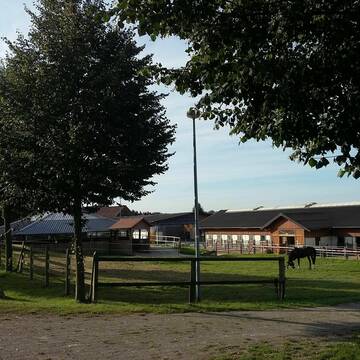
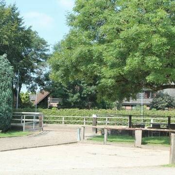
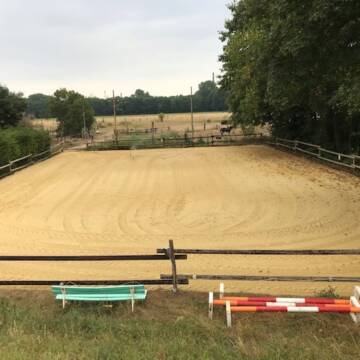
Reitanlage Liethen, Gut Steinkaule
Erkrath
Reitanlage Liethen
@ReitanlageLiethen
FN-Mitglied
Freizeitstall
Vermieten
Führanlage
Longierzirkel/Roundpen
Hengsthaltung möglich
20 weitere...
P
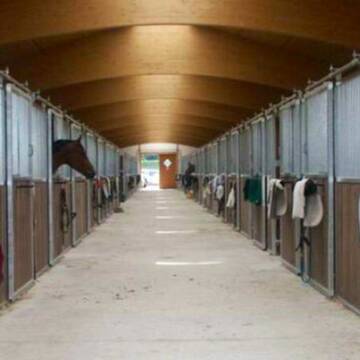
Wir haben aktuell Paddockbox-Fensterbox frei
Pulheim
Schumacher
@Reitanlage-Junkerhof
FN-Mitglied
Pferdeausbildung
Führanlage
Hunde willkommen
Allergikerstall
bedampftes/gewaschenes Heu
Außenbox mit Paddock
Außenboxen
26 weitere...
aktuell
S
Deprecated: Creation of dynamic property Zend_View_Helper_Ads::$adLink is deprecated in /var/www/stall-frei/htdocs/staging.stall-frei.de/library/Psf/View/Helper/Ads.php on line 108

Heu und Heulage verkaufen
Mechtersen
STALL-FREIde Marketing
@STALL-FREI-Marketing
Verkaufen Sie Ihr Heu und Ihre Heulage direkt an Reiter, Pferdeställe und Reitanlagen
Leider kein Vorschaubild
Leider kein Vorschaubild
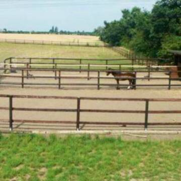
Boxen frei, in kleinem ruhigen Stall
Leichlingen
Schäferei Krabb
@SchaefereiKrabb
Freizeitstall
Vermieten
Paddock
Sattelkammer/Sattelschränke
Selbstversorgung
3 weitere...
B

Grundermühlenhof - für Stuten und Wallache -
Leverkusen
Eigen
@Eigen
Freizeitstall
Vermieten
Paddock
Parkplatz für Pferdeanhänger
Einzelne Boxen oder Stallplätze
7 weitere...
P
Leider kein Vorschaubild
Leider kein Vorschaubild
Eine schöne große Box zu vermieten.
Hilden
Reit u. Fahrverein Hilden e.V.
@ReitvereinHilden
Fahrstall, Kutschwagen
Freizeitstall
Vermieten
Führanlage
Hunde willkommen
Außenbox mit Paddock
Außenboxen
22 weitere...
B

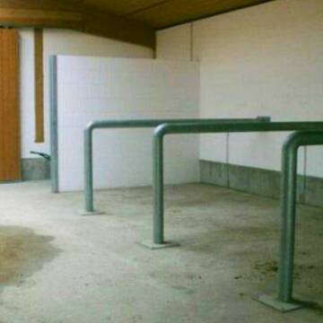
2 Offenstallplätze für kleine Robustpferde frei
Remscheid
Offenstall Remscheid
@Offenstall-Hermanns
Freizeitstall
Gangpferdereiten
Vermieten
Hunde willkommen
Krankenbox
Notfallboxen
22 weitere...
P

Frisches Stroh zu verkaufen!
Mechtersen
STALL-FREIde Marketing
@STALL-FREI-Marketing
Kaufe frisches Stroh für dein Pferd!
Reitstall Königs
Mettmann
Reitstall Königs
@Markus-Reitstall-Koenigs
Freizeitstall
Geländestrecke
Führanlage
Longierzirkel/Roundpen
Außenboxen
Innenbox
Vollpension
15 weitere...
P

Idyllischer, familiär geführter Islandpferdehof
Mettmann
S.M.D.
@Schum
Freizeitstall
Gangpferdereiten
Vermieten
Hunde willkommen
Longierzirkel/Roundpen
Allergikerstall
Notfallboxen
19 weitere...
P
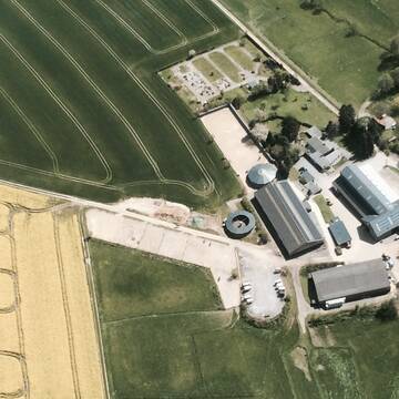
Ivenshof - Historischer Bauernhof/Reitanlage
Köln
Ivenshof 7ha Weideland
@Ivenshof
Freizeitstall
Reitlehrer und -unterricht
Vermieten
Hunde willkommen
Longierzirkel/Roundpen
Allergikerstall
Hufrehe geeignet
14 weitere...
P+

Kleiner Freizeitstall, Rentner, Offenstall
Düsseldorf
Christian-Wirtz
@Christian-Wirtz
Sattelkammer/Sattelschränke
Sommerweide
Fohlenaufzucht möglich
Außenbox mit Paddock
Außenboxen
Vollpension
4 weitere...
P
Newsletter abonnieren
Melde Dich für unseren Newsletter an und verpasse keine Neuigkeiten!
Deprecated: Creation of dynamic property Zend_View::$pageCount is deprecated in /var/www/stall-frei/htdocs/staging.stall-frei.de/library/vendor/shardj/zf1-future/library/Zend/View/Abstract.php on line 308
Deprecated: Creation of dynamic property Zend_View::$itemCountPerPage is deprecated in /var/www/stall-frei/htdocs/staging.stall-frei.de/library/vendor/shardj/zf1-future/library/Zend/View/Abstract.php on line 308
Deprecated: Creation of dynamic property Zend_View::$first is deprecated in /var/www/stall-frei/htdocs/staging.stall-frei.de/library/vendor/shardj/zf1-future/library/Zend/View/Abstract.php on line 308
Deprecated: Creation of dynamic property Zend_View::$current is deprecated in /var/www/stall-frei/htdocs/staging.stall-frei.de/library/vendor/shardj/zf1-future/library/Zend/View/Abstract.php on line 308
Deprecated: Creation of dynamic property Zend_View::$last is deprecated in /var/www/stall-frei/htdocs/staging.stall-frei.de/library/vendor/shardj/zf1-future/library/Zend/View/Abstract.php on line 308
Deprecated: Creation of dynamic property Zend_View::$previous is deprecated in /var/www/stall-frei/htdocs/staging.stall-frei.de/library/vendor/shardj/zf1-future/library/Zend/View/Abstract.php on line 308
Deprecated: Creation of dynamic property Zend_View::$next is deprecated in /var/www/stall-frei/htdocs/staging.stall-frei.de/library/vendor/shardj/zf1-future/library/Zend/View/Abstract.php on line 308
Deprecated: Creation of dynamic property Zend_View::$pagesInRange is deprecated in /var/www/stall-frei/htdocs/staging.stall-frei.de/library/vendor/shardj/zf1-future/library/Zend/View/Abstract.php on line 308
Deprecated: Creation of dynamic property Zend_View::$firstPageInRange is deprecated in /var/www/stall-frei/htdocs/staging.stall-frei.de/library/vendor/shardj/zf1-future/library/Zend/View/Abstract.php on line 308
Deprecated: Creation of dynamic property Zend_View::$lastPageInRange is deprecated in /var/www/stall-frei/htdocs/staging.stall-frei.de/library/vendor/shardj/zf1-future/library/Zend/View/Abstract.php on line 308
Deprecated: Creation of dynamic property Zend_View::$currentItemCount is deprecated in /var/www/stall-frei/htdocs/staging.stall-frei.de/library/vendor/shardj/zf1-future/library/Zend/View/Abstract.php on line 308
Deprecated: Creation of dynamic property Zend_View::$totalItemCount is deprecated in /var/www/stall-frei/htdocs/staging.stall-frei.de/library/vendor/shardj/zf1-future/library/Zend/View/Abstract.php on line 308
Deprecated: Creation of dynamic property Zend_View::$firstItemNumber is deprecated in /var/www/stall-frei/htdocs/staging.stall-frei.de/library/vendor/shardj/zf1-future/library/Zend/View/Abstract.php on line 308
Deprecated: Creation of dynamic property Zend_View::$lastItemNumber is deprecated in /var/www/stall-frei/htdocs/staging.stall-frei.de/library/vendor/shardj/zf1-future/library/Zend/View/Abstract.php on line 308
Deprecated: Creation of dynamic property Zend_View::$router is deprecated in /var/www/stall-frei/htdocs/staging.stall-frei.de/library/vendor/shardj/zf1-future/library/Zend/View/Abstract.php on line 308
Deprecated: Creation of dynamic property Zend_View::$urlParams is deprecated in /var/www/stall-frei/htdocs/staging.stall-frei.de/library/vendor/shardj/zf1-future/library/Zend/View/Abstract.php on line 308
Deprecated: Creation of dynamic property Zend_View::$showAds is deprecated in /var/www/stall-frei/htdocs/staging.stall-frei.de/library/vendor/shardj/zf1-future/library/Zend/View/Abstract.php on line 308
Deprecated: Creation of dynamic property Zend_View::$objectIds is deprecated in /var/www/stall-frei/htdocs/staging.stall-frei.de/library/vendor/shardj/zf1-future/library/Zend/View/Abstract.php on line 308
Deprecated: Creation of dynamic property Zend_View::$showNavbar is deprecated in /var/www/stall-frei/htdocs/staging.stall-frei.de/library/vendor/shardj/zf1-future/library/Zend/View/Abstract.php on line 308
Deprecated: Creation of dynamic property Zend_View::$showBreadcrumb is deprecated in /var/www/stall-frei/htdocs/staging.stall-frei.de/library/vendor/shardj/zf1-future/library/Zend/View/Abstract.php on line 308
Deprecated: Creation of dynamic property Zend_View::$showFooter is deprecated in /var/www/stall-frei/htdocs/staging.stall-frei.de/library/vendor/shardj/zf1-future/library/Zend/View/Abstract.php on line 308
Deprecated: Creation of dynamic property Zend_View::$showInternalAds is deprecated in /var/www/stall-frei/htdocs/staging.stall-frei.de/library/vendor/shardj/zf1-future/library/Zend/View/Abstract.php on line 308
Deprecated: Creation of dynamic property Zend_View::$blNoContent is deprecated in /var/www/stall-frei/htdocs/staging.stall-frei.de/library/vendor/shardj/zf1-future/library/Zend/View/Abstract.php on line 308
Deprecated: Creation of dynamic property Zend_View::$sMetaDesc is deprecated in /var/www/stall-frei/htdocs/staging.stall-frei.de/library/vendor/shardj/zf1-future/library/Zend/View/Abstract.php on line 308
Deprecated: Creation of dynamic property Zend_View::$useGmaps is deprecated in /var/www/stall-frei/htdocs/staging.stall-frei.de/library/vendor/shardj/zf1-future/library/Zend/View/Abstract.php on line 308
Deprecated: Creation of dynamic property Zend_View::$touches is deprecated in /var/www/stall-frei/htdocs/staging.stall-frei.de/library/vendor/shardj/zf1-future/library/Zend/View/Abstract.php on line 308
Deprecated: Creation of dynamic property Zend_View::$oProject is deprecated in /var/www/stall-frei/htdocs/staging.stall-frei.de/library/vendor/shardj/zf1-future/library/Zend/View/Abstract.php on line 308
Deprecated: Creation of dynamic property Zend_View::$pageHeadline is deprecated in /var/www/stall-frei/htdocs/staging.stall-frei.de/library/vendor/shardj/zf1-future/library/Zend/View/Abstract.php on line 308
Deprecated: Creation of dynamic property Zend_View::$disableLocationField is deprecated in /var/www/stall-frei/htdocs/staging.stall-frei.de/library/vendor/shardj/zf1-future/library/Zend/View/Abstract.php on line 308
Deprecated: Creation of dynamic property Zend_View::$isSearch is deprecated in /var/www/stall-frei/htdocs/staging.stall-frei.de/library/vendor/shardj/zf1-future/library/Zend/View/Abstract.php on line 308
Deprecated: Creation of dynamic property Zend_View::$pageTitle is deprecated in /var/www/stall-frei/htdocs/staging.stall-frei.de/library/vendor/shardj/zf1-future/library/Zend/View/Abstract.php on line 308
Deprecated: Creation of dynamic property Psf_Form_Element_Text::$class is deprecated in /var/www/stall-frei/htdocs/staging.stall-frei.de/library/vendor/shardj/zf1-future/library/Zend/Form/Element.php on line 874
Deprecated: Creation of dynamic property Psf_Form_Element_Text::$size is deprecated in /var/www/stall-frei/htdocs/staging.stall-frei.de/library/vendor/shardj/zf1-future/library/Zend/Form/Element.php on line 874
Deprecated: Creation of dynamic property Psf_Form_Element_Text::$placeholder is deprecated in /var/www/stall-frei/htdocs/staging.stall-frei.de/library/vendor/shardj/zf1-future/library/Zend/Form/Element.php on line 874
Deprecated: Creation of dynamic property Psf_Form_Element_Hidden::$class is deprecated in /var/www/stall-frei/htdocs/staging.stall-frei.de/library/vendor/shardj/zf1-future/library/Zend/Form/Element.php on line 874
Deprecated: Creation of dynamic property Psf_Form_Element_Hidden::$class is deprecated in /var/www/stall-frei/htdocs/staging.stall-frei.de/library/vendor/shardj/zf1-future/library/Zend/Form/Element.php on line 874
Deprecated: Creation of dynamic property Psf_Form_Element_Hidden::$class is deprecated in /var/www/stall-frei/htdocs/staging.stall-frei.de/library/vendor/shardj/zf1-future/library/Zend/Form/Element.php on line 874
Deprecated: Creation of dynamic property Psf_Form_Element_Hidden::$class is deprecated in /var/www/stall-frei/htdocs/staging.stall-frei.de/library/vendor/shardj/zf1-future/library/Zend/Form/Element.php on line 874
Deprecated: Creation of dynamic property Psf_Form_Element_Select::$class is deprecated in /var/www/stall-frei/htdocs/staging.stall-frei.de/library/vendor/shardj/zf1-future/library/Zend/Form/Element.php on line 874
Deprecated: Creation of dynamic property Psf_Form_Element_Select::$class is deprecated in /var/www/stall-frei/htdocs/staging.stall-frei.de/library/vendor/shardj/zf1-future/library/Zend/Form/Element.php on line 874
Deprecated: Creation of dynamic property Psf_Form_Element_Select::$class is deprecated in /var/www/stall-frei/htdocs/staging.stall-frei.de/library/vendor/shardj/zf1-future/library/Zend/Form/Element.php on line 874
Deprecated: Creation of dynamic property Psf_Form_Element_Select::$class is deprecated in /var/www/stall-frei/htdocs/staging.stall-frei.de/library/vendor/shardj/zf1-future/library/Zend/Form/Element.php on line 874
Deprecated: Creation of dynamic property Psf_Form_Element_Text::$class is deprecated in /var/www/stall-frei/htdocs/staging.stall-frei.de/library/vendor/shardj/zf1-future/library/Zend/Form/Element.php on line 874
Deprecated: Creation of dynamic property Psf_Form_Element_Checkbox::$label is deprecated in /var/www/stall-frei/htdocs/staging.stall-frei.de/library/vendor/shardj/zf1-future/library/Zend/Form/Element.php on line 874
Deprecated: Creation of dynamic property Zend_View::$sort is deprecated in /var/www/stall-frei/htdocs/staging.stall-frei.de/library/vendor/shardj/zf1-future/library/Zend/View/Abstract.php on line 308
Deprecated: Creation of dynamic property Zend_View::$searchLocation is deprecated in /var/www/stall-frei/htdocs/staging.stall-frei.de/library/vendor/shardj/zf1-future/library/Zend/View/Abstract.php on line 308
Deprecated: Creation of dynamic property Zend_View::$locationHint is deprecated in /var/www/stall-frei/htdocs/staging.stall-frei.de/library/vendor/shardj/zf1-future/library/Zend/View/Abstract.php on line 308
Psf_GeoCoder_Abstract::getLocation: Ohligs Get Location CachedOrLive
Psf_GeoCoder_Abstract::getCachedOrLive: Ohligs
Psf_GeoCoder_Abstract::convertLocationResult
{"documentation":"https:\/\/opencagedata.com\/api","licenses":[{"name":"see attribution guide","url":"https:\/\/opencagedata.com\/credits"}],"results":[{"bounds":{"northeast":{"lat":51.1661221,"lng":7.009223},"southwest":{"lat":51.1561221,"lng":6.999223}},"components":{"ISO_3166-1_alpha-2":"DE","ISO_3166-1_alpha-3":"DEU","ISO_3166-2":["DE-NW"],"_category":"transportation","_normalized_city":"Solingen","_type":"railway","city":"Solingen","continent":"Europe","country":"Deutschland","country_code":"de","hamlet":"Nassenweg","neighbourhood":"Keldersquartier","political_union":"European Union","postcode":"42697","railway":"Solingen Hauptbahnhof","road":"Bahnhofstunnel","state":"Nordrhein-Westfalen","state_code":"NW","suburb":"Ohligs\/Aufderh\u00f6he\/Merscheid"},"confidence":9,"formatted":"Solingen Hauptbahnhof, Bahnhofstunnel, 42697 Solingen, Deutschland","geometry":{"lat":51.1611221,"lng":7.004223}},{"bounds":{"northeast":{"lat":51.1815661,"lng":7.0201386},"southwest":{"lat":51.1415661,"lng":6.9801386}},"components":{"ISO_3166-1_alpha-2":"DE","ISO_3166-1_alpha-3":"DEU","ISO_3166-2":["DE-NW"],"_category":"place","_normalized_city":"Solingen","_type":"neighbourhood","city":"Solingen","continent":"Europe","country":"Deutschland","country_code":"de","political_union":"European Union","postcode":"42697","state":"Nordrhein-Westfalen","state_code":"NW","suburb":"Ohligs-Mitte"},"confidence":7,"formatted":"42697 Solingen, Deutschland","geometry":{"lat":51.1615661,"lng":7.0001386}},{"bounds":{"northeast":{"lat":51.1803704,"lng":7.0535122},"southwest":{"lat":51.1196901,"lng":6.9511406}},"components":{"ISO_3166-1_alpha-2":"DE","ISO_3166-1_alpha-3":"DEU","ISO_3166-2":["DE-NW"],"_category":"place","_normalized_city":"Solingen","_type":"neighbourhood","city":"Solingen","continent":"Europe","country":"Deutschland","country_code":"de","political_union":"European Union","state":"Nordrhein-Westfalen","state_code":"NW","suburb":"Ohligs\/Aufderh\u00f6he\/Merscheid"},"confidence":7,"formatted":"Ohligs\/Aufderh\u00f6he\/Merscheid, Solingen, Nordrhein-Westfalen, Deutschland","geometry":{"lat":51.1502373,"lng":6.9918403}},{"bounds":{"northeast":{"lat":49.4248186,"lng":6.6876974},"southwest":{"lat":49.4109243,"lng":6.6714075}},"components":{"ISO_3166-1_alpha-2":"DE","ISO_3166-1_alpha-3":"DEU","ISO_3166-2":["DE-SL"],"_category":"natural\/water","_normalized_city":"Merzig","_type":"stream","city_district":"Bietzen","continent":"Europe","country":"Deutschland","country_code":"de","county":"Landkreis Merzig-Wadern","political_union":"European Union","postcode":"66663","state":"Saarland","state_code":"SL","stream":"Ohligsbach","town":"Merzig"},"confidence":8,"formatted":"Ohligsbach, 66663 Merzig, Deutschland","geometry":{"lat":49.4212622,"lng":6.6760987}},{"bounds":{"northeast":{"lat":50.9276492,"lng":7.3701585},"southwest":{"lat":50.9252436,"lng":7.3592364}},"components":{"ISO_3166-1_alpha-2":"DE","ISO_3166-1_alpha-3":"DEU","ISO_3166-2":["DE-NW"],"_category":"natural\/water","_normalized_city":"Much","_type":"stream","continent":"Europe","country":"Deutschland","country_code":"de","county":"Rhein-Sieg-Kreis","hamlet":"Str\u00fcnkerhof","political_union":"European Union","postcode":"53804","state":"Nordrhein-Westfalen","state_code":"NW","stream":"Ohligsbach","village":"Much"},"confidence":9,"formatted":"Ohligsbach, Str\u00fcnkerhof, 53804 Much, Deutschland","geometry":{"lat":50.9266652,"lng":7.3645558}},{"bounds":{"northeast":{"lat":50.9289669,"lng":7.3752},"southwest":{"lat":50.9276224,"lng":7.3702848}},"components":{"ISO_3166-1_alpha-2":"DE","ISO_3166-1_alpha-3":"DEU","ISO_3166-2":["DE-NW"],"_category":"natural\/water","_normalized_city":"Much","_type":"stream","continent":"Europe","country":"Deutschland","country_code":"de","county":"Rhein-Sieg-Kreis","hamlet":"Neverdorf","neighbourhood":"Gerlinghausen","political_union":"European Union","postcode":"53804","state":"Nordrhein-Westfalen","state_code":"NW","stream":"Ohligsbach","village":"Much"},"confidence":9,"formatted":"Ohligsbach, Neverdorf, 53804 Much, Deutschland","geometry":{"lat":50.9282556,"lng":7.3727289}},{"bounds":{"northeast":{"lat":50.9251766,"lng":7.3591392},"southwest":{"lat":50.924661,"lng":7.3586629}},"components":{"ISO_3166-1_alpha-2":"DE","ISO_3166-1_alpha-3":"DEU","ISO_3166-2":["DE-NW"],"_category":"natural\/water","_normalized_city":"Much","_type":"stream","continent":"Europe","country":"Deutschland","country_code":"de","county":"Rhein-Sieg-Kreis","hamlet":"Birken","neighbourhood":"Gerlinghausen","political_union":"European Union","postcode":"53804","state":"Nordrhein-Westfalen","state_code":"NW","stream":"Ohligsbach","village":"Much"},"confidence":9,"formatted":"Ohligsbach, Birken, 53804 Much, Deutschland","geometry":{"lat":50.9249789,"lng":7.3588173}},{"bounds":{"northeast":{"lat":51.1583428,"lng":6.992902},"southwest":{"lat":51.1542998,"lng":6.9854575}},"components":{"ISO_3166-1_alpha-2":"DE","ISO_3166-1_alpha-3":"DEU","ISO_3166-2":["DE-NW"],"_category":"outdoors\/recreation","_normalized_city":"Solingen","_type":"cemetery","cemetery":"Evangelischer Friedhof Ohligs","city":"Solingen","continent":"Europe","country":"Deutschland","country_code":"de","political_union":"European Union","postcode":"42697","state":"Nordrhein-Westfalen","state_code":"NW","suburb":"Ohligs\/Aufderh\u00f6he\/Merscheid"},"confidence":9,"formatted":"Evangelischer Friedhof Ohligs, 42697 Solingen, Deutschland","geometry":{"lat":51.1562871,"lng":6.9878509}},{"components":{"ISO_3166-1_alpha-2":"FR","ISO_3166-1_alpha-3":"FRA","ISO_3166-2":["FR-OCC","FR-30"],"_category":"road","_normalized_city":"G\u00e9nolhac","_type":"road","city":"G\u00e9nolhac","continent":"Europe","country":"France","country_code":"fr","county":"Gard","local_authority":"Al\u00e8s Agglom\u00e9ration","political_union":"European Union","postcode":"30450","road":"Plan de l\u2019Oli","state":"Occitanie","state_code":"OCC"},"confidence":2,"formatted":"Plan de l\u2019Oli, 30450 G\u00e9nolhac, France","geometry":{"lat":44.349701,"lng":3.949618}},{"components":{"ISO_3166-1_alpha-2":"FR","ISO_3166-1_alpha-3":"FRA","ISO_3166-2":["FR-PAC","FR-04"],"_category":"road","_normalized_city":"Quinson","_type":"road","city":"Quinson","continent":"Europe","country":"France","country_code":"fr","county":"Alpes-de-Haute-Provence","local_authority":"Durance Luberon Verdon Agglom\u00e9ration","political_union":"European Union","postcode":"04500","road":"l'Escourche de l'Oli","state":"Provence-Alpes-C\u00f4te d'Azur","state_code":"PAC"},"confidence":10,"formatted":"l'Escourche de l'Oli, 04500 Quinson, France","geometry":{"lat":43.701561,"lng":6.039988}}],"status":{"code":200,"message":"OK"},"stay_informed":{"blog":"https:\/\/blog.opencagedata.com","mastodon":"https:\/\/en.osm.town\/@opencage"},"thanks":"For using an OpenCage API","timestamp":{"created_http":"Sun, 08 Feb 2026 03:01:19 GMT","created_unix":1770519679},"total_results":10}Array
(
[0] => stdClass Object
(
[bounds] => stdClass Object
(
[northeast] => stdClass Object
(
[lat] => 51.1661221
[lng] => 7.009223
)
[southwest] => stdClass Object
(
[lat] => 51.1561221
[lng] => 6.999223
)
)
[components] => stdClass Object
(
[ISO_3166-1_alpha-2] => DE
[ISO_3166-1_alpha-3] => DEU
[ISO_3166-2] => Array
(
[0] => DE-NW
)
[_category] => transportation
[_normalized_city] => Solingen
[_type] => railway
[city] => Solingen
[continent] => Europe
[country] => Deutschland
[country_code] => de
[hamlet] => Nassenweg
[neighbourhood] => Keldersquartier
[political_union] => European Union
[postcode] => 42697
[railway] => Solingen Hauptbahnhof
[road] => Bahnhofstunnel
[state] => Nordrhein-Westfalen
[state_code] => NW
[suburb] => Ohligs/Aufderhöhe/Merscheid
)
[confidence] => 9
[formatted] => Solingen Hauptbahnhof, Bahnhofstunnel, 42697 Solingen, Deutschland
[geometry] => stdClass Object
(
[lat] => 51.1611221
[lng] => 7.004223
)
)
[1] => stdClass Object
(
[bounds] => stdClass Object
(
[northeast] => stdClass Object
(
[lat] => 51.1815661
[lng] => 7.0201386
)
[southwest] => stdClass Object
(
[lat] => 51.1415661
[lng] => 6.9801386
)
)
[components] => stdClass Object
(
[ISO_3166-1_alpha-2] => DE
[ISO_3166-1_alpha-3] => DEU
[ISO_3166-2] => Array
(
[0] => DE-NW
)
[_category] => place
[_normalized_city] => Solingen
[_type] => neighbourhood
[city] => Solingen
[continent] => Europe
[country] => Deutschland
[country_code] => de
[political_union] => European Union
[postcode] => 42697
[state] => Nordrhein-Westfalen
[state_code] => NW
[suburb] => Ohligs-Mitte
)
[confidence] => 7
[formatted] => 42697 Solingen, Deutschland
[geometry] => stdClass Object
(
[lat] => 51.1615661
[lng] => 7.0001386
)
)
[2] => stdClass Object
(
[bounds] => stdClass Object
(
[northeast] => stdClass Object
(
[lat] => 51.1803704
[lng] => 7.0535122
)
[southwest] => stdClass Object
(
[lat] => 51.1196901
[lng] => 6.9511406
)
)
[components] => stdClass Object
(
[ISO_3166-1_alpha-2] => DE
[ISO_3166-1_alpha-3] => DEU
[ISO_3166-2] => Array
(
[0] => DE-NW
)
[_category] => place
[_normalized_city] => Solingen
[_type] => neighbourhood
[city] => Solingen
[continent] => Europe
[country] => Deutschland
[country_code] => de
[political_union] => European Union
[state] => Nordrhein-Westfalen
[state_code] => NW
[suburb] => Ohligs/Aufderhöhe/Merscheid
)
[confidence] => 7
[formatted] => Ohligs/Aufderhöhe/Merscheid, Solingen, Nordrhein-Westfalen, Deutschland
[geometry] => stdClass Object
(
[lat] => 51.1502373
[lng] => 6.9918403
)
)
[3] => stdClass Object
(
[bounds] => stdClass Object
(
[northeast] => stdClass Object
(
[lat] => 49.4248186
[lng] => 6.6876974
)
[southwest] => stdClass Object
(
[lat] => 49.4109243
[lng] => 6.6714075
)
)
[components] => stdClass Object
(
[ISO_3166-1_alpha-2] => DE
[ISO_3166-1_alpha-3] => DEU
[ISO_3166-2] => Array
(
[0] => DE-SL
)
[_category] => natural/water
[_normalized_city] => Merzig
[_type] => stream
[city_district] => Bietzen
[continent] => Europe
[country] => Deutschland
[country_code] => de
[county] => Landkreis Merzig-Wadern
[political_union] => European Union
[postcode] => 66663
[state] => Saarland
[state_code] => SL
[stream] => Ohligsbach
[town] => Merzig
)
[confidence] => 8
[formatted] => Ohligsbach, 66663 Merzig, Deutschland
[geometry] => stdClass Object
(
[lat] => 49.4212622
[lng] => 6.6760987
)
)
[4] => stdClass Object
(
[bounds] => stdClass Object
(
[northeast] => stdClass Object
(
[lat] => 50.9276492
[lng] => 7.3701585
)
[southwest] => stdClass Object
(
[lat] => 50.9252436
[lng] => 7.3592364
)
)
[components] => stdClass Object
(
[ISO_3166-1_alpha-2] => DE
[ISO_3166-1_alpha-3] => DEU
[ISO_3166-2] => Array
(
[0] => DE-NW
)
[_category] => natural/water
[_normalized_city] => Much
[_type] => stream
[continent] => Europe
[country] => Deutschland
[country_code] => de
[county] => Rhein-Sieg-Kreis
[hamlet] => Strünkerhof
[political_union] => European Union
[postcode] => 53804
[state] => Nordrhein-Westfalen
[state_code] => NW
[stream] => Ohligsbach
[village] => Much
)
[confidence] => 9
[formatted] => Ohligsbach, Strünkerhof, 53804 Much, Deutschland
[geometry] => stdClass Object
(
[lat] => 50.9266652
[lng] => 7.3645558
)
)
[5] => stdClass Object
(
[bounds] => stdClass Object
(
[northeast] => stdClass Object
(
[lat] => 50.9289669
[lng] => 7.3752
)
[southwest] => stdClass Object
(
[lat] => 50.9276224
[lng] => 7.3702848
)
)
[components] => stdClass Object
(
[ISO_3166-1_alpha-2] => DE
[ISO_3166-1_alpha-3] => DEU
[ISO_3166-2] => Array
(
[0] => DE-NW
)
[_category] => natural/water
[_normalized_city] => Much
[_type] => stream
[continent] => Europe
[country] => Deutschland
[country_code] => de
[county] => Rhein-Sieg-Kreis
[hamlet] => Neverdorf
[neighbourhood] => Gerlinghausen
[political_union] => European Union
[postcode] => 53804
[state] => Nordrhein-Westfalen
[state_code] => NW
[stream] => Ohligsbach
[village] => Much
)
[confidence] => 9
[formatted] => Ohligsbach, Neverdorf, 53804 Much, Deutschland
[geometry] => stdClass Object
(
[lat] => 50.9282556
[lng] => 7.3727289
)
)
[6] => stdClass Object
(
[bounds] => stdClass Object
(
[northeast] => stdClass Object
(
[lat] => 50.9251766
[lng] => 7.3591392
)
[southwest] => stdClass Object
(
[lat] => 50.924661
[lng] => 7.3586629
)
)
[components] => stdClass Object
(
[ISO_3166-1_alpha-2] => DE
[ISO_3166-1_alpha-3] => DEU
[ISO_3166-2] => Array
(
[0] => DE-NW
)
[_category] => natural/water
[_normalized_city] => Much
[_type] => stream
[continent] => Europe
[country] => Deutschland
[country_code] => de
[county] => Rhein-Sieg-Kreis
[hamlet] => Birken
[neighbourhood] => Gerlinghausen
[political_union] => European Union
[postcode] => 53804
[state] => Nordrhein-Westfalen
[state_code] => NW
[stream] => Ohligsbach
[village] => Much
)
[confidence] => 9
[formatted] => Ohligsbach, Birken, 53804 Much, Deutschland
[geometry] => stdClass Object
(
[lat] => 50.9249789
[lng] => 7.3588173
)
)
[7] => stdClass Object
(
[bounds] => stdClass Object
(
[northeast] => stdClass Object
(
[lat] => 51.1583428
[lng] => 6.992902
)
[southwest] => stdClass Object
(
[lat] => 51.1542998
[lng] => 6.9854575
)
)
[components] => stdClass Object
(
[ISO_3166-1_alpha-2] => DE
[ISO_3166-1_alpha-3] => DEU
[ISO_3166-2] => Array
(
[0] => DE-NW
)
[_category] => outdoors/recreation
[_normalized_city] => Solingen
[_type] => cemetery
[cemetery] => Evangelischer Friedhof Ohligs
[city] => Solingen
[continent] => Europe
[country] => Deutschland
[country_code] => de
[political_union] => European Union
[postcode] => 42697
[state] => Nordrhein-Westfalen
[state_code] => NW
[suburb] => Ohligs/Aufderhöhe/Merscheid
)
[confidence] => 9
[formatted] => Evangelischer Friedhof Ohligs, 42697 Solingen, Deutschland
[geometry] => stdClass Object
(
[lat] => 51.1562871
[lng] => 6.9878509
)
)
[8] => stdClass Object
(
[components] => stdClass Object
(
[ISO_3166-1_alpha-2] => FR
[ISO_3166-1_alpha-3] => FRA
[ISO_3166-2] => Array
(
[0] => FR-OCC
[1] => FR-30
)
[_category] => road
[_normalized_city] => Génolhac
[_type] => road
[city] => Génolhac
[continent] => Europe
[country] => France
[country_code] => fr
[county] => Gard
[local_authority] => Alès Agglomération
[political_union] => European Union
[postcode] => 30450
[road] => Plan de l’Oli
[state] => Occitanie
[state_code] => OCC
)
[confidence] => 2
[formatted] => Plan de l’Oli, 30450 Génolhac, France
[geometry] => stdClass Object
(
[lat] => 44.349701
[lng] => 3.949618
)
)
[9] => stdClass Object
(
[components] => stdClass Object
(
[ISO_3166-1_alpha-2] => FR
[ISO_3166-1_alpha-3] => FRA
[ISO_3166-2] => Array
(
[0] => FR-PAC
[1] => FR-04
)
[_category] => road
[_normalized_city] => Quinson
[_type] => road
[city] => Quinson
[continent] => Europe
[country] => France
[country_code] => fr
[county] => Alpes-de-Haute-Provence
[local_authority] => Durance Luberon Verdon Agglomération
[political_union] => European Union
[postcode] => 04500
[road] => l'Escourche de l'Oli
[state] => Provence-Alpes-Côte d'Azur
[state_code] => PAC
)
[confidence] => 10
[formatted] => l'Escourche de l'Oli, 04500 Quinson, France
[geometry] => stdClass Object
(
[lat] => 43.701561
[lng] => 6.039988
)
)
)
Psf_GeoCoder_OpenCageData::getKeyMap: 0
stdClass Object
(
    [bounds] => stdClass Object
        (
            [northeast] => stdClass Object
                (
                    [lat] => 51.1661221
                    [lng] => 7.009223
                )

            [southwest] => stdClass Object
                (
                    [lat] => 51.1561221
                    [lng] => 6.999223
                )

        )

    [components] => stdClass Object
        (
            [ISO_3166-1_alpha-2] => DE
            [ISO_3166-1_alpha-3] => DEU
            [ISO_3166-2] => Array
                (
                    [0] => DE-NW
                )

            [_category] => transportation
            [_normalized_city] => Solingen
            [_type] => railway
            [city] => Solingen
            [continent] => Europe
            [country] => Deutschland
            [country_code] => de
            [hamlet] => Nassenweg
            [neighbourhood] => Keldersquartier
            [political_union] => European Union
            [postcode] => 42697
            [railway] => Solingen Hauptbahnhof
            [road] => Bahnhofstunnel
            [state] => Nordrhein-Westfalen
            [state_code] => NW
            [suburb] => Ohligs/Aufderhöhe/Merscheid
        )

    [confidence] => 9
    [formatted] => Solingen Hauptbahnhof, Bahnhofstunnel, 42697 Solingen, Deutschland
    [geometry] => stdClass Object
        (
            [lat] => 51.1611221
            [lng] => 7.004223
        )

)
Psf_GeoCoder_OpenCageData::getCounty: Solingen
Psf_GeoCoder_OpenCageData::addMissingData REFETCH!
Array
(
    [address] => Solingen Hauptbahnhof, Bahnhofstunnel, 42697 Solingen, Deutschland
    [type] => railway
    [street] => Bahnhofstunnel
    [city] => Ohligs/Aufderhöhe/Merscheid
    [county] => Solingen
    [state] => Nordrhein-Westfalen
    [zip] => 42697
    [country] => Deutschland
    [suburb] => Ohligs/Aufderhöhe/Merscheid
    [countrycode] => de
    [latitude] => 51.1611221
    [longitude] => 7.004223
    [accuracy] => 1
    [confidence] => 9
    [bounds] => stdClass Object
        (
            [northeast] => stdClass Object
                (
                    [lat] => 51.1661221
                    [lng] => 7.009223
                )

            [southwest] => stdClass Object
                (
                    [lat] => 51.1561221
                    [lng] => 6.999223
                )

        )

)
reformat!
Array
(
    [address] => Bahnhofstunnel, 42697 Ohligs/Aufderhöhe/Merscheid
    [type] => railway
    [street] => Bahnhofstunnel
    [city] => Ohligs/Aufderhöhe/Merscheid
    [county] => Solingen
    [state] => Nordrhein-Westfalen
    [zip] => 42697
    [country] => Deutschland
    [suburb] => Ohligs/Aufderhöhe/Merscheid
    [countrycode] => de
    [latitude] => 51.1611221
    [longitude] => 7.004223
    [accuracy] => 1
    [confidence] => 9
    [bounds] => stdClass Object
        (
            [northeast] => stdClass Object
                (
                    [lat] => 51.1661221
                    [lng] => 7.009223
                )

            [southwest] => stdClass Object
                (
                    [lat] => 51.1561221
                    [lng] => 6.999223
                )

        )

    [place] => Bahnhofstunnel, 42697 Ohligs/Aufderhöhe/Merscheid, Nordrhein-Westfalen
    [hash] => 2ae8731c532fb07bf2da80584f02fd42
)
Psf_GeoCoder_OpenCageData::getKeyMap: 1
stdClass Object
(
    [bounds] => stdClass Object
        (
            [northeast] => stdClass Object
                (
                    [lat] => 51.1815661
                    [lng] => 7.0201386
                )

            [southwest] => stdClass Object
                (
                    [lat] => 51.1415661
                    [lng] => 6.9801386
                )

        )

    [components] => stdClass Object
        (
            [ISO_3166-1_alpha-2] => DE
            [ISO_3166-1_alpha-3] => DEU
            [ISO_3166-2] => Array
                (
                    [0] => DE-NW
                )

            [_category] => place
            [_normalized_city] => Solingen
            [_type] => neighbourhood
            [city] => Solingen
            [continent] => Europe
            [country] => Deutschland
            [country_code] => de
            [political_union] => European Union
            [postcode] => 42697
            [state] => Nordrhein-Westfalen
            [state_code] => NW
            [suburb] => Ohligs-Mitte
        )

    [confidence] => 7
    [formatted] => 42697 Solingen, Deutschland
    [geometry] => stdClass Object
        (
            [lat] => 51.1615661
            [lng] => 7.0001386
        )

)
Psf_GeoCoder_OpenCageData::getCounty: Solingen
Psf_GeoCoder_OpenCageData::addMissingData REFETCH!
Array
(
    [address] => 42697 Solingen, Deutschland
    [type] => neighbourhood
    [street] =>
    [city] => Ohligs-Mitte
    [county] => Solingen
    [state] => Nordrhein-Westfalen
    [zip] => 42697
    [country] => Deutschland
    [suburb] => Ohligs-Mitte
    [countrycode] => de
    [latitude] => 51.1615661
    [longitude] => 7.0001386
    [accuracy] => 1
    [confidence] => 7
    [bounds] => stdClass Object
        (
            [northeast] => stdClass Object
                (
                    [lat] => 51.1815661
                    [lng] => 7.0201386
                )

            [southwest] => stdClass Object
                (
                    [lat] => 51.1415661
                    [lng] => 6.9801386
                )

        )

)
reformat!
Array
(
    [address] => 42697 Ohligs-Mitte
    [type] => neighbourhood
    [street] =>
    [city] => Ohligs-Mitte
    [county] => Solingen
    [state] => Nordrhein-Westfalen
    [zip] => 42697
    [country] => Deutschland
    [suburb] => Ohligs-Mitte
    [countrycode] => de
    [latitude] => 51.1615661
    [longitude] => 7.0001386
    [accuracy] => 1
    [confidence] => 7
    [bounds] => stdClass Object
        (
            [northeast] => stdClass Object
                (
                    [lat] => 51.1815661
                    [lng] => 7.0201386
                )

            [southwest] => stdClass Object
                (
                    [lat] => 51.1415661
                    [lng] => 6.9801386
                )

        )

    [place] => 42697 Ohligs-Mitte, Nordrhein-Westfalen
    [hash] => a6e1110e4797f9df8693cbe4a2bb1afb
)
Psf_GeoCoder_OpenCageData::getKeyMap: 2
stdClass Object
(
    [bounds] => stdClass Object
        (
            [northeast] => stdClass Object
                (
                    [lat] => 51.1803704
                    [lng] => 7.0535122
                )

            [southwest] => stdClass Object
                (
                    [lat] => 51.1196901
                    [lng] => 6.9511406
                )

        )

    [components] => stdClass Object
        (
            [ISO_3166-1_alpha-2] => DE
            [ISO_3166-1_alpha-3] => DEU
            [ISO_3166-2] => Array
                (
                    [0] => DE-NW
                )

            [_category] => place
            [_normalized_city] => Solingen
            [_type] => neighbourhood
            [city] => Solingen
            [continent] => Europe
            [country] => Deutschland
            [country_code] => de
            [political_union] => European Union
            [state] => Nordrhein-Westfalen
            [state_code] => NW
            [suburb] => Ohligs/Aufderhöhe/Merscheid
        )

    [confidence] => 7
    [formatted] => Ohligs/Aufderhöhe/Merscheid, Solingen, Nordrhein-Westfalen, Deutschland
    [geometry] => stdClass Object
        (
            [lat] => 51.1502373
            [lng] => 6.9918403
        )

)
Psf_GeoCoder_OpenCageData::getCounty: Solingen
Psf_GeoCoder_OpenCageData::addMissingData REFETCH!
Array
(
    [address] => Ohligs/Aufderhöhe/Merscheid, Solingen, Nordrhein-Westfalen, Deutschland
    [type] => neighbourhood
    [street] =>
    [city] => Ohligs/Aufderhöhe/Merscheid
    [county] => Solingen
    [state] => Nordrhein-Westfalen
    [zip] =>
    [country] => Deutschland
    [suburb] => Ohligs/Aufderhöhe/Merscheid
    [countrycode] => de
    [latitude] => 51.1502373
    [longitude] => 6.9918403
    [accuracy] => 1
    [confidence] => 7
    [bounds] => stdClass Object
        (
            [northeast] => stdClass Object
                (
                    [lat] => 51.1803704
                    [lng] => 7.0535122
                )

            [southwest] => stdClass Object
                (
                    [lat] => 51.1196901
                    [lng] => 6.9511406
                )

        )

)
reformat!
Array
(
    [address] => Ohligs/Aufderhöhe/Merscheid, Solingen, Nordrhein-Westfalen, Deutschland
    [type] => neighbourhood
    [street] =>
    [city] => Ohligs/Aufderhöhe/Merscheid
    [county] => Solingen
    [state] => Nordrhein-Westfalen
    [zip] =>
    [country] => Deutschland
    [suburb] => Ohligs/Aufderhöhe/Merscheid
    [countrycode] => de
    [latitude] => 51.1502373
    [longitude] => 6.9918403
    [accuracy] => 1
    [confidence] => 7
    [bounds] => stdClass Object
        (
            [northeast] => stdClass Object
                (
                    [lat] => 51.1803704
                    [lng] => 7.0535122
                )

            [southwest] => stdClass Object
                (
                    [lat] => 51.1196901
                    [lng] => 6.9511406
                )

        )

    [place] => Ohligs/Aufderhöhe/Merscheid, Nordrhein-Westfalen
    [hash] => 7bfd791b9faa9a02f2056460bd66b3e0
)
Psf_GeoCoder_OpenCageData::getKeyMap: 3
stdClass Object
(
    [bounds] => stdClass Object
        (
            [northeast] => stdClass Object
                (
                    [lat] => 49.4248186
                    [lng] => 6.6876974
                )

            [southwest] => stdClass Object
                (
                    [lat] => 49.4109243
                    [lng] => 6.6714075
                )

        )

    [components] => stdClass Object
        (
            [ISO_3166-1_alpha-2] => DE
            [ISO_3166-1_alpha-3] => DEU
            [ISO_3166-2] => Array
                (
                    [0] => DE-SL
                )

            [_category] => natural/water
            [_normalized_city] => Merzig
            [_type] => stream
            [city_district] => Bietzen
            [continent] => Europe
            [country] => Deutschland
            [country_code] => de
            [county] => Landkreis Merzig-Wadern
            [political_union] => European Union
            [postcode] => 66663
            [state] => Saarland
            [state_code] => SL
            [stream] => Ohligsbach
            [town] => Merzig
        )

    [confidence] => 8
    [formatted] => Ohligsbach, 66663 Merzig, Deutschland
    [geometry] => stdClass Object
        (
            [lat] => 49.4212622
            [lng] => 6.6760987
        )

)
Psf_GeoCoder_OpenCageData::getCounty: Merzig-Wadern
Psf_GeoCoder_OpenCageData::addMissingData REFETCH!
Array
(
    [address] => Ohligsbach, 66663 Merzig, Deutschland
    [type] => stream
    [street] =>
    [city] => Merzig
    [county] => Merzig-Wadern
    [state] => Saarland
    [zip] => 66663
    [country] => Deutschland
    [suburb] =>
    [countrycode] => de
    [latitude] => 49.4212622
    [longitude] => 6.6760987
    [accuracy] => 1
    [confidence] => 8
    [bounds] => stdClass Object
        (
            [northeast] => stdClass Object
                (
                    [lat] => 49.4248186
                    [lng] => 6.6876974
                )

            [southwest] => stdClass Object
                (
                    [lat] => 49.4109243
                    [lng] => 6.6714075
                )

        )

)
reformat!
Array
(
    [address] => Ohligsbach, 66663 Merzig, Deutschland
    [type] => stream
    [street] =>
    [city] => Merzig
    [county] => Merzig-Wadern
    [state] => Saarland
    [zip] => 66663
    [country] => Deutschland
    [suburb] =>
    [countrycode] => de
    [latitude] => 49.4212622
    [longitude] => 6.6760987
    [accuracy] => 1
    [confidence] => 8
    [bounds] => stdClass Object
        (
            [northeast] => stdClass Object
                (
                    [lat] => 49.4248186
                    [lng] => 6.6876974
                )

            [southwest] => stdClass Object
                (
                    [lat] => 49.4109243
                    [lng] => 6.6714075
                )

        )

    [place] => 66663 Merzig, Saarland
    [hash] => 3aad86aee34d3dbc2febdebdc1412cc9
)
Psf_GeoCoder_OpenCageData::getKeyMap: 4
stdClass Object
(
    [bounds] => stdClass Object
        (
            [northeast] => stdClass Object
                (
                    [lat] => 50.9276492
                    [lng] => 7.3701585
                )

            [southwest] => stdClass Object
                (
                    [lat] => 50.9252436
                    [lng] => 7.3592364
                )

        )

    [components] => stdClass Object
        (
            [ISO_3166-1_alpha-2] => DE
            [ISO_3166-1_alpha-3] => DEU
            [ISO_3166-2] => Array
                (
                    [0] => DE-NW
                )

            [_category] => natural/water
            [_normalized_city] => Much
            [_type] => stream
            [continent] => Europe
            [country] => Deutschland
            [country_code] => de
            [county] => Rhein-Sieg-Kreis
            [hamlet] => Strünkerhof
            [political_union] => European Union
            [postcode] => 53804
            [state] => Nordrhein-Westfalen
            [state_code] => NW
            [stream] => Ohligsbach
            [village] => Much
        )

    [confidence] => 9
    [formatted] => Ohligsbach, Strünkerhof, 53804 Much, Deutschland
    [geometry] => stdClass Object
        (
            [lat] => 50.9266652
            [lng] => 7.3645558
        )

)
Psf_GeoCoder_OpenCageData::getCounty: Rhein-Sieg-Kreis
Psf_GeoCoder_OpenCageData::addMissingData REFETCH!
Array
(
    [address] => Ohligsbach, Strünkerhof, 53804 Much, Deutschland
    [type] => stream
    [street] => Strünkerhof
    [city] => Much
    [county] => Rhein-Sieg-Kreis
    [state] => Nordrhein-Westfalen
    [zip] => 53804
    [country] => Deutschland
    [suburb] =>
    [countrycode] => de
    [latitude] => 50.9266652
    [longitude] => 7.3645558
    [accuracy] => 1
    [confidence] => 9
    [bounds] => stdClass Object
        (
            [northeast] => stdClass Object
                (
                    [lat] => 50.9276492
                    [lng] => 7.3701585
                )

            [southwest] => stdClass Object
                (
                    [lat] => 50.9252436
                    [lng] => 7.3592364
                )

        )

)
reformat!
Array
(
    [address] => Ohligsbach, Strünkerhof, 53804 Much, Deutschland
    [type] => stream
    [street] => Strünkerhof
    [city] => Much
    [county] => Rhein-Sieg-Kreis
    [state] => Nordrhein-Westfalen
    [zip] => 53804
    [country] => Deutschland
    [suburb] =>
    [countrycode] => de
    [latitude] => 50.9266652
    [longitude] => 7.3645558
    [accuracy] => 1
    [confidence] => 9
    [bounds] => stdClass Object
        (
            [northeast] => stdClass Object
                (
                    [lat] => 50.9276492
                    [lng] => 7.3701585
                )

            [southwest] => stdClass Object
                (
                    [lat] => 50.9252436
                    [lng] => 7.3592364
                )

        )

    [place] => Strünkerhof, 53804 Much, Nordrhein-Westfalen
    [hash] => 380176cceaf90855f30e76eccedf1a4b
)
Psf_GeoCoder_OpenCageData::getKeyMap: 5
stdClass Object
(
    [bounds] => stdClass Object
        (
            [northeast] => stdClass Object
                (
                    [lat] => 50.9289669
                    [lng] => 7.3752
                )

            [southwest] => stdClass Object
                (
                    [lat] => 50.9276224
                    [lng] => 7.3702848
                )

        )

    [components] => stdClass Object
        (
            [ISO_3166-1_alpha-2] => DE
            [ISO_3166-1_alpha-3] => DEU
            [ISO_3166-2] => Array
                (
                    [0] => DE-NW
                )

            [_category] => natural/water
            [_normalized_city] => Much
            [_type] => stream
            [continent] => Europe
            [country] => Deutschland
            [country_code] => de
            [county] => Rhein-Sieg-Kreis
            [hamlet] => Neverdorf
            [neighbourhood] => Gerlinghausen
            [political_union] => European Union
            [postcode] => 53804
            [state] => Nordrhein-Westfalen
            [state_code] => NW
            [stream] => Ohligsbach
            [village] => Much
        )

    [confidence] => 9
    [formatted] => Ohligsbach, Neverdorf, 53804 Much, Deutschland
    [geometry] => stdClass Object
        (
            [lat] => 50.9282556
            [lng] => 7.3727289
        )

)
Psf_GeoCoder_OpenCageData::getCounty: Rhein-Sieg-Kreis
Psf_GeoCoder_OpenCageData::addMissingData REFETCH!
Array
(
    [address] => Ohligsbach, Neverdorf, 53804 Much, Deutschland
    [type] => stream
    [street] => Neverdorf
    [city] => Much
    [county] => Rhein-Sieg-Kreis
    [state] => Nordrhein-Westfalen
    [zip] => 53804
    [country] => Deutschland
    [suburb] =>
    [countrycode] => de
    [latitude] => 50.9282556
    [longitude] => 7.3727289
    [accuracy] => 1
    [confidence] => 9
    [bounds] => stdClass Object
        (
            [northeast] => stdClass Object
                (
                    [lat] => 50.9289669
                    [lng] => 7.3752
                )

            [southwest] => stdClass Object
                (
                    [lat] => 50.9276224
                    [lng] => 7.3702848
                )

        )

)
reformat!
Array
(
    [address] => Ohligsbach, Neverdorf, 53804 Much, Deutschland
    [type] => stream
    [street] => Neverdorf
    [city] => Much
    [county] => Rhein-Sieg-Kreis
    [state] => Nordrhein-Westfalen
    [zip] => 53804
    [country] => Deutschland
    [suburb] =>
    [countrycode] => de
    [latitude] => 50.9282556
    [longitude] => 7.3727289
    [accuracy] => 1
    [confidence] => 9
    [bounds] => stdClass Object
        (
            [northeast] => stdClass Object
                (
                    [lat] => 50.9289669
                    [lng] => 7.3752
                )

            [southwest] => stdClass Object
                (
                    [lat] => 50.9276224
                    [lng] => 7.3702848
                )

        )

    [place] => Neverdorf, 53804 Much, Nordrhein-Westfalen
    [hash] => 83954d3525e04c95636f6f7078170b67
)
Psf_GeoCoder_OpenCageData::getKeyMap: 6
stdClass Object
(
    [bounds] => stdClass Object
        (
            [northeast] => stdClass Object
                (
                    [lat] => 50.9251766
                    [lng] => 7.3591392
                )

            [southwest] => stdClass Object
                (
                    [lat] => 50.924661
                    [lng] => 7.3586629
                )

        )

    [components] => stdClass Object
        (
            [ISO_3166-1_alpha-2] => DE
            [ISO_3166-1_alpha-3] => DEU
            [ISO_3166-2] => Array
                (
                    [0] => DE-NW
                )

            [_category] => natural/water
            [_normalized_city] => Much
            [_type] => stream
            [continent] => Europe
            [country] => Deutschland
            [country_code] => de
            [county] => Rhein-Sieg-Kreis
            [hamlet] => Birken
            [neighbourhood] => Gerlinghausen
            [political_union] => European Union
            [postcode] => 53804
            [state] => Nordrhein-Westfalen
            [state_code] => NW
            [stream] => Ohligsbach
            [village] => Much
        )

    [confidence] => 9
    [formatted] => Ohligsbach, Birken, 53804 Much, Deutschland
    [geometry] => stdClass Object
        (
            [lat] => 50.9249789
            [lng] => 7.3588173
        )

)
Psf_GeoCoder_OpenCageData::getCounty: Rhein-Sieg-Kreis
Psf_GeoCoder_OpenCageData::addMissingData REFETCH!
Array
(
    [address] => Ohligsbach, Birken, 53804 Much, Deutschland
    [type] => stream
    [street] => Birken
    [city] => Much
    [county] => Rhein-Sieg-Kreis
    [state] => Nordrhein-Westfalen
    [zip] => 53804
    [country] => Deutschland
    [suburb] =>
    [countrycode] => de
    [latitude] => 50.9249789
    [longitude] => 7.3588173
    [accuracy] => 1
    [confidence] => 9
    [bounds] => stdClass Object
        (
            [northeast] => stdClass Object
                (
                    [lat] => 50.9251766
                    [lng] => 7.3591392
                )

            [southwest] => stdClass Object
                (
                    [lat] => 50.924661
                    [lng] => 7.3586629
                )

        )

)
reformat!
Array
(
    [address] => Ohligsbach, Birken, 53804 Much, Deutschland
    [type] => stream
    [street] => Birken
    [city] => Much
    [county] => Rhein-Sieg-Kreis
    [state] => Nordrhein-Westfalen
    [zip] => 53804
    [country] => Deutschland
    [suburb] =>
    [countrycode] => de
    [latitude] => 50.9249789
    [longitude] => 7.3588173
    [accuracy] => 1
    [confidence] => 9
    [bounds] => stdClass Object
        (
            [northeast] => stdClass Object
                (
                    [lat] => 50.9251766
                    [lng] => 7.3591392
                )

            [southwest] => stdClass Object
                (
                    [lat] => 50.924661
                    [lng] => 7.3586629
                )

        )

    [place] => Birken, 53804 Much, Nordrhein-Westfalen
    [hash] => 2ba38e8598ce2982ee8f8401534781ca
)
Psf_GeoCoder_OpenCageData::getKeyMap: 7
stdClass Object
(
    [bounds] => stdClass Object
        (
            [northeast] => stdClass Object
                (
                    [lat] => 51.1583428
                    [lng] => 6.992902
                )

            [southwest] => stdClass Object
                (
                    [lat] => 51.1542998
                    [lng] => 6.9854575
                )

        )

    [components] => stdClass Object
        (
            [ISO_3166-1_alpha-2] => DE
            [ISO_3166-1_alpha-3] => DEU
            [ISO_3166-2] => Array
                (
                    [0] => DE-NW
                )

            [_category] => outdoors/recreation
            [_normalized_city] => Solingen
            [_type] => cemetery
            [cemetery] => Evangelischer Friedhof Ohligs
            [city] => Solingen
            [continent] => Europe
            [country] => Deutschland
            [country_code] => de
            [political_union] => European Union
            [postcode] => 42697
            [state] => Nordrhein-Westfalen
            [state_code] => NW
            [suburb] => Ohligs/Aufderhöhe/Merscheid
        )

    [confidence] => 9
    [formatted] => Evangelischer Friedhof Ohligs, 42697 Solingen, Deutschland
    [geometry] => stdClass Object
        (
            [lat] => 51.1562871
            [lng] => 6.9878509
        )

)
Psf_GeoCoder_OpenCageData::getCounty: Solingen
Psf_GeoCoder_OpenCageData::addMissingData REFETCH!
Array
(
    [address] => Evangelischer Friedhof Ohligs, 42697 Solingen, Deutschland
    [type] => cemetery
    [street] =>
    [city] => Ohligs/Aufderhöhe/Merscheid
    [county] => Solingen
    [state] => Nordrhein-Westfalen
    [zip] => 42697
    [country] => Deutschland
    [suburb] => Ohligs/Aufderhöhe/Merscheid
    [countrycode] => de
    [latitude] => 51.1562871
    [longitude] => 6.9878509
    [accuracy] => 1
    [confidence] => 9
    [bounds] => stdClass Object
        (
            [northeast] => stdClass Object
                (
                    [lat] => 51.1583428
                    [lng] => 6.992902
                )

            [southwest] => stdClass Object
                (
                    [lat] => 51.1542998
                    [lng] => 6.9854575
                )

        )

)
reformat!
Array
(
    [address] => 42697 Ohligs/Aufderhöhe/Merscheid
    [type] => cemetery
    [street] =>
    [city] => Ohligs/Aufderhöhe/Merscheid
    [county] => Solingen
    [state] => Nordrhein-Westfalen
    [zip] => 42697
    [country] => Deutschland
    [suburb] => Ohligs/Aufderhöhe/Merscheid
    [countrycode] => de
    [latitude] => 51.1562871
    [longitude] => 6.9878509
    [accuracy] => 1
    [confidence] => 9
    [bounds] => stdClass Object
        (
            [northeast] => stdClass Object
                (
                    [lat] => 51.1583428
                    [lng] => 6.992902
                )

            [southwest] => stdClass Object
                (
                    [lat] => 51.1542998
                    [lng] => 6.9854575
                )

        )

    [place] => 42697 Ohligs/Aufderhöhe/Merscheid, Nordrhein-Westfalen
    [hash] => 20fdae52311d9e0ce1a54e797776dc30
)
Psf_GeoCoder_OpenCageData::getKeyMap: 8
stdClass Object
(
    [components] => stdClass Object
        (
            [ISO_3166-1_alpha-2] => FR
            [ISO_3166-1_alpha-3] => FRA
            [ISO_3166-2] => Array
                (
                    [0] => FR-OCC
                    [1] => FR-30
                )

            [_category] => road
            [_normalized_city] => Génolhac
            [_type] => road
            [city] => Génolhac
            [continent] => Europe
            [country] => France
            [country_code] => fr
            [county] => Gard
            [local_authority] => Alès Agglomération
            [political_union] => European Union
            [postcode] => 30450
            [road] => Plan de l’Oli
            [state] => Occitanie
            [state_code] => OCC
        )

    [confidence] => 2
    [formatted] => Plan de l’Oli, 30450 Génolhac, France
    [geometry] => stdClass Object
        (
            [lat] => 44.349701
            [lng] => 3.949618
        )

)
Psf_GeoCoder_OpenCageData::getCounty: Gard
Psf_GeoCoder_OpenCageData::addMissingData REFETCH!
Array
(
    [address] => Plan de l’Oli, 30450 Génolhac, France
    [type] => road
    [street] => Plan de l’Oli
    [city] => Génolhac
    [county] => Gard
    [state] => Occitanie
    [zip] => 30450
    [country] => France
    [suburb] =>
    [countrycode] => fr
    [latitude] => 44.349701
    [longitude] => 3.949618
    [accuracy] => 1
    [confidence] => 2
    [bounds] =>
)
reformat!
Array
(
    [address] => Plan de l’Oli, 30450 Génolhac, France
    [type] => road
    [street] => Plan de l’Oli
    [city] => Génolhac
    [county] => Gard
    [state] => Occitanie
    [zip] => 30450
    [country] => France
    [suburb] =>
    [countrycode] => fr
    [latitude] => 44.349701
    [longitude] => 3.949618
    [accuracy] => 1
    [confidence] => 2
    [bounds] =>
    [place] => Plan de l’Oli, 30450 Génolhac, Occitanie
    [hash] => fa15f5315777aabc288439999f75260a
)
Psf_GeoCoder_OpenCageData::getKeyMap: 9
stdClass Object
(
    [components] => stdClass Object
        (
            [ISO_3166-1_alpha-2] => FR
            [ISO_3166-1_alpha-3] => FRA
            [ISO_3166-2] => Array
                (
                    [0] => FR-PAC
                    [1] => FR-04
                )

            [_category] => road
            [_normalized_city] => Quinson
            [_type] => road
            [city] => Quinson
            [continent] => Europe
            [country] => France
            [country_code] => fr
            [county] => Alpes-de-Haute-Provence
            [local_authority] => Durance Luberon Verdon Agglomération
            [political_union] => European Union
            [postcode] => 04500
            [road] => l'Escourche de l'Oli
            [state] => Provence-Alpes-Côte d'Azur
            [state_code] => PAC
        )

    [confidence] => 10
    [formatted] => l'Escourche de l'Oli, 04500 Quinson, France
    [geometry] => stdClass Object
        (
            [lat] => 43.701561
            [lng] => 6.039988
        )

)
Psf_GeoCoder_OpenCageData::getCounty: Alpes-de-Haute-Provence
Psf_GeoCoder_OpenCageData::addMissingData REFETCH!
Array
(
    [address] => l'Escourche de l'Oli, 04500 Quinson, France
    [type] => road
    [street] => l'Escourche de l'Oli
    [city] => Quinson
    [county] => Alpes-de-Haute-Provence
    [state] => Provence-Alpes-Côte d'Azur
    [zip] => 04500
    [country] => France
    [suburb] =>
    [countrycode] => fr
    [latitude] => 43.701561
    [longitude] => 6.039988
    [accuracy] => 1
    [confidence] => 10
    [bounds] =>
)
reformat!
Array
(
    [address] => l'Escourche de l'Oli, 04500 Quinson, France
    [type] => road
    [street] => l'Escourche de l'Oli
    [city] => Quinson
    [county] => Alpes-de-Haute-Provence
    [state] => Provence-Alpes-Côte d'Azur
    [zip] => 04500
    [country] => France
    [suburb] =>
    [countrycode] => fr
    [latitude] => 43.701561
    [longitude] => 6.039988
    [accuracy] => 1
    [confidence] => 10
    [bounds] =>
    [place] => l'Escourche de l'Oli, 04500 Quinson, Provence-Alpes-Côte d'Azur
    [hash] => 36f03d66e986f0e653a9e8b3e0c7b385
)
Deprecated: Creation of dynamic property Zend_View::$locationHintStyle is deprecated in /var/www/stall-frei/htdocs/staging.stall-frei.de/library/vendor/shardj/zf1-future/library/Zend/View/Abstract.php on line 308
Deprecated: Creation of dynamic property Zend_View::$adGeoLocation is deprecated in /var/www/stall-frei/htdocs/staging.stall-frei.de/library/vendor/shardj/zf1-future/library/Zend/View/Abstract.php on line 308
Deprecated: Creation of dynamic property Zend_View::$recordCount is deprecated in /var/www/stall-frei/htdocs/staging.stall-frei.de/library/vendor/shardj/zf1-future/library/Zend/View/Abstract.php on line 308
Deprecated: Creation of dynamic property Zend_View::$paginationParams is deprecated in /var/www/stall-frei/htdocs/staging.stall-frei.de/library/vendor/shardj/zf1-future/library/Zend/View/Abstract.php on line 308
Deprecated: Creation of dynamic property Zend_View::$objectPaginator is deprecated in /var/www/stall-frei/htdocs/staging.stall-frei.de/library/vendor/shardj/zf1-future/library/Zend/View/Abstract.php on line 308
Deprecated: Creation of dynamic property Zend_View::$featuredObjects is deprecated in /var/www/stall-frei/htdocs/staging.stall-frei.de/library/vendor/shardj/zf1-future/library/Zend/View/Abstract.php on line 308
Deprecated: Creation of dynamic property Zend_View::$hints is deprecated in /var/www/stall-frei/htdocs/staging.stall-frei.de/library/vendor/shardj/zf1-future/library/Zend/View/Abstract.php on line 308
Deprecated: Creation of dynamic property Zend_View::$attributeHints is deprecated in /var/www/stall-frei/htdocs/staging.stall-frei.de/library/vendor/shardj/zf1-future/library/Zend/View/Abstract.php on line 308
Deprecated: Creation of dynamic property Zend_View::$oSearchForm is deprecated in /var/www/stall-frei/htdocs/staging.stall-frei.de/library/vendor/shardj/zf1-future/library/Zend/View/Abstract.php on line 308