Deprecated: Creation of dynamic property Zend_View::$sMode is deprecated in /var/www/stall-frei/htdocs/staging.stall-frei.de/library/vendor/shardj/zf1-future/library/Zend/View/Abstract.php on line 308
Stallplatz oder Offenstall in Bad Salzuflen
Gesucht wird in "Obernberg, 32105 Bad Salzuflen, Deutschland"
6.328 Einträge
Deprecated: Creation of dynamic property Zend_View::$listObjects is deprecated in /var/www/stall-frei/htdocs/staging.stall-frei.de/library/vendor/shardj/zf1-future/library/Zend/View/Abstract.php on line 308
Gesponsort


Deprecated: Creation of dynamic property Zend_View::$listMode is deprecated in /var/www/stall-frei/htdocs/staging.stall-frei.de/library/vendor/shardj/zf1-future/library/Zend/View/Abstract.php on line 308
Deprecated: Creation of dynamic property Zend_View::$renderedObjects is deprecated in /var/www/stall-frei/htdocs/staging.stall-frei.de/library/vendor/shardj/zf1-future/library/Zend/View/Abstract.php on line 308
Deprecated: Creation of dynamic property Zend_View::$index is deprecated in /var/www/stall-frei/htdocs/staging.stall-frei.de/library/vendor/shardj/zf1-future/library/Zend/View/Abstract.php on line 308
Deprecated: Creation of dynamic property Zend_View::$displayMode is deprecated in /var/www/stall-frei/htdocs/staging.stall-frei.de/library/vendor/shardj/zf1-future/library/Zend/View/Abstract.php on line 308
Deprecated: Creation of dynamic property Zend_View::$remarketingIds is deprecated in /var/www/stall-frei/htdocs/staging.stall-frei.de/library/vendor/shardj/zf1-future/library/Zend/View/Abstract.php on line 308
Deprecated: Creation of dynamic property Zend_View::$listItem is deprecated in /var/www/stall-frei/htdocs/staging.stall-frei.de/library/vendor/shardj/zf1-future/library/Zend/View/Abstract.php on line 308
Deprecated: Creation of dynamic property Zend_View::$object is deprecated in /var/www/stall-frei/htdocs/staging.stall-frei.de/library/vendor/shardj/zf1-future/library/Zend/View/Abstract.php on line 308
Deprecated: Creation of dynamic property Zend_View::$attributes is deprecated in /var/www/stall-frei/htdocs/staging.stall-frei.de/library/vendor/shardj/zf1-future/library/Zend/View/Abstract.php on line 308
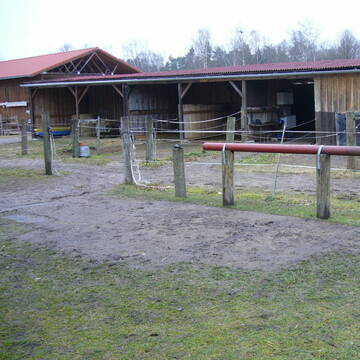
Paddock Boxen zu vermieten in Schlarbhofen
Kolbermoor
Stieb-Arnold
@Stieb-Arnold
Freizeitstall
Vermieten
Longierzirkel/Roundpen
Paddock
Außenbox mit Paddock
8 weitere...
P

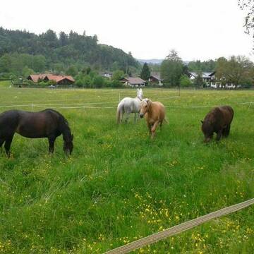
Islandpferde Offenstall
Irschenberg
Carolin Nebl
@Carolin-Nebl
Freizeitstall
Gangpferdereiten
Reitplatz (z.B. Dressur, Springen, Reining)
Sattelkammer/Sattelschränke
Hufrehe geeignet
Notfallboxen
Offenstall
6 weitere...
P
Deprecated: Creation of dynamic property Zend_View_Helper_Ads::$adLink is deprecated in /var/www/stall-frei/htdocs/staging.stall-frei.de/library/Psf/View/Helper/Ads.php on line 108

Pferdepension Hit Aktivstall Kürmerhof
Hohenkammer
Kuermerhof
@Kuermerhof
*******JETZT NEU MIT ENTSTAUBTEM BIOHEU*********
*******Demnächst mit einem Abenteuerspielplatz für Pferde ( Extrem Trail/Pa
Leider kein Vorschaubild
Leider kein Vorschaubild
Zwischen Schloßberg und Vogtareuth am Innufer
Vogtareuth
NorbertHuber
@NorbertHuber
Freizeitstall
Geländestrecke
Vermieten
Reitplatz (z.B. Dressur, Springen, Reining)
Weide
Hengsthaltung möglich
Hufrehe geeignet
11 weitere...
B
Bewegungs- Offen- Allergiker-Stall
Eschenlohe
Hildegard-Fischer
@Hildegard-Fischer
Vermieten
Hunde willkommen
Krankenbox
Allergikerstall
Bewegungsstall
Laufstall
12 weitere...
P
Leider kein Vorschaubild
Leider kein Vorschaubild
3-4 Box.,kl. pr. Anlage,viel Auslauf, nur Wallache
Waakirchen
Kinshof
@Kinshof
Vermieten
Laufband
Paddock
Halbpension
Einzelne Boxen oder Stallplätze
8 weitere...
B
Leider kein Vorschaubild
Leider kein Vorschaubild
Wallach Kleingruppe Offenstall
Großweil
Offenstall-Angerhof
@Offenstall-Angerhof
Freizeitstall
Hunde willkommen
Krankenbox
Offenstall
Halbpension
Vollpension
7 weitere...
B
Leider kein Vorschaubild
Leider kein Vorschaubild
Offenstall Stute
Großweil
Offenstall-Angerhof
@Offenstall-Angerhof
Hunde willkommen
Krankenbox
Notfallboxen
Offenstall
6 weitere...
B
Leider kein Vorschaubild
Leider kein Vorschaubild
Box in kleinem Privatstall
Waakirchen
Urschental
@Urschental
Freizeitstall
VFD-Mitglied
Vermieten
Paddock
Reitplatz (z.B. Dressur, Springen, Reining)
Innenbox
8 weitere...
B

Vergeben Reitbeteiligung 1-2 mal die Woche
Breitbrunn
Nicole Welponer
@NicoleW.
Wir vergeben für unser Pony eine Reitbeteiligung. Rocky ist ein 5 Jahre alter Welsh B Apfelschimmel Wallach. Rocky ist sehr brav
Leider kein Vorschaubild
Leider kein Vorschaubild
Einstellplatz in Vollpension für Mini Shetty
Trostberg
Hacienda-Hidalgo Horse Ranch
@Hacienda-Hidalgo
Freizeitstall
Vermieten
Hunde willkommen
Longierzirkel/Roundpen
Innenbox
8 weitere...
B

Westernreitanlage
Stephanskirchen
Johanna Dolinski
@Dolinski-Scheuerer
Pferdeausbildung
Westernreiten
Paddock
Parkplatz für Pferdeanhänger
Außenbox mit Paddock
Vollpension
7 weitere...
neu
P
Werde Teil von STALL-FREI.de
Du hast eine Pferdebox frei? Freie Plätze im Offenstall, Pferdestall oder der Reitanlage kostenlos anbieten.
Deprecated: Creation of dynamic property Zend_View::$pageCount is deprecated in /var/www/stall-frei/htdocs/staging.stall-frei.de/library/vendor/shardj/zf1-future/library/Zend/View/Abstract.php on line 308
Deprecated: Creation of dynamic property Zend_View::$itemCountPerPage is deprecated in /var/www/stall-frei/htdocs/staging.stall-frei.de/library/vendor/shardj/zf1-future/library/Zend/View/Abstract.php on line 308
Deprecated: Creation of dynamic property Zend_View::$first is deprecated in /var/www/stall-frei/htdocs/staging.stall-frei.de/library/vendor/shardj/zf1-future/library/Zend/View/Abstract.php on line 308
Deprecated: Creation of dynamic property Zend_View::$current is deprecated in /var/www/stall-frei/htdocs/staging.stall-frei.de/library/vendor/shardj/zf1-future/library/Zend/View/Abstract.php on line 308
Deprecated: Creation of dynamic property Zend_View::$last is deprecated in /var/www/stall-frei/htdocs/staging.stall-frei.de/library/vendor/shardj/zf1-future/library/Zend/View/Abstract.php on line 308
Deprecated: Creation of dynamic property Zend_View::$previous is deprecated in /var/www/stall-frei/htdocs/staging.stall-frei.de/library/vendor/shardj/zf1-future/library/Zend/View/Abstract.php on line 308
Deprecated: Creation of dynamic property Zend_View::$next is deprecated in /var/www/stall-frei/htdocs/staging.stall-frei.de/library/vendor/shardj/zf1-future/library/Zend/View/Abstract.php on line 308
Deprecated: Creation of dynamic property Zend_View::$pagesInRange is deprecated in /var/www/stall-frei/htdocs/staging.stall-frei.de/library/vendor/shardj/zf1-future/library/Zend/View/Abstract.php on line 308
Deprecated: Creation of dynamic property Zend_View::$firstPageInRange is deprecated in /var/www/stall-frei/htdocs/staging.stall-frei.de/library/vendor/shardj/zf1-future/library/Zend/View/Abstract.php on line 308
Deprecated: Creation of dynamic property Zend_View::$lastPageInRange is deprecated in /var/www/stall-frei/htdocs/staging.stall-frei.de/library/vendor/shardj/zf1-future/library/Zend/View/Abstract.php on line 308
Deprecated: Creation of dynamic property Zend_View::$currentItemCount is deprecated in /var/www/stall-frei/htdocs/staging.stall-frei.de/library/vendor/shardj/zf1-future/library/Zend/View/Abstract.php on line 308
Deprecated: Creation of dynamic property Zend_View::$totalItemCount is deprecated in /var/www/stall-frei/htdocs/staging.stall-frei.de/library/vendor/shardj/zf1-future/library/Zend/View/Abstract.php on line 308
Deprecated: Creation of dynamic property Zend_View::$firstItemNumber is deprecated in /var/www/stall-frei/htdocs/staging.stall-frei.de/library/vendor/shardj/zf1-future/library/Zend/View/Abstract.php on line 308
Deprecated: Creation of dynamic property Zend_View::$lastItemNumber is deprecated in /var/www/stall-frei/htdocs/staging.stall-frei.de/library/vendor/shardj/zf1-future/library/Zend/View/Abstract.php on line 308
Deprecated: Creation of dynamic property Zend_View::$router is deprecated in /var/www/stall-frei/htdocs/staging.stall-frei.de/library/vendor/shardj/zf1-future/library/Zend/View/Abstract.php on line 308
Deprecated: Creation of dynamic property Zend_View::$urlParams is deprecated in /var/www/stall-frei/htdocs/staging.stall-frei.de/library/vendor/shardj/zf1-future/library/Zend/View/Abstract.php on line 308
Deprecated: Creation of dynamic property Zend_View::$showAds is deprecated in /var/www/stall-frei/htdocs/staging.stall-frei.de/library/vendor/shardj/zf1-future/library/Zend/View/Abstract.php on line 308
Deprecated: Creation of dynamic property Zend_View::$objectIds is deprecated in /var/www/stall-frei/htdocs/staging.stall-frei.de/library/vendor/shardj/zf1-future/library/Zend/View/Abstract.php on line 308
Deprecated: Creation of dynamic property Zend_View::$showNavbar is deprecated in /var/www/stall-frei/htdocs/staging.stall-frei.de/library/vendor/shardj/zf1-future/library/Zend/View/Abstract.php on line 308
Deprecated: Creation of dynamic property Zend_View::$showBreadcrumb is deprecated in /var/www/stall-frei/htdocs/staging.stall-frei.de/library/vendor/shardj/zf1-future/library/Zend/View/Abstract.php on line 308
Deprecated: Creation of dynamic property Zend_View::$showFooter is deprecated in /var/www/stall-frei/htdocs/staging.stall-frei.de/library/vendor/shardj/zf1-future/library/Zend/View/Abstract.php on line 308
Deprecated: Creation of dynamic property Zend_View::$showInternalAds is deprecated in /var/www/stall-frei/htdocs/staging.stall-frei.de/library/vendor/shardj/zf1-future/library/Zend/View/Abstract.php on line 308
Deprecated: Creation of dynamic property Zend_View::$blNoContent is deprecated in /var/www/stall-frei/htdocs/staging.stall-frei.de/library/vendor/shardj/zf1-future/library/Zend/View/Abstract.php on line 308
Deprecated: Creation of dynamic property Zend_View::$sMetaDesc is deprecated in /var/www/stall-frei/htdocs/staging.stall-frei.de/library/vendor/shardj/zf1-future/library/Zend/View/Abstract.php on line 308
Deprecated: Creation of dynamic property Zend_View::$useGmaps is deprecated in /var/www/stall-frei/htdocs/staging.stall-frei.de/library/vendor/shardj/zf1-future/library/Zend/View/Abstract.php on line 308
Deprecated: Creation of dynamic property Zend_View::$touches is deprecated in /var/www/stall-frei/htdocs/staging.stall-frei.de/library/vendor/shardj/zf1-future/library/Zend/View/Abstract.php on line 308
Deprecated: Creation of dynamic property Zend_View::$oProject is deprecated in /var/www/stall-frei/htdocs/staging.stall-frei.de/library/vendor/shardj/zf1-future/library/Zend/View/Abstract.php on line 308
Deprecated: Creation of dynamic property Zend_View::$pageHeadline is deprecated in /var/www/stall-frei/htdocs/staging.stall-frei.de/library/vendor/shardj/zf1-future/library/Zend/View/Abstract.php on line 308
Deprecated: Creation of dynamic property Zend_View::$disableLocationField is deprecated in /var/www/stall-frei/htdocs/staging.stall-frei.de/library/vendor/shardj/zf1-future/library/Zend/View/Abstract.php on line 308
Deprecated: Creation of dynamic property Zend_View::$isSearch is deprecated in /var/www/stall-frei/htdocs/staging.stall-frei.de/library/vendor/shardj/zf1-future/library/Zend/View/Abstract.php on line 308
Deprecated: Creation of dynamic property Zend_View::$pageTitle is deprecated in /var/www/stall-frei/htdocs/staging.stall-frei.de/library/vendor/shardj/zf1-future/library/Zend/View/Abstract.php on line 308
Deprecated: Creation of dynamic property Psf_Form_Element_Text::$class is deprecated in /var/www/stall-frei/htdocs/staging.stall-frei.de/library/vendor/shardj/zf1-future/library/Zend/Form/Element.php on line 874
Deprecated: Creation of dynamic property Psf_Form_Element_Text::$size is deprecated in /var/www/stall-frei/htdocs/staging.stall-frei.de/library/vendor/shardj/zf1-future/library/Zend/Form/Element.php on line 874
Deprecated: Creation of dynamic property Psf_Form_Element_Text::$placeholder is deprecated in /var/www/stall-frei/htdocs/staging.stall-frei.de/library/vendor/shardj/zf1-future/library/Zend/Form/Element.php on line 874
Deprecated: Creation of dynamic property Psf_Form_Element_Hidden::$class is deprecated in /var/www/stall-frei/htdocs/staging.stall-frei.de/library/vendor/shardj/zf1-future/library/Zend/Form/Element.php on line 874
Deprecated: Creation of dynamic property Psf_Form_Element_Hidden::$class is deprecated in /var/www/stall-frei/htdocs/staging.stall-frei.de/library/vendor/shardj/zf1-future/library/Zend/Form/Element.php on line 874
Deprecated: Creation of dynamic property Psf_Form_Element_Hidden::$class is deprecated in /var/www/stall-frei/htdocs/staging.stall-frei.de/library/vendor/shardj/zf1-future/library/Zend/Form/Element.php on line 874
Deprecated: Creation of dynamic property Psf_Form_Element_Hidden::$class is deprecated in /var/www/stall-frei/htdocs/staging.stall-frei.de/library/vendor/shardj/zf1-future/library/Zend/Form/Element.php on line 874
Deprecated: Creation of dynamic property Psf_Form_Element_Select::$class is deprecated in /var/www/stall-frei/htdocs/staging.stall-frei.de/library/vendor/shardj/zf1-future/library/Zend/Form/Element.php on line 874
Deprecated: Creation of dynamic property Psf_Form_Element_Select::$class is deprecated in /var/www/stall-frei/htdocs/staging.stall-frei.de/library/vendor/shardj/zf1-future/library/Zend/Form/Element.php on line 874
Deprecated: Creation of dynamic property Psf_Form_Element_Select::$class is deprecated in /var/www/stall-frei/htdocs/staging.stall-frei.de/library/vendor/shardj/zf1-future/library/Zend/Form/Element.php on line 874
Deprecated: Creation of dynamic property Psf_Form_Element_Select::$class is deprecated in /var/www/stall-frei/htdocs/staging.stall-frei.de/library/vendor/shardj/zf1-future/library/Zend/Form/Element.php on line 874
Deprecated: Creation of dynamic property Psf_Form_Element_Text::$class is deprecated in /var/www/stall-frei/htdocs/staging.stall-frei.de/library/vendor/shardj/zf1-future/library/Zend/Form/Element.php on line 874
Deprecated: Creation of dynamic property Psf_Form_Element_Checkbox::$label is deprecated in /var/www/stall-frei/htdocs/staging.stall-frei.de/library/vendor/shardj/zf1-future/library/Zend/Form/Element.php on line 874
Deprecated: Creation of dynamic property Zend_View::$sort is deprecated in /var/www/stall-frei/htdocs/staging.stall-frei.de/library/vendor/shardj/zf1-future/library/Zend/View/Abstract.php on line 308
Deprecated: Creation of dynamic property Zend_View::$searchLocation is deprecated in /var/www/stall-frei/htdocs/staging.stall-frei.de/library/vendor/shardj/zf1-future/library/Zend/View/Abstract.php on line 308
Deprecated: Creation of dynamic property Zend_View::$locationHint is deprecated in /var/www/stall-frei/htdocs/staging.stall-frei.de/library/vendor/shardj/zf1-future/library/Zend/View/Abstract.php on line 308
Psf_GeoCoder_Abstract::getLocation: Obernberg Get Location CachedOrLive
Psf_GeoCoder_Abstract::getCachedOrLive: Obernberg
Psf_GeoCoder_Abstract::convertLocationResult
{"documentation":"https:\/\/opencagedata.com\/api","licenses":[{"name":"see attribution guide","url":"https:\/\/opencagedata.com\/credits"}],"results":[{"bounds":{"northeast":{"lat":52.1047996,"lng":8.7359823},"southwest":{"lat":52.1046996,"lng":8.7358823}},"components":{"ISO_3166-1_alpha-2":"DE","ISO_3166-1_alpha-3":"DEU","ISO_3166-2":["DE-NW"],"_category":"natural\/water","_normalized_city":"Bad Salzuflen","_type":"peak","continent":"Europe","country":"Deutschland","country_code":"de","county":"Kreis Lippe","peak":"Obernberg","political_union":"European Union","postcode":"32105","state":"Nordrhein-Westfalen","state_code":"NW","town":"Bad Salzuflen"},"confidence":9,"formatted":"Obernberg, 32105 Bad Salzuflen, Deutschland","geometry":{"lat":52.1047496,"lng":8.7359323}},{"bounds":{"northeast":{"lat":50.9512872,"lng":8.4047349},"southwest":{"lat":50.9511872,"lng":8.4046349}},"components":{"ISO_3166-1_alpha-2":"DE","ISO_3166-1_alpha-3":"DEU","ISO_3166-2":["DE-NW"],"_category":"natural\/water","_normalized_city":"Bad Laasphe","_type":"peak","continent":"Europe","country":"Deutschland","country_code":"de","county":"Kreis Siegen-Wittgenstein","peak":"Obernberg","political_union":"European Union","postcode":"57334","state":"Nordrhein-Westfalen","state_code":"NW","town":"Bad Laasphe"},"confidence":9,"formatted":"Obernberg, 57334 Bad Laasphe, Deutschland","geometry":{"lat":50.9512372,"lng":8.4046849}},{"bounds":{"northeast":{"lat":52.0986448,"lng":8.8850398},"southwest":{"lat":52.0985448,"lng":8.8849398}},"components":{"ISO_3166-1_alpha-2":"DE","ISO_3166-1_alpha-3":"DEU","ISO_3166-2":["DE-NW"],"_category":"natural\/water","_normalized_city":"Kalletal","_type":"peak","continent":"Europe","country":"Deutschland","country_code":"de","county":"Kreis Lippe","municipality":"Kalletal","peak":"Obernberg","political_union":"European Union","postcode":"32689","state":"Nordrhein-Westfalen","state_code":"NW"},"confidence":9,"formatted":"Obernberg, 32689 Kalletal, Deutschland","geometry":{"lat":52.0985948,"lng":8.8849898}},{"bounds":{"northeast":{"lat":48.6886112,"lng":13.0613286},"southwest":{"lat":48.6486112,"lng":13.0213286}},"components":{"ISO_3166-1_alpha-2":"DE","ISO_3166-1_alpha-3":"DEU","ISO_3166-2":["DE-BY"],"_category":"place","_normalized_city":"K\u00fcnzing","_type":"hamlet","continent":"Europe","country":"Deutschland","country_code":"de","county":"Landkreis Deggendorf","hamlet":"Obernberg","political_union":"European Union","postcode":"94550","state":"Bayern","state_code":"BY","village":"K\u00fcnzing"},"confidence":7,"formatted":"Obernberg, 94550 K\u00fcnzing, Deutschland","geometry":{"lat":48.6686112,"lng":13.0413286}},{"bounds":{"northeast":{"lat":48.8428556,"lng":13.0231639},"southwest":{"lat":48.8427556,"lng":13.0230639}},"components":{"ISO_3166-1_alpha-2":"DE","ISO_3166-1_alpha-3":"DEU","ISO_3166-2":["DE-BY"],"_category":"building","_normalized_city":"Schaufling","_type":"building","city":"Schaufling","continent":"Europe","country":"Deutschland","country_code":"de","county":"Landkreis Deggendorf","hamlet":"Dietmannsberg","isolated_dwelling":"Obernberg","municipality":"Lalling (VGem)","political_union":"European Union","postcode":"94571","state":"Bayern","state_code":"BY"},"confidence":10,"formatted":"Obernberg, Dietmannsberg, 94571 Schaufling, Deutschland","geometry":{"lat":48.8428056,"lng":13.0231139}},{"bounds":{"northeast":{"lat":49.3271131,"lng":9.4355386},"southwest":{"lat":49.3259809,"lng":9.4340673}},"components":{"ISO_3166-1_alpha-2":"DE","ISO_3166-1_alpha-3":"DEU","ISO_3166-2":["DE-BW"],"_category":"agriculture","_normalized_city":"Widdern","_type":"farmyard","continent":"Europe","country":"Deutschland","country_code":"de","county":"Landkreis Heilbronn","farmyard":"Obernberg","municipality":"VVG der Stadt M\u00f6ckm\u00fchl","political_union":"European Union","postcode":"74259","state":"Baden-W\u00fcrttemberg","state_code":"BW","village":"Widdern"},"confidence":9,"formatted":"Obernberg, 74259 Widdern, Deutschland","geometry":{"lat":49.3265955,"lng":9.434827}},{"bounds":{"northeast":{"lat":49.3372237,"lng":9.4407678},"southwest":{"lat":49.3172237,"lng":9.4207678}},"components":{"ISO_3166-1_alpha-2":"DE","ISO_3166-1_alpha-3":"DEU","ISO_3166-2":["DE-BW"],"_category":"place","_normalized_city":"Widdern","_type":"hamlet","continent":"Europe","country":"Deutschland","country_code":"de","county":"Landkreis Heilbronn","locality":"Obernberg","municipality":"VVG der Stadt M\u00f6ckm\u00fchl","political_union":"European Union","postcode":"74259","state":"Baden-W\u00fcrttemberg","state_code":"BW","village":"Widdern"},"confidence":8,"formatted":"Obernberg, 74259 Widdern, Deutschland","geometry":{"lat":49.3272237,"lng":9.4307678}},{"bounds":{"northeast":{"lat":50.37944,"lng":8.6133477},"southwest":{"lat":50.3787672,"lng":8.6111211}},"components":{"ISO_3166-1_alpha-2":"DE","ISO_3166-1_alpha-3":"DEU","ISO_3166-2":["DE-HE"],"_category":"road","_normalized_city":"Wiesental","_type":"road","continent":"Europe","country":"Deutschland","country_code":"de","county":"Wetteraukreis","municipality":"Butzbach","political_union":"European Union","postcode":"35510","residential":"Wiesental","road":"Obernberg","road_type":"residential","state":"Hessen","state_code":"HE","village":"Wiesental"},"confidence":9,"formatted":"Obernberg, 35510 Wiesental, Deutschland","geometry":{"lat":50.3787828,"lng":8.612446}},{"components":{"ISO_3166-1_alpha-2":"FR","ISO_3166-1_alpha-3":"FRA","ISO_3166-2":["FR-GES","FR-6AE","FR-67"],"_category":"road","_normalized_city":"Barr","_type":"road","city":"Barr","continent":"Europe","country":"France","country_code":"fr","county":"Bas-Rhin","local_authority":"Communaut\u00e9 de communes du Pays de Barr","political_union":"European Union","postcode":"67140","road":"Chemin de l\u2019Oberberg","state":"Grand Est","state_code":"GES"},"confidence":3,"formatted":"Chemin de l\u2019Oberberg, 67140 Barr, France","geometry":{"lat":48.402013,"lng":7.447941}},{"components":{"ISO_3166-1_alpha-2":"FR","ISO_3166-1_alpha-3":"FRA","ISO_3166-2":["FR-GES","FR-6AE","FR-67"],"_category":"road","_normalized_city":"Mittelbergheim","_type":"road","city":"Mittelbergheim","continent":"Europe","country":"France","country_code":"fr","county":"Bas-Rhin","local_authority":"Communaut\u00e9 de communes du Pays de Barr","political_union":"European Union","postcode":"67140","road":"Chemin de l'Oberberg","state":"Grand Est","state_code":"GES"},"confidence":3,"formatted":"Chemin de l'Oberberg, 67140 Mittelbergheim, France","geometry":{"lat":48.397143,"lng":7.444007}}],"status":{"code":200,"message":"OK"},"stay_informed":{"blog":"https:\/\/blog.opencagedata.com","mastodon":"https:\/\/en.osm.town\/@opencage"},"thanks":"For using an OpenCage API","timestamp":{"created_http":"Sat, 07 Feb 2026 22:07:58 GMT","created_unix":1770502078},"total_results":10}Array
(
[0] => stdClass Object
(
[bounds] => stdClass Object
(
[northeast] => stdClass Object
(
[lat] => 52.1047996
[lng] => 8.7359823
)
[southwest] => stdClass Object
(
[lat] => 52.1046996
[lng] => 8.7358823
)
)
[components] => stdClass Object
(
[ISO_3166-1_alpha-2] => DE
[ISO_3166-1_alpha-3] => DEU
[ISO_3166-2] => Array
(
[0] => DE-NW
)
[_category] => natural/water
[_normalized_city] => Bad Salzuflen
[_type] => peak
[continent] => Europe
[country] => Deutschland
[country_code] => de
[county] => Kreis Lippe
[peak] => Obernberg
[political_union] => European Union
[postcode] => 32105
[state] => Nordrhein-Westfalen
[state_code] => NW
[town] => Bad Salzuflen
)
[confidence] => 9
[formatted] => Obernberg, 32105 Bad Salzuflen, Deutschland
[geometry] => stdClass Object
(
[lat] => 52.1047496
[lng] => 8.7359323
)
)
[1] => stdClass Object
(
[bounds] => stdClass Object
(
[northeast] => stdClass Object
(
[lat] => 50.9512872
[lng] => 8.4047349
)
[southwest] => stdClass Object
(
[lat] => 50.9511872
[lng] => 8.4046349
)
)
[components] => stdClass Object
(
[ISO_3166-1_alpha-2] => DE
[ISO_3166-1_alpha-3] => DEU
[ISO_3166-2] => Array
(
[0] => DE-NW
)
[_category] => natural/water
[_normalized_city] => Bad Laasphe
[_type] => peak
[continent] => Europe
[country] => Deutschland
[country_code] => de
[county] => Kreis Siegen-Wittgenstein
[peak] => Obernberg
[political_union] => European Union
[postcode] => 57334
[state] => Nordrhein-Westfalen
[state_code] => NW
[town] => Bad Laasphe
)
[confidence] => 9
[formatted] => Obernberg, 57334 Bad Laasphe, Deutschland
[geometry] => stdClass Object
(
[lat] => 50.9512372
[lng] => 8.4046849
)
)
[2] => stdClass Object
(
[bounds] => stdClass Object
(
[northeast] => stdClass Object
(
[lat] => 52.0986448
[lng] => 8.8850398
)
[southwest] => stdClass Object
(
[lat] => 52.0985448
[lng] => 8.8849398
)
)
[components] => stdClass Object
(
[ISO_3166-1_alpha-2] => DE
[ISO_3166-1_alpha-3] => DEU
[ISO_3166-2] => Array
(
[0] => DE-NW
)
[_category] => natural/water
[_normalized_city] => Kalletal
[_type] => peak
[continent] => Europe
[country] => Deutschland
[country_code] => de
[county] => Kreis Lippe
[municipality] => Kalletal
[peak] => Obernberg
[political_union] => European Union
[postcode] => 32689
[state] => Nordrhein-Westfalen
[state_code] => NW
)
[confidence] => 9
[formatted] => Obernberg, 32689 Kalletal, Deutschland
[geometry] => stdClass Object
(
[lat] => 52.0985948
[lng] => 8.8849898
)
)
[3] => stdClass Object
(
[bounds] => stdClass Object
(
[northeast] => stdClass Object
(
[lat] => 48.6886112
[lng] => 13.0613286
)
[southwest] => stdClass Object
(
[lat] => 48.6486112
[lng] => 13.0213286
)
)
[components] => stdClass Object
(
[ISO_3166-1_alpha-2] => DE
[ISO_3166-1_alpha-3] => DEU
[ISO_3166-2] => Array
(
[0] => DE-BY
)
[_category] => place
[_normalized_city] => Künzing
[_type] => hamlet
[continent] => Europe
[country] => Deutschland
[country_code] => de
[county] => Landkreis Deggendorf
[hamlet] => Obernberg
[political_union] => European Union
[postcode] => 94550
[state] => Bayern
[state_code] => BY
[village] => Künzing
)
[confidence] => 7
[formatted] => Obernberg, 94550 Künzing, Deutschland
[geometry] => stdClass Object
(
[lat] => 48.6686112
[lng] => 13.0413286
)
)
[4] => stdClass Object
(
[bounds] => stdClass Object
(
[northeast] => stdClass Object
(
[lat] => 48.8428556
[lng] => 13.0231639
)
[southwest] => stdClass Object
(
[lat] => 48.8427556
[lng] => 13.0230639
)
)
[components] => stdClass Object
(
[ISO_3166-1_alpha-2] => DE
[ISO_3166-1_alpha-3] => DEU
[ISO_3166-2] => Array
(
[0] => DE-BY
)
[_category] => building
[_normalized_city] => Schaufling
[_type] => building
[city] => Schaufling
[continent] => Europe
[country] => Deutschland
[country_code] => de
[county] => Landkreis Deggendorf
[hamlet] => Dietmannsberg
[isolated_dwelling] => Obernberg
[municipality] => Lalling (VGem)
[political_union] => European Union
[postcode] => 94571
[state] => Bayern
[state_code] => BY
)
[confidence] => 10
[formatted] => Obernberg, Dietmannsberg, 94571 Schaufling, Deutschland
[geometry] => stdClass Object
(
[lat] => 48.8428056
[lng] => 13.0231139
)
)
[5] => stdClass Object
(
[bounds] => stdClass Object
(
[northeast] => stdClass Object
(
[lat] => 49.3271131
[lng] => 9.4355386
)
[southwest] => stdClass Object
(
[lat] => 49.3259809
[lng] => 9.4340673
)
)
[components] => stdClass Object
(
[ISO_3166-1_alpha-2] => DE
[ISO_3166-1_alpha-3] => DEU
[ISO_3166-2] => Array
(
[0] => DE-BW
)
[_category] => agriculture
[_normalized_city] => Widdern
[_type] => farmyard
[continent] => Europe
[country] => Deutschland
[country_code] => de
[county] => Landkreis Heilbronn
[farmyard] => Obernberg
[municipality] => VVG der Stadt Möckmühl
[political_union] => European Union
[postcode] => 74259
[state] => Baden-Württemberg
[state_code] => BW
[village] => Widdern
)
[confidence] => 9
[formatted] => Obernberg, 74259 Widdern, Deutschland
[geometry] => stdClass Object
(
[lat] => 49.3265955
[lng] => 9.434827
)
)
[6] => stdClass Object
(
[bounds] => stdClass Object
(
[northeast] => stdClass Object
(
[lat] => 49.3372237
[lng] => 9.4407678
)
[southwest] => stdClass Object
(
[lat] => 49.3172237
[lng] => 9.4207678
)
)
[components] => stdClass Object
(
[ISO_3166-1_alpha-2] => DE
[ISO_3166-1_alpha-3] => DEU
[ISO_3166-2] => Array
(
[0] => DE-BW
)
[_category] => place
[_normalized_city] => Widdern
[_type] => hamlet
[continent] => Europe
[country] => Deutschland
[country_code] => de
[county] => Landkreis Heilbronn
[locality] => Obernberg
[municipality] => VVG der Stadt Möckmühl
[political_union] => European Union
[postcode] => 74259
[state] => Baden-Württemberg
[state_code] => BW
[village] => Widdern
)
[confidence] => 8
[formatted] => Obernberg, 74259 Widdern, Deutschland
[geometry] => stdClass Object
(
[lat] => 49.3272237
[lng] => 9.4307678
)
)
[7] => stdClass Object
(
[bounds] => stdClass Object
(
[northeast] => stdClass Object
(
[lat] => 50.37944
[lng] => 8.6133477
)
[southwest] => stdClass Object
(
[lat] => 50.3787672
[lng] => 8.6111211
)
)
[components] => stdClass Object
(
[ISO_3166-1_alpha-2] => DE
[ISO_3166-1_alpha-3] => DEU
[ISO_3166-2] => Array
(
[0] => DE-HE
)
[_category] => road
[_normalized_city] => Wiesental
[_type] => road
[continent] => Europe
[country] => Deutschland
[country_code] => de
[county] => Wetteraukreis
[municipality] => Butzbach
[political_union] => European Union
[postcode] => 35510
[residential] => Wiesental
[road] => Obernberg
[road_type] => residential
[state] => Hessen
[state_code] => HE
[village] => Wiesental
)
[confidence] => 9
[formatted] => Obernberg, 35510 Wiesental, Deutschland
[geometry] => stdClass Object
(
[lat] => 50.3787828
[lng] => 8.612446
)
)
[8] => stdClass Object
(
[components] => stdClass Object
(
[ISO_3166-1_alpha-2] => FR
[ISO_3166-1_alpha-3] => FRA
[ISO_3166-2] => Array
(
[0] => FR-GES
[1] => FR-6AE
[2] => FR-67
)
[_category] => road
[_normalized_city] => Barr
[_type] => road
[city] => Barr
[continent] => Europe
[country] => France
[country_code] => fr
[county] => Bas-Rhin
[local_authority] => Communauté de communes du Pays de Barr
[political_union] => European Union
[postcode] => 67140
[road] => Chemin de l’Oberberg
[state] => Grand Est
[state_code] => GES
)
[confidence] => 3
[formatted] => Chemin de l’Oberberg, 67140 Barr, France
[geometry] => stdClass Object
(
[lat] => 48.402013
[lng] => 7.447941
)
)
[9] => stdClass Object
(
[components] => stdClass Object
(
[ISO_3166-1_alpha-2] => FR
[ISO_3166-1_alpha-3] => FRA
[ISO_3166-2] => Array
(
[0] => FR-GES
[1] => FR-6AE
[2] => FR-67
)
[_category] => road
[_normalized_city] => Mittelbergheim
[_type] => road
[city] => Mittelbergheim
[continent] => Europe
[country] => France
[country_code] => fr
[county] => Bas-Rhin
[local_authority] => Communauté de communes du Pays de Barr
[political_union] => European Union
[postcode] => 67140
[road] => Chemin de l'Oberberg
[state] => Grand Est
[state_code] => GES
)
[confidence] => 3
[formatted] => Chemin de l'Oberberg, 67140 Mittelbergheim, France
[geometry] => stdClass Object
(
[lat] => 48.397143
[lng] => 7.444007
)
)
)
Psf_GeoCoder_OpenCageData::getKeyMap: 0
stdClass Object
(
    [bounds] => stdClass Object
        (
            [northeast] => stdClass Object
                (
                    [lat] => 52.1047996
                    [lng] => 8.7359823
                )

            [southwest] => stdClass Object
                (
                    [lat] => 52.1046996
                    [lng] => 8.7358823
                )

        )

    [components] => stdClass Object
        (
            [ISO_3166-1_alpha-2] => DE
            [ISO_3166-1_alpha-3] => DEU
            [ISO_3166-2] => Array
                (
                    [0] => DE-NW
                )

            [_category] => natural/water
            [_normalized_city] => Bad Salzuflen
            [_type] => peak
            [continent] => Europe
            [country] => Deutschland
            [country_code] => de
            [county] => Kreis Lippe
            [peak] => Obernberg
            [political_union] => European Union
            [postcode] => 32105
            [state] => Nordrhein-Westfalen
            [state_code] => NW
            [town] => Bad Salzuflen
        )

    [confidence] => 9
    [formatted] => Obernberg, 32105 Bad Salzuflen, Deutschland
    [geometry] => stdClass Object
        (
            [lat] => 52.1047496
            [lng] => 8.7359323
        )

)
Psf_GeoCoder_OpenCageData::getCounty: Lippe
Psf_GeoCoder_OpenCageData::addMissingData REFETCH!
Array
(
    [address] => Obernberg, 32105 Bad Salzuflen, Deutschland
    [type] => peak
    [street] =>
    [city] => Bad Salzuflen
    [county] => Lippe
    [state] => Nordrhein-Westfalen
    [zip] => 32105
    [country] => Deutschland
    [suburb] =>
    [countrycode] => de
    [latitude] => 52.1047496
    [longitude] => 8.7359323
    [accuracy] => 1
    [confidence] => 9
    [bounds] => stdClass Object
        (
            [northeast] => stdClass Object
                (
                    [lat] => 52.1047996
                    [lng] => 8.7359823
                )

            [southwest] => stdClass Object
                (
                    [lat] => 52.1046996
                    [lng] => 8.7358823
                )

        )

)
reformat!
Array
(
    [address] => Obernberg, 32105 Bad Salzuflen, Deutschland
    [type] => peak
    [street] =>
    [city] => Bad Salzuflen
    [county] => Lippe
    [state] => Nordrhein-Westfalen
    [zip] => 32105
    [country] => Deutschland
    [suburb] =>
    [countrycode] => de
    [latitude] => 52.1047496
    [longitude] => 8.7359323
    [accuracy] => 1
    [confidence] => 9
    [bounds] => stdClass Object
        (
            [northeast] => stdClass Object
                (
                    [lat] => 52.1047996
                    [lng] => 8.7359823
                )

            [southwest] => stdClass Object
                (
                    [lat] => 52.1046996
                    [lng] => 8.7358823
                )

        )

    [place] => 32105 Bad Salzuflen, Nordrhein-Westfalen
    [hash] => a523342f33d0fec769ea45ff97c58fa6
)
Psf_GeoCoder_OpenCageData::getKeyMap: 1
stdClass Object
(
    [bounds] => stdClass Object
        (
            [northeast] => stdClass Object
                (
                    [lat] => 50.9512872
                    [lng] => 8.4047349
                )

            [southwest] => stdClass Object
                (
                    [lat] => 50.9511872
                    [lng] => 8.4046349
                )

        )

    [components] => stdClass Object
        (
            [ISO_3166-1_alpha-2] => DE
            [ISO_3166-1_alpha-3] => DEU
            [ISO_3166-2] => Array
                (
                    [0] => DE-NW
                )

            [_category] => natural/water
            [_normalized_city] => Bad Laasphe
            [_type] => peak
            [continent] => Europe
            [country] => Deutschland
            [country_code] => de
            [county] => Kreis Siegen-Wittgenstein
            [peak] => Obernberg
            [political_union] => European Union
            [postcode] => 57334
            [state] => Nordrhein-Westfalen
            [state_code] => NW
            [town] => Bad Laasphe
        )

    [confidence] => 9
    [formatted] => Obernberg, 57334 Bad Laasphe, Deutschland
    [geometry] => stdClass Object
        (
            [lat] => 50.9512372
            [lng] => 8.4046849
        )

)
Psf_GeoCoder_OpenCageData::getCounty: Siegen-Wittgenstein
Psf_GeoCoder_OpenCageData::addMissingData REFETCH!
Array
(
    [address] => Obernberg, 57334 Bad Laasphe, Deutschland
    [type] => peak
    [street] =>
    [city] => Bad Laasphe
    [county] => Siegen-Wittgenstein
    [state] => Nordrhein-Westfalen
    [zip] => 57334
    [country] => Deutschland
    [suburb] =>
    [countrycode] => de
    [latitude] => 50.9512372
    [longitude] => 8.4046849
    [accuracy] => 1
    [confidence] => 9
    [bounds] => stdClass Object
        (
            [northeast] => stdClass Object
                (
                    [lat] => 50.9512872
                    [lng] => 8.4047349
                )

            [southwest] => stdClass Object
                (
                    [lat] => 50.9511872
                    [lng] => 8.4046349
                )

        )

)
reformat!
Array
(
    [address] => Obernberg, 57334 Bad Laasphe, Deutschland
    [type] => peak
    [street] =>
    [city] => Bad Laasphe
    [county] => Siegen-Wittgenstein
    [state] => Nordrhein-Westfalen
    [zip] => 57334
    [country] => Deutschland
    [suburb] =>
    [countrycode] => de
    [latitude] => 50.9512372
    [longitude] => 8.4046849
    [accuracy] => 1
    [confidence] => 9
    [bounds] => stdClass Object
        (
            [northeast] => stdClass Object
                (
                    [lat] => 50.9512872
                    [lng] => 8.4047349
                )

            [southwest] => stdClass Object
                (
                    [lat] => 50.9511872
                    [lng] => 8.4046349
                )

        )

    [place] => 57334 Bad Laasphe, Nordrhein-Westfalen
    [hash] => ba53cc7da19e4f2aa94700a15f780ca8
)
Psf_GeoCoder_OpenCageData::getKeyMap: 2
stdClass Object
(
    [bounds] => stdClass Object
        (
            [northeast] => stdClass Object
                (
                    [lat] => 52.0986448
                    [lng] => 8.8850398
                )

            [southwest] => stdClass Object
                (
                    [lat] => 52.0985448
                    [lng] => 8.8849398
                )

        )

    [components] => stdClass Object
        (
            [ISO_3166-1_alpha-2] => DE
            [ISO_3166-1_alpha-3] => DEU
            [ISO_3166-2] => Array
                (
                    [0] => DE-NW
                )

            [_category] => natural/water
            [_normalized_city] => Kalletal
            [_type] => peak
            [continent] => Europe
            [country] => Deutschland
            [country_code] => de
            [county] => Kreis Lippe
            [municipality] => Kalletal
            [peak] => Obernberg
            [political_union] => European Union
            [postcode] => 32689
            [state] => Nordrhein-Westfalen
            [state_code] => NW
        )

    [confidence] => 9
    [formatted] => Obernberg, 32689 Kalletal, Deutschland
    [geometry] => stdClass Object
        (
            [lat] => 52.0985948
            [lng] => 8.8849898
        )

)
Psf_GeoCoder_OpenCageData::getCounty: Lippe
Psf_GeoCoder_OpenCageData::addMissingData REFETCH!
Array
(
    [address] => Obernberg, 32689 Kalletal, Deutschland
    [type] => peak
    [street] =>
    [city] =>
    [county] => Lippe
    [state] => Nordrhein-Westfalen
    [zip] => 32689
    [country] => Deutschland
    [suburb] =>
    [countrycode] => de
    [latitude] => 52.0985948
    [longitude] => 8.8849898
    [accuracy] => 1
    [confidence] => 9
    [bounds] => stdClass Object
        (
            [northeast] => stdClass Object
                (
                    [lat] => 52.0986448
                    [lng] => 8.8850398
                )

            [southwest] => stdClass Object
                (
                    [lat] => 52.0985448
                    [lng] => 8.8849398
                )

        )

)
reformat!
Array
(
    [address] => Obernberg, 32689 Kalletal, Deutschland
    [type] => peak
    [street] =>
    [city] =>
    [county] => Lippe
    [state] => Nordrhein-Westfalen
    [zip] => 32689
    [country] => Deutschland
    [suburb] =>
    [countrycode] => de
    [latitude] => 52.0985948
    [longitude] => 8.8849898
    [accuracy] => 1
    [confidence] => 9
    [bounds] => stdClass Object
        (
            [northeast] => stdClass Object
                (
                    [lat] => 52.0986448
                    [lng] => 8.8850398
                )

            [southwest] => stdClass Object
                (
                    [lat] => 52.0985448
                    [lng] => 8.8849398
                )

        )

    [place] => 32689 , Nordrhein-Westfalen
    [hash] => 3203132e624e91b87e243357c87c16f9
)
Psf_GeoCoder_OpenCageData::getKeyMap: 3
stdClass Object
(
    [bounds] => stdClass Object
        (
            [northeast] => stdClass Object
                (
                    [lat] => 48.6886112
                    [lng] => 13.0613286
                )

            [southwest] => stdClass Object
                (
                    [lat] => 48.6486112
                    [lng] => 13.0213286
                )

        )

    [components] => stdClass Object
        (
            [ISO_3166-1_alpha-2] => DE
            [ISO_3166-1_alpha-3] => DEU
            [ISO_3166-2] => Array
                (
                    [0] => DE-BY
                )

            [_category] => place
            [_normalized_city] => Künzing
            [_type] => hamlet
            [continent] => Europe
            [country] => Deutschland
            [country_code] => de
            [county] => Landkreis Deggendorf
            [hamlet] => Obernberg
            [political_union] => European Union
            [postcode] => 94550
            [state] => Bayern
            [state_code] => BY
            [village] => Künzing
        )

    [confidence] => 7
    [formatted] => Obernberg, 94550 Künzing, Deutschland
    [geometry] => stdClass Object
        (
            [lat] => 48.6686112
            [lng] => 13.0413286
        )

)
Psf_GeoCoder_OpenCageData::getCounty: Deggendorf
Psf_GeoCoder_OpenCageData::addMissingData REFETCH!
Array
(
    [address] => Obernberg, 94550 Künzing, Deutschland
    [type] => hamlet
    [street] => Obernberg
    [city] => Künzing
    [county] => Deggendorf
    [state] => Bayern
    [zip] => 94550
    [country] => Deutschland
    [suburb] =>
    [countrycode] => de
    [latitude] => 48.6686112
    [longitude] => 13.0413286
    [accuracy] => 1
    [confidence] => 7
    [bounds] => stdClass Object
        (
            [northeast] => stdClass Object
                (
                    [lat] => 48.6886112
                    [lng] => 13.0613286
                )

            [southwest] => stdClass Object
                (
                    [lat] => 48.6486112
                    [lng] => 13.0213286
                )

        )

)
reformat!
Array
(
    [address] => Obernberg, 94550 Künzing, Deutschland
    [type] => hamlet
    [street] => Obernberg
    [city] => Künzing
    [county] => Deggendorf
    [state] => Bayern
    [zip] => 94550
    [country] => Deutschland
    [suburb] =>
    [countrycode] => de
    [latitude] => 48.6686112
    [longitude] => 13.0413286
    [accuracy] => 1
    [confidence] => 7
    [bounds] => stdClass Object
        (
            [northeast] => stdClass Object
                (
                    [lat] => 48.6886112
                    [lng] => 13.0613286
                )

            [southwest] => stdClass Object
                (
                    [lat] => 48.6486112
                    [lng] => 13.0213286
                )

        )

    [place] => Obernberg, 94550 Künzing, Bayern
    [hash] => 2de084fd3b3bae0f08069fed2cdb516a
)
Psf_GeoCoder_OpenCageData::getKeyMap: 4
stdClass Object
(
    [bounds] => stdClass Object
        (
            [northeast] => stdClass Object
                (
                    [lat] => 48.8428556
                    [lng] => 13.0231639
                )

            [southwest] => stdClass Object
                (
                    [lat] => 48.8427556
                    [lng] => 13.0230639
                )

        )

    [components] => stdClass Object
        (
            [ISO_3166-1_alpha-2] => DE
            [ISO_3166-1_alpha-3] => DEU
            [ISO_3166-2] => Array
                (
                    [0] => DE-BY
                )

            [_category] => building
            [_normalized_city] => Schaufling
            [_type] => building
            [city] => Schaufling
            [continent] => Europe
            [country] => Deutschland
            [country_code] => de
            [county] => Landkreis Deggendorf
            [hamlet] => Dietmannsberg
            [isolated_dwelling] => Obernberg
            [municipality] => Lalling (VGem)
            [political_union] => European Union
            [postcode] => 94571
            [state] => Bayern
            [state_code] => BY
        )

    [confidence] => 10
    [formatted] => Obernberg, Dietmannsberg, 94571 Schaufling, Deutschland
    [geometry] => stdClass Object
        (
            [lat] => 48.8428056
            [lng] => 13.0231139
        )

)
Psf_GeoCoder_OpenCageData::getCounty: Deggendorf
Psf_GeoCoder_OpenCageData::addMissingData REFETCH!
Array
(
    [address] => Obernberg, Dietmannsberg, 94571 Schaufling, Deutschland
    [type] => building
    [street] => Dietmannsberg
    [city] => Schaufling
    [county] => Deggendorf
    [state] => Bayern
    [zip] => 94571
    [country] => Deutschland
    [suburb] =>
    [countrycode] => de
    [latitude] => 48.8428056
    [longitude] => 13.0231139
    [accuracy] => 1
    [confidence] => 10
    [bounds] => stdClass Object
        (
            [northeast] => stdClass Object
                (
                    [lat] => 48.8428556
                    [lng] => 13.0231639
                )

            [southwest] => stdClass Object
                (
                    [lat] => 48.8427556
                    [lng] => 13.0230639
                )

        )

)
reformat!
Array
(
    [address] => Obernberg, Dietmannsberg, 94571 Schaufling, Deutschland
    [type] => building
    [street] => Dietmannsberg
    [city] => Schaufling
    [county] => Deggendorf
    [state] => Bayern
    [zip] => 94571
    [country] => Deutschland
    [suburb] =>
    [countrycode] => de
    [latitude] => 48.8428056
    [longitude] => 13.0231139
    [accuracy] => 1
    [confidence] => 10
    [bounds] => stdClass Object
        (
            [northeast] => stdClass Object
                (
                    [lat] => 48.8428556
                    [lng] => 13.0231639
                )

            [southwest] => stdClass Object
                (
                    [lat] => 48.8427556
                    [lng] => 13.0230639
                )

        )

    [place] => Dietmannsberg, 94571 Schaufling, Bayern
    [hash] => ce5e9f944e50b8ab98741ecde48801c7
)
Psf_GeoCoder_OpenCageData::getKeyMap: 5
stdClass Object
(
    [bounds] => stdClass Object
        (
            [northeast] => stdClass Object
                (
                    [lat] => 49.3271131
                    [lng] => 9.4355386
                )

            [southwest] => stdClass Object
                (
                    [lat] => 49.3259809
                    [lng] => 9.4340673
                )

        )

    [components] => stdClass Object
        (
            [ISO_3166-1_alpha-2] => DE
            [ISO_3166-1_alpha-3] => DEU
            [ISO_3166-2] => Array
                (
                    [0] => DE-BW
                )

            [_category] => agriculture
            [_normalized_city] => Widdern
            [_type] => farmyard
            [continent] => Europe
            [country] => Deutschland
            [country_code] => de
            [county] => Landkreis Heilbronn
            [farmyard] => Obernberg
            [municipality] => VVG der Stadt Möckmühl
            [political_union] => European Union
            [postcode] => 74259
            [state] => Baden-Württemberg
            [state_code] => BW
            [village] => Widdern
        )

    [confidence] => 9
    [formatted] => Obernberg, 74259 Widdern, Deutschland
    [geometry] => stdClass Object
        (
            [lat] => 49.3265955
            [lng] => 9.434827
        )

)
Psf_GeoCoder_OpenCageData::getCounty: Heilbronn
Psf_GeoCoder_OpenCageData::addMissingData REFETCH!
Array
(
    [address] => Obernberg, 74259 Widdern, Deutschland
    [type] => farmyard
    [street] =>
    [city] => Widdern
    [county] => Heilbronn
    [state] => Baden-Württemberg
    [zip] => 74259
    [country] => Deutschland
    [suburb] =>
    [countrycode] => de
    [latitude] => 49.3265955
    [longitude] => 9.434827
    [accuracy] => 1
    [confidence] => 9
    [bounds] => stdClass Object
        (
            [northeast] => stdClass Object
                (
                    [lat] => 49.3271131
                    [lng] => 9.4355386
                )

            [southwest] => stdClass Object
                (
                    [lat] => 49.3259809
                    [lng] => 9.4340673
                )

        )

)
reformat!
Array
(
    [address] => Obernberg, 74259 Widdern, Deutschland
    [type] => farmyard
    [street] =>
    [city] => Widdern
    [county] => Heilbronn
    [state] => Baden-Württemberg
    [zip] => 74259
    [country] => Deutschland
    [suburb] =>
    [countrycode] => de
    [latitude] => 49.3265955
    [longitude] => 9.434827
    [accuracy] => 1
    [confidence] => 9
    [bounds] => stdClass Object
        (
            [northeast] => stdClass Object
                (
                    [lat] => 49.3271131
                    [lng] => 9.4355386
                )

            [southwest] => stdClass Object
                (
                    [lat] => 49.3259809
                    [lng] => 9.4340673
                )

        )

    [place] => 74259 Widdern, Baden-Württemberg
    [hash] => 01386ff2724aae5d785e66e61106d3bc
)
Psf_GeoCoder_OpenCageData::getKeyMap: 6
stdClass Object
(
    [bounds] => stdClass Object
        (
            [northeast] => stdClass Object
                (
                    [lat] => 49.3372237
                    [lng] => 9.4407678
                )

            [southwest] => stdClass Object
                (
                    [lat] => 49.3172237
                    [lng] => 9.4207678
                )

        )

    [components] => stdClass Object
        (
            [ISO_3166-1_alpha-2] => DE
            [ISO_3166-1_alpha-3] => DEU
            [ISO_3166-2] => Array
                (
                    [0] => DE-BW
                )

            [_category] => place
            [_normalized_city] => Widdern
            [_type] => hamlet
            [continent] => Europe
            [country] => Deutschland
            [country_code] => de
            [county] => Landkreis Heilbronn
            [locality] => Obernberg
            [municipality] => VVG der Stadt Möckmühl
            [political_union] => European Union
            [postcode] => 74259
            [state] => Baden-Württemberg
            [state_code] => BW
            [village] => Widdern
        )

    [confidence] => 8
    [formatted] => Obernberg, 74259 Widdern, Deutschland
    [geometry] => stdClass Object
        (
            [lat] => 49.3272237
            [lng] => 9.4307678
        )

)
Psf_GeoCoder_OpenCageData::getCounty: Heilbronn
Psf_GeoCoder_OpenCageData::addMissingData REFETCH!
Array
(
    [address] => Obernberg, 74259 Widdern, Deutschland
    [type] => hamlet
    [street] =>
    [city] => Widdern
    [county] => Heilbronn
    [state] => Baden-Württemberg
    [zip] => 74259
    [country] => Deutschland
    [suburb] =>
    [countrycode] => de
    [latitude] => 49.3272237
    [longitude] => 9.4307678
    [accuracy] => 1
    [confidence] => 8
    [bounds] => stdClass Object
        (
            [northeast] => stdClass Object
                (
                    [lat] => 49.3372237
                    [lng] => 9.4407678
                )

            [southwest] => stdClass Object
                (
                    [lat] => 49.3172237
                    [lng] => 9.4207678
                )

        )

)
reformat!
Array
(
    [address] => Obernberg, 74259 Widdern, Deutschland
    [type] => hamlet
    [street] =>
    [city] => Widdern
    [county] => Heilbronn
    [state] => Baden-Württemberg
    [zip] => 74259
    [country] => Deutschland
    [suburb] =>
    [countrycode] => de
    [latitude] => 49.3272237
    [longitude] => 9.4307678
    [accuracy] => 1
    [confidence] => 8
    [bounds] => stdClass Object
        (
            [northeast] => stdClass Object
                (
                    [lat] => 49.3372237
                    [lng] => 9.4407678
                )

            [southwest] => stdClass Object
                (
                    [lat] => 49.3172237
                    [lng] => 9.4207678
                )

        )

    [place] => 74259 Widdern, Baden-Württemberg
    [hash] => 01386ff2724aae5d785e66e61106d3bc
)
Psf_GeoCoder_OpenCageData::getKeyMap: 7
stdClass Object
(
    [bounds] => stdClass Object
        (
            [northeast] => stdClass Object
                (
                    [lat] => 50.37944
                    [lng] => 8.6133477
                )

            [southwest] => stdClass Object
                (
                    [lat] => 50.3787672
                    [lng] => 8.6111211
                )

        )

    [components] => stdClass Object
        (
            [ISO_3166-1_alpha-2] => DE
            [ISO_3166-1_alpha-3] => DEU
            [ISO_3166-2] => Array
                (
                    [0] => DE-HE
                )

            [_category] => road
            [_normalized_city] => Wiesental
            [_type] => road
            [continent] => Europe
            [country] => Deutschland
            [country_code] => de
            [county] => Wetteraukreis
            [municipality] => Butzbach
            [political_union] => European Union
            [postcode] => 35510
            [residential] => Wiesental
            [road] => Obernberg
            [road_type] => residential
            [state] => Hessen
            [state_code] => HE
            [village] => Wiesental
        )

    [confidence] => 9
    [formatted] => Obernberg, 35510 Wiesental, Deutschland
    [geometry] => stdClass Object
        (
            [lat] => 50.3787828
            [lng] => 8.612446
        )

)
Psf_GeoCoder_OpenCageData::getCounty: Wetteraukreis
Psf_GeoCoder_OpenCageData::addMissingData REFETCH!
Array
(
    [address] => Obernberg, 35510 Wiesental, Deutschland
    [type] => road
    [street] => Obernberg
    [city] => Wiesental
    [county] => Wetteraukreis
    [state] => Hessen
    [zip] => 35510
    [country] => Deutschland
    [suburb] =>
    [countrycode] => de
    [latitude] => 50.3787828
    [longitude] => 8.612446
    [accuracy] => 1
    [confidence] => 9
    [bounds] => stdClass Object
        (
            [northeast] => stdClass Object
                (
                    [lat] => 50.37944
                    [lng] => 8.6133477
                )

            [southwest] => stdClass Object
                (
                    [lat] => 50.3787672
                    [lng] => 8.6111211
                )

        )

)
reformat!
Array
(
    [address] => Obernberg, 35510 Wiesental, Deutschland
    [type] => road
    [street] => Obernberg
    [city] => Wiesental
    [county] => Wetteraukreis
    [state] => Hessen
    [zip] => 35510
    [country] => Deutschland
    [suburb] =>
    [countrycode] => de
    [latitude] => 50.3787828
    [longitude] => 8.612446
    [accuracy] => 1
    [confidence] => 9
    [bounds] => stdClass Object
        (
            [northeast] => stdClass Object
                (
                    [lat] => 50.37944
                    [lng] => 8.6133477
                )

            [southwest] => stdClass Object
                (
                    [lat] => 50.3787672
                    [lng] => 8.6111211
                )

        )

    [place] => Obernberg, 35510 Wiesental, Hessen
    [hash] => ad2a10cbd251d7c05149e5e96605f4df
)
Psf_GeoCoder_OpenCageData::getKeyMap: 8
stdClass Object
(
    [components] => stdClass Object
        (
            [ISO_3166-1_alpha-2] => FR
            [ISO_3166-1_alpha-3] => FRA
            [ISO_3166-2] => Array
                (
                    [0] => FR-GES
                    [1] => FR-6AE
                    [2] => FR-67
                )

            [_category] => road
            [_normalized_city] => Barr
            [_type] => road
            [city] => Barr
            [continent] => Europe
            [country] => France
            [country_code] => fr
            [county] => Bas-Rhin
            [local_authority] => Communauté de communes du Pays de Barr
            [political_union] => European Union
            [postcode] => 67140
            [road] => Chemin de l’Oberberg
            [state] => Grand Est
            [state_code] => GES
        )

    [confidence] => 3
    [formatted] => Chemin de l’Oberberg, 67140 Barr, France
    [geometry] => stdClass Object
        (
            [lat] => 48.402013
            [lng] => 7.447941
        )

)
Psf_GeoCoder_OpenCageData::getCounty: Bas-Rhin
Psf_GeoCoder_OpenCageData::addMissingData REFETCH!
Array
(
    [address] => Chemin de l’Oberberg, 67140 Barr, France
    [type] => road
    [street] => Chemin de l’Oberberg
    [city] => Barr
    [county] => Bas-Rhin
    [state] => Grand Est
    [zip] => 67140
    [country] => France
    [suburb] =>
    [countrycode] => fr
    [latitude] => 48.402013
    [longitude] => 7.447941
    [accuracy] => 1
    [confidence] => 3
    [bounds] =>
)
reformat!
Array
(
    [address] => Chemin de l’Oberberg, 67140 Barr, France
    [type] => road
    [street] => Chemin de l’Oberberg
    [city] => Barr
    [county] => Bas-Rhin
    [state] => Grand Est
    [zip] => 67140
    [country] => France
    [suburb] =>
    [countrycode] => fr
    [latitude] => 48.402013
    [longitude] => 7.447941
    [accuracy] => 1
    [confidence] => 3
    [bounds] =>
    [place] => Chemin de l’Oberberg, 67140 Barr, Grand Est
    [hash] => 784cacf1d7e36f2b6d8f3e0690d9bfde
)
Psf_GeoCoder_OpenCageData::getKeyMap: 9
stdClass Object
(
    [components] => stdClass Object
        (
            [ISO_3166-1_alpha-2] => FR
            [ISO_3166-1_alpha-3] => FRA
            [ISO_3166-2] => Array
                (
                    [0] => FR-GES
                    [1] => FR-6AE
                    [2] => FR-67
                )

            [_category] => road
            [_normalized_city] => Mittelbergheim
            [_type] => road
            [city] => Mittelbergheim
            [continent] => Europe
            [country] => France
            [country_code] => fr
            [county] => Bas-Rhin
            [local_authority] => Communauté de communes du Pays de Barr
            [political_union] => European Union
            [postcode] => 67140
            [road] => Chemin de l'Oberberg
            [state] => Grand Est
            [state_code] => GES
        )

    [confidence] => 3
    [formatted] => Chemin de l'Oberberg, 67140 Mittelbergheim, France
    [geometry] => stdClass Object
        (
            [lat] => 48.397143
            [lng] => 7.444007
        )

)
Psf_GeoCoder_OpenCageData::getCounty: Bas-Rhin
Psf_GeoCoder_OpenCageData::addMissingData REFETCH!
Array
(
    [address] => Chemin de l'Oberberg, 67140 Mittelbergheim, France
    [type] => road
    [street] => Chemin de l'Oberberg
    [city] => Mittelbergheim
    [county] => Bas-Rhin
    [state] => Grand Est
    [zip] => 67140
    [country] => France
    [suburb] =>
    [countrycode] => fr
    [latitude] => 48.397143
    [longitude] => 7.444007
    [accuracy] => 1
    [confidence] => 3
    [bounds] =>
)
reformat!
Array
(
    [address] => Chemin de l'Oberberg, 67140 Mittelbergheim, France
    [type] => road
    [street] => Chemin de l'Oberberg
    [city] => Mittelbergheim
    [county] => Bas-Rhin
    [state] => Grand Est
    [zip] => 67140
    [country] => France
    [suburb] =>
    [countrycode] => fr
    [latitude] => 48.397143
    [longitude] => 7.444007
    [accuracy] => 1
    [confidence] => 3
    [bounds] =>
    [place] => Chemin de l'Oberberg, 67140 Mittelbergheim, Grand Est
    [hash] => 7db5beee26128ab0a2edfb77692e0f1b
)
Deprecated: Creation of dynamic property Zend_View::$locationHintStyle is deprecated in /var/www/stall-frei/htdocs/staging.stall-frei.de/library/vendor/shardj/zf1-future/library/Zend/View/Abstract.php on line 308
Deprecated: Creation of dynamic property Zend_View::$adGeoLocation is deprecated in /var/www/stall-frei/htdocs/staging.stall-frei.de/library/vendor/shardj/zf1-future/library/Zend/View/Abstract.php on line 308
Deprecated: Creation of dynamic property Zend_View::$recordCount is deprecated in /var/www/stall-frei/htdocs/staging.stall-frei.de/library/vendor/shardj/zf1-future/library/Zend/View/Abstract.php on line 308
Deprecated: Creation of dynamic property Zend_View::$paginationParams is deprecated in /var/www/stall-frei/htdocs/staging.stall-frei.de/library/vendor/shardj/zf1-future/library/Zend/View/Abstract.php on line 308
Deprecated: Creation of dynamic property Zend_View::$objectPaginator is deprecated in /var/www/stall-frei/htdocs/staging.stall-frei.de/library/vendor/shardj/zf1-future/library/Zend/View/Abstract.php on line 308
Deprecated: Creation of dynamic property Zend_View::$featuredObjects is deprecated in /var/www/stall-frei/htdocs/staging.stall-frei.de/library/vendor/shardj/zf1-future/library/Zend/View/Abstract.php on line 308
Deprecated: Creation of dynamic property Zend_View::$hints is deprecated in /var/www/stall-frei/htdocs/staging.stall-frei.de/library/vendor/shardj/zf1-future/library/Zend/View/Abstract.php on line 308
Deprecated: Creation of dynamic property Zend_View::$attributeHints is deprecated in /var/www/stall-frei/htdocs/staging.stall-frei.de/library/vendor/shardj/zf1-future/library/Zend/View/Abstract.php on line 308
Deprecated: Creation of dynamic property Zend_View::$oSearchForm is deprecated in /var/www/stall-frei/htdocs/staging.stall-frei.de/library/vendor/shardj/zf1-future/library/Zend/View/Abstract.php on line 308