Deprecated: Creation of dynamic property Zend_View::$sMode is deprecated in /var/www/stall-frei/htdocs/staging.stall-frei.de/library/vendor/shardj/zf1-future/library/Zend/View/Abstract.php on line 308
Stallplatz oder Offenstall in Burladingen
Gesucht wird in "Mannenberg, 72393 Burladingen, Deutschland"
6.334 Einträge
Deprecated: Creation of dynamic property Zend_View::$listObjects is deprecated in /var/www/stall-frei/htdocs/staging.stall-frei.de/library/vendor/shardj/zf1-future/library/Zend/View/Abstract.php on line 308
Gesponsort


Deprecated: Creation of dynamic property Zend_View::$listMode is deprecated in /var/www/stall-frei/htdocs/staging.stall-frei.de/library/vendor/shardj/zf1-future/library/Zend/View/Abstract.php on line 308
Deprecated: Creation of dynamic property Zend_View::$renderedObjects is deprecated in /var/www/stall-frei/htdocs/staging.stall-frei.de/library/vendor/shardj/zf1-future/library/Zend/View/Abstract.php on line 308
Deprecated: Creation of dynamic property Zend_View::$index is deprecated in /var/www/stall-frei/htdocs/staging.stall-frei.de/library/vendor/shardj/zf1-future/library/Zend/View/Abstract.php on line 308
Deprecated: Creation of dynamic property Zend_View::$displayMode is deprecated in /var/www/stall-frei/htdocs/staging.stall-frei.de/library/vendor/shardj/zf1-future/library/Zend/View/Abstract.php on line 308
Deprecated: Creation of dynamic property Zend_View::$remarketingIds is deprecated in /var/www/stall-frei/htdocs/staging.stall-frei.de/library/vendor/shardj/zf1-future/library/Zend/View/Abstract.php on line 308
Deprecated: Creation of dynamic property Zend_View::$listItem is deprecated in /var/www/stall-frei/htdocs/staging.stall-frei.de/library/vendor/shardj/zf1-future/library/Zend/View/Abstract.php on line 308
Deprecated: Creation of dynamic property Zend_View::$object is deprecated in /var/www/stall-frei/htdocs/staging.stall-frei.de/library/vendor/shardj/zf1-future/library/Zend/View/Abstract.php on line 308
Deprecated: Creation of dynamic property Zend_View::$attributes is deprecated in /var/www/stall-frei/htdocs/staging.stall-frei.de/library/vendor/shardj/zf1-future/library/Zend/View/Abstract.php on line 308
Leider kein Vorschaubild
Leider kein Vorschaubild
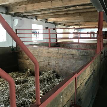
Kleiner privater Offenstall direkt am Kanal .
Altenholz
schuett4
@schuett4
Freizeitstall
Vermieten
Hunde willkommen
Krankenbox
bedampftes/gewaschenes Heu
Hufrehe geeignet
13 weitere...
B
Deprecated: Creation of dynamic property Zend_View_Helper_Ads::$adLink is deprecated in /var/www/stall-frei/htdocs/staging.stall-frei.de/library/Psf/View/Helper/Ads.php on line 108

Futtersack HeuToy, Fressbremse in pink
Mechtersen
STALL-FREIde Marketing
@STALL-FREI-Marketing
Stundenlange Beschäftigung die
Koliken vorbeugt, geringe Staubinhalation mit
steuerbarer Futterentnahme
Aussenbox mit Fenster
Osdorf
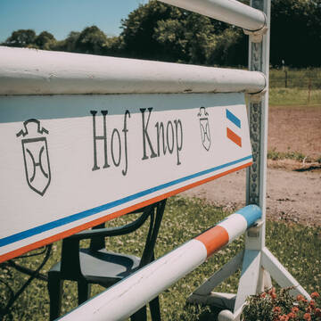
Hof-Knop
@Hof-Knop
Vermieten
Longierzirkel/Roundpen
Paddock
Pferdezucht
Außenboxen
12 weitere...
P
Leider kein Vorschaubild
Leider kein Vorschaubild
Stallplatz, Pferdebox, Weide
Klein Bennebek
Johannsen
@Jojo2103
Freizeitstall
Geländestrecke
Vermieten
Hunde willkommen
Parkplatz für Pferdeanhänger
Halbpension
Vollpension
6 weitere...
neu
B
2Ponyb.frei bis 1,46m u.1,30m
Osdorf
Hof-Kruse1
@Hof-Kruse1
FN-Mitglied
Freizeitstall
Longierzirkel/Roundpen
Paddock
Innenbox
Halbpension
Vollpension
13 weitere...
P
Reiterhof Lamp
Schönberg
Simone-Lamp
@Simone-Lamp
Freizeitstall
Geländestrecke
Paddock
Pensions- und Gastboxen
Außenbox mit Paddock
Außenboxen
Biofutter
Vollpension
11 weitere...
P
Leider kein Vorschaubild
Leider kein Vorschaubild
Offenstall Platz Frei
Ahlefeld-Bistensee
Offenstall Ahlefeld
@Rieke3
Freizeitstall
Hunde willkommen
Paddock
Allergikerstall
bedampftes/gewaschenes Heu
Offenstall
Paddock Trail
4 weitere...
B

Heu aus neuer Ernte
Mechtersen
STALL-FREIde Marketing
@STALL-FREI-Marketing
Heulage und Pferdeheu aus der neuen Ernte findest du in unserem Futtermarkt
Hof Eichengrund - Wohlfühlstall-Therapiezentrum
Altenhof
Hof Eichengrund
@HofEichengrund
Fahrstall, Kutschwagen
FN-Mitglied
Vermieten
Führanlage
Krankenbox
Allergikerstall
bedampftes/gewaschenes Heu
40 weitere...
P
Gepflegte Reitanlage
Schwedeneck
Sandra-Meggers
@Sandra-Meggers
FN-Mitglied
Freizeitstall
Vermieten
Longierzirkel/Roundpen
Ovalbahn
Außenbox mit Paddock
Außenboxen
21 weitere...
P
Leider kein Vorschaubild
Leider kein Vorschaubild
Familiärer Offenstall / Allergikerstall
Revensdorf
Y & K
@Yannik
Freizeitstall
Geländestrecke
Paddock
Reitplatz (z.B. Dressur, Springen, Reining)
Allergikerstall
bedampftes/gewaschenes Heu
Offenstall
Paddock Trail
7 weitere...
B
Offenstall am Schönberger Strand
Schönberg
Abenteuer-Wanderreiten
@Abenteuer-Wanderreiten
Fahrstall, Kutschwagen
FN-Mitglied
Vermieten
Hunde willkommen
Krankenbox
Allergikerstall
Hufrehe geeignet
22 weitere...
P
Werde Teil von STALL-FREI.de
Du hast eine Pferdebox frei? Freie Plätze im Offenstall, Pferdestall oder der Reitanlage kostenlos anbieten.
Deprecated: Creation of dynamic property Zend_View::$pageCount is deprecated in /var/www/stall-frei/htdocs/staging.stall-frei.de/library/vendor/shardj/zf1-future/library/Zend/View/Abstract.php on line 308
Deprecated: Creation of dynamic property Zend_View::$itemCountPerPage is deprecated in /var/www/stall-frei/htdocs/staging.stall-frei.de/library/vendor/shardj/zf1-future/library/Zend/View/Abstract.php on line 308
Deprecated: Creation of dynamic property Zend_View::$first is deprecated in /var/www/stall-frei/htdocs/staging.stall-frei.de/library/vendor/shardj/zf1-future/library/Zend/View/Abstract.php on line 308
Deprecated: Creation of dynamic property Zend_View::$current is deprecated in /var/www/stall-frei/htdocs/staging.stall-frei.de/library/vendor/shardj/zf1-future/library/Zend/View/Abstract.php on line 308
Deprecated: Creation of dynamic property Zend_View::$last is deprecated in /var/www/stall-frei/htdocs/staging.stall-frei.de/library/vendor/shardj/zf1-future/library/Zend/View/Abstract.php on line 308
Deprecated: Creation of dynamic property Zend_View::$previous is deprecated in /var/www/stall-frei/htdocs/staging.stall-frei.de/library/vendor/shardj/zf1-future/library/Zend/View/Abstract.php on line 308
Deprecated: Creation of dynamic property Zend_View::$next is deprecated in /var/www/stall-frei/htdocs/staging.stall-frei.de/library/vendor/shardj/zf1-future/library/Zend/View/Abstract.php on line 308
Deprecated: Creation of dynamic property Zend_View::$pagesInRange is deprecated in /var/www/stall-frei/htdocs/staging.stall-frei.de/library/vendor/shardj/zf1-future/library/Zend/View/Abstract.php on line 308
Deprecated: Creation of dynamic property Zend_View::$firstPageInRange is deprecated in /var/www/stall-frei/htdocs/staging.stall-frei.de/library/vendor/shardj/zf1-future/library/Zend/View/Abstract.php on line 308
Deprecated: Creation of dynamic property Zend_View::$lastPageInRange is deprecated in /var/www/stall-frei/htdocs/staging.stall-frei.de/library/vendor/shardj/zf1-future/library/Zend/View/Abstract.php on line 308
Deprecated: Creation of dynamic property Zend_View::$currentItemCount is deprecated in /var/www/stall-frei/htdocs/staging.stall-frei.de/library/vendor/shardj/zf1-future/library/Zend/View/Abstract.php on line 308
Deprecated: Creation of dynamic property Zend_View::$totalItemCount is deprecated in /var/www/stall-frei/htdocs/staging.stall-frei.de/library/vendor/shardj/zf1-future/library/Zend/View/Abstract.php on line 308
Deprecated: Creation of dynamic property Zend_View::$firstItemNumber is deprecated in /var/www/stall-frei/htdocs/staging.stall-frei.de/library/vendor/shardj/zf1-future/library/Zend/View/Abstract.php on line 308
Deprecated: Creation of dynamic property Zend_View::$lastItemNumber is deprecated in /var/www/stall-frei/htdocs/staging.stall-frei.de/library/vendor/shardj/zf1-future/library/Zend/View/Abstract.php on line 308
Deprecated: Creation of dynamic property Zend_View::$router is deprecated in /var/www/stall-frei/htdocs/staging.stall-frei.de/library/vendor/shardj/zf1-future/library/Zend/View/Abstract.php on line 308
Deprecated: Creation of dynamic property Zend_View::$urlParams is deprecated in /var/www/stall-frei/htdocs/staging.stall-frei.de/library/vendor/shardj/zf1-future/library/Zend/View/Abstract.php on line 308
Deprecated: Creation of dynamic property Zend_View::$showAds is deprecated in /var/www/stall-frei/htdocs/staging.stall-frei.de/library/vendor/shardj/zf1-future/library/Zend/View/Abstract.php on line 308
Deprecated: Creation of dynamic property Zend_View::$objectIds is deprecated in /var/www/stall-frei/htdocs/staging.stall-frei.de/library/vendor/shardj/zf1-future/library/Zend/View/Abstract.php on line 308
Deprecated: Creation of dynamic property Zend_View::$showNavbar is deprecated in /var/www/stall-frei/htdocs/staging.stall-frei.de/library/vendor/shardj/zf1-future/library/Zend/View/Abstract.php on line 308
Deprecated: Creation of dynamic property Zend_View::$showBreadcrumb is deprecated in /var/www/stall-frei/htdocs/staging.stall-frei.de/library/vendor/shardj/zf1-future/library/Zend/View/Abstract.php on line 308
Deprecated: Creation of dynamic property Zend_View::$showFooter is deprecated in /var/www/stall-frei/htdocs/staging.stall-frei.de/library/vendor/shardj/zf1-future/library/Zend/View/Abstract.php on line 308
Deprecated: Creation of dynamic property Zend_View::$showInternalAds is deprecated in /var/www/stall-frei/htdocs/staging.stall-frei.de/library/vendor/shardj/zf1-future/library/Zend/View/Abstract.php on line 308
Deprecated: Creation of dynamic property Zend_View::$blNoContent is deprecated in /var/www/stall-frei/htdocs/staging.stall-frei.de/library/vendor/shardj/zf1-future/library/Zend/View/Abstract.php on line 308
Deprecated: Creation of dynamic property Zend_View::$sMetaDesc is deprecated in /var/www/stall-frei/htdocs/staging.stall-frei.de/library/vendor/shardj/zf1-future/library/Zend/View/Abstract.php on line 308
Deprecated: Creation of dynamic property Zend_View::$useGmaps is deprecated in /var/www/stall-frei/htdocs/staging.stall-frei.de/library/vendor/shardj/zf1-future/library/Zend/View/Abstract.php on line 308
Deprecated: Creation of dynamic property Zend_View::$touches is deprecated in /var/www/stall-frei/htdocs/staging.stall-frei.de/library/vendor/shardj/zf1-future/library/Zend/View/Abstract.php on line 308
Deprecated: Creation of dynamic property Zend_View::$oProject is deprecated in /var/www/stall-frei/htdocs/staging.stall-frei.de/library/vendor/shardj/zf1-future/library/Zend/View/Abstract.php on line 308
Deprecated: Creation of dynamic property Zend_View::$pageHeadline is deprecated in /var/www/stall-frei/htdocs/staging.stall-frei.de/library/vendor/shardj/zf1-future/library/Zend/View/Abstract.php on line 308
Deprecated: Creation of dynamic property Zend_View::$disableLocationField is deprecated in /var/www/stall-frei/htdocs/staging.stall-frei.de/library/vendor/shardj/zf1-future/library/Zend/View/Abstract.php on line 308
Deprecated: Creation of dynamic property Zend_View::$isSearch is deprecated in /var/www/stall-frei/htdocs/staging.stall-frei.de/library/vendor/shardj/zf1-future/library/Zend/View/Abstract.php on line 308
Deprecated: Creation of dynamic property Zend_View::$pageTitle is deprecated in /var/www/stall-frei/htdocs/staging.stall-frei.de/library/vendor/shardj/zf1-future/library/Zend/View/Abstract.php on line 308
Deprecated: Creation of dynamic property Psf_Form_Element_Text::$class is deprecated in /var/www/stall-frei/htdocs/staging.stall-frei.de/library/vendor/shardj/zf1-future/library/Zend/Form/Element.php on line 874
Deprecated: Creation of dynamic property Psf_Form_Element_Text::$size is deprecated in /var/www/stall-frei/htdocs/staging.stall-frei.de/library/vendor/shardj/zf1-future/library/Zend/Form/Element.php on line 874
Deprecated: Creation of dynamic property Psf_Form_Element_Text::$placeholder is deprecated in /var/www/stall-frei/htdocs/staging.stall-frei.de/library/vendor/shardj/zf1-future/library/Zend/Form/Element.php on line 874
Deprecated: Creation of dynamic property Psf_Form_Element_Hidden::$class is deprecated in /var/www/stall-frei/htdocs/staging.stall-frei.de/library/vendor/shardj/zf1-future/library/Zend/Form/Element.php on line 874
Deprecated: Creation of dynamic property Psf_Form_Element_Hidden::$class is deprecated in /var/www/stall-frei/htdocs/staging.stall-frei.de/library/vendor/shardj/zf1-future/library/Zend/Form/Element.php on line 874
Deprecated: Creation of dynamic property Psf_Form_Element_Hidden::$class is deprecated in /var/www/stall-frei/htdocs/staging.stall-frei.de/library/vendor/shardj/zf1-future/library/Zend/Form/Element.php on line 874
Deprecated: Creation of dynamic property Psf_Form_Element_Hidden::$class is deprecated in /var/www/stall-frei/htdocs/staging.stall-frei.de/library/vendor/shardj/zf1-future/library/Zend/Form/Element.php on line 874
Deprecated: Creation of dynamic property Psf_Form_Element_Select::$class is deprecated in /var/www/stall-frei/htdocs/staging.stall-frei.de/library/vendor/shardj/zf1-future/library/Zend/Form/Element.php on line 874
Deprecated: Creation of dynamic property Psf_Form_Element_Select::$class is deprecated in /var/www/stall-frei/htdocs/staging.stall-frei.de/library/vendor/shardj/zf1-future/library/Zend/Form/Element.php on line 874
Deprecated: Creation of dynamic property Psf_Form_Element_Select::$class is deprecated in /var/www/stall-frei/htdocs/staging.stall-frei.de/library/vendor/shardj/zf1-future/library/Zend/Form/Element.php on line 874
Deprecated: Creation of dynamic property Psf_Form_Element_Select::$class is deprecated in /var/www/stall-frei/htdocs/staging.stall-frei.de/library/vendor/shardj/zf1-future/library/Zend/Form/Element.php on line 874
Deprecated: Creation of dynamic property Psf_Form_Element_Text::$class is deprecated in /var/www/stall-frei/htdocs/staging.stall-frei.de/library/vendor/shardj/zf1-future/library/Zend/Form/Element.php on line 874
Deprecated: Creation of dynamic property Psf_Form_Element_Checkbox::$label is deprecated in /var/www/stall-frei/htdocs/staging.stall-frei.de/library/vendor/shardj/zf1-future/library/Zend/Form/Element.php on line 874
Deprecated: Creation of dynamic property Zend_View::$sort is deprecated in /var/www/stall-frei/htdocs/staging.stall-frei.de/library/vendor/shardj/zf1-future/library/Zend/View/Abstract.php on line 308
Deprecated: Creation of dynamic property Zend_View::$searchLocation is deprecated in /var/www/stall-frei/htdocs/staging.stall-frei.de/library/vendor/shardj/zf1-future/library/Zend/View/Abstract.php on line 308
Deprecated: Creation of dynamic property Zend_View::$locationHint is deprecated in /var/www/stall-frei/htdocs/staging.stall-frei.de/library/vendor/shardj/zf1-future/library/Zend/View/Abstract.php on line 308
Psf_GeoCoder_Abstract::getLocation: Mannenberg Get Location CachedOrLive
Psf_GeoCoder_Abstract::getCachedOrLive: Mannenberg
Psf_GeoCoder_Abstract::convertLocationResult
{"documentation":"https:\/\/opencagedata.com\/api","licenses":[{"name":"see attribution guide","url":"https:\/\/opencagedata.com\/credits"}],"results":[{"bounds":{"northeast":{"lat":48.3228572,"lng":9.1344053},"southwest":{"lat":48.3227572,"lng":9.1343053}},"components":{"ISO_3166-1_alpha-2":"DE","ISO_3166-1_alpha-3":"DEU","ISO_3166-2":["DE-BW"],"_category":"natural\/water","_normalized_city":"Burladingen","_type":"peak","continent":"Europe","country":"Deutschland","country_code":"de","county":"Zollernalbkreis","peak":"Mannenberg","political_union":"European Union","postcode":"72393","state":"Baden-W\u00fcrttemberg","state_code":"BW","town":"Burladingen"},"confidence":9,"formatted":"Mannenberg, 72393 Burladingen, Deutschland","geometry":{"lat":48.3228072,"lng":9.1343553}},{"bounds":{"northeast":{"lat":49.5923402,"lng":7.075526},"southwest":{"lat":49.5922402,"lng":7.075426}},"components":{"ISO_3166-1_alpha-2":"DE","ISO_3166-1_alpha-3":"DEU","ISO_3166-2":["DE-SL"],"_category":"natural\/water","_normalized_city":"Nohfelden","_type":"peak","continent":"Europe","country":"Deutschland","country_code":"de","county":"Landkreis St. Wendel","peak":"Mannenberg","political_union":"European Union","postcode":"66625","state":"Saarland","state_code":"SL","village":"Nohfelden"},"confidence":9,"formatted":"Mannenberg, 66625 Nohfelden, Deutschland","geometry":{"lat":49.5922902,"lng":7.075476}},{"bounds":{"northeast":{"lat":48.9293107,"lng":9.574595},"southwest":{"lat":48.8893107,"lng":9.534595}},"components":{"ISO_3166-1_alpha-2":"DE","ISO_3166-1_alpha-3":"DEU","ISO_3166-2":["DE-BW"],"_category":"place","_normalized_city":"Rudersberg","_type":"village","city":"Rudersberg","continent":"Europe","country":"Deutschland","country_code":"de","county":"Rems-Murr-Kreis","political_union":"European Union","postcode":"71566","state":"Baden-W\u00fcrttemberg","state_code":"BW","village":"Mannenberg"},"confidence":7,"formatted":"71566 Mannenberg, Deutschland","geometry":{"lat":48.9093107,"lng":9.554595}},{"components":{"ISO_3166-1_alpha-2":"FR","ISO_3166-1_alpha-3":"FRA","ISO_3166-2":["FR-IDF","FR-92"],"_category":"road","_normalized_city":"Levallois-Perret","_type":"road","city":"Levallois-Perret","continent":"Europe","country":"France","country_code":"fr","county":"Hauts-de-Seine","local_authority":"M\u00e9tropole du Grand Paris","political_union":"European Union","postcode":"92300","road":"Rue Charles Deutschmann","state":"\u00cele-de-France","state_code":"IDF"},"confidence":3,"formatted":"Rue Charles Deutschmann, 92300 Levallois-Perret, France","geometry":{"lat":48.900049,"lng":2.2842}},{"components":{"ISO_3166-1_alpha-2":"FR","ISO_3166-1_alpha-3":"FRA","ISO_3166-2":["FR-GES","FR-6AE","FR-68"],"_category":"road","_normalized_city":"Sierentz","_type":"road","city":"Sierentz","continent":"Europe","country":"France","country_code":"fr","county":"Haut-Rhin","local_authority":"Saint-Louis Agglom\u00e9ration","political_union":"European Union","postcode":"68510","road":"Rue du Monenberg","state":"Grand Est","state_code":"GES"},"confidence":2,"formatted":"Rue du Monenberg, 68510 Sierentz, France","geometry":{"lat":47.650618,"lng":7.454508}},{"components":{"ISO_3166-1_alpha-2":"FR","ISO_3166-1_alpha-3":"FRA","ISO_3166-2":["FR-GES","FR-6AE","FR-68"],"_category":"road","_normalized_city":"Bourbach-le-Haut","_type":"road","city":"Bourbach-le-Haut","continent":"Europe","country":"France","country_code":"fr","county":"Haut-Rhin","local_authority":"Communaut\u00e9 de communes Thann-Cernay","political_union":"European Union","postcode":"68290","road":"Rue Maienberg","state":"Grand Est","state_code":"GES"},"confidence":2,"formatted":"Rue Maienberg, 68290 Bourbach-le-Haut, France","geometry":{"lat":47.798226,"lng":7.030668}},{"components":{"ISO_3166-1_alpha-2":"FR","ISO_3166-1_alpha-3":"FRA","ISO_3166-2":["FR-GES","FR-6AE","FR-67"],"_category":"road","_normalized_city":"Zinswiller","_type":"road","city":"Zinswiller","continent":"Europe","country":"France","country_code":"fr","county":"Bas-Rhin","local_authority":"Communaut\u00e9 de communes du Pays de Niederbronn-les-Bains","political_union":"European Union","postcode":"67110","road":"Rue Mattenberg","state":"Grand Est","state_code":"GES"},"confidence":2,"formatted":"Rue Mattenberg, 67110 Zinswiller, France","geometry":{"lat":48.914906,"lng":7.596459}},{"components":{"ISO_3166-1_alpha-2":"FR","ISO_3166-1_alpha-3":"FRA","ISO_3166-2":["FR-CVL","FR-41"],"_category":"road","_normalized_city":"Saint-Vi\u00e2tre","_type":"road","city":"Saint-Vi\u00e2tre","continent":"Europe","country":"France","country_code":"fr","county":"Loir-et-Cher","local_authority":"Communaut\u00e9 de communes de la Sologne des \u00c9tangs","political_union":"European Union","postcode":"41210","road":"Route des Maremberts","state":"Centre-Val de Loire","state_code":"CVL"},"confidence":2,"formatted":"Route des Maremberts, 41210 Saint-Vi\u00e2tre, France","geometry":{"lat":47.467077,"lng":1.982879}},{"components":{"ISO_3166-1_alpha-2":"FR","ISO_3166-1_alpha-3":"FRA","ISO_3166-2":["FR-CVL","FR-41"],"_category":"place","_normalized_city":"Saint-Vi\u00e2tre","_type":"place","city":"Saint-Vi\u00e2tre","continent":"Europe","country":"France","country_code":"fr","county":"Loir-et-Cher","local_authority":"Communaut\u00e9 de communes de la Sologne des \u00c9tangs","place":"Ch\u00e2teau des Maremberts","political_union":"European Union","postcode":"41210","state":"Centre-Val de Loire","state_code":"CVL"},"confidence":2,"formatted":"Ch\u00e2teau des Maremberts, 41210 Saint-Vi\u00e2tre, France","geometry":{"lat":47.469805,"lng":1.99583}},{"components":{"ISO_3166-1_alpha-2":"FR","ISO_3166-1_alpha-3":"FRA","ISO_3166-2":["FR-OCC","FR-46"],"_category":"road","_normalized_city":"Sousceyrac-en-Quercy","_type":"road","city":"Sousceyrac-en-Quercy","continent":"Europe","country":"France","country_code":"fr","county":"Lot","local_authority":"Communaut\u00e9 de communes Causses et Vall\u00e9e de la Dordogne","political_union":"European Union","postcode":"46190","road":"Route du Mazembert","state":"Occitanie","state_code":"OCC"},"confidence":10,"formatted":"Route du Mazembert, 46190 Sousceyrac-en-Quercy, France","geometry":{"lat":44.88621,"lng":2.055079}}],"status":{"code":200,"message":"OK"},"stay_informed":{"blog":"https:\/\/blog.opencagedata.com","mastodon":"https:\/\/en.osm.town\/@opencage"},"thanks":"For using an OpenCage API","timestamp":{"created_http":"Sun, 08 Feb 2026 01:05:04 GMT","created_unix":1770512704},"total_results":10}Array
(
[0] => stdClass Object
(
[bounds] => stdClass Object
(
[northeast] => stdClass Object
(
[lat] => 48.3228572
[lng] => 9.1344053
)
[southwest] => stdClass Object
(
[lat] => 48.3227572
[lng] => 9.1343053
)
)
[components] => stdClass Object
(
[ISO_3166-1_alpha-2] => DE
[ISO_3166-1_alpha-3] => DEU
[ISO_3166-2] => Array
(
[0] => DE-BW
)
[_category] => natural/water
[_normalized_city] => Burladingen
[_type] => peak
[continent] => Europe
[country] => Deutschland
[country_code] => de
[county] => Zollernalbkreis
[peak] => Mannenberg
[political_union] => European Union
[postcode] => 72393
[state] => Baden-Württemberg
[state_code] => BW
[town] => Burladingen
)
[confidence] => 9
[formatted] => Mannenberg, 72393 Burladingen, Deutschland
[geometry] => stdClass Object
(
[lat] => 48.3228072
[lng] => 9.1343553
)
)
[1] => stdClass Object
(
[bounds] => stdClass Object
(
[northeast] => stdClass Object
(
[lat] => 49.5923402
[lng] => 7.075526
)
[southwest] => stdClass Object
(
[lat] => 49.5922402
[lng] => 7.075426
)
)
[components] => stdClass Object
(
[ISO_3166-1_alpha-2] => DE
[ISO_3166-1_alpha-3] => DEU
[ISO_3166-2] => Array
(
[0] => DE-SL
)
[_category] => natural/water
[_normalized_city] => Nohfelden
[_type] => peak
[continent] => Europe
[country] => Deutschland
[country_code] => de
[county] => Landkreis St. Wendel
[peak] => Mannenberg
[political_union] => European Union
[postcode] => 66625
[state] => Saarland
[state_code] => SL
[village] => Nohfelden
)
[confidence] => 9
[formatted] => Mannenberg, 66625 Nohfelden, Deutschland
[geometry] => stdClass Object
(
[lat] => 49.5922902
[lng] => 7.075476
)
)
[2] => stdClass Object
(
[bounds] => stdClass Object
(
[northeast] => stdClass Object
(
[lat] => 48.9293107
[lng] => 9.574595
)
[southwest] => stdClass Object
(
[lat] => 48.8893107
[lng] => 9.534595
)
)
[components] => stdClass Object
(
[ISO_3166-1_alpha-2] => DE
[ISO_3166-1_alpha-3] => DEU
[ISO_3166-2] => Array
(
[0] => DE-BW
)
[_category] => place
[_normalized_city] => Rudersberg
[_type] => village
[city] => Rudersberg
[continent] => Europe
[country] => Deutschland
[country_code] => de
[county] => Rems-Murr-Kreis
[political_union] => European Union
[postcode] => 71566
[state] => Baden-Württemberg
[state_code] => BW
[village] => Mannenberg
)
[confidence] => 7
[formatted] => 71566 Mannenberg, Deutschland
[geometry] => stdClass Object
(
[lat] => 48.9093107
[lng] => 9.554595
)
)
[3] => stdClass Object
(
[components] => stdClass Object
(
[ISO_3166-1_alpha-2] => FR
[ISO_3166-1_alpha-3] => FRA
[ISO_3166-2] => Array
(
[0] => FR-IDF
[1] => FR-92
)
[_category] => road
[_normalized_city] => Levallois-Perret
[_type] => road
[city] => Levallois-Perret
[continent] => Europe
[country] => France
[country_code] => fr
[county] => Hauts-de-Seine
[local_authority] => Métropole du Grand Paris
[political_union] => European Union
[postcode] => 92300
[road] => Rue Charles Deutschmann
[state] => Île-de-France
[state_code] => IDF
)
[confidence] => 3
[formatted] => Rue Charles Deutschmann, 92300 Levallois-Perret, France
[geometry] => stdClass Object
(
[lat] => 48.900049
[lng] => 2.2842
)
)
[4] => stdClass Object
(
[components] => stdClass Object
(
[ISO_3166-1_alpha-2] => FR
[ISO_3166-1_alpha-3] => FRA
[ISO_3166-2] => Array
(
[0] => FR-GES
[1] => FR-6AE
[2] => FR-68
)
[_category] => road
[_normalized_city] => Sierentz
[_type] => road
[city] => Sierentz
[continent] => Europe
[country] => France
[country_code] => fr
[county] => Haut-Rhin
[local_authority] => Saint-Louis Agglomération
[political_union] => European Union
[postcode] => 68510
[road] => Rue du Monenberg
[state] => Grand Est
[state_code] => GES
)
[confidence] => 2
[formatted] => Rue du Monenberg, 68510 Sierentz, France
[geometry] => stdClass Object
(
[lat] => 47.650618
[lng] => 7.454508
)
)
[5] => stdClass Object
(
[components] => stdClass Object
(
[ISO_3166-1_alpha-2] => FR
[ISO_3166-1_alpha-3] => FRA
[ISO_3166-2] => Array
(
[0] => FR-GES
[1] => FR-6AE
[2] => FR-68
)
[_category] => road
[_normalized_city] => Bourbach-le-Haut
[_type] => road
[city] => Bourbach-le-Haut
[continent] => Europe
[country] => France
[country_code] => fr
[county] => Haut-Rhin
[local_authority] => Communauté de communes Thann-Cernay
[political_union] => European Union
[postcode] => 68290
[road] => Rue Maienberg
[state] => Grand Est
[state_code] => GES
)
[confidence] => 2
[formatted] => Rue Maienberg, 68290 Bourbach-le-Haut, France
[geometry] => stdClass Object
(
[lat] => 47.798226
[lng] => 7.030668
)
)
[6] => stdClass Object
(
[components] => stdClass Object
(
[ISO_3166-1_alpha-2] => FR
[ISO_3166-1_alpha-3] => FRA
[ISO_3166-2] => Array
(
[0] => FR-GES
[1] => FR-6AE
[2] => FR-67
)
[_category] => road
[_normalized_city] => Zinswiller
[_type] => road
[city] => Zinswiller
[continent] => Europe
[country] => France
[country_code] => fr
[county] => Bas-Rhin
[local_authority] => Communauté de communes du Pays de Niederbronn-les-Bains
[political_union] => European Union
[postcode] => 67110
[road] => Rue Mattenberg
[state] => Grand Est
[state_code] => GES
)
[confidence] => 2
[formatted] => Rue Mattenberg, 67110 Zinswiller, France
[geometry] => stdClass Object
(
[lat] => 48.914906
[lng] => 7.596459
)
)
[7] => stdClass Object
(
[components] => stdClass Object
(
[ISO_3166-1_alpha-2] => FR
[ISO_3166-1_alpha-3] => FRA
[ISO_3166-2] => Array
(
[0] => FR-CVL
[1] => FR-41
)
[_category] => road
[_normalized_city] => Saint-Viâtre
[_type] => road
[city] => Saint-Viâtre
[continent] => Europe
[country] => France
[country_code] => fr
[county] => Loir-et-Cher
[local_authority] => Communauté de communes de la Sologne des Étangs
[political_union] => European Union
[postcode] => 41210
[road] => Route des Maremberts
[state] => Centre-Val de Loire
[state_code] => CVL
)
[confidence] => 2
[formatted] => Route des Maremberts, 41210 Saint-Viâtre, France
[geometry] => stdClass Object
(
[lat] => 47.467077
[lng] => 1.982879
)
)
[8] => stdClass Object
(
[components] => stdClass Object
(
[ISO_3166-1_alpha-2] => FR
[ISO_3166-1_alpha-3] => FRA
[ISO_3166-2] => Array
(
[0] => FR-CVL
[1] => FR-41
)
[_category] => place
[_normalized_city] => Saint-Viâtre
[_type] => place
[city] => Saint-Viâtre
[continent] => Europe
[country] => France
[country_code] => fr
[county] => Loir-et-Cher
[local_authority] => Communauté de communes de la Sologne des Étangs
[place] => Château des Maremberts
[political_union] => European Union
[postcode] => 41210
[state] => Centre-Val de Loire
[state_code] => CVL
)
[confidence] => 2
[formatted] => Château des Maremberts, 41210 Saint-Viâtre, France
[geometry] => stdClass Object
(
[lat] => 47.469805
[lng] => 1.99583
)
)
[9] => stdClass Object
(
[components] => stdClass Object
(
[ISO_3166-1_alpha-2] => FR
[ISO_3166-1_alpha-3] => FRA
[ISO_3166-2] => Array
(
[0] => FR-OCC
[1] => FR-46
)
[_category] => road
[_normalized_city] => Sousceyrac-en-Quercy
[_type] => road
[city] => Sousceyrac-en-Quercy
[continent] => Europe
[country] => France
[country_code] => fr
[county] => Lot
[local_authority] => Communauté de communes Causses et Vallée de la Dordogne
[political_union] => European Union
[postcode] => 46190
[road] => Route du Mazembert
[state] => Occitanie
[state_code] => OCC
)
[confidence] => 10
[formatted] => Route du Mazembert, 46190 Sousceyrac-en-Quercy, France
[geometry] => stdClass Object
(
[lat] => 44.88621
[lng] => 2.055079
)
)
)
Psf_GeoCoder_OpenCageData::getKeyMap: 0
stdClass Object
(
    [bounds] => stdClass Object
        (
            [northeast] => stdClass Object
                (
                    [lat] => 48.3228572
                    [lng] => 9.1344053
                )

            [southwest] => stdClass Object
                (
                    [lat] => 48.3227572
                    [lng] => 9.1343053
                )

        )

    [components] => stdClass Object
        (
            [ISO_3166-1_alpha-2] => DE
            [ISO_3166-1_alpha-3] => DEU
            [ISO_3166-2] => Array
                (
                    [0] => DE-BW
                )

            [_category] => natural/water
            [_normalized_city] => Burladingen
            [_type] => peak
            [continent] => Europe
            [country] => Deutschland
            [country_code] => de
            [county] => Zollernalbkreis
            [peak] => Mannenberg
            [political_union] => European Union
            [postcode] => 72393
            [state] => Baden-Württemberg
            [state_code] => BW
            [town] => Burladingen
        )

    [confidence] => 9
    [formatted] => Mannenberg, 72393 Burladingen, Deutschland
    [geometry] => stdClass Object
        (
            [lat] => 48.3228072
            [lng] => 9.1343553
        )

)
Psf_GeoCoder_OpenCageData::getCounty: Zollernalbkreis
Psf_GeoCoder_OpenCageData::addMissingData REFETCH!
Array
(
    [address] => Mannenberg, 72393 Burladingen, Deutschland
    [type] => peak
    [street] =>
    [city] => Burladingen
    [county] => Zollernalbkreis
    [state] => Baden-Württemberg
    [zip] => 72393
    [country] => Deutschland
    [suburb] =>
    [countrycode] => de
    [latitude] => 48.3228072
    [longitude] => 9.1343553
    [accuracy] => 1
    [confidence] => 9
    [bounds] => stdClass Object
        (
            [northeast] => stdClass Object
                (
                    [lat] => 48.3228572
                    [lng] => 9.1344053
                )

            [southwest] => stdClass Object
                (
                    [lat] => 48.3227572
                    [lng] => 9.1343053
                )

        )

)
reformat!
Array
(
    [address] => Mannenberg, 72393 Burladingen, Deutschland
    [type] => peak
    [street] =>
    [city] => Burladingen
    [county] => Zollernalbkreis
    [state] => Baden-Württemberg
    [zip] => 72393
    [country] => Deutschland
    [suburb] =>
    [countrycode] => de
    [latitude] => 48.3228072
    [longitude] => 9.1343553
    [accuracy] => 1
    [confidence] => 9
    [bounds] => stdClass Object
        (
            [northeast] => stdClass Object
                (
                    [lat] => 48.3228572
                    [lng] => 9.1344053
                )

            [southwest] => stdClass Object
                (
                    [lat] => 48.3227572
                    [lng] => 9.1343053
                )

        )

    [place] => 72393 Burladingen, Baden-Württemberg
    [hash] => 7bad333cc0ec1d0882b078ccb309367a
)
Psf_GeoCoder_OpenCageData::getKeyMap: 1
stdClass Object
(
    [bounds] => stdClass Object
        (
            [northeast] => stdClass Object
                (
                    [lat] => 49.5923402
                    [lng] => 7.075526
                )

            [southwest] => stdClass Object
                (
                    [lat] => 49.5922402
                    [lng] => 7.075426
                )

        )

    [components] => stdClass Object
        (
            [ISO_3166-1_alpha-2] => DE
            [ISO_3166-1_alpha-3] => DEU
            [ISO_3166-2] => Array
                (
                    [0] => DE-SL
                )

            [_category] => natural/water
            [_normalized_city] => Nohfelden
            [_type] => peak
            [continent] => Europe
            [country] => Deutschland
            [country_code] => de
            [county] => Landkreis St. Wendel
            [peak] => Mannenberg
            [political_union] => European Union
            [postcode] => 66625
            [state] => Saarland
            [state_code] => SL
            [village] => Nohfelden
        )

    [confidence] => 9
    [formatted] => Mannenberg, 66625 Nohfelden, Deutschland
    [geometry] => stdClass Object
        (
            [lat] => 49.5922902
            [lng] => 7.075476
        )

)
Psf_GeoCoder_OpenCageData::getCounty: St. Wendel
Psf_GeoCoder_OpenCageData::addMissingData REFETCH!
Array
(
    [address] => Mannenberg, 66625 Nohfelden, Deutschland
    [type] => peak
    [street] =>
    [city] => Nohfelden
    [county] => St. Wendel
    [state] => Saarland
    [zip] => 66625
    [country] => Deutschland
    [suburb] =>
    [countrycode] => de
    [latitude] => 49.5922902
    [longitude] => 7.075476
    [accuracy] => 1
    [confidence] => 9
    [bounds] => stdClass Object
        (
            [northeast] => stdClass Object
                (
                    [lat] => 49.5923402
                    [lng] => 7.075526
                )

            [southwest] => stdClass Object
                (
                    [lat] => 49.5922402
                    [lng] => 7.075426
                )

        )

)
reformat!
Array
(
    [address] => Mannenberg, 66625 Nohfelden, Deutschland
    [type] => peak
    [street] =>
    [city] => Nohfelden
    [county] => St. Wendel
    [state] => Saarland
    [zip] => 66625
    [country] => Deutschland
    [suburb] =>
    [countrycode] => de
    [latitude] => 49.5922902
    [longitude] => 7.075476
    [accuracy] => 1
    [confidence] => 9
    [bounds] => stdClass Object
        (
            [northeast] => stdClass Object
                (
                    [lat] => 49.5923402
                    [lng] => 7.075526
                )

            [southwest] => stdClass Object
                (
                    [lat] => 49.5922402
                    [lng] => 7.075426
                )

        )

    [place] => 66625 Nohfelden, Saarland
    [hash] => 8d0be8433fa0734f01c550e1a3b4430d
)
Psf_GeoCoder_OpenCageData::getKeyMap: 2
stdClass Object
(
    [bounds] => stdClass Object
        (
            [northeast] => stdClass Object
                (
                    [lat] => 48.9293107
                    [lng] => 9.574595
                )

            [southwest] => stdClass Object
                (
                    [lat] => 48.8893107
                    [lng] => 9.534595
                )

        )

    [components] => stdClass Object
        (
            [ISO_3166-1_alpha-2] => DE
            [ISO_3166-1_alpha-3] => DEU
            [ISO_3166-2] => Array
                (
                    [0] => DE-BW
                )

            [_category] => place
            [_normalized_city] => Rudersberg
            [_type] => village
            [city] => Rudersberg
            [continent] => Europe
            [country] => Deutschland
            [country_code] => de
            [county] => Rems-Murr-Kreis
            [political_union] => European Union
            [postcode] => 71566
            [state] => Baden-Württemberg
            [state_code] => BW
            [village] => Mannenberg
        )

    [confidence] => 7
    [formatted] => 71566 Mannenberg, Deutschland
    [geometry] => stdClass Object
        (
            [lat] => 48.9093107
            [lng] => 9.554595
        )

)
Psf_GeoCoder_OpenCageData::getCounty: Rems-Murr-Kreis
Psf_GeoCoder_OpenCageData::addMissingData REFETCH!
Array
(
    [address] => 71566 Mannenberg, Deutschland
    [type] => village
    [street] =>
    [city] => Mannenberg
    [county] => Rems-Murr-Kreis
    [state] => Baden-Württemberg
    [zip] => 71566
    [country] => Deutschland
    [suburb] =>
    [countrycode] => de
    [latitude] => 48.9093107
    [longitude] => 9.554595
    [accuracy] => 1
    [confidence] => 7
    [bounds] => stdClass Object
        (
            [northeast] => stdClass Object
                (
                    [lat] => 48.9293107
                    [lng] => 9.574595
                )

            [southwest] => stdClass Object
                (
                    [lat] => 48.8893107
                    [lng] => 9.534595
                )

        )

)
reformat!
Array
(
    [address] => 71566 Mannenberg, Deutschland
    [type] => village
    [street] =>
    [city] => Mannenberg
    [county] => Rems-Murr-Kreis
    [state] => Baden-Württemberg
    [zip] => 71566
    [country] => Deutschland
    [suburb] =>
    [countrycode] => de
    [latitude] => 48.9093107
    [longitude] => 9.554595
    [accuracy] => 1
    [confidence] => 7
    [bounds] => stdClass Object
        (
            [northeast] => stdClass Object
                (
                    [lat] => 48.9293107
                    [lng] => 9.574595
                )

            [southwest] => stdClass Object
                (
                    [lat] => 48.8893107
                    [lng] => 9.534595
                )

        )

    [place] => 71566 Mannenberg, Baden-Württemberg
    [hash] => f3a6eaadcd52376c6feb41e7167819c0
)
Psf_GeoCoder_OpenCageData::getKeyMap: 3
stdClass Object
(
    [components] => stdClass Object
        (
            [ISO_3166-1_alpha-2] => FR
            [ISO_3166-1_alpha-3] => FRA
            [ISO_3166-2] => Array
                (
                    [0] => FR-IDF
                    [1] => FR-92
                )

            [_category] => road
            [_normalized_city] => Levallois-Perret
            [_type] => road
            [city] => Levallois-Perret
            [continent] => Europe
            [country] => France
            [country_code] => fr
            [county] => Hauts-de-Seine
            [local_authority] => Métropole du Grand Paris
            [political_union] => European Union
            [postcode] => 92300
            [road] => Rue Charles Deutschmann
            [state] => Île-de-France
            [state_code] => IDF
        )

    [confidence] => 3
    [formatted] => Rue Charles Deutschmann, 92300 Levallois-Perret, France
    [geometry] => stdClass Object
        (
            [lat] => 48.900049
            [lng] => 2.2842
        )

)
Psf_GeoCoder_OpenCageData::getCounty: Hauts-de-Seine
Psf_GeoCoder_OpenCageData::addMissingData REFETCH!
Array
(
    [address] => Rue Charles Deutschmann, 92300 Levallois-Perret, France
    [type] => road
    [street] => Rue Charles Deutschmann
    [city] => Levallois-Perret
    [county] => Hauts-de-Seine
    [state] => Île-de-France
    [zip] => 92300
    [country] => France
    [suburb] =>
    [countrycode] => fr
    [latitude] => 48.900049
    [longitude] => 2.2842
    [accuracy] => 1
    [confidence] => 3
    [bounds] =>
)
reformat!
Array
(
    [address] => Rue Charles Deutschmann, 92300 Levallois-Perret, France
    [type] => road
    [street] => Rue Charles Deutschmann
    [city] => Levallois-Perret
    [county] => Hauts-de-Seine
    [state] => Île-de-France
    [zip] => 92300
    [country] => France
    [suburb] =>
    [countrycode] => fr
    [latitude] => 48.900049
    [longitude] => 2.2842
    [accuracy] => 1
    [confidence] => 3
    [bounds] =>
    [place] => Rue Charles Deutschmann, 92300 Levallois-Perret, Île-de-France
    [hash] => b7dc44def3990e8a7eaf18e019eca466
)
Psf_GeoCoder_OpenCageData::getKeyMap: 4
stdClass Object
(
    [components] => stdClass Object
        (
            [ISO_3166-1_alpha-2] => FR
            [ISO_3166-1_alpha-3] => FRA
            [ISO_3166-2] => Array
                (
                    [0] => FR-GES
                    [1] => FR-6AE
                    [2] => FR-68
                )

            [_category] => road
            [_normalized_city] => Sierentz
            [_type] => road
            [city] => Sierentz
            [continent] => Europe
            [country] => France
            [country_code] => fr
            [county] => Haut-Rhin
            [local_authority] => Saint-Louis Agglomération
            [political_union] => European Union
            [postcode] => 68510
            [road] => Rue du Monenberg
            [state] => Grand Est
            [state_code] => GES
        )

    [confidence] => 2
    [formatted] => Rue du Monenberg, 68510 Sierentz, France
    [geometry] => stdClass Object
        (
            [lat] => 47.650618
            [lng] => 7.454508
        )

)
Psf_GeoCoder_OpenCageData::getCounty: Haut-Rhin
Psf_GeoCoder_OpenCageData::addMissingData REFETCH!
Array
(
    [address] => Rue du Monenberg, 68510 Sierentz, France
    [type] => road
    [street] => Rue du Monenberg
    [city] => Sierentz
    [county] => Haut-Rhin
    [state] => Grand Est
    [zip] => 68510
    [country] => France
    [suburb] =>
    [countrycode] => fr
    [latitude] => 47.650618
    [longitude] => 7.454508
    [accuracy] => 1
    [confidence] => 2
    [bounds] =>
)
reformat!
Array
(
    [address] => Rue du Monenberg, 68510 Sierentz, France
    [type] => road
    [street] => Rue du Monenberg
    [city] => Sierentz
    [county] => Haut-Rhin
    [state] => Grand Est
    [zip] => 68510
    [country] => France
    [suburb] =>
    [countrycode] => fr
    [latitude] => 47.650618
    [longitude] => 7.454508
    [accuracy] => 1
    [confidence] => 2
    [bounds] =>
    [place] => Rue du Monenberg, 68510 Sierentz, Grand Est
    [hash] => 1930305bfb16a6297fea046b25b9da96
)
Psf_GeoCoder_OpenCageData::getKeyMap: 5
stdClass Object
(
    [components] => stdClass Object
        (
            [ISO_3166-1_alpha-2] => FR
            [ISO_3166-1_alpha-3] => FRA
            [ISO_3166-2] => Array
                (
                    [0] => FR-GES
                    [1] => FR-6AE
                    [2] => FR-68
                )

            [_category] => road
            [_normalized_city] => Bourbach-le-Haut
            [_type] => road
            [city] => Bourbach-le-Haut
            [continent] => Europe
            [country] => France
            [country_code] => fr
            [county] => Haut-Rhin
            [local_authority] => Communauté de communes Thann-Cernay
            [political_union] => European Union
            [postcode] => 68290
            [road] => Rue Maienberg
            [state] => Grand Est
            [state_code] => GES
        )

    [confidence] => 2
    [formatted] => Rue Maienberg, 68290 Bourbach-le-Haut, France
    [geometry] => stdClass Object
        (
            [lat] => 47.798226
            [lng] => 7.030668
        )

)
Psf_GeoCoder_OpenCageData::getCounty: Haut-Rhin
Psf_GeoCoder_OpenCageData::addMissingData REFETCH!
Array
(
    [address] => Rue Maienberg, 68290 Bourbach-le-Haut, France
    [type] => road
    [street] => Rue Maienberg
    [city] => Bourbach-le-Haut
    [county] => Haut-Rhin
    [state] => Grand Est
    [zip] => 68290
    [country] => France
    [suburb] =>
    [countrycode] => fr
    [latitude] => 47.798226
    [longitude] => 7.030668
    [accuracy] => 1
    [confidence] => 2
    [bounds] =>
)
reformat!
Array
(
    [address] => Rue Maienberg, 68290 Bourbach-le-Haut, France
    [type] => road
    [street] => Rue Maienberg
    [city] => Bourbach-le-Haut
    [county] => Haut-Rhin
    [state] => Grand Est
    [zip] => 68290
    [country] => France
    [suburb] =>
    [countrycode] => fr
    [latitude] => 47.798226
    [longitude] => 7.030668
    [accuracy] => 1
    [confidence] => 2
    [bounds] =>
    [place] => Rue Maienberg, 68290 Bourbach-le-Haut, Grand Est
    [hash] => f1512ad918a379a76341ba98786bff88
)
Psf_GeoCoder_OpenCageData::getKeyMap: 6
stdClass Object
(
    [components] => stdClass Object
        (
            [ISO_3166-1_alpha-2] => FR
            [ISO_3166-1_alpha-3] => FRA
            [ISO_3166-2] => Array
                (
                    [0] => FR-GES
                    [1] => FR-6AE
                    [2] => FR-67
                )

            [_category] => road
            [_normalized_city] => Zinswiller
            [_type] => road
            [city] => Zinswiller
            [continent] => Europe
            [country] => France
            [country_code] => fr
            [county] => Bas-Rhin
            [local_authority] => Communauté de communes du Pays de Niederbronn-les-Bains
            [political_union] => European Union
            [postcode] => 67110
            [road] => Rue Mattenberg
            [state] => Grand Est
            [state_code] => GES
        )

    [confidence] => 2
    [formatted] => Rue Mattenberg, 67110 Zinswiller, France
    [geometry] => stdClass Object
        (
            [lat] => 48.914906
            [lng] => 7.596459
        )

)
Psf_GeoCoder_OpenCageData::getCounty: Bas-Rhin
Psf_GeoCoder_OpenCageData::addMissingData REFETCH!
Array
(
    [address] => Rue Mattenberg, 67110 Zinswiller, France
    [type] => road
    [street] => Rue Mattenberg
    [city] => Zinswiller
    [county] => Bas-Rhin
    [state] => Grand Est
    [zip] => 67110
    [country] => France
    [suburb] =>
    [countrycode] => fr
    [latitude] => 48.914906
    [longitude] => 7.596459
    [accuracy] => 1
    [confidence] => 2
    [bounds] =>
)
reformat!
Array
(
    [address] => Rue Mattenberg, 67110 Zinswiller, France
    [type] => road
    [street] => Rue Mattenberg
    [city] => Zinswiller
    [county] => Bas-Rhin
    [state] => Grand Est
    [zip] => 67110
    [country] => France
    [suburb] =>
    [countrycode] => fr
    [latitude] => 48.914906
    [longitude] => 7.596459
    [accuracy] => 1
    [confidence] => 2
    [bounds] =>
    [place] => Rue Mattenberg, 67110 Zinswiller, Grand Est
    [hash] => 2e83d37a56b88b739e05daa088d081fb
)
Psf_GeoCoder_OpenCageData::getKeyMap: 7
stdClass Object
(
    [components] => stdClass Object
        (
            [ISO_3166-1_alpha-2] => FR
            [ISO_3166-1_alpha-3] => FRA
            [ISO_3166-2] => Array
                (
                    [0] => FR-CVL
                    [1] => FR-41
                )

            [_category] => road
            [_normalized_city] => Saint-Viâtre
            [_type] => road
            [city] => Saint-Viâtre
            [continent] => Europe
            [country] => France
            [country_code] => fr
            [county] => Loir-et-Cher
            [local_authority] => Communauté de communes de la Sologne des Étangs
            [political_union] => European Union
            [postcode] => 41210
            [road] => Route des Maremberts
            [state] => Centre-Val de Loire
            [state_code] => CVL
        )

    [confidence] => 2
    [formatted] => Route des Maremberts, 41210 Saint-Viâtre, France
    [geometry] => stdClass Object
        (
            [lat] => 47.467077
            [lng] => 1.982879
        )

)
Psf_GeoCoder_OpenCageData::getCounty: Loir-et-Cher
Psf_GeoCoder_OpenCageData::addMissingData REFETCH!
Array
(
    [address] => Route des Maremberts, 41210 Saint-Viâtre, France
    [type] => road
    [street] => Route des Maremberts
    [city] => Saint-Viâtre
    [county] => Loir-et-Cher
    [state] => Centre-Val de Loire
    [zip] => 41210
    [country] => France
    [suburb] =>
    [countrycode] => fr
    [latitude] => 47.467077
    [longitude] => 1.982879
    [accuracy] => 1
    [confidence] => 2
    [bounds] =>
)
reformat!
Array
(
    [address] => Route des Maremberts, 41210 Saint-Viâtre, France
    [type] => road
    [street] => Route des Maremberts
    [city] => Saint-Viâtre
    [county] => Loir-et-Cher
    [state] => Centre-Val de Loire
    [zip] => 41210
    [country] => France
    [suburb] =>
    [countrycode] => fr
    [latitude] => 47.467077
    [longitude] => 1.982879
    [accuracy] => 1
    [confidence] => 2
    [bounds] =>
    [place] => Route des Maremberts, 41210 Saint-Viâtre, Centre-Val de Loire
    [hash] => 4c1753974155dd099641d20677b69d41
)
Psf_GeoCoder_OpenCageData::getKeyMap: 8
stdClass Object
(
    [components] => stdClass Object
        (
            [ISO_3166-1_alpha-2] => FR
            [ISO_3166-1_alpha-3] => FRA
            [ISO_3166-2] => Array
                (
                    [0] => FR-CVL
                    [1] => FR-41
                )

            [_category] => place
            [_normalized_city] => Saint-Viâtre
            [_type] => place
            [city] => Saint-Viâtre
            [continent] => Europe
            [country] => France
            [country_code] => fr
            [county] => Loir-et-Cher
            [local_authority] => Communauté de communes de la Sologne des Étangs
            [place] => Château des Maremberts
            [political_union] => European Union
            [postcode] => 41210
            [state] => Centre-Val de Loire
            [state_code] => CVL
        )

    [confidence] => 2
    [formatted] => Château des Maremberts, 41210 Saint-Viâtre, France
    [geometry] => stdClass Object
        (
            [lat] => 47.469805
            [lng] => 1.99583
        )

)
Psf_GeoCoder_OpenCageData::getCounty: Loir-et-Cher
Psf_GeoCoder_OpenCageData::addMissingData REFETCH!
Array
(
    [address] => Château des Maremberts, 41210 Saint-Viâtre, France
    [type] => place
    [street] =>
    [city] => Saint-Viâtre
    [county] => Loir-et-Cher
    [state] => Centre-Val de Loire
    [zip] => 41210
    [country] => France
    [suburb] =>
    [countrycode] => fr
    [latitude] => 47.469805
    [longitude] => 1.99583
    [accuracy] => 1
    [confidence] => 2
    [bounds] =>
)
reformat!
Array
(
    [address] => Château des Maremberts, 41210 Saint-Viâtre, France
    [type] => place
    [street] =>
    [city] => Saint-Viâtre
    [county] => Loir-et-Cher
    [state] => Centre-Val de Loire
    [zip] => 41210
    [country] => France
    [suburb] =>
    [countrycode] => fr
    [latitude] => 47.469805
    [longitude] => 1.99583
    [accuracy] => 1
    [confidence] => 2
    [bounds] =>
    [place] => 41210 Saint-Viâtre, Centre-Val de Loire
    [hash] => f93339c8b8f4d0890a1471b6b28018fa
)
Psf_GeoCoder_OpenCageData::getKeyMap: 9
stdClass Object
(
    [components] => stdClass Object
        (
            [ISO_3166-1_alpha-2] => FR
            [ISO_3166-1_alpha-3] => FRA
            [ISO_3166-2] => Array
                (
                    [0] => FR-OCC
                    [1] => FR-46
                )

            [_category] => road
            [_normalized_city] => Sousceyrac-en-Quercy
            [_type] => road
            [city] => Sousceyrac-en-Quercy
            [continent] => Europe
            [country] => France
            [country_code] => fr
            [county] => Lot
            [local_authority] => Communauté de communes Causses et Vallée de la Dordogne
            [political_union] => European Union
            [postcode] => 46190
            [road] => Route du Mazembert
            [state] => Occitanie
            [state_code] => OCC
        )

    [confidence] => 10
    [formatted] => Route du Mazembert, 46190 Sousceyrac-en-Quercy, France
    [geometry] => stdClass Object
        (
            [lat] => 44.88621
            [lng] => 2.055079
        )

)
Psf_GeoCoder_OpenCageData::getCounty: Lot
Psf_GeoCoder_OpenCageData::addMissingData REFETCH!
Array
(
    [address] => Route du Mazembert, 46190 Sousceyrac-en-Quercy, France
    [type] => road
    [street] => Route du Mazembert
    [city] => Sousceyrac-en-Quercy
    [county] => Lot
    [state] => Occitanie
    [zip] => 46190
    [country] => France
    [suburb] =>
    [countrycode] => fr
    [latitude] => 44.88621
    [longitude] => 2.055079
    [accuracy] => 1
    [confidence] => 10
    [bounds] =>
)
reformat!
Array
(
    [address] => Route du Mazembert, 46190 Sousceyrac-en-Quercy, France
    [type] => road
    [street] => Route du Mazembert
    [city] => Sousceyrac-en-Quercy
    [county] => Lot
    [state] => Occitanie
    [zip] => 46190
    [country] => France
    [suburb] =>
    [countrycode] => fr
    [latitude] => 44.88621
    [longitude] => 2.055079
    [accuracy] => 1
    [confidence] => 10
    [bounds] =>
    [place] => Route du Mazembert, 46190 Sousceyrac-en-Quercy, Occitanie
    [hash] => ea5a295ef8b8ec76db22567d83f16cd6
)
Deprecated: Creation of dynamic property Zend_View::$locationHintStyle is deprecated in /var/www/stall-frei/htdocs/staging.stall-frei.de/library/vendor/shardj/zf1-future/library/Zend/View/Abstract.php on line 308
Deprecated: Creation of dynamic property Zend_View::$adGeoLocation is deprecated in /var/www/stall-frei/htdocs/staging.stall-frei.de/library/vendor/shardj/zf1-future/library/Zend/View/Abstract.php on line 308
Deprecated: Creation of dynamic property Zend_View::$recordCount is deprecated in /var/www/stall-frei/htdocs/staging.stall-frei.de/library/vendor/shardj/zf1-future/library/Zend/View/Abstract.php on line 308
Deprecated: Creation of dynamic property Zend_View::$paginationParams is deprecated in /var/www/stall-frei/htdocs/staging.stall-frei.de/library/vendor/shardj/zf1-future/library/Zend/View/Abstract.php on line 308
Deprecated: Creation of dynamic property Zend_View::$objectPaginator is deprecated in /var/www/stall-frei/htdocs/staging.stall-frei.de/library/vendor/shardj/zf1-future/library/Zend/View/Abstract.php on line 308
Deprecated: Creation of dynamic property Zend_View::$featuredObjects is deprecated in /var/www/stall-frei/htdocs/staging.stall-frei.de/library/vendor/shardj/zf1-future/library/Zend/View/Abstract.php on line 308
Deprecated: Creation of dynamic property Zend_View::$hints is deprecated in /var/www/stall-frei/htdocs/staging.stall-frei.de/library/vendor/shardj/zf1-future/library/Zend/View/Abstract.php on line 308
Deprecated: Creation of dynamic property Zend_View::$attributeHints is deprecated in /var/www/stall-frei/htdocs/staging.stall-frei.de/library/vendor/shardj/zf1-future/library/Zend/View/Abstract.php on line 308
Deprecated: Creation of dynamic property Zend_View::$oSearchForm is deprecated in /var/www/stall-frei/htdocs/staging.stall-frei.de/library/vendor/shardj/zf1-future/library/Zend/View/Abstract.php on line 308