Deprecated: Creation of dynamic property Zend_View::$sMode is deprecated in /var/www/stall-frei/htdocs/staging.stall-frei.de/library/vendor/shardj/zf1-future/library/Zend/View/Abstract.php on line 308
Stallplatz oder Offenstall in Beverungen
Gesucht wird in "Beverungen"
6.333 Einträge
Deprecated: Creation of dynamic property Zend_View::$listObjects is deprecated in /var/www/stall-frei/htdocs/staging.stall-frei.de/library/vendor/shardj/zf1-future/library/Zend/View/Abstract.php on line 308
Gesponsort


Deprecated: Creation of dynamic property Zend_View::$listMode is deprecated in /var/www/stall-frei/htdocs/staging.stall-frei.de/library/vendor/shardj/zf1-future/library/Zend/View/Abstract.php on line 308
Deprecated: Creation of dynamic property Zend_View::$renderedObjects is deprecated in /var/www/stall-frei/htdocs/staging.stall-frei.de/library/vendor/shardj/zf1-future/library/Zend/View/Abstract.php on line 308
Deprecated: Creation of dynamic property Zend_View::$index is deprecated in /var/www/stall-frei/htdocs/staging.stall-frei.de/library/vendor/shardj/zf1-future/library/Zend/View/Abstract.php on line 308
Deprecated: Creation of dynamic property Zend_View::$displayMode is deprecated in /var/www/stall-frei/htdocs/staging.stall-frei.de/library/vendor/shardj/zf1-future/library/Zend/View/Abstract.php on line 308
Deprecated: Creation of dynamic property Zend_View::$remarketingIds is deprecated in /var/www/stall-frei/htdocs/staging.stall-frei.de/library/vendor/shardj/zf1-future/library/Zend/View/Abstract.php on line 308
Deprecated: Creation of dynamic property Zend_View::$listItem is deprecated in /var/www/stall-frei/htdocs/staging.stall-frei.de/library/vendor/shardj/zf1-future/library/Zend/View/Abstract.php on line 308
Deprecated: Creation of dynamic property Zend_View::$object is deprecated in /var/www/stall-frei/htdocs/staging.stall-frei.de/library/vendor/shardj/zf1-future/library/Zend/View/Abstract.php on line 308
Deprecated: Creation of dynamic property Zend_View::$attributes is deprecated in /var/www/stall-frei/htdocs/staging.stall-frei.de/library/vendor/shardj/zf1-future/library/Zend/View/Abstract.php on line 308
Leider kein Vorschaubild
Leider kein Vorschaubild
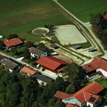
Privatstall
Blaichach
Altenried
@JasminAltenried
Freizeitstall
Vermieten
Longierzirkel/Roundpen
Paddock
Innenbox
10 weitere...
neu
B
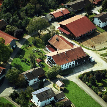


Bewegumgsstall Artegerechte Pferdehaltung
Traunwalchen
Kiefersbeck
@Kiefersbeck
FN-Mitglied
Freizeitstall
Vermieten
Krankenbox
Longierzirkel/Roundpen
Gnadenbrothof
18 weitere...
P+
Deprecated: Creation of dynamic property Zend_View_Helper_Ads::$adLink is deprecated in /var/www/stall-frei/htdocs/staging.stall-frei.de/library/Psf/View/Helper/Ads.php on line 108

Heu und Heulage verkaufen
Mechtersen
STALL-FREIde Marketing
@STALL-FREI-Marketing
Verkaufen Sie Ihr Heu und Ihre Heulage direkt an Reiter, Pferdeställe und Reitanlagen
Reitsportzentrum Lehmann
Weil am Rhein
Peter-Lehmann
@Peter-Lehmann
FN-Mitglied
Gastronomie
Vermieten
Führanlage
Longierzirkel/Roundpen
Außenboxen
Innenbox
13 weitere...
P
Leider kein Vorschaubild
Leider kein Vorschaubild
kl. Stall, Paddockbox, Offenstall ab April 25
Höslwang
Stauderer Hof, Jenny Künzner
@Stauderer-Hof
Freizeitstall
Pferdeausbildung
Vermieten
Hunde willkommen
Paddock
Allergikerstall
Hufrehe geeignet
15 weitere...
B
Leider kein Vorschaubild
Leider kein Vorschaubild
Einstellplatz in Vollpension
Trostberg
Hacienda-Hidalgo Horse Ranch
@Hacienda-Hidalgo
Freizeitstall
Vermieten
Hunde willkommen
Longierzirkel/Roundpen
Innenbox
9 weitere...
B

Offenstall mit Paddock Trail
Schattwald
Stanzlerhof GmbH
@Stanzlerhof
Freizeitstall
Gastronomie
Vermieten
Hunde willkommen
Krankenbox
Notfallboxen
Zuchtstutenhaltung möglich
23 weitere...
P
Leider kein Vorschaubild
Leider kein Vorschaubild
Offenstallpl. f. 1 leichtf. Isländer Wallach
Benediktbeuern
Frau-Schreiner
@Frau-Schreiner
Freizeitstall
Vermieten
Krankenbox
Paddock
Hufrehe geeignet
Notfallboxen
5 weitere...
B

Aktivstall Blaslhof , der Weg lohnt sich!!
Uffing am Staffelsee
Blaslhof Aktivstall
@Blaslhof
Unser HIT Aktivstall ist 2008 mit 5 Stallsternen, der höchstmöglichen Auszeichnung für Artgerechte Pferdehaltung belohnt worde

2x Offenstall Platz frei
Miesbach
Freizeitstall Unteraigen
@Veronika226
Freizeitstall
Pferdeausbildung
Hunde willkommen
Krankenbox
Außenbox mit Paddock
Außenboxen
Vollpension
16 weitere...
P
Leider kein Vorschaubild
Leider kein Vorschaubild
Box in kleinem Privatstall
Waakirchen
Urschental
@Urschental
Freizeitstall
VFD-Mitglied
Vermieten
Paddock
Reitplatz (z.B. Dressur, Springen, Reining)
Innenbox
8 weitere...
B
Leider kein Vorschaubild
Leider kein Vorschaubild
1-3 helle Innenboxen und 1 Offenstallplatz frei
Maulburg
Karlheinz Dreher
@Sandra-S1
Freizeitstall
Vermieten
Hunde willkommen
Krankenbox
Außenbox mit Paddock
Außenboxen
10 weitere...
B
Stallanlagen mit Laufstall
Reitschulen mit Reitplatz (z.B. Dressur, Springen, Reining)
Stallplätze mit Vollpension
Deprecated: Creation of dynamic property Zend_View::$pageCount is deprecated in /var/www/stall-frei/htdocs/staging.stall-frei.de/library/vendor/shardj/zf1-future/library/Zend/View/Abstract.php on line 308
Deprecated: Creation of dynamic property Zend_View::$itemCountPerPage is deprecated in /var/www/stall-frei/htdocs/staging.stall-frei.de/library/vendor/shardj/zf1-future/library/Zend/View/Abstract.php on line 308
Deprecated: Creation of dynamic property Zend_View::$first is deprecated in /var/www/stall-frei/htdocs/staging.stall-frei.de/library/vendor/shardj/zf1-future/library/Zend/View/Abstract.php on line 308
Deprecated: Creation of dynamic property Zend_View::$current is deprecated in /var/www/stall-frei/htdocs/staging.stall-frei.de/library/vendor/shardj/zf1-future/library/Zend/View/Abstract.php on line 308
Deprecated: Creation of dynamic property Zend_View::$last is deprecated in /var/www/stall-frei/htdocs/staging.stall-frei.de/library/vendor/shardj/zf1-future/library/Zend/View/Abstract.php on line 308
Deprecated: Creation of dynamic property Zend_View::$previous is deprecated in /var/www/stall-frei/htdocs/staging.stall-frei.de/library/vendor/shardj/zf1-future/library/Zend/View/Abstract.php on line 308
Deprecated: Creation of dynamic property Zend_View::$next is deprecated in /var/www/stall-frei/htdocs/staging.stall-frei.de/library/vendor/shardj/zf1-future/library/Zend/View/Abstract.php on line 308
Deprecated: Creation of dynamic property Zend_View::$pagesInRange is deprecated in /var/www/stall-frei/htdocs/staging.stall-frei.de/library/vendor/shardj/zf1-future/library/Zend/View/Abstract.php on line 308
Deprecated: Creation of dynamic property Zend_View::$firstPageInRange is deprecated in /var/www/stall-frei/htdocs/staging.stall-frei.de/library/vendor/shardj/zf1-future/library/Zend/View/Abstract.php on line 308
Deprecated: Creation of dynamic property Zend_View::$lastPageInRange is deprecated in /var/www/stall-frei/htdocs/staging.stall-frei.de/library/vendor/shardj/zf1-future/library/Zend/View/Abstract.php on line 308
Deprecated: Creation of dynamic property Zend_View::$currentItemCount is deprecated in /var/www/stall-frei/htdocs/staging.stall-frei.de/library/vendor/shardj/zf1-future/library/Zend/View/Abstract.php on line 308
Deprecated: Creation of dynamic property Zend_View::$totalItemCount is deprecated in /var/www/stall-frei/htdocs/staging.stall-frei.de/library/vendor/shardj/zf1-future/library/Zend/View/Abstract.php on line 308
Deprecated: Creation of dynamic property Zend_View::$firstItemNumber is deprecated in /var/www/stall-frei/htdocs/staging.stall-frei.de/library/vendor/shardj/zf1-future/library/Zend/View/Abstract.php on line 308
Deprecated: Creation of dynamic property Zend_View::$lastItemNumber is deprecated in /var/www/stall-frei/htdocs/staging.stall-frei.de/library/vendor/shardj/zf1-future/library/Zend/View/Abstract.php on line 308
Deprecated: Creation of dynamic property Zend_View::$router is deprecated in /var/www/stall-frei/htdocs/staging.stall-frei.de/library/vendor/shardj/zf1-future/library/Zend/View/Abstract.php on line 308
Deprecated: Creation of dynamic property Zend_View::$urlParams is deprecated in /var/www/stall-frei/htdocs/staging.stall-frei.de/library/vendor/shardj/zf1-future/library/Zend/View/Abstract.php on line 308
Deprecated: Creation of dynamic property Zend_View::$showAds is deprecated in /var/www/stall-frei/htdocs/staging.stall-frei.de/library/vendor/shardj/zf1-future/library/Zend/View/Abstract.php on line 308
Deprecated: Creation of dynamic property Zend_View::$objectIds is deprecated in /var/www/stall-frei/htdocs/staging.stall-frei.de/library/vendor/shardj/zf1-future/library/Zend/View/Abstract.php on line 308
Deprecated: Creation of dynamic property Zend_View::$showNavbar is deprecated in /var/www/stall-frei/htdocs/staging.stall-frei.de/library/vendor/shardj/zf1-future/library/Zend/View/Abstract.php on line 308
Deprecated: Creation of dynamic property Zend_View::$showBreadcrumb is deprecated in /var/www/stall-frei/htdocs/staging.stall-frei.de/library/vendor/shardj/zf1-future/library/Zend/View/Abstract.php on line 308
Deprecated: Creation of dynamic property Zend_View::$showFooter is deprecated in /var/www/stall-frei/htdocs/staging.stall-frei.de/library/vendor/shardj/zf1-future/library/Zend/View/Abstract.php on line 308
Deprecated: Creation of dynamic property Zend_View::$showInternalAds is deprecated in /var/www/stall-frei/htdocs/staging.stall-frei.de/library/vendor/shardj/zf1-future/library/Zend/View/Abstract.php on line 308
Deprecated: Creation of dynamic property Zend_View::$blNoContent is deprecated in /var/www/stall-frei/htdocs/staging.stall-frei.de/library/vendor/shardj/zf1-future/library/Zend/View/Abstract.php on line 308
Deprecated: Creation of dynamic property Zend_View::$sMetaDesc is deprecated in /var/www/stall-frei/htdocs/staging.stall-frei.de/library/vendor/shardj/zf1-future/library/Zend/View/Abstract.php on line 308
Deprecated: Creation of dynamic property Zend_View::$useGmaps is deprecated in /var/www/stall-frei/htdocs/staging.stall-frei.de/library/vendor/shardj/zf1-future/library/Zend/View/Abstract.php on line 308
Deprecated: Creation of dynamic property Zend_View::$touches is deprecated in /var/www/stall-frei/htdocs/staging.stall-frei.de/library/vendor/shardj/zf1-future/library/Zend/View/Abstract.php on line 308
Deprecated: Creation of dynamic property Zend_View::$oProject is deprecated in /var/www/stall-frei/htdocs/staging.stall-frei.de/library/vendor/shardj/zf1-future/library/Zend/View/Abstract.php on line 308
Deprecated: Creation of dynamic property Zend_View::$pageHeadline is deprecated in /var/www/stall-frei/htdocs/staging.stall-frei.de/library/vendor/shardj/zf1-future/library/Zend/View/Abstract.php on line 308
Deprecated: Creation of dynamic property Zend_View::$disableLocationField is deprecated in /var/www/stall-frei/htdocs/staging.stall-frei.de/library/vendor/shardj/zf1-future/library/Zend/View/Abstract.php on line 308
Deprecated: Creation of dynamic property Zend_View::$isSearch is deprecated in /var/www/stall-frei/htdocs/staging.stall-frei.de/library/vendor/shardj/zf1-future/library/Zend/View/Abstract.php on line 308
Deprecated: Creation of dynamic property Zend_View::$pageTitle is deprecated in /var/www/stall-frei/htdocs/staging.stall-frei.de/library/vendor/shardj/zf1-future/library/Zend/View/Abstract.php on line 308
Deprecated: Creation of dynamic property Psf_Form_Element_Text::$class is deprecated in /var/www/stall-frei/htdocs/staging.stall-frei.de/library/vendor/shardj/zf1-future/library/Zend/Form/Element.php on line 874
Deprecated: Creation of dynamic property Psf_Form_Element_Text::$size is deprecated in /var/www/stall-frei/htdocs/staging.stall-frei.de/library/vendor/shardj/zf1-future/library/Zend/Form/Element.php on line 874
Deprecated: Creation of dynamic property Psf_Form_Element_Text::$placeholder is deprecated in /var/www/stall-frei/htdocs/staging.stall-frei.de/library/vendor/shardj/zf1-future/library/Zend/Form/Element.php on line 874
Deprecated: Creation of dynamic property Psf_Form_Element_Hidden::$class is deprecated in /var/www/stall-frei/htdocs/staging.stall-frei.de/library/vendor/shardj/zf1-future/library/Zend/Form/Element.php on line 874
Deprecated: Creation of dynamic property Psf_Form_Element_Hidden::$class is deprecated in /var/www/stall-frei/htdocs/staging.stall-frei.de/library/vendor/shardj/zf1-future/library/Zend/Form/Element.php on line 874
Deprecated: Creation of dynamic property Psf_Form_Element_Hidden::$class is deprecated in /var/www/stall-frei/htdocs/staging.stall-frei.de/library/vendor/shardj/zf1-future/library/Zend/Form/Element.php on line 874
Deprecated: Creation of dynamic property Psf_Form_Element_Hidden::$class is deprecated in /var/www/stall-frei/htdocs/staging.stall-frei.de/library/vendor/shardj/zf1-future/library/Zend/Form/Element.php on line 874
Deprecated: Creation of dynamic property Psf_Form_Element_Select::$class is deprecated in /var/www/stall-frei/htdocs/staging.stall-frei.de/library/vendor/shardj/zf1-future/library/Zend/Form/Element.php on line 874
Deprecated: Creation of dynamic property Psf_Form_Element_Select::$class is deprecated in /var/www/stall-frei/htdocs/staging.stall-frei.de/library/vendor/shardj/zf1-future/library/Zend/Form/Element.php on line 874
Deprecated: Creation of dynamic property Psf_Form_Element_Select::$class is deprecated in /var/www/stall-frei/htdocs/staging.stall-frei.de/library/vendor/shardj/zf1-future/library/Zend/Form/Element.php on line 874
Deprecated: Creation of dynamic property Psf_Form_Element_Select::$class is deprecated in /var/www/stall-frei/htdocs/staging.stall-frei.de/library/vendor/shardj/zf1-future/library/Zend/Form/Element.php on line 874
Deprecated: Creation of dynamic property Psf_Form_Element_Text::$class is deprecated in /var/www/stall-frei/htdocs/staging.stall-frei.de/library/vendor/shardj/zf1-future/library/Zend/Form/Element.php on line 874
Deprecated: Creation of dynamic property Psf_Form_Element_Checkbox::$label is deprecated in /var/www/stall-frei/htdocs/staging.stall-frei.de/library/vendor/shardj/zf1-future/library/Zend/Form/Element.php on line 874
Deprecated: Creation of dynamic property Zend_View::$sort is deprecated in /var/www/stall-frei/htdocs/staging.stall-frei.de/library/vendor/shardj/zf1-future/library/Zend/View/Abstract.php on line 308
Deprecated: Creation of dynamic property Zend_View::$searchLocation is deprecated in /var/www/stall-frei/htdocs/staging.stall-frei.de/library/vendor/shardj/zf1-future/library/Zend/View/Abstract.php on line 308
Deprecated: Creation of dynamic property Zend_View::$locationHint is deprecated in /var/www/stall-frei/htdocs/staging.stall-frei.de/library/vendor/shardj/zf1-future/library/Zend/View/Abstract.php on line 308
Psf_GeoCoder_Abstract::getLocation: Wehrden Get Location CachedOrLive
Psf_GeoCoder_Abstract::getCachedOrLive: Wehrden
Psf_GeoCoder_Abstract::convertLocationResult
{"documentation":"https:\/\/opencagedata.com\/api","licenses":[{"name":"see attribution guide","url":"https:\/\/opencagedata.com\/credits"}],"results":[{"bounds":{"northeast":{"lat":51.7377251,"lng":9.401791},"southwest":{"lat":51.6906481,"lng":9.3451291}},"components":{"ISO_3166-1_alpha-2":"DE","ISO_3166-1_alpha-3":"DEU","ISO_3166-2":["DE-NW"],"_category":"place","_normalized_city":"Beverungen","_type":"village","continent":"Europe","country":"Deutschland","country_code":"de","county":"Kreis H\u00f6xter","political_union":"European Union","state":"Nordrhein-Westfalen","state_code":"NW","town":"Beverungen","village":"Wehrden"},"confidence":7,"formatted":"Wehrden, Nordrhein-Westfalen, Deutschland","geometry":{"lat":51.7103242,"lng":9.3865422}},{"bounds":{"northeast":{"lat":49.2582926,"lng":6.8486307},"southwest":{"lat":49.2324624,"lng":6.7969359}},"components":{"ISO_3166-1_alpha-2":"DE","ISO_3166-1_alpha-3":"DEU","ISO_3166-2":["DE-SL"],"_category":"place","_normalized_city":"V\u00f6lklingen","_type":"neighbourhood","city_district":"Wehrden","continent":"Europe","country":"Deutschland","country_code":"de","county":"Regionalverband Saarbr\u00fccken","political_union":"European Union","state":"Saarland","state_code":"SL","town":"V\u00f6lklingen"},"confidence":7,"formatted":"Wehrden, V\u00f6lklingen, Saarland, Deutschland","geometry":{"lat":49.245686,"lng":6.8276352}},{"bounds":{"northeast":{"lat":49.2668456,"lng":6.8444824},"southwest":{"lat":49.2268456,"lng":6.8044824}},"components":{"ISO_3166-1_alpha-2":"DE","ISO_3166-1_alpha-3":"DEU","ISO_3166-2":["DE-SL"],"_category":"place","_normalized_city":"V\u00f6lklingen","_type":"neighbourhood","city_district":"Wehrden","continent":"Europe","country":"Deutschland","country_code":"de","county":"Regionalverband Saarbr\u00fccken","political_union":"European Union","postcode":"66333","state":"Saarland","state_code":"SL","suburb":"Wehrden","town":"V\u00f6lklingen"},"confidence":7,"formatted":"66333 V\u00f6lklingen, Deutschland","geometry":{"lat":49.2468456,"lng":6.8244824}},{"bounds":{"northeast":{"lat":53.2996899,"lng":7.5916193},"southwest":{"lat":53.2958252,"lng":7.5829252}},"components":{"ISO_3166-1_alpha-2":"DE","ISO_3166-1_alpha-3":"DEU","ISO_3166-2":["DE-NI"],"_category":"place","_normalized_city":"Hesel","_type":"village","commercial":"Wehrden","continent":"Europe","country":"Deutschland","country_code":"de","county":"Landkreis Leer","municipality":"Samtgemeinde Hesel","political_union":"European Union","postcode":"26835","state":"Niedersachsen","state_code":"NI","town":"Hesel","village":"Hesel"},"confidence":9,"formatted":"26835 Hesel, Deutschland","geometry":{"lat":53.2969778,"lng":7.5884084}},{"bounds":{"northeast":{"lat":53.2988925,"lng":7.5863271},"southwest":{"lat":53.2977296,"lng":7.5829273}},"components":{"ISO_3166-1_alpha-2":"DE","ISO_3166-1_alpha-3":"DEU","ISO_3166-2":["DE-NI"],"_category":"road","_normalized_city":"Hesel","_type":"road","commercial":"Wehrden","continent":"Europe","country":"Deutschland","country_code":"de","county":"Landkreis Leer","municipality":"Samtgemeinde Hesel","political_union":"European Union","postcode":"26835","road":"Wehrden","road_type":"residential","state":"Niedersachsen","state_code":"NI","town":"Hesel","village":"Hesel"},"confidence":9,"formatted":"Wehrden, 26835 Hesel, Deutschland","geometry":{"lat":53.2983004,"lng":7.5846241}},{"components":{"ISO_3166-1_alpha-2":"FR","ISO_3166-1_alpha-3":"FRA","ISO_3166-2":["FR-OCC","FR-81"],"_category":"road","_normalized_city":"Albi","_type":"road","city":"Albi","continent":"Europe","country":"France","country_code":"fr","county":"Tarn","local_authority":"Albigeois","political_union":"European Union","postcode":"81000","road":"Chemin de Verdenne","state":"Occitanie","state_code":"OCC"},"confidence":2,"formatted":"Chemin de Verdenne, 81000 Albi, France","geometry":{"lat":43.90283,"lng":2.057038}},{"components":{"ISO_3166-1_alpha-2":"FR","ISO_3166-1_alpha-3":"FRA","ISO_3166-2":["FR-IDF","FR-77"],"_category":"road","_normalized_city":"Saint-Fargeau-Ponthierry","_type":"road","city":"Saint-Fargeau-Ponthierry","continent":"Europe","country":"France","country_code":"fr","county":"Seine-et-Marne","local_authority":"Communaut\u00e9 d'agglom\u00e9ration Melun Val de Seine","political_union":"European Union","postcode":"77310","road":"Rue des Verdennes","state":"\u00cele-de-France","state_code":"IDF"},"confidence":2,"formatted":"Rue des Verdennes, 77310 Saint-Fargeau-Ponthierry, France","geometry":{"lat":48.533878,"lng":2.552417}},{"components":{"ISO_3166-1_alpha-2":"FR","ISO_3166-1_alpha-3":"FRA","ISO_3166-2":["FR-NAQ","FR-23"],"_category":"road","_normalized_city":"Aubusson","_type":"road","city":"Aubusson","continent":"Europe","country":"France","country_code":"fr","county":"Creuse","local_authority":"Communaut\u00e9 de communes Creuse Grand Sud","political_union":"European Union","postcode":"23200","road":"Chemin de la Vedrenne","state":"Nouvelle-Aquitaine","state_code":"NAQ"},"confidence":2,"formatted":"Chemin de la Vedrenne, 23200 Aubusson, France","geometry":{"lat":45.956053,"lng":2.171594}},{"components":{"ISO_3166-1_alpha-2":"FR","ISO_3166-1_alpha-3":"FRA","ISO_3166-2":["FR-PDL","FR-49"],"_category":"road","_normalized_city":"Saumur","_type":"road","city":"Saumur","continent":"Europe","country":"France","country_code":"fr","county":"Maine-et-Loire","local_authority":"Communaut\u00e9 d'agglom\u00e9ration Saumur Val de Loire","political_union":"European Union","postcode":"49400","road":"Boulevard de Verden","state":"Pays de la Loire","state_code":"PDL"},"confidence":2,"formatted":"Boulevard de Verden, 49400 Saumur, France","geometry":{"lat":47.261808,"lng":-0.067388}},{"components":{"ISO_3166-1_alpha-2":"FR","ISO_3166-1_alpha-3":"FRA","ISO_3166-2":["FR-NAQ","FR-19"],"_category":"road","_normalized_city":"Cosnac","_type":"road","city":"Cosnac","continent":"Europe","country":"France","country_code":"fr","county":"Corr\u00e8ze","local_authority":"Communaut\u00e9 d'agglom\u00e9ration du Bassin de Brive","political_union":"European Union","postcode":"19360","road":"Chemin De La Vedrenne Basse","state":"Nouvelle-Aquitaine","state_code":"NAQ"},"confidence":10,"formatted":"Chemin De La Vedrenne Basse, 19360 Cosnac, France","geometry":{"lat":45.121463,"lng":1.588814}}],"status":{"code":200,"message":"OK"},"stay_informed":{"blog":"https:\/\/blog.opencagedata.com","mastodon":"https:\/\/en.osm.town\/@opencage"},"thanks":"For using an OpenCage API","timestamp":{"created_http":"Sun, 08 Feb 2026 14:59:38 GMT","created_unix":1770562778},"total_results":10}Array
(
[0] => stdClass Object
(
[bounds] => stdClass Object
(
[northeast] => stdClass Object
(
[lat] => 51.7377251
[lng] => 9.401791
)
[southwest] => stdClass Object
(
[lat] => 51.6906481
[lng] => 9.3451291
)
)
[components] => stdClass Object
(
[ISO_3166-1_alpha-2] => DE
[ISO_3166-1_alpha-3] => DEU
[ISO_3166-2] => Array
(
[0] => DE-NW
)
[_category] => place
[_normalized_city] => Beverungen
[_type] => village
[continent] => Europe
[country] => Deutschland
[country_code] => de
[county] => Kreis Höxter
[political_union] => European Union
[state] => Nordrhein-Westfalen
[state_code] => NW
[town] => Beverungen
[village] => Wehrden
)
[confidence] => 7
[formatted] => Wehrden, Nordrhein-Westfalen, Deutschland
[geometry] => stdClass Object
(
[lat] => 51.7103242
[lng] => 9.3865422
)
)
[1] => stdClass Object
(
[bounds] => stdClass Object
(
[northeast] => stdClass Object
(
[lat] => 49.2582926
[lng] => 6.8486307
)
[southwest] => stdClass Object
(
[lat] => 49.2324624
[lng] => 6.7969359
)
)
[components] => stdClass Object
(
[ISO_3166-1_alpha-2] => DE
[ISO_3166-1_alpha-3] => DEU
[ISO_3166-2] => Array
(
[0] => DE-SL
)
[_category] => place
[_normalized_city] => Völklingen
[_type] => neighbourhood
[city_district] => Wehrden
[continent] => Europe
[country] => Deutschland
[country_code] => de
[county] => Regionalverband Saarbrücken
[political_union] => European Union
[state] => Saarland
[state_code] => SL
[town] => Völklingen
)
[confidence] => 7
[formatted] => Wehrden, Völklingen, Saarland, Deutschland
[geometry] => stdClass Object
(
[lat] => 49.245686
[lng] => 6.8276352
)
)
[2] => stdClass Object
(
[bounds] => stdClass Object
(
[northeast] => stdClass Object
(
[lat] => 49.2668456
[lng] => 6.8444824
)
[southwest] => stdClass Object
(
[lat] => 49.2268456
[lng] => 6.8044824
)
)
[components] => stdClass Object
(
[ISO_3166-1_alpha-2] => DE
[ISO_3166-1_alpha-3] => DEU
[ISO_3166-2] => Array
(
[0] => DE-SL
)
[_category] => place
[_normalized_city] => Völklingen
[_type] => neighbourhood
[city_district] => Wehrden
[continent] => Europe
[country] => Deutschland
[country_code] => de
[county] => Regionalverband Saarbrücken
[political_union] => European Union
[postcode] => 66333
[state] => Saarland
[state_code] => SL
[suburb] => Wehrden
[town] => Völklingen
)
[confidence] => 7
[formatted] => 66333 Völklingen, Deutschland
[geometry] => stdClass Object
(
[lat] => 49.2468456
[lng] => 6.8244824
)
)
[3] => stdClass Object
(
[bounds] => stdClass Object
(
[northeast] => stdClass Object
(
[lat] => 53.2996899
[lng] => 7.5916193
)
[southwest] => stdClass Object
(
[lat] => 53.2958252
[lng] => 7.5829252
)
)
[components] => stdClass Object
(
[ISO_3166-1_alpha-2] => DE
[ISO_3166-1_alpha-3] => DEU
[ISO_3166-2] => Array
(
[0] => DE-NI
)
[_category] => place
[_normalized_city] => Hesel
[_type] => village
[commercial] => Wehrden
[continent] => Europe
[country] => Deutschland
[country_code] => de
[county] => Landkreis Leer
[municipality] => Samtgemeinde Hesel
[political_union] => European Union
[postcode] => 26835
[state] => Niedersachsen
[state_code] => NI
[town] => Hesel
[village] => Hesel
)
[confidence] => 9
[formatted] => 26835 Hesel, Deutschland
[geometry] => stdClass Object
(
[lat] => 53.2969778
[lng] => 7.5884084
)
)
[4] => stdClass Object
(
[bounds] => stdClass Object
(
[northeast] => stdClass Object
(
[lat] => 53.2988925
[lng] => 7.5863271
)
[southwest] => stdClass Object
(
[lat] => 53.2977296
[lng] => 7.5829273
)
)
[components] => stdClass Object
(
[ISO_3166-1_alpha-2] => DE
[ISO_3166-1_alpha-3] => DEU
[ISO_3166-2] => Array
(
[0] => DE-NI
)
[_category] => road
[_normalized_city] => Hesel
[_type] => road
[commercial] => Wehrden
[continent] => Europe
[country] => Deutschland
[country_code] => de
[county] => Landkreis Leer
[municipality] => Samtgemeinde Hesel
[political_union] => European Union
[postcode] => 26835
[road] => Wehrden
[road_type] => residential
[state] => Niedersachsen
[state_code] => NI
[town] => Hesel
[village] => Hesel
)
[confidence] => 9
[formatted] => Wehrden, 26835 Hesel, Deutschland
[geometry] => stdClass Object
(
[lat] => 53.2983004
[lng] => 7.5846241
)
)
[5] => stdClass Object
(
[components] => stdClass Object
(
[ISO_3166-1_alpha-2] => FR
[ISO_3166-1_alpha-3] => FRA
[ISO_3166-2] => Array
(
[0] => FR-OCC
[1] => FR-81
)
[_category] => road
[_normalized_city] => Albi
[_type] => road
[city] => Albi
[continent] => Europe
[country] => France
[country_code] => fr
[county] => Tarn
[local_authority] => Albigeois
[political_union] => European Union
[postcode] => 81000
[road] => Chemin de Verdenne
[state] => Occitanie
[state_code] => OCC
)
[confidence] => 2
[formatted] => Chemin de Verdenne, 81000 Albi, France
[geometry] => stdClass Object
(
[lat] => 43.90283
[lng] => 2.057038
)
)
[6] => stdClass Object
(
[components] => stdClass Object
(
[ISO_3166-1_alpha-2] => FR
[ISO_3166-1_alpha-3] => FRA
[ISO_3166-2] => Array
(
[0] => FR-IDF
[1] => FR-77
)
[_category] => road
[_normalized_city] => Saint-Fargeau-Ponthierry
[_type] => road
[city] => Saint-Fargeau-Ponthierry
[continent] => Europe
[country] => France
[country_code] => fr
[county] => Seine-et-Marne
[local_authority] => Communauté d'agglomération Melun Val de Seine
[political_union] => European Union
[postcode] => 77310
[road] => Rue des Verdennes
[state] => Île-de-France
[state_code] => IDF
)
[confidence] => 2
[formatted] => Rue des Verdennes, 77310 Saint-Fargeau-Ponthierry, France
[geometry] => stdClass Object
(
[lat] => 48.533878
[lng] => 2.552417
)
)
[7] => stdClass Object
(
[components] => stdClass Object
(
[ISO_3166-1_alpha-2] => FR
[ISO_3166-1_alpha-3] => FRA
[ISO_3166-2] => Array
(
[0] => FR-NAQ
[1] => FR-23
)
[_category] => road
[_normalized_city] => Aubusson
[_type] => road
[city] => Aubusson
[continent] => Europe
[country] => France
[country_code] => fr
[county] => Creuse
[local_authority] => Communauté de communes Creuse Grand Sud
[political_union] => European Union
[postcode] => 23200
[road] => Chemin de la Vedrenne
[state] => Nouvelle-Aquitaine
[state_code] => NAQ
)
[confidence] => 2
[formatted] => Chemin de la Vedrenne, 23200 Aubusson, France
[geometry] => stdClass Object
(
[lat] => 45.956053
[lng] => 2.171594
)
)
[8] => stdClass Object
(
[components] => stdClass Object
(
[ISO_3166-1_alpha-2] => FR
[ISO_3166-1_alpha-3] => FRA
[ISO_3166-2] => Array
(
[0] => FR-PDL
[1] => FR-49
)
[_category] => road
[_normalized_city] => Saumur
[_type] => road
[city] => Saumur
[continent] => Europe
[country] => France
[country_code] => fr
[county] => Maine-et-Loire
[local_authority] => Communauté d'agglomération Saumur Val de Loire
[political_union] => European Union
[postcode] => 49400
[road] => Boulevard de Verden
[state] => Pays de la Loire
[state_code] => PDL
)
[confidence] => 2
[formatted] => Boulevard de Verden, 49400 Saumur, France
[geometry] => stdClass Object
(
[lat] => 47.261808
[lng] => -0.067388
)
)
[9] => stdClass Object
(
[components] => stdClass Object
(
[ISO_3166-1_alpha-2] => FR
[ISO_3166-1_alpha-3] => FRA
[ISO_3166-2] => Array
(
[0] => FR-NAQ
[1] => FR-19
)
[_category] => road
[_normalized_city] => Cosnac
[_type] => road
[city] => Cosnac
[continent] => Europe
[country] => France
[country_code] => fr
[county] => Corrèze
[local_authority] => Communauté d'agglomération du Bassin de Brive
[political_union] => European Union
[postcode] => 19360
[road] => Chemin De La Vedrenne Basse
[state] => Nouvelle-Aquitaine
[state_code] => NAQ
)
[confidence] => 10
[formatted] => Chemin De La Vedrenne Basse, 19360 Cosnac, France
[geometry] => stdClass Object
(
[lat] => 45.121463
[lng] => 1.588814
)
)
)
Psf_GeoCoder_OpenCageData::getKeyMap: 0
stdClass Object
(
    [bounds] => stdClass Object
        (
            [northeast] => stdClass Object
                (
                    [lat] => 51.7377251
                    [lng] => 9.401791
                )

            [southwest] => stdClass Object
                (
                    [lat] => 51.6906481
                    [lng] => 9.3451291
                )

        )

    [components] => stdClass Object
        (
            [ISO_3166-1_alpha-2] => DE
            [ISO_3166-1_alpha-3] => DEU
            [ISO_3166-2] => Array
                (
                    [0] => DE-NW
                )

            [_category] => place
            [_normalized_city] => Beverungen
            [_type] => village
            [continent] => Europe
            [country] => Deutschland
            [country_code] => de
            [county] => Kreis Höxter
            [political_union] => European Union
            [state] => Nordrhein-Westfalen
            [state_code] => NW
            [town] => Beverungen
            [village] => Wehrden
        )

    [confidence] => 7
    [formatted] => Wehrden, Nordrhein-Westfalen, Deutschland
    [geometry] => stdClass Object
        (
            [lat] => 51.7103242
            [lng] => 9.3865422
        )

)
Psf_GeoCoder_OpenCageData::getCounty: Höxter
Psf_GeoCoder_OpenCageData::addMissingData REFETCH!
Array
(
    [address] => Wehrden, Nordrhein-Westfalen, Deutschland
    [type] => village
    [street] =>
    [city] => Beverungen
    [county] => Höxter
    [state] => Nordrhein-Westfalen
    [zip] =>
    [country] => Deutschland
    [suburb] =>
    [countrycode] => de
    [latitude] => 51.7103242
    [longitude] => 9.3865422
    [accuracy] => 1
    [confidence] => 7
    [bounds] => stdClass Object
        (
            [northeast] => stdClass Object
                (
                    [lat] => 51.7377251
                    [lng] => 9.401791
                )

            [southwest] => stdClass Object
                (
                    [lat] => 51.6906481
                    [lng] => 9.3451291
                )

        )

)
reformat!
Array
(
    [address] => Beverungen
    [type] => village
    [street] =>
    [city] => Beverungen
    [county] => Höxter
    [state] => Nordrhein-Westfalen
    [zip] =>
    [country] => Deutschland
    [suburb] =>
    [countrycode] => de
    [latitude] => 51.7103242
    [longitude] => 9.3865422
    [accuracy] => 1
    [confidence] => 7
    [bounds] => stdClass Object
        (
            [northeast] => stdClass Object
                (
                    [lat] => 51.7377251
                    [lng] => 9.401791
                )

            [southwest] => stdClass Object
                (
                    [lat] => 51.6906481
                    [lng] => 9.3451291
                )

        )

    [place] => Beverungen, Nordrhein-Westfalen
    [hash] => 85499f7b295b54cd839c19aeb0127d3e
)
Psf_GeoCoder_OpenCageData::getKeyMap: 1
stdClass Object
(
    [bounds] => stdClass Object
        (
            [northeast] => stdClass Object
                (
                    [lat] => 49.2582926
                    [lng] => 6.8486307
                )

            [southwest] => stdClass Object
                (
                    [lat] => 49.2324624
                    [lng] => 6.7969359
                )

        )

    [components] => stdClass Object
        (
            [ISO_3166-1_alpha-2] => DE
            [ISO_3166-1_alpha-3] => DEU
            [ISO_3166-2] => Array
                (
                    [0] => DE-SL
                )

            [_category] => place
            [_normalized_city] => Völklingen
            [_type] => neighbourhood
            [city_district] => Wehrden
            [continent] => Europe
            [country] => Deutschland
            [country_code] => de
            [county] => Regionalverband Saarbrücken
            [political_union] => European Union
            [state] => Saarland
            [state_code] => SL
            [town] => Völklingen
        )

    [confidence] => 7
    [formatted] => Wehrden, Völklingen, Saarland, Deutschland
    [geometry] => stdClass Object
        (
            [lat] => 49.245686
            [lng] => 6.8276352
        )

)
Psf_GeoCoder_OpenCageData::getCounty: alverband Saarbrücken
Psf_GeoCoder_OpenCageData::addMissingData REFETCH!
Array
(
    [address] => Wehrden, Völklingen, Saarland, Deutschland
    [type] => neighbourhood
    [street] =>
    [city] => Völklingen
    [county] => alverband Saarbrücken
    [state] => Saarland
    [zip] =>
    [country] => Deutschland
    [suburb] =>
    [countrycode] => de
    [latitude] => 49.245686
    [longitude] => 6.8276352
    [accuracy] => 1
    [confidence] => 7
    [bounds] => stdClass Object
        (
            [northeast] => stdClass Object
                (
                    [lat] => 49.2582926
                    [lng] => 6.8486307
                )

            [southwest] => stdClass Object
                (
                    [lat] => 49.2324624
                    [lng] => 6.7969359
                )

        )

)
reformat!
Array
(
    [address] => Wehrden, Völklingen, Saarland, Deutschland
    [type] => neighbourhood
    [street] =>
    [city] => Völklingen
    [county] => alverband Saarbrücken
    [state] => Saarland
    [zip] =>
    [country] => Deutschland
    [suburb] =>
    [countrycode] => de
    [latitude] => 49.245686
    [longitude] => 6.8276352
    [accuracy] => 1
    [confidence] => 7
    [bounds] => stdClass Object
        (
            [northeast] => stdClass Object
                (
                    [lat] => 49.2582926
                    [lng] => 6.8486307
                )

            [southwest] => stdClass Object
                (
                    [lat] => 49.2324624
                    [lng] => 6.7969359
                )

        )

    [place] => Völklingen, Saarland
    [hash] => 9287565a5e3fb49896b20fa4121f3dbd
)
Psf_GeoCoder_OpenCageData::getKeyMap: 2
stdClass Object
(
    [bounds] => stdClass Object
        (
            [northeast] => stdClass Object
                (
                    [lat] => 49.2668456
                    [lng] => 6.8444824
                )

            [southwest] => stdClass Object
                (
                    [lat] => 49.2268456
                    [lng] => 6.8044824
                )

        )

    [components] => stdClass Object
        (
            [ISO_3166-1_alpha-2] => DE
            [ISO_3166-1_alpha-3] => DEU
            [ISO_3166-2] => Array
                (
                    [0] => DE-SL
                )

            [_category] => place
            [_normalized_city] => Völklingen
            [_type] => neighbourhood
            [city_district] => Wehrden
            [continent] => Europe
            [country] => Deutschland
            [country_code] => de
            [county] => Regionalverband Saarbrücken
            [political_union] => European Union
            [postcode] => 66333
            [state] => Saarland
            [state_code] => SL
            [suburb] => Wehrden
            [town] => Völklingen
        )

    [confidence] => 7
    [formatted] => 66333 Völklingen, Deutschland
    [geometry] => stdClass Object
        (
            [lat] => 49.2468456
            [lng] => 6.8244824
        )

)
Psf_GeoCoder_OpenCageData::getCounty: alverband Saarbrücken
Psf_GeoCoder_OpenCageData::addMissingData REFETCH!
Array
(
    [address] => 66333 Völklingen, Deutschland
    [type] => neighbourhood
    [street] =>
    [city] => Völklingen
    [county] => alverband Saarbrücken
    [state] => Saarland
    [zip] => 66333
    [country] => Deutschland
    [suburb] => Wehrden
    [countrycode] => de
    [latitude] => 49.2468456
    [longitude] => 6.8244824
    [accuracy] => 1
    [confidence] => 7
    [bounds] => stdClass Object
        (
            [northeast] => stdClass Object
                (
                    [lat] => 49.2668456
                    [lng] => 6.8444824
                )

            [southwest] => stdClass Object
                (
                    [lat] => 49.2268456
                    [lng] => 6.8044824
                )

        )

)
reformat!
Array
(
    [address] => 66333 Völklingen, Deutschland
    [type] => neighbourhood
    [street] =>
    [city] => Völklingen
    [county] => alverband Saarbrücken
    [state] => Saarland
    [zip] => 66333
    [country] => Deutschland
    [suburb] => Wehrden
    [countrycode] => de
    [latitude] => 49.2468456
    [longitude] => 6.8244824
    [accuracy] => 1
    [confidence] => 7
    [bounds] => stdClass Object
        (
            [northeast] => stdClass Object
                (
                    [lat] => 49.2668456
                    [lng] => 6.8444824
                )

            [southwest] => stdClass Object
                (
                    [lat] => 49.2268456
                    [lng] => 6.8044824
                )

        )

    [place] => 66333 Völklingen, Saarland
    [hash] => d67448f3ca2aeae56927cb8891bf54c5
)
Psf_GeoCoder_OpenCageData::getKeyMap: 3
stdClass Object
(
    [bounds] => stdClass Object
        (
            [northeast] => stdClass Object
                (
                    [lat] => 53.2996899
                    [lng] => 7.5916193
                )

            [southwest] => stdClass Object
                (
                    [lat] => 53.2958252
                    [lng] => 7.5829252
                )

        )

    [components] => stdClass Object
        (
            [ISO_3166-1_alpha-2] => DE
            [ISO_3166-1_alpha-3] => DEU
            [ISO_3166-2] => Array
                (
                    [0] => DE-NI
                )

            [_category] => place
            [_normalized_city] => Hesel
            [_type] => village
            [commercial] => Wehrden
            [continent] => Europe
            [country] => Deutschland
            [country_code] => de
            [county] => Landkreis Leer
            [municipality] => Samtgemeinde Hesel
            [political_union] => European Union
            [postcode] => 26835
            [state] => Niedersachsen
            [state_code] => NI
            [town] => Hesel
            [village] => Hesel
        )

    [confidence] => 9
    [formatted] => 26835 Hesel, Deutschland
    [geometry] => stdClass Object
        (
            [lat] => 53.2969778
            [lng] => 7.5884084
        )

)
Psf_GeoCoder_OpenCageData::getCounty: Leer
Psf_GeoCoder_OpenCageData::addMissingData REFETCH!
Array
(
    [address] => 26835 Hesel, Deutschland
    [type] => village
    [street] =>
    [city] => Hesel
    [county] => Leer
    [state] => Niedersachsen
    [zip] => 26835
    [country] => Deutschland
    [suburb] =>
    [countrycode] => de
    [latitude] => 53.2969778
    [longitude] => 7.5884084
    [accuracy] => 1
    [confidence] => 9
    [bounds] => stdClass Object
        (
            [northeast] => stdClass Object
                (
                    [lat] => 53.2996899
                    [lng] => 7.5916193
                )

            [southwest] => stdClass Object
                (
                    [lat] => 53.2958252
                    [lng] => 7.5829252
                )

        )

)
reformat!
Array
(
    [address] => 26835 Hesel, Deutschland
    [type] => village
    [street] =>
    [city] => Hesel
    [county] => Leer
    [state] => Niedersachsen
    [zip] => 26835
    [country] => Deutschland
    [suburb] =>
    [countrycode] => de
    [latitude] => 53.2969778
    [longitude] => 7.5884084
    [accuracy] => 1
    [confidence] => 9
    [bounds] => stdClass Object
        (
            [northeast] => stdClass Object
                (
                    [lat] => 53.2996899
                    [lng] => 7.5916193
                )

            [southwest] => stdClass Object
                (
                    [lat] => 53.2958252
                    [lng] => 7.5829252
                )

        )

    [place] => 26835 Hesel, Niedersachsen
    [hash] => 579c447bb4a2cdb457a205f4d7ec6486
)
Psf_GeoCoder_OpenCageData::getKeyMap: 4
stdClass Object
(
    [bounds] => stdClass Object
        (
            [northeast] => stdClass Object
                (
                    [lat] => 53.2988925
                    [lng] => 7.5863271
                )

            [southwest] => stdClass Object
                (
                    [lat] => 53.2977296
                    [lng] => 7.5829273
                )

        )

    [components] => stdClass Object
        (
            [ISO_3166-1_alpha-2] => DE
            [ISO_3166-1_alpha-3] => DEU
            [ISO_3166-2] => Array
                (
                    [0] => DE-NI
                )

            [_category] => road
            [_normalized_city] => Hesel
            [_type] => road
            [commercial] => Wehrden
            [continent] => Europe
            [country] => Deutschland
            [country_code] => de
            [county] => Landkreis Leer
            [municipality] => Samtgemeinde Hesel
            [political_union] => European Union
            [postcode] => 26835
            [road] => Wehrden
            [road_type] => residential
            [state] => Niedersachsen
            [state_code] => NI
            [town] => Hesel
            [village] => Hesel
        )

    [confidence] => 9
    [formatted] => Wehrden, 26835 Hesel, Deutschland
    [geometry] => stdClass Object
        (
            [lat] => 53.2983004
            [lng] => 7.5846241
        )

)
Psf_GeoCoder_OpenCageData::getCounty: Leer
Psf_GeoCoder_OpenCageData::addMissingData REFETCH!
Array
(
    [address] => Wehrden, 26835 Hesel, Deutschland
    [type] => road
    [street] => Wehrden
    [city] => Hesel
    [county] => Leer
    [state] => Niedersachsen
    [zip] => 26835
    [country] => Deutschland
    [suburb] =>
    [countrycode] => de
    [latitude] => 53.2983004
    [longitude] => 7.5846241
    [accuracy] => 1
    [confidence] => 9
    [bounds] => stdClass Object
        (
            [northeast] => stdClass Object
                (
                    [lat] => 53.2988925
                    [lng] => 7.5863271
                )

            [southwest] => stdClass Object
                (
                    [lat] => 53.2977296
                    [lng] => 7.5829273
                )

        )

)
reformat!
Array
(
    [address] => Wehrden, 26835 Hesel, Deutschland
    [type] => road
    [street] => Wehrden
    [city] => Hesel
    [county] => Leer
    [state] => Niedersachsen
    [zip] => 26835
    [country] => Deutschland
    [suburb] =>
    [countrycode] => de
    [latitude] => 53.2983004
    [longitude] => 7.5846241
    [accuracy] => 1
    [confidence] => 9
    [bounds] => stdClass Object
        (
            [northeast] => stdClass Object
                (
                    [lat] => 53.2988925
                    [lng] => 7.5863271
                )

            [southwest] => stdClass Object
                (
                    [lat] => 53.2977296
                    [lng] => 7.5829273
                )

        )

    [place] => Wehrden, 26835 Hesel, Niedersachsen
    [hash] => c02a1e6c863c81c0291a1a3b2c9c4485
)
Psf_GeoCoder_OpenCageData::getKeyMap: 5
stdClass Object
(
    [components] => stdClass Object
        (
            [ISO_3166-1_alpha-2] => FR
            [ISO_3166-1_alpha-3] => FRA
            [ISO_3166-2] => Array
                (
                    [0] => FR-OCC
                    [1] => FR-81
                )

            [_category] => road
            [_normalized_city] => Albi
            [_type] => road
            [city] => Albi
            [continent] => Europe
            [country] => France
            [country_code] => fr
            [county] => Tarn
            [local_authority] => Albigeois
            [political_union] => European Union
            [postcode] => 81000
            [road] => Chemin de Verdenne
            [state] => Occitanie
            [state_code] => OCC
        )

    [confidence] => 2
    [formatted] => Chemin de Verdenne, 81000 Albi, France
    [geometry] => stdClass Object
        (
            [lat] => 43.90283
            [lng] => 2.057038
        )

)
Psf_GeoCoder_OpenCageData::getCounty: Tarn
Psf_GeoCoder_OpenCageData::addMissingData REFETCH!
Array
(
    [address] => Chemin de Verdenne, 81000 Albi, France
    [type] => road
    [street] => Chemin de Verdenne
    [city] => Albi
    [county] => Tarn
    [state] => Occitanie
    [zip] => 81000
    [country] => France
    [suburb] =>
    [countrycode] => fr
    [latitude] => 43.90283
    [longitude] => 2.057038
    [accuracy] => 1
    [confidence] => 2
    [bounds] =>
)
reformat!
Array
(
    [address] => Chemin de Verdenne, 81000 Albi, France
    [type] => road
    [street] => Chemin de Verdenne
    [city] => Albi
    [county] => Tarn
    [state] => Occitanie
    [zip] => 81000
    [country] => France
    [suburb] =>
    [countrycode] => fr
    [latitude] => 43.90283
    [longitude] => 2.057038
    [accuracy] => 1
    [confidence] => 2
    [bounds] =>
    [place] => Chemin de Verdenne, 81000 Albi, Occitanie
    [hash] => 276e0698fb9736e8dccd4021853123f9
)
Psf_GeoCoder_OpenCageData::getKeyMap: 6
stdClass Object
(
    [components] => stdClass Object
        (
            [ISO_3166-1_alpha-2] => FR
            [ISO_3166-1_alpha-3] => FRA
            [ISO_3166-2] => Array
                (
                    [0] => FR-IDF
                    [1] => FR-77
                )

            [_category] => road
            [_normalized_city] => Saint-Fargeau-Ponthierry
            [_type] => road
            [city] => Saint-Fargeau-Ponthierry
            [continent] => Europe
            [country] => France
            [country_code] => fr
            [county] => Seine-et-Marne
            [local_authority] => Communauté d'agglomération Melun Val de Seine
            [political_union] => European Union
            [postcode] => 77310
            [road] => Rue des Verdennes
            [state] => Île-de-France
            [state_code] => IDF
        )

    [confidence] => 2
    [formatted] => Rue des Verdennes, 77310 Saint-Fargeau-Ponthierry, France
    [geometry] => stdClass Object
        (
            [lat] => 48.533878
            [lng] => 2.552417
        )

)
Psf_GeoCoder_OpenCageData::getCounty: Seine-et-Marne
Psf_GeoCoder_OpenCageData::addMissingData REFETCH!
Array
(
    [address] => Rue des Verdennes, 77310 Saint-Fargeau-Ponthierry, France
    [type] => road
    [street] => Rue des Verdennes
    [city] => Saint-Fargeau-Ponthierry
    [county] => Seine-et-Marne
    [state] => Île-de-France
    [zip] => 77310
    [country] => France
    [suburb] =>
    [countrycode] => fr
    [latitude] => 48.533878
    [longitude] => 2.552417
    [accuracy] => 1
    [confidence] => 2
    [bounds] =>
)
reformat!
Array
(
    [address] => Rue des Verdennes, 77310 Saint-Fargeau-Ponthierry, France
    [type] => road
    [street] => Rue des Verdennes
    [city] => Saint-Fargeau-Ponthierry
    [county] => Seine-et-Marne
    [state] => Île-de-France
    [zip] => 77310
    [country] => France
    [suburb] =>
    [countrycode] => fr
    [latitude] => 48.533878
    [longitude] => 2.552417
    [accuracy] => 1
    [confidence] => 2
    [bounds] =>
    [place] => Rue des Verdennes, 77310 Saint-Fargeau-Ponthierry, Île-de-France
    [hash] => d2242e342d911922930c3f0df8466194
)
Psf_GeoCoder_OpenCageData::getKeyMap: 7
stdClass Object
(
    [components] => stdClass Object
        (
            [ISO_3166-1_alpha-2] => FR
            [ISO_3166-1_alpha-3] => FRA
            [ISO_3166-2] => Array
                (
                    [0] => FR-NAQ
                    [1] => FR-23
                )

            [_category] => road
            [_normalized_city] => Aubusson
            [_type] => road
            [city] => Aubusson
            [continent] => Europe
            [country] => France
            [country_code] => fr
            [county] => Creuse
            [local_authority] => Communauté de communes Creuse Grand Sud
            [political_union] => European Union
            [postcode] => 23200
            [road] => Chemin de la Vedrenne
            [state] => Nouvelle-Aquitaine
            [state_code] => NAQ
        )

    [confidence] => 2
    [formatted] => Chemin de la Vedrenne, 23200 Aubusson, France
    [geometry] => stdClass Object
        (
            [lat] => 45.956053
            [lng] => 2.171594
        )

)
Psf_GeoCoder_OpenCageData::getCounty: Creuse
Psf_GeoCoder_OpenCageData::addMissingData REFETCH!
Array
(
    [address] => Chemin de la Vedrenne, 23200 Aubusson, France
    [type] => road
    [street] => Chemin de la Vedrenne
    [city] => Aubusson
    [county] => Creuse
    [state] => Nouvelle-Aquitaine
    [zip] => 23200
    [country] => France
    [suburb] =>
    [countrycode] => fr
    [latitude] => 45.956053
    [longitude] => 2.171594
    [accuracy] => 1
    [confidence] => 2
    [bounds] =>
)
reformat!
Array
(
    [address] => Chemin de la Vedrenne, 23200 Aubusson, France
    [type] => road
    [street] => Chemin de la Vedrenne
    [city] => Aubusson
    [county] => Creuse
    [state] => Nouvelle-Aquitaine
    [zip] => 23200
    [country] => France
    [suburb] =>
    [countrycode] => fr
    [latitude] => 45.956053
    [longitude] => 2.171594
    [accuracy] => 1
    [confidence] => 2
    [bounds] =>
    [place] => Chemin de la Vedrenne, 23200 Aubusson, Nouvelle-Aquitaine
    [hash] => af56a9c05fa965aad3cb1464a24d0e64
)
Psf_GeoCoder_OpenCageData::getKeyMap: 8
stdClass Object
(
    [components] => stdClass Object
        (
            [ISO_3166-1_alpha-2] => FR
            [ISO_3166-1_alpha-3] => FRA
            [ISO_3166-2] => Array
                (
                    [0] => FR-PDL
                    [1] => FR-49
                )

            [_category] => road
            [_normalized_city] => Saumur
            [_type] => road
            [city] => Saumur
            [continent] => Europe
            [country] => France
            [country_code] => fr
            [county] => Maine-et-Loire
            [local_authority] => Communauté d'agglomération Saumur Val de Loire
            [political_union] => European Union
            [postcode] => 49400
            [road] => Boulevard  de Verden
            [state] => Pays de la Loire
            [state_code] => PDL
        )

    [confidence] => 2
    [formatted] => Boulevard de Verden, 49400 Saumur, France
    [geometry] => stdClass Object
        (
            [lat] => 47.261808
            [lng] => -0.067388
        )

)
Psf_GeoCoder_OpenCageData::getCounty: Maine-et-Loire
Psf_GeoCoder_OpenCageData::addMissingData REFETCH!
Array
(
    [address] => Boulevard de Verden, 49400 Saumur, France
    [type] => road
    [street] => Boulevard  de Verden
    [city] => Saumur
    [county] => Maine-et-Loire
    [state] => Pays de la Loire
    [zip] => 49400
    [country] => France
    [suburb] =>
    [countrycode] => fr
    [latitude] => 47.261808
    [longitude] => -0.067388
    [accuracy] => 1
    [confidence] => 2
    [bounds] =>
)
reformat!
Array
(
    [address] => Boulevard de Verden, 49400 Saumur, France
    [type] => road
    [street] => Boulevard  de Verden
    [city] => Saumur
    [county] => Maine-et-Loire
    [state] => Pays de la Loire
    [zip] => 49400
    [country] => France
    [suburb] =>
    [countrycode] => fr
    [latitude] => 47.261808
    [longitude] => -0.067388
    [accuracy] => 1
    [confidence] => 2
    [bounds] =>
    [place] => Boulevard  de Verden, 49400 Saumur, Pays de la Loire
    [hash] => d376050ba54ad744bdfce698ebb46d74
)
Psf_GeoCoder_OpenCageData::getKeyMap: 9
stdClass Object
(
    [components] => stdClass Object
        (
            [ISO_3166-1_alpha-2] => FR
            [ISO_3166-1_alpha-3] => FRA
            [ISO_3166-2] => Array
                (
                    [0] => FR-NAQ
                    [1] => FR-19
                )

            [_category] => road
            [_normalized_city] => Cosnac
            [_type] => road
            [city] => Cosnac
            [continent] => Europe
            [country] => France
            [country_code] => fr
            [county] => Corrèze
            [local_authority] => Communauté d'agglomération du Bassin de Brive
            [political_union] => European Union
            [postcode] => 19360
            [road] => Chemin De La Vedrenne Basse
            [state] => Nouvelle-Aquitaine
            [state_code] => NAQ
        )

    [confidence] => 10
    [formatted] => Chemin De La Vedrenne Basse, 19360 Cosnac, France
    [geometry] => stdClass Object
        (
            [lat] => 45.121463
            [lng] => 1.588814
        )

)
Psf_GeoCoder_OpenCageData::getCounty: Corrèze
Psf_GeoCoder_OpenCageData::addMissingData REFETCH!
Array
(
    [address] => Chemin De La Vedrenne Basse, 19360 Cosnac, France
    [type] => road
    [street] => Chemin De La Vedrenne Basse
    [city] => Cosnac
    [county] => Corrèze
    [state] => Nouvelle-Aquitaine
    [zip] => 19360
    [country] => France
    [suburb] =>
    [countrycode] => fr
    [latitude] => 45.121463
    [longitude] => 1.588814
    [accuracy] => 1
    [confidence] => 10
    [bounds] =>
)
reformat!
Array
(
    [address] => Chemin De La Vedrenne Basse, 19360 Cosnac, France
    [type] => road
    [street] => Chemin De La Vedrenne Basse
    [city] => Cosnac
    [county] => Corrèze
    [state] => Nouvelle-Aquitaine
    [zip] => 19360
    [country] => France
    [suburb] =>
    [countrycode] => fr
    [latitude] => 45.121463
    [longitude] => 1.588814
    [accuracy] => 1
    [confidence] => 10
    [bounds] =>
    [place] => Chemin De La Vedrenne Basse, 19360 Cosnac, Nouvelle-Aquitaine
    [hash] => fd06c378a2faa43e1a7b5c353641ddf6
)
Deprecated: Creation of dynamic property Zend_View::$locationHintStyle is deprecated in /var/www/stall-frei/htdocs/staging.stall-frei.de/library/vendor/shardj/zf1-future/library/Zend/View/Abstract.php on line 308
Deprecated: Creation of dynamic property Zend_View::$adGeoLocation is deprecated in /var/www/stall-frei/htdocs/staging.stall-frei.de/library/vendor/shardj/zf1-future/library/Zend/View/Abstract.php on line 308
Deprecated: Creation of dynamic property Zend_View::$recordCount is deprecated in /var/www/stall-frei/htdocs/staging.stall-frei.de/library/vendor/shardj/zf1-future/library/Zend/View/Abstract.php on line 308
Deprecated: Creation of dynamic property Zend_View::$paginationParams is deprecated in /var/www/stall-frei/htdocs/staging.stall-frei.de/library/vendor/shardj/zf1-future/library/Zend/View/Abstract.php on line 308
Deprecated: Creation of dynamic property Zend_View::$objectPaginator is deprecated in /var/www/stall-frei/htdocs/staging.stall-frei.de/library/vendor/shardj/zf1-future/library/Zend/View/Abstract.php on line 308
Deprecated: Creation of dynamic property Zend_View::$featuredObjects is deprecated in /var/www/stall-frei/htdocs/staging.stall-frei.de/library/vendor/shardj/zf1-future/library/Zend/View/Abstract.php on line 308
Deprecated: Creation of dynamic property Zend_View::$hints is deprecated in /var/www/stall-frei/htdocs/staging.stall-frei.de/library/vendor/shardj/zf1-future/library/Zend/View/Abstract.php on line 308
Deprecated: Creation of dynamic property Zend_View::$attributeHints is deprecated in /var/www/stall-frei/htdocs/staging.stall-frei.de/library/vendor/shardj/zf1-future/library/Zend/View/Abstract.php on line 308
Deprecated: Creation of dynamic property Zend_View::$oSearchForm is deprecated in /var/www/stall-frei/htdocs/staging.stall-frei.de/library/vendor/shardj/zf1-future/library/Zend/View/Abstract.php on line 308