Deprecated: Creation of dynamic property Zend_View::$sMode is deprecated in /var/www/stall-frei/htdocs/staging.stall-frei.de/library/vendor/shardj/zf1-future/library/Zend/View/Abstract.php on line 308
Stallplatz oder Offenstall in Pöring
Gesucht wird in "85604 Pöring, Deutschland"
6.333 Einträge
Deprecated: Creation of dynamic property Zend_View::$listObjects is deprecated in /var/www/stall-frei/htdocs/staging.stall-frei.de/library/vendor/shardj/zf1-future/library/Zend/View/Abstract.php on line 308
Gesponsort


Deprecated: Creation of dynamic property Zend_View::$listMode is deprecated in /var/www/stall-frei/htdocs/staging.stall-frei.de/library/vendor/shardj/zf1-future/library/Zend/View/Abstract.php on line 308
Deprecated: Creation of dynamic property Zend_View::$renderedObjects is deprecated in /var/www/stall-frei/htdocs/staging.stall-frei.de/library/vendor/shardj/zf1-future/library/Zend/View/Abstract.php on line 308
Deprecated: Creation of dynamic property Zend_View::$index is deprecated in /var/www/stall-frei/htdocs/staging.stall-frei.de/library/vendor/shardj/zf1-future/library/Zend/View/Abstract.php on line 308
Deprecated: Creation of dynamic property Zend_View::$displayMode is deprecated in /var/www/stall-frei/htdocs/staging.stall-frei.de/library/vendor/shardj/zf1-future/library/Zend/View/Abstract.php on line 308
Deprecated: Creation of dynamic property Zend_View::$remarketingIds is deprecated in /var/www/stall-frei/htdocs/staging.stall-frei.de/library/vendor/shardj/zf1-future/library/Zend/View/Abstract.php on line 308
Deprecated: Creation of dynamic property Zend_View::$listItem is deprecated in /var/www/stall-frei/htdocs/staging.stall-frei.de/library/vendor/shardj/zf1-future/library/Zend/View/Abstract.php on line 308
Deprecated: Creation of dynamic property Zend_View::$object is deprecated in /var/www/stall-frei/htdocs/staging.stall-frei.de/library/vendor/shardj/zf1-future/library/Zend/View/Abstract.php on line 308
Deprecated: Creation of dynamic property Zend_View::$attributes is deprecated in /var/www/stall-frei/htdocs/staging.stall-frei.de/library/vendor/shardj/zf1-future/library/Zend/View/Abstract.php on line 308
Leider kein Vorschaubild
Leider kein Vorschaubild
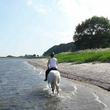
Offenstall für Isländer
Kiel
Susann
@Susannisi
Sattelkammer/Sattelschränke
Sommerweide
zuckerreduziertes Heu
Offenstall
Paddock Trail
Selbstversorgung
2 weitere...
B
Deprecated: Creation of dynamic property Zend_View_Helper_Ads::$adLink is deprecated in /var/www/stall-frei/htdocs/staging.stall-frei.de/library/Psf/View/Helper/Ads.php on line 108

Job gesucht?
Mechtersen
STALL-FREIde Marketing
@STALL-FREI-Marketing
Sie suchen einen Job und arbeiten gerne mit Pferden oder auf Reitanlagen?
Besuchen Sie jetzt unseren Stellenmarkt!

Offenstall, artgerecht, harmonisch, durchdacht
Schwedeneck
Gundula-und-Wilhelm-Staack
@Gundula-und-Wilhelm-Staack
Freizeitstall
Geländestrecke
Vermieten
Krankenbox
Paddock
Notfallboxen
10 weitere...
P

Reitanlage Lorenz
Schwedeneck
Reitanlage-Lorenz
@Reitanlage-Lorenz
Reitlehrer und -unterricht
Vermieten
Krankenbox
Longierzirkel/Roundpen
Notfallboxen
18 weitere...
P
Leider kein Vorschaubild
Leider kein Vorschaubild
Familiärer Offenstall / Allergikerstall
Revensdorf
Y & K
@Yannik
Freizeitstall
Geländestrecke
Paddock
Reitplatz (z.B. Dressur, Springen, Reining)
Allergikerstall
bedampftes/gewaschenes Heu
Offenstall
Paddock Trail
7 weitere...
B


Neueröffnung!!!All Inklusive
Seeth
Bastian Beschorner
@EquiNord
Freizeitstall
Pflegepferd
Vermieten
Longierzirkel/Roundpen
Paddock
Allergikerstall
Fohlenaufzucht möglich
19 weitere...
P+

Futtersack HeuToy, Fressbremse in pink
Mechtersen
STALL-FREIde Marketing
@STALL-FREI-Marketing
Stundenlange Beschäftigung die
Koliken vorbeugt, geringe Staubinhalation mit
steuerbarer Futterentnahme
Hof Eichengrund - Wohlfühlstall-Therapiezentrum
Altenhof
Hof Eichengrund
@HofEichengrund
Fahrstall, Kutschwagen
FN-Mitglied
Vermieten
Führanlage
Krankenbox
Allergikerstall
bedampftes/gewaschenes Heu
40 weitere...
P
HEIDBERG-FARM Paradies für Rentner+Frührentner
Schwedeneck
Jeannine Wittern
@Jeannine-Wittern
Freizeitstall
Geländestrecke
Vermieten
Hunde willkommen
Krankenbox
Allergikerstall
bedampftes/gewaschenes Heu
17 weitere...
aktuell
P
Leider kein Vorschaubild
Leider kein Vorschaubild
Box für Kleinpferd /Pony
Waterdiek
K.Wessel
@K.Wessel
Freizeitstall
Vermieten
Hunde willkommen
Paddock
Allergikerstall
Fohlenaufzucht möglich
14 weitere...
B
Leider kein Vorschaubild
Leider kein Vorschaubild
Hof Feldscheide, idyllisch gelegen am Ochsenweg
Tetenhusen
Wulf-Kursawe
@Wulf-Kursawe
FN-Mitglied
Freizeitstall
Longierzirkel/Roundpen
Paddock
Pferdezucht
Bewegungsstall
Innenbox
16 weitere...
B

Bewegungsstall - Platz frei!
Boklund
WT-Ranch
@WT-Ranch-Westernreitanlage
FN-Mitglied
Freizeitstall
Führanlage
Hunde willkommen
Allergikerstall
Notfallboxen
Bewegungsstall
Offenstall
20 weitere...
P
Werde Teil von STALL-FREI.de
Du hast eine Pferdebox frei? Freie Plätze im Offenstall, Pferdestall oder der Reitanlage kostenlos anbieten.
Deprecated: Creation of dynamic property Zend_View::$pageCount is deprecated in /var/www/stall-frei/htdocs/staging.stall-frei.de/library/vendor/shardj/zf1-future/library/Zend/View/Abstract.php on line 308
Deprecated: Creation of dynamic property Zend_View::$itemCountPerPage is deprecated in /var/www/stall-frei/htdocs/staging.stall-frei.de/library/vendor/shardj/zf1-future/library/Zend/View/Abstract.php on line 308
Deprecated: Creation of dynamic property Zend_View::$first is deprecated in /var/www/stall-frei/htdocs/staging.stall-frei.de/library/vendor/shardj/zf1-future/library/Zend/View/Abstract.php on line 308
Deprecated: Creation of dynamic property Zend_View::$current is deprecated in /var/www/stall-frei/htdocs/staging.stall-frei.de/library/vendor/shardj/zf1-future/library/Zend/View/Abstract.php on line 308
Deprecated: Creation of dynamic property Zend_View::$last is deprecated in /var/www/stall-frei/htdocs/staging.stall-frei.de/library/vendor/shardj/zf1-future/library/Zend/View/Abstract.php on line 308
Deprecated: Creation of dynamic property Zend_View::$previous is deprecated in /var/www/stall-frei/htdocs/staging.stall-frei.de/library/vendor/shardj/zf1-future/library/Zend/View/Abstract.php on line 308
Deprecated: Creation of dynamic property Zend_View::$next is deprecated in /var/www/stall-frei/htdocs/staging.stall-frei.de/library/vendor/shardj/zf1-future/library/Zend/View/Abstract.php on line 308
Deprecated: Creation of dynamic property Zend_View::$pagesInRange is deprecated in /var/www/stall-frei/htdocs/staging.stall-frei.de/library/vendor/shardj/zf1-future/library/Zend/View/Abstract.php on line 308
Deprecated: Creation of dynamic property Zend_View::$firstPageInRange is deprecated in /var/www/stall-frei/htdocs/staging.stall-frei.de/library/vendor/shardj/zf1-future/library/Zend/View/Abstract.php on line 308
Deprecated: Creation of dynamic property Zend_View::$lastPageInRange is deprecated in /var/www/stall-frei/htdocs/staging.stall-frei.de/library/vendor/shardj/zf1-future/library/Zend/View/Abstract.php on line 308
Deprecated: Creation of dynamic property Zend_View::$currentItemCount is deprecated in /var/www/stall-frei/htdocs/staging.stall-frei.de/library/vendor/shardj/zf1-future/library/Zend/View/Abstract.php on line 308
Deprecated: Creation of dynamic property Zend_View::$totalItemCount is deprecated in /var/www/stall-frei/htdocs/staging.stall-frei.de/library/vendor/shardj/zf1-future/library/Zend/View/Abstract.php on line 308
Deprecated: Creation of dynamic property Zend_View::$firstItemNumber is deprecated in /var/www/stall-frei/htdocs/staging.stall-frei.de/library/vendor/shardj/zf1-future/library/Zend/View/Abstract.php on line 308
Deprecated: Creation of dynamic property Zend_View::$lastItemNumber is deprecated in /var/www/stall-frei/htdocs/staging.stall-frei.de/library/vendor/shardj/zf1-future/library/Zend/View/Abstract.php on line 308
Deprecated: Creation of dynamic property Zend_View::$router is deprecated in /var/www/stall-frei/htdocs/staging.stall-frei.de/library/vendor/shardj/zf1-future/library/Zend/View/Abstract.php on line 308
Deprecated: Creation of dynamic property Zend_View::$urlParams is deprecated in /var/www/stall-frei/htdocs/staging.stall-frei.de/library/vendor/shardj/zf1-future/library/Zend/View/Abstract.php on line 308
Deprecated: Creation of dynamic property Zend_View::$showAds is deprecated in /var/www/stall-frei/htdocs/staging.stall-frei.de/library/vendor/shardj/zf1-future/library/Zend/View/Abstract.php on line 308
Deprecated: Creation of dynamic property Zend_View::$objectIds is deprecated in /var/www/stall-frei/htdocs/staging.stall-frei.de/library/vendor/shardj/zf1-future/library/Zend/View/Abstract.php on line 308
Deprecated: Creation of dynamic property Zend_View::$showNavbar is deprecated in /var/www/stall-frei/htdocs/staging.stall-frei.de/library/vendor/shardj/zf1-future/library/Zend/View/Abstract.php on line 308
Deprecated: Creation of dynamic property Zend_View::$showBreadcrumb is deprecated in /var/www/stall-frei/htdocs/staging.stall-frei.de/library/vendor/shardj/zf1-future/library/Zend/View/Abstract.php on line 308
Deprecated: Creation of dynamic property Zend_View::$showFooter is deprecated in /var/www/stall-frei/htdocs/staging.stall-frei.de/library/vendor/shardj/zf1-future/library/Zend/View/Abstract.php on line 308
Deprecated: Creation of dynamic property Zend_View::$showInternalAds is deprecated in /var/www/stall-frei/htdocs/staging.stall-frei.de/library/vendor/shardj/zf1-future/library/Zend/View/Abstract.php on line 308
Deprecated: Creation of dynamic property Zend_View::$blNoContent is deprecated in /var/www/stall-frei/htdocs/staging.stall-frei.de/library/vendor/shardj/zf1-future/library/Zend/View/Abstract.php on line 308
Deprecated: Creation of dynamic property Zend_View::$sMetaDesc is deprecated in /var/www/stall-frei/htdocs/staging.stall-frei.de/library/vendor/shardj/zf1-future/library/Zend/View/Abstract.php on line 308
Deprecated: Creation of dynamic property Zend_View::$useGmaps is deprecated in /var/www/stall-frei/htdocs/staging.stall-frei.de/library/vendor/shardj/zf1-future/library/Zend/View/Abstract.php on line 308
Deprecated: Creation of dynamic property Zend_View::$touches is deprecated in /var/www/stall-frei/htdocs/staging.stall-frei.de/library/vendor/shardj/zf1-future/library/Zend/View/Abstract.php on line 308
Deprecated: Creation of dynamic property Zend_View::$oProject is deprecated in /var/www/stall-frei/htdocs/staging.stall-frei.de/library/vendor/shardj/zf1-future/library/Zend/View/Abstract.php on line 308
Deprecated: Creation of dynamic property Zend_View::$pageHeadline is deprecated in /var/www/stall-frei/htdocs/staging.stall-frei.de/library/vendor/shardj/zf1-future/library/Zend/View/Abstract.php on line 308
Deprecated: Creation of dynamic property Zend_View::$disableLocationField is deprecated in /var/www/stall-frei/htdocs/staging.stall-frei.de/library/vendor/shardj/zf1-future/library/Zend/View/Abstract.php on line 308
Deprecated: Creation of dynamic property Zend_View::$isSearch is deprecated in /var/www/stall-frei/htdocs/staging.stall-frei.de/library/vendor/shardj/zf1-future/library/Zend/View/Abstract.php on line 308
Deprecated: Creation of dynamic property Zend_View::$pageTitle is deprecated in /var/www/stall-frei/htdocs/staging.stall-frei.de/library/vendor/shardj/zf1-future/library/Zend/View/Abstract.php on line 308
Deprecated: Creation of dynamic property Psf_Form_Element_Text::$class is deprecated in /var/www/stall-frei/htdocs/staging.stall-frei.de/library/vendor/shardj/zf1-future/library/Zend/Form/Element.php on line 874
Deprecated: Creation of dynamic property Psf_Form_Element_Text::$size is deprecated in /var/www/stall-frei/htdocs/staging.stall-frei.de/library/vendor/shardj/zf1-future/library/Zend/Form/Element.php on line 874
Deprecated: Creation of dynamic property Psf_Form_Element_Text::$placeholder is deprecated in /var/www/stall-frei/htdocs/staging.stall-frei.de/library/vendor/shardj/zf1-future/library/Zend/Form/Element.php on line 874
Deprecated: Creation of dynamic property Psf_Form_Element_Hidden::$class is deprecated in /var/www/stall-frei/htdocs/staging.stall-frei.de/library/vendor/shardj/zf1-future/library/Zend/Form/Element.php on line 874
Deprecated: Creation of dynamic property Psf_Form_Element_Hidden::$class is deprecated in /var/www/stall-frei/htdocs/staging.stall-frei.de/library/vendor/shardj/zf1-future/library/Zend/Form/Element.php on line 874
Deprecated: Creation of dynamic property Psf_Form_Element_Hidden::$class is deprecated in /var/www/stall-frei/htdocs/staging.stall-frei.de/library/vendor/shardj/zf1-future/library/Zend/Form/Element.php on line 874
Deprecated: Creation of dynamic property Psf_Form_Element_Hidden::$class is deprecated in /var/www/stall-frei/htdocs/staging.stall-frei.de/library/vendor/shardj/zf1-future/library/Zend/Form/Element.php on line 874
Deprecated: Creation of dynamic property Psf_Form_Element_Select::$class is deprecated in /var/www/stall-frei/htdocs/staging.stall-frei.de/library/vendor/shardj/zf1-future/library/Zend/Form/Element.php on line 874
Deprecated: Creation of dynamic property Psf_Form_Element_Select::$class is deprecated in /var/www/stall-frei/htdocs/staging.stall-frei.de/library/vendor/shardj/zf1-future/library/Zend/Form/Element.php on line 874
Deprecated: Creation of dynamic property Psf_Form_Element_Select::$class is deprecated in /var/www/stall-frei/htdocs/staging.stall-frei.de/library/vendor/shardj/zf1-future/library/Zend/Form/Element.php on line 874
Deprecated: Creation of dynamic property Psf_Form_Element_Select::$class is deprecated in /var/www/stall-frei/htdocs/staging.stall-frei.de/library/vendor/shardj/zf1-future/library/Zend/Form/Element.php on line 874
Deprecated: Creation of dynamic property Psf_Form_Element_Text::$class is deprecated in /var/www/stall-frei/htdocs/staging.stall-frei.de/library/vendor/shardj/zf1-future/library/Zend/Form/Element.php on line 874
Deprecated: Creation of dynamic property Psf_Form_Element_Checkbox::$label is deprecated in /var/www/stall-frei/htdocs/staging.stall-frei.de/library/vendor/shardj/zf1-future/library/Zend/Form/Element.php on line 874
Deprecated: Creation of dynamic property Zend_View::$sort is deprecated in /var/www/stall-frei/htdocs/staging.stall-frei.de/library/vendor/shardj/zf1-future/library/Zend/View/Abstract.php on line 308
Deprecated: Creation of dynamic property Zend_View::$searchLocation is deprecated in /var/www/stall-frei/htdocs/staging.stall-frei.de/library/vendor/shardj/zf1-future/library/Zend/View/Abstract.php on line 308
Deprecated: Creation of dynamic property Zend_View::$locationHint is deprecated in /var/www/stall-frei/htdocs/staging.stall-frei.de/library/vendor/shardj/zf1-future/library/Zend/View/Abstract.php on line 308
Psf_GeoCoder_Abstract::getLocation: Pöring Get Location CachedOrLive
Psf_GeoCoder_Abstract::getCachedOrLive: Pöring
Psf_GeoCoder_Abstract::convertLocationResult
{"documentation":"https:\/\/opencagedata.com\/api","licenses":[{"name":"see attribution guide","url":"https:\/\/opencagedata.com\/credits"}],"results":[{"bounds":{"northeast":{"lat":48.1149262,"lng":11.8537324},"southwest":{"lat":48.0749262,"lng":11.8137324}},"components":{"ISO_3166-1_alpha-2":"DE","ISO_3166-1_alpha-3":"DEU","ISO_3166-2":["DE-BY"],"_category":"place","_normalized_city":"Zorneding","_type":"village","city":"Zorneding","continent":"Europe","country":"Deutschland","country_code":"de","county":"Landkreis Ebersberg","political_union":"European Union","postcode":"85604","state":"Bayern","state_code":"BY","village":"P\u00f6ring"},"confidence":7,"formatted":"85604 P\u00f6ring, Deutschland","geometry":{"lat":48.0949262,"lng":11.8337324}},{"bounds":{"northeast":{"lat":48.0287091,"lng":10.8934623},"southwest":{"lat":48.0087091,"lng":10.8734623}},"components":{"ISO_3166-1_alpha-2":"DE","ISO_3166-1_alpha-3":"DEU","ISO_3166-2":["DE-BY"],"_category":"place","_normalized_city":"Landsberg am Lech","_type":"neighbourhood","continent":"Europe","country":"Deutschland","country_code":"de","county":"Landkreis Landsberg am Lech","neighbourhood":"P\u00f6ring","political_union":"European Union","postcode":"86899","state":"Bayern","state_code":"BY","town":"Landsberg am Lech"},"confidence":8,"formatted":"86899 Landsberg am Lech, Deutschland","geometry":{"lat":48.0187091,"lng":10.8834623}},{"bounds":{"northeast":{"lat":48.7322569,"lng":12.8703617},"southwest":{"lat":48.6775983,"lng":12.7933131}},"components":{"ISO_3166-1_alpha-2":"DE","ISO_3166-1_alpha-3":"DEU","ISO_3166-2":["DE-BY"],"_category":"place","_normalized_city":"Oberp\u00f6ring","_type":"village","continent":"Europe","country":"Deutschland","country_code":"de","county":"Landkreis Deggendorf","municipality":"Oberp\u00f6ring (VGem)","political_union":"European Union","postcode":"94562","state":"Bayern","state_code":"BY","village":"Oberp\u00f6ring"},"confidence":7,"formatted":"94562 Oberp\u00f6ring, Deutschland","geometry":{"lat":48.7023692,"lng":12.8247678}},{"bounds":{"northeast":{"lat":48.7867562,"lng":12.9119139},"southwest":{"lat":48.660419,"lng":12.7691882}},"components":{"ISO_3166-1_alpha-2":"DE","ISO_3166-1_alpha-3":"DEU","ISO_3166-2":["DE-BY"],"_category":"place","_normalized_city":"Oberp\u00f6ring (VGem)","_type":"municipality","continent":"Europe","country":"Deutschland","country_code":"de","county":"Landkreis Deggendorf","municipality":"Oberp\u00f6ring (VGem)","political_union":"European Union","state":"Bayern","state_code":"BY"},"confidence":6,"formatted":"Oberp\u00f6ring (VGem), Bayern, Deutschland","geometry":{"lat":48.7234552,"lng":12.8374037}},{"components":{"ISO_3166-1_alpha-2":"FR","ISO_3166-1_alpha-3":"FRA","ISO_3166-2":["FR-GES","FR-88"],"_category":"road","_normalized_city":"Uzemain","_type":"road","city":"Uzemain","continent":"Europe","country":"France","country_code":"fr","county":"Vosges","local_authority":"Communaut\u00e9 d'agglom\u00e9ration d'\u00c9pinal","political_union":"European Union","postcode":"88220","road":"Rue de Porin","state":"Grand Est","state_code":"GES"},"confidence":2,"formatted":"Rue de Porin, 88220 Uzemain, France","geometry":{"lat":48.108836,"lng":6.354832}},{"components":{"ISO_3166-1_alpha-2":"FR","ISO_3166-1_alpha-3":"FRA","ISO_3166-2":["FR-PAC","FR-84"],"_category":"road","_normalized_city":"Ansouis","_type":"road","city":"Ansouis","continent":"Europe","country":"France","country_code":"fr","county":"Vaucluse","local_authority":"Communaut\u00e9 territoriale du Sud Luberon","political_union":"European Union","postcode":"84240","road":"Chemin de la Parine","state":"Provence-Alpes-C\u00f4te d'Azur","state_code":"PAC"},"confidence":2,"formatted":"Chemin de la Parine, 84240 Ansouis, France","geometry":{"lat":43.748052,"lng":5.46837}},{"components":{"ISO_3166-1_alpha-2":"FR","ISO_3166-1_alpha-3":"FRA","ISO_3166-2":["FR-ARA","FR-42"],"_category":"road","_normalized_city":"Saint-Sauveur-en-Rue","_type":"road","city":"Saint-Sauveur-en-Rue","continent":"Europe","country":"France","country_code":"fr","county":"Loire","local_authority":"Communaut\u00e9 de communes des Monts du Pilat","political_union":"European Union","postcode":"42220","road":"chemin de la parine","state":"Auvergne-Rh\u00f4ne-Alpes","state_code":"ARA"},"confidence":2,"formatted":"chemin de la parine, 42220 Saint-Sauveur-en-Rue, France","geometry":{"lat":45.304414,"lng":4.518348}},{"components":{"ISO_3166-1_alpha-2":"FR","ISO_3166-1_alpha-3":"FRA","ISO_3166-2":["FR-PAC","FR-83"],"_category":"road","_normalized_city":"Vidauban","_type":"road","city":"Vidauban","continent":"Europe","country":"France","country_code":"fr","county":"Var","local_authority":"Drac\u00e9nie Provence Verdon agglom\u00e9ration","political_union":"European Union","postcode":"83550","road":"Chemin des Parins","state":"Provence-Alpes-C\u00f4te d'Azur","state_code":"PAC"},"confidence":2,"formatted":"Chemin des Parins, 83550 Vidauban, France","geometry":{"lat":43.40695,"lng":6.426758}},{"components":{"ISO_3166-1_alpha-2":"FR","ISO_3166-1_alpha-3":"FRA","ISO_3166-2":["FR-PAC","FR-84"],"_category":"road","_normalized_city":"Bonnieux","_type":"road","city":"Bonnieux","continent":"Europe","country":"France","country_code":"fr","county":"Vaucluse","local_authority":"Communaut\u00e9 de communes Pays d'Apt-Luberon","political_union":"European Union","postcode":"84480","road":"Chemin de la Parrine","state":"Provence-Alpes-C\u00f4te d'Azur","state_code":"PAC"},"confidence":2,"formatted":"Chemin de la Parrine, 84480 Bonnieux, France","geometry":{"lat":43.812387,"lng":5.31171}},{"components":{"ISO_3166-1_alpha-2":"FR","ISO_3166-1_alpha-3":"FRA","ISO_3166-2":["FR-ARA","FR-03"],"_category":"road","_normalized_city":"Beaune-d'Allier","_type":"road","city":"Beaune-d'Allier","continent":"Europe","country":"France","country_code":"fr","county":"Allier","local_authority":"Commentry Montmarault N\u00e9ris Communaut\u00e9","political_union":"European Union","postcode":"03390","road":"Chemin de la Parine","state":"Auvergne-Rh\u00f4ne-Alpes","state_code":"ARA"},"confidence":2,"formatted":"Chemin de la Parine, 03390 Beaune-d'Allier, France","geometry":{"lat":46.256358,"lng":2.870563}}],"status":{"code":200,"message":"OK"},"stay_informed":{"blog":"https:\/\/blog.opencagedata.com","mastodon":"https:\/\/en.osm.town\/@opencage"},"thanks":"For using an OpenCage API","timestamp":{"created_http":"Sun, 08 Feb 2026 18:40:51 GMT","created_unix":1770576051},"total_results":10}Array
(
[0] => stdClass Object
(
[bounds] => stdClass Object
(
[northeast] => stdClass Object
(
[lat] => 48.1149262
[lng] => 11.8537324
)
[southwest] => stdClass Object
(
[lat] => 48.0749262
[lng] => 11.8137324
)
)
[components] => stdClass Object
(
[ISO_3166-1_alpha-2] => DE
[ISO_3166-1_alpha-3] => DEU
[ISO_3166-2] => Array
(
[0] => DE-BY
)
[_category] => place
[_normalized_city] => Zorneding
[_type] => village
[city] => Zorneding
[continent] => Europe
[country] => Deutschland
[country_code] => de
[county] => Landkreis Ebersberg
[political_union] => European Union
[postcode] => 85604
[state] => Bayern
[state_code] => BY
[village] => Pöring
)
[confidence] => 7
[formatted] => 85604 Pöring, Deutschland
[geometry] => stdClass Object
(
[lat] => 48.0949262
[lng] => 11.8337324
)
)
[1] => stdClass Object
(
[bounds] => stdClass Object
(
[northeast] => stdClass Object
(
[lat] => 48.0287091
[lng] => 10.8934623
)
[southwest] => stdClass Object
(
[lat] => 48.0087091
[lng] => 10.8734623
)
)
[components] => stdClass Object
(
[ISO_3166-1_alpha-2] => DE
[ISO_3166-1_alpha-3] => DEU
[ISO_3166-2] => Array
(
[0] => DE-BY
)
[_category] => place
[_normalized_city] => Landsberg am Lech
[_type] => neighbourhood
[continent] => Europe
[country] => Deutschland
[country_code] => de
[county] => Landkreis Landsberg am Lech
[neighbourhood] => Pöring
[political_union] => European Union
[postcode] => 86899
[state] => Bayern
[state_code] => BY
[town] => Landsberg am Lech
)
[confidence] => 8
[formatted] => 86899 Landsberg am Lech, Deutschland
[geometry] => stdClass Object
(
[lat] => 48.0187091
[lng] => 10.8834623
)
)
[2] => stdClass Object
(
[bounds] => stdClass Object
(
[northeast] => stdClass Object
(
[lat] => 48.7322569
[lng] => 12.8703617
)
[southwest] => stdClass Object
(
[lat] => 48.6775983
[lng] => 12.7933131
)
)
[components] => stdClass Object
(
[ISO_3166-1_alpha-2] => DE
[ISO_3166-1_alpha-3] => DEU
[ISO_3166-2] => Array
(
[0] => DE-BY
)
[_category] => place
[_normalized_city] => Oberpöring
[_type] => village
[continent] => Europe
[country] => Deutschland
[country_code] => de
[county] => Landkreis Deggendorf
[municipality] => Oberpöring (VGem)
[political_union] => European Union
[postcode] => 94562
[state] => Bayern
[state_code] => BY
[village] => Oberpöring
)
[confidence] => 7
[formatted] => 94562 Oberpöring, Deutschland
[geometry] => stdClass Object
(
[lat] => 48.7023692
[lng] => 12.8247678
)
)
[3] => stdClass Object
(
[bounds] => stdClass Object
(
[northeast] => stdClass Object
(
[lat] => 48.7867562
[lng] => 12.9119139
)
[southwest] => stdClass Object
(
[lat] => 48.660419
[lng] => 12.7691882
)
)
[components] => stdClass Object
(
[ISO_3166-1_alpha-2] => DE
[ISO_3166-1_alpha-3] => DEU
[ISO_3166-2] => Array
(
[0] => DE-BY
)
[_category] => place
[_normalized_city] => Oberpöring (VGem)
[_type] => municipality
[continent] => Europe
[country] => Deutschland
[country_code] => de
[county] => Landkreis Deggendorf
[municipality] => Oberpöring (VGem)
[political_union] => European Union
[state] => Bayern
[state_code] => BY
)
[confidence] => 6
[formatted] => Oberpöring (VGem), Bayern, Deutschland
[geometry] => stdClass Object
(
[lat] => 48.7234552
[lng] => 12.8374037
)
)
[4] => stdClass Object
(
[components] => stdClass Object
(
[ISO_3166-1_alpha-2] => FR
[ISO_3166-1_alpha-3] => FRA
[ISO_3166-2] => Array
(
[0] => FR-GES
[1] => FR-88
)
[_category] => road
[_normalized_city] => Uzemain
[_type] => road
[city] => Uzemain
[continent] => Europe
[country] => France
[country_code] => fr
[county] => Vosges
[local_authority] => Communauté d'agglomération d'Épinal
[political_union] => European Union
[postcode] => 88220
[road] => Rue de Porin
[state] => Grand Est
[state_code] => GES
)
[confidence] => 2
[formatted] => Rue de Porin, 88220 Uzemain, France
[geometry] => stdClass Object
(
[lat] => 48.108836
[lng] => 6.354832
)
)
[5] => stdClass Object
(
[components] => stdClass Object
(
[ISO_3166-1_alpha-2] => FR
[ISO_3166-1_alpha-3] => FRA
[ISO_3166-2] => Array
(
[0] => FR-PAC
[1] => FR-84
)
[_category] => road
[_normalized_city] => Ansouis
[_type] => road
[city] => Ansouis
[continent] => Europe
[country] => France
[country_code] => fr
[county] => Vaucluse
[local_authority] => Communauté territoriale du Sud Luberon
[political_union] => European Union
[postcode] => 84240
[road] => Chemin de la Parine
[state] => Provence-Alpes-Côte d'Azur
[state_code] => PAC
)
[confidence] => 2
[formatted] => Chemin de la Parine, 84240 Ansouis, France
[geometry] => stdClass Object
(
[lat] => 43.748052
[lng] => 5.46837
)
)
[6] => stdClass Object
(
[components] => stdClass Object
(
[ISO_3166-1_alpha-2] => FR
[ISO_3166-1_alpha-3] => FRA
[ISO_3166-2] => Array
(
[0] => FR-ARA
[1] => FR-42
)
[_category] => road
[_normalized_city] => Saint-Sauveur-en-Rue
[_type] => road
[city] => Saint-Sauveur-en-Rue
[continent] => Europe
[country] => France
[country_code] => fr
[county] => Loire
[local_authority] => Communauté de communes des Monts du Pilat
[political_union] => European Union
[postcode] => 42220
[road] => chemin de la parine
[state] => Auvergne-Rhône-Alpes
[state_code] => ARA
)
[confidence] => 2
[formatted] => chemin de la parine, 42220 Saint-Sauveur-en-Rue, France
[geometry] => stdClass Object
(
[lat] => 45.304414
[lng] => 4.518348
)
)
[7] => stdClass Object
(
[components] => stdClass Object
(
[ISO_3166-1_alpha-2] => FR
[ISO_3166-1_alpha-3] => FRA
[ISO_3166-2] => Array
(
[0] => FR-PAC
[1] => FR-83
)
[_category] => road
[_normalized_city] => Vidauban
[_type] => road
[city] => Vidauban
[continent] => Europe
[country] => France
[country_code] => fr
[county] => Var
[local_authority] => Dracénie Provence Verdon agglomération
[political_union] => European Union
[postcode] => 83550
[road] => Chemin des Parins
[state] => Provence-Alpes-Côte d'Azur
[state_code] => PAC
)
[confidence] => 2
[formatted] => Chemin des Parins, 83550 Vidauban, France
[geometry] => stdClass Object
(
[lat] => 43.40695
[lng] => 6.426758
)
)
[8] => stdClass Object
(
[components] => stdClass Object
(
[ISO_3166-1_alpha-2] => FR
[ISO_3166-1_alpha-3] => FRA
[ISO_3166-2] => Array
(
[0] => FR-PAC
[1] => FR-84
)
[_category] => road
[_normalized_city] => Bonnieux
[_type] => road
[city] => Bonnieux
[continent] => Europe
[country] => France
[country_code] => fr
[county] => Vaucluse
[local_authority] => Communauté de communes Pays d'Apt-Luberon
[political_union] => European Union
[postcode] => 84480
[road] => Chemin de la Parrine
[state] => Provence-Alpes-Côte d'Azur
[state_code] => PAC
)
[confidence] => 2
[formatted] => Chemin de la Parrine, 84480 Bonnieux, France
[geometry] => stdClass Object
(
[lat] => 43.812387
[lng] => 5.31171
)
)
[9] => stdClass Object
(
[components] => stdClass Object
(
[ISO_3166-1_alpha-2] => FR
[ISO_3166-1_alpha-3] => FRA
[ISO_3166-2] => Array
(
[0] => FR-ARA
[1] => FR-03
)
[_category] => road
[_normalized_city] => Beaune-d'Allier
[_type] => road
[city] => Beaune-d'Allier
[continent] => Europe
[country] => France
[country_code] => fr
[county] => Allier
[local_authority] => Commentry Montmarault Néris Communauté
[political_union] => European Union
[postcode] => 03390
[road] => Chemin de la Parine
[state] => Auvergne-Rhône-Alpes
[state_code] => ARA
)
[confidence] => 2
[formatted] => Chemin de la Parine, 03390 Beaune-d'Allier, France
[geometry] => stdClass Object
(
[lat] => 46.256358
[lng] => 2.870563
)
)
)
Psf_GeoCoder_OpenCageData::getKeyMap: 0
stdClass Object
(
    [bounds] => stdClass Object
        (
            [northeast] => stdClass Object
                (
                    [lat] => 48.1149262
                    [lng] => 11.8537324
                )

            [southwest] => stdClass Object
                (
                    [lat] => 48.0749262
                    [lng] => 11.8137324
                )

        )

    [components] => stdClass Object
        (
            [ISO_3166-1_alpha-2] => DE
            [ISO_3166-1_alpha-3] => DEU
            [ISO_3166-2] => Array
                (
                    [0] => DE-BY
                )

            [_category] => place
            [_normalized_city] => Zorneding
            [_type] => village
            [city] => Zorneding
            [continent] => Europe
            [country] => Deutschland
            [country_code] => de
            [county] => Landkreis Ebersberg
            [political_union] => European Union
            [postcode] => 85604
            [state] => Bayern
            [state_code] => BY
            [village] => Pöring
        )

    [confidence] => 7
    [formatted] => 85604 Pöring, Deutschland
    [geometry] => stdClass Object
        (
            [lat] => 48.0949262
            [lng] => 11.8337324
        )

)
Psf_GeoCoder_OpenCageData::getCounty: Ebersberg
Psf_GeoCoder_OpenCageData::addMissingData REFETCH!
Array
(
    [address] => 85604 Pöring, Deutschland
    [type] => village
    [street] =>
    [city] => Pöring
    [county] => Ebersberg
    [state] => Bayern
    [zip] => 85604
    [country] => Deutschland
    [suburb] =>
    [countrycode] => de
    [latitude] => 48.0949262
    [longitude] => 11.8337324
    [accuracy] => 1
    [confidence] => 7
    [bounds] => stdClass Object
        (
            [northeast] => stdClass Object
                (
                    [lat] => 48.1149262
                    [lng] => 11.8537324
                )

            [southwest] => stdClass Object
                (
                    [lat] => 48.0749262
                    [lng] => 11.8137324
                )

        )

)
reformat!
Array
(
    [address] => 85604 Pöring, Deutschland
    [type] => village
    [street] =>
    [city] => Pöring
    [county] => Ebersberg
    [state] => Bayern
    [zip] => 85604
    [country] => Deutschland
    [suburb] =>
    [countrycode] => de
    [latitude] => 48.0949262
    [longitude] => 11.8337324
    [accuracy] => 1
    [confidence] => 7
    [bounds] => stdClass Object
        (
            [northeast] => stdClass Object
                (
                    [lat] => 48.1149262
                    [lng] => 11.8537324
                )

            [southwest] => stdClass Object
                (
                    [lat] => 48.0749262
                    [lng] => 11.8137324
                )

        )

    [place] => 85604 Pöring, Bayern
    [hash] => 041fa27713f7d27a7682f4d3c588b61e
)
Psf_GeoCoder_OpenCageData::getKeyMap: 1
stdClass Object
(
    [bounds] => stdClass Object
        (
            [northeast] => stdClass Object
                (
                    [lat] => 48.0287091
                    [lng] => 10.8934623
                )

            [southwest] => stdClass Object
                (
                    [lat] => 48.0087091
                    [lng] => 10.8734623
                )

        )

    [components] => stdClass Object
        (
            [ISO_3166-1_alpha-2] => DE
            [ISO_3166-1_alpha-3] => DEU
            [ISO_3166-2] => Array
                (
                    [0] => DE-BY
                )

            [_category] => place
            [_normalized_city] => Landsberg am Lech
            [_type] => neighbourhood
            [continent] => Europe
            [country] => Deutschland
            [country_code] => de
            [county] => Landkreis Landsberg am Lech
            [neighbourhood] => Pöring
            [political_union] => European Union
            [postcode] => 86899
            [state] => Bayern
            [state_code] => BY
            [town] => Landsberg am Lech
        )

    [confidence] => 8
    [formatted] => 86899 Landsberg am Lech, Deutschland
    [geometry] => stdClass Object
        (
            [lat] => 48.0187091
            [lng] => 10.8834623
        )

)
Psf_GeoCoder_OpenCageData::getCounty: Landsberg am Lech
Psf_GeoCoder_OpenCageData::addMissingData REFETCH!
Array
(
    [address] => 86899 Landsberg am Lech, Deutschland
    [type] => neighbourhood
    [street] =>
    [city] => Landsberg am Lech
    [county] => Landsberg am Lech
    [state] => Bayern
    [zip] => 86899
    [country] => Deutschland
    [suburb] =>
    [countrycode] => de
    [latitude] => 48.0187091
    [longitude] => 10.8834623
    [accuracy] => 1
    [confidence] => 8
    [bounds] => stdClass Object
        (
            [northeast] => stdClass Object
                (
                    [lat] => 48.0287091
                    [lng] => 10.8934623
                )

            [southwest] => stdClass Object
                (
                    [lat] => 48.0087091
                    [lng] => 10.8734623
                )

        )

)
reformat!
Array
(
    [address] => 86899 Landsberg am Lech, Deutschland
    [type] => neighbourhood
    [street] =>
    [city] => Landsberg am Lech
    [county] => Landsberg am Lech
    [state] => Bayern
    [zip] => 86899
    [country] => Deutschland
    [suburb] =>
    [countrycode] => de
    [latitude] => 48.0187091
    [longitude] => 10.8834623
    [accuracy] => 1
    [confidence] => 8
    [bounds] => stdClass Object
        (
            [northeast] => stdClass Object
                (
                    [lat] => 48.0287091
                    [lng] => 10.8934623
                )

            [southwest] => stdClass Object
                (
                    [lat] => 48.0087091
                    [lng] => 10.8734623
                )

        )

    [place] => 86899 Landsberg am Lech, Bayern
    [hash] => 420b3fc56341c2a6c8902798616165f8
)
Psf_GeoCoder_OpenCageData::getKeyMap: 2
stdClass Object
(
    [bounds] => stdClass Object
        (
            [northeast] => stdClass Object
                (
                    [lat] => 48.7322569
                    [lng] => 12.8703617
                )

            [southwest] => stdClass Object
                (
                    [lat] => 48.6775983
                    [lng] => 12.7933131
                )

        )

    [components] => stdClass Object
        (
            [ISO_3166-1_alpha-2] => DE
            [ISO_3166-1_alpha-3] => DEU
            [ISO_3166-2] => Array
                (
                    [0] => DE-BY
                )

            [_category] => place
            [_normalized_city] => Oberpöring
            [_type] => village
            [continent] => Europe
            [country] => Deutschland
            [country_code] => de
            [county] => Landkreis Deggendorf
            [municipality] => Oberpöring (VGem)
            [political_union] => European Union
            [postcode] => 94562
            [state] => Bayern
            [state_code] => BY
            [village] => Oberpöring
        )

    [confidence] => 7
    [formatted] => 94562 Oberpöring, Deutschland
    [geometry] => stdClass Object
        (
            [lat] => 48.7023692
            [lng] => 12.8247678
        )

)
Psf_GeoCoder_OpenCageData::getCounty: Deggendorf
Psf_GeoCoder_OpenCageData::addMissingData REFETCH!
Array
(
    [address] => 94562 Oberpöring, Deutschland
    [type] => village
    [street] =>
    [city] => Oberpöring
    [county] => Deggendorf
    [state] => Bayern
    [zip] => 94562
    [country] => Deutschland
    [suburb] =>
    [countrycode] => de
    [latitude] => 48.7023692
    [longitude] => 12.8247678
    [accuracy] => 1
    [confidence] => 7
    [bounds] => stdClass Object
        (
            [northeast] => stdClass Object
                (
                    [lat] => 48.7322569
                    [lng] => 12.8703617
                )

            [southwest] => stdClass Object
                (
                    [lat] => 48.6775983
                    [lng] => 12.7933131
                )

        )

)
reformat!
Array
(
    [address] => 94562 Oberpöring, Deutschland
    [type] => village
    [street] =>
    [city] => Oberpöring
    [county] => Deggendorf
    [state] => Bayern
    [zip] => 94562
    [country] => Deutschland
    [suburb] =>
    [countrycode] => de
    [latitude] => 48.7023692
    [longitude] => 12.8247678
    [accuracy] => 1
    [confidence] => 7
    [bounds] => stdClass Object
        (
            [northeast] => stdClass Object
                (
                    [lat] => 48.7322569
                    [lng] => 12.8703617
                )

            [southwest] => stdClass Object
                (
                    [lat] => 48.6775983
                    [lng] => 12.7933131
                )

        )

    [place] => 94562 Oberpöring, Bayern
    [hash] => e839bb92019be2f9598a5dfbbbeb1738
)
Psf_GeoCoder_OpenCageData::getKeyMap: 3
stdClass Object
(
    [bounds] => stdClass Object
        (
            [northeast] => stdClass Object
                (
                    [lat] => 48.7867562
                    [lng] => 12.9119139
                )

            [southwest] => stdClass Object
                (
                    [lat] => 48.660419
                    [lng] => 12.7691882
                )

        )

    [components] => stdClass Object
        (
            [ISO_3166-1_alpha-2] => DE
            [ISO_3166-1_alpha-3] => DEU
            [ISO_3166-2] => Array
                (
                    [0] => DE-BY
                )

            [_category] => place
            [_normalized_city] => Oberpöring (VGem)
            [_type] => municipality
            [continent] => Europe
            [country] => Deutschland
            [country_code] => de
            [county] => Landkreis Deggendorf
            [municipality] => Oberpöring (VGem)
            [political_union] => European Union
            [state] => Bayern
            [state_code] => BY
        )

    [confidence] => 6
    [formatted] => Oberpöring (VGem), Bayern, Deutschland
    [geometry] => stdClass Object
        (
            [lat] => 48.7234552
            [lng] => 12.8374037
        )

)
Psf_GeoCoder_OpenCageData::getCounty: Deggendorf
Psf_GeoCoder_OpenCageData::addMissingData REFETCH!
Array
(
    [address] => Oberpöring (VGem), Bayern, Deutschland
    [type] => municipality
    [street] =>
    [city] =>
    [county] => Deggendorf
    [state] => Bayern
    [zip] =>
    [country] => Deutschland
    [suburb] =>
    [countrycode] => de
    [latitude] => 48.7234552
    [longitude] => 12.8374037
    [accuracy] => 1
    [confidence] => 6
    [bounds] => stdClass Object
        (
            [northeast] => stdClass Object
                (
                    [lat] => 48.7867562
                    [lng] => 12.9119139
                )

            [southwest] => stdClass Object
                (
                    [lat] => 48.660419
                    [lng] => 12.7691882
                )

        )

)
reformat!
Array
(
    [address] => Oberpöring (VGem), Bayern, Deutschland
    [type] => municipality
    [street] =>
    [city] =>
    [county] => Deggendorf
    [state] => Bayern
    [zip] =>
    [country] => Deutschland
    [suburb] =>
    [countrycode] => de
    [latitude] => 48.7234552
    [longitude] => 12.8374037
    [accuracy] => 1
    [confidence] => 6
    [bounds] => stdClass Object
        (
            [northeast] => stdClass Object
                (
                    [lat] => 48.7867562
                    [lng] => 12.9119139
                )

            [southwest] => stdClass Object
                (
                    [lat] => 48.660419
                    [lng] => 12.7691882
                )

        )

    [place] => , Bayern
    [hash] => 665b3ba80c07f525effa36eea15d58d9
)
Psf_GeoCoder_OpenCageData::getKeyMap: 4
stdClass Object
(
    [components] => stdClass Object
        (
            [ISO_3166-1_alpha-2] => FR
            [ISO_3166-1_alpha-3] => FRA
            [ISO_3166-2] => Array
                (
                    [0] => FR-GES
                    [1] => FR-88
                )

            [_category] => road
            [_normalized_city] => Uzemain
            [_type] => road
            [city] => Uzemain
            [continent] => Europe
            [country] => France
            [country_code] => fr
            [county] => Vosges
            [local_authority] => Communauté d'agglomération d'Épinal
            [political_union] => European Union
            [postcode] => 88220
            [road] => Rue de Porin
            [state] => Grand Est
            [state_code] => GES
        )

    [confidence] => 2
    [formatted] => Rue de Porin, 88220 Uzemain, France
    [geometry] => stdClass Object
        (
            [lat] => 48.108836
            [lng] => 6.354832
        )

)
Psf_GeoCoder_OpenCageData::getCounty: Vosges
Psf_GeoCoder_OpenCageData::addMissingData REFETCH!
Array
(
    [address] => Rue de Porin, 88220 Uzemain, France
    [type] => road
    [street] => Rue de Porin
    [city] => Uzemain
    [county] => Vosges
    [state] => Grand Est
    [zip] => 88220
    [country] => France
    [suburb] =>
    [countrycode] => fr
    [latitude] => 48.108836
    [longitude] => 6.354832
    [accuracy] => 1
    [confidence] => 2
    [bounds] =>
)
reformat!
Array
(
    [address] => Rue de Porin, 88220 Uzemain, France
    [type] => road
    [street] => Rue de Porin
    [city] => Uzemain
    [county] => Vosges
    [state] => Grand Est
    [zip] => 88220
    [country] => France
    [suburb] =>
    [countrycode] => fr
    [latitude] => 48.108836
    [longitude] => 6.354832
    [accuracy] => 1
    [confidence] => 2
    [bounds] =>
    [place] => Rue de Porin, 88220 Uzemain, Grand Est
    [hash] => f0938c521125c7b89bb24c4ec6200365
)
Psf_GeoCoder_OpenCageData::getKeyMap: 5
stdClass Object
(
    [components] => stdClass Object
        (
            [ISO_3166-1_alpha-2] => FR
            [ISO_3166-1_alpha-3] => FRA
            [ISO_3166-2] => Array
                (
                    [0] => FR-PAC
                    [1] => FR-84
                )

            [_category] => road
            [_normalized_city] => Ansouis
            [_type] => road
            [city] => Ansouis
            [continent] => Europe
            [country] => France
            [country_code] => fr
            [county] => Vaucluse
            [local_authority] => Communauté territoriale du Sud Luberon
            [political_union] => European Union
            [postcode] => 84240
            [road] => Chemin de la Parine
            [state] => Provence-Alpes-Côte d'Azur
            [state_code] => PAC
        )

    [confidence] => 2
    [formatted] => Chemin de la Parine, 84240 Ansouis, France
    [geometry] => stdClass Object
        (
            [lat] => 43.748052
            [lng] => 5.46837
        )

)
Psf_GeoCoder_OpenCageData::getCounty: Vaucluse
Psf_GeoCoder_OpenCageData::addMissingData REFETCH!
Array
(
    [address] => Chemin de la Parine, 84240 Ansouis, France
    [type] => road
    [street] => Chemin de la Parine
    [city] => Ansouis
    [county] => Vaucluse
    [state] => Provence-Alpes-Côte d'Azur
    [zip] => 84240
    [country] => France
    [suburb] =>
    [countrycode] => fr
    [latitude] => 43.748052
    [longitude] => 5.46837
    [accuracy] => 1
    [confidence] => 2
    [bounds] =>
)
reformat!
Array
(
    [address] => Chemin de la Parine, 84240 Ansouis, France
    [type] => road
    [street] => Chemin de la Parine
    [city] => Ansouis
    [county] => Vaucluse
    [state] => Provence-Alpes-Côte d'Azur
    [zip] => 84240
    [country] => France
    [suburb] =>
    [countrycode] => fr
    [latitude] => 43.748052
    [longitude] => 5.46837
    [accuracy] => 1
    [confidence] => 2
    [bounds] =>
    [place] => Chemin de la Parine, 84240 Ansouis, Provence-Alpes-Côte d'Azur
    [hash] => 0b5de388415f854b74a8eb364aa4a73e
)
Psf_GeoCoder_OpenCageData::getKeyMap: 6
stdClass Object
(
    [components] => stdClass Object
        (
            [ISO_3166-1_alpha-2] => FR
            [ISO_3166-1_alpha-3] => FRA
            [ISO_3166-2] => Array
                (
                    [0] => FR-ARA
                    [1] => FR-42
                )

            [_category] => road
            [_normalized_city] => Saint-Sauveur-en-Rue
            [_type] => road
            [city] => Saint-Sauveur-en-Rue
            [continent] => Europe
            [country] => France
            [country_code] => fr
            [county] => Loire
            [local_authority] => Communauté de communes des Monts du Pilat
            [political_union] => European Union
            [postcode] => 42220
            [road] => chemin de la parine
            [state] => Auvergne-Rhône-Alpes
            [state_code] => ARA
        )

    [confidence] => 2
    [formatted] => chemin de la parine, 42220 Saint-Sauveur-en-Rue, France
    [geometry] => stdClass Object
        (
            [lat] => 45.304414
            [lng] => 4.518348
        )

)
Psf_GeoCoder_OpenCageData::getCounty: Loire
Psf_GeoCoder_OpenCageData::addMissingData REFETCH!
Array
(
    [address] => chemin de la parine, 42220 Saint-Sauveur-en-Rue, France
    [type] => road
    [street] => chemin de la parine
    [city] => Saint-Sauveur-en-Rue
    [county] => Loire
    [state] => Auvergne-Rhône-Alpes
    [zip] => 42220
    [country] => France
    [suburb] =>
    [countrycode] => fr
    [latitude] => 45.304414
    [longitude] => 4.518348
    [accuracy] => 1
    [confidence] => 2
    [bounds] =>
)
reformat!
Array
(
    [address] => chemin de la parine, 42220 Saint-Sauveur-en-Rue, France
    [type] => road
    [street] => chemin de la parine
    [city] => Saint-Sauveur-en-Rue
    [county] => Loire
    [state] => Auvergne-Rhône-Alpes
    [zip] => 42220
    [country] => France
    [suburb] =>
    [countrycode] => fr
    [latitude] => 45.304414
    [longitude] => 4.518348
    [accuracy] => 1
    [confidence] => 2
    [bounds] =>
    [place] => chemin de la parine, 42220 Saint-Sauveur-en-Rue, Auvergne-Rhône-Alpes
    [hash] => f1de49ee21b0408237197c214dfaf2a5
)
Psf_GeoCoder_OpenCageData::getKeyMap: 7
stdClass Object
(
    [components] => stdClass Object
        (
            [ISO_3166-1_alpha-2] => FR
            [ISO_3166-1_alpha-3] => FRA
            [ISO_3166-2] => Array
                (
                    [0] => FR-PAC
                    [1] => FR-83
                )

            [_category] => road
            [_normalized_city] => Vidauban
            [_type] => road
            [city] => Vidauban
            [continent] => Europe
            [country] => France
            [country_code] => fr
            [county] => Var
            [local_authority] => Dracénie Provence Verdon agglomération
            [political_union] => European Union
            [postcode] => 83550
            [road] => Chemin des Parins
            [state] => Provence-Alpes-Côte d'Azur
            [state_code] => PAC
        )

    [confidence] => 2
    [formatted] => Chemin des Parins, 83550 Vidauban, France
    [geometry] => stdClass Object
        (
            [lat] => 43.40695
            [lng] => 6.426758
        )

)
Psf_GeoCoder_OpenCageData::getCounty: Var
Psf_GeoCoder_OpenCageData::addMissingData REFETCH!
Array
(
    [address] => Chemin des Parins, 83550 Vidauban, France
    [type] => road
    [street] => Chemin des Parins
    [city] => Vidauban
    [county] => Var
    [state] => Provence-Alpes-Côte d'Azur
    [zip] => 83550
    [country] => France
    [suburb] =>
    [countrycode] => fr
    [latitude] => 43.40695
    [longitude] => 6.426758
    [accuracy] => 1
    [confidence] => 2
    [bounds] =>
)
reformat!
Array
(
    [address] => Chemin des Parins, 83550 Vidauban, France
    [type] => road
    [street] => Chemin des Parins
    [city] => Vidauban
    [county] => Var
    [state] => Provence-Alpes-Côte d'Azur
    [zip] => 83550
    [country] => France
    [suburb] =>
    [countrycode] => fr
    [latitude] => 43.40695
    [longitude] => 6.426758
    [accuracy] => 1
    [confidence] => 2
    [bounds] =>
    [place] => Chemin des Parins, 83550 Vidauban, Provence-Alpes-Côte d'Azur
    [hash] => 216055c991c5e242a5eef91d0828fb0e
)
Psf_GeoCoder_OpenCageData::getKeyMap: 8
stdClass Object
(
    [components] => stdClass Object
        (
            [ISO_3166-1_alpha-2] => FR
            [ISO_3166-1_alpha-3] => FRA
            [ISO_3166-2] => Array
                (
                    [0] => FR-PAC
                    [1] => FR-84
                )

            [_category] => road
            [_normalized_city] => Bonnieux
            [_type] => road
            [city] => Bonnieux
            [continent] => Europe
            [country] => France
            [country_code] => fr
            [county] => Vaucluse
            [local_authority] => Communauté de communes Pays d'Apt-Luberon
            [political_union] => European Union
            [postcode] => 84480
            [road] => Chemin de la Parrine
            [state] => Provence-Alpes-Côte d'Azur
            [state_code] => PAC
        )

    [confidence] => 2
    [formatted] => Chemin de la Parrine, 84480 Bonnieux, France
    [geometry] => stdClass Object
        (
            [lat] => 43.812387
            [lng] => 5.31171
        )

)
Psf_GeoCoder_OpenCageData::getCounty: Vaucluse
Psf_GeoCoder_OpenCageData::addMissingData REFETCH!
Array
(
    [address] => Chemin de la Parrine, 84480 Bonnieux, France
    [type] => road
    [street] => Chemin de la Parrine
    [city] => Bonnieux
    [county] => Vaucluse
    [state] => Provence-Alpes-Côte d'Azur
    [zip] => 84480
    [country] => France
    [suburb] =>
    [countrycode] => fr
    [latitude] => 43.812387
    [longitude] => 5.31171
    [accuracy] => 1
    [confidence] => 2
    [bounds] =>
)
reformat!
Array
(
    [address] => Chemin de la Parrine, 84480 Bonnieux, France
    [type] => road
    [street] => Chemin de la Parrine
    [city] => Bonnieux
    [county] => Vaucluse
    [state] => Provence-Alpes-Côte d'Azur
    [zip] => 84480
    [country] => France
    [suburb] =>
    [countrycode] => fr
    [latitude] => 43.812387
    [longitude] => 5.31171
    [accuracy] => 1
    [confidence] => 2
    [bounds] =>
    [place] => Chemin de la Parrine, 84480 Bonnieux, Provence-Alpes-Côte d'Azur
    [hash] => 317bdd88eacfdcd8cfe0d8a54357aa83
)
Psf_GeoCoder_OpenCageData::getKeyMap: 9
stdClass Object
(
    [components] => stdClass Object
        (
            [ISO_3166-1_alpha-2] => FR
            [ISO_3166-1_alpha-3] => FRA
            [ISO_3166-2] => Array
                (
                    [0] => FR-ARA
                    [1] => FR-03
                )

            [_category] => road
            [_normalized_city] => Beaune-d'Allier
            [_type] => road
            [city] => Beaune-d'Allier
            [continent] => Europe
            [country] => France
            [country_code] => fr
            [county] => Allier
            [local_authority] => Commentry Montmarault Néris Communauté
            [political_union] => European Union
            [postcode] => 03390
            [road] => Chemin de la Parine
            [state] => Auvergne-Rhône-Alpes
            [state_code] => ARA
        )

    [confidence] => 2
    [formatted] => Chemin de la Parine, 03390 Beaune-d'Allier, France
    [geometry] => stdClass Object
        (
            [lat] => 46.256358
            [lng] => 2.870563
        )

)
Psf_GeoCoder_OpenCageData::getCounty: Allier
Psf_GeoCoder_OpenCageData::addMissingData REFETCH!
Array
(
    [address] => Chemin de la Parine, 03390 Beaune-d'Allier, France
    [type] => road
    [street] => Chemin de la Parine
    [city] => Beaune-d'Allier
    [county] => Allier
    [state] => Auvergne-Rhône-Alpes
    [zip] => 03390
    [country] => France
    [suburb] =>
    [countrycode] => fr
    [latitude] => 46.256358
    [longitude] => 2.870563
    [accuracy] => 1
    [confidence] => 2
    [bounds] =>
)
reformat!
Array
(
    [address] => Chemin de la Parine, 03390 Beaune-d'Allier, France
    [type] => road
    [street] => Chemin de la Parine
    [city] => Beaune-d'Allier
    [county] => Allier
    [state] => Auvergne-Rhône-Alpes
    [zip] => 03390
    [country] => France
    [suburb] =>
    [countrycode] => fr
    [latitude] => 46.256358
    [longitude] => 2.870563
    [accuracy] => 1
    [confidence] => 2
    [bounds] =>
    [place] => Chemin de la Parine, 03390 Beaune-d'Allier, Auvergne-Rhône-Alpes
    [hash] => c12060b6f7f6dc4437323590cb126ad1
)
Deprecated: Creation of dynamic property Zend_View::$locationHintStyle is deprecated in /var/www/stall-frei/htdocs/staging.stall-frei.de/library/vendor/shardj/zf1-future/library/Zend/View/Abstract.php on line 308
Deprecated: Creation of dynamic property Zend_View::$adGeoLocation is deprecated in /var/www/stall-frei/htdocs/staging.stall-frei.de/library/vendor/shardj/zf1-future/library/Zend/View/Abstract.php on line 308
Deprecated: Creation of dynamic property Zend_View::$recordCount is deprecated in /var/www/stall-frei/htdocs/staging.stall-frei.de/library/vendor/shardj/zf1-future/library/Zend/View/Abstract.php on line 308
Deprecated: Creation of dynamic property Zend_View::$paginationParams is deprecated in /var/www/stall-frei/htdocs/staging.stall-frei.de/library/vendor/shardj/zf1-future/library/Zend/View/Abstract.php on line 308
Deprecated: Creation of dynamic property Zend_View::$objectPaginator is deprecated in /var/www/stall-frei/htdocs/staging.stall-frei.de/library/vendor/shardj/zf1-future/library/Zend/View/Abstract.php on line 308
Deprecated: Creation of dynamic property Zend_View::$featuredObjects is deprecated in /var/www/stall-frei/htdocs/staging.stall-frei.de/library/vendor/shardj/zf1-future/library/Zend/View/Abstract.php on line 308
Deprecated: Creation of dynamic property Zend_View::$hints is deprecated in /var/www/stall-frei/htdocs/staging.stall-frei.de/library/vendor/shardj/zf1-future/library/Zend/View/Abstract.php on line 308
Deprecated: Creation of dynamic property Zend_View::$attributeHints is deprecated in /var/www/stall-frei/htdocs/staging.stall-frei.de/library/vendor/shardj/zf1-future/library/Zend/View/Abstract.php on line 308
Deprecated: Creation of dynamic property Zend_View::$oSearchForm is deprecated in /var/www/stall-frei/htdocs/staging.stall-frei.de/library/vendor/shardj/zf1-future/library/Zend/View/Abstract.php on line 308