Deprecated: Creation of dynamic property Zend_View::$sMode is deprecated in /var/www/stall-frei/htdocs/staging.stall-frei.de/library/vendor/shardj/zf1-future/library/Zend/View/Abstract.php on line 308
Stallplatz oder Offenstall in Reichshof
Gesucht wird in "51702 Reichshof"
6.328 Einträge
Deprecated: Creation of dynamic property Zend_View::$listObjects is deprecated in /var/www/stall-frei/htdocs/staging.stall-frei.de/library/vendor/shardj/zf1-future/library/Zend/View/Abstract.php on line 308
Gesponsort


Deprecated: Creation of dynamic property Zend_View::$listMode is deprecated in /var/www/stall-frei/htdocs/staging.stall-frei.de/library/vendor/shardj/zf1-future/library/Zend/View/Abstract.php on line 308
Deprecated: Creation of dynamic property Zend_View::$renderedObjects is deprecated in /var/www/stall-frei/htdocs/staging.stall-frei.de/library/vendor/shardj/zf1-future/library/Zend/View/Abstract.php on line 308
Deprecated: Creation of dynamic property Zend_View::$index is deprecated in /var/www/stall-frei/htdocs/staging.stall-frei.de/library/vendor/shardj/zf1-future/library/Zend/View/Abstract.php on line 308
Deprecated: Creation of dynamic property Zend_View::$displayMode is deprecated in /var/www/stall-frei/htdocs/staging.stall-frei.de/library/vendor/shardj/zf1-future/library/Zend/View/Abstract.php on line 308
Deprecated: Creation of dynamic property Zend_View::$remarketingIds is deprecated in /var/www/stall-frei/htdocs/staging.stall-frei.de/library/vendor/shardj/zf1-future/library/Zend/View/Abstract.php on line 308
Deprecated: Creation of dynamic property Zend_View::$listItem is deprecated in /var/www/stall-frei/htdocs/staging.stall-frei.de/library/vendor/shardj/zf1-future/library/Zend/View/Abstract.php on line 308
Deprecated: Creation of dynamic property Zend_View::$object is deprecated in /var/www/stall-frei/htdocs/staging.stall-frei.de/library/vendor/shardj/zf1-future/library/Zend/View/Abstract.php on line 308
Deprecated: Creation of dynamic property Zend_View::$attributes is deprecated in /var/www/stall-frei/htdocs/staging.stall-frei.de/library/vendor/shardj/zf1-future/library/Zend/View/Abstract.php on line 308
Leider kein Vorschaubild
Leider kein Vorschaubild
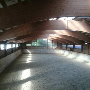
Pferdewohlhof - Offenstall mit Reitplatz für Wal...
Burgkirchen a.d.Alz
Manuela Weichselbaumer
@Pferdewohlhof
Freizeitstall
Pferdeausbildung
Vermieten
Hunde willkommen
Parkplatz für Pferdeanhänger
Fohlenaufzucht möglich
9 weitere...
B
Deprecated: Creation of dynamic property Zend_View_Helper_Ads::$adLink is deprecated in /var/www/stall-frei/htdocs/staging.stall-frei.de/library/Psf/View/Helper/Ads.php on line 108

Futtersack HeuToy, Fressbremse in pink
Mechtersen
STALL-FREIde Marketing
@STALL-FREI-Marketing
Stundenlange Beschäftigung die
Koliken vorbeugt, geringe Staubinhalation mit
steuerbarer Futterentnahme
Leider kein Vorschaubild
Leider kein Vorschaubild
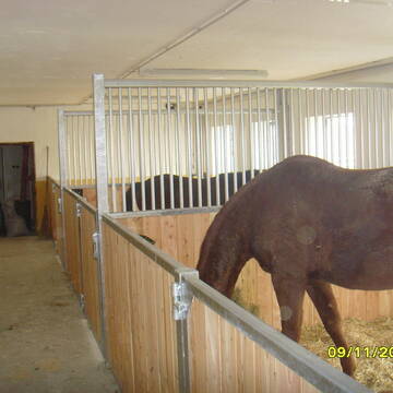
Boxen in Vollpension zu vermieten
Seeon
Reitanlage-Gruenweg
@Reitanlage-Gruenweg
FN-Mitglied
Freizeitstall
Vermieten
Hunde willkommen
Paddock
Hengsthaltung möglich
Hufrehe geeignet
19 weitere...
B

Große Pferdebox - ganztägig Koppelgang frei
Traunreut
Gerhard-Maier
@Gerhard-Maier1
Wanderreiten
Vermieten
Hunde willkommen
Reitplatz (z.B. Dressur, Springen, Reining)
Innenbox
8 weitere...
P
Leider kein Vorschaubild
Leider kein Vorschaubild
Boxen frei
Zeilarn
Reitanlage Schlagmann
@Bettina73
Paddock
Reithalle
Außenboxen
Innenbox
Halbpension
Einzelne Boxen oder Stallplätze
3 weitere...
B
Leider kein Vorschaubild
Leider kein Vorschaubild
Einstellplatz in Vollpension
Trostberg
Hacienda-Hidalgo Horse Ranch
@Hacienda-Hidalgo
Freizeitstall
Vermieten
Hunde willkommen
Longierzirkel/Roundpen
Innenbox
9 weitere...
B
Zucht- und Reitstall Sommer
Simbach am Inn
Sommer Gabriele
@Sommer-Gabriele
FN-Mitglied
Freizeitstall
Vermieten
Verpachten
Führanlage
Krankenbox
Allergikerstall
bedampftes/gewaschenes Heu
33 weitere...
P
Leider kein Vorschaubild
Leider kein Vorschaubild
Offenstallplatz
Riedering
Summererhof Stetten
@LisaSteinberger
Vermieten
Paddock
Reitplatz (z.B. Dressur, Springen, Reining)
Offenstall
Vollpension
5 weitere...
aktuell
B
Job gesucht?
Mechtersen
STALL-FREIde Marketing
@STALL-FREI-Marketing
Sie suchen einen Job und arbeiten gerne mit Pferden oder auf Reitanlagen?
Besuchen Sie jetzt unseren Stellenmarkt!
Leider kein Vorschaubild
Leider kein Vorschaubild
Boxenplatz inkl Vollpension
Riedering
Summererhof Stetten
@LisaSteinberger
Freizeitstall
Vermieten
Paddock
Parkplatz für Pferdeanhänger
Außenboxen
Innenbox
5 weitere...
B
Leider kein Vorschaubild
Leider kein Vorschaubild
Reiterhof Eschlberg
Mehring
Schiederer-Christine
@Schiederer-Christine
Freizeitstall
Geländestrecke
Vermieten
Hunde willkommen
Paddock
Außenbox mit Paddock
Innenbox
11 weitere...
B


Vermiete 4 paddockboxen
Salzweg
Pferdehof-Hoell1
@Pferdehof-Hoell1
FN-Mitglied
Vermieten
Paddock
Parkplatz für Pferdeanhänger
Hufrehe geeignet
11 weitere...
aktuell
P+
Werde Teil von STALL-FREI.de
Du hast eine Pferdebox frei? Freie Plätze im Offenstall, Pferdestall oder der Reitanlage kostenlos anbieten.
Deprecated: Creation of dynamic property Zend_View::$pageCount is deprecated in /var/www/stall-frei/htdocs/staging.stall-frei.de/library/vendor/shardj/zf1-future/library/Zend/View/Abstract.php on line 308
Deprecated: Creation of dynamic property Zend_View::$itemCountPerPage is deprecated in /var/www/stall-frei/htdocs/staging.stall-frei.de/library/vendor/shardj/zf1-future/library/Zend/View/Abstract.php on line 308
Deprecated: Creation of dynamic property Zend_View::$first is deprecated in /var/www/stall-frei/htdocs/staging.stall-frei.de/library/vendor/shardj/zf1-future/library/Zend/View/Abstract.php on line 308
Deprecated: Creation of dynamic property Zend_View::$current is deprecated in /var/www/stall-frei/htdocs/staging.stall-frei.de/library/vendor/shardj/zf1-future/library/Zend/View/Abstract.php on line 308
Deprecated: Creation of dynamic property Zend_View::$last is deprecated in /var/www/stall-frei/htdocs/staging.stall-frei.de/library/vendor/shardj/zf1-future/library/Zend/View/Abstract.php on line 308
Deprecated: Creation of dynamic property Zend_View::$previous is deprecated in /var/www/stall-frei/htdocs/staging.stall-frei.de/library/vendor/shardj/zf1-future/library/Zend/View/Abstract.php on line 308
Deprecated: Creation of dynamic property Zend_View::$next is deprecated in /var/www/stall-frei/htdocs/staging.stall-frei.de/library/vendor/shardj/zf1-future/library/Zend/View/Abstract.php on line 308
Deprecated: Creation of dynamic property Zend_View::$pagesInRange is deprecated in /var/www/stall-frei/htdocs/staging.stall-frei.de/library/vendor/shardj/zf1-future/library/Zend/View/Abstract.php on line 308
Deprecated: Creation of dynamic property Zend_View::$firstPageInRange is deprecated in /var/www/stall-frei/htdocs/staging.stall-frei.de/library/vendor/shardj/zf1-future/library/Zend/View/Abstract.php on line 308
Deprecated: Creation of dynamic property Zend_View::$lastPageInRange is deprecated in /var/www/stall-frei/htdocs/staging.stall-frei.de/library/vendor/shardj/zf1-future/library/Zend/View/Abstract.php on line 308
Deprecated: Creation of dynamic property Zend_View::$currentItemCount is deprecated in /var/www/stall-frei/htdocs/staging.stall-frei.de/library/vendor/shardj/zf1-future/library/Zend/View/Abstract.php on line 308
Deprecated: Creation of dynamic property Zend_View::$totalItemCount is deprecated in /var/www/stall-frei/htdocs/staging.stall-frei.de/library/vendor/shardj/zf1-future/library/Zend/View/Abstract.php on line 308
Deprecated: Creation of dynamic property Zend_View::$firstItemNumber is deprecated in /var/www/stall-frei/htdocs/staging.stall-frei.de/library/vendor/shardj/zf1-future/library/Zend/View/Abstract.php on line 308
Deprecated: Creation of dynamic property Zend_View::$lastItemNumber is deprecated in /var/www/stall-frei/htdocs/staging.stall-frei.de/library/vendor/shardj/zf1-future/library/Zend/View/Abstract.php on line 308
Deprecated: Creation of dynamic property Zend_View::$router is deprecated in /var/www/stall-frei/htdocs/staging.stall-frei.de/library/vendor/shardj/zf1-future/library/Zend/View/Abstract.php on line 308
Deprecated: Creation of dynamic property Zend_View::$urlParams is deprecated in /var/www/stall-frei/htdocs/staging.stall-frei.de/library/vendor/shardj/zf1-future/library/Zend/View/Abstract.php on line 308
Deprecated: Creation of dynamic property Zend_View::$showAds is deprecated in /var/www/stall-frei/htdocs/staging.stall-frei.de/library/vendor/shardj/zf1-future/library/Zend/View/Abstract.php on line 308
Deprecated: Creation of dynamic property Zend_View::$objectIds is deprecated in /var/www/stall-frei/htdocs/staging.stall-frei.de/library/vendor/shardj/zf1-future/library/Zend/View/Abstract.php on line 308
Deprecated: Creation of dynamic property Zend_View::$showNavbar is deprecated in /var/www/stall-frei/htdocs/staging.stall-frei.de/library/vendor/shardj/zf1-future/library/Zend/View/Abstract.php on line 308
Deprecated: Creation of dynamic property Zend_View::$showBreadcrumb is deprecated in /var/www/stall-frei/htdocs/staging.stall-frei.de/library/vendor/shardj/zf1-future/library/Zend/View/Abstract.php on line 308
Deprecated: Creation of dynamic property Zend_View::$showFooter is deprecated in /var/www/stall-frei/htdocs/staging.stall-frei.de/library/vendor/shardj/zf1-future/library/Zend/View/Abstract.php on line 308
Deprecated: Creation of dynamic property Zend_View::$showInternalAds is deprecated in /var/www/stall-frei/htdocs/staging.stall-frei.de/library/vendor/shardj/zf1-future/library/Zend/View/Abstract.php on line 308
Deprecated: Creation of dynamic property Zend_View::$blNoContent is deprecated in /var/www/stall-frei/htdocs/staging.stall-frei.de/library/vendor/shardj/zf1-future/library/Zend/View/Abstract.php on line 308
Deprecated: Creation of dynamic property Zend_View::$sMetaDesc is deprecated in /var/www/stall-frei/htdocs/staging.stall-frei.de/library/vendor/shardj/zf1-future/library/Zend/View/Abstract.php on line 308
Deprecated: Creation of dynamic property Zend_View::$useGmaps is deprecated in /var/www/stall-frei/htdocs/staging.stall-frei.de/library/vendor/shardj/zf1-future/library/Zend/View/Abstract.php on line 308
Deprecated: Creation of dynamic property Zend_View::$touches is deprecated in /var/www/stall-frei/htdocs/staging.stall-frei.de/library/vendor/shardj/zf1-future/library/Zend/View/Abstract.php on line 308
Deprecated: Creation of dynamic property Zend_View::$oProject is deprecated in /var/www/stall-frei/htdocs/staging.stall-frei.de/library/vendor/shardj/zf1-future/library/Zend/View/Abstract.php on line 308
Deprecated: Creation of dynamic property Zend_View::$pageHeadline is deprecated in /var/www/stall-frei/htdocs/staging.stall-frei.de/library/vendor/shardj/zf1-future/library/Zend/View/Abstract.php on line 308
Deprecated: Creation of dynamic property Zend_View::$disableLocationField is deprecated in /var/www/stall-frei/htdocs/staging.stall-frei.de/library/vendor/shardj/zf1-future/library/Zend/View/Abstract.php on line 308
Deprecated: Creation of dynamic property Zend_View::$isSearch is deprecated in /var/www/stall-frei/htdocs/staging.stall-frei.de/library/vendor/shardj/zf1-future/library/Zend/View/Abstract.php on line 308
Deprecated: Creation of dynamic property Zend_View::$pageTitle is deprecated in /var/www/stall-frei/htdocs/staging.stall-frei.de/library/vendor/shardj/zf1-future/library/Zend/View/Abstract.php on line 308
Deprecated: Creation of dynamic property Psf_Form_Element_Text::$class is deprecated in /var/www/stall-frei/htdocs/staging.stall-frei.de/library/vendor/shardj/zf1-future/library/Zend/Form/Element.php on line 874
Deprecated: Creation of dynamic property Psf_Form_Element_Text::$size is deprecated in /var/www/stall-frei/htdocs/staging.stall-frei.de/library/vendor/shardj/zf1-future/library/Zend/Form/Element.php on line 874
Deprecated: Creation of dynamic property Psf_Form_Element_Text::$placeholder is deprecated in /var/www/stall-frei/htdocs/staging.stall-frei.de/library/vendor/shardj/zf1-future/library/Zend/Form/Element.php on line 874
Deprecated: Creation of dynamic property Psf_Form_Element_Hidden::$class is deprecated in /var/www/stall-frei/htdocs/staging.stall-frei.de/library/vendor/shardj/zf1-future/library/Zend/Form/Element.php on line 874
Deprecated: Creation of dynamic property Psf_Form_Element_Hidden::$class is deprecated in /var/www/stall-frei/htdocs/staging.stall-frei.de/library/vendor/shardj/zf1-future/library/Zend/Form/Element.php on line 874
Deprecated: Creation of dynamic property Psf_Form_Element_Hidden::$class is deprecated in /var/www/stall-frei/htdocs/staging.stall-frei.de/library/vendor/shardj/zf1-future/library/Zend/Form/Element.php on line 874
Deprecated: Creation of dynamic property Psf_Form_Element_Hidden::$class is deprecated in /var/www/stall-frei/htdocs/staging.stall-frei.de/library/vendor/shardj/zf1-future/library/Zend/Form/Element.php on line 874
Deprecated: Creation of dynamic property Psf_Form_Element_Select::$class is deprecated in /var/www/stall-frei/htdocs/staging.stall-frei.de/library/vendor/shardj/zf1-future/library/Zend/Form/Element.php on line 874
Deprecated: Creation of dynamic property Psf_Form_Element_Select::$class is deprecated in /var/www/stall-frei/htdocs/staging.stall-frei.de/library/vendor/shardj/zf1-future/library/Zend/Form/Element.php on line 874
Deprecated: Creation of dynamic property Psf_Form_Element_Select::$class is deprecated in /var/www/stall-frei/htdocs/staging.stall-frei.de/library/vendor/shardj/zf1-future/library/Zend/Form/Element.php on line 874
Deprecated: Creation of dynamic property Psf_Form_Element_Select::$class is deprecated in /var/www/stall-frei/htdocs/staging.stall-frei.de/library/vendor/shardj/zf1-future/library/Zend/Form/Element.php on line 874
Deprecated: Creation of dynamic property Psf_Form_Element_Text::$class is deprecated in /var/www/stall-frei/htdocs/staging.stall-frei.de/library/vendor/shardj/zf1-future/library/Zend/Form/Element.php on line 874
Deprecated: Creation of dynamic property Psf_Form_Element_Checkbox::$label is deprecated in /var/www/stall-frei/htdocs/staging.stall-frei.de/library/vendor/shardj/zf1-future/library/Zend/Form/Element.php on line 874
Deprecated: Creation of dynamic property Zend_View::$sort is deprecated in /var/www/stall-frei/htdocs/staging.stall-frei.de/library/vendor/shardj/zf1-future/library/Zend/View/Abstract.php on line 308
Deprecated: Creation of dynamic property Zend_View::$searchLocation is deprecated in /var/www/stall-frei/htdocs/staging.stall-frei.de/library/vendor/shardj/zf1-future/library/Zend/View/Abstract.php on line 308
Deprecated: Creation of dynamic property Zend_View::$locationHint is deprecated in /var/www/stall-frei/htdocs/staging.stall-frei.de/library/vendor/shardj/zf1-future/library/Zend/View/Abstract.php on line 308
Psf_GeoCoder_Abstract::getLocation: Fahrenberg Get Location CachedOrLive
Psf_GeoCoder_Abstract::getCachedOrLive: Fahrenberg
Psf_GeoCoder_Abstract::convertLocationResult
{"documentation":"https:\/\/opencagedata.com\/api","licenses":[{"name":"see attribution guide","url":"https:\/\/opencagedata.com\/credits"}],"results":[{"bounds":{"northeast":{"lat":51.0133592,"lng":7.6530324},"southwest":{"lat":50.9733592,"lng":7.6130324}},"components":{"ISO_3166-1_alpha-2":"DE","ISO_3166-1_alpha-3":"DEU","ISO_3166-2":["DE-NW"],"_category":"place","_normalized_city":"Reichshof","_type":"village","continent":"Europe","country":"Deutschland","country_code":"de","county":"Oberbergischer Kreis","political_union":"European Union","postcode":"51702","state":"Nordrhein-Westfalen","state_code":"NW","town":"Reichshof","village":"Fahrenberg"},"confidence":7,"formatted":"51702 Fahrenberg, Deutschland","geometry":{"lat":50.9933592,"lng":7.6330324}},{"bounds":{"northeast":{"lat":49.6676352,"lng":12.3657602},"southwest":{"lat":49.6675352,"lng":12.3656602}},"components":{"ISO_3166-1_alpha-2":"DE","ISO_3166-1_alpha-3":"DEU","ISO_3166-2":["DE-BY"],"_category":"natural\/water","_normalized_city":"Waldthurn","_type":"peak","continent":"Europe","country":"Deutschland","country_code":"de","county":"Landkreis Neustadt an der Waldnaab","peak":"Fahrenberg","political_union":"European Union","postcode":"92727","state":"Bayern","state_code":"BY","village":"Waldthurn"},"confidence":9,"formatted":"Fahrenberg, 92727 Waldthurn, Deutschland","geometry":{"lat":49.6675852,"lng":12.3657102}},{"bounds":{"northeast":{"lat":51.8205493,"lng":10.1535356},"southwest":{"lat":51.8204493,"lng":10.1534356}},"components":{"ISO_3166-1_alpha-2":"DE","ISO_3166-1_alpha-3":"DEU","ISO_3166-2":["DE-NI"],"_category":"natural\/water","_normalized_city":"Harz (LK Goslar)","_type":"peak","city":"Harz (LK Goslar)","continent":"Europe","country":"Deutschland","country_code":"de","county":"Landkreis Goslar","peak":"Fahrenberg","political_union":"European Union","state":"Niedersachsen","state_code":"NI"},"confidence":9,"formatted":"Fahrenberg, Harz (LK Goslar), Niedersachsen, Deutschland","geometry":{"lat":51.8204993,"lng":10.1534856}},{"bounds":{"northeast":{"lat":52.9374915,"lng":9.7780623},"southwest":{"lat":52.9373915,"lng":9.7779623}},"components":{"ISO_3166-1_alpha-2":"DE","ISO_3166-1_alpha-3":"DEU","ISO_3166-2":["DE-NI"],"_category":"natural\/water","_normalized_city":"Bad Fallingbostel","_type":"peak","continent":"Europe","country":"Deutschland","country_code":"de","county":"Heidekreis","peak":"Fahrenberg","political_union":"European Union","state":"Niedersachsen","state_code":"NI","town":"Bad Fallingbostel"},"confidence":9,"formatted":"Fahrenberg, Bad Fallingbostel, Niedersachsen, Deutschland","geometry":{"lat":52.9374415,"lng":9.7780123}},{"bounds":{"northeast":{"lat":48.8179147,"lng":8.5118682},"southwest":{"lat":48.8178147,"lng":8.5117682}},"components":{"ISO_3166-1_alpha-2":"DE","ISO_3166-1_alpha-3":"DEU","ISO_3166-2":["DE-BW"],"_category":"natural\/water","_normalized_city":"Straubenhardt","_type":"peak","continent":"Europe","country":"Deutschland","country_code":"de","county":"Enzkreis","municipality":"Straubenhardt","peak":"Fahrenberg","political_union":"European Union","postcode":"75335","state":"Baden-W\u00fcrttemberg","state_code":"BW"},"confidence":9,"formatted":"Fahrenberg, 75335 Straubenhardt, Deutschland","geometry":{"lat":48.8178647,"lng":8.5118182}},{"bounds":{"northeast":{"lat":51.5054798,"lng":10.3376795},"southwest":{"lat":51.5053798,"lng":10.3375795}},"components":{"ISO_3166-1_alpha-2":"DE","ISO_3166-1_alpha-3":"DEU","ISO_3166-2":["DE-TH"],"_category":"natural\/water","_normalized_city":"Ecklingerode","_type":"peak","continent":"Europe","country":"Deutschland","country_code":"de","county":"Landkreis Eichsfeld","municipality":"Lindenberg\/Eichsfeld","peak":"Fahrenberg","political_union":"European Union","state":"Th\u00fcringen","state_code":"TH","village":"Ecklingerode"},"confidence":9,"formatted":"Fahrenberg, Ecklingerode, Th\u00fcringen, Deutschland","geometry":{"lat":51.5054298,"lng":10.3376295}},{"bounds":{"northeast":{"lat":47.5339974,"lng":11.291667},"southwest":{"lat":47.5338974,"lng":11.291567}},"components":{"ISO_3166-1_alpha-2":"DE","ISO_3166-1_alpha-3":"DEU","ISO_3166-2":["DE-BY"],"_category":"natural\/water","_normalized_city":"Wallgau","_type":"peak","continent":"Europe","country":"Deutschland","country_code":"de","county":"Landkreis Garmisch-Partenkirchen","peak":"Fahrenberg","political_union":"European Union","postcode":"82499","state":"Bayern","state_code":"BY","village":"Wallgau"},"confidence":9,"formatted":"Fahrenberg, 82499 Wallgau, Deutschland","geometry":{"lat":47.5339474,"lng":11.291617}},{"bounds":{"northeast":{"lat":50.9085147,"lng":9.3766004},"southwest":{"lat":50.9084147,"lng":9.3765004}},"components":{"ISO_3166-1_alpha-2":"DE","ISO_3166-1_alpha-3":"DEU","ISO_3166-2":["DE-HE"],"_category":"natural\/water","_normalized_city":"Seigertshausen","_type":"peak","continent":"Europe","country":"Deutschland","country_code":"de","county":"Schwalm-Eder-Kreis","municipality":"Neukirchen","peak":"Fahrenberg","political_union":"European Union","postcode":"34626","state":"Hessen","state_code":"HE","village":"Seigertshausen"},"confidence":9,"formatted":"Fahrenberg, 34626 Seigertshausen, Deutschland","geometry":{"lat":50.9084647,"lng":9.3765504}},{"bounds":{"northeast":{"lat":51.4971728,"lng":9.7855959},"southwest":{"lat":51.4970728,"lng":9.7854959}},"components":{"ISO_3166-1_alpha-2":"DE","ISO_3166-1_alpha-3":"DEU","ISO_3166-2":["DE-NI"],"_category":"natural\/water","_normalized_city":"Dransfeld","_type":"peak","city":"Dransfeld","continent":"Europe","country":"Deutschland","country_code":"de","county":"Landkreis G\u00f6ttingen","municipality":"Samtgemeinde Dransfeld","peak":"Fahrenberg","political_union":"European Union","postcode":"37127","state":"Niedersachsen","state_code":"NI"},"confidence":9,"formatted":"Fahrenberg, 37127 Dransfeld, Deutschland","geometry":{"lat":51.4971228,"lng":9.7855459}},{"bounds":{"northeast":{"lat":49.2299655,"lng":13.0387723},"southwest":{"lat":49.2298655,"lng":13.0386723}},"components":{"ISO_3166-1_alpha-2":"DE","ISO_3166-1_alpha-3":"DEU","ISO_3166-2":["DE-BY"],"_category":"natural\/water","_normalized_city":"Neukirchen beim Heiligen Blut","_type":"peak","continent":"Europe","country":"Deutschland","country_code":"de","county":"Landkreis Cham","peak":"Fahrenberg","political_union":"European Union","postcode":"93453","state":"Bayern","state_code":"BY","village":"Neukirchen beim Heiligen Blut"},"confidence":9,"formatted":"Fahrenberg, 93453 Neukirchen beim Heiligen Blut, Deutschland","geometry":{"lat":49.2299155,"lng":13.0387223}}],"status":{"code":200,"message":"OK"},"stay_informed":{"blog":"https:\/\/blog.opencagedata.com","mastodon":"https:\/\/en.osm.town\/@opencage"},"thanks":"For using an OpenCage API","timestamp":{"created_http":"Sun, 08 Feb 2026 02:59:57 GMT","created_unix":1770519597},"total_results":10}Array
(
[0] => stdClass Object
(
[bounds] => stdClass Object
(
[northeast] => stdClass Object
(
[lat] => 51.0133592
[lng] => 7.6530324
)
[southwest] => stdClass Object
(
[lat] => 50.9733592
[lng] => 7.6130324
)
)
[components] => stdClass Object
(
[ISO_3166-1_alpha-2] => DE
[ISO_3166-1_alpha-3] => DEU
[ISO_3166-2] => Array
(
[0] => DE-NW
)
[_category] => place
[_normalized_city] => Reichshof
[_type] => village
[continent] => Europe
[country] => Deutschland
[country_code] => de
[county] => Oberbergischer Kreis
[political_union] => European Union
[postcode] => 51702
[state] => Nordrhein-Westfalen
[state_code] => NW
[town] => Reichshof
[village] => Fahrenberg
)
[confidence] => 7
[formatted] => 51702 Fahrenberg, Deutschland
[geometry] => stdClass Object
(
[lat] => 50.9933592
[lng] => 7.6330324
)
)
[1] => stdClass Object
(
[bounds] => stdClass Object
(
[northeast] => stdClass Object
(
[lat] => 49.6676352
[lng] => 12.3657602
)
[southwest] => stdClass Object
(
[lat] => 49.6675352
[lng] => 12.3656602
)
)
[components] => stdClass Object
(
[ISO_3166-1_alpha-2] => DE
[ISO_3166-1_alpha-3] => DEU
[ISO_3166-2] => Array
(
[0] => DE-BY
)
[_category] => natural/water
[_normalized_city] => Waldthurn
[_type] => peak
[continent] => Europe
[country] => Deutschland
[country_code] => de
[county] => Landkreis Neustadt an der Waldnaab
[peak] => Fahrenberg
[political_union] => European Union
[postcode] => 92727
[state] => Bayern
[state_code] => BY
[village] => Waldthurn
)
[confidence] => 9
[formatted] => Fahrenberg, 92727 Waldthurn, Deutschland
[geometry] => stdClass Object
(
[lat] => 49.6675852
[lng] => 12.3657102
)
)
[2] => stdClass Object
(
[bounds] => stdClass Object
(
[northeast] => stdClass Object
(
[lat] => 51.8205493
[lng] => 10.1535356
)
[southwest] => stdClass Object
(
[lat] => 51.8204493
[lng] => 10.1534356
)
)
[components] => stdClass Object
(
[ISO_3166-1_alpha-2] => DE
[ISO_3166-1_alpha-3] => DEU
[ISO_3166-2] => Array
(
[0] => DE-NI
)
[_category] => natural/water
[_normalized_city] => Harz (LK Goslar)
[_type] => peak
[city] => Harz (LK Goslar)
[continent] => Europe
[country] => Deutschland
[country_code] => de
[county] => Landkreis Goslar
[peak] => Fahrenberg
[political_union] => European Union
[state] => Niedersachsen
[state_code] => NI
)
[confidence] => 9
[formatted] => Fahrenberg, Harz (LK Goslar), Niedersachsen, Deutschland
[geometry] => stdClass Object
(
[lat] => 51.8204993
[lng] => 10.1534856
)
)
[3] => stdClass Object
(
[bounds] => stdClass Object
(
[northeast] => stdClass Object
(
[lat] => 52.9374915
[lng] => 9.7780623
)
[southwest] => stdClass Object
(
[lat] => 52.9373915
[lng] => 9.7779623
)
)
[components] => stdClass Object
(
[ISO_3166-1_alpha-2] => DE
[ISO_3166-1_alpha-3] => DEU
[ISO_3166-2] => Array
(
[0] => DE-NI
)
[_category] => natural/water
[_normalized_city] => Bad Fallingbostel
[_type] => peak
[continent] => Europe
[country] => Deutschland
[country_code] => de
[county] => Heidekreis
[peak] => Fahrenberg
[political_union] => European Union
[state] => Niedersachsen
[state_code] => NI
[town] => Bad Fallingbostel
)
[confidence] => 9
[formatted] => Fahrenberg, Bad Fallingbostel, Niedersachsen, Deutschland
[geometry] => stdClass Object
(
[lat] => 52.9374415
[lng] => 9.7780123
)
)
[4] => stdClass Object
(
[bounds] => stdClass Object
(
[northeast] => stdClass Object
(
[lat] => 48.8179147
[lng] => 8.5118682
)
[southwest] => stdClass Object
(
[lat] => 48.8178147
[lng] => 8.5117682
)
)
[components] => stdClass Object
(
[ISO_3166-1_alpha-2] => DE
[ISO_3166-1_alpha-3] => DEU
[ISO_3166-2] => Array
(
[0] => DE-BW
)
[_category] => natural/water
[_normalized_city] => Straubenhardt
[_type] => peak
[continent] => Europe
[country] => Deutschland
[country_code] => de
[county] => Enzkreis
[municipality] => Straubenhardt
[peak] => Fahrenberg
[political_union] => European Union
[postcode] => 75335
[state] => Baden-Württemberg
[state_code] => BW
)
[confidence] => 9
[formatted] => Fahrenberg, 75335 Straubenhardt, Deutschland
[geometry] => stdClass Object
(
[lat] => 48.8178647
[lng] => 8.5118182
)
)
[5] => stdClass Object
(
[bounds] => stdClass Object
(
[northeast] => stdClass Object
(
[lat] => 51.5054798
[lng] => 10.3376795
)
[southwest] => stdClass Object
(
[lat] => 51.5053798
[lng] => 10.3375795
)
)
[components] => stdClass Object
(
[ISO_3166-1_alpha-2] => DE
[ISO_3166-1_alpha-3] => DEU
[ISO_3166-2] => Array
(
[0] => DE-TH
)
[_category] => natural/water
[_normalized_city] => Ecklingerode
[_type] => peak
[continent] => Europe
[country] => Deutschland
[country_code] => de
[county] => Landkreis Eichsfeld
[municipality] => Lindenberg/Eichsfeld
[peak] => Fahrenberg
[political_union] => European Union
[state] => Thüringen
[state_code] => TH
[village] => Ecklingerode
)
[confidence] => 9
[formatted] => Fahrenberg, Ecklingerode, Thüringen, Deutschland
[geometry] => stdClass Object
(
[lat] => 51.5054298
[lng] => 10.3376295
)
)
[6] => stdClass Object
(
[bounds] => stdClass Object
(
[northeast] => stdClass Object
(
[lat] => 47.5339974
[lng] => 11.291667
)
[southwest] => stdClass Object
(
[lat] => 47.5338974
[lng] => 11.291567
)
)
[components] => stdClass Object
(
[ISO_3166-1_alpha-2] => DE
[ISO_3166-1_alpha-3] => DEU
[ISO_3166-2] => Array
(
[0] => DE-BY
)
[_category] => natural/water
[_normalized_city] => Wallgau
[_type] => peak
[continent] => Europe
[country] => Deutschland
[country_code] => de
[county] => Landkreis Garmisch-Partenkirchen
[peak] => Fahrenberg
[political_union] => European Union
[postcode] => 82499
[state] => Bayern
[state_code] => BY
[village] => Wallgau
)
[confidence] => 9
[formatted] => Fahrenberg, 82499 Wallgau, Deutschland
[geometry] => stdClass Object
(
[lat] => 47.5339474
[lng] => 11.291617
)
)
[7] => stdClass Object
(
[bounds] => stdClass Object
(
[northeast] => stdClass Object
(
[lat] => 50.9085147
[lng] => 9.3766004
)
[southwest] => stdClass Object
(
[lat] => 50.9084147
[lng] => 9.3765004
)
)
[components] => stdClass Object
(
[ISO_3166-1_alpha-2] => DE
[ISO_3166-1_alpha-3] => DEU
[ISO_3166-2] => Array
(
[0] => DE-HE
)
[_category] => natural/water
[_normalized_city] => Seigertshausen
[_type] => peak
[continent] => Europe
[country] => Deutschland
[country_code] => de
[county] => Schwalm-Eder-Kreis
[municipality] => Neukirchen
[peak] => Fahrenberg
[political_union] => European Union
[postcode] => 34626
[state] => Hessen
[state_code] => HE
[village] => Seigertshausen
)
[confidence] => 9
[formatted] => Fahrenberg, 34626 Seigertshausen, Deutschland
[geometry] => stdClass Object
(
[lat] => 50.9084647
[lng] => 9.3765504
)
)
[8] => stdClass Object
(
[bounds] => stdClass Object
(
[northeast] => stdClass Object
(
[lat] => 51.4971728
[lng] => 9.7855959
)
[southwest] => stdClass Object
(
[lat] => 51.4970728
[lng] => 9.7854959
)
)
[components] => stdClass Object
(
[ISO_3166-1_alpha-2] => DE
[ISO_3166-1_alpha-3] => DEU
[ISO_3166-2] => Array
(
[0] => DE-NI
)
[_category] => natural/water
[_normalized_city] => Dransfeld
[_type] => peak
[city] => Dransfeld
[continent] => Europe
[country] => Deutschland
[country_code] => de
[county] => Landkreis Göttingen
[municipality] => Samtgemeinde Dransfeld
[peak] => Fahrenberg
[political_union] => European Union
[postcode] => 37127
[state] => Niedersachsen
[state_code] => NI
)
[confidence] => 9
[formatted] => Fahrenberg, 37127 Dransfeld, Deutschland
[geometry] => stdClass Object
(
[lat] => 51.4971228
[lng] => 9.7855459
)
)
[9] => stdClass Object
(
[bounds] => stdClass Object
(
[northeast] => stdClass Object
(
[lat] => 49.2299655
[lng] => 13.0387723
)
[southwest] => stdClass Object
(
[lat] => 49.2298655
[lng] => 13.0386723
)
)
[components] => stdClass Object
(
[ISO_3166-1_alpha-2] => DE
[ISO_3166-1_alpha-3] => DEU
[ISO_3166-2] => Array
(
[0] => DE-BY
)
[_category] => natural/water
[_normalized_city] => Neukirchen beim Heiligen Blut
[_type] => peak
[continent] => Europe
[country] => Deutschland
[country_code] => de
[county] => Landkreis Cham
[peak] => Fahrenberg
[political_union] => European Union
[postcode] => 93453
[state] => Bayern
[state_code] => BY
[village] => Neukirchen beim Heiligen Blut
)
[confidence] => 9
[formatted] => Fahrenberg, 93453 Neukirchen beim Heiligen Blut, Deutschland
[geometry] => stdClass Object
(
[lat] => 49.2299155
[lng] => 13.0387223
)
)
)
Psf_GeoCoder_OpenCageData::getKeyMap: 0
stdClass Object
(
    [bounds] => stdClass Object
        (
            [northeast] => stdClass Object
                (
                    [lat] => 51.0133592
                    [lng] => 7.6530324
                )

            [southwest] => stdClass Object
                (
                    [lat] => 50.9733592
                    [lng] => 7.6130324
                )

        )

    [components] => stdClass Object
        (
            [ISO_3166-1_alpha-2] => DE
            [ISO_3166-1_alpha-3] => DEU
            [ISO_3166-2] => Array
                (
                    [0] => DE-NW
                )

            [_category] => place
            [_normalized_city] => Reichshof
            [_type] => village
            [continent] => Europe
            [country] => Deutschland
            [country_code] => de
            [county] => Oberbergischer Kreis
            [political_union] => European Union
            [postcode] => 51702
            [state] => Nordrhein-Westfalen
            [state_code] => NW
            [town] => Reichshof
            [village] => Fahrenberg
        )

    [confidence] => 7
    [formatted] => 51702 Fahrenberg, Deutschland
    [geometry] => stdClass Object
        (
            [lat] => 50.9933592
            [lng] => 7.6330324
        )

)
Psf_GeoCoder_OpenCageData::getCounty: Oberbergischer Kreis
Psf_GeoCoder_OpenCageData::addMissingData REFETCH!
Array
(
    [address] => 51702 Fahrenberg, Deutschland
    [type] => village
    [street] =>
    [city] => Reichshof
    [county] => Oberbergischer Kreis
    [state] => Nordrhein-Westfalen
    [zip] => 51702
    [country] => Deutschland
    [suburb] =>
    [countrycode] => de
    [latitude] => 50.9933592
    [longitude] => 7.6330324
    [accuracy] => 1
    [confidence] => 7
    [bounds] => stdClass Object
        (
            [northeast] => stdClass Object
                (
                    [lat] => 51.0133592
                    [lng] => 7.6530324
                )

            [southwest] => stdClass Object
                (
                    [lat] => 50.9733592
                    [lng] => 7.6130324
                )

        )

)
reformat!
Array
(
    [address] => 51702 Reichshof
    [type] => village
    [street] =>
    [city] => Reichshof
    [county] => Oberbergischer Kreis
    [state] => Nordrhein-Westfalen
    [zip] => 51702
    [country] => Deutschland
    [suburb] =>
    [countrycode] => de
    [latitude] => 50.9933592
    [longitude] => 7.6330324
    [accuracy] => 1
    [confidence] => 7
    [bounds] => stdClass Object
        (
            [northeast] => stdClass Object
                (
                    [lat] => 51.0133592
                    [lng] => 7.6530324
                )

            [southwest] => stdClass Object
                (
                    [lat] => 50.9733592
                    [lng] => 7.6130324
                )

        )

    [place] => 51702 Reichshof, Nordrhein-Westfalen
    [hash] => aa311d3ca08d2028900991ddbaf4a639
)
Psf_GeoCoder_OpenCageData::getKeyMap: 1
stdClass Object
(
    [bounds] => stdClass Object
        (
            [northeast] => stdClass Object
                (
                    [lat] => 49.6676352
                    [lng] => 12.3657602
                )

            [southwest] => stdClass Object
                (
                    [lat] => 49.6675352
                    [lng] => 12.3656602
                )

        )

    [components] => stdClass Object
        (
            [ISO_3166-1_alpha-2] => DE
            [ISO_3166-1_alpha-3] => DEU
            [ISO_3166-2] => Array
                (
                    [0] => DE-BY
                )

            [_category] => natural/water
            [_normalized_city] => Waldthurn
            [_type] => peak
            [continent] => Europe
            [country] => Deutschland
            [country_code] => de
            [county] => Landkreis Neustadt an der Waldnaab
            [peak] => Fahrenberg
            [political_union] => European Union
            [postcode] => 92727
            [state] => Bayern
            [state_code] => BY
            [village] => Waldthurn
        )

    [confidence] => 9
    [formatted] => Fahrenberg, 92727 Waldthurn, Deutschland
    [geometry] => stdClass Object
        (
            [lat] => 49.6675852
            [lng] => 12.3657102
        )

)
Psf_GeoCoder_OpenCageData::getCounty: Neustadt an der Waldnaab
Psf_GeoCoder_OpenCageData::addMissingData REFETCH!
Array
(
    [address] => Fahrenberg, 92727 Waldthurn, Deutschland
    [type] => peak
    [street] =>
    [city] => Waldthurn
    [county] => Neustadt an der Waldnaab
    [state] => Bayern
    [zip] => 92727
    [country] => Deutschland
    [suburb] =>
    [countrycode] => de
    [latitude] => 49.6675852
    [longitude] => 12.3657102
    [accuracy] => 1
    [confidence] => 9
    [bounds] => stdClass Object
        (
            [northeast] => stdClass Object
                (
                    [lat] => 49.6676352
                    [lng] => 12.3657602
                )

            [southwest] => stdClass Object
                (
                    [lat] => 49.6675352
                    [lng] => 12.3656602
                )

        )

)
reformat!
Array
(
    [address] => Fahrenberg, 92727 Waldthurn, Deutschland
    [type] => peak
    [street] =>
    [city] => Waldthurn
    [county] => Neustadt an der Waldnaab
    [state] => Bayern
    [zip] => 92727
    [country] => Deutschland
    [suburb] =>
    [countrycode] => de
    [latitude] => 49.6675852
    [longitude] => 12.3657102
    [accuracy] => 1
    [confidence] => 9
    [bounds] => stdClass Object
        (
            [northeast] => stdClass Object
                (
                    [lat] => 49.6676352
                    [lng] => 12.3657602
                )

            [southwest] => stdClass Object
                (
                    [lat] => 49.6675352
                    [lng] => 12.3656602
                )

        )

    [place] => 92727 Waldthurn, Bayern
    [hash] => fc198614f22d2705e954ac0e2be0977f
)
Psf_GeoCoder_OpenCageData::getKeyMap: 2
stdClass Object
(
    [bounds] => stdClass Object
        (
            [northeast] => stdClass Object
                (
                    [lat] => 51.8205493
                    [lng] => 10.1535356
                )

            [southwest] => stdClass Object
                (
                    [lat] => 51.8204493
                    [lng] => 10.1534356
                )

        )

    [components] => stdClass Object
        (
            [ISO_3166-1_alpha-2] => DE
            [ISO_3166-1_alpha-3] => DEU
            [ISO_3166-2] => Array
                (
                    [0] => DE-NI
                )

            [_category] => natural/water
            [_normalized_city] => Harz (LK Goslar)
            [_type] => peak
            [city] => Harz (LK Goslar)
            [continent] => Europe
            [country] => Deutschland
            [country_code] => de
            [county] => Landkreis Goslar
            [peak] => Fahrenberg
            [political_union] => European Union
            [state] => Niedersachsen
            [state_code] => NI
        )

    [confidence] => 9
    [formatted] => Fahrenberg, Harz (LK Goslar), Niedersachsen, Deutschland
    [geometry] => stdClass Object
        (
            [lat] => 51.8204993
            [lng] => 10.1534856
        )

)
Psf_GeoCoder_OpenCageData::getCounty: Goslar
Psf_GeoCoder_OpenCageData::addMissingData REFETCH!
Array
(
    [address] => Fahrenberg, Harz (LK Goslar), Niedersachsen, Deutschland
    [type] => peak
    [street] =>
    [city] => Harz (LK Goslar)
    [county] => Goslar
    [state] => Niedersachsen
    [zip] =>
    [country] => Deutschland
    [suburb] =>
    [countrycode] => de
    [latitude] => 51.8204993
    [longitude] => 10.1534856
    [accuracy] => 1
    [confidence] => 9
    [bounds] => stdClass Object
        (
            [northeast] => stdClass Object
                (
                    [lat] => 51.8205493
                    [lng] => 10.1535356
                )

            [southwest] => stdClass Object
                (
                    [lat] => 51.8204493
                    [lng] => 10.1534356
                )

        )

)
reformat!
Array
(
    [address] => Fahrenberg, Harz (LK Goslar), Niedersachsen, Deutschland
    [type] => peak
    [street] =>
    [city] => Harz (LK Goslar)
    [county] => Goslar
    [state] => Niedersachsen
    [zip] =>
    [country] => Deutschland
    [suburb] =>
    [countrycode] => de
    [latitude] => 51.8204993
    [longitude] => 10.1534856
    [accuracy] => 1
    [confidence] => 9
    [bounds] => stdClass Object
        (
            [northeast] => stdClass Object
                (
                    [lat] => 51.8205493
                    [lng] => 10.1535356
                )

            [southwest] => stdClass Object
                (
                    [lat] => 51.8204493
                    [lng] => 10.1534356
                )

        )

    [place] => Harz (LK Goslar), Niedersachsen
    [hash] => 1f0a6a60d1f57f562e7dede065be3298
)
Psf_GeoCoder_OpenCageData::getKeyMap: 3
stdClass Object
(
    [bounds] => stdClass Object
        (
            [northeast] => stdClass Object
                (
                    [lat] => 52.9374915
                    [lng] => 9.7780623
                )

            [southwest] => stdClass Object
                (
                    [lat] => 52.9373915
                    [lng] => 9.7779623
                )

        )

    [components] => stdClass Object
        (
            [ISO_3166-1_alpha-2] => DE
            [ISO_3166-1_alpha-3] => DEU
            [ISO_3166-2] => Array
                (
                    [0] => DE-NI
                )

            [_category] => natural/water
            [_normalized_city] => Bad Fallingbostel
            [_type] => peak
            [continent] => Europe
            [country] => Deutschland
            [country_code] => de
            [county] => Heidekreis
            [peak] => Fahrenberg
            [political_union] => European Union
            [state] => Niedersachsen
            [state_code] => NI
            [town] => Bad Fallingbostel
        )

    [confidence] => 9
    [formatted] => Fahrenberg, Bad Fallingbostel, Niedersachsen, Deutschland
    [geometry] => stdClass Object
        (
            [lat] => 52.9374415
            [lng] => 9.7780123
        )

)
Psf_GeoCoder_OpenCageData::getCounty: Heidekreis
Psf_GeoCoder_OpenCageData::addMissingData REFETCH!
Array
(
    [address] => Fahrenberg, Bad Fallingbostel, Niedersachsen, Deutschland
    [type] => peak
    [street] =>
    [city] => Bad Fallingbostel
    [county] => Heidekreis
    [state] => Niedersachsen
    [zip] =>
    [country] => Deutschland
    [suburb] =>
    [countrycode] => de
    [latitude] => 52.9374415
    [longitude] => 9.7780123
    [accuracy] => 1
    [confidence] => 9
    [bounds] => stdClass Object
        (
            [northeast] => stdClass Object
                (
                    [lat] => 52.9374915
                    [lng] => 9.7780623
                )

            [southwest] => stdClass Object
                (
                    [lat] => 52.9373915
                    [lng] => 9.7779623
                )

        )

)
reformat!
Array
(
    [address] => Fahrenberg, Bad Fallingbostel, Niedersachsen, Deutschland
    [type] => peak
    [street] =>
    [city] => Bad Fallingbostel
    [county] => Heidekreis
    [state] => Niedersachsen
    [zip] =>
    [country] => Deutschland
    [suburb] =>
    [countrycode] => de
    [latitude] => 52.9374415
    [longitude] => 9.7780123
    [accuracy] => 1
    [confidence] => 9
    [bounds] => stdClass Object
        (
            [northeast] => stdClass Object
                (
                    [lat] => 52.9374915
                    [lng] => 9.7780623
                )

            [southwest] => stdClass Object
                (
                    [lat] => 52.9373915
                    [lng] => 9.7779623
                )

        )

    [place] => Bad Fallingbostel, Niedersachsen
    [hash] => 366bd4aa2797618f0c88801d2e7cdf3b
)
Psf_GeoCoder_OpenCageData::getKeyMap: 4
stdClass Object
(
    [bounds] => stdClass Object
        (
            [northeast] => stdClass Object
                (
                    [lat] => 48.8179147
                    [lng] => 8.5118682
                )

            [southwest] => stdClass Object
                (
                    [lat] => 48.8178147
                    [lng] => 8.5117682
                )

        )

    [components] => stdClass Object
        (
            [ISO_3166-1_alpha-2] => DE
            [ISO_3166-1_alpha-3] => DEU
            [ISO_3166-2] => Array
                (
                    [0] => DE-BW
                )

            [_category] => natural/water
            [_normalized_city] => Straubenhardt
            [_type] => peak
            [continent] => Europe
            [country] => Deutschland
            [country_code] => de
            [county] => Enzkreis
            [municipality] => Straubenhardt
            [peak] => Fahrenberg
            [political_union] => European Union
            [postcode] => 75335
            [state] => Baden-Württemberg
            [state_code] => BW
        )

    [confidence] => 9
    [formatted] => Fahrenberg, 75335 Straubenhardt, Deutschland
    [geometry] => stdClass Object
        (
            [lat] => 48.8178647
            [lng] => 8.5118182
        )

)
Psf_GeoCoder_OpenCageData::getCounty: Enzkreis
Psf_GeoCoder_OpenCageData::addMissingData REFETCH!
Array
(
    [address] => Fahrenberg, 75335 Straubenhardt, Deutschland
    [type] => peak
    [street] =>
    [city] =>
    [county] => Enzkreis
    [state] => Baden-Württemberg
    [zip] => 75335
    [country] => Deutschland
    [suburb] =>
    [countrycode] => de
    [latitude] => 48.8178647
    [longitude] => 8.5118182
    [accuracy] => 1
    [confidence] => 9
    [bounds] => stdClass Object
        (
            [northeast] => stdClass Object
                (
                    [lat] => 48.8179147
                    [lng] => 8.5118682
                )

            [southwest] => stdClass Object
                (
                    [lat] => 48.8178147
                    [lng] => 8.5117682
                )

        )

)
reformat!
Array
(
    [address] => Fahrenberg, 75335 Straubenhardt, Deutschland
    [type] => peak
    [street] =>
    [city] =>
    [county] => Enzkreis
    [state] => Baden-Württemberg
    [zip] => 75335
    [country] => Deutschland
    [suburb] =>
    [countrycode] => de
    [latitude] => 48.8178647
    [longitude] => 8.5118182
    [accuracy] => 1
    [confidence] => 9
    [bounds] => stdClass Object
        (
            [northeast] => stdClass Object
                (
                    [lat] => 48.8179147
                    [lng] => 8.5118682
                )

            [southwest] => stdClass Object
                (
                    [lat] => 48.8178147
                    [lng] => 8.5117682
                )

        )

    [place] => 75335 , Baden-Württemberg
    [hash] => 26341d4a483ad81eb0b8c453f419069c
)
Psf_GeoCoder_OpenCageData::getKeyMap: 5
stdClass Object
(
    [bounds] => stdClass Object
        (
            [northeast] => stdClass Object
                (
                    [lat] => 51.5054798
                    [lng] => 10.3376795
                )

            [southwest] => stdClass Object
                (
                    [lat] => 51.5053798
                    [lng] => 10.3375795
                )

        )

    [components] => stdClass Object
        (
            [ISO_3166-1_alpha-2] => DE
            [ISO_3166-1_alpha-3] => DEU
            [ISO_3166-2] => Array
                (
                    [0] => DE-TH
                )

            [_category] => natural/water
            [_normalized_city] => Ecklingerode
            [_type] => peak
            [continent] => Europe
            [country] => Deutschland
            [country_code] => de
            [county] => Landkreis Eichsfeld
            [municipality] => Lindenberg/Eichsfeld
            [peak] => Fahrenberg
            [political_union] => European Union
            [state] => Thüringen
            [state_code] => TH
            [village] => Ecklingerode
        )

    [confidence] => 9
    [formatted] => Fahrenberg, Ecklingerode, Thüringen, Deutschland
    [geometry] => stdClass Object
        (
            [lat] => 51.5054298
            [lng] => 10.3376295
        )

)
Psf_GeoCoder_OpenCageData::getCounty: Eichsfeld
Psf_GeoCoder_OpenCageData::addMissingData REFETCH!
Array
(
    [address] => Fahrenberg, Ecklingerode, Thüringen, Deutschland
    [type] => peak
    [street] =>
    [city] => Ecklingerode
    [county] => Eichsfeld
    [state] => Thüringen
    [zip] =>
    [country] => Deutschland
    [suburb] =>
    [countrycode] => de
    [latitude] => 51.5054298
    [longitude] => 10.3376295
    [accuracy] => 1
    [confidence] => 9
    [bounds] => stdClass Object
        (
            [northeast] => stdClass Object
                (
                    [lat] => 51.5054798
                    [lng] => 10.3376795
                )

            [southwest] => stdClass Object
                (
                    [lat] => 51.5053798
                    [lng] => 10.3375795
                )

        )

)
reformat!
Array
(
    [address] => Fahrenberg, Ecklingerode, Thüringen, Deutschland
    [type] => peak
    [street] =>
    [city] => Ecklingerode
    [county] => Eichsfeld
    [state] => Thüringen
    [zip] =>
    [country] => Deutschland
    [suburb] =>
    [countrycode] => de
    [latitude] => 51.5054298
    [longitude] => 10.3376295
    [accuracy] => 1
    [confidence] => 9
    [bounds] => stdClass Object
        (
            [northeast] => stdClass Object
                (
                    [lat] => 51.5054798
                    [lng] => 10.3376795
                )

            [southwest] => stdClass Object
                (
                    [lat] => 51.5053798
                    [lng] => 10.3375795
                )

        )

    [place] => Ecklingerode, Thüringen
    [hash] => 7c2e52ed3c16a81f0f1caf0a5afecda2
)
Psf_GeoCoder_OpenCageData::getKeyMap: 6
stdClass Object
(
    [bounds] => stdClass Object
        (
            [northeast] => stdClass Object
                (
                    [lat] => 47.5339974
                    [lng] => 11.291667
                )

            [southwest] => stdClass Object
                (
                    [lat] => 47.5338974
                    [lng] => 11.291567
                )

        )

    [components] => stdClass Object
        (
            [ISO_3166-1_alpha-2] => DE
            [ISO_3166-1_alpha-3] => DEU
            [ISO_3166-2] => Array
                (
                    [0] => DE-BY
                )

            [_category] => natural/water
            [_normalized_city] => Wallgau
            [_type] => peak
            [continent] => Europe
            [country] => Deutschland
            [country_code] => de
            [county] => Landkreis Garmisch-Partenkirchen
            [peak] => Fahrenberg
            [political_union] => European Union
            [postcode] => 82499
            [state] => Bayern
            [state_code] => BY
            [village] => Wallgau
        )

    [confidence] => 9
    [formatted] => Fahrenberg, 82499 Wallgau, Deutschland
    [geometry] => stdClass Object
        (
            [lat] => 47.5339474
            [lng] => 11.291617
        )

)
Psf_GeoCoder_OpenCageData::getCounty: Garmisch-Partenkirchen
Psf_GeoCoder_OpenCageData::addMissingData REFETCH!
Array
(
    [address] => Fahrenberg, 82499 Wallgau, Deutschland
    [type] => peak
    [street] =>
    [city] => Wallgau
    [county] => Garmisch-Partenkirchen
    [state] => Bayern
    [zip] => 82499
    [country] => Deutschland
    [suburb] =>
    [countrycode] => de
    [latitude] => 47.5339474
    [longitude] => 11.291617
    [accuracy] => 1
    [confidence] => 9
    [bounds] => stdClass Object
        (
            [northeast] => stdClass Object
                (
                    [lat] => 47.5339974
                    [lng] => 11.291667
                )

            [southwest] => stdClass Object
                (
                    [lat] => 47.5338974
                    [lng] => 11.291567
                )

        )

)
reformat!
Array
(
    [address] => Fahrenberg, 82499 Wallgau, Deutschland
    [type] => peak
    [street] =>
    [city] => Wallgau
    [county] => Garmisch-Partenkirchen
    [state] => Bayern
    [zip] => 82499
    [country] => Deutschland
    [suburb] =>
    [countrycode] => de
    [latitude] => 47.5339474
    [longitude] => 11.291617
    [accuracy] => 1
    [confidence] => 9
    [bounds] => stdClass Object
        (
            [northeast] => stdClass Object
                (
                    [lat] => 47.5339974
                    [lng] => 11.291667
                )

            [southwest] => stdClass Object
                (
                    [lat] => 47.5338974
                    [lng] => 11.291567
                )

        )

    [place] => 82499 Wallgau, Bayern
    [hash] => 276610417e4a904fb22aba96932fb4eb
)
Psf_GeoCoder_OpenCageData::getKeyMap: 7
stdClass Object
(
    [bounds] => stdClass Object
        (
            [northeast] => stdClass Object
                (
                    [lat] => 50.9085147
                    [lng] => 9.3766004
                )

            [southwest] => stdClass Object
                (
                    [lat] => 50.9084147
                    [lng] => 9.3765004
                )

        )

    [components] => stdClass Object
        (
            [ISO_3166-1_alpha-2] => DE
            [ISO_3166-1_alpha-3] => DEU
            [ISO_3166-2] => Array
                (
                    [0] => DE-HE
                )

            [_category] => natural/water
            [_normalized_city] => Seigertshausen
            [_type] => peak
            [continent] => Europe
            [country] => Deutschland
            [country_code] => de
            [county] => Schwalm-Eder-Kreis
            [municipality] => Neukirchen
            [peak] => Fahrenberg
            [political_union] => European Union
            [postcode] => 34626
            [state] => Hessen
            [state_code] => HE
            [village] => Seigertshausen
        )

    [confidence] => 9
    [formatted] => Fahrenberg, 34626 Seigertshausen, Deutschland
    [geometry] => stdClass Object
        (
            [lat] => 50.9084647
            [lng] => 9.3765504
        )

)
Psf_GeoCoder_OpenCageData::getCounty: Schwalm-Eder-Kreis
Psf_GeoCoder_OpenCageData::addMissingData REFETCH!
Array
(
    [address] => Fahrenberg, 34626 Seigertshausen, Deutschland
    [type] => peak
    [street] =>
    [city] => Seigertshausen
    [county] => Schwalm-Eder-Kreis
    [state] => Hessen
    [zip] => 34626
    [country] => Deutschland
    [suburb] =>
    [countrycode] => de
    [latitude] => 50.9084647
    [longitude] => 9.3765504
    [accuracy] => 1
    [confidence] => 9
    [bounds] => stdClass Object
        (
            [northeast] => stdClass Object
                (
                    [lat] => 50.9085147
                    [lng] => 9.3766004
                )

            [southwest] => stdClass Object
                (
                    [lat] => 50.9084147
                    [lng] => 9.3765004
                )

        )

)
reformat!
Array
(
    [address] => Fahrenberg, 34626 Seigertshausen, Deutschland
    [type] => peak
    [street] =>
    [city] => Seigertshausen
    [county] => Schwalm-Eder-Kreis
    [state] => Hessen
    [zip] => 34626
    [country] => Deutschland
    [suburb] =>
    [countrycode] => de
    [latitude] => 50.9084647
    [longitude] => 9.3765504
    [accuracy] => 1
    [confidence] => 9
    [bounds] => stdClass Object
        (
            [northeast] => stdClass Object
                (
                    [lat] => 50.9085147
                    [lng] => 9.3766004
                )

            [southwest] => stdClass Object
                (
                    [lat] => 50.9084147
                    [lng] => 9.3765004
                )

        )

    [place] => 34626 Seigertshausen, Hessen
    [hash] => 76a487fa2e5d83c95f63ee75faf1a63d
)
Psf_GeoCoder_OpenCageData::getKeyMap: 8
stdClass Object
(
    [bounds] => stdClass Object
        (
            [northeast] => stdClass Object
                (
                    [lat] => 51.4971728
                    [lng] => 9.7855959
                )

            [southwest] => stdClass Object
                (
                    [lat] => 51.4970728
                    [lng] => 9.7854959
                )

        )

    [components] => stdClass Object
        (
            [ISO_3166-1_alpha-2] => DE
            [ISO_3166-1_alpha-3] => DEU
            [ISO_3166-2] => Array
                (
                    [0] => DE-NI
                )

            [_category] => natural/water
            [_normalized_city] => Dransfeld
            [_type] => peak
            [city] => Dransfeld
            [continent] => Europe
            [country] => Deutschland
            [country_code] => de
            [county] => Landkreis Göttingen
            [municipality] => Samtgemeinde Dransfeld
            [peak] => Fahrenberg
            [political_union] => European Union
            [postcode] => 37127
            [state] => Niedersachsen
            [state_code] => NI
        )

    [confidence] => 9
    [formatted] => Fahrenberg, 37127 Dransfeld, Deutschland
    [geometry] => stdClass Object
        (
            [lat] => 51.4971228
            [lng] => 9.7855459
        )

)
Psf_GeoCoder_OpenCageData::getCounty: Göttingen
Psf_GeoCoder_OpenCageData::addMissingData REFETCH!
Array
(
    [address] => Fahrenberg, 37127 Dransfeld, Deutschland
    [type] => peak
    [street] =>
    [city] => Dransfeld
    [county] => Göttingen
    [state] => Niedersachsen
    [zip] => 37127
    [country] => Deutschland
    [suburb] =>
    [countrycode] => de
    [latitude] => 51.4971228
    [longitude] => 9.7855459
    [accuracy] => 1
    [confidence] => 9
    [bounds] => stdClass Object
        (
            [northeast] => stdClass Object
                (
                    [lat] => 51.4971728
                    [lng] => 9.7855959
                )

            [southwest] => stdClass Object
                (
                    [lat] => 51.4970728
                    [lng] => 9.7854959
                )

        )

)
reformat!
Array
(
    [address] => Fahrenberg, 37127 Dransfeld, Deutschland
    [type] => peak
    [street] =>
    [city] => Dransfeld
    [county] => Göttingen
    [state] => Niedersachsen
    [zip] => 37127
    [country] => Deutschland
    [suburb] =>
    [countrycode] => de
    [latitude] => 51.4971228
    [longitude] => 9.7855459
    [accuracy] => 1
    [confidence] => 9
    [bounds] => stdClass Object
        (
            [northeast] => stdClass Object
                (
                    [lat] => 51.4971728
                    [lng] => 9.7855959
                )

            [southwest] => stdClass Object
                (
                    [lat] => 51.4970728
                    [lng] => 9.7854959
                )

        )

    [place] => 37127 Dransfeld, Niedersachsen
    [hash] => 7ec6eeeebc5ca12ee9b1054d8d3958bd
)
Psf_GeoCoder_OpenCageData::getKeyMap: 9
stdClass Object
(
    [bounds] => stdClass Object
        (
            [northeast] => stdClass Object
                (
                    [lat] => 49.2299655
                    [lng] => 13.0387723
                )

            [southwest] => stdClass Object
                (
                    [lat] => 49.2298655
                    [lng] => 13.0386723
                )

        )

    [components] => stdClass Object
        (
            [ISO_3166-1_alpha-2] => DE
            [ISO_3166-1_alpha-3] => DEU
            [ISO_3166-2] => Array
                (
                    [0] => DE-BY
                )

            [_category] => natural/water
            [_normalized_city] => Neukirchen beim Heiligen Blut
            [_type] => peak
            [continent] => Europe
            [country] => Deutschland
            [country_code] => de
            [county] => Landkreis Cham
            [peak] => Fahrenberg
            [political_union] => European Union
            [postcode] => 93453
            [state] => Bayern
            [state_code] => BY
            [village] => Neukirchen beim Heiligen Blut
        )

    [confidence] => 9
    [formatted] => Fahrenberg, 93453 Neukirchen beim Heiligen Blut, Deutschland
    [geometry] => stdClass Object
        (
            [lat] => 49.2299155
            [lng] => 13.0387223
        )

)
Psf_GeoCoder_OpenCageData::getCounty: Cham
Psf_GeoCoder_OpenCageData::addMissingData REFETCH!
Array
(
    [address] => Fahrenberg, 93453 Neukirchen beim Heiligen Blut, Deutschland
    [type] => peak
    [street] =>
    [city] => Neukirchen beim Heiligen Blut
    [county] => Cham
    [state] => Bayern
    [zip] => 93453
    [country] => Deutschland
    [suburb] =>
    [countrycode] => de
    [latitude] => 49.2299155
    [longitude] => 13.0387223
    [accuracy] => 1
    [confidence] => 9
    [bounds] => stdClass Object
        (
            [northeast] => stdClass Object
                (
                    [lat] => 49.2299655
                    [lng] => 13.0387723
                )

            [southwest] => stdClass Object
                (
                    [lat] => 49.2298655
                    [lng] => 13.0386723
                )

        )

)
reformat!
Array
(
    [address] => Fahrenberg, 93453 Neukirchen beim Heiligen Blut, Deutschland
    [type] => peak
    [street] =>
    [city] => Neukirchen beim Heiligen Blut
    [county] => Cham
    [state] => Bayern
    [zip] => 93453
    [country] => Deutschland
    [suburb] =>
    [countrycode] => de
    [latitude] => 49.2299155
    [longitude] => 13.0387223
    [accuracy] => 1
    [confidence] => 9
    [bounds] => stdClass Object
        (
            [northeast] => stdClass Object
                (
                    [lat] => 49.2299655
                    [lng] => 13.0387723
                )

            [southwest] => stdClass Object
                (
                    [lat] => 49.2298655
                    [lng] => 13.0386723
                )

        )

    [place] => 93453 Neukirchen beim Heiligen Blut, Bayern
    [hash] => f7979f63d548e3aff50c286d63231ea5
)
Deprecated: Creation of dynamic property Zend_View::$locationHintStyle is deprecated in /var/www/stall-frei/htdocs/staging.stall-frei.de/library/vendor/shardj/zf1-future/library/Zend/View/Abstract.php on line 308
Deprecated: Creation of dynamic property Zend_View::$adGeoLocation is deprecated in /var/www/stall-frei/htdocs/staging.stall-frei.de/library/vendor/shardj/zf1-future/library/Zend/View/Abstract.php on line 308
Deprecated: Creation of dynamic property Zend_View::$recordCount is deprecated in /var/www/stall-frei/htdocs/staging.stall-frei.de/library/vendor/shardj/zf1-future/library/Zend/View/Abstract.php on line 308
Deprecated: Creation of dynamic property Zend_View::$paginationParams is deprecated in /var/www/stall-frei/htdocs/staging.stall-frei.de/library/vendor/shardj/zf1-future/library/Zend/View/Abstract.php on line 308
Deprecated: Creation of dynamic property Zend_View::$objectPaginator is deprecated in /var/www/stall-frei/htdocs/staging.stall-frei.de/library/vendor/shardj/zf1-future/library/Zend/View/Abstract.php on line 308
Deprecated: Creation of dynamic property Zend_View::$featuredObjects is deprecated in /var/www/stall-frei/htdocs/staging.stall-frei.de/library/vendor/shardj/zf1-future/library/Zend/View/Abstract.php on line 308
Deprecated: Creation of dynamic property Zend_View::$hints is deprecated in /var/www/stall-frei/htdocs/staging.stall-frei.de/library/vendor/shardj/zf1-future/library/Zend/View/Abstract.php on line 308
Deprecated: Creation of dynamic property Zend_View::$attributeHints is deprecated in /var/www/stall-frei/htdocs/staging.stall-frei.de/library/vendor/shardj/zf1-future/library/Zend/View/Abstract.php on line 308
Deprecated: Creation of dynamic property Zend_View::$oSearchForm is deprecated in /var/www/stall-frei/htdocs/staging.stall-frei.de/library/vendor/shardj/zf1-future/library/Zend/View/Abstract.php on line 308