Deprecated: Creation of dynamic property Zend_View::$sMode is deprecated in /var/www/stall-frei/htdocs/staging.stall-frei.de/library/vendor/shardj/zf1-future/library/Zend/View/Abstract.php on line 308
Stallplatz oder Offenstall in Kölleda
Gesucht wird in "Palmberg, Kölleda, Thüringen, Deutschland"
6.332 Einträge
Deprecated: Creation of dynamic property Zend_View::$listObjects is deprecated in /var/www/stall-frei/htdocs/staging.stall-frei.de/library/vendor/shardj/zf1-future/library/Zend/View/Abstract.php on line 308
Gesponsort


Deprecated: Creation of dynamic property Zend_View::$listMode is deprecated in /var/www/stall-frei/htdocs/staging.stall-frei.de/library/vendor/shardj/zf1-future/library/Zend/View/Abstract.php on line 308
Deprecated: Creation of dynamic property Zend_View::$renderedObjects is deprecated in /var/www/stall-frei/htdocs/staging.stall-frei.de/library/vendor/shardj/zf1-future/library/Zend/View/Abstract.php on line 308
Deprecated: Creation of dynamic property Zend_View::$index is deprecated in /var/www/stall-frei/htdocs/staging.stall-frei.de/library/vendor/shardj/zf1-future/library/Zend/View/Abstract.php on line 308
Deprecated: Creation of dynamic property Zend_View::$displayMode is deprecated in /var/www/stall-frei/htdocs/staging.stall-frei.de/library/vendor/shardj/zf1-future/library/Zend/View/Abstract.php on line 308
Deprecated: Creation of dynamic property Zend_View::$remarketingIds is deprecated in /var/www/stall-frei/htdocs/staging.stall-frei.de/library/vendor/shardj/zf1-future/library/Zend/View/Abstract.php on line 308
Deprecated: Creation of dynamic property Zend_View::$listItem is deprecated in /var/www/stall-frei/htdocs/staging.stall-frei.de/library/vendor/shardj/zf1-future/library/Zend/View/Abstract.php on line 308
Deprecated: Creation of dynamic property Zend_View::$object is deprecated in /var/www/stall-frei/htdocs/staging.stall-frei.de/library/vendor/shardj/zf1-future/library/Zend/View/Abstract.php on line 308
Deprecated: Creation of dynamic property Zend_View::$attributes is deprecated in /var/www/stall-frei/htdocs/staging.stall-frei.de/library/vendor/shardj/zf1-future/library/Zend/View/Abstract.php on line 308
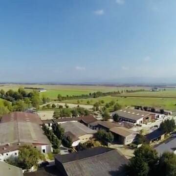
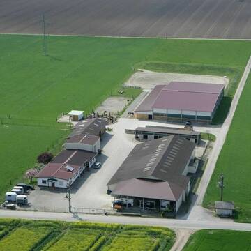
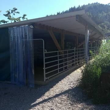
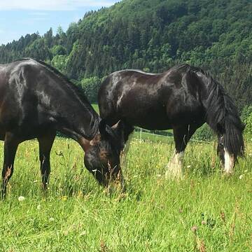
Hofgut Caballus (Neuenburg-Grißheim)
Neuenburg
Hofgut_Caballus
@Hofgut_Caballus
FN-Mitglied
Freizeitstall
Vermieten
Führanlage
Hunde willkommen
Pferdezucht
Zuchtstutenhaltung möglich
25 weitere...
P
Deprecated: Creation of dynamic property Zend_View_Helper_Ads::$adLink is deprecated in /var/www/stall-frei/htdocs/staging.stall-frei.de/library/Psf/View/Helper/Ads.php on line 108

Futtersack HeuToy, Fressbremse in pink
Mechtersen
STALL-FREIde Marketing
@STALL-FREI-Marketing
Stundenlange Beschäftigung die
Koliken vorbeugt, geringe Staubinhalation mit
steuerbarer Futterentnahme
Leider kein Vorschaubild
Leider kein Vorschaubild
Offenstallplätze
Geislingen klettgau
Silke
@Silke6
Freizeitstall
Hunde willkommen
Longierzirkel/Roundpen
Fohlenaufzucht möglich
Bewegungsstall
Offenstall
9 weitere...
B
Schöne Paddockboxen/Doppelbox frei
Buggingen
MoBo-Westerntraining
@MoBo-Westerntraining
Freizeitstall
Pferdeausbildung
Vermieten
Führanlage
Longierzirkel/Roundpen
Hengsthaltung möglich
Notfallboxen
14 weitere...
P

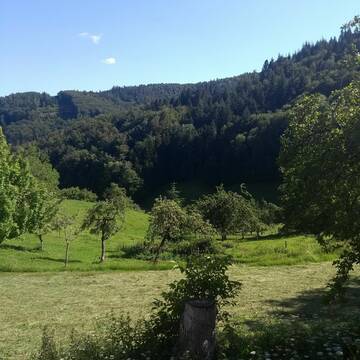
Pensionsplätze Pferde/Ponys/Fohlen/Senioren frei!
Kleines Wiesental
FerienundFreizeithofSchoenerei
@Schoenerei
Freizeitstall
Geländestrecke
Vermieten
Hunde willkommen
Pensions- und Gastboxen
Allergikerstall
Hufrehe geeignet
19 weitere...
P+
Leider kein Vorschaubild
Leider kein Vorschaubild
Wir haben ab Frühjahr 2026 freie Plätze
Todtmoos
Gabriela
@GabrielaK
Vermieten
Sattelkammer/Sattelschränke
Sommerweide
Vollpension
Einzelne Boxen oder Stallplätze
3 weitere...
B


Platz frei in unserem Offenstall
Rickenbach
Stefanie-V
@Stefanie-V
Freizeitstall
Geländestrecke
Longierzirkel/Roundpen
Paddock
Fohlenaufzucht möglich
Notfallboxen
Bewegungsstall
Laufstall
13 weitere...
aktuell
P+
Leider kein Vorschaubild
Leider kein Vorschaubild
Pferdeboxen frei
Küssaberg
EttikonerHof
@EttikonerHof
Longierzirkel/Roundpen
Ovalbahn
Einzelne Boxen oder Stallplätze
6 weitere...
B
Job gesucht?
Mechtersen
STALL-FREIde Marketing
@STALL-FREI-Marketing
Sie suchen einen Job und arbeiten gerne mit Pferden oder auf Reitanlagen?
Besuchen Sie jetzt unseren Stellenmarkt!

Stall Stockberg
Malsburg- Marzell
Stall-Stockberg
@Stall-Stockberg
FN-Mitglied
Freizeitstall
Hunde willkommen
Krankenbox
Gnadenbrothof
Notfallboxen
Bewegungsstall
Laufstall
16 weitere...
P
LAG zertif. Pferdeparadies in natürlicher Haltung
Kleines Wiesental
Malaihof
@Malaihof
Freizeitstall
Geländestrecke
Paddock
Reitplatz (z.B. Dressur, Springen, Reining)
Allergikerstall
Gnadenbrothof
Bewegungsstall
Laufstall
14 weitere...
P
Leider kein Vorschaubild
Leider kein Vorschaubild
Plätze im Offenstall, 79774 Albbruck-Unteralpfen
Albbruck
Michael Kaiser
@MichaelKaiser
Freizeitstall
Krankenbox
Parkplatz für Pferdeanhänger
Notfallboxen
Offenstall
10 weitere...
B
Werde Teil von STALL-FREI.de
Du hast eine Pferdebox frei? Freie Plätze im Offenstall, Pferdestall oder der Reitanlage kostenlos anbieten.
Deprecated: Creation of dynamic property Zend_View::$pageCount is deprecated in /var/www/stall-frei/htdocs/staging.stall-frei.de/library/vendor/shardj/zf1-future/library/Zend/View/Abstract.php on line 308
Deprecated: Creation of dynamic property Zend_View::$itemCountPerPage is deprecated in /var/www/stall-frei/htdocs/staging.stall-frei.de/library/vendor/shardj/zf1-future/library/Zend/View/Abstract.php on line 308
Deprecated: Creation of dynamic property Zend_View::$first is deprecated in /var/www/stall-frei/htdocs/staging.stall-frei.de/library/vendor/shardj/zf1-future/library/Zend/View/Abstract.php on line 308
Deprecated: Creation of dynamic property Zend_View::$current is deprecated in /var/www/stall-frei/htdocs/staging.stall-frei.de/library/vendor/shardj/zf1-future/library/Zend/View/Abstract.php on line 308
Deprecated: Creation of dynamic property Zend_View::$last is deprecated in /var/www/stall-frei/htdocs/staging.stall-frei.de/library/vendor/shardj/zf1-future/library/Zend/View/Abstract.php on line 308
Deprecated: Creation of dynamic property Zend_View::$previous is deprecated in /var/www/stall-frei/htdocs/staging.stall-frei.de/library/vendor/shardj/zf1-future/library/Zend/View/Abstract.php on line 308
Deprecated: Creation of dynamic property Zend_View::$next is deprecated in /var/www/stall-frei/htdocs/staging.stall-frei.de/library/vendor/shardj/zf1-future/library/Zend/View/Abstract.php on line 308
Deprecated: Creation of dynamic property Zend_View::$pagesInRange is deprecated in /var/www/stall-frei/htdocs/staging.stall-frei.de/library/vendor/shardj/zf1-future/library/Zend/View/Abstract.php on line 308
Deprecated: Creation of dynamic property Zend_View::$firstPageInRange is deprecated in /var/www/stall-frei/htdocs/staging.stall-frei.de/library/vendor/shardj/zf1-future/library/Zend/View/Abstract.php on line 308
Deprecated: Creation of dynamic property Zend_View::$lastPageInRange is deprecated in /var/www/stall-frei/htdocs/staging.stall-frei.de/library/vendor/shardj/zf1-future/library/Zend/View/Abstract.php on line 308
Deprecated: Creation of dynamic property Zend_View::$currentItemCount is deprecated in /var/www/stall-frei/htdocs/staging.stall-frei.de/library/vendor/shardj/zf1-future/library/Zend/View/Abstract.php on line 308
Deprecated: Creation of dynamic property Zend_View::$totalItemCount is deprecated in /var/www/stall-frei/htdocs/staging.stall-frei.de/library/vendor/shardj/zf1-future/library/Zend/View/Abstract.php on line 308
Deprecated: Creation of dynamic property Zend_View::$firstItemNumber is deprecated in /var/www/stall-frei/htdocs/staging.stall-frei.de/library/vendor/shardj/zf1-future/library/Zend/View/Abstract.php on line 308
Deprecated: Creation of dynamic property Zend_View::$lastItemNumber is deprecated in /var/www/stall-frei/htdocs/staging.stall-frei.de/library/vendor/shardj/zf1-future/library/Zend/View/Abstract.php on line 308
Deprecated: Creation of dynamic property Zend_View::$router is deprecated in /var/www/stall-frei/htdocs/staging.stall-frei.de/library/vendor/shardj/zf1-future/library/Zend/View/Abstract.php on line 308
Deprecated: Creation of dynamic property Zend_View::$urlParams is deprecated in /var/www/stall-frei/htdocs/staging.stall-frei.de/library/vendor/shardj/zf1-future/library/Zend/View/Abstract.php on line 308
Deprecated: Creation of dynamic property Zend_View::$showAds is deprecated in /var/www/stall-frei/htdocs/staging.stall-frei.de/library/vendor/shardj/zf1-future/library/Zend/View/Abstract.php on line 308
Deprecated: Creation of dynamic property Zend_View::$objectIds is deprecated in /var/www/stall-frei/htdocs/staging.stall-frei.de/library/vendor/shardj/zf1-future/library/Zend/View/Abstract.php on line 308
Deprecated: Creation of dynamic property Zend_View::$showNavbar is deprecated in /var/www/stall-frei/htdocs/staging.stall-frei.de/library/vendor/shardj/zf1-future/library/Zend/View/Abstract.php on line 308
Deprecated: Creation of dynamic property Zend_View::$showBreadcrumb is deprecated in /var/www/stall-frei/htdocs/staging.stall-frei.de/library/vendor/shardj/zf1-future/library/Zend/View/Abstract.php on line 308
Deprecated: Creation of dynamic property Zend_View::$showFooter is deprecated in /var/www/stall-frei/htdocs/staging.stall-frei.de/library/vendor/shardj/zf1-future/library/Zend/View/Abstract.php on line 308
Deprecated: Creation of dynamic property Zend_View::$showInternalAds is deprecated in /var/www/stall-frei/htdocs/staging.stall-frei.de/library/vendor/shardj/zf1-future/library/Zend/View/Abstract.php on line 308
Deprecated: Creation of dynamic property Zend_View::$blNoContent is deprecated in /var/www/stall-frei/htdocs/staging.stall-frei.de/library/vendor/shardj/zf1-future/library/Zend/View/Abstract.php on line 308
Deprecated: Creation of dynamic property Zend_View::$sMetaDesc is deprecated in /var/www/stall-frei/htdocs/staging.stall-frei.de/library/vendor/shardj/zf1-future/library/Zend/View/Abstract.php on line 308
Deprecated: Creation of dynamic property Zend_View::$useGmaps is deprecated in /var/www/stall-frei/htdocs/staging.stall-frei.de/library/vendor/shardj/zf1-future/library/Zend/View/Abstract.php on line 308
Deprecated: Creation of dynamic property Zend_View::$touches is deprecated in /var/www/stall-frei/htdocs/staging.stall-frei.de/library/vendor/shardj/zf1-future/library/Zend/View/Abstract.php on line 308
Deprecated: Creation of dynamic property Zend_View::$oProject is deprecated in /var/www/stall-frei/htdocs/staging.stall-frei.de/library/vendor/shardj/zf1-future/library/Zend/View/Abstract.php on line 308
Deprecated: Creation of dynamic property Zend_View::$pageHeadline is deprecated in /var/www/stall-frei/htdocs/staging.stall-frei.de/library/vendor/shardj/zf1-future/library/Zend/View/Abstract.php on line 308
Deprecated: Creation of dynamic property Zend_View::$disableLocationField is deprecated in /var/www/stall-frei/htdocs/staging.stall-frei.de/library/vendor/shardj/zf1-future/library/Zend/View/Abstract.php on line 308
Deprecated: Creation of dynamic property Zend_View::$isSearch is deprecated in /var/www/stall-frei/htdocs/staging.stall-frei.de/library/vendor/shardj/zf1-future/library/Zend/View/Abstract.php on line 308
Deprecated: Creation of dynamic property Zend_View::$pageTitle is deprecated in /var/www/stall-frei/htdocs/staging.stall-frei.de/library/vendor/shardj/zf1-future/library/Zend/View/Abstract.php on line 308
Deprecated: Creation of dynamic property Psf_Form_Element_Text::$class is deprecated in /var/www/stall-frei/htdocs/staging.stall-frei.de/library/vendor/shardj/zf1-future/library/Zend/Form/Element.php on line 874
Deprecated: Creation of dynamic property Psf_Form_Element_Text::$size is deprecated in /var/www/stall-frei/htdocs/staging.stall-frei.de/library/vendor/shardj/zf1-future/library/Zend/Form/Element.php on line 874
Deprecated: Creation of dynamic property Psf_Form_Element_Text::$placeholder is deprecated in /var/www/stall-frei/htdocs/staging.stall-frei.de/library/vendor/shardj/zf1-future/library/Zend/Form/Element.php on line 874
Deprecated: Creation of dynamic property Psf_Form_Element_Hidden::$class is deprecated in /var/www/stall-frei/htdocs/staging.stall-frei.de/library/vendor/shardj/zf1-future/library/Zend/Form/Element.php on line 874
Deprecated: Creation of dynamic property Psf_Form_Element_Hidden::$class is deprecated in /var/www/stall-frei/htdocs/staging.stall-frei.de/library/vendor/shardj/zf1-future/library/Zend/Form/Element.php on line 874
Deprecated: Creation of dynamic property Psf_Form_Element_Hidden::$class is deprecated in /var/www/stall-frei/htdocs/staging.stall-frei.de/library/vendor/shardj/zf1-future/library/Zend/Form/Element.php on line 874
Deprecated: Creation of dynamic property Psf_Form_Element_Hidden::$class is deprecated in /var/www/stall-frei/htdocs/staging.stall-frei.de/library/vendor/shardj/zf1-future/library/Zend/Form/Element.php on line 874
Deprecated: Creation of dynamic property Psf_Form_Element_Select::$class is deprecated in /var/www/stall-frei/htdocs/staging.stall-frei.de/library/vendor/shardj/zf1-future/library/Zend/Form/Element.php on line 874
Deprecated: Creation of dynamic property Psf_Form_Element_Select::$class is deprecated in /var/www/stall-frei/htdocs/staging.stall-frei.de/library/vendor/shardj/zf1-future/library/Zend/Form/Element.php on line 874
Deprecated: Creation of dynamic property Psf_Form_Element_Select::$class is deprecated in /var/www/stall-frei/htdocs/staging.stall-frei.de/library/vendor/shardj/zf1-future/library/Zend/Form/Element.php on line 874
Deprecated: Creation of dynamic property Psf_Form_Element_Select::$class is deprecated in /var/www/stall-frei/htdocs/staging.stall-frei.de/library/vendor/shardj/zf1-future/library/Zend/Form/Element.php on line 874
Deprecated: Creation of dynamic property Psf_Form_Element_Text::$class is deprecated in /var/www/stall-frei/htdocs/staging.stall-frei.de/library/vendor/shardj/zf1-future/library/Zend/Form/Element.php on line 874
Deprecated: Creation of dynamic property Psf_Form_Element_Checkbox::$label is deprecated in /var/www/stall-frei/htdocs/staging.stall-frei.de/library/vendor/shardj/zf1-future/library/Zend/Form/Element.php on line 874
Deprecated: Creation of dynamic property Zend_View::$sort is deprecated in /var/www/stall-frei/htdocs/staging.stall-frei.de/library/vendor/shardj/zf1-future/library/Zend/View/Abstract.php on line 308
Deprecated: Creation of dynamic property Zend_View::$searchLocation is deprecated in /var/www/stall-frei/htdocs/staging.stall-frei.de/library/vendor/shardj/zf1-future/library/Zend/View/Abstract.php on line 308
Deprecated: Creation of dynamic property Zend_View::$locationHint is deprecated in /var/www/stall-frei/htdocs/staging.stall-frei.de/library/vendor/shardj/zf1-future/library/Zend/View/Abstract.php on line 308
Psf_GeoCoder_Abstract::getLocation: Palmberg Get Location CachedOrLive
Psf_GeoCoder_Abstract::getCachedOrLive: Palmberg
Psf_GeoCoder_Abstract::convertLocationResult
{"documentation":"https:\/\/opencagedata.com\/api","licenses":[{"name":"see attribution guide","url":"https:\/\/opencagedata.com\/credits"}],"results":[{"bounds":{"northeast":{"lat":51.2488272,"lng":11.3784836},"southwest":{"lat":51.2487272,"lng":11.3783836}},"components":{"ISO_3166-1_alpha-2":"DE","ISO_3166-1_alpha-3":"DEU","ISO_3166-2":["DE-TH"],"_category":"natural\/water","_normalized_city":"K\u00f6lleda","_type":"peak","continent":"Europe","country":"Deutschland","country_code":"de","county":"Landkreis S\u00f6mmerda","peak":"Palmberg","political_union":"European Union","state":"Th\u00fcringen","state_code":"TH","town":"K\u00f6lleda"},"confidence":9,"formatted":"Palmberg, K\u00f6lleda, Th\u00fcringen, Deutschland","geometry":{"lat":51.2487772,"lng":11.3784336}},{"bounds":{"northeast":{"lat":48.8476619,"lng":11.9030485},"southwest":{"lat":48.8475619,"lng":11.9029485}},"components":{"ISO_3166-1_alpha-2":"DE","ISO_3166-1_alpha-3":"DEU","ISO_3166-2":["DE-BY"],"_category":"natural\/water","_normalized_city":"Saal a.d.Donau","_type":"peak","city":"Saal a.d.Donau","continent":"Europe","country":"Deutschland","country_code":"de","county":"Landkreis Kelheim","municipality":"Saal an der Donau (VGem)","peak":"Palmberg","political_union":"European Union","state":"Bayern","state_code":"BY"},"confidence":9,"formatted":"Palmberg, Saal a.d.Donau, Bayern, Deutschland","geometry":{"lat":48.8476119,"lng":11.9029985}},{"bounds":{"northeast":{"lat":48.9286263,"lng":13.3618847},"southwest":{"lat":48.8886263,"lng":13.3218847}},"components":{"ISO_3166-1_alpha-2":"DE","ISO_3166-1_alpha-3":"DEU","ISO_3166-2":["DE-BY"],"_category":"place","_normalized_city":"Spiegelau","_type":"village","city":"Spiegelau","continent":"Europe","country":"Deutschland","country_code":"de","county":"Landkreis Freyung-Grafenau","political_union":"European Union","postcode":"94518","state":"Bayern","state_code":"BY","village":"Palmberg"},"confidence":7,"formatted":"94518 Palmberg, Deutschland","geometry":{"lat":48.9086263,"lng":13.3418847}},{"bounds":{"northeast":{"lat":48.969019,"lng":11.8577471},"southwest":{"lat":48.929019,"lng":11.8177471}},"components":{"ISO_3166-1_alpha-2":"DE","ISO_3166-1_alpha-3":"DEU","ISO_3166-2":["DE-BY"],"_category":"place","_normalized_city":"Ihrlerstein","_type":"hamlet","continent":"Europe","country":"Deutschland","country_code":"de","county":"Landkreis Kelheim","hamlet":"Palmberg","municipality":"Ihrlerstein (VGem)","political_union":"European Union","postcode":"93346","state":"Bayern","state_code":"BY","village":"Ihrlerstein"},"confidence":7,"formatted":"Palmberg, 93346 Ihrlerstein, Deutschland","geometry":{"lat":48.949019,"lng":11.8377471}},{"bounds":{"northeast":{"lat":49.5437846,"lng":8.2510708},"southwest":{"lat":49.54036,"lng":8.2377287}},"components":{"ISO_3166-1_alpha-2":"DE","ISO_3166-1_alpha-3":"DEU","ISO_3166-2":["DE-RP"],"_category":"natural\/water","_normalized_city":"Laumersheim","_type":"wood","continent":"Europe","country":"Deutschland","country_code":"de","county":"Landkreis Bad D\u00fcrkheim","municipality":"Leiningerland","political_union":"European Union","postcode":"67229","state":"Rheinland-Pfalz","state_code":"RP","village":"Laumersheim","wood":"Palmberg"},"confidence":9,"formatted":"Palmberg, 67229 Laumersheim, Deutschland","geometry":{"lat":49.5420048,"lng":8.2440919}},{"bounds":{"northeast":{"lat":48.2738309,"lng":12.4215638},"southwest":{"lat":48.271228,"lng":12.418091}},"components":{"ISO_3166-1_alpha-2":"DE","ISO_3166-1_alpha-3":"DEU","ISO_3166-2":["DE-BY"],"_category":"road","_normalized_city":"Zangberg","_type":"road","continent":"Europe","country":"Deutschland","country_code":"de","county":"Landkreis M\u00fchldorf am Inn","hamlet":"Kr\u00f6ppen","municipality":"Oberbergkirchen (VGem)","political_union":"European Union","postcode":"84539","road":"Palmberg","state":"Bayern","state_code":"BY","village":"Zangberg"},"confidence":9,"formatted":"Palmberg, 84539 Zangberg, Deutschland","geometry":{"lat":48.271882,"lng":12.4204558}},{"bounds":{"northeast":{"lat":48.9497029,"lng":11.8397136},"southwest":{"lat":48.9491829,"lng":11.8362294}},"components":{"ISO_3166-1_alpha-2":"DE","ISO_3166-1_alpha-3":"DEU","ISO_3166-2":["DE-BY"],"_category":"road","_normalized_city":"Ihrlerstein","_type":"road","continent":"Europe","country":"Deutschland","country_code":"de","county":"Landkreis Kelheim","hamlet":"Palmberg","municipality":"Ihrlerstein (VGem)","political_union":"European Union","postcode":"93346","road":"Palmberg","road_type":"residential","state":"Bayern","state_code":"BY","village":"Ihrlerstein"},"confidence":9,"formatted":"Palmberg, 93346 Ihrlerstein, Deutschland","geometry":{"lat":48.9494296,"lng":11.8379665}},{"bounds":{"northeast":{"lat":50.9032969,"lng":10.9590782},"southwest":{"lat":50.9014234,"lng":10.9584167}},"components":{"ISO_3166-1_alpha-2":"DE","ISO_3166-1_alpha-3":"DEU","ISO_3166-2":["DE-TH"],"_category":"road","_normalized_city":"Erfurt","_type":"road","city":"Erfurt","continent":"Europe","country":"Deutschland","country_code":"de","political_union":"European Union","postcode":"99094","road":"Palmberg","road_type":"residential","state":"Th\u00fcringen","state_code":"TH","suburb":"Molsdorf"},"confidence":9,"formatted":"Palmberg, 99094 Erfurt, Deutschland","geometry":{"lat":50.902343,"lng":10.9587877}},{"bounds":{"northeast":{"lat":49.782289,"lng":7.9640404},"southwest":{"lat":49.7815828,"lng":7.9634243}},"components":{"ISO_3166-1_alpha-2":"DE","ISO_3166-1_alpha-3":"DEU","ISO_3166-2":["DE-RP"],"_category":"road","_normalized_city":"Wonsheim","_type":"road","continent":"Europe","country":"Deutschland","country_code":"de","county":"Landkreis Alzey-Worms","municipality":"W\u00f6llstein","political_union":"European Union","postcode":"55599","road":"Palmberg","road_type":"residential","state":"Rheinland-Pfalz","state_code":"RP","village":"Wonsheim"},"confidence":9,"formatted":"Palmberg, 55599 Wonsheim, Deutschland","geometry":{"lat":49.7819373,"lng":7.9637188}},{"components":{"ISO_3166-1_alpha-2":"RE","ISO_3166-1_alpha-3":"REU","ISO_3166-2":["FR-974"],"_category":"road","_normalized_city":"Saint-Denis","_type":"road","city":"Saint-Denis","continent":"Africa","country":"France","country_code":"fr","county":"La R\u00e9union","local_authority":"Communaut\u00e9 intercommunale du Nord de la R\u00e9union","political_union":"European Union","postcode":"97417","road":"Route des Palmiers","state":null},"confidence":2,"formatted":"Route des Palmiers, 97417 Saint-Denis, France","geometry":{"lat":-20.890004,"lng":55.424417}}],"status":{"code":200,"message":"OK"},"stay_informed":{"blog":"https:\/\/blog.opencagedata.com","mastodon":"https:\/\/en.osm.town\/@opencage"},"thanks":"For using an OpenCage API","timestamp":{"created_http":"Sun, 08 Feb 2026 18:41:08 GMT","created_unix":1770576068},"total_results":10}Array
(
[0] => stdClass Object
(
[bounds] => stdClass Object
(
[northeast] => stdClass Object
(
[lat] => 51.2488272
[lng] => 11.3784836
)
[southwest] => stdClass Object
(
[lat] => 51.2487272
[lng] => 11.3783836
)
)
[components] => stdClass Object
(
[ISO_3166-1_alpha-2] => DE
[ISO_3166-1_alpha-3] => DEU
[ISO_3166-2] => Array
(
[0] => DE-TH
)
[_category] => natural/water
[_normalized_city] => Kölleda
[_type] => peak
[continent] => Europe
[country] => Deutschland
[country_code] => de
[county] => Landkreis Sömmerda
[peak] => Palmberg
[political_union] => European Union
[state] => Thüringen
[state_code] => TH
[town] => Kölleda
)
[confidence] => 9
[formatted] => Palmberg, Kölleda, Thüringen, Deutschland
[geometry] => stdClass Object
(
[lat] => 51.2487772
[lng] => 11.3784336
)
)
[1] => stdClass Object
(
[bounds] => stdClass Object
(
[northeast] => stdClass Object
(
[lat] => 48.8476619
[lng] => 11.9030485
)
[southwest] => stdClass Object
(
[lat] => 48.8475619
[lng] => 11.9029485
)
)
[components] => stdClass Object
(
[ISO_3166-1_alpha-2] => DE
[ISO_3166-1_alpha-3] => DEU
[ISO_3166-2] => Array
(
[0] => DE-BY
)
[_category] => natural/water
[_normalized_city] => Saal a.d.Donau
[_type] => peak
[city] => Saal a.d.Donau
[continent] => Europe
[country] => Deutschland
[country_code] => de
[county] => Landkreis Kelheim
[municipality] => Saal an der Donau (VGem)
[peak] => Palmberg
[political_union] => European Union
[state] => Bayern
[state_code] => BY
)
[confidence] => 9
[formatted] => Palmberg, Saal a.d.Donau, Bayern, Deutschland
[geometry] => stdClass Object
(
[lat] => 48.8476119
[lng] => 11.9029985
)
)
[2] => stdClass Object
(
[bounds] => stdClass Object
(
[northeast] => stdClass Object
(
[lat] => 48.9286263
[lng] => 13.3618847
)
[southwest] => stdClass Object
(
[lat] => 48.8886263
[lng] => 13.3218847
)
)
[components] => stdClass Object
(
[ISO_3166-1_alpha-2] => DE
[ISO_3166-1_alpha-3] => DEU
[ISO_3166-2] => Array
(
[0] => DE-BY
)
[_category] => place
[_normalized_city] => Spiegelau
[_type] => village
[city] => Spiegelau
[continent] => Europe
[country] => Deutschland
[country_code] => de
[county] => Landkreis Freyung-Grafenau
[political_union] => European Union
[postcode] => 94518
[state] => Bayern
[state_code] => BY
[village] => Palmberg
)
[confidence] => 7
[formatted] => 94518 Palmberg, Deutschland
[geometry] => stdClass Object
(
[lat] => 48.9086263
[lng] => 13.3418847
)
)
[3] => stdClass Object
(
[bounds] => stdClass Object
(
[northeast] => stdClass Object
(
[lat] => 48.969019
[lng] => 11.8577471
)
[southwest] => stdClass Object
(
[lat] => 48.929019
[lng] => 11.8177471
)
)
[components] => stdClass Object
(
[ISO_3166-1_alpha-2] => DE
[ISO_3166-1_alpha-3] => DEU
[ISO_3166-2] => Array
(
[0] => DE-BY
)
[_category] => place
[_normalized_city] => Ihrlerstein
[_type] => hamlet
[continent] => Europe
[country] => Deutschland
[country_code] => de
[county] => Landkreis Kelheim
[hamlet] => Palmberg
[municipality] => Ihrlerstein (VGem)
[political_union] => European Union
[postcode] => 93346
[state] => Bayern
[state_code] => BY
[village] => Ihrlerstein
)
[confidence] => 7
[formatted] => Palmberg, 93346 Ihrlerstein, Deutschland
[geometry] => stdClass Object
(
[lat] => 48.949019
[lng] => 11.8377471
)
)
[4] => stdClass Object
(
[bounds] => stdClass Object
(
[northeast] => stdClass Object
(
[lat] => 49.5437846
[lng] => 8.2510708
)
[southwest] => stdClass Object
(
[lat] => 49.54036
[lng] => 8.2377287
)
)
[components] => stdClass Object
(
[ISO_3166-1_alpha-2] => DE
[ISO_3166-1_alpha-3] => DEU
[ISO_3166-2] => Array
(
[0] => DE-RP
)
[_category] => natural/water
[_normalized_city] => Laumersheim
[_type] => wood
[continent] => Europe
[country] => Deutschland
[country_code] => de
[county] => Landkreis Bad Dürkheim
[municipality] => Leiningerland
[political_union] => European Union
[postcode] => 67229
[state] => Rheinland-Pfalz
[state_code] => RP
[village] => Laumersheim
[wood] => Palmberg
)
[confidence] => 9
[formatted] => Palmberg, 67229 Laumersheim, Deutschland
[geometry] => stdClass Object
(
[lat] => 49.5420048
[lng] => 8.2440919
)
)
[5] => stdClass Object
(
[bounds] => stdClass Object
(
[northeast] => stdClass Object
(
[lat] => 48.2738309
[lng] => 12.4215638
)
[southwest] => stdClass Object
(
[lat] => 48.271228
[lng] => 12.418091
)
)
[components] => stdClass Object
(
[ISO_3166-1_alpha-2] => DE
[ISO_3166-1_alpha-3] => DEU
[ISO_3166-2] => Array
(
[0] => DE-BY
)
[_category] => road
[_normalized_city] => Zangberg
[_type] => road
[continent] => Europe
[country] => Deutschland
[country_code] => de
[county] => Landkreis Mühldorf am Inn
[hamlet] => Kröppen
[municipality] => Oberbergkirchen (VGem)
[political_union] => European Union
[postcode] => 84539
[road] => Palmberg
[state] => Bayern
[state_code] => BY
[village] => Zangberg
)
[confidence] => 9
[formatted] => Palmberg, 84539 Zangberg, Deutschland
[geometry] => stdClass Object
(
[lat] => 48.271882
[lng] => 12.4204558
)
)
[6] => stdClass Object
(
[bounds] => stdClass Object
(
[northeast] => stdClass Object
(
[lat] => 48.9497029
[lng] => 11.8397136
)
[southwest] => stdClass Object
(
[lat] => 48.9491829
[lng] => 11.8362294
)
)
[components] => stdClass Object
(
[ISO_3166-1_alpha-2] => DE
[ISO_3166-1_alpha-3] => DEU
[ISO_3166-2] => Array
(
[0] => DE-BY
)
[_category] => road
[_normalized_city] => Ihrlerstein
[_type] => road
[continent] => Europe
[country] => Deutschland
[country_code] => de
[county] => Landkreis Kelheim
[hamlet] => Palmberg
[municipality] => Ihrlerstein (VGem)
[political_union] => European Union
[postcode] => 93346
[road] => Palmberg
[road_type] => residential
[state] => Bayern
[state_code] => BY
[village] => Ihrlerstein
)
[confidence] => 9
[formatted] => Palmberg, 93346 Ihrlerstein, Deutschland
[geometry] => stdClass Object
(
[lat] => 48.9494296
[lng] => 11.8379665
)
)
[7] => stdClass Object
(
[bounds] => stdClass Object
(
[northeast] => stdClass Object
(
[lat] => 50.9032969
[lng] => 10.9590782
)
[southwest] => stdClass Object
(
[lat] => 50.9014234
[lng] => 10.9584167
)
)
[components] => stdClass Object
(
[ISO_3166-1_alpha-2] => DE
[ISO_3166-1_alpha-3] => DEU
[ISO_3166-2] => Array
(
[0] => DE-TH
)
[_category] => road
[_normalized_city] => Erfurt
[_type] => road
[city] => Erfurt
[continent] => Europe
[country] => Deutschland
[country_code] => de
[political_union] => European Union
[postcode] => 99094
[road] => Palmberg
[road_type] => residential
[state] => Thüringen
[state_code] => TH
[suburb] => Molsdorf
)
[confidence] => 9
[formatted] => Palmberg, 99094 Erfurt, Deutschland
[geometry] => stdClass Object
(
[lat] => 50.902343
[lng] => 10.9587877
)
)
[8] => stdClass Object
(
[bounds] => stdClass Object
(
[northeast] => stdClass Object
(
[lat] => 49.782289
[lng] => 7.9640404
)
[southwest] => stdClass Object
(
[lat] => 49.7815828
[lng] => 7.9634243
)
)
[components] => stdClass Object
(
[ISO_3166-1_alpha-2] => DE
[ISO_3166-1_alpha-3] => DEU
[ISO_3166-2] => Array
(
[0] => DE-RP
)
[_category] => road
[_normalized_city] => Wonsheim
[_type] => road
[continent] => Europe
[country] => Deutschland
[country_code] => de
[county] => Landkreis Alzey-Worms
[municipality] => Wöllstein
[political_union] => European Union
[postcode] => 55599
[road] => Palmberg
[road_type] => residential
[state] => Rheinland-Pfalz
[state_code] => RP
[village] => Wonsheim
)
[confidence] => 9
[formatted] => Palmberg, 55599 Wonsheim, Deutschland
[geometry] => stdClass Object
(
[lat] => 49.7819373
[lng] => 7.9637188
)
)
[9] => stdClass Object
(
[components] => stdClass Object
(
[ISO_3166-1_alpha-2] => RE
[ISO_3166-1_alpha-3] => REU
[ISO_3166-2] => Array
(
[0] => FR-974
)
[_category] => road
[_normalized_city] => Saint-Denis
[_type] => road
[city] => Saint-Denis
[continent] => Africa
[country] => France
[country_code] => fr
[county] => La Réunion
[local_authority] => Communauté intercommunale du Nord de la Réunion
[political_union] => European Union
[postcode] => 97417
[road] => Route des Palmiers
[state] =>
)
[confidence] => 2
[formatted] => Route des Palmiers, 97417 Saint-Denis, France
[geometry] => stdClass Object
(
[lat] => -20.890004
[lng] => 55.424417
)
)
)
Psf_GeoCoder_OpenCageData::getKeyMap: 0
stdClass Object
(
    [bounds] => stdClass Object
        (
            [northeast] => stdClass Object
                (
                    [lat] => 51.2488272
                    [lng] => 11.3784836
                )

            [southwest] => stdClass Object
                (
                    [lat] => 51.2487272
                    [lng] => 11.3783836
                )

        )

    [components] => stdClass Object
        (
            [ISO_3166-1_alpha-2] => DE
            [ISO_3166-1_alpha-3] => DEU
            [ISO_3166-2] => Array
                (
                    [0] => DE-TH
                )

            [_category] => natural/water
            [_normalized_city] => Kölleda
            [_type] => peak
            [continent] => Europe
            [country] => Deutschland
            [country_code] => de
            [county] => Landkreis Sömmerda
            [peak] => Palmberg
            [political_union] => European Union
            [state] => Thüringen
            [state_code] => TH
            [town] => Kölleda
        )

    [confidence] => 9
    [formatted] => Palmberg, Kölleda, Thüringen, Deutschland
    [geometry] => stdClass Object
        (
            [lat] => 51.2487772
            [lng] => 11.3784336
        )

)
Psf_GeoCoder_OpenCageData::getCounty: Sömmerda
Psf_GeoCoder_OpenCageData::addMissingData REFETCH!
Array
(
    [address] => Palmberg, Kölleda, Thüringen, Deutschland
    [type] => peak
    [street] =>
    [city] => Kölleda
    [county] => Sömmerda
    [state] => Thüringen
    [zip] =>
    [country] => Deutschland
    [suburb] =>
    [countrycode] => de
    [latitude] => 51.2487772
    [longitude] => 11.3784336
    [accuracy] => 1
    [confidence] => 9
    [bounds] => stdClass Object
        (
            [northeast] => stdClass Object
                (
                    [lat] => 51.2488272
                    [lng] => 11.3784836
                )

            [southwest] => stdClass Object
                (
                    [lat] => 51.2487272
                    [lng] => 11.3783836
                )

        )

)
reformat!
Array
(
    [address] => Palmberg, Kölleda, Thüringen, Deutschland
    [type] => peak
    [street] =>
    [city] => Kölleda
    [county] => Sömmerda
    [state] => Thüringen
    [zip] =>
    [country] => Deutschland
    [suburb] =>
    [countrycode] => de
    [latitude] => 51.2487772
    [longitude] => 11.3784336
    [accuracy] => 1
    [confidence] => 9
    [bounds] => stdClass Object
        (
            [northeast] => stdClass Object
                (
                    [lat] => 51.2488272
                    [lng] => 11.3784836
                )

            [southwest] => stdClass Object
                (
                    [lat] => 51.2487272
                    [lng] => 11.3783836
                )

        )

    [place] => Kölleda, Thüringen
    [hash] => 9efa7c044f807c62cf710f49d44d2ea0
)
Psf_GeoCoder_OpenCageData::getKeyMap: 1
stdClass Object
(
    [bounds] => stdClass Object
        (
            [northeast] => stdClass Object
                (
                    [lat] => 48.8476619
                    [lng] => 11.9030485
                )

            [southwest] => stdClass Object
                (
                    [lat] => 48.8475619
                    [lng] => 11.9029485
                )

        )

    [components] => stdClass Object
        (
            [ISO_3166-1_alpha-2] => DE
            [ISO_3166-1_alpha-3] => DEU
            [ISO_3166-2] => Array
                (
                    [0] => DE-BY
                )

            [_category] => natural/water
            [_normalized_city] => Saal a.d.Donau
            [_type] => peak
            [city] => Saal a.d.Donau
            [continent] => Europe
            [country] => Deutschland
            [country_code] => de
            [county] => Landkreis Kelheim
            [municipality] => Saal an der Donau (VGem)
            [peak] => Palmberg
            [political_union] => European Union
            [state] => Bayern
            [state_code] => BY
        )

    [confidence] => 9
    [formatted] => Palmberg, Saal a.d.Donau, Bayern, Deutschland
    [geometry] => stdClass Object
        (
            [lat] => 48.8476119
            [lng] => 11.9029985
        )

)
Psf_GeoCoder_OpenCageData::getCounty: Kelheim
Psf_GeoCoder_OpenCageData::addMissingData REFETCH!
Array
(
    [address] => Palmberg, Saal a.d.Donau, Bayern, Deutschland
    [type] => peak
    [street] =>
    [city] => Saal a.d.Donau
    [county] => Kelheim
    [state] => Bayern
    [zip] =>
    [country] => Deutschland
    [suburb] =>
    [countrycode] => de
    [latitude] => 48.8476119
    [longitude] => 11.9029985
    [accuracy] => 1
    [confidence] => 9
    [bounds] => stdClass Object
        (
            [northeast] => stdClass Object
                (
                    [lat] => 48.8476619
                    [lng] => 11.9030485
                )

            [southwest] => stdClass Object
                (
                    [lat] => 48.8475619
                    [lng] => 11.9029485
                )

        )

)
reformat!
Array
(
    [address] => Palmberg, Saal a.d.Donau, Bayern, Deutschland
    [type] => peak
    [street] =>
    [city] => Saal a.d.Donau
    [county] => Kelheim
    [state] => Bayern
    [zip] =>
    [country] => Deutschland
    [suburb] =>
    [countrycode] => de
    [latitude] => 48.8476119
    [longitude] => 11.9029985
    [accuracy] => 1
    [confidence] => 9
    [bounds] => stdClass Object
        (
            [northeast] => stdClass Object
                (
                    [lat] => 48.8476619
                    [lng] => 11.9030485
                )

            [southwest] => stdClass Object
                (
                    [lat] => 48.8475619
                    [lng] => 11.9029485
                )

        )

    [place] => Saal a.d.Donau, Bayern
    [hash] => 240c15ab471e2144c08ebad93463d8ce
)
Psf_GeoCoder_OpenCageData::getKeyMap: 2
stdClass Object
(
    [bounds] => stdClass Object
        (
            [northeast] => stdClass Object
                (
                    [lat] => 48.9286263
                    [lng] => 13.3618847
                )

            [southwest] => stdClass Object
                (
                    [lat] => 48.8886263
                    [lng] => 13.3218847
                )

        )

    [components] => stdClass Object
        (
            [ISO_3166-1_alpha-2] => DE
            [ISO_3166-1_alpha-3] => DEU
            [ISO_3166-2] => Array
                (
                    [0] => DE-BY
                )

            [_category] => place
            [_normalized_city] => Spiegelau
            [_type] => village
            [city] => Spiegelau
            [continent] => Europe
            [country] => Deutschland
            [country_code] => de
            [county] => Landkreis Freyung-Grafenau
            [political_union] => European Union
            [postcode] => 94518
            [state] => Bayern
            [state_code] => BY
            [village] => Palmberg
        )

    [confidence] => 7
    [formatted] => 94518 Palmberg, Deutschland
    [geometry] => stdClass Object
        (
            [lat] => 48.9086263
            [lng] => 13.3418847
        )

)
Psf_GeoCoder_OpenCageData::getCounty: Freyung-Grafenau
Psf_GeoCoder_OpenCageData::addMissingData REFETCH!
Array
(
    [address] => 94518 Palmberg, Deutschland
    [type] => village
    [street] =>
    [city] => Palmberg
    [county] => Freyung-Grafenau
    [state] => Bayern
    [zip] => 94518
    [country] => Deutschland
    [suburb] =>
    [countrycode] => de
    [latitude] => 48.9086263
    [longitude] => 13.3418847
    [accuracy] => 1
    [confidence] => 7
    [bounds] => stdClass Object
        (
            [northeast] => stdClass Object
                (
                    [lat] => 48.9286263
                    [lng] => 13.3618847
                )

            [southwest] => stdClass Object
                (
                    [lat] => 48.8886263
                    [lng] => 13.3218847
                )

        )

)
reformat!
Array
(
    [address] => 94518 Palmberg, Deutschland
    [type] => village
    [street] =>
    [city] => Palmberg
    [county] => Freyung-Grafenau
    [state] => Bayern
    [zip] => 94518
    [country] => Deutschland
    [suburb] =>
    [countrycode] => de
    [latitude] => 48.9086263
    [longitude] => 13.3418847
    [accuracy] => 1
    [confidence] => 7
    [bounds] => stdClass Object
        (
            [northeast] => stdClass Object
                (
                    [lat] => 48.9286263
                    [lng] => 13.3618847
                )

            [southwest] => stdClass Object
                (
                    [lat] => 48.8886263
                    [lng] => 13.3218847
                )

        )

    [place] => 94518 Palmberg, Bayern
    [hash] => 6ed73b1c6611a98e1fe6eb3d238783c5
)
Psf_GeoCoder_OpenCageData::getKeyMap: 3
stdClass Object
(
    [bounds] => stdClass Object
        (
            [northeast] => stdClass Object
                (
                    [lat] => 48.969019
                    [lng] => 11.8577471
                )

            [southwest] => stdClass Object
                (
                    [lat] => 48.929019
                    [lng] => 11.8177471
                )

        )

    [components] => stdClass Object
        (
            [ISO_3166-1_alpha-2] => DE
            [ISO_3166-1_alpha-3] => DEU
            [ISO_3166-2] => Array
                (
                    [0] => DE-BY
                )

            [_category] => place
            [_normalized_city] => Ihrlerstein
            [_type] => hamlet
            [continent] => Europe
            [country] => Deutschland
            [country_code] => de
            [county] => Landkreis Kelheim
            [hamlet] => Palmberg
            [municipality] => Ihrlerstein (VGem)
            [political_union] => European Union
            [postcode] => 93346
            [state] => Bayern
            [state_code] => BY
            [village] => Ihrlerstein
        )

    [confidence] => 7
    [formatted] => Palmberg, 93346 Ihrlerstein, Deutschland
    [geometry] => stdClass Object
        (
            [lat] => 48.949019
            [lng] => 11.8377471
        )

)
Psf_GeoCoder_OpenCageData::getCounty: Kelheim
Psf_GeoCoder_OpenCageData::addMissingData REFETCH!
Array
(
    [address] => Palmberg, 93346 Ihrlerstein, Deutschland
    [type] => hamlet
    [street] => Palmberg
    [city] => Ihrlerstein
    [county] => Kelheim
    [state] => Bayern
    [zip] => 93346
    [country] => Deutschland
    [suburb] =>
    [countrycode] => de
    [latitude] => 48.949019
    [longitude] => 11.8377471
    [accuracy] => 1
    [confidence] => 7
    [bounds] => stdClass Object
        (
            [northeast] => stdClass Object
                (
                    [lat] => 48.969019
                    [lng] => 11.8577471
                )

            [southwest] => stdClass Object
                (
                    [lat] => 48.929019
                    [lng] => 11.8177471
                )

        )

)
reformat!
Array
(
    [address] => Palmberg, 93346 Ihrlerstein, Deutschland
    [type] => hamlet
    [street] => Palmberg
    [city] => Ihrlerstein
    [county] => Kelheim
    [state] => Bayern
    [zip] => 93346
    [country] => Deutschland
    [suburb] =>
    [countrycode] => de
    [latitude] => 48.949019
    [longitude] => 11.8377471
    [accuracy] => 1
    [confidence] => 7
    [bounds] => stdClass Object
        (
            [northeast] => stdClass Object
                (
                    [lat] => 48.969019
                    [lng] => 11.8577471
                )

            [southwest] => stdClass Object
                (
                    [lat] => 48.929019
                    [lng] => 11.8177471
                )

        )

    [place] => Palmberg, 93346 Ihrlerstein, Bayern
    [hash] => 7ff099ba4376b3752ace80224c44a6d3
)
Psf_GeoCoder_OpenCageData::getKeyMap: 4
stdClass Object
(
    [bounds] => stdClass Object
        (
            [northeast] => stdClass Object
                (
                    [lat] => 49.5437846
                    [lng] => 8.2510708
                )

            [southwest] => stdClass Object
                (
                    [lat] => 49.54036
                    [lng] => 8.2377287
                )

        )

    [components] => stdClass Object
        (
            [ISO_3166-1_alpha-2] => DE
            [ISO_3166-1_alpha-3] => DEU
            [ISO_3166-2] => Array
                (
                    [0] => DE-RP
                )

            [_category] => natural/water
            [_normalized_city] => Laumersheim
            [_type] => wood
            [continent] => Europe
            [country] => Deutschland
            [country_code] => de
            [county] => Landkreis Bad Dürkheim
            [municipality] => Leiningerland
            [political_union] => European Union
            [postcode] => 67229
            [state] => Rheinland-Pfalz
            [state_code] => RP
            [village] => Laumersheim
            [wood] => Palmberg
        )

    [confidence] => 9
    [formatted] => Palmberg, 67229 Laumersheim, Deutschland
    [geometry] => stdClass Object
        (
            [lat] => 49.5420048
            [lng] => 8.2440919
        )

)
Psf_GeoCoder_OpenCageData::getCounty: Bad Dürkheim
Psf_GeoCoder_OpenCageData::addMissingData REFETCH!
Array
(
    [address] => Palmberg, 67229 Laumersheim, Deutschland
    [type] => wood
    [street] =>
    [city] => Laumersheim
    [county] => Bad Dürkheim
    [state] => Rheinland-Pfalz
    [zip] => 67229
    [country] => Deutschland
    [suburb] =>
    [countrycode] => de
    [latitude] => 49.5420048
    [longitude] => 8.2440919
    [accuracy] => 1
    [confidence] => 9
    [bounds] => stdClass Object
        (
            [northeast] => stdClass Object
                (
                    [lat] => 49.5437846
                    [lng] => 8.2510708
                )

            [southwest] => stdClass Object
                (
                    [lat] => 49.54036
                    [lng] => 8.2377287
                )

        )

)
reformat!
Array
(
    [address] => Palmberg, 67229 Laumersheim, Deutschland
    [type] => wood
    [street] =>
    [city] => Laumersheim
    [county] => Bad Dürkheim
    [state] => Rheinland-Pfalz
    [zip] => 67229
    [country] => Deutschland
    [suburb] =>
    [countrycode] => de
    [latitude] => 49.5420048
    [longitude] => 8.2440919
    [accuracy] => 1
    [confidence] => 9
    [bounds] => stdClass Object
        (
            [northeast] => stdClass Object
                (
                    [lat] => 49.5437846
                    [lng] => 8.2510708
                )

            [southwest] => stdClass Object
                (
                    [lat] => 49.54036
                    [lng] => 8.2377287
                )

        )

    [place] => 67229 Laumersheim, Rheinland-Pfalz
    [hash] => 7cc8c4765a86afdedf0bd40b101d5a1b
)
Psf_GeoCoder_OpenCageData::getKeyMap: 5
stdClass Object
(
    [bounds] => stdClass Object
        (
            [northeast] => stdClass Object
                (
                    [lat] => 48.2738309
                    [lng] => 12.4215638
                )

            [southwest] => stdClass Object
                (
                    [lat] => 48.271228
                    [lng] => 12.418091
                )

        )

    [components] => stdClass Object
        (
            [ISO_3166-1_alpha-2] => DE
            [ISO_3166-1_alpha-3] => DEU
            [ISO_3166-2] => Array
                (
                    [0] => DE-BY
                )

            [_category] => road
            [_normalized_city] => Zangberg
            [_type] => road
            [continent] => Europe
            [country] => Deutschland
            [country_code] => de
            [county] => Landkreis Mühldorf am Inn
            [hamlet] => Kröppen
            [municipality] => Oberbergkirchen (VGem)
            [political_union] => European Union
            [postcode] => 84539
            [road] => Palmberg
            [state] => Bayern
            [state_code] => BY
            [village] => Zangberg
        )

    [confidence] => 9
    [formatted] => Palmberg, 84539 Zangberg, Deutschland
    [geometry] => stdClass Object
        (
            [lat] => 48.271882
            [lng] => 12.4204558
        )

)
Psf_GeoCoder_OpenCageData::getCounty: Mühldorf am Inn
Psf_GeoCoder_OpenCageData::addMissingData REFETCH!
Array
(
    [address] => Palmberg, 84539 Zangberg, Deutschland
    [type] => road
    [street] => Palmberg
    [city] => Zangberg
    [county] => Mühldorf am Inn
    [state] => Bayern
    [zip] => 84539
    [country] => Deutschland
    [suburb] =>
    [countrycode] => de
    [latitude] => 48.271882
    [longitude] => 12.4204558
    [accuracy] => 1
    [confidence] => 9
    [bounds] => stdClass Object
        (
            [northeast] => stdClass Object
                (
                    [lat] => 48.2738309
                    [lng] => 12.4215638
                )

            [southwest] => stdClass Object
                (
                    [lat] => 48.271228
                    [lng] => 12.418091
                )

        )

)
reformat!
Array
(
    [address] => Palmberg, 84539 Zangberg, Deutschland
    [type] => road
    [street] => Palmberg
    [city] => Zangberg
    [county] => Mühldorf am Inn
    [state] => Bayern
    [zip] => 84539
    [country] => Deutschland
    [suburb] =>
    [countrycode] => de
    [latitude] => 48.271882
    [longitude] => 12.4204558
    [accuracy] => 1
    [confidence] => 9
    [bounds] => stdClass Object
        (
            [northeast] => stdClass Object
                (
                    [lat] => 48.2738309
                    [lng] => 12.4215638
                )

            [southwest] => stdClass Object
                (
                    [lat] => 48.271228
                    [lng] => 12.418091
                )

        )

    [place] => Palmberg, 84539 Zangberg, Bayern
    [hash] => a49f3c49770f8ec03e52f7d8b23bcae2
)
Psf_GeoCoder_OpenCageData::getKeyMap: 6
stdClass Object
(
    [bounds] => stdClass Object
        (
            [northeast] => stdClass Object
                (
                    [lat] => 48.9497029
                    [lng] => 11.8397136
                )

            [southwest] => stdClass Object
                (
                    [lat] => 48.9491829
                    [lng] => 11.8362294
                )

        )

    [components] => stdClass Object
        (
            [ISO_3166-1_alpha-2] => DE
            [ISO_3166-1_alpha-3] => DEU
            [ISO_3166-2] => Array
                (
                    [0] => DE-BY
                )

            [_category] => road
            [_normalized_city] => Ihrlerstein
            [_type] => road
            [continent] => Europe
            [country] => Deutschland
            [country_code] => de
            [county] => Landkreis Kelheim
            [hamlet] => Palmberg
            [municipality] => Ihrlerstein (VGem)
            [political_union] => European Union
            [postcode] => 93346
            [road] => Palmberg
            [road_type] => residential
            [state] => Bayern
            [state_code] => BY
            [village] => Ihrlerstein
        )

    [confidence] => 9
    [formatted] => Palmberg, 93346 Ihrlerstein, Deutschland
    [geometry] => stdClass Object
        (
            [lat] => 48.9494296
            [lng] => 11.8379665
        )

)
Psf_GeoCoder_OpenCageData::getCounty: Kelheim
Psf_GeoCoder_OpenCageData::addMissingData REFETCH!
Array
(
    [address] => Palmberg, 93346 Ihrlerstein, Deutschland
    [type] => road
    [street] => Palmberg
    [city] => Ihrlerstein
    [county] => Kelheim
    [state] => Bayern
    [zip] => 93346
    [country] => Deutschland
    [suburb] =>
    [countrycode] => de
    [latitude] => 48.9494296
    [longitude] => 11.8379665
    [accuracy] => 1
    [confidence] => 9
    [bounds] => stdClass Object
        (
            [northeast] => stdClass Object
                (
                    [lat] => 48.9497029
                    [lng] => 11.8397136
                )

            [southwest] => stdClass Object
                (
                    [lat] => 48.9491829
                    [lng] => 11.8362294
                )

        )

)
reformat!
Array
(
    [address] => Palmberg, 93346 Ihrlerstein, Deutschland
    [type] => road
    [street] => Palmberg
    [city] => Ihrlerstein
    [county] => Kelheim
    [state] => Bayern
    [zip] => 93346
    [country] => Deutschland
    [suburb] =>
    [countrycode] => de
    [latitude] => 48.9494296
    [longitude] => 11.8379665
    [accuracy] => 1
    [confidence] => 9
    [bounds] => stdClass Object
        (
            [northeast] => stdClass Object
                (
                    [lat] => 48.9497029
                    [lng] => 11.8397136
                )

            [southwest] => stdClass Object
                (
                    [lat] => 48.9491829
                    [lng] => 11.8362294
                )

        )

    [place] => Palmberg, 93346 Ihrlerstein, Bayern
    [hash] => 7ff099ba4376b3752ace80224c44a6d3
)
Psf_GeoCoder_OpenCageData::getKeyMap: 7
stdClass Object
(
    [bounds] => stdClass Object
        (
            [northeast] => stdClass Object
                (
                    [lat] => 50.9032969
                    [lng] => 10.9590782
                )

            [southwest] => stdClass Object
                (
                    [lat] => 50.9014234
                    [lng] => 10.9584167
                )

        )

    [components] => stdClass Object
        (
            [ISO_3166-1_alpha-2] => DE
            [ISO_3166-1_alpha-3] => DEU
            [ISO_3166-2] => Array
                (
                    [0] => DE-TH
                )

            [_category] => road
            [_normalized_city] => Erfurt
            [_type] => road
            [city] => Erfurt
            [continent] => Europe
            [country] => Deutschland
            [country_code] => de
            [political_union] => European Union
            [postcode] => 99094
            [road] => Palmberg
            [road_type] => residential
            [state] => Thüringen
            [state_code] => TH
            [suburb] => Molsdorf
        )

    [confidence] => 9
    [formatted] => Palmberg, 99094 Erfurt, Deutschland
    [geometry] => stdClass Object
        (
            [lat] => 50.902343
            [lng] => 10.9587877
        )

)
Psf_GeoCoder_OpenCageData::getCounty: Erfurt
Psf_GeoCoder_OpenCageData::addMissingData REFETCH!
Array
(
    [address] => Palmberg, 99094 Erfurt, Deutschland
    [type] => road
    [street] => Palmberg
    [city] => Molsdorf
    [county] => Erfurt
    [state] => Thüringen
    [zip] => 99094
    [country] => Deutschland
    [suburb] => Molsdorf
    [countrycode] => de
    [latitude] => 50.902343
    [longitude] => 10.9587877
    [accuracy] => 1
    [confidence] => 9
    [bounds] => stdClass Object
        (
            [northeast] => stdClass Object
                (
                    [lat] => 50.9032969
                    [lng] => 10.9590782
                )

            [southwest] => stdClass Object
                (
                    [lat] => 50.9014234
                    [lng] => 10.9584167
                )

        )

)
reformat!
Array
(
    [address] => Palmberg, 99094 Molsdorf
    [type] => road
    [street] => Palmberg
    [city] => Molsdorf
    [county] => Erfurt
    [state] => Thüringen
    [zip] => 99094
    [country] => Deutschland
    [suburb] => Molsdorf
    [countrycode] => de
    [latitude] => 50.902343
    [longitude] => 10.9587877
    [accuracy] => 1
    [confidence] => 9
    [bounds] => stdClass Object
        (
            [northeast] => stdClass Object
                (
                    [lat] => 50.9032969
                    [lng] => 10.9590782
                )

            [southwest] => stdClass Object
                (
                    [lat] => 50.9014234
                    [lng] => 10.9584167
                )

        )

    [place] => Palmberg, 99094 Molsdorf, Thüringen
    [hash] => 7adc98a4b24ece4939454d89a2c6b25e
)
Psf_GeoCoder_OpenCageData::getKeyMap: 8
stdClass Object
(
    [bounds] => stdClass Object
        (
            [northeast] => stdClass Object
                (
                    [lat] => 49.782289
                    [lng] => 7.9640404
                )

            [southwest] => stdClass Object
                (
                    [lat] => 49.7815828
                    [lng] => 7.9634243
                )

        )

    [components] => stdClass Object
        (
            [ISO_3166-1_alpha-2] => DE
            [ISO_3166-1_alpha-3] => DEU
            [ISO_3166-2] => Array
                (
                    [0] => DE-RP
                )

            [_category] => road
            [_normalized_city] => Wonsheim
            [_type] => road
            [continent] => Europe
            [country] => Deutschland
            [country_code] => de
            [county] => Landkreis Alzey-Worms
            [municipality] => Wöllstein
            [political_union] => European Union
            [postcode] => 55599
            [road] => Palmberg
            [road_type] => residential
            [state] => Rheinland-Pfalz
            [state_code] => RP
            [village] => Wonsheim
        )

    [confidence] => 9
    [formatted] => Palmberg, 55599 Wonsheim, Deutschland
    [geometry] => stdClass Object
        (
            [lat] => 49.7819373
            [lng] => 7.9637188
        )

)
Psf_GeoCoder_OpenCageData::getCounty: Alzey-Worms
Psf_GeoCoder_OpenCageData::addMissingData REFETCH!
Array
(
    [address] => Palmberg, 55599 Wonsheim, Deutschland
    [type] => road
    [street] => Palmberg
    [city] => Wonsheim
    [county] => Alzey-Worms
    [state] => Rheinland-Pfalz
    [zip] => 55599
    [country] => Deutschland
    [suburb] =>
    [countrycode] => de
    [latitude] => 49.7819373
    [longitude] => 7.9637188
    [accuracy] => 1
    [confidence] => 9
    [bounds] => stdClass Object
        (
            [northeast] => stdClass Object
                (
                    [lat] => 49.782289
                    [lng] => 7.9640404
                )

            [southwest] => stdClass Object
                (
                    [lat] => 49.7815828
                    [lng] => 7.9634243
                )

        )

)
reformat!
Array
(
    [address] => Palmberg, 55599 Wonsheim, Deutschland
    [type] => road
    [street] => Palmberg
    [city] => Wonsheim
    [county] => Alzey-Worms
    [state] => Rheinland-Pfalz
    [zip] => 55599
    [country] => Deutschland
    [suburb] =>
    [countrycode] => de
    [latitude] => 49.7819373
    [longitude] => 7.9637188
    [accuracy] => 1
    [confidence] => 9
    [bounds] => stdClass Object
        (
            [northeast] => stdClass Object
                (
                    [lat] => 49.782289
                    [lng] => 7.9640404
                )

            [southwest] => stdClass Object
                (
                    [lat] => 49.7815828
                    [lng] => 7.9634243
                )

        )

    [place] => Palmberg, 55599 Wonsheim, Rheinland-Pfalz
    [hash] => 2544900377b897c45b0ded7b0f4196d5
)
Psf_GeoCoder_OpenCageData::getKeyMap: 9
stdClass Object
(
    [components] => stdClass Object
        (
            [ISO_3166-1_alpha-2] => RE
            [ISO_3166-1_alpha-3] => REU
            [ISO_3166-2] => Array
                (
                    [0] => FR-974
                )

            [_category] => road
            [_normalized_city] => Saint-Denis
            [_type] => road
            [city] => Saint-Denis
            [continent] => Africa
            [country] => France
            [country_code] => fr
            [county] => La Réunion
            [local_authority] => Communauté intercommunale du Nord de la Réunion
            [political_union] => European Union
            [postcode] => 97417
            [road] => Route des Palmiers
            [state] =>
        )

    [confidence] => 2
    [formatted] => Route des Palmiers, 97417 Saint-Denis, France
    [geometry] => stdClass Object
        (
            [lat] => -20.890004
            [lng] => 55.424417
        )

)
Psf_GeoCoder_OpenCageData::getCounty: La Réunion
Psf_GeoCoder_OpenCageData::addMissingData REFETCH!
Array
(
    [address] => Route des Palmiers, 97417 Saint-Denis, France
    [type] => road
    [street] => Route des Palmiers
    [city] => Saint-Denis
    [county] => La Réunion
    [state] =>
    [zip] => 97417
    [country] => France
    [suburb] =>
    [countrycode] => fr
    [latitude] => -20.890004
    [longitude] => 55.424417
    [accuracy] => 1
    [confidence] => 2
    [bounds] =>
)
reformat!
Array
(
    [address] => Route des Palmiers, 97417 Saint-Denis, France
    [type] => road
    [street] => Route des Palmiers
    [city] => Saint-Denis
    [county] => La Réunion
    [state] =>
    [zip] => 97417
    [country] => France
    [suburb] =>
    [countrycode] => fr
    [latitude] => -20.890004
    [longitude] => 55.424417
    [accuracy] => 1
    [confidence] => 2
    [bounds] =>
    [place] => Route des Palmiers, 97417 Saint-Denis, France
    [hash] => b8eec2bfb02940ebf5b9d605df8bc482
)
Deprecated: Creation of dynamic property Zend_View::$locationHintStyle is deprecated in /var/www/stall-frei/htdocs/staging.stall-frei.de/library/vendor/shardj/zf1-future/library/Zend/View/Abstract.php on line 308
Deprecated: Creation of dynamic property Zend_View::$adGeoLocation is deprecated in /var/www/stall-frei/htdocs/staging.stall-frei.de/library/vendor/shardj/zf1-future/library/Zend/View/Abstract.php on line 308
Deprecated: Creation of dynamic property Zend_View::$recordCount is deprecated in /var/www/stall-frei/htdocs/staging.stall-frei.de/library/vendor/shardj/zf1-future/library/Zend/View/Abstract.php on line 308
Deprecated: Creation of dynamic property Zend_View::$paginationParams is deprecated in /var/www/stall-frei/htdocs/staging.stall-frei.de/library/vendor/shardj/zf1-future/library/Zend/View/Abstract.php on line 308
Deprecated: Creation of dynamic property Zend_View::$objectPaginator is deprecated in /var/www/stall-frei/htdocs/staging.stall-frei.de/library/vendor/shardj/zf1-future/library/Zend/View/Abstract.php on line 308
Deprecated: Creation of dynamic property Zend_View::$featuredObjects is deprecated in /var/www/stall-frei/htdocs/staging.stall-frei.de/library/vendor/shardj/zf1-future/library/Zend/View/Abstract.php on line 308
Deprecated: Creation of dynamic property Zend_View::$hints is deprecated in /var/www/stall-frei/htdocs/staging.stall-frei.de/library/vendor/shardj/zf1-future/library/Zend/View/Abstract.php on line 308
Deprecated: Creation of dynamic property Zend_View::$attributeHints is deprecated in /var/www/stall-frei/htdocs/staging.stall-frei.de/library/vendor/shardj/zf1-future/library/Zend/View/Abstract.php on line 308
Deprecated: Creation of dynamic property Zend_View::$oSearchForm is deprecated in /var/www/stall-frei/htdocs/staging.stall-frei.de/library/vendor/shardj/zf1-future/library/Zend/View/Abstract.php on line 308