Deprecated: Creation of dynamic property Zend_View::$sMode is deprecated in /var/www/stall-frei/htdocs/staging.stall-frei.de/library/vendor/shardj/zf1-future/library/Zend/View/Abstract.php on line 308
Stallplatz oder Offenstall in Feldmark
Gesucht wird in "45883 Feldmark"
6.330 Einträge
Deprecated: Creation of dynamic property Zend_View::$listObjects is deprecated in /var/www/stall-frei/htdocs/staging.stall-frei.de/library/vendor/shardj/zf1-future/library/Zend/View/Abstract.php on line 308
Gesponsort


Deprecated: Creation of dynamic property Zend_View::$listMode is deprecated in /var/www/stall-frei/htdocs/staging.stall-frei.de/library/vendor/shardj/zf1-future/library/Zend/View/Abstract.php on line 308
Deprecated: Creation of dynamic property Zend_View::$renderedObjects is deprecated in /var/www/stall-frei/htdocs/staging.stall-frei.de/library/vendor/shardj/zf1-future/library/Zend/View/Abstract.php on line 308
Deprecated: Creation of dynamic property Zend_View::$index is deprecated in /var/www/stall-frei/htdocs/staging.stall-frei.de/library/vendor/shardj/zf1-future/library/Zend/View/Abstract.php on line 308
Deprecated: Creation of dynamic property Zend_View::$displayMode is deprecated in /var/www/stall-frei/htdocs/staging.stall-frei.de/library/vendor/shardj/zf1-future/library/Zend/View/Abstract.php on line 308
Deprecated: Creation of dynamic property Zend_View::$remarketingIds is deprecated in /var/www/stall-frei/htdocs/staging.stall-frei.de/library/vendor/shardj/zf1-future/library/Zend/View/Abstract.php on line 308
Deprecated: Creation of dynamic property Zend_View::$listItem is deprecated in /var/www/stall-frei/htdocs/staging.stall-frei.de/library/vendor/shardj/zf1-future/library/Zend/View/Abstract.php on line 308
Deprecated: Creation of dynamic property Zend_View::$object is deprecated in /var/www/stall-frei/htdocs/staging.stall-frei.de/library/vendor/shardj/zf1-future/library/Zend/View/Abstract.php on line 308
Deprecated: Creation of dynamic property Zend_View::$attributes is deprecated in /var/www/stall-frei/htdocs/staging.stall-frei.de/library/vendor/shardj/zf1-future/library/Zend/View/Abstract.php on line 308

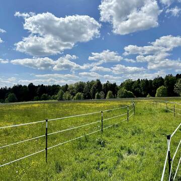
Paddockbox frei
Erl
jenny-koeberl
@jenny-koeberl
Paddock
Reitplatz (z.B. Dressur, Springen, Reining)
Allergikerstall
Hufrehe geeignet
Außenbox mit Paddock
Innenbox
Vollpension
6 weitere...
P
Leider kein Vorschaubild
Leider kein Vorschaubild
Paddockbox für Selbstversorger auf gr. Reitanlage
Traunreut
Magdalena Lauber
@MagdalenaLauber
Vermieten
Reithalle
Reitplatz (z.B. Dressur, Springen, Reining)
Außenbox mit Paddock
Selbstversorgung
4 weitere...
B
Deprecated: Creation of dynamic property Zend_View_Helper_Ads::$adLink is deprecated in /var/www/stall-frei/htdocs/staging.stall-frei.de/library/Psf/View/Helper/Ads.php on line 108

Futtersack HeuToy, Fressbremse in pink
Mechtersen
STALL-FREIde Marketing
@STALL-FREI-Marketing
Stundenlange Beschäftigung die
Koliken vorbeugt, geringe Staubinhalation mit
steuerbarer Futterentnahme
Leider kein Vorschaubild
Leider kein Vorschaubild
Hit Aktiv Stall - El Rocio Chiemsee
Chieming
El Rocio Chiemsee
@ElRocio
Freizeitstall
Reitlehrer und -unterricht
Vermieten
Hunde willkommen
Paddock
Hengsthaltung möglich
Notfallboxen
18 weitere...
B
Leider kein Vorschaubild
Leider kein Vorschaubild
Paddock Boxen, Offenstall, direkter Weidezugang
Palling
Kleinreuth
@Kleinreuth
Freizeitstall
Reitlehrer und -unterricht
Vermieten
Hunde willkommen
Krankenbox
Fohlenaufzucht möglich
Gnadenbrothof
17 weitere...
B
Pferdepension
Wonneberg
ReitstallWonneberg
@ReitstallWonneberg
Freizeitstall
Vermieten
Hunde willkommen
Paddock
Außenbox mit Paddock
10 weitere...
P

Offenstallplätze und Rentnerplätze FREI
Wonneberg
BioHofBerner
@BioHofBerner
Freizeitstall
Hunde willkommen
Krankenbox
Allergikerstall
bedampftes/gewaschenes Heu
Offenstall
Paddock Trail
17 weitere...
P
Job gesucht?
Mechtersen
STALL-FREIde Marketing
@STALL-FREI-Marketing
Sie suchen einen Job und arbeiten gerne mit Pferden oder auf Reitanlagen?
Besuchen Sie jetzt unseren Stellenmarkt!
Leider kein Vorschaubild
Leider kein Vorschaubild
Kleine Pferdepension
Traunstein
Lorenz und Stuhlreiter
@Stuhlreiter-und-Lorenz
Freizeitstall
Vermieten
Longierzirkel/Roundpen
Paddock
Gnadenbrothof
12 weitere...
B
Leider kein Vorschaubild
Leider kein Vorschaubild
Vollpension Reithalle täglicher Weidegang
Grassau
Reitanlage Gut Hindling
@Gut-Hindling
Freizeitstall
Vermieten
Reithalle
Reitplatz (z.B. Dressur, Springen, Reining)
Innenbox
8 weitere...
B
Leider kein Vorschaubild
Leider kein Vorschaubild
Offenstallplatz für Islandpferde
Neureichenau
ohnenguetl
@ohnenguetl
Freizeitstall
Pferdeausbildung
Vermieten
Reitplatz (z.B. Dressur, Springen, Reining)
Sattelkammer/Sattelschränke
Offenstall
Paddock Trail
11 weitere...
B
Leider kein Vorschaubild
Leider kein Vorschaubild
Paddock Box Warteliste
Fridolfing
Mehringerhof
@bernhard-wenzel
Freizeitstall
Führanlage
Longierzirkel/Roundpen
Gnadenbrothof
Hufrehe geeignet
Außenbox mit Paddock
12 weitere...
ganz aktuell
B
Werde Teil von STALL-FREI.de
Du hast eine Pferdebox frei? Freie Plätze im Offenstall, Pferdestall oder der Reitanlage kostenlos anbieten.
Deprecated: Creation of dynamic property Zend_View::$pageCount is deprecated in /var/www/stall-frei/htdocs/staging.stall-frei.de/library/vendor/shardj/zf1-future/library/Zend/View/Abstract.php on line 308
Deprecated: Creation of dynamic property Zend_View::$itemCountPerPage is deprecated in /var/www/stall-frei/htdocs/staging.stall-frei.de/library/vendor/shardj/zf1-future/library/Zend/View/Abstract.php on line 308
Deprecated: Creation of dynamic property Zend_View::$first is deprecated in /var/www/stall-frei/htdocs/staging.stall-frei.de/library/vendor/shardj/zf1-future/library/Zend/View/Abstract.php on line 308
Deprecated: Creation of dynamic property Zend_View::$current is deprecated in /var/www/stall-frei/htdocs/staging.stall-frei.de/library/vendor/shardj/zf1-future/library/Zend/View/Abstract.php on line 308
Deprecated: Creation of dynamic property Zend_View::$last is deprecated in /var/www/stall-frei/htdocs/staging.stall-frei.de/library/vendor/shardj/zf1-future/library/Zend/View/Abstract.php on line 308
Deprecated: Creation of dynamic property Zend_View::$previous is deprecated in /var/www/stall-frei/htdocs/staging.stall-frei.de/library/vendor/shardj/zf1-future/library/Zend/View/Abstract.php on line 308
Deprecated: Creation of dynamic property Zend_View::$next is deprecated in /var/www/stall-frei/htdocs/staging.stall-frei.de/library/vendor/shardj/zf1-future/library/Zend/View/Abstract.php on line 308
Deprecated: Creation of dynamic property Zend_View::$pagesInRange is deprecated in /var/www/stall-frei/htdocs/staging.stall-frei.de/library/vendor/shardj/zf1-future/library/Zend/View/Abstract.php on line 308
Deprecated: Creation of dynamic property Zend_View::$firstPageInRange is deprecated in /var/www/stall-frei/htdocs/staging.stall-frei.de/library/vendor/shardj/zf1-future/library/Zend/View/Abstract.php on line 308
Deprecated: Creation of dynamic property Zend_View::$lastPageInRange is deprecated in /var/www/stall-frei/htdocs/staging.stall-frei.de/library/vendor/shardj/zf1-future/library/Zend/View/Abstract.php on line 308
Deprecated: Creation of dynamic property Zend_View::$currentItemCount is deprecated in /var/www/stall-frei/htdocs/staging.stall-frei.de/library/vendor/shardj/zf1-future/library/Zend/View/Abstract.php on line 308
Deprecated: Creation of dynamic property Zend_View::$totalItemCount is deprecated in /var/www/stall-frei/htdocs/staging.stall-frei.de/library/vendor/shardj/zf1-future/library/Zend/View/Abstract.php on line 308
Deprecated: Creation of dynamic property Zend_View::$firstItemNumber is deprecated in /var/www/stall-frei/htdocs/staging.stall-frei.de/library/vendor/shardj/zf1-future/library/Zend/View/Abstract.php on line 308
Deprecated: Creation of dynamic property Zend_View::$lastItemNumber is deprecated in /var/www/stall-frei/htdocs/staging.stall-frei.de/library/vendor/shardj/zf1-future/library/Zend/View/Abstract.php on line 308
Deprecated: Creation of dynamic property Zend_View::$router is deprecated in /var/www/stall-frei/htdocs/staging.stall-frei.de/library/vendor/shardj/zf1-future/library/Zend/View/Abstract.php on line 308
Deprecated: Creation of dynamic property Zend_View::$urlParams is deprecated in /var/www/stall-frei/htdocs/staging.stall-frei.de/library/vendor/shardj/zf1-future/library/Zend/View/Abstract.php on line 308
Deprecated: Creation of dynamic property Zend_View::$showAds is deprecated in /var/www/stall-frei/htdocs/staging.stall-frei.de/library/vendor/shardj/zf1-future/library/Zend/View/Abstract.php on line 308
Deprecated: Creation of dynamic property Zend_View::$objectIds is deprecated in /var/www/stall-frei/htdocs/staging.stall-frei.de/library/vendor/shardj/zf1-future/library/Zend/View/Abstract.php on line 308
Deprecated: Creation of dynamic property Zend_View::$showNavbar is deprecated in /var/www/stall-frei/htdocs/staging.stall-frei.de/library/vendor/shardj/zf1-future/library/Zend/View/Abstract.php on line 308
Deprecated: Creation of dynamic property Zend_View::$showBreadcrumb is deprecated in /var/www/stall-frei/htdocs/staging.stall-frei.de/library/vendor/shardj/zf1-future/library/Zend/View/Abstract.php on line 308
Deprecated: Creation of dynamic property Zend_View::$showFooter is deprecated in /var/www/stall-frei/htdocs/staging.stall-frei.de/library/vendor/shardj/zf1-future/library/Zend/View/Abstract.php on line 308
Deprecated: Creation of dynamic property Zend_View::$showInternalAds is deprecated in /var/www/stall-frei/htdocs/staging.stall-frei.de/library/vendor/shardj/zf1-future/library/Zend/View/Abstract.php on line 308
Deprecated: Creation of dynamic property Zend_View::$blNoContent is deprecated in /var/www/stall-frei/htdocs/staging.stall-frei.de/library/vendor/shardj/zf1-future/library/Zend/View/Abstract.php on line 308
Deprecated: Creation of dynamic property Zend_View::$sMetaDesc is deprecated in /var/www/stall-frei/htdocs/staging.stall-frei.de/library/vendor/shardj/zf1-future/library/Zend/View/Abstract.php on line 308
Deprecated: Creation of dynamic property Zend_View::$useGmaps is deprecated in /var/www/stall-frei/htdocs/staging.stall-frei.de/library/vendor/shardj/zf1-future/library/Zend/View/Abstract.php on line 308
Deprecated: Creation of dynamic property Zend_View::$touches is deprecated in /var/www/stall-frei/htdocs/staging.stall-frei.de/library/vendor/shardj/zf1-future/library/Zend/View/Abstract.php on line 308
Deprecated: Creation of dynamic property Zend_View::$oProject is deprecated in /var/www/stall-frei/htdocs/staging.stall-frei.de/library/vendor/shardj/zf1-future/library/Zend/View/Abstract.php on line 308
Deprecated: Creation of dynamic property Zend_View::$pageHeadline is deprecated in /var/www/stall-frei/htdocs/staging.stall-frei.de/library/vendor/shardj/zf1-future/library/Zend/View/Abstract.php on line 308
Deprecated: Creation of dynamic property Zend_View::$disableLocationField is deprecated in /var/www/stall-frei/htdocs/staging.stall-frei.de/library/vendor/shardj/zf1-future/library/Zend/View/Abstract.php on line 308
Deprecated: Creation of dynamic property Zend_View::$isSearch is deprecated in /var/www/stall-frei/htdocs/staging.stall-frei.de/library/vendor/shardj/zf1-future/library/Zend/View/Abstract.php on line 308
Deprecated: Creation of dynamic property Zend_View::$pageTitle is deprecated in /var/www/stall-frei/htdocs/staging.stall-frei.de/library/vendor/shardj/zf1-future/library/Zend/View/Abstract.php on line 308
Deprecated: Creation of dynamic property Psf_Form_Element_Text::$class is deprecated in /var/www/stall-frei/htdocs/staging.stall-frei.de/library/vendor/shardj/zf1-future/library/Zend/Form/Element.php on line 874
Deprecated: Creation of dynamic property Psf_Form_Element_Text::$size is deprecated in /var/www/stall-frei/htdocs/staging.stall-frei.de/library/vendor/shardj/zf1-future/library/Zend/Form/Element.php on line 874
Deprecated: Creation of dynamic property Psf_Form_Element_Text::$placeholder is deprecated in /var/www/stall-frei/htdocs/staging.stall-frei.de/library/vendor/shardj/zf1-future/library/Zend/Form/Element.php on line 874
Deprecated: Creation of dynamic property Psf_Form_Element_Hidden::$class is deprecated in /var/www/stall-frei/htdocs/staging.stall-frei.de/library/vendor/shardj/zf1-future/library/Zend/Form/Element.php on line 874
Deprecated: Creation of dynamic property Psf_Form_Element_Hidden::$class is deprecated in /var/www/stall-frei/htdocs/staging.stall-frei.de/library/vendor/shardj/zf1-future/library/Zend/Form/Element.php on line 874
Deprecated: Creation of dynamic property Psf_Form_Element_Hidden::$class is deprecated in /var/www/stall-frei/htdocs/staging.stall-frei.de/library/vendor/shardj/zf1-future/library/Zend/Form/Element.php on line 874
Deprecated: Creation of dynamic property Psf_Form_Element_Hidden::$class is deprecated in /var/www/stall-frei/htdocs/staging.stall-frei.de/library/vendor/shardj/zf1-future/library/Zend/Form/Element.php on line 874
Deprecated: Creation of dynamic property Psf_Form_Element_Select::$class is deprecated in /var/www/stall-frei/htdocs/staging.stall-frei.de/library/vendor/shardj/zf1-future/library/Zend/Form/Element.php on line 874
Deprecated: Creation of dynamic property Psf_Form_Element_Select::$class is deprecated in /var/www/stall-frei/htdocs/staging.stall-frei.de/library/vendor/shardj/zf1-future/library/Zend/Form/Element.php on line 874
Deprecated: Creation of dynamic property Psf_Form_Element_Select::$class is deprecated in /var/www/stall-frei/htdocs/staging.stall-frei.de/library/vendor/shardj/zf1-future/library/Zend/Form/Element.php on line 874
Deprecated: Creation of dynamic property Psf_Form_Element_Select::$class is deprecated in /var/www/stall-frei/htdocs/staging.stall-frei.de/library/vendor/shardj/zf1-future/library/Zend/Form/Element.php on line 874
Deprecated: Creation of dynamic property Psf_Form_Element_Text::$class is deprecated in /var/www/stall-frei/htdocs/staging.stall-frei.de/library/vendor/shardj/zf1-future/library/Zend/Form/Element.php on line 874
Deprecated: Creation of dynamic property Psf_Form_Element_Checkbox::$label is deprecated in /var/www/stall-frei/htdocs/staging.stall-frei.de/library/vendor/shardj/zf1-future/library/Zend/Form/Element.php on line 874
Deprecated: Creation of dynamic property Zend_View::$sort is deprecated in /var/www/stall-frei/htdocs/staging.stall-frei.de/library/vendor/shardj/zf1-future/library/Zend/View/Abstract.php on line 308
Deprecated: Creation of dynamic property Zend_View::$searchLocation is deprecated in /var/www/stall-frei/htdocs/staging.stall-frei.de/library/vendor/shardj/zf1-future/library/Zend/View/Abstract.php on line 308
Deprecated: Creation of dynamic property Zend_View::$locationHint is deprecated in /var/www/stall-frei/htdocs/staging.stall-frei.de/library/vendor/shardj/zf1-future/library/Zend/View/Abstract.php on line 308
Psf_GeoCoder_Abstract::getLocation: Feldmark Get Location CachedOrLive
Psf_GeoCoder_Abstract::getCachedOrLive: Feldmark
Psf_GeoCoder_Abstract::convertLocationResult
{"documentation":"https:\/\/opencagedata.com\/api","licenses":[{"name":"see attribution guide","url":"https:\/\/opencagedata.com\/credits"}],"results":[{"bounds":{"northeast":{"lat":51.517096,"lng":7.0868675},"southwest":{"lat":51.4967003,"lng":7.0463225}},"components":{"ISO_3166-1_alpha-2":"DE","ISO_3166-1_alpha-3":"DEU","ISO_3166-2":["DE-NW"],"_category":"place","_normalized_city":"Gelsenkirchen","_type":"neighbourhood","city":"Gelsenkirchen","city_district":"Gelsenkirchen-Mitte","continent":"Europe","country":"Deutschland","country_code":"de","political_union":"European Union","postcode":"45883","state":"Nordrhein-Westfalen","state_code":"NW","suburb":"Feldmark"},"confidence":7,"formatted":"45883 Gelsenkirchen, Deutschland","geometry":{"lat":51.5089546,"lng":7.0716731}},{"bounds":{"northeast":{"lat":51.6885509,"lng":6.6373485},"southwest":{"lat":51.6644061,"lng":6.5956002}},"components":{"ISO_3166-1_alpha-2":"DE","ISO_3166-1_alpha-3":"DEU","ISO_3166-2":["DE-NW"],"_category":"place","_normalized_city":"Wesel","_type":"neighbourhood","continent":"Europe","country":"Deutschland","country_code":"de","county":"Kreis Wesel","political_union":"European Union","postcode":"46483","state":"Nordrhein-Westfalen","state_code":"NW","suburb":"Feldmark","town":"Wesel"},"confidence":7,"formatted":"46483 Wesel, Deutschland","geometry":{"lat":51.6756205,"lng":6.6099291}},{"bounds":{"northeast":{"lat":51.6697879,"lng":7.0324881},"southwest":{"lat":51.6340458,"lng":6.9404709}},"components":{"ISO_3166-1_alpha-2":"DE","ISO_3166-1_alpha-3":"DEU","ISO_3166-2":["DE-NW"],"_category":"place","_normalized_city":"Dorsten","_type":"neighbourhood","continent":"Europe","country":"Deutschland","country_code":"de","county":"Kreis Recklinghausen","political_union":"European Union","postcode":"46282","state":"Nordrhein-Westfalen","state_code":"NW","suburb":"Feldmark","town":"Dorsten"},"confidence":7,"formatted":"46282 Dorsten, Deutschland","geometry":{"lat":51.6545226,"lng":6.9827847}},{"bounds":{"northeast":{"lat":51.8553127,"lng":6.6070252},"southwest":{"lat":51.8153127,"lng":6.5670252}},"components":{"ISO_3166-1_alpha-2":"DE","ISO_3166-1_alpha-3":"DEU","ISO_3166-2":["DE-NW"],"_category":"place","_normalized_city":"Bocholt","_type":"neighbourhood","continent":"Europe","country":"Deutschland","country_code":"de","county":"Kreis Borken","political_union":"European Union","postcode":"46395","state":"Nordrhein-Westfalen","state_code":"NW","suburb":"Feldmark","town":"Bocholt"},"confidence":7,"formatted":"46395 Bocholt, Deutschland","geometry":{"lat":51.8353127,"lng":6.5870252}},{"bounds":{"northeast":{"lat":52.0828282,"lng":6.9416194},"southwest":{"lat":52.0584627,"lng":6.8867118}},"components":{"ISO_3166-1_alpha-2":"DE","ISO_3166-1_alpha-3":"DEU","ISO_3166-2":["DE-NW"],"_category":"place","_normalized_city":"Ahaus","_type":"neighbourhood","city_district":"Ottenstein","continent":"Europe","country":"Deutschland","country_code":"de","county":"Kreis Borken","political_union":"European Union","state":"Nordrhein-Westfalen","state_code":"NW","suburb":"Feldmark","town":"Ahaus"},"confidence":7,"formatted":"Feldmark, Ahaus, Nordrhein-Westfalen, Deutschland","geometry":{"lat":52.0706106,"lng":6.9319608}},{"bounds":{"northeast":{"lat":51.8718272,"lng":7.4279735},"southwest":{"lat":51.8318272,"lng":7.3879735}},"components":{"ISO_3166-1_alpha-2":"DE","ISO_3166-1_alpha-3":"DEU","ISO_3166-2":["DE-NW"],"_category":"place","_normalized_city":"D\u00fclmen","_type":"hamlet","continent":"Europe","country":"Deutschland","country_code":"de","county":"Kreis Coesfeld","hamlet":"Feldmark","political_union":"European Union","postcode":"48249","state":"Nordrhein-Westfalen","state_code":"NW","town":"D\u00fclmen"},"confidence":7,"formatted":"Feldmark, 48249 D\u00fclmen, Deutschland","geometry":{"lat":51.8518272,"lng":7.4079735}},{"bounds":{"northeast":{"lat":54.6383936,"lng":8.9763515},"southwest":{"lat":54.6306601,"lng":8.9690808}},"components":{"ISO_3166-1_alpha-2":"DE","ISO_3166-1_alpha-3":"DEU","ISO_3166-2":["DE-SH"],"_category":"road","_normalized_city":"Bredstedt","_type":"road","continent":"Europe","country":"Deutschland","country_code":"de","county":"Kreis Nordfriesland","municipality":"Mittleres Nordfriesland","political_union":"European Union","postcode":"25821","road":"Feldmark","state":"Schleswig-Holstein","state_code":"SH","town":"Bredstedt"},"confidence":9,"formatted":"Feldmark, 25821 Bredstedt, Deutschland","geometry":{"lat":54.6350957,"lng":8.9720435}},{"bounds":{"northeast":{"lat":51.5338443,"lng":9.1513425},"southwest":{"lat":51.5286625,"lng":9.141306}},"components":{"ISO_3166-1_alpha-2":"DE","ISO_3166-1_alpha-3":"DEU","ISO_3166-2":["DE-NW"],"_category":"road","_normalized_city":"Warburg","_type":"road","continent":"Europe","country":"Deutschland","country_code":"de","county":"Kreis H\u00f6xter","political_union":"European Union","postcode":"34414","road":"Feldmark","road_type":"tertiary","state":"Nordrhein-Westfalen","state_code":"NW","suburb":"Hohenwepel","town":"Warburg"},"confidence":9,"formatted":"Feldmark, 34414 Warburg, Deutschland","geometry":{"lat":51.5309926,"lng":9.1461761}},{"bounds":{"northeast":{"lat":53.9314905,"lng":11.0715954},"southwest":{"lat":53.9303551,"lng":11.0606266}},"components":{"ISO_3166-1_alpha-2":"DE","ISO_3166-1_alpha-3":"DEU","ISO_3166-2":["DE-MV"],"_category":"road","_normalized_city":"Roggenstorf","_type":"road","continent":"Europe","country":"Deutschland","country_code":"de","county":"Nordwestmecklenburg","hamlet":"Grevenstein","municipality":"Grevesm\u00fchlen-Land","political_union":"European Union","postcode":"23936","road":"Feldmark","state":"Mecklenburg-Vorpommern","state_code":"MV","village":"Roggenstorf"},"confidence":9,"formatted":"Feldmark, 23936 Roggenstorf, Deutschland","geometry":{"lat":53.9311944,"lng":11.0661055}},{"bounds":{"northeast":{"lat":52.2419718,"lng":12.8588603},"southwest":{"lat":52.2405282,"lng":12.8520036}},"components":{"ISO_3166-1_alpha-2":"DE","ISO_3166-1_alpha-3":"DEU","ISO_3166-2":["DE-BB"],"_category":"road","_normalized_city":"Borkheide","_type":"road","continent":"Europe","country":"Deutschland","country_code":"de","county":"Potsdam-Mittelmark","municipality":"Br\u00fcck","political_union":"European Union","postcode":"14822","road":"Feldmark","road_type":"residential","state":"Brandenburg","state_code":"BB","village":"Borkheide"},"confidence":9,"formatted":"Feldmark, 14822 Borkheide, Deutschland","geometry":{"lat":52.2410015,"lng":12.8554997}}],"status":{"code":200,"message":"OK"},"stay_informed":{"blog":"https:\/\/blog.opencagedata.com","mastodon":"https:\/\/en.osm.town\/@opencage"},"thanks":"For using an OpenCage API","timestamp":{"created_http":"Sat, 07 Feb 2026 22:39:40 GMT","created_unix":1770503980},"total_results":10}Array
(
[0] => stdClass Object
(
[bounds] => stdClass Object
(
[northeast] => stdClass Object
(
[lat] => 51.517096
[lng] => 7.0868675
)
[southwest] => stdClass Object
(
[lat] => 51.4967003
[lng] => 7.0463225
)
)
[components] => stdClass Object
(
[ISO_3166-1_alpha-2] => DE
[ISO_3166-1_alpha-3] => DEU
[ISO_3166-2] => Array
(
[0] => DE-NW
)
[_category] => place
[_normalized_city] => Gelsenkirchen
[_type] => neighbourhood
[city] => Gelsenkirchen
[city_district] => Gelsenkirchen-Mitte
[continent] => Europe
[country] => Deutschland
[country_code] => de
[political_union] => European Union
[postcode] => 45883
[state] => Nordrhein-Westfalen
[state_code] => NW
[suburb] => Feldmark
)
[confidence] => 7
[formatted] => 45883 Gelsenkirchen, Deutschland
[geometry] => stdClass Object
(
[lat] => 51.5089546
[lng] => 7.0716731
)
)
[1] => stdClass Object
(
[bounds] => stdClass Object
(
[northeast] => stdClass Object
(
[lat] => 51.6885509
[lng] => 6.6373485
)
[southwest] => stdClass Object
(
[lat] => 51.6644061
[lng] => 6.5956002
)
)
[components] => stdClass Object
(
[ISO_3166-1_alpha-2] => DE
[ISO_3166-1_alpha-3] => DEU
[ISO_3166-2] => Array
(
[0] => DE-NW
)
[_category] => place
[_normalized_city] => Wesel
[_type] => neighbourhood
[continent] => Europe
[country] => Deutschland
[country_code] => de
[county] => Kreis Wesel
[political_union] => European Union
[postcode] => 46483
[state] => Nordrhein-Westfalen
[state_code] => NW
[suburb] => Feldmark
[town] => Wesel
)
[confidence] => 7
[formatted] => 46483 Wesel, Deutschland
[geometry] => stdClass Object
(
[lat] => 51.6756205
[lng] => 6.6099291
)
)
[2] => stdClass Object
(
[bounds] => stdClass Object
(
[northeast] => stdClass Object
(
[lat] => 51.6697879
[lng] => 7.0324881
)
[southwest] => stdClass Object
(
[lat] => 51.6340458
[lng] => 6.9404709
)
)
[components] => stdClass Object
(
[ISO_3166-1_alpha-2] => DE
[ISO_3166-1_alpha-3] => DEU
[ISO_3166-2] => Array
(
[0] => DE-NW
)
[_category] => place
[_normalized_city] => Dorsten
[_type] => neighbourhood
[continent] => Europe
[country] => Deutschland
[country_code] => de
[county] => Kreis Recklinghausen
[political_union] => European Union
[postcode] => 46282
[state] => Nordrhein-Westfalen
[state_code] => NW
[suburb] => Feldmark
[town] => Dorsten
)
[confidence] => 7
[formatted] => 46282 Dorsten, Deutschland
[geometry] => stdClass Object
(
[lat] => 51.6545226
[lng] => 6.9827847
)
)
[3] => stdClass Object
(
[bounds] => stdClass Object
(
[northeast] => stdClass Object
(
[lat] => 51.8553127
[lng] => 6.6070252
)
[southwest] => stdClass Object
(
[lat] => 51.8153127
[lng] => 6.5670252
)
)
[components] => stdClass Object
(
[ISO_3166-1_alpha-2] => DE
[ISO_3166-1_alpha-3] => DEU
[ISO_3166-2] => Array
(
[0] => DE-NW
)
[_category] => place
[_normalized_city] => Bocholt
[_type] => neighbourhood
[continent] => Europe
[country] => Deutschland
[country_code] => de
[county] => Kreis Borken
[political_union] => European Union
[postcode] => 46395
[state] => Nordrhein-Westfalen
[state_code] => NW
[suburb] => Feldmark
[town] => Bocholt
)
[confidence] => 7
[formatted] => 46395 Bocholt, Deutschland
[geometry] => stdClass Object
(
[lat] => 51.8353127
[lng] => 6.5870252
)
)
[4] => stdClass Object
(
[bounds] => stdClass Object
(
[northeast] => stdClass Object
(
[lat] => 52.0828282
[lng] => 6.9416194
)
[southwest] => stdClass Object
(
[lat] => 52.0584627
[lng] => 6.8867118
)
)
[components] => stdClass Object
(
[ISO_3166-1_alpha-2] => DE
[ISO_3166-1_alpha-3] => DEU
[ISO_3166-2] => Array
(
[0] => DE-NW
)
[_category] => place
[_normalized_city] => Ahaus
[_type] => neighbourhood
[city_district] => Ottenstein
[continent] => Europe
[country] => Deutschland
[country_code] => de
[county] => Kreis Borken
[political_union] => European Union
[state] => Nordrhein-Westfalen
[state_code] => NW
[suburb] => Feldmark
[town] => Ahaus
)
[confidence] => 7
[formatted] => Feldmark, Ahaus, Nordrhein-Westfalen, Deutschland
[geometry] => stdClass Object
(
[lat] => 52.0706106
[lng] => 6.9319608
)
)
[5] => stdClass Object
(
[bounds] => stdClass Object
(
[northeast] => stdClass Object
(
[lat] => 51.8718272
[lng] => 7.4279735
)
[southwest] => stdClass Object
(
[lat] => 51.8318272
[lng] => 7.3879735
)
)
[components] => stdClass Object
(
[ISO_3166-1_alpha-2] => DE
[ISO_3166-1_alpha-3] => DEU
[ISO_3166-2] => Array
(
[0] => DE-NW
)
[_category] => place
[_normalized_city] => Dülmen
[_type] => hamlet
[continent] => Europe
[country] => Deutschland
[country_code] => de
[county] => Kreis Coesfeld
[hamlet] => Feldmark
[political_union] => European Union
[postcode] => 48249
[state] => Nordrhein-Westfalen
[state_code] => NW
[town] => Dülmen
)
[confidence] => 7
[formatted] => Feldmark, 48249 Dülmen, Deutschland
[geometry] => stdClass Object
(
[lat] => 51.8518272
[lng] => 7.4079735
)
)
[6] => stdClass Object
(
[bounds] => stdClass Object
(
[northeast] => stdClass Object
(
[lat] => 54.6383936
[lng] => 8.9763515
)
[southwest] => stdClass Object
(
[lat] => 54.6306601
[lng] => 8.9690808
)
)
[components] => stdClass Object
(
[ISO_3166-1_alpha-2] => DE
[ISO_3166-1_alpha-3] => DEU
[ISO_3166-2] => Array
(
[0] => DE-SH
)
[_category] => road
[_normalized_city] => Bredstedt
[_type] => road
[continent] => Europe
[country] => Deutschland
[country_code] => de
[county] => Kreis Nordfriesland
[municipality] => Mittleres Nordfriesland
[political_union] => European Union
[postcode] => 25821
[road] => Feldmark
[state] => Schleswig-Holstein
[state_code] => SH
[town] => Bredstedt
)
[confidence] => 9
[formatted] => Feldmark, 25821 Bredstedt, Deutschland
[geometry] => stdClass Object
(
[lat] => 54.6350957
[lng] => 8.9720435
)
)
[7] => stdClass Object
(
[bounds] => stdClass Object
(
[northeast] => stdClass Object
(
[lat] => 51.5338443
[lng] => 9.1513425
)
[southwest] => stdClass Object
(
[lat] => 51.5286625
[lng] => 9.141306
)
)
[components] => stdClass Object
(
[ISO_3166-1_alpha-2] => DE
[ISO_3166-1_alpha-3] => DEU
[ISO_3166-2] => Array
(
[0] => DE-NW
)
[_category] => road
[_normalized_city] => Warburg
[_type] => road
[continent] => Europe
[country] => Deutschland
[country_code] => de
[county] => Kreis Höxter
[political_union] => European Union
[postcode] => 34414
[road] => Feldmark
[road_type] => tertiary
[state] => Nordrhein-Westfalen
[state_code] => NW
[suburb] => Hohenwepel
[town] => Warburg
)
[confidence] => 9
[formatted] => Feldmark, 34414 Warburg, Deutschland
[geometry] => stdClass Object
(
[lat] => 51.5309926
[lng] => 9.1461761
)
)
[8] => stdClass Object
(
[bounds] => stdClass Object
(
[northeast] => stdClass Object
(
[lat] => 53.9314905
[lng] => 11.0715954
)
[southwest] => stdClass Object
(
[lat] => 53.9303551
[lng] => 11.0606266
)
)
[components] => stdClass Object
(
[ISO_3166-1_alpha-2] => DE
[ISO_3166-1_alpha-3] => DEU
[ISO_3166-2] => Array
(
[0] => DE-MV
)
[_category] => road
[_normalized_city] => Roggenstorf
[_type] => road
[continent] => Europe
[country] => Deutschland
[country_code] => de
[county] => Nordwestmecklenburg
[hamlet] => Grevenstein
[municipality] => Grevesmühlen-Land
[political_union] => European Union
[postcode] => 23936
[road] => Feldmark
[state] => Mecklenburg-Vorpommern
[state_code] => MV
[village] => Roggenstorf
)
[confidence] => 9
[formatted] => Feldmark, 23936 Roggenstorf, Deutschland
[geometry] => stdClass Object
(
[lat] => 53.9311944
[lng] => 11.0661055
)
)
[9] => stdClass Object
(
[bounds] => stdClass Object
(
[northeast] => stdClass Object
(
[lat] => 52.2419718
[lng] => 12.8588603
)
[southwest] => stdClass Object
(
[lat] => 52.2405282
[lng] => 12.8520036
)
)
[components] => stdClass Object
(
[ISO_3166-1_alpha-2] => DE
[ISO_3166-1_alpha-3] => DEU
[ISO_3166-2] => Array
(
[0] => DE-BB
)
[_category] => road
[_normalized_city] => Borkheide
[_type] => road
[continent] => Europe
[country] => Deutschland
[country_code] => de
[county] => Potsdam-Mittelmark
[municipality] => Brück
[political_union] => European Union
[postcode] => 14822
[road] => Feldmark
[road_type] => residential
[state] => Brandenburg
[state_code] => BB
[village] => Borkheide
)
[confidence] => 9
[formatted] => Feldmark, 14822 Borkheide, Deutschland
[geometry] => stdClass Object
(
[lat] => 52.2410015
[lng] => 12.8554997
)
)
)
Psf_GeoCoder_OpenCageData::getKeyMap: 0
stdClass Object
(
    [bounds] => stdClass Object
        (
            [northeast] => stdClass Object
                (
                    [lat] => 51.517096
                    [lng] => 7.0868675
                )

            [southwest] => stdClass Object
                (
                    [lat] => 51.4967003
                    [lng] => 7.0463225
                )

        )

    [components] => stdClass Object
        (
            [ISO_3166-1_alpha-2] => DE
            [ISO_3166-1_alpha-3] => DEU
            [ISO_3166-2] => Array
                (
                    [0] => DE-NW
                )

            [_category] => place
            [_normalized_city] => Gelsenkirchen
            [_type] => neighbourhood
            [city] => Gelsenkirchen
            [city_district] => Gelsenkirchen-Mitte
            [continent] => Europe
            [country] => Deutschland
            [country_code] => de
            [political_union] => European Union
            [postcode] => 45883
            [state] => Nordrhein-Westfalen
            [state_code] => NW
            [suburb] => Feldmark
        )

    [confidence] => 7
    [formatted] => 45883 Gelsenkirchen, Deutschland
    [geometry] => stdClass Object
        (
            [lat] => 51.5089546
            [lng] => 7.0716731
        )

)
Psf_GeoCoder_OpenCageData::getCounty: Gelsenkirchen
Psf_GeoCoder_OpenCageData::addMissingData REFETCH!
Array
(
    [address] => 45883 Gelsenkirchen, Deutschland
    [type] => neighbourhood
    [street] =>
    [city] => Feldmark
    [county] => Gelsenkirchen
    [state] => Nordrhein-Westfalen
    [zip] => 45883
    [country] => Deutschland
    [suburb] => Feldmark
    [countrycode] => de
    [latitude] => 51.5089546
    [longitude] => 7.0716731
    [accuracy] => 1
    [confidence] => 7
    [bounds] => stdClass Object
        (
            [northeast] => stdClass Object
                (
                    [lat] => 51.517096
                    [lng] => 7.0868675
                )

            [southwest] => stdClass Object
                (
                    [lat] => 51.4967003
                    [lng] => 7.0463225
                )

        )

)
reformat!
Array
(
    [address] => 45883 Feldmark
    [type] => neighbourhood
    [street] =>
    [city] => Feldmark
    [county] => Gelsenkirchen
    [state] => Nordrhein-Westfalen
    [zip] => 45883
    [country] => Deutschland
    [suburb] => Feldmark
    [countrycode] => de
    [latitude] => 51.5089546
    [longitude] => 7.0716731
    [accuracy] => 1
    [confidence] => 7
    [bounds] => stdClass Object
        (
            [northeast] => stdClass Object
                (
                    [lat] => 51.517096
                    [lng] => 7.0868675
                )

            [southwest] => stdClass Object
                (
                    [lat] => 51.4967003
                    [lng] => 7.0463225
                )

        )

    [place] => 45883 Feldmark, Nordrhein-Westfalen
    [hash] => bf300c29be9b3da9b2459224cf727bee
)
Psf_GeoCoder_OpenCageData::getKeyMap: 1
stdClass Object
(
    [bounds] => stdClass Object
        (
            [northeast] => stdClass Object
                (
                    [lat] => 51.6885509
                    [lng] => 6.6373485
                )

            [southwest] => stdClass Object
                (
                    [lat] => 51.6644061
                    [lng] => 6.5956002
                )

        )

    [components] => stdClass Object
        (
            [ISO_3166-1_alpha-2] => DE
            [ISO_3166-1_alpha-3] => DEU
            [ISO_3166-2] => Array
                (
                    [0] => DE-NW
                )

            [_category] => place
            [_normalized_city] => Wesel
            [_type] => neighbourhood
            [continent] => Europe
            [country] => Deutschland
            [country_code] => de
            [county] => Kreis Wesel
            [political_union] => European Union
            [postcode] => 46483
            [state] => Nordrhein-Westfalen
            [state_code] => NW
            [suburb] => Feldmark
            [town] => Wesel
        )

    [confidence] => 7
    [formatted] => 46483 Wesel, Deutschland
    [geometry] => stdClass Object
        (
            [lat] => 51.6756205
            [lng] => 6.6099291
        )

)
Psf_GeoCoder_OpenCageData::getCounty: Wesel
Psf_GeoCoder_OpenCageData::addMissingData REFETCH!
Array
(
    [address] => 46483 Wesel, Deutschland
    [type] => neighbourhood
    [street] =>
    [city] => Wesel
    [county] => Wesel
    [state] => Nordrhein-Westfalen
    [zip] => 46483
    [country] => Deutschland
    [suburb] => Feldmark
    [countrycode] => de
    [latitude] => 51.6756205
    [longitude] => 6.6099291
    [accuracy] => 1
    [confidence] => 7
    [bounds] => stdClass Object
        (
            [northeast] => stdClass Object
                (
                    [lat] => 51.6885509
                    [lng] => 6.6373485
                )

            [southwest] => stdClass Object
                (
                    [lat] => 51.6644061
                    [lng] => 6.5956002
                )

        )

)
reformat!
Array
(
    [address] => 46483 Wesel, Deutschland
    [type] => neighbourhood
    [street] =>
    [city] => Wesel
    [county] => Wesel
    [state] => Nordrhein-Westfalen
    [zip] => 46483
    [country] => Deutschland
    [suburb] => Feldmark
    [countrycode] => de
    [latitude] => 51.6756205
    [longitude] => 6.6099291
    [accuracy] => 1
    [confidence] => 7
    [bounds] => stdClass Object
        (
            [northeast] => stdClass Object
                (
                    [lat] => 51.6885509
                    [lng] => 6.6373485
                )

            [southwest] => stdClass Object
                (
                    [lat] => 51.6644061
                    [lng] => 6.5956002
                )

        )

    [place] => 46483 Wesel, Nordrhein-Westfalen
    [hash] => 06e5cc590bdf09a802df17b9e18876bc
)
Psf_GeoCoder_OpenCageData::getKeyMap: 2
stdClass Object
(
    [bounds] => stdClass Object
        (
            [northeast] => stdClass Object
                (
                    [lat] => 51.6697879
                    [lng] => 7.0324881
                )

            [southwest] => stdClass Object
                (
                    [lat] => 51.6340458
                    [lng] => 6.9404709
                )

        )

    [components] => stdClass Object
        (
            [ISO_3166-1_alpha-2] => DE
            [ISO_3166-1_alpha-3] => DEU
            [ISO_3166-2] => Array
                (
                    [0] => DE-NW
                )

            [_category] => place
            [_normalized_city] => Dorsten
            [_type] => neighbourhood
            [continent] => Europe
            [country] => Deutschland
            [country_code] => de
            [county] => Kreis Recklinghausen
            [political_union] => European Union
            [postcode] => 46282
            [state] => Nordrhein-Westfalen
            [state_code] => NW
            [suburb] => Feldmark
            [town] => Dorsten
        )

    [confidence] => 7
    [formatted] => 46282 Dorsten, Deutschland
    [geometry] => stdClass Object
        (
            [lat] => 51.6545226
            [lng] => 6.9827847
        )

)
Psf_GeoCoder_OpenCageData::getCounty: Recklinghausen
Psf_GeoCoder_OpenCageData::addMissingData REFETCH!
Array
(
    [address] => 46282 Dorsten, Deutschland
    [type] => neighbourhood
    [street] =>
    [city] => Dorsten
    [county] => Recklinghausen
    [state] => Nordrhein-Westfalen
    [zip] => 46282
    [country] => Deutschland
    [suburb] => Feldmark
    [countrycode] => de
    [latitude] => 51.6545226
    [longitude] => 6.9827847
    [accuracy] => 1
    [confidence] => 7
    [bounds] => stdClass Object
        (
            [northeast] => stdClass Object
                (
                    [lat] => 51.6697879
                    [lng] => 7.0324881
                )

            [southwest] => stdClass Object
                (
                    [lat] => 51.6340458
                    [lng] => 6.9404709
                )

        )

)
reformat!
Array
(
    [address] => 46282 Dorsten, Deutschland
    [type] => neighbourhood
    [street] =>
    [city] => Dorsten
    [county] => Recklinghausen
    [state] => Nordrhein-Westfalen
    [zip] => 46282
    [country] => Deutschland
    [suburb] => Feldmark
    [countrycode] => de
    [latitude] => 51.6545226
    [longitude] => 6.9827847
    [accuracy] => 1
    [confidence] => 7
    [bounds] => stdClass Object
        (
            [northeast] => stdClass Object
                (
                    [lat] => 51.6697879
                    [lng] => 7.0324881
                )

            [southwest] => stdClass Object
                (
                    [lat] => 51.6340458
                    [lng] => 6.9404709
                )

        )

    [place] => 46282 Dorsten, Nordrhein-Westfalen
    [hash] => 06dd11242a65dd5c991f4ab9b052492a
)
Psf_GeoCoder_OpenCageData::getKeyMap: 3
stdClass Object
(
    [bounds] => stdClass Object
        (
            [northeast] => stdClass Object
                (
                    [lat] => 51.8553127
                    [lng] => 6.6070252
                )

            [southwest] => stdClass Object
                (
                    [lat] => 51.8153127
                    [lng] => 6.5670252
                )

        )

    [components] => stdClass Object
        (
            [ISO_3166-1_alpha-2] => DE
            [ISO_3166-1_alpha-3] => DEU
            [ISO_3166-2] => Array
                (
                    [0] => DE-NW
                )

            [_category] => place
            [_normalized_city] => Bocholt
            [_type] => neighbourhood
            [continent] => Europe
            [country] => Deutschland
            [country_code] => de
            [county] => Kreis Borken
            [political_union] => European Union
            [postcode] => 46395
            [state] => Nordrhein-Westfalen
            [state_code] => NW
            [suburb] => Feldmark
            [town] => Bocholt
        )

    [confidence] => 7
    [formatted] => 46395 Bocholt, Deutschland
    [geometry] => stdClass Object
        (
            [lat] => 51.8353127
            [lng] => 6.5870252
        )

)
Psf_GeoCoder_OpenCageData::getCounty: Borken
Psf_GeoCoder_OpenCageData::addMissingData REFETCH!
Array
(
    [address] => 46395 Bocholt, Deutschland
    [type] => neighbourhood
    [street] =>
    [city] => Bocholt
    [county] => Borken
    [state] => Nordrhein-Westfalen
    [zip] => 46395
    [country] => Deutschland
    [suburb] => Feldmark
    [countrycode] => de
    [latitude] => 51.8353127
    [longitude] => 6.5870252
    [accuracy] => 1
    [confidence] => 7
    [bounds] => stdClass Object
        (
            [northeast] => stdClass Object
                (
                    [lat] => 51.8553127
                    [lng] => 6.6070252
                )

            [southwest] => stdClass Object
                (
                    [lat] => 51.8153127
                    [lng] => 6.5670252
                )

        )

)
reformat!
Array
(
    [address] => 46395 Bocholt, Deutschland
    [type] => neighbourhood
    [street] =>
    [city] => Bocholt
    [county] => Borken
    [state] => Nordrhein-Westfalen
    [zip] => 46395
    [country] => Deutschland
    [suburb] => Feldmark
    [countrycode] => de
    [latitude] => 51.8353127
    [longitude] => 6.5870252
    [accuracy] => 1
    [confidence] => 7
    [bounds] => stdClass Object
        (
            [northeast] => stdClass Object
                (
                    [lat] => 51.8553127
                    [lng] => 6.6070252
                )

            [southwest] => stdClass Object
                (
                    [lat] => 51.8153127
                    [lng] => 6.5670252
                )

        )

    [place] => 46395 Bocholt, Nordrhein-Westfalen
    [hash] => 0ec233586a90e921d00b5bc4bba3d8ae
)
Psf_GeoCoder_OpenCageData::getKeyMap: 4
stdClass Object
(
    [bounds] => stdClass Object
        (
            [northeast] => stdClass Object
                (
                    [lat] => 52.0828282
                    [lng] => 6.9416194
                )

            [southwest] => stdClass Object
                (
                    [lat] => 52.0584627
                    [lng] => 6.8867118
                )

        )

    [components] => stdClass Object
        (
            [ISO_3166-1_alpha-2] => DE
            [ISO_3166-1_alpha-3] => DEU
            [ISO_3166-2] => Array
                (
                    [0] => DE-NW
                )

            [_category] => place
            [_normalized_city] => Ahaus
            [_type] => neighbourhood
            [city_district] => Ottenstein
            [continent] => Europe
            [country] => Deutschland
            [country_code] => de
            [county] => Kreis Borken
            [political_union] => European Union
            [state] => Nordrhein-Westfalen
            [state_code] => NW
            [suburb] => Feldmark
            [town] => Ahaus
        )

    [confidence] => 7
    [formatted] => Feldmark, Ahaus, Nordrhein-Westfalen, Deutschland
    [geometry] => stdClass Object
        (
            [lat] => 52.0706106
            [lng] => 6.9319608
        )

)
Psf_GeoCoder_OpenCageData::getCounty: Borken
Psf_GeoCoder_OpenCageData::addMissingData REFETCH!
Array
(
    [address] => Feldmark, Ahaus, Nordrhein-Westfalen, Deutschland
    [type] => neighbourhood
    [street] =>
    [city] => Ahaus
    [county] => Borken
    [state] => Nordrhein-Westfalen
    [zip] =>
    [country] => Deutschland
    [suburb] => Feldmark
    [countrycode] => de
    [latitude] => 52.0706106
    [longitude] => 6.9319608
    [accuracy] => 1
    [confidence] => 7
    [bounds] => stdClass Object
        (
            [northeast] => stdClass Object
                (
                    [lat] => 52.0828282
                    [lng] => 6.9416194
                )

            [southwest] => stdClass Object
                (
                    [lat] => 52.0584627
                    [lng] => 6.8867118
                )

        )

)
reformat!
Array
(
    [address] => Feldmark, Ahaus, Nordrhein-Westfalen, Deutschland
    [type] => neighbourhood
    [street] =>
    [city] => Ahaus
    [county] => Borken
    [state] => Nordrhein-Westfalen
    [zip] =>
    [country] => Deutschland
    [suburb] => Feldmark
    [countrycode] => de
    [latitude] => 52.0706106
    [longitude] => 6.9319608
    [accuracy] => 1
    [confidence] => 7
    [bounds] => stdClass Object
        (
            [northeast] => stdClass Object
                (
                    [lat] => 52.0828282
                    [lng] => 6.9416194
                )

            [southwest] => stdClass Object
                (
                    [lat] => 52.0584627
                    [lng] => 6.8867118
                )

        )

    [place] => Ahaus, Nordrhein-Westfalen
    [hash] => 67d1f3aef56af5b62c4d407f20cd0521
)
Psf_GeoCoder_OpenCageData::getKeyMap: 5
stdClass Object
(
    [bounds] => stdClass Object
        (
            [northeast] => stdClass Object
                (
                    [lat] => 51.8718272
                    [lng] => 7.4279735
                )

            [southwest] => stdClass Object
                (
                    [lat] => 51.8318272
                    [lng] => 7.3879735
                )

        )

    [components] => stdClass Object
        (
            [ISO_3166-1_alpha-2] => DE
            [ISO_3166-1_alpha-3] => DEU
            [ISO_3166-2] => Array
                (
                    [0] => DE-NW
                )

            [_category] => place
            [_normalized_city] => Dülmen
            [_type] => hamlet
            [continent] => Europe
            [country] => Deutschland
            [country_code] => de
            [county] => Kreis Coesfeld
            [hamlet] => Feldmark
            [political_union] => European Union
            [postcode] => 48249
            [state] => Nordrhein-Westfalen
            [state_code] => NW
            [town] => Dülmen
        )

    [confidence] => 7
    [formatted] => Feldmark, 48249 Dülmen, Deutschland
    [geometry] => stdClass Object
        (
            [lat] => 51.8518272
            [lng] => 7.4079735
        )

)
Psf_GeoCoder_OpenCageData::getCounty: Coesfeld
Psf_GeoCoder_OpenCageData::addMissingData REFETCH!
Array
(
    [address] => Feldmark, 48249 Dülmen, Deutschland
    [type] => hamlet
    [street] => Feldmark
    [city] => Dülmen
    [county] => Coesfeld
    [state] => Nordrhein-Westfalen
    [zip] => 48249
    [country] => Deutschland
    [suburb] =>
    [countrycode] => de
    [latitude] => 51.8518272
    [longitude] => 7.4079735
    [accuracy] => 1
    [confidence] => 7
    [bounds] => stdClass Object
        (
            [northeast] => stdClass Object
                (
                    [lat] => 51.8718272
                    [lng] => 7.4279735
                )

            [southwest] => stdClass Object
                (
                    [lat] => 51.8318272
                    [lng] => 7.3879735
                )

        )

)
reformat!
Array
(
    [address] => Feldmark, 48249 Dülmen, Deutschland
    [type] => hamlet
    [street] => Feldmark
    [city] => Dülmen
    [county] => Coesfeld
    [state] => Nordrhein-Westfalen
    [zip] => 48249
    [country] => Deutschland
    [suburb] =>
    [countrycode] => de
    [latitude] => 51.8518272
    [longitude] => 7.4079735
    [accuracy] => 1
    [confidence] => 7
    [bounds] => stdClass Object
        (
            [northeast] => stdClass Object
                (
                    [lat] => 51.8718272
                    [lng] => 7.4279735
                )

            [southwest] => stdClass Object
                (
                    [lat] => 51.8318272
                    [lng] => 7.3879735
                )

        )

    [place] => Feldmark, 48249 Dülmen, Nordrhein-Westfalen
    [hash] => d5a286a6c306f5dffe8c7568076f7087
)
Psf_GeoCoder_OpenCageData::getKeyMap: 6
stdClass Object
(
    [bounds] => stdClass Object
        (
            [northeast] => stdClass Object
                (
                    [lat] => 54.6383936
                    [lng] => 8.9763515
                )

            [southwest] => stdClass Object
                (
                    [lat] => 54.6306601
                    [lng] => 8.9690808
                )

        )

    [components] => stdClass Object
        (
            [ISO_3166-1_alpha-2] => DE
            [ISO_3166-1_alpha-3] => DEU
            [ISO_3166-2] => Array
                (
                    [0] => DE-SH
                )

            [_category] => road
            [_normalized_city] => Bredstedt
            [_type] => road
            [continent] => Europe
            [country] => Deutschland
            [country_code] => de
            [county] => Kreis Nordfriesland
            [municipality] => Mittleres Nordfriesland
            [political_union] => European Union
            [postcode] => 25821
            [road] => Feldmark
            [state] => Schleswig-Holstein
            [state_code] => SH
            [town] => Bredstedt
        )

    [confidence] => 9
    [formatted] => Feldmark, 25821 Bredstedt, Deutschland
    [geometry] => stdClass Object
        (
            [lat] => 54.6350957
            [lng] => 8.9720435
        )

)
Psf_GeoCoder_OpenCageData::getCounty: Nordfriesland
Psf_GeoCoder_OpenCageData::addMissingData REFETCH!
Array
(
    [address] => Feldmark, 25821 Bredstedt, Deutschland
    [type] => road
    [street] => Feldmark
    [city] => Bredstedt
    [county] => Nordfriesland
    [state] => Schleswig-Holstein
    [zip] => 25821
    [country] => Deutschland
    [suburb] =>
    [countrycode] => de
    [latitude] => 54.6350957
    [longitude] => 8.9720435
    [accuracy] => 1
    [confidence] => 9
    [bounds] => stdClass Object
        (
            [northeast] => stdClass Object
                (
                    [lat] => 54.6383936
                    [lng] => 8.9763515
                )

            [southwest] => stdClass Object
                (
                    [lat] => 54.6306601
                    [lng] => 8.9690808
                )

        )

)
reformat!
Array
(
    [address] => Feldmark, 25821 Bredstedt, Deutschland
    [type] => road
    [street] => Feldmark
    [city] => Bredstedt
    [county] => Nordfriesland
    [state] => Schleswig-Holstein
    [zip] => 25821
    [country] => Deutschland
    [suburb] =>
    [countrycode] => de
    [latitude] => 54.6350957
    [longitude] => 8.9720435
    [accuracy] => 1
    [confidence] => 9
    [bounds] => stdClass Object
        (
            [northeast] => stdClass Object
                (
                    [lat] => 54.6383936
                    [lng] => 8.9763515
                )

            [southwest] => stdClass Object
                (
                    [lat] => 54.6306601
                    [lng] => 8.9690808
                )

        )

    [place] => Feldmark, 25821 Bredstedt, Schleswig-Holstein
    [hash] => 91df18aacc2d7fdedccef0ba8ec2347e
)
Psf_GeoCoder_OpenCageData::getKeyMap: 7
stdClass Object
(
    [bounds] => stdClass Object
        (
            [northeast] => stdClass Object
                (
                    [lat] => 51.5338443
                    [lng] => 9.1513425
                )

            [southwest] => stdClass Object
                (
                    [lat] => 51.5286625
                    [lng] => 9.141306
                )

        )

    [components] => stdClass Object
        (
            [ISO_3166-1_alpha-2] => DE
            [ISO_3166-1_alpha-3] => DEU
            [ISO_3166-2] => Array
                (
                    [0] => DE-NW
                )

            [_category] => road
            [_normalized_city] => Warburg
            [_type] => road
            [continent] => Europe
            [country] => Deutschland
            [country_code] => de
            [county] => Kreis Höxter
            [political_union] => European Union
            [postcode] => 34414
            [road] => Feldmark
            [road_type] => tertiary
            [state] => Nordrhein-Westfalen
            [state_code] => NW
            [suburb] => Hohenwepel
            [town] => Warburg
        )

    [confidence] => 9
    [formatted] => Feldmark, 34414 Warburg, Deutschland
    [geometry] => stdClass Object
        (
            [lat] => 51.5309926
            [lng] => 9.1461761
        )

)
Psf_GeoCoder_OpenCageData::getCounty: Höxter
Psf_GeoCoder_OpenCageData::addMissingData REFETCH!
Array
(
    [address] => Feldmark, 34414 Warburg, Deutschland
    [type] => road
    [street] => Feldmark
    [city] => Warburg
    [county] => Höxter
    [state] => Nordrhein-Westfalen
    [zip] => 34414
    [country] => Deutschland
    [suburb] => Hohenwepel
    [countrycode] => de
    [latitude] => 51.5309926
    [longitude] => 9.1461761
    [accuracy] => 1
    [confidence] => 9
    [bounds] => stdClass Object
        (
            [northeast] => stdClass Object
                (
                    [lat] => 51.5338443
                    [lng] => 9.1513425
                )

            [southwest] => stdClass Object
                (
                    [lat] => 51.5286625
                    [lng] => 9.141306
                )

        )

)
reformat!
Array
(
    [address] => Feldmark, 34414 Warburg, Deutschland
    [type] => road
    [street] => Feldmark
    [city] => Warburg
    [county] => Höxter
    [state] => Nordrhein-Westfalen
    [zip] => 34414
    [country] => Deutschland
    [suburb] => Hohenwepel
    [countrycode] => de
    [latitude] => 51.5309926
    [longitude] => 9.1461761
    [accuracy] => 1
    [confidence] => 9
    [bounds] => stdClass Object
        (
            [northeast] => stdClass Object
                (
                    [lat] => 51.5338443
                    [lng] => 9.1513425
                )

            [southwest] => stdClass Object
                (
                    [lat] => 51.5286625
                    [lng] => 9.141306
                )

        )

    [place] => Feldmark, 34414 Warburg, Nordrhein-Westfalen
    [hash] => 79f38c459194da2ae022ef1dabef906f
)
Psf_GeoCoder_OpenCageData::getKeyMap: 8
stdClass Object
(
    [bounds] => stdClass Object
        (
            [northeast] => stdClass Object
                (
                    [lat] => 53.9314905
                    [lng] => 11.0715954
                )

            [southwest] => stdClass Object
                (
                    [lat] => 53.9303551
                    [lng] => 11.0606266
                )

        )

    [components] => stdClass Object
        (
            [ISO_3166-1_alpha-2] => DE
            [ISO_3166-1_alpha-3] => DEU
            [ISO_3166-2] => Array
                (
                    [0] => DE-MV
                )

            [_category] => road
            [_normalized_city] => Roggenstorf
            [_type] => road
            [continent] => Europe
            [country] => Deutschland
            [country_code] => de
            [county] => Nordwestmecklenburg
            [hamlet] => Grevenstein
            [municipality] => Grevesmühlen-Land
            [political_union] => European Union
            [postcode] => 23936
            [road] => Feldmark
            [state] => Mecklenburg-Vorpommern
            [state_code] => MV
            [village] => Roggenstorf
        )

    [confidence] => 9
    [formatted] => Feldmark, 23936 Roggenstorf, Deutschland
    [geometry] => stdClass Object
        (
            [lat] => 53.9311944
            [lng] => 11.0661055
        )

)
Psf_GeoCoder_OpenCageData::getCounty: Nordwestmecklenburg
Psf_GeoCoder_OpenCageData::addMissingData REFETCH!
Array
(
    [address] => Feldmark, 23936 Roggenstorf, Deutschland
    [type] => road
    [street] => Feldmark
    [city] => Roggenstorf
    [county] => Nordwestmecklenburg
    [state] => Mecklenburg-Vorpommern
    [zip] => 23936
    [country] => Deutschland
    [suburb] =>
    [countrycode] => de
    [latitude] => 53.9311944
    [longitude] => 11.0661055
    [accuracy] => 1
    [confidence] => 9
    [bounds] => stdClass Object
        (
            [northeast] => stdClass Object
                (
                    [lat] => 53.9314905
                    [lng] => 11.0715954
                )

            [southwest] => stdClass Object
                (
                    [lat] => 53.9303551
                    [lng] => 11.0606266
                )

        )

)
reformat!
Array
(
    [address] => Feldmark, 23936 Roggenstorf, Deutschland
    [type] => road
    [street] => Feldmark
    [city] => Roggenstorf
    [county] => Nordwestmecklenburg
    [state] => Mecklenburg-Vorpommern
    [zip] => 23936
    [country] => Deutschland
    [suburb] =>
    [countrycode] => de
    [latitude] => 53.9311944
    [longitude] => 11.0661055
    [accuracy] => 1
    [confidence] => 9
    [bounds] => stdClass Object
        (
            [northeast] => stdClass Object
                (
                    [lat] => 53.9314905
                    [lng] => 11.0715954
                )

            [southwest] => stdClass Object
                (
                    [lat] => 53.9303551
                    [lng] => 11.0606266
                )

        )

    [place] => Feldmark, 23936 Roggenstorf, Mecklenburg-Vorpommern
    [hash] => d0f76c06d7caeebc219f30398ceb016b
)
Psf_GeoCoder_OpenCageData::getKeyMap: 9
stdClass Object
(
    [bounds] => stdClass Object
        (
            [northeast] => stdClass Object
                (
                    [lat] => 52.2419718
                    [lng] => 12.8588603
                )

            [southwest] => stdClass Object
                (
                    [lat] => 52.2405282
                    [lng] => 12.8520036
                )

        )

    [components] => stdClass Object
        (
            [ISO_3166-1_alpha-2] => DE
            [ISO_3166-1_alpha-3] => DEU
            [ISO_3166-2] => Array
                (
                    [0] => DE-BB
                )

            [_category] => road
            [_normalized_city] => Borkheide
            [_type] => road
            [continent] => Europe
            [country] => Deutschland
            [country_code] => de
            [county] => Potsdam-Mittelmark
            [municipality] => Brück
            [political_union] => European Union
            [postcode] => 14822
            [road] => Feldmark
            [road_type] => residential
            [state] => Brandenburg
            [state_code] => BB
            [village] => Borkheide
        )

    [confidence] => 9
    [formatted] => Feldmark, 14822 Borkheide, Deutschland
    [geometry] => stdClass Object
        (
            [lat] => 52.2410015
            [lng] => 12.8554997
        )

)
Psf_GeoCoder_OpenCageData::getCounty: Potsdam-Mittelmark
Psf_GeoCoder_OpenCageData::addMissingData REFETCH!
Array
(
    [address] => Feldmark, 14822 Borkheide, Deutschland
    [type] => road
    [street] => Feldmark
    [city] => Borkheide
    [county] => Potsdam-Mittelmark
    [state] => Brandenburg
    [zip] => 14822
    [country] => Deutschland
    [suburb] =>
    [countrycode] => de
    [latitude] => 52.2410015
    [longitude] => 12.8554997
    [accuracy] => 1
    [confidence] => 9
    [bounds] => stdClass Object
        (
            [northeast] => stdClass Object
                (
                    [lat] => 52.2419718
                    [lng] => 12.8588603
                )

            [southwest] => stdClass Object
                (
                    [lat] => 52.2405282
                    [lng] => 12.8520036
                )

        )

)
reformat!
Array
(
    [address] => Feldmark, 14822 Borkheide, Deutschland
    [type] => road
    [street] => Feldmark
    [city] => Borkheide
    [county] => Potsdam-Mittelmark
    [state] => Brandenburg
    [zip] => 14822
    [country] => Deutschland
    [suburb] =>
    [countrycode] => de
    [latitude] => 52.2410015
    [longitude] => 12.8554997
    [accuracy] => 1
    [confidence] => 9
    [bounds] => stdClass Object
        (
            [northeast] => stdClass Object
                (
                    [lat] => 52.2419718
                    [lng] => 12.8588603
                )

            [southwest] => stdClass Object
                (
                    [lat] => 52.2405282
                    [lng] => 12.8520036
                )

        )

    [place] => Feldmark, 14822 Borkheide, Brandenburg
    [hash] => 85e5e7abdbd631da76cef553f423d0a3
)
Deprecated: Creation of dynamic property Zend_View::$locationHintStyle is deprecated in /var/www/stall-frei/htdocs/staging.stall-frei.de/library/vendor/shardj/zf1-future/library/Zend/View/Abstract.php on line 308
Deprecated: Creation of dynamic property Zend_View::$adGeoLocation is deprecated in /var/www/stall-frei/htdocs/staging.stall-frei.de/library/vendor/shardj/zf1-future/library/Zend/View/Abstract.php on line 308
Deprecated: Creation of dynamic property Zend_View::$recordCount is deprecated in /var/www/stall-frei/htdocs/staging.stall-frei.de/library/vendor/shardj/zf1-future/library/Zend/View/Abstract.php on line 308
Deprecated: Creation of dynamic property Zend_View::$paginationParams is deprecated in /var/www/stall-frei/htdocs/staging.stall-frei.de/library/vendor/shardj/zf1-future/library/Zend/View/Abstract.php on line 308
Deprecated: Creation of dynamic property Zend_View::$objectPaginator is deprecated in /var/www/stall-frei/htdocs/staging.stall-frei.de/library/vendor/shardj/zf1-future/library/Zend/View/Abstract.php on line 308
Deprecated: Creation of dynamic property Zend_View::$featuredObjects is deprecated in /var/www/stall-frei/htdocs/staging.stall-frei.de/library/vendor/shardj/zf1-future/library/Zend/View/Abstract.php on line 308
Deprecated: Creation of dynamic property Zend_View::$hints is deprecated in /var/www/stall-frei/htdocs/staging.stall-frei.de/library/vendor/shardj/zf1-future/library/Zend/View/Abstract.php on line 308
Deprecated: Creation of dynamic property Zend_View::$attributeHints is deprecated in /var/www/stall-frei/htdocs/staging.stall-frei.de/library/vendor/shardj/zf1-future/library/Zend/View/Abstract.php on line 308
Deprecated: Creation of dynamic property Zend_View::$oSearchForm is deprecated in /var/www/stall-frei/htdocs/staging.stall-frei.de/library/vendor/shardj/zf1-future/library/Zend/View/Abstract.php on line 308