Deprecated: Creation of dynamic property Zend_View::$sMode is deprecated in /var/www/stall-frei/htdocs/staging.stall-frei.de/library/vendor/shardj/zf1-future/library/Zend/View/Abstract.php on line 308
Stallplatz oder Offenstall in Ostheim
Gesucht wird in "Ostheim, Köln, Nordrhein-Westfalen, Deutschland"
6.328 Einträge
Deprecated: Creation of dynamic property Zend_View::$listObjects is deprecated in /var/www/stall-frei/htdocs/staging.stall-frei.de/library/vendor/shardj/zf1-future/library/Zend/View/Abstract.php on line 308
Gesponsort


Deprecated: Creation of dynamic property Zend_View::$listMode is deprecated in /var/www/stall-frei/htdocs/staging.stall-frei.de/library/vendor/shardj/zf1-future/library/Zend/View/Abstract.php on line 308
Deprecated: Creation of dynamic property Zend_View::$renderedObjects is deprecated in /var/www/stall-frei/htdocs/staging.stall-frei.de/library/vendor/shardj/zf1-future/library/Zend/View/Abstract.php on line 308
Deprecated: Creation of dynamic property Zend_View::$index is deprecated in /var/www/stall-frei/htdocs/staging.stall-frei.de/library/vendor/shardj/zf1-future/library/Zend/View/Abstract.php on line 308
Deprecated: Creation of dynamic property Zend_View::$displayMode is deprecated in /var/www/stall-frei/htdocs/staging.stall-frei.de/library/vendor/shardj/zf1-future/library/Zend/View/Abstract.php on line 308
Deprecated: Creation of dynamic property Zend_View::$remarketingIds is deprecated in /var/www/stall-frei/htdocs/staging.stall-frei.de/library/vendor/shardj/zf1-future/library/Zend/View/Abstract.php on line 308
Deprecated: Creation of dynamic property Zend_View::$listItem is deprecated in /var/www/stall-frei/htdocs/staging.stall-frei.de/library/vendor/shardj/zf1-future/library/Zend/View/Abstract.php on line 308
Deprecated: Creation of dynamic property Zend_View::$object is deprecated in /var/www/stall-frei/htdocs/staging.stall-frei.de/library/vendor/shardj/zf1-future/library/Zend/View/Abstract.php on line 308
Deprecated: Creation of dynamic property Zend_View::$attributes is deprecated in /var/www/stall-frei/htdocs/staging.stall-frei.de/library/vendor/shardj/zf1-future/library/Zend/View/Abstract.php on line 308
Leider kein Vorschaubild
Leider kein Vorschaubild
Offenstallplatz für Islandpferde
Neureichenau
ohnenguetl
@ohnenguetl
Freizeitstall
Pferdeausbildung
Vermieten
Reitplatz (z.B. Dressur, Springen, Reining)
Sattelkammer/Sattelschränke
Offenstall
Paddock Trail
11 weitere...
B
Leider kein Vorschaubild
Leider kein Vorschaubild
Offenstall
Reichenbach
Pferdehof-Maass
@Pferdehof-Maass
Vermieten
Hunde willkommen
Krankenbox
Offenstall
Vollpension
7 weitere...
B
Deprecated: Creation of dynamic property Zend_View_Helper_Ads::$adLink is deprecated in /var/www/stall-frei/htdocs/staging.stall-frei.de/library/Psf/View/Helper/Ads.php on line 108

Futtersack HeuToy, Fressbremse in pink
Mechtersen
STALL-FREIde Marketing
@STALL-FREI-Marketing
Stundenlange Beschäftigung die
Koliken vorbeugt, geringe Staubinhalation mit
steuerbarer Futterentnahme

Offenstallplatz frei in Anger
Anger
Andrea Pils
@OffenstallGandja
Freizeitstall
Vermieten
Führanlage
Parkplatz für Pferdeanhänger
Offenstall
8 weitere...
P
Leider kein Vorschaubild
Leider kein Vorschaubild
Offenstallplatz zu vergeben
Teisendorf
Celina Prange
@Runfree
Freizeitstall
Vermieten
Hunde willkommen
Krankenbox
Notfallboxen
17 weitere...
aktuell
B
Stiller & Görtz LwB, Ökohof Greenland
Stralsund
Stiller-Goertz-LwB-GREENLAND-FARM
@Stiller-Goertz-LwB
Freizeitstall
Hunde willkommen
Longierzirkel/Roundpen
Offenstall
Biofutter
Vollpension
7 weitere...
P
Leider kein Vorschaubild
Leider kein Vorschaubild
PFairD Aktivstall, Plätze frei ab 1.3.2026
Bischofswiesen
Elisabeth Weingarten
@andreas-weingarten
Reitlehrer und -unterricht
Hunde willkommen
Krankenbox
Allergikerstall
Notfallboxen
Bewegungsstall
12 weitere...
B
Leider kein Vorschaubild
Leider kein Vorschaubild
Stall mit individueller Betreuung + Training
Zirkow
Pferdetheater
@Pferdetheater
Freizeitstall
Pferdeausbildung
Vermieten
Hunde willkommen
Paddock
Hengsthaltung möglich
Hufrehe geeignet
16 weitere...
B
Leider kein Vorschaubild
Leider kein Vorschaubild
Offenstallplätze für Wallache frei
Liebenau
Tamara L.
@BiohofGlashuetter
Freizeitstall
Wanderreiten
Hunde willkommen
Sattelkammer/Sattelschränke
Hengsthaltung möglich
Offenstall
6 weitere...
B

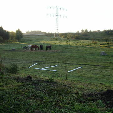
Pferdepension Hit Aktivstall Kürmerhof
Hohenkammer
Kuermerhof
@Kuermerhof
*******JETZT NEU MIT ENTSTAUBTEM BIOHEU*********
*******Demnächst mit einem Abenteuerspielplatz für Pferde ( Extrem Trail/Pa
Veröffentliche deine Suche als Gesuch und Suchauftrag, dann erhältst du Angebote, neue Treffer und Änderungen per E-Mail.
Diese Suche als Gesuch veröffentlichenDeprecated: Creation of dynamic property Zend_View::$pageCount is deprecated in /var/www/stall-frei/htdocs/staging.stall-frei.de/library/vendor/shardj/zf1-future/library/Zend/View/Abstract.php on line 308
Deprecated: Creation of dynamic property Zend_View::$itemCountPerPage is deprecated in /var/www/stall-frei/htdocs/staging.stall-frei.de/library/vendor/shardj/zf1-future/library/Zend/View/Abstract.php on line 308
Deprecated: Creation of dynamic property Zend_View::$first is deprecated in /var/www/stall-frei/htdocs/staging.stall-frei.de/library/vendor/shardj/zf1-future/library/Zend/View/Abstract.php on line 308
Deprecated: Creation of dynamic property Zend_View::$current is deprecated in /var/www/stall-frei/htdocs/staging.stall-frei.de/library/vendor/shardj/zf1-future/library/Zend/View/Abstract.php on line 308
Deprecated: Creation of dynamic property Zend_View::$last is deprecated in /var/www/stall-frei/htdocs/staging.stall-frei.de/library/vendor/shardj/zf1-future/library/Zend/View/Abstract.php on line 308
Deprecated: Creation of dynamic property Zend_View::$previous is deprecated in /var/www/stall-frei/htdocs/staging.stall-frei.de/library/vendor/shardj/zf1-future/library/Zend/View/Abstract.php on line 308
Deprecated: Creation of dynamic property Zend_View::$pagesInRange is deprecated in /var/www/stall-frei/htdocs/staging.stall-frei.de/library/vendor/shardj/zf1-future/library/Zend/View/Abstract.php on line 308
Deprecated: Creation of dynamic property Zend_View::$firstPageInRange is deprecated in /var/www/stall-frei/htdocs/staging.stall-frei.de/library/vendor/shardj/zf1-future/library/Zend/View/Abstract.php on line 308
Deprecated: Creation of dynamic property Zend_View::$lastPageInRange is deprecated in /var/www/stall-frei/htdocs/staging.stall-frei.de/library/vendor/shardj/zf1-future/library/Zend/View/Abstract.php on line 308
Deprecated: Creation of dynamic property Zend_View::$currentItemCount is deprecated in /var/www/stall-frei/htdocs/staging.stall-frei.de/library/vendor/shardj/zf1-future/library/Zend/View/Abstract.php on line 308
Deprecated: Creation of dynamic property Zend_View::$totalItemCount is deprecated in /var/www/stall-frei/htdocs/staging.stall-frei.de/library/vendor/shardj/zf1-future/library/Zend/View/Abstract.php on line 308
Deprecated: Creation of dynamic property Zend_View::$firstItemNumber is deprecated in /var/www/stall-frei/htdocs/staging.stall-frei.de/library/vendor/shardj/zf1-future/library/Zend/View/Abstract.php on line 308
Deprecated: Creation of dynamic property Zend_View::$lastItemNumber is deprecated in /var/www/stall-frei/htdocs/staging.stall-frei.de/library/vendor/shardj/zf1-future/library/Zend/View/Abstract.php on line 308
Deprecated: Creation of dynamic property Zend_View::$router is deprecated in /var/www/stall-frei/htdocs/staging.stall-frei.de/library/vendor/shardj/zf1-future/library/Zend/View/Abstract.php on line 308
Deprecated: Creation of dynamic property Zend_View::$urlParams is deprecated in /var/www/stall-frei/htdocs/staging.stall-frei.de/library/vendor/shardj/zf1-future/library/Zend/View/Abstract.php on line 308
Deprecated: Creation of dynamic property Zend_View::$showAds is deprecated in /var/www/stall-frei/htdocs/staging.stall-frei.de/library/vendor/shardj/zf1-future/library/Zend/View/Abstract.php on line 308
Deprecated: Creation of dynamic property Zend_View::$objectIds is deprecated in /var/www/stall-frei/htdocs/staging.stall-frei.de/library/vendor/shardj/zf1-future/library/Zend/View/Abstract.php on line 308
Deprecated: Creation of dynamic property Zend_View::$showNavbar is deprecated in /var/www/stall-frei/htdocs/staging.stall-frei.de/library/vendor/shardj/zf1-future/library/Zend/View/Abstract.php on line 308
Deprecated: Creation of dynamic property Zend_View::$showBreadcrumb is deprecated in /var/www/stall-frei/htdocs/staging.stall-frei.de/library/vendor/shardj/zf1-future/library/Zend/View/Abstract.php on line 308
Deprecated: Creation of dynamic property Zend_View::$showFooter is deprecated in /var/www/stall-frei/htdocs/staging.stall-frei.de/library/vendor/shardj/zf1-future/library/Zend/View/Abstract.php on line 308
Deprecated: Creation of dynamic property Zend_View::$showInternalAds is deprecated in /var/www/stall-frei/htdocs/staging.stall-frei.de/library/vendor/shardj/zf1-future/library/Zend/View/Abstract.php on line 308
Deprecated: Creation of dynamic property Zend_View::$blNoContent is deprecated in /var/www/stall-frei/htdocs/staging.stall-frei.de/library/vendor/shardj/zf1-future/library/Zend/View/Abstract.php on line 308
Deprecated: Creation of dynamic property Zend_View::$sMetaDesc is deprecated in /var/www/stall-frei/htdocs/staging.stall-frei.de/library/vendor/shardj/zf1-future/library/Zend/View/Abstract.php on line 308
Deprecated: Creation of dynamic property Zend_View::$useGmaps is deprecated in /var/www/stall-frei/htdocs/staging.stall-frei.de/library/vendor/shardj/zf1-future/library/Zend/View/Abstract.php on line 308
Deprecated: Creation of dynamic property Zend_View::$touches is deprecated in /var/www/stall-frei/htdocs/staging.stall-frei.de/library/vendor/shardj/zf1-future/library/Zend/View/Abstract.php on line 308
Deprecated: Creation of dynamic property Zend_View::$oProject is deprecated in /var/www/stall-frei/htdocs/staging.stall-frei.de/library/vendor/shardj/zf1-future/library/Zend/View/Abstract.php on line 308
Deprecated: Creation of dynamic property Zend_View::$pageHeadline is deprecated in /var/www/stall-frei/htdocs/staging.stall-frei.de/library/vendor/shardj/zf1-future/library/Zend/View/Abstract.php on line 308
Deprecated: Creation of dynamic property Zend_View::$disableLocationField is deprecated in /var/www/stall-frei/htdocs/staging.stall-frei.de/library/vendor/shardj/zf1-future/library/Zend/View/Abstract.php on line 308
Deprecated: Creation of dynamic property Zend_View::$isSearch is deprecated in /var/www/stall-frei/htdocs/staging.stall-frei.de/library/vendor/shardj/zf1-future/library/Zend/View/Abstract.php on line 308
Deprecated: Creation of dynamic property Zend_View::$pageTitle is deprecated in /var/www/stall-frei/htdocs/staging.stall-frei.de/library/vendor/shardj/zf1-future/library/Zend/View/Abstract.php on line 308
Deprecated: Creation of dynamic property Psf_Form_Element_Text::$class is deprecated in /var/www/stall-frei/htdocs/staging.stall-frei.de/library/vendor/shardj/zf1-future/library/Zend/Form/Element.php on line 874
Deprecated: Creation of dynamic property Psf_Form_Element_Text::$size is deprecated in /var/www/stall-frei/htdocs/staging.stall-frei.de/library/vendor/shardj/zf1-future/library/Zend/Form/Element.php on line 874
Deprecated: Creation of dynamic property Psf_Form_Element_Text::$placeholder is deprecated in /var/www/stall-frei/htdocs/staging.stall-frei.de/library/vendor/shardj/zf1-future/library/Zend/Form/Element.php on line 874
Deprecated: Creation of dynamic property Psf_Form_Element_Hidden::$class is deprecated in /var/www/stall-frei/htdocs/staging.stall-frei.de/library/vendor/shardj/zf1-future/library/Zend/Form/Element.php on line 874
Deprecated: Creation of dynamic property Psf_Form_Element_Hidden::$class is deprecated in /var/www/stall-frei/htdocs/staging.stall-frei.de/library/vendor/shardj/zf1-future/library/Zend/Form/Element.php on line 874
Deprecated: Creation of dynamic property Psf_Form_Element_Hidden::$class is deprecated in /var/www/stall-frei/htdocs/staging.stall-frei.de/library/vendor/shardj/zf1-future/library/Zend/Form/Element.php on line 874
Deprecated: Creation of dynamic property Psf_Form_Element_Hidden::$class is deprecated in /var/www/stall-frei/htdocs/staging.stall-frei.de/library/vendor/shardj/zf1-future/library/Zend/Form/Element.php on line 874
Deprecated: Creation of dynamic property Psf_Form_Element_Select::$class is deprecated in /var/www/stall-frei/htdocs/staging.stall-frei.de/library/vendor/shardj/zf1-future/library/Zend/Form/Element.php on line 874
Deprecated: Creation of dynamic property Psf_Form_Element_Select::$class is deprecated in /var/www/stall-frei/htdocs/staging.stall-frei.de/library/vendor/shardj/zf1-future/library/Zend/Form/Element.php on line 874
Deprecated: Creation of dynamic property Psf_Form_Element_Select::$class is deprecated in /var/www/stall-frei/htdocs/staging.stall-frei.de/library/vendor/shardj/zf1-future/library/Zend/Form/Element.php on line 874
Deprecated: Creation of dynamic property Psf_Form_Element_Select::$class is deprecated in /var/www/stall-frei/htdocs/staging.stall-frei.de/library/vendor/shardj/zf1-future/library/Zend/Form/Element.php on line 874
Deprecated: Creation of dynamic property Psf_Form_Element_Text::$class is deprecated in /var/www/stall-frei/htdocs/staging.stall-frei.de/library/vendor/shardj/zf1-future/library/Zend/Form/Element.php on line 874
Deprecated: Creation of dynamic property Psf_Form_Element_Checkbox::$label is deprecated in /var/www/stall-frei/htdocs/staging.stall-frei.de/library/vendor/shardj/zf1-future/library/Zend/Form/Element.php on line 874
Deprecated: Creation of dynamic property Zend_View::$sort is deprecated in /var/www/stall-frei/htdocs/staging.stall-frei.de/library/vendor/shardj/zf1-future/library/Zend/View/Abstract.php on line 308
Deprecated: Creation of dynamic property Zend_View::$searchLocation is deprecated in /var/www/stall-frei/htdocs/staging.stall-frei.de/library/vendor/shardj/zf1-future/library/Zend/View/Abstract.php on line 308
Deprecated: Creation of dynamic property Zend_View::$locationHint is deprecated in /var/www/stall-frei/htdocs/staging.stall-frei.de/library/vendor/shardj/zf1-future/library/Zend/View/Abstract.php on line 308
Psf_GeoCoder_Abstract::getLocation: Ostheim Get Location CachedOrLive
Psf_GeoCoder_Abstract::getCachedOrLive: Ostheim
Psf_GeoCoder_Abstract::convertLocationResult
{"documentation":"https:\/\/opencagedata.com\/api","licenses":[{"name":"see attribution guide","url":"https:\/\/opencagedata.com\/credits"}],"results":[{"bounds":{"northeast":{"lat":50.9386582,"lng":7.0604929},"southwest":{"lat":50.917575,"lng":7.0242392}},"components":{"ISO_3166-1_alpha-2":"DE","ISO_3166-1_alpha-3":"DEU","ISO_3166-2":["DE-NW"],"_category":"place","_normalized_city":"K\u00f6ln","_type":"neighbourhood","city":"K\u00f6ln","city_district":"Kalk","continent":"Europe","country":"Deutschland","country_code":"de","political_union":"European Union","state":"Nordrhein-Westfalen","state_code":"NW","suburb":"Ostheim"},"confidence":7,"formatted":"Ostheim, K\u00f6ln, Nordrhein-Westfalen, Deutschland","geometry":{"lat":50.9313927,"lng":7.0457361}},{"bounds":{"northeast":{"lat":50.4090276,"lng":8.7064923},"southwest":{"lat":50.3787931,"lng":8.6529584}},"components":{"ISO_3166-1_alpha-2":"DE","ISO_3166-1_alpha-3":"DEU","ISO_3166-2":["DE-HE"],"_category":"place","_normalized_city":"Ostheim","_type":"village","continent":"Europe","country":"Deutschland","country_code":"de","county":"Wetteraukreis","municipality":"Butzbach","political_union":"European Union","state":"Hessen","state_code":"HE","village":"Ostheim"},"confidence":7,"formatted":"Ostheim, Hessen, Deutschland","geometry":{"lat":50.4034237,"lng":8.6720343}},{"bounds":{"northeast":{"lat":50.2660159,"lng":8.962775},"southwest":{"lat":50.2154305,"lng":8.8911282}},"components":{"ISO_3166-1_alpha-2":"DE","ISO_3166-1_alpha-3":"DEU","ISO_3166-2":["DE-HE"],"_category":"place","_normalized_city":"Nidderau","_type":"village","continent":"Europe","country":"Deutschland","country_code":"de","county":"Main-Kinzig-Kreis","political_union":"European Union","state":"Hessen","state_code":"HE","town":"Nidderau","village":"Ostheim"},"confidence":7,"formatted":"Ostheim, Hessen, Deutschland","geometry":{"lat":50.2242431,"lng":8.9084478}},{"bounds":{"northeast":{"lat":51.0926803,"lng":9.5030908},"southwest":{"lat":51.0658638,"lng":9.4600845}},"components":{"ISO_3166-1_alpha-2":"DE","ISO_3166-1_alpha-3":"DEU","ISO_3166-2":["DE-HE"],"_category":"place","_normalized_city":"Ostheim","_type":"village","continent":"Europe","country":"Deutschland","country_code":"de","county":"Schwalm-Eder-Kreis","municipality":"Malsfeld","political_union":"European Union","state":"Hessen","state_code":"HE","village":"Ostheim"},"confidence":7,"formatted":"Ostheim, Hessen, Deutschland","geometry":{"lat":51.0795893,"lng":9.4803874}},{"bounds":{"northeast":{"lat":51.520949,"lng":9.3333298},"southwest":{"lat":51.4948622,"lng":9.2987495}},"components":{"ISO_3166-1_alpha-2":"DE","ISO_3166-1_alpha-3":"DEU","ISO_3166-2":["DE-HE"],"_category":"place","_normalized_city":"Ostheim","_type":"village","continent":"Europe","country":"Deutschland","country_code":"de","county":"Landkreis Kassel","municipality":"Liebenau","political_union":"European Union","state":"Hessen","state_code":"HE","village":"Ostheim"},"confidence":7,"formatted":"Ostheim, Hessen, Deutschland","geometry":{"lat":51.506111,"lng":9.321111}},{"bounds":{"northeast":{"lat":50.1438327,"lng":10.5536427},"southwest":{"lat":50.1038327,"lng":10.5136427}},"components":{"ISO_3166-1_alpha-2":"DE","ISO_3166-1_alpha-3":"DEU","ISO_3166-2":["DE-BY"],"_category":"place","_normalized_city":"Hofheim in Unterfranken","_type":"village","continent":"Europe","country":"Deutschland","country_code":"de","county":"Landkreis Ha\u00dfberge","municipality":"Hofheim i. UFr. (VGem)","political_union":"European Union","postcode":"97461","state":"Bayern","state_code":"BY","town":"Hofheim in Unterfranken","village":"Ostheim"},"confidence":7,"formatted":"97461 Ostheim, Deutschland","geometry":{"lat":50.1238327,"lng":10.5336427}},{"bounds":{"northeast":{"lat":49.0436682,"lng":10.7104065},"southwest":{"lat":49.0036682,"lng":10.6704065}},"components":{"ISO_3166-1_alpha-2":"DE","ISO_3166-1_alpha-3":"DEU","ISO_3166-2":["DE-BY"],"_category":"place","_normalized_city":"Westheim","_type":"village","city":"Westheim","continent":"Europe","country":"Deutschland","country_code":"de","county":"Landkreis Wei\u00dfenburg-Gunzenhausen","municipality":"Hahnenkamm (VGem)","political_union":"European Union","postcode":"91747","state":"Bayern","state_code":"BY","village":"Ostheim"},"confidence":7,"formatted":"91747 Ostheim, Deutschland","geometry":{"lat":49.0236682,"lng":10.6904065}},{"bounds":{"northeast":{"lat":48.792918,"lng":9.2151564},"southwest":{"lat":48.780179,"lng":9.1955682}},"components":{"ISO_3166-1_alpha-2":"DE","ISO_3166-1_alpha-3":"DEU","ISO_3166-2":["DE-BW"],"_category":"place","_normalized_city":"Stuttgart","_type":"neighbourhood","city":"Stuttgart","city_district":"Stuttgart-Ost","continent":"Europe","country":"Deutschland","country_code":"de","political_union":"European Union","postcode":"70188","state":"Baden-W\u00fcrttemberg","state_code":"BW","suburb":"Ostheim"},"confidence":8,"formatted":"70188 Stuttgart, Deutschland","geometry":{"lat":48.7865323,"lng":9.2040954}},{"bounds":{"northeast":{"lat":50.8288852,"lng":12.9709196},"southwest":{"lat":50.8264195,"lng":12.9677407}},"components":{"ISO_3166-1_alpha-2":"DE","ISO_3166-1_alpha-3":"DEU","ISO_3166-2":["DE-SN"],"_category":"road","_normalized_city":"Chemnitz","_type":"road","city":"Chemnitz","continent":"Europe","country":"Deutschland","country_code":"de","municipality":"Lichtenau","political_union":"European Union","postcode":"09127","road":"Ostheim","road_type":"residential","state":"Sachsen","state_code":"SN","suburb":"Gablenz"},"confidence":9,"formatted":"Ostheim, 09127 Chemnitz, Deutschland","geometry":{"lat":50.8277,"lng":12.969293}},{"bounds":{"northeast":{"lat":49.0110604,"lng":12.1341599},"southwest":{"lat":49.0095857,"lng":12.1331041}},"components":{"ISO_3166-1_alpha-2":"DE","ISO_3166-1_alpha-3":"DEU","ISO_3166-2":["DE-BY"],"_category":"road","_normalized_city":"Regensburg","_type":"road","city":"Regensburg","continent":"Europe","country":"Deutschland","country_code":"de","neighbourhood":"Hohes Kreuz","political_union":"European Union","postcode":"93055","road":"Ostheim","road_type":"residential","state":"Bayern","state_code":"BY","suburb":"Ostenviertel"},"confidence":9,"formatted":"Ostheim, 93055 Regensburg, Deutschland","geometry":{"lat":49.0100427,"lng":12.1332155}}],"status":{"code":200,"message":"OK"},"stay_informed":{"blog":"https:\/\/blog.opencagedata.com","mastodon":"https:\/\/en.osm.town\/@opencage"},"thanks":"For using an OpenCage API","timestamp":{"created_http":"Sat, 07 Feb 2026 19:44:46 GMT","created_unix":1770493486},"total_results":10}Array
(
[0] => stdClass Object
(
[bounds] => stdClass Object
(
[northeast] => stdClass Object
(
[lat] => 50.9386582
[lng] => 7.0604929
)
[southwest] => stdClass Object
(
[lat] => 50.917575
[lng] => 7.0242392
)
)
[components] => stdClass Object
(
[ISO_3166-1_alpha-2] => DE
[ISO_3166-1_alpha-3] => DEU
[ISO_3166-2] => Array
(
[0] => DE-NW
)
[_category] => place
[_normalized_city] => Köln
[_type] => neighbourhood
[city] => Köln
[city_district] => Kalk
[continent] => Europe
[country] => Deutschland
[country_code] => de
[political_union] => European Union
[state] => Nordrhein-Westfalen
[state_code] => NW
[suburb] => Ostheim
)
[confidence] => 7
[formatted] => Ostheim, Köln, Nordrhein-Westfalen, Deutschland
[geometry] => stdClass Object
(
[lat] => 50.9313927
[lng] => 7.0457361
)
)
[1] => stdClass Object
(
[bounds] => stdClass Object
(
[northeast] => stdClass Object
(
[lat] => 50.4090276
[lng] => 8.7064923
)
[southwest] => stdClass Object
(
[lat] => 50.3787931
[lng] => 8.6529584
)
)
[components] => stdClass Object
(
[ISO_3166-1_alpha-2] => DE
[ISO_3166-1_alpha-3] => DEU
[ISO_3166-2] => Array
(
[0] => DE-HE
)
[_category] => place
[_normalized_city] => Ostheim
[_type] => village
[continent] => Europe
[country] => Deutschland
[country_code] => de
[county] => Wetteraukreis
[municipality] => Butzbach
[political_union] => European Union
[state] => Hessen
[state_code] => HE
[village] => Ostheim
)
[confidence] => 7
[formatted] => Ostheim, Hessen, Deutschland
[geometry] => stdClass Object
(
[lat] => 50.4034237
[lng] => 8.6720343
)
)
[2] => stdClass Object
(
[bounds] => stdClass Object
(
[northeast] => stdClass Object
(
[lat] => 50.2660159
[lng] => 8.962775
)
[southwest] => stdClass Object
(
[lat] => 50.2154305
[lng] => 8.8911282
)
)
[components] => stdClass Object
(
[ISO_3166-1_alpha-2] => DE
[ISO_3166-1_alpha-3] => DEU
[ISO_3166-2] => Array
(
[0] => DE-HE
)
[_category] => place
[_normalized_city] => Nidderau
[_type] => village
[continent] => Europe
[country] => Deutschland
[country_code] => de
[county] => Main-Kinzig-Kreis
[political_union] => European Union
[state] => Hessen
[state_code] => HE
[town] => Nidderau
[village] => Ostheim
)
[confidence] => 7
[formatted] => Ostheim, Hessen, Deutschland
[geometry] => stdClass Object
(
[lat] => 50.2242431
[lng] => 8.9084478
)
)
[3] => stdClass Object
(
[bounds] => stdClass Object
(
[northeast] => stdClass Object
(
[lat] => 51.0926803
[lng] => 9.5030908
)
[southwest] => stdClass Object
(
[lat] => 51.0658638
[lng] => 9.4600845
)
)
[components] => stdClass Object
(
[ISO_3166-1_alpha-2] => DE
[ISO_3166-1_alpha-3] => DEU
[ISO_3166-2] => Array
(
[0] => DE-HE
)
[_category] => place
[_normalized_city] => Ostheim
[_type] => village
[continent] => Europe
[country] => Deutschland
[country_code] => de
[county] => Schwalm-Eder-Kreis
[municipality] => Malsfeld
[political_union] => European Union
[state] => Hessen
[state_code] => HE
[village] => Ostheim
)
[confidence] => 7
[formatted] => Ostheim, Hessen, Deutschland
[geometry] => stdClass Object
(
[lat] => 51.0795893
[lng] => 9.4803874
)
)
[4] => stdClass Object
(
[bounds] => stdClass Object
(
[northeast] => stdClass Object
(
[lat] => 51.520949
[lng] => 9.3333298
)
[southwest] => stdClass Object
(
[lat] => 51.4948622
[lng] => 9.2987495
)
)
[components] => stdClass Object
(
[ISO_3166-1_alpha-2] => DE
[ISO_3166-1_alpha-3] => DEU
[ISO_3166-2] => Array
(
[0] => DE-HE
)
[_category] => place
[_normalized_city] => Ostheim
[_type] => village
[continent] => Europe
[country] => Deutschland
[country_code] => de
[county] => Landkreis Kassel
[municipality] => Liebenau
[political_union] => European Union
[state] => Hessen
[state_code] => HE
[village] => Ostheim
)
[confidence] => 7
[formatted] => Ostheim, Hessen, Deutschland
[geometry] => stdClass Object
(
[lat] => 51.506111
[lng] => 9.321111
)
)
[5] => stdClass Object
(
[bounds] => stdClass Object
(
[northeast] => stdClass Object
(
[lat] => 50.1438327
[lng] => 10.5536427
)
[southwest] => stdClass Object
(
[lat] => 50.1038327
[lng] => 10.5136427
)
)
[components] => stdClass Object
(
[ISO_3166-1_alpha-2] => DE
[ISO_3166-1_alpha-3] => DEU
[ISO_3166-2] => Array
(
[0] => DE-BY
)
[_category] => place
[_normalized_city] => Hofheim in Unterfranken
[_type] => village
[continent] => Europe
[country] => Deutschland
[country_code] => de
[county] => Landkreis Haßberge
[municipality] => Hofheim i. UFr. (VGem)
[political_union] => European Union
[postcode] => 97461
[state] => Bayern
[state_code] => BY
[town] => Hofheim in Unterfranken
[village] => Ostheim
)
[confidence] => 7
[formatted] => 97461 Ostheim, Deutschland
[geometry] => stdClass Object
(
[lat] => 50.1238327
[lng] => 10.5336427
)
)
[6] => stdClass Object
(
[bounds] => stdClass Object
(
[northeast] => stdClass Object
(
[lat] => 49.0436682
[lng] => 10.7104065
)
[southwest] => stdClass Object
(
[lat] => 49.0036682
[lng] => 10.6704065
)
)
[components] => stdClass Object
(
[ISO_3166-1_alpha-2] => DE
[ISO_3166-1_alpha-3] => DEU
[ISO_3166-2] => Array
(
[0] => DE-BY
)
[_category] => place
[_normalized_city] => Westheim
[_type] => village
[city] => Westheim
[continent] => Europe
[country] => Deutschland
[country_code] => de
[county] => Landkreis Weißenburg-Gunzenhausen
[municipality] => Hahnenkamm (VGem)
[political_union] => European Union
[postcode] => 91747
[state] => Bayern
[state_code] => BY
[village] => Ostheim
)
[confidence] => 7
[formatted] => 91747 Ostheim, Deutschland
[geometry] => stdClass Object
(
[lat] => 49.0236682
[lng] => 10.6904065
)
)
[7] => stdClass Object
(
[bounds] => stdClass Object
(
[northeast] => stdClass Object
(
[lat] => 48.792918
[lng] => 9.2151564
)
[southwest] => stdClass Object
(
[lat] => 48.780179
[lng] => 9.1955682
)
)
[components] => stdClass Object
(
[ISO_3166-1_alpha-2] => DE
[ISO_3166-1_alpha-3] => DEU
[ISO_3166-2] => Array
(
[0] => DE-BW
)
[_category] => place
[_normalized_city] => Stuttgart
[_type] => neighbourhood
[city] => Stuttgart
[city_district] => Stuttgart-Ost
[continent] => Europe
[country] => Deutschland
[country_code] => de
[political_union] => European Union
[postcode] => 70188
[state] => Baden-Württemberg
[state_code] => BW
[suburb] => Ostheim
)
[confidence] => 8
[formatted] => 70188 Stuttgart, Deutschland
[geometry] => stdClass Object
(
[lat] => 48.7865323
[lng] => 9.2040954
)
)
[8] => stdClass Object
(
[bounds] => stdClass Object
(
[northeast] => stdClass Object
(
[lat] => 50.8288852
[lng] => 12.9709196
)
[southwest] => stdClass Object
(
[lat] => 50.8264195
[lng] => 12.9677407
)
)
[components] => stdClass Object
(
[ISO_3166-1_alpha-2] => DE
[ISO_3166-1_alpha-3] => DEU
[ISO_3166-2] => Array
(
[0] => DE-SN
)
[_category] => road
[_normalized_city] => Chemnitz
[_type] => road
[city] => Chemnitz
[continent] => Europe
[country] => Deutschland
[country_code] => de
[municipality] => Lichtenau
[political_union] => European Union
[postcode] => 09127
[road] => Ostheim
[road_type] => residential
[state] => Sachsen
[state_code] => SN
[suburb] => Gablenz
)
[confidence] => 9
[formatted] => Ostheim, 09127 Chemnitz, Deutschland
[geometry] => stdClass Object
(
[lat] => 50.8277
[lng] => 12.969293
)
)
[9] => stdClass Object
(
[bounds] => stdClass Object
(
[northeast] => stdClass Object
(
[lat] => 49.0110604
[lng] => 12.1341599
)
[southwest] => stdClass Object
(
[lat] => 49.0095857
[lng] => 12.1331041
)
)
[components] => stdClass Object
(
[ISO_3166-1_alpha-2] => DE
[ISO_3166-1_alpha-3] => DEU
[ISO_3166-2] => Array
(
[0] => DE-BY
)
[_category] => road
[_normalized_city] => Regensburg
[_type] => road
[city] => Regensburg
[continent] => Europe
[country] => Deutschland
[country_code] => de
[neighbourhood] => Hohes Kreuz
[political_union] => European Union
[postcode] => 93055
[road] => Ostheim
[road_type] => residential
[state] => Bayern
[state_code] => BY
[suburb] => Ostenviertel
)
[confidence] => 9
[formatted] => Ostheim, 93055 Regensburg, Deutschland
[geometry] => stdClass Object
(
[lat] => 49.0100427
[lng] => 12.1332155
)
)
)
Psf_GeoCoder_OpenCageData::getKeyMap: 0
stdClass Object
(
    [bounds] => stdClass Object
        (
            [northeast] => stdClass Object
                (
                    [lat] => 50.9386582
                    [lng] => 7.0604929
                )

            [southwest] => stdClass Object
                (
                    [lat] => 50.917575
                    [lng] => 7.0242392
                )

        )

    [components] => stdClass Object
        (
            [ISO_3166-1_alpha-2] => DE
            [ISO_3166-1_alpha-3] => DEU
            [ISO_3166-2] => Array
                (
                    [0] => DE-NW
                )

            [_category] => place
            [_normalized_city] => Köln
            [_type] => neighbourhood
            [city] => Köln
            [city_district] => Kalk
            [continent] => Europe
            [country] => Deutschland
            [country_code] => de
            [political_union] => European Union
            [state] => Nordrhein-Westfalen
            [state_code] => NW
            [suburb] => Ostheim
        )

    [confidence] => 7
    [formatted] => Ostheim, Köln, Nordrhein-Westfalen, Deutschland
    [geometry] => stdClass Object
        (
            [lat] => 50.9313927
            [lng] => 7.0457361
        )

)
Psf_GeoCoder_OpenCageData::getCounty: Köln
Psf_GeoCoder_OpenCageData::addMissingData REFETCH!
Array
(
    [address] => Ostheim, Köln, Nordrhein-Westfalen, Deutschland
    [type] => neighbourhood
    [street] =>
    [city] => Ostheim
    [county] => Köln
    [state] => Nordrhein-Westfalen
    [zip] =>
    [country] => Deutschland
    [suburb] => Ostheim
    [countrycode] => de
    [latitude] => 50.9313927
    [longitude] => 7.0457361
    [accuracy] => 1
    [confidence] => 7
    [bounds] => stdClass Object
        (
            [northeast] => stdClass Object
                (
                    [lat] => 50.9386582
                    [lng] => 7.0604929
                )

            [southwest] => stdClass Object
                (
                    [lat] => 50.917575
                    [lng] => 7.0242392
                )

        )

)
reformat!
Array
(
    [address] => Ostheim, Köln, Nordrhein-Westfalen, Deutschland
    [type] => neighbourhood
    [street] =>
    [city] => Ostheim
    [county] => Köln
    [state] => Nordrhein-Westfalen
    [zip] =>
    [country] => Deutschland
    [suburb] => Ostheim
    [countrycode] => de
    [latitude] => 50.9313927
    [longitude] => 7.0457361
    [accuracy] => 1
    [confidence] => 7
    [bounds] => stdClass Object
        (
            [northeast] => stdClass Object
                (
                    [lat] => 50.9386582
                    [lng] => 7.0604929
                )

            [southwest] => stdClass Object
                (
                    [lat] => 50.917575
                    [lng] => 7.0242392
                )

        )

    [place] => Ostheim, Nordrhein-Westfalen
    [hash] => 2c024fcba16f0a2d96db5c816a3812b8
)
Psf_GeoCoder_OpenCageData::getKeyMap: 1
stdClass Object
(
    [bounds] => stdClass Object
        (
            [northeast] => stdClass Object
                (
                    [lat] => 50.4090276
                    [lng] => 8.7064923
                )

            [southwest] => stdClass Object
                (
                    [lat] => 50.3787931
                    [lng] => 8.6529584
                )

        )

    [components] => stdClass Object
        (
            [ISO_3166-1_alpha-2] => DE
            [ISO_3166-1_alpha-3] => DEU
            [ISO_3166-2] => Array
                (
                    [0] => DE-HE
                )

            [_category] => place
            [_normalized_city] => Ostheim
            [_type] => village
            [continent] => Europe
            [country] => Deutschland
            [country_code] => de
            [county] => Wetteraukreis
            [municipality] => Butzbach
            [political_union] => European Union
            [state] => Hessen
            [state_code] => HE
            [village] => Ostheim
        )

    [confidence] => 7
    [formatted] => Ostheim, Hessen, Deutschland
    [geometry] => stdClass Object
        (
            [lat] => 50.4034237
            [lng] => 8.6720343
        )

)
Psf_GeoCoder_OpenCageData::getCounty: Wetteraukreis
Psf_GeoCoder_OpenCageData::addMissingData REFETCH!
Array
(
    [address] => Ostheim, Hessen, Deutschland
    [type] => village
    [street] =>
    [city] => Ostheim
    [county] => Wetteraukreis
    [state] => Hessen
    [zip] =>
    [country] => Deutschland
    [suburb] =>
    [countrycode] => de
    [latitude] => 50.4034237
    [longitude] => 8.6720343
    [accuracy] => 1
    [confidence] => 7
    [bounds] => stdClass Object
        (
            [northeast] => stdClass Object
                (
                    [lat] => 50.4090276
                    [lng] => 8.7064923
                )

            [southwest] => stdClass Object
                (
                    [lat] => 50.3787931
                    [lng] => 8.6529584
                )

        )

)
reformat!
Array
(
    [address] => Ostheim, Hessen, Deutschland
    [type] => village
    [street] =>
    [city] => Ostheim
    [county] => Wetteraukreis
    [state] => Hessen
    [zip] =>
    [country] => Deutschland
    [suburb] =>
    [countrycode] => de
    [latitude] => 50.4034237
    [longitude] => 8.6720343
    [accuracy] => 1
    [confidence] => 7
    [bounds] => stdClass Object
        (
            [northeast] => stdClass Object
                (
                    [lat] => 50.4090276
                    [lng] => 8.7064923
                )

            [southwest] => stdClass Object
                (
                    [lat] => 50.3787931
                    [lng] => 8.6529584
                )

        )

    [place] => Ostheim, Hessen
    [hash] => 1c5303bf3617e02bff2de382e01e746e
)
Psf_GeoCoder_OpenCageData::getKeyMap: 2
stdClass Object
(
    [bounds] => stdClass Object
        (
            [northeast] => stdClass Object
                (
                    [lat] => 50.2660159
                    [lng] => 8.962775
                )

            [southwest] => stdClass Object
                (
                    [lat] => 50.2154305
                    [lng] => 8.8911282
                )

        )

    [components] => stdClass Object
        (
            [ISO_3166-1_alpha-2] => DE
            [ISO_3166-1_alpha-3] => DEU
            [ISO_3166-2] => Array
                (
                    [0] => DE-HE
                )

            [_category] => place
            [_normalized_city] => Nidderau
            [_type] => village
            [continent] => Europe
            [country] => Deutschland
            [country_code] => de
            [county] => Main-Kinzig-Kreis
            [political_union] => European Union
            [state] => Hessen
            [state_code] => HE
            [town] => Nidderau
            [village] => Ostheim
        )

    [confidence] => 7
    [formatted] => Ostheim, Hessen, Deutschland
    [geometry] => stdClass Object
        (
            [lat] => 50.2242431
            [lng] => 8.9084478
        )

)
Psf_GeoCoder_OpenCageData::getCounty: Main-Kinzig-Kreis
Psf_GeoCoder_OpenCageData::addMissingData REFETCH!
Array
(
    [address] => Ostheim, Hessen, Deutschland
    [type] => village
    [street] =>
    [city] => Nidderau
    [county] => Main-Kinzig-Kreis
    [state] => Hessen
    [zip] =>
    [country] => Deutschland
    [suburb] =>
    [countrycode] => de
    [latitude] => 50.2242431
    [longitude] => 8.9084478
    [accuracy] => 1
    [confidence] => 7
    [bounds] => stdClass Object
        (
            [northeast] => stdClass Object
                (
                    [lat] => 50.2660159
                    [lng] => 8.962775
                )

            [southwest] => stdClass Object
                (
                    [lat] => 50.2154305
                    [lng] => 8.8911282
                )

        )

)
reformat!
Array
(
    [address] => Nidderau
    [type] => village
    [street] =>
    [city] => Nidderau
    [county] => Main-Kinzig-Kreis
    [state] => Hessen
    [zip] =>
    [country] => Deutschland
    [suburb] =>
    [countrycode] => de
    [latitude] => 50.2242431
    [longitude] => 8.9084478
    [accuracy] => 1
    [confidence] => 7
    [bounds] => stdClass Object
        (
            [northeast] => stdClass Object
                (
                    [lat] => 50.2660159
                    [lng] => 8.962775
                )

            [southwest] => stdClass Object
                (
                    [lat] => 50.2154305
                    [lng] => 8.8911282
                )

        )

    [place] => Nidderau, Hessen
    [hash] => 32913e3bef8eb0f2fdebdb8297c5cf8d
)
Psf_GeoCoder_OpenCageData::getKeyMap: 3
stdClass Object
(
    [bounds] => stdClass Object
        (
            [northeast] => stdClass Object
                (
                    [lat] => 51.0926803
                    [lng] => 9.5030908
                )

            [southwest] => stdClass Object
                (
                    [lat] => 51.0658638
                    [lng] => 9.4600845
                )

        )

    [components] => stdClass Object
        (
            [ISO_3166-1_alpha-2] => DE
            [ISO_3166-1_alpha-3] => DEU
            [ISO_3166-2] => Array
                (
                    [0] => DE-HE
                )

            [_category] => place
            [_normalized_city] => Ostheim
            [_type] => village
            [continent] => Europe
            [country] => Deutschland
            [country_code] => de
            [county] => Schwalm-Eder-Kreis
            [municipality] => Malsfeld
            [political_union] => European Union
            [state] => Hessen
            [state_code] => HE
            [village] => Ostheim
        )

    [confidence] => 7
    [formatted] => Ostheim, Hessen, Deutschland
    [geometry] => stdClass Object
        (
            [lat] => 51.0795893
            [lng] => 9.4803874
        )

)
Psf_GeoCoder_OpenCageData::getCounty: Schwalm-Eder-Kreis
Psf_GeoCoder_OpenCageData::addMissingData REFETCH!
Array
(
    [address] => Ostheim, Hessen, Deutschland
    [type] => village
    [street] =>
    [city] => Ostheim
    [county] => Schwalm-Eder-Kreis
    [state] => Hessen
    [zip] =>
    [country] => Deutschland
    [suburb] =>
    [countrycode] => de
    [latitude] => 51.0795893
    [longitude] => 9.4803874
    [accuracy] => 1
    [confidence] => 7
    [bounds] => stdClass Object
        (
            [northeast] => stdClass Object
                (
                    [lat] => 51.0926803
                    [lng] => 9.5030908
                )

            [southwest] => stdClass Object
                (
                    [lat] => 51.0658638
                    [lng] => 9.4600845
                )

        )

)
reformat!
Array
(
    [address] => Ostheim, Hessen, Deutschland
    [type] => village
    [street] =>
    [city] => Ostheim
    [county] => Schwalm-Eder-Kreis
    [state] => Hessen
    [zip] =>
    [country] => Deutschland
    [suburb] =>
    [countrycode] => de
    [latitude] => 51.0795893
    [longitude] => 9.4803874
    [accuracy] => 1
    [confidence] => 7
    [bounds] => stdClass Object
        (
            [northeast] => stdClass Object
                (
                    [lat] => 51.0926803
                    [lng] => 9.5030908
                )

            [southwest] => stdClass Object
                (
                    [lat] => 51.0658638
                    [lng] => 9.4600845
                )

        )

    [place] => Ostheim, Hessen
    [hash] => 1c5303bf3617e02bff2de382e01e746e
)
Psf_GeoCoder_OpenCageData::getKeyMap: 4
stdClass Object
(
    [bounds] => stdClass Object
        (
            [northeast] => stdClass Object
                (
                    [lat] => 51.520949
                    [lng] => 9.3333298
                )

            [southwest] => stdClass Object
                (
                    [lat] => 51.4948622
                    [lng] => 9.2987495
                )

        )

    [components] => stdClass Object
        (
            [ISO_3166-1_alpha-2] => DE
            [ISO_3166-1_alpha-3] => DEU
            [ISO_3166-2] => Array
                (
                    [0] => DE-HE
                )

            [_category] => place
            [_normalized_city] => Ostheim
            [_type] => village
            [continent] => Europe
            [country] => Deutschland
            [country_code] => de
            [county] => Landkreis Kassel
            [municipality] => Liebenau
            [political_union] => European Union
            [state] => Hessen
            [state_code] => HE
            [village] => Ostheim
        )

    [confidence] => 7
    [formatted] => Ostheim, Hessen, Deutschland
    [geometry] => stdClass Object
        (
            [lat] => 51.506111
            [lng] => 9.321111
        )

)
Psf_GeoCoder_OpenCageData::getCounty: Kassel
Psf_GeoCoder_OpenCageData::addMissingData REFETCH!
Array
(
    [address] => Ostheim, Hessen, Deutschland
    [type] => village
    [street] =>
    [city] => Ostheim
    [county] => Kassel
    [state] => Hessen
    [zip] =>
    [country] => Deutschland
    [suburb] =>
    [countrycode] => de
    [latitude] => 51.506111
    [longitude] => 9.321111
    [accuracy] => 1
    [confidence] => 7
    [bounds] => stdClass Object
        (
            [northeast] => stdClass Object
                (
                    [lat] => 51.520949
                    [lng] => 9.3333298
                )

            [southwest] => stdClass Object
                (
                    [lat] => 51.4948622
                    [lng] => 9.2987495
                )

        )

)
reformat!
Array
(
    [address] => Ostheim, Hessen, Deutschland
    [type] => village
    [street] =>
    [city] => Ostheim
    [county] => Kassel
    [state] => Hessen
    [zip] =>
    [country] => Deutschland
    [suburb] =>
    [countrycode] => de
    [latitude] => 51.506111
    [longitude] => 9.321111
    [accuracy] => 1
    [confidence] => 7
    [bounds] => stdClass Object
        (
            [northeast] => stdClass Object
                (
                    [lat] => 51.520949
                    [lng] => 9.3333298
                )

            [southwest] => stdClass Object
                (
                    [lat] => 51.4948622
                    [lng] => 9.2987495
                )

        )

    [place] => Ostheim, Hessen
    [hash] => 1c5303bf3617e02bff2de382e01e746e
)
Psf_GeoCoder_OpenCageData::getKeyMap: 5
stdClass Object
(
    [bounds] => stdClass Object
        (
            [northeast] => stdClass Object
                (
                    [lat] => 50.1438327
                    [lng] => 10.5536427
                )

            [southwest] => stdClass Object
                (
                    [lat] => 50.1038327
                    [lng] => 10.5136427
                )

        )

    [components] => stdClass Object
        (
            [ISO_3166-1_alpha-2] => DE
            [ISO_3166-1_alpha-3] => DEU
            [ISO_3166-2] => Array
                (
                    [0] => DE-BY
                )

            [_category] => place
            [_normalized_city] => Hofheim in Unterfranken
            [_type] => village
            [continent] => Europe
            [country] => Deutschland
            [country_code] => de
            [county] => Landkreis Haßberge
            [municipality] => Hofheim i. UFr. (VGem)
            [political_union] => European Union
            [postcode] => 97461
            [state] => Bayern
            [state_code] => BY
            [town] => Hofheim in Unterfranken
            [village] => Ostheim
        )

    [confidence] => 7
    [formatted] => 97461 Ostheim, Deutschland
    [geometry] => stdClass Object
        (
            [lat] => 50.1238327
            [lng] => 10.5336427
        )

)
Psf_GeoCoder_OpenCageData::getCounty: Haßberge
Psf_GeoCoder_OpenCageData::addMissingData REFETCH!
Array
(
    [address] => 97461 Ostheim, Deutschland
    [type] => village
    [street] =>
    [city] => Hofheim in Unterfranken
    [county] => Haßberge
    [state] => Bayern
    [zip] => 97461
    [country] => Deutschland
    [suburb] =>
    [countrycode] => de
    [latitude] => 50.1238327
    [longitude] => 10.5336427
    [accuracy] => 1
    [confidence] => 7
    [bounds] => stdClass Object
        (
            [northeast] => stdClass Object
                (
                    [lat] => 50.1438327
                    [lng] => 10.5536427
                )

            [southwest] => stdClass Object
                (
                    [lat] => 50.1038327
                    [lng] => 10.5136427
                )

        )

)
reformat!
Array
(
    [address] => 97461 Hofheim in Unterfranken
    [type] => village
    [street] =>
    [city] => Hofheim in Unterfranken
    [county] => Haßberge
    [state] => Bayern
    [zip] => 97461
    [country] => Deutschland
    [suburb] =>
    [countrycode] => de
    [latitude] => 50.1238327
    [longitude] => 10.5336427
    [accuracy] => 1
    [confidence] => 7
    [bounds] => stdClass Object
        (
            [northeast] => stdClass Object
                (
                    [lat] => 50.1438327
                    [lng] => 10.5536427
                )

            [southwest] => stdClass Object
                (
                    [lat] => 50.1038327
                    [lng] => 10.5136427
                )

        )

    [place] => 97461 Hofheim in Unterfranken, Bayern
    [hash] => 1589c019b6e309329149cfe6895fafdb
)
Psf_GeoCoder_OpenCageData::getKeyMap: 6
stdClass Object
(
    [bounds] => stdClass Object
        (
            [northeast] => stdClass Object
                (
                    [lat] => 49.0436682
                    [lng] => 10.7104065
                )

            [southwest] => stdClass Object
                (
                    [lat] => 49.0036682
                    [lng] => 10.6704065
                )

        )

    [components] => stdClass Object
        (
            [ISO_3166-1_alpha-2] => DE
            [ISO_3166-1_alpha-3] => DEU
            [ISO_3166-2] => Array
                (
                    [0] => DE-BY
                )

            [_category] => place
            [_normalized_city] => Westheim
            [_type] => village
            [city] => Westheim
            [continent] => Europe
            [country] => Deutschland
            [country_code] => de
            [county] => Landkreis Weißenburg-Gunzenhausen
            [municipality] => Hahnenkamm (VGem)
            [political_union] => European Union
            [postcode] => 91747
            [state] => Bayern
            [state_code] => BY
            [village] => Ostheim
        )

    [confidence] => 7
    [formatted] => 91747 Ostheim, Deutschland
    [geometry] => stdClass Object
        (
            [lat] => 49.0236682
            [lng] => 10.6904065
        )

)
Psf_GeoCoder_OpenCageData::getCounty: Weißenburg-Gunzenhausen
Psf_GeoCoder_OpenCageData::addMissingData REFETCH!
Array
(
    [address] => 91747 Ostheim, Deutschland
    [type] => village
    [street] =>
    [city] => Ostheim
    [county] => Weißenburg-Gunzenhausen
    [state] => Bayern
    [zip] => 91747
    [country] => Deutschland
    [suburb] =>
    [countrycode] => de
    [latitude] => 49.0236682
    [longitude] => 10.6904065
    [accuracy] => 1
    [confidence] => 7
    [bounds] => stdClass Object
        (
            [northeast] => stdClass Object
                (
                    [lat] => 49.0436682
                    [lng] => 10.7104065
                )

            [southwest] => stdClass Object
                (
                    [lat] => 49.0036682
                    [lng] => 10.6704065
                )

        )

)
reformat!
Array
(
    [address] => 91747 Ostheim, Deutschland
    [type] => village
    [street] =>
    [city] => Ostheim
    [county] => Weißenburg-Gunzenhausen
    [state] => Bayern
    [zip] => 91747
    [country] => Deutschland
    [suburb] =>
    [countrycode] => de
    [latitude] => 49.0236682
    [longitude] => 10.6904065
    [accuracy] => 1
    [confidence] => 7
    [bounds] => stdClass Object
        (
            [northeast] => stdClass Object
                (
                    [lat] => 49.0436682
                    [lng] => 10.7104065
                )

            [southwest] => stdClass Object
                (
                    [lat] => 49.0036682
                    [lng] => 10.6704065
                )

        )

    [place] => 91747 Ostheim, Bayern
    [hash] => dcad37a96c9c1ed4b76dbf33d815e735
)
Psf_GeoCoder_OpenCageData::getKeyMap: 7
stdClass Object
(
    [bounds] => stdClass Object
        (
            [northeast] => stdClass Object
                (
                    [lat] => 48.792918
                    [lng] => 9.2151564
                )

            [southwest] => stdClass Object
                (
                    [lat] => 48.780179
                    [lng] => 9.1955682
                )

        )

    [components] => stdClass Object
        (
            [ISO_3166-1_alpha-2] => DE
            [ISO_3166-1_alpha-3] => DEU
            [ISO_3166-2] => Array
                (
                    [0] => DE-BW
                )

            [_category] => place
            [_normalized_city] => Stuttgart
            [_type] => neighbourhood
            [city] => Stuttgart
            [city_district] => Stuttgart-Ost
            [continent] => Europe
            [country] => Deutschland
            [country_code] => de
            [political_union] => European Union
            [postcode] => 70188
            [state] => Baden-Württemberg
            [state_code] => BW
            [suburb] => Ostheim
        )

    [confidence] => 8
    [formatted] => 70188 Stuttgart, Deutschland
    [geometry] => stdClass Object
        (
            [lat] => 48.7865323
            [lng] => 9.2040954
        )

)
Psf_GeoCoder_OpenCageData::getCounty: Stuttgart
Psf_GeoCoder_OpenCageData::addMissingData REFETCH!
Array
(
    [address] => 70188 Stuttgart, Deutschland
    [type] => neighbourhood
    [street] =>
    [city] => Ostheim
    [county] => Stuttgart
    [state] => Baden-Württemberg
    [zip] => 70188
    [country] => Deutschland
    [suburb] => Ostheim
    [countrycode] => de
    [latitude] => 48.7865323
    [longitude] => 9.2040954
    [accuracy] => 1
    [confidence] => 8
    [bounds] => stdClass Object
        (
            [northeast] => stdClass Object
                (
                    [lat] => 48.792918
                    [lng] => 9.2151564
                )

            [southwest] => stdClass Object
                (
                    [lat] => 48.780179
                    [lng] => 9.1955682
                )

        )

)
reformat!
Array
(
    [address] => 70188 Ostheim
    [type] => neighbourhood
    [street] =>
    [city] => Ostheim
    [county] => Stuttgart
    [state] => Baden-Württemberg
    [zip] => 70188
    [country] => Deutschland
    [suburb] => Ostheim
    [countrycode] => de
    [latitude] => 48.7865323
    [longitude] => 9.2040954
    [accuracy] => 1
    [confidence] => 8
    [bounds] => stdClass Object
        (
            [northeast] => stdClass Object
                (
                    [lat] => 48.792918
                    [lng] => 9.2151564
                )

            [southwest] => stdClass Object
                (
                    [lat] => 48.780179
                    [lng] => 9.1955682
                )

        )

    [place] => 70188 Ostheim, Baden-Württemberg
    [hash] => 50b821cd91dd469fedcc5daa69e5a2bf
)
Psf_GeoCoder_OpenCageData::getKeyMap: 8
stdClass Object
(
    [bounds] => stdClass Object
        (
            [northeast] => stdClass Object
                (
                    [lat] => 50.8288852
                    [lng] => 12.9709196
                )

            [southwest] => stdClass Object
                (
                    [lat] => 50.8264195
                    [lng] => 12.9677407
                )

        )

    [components] => stdClass Object
        (
            [ISO_3166-1_alpha-2] => DE
            [ISO_3166-1_alpha-3] => DEU
            [ISO_3166-2] => Array
                (
                    [0] => DE-SN
                )

            [_category] => road
            [_normalized_city] => Chemnitz
            [_type] => road
            [city] => Chemnitz
            [continent] => Europe
            [country] => Deutschland
            [country_code] => de
            [municipality] => Lichtenau
            [political_union] => European Union
            [postcode] => 09127
            [road] => Ostheim
            [road_type] => residential
            [state] => Sachsen
            [state_code] => SN
            [suburb] => Gablenz
        )

    [confidence] => 9
    [formatted] => Ostheim, 09127 Chemnitz, Deutschland
    [geometry] => stdClass Object
        (
            [lat] => 50.8277
            [lng] => 12.969293
        )

)
Psf_GeoCoder_OpenCageData::getCounty: Chemnitz
Psf_GeoCoder_OpenCageData::addMissingData REFETCH!
Array
(
    [address] => Ostheim, 09127 Chemnitz, Deutschland
    [type] => road
    [street] => Ostheim
    [city] => Gablenz
    [county] => Chemnitz
    [state] => Sachsen
    [zip] => 09127
    [country] => Deutschland
    [suburb] => Gablenz
    [countrycode] => de
    [latitude] => 50.8277
    [longitude] => 12.969293
    [accuracy] => 1
    [confidence] => 9
    [bounds] => stdClass Object
        (
            [northeast] => stdClass Object
                (
                    [lat] => 50.8288852
                    [lng] => 12.9709196
                )

            [southwest] => stdClass Object
                (
                    [lat] => 50.8264195
                    [lng] => 12.9677407
                )

        )

)
reformat!
Array
(
    [address] => Ostheim, 09127 Gablenz
    [type] => road
    [street] => Ostheim
    [city] => Gablenz
    [county] => Chemnitz
    [state] => Sachsen
    [zip] => 09127
    [country] => Deutschland
    [suburb] => Gablenz
    [countrycode] => de
    [latitude] => 50.8277
    [longitude] => 12.969293
    [accuracy] => 1
    [confidence] => 9
    [bounds] => stdClass Object
        (
            [northeast] => stdClass Object
                (
                    [lat] => 50.8288852
                    [lng] => 12.9709196
                )

            [southwest] => stdClass Object
                (
                    [lat] => 50.8264195
                    [lng] => 12.9677407
                )

        )

    [place] => Ostheim, 09127 Gablenz, Sachsen
    [hash] => de78a7c290821ae2b700424d48edf497
)
Psf_GeoCoder_OpenCageData::getKeyMap: 9
stdClass Object
(
    [bounds] => stdClass Object
        (
            [northeast] => stdClass Object
                (
                    [lat] => 49.0110604
                    [lng] => 12.1341599
                )

            [southwest] => stdClass Object
                (
                    [lat] => 49.0095857
                    [lng] => 12.1331041
                )

        )

    [components] => stdClass Object
        (
            [ISO_3166-1_alpha-2] => DE
            [ISO_3166-1_alpha-3] => DEU
            [ISO_3166-2] => Array
                (
                    [0] => DE-BY
                )

            [_category] => road
            [_normalized_city] => Regensburg
            [_type] => road
            [city] => Regensburg
            [continent] => Europe
            [country] => Deutschland
            [country_code] => de
            [neighbourhood] => Hohes Kreuz
            [political_union] => European Union
            [postcode] => 93055
            [road] => Ostheim
            [road_type] => residential
            [state] => Bayern
            [state_code] => BY
            [suburb] => Ostenviertel
        )

    [confidence] => 9
    [formatted] => Ostheim, 93055 Regensburg, Deutschland
    [geometry] => stdClass Object
        (
            [lat] => 49.0100427
            [lng] => 12.1332155
        )

)
Psf_GeoCoder_OpenCageData::getCounty: Regensburg
Psf_GeoCoder_OpenCageData::addMissingData REFETCH!
Array
(
    [address] => Ostheim, 93055 Regensburg, Deutschland
    [type] => road
    [street] => Ostheim
    [city] => Ostenviertel
    [county] => Regensburg
    [state] => Bayern
    [zip] => 93055
    [country] => Deutschland
    [suburb] => Ostenviertel
    [countrycode] => de
    [latitude] => 49.0100427
    [longitude] => 12.1332155
    [accuracy] => 1
    [confidence] => 9
    [bounds] => stdClass Object
        (
            [northeast] => stdClass Object
                (
                    [lat] => 49.0110604
                    [lng] => 12.1341599
                )

            [southwest] => stdClass Object
                (
                    [lat] => 49.0095857
                    [lng] => 12.1331041
                )

        )

)
reformat!
Array
(
    [address] => Ostheim, 93055 Ostenviertel
    [type] => road
    [street] => Ostheim
    [city] => Ostenviertel
    [county] => Regensburg
    [state] => Bayern
    [zip] => 93055
    [country] => Deutschland
    [suburb] => Ostenviertel
    [countrycode] => de
    [latitude] => 49.0100427
    [longitude] => 12.1332155
    [accuracy] => 1
    [confidence] => 9
    [bounds] => stdClass Object
        (
            [northeast] => stdClass Object
                (
                    [lat] => 49.0110604
                    [lng] => 12.1341599
                )

            [southwest] => stdClass Object
                (
                    [lat] => 49.0095857
                    [lng] => 12.1331041
                )

        )

    [place] => Ostheim, 93055 Ostenviertel, Bayern
    [hash] => 184e3e383e4745e705a715ed0be823c5
)
Deprecated: Creation of dynamic property Zend_View::$locationHintStyle is deprecated in /var/www/stall-frei/htdocs/staging.stall-frei.de/library/vendor/shardj/zf1-future/library/Zend/View/Abstract.php on line 308
Deprecated: Creation of dynamic property Zend_View::$adGeoLocation is deprecated in /var/www/stall-frei/htdocs/staging.stall-frei.de/library/vendor/shardj/zf1-future/library/Zend/View/Abstract.php on line 308
Deprecated: Creation of dynamic property Zend_View::$recordCount is deprecated in /var/www/stall-frei/htdocs/staging.stall-frei.de/library/vendor/shardj/zf1-future/library/Zend/View/Abstract.php on line 308
Deprecated: Creation of dynamic property Zend_View::$paginationParams is deprecated in /var/www/stall-frei/htdocs/staging.stall-frei.de/library/vendor/shardj/zf1-future/library/Zend/View/Abstract.php on line 308
Deprecated: Creation of dynamic property Zend_View::$objectPaginator is deprecated in /var/www/stall-frei/htdocs/staging.stall-frei.de/library/vendor/shardj/zf1-future/library/Zend/View/Abstract.php on line 308
Deprecated: Creation of dynamic property Zend_View::$featuredObjects is deprecated in /var/www/stall-frei/htdocs/staging.stall-frei.de/library/vendor/shardj/zf1-future/library/Zend/View/Abstract.php on line 308
Deprecated: Creation of dynamic property Zend_View::$hints is deprecated in /var/www/stall-frei/htdocs/staging.stall-frei.de/library/vendor/shardj/zf1-future/library/Zend/View/Abstract.php on line 308
Deprecated: Creation of dynamic property Zend_View::$attributeHints is deprecated in /var/www/stall-frei/htdocs/staging.stall-frei.de/library/vendor/shardj/zf1-future/library/Zend/View/Abstract.php on line 308
Deprecated: Creation of dynamic property Zend_View::$oSearchForm is deprecated in /var/www/stall-frei/htdocs/staging.stall-frei.de/library/vendor/shardj/zf1-future/library/Zend/View/Abstract.php on line 308