Deprecated: Creation of dynamic property Zend_View::$sMode is deprecated in /var/www/stall-frei/htdocs/staging.stall-frei.de/library/vendor/shardj/zf1-future/library/Zend/View/Abstract.php on line 308
Stallplatz oder Offenstall in Wartenberg
Gesucht wird in "13059 Wartenberg"
6.333 Einträge
Deprecated: Creation of dynamic property Zend_View::$listObjects is deprecated in /var/www/stall-frei/htdocs/staging.stall-frei.de/library/vendor/shardj/zf1-future/library/Zend/View/Abstract.php on line 308
Gesponsort


Deprecated: Creation of dynamic property Zend_View::$listMode is deprecated in /var/www/stall-frei/htdocs/staging.stall-frei.de/library/vendor/shardj/zf1-future/library/Zend/View/Abstract.php on line 308
Deprecated: Creation of dynamic property Zend_View::$renderedObjects is deprecated in /var/www/stall-frei/htdocs/staging.stall-frei.de/library/vendor/shardj/zf1-future/library/Zend/View/Abstract.php on line 308
Deprecated: Creation of dynamic property Zend_View::$index is deprecated in /var/www/stall-frei/htdocs/staging.stall-frei.de/library/vendor/shardj/zf1-future/library/Zend/View/Abstract.php on line 308
Deprecated: Creation of dynamic property Zend_View::$displayMode is deprecated in /var/www/stall-frei/htdocs/staging.stall-frei.de/library/vendor/shardj/zf1-future/library/Zend/View/Abstract.php on line 308
Deprecated: Creation of dynamic property Zend_View::$remarketingIds is deprecated in /var/www/stall-frei/htdocs/staging.stall-frei.de/library/vendor/shardj/zf1-future/library/Zend/View/Abstract.php on line 308
Deprecated: Creation of dynamic property Zend_View::$listItem is deprecated in /var/www/stall-frei/htdocs/staging.stall-frei.de/library/vendor/shardj/zf1-future/library/Zend/View/Abstract.php on line 308
Deprecated: Creation of dynamic property Zend_View::$object is deprecated in /var/www/stall-frei/htdocs/staging.stall-frei.de/library/vendor/shardj/zf1-future/library/Zend/View/Abstract.php on line 308
Deprecated: Creation of dynamic property Zend_View::$attributes is deprecated in /var/www/stall-frei/htdocs/staging.stall-frei.de/library/vendor/shardj/zf1-future/library/Zend/View/Abstract.php on line 308
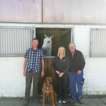
Reitsportzentrum Lehmann
Weil am Rhein
Peter-Lehmann
@Peter-Lehmann
FN-Mitglied
Gastronomie
Vermieten
Führanlage
Longierzirkel/Roundpen
Außenboxen
Innenbox
13 weitere...
P
Deprecated: Creation of dynamic property Zend_View_Helper_Ads::$adLink is deprecated in /var/www/stall-frei/htdocs/staging.stall-frei.de/library/Psf/View/Helper/Ads.php on line 108

Mitarbeiter gesucht?
Mechtersen
STALL-FREIde Marketing
@STALL-FREI-Marketing
Stellenangebote kostenlos veröffentlichen!
Leider kein Vorschaubild
Leider kein Vorschaubild
Gnadenbrot für Friese Friesenstute Friesenwallach
Eimeldingen
Senioren Friesen-Treff
@Friesen-Treff
Krankenbox
Videoüberwachung
Gnadenbrothof
Hufrehe geeignet
Offenstall
Halbpension
Selbstversorgung
1 weitere...
B
Leider kein Vorschaubild
Leider kein Vorschaubild
Rekonvalenz - und Pferdesenioren -Residenz
Mélisey
Little Paradies
@Team-Obelix
Rehabilitationsstall
Vermieten
Longierzirkel/Roundpen
Paddock
Notfallboxen
11 weitere...
B
Werde Teil von STALL-FREI.de
Du hast eine Pferdebox frei? Freie Plätze im Offenstall, Pferdestall oder der Reitanlage kostenlos anbieten.
Deprecated: Creation of dynamic property Zend_View::$pageCount is deprecated in /var/www/stall-frei/htdocs/staging.stall-frei.de/library/vendor/shardj/zf1-future/library/Zend/View/Abstract.php on line 308
Deprecated: Creation of dynamic property Zend_View::$itemCountPerPage is deprecated in /var/www/stall-frei/htdocs/staging.stall-frei.de/library/vendor/shardj/zf1-future/library/Zend/View/Abstract.php on line 308
Deprecated: Creation of dynamic property Zend_View::$first is deprecated in /var/www/stall-frei/htdocs/staging.stall-frei.de/library/vendor/shardj/zf1-future/library/Zend/View/Abstract.php on line 308
Deprecated: Creation of dynamic property Zend_View::$current is deprecated in /var/www/stall-frei/htdocs/staging.stall-frei.de/library/vendor/shardj/zf1-future/library/Zend/View/Abstract.php on line 308
Deprecated: Creation of dynamic property Zend_View::$last is deprecated in /var/www/stall-frei/htdocs/staging.stall-frei.de/library/vendor/shardj/zf1-future/library/Zend/View/Abstract.php on line 308
Deprecated: Creation of dynamic property Zend_View::$previous is deprecated in /var/www/stall-frei/htdocs/staging.stall-frei.de/library/vendor/shardj/zf1-future/library/Zend/View/Abstract.php on line 308
Deprecated: Creation of dynamic property Zend_View::$pagesInRange is deprecated in /var/www/stall-frei/htdocs/staging.stall-frei.de/library/vendor/shardj/zf1-future/library/Zend/View/Abstract.php on line 308
Deprecated: Creation of dynamic property Zend_View::$firstPageInRange is deprecated in /var/www/stall-frei/htdocs/staging.stall-frei.de/library/vendor/shardj/zf1-future/library/Zend/View/Abstract.php on line 308
Deprecated: Creation of dynamic property Zend_View::$lastPageInRange is deprecated in /var/www/stall-frei/htdocs/staging.stall-frei.de/library/vendor/shardj/zf1-future/library/Zend/View/Abstract.php on line 308
Deprecated: Creation of dynamic property Zend_View::$currentItemCount is deprecated in /var/www/stall-frei/htdocs/staging.stall-frei.de/library/vendor/shardj/zf1-future/library/Zend/View/Abstract.php on line 308
Deprecated: Creation of dynamic property Zend_View::$totalItemCount is deprecated in /var/www/stall-frei/htdocs/staging.stall-frei.de/library/vendor/shardj/zf1-future/library/Zend/View/Abstract.php on line 308
Deprecated: Creation of dynamic property Zend_View::$firstItemNumber is deprecated in /var/www/stall-frei/htdocs/staging.stall-frei.de/library/vendor/shardj/zf1-future/library/Zend/View/Abstract.php on line 308
Deprecated: Creation of dynamic property Zend_View::$lastItemNumber is deprecated in /var/www/stall-frei/htdocs/staging.stall-frei.de/library/vendor/shardj/zf1-future/library/Zend/View/Abstract.php on line 308
Deprecated: Creation of dynamic property Zend_View::$router is deprecated in /var/www/stall-frei/htdocs/staging.stall-frei.de/library/vendor/shardj/zf1-future/library/Zend/View/Abstract.php on line 308
Deprecated: Creation of dynamic property Zend_View::$urlParams is deprecated in /var/www/stall-frei/htdocs/staging.stall-frei.de/library/vendor/shardj/zf1-future/library/Zend/View/Abstract.php on line 308
Deprecated: Creation of dynamic property Zend_View::$showAds is deprecated in /var/www/stall-frei/htdocs/staging.stall-frei.de/library/vendor/shardj/zf1-future/library/Zend/View/Abstract.php on line 308
Deprecated: Creation of dynamic property Zend_View::$objectIds is deprecated in /var/www/stall-frei/htdocs/staging.stall-frei.de/library/vendor/shardj/zf1-future/library/Zend/View/Abstract.php on line 308
Deprecated: Creation of dynamic property Zend_View::$showNavbar is deprecated in /var/www/stall-frei/htdocs/staging.stall-frei.de/library/vendor/shardj/zf1-future/library/Zend/View/Abstract.php on line 308
Deprecated: Creation of dynamic property Zend_View::$showBreadcrumb is deprecated in /var/www/stall-frei/htdocs/staging.stall-frei.de/library/vendor/shardj/zf1-future/library/Zend/View/Abstract.php on line 308
Deprecated: Creation of dynamic property Zend_View::$showFooter is deprecated in /var/www/stall-frei/htdocs/staging.stall-frei.de/library/vendor/shardj/zf1-future/library/Zend/View/Abstract.php on line 308
Deprecated: Creation of dynamic property Zend_View::$showInternalAds is deprecated in /var/www/stall-frei/htdocs/staging.stall-frei.de/library/vendor/shardj/zf1-future/library/Zend/View/Abstract.php on line 308
Deprecated: Creation of dynamic property Zend_View::$blNoContent is deprecated in /var/www/stall-frei/htdocs/staging.stall-frei.de/library/vendor/shardj/zf1-future/library/Zend/View/Abstract.php on line 308
Deprecated: Creation of dynamic property Zend_View::$sMetaDesc is deprecated in /var/www/stall-frei/htdocs/staging.stall-frei.de/library/vendor/shardj/zf1-future/library/Zend/View/Abstract.php on line 308
Deprecated: Creation of dynamic property Zend_View::$useGmaps is deprecated in /var/www/stall-frei/htdocs/staging.stall-frei.de/library/vendor/shardj/zf1-future/library/Zend/View/Abstract.php on line 308
Deprecated: Creation of dynamic property Zend_View::$touches is deprecated in /var/www/stall-frei/htdocs/staging.stall-frei.de/library/vendor/shardj/zf1-future/library/Zend/View/Abstract.php on line 308
Deprecated: Creation of dynamic property Zend_View::$oProject is deprecated in /var/www/stall-frei/htdocs/staging.stall-frei.de/library/vendor/shardj/zf1-future/library/Zend/View/Abstract.php on line 308
Deprecated: Creation of dynamic property Zend_View::$pageHeadline is deprecated in /var/www/stall-frei/htdocs/staging.stall-frei.de/library/vendor/shardj/zf1-future/library/Zend/View/Abstract.php on line 308
Deprecated: Creation of dynamic property Zend_View::$disableLocationField is deprecated in /var/www/stall-frei/htdocs/staging.stall-frei.de/library/vendor/shardj/zf1-future/library/Zend/View/Abstract.php on line 308
Deprecated: Creation of dynamic property Zend_View::$isSearch is deprecated in /var/www/stall-frei/htdocs/staging.stall-frei.de/library/vendor/shardj/zf1-future/library/Zend/View/Abstract.php on line 308
Deprecated: Creation of dynamic property Zend_View::$pageTitle is deprecated in /var/www/stall-frei/htdocs/staging.stall-frei.de/library/vendor/shardj/zf1-future/library/Zend/View/Abstract.php on line 308
Deprecated: Creation of dynamic property Psf_Form_Element_Text::$class is deprecated in /var/www/stall-frei/htdocs/staging.stall-frei.de/library/vendor/shardj/zf1-future/library/Zend/Form/Element.php on line 874
Deprecated: Creation of dynamic property Psf_Form_Element_Text::$size is deprecated in /var/www/stall-frei/htdocs/staging.stall-frei.de/library/vendor/shardj/zf1-future/library/Zend/Form/Element.php on line 874
Deprecated: Creation of dynamic property Psf_Form_Element_Text::$placeholder is deprecated in /var/www/stall-frei/htdocs/staging.stall-frei.de/library/vendor/shardj/zf1-future/library/Zend/Form/Element.php on line 874
Deprecated: Creation of dynamic property Psf_Form_Element_Hidden::$class is deprecated in /var/www/stall-frei/htdocs/staging.stall-frei.de/library/vendor/shardj/zf1-future/library/Zend/Form/Element.php on line 874
Deprecated: Creation of dynamic property Psf_Form_Element_Hidden::$class is deprecated in /var/www/stall-frei/htdocs/staging.stall-frei.de/library/vendor/shardj/zf1-future/library/Zend/Form/Element.php on line 874
Deprecated: Creation of dynamic property Psf_Form_Element_Hidden::$class is deprecated in /var/www/stall-frei/htdocs/staging.stall-frei.de/library/vendor/shardj/zf1-future/library/Zend/Form/Element.php on line 874
Deprecated: Creation of dynamic property Psf_Form_Element_Hidden::$class is deprecated in /var/www/stall-frei/htdocs/staging.stall-frei.de/library/vendor/shardj/zf1-future/library/Zend/Form/Element.php on line 874
Deprecated: Creation of dynamic property Psf_Form_Element_Select::$class is deprecated in /var/www/stall-frei/htdocs/staging.stall-frei.de/library/vendor/shardj/zf1-future/library/Zend/Form/Element.php on line 874
Deprecated: Creation of dynamic property Psf_Form_Element_Select::$class is deprecated in /var/www/stall-frei/htdocs/staging.stall-frei.de/library/vendor/shardj/zf1-future/library/Zend/Form/Element.php on line 874
Deprecated: Creation of dynamic property Psf_Form_Element_Select::$class is deprecated in /var/www/stall-frei/htdocs/staging.stall-frei.de/library/vendor/shardj/zf1-future/library/Zend/Form/Element.php on line 874
Deprecated: Creation of dynamic property Psf_Form_Element_Select::$class is deprecated in /var/www/stall-frei/htdocs/staging.stall-frei.de/library/vendor/shardj/zf1-future/library/Zend/Form/Element.php on line 874
Deprecated: Creation of dynamic property Psf_Form_Element_Text::$class is deprecated in /var/www/stall-frei/htdocs/staging.stall-frei.de/library/vendor/shardj/zf1-future/library/Zend/Form/Element.php on line 874
Deprecated: Creation of dynamic property Psf_Form_Element_Checkbox::$label is deprecated in /var/www/stall-frei/htdocs/staging.stall-frei.de/library/vendor/shardj/zf1-future/library/Zend/Form/Element.php on line 874
Deprecated: Creation of dynamic property Zend_View::$sort is deprecated in /var/www/stall-frei/htdocs/staging.stall-frei.de/library/vendor/shardj/zf1-future/library/Zend/View/Abstract.php on line 308
Deprecated: Creation of dynamic property Zend_View::$searchLocation is deprecated in /var/www/stall-frei/htdocs/staging.stall-frei.de/library/vendor/shardj/zf1-future/library/Zend/View/Abstract.php on line 308
Deprecated: Creation of dynamic property Zend_View::$locationHint is deprecated in /var/www/stall-frei/htdocs/staging.stall-frei.de/library/vendor/shardj/zf1-future/library/Zend/View/Abstract.php on line 308
Psf_GeoCoder_Abstract::getLocation: Wartenberg Get Location CachedOrLive
Psf_GeoCoder_Abstract::getCachedOrLive: Wartenberg
Psf_GeoCoder_Abstract::convertLocationResult
{"documentation":"https:\/\/opencagedata.com\/api","licenses":[{"name":"see attribution guide","url":"https:\/\/opencagedata.com\/credits"}],"results":[{"bounds":{"northeast":{"lat":52.5964629,"lng":13.5471255},"southwest":{"lat":52.5705976,"lng":13.4854997}},"components":{"ISO_3166-1_alpha-2":"DE","ISO_3166-1_alpha-3":"DEU","ISO_3166-2":["DE-BE"],"_category":"place","_normalized_city":"Berlin","_type":"neighbourhood","borough":"Lichtenberg","city":"Berlin","continent":"Europe","country":"Deutschland","country_code":"de","political_union":"European Union","postcode":"13059","state":"Berlin","state_code":"BE","suburb":"Wartenberg"},"confidence":7,"formatted":"13059 Berlin, Deutschland","geometry":{"lat":52.5753945,"lng":13.5175821}},{"bounds":{"northeast":{"lat":48.4148472,"lng":12.0369171},"southwest":{"lat":48.3698871,"lng":11.9430951}},"components":{"ISO_3166-1_alpha-2":"DE","ISO_3166-1_alpha-3":"DEU","ISO_3166-2":["DE-BY"],"_category":"place","_normalized_city":"Wartenberg","_type":"village","continent":"Europe","country":"Deutschland","country_code":"de","county":"Landkreis Erding","municipality":"Wartenberg (VGem)","political_union":"European Union","postcode":"85456","state":"Bayern","state_code":"BY","village":"Wartenberg"},"confidence":7,"formatted":"85456 Wartenberg, Deutschland","geometry":{"lat":48.4043903,"lng":11.9885652}},{"bounds":{"northeast":{"lat":50.6719244,"lng":9.5015277},"southwest":{"lat":50.5754249,"lng":9.4164563}},"components":{"ISO_3166-1_alpha-2":"DE","ISO_3166-1_alpha-3":"DEU","ISO_3166-2":["DE-HE"],"_category":"place","_normalized_city":"Wartenberg","_type":"municipality","continent":"Europe","country":"Deutschland","country_code":"de","county":"Vogelsbergkreis","municipality":"Wartenberg","political_union":"European Union","postcode":"36367","state":"Hessen","state_code":"HE"},"confidence":7,"formatted":"36367 Wartenberg, Deutschland","geometry":{"lat":50.6145901,"lng":9.4623115}},{"bounds":{"northeast":{"lat":52.6520585,"lng":11.5342045},"southwest":{"lat":52.6080223,"lng":11.4995711}},"components":{"ISO_3166-1_alpha-2":"DE","ISO_3166-1_alpha-3":"DEU","ISO_3166-2":["DE-ST"],"_category":"place","_normalized_city":"Bismark (Altmark)","_type":"village","continent":"Europe","country":"Deutschland","country_code":"de","county":"Stendal","political_union":"European Union","state":"Sachsen-Anhalt","state_code":"ST","town":"Bismark (Altmark)","village":"Wartenberg"},"confidence":7,"formatted":"Wartenberg, Sachsen-Anhalt, Deutschland","geometry":{"lat":52.6380786,"lng":11.5103221}},{"bounds":{"northeast":{"lat":48.4547937,"lng":12.0369171},"southwest":{"lat":48.3611675,"lng":11.8938408}},"components":{"ISO_3166-1_alpha-2":"DE","ISO_3166-1_alpha-3":"DEU","ISO_3166-2":["DE-BY"],"_category":"place","_normalized_city":"Wartenberg (VGem)","_type":"municipality","continent":"Europe","country":"Deutschland","country_code":"de","county":"Landkreis Erding","municipality":"Wartenberg (VGem)","political_union":"European Union","state":"Bayern","state_code":"BY"},"confidence":6,"formatted":"Wartenberg (VGem), Bayern, Deutschland","geometry":{"lat":48.4079251,"lng":11.9619132}},{"bounds":{"northeast":{"lat":50.9911754,"lng":10.32975},"southwest":{"lat":50.9910754,"lng":10.32965}},"components":{"ISO_3166-1_alpha-2":"DE","ISO_3166-1_alpha-3":"DEU","ISO_3166-2":["DE-TH"],"_category":"natural\/water","_normalized_city":"Eisenach","_type":"peak","continent":"Europe","country":"Deutschland","country_code":"de","county":"Wartburgkreis","peak":"Wartenberg","political_union":"European Union","postcode":"99817","state":"Th\u00fcringen","state_code":"TH","town":"Eisenach"},"confidence":9,"formatted":"Wartenberg, 99817 Eisenach, Deutschland","geometry":{"lat":50.9911254,"lng":10.3297}},{"bounds":{"northeast":{"lat":47.9256993,"lng":8.618028},"southwest":{"lat":47.9255993,"lng":8.617928}},"components":{"ISO_3166-1_alpha-2":"DE","ISO_3166-1_alpha-3":"DEU","ISO_3166-2":["DE-BW"],"_category":"natural\/water","_normalized_city":"Geisingen","_type":"volcano","continent":"Europe","country":"Deutschland","country_code":"de","county":"Landkreis Tuttlingen","municipality":"GVV Immendingen-Geisingen","political_union":"European Union","postcode":"78187","state":"Baden-W\u00fcrttemberg","state_code":"BW","town":"Geisingen","volcano":"Wartenberg"},"confidence":9,"formatted":"Wartenberg, 78187 Geisingen, Deutschland","geometry":{"lat":47.9256493,"lng":8.617978}},{"bounds":{"northeast":{"lat":49.2420041,"lng":7.7847159},"southwest":{"lat":49.2419041,"lng":7.7846159}},"components":{"ISO_3166-1_alpha-2":"DE","ISO_3166-1_alpha-3":"DEU","ISO_3166-2":["DE-RP"],"_category":"natural\/water","_normalized_city":"Merzalben","_type":"peak","continent":"Europe","country":"Deutschland","country_code":"de","county":"S\u00fcdwestpfalz","municipality":"Rodalben","peak":"Wartenberg","political_union":"European Union","state":"Rheinland-Pfalz","state_code":"RP","village":"Merzalben"},"confidence":9,"formatted":"Wartenberg, Merzalben, Rheinland-Pfalz, Deutschland","geometry":{"lat":49.2419541,"lng":7.7846659}},{"bounds":{"northeast":{"lat":51.4203602,"lng":7.3685188},"southwest":{"lat":51.4202602,"lng":7.3684188}},"components":{"ISO_3166-1_alpha-2":"DE","ISO_3166-1_alpha-3":"DEU","ISO_3166-2":["DE-NW"],"_category":"natural\/water","_normalized_city":"Witten","_type":"peak","continent":"Europe","country":"Deutschland","country_code":"de","county":"Ennepe-Ruhr-Kreis","peak":"Wartenberg","political_union":"European Union","postcode":"58453","state":"Nordrhein-Westfalen","state_code":"NW","town":"Witten"},"confidence":9,"formatted":"Wartenberg, 58453 Witten, Deutschland","geometry":{"lat":51.4203102,"lng":7.3684688}},{"bounds":{"northeast":{"lat":50.9839468,"lng":14.1005918},"southwest":{"lat":50.9838468,"lng":14.1004918}},"components":{"ISO_3166-1_alpha-2":"DE","ISO_3166-1_alpha-3":"DEU","ISO_3166-2":["DE-SN"],"_category":"natural\/water","_normalized_city":"Hohnstein","_type":"peak","continent":"Europe","country":"Deutschland","country_code":"de","county":"S\u00e4chsische Schweiz-Osterzgebirge","peak":"Wartenberg","political_union":"European Union","postcode":"01848","state":"Sachsen","state_code":"SN","town":"Hohnstein"},"confidence":9,"formatted":"Wartenberg, 01848 Hohnstein, Deutschland","geometry":{"lat":50.9838968,"lng":14.1005418}}],"status":{"code":200,"message":"OK"},"stay_informed":{"blog":"https:\/\/blog.opencagedata.com","mastodon":"https:\/\/en.osm.town\/@opencage"},"thanks":"For using an OpenCage API","timestamp":{"created_http":"Sat, 07 Feb 2026 13:27:45 GMT","created_unix":1770470865},"total_results":10}Array
(
[0] => stdClass Object
(
[bounds] => stdClass Object
(
[northeast] => stdClass Object
(
[lat] => 52.5964629
[lng] => 13.5471255
)
[southwest] => stdClass Object
(
[lat] => 52.5705976
[lng] => 13.4854997
)
)
[components] => stdClass Object
(
[ISO_3166-1_alpha-2] => DE
[ISO_3166-1_alpha-3] => DEU
[ISO_3166-2] => Array
(
[0] => DE-BE
)
[_category] => place
[_normalized_city] => Berlin
[_type] => neighbourhood
[borough] => Lichtenberg
[city] => Berlin
[continent] => Europe
[country] => Deutschland
[country_code] => de
[political_union] => European Union
[postcode] => 13059
[state] => Berlin
[state_code] => BE
[suburb] => Wartenberg
)
[confidence] => 7
[formatted] => 13059 Berlin, Deutschland
[geometry] => stdClass Object
(
[lat] => 52.5753945
[lng] => 13.5175821
)
)
[1] => stdClass Object
(
[bounds] => stdClass Object
(
[northeast] => stdClass Object
(
[lat] => 48.4148472
[lng] => 12.0369171
)
[southwest] => stdClass Object
(
[lat] => 48.3698871
[lng] => 11.9430951
)
)
[components] => stdClass Object
(
[ISO_3166-1_alpha-2] => DE
[ISO_3166-1_alpha-3] => DEU
[ISO_3166-2] => Array
(
[0] => DE-BY
)
[_category] => place
[_normalized_city] => Wartenberg
[_type] => village
[continent] => Europe
[country] => Deutschland
[country_code] => de
[county] => Landkreis Erding
[municipality] => Wartenberg (VGem)
[political_union] => European Union
[postcode] => 85456
[state] => Bayern
[state_code] => BY
[village] => Wartenberg
)
[confidence] => 7
[formatted] => 85456 Wartenberg, Deutschland
[geometry] => stdClass Object
(
[lat] => 48.4043903
[lng] => 11.9885652
)
)
[2] => stdClass Object
(
[bounds] => stdClass Object
(
[northeast] => stdClass Object
(
[lat] => 50.6719244
[lng] => 9.5015277
)
[southwest] => stdClass Object
(
[lat] => 50.5754249
[lng] => 9.4164563
)
)
[components] => stdClass Object
(
[ISO_3166-1_alpha-2] => DE
[ISO_3166-1_alpha-3] => DEU
[ISO_3166-2] => Array
(
[0] => DE-HE
)
[_category] => place
[_normalized_city] => Wartenberg
[_type] => municipality
[continent] => Europe
[country] => Deutschland
[country_code] => de
[county] => Vogelsbergkreis
[municipality] => Wartenberg
[political_union] => European Union
[postcode] => 36367
[state] => Hessen
[state_code] => HE
)
[confidence] => 7
[formatted] => 36367 Wartenberg, Deutschland
[geometry] => stdClass Object
(
[lat] => 50.6145901
[lng] => 9.4623115
)
)
[3] => stdClass Object
(
[bounds] => stdClass Object
(
[northeast] => stdClass Object
(
[lat] => 52.6520585
[lng] => 11.5342045
)
[southwest] => stdClass Object
(
[lat] => 52.6080223
[lng] => 11.4995711
)
)
[components] => stdClass Object
(
[ISO_3166-1_alpha-2] => DE
[ISO_3166-1_alpha-3] => DEU
[ISO_3166-2] => Array
(
[0] => DE-ST
)
[_category] => place
[_normalized_city] => Bismark (Altmark)
[_type] => village
[continent] => Europe
[country] => Deutschland
[country_code] => de
[county] => Stendal
[political_union] => European Union
[state] => Sachsen-Anhalt
[state_code] => ST
[town] => Bismark (Altmark)
[village] => Wartenberg
)
[confidence] => 7
[formatted] => Wartenberg, Sachsen-Anhalt, Deutschland
[geometry] => stdClass Object
(
[lat] => 52.6380786
[lng] => 11.5103221
)
)
[4] => stdClass Object
(
[bounds] => stdClass Object
(
[northeast] => stdClass Object
(
[lat] => 48.4547937
[lng] => 12.0369171
)
[southwest] => stdClass Object
(
[lat] => 48.3611675
[lng] => 11.8938408
)
)
[components] => stdClass Object
(
[ISO_3166-1_alpha-2] => DE
[ISO_3166-1_alpha-3] => DEU
[ISO_3166-2] => Array
(
[0] => DE-BY
)
[_category] => place
[_normalized_city] => Wartenberg (VGem)
[_type] => municipality
[continent] => Europe
[country] => Deutschland
[country_code] => de
[county] => Landkreis Erding
[municipality] => Wartenberg (VGem)
[political_union] => European Union
[state] => Bayern
[state_code] => BY
)
[confidence] => 6
[formatted] => Wartenberg (VGem), Bayern, Deutschland
[geometry] => stdClass Object
(
[lat] => 48.4079251
[lng] => 11.9619132
)
)
[5] => stdClass Object
(
[bounds] => stdClass Object
(
[northeast] => stdClass Object
(
[lat] => 50.9911754
[lng] => 10.32975
)
[southwest] => stdClass Object
(
[lat] => 50.9910754
[lng] => 10.32965
)
)
[components] => stdClass Object
(
[ISO_3166-1_alpha-2] => DE
[ISO_3166-1_alpha-3] => DEU
[ISO_3166-2] => Array
(
[0] => DE-TH
)
[_category] => natural/water
[_normalized_city] => Eisenach
[_type] => peak
[continent] => Europe
[country] => Deutschland
[country_code] => de
[county] => Wartburgkreis
[peak] => Wartenberg
[political_union] => European Union
[postcode] => 99817
[state] => Thüringen
[state_code] => TH
[town] => Eisenach
)
[confidence] => 9
[formatted] => Wartenberg, 99817 Eisenach, Deutschland
[geometry] => stdClass Object
(
[lat] => 50.9911254
[lng] => 10.3297
)
)
[6] => stdClass Object
(
[bounds] => stdClass Object
(
[northeast] => stdClass Object
(
[lat] => 47.9256993
[lng] => 8.618028
)
[southwest] => stdClass Object
(
[lat] => 47.9255993
[lng] => 8.617928
)
)
[components] => stdClass Object
(
[ISO_3166-1_alpha-2] => DE
[ISO_3166-1_alpha-3] => DEU
[ISO_3166-2] => Array
(
[0] => DE-BW
)
[_category] => natural/water
[_normalized_city] => Geisingen
[_type] => volcano
[continent] => Europe
[country] => Deutschland
[country_code] => de
[county] => Landkreis Tuttlingen
[municipality] => GVV Immendingen-Geisingen
[political_union] => European Union
[postcode] => 78187
[state] => Baden-Württemberg
[state_code] => BW
[town] => Geisingen
[volcano] => Wartenberg
)
[confidence] => 9
[formatted] => Wartenberg, 78187 Geisingen, Deutschland
[geometry] => stdClass Object
(
[lat] => 47.9256493
[lng] => 8.617978
)
)
[7] => stdClass Object
(
[bounds] => stdClass Object
(
[northeast] => stdClass Object
(
[lat] => 49.2420041
[lng] => 7.7847159
)
[southwest] => stdClass Object
(
[lat] => 49.2419041
[lng] => 7.7846159
)
)
[components] => stdClass Object
(
[ISO_3166-1_alpha-2] => DE
[ISO_3166-1_alpha-3] => DEU
[ISO_3166-2] => Array
(
[0] => DE-RP
)
[_category] => natural/water
[_normalized_city] => Merzalben
[_type] => peak
[continent] => Europe
[country] => Deutschland
[country_code] => de
[county] => Südwestpfalz
[municipality] => Rodalben
[peak] => Wartenberg
[political_union] => European Union
[state] => Rheinland-Pfalz
[state_code] => RP
[village] => Merzalben
)
[confidence] => 9
[formatted] => Wartenberg, Merzalben, Rheinland-Pfalz, Deutschland
[geometry] => stdClass Object
(
[lat] => 49.2419541
[lng] => 7.7846659
)
)
[8] => stdClass Object
(
[bounds] => stdClass Object
(
[northeast] => stdClass Object
(
[lat] => 51.4203602
[lng] => 7.3685188
)
[southwest] => stdClass Object
(
[lat] => 51.4202602
[lng] => 7.3684188
)
)
[components] => stdClass Object
(
[ISO_3166-1_alpha-2] => DE
[ISO_3166-1_alpha-3] => DEU
[ISO_3166-2] => Array
(
[0] => DE-NW
)
[_category] => natural/water
[_normalized_city] => Witten
[_type] => peak
[continent] => Europe
[country] => Deutschland
[country_code] => de
[county] => Ennepe-Ruhr-Kreis
[peak] => Wartenberg
[political_union] => European Union
[postcode] => 58453
[state] => Nordrhein-Westfalen
[state_code] => NW
[town] => Witten
)
[confidence] => 9
[formatted] => Wartenberg, 58453 Witten, Deutschland
[geometry] => stdClass Object
(
[lat] => 51.4203102
[lng] => 7.3684688
)
)
[9] => stdClass Object
(
[bounds] => stdClass Object
(
[northeast] => stdClass Object
(
[lat] => 50.9839468
[lng] => 14.1005918
)
[southwest] => stdClass Object
(
[lat] => 50.9838468
[lng] => 14.1004918
)
)
[components] => stdClass Object
(
[ISO_3166-1_alpha-2] => DE
[ISO_3166-1_alpha-3] => DEU
[ISO_3166-2] => Array
(
[0] => DE-SN
)
[_category] => natural/water
[_normalized_city] => Hohnstein
[_type] => peak
[continent] => Europe
[country] => Deutschland
[country_code] => de
[county] => Sächsische Schweiz-Osterzgebirge
[peak] => Wartenberg
[political_union] => European Union
[postcode] => 01848
[state] => Sachsen
[state_code] => SN
[town] => Hohnstein
)
[confidence] => 9
[formatted] => Wartenberg, 01848 Hohnstein, Deutschland
[geometry] => stdClass Object
(
[lat] => 50.9838968
[lng] => 14.1005418
)
)
)
Psf_GeoCoder_OpenCageData::getKeyMap: 0
stdClass Object
(
    [bounds] => stdClass Object
        (
            [northeast] => stdClass Object
                (
                    [lat] => 52.5964629
                    [lng] => 13.5471255
                )

            [southwest] => stdClass Object
                (
                    [lat] => 52.5705976
                    [lng] => 13.4854997
                )

        )

    [components] => stdClass Object
        (
            [ISO_3166-1_alpha-2] => DE
            [ISO_3166-1_alpha-3] => DEU
            [ISO_3166-2] => Array
                (
                    [0] => DE-BE
                )

            [_category] => place
            [_normalized_city] => Berlin
            [_type] => neighbourhood
            [borough] => Lichtenberg
            [city] => Berlin
            [continent] => Europe
            [country] => Deutschland
            [country_code] => de
            [political_union] => European Union
            [postcode] => 13059
            [state] => Berlin
            [state_code] => BE
            [suburb] => Wartenberg
        )

    [confidence] => 7
    [formatted] => 13059 Berlin, Deutschland
    [geometry] => stdClass Object
        (
            [lat] => 52.5753945
            [lng] => 13.5175821
        )

)
Psf_GeoCoder_OpenCageData::getCounty: Berlin
Psf_GeoCoder_OpenCageData::addMissingData REFETCH!
Array
(
    [address] => 13059 Berlin, Deutschland
    [type] => neighbourhood
    [street] =>
    [city] => Wartenberg
    [county] => Berlin
    [state] => Berlin
    [zip] => 13059
    [country] => Deutschland
    [suburb] => Wartenberg
    [countrycode] => de
    [latitude] => 52.5753945
    [longitude] => 13.5175821
    [accuracy] => 1
    [confidence] => 7
    [bounds] => stdClass Object
        (
            [northeast] => stdClass Object
                (
                    [lat] => 52.5964629
                    [lng] => 13.5471255
                )

            [southwest] => stdClass Object
                (
                    [lat] => 52.5705976
                    [lng] => 13.4854997
                )

        )

)
reformat!
Array
(
    [address] => 13059 Wartenberg
    [type] => neighbourhood
    [street] =>
    [city] => Wartenberg
    [county] => Berlin
    [state] => Berlin
    [zip] => 13059
    [country] => Deutschland
    [suburb] => Wartenberg
    [countrycode] => de
    [latitude] => 52.5753945
    [longitude] => 13.5175821
    [accuracy] => 1
    [confidence] => 7
    [bounds] => stdClass Object
        (
            [northeast] => stdClass Object
                (
                    [lat] => 52.5964629
                    [lng] => 13.5471255
                )

            [southwest] => stdClass Object
                (
                    [lat] => 52.5705976
                    [lng] => 13.4854997
                )

        )

    [place] => 13059 Wartenberg, Berlin
    [hash] => 0bc8802f45dcfbfed6c9f32a7ec3ba39
)
Psf_GeoCoder_OpenCageData::getKeyMap: 1
stdClass Object
(
    [bounds] => stdClass Object
        (
            [northeast] => stdClass Object
                (
                    [lat] => 48.4148472
                    [lng] => 12.0369171
                )

            [southwest] => stdClass Object
                (
                    [lat] => 48.3698871
                    [lng] => 11.9430951
                )

        )

    [components] => stdClass Object
        (
            [ISO_3166-1_alpha-2] => DE
            [ISO_3166-1_alpha-3] => DEU
            [ISO_3166-2] => Array
                (
                    [0] => DE-BY
                )

            [_category] => place
            [_normalized_city] => Wartenberg
            [_type] => village
            [continent] => Europe
            [country] => Deutschland
            [country_code] => de
            [county] => Landkreis Erding
            [municipality] => Wartenberg (VGem)
            [political_union] => European Union
            [postcode] => 85456
            [state] => Bayern
            [state_code] => BY
            [village] => Wartenberg
        )

    [confidence] => 7
    [formatted] => 85456 Wartenberg, Deutschland
    [geometry] => stdClass Object
        (
            [lat] => 48.4043903
            [lng] => 11.9885652
        )

)
Psf_GeoCoder_OpenCageData::getCounty: Erding
Psf_GeoCoder_OpenCageData::addMissingData REFETCH!
Array
(
    [address] => 85456 Wartenberg, Deutschland
    [type] => village
    [street] =>
    [city] => Wartenberg
    [county] => Erding
    [state] => Bayern
    [zip] => 85456
    [country] => Deutschland
    [suburb] =>
    [countrycode] => de
    [latitude] => 48.4043903
    [longitude] => 11.9885652
    [accuracy] => 1
    [confidence] => 7
    [bounds] => stdClass Object
        (
            [northeast] => stdClass Object
                (
                    [lat] => 48.4148472
                    [lng] => 12.0369171
                )

            [southwest] => stdClass Object
                (
                    [lat] => 48.3698871
                    [lng] => 11.9430951
                )

        )

)
reformat!
Array
(
    [address] => 85456 Wartenberg, Deutschland
    [type] => village
    [street] =>
    [city] => Wartenberg
    [county] => Erding
    [state] => Bayern
    [zip] => 85456
    [country] => Deutschland
    [suburb] =>
    [countrycode] => de
    [latitude] => 48.4043903
    [longitude] => 11.9885652
    [accuracy] => 1
    [confidence] => 7
    [bounds] => stdClass Object
        (
            [northeast] => stdClass Object
                (
                    [lat] => 48.4148472
                    [lng] => 12.0369171
                )

            [southwest] => stdClass Object
                (
                    [lat] => 48.3698871
                    [lng] => 11.9430951
                )

        )

    [place] => 85456 Wartenberg, Bayern
    [hash] => 092fb72a7c16c4f7a159045ff189a567
)
Psf_GeoCoder_OpenCageData::getKeyMap: 2
stdClass Object
(
    [bounds] => stdClass Object
        (
            [northeast] => stdClass Object
                (
                    [lat] => 50.6719244
                    [lng] => 9.5015277
                )

            [southwest] => stdClass Object
                (
                    [lat] => 50.5754249
                    [lng] => 9.4164563
                )

        )

    [components] => stdClass Object
        (
            [ISO_3166-1_alpha-2] => DE
            [ISO_3166-1_alpha-3] => DEU
            [ISO_3166-2] => Array
                (
                    [0] => DE-HE
                )

            [_category] => place
            [_normalized_city] => Wartenberg
            [_type] => municipality
            [continent] => Europe
            [country] => Deutschland
            [country_code] => de
            [county] => Vogelsbergkreis
            [municipality] => Wartenberg
            [political_union] => European Union
            [postcode] => 36367
            [state] => Hessen
            [state_code] => HE
        )

    [confidence] => 7
    [formatted] => 36367 Wartenberg, Deutschland
    [geometry] => stdClass Object
        (
            [lat] => 50.6145901
            [lng] => 9.4623115
        )

)
Psf_GeoCoder_OpenCageData::getCounty: Vogelsbergkreis
Psf_GeoCoder_OpenCageData::addMissingData REFETCH!
Array
(
    [address] => 36367 Wartenberg, Deutschland
    [type] => municipality
    [street] =>
    [city] =>
    [county] => Vogelsbergkreis
    [state] => Hessen
    [zip] => 36367
    [country] => Deutschland
    [suburb] =>
    [countrycode] => de
    [latitude] => 50.6145901
    [longitude] => 9.4623115
    [accuracy] => 1
    [confidence] => 7
    [bounds] => stdClass Object
        (
            [northeast] => stdClass Object
                (
                    [lat] => 50.6719244
                    [lng] => 9.5015277
                )

            [southwest] => stdClass Object
                (
                    [lat] => 50.5754249
                    [lng] => 9.4164563
                )

        )

)
reformat!
Array
(
    [address] => 36367 Wartenberg, Deutschland
    [type] => municipality
    [street] =>
    [city] =>
    [county] => Vogelsbergkreis
    [state] => Hessen
    [zip] => 36367
    [country] => Deutschland
    [suburb] =>
    [countrycode] => de
    [latitude] => 50.6145901
    [longitude] => 9.4623115
    [accuracy] => 1
    [confidence] => 7
    [bounds] => stdClass Object
        (
            [northeast] => stdClass Object
                (
                    [lat] => 50.6719244
                    [lng] => 9.5015277
                )

            [southwest] => stdClass Object
                (
                    [lat] => 50.5754249
                    [lng] => 9.4164563
                )

        )

    [place] => 36367 , Hessen
    [hash] => da450149a2bc668f4e4eb4313654501c
)
Psf_GeoCoder_OpenCageData::getKeyMap: 3
stdClass Object
(
    [bounds] => stdClass Object
        (
            [northeast] => stdClass Object
                (
                    [lat] => 52.6520585
                    [lng] => 11.5342045
                )

            [southwest] => stdClass Object
                (
                    [lat] => 52.6080223
                    [lng] => 11.4995711
                )

        )

    [components] => stdClass Object
        (
            [ISO_3166-1_alpha-2] => DE
            [ISO_3166-1_alpha-3] => DEU
            [ISO_3166-2] => Array
                (
                    [0] => DE-ST
                )

            [_category] => place
            [_normalized_city] => Bismark (Altmark)
            [_type] => village
            [continent] => Europe
            [country] => Deutschland
            [country_code] => de
            [county] => Stendal
            [political_union] => European Union
            [state] => Sachsen-Anhalt
            [state_code] => ST
            [town] => Bismark (Altmark)
            [village] => Wartenberg
        )

    [confidence] => 7
    [formatted] => Wartenberg, Sachsen-Anhalt, Deutschland
    [geometry] => stdClass Object
        (
            [lat] => 52.6380786
            [lng] => 11.5103221
        )

)
Psf_GeoCoder_OpenCageData::getCounty: Stendal
Psf_GeoCoder_OpenCageData::addMissingData REFETCH!
Array
(
    [address] => Wartenberg, Sachsen-Anhalt, Deutschland
    [type] => village
    [street] =>
    [city] => Bismark (Altmark)
    [county] => Stendal
    [state] => Sachsen-Anhalt
    [zip] =>
    [country] => Deutschland
    [suburb] =>
    [countrycode] => de
    [latitude] => 52.6380786
    [longitude] => 11.5103221
    [accuracy] => 1
    [confidence] => 7
    [bounds] => stdClass Object
        (
            [northeast] => stdClass Object
                (
                    [lat] => 52.6520585
                    [lng] => 11.5342045
                )

            [southwest] => stdClass Object
                (
                    [lat] => 52.6080223
                    [lng] => 11.4995711
                )

        )

)
reformat!
Array
(
    [address] => Bismark (Altmark)
    [type] => village
    [street] =>
    [city] => Bismark (Altmark)
    [county] => Stendal
    [state] => Sachsen-Anhalt
    [zip] =>
    [country] => Deutschland
    [suburb] =>
    [countrycode] => de
    [latitude] => 52.6380786
    [longitude] => 11.5103221
    [accuracy] => 1
    [confidence] => 7
    [bounds] => stdClass Object
        (
            [northeast] => stdClass Object
                (
                    [lat] => 52.6520585
                    [lng] => 11.5342045
                )

            [southwest] => stdClass Object
                (
                    [lat] => 52.6080223
                    [lng] => 11.4995711
                )

        )

    [place] => Bismark (Altmark), Sachsen-Anhalt
    [hash] => 6d393613a83f972e71bef124b314ce32
)
Psf_GeoCoder_OpenCageData::getKeyMap: 4
stdClass Object
(
    [bounds] => stdClass Object
        (
            [northeast] => stdClass Object
                (
                    [lat] => 48.4547937
                    [lng] => 12.0369171
                )

            [southwest] => stdClass Object
                (
                    [lat] => 48.3611675
                    [lng] => 11.8938408
                )

        )

    [components] => stdClass Object
        (
            [ISO_3166-1_alpha-2] => DE
            [ISO_3166-1_alpha-3] => DEU
            [ISO_3166-2] => Array
                (
                    [0] => DE-BY
                )

            [_category] => place
            [_normalized_city] => Wartenberg (VGem)
            [_type] => municipality
            [continent] => Europe
            [country] => Deutschland
            [country_code] => de
            [county] => Landkreis Erding
            [municipality] => Wartenberg (VGem)
            [political_union] => European Union
            [state] => Bayern
            [state_code] => BY
        )

    [confidence] => 6
    [formatted] => Wartenberg (VGem), Bayern, Deutschland
    [geometry] => stdClass Object
        (
            [lat] => 48.4079251
            [lng] => 11.9619132
        )

)
Psf_GeoCoder_OpenCageData::getCounty: Erding
Psf_GeoCoder_OpenCageData::addMissingData REFETCH!
Array
(
    [address] => Wartenberg (VGem), Bayern, Deutschland
    [type] => municipality
    [street] =>
    [city] =>
    [county] => Erding
    [state] => Bayern
    [zip] =>
    [country] => Deutschland
    [suburb] =>
    [countrycode] => de
    [latitude] => 48.4079251
    [longitude] => 11.9619132
    [accuracy] => 1
    [confidence] => 6
    [bounds] => stdClass Object
        (
            [northeast] => stdClass Object
                (
                    [lat] => 48.4547937
                    [lng] => 12.0369171
                )

            [southwest] => stdClass Object
                (
                    [lat] => 48.3611675
                    [lng] => 11.8938408
                )

        )

)
reformat!
Array
(
    [address] => Wartenberg (VGem), Bayern, Deutschland
    [type] => municipality
    [street] =>
    [city] =>
    [county] => Erding
    [state] => Bayern
    [zip] =>
    [country] => Deutschland
    [suburb] =>
    [countrycode] => de
    [latitude] => 48.4079251
    [longitude] => 11.9619132
    [accuracy] => 1
    [confidence] => 6
    [bounds] => stdClass Object
        (
            [northeast] => stdClass Object
                (
                    [lat] => 48.4547937
                    [lng] => 12.0369171
                )

            [southwest] => stdClass Object
                (
                    [lat] => 48.3611675
                    [lng] => 11.8938408
                )

        )

    [place] => , Bayern
    [hash] => 665b3ba80c07f525effa36eea15d58d9
)
Psf_GeoCoder_OpenCageData::getKeyMap: 5
stdClass Object
(
    [bounds] => stdClass Object
        (
            [northeast] => stdClass Object
                (
                    [lat] => 50.9911754
                    [lng] => 10.32975
                )

            [southwest] => stdClass Object
                (
                    [lat] => 50.9910754
                    [lng] => 10.32965
                )

        )

    [components] => stdClass Object
        (
            [ISO_3166-1_alpha-2] => DE
            [ISO_3166-1_alpha-3] => DEU
            [ISO_3166-2] => Array
                (
                    [0] => DE-TH
                )

            [_category] => natural/water
            [_normalized_city] => Eisenach
            [_type] => peak
            [continent] => Europe
            [country] => Deutschland
            [country_code] => de
            [county] => Wartburgkreis
            [peak] => Wartenberg
            [political_union] => European Union
            [postcode] => 99817
            [state] => Thüringen
            [state_code] => TH
            [town] => Eisenach
        )

    [confidence] => 9
    [formatted] => Wartenberg, 99817 Eisenach, Deutschland
    [geometry] => stdClass Object
        (
            [lat] => 50.9911254
            [lng] => 10.3297
        )

)
Psf_GeoCoder_OpenCageData::getCounty: Wartburgkreis
Psf_GeoCoder_OpenCageData::addMissingData REFETCH!
Array
(
    [address] => Wartenberg, 99817 Eisenach, Deutschland
    [type] => peak
    [street] =>
    [city] => Eisenach
    [county] => Wartburgkreis
    [state] => Thüringen
    [zip] => 99817
    [country] => Deutschland
    [suburb] =>
    [countrycode] => de
    [latitude] => 50.9911254
    [longitude] => 10.3297
    [accuracy] => 1
    [confidence] => 9
    [bounds] => stdClass Object
        (
            [northeast] => stdClass Object
                (
                    [lat] => 50.9911754
                    [lng] => 10.32975
                )

            [southwest] => stdClass Object
                (
                    [lat] => 50.9910754
                    [lng] => 10.32965
                )

        )

)
reformat!
Array
(
    [address] => Wartenberg, 99817 Eisenach, Deutschland
    [type] => peak
    [street] =>
    [city] => Eisenach
    [county] => Wartburgkreis
    [state] => Thüringen
    [zip] => 99817
    [country] => Deutschland
    [suburb] =>
    [countrycode] => de
    [latitude] => 50.9911254
    [longitude] => 10.3297
    [accuracy] => 1
    [confidence] => 9
    [bounds] => stdClass Object
        (
            [northeast] => stdClass Object
                (
                    [lat] => 50.9911754
                    [lng] => 10.32975
                )

            [southwest] => stdClass Object
                (
                    [lat] => 50.9910754
                    [lng] => 10.32965
                )

        )

    [place] => 99817 Eisenach, Thüringen
    [hash] => c04c75b26a7e73b384ad6926fc1f42e4
)
Psf_GeoCoder_OpenCageData::getKeyMap: 6
stdClass Object
(
    [bounds] => stdClass Object
        (
            [northeast] => stdClass Object
                (
                    [lat] => 47.9256993
                    [lng] => 8.618028
                )

            [southwest] => stdClass Object
                (
                    [lat] => 47.9255993
                    [lng] => 8.617928
                )

        )

    [components] => stdClass Object
        (
            [ISO_3166-1_alpha-2] => DE
            [ISO_3166-1_alpha-3] => DEU
            [ISO_3166-2] => Array
                (
                    [0] => DE-BW
                )

            [_category] => natural/water
            [_normalized_city] => Geisingen
            [_type] => volcano
            [continent] => Europe
            [country] => Deutschland
            [country_code] => de
            [county] => Landkreis Tuttlingen
            [municipality] => GVV Immendingen-Geisingen
            [political_union] => European Union
            [postcode] => 78187
            [state] => Baden-Württemberg
            [state_code] => BW
            [town] => Geisingen
            [volcano] => Wartenberg
        )

    [confidence] => 9
    [formatted] => Wartenberg, 78187 Geisingen, Deutschland
    [geometry] => stdClass Object
        (
            [lat] => 47.9256493
            [lng] => 8.617978
        )

)
Psf_GeoCoder_OpenCageData::getCounty: Tuttlingen
Psf_GeoCoder_OpenCageData::addMissingData REFETCH!
Array
(
    [address] => Wartenberg, 78187 Geisingen, Deutschland
    [type] => volcano
    [street] =>
    [city] => Geisingen
    [county] => Tuttlingen
    [state] => Baden-Württemberg
    [zip] => 78187
    [country] => Deutschland
    [suburb] =>
    [countrycode] => de
    [latitude] => 47.9256493
    [longitude] => 8.617978
    [accuracy] => 1
    [confidence] => 9
    [bounds] => stdClass Object
        (
            [northeast] => stdClass Object
                (
                    [lat] => 47.9256993
                    [lng] => 8.618028
                )

            [southwest] => stdClass Object
                (
                    [lat] => 47.9255993
                    [lng] => 8.617928
                )

        )

)
reformat!
Array
(
    [address] => Wartenberg, 78187 Geisingen, Deutschland
    [type] => volcano
    [street] =>
    [city] => Geisingen
    [county] => Tuttlingen
    [state] => Baden-Württemberg
    [zip] => 78187
    [country] => Deutschland
    [suburb] =>
    [countrycode] => de
    [latitude] => 47.9256493
    [longitude] => 8.617978
    [accuracy] => 1
    [confidence] => 9
    [bounds] => stdClass Object
        (
            [northeast] => stdClass Object
                (
                    [lat] => 47.9256993
                    [lng] => 8.618028
                )

            [southwest] => stdClass Object
                (
                    [lat] => 47.9255993
                    [lng] => 8.617928
                )

        )

    [place] => 78187 Geisingen, Baden-Württemberg
    [hash] => 103d8202e4edfbde55c73c09f8ff884b
)
Psf_GeoCoder_OpenCageData::getKeyMap: 7
stdClass Object
(
    [bounds] => stdClass Object
        (
            [northeast] => stdClass Object
                (
                    [lat] => 49.2420041
                    [lng] => 7.7847159
                )

            [southwest] => stdClass Object
                (
                    [lat] => 49.2419041
                    [lng] => 7.7846159
                )

        )

    [components] => stdClass Object
        (
            [ISO_3166-1_alpha-2] => DE
            [ISO_3166-1_alpha-3] => DEU
            [ISO_3166-2] => Array
                (
                    [0] => DE-RP
                )

            [_category] => natural/water
            [_normalized_city] => Merzalben
            [_type] => peak
            [continent] => Europe
            [country] => Deutschland
            [country_code] => de
            [county] => Südwestpfalz
            [municipality] => Rodalben
            [peak] => Wartenberg
            [political_union] => European Union
            [state] => Rheinland-Pfalz
            [state_code] => RP
            [village] => Merzalben
        )

    [confidence] => 9
    [formatted] => Wartenberg, Merzalben, Rheinland-Pfalz, Deutschland
    [geometry] => stdClass Object
        (
            [lat] => 49.2419541
            [lng] => 7.7846659
        )

)
Psf_GeoCoder_OpenCageData::getCounty: Südwestpfalz
Psf_GeoCoder_OpenCageData::addMissingData REFETCH!
Array
(
    [address] => Wartenberg, Merzalben, Rheinland-Pfalz, Deutschland
    [type] => peak
    [street] =>
    [city] => Merzalben
    [county] => Südwestpfalz
    [state] => Rheinland-Pfalz
    [zip] =>
    [country] => Deutschland
    [suburb] =>
    [countrycode] => de
    [latitude] => 49.2419541
    [longitude] => 7.7846659
    [accuracy] => 1
    [confidence] => 9
    [bounds] => stdClass Object
        (
            [northeast] => stdClass Object
                (
                    [lat] => 49.2420041
                    [lng] => 7.7847159
                )

            [southwest] => stdClass Object
                (
                    [lat] => 49.2419041
                    [lng] => 7.7846159
                )

        )

)
reformat!
Array
(
    [address] => Wartenberg, Merzalben, Rheinland-Pfalz, Deutschland
    [type] => peak
    [street] =>
    [city] => Merzalben
    [county] => Südwestpfalz
    [state] => Rheinland-Pfalz
    [zip] =>
    [country] => Deutschland
    [suburb] =>
    [countrycode] => de
    [latitude] => 49.2419541
    [longitude] => 7.7846659
    [accuracy] => 1
    [confidence] => 9
    [bounds] => stdClass Object
        (
            [northeast] => stdClass Object
                (
                    [lat] => 49.2420041
                    [lng] => 7.7847159
                )

            [southwest] => stdClass Object
                (
                    [lat] => 49.2419041
                    [lng] => 7.7846159
                )

        )

    [place] => Merzalben, Rheinland-Pfalz
    [hash] => 01e5c59f73184501ca37be531c43de12
)
Psf_GeoCoder_OpenCageData::getKeyMap: 8
stdClass Object
(
    [bounds] => stdClass Object
        (
            [northeast] => stdClass Object
                (
                    [lat] => 51.4203602
                    [lng] => 7.3685188
                )

            [southwest] => stdClass Object
                (
                    [lat] => 51.4202602
                    [lng] => 7.3684188
                )

        )

    [components] => stdClass Object
        (
            [ISO_3166-1_alpha-2] => DE
            [ISO_3166-1_alpha-3] => DEU
            [ISO_3166-2] => Array
                (
                    [0] => DE-NW
                )

            [_category] => natural/water
            [_normalized_city] => Witten
            [_type] => peak
            [continent] => Europe
            [country] => Deutschland
            [country_code] => de
            [county] => Ennepe-Ruhr-Kreis
            [peak] => Wartenberg
            [political_union] => European Union
            [postcode] => 58453
            [state] => Nordrhein-Westfalen
            [state_code] => NW
            [town] => Witten
        )

    [confidence] => 9
    [formatted] => Wartenberg, 58453 Witten, Deutschland
    [geometry] => stdClass Object
        (
            [lat] => 51.4203102
            [lng] => 7.3684688
        )

)
Psf_GeoCoder_OpenCageData::getCounty: Ennepe-Ruhr-Kreis
Psf_GeoCoder_OpenCageData::addMissingData REFETCH!
Array
(
    [address] => Wartenberg, 58453 Witten, Deutschland
    [type] => peak
    [street] =>
    [city] => Witten
    [county] => Ennepe-Ruhr-Kreis
    [state] => Nordrhein-Westfalen
    [zip] => 58453
    [country] => Deutschland
    [suburb] =>
    [countrycode] => de
    [latitude] => 51.4203102
    [longitude] => 7.3684688
    [accuracy] => 1
    [confidence] => 9
    [bounds] => stdClass Object
        (
            [northeast] => stdClass Object
                (
                    [lat] => 51.4203602
                    [lng] => 7.3685188
                )

            [southwest] => stdClass Object
                (
                    [lat] => 51.4202602
                    [lng] => 7.3684188
                )

        )

)
reformat!
Array
(
    [address] => Wartenberg, 58453 Witten, Deutschland
    [type] => peak
    [street] =>
    [city] => Witten
    [county] => Ennepe-Ruhr-Kreis
    [state] => Nordrhein-Westfalen
    [zip] => 58453
    [country] => Deutschland
    [suburb] =>
    [countrycode] => de
    [latitude] => 51.4203102
    [longitude] => 7.3684688
    [accuracy] => 1
    [confidence] => 9
    [bounds] => stdClass Object
        (
            [northeast] => stdClass Object
                (
                    [lat] => 51.4203602
                    [lng] => 7.3685188
                )

            [southwest] => stdClass Object
                (
                    [lat] => 51.4202602
                    [lng] => 7.3684188
                )

        )

    [place] => 58453 Witten, Nordrhein-Westfalen
    [hash] => ba367685175ff7000d91bf876c978f17
)
Psf_GeoCoder_OpenCageData::getKeyMap: 9
stdClass Object
(
    [bounds] => stdClass Object
        (
            [northeast] => stdClass Object
                (
                    [lat] => 50.9839468
                    [lng] => 14.1005918
                )

            [southwest] => stdClass Object
                (
                    [lat] => 50.9838468
                    [lng] => 14.1004918
                )

        )

    [components] => stdClass Object
        (
            [ISO_3166-1_alpha-2] => DE
            [ISO_3166-1_alpha-3] => DEU
            [ISO_3166-2] => Array
                (
                    [0] => DE-SN
                )

            [_category] => natural/water
            [_normalized_city] => Hohnstein
            [_type] => peak
            [continent] => Europe
            [country] => Deutschland
            [country_code] => de
            [county] => Sächsische Schweiz-Osterzgebirge
            [peak] => Wartenberg
            [political_union] => European Union
            [postcode] => 01848
            [state] => Sachsen
            [state_code] => SN
            [town] => Hohnstein
        )

    [confidence] => 9
    [formatted] => Wartenberg, 01848 Hohnstein, Deutschland
    [geometry] => stdClass Object
        (
            [lat] => 50.9838968
            [lng] => 14.1005418
        )

)
Psf_GeoCoder_OpenCageData::getCounty: Sächsische Schweiz-Osterzgebirge
Psf_GeoCoder_OpenCageData::addMissingData REFETCH!
Array
(
    [address] => Wartenberg, 01848 Hohnstein, Deutschland
    [type] => peak
    [street] =>
    [city] => Hohnstein
    [county] => Sächsische Schweiz-Osterzgebirge
    [state] => Sachsen
    [zip] => 01848
    [country] => Deutschland
    [suburb] =>
    [countrycode] => de
    [latitude] => 50.9838968
    [longitude] => 14.1005418
    [accuracy] => 1
    [confidence] => 9
    [bounds] => stdClass Object
        (
            [northeast] => stdClass Object
                (
                    [lat] => 50.9839468
                    [lng] => 14.1005918
                )

            [southwest] => stdClass Object
                (
                    [lat] => 50.9838468
                    [lng] => 14.1004918
                )

        )

)
reformat!
Array
(
    [address] => Wartenberg, 01848 Hohnstein, Deutschland
    [type] => peak
    [street] =>
    [city] => Hohnstein
    [county] => Sächsische Schweiz-Osterzgebirge
    [state] => Sachsen
    [zip] => 01848
    [country] => Deutschland
    [suburb] =>
    [countrycode] => de
    [latitude] => 50.9838968
    [longitude] => 14.1005418
    [accuracy] => 1
    [confidence] => 9
    [bounds] => stdClass Object
        (
            [northeast] => stdClass Object
                (
                    [lat] => 50.9839468
                    [lng] => 14.1005918
                )

            [southwest] => stdClass Object
                (
                    [lat] => 50.9838468
                    [lng] => 14.1004918
                )

        )

    [place] => 01848 Hohnstein, Sachsen
    [hash] => e9e7169d32f67451959b862f4ca161c7
)
Deprecated: Creation of dynamic property Zend_View::$locationHintStyle is deprecated in /var/www/stall-frei/htdocs/staging.stall-frei.de/library/vendor/shardj/zf1-future/library/Zend/View/Abstract.php on line 308
Deprecated: Creation of dynamic property Zend_View::$adGeoLocation is deprecated in /var/www/stall-frei/htdocs/staging.stall-frei.de/library/vendor/shardj/zf1-future/library/Zend/View/Abstract.php on line 308
Deprecated: Creation of dynamic property Zend_View::$recordCount is deprecated in /var/www/stall-frei/htdocs/staging.stall-frei.de/library/vendor/shardj/zf1-future/library/Zend/View/Abstract.php on line 308
Deprecated: Creation of dynamic property Zend_View::$paginationParams is deprecated in /var/www/stall-frei/htdocs/staging.stall-frei.de/library/vendor/shardj/zf1-future/library/Zend/View/Abstract.php on line 308
Deprecated: Creation of dynamic property Zend_View::$objectPaginator is deprecated in /var/www/stall-frei/htdocs/staging.stall-frei.de/library/vendor/shardj/zf1-future/library/Zend/View/Abstract.php on line 308
Deprecated: Creation of dynamic property Zend_View::$featuredObjects is deprecated in /var/www/stall-frei/htdocs/staging.stall-frei.de/library/vendor/shardj/zf1-future/library/Zend/View/Abstract.php on line 308
Deprecated: Creation of dynamic property Zend_View::$hints is deprecated in /var/www/stall-frei/htdocs/staging.stall-frei.de/library/vendor/shardj/zf1-future/library/Zend/View/Abstract.php on line 308
Deprecated: Creation of dynamic property Zend_View::$attributeHints is deprecated in /var/www/stall-frei/htdocs/staging.stall-frei.de/library/vendor/shardj/zf1-future/library/Zend/View/Abstract.php on line 308
Deprecated: Creation of dynamic property Zend_View::$oSearchForm is deprecated in /var/www/stall-frei/htdocs/staging.stall-frei.de/library/vendor/shardj/zf1-future/library/Zend/View/Abstract.php on line 308