Deprecated: Creation of dynamic property Zend_View::$sMode is deprecated in /var/www/stall-frei/htdocs/staging.stall-frei.de/library/vendor/shardj/zf1-future/library/Zend/View/Abstract.php on line 308
Stallplatz oder Offenstall
Gesucht wird in "Waltersberg, 34385 Bad Karlshafen, Deutschland"
6.328 Einträge
Deprecated: Creation of dynamic property Zend_View::$listObjects is deprecated in /var/www/stall-frei/htdocs/staging.stall-frei.de/library/vendor/shardj/zf1-future/library/Zend/View/Abstract.php on line 308
Gesponsort


Deprecated: Creation of dynamic property Zend_View::$listMode is deprecated in /var/www/stall-frei/htdocs/staging.stall-frei.de/library/vendor/shardj/zf1-future/library/Zend/View/Abstract.php on line 308
Deprecated: Creation of dynamic property Zend_View::$renderedObjects is deprecated in /var/www/stall-frei/htdocs/staging.stall-frei.de/library/vendor/shardj/zf1-future/library/Zend/View/Abstract.php on line 308
Deprecated: Creation of dynamic property Zend_View::$index is deprecated in /var/www/stall-frei/htdocs/staging.stall-frei.de/library/vendor/shardj/zf1-future/library/Zend/View/Abstract.php on line 308
Deprecated: Creation of dynamic property Zend_View::$displayMode is deprecated in /var/www/stall-frei/htdocs/staging.stall-frei.de/library/vendor/shardj/zf1-future/library/Zend/View/Abstract.php on line 308
Deprecated: Creation of dynamic property Zend_View::$remarketingIds is deprecated in /var/www/stall-frei/htdocs/staging.stall-frei.de/library/vendor/shardj/zf1-future/library/Zend/View/Abstract.php on line 308
Deprecated: Creation of dynamic property Zend_View::$listItem is deprecated in /var/www/stall-frei/htdocs/staging.stall-frei.de/library/vendor/shardj/zf1-future/library/Zend/View/Abstract.php on line 308
Deprecated: Creation of dynamic property Zend_View::$object is deprecated in /var/www/stall-frei/htdocs/staging.stall-frei.de/library/vendor/shardj/zf1-future/library/Zend/View/Abstract.php on line 308
Deprecated: Creation of dynamic property Zend_View::$attributes is deprecated in /var/www/stall-frei/htdocs/staging.stall-frei.de/library/vendor/shardj/zf1-future/library/Zend/View/Abstract.php on line 308
Leider kein Vorschaubild
Leider kein Vorschaubild
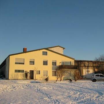
Gepflegter Wallach-Offenstall (Freizeitreiter).
Dassel-Amelsen
Holger-Traupe
@Holger-Traupe
Freizeitstall
Krankenbox
Longierzirkel/Roundpen
Bewegungsstall
Offenstall
Vollpension
9 weitere...
B
Leider kein Vorschaubild
Leider kein Vorschaubild
Gepflegter Offenstall NUR für soziale Wallache.
Dassel-Amelsen
Pferdepension-Traupe
@Pferdepension-Traupe
Freizeitstall
Vermieten
Krankenbox
Longierzirkel/Roundpen
Hufrehe geeignet
Notfallboxen
12 weitere...
aktuell
B
Deprecated: Creation of dynamic property Zend_View_Helper_Ads::$adLink is deprecated in /var/www/stall-frei/htdocs/staging.stall-frei.de/library/Psf/View/Helper/Ads.php on line 108

Futtersack HeuToy, Fressbremse in pink
Mechtersen
STALL-FREIde Marketing
@STALL-FREI-Marketing
Stundenlange Beschäftigung die
Koliken vorbeugt, geringe Staubinhalation mit
steuerbarer Futterentnahme
Leider kein Vorschaubild
Leider kein Vorschaubild
Offenstallplätze frei! ab sofort
Göttingen
Lena Bötte
@L.Boette
Freizeitstall
Verpachten
Paddock
Reitplatz (z.B. Dressur, Springen, Reining)
Hufrehe geeignet
5 weitere...
B
Leider kein Vorschaubild
Leider kein Vorschaubild
Offenstall / Wallache / Allergiker geeignet
Fuldatel-Ihringshausen
Janineernd
@Janineernd
Freizeitstall
Vermieten
Sommerweide
Weide
Allergikerstall
bedampftes/gewaschenes Heu
5 weitere...
B
Leider kein Vorschaubild
Leider kein Vorschaubild
Golden Shadow Ranch
Schwalenberg
Bianca-Rueter-Kreienmeier
@Bianca-Rueter-Kreienmeier
Freizeitstall
Geländestrecke
Vermieten
Longierzirkel/Roundpen
Paddock
Hengsthaltung möglich
Pferdezucht
19 weitere...
B
Leider kein Vorschaubild
Leider kein Vorschaubild
Offenstallplatz
Nieheim
Ponyhof-Nieheim
@Ponyhof-Nieheim
Freizeitstall
VFD-Mitglied
Vermieten
Hunde willkommen
Krankenbox
Notfallboxen
12 weitere...
B

Persönlichkeitsentwicklung mit Pferden
Bad Salzuflen
Katja Dors
@Pferdezeiten
Begleite andere auf ihrem Entwicklungsweg und entdecke die transformative Kraft der pferdegestützten Persönlichkeitsentwicklung !
neu
R
Leider kein Vorschaubild
Leider kein Vorschaubild
Offenstallplatz
Göttingen
Göttinger Birkenhof
@Birkenhof1
FN-Mitglied
Freizeitstall
Vermieten
Verpachten
Longierzirkel/Roundpen
Paddock
Notfallboxen
26 weitere...
P
Leider kein Vorschaubild
Leider kein Vorschaubild
Islandpferdehof Ickelsbach
Staufenberg-Landwehrhagen
Islandpferdehof Ickelsbach
@Ickelsbach
Gangpferdereiten
Pferdeausbildung
Longierzirkel/Roundpen
Ovalbahn
Außenbox mit Paddock
Innenbox
Vollpension
10 weitere...
B
Hof Heinemann
Göttingen
Jan-Heinemann
@Jan-Heinemann
FN-Mitglied
Pferdeausbildung
Longierzirkel/Roundpen
Paddock
Hengsthaltung möglich
Pferdezucht
Außenbox mit Paddock
Außenboxen
9 weitere...
P

Bewegungsstall Nähe Göttingen / Witzenhausen
Hermannrode
Swantje-Schroeter
@Swantje-Schroeter
Pferdeausbildung
Reitlehrer und -unterricht
Vermieten
Krankenbox
Longierzirkel/Roundpen
Hufrehe geeignet
Notfallboxen
17 weitere...
P
Veröffentliche deine Suche als Gesuch und Suchauftrag, dann erhältst du Angebote, neue Treffer und Änderungen per E-Mail.
Diese Suche als Gesuch veröffentlichenDeprecated: Creation of dynamic property Zend_View::$pageCount is deprecated in /var/www/stall-frei/htdocs/staging.stall-frei.de/library/vendor/shardj/zf1-future/library/Zend/View/Abstract.php on line 308
Deprecated: Creation of dynamic property Zend_View::$itemCountPerPage is deprecated in /var/www/stall-frei/htdocs/staging.stall-frei.de/library/vendor/shardj/zf1-future/library/Zend/View/Abstract.php on line 308
Deprecated: Creation of dynamic property Zend_View::$first is deprecated in /var/www/stall-frei/htdocs/staging.stall-frei.de/library/vendor/shardj/zf1-future/library/Zend/View/Abstract.php on line 308
Deprecated: Creation of dynamic property Zend_View::$current is deprecated in /var/www/stall-frei/htdocs/staging.stall-frei.de/library/vendor/shardj/zf1-future/library/Zend/View/Abstract.php on line 308
Deprecated: Creation of dynamic property Zend_View::$last is deprecated in /var/www/stall-frei/htdocs/staging.stall-frei.de/library/vendor/shardj/zf1-future/library/Zend/View/Abstract.php on line 308
Deprecated: Creation of dynamic property Zend_View::$previous is deprecated in /var/www/stall-frei/htdocs/staging.stall-frei.de/library/vendor/shardj/zf1-future/library/Zend/View/Abstract.php on line 308
Deprecated: Creation of dynamic property Zend_View::$next is deprecated in /var/www/stall-frei/htdocs/staging.stall-frei.de/library/vendor/shardj/zf1-future/library/Zend/View/Abstract.php on line 308
Deprecated: Creation of dynamic property Zend_View::$pagesInRange is deprecated in /var/www/stall-frei/htdocs/staging.stall-frei.de/library/vendor/shardj/zf1-future/library/Zend/View/Abstract.php on line 308
Deprecated: Creation of dynamic property Zend_View::$firstPageInRange is deprecated in /var/www/stall-frei/htdocs/staging.stall-frei.de/library/vendor/shardj/zf1-future/library/Zend/View/Abstract.php on line 308
Deprecated: Creation of dynamic property Zend_View::$lastPageInRange is deprecated in /var/www/stall-frei/htdocs/staging.stall-frei.de/library/vendor/shardj/zf1-future/library/Zend/View/Abstract.php on line 308
Deprecated: Creation of dynamic property Zend_View::$currentItemCount is deprecated in /var/www/stall-frei/htdocs/staging.stall-frei.de/library/vendor/shardj/zf1-future/library/Zend/View/Abstract.php on line 308
Deprecated: Creation of dynamic property Zend_View::$totalItemCount is deprecated in /var/www/stall-frei/htdocs/staging.stall-frei.de/library/vendor/shardj/zf1-future/library/Zend/View/Abstract.php on line 308
Deprecated: Creation of dynamic property Zend_View::$firstItemNumber is deprecated in /var/www/stall-frei/htdocs/staging.stall-frei.de/library/vendor/shardj/zf1-future/library/Zend/View/Abstract.php on line 308
Deprecated: Creation of dynamic property Zend_View::$lastItemNumber is deprecated in /var/www/stall-frei/htdocs/staging.stall-frei.de/library/vendor/shardj/zf1-future/library/Zend/View/Abstract.php on line 308
Deprecated: Creation of dynamic property Zend_View::$router is deprecated in /var/www/stall-frei/htdocs/staging.stall-frei.de/library/vendor/shardj/zf1-future/library/Zend/View/Abstract.php on line 308
Deprecated: Creation of dynamic property Zend_View::$urlParams is deprecated in /var/www/stall-frei/htdocs/staging.stall-frei.de/library/vendor/shardj/zf1-future/library/Zend/View/Abstract.php on line 308
Deprecated: Creation of dynamic property Zend_View::$showAds is deprecated in /var/www/stall-frei/htdocs/staging.stall-frei.de/library/vendor/shardj/zf1-future/library/Zend/View/Abstract.php on line 308
Deprecated: Creation of dynamic property Zend_View::$objectIds is deprecated in /var/www/stall-frei/htdocs/staging.stall-frei.de/library/vendor/shardj/zf1-future/library/Zend/View/Abstract.php on line 308
Deprecated: Creation of dynamic property Zend_View::$showNavbar is deprecated in /var/www/stall-frei/htdocs/staging.stall-frei.de/library/vendor/shardj/zf1-future/library/Zend/View/Abstract.php on line 308
Deprecated: Creation of dynamic property Zend_View::$showBreadcrumb is deprecated in /var/www/stall-frei/htdocs/staging.stall-frei.de/library/vendor/shardj/zf1-future/library/Zend/View/Abstract.php on line 308
Deprecated: Creation of dynamic property Zend_View::$showFooter is deprecated in /var/www/stall-frei/htdocs/staging.stall-frei.de/library/vendor/shardj/zf1-future/library/Zend/View/Abstract.php on line 308
Deprecated: Creation of dynamic property Zend_View::$showInternalAds is deprecated in /var/www/stall-frei/htdocs/staging.stall-frei.de/library/vendor/shardj/zf1-future/library/Zend/View/Abstract.php on line 308
Deprecated: Creation of dynamic property Zend_View::$blNoContent is deprecated in /var/www/stall-frei/htdocs/staging.stall-frei.de/library/vendor/shardj/zf1-future/library/Zend/View/Abstract.php on line 308
Deprecated: Creation of dynamic property Zend_View::$sMetaDesc is deprecated in /var/www/stall-frei/htdocs/staging.stall-frei.de/library/vendor/shardj/zf1-future/library/Zend/View/Abstract.php on line 308
Deprecated: Creation of dynamic property Zend_View::$useGmaps is deprecated in /var/www/stall-frei/htdocs/staging.stall-frei.de/library/vendor/shardj/zf1-future/library/Zend/View/Abstract.php on line 308
Deprecated: Creation of dynamic property Zend_View::$touches is deprecated in /var/www/stall-frei/htdocs/staging.stall-frei.de/library/vendor/shardj/zf1-future/library/Zend/View/Abstract.php on line 308
Deprecated: Creation of dynamic property Zend_View::$oProject is deprecated in /var/www/stall-frei/htdocs/staging.stall-frei.de/library/vendor/shardj/zf1-future/library/Zend/View/Abstract.php on line 308
Deprecated: Creation of dynamic property Zend_View::$pageHeadline is deprecated in /var/www/stall-frei/htdocs/staging.stall-frei.de/library/vendor/shardj/zf1-future/library/Zend/View/Abstract.php on line 308
Deprecated: Creation of dynamic property Zend_View::$disableLocationField is deprecated in /var/www/stall-frei/htdocs/staging.stall-frei.de/library/vendor/shardj/zf1-future/library/Zend/View/Abstract.php on line 308
Deprecated: Creation of dynamic property Zend_View::$isSearch is deprecated in /var/www/stall-frei/htdocs/staging.stall-frei.de/library/vendor/shardj/zf1-future/library/Zend/View/Abstract.php on line 308
Deprecated: Creation of dynamic property Zend_View::$pageTitle is deprecated in /var/www/stall-frei/htdocs/staging.stall-frei.de/library/vendor/shardj/zf1-future/library/Zend/View/Abstract.php on line 308
Deprecated: Creation of dynamic property Psf_Form_Element_Text::$class is deprecated in /var/www/stall-frei/htdocs/staging.stall-frei.de/library/vendor/shardj/zf1-future/library/Zend/Form/Element.php on line 874
Deprecated: Creation of dynamic property Psf_Form_Element_Text::$size is deprecated in /var/www/stall-frei/htdocs/staging.stall-frei.de/library/vendor/shardj/zf1-future/library/Zend/Form/Element.php on line 874
Deprecated: Creation of dynamic property Psf_Form_Element_Text::$placeholder is deprecated in /var/www/stall-frei/htdocs/staging.stall-frei.de/library/vendor/shardj/zf1-future/library/Zend/Form/Element.php on line 874
Deprecated: Creation of dynamic property Psf_Form_Element_Hidden::$class is deprecated in /var/www/stall-frei/htdocs/staging.stall-frei.de/library/vendor/shardj/zf1-future/library/Zend/Form/Element.php on line 874
Deprecated: Creation of dynamic property Psf_Form_Element_Hidden::$class is deprecated in /var/www/stall-frei/htdocs/staging.stall-frei.de/library/vendor/shardj/zf1-future/library/Zend/Form/Element.php on line 874
Deprecated: Creation of dynamic property Psf_Form_Element_Hidden::$class is deprecated in /var/www/stall-frei/htdocs/staging.stall-frei.de/library/vendor/shardj/zf1-future/library/Zend/Form/Element.php on line 874
Deprecated: Creation of dynamic property Psf_Form_Element_Hidden::$class is deprecated in /var/www/stall-frei/htdocs/staging.stall-frei.de/library/vendor/shardj/zf1-future/library/Zend/Form/Element.php on line 874
Deprecated: Creation of dynamic property Psf_Form_Element_Select::$class is deprecated in /var/www/stall-frei/htdocs/staging.stall-frei.de/library/vendor/shardj/zf1-future/library/Zend/Form/Element.php on line 874
Deprecated: Creation of dynamic property Psf_Form_Element_Select::$class is deprecated in /var/www/stall-frei/htdocs/staging.stall-frei.de/library/vendor/shardj/zf1-future/library/Zend/Form/Element.php on line 874
Deprecated: Creation of dynamic property Psf_Form_Element_Select::$class is deprecated in /var/www/stall-frei/htdocs/staging.stall-frei.de/library/vendor/shardj/zf1-future/library/Zend/Form/Element.php on line 874
Deprecated: Creation of dynamic property Psf_Form_Element_Select::$class is deprecated in /var/www/stall-frei/htdocs/staging.stall-frei.de/library/vendor/shardj/zf1-future/library/Zend/Form/Element.php on line 874
Deprecated: Creation of dynamic property Psf_Form_Element_Text::$class is deprecated in /var/www/stall-frei/htdocs/staging.stall-frei.de/library/vendor/shardj/zf1-future/library/Zend/Form/Element.php on line 874
Deprecated: Creation of dynamic property Psf_Form_Element_Checkbox::$label is deprecated in /var/www/stall-frei/htdocs/staging.stall-frei.de/library/vendor/shardj/zf1-future/library/Zend/Form/Element.php on line 874
Deprecated: Creation of dynamic property Zend_View::$sort is deprecated in /var/www/stall-frei/htdocs/staging.stall-frei.de/library/vendor/shardj/zf1-future/library/Zend/View/Abstract.php on line 308
Deprecated: Creation of dynamic property Zend_View::$searchLocation is deprecated in /var/www/stall-frei/htdocs/staging.stall-frei.de/library/vendor/shardj/zf1-future/library/Zend/View/Abstract.php on line 308
Deprecated: Creation of dynamic property Zend_View::$locationHint is deprecated in /var/www/stall-frei/htdocs/staging.stall-frei.de/library/vendor/shardj/zf1-future/library/Zend/View/Abstract.php on line 308
Psf_GeoCoder_Abstract::getLocation: Waltersberg Get Location CachedOrLive
Psf_GeoCoder_Abstract::getCachedOrLive: Waltersberg
Psf_GeoCoder_Abstract::convertLocationResult
{"documentation":"https:\/\/opencagedata.com\/api","licenses":[{"name":"see attribution guide","url":"https:\/\/opencagedata.com\/credits"}],"results":[{"bounds":{"northeast":{"lat":51.63237,"lng":9.4593348},"southwest":{"lat":51.63227,"lng":9.4592348}},"components":{"ISO_3166-1_alpha-2":"DE","ISO_3166-1_alpha-3":"DEU","ISO_3166-2":["DE-HE"],"_category":"natural\/water","_normalized_city":"Bad Karlshafen","_type":"peak","continent":"Europe","country":"Deutschland","country_code":"de","county":"Landkreis Kassel","municipality":"Bad Karlshafen","peak":"Waltersberg","political_union":"European Union","postcode":"34385","state":"Hessen","state_code":"HE"},"confidence":9,"formatted":"Waltersberg, 34385 Bad Karlshafen, Deutschland","geometry":{"lat":51.63232,"lng":9.4592848}},{"bounds":{"northeast":{"lat":47.6097544,"lng":9.7278472},"southwest":{"lat":47.5697544,"lng":9.6878472}},"components":{"ISO_3166-1_alpha-2":"DE","ISO_3166-1_alpha-3":"DEU","ISO_3166-2":["DE-BY"],"_category":"place","_normalized_city":"Lindau (Bodensee)","_type":"hamlet","continent":"Europe","country":"Deutschland","country_code":"de","county":"Landkreis Lindau","hamlet":"Waltersberg","political_union":"European Union","postcode":"88147","state":"Bayern","state_code":"BY","town":"Lindau (Bodensee)"},"confidence":7,"formatted":"Waltersberg, 88147 Lindau (Bodensee), Deutschland","geometry":{"lat":47.5897544,"lng":9.7078472}},{"bounds":{"northeast":{"lat":49.2010616,"lng":11.543172},"southwest":{"lat":49.1610616,"lng":11.503172}},"components":{"ISO_3166-1_alpha-2":"DE","ISO_3166-1_alpha-3":"DEU","ISO_3166-2":["DE-BY"],"_category":"place","_normalized_city":"Deining","_type":"village","city":"Deining","continent":"Europe","country":"Deutschland","country_code":"de","county":"Landkreis Neumarkt in der Oberpfalz","political_union":"European Union","postcode":"92364","state":"Bayern","state_code":"BY","village":"Waltersberg"},"confidence":7,"formatted":"92364 Waltersberg, Deutschland","geometry":{"lat":49.1810616,"lng":11.523172}},{"bounds":{"northeast":{"lat":50.9677306,"lng":9.2709443},"southwest":{"lat":50.9676306,"lng":9.2708443}},"components":{"ISO_3166-1_alpha-2":"DE","ISO_3166-1_alpha-3":"DEU","ISO_3166-2":["DE-HE"],"_category":"natural\/water","_normalized_city":"Linsingen","_type":"peak","continent":"Europe","country":"Deutschland","country_code":"de","county":"Schwalm-Eder-Kreis","municipality":"Frielendorf","peak":"Waltersberg","political_union":"European Union","state":"Hessen","state_code":"HE","village":"Linsingen"},"confidence":9,"formatted":"Waltersberg, Linsingen, Hessen, Deutschland","geometry":{"lat":50.9676806,"lng":9.2708943}},{"bounds":{"northeast":{"lat":48.975391,"lng":9.5673611},"southwest":{"lat":48.975291,"lng":9.5672611}},"components":{"ISO_3166-1_alpha-2":"DE","ISO_3166-1_alpha-3":"DEU","ISO_3166-2":["DE-BW"],"_category":"natural\/water","_normalized_city":"Murrhardt","_type":"peak","continent":"Europe","country":"Deutschland","country_code":"de","county":"Rems-Murr-Kreis","peak":"Waltersberg","political_union":"European Union","postcode":"71540","state":"Baden-W\u00fcrttemberg","state_code":"BW","town":"Murrhardt"},"confidence":9,"formatted":"Waltersberg, 71540 Murrhardt, Deutschland","geometry":{"lat":48.975341,"lng":9.5673111}},{"bounds":{"northeast":{"lat":51.0149013,"lng":9.5569265},"southwest":{"lat":51.0148013,"lng":9.5568265}},"components":{"ISO_3166-1_alpha-2":"DE","ISO_3166-1_alpha-3":"DEU","ISO_3166-2":["DE-HE"],"_category":"natural\/water","_normalized_city":"Rengshausen","_type":"peak","continent":"Europe","country":"Deutschland","country_code":"de","county":"Schwalm-Eder-Kreis","municipality":"Kn\u00fcllwald","peak":"Waltersberg","political_union":"European Union","state":"Hessen","state_code":"HE","village":"Rengshausen"},"confidence":9,"formatted":"Waltersberg, Rengshausen, Hessen, Deutschland","geometry":{"lat":51.0148513,"lng":9.5568765}},{"bounds":{"northeast":{"lat":47.7172456,"lng":11.1986796},"southwest":{"lat":47.7126611,"lng":11.1929493}},"components":{"ISO_3166-1_alpha-2":"DE","ISO_3166-1_alpha-3":"DEU","ISO_3166-2":["DE-BY"],"_category":"place","_normalized_city":"Spatzenhausen","_type":"hamlet","continent":"Europe","country":"Deutschland","country_code":"de","county":"Landkreis Garmisch-Partenkirchen","hamlet":"Waltersberg","municipality":"Seehausen am Staffelsee (VGem)","political_union":"European Union","state":"Bayern","state_code":"BY","village":"Spatzenhausen"},"confidence":9,"formatted":"Waltersberg, Spatzenhausen, Bayern, Deutschland","geometry":{"lat":47.715009,"lng":11.1962317}},{"bounds":{"northeast":{"lat":48.1645989,"lng":12.4430014},"southwest":{"lat":48.1245989,"lng":12.4030014}},"components":{"ISO_3166-1_alpha-2":"DE","ISO_3166-1_alpha-3":"DEU","ISO_3166-2":["DE-BY"],"_category":"place","_normalized_city":"Taufkirchen","_type":"hamlet","continent":"Europe","country":"Deutschland","country_code":"de","county":"Landkreis M\u00fchldorf am Inn","hamlet":"Waltersberg","municipality":"Kraiburg am Inn (VGem)","political_union":"European Union","postcode":"84574","state":"Bayern","state_code":"BY","village":"Taufkirchen"},"confidence":7,"formatted":"Waltersberg, 84574 Taufkirchen, Deutschland","geometry":{"lat":48.1445989,"lng":12.4230014}},{"bounds":{"northeast":{"lat":48.4222746,"lng":12.1820501},"southwest":{"lat":48.3822746,"lng":12.1420501}},"components":{"ISO_3166-1_alpha-2":"DE","ISO_3166-1_alpha-3":"DEU","ISO_3166-2":["DE-BY"],"_category":"place","_normalized_city":"Hohenpolding","_type":"hamlet","continent":"Europe","country":"Deutschland","country_code":"de","county":"Landkreis Erding","hamlet":"Waltersberg","municipality":"Steinkirchen (VGem)","political_union":"European Union","postcode":"84432","state":"Bayern","state_code":"BY","village":"Hohenpolding"},"confidence":7,"formatted":"Waltersberg, 84432 Hohenpolding, Deutschland","geometry":{"lat":48.4022746,"lng":12.1620501}},{"bounds":{"northeast":{"lat":48.9867172,"lng":9.580907},"southwest":{"lat":48.9467172,"lng":9.540907}},"components":{"ISO_3166-1_alpha-2":"DE","ISO_3166-1_alpha-3":"DEU","ISO_3166-2":["DE-BW"],"_category":"place","_normalized_city":"Murrhardt","_type":"hamlet","continent":"Europe","country":"Deutschland","country_code":"de","county":"Rems-Murr-Kreis","hamlet":"Waltersberg","political_union":"European Union","postcode":"71540","state":"Baden-W\u00fcrttemberg","state_code":"BW","town":"Murrhardt"},"confidence":7,"formatted":"Waltersberg, 71540 Murrhardt, Deutschland","geometry":{"lat":48.9667172,"lng":9.560907}}],"status":{"code":200,"message":"OK"},"stay_informed":{"blog":"https:\/\/blog.opencagedata.com","mastodon":"https:\/\/en.osm.town\/@opencage"},"thanks":"For using an OpenCage API","timestamp":{"created_http":"Sat, 07 Feb 2026 22:42:14 GMT","created_unix":1770504134},"total_results":10}Array
(
[0] => stdClass Object
(
[bounds] => stdClass Object
(
[northeast] => stdClass Object
(
[lat] => 51.63237
[lng] => 9.4593348
)
[southwest] => stdClass Object
(
[lat] => 51.63227
[lng] => 9.4592348
)
)
[components] => stdClass Object
(
[ISO_3166-1_alpha-2] => DE
[ISO_3166-1_alpha-3] => DEU
[ISO_3166-2] => Array
(
[0] => DE-HE
)
[_category] => natural/water
[_normalized_city] => Bad Karlshafen
[_type] => peak
[continent] => Europe
[country] => Deutschland
[country_code] => de
[county] => Landkreis Kassel
[municipality] => Bad Karlshafen
[peak] => Waltersberg
[political_union] => European Union
[postcode] => 34385
[state] => Hessen
[state_code] => HE
)
[confidence] => 9
[formatted] => Waltersberg, 34385 Bad Karlshafen, Deutschland
[geometry] => stdClass Object
(
[lat] => 51.63232
[lng] => 9.4592848
)
)
[1] => stdClass Object
(
[bounds] => stdClass Object
(
[northeast] => stdClass Object
(
[lat] => 47.6097544
[lng] => 9.7278472
)
[southwest] => stdClass Object
(
[lat] => 47.5697544
[lng] => 9.6878472
)
)
[components] => stdClass Object
(
[ISO_3166-1_alpha-2] => DE
[ISO_3166-1_alpha-3] => DEU
[ISO_3166-2] => Array
(
[0] => DE-BY
)
[_category] => place
[_normalized_city] => Lindau (Bodensee)
[_type] => hamlet
[continent] => Europe
[country] => Deutschland
[country_code] => de
[county] => Landkreis Lindau
[hamlet] => Waltersberg
[political_union] => European Union
[postcode] => 88147
[state] => Bayern
[state_code] => BY
[town] => Lindau (Bodensee)
)
[confidence] => 7
[formatted] => Waltersberg, 88147 Lindau (Bodensee), Deutschland
[geometry] => stdClass Object
(
[lat] => 47.5897544
[lng] => 9.7078472
)
)
[2] => stdClass Object
(
[bounds] => stdClass Object
(
[northeast] => stdClass Object
(
[lat] => 49.2010616
[lng] => 11.543172
)
[southwest] => stdClass Object
(
[lat] => 49.1610616
[lng] => 11.503172
)
)
[components] => stdClass Object
(
[ISO_3166-1_alpha-2] => DE
[ISO_3166-1_alpha-3] => DEU
[ISO_3166-2] => Array
(
[0] => DE-BY
)
[_category] => place
[_normalized_city] => Deining
[_type] => village
[city] => Deining
[continent] => Europe
[country] => Deutschland
[country_code] => de
[county] => Landkreis Neumarkt in der Oberpfalz
[political_union] => European Union
[postcode] => 92364
[state] => Bayern
[state_code] => BY
[village] => Waltersberg
)
[confidence] => 7
[formatted] => 92364 Waltersberg, Deutschland
[geometry] => stdClass Object
(
[lat] => 49.1810616
[lng] => 11.523172
)
)
[3] => stdClass Object
(
[bounds] => stdClass Object
(
[northeast] => stdClass Object
(
[lat] => 50.9677306
[lng] => 9.2709443
)
[southwest] => stdClass Object
(
[lat] => 50.9676306
[lng] => 9.2708443
)
)
[components] => stdClass Object
(
[ISO_3166-1_alpha-2] => DE
[ISO_3166-1_alpha-3] => DEU
[ISO_3166-2] => Array
(
[0] => DE-HE
)
[_category] => natural/water
[_normalized_city] => Linsingen
[_type] => peak
[continent] => Europe
[country] => Deutschland
[country_code] => de
[county] => Schwalm-Eder-Kreis
[municipality] => Frielendorf
[peak] => Waltersberg
[political_union] => European Union
[state] => Hessen
[state_code] => HE
[village] => Linsingen
)
[confidence] => 9
[formatted] => Waltersberg, Linsingen, Hessen, Deutschland
[geometry] => stdClass Object
(
[lat] => 50.9676806
[lng] => 9.2708943
)
)
[4] => stdClass Object
(
[bounds] => stdClass Object
(
[northeast] => stdClass Object
(
[lat] => 48.975391
[lng] => 9.5673611
)
[southwest] => stdClass Object
(
[lat] => 48.975291
[lng] => 9.5672611
)
)
[components] => stdClass Object
(
[ISO_3166-1_alpha-2] => DE
[ISO_3166-1_alpha-3] => DEU
[ISO_3166-2] => Array
(
[0] => DE-BW
)
[_category] => natural/water
[_normalized_city] => Murrhardt
[_type] => peak
[continent] => Europe
[country] => Deutschland
[country_code] => de
[county] => Rems-Murr-Kreis
[peak] => Waltersberg
[political_union] => European Union
[postcode] => 71540
[state] => Baden-Württemberg
[state_code] => BW
[town] => Murrhardt
)
[confidence] => 9
[formatted] => Waltersberg, 71540 Murrhardt, Deutschland
[geometry] => stdClass Object
(
[lat] => 48.975341
[lng] => 9.5673111
)
)
[5] => stdClass Object
(
[bounds] => stdClass Object
(
[northeast] => stdClass Object
(
[lat] => 51.0149013
[lng] => 9.5569265
)
[southwest] => stdClass Object
(
[lat] => 51.0148013
[lng] => 9.5568265
)
)
[components] => stdClass Object
(
[ISO_3166-1_alpha-2] => DE
[ISO_3166-1_alpha-3] => DEU
[ISO_3166-2] => Array
(
[0] => DE-HE
)
[_category] => natural/water
[_normalized_city] => Rengshausen
[_type] => peak
[continent] => Europe
[country] => Deutschland
[country_code] => de
[county] => Schwalm-Eder-Kreis
[municipality] => Knüllwald
[peak] => Waltersberg
[political_union] => European Union
[state] => Hessen
[state_code] => HE
[village] => Rengshausen
)
[confidence] => 9
[formatted] => Waltersberg, Rengshausen, Hessen, Deutschland
[geometry] => stdClass Object
(
[lat] => 51.0148513
[lng] => 9.5568765
)
)
[6] => stdClass Object
(
[bounds] => stdClass Object
(
[northeast] => stdClass Object
(
[lat] => 47.7172456
[lng] => 11.1986796
)
[southwest] => stdClass Object
(
[lat] => 47.7126611
[lng] => 11.1929493
)
)
[components] => stdClass Object
(
[ISO_3166-1_alpha-2] => DE
[ISO_3166-1_alpha-3] => DEU
[ISO_3166-2] => Array
(
[0] => DE-BY
)
[_category] => place
[_normalized_city] => Spatzenhausen
[_type] => hamlet
[continent] => Europe
[country] => Deutschland
[country_code] => de
[county] => Landkreis Garmisch-Partenkirchen
[hamlet] => Waltersberg
[municipality] => Seehausen am Staffelsee (VGem)
[political_union] => European Union
[state] => Bayern
[state_code] => BY
[village] => Spatzenhausen
)
[confidence] => 9
[formatted] => Waltersberg, Spatzenhausen, Bayern, Deutschland
[geometry] => stdClass Object
(
[lat] => 47.715009
[lng] => 11.1962317
)
)
[7] => stdClass Object
(
[bounds] => stdClass Object
(
[northeast] => stdClass Object
(
[lat] => 48.1645989
[lng] => 12.4430014
)
[southwest] => stdClass Object
(
[lat] => 48.1245989
[lng] => 12.4030014
)
)
[components] => stdClass Object
(
[ISO_3166-1_alpha-2] => DE
[ISO_3166-1_alpha-3] => DEU
[ISO_3166-2] => Array
(
[0] => DE-BY
)
[_category] => place
[_normalized_city] => Taufkirchen
[_type] => hamlet
[continent] => Europe
[country] => Deutschland
[country_code] => de
[county] => Landkreis Mühldorf am Inn
[hamlet] => Waltersberg
[municipality] => Kraiburg am Inn (VGem)
[political_union] => European Union
[postcode] => 84574
[state] => Bayern
[state_code] => BY
[village] => Taufkirchen
)
[confidence] => 7
[formatted] => Waltersberg, 84574 Taufkirchen, Deutschland
[geometry] => stdClass Object
(
[lat] => 48.1445989
[lng] => 12.4230014
)
)
[8] => stdClass Object
(
[bounds] => stdClass Object
(
[northeast] => stdClass Object
(
[lat] => 48.4222746
[lng] => 12.1820501
)
[southwest] => stdClass Object
(
[lat] => 48.3822746
[lng] => 12.1420501
)
)
[components] => stdClass Object
(
[ISO_3166-1_alpha-2] => DE
[ISO_3166-1_alpha-3] => DEU
[ISO_3166-2] => Array
(
[0] => DE-BY
)
[_category] => place
[_normalized_city] => Hohenpolding
[_type] => hamlet
[continent] => Europe
[country] => Deutschland
[country_code] => de
[county] => Landkreis Erding
[hamlet] => Waltersberg
[municipality] => Steinkirchen (VGem)
[political_union] => European Union
[postcode] => 84432
[state] => Bayern
[state_code] => BY
[village] => Hohenpolding
)
[confidence] => 7
[formatted] => Waltersberg, 84432 Hohenpolding, Deutschland
[geometry] => stdClass Object
(
[lat] => 48.4022746
[lng] => 12.1620501
)
)
[9] => stdClass Object
(
[bounds] => stdClass Object
(
[northeast] => stdClass Object
(
[lat] => 48.9867172
[lng] => 9.580907
)
[southwest] => stdClass Object
(
[lat] => 48.9467172
[lng] => 9.540907
)
)
[components] => stdClass Object
(
[ISO_3166-1_alpha-2] => DE
[ISO_3166-1_alpha-3] => DEU
[ISO_3166-2] => Array
(
[0] => DE-BW
)
[_category] => place
[_normalized_city] => Murrhardt
[_type] => hamlet
[continent] => Europe
[country] => Deutschland
[country_code] => de
[county] => Rems-Murr-Kreis
[hamlet] => Waltersberg
[political_union] => European Union
[postcode] => 71540
[state] => Baden-Württemberg
[state_code] => BW
[town] => Murrhardt
)
[confidence] => 7
[formatted] => Waltersberg, 71540 Murrhardt, Deutschland
[geometry] => stdClass Object
(
[lat] => 48.9667172
[lng] => 9.560907
)
)
)
Psf_GeoCoder_OpenCageData::getKeyMap: 0
stdClass Object
(
    [bounds] => stdClass Object
        (
            [northeast] => stdClass Object
                (
                    [lat] => 51.63237
                    [lng] => 9.4593348
                )

            [southwest] => stdClass Object
                (
                    [lat] => 51.63227
                    [lng] => 9.4592348
                )

        )

    [components] => stdClass Object
        (
            [ISO_3166-1_alpha-2] => DE
            [ISO_3166-1_alpha-3] => DEU
            [ISO_3166-2] => Array
                (
                    [0] => DE-HE
                )

            [_category] => natural/water
            [_normalized_city] => Bad Karlshafen
            [_type] => peak
            [continent] => Europe
            [country] => Deutschland
            [country_code] => de
            [county] => Landkreis Kassel
            [municipality] => Bad Karlshafen
            [peak] => Waltersberg
            [political_union] => European Union
            [postcode] => 34385
            [state] => Hessen
            [state_code] => HE
        )

    [confidence] => 9
    [formatted] => Waltersberg, 34385 Bad Karlshafen, Deutschland
    [geometry] => stdClass Object
        (
            [lat] => 51.63232
            [lng] => 9.4592848
        )

)
Psf_GeoCoder_OpenCageData::getCounty: Kassel
Psf_GeoCoder_OpenCageData::addMissingData REFETCH!
Array
(
    [address] => Waltersberg, 34385 Bad Karlshafen, Deutschland
    [type] => peak
    [street] =>
    [city] =>
    [county] => Kassel
    [state] => Hessen
    [zip] => 34385
    [country] => Deutschland
    [suburb] =>
    [countrycode] => de
    [latitude] => 51.63232
    [longitude] => 9.4592848
    [accuracy] => 1
    [confidence] => 9
    [bounds] => stdClass Object
        (
            [northeast] => stdClass Object
                (
                    [lat] => 51.63237
                    [lng] => 9.4593348
                )

            [southwest] => stdClass Object
                (
                    [lat] => 51.63227
                    [lng] => 9.4592348
                )

        )

)
reformat!
Array
(
    [address] => Waltersberg, 34385 Bad Karlshafen, Deutschland
    [type] => peak
    [street] =>
    [city] =>
    [county] => Kassel
    [state] => Hessen
    [zip] => 34385
    [country] => Deutschland
    [suburb] =>
    [countrycode] => de
    [latitude] => 51.63232
    [longitude] => 9.4592848
    [accuracy] => 1
    [confidence] => 9
    [bounds] => stdClass Object
        (
            [northeast] => stdClass Object
                (
                    [lat] => 51.63237
                    [lng] => 9.4593348
                )

            [southwest] => stdClass Object
                (
                    [lat] => 51.63227
                    [lng] => 9.4592348
                )

        )

    [place] => 34385 , Hessen
    [hash] => 0e01a0554f2a0630fe8642bc38cb4625
)
Psf_GeoCoder_OpenCageData::getKeyMap: 1
stdClass Object
(
    [bounds] => stdClass Object
        (
            [northeast] => stdClass Object
                (
                    [lat] => 47.6097544
                    [lng] => 9.7278472
                )

            [southwest] => stdClass Object
                (
                    [lat] => 47.5697544
                    [lng] => 9.6878472
                )

        )

    [components] => stdClass Object
        (
            [ISO_3166-1_alpha-2] => DE
            [ISO_3166-1_alpha-3] => DEU
            [ISO_3166-2] => Array
                (
                    [0] => DE-BY
                )

            [_category] => place
            [_normalized_city] => Lindau (Bodensee)
            [_type] => hamlet
            [continent] => Europe
            [country] => Deutschland
            [country_code] => de
            [county] => Landkreis Lindau
            [hamlet] => Waltersberg
            [political_union] => European Union
            [postcode] => 88147
            [state] => Bayern
            [state_code] => BY
            [town] => Lindau (Bodensee)
        )

    [confidence] => 7
    [formatted] => Waltersberg, 88147 Lindau (Bodensee), Deutschland
    [geometry] => stdClass Object
        (
            [lat] => 47.5897544
            [lng] => 9.7078472
        )

)
Psf_GeoCoder_OpenCageData::getCounty: Lindau
Psf_GeoCoder_OpenCageData::addMissingData REFETCH!
Array
(
    [address] => Waltersberg, 88147 Lindau (Bodensee), Deutschland
    [type] => hamlet
    [street] => Waltersberg
    [city] => Lindau (Bodensee)
    [county] => Lindau
    [state] => Bayern
    [zip] => 88147
    [country] => Deutschland
    [suburb] =>
    [countrycode] => de
    [latitude] => 47.5897544
    [longitude] => 9.7078472
    [accuracy] => 1
    [confidence] => 7
    [bounds] => stdClass Object
        (
            [northeast] => stdClass Object
                (
                    [lat] => 47.6097544
                    [lng] => 9.7278472
                )

            [southwest] => stdClass Object
                (
                    [lat] => 47.5697544
                    [lng] => 9.6878472
                )

        )

)
reformat!
Array
(
    [address] => Waltersberg, 88147 Lindau (Bodensee), Deutschland
    [type] => hamlet
    [street] => Waltersberg
    [city] => Lindau (Bodensee)
    [county] => Lindau
    [state] => Bayern
    [zip] => 88147
    [country] => Deutschland
    [suburb] =>
    [countrycode] => de
    [latitude] => 47.5897544
    [longitude] => 9.7078472
    [accuracy] => 1
    [confidence] => 7
    [bounds] => stdClass Object
        (
            [northeast] => stdClass Object
                (
                    [lat] => 47.6097544
                    [lng] => 9.7278472
                )

            [southwest] => stdClass Object
                (
                    [lat] => 47.5697544
                    [lng] => 9.6878472
                )

        )

    [place] => Waltersberg, 88147 Lindau (Bodensee), Bayern
    [hash] => 0ccf41d04460deefcf00c0d97087a8ae
)
Psf_GeoCoder_OpenCageData::getKeyMap: 2
stdClass Object
(
    [bounds] => stdClass Object
        (
            [northeast] => stdClass Object
                (
                    [lat] => 49.2010616
                    [lng] => 11.543172
                )

            [southwest] => stdClass Object
                (
                    [lat] => 49.1610616
                    [lng] => 11.503172
                )

        )

    [components] => stdClass Object
        (
            [ISO_3166-1_alpha-2] => DE
            [ISO_3166-1_alpha-3] => DEU
            [ISO_3166-2] => Array
                (
                    [0] => DE-BY
                )

            [_category] => place
            [_normalized_city] => Deining
            [_type] => village
            [city] => Deining
            [continent] => Europe
            [country] => Deutschland
            [country_code] => de
            [county] => Landkreis Neumarkt in der Oberpfalz
            [political_union] => European Union
            [postcode] => 92364
            [state] => Bayern
            [state_code] => BY
            [village] => Waltersberg
        )

    [confidence] => 7
    [formatted] => 92364 Waltersberg, Deutschland
    [geometry] => stdClass Object
        (
            [lat] => 49.1810616
            [lng] => 11.523172
        )

)
Psf_GeoCoder_OpenCageData::getCounty: Neumarkt in der Oberpfalz
Psf_GeoCoder_OpenCageData::addMissingData REFETCH!
Array
(
    [address] => 92364 Waltersberg, Deutschland
    [type] => village
    [street] =>
    [city] => Waltersberg
    [county] => Neumarkt in der Oberpfalz
    [state] => Bayern
    [zip] => 92364
    [country] => Deutschland
    [suburb] =>
    [countrycode] => de
    [latitude] => 49.1810616
    [longitude] => 11.523172
    [accuracy] => 1
    [confidence] => 7
    [bounds] => stdClass Object
        (
            [northeast] => stdClass Object
                (
                    [lat] => 49.2010616
                    [lng] => 11.543172
                )

            [southwest] => stdClass Object
                (
                    [lat] => 49.1610616
                    [lng] => 11.503172
                )

        )

)
reformat!
Array
(
    [address] => 92364 Waltersberg, Deutschland
    [type] => village
    [street] =>
    [city] => Waltersberg
    [county] => Neumarkt in der Oberpfalz
    [state] => Bayern
    [zip] => 92364
    [country] => Deutschland
    [suburb] =>
    [countrycode] => de
    [latitude] => 49.1810616
    [longitude] => 11.523172
    [accuracy] => 1
    [confidence] => 7
    [bounds] => stdClass Object
        (
            [northeast] => stdClass Object
                (
                    [lat] => 49.2010616
                    [lng] => 11.543172
                )

            [southwest] => stdClass Object
                (
                    [lat] => 49.1610616
                    [lng] => 11.503172
                )

        )

    [place] => 92364 Waltersberg, Bayern
    [hash] => 24d7579ea2ef28123beafbf990d39aa6
)
Psf_GeoCoder_OpenCageData::getKeyMap: 3
stdClass Object
(
    [bounds] => stdClass Object
        (
            [northeast] => stdClass Object
                (
                    [lat] => 50.9677306
                    [lng] => 9.2709443
                )

            [southwest] => stdClass Object
                (
                    [lat] => 50.9676306
                    [lng] => 9.2708443
                )

        )

    [components] => stdClass Object
        (
            [ISO_3166-1_alpha-2] => DE
            [ISO_3166-1_alpha-3] => DEU
            [ISO_3166-2] => Array
                (
                    [0] => DE-HE
                )

            [_category] => natural/water
            [_normalized_city] => Linsingen
            [_type] => peak
            [continent] => Europe
            [country] => Deutschland
            [country_code] => de
            [county] => Schwalm-Eder-Kreis
            [municipality] => Frielendorf
            [peak] => Waltersberg
            [political_union] => European Union
            [state] => Hessen
            [state_code] => HE
            [village] => Linsingen
        )

    [confidence] => 9
    [formatted] => Waltersberg, Linsingen, Hessen, Deutschland
    [geometry] => stdClass Object
        (
            [lat] => 50.9676806
            [lng] => 9.2708943
        )

)
Psf_GeoCoder_OpenCageData::getCounty: Schwalm-Eder-Kreis
Psf_GeoCoder_OpenCageData::addMissingData REFETCH!
Array
(
    [address] => Waltersberg, Linsingen, Hessen, Deutschland
    [type] => peak
    [street] =>
    [city] => Linsingen
    [county] => Schwalm-Eder-Kreis
    [state] => Hessen
    [zip] =>
    [country] => Deutschland
    [suburb] =>
    [countrycode] => de
    [latitude] => 50.9676806
    [longitude] => 9.2708943
    [accuracy] => 1
    [confidence] => 9
    [bounds] => stdClass Object
        (
            [northeast] => stdClass Object
                (
                    [lat] => 50.9677306
                    [lng] => 9.2709443
                )

            [southwest] => stdClass Object
                (
                    [lat] => 50.9676306
                    [lng] => 9.2708443
                )

        )

)
reformat!
Array
(
    [address] => Waltersberg, Linsingen, Hessen, Deutschland
    [type] => peak
    [street] =>
    [city] => Linsingen
    [county] => Schwalm-Eder-Kreis
    [state] => Hessen
    [zip] =>
    [country] => Deutschland
    [suburb] =>
    [countrycode] => de
    [latitude] => 50.9676806
    [longitude] => 9.2708943
    [accuracy] => 1
    [confidence] => 9
    [bounds] => stdClass Object
        (
            [northeast] => stdClass Object
                (
                    [lat] => 50.9677306
                    [lng] => 9.2709443
                )

            [southwest] => stdClass Object
                (
                    [lat] => 50.9676306
                    [lng] => 9.2708443
                )

        )

    [place] => Linsingen, Hessen
    [hash] => 6b2fa336b897ef8787d69325315010bf
)
Psf_GeoCoder_OpenCageData::getKeyMap: 4
stdClass Object
(
    [bounds] => stdClass Object
        (
            [northeast] => stdClass Object
                (
                    [lat] => 48.975391
                    [lng] => 9.5673611
                )

            [southwest] => stdClass Object
                (
                    [lat] => 48.975291
                    [lng] => 9.5672611
                )

        )

    [components] => stdClass Object
        (
            [ISO_3166-1_alpha-2] => DE
            [ISO_3166-1_alpha-3] => DEU
            [ISO_3166-2] => Array
                (
                    [0] => DE-BW
                )

            [_category] => natural/water
            [_normalized_city] => Murrhardt
            [_type] => peak
            [continent] => Europe
            [country] => Deutschland
            [country_code] => de
            [county] => Rems-Murr-Kreis
            [peak] => Waltersberg
            [political_union] => European Union
            [postcode] => 71540
            [state] => Baden-Württemberg
            [state_code] => BW
            [town] => Murrhardt
        )

    [confidence] => 9
    [formatted] => Waltersberg, 71540 Murrhardt, Deutschland
    [geometry] => stdClass Object
        (
            [lat] => 48.975341
            [lng] => 9.5673111
        )

)
Psf_GeoCoder_OpenCageData::getCounty: Rems-Murr-Kreis
Psf_GeoCoder_OpenCageData::addMissingData REFETCH!
Array
(
    [address] => Waltersberg, 71540 Murrhardt, Deutschland
    [type] => peak
    [street] =>
    [city] => Murrhardt
    [county] => Rems-Murr-Kreis
    [state] => Baden-Württemberg
    [zip] => 71540
    [country] => Deutschland
    [suburb] =>
    [countrycode] => de
    [latitude] => 48.975341
    [longitude] => 9.5673111
    [accuracy] => 1
    [confidence] => 9
    [bounds] => stdClass Object
        (
            [northeast] => stdClass Object
                (
                    [lat] => 48.975391
                    [lng] => 9.5673611
                )

            [southwest] => stdClass Object
                (
                    [lat] => 48.975291
                    [lng] => 9.5672611
                )

        )

)
reformat!
Array
(
    [address] => Waltersberg, 71540 Murrhardt, Deutschland
    [type] => peak
    [street] =>
    [city] => Murrhardt
    [county] => Rems-Murr-Kreis
    [state] => Baden-Württemberg
    [zip] => 71540
    [country] => Deutschland
    [suburb] =>
    [countrycode] => de
    [latitude] => 48.975341
    [longitude] => 9.5673111
    [accuracy] => 1
    [confidence] => 9
    [bounds] => stdClass Object
        (
            [northeast] => stdClass Object
                (
                    [lat] => 48.975391
                    [lng] => 9.5673611
                )

            [southwest] => stdClass Object
                (
                    [lat] => 48.975291
                    [lng] => 9.5672611
                )

        )

    [place] => 71540 Murrhardt, Baden-Württemberg
    [hash] => 81643956356d5c33fc8e968d44dfed28
)
Psf_GeoCoder_OpenCageData::getKeyMap: 5
stdClass Object
(
    [bounds] => stdClass Object
        (
            [northeast] => stdClass Object
                (
                    [lat] => 51.0149013
                    [lng] => 9.5569265
                )

            [southwest] => stdClass Object
                (
                    [lat] => 51.0148013
                    [lng] => 9.5568265
                )

        )

    [components] => stdClass Object
        (
            [ISO_3166-1_alpha-2] => DE
            [ISO_3166-1_alpha-3] => DEU
            [ISO_3166-2] => Array
                (
                    [0] => DE-HE
                )

            [_category] => natural/water
            [_normalized_city] => Rengshausen
            [_type] => peak
            [continent] => Europe
            [country] => Deutschland
            [country_code] => de
            [county] => Schwalm-Eder-Kreis
            [municipality] => Knüllwald
            [peak] => Waltersberg
            [political_union] => European Union
            [state] => Hessen
            [state_code] => HE
            [village] => Rengshausen
        )

    [confidence] => 9
    [formatted] => Waltersberg, Rengshausen, Hessen, Deutschland
    [geometry] => stdClass Object
        (
            [lat] => 51.0148513
            [lng] => 9.5568765
        )

)
Psf_GeoCoder_OpenCageData::getCounty: Schwalm-Eder-Kreis
Psf_GeoCoder_OpenCageData::addMissingData REFETCH!
Array
(
    [address] => Waltersberg, Rengshausen, Hessen, Deutschland
    [type] => peak
    [street] =>
    [city] => Rengshausen
    [county] => Schwalm-Eder-Kreis
    [state] => Hessen
    [zip] =>
    [country] => Deutschland
    [suburb] =>
    [countrycode] => de
    [latitude] => 51.0148513
    [longitude] => 9.5568765
    [accuracy] => 1
    [confidence] => 9
    [bounds] => stdClass Object
        (
            [northeast] => stdClass Object
                (
                    [lat] => 51.0149013
                    [lng] => 9.5569265
                )

            [southwest] => stdClass Object
                (
                    [lat] => 51.0148013
                    [lng] => 9.5568265
                )

        )

)
reformat!
Array
(
    [address] => Waltersberg, Rengshausen, Hessen, Deutschland
    [type] => peak
    [street] =>
    [city] => Rengshausen
    [county] => Schwalm-Eder-Kreis
    [state] => Hessen
    [zip] =>
    [country] => Deutschland
    [suburb] =>
    [countrycode] => de
    [latitude] => 51.0148513
    [longitude] => 9.5568765
    [accuracy] => 1
    [confidence] => 9
    [bounds] => stdClass Object
        (
            [northeast] => stdClass Object
                (
                    [lat] => 51.0149013
                    [lng] => 9.5569265
                )

            [southwest] => stdClass Object
                (
                    [lat] => 51.0148013
                    [lng] => 9.5568265
                )

        )

    [place] => Rengshausen, Hessen
    [hash] => 5151e40127bc6ec175a6acb196c58b32
)
Psf_GeoCoder_OpenCageData::getKeyMap: 6
stdClass Object
(
    [bounds] => stdClass Object
        (
            [northeast] => stdClass Object
                (
                    [lat] => 47.7172456
                    [lng] => 11.1986796
                )

            [southwest] => stdClass Object
                (
                    [lat] => 47.7126611
                    [lng] => 11.1929493
                )

        )

    [components] => stdClass Object
        (
            [ISO_3166-1_alpha-2] => DE
            [ISO_3166-1_alpha-3] => DEU
            [ISO_3166-2] => Array
                (
                    [0] => DE-BY
                )

            [_category] => place
            [_normalized_city] => Spatzenhausen
            [_type] => hamlet
            [continent] => Europe
            [country] => Deutschland
            [country_code] => de
            [county] => Landkreis Garmisch-Partenkirchen
            [hamlet] => Waltersberg
            [municipality] => Seehausen am Staffelsee (VGem)
            [political_union] => European Union
            [state] => Bayern
            [state_code] => BY
            [village] => Spatzenhausen
        )

    [confidence] => 9
    [formatted] => Waltersberg, Spatzenhausen, Bayern, Deutschland
    [geometry] => stdClass Object
        (
            [lat] => 47.715009
            [lng] => 11.1962317
        )

)
Psf_GeoCoder_OpenCageData::getCounty: Garmisch-Partenkirchen
Psf_GeoCoder_OpenCageData::addMissingData REFETCH!
Array
(
    [address] => Waltersberg, Spatzenhausen, Bayern, Deutschland
    [type] => hamlet
    [street] => Waltersberg
    [city] => Spatzenhausen
    [county] => Garmisch-Partenkirchen
    [state] => Bayern
    [zip] =>
    [country] => Deutschland
    [suburb] =>
    [countrycode] => de
    [latitude] => 47.715009
    [longitude] => 11.1962317
    [accuracy] => 1
    [confidence] => 9
    [bounds] => stdClass Object
        (
            [northeast] => stdClass Object
                (
                    [lat] => 47.7172456
                    [lng] => 11.1986796
                )

            [southwest] => stdClass Object
                (
                    [lat] => 47.7126611
                    [lng] => 11.1929493
                )

        )

)
reformat!
Array
(
    [address] => Waltersberg, Spatzenhausen, Bayern, Deutschland
    [type] => hamlet
    [street] => Waltersberg
    [city] => Spatzenhausen
    [county] => Garmisch-Partenkirchen
    [state] => Bayern
    [zip] =>
    [country] => Deutschland
    [suburb] =>
    [countrycode] => de
    [latitude] => 47.715009
    [longitude] => 11.1962317
    [accuracy] => 1
    [confidence] => 9
    [bounds] => stdClass Object
        (
            [northeast] => stdClass Object
                (
                    [lat] => 47.7172456
                    [lng] => 11.1986796
                )

            [southwest] => stdClass Object
                (
                    [lat] => 47.7126611
                    [lng] => 11.1929493
                )

        )

    [place] => Waltersberg, Spatzenhausen, Bayern
    [hash] => 7a417575ebf8e905cc961c36f5c5761b
)
Psf_GeoCoder_OpenCageData::getKeyMap: 7
stdClass Object
(
    [bounds] => stdClass Object
        (
            [northeast] => stdClass Object
                (
                    [lat] => 48.1645989
                    [lng] => 12.4430014
                )

            [southwest] => stdClass Object
                (
                    [lat] => 48.1245989
                    [lng] => 12.4030014
                )

        )

    [components] => stdClass Object
        (
            [ISO_3166-1_alpha-2] => DE
            [ISO_3166-1_alpha-3] => DEU
            [ISO_3166-2] => Array
                (
                    [0] => DE-BY
                )

            [_category] => place
            [_normalized_city] => Taufkirchen
            [_type] => hamlet
            [continent] => Europe
            [country] => Deutschland
            [country_code] => de
            [county] => Landkreis Mühldorf am Inn
            [hamlet] => Waltersberg
            [municipality] => Kraiburg am Inn (VGem)
            [political_union] => European Union
            [postcode] => 84574
            [state] => Bayern
            [state_code] => BY
            [village] => Taufkirchen
        )

    [confidence] => 7
    [formatted] => Waltersberg, 84574 Taufkirchen, Deutschland
    [geometry] => stdClass Object
        (
            [lat] => 48.1445989
            [lng] => 12.4230014
        )

)
Psf_GeoCoder_OpenCageData::getCounty: Mühldorf am Inn
Psf_GeoCoder_OpenCageData::addMissingData REFETCH!
Array
(
    [address] => Waltersberg, 84574 Taufkirchen, Deutschland
    [type] => hamlet
    [street] => Waltersberg
    [city] => Taufkirchen
    [county] => Mühldorf am Inn
    [state] => Bayern
    [zip] => 84574
    [country] => Deutschland
    [suburb] =>
    [countrycode] => de
    [latitude] => 48.1445989
    [longitude] => 12.4230014
    [accuracy] => 1
    [confidence] => 7
    [bounds] => stdClass Object
        (
            [northeast] => stdClass Object
                (
                    [lat] => 48.1645989
                    [lng] => 12.4430014
                )

            [southwest] => stdClass Object
                (
                    [lat] => 48.1245989
                    [lng] => 12.4030014
                )

        )

)
reformat!
Array
(
    [address] => Waltersberg, 84574 Taufkirchen, Deutschland
    [type] => hamlet
    [street] => Waltersberg
    [city] => Taufkirchen
    [county] => Mühldorf am Inn
    [state] => Bayern
    [zip] => 84574
    [country] => Deutschland
    [suburb] =>
    [countrycode] => de
    [latitude] => 48.1445989
    [longitude] => 12.4230014
    [accuracy] => 1
    [confidence] => 7
    [bounds] => stdClass Object
        (
            [northeast] => stdClass Object
                (
                    [lat] => 48.1645989
                    [lng] => 12.4430014
                )

            [southwest] => stdClass Object
                (
                    [lat] => 48.1245989
                    [lng] => 12.4030014
                )

        )

    [place] => Waltersberg, 84574 Taufkirchen, Bayern
    [hash] => 17240f98b9253203637ec3666a98c11b
)
Psf_GeoCoder_OpenCageData::getKeyMap: 8
stdClass Object
(
    [bounds] => stdClass Object
        (
            [northeast] => stdClass Object
                (
                    [lat] => 48.4222746
                    [lng] => 12.1820501
                )

            [southwest] => stdClass Object
                (
                    [lat] => 48.3822746
                    [lng] => 12.1420501
                )

        )

    [components] => stdClass Object
        (
            [ISO_3166-1_alpha-2] => DE
            [ISO_3166-1_alpha-3] => DEU
            [ISO_3166-2] => Array
                (
                    [0] => DE-BY
                )

            [_category] => place
            [_normalized_city] => Hohenpolding
            [_type] => hamlet
            [continent] => Europe
            [country] => Deutschland
            [country_code] => de
            [county] => Landkreis Erding
            [hamlet] => Waltersberg
            [municipality] => Steinkirchen (VGem)
            [political_union] => European Union
            [postcode] => 84432
            [state] => Bayern
            [state_code] => BY
            [village] => Hohenpolding
        )

    [confidence] => 7
    [formatted] => Waltersberg, 84432 Hohenpolding, Deutschland
    [geometry] => stdClass Object
        (
            [lat] => 48.4022746
            [lng] => 12.1620501
        )

)
Psf_GeoCoder_OpenCageData::getCounty: Erding
Psf_GeoCoder_OpenCageData::addMissingData REFETCH!
Array
(
    [address] => Waltersberg, 84432 Hohenpolding, Deutschland
    [type] => hamlet
    [street] => Waltersberg
    [city] => Hohenpolding
    [county] => Erding
    [state] => Bayern
    [zip] => 84432
    [country] => Deutschland
    [suburb] =>
    [countrycode] => de
    [latitude] => 48.4022746
    [longitude] => 12.1620501
    [accuracy] => 1
    [confidence] => 7
    [bounds] => stdClass Object
        (
            [northeast] => stdClass Object
                (
                    [lat] => 48.4222746
                    [lng] => 12.1820501
                )

            [southwest] => stdClass Object
                (
                    [lat] => 48.3822746
                    [lng] => 12.1420501
                )

        )

)
reformat!
Array
(
    [address] => Waltersberg, 84432 Hohenpolding, Deutschland
    [type] => hamlet
    [street] => Waltersberg
    [city] => Hohenpolding
    [county] => Erding
    [state] => Bayern
    [zip] => 84432
    [country] => Deutschland
    [suburb] =>
    [countrycode] => de
    [latitude] => 48.4022746
    [longitude] => 12.1620501
    [accuracy] => 1
    [confidence] => 7
    [bounds] => stdClass Object
        (
            [northeast] => stdClass Object
                (
                    [lat] => 48.4222746
                    [lng] => 12.1820501
                )

            [southwest] => stdClass Object
                (
                    [lat] => 48.3822746
                    [lng] => 12.1420501
                )

        )

    [place] => Waltersberg, 84432 Hohenpolding, Bayern
    [hash] => d92f42697e9f024163e47fb0f2eec151
)
Psf_GeoCoder_OpenCageData::getKeyMap: 9
stdClass Object
(
    [bounds] => stdClass Object
        (
            [northeast] => stdClass Object
                (
                    [lat] => 48.9867172
                    [lng] => 9.580907
                )

            [southwest] => stdClass Object
                (
                    [lat] => 48.9467172
                    [lng] => 9.540907
                )

        )

    [components] => stdClass Object
        (
            [ISO_3166-1_alpha-2] => DE
            [ISO_3166-1_alpha-3] => DEU
            [ISO_3166-2] => Array
                (
                    [0] => DE-BW
                )

            [_category] => place
            [_normalized_city] => Murrhardt
            [_type] => hamlet
            [continent] => Europe
            [country] => Deutschland
            [country_code] => de
            [county] => Rems-Murr-Kreis
            [hamlet] => Waltersberg
            [political_union] => European Union
            [postcode] => 71540
            [state] => Baden-Württemberg
            [state_code] => BW
            [town] => Murrhardt
        )

    [confidence] => 7
    [formatted] => Waltersberg, 71540 Murrhardt, Deutschland
    [geometry] => stdClass Object
        (
            [lat] => 48.9667172
            [lng] => 9.560907
        )

)
Psf_GeoCoder_OpenCageData::getCounty: Rems-Murr-Kreis
Psf_GeoCoder_OpenCageData::addMissingData REFETCH!
Array
(
    [address] => Waltersberg, 71540 Murrhardt, Deutschland
    [type] => hamlet
    [street] => Waltersberg
    [city] => Murrhardt
    [county] => Rems-Murr-Kreis
    [state] => Baden-Württemberg
    [zip] => 71540
    [country] => Deutschland
    [suburb] =>
    [countrycode] => de
    [latitude] => 48.9667172
    [longitude] => 9.560907
    [accuracy] => 1
    [confidence] => 7
    [bounds] => stdClass Object
        (
            [northeast] => stdClass Object
                (
                    [lat] => 48.9867172
                    [lng] => 9.580907
                )

            [southwest] => stdClass Object
                (
                    [lat] => 48.9467172
                    [lng] => 9.540907
                )

        )

)
reformat!
Array
(
    [address] => Waltersberg, 71540 Murrhardt, Deutschland
    [type] => hamlet
    [street] => Waltersberg
    [city] => Murrhardt
    [county] => Rems-Murr-Kreis
    [state] => Baden-Württemberg
    [zip] => 71540
    [country] => Deutschland
    [suburb] =>
    [countrycode] => de
    [latitude] => 48.9667172
    [longitude] => 9.560907
    [accuracy] => 1
    [confidence] => 7
    [bounds] => stdClass Object
        (
            [northeast] => stdClass Object
                (
                    [lat] => 48.9867172
                    [lng] => 9.580907
                )

            [southwest] => stdClass Object
                (
                    [lat] => 48.9467172
                    [lng] => 9.540907
                )

        )

    [place] => Waltersberg, 71540 Murrhardt, Baden-Württemberg
    [hash] => ce91b2b9facd4f76b8a756b51aed34fe
)
Deprecated: Creation of dynamic property Zend_View::$locationHintStyle is deprecated in /var/www/stall-frei/htdocs/staging.stall-frei.de/library/vendor/shardj/zf1-future/library/Zend/View/Abstract.php on line 308
Deprecated: Creation of dynamic property Zend_View::$adGeoLocation is deprecated in /var/www/stall-frei/htdocs/staging.stall-frei.de/library/vendor/shardj/zf1-future/library/Zend/View/Abstract.php on line 308
Deprecated: Creation of dynamic property Zend_View::$recordCount is deprecated in /var/www/stall-frei/htdocs/staging.stall-frei.de/library/vendor/shardj/zf1-future/library/Zend/View/Abstract.php on line 308
Deprecated: Creation of dynamic property Zend_View::$paginationParams is deprecated in /var/www/stall-frei/htdocs/staging.stall-frei.de/library/vendor/shardj/zf1-future/library/Zend/View/Abstract.php on line 308
Deprecated: Creation of dynamic property Zend_View::$objectPaginator is deprecated in /var/www/stall-frei/htdocs/staging.stall-frei.de/library/vendor/shardj/zf1-future/library/Zend/View/Abstract.php on line 308
Deprecated: Creation of dynamic property Zend_View::$featuredObjects is deprecated in /var/www/stall-frei/htdocs/staging.stall-frei.de/library/vendor/shardj/zf1-future/library/Zend/View/Abstract.php on line 308
Deprecated: Creation of dynamic property Zend_View::$hints is deprecated in /var/www/stall-frei/htdocs/staging.stall-frei.de/library/vendor/shardj/zf1-future/library/Zend/View/Abstract.php on line 308
Deprecated: Creation of dynamic property Zend_View::$attributeHints is deprecated in /var/www/stall-frei/htdocs/staging.stall-frei.de/library/vendor/shardj/zf1-future/library/Zend/View/Abstract.php on line 308
Deprecated: Creation of dynamic property Zend_View::$oSearchForm is deprecated in /var/www/stall-frei/htdocs/staging.stall-frei.de/library/vendor/shardj/zf1-future/library/Zend/View/Abstract.php on line 308