Deprecated: Creation of dynamic property Zend_View::$sMode is deprecated in /var/www/stall-frei/htdocs/staging.stall-frei.de/library/vendor/shardj/zf1-future/library/Zend/View/Abstract.php on line 308
Stallplatz oder Offenstall in Lohberg
Gesucht wird in "93470 Lohberg, Deutschland"
6.333 Einträge
Deprecated: Creation of dynamic property Zend_View::$listObjects is deprecated in /var/www/stall-frei/htdocs/staging.stall-frei.de/library/vendor/shardj/zf1-future/library/Zend/View/Abstract.php on line 308
Gesponsort


Deprecated: Creation of dynamic property Zend_View::$listMode is deprecated in /var/www/stall-frei/htdocs/staging.stall-frei.de/library/vendor/shardj/zf1-future/library/Zend/View/Abstract.php on line 308
Deprecated: Creation of dynamic property Zend_View::$renderedObjects is deprecated in /var/www/stall-frei/htdocs/staging.stall-frei.de/library/vendor/shardj/zf1-future/library/Zend/View/Abstract.php on line 308
Deprecated: Creation of dynamic property Zend_View::$index is deprecated in /var/www/stall-frei/htdocs/staging.stall-frei.de/library/vendor/shardj/zf1-future/library/Zend/View/Abstract.php on line 308
Deprecated: Creation of dynamic property Zend_View::$displayMode is deprecated in /var/www/stall-frei/htdocs/staging.stall-frei.de/library/vendor/shardj/zf1-future/library/Zend/View/Abstract.php on line 308
Deprecated: Creation of dynamic property Zend_View::$remarketingIds is deprecated in /var/www/stall-frei/htdocs/staging.stall-frei.de/library/vendor/shardj/zf1-future/library/Zend/View/Abstract.php on line 308
Deprecated: Creation of dynamic property Zend_View::$listItem is deprecated in /var/www/stall-frei/htdocs/staging.stall-frei.de/library/vendor/shardj/zf1-future/library/Zend/View/Abstract.php on line 308
Deprecated: Creation of dynamic property Zend_View::$object is deprecated in /var/www/stall-frei/htdocs/staging.stall-frei.de/library/vendor/shardj/zf1-future/library/Zend/View/Abstract.php on line 308
Deprecated: Creation of dynamic property Zend_View::$attributes is deprecated in /var/www/stall-frei/htdocs/staging.stall-frei.de/library/vendor/shardj/zf1-future/library/Zend/View/Abstract.php on line 308

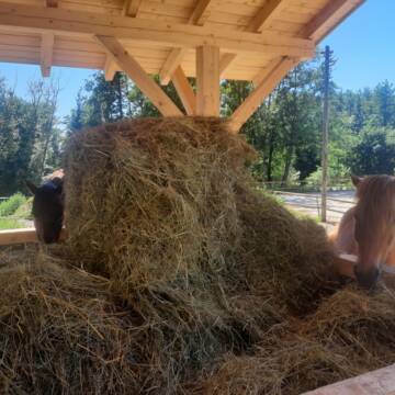
Reitanlage Zeitlhof
Wenzenbach
Reitanlage Zeitlhof
@ReitanlageZeitlhof
Freizeitstall
Geländestrecke
Vermieten
Laufband
Longierzirkel/Roundpen
Hengsthaltung möglich
22 weitere...
P
Leider kein Vorschaubild
Leider kein Vorschaubild
1 Offenstallplatz ab 01.03.2026 frei 270 Euro VP
Nittenau
Rösch
@Roesch2
Vermieten
Hunde willkommen
Krankenbox
Notfallboxen
Offenstall
8 weitere...
B
Deprecated: Creation of dynamic property Zend_View_Helper_Ads::$adLink is deprecated in /var/www/stall-frei/htdocs/staging.stall-frei.de/library/Psf/View/Helper/Ads.php on line 108

Pferdepension Hit Aktivstall Kürmerhof
Hohenkammer
Kuermerhof
@Kuermerhof
*******JETZT NEU MIT ENTSTAUBTEM BIOHEU*********
*******Demnächst mit einem Abenteuerspielplatz für Pferde ( Extrem Trail/Pa
Leider kein Vorschaubild
Leider kein Vorschaubild
offenstall f.Teil-/Selbstversorger f. 2 - 4 Pferde
Sünching/Hardt
Happy-Horse-Reiterhof
@Happy-Horse-Reiterhof
Freizeitstall
Vermieten
Hunde willkommen
Krankenbox
Notfallboxen
11 weitere...
B

Landgut Rosenau - HIT Aktivstall
Mamming
Axel Zillner
@Landgut-Rosenau
FN-Mitglied
Freizeitstall
Vermieten
Führanlage
Hunde willkommen
Allergikerstall
Hufrehe geeignet
31 weitere...
P
Leider kein Vorschaubild
Leider kein Vorschaubild
Freie Einstellplätze im Offenstall
Landau an der isar
Martina
@MartinaSeitz
Freizeitstall
Geländestrecke
Krankenbox
Longierzirkel/Roundpen
Notfallboxen
Offenstall
11 weitere...
B
Leider kein Vorschaubild
Leider kein Vorschaubild
Offenstallplatz
Rossbach
Mittelhammer-Rosemarie
@Mittelhammer-Rosemarie
Freizeitstall
Reitplatz (z.B. Dressur, Springen, Reining)
Sattelkammer/Sattelschränke
Gnadenbrothof
Notfallboxen
Offenstall
4 weitere...
B


Schauer Aktivstall-Bewegungsstall
Neuburg
Aktivstall Kaelberbach-Hof
@Kaelberbach-Hof
Freizeitstall
Pferdeausbildung
Vermieten
Hunde willkommen
Krankenbox
Allergikerstall
Gnadenbrothof
25 weitere...
P+

Pferdehof Fraunhofer
Bayern - Tiefenbach Kr Passau
Pferdehof-Fraunhofer
@Pferdehof-Fraunhofer
Westernreiten
Vermieten
Krankenbox
Paddock
Außenboxen
Innenbox
11 weitere...
P

Job gesucht?
Mechtersen
STALL-FREIde Marketing
@STALL-FREI-Marketing
Sie suchen einen Job und arbeiten gerne mit Pferden oder auf Reitanlagen?
Besuchen Sie jetzt unseren Stellenmarkt!
Leider kein Vorschaubild
Leider kein Vorschaubild
B
Leider kein Vorschaubild
Leider kein Vorschaubild
Offenstallplatz für Islandpferde
Neureichenau
ohnenguetl
@ohnenguetl
Freizeitstall
Pferdeausbildung
Vermieten
Reitplatz (z.B. Dressur, Springen, Reining)
Sattelkammer/Sattelschränke
Offenstall
Paddock Trail
11 weitere...
B
Werde Teil von STALL-FREI.de
Du hast eine Pferdebox frei? Freie Plätze im Offenstall, Pferdestall oder der Reitanlage kostenlos anbieten.
Deprecated: Creation of dynamic property Zend_View::$pageCount is deprecated in /var/www/stall-frei/htdocs/staging.stall-frei.de/library/vendor/shardj/zf1-future/library/Zend/View/Abstract.php on line 308
Deprecated: Creation of dynamic property Zend_View::$itemCountPerPage is deprecated in /var/www/stall-frei/htdocs/staging.stall-frei.de/library/vendor/shardj/zf1-future/library/Zend/View/Abstract.php on line 308
Deprecated: Creation of dynamic property Zend_View::$first is deprecated in /var/www/stall-frei/htdocs/staging.stall-frei.de/library/vendor/shardj/zf1-future/library/Zend/View/Abstract.php on line 308
Deprecated: Creation of dynamic property Zend_View::$current is deprecated in /var/www/stall-frei/htdocs/staging.stall-frei.de/library/vendor/shardj/zf1-future/library/Zend/View/Abstract.php on line 308
Deprecated: Creation of dynamic property Zend_View::$last is deprecated in /var/www/stall-frei/htdocs/staging.stall-frei.de/library/vendor/shardj/zf1-future/library/Zend/View/Abstract.php on line 308
Deprecated: Creation of dynamic property Zend_View::$previous is deprecated in /var/www/stall-frei/htdocs/staging.stall-frei.de/library/vendor/shardj/zf1-future/library/Zend/View/Abstract.php on line 308
Deprecated: Creation of dynamic property Zend_View::$next is deprecated in /var/www/stall-frei/htdocs/staging.stall-frei.de/library/vendor/shardj/zf1-future/library/Zend/View/Abstract.php on line 308
Deprecated: Creation of dynamic property Zend_View::$pagesInRange is deprecated in /var/www/stall-frei/htdocs/staging.stall-frei.de/library/vendor/shardj/zf1-future/library/Zend/View/Abstract.php on line 308
Deprecated: Creation of dynamic property Zend_View::$firstPageInRange is deprecated in /var/www/stall-frei/htdocs/staging.stall-frei.de/library/vendor/shardj/zf1-future/library/Zend/View/Abstract.php on line 308
Deprecated: Creation of dynamic property Zend_View::$lastPageInRange is deprecated in /var/www/stall-frei/htdocs/staging.stall-frei.de/library/vendor/shardj/zf1-future/library/Zend/View/Abstract.php on line 308
Deprecated: Creation of dynamic property Zend_View::$currentItemCount is deprecated in /var/www/stall-frei/htdocs/staging.stall-frei.de/library/vendor/shardj/zf1-future/library/Zend/View/Abstract.php on line 308
Deprecated: Creation of dynamic property Zend_View::$totalItemCount is deprecated in /var/www/stall-frei/htdocs/staging.stall-frei.de/library/vendor/shardj/zf1-future/library/Zend/View/Abstract.php on line 308
Deprecated: Creation of dynamic property Zend_View::$firstItemNumber is deprecated in /var/www/stall-frei/htdocs/staging.stall-frei.de/library/vendor/shardj/zf1-future/library/Zend/View/Abstract.php on line 308
Deprecated: Creation of dynamic property Zend_View::$lastItemNumber is deprecated in /var/www/stall-frei/htdocs/staging.stall-frei.de/library/vendor/shardj/zf1-future/library/Zend/View/Abstract.php on line 308
Deprecated: Creation of dynamic property Zend_View::$router is deprecated in /var/www/stall-frei/htdocs/staging.stall-frei.de/library/vendor/shardj/zf1-future/library/Zend/View/Abstract.php on line 308
Deprecated: Creation of dynamic property Zend_View::$urlParams is deprecated in /var/www/stall-frei/htdocs/staging.stall-frei.de/library/vendor/shardj/zf1-future/library/Zend/View/Abstract.php on line 308
Deprecated: Creation of dynamic property Zend_View::$showAds is deprecated in /var/www/stall-frei/htdocs/staging.stall-frei.de/library/vendor/shardj/zf1-future/library/Zend/View/Abstract.php on line 308
Deprecated: Creation of dynamic property Zend_View::$objectIds is deprecated in /var/www/stall-frei/htdocs/staging.stall-frei.de/library/vendor/shardj/zf1-future/library/Zend/View/Abstract.php on line 308
Deprecated: Creation of dynamic property Zend_View::$showNavbar is deprecated in /var/www/stall-frei/htdocs/staging.stall-frei.de/library/vendor/shardj/zf1-future/library/Zend/View/Abstract.php on line 308
Deprecated: Creation of dynamic property Zend_View::$showBreadcrumb is deprecated in /var/www/stall-frei/htdocs/staging.stall-frei.de/library/vendor/shardj/zf1-future/library/Zend/View/Abstract.php on line 308
Deprecated: Creation of dynamic property Zend_View::$showFooter is deprecated in /var/www/stall-frei/htdocs/staging.stall-frei.de/library/vendor/shardj/zf1-future/library/Zend/View/Abstract.php on line 308
Deprecated: Creation of dynamic property Zend_View::$showInternalAds is deprecated in /var/www/stall-frei/htdocs/staging.stall-frei.de/library/vendor/shardj/zf1-future/library/Zend/View/Abstract.php on line 308
Deprecated: Creation of dynamic property Zend_View::$blNoContent is deprecated in /var/www/stall-frei/htdocs/staging.stall-frei.de/library/vendor/shardj/zf1-future/library/Zend/View/Abstract.php on line 308
Deprecated: Creation of dynamic property Zend_View::$sMetaDesc is deprecated in /var/www/stall-frei/htdocs/staging.stall-frei.de/library/vendor/shardj/zf1-future/library/Zend/View/Abstract.php on line 308
Deprecated: Creation of dynamic property Zend_View::$useGmaps is deprecated in /var/www/stall-frei/htdocs/staging.stall-frei.de/library/vendor/shardj/zf1-future/library/Zend/View/Abstract.php on line 308
Deprecated: Creation of dynamic property Zend_View::$touches is deprecated in /var/www/stall-frei/htdocs/staging.stall-frei.de/library/vendor/shardj/zf1-future/library/Zend/View/Abstract.php on line 308
Deprecated: Creation of dynamic property Zend_View::$oProject is deprecated in /var/www/stall-frei/htdocs/staging.stall-frei.de/library/vendor/shardj/zf1-future/library/Zend/View/Abstract.php on line 308
Deprecated: Creation of dynamic property Zend_View::$pageHeadline is deprecated in /var/www/stall-frei/htdocs/staging.stall-frei.de/library/vendor/shardj/zf1-future/library/Zend/View/Abstract.php on line 308
Deprecated: Creation of dynamic property Zend_View::$disableLocationField is deprecated in /var/www/stall-frei/htdocs/staging.stall-frei.de/library/vendor/shardj/zf1-future/library/Zend/View/Abstract.php on line 308
Deprecated: Creation of dynamic property Zend_View::$isSearch is deprecated in /var/www/stall-frei/htdocs/staging.stall-frei.de/library/vendor/shardj/zf1-future/library/Zend/View/Abstract.php on line 308
Deprecated: Creation of dynamic property Zend_View::$pageTitle is deprecated in /var/www/stall-frei/htdocs/staging.stall-frei.de/library/vendor/shardj/zf1-future/library/Zend/View/Abstract.php on line 308
Deprecated: Creation of dynamic property Psf_Form_Element_Text::$class is deprecated in /var/www/stall-frei/htdocs/staging.stall-frei.de/library/vendor/shardj/zf1-future/library/Zend/Form/Element.php on line 874
Deprecated: Creation of dynamic property Psf_Form_Element_Text::$size is deprecated in /var/www/stall-frei/htdocs/staging.stall-frei.de/library/vendor/shardj/zf1-future/library/Zend/Form/Element.php on line 874
Deprecated: Creation of dynamic property Psf_Form_Element_Text::$placeholder is deprecated in /var/www/stall-frei/htdocs/staging.stall-frei.de/library/vendor/shardj/zf1-future/library/Zend/Form/Element.php on line 874
Deprecated: Creation of dynamic property Psf_Form_Element_Hidden::$class is deprecated in /var/www/stall-frei/htdocs/staging.stall-frei.de/library/vendor/shardj/zf1-future/library/Zend/Form/Element.php on line 874
Deprecated: Creation of dynamic property Psf_Form_Element_Hidden::$class is deprecated in /var/www/stall-frei/htdocs/staging.stall-frei.de/library/vendor/shardj/zf1-future/library/Zend/Form/Element.php on line 874
Deprecated: Creation of dynamic property Psf_Form_Element_Hidden::$class is deprecated in /var/www/stall-frei/htdocs/staging.stall-frei.de/library/vendor/shardj/zf1-future/library/Zend/Form/Element.php on line 874
Deprecated: Creation of dynamic property Psf_Form_Element_Hidden::$class is deprecated in /var/www/stall-frei/htdocs/staging.stall-frei.de/library/vendor/shardj/zf1-future/library/Zend/Form/Element.php on line 874
Deprecated: Creation of dynamic property Psf_Form_Element_Select::$class is deprecated in /var/www/stall-frei/htdocs/staging.stall-frei.de/library/vendor/shardj/zf1-future/library/Zend/Form/Element.php on line 874
Deprecated: Creation of dynamic property Psf_Form_Element_Select::$class is deprecated in /var/www/stall-frei/htdocs/staging.stall-frei.de/library/vendor/shardj/zf1-future/library/Zend/Form/Element.php on line 874
Deprecated: Creation of dynamic property Psf_Form_Element_Select::$class is deprecated in /var/www/stall-frei/htdocs/staging.stall-frei.de/library/vendor/shardj/zf1-future/library/Zend/Form/Element.php on line 874
Deprecated: Creation of dynamic property Psf_Form_Element_Select::$class is deprecated in /var/www/stall-frei/htdocs/staging.stall-frei.de/library/vendor/shardj/zf1-future/library/Zend/Form/Element.php on line 874
Deprecated: Creation of dynamic property Psf_Form_Element_Text::$class is deprecated in /var/www/stall-frei/htdocs/staging.stall-frei.de/library/vendor/shardj/zf1-future/library/Zend/Form/Element.php on line 874
Deprecated: Creation of dynamic property Psf_Form_Element_Checkbox::$label is deprecated in /var/www/stall-frei/htdocs/staging.stall-frei.de/library/vendor/shardj/zf1-future/library/Zend/Form/Element.php on line 874
Deprecated: Creation of dynamic property Zend_View::$sort is deprecated in /var/www/stall-frei/htdocs/staging.stall-frei.de/library/vendor/shardj/zf1-future/library/Zend/View/Abstract.php on line 308
Deprecated: Creation of dynamic property Zend_View::$searchLocation is deprecated in /var/www/stall-frei/htdocs/staging.stall-frei.de/library/vendor/shardj/zf1-future/library/Zend/View/Abstract.php on line 308
Deprecated: Creation of dynamic property Zend_View::$locationHint is deprecated in /var/www/stall-frei/htdocs/staging.stall-frei.de/library/vendor/shardj/zf1-future/library/Zend/View/Abstract.php on line 308
Psf_GeoCoder_Abstract::getLocation: Lohberg Get Location CachedOrLive
Psf_GeoCoder_Abstract::getCachedOrLive: Lohberg
Psf_GeoCoder_Abstract::convertLocationResult
{"documentation":"https:\/\/opencagedata.com\/api","licenses":[{"name":"see attribution guide","url":"https:\/\/opencagedata.com\/credits"}],"results":[{"bounds":{"northeast":{"lat":49.2066603,"lng":13.1708972},"southwest":{"lat":49.1107315,"lng":13.0450967}},"components":{"ISO_3166-1_alpha-2":"DE","ISO_3166-1_alpha-3":"DEU","ISO_3166-2":["DE-BY"],"_category":"place","_normalized_city":"Lohberg","_type":"village","continent":"Europe","country":"Deutschland","country_code":"de","county":"Landkreis Cham","political_union":"European Union","postcode":"93470","state":"Bayern","state_code":"BY","village":"Lohberg"},"confidence":7,"formatted":"93470 Lohberg, Deutschland","geometry":{"lat":49.1763771,"lng":13.106114}},{"bounds":{"northeast":{"lat":51.6021757,"lng":6.7768162},"southwest":{"lat":51.5621757,"lng":6.7368162}},"components":{"ISO_3166-1_alpha-2":"DE","ISO_3166-1_alpha-3":"DEU","ISO_3166-2":["DE-NW"],"_category":"place","_normalized_city":"Dinslaken","_type":"neighbourhood","city_district":"Lohberg","continent":"Europe","country":"Deutschland","country_code":"de","county":"Kreis Wesel","political_union":"European Union","postcode":"46537","state":"Nordrhein-Westfalen","state_code":"NW","suburb":"Lohberg","town":"Dinslaken"},"confidence":7,"formatted":"46537 Dinslaken, Deutschland","geometry":{"lat":51.5821757,"lng":6.7568162}},{"bounds":{"northeast":{"lat":51.5896961,"lng":6.7685413},"southwest":{"lat":51.5721798,"lng":6.7420956}},"components":{"ISO_3166-1_alpha-2":"DE","ISO_3166-1_alpha-3":"DEU","ISO_3166-2":["DE-NW"],"_category":"place","_normalized_city":"Dinslaken","_type":"neighbourhood","city_district":"Lohberg","continent":"Europe","country":"Deutschland","country_code":"de","county":"Kreis Wesel","political_union":"European Union","state":"Nordrhein-Westfalen","state_code":"NW","town":"Dinslaken"},"confidence":8,"formatted":"Lohberg, Dinslaken, Nordrhein-Westfalen, Deutschland","geometry":{"lat":51.5809786,"lng":6.7577078}},{"bounds":{"northeast":{"lat":50.7507569,"lng":11.2279884},"southwest":{"lat":50.7506569,"lng":11.2278884}},"components":{"ISO_3166-1_alpha-2":"DE","ISO_3166-1_alpha-3":"DEU","ISO_3166-2":["DE-TH"],"_category":"natural\/water","_normalized_city":"Rudolstadt","_type":"peak","continent":"Europe","country":"Deutschland","country_code":"de","county":"Landkreis Saalfeld-Rudolstadt","peak":"Lohberg","political_union":"European Union","state":"Th\u00fcringen","state_code":"TH","town":"Rudolstadt"},"confidence":9,"formatted":"Lohberg, Rudolstadt, Th\u00fcringen, Deutschland","geometry":{"lat":50.7507069,"lng":11.2279384}},{"bounds":{"northeast":{"lat":51.5272139,"lng":10.7066655},"southwest":{"lat":51.5271139,"lng":10.7065655}},"components":{"ISO_3166-1_alpha-2":"DE","ISO_3166-1_alpha-3":"DEU","ISO_3166-2":["DE-TH"],"_category":"natural\/water","_normalized_city":"Nordhausen","_type":"peak","continent":"Europe","country":"Deutschland","country_code":"de","county":"Landkreis Nordhausen","peak":"Lohberg","political_union":"European Union","state":"Th\u00fcringen","state_code":"TH","town":"Nordhausen"},"confidence":9,"formatted":"Lohberg, Nordhausen, Th\u00fcringen, Deutschland","geometry":{"lat":51.5271639,"lng":10.7066155}},{"bounds":{"northeast":{"lat":51.5952162,"lng":10.2322339},"southwest":{"lat":51.5951162,"lng":10.2321339}},"components":{"ISO_3166-1_alpha-2":"DE","ISO_3166-1_alpha-3":"DEU","ISO_3166-2":["DE-NI"],"_category":"natural\/water","_normalized_city":"Gieboldehausen","_type":"peak","continent":"Europe","country":"Deutschland","country_code":"de","county":"Landkreis G\u00f6ttingen","municipality":"Samtgemeinde Gieboldehausen","peak":"Lohberg","political_union":"European Union","postcode":"37434","state":"Niedersachsen","state_code":"NI","village":"Gieboldehausen"},"confidence":9,"formatted":"Lohberg, 37434 Gieboldehausen, Deutschland","geometry":{"lat":51.5951662,"lng":10.2321839}},{"bounds":{"northeast":{"lat":51.0178821,"lng":10.5850263},"southwest":{"lat":51.0177821,"lng":10.5849263}},"components":{"ISO_3166-1_alpha-2":"DE","ISO_3166-1_alpha-3":"DEU","ISO_3166-2":["DE-TH"],"_category":"natural\/water","_normalized_city":"Nessetal","_type":"peak","continent":"Europe","country":"Deutschland","country_code":"de","county":"Landkreis Gotha","municipality":"Nessetal","peak":"Lohberg","political_union":"European Union","state":"Th\u00fcringen","state_code":"TH"},"confidence":9,"formatted":"Lohberg, Nessetal, Th\u00fcringen, Deutschland","geometry":{"lat":51.0178321,"lng":10.5849763}},{"bounds":{"northeast":{"lat":51.4050605,"lng":10.5219817},"southwest":{"lat":51.4049605,"lng":10.5218817}},"components":{"ISO_3166-1_alpha-2":"DE","ISO_3166-1_alpha-3":"DEU","ISO_3166-2":["DE-TH"],"_category":"natural\/water","_normalized_city":"Sollstedt","_type":"peak","continent":"Europe","country":"Deutschland","country_code":"de","county":"Landkreis Nordhausen","peak":"Lohberg","political_union":"European Union","state":"Th\u00fcringen","state_code":"TH","village":"Sollstedt"},"confidence":9,"formatted":"Lohberg, Sollstedt, Th\u00fcringen, Deutschland","geometry":{"lat":51.4050105,"lng":10.5219317}},{"bounds":{"northeast":{"lat":50.9332174,"lng":10.1494673},"southwest":{"lat":50.9331174,"lng":10.1493673}},"components":{"ISO_3166-1_alpha-2":"DE","ISO_3166-1_alpha-3":"DEU","ISO_3166-2":["DE-TH"],"_category":"natural\/water","_normalized_city":"Berka\/Werra","_type":"peak","continent":"Europe","country":"Deutschland","country_code":"de","county":"Wartburgkreis","municipality":"Werra-Suhl-Tal","peak":"Lohberg","political_union":"European Union","postcode":"99834","state":"Th\u00fcringen","state_code":"TH","village":"Berka\/Werra"},"confidence":9,"formatted":"Lohberg, 99834 Berka\/Werra, Deutschland","geometry":{"lat":50.9331674,"lng":10.1494173}},{"bounds":{"northeast":{"lat":49.7391708,"lng":10.505911},"southwest":{"lat":49.7390708,"lng":10.505811}},"components":{"ISO_3166-1_alpha-2":"DE","ISO_3166-1_alpha-3":"DEU","ISO_3166-2":["DE-BY"],"_category":"natural\/water","_normalized_city":"Burghaslach","_type":"peak","continent":"Europe","country":"Deutschland","country_code":"de","county":"Landkreis Neustadt an der Aisch-Bad Windsheim","peak":"Lohberg","political_union":"European Union","state":"Bayern","state_code":"BY","village":"Burghaslach"},"confidence":9,"formatted":"Lohberg, Burghaslach, Bayern, Deutschland","geometry":{"lat":49.7391208,"lng":10.505861}}],"status":{"code":200,"message":"OK"},"stay_informed":{"blog":"https:\/\/blog.opencagedata.com","mastodon":"https:\/\/en.osm.town\/@opencage"},"thanks":"For using an OpenCage API","timestamp":{"created_http":"Sun, 08 Feb 2026 18:39:09 GMT","created_unix":1770575949},"total_results":10}Array
(
[0] => stdClass Object
(
[bounds] => stdClass Object
(
[northeast] => stdClass Object
(
[lat] => 49.2066603
[lng] => 13.1708972
)
[southwest] => stdClass Object
(
[lat] => 49.1107315
[lng] => 13.0450967
)
)
[components] => stdClass Object
(
[ISO_3166-1_alpha-2] => DE
[ISO_3166-1_alpha-3] => DEU
[ISO_3166-2] => Array
(
[0] => DE-BY
)
[_category] => place
[_normalized_city] => Lohberg
[_type] => village
[continent] => Europe
[country] => Deutschland
[country_code] => de
[county] => Landkreis Cham
[political_union] => European Union
[postcode] => 93470
[state] => Bayern
[state_code] => BY
[village] => Lohberg
)
[confidence] => 7
[formatted] => 93470 Lohberg, Deutschland
[geometry] => stdClass Object
(
[lat] => 49.1763771
[lng] => 13.106114
)
)
[1] => stdClass Object
(
[bounds] => stdClass Object
(
[northeast] => stdClass Object
(
[lat] => 51.6021757
[lng] => 6.7768162
)
[southwest] => stdClass Object
(
[lat] => 51.5621757
[lng] => 6.7368162
)
)
[components] => stdClass Object
(
[ISO_3166-1_alpha-2] => DE
[ISO_3166-1_alpha-3] => DEU
[ISO_3166-2] => Array
(
[0] => DE-NW
)
[_category] => place
[_normalized_city] => Dinslaken
[_type] => neighbourhood
[city_district] => Lohberg
[continent] => Europe
[country] => Deutschland
[country_code] => de
[county] => Kreis Wesel
[political_union] => European Union
[postcode] => 46537
[state] => Nordrhein-Westfalen
[state_code] => NW
[suburb] => Lohberg
[town] => Dinslaken
)
[confidence] => 7
[formatted] => 46537 Dinslaken, Deutschland
[geometry] => stdClass Object
(
[lat] => 51.5821757
[lng] => 6.7568162
)
)
[2] => stdClass Object
(
[bounds] => stdClass Object
(
[northeast] => stdClass Object
(
[lat] => 51.5896961
[lng] => 6.7685413
)
[southwest] => stdClass Object
(
[lat] => 51.5721798
[lng] => 6.7420956
)
)
[components] => stdClass Object
(
[ISO_3166-1_alpha-2] => DE
[ISO_3166-1_alpha-3] => DEU
[ISO_3166-2] => Array
(
[0] => DE-NW
)
[_category] => place
[_normalized_city] => Dinslaken
[_type] => neighbourhood
[city_district] => Lohberg
[continent] => Europe
[country] => Deutschland
[country_code] => de
[county] => Kreis Wesel
[political_union] => European Union
[state] => Nordrhein-Westfalen
[state_code] => NW
[town] => Dinslaken
)
[confidence] => 8
[formatted] => Lohberg, Dinslaken, Nordrhein-Westfalen, Deutschland
[geometry] => stdClass Object
(
[lat] => 51.5809786
[lng] => 6.7577078
)
)
[3] => stdClass Object
(
[bounds] => stdClass Object
(
[northeast] => stdClass Object
(
[lat] => 50.7507569
[lng] => 11.2279884
)
[southwest] => stdClass Object
(
[lat] => 50.7506569
[lng] => 11.2278884
)
)
[components] => stdClass Object
(
[ISO_3166-1_alpha-2] => DE
[ISO_3166-1_alpha-3] => DEU
[ISO_3166-2] => Array
(
[0] => DE-TH
)
[_category] => natural/water
[_normalized_city] => Rudolstadt
[_type] => peak
[continent] => Europe
[country] => Deutschland
[country_code] => de
[county] => Landkreis Saalfeld-Rudolstadt
[peak] => Lohberg
[political_union] => European Union
[state] => Thüringen
[state_code] => TH
[town] => Rudolstadt
)
[confidence] => 9
[formatted] => Lohberg, Rudolstadt, Thüringen, Deutschland
[geometry] => stdClass Object
(
[lat] => 50.7507069
[lng] => 11.2279384
)
)
[4] => stdClass Object
(
[bounds] => stdClass Object
(
[northeast] => stdClass Object
(
[lat] => 51.5272139
[lng] => 10.7066655
)
[southwest] => stdClass Object
(
[lat] => 51.5271139
[lng] => 10.7065655
)
)
[components] => stdClass Object
(
[ISO_3166-1_alpha-2] => DE
[ISO_3166-1_alpha-3] => DEU
[ISO_3166-2] => Array
(
[0] => DE-TH
)
[_category] => natural/water
[_normalized_city] => Nordhausen
[_type] => peak
[continent] => Europe
[country] => Deutschland
[country_code] => de
[county] => Landkreis Nordhausen
[peak] => Lohberg
[political_union] => European Union
[state] => Thüringen
[state_code] => TH
[town] => Nordhausen
)
[confidence] => 9
[formatted] => Lohberg, Nordhausen, Thüringen, Deutschland
[geometry] => stdClass Object
(
[lat] => 51.5271639
[lng] => 10.7066155
)
)
[5] => stdClass Object
(
[bounds] => stdClass Object
(
[northeast] => stdClass Object
(
[lat] => 51.5952162
[lng] => 10.2322339
)
[southwest] => stdClass Object
(
[lat] => 51.5951162
[lng] => 10.2321339
)
)
[components] => stdClass Object
(
[ISO_3166-1_alpha-2] => DE
[ISO_3166-1_alpha-3] => DEU
[ISO_3166-2] => Array
(
[0] => DE-NI
)
[_category] => natural/water
[_normalized_city] => Gieboldehausen
[_type] => peak
[continent] => Europe
[country] => Deutschland
[country_code] => de
[county] => Landkreis Göttingen
[municipality] => Samtgemeinde Gieboldehausen
[peak] => Lohberg
[political_union] => European Union
[postcode] => 37434
[state] => Niedersachsen
[state_code] => NI
[village] => Gieboldehausen
)
[confidence] => 9
[formatted] => Lohberg, 37434 Gieboldehausen, Deutschland
[geometry] => stdClass Object
(
[lat] => 51.5951662
[lng] => 10.2321839
)
)
[6] => stdClass Object
(
[bounds] => stdClass Object
(
[northeast] => stdClass Object
(
[lat] => 51.0178821
[lng] => 10.5850263
)
[southwest] => stdClass Object
(
[lat] => 51.0177821
[lng] => 10.5849263
)
)
[components] => stdClass Object
(
[ISO_3166-1_alpha-2] => DE
[ISO_3166-1_alpha-3] => DEU
[ISO_3166-2] => Array
(
[0] => DE-TH
)
[_category] => natural/water
[_normalized_city] => Nessetal
[_type] => peak
[continent] => Europe
[country] => Deutschland
[country_code] => de
[county] => Landkreis Gotha
[municipality] => Nessetal
[peak] => Lohberg
[political_union] => European Union
[state] => Thüringen
[state_code] => TH
)
[confidence] => 9
[formatted] => Lohberg, Nessetal, Thüringen, Deutschland
[geometry] => stdClass Object
(
[lat] => 51.0178321
[lng] => 10.5849763
)
)
[7] => stdClass Object
(
[bounds] => stdClass Object
(
[northeast] => stdClass Object
(
[lat] => 51.4050605
[lng] => 10.5219817
)
[southwest] => stdClass Object
(
[lat] => 51.4049605
[lng] => 10.5218817
)
)
[components] => stdClass Object
(
[ISO_3166-1_alpha-2] => DE
[ISO_3166-1_alpha-3] => DEU
[ISO_3166-2] => Array
(
[0] => DE-TH
)
[_category] => natural/water
[_normalized_city] => Sollstedt
[_type] => peak
[continent] => Europe
[country] => Deutschland
[country_code] => de
[county] => Landkreis Nordhausen
[peak] => Lohberg
[political_union] => European Union
[state] => Thüringen
[state_code] => TH
[village] => Sollstedt
)
[confidence] => 9
[formatted] => Lohberg, Sollstedt, Thüringen, Deutschland
[geometry] => stdClass Object
(
[lat] => 51.4050105
[lng] => 10.5219317
)
)
[8] => stdClass Object
(
[bounds] => stdClass Object
(
[northeast] => stdClass Object
(
[lat] => 50.9332174
[lng] => 10.1494673
)
[southwest] => stdClass Object
(
[lat] => 50.9331174
[lng] => 10.1493673
)
)
[components] => stdClass Object
(
[ISO_3166-1_alpha-2] => DE
[ISO_3166-1_alpha-3] => DEU
[ISO_3166-2] => Array
(
[0] => DE-TH
)
[_category] => natural/water
[_normalized_city] => Berka/Werra
[_type] => peak
[continent] => Europe
[country] => Deutschland
[country_code] => de
[county] => Wartburgkreis
[municipality] => Werra-Suhl-Tal
[peak] => Lohberg
[political_union] => European Union
[postcode] => 99834
[state] => Thüringen
[state_code] => TH
[village] => Berka/Werra
)
[confidence] => 9
[formatted] => Lohberg, 99834 Berka/Werra, Deutschland
[geometry] => stdClass Object
(
[lat] => 50.9331674
[lng] => 10.1494173
)
)
[9] => stdClass Object
(
[bounds] => stdClass Object
(
[northeast] => stdClass Object
(
[lat] => 49.7391708
[lng] => 10.505911
)
[southwest] => stdClass Object
(
[lat] => 49.7390708
[lng] => 10.505811
)
)
[components] => stdClass Object
(
[ISO_3166-1_alpha-2] => DE
[ISO_3166-1_alpha-3] => DEU
[ISO_3166-2] => Array
(
[0] => DE-BY
)
[_category] => natural/water
[_normalized_city] => Burghaslach
[_type] => peak
[continent] => Europe
[country] => Deutschland
[country_code] => de
[county] => Landkreis Neustadt an der Aisch-Bad Windsheim
[peak] => Lohberg
[political_union] => European Union
[state] => Bayern
[state_code] => BY
[village] => Burghaslach
)
[confidence] => 9
[formatted] => Lohberg, Burghaslach, Bayern, Deutschland
[geometry] => stdClass Object
(
[lat] => 49.7391208
[lng] => 10.505861
)
)
)
Psf_GeoCoder_OpenCageData::getKeyMap: 0
stdClass Object
(
    [bounds] => stdClass Object
        (
            [northeast] => stdClass Object
                (
                    [lat] => 49.2066603
                    [lng] => 13.1708972
                )

            [southwest] => stdClass Object
                (
                    [lat] => 49.1107315
                    [lng] => 13.0450967
                )

        )

    [components] => stdClass Object
        (
            [ISO_3166-1_alpha-2] => DE
            [ISO_3166-1_alpha-3] => DEU
            [ISO_3166-2] => Array
                (
                    [0] => DE-BY
                )

            [_category] => place
            [_normalized_city] => Lohberg
            [_type] => village
            [continent] => Europe
            [country] => Deutschland
            [country_code] => de
            [county] => Landkreis Cham
            [political_union] => European Union
            [postcode] => 93470
            [state] => Bayern
            [state_code] => BY
            [village] => Lohberg
        )

    [confidence] => 7
    [formatted] => 93470 Lohberg, Deutschland
    [geometry] => stdClass Object
        (
            [lat] => 49.1763771
            [lng] => 13.106114
        )

)
Psf_GeoCoder_OpenCageData::getCounty: Cham
Psf_GeoCoder_OpenCageData::addMissingData REFETCH!
Array
(
    [address] => 93470 Lohberg, Deutschland
    [type] => village
    [street] =>
    [city] => Lohberg
    [county] => Cham
    [state] => Bayern
    [zip] => 93470
    [country] => Deutschland
    [suburb] =>
    [countrycode] => de
    [latitude] => 49.1763771
    [longitude] => 13.106114
    [accuracy] => 1
    [confidence] => 7
    [bounds] => stdClass Object
        (
            [northeast] => stdClass Object
                (
                    [lat] => 49.2066603
                    [lng] => 13.1708972
                )

            [southwest] => stdClass Object
                (
                    [lat] => 49.1107315
                    [lng] => 13.0450967
                )

        )

)
reformat!
Array
(
    [address] => 93470 Lohberg, Deutschland
    [type] => village
    [street] =>
    [city] => Lohberg
    [county] => Cham
    [state] => Bayern
    [zip] => 93470
    [country] => Deutschland
    [suburb] =>
    [countrycode] => de
    [latitude] => 49.1763771
    [longitude] => 13.106114
    [accuracy] => 1
    [confidence] => 7
    [bounds] => stdClass Object
        (
            [northeast] => stdClass Object
                (
                    [lat] => 49.2066603
                    [lng] => 13.1708972
                )

            [southwest] => stdClass Object
                (
                    [lat] => 49.1107315
                    [lng] => 13.0450967
                )

        )

    [place] => 93470 Lohberg, Bayern
    [hash] => 976343ae46a352bce8b0249f156d99f8
)
Psf_GeoCoder_OpenCageData::getKeyMap: 1
stdClass Object
(
    [bounds] => stdClass Object
        (
            [northeast] => stdClass Object
                (
                    [lat] => 51.6021757
                    [lng] => 6.7768162
                )

            [southwest] => stdClass Object
                (
                    [lat] => 51.5621757
                    [lng] => 6.7368162
                )

        )

    [components] => stdClass Object
        (
            [ISO_3166-1_alpha-2] => DE
            [ISO_3166-1_alpha-3] => DEU
            [ISO_3166-2] => Array
                (
                    [0] => DE-NW
                )

            [_category] => place
            [_normalized_city] => Dinslaken
            [_type] => neighbourhood
            [city_district] => Lohberg
            [continent] => Europe
            [country] => Deutschland
            [country_code] => de
            [county] => Kreis Wesel
            [political_union] => European Union
            [postcode] => 46537
            [state] => Nordrhein-Westfalen
            [state_code] => NW
            [suburb] => Lohberg
            [town] => Dinslaken
        )

    [confidence] => 7
    [formatted] => 46537 Dinslaken, Deutschland
    [geometry] => stdClass Object
        (
            [lat] => 51.5821757
            [lng] => 6.7568162
        )

)
Psf_GeoCoder_OpenCageData::getCounty: Wesel
Psf_GeoCoder_OpenCageData::addMissingData REFETCH!
Array
(
    [address] => 46537 Dinslaken, Deutschland
    [type] => neighbourhood
    [street] =>
    [city] => Dinslaken
    [county] => Wesel
    [state] => Nordrhein-Westfalen
    [zip] => 46537
    [country] => Deutschland
    [suburb] => Lohberg
    [countrycode] => de
    [latitude] => 51.5821757
    [longitude] => 6.7568162
    [accuracy] => 1
    [confidence] => 7
    [bounds] => stdClass Object
        (
            [northeast] => stdClass Object
                (
                    [lat] => 51.6021757
                    [lng] => 6.7768162
                )

            [southwest] => stdClass Object
                (
                    [lat] => 51.5621757
                    [lng] => 6.7368162
                )

        )

)
reformat!
Array
(
    [address] => 46537 Dinslaken, Deutschland
    [type] => neighbourhood
    [street] =>
    [city] => Dinslaken
    [county] => Wesel
    [state] => Nordrhein-Westfalen
    [zip] => 46537
    [country] => Deutschland
    [suburb] => Lohberg
    [countrycode] => de
    [latitude] => 51.5821757
    [longitude] => 6.7568162
    [accuracy] => 1
    [confidence] => 7
    [bounds] => stdClass Object
        (
            [northeast] => stdClass Object
                (
                    [lat] => 51.6021757
                    [lng] => 6.7768162
                )

            [southwest] => stdClass Object
                (
                    [lat] => 51.5621757
                    [lng] => 6.7368162
                )

        )

    [place] => 46537 Dinslaken, Nordrhein-Westfalen
    [hash] => 38b3d02de23d67838d37dc8b36d33ee7
)
Psf_GeoCoder_OpenCageData::getKeyMap: 2
stdClass Object
(
    [bounds] => stdClass Object
        (
            [northeast] => stdClass Object
                (
                    [lat] => 51.5896961
                    [lng] => 6.7685413
                )

            [southwest] => stdClass Object
                (
                    [lat] => 51.5721798
                    [lng] => 6.7420956
                )

        )

    [components] => stdClass Object
        (
            [ISO_3166-1_alpha-2] => DE
            [ISO_3166-1_alpha-3] => DEU
            [ISO_3166-2] => Array
                (
                    [0] => DE-NW
                )

            [_category] => place
            [_normalized_city] => Dinslaken
            [_type] => neighbourhood
            [city_district] => Lohberg
            [continent] => Europe
            [country] => Deutschland
            [country_code] => de
            [county] => Kreis Wesel
            [political_union] => European Union
            [state] => Nordrhein-Westfalen
            [state_code] => NW
            [town] => Dinslaken
        )

    [confidence] => 8
    [formatted] => Lohberg, Dinslaken, Nordrhein-Westfalen, Deutschland
    [geometry] => stdClass Object
        (
            [lat] => 51.5809786
            [lng] => 6.7577078
        )

)
Psf_GeoCoder_OpenCageData::getCounty: Wesel
Psf_GeoCoder_OpenCageData::addMissingData REFETCH!
Array
(
    [address] => Lohberg, Dinslaken, Nordrhein-Westfalen, Deutschland
    [type] => neighbourhood
    [street] =>
    [city] => Dinslaken
    [county] => Wesel
    [state] => Nordrhein-Westfalen
    [zip] =>
    [country] => Deutschland
    [suburb] =>
    [countrycode] => de
    [latitude] => 51.5809786
    [longitude] => 6.7577078
    [accuracy] => 1
    [confidence] => 8
    [bounds] => stdClass Object
        (
            [northeast] => stdClass Object
                (
                    [lat] => 51.5896961
                    [lng] => 6.7685413
                )

            [southwest] => stdClass Object
                (
                    [lat] => 51.5721798
                    [lng] => 6.7420956
                )

        )

)
reformat!
Array
(
    [address] => Lohberg, Dinslaken, Nordrhein-Westfalen, Deutschland
    [type] => neighbourhood
    [street] =>
    [city] => Dinslaken
    [county] => Wesel
    [state] => Nordrhein-Westfalen
    [zip] =>
    [country] => Deutschland
    [suburb] =>
    [countrycode] => de
    [latitude] => 51.5809786
    [longitude] => 6.7577078
    [accuracy] => 1
    [confidence] => 8
    [bounds] => stdClass Object
        (
            [northeast] => stdClass Object
                (
                    [lat] => 51.5896961
                    [lng] => 6.7685413
                )

            [southwest] => stdClass Object
                (
                    [lat] => 51.5721798
                    [lng] => 6.7420956
                )

        )

    [place] => Dinslaken, Nordrhein-Westfalen
    [hash] => 5a08ccaeacc2a7a1f6c1fcbff8308d83
)
Psf_GeoCoder_OpenCageData::getKeyMap: 3
stdClass Object
(
    [bounds] => stdClass Object
        (
            [northeast] => stdClass Object
                (
                    [lat] => 50.7507569
                    [lng] => 11.2279884
                )

            [southwest] => stdClass Object
                (
                    [lat] => 50.7506569
                    [lng] => 11.2278884
                )

        )

    [components] => stdClass Object
        (
            [ISO_3166-1_alpha-2] => DE
            [ISO_3166-1_alpha-3] => DEU
            [ISO_3166-2] => Array
                (
                    [0] => DE-TH
                )

            [_category] => natural/water
            [_normalized_city] => Rudolstadt
            [_type] => peak
            [continent] => Europe
            [country] => Deutschland
            [country_code] => de
            [county] => Landkreis Saalfeld-Rudolstadt
            [peak] => Lohberg
            [political_union] => European Union
            [state] => Thüringen
            [state_code] => TH
            [town] => Rudolstadt
        )

    [confidence] => 9
    [formatted] => Lohberg, Rudolstadt, Thüringen, Deutschland
    [geometry] => stdClass Object
        (
            [lat] => 50.7507069
            [lng] => 11.2279384
        )

)
Psf_GeoCoder_OpenCageData::getCounty: Saalfeld-Rudolstadt
Psf_GeoCoder_OpenCageData::addMissingData REFETCH!
Array
(
    [address] => Lohberg, Rudolstadt, Thüringen, Deutschland
    [type] => peak
    [street] =>
    [city] => Rudolstadt
    [county] => Saalfeld-Rudolstadt
    [state] => Thüringen
    [zip] =>
    [country] => Deutschland
    [suburb] =>
    [countrycode] => de
    [latitude] => 50.7507069
    [longitude] => 11.2279384
    [accuracy] => 1
    [confidence] => 9
    [bounds] => stdClass Object
        (
            [northeast] => stdClass Object
                (
                    [lat] => 50.7507569
                    [lng] => 11.2279884
                )

            [southwest] => stdClass Object
                (
                    [lat] => 50.7506569
                    [lng] => 11.2278884
                )

        )

)
reformat!
Array
(
    [address] => Lohberg, Rudolstadt, Thüringen, Deutschland
    [type] => peak
    [street] =>
    [city] => Rudolstadt
    [county] => Saalfeld-Rudolstadt
    [state] => Thüringen
    [zip] =>
    [country] => Deutschland
    [suburb] =>
    [countrycode] => de
    [latitude] => 50.7507069
    [longitude] => 11.2279384
    [accuracy] => 1
    [confidence] => 9
    [bounds] => stdClass Object
        (
            [northeast] => stdClass Object
                (
                    [lat] => 50.7507569
                    [lng] => 11.2279884
                )

            [southwest] => stdClass Object
                (
                    [lat] => 50.7506569
                    [lng] => 11.2278884
                )

        )

    [place] => Rudolstadt, Thüringen
    [hash] => 6d26a88cbc2ba24add0d2387e8822805
)
Psf_GeoCoder_OpenCageData::getKeyMap: 4
stdClass Object
(
    [bounds] => stdClass Object
        (
            [northeast] => stdClass Object
                (
                    [lat] => 51.5272139
                    [lng] => 10.7066655
                )

            [southwest] => stdClass Object
                (
                    [lat] => 51.5271139
                    [lng] => 10.7065655
                )

        )

    [components] => stdClass Object
        (
            [ISO_3166-1_alpha-2] => DE
            [ISO_3166-1_alpha-3] => DEU
            [ISO_3166-2] => Array
                (
                    [0] => DE-TH
                )

            [_category] => natural/water
            [_normalized_city] => Nordhausen
            [_type] => peak
            [continent] => Europe
            [country] => Deutschland
            [country_code] => de
            [county] => Landkreis Nordhausen
            [peak] => Lohberg
            [political_union] => European Union
            [state] => Thüringen
            [state_code] => TH
            [town] => Nordhausen
        )

    [confidence] => 9
    [formatted] => Lohberg, Nordhausen, Thüringen, Deutschland
    [geometry] => stdClass Object
        (
            [lat] => 51.5271639
            [lng] => 10.7066155
        )

)
Psf_GeoCoder_OpenCageData::getCounty: Nordhausen
Psf_GeoCoder_OpenCageData::addMissingData REFETCH!
Array
(
    [address] => Lohberg, Nordhausen, Thüringen, Deutschland
    [type] => peak
    [street] =>
    [city] => Nordhausen
    [county] => Nordhausen
    [state] => Thüringen
    [zip] =>
    [country] => Deutschland
    [suburb] =>
    [countrycode] => de
    [latitude] => 51.5271639
    [longitude] => 10.7066155
    [accuracy] => 1
    [confidence] => 9
    [bounds] => stdClass Object
        (
            [northeast] => stdClass Object
                (
                    [lat] => 51.5272139
                    [lng] => 10.7066655
                )

            [southwest] => stdClass Object
                (
                    [lat] => 51.5271139
                    [lng] => 10.7065655
                )

        )

)
reformat!
Array
(
    [address] => Lohberg, Nordhausen, Thüringen, Deutschland
    [type] => peak
    [street] =>
    [city] => Nordhausen
    [county] => Nordhausen
    [state] => Thüringen
    [zip] =>
    [country] => Deutschland
    [suburb] =>
    [countrycode] => de
    [latitude] => 51.5271639
    [longitude] => 10.7066155
    [accuracy] => 1
    [confidence] => 9
    [bounds] => stdClass Object
        (
            [northeast] => stdClass Object
                (
                    [lat] => 51.5272139
                    [lng] => 10.7066655
                )

            [southwest] => stdClass Object
                (
                    [lat] => 51.5271139
                    [lng] => 10.7065655
                )

        )

    [place] => Nordhausen, Thüringen
    [hash] => 12c6cbb96e8a36aba5beb63305f25f10
)
Psf_GeoCoder_OpenCageData::getKeyMap: 5
stdClass Object
(
    [bounds] => stdClass Object
        (
            [northeast] => stdClass Object
                (
                    [lat] => 51.5952162
                    [lng] => 10.2322339
                )

            [southwest] => stdClass Object
                (
                    [lat] => 51.5951162
                    [lng] => 10.2321339
                )

        )

    [components] => stdClass Object
        (
            [ISO_3166-1_alpha-2] => DE
            [ISO_3166-1_alpha-3] => DEU
            [ISO_3166-2] => Array
                (
                    [0] => DE-NI
                )

            [_category] => natural/water
            [_normalized_city] => Gieboldehausen
            [_type] => peak
            [continent] => Europe
            [country] => Deutschland
            [country_code] => de
            [county] => Landkreis Göttingen
            [municipality] => Samtgemeinde Gieboldehausen
            [peak] => Lohberg
            [political_union] => European Union
            [postcode] => 37434
            [state] => Niedersachsen
            [state_code] => NI
            [village] => Gieboldehausen
        )

    [confidence] => 9
    [formatted] => Lohberg, 37434 Gieboldehausen, Deutschland
    [geometry] => stdClass Object
        (
            [lat] => 51.5951662
            [lng] => 10.2321839
        )

)
Psf_GeoCoder_OpenCageData::getCounty: Göttingen
Psf_GeoCoder_OpenCageData::addMissingData REFETCH!
Array
(
    [address] => Lohberg, 37434 Gieboldehausen, Deutschland
    [type] => peak
    [street] =>
    [city] => Gieboldehausen
    [county] => Göttingen
    [state] => Niedersachsen
    [zip] => 37434
    [country] => Deutschland
    [suburb] =>
    [countrycode] => de
    [latitude] => 51.5951662
    [longitude] => 10.2321839
    [accuracy] => 1
    [confidence] => 9
    [bounds] => stdClass Object
        (
            [northeast] => stdClass Object
                (
                    [lat] => 51.5952162
                    [lng] => 10.2322339
                )

            [southwest] => stdClass Object
                (
                    [lat] => 51.5951162
                    [lng] => 10.2321339
                )

        )

)
reformat!
Array
(
    [address] => Lohberg, 37434 Gieboldehausen, Deutschland
    [type] => peak
    [street] =>
    [city] => Gieboldehausen
    [county] => Göttingen
    [state] => Niedersachsen
    [zip] => 37434
    [country] => Deutschland
    [suburb] =>
    [countrycode] => de
    [latitude] => 51.5951662
    [longitude] => 10.2321839
    [accuracy] => 1
    [confidence] => 9
    [bounds] => stdClass Object
        (
            [northeast] => stdClass Object
                (
                    [lat] => 51.5952162
                    [lng] => 10.2322339
                )

            [southwest] => stdClass Object
                (
                    [lat] => 51.5951162
                    [lng] => 10.2321339
                )

        )

    [place] => 37434 Gieboldehausen, Niedersachsen
    [hash] => 3bb5f9bdd4898cc211694d901957048a
)
Psf_GeoCoder_OpenCageData::getKeyMap: 6
stdClass Object
(
    [bounds] => stdClass Object
        (
            [northeast] => stdClass Object
                (
                    [lat] => 51.0178821
                    [lng] => 10.5850263
                )

            [southwest] => stdClass Object
                (
                    [lat] => 51.0177821
                    [lng] => 10.5849263
                )

        )

    [components] => stdClass Object
        (
            [ISO_3166-1_alpha-2] => DE
            [ISO_3166-1_alpha-3] => DEU
            [ISO_3166-2] => Array
                (
                    [0] => DE-TH
                )

            [_category] => natural/water
            [_normalized_city] => Nessetal
            [_type] => peak
            [continent] => Europe
            [country] => Deutschland
            [country_code] => de
            [county] => Landkreis Gotha
            [municipality] => Nessetal
            [peak] => Lohberg
            [political_union] => European Union
            [state] => Thüringen
            [state_code] => TH
        )

    [confidence] => 9
    [formatted] => Lohberg, Nessetal, Thüringen, Deutschland
    [geometry] => stdClass Object
        (
            [lat] => 51.0178321
            [lng] => 10.5849763
        )

)
Psf_GeoCoder_OpenCageData::getCounty: Gotha
Psf_GeoCoder_OpenCageData::addMissingData REFETCH!
Array
(
    [address] => Lohberg, Nessetal, Thüringen, Deutschland
    [type] => peak
    [street] =>
    [city] =>
    [county] => Gotha
    [state] => Thüringen
    [zip] =>
    [country] => Deutschland
    [suburb] =>
    [countrycode] => de
    [latitude] => 51.0178321
    [longitude] => 10.5849763
    [accuracy] => 1
    [confidence] => 9
    [bounds] => stdClass Object
        (
            [northeast] => stdClass Object
                (
                    [lat] => 51.0178821
                    [lng] => 10.5850263
                )

            [southwest] => stdClass Object
                (
                    [lat] => 51.0177821
                    [lng] => 10.5849263
                )

        )

)
reformat!
Array
(
    [address] => Lohberg, Nessetal, Thüringen, Deutschland
    [type] => peak
    [street] =>
    [city] =>
    [county] => Gotha
    [state] => Thüringen
    [zip] =>
    [country] => Deutschland
    [suburb] =>
    [countrycode] => de
    [latitude] => 51.0178321
    [longitude] => 10.5849763
    [accuracy] => 1
    [confidence] => 9
    [bounds] => stdClass Object
        (
            [northeast] => stdClass Object
                (
                    [lat] => 51.0178821
                    [lng] => 10.5850263
                )

            [southwest] => stdClass Object
                (
                    [lat] => 51.0177821
                    [lng] => 10.5849263
                )

        )

    [place] => , Thüringen
    [hash] => be411ba72f63ba851c285b19a0ee33b0
)
Psf_GeoCoder_OpenCageData::getKeyMap: 7
stdClass Object
(
    [bounds] => stdClass Object
        (
            [northeast] => stdClass Object
                (
                    [lat] => 51.4050605
                    [lng] => 10.5219817
                )

            [southwest] => stdClass Object
                (
                    [lat] => 51.4049605
                    [lng] => 10.5218817
                )

        )

    [components] => stdClass Object
        (
            [ISO_3166-1_alpha-2] => DE
            [ISO_3166-1_alpha-3] => DEU
            [ISO_3166-2] => Array
                (
                    [0] => DE-TH
                )

            [_category] => natural/water
            [_normalized_city] => Sollstedt
            [_type] => peak
            [continent] => Europe
            [country] => Deutschland
            [country_code] => de
            [county] => Landkreis Nordhausen
            [peak] => Lohberg
            [political_union] => European Union
            [state] => Thüringen
            [state_code] => TH
            [village] => Sollstedt
        )

    [confidence] => 9
    [formatted] => Lohberg, Sollstedt, Thüringen, Deutschland
    [geometry] => stdClass Object
        (
            [lat] => 51.4050105
            [lng] => 10.5219317
        )

)
Psf_GeoCoder_OpenCageData::getCounty: Nordhausen
Psf_GeoCoder_OpenCageData::addMissingData REFETCH!
Array
(
    [address] => Lohberg, Sollstedt, Thüringen, Deutschland
    [type] => peak
    [street] =>
    [city] => Sollstedt
    [county] => Nordhausen
    [state] => Thüringen
    [zip] =>
    [country] => Deutschland
    [suburb] =>
    [countrycode] => de
    [latitude] => 51.4050105
    [longitude] => 10.5219317
    [accuracy] => 1
    [confidence] => 9
    [bounds] => stdClass Object
        (
            [northeast] => stdClass Object
                (
                    [lat] => 51.4050605
                    [lng] => 10.5219817
                )

            [southwest] => stdClass Object
                (
                    [lat] => 51.4049605
                    [lng] => 10.5218817
                )

        )

)
reformat!
Array
(
    [address] => Lohberg, Sollstedt, Thüringen, Deutschland
    [type] => peak
    [street] =>
    [city] => Sollstedt
    [county] => Nordhausen
    [state] => Thüringen
    [zip] =>
    [country] => Deutschland
    [suburb] =>
    [countrycode] => de
    [latitude] => 51.4050105
    [longitude] => 10.5219317
    [accuracy] => 1
    [confidence] => 9
    [bounds] => stdClass Object
        (
            [northeast] => stdClass Object
                (
                    [lat] => 51.4050605
                    [lng] => 10.5219817
                )

            [southwest] => stdClass Object
                (
                    [lat] => 51.4049605
                    [lng] => 10.5218817
                )

        )

    [place] => Sollstedt, Thüringen
    [hash] => cd5414d5b2d57c829496890f33d2d3fc
)
Psf_GeoCoder_OpenCageData::getKeyMap: 8
stdClass Object
(
    [bounds] => stdClass Object
        (
            [northeast] => stdClass Object
                (
                    [lat] => 50.9332174
                    [lng] => 10.1494673
                )

            [southwest] => stdClass Object
                (
                    [lat] => 50.9331174
                    [lng] => 10.1493673
                )

        )

    [components] => stdClass Object
        (
            [ISO_3166-1_alpha-2] => DE
            [ISO_3166-1_alpha-3] => DEU
            [ISO_3166-2] => Array
                (
                    [0] => DE-TH
                )

            [_category] => natural/water
            [_normalized_city] => Berka/Werra
            [_type] => peak
            [continent] => Europe
            [country] => Deutschland
            [country_code] => de
            [county] => Wartburgkreis
            [municipality] => Werra-Suhl-Tal
            [peak] => Lohberg
            [political_union] => European Union
            [postcode] => 99834
            [state] => Thüringen
            [state_code] => TH
            [village] => Berka/Werra
        )

    [confidence] => 9
    [formatted] => Lohberg, 99834 Berka/Werra, Deutschland
    [geometry] => stdClass Object
        (
            [lat] => 50.9331674
            [lng] => 10.1494173
        )

)
Psf_GeoCoder_OpenCageData::getCounty: Wartburgkreis
Psf_GeoCoder_OpenCageData::addMissingData REFETCH!
Array
(
    [address] => Lohberg, 99834 Berka/Werra, Deutschland
    [type] => peak
    [street] =>
    [city] => Berka/Werra
    [county] => Wartburgkreis
    [state] => Thüringen
    [zip] => 99834
    [country] => Deutschland
    [suburb] =>
    [countrycode] => de
    [latitude] => 50.9331674
    [longitude] => 10.1494173
    [accuracy] => 1
    [confidence] => 9
    [bounds] => stdClass Object
        (
            [northeast] => stdClass Object
                (
                    [lat] => 50.9332174
                    [lng] => 10.1494673
                )

            [southwest] => stdClass Object
                (
                    [lat] => 50.9331174
                    [lng] => 10.1493673
                )

        )

)
reformat!
Array
(
    [address] => Lohberg, 99834 Berka/Werra, Deutschland
    [type] => peak
    [street] =>
    [city] => Berka/Werra
    [county] => Wartburgkreis
    [state] => Thüringen
    [zip] => 99834
    [country] => Deutschland
    [suburb] =>
    [countrycode] => de
    [latitude] => 50.9331674
    [longitude] => 10.1494173
    [accuracy] => 1
    [confidence] => 9
    [bounds] => stdClass Object
        (
            [northeast] => stdClass Object
                (
                    [lat] => 50.9332174
                    [lng] => 10.1494673
                )

            [southwest] => stdClass Object
                (
                    [lat] => 50.9331174
                    [lng] => 10.1493673
                )

        )

    [place] => 99834 Berka/Werra, Thüringen
    [hash] => 6fc57dbcab64766abc108561b091dd29
)
Psf_GeoCoder_OpenCageData::getKeyMap: 9
stdClass Object
(
    [bounds] => stdClass Object
        (
            [northeast] => stdClass Object
                (
                    [lat] => 49.7391708
                    [lng] => 10.505911
                )

            [southwest] => stdClass Object
                (
                    [lat] => 49.7390708
                    [lng] => 10.505811
                )

        )

    [components] => stdClass Object
        (
            [ISO_3166-1_alpha-2] => DE
            [ISO_3166-1_alpha-3] => DEU
            [ISO_3166-2] => Array
                (
                    [0] => DE-BY
                )

            [_category] => natural/water
            [_normalized_city] => Burghaslach
            [_type] => peak
            [continent] => Europe
            [country] => Deutschland
            [country_code] => de
            [county] => Landkreis Neustadt an der Aisch-Bad Windsheim
            [peak] => Lohberg
            [political_union] => European Union
            [state] => Bayern
            [state_code] => BY
            [village] => Burghaslach
        )

    [confidence] => 9
    [formatted] => Lohberg, Burghaslach, Bayern, Deutschland
    [geometry] => stdClass Object
        (
            [lat] => 49.7391208
            [lng] => 10.505861
        )

)
Psf_GeoCoder_OpenCageData::getCounty: Neustadt an der Aisch-Bad Windsheim
Psf_GeoCoder_OpenCageData::addMissingData REFETCH!
Array
(
    [address] => Lohberg, Burghaslach, Bayern, Deutschland
    [type] => peak
    [street] =>
    [city] => Burghaslach
    [county] => Neustadt an der Aisch-Bad Windsheim
    [state] => Bayern
    [zip] =>
    [country] => Deutschland
    [suburb] =>
    [countrycode] => de
    [latitude] => 49.7391208
    [longitude] => 10.505861
    [accuracy] => 1
    [confidence] => 9
    [bounds] => stdClass Object
        (
            [northeast] => stdClass Object
                (
                    [lat] => 49.7391708
                    [lng] => 10.505911
                )

            [southwest] => stdClass Object
                (
                    [lat] => 49.7390708
                    [lng] => 10.505811
                )

        )

)
reformat!
Array
(
    [address] => Lohberg, Burghaslach, Bayern, Deutschland
    [type] => peak
    [street] =>
    [city] => Burghaslach
    [county] => Neustadt an der Aisch-Bad Windsheim
    [state] => Bayern
    [zip] =>
    [country] => Deutschland
    [suburb] =>
    [countrycode] => de
    [latitude] => 49.7391208
    [longitude] => 10.505861
    [accuracy] => 1
    [confidence] => 9
    [bounds] => stdClass Object
        (
            [northeast] => stdClass Object
                (
                    [lat] => 49.7391708
                    [lng] => 10.505911
                )

            [southwest] => stdClass Object
                (
                    [lat] => 49.7390708
                    [lng] => 10.505811
                )

        )

    [place] => Burghaslach, Bayern
    [hash] => f9ccf5277ab209933ca7e3afadb65a78
)
Deprecated: Creation of dynamic property Zend_View::$locationHintStyle is deprecated in /var/www/stall-frei/htdocs/staging.stall-frei.de/library/vendor/shardj/zf1-future/library/Zend/View/Abstract.php on line 308
Deprecated: Creation of dynamic property Zend_View::$adGeoLocation is deprecated in /var/www/stall-frei/htdocs/staging.stall-frei.de/library/vendor/shardj/zf1-future/library/Zend/View/Abstract.php on line 308
Deprecated: Creation of dynamic property Zend_View::$recordCount is deprecated in /var/www/stall-frei/htdocs/staging.stall-frei.de/library/vendor/shardj/zf1-future/library/Zend/View/Abstract.php on line 308
Deprecated: Creation of dynamic property Zend_View::$paginationParams is deprecated in /var/www/stall-frei/htdocs/staging.stall-frei.de/library/vendor/shardj/zf1-future/library/Zend/View/Abstract.php on line 308
Deprecated: Creation of dynamic property Zend_View::$objectPaginator is deprecated in /var/www/stall-frei/htdocs/staging.stall-frei.de/library/vendor/shardj/zf1-future/library/Zend/View/Abstract.php on line 308
Deprecated: Creation of dynamic property Zend_View::$featuredObjects is deprecated in /var/www/stall-frei/htdocs/staging.stall-frei.de/library/vendor/shardj/zf1-future/library/Zend/View/Abstract.php on line 308
Deprecated: Creation of dynamic property Zend_View::$hints is deprecated in /var/www/stall-frei/htdocs/staging.stall-frei.de/library/vendor/shardj/zf1-future/library/Zend/View/Abstract.php on line 308
Deprecated: Creation of dynamic property Zend_View::$attributeHints is deprecated in /var/www/stall-frei/htdocs/staging.stall-frei.de/library/vendor/shardj/zf1-future/library/Zend/View/Abstract.php on line 308
Deprecated: Creation of dynamic property Zend_View::$oSearchForm is deprecated in /var/www/stall-frei/htdocs/staging.stall-frei.de/library/vendor/shardj/zf1-future/library/Zend/View/Abstract.php on line 308