Deprecated: Creation of dynamic property Zend_View::$sMode is deprecated in /var/www/stall-frei/htdocs/staging.stall-frei.de/library/vendor/shardj/zf1-future/library/Zend/View/Abstract.php on line 308
Stallplatz oder Offenstall in Niederberg
Gesucht wird in "Niederberg, Koblenz, Rheinland-Pfalz, Deutschland"
6.329 Einträge
Deprecated: Creation of dynamic property Zend_View::$listObjects is deprecated in /var/www/stall-frei/htdocs/staging.stall-frei.de/library/vendor/shardj/zf1-future/library/Zend/View/Abstract.php on line 308
Gesponsort


Deprecated: Creation of dynamic property Zend_View::$listMode is deprecated in /var/www/stall-frei/htdocs/staging.stall-frei.de/library/vendor/shardj/zf1-future/library/Zend/View/Abstract.php on line 308
Deprecated: Creation of dynamic property Zend_View::$renderedObjects is deprecated in /var/www/stall-frei/htdocs/staging.stall-frei.de/library/vendor/shardj/zf1-future/library/Zend/View/Abstract.php on line 308
Deprecated: Creation of dynamic property Zend_View::$index is deprecated in /var/www/stall-frei/htdocs/staging.stall-frei.de/library/vendor/shardj/zf1-future/library/Zend/View/Abstract.php on line 308
Deprecated: Creation of dynamic property Zend_View::$displayMode is deprecated in /var/www/stall-frei/htdocs/staging.stall-frei.de/library/vendor/shardj/zf1-future/library/Zend/View/Abstract.php on line 308
Deprecated: Creation of dynamic property Zend_View::$remarketingIds is deprecated in /var/www/stall-frei/htdocs/staging.stall-frei.de/library/vendor/shardj/zf1-future/library/Zend/View/Abstract.php on line 308
Deprecated: Creation of dynamic property Zend_View::$listItem is deprecated in /var/www/stall-frei/htdocs/staging.stall-frei.de/library/vendor/shardj/zf1-future/library/Zend/View/Abstract.php on line 308
Deprecated: Creation of dynamic property Zend_View::$object is deprecated in /var/www/stall-frei/htdocs/staging.stall-frei.de/library/vendor/shardj/zf1-future/library/Zend/View/Abstract.php on line 308
Deprecated: Creation of dynamic property Zend_View::$attributes is deprecated in /var/www/stall-frei/htdocs/staging.stall-frei.de/library/vendor/shardj/zf1-future/library/Zend/View/Abstract.php on line 308
Leider kein Vorschaubild
Leider kein Vorschaubild
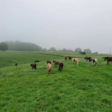
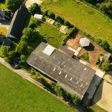
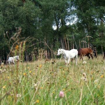
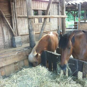
Paddock Trail Laufstall Offenstall
Linkenbach
Markus Erdmann
@Markus-Erdmann
Freizeitstall
Geländestrecke
Vermieten
Hunde willkommen
Krankenbox
Notfallboxen
23 weitere...
B
Deprecated: Creation of dynamic property Zend_View_Helper_Ads::$adLink is deprecated in /var/www/stall-frei/htdocs/staging.stall-frei.de/library/Psf/View/Helper/Ads.php on line 108

Persönlichkeitsentwicklung mit Pferden
Bad Salzuflen
Katja Dors
@Pferdezeiten
Begleite andere auf ihrem Entwicklungsweg und entdecke die transformative Kraft der pferdegestützten Persönlichkeitsentwicklung !
neu
R


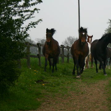
Pferdepension, Pferdebox, Einstellplatz
Orfgen
Pferdepension AnnAHof
@SanOffzVet
Freizeitstall
Geländestrecke
Hunde willkommen
Longierzirkel/Roundpen
Innenbox
Biofutter
Vollpension
13 weitere...
P+


Pferdebox, Pferdepension, Einstellplatz
Orfgen
Pferdepension AnnAHof
@AnnAHof
Freizeitstall
Geländestrecke
Hunde willkommen
Longierzirkel/Roundpen
Innenbox
Biofutter
Vollpension
13 weitere...
P+
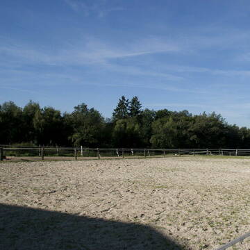
Hof Waldwiese 5 Sterne LAG-Stall
Kescheid
Melanie-Liebscher
@Melanie-Liebscher
Freizeitstall
Pferdeausbildung
Krankenbox
Longierzirkel/Roundpen
Gnadenbrothof
Außenbox mit Paddock
Außenboxen
19 weitere...
P+
Leider kein Vorschaubild
Leider kein Vorschaubild
Artgerechte, großzüge Paddockboxen u. Offenstall
Niedersayn
D. Wagner
@Dirk84
Pferdeausbildung
Reitlehrer und -unterricht
Vermieten
Hunde willkommen
Krankenbox
Fohlenaufzucht möglich
Gnadenbrothof
17 weitere...
B
Leider kein Vorschaubild
Leider kein Vorschaubild
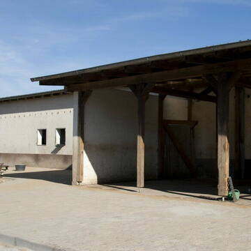
Offenstallplätze wieder frei auf Peterhof
Boppard
Peterhof
@Peterhof
Geländestrecke
Reitlehrer und -unterricht
Longierzirkel/Roundpen
Paddock
Pferdezucht
Zuchtstutenhaltung möglich
Außenboxen
Innenbox
15 weitere...
B
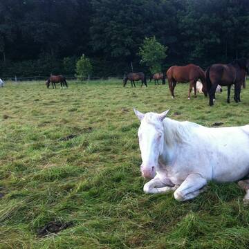
Pferdepension mit artgerechter Offenstallhaltung
Schlangenbad-Wambach
Offenstall-Pferdepension
@Pferdepension-Rhein-Main
Freizeitstall
Geländestrecke
Krankenbox
Sommerweide
Gnadenbrothof
Hengsthaltung möglich
Offenstall
7 weitere...
S

Schweizerhof 3/4* LAG - Barhufstall - PaddockTrail
Westerburg
Sarah Lech
@Schweizerhof_Westerburg
Freizeitstall
Pferdeausbildung
Vermieten
Krankenbox
Paddock
Notfallboxen
13 weitere...
P+

Offenstallplätze in Oberbreisig
Bad Breisig
Tanja Hornberger
@Waldgut-Heiligental
Freizeitstall
Vermieten
Hunde willkommen
Paddock
Allergikerstall
Hufrehe geeignet
12 weitere...
P
Islandpferde vom Elbbachtal / Inhalationskammer
Rothenbach
Islandpferde vom Elbbachtal
@Islandpferde-vom-Elbbachtal
Freizeitstall
Gangpferdereiten
Vermieten
Führanlage
Hunde willkommen
Allergikerstall
Gnadenbrothof
45 weitere...
P
Deprecated: Creation of dynamic property Zend_View::$pageCount is deprecated in /var/www/stall-frei/htdocs/staging.stall-frei.de/library/vendor/shardj/zf1-future/library/Zend/View/Abstract.php on line 308
Deprecated: Creation of dynamic property Zend_View::$itemCountPerPage is deprecated in /var/www/stall-frei/htdocs/staging.stall-frei.de/library/vendor/shardj/zf1-future/library/Zend/View/Abstract.php on line 308
Deprecated: Creation of dynamic property Zend_View::$first is deprecated in /var/www/stall-frei/htdocs/staging.stall-frei.de/library/vendor/shardj/zf1-future/library/Zend/View/Abstract.php on line 308
Deprecated: Creation of dynamic property Zend_View::$current is deprecated in /var/www/stall-frei/htdocs/staging.stall-frei.de/library/vendor/shardj/zf1-future/library/Zend/View/Abstract.php on line 308
Deprecated: Creation of dynamic property Zend_View::$last is deprecated in /var/www/stall-frei/htdocs/staging.stall-frei.de/library/vendor/shardj/zf1-future/library/Zend/View/Abstract.php on line 308
Deprecated: Creation of dynamic property Zend_View::$previous is deprecated in /var/www/stall-frei/htdocs/staging.stall-frei.de/library/vendor/shardj/zf1-future/library/Zend/View/Abstract.php on line 308
Deprecated: Creation of dynamic property Zend_View::$next is deprecated in /var/www/stall-frei/htdocs/staging.stall-frei.de/library/vendor/shardj/zf1-future/library/Zend/View/Abstract.php on line 308
Deprecated: Creation of dynamic property Zend_View::$pagesInRange is deprecated in /var/www/stall-frei/htdocs/staging.stall-frei.de/library/vendor/shardj/zf1-future/library/Zend/View/Abstract.php on line 308
Deprecated: Creation of dynamic property Zend_View::$firstPageInRange is deprecated in /var/www/stall-frei/htdocs/staging.stall-frei.de/library/vendor/shardj/zf1-future/library/Zend/View/Abstract.php on line 308
Deprecated: Creation of dynamic property Zend_View::$lastPageInRange is deprecated in /var/www/stall-frei/htdocs/staging.stall-frei.de/library/vendor/shardj/zf1-future/library/Zend/View/Abstract.php on line 308
Deprecated: Creation of dynamic property Zend_View::$currentItemCount is deprecated in /var/www/stall-frei/htdocs/staging.stall-frei.de/library/vendor/shardj/zf1-future/library/Zend/View/Abstract.php on line 308
Deprecated: Creation of dynamic property Zend_View::$totalItemCount is deprecated in /var/www/stall-frei/htdocs/staging.stall-frei.de/library/vendor/shardj/zf1-future/library/Zend/View/Abstract.php on line 308
Deprecated: Creation of dynamic property Zend_View::$firstItemNumber is deprecated in /var/www/stall-frei/htdocs/staging.stall-frei.de/library/vendor/shardj/zf1-future/library/Zend/View/Abstract.php on line 308
Deprecated: Creation of dynamic property Zend_View::$lastItemNumber is deprecated in /var/www/stall-frei/htdocs/staging.stall-frei.de/library/vendor/shardj/zf1-future/library/Zend/View/Abstract.php on line 308
Deprecated: Creation of dynamic property Zend_View::$router is deprecated in /var/www/stall-frei/htdocs/staging.stall-frei.de/library/vendor/shardj/zf1-future/library/Zend/View/Abstract.php on line 308
Deprecated: Creation of dynamic property Zend_View::$urlParams is deprecated in /var/www/stall-frei/htdocs/staging.stall-frei.de/library/vendor/shardj/zf1-future/library/Zend/View/Abstract.php on line 308
Deprecated: Creation of dynamic property Zend_View::$showAds is deprecated in /var/www/stall-frei/htdocs/staging.stall-frei.de/library/vendor/shardj/zf1-future/library/Zend/View/Abstract.php on line 308
Deprecated: Creation of dynamic property Zend_View::$objectIds is deprecated in /var/www/stall-frei/htdocs/staging.stall-frei.de/library/vendor/shardj/zf1-future/library/Zend/View/Abstract.php on line 308
Deprecated: Creation of dynamic property Zend_View::$showNavbar is deprecated in /var/www/stall-frei/htdocs/staging.stall-frei.de/library/vendor/shardj/zf1-future/library/Zend/View/Abstract.php on line 308
Deprecated: Creation of dynamic property Zend_View::$showBreadcrumb is deprecated in /var/www/stall-frei/htdocs/staging.stall-frei.de/library/vendor/shardj/zf1-future/library/Zend/View/Abstract.php on line 308
Deprecated: Creation of dynamic property Zend_View::$showFooter is deprecated in /var/www/stall-frei/htdocs/staging.stall-frei.de/library/vendor/shardj/zf1-future/library/Zend/View/Abstract.php on line 308
Deprecated: Creation of dynamic property Zend_View::$showInternalAds is deprecated in /var/www/stall-frei/htdocs/staging.stall-frei.de/library/vendor/shardj/zf1-future/library/Zend/View/Abstract.php on line 308
Deprecated: Creation of dynamic property Zend_View::$blNoContent is deprecated in /var/www/stall-frei/htdocs/staging.stall-frei.de/library/vendor/shardj/zf1-future/library/Zend/View/Abstract.php on line 308
Deprecated: Creation of dynamic property Zend_View::$sMetaDesc is deprecated in /var/www/stall-frei/htdocs/staging.stall-frei.de/library/vendor/shardj/zf1-future/library/Zend/View/Abstract.php on line 308
Deprecated: Creation of dynamic property Zend_View::$useGmaps is deprecated in /var/www/stall-frei/htdocs/staging.stall-frei.de/library/vendor/shardj/zf1-future/library/Zend/View/Abstract.php on line 308
Deprecated: Creation of dynamic property Zend_View::$touches is deprecated in /var/www/stall-frei/htdocs/staging.stall-frei.de/library/vendor/shardj/zf1-future/library/Zend/View/Abstract.php on line 308
Deprecated: Creation of dynamic property Zend_View::$oProject is deprecated in /var/www/stall-frei/htdocs/staging.stall-frei.de/library/vendor/shardj/zf1-future/library/Zend/View/Abstract.php on line 308
Deprecated: Creation of dynamic property Zend_View::$pageHeadline is deprecated in /var/www/stall-frei/htdocs/staging.stall-frei.de/library/vendor/shardj/zf1-future/library/Zend/View/Abstract.php on line 308
Deprecated: Creation of dynamic property Zend_View::$disableLocationField is deprecated in /var/www/stall-frei/htdocs/staging.stall-frei.de/library/vendor/shardj/zf1-future/library/Zend/View/Abstract.php on line 308
Deprecated: Creation of dynamic property Zend_View::$isSearch is deprecated in /var/www/stall-frei/htdocs/staging.stall-frei.de/library/vendor/shardj/zf1-future/library/Zend/View/Abstract.php on line 308
Deprecated: Creation of dynamic property Zend_View::$pageTitle is deprecated in /var/www/stall-frei/htdocs/staging.stall-frei.de/library/vendor/shardj/zf1-future/library/Zend/View/Abstract.php on line 308
Deprecated: Creation of dynamic property Psf_Form_Element_Text::$class is deprecated in /var/www/stall-frei/htdocs/staging.stall-frei.de/library/vendor/shardj/zf1-future/library/Zend/Form/Element.php on line 874
Deprecated: Creation of dynamic property Psf_Form_Element_Text::$size is deprecated in /var/www/stall-frei/htdocs/staging.stall-frei.de/library/vendor/shardj/zf1-future/library/Zend/Form/Element.php on line 874
Deprecated: Creation of dynamic property Psf_Form_Element_Text::$placeholder is deprecated in /var/www/stall-frei/htdocs/staging.stall-frei.de/library/vendor/shardj/zf1-future/library/Zend/Form/Element.php on line 874
Deprecated: Creation of dynamic property Psf_Form_Element_Hidden::$class is deprecated in /var/www/stall-frei/htdocs/staging.stall-frei.de/library/vendor/shardj/zf1-future/library/Zend/Form/Element.php on line 874
Deprecated: Creation of dynamic property Psf_Form_Element_Hidden::$class is deprecated in /var/www/stall-frei/htdocs/staging.stall-frei.de/library/vendor/shardj/zf1-future/library/Zend/Form/Element.php on line 874
Deprecated: Creation of dynamic property Psf_Form_Element_Hidden::$class is deprecated in /var/www/stall-frei/htdocs/staging.stall-frei.de/library/vendor/shardj/zf1-future/library/Zend/Form/Element.php on line 874
Deprecated: Creation of dynamic property Psf_Form_Element_Hidden::$class is deprecated in /var/www/stall-frei/htdocs/staging.stall-frei.de/library/vendor/shardj/zf1-future/library/Zend/Form/Element.php on line 874
Deprecated: Creation of dynamic property Psf_Form_Element_Select::$class is deprecated in /var/www/stall-frei/htdocs/staging.stall-frei.de/library/vendor/shardj/zf1-future/library/Zend/Form/Element.php on line 874
Deprecated: Creation of dynamic property Psf_Form_Element_Select::$class is deprecated in /var/www/stall-frei/htdocs/staging.stall-frei.de/library/vendor/shardj/zf1-future/library/Zend/Form/Element.php on line 874
Deprecated: Creation of dynamic property Psf_Form_Element_Select::$class is deprecated in /var/www/stall-frei/htdocs/staging.stall-frei.de/library/vendor/shardj/zf1-future/library/Zend/Form/Element.php on line 874
Deprecated: Creation of dynamic property Psf_Form_Element_Select::$class is deprecated in /var/www/stall-frei/htdocs/staging.stall-frei.de/library/vendor/shardj/zf1-future/library/Zend/Form/Element.php on line 874
Deprecated: Creation of dynamic property Psf_Form_Element_Text::$class is deprecated in /var/www/stall-frei/htdocs/staging.stall-frei.de/library/vendor/shardj/zf1-future/library/Zend/Form/Element.php on line 874
Deprecated: Creation of dynamic property Psf_Form_Element_Checkbox::$label is deprecated in /var/www/stall-frei/htdocs/staging.stall-frei.de/library/vendor/shardj/zf1-future/library/Zend/Form/Element.php on line 874
Deprecated: Creation of dynamic property Zend_View::$sort is deprecated in /var/www/stall-frei/htdocs/staging.stall-frei.de/library/vendor/shardj/zf1-future/library/Zend/View/Abstract.php on line 308
Deprecated: Creation of dynamic property Zend_View::$searchLocation is deprecated in /var/www/stall-frei/htdocs/staging.stall-frei.de/library/vendor/shardj/zf1-future/library/Zend/View/Abstract.php on line 308
Deprecated: Creation of dynamic property Zend_View::$locationHint is deprecated in /var/www/stall-frei/htdocs/staging.stall-frei.de/library/vendor/shardj/zf1-future/library/Zend/View/Abstract.php on line 308
Psf_GeoCoder_Abstract::getLocation: Niederberg Get Location CachedOrLive
Psf_GeoCoder_Abstract::getCachedOrLive: Niederberg
Psf_GeoCoder_Abstract::convertLocationResult
{"documentation":"https:\/\/opencagedata.com\/api","licenses":[{"name":"see attribution guide","url":"https:\/\/opencagedata.com\/credits"}],"results":[{"bounds":{"northeast":{"lat":50.3758438,"lng":7.642517},"southwest":{"lat":50.3631432,"lng":7.6099769}},"components":{"ISO_3166-1_alpha-2":"DE","ISO_3166-1_alpha-3":"DEU","ISO_3166-2":["DE-RP"],"_category":"place","_normalized_city":"Koblenz","_type":"neighbourhood","city":"Koblenz","continent":"Europe","country":"Deutschland","country_code":"de","political_union":"European Union","state":"Rheinland-Pfalz","state_code":"RP","suburb":"Niederberg"},"confidence":8,"formatted":"Niederberg, Koblenz, Rheinland-Pfalz, Deutschland","geometry":{"lat":50.3706556,"lng":7.6275541}},{"bounds":{"northeast":{"lat":50.7552263,"lng":6.7882707},"southwest":{"lat":50.7152263,"lng":6.7482707}},"components":{"ISO_3166-1_alpha-2":"DE","ISO_3166-1_alpha-3":"DEU","ISO_3166-2":["DE-NW"],"_category":"place","_normalized_city":"Niederberg","_type":"village","continent":"Europe","country":"Deutschland","country_code":"de","county":"Rhein-Erft-Kreis","municipality":"Erftstadt","political_union":"European Union","postcode":"50374","state":"Nordrhein-Westfalen","state_code":"NW","village":"Niederberg"},"confidence":7,"formatted":"50374 Niederberg, Deutschland","geometry":{"lat":50.7352263,"lng":6.7682707}},{"bounds":{"northeast":{"lat":47.9986774,"lng":8.5995457},"southwest":{"lat":47.9985774,"lng":8.5994457}},"components":{"ISO_3166-1_alpha-2":"DE","ISO_3166-1_alpha-3":"DEU","ISO_3166-2":["DE-BW"],"_category":"natural\/water","_normalized_city":"Bad D\u00fcrrheim","_type":"peak","continent":"Europe","country":"Deutschland","country_code":"de","county":"Schwarzwald-Baar-Kreis","peak":"Niederberg","political_union":"European Union","postcode":"78609","state":"Baden-W\u00fcrttemberg","state_code":"BW","town":"Bad D\u00fcrrheim"},"confidence":9,"formatted":"Niederberg, 78609 Bad D\u00fcrrheim, Deutschland","geometry":{"lat":47.9986274,"lng":8.5994957}},{"bounds":{"northeast":{"lat":50.820026,"lng":8.3544657},"southwest":{"lat":50.819926,"lng":8.3543657}},"components":{"ISO_3166-1_alpha-2":"DE","ISO_3166-1_alpha-3":"DEU","ISO_3166-2":["DE-HE"],"_category":"natural\/water","_normalized_city":"Eibelshausen","_type":"peak","continent":"Europe","country":"Deutschland","country_code":"de","county":"Lahn-Dill-Kreis","municipality":"Eschenburg","peak":"Niederberg","political_union":"European Union","postcode":"35713","state":"Hessen","state_code":"HE","village":"Eibelshausen"},"confidence":9,"formatted":"Niederberg, 35713 Eibelshausen, Deutschland","geometry":{"lat":50.819976,"lng":8.3544157}},{"bounds":{"northeast":{"lat":50.7787487,"lng":7.2019587},"southwest":{"lat":50.7387487,"lng":7.1619587}},"components":{"ISO_3166-1_alpha-2":"DE","ISO_3166-1_alpha-3":"DEU","ISO_3166-2":["DE-NW"],"_category":"place","_normalized_city":"Sankt Augustin","_type":"neighbourhood","continent":"Europe","country":"Deutschland","country_code":"de","county":"Rhein-Sieg-Kreis","political_union":"European Union","postcode":"53757","state":"Nordrhein-Westfalen","state_code":"NW","suburb":"Niederberg","town":"Sankt Augustin"},"confidence":7,"formatted":"53757 Sankt Augustin, Deutschland","geometry":{"lat":50.7587487,"lng":7.1819587}},{"bounds":{"northeast":{"lat":48.9186718,"lng":9.7924035},"southwest":{"lat":48.9185718,"lng":9.7923035}},"components":{"ISO_3166-1_alpha-2":"DE","ISO_3166-1_alpha-3":"DEU","ISO_3166-2":["DE-BW"],"_category":"building","_normalized_city":"Gschwend","_type":"building","city":"Gschwend","continent":"Europe","country":"Deutschland","country_code":"de","county":"Ostalbkreis","hamlet":"Brechtenhalden","isolated_dwelling":"Niederberg","political_union":"European Union","postcode":"74417","state":"Baden-W\u00fcrttemberg","state_code":"BW"},"confidence":10,"formatted":"Niederberg, Brechtenhalden, 74417 Gschwend, Deutschland","geometry":{"lat":48.9186218,"lng":9.7923535}},{"bounds":{"northeast":{"lat":47.6566642,"lng":8.1633149},"southwest":{"lat":47.6366642,"lng":8.1433149}},"components":{"ISO_3166-1_alpha-2":"DE","ISO_3166-1_alpha-3":"DEU","ISO_3166-2":["DE-BW"],"_category":"place","_normalized_city":"Oberalpfen","_type":"hamlet","continent":"Europe","country":"Deutschland","country_code":"de","county":"Landkreis Waldshut","locality":"Niederberg","municipality":"Waldshut-Tiengen","political_union":"European Union","postcode":"79761","state":"Baden-W\u00fcrttemberg","state_code":"BW","village":"Oberalpfen"},"confidence":8,"formatted":"Niederberg, 79761 Oberalpfen, Deutschland","geometry":{"lat":47.6466642,"lng":8.1533149}},{"bounds":{"northeast":{"lat":51.4998876,"lng":14.8601375},"southwest":{"lat":51.4801211,"lng":14.8142951}},"components":{"ISO_3166-1_alpha-2":"DE","ISO_3166-1_alpha-3":"DEU","ISO_3166-2":["DE-SN"],"_category":"road","_normalized_city":"Krauschwitz","_type":"road","city":"Krauschwitz","continent":"Europe","country":"Deutschland","country_code":"de","county":"G\u00f6rlitz","political_union":"European Union","postcode":"02957","road":"Niederberg","road_type":"secondary","state":"Sachsen","state_code":"SN"},"confidence":7,"formatted":"Niederberg, 02957 Krauschwitz, Deutschland","geometry":{"lat":51.4895397,"lng":14.8371619}},{"bounds":{"northeast":{"lat":49.789959,"lng":7.4778181},"southwest":{"lat":49.7874146,"lng":7.4691641}},"components":{"ISO_3166-1_alpha-2":"DE","ISO_3166-1_alpha-3":"DEU","ISO_3166-2":["DE-RP"],"_category":"road","_normalized_city":"Kirn","_type":"road","continent":"Europe","country":"Deutschland","country_code":"de","county":"Landkreis Bad Kreuznach","municipality":"Kirner Land","political_union":"European Union","postcode":"55606","road":"Niederberg","road_type":"residential","state":"Rheinland-Pfalz","state_code":"RP","town":"Kirn"},"confidence":9,"formatted":"Niederberg, 55606 Kirn, Deutschland","geometry":{"lat":49.7887914,"lng":7.47342}},{"components":{"ISO_3166-1_alpha-2":"FR","ISO_3166-1_alpha-3":"FRA","ISO_3166-2":["FR-GES","FR-57"],"_category":"place","_normalized_city":"Th\u00e9ding","_type":"place","city":"Th\u00e9ding","continent":"Europe","country":"France","country_code":"fr","county":"Moselle","local_authority":"Communaut\u00e9 d'agglom\u00e9ration de Forbach Porte de France","place":"Niederberg 2 Lange","political_union":"European Union","postcode":"57450","state":"Grand Est","state_code":"GES"},"confidence":4,"formatted":"Niederberg 2 Lange, 57450 Th\u00e9ding, France","geometry":{"lat":49.132676,"lng":6.885656}}],"status":{"code":200,"message":"OK"},"stay_informed":{"blog":"https:\/\/blog.opencagedata.com","mastodon":"https:\/\/en.osm.town\/@opencage"},"thanks":"For using an OpenCage API","timestamp":{"created_http":"Sat, 07 Feb 2026 19:47:00 GMT","created_unix":1770493620},"total_results":10}Array
(
[0] => stdClass Object
(
[bounds] => stdClass Object
(
[northeast] => stdClass Object
(
[lat] => 50.3758438
[lng] => 7.642517
)
[southwest] => stdClass Object
(
[lat] => 50.3631432
[lng] => 7.6099769
)
)
[components] => stdClass Object
(
[ISO_3166-1_alpha-2] => DE
[ISO_3166-1_alpha-3] => DEU
[ISO_3166-2] => Array
(
[0] => DE-RP
)
[_category] => place
[_normalized_city] => Koblenz
[_type] => neighbourhood
[city] => Koblenz
[continent] => Europe
[country] => Deutschland
[country_code] => de
[political_union] => European Union
[state] => Rheinland-Pfalz
[state_code] => RP
[suburb] => Niederberg
)
[confidence] => 8
[formatted] => Niederberg, Koblenz, Rheinland-Pfalz, Deutschland
[geometry] => stdClass Object
(
[lat] => 50.3706556
[lng] => 7.6275541
)
)
[1] => stdClass Object
(
[bounds] => stdClass Object
(
[northeast] => stdClass Object
(
[lat] => 50.7552263
[lng] => 6.7882707
)
[southwest] => stdClass Object
(
[lat] => 50.7152263
[lng] => 6.7482707
)
)
[components] => stdClass Object
(
[ISO_3166-1_alpha-2] => DE
[ISO_3166-1_alpha-3] => DEU
[ISO_3166-2] => Array
(
[0] => DE-NW
)
[_category] => place
[_normalized_city] => Niederberg
[_type] => village
[continent] => Europe
[country] => Deutschland
[country_code] => de
[county] => Rhein-Erft-Kreis
[municipality] => Erftstadt
[political_union] => European Union
[postcode] => 50374
[state] => Nordrhein-Westfalen
[state_code] => NW
[village] => Niederberg
)
[confidence] => 7
[formatted] => 50374 Niederberg, Deutschland
[geometry] => stdClass Object
(
[lat] => 50.7352263
[lng] => 6.7682707
)
)
[2] => stdClass Object
(
[bounds] => stdClass Object
(
[northeast] => stdClass Object
(
[lat] => 47.9986774
[lng] => 8.5995457
)
[southwest] => stdClass Object
(
[lat] => 47.9985774
[lng] => 8.5994457
)
)
[components] => stdClass Object
(
[ISO_3166-1_alpha-2] => DE
[ISO_3166-1_alpha-3] => DEU
[ISO_3166-2] => Array
(
[0] => DE-BW
)
[_category] => natural/water
[_normalized_city] => Bad Dürrheim
[_type] => peak
[continent] => Europe
[country] => Deutschland
[country_code] => de
[county] => Schwarzwald-Baar-Kreis
[peak] => Niederberg
[political_union] => European Union
[postcode] => 78609
[state] => Baden-Württemberg
[state_code] => BW
[town] => Bad Dürrheim
)
[confidence] => 9
[formatted] => Niederberg, 78609 Bad Dürrheim, Deutschland
[geometry] => stdClass Object
(
[lat] => 47.9986274
[lng] => 8.5994957
)
)
[3] => stdClass Object
(
[bounds] => stdClass Object
(
[northeast] => stdClass Object
(
[lat] => 50.820026
[lng] => 8.3544657
)
[southwest] => stdClass Object
(
[lat] => 50.819926
[lng] => 8.3543657
)
)
[components] => stdClass Object
(
[ISO_3166-1_alpha-2] => DE
[ISO_3166-1_alpha-3] => DEU
[ISO_3166-2] => Array
(
[0] => DE-HE
)
[_category] => natural/water
[_normalized_city] => Eibelshausen
[_type] => peak
[continent] => Europe
[country] => Deutschland
[country_code] => de
[county] => Lahn-Dill-Kreis
[municipality] => Eschenburg
[peak] => Niederberg
[political_union] => European Union
[postcode] => 35713
[state] => Hessen
[state_code] => HE
[village] => Eibelshausen
)
[confidence] => 9
[formatted] => Niederberg, 35713 Eibelshausen, Deutschland
[geometry] => stdClass Object
(
[lat] => 50.819976
[lng] => 8.3544157
)
)
[4] => stdClass Object
(
[bounds] => stdClass Object
(
[northeast] => stdClass Object
(
[lat] => 50.7787487
[lng] => 7.2019587
)
[southwest] => stdClass Object
(
[lat] => 50.7387487
[lng] => 7.1619587
)
)
[components] => stdClass Object
(
[ISO_3166-1_alpha-2] => DE
[ISO_3166-1_alpha-3] => DEU
[ISO_3166-2] => Array
(
[0] => DE-NW
)
[_category] => place
[_normalized_city] => Sankt Augustin
[_type] => neighbourhood
[continent] => Europe
[country] => Deutschland
[country_code] => de
[county] => Rhein-Sieg-Kreis
[political_union] => European Union
[postcode] => 53757
[state] => Nordrhein-Westfalen
[state_code] => NW
[suburb] => Niederberg
[town] => Sankt Augustin
)
[confidence] => 7
[formatted] => 53757 Sankt Augustin, Deutschland
[geometry] => stdClass Object
(
[lat] => 50.7587487
[lng] => 7.1819587
)
)
[5] => stdClass Object
(
[bounds] => stdClass Object
(
[northeast] => stdClass Object
(
[lat] => 48.9186718
[lng] => 9.7924035
)
[southwest] => stdClass Object
(
[lat] => 48.9185718
[lng] => 9.7923035
)
)
[components] => stdClass Object
(
[ISO_3166-1_alpha-2] => DE
[ISO_3166-1_alpha-3] => DEU
[ISO_3166-2] => Array
(
[0] => DE-BW
)
[_category] => building
[_normalized_city] => Gschwend
[_type] => building
[city] => Gschwend
[continent] => Europe
[country] => Deutschland
[country_code] => de
[county] => Ostalbkreis
[hamlet] => Brechtenhalden
[isolated_dwelling] => Niederberg
[political_union] => European Union
[postcode] => 74417
[state] => Baden-Württemberg
[state_code] => BW
)
[confidence] => 10
[formatted] => Niederberg, Brechtenhalden, 74417 Gschwend, Deutschland
[geometry] => stdClass Object
(
[lat] => 48.9186218
[lng] => 9.7923535
)
)
[6] => stdClass Object
(
[bounds] => stdClass Object
(
[northeast] => stdClass Object
(
[lat] => 47.6566642
[lng] => 8.1633149
)
[southwest] => stdClass Object
(
[lat] => 47.6366642
[lng] => 8.1433149
)
)
[components] => stdClass Object
(
[ISO_3166-1_alpha-2] => DE
[ISO_3166-1_alpha-3] => DEU
[ISO_3166-2] => Array
(
[0] => DE-BW
)
[_category] => place
[_normalized_city] => Oberalpfen
[_type] => hamlet
[continent] => Europe
[country] => Deutschland
[country_code] => de
[county] => Landkreis Waldshut
[locality] => Niederberg
[municipality] => Waldshut-Tiengen
[political_union] => European Union
[postcode] => 79761
[state] => Baden-Württemberg
[state_code] => BW
[village] => Oberalpfen
)
[confidence] => 8
[formatted] => Niederberg, 79761 Oberalpfen, Deutschland
[geometry] => stdClass Object
(
[lat] => 47.6466642
[lng] => 8.1533149
)
)
[7] => stdClass Object
(
[bounds] => stdClass Object
(
[northeast] => stdClass Object
(
[lat] => 51.4998876
[lng] => 14.8601375
)
[southwest] => stdClass Object
(
[lat] => 51.4801211
[lng] => 14.8142951
)
)
[components] => stdClass Object
(
[ISO_3166-1_alpha-2] => DE
[ISO_3166-1_alpha-3] => DEU
[ISO_3166-2] => Array
(
[0] => DE-SN
)
[_category] => road
[_normalized_city] => Krauschwitz
[_type] => road
[city] => Krauschwitz
[continent] => Europe
[country] => Deutschland
[country_code] => de
[county] => Görlitz
[political_union] => European Union
[postcode] => 02957
[road] => Niederberg
[road_type] => secondary
[state] => Sachsen
[state_code] => SN
)
[confidence] => 7
[formatted] => Niederberg, 02957 Krauschwitz, Deutschland
[geometry] => stdClass Object
(
[lat] => 51.4895397
[lng] => 14.8371619
)
)
[8] => stdClass Object
(
[bounds] => stdClass Object
(
[northeast] => stdClass Object
(
[lat] => 49.789959
[lng] => 7.4778181
)
[southwest] => stdClass Object
(
[lat] => 49.7874146
[lng] => 7.4691641
)
)
[components] => stdClass Object
(
[ISO_3166-1_alpha-2] => DE
[ISO_3166-1_alpha-3] => DEU
[ISO_3166-2] => Array
(
[0] => DE-RP
)
[_category] => road
[_normalized_city] => Kirn
[_type] => road
[continent] => Europe
[country] => Deutschland
[country_code] => de
[county] => Landkreis Bad Kreuznach
[municipality] => Kirner Land
[political_union] => European Union
[postcode] => 55606
[road] => Niederberg
[road_type] => residential
[state] => Rheinland-Pfalz
[state_code] => RP
[town] => Kirn
)
[confidence] => 9
[formatted] => Niederberg, 55606 Kirn, Deutschland
[geometry] => stdClass Object
(
[lat] => 49.7887914
[lng] => 7.47342
)
)
[9] => stdClass Object
(
[components] => stdClass Object
(
[ISO_3166-1_alpha-2] => FR
[ISO_3166-1_alpha-3] => FRA
[ISO_3166-2] => Array
(
[0] => FR-GES
[1] => FR-57
)
[_category] => place
[_normalized_city] => Théding
[_type] => place
[city] => Théding
[continent] => Europe
[country] => France
[country_code] => fr
[county] => Moselle
[local_authority] => Communauté d'agglomération de Forbach Porte de France
[place] => Niederberg 2 Lange
[political_union] => European Union
[postcode] => 57450
[state] => Grand Est
[state_code] => GES
)
[confidence] => 4
[formatted] => Niederberg 2 Lange, 57450 Théding, France
[geometry] => stdClass Object
(
[lat] => 49.132676
[lng] => 6.885656
)
)
)
Psf_GeoCoder_OpenCageData::getKeyMap: 0
stdClass Object
(
    [bounds] => stdClass Object
        (
            [northeast] => stdClass Object
                (
                    [lat] => 50.3758438
                    [lng] => 7.642517
                )

            [southwest] => stdClass Object
                (
                    [lat] => 50.3631432
                    [lng] => 7.6099769
                )

        )

    [components] => stdClass Object
        (
            [ISO_3166-1_alpha-2] => DE
            [ISO_3166-1_alpha-3] => DEU
            [ISO_3166-2] => Array
                (
                    [0] => DE-RP
                )

            [_category] => place
            [_normalized_city] => Koblenz
            [_type] => neighbourhood
            [city] => Koblenz
            [continent] => Europe
            [country] => Deutschland
            [country_code] => de
            [political_union] => European Union
            [state] => Rheinland-Pfalz
            [state_code] => RP
            [suburb] => Niederberg
        )

    [confidence] => 8
    [formatted] => Niederberg, Koblenz, Rheinland-Pfalz, Deutschland
    [geometry] => stdClass Object
        (
            [lat] => 50.3706556
            [lng] => 7.6275541
        )

)
Psf_GeoCoder_OpenCageData::getCounty: Koblenz
Psf_GeoCoder_OpenCageData::addMissingData REFETCH!
Array
(
    [address] => Niederberg, Koblenz, Rheinland-Pfalz, Deutschland
    [type] => neighbourhood
    [street] =>
    [city] => Niederberg
    [county] => Koblenz
    [state] => Rheinland-Pfalz
    [zip] =>
    [country] => Deutschland
    [suburb] => Niederberg
    [countrycode] => de
    [latitude] => 50.3706556
    [longitude] => 7.6275541
    [accuracy] => 1
    [confidence] => 8
    [bounds] => stdClass Object
        (
            [northeast] => stdClass Object
                (
                    [lat] => 50.3758438
                    [lng] => 7.642517
                )

            [southwest] => stdClass Object
                (
                    [lat] => 50.3631432
                    [lng] => 7.6099769
                )

        )

)
reformat!
Array
(
    [address] => Niederberg, Koblenz, Rheinland-Pfalz, Deutschland
    [type] => neighbourhood
    [street] =>
    [city] => Niederberg
    [county] => Koblenz
    [state] => Rheinland-Pfalz
    [zip] =>
    [country] => Deutschland
    [suburb] => Niederberg
    [countrycode] => de
    [latitude] => 50.3706556
    [longitude] => 7.6275541
    [accuracy] => 1
    [confidence] => 8
    [bounds] => stdClass Object
        (
            [northeast] => stdClass Object
                (
                    [lat] => 50.3758438
                    [lng] => 7.642517
                )

            [southwest] => stdClass Object
                (
                    [lat] => 50.3631432
                    [lng] => 7.6099769
                )

        )

    [place] => Niederberg, Rheinland-Pfalz
    [hash] => 0cd160803bcd9291022da8ba8feb8da5
)
Psf_GeoCoder_OpenCageData::getKeyMap: 1
stdClass Object
(
    [bounds] => stdClass Object
        (
            [northeast] => stdClass Object
                (
                    [lat] => 50.7552263
                    [lng] => 6.7882707
                )

            [southwest] => stdClass Object
                (
                    [lat] => 50.7152263
                    [lng] => 6.7482707
                )

        )

    [components] => stdClass Object
        (
            [ISO_3166-1_alpha-2] => DE
            [ISO_3166-1_alpha-3] => DEU
            [ISO_3166-2] => Array
                (
                    [0] => DE-NW
                )

            [_category] => place
            [_normalized_city] => Niederberg
            [_type] => village
            [continent] => Europe
            [country] => Deutschland
            [country_code] => de
            [county] => Rhein-Erft-Kreis
            [municipality] => Erftstadt
            [political_union] => European Union
            [postcode] => 50374
            [state] => Nordrhein-Westfalen
            [state_code] => NW
            [village] => Niederberg
        )

    [confidence] => 7
    [formatted] => 50374 Niederberg, Deutschland
    [geometry] => stdClass Object
        (
            [lat] => 50.7352263
            [lng] => 6.7682707
        )

)
Psf_GeoCoder_OpenCageData::getCounty: Rhein-Erft-Kreis
Psf_GeoCoder_OpenCageData::addMissingData REFETCH!
Array
(
    [address] => 50374 Niederberg, Deutschland
    [type] => village
    [street] =>
    [city] => Niederberg
    [county] => Rhein-Erft-Kreis
    [state] => Nordrhein-Westfalen
    [zip] => 50374
    [country] => Deutschland
    [suburb] =>
    [countrycode] => de
    [latitude] => 50.7352263
    [longitude] => 6.7682707
    [accuracy] => 1
    [confidence] => 7
    [bounds] => stdClass Object
        (
            [northeast] => stdClass Object
                (
                    [lat] => 50.7552263
                    [lng] => 6.7882707
                )

            [southwest] => stdClass Object
                (
                    [lat] => 50.7152263
                    [lng] => 6.7482707
                )

        )

)
reformat!
Array
(
    [address] => 50374 Niederberg, Deutschland
    [type] => village
    [street] =>
    [city] => Niederberg
    [county] => Rhein-Erft-Kreis
    [state] => Nordrhein-Westfalen
    [zip] => 50374
    [country] => Deutschland
    [suburb] =>
    [countrycode] => de
    [latitude] => 50.7352263
    [longitude] => 6.7682707
    [accuracy] => 1
    [confidence] => 7
    [bounds] => stdClass Object
        (
            [northeast] => stdClass Object
                (
                    [lat] => 50.7552263
                    [lng] => 6.7882707
                )

            [southwest] => stdClass Object
                (
                    [lat] => 50.7152263
                    [lng] => 6.7482707
                )

        )

    [place] => 50374 Niederberg, Nordrhein-Westfalen
    [hash] => 221df0943920e6ab282f381766fd2c53
)
Psf_GeoCoder_OpenCageData::getKeyMap: 2
stdClass Object
(
    [bounds] => stdClass Object
        (
            [northeast] => stdClass Object
                (
                    [lat] => 47.9986774
                    [lng] => 8.5995457
                )

            [southwest] => stdClass Object
                (
                    [lat] => 47.9985774
                    [lng] => 8.5994457
                )

        )

    [components] => stdClass Object
        (
            [ISO_3166-1_alpha-2] => DE
            [ISO_3166-1_alpha-3] => DEU
            [ISO_3166-2] => Array
                (
                    [0] => DE-BW
                )

            [_category] => natural/water
            [_normalized_city] => Bad Dürrheim
            [_type] => peak
            [continent] => Europe
            [country] => Deutschland
            [country_code] => de
            [county] => Schwarzwald-Baar-Kreis
            [peak] => Niederberg
            [political_union] => European Union
            [postcode] => 78609
            [state] => Baden-Württemberg
            [state_code] => BW
            [town] => Bad Dürrheim
        )

    [confidence] => 9
    [formatted] => Niederberg, 78609 Bad Dürrheim, Deutschland
    [geometry] => stdClass Object
        (
            [lat] => 47.9986274
            [lng] => 8.5994957
        )

)
Psf_GeoCoder_OpenCageData::getCounty: Schwarzwald-Baar-Kreis
Psf_GeoCoder_OpenCageData::addMissingData REFETCH!
Array
(
    [address] => Niederberg, 78609 Bad Dürrheim, Deutschland
    [type] => peak
    [street] =>
    [city] => Bad Dürrheim
    [county] => Schwarzwald-Baar-Kreis
    [state] => Baden-Württemberg
    [zip] => 78609
    [country] => Deutschland
    [suburb] =>
    [countrycode] => de
    [latitude] => 47.9986274
    [longitude] => 8.5994957
    [accuracy] => 1
    [confidence] => 9
    [bounds] => stdClass Object
        (
            [northeast] => stdClass Object
                (
                    [lat] => 47.9986774
                    [lng] => 8.5995457
                )

            [southwest] => stdClass Object
                (
                    [lat] => 47.9985774
                    [lng] => 8.5994457
                )

        )

)
reformat!
Array
(
    [address] => Niederberg, 78609 Bad Dürrheim, Deutschland
    [type] => peak
    [street] =>
    [city] => Bad Dürrheim
    [county] => Schwarzwald-Baar-Kreis
    [state] => Baden-Württemberg
    [zip] => 78609
    [country] => Deutschland
    [suburb] =>
    [countrycode] => de
    [latitude] => 47.9986274
    [longitude] => 8.5994957
    [accuracy] => 1
    [confidence] => 9
    [bounds] => stdClass Object
        (
            [northeast] => stdClass Object
                (
                    [lat] => 47.9986774
                    [lng] => 8.5995457
                )

            [southwest] => stdClass Object
                (
                    [lat] => 47.9985774
                    [lng] => 8.5994457
                )

        )

    [place] => 78609 Bad Dürrheim, Baden-Württemberg
    [hash] => 61b9be0467c92c3a2dd268940890d421
)
Psf_GeoCoder_OpenCageData::getKeyMap: 3
stdClass Object
(
    [bounds] => stdClass Object
        (
            [northeast] => stdClass Object
                (
                    [lat] => 50.820026
                    [lng] => 8.3544657
                )

            [southwest] => stdClass Object
                (
                    [lat] => 50.819926
                    [lng] => 8.3543657
                )

        )

    [components] => stdClass Object
        (
            [ISO_3166-1_alpha-2] => DE
            [ISO_3166-1_alpha-3] => DEU
            [ISO_3166-2] => Array
                (
                    [0] => DE-HE
                )

            [_category] => natural/water
            [_normalized_city] => Eibelshausen
            [_type] => peak
            [continent] => Europe
            [country] => Deutschland
            [country_code] => de
            [county] => Lahn-Dill-Kreis
            [municipality] => Eschenburg
            [peak] => Niederberg
            [political_union] => European Union
            [postcode] => 35713
            [state] => Hessen
            [state_code] => HE
            [village] => Eibelshausen
        )

    [confidence] => 9
    [formatted] => Niederberg, 35713 Eibelshausen, Deutschland
    [geometry] => stdClass Object
        (
            [lat] => 50.819976
            [lng] => 8.3544157
        )

)
Psf_GeoCoder_OpenCageData::getCounty: Lahn-Dill-Kreis
Psf_GeoCoder_OpenCageData::addMissingData REFETCH!
Array
(
    [address] => Niederberg, 35713 Eibelshausen, Deutschland
    [type] => peak
    [street] =>
    [city] => Eibelshausen
    [county] => Lahn-Dill-Kreis
    [state] => Hessen
    [zip] => 35713
    [country] => Deutschland
    [suburb] =>
    [countrycode] => de
    [latitude] => 50.819976
    [longitude] => 8.3544157
    [accuracy] => 1
    [confidence] => 9
    [bounds] => stdClass Object
        (
            [northeast] => stdClass Object
                (
                    [lat] => 50.820026
                    [lng] => 8.3544657
                )

            [southwest] => stdClass Object
                (
                    [lat] => 50.819926
                    [lng] => 8.3543657
                )

        )

)
reformat!
Array
(
    [address] => Niederberg, 35713 Eibelshausen, Deutschland
    [type] => peak
    [street] =>
    [city] => Eibelshausen
    [county] => Lahn-Dill-Kreis
    [state] => Hessen
    [zip] => 35713
    [country] => Deutschland
    [suburb] =>
    [countrycode] => de
    [latitude] => 50.819976
    [longitude] => 8.3544157
    [accuracy] => 1
    [confidence] => 9
    [bounds] => stdClass Object
        (
            [northeast] => stdClass Object
                (
                    [lat] => 50.820026
                    [lng] => 8.3544657
                )

            [southwest] => stdClass Object
                (
                    [lat] => 50.819926
                    [lng] => 8.3543657
                )

        )

    [place] => 35713 Eibelshausen, Hessen
    [hash] => 1777cb1f4f381571810777c2ef5cca93
)
Psf_GeoCoder_OpenCageData::getKeyMap: 4
stdClass Object
(
    [bounds] => stdClass Object
        (
            [northeast] => stdClass Object
                (
                    [lat] => 50.7787487
                    [lng] => 7.2019587
                )

            [southwest] => stdClass Object
                (
                    [lat] => 50.7387487
                    [lng] => 7.1619587
                )

        )

    [components] => stdClass Object
        (
            [ISO_3166-1_alpha-2] => DE
            [ISO_3166-1_alpha-3] => DEU
            [ISO_3166-2] => Array
                (
                    [0] => DE-NW
                )

            [_category] => place
            [_normalized_city] => Sankt Augustin
            [_type] => neighbourhood
            [continent] => Europe
            [country] => Deutschland
            [country_code] => de
            [county] => Rhein-Sieg-Kreis
            [political_union] => European Union
            [postcode] => 53757
            [state] => Nordrhein-Westfalen
            [state_code] => NW
            [suburb] => Niederberg
            [town] => Sankt Augustin
        )

    [confidence] => 7
    [formatted] => 53757 Sankt Augustin, Deutschland
    [geometry] => stdClass Object
        (
            [lat] => 50.7587487
            [lng] => 7.1819587
        )

)
Psf_GeoCoder_OpenCageData::getCounty: Rhein-Sieg-Kreis
Psf_GeoCoder_OpenCageData::addMissingData REFETCH!
Array
(
    [address] => 53757 Sankt Augustin, Deutschland
    [type] => neighbourhood
    [street] =>
    [city] => Sankt Augustin
    [county] => Rhein-Sieg-Kreis
    [state] => Nordrhein-Westfalen
    [zip] => 53757
    [country] => Deutschland
    [suburb] => Niederberg
    [countrycode] => de
    [latitude] => 50.7587487
    [longitude] => 7.1819587
    [accuracy] => 1
    [confidence] => 7
    [bounds] => stdClass Object
        (
            [northeast] => stdClass Object
                (
                    [lat] => 50.7787487
                    [lng] => 7.2019587
                )

            [southwest] => stdClass Object
                (
                    [lat] => 50.7387487
                    [lng] => 7.1619587
                )

        )

)
reformat!
Array
(
    [address] => 53757 Sankt Augustin, Deutschland
    [type] => neighbourhood
    [street] =>
    [city] => Sankt Augustin
    [county] => Rhein-Sieg-Kreis
    [state] => Nordrhein-Westfalen
    [zip] => 53757
    [country] => Deutschland
    [suburb] => Niederberg
    [countrycode] => de
    [latitude] => 50.7587487
    [longitude] => 7.1819587
    [accuracy] => 1
    [confidence] => 7
    [bounds] => stdClass Object
        (
            [northeast] => stdClass Object
                (
                    [lat] => 50.7787487
                    [lng] => 7.2019587
                )

            [southwest] => stdClass Object
                (
                    [lat] => 50.7387487
                    [lng] => 7.1619587
                )

        )

    [place] => 53757 Sankt Augustin, Nordrhein-Westfalen
    [hash] => 2faaca883100d35b12d25ec399784b72
)
Psf_GeoCoder_OpenCageData::getKeyMap: 5
stdClass Object
(
    [bounds] => stdClass Object
        (
            [northeast] => stdClass Object
                (
                    [lat] => 48.9186718
                    [lng] => 9.7924035
                )

            [southwest] => stdClass Object
                (
                    [lat] => 48.9185718
                    [lng] => 9.7923035
                )

        )

    [components] => stdClass Object
        (
            [ISO_3166-1_alpha-2] => DE
            [ISO_3166-1_alpha-3] => DEU
            [ISO_3166-2] => Array
                (
                    [0] => DE-BW
                )

            [_category] => building
            [_normalized_city] => Gschwend
            [_type] => building
            [city] => Gschwend
            [continent] => Europe
            [country] => Deutschland
            [country_code] => de
            [county] => Ostalbkreis
            [hamlet] => Brechtenhalden
            [isolated_dwelling] => Niederberg
            [political_union] => European Union
            [postcode] => 74417
            [state] => Baden-Württemberg
            [state_code] => BW
        )

    [confidence] => 10
    [formatted] => Niederberg, Brechtenhalden, 74417 Gschwend, Deutschland
    [geometry] => stdClass Object
        (
            [lat] => 48.9186218
            [lng] => 9.7923535
        )

)
Psf_GeoCoder_OpenCageData::getCounty: Ostalbkreis
Psf_GeoCoder_OpenCageData::addMissingData REFETCH!
Array
(
    [address] => Niederberg, Brechtenhalden, 74417 Gschwend, Deutschland
    [type] => building
    [street] => Brechtenhalden
    [city] => Gschwend
    [county] => Ostalbkreis
    [state] => Baden-Württemberg
    [zip] => 74417
    [country] => Deutschland
    [suburb] =>
    [countrycode] => de
    [latitude] => 48.9186218
    [longitude] => 9.7923535
    [accuracy] => 1
    [confidence] => 10
    [bounds] => stdClass Object
        (
            [northeast] => stdClass Object
                (
                    [lat] => 48.9186718
                    [lng] => 9.7924035
                )

            [southwest] => stdClass Object
                (
                    [lat] => 48.9185718
                    [lng] => 9.7923035
                )

        )

)
reformat!
Array
(
    [address] => Niederberg, Brechtenhalden, 74417 Gschwend, Deutschland
    [type] => building
    [street] => Brechtenhalden
    [city] => Gschwend
    [county] => Ostalbkreis
    [state] => Baden-Württemberg
    [zip] => 74417
    [country] => Deutschland
    [suburb] =>
    [countrycode] => de
    [latitude] => 48.9186218
    [longitude] => 9.7923535
    [accuracy] => 1
    [confidence] => 10
    [bounds] => stdClass Object
        (
            [northeast] => stdClass Object
                (
                    [lat] => 48.9186718
                    [lng] => 9.7924035
                )

            [southwest] => stdClass Object
                (
                    [lat] => 48.9185718
                    [lng] => 9.7923035
                )

        )

    [place] => Brechtenhalden, 74417 Gschwend, Baden-Württemberg
    [hash] => 1e6f2a8b9fc595cb6d76901d1d92366a
)
Psf_GeoCoder_OpenCageData::getKeyMap: 6
stdClass Object
(
    [bounds] => stdClass Object
        (
            [northeast] => stdClass Object
                (
                    [lat] => 47.6566642
                    [lng] => 8.1633149
                )

            [southwest] => stdClass Object
                (
                    [lat] => 47.6366642
                    [lng] => 8.1433149
                )

        )

    [components] => stdClass Object
        (
            [ISO_3166-1_alpha-2] => DE
            [ISO_3166-1_alpha-3] => DEU
            [ISO_3166-2] => Array
                (
                    [0] => DE-BW
                )

            [_category] => place
            [_normalized_city] => Oberalpfen
            [_type] => hamlet
            [continent] => Europe
            [country] => Deutschland
            [country_code] => de
            [county] => Landkreis Waldshut
            [locality] => Niederberg
            [municipality] => Waldshut-Tiengen
            [political_union] => European Union
            [postcode] => 79761
            [state] => Baden-Württemberg
            [state_code] => BW
            [village] => Oberalpfen
        )

    [confidence] => 8
    [formatted] => Niederberg, 79761 Oberalpfen, Deutschland
    [geometry] => stdClass Object
        (
            [lat] => 47.6466642
            [lng] => 8.1533149
        )

)
Psf_GeoCoder_OpenCageData::getCounty: Waldshut
Psf_GeoCoder_OpenCageData::addMissingData REFETCH!
Array
(
    [address] => Niederberg, 79761 Oberalpfen, Deutschland
    [type] => hamlet
    [street] =>
    [city] => Oberalpfen
    [county] => Waldshut
    [state] => Baden-Württemberg
    [zip] => 79761
    [country] => Deutschland
    [suburb] =>
    [countrycode] => de
    [latitude] => 47.6466642
    [longitude] => 8.1533149
    [accuracy] => 1
    [confidence] => 8
    [bounds] => stdClass Object
        (
            [northeast] => stdClass Object
                (
                    [lat] => 47.6566642
                    [lng] => 8.1633149
                )

            [southwest] => stdClass Object
                (
                    [lat] => 47.6366642
                    [lng] => 8.1433149
                )

        )

)
reformat!
Array
(
    [address] => Niederberg, 79761 Oberalpfen, Deutschland
    [type] => hamlet
    [street] =>
    [city] => Oberalpfen
    [county] => Waldshut
    [state] => Baden-Württemberg
    [zip] => 79761
    [country] => Deutschland
    [suburb] =>
    [countrycode] => de
    [latitude] => 47.6466642
    [longitude] => 8.1533149
    [accuracy] => 1
    [confidence] => 8
    [bounds] => stdClass Object
        (
            [northeast] => stdClass Object
                (
                    [lat] => 47.6566642
                    [lng] => 8.1633149
                )

            [southwest] => stdClass Object
                (
                    [lat] => 47.6366642
                    [lng] => 8.1433149
                )

        )

    [place] => 79761 Oberalpfen, Baden-Württemberg
    [hash] => af2d363602684e698a5556d1caf89913
)
Psf_GeoCoder_OpenCageData::getKeyMap: 7
stdClass Object
(
    [bounds] => stdClass Object
        (
            [northeast] => stdClass Object
                (
                    [lat] => 51.4998876
                    [lng] => 14.8601375
                )

            [southwest] => stdClass Object
                (
                    [lat] => 51.4801211
                    [lng] => 14.8142951
                )

        )

    [components] => stdClass Object
        (
            [ISO_3166-1_alpha-2] => DE
            [ISO_3166-1_alpha-3] => DEU
            [ISO_3166-2] => Array
                (
                    [0] => DE-SN
                )

            [_category] => road
            [_normalized_city] => Krauschwitz
            [_type] => road
            [city] => Krauschwitz
            [continent] => Europe
            [country] => Deutschland
            [country_code] => de
            [county] => Görlitz
            [political_union] => European Union
            [postcode] => 02957
            [road] => Niederberg
            [road_type] => secondary
            [state] => Sachsen
            [state_code] => SN
        )

    [confidence] => 7
    [formatted] => Niederberg, 02957 Krauschwitz, Deutschland
    [geometry] => stdClass Object
        (
            [lat] => 51.4895397
            [lng] => 14.8371619
        )

)
Psf_GeoCoder_OpenCageData::getCounty: Görlitz
Psf_GeoCoder_OpenCageData::addMissingData REFETCH!
Array
(
    [address] => Niederberg, 02957 Krauschwitz, Deutschland
    [type] => road
    [street] => Niederberg
    [city] => Krauschwitz
    [county] => Görlitz
    [state] => Sachsen
    [zip] => 02957
    [country] => Deutschland
    [suburb] =>
    [countrycode] => de
    [latitude] => 51.4895397
    [longitude] => 14.8371619
    [accuracy] => 1
    [confidence] => 7
    [bounds] => stdClass Object
        (
            [northeast] => stdClass Object
                (
                    [lat] => 51.4998876
                    [lng] => 14.8601375
                )

            [southwest] => stdClass Object
                (
                    [lat] => 51.4801211
                    [lng] => 14.8142951
                )

        )

)
reformat!
Array
(
    [address] => Niederberg, 02957 Krauschwitz, Deutschland
    [type] => road
    [street] => Niederberg
    [city] => Krauschwitz
    [county] => Görlitz
    [state] => Sachsen
    [zip] => 02957
    [country] => Deutschland
    [suburb] =>
    [countrycode] => de
    [latitude] => 51.4895397
    [longitude] => 14.8371619
    [accuracy] => 1
    [confidence] => 7
    [bounds] => stdClass Object
        (
            [northeast] => stdClass Object
                (
                    [lat] => 51.4998876
                    [lng] => 14.8601375
                )

            [southwest] => stdClass Object
                (
                    [lat] => 51.4801211
                    [lng] => 14.8142951
                )

        )

    [place] => Niederberg, 02957 Krauschwitz, Sachsen
    [hash] => 0659e2e162228e7c08ae63c6ca116211
)
Psf_GeoCoder_OpenCageData::getKeyMap: 8
stdClass Object
(
    [bounds] => stdClass Object
        (
            [northeast] => stdClass Object
                (
                    [lat] => 49.789959
                    [lng] => 7.4778181
                )

            [southwest] => stdClass Object
                (
                    [lat] => 49.7874146
                    [lng] => 7.4691641
                )

        )

    [components] => stdClass Object
        (
            [ISO_3166-1_alpha-2] => DE
            [ISO_3166-1_alpha-3] => DEU
            [ISO_3166-2] => Array
                (
                    [0] => DE-RP
                )

            [_category] => road
            [_normalized_city] => Kirn
            [_type] => road
            [continent] => Europe
            [country] => Deutschland
            [country_code] => de
            [county] => Landkreis Bad Kreuznach
            [municipality] => Kirner Land
            [political_union] => European Union
            [postcode] => 55606
            [road] => Niederberg
            [road_type] => residential
            [state] => Rheinland-Pfalz
            [state_code] => RP
            [town] => Kirn
        )

    [confidence] => 9
    [formatted] => Niederberg, 55606 Kirn, Deutschland
    [geometry] => stdClass Object
        (
            [lat] => 49.7887914
            [lng] => 7.47342
        )

)
Psf_GeoCoder_OpenCageData::getCounty: Bad Kreuznach
Psf_GeoCoder_OpenCageData::addMissingData REFETCH!
Array
(
    [address] => Niederberg, 55606 Kirn, Deutschland
    [type] => road
    [street] => Niederberg
    [city] => Kirn
    [county] => Bad Kreuznach
    [state] => Rheinland-Pfalz
    [zip] => 55606
    [country] => Deutschland
    [suburb] =>
    [countrycode] => de
    [latitude] => 49.7887914
    [longitude] => 7.47342
    [accuracy] => 1
    [confidence] => 9
    [bounds] => stdClass Object
        (
            [northeast] => stdClass Object
                (
                    [lat] => 49.789959
                    [lng] => 7.4778181
                )

            [southwest] => stdClass Object
                (
                    [lat] => 49.7874146
                    [lng] => 7.4691641
                )

        )

)
reformat!
Array
(
    [address] => Niederberg, 55606 Kirn, Deutschland
    [type] => road
    [street] => Niederberg
    [city] => Kirn
    [county] => Bad Kreuznach
    [state] => Rheinland-Pfalz
    [zip] => 55606
    [country] => Deutschland
    [suburb] =>
    [countrycode] => de
    [latitude] => 49.7887914
    [longitude] => 7.47342
    [accuracy] => 1
    [confidence] => 9
    [bounds] => stdClass Object
        (
            [northeast] => stdClass Object
                (
                    [lat] => 49.789959
                    [lng] => 7.4778181
                )

            [southwest] => stdClass Object
                (
                    [lat] => 49.7874146
                    [lng] => 7.4691641
                )

        )

    [place] => Niederberg, 55606 Kirn, Rheinland-Pfalz
    [hash] => 44672c9127976ab006359381d01be040
)
Psf_GeoCoder_OpenCageData::getKeyMap: 9
stdClass Object
(
    [components] => stdClass Object
        (
            [ISO_3166-1_alpha-2] => FR
            [ISO_3166-1_alpha-3] => FRA
            [ISO_3166-2] => Array
                (
                    [0] => FR-GES
                    [1] => FR-57
                )

            [_category] => place
            [_normalized_city] => Théding
            [_type] => place
            [city] => Théding
            [continent] => Europe
            [country] => France
            [country_code] => fr
            [county] => Moselle
            [local_authority] => Communauté d'agglomération de Forbach Porte de France
            [place] => Niederberg 2 Lange
            [political_union] => European Union
            [postcode] => 57450
            [state] => Grand Est
            [state_code] => GES
        )

    [confidence] => 4
    [formatted] => Niederberg 2 Lange, 57450 Théding, France
    [geometry] => stdClass Object
        (
            [lat] => 49.132676
            [lng] => 6.885656
        )

)
Psf_GeoCoder_OpenCageData::getCounty: Moselle
Psf_GeoCoder_OpenCageData::addMissingData REFETCH!
Array
(
    [address] => Niederberg 2 Lange, 57450 Théding, France
    [type] => place
    [street] =>
    [city] => Théding
    [county] => Moselle
    [state] => Grand Est
    [zip] => 57450
    [country] => France
    [suburb] =>
    [countrycode] => fr
    [latitude] => 49.132676
    [longitude] => 6.885656
    [accuracy] => 1
    [confidence] => 4
    [bounds] =>
)
reformat!
Array
(
    [address] => Niederberg 2 Lange, 57450 Théding, France
    [type] => place
    [street] =>
    [city] => Théding
    [county] => Moselle
    [state] => Grand Est
    [zip] => 57450
    [country] => France
    [suburb] =>
    [countrycode] => fr
    [latitude] => 49.132676
    [longitude] => 6.885656
    [accuracy] => 1
    [confidence] => 4
    [bounds] =>
    [place] => 57450 Théding, Grand Est
    [hash] => 777a673a99913d564e7f9e684c570a7d
)
Deprecated: Creation of dynamic property Zend_View::$locationHintStyle is deprecated in /var/www/stall-frei/htdocs/staging.stall-frei.de/library/vendor/shardj/zf1-future/library/Zend/View/Abstract.php on line 308
Deprecated: Creation of dynamic property Zend_View::$adGeoLocation is deprecated in /var/www/stall-frei/htdocs/staging.stall-frei.de/library/vendor/shardj/zf1-future/library/Zend/View/Abstract.php on line 308
Deprecated: Creation of dynamic property Zend_View::$recordCount is deprecated in /var/www/stall-frei/htdocs/staging.stall-frei.de/library/vendor/shardj/zf1-future/library/Zend/View/Abstract.php on line 308
Deprecated: Creation of dynamic property Zend_View::$paginationParams is deprecated in /var/www/stall-frei/htdocs/staging.stall-frei.de/library/vendor/shardj/zf1-future/library/Zend/View/Abstract.php on line 308
Deprecated: Creation of dynamic property Zend_View::$objectPaginator is deprecated in /var/www/stall-frei/htdocs/staging.stall-frei.de/library/vendor/shardj/zf1-future/library/Zend/View/Abstract.php on line 308
Deprecated: Creation of dynamic property Zend_View::$featuredObjects is deprecated in /var/www/stall-frei/htdocs/staging.stall-frei.de/library/vendor/shardj/zf1-future/library/Zend/View/Abstract.php on line 308
Deprecated: Creation of dynamic property Zend_View::$hints is deprecated in /var/www/stall-frei/htdocs/staging.stall-frei.de/library/vendor/shardj/zf1-future/library/Zend/View/Abstract.php on line 308
Deprecated: Creation of dynamic property Zend_View::$attributeHints is deprecated in /var/www/stall-frei/htdocs/staging.stall-frei.de/library/vendor/shardj/zf1-future/library/Zend/View/Abstract.php on line 308
Deprecated: Creation of dynamic property Zend_View::$oSearchForm is deprecated in /var/www/stall-frei/htdocs/staging.stall-frei.de/library/vendor/shardj/zf1-future/library/Zend/View/Abstract.php on line 308