Deprecated: Creation of dynamic property Zend_View::$sMode is deprecated in /var/www/stall-frei/htdocs/staging.stall-frei.de/library/vendor/shardj/zf1-future/library/Zend/View/Abstract.php on line 308
Stallplatz oder Offenstall in Motzenrode
Gesucht wird in "Hörne, Motzenrode, Hessen, Deutschland"
6.328 Einträge
Deprecated: Creation of dynamic property Zend_View::$listObjects is deprecated in /var/www/stall-frei/htdocs/staging.stall-frei.de/library/vendor/shardj/zf1-future/library/Zend/View/Abstract.php on line 308
Gesponsort


Deprecated: Creation of dynamic property Zend_View::$listMode is deprecated in /var/www/stall-frei/htdocs/staging.stall-frei.de/library/vendor/shardj/zf1-future/library/Zend/View/Abstract.php on line 308
Deprecated: Creation of dynamic property Zend_View::$renderedObjects is deprecated in /var/www/stall-frei/htdocs/staging.stall-frei.de/library/vendor/shardj/zf1-future/library/Zend/View/Abstract.php on line 308
Deprecated: Creation of dynamic property Zend_View::$index is deprecated in /var/www/stall-frei/htdocs/staging.stall-frei.de/library/vendor/shardj/zf1-future/library/Zend/View/Abstract.php on line 308
Deprecated: Creation of dynamic property Zend_View::$displayMode is deprecated in /var/www/stall-frei/htdocs/staging.stall-frei.de/library/vendor/shardj/zf1-future/library/Zend/View/Abstract.php on line 308
Deprecated: Creation of dynamic property Zend_View::$remarketingIds is deprecated in /var/www/stall-frei/htdocs/staging.stall-frei.de/library/vendor/shardj/zf1-future/library/Zend/View/Abstract.php on line 308
Deprecated: Creation of dynamic property Zend_View::$listItem is deprecated in /var/www/stall-frei/htdocs/staging.stall-frei.de/library/vendor/shardj/zf1-future/library/Zend/View/Abstract.php on line 308
Deprecated: Creation of dynamic property Zend_View::$object is deprecated in /var/www/stall-frei/htdocs/staging.stall-frei.de/library/vendor/shardj/zf1-future/library/Zend/View/Abstract.php on line 308
Deprecated: Creation of dynamic property Zend_View::$attributes is deprecated in /var/www/stall-frei/htdocs/staging.stall-frei.de/library/vendor/shardj/zf1-future/library/Zend/View/Abstract.php on line 308

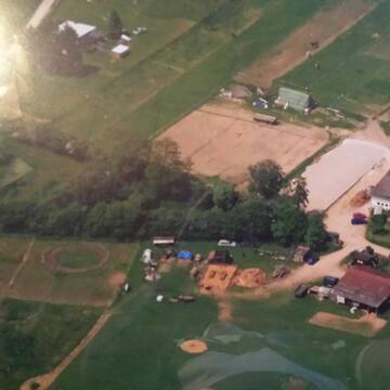
Reitanlage am Rand von Vellmar
Vellmar
Reitanlage Beck
@Reitanlage_Vellmar
Freizeitstall
Geländestrecke
Vermieten
Hunde willkommen
Laufband
Allergikerstall
Hengsthaltung möglich
18 weitere...
aktuell
P
Deprecated: Creation of dynamic property Zend_View_Helper_Ads::$adLink is deprecated in /var/www/stall-frei/htdocs/staging.stall-frei.de/library/Psf/View/Helper/Ads.php on line 108

Heu aus neuer Ernte
Mechtersen
STALL-FREIde Marketing
@STALL-FREI-Marketing
Heulage und Pferdeheu aus der neuen Ernte findest du in unserem Futtermarkt
Leider kein Vorschaubild
Leider kein Vorschaubild
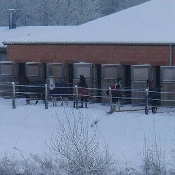
1 Paddockbox frei!
Fuldatal
Nicol-Spohr
@Nicol-Spohr
Pferdeausbildung
Reitlehrer und -unterricht
Vermieten
Paddock
Parkplatz für Pferdeanhänger
Fohlenaufzucht möglich
Zuchtstutenhaltung möglich
11 weitere...
B
Leider kein Vorschaubild
Leider kein Vorschaubild
Neuer Gruppenstall für Pferde - sofort Verfügbar...
Guxhagen-Wollrode
info.Grebenhof
@Grebenhof2000
Freizeitstall
Geländestrecke
Vermieten
Hunde willkommen
Pensions- und Gastboxen
Bewegungsstall
Offenstall
10 weitere...
B
Leider kein Vorschaubild
Leider kein Vorschaubild
Offenstallplätze frei! ab sofort
Göttingen
Lena Bötte
@L.Boette
Freizeitstall
Verpachten
Paddock
Reitplatz (z.B. Dressur, Springen, Reining)
Hufrehe geeignet
5 weitere...
B

Pferdeboxen frei
Nörten-Hardenberg
Dieter Thiele
@DieterThiele
Freizeitstall
Geländestrecke
Vermieten
Hunde willkommen
Paddock
Gnadenbrothof
Notfallboxen
12 weitere...
P


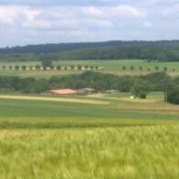
Schöne Reitanlage in Vellmar
Vellmar
Reitverein Vellmar
@Rv-Vellmar
FN-Mitglied
Freizeitstall
Vermieten
Führanlage
Hunde willkommen
bedampftes/gewaschenes Heu
23 weitere...
P
Leider kein Vorschaubild
Leider kein Vorschaubild
Offenstall / Wallache / Allergiker geeignet
Fuldatel-Ihringshausen
Janineernd
@Janineernd
Freizeitstall
Vermieten
Sommerweide
Weide
Allergikerstall
bedampftes/gewaschenes Heu
5 weitere...
B


Offenstall Selbstversorger
Ahnatal
Angela Klapp
@Angela50
Freizeitstall
Geländestrecke
Hunde willkommen
Parkplatz für Pferdeanhänger
Allergikerstall
Gnadenbrothof
Offenstall
9 weitere...
P+


FN- Pensionsbetrieb ***
Hofgeismar
Soodehof-Hombressen
@Soodehof-Hombressen
FN-Mitglied
Geländestrecke
Paddock
Parkplatz für Pferdeanhänger
Allergikerstall
bedampftes/gewaschenes Heu
Außenbox mit Paddock
Außenboxen
22 weitere...
P+


HIT Aktivstall, Vollpension, Offenstall, Reithalle
Moorgrund
Reitanlage-am-Moorgrund
@Reitanlage-am-Moorgrund
Krankenbox
Longierzirkel/Roundpen
Offenstall
HIT-Aktivstall
Biofutter
Vollpension
13 weitere...
P+
Newsletter abonnieren
Melde Dich für unseren Newsletter an und verpasse keine Neuigkeiten!
Deprecated: Creation of dynamic property Zend_View::$pageCount is deprecated in /var/www/stall-frei/htdocs/staging.stall-frei.de/library/vendor/shardj/zf1-future/library/Zend/View/Abstract.php on line 308
Deprecated: Creation of dynamic property Zend_View::$itemCountPerPage is deprecated in /var/www/stall-frei/htdocs/staging.stall-frei.de/library/vendor/shardj/zf1-future/library/Zend/View/Abstract.php on line 308
Deprecated: Creation of dynamic property Zend_View::$first is deprecated in /var/www/stall-frei/htdocs/staging.stall-frei.de/library/vendor/shardj/zf1-future/library/Zend/View/Abstract.php on line 308
Deprecated: Creation of dynamic property Zend_View::$current is deprecated in /var/www/stall-frei/htdocs/staging.stall-frei.de/library/vendor/shardj/zf1-future/library/Zend/View/Abstract.php on line 308
Deprecated: Creation of dynamic property Zend_View::$last is deprecated in /var/www/stall-frei/htdocs/staging.stall-frei.de/library/vendor/shardj/zf1-future/library/Zend/View/Abstract.php on line 308
Deprecated: Creation of dynamic property Zend_View::$previous is deprecated in /var/www/stall-frei/htdocs/staging.stall-frei.de/library/vendor/shardj/zf1-future/library/Zend/View/Abstract.php on line 308
Deprecated: Creation of dynamic property Zend_View::$next is deprecated in /var/www/stall-frei/htdocs/staging.stall-frei.de/library/vendor/shardj/zf1-future/library/Zend/View/Abstract.php on line 308
Deprecated: Creation of dynamic property Zend_View::$pagesInRange is deprecated in /var/www/stall-frei/htdocs/staging.stall-frei.de/library/vendor/shardj/zf1-future/library/Zend/View/Abstract.php on line 308
Deprecated: Creation of dynamic property Zend_View::$firstPageInRange is deprecated in /var/www/stall-frei/htdocs/staging.stall-frei.de/library/vendor/shardj/zf1-future/library/Zend/View/Abstract.php on line 308
Deprecated: Creation of dynamic property Zend_View::$lastPageInRange is deprecated in /var/www/stall-frei/htdocs/staging.stall-frei.de/library/vendor/shardj/zf1-future/library/Zend/View/Abstract.php on line 308
Deprecated: Creation of dynamic property Zend_View::$currentItemCount is deprecated in /var/www/stall-frei/htdocs/staging.stall-frei.de/library/vendor/shardj/zf1-future/library/Zend/View/Abstract.php on line 308
Deprecated: Creation of dynamic property Zend_View::$totalItemCount is deprecated in /var/www/stall-frei/htdocs/staging.stall-frei.de/library/vendor/shardj/zf1-future/library/Zend/View/Abstract.php on line 308
Deprecated: Creation of dynamic property Zend_View::$firstItemNumber is deprecated in /var/www/stall-frei/htdocs/staging.stall-frei.de/library/vendor/shardj/zf1-future/library/Zend/View/Abstract.php on line 308
Deprecated: Creation of dynamic property Zend_View::$lastItemNumber is deprecated in /var/www/stall-frei/htdocs/staging.stall-frei.de/library/vendor/shardj/zf1-future/library/Zend/View/Abstract.php on line 308
Deprecated: Creation of dynamic property Zend_View::$router is deprecated in /var/www/stall-frei/htdocs/staging.stall-frei.de/library/vendor/shardj/zf1-future/library/Zend/View/Abstract.php on line 308
Deprecated: Creation of dynamic property Zend_View::$urlParams is deprecated in /var/www/stall-frei/htdocs/staging.stall-frei.de/library/vendor/shardj/zf1-future/library/Zend/View/Abstract.php on line 308
Deprecated: Creation of dynamic property Zend_View::$showAds is deprecated in /var/www/stall-frei/htdocs/staging.stall-frei.de/library/vendor/shardj/zf1-future/library/Zend/View/Abstract.php on line 308
Deprecated: Creation of dynamic property Zend_View::$objectIds is deprecated in /var/www/stall-frei/htdocs/staging.stall-frei.de/library/vendor/shardj/zf1-future/library/Zend/View/Abstract.php on line 308
Deprecated: Creation of dynamic property Zend_View::$showNavbar is deprecated in /var/www/stall-frei/htdocs/staging.stall-frei.de/library/vendor/shardj/zf1-future/library/Zend/View/Abstract.php on line 308
Deprecated: Creation of dynamic property Zend_View::$showBreadcrumb is deprecated in /var/www/stall-frei/htdocs/staging.stall-frei.de/library/vendor/shardj/zf1-future/library/Zend/View/Abstract.php on line 308
Deprecated: Creation of dynamic property Zend_View::$showFooter is deprecated in /var/www/stall-frei/htdocs/staging.stall-frei.de/library/vendor/shardj/zf1-future/library/Zend/View/Abstract.php on line 308
Deprecated: Creation of dynamic property Zend_View::$showInternalAds is deprecated in /var/www/stall-frei/htdocs/staging.stall-frei.de/library/vendor/shardj/zf1-future/library/Zend/View/Abstract.php on line 308
Deprecated: Creation of dynamic property Zend_View::$blNoContent is deprecated in /var/www/stall-frei/htdocs/staging.stall-frei.de/library/vendor/shardj/zf1-future/library/Zend/View/Abstract.php on line 308
Deprecated: Creation of dynamic property Zend_View::$sMetaDesc is deprecated in /var/www/stall-frei/htdocs/staging.stall-frei.de/library/vendor/shardj/zf1-future/library/Zend/View/Abstract.php on line 308
Deprecated: Creation of dynamic property Zend_View::$useGmaps is deprecated in /var/www/stall-frei/htdocs/staging.stall-frei.de/library/vendor/shardj/zf1-future/library/Zend/View/Abstract.php on line 308
Deprecated: Creation of dynamic property Zend_View::$touches is deprecated in /var/www/stall-frei/htdocs/staging.stall-frei.de/library/vendor/shardj/zf1-future/library/Zend/View/Abstract.php on line 308
Deprecated: Creation of dynamic property Zend_View::$oProject is deprecated in /var/www/stall-frei/htdocs/staging.stall-frei.de/library/vendor/shardj/zf1-future/library/Zend/View/Abstract.php on line 308
Deprecated: Creation of dynamic property Zend_View::$pageHeadline is deprecated in /var/www/stall-frei/htdocs/staging.stall-frei.de/library/vendor/shardj/zf1-future/library/Zend/View/Abstract.php on line 308
Deprecated: Creation of dynamic property Zend_View::$disableLocationField is deprecated in /var/www/stall-frei/htdocs/staging.stall-frei.de/library/vendor/shardj/zf1-future/library/Zend/View/Abstract.php on line 308
Deprecated: Creation of dynamic property Zend_View::$isSearch is deprecated in /var/www/stall-frei/htdocs/staging.stall-frei.de/library/vendor/shardj/zf1-future/library/Zend/View/Abstract.php on line 308
Deprecated: Creation of dynamic property Zend_View::$pageTitle is deprecated in /var/www/stall-frei/htdocs/staging.stall-frei.de/library/vendor/shardj/zf1-future/library/Zend/View/Abstract.php on line 308
Deprecated: Creation of dynamic property Psf_Form_Element_Text::$class is deprecated in /var/www/stall-frei/htdocs/staging.stall-frei.de/library/vendor/shardj/zf1-future/library/Zend/Form/Element.php on line 874
Deprecated: Creation of dynamic property Psf_Form_Element_Text::$size is deprecated in /var/www/stall-frei/htdocs/staging.stall-frei.de/library/vendor/shardj/zf1-future/library/Zend/Form/Element.php on line 874
Deprecated: Creation of dynamic property Psf_Form_Element_Text::$placeholder is deprecated in /var/www/stall-frei/htdocs/staging.stall-frei.de/library/vendor/shardj/zf1-future/library/Zend/Form/Element.php on line 874
Deprecated: Creation of dynamic property Psf_Form_Element_Hidden::$class is deprecated in /var/www/stall-frei/htdocs/staging.stall-frei.de/library/vendor/shardj/zf1-future/library/Zend/Form/Element.php on line 874
Deprecated: Creation of dynamic property Psf_Form_Element_Hidden::$class is deprecated in /var/www/stall-frei/htdocs/staging.stall-frei.de/library/vendor/shardj/zf1-future/library/Zend/Form/Element.php on line 874
Deprecated: Creation of dynamic property Psf_Form_Element_Hidden::$class is deprecated in /var/www/stall-frei/htdocs/staging.stall-frei.de/library/vendor/shardj/zf1-future/library/Zend/Form/Element.php on line 874
Deprecated: Creation of dynamic property Psf_Form_Element_Hidden::$class is deprecated in /var/www/stall-frei/htdocs/staging.stall-frei.de/library/vendor/shardj/zf1-future/library/Zend/Form/Element.php on line 874
Deprecated: Creation of dynamic property Psf_Form_Element_Select::$class is deprecated in /var/www/stall-frei/htdocs/staging.stall-frei.de/library/vendor/shardj/zf1-future/library/Zend/Form/Element.php on line 874
Deprecated: Creation of dynamic property Psf_Form_Element_Select::$class is deprecated in /var/www/stall-frei/htdocs/staging.stall-frei.de/library/vendor/shardj/zf1-future/library/Zend/Form/Element.php on line 874
Deprecated: Creation of dynamic property Psf_Form_Element_Select::$class is deprecated in /var/www/stall-frei/htdocs/staging.stall-frei.de/library/vendor/shardj/zf1-future/library/Zend/Form/Element.php on line 874
Deprecated: Creation of dynamic property Psf_Form_Element_Select::$class is deprecated in /var/www/stall-frei/htdocs/staging.stall-frei.de/library/vendor/shardj/zf1-future/library/Zend/Form/Element.php on line 874
Deprecated: Creation of dynamic property Psf_Form_Element_Text::$class is deprecated in /var/www/stall-frei/htdocs/staging.stall-frei.de/library/vendor/shardj/zf1-future/library/Zend/Form/Element.php on line 874
Deprecated: Creation of dynamic property Psf_Form_Element_Checkbox::$label is deprecated in /var/www/stall-frei/htdocs/staging.stall-frei.de/library/vendor/shardj/zf1-future/library/Zend/Form/Element.php on line 874
Deprecated: Creation of dynamic property Zend_View::$sort is deprecated in /var/www/stall-frei/htdocs/staging.stall-frei.de/library/vendor/shardj/zf1-future/library/Zend/View/Abstract.php on line 308
Deprecated: Creation of dynamic property Zend_View::$searchLocation is deprecated in /var/www/stall-frei/htdocs/staging.stall-frei.de/library/vendor/shardj/zf1-future/library/Zend/View/Abstract.php on line 308
Deprecated: Creation of dynamic property Zend_View::$locationHint is deprecated in /var/www/stall-frei/htdocs/staging.stall-frei.de/library/vendor/shardj/zf1-future/library/Zend/View/Abstract.php on line 308
Psf_GeoCoder_Abstract::getLocation: Hörne Get Location CachedOrLive
Psf_GeoCoder_Abstract::getCachedOrLive: Hörne
Psf_GeoCoder_Abstract::convertLocationResult
{"documentation":"https:\/\/opencagedata.com\/api","licenses":[{"name":"see attribution guide","url":"https:\/\/opencagedata.com\/credits"}],"results":[{"bounds":{"northeast":{"lat":51.2494429,"lng":10.0281548},"southwest":{"lat":51.2493429,"lng":10.0280548}},"components":{"ISO_3166-1_alpha-2":"DE","ISO_3166-1_alpha-3":"DEU","ISO_3166-2":["DE-HE"],"_category":"natural\/water","_normalized_city":"Motzenrode","_type":"peak","continent":"Europe","country":"Deutschland","country_code":"de","county":"Werra-Mei\u00dfner-Kreis","municipality":"Meinhard","peak":"H\u00f6rne","political_union":"European Union","state":"Hessen","state_code":"HE","village":"Motzenrode"},"confidence":9,"formatted":"H\u00f6rne, Motzenrode, Hessen, Deutschland","geometry":{"lat":51.2493929,"lng":10.0281048}},{"bounds":{"northeast":{"lat":49.0876959,"lng":13.0989358},"southwest":{"lat":47.3933482,"lng":10.7156838}},"components":{"ISO_3166-1_alpha-2":"DE","ISO_3166-1_alpha-3":"DEU","_category":"government","_type":"administrative","administrative":"Oberbayern","continent":"Europe","country":"Deutschland","country_code":"de","political_union":"European Union"},"confidence":1,"formatted":"Oberbayern, Deutschland","geometry":{"lat":48.2405833,"lng":11.9699152}},{"bounds":{"northeast":{"lat":52.2650868,"lng":8.0283151},"southwest":{"lat":52.2250868,"lng":7.9883151}},"components":{"ISO_3166-1_alpha-2":"DE","ISO_3166-1_alpha-3":"DEU","ISO_3166-2":["DE-NI"],"_category":"place","_normalized_city":"Osnabr\u00fcck","_type":"hamlet","city":"Osnabr\u00fcck","continent":"Europe","country":"Deutschland","country_code":"de","hamlet":"H\u00f6rne","political_union":"European Union","postcode":"49082","state":"Niedersachsen","state_code":"NI","suburb":"Sutthausen"},"confidence":7,"formatted":"H\u00f6rne, 49082 Osnabr\u00fcck, Deutschland","geometry":{"lat":52.2450868,"lng":8.0083151}},{"bounds":{"northeast":{"lat":53.8426117,"lng":9.1012219},"southwest":{"lat":53.8026117,"lng":9.0612219}},"components":{"ISO_3166-1_alpha-2":"DE","ISO_3166-1_alpha-3":"DEU","ISO_3166-2":["DE-NI"],"_category":"place","_normalized_city":"Balje","_type":"village","city":"Balje","continent":"Europe","country":"Deutschland","country_code":"de","county":"Landkreis Stade","municipality":"Samtgemeinde Nordkehdingen","political_union":"European Union","postcode":"21730","state":"Niedersachsen","state_code":"NI","village":"H\u00f6rne"},"confidence":7,"formatted":"21730 H\u00f6rne, Deutschland","geometry":{"lat":53.8226117,"lng":9.0812219}},{"bounds":{"northeast":{"lat":51.6965709,"lng":7.657064},"southwest":{"lat":51.648151,"lng":7.6311393}},"components":{"ISO_3166-1_alpha-2":"DE","ISO_3166-1_alpha-3":"DEU","ISO_3166-2":["DE-NW"],"_category":"natural\/water","_normalized_city":"Werne","_type":"river","continent":"Europe","country":"Deutschland","country_code":"de","county":"Kreis Unna","political_union":"European Union","river":"Horne","state":"Nordrhein-Westfalen","state_code":"NW","town":"Werne"},"confidence":7,"formatted":"Horne, Werne, Nordrhein-Westfalen, Deutschland","geometry":{"lat":51.6743964,"lng":7.6373892}},{"components":{"ISO_3166-1_alpha-2":"FR","ISO_3166-1_alpha-3":"FRA","ISO_3166-2":["FR-BRE","FR-29"],"_category":"road","_normalized_city":"Landerneau","_type":"road","city":"Landerneau","continent":"Europe","country":"France","country_code":"fr","county":"Finist\u00e8re","local_authority":"Communaut\u00e9 d'agglom\u00e9ration du pays de Landerneau-Daoulas","political_union":"European Union","postcode":"29800","road":"rue de l'Horn","state":"Bretagne","state_code":"BRE"},"confidence":3,"formatted":"rue de l'Horn, 29800 Landerneau, France","geometry":{"lat":48.449118,"lng":-4.27921}},{"components":{"ISO_3166-1_alpha-2":"FR","ISO_3166-1_alpha-3":"FRA","ISO_3166-2":["FR-GES","FR-10"],"_category":"road","_normalized_city":"Plessis-Barbuise","_type":"road","city":"Plessis-Barbuise","continent":"Europe","country":"France","country_code":"fr","county":"Aube","local_authority":"Communaut\u00e9 de communes du Nogentais","political_union":"European Union","postcode":"10400","road":"Chemin de la Horne","state":"Grand Est","state_code":"GES"},"confidence":3,"formatted":"Chemin de la Horne, 10400 Plessis-Barbuise, France","geometry":{"lat":48.570216,"lng":3.574631}},{"components":{"ISO_3166-1_alpha-2":"FR","ISO_3166-1_alpha-3":"FRA","ISO_3166-2":["FR-GES","FR-88"],"_category":"road","_normalized_city":"Pierrepont-sur-l'Arent\u00e8le","_type":"road","city":"Pierrepont-sur-l'Arent\u00e8le","continent":"Europe","country":"France","country_code":"fr","county":"Vosges","local_authority":"Communaut\u00e9 de communes de Bruy\u00e8res, Vallons des Vosges","political_union":"European Union","postcode":"88600","road":"Rue de la Horne","state":"Grand Est","state_code":"GES"},"confidence":3,"formatted":"Rue de la Horne, 88600 Pierrepont-sur-l'Arent\u00e8le, France","geometry":{"lat":48.272165,"lng":6.66}},{"components":{"ISO_3166-1_alpha-2":"FR","ISO_3166-1_alpha-3":"FRA","ISO_3166-2":["FR-GES","FR-57"],"_category":"road","_normalized_city":"Rolbing","_type":"road","city":"Rolbing","continent":"Europe","country":"France","country_code":"fr","county":"Moselle","local_authority":"Communaut\u00e9 de communes du Pays de Bitche","political_union":"European Union","postcode":"57720","road":"Rue de la Horn","state":"Grand Est","state_code":"GES"},"confidence":3,"formatted":"Rue de la Horn, 57720 Rolbing, France","geometry":{"lat":49.179811,"lng":7.434545}},{"components":{"ISO_3166-1_alpha-2":"FR","ISO_3166-1_alpha-3":"FRA","ISO_3166-2":["FR-GES","FR-6AE","FR-68"],"_category":"road","_normalized_city":"Landser","_type":"road","city":"Landser","continent":"Europe","country":"France","country_code":"fr","county":"Haut-Rhin","local_authority":"Saint-Louis Agglom\u00e9ration","political_union":"European Union","postcode":"68440","road":"Allee de l\u2019Orne","state":"Grand Est","state_code":"GES"},"confidence":3,"formatted":"Allee de l\u2019Orne, 68440 Landser, France","geometry":{"lat":47.686328,"lng":7.390208}}],"status":{"code":200,"message":"OK"},"stay_informed":{"blog":"https:\/\/blog.opencagedata.com","mastodon":"https:\/\/en.osm.town\/@opencage"},"thanks":"For using an OpenCage API","timestamp":{"created_http":"Sat, 07 Feb 2026 22:49:05 GMT","created_unix":1770504545},"total_results":10}Array
(
[0] => stdClass Object
(
[bounds] => stdClass Object
(
[northeast] => stdClass Object
(
[lat] => 51.2494429
[lng] => 10.0281548
)
[southwest] => stdClass Object
(
[lat] => 51.2493429
[lng] => 10.0280548
)
)
[components] => stdClass Object
(
[ISO_3166-1_alpha-2] => DE
[ISO_3166-1_alpha-3] => DEU
[ISO_3166-2] => Array
(
[0] => DE-HE
)
[_category] => natural/water
[_normalized_city] => Motzenrode
[_type] => peak
[continent] => Europe
[country] => Deutschland
[country_code] => de
[county] => Werra-Meißner-Kreis
[municipality] => Meinhard
[peak] => Hörne
[political_union] => European Union
[state] => Hessen
[state_code] => HE
[village] => Motzenrode
)
[confidence] => 9
[formatted] => Hörne, Motzenrode, Hessen, Deutschland
[geometry] => stdClass Object
(
[lat] => 51.2493929
[lng] => 10.0281048
)
)
[1] => stdClass Object
(
[bounds] => stdClass Object
(
[northeast] => stdClass Object
(
[lat] => 49.0876959
[lng] => 13.0989358
)
[southwest] => stdClass Object
(
[lat] => 47.3933482
[lng] => 10.7156838
)
)
[components] => stdClass Object
(
[ISO_3166-1_alpha-2] => DE
[ISO_3166-1_alpha-3] => DEU
[_category] => government
[_type] => administrative
[administrative] => Oberbayern
[continent] => Europe
[country] => Deutschland
[country_code] => de
[political_union] => European Union
)
[confidence] => 1
[formatted] => Oberbayern, Deutschland
[geometry] => stdClass Object
(
[lat] => 48.2405833
[lng] => 11.9699152
)
)
[2] => stdClass Object
(
[bounds] => stdClass Object
(
[northeast] => stdClass Object
(
[lat] => 52.2650868
[lng] => 8.0283151
)
[southwest] => stdClass Object
(
[lat] => 52.2250868
[lng] => 7.9883151
)
)
[components] => stdClass Object
(
[ISO_3166-1_alpha-2] => DE
[ISO_3166-1_alpha-3] => DEU
[ISO_3166-2] => Array
(
[0] => DE-NI
)
[_category] => place
[_normalized_city] => Osnabrück
[_type] => hamlet
[city] => Osnabrück
[continent] => Europe
[country] => Deutschland
[country_code] => de
[hamlet] => Hörne
[political_union] => European Union
[postcode] => 49082
[state] => Niedersachsen
[state_code] => NI
[suburb] => Sutthausen
)
[confidence] => 7
[formatted] => Hörne, 49082 Osnabrück, Deutschland
[geometry] => stdClass Object
(
[lat] => 52.2450868
[lng] => 8.0083151
)
)
[3] => stdClass Object
(
[bounds] => stdClass Object
(
[northeast] => stdClass Object
(
[lat] => 53.8426117
[lng] => 9.1012219
)
[southwest] => stdClass Object
(
[lat] => 53.8026117
[lng] => 9.0612219
)
)
[components] => stdClass Object
(
[ISO_3166-1_alpha-2] => DE
[ISO_3166-1_alpha-3] => DEU
[ISO_3166-2] => Array
(
[0] => DE-NI
)
[_category] => place
[_normalized_city] => Balje
[_type] => village
[city] => Balje
[continent] => Europe
[country] => Deutschland
[country_code] => de
[county] => Landkreis Stade
[municipality] => Samtgemeinde Nordkehdingen
[political_union] => European Union
[postcode] => 21730
[state] => Niedersachsen
[state_code] => NI
[village] => Hörne
)
[confidence] => 7
[formatted] => 21730 Hörne, Deutschland
[geometry] => stdClass Object
(
[lat] => 53.8226117
[lng] => 9.0812219
)
)
[4] => stdClass Object
(
[bounds] => stdClass Object
(
[northeast] => stdClass Object
(
[lat] => 51.6965709
[lng] => 7.657064
)
[southwest] => stdClass Object
(
[lat] => 51.648151
[lng] => 7.6311393
)
)
[components] => stdClass Object
(
[ISO_3166-1_alpha-2] => DE
[ISO_3166-1_alpha-3] => DEU
[ISO_3166-2] => Array
(
[0] => DE-NW
)
[_category] => natural/water
[_normalized_city] => Werne
[_type] => river
[continent] => Europe
[country] => Deutschland
[country_code] => de
[county] => Kreis Unna
[political_union] => European Union
[river] => Horne
[state] => Nordrhein-Westfalen
[state_code] => NW
[town] => Werne
)
[confidence] => 7
[formatted] => Horne, Werne, Nordrhein-Westfalen, Deutschland
[geometry] => stdClass Object
(
[lat] => 51.6743964
[lng] => 7.6373892
)
)
[5] => stdClass Object
(
[components] => stdClass Object
(
[ISO_3166-1_alpha-2] => FR
[ISO_3166-1_alpha-3] => FRA
[ISO_3166-2] => Array
(
[0] => FR-BRE
[1] => FR-29
)
[_category] => road
[_normalized_city] => Landerneau
[_type] => road
[city] => Landerneau
[continent] => Europe
[country] => France
[country_code] => fr
[county] => Finistère
[local_authority] => Communauté d'agglomération du pays de Landerneau-Daoulas
[political_union] => European Union
[postcode] => 29800
[road] => rue de l'Horn
[state] => Bretagne
[state_code] => BRE
)
[confidence] => 3
[formatted] => rue de l'Horn, 29800 Landerneau, France
[geometry] => stdClass Object
(
[lat] => 48.449118
[lng] => -4.27921
)
)
[6] => stdClass Object
(
[components] => stdClass Object
(
[ISO_3166-1_alpha-2] => FR
[ISO_3166-1_alpha-3] => FRA
[ISO_3166-2] => Array
(
[0] => FR-GES
[1] => FR-10
)
[_category] => road
[_normalized_city] => Plessis-Barbuise
[_type] => road
[city] => Plessis-Barbuise
[continent] => Europe
[country] => France
[country_code] => fr
[county] => Aube
[local_authority] => Communauté de communes du Nogentais
[political_union] => European Union
[postcode] => 10400
[road] => Chemin de la Horne
[state] => Grand Est
[state_code] => GES
)
[confidence] => 3
[formatted] => Chemin de la Horne, 10400 Plessis-Barbuise, France
[geometry] => stdClass Object
(
[lat] => 48.570216
[lng] => 3.574631
)
)
[7] => stdClass Object
(
[components] => stdClass Object
(
[ISO_3166-1_alpha-2] => FR
[ISO_3166-1_alpha-3] => FRA
[ISO_3166-2] => Array
(
[0] => FR-GES
[1] => FR-88
)
[_category] => road
[_normalized_city] => Pierrepont-sur-l'Arentèle
[_type] => road
[city] => Pierrepont-sur-l'Arentèle
[continent] => Europe
[country] => France
[country_code] => fr
[county] => Vosges
[local_authority] => Communauté de communes de Bruyères, Vallons des Vosges
[political_union] => European Union
[postcode] => 88600
[road] => Rue de la Horne
[state] => Grand Est
[state_code] => GES
)
[confidence] => 3
[formatted] => Rue de la Horne, 88600 Pierrepont-sur-l'Arentèle, France
[geometry] => stdClass Object
(
[lat] => 48.272165
[lng] => 6.66
)
)
[8] => stdClass Object
(
[components] => stdClass Object
(
[ISO_3166-1_alpha-2] => FR
[ISO_3166-1_alpha-3] => FRA
[ISO_3166-2] => Array
(
[0] => FR-GES
[1] => FR-57
)
[_category] => road
[_normalized_city] => Rolbing
[_type] => road
[city] => Rolbing
[continent] => Europe
[country] => France
[country_code] => fr
[county] => Moselle
[local_authority] => Communauté de communes du Pays de Bitche
[political_union] => European Union
[postcode] => 57720
[road] => Rue de la Horn
[state] => Grand Est
[state_code] => GES
)
[confidence] => 3
[formatted] => Rue de la Horn, 57720 Rolbing, France
[geometry] => stdClass Object
(
[lat] => 49.179811
[lng] => 7.434545
)
)
[9] => stdClass Object
(
[components] => stdClass Object
(
[ISO_3166-1_alpha-2] => FR
[ISO_3166-1_alpha-3] => FRA
[ISO_3166-2] => Array
(
[0] => FR-GES
[1] => FR-6AE
[2] => FR-68
)
[_category] => road
[_normalized_city] => Landser
[_type] => road
[city] => Landser
[continent] => Europe
[country] => France
[country_code] => fr
[county] => Haut-Rhin
[local_authority] => Saint-Louis Agglomération
[political_union] => European Union
[postcode] => 68440
[road] => Allee de l’Orne
[state] => Grand Est
[state_code] => GES
)
[confidence] => 3
[formatted] => Allee de l’Orne, 68440 Landser, France
[geometry] => stdClass Object
(
[lat] => 47.686328
[lng] => 7.390208
)
)
)
Psf_GeoCoder_OpenCageData::getKeyMap: 0
stdClass Object
(
    [bounds] => stdClass Object
        (
            [northeast] => stdClass Object
                (
                    [lat] => 51.2494429
                    [lng] => 10.0281548
                )

            [southwest] => stdClass Object
                (
                    [lat] => 51.2493429
                    [lng] => 10.0280548
                )

        )

    [components] => stdClass Object
        (
            [ISO_3166-1_alpha-2] => DE
            [ISO_3166-1_alpha-3] => DEU
            [ISO_3166-2] => Array
                (
                    [0] => DE-HE
                )

            [_category] => natural/water
            [_normalized_city] => Motzenrode
            [_type] => peak
            [continent] => Europe
            [country] => Deutschland
            [country_code] => de
            [county] => Werra-Meißner-Kreis
            [municipality] => Meinhard
            [peak] => Hörne
            [political_union] => European Union
            [state] => Hessen
            [state_code] => HE
            [village] => Motzenrode
        )

    [confidence] => 9
    [formatted] => Hörne, Motzenrode, Hessen, Deutschland
    [geometry] => stdClass Object
        (
            [lat] => 51.2493929
            [lng] => 10.0281048
        )

)
Psf_GeoCoder_OpenCageData::getCounty: Werra-Meißner-Kreis
Psf_GeoCoder_OpenCageData::addMissingData REFETCH!
Array
(
    [address] => Hörne, Motzenrode, Hessen, Deutschland
    [type] => peak
    [street] =>
    [city] => Motzenrode
    [county] => Werra-Meißner-Kreis
    [state] => Hessen
    [zip] =>
    [country] => Deutschland
    [suburb] =>
    [countrycode] => de
    [latitude] => 51.2493929
    [longitude] => 10.0281048
    [accuracy] => 1
    [confidence] => 9
    [bounds] => stdClass Object
        (
            [northeast] => stdClass Object
                (
                    [lat] => 51.2494429
                    [lng] => 10.0281548
                )

            [southwest] => stdClass Object
                (
                    [lat] => 51.2493429
                    [lng] => 10.0280548
                )

        )

)
reformat!
Array
(
    [address] => Hörne, Motzenrode, Hessen, Deutschland
    [type] => peak
    [street] =>
    [city] => Motzenrode
    [county] => Werra-Meißner-Kreis
    [state] => Hessen
    [zip] =>
    [country] => Deutschland
    [suburb] =>
    [countrycode] => de
    [latitude] => 51.2493929
    [longitude] => 10.0281048
    [accuracy] => 1
    [confidence] => 9
    [bounds] => stdClass Object
        (
            [northeast] => stdClass Object
                (
                    [lat] => 51.2494429
                    [lng] => 10.0281548
                )

            [southwest] => stdClass Object
                (
                    [lat] => 51.2493429
                    [lng] => 10.0280548
                )

        )

    [place] => Motzenrode, Hessen
    [hash] => 365d3eabf1c7de8fd8828e8cb1715daa
)
Psf_GeoCoder_OpenCageData::getKeyMap: 1
stdClass Object
(
    [bounds] => stdClass Object
        (
            [northeast] => stdClass Object
                (
                    [lat] => 49.0876959
                    [lng] => 13.0989358
                )

            [southwest] => stdClass Object
                (
                    [lat] => 47.3933482
                    [lng] => 10.7156838
                )

        )

    [components] => stdClass Object
        (
            [ISO_3166-1_alpha-2] => DE
            [ISO_3166-1_alpha-3] => DEU
            [_category] => government
            [_type] => administrative
            [administrative] => Oberbayern
            [continent] => Europe
            [country] => Deutschland
            [country_code] => de
            [political_union] => European Union
        )

    [confidence] => 1
    [formatted] => Oberbayern, Deutschland
    [geometry] => stdClass Object
        (
            [lat] => 48.2405833
            [lng] => 11.9699152
        )

)
Psf_GeoCoder_OpenCageData::getCounty:
Psf_GeoCoder_OpenCageData::addMissingData REFETCH!
Array
(
    [address] => Oberbayern, Deutschland
    [type] => administrative
    [street] =>
    [city] =>
    [county] =>
    [state] =>
    [zip] =>
    [country] => Deutschland
    [suburb] =>
    [countrycode] => de
    [latitude] => 48.2405833
    [longitude] => 11.9699152
    [accuracy] => 1
    [confidence] => 1
    [bounds] => stdClass Object
        (
            [northeast] => stdClass Object
                (
                    [lat] => 49.0876959
                    [lng] => 13.0989358
                )

            [southwest] => stdClass Object
                (
                    [lat] => 47.3933482
                    [lng] => 10.7156838
                )

        )

)
reformat!
Array
(
    [address] => Oberbayern, Deutschland
    [type] => administrative
    [street] =>
    [city] =>
    [county] =>
    [state] =>
    [zip] =>
    [country] => Deutschland
    [suburb] =>
    [countrycode] => de
    [latitude] => 48.2405833
    [longitude] => 11.9699152
    [accuracy] => 1
    [confidence] => 1
    [bounds] => stdClass Object
        (
            [northeast] => stdClass Object
                (
                    [lat] => 49.0876959
                    [lng] => 13.0989358
                )

            [southwest] => stdClass Object
                (
                    [lat] => 47.3933482
                    [lng] => 10.7156838
                )

        )

    [place] => Oberbayern, Deutschland
    [hash] => efaeee6156991641afcbae9d682f9c89
)
Psf_GeoCoder_OpenCageData::getKeyMap: 2
stdClass Object
(
    [bounds] => stdClass Object
        (
            [northeast] => stdClass Object
                (
                    [lat] => 52.2650868
                    [lng] => 8.0283151
                )

            [southwest] => stdClass Object
                (
                    [lat] => 52.2250868
                    [lng] => 7.9883151
                )

        )

    [components] => stdClass Object
        (
            [ISO_3166-1_alpha-2] => DE
            [ISO_3166-1_alpha-3] => DEU
            [ISO_3166-2] => Array
                (
                    [0] => DE-NI
                )

            [_category] => place
            [_normalized_city] => Osnabrück
            [_type] => hamlet
            [city] => Osnabrück
            [continent] => Europe
            [country] => Deutschland
            [country_code] => de
            [hamlet] => Hörne
            [political_union] => European Union
            [postcode] => 49082
            [state] => Niedersachsen
            [state_code] => NI
            [suburb] => Sutthausen
        )

    [confidence] => 7
    [formatted] => Hörne, 49082 Osnabrück, Deutschland
    [geometry] => stdClass Object
        (
            [lat] => 52.2450868
            [lng] => 8.0083151
        )

)
Psf_GeoCoder_OpenCageData::getCounty: Osnabrück
Psf_GeoCoder_OpenCageData::addMissingData REFETCH!
Array
(
    [address] => Hörne, 49082 Osnabrück, Deutschland
    [type] => hamlet
    [street] => Hörne
    [city] => Sutthausen
    [county] => Osnabrück
    [state] => Niedersachsen
    [zip] => 49082
    [country] => Deutschland
    [suburb] => Sutthausen
    [countrycode] => de
    [latitude] => 52.2450868
    [longitude] => 8.0083151
    [accuracy] => 1
    [confidence] => 7
    [bounds] => stdClass Object
        (
            [northeast] => stdClass Object
                (
                    [lat] => 52.2650868
                    [lng] => 8.0283151
                )

            [southwest] => stdClass Object
                (
                    [lat] => 52.2250868
                    [lng] => 7.9883151
                )

        )

)
reformat!
Array
(
    [address] => Hörne, 49082 Sutthausen
    [type] => hamlet
    [street] => Hörne
    [city] => Sutthausen
    [county] => Osnabrück
    [state] => Niedersachsen
    [zip] => 49082
    [country] => Deutschland
    [suburb] => Sutthausen
    [countrycode] => de
    [latitude] => 52.2450868
    [longitude] => 8.0083151
    [accuracy] => 1
    [confidence] => 7
    [bounds] => stdClass Object
        (
            [northeast] => stdClass Object
                (
                    [lat] => 52.2650868
                    [lng] => 8.0283151
                )

            [southwest] => stdClass Object
                (
                    [lat] => 52.2250868
                    [lng] => 7.9883151
                )

        )

    [place] => Hörne, 49082 Sutthausen, Niedersachsen
    [hash] => 9925c3da0c020ed3fc17a5aaf9307fb8
)
Psf_GeoCoder_OpenCageData::getKeyMap: 3
stdClass Object
(
    [bounds] => stdClass Object
        (
            [northeast] => stdClass Object
                (
                    [lat] => 53.8426117
                    [lng] => 9.1012219
                )

            [southwest] => stdClass Object
                (
                    [lat] => 53.8026117
                    [lng] => 9.0612219
                )

        )

    [components] => stdClass Object
        (
            [ISO_3166-1_alpha-2] => DE
            [ISO_3166-1_alpha-3] => DEU
            [ISO_3166-2] => Array
                (
                    [0] => DE-NI
                )

            [_category] => place
            [_normalized_city] => Balje
            [_type] => village
            [city] => Balje
            [continent] => Europe
            [country] => Deutschland
            [country_code] => de
            [county] => Landkreis Stade
            [municipality] => Samtgemeinde Nordkehdingen
            [political_union] => European Union
            [postcode] => 21730
            [state] => Niedersachsen
            [state_code] => NI
            [village] => Hörne
        )

    [confidence] => 7
    [formatted] => 21730 Hörne, Deutschland
    [geometry] => stdClass Object
        (
            [lat] => 53.8226117
            [lng] => 9.0812219
        )

)
Psf_GeoCoder_OpenCageData::getCounty: Stade
Psf_GeoCoder_OpenCageData::addMissingData REFETCH!
Array
(
    [address] => 21730 Hörne, Deutschland
    [type] => village
    [street] =>
    [city] => Hörne
    [county] => Stade
    [state] => Niedersachsen
    [zip] => 21730
    [country] => Deutschland
    [suburb] =>
    [countrycode] => de
    [latitude] => 53.8226117
    [longitude] => 9.0812219
    [accuracy] => 1
    [confidence] => 7
    [bounds] => stdClass Object
        (
            [northeast] => stdClass Object
                (
                    [lat] => 53.8426117
                    [lng] => 9.1012219
                )

            [southwest] => stdClass Object
                (
                    [lat] => 53.8026117
                    [lng] => 9.0612219
                )

        )

)
reformat!
Array
(
    [address] => 21730 Hörne, Deutschland
    [type] => village
    [street] =>
    [city] => Hörne
    [county] => Stade
    [state] => Niedersachsen
    [zip] => 21730
    [country] => Deutschland
    [suburb] =>
    [countrycode] => de
    [latitude] => 53.8226117
    [longitude] => 9.0812219
    [accuracy] => 1
    [confidence] => 7
    [bounds] => stdClass Object
        (
            [northeast] => stdClass Object
                (
                    [lat] => 53.8426117
                    [lng] => 9.1012219
                )

            [southwest] => stdClass Object
                (
                    [lat] => 53.8026117
                    [lng] => 9.0612219
                )

        )

    [place] => 21730 Hörne, Niedersachsen
    [hash] => 6c1197f43ae6cd92fd346846bdbe7324
)
Psf_GeoCoder_OpenCageData::getKeyMap: 4
stdClass Object
(
    [bounds] => stdClass Object
        (
            [northeast] => stdClass Object
                (
                    [lat] => 51.6965709
                    [lng] => 7.657064
                )

            [southwest] => stdClass Object
                (
                    [lat] => 51.648151
                    [lng] => 7.6311393
                )

        )

    [components] => stdClass Object
        (
            [ISO_3166-1_alpha-2] => DE
            [ISO_3166-1_alpha-3] => DEU
            [ISO_3166-2] => Array
                (
                    [0] => DE-NW
                )

            [_category] => natural/water
            [_normalized_city] => Werne
            [_type] => river
            [continent] => Europe
            [country] => Deutschland
            [country_code] => de
            [county] => Kreis Unna
            [political_union] => European Union
            [river] => Horne
            [state] => Nordrhein-Westfalen
            [state_code] => NW
            [town] => Werne
        )

    [confidence] => 7
    [formatted] => Horne, Werne, Nordrhein-Westfalen, Deutschland
    [geometry] => stdClass Object
        (
            [lat] => 51.6743964
            [lng] => 7.6373892
        )

)
Psf_GeoCoder_OpenCageData::getCounty: Unna
Psf_GeoCoder_OpenCageData::addMissingData REFETCH!
Array
(
    [address] => Horne, Werne, Nordrhein-Westfalen, Deutschland
    [type] => river
    [street] =>
    [city] => Werne
    [county] => Unna
    [state] => Nordrhein-Westfalen
    [zip] =>
    [country] => Deutschland
    [suburb] =>
    [countrycode] => de
    [latitude] => 51.6743964
    [longitude] => 7.6373892
    [accuracy] => 1
    [confidence] => 7
    [bounds] => stdClass Object
        (
            [northeast] => stdClass Object
                (
                    [lat] => 51.6965709
                    [lng] => 7.657064
                )

            [southwest] => stdClass Object
                (
                    [lat] => 51.648151
                    [lng] => 7.6311393
                )

        )

)
reformat!
Array
(
    [address] => Horne, Werne, Nordrhein-Westfalen, Deutschland
    [type] => river
    [street] =>
    [city] => Werne
    [county] => Unna
    [state] => Nordrhein-Westfalen
    [zip] =>
    [country] => Deutschland
    [suburb] =>
    [countrycode] => de
    [latitude] => 51.6743964
    [longitude] => 7.6373892
    [accuracy] => 1
    [confidence] => 7
    [bounds] => stdClass Object
        (
            [northeast] => stdClass Object
                (
                    [lat] => 51.6965709
                    [lng] => 7.657064
                )

            [southwest] => stdClass Object
                (
                    [lat] => 51.648151
                    [lng] => 7.6311393
                )

        )

    [place] => Werne, Nordrhein-Westfalen
    [hash] => 443a2115454dce876192e5d5c08688d8
)
Psf_GeoCoder_OpenCageData::getKeyMap: 5
stdClass Object
(
    [components] => stdClass Object
        (
            [ISO_3166-1_alpha-2] => FR
            [ISO_3166-1_alpha-3] => FRA
            [ISO_3166-2] => Array
                (
                    [0] => FR-BRE
                    [1] => FR-29
                )

            [_category] => road
            [_normalized_city] => Landerneau
            [_type] => road
            [city] => Landerneau
            [continent] => Europe
            [country] => France
            [country_code] => fr
            [county] => Finistère
            [local_authority] => Communauté d'agglomération du pays de Landerneau-Daoulas
            [political_union] => European Union
            [postcode] => 29800
            [road] => rue de l'Horn
            [state] => Bretagne
            [state_code] => BRE
        )

    [confidence] => 3
    [formatted] => rue de l'Horn, 29800 Landerneau, France
    [geometry] => stdClass Object
        (
            [lat] => 48.449118
            [lng] => -4.27921
        )

)
Psf_GeoCoder_OpenCageData::getCounty: Finistère
Psf_GeoCoder_OpenCageData::addMissingData REFETCH!
Array
(
    [address] => rue de l'Horn, 29800 Landerneau, France
    [type] => road
    [street] => rue de l'Horn
    [city] => Landerneau
    [county] => Finistère
    [state] => Bretagne
    [zip] => 29800
    [country] => France
    [suburb] =>
    [countrycode] => fr
    [latitude] => 48.449118
    [longitude] => -4.27921
    [accuracy] => 1
    [confidence] => 3
    [bounds] =>
)
reformat!
Array
(
    [address] => rue de l'Horn, 29800 Landerneau, France
    [type] => road
    [street] => rue de l'Horn
    [city] => Landerneau
    [county] => Finistère
    [state] => Bretagne
    [zip] => 29800
    [country] => France
    [suburb] =>
    [countrycode] => fr
    [latitude] => 48.449118
    [longitude] => -4.27921
    [accuracy] => 1
    [confidence] => 3
    [bounds] =>
    [place] => rue de l'Horn, 29800 Landerneau, Bretagne
    [hash] => fdd509ae31d4f808432c789e41ba272d
)
Psf_GeoCoder_OpenCageData::getKeyMap: 6
stdClass Object
(
    [components] => stdClass Object
        (
            [ISO_3166-1_alpha-2] => FR
            [ISO_3166-1_alpha-3] => FRA
            [ISO_3166-2] => Array
                (
                    [0] => FR-GES
                    [1] => FR-10
                )

            [_category] => road
            [_normalized_city] => Plessis-Barbuise
            [_type] => road
            [city] => Plessis-Barbuise
            [continent] => Europe
            [country] => France
            [country_code] => fr
            [county] => Aube
            [local_authority] => Communauté de communes du Nogentais
            [political_union] => European Union
            [postcode] => 10400
            [road] => Chemin de la Horne
            [state] => Grand Est
            [state_code] => GES
        )

    [confidence] => 3
    [formatted] => Chemin de la Horne, 10400 Plessis-Barbuise, France
    [geometry] => stdClass Object
        (
            [lat] => 48.570216
            [lng] => 3.574631
        )

)
Psf_GeoCoder_OpenCageData::getCounty: Aube
Psf_GeoCoder_OpenCageData::addMissingData REFETCH!
Array
(
    [address] => Chemin de la Horne, 10400 Plessis-Barbuise, France
    [type] => road
    [street] => Chemin de la Horne
    [city] => Plessis-Barbuise
    [county] => Aube
    [state] => Grand Est
    [zip] => 10400
    [country] => France
    [suburb] =>
    [countrycode] => fr
    [latitude] => 48.570216
    [longitude] => 3.574631
    [accuracy] => 1
    [confidence] => 3
    [bounds] =>
)
reformat!
Array
(
    [address] => Chemin de la Horne, 10400 Plessis-Barbuise, France
    [type] => road
    [street] => Chemin de la Horne
    [city] => Plessis-Barbuise
    [county] => Aube
    [state] => Grand Est
    [zip] => 10400
    [country] => France
    [suburb] =>
    [countrycode] => fr
    [latitude] => 48.570216
    [longitude] => 3.574631
    [accuracy] => 1
    [confidence] => 3
    [bounds] =>
    [place] => Chemin de la Horne, 10400 Plessis-Barbuise, Grand Est
    [hash] => c291825f62082e0cc5f276127d031273
)
Psf_GeoCoder_OpenCageData::getKeyMap: 7
stdClass Object
(
    [components] => stdClass Object
        (
            [ISO_3166-1_alpha-2] => FR
            [ISO_3166-1_alpha-3] => FRA
            [ISO_3166-2] => Array
                (
                    [0] => FR-GES
                    [1] => FR-88
                )

            [_category] => road
            [_normalized_city] => Pierrepont-sur-l'Arentèle
            [_type] => road
            [city] => Pierrepont-sur-l'Arentèle
            [continent] => Europe
            [country] => France
            [country_code] => fr
            [county] => Vosges
            [local_authority] => Communauté de communes de Bruyères, Vallons des Vosges
            [political_union] => European Union
            [postcode] => 88600
            [road] => Rue de la Horne
            [state] => Grand Est
            [state_code] => GES
        )

    [confidence] => 3
    [formatted] => Rue de la Horne, 88600 Pierrepont-sur-l'Arentèle, France
    [geometry] => stdClass Object
        (
            [lat] => 48.272165
            [lng] => 6.66
        )

)
Psf_GeoCoder_OpenCageData::getCounty: Vosges
Psf_GeoCoder_OpenCageData::addMissingData REFETCH!
Array
(
    [address] => Rue de la Horne, 88600 Pierrepont-sur-l'Arentèle, France
    [type] => road
    [street] => Rue de la Horne
    [city] => Pierrepont-sur-l'Arentèle
    [county] => Vosges
    [state] => Grand Est
    [zip] => 88600
    [country] => France
    [suburb] =>
    [countrycode] => fr
    [latitude] => 48.272165
    [longitude] => 6.66
    [accuracy] => 1
    [confidence] => 3
    [bounds] =>
)
reformat!
Array
(
    [address] => Rue de la Horne, 88600 Pierrepont-sur-l'Arentèle, France
    [type] => road
    [street] => Rue de la Horne
    [city] => Pierrepont-sur-l'Arentèle
    [county] => Vosges
    [state] => Grand Est
    [zip] => 88600
    [country] => France
    [suburb] =>
    [countrycode] => fr
    [latitude] => 48.272165
    [longitude] => 6.66
    [accuracy] => 1
    [confidence] => 3
    [bounds] =>
    [place] => Rue de la Horne, 88600 Pierrepont-sur-l'Arentèle, Grand Est
    [hash] => a27e3286810c610ace98b812a9f5420e
)
Psf_GeoCoder_OpenCageData::getKeyMap: 8
stdClass Object
(
    [components] => stdClass Object
        (
            [ISO_3166-1_alpha-2] => FR
            [ISO_3166-1_alpha-3] => FRA
            [ISO_3166-2] => Array
                (
                    [0] => FR-GES
                    [1] => FR-57
                )

            [_category] => road
            [_normalized_city] => Rolbing
            [_type] => road
            [city] => Rolbing
            [continent] => Europe
            [country] => France
            [country_code] => fr
            [county] => Moselle
            [local_authority] => Communauté de communes du Pays de Bitche
            [political_union] => European Union
            [postcode] => 57720
            [road] => Rue de la Horn
            [state] => Grand Est
            [state_code] => GES
        )

    [confidence] => 3
    [formatted] => Rue de la Horn, 57720 Rolbing, France
    [geometry] => stdClass Object
        (
            [lat] => 49.179811
            [lng] => 7.434545
        )

)
Psf_GeoCoder_OpenCageData::getCounty: Moselle
Psf_GeoCoder_OpenCageData::addMissingData REFETCH!
Array
(
    [address] => Rue de la Horn, 57720 Rolbing, France
    [type] => road
    [street] => Rue de la Horn
    [city] => Rolbing
    [county] => Moselle
    [state] => Grand Est
    [zip] => 57720
    [country] => France
    [suburb] =>
    [countrycode] => fr
    [latitude] => 49.179811
    [longitude] => 7.434545
    [accuracy] => 1
    [confidence] => 3
    [bounds] =>
)
reformat!
Array
(
    [address] => Rue de la Horn, 57720 Rolbing, France
    [type] => road
    [street] => Rue de la Horn
    [city] => Rolbing
    [county] => Moselle
    [state] => Grand Est
    [zip] => 57720
    [country] => France
    [suburb] =>
    [countrycode] => fr
    [latitude] => 49.179811
    [longitude] => 7.434545
    [accuracy] => 1
    [confidence] => 3
    [bounds] =>
    [place] => Rue de la Horn, 57720 Rolbing, Grand Est
    [hash] => 1e5d828d7ac3db550219ec7af7d0e8c8
)
Psf_GeoCoder_OpenCageData::getKeyMap: 9
stdClass Object
(
    [components] => stdClass Object
        (
            [ISO_3166-1_alpha-2] => FR
            [ISO_3166-1_alpha-3] => FRA
            [ISO_3166-2] => Array
                (
                    [0] => FR-GES
                    [1] => FR-6AE
                    [2] => FR-68
                )

            [_category] => road
            [_normalized_city] => Landser
            [_type] => road
            [city] => Landser
            [continent] => Europe
            [country] => France
            [country_code] => fr
            [county] => Haut-Rhin
            [local_authority] => Saint-Louis Agglomération
            [political_union] => European Union
            [postcode] => 68440
            [road] => Allee de l’Orne
            [state] => Grand Est
            [state_code] => GES
        )

    [confidence] => 3
    [formatted] => Allee de l’Orne, 68440 Landser, France
    [geometry] => stdClass Object
        (
            [lat] => 47.686328
            [lng] => 7.390208
        )

)
Psf_GeoCoder_OpenCageData::getCounty: Haut-Rhin
Psf_GeoCoder_OpenCageData::addMissingData REFETCH!
Array
(
    [address] => Allee de l’Orne, 68440 Landser, France
    [type] => road
    [street] => Allee de l’Orne
    [city] => Landser
    [county] => Haut-Rhin
    [state] => Grand Est
    [zip] => 68440
    [country] => France
    [suburb] =>
    [countrycode] => fr
    [latitude] => 47.686328
    [longitude] => 7.390208
    [accuracy] => 1
    [confidence] => 3
    [bounds] =>
)
reformat!
Array
(
    [address] => Allee de l’Orne, 68440 Landser, France
    [type] => road
    [street] => Allee de l’Orne
    [city] => Landser
    [county] => Haut-Rhin
    [state] => Grand Est
    [zip] => 68440
    [country] => France
    [suburb] =>
    [countrycode] => fr
    [latitude] => 47.686328
    [longitude] => 7.390208
    [accuracy] => 1
    [confidence] => 3
    [bounds] =>
    [place] => Allee de l’Orne, 68440 Landser, Grand Est
    [hash] => eef9fd6961de935a4cd0cefb18e673e4
)
Deprecated: Creation of dynamic property Zend_View::$locationHintStyle is deprecated in /var/www/stall-frei/htdocs/staging.stall-frei.de/library/vendor/shardj/zf1-future/library/Zend/View/Abstract.php on line 308
Deprecated: Creation of dynamic property Zend_View::$adGeoLocation is deprecated in /var/www/stall-frei/htdocs/staging.stall-frei.de/library/vendor/shardj/zf1-future/library/Zend/View/Abstract.php on line 308
Deprecated: Creation of dynamic property Zend_View::$recordCount is deprecated in /var/www/stall-frei/htdocs/staging.stall-frei.de/library/vendor/shardj/zf1-future/library/Zend/View/Abstract.php on line 308
Deprecated: Creation of dynamic property Zend_View::$paginationParams is deprecated in /var/www/stall-frei/htdocs/staging.stall-frei.de/library/vendor/shardj/zf1-future/library/Zend/View/Abstract.php on line 308
Deprecated: Creation of dynamic property Zend_View::$objectPaginator is deprecated in /var/www/stall-frei/htdocs/staging.stall-frei.de/library/vendor/shardj/zf1-future/library/Zend/View/Abstract.php on line 308
Deprecated: Creation of dynamic property Zend_View::$featuredObjects is deprecated in /var/www/stall-frei/htdocs/staging.stall-frei.de/library/vendor/shardj/zf1-future/library/Zend/View/Abstract.php on line 308
Deprecated: Creation of dynamic property Zend_View::$hints is deprecated in /var/www/stall-frei/htdocs/staging.stall-frei.de/library/vendor/shardj/zf1-future/library/Zend/View/Abstract.php on line 308
Deprecated: Creation of dynamic property Zend_View::$attributeHints is deprecated in /var/www/stall-frei/htdocs/staging.stall-frei.de/library/vendor/shardj/zf1-future/library/Zend/View/Abstract.php on line 308
Deprecated: Creation of dynamic property Zend_View::$oSearchForm is deprecated in /var/www/stall-frei/htdocs/staging.stall-frei.de/library/vendor/shardj/zf1-future/library/Zend/View/Abstract.php on line 308