Deprecated: Creation of dynamic property Zend_View::$sMode is deprecated in /var/www/stall-frei/htdocs/staging.stall-frei.de/library/vendor/shardj/zf1-future/library/Zend/View/Abstract.php on line 308
Stallplatz oder Offenstall
Gesucht wird in "Mühlenberg, 34359 Gutsbezirk Reinhardswald, Deutschland"
6.331 Einträge
Deprecated: Creation of dynamic property Zend_View::$listObjects is deprecated in /var/www/stall-frei/htdocs/staging.stall-frei.de/library/vendor/shardj/zf1-future/library/Zend/View/Abstract.php on line 308
Gesponsort


Deprecated: Creation of dynamic property Zend_View::$listMode is deprecated in /var/www/stall-frei/htdocs/staging.stall-frei.de/library/vendor/shardj/zf1-future/library/Zend/View/Abstract.php on line 308
Deprecated: Creation of dynamic property Zend_View::$renderedObjects is deprecated in /var/www/stall-frei/htdocs/staging.stall-frei.de/library/vendor/shardj/zf1-future/library/Zend/View/Abstract.php on line 308
Deprecated: Creation of dynamic property Zend_View::$index is deprecated in /var/www/stall-frei/htdocs/staging.stall-frei.de/library/vendor/shardj/zf1-future/library/Zend/View/Abstract.php on line 308
Deprecated: Creation of dynamic property Zend_View::$displayMode is deprecated in /var/www/stall-frei/htdocs/staging.stall-frei.de/library/vendor/shardj/zf1-future/library/Zend/View/Abstract.php on line 308
Deprecated: Creation of dynamic property Zend_View::$remarketingIds is deprecated in /var/www/stall-frei/htdocs/staging.stall-frei.de/library/vendor/shardj/zf1-future/library/Zend/View/Abstract.php on line 308
Deprecated: Creation of dynamic property Zend_View::$listItem is deprecated in /var/www/stall-frei/htdocs/staging.stall-frei.de/library/vendor/shardj/zf1-future/library/Zend/View/Abstract.php on line 308
Deprecated: Creation of dynamic property Zend_View::$object is deprecated in /var/www/stall-frei/htdocs/staging.stall-frei.de/library/vendor/shardj/zf1-future/library/Zend/View/Abstract.php on line 308
Deprecated: Creation of dynamic property Zend_View::$attributes is deprecated in /var/www/stall-frei/htdocs/staging.stall-frei.de/library/vendor/shardj/zf1-future/library/Zend/View/Abstract.php on line 308

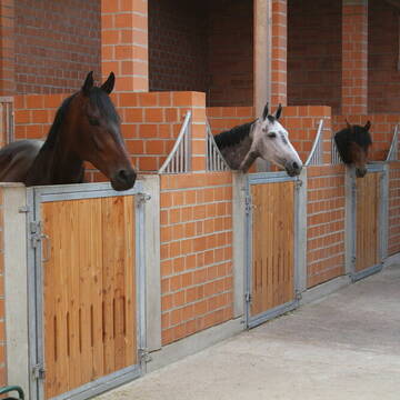
Boxen und Offenstall frei
Gleichen
Unity-Fellponys
@Unity-Fellponys
Geländestrecke
Reitlehrer und -unterricht
Vermieten
Hunde willkommen
Paddock
Pferdezucht
16 weitere...
P

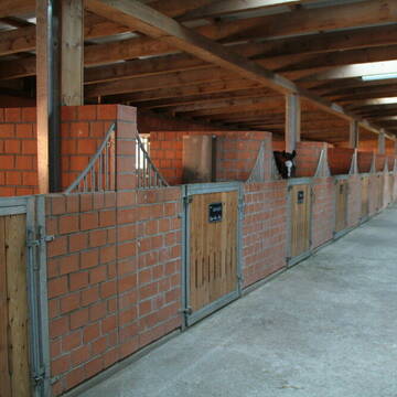
Gruppenstall, befestigter Paddock, Weide nach Wahl
Bad Emstal
Landgrebe Agrar GbR
@LandgrebeAgrar
Freizeitstall
Geländestrecke
Vermieten
Hunde willkommen
Krankenbox
Hufrehe geeignet
Notfallboxen
22 weitere...
P
Deprecated: Creation of dynamic property Zend_View_Helper_Ads::$adLink is deprecated in /var/www/stall-frei/htdocs/staging.stall-frei.de/library/Psf/View/Helper/Ads.php on line 108

Futtersack HeuToy, Fressbremse in pink
Mechtersen
STALL-FREIde Marketing
@STALL-FREI-Marketing
Stundenlange Beschäftigung die
Koliken vorbeugt, geringe Staubinhalation mit
steuerbarer Futterentnahme

Offenstallplatz in Körle frei
Körle
Volker Döberitz
@Pensionspferdehof
FN-Mitglied
Freizeitstall
Vermieten
Hunde willkommen
Krankenbox
Innenbox
Laufstall
13 weitere...
ganz aktuell
P
Leider kein Vorschaubild
Leider kein Vorschaubild
Neuer Gruppenstall für Pferde - sofort Verfügbar...
Guxhagen-Wollrode
info.Grebenhof
@Grebenhof2000
Freizeitstall
Geländestrecke
Vermieten
Hunde willkommen
Pensions- und Gastboxen
Bewegungsstall
Offenstall
10 weitere...
B
Leider kein Vorschaubild
Leider kein Vorschaubild
B
Reitanlage Eichenhof
Krebeck
Gisbert-Hann
@Gisbert-Hann
Freizeitstall
Reitlehrer und -unterricht
Longierzirkel/Roundpen
Paddock
Außenbox mit Paddock
Außenboxen
Vollpension
10 weitere...
P+
Leider kein Vorschaubild
Leider kein Vorschaubild
Offenstall-Vollpension: 1 Stutenplatz noch frei.
Warburg
Müller
@AraberStuten
Hunde willkommen
Pensions- und Gastboxen
Offenstall
Vollpension
7 weitere...
B

Frisches Stroh zu verkaufen!
Mechtersen
STALL-FREIde Marketing
@STALL-FREI-Marketing
Kaufe frisches Stroh für dein Pferd!
Leider kein Vorschaubild
Leider kein Vorschaubild
Offenstallplatz frei
Wolfahgen-Istha
Martina-L1
@Martina-L1
Freizeitstall
Vermieten
Krankenbox
Longierzirkel/Roundpen
Notfallboxen
10 weitere...
neu
B
Leider kein Vorschaubild
Leider kein Vorschaubild
Aktiv- Stall
Wolfhagen
Pferdepension Kalkhofsmühle
@JaninaBachmann
Freizeitstall
Geländestrecke
Vermieten
Hunde willkommen
Krankenbox
Allergikerstall
Notfallboxen
16 weitere...
B
Leider kein Vorschaubild
Leider kein Vorschaubild
Pferdebox frei in nettem Stall mit Solekammer
Wolfhagen
Pferdepension Freckenhausen
@Freckenhausen.Wolfhagen
FN-Mitglied
Freizeitstall
Vermieten
Krankenbox
Paddock
Allergikerstall
Gnadenbrothof
21 weitere...
B
Newsletter abonnieren
Melde Dich für unseren Newsletter an und verpasse keine Neuigkeiten!
Deprecated: Creation of dynamic property Zend_View::$pageCount is deprecated in /var/www/stall-frei/htdocs/staging.stall-frei.de/library/vendor/shardj/zf1-future/library/Zend/View/Abstract.php on line 308
Deprecated: Creation of dynamic property Zend_View::$itemCountPerPage is deprecated in /var/www/stall-frei/htdocs/staging.stall-frei.de/library/vendor/shardj/zf1-future/library/Zend/View/Abstract.php on line 308
Deprecated: Creation of dynamic property Zend_View::$first is deprecated in /var/www/stall-frei/htdocs/staging.stall-frei.de/library/vendor/shardj/zf1-future/library/Zend/View/Abstract.php on line 308
Deprecated: Creation of dynamic property Zend_View::$current is deprecated in /var/www/stall-frei/htdocs/staging.stall-frei.de/library/vendor/shardj/zf1-future/library/Zend/View/Abstract.php on line 308
Deprecated: Creation of dynamic property Zend_View::$last is deprecated in /var/www/stall-frei/htdocs/staging.stall-frei.de/library/vendor/shardj/zf1-future/library/Zend/View/Abstract.php on line 308
Deprecated: Creation of dynamic property Zend_View::$previous is deprecated in /var/www/stall-frei/htdocs/staging.stall-frei.de/library/vendor/shardj/zf1-future/library/Zend/View/Abstract.php on line 308
Deprecated: Creation of dynamic property Zend_View::$next is deprecated in /var/www/stall-frei/htdocs/staging.stall-frei.de/library/vendor/shardj/zf1-future/library/Zend/View/Abstract.php on line 308
Deprecated: Creation of dynamic property Zend_View::$pagesInRange is deprecated in /var/www/stall-frei/htdocs/staging.stall-frei.de/library/vendor/shardj/zf1-future/library/Zend/View/Abstract.php on line 308
Deprecated: Creation of dynamic property Zend_View::$firstPageInRange is deprecated in /var/www/stall-frei/htdocs/staging.stall-frei.de/library/vendor/shardj/zf1-future/library/Zend/View/Abstract.php on line 308
Deprecated: Creation of dynamic property Zend_View::$lastPageInRange is deprecated in /var/www/stall-frei/htdocs/staging.stall-frei.de/library/vendor/shardj/zf1-future/library/Zend/View/Abstract.php on line 308
Deprecated: Creation of dynamic property Zend_View::$currentItemCount is deprecated in /var/www/stall-frei/htdocs/staging.stall-frei.de/library/vendor/shardj/zf1-future/library/Zend/View/Abstract.php on line 308
Deprecated: Creation of dynamic property Zend_View::$totalItemCount is deprecated in /var/www/stall-frei/htdocs/staging.stall-frei.de/library/vendor/shardj/zf1-future/library/Zend/View/Abstract.php on line 308
Deprecated: Creation of dynamic property Zend_View::$firstItemNumber is deprecated in /var/www/stall-frei/htdocs/staging.stall-frei.de/library/vendor/shardj/zf1-future/library/Zend/View/Abstract.php on line 308
Deprecated: Creation of dynamic property Zend_View::$lastItemNumber is deprecated in /var/www/stall-frei/htdocs/staging.stall-frei.de/library/vendor/shardj/zf1-future/library/Zend/View/Abstract.php on line 308
Deprecated: Creation of dynamic property Zend_View::$router is deprecated in /var/www/stall-frei/htdocs/staging.stall-frei.de/library/vendor/shardj/zf1-future/library/Zend/View/Abstract.php on line 308
Deprecated: Creation of dynamic property Zend_View::$urlParams is deprecated in /var/www/stall-frei/htdocs/staging.stall-frei.de/library/vendor/shardj/zf1-future/library/Zend/View/Abstract.php on line 308
Deprecated: Creation of dynamic property Zend_View::$showAds is deprecated in /var/www/stall-frei/htdocs/staging.stall-frei.de/library/vendor/shardj/zf1-future/library/Zend/View/Abstract.php on line 308
Deprecated: Creation of dynamic property Zend_View::$objectIds is deprecated in /var/www/stall-frei/htdocs/staging.stall-frei.de/library/vendor/shardj/zf1-future/library/Zend/View/Abstract.php on line 308
Deprecated: Creation of dynamic property Zend_View::$showNavbar is deprecated in /var/www/stall-frei/htdocs/staging.stall-frei.de/library/vendor/shardj/zf1-future/library/Zend/View/Abstract.php on line 308
Deprecated: Creation of dynamic property Zend_View::$showBreadcrumb is deprecated in /var/www/stall-frei/htdocs/staging.stall-frei.de/library/vendor/shardj/zf1-future/library/Zend/View/Abstract.php on line 308
Deprecated: Creation of dynamic property Zend_View::$showFooter is deprecated in /var/www/stall-frei/htdocs/staging.stall-frei.de/library/vendor/shardj/zf1-future/library/Zend/View/Abstract.php on line 308
Deprecated: Creation of dynamic property Zend_View::$showInternalAds is deprecated in /var/www/stall-frei/htdocs/staging.stall-frei.de/library/vendor/shardj/zf1-future/library/Zend/View/Abstract.php on line 308
Deprecated: Creation of dynamic property Zend_View::$blNoContent is deprecated in /var/www/stall-frei/htdocs/staging.stall-frei.de/library/vendor/shardj/zf1-future/library/Zend/View/Abstract.php on line 308
Deprecated: Creation of dynamic property Zend_View::$sMetaDesc is deprecated in /var/www/stall-frei/htdocs/staging.stall-frei.de/library/vendor/shardj/zf1-future/library/Zend/View/Abstract.php on line 308
Deprecated: Creation of dynamic property Zend_View::$useGmaps is deprecated in /var/www/stall-frei/htdocs/staging.stall-frei.de/library/vendor/shardj/zf1-future/library/Zend/View/Abstract.php on line 308
Deprecated: Creation of dynamic property Zend_View::$touches is deprecated in /var/www/stall-frei/htdocs/staging.stall-frei.de/library/vendor/shardj/zf1-future/library/Zend/View/Abstract.php on line 308
Deprecated: Creation of dynamic property Zend_View::$oProject is deprecated in /var/www/stall-frei/htdocs/staging.stall-frei.de/library/vendor/shardj/zf1-future/library/Zend/View/Abstract.php on line 308
Deprecated: Creation of dynamic property Zend_View::$pageHeadline is deprecated in /var/www/stall-frei/htdocs/staging.stall-frei.de/library/vendor/shardj/zf1-future/library/Zend/View/Abstract.php on line 308
Deprecated: Creation of dynamic property Zend_View::$disableLocationField is deprecated in /var/www/stall-frei/htdocs/staging.stall-frei.de/library/vendor/shardj/zf1-future/library/Zend/View/Abstract.php on line 308
Deprecated: Creation of dynamic property Zend_View::$isSearch is deprecated in /var/www/stall-frei/htdocs/staging.stall-frei.de/library/vendor/shardj/zf1-future/library/Zend/View/Abstract.php on line 308
Deprecated: Creation of dynamic property Zend_View::$pageTitle is deprecated in /var/www/stall-frei/htdocs/staging.stall-frei.de/library/vendor/shardj/zf1-future/library/Zend/View/Abstract.php on line 308
Deprecated: Creation of dynamic property Psf_Form_Element_Text::$class is deprecated in /var/www/stall-frei/htdocs/staging.stall-frei.de/library/vendor/shardj/zf1-future/library/Zend/Form/Element.php on line 874
Deprecated: Creation of dynamic property Psf_Form_Element_Text::$size is deprecated in /var/www/stall-frei/htdocs/staging.stall-frei.de/library/vendor/shardj/zf1-future/library/Zend/Form/Element.php on line 874
Deprecated: Creation of dynamic property Psf_Form_Element_Text::$placeholder is deprecated in /var/www/stall-frei/htdocs/staging.stall-frei.de/library/vendor/shardj/zf1-future/library/Zend/Form/Element.php on line 874
Deprecated: Creation of dynamic property Psf_Form_Element_Hidden::$class is deprecated in /var/www/stall-frei/htdocs/staging.stall-frei.de/library/vendor/shardj/zf1-future/library/Zend/Form/Element.php on line 874
Deprecated: Creation of dynamic property Psf_Form_Element_Hidden::$class is deprecated in /var/www/stall-frei/htdocs/staging.stall-frei.de/library/vendor/shardj/zf1-future/library/Zend/Form/Element.php on line 874
Deprecated: Creation of dynamic property Psf_Form_Element_Hidden::$class is deprecated in /var/www/stall-frei/htdocs/staging.stall-frei.de/library/vendor/shardj/zf1-future/library/Zend/Form/Element.php on line 874
Deprecated: Creation of dynamic property Psf_Form_Element_Hidden::$class is deprecated in /var/www/stall-frei/htdocs/staging.stall-frei.de/library/vendor/shardj/zf1-future/library/Zend/Form/Element.php on line 874
Deprecated: Creation of dynamic property Psf_Form_Element_Select::$class is deprecated in /var/www/stall-frei/htdocs/staging.stall-frei.de/library/vendor/shardj/zf1-future/library/Zend/Form/Element.php on line 874
Deprecated: Creation of dynamic property Psf_Form_Element_Select::$class is deprecated in /var/www/stall-frei/htdocs/staging.stall-frei.de/library/vendor/shardj/zf1-future/library/Zend/Form/Element.php on line 874
Deprecated: Creation of dynamic property Psf_Form_Element_Select::$class is deprecated in /var/www/stall-frei/htdocs/staging.stall-frei.de/library/vendor/shardj/zf1-future/library/Zend/Form/Element.php on line 874
Deprecated: Creation of dynamic property Psf_Form_Element_Select::$class is deprecated in /var/www/stall-frei/htdocs/staging.stall-frei.de/library/vendor/shardj/zf1-future/library/Zend/Form/Element.php on line 874
Deprecated: Creation of dynamic property Psf_Form_Element_Text::$class is deprecated in /var/www/stall-frei/htdocs/staging.stall-frei.de/library/vendor/shardj/zf1-future/library/Zend/Form/Element.php on line 874
Deprecated: Creation of dynamic property Psf_Form_Element_Checkbox::$label is deprecated in /var/www/stall-frei/htdocs/staging.stall-frei.de/library/vendor/shardj/zf1-future/library/Zend/Form/Element.php on line 874
Deprecated: Creation of dynamic property Zend_View::$sort is deprecated in /var/www/stall-frei/htdocs/staging.stall-frei.de/library/vendor/shardj/zf1-future/library/Zend/View/Abstract.php on line 308
Deprecated: Creation of dynamic property Zend_View::$searchLocation is deprecated in /var/www/stall-frei/htdocs/staging.stall-frei.de/library/vendor/shardj/zf1-future/library/Zend/View/Abstract.php on line 308
Deprecated: Creation of dynamic property Zend_View::$locationHint is deprecated in /var/www/stall-frei/htdocs/staging.stall-frei.de/library/vendor/shardj/zf1-future/library/Zend/View/Abstract.php on line 308
Psf_GeoCoder_Abstract::getLocation: Mühlenberg Get Location CachedOrLive
Psf_GeoCoder_Abstract::getCachedOrLive: Mühlenberg
Psf_GeoCoder_Abstract::convertLocationResult
{"documentation":"https:\/\/opencagedata.com\/api","licenses":[{"name":"see attribution guide","url":"https:\/\/opencagedata.com\/credits"}],"results":[{"bounds":{"northeast":{"lat":51.4805042,"lng":9.5712125},"southwest":{"lat":51.4804042,"lng":9.5711125}},"components":{"ISO_3166-1_alpha-2":"DE","ISO_3166-1_alpha-3":"DEU","ISO_3166-2":["DE-HE"],"_category":"natural\/water","_normalized_city":"Gutsbezirk Reinhardswald","_type":"peak","continent":"Europe","country":"Deutschland","country_code":"de","county":"Landkreis Kassel","municipality":"Gutsbezirk Reinhardswald","peak":"M\u00fchlenberg","political_union":"European Union","postcode":"34359","state":"Hessen","state_code":"HE"},"confidence":9,"formatted":"M\u00fchlenberg, 34359 Gutsbezirk Reinhardswald, Deutschland","geometry":{"lat":51.4804542,"lng":9.5711625}},{"bounds":{"northeast":{"lat":51.1528487,"lng":7.3671564},"southwest":{"lat":51.1128487,"lng":7.3271564}},"components":{"ISO_3166-1_alpha-2":"DE","ISO_3166-1_alpha-3":"DEU","ISO_3166-2":["DE-NW"],"_category":"place","_normalized_city":"H\u00fcckeswagen","_type":"hamlet","continent":"Europe","country":"Deutschland","country_code":"de","county":"Oberbergischer Kreis","hamlet":"M\u00fchlenberg","political_union":"European Union","postcode":"42499","state":"Nordrhein-Westfalen","state_code":"NW","town":"H\u00fcckeswagen"},"confidence":7,"formatted":"M\u00fchlenberg, 42499 H\u00fcckeswagen, Deutschland","geometry":{"lat":51.1328487,"lng":7.3471564}},{"bounds":{"northeast":{"lat":52.3475772,"lng":9.6991214},"southwest":{"lat":52.3373671,"lng":9.6797733}},"components":{"ISO_3166-1_alpha-2":"DE","ISO_3166-1_alpha-3":"DEU","ISO_3166-2":["DE-NI"],"_category":"place","_normalized_city":"Hannover","_type":"neighbourhood","city":"Hannover","city_district":"Ricklingen","continent":"Europe","country":"Deutschland","country_code":"de","county":"Region Hannover","political_union":"European Union","state":"Niedersachsen","state_code":"NI","suburb":"M\u00fchlenberg"},"confidence":8,"formatted":"M\u00fchlenberg, Hannover, Niedersachsen, Deutschland","geometry":{"lat":52.3433467,"lng":9.6906241}},{"bounds":{"northeast":{"lat":51.3862915,"lng":8.6597806},"southwest":{"lat":51.3812258,"lng":8.6530734}},"components":{"ISO_3166-1_alpha-2":"DE","ISO_3166-1_alpha-3":"DEU","ISO_3166-2":["DE-NW"],"_category":"natural\/water","_normalized_city":"Brilon","_type":"nature_reserve","continent":"Europe","country":"Deutschland","country_code":"de","county":"Hochsauerlandkreis","nature_reserve":"M\u00fchlenberg","political_union":"European Union","postcode":"59929","state":"Nordrhein-Westfalen","state_code":"NW","town":"Brilon"},"confidence":9,"formatted":"M\u00fchlenberg, 59929 Brilon, Deutschland","geometry":{"lat":51.3837165,"lng":8.6554833}},{"bounds":{"northeast":{"lat":52.1629254,"lng":9.026456},"southwest":{"lat":52.1605278,"lng":9.022543}},"components":{"ISO_3166-1_alpha-2":"DE","ISO_3166-1_alpha-3":"DEU","ISO_3166-2":["DE-NI"],"_category":"natural\/water","_normalized_city":"Rinteln","_type":"nature_reserve","continent":"Europe","country":"Deutschland","country_code":"de","county":"Landkreis Schaumburg","nature_reserve":"M\u00fchlenberg","political_union":"European Union","postcode":"31737","state":"Niedersachsen","state_code":"NI","suburb":"M\u00f6llenbeck","town":"Rinteln"},"confidence":9,"formatted":"M\u00fchlenberg, 31737 Rinteln, Deutschland","geometry":{"lat":52.1618122,"lng":9.0249414}},{"bounds":{"northeast":{"lat":51.814755,"lng":9.5329879},"southwest":{"lat":51.774755,"lng":9.4929879}},"components":{"ISO_3166-1_alpha-2":"DE","ISO_3166-1_alpha-3":"DEU","ISO_3166-2":["DE-NI"],"_category":"place","_normalized_city":"Holzminden","_type":"hamlet","city":"Holzminden","continent":"Europe","country":"Deutschland","country_code":"de","county":"Landkreis Holzminden","hamlet":"M\u00fchlenberg","political_union":"European Union","state":"Niedersachsen","state_code":"NI"},"confidence":7,"formatted":"M\u00fchlenberg, Holzminden, Niedersachsen, Deutschland","geometry":{"lat":51.794755,"lng":9.5129879}},{"bounds":{"northeast":{"lat":52.3046333,"lng":13.6160922},"southwest":{"lat":52.3045333,"lng":13.6159922}},"components":{"ISO_3166-1_alpha-2":"DE","ISO_3166-1_alpha-3":"DEU","ISO_3166-2":["DE-BB"],"_category":"natural\/water","_normalized_city":"K\u00f6nigs Wusterhausen","_type":"peak","continent":"Europe","country":"Deutschland","country_code":"de","county":"Dahme-Spreewald","municipality":"Schenkendorf-Krummensee","peak":"Funkerberg","political_union":"European Union","postcode":"15711","state":"Brandenburg","state_code":"BB","town":"K\u00f6nigs Wusterhausen"},"confidence":9,"formatted":"Funkerberg, 15711 K\u00f6nigs Wusterhausen, Deutschland","geometry":{"lat":52.3045833,"lng":13.6160422}},{"bounds":{"northeast":{"lat":51.3668411,"lng":7.6648911},"southwest":{"lat":51.3635544,"lng":7.6508486}},"components":{"ISO_3166-1_alpha-2":"DE","ISO_3166-1_alpha-3":"DEU","ISO_3166-2":["DE-NW"],"_category":"natural\/water","_normalized_city":"Iserlohn","_type":"nature_reserve","continent":"Europe","country":"Deutschland","country_code":"de","county":"M\u00e4rkischer Kreis","nature_reserve":"M\u00fchlenberg","political_union":"European Union","postcode":"58644","state":"Nordrhein-Westfalen","state_code":"NW","suburb":"Gr\u00fcne","town":"Iserlohn"},"confidence":9,"formatted":"M\u00fchlenberg, 58644 Iserlohn, Deutschland","geometry":{"lat":51.3651953,"lng":7.6528014}},{"bounds":{"northeast":{"lat":51.3185784,"lng":9.6215136},"southwest":{"lat":51.3184784,"lng":9.6214136}},"components":{"ISO_3166-1_alpha-2":"DE","ISO_3166-1_alpha-3":"DEU","ISO_3166-2":["DE-HE"],"_category":"natural\/water","_normalized_city":"Heiligenrode","_type":"peak","continent":"Europe","country":"Deutschland","country_code":"de","county":"Landkreis Kassel","municipality":"Niestetal","peak":"M\u00fchlenberg","political_union":"European Union","postcode":"34260","state":"Hessen","state_code":"HE","village":"Heiligenrode"},"confidence":9,"formatted":"M\u00fchlenberg, 34260 Heiligenrode, Deutschland","geometry":{"lat":51.3185284,"lng":9.6214636}},{"bounds":{"northeast":{"lat":52.8500641,"lng":7.5193187},"southwest":{"lat":52.8499641,"lng":7.5192187}},"components":{"ISO_3166-1_alpha-2":"DE","ISO_3166-1_alpha-3":"DEU","ISO_3166-2":["DE-NI"],"_category":"natural\/water","_normalized_city":"S\u00f6gel","_type":"peak","continent":"Europe","country":"Deutschland","country_code":"de","county":"Landkreis Emsland","municipality":"Samtgemeinde S\u00f6gel","peak":"M\u00fchlenberg","political_union":"European Union","postcode":"49751","state":"Niedersachsen","state_code":"NI","town":"S\u00f6gel"},"confidence":9,"formatted":"M\u00fchlenberg, 49751 S\u00f6gel, Deutschland","geometry":{"lat":52.8500141,"lng":7.5192687}}],"status":{"code":200,"message":"OK"},"stay_informed":{"blog":"https:\/\/blog.opencagedata.com","mastodon":"https:\/\/en.osm.town\/@opencage"},"thanks":"For using an OpenCage API","timestamp":{"created_http":"Sun, 08 Feb 2026 06:11:20 GMT","created_unix":1770531080},"total_results":10}Array
(
[0] => stdClass Object
(
[bounds] => stdClass Object
(
[northeast] => stdClass Object
(
[lat] => 51.4805042
[lng] => 9.5712125
)
[southwest] => stdClass Object
(
[lat] => 51.4804042
[lng] => 9.5711125
)
)
[components] => stdClass Object
(
[ISO_3166-1_alpha-2] => DE
[ISO_3166-1_alpha-3] => DEU
[ISO_3166-2] => Array
(
[0] => DE-HE
)
[_category] => natural/water
[_normalized_city] => Gutsbezirk Reinhardswald
[_type] => peak
[continent] => Europe
[country] => Deutschland
[country_code] => de
[county] => Landkreis Kassel
[municipality] => Gutsbezirk Reinhardswald
[peak] => Mühlenberg
[political_union] => European Union
[postcode] => 34359
[state] => Hessen
[state_code] => HE
)
[confidence] => 9
[formatted] => Mühlenberg, 34359 Gutsbezirk Reinhardswald, Deutschland
[geometry] => stdClass Object
(
[lat] => 51.4804542
[lng] => 9.5711625
)
)
[1] => stdClass Object
(
[bounds] => stdClass Object
(
[northeast] => stdClass Object
(
[lat] => 51.1528487
[lng] => 7.3671564
)
[southwest] => stdClass Object
(
[lat] => 51.1128487
[lng] => 7.3271564
)
)
[components] => stdClass Object
(
[ISO_3166-1_alpha-2] => DE
[ISO_3166-1_alpha-3] => DEU
[ISO_3166-2] => Array
(
[0] => DE-NW
)
[_category] => place
[_normalized_city] => Hückeswagen
[_type] => hamlet
[continent] => Europe
[country] => Deutschland
[country_code] => de
[county] => Oberbergischer Kreis
[hamlet] => Mühlenberg
[political_union] => European Union
[postcode] => 42499
[state] => Nordrhein-Westfalen
[state_code] => NW
[town] => Hückeswagen
)
[confidence] => 7
[formatted] => Mühlenberg, 42499 Hückeswagen, Deutschland
[geometry] => stdClass Object
(
[lat] => 51.1328487
[lng] => 7.3471564
)
)
[2] => stdClass Object
(
[bounds] => stdClass Object
(
[northeast] => stdClass Object
(
[lat] => 52.3475772
[lng] => 9.6991214
)
[southwest] => stdClass Object
(
[lat] => 52.3373671
[lng] => 9.6797733
)
)
[components] => stdClass Object
(
[ISO_3166-1_alpha-2] => DE
[ISO_3166-1_alpha-3] => DEU
[ISO_3166-2] => Array
(
[0] => DE-NI
)
[_category] => place
[_normalized_city] => Hannover
[_type] => neighbourhood
[city] => Hannover
[city_district] => Ricklingen
[continent] => Europe
[country] => Deutschland
[country_code] => de
[county] => Region Hannover
[political_union] => European Union
[state] => Niedersachsen
[state_code] => NI
[suburb] => Mühlenberg
)
[confidence] => 8
[formatted] => Mühlenberg, Hannover, Niedersachsen, Deutschland
[geometry] => stdClass Object
(
[lat] => 52.3433467
[lng] => 9.6906241
)
)
[3] => stdClass Object
(
[bounds] => stdClass Object
(
[northeast] => stdClass Object
(
[lat] => 51.3862915
[lng] => 8.6597806
)
[southwest] => stdClass Object
(
[lat] => 51.3812258
[lng] => 8.6530734
)
)
[components] => stdClass Object
(
[ISO_3166-1_alpha-2] => DE
[ISO_3166-1_alpha-3] => DEU
[ISO_3166-2] => Array
(
[0] => DE-NW
)
[_category] => natural/water
[_normalized_city] => Brilon
[_type] => nature_reserve
[continent] => Europe
[country] => Deutschland
[country_code] => de
[county] => Hochsauerlandkreis
[nature_reserve] => Mühlenberg
[political_union] => European Union
[postcode] => 59929
[state] => Nordrhein-Westfalen
[state_code] => NW
[town] => Brilon
)
[confidence] => 9
[formatted] => Mühlenberg, 59929 Brilon, Deutschland
[geometry] => stdClass Object
(
[lat] => 51.3837165
[lng] => 8.6554833
)
)
[4] => stdClass Object
(
[bounds] => stdClass Object
(
[northeast] => stdClass Object
(
[lat] => 52.1629254
[lng] => 9.026456
)
[southwest] => stdClass Object
(
[lat] => 52.1605278
[lng] => 9.022543
)
)
[components] => stdClass Object
(
[ISO_3166-1_alpha-2] => DE
[ISO_3166-1_alpha-3] => DEU
[ISO_3166-2] => Array
(
[0] => DE-NI
)
[_category] => natural/water
[_normalized_city] => Rinteln
[_type] => nature_reserve
[continent] => Europe
[country] => Deutschland
[country_code] => de
[county] => Landkreis Schaumburg
[nature_reserve] => Mühlenberg
[political_union] => European Union
[postcode] => 31737
[state] => Niedersachsen
[state_code] => NI
[suburb] => Möllenbeck
[town] => Rinteln
)
[confidence] => 9
[formatted] => Mühlenberg, 31737 Rinteln, Deutschland
[geometry] => stdClass Object
(
[lat] => 52.1618122
[lng] => 9.0249414
)
)
[5] => stdClass Object
(
[bounds] => stdClass Object
(
[northeast] => stdClass Object
(
[lat] => 51.814755
[lng] => 9.5329879
)
[southwest] => stdClass Object
(
[lat] => 51.774755
[lng] => 9.4929879
)
)
[components] => stdClass Object
(
[ISO_3166-1_alpha-2] => DE
[ISO_3166-1_alpha-3] => DEU
[ISO_3166-2] => Array
(
[0] => DE-NI
)
[_category] => place
[_normalized_city] => Holzminden
[_type] => hamlet
[city] => Holzminden
[continent] => Europe
[country] => Deutschland
[country_code] => de
[county] => Landkreis Holzminden
[hamlet] => Mühlenberg
[political_union] => European Union
[state] => Niedersachsen
[state_code] => NI
)
[confidence] => 7
[formatted] => Mühlenberg, Holzminden, Niedersachsen, Deutschland
[geometry] => stdClass Object
(
[lat] => 51.794755
[lng] => 9.5129879
)
)
[6] => stdClass Object
(
[bounds] => stdClass Object
(
[northeast] => stdClass Object
(
[lat] => 52.3046333
[lng] => 13.6160922
)
[southwest] => stdClass Object
(
[lat] => 52.3045333
[lng] => 13.6159922
)
)
[components] => stdClass Object
(
[ISO_3166-1_alpha-2] => DE
[ISO_3166-1_alpha-3] => DEU
[ISO_3166-2] => Array
(
[0] => DE-BB
)
[_category] => natural/water
[_normalized_city] => Königs Wusterhausen
[_type] => peak
[continent] => Europe
[country] => Deutschland
[country_code] => de
[county] => Dahme-Spreewald
[municipality] => Schenkendorf-Krummensee
[peak] => Funkerberg
[political_union] => European Union
[postcode] => 15711
[state] => Brandenburg
[state_code] => BB
[town] => Königs Wusterhausen
)
[confidence] => 9
[formatted] => Funkerberg, 15711 Königs Wusterhausen, Deutschland
[geometry] => stdClass Object
(
[lat] => 52.3045833
[lng] => 13.6160422
)
)
[7] => stdClass Object
(
[bounds] => stdClass Object
(
[northeast] => stdClass Object
(
[lat] => 51.3668411
[lng] => 7.6648911
)
[southwest] => stdClass Object
(
[lat] => 51.3635544
[lng] => 7.6508486
)
)
[components] => stdClass Object
(
[ISO_3166-1_alpha-2] => DE
[ISO_3166-1_alpha-3] => DEU
[ISO_3166-2] => Array
(
[0] => DE-NW
)
[_category] => natural/water
[_normalized_city] => Iserlohn
[_type] => nature_reserve
[continent] => Europe
[country] => Deutschland
[country_code] => de
[county] => Märkischer Kreis
[nature_reserve] => Mühlenberg
[political_union] => European Union
[postcode] => 58644
[state] => Nordrhein-Westfalen
[state_code] => NW
[suburb] => Grüne
[town] => Iserlohn
)
[confidence] => 9
[formatted] => Mühlenberg, 58644 Iserlohn, Deutschland
[geometry] => stdClass Object
(
[lat] => 51.3651953
[lng] => 7.6528014
)
)
[8] => stdClass Object
(
[bounds] => stdClass Object
(
[northeast] => stdClass Object
(
[lat] => 51.3185784
[lng] => 9.6215136
)
[southwest] => stdClass Object
(
[lat] => 51.3184784
[lng] => 9.6214136
)
)
[components] => stdClass Object
(
[ISO_3166-1_alpha-2] => DE
[ISO_3166-1_alpha-3] => DEU
[ISO_3166-2] => Array
(
[0] => DE-HE
)
[_category] => natural/water
[_normalized_city] => Heiligenrode
[_type] => peak
[continent] => Europe
[country] => Deutschland
[country_code] => de
[county] => Landkreis Kassel
[municipality] => Niestetal
[peak] => Mühlenberg
[political_union] => European Union
[postcode] => 34260
[state] => Hessen
[state_code] => HE
[village] => Heiligenrode
)
[confidence] => 9
[formatted] => Mühlenberg, 34260 Heiligenrode, Deutschland
[geometry] => stdClass Object
(
[lat] => 51.3185284
[lng] => 9.6214636
)
)
[9] => stdClass Object
(
[bounds] => stdClass Object
(
[northeast] => stdClass Object
(
[lat] => 52.8500641
[lng] => 7.5193187
)
[southwest] => stdClass Object
(
[lat] => 52.8499641
[lng] => 7.5192187
)
)
[components] => stdClass Object
(
[ISO_3166-1_alpha-2] => DE
[ISO_3166-1_alpha-3] => DEU
[ISO_3166-2] => Array
(
[0] => DE-NI
)
[_category] => natural/water
[_normalized_city] => Sögel
[_type] => peak
[continent] => Europe
[country] => Deutschland
[country_code] => de
[county] => Landkreis Emsland
[municipality] => Samtgemeinde Sögel
[peak] => Mühlenberg
[political_union] => European Union
[postcode] => 49751
[state] => Niedersachsen
[state_code] => NI
[town] => Sögel
)
[confidence] => 9
[formatted] => Mühlenberg, 49751 Sögel, Deutschland
[geometry] => stdClass Object
(
[lat] => 52.8500141
[lng] => 7.5192687
)
)
)
Psf_GeoCoder_OpenCageData::getKeyMap: 0
stdClass Object
(
    [bounds] => stdClass Object
        (
            [northeast] => stdClass Object
                (
                    [lat] => 51.4805042
                    [lng] => 9.5712125
                )

            [southwest] => stdClass Object
                (
                    [lat] => 51.4804042
                    [lng] => 9.5711125
                )

        )

    [components] => stdClass Object
        (
            [ISO_3166-1_alpha-2] => DE
            [ISO_3166-1_alpha-3] => DEU
            [ISO_3166-2] => Array
                (
                    [0] => DE-HE
                )

            [_category] => natural/water
            [_normalized_city] => Gutsbezirk Reinhardswald
            [_type] => peak
            [continent] => Europe
            [country] => Deutschland
            [country_code] => de
            [county] => Landkreis Kassel
            [municipality] => Gutsbezirk Reinhardswald
            [peak] => Mühlenberg
            [political_union] => European Union
            [postcode] => 34359
            [state] => Hessen
            [state_code] => HE
        )

    [confidence] => 9
    [formatted] => Mühlenberg, 34359 Gutsbezirk Reinhardswald, Deutschland
    [geometry] => stdClass Object
        (
            [lat] => 51.4804542
            [lng] => 9.5711625
        )

)
Psf_GeoCoder_OpenCageData::getCounty: Kassel
Psf_GeoCoder_OpenCageData::addMissingData REFETCH!
Array
(
    [address] => Mühlenberg, 34359 Gutsbezirk Reinhardswald, Deutschland
    [type] => peak
    [street] =>
    [city] =>
    [county] => Kassel
    [state] => Hessen
    [zip] => 34359
    [country] => Deutschland
    [suburb] =>
    [countrycode] => de
    [latitude] => 51.4804542
    [longitude] => 9.5711625
    [accuracy] => 1
    [confidence] => 9
    [bounds] => stdClass Object
        (
            [northeast] => stdClass Object
                (
                    [lat] => 51.4805042
                    [lng] => 9.5712125
                )

            [southwest] => stdClass Object
                (
                    [lat] => 51.4804042
                    [lng] => 9.5711125
                )

        )

)
reformat!
Array
(
    [address] => Mühlenberg, 34359 Gutsbezirk Reinhardswald, Deutschland
    [type] => peak
    [street] =>
    [city] =>
    [county] => Kassel
    [state] => Hessen
    [zip] => 34359
    [country] => Deutschland
    [suburb] =>
    [countrycode] => de
    [latitude] => 51.4804542
    [longitude] => 9.5711625
    [accuracy] => 1
    [confidence] => 9
    [bounds] => stdClass Object
        (
            [northeast] => stdClass Object
                (
                    [lat] => 51.4805042
                    [lng] => 9.5712125
                )

            [southwest] => stdClass Object
                (
                    [lat] => 51.4804042
                    [lng] => 9.5711125
                )

        )

    [place] => 34359 , Hessen
    [hash] => bcd56317677a5c459652369eb430c73c
)
Psf_GeoCoder_OpenCageData::getKeyMap: 1
stdClass Object
(
    [bounds] => stdClass Object
        (
            [northeast] => stdClass Object
                (
                    [lat] => 51.1528487
                    [lng] => 7.3671564
                )

            [southwest] => stdClass Object
                (
                    [lat] => 51.1128487
                    [lng] => 7.3271564
                )

        )

    [components] => stdClass Object
        (
            [ISO_3166-1_alpha-2] => DE
            [ISO_3166-1_alpha-3] => DEU
            [ISO_3166-2] => Array
                (
                    [0] => DE-NW
                )

            [_category] => place
            [_normalized_city] => Hückeswagen
            [_type] => hamlet
            [continent] => Europe
            [country] => Deutschland
            [country_code] => de
            [county] => Oberbergischer Kreis
            [hamlet] => Mühlenberg
            [political_union] => European Union
            [postcode] => 42499
            [state] => Nordrhein-Westfalen
            [state_code] => NW
            [town] => Hückeswagen
        )

    [confidence] => 7
    [formatted] => Mühlenberg, 42499 Hückeswagen, Deutschland
    [geometry] => stdClass Object
        (
            [lat] => 51.1328487
            [lng] => 7.3471564
        )

)
Psf_GeoCoder_OpenCageData::getCounty: Oberbergischer Kreis
Psf_GeoCoder_OpenCageData::addMissingData REFETCH!
Array
(
    [address] => Mühlenberg, 42499 Hückeswagen, Deutschland
    [type] => hamlet
    [street] => Mühlenberg
    [city] => Hückeswagen
    [county] => Oberbergischer Kreis
    [state] => Nordrhein-Westfalen
    [zip] => 42499
    [country] => Deutschland
    [suburb] =>
    [countrycode] => de
    [latitude] => 51.1328487
    [longitude] => 7.3471564
    [accuracy] => 1
    [confidence] => 7
    [bounds] => stdClass Object
        (
            [northeast] => stdClass Object
                (
                    [lat] => 51.1528487
                    [lng] => 7.3671564
                )

            [southwest] => stdClass Object
                (
                    [lat] => 51.1128487
                    [lng] => 7.3271564
                )

        )

)
reformat!
Array
(
    [address] => Mühlenberg, 42499 Hückeswagen, Deutschland
    [type] => hamlet
    [street] => Mühlenberg
    [city] => Hückeswagen
    [county] => Oberbergischer Kreis
    [state] => Nordrhein-Westfalen
    [zip] => 42499
    [country] => Deutschland
    [suburb] =>
    [countrycode] => de
    [latitude] => 51.1328487
    [longitude] => 7.3471564
    [accuracy] => 1
    [confidence] => 7
    [bounds] => stdClass Object
        (
            [northeast] => stdClass Object
                (
                    [lat] => 51.1528487
                    [lng] => 7.3671564
                )

            [southwest] => stdClass Object
                (
                    [lat] => 51.1128487
                    [lng] => 7.3271564
                )

        )

    [place] => Mühlenberg, 42499 Hückeswagen, Nordrhein-Westfalen
    [hash] => 746ef435a3eced1b74a09159b2fb124c
)
Psf_GeoCoder_OpenCageData::getKeyMap: 2
stdClass Object
(
    [bounds] => stdClass Object
        (
            [northeast] => stdClass Object
                (
                    [lat] => 52.3475772
                    [lng] => 9.6991214
                )

            [southwest] => stdClass Object
                (
                    [lat] => 52.3373671
                    [lng] => 9.6797733
                )

        )

    [components] => stdClass Object
        (
            [ISO_3166-1_alpha-2] => DE
            [ISO_3166-1_alpha-3] => DEU
            [ISO_3166-2] => Array
                (
                    [0] => DE-NI
                )

            [_category] => place
            [_normalized_city] => Hannover
            [_type] => neighbourhood
            [city] => Hannover
            [city_district] => Ricklingen
            [continent] => Europe
            [country] => Deutschland
            [country_code] => de
            [county] => Region Hannover
            [political_union] => European Union
            [state] => Niedersachsen
            [state_code] => NI
            [suburb] => Mühlenberg
        )

    [confidence] => 8
    [formatted] => Mühlenberg, Hannover, Niedersachsen, Deutschland
    [geometry] => stdClass Object
        (
            [lat] => 52.3433467
            [lng] => 9.6906241
        )

)
Psf_GeoCoder_OpenCageData::getCounty: Hannover
Psf_GeoCoder_OpenCageData::addMissingData REFETCH!
Array
(
    [address] => Mühlenberg, Hannover, Niedersachsen, Deutschland
    [type] => neighbourhood
    [street] =>
    [city] => Mühlenberg
    [county] => Hannover
    [state] => Niedersachsen
    [zip] =>
    [country] => Deutschland
    [suburb] => Mühlenberg
    [countrycode] => de
    [latitude] => 52.3433467
    [longitude] => 9.6906241
    [accuracy] => 1
    [confidence] => 8
    [bounds] => stdClass Object
        (
            [northeast] => stdClass Object
                (
                    [lat] => 52.3475772
                    [lng] => 9.6991214
                )

            [southwest] => stdClass Object
                (
                    [lat] => 52.3373671
                    [lng] => 9.6797733
                )

        )

)
reformat!
Array
(
    [address] => Mühlenberg, Hannover, Niedersachsen, Deutschland
    [type] => neighbourhood
    [street] =>
    [city] => Mühlenberg
    [county] => Hannover
    [state] => Niedersachsen
    [zip] =>
    [country] => Deutschland
    [suburb] => Mühlenberg
    [countrycode] => de
    [latitude] => 52.3433467
    [longitude] => 9.6906241
    [accuracy] => 1
    [confidence] => 8
    [bounds] => stdClass Object
        (
            [northeast] => stdClass Object
                (
                    [lat] => 52.3475772
                    [lng] => 9.6991214
                )

            [southwest] => stdClass Object
                (
                    [lat] => 52.3373671
                    [lng] => 9.6797733
                )

        )

    [place] => Mühlenberg, Niedersachsen
    [hash] => de2a5c8a7a632b0b9039f6cbd258655b
)
Psf_GeoCoder_OpenCageData::getKeyMap: 3
stdClass Object
(
    [bounds] => stdClass Object
        (
            [northeast] => stdClass Object
                (
                    [lat] => 51.3862915
                    [lng] => 8.6597806
                )

            [southwest] => stdClass Object
                (
                    [lat] => 51.3812258
                    [lng] => 8.6530734
                )

        )

    [components] => stdClass Object
        (
            [ISO_3166-1_alpha-2] => DE
            [ISO_3166-1_alpha-3] => DEU
            [ISO_3166-2] => Array
                (
                    [0] => DE-NW
                )

            [_category] => natural/water
            [_normalized_city] => Brilon
            [_type] => nature_reserve
            [continent] => Europe
            [country] => Deutschland
            [country_code] => de
            [county] => Hochsauerlandkreis
            [nature_reserve] => Mühlenberg
            [political_union] => European Union
            [postcode] => 59929
            [state] => Nordrhein-Westfalen
            [state_code] => NW
            [town] => Brilon
        )

    [confidence] => 9
    [formatted] => Mühlenberg, 59929 Brilon, Deutschland
    [geometry] => stdClass Object
        (
            [lat] => 51.3837165
            [lng] => 8.6554833
        )

)
Psf_GeoCoder_OpenCageData::getCounty: Hochsauerlandkreis
Psf_GeoCoder_OpenCageData::addMissingData REFETCH!
Array
(
    [address] => Mühlenberg, 59929 Brilon, Deutschland
    [type] => nature_reserve
    [street] =>
    [city] => Brilon
    [county] => Hochsauerlandkreis
    [state] => Nordrhein-Westfalen
    [zip] => 59929
    [country] => Deutschland
    [suburb] =>
    [countrycode] => de
    [latitude] => 51.3837165
    [longitude] => 8.6554833
    [accuracy] => 1
    [confidence] => 9
    [bounds] => stdClass Object
        (
            [northeast] => stdClass Object
                (
                    [lat] => 51.3862915
                    [lng] => 8.6597806
                )

            [southwest] => stdClass Object
                (
                    [lat] => 51.3812258
                    [lng] => 8.6530734
                )

        )

)
reformat!
Array
(
    [address] => Mühlenberg, 59929 Brilon, Deutschland
    [type] => nature_reserve
    [street] =>
    [city] => Brilon
    [county] => Hochsauerlandkreis
    [state] => Nordrhein-Westfalen
    [zip] => 59929
    [country] => Deutschland
    [suburb] =>
    [countrycode] => de
    [latitude] => 51.3837165
    [longitude] => 8.6554833
    [accuracy] => 1
    [confidence] => 9
    [bounds] => stdClass Object
        (
            [northeast] => stdClass Object
                (
                    [lat] => 51.3862915
                    [lng] => 8.6597806
                )

            [southwest] => stdClass Object
                (
                    [lat] => 51.3812258
                    [lng] => 8.6530734
                )

        )

    [place] => 59929 Brilon, Nordrhein-Westfalen
    [hash] => 307a9b48d029e6f1226900d093930218
)
Psf_GeoCoder_OpenCageData::getKeyMap: 4
stdClass Object
(
    [bounds] => stdClass Object
        (
            [northeast] => stdClass Object
                (
                    [lat] => 52.1629254
                    [lng] => 9.026456
                )

            [southwest] => stdClass Object
                (
                    [lat] => 52.1605278
                    [lng] => 9.022543
                )

        )

    [components] => stdClass Object
        (
            [ISO_3166-1_alpha-2] => DE
            [ISO_3166-1_alpha-3] => DEU
            [ISO_3166-2] => Array
                (
                    [0] => DE-NI
                )

            [_category] => natural/water
            [_normalized_city] => Rinteln
            [_type] => nature_reserve
            [continent] => Europe
            [country] => Deutschland
            [country_code] => de
            [county] => Landkreis Schaumburg
            [nature_reserve] => Mühlenberg
            [political_union] => European Union
            [postcode] => 31737
            [state] => Niedersachsen
            [state_code] => NI
            [suburb] => Möllenbeck
            [town] => Rinteln
        )

    [confidence] => 9
    [formatted] => Mühlenberg, 31737 Rinteln, Deutschland
    [geometry] => stdClass Object
        (
            [lat] => 52.1618122
            [lng] => 9.0249414
        )

)
Psf_GeoCoder_OpenCageData::getCounty: Schaumburg
Psf_GeoCoder_OpenCageData::addMissingData REFETCH!
Array
(
    [address] => Mühlenberg, 31737 Rinteln, Deutschland
    [type] => nature_reserve
    [street] =>
    [city] => Rinteln
    [county] => Schaumburg
    [state] => Niedersachsen
    [zip] => 31737
    [country] => Deutschland
    [suburb] => Möllenbeck
    [countrycode] => de
    [latitude] => 52.1618122
    [longitude] => 9.0249414
    [accuracy] => 1
    [confidence] => 9
    [bounds] => stdClass Object
        (
            [northeast] => stdClass Object
                (
                    [lat] => 52.1629254
                    [lng] => 9.026456
                )

            [southwest] => stdClass Object
                (
                    [lat] => 52.1605278
                    [lng] => 9.022543
                )

        )

)
reformat!
Array
(
    [address] => Mühlenberg, 31737 Rinteln, Deutschland
    [type] => nature_reserve
    [street] =>
    [city] => Rinteln
    [county] => Schaumburg
    [state] => Niedersachsen
    [zip] => 31737
    [country] => Deutschland
    [suburb] => Möllenbeck
    [countrycode] => de
    [latitude] => 52.1618122
    [longitude] => 9.0249414
    [accuracy] => 1
    [confidence] => 9
    [bounds] => stdClass Object
        (
            [northeast] => stdClass Object
                (
                    [lat] => 52.1629254
                    [lng] => 9.026456
                )

            [southwest] => stdClass Object
                (
                    [lat] => 52.1605278
                    [lng] => 9.022543
                )

        )

    [place] => 31737 Rinteln, Niedersachsen
    [hash] => 96c423ac6382c4f1764660d535b9f73e
)
Psf_GeoCoder_OpenCageData::getKeyMap: 5
stdClass Object
(
    [bounds] => stdClass Object
        (
            [northeast] => stdClass Object
                (
                    [lat] => 51.814755
                    [lng] => 9.5329879
                )

            [southwest] => stdClass Object
                (
                    [lat] => 51.774755
                    [lng] => 9.4929879
                )

        )

    [components] => stdClass Object
        (
            [ISO_3166-1_alpha-2] => DE
            [ISO_3166-1_alpha-3] => DEU
            [ISO_3166-2] => Array
                (
                    [0] => DE-NI
                )

            [_category] => place
            [_normalized_city] => Holzminden
            [_type] => hamlet
            [city] => Holzminden
            [continent] => Europe
            [country] => Deutschland
            [country_code] => de
            [county] => Landkreis Holzminden
            [hamlet] => Mühlenberg
            [political_union] => European Union
            [state] => Niedersachsen
            [state_code] => NI
        )

    [confidence] => 7
    [formatted] => Mühlenberg, Holzminden, Niedersachsen, Deutschland
    [geometry] => stdClass Object
        (
            [lat] => 51.794755
            [lng] => 9.5129879
        )

)
Psf_GeoCoder_OpenCageData::getCounty: Holzminden
Psf_GeoCoder_OpenCageData::addMissingData REFETCH!
Array
(
    [address] => Mühlenberg, Holzminden, Niedersachsen, Deutschland
    [type] => hamlet
    [street] => Mühlenberg
    [city] => Holzminden
    [county] => Holzminden
    [state] => Niedersachsen
    [zip] =>
    [country] => Deutschland
    [suburb] =>
    [countrycode] => de
    [latitude] => 51.794755
    [longitude] => 9.5129879
    [accuracy] => 1
    [confidence] => 7
    [bounds] => stdClass Object
        (
            [northeast] => stdClass Object
                (
                    [lat] => 51.814755
                    [lng] => 9.5329879
                )

            [southwest] => stdClass Object
                (
                    [lat] => 51.774755
                    [lng] => 9.4929879
                )

        )

)
reformat!
Array
(
    [address] => Mühlenberg, Holzminden, Niedersachsen, Deutschland
    [type] => hamlet
    [street] => Mühlenberg
    [city] => Holzminden
    [county] => Holzminden
    [state] => Niedersachsen
    [zip] =>
    [country] => Deutschland
    [suburb] =>
    [countrycode] => de
    [latitude] => 51.794755
    [longitude] => 9.5129879
    [accuracy] => 1
    [confidence] => 7
    [bounds] => stdClass Object
        (
            [northeast] => stdClass Object
                (
                    [lat] => 51.814755
                    [lng] => 9.5329879
                )

            [southwest] => stdClass Object
                (
                    [lat] => 51.774755
                    [lng] => 9.4929879
                )

        )

    [place] => Mühlenberg, Holzminden, Niedersachsen
    [hash] => df6704442a10cd2d3d3afd494d71b126
)
Psf_GeoCoder_OpenCageData::getKeyMap: 6
stdClass Object
(
    [bounds] => stdClass Object
        (
            [northeast] => stdClass Object
                (
                    [lat] => 52.3046333
                    [lng] => 13.6160922
                )

            [southwest] => stdClass Object
                (
                    [lat] => 52.3045333
                    [lng] => 13.6159922
                )

        )

    [components] => stdClass Object
        (
            [ISO_3166-1_alpha-2] => DE
            [ISO_3166-1_alpha-3] => DEU
            [ISO_3166-2] => Array
                (
                    [0] => DE-BB
                )

            [_category] => natural/water
            [_normalized_city] => Königs Wusterhausen
            [_type] => peak
            [continent] => Europe
            [country] => Deutschland
            [country_code] => de
            [county] => Dahme-Spreewald
            [municipality] => Schenkendorf-Krummensee
            [peak] => Funkerberg
            [political_union] => European Union
            [postcode] => 15711
            [state] => Brandenburg
            [state_code] => BB
            [town] => Königs Wusterhausen
        )

    [confidence] => 9
    [formatted] => Funkerberg, 15711 Königs Wusterhausen, Deutschland
    [geometry] => stdClass Object
        (
            [lat] => 52.3045833
            [lng] => 13.6160422
        )

)
Psf_GeoCoder_OpenCageData::getCounty: Dahme-Spreewald
Psf_GeoCoder_OpenCageData::addMissingData REFETCH!
Array
(
    [address] => Funkerberg, 15711 Königs Wusterhausen, Deutschland
    [type] => peak
    [street] =>
    [city] => Königs Wusterhausen
    [county] => Dahme-Spreewald
    [state] => Brandenburg
    [zip] => 15711
    [country] => Deutschland
    [suburb] =>
    [countrycode] => de
    [latitude] => 52.3045833
    [longitude] => 13.6160422
    [accuracy] => 1
    [confidence] => 9
    [bounds] => stdClass Object
        (
            [northeast] => stdClass Object
                (
                    [lat] => 52.3046333
                    [lng] => 13.6160922
                )

            [southwest] => stdClass Object
                (
                    [lat] => 52.3045333
                    [lng] => 13.6159922
                )

        )

)
reformat!
Array
(
    [address] => Funkerberg, 15711 Königs Wusterhausen, Deutschland
    [type] => peak
    [street] =>
    [city] => Königs Wusterhausen
    [county] => Dahme-Spreewald
    [state] => Brandenburg
    [zip] => 15711
    [country] => Deutschland
    [suburb] =>
    [countrycode] => de
    [latitude] => 52.3045833
    [longitude] => 13.6160422
    [accuracy] => 1
    [confidence] => 9
    [bounds] => stdClass Object
        (
            [northeast] => stdClass Object
                (
                    [lat] => 52.3046333
                    [lng] => 13.6160922
                )

            [southwest] => stdClass Object
                (
                    [lat] => 52.3045333
                    [lng] => 13.6159922
                )

        )

    [place] => 15711 Königs Wusterhausen, Brandenburg
    [hash] => 338508dd0195d2a3a04815069e6fb58b
)
Psf_GeoCoder_OpenCageData::getKeyMap: 7
stdClass Object
(
    [bounds] => stdClass Object
        (
            [northeast] => stdClass Object
                (
                    [lat] => 51.3668411
                    [lng] => 7.6648911
                )

            [southwest] => stdClass Object
                (
                    [lat] => 51.3635544
                    [lng] => 7.6508486
                )

        )

    [components] => stdClass Object
        (
            [ISO_3166-1_alpha-2] => DE
            [ISO_3166-1_alpha-3] => DEU
            [ISO_3166-2] => Array
                (
                    [0] => DE-NW
                )

            [_category] => natural/water
            [_normalized_city] => Iserlohn
            [_type] => nature_reserve
            [continent] => Europe
            [country] => Deutschland
            [country_code] => de
            [county] => Märkischer Kreis
            [nature_reserve] => Mühlenberg
            [political_union] => European Union
            [postcode] => 58644
            [state] => Nordrhein-Westfalen
            [state_code] => NW
            [suburb] => Grüne
            [town] => Iserlohn
        )

    [confidence] => 9
    [formatted] => Mühlenberg, 58644 Iserlohn, Deutschland
    [geometry] => stdClass Object
        (
            [lat] => 51.3651953
            [lng] => 7.6528014
        )

)
Psf_GeoCoder_OpenCageData::getCounty: Märkischer Kreis
Psf_GeoCoder_OpenCageData::addMissingData REFETCH!
Array
(
    [address] => Mühlenberg, 58644 Iserlohn, Deutschland
    [type] => nature_reserve
    [street] =>
    [city] => Iserlohn
    [county] => Märkischer Kreis
    [state] => Nordrhein-Westfalen
    [zip] => 58644
    [country] => Deutschland
    [suburb] => Grüne
    [countrycode] => de
    [latitude] => 51.3651953
    [longitude] => 7.6528014
    [accuracy] => 1
    [confidence] => 9
    [bounds] => stdClass Object
        (
            [northeast] => stdClass Object
                (
                    [lat] => 51.3668411
                    [lng] => 7.6648911
                )

            [southwest] => stdClass Object
                (
                    [lat] => 51.3635544
                    [lng] => 7.6508486
                )

        )

)
reformat!
Array
(
    [address] => Mühlenberg, 58644 Iserlohn, Deutschland
    [type] => nature_reserve
    [street] =>
    [city] => Iserlohn
    [county] => Märkischer Kreis
    [state] => Nordrhein-Westfalen
    [zip] => 58644
    [country] => Deutschland
    [suburb] => Grüne
    [countrycode] => de
    [latitude] => 51.3651953
    [longitude] => 7.6528014
    [accuracy] => 1
    [confidence] => 9
    [bounds] => stdClass Object
        (
            [northeast] => stdClass Object
                (
                    [lat] => 51.3668411
                    [lng] => 7.6648911
                )

            [southwest] => stdClass Object
                (
                    [lat] => 51.3635544
                    [lng] => 7.6508486
                )

        )

    [place] => 58644 Iserlohn, Nordrhein-Westfalen
    [hash] => c6885cd345dd1f00916b5947e2649edf
)
Psf_GeoCoder_OpenCageData::getKeyMap: 8
stdClass Object
(
    [bounds] => stdClass Object
        (
            [northeast] => stdClass Object
                (
                    [lat] => 51.3185784
                    [lng] => 9.6215136
                )

            [southwest] => stdClass Object
                (
                    [lat] => 51.3184784
                    [lng] => 9.6214136
                )

        )

    [components] => stdClass Object
        (
            [ISO_3166-1_alpha-2] => DE
            [ISO_3166-1_alpha-3] => DEU
            [ISO_3166-2] => Array
                (
                    [0] => DE-HE
                )

            [_category] => natural/water
            [_normalized_city] => Heiligenrode
            [_type] => peak
            [continent] => Europe
            [country] => Deutschland
            [country_code] => de
            [county] => Landkreis Kassel
            [municipality] => Niestetal
            [peak] => Mühlenberg
            [political_union] => European Union
            [postcode] => 34260
            [state] => Hessen
            [state_code] => HE
            [village] => Heiligenrode
        )

    [confidence] => 9
    [formatted] => Mühlenberg, 34260 Heiligenrode, Deutschland
    [geometry] => stdClass Object
        (
            [lat] => 51.3185284
            [lng] => 9.6214636
        )

)
Psf_GeoCoder_OpenCageData::getCounty: Kassel
Psf_GeoCoder_OpenCageData::addMissingData REFETCH!
Array
(
    [address] => Mühlenberg, 34260 Heiligenrode, Deutschland
    [type] => peak
    [street] =>
    [city] => Heiligenrode
    [county] => Kassel
    [state] => Hessen
    [zip] => 34260
    [country] => Deutschland
    [suburb] =>
    [countrycode] => de
    [latitude] => 51.3185284
    [longitude] => 9.6214636
    [accuracy] => 1
    [confidence] => 9
    [bounds] => stdClass Object
        (
            [northeast] => stdClass Object
                (
                    [lat] => 51.3185784
                    [lng] => 9.6215136
                )

            [southwest] => stdClass Object
                (
                    [lat] => 51.3184784
                    [lng] => 9.6214136
                )

        )

)
reformat!
Array
(
    [address] => Mühlenberg, 34260 Heiligenrode, Deutschland
    [type] => peak
    [street] =>
    [city] => Heiligenrode
    [county] => Kassel
    [state] => Hessen
    [zip] => 34260
    [country] => Deutschland
    [suburb] =>
    [countrycode] => de
    [latitude] => 51.3185284
    [longitude] => 9.6214636
    [accuracy] => 1
    [confidence] => 9
    [bounds] => stdClass Object
        (
            [northeast] => stdClass Object
                (
                    [lat] => 51.3185784
                    [lng] => 9.6215136
                )

            [southwest] => stdClass Object
                (
                    [lat] => 51.3184784
                    [lng] => 9.6214136
                )

        )

    [place] => 34260 Heiligenrode, Hessen
    [hash] => ce755f8cc4aac3ec2ceebfad1e38e0cf
)
Psf_GeoCoder_OpenCageData::getKeyMap: 9
stdClass Object
(
    [bounds] => stdClass Object
        (
            [northeast] => stdClass Object
                (
                    [lat] => 52.8500641
                    [lng] => 7.5193187
                )

            [southwest] => stdClass Object
                (
                    [lat] => 52.8499641
                    [lng] => 7.5192187
                )

        )

    [components] => stdClass Object
        (
            [ISO_3166-1_alpha-2] => DE
            [ISO_3166-1_alpha-3] => DEU
            [ISO_3166-2] => Array
                (
                    [0] => DE-NI
                )

            [_category] => natural/water
            [_normalized_city] => Sögel
            [_type] => peak
            [continent] => Europe
            [country] => Deutschland
            [country_code] => de
            [county] => Landkreis Emsland
            [municipality] => Samtgemeinde Sögel
            [peak] => Mühlenberg
            [political_union] => European Union
            [postcode] => 49751
            [state] => Niedersachsen
            [state_code] => NI
            [town] => Sögel
        )

    [confidence] => 9
    [formatted] => Mühlenberg, 49751 Sögel, Deutschland
    [geometry] => stdClass Object
        (
            [lat] => 52.8500141
            [lng] => 7.5192687
        )

)
Psf_GeoCoder_OpenCageData::getCounty: Emsland
Psf_GeoCoder_OpenCageData::addMissingData REFETCH!
Array
(
    [address] => Mühlenberg, 49751 Sögel, Deutschland
    [type] => peak
    [street] =>
    [city] => Sögel
    [county] => Emsland
    [state] => Niedersachsen
    [zip] => 49751
    [country] => Deutschland
    [suburb] =>
    [countrycode] => de
    [latitude] => 52.8500141
    [longitude] => 7.5192687
    [accuracy] => 1
    [confidence] => 9
    [bounds] => stdClass Object
        (
            [northeast] => stdClass Object
                (
                    [lat] => 52.8500641
                    [lng] => 7.5193187
                )

            [southwest] => stdClass Object
                (
                    [lat] => 52.8499641
                    [lng] => 7.5192187
                )

        )

)
reformat!
Array
(
    [address] => Mühlenberg, 49751 Sögel, Deutschland
    [type] => peak
    [street] =>
    [city] => Sögel
    [county] => Emsland
    [state] => Niedersachsen
    [zip] => 49751
    [country] => Deutschland
    [suburb] =>
    [countrycode] => de
    [latitude] => 52.8500141
    [longitude] => 7.5192687
    [accuracy] => 1
    [confidence] => 9
    [bounds] => stdClass Object
        (
            [northeast] => stdClass Object
                (
                    [lat] => 52.8500641
                    [lng] => 7.5193187
                )

            [southwest] => stdClass Object
                (
                    [lat] => 52.8499641
                    [lng] => 7.5192187
                )

        )

    [place] => 49751 Sögel, Niedersachsen
    [hash] => bbf71dded7bf86eaddaa25ef6b29c640
)
Deprecated: Creation of dynamic property Zend_View::$locationHintStyle is deprecated in /var/www/stall-frei/htdocs/staging.stall-frei.de/library/vendor/shardj/zf1-future/library/Zend/View/Abstract.php on line 308
Deprecated: Creation of dynamic property Zend_View::$adGeoLocation is deprecated in /var/www/stall-frei/htdocs/staging.stall-frei.de/library/vendor/shardj/zf1-future/library/Zend/View/Abstract.php on line 308
Deprecated: Creation of dynamic property Zend_View::$recordCount is deprecated in /var/www/stall-frei/htdocs/staging.stall-frei.de/library/vendor/shardj/zf1-future/library/Zend/View/Abstract.php on line 308
Deprecated: Creation of dynamic property Zend_View::$paginationParams is deprecated in /var/www/stall-frei/htdocs/staging.stall-frei.de/library/vendor/shardj/zf1-future/library/Zend/View/Abstract.php on line 308
Deprecated: Creation of dynamic property Zend_View::$objectPaginator is deprecated in /var/www/stall-frei/htdocs/staging.stall-frei.de/library/vendor/shardj/zf1-future/library/Zend/View/Abstract.php on line 308
Deprecated: Creation of dynamic property Zend_View::$featuredObjects is deprecated in /var/www/stall-frei/htdocs/staging.stall-frei.de/library/vendor/shardj/zf1-future/library/Zend/View/Abstract.php on line 308
Deprecated: Creation of dynamic property Zend_View::$hints is deprecated in /var/www/stall-frei/htdocs/staging.stall-frei.de/library/vendor/shardj/zf1-future/library/Zend/View/Abstract.php on line 308
Deprecated: Creation of dynamic property Zend_View::$attributeHints is deprecated in /var/www/stall-frei/htdocs/staging.stall-frei.de/library/vendor/shardj/zf1-future/library/Zend/View/Abstract.php on line 308
Deprecated: Creation of dynamic property Zend_View::$oSearchForm is deprecated in /var/www/stall-frei/htdocs/staging.stall-frei.de/library/vendor/shardj/zf1-future/library/Zend/View/Abstract.php on line 308