Deprecated: Creation of dynamic property Zend_View::$sMode is deprecated in /var/www/stall-frei/htdocs/staging.stall-frei.de/library/vendor/shardj/zf1-future/library/Zend/View/Abstract.php on line 308
Stallplatz oder Offenstall in Osterende
Gesucht wird in "Osterende, Schleswig-Holstein, Deutschland"
6.328 Einträge
Deprecated: Creation of dynamic property Zend_View::$listObjects is deprecated in /var/www/stall-frei/htdocs/staging.stall-frei.de/library/vendor/shardj/zf1-future/library/Zend/View/Abstract.php on line 308
Gesponsort


Deprecated: Creation of dynamic property Zend_View::$listMode is deprecated in /var/www/stall-frei/htdocs/staging.stall-frei.de/library/vendor/shardj/zf1-future/library/Zend/View/Abstract.php on line 308
Deprecated: Creation of dynamic property Zend_View::$renderedObjects is deprecated in /var/www/stall-frei/htdocs/staging.stall-frei.de/library/vendor/shardj/zf1-future/library/Zend/View/Abstract.php on line 308
Deprecated: Creation of dynamic property Zend_View::$index is deprecated in /var/www/stall-frei/htdocs/staging.stall-frei.de/library/vendor/shardj/zf1-future/library/Zend/View/Abstract.php on line 308
Deprecated: Creation of dynamic property Zend_View::$displayMode is deprecated in /var/www/stall-frei/htdocs/staging.stall-frei.de/library/vendor/shardj/zf1-future/library/Zend/View/Abstract.php on line 308
Deprecated: Creation of dynamic property Zend_View::$remarketingIds is deprecated in /var/www/stall-frei/htdocs/staging.stall-frei.de/library/vendor/shardj/zf1-future/library/Zend/View/Abstract.php on line 308
Deprecated: Creation of dynamic property Zend_View::$listItem is deprecated in /var/www/stall-frei/htdocs/staging.stall-frei.de/library/vendor/shardj/zf1-future/library/Zend/View/Abstract.php on line 308
Deprecated: Creation of dynamic property Zend_View::$object is deprecated in /var/www/stall-frei/htdocs/staging.stall-frei.de/library/vendor/shardj/zf1-future/library/Zend/View/Abstract.php on line 308
Deprecated: Creation of dynamic property Zend_View::$attributes is deprecated in /var/www/stall-frei/htdocs/staging.stall-frei.de/library/vendor/shardj/zf1-future/library/Zend/View/Abstract.php on line 308
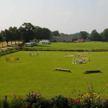
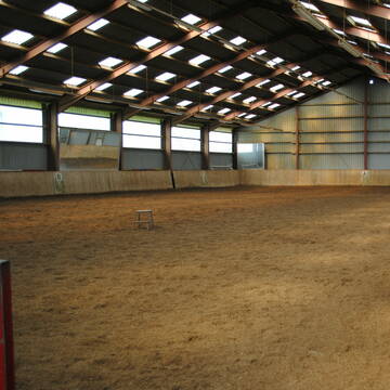
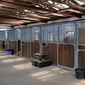
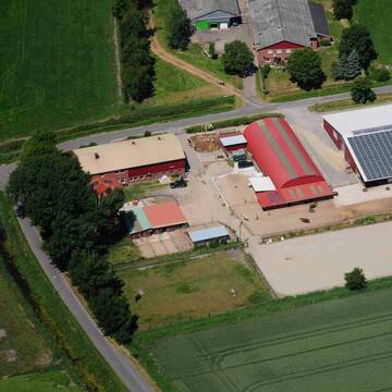
Reitanlage Schröder, Kaltenhof
Dänischenhagen
Dr-Enken-Schroeder-Lausen
@Dr-Enken-Schroeder-Lausen
FN-Mitglied
Rehabilitationsstall
Vermieten
Hunde willkommen
Krankenbox
Allergikerstall
bedampftes/gewaschenes Heu
24 weitere...
P+
Deprecated: Creation of dynamic property Zend_View_Helper_Ads::$adLink is deprecated in /var/www/stall-frei/htdocs/staging.stall-frei.de/library/Psf/View/Helper/Ads.php on line 108

Futtersack HeuToy, Fressbremse in pink
Mechtersen
STALL-FREIde Marketing
@STALL-FREI-Marketing
Stundenlange Beschäftigung die
Koliken vorbeugt, geringe Staubinhalation mit
steuerbarer Futterentnahme

Zucht und Pensionsstall Gut Neu Nordsee
Felde
Philipp-Behr-Boxenvermietung
@Philipp-Behr-Boxenvermietung
Freizeitstall
Pferdeausbildung
Vermieten
Longierzirkel/Roundpen
Paddock
Hufrehe geeignet
17 weitere...
P
2Ponyb.frei bis 1,46m u.1,30m
Osdorf
Hof-Kruse1
@Hof-Kruse1
FN-Mitglied
Freizeitstall
Longierzirkel/Roundpen
Paddock
Innenbox
Halbpension
Vollpension
13 weitere...
P
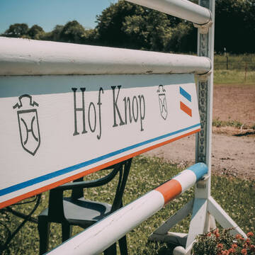
Aussenbox mit Fenster
Osdorf
Hof-Knop
@Hof-Knop
Vermieten
Longierzirkel/Roundpen
Paddock
Pferdezucht
Außenboxen
12 weitere...
aktuell
P

Offenstallplätze (Heu, kleine getrennte Herden)
Tüttendorf
Pferdeparadies_Rabensmoor
@Pferdeparadies_Rabensmoor
Freizeitstall
Reitlehrer und -unterricht
Vermieten
Hunde willkommen
Krankenbox
Fohlenaufzucht möglich
Gnadenbrothof
21 weitere...
P


Hof Silberturm - Freizeit- und Familienstall
Heikendorf
Hof Silberturm
@Hof-Silberturm
Freizeitstall
Vermieten
Paddock
Parkplatz für Pferdeanhänger
Außenbox mit Paddock
Innenbox
10 weitere...
S

Heu und Heulage verkaufen
Mechtersen
STALL-FREIde Marketing
@STALL-FREI-Marketing
Verkaufen Sie Ihr Heu und Ihre Heulage direkt an Reiter, Pferdeställe und Reitanlagen
Reitstall Hof Hammerich, Osdorf/Haferrögen
Osdorf
Susanne Hammerich
@SusanneHammerich
Freizeitstall
Reitlehrer und -unterricht
Vermieten
Longierzirkel/Roundpen
Paddock
Außenbox mit Paddock
Innenbox
13 weitere...
P

Kurplatz Rentnerplatz Nordsee Bewegungsstall
Cuxhaven
Udo und Kathrin Peine
@kathrinpeine
Freizeitstall
Krankenbox
Parkplatz für Pferdeanhänger
Allergikerstall
Notfallboxen
Bewegungsstall
9 weitere...
P
HIT Aktivstall
Brunsbüttel
Anki-Kuehl1
@Anki-Kuehl1
FN-Mitglied
Freizeitstall
Krankenbox
Longierzirkel/Roundpen
Notfallboxen
Pferdezucht
Bewegungsstall
Offenstall
16 weitere...
P


Boxen frei, Offenstall Plätze frei
Willenscharen
Yvonne-Thun
@Yvonne-Thun
FN-Mitglied
Freizeitstall
Führanlage
Hunde willkommen
Allergikerstall
Pferdezucht
Außenboxen
Innenbox
27 weitere...
aktuell
S
Werde Teil von STALL-FREI.de
Du hast eine Pferdebox frei? Freie Plätze im Offenstall, Pferdestall oder der Reitanlage kostenlos anbieten.
Deprecated: Creation of dynamic property Zend_View::$pageCount is deprecated in /var/www/stall-frei/htdocs/staging.stall-frei.de/library/vendor/shardj/zf1-future/library/Zend/View/Abstract.php on line 308
Deprecated: Creation of dynamic property Zend_View::$itemCountPerPage is deprecated in /var/www/stall-frei/htdocs/staging.stall-frei.de/library/vendor/shardj/zf1-future/library/Zend/View/Abstract.php on line 308
Deprecated: Creation of dynamic property Zend_View::$first is deprecated in /var/www/stall-frei/htdocs/staging.stall-frei.de/library/vendor/shardj/zf1-future/library/Zend/View/Abstract.php on line 308
Deprecated: Creation of dynamic property Zend_View::$current is deprecated in /var/www/stall-frei/htdocs/staging.stall-frei.de/library/vendor/shardj/zf1-future/library/Zend/View/Abstract.php on line 308
Deprecated: Creation of dynamic property Zend_View::$last is deprecated in /var/www/stall-frei/htdocs/staging.stall-frei.de/library/vendor/shardj/zf1-future/library/Zend/View/Abstract.php on line 308
Deprecated: Creation of dynamic property Zend_View::$previous is deprecated in /var/www/stall-frei/htdocs/staging.stall-frei.de/library/vendor/shardj/zf1-future/library/Zend/View/Abstract.php on line 308
Deprecated: Creation of dynamic property Zend_View::$next is deprecated in /var/www/stall-frei/htdocs/staging.stall-frei.de/library/vendor/shardj/zf1-future/library/Zend/View/Abstract.php on line 308
Deprecated: Creation of dynamic property Zend_View::$pagesInRange is deprecated in /var/www/stall-frei/htdocs/staging.stall-frei.de/library/vendor/shardj/zf1-future/library/Zend/View/Abstract.php on line 308
Deprecated: Creation of dynamic property Zend_View::$firstPageInRange is deprecated in /var/www/stall-frei/htdocs/staging.stall-frei.de/library/vendor/shardj/zf1-future/library/Zend/View/Abstract.php on line 308
Deprecated: Creation of dynamic property Zend_View::$lastPageInRange is deprecated in /var/www/stall-frei/htdocs/staging.stall-frei.de/library/vendor/shardj/zf1-future/library/Zend/View/Abstract.php on line 308
Deprecated: Creation of dynamic property Zend_View::$currentItemCount is deprecated in /var/www/stall-frei/htdocs/staging.stall-frei.de/library/vendor/shardj/zf1-future/library/Zend/View/Abstract.php on line 308
Deprecated: Creation of dynamic property Zend_View::$totalItemCount is deprecated in /var/www/stall-frei/htdocs/staging.stall-frei.de/library/vendor/shardj/zf1-future/library/Zend/View/Abstract.php on line 308
Deprecated: Creation of dynamic property Zend_View::$firstItemNumber is deprecated in /var/www/stall-frei/htdocs/staging.stall-frei.de/library/vendor/shardj/zf1-future/library/Zend/View/Abstract.php on line 308
Deprecated: Creation of dynamic property Zend_View::$lastItemNumber is deprecated in /var/www/stall-frei/htdocs/staging.stall-frei.de/library/vendor/shardj/zf1-future/library/Zend/View/Abstract.php on line 308
Deprecated: Creation of dynamic property Zend_View::$router is deprecated in /var/www/stall-frei/htdocs/staging.stall-frei.de/library/vendor/shardj/zf1-future/library/Zend/View/Abstract.php on line 308
Deprecated: Creation of dynamic property Zend_View::$urlParams is deprecated in /var/www/stall-frei/htdocs/staging.stall-frei.de/library/vendor/shardj/zf1-future/library/Zend/View/Abstract.php on line 308
Deprecated: Creation of dynamic property Zend_View::$showAds is deprecated in /var/www/stall-frei/htdocs/staging.stall-frei.de/library/vendor/shardj/zf1-future/library/Zend/View/Abstract.php on line 308
Deprecated: Creation of dynamic property Zend_View::$objectIds is deprecated in /var/www/stall-frei/htdocs/staging.stall-frei.de/library/vendor/shardj/zf1-future/library/Zend/View/Abstract.php on line 308
Deprecated: Creation of dynamic property Zend_View::$showNavbar is deprecated in /var/www/stall-frei/htdocs/staging.stall-frei.de/library/vendor/shardj/zf1-future/library/Zend/View/Abstract.php on line 308
Deprecated: Creation of dynamic property Zend_View::$showBreadcrumb is deprecated in /var/www/stall-frei/htdocs/staging.stall-frei.de/library/vendor/shardj/zf1-future/library/Zend/View/Abstract.php on line 308
Deprecated: Creation of dynamic property Zend_View::$showFooter is deprecated in /var/www/stall-frei/htdocs/staging.stall-frei.de/library/vendor/shardj/zf1-future/library/Zend/View/Abstract.php on line 308
Deprecated: Creation of dynamic property Zend_View::$showInternalAds is deprecated in /var/www/stall-frei/htdocs/staging.stall-frei.de/library/vendor/shardj/zf1-future/library/Zend/View/Abstract.php on line 308
Deprecated: Creation of dynamic property Zend_View::$blNoContent is deprecated in /var/www/stall-frei/htdocs/staging.stall-frei.de/library/vendor/shardj/zf1-future/library/Zend/View/Abstract.php on line 308
Deprecated: Creation of dynamic property Zend_View::$sMetaDesc is deprecated in /var/www/stall-frei/htdocs/staging.stall-frei.de/library/vendor/shardj/zf1-future/library/Zend/View/Abstract.php on line 308
Deprecated: Creation of dynamic property Zend_View::$useGmaps is deprecated in /var/www/stall-frei/htdocs/staging.stall-frei.de/library/vendor/shardj/zf1-future/library/Zend/View/Abstract.php on line 308
Deprecated: Creation of dynamic property Zend_View::$touches is deprecated in /var/www/stall-frei/htdocs/staging.stall-frei.de/library/vendor/shardj/zf1-future/library/Zend/View/Abstract.php on line 308
Deprecated: Creation of dynamic property Zend_View::$oProject is deprecated in /var/www/stall-frei/htdocs/staging.stall-frei.de/library/vendor/shardj/zf1-future/library/Zend/View/Abstract.php on line 308
Deprecated: Creation of dynamic property Zend_View::$pageHeadline is deprecated in /var/www/stall-frei/htdocs/staging.stall-frei.de/library/vendor/shardj/zf1-future/library/Zend/View/Abstract.php on line 308
Deprecated: Creation of dynamic property Zend_View::$disableLocationField is deprecated in /var/www/stall-frei/htdocs/staging.stall-frei.de/library/vendor/shardj/zf1-future/library/Zend/View/Abstract.php on line 308
Deprecated: Creation of dynamic property Zend_View::$isSearch is deprecated in /var/www/stall-frei/htdocs/staging.stall-frei.de/library/vendor/shardj/zf1-future/library/Zend/View/Abstract.php on line 308
Deprecated: Creation of dynamic property Zend_View::$pageTitle is deprecated in /var/www/stall-frei/htdocs/staging.stall-frei.de/library/vendor/shardj/zf1-future/library/Zend/View/Abstract.php on line 308
Deprecated: Creation of dynamic property Psf_Form_Element_Text::$class is deprecated in /var/www/stall-frei/htdocs/staging.stall-frei.de/library/vendor/shardj/zf1-future/library/Zend/Form/Element.php on line 874
Deprecated: Creation of dynamic property Psf_Form_Element_Text::$size is deprecated in /var/www/stall-frei/htdocs/staging.stall-frei.de/library/vendor/shardj/zf1-future/library/Zend/Form/Element.php on line 874
Deprecated: Creation of dynamic property Psf_Form_Element_Text::$placeholder is deprecated in /var/www/stall-frei/htdocs/staging.stall-frei.de/library/vendor/shardj/zf1-future/library/Zend/Form/Element.php on line 874
Deprecated: Creation of dynamic property Psf_Form_Element_Hidden::$class is deprecated in /var/www/stall-frei/htdocs/staging.stall-frei.de/library/vendor/shardj/zf1-future/library/Zend/Form/Element.php on line 874
Deprecated: Creation of dynamic property Psf_Form_Element_Hidden::$class is deprecated in /var/www/stall-frei/htdocs/staging.stall-frei.de/library/vendor/shardj/zf1-future/library/Zend/Form/Element.php on line 874
Deprecated: Creation of dynamic property Psf_Form_Element_Hidden::$class is deprecated in /var/www/stall-frei/htdocs/staging.stall-frei.de/library/vendor/shardj/zf1-future/library/Zend/Form/Element.php on line 874
Deprecated: Creation of dynamic property Psf_Form_Element_Hidden::$class is deprecated in /var/www/stall-frei/htdocs/staging.stall-frei.de/library/vendor/shardj/zf1-future/library/Zend/Form/Element.php on line 874
Deprecated: Creation of dynamic property Psf_Form_Element_Select::$class is deprecated in /var/www/stall-frei/htdocs/staging.stall-frei.de/library/vendor/shardj/zf1-future/library/Zend/Form/Element.php on line 874
Deprecated: Creation of dynamic property Psf_Form_Element_Select::$class is deprecated in /var/www/stall-frei/htdocs/staging.stall-frei.de/library/vendor/shardj/zf1-future/library/Zend/Form/Element.php on line 874
Deprecated: Creation of dynamic property Psf_Form_Element_Select::$class is deprecated in /var/www/stall-frei/htdocs/staging.stall-frei.de/library/vendor/shardj/zf1-future/library/Zend/Form/Element.php on line 874
Deprecated: Creation of dynamic property Psf_Form_Element_Select::$class is deprecated in /var/www/stall-frei/htdocs/staging.stall-frei.de/library/vendor/shardj/zf1-future/library/Zend/Form/Element.php on line 874
Deprecated: Creation of dynamic property Psf_Form_Element_Text::$class is deprecated in /var/www/stall-frei/htdocs/staging.stall-frei.de/library/vendor/shardj/zf1-future/library/Zend/Form/Element.php on line 874
Deprecated: Creation of dynamic property Psf_Form_Element_Checkbox::$label is deprecated in /var/www/stall-frei/htdocs/staging.stall-frei.de/library/vendor/shardj/zf1-future/library/Zend/Form/Element.php on line 874
Deprecated: Creation of dynamic property Zend_View::$sort is deprecated in /var/www/stall-frei/htdocs/staging.stall-frei.de/library/vendor/shardj/zf1-future/library/Zend/View/Abstract.php on line 308
Deprecated: Creation of dynamic property Zend_View::$searchLocation is deprecated in /var/www/stall-frei/htdocs/staging.stall-frei.de/library/vendor/shardj/zf1-future/library/Zend/View/Abstract.php on line 308
Deprecated: Creation of dynamic property Zend_View::$locationHint is deprecated in /var/www/stall-frei/htdocs/staging.stall-frei.de/library/vendor/shardj/zf1-future/library/Zend/View/Abstract.php on line 308
Psf_GeoCoder_Abstract::getLocation: Osterende Get Location CachedOrLive
Psf_GeoCoder_Abstract::getCachedOrLive: Osterende
Psf_GeoCoder_Abstract::convertLocationResult
{"documentation":"https:\/\/opencagedata.com\/api","licenses":[{"name":"see attribution guide","url":"https:\/\/opencagedata.com\/credits"}],"results":[{"bounds":{"northeast":{"lat":54.8803628,"lng":8.4522271},"southwest":{"lat":54.8403628,"lng":8.4122271}},"components":{"ISO_3166-1_alpha-2":"DE","ISO_3166-1_alpha-3":"DEU","ISO_3166-2":["DE-SH"],"_category":"place","_normalized_city":"Sylt","_type":"village","city":"Sylt","continent":"Europe","country":"Deutschland","country_code":"de","county":"Kreis Nordfriesland","political_union":"European Union","state":"Schleswig-Holstein","state_code":"SH","village":"Osterende"},"confidence":7,"formatted":"Osterende, Schleswig-Holstein, Deutschland","geometry":{"lat":54.8603628,"lng":8.4322271}},{"bounds":{"northeast":{"lat":53.4461039,"lng":7.9999313},"southwest":{"lat":53.4061039,"lng":7.9599313}},"components":{"ISO_3166-1_alpha-2":"DE","ISO_3166-1_alpha-3":"DEU","ISO_3166-2":["DE-NI"],"_category":"place","_normalized_city":"Zetel","_type":"village","continent":"Europe","country":"Deutschland","country_code":"de","county":"Landkreis Friesland","political_union":"European Union","postcode":"26340","state":"Niedersachsen","state_code":"NI","town":"Zetel","village":"Osterende"},"confidence":7,"formatted":"26340 Osterende, Deutschland","geometry":{"lat":53.4261039,"lng":7.9799313}},{"bounds":{"northeast":{"lat":52.7751541,"lng":8.3852501},"southwest":{"lat":52.7351541,"lng":8.3452501}},"components":{"ISO_3166-1_alpha-2":"DE","ISO_3166-1_alpha-3":"DEU","ISO_3166-2":["DE-NI"],"_category":"place","_normalized_city":"Goldenstedt","_type":"hamlet","continent":"Europe","country":"Deutschland","country_code":"de","county":"Landkreis Vechta","hamlet":"Osterende","political_union":"European Union","postcode":"49424","state":"Niedersachsen","state_code":"NI","suburb":"Lutten","village":"Goldenstedt"},"confidence":7,"formatted":"Osterende, 49424 Goldenstedt, Deutschland","geometry":{"lat":52.7551541,"lng":8.3652501}},{"bounds":{"northeast":{"lat":52.761659,"lng":8.3805211},"southwest":{"lat":52.7389436,"lng":8.3535461}},"components":{"ISO_3166-1_alpha-2":"DE","ISO_3166-1_alpha-3":"DEU","ISO_3166-2":["DE-NI"],"_category":"place","_normalized_city":"Goldenstedt","_type":"village","continent":"Europe","country":"Deutschland","country_code":"de","county":"Landkreis Vechta","neighbourhood":"Osterende","political_union":"European Union","state":"Niedersachsen","state_code":"NI","suburb":"Lutten","village":"Goldenstedt"},"confidence":7,"formatted":"Lutten, Goldenstedt, Niedersachsen, Deutschland","geometry":{"lat":52.7499988,"lng":8.3705961}},{"bounds":{"northeast":{"lat":52.856068,"lng":7.6910479},"southwest":{"lat":52.8542612,"lng":7.6894325}},"components":{"ISO_3166-1_alpha-2":"DE","ISO_3166-1_alpha-3":"DEU","ISO_3166-2":["DE-NI"],"_category":"natural\/water","_normalized_city":"Werlte","_type":"forest","continent":"Europe","country":"Deutschland","country_code":"de","county":"Landkreis Emsland","forest":"Osterende","municipality":"Samtgemeinde Werlte","political_union":"European Union","postcode":"49757","state":"Niedersachsen","state_code":"NI","town":"Werlte"},"confidence":9,"formatted":"Osterende, 49757 Werlte, Deutschland","geometry":{"lat":52.8551373,"lng":7.6902401}},{"bounds":{"northeast":{"lat":53.3306478,"lng":7.9413412},"southwest":{"lat":53.32234,"lng":7.936126}},"components":{"ISO_3166-1_alpha-2":"DE","ISO_3166-1_alpha-3":"DEU","ISO_3166-2":["DE-NI"],"_category":"road","_normalized_city":"Westerstede","_type":"road","continent":"Europe","country":"Deutschland","country_code":"de","county":"Landkreis Ammerland","political_union":"European Union","postcode":"26655","road":"Osterende","road_type":"tertiary","state":"Niedersachsen","state_code":"NI","town":"Westerstede"},"confidence":9,"formatted":"Osterende, 26655 Westerstede, Deutschland","geometry":{"lat":53.326295,"lng":7.938971}},{"bounds":{"northeast":{"lat":54.7731917,"lng":8.2963866},"southwest":{"lat":54.7702743,"lng":8.2941829}},"components":{"ISO_3166-1_alpha-2":"DE","ISO_3166-1_alpha-3":"DEU","ISO_3166-2":["DE-SH"],"_category":"road","_normalized_city":"H\u00f6rnum (Sylt)","_type":"road","continent":"Europe","country":"Deutschland","country_code":"de","county":"Kreis Nordfriesland","municipality":"Landschaft Sylt","political_union":"European Union","postcode":"25997","road":"Osterende","road_type":"residential","state":"Schleswig-Holstein","state_code":"SH","village":"H\u00f6rnum (Sylt)"},"confidence":9,"formatted":"Osterende, 25997 H\u00f6rnum (Sylt), Deutschland","geometry":{"lat":54.7709966,"lng":8.2962722}},{"bounds":{"northeast":{"lat":53.6672969,"lng":9.0516496},"southwest":{"lat":53.6650583,"lng":9.0499466}},"components":{"ISO_3166-1_alpha-2":"DE","ISO_3166-1_alpha-3":"DEU","ISO_3166-2":["DE-NI"],"_category":"road","_normalized_city":"Mittelstenahe","_type":"road","city":"Mittelstenahe","continent":"Europe","country":"Deutschland","country_code":"de","county":"Landkreis Cuxhaven","municipality":"Samtgemeinde B\u00f6rde Lamstedt","political_union":"European Union","postcode":"21770","road":"Osterende","road_type":"tertiary","state":"Niedersachsen","state_code":"NI"},"confidence":9,"formatted":"Osterende, 21770 Mittelstenahe, Deutschland","geometry":{"lat":53.6663263,"lng":9.0506032}},{"bounds":{"northeast":{"lat":53.2177865,"lng":7.8125598},"southwest":{"lat":53.2172193,"lng":7.8090473}},"components":{"ISO_3166-1_alpha-2":"DE","ISO_3166-1_alpha-3":"DEU","ISO_3166-2":["DE-NI"],"_category":"road","_normalized_city":"Apen","_type":"road","continent":"Europe","country":"Deutschland","country_code":"de","county":"Landkreis Ammerland","neighbourhood":"Eschsiedlung","political_union":"European Union","postcode":"26689","road":"Osterende","road_type":"tertiary","state":"Niedersachsen","state_code":"NI","village":"Apen"},"confidence":9,"formatted":"Osterende, 26689 Apen, Deutschland","geometry":{"lat":53.2176759,"lng":7.8108297}},{"bounds":{"northeast":{"lat":53.2151933,"lng":9.4984297},"southwest":{"lat":53.2148053,"lng":9.4963264}},"components":{"ISO_3166-1_alpha-2":"DE","ISO_3166-1_alpha-3":"DEU","ISO_3166-2":["DE-NI"],"_category":"road","_normalized_city":"Helvesiek","_type":"road","continent":"Europe","country":"Deutschland","country_code":"de","county":"Landkreis Rotenburg (W\u00fcmme)","municipality":"Samtgemeinde Fintel","political_union":"European Union","postcode":"27389","road":"Osterende","road_type":"tertiary","state":"Niedersachsen","state_code":"NI","village":"Helvesiek"},"confidence":9,"formatted":"Osterende, 27389 Helvesiek, Deutschland","geometry":{"lat":53.2149918,"lng":9.4973763}}],"status":{"code":200,"message":"OK"},"stay_informed":{"blog":"https:\/\/blog.opencagedata.com","mastodon":"https:\/\/en.osm.town\/@opencage"},"thanks":"For using an OpenCage API","timestamp":{"created_http":"Sun, 08 Feb 2026 01:22:00 GMT","created_unix":1770513720},"total_results":10}Array
(
[0] => stdClass Object
(
[bounds] => stdClass Object
(
[northeast] => stdClass Object
(
[lat] => 54.8803628
[lng] => 8.4522271
)
[southwest] => stdClass Object
(
[lat] => 54.8403628
[lng] => 8.4122271
)
)
[components] => stdClass Object
(
[ISO_3166-1_alpha-2] => DE
[ISO_3166-1_alpha-3] => DEU
[ISO_3166-2] => Array
(
[0] => DE-SH
)
[_category] => place
[_normalized_city] => Sylt
[_type] => village
[city] => Sylt
[continent] => Europe
[country] => Deutschland
[country_code] => de
[county] => Kreis Nordfriesland
[political_union] => European Union
[state] => Schleswig-Holstein
[state_code] => SH
[village] => Osterende
)
[confidence] => 7
[formatted] => Osterende, Schleswig-Holstein, Deutschland
[geometry] => stdClass Object
(
[lat] => 54.8603628
[lng] => 8.4322271
)
)
[1] => stdClass Object
(
[bounds] => stdClass Object
(
[northeast] => stdClass Object
(
[lat] => 53.4461039
[lng] => 7.9999313
)
[southwest] => stdClass Object
(
[lat] => 53.4061039
[lng] => 7.9599313
)
)
[components] => stdClass Object
(
[ISO_3166-1_alpha-2] => DE
[ISO_3166-1_alpha-3] => DEU
[ISO_3166-2] => Array
(
[0] => DE-NI
)
[_category] => place
[_normalized_city] => Zetel
[_type] => village
[continent] => Europe
[country] => Deutschland
[country_code] => de
[county] => Landkreis Friesland
[political_union] => European Union
[postcode] => 26340
[state] => Niedersachsen
[state_code] => NI
[town] => Zetel
[village] => Osterende
)
[confidence] => 7
[formatted] => 26340 Osterende, Deutschland
[geometry] => stdClass Object
(
[lat] => 53.4261039
[lng] => 7.9799313
)
)
[2] => stdClass Object
(
[bounds] => stdClass Object
(
[northeast] => stdClass Object
(
[lat] => 52.7751541
[lng] => 8.3852501
)
[southwest] => stdClass Object
(
[lat] => 52.7351541
[lng] => 8.3452501
)
)
[components] => stdClass Object
(
[ISO_3166-1_alpha-2] => DE
[ISO_3166-1_alpha-3] => DEU
[ISO_3166-2] => Array
(
[0] => DE-NI
)
[_category] => place
[_normalized_city] => Goldenstedt
[_type] => hamlet
[continent] => Europe
[country] => Deutschland
[country_code] => de
[county] => Landkreis Vechta
[hamlet] => Osterende
[political_union] => European Union
[postcode] => 49424
[state] => Niedersachsen
[state_code] => NI
[suburb] => Lutten
[village] => Goldenstedt
)
[confidence] => 7
[formatted] => Osterende, 49424 Goldenstedt, Deutschland
[geometry] => stdClass Object
(
[lat] => 52.7551541
[lng] => 8.3652501
)
)
[3] => stdClass Object
(
[bounds] => stdClass Object
(
[northeast] => stdClass Object
(
[lat] => 52.761659
[lng] => 8.3805211
)
[southwest] => stdClass Object
(
[lat] => 52.7389436
[lng] => 8.3535461
)
)
[components] => stdClass Object
(
[ISO_3166-1_alpha-2] => DE
[ISO_3166-1_alpha-3] => DEU
[ISO_3166-2] => Array
(
[0] => DE-NI
)
[_category] => place
[_normalized_city] => Goldenstedt
[_type] => village
[continent] => Europe
[country] => Deutschland
[country_code] => de
[county] => Landkreis Vechta
[neighbourhood] => Osterende
[political_union] => European Union
[state] => Niedersachsen
[state_code] => NI
[suburb] => Lutten
[village] => Goldenstedt
)
[confidence] => 7
[formatted] => Lutten, Goldenstedt, Niedersachsen, Deutschland
[geometry] => stdClass Object
(
[lat] => 52.7499988
[lng] => 8.3705961
)
)
[4] => stdClass Object
(
[bounds] => stdClass Object
(
[northeast] => stdClass Object
(
[lat] => 52.856068
[lng] => 7.6910479
)
[southwest] => stdClass Object
(
[lat] => 52.8542612
[lng] => 7.6894325
)
)
[components] => stdClass Object
(
[ISO_3166-1_alpha-2] => DE
[ISO_3166-1_alpha-3] => DEU
[ISO_3166-2] => Array
(
[0] => DE-NI
)
[_category] => natural/water
[_normalized_city] => Werlte
[_type] => forest
[continent] => Europe
[country] => Deutschland
[country_code] => de
[county] => Landkreis Emsland
[forest] => Osterende
[municipality] => Samtgemeinde Werlte
[political_union] => European Union
[postcode] => 49757
[state] => Niedersachsen
[state_code] => NI
[town] => Werlte
)
[confidence] => 9
[formatted] => Osterende, 49757 Werlte, Deutschland
[geometry] => stdClass Object
(
[lat] => 52.8551373
[lng] => 7.6902401
)
)
[5] => stdClass Object
(
[bounds] => stdClass Object
(
[northeast] => stdClass Object
(
[lat] => 53.3306478
[lng] => 7.9413412
)
[southwest] => stdClass Object
(
[lat] => 53.32234
[lng] => 7.936126
)
)
[components] => stdClass Object
(
[ISO_3166-1_alpha-2] => DE
[ISO_3166-1_alpha-3] => DEU
[ISO_3166-2] => Array
(
[0] => DE-NI
)
[_category] => road
[_normalized_city] => Westerstede
[_type] => road
[continent] => Europe
[country] => Deutschland
[country_code] => de
[county] => Landkreis Ammerland
[political_union] => European Union
[postcode] => 26655
[road] => Osterende
[road_type] => tertiary
[state] => Niedersachsen
[state_code] => NI
[town] => Westerstede
)
[confidence] => 9
[formatted] => Osterende, 26655 Westerstede, Deutschland
[geometry] => stdClass Object
(
[lat] => 53.326295
[lng] => 7.938971
)
)
[6] => stdClass Object
(
[bounds] => stdClass Object
(
[northeast] => stdClass Object
(
[lat] => 54.7731917
[lng] => 8.2963866
)
[southwest] => stdClass Object
(
[lat] => 54.7702743
[lng] => 8.2941829
)
)
[components] => stdClass Object
(
[ISO_3166-1_alpha-2] => DE
[ISO_3166-1_alpha-3] => DEU
[ISO_3166-2] => Array
(
[0] => DE-SH
)
[_category] => road
[_normalized_city] => Hörnum (Sylt)
[_type] => road
[continent] => Europe
[country] => Deutschland
[country_code] => de
[county] => Kreis Nordfriesland
[municipality] => Landschaft Sylt
[political_union] => European Union
[postcode] => 25997
[road] => Osterende
[road_type] => residential
[state] => Schleswig-Holstein
[state_code] => SH
[village] => Hörnum (Sylt)
)
[confidence] => 9
[formatted] => Osterende, 25997 Hörnum (Sylt), Deutschland
[geometry] => stdClass Object
(
[lat] => 54.7709966
[lng] => 8.2962722
)
)
[7] => stdClass Object
(
[bounds] => stdClass Object
(
[northeast] => stdClass Object
(
[lat] => 53.6672969
[lng] => 9.0516496
)
[southwest] => stdClass Object
(
[lat] => 53.6650583
[lng] => 9.0499466
)
)
[components] => stdClass Object
(
[ISO_3166-1_alpha-2] => DE
[ISO_3166-1_alpha-3] => DEU
[ISO_3166-2] => Array
(
[0] => DE-NI
)
[_category] => road
[_normalized_city] => Mittelstenahe
[_type] => road
[city] => Mittelstenahe
[continent] => Europe
[country] => Deutschland
[country_code] => de
[county] => Landkreis Cuxhaven
[municipality] => Samtgemeinde Börde Lamstedt
[political_union] => European Union
[postcode] => 21770
[road] => Osterende
[road_type] => tertiary
[state] => Niedersachsen
[state_code] => NI
)
[confidence] => 9
[formatted] => Osterende, 21770 Mittelstenahe, Deutschland
[geometry] => stdClass Object
(
[lat] => 53.6663263
[lng] => 9.0506032
)
)
[8] => stdClass Object
(
[bounds] => stdClass Object
(
[northeast] => stdClass Object
(
[lat] => 53.2177865
[lng] => 7.8125598
)
[southwest] => stdClass Object
(
[lat] => 53.2172193
[lng] => 7.8090473
)
)
[components] => stdClass Object
(
[ISO_3166-1_alpha-2] => DE
[ISO_3166-1_alpha-3] => DEU
[ISO_3166-2] => Array
(
[0] => DE-NI
)
[_category] => road
[_normalized_city] => Apen
[_type] => road
[continent] => Europe
[country] => Deutschland
[country_code] => de
[county] => Landkreis Ammerland
[neighbourhood] => Eschsiedlung
[political_union] => European Union
[postcode] => 26689
[road] => Osterende
[road_type] => tertiary
[state] => Niedersachsen
[state_code] => NI
[village] => Apen
)
[confidence] => 9
[formatted] => Osterende, 26689 Apen, Deutschland
[geometry] => stdClass Object
(
[lat] => 53.2176759
[lng] => 7.8108297
)
)
[9] => stdClass Object
(
[bounds] => stdClass Object
(
[northeast] => stdClass Object
(
[lat] => 53.2151933
[lng] => 9.4984297
)
[southwest] => stdClass Object
(
[lat] => 53.2148053
[lng] => 9.4963264
)
)
[components] => stdClass Object
(
[ISO_3166-1_alpha-2] => DE
[ISO_3166-1_alpha-3] => DEU
[ISO_3166-2] => Array
(
[0] => DE-NI
)
[_category] => road
[_normalized_city] => Helvesiek
[_type] => road
[continent] => Europe
[country] => Deutschland
[country_code] => de
[county] => Landkreis Rotenburg (Wümme)
[municipality] => Samtgemeinde Fintel
[political_union] => European Union
[postcode] => 27389
[road] => Osterende
[road_type] => tertiary
[state] => Niedersachsen
[state_code] => NI
[village] => Helvesiek
)
[confidence] => 9
[formatted] => Osterende, 27389 Helvesiek, Deutschland
[geometry] => stdClass Object
(
[lat] => 53.2149918
[lng] => 9.4973763
)
)
)
Psf_GeoCoder_OpenCageData::getKeyMap: 0
stdClass Object
(
    [bounds] => stdClass Object
        (
            [northeast] => stdClass Object
                (
                    [lat] => 54.8803628
                    [lng] => 8.4522271
                )

            [southwest] => stdClass Object
                (
                    [lat] => 54.8403628
                    [lng] => 8.4122271
                )

        )

    [components] => stdClass Object
        (
            [ISO_3166-1_alpha-2] => DE
            [ISO_3166-1_alpha-3] => DEU
            [ISO_3166-2] => Array
                (
                    [0] => DE-SH
                )

            [_category] => place
            [_normalized_city] => Sylt
            [_type] => village
            [city] => Sylt
            [continent] => Europe
            [country] => Deutschland
            [country_code] => de
            [county] => Kreis Nordfriesland
            [political_union] => European Union
            [state] => Schleswig-Holstein
            [state_code] => SH
            [village] => Osterende
        )

    [confidence] => 7
    [formatted] => Osterende, Schleswig-Holstein, Deutschland
    [geometry] => stdClass Object
        (
            [lat] => 54.8603628
            [lng] => 8.4322271
        )

)
Psf_GeoCoder_OpenCageData::getCounty: Nordfriesland
Psf_GeoCoder_OpenCageData::addMissingData REFETCH!
Array
(
    [address] => Osterende, Schleswig-Holstein, Deutschland
    [type] => village
    [street] =>
    [city] => Osterende
    [county] => Nordfriesland
    [state] => Schleswig-Holstein
    [zip] =>
    [country] => Deutschland
    [suburb] =>
    [countrycode] => de
    [latitude] => 54.8603628
    [longitude] => 8.4322271
    [accuracy] => 1
    [confidence] => 7
    [bounds] => stdClass Object
        (
            [northeast] => stdClass Object
                (
                    [lat] => 54.8803628
                    [lng] => 8.4522271
                )

            [southwest] => stdClass Object
                (
                    [lat] => 54.8403628
                    [lng] => 8.4122271
                )

        )

)
reformat!
Array
(
    [address] => Osterende, Schleswig-Holstein, Deutschland
    [type] => village
    [street] =>
    [city] => Osterende
    [county] => Nordfriesland
    [state] => Schleswig-Holstein
    [zip] =>
    [country] => Deutschland
    [suburb] =>
    [countrycode] => de
    [latitude] => 54.8603628
    [longitude] => 8.4322271
    [accuracy] => 1
    [confidence] => 7
    [bounds] => stdClass Object
        (
            [northeast] => stdClass Object
                (
                    [lat] => 54.8803628
                    [lng] => 8.4522271
                )

            [southwest] => stdClass Object
                (
                    [lat] => 54.8403628
                    [lng] => 8.4122271
                )

        )

    [place] => Osterende, Schleswig-Holstein
    [hash] => 58c4171b6ff017c48cd4574feb1bc244
)
Psf_GeoCoder_OpenCageData::getKeyMap: 1
stdClass Object
(
    [bounds] => stdClass Object
        (
            [northeast] => stdClass Object
                (
                    [lat] => 53.4461039
                    [lng] => 7.9999313
                )

            [southwest] => stdClass Object
                (
                    [lat] => 53.4061039
                    [lng] => 7.9599313
                )

        )

    [components] => stdClass Object
        (
            [ISO_3166-1_alpha-2] => DE
            [ISO_3166-1_alpha-3] => DEU
            [ISO_3166-2] => Array
                (
                    [0] => DE-NI
                )

            [_category] => place
            [_normalized_city] => Zetel
            [_type] => village
            [continent] => Europe
            [country] => Deutschland
            [country_code] => de
            [county] => Landkreis Friesland
            [political_union] => European Union
            [postcode] => 26340
            [state] => Niedersachsen
            [state_code] => NI
            [town] => Zetel
            [village] => Osterende
        )

    [confidence] => 7
    [formatted] => 26340 Osterende, Deutschland
    [geometry] => stdClass Object
        (
            [lat] => 53.4261039
            [lng] => 7.9799313
        )

)
Psf_GeoCoder_OpenCageData::getCounty: Friesland
Psf_GeoCoder_OpenCageData::addMissingData REFETCH!
Array
(
    [address] => 26340 Osterende, Deutschland
    [type] => village
    [street] =>
    [city] => Zetel
    [county] => Friesland
    [state] => Niedersachsen
    [zip] => 26340
    [country] => Deutschland
    [suburb] =>
    [countrycode] => de
    [latitude] => 53.4261039
    [longitude] => 7.9799313
    [accuracy] => 1
    [confidence] => 7
    [bounds] => stdClass Object
        (
            [northeast] => stdClass Object
                (
                    [lat] => 53.4461039
                    [lng] => 7.9999313
                )

            [southwest] => stdClass Object
                (
                    [lat] => 53.4061039
                    [lng] => 7.9599313
                )

        )

)
reformat!
Array
(
    [address] => 26340 Zetel
    [type] => village
    [street] =>
    [city] => Zetel
    [county] => Friesland
    [state] => Niedersachsen
    [zip] => 26340
    [country] => Deutschland
    [suburb] =>
    [countrycode] => de
    [latitude] => 53.4261039
    [longitude] => 7.9799313
    [accuracy] => 1
    [confidence] => 7
    [bounds] => stdClass Object
        (
            [northeast] => stdClass Object
                (
                    [lat] => 53.4461039
                    [lng] => 7.9999313
                )

            [southwest] => stdClass Object
                (
                    [lat] => 53.4061039
                    [lng] => 7.9599313
                )

        )

    [place] => 26340 Zetel, Niedersachsen
    [hash] => 1aeea9b9bf5e11efe83c4382d10424e2
)
Psf_GeoCoder_OpenCageData::getKeyMap: 2
stdClass Object
(
    [bounds] => stdClass Object
        (
            [northeast] => stdClass Object
                (
                    [lat] => 52.7751541
                    [lng] => 8.3852501
                )

            [southwest] => stdClass Object
                (
                    [lat] => 52.7351541
                    [lng] => 8.3452501
                )

        )

    [components] => stdClass Object
        (
            [ISO_3166-1_alpha-2] => DE
            [ISO_3166-1_alpha-3] => DEU
            [ISO_3166-2] => Array
                (
                    [0] => DE-NI
                )

            [_category] => place
            [_normalized_city] => Goldenstedt
            [_type] => hamlet
            [continent] => Europe
            [country] => Deutschland
            [country_code] => de
            [county] => Landkreis Vechta
            [hamlet] => Osterende
            [political_union] => European Union
            [postcode] => 49424
            [state] => Niedersachsen
            [state_code] => NI
            [suburb] => Lutten
            [village] => Goldenstedt
        )

    [confidence] => 7
    [formatted] => Osterende, 49424 Goldenstedt, Deutschland
    [geometry] => stdClass Object
        (
            [lat] => 52.7551541
            [lng] => 8.3652501
        )

)
Psf_GeoCoder_OpenCageData::getCounty: Vechta
Psf_GeoCoder_OpenCageData::addMissingData REFETCH!
Array
(
    [address] => Osterende, 49424 Goldenstedt, Deutschland
    [type] => hamlet
    [street] => Osterende
    [city] => Goldenstedt
    [county] => Vechta
    [state] => Niedersachsen
    [zip] => 49424
    [country] => Deutschland
    [suburb] => Lutten
    [countrycode] => de
    [latitude] => 52.7551541
    [longitude] => 8.3652501
    [accuracy] => 1
    [confidence] => 7
    [bounds] => stdClass Object
        (
            [northeast] => stdClass Object
                (
                    [lat] => 52.7751541
                    [lng] => 8.3852501
                )

            [southwest] => stdClass Object
                (
                    [lat] => 52.7351541
                    [lng] => 8.3452501
                )

        )

)
reformat!
Array
(
    [address] => Osterende, 49424 Goldenstedt, Deutschland
    [type] => hamlet
    [street] => Osterende
    [city] => Goldenstedt
    [county] => Vechta
    [state] => Niedersachsen
    [zip] => 49424
    [country] => Deutschland
    [suburb] => Lutten
    [countrycode] => de
    [latitude] => 52.7551541
    [longitude] => 8.3652501
    [accuracy] => 1
    [confidence] => 7
    [bounds] => stdClass Object
        (
            [northeast] => stdClass Object
                (
                    [lat] => 52.7751541
                    [lng] => 8.3852501
                )

            [southwest] => stdClass Object
                (
                    [lat] => 52.7351541
                    [lng] => 8.3452501
                )

        )

    [place] => Osterende, 49424 Goldenstedt, Niedersachsen
    [hash] => d35fe7f161a3522fbbb4a31c29c5245b
)
Psf_GeoCoder_OpenCageData::getKeyMap: 3
stdClass Object
(
    [bounds] => stdClass Object
        (
            [northeast] => stdClass Object
                (
                    [lat] => 52.761659
                    [lng] => 8.3805211
                )

            [southwest] => stdClass Object
                (
                    [lat] => 52.7389436
                    [lng] => 8.3535461
                )

        )

    [components] => stdClass Object
        (
            [ISO_3166-1_alpha-2] => DE
            [ISO_3166-1_alpha-3] => DEU
            [ISO_3166-2] => Array
                (
                    [0] => DE-NI
                )

            [_category] => place
            [_normalized_city] => Goldenstedt
            [_type] => village
            [continent] => Europe
            [country] => Deutschland
            [country_code] => de
            [county] => Landkreis Vechta
            [neighbourhood] => Osterende
            [political_union] => European Union
            [state] => Niedersachsen
            [state_code] => NI
            [suburb] => Lutten
            [village] => Goldenstedt
        )

    [confidence] => 7
    [formatted] => Lutten, Goldenstedt, Niedersachsen, Deutschland
    [geometry] => stdClass Object
        (
            [lat] => 52.7499988
            [lng] => 8.3705961
        )

)
Psf_GeoCoder_OpenCageData::getCounty: Vechta
Psf_GeoCoder_OpenCageData::addMissingData REFETCH!
Array
(
    [address] => Lutten, Goldenstedt, Niedersachsen, Deutschland
    [type] => village
    [street] =>
    [city] => Goldenstedt
    [county] => Vechta
    [state] => Niedersachsen
    [zip] =>
    [country] => Deutschland
    [suburb] => Lutten
    [countrycode] => de
    [latitude] => 52.7499988
    [longitude] => 8.3705961
    [accuracy] => 1
    [confidence] => 7
    [bounds] => stdClass Object
        (
            [northeast] => stdClass Object
                (
                    [lat] => 52.761659
                    [lng] => 8.3805211
                )

            [southwest] => stdClass Object
                (
                    [lat] => 52.7389436
                    [lng] => 8.3535461
                )

        )

)
reformat!
Array
(
    [address] => Lutten, Goldenstedt, Niedersachsen, Deutschland
    [type] => village
    [street] =>
    [city] => Goldenstedt
    [county] => Vechta
    [state] => Niedersachsen
    [zip] =>
    [country] => Deutschland
    [suburb] => Lutten
    [countrycode] => de
    [latitude] => 52.7499988
    [longitude] => 8.3705961
    [accuracy] => 1
    [confidence] => 7
    [bounds] => stdClass Object
        (
            [northeast] => stdClass Object
                (
                    [lat] => 52.761659
                    [lng] => 8.3805211
                )

            [southwest] => stdClass Object
                (
                    [lat] => 52.7389436
                    [lng] => 8.3535461
                )

        )

    [place] => Goldenstedt, Niedersachsen
    [hash] => 095648fe5c3260e7b2caee5617899c14
)
Psf_GeoCoder_OpenCageData::getKeyMap: 4
stdClass Object
(
    [bounds] => stdClass Object
        (
            [northeast] => stdClass Object
                (
                    [lat] => 52.856068
                    [lng] => 7.6910479
                )

            [southwest] => stdClass Object
                (
                    [lat] => 52.8542612
                    [lng] => 7.6894325
                )

        )

    [components] => stdClass Object
        (
            [ISO_3166-1_alpha-2] => DE
            [ISO_3166-1_alpha-3] => DEU
            [ISO_3166-2] => Array
                (
                    [0] => DE-NI
                )

            [_category] => natural/water
            [_normalized_city] => Werlte
            [_type] => forest
            [continent] => Europe
            [country] => Deutschland
            [country_code] => de
            [county] => Landkreis Emsland
            [forest] => Osterende
            [municipality] => Samtgemeinde Werlte
            [political_union] => European Union
            [postcode] => 49757
            [state] => Niedersachsen
            [state_code] => NI
            [town] => Werlte
        )

    [confidence] => 9
    [formatted] => Osterende, 49757 Werlte, Deutschland
    [geometry] => stdClass Object
        (
            [lat] => 52.8551373
            [lng] => 7.6902401
        )

)
Psf_GeoCoder_OpenCageData::getCounty: Emsland
Psf_GeoCoder_OpenCageData::addMissingData REFETCH!
Array
(
    [address] => Osterende, 49757 Werlte, Deutschland
    [type] => forest
    [street] =>
    [city] => Werlte
    [county] => Emsland
    [state] => Niedersachsen
    [zip] => 49757
    [country] => Deutschland
    [suburb] =>
    [countrycode] => de
    [latitude] => 52.8551373
    [longitude] => 7.6902401
    [accuracy] => 1
    [confidence] => 9
    [bounds] => stdClass Object
        (
            [northeast] => stdClass Object
                (
                    [lat] => 52.856068
                    [lng] => 7.6910479
                )

            [southwest] => stdClass Object
                (
                    [lat] => 52.8542612
                    [lng] => 7.6894325
                )

        )

)
reformat!
Array
(
    [address] => Osterende, 49757 Werlte, Deutschland
    [type] => forest
    [street] =>
    [city] => Werlte
    [county] => Emsland
    [state] => Niedersachsen
    [zip] => 49757
    [country] => Deutschland
    [suburb] =>
    [countrycode] => de
    [latitude] => 52.8551373
    [longitude] => 7.6902401
    [accuracy] => 1
    [confidence] => 9
    [bounds] => stdClass Object
        (
            [northeast] => stdClass Object
                (
                    [lat] => 52.856068
                    [lng] => 7.6910479
                )

            [southwest] => stdClass Object
                (
                    [lat] => 52.8542612
                    [lng] => 7.6894325
                )

        )

    [place] => 49757 Werlte, Niedersachsen
    [hash] => ca34b83157ece7f79ac92ba47f66fbb8
)
Psf_GeoCoder_OpenCageData::getKeyMap: 5
stdClass Object
(
    [bounds] => stdClass Object
        (
            [northeast] => stdClass Object
                (
                    [lat] => 53.3306478
                    [lng] => 7.9413412
                )

            [southwest] => stdClass Object
                (
                    [lat] => 53.32234
                    [lng] => 7.936126
                )

        )

    [components] => stdClass Object
        (
            [ISO_3166-1_alpha-2] => DE
            [ISO_3166-1_alpha-3] => DEU
            [ISO_3166-2] => Array
                (
                    [0] => DE-NI
                )

            [_category] => road
            [_normalized_city] => Westerstede
            [_type] => road
            [continent] => Europe
            [country] => Deutschland
            [country_code] => de
            [county] => Landkreis Ammerland
            [political_union] => European Union
            [postcode] => 26655
            [road] => Osterende
            [road_type] => tertiary
            [state] => Niedersachsen
            [state_code] => NI
            [town] => Westerstede
        )

    [confidence] => 9
    [formatted] => Osterende, 26655 Westerstede, Deutschland
    [geometry] => stdClass Object
        (
            [lat] => 53.326295
            [lng] => 7.938971
        )

)
Psf_GeoCoder_OpenCageData::getCounty: Ammerland
Psf_GeoCoder_OpenCageData::addMissingData REFETCH!
Array
(
    [address] => Osterende, 26655 Westerstede, Deutschland
    [type] => road
    [street] => Osterende
    [city] => Westerstede
    [county] => Ammerland
    [state] => Niedersachsen
    [zip] => 26655
    [country] => Deutschland
    [suburb] =>
    [countrycode] => de
    [latitude] => 53.326295
    [longitude] => 7.938971
    [accuracy] => 1
    [confidence] => 9
    [bounds] => stdClass Object
        (
            [northeast] => stdClass Object
                (
                    [lat] => 53.3306478
                    [lng] => 7.9413412
                )

            [southwest] => stdClass Object
                (
                    [lat] => 53.32234
                    [lng] => 7.936126
                )

        )

)
reformat!
Array
(
    [address] => Osterende, 26655 Westerstede, Deutschland
    [type] => road
    [street] => Osterende
    [city] => Westerstede
    [county] => Ammerland
    [state] => Niedersachsen
    [zip] => 26655
    [country] => Deutschland
    [suburb] =>
    [countrycode] => de
    [latitude] => 53.326295
    [longitude] => 7.938971
    [accuracy] => 1
    [confidence] => 9
    [bounds] => stdClass Object
        (
            [northeast] => stdClass Object
                (
                    [lat] => 53.3306478
                    [lng] => 7.9413412
                )

            [southwest] => stdClass Object
                (
                    [lat] => 53.32234
                    [lng] => 7.936126
                )

        )

    [place] => Osterende, 26655 Westerstede, Niedersachsen
    [hash] => 66d97008ecf186af8ada9c0104442009
)
Psf_GeoCoder_OpenCageData::getKeyMap: 6
stdClass Object
(
    [bounds] => stdClass Object
        (
            [northeast] => stdClass Object
                (
                    [lat] => 54.7731917
                    [lng] => 8.2963866
                )

            [southwest] => stdClass Object
                (
                    [lat] => 54.7702743
                    [lng] => 8.2941829
                )

        )

    [components] => stdClass Object
        (
            [ISO_3166-1_alpha-2] => DE
            [ISO_3166-1_alpha-3] => DEU
            [ISO_3166-2] => Array
                (
                    [0] => DE-SH
                )

            [_category] => road
            [_normalized_city] => Hörnum (Sylt)
            [_type] => road
            [continent] => Europe
            [country] => Deutschland
            [country_code] => de
            [county] => Kreis Nordfriesland
            [municipality] => Landschaft Sylt
            [political_union] => European Union
            [postcode] => 25997
            [road] => Osterende
            [road_type] => residential
            [state] => Schleswig-Holstein
            [state_code] => SH
            [village] => Hörnum (Sylt)
        )

    [confidence] => 9
    [formatted] => Osterende, 25997 Hörnum (Sylt), Deutschland
    [geometry] => stdClass Object
        (
            [lat] => 54.7709966
            [lng] => 8.2962722
        )

)
Psf_GeoCoder_OpenCageData::getCounty: Nordfriesland
Psf_GeoCoder_OpenCageData::addMissingData REFETCH!
Array
(
    [address] => Osterende, 25997 Hörnum (Sylt), Deutschland
    [type] => road
    [street] => Osterende
    [city] => Hörnum (Sylt)
    [county] => Nordfriesland
    [state] => Schleswig-Holstein
    [zip] => 25997
    [country] => Deutschland
    [suburb] =>
    [countrycode] => de
    [latitude] => 54.7709966
    [longitude] => 8.2962722
    [accuracy] => 1
    [confidence] => 9
    [bounds] => stdClass Object
        (
            [northeast] => stdClass Object
                (
                    [lat] => 54.7731917
                    [lng] => 8.2963866
                )

            [southwest] => stdClass Object
                (
                    [lat] => 54.7702743
                    [lng] => 8.2941829
                )

        )

)
reformat!
Array
(
    [address] => Osterende, 25997 Hörnum (Sylt), Deutschland
    [type] => road
    [street] => Osterende
    [city] => Hörnum (Sylt)
    [county] => Nordfriesland
    [state] => Schleswig-Holstein
    [zip] => 25997
    [country] => Deutschland
    [suburb] =>
    [countrycode] => de
    [latitude] => 54.7709966
    [longitude] => 8.2962722
    [accuracy] => 1
    [confidence] => 9
    [bounds] => stdClass Object
        (
            [northeast] => stdClass Object
                (
                    [lat] => 54.7731917
                    [lng] => 8.2963866
                )

            [southwest] => stdClass Object
                (
                    [lat] => 54.7702743
                    [lng] => 8.2941829
                )

        )

    [place] => Osterende, 25997 Hörnum (Sylt), Schleswig-Holstein
    [hash] => cfb164b18ccf5cf2b9b8d189304f2e65
)
Psf_GeoCoder_OpenCageData::getKeyMap: 7
stdClass Object
(
    [bounds] => stdClass Object
        (
            [northeast] => stdClass Object
                (
                    [lat] => 53.6672969
                    [lng] => 9.0516496
                )

            [southwest] => stdClass Object
                (
                    [lat] => 53.6650583
                    [lng] => 9.0499466
                )

        )

    [components] => stdClass Object
        (
            [ISO_3166-1_alpha-2] => DE
            [ISO_3166-1_alpha-3] => DEU
            [ISO_3166-2] => Array
                (
                    [0] => DE-NI
                )

            [_category] => road
            [_normalized_city] => Mittelstenahe
            [_type] => road
            [city] => Mittelstenahe
            [continent] => Europe
            [country] => Deutschland
            [country_code] => de
            [county] => Landkreis Cuxhaven
            [municipality] => Samtgemeinde Börde Lamstedt
            [political_union] => European Union
            [postcode] => 21770
            [road] => Osterende
            [road_type] => tertiary
            [state] => Niedersachsen
            [state_code] => NI
        )

    [confidence] => 9
    [formatted] => Osterende, 21770 Mittelstenahe, Deutschland
    [geometry] => stdClass Object
        (
            [lat] => 53.6663263
            [lng] => 9.0506032
        )

)
Psf_GeoCoder_OpenCageData::getCounty: Cuxhaven
Psf_GeoCoder_OpenCageData::addMissingData REFETCH!
Array
(
    [address] => Osterende, 21770 Mittelstenahe, Deutschland
    [type] => road
    [street] => Osterende
    [city] => Mittelstenahe
    [county] => Cuxhaven
    [state] => Niedersachsen
    [zip] => 21770
    [country] => Deutschland
    [suburb] =>
    [countrycode] => de
    [latitude] => 53.6663263
    [longitude] => 9.0506032
    [accuracy] => 1
    [confidence] => 9
    [bounds] => stdClass Object
        (
            [northeast] => stdClass Object
                (
                    [lat] => 53.6672969
                    [lng] => 9.0516496
                )

            [southwest] => stdClass Object
                (
                    [lat] => 53.6650583
                    [lng] => 9.0499466
                )

        )

)
reformat!
Array
(
    [address] => Osterende, 21770 Mittelstenahe, Deutschland
    [type] => road
    [street] => Osterende
    [city] => Mittelstenahe
    [county] => Cuxhaven
    [state] => Niedersachsen
    [zip] => 21770
    [country] => Deutschland
    [suburb] =>
    [countrycode] => de
    [latitude] => 53.6663263
    [longitude] => 9.0506032
    [accuracy] => 1
    [confidence] => 9
    [bounds] => stdClass Object
        (
            [northeast] => stdClass Object
                (
                    [lat] => 53.6672969
                    [lng] => 9.0516496
                )

            [southwest] => stdClass Object
                (
                    [lat] => 53.6650583
                    [lng] => 9.0499466
                )

        )

    [place] => Osterende, 21770 Mittelstenahe, Niedersachsen
    [hash] => a029d01ddf6c861867009276c213bb22
)
Psf_GeoCoder_OpenCageData::getKeyMap: 8
stdClass Object
(
    [bounds] => stdClass Object
        (
            [northeast] => stdClass Object
                (
                    [lat] => 53.2177865
                    [lng] => 7.8125598
                )

            [southwest] => stdClass Object
                (
                    [lat] => 53.2172193
                    [lng] => 7.8090473
                )

        )

    [components] => stdClass Object
        (
            [ISO_3166-1_alpha-2] => DE
            [ISO_3166-1_alpha-3] => DEU
            [ISO_3166-2] => Array
                (
                    [0] => DE-NI
                )

            [_category] => road
            [_normalized_city] => Apen
            [_type] => road
            [continent] => Europe
            [country] => Deutschland
            [country_code] => de
            [county] => Landkreis Ammerland
            [neighbourhood] => Eschsiedlung
            [political_union] => European Union
            [postcode] => 26689
            [road] => Osterende
            [road_type] => tertiary
            [state] => Niedersachsen
            [state_code] => NI
            [village] => Apen
        )

    [confidence] => 9
    [formatted] => Osterende, 26689 Apen, Deutschland
    [geometry] => stdClass Object
        (
            [lat] => 53.2176759
            [lng] => 7.8108297
        )

)
Psf_GeoCoder_OpenCageData::getCounty: Ammerland
Psf_GeoCoder_OpenCageData::addMissingData REFETCH!
Array
(
    [address] => Osterende, 26689 Apen, Deutschland
    [type] => road
    [street] => Osterende
    [city] => Apen
    [county] => Ammerland
    [state] => Niedersachsen
    [zip] => 26689
    [country] => Deutschland
    [suburb] =>
    [countrycode] => de
    [latitude] => 53.2176759
    [longitude] => 7.8108297
    [accuracy] => 1
    [confidence] => 9
    [bounds] => stdClass Object
        (
            [northeast] => stdClass Object
                (
                    [lat] => 53.2177865
                    [lng] => 7.8125598
                )

            [southwest] => stdClass Object
                (
                    [lat] => 53.2172193
                    [lng] => 7.8090473
                )

        )

)
reformat!
Array
(
    [address] => Osterende, 26689 Apen, Deutschland
    [type] => road
    [street] => Osterende
    [city] => Apen
    [county] => Ammerland
    [state] => Niedersachsen
    [zip] => 26689
    [country] => Deutschland
    [suburb] =>
    [countrycode] => de
    [latitude] => 53.2176759
    [longitude] => 7.8108297
    [accuracy] => 1
    [confidence] => 9
    [bounds] => stdClass Object
        (
            [northeast] => stdClass Object
                (
                    [lat] => 53.2177865
                    [lng] => 7.8125598
                )

            [southwest] => stdClass Object
                (
                    [lat] => 53.2172193
                    [lng] => 7.8090473
                )

        )

    [place] => Osterende, 26689 Apen, Niedersachsen
    [hash] => 3d8eb5d28d8b03c10ad47c0b60ccfab0
)
Psf_GeoCoder_OpenCageData::getKeyMap: 9
stdClass Object
(
    [bounds] => stdClass Object
        (
            [northeast] => stdClass Object
                (
                    [lat] => 53.2151933
                    [lng] => 9.4984297
                )

            [southwest] => stdClass Object
                (
                    [lat] => 53.2148053
                    [lng] => 9.4963264
                )

        )

    [components] => stdClass Object
        (
            [ISO_3166-1_alpha-2] => DE
            [ISO_3166-1_alpha-3] => DEU
            [ISO_3166-2] => Array
                (
                    [0] => DE-NI
                )

            [_category] => road
            [_normalized_city] => Helvesiek
            [_type] => road
            [continent] => Europe
            [country] => Deutschland
            [country_code] => de
            [county] => Landkreis Rotenburg (Wümme)
            [municipality] => Samtgemeinde Fintel
            [political_union] => European Union
            [postcode] => 27389
            [road] => Osterende
            [road_type] => tertiary
            [state] => Niedersachsen
            [state_code] => NI
            [village] => Helvesiek
        )

    [confidence] => 9
    [formatted] => Osterende, 27389 Helvesiek, Deutschland
    [geometry] => stdClass Object
        (
            [lat] => 53.2149918
            [lng] => 9.4973763
        )

)
Psf_GeoCoder_OpenCageData::getCounty: Rotenburg (Wümme)
Psf_GeoCoder_OpenCageData::addMissingData REFETCH!
Array
(
    [address] => Osterende, 27389 Helvesiek, Deutschland
    [type] => road
    [street] => Osterende
    [city] => Helvesiek
    [county] => Rotenburg (Wümme)
    [state] => Niedersachsen
    [zip] => 27389
    [country] => Deutschland
    [suburb] =>
    [countrycode] => de
    [latitude] => 53.2149918
    [longitude] => 9.4973763
    [accuracy] => 1
    [confidence] => 9
    [bounds] => stdClass Object
        (
            [northeast] => stdClass Object
                (
                    [lat] => 53.2151933
                    [lng] => 9.4984297
                )

            [southwest] => stdClass Object
                (
                    [lat] => 53.2148053
                    [lng] => 9.4963264
                )

        )

)
reformat!
Array
(
    [address] => Osterende, 27389 Helvesiek, Deutschland
    [type] => road
    [street] => Osterende
    [city] => Helvesiek
    [county] => Rotenburg (Wümme)
    [state] => Niedersachsen
    [zip] => 27389
    [country] => Deutschland
    [suburb] =>
    [countrycode] => de
    [latitude] => 53.2149918
    [longitude] => 9.4973763
    [accuracy] => 1
    [confidence] => 9
    [bounds] => stdClass Object
        (
            [northeast] => stdClass Object
                (
                    [lat] => 53.2151933
                    [lng] => 9.4984297
                )

            [southwest] => stdClass Object
                (
                    [lat] => 53.2148053
                    [lng] => 9.4963264
                )

        )

    [place] => Osterende, 27389 Helvesiek, Niedersachsen
    [hash] => 896efd079abd473db558b79b37f3c31b
)
Deprecated: Creation of dynamic property Zend_View::$locationHintStyle is deprecated in /var/www/stall-frei/htdocs/staging.stall-frei.de/library/vendor/shardj/zf1-future/library/Zend/View/Abstract.php on line 308
Deprecated: Creation of dynamic property Zend_View::$adGeoLocation is deprecated in /var/www/stall-frei/htdocs/staging.stall-frei.de/library/vendor/shardj/zf1-future/library/Zend/View/Abstract.php on line 308
Deprecated: Creation of dynamic property Zend_View::$recordCount is deprecated in /var/www/stall-frei/htdocs/staging.stall-frei.de/library/vendor/shardj/zf1-future/library/Zend/View/Abstract.php on line 308
Deprecated: Creation of dynamic property Zend_View::$paginationParams is deprecated in /var/www/stall-frei/htdocs/staging.stall-frei.de/library/vendor/shardj/zf1-future/library/Zend/View/Abstract.php on line 308
Deprecated: Creation of dynamic property Zend_View::$objectPaginator is deprecated in /var/www/stall-frei/htdocs/staging.stall-frei.de/library/vendor/shardj/zf1-future/library/Zend/View/Abstract.php on line 308
Deprecated: Creation of dynamic property Zend_View::$featuredObjects is deprecated in /var/www/stall-frei/htdocs/staging.stall-frei.de/library/vendor/shardj/zf1-future/library/Zend/View/Abstract.php on line 308
Deprecated: Creation of dynamic property Zend_View::$hints is deprecated in /var/www/stall-frei/htdocs/staging.stall-frei.de/library/vendor/shardj/zf1-future/library/Zend/View/Abstract.php on line 308
Deprecated: Creation of dynamic property Zend_View::$attributeHints is deprecated in /var/www/stall-frei/htdocs/staging.stall-frei.de/library/vendor/shardj/zf1-future/library/Zend/View/Abstract.php on line 308
Deprecated: Creation of dynamic property Zend_View::$oSearchForm is deprecated in /var/www/stall-frei/htdocs/staging.stall-frei.de/library/vendor/shardj/zf1-future/library/Zend/View/Abstract.php on line 308