Deprecated: Creation of dynamic property Zend_View::$sMode is deprecated in /var/www/stall-frei/htdocs/staging.stall-frei.de/library/vendor/shardj/zf1-future/library/Zend/View/Abstract.php on line 308
Stallplatz oder Offenstall in Ratzeburg
Gesucht wird in "Ratzeburger Dom, Domhof 35, 23909 Ratzeburg, Deutschland"
6.334 Einträge
Deprecated: Creation of dynamic property Zend_View::$listObjects is deprecated in /var/www/stall-frei/htdocs/staging.stall-frei.de/library/vendor/shardj/zf1-future/library/Zend/View/Abstract.php on line 308
Gesponsort


Deprecated: Creation of dynamic property Zend_View::$listMode is deprecated in /var/www/stall-frei/htdocs/staging.stall-frei.de/library/vendor/shardj/zf1-future/library/Zend/View/Abstract.php on line 308
Deprecated: Creation of dynamic property Zend_View::$renderedObjects is deprecated in /var/www/stall-frei/htdocs/staging.stall-frei.de/library/vendor/shardj/zf1-future/library/Zend/View/Abstract.php on line 308
Deprecated: Creation of dynamic property Zend_View::$index is deprecated in /var/www/stall-frei/htdocs/staging.stall-frei.de/library/vendor/shardj/zf1-future/library/Zend/View/Abstract.php on line 308
Deprecated: Creation of dynamic property Zend_View::$displayMode is deprecated in /var/www/stall-frei/htdocs/staging.stall-frei.de/library/vendor/shardj/zf1-future/library/Zend/View/Abstract.php on line 308
Deprecated: Creation of dynamic property Zend_View::$remarketingIds is deprecated in /var/www/stall-frei/htdocs/staging.stall-frei.de/library/vendor/shardj/zf1-future/library/Zend/View/Abstract.php on line 308
Deprecated: Creation of dynamic property Zend_View::$listItem is deprecated in /var/www/stall-frei/htdocs/staging.stall-frei.de/library/vendor/shardj/zf1-future/library/Zend/View/Abstract.php on line 308
Deprecated: Creation of dynamic property Zend_View::$object is deprecated in /var/www/stall-frei/htdocs/staging.stall-frei.de/library/vendor/shardj/zf1-future/library/Zend/View/Abstract.php on line 308
Deprecated: Creation of dynamic property Zend_View::$attributes is deprecated in /var/www/stall-frei/htdocs/staging.stall-frei.de/library/vendor/shardj/zf1-future/library/Zend/View/Abstract.php on line 308
Reiterurlaub in Ostseenähe
Scharbeutz
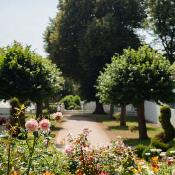
Reiterhof am Dorfteich
@Reiterhof-am-Dorfteich
Vermieten
Reithalle
Reitplatz (z.B. Dressur, Springen, Reining)
Hengsthaltung möglich
Außenboxen
Innenbox
9 weitere...
P


Zur Zeit sind alle Plätze belegt.
Bleckede
Daniela-B
@Daniela-B
Freizeitstall
Hunde willkommen
Krankenbox
Notfallboxen
Offenstall
Paddock Trail
11 weitere...
P+
Deprecated: Creation of dynamic property Zend_View_Helper_Ads::$adLink is deprecated in /var/www/stall-frei/htdocs/staging.stall-frei.de/library/Psf/View/Helper/Ads.php on line 108

Frisches Stroh zu verkaufen!
Mechtersen
STALL-FREIde Marketing
@STALL-FREI-Marketing
Kaufe frisches Stroh für dein Pferd!
Leider kein Vorschaubild
Leider kein Vorschaubild
Reitstall Hicken
Rohlsdorf
Reitstall Hicken
@Reitstall-Hicken
FN-Mitglied
Freizeitstall
Vermieten
Paddock
Parkplatz für Pferdeanhänger
Hufrehe geeignet
Notfallboxen
17 weitere...
B
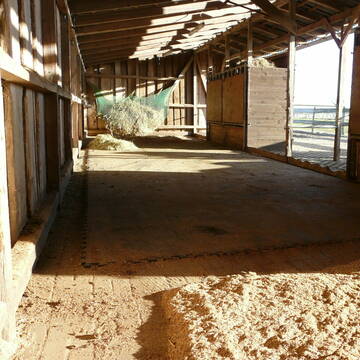
Stall Dassau
Dassendorf
Carsten-Dassau
@Carsten-Dassau
Freizeitstall
Geländestrecke
Paddock
Parkplatz für Pferdeanhänger
Außenboxen
Innenbox
Halbpension
11 weitere...
aktuell
P

Hof Ohana in Bargteheide
Bargteheide
Hof Ohana
@Mona-von-Heymann
FN-Mitglied
Freizeitstall
Vermieten
Führanlage
Krankenbox
Allergikerstall
bedampftes/gewaschenes Heu
26 weitere...
P

Wittmoor Ranch Norderstedt
Norderstedt
Wittmoor-Ranch-Norderstedt
@Wittmoor-Ranch-Norderstedt
Wir haben 3 - 4 Offenstallplätze in Norderstedt/Glashütt e ab 1.4.2026 für Stuten bis Stockmaß 155 cm frei.
In den Wintermon
brandneu
R

Pensionsplätze in Ahrensfelde frei
Ahrensburg
Teichhof-Ahrensfelde
@Teichhof-Ahrensfelde
FN-Mitglied
Freizeitstall
Vermieten
Pensions- und Gastboxen
Reithalle
bedampftes/gewaschenes Heu
Hufrehe geeignet
10 weitere...
P


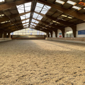
Reitanlage Hof Immenhorst
Norderstedt
Thomas von Samson
@dressurausbildung-immenhorst
FN-Mitglied
Freizeitstall
Vermieten
Hunde willkommen
Krankenbox
Allergikerstall
Gnadenbrothof
30 weitere...
S
Leider kein Vorschaubild
Leider kein Vorschaubild
Kleiner gemütlicher Privatstall in Hoisdorf
Hoisdorf
Frederike
@Frederike1
Freizeitstall
Geländestrecke
Vermieten
Hunde willkommen
Krankenbox
Allergikerstall
Gnadenbrothof
22 weitere...
B
Pferdepension Lutzenberger
Ahrensburg-Ahrensfelde
Pferdepension-Lutzenberger
@Pferdepension-Lutzenberger
FN-Mitglied
Freizeitstall
Vermieten
Führanlage
Hunde willkommen
Hufrehe geeignet
Pferdezucht
21 weitere...
P
Leider kein Vorschaubild
Leider kein Vorschaubild
Gestüt an der Lütt Beek - Islandpferdepension
Tremsbüttel
Lassoued
@Ilka_Lassoued
Freizeitstall
Gangpferdereiten
Vermieten
Hunde willkommen
Krankenbox
Notfallboxen
Pferdezucht
18 weitere...
B
Veröffentliche deine Suche als Gesuch und Suchauftrag, dann erhältst du Angebote, neue Treffer und Änderungen per E-Mail.
Diese Suche als Gesuch veröffentlichenDeprecated: Creation of dynamic property Zend_View::$pageCount is deprecated in /var/www/stall-frei/htdocs/staging.stall-frei.de/library/vendor/shardj/zf1-future/library/Zend/View/Abstract.php on line 308
Deprecated: Creation of dynamic property Zend_View::$itemCountPerPage is deprecated in /var/www/stall-frei/htdocs/staging.stall-frei.de/library/vendor/shardj/zf1-future/library/Zend/View/Abstract.php on line 308
Deprecated: Creation of dynamic property Zend_View::$first is deprecated in /var/www/stall-frei/htdocs/staging.stall-frei.de/library/vendor/shardj/zf1-future/library/Zend/View/Abstract.php on line 308
Deprecated: Creation of dynamic property Zend_View::$current is deprecated in /var/www/stall-frei/htdocs/staging.stall-frei.de/library/vendor/shardj/zf1-future/library/Zend/View/Abstract.php on line 308
Deprecated: Creation of dynamic property Zend_View::$last is deprecated in /var/www/stall-frei/htdocs/staging.stall-frei.de/library/vendor/shardj/zf1-future/library/Zend/View/Abstract.php on line 308
Deprecated: Creation of dynamic property Zend_View::$previous is deprecated in /var/www/stall-frei/htdocs/staging.stall-frei.de/library/vendor/shardj/zf1-future/library/Zend/View/Abstract.php on line 308
Deprecated: Creation of dynamic property Zend_View::$next is deprecated in /var/www/stall-frei/htdocs/staging.stall-frei.de/library/vendor/shardj/zf1-future/library/Zend/View/Abstract.php on line 308
Deprecated: Creation of dynamic property Zend_View::$pagesInRange is deprecated in /var/www/stall-frei/htdocs/staging.stall-frei.de/library/vendor/shardj/zf1-future/library/Zend/View/Abstract.php on line 308
Deprecated: Creation of dynamic property Zend_View::$firstPageInRange is deprecated in /var/www/stall-frei/htdocs/staging.stall-frei.de/library/vendor/shardj/zf1-future/library/Zend/View/Abstract.php on line 308
Deprecated: Creation of dynamic property Zend_View::$lastPageInRange is deprecated in /var/www/stall-frei/htdocs/staging.stall-frei.de/library/vendor/shardj/zf1-future/library/Zend/View/Abstract.php on line 308
Deprecated: Creation of dynamic property Zend_View::$currentItemCount is deprecated in /var/www/stall-frei/htdocs/staging.stall-frei.de/library/vendor/shardj/zf1-future/library/Zend/View/Abstract.php on line 308
Deprecated: Creation of dynamic property Zend_View::$totalItemCount is deprecated in /var/www/stall-frei/htdocs/staging.stall-frei.de/library/vendor/shardj/zf1-future/library/Zend/View/Abstract.php on line 308
Deprecated: Creation of dynamic property Zend_View::$firstItemNumber is deprecated in /var/www/stall-frei/htdocs/staging.stall-frei.de/library/vendor/shardj/zf1-future/library/Zend/View/Abstract.php on line 308
Deprecated: Creation of dynamic property Zend_View::$lastItemNumber is deprecated in /var/www/stall-frei/htdocs/staging.stall-frei.de/library/vendor/shardj/zf1-future/library/Zend/View/Abstract.php on line 308
Deprecated: Creation of dynamic property Zend_View::$router is deprecated in /var/www/stall-frei/htdocs/staging.stall-frei.de/library/vendor/shardj/zf1-future/library/Zend/View/Abstract.php on line 308
Deprecated: Creation of dynamic property Zend_View::$urlParams is deprecated in /var/www/stall-frei/htdocs/staging.stall-frei.de/library/vendor/shardj/zf1-future/library/Zend/View/Abstract.php on line 308
Deprecated: Creation of dynamic property Zend_View::$showAds is deprecated in /var/www/stall-frei/htdocs/staging.stall-frei.de/library/vendor/shardj/zf1-future/library/Zend/View/Abstract.php on line 308
Deprecated: Creation of dynamic property Zend_View::$objectIds is deprecated in /var/www/stall-frei/htdocs/staging.stall-frei.de/library/vendor/shardj/zf1-future/library/Zend/View/Abstract.php on line 308
Deprecated: Creation of dynamic property Zend_View::$showNavbar is deprecated in /var/www/stall-frei/htdocs/staging.stall-frei.de/library/vendor/shardj/zf1-future/library/Zend/View/Abstract.php on line 308
Deprecated: Creation of dynamic property Zend_View::$showBreadcrumb is deprecated in /var/www/stall-frei/htdocs/staging.stall-frei.de/library/vendor/shardj/zf1-future/library/Zend/View/Abstract.php on line 308
Deprecated: Creation of dynamic property Zend_View::$showFooter is deprecated in /var/www/stall-frei/htdocs/staging.stall-frei.de/library/vendor/shardj/zf1-future/library/Zend/View/Abstract.php on line 308
Deprecated: Creation of dynamic property Zend_View::$showInternalAds is deprecated in /var/www/stall-frei/htdocs/staging.stall-frei.de/library/vendor/shardj/zf1-future/library/Zend/View/Abstract.php on line 308
Deprecated: Creation of dynamic property Zend_View::$blNoContent is deprecated in /var/www/stall-frei/htdocs/staging.stall-frei.de/library/vendor/shardj/zf1-future/library/Zend/View/Abstract.php on line 308
Deprecated: Creation of dynamic property Zend_View::$sMetaDesc is deprecated in /var/www/stall-frei/htdocs/staging.stall-frei.de/library/vendor/shardj/zf1-future/library/Zend/View/Abstract.php on line 308
Deprecated: Creation of dynamic property Zend_View::$useGmaps is deprecated in /var/www/stall-frei/htdocs/staging.stall-frei.de/library/vendor/shardj/zf1-future/library/Zend/View/Abstract.php on line 308
Deprecated: Creation of dynamic property Zend_View::$touches is deprecated in /var/www/stall-frei/htdocs/staging.stall-frei.de/library/vendor/shardj/zf1-future/library/Zend/View/Abstract.php on line 308
Deprecated: Creation of dynamic property Zend_View::$oProject is deprecated in /var/www/stall-frei/htdocs/staging.stall-frei.de/library/vendor/shardj/zf1-future/library/Zend/View/Abstract.php on line 308
Deprecated: Creation of dynamic property Zend_View::$pageHeadline is deprecated in /var/www/stall-frei/htdocs/staging.stall-frei.de/library/vendor/shardj/zf1-future/library/Zend/View/Abstract.php on line 308
Deprecated: Creation of dynamic property Zend_View::$disableLocationField is deprecated in /var/www/stall-frei/htdocs/staging.stall-frei.de/library/vendor/shardj/zf1-future/library/Zend/View/Abstract.php on line 308
Deprecated: Creation of dynamic property Zend_View::$isSearch is deprecated in /var/www/stall-frei/htdocs/staging.stall-frei.de/library/vendor/shardj/zf1-future/library/Zend/View/Abstract.php on line 308
Deprecated: Creation of dynamic property Zend_View::$pageTitle is deprecated in /var/www/stall-frei/htdocs/staging.stall-frei.de/library/vendor/shardj/zf1-future/library/Zend/View/Abstract.php on line 308
Deprecated: Creation of dynamic property Psf_Form_Element_Text::$class is deprecated in /var/www/stall-frei/htdocs/staging.stall-frei.de/library/vendor/shardj/zf1-future/library/Zend/Form/Element.php on line 874
Deprecated: Creation of dynamic property Psf_Form_Element_Text::$size is deprecated in /var/www/stall-frei/htdocs/staging.stall-frei.de/library/vendor/shardj/zf1-future/library/Zend/Form/Element.php on line 874
Deprecated: Creation of dynamic property Psf_Form_Element_Text::$placeholder is deprecated in /var/www/stall-frei/htdocs/staging.stall-frei.de/library/vendor/shardj/zf1-future/library/Zend/Form/Element.php on line 874
Deprecated: Creation of dynamic property Psf_Form_Element_Hidden::$class is deprecated in /var/www/stall-frei/htdocs/staging.stall-frei.de/library/vendor/shardj/zf1-future/library/Zend/Form/Element.php on line 874
Deprecated: Creation of dynamic property Psf_Form_Element_Hidden::$class is deprecated in /var/www/stall-frei/htdocs/staging.stall-frei.de/library/vendor/shardj/zf1-future/library/Zend/Form/Element.php on line 874
Deprecated: Creation of dynamic property Psf_Form_Element_Hidden::$class is deprecated in /var/www/stall-frei/htdocs/staging.stall-frei.de/library/vendor/shardj/zf1-future/library/Zend/Form/Element.php on line 874
Deprecated: Creation of dynamic property Psf_Form_Element_Hidden::$class is deprecated in /var/www/stall-frei/htdocs/staging.stall-frei.de/library/vendor/shardj/zf1-future/library/Zend/Form/Element.php on line 874
Deprecated: Creation of dynamic property Psf_Form_Element_Select::$class is deprecated in /var/www/stall-frei/htdocs/staging.stall-frei.de/library/vendor/shardj/zf1-future/library/Zend/Form/Element.php on line 874
Deprecated: Creation of dynamic property Psf_Form_Element_Select::$class is deprecated in /var/www/stall-frei/htdocs/staging.stall-frei.de/library/vendor/shardj/zf1-future/library/Zend/Form/Element.php on line 874
Deprecated: Creation of dynamic property Psf_Form_Element_Select::$class is deprecated in /var/www/stall-frei/htdocs/staging.stall-frei.de/library/vendor/shardj/zf1-future/library/Zend/Form/Element.php on line 874
Deprecated: Creation of dynamic property Psf_Form_Element_Select::$class is deprecated in /var/www/stall-frei/htdocs/staging.stall-frei.de/library/vendor/shardj/zf1-future/library/Zend/Form/Element.php on line 874
Deprecated: Creation of dynamic property Psf_Form_Element_Text::$class is deprecated in /var/www/stall-frei/htdocs/staging.stall-frei.de/library/vendor/shardj/zf1-future/library/Zend/Form/Element.php on line 874
Deprecated: Creation of dynamic property Psf_Form_Element_Checkbox::$label is deprecated in /var/www/stall-frei/htdocs/staging.stall-frei.de/library/vendor/shardj/zf1-future/library/Zend/Form/Element.php on line 874
Deprecated: Creation of dynamic property Zend_View::$sort is deprecated in /var/www/stall-frei/htdocs/staging.stall-frei.de/library/vendor/shardj/zf1-future/library/Zend/View/Abstract.php on line 308
Deprecated: Creation of dynamic property Zend_View::$searchLocation is deprecated in /var/www/stall-frei/htdocs/staging.stall-frei.de/library/vendor/shardj/zf1-future/library/Zend/View/Abstract.php on line 308
Deprecated: Creation of dynamic property Zend_View::$locationHint is deprecated in /var/www/stall-frei/htdocs/staging.stall-frei.de/library/vendor/shardj/zf1-future/library/Zend/View/Abstract.php on line 308
Psf_GeoCoder_Abstract::getLocation: Saint-Marien Get Location CachedOrLive
Psf_GeoCoder_Abstract::getCachedOrLive: Saint-Marien
Psf_GeoCoder_Abstract::convertLocationResult
{"documentation":"https:\/\/opencagedata.com\/api","licenses":[{"name":"see attribution guide","url":"https:\/\/opencagedata.com\/credits"}],"results":[{"bounds":{"northeast":{"lat":53.7040639,"lng":10.7754546},"southwest":{"lat":53.7037042,"lng":10.7744209}},"components":{"ISO_3166-1_alpha-2":"DE","ISO_3166-1_alpha-3":"DEU","ISO_3166-2":["DE-SH"],"_category":"place_of_worship","_normalized_city":"Ratzeburg","_type":"place_of_worship","continent":"Europe","country":"Deutschland","country_code":"de","county":"Kreis Herzogtum Lauenburg","house_number":"35","place_of_worship":"Ratzeburger Dom","political_union":"European Union","postcode":"23909","road":"Domhof","state":"Schleswig-Holstein","state_code":"SH","suburb":"Inselstadt","town":"Ratzeburg"},"confidence":9,"formatted":"Ratzeburger Dom, Domhof 35, 23909 Ratzeburg, Deutschland","geometry":{"lat":53.7038826,"lng":10.7749501}},{"bounds":{"northeast":{"lat":52.3583869,"lng":14.066195},"southwest":{"lat":52.357956,"lng":14.0651289}},"components":{"ISO_3166-1_alpha-2":"DE","ISO_3166-1_alpha-3":"DEU","ISO_3166-2":["DE-BB"],"_category":"place_of_worship","_normalized_city":"F\u00fcrstenwalde\/Spree","_type":"place_of_worship","continent":"Europe","country":"Deutschland","country_code":"de","county":"Oder-Spree","house_number":"10","neighbourhood":"Stadtzentrum","place_of_worship":"Dom Sankt Marien","political_union":"European Union","postcode":"15517","road":"Domplatz","state":"Brandenburg","state_code":"BB","suburb":"Mitte","town":"F\u00fcrstenwalde\/Spree"},"confidence":9,"formatted":"Dom Sankt Marien, Domplatz 10, 15517 F\u00fcrstenwalde\/Spree, Deutschland","geometry":{"lat":52.3581681,"lng":14.0656332}},{"bounds":{"northeast":{"lat":51.5327677,"lng":9.930323},"southwest":{"lat":51.5325127,"lng":9.92974}},"components":{"ISO_3166-1_alpha-2":"DE","ISO_3166-1_alpha-3":"DEU","ISO_3166-2":["DE-NI"],"_category":"place_of_worship","_normalized_city":"G\u00f6ttingen","_type":"place_of_worship","city":"G\u00f6ttingen","continent":"Europe","country":"Deutschland","country_code":"de","county":"Landkreis G\u00f6ttingen","house_number":"30","place_of_worship":"Sankt Marien","political_union":"European Union","postcode":"37073","road":"Groner-Tor-Stra\u00dfe","state":"Niedersachsen","state_code":"NI","suburb":"Innenstadt"},"confidence":9,"formatted":"Sankt Marien, Groner-Tor-Stra\u00dfe 30, 37073 G\u00f6ttingen, Deutschland","geometry":{"lat":51.5326399,"lng":9.9300671}},{"bounds":{"northeast":{"lat":52.1648202,"lng":11.9164427},"southwest":{"lat":52.1647309,"lng":11.9161104}},"components":{"ISO_3166-1_alpha-2":"DE","ISO_3166-1_alpha-3":"DEU","ISO_3166-2":["DE-ST"],"_category":"place_of_worship","_normalized_city":"M\u00f6ckern","_type":"place_of_worship","continent":"Europe","country":"Deutschland","country_code":"de","county":"Jerichower Land","place_of_worship":"Saint-Marien-Kirche","political_union":"European Union","postcode":"39291","road":"Kirchgasse","state":"Sachsen-Anhalt","state_code":"ST","town":"M\u00f6ckern","village":"Tryppehna"},"confidence":9,"formatted":"Saint-Marien-Kirche, Kirchgasse, 39291 Tryppehna, Deutschland","geometry":{"lat":52.1647668,"lng":11.9162743}},{"bounds":{"northeast":{"lat":51.5325895,"lng":9.8595875},"southwest":{"lat":51.5321965,"lng":9.8588413}},"components":{"ISO_3166-1_alpha-2":"DE","ISO_3166-1_alpha-3":"DEU","ISO_3166-2":["DE-NI"],"_category":"place_of_worship","_normalized_city":"G\u00f6ttingen","_type":"place_of_worship","city":"G\u00f6ttingen","continent":"Europe","country":"Deutschland","country_code":"de","county":"Landkreis G\u00f6ttingen","house_number":"1","place_of_worship":"Sankt Marien","political_union":"European Union","postcode":"37079","road":"In der Wehm","state":"Niedersachsen","state_code":"NI","suburb":"Hetjershausen"},"confidence":9,"formatted":"Sankt Marien, In der Wehm 1, 37079 G\u00f6ttingen, Deutschland","geometry":{"lat":51.5324014,"lng":9.859211}},{"components":{"ISO_3166-1_alpha-2":"FR","ISO_3166-1_alpha-3":"FRA","ISO_3166-2":["FR-CVL","FR-18"],"_category":"road","_normalized_city":"Pr\u00e9veranges","_type":"road","city":"Pr\u00e9veranges","continent":"Europe","country":"France","country_code":"fr","county":"Cher","local_authority":"Communaut\u00e9 de communes Berry Grand Sud","political_union":"European Union","postcode":"18370","road":"Route de Saint-Marien","state":"Centre-Val de Loire","state_code":"CVL"},"confidence":4,"formatted":"Route de Saint-Marien, 18370 Pr\u00e9veranges, France","geometry":{"lat":46.431531,"lng":2.248885}},{"components":{"ISO_3166-1_alpha-2":"FR","ISO_3166-1_alpha-3":"FRA","ISO_3166-2":["FR-NAQ","FR-33"],"_category":"road","_normalized_city":"C\u00e9zac","_type":"road","city":"C\u00e9zac","continent":"Europe","country":"France","country_code":"fr","county":"Gironde","local_authority":"Communaut\u00e9 de communes Latitude Nord Gironde","political_union":"European Union","postcode":"33620","road":"route de Saint Mariens","state":"Nouvelle-Aquitaine","state_code":"NAQ"},"confidence":4,"formatted":"route de Saint Mariens, 33620 C\u00e9zac, France","geometry":{"lat":45.100848,"lng":-0.411622}},{"components":{"ISO_3166-1_alpha-2":"FR","ISO_3166-1_alpha-3":"FRA","ISO_3166-2":["FR-NAQ","FR-33"],"_category":"road","_normalized_city":"Saint-Mariens","_type":"road","city":"Saint-Mariens","continent":"Europe","country":"France","country_code":"fr","county":"Gironde","local_authority":"Communaut\u00e9 de communes Latitude Nord Gironde","political_union":"European Union","postcode":"33620","road":"Route de la Brande","state":"Nouvelle-Aquitaine","state_code":"NAQ"},"confidence":4,"formatted":"Route de la Brande, 33620 Saint-Mariens, France","geometry":{"lat":45.128598,"lng":-0.415955}},{"components":{"ISO_3166-1_alpha-2":"FR","ISO_3166-1_alpha-3":"FRA","ISO_3166-2":["FR-CVL","FR-18"],"_category":"road","_normalized_city":"Saint-Vitte","_type":"road","city":"Saint-Vitte","continent":"Europe","country":"France","country_code":"fr","county":"Cher","local_authority":"Communaut\u00e9 de communes Berry Grand Sud","political_union":"European Union","postcode":"18360","road":"Saint Marien","state":"Centre-Val de Loire","state_code":"CVL"},"confidence":4,"formatted":"Saint Marien, 18360 Saint-Vitte, France","geometry":{"lat":46.553112,"lng":2.552603}},{"components":{"ISO_3166-1_alpha-2":"FR","ISO_3166-1_alpha-3":"FRA","ISO_3166-2":["FR-NAQ","FR-23"],"_category":"place","_normalized_city":"Saint-Marien","_type":"city","city":"Saint-Marien","continent":"Europe","country":"France","country_code":"fr","county":"Creuse","local_authority":"Creuse Confluence","political_union":"European Union","postcode":"23600","state":"Nouvelle-Aquitaine","state_code":"NAQ"},"confidence":4,"formatted":"Saint-Marien, Creuse, France","geometry":{"lat":46.406168,"lng":2.204187}}],"status":{"code":200,"message":"OK"},"stay_informed":{"blog":"https:\/\/blog.opencagedata.com","mastodon":"https:\/\/en.osm.town\/@opencage"},"thanks":"For using an OpenCage API","timestamp":{"created_http":"Sun, 08 Feb 2026 11:38:53 GMT","created_unix":1770550733},"total_results":10}Array
(
[0] => stdClass Object
(
[bounds] => stdClass Object
(
[northeast] => stdClass Object
(
[lat] => 53.7040639
[lng] => 10.7754546
)
[southwest] => stdClass Object
(
[lat] => 53.7037042
[lng] => 10.7744209
)
)
[components] => stdClass Object
(
[ISO_3166-1_alpha-2] => DE
[ISO_3166-1_alpha-3] => DEU
[ISO_3166-2] => Array
(
[0] => DE-SH
)
[_category] => place_of_worship
[_normalized_city] => Ratzeburg
[_type] => place_of_worship
[continent] => Europe
[country] => Deutschland
[country_code] => de
[county] => Kreis Herzogtum Lauenburg
[house_number] => 35
[place_of_worship] => Ratzeburger Dom
[political_union] => European Union
[postcode] => 23909
[road] => Domhof
[state] => Schleswig-Holstein
[state_code] => SH
[suburb] => Inselstadt
[town] => Ratzeburg
)
[confidence] => 9
[formatted] => Ratzeburger Dom, Domhof 35, 23909 Ratzeburg, Deutschland
[geometry] => stdClass Object
(
[lat] => 53.7038826
[lng] => 10.7749501
)
)
[1] => stdClass Object
(
[bounds] => stdClass Object
(
[northeast] => stdClass Object
(
[lat] => 52.3583869
[lng] => 14.066195
)
[southwest] => stdClass Object
(
[lat] => 52.357956
[lng] => 14.0651289
)
)
[components] => stdClass Object
(
[ISO_3166-1_alpha-2] => DE
[ISO_3166-1_alpha-3] => DEU
[ISO_3166-2] => Array
(
[0] => DE-BB
)
[_category] => place_of_worship
[_normalized_city] => Fürstenwalde/Spree
[_type] => place_of_worship
[continent] => Europe
[country] => Deutschland
[country_code] => de
[county] => Oder-Spree
[house_number] => 10
[neighbourhood] => Stadtzentrum
[place_of_worship] => Dom Sankt Marien
[political_union] => European Union
[postcode] => 15517
[road] => Domplatz
[state] => Brandenburg
[state_code] => BB
[suburb] => Mitte
[town] => Fürstenwalde/Spree
)
[confidence] => 9
[formatted] => Dom Sankt Marien, Domplatz 10, 15517 Fürstenwalde/Spree, Deutschland
[geometry] => stdClass Object
(
[lat] => 52.3581681
[lng] => 14.0656332
)
)
[2] => stdClass Object
(
[bounds] => stdClass Object
(
[northeast] => stdClass Object
(
[lat] => 51.5327677
[lng] => 9.930323
)
[southwest] => stdClass Object
(
[lat] => 51.5325127
[lng] => 9.92974
)
)
[components] => stdClass Object
(
[ISO_3166-1_alpha-2] => DE
[ISO_3166-1_alpha-3] => DEU
[ISO_3166-2] => Array
(
[0] => DE-NI
)
[_category] => place_of_worship
[_normalized_city] => Göttingen
[_type] => place_of_worship
[city] => Göttingen
[continent] => Europe
[country] => Deutschland
[country_code] => de
[county] => Landkreis Göttingen
[house_number] => 30
[place_of_worship] => Sankt Marien
[political_union] => European Union
[postcode] => 37073
[road] => Groner-Tor-Straße
[state] => Niedersachsen
[state_code] => NI
[suburb] => Innenstadt
)
[confidence] => 9
[formatted] => Sankt Marien, Groner-Tor-Straße 30, 37073 Göttingen, Deutschland
[geometry] => stdClass Object
(
[lat] => 51.5326399
[lng] => 9.9300671
)
)
[3] => stdClass Object
(
[bounds] => stdClass Object
(
[northeast] => stdClass Object
(
[lat] => 52.1648202
[lng] => 11.9164427
)
[southwest] => stdClass Object
(
[lat] => 52.1647309
[lng] => 11.9161104
)
)
[components] => stdClass Object
(
[ISO_3166-1_alpha-2] => DE
[ISO_3166-1_alpha-3] => DEU
[ISO_3166-2] => Array
(
[0] => DE-ST
)
[_category] => place_of_worship
[_normalized_city] => Möckern
[_type] => place_of_worship
[continent] => Europe
[country] => Deutschland
[country_code] => de
[county] => Jerichower Land
[place_of_worship] => Saint-Marien-Kirche
[political_union] => European Union
[postcode] => 39291
[road] => Kirchgasse
[state] => Sachsen-Anhalt
[state_code] => ST
[town] => Möckern
[village] => Tryppehna
)
[confidence] => 9
[formatted] => Saint-Marien-Kirche, Kirchgasse, 39291 Tryppehna, Deutschland
[geometry] => stdClass Object
(
[lat] => 52.1647668
[lng] => 11.9162743
)
)
[4] => stdClass Object
(
[bounds] => stdClass Object
(
[northeast] => stdClass Object
(
[lat] => 51.5325895
[lng] => 9.8595875
)
[southwest] => stdClass Object
(
[lat] => 51.5321965
[lng] => 9.8588413
)
)
[components] => stdClass Object
(
[ISO_3166-1_alpha-2] => DE
[ISO_3166-1_alpha-3] => DEU
[ISO_3166-2] => Array
(
[0] => DE-NI
)
[_category] => place_of_worship
[_normalized_city] => Göttingen
[_type] => place_of_worship
[city] => Göttingen
[continent] => Europe
[country] => Deutschland
[country_code] => de
[county] => Landkreis Göttingen
[house_number] => 1
[place_of_worship] => Sankt Marien
[political_union] => European Union
[postcode] => 37079
[road] => In der Wehm
[state] => Niedersachsen
[state_code] => NI
[suburb] => Hetjershausen
)
[confidence] => 9
[formatted] => Sankt Marien, In der Wehm 1, 37079 Göttingen, Deutschland
[geometry] => stdClass Object
(
[lat] => 51.5324014
[lng] => 9.859211
)
)
[5] => stdClass Object
(
[components] => stdClass Object
(
[ISO_3166-1_alpha-2] => FR
[ISO_3166-1_alpha-3] => FRA
[ISO_3166-2] => Array
(
[0] => FR-CVL
[1] => FR-18
)
[_category] => road
[_normalized_city] => Préveranges
[_type] => road
[city] => Préveranges
[continent] => Europe
[country] => France
[country_code] => fr
[county] => Cher
[local_authority] => Communauté de communes Berry Grand Sud
[political_union] => European Union
[postcode] => 18370
[road] => Route de Saint-Marien
[state] => Centre-Val de Loire
[state_code] => CVL
)
[confidence] => 4
[formatted] => Route de Saint-Marien, 18370 Préveranges, France
[geometry] => stdClass Object
(
[lat] => 46.431531
[lng] => 2.248885
)
)
[6] => stdClass Object
(
[components] => stdClass Object
(
[ISO_3166-1_alpha-2] => FR
[ISO_3166-1_alpha-3] => FRA
[ISO_3166-2] => Array
(
[0] => FR-NAQ
[1] => FR-33
)
[_category] => road
[_normalized_city] => Cézac
[_type] => road
[city] => Cézac
[continent] => Europe
[country] => France
[country_code] => fr
[county] => Gironde
[local_authority] => Communauté de communes Latitude Nord Gironde
[political_union] => European Union
[postcode] => 33620
[road] => route de Saint Mariens
[state] => Nouvelle-Aquitaine
[state_code] => NAQ
)
[confidence] => 4
[formatted] => route de Saint Mariens, 33620 Cézac, France
[geometry] => stdClass Object
(
[lat] => 45.100848
[lng] => -0.411622
)
)
[7] => stdClass Object
(
[components] => stdClass Object
(
[ISO_3166-1_alpha-2] => FR
[ISO_3166-1_alpha-3] => FRA
[ISO_3166-2] => Array
(
[0] => FR-NAQ
[1] => FR-33
)
[_category] => road
[_normalized_city] => Saint-Mariens
[_type] => road
[city] => Saint-Mariens
[continent] => Europe
[country] => France
[country_code] => fr
[county] => Gironde
[local_authority] => Communauté de communes Latitude Nord Gironde
[political_union] => European Union
[postcode] => 33620
[road] => Route de la Brande
[state] => Nouvelle-Aquitaine
[state_code] => NAQ
)
[confidence] => 4
[formatted] => Route de la Brande, 33620 Saint-Mariens, France
[geometry] => stdClass Object
(
[lat] => 45.128598
[lng] => -0.415955
)
)
[8] => stdClass Object
(
[components] => stdClass Object
(
[ISO_3166-1_alpha-2] => FR
[ISO_3166-1_alpha-3] => FRA
[ISO_3166-2] => Array
(
[0] => FR-CVL
[1] => FR-18
)
[_category] => road
[_normalized_city] => Saint-Vitte
[_type] => road
[city] => Saint-Vitte
[continent] => Europe
[country] => France
[country_code] => fr
[county] => Cher
[local_authority] => Communauté de communes Berry Grand Sud
[political_union] => European Union
[postcode] => 18360
[road] => Saint Marien
[state] => Centre-Val de Loire
[state_code] => CVL
)
[confidence] => 4
[formatted] => Saint Marien, 18360 Saint-Vitte, France
[geometry] => stdClass Object
(
[lat] => 46.553112
[lng] => 2.552603
)
)
[9] => stdClass Object
(
[components] => stdClass Object
(
[ISO_3166-1_alpha-2] => FR
[ISO_3166-1_alpha-3] => FRA
[ISO_3166-2] => Array
(
[0] => FR-NAQ
[1] => FR-23
)
[_category] => place
[_normalized_city] => Saint-Marien
[_type] => city
[city] => Saint-Marien
[continent] => Europe
[country] => France
[country_code] => fr
[county] => Creuse
[local_authority] => Creuse Confluence
[political_union] => European Union
[postcode] => 23600
[state] => Nouvelle-Aquitaine
[state_code] => NAQ
)
[confidence] => 4
[formatted] => Saint-Marien, Creuse, France
[geometry] => stdClass Object
(
[lat] => 46.406168
[lng] => 2.204187
)
)
)
Psf_GeoCoder_OpenCageData::getKeyMap: 0
stdClass Object
(
    [bounds] => stdClass Object
        (
            [northeast] => stdClass Object
                (
                    [lat] => 53.7040639
                    [lng] => 10.7754546
                )

            [southwest] => stdClass Object
                (
                    [lat] => 53.7037042
                    [lng] => 10.7744209
                )

        )

    [components] => stdClass Object
        (
            [ISO_3166-1_alpha-2] => DE
            [ISO_3166-1_alpha-3] => DEU
            [ISO_3166-2] => Array
                (
                    [0] => DE-SH
                )

            [_category] => place_of_worship
            [_normalized_city] => Ratzeburg
            [_type] => place_of_worship
            [continent] => Europe
            [country] => Deutschland
            [country_code] => de
            [county] => Kreis Herzogtum Lauenburg
            [house_number] => 35
            [place_of_worship] => Ratzeburger Dom
            [political_union] => European Union
            [postcode] => 23909
            [road] => Domhof
            [state] => Schleswig-Holstein
            [state_code] => SH
            [suburb] => Inselstadt
            [town] => Ratzeburg
        )

    [confidence] => 9
    [formatted] => Ratzeburger Dom, Domhof 35, 23909 Ratzeburg, Deutschland
    [geometry] => stdClass Object
        (
            [lat] => 53.7038826
            [lng] => 10.7749501
        )

)
Psf_GeoCoder_OpenCageData::getCounty: Herzogtum Lauenburg
Psf_GeoCoder_OpenCageData::addMissingData REFETCH!
Array
(
    [address] => Ratzeburger Dom, Domhof 35, 23909 Ratzeburg, Deutschland
    [type] => place_of_worship
    [street] => Domhof 35
    [city] => Ratzeburg
    [county] => Herzogtum Lauenburg
    [state] => Schleswig-Holstein
    [zip] => 23909
    [country] => Deutschland
    [suburb] => Inselstadt
    [countrycode] => de
    [latitude] => 53.7038826
    [longitude] => 10.7749501
    [accuracy] => 1
    [confidence] => 9
    [bounds] => stdClass Object
        (
            [northeast] => stdClass Object
                (
                    [lat] => 53.7040639
                    [lng] => 10.7754546
                )

            [southwest] => stdClass Object
                (
                    [lat] => 53.7037042
                    [lng] => 10.7744209
                )

        )

)
reformat!
Array
(
    [address] => Ratzeburger Dom, Domhof 35, 23909 Ratzeburg, Deutschland
    [type] => place_of_worship
    [street] => Domhof 35
    [city] => Ratzeburg
    [county] => Herzogtum Lauenburg
    [state] => Schleswig-Holstein
    [zip] => 23909
    [country] => Deutschland
    [suburb] => Inselstadt
    [countrycode] => de
    [latitude] => 53.7038826
    [longitude] => 10.7749501
    [accuracy] => 1
    [confidence] => 9
    [bounds] => stdClass Object
        (
            [northeast] => stdClass Object
                (
                    [lat] => 53.7040639
                    [lng] => 10.7754546
                )

            [southwest] => stdClass Object
                (
                    [lat] => 53.7037042
                    [lng] => 10.7744209
                )

        )

    [place] => Domhof 35, 23909 Ratzeburg, Schleswig-Holstein
    [hash] => 18bf838b9f332edeefb2bdf3c59c40ca
)
Psf_GeoCoder_OpenCageData::getKeyMap: 1
stdClass Object
(
    [bounds] => stdClass Object
        (
            [northeast] => stdClass Object
                (
                    [lat] => 52.3583869
                    [lng] => 14.066195
                )

            [southwest] => stdClass Object
                (
                    [lat] => 52.357956
                    [lng] => 14.0651289
                )

        )

    [components] => stdClass Object
        (
            [ISO_3166-1_alpha-2] => DE
            [ISO_3166-1_alpha-3] => DEU
            [ISO_3166-2] => Array
                (
                    [0] => DE-BB
                )

            [_category] => place_of_worship
            [_normalized_city] => Fürstenwalde/Spree
            [_type] => place_of_worship
            [continent] => Europe
            [country] => Deutschland
            [country_code] => de
            [county] => Oder-Spree
            [house_number] => 10
            [neighbourhood] => Stadtzentrum
            [place_of_worship] => Dom Sankt Marien
            [political_union] => European Union
            [postcode] => 15517
            [road] => Domplatz
            [state] => Brandenburg
            [state_code] => BB
            [suburb] => Mitte
            [town] => Fürstenwalde/Spree
        )

    [confidence] => 9
    [formatted] => Dom Sankt Marien, Domplatz 10, 15517 Fürstenwalde/Spree, Deutschland
    [geometry] => stdClass Object
        (
            [lat] => 52.3581681
            [lng] => 14.0656332
        )

)
Psf_GeoCoder_OpenCageData::getCounty: Oder-Spree
Psf_GeoCoder_OpenCageData::addMissingData REFETCH!
Array
(
    [address] => Dom Sankt Marien, Domplatz 10, 15517 Fürstenwalde/Spree, Deutschland
    [type] => place_of_worship
    [street] => Domplatz 10
    [city] => Fürstenwalde/Spree
    [county] => Oder-Spree
    [state] => Brandenburg
    [zip] => 15517
    [country] => Deutschland
    [suburb] => Mitte
    [countrycode] => de
    [latitude] => 52.3581681
    [longitude] => 14.0656332
    [accuracy] => 1
    [confidence] => 9
    [bounds] => stdClass Object
        (
            [northeast] => stdClass Object
                (
                    [lat] => 52.3583869
                    [lng] => 14.066195
                )

            [southwest] => stdClass Object
                (
                    [lat] => 52.357956
                    [lng] => 14.0651289
                )

        )

)
reformat!
Array
(
    [address] => Dom Sankt Marien, Domplatz 10, 15517 Fürstenwalde/Spree, Deutschland
    [type] => place_of_worship
    [street] => Domplatz 10
    [city] => Fürstenwalde/Spree
    [county] => Oder-Spree
    [state] => Brandenburg
    [zip] => 15517
    [country] => Deutschland
    [suburb] => Mitte
    [countrycode] => de
    [latitude] => 52.3581681
    [longitude] => 14.0656332
    [accuracy] => 1
    [confidence] => 9
    [bounds] => stdClass Object
        (
            [northeast] => stdClass Object
                (
                    [lat] => 52.3583869
                    [lng] => 14.066195
                )

            [southwest] => stdClass Object
                (
                    [lat] => 52.357956
                    [lng] => 14.0651289
                )

        )

    [place] => Domplatz 10, 15517 Fürstenwalde/Spree, Brandenburg
    [hash] => 9a9f19df64a50cb4265558809c339c15
)
Psf_GeoCoder_OpenCageData::getKeyMap: 2
stdClass Object
(
    [bounds] => stdClass Object
        (
            [northeast] => stdClass Object
                (
                    [lat] => 51.5327677
                    [lng] => 9.930323
                )

            [southwest] => stdClass Object
                (
                    [lat] => 51.5325127
                    [lng] => 9.92974
                )

        )

    [components] => stdClass Object
        (
            [ISO_3166-1_alpha-2] => DE
            [ISO_3166-1_alpha-3] => DEU
            [ISO_3166-2] => Array
                (
                    [0] => DE-NI
                )

            [_category] => place_of_worship
            [_normalized_city] => Göttingen
            [_type] => place_of_worship
            [city] => Göttingen
            [continent] => Europe
            [country] => Deutschland
            [country_code] => de
            [county] => Landkreis Göttingen
            [house_number] => 30
            [place_of_worship] => Sankt Marien
            [political_union] => European Union
            [postcode] => 37073
            [road] => Groner-Tor-Straße
            [state] => Niedersachsen
            [state_code] => NI
            [suburb] => Innenstadt
        )

    [confidence] => 9
    [formatted] => Sankt Marien, Groner-Tor-Straße 30, 37073 Göttingen, Deutschland
    [geometry] => stdClass Object
        (
            [lat] => 51.5326399
            [lng] => 9.9300671
        )

)
Psf_GeoCoder_OpenCageData::getCounty: Göttingen
Psf_GeoCoder_OpenCageData::addMissingData REFETCH!
Array
(
    [address] => Sankt Marien, Groner-Tor-Straße 30, 37073 Göttingen, Deutschland
    [type] => place_of_worship
    [street] => Groner-Tor-Straße 30
    [city] => Innenstadt
    [county] => Göttingen
    [state] => Niedersachsen
    [zip] => 37073
    [country] => Deutschland
    [suburb] => Innenstadt
    [countrycode] => de
    [latitude] => 51.5326399
    [longitude] => 9.9300671
    [accuracy] => 1
    [confidence] => 9
    [bounds] => stdClass Object
        (
            [northeast] => stdClass Object
                (
                    [lat] => 51.5327677
                    [lng] => 9.930323
                )

            [southwest] => stdClass Object
                (
                    [lat] => 51.5325127
                    [lng] => 9.92974
                )

        )

)
reformat!
Array
(
    [address] => Groner-Tor-Straße 30, 37073 Innenstadt
    [type] => place_of_worship
    [street] => Groner-Tor-Straße 30
    [city] => Innenstadt
    [county] => Göttingen
    [state] => Niedersachsen
    [zip] => 37073
    [country] => Deutschland
    [suburb] => Innenstadt
    [countrycode] => de
    [latitude] => 51.5326399
    [longitude] => 9.9300671
    [accuracy] => 1
    [confidence] => 9
    [bounds] => stdClass Object
        (
            [northeast] => stdClass Object
                (
                    [lat] => 51.5327677
                    [lng] => 9.930323
                )

            [southwest] => stdClass Object
                (
                    [lat] => 51.5325127
                    [lng] => 9.92974
                )

        )

    [place] => Groner-Tor-Straße 30, 37073 Innenstadt, Niedersachsen
    [hash] => 537278b48d07da08e68442e51348c15b
)
Psf_GeoCoder_OpenCageData::getKeyMap: 3
stdClass Object
(
    [bounds] => stdClass Object
        (
            [northeast] => stdClass Object
                (
                    [lat] => 52.1648202
                    [lng] => 11.9164427
                )

            [southwest] => stdClass Object
                (
                    [lat] => 52.1647309
                    [lng] => 11.9161104
                )

        )

    [components] => stdClass Object
        (
            [ISO_3166-1_alpha-2] => DE
            [ISO_3166-1_alpha-3] => DEU
            [ISO_3166-2] => Array
                (
                    [0] => DE-ST
                )

            [_category] => place_of_worship
            [_normalized_city] => Möckern
            [_type] => place_of_worship
            [continent] => Europe
            [country] => Deutschland
            [country_code] => de
            [county] => Jerichower Land
            [place_of_worship] => Saint-Marien-Kirche
            [political_union] => European Union
            [postcode] => 39291
            [road] => Kirchgasse
            [state] => Sachsen-Anhalt
            [state_code] => ST
            [town] => Möckern
            [village] => Tryppehna
        )

    [confidence] => 9
    [formatted] => Saint-Marien-Kirche, Kirchgasse, 39291 Tryppehna, Deutschland
    [geometry] => stdClass Object
        (
            [lat] => 52.1647668
            [lng] => 11.9162743
        )

)
Psf_GeoCoder_OpenCageData::getCounty: Jerichower Land
Psf_GeoCoder_OpenCageData::addMissingData REFETCH!
Array
(
    [address] => Saint-Marien-Kirche, Kirchgasse, 39291 Tryppehna, Deutschland
    [type] => place_of_worship
    [street] => Kirchgasse
    [city] => Möckern
    [county] => Jerichower Land
    [state] => Sachsen-Anhalt
    [zip] => 39291
    [country] => Deutschland
    [suburb] =>
    [countrycode] => de
    [latitude] => 52.1647668
    [longitude] => 11.9162743
    [accuracy] => 1
    [confidence] => 9
    [bounds] => stdClass Object
        (
            [northeast] => stdClass Object
                (
                    [lat] => 52.1648202
                    [lng] => 11.9164427
                )

            [southwest] => stdClass Object
                (
                    [lat] => 52.1647309
                    [lng] => 11.9161104
                )

        )

)
reformat!
Array
(
    [address] => Kirchgasse, 39291 Möckern
    [type] => place_of_worship
    [street] => Kirchgasse
    [city] => Möckern
    [county] => Jerichower Land
    [state] => Sachsen-Anhalt
    [zip] => 39291
    [country] => Deutschland
    [suburb] =>
    [countrycode] => de
    [latitude] => 52.1647668
    [longitude] => 11.9162743
    [accuracy] => 1
    [confidence] => 9
    [bounds] => stdClass Object
        (
            [northeast] => stdClass Object
                (
                    [lat] => 52.1648202
                    [lng] => 11.9164427
                )

            [southwest] => stdClass Object
                (
                    [lat] => 52.1647309
                    [lng] => 11.9161104
                )

        )

    [place] => Kirchgasse, 39291 Möckern, Sachsen-Anhalt
    [hash] => df7b8d40f2922a0dfa522091c844de63
)
Psf_GeoCoder_OpenCageData::getKeyMap: 4
stdClass Object
(
    [bounds] => stdClass Object
        (
            [northeast] => stdClass Object
                (
                    [lat] => 51.5325895
                    [lng] => 9.8595875
                )

            [southwest] => stdClass Object
                (
                    [lat] => 51.5321965
                    [lng] => 9.8588413
                )

        )

    [components] => stdClass Object
        (
            [ISO_3166-1_alpha-2] => DE
            [ISO_3166-1_alpha-3] => DEU
            [ISO_3166-2] => Array
                (
                    [0] => DE-NI
                )

            [_category] => place_of_worship
            [_normalized_city] => Göttingen
            [_type] => place_of_worship
            [city] => Göttingen
            [continent] => Europe
            [country] => Deutschland
            [country_code] => de
            [county] => Landkreis Göttingen
            [house_number] => 1
            [place_of_worship] => Sankt Marien
            [political_union] => European Union
            [postcode] => 37079
            [road] => In der Wehm
            [state] => Niedersachsen
            [state_code] => NI
            [suburb] => Hetjershausen
        )

    [confidence] => 9
    [formatted] => Sankt Marien, In der Wehm 1, 37079 Göttingen, Deutschland
    [geometry] => stdClass Object
        (
            [lat] => 51.5324014
            [lng] => 9.859211
        )

)
Psf_GeoCoder_OpenCageData::getCounty: Göttingen
Psf_GeoCoder_OpenCageData::addMissingData REFETCH!
Array
(
    [address] => Sankt Marien, In der Wehm 1, 37079 Göttingen, Deutschland
    [type] => place_of_worship
    [street] => In der Wehm 1
    [city] => Hetjershausen
    [county] => Göttingen
    [state] => Niedersachsen
    [zip] => 37079
    [country] => Deutschland
    [suburb] => Hetjershausen
    [countrycode] => de
    [latitude] => 51.5324014
    [longitude] => 9.859211
    [accuracy] => 1
    [confidence] => 9
    [bounds] => stdClass Object
        (
            [northeast] => stdClass Object
                (
                    [lat] => 51.5325895
                    [lng] => 9.8595875
                )

            [southwest] => stdClass Object
                (
                    [lat] => 51.5321965
                    [lng] => 9.8588413
                )

        )

)
reformat!
Array
(
    [address] => In der Wehm 1, 37079 Hetjershausen
    [type] => place_of_worship
    [street] => In der Wehm 1
    [city] => Hetjershausen
    [county] => Göttingen
    [state] => Niedersachsen
    [zip] => 37079
    [country] => Deutschland
    [suburb] => Hetjershausen
    [countrycode] => de
    [latitude] => 51.5324014
    [longitude] => 9.859211
    [accuracy] => 1
    [confidence] => 9
    [bounds] => stdClass Object
        (
            [northeast] => stdClass Object
                (
                    [lat] => 51.5325895
                    [lng] => 9.8595875
                )

            [southwest] => stdClass Object
                (
                    [lat] => 51.5321965
                    [lng] => 9.8588413
                )

        )

    [place] => In der Wehm 1, 37079 Hetjershausen, Niedersachsen
    [hash] => 3ae00bb876b6be3bd3bcb2e859bc25e5
)
Psf_GeoCoder_OpenCageData::getKeyMap: 5
stdClass Object
(
    [components] => stdClass Object
        (
            [ISO_3166-1_alpha-2] => FR
            [ISO_3166-1_alpha-3] => FRA
            [ISO_3166-2] => Array
                (
                    [0] => FR-CVL
                    [1] => FR-18
                )

            [_category] => road
            [_normalized_city] => Préveranges
            [_type] => road
            [city] => Préveranges
            [continent] => Europe
            [country] => France
            [country_code] => fr
            [county] => Cher
            [local_authority] => Communauté de communes Berry Grand Sud
            [political_union] => European Union
            [postcode] => 18370
            [road] => Route de Saint-Marien
            [state] => Centre-Val de Loire
            [state_code] => CVL
        )

    [confidence] => 4
    [formatted] => Route de Saint-Marien, 18370 Préveranges, France
    [geometry] => stdClass Object
        (
            [lat] => 46.431531
            [lng] => 2.248885
        )

)
Psf_GeoCoder_OpenCageData::getCounty: Cher
Psf_GeoCoder_OpenCageData::addMissingData REFETCH!
Array
(
    [address] => Route de Saint-Marien, 18370 Préveranges, France
    [type] => road
    [street] => Route de Saint-Marien
    [city] => Préveranges
    [county] => Cher
    [state] => Centre-Val de Loire
    [zip] => 18370
    [country] => France
    [suburb] =>
    [countrycode] => fr
    [latitude] => 46.431531
    [longitude] => 2.248885
    [accuracy] => 1
    [confidence] => 4
    [bounds] =>
)
reformat!
Array
(
    [address] => Route de Saint-Marien, 18370 Préveranges, France
    [type] => road
    [street] => Route de Saint-Marien
    [city] => Préveranges
    [county] => Cher
    [state] => Centre-Val de Loire
    [zip] => 18370
    [country] => France
    [suburb] =>
    [countrycode] => fr
    [latitude] => 46.431531
    [longitude] => 2.248885
    [accuracy] => 1
    [confidence] => 4
    [bounds] =>
    [place] => Route de Saint-Marien, 18370 Préveranges, Centre-Val de Loire
    [hash] => ba764fd516769ec1d0dc8ef1d6ff1ccc
)
Psf_GeoCoder_OpenCageData::getKeyMap: 6
stdClass Object
(
    [components] => stdClass Object
        (
            [ISO_3166-1_alpha-2] => FR
            [ISO_3166-1_alpha-3] => FRA
            [ISO_3166-2] => Array
                (
                    [0] => FR-NAQ
                    [1] => FR-33
                )

            [_category] => road
            [_normalized_city] => Cézac
            [_type] => road
            [city] => Cézac
            [continent] => Europe
            [country] => France
            [country_code] => fr
            [county] => Gironde
            [local_authority] => Communauté de communes Latitude Nord Gironde
            [political_union] => European Union
            [postcode] => 33620
            [road] => route de Saint Mariens
            [state] => Nouvelle-Aquitaine
            [state_code] => NAQ
        )

    [confidence] => 4
    [formatted] => route de Saint Mariens, 33620 Cézac, France
    [geometry] => stdClass Object
        (
            [lat] => 45.100848
            [lng] => -0.411622
        )

)
Psf_GeoCoder_OpenCageData::getCounty: Gironde
Psf_GeoCoder_OpenCageData::addMissingData REFETCH!
Array
(
    [address] => route de Saint Mariens, 33620 Cézac, France
    [type] => road
    [street] => route de Saint Mariens
    [city] => Cézac
    [county] => Gironde
    [state] => Nouvelle-Aquitaine
    [zip] => 33620
    [country] => France
    [suburb] =>
    [countrycode] => fr
    [latitude] => 45.100848
    [longitude] => -0.411622
    [accuracy] => 1
    [confidence] => 4
    [bounds] =>
)
reformat!
Array
(
    [address] => route de Saint Mariens, 33620 Cézac, France
    [type] => road
    [street] => route de Saint Mariens
    [city] => Cézac
    [county] => Gironde
    [state] => Nouvelle-Aquitaine
    [zip] => 33620
    [country] => France
    [suburb] =>
    [countrycode] => fr
    [latitude] => 45.100848
    [longitude] => -0.411622
    [accuracy] => 1
    [confidence] => 4
    [bounds] =>
    [place] => route de Saint Mariens, 33620 Cézac, Nouvelle-Aquitaine
    [hash] => 8e1169b7074fd851532f0abc81917257
)
Psf_GeoCoder_OpenCageData::getKeyMap: 7
stdClass Object
(
    [components] => stdClass Object
        (
            [ISO_3166-1_alpha-2] => FR
            [ISO_3166-1_alpha-3] => FRA
            [ISO_3166-2] => Array
                (
                    [0] => FR-NAQ
                    [1] => FR-33
                )

            [_category] => road
            [_normalized_city] => Saint-Mariens
            [_type] => road
            [city] => Saint-Mariens
            [continent] => Europe
            [country] => France
            [country_code] => fr
            [county] => Gironde
            [local_authority] => Communauté de communes Latitude Nord Gironde
            [political_union] => European Union
            [postcode] => 33620
            [road] => Route de la Brande
            [state] => Nouvelle-Aquitaine
            [state_code] => NAQ
        )

    [confidence] => 4
    [formatted] => Route de la Brande, 33620 Saint-Mariens, France
    [geometry] => stdClass Object
        (
            [lat] => 45.128598
            [lng] => -0.415955
        )

)
Psf_GeoCoder_OpenCageData::getCounty: Gironde
Psf_GeoCoder_OpenCageData::addMissingData REFETCH!
Array
(
    [address] => Route de la Brande, 33620 Saint-Mariens, France
    [type] => road
    [street] => Route de la Brande
    [city] => Saint-Mariens
    [county] => Gironde
    [state] => Nouvelle-Aquitaine
    [zip] => 33620
    [country] => France
    [suburb] =>
    [countrycode] => fr
    [latitude] => 45.128598
    [longitude] => -0.415955
    [accuracy] => 1
    [confidence] => 4
    [bounds] =>
)
reformat!
Array
(
    [address] => Route de la Brande, 33620 Saint-Mariens, France
    [type] => road
    [street] => Route de la Brande
    [city] => Saint-Mariens
    [county] => Gironde
    [state] => Nouvelle-Aquitaine
    [zip] => 33620
    [country] => France
    [suburb] =>
    [countrycode] => fr
    [latitude] => 45.128598
    [longitude] => -0.415955
    [accuracy] => 1
    [confidence] => 4
    [bounds] =>
    [place] => Route de la Brande, 33620 Saint-Mariens, Nouvelle-Aquitaine
    [hash] => 797c5aba53d8d9b04ead74026eb72819
)
Psf_GeoCoder_OpenCageData::getKeyMap: 8
stdClass Object
(
    [components] => stdClass Object
        (
            [ISO_3166-1_alpha-2] => FR
            [ISO_3166-1_alpha-3] => FRA
            [ISO_3166-2] => Array
                (
                    [0] => FR-CVL
                    [1] => FR-18
                )

            [_category] => road
            [_normalized_city] => Saint-Vitte
            [_type] => road
            [city] => Saint-Vitte
            [continent] => Europe
            [country] => France
            [country_code] => fr
            [county] => Cher
            [local_authority] => Communauté de communes Berry Grand Sud
            [political_union] => European Union
            [postcode] => 18360
            [road] => Saint Marien
            [state] => Centre-Val de Loire
            [state_code] => CVL
        )

    [confidence] => 4
    [formatted] => Saint Marien, 18360 Saint-Vitte, France
    [geometry] => stdClass Object
        (
            [lat] => 46.553112
            [lng] => 2.552603
        )

)
Psf_GeoCoder_OpenCageData::getCounty: Cher
Psf_GeoCoder_OpenCageData::addMissingData REFETCH!
Array
(
    [address] => Saint Marien, 18360 Saint-Vitte, France
    [type] => road
    [street] => Saint Marien
    [city] => Saint-Vitte
    [county] => Cher
    [state] => Centre-Val de Loire
    [zip] => 18360
    [country] => France
    [suburb] =>
    [countrycode] => fr
    [latitude] => 46.553112
    [longitude] => 2.552603
    [accuracy] => 1
    [confidence] => 4
    [bounds] =>
)
reformat!
Array
(
    [address] => Saint Marien, 18360 Saint-Vitte, France
    [type] => road
    [street] => Saint Marien
    [city] => Saint-Vitte
    [county] => Cher
    [state] => Centre-Val de Loire
    [zip] => 18360
    [country] => France
    [suburb] =>
    [countrycode] => fr
    [latitude] => 46.553112
    [longitude] => 2.552603
    [accuracy] => 1
    [confidence] => 4
    [bounds] =>
    [place] => Saint Marien, 18360 Saint-Vitte, Centre-Val de Loire
    [hash] => 91f81d6eabbe6014b9ce89d3ec096d06
)
Psf_GeoCoder_OpenCageData::getKeyMap: 9
stdClass Object
(
    [components] => stdClass Object
        (
            [ISO_3166-1_alpha-2] => FR
            [ISO_3166-1_alpha-3] => FRA
            [ISO_3166-2] => Array
                (
                    [0] => FR-NAQ
                    [1] => FR-23
                )

            [_category] => place
            [_normalized_city] => Saint-Marien
            [_type] => city
            [city] => Saint-Marien
            [continent] => Europe
            [country] => France
            [country_code] => fr
            [county] => Creuse
            [local_authority] => Creuse Confluence
            [political_union] => European Union
            [postcode] => 23600
            [state] => Nouvelle-Aquitaine
            [state_code] => NAQ
        )

    [confidence] => 4
    [formatted] => Saint-Marien, Creuse, France
    [geometry] => stdClass Object
        (
            [lat] => 46.406168
            [lng] => 2.204187
        )

)
Psf_GeoCoder_OpenCageData::getCounty: Creuse
Psf_GeoCoder_OpenCageData::addMissingData REFETCH!
Array
(
    [address] => Saint-Marien, Creuse, France
    [type] => city
    [street] =>
    [city] => Saint-Marien
    [county] => Creuse
    [state] => Nouvelle-Aquitaine
    [zip] => 23600
    [country] => France
    [suburb] =>
    [countrycode] => fr
    [latitude] => 46.406168
    [longitude] => 2.204187
    [accuracy] => 1
    [confidence] => 4
    [bounds] =>
)
reformat!
Array
(
    [address] => Saint-Marien, Creuse, France
    [type] => city
    [street] =>
    [city] => Saint-Marien
    [county] => Creuse
    [state] => Nouvelle-Aquitaine
    [zip] => 23600
    [country] => France
    [suburb] =>
    [countrycode] => fr
    [latitude] => 46.406168
    [longitude] => 2.204187
    [accuracy] => 1
    [confidence] => 4
    [bounds] =>
    [place] => 23600 Saint-Marien, Nouvelle-Aquitaine
    [hash] => e09ea072515878f2c0b891e2db96721a
)
Deprecated: Creation of dynamic property Zend_View::$locationHintStyle is deprecated in /var/www/stall-frei/htdocs/staging.stall-frei.de/library/vendor/shardj/zf1-future/library/Zend/View/Abstract.php on line 308
Deprecated: Creation of dynamic property Zend_View::$adGeoLocation is deprecated in /var/www/stall-frei/htdocs/staging.stall-frei.de/library/vendor/shardj/zf1-future/library/Zend/View/Abstract.php on line 308
Deprecated: Creation of dynamic property Zend_View::$recordCount is deprecated in /var/www/stall-frei/htdocs/staging.stall-frei.de/library/vendor/shardj/zf1-future/library/Zend/View/Abstract.php on line 308
Deprecated: Creation of dynamic property Zend_View::$paginationParams is deprecated in /var/www/stall-frei/htdocs/staging.stall-frei.de/library/vendor/shardj/zf1-future/library/Zend/View/Abstract.php on line 308
Deprecated: Creation of dynamic property Zend_View::$objectPaginator is deprecated in /var/www/stall-frei/htdocs/staging.stall-frei.de/library/vendor/shardj/zf1-future/library/Zend/View/Abstract.php on line 308
Deprecated: Creation of dynamic property Zend_View::$featuredObjects is deprecated in /var/www/stall-frei/htdocs/staging.stall-frei.de/library/vendor/shardj/zf1-future/library/Zend/View/Abstract.php on line 308
Deprecated: Creation of dynamic property Zend_View::$hints is deprecated in /var/www/stall-frei/htdocs/staging.stall-frei.de/library/vendor/shardj/zf1-future/library/Zend/View/Abstract.php on line 308
Deprecated: Creation of dynamic property Zend_View::$attributeHints is deprecated in /var/www/stall-frei/htdocs/staging.stall-frei.de/library/vendor/shardj/zf1-future/library/Zend/View/Abstract.php on line 308
Deprecated: Creation of dynamic property Zend_View::$oSearchForm is deprecated in /var/www/stall-frei/htdocs/staging.stall-frei.de/library/vendor/shardj/zf1-future/library/Zend/View/Abstract.php on line 308