Deprecated: Creation of dynamic property Zend_View::$sMode is deprecated in /var/www/stall-frei/htdocs/staging.stall-frei.de/library/vendor/shardj/zf1-future/library/Zend/View/Abstract.php on line 308
Stallplatz oder Offenstall in Helmbrechts
Gesucht wird in "95233 Helmbrechts"
6.328 Einträge
Deprecated: Creation of dynamic property Zend_View::$listObjects is deprecated in /var/www/stall-frei/htdocs/staging.stall-frei.de/library/vendor/shardj/zf1-future/library/Zend/View/Abstract.php on line 308
Gesponsort


Deprecated: Creation of dynamic property Zend_View::$listMode is deprecated in /var/www/stall-frei/htdocs/staging.stall-frei.de/library/vendor/shardj/zf1-future/library/Zend/View/Abstract.php on line 308
Deprecated: Creation of dynamic property Zend_View::$renderedObjects is deprecated in /var/www/stall-frei/htdocs/staging.stall-frei.de/library/vendor/shardj/zf1-future/library/Zend/View/Abstract.php on line 308
Deprecated: Creation of dynamic property Zend_View::$index is deprecated in /var/www/stall-frei/htdocs/staging.stall-frei.de/library/vendor/shardj/zf1-future/library/Zend/View/Abstract.php on line 308
Deprecated: Creation of dynamic property Zend_View::$displayMode is deprecated in /var/www/stall-frei/htdocs/staging.stall-frei.de/library/vendor/shardj/zf1-future/library/Zend/View/Abstract.php on line 308
Deprecated: Creation of dynamic property Zend_View::$remarketingIds is deprecated in /var/www/stall-frei/htdocs/staging.stall-frei.de/library/vendor/shardj/zf1-future/library/Zend/View/Abstract.php on line 308
Deprecated: Creation of dynamic property Zend_View::$listItem is deprecated in /var/www/stall-frei/htdocs/staging.stall-frei.de/library/vendor/shardj/zf1-future/library/Zend/View/Abstract.php on line 308
Deprecated: Creation of dynamic property Zend_View::$object is deprecated in /var/www/stall-frei/htdocs/staging.stall-frei.de/library/vendor/shardj/zf1-future/library/Zend/View/Abstract.php on line 308
Deprecated: Creation of dynamic property Zend_View::$attributes is deprecated in /var/www/stall-frei/htdocs/staging.stall-frei.de/library/vendor/shardj/zf1-future/library/Zend/View/Abstract.php on line 308
Leider kein Vorschaubild
Leider kein Vorschaubild
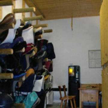
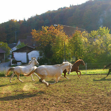
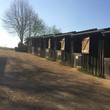
Paddockbox m. angrenzenden Auslauf frei
Zapfendorf
Weidner
@Weidner
Vermieten
Hunde willkommen
Longierzirkel/Roundpen
Hufrehe geeignet
Zuchtstutenhaltung möglich
Außenbox mit Paddock
14 weitere...
B

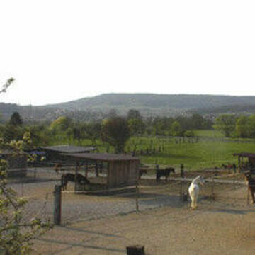
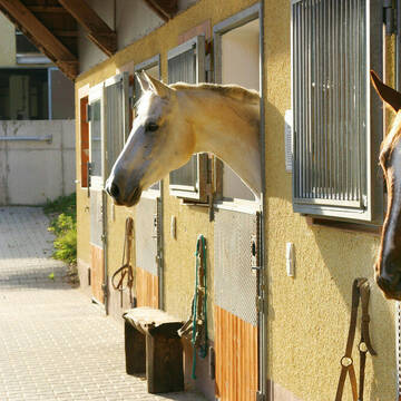
Boxen und Offenstallplätze Frei
Kirchehrenbach
Reithof Gebhard
@bernd-Reithof-Gebhard
Freizeitstall
Geländestrecke
Longierzirkel/Roundpen
Paddock
Fohlenaufzucht möglich
Hengsthaltung möglich
Außenbox mit Paddock
Außenboxen
21 weitere...
P+
Deprecated: Creation of dynamic property Zend_View_Helper_Ads::$adLink is deprecated in /var/www/stall-frei/htdocs/staging.stall-frei.de/library/Psf/View/Helper/Ads.php on line 108

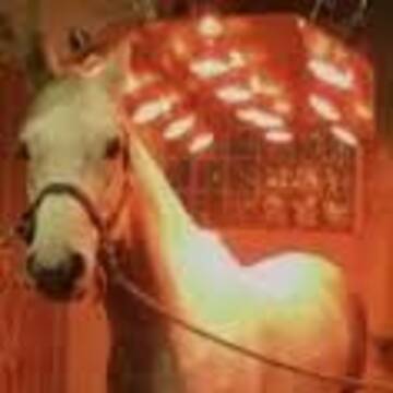
Das Beste für die Hufe
Mechtersen
STALL-FREIde Marketing
@STALL-FREI-Marketing
Hufschmiede und Hufpfleger in Ihrer Nähe
Leider kein Vorschaubild
Leider kein Vorschaubild
Gestüt am Giechburgblick
Scheßlitz
Lena Möhrlein
@Lena Möhrlein
Vermieten
Pensions- und Gastboxen
Reithalle
Hengsthaltung möglich
Pferdezucht
Außenbox mit Paddock
8 weitere...
B


Reitsportanlage Frank / Schmidt
Etzelwang
Reitsportanlage Frank /Schmidt
@Reitstall-Frank
Pferdeausbildung
Reitlehrer und -unterricht
Vermieten
Paddock
Pensions- und Gastboxen
Hengsthaltung möglich
16 weitere...
S

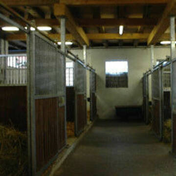
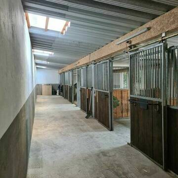
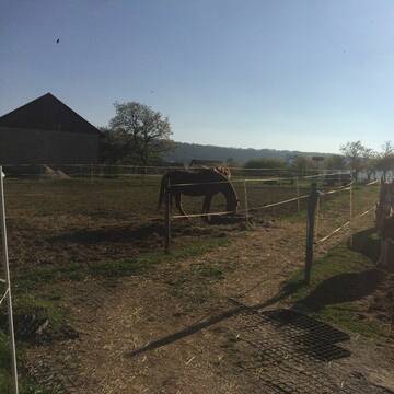
Offenstallplätze Wallach / Stute
Pretzfeld
Brütting
@Christinaxkern
Freizeitstall
Geländestrecke
Vermieten
Hunde willkommen
Krankenbox
Notfallboxen
15 weitere...
P
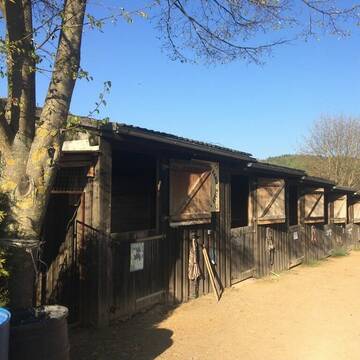
Paddoockboxen und Offenstall Plätze wieder frei
Buttenheim
Matthias
@heinrich-lessner
Freizeitstall
Vermieten
Hunde willkommen
Krankenbox
Außenbox mit Paddock
Offenstall
12 weitere...
P

Artgerechter Offenstall mit heller Reithalle!
Betzenstein
Sabrina-Ostfalk
@Sabrina-Ostfalk
FN-Mitglied
Freizeitstall
Hunde willkommen
Krankenbox
Notfallboxen
Bewegungsstall
Laufstall
25 weitere...
P
Leider kein Vorschaubild
Leider kein Vorschaubild
Zucht- und Pensionsstall Grünwald
Parkstein
Alexander Grünwald
@pensionsstall_gruenwald
Freizeitstall
Geländestrecke
Vermieten
Hunde willkommen
Longierzirkel/Roundpen
Pferdezucht
Zuchtstutenhaltung möglich
21 weitere...
B

Job gesucht?
Mechtersen
STALL-FREIde Marketing
@STALL-FREI-Marketing
Sie suchen einen Job und arbeiten gerne mit Pferden oder auf Reitanlagen?
Besuchen Sie jetzt unseren Stellenmarkt!

Pensionsstall Stein
Kunreuth
Pensionsstall Stein
@Pensionsstall-Stein-GbR
Freizeitstall
Geländestrecke
Vermieten
Longierzirkel/Roundpen
Paddock
Allergikerstall
Gnadenbrothof
23 weitere...
P+
Leider kein Vorschaubild
Leider kein Vorschaubild
Spin in X Ranch in Ebern Freie Boxen
Ebern
KaiWa
@KaiWa
Geländestrecke
Pferdeausbildung
Longierzirkel/Roundpen
Paddock
Hengsthaltung möglich
Pferdezucht
Außenbox mit Paddock
Außenboxen
17 weitere...
B
Newsletter abonnieren
Melde Dich für unseren Newsletter an und verpasse keine Neuigkeiten!
Deprecated: Creation of dynamic property Zend_View::$pageCount is deprecated in /var/www/stall-frei/htdocs/staging.stall-frei.de/library/vendor/shardj/zf1-future/library/Zend/View/Abstract.php on line 308
Deprecated: Creation of dynamic property Zend_View::$itemCountPerPage is deprecated in /var/www/stall-frei/htdocs/staging.stall-frei.de/library/vendor/shardj/zf1-future/library/Zend/View/Abstract.php on line 308
Deprecated: Creation of dynamic property Zend_View::$first is deprecated in /var/www/stall-frei/htdocs/staging.stall-frei.de/library/vendor/shardj/zf1-future/library/Zend/View/Abstract.php on line 308
Deprecated: Creation of dynamic property Zend_View::$current is deprecated in /var/www/stall-frei/htdocs/staging.stall-frei.de/library/vendor/shardj/zf1-future/library/Zend/View/Abstract.php on line 308
Deprecated: Creation of dynamic property Zend_View::$last is deprecated in /var/www/stall-frei/htdocs/staging.stall-frei.de/library/vendor/shardj/zf1-future/library/Zend/View/Abstract.php on line 308
Deprecated: Creation of dynamic property Zend_View::$previous is deprecated in /var/www/stall-frei/htdocs/staging.stall-frei.de/library/vendor/shardj/zf1-future/library/Zend/View/Abstract.php on line 308
Deprecated: Creation of dynamic property Zend_View::$next is deprecated in /var/www/stall-frei/htdocs/staging.stall-frei.de/library/vendor/shardj/zf1-future/library/Zend/View/Abstract.php on line 308
Deprecated: Creation of dynamic property Zend_View::$pagesInRange is deprecated in /var/www/stall-frei/htdocs/staging.stall-frei.de/library/vendor/shardj/zf1-future/library/Zend/View/Abstract.php on line 308
Deprecated: Creation of dynamic property Zend_View::$firstPageInRange is deprecated in /var/www/stall-frei/htdocs/staging.stall-frei.de/library/vendor/shardj/zf1-future/library/Zend/View/Abstract.php on line 308
Deprecated: Creation of dynamic property Zend_View::$lastPageInRange is deprecated in /var/www/stall-frei/htdocs/staging.stall-frei.de/library/vendor/shardj/zf1-future/library/Zend/View/Abstract.php on line 308
Deprecated: Creation of dynamic property Zend_View::$currentItemCount is deprecated in /var/www/stall-frei/htdocs/staging.stall-frei.de/library/vendor/shardj/zf1-future/library/Zend/View/Abstract.php on line 308
Deprecated: Creation of dynamic property Zend_View::$totalItemCount is deprecated in /var/www/stall-frei/htdocs/staging.stall-frei.de/library/vendor/shardj/zf1-future/library/Zend/View/Abstract.php on line 308
Deprecated: Creation of dynamic property Zend_View::$firstItemNumber is deprecated in /var/www/stall-frei/htdocs/staging.stall-frei.de/library/vendor/shardj/zf1-future/library/Zend/View/Abstract.php on line 308
Deprecated: Creation of dynamic property Zend_View::$lastItemNumber is deprecated in /var/www/stall-frei/htdocs/staging.stall-frei.de/library/vendor/shardj/zf1-future/library/Zend/View/Abstract.php on line 308
Deprecated: Creation of dynamic property Zend_View::$router is deprecated in /var/www/stall-frei/htdocs/staging.stall-frei.de/library/vendor/shardj/zf1-future/library/Zend/View/Abstract.php on line 308
Deprecated: Creation of dynamic property Zend_View::$urlParams is deprecated in /var/www/stall-frei/htdocs/staging.stall-frei.de/library/vendor/shardj/zf1-future/library/Zend/View/Abstract.php on line 308
Deprecated: Creation of dynamic property Zend_View::$showAds is deprecated in /var/www/stall-frei/htdocs/staging.stall-frei.de/library/vendor/shardj/zf1-future/library/Zend/View/Abstract.php on line 308
Deprecated: Creation of dynamic property Zend_View::$objectIds is deprecated in /var/www/stall-frei/htdocs/staging.stall-frei.de/library/vendor/shardj/zf1-future/library/Zend/View/Abstract.php on line 308
Deprecated: Creation of dynamic property Zend_View::$showNavbar is deprecated in /var/www/stall-frei/htdocs/staging.stall-frei.de/library/vendor/shardj/zf1-future/library/Zend/View/Abstract.php on line 308
Deprecated: Creation of dynamic property Zend_View::$showBreadcrumb is deprecated in /var/www/stall-frei/htdocs/staging.stall-frei.de/library/vendor/shardj/zf1-future/library/Zend/View/Abstract.php on line 308
Deprecated: Creation of dynamic property Zend_View::$showFooter is deprecated in /var/www/stall-frei/htdocs/staging.stall-frei.de/library/vendor/shardj/zf1-future/library/Zend/View/Abstract.php on line 308
Deprecated: Creation of dynamic property Zend_View::$showInternalAds is deprecated in /var/www/stall-frei/htdocs/staging.stall-frei.de/library/vendor/shardj/zf1-future/library/Zend/View/Abstract.php on line 308
Deprecated: Creation of dynamic property Zend_View::$blNoContent is deprecated in /var/www/stall-frei/htdocs/staging.stall-frei.de/library/vendor/shardj/zf1-future/library/Zend/View/Abstract.php on line 308
Deprecated: Creation of dynamic property Zend_View::$sMetaDesc is deprecated in /var/www/stall-frei/htdocs/staging.stall-frei.de/library/vendor/shardj/zf1-future/library/Zend/View/Abstract.php on line 308
Deprecated: Creation of dynamic property Zend_View::$useGmaps is deprecated in /var/www/stall-frei/htdocs/staging.stall-frei.de/library/vendor/shardj/zf1-future/library/Zend/View/Abstract.php on line 308
Deprecated: Creation of dynamic property Zend_View::$touches is deprecated in /var/www/stall-frei/htdocs/staging.stall-frei.de/library/vendor/shardj/zf1-future/library/Zend/View/Abstract.php on line 308
Deprecated: Creation of dynamic property Zend_View::$oProject is deprecated in /var/www/stall-frei/htdocs/staging.stall-frei.de/library/vendor/shardj/zf1-future/library/Zend/View/Abstract.php on line 308
Deprecated: Creation of dynamic property Zend_View::$pageHeadline is deprecated in /var/www/stall-frei/htdocs/staging.stall-frei.de/library/vendor/shardj/zf1-future/library/Zend/View/Abstract.php on line 308
Deprecated: Creation of dynamic property Zend_View::$disableLocationField is deprecated in /var/www/stall-frei/htdocs/staging.stall-frei.de/library/vendor/shardj/zf1-future/library/Zend/View/Abstract.php on line 308
Deprecated: Creation of dynamic property Zend_View::$isSearch is deprecated in /var/www/stall-frei/htdocs/staging.stall-frei.de/library/vendor/shardj/zf1-future/library/Zend/View/Abstract.php on line 308
Deprecated: Creation of dynamic property Zend_View::$pageTitle is deprecated in /var/www/stall-frei/htdocs/staging.stall-frei.de/library/vendor/shardj/zf1-future/library/Zend/View/Abstract.php on line 308
Deprecated: Creation of dynamic property Psf_Form_Element_Text::$class is deprecated in /var/www/stall-frei/htdocs/staging.stall-frei.de/library/vendor/shardj/zf1-future/library/Zend/Form/Element.php on line 874
Deprecated: Creation of dynamic property Psf_Form_Element_Text::$size is deprecated in /var/www/stall-frei/htdocs/staging.stall-frei.de/library/vendor/shardj/zf1-future/library/Zend/Form/Element.php on line 874
Deprecated: Creation of dynamic property Psf_Form_Element_Text::$placeholder is deprecated in /var/www/stall-frei/htdocs/staging.stall-frei.de/library/vendor/shardj/zf1-future/library/Zend/Form/Element.php on line 874
Deprecated: Creation of dynamic property Psf_Form_Element_Hidden::$class is deprecated in /var/www/stall-frei/htdocs/staging.stall-frei.de/library/vendor/shardj/zf1-future/library/Zend/Form/Element.php on line 874
Deprecated: Creation of dynamic property Psf_Form_Element_Hidden::$class is deprecated in /var/www/stall-frei/htdocs/staging.stall-frei.de/library/vendor/shardj/zf1-future/library/Zend/Form/Element.php on line 874
Deprecated: Creation of dynamic property Psf_Form_Element_Hidden::$class is deprecated in /var/www/stall-frei/htdocs/staging.stall-frei.de/library/vendor/shardj/zf1-future/library/Zend/Form/Element.php on line 874
Deprecated: Creation of dynamic property Psf_Form_Element_Hidden::$class is deprecated in /var/www/stall-frei/htdocs/staging.stall-frei.de/library/vendor/shardj/zf1-future/library/Zend/Form/Element.php on line 874
Deprecated: Creation of dynamic property Psf_Form_Element_Select::$class is deprecated in /var/www/stall-frei/htdocs/staging.stall-frei.de/library/vendor/shardj/zf1-future/library/Zend/Form/Element.php on line 874
Deprecated: Creation of dynamic property Psf_Form_Element_Select::$class is deprecated in /var/www/stall-frei/htdocs/staging.stall-frei.de/library/vendor/shardj/zf1-future/library/Zend/Form/Element.php on line 874
Deprecated: Creation of dynamic property Psf_Form_Element_Select::$class is deprecated in /var/www/stall-frei/htdocs/staging.stall-frei.de/library/vendor/shardj/zf1-future/library/Zend/Form/Element.php on line 874
Deprecated: Creation of dynamic property Psf_Form_Element_Select::$class is deprecated in /var/www/stall-frei/htdocs/staging.stall-frei.de/library/vendor/shardj/zf1-future/library/Zend/Form/Element.php on line 874
Deprecated: Creation of dynamic property Psf_Form_Element_Text::$class is deprecated in /var/www/stall-frei/htdocs/staging.stall-frei.de/library/vendor/shardj/zf1-future/library/Zend/Form/Element.php on line 874
Deprecated: Creation of dynamic property Psf_Form_Element_Checkbox::$label is deprecated in /var/www/stall-frei/htdocs/staging.stall-frei.de/library/vendor/shardj/zf1-future/library/Zend/Form/Element.php on line 874
Deprecated: Creation of dynamic property Zend_View::$sort is deprecated in /var/www/stall-frei/htdocs/staging.stall-frei.de/library/vendor/shardj/zf1-future/library/Zend/View/Abstract.php on line 308
Deprecated: Creation of dynamic property Zend_View::$searchLocation is deprecated in /var/www/stall-frei/htdocs/staging.stall-frei.de/library/vendor/shardj/zf1-future/library/Zend/View/Abstract.php on line 308
Deprecated: Creation of dynamic property Zend_View::$locationHint is deprecated in /var/www/stall-frei/htdocs/staging.stall-frei.de/library/vendor/shardj/zf1-future/library/Zend/View/Abstract.php on line 308
Psf_GeoCoder_Abstract::getLocation: Ort Get Location CachedOrLive
Psf_GeoCoder_Abstract::getCachedOrLive: Ort
Psf_GeoCoder_Abstract::convertLocationResult
{"documentation":"https:\/\/opencagedata.com\/api","licenses":[{"name":"see attribution guide","url":"https:\/\/opencagedata.com\/credits"}],"results":[{"bounds":{"northeast":{"lat":50.2506211,"lng":11.6940548},"southwest":{"lat":50.2106211,"lng":11.6540548}},"components":{"ISO_3166-1_alpha-2":"DE","ISO_3166-1_alpha-3":"DEU","ISO_3166-2":["DE-BY"],"_category":"place","_normalized_city":"Helmbrechts","_type":"village","continent":"Europe","country":"Deutschland","country_code":"de","county":"Landkreis Hof","political_union":"European Union","postcode":"95233","state":"Bayern","state_code":"BY","town":"Helmbrechts","village":"Ort"},"confidence":7,"formatted":"95233 Ort, Deutschland","geometry":{"lat":50.2306211,"lng":11.6740548}},{"bounds":{"northeast":{"lat":50.7795091,"lng":7.2024283},"southwest":{"lat":50.7615783,"lng":7.1742671}},"components":{"ISO_3166-1_alpha-2":"DE","ISO_3166-1_alpha-3":"DEU","ISO_3166-2":["DE-NW"],"_category":"place","_normalized_city":"Sankt Augustin","_type":"neighbourhood","continent":"Europe","country":"Deutschland","country_code":"de","county":"Rhein-Sieg-Kreis","political_union":"European Union","postcode":"53757","state":"Nordrhein-Westfalen","state_code":"NW","suburb":"Ort","town":"Sankt Augustin"},"confidence":8,"formatted":"53757 Sankt Augustin, Deutschland","geometry":{"lat":50.77051,"lng":7.186784}},{"bounds":{"northeast":{"lat":48.8284417,"lng":13.5508764},"southwest":{"lat":48.7884417,"lng":13.5108764}},"components":{"ISO_3166-1_alpha-2":"DE","ISO_3166-1_alpha-3":"DEU","ISO_3166-2":["DE-BY"],"_category":"place","_normalized_city":"Freyung","_type":"hamlet","continent":"Europe","country":"Deutschland","country_code":"de","county":"Landkreis Freyung-Grafenau","hamlet":"Ort","political_union":"European Union","postcode":"94078","state":"Bayern","state_code":"BY","town":"Freyung"},"confidence":7,"formatted":"Ort, 94078 Freyung, Deutschland","geometry":{"lat":48.8084417,"lng":13.5308764}},{"bounds":{"northeast":{"lat":47.6949089,"lng":11.4086346},"southwest":{"lat":47.6549089,"lng":11.3686346}},"components":{"ISO_3166-1_alpha-2":"DE","ISO_3166-1_alpha-3":"DEU","ISO_3166-2":["DE-BY"],"_category":"place","_normalized_city":"Kochel am See","_type":"hamlet","continent":"Europe","country":"Deutschland","country_code":"de","county":"Landkreis Bad T\u00f6lz-Wolfratshausen","hamlet":"Ort","municipality":"Kochel am See (VGem)","political_union":"European Union","postcode":"82431","state":"Bayern","state_code":"BY","village":"Kochel am See"},"confidence":7,"formatted":"Ort, 82431 Kochel am See, Deutschland","geometry":{"lat":47.6749089,"lng":11.3886346}},{"bounds":{"northeast":{"lat":48.8879681,"lng":13.2781122},"southwest":{"lat":48.8479681,"lng":13.2381122}},"components":{"ISO_3166-1_alpha-2":"DE","ISO_3166-1_alpha-3":"DEU","ISO_3166-2":["DE-BY"],"_category":"place","_normalized_city":"Innernzell","_type":"hamlet","city":"Innernzell","continent":"Europe","country":"Deutschland","country_code":"de","county":"Landkreis Freyung-Grafenau","hamlet":"Ort","municipality":"Sch\u00f6nberg (VGem)","political_union":"European Union","postcode":"94548","state":"Bayern","state_code":"BY"},"confidence":7,"formatted":"Ort, 94548 Innernzell, Deutschland","geometry":{"lat":48.8679681,"lng":13.2581122}},{"bounds":{"northeast":{"lat":47.7637466,"lng":12.6822557},"southwest":{"lat":47.7237466,"lng":12.6422557}},"components":{"ISO_3166-1_alpha-2":"DE","ISO_3166-1_alpha-3":"DEU","ISO_3166-2":["DE-BY"],"_category":"place","_normalized_city":"Ruhpolding","_type":"hamlet","continent":"Europe","country":"Deutschland","country_code":"de","county":"Landkreis Traunstein","hamlet":"Ort","political_union":"European Union","postcode":"83324","state":"Bayern","state_code":"BY","village":"Ruhpolding"},"confidence":7,"formatted":"Ort, 83324 Ruhpolding, Deutschland","geometry":{"lat":47.7437466,"lng":12.6622557}},{"bounds":{"northeast":{"lat":48.361304,"lng":13.236639},"southwest":{"lat":48.321304,"lng":13.196639}},"components":{"ISO_3166-1_alpha-2":"DE","ISO_3166-1_alpha-3":"DEU","ISO_3166-2":["DE-BY"],"_category":"place","_normalized_city":"Kirchham","_type":"hamlet","continent":"Europe","country":"Deutschland","country_code":"de","county":"Landkreis Passau","hamlet":"Ort","political_union":"European Union","postcode":"94094","state":"Bayern","state_code":"BY","village":"Kirchham"},"confidence":7,"formatted":"Ort, 94094 Kirchham, Deutschland","geometry":{"lat":48.341304,"lng":13.216639}},{"bounds":{"northeast":{"lat":48.0380827,"lng":12.584072},"southwest":{"lat":47.9980827,"lng":12.544072}},"components":{"ISO_3166-1_alpha-2":"DE","ISO_3166-1_alpha-3":"DEU","ISO_3166-2":["DE-BY"],"_category":"place","_normalized_city":"Trostberg","_type":"hamlet","continent":"Europe","country":"Deutschland","country_code":"de","county":"Landkreis Traunstein","hamlet":"Ort","municipality":"Trostberg","political_union":"European Union","postcode":"83308","state":"Bayern","state_code":"BY","town":"Trostberg"},"confidence":7,"formatted":"Ort, 83308 Trostberg, Deutschland","geometry":{"lat":48.0180827,"lng":12.564072}},{"bounds":{"northeast":{"lat":53.5658526,"lng":9.6127726},"southwest":{"lat":53.558988,"lng":9.6087296}},"components":{"ISO_3166-1_alpha-2":"DE","ISO_3166-1_alpha-3":"DEU","ISO_3166-2":["DE-NI"],"_category":"road","_normalized_city":"Mittelnkirchen","_type":"road","continent":"Europe","country":"Deutschland","country_code":"de","county":"Landkreis Stade","municipality":"Samtgemeinde L\u00fche","political_union":"European Union","postcode":"21720","road":"Ort","road_type":"residential","state":"Niedersachsen","state_code":"NI","village":"Mittelnkirchen"},"confidence":9,"formatted":"Ort, 21720 Mittelnkirchen, Deutschland","geometry":{"lat":53.5622174,"lng":9.611126}},{"bounds":{"northeast":{"lat":48.8089688,"lng":13.5280753},"southwest":{"lat":48.8078078,"lng":13.5264259}},"components":{"ISO_3166-1_alpha-2":"DE","ISO_3166-1_alpha-3":"DEU","ISO_3166-2":["DE-BY"],"_category":"road","_normalized_city":"Freyung","_type":"road","continent":"Europe","country":"Deutschland","country_code":"de","county":"Landkreis Freyung-Grafenau","hamlet":"Ort","political_union":"European Union","postcode":"94078","road":"Ort","state":"Bayern","state_code":"BY","town":"Freyung"},"confidence":9,"formatted":"Ort, 94078 Freyung, Deutschland","geometry":{"lat":48.808355,"lng":13.5272773}}],"status":{"code":200,"message":"OK"},"stay_informed":{"blog":"https:\/\/blog.opencagedata.com","mastodon":"https:\/\/en.osm.town\/@opencage"},"thanks":"For using an OpenCage API","timestamp":{"created_http":"Sat, 07 Feb 2026 22:21:19 GMT","created_unix":1770502879},"total_results":10}Array
(
[0] => stdClass Object
(
[bounds] => stdClass Object
(
[northeast] => stdClass Object
(
[lat] => 50.2506211
[lng] => 11.6940548
)
[southwest] => stdClass Object
(
[lat] => 50.2106211
[lng] => 11.6540548
)
)
[components] => stdClass Object
(
[ISO_3166-1_alpha-2] => DE
[ISO_3166-1_alpha-3] => DEU
[ISO_3166-2] => Array
(
[0] => DE-BY
)
[_category] => place
[_normalized_city] => Helmbrechts
[_type] => village
[continent] => Europe
[country] => Deutschland
[country_code] => de
[county] => Landkreis Hof
[political_union] => European Union
[postcode] => 95233
[state] => Bayern
[state_code] => BY
[town] => Helmbrechts
[village] => Ort
)
[confidence] => 7
[formatted] => 95233 Ort, Deutschland
[geometry] => stdClass Object
(
[lat] => 50.2306211
[lng] => 11.6740548
)
)
[1] => stdClass Object
(
[bounds] => stdClass Object
(
[northeast] => stdClass Object
(
[lat] => 50.7795091
[lng] => 7.2024283
)
[southwest] => stdClass Object
(
[lat] => 50.7615783
[lng] => 7.1742671
)
)
[components] => stdClass Object
(
[ISO_3166-1_alpha-2] => DE
[ISO_3166-1_alpha-3] => DEU
[ISO_3166-2] => Array
(
[0] => DE-NW
)
[_category] => place
[_normalized_city] => Sankt Augustin
[_type] => neighbourhood
[continent] => Europe
[country] => Deutschland
[country_code] => de
[county] => Rhein-Sieg-Kreis
[political_union] => European Union
[postcode] => 53757
[state] => Nordrhein-Westfalen
[state_code] => NW
[suburb] => Ort
[town] => Sankt Augustin
)
[confidence] => 8
[formatted] => 53757 Sankt Augustin, Deutschland
[geometry] => stdClass Object
(
[lat] => 50.77051
[lng] => 7.186784
)
)
[2] => stdClass Object
(
[bounds] => stdClass Object
(
[northeast] => stdClass Object
(
[lat] => 48.8284417
[lng] => 13.5508764
)
[southwest] => stdClass Object
(
[lat] => 48.7884417
[lng] => 13.5108764
)
)
[components] => stdClass Object
(
[ISO_3166-1_alpha-2] => DE
[ISO_3166-1_alpha-3] => DEU
[ISO_3166-2] => Array
(
[0] => DE-BY
)
[_category] => place
[_normalized_city] => Freyung
[_type] => hamlet
[continent] => Europe
[country] => Deutschland
[country_code] => de
[county] => Landkreis Freyung-Grafenau
[hamlet] => Ort
[political_union] => European Union
[postcode] => 94078
[state] => Bayern
[state_code] => BY
[town] => Freyung
)
[confidence] => 7
[formatted] => Ort, 94078 Freyung, Deutschland
[geometry] => stdClass Object
(
[lat] => 48.8084417
[lng] => 13.5308764
)
)
[3] => stdClass Object
(
[bounds] => stdClass Object
(
[northeast] => stdClass Object
(
[lat] => 47.6949089
[lng] => 11.4086346
)
[southwest] => stdClass Object
(
[lat] => 47.6549089
[lng] => 11.3686346
)
)
[components] => stdClass Object
(
[ISO_3166-1_alpha-2] => DE
[ISO_3166-1_alpha-3] => DEU
[ISO_3166-2] => Array
(
[0] => DE-BY
)
[_category] => place
[_normalized_city] => Kochel am See
[_type] => hamlet
[continent] => Europe
[country] => Deutschland
[country_code] => de
[county] => Landkreis Bad Tölz-Wolfratshausen
[hamlet] => Ort
[municipality] => Kochel am See (VGem)
[political_union] => European Union
[postcode] => 82431
[state] => Bayern
[state_code] => BY
[village] => Kochel am See
)
[confidence] => 7
[formatted] => Ort, 82431 Kochel am See, Deutschland
[geometry] => stdClass Object
(
[lat] => 47.6749089
[lng] => 11.3886346
)
)
[4] => stdClass Object
(
[bounds] => stdClass Object
(
[northeast] => stdClass Object
(
[lat] => 48.8879681
[lng] => 13.2781122
)
[southwest] => stdClass Object
(
[lat] => 48.8479681
[lng] => 13.2381122
)
)
[components] => stdClass Object
(
[ISO_3166-1_alpha-2] => DE
[ISO_3166-1_alpha-3] => DEU
[ISO_3166-2] => Array
(
[0] => DE-BY
)
[_category] => place
[_normalized_city] => Innernzell
[_type] => hamlet
[city] => Innernzell
[continent] => Europe
[country] => Deutschland
[country_code] => de
[county] => Landkreis Freyung-Grafenau
[hamlet] => Ort
[municipality] => Schönberg (VGem)
[political_union] => European Union
[postcode] => 94548
[state] => Bayern
[state_code] => BY
)
[confidence] => 7
[formatted] => Ort, 94548 Innernzell, Deutschland
[geometry] => stdClass Object
(
[lat] => 48.8679681
[lng] => 13.2581122
)
)
[5] => stdClass Object
(
[bounds] => stdClass Object
(
[northeast] => stdClass Object
(
[lat] => 47.7637466
[lng] => 12.6822557
)
[southwest] => stdClass Object
(
[lat] => 47.7237466
[lng] => 12.6422557
)
)
[components] => stdClass Object
(
[ISO_3166-1_alpha-2] => DE
[ISO_3166-1_alpha-3] => DEU
[ISO_3166-2] => Array
(
[0] => DE-BY
)
[_category] => place
[_normalized_city] => Ruhpolding
[_type] => hamlet
[continent] => Europe
[country] => Deutschland
[country_code] => de
[county] => Landkreis Traunstein
[hamlet] => Ort
[political_union] => European Union
[postcode] => 83324
[state] => Bayern
[state_code] => BY
[village] => Ruhpolding
)
[confidence] => 7
[formatted] => Ort, 83324 Ruhpolding, Deutschland
[geometry] => stdClass Object
(
[lat] => 47.7437466
[lng] => 12.6622557
)
)
[6] => stdClass Object
(
[bounds] => stdClass Object
(
[northeast] => stdClass Object
(
[lat] => 48.361304
[lng] => 13.236639
)
[southwest] => stdClass Object
(
[lat] => 48.321304
[lng] => 13.196639
)
)
[components] => stdClass Object
(
[ISO_3166-1_alpha-2] => DE
[ISO_3166-1_alpha-3] => DEU
[ISO_3166-2] => Array
(
[0] => DE-BY
)
[_category] => place
[_normalized_city] => Kirchham
[_type] => hamlet
[continent] => Europe
[country] => Deutschland
[country_code] => de
[county] => Landkreis Passau
[hamlet] => Ort
[political_union] => European Union
[postcode] => 94094
[state] => Bayern
[state_code] => BY
[village] => Kirchham
)
[confidence] => 7
[formatted] => Ort, 94094 Kirchham, Deutschland
[geometry] => stdClass Object
(
[lat] => 48.341304
[lng] => 13.216639
)
)
[7] => stdClass Object
(
[bounds] => stdClass Object
(
[northeast] => stdClass Object
(
[lat] => 48.0380827
[lng] => 12.584072
)
[southwest] => stdClass Object
(
[lat] => 47.9980827
[lng] => 12.544072
)
)
[components] => stdClass Object
(
[ISO_3166-1_alpha-2] => DE
[ISO_3166-1_alpha-3] => DEU
[ISO_3166-2] => Array
(
[0] => DE-BY
)
[_category] => place
[_normalized_city] => Trostberg
[_type] => hamlet
[continent] => Europe
[country] => Deutschland
[country_code] => de
[county] => Landkreis Traunstein
[hamlet] => Ort
[municipality] => Trostberg
[political_union] => European Union
[postcode] => 83308
[state] => Bayern
[state_code] => BY
[town] => Trostberg
)
[confidence] => 7
[formatted] => Ort, 83308 Trostberg, Deutschland
[geometry] => stdClass Object
(
[lat] => 48.0180827
[lng] => 12.564072
)
)
[8] => stdClass Object
(
[bounds] => stdClass Object
(
[northeast] => stdClass Object
(
[lat] => 53.5658526
[lng] => 9.6127726
)
[southwest] => stdClass Object
(
[lat] => 53.558988
[lng] => 9.6087296
)
)
[components] => stdClass Object
(
[ISO_3166-1_alpha-2] => DE
[ISO_3166-1_alpha-3] => DEU
[ISO_3166-2] => Array
(
[0] => DE-NI
)
[_category] => road
[_normalized_city] => Mittelnkirchen
[_type] => road
[continent] => Europe
[country] => Deutschland
[country_code] => de
[county] => Landkreis Stade
[municipality] => Samtgemeinde Lühe
[political_union] => European Union
[postcode] => 21720
[road] => Ort
[road_type] => residential
[state] => Niedersachsen
[state_code] => NI
[village] => Mittelnkirchen
)
[confidence] => 9
[formatted] => Ort, 21720 Mittelnkirchen, Deutschland
[geometry] => stdClass Object
(
[lat] => 53.5622174
[lng] => 9.611126
)
)
[9] => stdClass Object
(
[bounds] => stdClass Object
(
[northeast] => stdClass Object
(
[lat] => 48.8089688
[lng] => 13.5280753
)
[southwest] => stdClass Object
(
[lat] => 48.8078078
[lng] => 13.5264259
)
)
[components] => stdClass Object
(
[ISO_3166-1_alpha-2] => DE
[ISO_3166-1_alpha-3] => DEU
[ISO_3166-2] => Array
(
[0] => DE-BY
)
[_category] => road
[_normalized_city] => Freyung
[_type] => road
[continent] => Europe
[country] => Deutschland
[country_code] => de
[county] => Landkreis Freyung-Grafenau
[hamlet] => Ort
[political_union] => European Union
[postcode] => 94078
[road] => Ort
[state] => Bayern
[state_code] => BY
[town] => Freyung
)
[confidence] => 9
[formatted] => Ort, 94078 Freyung, Deutschland
[geometry] => stdClass Object
(
[lat] => 48.808355
[lng] => 13.5272773
)
)
)
Psf_GeoCoder_OpenCageData::getKeyMap: 0
stdClass Object
(
    [bounds] => stdClass Object
        (
            [northeast] => stdClass Object
                (
                    [lat] => 50.2506211
                    [lng] => 11.6940548
                )

            [southwest] => stdClass Object
                (
                    [lat] => 50.2106211
                    [lng] => 11.6540548
                )

        )

    [components] => stdClass Object
        (
            [ISO_3166-1_alpha-2] => DE
            [ISO_3166-1_alpha-3] => DEU
            [ISO_3166-2] => Array
                (
                    [0] => DE-BY
                )

            [_category] => place
            [_normalized_city] => Helmbrechts
            [_type] => village
            [continent] => Europe
            [country] => Deutschland
            [country_code] => de
            [county] => Landkreis Hof
            [political_union] => European Union
            [postcode] => 95233
            [state] => Bayern
            [state_code] => BY
            [town] => Helmbrechts
            [village] => Ort
        )

    [confidence] => 7
    [formatted] => 95233 Ort, Deutschland
    [geometry] => stdClass Object
        (
            [lat] => 50.2306211
            [lng] => 11.6740548
        )

)
Psf_GeoCoder_OpenCageData::getCounty: Hof
Psf_GeoCoder_OpenCageData::addMissingData REFETCH!
Array
(
    [address] => 95233 Ort, Deutschland
    [type] => village
    [street] =>
    [city] => Helmbrechts
    [county] => Hof
    [state] => Bayern
    [zip] => 95233
    [country] => Deutschland
    [suburb] =>
    [countrycode] => de
    [latitude] => 50.2306211
    [longitude] => 11.6740548
    [accuracy] => 1
    [confidence] => 7
    [bounds] => stdClass Object
        (
            [northeast] => stdClass Object
                (
                    [lat] => 50.2506211
                    [lng] => 11.6940548
                )

            [southwest] => stdClass Object
                (
                    [lat] => 50.2106211
                    [lng] => 11.6540548
                )

        )

)
reformat!
Array
(
    [address] => 95233 Helmbrechts
    [type] => village
    [street] =>
    [city] => Helmbrechts
    [county] => Hof
    [state] => Bayern
    [zip] => 95233
    [country] => Deutschland
    [suburb] =>
    [countrycode] => de
    [latitude] => 50.2306211
    [longitude] => 11.6740548
    [accuracy] => 1
    [confidence] => 7
    [bounds] => stdClass Object
        (
            [northeast] => stdClass Object
                (
                    [lat] => 50.2506211
                    [lng] => 11.6940548
                )

            [southwest] => stdClass Object
                (
                    [lat] => 50.2106211
                    [lng] => 11.6540548
                )

        )

    [place] => 95233 Helmbrechts, Bayern
    [hash] => 15f8bef5697700ea239960d93c604218
)
Psf_GeoCoder_OpenCageData::getKeyMap: 1
stdClass Object
(
    [bounds] => stdClass Object
        (
            [northeast] => stdClass Object
                (
                    [lat] => 50.7795091
                    [lng] => 7.2024283
                )

            [southwest] => stdClass Object
                (
                    [lat] => 50.7615783
                    [lng] => 7.1742671
                )

        )

    [components] => stdClass Object
        (
            [ISO_3166-1_alpha-2] => DE
            [ISO_3166-1_alpha-3] => DEU
            [ISO_3166-2] => Array
                (
                    [0] => DE-NW
                )

            [_category] => place
            [_normalized_city] => Sankt Augustin
            [_type] => neighbourhood
            [continent] => Europe
            [country] => Deutschland
            [country_code] => de
            [county] => Rhein-Sieg-Kreis
            [political_union] => European Union
            [postcode] => 53757
            [state] => Nordrhein-Westfalen
            [state_code] => NW
            [suburb] => Ort
            [town] => Sankt Augustin
        )

    [confidence] => 8
    [formatted] => 53757 Sankt Augustin, Deutschland
    [geometry] => stdClass Object
        (
            [lat] => 50.77051
            [lng] => 7.186784
        )

)
Psf_GeoCoder_OpenCageData::getCounty: Rhein-Sieg-Kreis
Psf_GeoCoder_OpenCageData::addMissingData REFETCH!
Array
(
    [address] => 53757 Sankt Augustin, Deutschland
    [type] => neighbourhood
    [street] =>
    [city] => Sankt Augustin
    [county] => Rhein-Sieg-Kreis
    [state] => Nordrhein-Westfalen
    [zip] => 53757
    [country] => Deutschland
    [suburb] => Ort
    [countrycode] => de
    [latitude] => 50.77051
    [longitude] => 7.186784
    [accuracy] => 1
    [confidence] => 8
    [bounds] => stdClass Object
        (
            [northeast] => stdClass Object
                (
                    [lat] => 50.7795091
                    [lng] => 7.2024283
                )

            [southwest] => stdClass Object
                (
                    [lat] => 50.7615783
                    [lng] => 7.1742671
                )

        )

)
reformat!
Array
(
    [address] => 53757 Sankt Augustin, Deutschland
    [type] => neighbourhood
    [street] =>
    [city] => Sankt Augustin
    [county] => Rhein-Sieg-Kreis
    [state] => Nordrhein-Westfalen
    [zip] => 53757
    [country] => Deutschland
    [suburb] => Ort
    [countrycode] => de
    [latitude] => 50.77051
    [longitude] => 7.186784
    [accuracy] => 1
    [confidence] => 8
    [bounds] => stdClass Object
        (
            [northeast] => stdClass Object
                (
                    [lat] => 50.7795091
                    [lng] => 7.2024283
                )

            [southwest] => stdClass Object
                (
                    [lat] => 50.7615783
                    [lng] => 7.1742671
                )

        )

    [place] => 53757 Sankt Augustin, Nordrhein-Westfalen
    [hash] => 2faaca883100d35b12d25ec399784b72
)
Psf_GeoCoder_OpenCageData::getKeyMap: 2
stdClass Object
(
    [bounds] => stdClass Object
        (
            [northeast] => stdClass Object
                (
                    [lat] => 48.8284417
                    [lng] => 13.5508764
                )

            [southwest] => stdClass Object
                (
                    [lat] => 48.7884417
                    [lng] => 13.5108764
                )

        )

    [components] => stdClass Object
        (
            [ISO_3166-1_alpha-2] => DE
            [ISO_3166-1_alpha-3] => DEU
            [ISO_3166-2] => Array
                (
                    [0] => DE-BY
                )

            [_category] => place
            [_normalized_city] => Freyung
            [_type] => hamlet
            [continent] => Europe
            [country] => Deutschland
            [country_code] => de
            [county] => Landkreis Freyung-Grafenau
            [hamlet] => Ort
            [political_union] => European Union
            [postcode] => 94078
            [state] => Bayern
            [state_code] => BY
            [town] => Freyung
        )

    [confidence] => 7
    [formatted] => Ort, 94078 Freyung, Deutschland
    [geometry] => stdClass Object
        (
            [lat] => 48.8084417
            [lng] => 13.5308764
        )

)
Psf_GeoCoder_OpenCageData::getCounty: Freyung-Grafenau
Psf_GeoCoder_OpenCageData::addMissingData REFETCH!
Array
(
    [address] => Ort, 94078 Freyung, Deutschland
    [type] => hamlet
    [street] => Ort
    [city] => Freyung
    [county] => Freyung-Grafenau
    [state] => Bayern
    [zip] => 94078
    [country] => Deutschland
    [suburb] =>
    [countrycode] => de
    [latitude] => 48.8084417
    [longitude] => 13.5308764
    [accuracy] => 1
    [confidence] => 7
    [bounds] => stdClass Object
        (
            [northeast] => stdClass Object
                (
                    [lat] => 48.8284417
                    [lng] => 13.5508764
                )

            [southwest] => stdClass Object
                (
                    [lat] => 48.7884417
                    [lng] => 13.5108764
                )

        )

)
reformat!
Array
(
    [address] => Ort, 94078 Freyung, Deutschland
    [type] => hamlet
    [street] => Ort
    [city] => Freyung
    [county] => Freyung-Grafenau
    [state] => Bayern
    [zip] => 94078
    [country] => Deutschland
    [suburb] =>
    [countrycode] => de
    [latitude] => 48.8084417
    [longitude] => 13.5308764
    [accuracy] => 1
    [confidence] => 7
    [bounds] => stdClass Object
        (
            [northeast] => stdClass Object
                (
                    [lat] => 48.8284417
                    [lng] => 13.5508764
                )

            [southwest] => stdClass Object
                (
                    [lat] => 48.7884417
                    [lng] => 13.5108764
                )

        )

    [place] => Ort, 94078 Freyung, Bayern
    [hash] => a3de665d7ef274c7b76eb7cfaaffa0df
)
Psf_GeoCoder_OpenCageData::getKeyMap: 3
stdClass Object
(
    [bounds] => stdClass Object
        (
            [northeast] => stdClass Object
                (
                    [lat] => 47.6949089
                    [lng] => 11.4086346
                )

            [southwest] => stdClass Object
                (
                    [lat] => 47.6549089
                    [lng] => 11.3686346
                )

        )

    [components] => stdClass Object
        (
            [ISO_3166-1_alpha-2] => DE
            [ISO_3166-1_alpha-3] => DEU
            [ISO_3166-2] => Array
                (
                    [0] => DE-BY
                )

            [_category] => place
            [_normalized_city] => Kochel am See
            [_type] => hamlet
            [continent] => Europe
            [country] => Deutschland
            [country_code] => de
            [county] => Landkreis Bad Tölz-Wolfratshausen
            [hamlet] => Ort
            [municipality] => Kochel am See (VGem)
            [political_union] => European Union
            [postcode] => 82431
            [state] => Bayern
            [state_code] => BY
            [village] => Kochel am See
        )

    [confidence] => 7
    [formatted] => Ort, 82431 Kochel am See, Deutschland
    [geometry] => stdClass Object
        (
            [lat] => 47.6749089
            [lng] => 11.3886346
        )

)
Psf_GeoCoder_OpenCageData::getCounty: Bad Tölz-Wolfratshausen
Psf_GeoCoder_OpenCageData::addMissingData REFETCH!
Array
(
    [address] => Ort, 82431 Kochel am See, Deutschland
    [type] => hamlet
    [street] => Ort
    [city] => Kochel am See
    [county] => Bad Tölz-Wolfratshausen
    [state] => Bayern
    [zip] => 82431
    [country] => Deutschland
    [suburb] =>
    [countrycode] => de
    [latitude] => 47.6749089
    [longitude] => 11.3886346
    [accuracy] => 1
    [confidence] => 7
    [bounds] => stdClass Object
        (
            [northeast] => stdClass Object
                (
                    [lat] => 47.6949089
                    [lng] => 11.4086346
                )

            [southwest] => stdClass Object
                (
                    [lat] => 47.6549089
                    [lng] => 11.3686346
                )

        )

)
reformat!
Array
(
    [address] => Ort, 82431 Kochel am See, Deutschland
    [type] => hamlet
    [street] => Ort
    [city] => Kochel am See
    [county] => Bad Tölz-Wolfratshausen
    [state] => Bayern
    [zip] => 82431
    [country] => Deutschland
    [suburb] =>
    [countrycode] => de
    [latitude] => 47.6749089
    [longitude] => 11.3886346
    [accuracy] => 1
    [confidence] => 7
    [bounds] => stdClass Object
        (
            [northeast] => stdClass Object
                (
                    [lat] => 47.6949089
                    [lng] => 11.4086346
                )

            [southwest] => stdClass Object
                (
                    [lat] => 47.6549089
                    [lng] => 11.3686346
                )

        )

    [place] => Ort, 82431 Kochel am See, Bayern
    [hash] => 384a0a6049bab25f33ccfabd733af159
)
Psf_GeoCoder_OpenCageData::getKeyMap: 4
stdClass Object
(
    [bounds] => stdClass Object
        (
            [northeast] => stdClass Object
                (
                    [lat] => 48.8879681
                    [lng] => 13.2781122
                )

            [southwest] => stdClass Object
                (
                    [lat] => 48.8479681
                    [lng] => 13.2381122
                )

        )

    [components] => stdClass Object
        (
            [ISO_3166-1_alpha-2] => DE
            [ISO_3166-1_alpha-3] => DEU
            [ISO_3166-2] => Array
                (
                    [0] => DE-BY
                )

            [_category] => place
            [_normalized_city] => Innernzell
            [_type] => hamlet
            [city] => Innernzell
            [continent] => Europe
            [country] => Deutschland
            [country_code] => de
            [county] => Landkreis Freyung-Grafenau
            [hamlet] => Ort
            [municipality] => Schönberg (VGem)
            [political_union] => European Union
            [postcode] => 94548
            [state] => Bayern
            [state_code] => BY
        )

    [confidence] => 7
    [formatted] => Ort, 94548 Innernzell, Deutschland
    [geometry] => stdClass Object
        (
            [lat] => 48.8679681
            [lng] => 13.2581122
        )

)
Psf_GeoCoder_OpenCageData::getCounty: Freyung-Grafenau
Psf_GeoCoder_OpenCageData::addMissingData REFETCH!
Array
(
    [address] => Ort, 94548 Innernzell, Deutschland
    [type] => hamlet
    [street] => Ort
    [city] => Innernzell
    [county] => Freyung-Grafenau
    [state] => Bayern
    [zip] => 94548
    [country] => Deutschland
    [suburb] =>
    [countrycode] => de
    [latitude] => 48.8679681
    [longitude] => 13.2581122
    [accuracy] => 1
    [confidence] => 7
    [bounds] => stdClass Object
        (
            [northeast] => stdClass Object
                (
                    [lat] => 48.8879681
                    [lng] => 13.2781122
                )

            [southwest] => stdClass Object
                (
                    [lat] => 48.8479681
                    [lng] => 13.2381122
                )

        )

)
reformat!
Array
(
    [address] => Ort, 94548 Innernzell, Deutschland
    [type] => hamlet
    [street] => Ort
    [city] => Innernzell
    [county] => Freyung-Grafenau
    [state] => Bayern
    [zip] => 94548
    [country] => Deutschland
    [suburb] =>
    [countrycode] => de
    [latitude] => 48.8679681
    [longitude] => 13.2581122
    [accuracy] => 1
    [confidence] => 7
    [bounds] => stdClass Object
        (
            [northeast] => stdClass Object
                (
                    [lat] => 48.8879681
                    [lng] => 13.2781122
                )

            [southwest] => stdClass Object
                (
                    [lat] => 48.8479681
                    [lng] => 13.2381122
                )

        )

    [place] => Ort, 94548 Innernzell, Bayern
    [hash] => 807c806abb9479a19543a799a27255f0
)
Psf_GeoCoder_OpenCageData::getKeyMap: 5
stdClass Object
(
    [bounds] => stdClass Object
        (
            [northeast] => stdClass Object
                (
                    [lat] => 47.7637466
                    [lng] => 12.6822557
                )

            [southwest] => stdClass Object
                (
                    [lat] => 47.7237466
                    [lng] => 12.6422557
                )

        )

    [components] => stdClass Object
        (
            [ISO_3166-1_alpha-2] => DE
            [ISO_3166-1_alpha-3] => DEU
            [ISO_3166-2] => Array
                (
                    [0] => DE-BY
                )

            [_category] => place
            [_normalized_city] => Ruhpolding
            [_type] => hamlet
            [continent] => Europe
            [country] => Deutschland
            [country_code] => de
            [county] => Landkreis Traunstein
            [hamlet] => Ort
            [political_union] => European Union
            [postcode] => 83324
            [state] => Bayern
            [state_code] => BY
            [village] => Ruhpolding
        )

    [confidence] => 7
    [formatted] => Ort, 83324 Ruhpolding, Deutschland
    [geometry] => stdClass Object
        (
            [lat] => 47.7437466
            [lng] => 12.6622557
        )

)
Psf_GeoCoder_OpenCageData::getCounty: Traunstein
Psf_GeoCoder_OpenCageData::addMissingData REFETCH!
Array
(
    [address] => Ort, 83324 Ruhpolding, Deutschland
    [type] => hamlet
    [street] => Ort
    [city] => Ruhpolding
    [county] => Traunstein
    [state] => Bayern
    [zip] => 83324
    [country] => Deutschland
    [suburb] =>
    [countrycode] => de
    [latitude] => 47.7437466
    [longitude] => 12.6622557
    [accuracy] => 1
    [confidence] => 7
    [bounds] => stdClass Object
        (
            [northeast] => stdClass Object
                (
                    [lat] => 47.7637466
                    [lng] => 12.6822557
                )

            [southwest] => stdClass Object
                (
                    [lat] => 47.7237466
                    [lng] => 12.6422557
                )

        )

)
reformat!
Array
(
    [address] => Ort, 83324 Ruhpolding, Deutschland
    [type] => hamlet
    [street] => Ort
    [city] => Ruhpolding
    [county] => Traunstein
    [state] => Bayern
    [zip] => 83324
    [country] => Deutschland
    [suburb] =>
    [countrycode] => de
    [latitude] => 47.7437466
    [longitude] => 12.6622557
    [accuracy] => 1
    [confidence] => 7
    [bounds] => stdClass Object
        (
            [northeast] => stdClass Object
                (
                    [lat] => 47.7637466
                    [lng] => 12.6822557
                )

            [southwest] => stdClass Object
                (
                    [lat] => 47.7237466
                    [lng] => 12.6422557
                )

        )

    [place] => Ort, 83324 Ruhpolding, Bayern
    [hash] => 324b532c4d78f82a486b69c9c569d162
)
Psf_GeoCoder_OpenCageData::getKeyMap: 6
stdClass Object
(
    [bounds] => stdClass Object
        (
            [northeast] => stdClass Object
                (
                    [lat] => 48.361304
                    [lng] => 13.236639
                )

            [southwest] => stdClass Object
                (
                    [lat] => 48.321304
                    [lng] => 13.196639
                )

        )

    [components] => stdClass Object
        (
            [ISO_3166-1_alpha-2] => DE
            [ISO_3166-1_alpha-3] => DEU
            [ISO_3166-2] => Array
                (
                    [0] => DE-BY
                )

            [_category] => place
            [_normalized_city] => Kirchham
            [_type] => hamlet
            [continent] => Europe
            [country] => Deutschland
            [country_code] => de
            [county] => Landkreis Passau
            [hamlet] => Ort
            [political_union] => European Union
            [postcode] => 94094
            [state] => Bayern
            [state_code] => BY
            [village] => Kirchham
        )

    [confidence] => 7
    [formatted] => Ort, 94094 Kirchham, Deutschland
    [geometry] => stdClass Object
        (
            [lat] => 48.341304
            [lng] => 13.216639
        )

)
Psf_GeoCoder_OpenCageData::getCounty: Passau
Psf_GeoCoder_OpenCageData::addMissingData REFETCH!
Array
(
    [address] => Ort, 94094 Kirchham, Deutschland
    [type] => hamlet
    [street] => Ort
    [city] => Kirchham
    [county] => Passau
    [state] => Bayern
    [zip] => 94094
    [country] => Deutschland
    [suburb] =>
    [countrycode] => de
    [latitude] => 48.341304
    [longitude] => 13.216639
    [accuracy] => 1
    [confidence] => 7
    [bounds] => stdClass Object
        (
            [northeast] => stdClass Object
                (
                    [lat] => 48.361304
                    [lng] => 13.236639
                )

            [southwest] => stdClass Object
                (
                    [lat] => 48.321304
                    [lng] => 13.196639
                )

        )

)
reformat!
Array
(
    [address] => Ort, 94094 Kirchham, Deutschland
    [type] => hamlet
    [street] => Ort
    [city] => Kirchham
    [county] => Passau
    [state] => Bayern
    [zip] => 94094
    [country] => Deutschland
    [suburb] =>
    [countrycode] => de
    [latitude] => 48.341304
    [longitude] => 13.216639
    [accuracy] => 1
    [confidence] => 7
    [bounds] => stdClass Object
        (
            [northeast] => stdClass Object
                (
                    [lat] => 48.361304
                    [lng] => 13.236639
                )

            [southwest] => stdClass Object
                (
                    [lat] => 48.321304
                    [lng] => 13.196639
                )

        )

    [place] => Ort, 94094 Kirchham, Bayern
    [hash] => 04d9deaa16ee9176ed08b990e4eaf794
)
Psf_GeoCoder_OpenCageData::getKeyMap: 7
stdClass Object
(
    [bounds] => stdClass Object
        (
            [northeast] => stdClass Object
                (
                    [lat] => 48.0380827
                    [lng] => 12.584072
                )

            [southwest] => stdClass Object
                (
                    [lat] => 47.9980827
                    [lng] => 12.544072
                )

        )

    [components] => stdClass Object
        (
            [ISO_3166-1_alpha-2] => DE
            [ISO_3166-1_alpha-3] => DEU
            [ISO_3166-2] => Array
                (
                    [0] => DE-BY
                )

            [_category] => place
            [_normalized_city] => Trostberg
            [_type] => hamlet
            [continent] => Europe
            [country] => Deutschland
            [country_code] => de
            [county] => Landkreis Traunstein
            [hamlet] => Ort
            [municipality] => Trostberg
            [political_union] => European Union
            [postcode] => 83308
            [state] => Bayern
            [state_code] => BY
            [town] => Trostberg
        )

    [confidence] => 7
    [formatted] => Ort, 83308 Trostberg, Deutschland
    [geometry] => stdClass Object
        (
            [lat] => 48.0180827
            [lng] => 12.564072
        )

)
Psf_GeoCoder_OpenCageData::getCounty: Traunstein
Psf_GeoCoder_OpenCageData::addMissingData REFETCH!
Array
(
    [address] => Ort, 83308 Trostberg, Deutschland
    [type] => hamlet
    [street] => Ort
    [city] => Trostberg
    [county] => Traunstein
    [state] => Bayern
    [zip] => 83308
    [country] => Deutschland
    [suburb] =>
    [countrycode] => de
    [latitude] => 48.0180827
    [longitude] => 12.564072
    [accuracy] => 1
    [confidence] => 7
    [bounds] => stdClass Object
        (
            [northeast] => stdClass Object
                (
                    [lat] => 48.0380827
                    [lng] => 12.584072
                )

            [southwest] => stdClass Object
                (
                    [lat] => 47.9980827
                    [lng] => 12.544072
                )

        )

)
reformat!
Array
(
    [address] => Ort, 83308 Trostberg, Deutschland
    [type] => hamlet
    [street] => Ort
    [city] => Trostberg
    [county] => Traunstein
    [state] => Bayern
    [zip] => 83308
    [country] => Deutschland
    [suburb] =>
    [countrycode] => de
    [latitude] => 48.0180827
    [longitude] => 12.564072
    [accuracy] => 1
    [confidence] => 7
    [bounds] => stdClass Object
        (
            [northeast] => stdClass Object
                (
                    [lat] => 48.0380827
                    [lng] => 12.584072
                )

            [southwest] => stdClass Object
                (
                    [lat] => 47.9980827
                    [lng] => 12.544072
                )

        )

    [place] => Ort, 83308 Trostberg, Bayern
    [hash] => 00b166e479edb589bd5dcfe21f28d6b4
)
Psf_GeoCoder_OpenCageData::getKeyMap: 8
stdClass Object
(
    [bounds] => stdClass Object
        (
            [northeast] => stdClass Object
                (
                    [lat] => 53.5658526
                    [lng] => 9.6127726
                )

            [southwest] => stdClass Object
                (
                    [lat] => 53.558988
                    [lng] => 9.6087296
                )

        )

    [components] => stdClass Object
        (
            [ISO_3166-1_alpha-2] => DE
            [ISO_3166-1_alpha-3] => DEU
            [ISO_3166-2] => Array
                (
                    [0] => DE-NI
                )

            [_category] => road
            [_normalized_city] => Mittelnkirchen
            [_type] => road
            [continent] => Europe
            [country] => Deutschland
            [country_code] => de
            [county] => Landkreis Stade
            [municipality] => Samtgemeinde Lühe
            [political_union] => European Union
            [postcode] => 21720
            [road] => Ort
            [road_type] => residential
            [state] => Niedersachsen
            [state_code] => NI
            [village] => Mittelnkirchen
        )

    [confidence] => 9
    [formatted] => Ort, 21720 Mittelnkirchen, Deutschland
    [geometry] => stdClass Object
        (
            [lat] => 53.5622174
            [lng] => 9.611126
        )

)
Psf_GeoCoder_OpenCageData::getCounty: Stade
Psf_GeoCoder_OpenCageData::addMissingData REFETCH!
Array
(
    [address] => Ort, 21720 Mittelnkirchen, Deutschland
    [type] => road
    [street] => Ort
    [city] => Mittelnkirchen
    [county] => Stade
    [state] => Niedersachsen
    [zip] => 21720
    [country] => Deutschland
    [suburb] =>
    [countrycode] => de
    [latitude] => 53.5622174
    [longitude] => 9.611126
    [accuracy] => 1
    [confidence] => 9
    [bounds] => stdClass Object
        (
            [northeast] => stdClass Object
                (
                    [lat] => 53.5658526
                    [lng] => 9.6127726
                )

            [southwest] => stdClass Object
                (
                    [lat] => 53.558988
                    [lng] => 9.6087296
                )

        )

)
reformat!
Array
(
    [address] => Ort, 21720 Mittelnkirchen, Deutschland
    [type] => road
    [street] => Ort
    [city] => Mittelnkirchen
    [county] => Stade
    [state] => Niedersachsen
    [zip] => 21720
    [country] => Deutschland
    [suburb] =>
    [countrycode] => de
    [latitude] => 53.5622174
    [longitude] => 9.611126
    [accuracy] => 1
    [confidence] => 9
    [bounds] => stdClass Object
        (
            [northeast] => stdClass Object
                (
                    [lat] => 53.5658526
                    [lng] => 9.6127726
                )

            [southwest] => stdClass Object
                (
                    [lat] => 53.558988
                    [lng] => 9.6087296
                )

        )

    [place] => Ort, 21720 Mittelnkirchen, Niedersachsen
    [hash] => a522c67b057c8c49a01415b84dfb96ff
)
Psf_GeoCoder_OpenCageData::getKeyMap: 9
stdClass Object
(
    [bounds] => stdClass Object
        (
            [northeast] => stdClass Object
                (
                    [lat] => 48.8089688
                    [lng] => 13.5280753
                )

            [southwest] => stdClass Object
                (
                    [lat] => 48.8078078
                    [lng] => 13.5264259
                )

        )

    [components] => stdClass Object
        (
            [ISO_3166-1_alpha-2] => DE
            [ISO_3166-1_alpha-3] => DEU
            [ISO_3166-2] => Array
                (
                    [0] => DE-BY
                )

            [_category] => road
            [_normalized_city] => Freyung
            [_type] => road
            [continent] => Europe
            [country] => Deutschland
            [country_code] => de
            [county] => Landkreis Freyung-Grafenau
            [hamlet] => Ort
            [political_union] => European Union
            [postcode] => 94078
            [road] => Ort
            [state] => Bayern
            [state_code] => BY
            [town] => Freyung
        )

    [confidence] => 9
    [formatted] => Ort, 94078 Freyung, Deutschland
    [geometry] => stdClass Object
        (
            [lat] => 48.808355
            [lng] => 13.5272773
        )

)
Psf_GeoCoder_OpenCageData::getCounty: Freyung-Grafenau
Psf_GeoCoder_OpenCageData::addMissingData REFETCH!
Array
(
    [address] => Ort, 94078 Freyung, Deutschland
    [type] => road
    [street] => Ort
    [city] => Freyung
    [county] => Freyung-Grafenau
    [state] => Bayern
    [zip] => 94078
    [country] => Deutschland
    [suburb] =>
    [countrycode] => de
    [latitude] => 48.808355
    [longitude] => 13.5272773
    [accuracy] => 1
    [confidence] => 9
    [bounds] => stdClass Object
        (
            [northeast] => stdClass Object
                (
                    [lat] => 48.8089688
                    [lng] => 13.5280753
                )

            [southwest] => stdClass Object
                (
                    [lat] => 48.8078078
                    [lng] => 13.5264259
                )

        )

)
reformat!
Array
(
    [address] => Ort, 94078 Freyung, Deutschland
    [type] => road
    [street] => Ort
    [city] => Freyung
    [county] => Freyung-Grafenau
    [state] => Bayern
    [zip] => 94078
    [country] => Deutschland
    [suburb] =>
    [countrycode] => de
    [latitude] => 48.808355
    [longitude] => 13.5272773
    [accuracy] => 1
    [confidence] => 9
    [bounds] => stdClass Object
        (
            [northeast] => stdClass Object
                (
                    [lat] => 48.8089688
                    [lng] => 13.5280753
                )

            [southwest] => stdClass Object
                (
                    [lat] => 48.8078078
                    [lng] => 13.5264259
                )

        )

    [place] => Ort, 94078 Freyung, Bayern
    [hash] => a3de665d7ef274c7b76eb7cfaaffa0df
)
Deprecated: Creation of dynamic property Zend_View::$locationHintStyle is deprecated in /var/www/stall-frei/htdocs/staging.stall-frei.de/library/vendor/shardj/zf1-future/library/Zend/View/Abstract.php on line 308
Deprecated: Creation of dynamic property Zend_View::$adGeoLocation is deprecated in /var/www/stall-frei/htdocs/staging.stall-frei.de/library/vendor/shardj/zf1-future/library/Zend/View/Abstract.php on line 308
Deprecated: Creation of dynamic property Zend_View::$recordCount is deprecated in /var/www/stall-frei/htdocs/staging.stall-frei.de/library/vendor/shardj/zf1-future/library/Zend/View/Abstract.php on line 308
Deprecated: Creation of dynamic property Zend_View::$paginationParams is deprecated in /var/www/stall-frei/htdocs/staging.stall-frei.de/library/vendor/shardj/zf1-future/library/Zend/View/Abstract.php on line 308
Deprecated: Creation of dynamic property Zend_View::$objectPaginator is deprecated in /var/www/stall-frei/htdocs/staging.stall-frei.de/library/vendor/shardj/zf1-future/library/Zend/View/Abstract.php on line 308
Deprecated: Creation of dynamic property Zend_View::$featuredObjects is deprecated in /var/www/stall-frei/htdocs/staging.stall-frei.de/library/vendor/shardj/zf1-future/library/Zend/View/Abstract.php on line 308
Deprecated: Creation of dynamic property Zend_View::$hints is deprecated in /var/www/stall-frei/htdocs/staging.stall-frei.de/library/vendor/shardj/zf1-future/library/Zend/View/Abstract.php on line 308
Deprecated: Creation of dynamic property Zend_View::$attributeHints is deprecated in /var/www/stall-frei/htdocs/staging.stall-frei.de/library/vendor/shardj/zf1-future/library/Zend/View/Abstract.php on line 308
Deprecated: Creation of dynamic property Zend_View::$oSearchForm is deprecated in /var/www/stall-frei/htdocs/staging.stall-frei.de/library/vendor/shardj/zf1-future/library/Zend/View/Abstract.php on line 308