Deprecated: Creation of dynamic property Zend_View::$sMode is deprecated in /var/www/stall-frei/htdocs/staging.stall-frei.de/library/vendor/shardj/zf1-future/library/Zend/View/Abstract.php on line 308
Stallplatz oder Offenstall in Winterberg
Gesucht wird in "59955 Winterberg, Deutschland"
6.328 Einträge
Deprecated: Creation of dynamic property Zend_View::$listObjects is deprecated in /var/www/stall-frei/htdocs/staging.stall-frei.de/library/vendor/shardj/zf1-future/library/Zend/View/Abstract.php on line 308
Gesponsort


Deprecated: Creation of dynamic property Zend_View::$listMode is deprecated in /var/www/stall-frei/htdocs/staging.stall-frei.de/library/vendor/shardj/zf1-future/library/Zend/View/Abstract.php on line 308
Deprecated: Creation of dynamic property Zend_View::$renderedObjects is deprecated in /var/www/stall-frei/htdocs/staging.stall-frei.de/library/vendor/shardj/zf1-future/library/Zend/View/Abstract.php on line 308
Deprecated: Creation of dynamic property Zend_View::$index is deprecated in /var/www/stall-frei/htdocs/staging.stall-frei.de/library/vendor/shardj/zf1-future/library/Zend/View/Abstract.php on line 308
Deprecated: Creation of dynamic property Zend_View::$displayMode is deprecated in /var/www/stall-frei/htdocs/staging.stall-frei.de/library/vendor/shardj/zf1-future/library/Zend/View/Abstract.php on line 308
Deprecated: Creation of dynamic property Zend_View::$remarketingIds is deprecated in /var/www/stall-frei/htdocs/staging.stall-frei.de/library/vendor/shardj/zf1-future/library/Zend/View/Abstract.php on line 308
Deprecated: Creation of dynamic property Zend_View::$listItem is deprecated in /var/www/stall-frei/htdocs/staging.stall-frei.de/library/vendor/shardj/zf1-future/library/Zend/View/Abstract.php on line 308
Deprecated: Creation of dynamic property Zend_View::$object is deprecated in /var/www/stall-frei/htdocs/staging.stall-frei.de/library/vendor/shardj/zf1-future/library/Zend/View/Abstract.php on line 308
Deprecated: Creation of dynamic property Zend_View::$attributes is deprecated in /var/www/stall-frei/htdocs/staging.stall-frei.de/library/vendor/shardj/zf1-future/library/Zend/View/Abstract.php on line 308
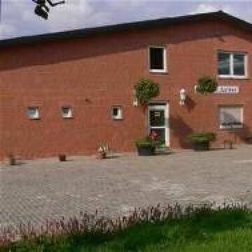
Hier fühlt sich Ihr Pferd wohl....
Bad Sassendorf
Zucht- Ausbildungsstall Junker
@Zucht-Ausbildungsstall-Junker
FN-Mitglied
Freizeitstall
Vermieten
Führanlage
Hunde willkommen
Fohlenaufzucht möglich
Hengsthaltung möglich
23 weitere...
P
Deprecated: Creation of dynamic property Zend_View_Helper_Ads::$adLink is deprecated in /var/www/stall-frei/htdocs/staging.stall-frei.de/library/Psf/View/Helper/Ads.php on line 108

Job gesucht?
Mechtersen
STALL-FREIde Marketing
@STALL-FREI-Marketing
Sie suchen einen Job und arbeiten gerne mit Pferden oder auf Reitanlagen?
Besuchen Sie jetzt unseren Stellenmarkt!
Leider kein Vorschaubild
Leider kein Vorschaubild
Pferdepension und Ausbildungsstall Steinhaus
Kirchhain-Niederwald
Pferdepension-Steinhaus
@Pferdepension-Steinhaus
FN-Mitglied
Freizeitstall
Vermieten
Longierzirkel/Roundpen
Paddock
Allergikerstall
Hufrehe geeignet
20 weitere...
B
Pferdepension mit Reitanlage in Olpe
Olpe
Stinn Georg
@StinnGeorg
Freizeitstall
Geländestrecke
Longierzirkel/Roundpen
Paddock
Gnadenbrothof
Außenbox mit Paddock
Innenbox
7 weitere...
P
Leider kein Vorschaubild
Leider kein Vorschaubild
Boxen mit ganzjährigem, täglichem Weidegang
Volkmarsen
Stall Becker
@Christina144
Vermieten
Hunde willkommen
Sattelkammer/Sattelschränke
Innenbox
Vollpension
4 weitere...
B

Box, Weide/Paddock
Arnsberg
A.S.
@ReitanlagezurHohenFuhr
Freizeitstall
Hunde willkommen
Paddock
Allergikerstall
bedampftes/gewaschenes Heu
Vollpension
8 weitere...
aktuell
P


LebensRaum DraußenPferd
Bönen
LebensRaum-DraussenPferd
@LebensRaum-DraussenPferd
Freizeitstall
Hunde willkommen
Krankenbox
Allergikerstall
Hufrehe geeignet
Bewegungsstall
Laufstall
15 weitere...
S

Das Beste für die Hufe
Mechtersen
STALL-FREIde Marketing
@STALL-FREI-Marketing
Hufschmiede und Hufpfleger in Ihrer Nähe
Pferdepension zur Kummerwie
Bad Sassendorf
Zur-Kummerwie
@Zur-Kummerwie
Vermieten
Hunde willkommen
Paddock
Außenbox mit Paddock
Innenbox
Vollpension
11 weitere...
P
Reitstall Bockholt
Soest
Reitanlage-Bockholt
@Reitanlage-Bockholt
FN-Mitglied
Freizeitstall
Führanlage
Longierzirkel/Roundpen
Pferdezucht
zuckerreduziertes Heu
Außenbox mit Paddock
Außenboxen
20 weitere...
P
Leider kein Vorschaubild
Leider kein Vorschaubild
Pferdebox frei in nettem Stall mit Solekammer
Wolfhagen
Pferdepension Freckenhausen
@Freckenhausen.Wolfhagen
FN-Mitglied
Freizeitstall
Vermieten
Krankenbox
Paddock
Allergikerstall
Gnadenbrothof
21 weitere...
B

Einstellplatz / Herde/ Paddock-Box
Niedenstein/Kirchberg
Herr-Frau-Gude
@Herr-Frau-Gude
Fahrstall, Kutschwagen
Freizeitstall
Führanlage
Krankenbox
Allergikerstall
Hufrehe geeignet
Außenbox mit Paddock
Außenboxen
24 weitere...
P
Werde Teil von STALL-FREI.de
Du hast eine Pferdebox frei? Freie Plätze im Offenstall, Pferdestall oder der Reitanlage kostenlos anbieten.
Deprecated: Creation of dynamic property Zend_View::$pageCount is deprecated in /var/www/stall-frei/htdocs/staging.stall-frei.de/library/vendor/shardj/zf1-future/library/Zend/View/Abstract.php on line 308
Deprecated: Creation of dynamic property Zend_View::$itemCountPerPage is deprecated in /var/www/stall-frei/htdocs/staging.stall-frei.de/library/vendor/shardj/zf1-future/library/Zend/View/Abstract.php on line 308
Deprecated: Creation of dynamic property Zend_View::$first is deprecated in /var/www/stall-frei/htdocs/staging.stall-frei.de/library/vendor/shardj/zf1-future/library/Zend/View/Abstract.php on line 308
Deprecated: Creation of dynamic property Zend_View::$current is deprecated in /var/www/stall-frei/htdocs/staging.stall-frei.de/library/vendor/shardj/zf1-future/library/Zend/View/Abstract.php on line 308
Deprecated: Creation of dynamic property Zend_View::$last is deprecated in /var/www/stall-frei/htdocs/staging.stall-frei.de/library/vendor/shardj/zf1-future/library/Zend/View/Abstract.php on line 308
Deprecated: Creation of dynamic property Zend_View::$previous is deprecated in /var/www/stall-frei/htdocs/staging.stall-frei.de/library/vendor/shardj/zf1-future/library/Zend/View/Abstract.php on line 308
Deprecated: Creation of dynamic property Zend_View::$next is deprecated in /var/www/stall-frei/htdocs/staging.stall-frei.de/library/vendor/shardj/zf1-future/library/Zend/View/Abstract.php on line 308
Deprecated: Creation of dynamic property Zend_View::$pagesInRange is deprecated in /var/www/stall-frei/htdocs/staging.stall-frei.de/library/vendor/shardj/zf1-future/library/Zend/View/Abstract.php on line 308
Deprecated: Creation of dynamic property Zend_View::$firstPageInRange is deprecated in /var/www/stall-frei/htdocs/staging.stall-frei.de/library/vendor/shardj/zf1-future/library/Zend/View/Abstract.php on line 308
Deprecated: Creation of dynamic property Zend_View::$lastPageInRange is deprecated in /var/www/stall-frei/htdocs/staging.stall-frei.de/library/vendor/shardj/zf1-future/library/Zend/View/Abstract.php on line 308
Deprecated: Creation of dynamic property Zend_View::$currentItemCount is deprecated in /var/www/stall-frei/htdocs/staging.stall-frei.de/library/vendor/shardj/zf1-future/library/Zend/View/Abstract.php on line 308
Deprecated: Creation of dynamic property Zend_View::$totalItemCount is deprecated in /var/www/stall-frei/htdocs/staging.stall-frei.de/library/vendor/shardj/zf1-future/library/Zend/View/Abstract.php on line 308
Deprecated: Creation of dynamic property Zend_View::$firstItemNumber is deprecated in /var/www/stall-frei/htdocs/staging.stall-frei.de/library/vendor/shardj/zf1-future/library/Zend/View/Abstract.php on line 308
Deprecated: Creation of dynamic property Zend_View::$lastItemNumber is deprecated in /var/www/stall-frei/htdocs/staging.stall-frei.de/library/vendor/shardj/zf1-future/library/Zend/View/Abstract.php on line 308
Deprecated: Creation of dynamic property Zend_View::$router is deprecated in /var/www/stall-frei/htdocs/staging.stall-frei.de/library/vendor/shardj/zf1-future/library/Zend/View/Abstract.php on line 308
Deprecated: Creation of dynamic property Zend_View::$urlParams is deprecated in /var/www/stall-frei/htdocs/staging.stall-frei.de/library/vendor/shardj/zf1-future/library/Zend/View/Abstract.php on line 308
Deprecated: Creation of dynamic property Zend_View::$showAds is deprecated in /var/www/stall-frei/htdocs/staging.stall-frei.de/library/vendor/shardj/zf1-future/library/Zend/View/Abstract.php on line 308
Deprecated: Creation of dynamic property Zend_View::$objectIds is deprecated in /var/www/stall-frei/htdocs/staging.stall-frei.de/library/vendor/shardj/zf1-future/library/Zend/View/Abstract.php on line 308
Deprecated: Creation of dynamic property Zend_View::$showNavbar is deprecated in /var/www/stall-frei/htdocs/staging.stall-frei.de/library/vendor/shardj/zf1-future/library/Zend/View/Abstract.php on line 308
Deprecated: Creation of dynamic property Zend_View::$showBreadcrumb is deprecated in /var/www/stall-frei/htdocs/staging.stall-frei.de/library/vendor/shardj/zf1-future/library/Zend/View/Abstract.php on line 308
Deprecated: Creation of dynamic property Zend_View::$showFooter is deprecated in /var/www/stall-frei/htdocs/staging.stall-frei.de/library/vendor/shardj/zf1-future/library/Zend/View/Abstract.php on line 308
Deprecated: Creation of dynamic property Zend_View::$showInternalAds is deprecated in /var/www/stall-frei/htdocs/staging.stall-frei.de/library/vendor/shardj/zf1-future/library/Zend/View/Abstract.php on line 308
Deprecated: Creation of dynamic property Zend_View::$blNoContent is deprecated in /var/www/stall-frei/htdocs/staging.stall-frei.de/library/vendor/shardj/zf1-future/library/Zend/View/Abstract.php on line 308
Deprecated: Creation of dynamic property Zend_View::$sMetaDesc is deprecated in /var/www/stall-frei/htdocs/staging.stall-frei.de/library/vendor/shardj/zf1-future/library/Zend/View/Abstract.php on line 308
Deprecated: Creation of dynamic property Zend_View::$useGmaps is deprecated in /var/www/stall-frei/htdocs/staging.stall-frei.de/library/vendor/shardj/zf1-future/library/Zend/View/Abstract.php on line 308
Deprecated: Creation of dynamic property Zend_View::$touches is deprecated in /var/www/stall-frei/htdocs/staging.stall-frei.de/library/vendor/shardj/zf1-future/library/Zend/View/Abstract.php on line 308
Deprecated: Creation of dynamic property Zend_View::$oProject is deprecated in /var/www/stall-frei/htdocs/staging.stall-frei.de/library/vendor/shardj/zf1-future/library/Zend/View/Abstract.php on line 308
Deprecated: Creation of dynamic property Zend_View::$pageHeadline is deprecated in /var/www/stall-frei/htdocs/staging.stall-frei.de/library/vendor/shardj/zf1-future/library/Zend/View/Abstract.php on line 308
Deprecated: Creation of dynamic property Zend_View::$disableLocationField is deprecated in /var/www/stall-frei/htdocs/staging.stall-frei.de/library/vendor/shardj/zf1-future/library/Zend/View/Abstract.php on line 308
Deprecated: Creation of dynamic property Zend_View::$isSearch is deprecated in /var/www/stall-frei/htdocs/staging.stall-frei.de/library/vendor/shardj/zf1-future/library/Zend/View/Abstract.php on line 308
Deprecated: Creation of dynamic property Zend_View::$pageTitle is deprecated in /var/www/stall-frei/htdocs/staging.stall-frei.de/library/vendor/shardj/zf1-future/library/Zend/View/Abstract.php on line 308
Deprecated: Creation of dynamic property Psf_Form_Element_Text::$class is deprecated in /var/www/stall-frei/htdocs/staging.stall-frei.de/library/vendor/shardj/zf1-future/library/Zend/Form/Element.php on line 874
Deprecated: Creation of dynamic property Psf_Form_Element_Text::$size is deprecated in /var/www/stall-frei/htdocs/staging.stall-frei.de/library/vendor/shardj/zf1-future/library/Zend/Form/Element.php on line 874
Deprecated: Creation of dynamic property Psf_Form_Element_Text::$placeholder is deprecated in /var/www/stall-frei/htdocs/staging.stall-frei.de/library/vendor/shardj/zf1-future/library/Zend/Form/Element.php on line 874
Deprecated: Creation of dynamic property Psf_Form_Element_Hidden::$class is deprecated in /var/www/stall-frei/htdocs/staging.stall-frei.de/library/vendor/shardj/zf1-future/library/Zend/Form/Element.php on line 874
Deprecated: Creation of dynamic property Psf_Form_Element_Hidden::$class is deprecated in /var/www/stall-frei/htdocs/staging.stall-frei.de/library/vendor/shardj/zf1-future/library/Zend/Form/Element.php on line 874
Deprecated: Creation of dynamic property Psf_Form_Element_Hidden::$class is deprecated in /var/www/stall-frei/htdocs/staging.stall-frei.de/library/vendor/shardj/zf1-future/library/Zend/Form/Element.php on line 874
Deprecated: Creation of dynamic property Psf_Form_Element_Hidden::$class is deprecated in /var/www/stall-frei/htdocs/staging.stall-frei.de/library/vendor/shardj/zf1-future/library/Zend/Form/Element.php on line 874
Deprecated: Creation of dynamic property Psf_Form_Element_Select::$class is deprecated in /var/www/stall-frei/htdocs/staging.stall-frei.de/library/vendor/shardj/zf1-future/library/Zend/Form/Element.php on line 874
Deprecated: Creation of dynamic property Psf_Form_Element_Select::$class is deprecated in /var/www/stall-frei/htdocs/staging.stall-frei.de/library/vendor/shardj/zf1-future/library/Zend/Form/Element.php on line 874
Deprecated: Creation of dynamic property Psf_Form_Element_Select::$class is deprecated in /var/www/stall-frei/htdocs/staging.stall-frei.de/library/vendor/shardj/zf1-future/library/Zend/Form/Element.php on line 874
Deprecated: Creation of dynamic property Psf_Form_Element_Select::$class is deprecated in /var/www/stall-frei/htdocs/staging.stall-frei.de/library/vendor/shardj/zf1-future/library/Zend/Form/Element.php on line 874
Deprecated: Creation of dynamic property Psf_Form_Element_Text::$class is deprecated in /var/www/stall-frei/htdocs/staging.stall-frei.de/library/vendor/shardj/zf1-future/library/Zend/Form/Element.php on line 874
Deprecated: Creation of dynamic property Psf_Form_Element_Checkbox::$label is deprecated in /var/www/stall-frei/htdocs/staging.stall-frei.de/library/vendor/shardj/zf1-future/library/Zend/Form/Element.php on line 874
Deprecated: Creation of dynamic property Zend_View::$sort is deprecated in /var/www/stall-frei/htdocs/staging.stall-frei.de/library/vendor/shardj/zf1-future/library/Zend/View/Abstract.php on line 308
Deprecated: Creation of dynamic property Zend_View::$searchLocation is deprecated in /var/www/stall-frei/htdocs/staging.stall-frei.de/library/vendor/shardj/zf1-future/library/Zend/View/Abstract.php on line 308
Deprecated: Creation of dynamic property Zend_View::$locationHint is deprecated in /var/www/stall-frei/htdocs/staging.stall-frei.de/library/vendor/shardj/zf1-future/library/Zend/View/Abstract.php on line 308
Psf_GeoCoder_Abstract::getLocation: Winterberg Get Location CachedOrLive
Psf_GeoCoder_Abstract::getCachedOrLive: Winterberg
Psf_GeoCoder_Abstract::convertLocationResult
{"documentation":"https:\/\/opencagedata.com\/api","licenses":[{"name":"see attribution guide","url":"https:\/\/opencagedata.com\/credits"}],"results":[{"bounds":{"northeast":{"lat":51.2770506,"lng":8.6079696},"southwest":{"lat":51.1243752,"lng":8.4189947}},"components":{"ISO_3166-1_alpha-2":"DE","ISO_3166-1_alpha-3":"DEU","ISO_3166-2":["DE-NW"],"_category":"place","_normalized_city":"Winterberg","_type":"city","continent":"Europe","country":"Deutschland","country_code":"de","county":"Hochsauerlandkreis","political_union":"European Union","postcode":"59955","state":"Nordrhein-Westfalen","state_code":"NW","town":"Winterberg"},"confidence":5,"formatted":"59955 Winterberg, Deutschland","geometry":{"lat":51.1933391,"lng":8.5334064}},{"bounds":{"northeast":{"lat":49.2290863,"lng":7.0185227},"southwest":{"lat":49.2141771,"lng":6.9798551}},"components":{"ISO_3166-1_alpha-2":"DE","ISO_3166-1_alpha-3":"DEU","ISO_3166-2":["DE-SL"],"_category":"place","_normalized_city":"Saarbr\u00fccken","_type":"neighbourhood","borough":"Bezirk Mitte","city":"Saarbr\u00fccken","continent":"Europe","country":"Deutschland","country_code":"de","county":"Regionalverband Saarbr\u00fccken","neighbourhood":"Winterberg","political_union":"European Union","postcode":"66119","state":"Saarland","state_code":"SL","suburb":"St. Arnual"},"confidence":7,"formatted":"66119 Saarbr\u00fccken, Deutschland","geometry":{"lat":49.2216732,"lng":7.001683}},{"bounds":{"northeast":{"lat":49.2207703,"lng":7.0021065},"southwest":{"lat":49.2206703,"lng":7.0020065}},"components":{"ISO_3166-1_alpha-2":"DE","ISO_3166-1_alpha-3":"DEU","ISO_3166-2":["DE-SL"],"_category":"natural\/water","_normalized_city":"Saarbr\u00fccken","_type":"peak","city":"Saarbr\u00fccken","continent":"Europe","country":"Deutschland","country_code":"de","county":"Regionalverband Saarbr\u00fccken","peak":"Winterberg","political_union":"European Union","postcode":"66119","state":"Saarland","state_code":"SL"},"confidence":9,"formatted":"Winterberg, 66119 Saarbr\u00fccken, Deutschland","geometry":{"lat":49.2207203,"lng":7.0020565}},{"bounds":{"northeast":{"lat":49.1698718,"lng":7.8219304},"southwest":{"lat":49.1697718,"lng":7.8218304}},"components":{"ISO_3166-1_alpha-2":"DE","ISO_3166-1_alpha-3":"DEU","ISO_3166-2":["DE-RP"],"_category":"natural\/water","_normalized_city":"Hauenstein","_type":"peak","continent":"Europe","country":"Deutschland","country_code":"de","county":"S\u00fcdwestpfalz","municipality":"Hauenstein","peak":"Winterberg","political_union":"European Union","postcode":"76846","state":"Rheinland-Pfalz","state_code":"RP","village":"Hauenstein"},"confidence":9,"formatted":"Winterberg, 76846 Hauenstein, Deutschland","geometry":{"lat":49.1698218,"lng":7.8218804}},{"bounds":{"northeast":{"lat":49.5585756,"lng":11.5494931},"southwest":{"lat":49.5584756,"lng":11.5493931}},"components":{"ISO_3166-1_alpha-2":"DE","ISO_3166-1_alpha-3":"DEU","ISO_3166-2":["DE-BY"],"_category":"natural\/water","_normalized_city":"Hirschbach","_type":"peak","continent":"Europe","country":"Deutschland","country_code":"de","county":"Landkreis Amberg-Sulzbach","municipality":"K\u00f6nigstein (VGem)","peak":"Winterberg","political_union":"European Union","postcode":"92275","state":"Bayern","state_code":"BY","village":"Hirschbach"},"confidence":9,"formatted":"Winterberg, 92275 Hirschbach, Deutschland","geometry":{"lat":49.5585256,"lng":11.5494431}},{"bounds":{"northeast":{"lat":50.4143173,"lng":9.3932529},"southwest":{"lat":50.4142173,"lng":9.3931529}},"components":{"ISO_3166-1_alpha-2":"DE","ISO_3166-1_alpha-3":"DEU","ISO_3166-2":["DE-HE"],"_category":"natural\/water","_normalized_city":"Freiensteinau","_type":"peak","continent":"Europe","country":"Deutschland","country_code":"de","county":"Vogelsbergkreis","municipality":"Freiensteinau","peak":"Winterberg","political_union":"European Union","postcode":"36399","state":"Hessen","state_code":"HE","village":"Freiensteinau"},"confidence":9,"formatted":"Winterberg, 36399 Freiensteinau, Deutschland","geometry":{"lat":50.4142673,"lng":9.3932029}},{"bounds":{"northeast":{"lat":49.2379104,"lng":9.1512551},"southwest":{"lat":49.2378104,"lng":9.1511551}},"components":{"ISO_3166-1_alpha-2":"DE","ISO_3166-1_alpha-3":"DEU","ISO_3166-2":["DE-BW"],"_category":"natural\/water","_normalized_city":"Bad Wimpfen","_type":"peak","continent":"Europe","country":"Deutschland","country_code":"de","county":"Landkreis Heilbronn","peak":"Winterberg","political_union":"European Union","postcode":"74206","state":"Baden-W\u00fcrttemberg","state_code":"BW","town":"Bad Wimpfen"},"confidence":9,"formatted":"Winterberg, 74206 Bad Wimpfen, Deutschland","geometry":{"lat":49.2378604,"lng":9.1512051}},{"bounds":{"northeast":{"lat":51.8696496,"lng":11.0012027},"southwest":{"lat":51.8695496,"lng":11.0011027}},"components":{"ISO_3166-1_alpha-2":"DE","ISO_3166-1_alpha-3":"DEU","ISO_3166-2":["DE-ST"],"_category":"natural\/water","_normalized_city":"Halberstadt","_type":"peak","continent":"Europe","country":"Deutschland","country_code":"de","county":"Landkreis Harz","peak":"Winterberg","political_union":"European Union","state":"Sachsen-Anhalt","state_code":"ST","town":"Halberstadt"},"confidence":9,"formatted":"Winterberg, Halberstadt, Sachsen-Anhalt, Deutschland","geometry":{"lat":51.8695996,"lng":11.0011527}},{"bounds":{"northeast":{"lat":50.5716856,"lng":9.9854241},"southwest":{"lat":50.5715856,"lng":9.9853241}},"components":{"ISO_3166-1_alpha-2":"DE","ISO_3166-1_alpha-3":"DEU","ISO_3166-2":["DE-HE"],"_category":"natural\/water","_normalized_city":"Hilders","_type":"peak","continent":"Europe","country":"Deutschland","country_code":"de","county":"Landkreis Fulda","municipality":"Hilders","peak":"Winterberg","political_union":"European Union","postcode":"36115","state":"Hessen","state_code":"HE","village":"Hilders"},"confidence":9,"formatted":"Winterberg, 36115 Hilders, Deutschland","geometry":{"lat":50.5716356,"lng":9.9853741}},{"bounds":{"northeast":{"lat":50.5231266,"lng":11.2924061},"southwest":{"lat":50.5230266,"lng":11.2923061}},"components":{"ISO_3166-1_alpha-2":"DE","ISO_3166-1_alpha-3":"DEU","ISO_3166-2":["DE-TH"],"_category":"natural\/water","_normalized_city":"Gr\u00e4fenthal","_type":"peak","continent":"Europe","country":"Deutschland","country_code":"de","county":"Landkreis Saalfeld-Rudolstadt","municipality":"Schiefergebirge","peak":"Winterberg","political_union":"European Union","postcode":"98743","state":"Th\u00fcringen","state_code":"TH","town":"Gr\u00e4fenthal"},"confidence":9,"formatted":"Winterberg, 98743 Gr\u00e4fenthal, Deutschland","geometry":{"lat":50.5230766,"lng":11.2923561}}],"status":{"code":200,"message":"OK"},"stay_informed":{"blog":"https:\/\/blog.opencagedata.com","mastodon":"https:\/\/en.osm.town\/@opencage"},"thanks":"For using an OpenCage API","timestamp":{"created_http":"Sun, 08 Feb 2026 04:27:36 GMT","created_unix":1770524856},"total_results":10}Array
(
[0] => stdClass Object
(
[bounds] => stdClass Object
(
[northeast] => stdClass Object
(
[lat] => 51.2770506
[lng] => 8.6079696
)
[southwest] => stdClass Object
(
[lat] => 51.1243752
[lng] => 8.4189947
)
)
[components] => stdClass Object
(
[ISO_3166-1_alpha-2] => DE
[ISO_3166-1_alpha-3] => DEU
[ISO_3166-2] => Array
(
[0] => DE-NW
)
[_category] => place
[_normalized_city] => Winterberg
[_type] => city
[continent] => Europe
[country] => Deutschland
[country_code] => de
[county] => Hochsauerlandkreis
[political_union] => European Union
[postcode] => 59955
[state] => Nordrhein-Westfalen
[state_code] => NW
[town] => Winterberg
)
[confidence] => 5
[formatted] => 59955 Winterberg, Deutschland
[geometry] => stdClass Object
(
[lat] => 51.1933391
[lng] => 8.5334064
)
)
[1] => stdClass Object
(
[bounds] => stdClass Object
(
[northeast] => stdClass Object
(
[lat] => 49.2290863
[lng] => 7.0185227
)
[southwest] => stdClass Object
(
[lat] => 49.2141771
[lng] => 6.9798551
)
)
[components] => stdClass Object
(
[ISO_3166-1_alpha-2] => DE
[ISO_3166-1_alpha-3] => DEU
[ISO_3166-2] => Array
(
[0] => DE-SL
)
[_category] => place
[_normalized_city] => Saarbrücken
[_type] => neighbourhood
[borough] => Bezirk Mitte
[city] => Saarbrücken
[continent] => Europe
[country] => Deutschland
[country_code] => de
[county] => Regionalverband Saarbrücken
[neighbourhood] => Winterberg
[political_union] => European Union
[postcode] => 66119
[state] => Saarland
[state_code] => SL
[suburb] => St. Arnual
)
[confidence] => 7
[formatted] => 66119 Saarbrücken, Deutschland
[geometry] => stdClass Object
(
[lat] => 49.2216732
[lng] => 7.001683
)
)
[2] => stdClass Object
(
[bounds] => stdClass Object
(
[northeast] => stdClass Object
(
[lat] => 49.2207703
[lng] => 7.0021065
)
[southwest] => stdClass Object
(
[lat] => 49.2206703
[lng] => 7.0020065
)
)
[components] => stdClass Object
(
[ISO_3166-1_alpha-2] => DE
[ISO_3166-1_alpha-3] => DEU
[ISO_3166-2] => Array
(
[0] => DE-SL
)
[_category] => natural/water
[_normalized_city] => Saarbrücken
[_type] => peak
[city] => Saarbrücken
[continent] => Europe
[country] => Deutschland
[country_code] => de
[county] => Regionalverband Saarbrücken
[peak] => Winterberg
[political_union] => European Union
[postcode] => 66119
[state] => Saarland
[state_code] => SL
)
[confidence] => 9
[formatted] => Winterberg, 66119 Saarbrücken, Deutschland
[geometry] => stdClass Object
(
[lat] => 49.2207203
[lng] => 7.0020565
)
)
[3] => stdClass Object
(
[bounds] => stdClass Object
(
[northeast] => stdClass Object
(
[lat] => 49.1698718
[lng] => 7.8219304
)
[southwest] => stdClass Object
(
[lat] => 49.1697718
[lng] => 7.8218304
)
)
[components] => stdClass Object
(
[ISO_3166-1_alpha-2] => DE
[ISO_3166-1_alpha-3] => DEU
[ISO_3166-2] => Array
(
[0] => DE-RP
)
[_category] => natural/water
[_normalized_city] => Hauenstein
[_type] => peak
[continent] => Europe
[country] => Deutschland
[country_code] => de
[county] => Südwestpfalz
[municipality] => Hauenstein
[peak] => Winterberg
[political_union] => European Union
[postcode] => 76846
[state] => Rheinland-Pfalz
[state_code] => RP
[village] => Hauenstein
)
[confidence] => 9
[formatted] => Winterberg, 76846 Hauenstein, Deutschland
[geometry] => stdClass Object
(
[lat] => 49.1698218
[lng] => 7.8218804
)
)
[4] => stdClass Object
(
[bounds] => stdClass Object
(
[northeast] => stdClass Object
(
[lat] => 49.5585756
[lng] => 11.5494931
)
[southwest] => stdClass Object
(
[lat] => 49.5584756
[lng] => 11.5493931
)
)
[components] => stdClass Object
(
[ISO_3166-1_alpha-2] => DE
[ISO_3166-1_alpha-3] => DEU
[ISO_3166-2] => Array
(
[0] => DE-BY
)
[_category] => natural/water
[_normalized_city] => Hirschbach
[_type] => peak
[continent] => Europe
[country] => Deutschland
[country_code] => de
[county] => Landkreis Amberg-Sulzbach
[municipality] => Königstein (VGem)
[peak] => Winterberg
[political_union] => European Union
[postcode] => 92275
[state] => Bayern
[state_code] => BY
[village] => Hirschbach
)
[confidence] => 9
[formatted] => Winterberg, 92275 Hirschbach, Deutschland
[geometry] => stdClass Object
(
[lat] => 49.5585256
[lng] => 11.5494431
)
)
[5] => stdClass Object
(
[bounds] => stdClass Object
(
[northeast] => stdClass Object
(
[lat] => 50.4143173
[lng] => 9.3932529
)
[southwest] => stdClass Object
(
[lat] => 50.4142173
[lng] => 9.3931529
)
)
[components] => stdClass Object
(
[ISO_3166-1_alpha-2] => DE
[ISO_3166-1_alpha-3] => DEU
[ISO_3166-2] => Array
(
[0] => DE-HE
)
[_category] => natural/water
[_normalized_city] => Freiensteinau
[_type] => peak
[continent] => Europe
[country] => Deutschland
[country_code] => de
[county] => Vogelsbergkreis
[municipality] => Freiensteinau
[peak] => Winterberg
[political_union] => European Union
[postcode] => 36399
[state] => Hessen
[state_code] => HE
[village] => Freiensteinau
)
[confidence] => 9
[formatted] => Winterberg, 36399 Freiensteinau, Deutschland
[geometry] => stdClass Object
(
[lat] => 50.4142673
[lng] => 9.3932029
)
)
[6] => stdClass Object
(
[bounds] => stdClass Object
(
[northeast] => stdClass Object
(
[lat] => 49.2379104
[lng] => 9.1512551
)
[southwest] => stdClass Object
(
[lat] => 49.2378104
[lng] => 9.1511551
)
)
[components] => stdClass Object
(
[ISO_3166-1_alpha-2] => DE
[ISO_3166-1_alpha-3] => DEU
[ISO_3166-2] => Array
(
[0] => DE-BW
)
[_category] => natural/water
[_normalized_city] => Bad Wimpfen
[_type] => peak
[continent] => Europe
[country] => Deutschland
[country_code] => de
[county] => Landkreis Heilbronn
[peak] => Winterberg
[political_union] => European Union
[postcode] => 74206
[state] => Baden-Württemberg
[state_code] => BW
[town] => Bad Wimpfen
)
[confidence] => 9
[formatted] => Winterberg, 74206 Bad Wimpfen, Deutschland
[geometry] => stdClass Object
(
[lat] => 49.2378604
[lng] => 9.1512051
)
)
[7] => stdClass Object
(
[bounds] => stdClass Object
(
[northeast] => stdClass Object
(
[lat] => 51.8696496
[lng] => 11.0012027
)
[southwest] => stdClass Object
(
[lat] => 51.8695496
[lng] => 11.0011027
)
)
[components] => stdClass Object
(
[ISO_3166-1_alpha-2] => DE
[ISO_3166-1_alpha-3] => DEU
[ISO_3166-2] => Array
(
[0] => DE-ST
)
[_category] => natural/water
[_normalized_city] => Halberstadt
[_type] => peak
[continent] => Europe
[country] => Deutschland
[country_code] => de
[county] => Landkreis Harz
[peak] => Winterberg
[political_union] => European Union
[state] => Sachsen-Anhalt
[state_code] => ST
[town] => Halberstadt
)
[confidence] => 9
[formatted] => Winterberg, Halberstadt, Sachsen-Anhalt, Deutschland
[geometry] => stdClass Object
(
[lat] => 51.8695996
[lng] => 11.0011527
)
)
[8] => stdClass Object
(
[bounds] => stdClass Object
(
[northeast] => stdClass Object
(
[lat] => 50.5716856
[lng] => 9.9854241
)
[southwest] => stdClass Object
(
[lat] => 50.5715856
[lng] => 9.9853241
)
)
[components] => stdClass Object
(
[ISO_3166-1_alpha-2] => DE
[ISO_3166-1_alpha-3] => DEU
[ISO_3166-2] => Array
(
[0] => DE-HE
)
[_category] => natural/water
[_normalized_city] => Hilders
[_type] => peak
[continent] => Europe
[country] => Deutschland
[country_code] => de
[county] => Landkreis Fulda
[municipality] => Hilders
[peak] => Winterberg
[political_union] => European Union
[postcode] => 36115
[state] => Hessen
[state_code] => HE
[village] => Hilders
)
[confidence] => 9
[formatted] => Winterberg, 36115 Hilders, Deutschland
[geometry] => stdClass Object
(
[lat] => 50.5716356
[lng] => 9.9853741
)
)
[9] => stdClass Object
(
[bounds] => stdClass Object
(
[northeast] => stdClass Object
(
[lat] => 50.5231266
[lng] => 11.2924061
)
[southwest] => stdClass Object
(
[lat] => 50.5230266
[lng] => 11.2923061
)
)
[components] => stdClass Object
(
[ISO_3166-1_alpha-2] => DE
[ISO_3166-1_alpha-3] => DEU
[ISO_3166-2] => Array
(
[0] => DE-TH
)
[_category] => natural/water
[_normalized_city] => Gräfenthal
[_type] => peak
[continent] => Europe
[country] => Deutschland
[country_code] => de
[county] => Landkreis Saalfeld-Rudolstadt
[municipality] => Schiefergebirge
[peak] => Winterberg
[political_union] => European Union
[postcode] => 98743
[state] => Thüringen
[state_code] => TH
[town] => Gräfenthal
)
[confidence] => 9
[formatted] => Winterberg, 98743 Gräfenthal, Deutschland
[geometry] => stdClass Object
(
[lat] => 50.5230766
[lng] => 11.2923561
)
)
)
Psf_GeoCoder_OpenCageData::getKeyMap: 0
stdClass Object
(
    [bounds] => stdClass Object
        (
            [northeast] => stdClass Object
                (
                    [lat] => 51.2770506
                    [lng] => 8.6079696
                )

            [southwest] => stdClass Object
                (
                    [lat] => 51.1243752
                    [lng] => 8.4189947
                )

        )

    [components] => stdClass Object
        (
            [ISO_3166-1_alpha-2] => DE
            [ISO_3166-1_alpha-3] => DEU
            [ISO_3166-2] => Array
                (
                    [0] => DE-NW
                )

            [_category] => place
            [_normalized_city] => Winterberg
            [_type] => city
            [continent] => Europe
            [country] => Deutschland
            [country_code] => de
            [county] => Hochsauerlandkreis
            [political_union] => European Union
            [postcode] => 59955
            [state] => Nordrhein-Westfalen
            [state_code] => NW
            [town] => Winterberg
        )

    [confidence] => 5
    [formatted] => 59955 Winterberg, Deutschland
    [geometry] => stdClass Object
        (
            [lat] => 51.1933391
            [lng] => 8.5334064
        )

)
Psf_GeoCoder_OpenCageData::getCounty: Hochsauerlandkreis
Psf_GeoCoder_OpenCageData::addMissingData REFETCH!
Array
(
    [address] => 59955 Winterberg, Deutschland
    [type] => city
    [street] =>
    [city] => Winterberg
    [county] => Hochsauerlandkreis
    [state] => Nordrhein-Westfalen
    [zip] => 59955
    [country] => Deutschland
    [suburb] =>
    [countrycode] => de
    [latitude] => 51.1933391
    [longitude] => 8.5334064
    [accuracy] => 1
    [confidence] => 5
    [bounds] => stdClass Object
        (
            [northeast] => stdClass Object
                (
                    [lat] => 51.2770506
                    [lng] => 8.6079696
                )

            [southwest] => stdClass Object
                (
                    [lat] => 51.1243752
                    [lng] => 8.4189947
                )

        )

)
reformat!
Array
(
    [address] => 59955 Winterberg, Deutschland
    [type] => city
    [street] =>
    [city] => Winterberg
    [county] => Hochsauerlandkreis
    [state] => Nordrhein-Westfalen
    [zip] => 59955
    [country] => Deutschland
    [suburb] =>
    [countrycode] => de
    [latitude] => 51.1933391
    [longitude] => 8.5334064
    [accuracy] => 1
    [confidence] => 5
    [bounds] => stdClass Object
        (
            [northeast] => stdClass Object
                (
                    [lat] => 51.2770506
                    [lng] => 8.6079696
                )

            [southwest] => stdClass Object
                (
                    [lat] => 51.1243752
                    [lng] => 8.4189947
                )

        )

    [place] => 59955 Winterberg, Nordrhein-Westfalen
    [hash] => 989081dfd4def8154a4c60dd3ab04788
)
Psf_GeoCoder_OpenCageData::getKeyMap: 1
stdClass Object
(
    [bounds] => stdClass Object
        (
            [northeast] => stdClass Object
                (
                    [lat] => 49.2290863
                    [lng] => 7.0185227
                )

            [southwest] => stdClass Object
                (
                    [lat] => 49.2141771
                    [lng] => 6.9798551
                )

        )

    [components] => stdClass Object
        (
            [ISO_3166-1_alpha-2] => DE
            [ISO_3166-1_alpha-3] => DEU
            [ISO_3166-2] => Array
                (
                    [0] => DE-SL
                )

            [_category] => place
            [_normalized_city] => Saarbrücken
            [_type] => neighbourhood
            [borough] => Bezirk Mitte
            [city] => Saarbrücken
            [continent] => Europe
            [country] => Deutschland
            [country_code] => de
            [county] => Regionalverband Saarbrücken
            [neighbourhood] => Winterberg
            [political_union] => European Union
            [postcode] => 66119
            [state] => Saarland
            [state_code] => SL
            [suburb] => St. Arnual
        )

    [confidence] => 7
    [formatted] => 66119 Saarbrücken, Deutschland
    [geometry] => stdClass Object
        (
            [lat] => 49.2216732
            [lng] => 7.001683
        )

)
Psf_GeoCoder_OpenCageData::getCounty: alverband Saarbrücken
Psf_GeoCoder_OpenCageData::addMissingData REFETCH!
Array
(
    [address] => 66119 Saarbrücken, Deutschland
    [type] => neighbourhood
    [street] =>
    [city] => St. Arnual
    [county] => alverband Saarbrücken
    [state] => Saarland
    [zip] => 66119
    [country] => Deutschland
    [suburb] => St. Arnual
    [countrycode] => de
    [latitude] => 49.2216732
    [longitude] => 7.001683
    [accuracy] => 1
    [confidence] => 7
    [bounds] => stdClass Object
        (
            [northeast] => stdClass Object
                (
                    [lat] => 49.2290863
                    [lng] => 7.0185227
                )

            [southwest] => stdClass Object
                (
                    [lat] => 49.2141771
                    [lng] => 6.9798551
                )

        )

)
reformat!
Array
(
    [address] => 66119 St. Arnual
    [type] => neighbourhood
    [street] =>
    [city] => St. Arnual
    [county] => alverband Saarbrücken
    [state] => Saarland
    [zip] => 66119
    [country] => Deutschland
    [suburb] => St. Arnual
    [countrycode] => de
    [latitude] => 49.2216732
    [longitude] => 7.001683
    [accuracy] => 1
    [confidence] => 7
    [bounds] => stdClass Object
        (
            [northeast] => stdClass Object
                (
                    [lat] => 49.2290863
                    [lng] => 7.0185227
                )

            [southwest] => stdClass Object
                (
                    [lat] => 49.2141771
                    [lng] => 6.9798551
                )

        )

    [place] => 66119 St. Arnual, Saarland
    [hash] => a6d5b49ac755a3d32e977688550d1237
)
Psf_GeoCoder_OpenCageData::getKeyMap: 2
stdClass Object
(
    [bounds] => stdClass Object
        (
            [northeast] => stdClass Object
                (
                    [lat] => 49.2207703
                    [lng] => 7.0021065
                )

            [southwest] => stdClass Object
                (
                    [lat] => 49.2206703
                    [lng] => 7.0020065
                )

        )

    [components] => stdClass Object
        (
            [ISO_3166-1_alpha-2] => DE
            [ISO_3166-1_alpha-3] => DEU
            [ISO_3166-2] => Array
                (
                    [0] => DE-SL
                )

            [_category] => natural/water
            [_normalized_city] => Saarbrücken
            [_type] => peak
            [city] => Saarbrücken
            [continent] => Europe
            [country] => Deutschland
            [country_code] => de
            [county] => Regionalverband Saarbrücken
            [peak] => Winterberg
            [political_union] => European Union
            [postcode] => 66119
            [state] => Saarland
            [state_code] => SL
        )

    [confidence] => 9
    [formatted] => Winterberg, 66119 Saarbrücken, Deutschland
    [geometry] => stdClass Object
        (
            [lat] => 49.2207203
            [lng] => 7.0020565
        )

)
Psf_GeoCoder_OpenCageData::getCounty: alverband Saarbrücken
Psf_GeoCoder_OpenCageData::addMissingData REFETCH!
Array
(
    [address] => Winterberg, 66119 Saarbrücken, Deutschland
    [type] => peak
    [street] =>
    [city] => Saarbrücken
    [county] => alverband Saarbrücken
    [state] => Saarland
    [zip] => 66119
    [country] => Deutschland
    [suburb] =>
    [countrycode] => de
    [latitude] => 49.2207203
    [longitude] => 7.0020565
    [accuracy] => 1
    [confidence] => 9
    [bounds] => stdClass Object
        (
            [northeast] => stdClass Object
                (
                    [lat] => 49.2207703
                    [lng] => 7.0021065
                )

            [southwest] => stdClass Object
                (
                    [lat] => 49.2206703
                    [lng] => 7.0020065
                )

        )

)
reformat!
Array
(
    [address] => Winterberg, 66119 Saarbrücken, Deutschland
    [type] => peak
    [street] =>
    [city] => Saarbrücken
    [county] => alverband Saarbrücken
    [state] => Saarland
    [zip] => 66119
    [country] => Deutschland
    [suburb] =>
    [countrycode] => de
    [latitude] => 49.2207203
    [longitude] => 7.0020565
    [accuracy] => 1
    [confidence] => 9
    [bounds] => stdClass Object
        (
            [northeast] => stdClass Object
                (
                    [lat] => 49.2207703
                    [lng] => 7.0021065
                )

            [southwest] => stdClass Object
                (
                    [lat] => 49.2206703
                    [lng] => 7.0020065
                )

        )

    [place] => 66119 Saarbrücken, Saarland
    [hash] => 391b13b5f100e9331f9ffaa69590f54e
)
Psf_GeoCoder_OpenCageData::getKeyMap: 3
stdClass Object
(
    [bounds] => stdClass Object
        (
            [northeast] => stdClass Object
                (
                    [lat] => 49.1698718
                    [lng] => 7.8219304
                )

            [southwest] => stdClass Object
                (
                    [lat] => 49.1697718
                    [lng] => 7.8218304
                )

        )

    [components] => stdClass Object
        (
            [ISO_3166-1_alpha-2] => DE
            [ISO_3166-1_alpha-3] => DEU
            [ISO_3166-2] => Array
                (
                    [0] => DE-RP
                )

            [_category] => natural/water
            [_normalized_city] => Hauenstein
            [_type] => peak
            [continent] => Europe
            [country] => Deutschland
            [country_code] => de
            [county] => Südwestpfalz
            [municipality] => Hauenstein
            [peak] => Winterberg
            [political_union] => European Union
            [postcode] => 76846
            [state] => Rheinland-Pfalz
            [state_code] => RP
            [village] => Hauenstein
        )

    [confidence] => 9
    [formatted] => Winterberg, 76846 Hauenstein, Deutschland
    [geometry] => stdClass Object
        (
            [lat] => 49.1698218
            [lng] => 7.8218804
        )

)
Psf_GeoCoder_OpenCageData::getCounty: Südwestpfalz
Psf_GeoCoder_OpenCageData::addMissingData REFETCH!
Array
(
    [address] => Winterberg, 76846 Hauenstein, Deutschland
    [type] => peak
    [street] =>
    [city] => Hauenstein
    [county] => Südwestpfalz
    [state] => Rheinland-Pfalz
    [zip] => 76846
    [country] => Deutschland
    [suburb] =>
    [countrycode] => de
    [latitude] => 49.1698218
    [longitude] => 7.8218804
    [accuracy] => 1
    [confidence] => 9
    [bounds] => stdClass Object
        (
            [northeast] => stdClass Object
                (
                    [lat] => 49.1698718
                    [lng] => 7.8219304
                )

            [southwest] => stdClass Object
                (
                    [lat] => 49.1697718
                    [lng] => 7.8218304
                )

        )

)
reformat!
Array
(
    [address] => Winterberg, 76846 Hauenstein, Deutschland
    [type] => peak
    [street] =>
    [city] => Hauenstein
    [county] => Südwestpfalz
    [state] => Rheinland-Pfalz
    [zip] => 76846
    [country] => Deutschland
    [suburb] =>
    [countrycode] => de
    [latitude] => 49.1698218
    [longitude] => 7.8218804
    [accuracy] => 1
    [confidence] => 9
    [bounds] => stdClass Object
        (
            [northeast] => stdClass Object
                (
                    [lat] => 49.1698718
                    [lng] => 7.8219304
                )

            [southwest] => stdClass Object
                (
                    [lat] => 49.1697718
                    [lng] => 7.8218304
                )

        )

    [place] => 76846 Hauenstein, Rheinland-Pfalz
    [hash] => 437d819376237340358a0e7d6ad3baab
)
Psf_GeoCoder_OpenCageData::getKeyMap: 4
stdClass Object
(
    [bounds] => stdClass Object
        (
            [northeast] => stdClass Object
                (
                    [lat] => 49.5585756
                    [lng] => 11.5494931
                )

            [southwest] => stdClass Object
                (
                    [lat] => 49.5584756
                    [lng] => 11.5493931
                )

        )

    [components] => stdClass Object
        (
            [ISO_3166-1_alpha-2] => DE
            [ISO_3166-1_alpha-3] => DEU
            [ISO_3166-2] => Array
                (
                    [0] => DE-BY
                )

            [_category] => natural/water
            [_normalized_city] => Hirschbach
            [_type] => peak
            [continent] => Europe
            [country] => Deutschland
            [country_code] => de
            [county] => Landkreis Amberg-Sulzbach
            [municipality] => Königstein (VGem)
            [peak] => Winterberg
            [political_union] => European Union
            [postcode] => 92275
            [state] => Bayern
            [state_code] => BY
            [village] => Hirschbach
        )

    [confidence] => 9
    [formatted] => Winterberg, 92275 Hirschbach, Deutschland
    [geometry] => stdClass Object
        (
            [lat] => 49.5585256
            [lng] => 11.5494431
        )

)
Psf_GeoCoder_OpenCageData::getCounty: Amberg-Sulzbach
Psf_GeoCoder_OpenCageData::addMissingData REFETCH!
Array
(
    [address] => Winterberg, 92275 Hirschbach, Deutschland
    [type] => peak
    [street] =>
    [city] => Hirschbach
    [county] => Amberg-Sulzbach
    [state] => Bayern
    [zip] => 92275
    [country] => Deutschland
    [suburb] =>
    [countrycode] => de
    [latitude] => 49.5585256
    [longitude] => 11.5494431
    [accuracy] => 1
    [confidence] => 9
    [bounds] => stdClass Object
        (
            [northeast] => stdClass Object
                (
                    [lat] => 49.5585756
                    [lng] => 11.5494931
                )

            [southwest] => stdClass Object
                (
                    [lat] => 49.5584756
                    [lng] => 11.5493931
                )

        )

)
reformat!
Array
(
    [address] => Winterberg, 92275 Hirschbach, Deutschland
    [type] => peak
    [street] =>
    [city] => Hirschbach
    [county] => Amberg-Sulzbach
    [state] => Bayern
    [zip] => 92275
    [country] => Deutschland
    [suburb] =>
    [countrycode] => de
    [latitude] => 49.5585256
    [longitude] => 11.5494431
    [accuracy] => 1
    [confidence] => 9
    [bounds] => stdClass Object
        (
            [northeast] => stdClass Object
                (
                    [lat] => 49.5585756
                    [lng] => 11.5494931
                )

            [southwest] => stdClass Object
                (
                    [lat] => 49.5584756
                    [lng] => 11.5493931
                )

        )

    [place] => 92275 Hirschbach, Bayern
    [hash] => 1bbfdc1d4f049fc7cc9b20288c34f86f
)
Psf_GeoCoder_OpenCageData::getKeyMap: 5
stdClass Object
(
    [bounds] => stdClass Object
        (
            [northeast] => stdClass Object
                (
                    [lat] => 50.4143173
                    [lng] => 9.3932529
                )

            [southwest] => stdClass Object
                (
                    [lat] => 50.4142173
                    [lng] => 9.3931529
                )

        )

    [components] => stdClass Object
        (
            [ISO_3166-1_alpha-2] => DE
            [ISO_3166-1_alpha-3] => DEU
            [ISO_3166-2] => Array
                (
                    [0] => DE-HE
                )

            [_category] => natural/water
            [_normalized_city] => Freiensteinau
            [_type] => peak
            [continent] => Europe
            [country] => Deutschland
            [country_code] => de
            [county] => Vogelsbergkreis
            [municipality] => Freiensteinau
            [peak] => Winterberg
            [political_union] => European Union
            [postcode] => 36399
            [state] => Hessen
            [state_code] => HE
            [village] => Freiensteinau
        )

    [confidence] => 9
    [formatted] => Winterberg, 36399 Freiensteinau, Deutschland
    [geometry] => stdClass Object
        (
            [lat] => 50.4142673
            [lng] => 9.3932029
        )

)
Psf_GeoCoder_OpenCageData::getCounty: Vogelsbergkreis
Psf_GeoCoder_OpenCageData::addMissingData REFETCH!
Array
(
    [address] => Winterberg, 36399 Freiensteinau, Deutschland
    [type] => peak
    [street] =>
    [city] => Freiensteinau
    [county] => Vogelsbergkreis
    [state] => Hessen
    [zip] => 36399
    [country] => Deutschland
    [suburb] =>
    [countrycode] => de
    [latitude] => 50.4142673
    [longitude] => 9.3932029
    [accuracy] => 1
    [confidence] => 9
    [bounds] => stdClass Object
        (
            [northeast] => stdClass Object
                (
                    [lat] => 50.4143173
                    [lng] => 9.3932529
                )

            [southwest] => stdClass Object
                (
                    [lat] => 50.4142173
                    [lng] => 9.3931529
                )

        )

)
reformat!
Array
(
    [address] => Winterberg, 36399 Freiensteinau, Deutschland
    [type] => peak
    [street] =>
    [city] => Freiensteinau
    [county] => Vogelsbergkreis
    [state] => Hessen
    [zip] => 36399
    [country] => Deutschland
    [suburb] =>
    [countrycode] => de
    [latitude] => 50.4142673
    [longitude] => 9.3932029
    [accuracy] => 1
    [confidence] => 9
    [bounds] => stdClass Object
        (
            [northeast] => stdClass Object
                (
                    [lat] => 50.4143173
                    [lng] => 9.3932529
                )

            [southwest] => stdClass Object
                (
                    [lat] => 50.4142173
                    [lng] => 9.3931529
                )

        )

    [place] => 36399 Freiensteinau, Hessen
    [hash] => cd7b3c30cd5131978b760ba43ee396a2
)
Psf_GeoCoder_OpenCageData::getKeyMap: 6
stdClass Object
(
    [bounds] => stdClass Object
        (
            [northeast] => stdClass Object
                (
                    [lat] => 49.2379104
                    [lng] => 9.1512551
                )

            [southwest] => stdClass Object
                (
                    [lat] => 49.2378104
                    [lng] => 9.1511551
                )

        )

    [components] => stdClass Object
        (
            [ISO_3166-1_alpha-2] => DE
            [ISO_3166-1_alpha-3] => DEU
            [ISO_3166-2] => Array
                (
                    [0] => DE-BW
                )

            [_category] => natural/water
            [_normalized_city] => Bad Wimpfen
            [_type] => peak
            [continent] => Europe
            [country] => Deutschland
            [country_code] => de
            [county] => Landkreis Heilbronn
            [peak] => Winterberg
            [political_union] => European Union
            [postcode] => 74206
            [state] => Baden-Württemberg
            [state_code] => BW
            [town] => Bad Wimpfen
        )

    [confidence] => 9
    [formatted] => Winterberg, 74206 Bad Wimpfen, Deutschland
    [geometry] => stdClass Object
        (
            [lat] => 49.2378604
            [lng] => 9.1512051
        )

)
Psf_GeoCoder_OpenCageData::getCounty: Heilbronn
Psf_GeoCoder_OpenCageData::addMissingData REFETCH!
Array
(
    [address] => Winterberg, 74206 Bad Wimpfen, Deutschland
    [type] => peak
    [street] =>
    [city] => Bad Wimpfen
    [county] => Heilbronn
    [state] => Baden-Württemberg
    [zip] => 74206
    [country] => Deutschland
    [suburb] =>
    [countrycode] => de
    [latitude] => 49.2378604
    [longitude] => 9.1512051
    [accuracy] => 1
    [confidence] => 9
    [bounds] => stdClass Object
        (
            [northeast] => stdClass Object
                (
                    [lat] => 49.2379104
                    [lng] => 9.1512551
                )

            [southwest] => stdClass Object
                (
                    [lat] => 49.2378104
                    [lng] => 9.1511551
                )

        )

)
reformat!
Array
(
    [address] => Winterberg, 74206 Bad Wimpfen, Deutschland
    [type] => peak
    [street] =>
    [city] => Bad Wimpfen
    [county] => Heilbronn
    [state] => Baden-Württemberg
    [zip] => 74206
    [country] => Deutschland
    [suburb] =>
    [countrycode] => de
    [latitude] => 49.2378604
    [longitude] => 9.1512051
    [accuracy] => 1
    [confidence] => 9
    [bounds] => stdClass Object
        (
            [northeast] => stdClass Object
                (
                    [lat] => 49.2379104
                    [lng] => 9.1512551
                )

            [southwest] => stdClass Object
                (
                    [lat] => 49.2378104
                    [lng] => 9.1511551
                )

        )

    [place] => 74206 Bad Wimpfen, Baden-Württemberg
    [hash] => bb4c2f3b2adfb702c65bff3c05c6da49
)
Psf_GeoCoder_OpenCageData::getKeyMap: 7
stdClass Object
(
    [bounds] => stdClass Object
        (
            [northeast] => stdClass Object
                (
                    [lat] => 51.8696496
                    [lng] => 11.0012027
                )

            [southwest] => stdClass Object
                (
                    [lat] => 51.8695496
                    [lng] => 11.0011027
                )

        )

    [components] => stdClass Object
        (
            [ISO_3166-1_alpha-2] => DE
            [ISO_3166-1_alpha-3] => DEU
            [ISO_3166-2] => Array
                (
                    [0] => DE-ST
                )

            [_category] => natural/water
            [_normalized_city] => Halberstadt
            [_type] => peak
            [continent] => Europe
            [country] => Deutschland
            [country_code] => de
            [county] => Landkreis Harz
            [peak] => Winterberg
            [political_union] => European Union
            [state] => Sachsen-Anhalt
            [state_code] => ST
            [town] => Halberstadt
        )

    [confidence] => 9
    [formatted] => Winterberg, Halberstadt, Sachsen-Anhalt, Deutschland
    [geometry] => stdClass Object
        (
            [lat] => 51.8695996
            [lng] => 11.0011527
        )

)
Psf_GeoCoder_OpenCageData::getCounty: Harz
Psf_GeoCoder_OpenCageData::addMissingData REFETCH!
Array
(
    [address] => Winterberg, Halberstadt, Sachsen-Anhalt, Deutschland
    [type] => peak
    [street] =>
    [city] => Halberstadt
    [county] => Harz
    [state] => Sachsen-Anhalt
    [zip] =>
    [country] => Deutschland
    [suburb] =>
    [countrycode] => de
    [latitude] => 51.8695996
    [longitude] => 11.0011527
    [accuracy] => 1
    [confidence] => 9
    [bounds] => stdClass Object
        (
            [northeast] => stdClass Object
                (
                    [lat] => 51.8696496
                    [lng] => 11.0012027
                )

            [southwest] => stdClass Object
                (
                    [lat] => 51.8695496
                    [lng] => 11.0011027
                )

        )

)
reformat!
Array
(
    [address] => Winterberg, Halberstadt, Sachsen-Anhalt, Deutschland
    [type] => peak
    [street] =>
    [city] => Halberstadt
    [county] => Harz
    [state] => Sachsen-Anhalt
    [zip] =>
    [country] => Deutschland
    [suburb] =>
    [countrycode] => de
    [latitude] => 51.8695996
    [longitude] => 11.0011527
    [accuracy] => 1
    [confidence] => 9
    [bounds] => stdClass Object
        (
            [northeast] => stdClass Object
                (
                    [lat] => 51.8696496
                    [lng] => 11.0012027
                )

            [southwest] => stdClass Object
                (
                    [lat] => 51.8695496
                    [lng] => 11.0011027
                )

        )

    [place] => Halberstadt, Sachsen-Anhalt
    [hash] => 9c08fbdd175747fd8500668df7a0eb9a
)
Psf_GeoCoder_OpenCageData::getKeyMap: 8
stdClass Object
(
    [bounds] => stdClass Object
        (
            [northeast] => stdClass Object
                (
                    [lat] => 50.5716856
                    [lng] => 9.9854241
                )

            [southwest] => stdClass Object
                (
                    [lat] => 50.5715856
                    [lng] => 9.9853241
                )

        )

    [components] => stdClass Object
        (
            [ISO_3166-1_alpha-2] => DE
            [ISO_3166-1_alpha-3] => DEU
            [ISO_3166-2] => Array
                (
                    [0] => DE-HE
                )

            [_category] => natural/water
            [_normalized_city] => Hilders
            [_type] => peak
            [continent] => Europe
            [country] => Deutschland
            [country_code] => de
            [county] => Landkreis Fulda
            [municipality] => Hilders
            [peak] => Winterberg
            [political_union] => European Union
            [postcode] => 36115
            [state] => Hessen
            [state_code] => HE
            [village] => Hilders
        )

    [confidence] => 9
    [formatted] => Winterberg, 36115 Hilders, Deutschland
    [geometry] => stdClass Object
        (
            [lat] => 50.5716356
            [lng] => 9.9853741
        )

)
Psf_GeoCoder_OpenCageData::getCounty: Fulda
Psf_GeoCoder_OpenCageData::addMissingData REFETCH!
Array
(
    [address] => Winterberg, 36115 Hilders, Deutschland
    [type] => peak
    [street] =>
    [city] => Hilders
    [county] => Fulda
    [state] => Hessen
    [zip] => 36115
    [country] => Deutschland
    [suburb] =>
    [countrycode] => de
    [latitude] => 50.5716356
    [longitude] => 9.9853741
    [accuracy] => 1
    [confidence] => 9
    [bounds] => stdClass Object
        (
            [northeast] => stdClass Object
                (
                    [lat] => 50.5716856
                    [lng] => 9.9854241
                )

            [southwest] => stdClass Object
                (
                    [lat] => 50.5715856
                    [lng] => 9.9853241
                )

        )

)
reformat!
Array
(
    [address] => Winterberg, 36115 Hilders, Deutschland
    [type] => peak
    [street] =>
    [city] => Hilders
    [county] => Fulda
    [state] => Hessen
    [zip] => 36115
    [country] => Deutschland
    [suburb] =>
    [countrycode] => de
    [latitude] => 50.5716356
    [longitude] => 9.9853741
    [accuracy] => 1
    [confidence] => 9
    [bounds] => stdClass Object
        (
            [northeast] => stdClass Object
                (
                    [lat] => 50.5716856
                    [lng] => 9.9854241
                )

            [southwest] => stdClass Object
                (
                    [lat] => 50.5715856
                    [lng] => 9.9853241
                )

        )

    [place] => 36115 Hilders, Hessen
    [hash] => b41d31f3905d27ec43d5c5834d3858c3
)
Psf_GeoCoder_OpenCageData::getKeyMap: 9
stdClass Object
(
    [bounds] => stdClass Object
        (
            [northeast] => stdClass Object
                (
                    [lat] => 50.5231266
                    [lng] => 11.2924061
                )

            [southwest] => stdClass Object
                (
                    [lat] => 50.5230266
                    [lng] => 11.2923061
                )

        )

    [components] => stdClass Object
        (
            [ISO_3166-1_alpha-2] => DE
            [ISO_3166-1_alpha-3] => DEU
            [ISO_3166-2] => Array
                (
                    [0] => DE-TH
                )

            [_category] => natural/water
            [_normalized_city] => Gräfenthal
            [_type] => peak
            [continent] => Europe
            [country] => Deutschland
            [country_code] => de
            [county] => Landkreis Saalfeld-Rudolstadt
            [municipality] => Schiefergebirge
            [peak] => Winterberg
            [political_union] => European Union
            [postcode] => 98743
            [state] => Thüringen
            [state_code] => TH
            [town] => Gräfenthal
        )

    [confidence] => 9
    [formatted] => Winterberg, 98743 Gräfenthal, Deutschland
    [geometry] => stdClass Object
        (
            [lat] => 50.5230766
            [lng] => 11.2923561
        )

)
Psf_GeoCoder_OpenCageData::getCounty: Saalfeld-Rudolstadt
Psf_GeoCoder_OpenCageData::addMissingData REFETCH!
Array
(
    [address] => Winterberg, 98743 Gräfenthal, Deutschland
    [type] => peak
    [street] =>
    [city] => Gräfenthal
    [county] => Saalfeld-Rudolstadt
    [state] => Thüringen
    [zip] => 98743
    [country] => Deutschland
    [suburb] =>
    [countrycode] => de
    [latitude] => 50.5230766
    [longitude] => 11.2923561
    [accuracy] => 1
    [confidence] => 9
    [bounds] => stdClass Object
        (
            [northeast] => stdClass Object
                (
                    [lat] => 50.5231266
                    [lng] => 11.2924061
                )

            [southwest] => stdClass Object
                (
                    [lat] => 50.5230266
                    [lng] => 11.2923061
                )

        )

)
reformat!
Array
(
    [address] => Winterberg, 98743 Gräfenthal, Deutschland
    [type] => peak
    [street] =>
    [city] => Gräfenthal
    [county] => Saalfeld-Rudolstadt
    [state] => Thüringen
    [zip] => 98743
    [country] => Deutschland
    [suburb] =>
    [countrycode] => de
    [latitude] => 50.5230766
    [longitude] => 11.2923561
    [accuracy] => 1
    [confidence] => 9
    [bounds] => stdClass Object
        (
            [northeast] => stdClass Object
                (
                    [lat] => 50.5231266
                    [lng] => 11.2924061
                )

            [southwest] => stdClass Object
                (
                    [lat] => 50.5230266
                    [lng] => 11.2923061
                )

        )

    [place] => 98743 Gräfenthal, Thüringen
    [hash] => cc476ebfc8015c90d305785eb79d3850
)
Deprecated: Creation of dynamic property Zend_View::$locationHintStyle is deprecated in /var/www/stall-frei/htdocs/staging.stall-frei.de/library/vendor/shardj/zf1-future/library/Zend/View/Abstract.php on line 308
Deprecated: Creation of dynamic property Zend_View::$adGeoLocation is deprecated in /var/www/stall-frei/htdocs/staging.stall-frei.de/library/vendor/shardj/zf1-future/library/Zend/View/Abstract.php on line 308
Deprecated: Creation of dynamic property Zend_View::$recordCount is deprecated in /var/www/stall-frei/htdocs/staging.stall-frei.de/library/vendor/shardj/zf1-future/library/Zend/View/Abstract.php on line 308
Deprecated: Creation of dynamic property Zend_View::$paginationParams is deprecated in /var/www/stall-frei/htdocs/staging.stall-frei.de/library/vendor/shardj/zf1-future/library/Zend/View/Abstract.php on line 308
Deprecated: Creation of dynamic property Zend_View::$objectPaginator is deprecated in /var/www/stall-frei/htdocs/staging.stall-frei.de/library/vendor/shardj/zf1-future/library/Zend/View/Abstract.php on line 308
Deprecated: Creation of dynamic property Zend_View::$featuredObjects is deprecated in /var/www/stall-frei/htdocs/staging.stall-frei.de/library/vendor/shardj/zf1-future/library/Zend/View/Abstract.php on line 308
Deprecated: Creation of dynamic property Zend_View::$hints is deprecated in /var/www/stall-frei/htdocs/staging.stall-frei.de/library/vendor/shardj/zf1-future/library/Zend/View/Abstract.php on line 308
Deprecated: Creation of dynamic property Zend_View::$attributeHints is deprecated in /var/www/stall-frei/htdocs/staging.stall-frei.de/library/vendor/shardj/zf1-future/library/Zend/View/Abstract.php on line 308
Deprecated: Creation of dynamic property Zend_View::$oSearchForm is deprecated in /var/www/stall-frei/htdocs/staging.stall-frei.de/library/vendor/shardj/zf1-future/library/Zend/View/Abstract.php on line 308