Deprecated: Creation of dynamic property Zend_View::$sMode is deprecated in /var/www/stall-frei/htdocs/staging.stall-frei.de/library/vendor/shardj/zf1-future/library/Zend/View/Abstract.php on line 308
Stallplatz oder Offenstall in Ostrau
Gesucht wird in "04749 Ostrau, Deutschland"
6.341 Einträge
Deprecated: Creation of dynamic property Zend_View::$listObjects is deprecated in /var/www/stall-frei/htdocs/staging.stall-frei.de/library/vendor/shardj/zf1-future/library/Zend/View/Abstract.php on line 308
Gesponsort


Deprecated: Creation of dynamic property Zend_View::$listMode is deprecated in /var/www/stall-frei/htdocs/staging.stall-frei.de/library/vendor/shardj/zf1-future/library/Zend/View/Abstract.php on line 308
Deprecated: Creation of dynamic property Zend_View::$renderedObjects is deprecated in /var/www/stall-frei/htdocs/staging.stall-frei.de/library/vendor/shardj/zf1-future/library/Zend/View/Abstract.php on line 308
Deprecated: Creation of dynamic property Zend_View::$index is deprecated in /var/www/stall-frei/htdocs/staging.stall-frei.de/library/vendor/shardj/zf1-future/library/Zend/View/Abstract.php on line 308
Deprecated: Creation of dynamic property Zend_View::$displayMode is deprecated in /var/www/stall-frei/htdocs/staging.stall-frei.de/library/vendor/shardj/zf1-future/library/Zend/View/Abstract.php on line 308
Deprecated: Creation of dynamic property Zend_View::$remarketingIds is deprecated in /var/www/stall-frei/htdocs/staging.stall-frei.de/library/vendor/shardj/zf1-future/library/Zend/View/Abstract.php on line 308
Deprecated: Creation of dynamic property Zend_View::$listItem is deprecated in /var/www/stall-frei/htdocs/staging.stall-frei.de/library/vendor/shardj/zf1-future/library/Zend/View/Abstract.php on line 308
Deprecated: Creation of dynamic property Zend_View::$object is deprecated in /var/www/stall-frei/htdocs/staging.stall-frei.de/library/vendor/shardj/zf1-future/library/Zend/View/Abstract.php on line 308
Deprecated: Creation of dynamic property Zend_View::$attributes is deprecated in /var/www/stall-frei/htdocs/staging.stall-frei.de/library/vendor/shardj/zf1-future/library/Zend/View/Abstract.php on line 308
Leider kein Vorschaubild
Leider kein Vorschaubild
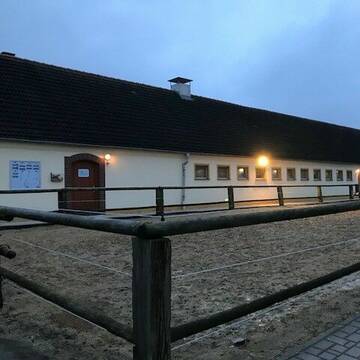
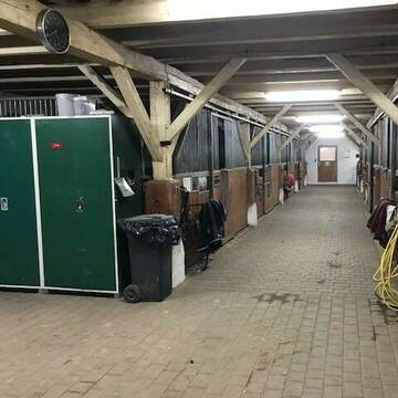
Vermiete große Boxen
Zwickau
christine-sachnik-Folk
@christine-sachnik
Freizeitstall
Geländestrecke
Vermieten
Paddock
Parkplatz für Pferdeanhänger
Hufrehe geeignet
10 weitere...
B
Deprecated: Creation of dynamic property Zend_View_Helper_Ads::$adLink is deprecated in /var/www/stall-frei/htdocs/staging.stall-frei.de/library/Psf/View/Helper/Ads.php on line 108

Das Beste für die Hufe
Mechtersen
STALL-FREIde Marketing
@STALL-FREI-Marketing
Hufschmiede und Hufpfleger in Ihrer Nähe
Leider kein Vorschaubild
Leider kein Vorschaubild
Frei Boxen zu vermieten
Zwickau
christine-sachnik-Folk
@christine-sachnik
Freizeitstall
Geländestrecke
Vermieten
Paddock
Parkplatz für Pferdeanhänger
Innenbox
7 weitere...
B
Reitverein Heideland e.V.
Heideland OT Etzdorf
Reitverein-Heideland-e-V
@Reitverein-Heideland-e-V
Fahrstall, Kutschwagen
FN-Mitglied
Vermieten
Hunde willkommen
Krankenbox
Allergikerstall
Gnadenbrothof
34 weitere...
S
Leider kein Vorschaubild
Leider kein Vorschaubild
Boxen frei - Pferdepension mit Reitplatz und Halle
Schmölln
Reit- & Pensionsstall Förster
@JuleSch
Freizeitstall
Krankenbox
Paddock
Hengsthaltung möglich
Notfallboxen
Außenboxen
Innenbox
11 weitere...
B
Reitstall in den traumhaften Saaleauen in Holleben
Holleben
Burghof-Holleben-UG-Co-KG
@Burghof-Holleben-UG-Co-KG
FN-Mitglied
Freizeitstall
Paddock
Reithalle
Innenbox
Vollpension
7 weitere...
aktuell
S
Pensionsboxen - Reiten für Jedermann
Schwarzenberg
PSV-Gruenstaedtel-e-V
@PSV-Gruenstaedtel-e-V
FN-Mitglied
Freizeitstall
Vermieten
Paddock
Parkplatz für Pferdeanhänger
Innenbox
Offenstall
19 weitere...
P

Persönlichkeitsentwicklung mit Pferden
Bad Salzuflen
Katja Dors
@Pferdezeiten
Begleite andere auf ihrem Entwicklungsweg und entdecke die transformative Kraft der pferdegestützten Persönlichkeitsentwicklung !
neu
R

Reiterhof Hultsch
Neukirch/Lausitz
Reiterhof Hultsch
@ReiterhofHultsch
FN-Mitglied
Freizeitstall
Vermieten
Hunde willkommen
Paddock
Innenbox
15 weitere...
P
Leider kein Vorschaubild
Leider kein Vorschaubild
Boxen mit täglichem, ganztägigen Weide/ Koppelga...
Hohenmölsen
Katharina Stür
@Katharina-Hartung
Freizeitstall
Pferdeausbildung
Vermieten
Krankenbox
Longierzirkel/Roundpen
Fohlenaufzucht möglich
Gnadenbrothof
19 weitere...
B

PADDOCKBOXEN / AKTIVSTALLPLATZ frei
Göda
Reitanlage Lindenhöhe
@RalfBusch
FN-Mitglied
Freizeitstall
Vermieten
Führanlage
Hunde willkommen
Allergikerstall
Fohlenaufzucht möglich
37 weitere...
P
Leider kein Vorschaubild
Leider kein Vorschaubild
Offenstall Plätze
Weißenfels
Sigrun Fröhlich
@Equiemption
Freizeitstall
Pferdeausbildung
Vermieten
Hunde willkommen
Paddock
Allergikerstall
Fohlenaufzucht möglich
17 weitere...
aktuell
B
Newsletter abonnieren
Melde Dich für unseren Newsletter an und verpasse keine Neuigkeiten!
Deprecated: Creation of dynamic property Zend_View::$pageCount is deprecated in /var/www/stall-frei/htdocs/staging.stall-frei.de/library/vendor/shardj/zf1-future/library/Zend/View/Abstract.php on line 308
Deprecated: Creation of dynamic property Zend_View::$itemCountPerPage is deprecated in /var/www/stall-frei/htdocs/staging.stall-frei.de/library/vendor/shardj/zf1-future/library/Zend/View/Abstract.php on line 308
Deprecated: Creation of dynamic property Zend_View::$first is deprecated in /var/www/stall-frei/htdocs/staging.stall-frei.de/library/vendor/shardj/zf1-future/library/Zend/View/Abstract.php on line 308
Deprecated: Creation of dynamic property Zend_View::$current is deprecated in /var/www/stall-frei/htdocs/staging.stall-frei.de/library/vendor/shardj/zf1-future/library/Zend/View/Abstract.php on line 308
Deprecated: Creation of dynamic property Zend_View::$last is deprecated in /var/www/stall-frei/htdocs/staging.stall-frei.de/library/vendor/shardj/zf1-future/library/Zend/View/Abstract.php on line 308
Deprecated: Creation of dynamic property Zend_View::$previous is deprecated in /var/www/stall-frei/htdocs/staging.stall-frei.de/library/vendor/shardj/zf1-future/library/Zend/View/Abstract.php on line 308
Deprecated: Creation of dynamic property Zend_View::$next is deprecated in /var/www/stall-frei/htdocs/staging.stall-frei.de/library/vendor/shardj/zf1-future/library/Zend/View/Abstract.php on line 308
Deprecated: Creation of dynamic property Zend_View::$pagesInRange is deprecated in /var/www/stall-frei/htdocs/staging.stall-frei.de/library/vendor/shardj/zf1-future/library/Zend/View/Abstract.php on line 308
Deprecated: Creation of dynamic property Zend_View::$firstPageInRange is deprecated in /var/www/stall-frei/htdocs/staging.stall-frei.de/library/vendor/shardj/zf1-future/library/Zend/View/Abstract.php on line 308
Deprecated: Creation of dynamic property Zend_View::$lastPageInRange is deprecated in /var/www/stall-frei/htdocs/staging.stall-frei.de/library/vendor/shardj/zf1-future/library/Zend/View/Abstract.php on line 308
Deprecated: Creation of dynamic property Zend_View::$currentItemCount is deprecated in /var/www/stall-frei/htdocs/staging.stall-frei.de/library/vendor/shardj/zf1-future/library/Zend/View/Abstract.php on line 308
Deprecated: Creation of dynamic property Zend_View::$totalItemCount is deprecated in /var/www/stall-frei/htdocs/staging.stall-frei.de/library/vendor/shardj/zf1-future/library/Zend/View/Abstract.php on line 308
Deprecated: Creation of dynamic property Zend_View::$firstItemNumber is deprecated in /var/www/stall-frei/htdocs/staging.stall-frei.de/library/vendor/shardj/zf1-future/library/Zend/View/Abstract.php on line 308
Deprecated: Creation of dynamic property Zend_View::$lastItemNumber is deprecated in /var/www/stall-frei/htdocs/staging.stall-frei.de/library/vendor/shardj/zf1-future/library/Zend/View/Abstract.php on line 308
Deprecated: Creation of dynamic property Zend_View::$router is deprecated in /var/www/stall-frei/htdocs/staging.stall-frei.de/library/vendor/shardj/zf1-future/library/Zend/View/Abstract.php on line 308
Deprecated: Creation of dynamic property Zend_View::$urlParams is deprecated in /var/www/stall-frei/htdocs/staging.stall-frei.de/library/vendor/shardj/zf1-future/library/Zend/View/Abstract.php on line 308
Deprecated: Creation of dynamic property Zend_View::$showAds is deprecated in /var/www/stall-frei/htdocs/staging.stall-frei.de/library/vendor/shardj/zf1-future/library/Zend/View/Abstract.php on line 308
Deprecated: Creation of dynamic property Zend_View::$objectIds is deprecated in /var/www/stall-frei/htdocs/staging.stall-frei.de/library/vendor/shardj/zf1-future/library/Zend/View/Abstract.php on line 308
Deprecated: Creation of dynamic property Zend_View::$showNavbar is deprecated in /var/www/stall-frei/htdocs/staging.stall-frei.de/library/vendor/shardj/zf1-future/library/Zend/View/Abstract.php on line 308
Deprecated: Creation of dynamic property Zend_View::$showBreadcrumb is deprecated in /var/www/stall-frei/htdocs/staging.stall-frei.de/library/vendor/shardj/zf1-future/library/Zend/View/Abstract.php on line 308
Deprecated: Creation of dynamic property Zend_View::$showFooter is deprecated in /var/www/stall-frei/htdocs/staging.stall-frei.de/library/vendor/shardj/zf1-future/library/Zend/View/Abstract.php on line 308
Deprecated: Creation of dynamic property Zend_View::$showInternalAds is deprecated in /var/www/stall-frei/htdocs/staging.stall-frei.de/library/vendor/shardj/zf1-future/library/Zend/View/Abstract.php on line 308
Deprecated: Creation of dynamic property Zend_View::$blNoContent is deprecated in /var/www/stall-frei/htdocs/staging.stall-frei.de/library/vendor/shardj/zf1-future/library/Zend/View/Abstract.php on line 308
Deprecated: Creation of dynamic property Zend_View::$sMetaDesc is deprecated in /var/www/stall-frei/htdocs/staging.stall-frei.de/library/vendor/shardj/zf1-future/library/Zend/View/Abstract.php on line 308
Deprecated: Creation of dynamic property Zend_View::$useGmaps is deprecated in /var/www/stall-frei/htdocs/staging.stall-frei.de/library/vendor/shardj/zf1-future/library/Zend/View/Abstract.php on line 308
Deprecated: Creation of dynamic property Zend_View::$touches is deprecated in /var/www/stall-frei/htdocs/staging.stall-frei.de/library/vendor/shardj/zf1-future/library/Zend/View/Abstract.php on line 308
Deprecated: Creation of dynamic property Zend_View::$oProject is deprecated in /var/www/stall-frei/htdocs/staging.stall-frei.de/library/vendor/shardj/zf1-future/library/Zend/View/Abstract.php on line 308
Deprecated: Creation of dynamic property Zend_View::$pageHeadline is deprecated in /var/www/stall-frei/htdocs/staging.stall-frei.de/library/vendor/shardj/zf1-future/library/Zend/View/Abstract.php on line 308
Deprecated: Creation of dynamic property Zend_View::$disableLocationField is deprecated in /var/www/stall-frei/htdocs/staging.stall-frei.de/library/vendor/shardj/zf1-future/library/Zend/View/Abstract.php on line 308
Deprecated: Creation of dynamic property Zend_View::$isSearch is deprecated in /var/www/stall-frei/htdocs/staging.stall-frei.de/library/vendor/shardj/zf1-future/library/Zend/View/Abstract.php on line 308
Deprecated: Creation of dynamic property Zend_View::$pageTitle is deprecated in /var/www/stall-frei/htdocs/staging.stall-frei.de/library/vendor/shardj/zf1-future/library/Zend/View/Abstract.php on line 308
Deprecated: Creation of dynamic property Psf_Form_Element_Text::$class is deprecated in /var/www/stall-frei/htdocs/staging.stall-frei.de/library/vendor/shardj/zf1-future/library/Zend/Form/Element.php on line 874
Deprecated: Creation of dynamic property Psf_Form_Element_Text::$size is deprecated in /var/www/stall-frei/htdocs/staging.stall-frei.de/library/vendor/shardj/zf1-future/library/Zend/Form/Element.php on line 874
Deprecated: Creation of dynamic property Psf_Form_Element_Text::$placeholder is deprecated in /var/www/stall-frei/htdocs/staging.stall-frei.de/library/vendor/shardj/zf1-future/library/Zend/Form/Element.php on line 874
Deprecated: Creation of dynamic property Psf_Form_Element_Hidden::$class is deprecated in /var/www/stall-frei/htdocs/staging.stall-frei.de/library/vendor/shardj/zf1-future/library/Zend/Form/Element.php on line 874
Deprecated: Creation of dynamic property Psf_Form_Element_Hidden::$class is deprecated in /var/www/stall-frei/htdocs/staging.stall-frei.de/library/vendor/shardj/zf1-future/library/Zend/Form/Element.php on line 874
Deprecated: Creation of dynamic property Psf_Form_Element_Hidden::$class is deprecated in /var/www/stall-frei/htdocs/staging.stall-frei.de/library/vendor/shardj/zf1-future/library/Zend/Form/Element.php on line 874
Deprecated: Creation of dynamic property Psf_Form_Element_Hidden::$class is deprecated in /var/www/stall-frei/htdocs/staging.stall-frei.de/library/vendor/shardj/zf1-future/library/Zend/Form/Element.php on line 874
Deprecated: Creation of dynamic property Psf_Form_Element_Select::$class is deprecated in /var/www/stall-frei/htdocs/staging.stall-frei.de/library/vendor/shardj/zf1-future/library/Zend/Form/Element.php on line 874
Deprecated: Creation of dynamic property Psf_Form_Element_Select::$class is deprecated in /var/www/stall-frei/htdocs/staging.stall-frei.de/library/vendor/shardj/zf1-future/library/Zend/Form/Element.php on line 874
Deprecated: Creation of dynamic property Psf_Form_Element_Select::$class is deprecated in /var/www/stall-frei/htdocs/staging.stall-frei.de/library/vendor/shardj/zf1-future/library/Zend/Form/Element.php on line 874
Deprecated: Creation of dynamic property Psf_Form_Element_Select::$class is deprecated in /var/www/stall-frei/htdocs/staging.stall-frei.de/library/vendor/shardj/zf1-future/library/Zend/Form/Element.php on line 874
Deprecated: Creation of dynamic property Psf_Form_Element_Text::$class is deprecated in /var/www/stall-frei/htdocs/staging.stall-frei.de/library/vendor/shardj/zf1-future/library/Zend/Form/Element.php on line 874
Deprecated: Creation of dynamic property Psf_Form_Element_Checkbox::$label is deprecated in /var/www/stall-frei/htdocs/staging.stall-frei.de/library/vendor/shardj/zf1-future/library/Zend/Form/Element.php on line 874
Deprecated: Creation of dynamic property Zend_View::$sort is deprecated in /var/www/stall-frei/htdocs/staging.stall-frei.de/library/vendor/shardj/zf1-future/library/Zend/View/Abstract.php on line 308
Deprecated: Creation of dynamic property Zend_View::$searchLocation is deprecated in /var/www/stall-frei/htdocs/staging.stall-frei.de/library/vendor/shardj/zf1-future/library/Zend/View/Abstract.php on line 308
Deprecated: Creation of dynamic property Zend_View::$locationHint is deprecated in /var/www/stall-frei/htdocs/staging.stall-frei.de/library/vendor/shardj/zf1-future/library/Zend/View/Abstract.php on line 308
Psf_GeoCoder_Abstract::getLocation: Ostrau Get Location CachedOrLive
Psf_GeoCoder_Abstract::getCachedOrLive: Ostrau
Psf_GeoCoder_Abstract::convertLocationResult
{"documentation":"https:\/\/opencagedata.com\/api","licenses":[{"name":"see attribution guide","url":"https:\/\/opencagedata.com\/credits"}],"results":[{"bounds":{"northeast":{"lat":51.22,"lng":13.1867},"southwest":{"lat":51.18,"lng":13.1467}},"components":{"ISO_3166-1_alpha-2":"DE","ISO_3166-1_alpha-3":"DEU","ISO_3166-2":["DE-SN"],"_category":"place","_normalized_city":"Ostrau","_type":"village","continent":"Europe","country":"Deutschland","country_code":"de","county":"Mittelsachsen","municipality":"Jahnatal","political_union":"European Union","postcode":"04749","state":"Sachsen","state_code":"SN","village":"Ostrau"},"confidence":7,"formatted":"04749 Ostrau, Deutschland","geometry":{"lat":51.2,"lng":13.1667}},{"bounds":{"northeast":{"lat":51.64656,"lng":12.0506607},"southwest":{"lat":51.597257,"lng":11.9731573}},"components":{"ISO_3166-1_alpha-2":"DE","ISO_3166-1_alpha-3":"DEU","ISO_3166-2":["DE-ST"],"_category":"place","_normalized_city":"Petersberg","_type":"village","city":"Petersberg","continent":"Europe","country":"Deutschland","country_code":"de","county":"Saalekreis","political_union":"European Union","state":"Sachsen-Anhalt","state_code":"ST","village":"Ostrau"},"confidence":7,"formatted":"Ostrau, Sachsen-Anhalt, Deutschland","geometry":{"lat":51.6178648,"lng":12.0093228}},{"bounds":{"northeast":{"lat":50.940524,"lng":14.1945622},"southwest":{"lat":50.900524,"lng":14.1545622}},"components":{"ISO_3166-1_alpha-2":"DE","ISO_3166-1_alpha-3":"DEU","ISO_3166-2":["DE-SN"],"_category":"place","_normalized_city":"Bad Schandau","_type":"neighbourhood","continent":"Europe","country":"Deutschland","country_code":"de","county":"S\u00e4chsische Schweiz-Osterzgebirge","municipality":"Bad Schandau","political_union":"European Union","postcode":"01814","state":"Sachsen","state_code":"SN","suburb":"Ostrau","town":"Bad Schandau"},"confidence":7,"formatted":"01814 Bad Schandau, Deutschland","geometry":{"lat":50.920524,"lng":14.1745622}},{"bounds":{"northeast":{"lat":51.1188201,"lng":12.2173941},"southwest":{"lat":51.0788201,"lng":12.1773941}},"components":{"ISO_3166-1_alpha-2":"DE","ISO_3166-1_alpha-3":"DEU","ISO_3166-2":["DE-ST"],"_category":"place","_normalized_city":"Ostrau","_type":"city","continent":"Europe","country":"Deutschland","country_code":"de","county":"Burgenlandkreis","municipality":"Elsteraue","political_union":"European Union","postcode":"06725","state":"Sachsen-Anhalt","state_code":"ST","town":"Ostrau"},"confidence":7,"formatted":"06725 Ostrau, Deutschland","geometry":{"lat":51.0988201,"lng":12.1973941}},{"bounds":{"northeast":{"lat":51.3283651,"lng":12.0779038},"southwest":{"lat":51.2883651,"lng":12.0379038}},"components":{"ISO_3166-1_alpha-2":"DE","ISO_3166-1_alpha-3":"DEU","ISO_3166-2":["DE-ST"],"_category":"place","_normalized_city":"Bad D\u00fcrrenberg","_type":"neighbourhood","city_district":"Bad D\u00fcrrenberg","continent":"Europe","country":"Deutschland","country_code":"de","county":"Saalekreis","political_union":"European Union","postcode":"06231","state":"Sachsen-Anhalt","state_code":"ST","suburb":"Ostrau","town":"Bad D\u00fcrrenberg"},"confidence":7,"formatted":"06231 Bad D\u00fcrrenberg, Deutschland","geometry":{"lat":51.3083651,"lng":12.0579038}},{"bounds":{"northeast":{"lat":51.2264112,"lng":12.9033771},"southwest":{"lat":51.1864112,"lng":12.8633771}},"components":{"ISO_3166-1_alpha-2":"DE","ISO_3166-1_alpha-3":"DEU","ISO_3166-2":["DE-SN"],"_category":"place","_normalized_city":"Grimma","_type":"hamlet","city_district":"Th\u00fcmmlitzwalde","continent":"Europe","country":"Deutschland","country_code":"de","county":"Landkreis Leipzig","hamlet":"Ostrau","political_union":"European Union","state":"Sachsen","state_code":"SN","town":"Grimma"},"confidence":7,"formatted":"Ostrau, Th\u00fcmmlitzwalde, Grimma, Sachsen, Deutschland","geometry":{"lat":51.2064112,"lng":12.8833771}},{"components":{"ISO_3166-1_alpha-2":"FR","ISO_3166-1_alpha-3":"FRA","ISO_3166-2":["FR-OCC","FR-30"],"_category":"road","_normalized_city":"Saint-Jean-du-Gard","_type":"road","city":"Saint-Jean-du-Gard","continent":"Europe","country":"France","country_code":"fr","county":"Gard","local_authority":"Al\u00e8s Agglom\u00e9ration","political_union":"European Union","postcode":"30270","road":"Route de L'Astrau","state":"Occitanie","state_code":"OCC"},"confidence":2,"formatted":"Route de L'Astrau, 30270 Saint-Jean-du-Gard, France","geometry":{"lat":44.096523,"lng":3.889733}},{"components":{"ISO_3166-1_alpha-2":"FR","ISO_3166-1_alpha-3":"FRA","ISO_3166-2":["FR-IDF","FR-92"],"_category":"road","_normalized_city":"Levallois-Perret","_type":"road","city":"Levallois-Perret","continent":"Europe","country":"France","country_code":"fr","county":"Hauts-de-Seine","local_authority":"M\u00e9tropole du Grand Paris","political_union":"European Union","postcode":"92300","road":"Rue Charles Deutschmann","state":"\u00cele-de-France","state_code":"IDF"},"confidence":2,"formatted":"Rue Charles Deutschmann, 92300 Levallois-Perret, France","geometry":{"lat":48.900049,"lng":2.2842}},{"components":{"ISO_3166-1_alpha-2":"FR","ISO_3166-1_alpha-3":"FRA","ISO_3166-2":["FR-NAQ","FR-64"],"_category":"road","_normalized_city":"Aramits","_type":"road","city":"Aramits","continent":"Europe","country":"France","country_code":"fr","county":"Pyr\u00e9n\u00e9es-Atlantiques","local_authority":"Communaut\u00e9 de communes du Haut B\u00e9arn","political_union":"European Union","postcode":"64570","road":"Chemin de l'Ostau","state":"Nouvelle-Aquitaine","state_code":"NAQ"},"confidence":2,"formatted":"Chemin de l'Ostau, 64570 Aramits, France","geometry":{"lat":43.133163,"lng":-0.697526}},{"components":{"ISO_3166-1_alpha-2":"FR","ISO_3166-1_alpha-3":"FRA","ISO_3166-2":["FR-IDF","FR-91"],"_category":"road","_normalized_city":"\u00c9tr\u00e9chy","_type":"road","city":"\u00c9tr\u00e9chy","continent":"Europe","country":"France","country_code":"fr","county":"Essonne","local_authority":"Communaut\u00e9 de communes Entre Juine et Renarde","political_union":"European Union","postcode":"91580","road":"Rue d\u2019Ostrach","state":"\u00cele-de-France","state_code":"IDF"},"confidence":2,"formatted":"Rue d\u2019Ostrach, 91580 \u00c9tr\u00e9chy, France","geometry":{"lat":48.492078,"lng":2.184918}}],"status":{"code":200,"message":"OK"},"stay_informed":{"blog":"https:\/\/blog.opencagedata.com","mastodon":"https:\/\/en.osm.town\/@opencage"},"thanks":"For using an OpenCage API","timestamp":{"created_http":"Fri, 06 Feb 2026 22:47:04 GMT","created_unix":1770418024},"total_results":10}Array
(
[0] => stdClass Object
(
[bounds] => stdClass Object
(
[northeast] => stdClass Object
(
[lat] => 51.22
[lng] => 13.1867
)
[southwest] => stdClass Object
(
[lat] => 51.18
[lng] => 13.1467
)
)
[components] => stdClass Object
(
[ISO_3166-1_alpha-2] => DE
[ISO_3166-1_alpha-3] => DEU
[ISO_3166-2] => Array
(
[0] => DE-SN
)
[_category] => place
[_normalized_city] => Ostrau
[_type] => village
[continent] => Europe
[country] => Deutschland
[country_code] => de
[county] => Mittelsachsen
[municipality] => Jahnatal
[political_union] => European Union
[postcode] => 04749
[state] => Sachsen
[state_code] => SN
[village] => Ostrau
)
[confidence] => 7
[formatted] => 04749 Ostrau, Deutschland
[geometry] => stdClass Object
(
[lat] => 51.2
[lng] => 13.1667
)
)
[1] => stdClass Object
(
[bounds] => stdClass Object
(
[northeast] => stdClass Object
(
[lat] => 51.64656
[lng] => 12.0506607
)
[southwest] => stdClass Object
(
[lat] => 51.597257
[lng] => 11.9731573
)
)
[components] => stdClass Object
(
[ISO_3166-1_alpha-2] => DE
[ISO_3166-1_alpha-3] => DEU
[ISO_3166-2] => Array
(
[0] => DE-ST
)
[_category] => place
[_normalized_city] => Petersberg
[_type] => village
[city] => Petersberg
[continent] => Europe
[country] => Deutschland
[country_code] => de
[county] => Saalekreis
[political_union] => European Union
[state] => Sachsen-Anhalt
[state_code] => ST
[village] => Ostrau
)
[confidence] => 7
[formatted] => Ostrau, Sachsen-Anhalt, Deutschland
[geometry] => stdClass Object
(
[lat] => 51.6178648
[lng] => 12.0093228
)
)
[2] => stdClass Object
(
[bounds] => stdClass Object
(
[northeast] => stdClass Object
(
[lat] => 50.940524
[lng] => 14.1945622
)
[southwest] => stdClass Object
(
[lat] => 50.900524
[lng] => 14.1545622
)
)
[components] => stdClass Object
(
[ISO_3166-1_alpha-2] => DE
[ISO_3166-1_alpha-3] => DEU
[ISO_3166-2] => Array
(
[0] => DE-SN
)
[_category] => place
[_normalized_city] => Bad Schandau
[_type] => neighbourhood
[continent] => Europe
[country] => Deutschland
[country_code] => de
[county] => Sächsische Schweiz-Osterzgebirge
[municipality] => Bad Schandau
[political_union] => European Union
[postcode] => 01814
[state] => Sachsen
[state_code] => SN
[suburb] => Ostrau
[town] => Bad Schandau
)
[confidence] => 7
[formatted] => 01814 Bad Schandau, Deutschland
[geometry] => stdClass Object
(
[lat] => 50.920524
[lng] => 14.1745622
)
)
[3] => stdClass Object
(
[bounds] => stdClass Object
(
[northeast] => stdClass Object
(
[lat] => 51.1188201
[lng] => 12.2173941
)
[southwest] => stdClass Object
(
[lat] => 51.0788201
[lng] => 12.1773941
)
)
[components] => stdClass Object
(
[ISO_3166-1_alpha-2] => DE
[ISO_3166-1_alpha-3] => DEU
[ISO_3166-2] => Array
(
[0] => DE-ST
)
[_category] => place
[_normalized_city] => Ostrau
[_type] => city
[continent] => Europe
[country] => Deutschland
[country_code] => de
[county] => Burgenlandkreis
[municipality] => Elsteraue
[political_union] => European Union
[postcode] => 06725
[state] => Sachsen-Anhalt
[state_code] => ST
[town] => Ostrau
)
[confidence] => 7
[formatted] => 06725 Ostrau, Deutschland
[geometry] => stdClass Object
(
[lat] => 51.0988201
[lng] => 12.1973941
)
)
[4] => stdClass Object
(
[bounds] => stdClass Object
(
[northeast] => stdClass Object
(
[lat] => 51.3283651
[lng] => 12.0779038
)
[southwest] => stdClass Object
(
[lat] => 51.2883651
[lng] => 12.0379038
)
)
[components] => stdClass Object
(
[ISO_3166-1_alpha-2] => DE
[ISO_3166-1_alpha-3] => DEU
[ISO_3166-2] => Array
(
[0] => DE-ST
)
[_category] => place
[_normalized_city] => Bad Dürrenberg
[_type] => neighbourhood
[city_district] => Bad Dürrenberg
[continent] => Europe
[country] => Deutschland
[country_code] => de
[county] => Saalekreis
[political_union] => European Union
[postcode] => 06231
[state] => Sachsen-Anhalt
[state_code] => ST
[suburb] => Ostrau
[town] => Bad Dürrenberg
)
[confidence] => 7
[formatted] => 06231 Bad Dürrenberg, Deutschland
[geometry] => stdClass Object
(
[lat] => 51.3083651
[lng] => 12.0579038
)
)
[5] => stdClass Object
(
[bounds] => stdClass Object
(
[northeast] => stdClass Object
(
[lat] => 51.2264112
[lng] => 12.9033771
)
[southwest] => stdClass Object
(
[lat] => 51.1864112
[lng] => 12.8633771
)
)
[components] => stdClass Object
(
[ISO_3166-1_alpha-2] => DE
[ISO_3166-1_alpha-3] => DEU
[ISO_3166-2] => Array
(
[0] => DE-SN
)
[_category] => place
[_normalized_city] => Grimma
[_type] => hamlet
[city_district] => Thümmlitzwalde
[continent] => Europe
[country] => Deutschland
[country_code] => de
[county] => Landkreis Leipzig
[hamlet] => Ostrau
[political_union] => European Union
[state] => Sachsen
[state_code] => SN
[town] => Grimma
)
[confidence] => 7
[formatted] => Ostrau, Thümmlitzwalde, Grimma, Sachsen, Deutschland
[geometry] => stdClass Object
(
[lat] => 51.2064112
[lng] => 12.8833771
)
)
[6] => stdClass Object
(
[components] => stdClass Object
(
[ISO_3166-1_alpha-2] => FR
[ISO_3166-1_alpha-3] => FRA
[ISO_3166-2] => Array
(
[0] => FR-OCC
[1] => FR-30
)
[_category] => road
[_normalized_city] => Saint-Jean-du-Gard
[_type] => road
[city] => Saint-Jean-du-Gard
[continent] => Europe
[country] => France
[country_code] => fr
[county] => Gard
[local_authority] => Alès Agglomération
[political_union] => European Union
[postcode] => 30270
[road] => Route de L'Astrau
[state] => Occitanie
[state_code] => OCC
)
[confidence] => 2
[formatted] => Route de L'Astrau, 30270 Saint-Jean-du-Gard, France
[geometry] => stdClass Object
(
[lat] => 44.096523
[lng] => 3.889733
)
)
[7] => stdClass Object
(
[components] => stdClass Object
(
[ISO_3166-1_alpha-2] => FR
[ISO_3166-1_alpha-3] => FRA
[ISO_3166-2] => Array
(
[0] => FR-IDF
[1] => FR-92
)
[_category] => road
[_normalized_city] => Levallois-Perret
[_type] => road
[city] => Levallois-Perret
[continent] => Europe
[country] => France
[country_code] => fr
[county] => Hauts-de-Seine
[local_authority] => Métropole du Grand Paris
[political_union] => European Union
[postcode] => 92300
[road] => Rue Charles Deutschmann
[state] => Île-de-France
[state_code] => IDF
)
[confidence] => 2
[formatted] => Rue Charles Deutschmann, 92300 Levallois-Perret, France
[geometry] => stdClass Object
(
[lat] => 48.900049
[lng] => 2.2842
)
)
[8] => stdClass Object
(
[components] => stdClass Object
(
[ISO_3166-1_alpha-2] => FR
[ISO_3166-1_alpha-3] => FRA
[ISO_3166-2] => Array
(
[0] => FR-NAQ
[1] => FR-64
)
[_category] => road
[_normalized_city] => Aramits
[_type] => road
[city] => Aramits
[continent] => Europe
[country] => France
[country_code] => fr
[county] => Pyrénées-Atlantiques
[local_authority] => Communauté de communes du Haut Béarn
[political_union] => European Union
[postcode] => 64570
[road] => Chemin de l'Ostau
[state] => Nouvelle-Aquitaine
[state_code] => NAQ
)
[confidence] => 2
[formatted] => Chemin de l'Ostau, 64570 Aramits, France
[geometry] => stdClass Object
(
[lat] => 43.133163
[lng] => -0.697526
)
)
[9] => stdClass Object
(
[components] => stdClass Object
(
[ISO_3166-1_alpha-2] => FR
[ISO_3166-1_alpha-3] => FRA
[ISO_3166-2] => Array
(
[0] => FR-IDF
[1] => FR-91
)
[_category] => road
[_normalized_city] => Étréchy
[_type] => road
[city] => Étréchy
[continent] => Europe
[country] => France
[country_code] => fr
[county] => Essonne
[local_authority] => Communauté de communes Entre Juine et Renarde
[political_union] => European Union
[postcode] => 91580
[road] => Rue d’Ostrach
[state] => Île-de-France
[state_code] => IDF
)
[confidence] => 2
[formatted] => Rue d’Ostrach, 91580 Étréchy, France
[geometry] => stdClass Object
(
[lat] => 48.492078
[lng] => 2.184918
)
)
)
Psf_GeoCoder_OpenCageData::getKeyMap: 0
stdClass Object
(
    [bounds] => stdClass Object
        (
            [northeast] => stdClass Object
                (
                    [lat] => 51.22
                    [lng] => 13.1867
                )

            [southwest] => stdClass Object
                (
                    [lat] => 51.18
                    [lng] => 13.1467
                )

        )

    [components] => stdClass Object
        (
            [ISO_3166-1_alpha-2] => DE
            [ISO_3166-1_alpha-3] => DEU
            [ISO_3166-2] => Array
                (
                    [0] => DE-SN
                )

            [_category] => place
            [_normalized_city] => Ostrau
            [_type] => village
            [continent] => Europe
            [country] => Deutschland
            [country_code] => de
            [county] => Mittelsachsen
            [municipality] => Jahnatal
            [political_union] => European Union
            [postcode] => 04749
            [state] => Sachsen
            [state_code] => SN
            [village] => Ostrau
        )

    [confidence] => 7
    [formatted] => 04749 Ostrau, Deutschland
    [geometry] => stdClass Object
        (
            [lat] => 51.2
            [lng] => 13.1667
        )

)
Psf_GeoCoder_OpenCageData::getCounty: Mittelsachsen
Psf_GeoCoder_OpenCageData::addMissingData REFETCH!
Array
(
    [address] => 04749 Ostrau, Deutschland
    [type] => village
    [street] =>
    [city] => Ostrau
    [county] => Mittelsachsen
    [state] => Sachsen
    [zip] => 04749
    [country] => Deutschland
    [suburb] =>
    [countrycode] => de
    [latitude] => 51.2
    [longitude] => 13.1667
    [accuracy] => 1
    [confidence] => 7
    [bounds] => stdClass Object
        (
            [northeast] => stdClass Object
                (
                    [lat] => 51.22
                    [lng] => 13.1867
                )

            [southwest] => stdClass Object
                (
                    [lat] => 51.18
                    [lng] => 13.1467
                )

        )

)
reformat!
Array
(
    [address] => 04749 Ostrau, Deutschland
    [type] => village
    [street] =>
    [city] => Ostrau
    [county] => Mittelsachsen
    [state] => Sachsen
    [zip] => 04749
    [country] => Deutschland
    [suburb] =>
    [countrycode] => de
    [latitude] => 51.2
    [longitude] => 13.1667
    [accuracy] => 1
    [confidence] => 7
    [bounds] => stdClass Object
        (
            [northeast] => stdClass Object
                (
                    [lat] => 51.22
                    [lng] => 13.1867
                )

            [southwest] => stdClass Object
                (
                    [lat] => 51.18
                    [lng] => 13.1467
                )

        )

    [place] => 04749 Ostrau, Sachsen
    [hash] => 958271dbf4c8e92d4374cd8b0c765dd7
)
Psf_GeoCoder_OpenCageData::getKeyMap: 1
stdClass Object
(
    [bounds] => stdClass Object
        (
            [northeast] => stdClass Object
                (
                    [lat] => 51.64656
                    [lng] => 12.0506607
                )

            [southwest] => stdClass Object
                (
                    [lat] => 51.597257
                    [lng] => 11.9731573
                )

        )

    [components] => stdClass Object
        (
            [ISO_3166-1_alpha-2] => DE
            [ISO_3166-1_alpha-3] => DEU
            [ISO_3166-2] => Array
                (
                    [0] => DE-ST
                )

            [_category] => place
            [_normalized_city] => Petersberg
            [_type] => village
            [city] => Petersberg
            [continent] => Europe
            [country] => Deutschland
            [country_code] => de
            [county] => Saalekreis
            [political_union] => European Union
            [state] => Sachsen-Anhalt
            [state_code] => ST
            [village] => Ostrau
        )

    [confidence] => 7
    [formatted] => Ostrau, Sachsen-Anhalt, Deutschland
    [geometry] => stdClass Object
        (
            [lat] => 51.6178648
            [lng] => 12.0093228
        )

)
Psf_GeoCoder_OpenCageData::getCounty: Saalekreis
Psf_GeoCoder_OpenCageData::addMissingData REFETCH!
Array
(
    [address] => Ostrau, Sachsen-Anhalt, Deutschland
    [type] => village
    [street] =>
    [city] => Ostrau
    [county] => Saalekreis
    [state] => Sachsen-Anhalt
    [zip] =>
    [country] => Deutschland
    [suburb] =>
    [countrycode] => de
    [latitude] => 51.6178648
    [longitude] => 12.0093228
    [accuracy] => 1
    [confidence] => 7
    [bounds] => stdClass Object
        (
            [northeast] => stdClass Object
                (
                    [lat] => 51.64656
                    [lng] => 12.0506607
                )

            [southwest] => stdClass Object
                (
                    [lat] => 51.597257
                    [lng] => 11.9731573
                )

        )

)
reformat!
Array
(
    [address] => Ostrau, Sachsen-Anhalt, Deutschland
    [type] => village
    [street] =>
    [city] => Ostrau
    [county] => Saalekreis
    [state] => Sachsen-Anhalt
    [zip] =>
    [country] => Deutschland
    [suburb] =>
    [countrycode] => de
    [latitude] => 51.6178648
    [longitude] => 12.0093228
    [accuracy] => 1
    [confidence] => 7
    [bounds] => stdClass Object
        (
            [northeast] => stdClass Object
                (
                    [lat] => 51.64656
                    [lng] => 12.0506607
                )

            [southwest] => stdClass Object
                (
                    [lat] => 51.597257
                    [lng] => 11.9731573
                )

        )

    [place] => Ostrau, Sachsen-Anhalt
    [hash] => 88ee1f1d9ace8c442645cb32d4d8921b
)
Psf_GeoCoder_OpenCageData::getKeyMap: 2
stdClass Object
(
    [bounds] => stdClass Object
        (
            [northeast] => stdClass Object
                (
                    [lat] => 50.940524
                    [lng] => 14.1945622
                )

            [southwest] => stdClass Object
                (
                    [lat] => 50.900524
                    [lng] => 14.1545622
                )

        )

    [components] => stdClass Object
        (
            [ISO_3166-1_alpha-2] => DE
            [ISO_3166-1_alpha-3] => DEU
            [ISO_3166-2] => Array
                (
                    [0] => DE-SN
                )

            [_category] => place
            [_normalized_city] => Bad Schandau
            [_type] => neighbourhood
            [continent] => Europe
            [country] => Deutschland
            [country_code] => de
            [county] => Sächsische Schweiz-Osterzgebirge
            [municipality] => Bad Schandau
            [political_union] => European Union
            [postcode] => 01814
            [state] => Sachsen
            [state_code] => SN
            [suburb] => Ostrau
            [town] => Bad Schandau
        )

    [confidence] => 7
    [formatted] => 01814 Bad Schandau, Deutschland
    [geometry] => stdClass Object
        (
            [lat] => 50.920524
            [lng] => 14.1745622
        )

)
Psf_GeoCoder_OpenCageData::getCounty: Sächsische Schweiz-Osterzgebirge
Psf_GeoCoder_OpenCageData::addMissingData REFETCH!
Array
(
    [address] => 01814 Bad Schandau, Deutschland
    [type] => neighbourhood
    [street] =>
    [city] => Bad Schandau
    [county] => Sächsische Schweiz-Osterzgebirge
    [state] => Sachsen
    [zip] => 01814
    [country] => Deutschland
    [suburb] => Ostrau
    [countrycode] => de
    [latitude] => 50.920524
    [longitude] => 14.1745622
    [accuracy] => 1
    [confidence] => 7
    [bounds] => stdClass Object
        (
            [northeast] => stdClass Object
                (
                    [lat] => 50.940524
                    [lng] => 14.1945622
                )

            [southwest] => stdClass Object
                (
                    [lat] => 50.900524
                    [lng] => 14.1545622
                )

        )

)
reformat!
Array
(
    [address] => 01814 Bad Schandau, Deutschland
    [type] => neighbourhood
    [street] =>
    [city] => Bad Schandau
    [county] => Sächsische Schweiz-Osterzgebirge
    [state] => Sachsen
    [zip] => 01814
    [country] => Deutschland
    [suburb] => Ostrau
    [countrycode] => de
    [latitude] => 50.920524
    [longitude] => 14.1745622
    [accuracy] => 1
    [confidence] => 7
    [bounds] => stdClass Object
        (
            [northeast] => stdClass Object
                (
                    [lat] => 50.940524
                    [lng] => 14.1945622
                )

            [southwest] => stdClass Object
                (
                    [lat] => 50.900524
                    [lng] => 14.1545622
                )

        )

    [place] => 01814 Bad Schandau, Sachsen
    [hash] => cb42277cc0f277a7b668eb289a551e87
)
Psf_GeoCoder_OpenCageData::getKeyMap: 3
stdClass Object
(
    [bounds] => stdClass Object
        (
            [northeast] => stdClass Object
                (
                    [lat] => 51.1188201
                    [lng] => 12.2173941
                )

            [southwest] => stdClass Object
                (
                    [lat] => 51.0788201
                    [lng] => 12.1773941
                )

        )

    [components] => stdClass Object
        (
            [ISO_3166-1_alpha-2] => DE
            [ISO_3166-1_alpha-3] => DEU
            [ISO_3166-2] => Array
                (
                    [0] => DE-ST
                )

            [_category] => place
            [_normalized_city] => Ostrau
            [_type] => city
            [continent] => Europe
            [country] => Deutschland
            [country_code] => de
            [county] => Burgenlandkreis
            [municipality] => Elsteraue
            [political_union] => European Union
            [postcode] => 06725
            [state] => Sachsen-Anhalt
            [state_code] => ST
            [town] => Ostrau
        )

    [confidence] => 7
    [formatted] => 06725 Ostrau, Deutschland
    [geometry] => stdClass Object
        (
            [lat] => 51.0988201
            [lng] => 12.1973941
        )

)
Psf_GeoCoder_OpenCageData::getCounty: Burgenlandkreis
Psf_GeoCoder_OpenCageData::addMissingData REFETCH!
Array
(
    [address] => 06725 Ostrau, Deutschland
    [type] => city
    [street] =>
    [city] => Ostrau
    [county] => Burgenlandkreis
    [state] => Sachsen-Anhalt
    [zip] => 06725
    [country] => Deutschland
    [suburb] =>
    [countrycode] => de
    [latitude] => 51.0988201
    [longitude] => 12.1973941
    [accuracy] => 1
    [confidence] => 7
    [bounds] => stdClass Object
        (
            [northeast] => stdClass Object
                (
                    [lat] => 51.1188201
                    [lng] => 12.2173941
                )

            [southwest] => stdClass Object
                (
                    [lat] => 51.0788201
                    [lng] => 12.1773941
                )

        )

)
reformat!
Array
(
    [address] => 06725 Ostrau, Deutschland
    [type] => city
    [street] =>
    [city] => Ostrau
    [county] => Burgenlandkreis
    [state] => Sachsen-Anhalt
    [zip] => 06725
    [country] => Deutschland
    [suburb] =>
    [countrycode] => de
    [latitude] => 51.0988201
    [longitude] => 12.1973941
    [accuracy] => 1
    [confidence] => 7
    [bounds] => stdClass Object
        (
            [northeast] => stdClass Object
                (
                    [lat] => 51.1188201
                    [lng] => 12.2173941
                )

            [southwest] => stdClass Object
                (
                    [lat] => 51.0788201
                    [lng] => 12.1773941
                )

        )

    [place] => 06725 Ostrau, Sachsen-Anhalt
    [hash] => 4dd0683c9a53cc124e988bcadf8a4fbf
)
Psf_GeoCoder_OpenCageData::getKeyMap: 4
stdClass Object
(
    [bounds] => stdClass Object
        (
            [northeast] => stdClass Object
                (
                    [lat] => 51.3283651
                    [lng] => 12.0779038
                )

            [southwest] => stdClass Object
                (
                    [lat] => 51.2883651
                    [lng] => 12.0379038
                )

        )

    [components] => stdClass Object
        (
            [ISO_3166-1_alpha-2] => DE
            [ISO_3166-1_alpha-3] => DEU
            [ISO_3166-2] => Array
                (
                    [0] => DE-ST
                )

            [_category] => place
            [_normalized_city] => Bad Dürrenberg
            [_type] => neighbourhood
            [city_district] => Bad Dürrenberg
            [continent] => Europe
            [country] => Deutschland
            [country_code] => de
            [county] => Saalekreis
            [political_union] => European Union
            [postcode] => 06231
            [state] => Sachsen-Anhalt
            [state_code] => ST
            [suburb] => Ostrau
            [town] => Bad Dürrenberg
        )

    [confidence] => 7
    [formatted] => 06231 Bad Dürrenberg, Deutschland
    [geometry] => stdClass Object
        (
            [lat] => 51.3083651
            [lng] => 12.0579038
        )

)
Psf_GeoCoder_OpenCageData::getCounty: Saalekreis
Psf_GeoCoder_OpenCageData::addMissingData REFETCH!
Array
(
    [address] => 06231 Bad Dürrenberg, Deutschland
    [type] => neighbourhood
    [street] =>
    [city] => Bad Dürrenberg
    [county] => Saalekreis
    [state] => Sachsen-Anhalt
    [zip] => 06231
    [country] => Deutschland
    [suburb] => Ostrau
    [countrycode] => de
    [latitude] => 51.3083651
    [longitude] => 12.0579038
    [accuracy] => 1
    [confidence] => 7
    [bounds] => stdClass Object
        (
            [northeast] => stdClass Object
                (
                    [lat] => 51.3283651
                    [lng] => 12.0779038
                )

            [southwest] => stdClass Object
                (
                    [lat] => 51.2883651
                    [lng] => 12.0379038
                )

        )

)
reformat!
Array
(
    [address] => 06231 Bad Dürrenberg, Deutschland
    [type] => neighbourhood
    [street] =>
    [city] => Bad Dürrenberg
    [county] => Saalekreis
    [state] => Sachsen-Anhalt
    [zip] => 06231
    [country] => Deutschland
    [suburb] => Ostrau
    [countrycode] => de
    [latitude] => 51.3083651
    [longitude] => 12.0579038
    [accuracy] => 1
    [confidence] => 7
    [bounds] => stdClass Object
        (
            [northeast] => stdClass Object
                (
                    [lat] => 51.3283651
                    [lng] => 12.0779038
                )

            [southwest] => stdClass Object
                (
                    [lat] => 51.2883651
                    [lng] => 12.0379038
                )

        )

    [place] => 06231 Bad Dürrenberg, Sachsen-Anhalt
    [hash] => f657e186a84e2cfb120f4277dbb15f83
)
Psf_GeoCoder_OpenCageData::getKeyMap: 5
stdClass Object
(
    [bounds] => stdClass Object
        (
            [northeast] => stdClass Object
                (
                    [lat] => 51.2264112
                    [lng] => 12.9033771
                )

            [southwest] => stdClass Object
                (
                    [lat] => 51.1864112
                    [lng] => 12.8633771
                )

        )

    [components] => stdClass Object
        (
            [ISO_3166-1_alpha-2] => DE
            [ISO_3166-1_alpha-3] => DEU
            [ISO_3166-2] => Array
                (
                    [0] => DE-SN
                )

            [_category] => place
            [_normalized_city] => Grimma
            [_type] => hamlet
            [city_district] => Thümmlitzwalde
            [continent] => Europe
            [country] => Deutschland
            [country_code] => de
            [county] => Landkreis Leipzig
            [hamlet] => Ostrau
            [political_union] => European Union
            [state] => Sachsen
            [state_code] => SN
            [town] => Grimma
        )

    [confidence] => 7
    [formatted] => Ostrau, Thümmlitzwalde, Grimma, Sachsen, Deutschland
    [geometry] => stdClass Object
        (
            [lat] => 51.2064112
            [lng] => 12.8833771
        )

)
Psf_GeoCoder_OpenCageData::getCounty: Leipzig
Psf_GeoCoder_OpenCageData::addMissingData REFETCH!
Array
(
    [address] => Ostrau, Thümmlitzwalde, Grimma, Sachsen, Deutschland
    [type] => hamlet
    [street] => Ostrau
    [city] => Grimma
    [county] => Leipzig
    [state] => Sachsen
    [zip] =>
    [country] => Deutschland
    [suburb] =>
    [countrycode] => de
    [latitude] => 51.2064112
    [longitude] => 12.8833771
    [accuracy] => 1
    [confidence] => 7
    [bounds] => stdClass Object
        (
            [northeast] => stdClass Object
                (
                    [lat] => 51.2264112
                    [lng] => 12.9033771
                )

            [southwest] => stdClass Object
                (
                    [lat] => 51.1864112
                    [lng] => 12.8633771
                )

        )

)
reformat!
Array
(
    [address] => Ostrau, Thümmlitzwalde, Grimma, Sachsen, Deutschland
    [type] => hamlet
    [street] => Ostrau
    [city] => Grimma
    [county] => Leipzig
    [state] => Sachsen
    [zip] =>
    [country] => Deutschland
    [suburb] =>
    [countrycode] => de
    [latitude] => 51.2064112
    [longitude] => 12.8833771
    [accuracy] => 1
    [confidence] => 7
    [bounds] => stdClass Object
        (
            [northeast] => stdClass Object
                (
                    [lat] => 51.2264112
                    [lng] => 12.9033771
                )

            [southwest] => stdClass Object
                (
                    [lat] => 51.1864112
                    [lng] => 12.8633771
                )

        )

    [place] => Ostrau, Grimma, Sachsen
    [hash] => 77598c871b2b10d7cef6235b10c0c560
)
Psf_GeoCoder_OpenCageData::getKeyMap: 6
stdClass Object
(
    [components] => stdClass Object
        (
            [ISO_3166-1_alpha-2] => FR
            [ISO_3166-1_alpha-3] => FRA
            [ISO_3166-2] => Array
                (
                    [0] => FR-OCC
                    [1] => FR-30
                )

            [_category] => road
            [_normalized_city] => Saint-Jean-du-Gard
            [_type] => road
            [city] => Saint-Jean-du-Gard
            [continent] => Europe
            [country] => France
            [country_code] => fr
            [county] => Gard
            [local_authority] => Alès Agglomération
            [political_union] => European Union
            [postcode] => 30270
            [road] => Route de L'Astrau
            [state] => Occitanie
            [state_code] => OCC
        )

    [confidence] => 2
    [formatted] => Route de L'Astrau, 30270 Saint-Jean-du-Gard, France
    [geometry] => stdClass Object
        (
            [lat] => 44.096523
            [lng] => 3.889733
        )

)
Psf_GeoCoder_OpenCageData::getCounty: Gard
Psf_GeoCoder_OpenCageData::addMissingData REFETCH!
Array
(
    [address] => Route de L'Astrau, 30270 Saint-Jean-du-Gard, France
    [type] => road
    [street] => Route de L'Astrau
    [city] => Saint-Jean-du-Gard
    [county] => Gard
    [state] => Occitanie
    [zip] => 30270
    [country] => France
    [suburb] =>
    [countrycode] => fr
    [latitude] => 44.096523
    [longitude] => 3.889733
    [accuracy] => 1
    [confidence] => 2
    [bounds] =>
)
reformat!
Array
(
    [address] => Route de L'Astrau, 30270 Saint-Jean-du-Gard, France
    [type] => road
    [street] => Route de L'Astrau
    [city] => Saint-Jean-du-Gard
    [county] => Gard
    [state] => Occitanie
    [zip] => 30270
    [country] => France
    [suburb] =>
    [countrycode] => fr
    [latitude] => 44.096523
    [longitude] => 3.889733
    [accuracy] => 1
    [confidence] => 2
    [bounds] =>
    [place] => Route de L'Astrau, 30270 Saint-Jean-du-Gard, Occitanie
    [hash] => 5815c4bd47b763a2010a95c2cb161bd1
)
Psf_GeoCoder_OpenCageData::getKeyMap: 7
stdClass Object
(
    [components] => stdClass Object
        (
            [ISO_3166-1_alpha-2] => FR
            [ISO_3166-1_alpha-3] => FRA
            [ISO_3166-2] => Array
                (
                    [0] => FR-IDF
                    [1] => FR-92
                )

            [_category] => road
            [_normalized_city] => Levallois-Perret
            [_type] => road
            [city] => Levallois-Perret
            [continent] => Europe
            [country] => France
            [country_code] => fr
            [county] => Hauts-de-Seine
            [local_authority] => Métropole du Grand Paris
            [political_union] => European Union
            [postcode] => 92300
            [road] => Rue Charles Deutschmann
            [state] => Île-de-France
            [state_code] => IDF
        )

    [confidence] => 2
    [formatted] => Rue Charles Deutschmann, 92300 Levallois-Perret, France
    [geometry] => stdClass Object
        (
            [lat] => 48.900049
            [lng] => 2.2842
        )

)
Psf_GeoCoder_OpenCageData::getCounty: Hauts-de-Seine
Psf_GeoCoder_OpenCageData::addMissingData REFETCH!
Array
(
    [address] => Rue Charles Deutschmann, 92300 Levallois-Perret, France
    [type] => road
    [street] => Rue Charles Deutschmann
    [city] => Levallois-Perret
    [county] => Hauts-de-Seine
    [state] => Île-de-France
    [zip] => 92300
    [country] => France
    [suburb] =>
    [countrycode] => fr
    [latitude] => 48.900049
    [longitude] => 2.2842
    [accuracy] => 1
    [confidence] => 2
    [bounds] =>
)
reformat!
Array
(
    [address] => Rue Charles Deutschmann, 92300 Levallois-Perret, France
    [type] => road
    [street] => Rue Charles Deutschmann
    [city] => Levallois-Perret
    [county] => Hauts-de-Seine
    [state] => Île-de-France
    [zip] => 92300
    [country] => France
    [suburb] =>
    [countrycode] => fr
    [latitude] => 48.900049
    [longitude] => 2.2842
    [accuracy] => 1
    [confidence] => 2
    [bounds] =>
    [place] => Rue Charles Deutschmann, 92300 Levallois-Perret, Île-de-France
    [hash] => b7dc44def3990e8a7eaf18e019eca466
)
Psf_GeoCoder_OpenCageData::getKeyMap: 8
stdClass Object
(
    [components] => stdClass Object
        (
            [ISO_3166-1_alpha-2] => FR
            [ISO_3166-1_alpha-3] => FRA
            [ISO_3166-2] => Array
                (
                    [0] => FR-NAQ
                    [1] => FR-64
                )

            [_category] => road
            [_normalized_city] => Aramits
            [_type] => road
            [city] => Aramits
            [continent] => Europe
            [country] => France
            [country_code] => fr
            [county] => Pyrénées-Atlantiques
            [local_authority] => Communauté de communes du Haut Béarn
            [political_union] => European Union
            [postcode] => 64570
            [road] => Chemin de l'Ostau
            [state] => Nouvelle-Aquitaine
            [state_code] => NAQ
        )

    [confidence] => 2
    [formatted] => Chemin de l'Ostau, 64570 Aramits, France
    [geometry] => stdClass Object
        (
            [lat] => 43.133163
            [lng] => -0.697526
        )

)
Psf_GeoCoder_OpenCageData::getCounty: Pyrénées-Atlantiques
Psf_GeoCoder_OpenCageData::addMissingData REFETCH!
Array
(
    [address] => Chemin de l'Ostau, 64570 Aramits, France
    [type] => road
    [street] => Chemin de l'Ostau
    [city] => Aramits
    [county] => Pyrénées-Atlantiques
    [state] => Nouvelle-Aquitaine
    [zip] => 64570
    [country] => France
    [suburb] =>
    [countrycode] => fr
    [latitude] => 43.133163
    [longitude] => -0.697526
    [accuracy] => 1
    [confidence] => 2
    [bounds] =>
)
reformat!
Array
(
    [address] => Chemin de l'Ostau, 64570 Aramits, France
    [type] => road
    [street] => Chemin de l'Ostau
    [city] => Aramits
    [county] => Pyrénées-Atlantiques
    [state] => Nouvelle-Aquitaine
    [zip] => 64570
    [country] => France
    [suburb] =>
    [countrycode] => fr
    [latitude] => 43.133163
    [longitude] => -0.697526
    [accuracy] => 1
    [confidence] => 2
    [bounds] =>
    [place] => Chemin de l'Ostau, 64570 Aramits, Nouvelle-Aquitaine
    [hash] => 22ac5120ed704f22cfcf01177cd37a2c
)
Psf_GeoCoder_OpenCageData::getKeyMap: 9
stdClass Object
(
    [components] => stdClass Object
        (
            [ISO_3166-1_alpha-2] => FR
            [ISO_3166-1_alpha-3] => FRA
            [ISO_3166-2] => Array
                (
                    [0] => FR-IDF
                    [1] => FR-91
                )

            [_category] => road
            [_normalized_city] => Étréchy
            [_type] => road
            [city] => Étréchy
            [continent] => Europe
            [country] => France
            [country_code] => fr
            [county] => Essonne
            [local_authority] => Communauté de communes Entre Juine et Renarde
            [political_union] => European Union
            [postcode] => 91580
            [road] => Rue d’Ostrach
            [state] => Île-de-France
            [state_code] => IDF
        )

    [confidence] => 2
    [formatted] => Rue d’Ostrach, 91580 Étréchy, France
    [geometry] => stdClass Object
        (
            [lat] => 48.492078
            [lng] => 2.184918
        )

)
Psf_GeoCoder_OpenCageData::getCounty: Essonne
Psf_GeoCoder_OpenCageData::addMissingData REFETCH!
Array
(
    [address] => Rue d’Ostrach, 91580 Étréchy, France
    [type] => road
    [street] => Rue d’Ostrach
    [city] => Étréchy
    [county] => Essonne
    [state] => Île-de-France
    [zip] => 91580
    [country] => France
    [suburb] =>
    [countrycode] => fr
    [latitude] => 48.492078
    [longitude] => 2.184918
    [accuracy] => 1
    [confidence] => 2
    [bounds] =>
)
reformat!
Array
(
    [address] => Rue d’Ostrach, 91580 Étréchy, France
    [type] => road
    [street] => Rue d’Ostrach
    [city] => Étréchy
    [county] => Essonne
    [state] => Île-de-France
    [zip] => 91580
    [country] => France
    [suburb] =>
    [countrycode] => fr
    [latitude] => 48.492078
    [longitude] => 2.184918
    [accuracy] => 1
    [confidence] => 2
    [bounds] =>
    [place] => Rue d’Ostrach, 91580 Étréchy, Île-de-France
    [hash] => f8fc17f189920f2fcd5fac866871a086
)
Deprecated: Creation of dynamic property Zend_View::$locationHintStyle is deprecated in /var/www/stall-frei/htdocs/staging.stall-frei.de/library/vendor/shardj/zf1-future/library/Zend/View/Abstract.php on line 308
Deprecated: Creation of dynamic property Zend_View::$adGeoLocation is deprecated in /var/www/stall-frei/htdocs/staging.stall-frei.de/library/vendor/shardj/zf1-future/library/Zend/View/Abstract.php on line 308
Deprecated: Creation of dynamic property Zend_View::$recordCount is deprecated in /var/www/stall-frei/htdocs/staging.stall-frei.de/library/vendor/shardj/zf1-future/library/Zend/View/Abstract.php on line 308
Deprecated: Creation of dynamic property Zend_View::$paginationParams is deprecated in /var/www/stall-frei/htdocs/staging.stall-frei.de/library/vendor/shardj/zf1-future/library/Zend/View/Abstract.php on line 308
Deprecated: Creation of dynamic property Zend_View::$objectPaginator is deprecated in /var/www/stall-frei/htdocs/staging.stall-frei.de/library/vendor/shardj/zf1-future/library/Zend/View/Abstract.php on line 308
Deprecated: Creation of dynamic property Zend_View::$featuredObjects is deprecated in /var/www/stall-frei/htdocs/staging.stall-frei.de/library/vendor/shardj/zf1-future/library/Zend/View/Abstract.php on line 308
Deprecated: Creation of dynamic property Zend_View::$hints is deprecated in /var/www/stall-frei/htdocs/staging.stall-frei.de/library/vendor/shardj/zf1-future/library/Zend/View/Abstract.php on line 308
Deprecated: Creation of dynamic property Zend_View::$attributeHints is deprecated in /var/www/stall-frei/htdocs/staging.stall-frei.de/library/vendor/shardj/zf1-future/library/Zend/View/Abstract.php on line 308
Deprecated: Creation of dynamic property Zend_View::$oSearchForm is deprecated in /var/www/stall-frei/htdocs/staging.stall-frei.de/library/vendor/shardj/zf1-future/library/Zend/View/Abstract.php on line 308