Deprecated: Creation of dynamic property Zend_View::$sMode is deprecated in /var/www/stall-frei/htdocs/staging.stall-frei.de/library/vendor/shardj/zf1-future/library/Zend/View/Abstract.php on line 308
Stallplatz oder Offenstall in Wallenrod
Gesucht wird in "Rodeberg, 36369 Wallenrod, Deutschland"
6.330 Einträge
Deprecated: Creation of dynamic property Zend_View::$listObjects is deprecated in /var/www/stall-frei/htdocs/staging.stall-frei.de/library/vendor/shardj/zf1-future/library/Zend/View/Abstract.php on line 308
Gesponsort


Deprecated: Creation of dynamic property Zend_View::$listMode is deprecated in /var/www/stall-frei/htdocs/staging.stall-frei.de/library/vendor/shardj/zf1-future/library/Zend/View/Abstract.php on line 308
Deprecated: Creation of dynamic property Zend_View::$renderedObjects is deprecated in /var/www/stall-frei/htdocs/staging.stall-frei.de/library/vendor/shardj/zf1-future/library/Zend/View/Abstract.php on line 308
Deprecated: Creation of dynamic property Zend_View::$index is deprecated in /var/www/stall-frei/htdocs/staging.stall-frei.de/library/vendor/shardj/zf1-future/library/Zend/View/Abstract.php on line 308
Deprecated: Creation of dynamic property Zend_View::$displayMode is deprecated in /var/www/stall-frei/htdocs/staging.stall-frei.de/library/vendor/shardj/zf1-future/library/Zend/View/Abstract.php on line 308
Deprecated: Creation of dynamic property Zend_View::$remarketingIds is deprecated in /var/www/stall-frei/htdocs/staging.stall-frei.de/library/vendor/shardj/zf1-future/library/Zend/View/Abstract.php on line 308
Deprecated: Creation of dynamic property Zend_View::$listItem is deprecated in /var/www/stall-frei/htdocs/staging.stall-frei.de/library/vendor/shardj/zf1-future/library/Zend/View/Abstract.php on line 308
Deprecated: Creation of dynamic property Zend_View::$object is deprecated in /var/www/stall-frei/htdocs/staging.stall-frei.de/library/vendor/shardj/zf1-future/library/Zend/View/Abstract.php on line 308
Deprecated: Creation of dynamic property Zend_View::$attributes is deprecated in /var/www/stall-frei/htdocs/staging.stall-frei.de/library/vendor/shardj/zf1-future/library/Zend/View/Abstract.php on line 308

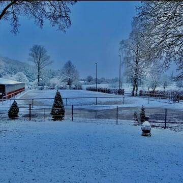
Hofgut Altenburg, 63619 Bad Orb
Bad Orb
Hofgut Altenburg Bad Orb
@Hofgut_Altenburg_Bad_Orb
FN-Mitglied
Freizeitstall
Führanlage
Hunde willkommen
Hengsthaltung möglich
Hufrehe geeignet
Außenbox mit Paddock
Innenbox
23 weitere...
P
Leider kein Vorschaubild
Leider kein Vorschaubild
Platz für Stute frei: Gruppenhaltung + Paddockbox
Reichelsheim
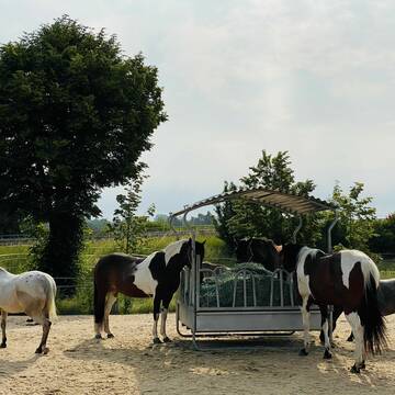
Sattlerhof Blofeld
@Sattlerhof
Freizeitstall
Longierzirkel/Roundpen
Paddock
Notfallboxen
Außenbox mit Paddock
Bewegungsstall
7 weitere...
B
Deprecated: Creation of dynamic property Zend_View_Helper_Ads::$adLink is deprecated in /var/www/stall-frei/htdocs/staging.stall-frei.de/library/Psf/View/Helper/Ads.php on line 108

Offenstall/Paddockbox für Pony oder Kleinpferd
Glashütten
Tatjana Bommersheim
@TatjanaBommersheim
Wir haben ab dem 1.04.26 eine Platz in einem unsere Offenställe (Wallach oder Stute)und eine unserer Paddockboxen (Wallach oder S
neu
R
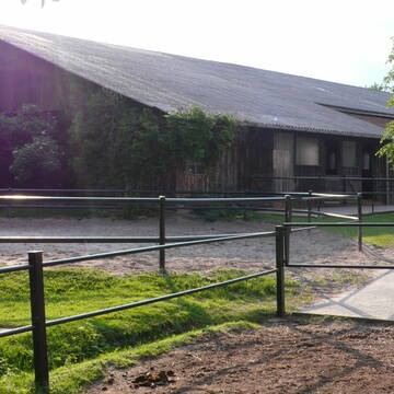
Balzerhof
Marburg
Balzerhof
@Balzerhof
Freizeitstall
Westernreiten
Vermieten
Verpachten
Führanlage
Hunde willkommen
Allergikerstall
bedampftes/gewaschenes Heu
30 weitere...
P
Leider kein Vorschaubild
Leider kein Vorschaubild
Pferdebox frei
Pohlheim
Natalie Wohlfeil
@Natalie7
Vermieten
Reitplatz (z.B. Dressur, Springen, Reining)
Sattelkammer/Sattelschränke
Innenbox
Biofutter
Halbpension
4 weitere...
aktuell
B


Offenstall/Pferdeboxen mit Reithalle und Reitplatz
Bad Nauheim
Pferdebetrieb-Hartmann
@Pferdebetrieb-Hartmann
Vermieten
Hunde willkommen
Krankenbox
Außenbox mit Paddock
Außenboxen
Halbpension
Vollpension
14 weitere...
P+

Das Beste für die Hufe
Mechtersen
STALL-FREIde Marketing
@STALL-FREI-Marketing
Hufschmiede und Hufpfleger in Ihrer Nähe
Leider kein Vorschaubild
Leider kein Vorschaubild
Gestüt Keilhof
Echzell
Gestuet-Keilhof
@Gestuet-Keilhof
Freizeitstall
Vermieten
Verpachten
Hunde willkommen
Krankenbox
Fohlenaufzucht möglich
Hengsthaltung möglich
19 weitere...
B
Leider kein Vorschaubild
Leider kein Vorschaubild
XXL Pferdebox mit Reithalle
Wohratal
BauerHof
@Bauerhof
Freizeitstall
Reithalle
Sattelkammer/Sattelschränke
Gnadenbrothof
Außenbox mit Paddock
Außenboxen
8 weitere...
B
Reitsporthof Hermershausen
Marburg
von-Pritzelwitz-Benjamin
@von-Pritzelwitz-Benjamin
FN-Mitglied
Freizeitstall
Vermieten
Führanlage
Krankenbox
Gnadenbrothof
27 weitere...
P

Lohrberg Ranch - Western/Freizeit-Stall in Hessen
Büdingen-Eckartshausen
Lohrberg Ranch
@LohrbergRanch
Freizeitstall
Reitlehrer und -unterricht
Vermieten
Hunde willkommen
Krankenbox
Fohlenaufzucht möglich
Hufrehe geeignet
19 weitere...
P
Leider kein Vorschaubild
Leider kein Vorschaubild
Offenstallplatz & Außenbox in Münzenberg fre...
Münzenberg
Stall-Doell
@Stall-Doell
FN-Mitglied
Rehabilitationsstall
Vermieten
Hunde willkommen
Laufband
Gnadenbrothof
Hufrehe geeignet
17 weitere...
B
Newsletter abonnieren
Melde Dich für unseren Newsletter an und verpasse keine Neuigkeiten!
Deprecated: Creation of dynamic property Zend_View::$pageCount is deprecated in /var/www/stall-frei/htdocs/staging.stall-frei.de/library/vendor/shardj/zf1-future/library/Zend/View/Abstract.php on line 308
Deprecated: Creation of dynamic property Zend_View::$itemCountPerPage is deprecated in /var/www/stall-frei/htdocs/staging.stall-frei.de/library/vendor/shardj/zf1-future/library/Zend/View/Abstract.php on line 308
Deprecated: Creation of dynamic property Zend_View::$first is deprecated in /var/www/stall-frei/htdocs/staging.stall-frei.de/library/vendor/shardj/zf1-future/library/Zend/View/Abstract.php on line 308
Deprecated: Creation of dynamic property Zend_View::$current is deprecated in /var/www/stall-frei/htdocs/staging.stall-frei.de/library/vendor/shardj/zf1-future/library/Zend/View/Abstract.php on line 308
Deprecated: Creation of dynamic property Zend_View::$last is deprecated in /var/www/stall-frei/htdocs/staging.stall-frei.de/library/vendor/shardj/zf1-future/library/Zend/View/Abstract.php on line 308
Deprecated: Creation of dynamic property Zend_View::$previous is deprecated in /var/www/stall-frei/htdocs/staging.stall-frei.de/library/vendor/shardj/zf1-future/library/Zend/View/Abstract.php on line 308
Deprecated: Creation of dynamic property Zend_View::$next is deprecated in /var/www/stall-frei/htdocs/staging.stall-frei.de/library/vendor/shardj/zf1-future/library/Zend/View/Abstract.php on line 308
Deprecated: Creation of dynamic property Zend_View::$pagesInRange is deprecated in /var/www/stall-frei/htdocs/staging.stall-frei.de/library/vendor/shardj/zf1-future/library/Zend/View/Abstract.php on line 308
Deprecated: Creation of dynamic property Zend_View::$firstPageInRange is deprecated in /var/www/stall-frei/htdocs/staging.stall-frei.de/library/vendor/shardj/zf1-future/library/Zend/View/Abstract.php on line 308
Deprecated: Creation of dynamic property Zend_View::$lastPageInRange is deprecated in /var/www/stall-frei/htdocs/staging.stall-frei.de/library/vendor/shardj/zf1-future/library/Zend/View/Abstract.php on line 308
Deprecated: Creation of dynamic property Zend_View::$currentItemCount is deprecated in /var/www/stall-frei/htdocs/staging.stall-frei.de/library/vendor/shardj/zf1-future/library/Zend/View/Abstract.php on line 308
Deprecated: Creation of dynamic property Zend_View::$totalItemCount is deprecated in /var/www/stall-frei/htdocs/staging.stall-frei.de/library/vendor/shardj/zf1-future/library/Zend/View/Abstract.php on line 308
Deprecated: Creation of dynamic property Zend_View::$firstItemNumber is deprecated in /var/www/stall-frei/htdocs/staging.stall-frei.de/library/vendor/shardj/zf1-future/library/Zend/View/Abstract.php on line 308
Deprecated: Creation of dynamic property Zend_View::$lastItemNumber is deprecated in /var/www/stall-frei/htdocs/staging.stall-frei.de/library/vendor/shardj/zf1-future/library/Zend/View/Abstract.php on line 308
Deprecated: Creation of dynamic property Zend_View::$router is deprecated in /var/www/stall-frei/htdocs/staging.stall-frei.de/library/vendor/shardj/zf1-future/library/Zend/View/Abstract.php on line 308
Deprecated: Creation of dynamic property Zend_View::$urlParams is deprecated in /var/www/stall-frei/htdocs/staging.stall-frei.de/library/vendor/shardj/zf1-future/library/Zend/View/Abstract.php on line 308
Deprecated: Creation of dynamic property Zend_View::$showAds is deprecated in /var/www/stall-frei/htdocs/staging.stall-frei.de/library/vendor/shardj/zf1-future/library/Zend/View/Abstract.php on line 308
Deprecated: Creation of dynamic property Zend_View::$objectIds is deprecated in /var/www/stall-frei/htdocs/staging.stall-frei.de/library/vendor/shardj/zf1-future/library/Zend/View/Abstract.php on line 308
Deprecated: Creation of dynamic property Zend_View::$showNavbar is deprecated in /var/www/stall-frei/htdocs/staging.stall-frei.de/library/vendor/shardj/zf1-future/library/Zend/View/Abstract.php on line 308
Deprecated: Creation of dynamic property Zend_View::$showBreadcrumb is deprecated in /var/www/stall-frei/htdocs/staging.stall-frei.de/library/vendor/shardj/zf1-future/library/Zend/View/Abstract.php on line 308
Deprecated: Creation of dynamic property Zend_View::$showFooter is deprecated in /var/www/stall-frei/htdocs/staging.stall-frei.de/library/vendor/shardj/zf1-future/library/Zend/View/Abstract.php on line 308
Deprecated: Creation of dynamic property Zend_View::$showInternalAds is deprecated in /var/www/stall-frei/htdocs/staging.stall-frei.de/library/vendor/shardj/zf1-future/library/Zend/View/Abstract.php on line 308
Deprecated: Creation of dynamic property Zend_View::$blNoContent is deprecated in /var/www/stall-frei/htdocs/staging.stall-frei.de/library/vendor/shardj/zf1-future/library/Zend/View/Abstract.php on line 308
Deprecated: Creation of dynamic property Zend_View::$sMetaDesc is deprecated in /var/www/stall-frei/htdocs/staging.stall-frei.de/library/vendor/shardj/zf1-future/library/Zend/View/Abstract.php on line 308
Deprecated: Creation of dynamic property Zend_View::$useGmaps is deprecated in /var/www/stall-frei/htdocs/staging.stall-frei.de/library/vendor/shardj/zf1-future/library/Zend/View/Abstract.php on line 308
Deprecated: Creation of dynamic property Zend_View::$touches is deprecated in /var/www/stall-frei/htdocs/staging.stall-frei.de/library/vendor/shardj/zf1-future/library/Zend/View/Abstract.php on line 308
Deprecated: Creation of dynamic property Zend_View::$oProject is deprecated in /var/www/stall-frei/htdocs/staging.stall-frei.de/library/vendor/shardj/zf1-future/library/Zend/View/Abstract.php on line 308
Deprecated: Creation of dynamic property Zend_View::$pageHeadline is deprecated in /var/www/stall-frei/htdocs/staging.stall-frei.de/library/vendor/shardj/zf1-future/library/Zend/View/Abstract.php on line 308
Deprecated: Creation of dynamic property Zend_View::$disableLocationField is deprecated in /var/www/stall-frei/htdocs/staging.stall-frei.de/library/vendor/shardj/zf1-future/library/Zend/View/Abstract.php on line 308
Deprecated: Creation of dynamic property Zend_View::$isSearch is deprecated in /var/www/stall-frei/htdocs/staging.stall-frei.de/library/vendor/shardj/zf1-future/library/Zend/View/Abstract.php on line 308
Deprecated: Creation of dynamic property Zend_View::$pageTitle is deprecated in /var/www/stall-frei/htdocs/staging.stall-frei.de/library/vendor/shardj/zf1-future/library/Zend/View/Abstract.php on line 308
Deprecated: Creation of dynamic property Psf_Form_Element_Text::$class is deprecated in /var/www/stall-frei/htdocs/staging.stall-frei.de/library/vendor/shardj/zf1-future/library/Zend/Form/Element.php on line 874
Deprecated: Creation of dynamic property Psf_Form_Element_Text::$size is deprecated in /var/www/stall-frei/htdocs/staging.stall-frei.de/library/vendor/shardj/zf1-future/library/Zend/Form/Element.php on line 874
Deprecated: Creation of dynamic property Psf_Form_Element_Text::$placeholder is deprecated in /var/www/stall-frei/htdocs/staging.stall-frei.de/library/vendor/shardj/zf1-future/library/Zend/Form/Element.php on line 874
Deprecated: Creation of dynamic property Psf_Form_Element_Hidden::$class is deprecated in /var/www/stall-frei/htdocs/staging.stall-frei.de/library/vendor/shardj/zf1-future/library/Zend/Form/Element.php on line 874
Deprecated: Creation of dynamic property Psf_Form_Element_Hidden::$class is deprecated in /var/www/stall-frei/htdocs/staging.stall-frei.de/library/vendor/shardj/zf1-future/library/Zend/Form/Element.php on line 874
Deprecated: Creation of dynamic property Psf_Form_Element_Hidden::$class is deprecated in /var/www/stall-frei/htdocs/staging.stall-frei.de/library/vendor/shardj/zf1-future/library/Zend/Form/Element.php on line 874
Deprecated: Creation of dynamic property Psf_Form_Element_Hidden::$class is deprecated in /var/www/stall-frei/htdocs/staging.stall-frei.de/library/vendor/shardj/zf1-future/library/Zend/Form/Element.php on line 874
Deprecated: Creation of dynamic property Psf_Form_Element_Select::$class is deprecated in /var/www/stall-frei/htdocs/staging.stall-frei.de/library/vendor/shardj/zf1-future/library/Zend/Form/Element.php on line 874
Deprecated: Creation of dynamic property Psf_Form_Element_Select::$class is deprecated in /var/www/stall-frei/htdocs/staging.stall-frei.de/library/vendor/shardj/zf1-future/library/Zend/Form/Element.php on line 874
Deprecated: Creation of dynamic property Psf_Form_Element_Select::$class is deprecated in /var/www/stall-frei/htdocs/staging.stall-frei.de/library/vendor/shardj/zf1-future/library/Zend/Form/Element.php on line 874
Deprecated: Creation of dynamic property Psf_Form_Element_Select::$class is deprecated in /var/www/stall-frei/htdocs/staging.stall-frei.de/library/vendor/shardj/zf1-future/library/Zend/Form/Element.php on line 874
Deprecated: Creation of dynamic property Psf_Form_Element_Text::$class is deprecated in /var/www/stall-frei/htdocs/staging.stall-frei.de/library/vendor/shardj/zf1-future/library/Zend/Form/Element.php on line 874
Deprecated: Creation of dynamic property Psf_Form_Element_Checkbox::$label is deprecated in /var/www/stall-frei/htdocs/staging.stall-frei.de/library/vendor/shardj/zf1-future/library/Zend/Form/Element.php on line 874
Deprecated: Creation of dynamic property Zend_View::$sort is deprecated in /var/www/stall-frei/htdocs/staging.stall-frei.de/library/vendor/shardj/zf1-future/library/Zend/View/Abstract.php on line 308
Deprecated: Creation of dynamic property Zend_View::$searchLocation is deprecated in /var/www/stall-frei/htdocs/staging.stall-frei.de/library/vendor/shardj/zf1-future/library/Zend/View/Abstract.php on line 308
Deprecated: Creation of dynamic property Zend_View::$locationHint is deprecated in /var/www/stall-frei/htdocs/staging.stall-frei.de/library/vendor/shardj/zf1-future/library/Zend/View/Abstract.php on line 308
Psf_GeoCoder_Abstract::getLocation: Rodeberg Get Location CachedOrLive
Psf_GeoCoder_Abstract::getCachedOrLive: Rodeberg
Psf_GeoCoder_Abstract::convertLocationResult
{"documentation":"https:\/\/opencagedata.com\/api","licenses":[{"name":"see attribution guide","url":"https:\/\/opencagedata.com\/credits"}],"results":[{"bounds":{"northeast":{"lat":50.6334946,"lng":9.2998182},"southwest":{"lat":50.6333946,"lng":9.2997182}},"components":{"ISO_3166-1_alpha-2":"DE","ISO_3166-1_alpha-3":"DEU","ISO_3166-2":["DE-HE"],"_category":"natural\/water","_normalized_city":"Wallenrod","_type":"peak","continent":"Europe","country":"Deutschland","country_code":"de","county":"Vogelsbergkreis","municipality":"Lauterbach (Hessen)","peak":"Rodeberg","political_union":"European Union","postcode":"36369","state":"Hessen","state_code":"HE","village":"Wallenrod"},"confidence":9,"formatted":"Rodeberg, 36369 Wallenrod, Deutschland","geometry":{"lat":50.6334446,"lng":9.2997682}},{"bounds":{"northeast":{"lat":51.3457398,"lng":9.8070866},"southwest":{"lat":51.3456398,"lng":9.8069866}},"components":{"ISO_3166-1_alpha-2":"DE","ISO_3166-1_alpha-3":"DEU","ISO_3166-2":["DE-HE"],"_category":"natural\/water","_normalized_city":"Witzenhausen","_type":"peak","continent":"Europe","country":"Deutschland","country_code":"de","county":"Werra-Mei\u00dfner-Kreis","municipality":"Witzenhausen","peak":"Rodeberg","political_union":"European Union","postcode":"37217","state":"Hessen","state_code":"HE","town":"Witzenhausen"},"confidence":9,"formatted":"Rodeberg, 37217 Witzenhausen, Deutschland","geometry":{"lat":51.3456898,"lng":9.8070366}},{"bounds":{"northeast":{"lat":51.5455014,"lng":10.4085415},"southwest":{"lat":51.5454014,"lng":10.4084415}},"components":{"ISO_3166-1_alpha-2":"DE","ISO_3166-1_alpha-3":"DEU","ISO_3166-2":["DE-TH"],"_category":"natural\/water","_normalized_city":"Sonnenstein","_type":"peak","city":"Sonnenstein","continent":"Europe","country":"Deutschland","country_code":"de","county":"Landkreis Eichsfeld","peak":"Rodeberg","political_union":"European Union","postcode":"37345","state":"Th\u00fcringen","state_code":"TH"},"confidence":9,"formatted":"Rodeberg, 37345 Sonnenstein, Deutschland","geometry":{"lat":51.5454514,"lng":10.4084915}},{"bounds":{"northeast":{"lat":50.5063019,"lng":11.2247597},"southwest":{"lat":50.5062019,"lng":11.2246597}},"components":{"ISO_3166-1_alpha-2":"DE","ISO_3166-1_alpha-3":"DEU","ISO_3166-2":["DE-TH"],"_category":"natural\/water","_normalized_city":"Neuhaus am Rennweg","_type":"peak","continent":"Europe","country":"Deutschland","country_code":"de","county":"Landkreis Sonneberg","municipality":"Neuhaus am Rennweg","peak":"Rodeberg","political_union":"European Union","state":"Th\u00fcringen","state_code":"TH","town":"Neuhaus am Rennweg"},"confidence":9,"formatted":"Rodeberg, Neuhaus am Rennweg, Th\u00fcringen, Deutschland","geometry":{"lat":50.5062519,"lng":11.2247097}},{"bounds":{"northeast":{"lat":51.0039283,"lng":10.9033838},"southwest":{"lat":51.0038283,"lng":10.9032838}},"components":{"ISO_3166-1_alpha-2":"DE","ISO_3166-1_alpha-3":"DEU","ISO_3166-2":["DE-TH"],"_category":"natural\/water","_normalized_city":"Erfurt","_type":"peak","city":"Erfurt","continent":"Europe","country":"Deutschland","country_code":"de","peak":"Rodeberg","political_union":"European Union","postcode":"99090","state":"Th\u00fcringen","state_code":"TH"},"confidence":9,"formatted":"Rodeberg, 99090 Erfurt, Deutschland","geometry":{"lat":51.0038783,"lng":10.9033338}},{"bounds":{"northeast":{"lat":51.4748361,"lng":10.9675899},"southwest":{"lat":51.4747361,"lng":10.9674899}},"components":{"ISO_3166-1_alpha-2":"DE","ISO_3166-1_alpha-3":"DEU","ISO_3166-2":["DE-ST"],"_category":"natural\/water","_normalized_city":"Berga","_type":"peak","continent":"Europe","country":"Deutschland","country_code":"de","county":"Mansfeld-S\u00fcdharz","municipality":"Goldene Aue","peak":"Rodeberg","political_union":"European Union","state":"Sachsen-Anhalt","state_code":"ST","village":"Berga"},"confidence":9,"formatted":"Rodeberg, Berga, Sachsen-Anhalt, Deutschland","geometry":{"lat":51.4747861,"lng":10.9675399}},{"bounds":{"northeast":{"lat":51.4940106,"lng":10.9228142},"southwest":{"lat":51.4939106,"lng":10.9227142}},"components":{"ISO_3166-1_alpha-2":"DE","ISO_3166-1_alpha-3":"DEU","ISO_3166-2":["DE-TH"],"_category":"building","_normalized_city":"Urbach","_type":"building","continent":"Europe","country":"Deutschland","country_code":"de","county":"Landkreis Nordhausen","isolated_dwelling":"Rodeberg","municipality":"Heringen\/Helme","political_union":"European Union","postcode":"99765","state":"Th\u00fcringen","state_code":"TH","village":"Urbach"},"confidence":10,"formatted":"Rodeberg, 99765 Urbach, Deutschland","geometry":{"lat":51.4939606,"lng":10.9227642}},{"bounds":{"northeast":{"lat":51.5976277,"lng":9.960975},"southwest":{"lat":51.5975277,"lng":9.960875}},"components":{"ISO_3166-1_alpha-2":"DE","ISO_3166-1_alpha-3":"DEU","ISO_3166-2":["DE-NI"],"_category":"unknown","_normalized_city":"Bovenden","_type":"field","city_district":"Eddigehausen","continent":"Europe","country":"Deutschland","country_code":"de","county":"Landkreis G\u00f6ttingen","field":"Rodeberg","political_union":"European Union","postcode":"37120","state":"Niedersachsen","state_code":"NI","town":"Bovenden"},"confidence":9,"formatted":"Rodeberg, 37120 Bovenden, Deutschland","geometry":{"lat":51.5975777,"lng":9.960925}},{"bounds":{"northeast":{"lat":52.2983148,"lng":10.2065449},"southwest":{"lat":52.2934143,"lng":10.2057894}},"components":{"ISO_3166-1_alpha-2":"DE","ISO_3166-1_alpha-3":"DEU","ISO_3166-2":["DE-NI"],"_category":"road","_normalized_city":"Peine","_type":"road","continent":"Europe","country":"Deutschland","country_code":"de","county":"Landkreis Peine","political_union":"European Union","postcode":"31226","residential":"Handorfer M\u00fchle","road":"Rodeberg","road_type":"tertiary","state":"Niedersachsen","state_code":"NI","town":"Peine"},"confidence":9,"formatted":"Rodeberg, 31226 Peine, Deutschland","geometry":{"lat":52.2958627,"lng":10.2061547}},{"components":{"ISO_3166-1_alpha-2":"FR","ISO_3166-1_alpha-3":"FRA","ISO_3166-2":["FR-PDL","FR-49"],"_category":"road","_normalized_city":"Rou-Marson","_type":"road","city":"Rou-Marson","continent":"Europe","country":"France","country_code":"fr","county":"Maine-et-Loire","local_authority":"Communaut\u00e9 d'agglom\u00e9ration Saumur Val de Loire","political_union":"European Union","postcode":"49400","road":"Rue de Godebert","state":"Pays de la Loire","state_code":"PDL"},"confidence":2,"formatted":"Rue de Godebert, 49400 Rou-Marson, France","geometry":{"lat":47.247584,"lng":-0.146376}}],"status":{"code":200,"message":"OK"},"stay_informed":{"blog":"https:\/\/blog.opencagedata.com","mastodon":"https:\/\/en.osm.town\/@opencage"},"thanks":"For using an OpenCage API","timestamp":{"created_http":"Sun, 08 Feb 2026 05:08:55 GMT","created_unix":1770527335},"total_results":10}Array
(
[0] => stdClass Object
(
[bounds] => stdClass Object
(
[northeast] => stdClass Object
(
[lat] => 50.6334946
[lng] => 9.2998182
)
[southwest] => stdClass Object
(
[lat] => 50.6333946
[lng] => 9.2997182
)
)
[components] => stdClass Object
(
[ISO_3166-1_alpha-2] => DE
[ISO_3166-1_alpha-3] => DEU
[ISO_3166-2] => Array
(
[0] => DE-HE
)
[_category] => natural/water
[_normalized_city] => Wallenrod
[_type] => peak
[continent] => Europe
[country] => Deutschland
[country_code] => de
[county] => Vogelsbergkreis
[municipality] => Lauterbach (Hessen)
[peak] => Rodeberg
[political_union] => European Union
[postcode] => 36369
[state] => Hessen
[state_code] => HE
[village] => Wallenrod
)
[confidence] => 9
[formatted] => Rodeberg, 36369 Wallenrod, Deutschland
[geometry] => stdClass Object
(
[lat] => 50.6334446
[lng] => 9.2997682
)
)
[1] => stdClass Object
(
[bounds] => stdClass Object
(
[northeast] => stdClass Object
(
[lat] => 51.3457398
[lng] => 9.8070866
)
[southwest] => stdClass Object
(
[lat] => 51.3456398
[lng] => 9.8069866
)
)
[components] => stdClass Object
(
[ISO_3166-1_alpha-2] => DE
[ISO_3166-1_alpha-3] => DEU
[ISO_3166-2] => Array
(
[0] => DE-HE
)
[_category] => natural/water
[_normalized_city] => Witzenhausen
[_type] => peak
[continent] => Europe
[country] => Deutschland
[country_code] => de
[county] => Werra-Meißner-Kreis
[municipality] => Witzenhausen
[peak] => Rodeberg
[political_union] => European Union
[postcode] => 37217
[state] => Hessen
[state_code] => HE
[town] => Witzenhausen
)
[confidence] => 9
[formatted] => Rodeberg, 37217 Witzenhausen, Deutschland
[geometry] => stdClass Object
(
[lat] => 51.3456898
[lng] => 9.8070366
)
)
[2] => stdClass Object
(
[bounds] => stdClass Object
(
[northeast] => stdClass Object
(
[lat] => 51.5455014
[lng] => 10.4085415
)
[southwest] => stdClass Object
(
[lat] => 51.5454014
[lng] => 10.4084415
)
)
[components] => stdClass Object
(
[ISO_3166-1_alpha-2] => DE
[ISO_3166-1_alpha-3] => DEU
[ISO_3166-2] => Array
(
[0] => DE-TH
)
[_category] => natural/water
[_normalized_city] => Sonnenstein
[_type] => peak
[city] => Sonnenstein
[continent] => Europe
[country] => Deutschland
[country_code] => de
[county] => Landkreis Eichsfeld
[peak] => Rodeberg
[political_union] => European Union
[postcode] => 37345
[state] => Thüringen
[state_code] => TH
)
[confidence] => 9
[formatted] => Rodeberg, 37345 Sonnenstein, Deutschland
[geometry] => stdClass Object
(
[lat] => 51.5454514
[lng] => 10.4084915
)
)
[3] => stdClass Object
(
[bounds] => stdClass Object
(
[northeast] => stdClass Object
(
[lat] => 50.5063019
[lng] => 11.2247597
)
[southwest] => stdClass Object
(
[lat] => 50.5062019
[lng] => 11.2246597
)
)
[components] => stdClass Object
(
[ISO_3166-1_alpha-2] => DE
[ISO_3166-1_alpha-3] => DEU
[ISO_3166-2] => Array
(
[0] => DE-TH
)
[_category] => natural/water
[_normalized_city] => Neuhaus am Rennweg
[_type] => peak
[continent] => Europe
[country] => Deutschland
[country_code] => de
[county] => Landkreis Sonneberg
[municipality] => Neuhaus am Rennweg
[peak] => Rodeberg
[political_union] => European Union
[state] => Thüringen
[state_code] => TH
[town] => Neuhaus am Rennweg
)
[confidence] => 9
[formatted] => Rodeberg, Neuhaus am Rennweg, Thüringen, Deutschland
[geometry] => stdClass Object
(
[lat] => 50.5062519
[lng] => 11.2247097
)
)
[4] => stdClass Object
(
[bounds] => stdClass Object
(
[northeast] => stdClass Object
(
[lat] => 51.0039283
[lng] => 10.9033838
)
[southwest] => stdClass Object
(
[lat] => 51.0038283
[lng] => 10.9032838
)
)
[components] => stdClass Object
(
[ISO_3166-1_alpha-2] => DE
[ISO_3166-1_alpha-3] => DEU
[ISO_3166-2] => Array
(
[0] => DE-TH
)
[_category] => natural/water
[_normalized_city] => Erfurt
[_type] => peak
[city] => Erfurt
[continent] => Europe
[country] => Deutschland
[country_code] => de
[peak] => Rodeberg
[political_union] => European Union
[postcode] => 99090
[state] => Thüringen
[state_code] => TH
)
[confidence] => 9
[formatted] => Rodeberg, 99090 Erfurt, Deutschland
[geometry] => stdClass Object
(
[lat] => 51.0038783
[lng] => 10.9033338
)
)
[5] => stdClass Object
(
[bounds] => stdClass Object
(
[northeast] => stdClass Object
(
[lat] => 51.4748361
[lng] => 10.9675899
)
[southwest] => stdClass Object
(
[lat] => 51.4747361
[lng] => 10.9674899
)
)
[components] => stdClass Object
(
[ISO_3166-1_alpha-2] => DE
[ISO_3166-1_alpha-3] => DEU
[ISO_3166-2] => Array
(
[0] => DE-ST
)
[_category] => natural/water
[_normalized_city] => Berga
[_type] => peak
[continent] => Europe
[country] => Deutschland
[country_code] => de
[county] => Mansfeld-Südharz
[municipality] => Goldene Aue
[peak] => Rodeberg
[political_union] => European Union
[state] => Sachsen-Anhalt
[state_code] => ST
[village] => Berga
)
[confidence] => 9
[formatted] => Rodeberg, Berga, Sachsen-Anhalt, Deutschland
[geometry] => stdClass Object
(
[lat] => 51.4747861
[lng] => 10.9675399
)
)
[6] => stdClass Object
(
[bounds] => stdClass Object
(
[northeast] => stdClass Object
(
[lat] => 51.4940106
[lng] => 10.9228142
)
[southwest] => stdClass Object
(
[lat] => 51.4939106
[lng] => 10.9227142
)
)
[components] => stdClass Object
(
[ISO_3166-1_alpha-2] => DE
[ISO_3166-1_alpha-3] => DEU
[ISO_3166-2] => Array
(
[0] => DE-TH
)
[_category] => building
[_normalized_city] => Urbach
[_type] => building
[continent] => Europe
[country] => Deutschland
[country_code] => de
[county] => Landkreis Nordhausen
[isolated_dwelling] => Rodeberg
[municipality] => Heringen/Helme
[political_union] => European Union
[postcode] => 99765
[state] => Thüringen
[state_code] => TH
[village] => Urbach
)
[confidence] => 10
[formatted] => Rodeberg, 99765 Urbach, Deutschland
[geometry] => stdClass Object
(
[lat] => 51.4939606
[lng] => 10.9227642
)
)
[7] => stdClass Object
(
[bounds] => stdClass Object
(
[northeast] => stdClass Object
(
[lat] => 51.5976277
[lng] => 9.960975
)
[southwest] => stdClass Object
(
[lat] => 51.5975277
[lng] => 9.960875
)
)
[components] => stdClass Object
(
[ISO_3166-1_alpha-2] => DE
[ISO_3166-1_alpha-3] => DEU
[ISO_3166-2] => Array
(
[0] => DE-NI
)
[_category] => unknown
[_normalized_city] => Bovenden
[_type] => field
[city_district] => Eddigehausen
[continent] => Europe
[country] => Deutschland
[country_code] => de
[county] => Landkreis Göttingen
[field] => Rodeberg
[political_union] => European Union
[postcode] => 37120
[state] => Niedersachsen
[state_code] => NI
[town] => Bovenden
)
[confidence] => 9
[formatted] => Rodeberg, 37120 Bovenden, Deutschland
[geometry] => stdClass Object
(
[lat] => 51.5975777
[lng] => 9.960925
)
)
[8] => stdClass Object
(
[bounds] => stdClass Object
(
[northeast] => stdClass Object
(
[lat] => 52.2983148
[lng] => 10.2065449
)
[southwest] => stdClass Object
(
[lat] => 52.2934143
[lng] => 10.2057894
)
)
[components] => stdClass Object
(
[ISO_3166-1_alpha-2] => DE
[ISO_3166-1_alpha-3] => DEU
[ISO_3166-2] => Array
(
[0] => DE-NI
)
[_category] => road
[_normalized_city] => Peine
[_type] => road
[continent] => Europe
[country] => Deutschland
[country_code] => de
[county] => Landkreis Peine
[political_union] => European Union
[postcode] => 31226
[residential] => Handorfer Mühle
[road] => Rodeberg
[road_type] => tertiary
[state] => Niedersachsen
[state_code] => NI
[town] => Peine
)
[confidence] => 9
[formatted] => Rodeberg, 31226 Peine, Deutschland
[geometry] => stdClass Object
(
[lat] => 52.2958627
[lng] => 10.2061547
)
)
[9] => stdClass Object
(
[components] => stdClass Object
(
[ISO_3166-1_alpha-2] => FR
[ISO_3166-1_alpha-3] => FRA
[ISO_3166-2] => Array
(
[0] => FR-PDL
[1] => FR-49
)
[_category] => road
[_normalized_city] => Rou-Marson
[_type] => road
[city] => Rou-Marson
[continent] => Europe
[country] => France
[country_code] => fr
[county] => Maine-et-Loire
[local_authority] => Communauté d'agglomération Saumur Val de Loire
[political_union] => European Union
[postcode] => 49400
[road] => Rue de Godebert
[state] => Pays de la Loire
[state_code] => PDL
)
[confidence] => 2
[formatted] => Rue de Godebert, 49400 Rou-Marson, France
[geometry] => stdClass Object
(
[lat] => 47.247584
[lng] => -0.146376
)
)
)
Psf_GeoCoder_OpenCageData::getKeyMap: 0
stdClass Object
(
    [bounds] => stdClass Object
        (
            [northeast] => stdClass Object
                (
                    [lat] => 50.6334946
                    [lng] => 9.2998182
                )

            [southwest] => stdClass Object
                (
                    [lat] => 50.6333946
                    [lng] => 9.2997182
                )

        )

    [components] => stdClass Object
        (
            [ISO_3166-1_alpha-2] => DE
            [ISO_3166-1_alpha-3] => DEU
            [ISO_3166-2] => Array
                (
                    [0] => DE-HE
                )

            [_category] => natural/water
            [_normalized_city] => Wallenrod
            [_type] => peak
            [continent] => Europe
            [country] => Deutschland
            [country_code] => de
            [county] => Vogelsbergkreis
            [municipality] => Lauterbach (Hessen)
            [peak] => Rodeberg
            [political_union] => European Union
            [postcode] => 36369
            [state] => Hessen
            [state_code] => HE
            [village] => Wallenrod
        )

    [confidence] => 9
    [formatted] => Rodeberg, 36369 Wallenrod, Deutschland
    [geometry] => stdClass Object
        (
            [lat] => 50.6334446
            [lng] => 9.2997682
        )

)
Psf_GeoCoder_OpenCageData::getCounty: Vogelsbergkreis
Psf_GeoCoder_OpenCageData::addMissingData REFETCH!
Array
(
    [address] => Rodeberg, 36369 Wallenrod, Deutschland
    [type] => peak
    [street] =>
    [city] => Wallenrod
    [county] => Vogelsbergkreis
    [state] => Hessen
    [zip] => 36369
    [country] => Deutschland
    [suburb] =>
    [countrycode] => de
    [latitude] => 50.6334446
    [longitude] => 9.2997682
    [accuracy] => 1
    [confidence] => 9
    [bounds] => stdClass Object
        (
            [northeast] => stdClass Object
                (
                    [lat] => 50.6334946
                    [lng] => 9.2998182
                )

            [southwest] => stdClass Object
                (
                    [lat] => 50.6333946
                    [lng] => 9.2997182
                )

        )

)
reformat!
Array
(
    [address] => Rodeberg, 36369 Wallenrod, Deutschland
    [type] => peak
    [street] =>
    [city] => Wallenrod
    [county] => Vogelsbergkreis
    [state] => Hessen
    [zip] => 36369
    [country] => Deutschland
    [suburb] =>
    [countrycode] => de
    [latitude] => 50.6334446
    [longitude] => 9.2997682
    [accuracy] => 1
    [confidence] => 9
    [bounds] => stdClass Object
        (
            [northeast] => stdClass Object
                (
                    [lat] => 50.6334946
                    [lng] => 9.2998182
                )

            [southwest] => stdClass Object
                (
                    [lat] => 50.6333946
                    [lng] => 9.2997182
                )

        )

    [place] => 36369 Wallenrod, Hessen
    [hash] => f2d9bcb4e051c907789f29fa15fef912
)
Psf_GeoCoder_OpenCageData::getKeyMap: 1
stdClass Object
(
    [bounds] => stdClass Object
        (
            [northeast] => stdClass Object
                (
                    [lat] => 51.3457398
                    [lng] => 9.8070866
                )

            [southwest] => stdClass Object
                (
                    [lat] => 51.3456398
                    [lng] => 9.8069866
                )

        )

    [components] => stdClass Object
        (
            [ISO_3166-1_alpha-2] => DE
            [ISO_3166-1_alpha-3] => DEU
            [ISO_3166-2] => Array
                (
                    [0] => DE-HE
                )

            [_category] => natural/water
            [_normalized_city] => Witzenhausen
            [_type] => peak
            [continent] => Europe
            [country] => Deutschland
            [country_code] => de
            [county] => Werra-Meißner-Kreis
            [municipality] => Witzenhausen
            [peak] => Rodeberg
            [political_union] => European Union
            [postcode] => 37217
            [state] => Hessen
            [state_code] => HE
            [town] => Witzenhausen
        )

    [confidence] => 9
    [formatted] => Rodeberg, 37217 Witzenhausen, Deutschland
    [geometry] => stdClass Object
        (
            [lat] => 51.3456898
            [lng] => 9.8070366
        )

)
Psf_GeoCoder_OpenCageData::getCounty: Werra-Meißner-Kreis
Psf_GeoCoder_OpenCageData::addMissingData REFETCH!
Array
(
    [address] => Rodeberg, 37217 Witzenhausen, Deutschland
    [type] => peak
    [street] =>
    [city] => Witzenhausen
    [county] => Werra-Meißner-Kreis
    [state] => Hessen
    [zip] => 37217
    [country] => Deutschland
    [suburb] =>
    [countrycode] => de
    [latitude] => 51.3456898
    [longitude] => 9.8070366
    [accuracy] => 1
    [confidence] => 9
    [bounds] => stdClass Object
        (
            [northeast] => stdClass Object
                (
                    [lat] => 51.3457398
                    [lng] => 9.8070866
                )

            [southwest] => stdClass Object
                (
                    [lat] => 51.3456398
                    [lng] => 9.8069866
                )

        )

)
reformat!
Array
(
    [address] => Rodeberg, 37217 Witzenhausen, Deutschland
    [type] => peak
    [street] =>
    [city] => Witzenhausen
    [county] => Werra-Meißner-Kreis
    [state] => Hessen
    [zip] => 37217
    [country] => Deutschland
    [suburb] =>
    [countrycode] => de
    [latitude] => 51.3456898
    [longitude] => 9.8070366
    [accuracy] => 1
    [confidence] => 9
    [bounds] => stdClass Object
        (
            [northeast] => stdClass Object
                (
                    [lat] => 51.3457398
                    [lng] => 9.8070866
                )

            [southwest] => stdClass Object
                (
                    [lat] => 51.3456398
                    [lng] => 9.8069866
                )

        )

    [place] => 37217 Witzenhausen, Hessen
    [hash] => ad38173a7554b7c1f7c1e68a6a26a045
)
Psf_GeoCoder_OpenCageData::getKeyMap: 2
stdClass Object
(
    [bounds] => stdClass Object
        (
            [northeast] => stdClass Object
                (
                    [lat] => 51.5455014
                    [lng] => 10.4085415
                )

            [southwest] => stdClass Object
                (
                    [lat] => 51.5454014
                    [lng] => 10.4084415
                )

        )

    [components] => stdClass Object
        (
            [ISO_3166-1_alpha-2] => DE
            [ISO_3166-1_alpha-3] => DEU
            [ISO_3166-2] => Array
                (
                    [0] => DE-TH
                )

            [_category] => natural/water
            [_normalized_city] => Sonnenstein
            [_type] => peak
            [city] => Sonnenstein
            [continent] => Europe
            [country] => Deutschland
            [country_code] => de
            [county] => Landkreis Eichsfeld
            [peak] => Rodeberg
            [political_union] => European Union
            [postcode] => 37345
            [state] => Thüringen
            [state_code] => TH
        )

    [confidence] => 9
    [formatted] => Rodeberg, 37345 Sonnenstein, Deutschland
    [geometry] => stdClass Object
        (
            [lat] => 51.5454514
            [lng] => 10.4084915
        )

)
Psf_GeoCoder_OpenCageData::getCounty: Eichsfeld
Psf_GeoCoder_OpenCageData::addMissingData REFETCH!
Array
(
    [address] => Rodeberg, 37345 Sonnenstein, Deutschland
    [type] => peak
    [street] =>
    [city] => Sonnenstein
    [county] => Eichsfeld
    [state] => Thüringen
    [zip] => 37345
    [country] => Deutschland
    [suburb] =>
    [countrycode] => de
    [latitude] => 51.5454514
    [longitude] => 10.4084915
    [accuracy] => 1
    [confidence] => 9
    [bounds] => stdClass Object
        (
            [northeast] => stdClass Object
                (
                    [lat] => 51.5455014
                    [lng] => 10.4085415
                )

            [southwest] => stdClass Object
                (
                    [lat] => 51.5454014
                    [lng] => 10.4084415
                )

        )

)
reformat!
Array
(
    [address] => Rodeberg, 37345 Sonnenstein, Deutschland
    [type] => peak
    [street] =>
    [city] => Sonnenstein
    [county] => Eichsfeld
    [state] => Thüringen
    [zip] => 37345
    [country] => Deutschland
    [suburb] =>
    [countrycode] => de
    [latitude] => 51.5454514
    [longitude] => 10.4084915
    [accuracy] => 1
    [confidence] => 9
    [bounds] => stdClass Object
        (
            [northeast] => stdClass Object
                (
                    [lat] => 51.5455014
                    [lng] => 10.4085415
                )

            [southwest] => stdClass Object
                (
                    [lat] => 51.5454014
                    [lng] => 10.4084415
                )

        )

    [place] => 37345 Sonnenstein, Thüringen
    [hash] => cb4da14879c9d34d32110184cd736fa4
)
Psf_GeoCoder_OpenCageData::getKeyMap: 3
stdClass Object
(
    [bounds] => stdClass Object
        (
            [northeast] => stdClass Object
                (
                    [lat] => 50.5063019
                    [lng] => 11.2247597
                )

            [southwest] => stdClass Object
                (
                    [lat] => 50.5062019
                    [lng] => 11.2246597
                )

        )

    [components] => stdClass Object
        (
            [ISO_3166-1_alpha-2] => DE
            [ISO_3166-1_alpha-3] => DEU
            [ISO_3166-2] => Array
                (
                    [0] => DE-TH
                )

            [_category] => natural/water
            [_normalized_city] => Neuhaus am Rennweg
            [_type] => peak
            [continent] => Europe
            [country] => Deutschland
            [country_code] => de
            [county] => Landkreis Sonneberg
            [municipality] => Neuhaus am Rennweg
            [peak] => Rodeberg
            [political_union] => European Union
            [state] => Thüringen
            [state_code] => TH
            [town] => Neuhaus am Rennweg
        )

    [confidence] => 9
    [formatted] => Rodeberg, Neuhaus am Rennweg, Thüringen, Deutschland
    [geometry] => stdClass Object
        (
            [lat] => 50.5062519
            [lng] => 11.2247097
        )

)
Psf_GeoCoder_OpenCageData::getCounty: Sonneberg
Psf_GeoCoder_OpenCageData::addMissingData REFETCH!
Array
(
    [address] => Rodeberg, Neuhaus am Rennweg, Thüringen, Deutschland
    [type] => peak
    [street] =>
    [city] => Neuhaus am Rennweg
    [county] => Sonneberg
    [state] => Thüringen
    [zip] =>
    [country] => Deutschland
    [suburb] =>
    [countrycode] => de
    [latitude] => 50.5062519
    [longitude] => 11.2247097
    [accuracy] => 1
    [confidence] => 9
    [bounds] => stdClass Object
        (
            [northeast] => stdClass Object
                (
                    [lat] => 50.5063019
                    [lng] => 11.2247597
                )

            [southwest] => stdClass Object
                (
                    [lat] => 50.5062019
                    [lng] => 11.2246597
                )

        )

)
reformat!
Array
(
    [address] => Rodeberg, Neuhaus am Rennweg, Thüringen, Deutschland
    [type] => peak
    [street] =>
    [city] => Neuhaus am Rennweg
    [county] => Sonneberg
    [state] => Thüringen
    [zip] =>
    [country] => Deutschland
    [suburb] =>
    [countrycode] => de
    [latitude] => 50.5062519
    [longitude] => 11.2247097
    [accuracy] => 1
    [confidence] => 9
    [bounds] => stdClass Object
        (
            [northeast] => stdClass Object
                (
                    [lat] => 50.5063019
                    [lng] => 11.2247597
                )

            [southwest] => stdClass Object
                (
                    [lat] => 50.5062019
                    [lng] => 11.2246597
                )

        )

    [place] => Neuhaus am Rennweg, Thüringen
    [hash] => 49b4a9ddca96b497168449228e6e404b
)
Psf_GeoCoder_OpenCageData::getKeyMap: 4
stdClass Object
(
    [bounds] => stdClass Object
        (
            [northeast] => stdClass Object
                (
                    [lat] => 51.0039283
                    [lng] => 10.9033838
                )

            [southwest] => stdClass Object
                (
                    [lat] => 51.0038283
                    [lng] => 10.9032838
                )

        )

    [components] => stdClass Object
        (
            [ISO_3166-1_alpha-2] => DE
            [ISO_3166-1_alpha-3] => DEU
            [ISO_3166-2] => Array
                (
                    [0] => DE-TH
                )

            [_category] => natural/water
            [_normalized_city] => Erfurt
            [_type] => peak
            [city] => Erfurt
            [continent] => Europe
            [country] => Deutschland
            [country_code] => de
            [peak] => Rodeberg
            [political_union] => European Union
            [postcode] => 99090
            [state] => Thüringen
            [state_code] => TH
        )

    [confidence] => 9
    [formatted] => Rodeberg, 99090 Erfurt, Deutschland
    [geometry] => stdClass Object
        (
            [lat] => 51.0038783
            [lng] => 10.9033338
        )

)
Psf_GeoCoder_OpenCageData::getCounty: Erfurt
Psf_GeoCoder_OpenCageData::addMissingData REFETCH!
Array
(
    [address] => Rodeberg, 99090 Erfurt, Deutschland
    [type] => peak
    [street] =>
    [city] => Erfurt
    [county] => Erfurt
    [state] => Thüringen
    [zip] => 99090
    [country] => Deutschland
    [suburb] =>
    [countrycode] => de
    [latitude] => 51.0038783
    [longitude] => 10.9033338
    [accuracy] => 1
    [confidence] => 9
    [bounds] => stdClass Object
        (
            [northeast] => stdClass Object
                (
                    [lat] => 51.0039283
                    [lng] => 10.9033838
                )

            [southwest] => stdClass Object
                (
                    [lat] => 51.0038283
                    [lng] => 10.9032838
                )

        )

)
reformat!
Array
(
    [address] => Rodeberg, 99090 Erfurt, Deutschland
    [type] => peak
    [street] =>
    [city] => Erfurt
    [county] => Erfurt
    [state] => Thüringen
    [zip] => 99090
    [country] => Deutschland
    [suburb] =>
    [countrycode] => de
    [latitude] => 51.0038783
    [longitude] => 10.9033338
    [accuracy] => 1
    [confidence] => 9
    [bounds] => stdClass Object
        (
            [northeast] => stdClass Object
                (
                    [lat] => 51.0039283
                    [lng] => 10.9033838
                )

            [southwest] => stdClass Object
                (
                    [lat] => 51.0038283
                    [lng] => 10.9032838
                )

        )

    [place] => 99090 Erfurt, Thüringen
    [hash] => 45171c9ea25903b18c909174a0e6e721
)
Psf_GeoCoder_OpenCageData::getKeyMap: 5
stdClass Object
(
    [bounds] => stdClass Object
        (
            [northeast] => stdClass Object
                (
                    [lat] => 51.4748361
                    [lng] => 10.9675899
                )

            [southwest] => stdClass Object
                (
                    [lat] => 51.4747361
                    [lng] => 10.9674899
                )

        )

    [components] => stdClass Object
        (
            [ISO_3166-1_alpha-2] => DE
            [ISO_3166-1_alpha-3] => DEU
            [ISO_3166-2] => Array
                (
                    [0] => DE-ST
                )

            [_category] => natural/water
            [_normalized_city] => Berga
            [_type] => peak
            [continent] => Europe
            [country] => Deutschland
            [country_code] => de
            [county] => Mansfeld-Südharz
            [municipality] => Goldene Aue
            [peak] => Rodeberg
            [political_union] => European Union
            [state] => Sachsen-Anhalt
            [state_code] => ST
            [village] => Berga
        )

    [confidence] => 9
    [formatted] => Rodeberg, Berga, Sachsen-Anhalt, Deutschland
    [geometry] => stdClass Object
        (
            [lat] => 51.4747861
            [lng] => 10.9675399
        )

)
Psf_GeoCoder_OpenCageData::getCounty: Mansfeld-Südharz
Psf_GeoCoder_OpenCageData::addMissingData REFETCH!
Array
(
    [address] => Rodeberg, Berga, Sachsen-Anhalt, Deutschland
    [type] => peak
    [street] =>
    [city] => Berga
    [county] => Mansfeld-Südharz
    [state] => Sachsen-Anhalt
    [zip] =>
    [country] => Deutschland
    [suburb] =>
    [countrycode] => de
    [latitude] => 51.4747861
    [longitude] => 10.9675399
    [accuracy] => 1
    [confidence] => 9
    [bounds] => stdClass Object
        (
            [northeast] => stdClass Object
                (
                    [lat] => 51.4748361
                    [lng] => 10.9675899
                )

            [southwest] => stdClass Object
                (
                    [lat] => 51.4747361
                    [lng] => 10.9674899
                )

        )

)
reformat!
Array
(
    [address] => Rodeberg, Berga, Sachsen-Anhalt, Deutschland
    [type] => peak
    [street] =>
    [city] => Berga
    [county] => Mansfeld-Südharz
    [state] => Sachsen-Anhalt
    [zip] =>
    [country] => Deutschland
    [suburb] =>
    [countrycode] => de
    [latitude] => 51.4747861
    [longitude] => 10.9675399
    [accuracy] => 1
    [confidence] => 9
    [bounds] => stdClass Object
        (
            [northeast] => stdClass Object
                (
                    [lat] => 51.4748361
                    [lng] => 10.9675899
                )

            [southwest] => stdClass Object
                (
                    [lat] => 51.4747361
                    [lng] => 10.9674899
                )

        )

    [place] => Berga, Sachsen-Anhalt
    [hash] => 97356e259db37d760f96b1c3790ca6a2
)
Psf_GeoCoder_OpenCageData::getKeyMap: 6
stdClass Object
(
    [bounds] => stdClass Object
        (
            [northeast] => stdClass Object
                (
                    [lat] => 51.4940106
                    [lng] => 10.9228142
                )

            [southwest] => stdClass Object
                (
                    [lat] => 51.4939106
                    [lng] => 10.9227142
                )

        )

    [components] => stdClass Object
        (
            [ISO_3166-1_alpha-2] => DE
            [ISO_3166-1_alpha-3] => DEU
            [ISO_3166-2] => Array
                (
                    [0] => DE-TH
                )

            [_category] => building
            [_normalized_city] => Urbach
            [_type] => building
            [continent] => Europe
            [country] => Deutschland
            [country_code] => de
            [county] => Landkreis Nordhausen
            [isolated_dwelling] => Rodeberg
            [municipality] => Heringen/Helme
            [political_union] => European Union
            [postcode] => 99765
            [state] => Thüringen
            [state_code] => TH
            [village] => Urbach
        )

    [confidence] => 10
    [formatted] => Rodeberg, 99765 Urbach, Deutschland
    [geometry] => stdClass Object
        (
            [lat] => 51.4939606
            [lng] => 10.9227642
        )

)
Psf_GeoCoder_OpenCageData::getCounty: Nordhausen
Psf_GeoCoder_OpenCageData::addMissingData REFETCH!
Array
(
    [address] => Rodeberg, 99765 Urbach, Deutschland
    [type] => building
    [street] =>
    [city] => Urbach
    [county] => Nordhausen
    [state] => Thüringen
    [zip] => 99765
    [country] => Deutschland
    [suburb] =>
    [countrycode] => de
    [latitude] => 51.4939606
    [longitude] => 10.9227642
    [accuracy] => 1
    [confidence] => 10
    [bounds] => stdClass Object
        (
            [northeast] => stdClass Object
                (
                    [lat] => 51.4940106
                    [lng] => 10.9228142
                )

            [southwest] => stdClass Object
                (
                    [lat] => 51.4939106
                    [lng] => 10.9227142
                )

        )

)
reformat!
Array
(
    [address] => Rodeberg, 99765 Urbach, Deutschland
    [type] => building
    [street] =>
    [city] => Urbach
    [county] => Nordhausen
    [state] => Thüringen
    [zip] => 99765
    [country] => Deutschland
    [suburb] =>
    [countrycode] => de
    [latitude] => 51.4939606
    [longitude] => 10.9227642
    [accuracy] => 1
    [confidence] => 10
    [bounds] => stdClass Object
        (
            [northeast] => stdClass Object
                (
                    [lat] => 51.4940106
                    [lng] => 10.9228142
                )

            [southwest] => stdClass Object
                (
                    [lat] => 51.4939106
                    [lng] => 10.9227142
                )

        )

    [place] => 99765 Urbach, Thüringen
    [hash] => 6394ab1baccdaf94835324be1d4dcf5d
)
Psf_GeoCoder_OpenCageData::getKeyMap: 7
stdClass Object
(
    [bounds] => stdClass Object
        (
            [northeast] => stdClass Object
                (
                    [lat] => 51.5976277
                    [lng] => 9.960975
                )

            [southwest] => stdClass Object
                (
                    [lat] => 51.5975277
                    [lng] => 9.960875
                )

        )

    [components] => stdClass Object
        (
            [ISO_3166-1_alpha-2] => DE
            [ISO_3166-1_alpha-3] => DEU
            [ISO_3166-2] => Array
                (
                    [0] => DE-NI
                )

            [_category] => unknown
            [_normalized_city] => Bovenden
            [_type] => field
            [city_district] => Eddigehausen
            [continent] => Europe
            [country] => Deutschland
            [country_code] => de
            [county] => Landkreis Göttingen
            [field] => Rodeberg
            [political_union] => European Union
            [postcode] => 37120
            [state] => Niedersachsen
            [state_code] => NI
            [town] => Bovenden
        )

    [confidence] => 9
    [formatted] => Rodeberg, 37120 Bovenden, Deutschland
    [geometry] => stdClass Object
        (
            [lat] => 51.5975777
            [lng] => 9.960925
        )

)
Psf_GeoCoder_OpenCageData::getCounty: Göttingen
Psf_GeoCoder_OpenCageData::addMissingData REFETCH!
Array
(
    [address] => Rodeberg, 37120 Bovenden, Deutschland
    [type] => field
    [street] =>
    [city] => Bovenden
    [county] => Göttingen
    [state] => Niedersachsen
    [zip] => 37120
    [country] => Deutschland
    [suburb] =>
    [countrycode] => de
    [latitude] => 51.5975777
    [longitude] => 9.960925
    [accuracy] => 1
    [confidence] => 9
    [bounds] => stdClass Object
        (
            [northeast] => stdClass Object
                (
                    [lat] => 51.5976277
                    [lng] => 9.960975
                )

            [southwest] => stdClass Object
                (
                    [lat] => 51.5975277
                    [lng] => 9.960875
                )

        )

)
reformat!
Array
(
    [address] => Rodeberg, 37120 Bovenden, Deutschland
    [type] => field
    [street] =>
    [city] => Bovenden
    [county] => Göttingen
    [state] => Niedersachsen
    [zip] => 37120
    [country] => Deutschland
    [suburb] =>
    [countrycode] => de
    [latitude] => 51.5975777
    [longitude] => 9.960925
    [accuracy] => 1
    [confidence] => 9
    [bounds] => stdClass Object
        (
            [northeast] => stdClass Object
                (
                    [lat] => 51.5976277
                    [lng] => 9.960975
                )

            [southwest] => stdClass Object
                (
                    [lat] => 51.5975277
                    [lng] => 9.960875
                )

        )

    [place] => 37120 Bovenden, Niedersachsen
    [hash] => ef24a7f750dcd346d494c3621e66b985
)
Psf_GeoCoder_OpenCageData::getKeyMap: 8
stdClass Object
(
    [bounds] => stdClass Object
        (
            [northeast] => stdClass Object
                (
                    [lat] => 52.2983148
                    [lng] => 10.2065449
                )

            [southwest] => stdClass Object
                (
                    [lat] => 52.2934143
                    [lng] => 10.2057894
                )

        )

    [components] => stdClass Object
        (
            [ISO_3166-1_alpha-2] => DE
            [ISO_3166-1_alpha-3] => DEU
            [ISO_3166-2] => Array
                (
                    [0] => DE-NI
                )

            [_category] => road
            [_normalized_city] => Peine
            [_type] => road
            [continent] => Europe
            [country] => Deutschland
            [country_code] => de
            [county] => Landkreis Peine
            [political_union] => European Union
            [postcode] => 31226
            [residential] => Handorfer Mühle
            [road] => Rodeberg
            [road_type] => tertiary
            [state] => Niedersachsen
            [state_code] => NI
            [town] => Peine
        )

    [confidence] => 9
    [formatted] => Rodeberg, 31226 Peine, Deutschland
    [geometry] => stdClass Object
        (
            [lat] => 52.2958627
            [lng] => 10.2061547
        )

)
Psf_GeoCoder_OpenCageData::getCounty: Peine
Psf_GeoCoder_OpenCageData::addMissingData REFETCH!
Array
(
    [address] => Rodeberg, 31226 Peine, Deutschland
    [type] => road
    [street] => Rodeberg
    [city] => Peine
    [county] => Peine
    [state] => Niedersachsen
    [zip] => 31226
    [country] => Deutschland
    [suburb] =>
    [countrycode] => de
    [latitude] => 52.2958627
    [longitude] => 10.2061547
    [accuracy] => 1
    [confidence] => 9
    [bounds] => stdClass Object
        (
            [northeast] => stdClass Object
                (
                    [lat] => 52.2983148
                    [lng] => 10.2065449
                )

            [southwest] => stdClass Object
                (
                    [lat] => 52.2934143
                    [lng] => 10.2057894
                )

        )

)
reformat!
Array
(
    [address] => Rodeberg, 31226 Peine, Deutschland
    [type] => road
    [street] => Rodeberg
    [city] => Peine
    [county] => Peine
    [state] => Niedersachsen
    [zip] => 31226
    [country] => Deutschland
    [suburb] =>
    [countrycode] => de
    [latitude] => 52.2958627
    [longitude] => 10.2061547
    [accuracy] => 1
    [confidence] => 9
    [bounds] => stdClass Object
        (
            [northeast] => stdClass Object
                (
                    [lat] => 52.2983148
                    [lng] => 10.2065449
                )

            [southwest] => stdClass Object
                (
                    [lat] => 52.2934143
                    [lng] => 10.2057894
                )

        )

    [place] => Rodeberg, 31226 Peine, Niedersachsen
    [hash] => 23ab769c1076c1b891dbe9db6b3d7aa0
)
Psf_GeoCoder_OpenCageData::getKeyMap: 9
stdClass Object
(
    [components] => stdClass Object
        (
            [ISO_3166-1_alpha-2] => FR
            [ISO_3166-1_alpha-3] => FRA
            [ISO_3166-2] => Array
                (
                    [0] => FR-PDL
                    [1] => FR-49
                )

            [_category] => road
            [_normalized_city] => Rou-Marson
            [_type] => road
            [city] => Rou-Marson
            [continent] => Europe
            [country] => France
            [country_code] => fr
            [county] => Maine-et-Loire
            [local_authority] => Communauté d'agglomération Saumur Val de Loire
            [political_union] => European Union
            [postcode] => 49400
            [road] => Rue de Godebert
            [state] => Pays de la Loire
            [state_code] => PDL
        )

    [confidence] => 2
    [formatted] => Rue de Godebert, 49400 Rou-Marson, France
    [geometry] => stdClass Object
        (
            [lat] => 47.247584
            [lng] => -0.146376
        )

)
Psf_GeoCoder_OpenCageData::getCounty: Maine-et-Loire
Psf_GeoCoder_OpenCageData::addMissingData REFETCH!
Array
(
    [address] => Rue de Godebert, 49400 Rou-Marson, France
    [type] => road
    [street] => Rue de Godebert
    [city] => Rou-Marson
    [county] => Maine-et-Loire
    [state] => Pays de la Loire
    [zip] => 49400
    [country] => France
    [suburb] =>
    [countrycode] => fr
    [latitude] => 47.247584
    [longitude] => -0.146376
    [accuracy] => 1
    [confidence] => 2
    [bounds] =>
)
reformat!
Array
(
    [address] => Rue de Godebert, 49400 Rou-Marson, France
    [type] => road
    [street] => Rue de Godebert
    [city] => Rou-Marson
    [county] => Maine-et-Loire
    [state] => Pays de la Loire
    [zip] => 49400
    [country] => France
    [suburb] =>
    [countrycode] => fr
    [latitude] => 47.247584
    [longitude] => -0.146376
    [accuracy] => 1
    [confidence] => 2
    [bounds] =>
    [place] => Rue de Godebert, 49400 Rou-Marson, Pays de la Loire
    [hash] => bcaca34fd59545d8187c14ab10ac7bf6
)
Deprecated: Creation of dynamic property Zend_View::$locationHintStyle is deprecated in /var/www/stall-frei/htdocs/staging.stall-frei.de/library/vendor/shardj/zf1-future/library/Zend/View/Abstract.php on line 308
Deprecated: Creation of dynamic property Zend_View::$adGeoLocation is deprecated in /var/www/stall-frei/htdocs/staging.stall-frei.de/library/vendor/shardj/zf1-future/library/Zend/View/Abstract.php on line 308
Deprecated: Creation of dynamic property Zend_View::$recordCount is deprecated in /var/www/stall-frei/htdocs/staging.stall-frei.de/library/vendor/shardj/zf1-future/library/Zend/View/Abstract.php on line 308
Deprecated: Creation of dynamic property Zend_View::$paginationParams is deprecated in /var/www/stall-frei/htdocs/staging.stall-frei.de/library/vendor/shardj/zf1-future/library/Zend/View/Abstract.php on line 308
Deprecated: Creation of dynamic property Zend_View::$objectPaginator is deprecated in /var/www/stall-frei/htdocs/staging.stall-frei.de/library/vendor/shardj/zf1-future/library/Zend/View/Abstract.php on line 308
Deprecated: Creation of dynamic property Zend_View::$featuredObjects is deprecated in /var/www/stall-frei/htdocs/staging.stall-frei.de/library/vendor/shardj/zf1-future/library/Zend/View/Abstract.php on line 308
Deprecated: Creation of dynamic property Zend_View::$hints is deprecated in /var/www/stall-frei/htdocs/staging.stall-frei.de/library/vendor/shardj/zf1-future/library/Zend/View/Abstract.php on line 308
Deprecated: Creation of dynamic property Zend_View::$attributeHints is deprecated in /var/www/stall-frei/htdocs/staging.stall-frei.de/library/vendor/shardj/zf1-future/library/Zend/View/Abstract.php on line 308
Deprecated: Creation of dynamic property Zend_View::$oSearchForm is deprecated in /var/www/stall-frei/htdocs/staging.stall-frei.de/library/vendor/shardj/zf1-future/library/Zend/View/Abstract.php on line 308