Deprecated: Creation of dynamic property Zend_View::$sMode is deprecated in /var/www/stall-frei/htdocs/staging.stall-frei.de/library/vendor/shardj/zf1-future/library/Zend/View/Abstract.php on line 308
Stallplatz oder Offenstall in Mark
Gesucht wird in "Mark, Bayern, Deutschland"
6.330 Einträge
Deprecated: Creation of dynamic property Zend_View::$listObjects is deprecated in /var/www/stall-frei/htdocs/staging.stall-frei.de/library/vendor/shardj/zf1-future/library/Zend/View/Abstract.php on line 308
Gesponsort


Deprecated: Creation of dynamic property Zend_View::$listMode is deprecated in /var/www/stall-frei/htdocs/staging.stall-frei.de/library/vendor/shardj/zf1-future/library/Zend/View/Abstract.php on line 308
Deprecated: Creation of dynamic property Zend_View::$renderedObjects is deprecated in /var/www/stall-frei/htdocs/staging.stall-frei.de/library/vendor/shardj/zf1-future/library/Zend/View/Abstract.php on line 308
Deprecated: Creation of dynamic property Zend_View::$index is deprecated in /var/www/stall-frei/htdocs/staging.stall-frei.de/library/vendor/shardj/zf1-future/library/Zend/View/Abstract.php on line 308
Deprecated: Creation of dynamic property Zend_View::$displayMode is deprecated in /var/www/stall-frei/htdocs/staging.stall-frei.de/library/vendor/shardj/zf1-future/library/Zend/View/Abstract.php on line 308
Deprecated: Creation of dynamic property Zend_View::$remarketingIds is deprecated in /var/www/stall-frei/htdocs/staging.stall-frei.de/library/vendor/shardj/zf1-future/library/Zend/View/Abstract.php on line 308
Deprecated: Creation of dynamic property Zend_View::$listItem is deprecated in /var/www/stall-frei/htdocs/staging.stall-frei.de/library/vendor/shardj/zf1-future/library/Zend/View/Abstract.php on line 308
Deprecated: Creation of dynamic property Zend_View::$object is deprecated in /var/www/stall-frei/htdocs/staging.stall-frei.de/library/vendor/shardj/zf1-future/library/Zend/View/Abstract.php on line 308
Deprecated: Creation of dynamic property Zend_View::$attributes is deprecated in /var/www/stall-frei/htdocs/staging.stall-frei.de/library/vendor/shardj/zf1-future/library/Zend/View/Abstract.php on line 308

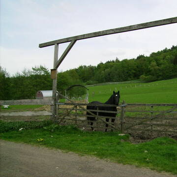
Paddockbox für Ihr Pferd
Litzendorf
Reitanlage-Ellertal
@Reitanlage-Ellertal
FN-Mitglied
Pferdeausbildung
Vermieten
Laufband
Longierzirkel/Roundpen
Hufrehe geeignet
zuckerreduziertes Heu
18 weitere...
P
Leider kein Vorschaubild
Leider kein Vorschaubild
Naturnaher Offenstall - Platz ab Frühjahr
Burgebrach
Sophia
@Soffel
VFD-Mitglied
Vermieten
Krankenbox
Reitplatz (z.B. Dressur, Springen, Reining)
Bewegungsstall
Innenbox
8 weitere...
B
Deprecated: Creation of dynamic property Zend_View_Helper_Ads::$adLink is deprecated in /var/www/stall-frei/htdocs/staging.stall-frei.de/library/Psf/View/Helper/Ads.php on line 108

Futtersack HeuToy, Fressbremse in pink
Mechtersen
STALL-FREIde Marketing
@STALL-FREI-Marketing
Stundenlange Beschäftigung die
Koliken vorbeugt, geringe Staubinhalation mit
steuerbarer Futterentnahme
Leider kein Vorschaubild
Leider kein Vorschaubild
Paddocktrail für Huster/Allergiker
Schlüsselfeld
Antonia Koerber
@Antonia-Koerber
Freizeitstall
Rehabilitationsstall
Vermieten
Krankenbox
Longierzirkel/Roundpen
Allergikerstall
15 weitere...
B
Leider kein Vorschaubild
Leider kein Vorschaubild
Innenbox zu vergeben
Wilhermsdorf
Stall Gruber
@Ch.Gruber
Freizeitstall
Pferdeausbildung
Vermieten
Hunde willkommen
Paddock
bedampftes/gewaschenes Heu
Hufrehe geeignet
15 weitere...
aktuell
B
Leider kein Vorschaubild
Leider kein Vorschaubild
B

Aktivstall - Offenstall
Roßtal
Jennifer Winkler
@PonyLiebeOffenstall
Freizeitstall
Gastronomie
Vermieten
Krankenbox
Paddock
Gnadenbrothof
Notfallboxen
16 weitere...
P
Leider kein Vorschaubild
Leider kein Vorschaubild
Großer Offenstallplatz frei
Cadolzburg
Carola Barth
@carolamarton
Freizeitstall
Geländestrecke
Vermieten
Hunde willkommen
Krankenbox
Offenstall
Paddock Trail
18 weitere...
B
STALL LINDENHOF
Röthenbach-Haimendorf
Helmut-Peter-HECKEL
@Helmut-Peter-HECKEL
Freizeitstall
Geländestrecke
Vermieten
Krankenbox
Longierzirkel/Roundpen
Außenbox mit Paddock
Außenboxen
15 weitere...
P

Pferdepension Hit Aktivstall Kürmerhof
Hohenkammer
Kuermerhof
@Kuermerhof
*******JETZT NEU MIT ENTSTAUBTEM BIOHEU*********
*******Demnächst mit einem Abenteuerspielplatz für Pferde ( Extrem Trail/Pa

NEWSTONE Boxen frei für Einsteller Westernpferde!
NEWSTONE Köhl Ranch
@NEWSTONE
Pferdeausbildung
Rehabilitationsstall
Vermieten
Führanlage
Krankenbox
Fohlenaufzucht möglich
Zuchtstutenhaltung möglich
25 weitere...
P
Leider kein Vorschaubild
Leider kein Vorschaubild
Stall frei
Hiltpoltstein
L-R-R
@Puecktchen
Freizeitstall
Longierzirkel/Roundpen
Paddock
Hufrehe geeignet
Außenbox mit Paddock
Laufstall
9 weitere...
B
Veröffentliche deine Suche als Gesuch und Suchauftrag, dann erhältst du Angebote, neue Treffer und Änderungen per E-Mail.
Diese Suche als Gesuch veröffentlichenDeprecated: Creation of dynamic property Zend_View::$pageCount is deprecated in /var/www/stall-frei/htdocs/staging.stall-frei.de/library/vendor/shardj/zf1-future/library/Zend/View/Abstract.php on line 308
Deprecated: Creation of dynamic property Zend_View::$itemCountPerPage is deprecated in /var/www/stall-frei/htdocs/staging.stall-frei.de/library/vendor/shardj/zf1-future/library/Zend/View/Abstract.php on line 308
Deprecated: Creation of dynamic property Zend_View::$first is deprecated in /var/www/stall-frei/htdocs/staging.stall-frei.de/library/vendor/shardj/zf1-future/library/Zend/View/Abstract.php on line 308
Deprecated: Creation of dynamic property Zend_View::$current is deprecated in /var/www/stall-frei/htdocs/staging.stall-frei.de/library/vendor/shardj/zf1-future/library/Zend/View/Abstract.php on line 308
Deprecated: Creation of dynamic property Zend_View::$last is deprecated in /var/www/stall-frei/htdocs/staging.stall-frei.de/library/vendor/shardj/zf1-future/library/Zend/View/Abstract.php on line 308
Deprecated: Creation of dynamic property Zend_View::$previous is deprecated in /var/www/stall-frei/htdocs/staging.stall-frei.de/library/vendor/shardj/zf1-future/library/Zend/View/Abstract.php on line 308
Deprecated: Creation of dynamic property Zend_View::$next is deprecated in /var/www/stall-frei/htdocs/staging.stall-frei.de/library/vendor/shardj/zf1-future/library/Zend/View/Abstract.php on line 308
Deprecated: Creation of dynamic property Zend_View::$pagesInRange is deprecated in /var/www/stall-frei/htdocs/staging.stall-frei.de/library/vendor/shardj/zf1-future/library/Zend/View/Abstract.php on line 308
Deprecated: Creation of dynamic property Zend_View::$firstPageInRange is deprecated in /var/www/stall-frei/htdocs/staging.stall-frei.de/library/vendor/shardj/zf1-future/library/Zend/View/Abstract.php on line 308
Deprecated: Creation of dynamic property Zend_View::$lastPageInRange is deprecated in /var/www/stall-frei/htdocs/staging.stall-frei.de/library/vendor/shardj/zf1-future/library/Zend/View/Abstract.php on line 308
Deprecated: Creation of dynamic property Zend_View::$currentItemCount is deprecated in /var/www/stall-frei/htdocs/staging.stall-frei.de/library/vendor/shardj/zf1-future/library/Zend/View/Abstract.php on line 308
Deprecated: Creation of dynamic property Zend_View::$totalItemCount is deprecated in /var/www/stall-frei/htdocs/staging.stall-frei.de/library/vendor/shardj/zf1-future/library/Zend/View/Abstract.php on line 308
Deprecated: Creation of dynamic property Zend_View::$firstItemNumber is deprecated in /var/www/stall-frei/htdocs/staging.stall-frei.de/library/vendor/shardj/zf1-future/library/Zend/View/Abstract.php on line 308
Deprecated: Creation of dynamic property Zend_View::$lastItemNumber is deprecated in /var/www/stall-frei/htdocs/staging.stall-frei.de/library/vendor/shardj/zf1-future/library/Zend/View/Abstract.php on line 308
Deprecated: Creation of dynamic property Zend_View::$router is deprecated in /var/www/stall-frei/htdocs/staging.stall-frei.de/library/vendor/shardj/zf1-future/library/Zend/View/Abstract.php on line 308
Deprecated: Creation of dynamic property Zend_View::$urlParams is deprecated in /var/www/stall-frei/htdocs/staging.stall-frei.de/library/vendor/shardj/zf1-future/library/Zend/View/Abstract.php on line 308
Deprecated: Creation of dynamic property Zend_View::$showAds is deprecated in /var/www/stall-frei/htdocs/staging.stall-frei.de/library/vendor/shardj/zf1-future/library/Zend/View/Abstract.php on line 308
Deprecated: Creation of dynamic property Zend_View::$objectIds is deprecated in /var/www/stall-frei/htdocs/staging.stall-frei.de/library/vendor/shardj/zf1-future/library/Zend/View/Abstract.php on line 308
Deprecated: Creation of dynamic property Zend_View::$showNavbar is deprecated in /var/www/stall-frei/htdocs/staging.stall-frei.de/library/vendor/shardj/zf1-future/library/Zend/View/Abstract.php on line 308
Deprecated: Creation of dynamic property Zend_View::$showBreadcrumb is deprecated in /var/www/stall-frei/htdocs/staging.stall-frei.de/library/vendor/shardj/zf1-future/library/Zend/View/Abstract.php on line 308
Deprecated: Creation of dynamic property Zend_View::$showFooter is deprecated in /var/www/stall-frei/htdocs/staging.stall-frei.de/library/vendor/shardj/zf1-future/library/Zend/View/Abstract.php on line 308
Deprecated: Creation of dynamic property Zend_View::$showInternalAds is deprecated in /var/www/stall-frei/htdocs/staging.stall-frei.de/library/vendor/shardj/zf1-future/library/Zend/View/Abstract.php on line 308
Deprecated: Creation of dynamic property Zend_View::$blNoContent is deprecated in /var/www/stall-frei/htdocs/staging.stall-frei.de/library/vendor/shardj/zf1-future/library/Zend/View/Abstract.php on line 308
Deprecated: Creation of dynamic property Zend_View::$sMetaDesc is deprecated in /var/www/stall-frei/htdocs/staging.stall-frei.de/library/vendor/shardj/zf1-future/library/Zend/View/Abstract.php on line 308
Deprecated: Creation of dynamic property Zend_View::$useGmaps is deprecated in /var/www/stall-frei/htdocs/staging.stall-frei.de/library/vendor/shardj/zf1-future/library/Zend/View/Abstract.php on line 308
Deprecated: Creation of dynamic property Zend_View::$touches is deprecated in /var/www/stall-frei/htdocs/staging.stall-frei.de/library/vendor/shardj/zf1-future/library/Zend/View/Abstract.php on line 308
Deprecated: Creation of dynamic property Zend_View::$oProject is deprecated in /var/www/stall-frei/htdocs/staging.stall-frei.de/library/vendor/shardj/zf1-future/library/Zend/View/Abstract.php on line 308
Deprecated: Creation of dynamic property Zend_View::$pageHeadline is deprecated in /var/www/stall-frei/htdocs/staging.stall-frei.de/library/vendor/shardj/zf1-future/library/Zend/View/Abstract.php on line 308
Deprecated: Creation of dynamic property Zend_View::$disableLocationField is deprecated in /var/www/stall-frei/htdocs/staging.stall-frei.de/library/vendor/shardj/zf1-future/library/Zend/View/Abstract.php on line 308
Deprecated: Creation of dynamic property Zend_View::$isSearch is deprecated in /var/www/stall-frei/htdocs/staging.stall-frei.de/library/vendor/shardj/zf1-future/library/Zend/View/Abstract.php on line 308
Deprecated: Creation of dynamic property Zend_View::$pageTitle is deprecated in /var/www/stall-frei/htdocs/staging.stall-frei.de/library/vendor/shardj/zf1-future/library/Zend/View/Abstract.php on line 308
Deprecated: Creation of dynamic property Psf_Form_Element_Text::$class is deprecated in /var/www/stall-frei/htdocs/staging.stall-frei.de/library/vendor/shardj/zf1-future/library/Zend/Form/Element.php on line 874
Deprecated: Creation of dynamic property Psf_Form_Element_Text::$size is deprecated in /var/www/stall-frei/htdocs/staging.stall-frei.de/library/vendor/shardj/zf1-future/library/Zend/Form/Element.php on line 874
Deprecated: Creation of dynamic property Psf_Form_Element_Text::$placeholder is deprecated in /var/www/stall-frei/htdocs/staging.stall-frei.de/library/vendor/shardj/zf1-future/library/Zend/Form/Element.php on line 874
Deprecated: Creation of dynamic property Psf_Form_Element_Hidden::$class is deprecated in /var/www/stall-frei/htdocs/staging.stall-frei.de/library/vendor/shardj/zf1-future/library/Zend/Form/Element.php on line 874
Deprecated: Creation of dynamic property Psf_Form_Element_Hidden::$class is deprecated in /var/www/stall-frei/htdocs/staging.stall-frei.de/library/vendor/shardj/zf1-future/library/Zend/Form/Element.php on line 874
Deprecated: Creation of dynamic property Psf_Form_Element_Hidden::$class is deprecated in /var/www/stall-frei/htdocs/staging.stall-frei.de/library/vendor/shardj/zf1-future/library/Zend/Form/Element.php on line 874
Deprecated: Creation of dynamic property Psf_Form_Element_Hidden::$class is deprecated in /var/www/stall-frei/htdocs/staging.stall-frei.de/library/vendor/shardj/zf1-future/library/Zend/Form/Element.php on line 874
Deprecated: Creation of dynamic property Psf_Form_Element_Select::$class is deprecated in /var/www/stall-frei/htdocs/staging.stall-frei.de/library/vendor/shardj/zf1-future/library/Zend/Form/Element.php on line 874
Deprecated: Creation of dynamic property Psf_Form_Element_Select::$class is deprecated in /var/www/stall-frei/htdocs/staging.stall-frei.de/library/vendor/shardj/zf1-future/library/Zend/Form/Element.php on line 874
Deprecated: Creation of dynamic property Psf_Form_Element_Select::$class is deprecated in /var/www/stall-frei/htdocs/staging.stall-frei.de/library/vendor/shardj/zf1-future/library/Zend/Form/Element.php on line 874
Deprecated: Creation of dynamic property Psf_Form_Element_Select::$class is deprecated in /var/www/stall-frei/htdocs/staging.stall-frei.de/library/vendor/shardj/zf1-future/library/Zend/Form/Element.php on line 874
Deprecated: Creation of dynamic property Psf_Form_Element_Text::$class is deprecated in /var/www/stall-frei/htdocs/staging.stall-frei.de/library/vendor/shardj/zf1-future/library/Zend/Form/Element.php on line 874
Deprecated: Creation of dynamic property Psf_Form_Element_Checkbox::$label is deprecated in /var/www/stall-frei/htdocs/staging.stall-frei.de/library/vendor/shardj/zf1-future/library/Zend/Form/Element.php on line 874
Deprecated: Creation of dynamic property Zend_View::$sort is deprecated in /var/www/stall-frei/htdocs/staging.stall-frei.de/library/vendor/shardj/zf1-future/library/Zend/View/Abstract.php on line 308
Deprecated: Creation of dynamic property Zend_View::$searchLocation is deprecated in /var/www/stall-frei/htdocs/staging.stall-frei.de/library/vendor/shardj/zf1-future/library/Zend/View/Abstract.php on line 308
Deprecated: Creation of dynamic property Zend_View::$locationHint is deprecated in /var/www/stall-frei/htdocs/staging.stall-frei.de/library/vendor/shardj/zf1-future/library/Zend/View/Abstract.php on line 308
Psf_GeoCoder_Abstract::getLocation: Mark Get Location CachedOrLive
Psf_GeoCoder_Abstract::getCachedOrLive: Mark
Psf_GeoCoder_Abstract::convertLocationResult
{"documentation":"https:\/\/opencagedata.com\/api","licenses":[{"name":"see attribution guide","url":"https:\/\/opencagedata.com\/credits"}],"results":[{"bounds":{"northeast":{"lat":49.6852097,"lng":11.0157319},"southwest":{"lat":49.6239922,"lng":10.9265754}},"components":{"ISO_3166-1_alpha-2":"DE","ISO_3166-1_alpha-3":"DEU","ISO_3166-2":["DE-BY"],"_category":"place","_normalized_city":"Mark","_type":"city","city":"Mark","continent":"Europe","country":"Deutschland","country_code":"de","county":"Landkreis Erlangen-H\u00f6chstadt","political_union":"European Union","state":"Bayern","state_code":"BY"},"confidence":7,"formatted":"Mark, Bayern, Deutschland","geometry":{"lat":49.654602,"lng":10.9512725}},{"bounds":{"northeast":{"lat":51.7033905,"lng":7.8757533},"southwest":{"lat":51.6633905,"lng":7.8357533}},"components":{"ISO_3166-1_alpha-2":"DE","ISO_3166-1_alpha-3":"DEU","ISO_3166-2":["DE-NW"],"_category":"place","_normalized_city":"Hamm","_type":"neighbourhood","city":"Hamm","city_district":"Uentrop","continent":"Europe","country":"Deutschland","country_code":"de","political_union":"European Union","postcode":"59071","state":"Nordrhein-Westfalen","state_code":"NW","suburb":"Mark"},"confidence":7,"formatted":"59071 Hamm, Deutschland","geometry":{"lat":51.6833905,"lng":7.8557533}},{"bounds":{"northeast":{"lat":53.1530804,"lng":7.3873791},"southwest":{"lat":53.1330804,"lng":7.3673791}},"components":{"ISO_3166-1_alpha-2":"DE","ISO_3166-1_alpha-3":"DEU","ISO_3166-2":["DE-NI"],"_category":"place","_normalized_city":"Westoverledingen","_type":"neighbourhood","continent":"Europe","country":"Deutschland","country_code":"de","county":"Landkreis Leer","municipality":"Westoverledingen","neighbourhood":"Mark","political_union":"European Union","postcode":"26810","state":"Niedersachsen","state_code":"NI"},"confidence":8,"formatted":"26810 Westoverledingen, Deutschland","geometry":{"lat":53.1430804,"lng":7.3773791}},{"bounds":{"northeast":{"lat":51.0582313,"lng":7.7122643},"southwest":{"lat":51.0581313,"lng":7.7121643}},"components":{"ISO_3166-1_alpha-2":"DE","ISO_3166-1_alpha-3":"DEU","ISO_3166-2":["DE-NW"],"_category":"natural\/water","_normalized_city":"Drolshagen","_type":"peak","continent":"Europe","country":"Deutschland","country_code":"de","county":"Kreis Olpe","peak":"Mark","political_union":"European Union","state":"Nordrhein-Westfalen","state_code":"NW","town":"Drolshagen"},"confidence":9,"formatted":"Mark, Drolshagen, Nordrhein-Westfalen, Deutschland","geometry":{"lat":51.0581813,"lng":7.7122143}},{"bounds":{"northeast":{"lat":51.2718806,"lng":10.7236232},"southwest":{"lat":51.2717806,"lng":10.7235232}},"components":{"ISO_3166-1_alpha-2":"DE","ISO_3166-1_alpha-3":"DEU","ISO_3166-2":["DE-TH"],"_category":"natural\/water","_normalized_city":"Ebeleben","_type":"peak","continent":"Europe","country":"Deutschland","country_code":"de","county":"Kyffh\u00e4userkreis","municipality":"Ebeleben","peak":"Mark","political_union":"European Union","postcode":"99713","state":"Th\u00fcringen","state_code":"TH","town":"Ebeleben"},"confidence":9,"formatted":"Mark, 99713 Ebeleben, Deutschland","geometry":{"lat":51.2718306,"lng":10.7235732}},{"bounds":{"northeast":{"lat":51.0042496,"lng":7.8256616},"southwest":{"lat":51.0041496,"lng":7.8255616}},"components":{"ISO_3166-1_alpha-2":"DE","ISO_3166-1_alpha-3":"DEU","ISO_3166-2":["DE-NW"],"_category":"natural\/water","_normalized_city":"Olpe","_type":"peak","continent":"Europe","country":"Deutschland","country_code":"de","county":"Kreis Olpe","peak":"Mark","political_union":"European Union","postcode":"57462","state":"Nordrhein-Westfalen","state_code":"NW","town":"Olpe"},"confidence":9,"formatted":"Mark, 57462 Olpe, Deutschland","geometry":{"lat":51.0041996,"lng":7.8256116}},{"bounds":{"northeast":{"lat":50.9628444,"lng":9.3603395},"southwest":{"lat":50.9627444,"lng":9.3602395}},"components":{"ISO_3166-1_alpha-2":"DE","ISO_3166-1_alpha-3":"DEU","ISO_3166-2":["DE-HE"],"_category":"natural\/water","_normalized_city":"Frielendorf","_type":"peak","continent":"Europe","country":"Deutschland","country_code":"de","county":"Schwalm-Eder-Kreis","municipality":"Frielendorf","peak":"Mark","political_union":"European Union","postcode":"34621","state":"Hessen","state_code":"HE","town":"Frielendorf"},"confidence":9,"formatted":"Mark, 34621 Frielendorf, Deutschland","geometry":{"lat":50.9627944,"lng":9.3602895}},{"bounds":{"northeast":{"lat":47.7443127,"lng":10.7536067},"southwest":{"lat":47.7043127,"lng":10.7136067}},"components":{"ISO_3166-1_alpha-2":"DE","ISO_3166-1_alpha-3":"DEU","ISO_3166-2":["DE-BY"],"_category":"place","_normalized_city":"Bernbeuren","_type":"hamlet","continent":"Europe","country":"Deutschland","country_code":"de","county":"Landkreis Weilheim-Schongau","hamlet":"Mark","municipality":"Bernbeuren (VGem)","political_union":"European Union","postcode":"87675","state":"Bayern","state_code":"BY","village":"Bernbeuren"},"confidence":7,"formatted":"Mark, 87675 Bernbeuren, Deutschland","geometry":{"lat":47.7243127,"lng":10.7336067}},{"bounds":{"northeast":{"lat":51.1087376,"lng":7.6274232},"southwest":{"lat":51.0983863,"lng":7.5903718}},"components":{"ISO_3166-1_alpha-2":"DE","ISO_3166-1_alpha-3":"DEU","ISO_3166-2":["DE-NW"],"_category":"natural\/water","_normalized_city":"Meinerzhagen","_type":"forest","continent":"Europe","country":"Deutschland","country_code":"de","county":"M\u00e4rkischer Kreis","forest":"Mark","political_union":"European Union","state":"Nordrhein-Westfalen","state_code":"NW","town":"Meinerzhagen"},"confidence":7,"formatted":"Mark, Meinerzhagen, Nordrhein-Westfalen, Deutschland","geometry":{"lat":51.1035576,"lng":7.6012501}},{"bounds":{"northeast":{"lat":52.7814211,"lng":7.2685985},"southwest":{"lat":52.7776405,"lng":7.2630728}},"components":{"ISO_3166-1_alpha-2":"DE","ISO_3166-1_alpha-3":"DEU","ISO_3166-2":["DE-NI"],"_category":"agriculture","_normalized_city":"Haren (Ems)","_type":"farmland","continent":"Europe","country":"Deutschland","country_code":"de","county":"Landkreis Emsland","farmland":"Mark","political_union":"European Union","postcode":"49733","state":"Niedersachsen","state_code":"NI","town":"Haren (Ems)"},"confidence":9,"formatted":"Mark, 49733 Haren (Ems), Deutschland","geometry":{"lat":52.7795364,"lng":7.2648403}}],"status":{"code":200,"message":"OK"},"stay_informed":{"blog":"https:\/\/blog.opencagedata.com","mastodon":"https:\/\/en.osm.town\/@opencage"},"thanks":"For using an OpenCage API","timestamp":{"created_http":"Sun, 08 Feb 2026 05:03:07 GMT","created_unix":1770526987},"total_results":10}Array
(
[0] => stdClass Object
(
[bounds] => stdClass Object
(
[northeast] => stdClass Object
(
[lat] => 49.6852097
[lng] => 11.0157319
)
[southwest] => stdClass Object
(
[lat] => 49.6239922
[lng] => 10.9265754
)
)
[components] => stdClass Object
(
[ISO_3166-1_alpha-2] => DE
[ISO_3166-1_alpha-3] => DEU
[ISO_3166-2] => Array
(
[0] => DE-BY
)
[_category] => place
[_normalized_city] => Mark
[_type] => city
[city] => Mark
[continent] => Europe
[country] => Deutschland
[country_code] => de
[county] => Landkreis Erlangen-Höchstadt
[political_union] => European Union
[state] => Bayern
[state_code] => BY
)
[confidence] => 7
[formatted] => Mark, Bayern, Deutschland
[geometry] => stdClass Object
(
[lat] => 49.654602
[lng] => 10.9512725
)
)
[1] => stdClass Object
(
[bounds] => stdClass Object
(
[northeast] => stdClass Object
(
[lat] => 51.7033905
[lng] => 7.8757533
)
[southwest] => stdClass Object
(
[lat] => 51.6633905
[lng] => 7.8357533
)
)
[components] => stdClass Object
(
[ISO_3166-1_alpha-2] => DE
[ISO_3166-1_alpha-3] => DEU
[ISO_3166-2] => Array
(
[0] => DE-NW
)
[_category] => place
[_normalized_city] => Hamm
[_type] => neighbourhood
[city] => Hamm
[city_district] => Uentrop
[continent] => Europe
[country] => Deutschland
[country_code] => de
[political_union] => European Union
[postcode] => 59071
[state] => Nordrhein-Westfalen
[state_code] => NW
[suburb] => Mark
)
[confidence] => 7
[formatted] => 59071 Hamm, Deutschland
[geometry] => stdClass Object
(
[lat] => 51.6833905
[lng] => 7.8557533
)
)
[2] => stdClass Object
(
[bounds] => stdClass Object
(
[northeast] => stdClass Object
(
[lat] => 53.1530804
[lng] => 7.3873791
)
[southwest] => stdClass Object
(
[lat] => 53.1330804
[lng] => 7.3673791
)
)
[components] => stdClass Object
(
[ISO_3166-1_alpha-2] => DE
[ISO_3166-1_alpha-3] => DEU
[ISO_3166-2] => Array
(
[0] => DE-NI
)
[_category] => place
[_normalized_city] => Westoverledingen
[_type] => neighbourhood
[continent] => Europe
[country] => Deutschland
[country_code] => de
[county] => Landkreis Leer
[municipality] => Westoverledingen
[neighbourhood] => Mark
[political_union] => European Union
[postcode] => 26810
[state] => Niedersachsen
[state_code] => NI
)
[confidence] => 8
[formatted] => 26810 Westoverledingen, Deutschland
[geometry] => stdClass Object
(
[lat] => 53.1430804
[lng] => 7.3773791
)
)
[3] => stdClass Object
(
[bounds] => stdClass Object
(
[northeast] => stdClass Object
(
[lat] => 51.0582313
[lng] => 7.7122643
)
[southwest] => stdClass Object
(
[lat] => 51.0581313
[lng] => 7.7121643
)
)
[components] => stdClass Object
(
[ISO_3166-1_alpha-2] => DE
[ISO_3166-1_alpha-3] => DEU
[ISO_3166-2] => Array
(
[0] => DE-NW
)
[_category] => natural/water
[_normalized_city] => Drolshagen
[_type] => peak
[continent] => Europe
[country] => Deutschland
[country_code] => de
[county] => Kreis Olpe
[peak] => Mark
[political_union] => European Union
[state] => Nordrhein-Westfalen
[state_code] => NW
[town] => Drolshagen
)
[confidence] => 9
[formatted] => Mark, Drolshagen, Nordrhein-Westfalen, Deutschland
[geometry] => stdClass Object
(
[lat] => 51.0581813
[lng] => 7.7122143
)
)
[4] => stdClass Object
(
[bounds] => stdClass Object
(
[northeast] => stdClass Object
(
[lat] => 51.2718806
[lng] => 10.7236232
)
[southwest] => stdClass Object
(
[lat] => 51.2717806
[lng] => 10.7235232
)
)
[components] => stdClass Object
(
[ISO_3166-1_alpha-2] => DE
[ISO_3166-1_alpha-3] => DEU
[ISO_3166-2] => Array
(
[0] => DE-TH
)
[_category] => natural/water
[_normalized_city] => Ebeleben
[_type] => peak
[continent] => Europe
[country] => Deutschland
[country_code] => de
[county] => Kyffhäuserkreis
[municipality] => Ebeleben
[peak] => Mark
[political_union] => European Union
[postcode] => 99713
[state] => Thüringen
[state_code] => TH
[town] => Ebeleben
)
[confidence] => 9
[formatted] => Mark, 99713 Ebeleben, Deutschland
[geometry] => stdClass Object
(
[lat] => 51.2718306
[lng] => 10.7235732
)
)
[5] => stdClass Object
(
[bounds] => stdClass Object
(
[northeast] => stdClass Object
(
[lat] => 51.0042496
[lng] => 7.8256616
)
[southwest] => stdClass Object
(
[lat] => 51.0041496
[lng] => 7.8255616
)
)
[components] => stdClass Object
(
[ISO_3166-1_alpha-2] => DE
[ISO_3166-1_alpha-3] => DEU
[ISO_3166-2] => Array
(
[0] => DE-NW
)
[_category] => natural/water
[_normalized_city] => Olpe
[_type] => peak
[continent] => Europe
[country] => Deutschland
[country_code] => de
[county] => Kreis Olpe
[peak] => Mark
[political_union] => European Union
[postcode] => 57462
[state] => Nordrhein-Westfalen
[state_code] => NW
[town] => Olpe
)
[confidence] => 9
[formatted] => Mark, 57462 Olpe, Deutschland
[geometry] => stdClass Object
(
[lat] => 51.0041996
[lng] => 7.8256116
)
)
[6] => stdClass Object
(
[bounds] => stdClass Object
(
[northeast] => stdClass Object
(
[lat] => 50.9628444
[lng] => 9.3603395
)
[southwest] => stdClass Object
(
[lat] => 50.9627444
[lng] => 9.3602395
)
)
[components] => stdClass Object
(
[ISO_3166-1_alpha-2] => DE
[ISO_3166-1_alpha-3] => DEU
[ISO_3166-2] => Array
(
[0] => DE-HE
)
[_category] => natural/water
[_normalized_city] => Frielendorf
[_type] => peak
[continent] => Europe
[country] => Deutschland
[country_code] => de
[county] => Schwalm-Eder-Kreis
[municipality] => Frielendorf
[peak] => Mark
[political_union] => European Union
[postcode] => 34621
[state] => Hessen
[state_code] => HE
[town] => Frielendorf
)
[confidence] => 9
[formatted] => Mark, 34621 Frielendorf, Deutschland
[geometry] => stdClass Object
(
[lat] => 50.9627944
[lng] => 9.3602895
)
)
[7] => stdClass Object
(
[bounds] => stdClass Object
(
[northeast] => stdClass Object
(
[lat] => 47.7443127
[lng] => 10.7536067
)
[southwest] => stdClass Object
(
[lat] => 47.7043127
[lng] => 10.7136067
)
)
[components] => stdClass Object
(
[ISO_3166-1_alpha-2] => DE
[ISO_3166-1_alpha-3] => DEU
[ISO_3166-2] => Array
(
[0] => DE-BY
)
[_category] => place
[_normalized_city] => Bernbeuren
[_type] => hamlet
[continent] => Europe
[country] => Deutschland
[country_code] => de
[county] => Landkreis Weilheim-Schongau
[hamlet] => Mark
[municipality] => Bernbeuren (VGem)
[political_union] => European Union
[postcode] => 87675
[state] => Bayern
[state_code] => BY
[village] => Bernbeuren
)
[confidence] => 7
[formatted] => Mark, 87675 Bernbeuren, Deutschland
[geometry] => stdClass Object
(
[lat] => 47.7243127
[lng] => 10.7336067
)
)
[8] => stdClass Object
(
[bounds] => stdClass Object
(
[northeast] => stdClass Object
(
[lat] => 51.1087376
[lng] => 7.6274232
)
[southwest] => stdClass Object
(
[lat] => 51.0983863
[lng] => 7.5903718
)
)
[components] => stdClass Object
(
[ISO_3166-1_alpha-2] => DE
[ISO_3166-1_alpha-3] => DEU
[ISO_3166-2] => Array
(
[0] => DE-NW
)
[_category] => natural/water
[_normalized_city] => Meinerzhagen
[_type] => forest
[continent] => Europe
[country] => Deutschland
[country_code] => de
[county] => Märkischer Kreis
[forest] => Mark
[political_union] => European Union
[state] => Nordrhein-Westfalen
[state_code] => NW
[town] => Meinerzhagen
)
[confidence] => 7
[formatted] => Mark, Meinerzhagen, Nordrhein-Westfalen, Deutschland
[geometry] => stdClass Object
(
[lat] => 51.1035576
[lng] => 7.6012501
)
)
[9] => stdClass Object
(
[bounds] => stdClass Object
(
[northeast] => stdClass Object
(
[lat] => 52.7814211
[lng] => 7.2685985
)
[southwest] => stdClass Object
(
[lat] => 52.7776405
[lng] => 7.2630728
)
)
[components] => stdClass Object
(
[ISO_3166-1_alpha-2] => DE
[ISO_3166-1_alpha-3] => DEU
[ISO_3166-2] => Array
(
[0] => DE-NI
)
[_category] => agriculture
[_normalized_city] => Haren (Ems)
[_type] => farmland
[continent] => Europe
[country] => Deutschland
[country_code] => de
[county] => Landkreis Emsland
[farmland] => Mark
[political_union] => European Union
[postcode] => 49733
[state] => Niedersachsen
[state_code] => NI
[town] => Haren (Ems)
)
[confidence] => 9
[formatted] => Mark, 49733 Haren (Ems), Deutschland
[geometry] => stdClass Object
(
[lat] => 52.7795364
[lng] => 7.2648403
)
)
)
Psf_GeoCoder_OpenCageData::getKeyMap: 0
stdClass Object
(
    [bounds] => stdClass Object
        (
            [northeast] => stdClass Object
                (
                    [lat] => 49.6852097
                    [lng] => 11.0157319
                )

            [southwest] => stdClass Object
                (
                    [lat] => 49.6239922
                    [lng] => 10.9265754
                )

        )

    [components] => stdClass Object
        (
            [ISO_3166-1_alpha-2] => DE
            [ISO_3166-1_alpha-3] => DEU
            [ISO_3166-2] => Array
                (
                    [0] => DE-BY
                )

            [_category] => place
            [_normalized_city] => Mark
            [_type] => city
            [city] => Mark
            [continent] => Europe
            [country] => Deutschland
            [country_code] => de
            [county] => Landkreis Erlangen-Höchstadt
            [political_union] => European Union
            [state] => Bayern
            [state_code] => BY
        )

    [confidence] => 7
    [formatted] => Mark, Bayern, Deutschland
    [geometry] => stdClass Object
        (
            [lat] => 49.654602
            [lng] => 10.9512725
        )

)
Psf_GeoCoder_OpenCageData::getCounty: Erlangen-Höchstadt
Psf_GeoCoder_OpenCageData::addMissingData REFETCH!
Array
(
    [address] => Mark, Bayern, Deutschland
    [type] => city
    [street] =>
    [city] => Mark
    [county] => Erlangen-Höchstadt
    [state] => Bayern
    [zip] =>
    [country] => Deutschland
    [suburb] =>
    [countrycode] => de
    [latitude] => 49.654602
    [longitude] => 10.9512725
    [accuracy] => 1
    [confidence] => 7
    [bounds] => stdClass Object
        (
            [northeast] => stdClass Object
                (
                    [lat] => 49.6852097
                    [lng] => 11.0157319
                )

            [southwest] => stdClass Object
                (
                    [lat] => 49.6239922
                    [lng] => 10.9265754
                )

        )

)
reformat!
Array
(
    [address] => Mark, Bayern, Deutschland
    [type] => city
    [street] =>
    [city] => Mark
    [county] => Erlangen-Höchstadt
    [state] => Bayern
    [zip] =>
    [country] => Deutschland
    [suburb] =>
    [countrycode] => de
    [latitude] => 49.654602
    [longitude] => 10.9512725
    [accuracy] => 1
    [confidence] => 7
    [bounds] => stdClass Object
        (
            [northeast] => stdClass Object
                (
                    [lat] => 49.6852097
                    [lng] => 11.0157319
                )

            [southwest] => stdClass Object
                (
                    [lat] => 49.6239922
                    [lng] => 10.9265754
                )

        )

    [place] => Mark, Bayern
    [hash] => 3155543e6f6a4e4ef2f1f1ec78485e89
)
Psf_GeoCoder_OpenCageData::getKeyMap: 1
stdClass Object
(
    [bounds] => stdClass Object
        (
            [northeast] => stdClass Object
                (
                    [lat] => 51.7033905
                    [lng] => 7.8757533
                )

            [southwest] => stdClass Object
                (
                    [lat] => 51.6633905
                    [lng] => 7.8357533
                )

        )

    [components] => stdClass Object
        (
            [ISO_3166-1_alpha-2] => DE
            [ISO_3166-1_alpha-3] => DEU
            [ISO_3166-2] => Array
                (
                    [0] => DE-NW
                )

            [_category] => place
            [_normalized_city] => Hamm
            [_type] => neighbourhood
            [city] => Hamm
            [city_district] => Uentrop
            [continent] => Europe
            [country] => Deutschland
            [country_code] => de
            [political_union] => European Union
            [postcode] => 59071
            [state] => Nordrhein-Westfalen
            [state_code] => NW
            [suburb] => Mark
        )

    [confidence] => 7
    [formatted] => 59071 Hamm, Deutschland
    [geometry] => stdClass Object
        (
            [lat] => 51.6833905
            [lng] => 7.8557533
        )

)
Psf_GeoCoder_OpenCageData::getCounty: Hamm
Psf_GeoCoder_OpenCageData::addMissingData REFETCH!
Array
(
    [address] => 59071 Hamm, Deutschland
    [type] => neighbourhood
    [street] =>
    [city] => Mark
    [county] => Hamm
    [state] => Nordrhein-Westfalen
    [zip] => 59071
    [country] => Deutschland
    [suburb] => Mark
    [countrycode] => de
    [latitude] => 51.6833905
    [longitude] => 7.8557533
    [accuracy] => 1
    [confidence] => 7
    [bounds] => stdClass Object
        (
            [northeast] => stdClass Object
                (
                    [lat] => 51.7033905
                    [lng] => 7.8757533
                )

            [southwest] => stdClass Object
                (
                    [lat] => 51.6633905
                    [lng] => 7.8357533
                )

        )

)
reformat!
Array
(
    [address] => 59071 Mark
    [type] => neighbourhood
    [street] =>
    [city] => Mark
    [county] => Hamm
    [state] => Nordrhein-Westfalen
    [zip] => 59071
    [country] => Deutschland
    [suburb] => Mark
    [countrycode] => de
    [latitude] => 51.6833905
    [longitude] => 7.8557533
    [accuracy] => 1
    [confidence] => 7
    [bounds] => stdClass Object
        (
            [northeast] => stdClass Object
                (
                    [lat] => 51.7033905
                    [lng] => 7.8757533
                )

            [southwest] => stdClass Object
                (
                    [lat] => 51.6633905
                    [lng] => 7.8357533
                )

        )

    [place] => 59071 Mark, Nordrhein-Westfalen
    [hash] => e9abb1936c1e5c5adea80268cac72b35
)
Psf_GeoCoder_OpenCageData::getKeyMap: 2
stdClass Object
(
    [bounds] => stdClass Object
        (
            [northeast] => stdClass Object
                (
                    [lat] => 53.1530804
                    [lng] => 7.3873791
                )

            [southwest] => stdClass Object
                (
                    [lat] => 53.1330804
                    [lng] => 7.3673791
                )

        )

    [components] => stdClass Object
        (
            [ISO_3166-1_alpha-2] => DE
            [ISO_3166-1_alpha-3] => DEU
            [ISO_3166-2] => Array
                (
                    [0] => DE-NI
                )

            [_category] => place
            [_normalized_city] => Westoverledingen
            [_type] => neighbourhood
            [continent] => Europe
            [country] => Deutschland
            [country_code] => de
            [county] => Landkreis Leer
            [municipality] => Westoverledingen
            [neighbourhood] => Mark
            [political_union] => European Union
            [postcode] => 26810
            [state] => Niedersachsen
            [state_code] => NI
        )

    [confidence] => 8
    [formatted] => 26810 Westoverledingen, Deutschland
    [geometry] => stdClass Object
        (
            [lat] => 53.1430804
            [lng] => 7.3773791
        )

)
Psf_GeoCoder_OpenCageData::getCounty: Leer
Psf_GeoCoder_OpenCageData::addMissingData REFETCH!
Array
(
    [address] => 26810 Westoverledingen, Deutschland
    [type] => neighbourhood
    [street] =>
    [city] =>
    [county] => Leer
    [state] => Niedersachsen
    [zip] => 26810
    [country] => Deutschland
    [suburb] =>
    [countrycode] => de
    [latitude] => 53.1430804
    [longitude] => 7.3773791
    [accuracy] => 1
    [confidence] => 8
    [bounds] => stdClass Object
        (
            [northeast] => stdClass Object
                (
                    [lat] => 53.1530804
                    [lng] => 7.3873791
                )

            [southwest] => stdClass Object
                (
                    [lat] => 53.1330804
                    [lng] => 7.3673791
                )

        )

)
reformat!
Array
(
    [address] => 26810 Westoverledingen, Deutschland
    [type] => neighbourhood
    [street] =>
    [city] =>
    [county] => Leer
    [state] => Niedersachsen
    [zip] => 26810
    [country] => Deutschland
    [suburb] =>
    [countrycode] => de
    [latitude] => 53.1430804
    [longitude] => 7.3773791
    [accuracy] => 1
    [confidence] => 8
    [bounds] => stdClass Object
        (
            [northeast] => stdClass Object
                (
                    [lat] => 53.1530804
                    [lng] => 7.3873791
                )

            [southwest] => stdClass Object
                (
                    [lat] => 53.1330804
                    [lng] => 7.3673791
                )

        )

    [place] => 26810 , Niedersachsen
    [hash] => 56972a1a60ad1fd74a5854fe306fe9b1
)
Psf_GeoCoder_OpenCageData::getKeyMap: 3
stdClass Object
(
    [bounds] => stdClass Object
        (
            [northeast] => stdClass Object
                (
                    [lat] => 51.0582313
                    [lng] => 7.7122643
                )

            [southwest] => stdClass Object
                (
                    [lat] => 51.0581313
                    [lng] => 7.7121643
                )

        )

    [components] => stdClass Object
        (
            [ISO_3166-1_alpha-2] => DE
            [ISO_3166-1_alpha-3] => DEU
            [ISO_3166-2] => Array
                (
                    [0] => DE-NW
                )

            [_category] => natural/water
            [_normalized_city] => Drolshagen
            [_type] => peak
            [continent] => Europe
            [country] => Deutschland
            [country_code] => de
            [county] => Kreis Olpe
            [peak] => Mark
            [political_union] => European Union
            [state] => Nordrhein-Westfalen
            [state_code] => NW
            [town] => Drolshagen
        )

    [confidence] => 9
    [formatted] => Mark, Drolshagen, Nordrhein-Westfalen, Deutschland
    [geometry] => stdClass Object
        (
            [lat] => 51.0581813
            [lng] => 7.7122143
        )

)
Psf_GeoCoder_OpenCageData::getCounty: Olpe
Psf_GeoCoder_OpenCageData::addMissingData REFETCH!
Array
(
    [address] => Mark, Drolshagen, Nordrhein-Westfalen, Deutschland
    [type] => peak
    [street] =>
    [city] => Drolshagen
    [county] => Olpe
    [state] => Nordrhein-Westfalen
    [zip] =>
    [country] => Deutschland
    [suburb] =>
    [countrycode] => de
    [latitude] => 51.0581813
    [longitude] => 7.7122143
    [accuracy] => 1
    [confidence] => 9
    [bounds] => stdClass Object
        (
            [northeast] => stdClass Object
                (
                    [lat] => 51.0582313
                    [lng] => 7.7122643
                )

            [southwest] => stdClass Object
                (
                    [lat] => 51.0581313
                    [lng] => 7.7121643
                )

        )

)
reformat!
Array
(
    [address] => Mark, Drolshagen, Nordrhein-Westfalen, Deutschland
    [type] => peak
    [street] =>
    [city] => Drolshagen
    [county] => Olpe
    [state] => Nordrhein-Westfalen
    [zip] =>
    [country] => Deutschland
    [suburb] =>
    [countrycode] => de
    [latitude] => 51.0581813
    [longitude] => 7.7122143
    [accuracy] => 1
    [confidence] => 9
    [bounds] => stdClass Object
        (
            [northeast] => stdClass Object
                (
                    [lat] => 51.0582313
                    [lng] => 7.7122643
                )

            [southwest] => stdClass Object
                (
                    [lat] => 51.0581313
                    [lng] => 7.7121643
                )

        )

    [place] => Drolshagen, Nordrhein-Westfalen
    [hash] => 9d3fc618ecc445603aba32542c8d92d8
)
Psf_GeoCoder_OpenCageData::getKeyMap: 4
stdClass Object
(
    [bounds] => stdClass Object
        (
            [northeast] => stdClass Object
                (
                    [lat] => 51.2718806
                    [lng] => 10.7236232
                )

            [southwest] => stdClass Object
                (
                    [lat] => 51.2717806
                    [lng] => 10.7235232
                )

        )

    [components] => stdClass Object
        (
            [ISO_3166-1_alpha-2] => DE
            [ISO_3166-1_alpha-3] => DEU
            [ISO_3166-2] => Array
                (
                    [0] => DE-TH
                )

            [_category] => natural/water
            [_normalized_city] => Ebeleben
            [_type] => peak
            [continent] => Europe
            [country] => Deutschland
            [country_code] => de
            [county] => Kyffhäuserkreis
            [municipality] => Ebeleben
            [peak] => Mark
            [political_union] => European Union
            [postcode] => 99713
            [state] => Thüringen
            [state_code] => TH
            [town] => Ebeleben
        )

    [confidence] => 9
    [formatted] => Mark, 99713 Ebeleben, Deutschland
    [geometry] => stdClass Object
        (
            [lat] => 51.2718306
            [lng] => 10.7235732
        )

)
Psf_GeoCoder_OpenCageData::getCounty: Kyffhäuserkreis
Psf_GeoCoder_OpenCageData::addMissingData REFETCH!
Array
(
    [address] => Mark, 99713 Ebeleben, Deutschland
    [type] => peak
    [street] =>
    [city] => Ebeleben
    [county] => Kyffhäuserkreis
    [state] => Thüringen
    [zip] => 99713
    [country] => Deutschland
    [suburb] =>
    [countrycode] => de
    [latitude] => 51.2718306
    [longitude] => 10.7235732
    [accuracy] => 1
    [confidence] => 9
    [bounds] => stdClass Object
        (
            [northeast] => stdClass Object
                (
                    [lat] => 51.2718806
                    [lng] => 10.7236232
                )

            [southwest] => stdClass Object
                (
                    [lat] => 51.2717806
                    [lng] => 10.7235232
                )

        )

)
reformat!
Array
(
    [address] => Mark, 99713 Ebeleben, Deutschland
    [type] => peak
    [street] =>
    [city] => Ebeleben
    [county] => Kyffhäuserkreis
    [state] => Thüringen
    [zip] => 99713
    [country] => Deutschland
    [suburb] =>
    [countrycode] => de
    [latitude] => 51.2718306
    [longitude] => 10.7235732
    [accuracy] => 1
    [confidence] => 9
    [bounds] => stdClass Object
        (
            [northeast] => stdClass Object
                (
                    [lat] => 51.2718806
                    [lng] => 10.7236232
                )

            [southwest] => stdClass Object
                (
                    [lat] => 51.2717806
                    [lng] => 10.7235232
                )

        )

    [place] => 99713 Ebeleben, Thüringen
    [hash] => e8ff36e2d1f1b56f4aebd50bc0864012
)
Psf_GeoCoder_OpenCageData::getKeyMap: 5
stdClass Object
(
    [bounds] => stdClass Object
        (
            [northeast] => stdClass Object
                (
                    [lat] => 51.0042496
                    [lng] => 7.8256616
                )

            [southwest] => stdClass Object
                (
                    [lat] => 51.0041496
                    [lng] => 7.8255616
                )

        )

    [components] => stdClass Object
        (
            [ISO_3166-1_alpha-2] => DE
            [ISO_3166-1_alpha-3] => DEU
            [ISO_3166-2] => Array
                (
                    [0] => DE-NW
                )

            [_category] => natural/water
            [_normalized_city] => Olpe
            [_type] => peak
            [continent] => Europe
            [country] => Deutschland
            [country_code] => de
            [county] => Kreis Olpe
            [peak] => Mark
            [political_union] => European Union
            [postcode] => 57462
            [state] => Nordrhein-Westfalen
            [state_code] => NW
            [town] => Olpe
        )

    [confidence] => 9
    [formatted] => Mark, 57462 Olpe, Deutschland
    [geometry] => stdClass Object
        (
            [lat] => 51.0041996
            [lng] => 7.8256116
        )

)
Psf_GeoCoder_OpenCageData::getCounty: Olpe
Psf_GeoCoder_OpenCageData::addMissingData REFETCH!
Array
(
    [address] => Mark, 57462 Olpe, Deutschland
    [type] => peak
    [street] =>
    [city] => Olpe
    [county] => Olpe
    [state] => Nordrhein-Westfalen
    [zip] => 57462
    [country] => Deutschland
    [suburb] =>
    [countrycode] => de
    [latitude] => 51.0041996
    [longitude] => 7.8256116
    [accuracy] => 1
    [confidence] => 9
    [bounds] => stdClass Object
        (
            [northeast] => stdClass Object
                (
                    [lat] => 51.0042496
                    [lng] => 7.8256616
                )

            [southwest] => stdClass Object
                (
                    [lat] => 51.0041496
                    [lng] => 7.8255616
                )

        )

)
reformat!
Array
(
    [address] => Mark, 57462 Olpe, Deutschland
    [type] => peak
    [street] =>
    [city] => Olpe
    [county] => Olpe
    [state] => Nordrhein-Westfalen
    [zip] => 57462
    [country] => Deutschland
    [suburb] =>
    [countrycode] => de
    [latitude] => 51.0041996
    [longitude] => 7.8256116
    [accuracy] => 1
    [confidence] => 9
    [bounds] => stdClass Object
        (
            [northeast] => stdClass Object
                (
                    [lat] => 51.0042496
                    [lng] => 7.8256616
                )

            [southwest] => stdClass Object
                (
                    [lat] => 51.0041496
                    [lng] => 7.8255616
                )

        )

    [place] => 57462 Olpe, Nordrhein-Westfalen
    [hash] => e808aab9645896bddf00f6ac04732278
)
Psf_GeoCoder_OpenCageData::getKeyMap: 6
stdClass Object
(
    [bounds] => stdClass Object
        (
            [northeast] => stdClass Object
                (
                    [lat] => 50.9628444
                    [lng] => 9.3603395
                )

            [southwest] => stdClass Object
                (
                    [lat] => 50.9627444
                    [lng] => 9.3602395
                )

        )

    [components] => stdClass Object
        (
            [ISO_3166-1_alpha-2] => DE
            [ISO_3166-1_alpha-3] => DEU
            [ISO_3166-2] => Array
                (
                    [0] => DE-HE
                )

            [_category] => natural/water
            [_normalized_city] => Frielendorf
            [_type] => peak
            [continent] => Europe
            [country] => Deutschland
            [country_code] => de
            [county] => Schwalm-Eder-Kreis
            [municipality] => Frielendorf
            [peak] => Mark
            [political_union] => European Union
            [postcode] => 34621
            [state] => Hessen
            [state_code] => HE
            [town] => Frielendorf
        )

    [confidence] => 9
    [formatted] => Mark, 34621 Frielendorf, Deutschland
    [geometry] => stdClass Object
        (
            [lat] => 50.9627944
            [lng] => 9.3602895
        )

)
Psf_GeoCoder_OpenCageData::getCounty: Schwalm-Eder-Kreis
Psf_GeoCoder_OpenCageData::addMissingData REFETCH!
Array
(
    [address] => Mark, 34621 Frielendorf, Deutschland
    [type] => peak
    [street] =>
    [city] => Frielendorf
    [county] => Schwalm-Eder-Kreis
    [state] => Hessen
    [zip] => 34621
    [country] => Deutschland
    [suburb] =>
    [countrycode] => de
    [latitude] => 50.9627944
    [longitude] => 9.3602895
    [accuracy] => 1
    [confidence] => 9
    [bounds] => stdClass Object
        (
            [northeast] => stdClass Object
                (
                    [lat] => 50.9628444
                    [lng] => 9.3603395
                )

            [southwest] => stdClass Object
                (
                    [lat] => 50.9627444
                    [lng] => 9.3602395
                )

        )

)
reformat!
Array
(
    [address] => Mark, 34621 Frielendorf, Deutschland
    [type] => peak
    [street] =>
    [city] => Frielendorf
    [county] => Schwalm-Eder-Kreis
    [state] => Hessen
    [zip] => 34621
    [country] => Deutschland
    [suburb] =>
    [countrycode] => de
    [latitude] => 50.9627944
    [longitude] => 9.3602895
    [accuracy] => 1
    [confidence] => 9
    [bounds] => stdClass Object
        (
            [northeast] => stdClass Object
                (
                    [lat] => 50.9628444
                    [lng] => 9.3603395
                )

            [southwest] => stdClass Object
                (
                    [lat] => 50.9627444
                    [lng] => 9.3602395
                )

        )

    [place] => 34621 Frielendorf, Hessen
    [hash] => 47d3bd4bb2811efba57cdf71cf2d831b
)
Psf_GeoCoder_OpenCageData::getKeyMap: 7
stdClass Object
(
    [bounds] => stdClass Object
        (
            [northeast] => stdClass Object
                (
                    [lat] => 47.7443127
                    [lng] => 10.7536067
                )

            [southwest] => stdClass Object
                (
                    [lat] => 47.7043127
                    [lng] => 10.7136067
                )

        )

    [components] => stdClass Object
        (
            [ISO_3166-1_alpha-2] => DE
            [ISO_3166-1_alpha-3] => DEU
            [ISO_3166-2] => Array
                (
                    [0] => DE-BY
                )

            [_category] => place
            [_normalized_city] => Bernbeuren
            [_type] => hamlet
            [continent] => Europe
            [country] => Deutschland
            [country_code] => de
            [county] => Landkreis Weilheim-Schongau
            [hamlet] => Mark
            [municipality] => Bernbeuren (VGem)
            [political_union] => European Union
            [postcode] => 87675
            [state] => Bayern
            [state_code] => BY
            [village] => Bernbeuren
        )

    [confidence] => 7
    [formatted] => Mark, 87675 Bernbeuren, Deutschland
    [geometry] => stdClass Object
        (
            [lat] => 47.7243127
            [lng] => 10.7336067
        )

)
Psf_GeoCoder_OpenCageData::getCounty: Weilheim-Schongau
Psf_GeoCoder_OpenCageData::addMissingData REFETCH!
Array
(
    [address] => Mark, 87675 Bernbeuren, Deutschland
    [type] => hamlet
    [street] => Mark
    [city] => Bernbeuren
    [county] => Weilheim-Schongau
    [state] => Bayern
    [zip] => 87675
    [country] => Deutschland
    [suburb] =>
    [countrycode] => de
    [latitude] => 47.7243127
    [longitude] => 10.7336067
    [accuracy] => 1
    [confidence] => 7
    [bounds] => stdClass Object
        (
            [northeast] => stdClass Object
                (
                    [lat] => 47.7443127
                    [lng] => 10.7536067
                )

            [southwest] => stdClass Object
                (
                    [lat] => 47.7043127
                    [lng] => 10.7136067
                )

        )

)
reformat!
Array
(
    [address] => Mark, 87675 Bernbeuren, Deutschland
    [type] => hamlet
    [street] => Mark
    [city] => Bernbeuren
    [county] => Weilheim-Schongau
    [state] => Bayern
    [zip] => 87675
    [country] => Deutschland
    [suburb] =>
    [countrycode] => de
    [latitude] => 47.7243127
    [longitude] => 10.7336067
    [accuracy] => 1
    [confidence] => 7
    [bounds] => stdClass Object
        (
            [northeast] => stdClass Object
                (
                    [lat] => 47.7443127
                    [lng] => 10.7536067
                )

            [southwest] => stdClass Object
                (
                    [lat] => 47.7043127
                    [lng] => 10.7136067
                )

        )

    [place] => Mark, 87675 Bernbeuren, Bayern
    [hash] => c3b36170c816d8f34c01c40945c01491
)
Psf_GeoCoder_OpenCageData::getKeyMap: 8
stdClass Object
(
    [bounds] => stdClass Object
        (
            [northeast] => stdClass Object
                (
                    [lat] => 51.1087376
                    [lng] => 7.6274232
                )

            [southwest] => stdClass Object
                (
                    [lat] => 51.0983863
                    [lng] => 7.5903718
                )

        )

    [components] => stdClass Object
        (
            [ISO_3166-1_alpha-2] => DE
            [ISO_3166-1_alpha-3] => DEU
            [ISO_3166-2] => Array
                (
                    [0] => DE-NW
                )

            [_category] => natural/water
            [_normalized_city] => Meinerzhagen
            [_type] => forest
            [continent] => Europe
            [country] => Deutschland
            [country_code] => de
            [county] => Märkischer Kreis
            [forest] => Mark
            [political_union] => European Union
            [state] => Nordrhein-Westfalen
            [state_code] => NW
            [town] => Meinerzhagen
        )

    [confidence] => 7
    [formatted] => Mark, Meinerzhagen, Nordrhein-Westfalen, Deutschland
    [geometry] => stdClass Object
        (
            [lat] => 51.1035576
            [lng] => 7.6012501
        )

)
Psf_GeoCoder_OpenCageData::getCounty: Märkischer Kreis
Psf_GeoCoder_OpenCageData::addMissingData REFETCH!
Array
(
    [address] => Mark, Meinerzhagen, Nordrhein-Westfalen, Deutschland
    [type] => forest
    [street] =>
    [city] => Meinerzhagen
    [county] => Märkischer Kreis
    [state] => Nordrhein-Westfalen
    [zip] =>
    [country] => Deutschland
    [suburb] =>
    [countrycode] => de
    [latitude] => 51.1035576
    [longitude] => 7.6012501
    [accuracy] => 1
    [confidence] => 7
    [bounds] => stdClass Object
        (
            [northeast] => stdClass Object
                (
                    [lat] => 51.1087376
                    [lng] => 7.6274232
                )

            [southwest] => stdClass Object
                (
                    [lat] => 51.0983863
                    [lng] => 7.5903718
                )

        )

)
reformat!
Array
(
    [address] => Mark, Meinerzhagen, Nordrhein-Westfalen, Deutschland
    [type] => forest
    [street] =>
    [city] => Meinerzhagen
    [county] => Märkischer Kreis
    [state] => Nordrhein-Westfalen
    [zip] =>
    [country] => Deutschland
    [suburb] =>
    [countrycode] => de
    [latitude] => 51.1035576
    [longitude] => 7.6012501
    [accuracy] => 1
    [confidence] => 7
    [bounds] => stdClass Object
        (
            [northeast] => stdClass Object
                (
                    [lat] => 51.1087376
                    [lng] => 7.6274232
                )

            [southwest] => stdClass Object
                (
                    [lat] => 51.0983863
                    [lng] => 7.5903718
                )

        )

    [place] => Meinerzhagen, Nordrhein-Westfalen
    [hash] => dfe033f5f08449d3cfb4dd0231604ce7
)
Psf_GeoCoder_OpenCageData::getKeyMap: 9
stdClass Object
(
    [bounds] => stdClass Object
        (
            [northeast] => stdClass Object
                (
                    [lat] => 52.7814211
                    [lng] => 7.2685985
                )

            [southwest] => stdClass Object
                (
                    [lat] => 52.7776405
                    [lng] => 7.2630728
                )

        )

    [components] => stdClass Object
        (
            [ISO_3166-1_alpha-2] => DE
            [ISO_3166-1_alpha-3] => DEU
            [ISO_3166-2] => Array
                (
                    [0] => DE-NI
                )

            [_category] => agriculture
            [_normalized_city] => Haren (Ems)
            [_type] => farmland
            [continent] => Europe
            [country] => Deutschland
            [country_code] => de
            [county] => Landkreis Emsland
            [farmland] => Mark
            [political_union] => European Union
            [postcode] => 49733
            [state] => Niedersachsen
            [state_code] => NI
            [town] => Haren (Ems)
        )

    [confidence] => 9
    [formatted] => Mark, 49733 Haren (Ems), Deutschland
    [geometry] => stdClass Object
        (
            [lat] => 52.7795364
            [lng] => 7.2648403
        )

)
Psf_GeoCoder_OpenCageData::getCounty: Emsland
Psf_GeoCoder_OpenCageData::addMissingData REFETCH!
Array
(
    [address] => Mark, 49733 Haren (Ems), Deutschland
    [type] => farmland
    [street] =>
    [city] => Haren (Ems)
    [county] => Emsland
    [state] => Niedersachsen
    [zip] => 49733
    [country] => Deutschland
    [suburb] =>
    [countrycode] => de
    [latitude] => 52.7795364
    [longitude] => 7.2648403
    [accuracy] => 1
    [confidence] => 9
    [bounds] => stdClass Object
        (
            [northeast] => stdClass Object
                (
                    [lat] => 52.7814211
                    [lng] => 7.2685985
                )

            [southwest] => stdClass Object
                (
                    [lat] => 52.7776405
                    [lng] => 7.2630728
                )

        )

)
reformat!
Array
(
    [address] => Mark, 49733 Haren (Ems), Deutschland
    [type] => farmland
    [street] =>
    [city] => Haren (Ems)
    [county] => Emsland
    [state] => Niedersachsen
    [zip] => 49733
    [country] => Deutschland
    [suburb] =>
    [countrycode] => de
    [latitude] => 52.7795364
    [longitude] => 7.2648403
    [accuracy] => 1
    [confidence] => 9
    [bounds] => stdClass Object
        (
            [northeast] => stdClass Object
                (
                    [lat] => 52.7814211
                    [lng] => 7.2685985
                )

            [southwest] => stdClass Object
                (
                    [lat] => 52.7776405
                    [lng] => 7.2630728
                )

        )

    [place] => 49733 Haren (Ems), Niedersachsen
    [hash] => ab7f271f4abc29194aadc7aef3896e67
)
Deprecated: Creation of dynamic property Zend_View::$locationHintStyle is deprecated in /var/www/stall-frei/htdocs/staging.stall-frei.de/library/vendor/shardj/zf1-future/library/Zend/View/Abstract.php on line 308
Deprecated: Creation of dynamic property Zend_View::$adGeoLocation is deprecated in /var/www/stall-frei/htdocs/staging.stall-frei.de/library/vendor/shardj/zf1-future/library/Zend/View/Abstract.php on line 308
Deprecated: Creation of dynamic property Zend_View::$recordCount is deprecated in /var/www/stall-frei/htdocs/staging.stall-frei.de/library/vendor/shardj/zf1-future/library/Zend/View/Abstract.php on line 308
Deprecated: Creation of dynamic property Zend_View::$paginationParams is deprecated in /var/www/stall-frei/htdocs/staging.stall-frei.de/library/vendor/shardj/zf1-future/library/Zend/View/Abstract.php on line 308
Deprecated: Creation of dynamic property Zend_View::$objectPaginator is deprecated in /var/www/stall-frei/htdocs/staging.stall-frei.de/library/vendor/shardj/zf1-future/library/Zend/View/Abstract.php on line 308
Deprecated: Creation of dynamic property Zend_View::$featuredObjects is deprecated in /var/www/stall-frei/htdocs/staging.stall-frei.de/library/vendor/shardj/zf1-future/library/Zend/View/Abstract.php on line 308
Deprecated: Creation of dynamic property Zend_View::$hints is deprecated in /var/www/stall-frei/htdocs/staging.stall-frei.de/library/vendor/shardj/zf1-future/library/Zend/View/Abstract.php on line 308
Deprecated: Creation of dynamic property Zend_View::$attributeHints is deprecated in /var/www/stall-frei/htdocs/staging.stall-frei.de/library/vendor/shardj/zf1-future/library/Zend/View/Abstract.php on line 308
Deprecated: Creation of dynamic property Zend_View::$oSearchForm is deprecated in /var/www/stall-frei/htdocs/staging.stall-frei.de/library/vendor/shardj/zf1-future/library/Zend/View/Abstract.php on line 308