Deprecated: Creation of dynamic property Zend_View::$sMode is deprecated in /var/www/stall-frei/htdocs/staging.stall-frei.de/library/vendor/shardj/zf1-future/library/Zend/View/Abstract.php on line 308
Stallplatz oder Offenstall in Dohren
Gesucht wird in "Dohren, Niedersachsen, Deutschland"
6.333 Einträge
Deprecated: Creation of dynamic property Zend_View::$listObjects is deprecated in /var/www/stall-frei/htdocs/staging.stall-frei.de/library/vendor/shardj/zf1-future/library/Zend/View/Abstract.php on line 308
Gesponsort


Deprecated: Creation of dynamic property Zend_View::$listMode is deprecated in /var/www/stall-frei/htdocs/staging.stall-frei.de/library/vendor/shardj/zf1-future/library/Zend/View/Abstract.php on line 308
Deprecated: Creation of dynamic property Zend_View::$renderedObjects is deprecated in /var/www/stall-frei/htdocs/staging.stall-frei.de/library/vendor/shardj/zf1-future/library/Zend/View/Abstract.php on line 308
Deprecated: Creation of dynamic property Zend_View::$index is deprecated in /var/www/stall-frei/htdocs/staging.stall-frei.de/library/vendor/shardj/zf1-future/library/Zend/View/Abstract.php on line 308
Deprecated: Creation of dynamic property Zend_View::$displayMode is deprecated in /var/www/stall-frei/htdocs/staging.stall-frei.de/library/vendor/shardj/zf1-future/library/Zend/View/Abstract.php on line 308
Deprecated: Creation of dynamic property Zend_View::$remarketingIds is deprecated in /var/www/stall-frei/htdocs/staging.stall-frei.de/library/vendor/shardj/zf1-future/library/Zend/View/Abstract.php on line 308
Deprecated: Creation of dynamic property Zend_View::$listItem is deprecated in /var/www/stall-frei/htdocs/staging.stall-frei.de/library/vendor/shardj/zf1-future/library/Zend/View/Abstract.php on line 308
Deprecated: Creation of dynamic property Zend_View::$object is deprecated in /var/www/stall-frei/htdocs/staging.stall-frei.de/library/vendor/shardj/zf1-future/library/Zend/View/Abstract.php on line 308
Deprecated: Creation of dynamic property Zend_View::$attributes is deprecated in /var/www/stall-frei/htdocs/staging.stall-frei.de/library/vendor/shardj/zf1-future/library/Zend/View/Abstract.php on line 308
Leider kein Vorschaubild
Leider kein Vorschaubild
ganz aktuell
B
Deprecated: Creation of dynamic property Zend_View_Helper_Ads::$adLink is deprecated in /var/www/stall-frei/htdocs/staging.stall-frei.de/library/Psf/View/Helper/Ads.php on line 108

Heu und Heulage verkaufen
Mechtersen
STALL-FREIde Marketing
@STALL-FREI-Marketing
Verkaufen Sie Ihr Heu und Ihre Heulage direkt an Reiter, Pferdeställe und Reitanlagen


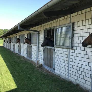
Außenboxen frei - kleiner Privatstall viel Ausla...
Warendorf
EquiFM Pferdephysiotherapie
@EquiFM-Pferdephysiotherapie
Freizeitstall
Pferdeausbildung
Vermieten
Führanlage
Hunde willkommen
Allergikerstall
Hufrehe geeignet
18 weitere...
S

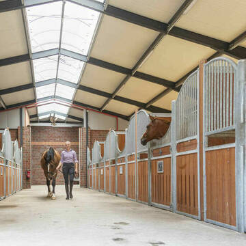
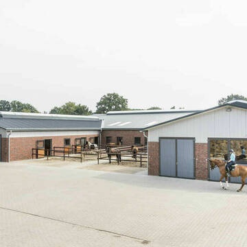
Großzügige Einzelboxen in ruhiger Lage
Nordwalde
Hof-Floer-Nordwalde
@Hof-Floer-Nordwalde
Freizeitstall
Vermieten
Hunde willkommen
Longierzirkel/Roundpen
Allergikerstall
11 weitere...
P
Leider kein Vorschaubild
Leider kein Vorschaubild
Ein Zuhause für Reiter und Pferde
Hagen am Teutoburger Wald
Reiterhof Nieberg
@Reiterhof-Nieberg
FN-Mitglied
Freizeitstall
Vermieten
Longierzirkel/Roundpen
Paddock
Allergikerstall
Hufrehe geeignet
17 weitere...
B
Reiterhof Wilmsberg
Steinfurt
Reiterhof-Wilmsberg
@Reiterhof-Wilmsberg
FN-Mitglied
Freizeitstall
Vermieten
Paddock
Parkplatz für Pferdeanhänger
Allergikerstall
Hufrehe geeignet
17 weitere...
P
Leider kein Vorschaubild
Leider kein Vorschaubild
Große Box mit Weide/Paddock/24/7 Heu
Greven
Ponyliebe_Greven
@Ponyliebe_Greven
Freizeitstall
Vermieten
Führanlage
Hunde willkommen
Gnadenbrothof
Notfallboxen
14 weitere...
B

Offenstallplätze für Islandpferde
Apen
AnneMargraf
@AnneMargraf
Freizeitstall
Gangpferdereiten
Longierzirkel/Roundpen
Ovalbahn
Allergikerstall
bedampftes/gewaschenes Heu
Offenstall
21 weitere...
P

Das Beste für die Hufe
Mechtersen
STALL-FREIde Marketing
@STALL-FREI-Marketing
Hufschmiede und Hufpfleger in Ihrer Nähe

Hof Gerdes
Bloh
Herwig Gerdes
@Herwig-Gerdes
FN-Mitglied
Freizeitstall
Vermieten
Hunde willkommen
Longierzirkel/Roundpen
Gnadenbrothof
20 weitere...
P+
Ställe frei auf moderner Reitanlage!
Laer
Clara Möllers
@clara-moellers
Pflegepferd
Reitlehrer und -unterricht
Vermieten
Führanlage
Hunde willkommen
Außenboxen
Innenbox
15 weitere...
P+

2 Offenstallplätze für Wallache frei
26849 Filsum
Privat
@Pferdefreunde86
Fahrstall, Kutschwagen
Freizeitstall
Vermieten
Hunde willkommen
Krankenbox
Allergikerstall
Notfallboxen
13 weitere...
P+
Deprecated: Creation of dynamic property Zend_View::$pageCount is deprecated in /var/www/stall-frei/htdocs/staging.stall-frei.de/library/vendor/shardj/zf1-future/library/Zend/View/Abstract.php on line 308
Deprecated: Creation of dynamic property Zend_View::$itemCountPerPage is deprecated in /var/www/stall-frei/htdocs/staging.stall-frei.de/library/vendor/shardj/zf1-future/library/Zend/View/Abstract.php on line 308
Deprecated: Creation of dynamic property Zend_View::$first is deprecated in /var/www/stall-frei/htdocs/staging.stall-frei.de/library/vendor/shardj/zf1-future/library/Zend/View/Abstract.php on line 308
Deprecated: Creation of dynamic property Zend_View::$current is deprecated in /var/www/stall-frei/htdocs/staging.stall-frei.de/library/vendor/shardj/zf1-future/library/Zend/View/Abstract.php on line 308
Deprecated: Creation of dynamic property Zend_View::$last is deprecated in /var/www/stall-frei/htdocs/staging.stall-frei.de/library/vendor/shardj/zf1-future/library/Zend/View/Abstract.php on line 308
Deprecated: Creation of dynamic property Zend_View::$previous is deprecated in /var/www/stall-frei/htdocs/staging.stall-frei.de/library/vendor/shardj/zf1-future/library/Zend/View/Abstract.php on line 308
Deprecated: Creation of dynamic property Zend_View::$next is deprecated in /var/www/stall-frei/htdocs/staging.stall-frei.de/library/vendor/shardj/zf1-future/library/Zend/View/Abstract.php on line 308
Deprecated: Creation of dynamic property Zend_View::$pagesInRange is deprecated in /var/www/stall-frei/htdocs/staging.stall-frei.de/library/vendor/shardj/zf1-future/library/Zend/View/Abstract.php on line 308
Deprecated: Creation of dynamic property Zend_View::$firstPageInRange is deprecated in /var/www/stall-frei/htdocs/staging.stall-frei.de/library/vendor/shardj/zf1-future/library/Zend/View/Abstract.php on line 308
Deprecated: Creation of dynamic property Zend_View::$lastPageInRange is deprecated in /var/www/stall-frei/htdocs/staging.stall-frei.de/library/vendor/shardj/zf1-future/library/Zend/View/Abstract.php on line 308
Deprecated: Creation of dynamic property Zend_View::$currentItemCount is deprecated in /var/www/stall-frei/htdocs/staging.stall-frei.de/library/vendor/shardj/zf1-future/library/Zend/View/Abstract.php on line 308
Deprecated: Creation of dynamic property Zend_View::$totalItemCount is deprecated in /var/www/stall-frei/htdocs/staging.stall-frei.de/library/vendor/shardj/zf1-future/library/Zend/View/Abstract.php on line 308
Deprecated: Creation of dynamic property Zend_View::$firstItemNumber is deprecated in /var/www/stall-frei/htdocs/staging.stall-frei.de/library/vendor/shardj/zf1-future/library/Zend/View/Abstract.php on line 308
Deprecated: Creation of dynamic property Zend_View::$lastItemNumber is deprecated in /var/www/stall-frei/htdocs/staging.stall-frei.de/library/vendor/shardj/zf1-future/library/Zend/View/Abstract.php on line 308
Deprecated: Creation of dynamic property Zend_View::$router is deprecated in /var/www/stall-frei/htdocs/staging.stall-frei.de/library/vendor/shardj/zf1-future/library/Zend/View/Abstract.php on line 308
Deprecated: Creation of dynamic property Zend_View::$urlParams is deprecated in /var/www/stall-frei/htdocs/staging.stall-frei.de/library/vendor/shardj/zf1-future/library/Zend/View/Abstract.php on line 308
Deprecated: Creation of dynamic property Zend_View::$showAds is deprecated in /var/www/stall-frei/htdocs/staging.stall-frei.de/library/vendor/shardj/zf1-future/library/Zend/View/Abstract.php on line 308
Deprecated: Creation of dynamic property Zend_View::$objectIds is deprecated in /var/www/stall-frei/htdocs/staging.stall-frei.de/library/vendor/shardj/zf1-future/library/Zend/View/Abstract.php on line 308
Deprecated: Creation of dynamic property Zend_View::$showNavbar is deprecated in /var/www/stall-frei/htdocs/staging.stall-frei.de/library/vendor/shardj/zf1-future/library/Zend/View/Abstract.php on line 308
Deprecated: Creation of dynamic property Zend_View::$showBreadcrumb is deprecated in /var/www/stall-frei/htdocs/staging.stall-frei.de/library/vendor/shardj/zf1-future/library/Zend/View/Abstract.php on line 308
Deprecated: Creation of dynamic property Zend_View::$showFooter is deprecated in /var/www/stall-frei/htdocs/staging.stall-frei.de/library/vendor/shardj/zf1-future/library/Zend/View/Abstract.php on line 308
Deprecated: Creation of dynamic property Zend_View::$showInternalAds is deprecated in /var/www/stall-frei/htdocs/staging.stall-frei.de/library/vendor/shardj/zf1-future/library/Zend/View/Abstract.php on line 308
Deprecated: Creation of dynamic property Zend_View::$blNoContent is deprecated in /var/www/stall-frei/htdocs/staging.stall-frei.de/library/vendor/shardj/zf1-future/library/Zend/View/Abstract.php on line 308
Deprecated: Creation of dynamic property Zend_View::$sMetaDesc is deprecated in /var/www/stall-frei/htdocs/staging.stall-frei.de/library/vendor/shardj/zf1-future/library/Zend/View/Abstract.php on line 308
Deprecated: Creation of dynamic property Zend_View::$useGmaps is deprecated in /var/www/stall-frei/htdocs/staging.stall-frei.de/library/vendor/shardj/zf1-future/library/Zend/View/Abstract.php on line 308
Deprecated: Creation of dynamic property Zend_View::$touches is deprecated in /var/www/stall-frei/htdocs/staging.stall-frei.de/library/vendor/shardj/zf1-future/library/Zend/View/Abstract.php on line 308
Deprecated: Creation of dynamic property Zend_View::$oProject is deprecated in /var/www/stall-frei/htdocs/staging.stall-frei.de/library/vendor/shardj/zf1-future/library/Zend/View/Abstract.php on line 308
Deprecated: Creation of dynamic property Zend_View::$pageHeadline is deprecated in /var/www/stall-frei/htdocs/staging.stall-frei.de/library/vendor/shardj/zf1-future/library/Zend/View/Abstract.php on line 308
Deprecated: Creation of dynamic property Zend_View::$disableLocationField is deprecated in /var/www/stall-frei/htdocs/staging.stall-frei.de/library/vendor/shardj/zf1-future/library/Zend/View/Abstract.php on line 308
Deprecated: Creation of dynamic property Zend_View::$isSearch is deprecated in /var/www/stall-frei/htdocs/staging.stall-frei.de/library/vendor/shardj/zf1-future/library/Zend/View/Abstract.php on line 308
Deprecated: Creation of dynamic property Zend_View::$pageTitle is deprecated in /var/www/stall-frei/htdocs/staging.stall-frei.de/library/vendor/shardj/zf1-future/library/Zend/View/Abstract.php on line 308
Deprecated: Creation of dynamic property Psf_Form_Element_Text::$class is deprecated in /var/www/stall-frei/htdocs/staging.stall-frei.de/library/vendor/shardj/zf1-future/library/Zend/Form/Element.php on line 874
Deprecated: Creation of dynamic property Psf_Form_Element_Text::$size is deprecated in /var/www/stall-frei/htdocs/staging.stall-frei.de/library/vendor/shardj/zf1-future/library/Zend/Form/Element.php on line 874
Deprecated: Creation of dynamic property Psf_Form_Element_Text::$placeholder is deprecated in /var/www/stall-frei/htdocs/staging.stall-frei.de/library/vendor/shardj/zf1-future/library/Zend/Form/Element.php on line 874
Deprecated: Creation of dynamic property Psf_Form_Element_Hidden::$class is deprecated in /var/www/stall-frei/htdocs/staging.stall-frei.de/library/vendor/shardj/zf1-future/library/Zend/Form/Element.php on line 874
Deprecated: Creation of dynamic property Psf_Form_Element_Hidden::$class is deprecated in /var/www/stall-frei/htdocs/staging.stall-frei.de/library/vendor/shardj/zf1-future/library/Zend/Form/Element.php on line 874
Deprecated: Creation of dynamic property Psf_Form_Element_Hidden::$class is deprecated in /var/www/stall-frei/htdocs/staging.stall-frei.de/library/vendor/shardj/zf1-future/library/Zend/Form/Element.php on line 874
Deprecated: Creation of dynamic property Psf_Form_Element_Hidden::$class is deprecated in /var/www/stall-frei/htdocs/staging.stall-frei.de/library/vendor/shardj/zf1-future/library/Zend/Form/Element.php on line 874
Deprecated: Creation of dynamic property Psf_Form_Element_Select::$class is deprecated in /var/www/stall-frei/htdocs/staging.stall-frei.de/library/vendor/shardj/zf1-future/library/Zend/Form/Element.php on line 874
Deprecated: Creation of dynamic property Psf_Form_Element_Select::$class is deprecated in /var/www/stall-frei/htdocs/staging.stall-frei.de/library/vendor/shardj/zf1-future/library/Zend/Form/Element.php on line 874
Deprecated: Creation of dynamic property Psf_Form_Element_Select::$class is deprecated in /var/www/stall-frei/htdocs/staging.stall-frei.de/library/vendor/shardj/zf1-future/library/Zend/Form/Element.php on line 874
Deprecated: Creation of dynamic property Psf_Form_Element_Select::$class is deprecated in /var/www/stall-frei/htdocs/staging.stall-frei.de/library/vendor/shardj/zf1-future/library/Zend/Form/Element.php on line 874
Deprecated: Creation of dynamic property Psf_Form_Element_Text::$class is deprecated in /var/www/stall-frei/htdocs/staging.stall-frei.de/library/vendor/shardj/zf1-future/library/Zend/Form/Element.php on line 874
Deprecated: Creation of dynamic property Psf_Form_Element_Checkbox::$label is deprecated in /var/www/stall-frei/htdocs/staging.stall-frei.de/library/vendor/shardj/zf1-future/library/Zend/Form/Element.php on line 874
Deprecated: Creation of dynamic property Zend_View::$sort is deprecated in /var/www/stall-frei/htdocs/staging.stall-frei.de/library/vendor/shardj/zf1-future/library/Zend/View/Abstract.php on line 308
Deprecated: Creation of dynamic property Zend_View::$searchLocation is deprecated in /var/www/stall-frei/htdocs/staging.stall-frei.de/library/vendor/shardj/zf1-future/library/Zend/View/Abstract.php on line 308
Deprecated: Creation of dynamic property Zend_View::$locationHint is deprecated in /var/www/stall-frei/htdocs/staging.stall-frei.de/library/vendor/shardj/zf1-future/library/Zend/View/Abstract.php on line 308
Psf_GeoCoder_Abstract::getLocation: Dohren Get Location CachedOrLive
Psf_GeoCoder_Abstract::getCachedOrLive: Dohren
Psf_GeoCoder_Abstract::convertLocationResult
{"documentation":"https:\/\/opencagedata.com\/api","licenses":[{"name":"see attribution guide","url":"https:\/\/opencagedata.com\/credits"}],"results":[{"bounds":{"northeast":{"lat":52.6583184,"lng":7.658145},"southwest":{"lat":52.6095098,"lng":7.542665}},"components":{"ISO_3166-1_alpha-2":"DE","ISO_3166-1_alpha-3":"DEU","ISO_3166-2":["DE-NI"],"_category":"place","_normalized_city":"Dohren","_type":"village","continent":"Europe","country":"Deutschland","country_code":"de","county":"Landkreis Emsland","municipality":"Samtgemeinde Herzlake","political_union":"European Union","state":"Niedersachsen","state_code":"NI","village":"Dohren"},"confidence":7,"formatted":"Dohren, Niedersachsen, Deutschland","geometry":{"lat":52.6458321,"lng":7.5837734}},{"bounds":{"northeast":{"lat":53.3383569,"lng":9.7349396},"southwest":{"lat":53.2803282,"lng":9.6319703}},"components":{"ISO_3166-1_alpha-2":"DE","ISO_3166-1_alpha-3":"DEU","ISO_3166-2":["DE-NI"],"_category":"place","_normalized_city":"Dohren","_type":"village","continent":"Europe","country":"Deutschland","country_code":"de","county":"Landkreis Harburg","municipality":"Samtgemeinde Tostedt","political_union":"European Union","state":"Niedersachsen","state_code":"NI","village":"Dohren"},"confidence":7,"formatted":"Dohren, Niedersachsen, Deutschland","geometry":{"lat":53.3054946,"lng":9.7008436}},{"bounds":{"northeast":{"lat":52.3473706,"lng":11.0388626},"southwest":{"lat":52.3215891,"lng":10.9834602}},"components":{"ISO_3166-1_alpha-2":"DE","ISO_3166-1_alpha-3":"DEU","ISO_3166-2":["DE-ST"],"_category":"place","_normalized_city":"Oebisfelde-Weferlingen","_type":"neighbourhood","city_district":"D\u00f6hren","continent":"Europe","country":"Deutschland","country_code":"de","county":"B\u00f6rde","municipality":"Oebisfelde-Weferlingen","political_union":"European Union","state":"Sachsen-Anhalt","state_code":"ST"},"confidence":7,"formatted":"D\u00f6hren, Oebisfelde-Weferlingen, Sachsen-Anhalt, Deutschland","geometry":{"lat":52.3346047,"lng":11.0196729}},{"bounds":{"northeast":{"lat":52.3462943,"lng":9.7820014},"southwest":{"lat":52.3271955,"lng":9.7401532}},"components":{"ISO_3166-1_alpha-2":"DE","ISO_3166-1_alpha-3":"DEU","ISO_3166-2":["DE-NI"],"_category":"place","_normalized_city":"Hannover","_type":"neighbourhood","city":"Hannover","city_district":"D\u00f6hren-W\u00fclfel","continent":"Europe","country":"Deutschland","country_code":"de","county":"Region Hannover","political_union":"European Union","postcode":"30519","state":"Niedersachsen","state_code":"NI","suburb":"D\u00f6hren"},"confidence":7,"formatted":"30519 Hannover, Deutschland","geometry":{"lat":52.3358471,"lng":9.7688064}},{"bounds":{"northeast":{"lat":52.4518076,"lng":9.0542093},"southwest":{"lat":52.4118076,"lng":9.0142093}},"components":{"ISO_3166-1_alpha-2":"DE","ISO_3166-1_alpha-3":"DEU","ISO_3166-2":["DE-NW"],"_category":"place","_normalized_city":"Petershagen","_type":"city","continent":"Europe","country":"Deutschland","country_code":"de","county":"Kreis Minden-L\u00fcbbecke","political_union":"European Union","state":"Nordrhein-Westfalen","state_code":"NW","town":"Petershagen"},"confidence":7,"formatted":"Petershagen, Nordrhein-Westfalen, Deutschland","geometry":{"lat":52.4318076,"lng":9.0342093}},{"bounds":{"northeast":{"lat":52.0138135,"lng":10.4854876},"southwest":{"lat":51.965191,"lng":10.4192081}},"components":{"ISO_3166-1_alpha-2":"DE","ISO_3166-1_alpha-3":"DEU","ISO_3166-2":["DE-NI"],"_category":"place","_normalized_city":"Liebenburg","_type":"village","city":"Liebenburg","continent":"Europe","country":"Deutschland","country_code":"de","county":"Landkreis Goslar","political_union":"European Union","state":"Niedersachsen","state_code":"NI","village":"D\u00f6hren"},"confidence":7,"formatted":"D\u00f6hren, Niedersachsen, Deutschland","geometry":{"lat":51.997521,"lng":10.4467605}},{"components":{"ISO_3166-1_alpha-2":"FR","ISO_3166-1_alpha-3":"FRA","ISO_3166-2":["FR-OCC","FR-81"],"_category":"road","_normalized_city":"Teulat","_type":"road","city":"Teulat","continent":"Europe","country":"France","country_code":"fr","county":"Tarn","local_authority":"Communaut\u00e9 de communes Tarn-Agout","political_union":"European Union","postcode":"81500","road":"Route de Daren","state":"Occitanie","state_code":"OCC"},"confidence":2,"formatted":"Route de Daren, 81500 Teulat, France","geometry":{"lat":43.626541,"lng":1.714}},{"components":{"ISO_3166-1_alpha-2":"FR","ISO_3166-1_alpha-3":"FRA","ISO_3166-2":["FR-ARA","FR-69"],"_category":"road","_normalized_city":"Neuville-sur-Sa\u00f4ne","_type":"road","city":"Neuville-sur-Sa\u00f4ne","continent":"Europe","country":"France","country_code":"fr","county":"Rh\u00f4ne","local_authority":"M\u00e9tropole de Lyon","political_union":"European Union","postcode":"69250","road":"Avenue Van Doren","state":"Auvergne-Rh\u00f4ne-Alpes","state_code":"ARA"},"confidence":2,"formatted":"Avenue Van Doren, 69250 Neuville-sur-Sa\u00f4ne, France","geometry":{"lat":45.873945,"lng":4.839802}},{"components":{"ISO_3166-1_alpha-2":"FR","ISO_3166-1_alpha-3":"FRA","ISO_3166-2":["FR-HDF","FR-60"],"_category":"road","_normalized_city":"Pont-Sainte-Maxence","_type":"road","city":"Pont-Sainte-Maxence","continent":"Europe","country":"France","country_code":"fr","county":"Oise","local_authority":"Communaut\u00e9 de communes des Pays d'Oise et d'Halatte","political_union":"European Union","postcode":"60700","road":"Rue Alexandre Van Dooren","state":"Hauts-de-France","state_code":"HDF"},"confidence":2,"formatted":"Rue Alexandre Van Dooren, 60700 Pont-Sainte-Maxence, France","geometry":{"lat":49.314301,"lng":2.613175}},{"components":{"ISO_3166-1_alpha-2":"FR","ISO_3166-1_alpha-3":"FRA","ISO_3166-2":["FR-GES","FR-08"],"_category":"road","_normalized_city":"Charnois","_type":"road","city":"Charnois","continent":"Europe","country":"France","country_code":"fr","county":"Ardennes","local_authority":"Communaut\u00e9 de communes Ardenne, Rives de Meuse","political_union":"European Union","postcode":"08600","road":"La Dorenne","state":"Grand Est","state_code":"GES"},"confidence":2,"formatted":"La Dorenne, 08600 Charnois, France","geometry":{"lat":50.110819,"lng":4.830789}}],"status":{"code":200,"message":"OK"},"stay_informed":{"blog":"https:\/\/blog.opencagedata.com","mastodon":"https:\/\/en.osm.town\/@opencage"},"thanks":"For using an OpenCage API","timestamp":{"created_http":"Sat, 07 Feb 2026 07:32:39 GMT","created_unix":1770449559},"total_results":10}Array
(
[0] => stdClass Object
(
[bounds] => stdClass Object
(
[northeast] => stdClass Object
(
[lat] => 52.6583184
[lng] => 7.658145
)
[southwest] => stdClass Object
(
[lat] => 52.6095098
[lng] => 7.542665
)
)
[components] => stdClass Object
(
[ISO_3166-1_alpha-2] => DE
[ISO_3166-1_alpha-3] => DEU
[ISO_3166-2] => Array
(
[0] => DE-NI
)
[_category] => place
[_normalized_city] => Dohren
[_type] => village
[continent] => Europe
[country] => Deutschland
[country_code] => de
[county] => Landkreis Emsland
[municipality] => Samtgemeinde Herzlake
[political_union] => European Union
[state] => Niedersachsen
[state_code] => NI
[village] => Dohren
)
[confidence] => 7
[formatted] => Dohren, Niedersachsen, Deutschland
[geometry] => stdClass Object
(
[lat] => 52.6458321
[lng] => 7.5837734
)
)
[1] => stdClass Object
(
[bounds] => stdClass Object
(
[northeast] => stdClass Object
(
[lat] => 53.3383569
[lng] => 9.7349396
)
[southwest] => stdClass Object
(
[lat] => 53.2803282
[lng] => 9.6319703
)
)
[components] => stdClass Object
(
[ISO_3166-1_alpha-2] => DE
[ISO_3166-1_alpha-3] => DEU
[ISO_3166-2] => Array
(
[0] => DE-NI
)
[_category] => place
[_normalized_city] => Dohren
[_type] => village
[continent] => Europe
[country] => Deutschland
[country_code] => de
[county] => Landkreis Harburg
[municipality] => Samtgemeinde Tostedt
[political_union] => European Union
[state] => Niedersachsen
[state_code] => NI
[village] => Dohren
)
[confidence] => 7
[formatted] => Dohren, Niedersachsen, Deutschland
[geometry] => stdClass Object
(
[lat] => 53.3054946
[lng] => 9.7008436
)
)
[2] => stdClass Object
(
[bounds] => stdClass Object
(
[northeast] => stdClass Object
(
[lat] => 52.3473706
[lng] => 11.0388626
)
[southwest] => stdClass Object
(
[lat] => 52.3215891
[lng] => 10.9834602
)
)
[components] => stdClass Object
(
[ISO_3166-1_alpha-2] => DE
[ISO_3166-1_alpha-3] => DEU
[ISO_3166-2] => Array
(
[0] => DE-ST
)
[_category] => place
[_normalized_city] => Oebisfelde-Weferlingen
[_type] => neighbourhood
[city_district] => Döhren
[continent] => Europe
[country] => Deutschland
[country_code] => de
[county] => Börde
[municipality] => Oebisfelde-Weferlingen
[political_union] => European Union
[state] => Sachsen-Anhalt
[state_code] => ST
)
[confidence] => 7
[formatted] => Döhren, Oebisfelde-Weferlingen, Sachsen-Anhalt, Deutschland
[geometry] => stdClass Object
(
[lat] => 52.3346047
[lng] => 11.0196729
)
)
[3] => stdClass Object
(
[bounds] => stdClass Object
(
[northeast] => stdClass Object
(
[lat] => 52.3462943
[lng] => 9.7820014
)
[southwest] => stdClass Object
(
[lat] => 52.3271955
[lng] => 9.7401532
)
)
[components] => stdClass Object
(
[ISO_3166-1_alpha-2] => DE
[ISO_3166-1_alpha-3] => DEU
[ISO_3166-2] => Array
(
[0] => DE-NI
)
[_category] => place
[_normalized_city] => Hannover
[_type] => neighbourhood
[city] => Hannover
[city_district] => Döhren-Wülfel
[continent] => Europe
[country] => Deutschland
[country_code] => de
[county] => Region Hannover
[political_union] => European Union
[postcode] => 30519
[state] => Niedersachsen
[state_code] => NI
[suburb] => Döhren
)
[confidence] => 7
[formatted] => 30519 Hannover, Deutschland
[geometry] => stdClass Object
(
[lat] => 52.3358471
[lng] => 9.7688064
)
)
[4] => stdClass Object
(
[bounds] => stdClass Object
(
[northeast] => stdClass Object
(
[lat] => 52.4518076
[lng] => 9.0542093
)
[southwest] => stdClass Object
(
[lat] => 52.4118076
[lng] => 9.0142093
)
)
[components] => stdClass Object
(
[ISO_3166-1_alpha-2] => DE
[ISO_3166-1_alpha-3] => DEU
[ISO_3166-2] => Array
(
[0] => DE-NW
)
[_category] => place
[_normalized_city] => Petershagen
[_type] => city
[continent] => Europe
[country] => Deutschland
[country_code] => de
[county] => Kreis Minden-Lübbecke
[political_union] => European Union
[state] => Nordrhein-Westfalen
[state_code] => NW
[town] => Petershagen
)
[confidence] => 7
[formatted] => Petershagen, Nordrhein-Westfalen, Deutschland
[geometry] => stdClass Object
(
[lat] => 52.4318076
[lng] => 9.0342093
)
)
[5] => stdClass Object
(
[bounds] => stdClass Object
(
[northeast] => stdClass Object
(
[lat] => 52.0138135
[lng] => 10.4854876
)
[southwest] => stdClass Object
(
[lat] => 51.965191
[lng] => 10.4192081
)
)
[components] => stdClass Object
(
[ISO_3166-1_alpha-2] => DE
[ISO_3166-1_alpha-3] => DEU
[ISO_3166-2] => Array
(
[0] => DE-NI
)
[_category] => place
[_normalized_city] => Liebenburg
[_type] => village
[city] => Liebenburg
[continent] => Europe
[country] => Deutschland
[country_code] => de
[county] => Landkreis Goslar
[political_union] => European Union
[state] => Niedersachsen
[state_code] => NI
[village] => Döhren
)
[confidence] => 7
[formatted] => Döhren, Niedersachsen, Deutschland
[geometry] => stdClass Object
(
[lat] => 51.997521
[lng] => 10.4467605
)
)
[6] => stdClass Object
(
[components] => stdClass Object
(
[ISO_3166-1_alpha-2] => FR
[ISO_3166-1_alpha-3] => FRA
[ISO_3166-2] => Array
(
[0] => FR-OCC
[1] => FR-81
)
[_category] => road
[_normalized_city] => Teulat
[_type] => road
[city] => Teulat
[continent] => Europe
[country] => France
[country_code] => fr
[county] => Tarn
[local_authority] => Communauté de communes Tarn-Agout
[political_union] => European Union
[postcode] => 81500
[road] => Route de Daren
[state] => Occitanie
[state_code] => OCC
)
[confidence] => 2
[formatted] => Route de Daren, 81500 Teulat, France
[geometry] => stdClass Object
(
[lat] => 43.626541
[lng] => 1.714
)
)
[7] => stdClass Object
(
[components] => stdClass Object
(
[ISO_3166-1_alpha-2] => FR
[ISO_3166-1_alpha-3] => FRA
[ISO_3166-2] => Array
(
[0] => FR-ARA
[1] => FR-69
)
[_category] => road
[_normalized_city] => Neuville-sur-Saône
[_type] => road
[city] => Neuville-sur-Saône
[continent] => Europe
[country] => France
[country_code] => fr
[county] => Rhône
[local_authority] => Métropole de Lyon
[political_union] => European Union
[postcode] => 69250
[road] => Avenue Van Doren
[state] => Auvergne-Rhône-Alpes
[state_code] => ARA
)
[confidence] => 2
[formatted] => Avenue Van Doren, 69250 Neuville-sur-Saône, France
[geometry] => stdClass Object
(
[lat] => 45.873945
[lng] => 4.839802
)
)
[8] => stdClass Object
(
[components] => stdClass Object
(
[ISO_3166-1_alpha-2] => FR
[ISO_3166-1_alpha-3] => FRA
[ISO_3166-2] => Array
(
[0] => FR-HDF
[1] => FR-60
)
[_category] => road
[_normalized_city] => Pont-Sainte-Maxence
[_type] => road
[city] => Pont-Sainte-Maxence
[continent] => Europe
[country] => France
[country_code] => fr
[county] => Oise
[local_authority] => Communauté de communes des Pays d'Oise et d'Halatte
[political_union] => European Union
[postcode] => 60700
[road] => Rue Alexandre Van Dooren
[state] => Hauts-de-France
[state_code] => HDF
)
[confidence] => 2
[formatted] => Rue Alexandre Van Dooren, 60700 Pont-Sainte-Maxence, France
[geometry] => stdClass Object
(
[lat] => 49.314301
[lng] => 2.613175
)
)
[9] => stdClass Object
(
[components] => stdClass Object
(
[ISO_3166-1_alpha-2] => FR
[ISO_3166-1_alpha-3] => FRA
[ISO_3166-2] => Array
(
[0] => FR-GES
[1] => FR-08
)
[_category] => road
[_normalized_city] => Charnois
[_type] => road
[city] => Charnois
[continent] => Europe
[country] => France
[country_code] => fr
[county] => Ardennes
[local_authority] => Communauté de communes Ardenne, Rives de Meuse
[political_union] => European Union
[postcode] => 08600
[road] => La Dorenne
[state] => Grand Est
[state_code] => GES
)
[confidence] => 2
[formatted] => La Dorenne, 08600 Charnois, France
[geometry] => stdClass Object
(
[lat] => 50.110819
[lng] => 4.830789
)
)
)
Psf_GeoCoder_OpenCageData::getKeyMap: 0
stdClass Object
(
    [bounds] => stdClass Object
        (
            [northeast] => stdClass Object
                (
                    [lat] => 52.6583184
                    [lng] => 7.658145
                )

            [southwest] => stdClass Object
                (
                    [lat] => 52.6095098
                    [lng] => 7.542665
                )

        )

    [components] => stdClass Object
        (
            [ISO_3166-1_alpha-2] => DE
            [ISO_3166-1_alpha-3] => DEU
            [ISO_3166-2] => Array
                (
                    [0] => DE-NI
                )

            [_category] => place
            [_normalized_city] => Dohren
            [_type] => village
            [continent] => Europe
            [country] => Deutschland
            [country_code] => de
            [county] => Landkreis Emsland
            [municipality] => Samtgemeinde Herzlake
            [political_union] => European Union
            [state] => Niedersachsen
            [state_code] => NI
            [village] => Dohren
        )

    [confidence] => 7
    [formatted] => Dohren, Niedersachsen, Deutschland
    [geometry] => stdClass Object
        (
            [lat] => 52.6458321
            [lng] => 7.5837734
        )

)
Psf_GeoCoder_OpenCageData::getCounty: Emsland
Psf_GeoCoder_OpenCageData::addMissingData REFETCH!
Array
(
    [address] => Dohren, Niedersachsen, Deutschland
    [type] => village
    [street] =>
    [city] => Dohren
    [county] => Emsland
    [state] => Niedersachsen
    [zip] =>
    [country] => Deutschland
    [suburb] =>
    [countrycode] => de
    [latitude] => 52.6458321
    [longitude] => 7.5837734
    [accuracy] => 1
    [confidence] => 7
    [bounds] => stdClass Object
        (
            [northeast] => stdClass Object
                (
                    [lat] => 52.6583184
                    [lng] => 7.658145
                )

            [southwest] => stdClass Object
                (
                    [lat] => 52.6095098
                    [lng] => 7.542665
                )

        )

)
reformat!
Array
(
    [address] => Dohren, Niedersachsen, Deutschland
    [type] => village
    [street] =>
    [city] => Dohren
    [county] => Emsland
    [state] => Niedersachsen
    [zip] =>
    [country] => Deutschland
    [suburb] =>
    [countrycode] => de
    [latitude] => 52.6458321
    [longitude] => 7.5837734
    [accuracy] => 1
    [confidence] => 7
    [bounds] => stdClass Object
        (
            [northeast] => stdClass Object
                (
                    [lat] => 52.6583184
                    [lng] => 7.658145
                )

            [southwest] => stdClass Object
                (
                    [lat] => 52.6095098
                    [lng] => 7.542665
                )

        )

    [place] => Dohren, Niedersachsen
    [hash] => 6dcc9ed1abda7e62e374ba44b094b529
)
Psf_GeoCoder_OpenCageData::getKeyMap: 1
stdClass Object
(
    [bounds] => stdClass Object
        (
            [northeast] => stdClass Object
                (
                    [lat] => 53.3383569
                    [lng] => 9.7349396
                )

            [southwest] => stdClass Object
                (
                    [lat] => 53.2803282
                    [lng] => 9.6319703
                )

        )

    [components] => stdClass Object
        (
            [ISO_3166-1_alpha-2] => DE
            [ISO_3166-1_alpha-3] => DEU
            [ISO_3166-2] => Array
                (
                    [0] => DE-NI
                )

            [_category] => place
            [_normalized_city] => Dohren
            [_type] => village
            [continent] => Europe
            [country] => Deutschland
            [country_code] => de
            [county] => Landkreis Harburg
            [municipality] => Samtgemeinde Tostedt
            [political_union] => European Union
            [state] => Niedersachsen
            [state_code] => NI
            [village] => Dohren
        )

    [confidence] => 7
    [formatted] => Dohren, Niedersachsen, Deutschland
    [geometry] => stdClass Object
        (
            [lat] => 53.3054946
            [lng] => 9.7008436
        )

)
Psf_GeoCoder_OpenCageData::getCounty: Harburg
Psf_GeoCoder_OpenCageData::addMissingData REFETCH!
Array
(
    [address] => Dohren, Niedersachsen, Deutschland
    [type] => village
    [street] =>
    [city] => Dohren
    [county] => Harburg
    [state] => Niedersachsen
    [zip] =>
    [country] => Deutschland
    [suburb] =>
    [countrycode] => de
    [latitude] => 53.3054946
    [longitude] => 9.7008436
    [accuracy] => 1
    [confidence] => 7
    [bounds] => stdClass Object
        (
            [northeast] => stdClass Object
                (
                    [lat] => 53.3383569
                    [lng] => 9.7349396
                )

            [southwest] => stdClass Object
                (
                    [lat] => 53.2803282
                    [lng] => 9.6319703
                )

        )

)
reformat!
Array
(
    [address] => Dohren, Niedersachsen, Deutschland
    [type] => village
    [street] =>
    [city] => Dohren
    [county] => Harburg
    [state] => Niedersachsen
    [zip] =>
    [country] => Deutschland
    [suburb] =>
    [countrycode] => de
    [latitude] => 53.3054946
    [longitude] => 9.7008436
    [accuracy] => 1
    [confidence] => 7
    [bounds] => stdClass Object
        (
            [northeast] => stdClass Object
                (
                    [lat] => 53.3383569
                    [lng] => 9.7349396
                )

            [southwest] => stdClass Object
                (
                    [lat] => 53.2803282
                    [lng] => 9.6319703
                )

        )

    [place] => Dohren, Niedersachsen
    [hash] => 6dcc9ed1abda7e62e374ba44b094b529
)
Psf_GeoCoder_OpenCageData::getKeyMap: 2
stdClass Object
(
    [bounds] => stdClass Object
        (
            [northeast] => stdClass Object
                (
                    [lat] => 52.3473706
                    [lng] => 11.0388626
                )

            [southwest] => stdClass Object
                (
                    [lat] => 52.3215891
                    [lng] => 10.9834602
                )

        )

    [components] => stdClass Object
        (
            [ISO_3166-1_alpha-2] => DE
            [ISO_3166-1_alpha-3] => DEU
            [ISO_3166-2] => Array
                (
                    [0] => DE-ST
                )

            [_category] => place
            [_normalized_city] => Oebisfelde-Weferlingen
            [_type] => neighbourhood
            [city_district] => Döhren
            [continent] => Europe
            [country] => Deutschland
            [country_code] => de
            [county] => Börde
            [municipality] => Oebisfelde-Weferlingen
            [political_union] => European Union
            [state] => Sachsen-Anhalt
            [state_code] => ST
        )

    [confidence] => 7
    [formatted] => Döhren, Oebisfelde-Weferlingen, Sachsen-Anhalt, Deutschland
    [geometry] => stdClass Object
        (
            [lat] => 52.3346047
            [lng] => 11.0196729
        )

)
Psf_GeoCoder_OpenCageData::getCounty: Börde
Psf_GeoCoder_OpenCageData::addMissingData REFETCH!
Array
(
    [address] => Döhren, Oebisfelde-Weferlingen, Sachsen-Anhalt, Deutschland
    [type] => neighbourhood
    [street] =>
    [city] => Döhren
    [county] => Börde
    [state] => Sachsen-Anhalt
    [zip] =>
    [country] => Deutschland
    [suburb] =>
    [countrycode] => de
    [latitude] => 52.3346047
    [longitude] => 11.0196729
    [accuracy] => 1
    [confidence] => 7
    [bounds] => stdClass Object
        (
            [northeast] => stdClass Object
                (
                    [lat] => 52.3473706
                    [lng] => 11.0388626
                )

            [southwest] => stdClass Object
                (
                    [lat] => 52.3215891
                    [lng] => 10.9834602
                )

        )

)
reformat!
Array
(
    [address] => Döhren, Oebisfelde-Weferlingen, Sachsen-Anhalt, Deutschland
    [type] => neighbourhood
    [street] =>
    [city] => Döhren
    [county] => Börde
    [state] => Sachsen-Anhalt
    [zip] =>
    [country] => Deutschland
    [suburb] =>
    [countrycode] => de
    [latitude] => 52.3346047
    [longitude] => 11.0196729
    [accuracy] => 1
    [confidence] => 7
    [bounds] => stdClass Object
        (
            [northeast] => stdClass Object
                (
                    [lat] => 52.3473706
                    [lng] => 11.0388626
                )

            [southwest] => stdClass Object
                (
                    [lat] => 52.3215891
                    [lng] => 10.9834602
                )

        )

    [place] => Döhren, Sachsen-Anhalt
    [hash] => c874d1a015479747f04a64aa70d672ba
)
Psf_GeoCoder_OpenCageData::getKeyMap: 3
stdClass Object
(
    [bounds] => stdClass Object
        (
            [northeast] => stdClass Object
                (
                    [lat] => 52.3462943
                    [lng] => 9.7820014
                )

            [southwest] => stdClass Object
                (
                    [lat] => 52.3271955
                    [lng] => 9.7401532
                )

        )

    [components] => stdClass Object
        (
            [ISO_3166-1_alpha-2] => DE
            [ISO_3166-1_alpha-3] => DEU
            [ISO_3166-2] => Array
                (
                    [0] => DE-NI
                )

            [_category] => place
            [_normalized_city] => Hannover
            [_type] => neighbourhood
            [city] => Hannover
            [city_district] => Döhren-Wülfel
            [continent] => Europe
            [country] => Deutschland
            [country_code] => de
            [county] => Region Hannover
            [political_union] => European Union
            [postcode] => 30519
            [state] => Niedersachsen
            [state_code] => NI
            [suburb] => Döhren
        )

    [confidence] => 7
    [formatted] => 30519 Hannover, Deutschland
    [geometry] => stdClass Object
        (
            [lat] => 52.3358471
            [lng] => 9.7688064
        )

)
Psf_GeoCoder_OpenCageData::getCounty: Hannover
Psf_GeoCoder_OpenCageData::addMissingData REFETCH!
Array
(
    [address] => 30519 Hannover, Deutschland
    [type] => neighbourhood
    [street] =>
    [city] => Döhren
    [county] => Hannover
    [state] => Niedersachsen
    [zip] => 30519
    [country] => Deutschland
    [suburb] => Döhren
    [countrycode] => de
    [latitude] => 52.3358471
    [longitude] => 9.7688064
    [accuracy] => 1
    [confidence] => 7
    [bounds] => stdClass Object
        (
            [northeast] => stdClass Object
                (
                    [lat] => 52.3462943
                    [lng] => 9.7820014
                )

            [southwest] => stdClass Object
                (
                    [lat] => 52.3271955
                    [lng] => 9.7401532
                )

        )

)
reformat!
Array
(
    [address] => 30519 Döhren
    [type] => neighbourhood
    [street] =>
    [city] => Döhren
    [county] => Hannover
    [state] => Niedersachsen
    [zip] => 30519
    [country] => Deutschland
    [suburb] => Döhren
    [countrycode] => de
    [latitude] => 52.3358471
    [longitude] => 9.7688064
    [accuracy] => 1
    [confidence] => 7
    [bounds] => stdClass Object
        (
            [northeast] => stdClass Object
                (
                    [lat] => 52.3462943
                    [lng] => 9.7820014
                )

            [southwest] => stdClass Object
                (
                    [lat] => 52.3271955
                    [lng] => 9.7401532
                )

        )

    [place] => 30519 Döhren, Niedersachsen
    [hash] => b73264222af1a889297f16e56d41fc8e
)
Psf_GeoCoder_OpenCageData::getKeyMap: 4
stdClass Object
(
    [bounds] => stdClass Object
        (
            [northeast] => stdClass Object
                (
                    [lat] => 52.4518076
                    [lng] => 9.0542093
                )

            [southwest] => stdClass Object
                (
                    [lat] => 52.4118076
                    [lng] => 9.0142093
                )

        )

    [components] => stdClass Object
        (
            [ISO_3166-1_alpha-2] => DE
            [ISO_3166-1_alpha-3] => DEU
            [ISO_3166-2] => Array
                (
                    [0] => DE-NW
                )

            [_category] => place
            [_normalized_city] => Petershagen
            [_type] => city
            [continent] => Europe
            [country] => Deutschland
            [country_code] => de
            [county] => Kreis Minden-Lübbecke
            [political_union] => European Union
            [state] => Nordrhein-Westfalen
            [state_code] => NW
            [town] => Petershagen
        )

    [confidence] => 7
    [formatted] => Petershagen, Nordrhein-Westfalen, Deutschland
    [geometry] => stdClass Object
        (
            [lat] => 52.4318076
            [lng] => 9.0342093
        )

)
Psf_GeoCoder_OpenCageData::getCounty: Minden-Lübbecke
Psf_GeoCoder_OpenCageData::addMissingData REFETCH!
Array
(
    [address] => Petershagen, Nordrhein-Westfalen, Deutschland
    [type] => city
    [street] =>
    [city] => Petershagen
    [county] => Minden-Lübbecke
    [state] => Nordrhein-Westfalen
    [zip] =>
    [country] => Deutschland
    [suburb] =>
    [countrycode] => de
    [latitude] => 52.4318076
    [longitude] => 9.0342093
    [accuracy] => 1
    [confidence] => 7
    [bounds] => stdClass Object
        (
            [northeast] => stdClass Object
                (
                    [lat] => 52.4518076
                    [lng] => 9.0542093
                )

            [southwest] => stdClass Object
                (
                    [lat] => 52.4118076
                    [lng] => 9.0142093
                )

        )

)
reformat!
Array
(
    [address] => Petershagen, Nordrhein-Westfalen, Deutschland
    [type] => city
    [street] =>
    [city] => Petershagen
    [county] => Minden-Lübbecke
    [state] => Nordrhein-Westfalen
    [zip] =>
    [country] => Deutschland
    [suburb] =>
    [countrycode] => de
    [latitude] => 52.4318076
    [longitude] => 9.0342093
    [accuracy] => 1
    [confidence] => 7
    [bounds] => stdClass Object
        (
            [northeast] => stdClass Object
                (
                    [lat] => 52.4518076
                    [lng] => 9.0542093
                )

            [southwest] => stdClass Object
                (
                    [lat] => 52.4118076
                    [lng] => 9.0142093
                )

        )

    [place] => Petershagen, Nordrhein-Westfalen
    [hash] => 517c406098104eb3c288165b4896e4b1
)
Psf_GeoCoder_OpenCageData::getKeyMap: 5
stdClass Object
(
    [bounds] => stdClass Object
        (
            [northeast] => stdClass Object
                (
                    [lat] => 52.0138135
                    [lng] => 10.4854876
                )

            [southwest] => stdClass Object
                (
                    [lat] => 51.965191
                    [lng] => 10.4192081
                )

        )

    [components] => stdClass Object
        (
            [ISO_3166-1_alpha-2] => DE
            [ISO_3166-1_alpha-3] => DEU
            [ISO_3166-2] => Array
                (
                    [0] => DE-NI
                )

            [_category] => place
            [_normalized_city] => Liebenburg
            [_type] => village
            [city] => Liebenburg
            [continent] => Europe
            [country] => Deutschland
            [country_code] => de
            [county] => Landkreis Goslar
            [political_union] => European Union
            [state] => Niedersachsen
            [state_code] => NI
            [village] => Döhren
        )

    [confidence] => 7
    [formatted] => Döhren, Niedersachsen, Deutschland
    [geometry] => stdClass Object
        (
            [lat] => 51.997521
            [lng] => 10.4467605
        )

)
Psf_GeoCoder_OpenCageData::getCounty: Goslar
Psf_GeoCoder_OpenCageData::addMissingData REFETCH!
Array
(
    [address] => Döhren, Niedersachsen, Deutschland
    [type] => village
    [street] =>
    [city] => Döhren
    [county] => Goslar
    [state] => Niedersachsen
    [zip] =>
    [country] => Deutschland
    [suburb] =>
    [countrycode] => de
    [latitude] => 51.997521
    [longitude] => 10.4467605
    [accuracy] => 1
    [confidence] => 7
    [bounds] => stdClass Object
        (
            [northeast] => stdClass Object
                (
                    [lat] => 52.0138135
                    [lng] => 10.4854876
                )

            [southwest] => stdClass Object
                (
                    [lat] => 51.965191
                    [lng] => 10.4192081
                )

        )

)
reformat!
Array
(
    [address] => Döhren, Niedersachsen, Deutschland
    [type] => village
    [street] =>
    [city] => Döhren
    [county] => Goslar
    [state] => Niedersachsen
    [zip] =>
    [country] => Deutschland
    [suburb] =>
    [countrycode] => de
    [latitude] => 51.997521
    [longitude] => 10.4467605
    [accuracy] => 1
    [confidence] => 7
    [bounds] => stdClass Object
        (
            [northeast] => stdClass Object
                (
                    [lat] => 52.0138135
                    [lng] => 10.4854876
                )

            [southwest] => stdClass Object
                (
                    [lat] => 51.965191
                    [lng] => 10.4192081
                )

        )

    [place] => Döhren, Niedersachsen
    [hash] => 293fe7d91350825301f635f7080737b1
)
Psf_GeoCoder_OpenCageData::getKeyMap: 6
stdClass Object
(
    [components] => stdClass Object
        (
            [ISO_3166-1_alpha-2] => FR
            [ISO_3166-1_alpha-3] => FRA
            [ISO_3166-2] => Array
                (
                    [0] => FR-OCC
                    [1] => FR-81
                )

            [_category] => road
            [_normalized_city] => Teulat
            [_type] => road
            [city] => Teulat
            [continent] => Europe
            [country] => France
            [country_code] => fr
            [county] => Tarn
            [local_authority] => Communauté de communes Tarn-Agout
            [political_union] => European Union
            [postcode] => 81500
            [road] => Route de Daren
            [state] => Occitanie
            [state_code] => OCC
        )

    [confidence] => 2
    [formatted] => Route de Daren, 81500 Teulat, France
    [geometry] => stdClass Object
        (
            [lat] => 43.626541
            [lng] => 1.714
        )

)
Psf_GeoCoder_OpenCageData::getCounty: Tarn
Psf_GeoCoder_OpenCageData::addMissingData REFETCH!
Array
(
    [address] => Route de Daren, 81500 Teulat, France
    [type] => road
    [street] => Route de Daren
    [city] => Teulat
    [county] => Tarn
    [state] => Occitanie
    [zip] => 81500
    [country] => France
    [suburb] =>
    [countrycode] => fr
    [latitude] => 43.626541
    [longitude] => 1.714
    [accuracy] => 1
    [confidence] => 2
    [bounds] =>
)
reformat!
Array
(
    [address] => Route de Daren, 81500 Teulat, France
    [type] => road
    [street] => Route de Daren
    [city] => Teulat
    [county] => Tarn
    [state] => Occitanie
    [zip] => 81500
    [country] => France
    [suburb] =>
    [countrycode] => fr
    [latitude] => 43.626541
    [longitude] => 1.714
    [accuracy] => 1
    [confidence] => 2
    [bounds] =>
    [place] => Route de Daren, 81500 Teulat, Occitanie
    [hash] => 2cf8d08004f6e06bf11d3c428650e047
)
Psf_GeoCoder_OpenCageData::getKeyMap: 7
stdClass Object
(
    [components] => stdClass Object
        (
            [ISO_3166-1_alpha-2] => FR
            [ISO_3166-1_alpha-3] => FRA
            [ISO_3166-2] => Array
                (
                    [0] => FR-ARA
                    [1] => FR-69
                )

            [_category] => road
            [_normalized_city] => Neuville-sur-Saône
            [_type] => road
            [city] => Neuville-sur-Saône
            [continent] => Europe
            [country] => France
            [country_code] => fr
            [county] => Rhône
            [local_authority] => Métropole de Lyon
            [political_union] => European Union
            [postcode] => 69250
            [road] => Avenue Van Doren
            [state] => Auvergne-Rhône-Alpes
            [state_code] => ARA
        )

    [confidence] => 2
    [formatted] => Avenue Van Doren, 69250 Neuville-sur-Saône, France
    [geometry] => stdClass Object
        (
            [lat] => 45.873945
            [lng] => 4.839802
        )

)
Psf_GeoCoder_OpenCageData::getCounty: Rhône
Psf_GeoCoder_OpenCageData::addMissingData REFETCH!
Array
(
    [address] => Avenue Van Doren, 69250 Neuville-sur-Saône, France
    [type] => road
    [street] => Avenue Van Doren
    [city] => Neuville-sur-Saône
    [county] => Rhône
    [state] => Auvergne-Rhône-Alpes
    [zip] => 69250
    [country] => France
    [suburb] =>
    [countrycode] => fr
    [latitude] => 45.873945
    [longitude] => 4.839802
    [accuracy] => 1
    [confidence] => 2
    [bounds] =>
)
reformat!
Array
(
    [address] => Avenue Van Doren, 69250 Neuville-sur-Saône, France
    [type] => road
    [street] => Avenue Van Doren
    [city] => Neuville-sur-Saône
    [county] => Rhône
    [state] => Auvergne-Rhône-Alpes
    [zip] => 69250
    [country] => France
    [suburb] =>
    [countrycode] => fr
    [latitude] => 45.873945
    [longitude] => 4.839802
    [accuracy] => 1
    [confidence] => 2
    [bounds] =>
    [place] => Avenue Van Doren, 69250 Neuville-sur-Saône, Auvergne-Rhône-Alpes
    [hash] => 8f8d8a2822ececce6aaf0bc4fe94eaac
)
Psf_GeoCoder_OpenCageData::getKeyMap: 8
stdClass Object
(
    [components] => stdClass Object
        (
            [ISO_3166-1_alpha-2] => FR
            [ISO_3166-1_alpha-3] => FRA
            [ISO_3166-2] => Array
                (
                    [0] => FR-HDF
                    [1] => FR-60
                )

            [_category] => road
            [_normalized_city] => Pont-Sainte-Maxence
            [_type] => road
            [city] => Pont-Sainte-Maxence
            [continent] => Europe
            [country] => France
            [country_code] => fr
            [county] => Oise
            [local_authority] => Communauté de communes des Pays d'Oise et d'Halatte
            [political_union] => European Union
            [postcode] => 60700
            [road] => Rue Alexandre Van Dooren
            [state] => Hauts-de-France
            [state_code] => HDF
        )

    [confidence] => 2
    [formatted] => Rue Alexandre Van Dooren, 60700 Pont-Sainte-Maxence, France
    [geometry] => stdClass Object
        (
            [lat] => 49.314301
            [lng] => 2.613175
        )

)
Psf_GeoCoder_OpenCageData::getCounty: Oise
Psf_GeoCoder_OpenCageData::addMissingData REFETCH!
Array
(
    [address] => Rue Alexandre Van Dooren, 60700 Pont-Sainte-Maxence, France
    [type] => road
    [street] => Rue Alexandre Van Dooren
    [city] => Pont-Sainte-Maxence
    [county] => Oise
    [state] => Hauts-de-France
    [zip] => 60700
    [country] => France
    [suburb] =>
    [countrycode] => fr
    [latitude] => 49.314301
    [longitude] => 2.613175
    [accuracy] => 1
    [confidence] => 2
    [bounds] =>
)
reformat!
Array
(
    [address] => Rue Alexandre Van Dooren, 60700 Pont-Sainte-Maxence, France
    [type] => road
    [street] => Rue Alexandre Van Dooren
    [city] => Pont-Sainte-Maxence
    [county] => Oise
    [state] => Hauts-de-France
    [zip] => 60700
    [country] => France
    [suburb] =>
    [countrycode] => fr
    [latitude] => 49.314301
    [longitude] => 2.613175
    [accuracy] => 1
    [confidence] => 2
    [bounds] =>
    [place] => Rue Alexandre Van Dooren, 60700 Pont-Sainte-Maxence, Hauts-de-France
    [hash] => 0b4c3969d3bc6047a4fa3aedc2004699
)
Psf_GeoCoder_OpenCageData::getKeyMap: 9
stdClass Object
(
    [components] => stdClass Object
        (
            [ISO_3166-1_alpha-2] => FR
            [ISO_3166-1_alpha-3] => FRA
            [ISO_3166-2] => Array
                (
                    [0] => FR-GES
                    [1] => FR-08
                )

            [_category] => road
            [_normalized_city] => Charnois
            [_type] => road
            [city] => Charnois
            [continent] => Europe
            [country] => France
            [country_code] => fr
            [county] => Ardennes
            [local_authority] => Communauté de communes Ardenne, Rives de Meuse
            [political_union] => European Union
            [postcode] => 08600
            [road] => La Dorenne
            [state] => Grand Est
            [state_code] => GES
        )

    [confidence] => 2
    [formatted] => La Dorenne, 08600 Charnois, France
    [geometry] => stdClass Object
        (
            [lat] => 50.110819
            [lng] => 4.830789
        )

)
Psf_GeoCoder_OpenCageData::getCounty: Ardennes
Psf_GeoCoder_OpenCageData::addMissingData REFETCH!
Array
(
    [address] => La Dorenne, 08600 Charnois, France
    [type] => road
    [street] => La Dorenne
    [city] => Charnois
    [county] => Ardennes
    [state] => Grand Est
    [zip] => 08600
    [country] => France
    [suburb] =>
    [countrycode] => fr
    [latitude] => 50.110819
    [longitude] => 4.830789
    [accuracy] => 1
    [confidence] => 2
    [bounds] =>
)
reformat!
Array
(
    [address] => La Dorenne, 08600 Charnois, France
    [type] => road
    [street] => La Dorenne
    [city] => Charnois
    [county] => Ardennes
    [state] => Grand Est
    [zip] => 08600
    [country] => France
    [suburb] =>
    [countrycode] => fr
    [latitude] => 50.110819
    [longitude] => 4.830789
    [accuracy] => 1
    [confidence] => 2
    [bounds] =>
    [place] => La Dorenne, 08600 Charnois, Grand Est
    [hash] => e1cde3d2196c440e00b9b974166987f0
)
Deprecated: Creation of dynamic property Zend_View::$locationHintStyle is deprecated in /var/www/stall-frei/htdocs/staging.stall-frei.de/library/vendor/shardj/zf1-future/library/Zend/View/Abstract.php on line 308
Deprecated: Creation of dynamic property Zend_View::$adGeoLocation is deprecated in /var/www/stall-frei/htdocs/staging.stall-frei.de/library/vendor/shardj/zf1-future/library/Zend/View/Abstract.php on line 308
Deprecated: Creation of dynamic property Zend_View::$recordCount is deprecated in /var/www/stall-frei/htdocs/staging.stall-frei.de/library/vendor/shardj/zf1-future/library/Zend/View/Abstract.php on line 308
Deprecated: Creation of dynamic property Zend_View::$paginationParams is deprecated in /var/www/stall-frei/htdocs/staging.stall-frei.de/library/vendor/shardj/zf1-future/library/Zend/View/Abstract.php on line 308
Deprecated: Creation of dynamic property Zend_View::$objectPaginator is deprecated in /var/www/stall-frei/htdocs/staging.stall-frei.de/library/vendor/shardj/zf1-future/library/Zend/View/Abstract.php on line 308
Deprecated: Creation of dynamic property Zend_View::$featuredObjects is deprecated in /var/www/stall-frei/htdocs/staging.stall-frei.de/library/vendor/shardj/zf1-future/library/Zend/View/Abstract.php on line 308
Deprecated: Creation of dynamic property Zend_View::$hints is deprecated in /var/www/stall-frei/htdocs/staging.stall-frei.de/library/vendor/shardj/zf1-future/library/Zend/View/Abstract.php on line 308
Deprecated: Creation of dynamic property Zend_View::$attributeHints is deprecated in /var/www/stall-frei/htdocs/staging.stall-frei.de/library/vendor/shardj/zf1-future/library/Zend/View/Abstract.php on line 308
Deprecated: Creation of dynamic property Zend_View::$oSearchForm is deprecated in /var/www/stall-frei/htdocs/staging.stall-frei.de/library/vendor/shardj/zf1-future/library/Zend/View/Abstract.php on line 308