Deprecated: Creation of dynamic property Zend_View::$sMode is deprecated in /var/www/stall-frei/htdocs/staging.stall-frei.de/library/vendor/shardj/zf1-future/library/Zend/View/Abstract.php on line 308
Stallplatz oder Offenstall
Gesucht wird in "35625 Hüttenberg, Deutschland"
6.347 Einträge
Deprecated: Creation of dynamic property Zend_View::$listObjects is deprecated in /var/www/stall-frei/htdocs/staging.stall-frei.de/library/vendor/shardj/zf1-future/library/Zend/View/Abstract.php on line 308
Gesponsort


Deprecated: Creation of dynamic property Zend_View::$listMode is deprecated in /var/www/stall-frei/htdocs/staging.stall-frei.de/library/vendor/shardj/zf1-future/library/Zend/View/Abstract.php on line 308
Deprecated: Creation of dynamic property Zend_View::$renderedObjects is deprecated in /var/www/stall-frei/htdocs/staging.stall-frei.de/library/vendor/shardj/zf1-future/library/Zend/View/Abstract.php on line 308
Deprecated: Creation of dynamic property Zend_View::$index is deprecated in /var/www/stall-frei/htdocs/staging.stall-frei.de/library/vendor/shardj/zf1-future/library/Zend/View/Abstract.php on line 308
Deprecated: Creation of dynamic property Zend_View::$displayMode is deprecated in /var/www/stall-frei/htdocs/staging.stall-frei.de/library/vendor/shardj/zf1-future/library/Zend/View/Abstract.php on line 308
Deprecated: Creation of dynamic property Zend_View::$remarketingIds is deprecated in /var/www/stall-frei/htdocs/staging.stall-frei.de/library/vendor/shardj/zf1-future/library/Zend/View/Abstract.php on line 308
Deprecated: Creation of dynamic property Zend_View::$listItem is deprecated in /var/www/stall-frei/htdocs/staging.stall-frei.de/library/vendor/shardj/zf1-future/library/Zend/View/Abstract.php on line 308
Deprecated: Creation of dynamic property Zend_View::$object is deprecated in /var/www/stall-frei/htdocs/staging.stall-frei.de/library/vendor/shardj/zf1-future/library/Zend/View/Abstract.php on line 308
Deprecated: Creation of dynamic property Zend_View::$attributes is deprecated in /var/www/stall-frei/htdocs/staging.stall-frei.de/library/vendor/shardj/zf1-future/library/Zend/View/Abstract.php on line 308


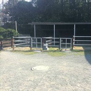
Box Paddock Stall Pferd Solekammer
Butzbach
Alexander Studt
@Alexander-Studt-Pferdepension-
FN-Mitglied
Freizeitstall
Vermieten
Führanlage
Hunde willkommen
Außenbox mit Paddock
Außenboxen
21 weitere...
S
Deprecated: Creation of dynamic property Zend_View_Helper_Ads::$adLink is deprecated in /var/www/stall-frei/htdocs/staging.stall-frei.de/library/Psf/View/Helper/Ads.php on line 108

Heu aus neuer Ernte
Mechtersen
STALL-FREIde Marketing
@STALL-FREI-Marketing
Heulage und Pferdeheu aus der neuen Ernte findest du in unserem Futtermarkt

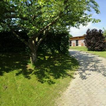
Paddockbox/Offenstall/Innenbox
Hüttenberg
Lara Brennecke
@Lara-Brennecke
FN-Mitglied
Freizeitstall
Vermieten
Hunde willkommen
Krankenbox
Allergikerstall
bedampftes/gewaschenes Heu
28 weitere...
P
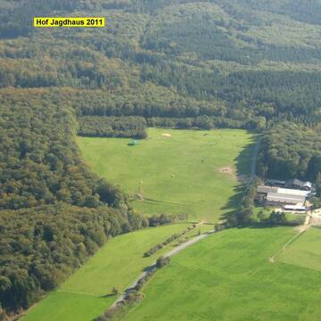
Artgerechte Pferdehaltung / Offenstallhaltung
Langgöns - Cleeberg
Pferdepension-Hof-Jagdhaus
@Pferdepension-Hof-Jagdhaus
Fahrstall, Kutschwagen
FN-Mitglied
Hunde willkommen
Krankenbox
Außenbox mit Paddock
Außenboxen
Vollpension
27 weitere...
P+

Pferdehof Wetzlar, Ohlemoos GbR
Wetzlar-Münchholzhausen
Nick-Henrich
@Nick-Henrich
Freizeitstall
Geländestrecke
Vermieten
Hunde willkommen
Krankenbox
Notfallboxen
14 weitere...
P
Reitanlage Mehl
Wetzlar - Münchholzhausen
Gerhard-u-Katrin-Mehl
@Gerhard-u-Katrin-Mehl
FN-Mitglied
Freizeitstall
Vermieten
Führanlage
Hunde willkommen
Allergikerstall
Hufrehe geeignet
26 weitere...
P

Laufstall/Bewegungsstall/Offenstall
Langgöns
Pferdepension-Zoerner
@Pferdepension-Zoerner
Freizeitstall
Geländestrecke
Hunde willkommen
Krankenbox
Hufrehe geeignet
Bewegungsstall
Laufstall
15 weitere...
P
Leider kein Vorschaubild
Leider kein Vorschaubild
Offenstall, Reithalle, Sportpferde, Rehe, Rentner
Schöffengrund
HorseOptions
@HorseOptions
Vermieten
Hunde willkommen
Krankenbox
Hufrehe geeignet
Notfallboxen
Bewegungsstall
Offenstall
17 weitere...
B

Persönlichkeitsentwicklung mit Pferden
Bad Salzuflen
Katja Dors
@Pferdezeiten
Begleite andere auf ihrem Entwicklungsweg und entdecke die transformative Kraft der pferdegestützten Persönlichkeitsentwicklung !
brandneu
R
Leider kein Vorschaubild
Leider kein Vorschaubild
Reitanlage Kastanienhof
Wetzlar
Reitanlage Kastanienhof
@Kastanienhof-Nauborn
Freizeitstall
Pflegepferd
Vermieten
Verpachten
Krankenbox
Longierzirkel/Roundpen
Allergikerstall
Notfallboxen
17 weitere...
B
Leider kein Vorschaubild
Leider kein Vorschaubild
Paddockbox ab 01.02.2026 Langgöns frei
Langgöns
Susanne-und-Reinhard-Brueckel
@Susanne-und-Reinhard-Brueckel
Freizeitstall
Laufband
Paddock
Allergikerstall
bedampftes/gewaschenes Heu
Außenbox mit Paddock
11 weitere...
B

PFERDEPENSION-WILLERSHÄUSER
Biebertal
WILLERSHAeUSER
@WILLERSHAeUSER
FN-Mitglied
Wanderreiten
Longierzirkel/Roundpen
Paddock
Außenbox mit Paddock
Außenboxen
Halbpension
Vollpension
10 weitere...
P
Deprecated: Creation of dynamic property Zend_View::$pageCount is deprecated in /var/www/stall-frei/htdocs/staging.stall-frei.de/library/vendor/shardj/zf1-future/library/Zend/View/Abstract.php on line 308
Deprecated: Creation of dynamic property Zend_View::$itemCountPerPage is deprecated in /var/www/stall-frei/htdocs/staging.stall-frei.de/library/vendor/shardj/zf1-future/library/Zend/View/Abstract.php on line 308
Deprecated: Creation of dynamic property Zend_View::$first is deprecated in /var/www/stall-frei/htdocs/staging.stall-frei.de/library/vendor/shardj/zf1-future/library/Zend/View/Abstract.php on line 308
Deprecated: Creation of dynamic property Zend_View::$current is deprecated in /var/www/stall-frei/htdocs/staging.stall-frei.de/library/vendor/shardj/zf1-future/library/Zend/View/Abstract.php on line 308
Deprecated: Creation of dynamic property Zend_View::$last is deprecated in /var/www/stall-frei/htdocs/staging.stall-frei.de/library/vendor/shardj/zf1-future/library/Zend/View/Abstract.php on line 308
Deprecated: Creation of dynamic property Zend_View::$next is deprecated in /var/www/stall-frei/htdocs/staging.stall-frei.de/library/vendor/shardj/zf1-future/library/Zend/View/Abstract.php on line 308
Deprecated: Creation of dynamic property Zend_View::$pagesInRange is deprecated in /var/www/stall-frei/htdocs/staging.stall-frei.de/library/vendor/shardj/zf1-future/library/Zend/View/Abstract.php on line 308
Deprecated: Creation of dynamic property Zend_View::$firstPageInRange is deprecated in /var/www/stall-frei/htdocs/staging.stall-frei.de/library/vendor/shardj/zf1-future/library/Zend/View/Abstract.php on line 308
Deprecated: Creation of dynamic property Zend_View::$lastPageInRange is deprecated in /var/www/stall-frei/htdocs/staging.stall-frei.de/library/vendor/shardj/zf1-future/library/Zend/View/Abstract.php on line 308
Deprecated: Creation of dynamic property Zend_View::$currentItemCount is deprecated in /var/www/stall-frei/htdocs/staging.stall-frei.de/library/vendor/shardj/zf1-future/library/Zend/View/Abstract.php on line 308
Deprecated: Creation of dynamic property Zend_View::$totalItemCount is deprecated in /var/www/stall-frei/htdocs/staging.stall-frei.de/library/vendor/shardj/zf1-future/library/Zend/View/Abstract.php on line 308
Deprecated: Creation of dynamic property Zend_View::$firstItemNumber is deprecated in /var/www/stall-frei/htdocs/staging.stall-frei.de/library/vendor/shardj/zf1-future/library/Zend/View/Abstract.php on line 308
Deprecated: Creation of dynamic property Zend_View::$lastItemNumber is deprecated in /var/www/stall-frei/htdocs/staging.stall-frei.de/library/vendor/shardj/zf1-future/library/Zend/View/Abstract.php on line 308
Deprecated: Creation of dynamic property Zend_View::$router is deprecated in /var/www/stall-frei/htdocs/staging.stall-frei.de/library/vendor/shardj/zf1-future/library/Zend/View/Abstract.php on line 308
Deprecated: Creation of dynamic property Zend_View::$urlParams is deprecated in /var/www/stall-frei/htdocs/staging.stall-frei.de/library/vendor/shardj/zf1-future/library/Zend/View/Abstract.php on line 308
Deprecated: Creation of dynamic property Zend_View::$showAds is deprecated in /var/www/stall-frei/htdocs/staging.stall-frei.de/library/vendor/shardj/zf1-future/library/Zend/View/Abstract.php on line 308
Deprecated: Creation of dynamic property Zend_View::$objectIds is deprecated in /var/www/stall-frei/htdocs/staging.stall-frei.de/library/vendor/shardj/zf1-future/library/Zend/View/Abstract.php on line 308
Deprecated: Creation of dynamic property Zend_View::$showNavbar is deprecated in /var/www/stall-frei/htdocs/staging.stall-frei.de/library/vendor/shardj/zf1-future/library/Zend/View/Abstract.php on line 308
Deprecated: Creation of dynamic property Zend_View::$showBreadcrumb is deprecated in /var/www/stall-frei/htdocs/staging.stall-frei.de/library/vendor/shardj/zf1-future/library/Zend/View/Abstract.php on line 308
Deprecated: Creation of dynamic property Zend_View::$showFooter is deprecated in /var/www/stall-frei/htdocs/staging.stall-frei.de/library/vendor/shardj/zf1-future/library/Zend/View/Abstract.php on line 308
Deprecated: Creation of dynamic property Zend_View::$showInternalAds is deprecated in /var/www/stall-frei/htdocs/staging.stall-frei.de/library/vendor/shardj/zf1-future/library/Zend/View/Abstract.php on line 308
Deprecated: Creation of dynamic property Zend_View::$blNoContent is deprecated in /var/www/stall-frei/htdocs/staging.stall-frei.de/library/vendor/shardj/zf1-future/library/Zend/View/Abstract.php on line 308
Deprecated: Creation of dynamic property Zend_View::$sMetaDesc is deprecated in /var/www/stall-frei/htdocs/staging.stall-frei.de/library/vendor/shardj/zf1-future/library/Zend/View/Abstract.php on line 308
Deprecated: Creation of dynamic property Zend_View::$useGmaps is deprecated in /var/www/stall-frei/htdocs/staging.stall-frei.de/library/vendor/shardj/zf1-future/library/Zend/View/Abstract.php on line 308
Deprecated: Creation of dynamic property Zend_View::$touches is deprecated in /var/www/stall-frei/htdocs/staging.stall-frei.de/library/vendor/shardj/zf1-future/library/Zend/View/Abstract.php on line 308
Deprecated: Creation of dynamic property Zend_View::$oProject is deprecated in /var/www/stall-frei/htdocs/staging.stall-frei.de/library/vendor/shardj/zf1-future/library/Zend/View/Abstract.php on line 308
Deprecated: Creation of dynamic property Zend_View::$pageHeadline is deprecated in /var/www/stall-frei/htdocs/staging.stall-frei.de/library/vendor/shardj/zf1-future/library/Zend/View/Abstract.php on line 308
Deprecated: Creation of dynamic property Zend_View::$disableLocationField is deprecated in /var/www/stall-frei/htdocs/staging.stall-frei.de/library/vendor/shardj/zf1-future/library/Zend/View/Abstract.php on line 308
Deprecated: Creation of dynamic property Zend_View::$isSearch is deprecated in /var/www/stall-frei/htdocs/staging.stall-frei.de/library/vendor/shardj/zf1-future/library/Zend/View/Abstract.php on line 308
Deprecated: Creation of dynamic property Zend_View::$pageTitle is deprecated in /var/www/stall-frei/htdocs/staging.stall-frei.de/library/vendor/shardj/zf1-future/library/Zend/View/Abstract.php on line 308
Deprecated: Creation of dynamic property Psf_Form_Element_Text::$class is deprecated in /var/www/stall-frei/htdocs/staging.stall-frei.de/library/vendor/shardj/zf1-future/library/Zend/Form/Element.php on line 874
Deprecated: Creation of dynamic property Psf_Form_Element_Text::$size is deprecated in /var/www/stall-frei/htdocs/staging.stall-frei.de/library/vendor/shardj/zf1-future/library/Zend/Form/Element.php on line 874
Deprecated: Creation of dynamic property Psf_Form_Element_Text::$placeholder is deprecated in /var/www/stall-frei/htdocs/staging.stall-frei.de/library/vendor/shardj/zf1-future/library/Zend/Form/Element.php on line 874
Deprecated: Creation of dynamic property Psf_Form_Element_Hidden::$class is deprecated in /var/www/stall-frei/htdocs/staging.stall-frei.de/library/vendor/shardj/zf1-future/library/Zend/Form/Element.php on line 874
Deprecated: Creation of dynamic property Psf_Form_Element_Hidden::$class is deprecated in /var/www/stall-frei/htdocs/staging.stall-frei.de/library/vendor/shardj/zf1-future/library/Zend/Form/Element.php on line 874
Deprecated: Creation of dynamic property Psf_Form_Element_Hidden::$class is deprecated in /var/www/stall-frei/htdocs/staging.stall-frei.de/library/vendor/shardj/zf1-future/library/Zend/Form/Element.php on line 874
Deprecated: Creation of dynamic property Psf_Form_Element_Hidden::$class is deprecated in /var/www/stall-frei/htdocs/staging.stall-frei.de/library/vendor/shardj/zf1-future/library/Zend/Form/Element.php on line 874
Deprecated: Creation of dynamic property Psf_Form_Element_Select::$class is deprecated in /var/www/stall-frei/htdocs/staging.stall-frei.de/library/vendor/shardj/zf1-future/library/Zend/Form/Element.php on line 874
Deprecated: Creation of dynamic property Psf_Form_Element_Select::$class is deprecated in /var/www/stall-frei/htdocs/staging.stall-frei.de/library/vendor/shardj/zf1-future/library/Zend/Form/Element.php on line 874
Deprecated: Creation of dynamic property Psf_Form_Element_Select::$class is deprecated in /var/www/stall-frei/htdocs/staging.stall-frei.de/library/vendor/shardj/zf1-future/library/Zend/Form/Element.php on line 874
Deprecated: Creation of dynamic property Psf_Form_Element_Select::$class is deprecated in /var/www/stall-frei/htdocs/staging.stall-frei.de/library/vendor/shardj/zf1-future/library/Zend/Form/Element.php on line 874
Deprecated: Creation of dynamic property Psf_Form_Element_Text::$class is deprecated in /var/www/stall-frei/htdocs/staging.stall-frei.de/library/vendor/shardj/zf1-future/library/Zend/Form/Element.php on line 874
Deprecated: Creation of dynamic property Psf_Form_Element_Checkbox::$label is deprecated in /var/www/stall-frei/htdocs/staging.stall-frei.de/library/vendor/shardj/zf1-future/library/Zend/Form/Element.php on line 874
Deprecated: Creation of dynamic property Zend_View::$sort is deprecated in /var/www/stall-frei/htdocs/staging.stall-frei.de/library/vendor/shardj/zf1-future/library/Zend/View/Abstract.php on line 308
Deprecated: Creation of dynamic property Zend_View::$searchLocation is deprecated in /var/www/stall-frei/htdocs/staging.stall-frei.de/library/vendor/shardj/zf1-future/library/Zend/View/Abstract.php on line 308
Deprecated: Creation of dynamic property Zend_View::$locationHint is deprecated in /var/www/stall-frei/htdocs/staging.stall-frei.de/library/vendor/shardj/zf1-future/library/Zend/View/Abstract.php on line 308
Psf_GeoCoder_Abstract::getLocation: Hüttenberg Get Location CachedOrLive
Psf_GeoCoder_Abstract::getCachedOrLive: Hüttenberg
Psf_GeoCoder_OpenCageData::makeApiRequest: response:
Array
(
[documentation] => https://opencagedata.com/api
[licenses] => Array
(
[0] => Array
(
[name] => see attribution guide
[url] => https://opencagedata.com/credits
)
)
[results] => Array
(
[0] => Array
(
[bounds] => Array
(
[northeast] => Array
(
[lat] => 50.5366655
[lng] => 8.6513325
)
[southwest] => Array
(
[lat] => 50.4695807
[lng] => 8.4883287
)
)
[components] => Array
(
[ISO_3166-1_alpha-2] => DE
[ISO_3166-1_alpha-3] => DEU
[ISO_3166-2] => Array
(
[0] => DE-HE
)
[_category] => place
[_normalized_city] => Hüttenberg
[_type] => municipality
[continent] => Europe
[country] => Deutschland
[country_code] => de
[county] => Lahn-Dill-Kreis
[municipality] => Hüttenberg
[political_union] => European Union
[postcode] => 35625
[state] => Hessen
[state_code] => HE
)
[confidence] => 7
[formatted] => 35625 Hüttenberg, Deutschland
[geometry] => Array
(
[lat] => 50.51113
[lng] => 8.56487
)
)
[1] => Array
(
[bounds] => Array
(
[northeast] => Array
(
[lat] => 51.4044566
[lng] => 8.7956919
)
[southwest] => Array
(
[lat] => 51.3946903
[lng] => 8.7824582
)
)
[components] => Array
(
[ISO_3166-1_alpha-2] => DE
[ISO_3166-1_alpha-3] => DEU
[ISO_3166-2] => Array
(
[0] => DE-NW
)
[_category] => natural/water
[_normalized_city] => Marsberg
[_type] => nature_reserve
[continent] => Europe
[country] => Deutschland
[country_code] => de
[county] => Hochsauerlandkreis
[nature_reserve] => Hüttenberg
[political_union] => European Union
[postcode] => 34431
[state] => Nordrhein-Westfalen
[state_code] => NW
[suburb] => Giershagen
[town] => Marsberg
)
[confidence] => 8
[formatted] => Hüttenberg, 34431 Marsberg, Deutschland
[geometry] => Array
(
[lat] => 51.3995378
[lng] => 8.787282
)
)
[2] => Array
(
[bounds] => Array
(
[northeast] => Array
(
[lat] => 50.5366655
[lng] => 8.6513325
)
[southwest] => Array
(
[lat] => 50.4891922
[lng] => 8.536809
)
)
[components] => Array
(
[ISO_3166-1_alpha-2] => DE
[ISO_3166-1_alpha-3] => DEU
[ISO_3166-2] => Array
(
[0] => DE-HE
)
[_category] => place
[_normalized_city] => Hüttenberg
[_type] => village
[continent] => Europe
[country] => Deutschland
[country_code] => de
[county] => Lahn-Dill-Kreis
[municipality] => Hüttenberg
[political_union] => European Union
[state] => Hessen
[state_code] => HE
[village] => Hüttenberg
)
[confidence] => 7
[formatted] => Hüttenberg, Hessen, Deutschland
[geometry] => Array
(
[lat] => 50.5159478
[lng] => 8.6245772
)
)
[3] => Array
(
[bounds] => Array
(
[northeast] => Array
(
[lat] => 51.8312336
[lng] => 10.2782445
)
[southwest] => Array
(
[lat] => 51.8311336
[lng] => 10.2781445
)
)
[components] => Array
(
[ISO_3166-1_alpha-2] => DE
[ISO_3166-1_alpha-3] => DEU
[ISO_3166-2] => Array
(
[0] => DE-NI
)
[_category] => natural/water
[_normalized_city] => Clausthal-Zellerfeld
[_type] => peak
[continent] => Europe
[country] => Deutschland
[country_code] => de
[county] => Landkreis Goslar
[peak] => Hüttenberg
[political_union] => European Union
[postcode] => 38709
[state] => Niedersachsen
[state_code] => NI
[town] => Clausthal-Zellerfeld
)
[confidence] => 9
[formatted] => Hüttenberg, 38709 Clausthal-Zellerfeld, Deutschland
[geometry] => Array
(
[lat] => 51.8311836
[lng] => 10.2781945
)
)
[4] => Array
(
[bounds] => Array
(
[northeast] => Array
(
[lat] => 52.0872457
[lng] => 9.0456973
)
[southwest] => Array
(
[lat] => 52.0871457
[lng] => 9.0455973
)
)
[components] => Array
(
[ISO_3166-1_alpha-2] => DE
[ISO_3166-1_alpha-3] => DEU
[ISO_3166-2] => Array
(
[0] => DE-NW
)
[_category] => natural/water
[_normalized_city] => Extertal
[_type] => peak
[continent] => Europe
[country] => Deutschland
[country_code] => de
[county] => Kreis Lippe
[peak] => Hüttenberg
[political_union] => European Union
[state] => Nordrhein-Westfalen
[state_code] => NW
[village] => Extertal
)
[confidence] => 9
[formatted] => Hüttenberg, Extertal, Nordrhein-Westfalen, Deutschland
[geometry] => Array
(
[lat] => 52.0871957
[lng] => 9.0456473
)
)
[5] => Array
(
[bounds] => Array
(
[northeast] => Array
(
[lat] => 51.7320439
[lng] => 10.621147
)
[southwest] => Array
(
[lat] => 51.7319439
[lng] => 10.621047
)
)
[components] => Array
(
[ISO_3166-1_alpha-2] => DE
[ISO_3166-1_alpha-3] => DEU
[ISO_3166-2] => Array
(
[0] => DE-NI
)
[_category] => natural/water
[_normalized_city] => Braunlage
[_type] => peak
[continent] => Europe
[country] => Deutschland
[country_code] => de
[county] => Landkreis Goslar
[peak] => Hüttenberg
[political_union] => European Union
[postcode] => 38700
[state] => Niedersachsen
[state_code] => NI
[town] => Braunlage
)
[confidence] => 9
[formatted] => Hüttenberg, 38700 Braunlage, Deutschland
[geometry] => Array
(
[lat] => 51.7319939
[lng] => 10.621097
)
)
[6] => Array
(
[bounds] => Array
(
[northeast] => Array
(
[lat] => 52.144914
[lng] => 12.5472004
)
[southwest] => Array
(
[lat] => 52.144814
[lng] => 12.5471004
)
)
[components] => Array
(
[ISO_3166-1_alpha-2] => DE
[ISO_3166-1_alpha-3] => DEU
[ISO_3166-2] => Array
(
[0] => DE-BB
)
[_category] => natural/water
[_normalized_city] => Bad Belzig
[_type] => peak
[continent] => Europe
[country] => Deutschland
[country_code] => de
[county] => Potsdam-Mittelmark
[peak] => Hüttenberg
[political_union] => European Union
[postcode] => 14806
[state] => Brandenburg
[state_code] => BB
[town] => Bad Belzig
)
[confidence] => 9
[formatted] => Hüttenberg, 14806 Bad Belzig, Deutschland
[geometry] => Array
(
[lat] => 52.144864
[lng] => 12.5471504
)
)
[7] => Array
(
[bounds] => Array
(
[northeast] => Array
(
[lat] => 49.1417736
[lng] => 7.6428101
)
[southwest] => Array
(
[lat] => 49.1416736
[lng] => 7.6427101
)
)
[components] => Array
(
[ISO_3166-1_alpha-2] => DE
[ISO_3166-1_alpha-3] => DEU
[ISO_3166-2] => Array
(
[0] => DE-RP
)
[_category] => natural/water
[_normalized_city] => Lemberg
[_type] => peak
[continent] => Europe
[country] => Deutschland
[country_code] => de
[county] => Südwestpfalz
[municipality] => Pirmasens-Land
[peak] => Hüttenberg
[political_union] => European Union
[postcode] => 66969
[state] => Rheinland-Pfalz
[state_code] => RP
[village] => Lemberg
)
[confidence] => 9
[formatted] => Hüttenberg, 66969 Lemberg, Deutschland
[geometry] => Array
(
[lat] => 49.1417236
[lng] => 7.6427601
)
)
[8] => Array
(
[bounds] => Array
(
[northeast] => Array
(
[lat] => 51.299537
[lng] => 12.7094686
)
[southwest] => Array
(
[lat] => 51.299437
[lng] => 12.7093686
)
)
[components] => Array
(
[ISO_3166-1_alpha-2] => DE
[ISO_3166-1_alpha-3] => DEU
[ISO_3166-2] => Array
(
[0] => DE-SN
)
[_category] => natural/water
[_normalized_city] => Trebsen/Mulde
[_type] => peak
[continent] => Europe
[country] => Deutschland
[country_code] => de
[county] => Landkreis Leipzig
[peak] => Hüttenberg
[political_union] => European Union
[postcode] => 04687
[state] => Sachsen
[state_code] => SN
[town] => Trebsen/Mulde
)
[confidence] => 9
[formatted] => Hüttenberg, 04687 Trebsen/Mulde, Deutschland
[geometry] => Array
(
[lat] => 51.299487
[lng] => 12.7094186
)
)
[9] => Array
(
[bounds] => Array
(
[northeast] => Array
(
[lat] => 49.1686794
[lng] => 13.0998301
)
[southwest] => Array
(
[lat] => 49.1685794
[lng] => 13.0997301
)
)
[components] => Array
(
[ISO_3166-1_alpha-2] => DE
[ISO_3166-1_alpha-3] => DEU
[ISO_3166-2] => Array
(
[0] => DE-BY
)
[_category] => natural/water
[_normalized_city] => Lohberg
[_type] => peak
[continent] => Europe
[country] => Deutschland
[country_code] => de
[county] => Landkreis Cham
[peak] => Hüttenberg
[political_union] => European Union
[postcode] => 93470
[state] => Bayern
[state_code] => BY
[village] => Lohberg
)
[confidence] => 9
[formatted] => Hüttenberg, 93470 Lohberg, Deutschland
[geometry] => Array
(
[lat] => 49.1686294
[lng] => 13.0997801
)
)
)
[status] => Array
(
[code] => 200
[message] => OK
)
[stay_informed] => Array
(
[blog] => https://blog.opencagedata.com
[mastodon] => https://en.osm.town/@opencage
)
[thanks] => For using an OpenCage API
[timestamp] => Array
(
[created_http] => Tue, 03 Feb 2026 21:03:20 GMT
[created_unix] => 1770152600
)
[total_results] => 10
)
Psf_GeoCoder_Abstract::convertLocationResult
{"documentation":"https:\/\/opencagedata.com\/api","licenses":[{"name":"see attribution guide","url":"https:\/\/opencagedata.com\/credits"}],"results":[{"bounds":{"northeast":{"lat":50.5366655,"lng":8.6513325},"southwest":{"lat":50.4695807,"lng":8.4883287}},"components":{"ISO_3166-1_alpha-2":"DE","ISO_3166-1_alpha-3":"DEU","ISO_3166-2":["DE-HE"],"_category":"place","_normalized_city":"H\u00fcttenberg","_type":"municipality","continent":"Europe","country":"Deutschland","country_code":"de","county":"Lahn-Dill-Kreis","municipality":"H\u00fcttenberg","political_union":"European Union","postcode":"35625","state":"Hessen","state_code":"HE"},"confidence":7,"formatted":"35625 H\u00fcttenberg, Deutschland","geometry":{"lat":50.51113,"lng":8.56487}},{"bounds":{"northeast":{"lat":51.4044566,"lng":8.7956919},"southwest":{"lat":51.3946903,"lng":8.7824582}},"components":{"ISO_3166-1_alpha-2":"DE","ISO_3166-1_alpha-3":"DEU","ISO_3166-2":["DE-NW"],"_category":"natural\/water","_normalized_city":"Marsberg","_type":"nature_reserve","continent":"Europe","country":"Deutschland","country_code":"de","county":"Hochsauerlandkreis","nature_reserve":"H\u00fcttenberg","political_union":"European Union","postcode":"34431","state":"Nordrhein-Westfalen","state_code":"NW","suburb":"Giershagen","town":"Marsberg"},"confidence":8,"formatted":"H\u00fcttenberg, 34431 Marsberg, Deutschland","geometry":{"lat":51.3995378,"lng":8.787282}},{"bounds":{"northeast":{"lat":50.5366655,"lng":8.6513325},"southwest":{"lat":50.4891922,"lng":8.536809}},"components":{"ISO_3166-1_alpha-2":"DE","ISO_3166-1_alpha-3":"DEU","ISO_3166-2":["DE-HE"],"_category":"place","_normalized_city":"H\u00fcttenberg","_type":"village","continent":"Europe","country":"Deutschland","country_code":"de","county":"Lahn-Dill-Kreis","municipality":"H\u00fcttenberg","political_union":"European Union","state":"Hessen","state_code":"HE","village":"H\u00fcttenberg"},"confidence":7,"formatted":"H\u00fcttenberg, Hessen, Deutschland","geometry":{"lat":50.5159478,"lng":8.6245772}},{"bounds":{"northeast":{"lat":51.8312336,"lng":10.2782445},"southwest":{"lat":51.8311336,"lng":10.2781445}},"components":{"ISO_3166-1_alpha-2":"DE","ISO_3166-1_alpha-3":"DEU","ISO_3166-2":["DE-NI"],"_category":"natural\/water","_normalized_city":"Clausthal-Zellerfeld","_type":"peak","continent":"Europe","country":"Deutschland","country_code":"de","county":"Landkreis Goslar","peak":"H\u00fcttenberg","political_union":"European Union","postcode":"38709","state":"Niedersachsen","state_code":"NI","town":"Clausthal-Zellerfeld"},"confidence":9,"formatted":"H\u00fcttenberg, 38709 Clausthal-Zellerfeld, Deutschland","geometry":{"lat":51.8311836,"lng":10.2781945}},{"bounds":{"northeast":{"lat":52.0872457,"lng":9.0456973},"southwest":{"lat":52.0871457,"lng":9.0455973}},"components":{"ISO_3166-1_alpha-2":"DE","ISO_3166-1_alpha-3":"DEU","ISO_3166-2":["DE-NW"],"_category":"natural\/water","_normalized_city":"Extertal","_type":"peak","continent":"Europe","country":"Deutschland","country_code":"de","county":"Kreis Lippe","peak":"H\u00fcttenberg","political_union":"European Union","state":"Nordrhein-Westfalen","state_code":"NW","village":"Extertal"},"confidence":9,"formatted":"H\u00fcttenberg, Extertal, Nordrhein-Westfalen, Deutschland","geometry":{"lat":52.0871957,"lng":9.0456473}},{"bounds":{"northeast":{"lat":51.7320439,"lng":10.621147},"southwest":{"lat":51.7319439,"lng":10.621047}},"components":{"ISO_3166-1_alpha-2":"DE","ISO_3166-1_alpha-3":"DEU","ISO_3166-2":["DE-NI"],"_category":"natural\/water","_normalized_city":"Braunlage","_type":"peak","continent":"Europe","country":"Deutschland","country_code":"de","county":"Landkreis Goslar","peak":"H\u00fcttenberg","political_union":"European Union","postcode":"38700","state":"Niedersachsen","state_code":"NI","town":"Braunlage"},"confidence":9,"formatted":"H\u00fcttenberg, 38700 Braunlage, Deutschland","geometry":{"lat":51.7319939,"lng":10.621097}},{"bounds":{"northeast":{"lat":52.144914,"lng":12.5472004},"southwest":{"lat":52.144814,"lng":12.5471004}},"components":{"ISO_3166-1_alpha-2":"DE","ISO_3166-1_alpha-3":"DEU","ISO_3166-2":["DE-BB"],"_category":"natural\/water","_normalized_city":"Bad Belzig","_type":"peak","continent":"Europe","country":"Deutschland","country_code":"de","county":"Potsdam-Mittelmark","peak":"H\u00fcttenberg","political_union":"European Union","postcode":"14806","state":"Brandenburg","state_code":"BB","town":"Bad Belzig"},"confidence":9,"formatted":"H\u00fcttenberg, 14806 Bad Belzig, Deutschland","geometry":{"lat":52.144864,"lng":12.5471504}},{"bounds":{"northeast":{"lat":49.1417736,"lng":7.6428101},"southwest":{"lat":49.1416736,"lng":7.6427101}},"components":{"ISO_3166-1_alpha-2":"DE","ISO_3166-1_alpha-3":"DEU","ISO_3166-2":["DE-RP"],"_category":"natural\/water","_normalized_city":"Lemberg","_type":"peak","continent":"Europe","country":"Deutschland","country_code":"de","county":"S\u00fcdwestpfalz","municipality":"Pirmasens-Land","peak":"H\u00fcttenberg","political_union":"European Union","postcode":"66969","state":"Rheinland-Pfalz","state_code":"RP","village":"Lemberg"},"confidence":9,"formatted":"H\u00fcttenberg, 66969 Lemberg, Deutschland","geometry":{"lat":49.1417236,"lng":7.6427601}},{"bounds":{"northeast":{"lat":51.299537,"lng":12.7094686},"southwest":{"lat":51.299437,"lng":12.7093686}},"components":{"ISO_3166-1_alpha-2":"DE","ISO_3166-1_alpha-3":"DEU","ISO_3166-2":["DE-SN"],"_category":"natural\/water","_normalized_city":"Trebsen\/Mulde","_type":"peak","continent":"Europe","country":"Deutschland","country_code":"de","county":"Landkreis Leipzig","peak":"H\u00fcttenberg","political_union":"European Union","postcode":"04687","state":"Sachsen","state_code":"SN","town":"Trebsen\/Mulde"},"confidence":9,"formatted":"H\u00fcttenberg, 04687 Trebsen\/Mulde, Deutschland","geometry":{"lat":51.299487,"lng":12.7094186}},{"bounds":{"northeast":{"lat":49.1686794,"lng":13.0998301},"southwest":{"lat":49.1685794,"lng":13.0997301}},"components":{"ISO_3166-1_alpha-2":"DE","ISO_3166-1_alpha-3":"DEU","ISO_3166-2":["DE-BY"],"_category":"natural\/water","_normalized_city":"Lohberg","_type":"peak","continent":"Europe","country":"Deutschland","country_code":"de","county":"Landkreis Cham","peak":"H\u00fcttenberg","political_union":"European Union","postcode":"93470","state":"Bayern","state_code":"BY","village":"Lohberg"},"confidence":9,"formatted":"H\u00fcttenberg, 93470 Lohberg, Deutschland","geometry":{"lat":49.1686294,"lng":13.0997801}}],"status":{"code":200,"message":"OK"},"stay_informed":{"blog":"https:\/\/blog.opencagedata.com","mastodon":"https:\/\/en.osm.town\/@opencage"},"thanks":"For using an OpenCage API","timestamp":{"created_http":"Tue, 03 Feb 2026 21:03:20 GMT","created_unix":1770152600},"total_results":10}Array
(
[0] => stdClass Object
(
[bounds] => stdClass Object
(
[northeast] => stdClass Object
(
[lat] => 50.5366655
[lng] => 8.6513325
)
[southwest] => stdClass Object
(
[lat] => 50.4695807
[lng] => 8.4883287
)
)
[components] => stdClass Object
(
[ISO_3166-1_alpha-2] => DE
[ISO_3166-1_alpha-3] => DEU
[ISO_3166-2] => Array
(
[0] => DE-HE
)
[_category] => place
[_normalized_city] => Hüttenberg
[_type] => municipality
[continent] => Europe
[country] => Deutschland
[country_code] => de
[county] => Lahn-Dill-Kreis
[municipality] => Hüttenberg
[political_union] => European Union
[postcode] => 35625
[state] => Hessen
[state_code] => HE
)
[confidence] => 7
[formatted] => 35625 Hüttenberg, Deutschland
[geometry] => stdClass Object
(
[lat] => 50.51113
[lng] => 8.56487
)
)
[1] => stdClass Object
(
[bounds] => stdClass Object
(
[northeast] => stdClass Object
(
[lat] => 51.4044566
[lng] => 8.7956919
)
[southwest] => stdClass Object
(
[lat] => 51.3946903
[lng] => 8.7824582
)
)
[components] => stdClass Object
(
[ISO_3166-1_alpha-2] => DE
[ISO_3166-1_alpha-3] => DEU
[ISO_3166-2] => Array
(
[0] => DE-NW
)
[_category] => natural/water
[_normalized_city] => Marsberg
[_type] => nature_reserve
[continent] => Europe
[country] => Deutschland
[country_code] => de
[county] => Hochsauerlandkreis
[nature_reserve] => Hüttenberg
[political_union] => European Union
[postcode] => 34431
[state] => Nordrhein-Westfalen
[state_code] => NW
[suburb] => Giershagen
[town] => Marsberg
)
[confidence] => 8
[formatted] => Hüttenberg, 34431 Marsberg, Deutschland
[geometry] => stdClass Object
(
[lat] => 51.3995378
[lng] => 8.787282
)
)
[2] => stdClass Object
(
[bounds] => stdClass Object
(
[northeast] => stdClass Object
(
[lat] => 50.5366655
[lng] => 8.6513325
)
[southwest] => stdClass Object
(
[lat] => 50.4891922
[lng] => 8.536809
)
)
[components] => stdClass Object
(
[ISO_3166-1_alpha-2] => DE
[ISO_3166-1_alpha-3] => DEU
[ISO_3166-2] => Array
(
[0] => DE-HE
)
[_category] => place
[_normalized_city] => Hüttenberg
[_type] => village
[continent] => Europe
[country] => Deutschland
[country_code] => de
[county] => Lahn-Dill-Kreis
[municipality] => Hüttenberg
[political_union] => European Union
[state] => Hessen
[state_code] => HE
[village] => Hüttenberg
)
[confidence] => 7
[formatted] => Hüttenberg, Hessen, Deutschland
[geometry] => stdClass Object
(
[lat] => 50.5159478
[lng] => 8.6245772
)
)
[3] => stdClass Object
(
[bounds] => stdClass Object
(
[northeast] => stdClass Object
(
[lat] => 51.8312336
[lng] => 10.2782445
)
[southwest] => stdClass Object
(
[lat] => 51.8311336
[lng] => 10.2781445
)
)
[components] => stdClass Object
(
[ISO_3166-1_alpha-2] => DE
[ISO_3166-1_alpha-3] => DEU
[ISO_3166-2] => Array
(
[0] => DE-NI
)
[_category] => natural/water
[_normalized_city] => Clausthal-Zellerfeld
[_type] => peak
[continent] => Europe
[country] => Deutschland
[country_code] => de
[county] => Landkreis Goslar
[peak] => Hüttenberg
[political_union] => European Union
[postcode] => 38709
[state] => Niedersachsen
[state_code] => NI
[town] => Clausthal-Zellerfeld
)
[confidence] => 9
[formatted] => Hüttenberg, 38709 Clausthal-Zellerfeld, Deutschland
[geometry] => stdClass Object
(
[lat] => 51.8311836
[lng] => 10.2781945
)
)
[4] => stdClass Object
(
[bounds] => stdClass Object
(
[northeast] => stdClass Object
(
[lat] => 52.0872457
[lng] => 9.0456973
)
[southwest] => stdClass Object
(
[lat] => 52.0871457
[lng] => 9.0455973
)
)
[components] => stdClass Object
(
[ISO_3166-1_alpha-2] => DE
[ISO_3166-1_alpha-3] => DEU
[ISO_3166-2] => Array
(
[0] => DE-NW
)
[_category] => natural/water
[_normalized_city] => Extertal
[_type] => peak
[continent] => Europe
[country] => Deutschland
[country_code] => de
[county] => Kreis Lippe
[peak] => Hüttenberg
[political_union] => European Union
[state] => Nordrhein-Westfalen
[state_code] => NW
[village] => Extertal
)
[confidence] => 9
[formatted] => Hüttenberg, Extertal, Nordrhein-Westfalen, Deutschland
[geometry] => stdClass Object
(
[lat] => 52.0871957
[lng] => 9.0456473
)
)
[5] => stdClass Object
(
[bounds] => stdClass Object
(
[northeast] => stdClass Object
(
[lat] => 51.7320439
[lng] => 10.621147
)
[southwest] => stdClass Object
(
[lat] => 51.7319439
[lng] => 10.621047
)
)
[components] => stdClass Object
(
[ISO_3166-1_alpha-2] => DE
[ISO_3166-1_alpha-3] => DEU
[ISO_3166-2] => Array
(
[0] => DE-NI
)
[_category] => natural/water
[_normalized_city] => Braunlage
[_type] => peak
[continent] => Europe
[country] => Deutschland
[country_code] => de
[county] => Landkreis Goslar
[peak] => Hüttenberg
[political_union] => European Union
[postcode] => 38700
[state] => Niedersachsen
[state_code] => NI
[town] => Braunlage
)
[confidence] => 9
[formatted] => Hüttenberg, 38700 Braunlage, Deutschland
[geometry] => stdClass Object
(
[lat] => 51.7319939
[lng] => 10.621097
)
)
[6] => stdClass Object
(
[bounds] => stdClass Object
(
[northeast] => stdClass Object
(
[lat] => 52.144914
[lng] => 12.5472004
)
[southwest] => stdClass Object
(
[lat] => 52.144814
[lng] => 12.5471004
)
)
[components] => stdClass Object
(
[ISO_3166-1_alpha-2] => DE
[ISO_3166-1_alpha-3] => DEU
[ISO_3166-2] => Array
(
[0] => DE-BB
)
[_category] => natural/water
[_normalized_city] => Bad Belzig
[_type] => peak
[continent] => Europe
[country] => Deutschland
[country_code] => de
[county] => Potsdam-Mittelmark
[peak] => Hüttenberg
[political_union] => European Union
[postcode] => 14806
[state] => Brandenburg
[state_code] => BB
[town] => Bad Belzig
)
[confidence] => 9
[formatted] => Hüttenberg, 14806 Bad Belzig, Deutschland
[geometry] => stdClass Object
(
[lat] => 52.144864
[lng] => 12.5471504
)
)
[7] => stdClass Object
(
[bounds] => stdClass Object
(
[northeast] => stdClass Object
(
[lat] => 49.1417736
[lng] => 7.6428101
)
[southwest] => stdClass Object
(
[lat] => 49.1416736
[lng] => 7.6427101
)
)
[components] => stdClass Object
(
[ISO_3166-1_alpha-2] => DE
[ISO_3166-1_alpha-3] => DEU
[ISO_3166-2] => Array
(
[0] => DE-RP
)
[_category] => natural/water
[_normalized_city] => Lemberg
[_type] => peak
[continent] => Europe
[country] => Deutschland
[country_code] => de
[county] => Südwestpfalz
[municipality] => Pirmasens-Land
[peak] => Hüttenberg
[political_union] => European Union
[postcode] => 66969
[state] => Rheinland-Pfalz
[state_code] => RP
[village] => Lemberg
)
[confidence] => 9
[formatted] => Hüttenberg, 66969 Lemberg, Deutschland
[geometry] => stdClass Object
(
[lat] => 49.1417236
[lng] => 7.6427601
)
)
[8] => stdClass Object
(
[bounds] => stdClass Object
(
[northeast] => stdClass Object
(
[lat] => 51.299537
[lng] => 12.7094686
)
[southwest] => stdClass Object
(
[lat] => 51.299437
[lng] => 12.7093686
)
)
[components] => stdClass Object
(
[ISO_3166-1_alpha-2] => DE
[ISO_3166-1_alpha-3] => DEU
[ISO_3166-2] => Array
(
[0] => DE-SN
)
[_category] => natural/water
[_normalized_city] => Trebsen/Mulde
[_type] => peak
[continent] => Europe
[country] => Deutschland
[country_code] => de
[county] => Landkreis Leipzig
[peak] => Hüttenberg
[political_union] => European Union
[postcode] => 04687
[state] => Sachsen
[state_code] => SN
[town] => Trebsen/Mulde
)
[confidence] => 9
[formatted] => Hüttenberg, 04687 Trebsen/Mulde, Deutschland
[geometry] => stdClass Object
(
[lat] => 51.299487
[lng] => 12.7094186
)
)
[9] => stdClass Object
(
[bounds] => stdClass Object
(
[northeast] => stdClass Object
(
[lat] => 49.1686794
[lng] => 13.0998301
)
[southwest] => stdClass Object
(
[lat] => 49.1685794
[lng] => 13.0997301
)
)
[components] => stdClass Object
(
[ISO_3166-1_alpha-2] => DE
[ISO_3166-1_alpha-3] => DEU
[ISO_3166-2] => Array
(
[0] => DE-BY
)
[_category] => natural/water
[_normalized_city] => Lohberg
[_type] => peak
[continent] => Europe
[country] => Deutschland
[country_code] => de
[county] => Landkreis Cham
[peak] => Hüttenberg
[political_union] => European Union
[postcode] => 93470
[state] => Bayern
[state_code] => BY
[village] => Lohberg
)
[confidence] => 9
[formatted] => Hüttenberg, 93470 Lohberg, Deutschland
[geometry] => stdClass Object
(
[lat] => 49.1686294
[lng] => 13.0997801
)
)
)
Psf_GeoCoder_OpenCageData::getKeyMap: 0
stdClass Object
(
    [bounds] => stdClass Object
        (
            [northeast] => stdClass Object
                (
                    [lat] => 50.5366655
                    [lng] => 8.6513325
                )

            [southwest] => stdClass Object
                (
                    [lat] => 50.4695807
                    [lng] => 8.4883287
                )

        )

    [components] => stdClass Object
        (
            [ISO_3166-1_alpha-2] => DE
            [ISO_3166-1_alpha-3] => DEU
            [ISO_3166-2] => Array
                (
                    [0] => DE-HE
                )

            [_category] => place
            [_normalized_city] => Hüttenberg
            [_type] => municipality
            [continent] => Europe
            [country] => Deutschland
            [country_code] => de
            [county] => Lahn-Dill-Kreis
            [municipality] => Hüttenberg
            [political_union] => European Union
            [postcode] => 35625
            [state] => Hessen
            [state_code] => HE
        )

    [confidence] => 7
    [formatted] => 35625 Hüttenberg, Deutschland
    [geometry] => stdClass Object
        (
            [lat] => 50.51113
            [lng] => 8.56487
        )

)
Psf_GeoCoder_OpenCageData::getCounty: Lahn-Dill-Kreis
Psf_GeoCoder_OpenCageData::addMissingData REFETCH!
Array
(
    [address] => 35625 Hüttenberg, Deutschland
    [type] => municipality
    [street] =>
    [city] =>
    [county] => Lahn-Dill-Kreis
    [state] => Hessen
    [zip] => 35625
    [country] => Deutschland
    [suburb] =>
    [countrycode] => de
    [latitude] => 50.51113
    [longitude] => 8.56487
    [accuracy] => 1
    [confidence] => 7
    [bounds] => stdClass Object
        (
            [northeast] => stdClass Object
                (
                    [lat] => 50.5366655
                    [lng] => 8.6513325
                )

            [southwest] => stdClass Object
                (
                    [lat] => 50.4695807
                    [lng] => 8.4883287
                )

        )

)
reformat!
Array
(
    [address] => 35625 Hüttenberg, Deutschland
    [type] => municipality
    [street] =>
    [city] =>
    [county] => Lahn-Dill-Kreis
    [state] => Hessen
    [zip] => 35625
    [country] => Deutschland
    [suburb] =>
    [countrycode] => de
    [latitude] => 50.51113
    [longitude] => 8.56487
    [accuracy] => 1
    [confidence] => 7
    [bounds] => stdClass Object
        (
            [northeast] => stdClass Object
                (
                    [lat] => 50.5366655
                    [lng] => 8.6513325
                )

            [southwest] => stdClass Object
                (
                    [lat] => 50.4695807
                    [lng] => 8.4883287
                )

        )

    [place] => 35625 , Hessen
    [hash] => ac7d1545b8e99fea645a4729b0430b33
)
Psf_GeoCoder_OpenCageData::getKeyMap: 1
stdClass Object
(
    [bounds] => stdClass Object
        (
            [northeast] => stdClass Object
                (
                    [lat] => 51.4044566
                    [lng] => 8.7956919
                )

            [southwest] => stdClass Object
                (
                    [lat] => 51.3946903
                    [lng] => 8.7824582
                )

        )

    [components] => stdClass Object
        (
            [ISO_3166-1_alpha-2] => DE
            [ISO_3166-1_alpha-3] => DEU
            [ISO_3166-2] => Array
                (
                    [0] => DE-NW
                )

            [_category] => natural/water
            [_normalized_city] => Marsberg
            [_type] => nature_reserve
            [continent] => Europe
            [country] => Deutschland
            [country_code] => de
            [county] => Hochsauerlandkreis
            [nature_reserve] => Hüttenberg
            [political_union] => European Union
            [postcode] => 34431
            [state] => Nordrhein-Westfalen
            [state_code] => NW
            [suburb] => Giershagen
            [town] => Marsberg
        )

    [confidence] => 8
    [formatted] => Hüttenberg, 34431 Marsberg, Deutschland
    [geometry] => stdClass Object
        (
            [lat] => 51.3995378
            [lng] => 8.787282
        )

)
Psf_GeoCoder_OpenCageData::getCounty: Hochsauerlandkreis
Psf_GeoCoder_OpenCageData::addMissingData REFETCH!
Array
(
    [address] => Hüttenberg, 34431 Marsberg, Deutschland
    [type] => nature_reserve
    [street] =>
    [city] => Marsberg
    [county] => Hochsauerlandkreis
    [state] => Nordrhein-Westfalen
    [zip] => 34431
    [country] => Deutschland
    [suburb] => Giershagen
    [countrycode] => de
    [latitude] => 51.3995378
    [longitude] => 8.787282
    [accuracy] => 1
    [confidence] => 8
    [bounds] => stdClass Object
        (
            [northeast] => stdClass Object
                (
                    [lat] => 51.4044566
                    [lng] => 8.7956919
                )

            [southwest] => stdClass Object
                (
                    [lat] => 51.3946903
                    [lng] => 8.7824582
                )

        )

)
reformat!
Array
(
    [address] => Hüttenberg, 34431 Marsberg, Deutschland
    [type] => nature_reserve
    [street] =>
    [city] => Marsberg
    [county] => Hochsauerlandkreis
    [state] => Nordrhein-Westfalen
    [zip] => 34431
    [country] => Deutschland
    [suburb] => Giershagen
    [countrycode] => de
    [latitude] => 51.3995378
    [longitude] => 8.787282
    [accuracy] => 1
    [confidence] => 8
    [bounds] => stdClass Object
        (
            [northeast] => stdClass Object
                (
                    [lat] => 51.4044566
                    [lng] => 8.7956919
                )

            [southwest] => stdClass Object
                (
                    [lat] => 51.3946903
                    [lng] => 8.7824582
                )

        )

    [place] => 34431 Marsberg, Nordrhein-Westfalen
    [hash] => 5c2b1e792e3ac8fa9bf099cf6380a831
)
Psf_GeoCoder_OpenCageData::getKeyMap: 2
stdClass Object
(
    [bounds] => stdClass Object
        (
            [northeast] => stdClass Object
                (
                    [lat] => 50.5366655
                    [lng] => 8.6513325
                )

            [southwest] => stdClass Object
                (
                    [lat] => 50.4891922
                    [lng] => 8.536809
                )

        )

    [components] => stdClass Object
        (
            [ISO_3166-1_alpha-2] => DE
            [ISO_3166-1_alpha-3] => DEU
            [ISO_3166-2] => Array
                (
                    [0] => DE-HE
                )

            [_category] => place
            [_normalized_city] => Hüttenberg
            [_type] => village
            [continent] => Europe
            [country] => Deutschland
            [country_code] => de
            [county] => Lahn-Dill-Kreis
            [municipality] => Hüttenberg
            [political_union] => European Union
            [state] => Hessen
            [state_code] => HE
            [village] => Hüttenberg
        )

    [confidence] => 7
    [formatted] => Hüttenberg, Hessen, Deutschland
    [geometry] => stdClass Object
        (
            [lat] => 50.5159478
            [lng] => 8.6245772
        )

)
Psf_GeoCoder_OpenCageData::getCounty: Lahn-Dill-Kreis
Psf_GeoCoder_OpenCageData::addMissingData REFETCH!
Array
(
    [address] => Hüttenberg, Hessen, Deutschland
    [type] => village
    [street] =>
    [city] => Hüttenberg
    [county] => Lahn-Dill-Kreis
    [state] => Hessen
    [zip] =>
    [country] => Deutschland
    [suburb] =>
    [countrycode] => de
    [latitude] => 50.5159478
    [longitude] => 8.6245772
    [accuracy] => 1
    [confidence] => 7
    [bounds] => stdClass Object
        (
            [northeast] => stdClass Object
                (
                    [lat] => 50.5366655
                    [lng] => 8.6513325
                )

            [southwest] => stdClass Object
                (
                    [lat] => 50.4891922
                    [lng] => 8.536809
                )

        )

)
reformat!
Array
(
    [address] => Hüttenberg, Hessen, Deutschland
    [type] => village
    [street] =>
    [city] => Hüttenberg
    [county] => Lahn-Dill-Kreis
    [state] => Hessen
    [zip] =>
    [country] => Deutschland
    [suburb] =>
    [countrycode] => de
    [latitude] => 50.5159478
    [longitude] => 8.6245772
    [accuracy] => 1
    [confidence] => 7
    [bounds] => stdClass Object
        (
            [northeast] => stdClass Object
                (
                    [lat] => 50.5366655
                    [lng] => 8.6513325
                )

            [southwest] => stdClass Object
                (
                    [lat] => 50.4891922
                    [lng] => 8.536809
                )

        )

    [place] => Hüttenberg, Hessen
    [hash] => 037b8534535ff0297f07886d46096fa1
)
Psf_GeoCoder_OpenCageData::getKeyMap: 3
stdClass Object
(
    [bounds] => stdClass Object
        (
            [northeast] => stdClass Object
                (
                    [lat] => 51.8312336
                    [lng] => 10.2782445
                )

            [southwest] => stdClass Object
                (
                    [lat] => 51.8311336
                    [lng] => 10.2781445
                )

        )

    [components] => stdClass Object
        (
            [ISO_3166-1_alpha-2] => DE
            [ISO_3166-1_alpha-3] => DEU
            [ISO_3166-2] => Array
                (
                    [0] => DE-NI
                )

            [_category] => natural/water
            [_normalized_city] => Clausthal-Zellerfeld
            [_type] => peak
            [continent] => Europe
            [country] => Deutschland
            [country_code] => de
            [county] => Landkreis Goslar
            [peak] => Hüttenberg
            [political_union] => European Union
            [postcode] => 38709
            [state] => Niedersachsen
            [state_code] => NI
            [town] => Clausthal-Zellerfeld
        )

    [confidence] => 9
    [formatted] => Hüttenberg, 38709 Clausthal-Zellerfeld, Deutschland
    [geometry] => stdClass Object
        (
            [lat] => 51.8311836
            [lng] => 10.2781945
        )

)
Psf_GeoCoder_OpenCageData::getCounty: Goslar
Psf_GeoCoder_OpenCageData::addMissingData REFETCH!
Array
(
    [address] => Hüttenberg, 38709 Clausthal-Zellerfeld, Deutschland
    [type] => peak
    [street] =>
    [city] => Clausthal-Zellerfeld
    [county] => Goslar
    [state] => Niedersachsen
    [zip] => 38709
    [country] => Deutschland
    [suburb] =>
    [countrycode] => de
    [latitude] => 51.8311836
    [longitude] => 10.2781945
    [accuracy] => 1
    [confidence] => 9
    [bounds] => stdClass Object
        (
            [northeast] => stdClass Object
                (
                    [lat] => 51.8312336
                    [lng] => 10.2782445
                )

            [southwest] => stdClass Object
                (
                    [lat] => 51.8311336
                    [lng] => 10.2781445
                )

        )

)
reformat!
Array
(
    [address] => Hüttenberg, 38709 Clausthal-Zellerfeld, Deutschland
    [type] => peak
    [street] =>
    [city] => Clausthal-Zellerfeld
    [county] => Goslar
    [state] => Niedersachsen
    [zip] => 38709
    [country] => Deutschland
    [suburb] =>
    [countrycode] => de
    [latitude] => 51.8311836
    [longitude] => 10.2781945
    [accuracy] => 1
    [confidence] => 9
    [bounds] => stdClass Object
        (
            [northeast] => stdClass Object
                (
                    [lat] => 51.8312336
                    [lng] => 10.2782445
                )

            [southwest] => stdClass Object
                (
                    [lat] => 51.8311336
                    [lng] => 10.2781445
                )

        )

    [place] => 38709 Clausthal-Zellerfeld, Niedersachsen
    [hash] => 4f6c735e1e02efd738432ed7dd5c7d7e
)
Psf_GeoCoder_OpenCageData::getKeyMap: 4
stdClass Object
(
    [bounds] => stdClass Object
        (
            [northeast] => stdClass Object
                (
                    [lat] => 52.0872457
                    [lng] => 9.0456973
                )

            [southwest] => stdClass Object
                (
                    [lat] => 52.0871457
                    [lng] => 9.0455973
                )

        )

    [components] => stdClass Object
        (
            [ISO_3166-1_alpha-2] => DE
            [ISO_3166-1_alpha-3] => DEU
            [ISO_3166-2] => Array
                (
                    [0] => DE-NW
                )

            [_category] => natural/water
            [_normalized_city] => Extertal
            [_type] => peak
            [continent] => Europe
            [country] => Deutschland
            [country_code] => de
            [county] => Kreis Lippe
            [peak] => Hüttenberg
            [political_union] => European Union
            [state] => Nordrhein-Westfalen
            [state_code] => NW
            [village] => Extertal
        )

    [confidence] => 9
    [formatted] => Hüttenberg, Extertal, Nordrhein-Westfalen, Deutschland
    [geometry] => stdClass Object
        (
            [lat] => 52.0871957
            [lng] => 9.0456473
        )

)
Psf_GeoCoder_OpenCageData::getCounty: Lippe
Psf_GeoCoder_OpenCageData::addMissingData REFETCH!
Array
(
    [address] => Hüttenberg, Extertal, Nordrhein-Westfalen, Deutschland
    [type] => peak
    [street] =>
    [city] => Extertal
    [county] => Lippe
    [state] => Nordrhein-Westfalen
    [zip] =>
    [country] => Deutschland
    [suburb] =>
    [countrycode] => de
    [latitude] => 52.0871957
    [longitude] => 9.0456473
    [accuracy] => 1
    [confidence] => 9
    [bounds] => stdClass Object
        (
            [northeast] => stdClass Object
                (
                    [lat] => 52.0872457
                    [lng] => 9.0456973
                )

            [southwest] => stdClass Object
                (
                    [lat] => 52.0871457
                    [lng] => 9.0455973
                )

        )

)
reformat!
Array
(
    [address] => Hüttenberg, Extertal, Nordrhein-Westfalen, Deutschland
    [type] => peak
    [street] =>
    [city] => Extertal
    [county] => Lippe
    [state] => Nordrhein-Westfalen
    [zip] =>
    [country] => Deutschland
    [suburb] =>
    [countrycode] => de
    [latitude] => 52.0871957
    [longitude] => 9.0456473
    [accuracy] => 1
    [confidence] => 9
    [bounds] => stdClass Object
        (
            [northeast] => stdClass Object
                (
                    [lat] => 52.0872457
                    [lng] => 9.0456973
                )

            [southwest] => stdClass Object
                (
                    [lat] => 52.0871457
                    [lng] => 9.0455973
                )

        )

    [place] => Extertal, Nordrhein-Westfalen
    [hash] => a26b97feb00747b3c04974e5559109fb
)
Psf_GeoCoder_OpenCageData::getKeyMap: 5
stdClass Object
(
    [bounds] => stdClass Object
        (
            [northeast] => stdClass Object
                (
                    [lat] => 51.7320439
                    [lng] => 10.621147
                )

            [southwest] => stdClass Object
                (
                    [lat] => 51.7319439
                    [lng] => 10.621047
                )

        )

    [components] => stdClass Object
        (
            [ISO_3166-1_alpha-2] => DE
            [ISO_3166-1_alpha-3] => DEU
            [ISO_3166-2] => Array
                (
                    [0] => DE-NI
                )

            [_category] => natural/water
            [_normalized_city] => Braunlage
            [_type] => peak
            [continent] => Europe
            [country] => Deutschland
            [country_code] => de
            [county] => Landkreis Goslar
            [peak] => Hüttenberg
            [political_union] => European Union
            [postcode] => 38700
            [state] => Niedersachsen
            [state_code] => NI
            [town] => Braunlage
        )

    [confidence] => 9
    [formatted] => Hüttenberg, 38700 Braunlage, Deutschland
    [geometry] => stdClass Object
        (
            [lat] => 51.7319939
            [lng] => 10.621097
        )

)
Psf_GeoCoder_OpenCageData::getCounty: Goslar
Psf_GeoCoder_OpenCageData::addMissingData REFETCH!
Array
(
    [address] => Hüttenberg, 38700 Braunlage, Deutschland
    [type] => peak
    [street] =>
    [city] => Braunlage
    [county] => Goslar
    [state] => Niedersachsen
    [zip] => 38700
    [country] => Deutschland
    [suburb] =>
    [countrycode] => de
    [latitude] => 51.7319939
    [longitude] => 10.621097
    [accuracy] => 1
    [confidence] => 9
    [bounds] => stdClass Object
        (
            [northeast] => stdClass Object
                (
                    [lat] => 51.7320439
                    [lng] => 10.621147
                )

            [southwest] => stdClass Object
                (
                    [lat] => 51.7319439
                    [lng] => 10.621047
                )

        )

)
reformat!
Array
(
    [address] => Hüttenberg, 38700 Braunlage, Deutschland
    [type] => peak
    [street] =>
    [city] => Braunlage
    [county] => Goslar
    [state] => Niedersachsen
    [zip] => 38700
    [country] => Deutschland
    [suburb] =>
    [countrycode] => de
    [latitude] => 51.7319939
    [longitude] => 10.621097
    [accuracy] => 1
    [confidence] => 9
    [bounds] => stdClass Object
        (
            [northeast] => stdClass Object
                (
                    [lat] => 51.7320439
                    [lng] => 10.621147
                )

            [southwest] => stdClass Object
                (
                    [lat] => 51.7319439
                    [lng] => 10.621047
                )

        )

    [place] => 38700 Braunlage, Niedersachsen
    [hash] => 1f42be229138dafc2ce19e57e54dce36
)
Psf_GeoCoder_OpenCageData::getKeyMap: 6
stdClass Object
(
    [bounds] => stdClass Object
        (
            [northeast] => stdClass Object
                (
                    [lat] => 52.144914
                    [lng] => 12.5472004
                )

            [southwest] => stdClass Object
                (
                    [lat] => 52.144814
                    [lng] => 12.5471004
                )

        )

    [components] => stdClass Object
        (
            [ISO_3166-1_alpha-2] => DE
            [ISO_3166-1_alpha-3] => DEU
            [ISO_3166-2] => Array
                (
                    [0] => DE-BB
                )

            [_category] => natural/water
            [_normalized_city] => Bad Belzig
            [_type] => peak
            [continent] => Europe
            [country] => Deutschland
            [country_code] => de
            [county] => Potsdam-Mittelmark
            [peak] => Hüttenberg
            [political_union] => European Union
            [postcode] => 14806
            [state] => Brandenburg
            [state_code] => BB
            [town] => Bad Belzig
        )

    [confidence] => 9
    [formatted] => Hüttenberg, 14806 Bad Belzig, Deutschland
    [geometry] => stdClass Object
        (
            [lat] => 52.144864
            [lng] => 12.5471504
        )

)
Psf_GeoCoder_OpenCageData::getCounty: Potsdam-Mittelmark
Psf_GeoCoder_OpenCageData::addMissingData REFETCH!
Array
(
    [address] => Hüttenberg, 14806 Bad Belzig, Deutschland
    [type] => peak
    [street] =>
    [city] => Bad Belzig
    [county] => Potsdam-Mittelmark
    [state] => Brandenburg
    [zip] => 14806
    [country] => Deutschland
    [suburb] =>
    [countrycode] => de
    [latitude] => 52.144864
    [longitude] => 12.5471504
    [accuracy] => 1
    [confidence] => 9
    [bounds] => stdClass Object
        (
            [northeast] => stdClass Object
                (
                    [lat] => 52.144914
                    [lng] => 12.5472004
                )

            [southwest] => stdClass Object
                (
                    [lat] => 52.144814
                    [lng] => 12.5471004
                )

        )

)
reformat!
Array
(
    [address] => Hüttenberg, 14806 Bad Belzig, Deutschland
    [type] => peak
    [street] =>
    [city] => Bad Belzig
    [county] => Potsdam-Mittelmark
    [state] => Brandenburg
    [zip] => 14806
    [country] => Deutschland
    [suburb] =>
    [countrycode] => de
    [latitude] => 52.144864
    [longitude] => 12.5471504
    [accuracy] => 1
    [confidence] => 9
    [bounds] => stdClass Object
        (
            [northeast] => stdClass Object
                (
                    [lat] => 52.144914
                    [lng] => 12.5472004
                )

            [southwest] => stdClass Object
                (
                    [lat] => 52.144814
                    [lng] => 12.5471004
                )

        )

    [place] => 14806 Bad Belzig, Brandenburg
    [hash] => 01e242cb1e82dec8b557014c73f7c812
)
Psf_GeoCoder_OpenCageData::getKeyMap: 7
stdClass Object
(
    [bounds] => stdClass Object
        (
            [northeast] => stdClass Object
                (
                    [lat] => 49.1417736
                    [lng] => 7.6428101
                )

            [southwest] => stdClass Object
                (
                    [lat] => 49.1416736
                    [lng] => 7.6427101
                )

        )

    [components] => stdClass Object
        (
            [ISO_3166-1_alpha-2] => DE
            [ISO_3166-1_alpha-3] => DEU
            [ISO_3166-2] => Array
                (
                    [0] => DE-RP
                )

            [_category] => natural/water
            [_normalized_city] => Lemberg
            [_type] => peak
            [continent] => Europe
            [country] => Deutschland
            [country_code] => de
            [county] => Südwestpfalz
            [municipality] => Pirmasens-Land
            [peak] => Hüttenberg
            [political_union] => European Union
            [postcode] => 66969
            [state] => Rheinland-Pfalz
            [state_code] => RP
            [village] => Lemberg
        )

    [confidence] => 9
    [formatted] => Hüttenberg, 66969 Lemberg, Deutschland
    [geometry] => stdClass Object
        (
            [lat] => 49.1417236
            [lng] => 7.6427601
        )

)
Psf_GeoCoder_OpenCageData::getCounty: Südwestpfalz
Psf_GeoCoder_OpenCageData::addMissingData REFETCH!
Array
(
    [address] => Hüttenberg, 66969 Lemberg, Deutschland
    [type] => peak
    [street] =>
    [city] => Lemberg
    [county] => Südwestpfalz
    [state] => Rheinland-Pfalz
    [zip] => 66969
    [country] => Deutschland
    [suburb] =>
    [countrycode] => de
    [latitude] => 49.1417236
    [longitude] => 7.6427601
    [accuracy] => 1
    [confidence] => 9
    [bounds] => stdClass Object
        (
            [northeast] => stdClass Object
                (
                    [lat] => 49.1417736
                    [lng] => 7.6428101
                )

            [southwest] => stdClass Object
                (
                    [lat] => 49.1416736
                    [lng] => 7.6427101
                )

        )

)
reformat!
Array
(
    [address] => Hüttenberg, 66969 Lemberg, Deutschland
    [type] => peak
    [street] =>
    [city] => Lemberg
    [county] => Südwestpfalz
    [state] => Rheinland-Pfalz
    [zip] => 66969
    [country] => Deutschland
    [suburb] =>
    [countrycode] => de
    [latitude] => 49.1417236
    [longitude] => 7.6427601
    [accuracy] => 1
    [confidence] => 9
    [bounds] => stdClass Object
        (
            [northeast] => stdClass Object
                (
                    [lat] => 49.1417736
                    [lng] => 7.6428101
                )

            [southwest] => stdClass Object
                (
                    [lat] => 49.1416736
                    [lng] => 7.6427101
                )

        )

    [place] => 66969 Lemberg, Rheinland-Pfalz
    [hash] => 2d70bdeea3ac68462886d9d59b8435a3
)
Psf_GeoCoder_OpenCageData::getKeyMap: 8
stdClass Object
(
    [bounds] => stdClass Object
        (
            [northeast] => stdClass Object
                (
                    [lat] => 51.299537
                    [lng] => 12.7094686
                )

            [southwest] => stdClass Object
                (
                    [lat] => 51.299437
                    [lng] => 12.7093686
                )

        )

    [components] => stdClass Object
        (
            [ISO_3166-1_alpha-2] => DE
            [ISO_3166-1_alpha-3] => DEU
            [ISO_3166-2] => Array
                (
                    [0] => DE-SN
                )

            [_category] => natural/water
            [_normalized_city] => Trebsen/Mulde
            [_type] => peak
            [continent] => Europe
            [country] => Deutschland
            [country_code] => de
            [county] => Landkreis Leipzig
            [peak] => Hüttenberg
            [political_union] => European Union
            [postcode] => 04687
            [state] => Sachsen
            [state_code] => SN
            [town] => Trebsen/Mulde
        )

    [confidence] => 9
    [formatted] => Hüttenberg, 04687 Trebsen/Mulde, Deutschland
    [geometry] => stdClass Object
        (
            [lat] => 51.299487
            [lng] => 12.7094186
        )

)
Psf_GeoCoder_OpenCageData::getCounty: Leipzig
Psf_GeoCoder_OpenCageData::addMissingData REFETCH!
Array
(
    [address] => Hüttenberg, 04687 Trebsen/Mulde, Deutschland
    [type] => peak
    [street] =>
    [city] => Trebsen/Mulde
    [county] => Leipzig
    [state] => Sachsen
    [zip] => 04687
    [country] => Deutschland
    [suburb] =>
    [countrycode] => de
    [latitude] => 51.299487
    [longitude] => 12.7094186
    [accuracy] => 1
    [confidence] => 9
    [bounds] => stdClass Object
        (
            [northeast] => stdClass Object
                (
                    [lat] => 51.299537
                    [lng] => 12.7094686
                )

            [southwest] => stdClass Object
                (
                    [lat] => 51.299437
                    [lng] => 12.7093686
                )

        )

)
reformat!
Array
(
    [address] => Hüttenberg, 04687 Trebsen/Mulde, Deutschland
    [type] => peak
    [street] =>
    [city] => Trebsen/Mulde
    [county] => Leipzig
    [state] => Sachsen
    [zip] => 04687
    [country] => Deutschland
    [suburb] =>
    [countrycode] => de
    [latitude] => 51.299487
    [longitude] => 12.7094186
    [accuracy] => 1
    [confidence] => 9
    [bounds] => stdClass Object
        (
            [northeast] => stdClass Object
                (
                    [lat] => 51.299537
                    [lng] => 12.7094686
                )

            [southwest] => stdClass Object
                (
                    [lat] => 51.299437
                    [lng] => 12.7093686
                )

        )

    [place] => 04687 Trebsen/Mulde, Sachsen
    [hash] => 8c11390bce8a23a698173260a6cfab7c
)
Psf_GeoCoder_OpenCageData::getKeyMap: 9
stdClass Object
(
    [bounds] => stdClass Object
        (
            [northeast] => stdClass Object
                (
                    [lat] => 49.1686794
                    [lng] => 13.0998301
                )

            [southwest] => stdClass Object
                (
                    [lat] => 49.1685794
                    [lng] => 13.0997301
                )

        )

    [components] => stdClass Object
        (
            [ISO_3166-1_alpha-2] => DE
            [ISO_3166-1_alpha-3] => DEU
            [ISO_3166-2] => Array
                (
                    [0] => DE-BY
                )

            [_category] => natural/water
            [_normalized_city] => Lohberg
            [_type] => peak
            [continent] => Europe
            [country] => Deutschland
            [country_code] => de
            [county] => Landkreis Cham
            [peak] => Hüttenberg
            [political_union] => European Union
            [postcode] => 93470
            [state] => Bayern
            [state_code] => BY
            [village] => Lohberg
        )

    [confidence] => 9
    [formatted] => Hüttenberg, 93470 Lohberg, Deutschland
    [geometry] => stdClass Object
        (
            [lat] => 49.1686294
            [lng] => 13.0997801
        )

)
Psf_GeoCoder_OpenCageData::getCounty: Cham
Psf_GeoCoder_OpenCageData::addMissingData REFETCH!
Array
(
    [address] => Hüttenberg, 93470 Lohberg, Deutschland
    [type] => peak
    [street] =>
    [city] => Lohberg
    [county] => Cham
    [state] => Bayern
    [zip] => 93470
    [country] => Deutschland
    [suburb] =>
    [countrycode] => de
    [latitude] => 49.1686294
    [longitude] => 13.0997801
    [accuracy] => 1
    [confidence] => 9
    [bounds] => stdClass Object
        (
            [northeast] => stdClass Object
                (
                    [lat] => 49.1686794
                    [lng] => 13.0998301
                )

            [southwest] => stdClass Object
                (
                    [lat] => 49.1685794
                    [lng] => 13.0997301
                )

        )

)
reformat!
Array
(
    [address] => Hüttenberg, 93470 Lohberg, Deutschland
    [type] => peak
    [street] =>
    [city] => Lohberg
    [county] => Cham
    [state] => Bayern
    [zip] => 93470
    [country] => Deutschland
    [suburb] =>
    [countrycode] => de
    [latitude] => 49.1686294
    [longitude] => 13.0997801
    [accuracy] => 1
    [confidence] => 9
    [bounds] => stdClass Object
        (
            [northeast] => stdClass Object
                (
                    [lat] => 49.1686794
                    [lng] => 13.0998301
                )

            [southwest] => stdClass Object
                (
                    [lat] => 49.1685794
                    [lng] => 13.0997301
                )

        )

    [place] => 93470 Lohberg, Bayern
    [hash] => 976343ae46a352bce8b0249f156d99f8
)
Deprecated: Creation of dynamic property Zend_View::$locationHintStyle is deprecated in /var/www/stall-frei/htdocs/staging.stall-frei.de/library/vendor/shardj/zf1-future/library/Zend/View/Abstract.php on line 308
Deprecated: Creation of dynamic property Zend_View::$adGeoLocation is deprecated in /var/www/stall-frei/htdocs/staging.stall-frei.de/library/vendor/shardj/zf1-future/library/Zend/View/Abstract.php on line 308
Deprecated: Creation of dynamic property Zend_View::$recordCount is deprecated in /var/www/stall-frei/htdocs/staging.stall-frei.de/library/vendor/shardj/zf1-future/library/Zend/View/Abstract.php on line 308
Deprecated: explode(): Passing null to parameter #2 ($string) of type string is deprecated in /var/www/stall-frei/htdocs/staging.stall-frei.de/application/models/SearchAgent.php on line 100
Deprecated: explode(): Passing null to parameter #2 ($string) of type string is deprecated in /var/www/stall-frei/htdocs/staging.stall-frei.de/application/models/SearchAgent.php on line 100
Deprecated: explode(): Passing null to parameter #2 ($string) of type string is deprecated in /var/www/stall-frei/htdocs/staging.stall-frei.de/application/models/SearchAgent.php on line 100
Deprecated: explode(): Passing null to parameter #2 ($string) of type string is deprecated in /var/www/stall-frei/htdocs/staging.stall-frei.de/application/models/SearchAgent.php on line 100
Deprecated: explode(): Passing null to parameter #2 ($string) of type string is deprecated in /var/www/stall-frei/htdocs/staging.stall-frei.de/application/models/SearchAgent.php on line 100
Deprecated: explode(): Passing null to parameter #2 ($string) of type string is deprecated in /var/www/stall-frei/htdocs/staging.stall-frei.de/application/models/SearchAgent.php on line 100
Deprecated: explode(): Passing null to parameter #2 ($string) of type string is deprecated in /var/www/stall-frei/htdocs/staging.stall-frei.de/application/models/SearchAgent.php on line 100
Deprecated: explode(): Passing null to parameter #2 ($string) of type string is deprecated in /var/www/stall-frei/htdocs/staging.stall-frei.de/application/models/SearchAgent.php on line 100
Deprecated: explode(): Passing null to parameter #2 ($string) of type string is deprecated in /var/www/stall-frei/htdocs/staging.stall-frei.de/application/models/SearchAgent.php on line 100
Deprecated: trim(): Passing null to parameter #1 ($string) of type string is deprecated in /var/www/stall-frei/htdocs/staging.stall-frei.de/application/models/Account/Search.php on line 82
Warning: Cannot modify header information - headers already sent by (output started at /var/www/stall-frei/htdocs/staging.stall-frei.de/library/vendor/shardj/zf1-future/library/Zend/View/Abstract.php:308) in /var/www/stall-frei/htdocs/staging.stall-frei.de/application/models/Account/Search.php on line 71
Deprecated: Creation of dynamic property Zend_View::$paginationParams is deprecated in /var/www/stall-frei/htdocs/staging.stall-frei.de/library/vendor/shardj/zf1-future/library/Zend/View/Abstract.php on line 308
Deprecated: Creation of dynamic property Zend_View::$objectPaginator is deprecated in /var/www/stall-frei/htdocs/staging.stall-frei.de/library/vendor/shardj/zf1-future/library/Zend/View/Abstract.php on line 308
Deprecated: Creation of dynamic property Zend_View::$featuredObjects is deprecated in /var/www/stall-frei/htdocs/staging.stall-frei.de/library/vendor/shardj/zf1-future/library/Zend/View/Abstract.php on line 308
Deprecated: Creation of dynamic property Zend_View::$hints is deprecated in /var/www/stall-frei/htdocs/staging.stall-frei.de/library/vendor/shardj/zf1-future/library/Zend/View/Abstract.php on line 308
Deprecated: Creation of dynamic property Zend_View::$attributeHints is deprecated in /var/www/stall-frei/htdocs/staging.stall-frei.de/library/vendor/shardj/zf1-future/library/Zend/View/Abstract.php on line 308
Deprecated: Creation of dynamic property Zend_View::$oSearchForm is deprecated in /var/www/stall-frei/htdocs/staging.stall-frei.de/library/vendor/shardj/zf1-future/library/Zend/View/Abstract.php on line 308