Deprecated: Creation of dynamic property Zend_View::$sMode is deprecated in /var/www/stall-frei/htdocs/staging.stall-frei.de/library/vendor/shardj/zf1-future/library/Zend/View/Abstract.php on line 308
Stallplatz oder Offenstall in Saint-Jean-de-Moirans
Gesucht wird in "Chemin de Voiron, 38430 Saint-Jean-de-Moirans, France"
6.063 Einträge
Deprecated: Creation of dynamic property Zend_View::$listObjects is deprecated in /var/www/stall-frei/htdocs/staging.stall-frei.de/library/vendor/shardj/zf1-future/library/Zend/View/Abstract.php on line 308
Deprecated: Creation of dynamic property Zend_View::$listMode is deprecated in /var/www/stall-frei/htdocs/staging.stall-frei.de/library/vendor/shardj/zf1-future/library/Zend/View/Abstract.php on line 308
Deprecated: Creation of dynamic property Zend_View::$renderedObjects is deprecated in /var/www/stall-frei/htdocs/staging.stall-frei.de/library/vendor/shardj/zf1-future/library/Zend/View/Abstract.php on line 308
Deprecated: Creation of dynamic property Zend_View::$index is deprecated in /var/www/stall-frei/htdocs/staging.stall-frei.de/library/vendor/shardj/zf1-future/library/Zend/View/Abstract.php on line 308
Deprecated: Creation of dynamic property Zend_View::$displayMode is deprecated in /var/www/stall-frei/htdocs/staging.stall-frei.de/library/vendor/shardj/zf1-future/library/Zend/View/Abstract.php on line 308
Deprecated: Creation of dynamic property Zend_View::$remarketingIds is deprecated in /var/www/stall-frei/htdocs/staging.stall-frei.de/library/vendor/shardj/zf1-future/library/Zend/View/Abstract.php on line 308
Deprecated: Creation of dynamic property Zend_View::$listItem is deprecated in /var/www/stall-frei/htdocs/staging.stall-frei.de/library/vendor/shardj/zf1-future/library/Zend/View/Abstract.php on line 308
Deprecated: Creation of dynamic property Zend_View::$object is deprecated in /var/www/stall-frei/htdocs/staging.stall-frei.de/library/vendor/shardj/zf1-future/library/Zend/View/Abstract.php on line 308
Deprecated: Creation of dynamic property Zend_View::$attributes is deprecated in /var/www/stall-frei/htdocs/staging.stall-frei.de/library/vendor/shardj/zf1-future/library/Zend/View/Abstract.php on line 308

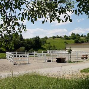
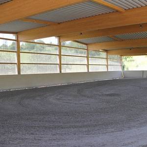
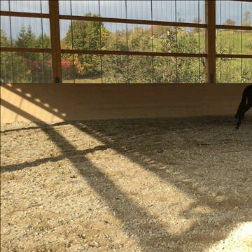
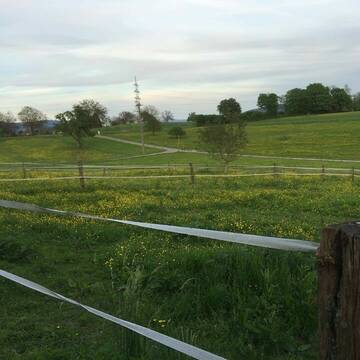
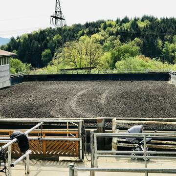
Hit Aktivstall Paulinenhof
Grenzach-Wyhlen
Moench-beate
@Moench-beate
FN-Mitglied
Freizeitstall
Hunde willkommen
Krankenbox
Notfallboxen
Bewegungsstall
Offenstall
16 weitere...
S
Deprecated: Creation of dynamic property Zend_View_Helper_Ads::$adLink is deprecated in /var/www/stall-frei/htdocs/staging.stall-frei.de/library/Psf/View/Helper/Ads.php on line 108

Futtersack HeuToy, Fressbremse in pink
Mechtersen
STALL-FREIde Marketing
@STALL-FREI-Marketing
Stundenlange Beschäftigung die
Koliken vorbeugt, geringe Staubinhalation mit
steuerbarer Futterentnahme
Leider kein Vorschaubild
Leider kein Vorschaubild
Rekonvalenz - und Pferdesenioren -Residenz
Mélisey
Little Paradies
@Team-Obelix
Rehabilitationsstall
Vermieten
Longierzirkel/Roundpen
Paddock
Notfallboxen
11 weitere...
B
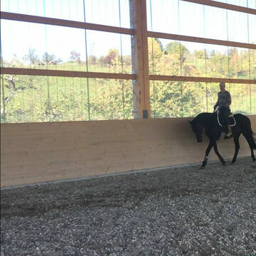
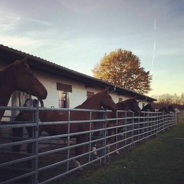
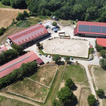
Idyllischer Reitstall mit Reithalle + Reitplatz
Rheinfelden
Elderberry Ranch
@ElderberryRanch
Fahrstall, Kutschwagen
FN-Mitglied
Vermieten
Hunde willkommen
Longierzirkel/Roundpen
Allergikerstall
Einhornhaltung möglich
37 weitere...
S


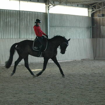
Reitstall Hemmer
Efringen-Kirchen
Jürgen Hemmer Reitlehrer FN
@JuergenHemmerReitlehrerFN
FN-Mitglied
Geländestrecke
Vermieten
Hunde willkommen
Longierzirkel/Roundpen
Außenbox mit Paddock
Außenboxen
15 weitere...
P+
Reitsportzentrum Lehmann
Weil am Rhein
Peter-Lehmann
@Peter-Lehmann
FN-Mitglied
Gastronomie
Vermieten
Führanlage
Longierzirkel/Roundpen
Außenboxen
Innenbox
13 weitere...
P

Persönlichkeitsentwicklung mit Pferden
Bad Salzuflen
Katja Dors
@Pferdezeiten
Begleite andere auf ihrem Entwicklungsweg und entdecke die transformative Kraft der pferdegestützten Persönlichkeitsentwicklung !
neu
R
Freie Pferdeboxen/Paddocks und Doppelpaddocks
Rheinfelden
Frech-City-Pferdepension
@Frech-City-Pferdepension
FN-Mitglied
Freizeitstall
Vermieten
Führanlage
Hunde willkommen
Allergikerstall
Gnadenbrothof
23 weitere...
P+


Offenstall - Trail und Weiden - Pferde und Ponies
Lörrach
Quellhof-GmbH
@Quellhof-GmbH
Freizeitstall
Gangpferdereiten
Krankenbox
Laufband
Notfallboxen
Bewegungsstall
Laufstall
11 weitere...
P+


Reitstall Goldberghof
Laufenburg
Stefan Ebner
@Goldberghof1
FN-Mitglied
Freizeitstall
Vermieten
Hunde willkommen
Krankenbox
Allergikerstall
bedampftes/gewaschenes Heu
23 weitere...
S
Pensionsplätze frei beim Reiterverein Lörrach e....
Lörrach
Reiterverein Lörrach e.V.
@RVLoerrach
FN-Mitglied
Reitlehrer und -unterricht
Hunde willkommen
Longierzirkel/Roundpen
Außenbox mit Paddock
Außenboxen
Vollpension
9 weitere...
P

XXL- und Paddockboxen auf idyllischer Privatanlage
Lörrach
PRIMEUR Equestrian Centre
@PrimeurEquestrianCentre
Pferdeausbildung
Rehabilitationsstall
Vermieten
Laufband
Paddock
Allergikerstall
Fohlenaufzucht möglich
22 weitere...
P
Deprecated: Creation of dynamic property Zend_View::$pageCount is deprecated in /var/www/stall-frei/htdocs/staging.stall-frei.de/library/vendor/shardj/zf1-future/library/Zend/View/Abstract.php on line 308
Deprecated: Creation of dynamic property Zend_View::$itemCountPerPage is deprecated in /var/www/stall-frei/htdocs/staging.stall-frei.de/library/vendor/shardj/zf1-future/library/Zend/View/Abstract.php on line 308
Deprecated: Creation of dynamic property Zend_View::$first is deprecated in /var/www/stall-frei/htdocs/staging.stall-frei.de/library/vendor/shardj/zf1-future/library/Zend/View/Abstract.php on line 308
Deprecated: Creation of dynamic property Zend_View::$current is deprecated in /var/www/stall-frei/htdocs/staging.stall-frei.de/library/vendor/shardj/zf1-future/library/Zend/View/Abstract.php on line 308
Deprecated: Creation of dynamic property Zend_View::$last is deprecated in /var/www/stall-frei/htdocs/staging.stall-frei.de/library/vendor/shardj/zf1-future/library/Zend/View/Abstract.php on line 308
Deprecated: Creation of dynamic property Zend_View::$next is deprecated in /var/www/stall-frei/htdocs/staging.stall-frei.de/library/vendor/shardj/zf1-future/library/Zend/View/Abstract.php on line 308
Deprecated: Creation of dynamic property Zend_View::$pagesInRange is deprecated in /var/www/stall-frei/htdocs/staging.stall-frei.de/library/vendor/shardj/zf1-future/library/Zend/View/Abstract.php on line 308
Deprecated: Creation of dynamic property Zend_View::$firstPageInRange is deprecated in /var/www/stall-frei/htdocs/staging.stall-frei.de/library/vendor/shardj/zf1-future/library/Zend/View/Abstract.php on line 308
Deprecated: Creation of dynamic property Zend_View::$lastPageInRange is deprecated in /var/www/stall-frei/htdocs/staging.stall-frei.de/library/vendor/shardj/zf1-future/library/Zend/View/Abstract.php on line 308
Deprecated: Creation of dynamic property Zend_View::$currentItemCount is deprecated in /var/www/stall-frei/htdocs/staging.stall-frei.de/library/vendor/shardj/zf1-future/library/Zend/View/Abstract.php on line 308
Deprecated: Creation of dynamic property Zend_View::$totalItemCount is deprecated in /var/www/stall-frei/htdocs/staging.stall-frei.de/library/vendor/shardj/zf1-future/library/Zend/View/Abstract.php on line 308
Deprecated: Creation of dynamic property Zend_View::$firstItemNumber is deprecated in /var/www/stall-frei/htdocs/staging.stall-frei.de/library/vendor/shardj/zf1-future/library/Zend/View/Abstract.php on line 308
Deprecated: Creation of dynamic property Zend_View::$lastItemNumber is deprecated in /var/www/stall-frei/htdocs/staging.stall-frei.de/library/vendor/shardj/zf1-future/library/Zend/View/Abstract.php on line 308
Deprecated: Creation of dynamic property Zend_View::$router is deprecated in /var/www/stall-frei/htdocs/staging.stall-frei.de/library/vendor/shardj/zf1-future/library/Zend/View/Abstract.php on line 308
Deprecated: Creation of dynamic property Zend_View::$urlParams is deprecated in /var/www/stall-frei/htdocs/staging.stall-frei.de/library/vendor/shardj/zf1-future/library/Zend/View/Abstract.php on line 308
Deprecated: Creation of dynamic property Zend_View::$showAds is deprecated in /var/www/stall-frei/htdocs/staging.stall-frei.de/library/vendor/shardj/zf1-future/library/Zend/View/Abstract.php on line 308
Deprecated: Creation of dynamic property Zend_View::$objectIds is deprecated in /var/www/stall-frei/htdocs/staging.stall-frei.de/library/vendor/shardj/zf1-future/library/Zend/View/Abstract.php on line 308
Deprecated: Creation of dynamic property Zend_View::$showNavbar is deprecated in /var/www/stall-frei/htdocs/staging.stall-frei.de/library/vendor/shardj/zf1-future/library/Zend/View/Abstract.php on line 308
Deprecated: Creation of dynamic property Zend_View::$showBreadcrumb is deprecated in /var/www/stall-frei/htdocs/staging.stall-frei.de/library/vendor/shardj/zf1-future/library/Zend/View/Abstract.php on line 308
Deprecated: Creation of dynamic property Zend_View::$showFooter is deprecated in /var/www/stall-frei/htdocs/staging.stall-frei.de/library/vendor/shardj/zf1-future/library/Zend/View/Abstract.php on line 308
Deprecated: Creation of dynamic property Zend_View::$showInternalAds is deprecated in /var/www/stall-frei/htdocs/staging.stall-frei.de/library/vendor/shardj/zf1-future/library/Zend/View/Abstract.php on line 308
Deprecated: Creation of dynamic property Zend_View::$blNoContent is deprecated in /var/www/stall-frei/htdocs/staging.stall-frei.de/library/vendor/shardj/zf1-future/library/Zend/View/Abstract.php on line 308
Deprecated: Creation of dynamic property Zend_View::$sMetaDesc is deprecated in /var/www/stall-frei/htdocs/staging.stall-frei.de/library/vendor/shardj/zf1-future/library/Zend/View/Abstract.php on line 308
Deprecated: Creation of dynamic property Zend_View::$useGmaps is deprecated in /var/www/stall-frei/htdocs/staging.stall-frei.de/library/vendor/shardj/zf1-future/library/Zend/View/Abstract.php on line 308
Deprecated: Creation of dynamic property Zend_View::$touches is deprecated in /var/www/stall-frei/htdocs/staging.stall-frei.de/library/vendor/shardj/zf1-future/library/Zend/View/Abstract.php on line 308
Deprecated: Creation of dynamic property Zend_View::$oProject is deprecated in /var/www/stall-frei/htdocs/staging.stall-frei.de/library/vendor/shardj/zf1-future/library/Zend/View/Abstract.php on line 308
Deprecated: Creation of dynamic property Zend_View::$pageHeadline is deprecated in /var/www/stall-frei/htdocs/staging.stall-frei.de/library/vendor/shardj/zf1-future/library/Zend/View/Abstract.php on line 308
Deprecated: Creation of dynamic property Zend_View::$disableLocationField is deprecated in /var/www/stall-frei/htdocs/staging.stall-frei.de/library/vendor/shardj/zf1-future/library/Zend/View/Abstract.php on line 308
Deprecated: Creation of dynamic property Zend_View::$isSearch is deprecated in /var/www/stall-frei/htdocs/staging.stall-frei.de/library/vendor/shardj/zf1-future/library/Zend/View/Abstract.php on line 308
Deprecated: Creation of dynamic property Zend_View::$pageTitle is deprecated in /var/www/stall-frei/htdocs/staging.stall-frei.de/library/vendor/shardj/zf1-future/library/Zend/View/Abstract.php on line 308
Deprecated: Creation of dynamic property Psf_Form_Element_Text::$class is deprecated in /var/www/stall-frei/htdocs/staging.stall-frei.de/library/vendor/shardj/zf1-future/library/Zend/Form/Element.php on line 874
Deprecated: Creation of dynamic property Psf_Form_Element_Text::$size is deprecated in /var/www/stall-frei/htdocs/staging.stall-frei.de/library/vendor/shardj/zf1-future/library/Zend/Form/Element.php on line 874
Deprecated: Creation of dynamic property Psf_Form_Element_Text::$placeholder is deprecated in /var/www/stall-frei/htdocs/staging.stall-frei.de/library/vendor/shardj/zf1-future/library/Zend/Form/Element.php on line 874
Deprecated: Creation of dynamic property Psf_Form_Element_Hidden::$class is deprecated in /var/www/stall-frei/htdocs/staging.stall-frei.de/library/vendor/shardj/zf1-future/library/Zend/Form/Element.php on line 874
Deprecated: Creation of dynamic property Psf_Form_Element_Hidden::$class is deprecated in /var/www/stall-frei/htdocs/staging.stall-frei.de/library/vendor/shardj/zf1-future/library/Zend/Form/Element.php on line 874
Deprecated: Creation of dynamic property Psf_Form_Element_Hidden::$class is deprecated in /var/www/stall-frei/htdocs/staging.stall-frei.de/library/vendor/shardj/zf1-future/library/Zend/Form/Element.php on line 874
Deprecated: Creation of dynamic property Psf_Form_Element_Hidden::$class is deprecated in /var/www/stall-frei/htdocs/staging.stall-frei.de/library/vendor/shardj/zf1-future/library/Zend/Form/Element.php on line 874
Deprecated: Creation of dynamic property Psf_Form_Element_Select::$class is deprecated in /var/www/stall-frei/htdocs/staging.stall-frei.de/library/vendor/shardj/zf1-future/library/Zend/Form/Element.php on line 874
Deprecated: Creation of dynamic property Psf_Form_Element_Select::$class is deprecated in /var/www/stall-frei/htdocs/staging.stall-frei.de/library/vendor/shardj/zf1-future/library/Zend/Form/Element.php on line 874
Deprecated: Creation of dynamic property Psf_Form_Element_Select::$class is deprecated in /var/www/stall-frei/htdocs/staging.stall-frei.de/library/vendor/shardj/zf1-future/library/Zend/Form/Element.php on line 874
Deprecated: Creation of dynamic property Psf_Form_Element_Select::$class is deprecated in /var/www/stall-frei/htdocs/staging.stall-frei.de/library/vendor/shardj/zf1-future/library/Zend/Form/Element.php on line 874
Deprecated: Creation of dynamic property Psf_Form_Element_Text::$class is deprecated in /var/www/stall-frei/htdocs/staging.stall-frei.de/library/vendor/shardj/zf1-future/library/Zend/Form/Element.php on line 874
Deprecated: Creation of dynamic property Psf_Form_Element_Checkbox::$label is deprecated in /var/www/stall-frei/htdocs/staging.stall-frei.de/library/vendor/shardj/zf1-future/library/Zend/Form/Element.php on line 874
Deprecated: Creation of dynamic property Zend_View::$sort is deprecated in /var/www/stall-frei/htdocs/staging.stall-frei.de/library/vendor/shardj/zf1-future/library/Zend/View/Abstract.php on line 308
Deprecated: Creation of dynamic property Zend_View::$searchLocation is deprecated in /var/www/stall-frei/htdocs/staging.stall-frei.de/library/vendor/shardj/zf1-future/library/Zend/View/Abstract.php on line 308
Deprecated: Creation of dynamic property Zend_View::$locationHint is deprecated in /var/www/stall-frei/htdocs/staging.stall-frei.de/library/vendor/shardj/zf1-future/library/Zend/View/Abstract.php on line 308
Psf_GeoCoder_Abstract::getLocation: Voiron Get Location CachedOrLive
Psf_GeoCoder_Abstract::getCachedOrLive: Voiron
Psf_GeoCoder_OpenCageData::makeApiRequest: response:
Array
(
[documentation] => https://opencagedata.com/api
[licenses] => Array
(
[0] => Array
(
[name] => see attribution guide
[url] => https://opencagedata.com/credits
)
)
[results] => Array
(
[0] => Array
(
[components] => Array
(
[ISO_3166-1_alpha-2] => FR
[ISO_3166-1_alpha-3] => FRA
[ISO_3166-2] => Array
(
[0] => FR-ARA
[1] => FR-38
)
[_category] => road
[_normalized_city] => Saint-Jean-de-Moirans
[_type] => road
[city] => Saint-Jean-de-Moirans
[continent] => Europe
[country] => France
[country_code] => fr
[county] => Isère
[local_authority] => Communauté d'agglomération du Pays Voironnais
[political_union] => European Union
[postcode] => 38430
[road] => Chemin de Voiron
[state] => Auvergne-Rhône-Alpes
[state_code] => ARA
)
[confidence] => 3
[formatted] => Chemin de Voiron, 38430 Saint-Jean-de-Moirans, France
[geometry] => Array
(
[lat] => 45.346408
[lng] => 5.577204
)
)
[1] => Array
(
[components] => Array
(
[ISO_3166-1_alpha-2] => FR
[ISO_3166-1_alpha-3] => FRA
[ISO_3166-2] => Array
(
[0] => FR-ARA
[1] => FR-74
)
[_category] => road
[_normalized_city] => Thonon-les-Bains
[_type] => road
[city] => Thonon-les-Bains
[continent] => Europe
[country] => France
[country_code] => fr
[county] => Haute-Savoie
[local_authority] => Thonon Agglomération
[political_union] => European Union
[postcode] => 74200
[road] => Chemin des Voirons
[state] => Auvergne-Rhône-Alpes
[state_code] => ARA
)
[confidence] => 3
[formatted] => Chemin des Voirons, 74200 Thonon-les-Bains, France
[geometry] => Array
(
[lat] => 46.364269
[lng] => 6.466104
)
)
[2] => Array
(
[components] => Array
(
[ISO_3166-1_alpha-2] => FR
[ISO_3166-1_alpha-3] => FRA
[ISO_3166-2] => Array
(
[0] => FR-ARA
[1] => FR-74
)
[_category] => road
[_normalized_city] => Arenthon
[_type] => road
[city] => Arenthon
[continent] => Europe
[country] => France
[country_code] => fr
[county] => Haute-Savoie
[local_authority] => Le Pays Rochois
[political_union] => European Union
[postcode] => 74800
[road] => Chemin des Voirons
[state] => Auvergne-Rhône-Alpes
[state_code] => ARA
)
[confidence] => 3
[formatted] => Chemin des Voirons, 74800 Arenthon, France
[geometry] => Array
(
[lat] => 46.108824
[lng] => 6.327146
)
)
[3] => Array
(
[components] => Array
(
[ISO_3166-1_alpha-2] => FR
[ISO_3166-1_alpha-3] => FRA
[ISO_3166-2] => Array
(
[0] => FR-ARA
[1] => FR-38
)
[_category] => road
[_normalized_city] => Moirans
[_type] => road
[city] => Moirans
[continent] => Europe
[country] => France
[country_code] => fr
[county] => Isère
[local_authority] => Communauté d'agglomération du Pays Voironnais
[political_union] => European Union
[postcode] => 38430
[road] => Route de Voiron
[state] => Auvergne-Rhône-Alpes
[state_code] => ARA
)
[confidence] => 3
[formatted] => Route de Voiron, 38430 Moirans, France
[geometry] => Array
(
[lat] => 45.329998
[lng] => 5.557105
)
)
[4] => Array
(
[components] => Array
(
[ISO_3166-1_alpha-2] => FR
[ISO_3166-1_alpha-3] => FRA
[ISO_3166-2] => Array
(
[0] => FR-ARA
[1] => FR-38
)
[_category] => road
[_normalized_city] => La Buisse
[_type] => road
[city] => La Buisse
[continent] => Europe
[country] => France
[country_code] => fr
[county] => Isère
[local_authority] => Communauté d'agglomération du Pays Voironnais
[political_union] => European Union
[postcode] => 38500
[road] => Route de Voiron
[state] => Auvergne-Rhône-Alpes
[state_code] => ARA
)
[confidence] => 3
[formatted] => Route de Voiron, 38500 La Buisse, France
[geometry] => Array
(
[lat] => 45.336518
[lng] => 5.619427
)
)
[5] => Array
(
[components] => Array
(
[ISO_3166-1_alpha-2] => FR
[ISO_3166-1_alpha-3] => FRA
[ISO_3166-2] => Array
(
[0] => FR-ARA
[1] => FR-38
)
[_category] => road
[_normalized_city] => Charnècles
[_type] => road
[city] => Charnècles
[continent] => Europe
[country] => France
[country_code] => fr
[county] => Isère
[local_authority] => Communauté d'agglomération du Pays Voironnais
[political_union] => European Union
[postcode] => 38140
[road] => Route de Voiron
[state] => Auvergne-Rhône-Alpes
[state_code] => ARA
)
[confidence] => 3
[formatted] => Route de Voiron, 38140 Charnècles, France
[geometry] => Array
(
[lat] => 45.348755
[lng] => 5.528339
)
)
[6] => Array
(
[components] => Array
(
[ISO_3166-1_alpha-2] => FR
[ISO_3166-1_alpha-3] => FRA
[ISO_3166-2] => Array
(
[0] => FR-ARA
[1] => FR-38
)
[_category] => road
[_normalized_city] => Saint-Étienne-de-Crossey
[_type] => road
[city] => Saint-Étienne-de-Crossey
[continent] => Europe
[country] => France
[country_code] => fr
[county] => Isère
[local_authority] => Communauté d'agglomération du Pays Voironnais
[political_union] => European Union
[postcode] => 38960
[road] => Route de Voiron
[state] => Auvergne-Rhône-Alpes
[state_code] => ARA
)
[confidence] => 3
[formatted] => Route de Voiron, 38960 Saint-Étienne-de-Crossey, France
[geometry] => Array
(
[lat] => 45.376864
[lng] => 5.645634
)
)
[7] => Array
(
[components] => Array
(
[ISO_3166-1_alpha-2] => FR
[ISO_3166-1_alpha-3] => FRA
[ISO_3166-2] => Array
(
[0] => FR-ARA
[1] => FR-38
)
[_category] => road
[_normalized_city] => Montferrat
[_type] => road
[city] => Montferrat
[continent] => Europe
[country] => France
[country_code] => fr
[county] => Isère
[local_authority] => Communauté d'agglomération du Pays Voironnais
[political_union] => European Union
[postcode] => 38620
[road] => Route de Voiron
[state] => Auvergne-Rhône-Alpes
[state_code] => ARA
)
[confidence] => 3
[formatted] => Route de Voiron, 38620 Montferrat, France
[geometry] => Array
(
[lat] => 45.471585
[lng] => 5.583863
)
)
[8] => Array
(
[components] => Array
(
[ISO_3166-1_alpha-2] => FR
[ISO_3166-1_alpha-3] => FRA
[ISO_3166-2] => Array
(
[0] => FR-ARA
[1] => FR-38
)
[_category] => road
[_normalized_city] => Voreppe
[_type] => road
[city] => Voreppe
[continent] => Europe
[country] => France
[country_code] => fr
[county] => Isère
[local_authority] => Communauté d'agglomération du Pays Voironnais
[political_union] => European Union
[postcode] => 38340
[road] => Route de Voiron
[state] => Auvergne-Rhône-Alpes
[state_code] => ARA
)
[confidence] => 3
[formatted] => Route de Voiron, 38340 Voreppe, France
[geometry] => Array
(
[lat] => 45.310282
[lng] => 5.622699
)
)
[9] => Array
(
[components] => Array
(
[ISO_3166-1_alpha-2] => FR
[ISO_3166-1_alpha-3] => FRA
[ISO_3166-2] => Array
(
[0] => FR-ARA
[1] => FR-38
)
[_category] => road
[_normalized_city] => Réaumont
[_type] => road
[city] => Réaumont
[continent] => Europe
[country] => France
[country_code] => fr
[county] => Isère
[local_authority] => Communauté d'agglomération du Pays Voironnais
[political_union] => European Union
[postcode] => 38140
[road] => Route de Voiron
[state] => Auvergne-Rhône-Alpes
[state_code] => ARA
)
[confidence] => 3
[formatted] => Route de Voiron, 38140 Réaumont, France
[geometry] => Array
(
[lat] => 45.353126
[lng] => 5.539844
)
)
)
[status] => Array
(
[code] => 200
[message] => OK
)
[stay_informed] => Array
(
[blog] => https://blog.opencagedata.com
[mastodon] => https://en.osm.town/@opencage
)
[thanks] => For using an OpenCage API
[timestamp] => Array
(
[created_http] => Sun, 08 Feb 2026 20:52:20 GMT
[created_unix] => 1770583940
)
[total_results] => 10
)
Psf_GeoCoder_Abstract::convertLocationResult
{"documentation":"https:\/\/opencagedata.com\/api","licenses":[{"name":"see attribution guide","url":"https:\/\/opencagedata.com\/credits"}],"results":[{"components":{"ISO_3166-1_alpha-2":"FR","ISO_3166-1_alpha-3":"FRA","ISO_3166-2":["FR-ARA","FR-38"],"_category":"road","_normalized_city":"Saint-Jean-de-Moirans","_type":"road","city":"Saint-Jean-de-Moirans","continent":"Europe","country":"France","country_code":"fr","county":"Is\u00e8re","local_authority":"Communaut\u00e9 d'agglom\u00e9ration du Pays Voironnais","political_union":"European Union","postcode":"38430","road":"Chemin de Voiron","state":"Auvergne-Rh\u00f4ne-Alpes","state_code":"ARA"},"confidence":3,"formatted":"Chemin de Voiron, 38430 Saint-Jean-de-Moirans, France","geometry":{"lat":45.346408,"lng":5.577204}},{"components":{"ISO_3166-1_alpha-2":"FR","ISO_3166-1_alpha-3":"FRA","ISO_3166-2":["FR-ARA","FR-74"],"_category":"road","_normalized_city":"Thonon-les-Bains","_type":"road","city":"Thonon-les-Bains","continent":"Europe","country":"France","country_code":"fr","county":"Haute-Savoie","local_authority":"Thonon Agglom\u00e9ration","political_union":"European Union","postcode":"74200","road":"Chemin des Voirons","state":"Auvergne-Rh\u00f4ne-Alpes","state_code":"ARA"},"confidence":3,"formatted":"Chemin des Voirons, 74200 Thonon-les-Bains, France","geometry":{"lat":46.364269,"lng":6.466104}},{"components":{"ISO_3166-1_alpha-2":"FR","ISO_3166-1_alpha-3":"FRA","ISO_3166-2":["FR-ARA","FR-74"],"_category":"road","_normalized_city":"Arenthon","_type":"road","city":"Arenthon","continent":"Europe","country":"France","country_code":"fr","county":"Haute-Savoie","local_authority":"Le Pays Rochois","political_union":"European Union","postcode":"74800","road":"Chemin des Voirons","state":"Auvergne-Rh\u00f4ne-Alpes","state_code":"ARA"},"confidence":3,"formatted":"Chemin des Voirons, 74800 Arenthon, France","geometry":{"lat":46.108824,"lng":6.327146}},{"components":{"ISO_3166-1_alpha-2":"FR","ISO_3166-1_alpha-3":"FRA","ISO_3166-2":["FR-ARA","FR-38"],"_category":"road","_normalized_city":"Moirans","_type":"road","city":"Moirans","continent":"Europe","country":"France","country_code":"fr","county":"Is\u00e8re","local_authority":"Communaut\u00e9 d'agglom\u00e9ration du Pays Voironnais","political_union":"European Union","postcode":"38430","road":"Route de Voiron","state":"Auvergne-Rh\u00f4ne-Alpes","state_code":"ARA"},"confidence":3,"formatted":"Route de Voiron, 38430 Moirans, France","geometry":{"lat":45.329998,"lng":5.557105}},{"components":{"ISO_3166-1_alpha-2":"FR","ISO_3166-1_alpha-3":"FRA","ISO_3166-2":["FR-ARA","FR-38"],"_category":"road","_normalized_city":"La Buisse","_type":"road","city":"La Buisse","continent":"Europe","country":"France","country_code":"fr","county":"Is\u00e8re","local_authority":"Communaut\u00e9 d'agglom\u00e9ration du Pays Voironnais","political_union":"European Union","postcode":"38500","road":"Route de Voiron","state":"Auvergne-Rh\u00f4ne-Alpes","state_code":"ARA"},"confidence":3,"formatted":"Route de Voiron, 38500 La Buisse, France","geometry":{"lat":45.336518,"lng":5.619427}},{"components":{"ISO_3166-1_alpha-2":"FR","ISO_3166-1_alpha-3":"FRA","ISO_3166-2":["FR-ARA","FR-38"],"_category":"road","_normalized_city":"Charn\u00e8cles","_type":"road","city":"Charn\u00e8cles","continent":"Europe","country":"France","country_code":"fr","county":"Is\u00e8re","local_authority":"Communaut\u00e9 d'agglom\u00e9ration du Pays Voironnais","political_union":"European Union","postcode":"38140","road":"Route de Voiron","state":"Auvergne-Rh\u00f4ne-Alpes","state_code":"ARA"},"confidence":3,"formatted":"Route de Voiron, 38140 Charn\u00e8cles, France","geometry":{"lat":45.348755,"lng":5.528339}},{"components":{"ISO_3166-1_alpha-2":"FR","ISO_3166-1_alpha-3":"FRA","ISO_3166-2":["FR-ARA","FR-38"],"_category":"road","_normalized_city":"Saint-\u00c9tienne-de-Crossey","_type":"road","city":"Saint-\u00c9tienne-de-Crossey","continent":"Europe","country":"France","country_code":"fr","county":"Is\u00e8re","local_authority":"Communaut\u00e9 d'agglom\u00e9ration du Pays Voironnais","political_union":"European Union","postcode":"38960","road":"Route de Voiron","state":"Auvergne-Rh\u00f4ne-Alpes","state_code":"ARA"},"confidence":3,"formatted":"Route de Voiron, 38960 Saint-\u00c9tienne-de-Crossey, France","geometry":{"lat":45.376864,"lng":5.645634}},{"components":{"ISO_3166-1_alpha-2":"FR","ISO_3166-1_alpha-3":"FRA","ISO_3166-2":["FR-ARA","FR-38"],"_category":"road","_normalized_city":"Montferrat","_type":"road","city":"Montferrat","continent":"Europe","country":"France","country_code":"fr","county":"Is\u00e8re","local_authority":"Communaut\u00e9 d'agglom\u00e9ration du Pays Voironnais","political_union":"European Union","postcode":"38620","road":"Route de Voiron","state":"Auvergne-Rh\u00f4ne-Alpes","state_code":"ARA"},"confidence":3,"formatted":"Route de Voiron, 38620 Montferrat, France","geometry":{"lat":45.471585,"lng":5.583863}},{"components":{"ISO_3166-1_alpha-2":"FR","ISO_3166-1_alpha-3":"FRA","ISO_3166-2":["FR-ARA","FR-38"],"_category":"road","_normalized_city":"Voreppe","_type":"road","city":"Voreppe","continent":"Europe","country":"France","country_code":"fr","county":"Is\u00e8re","local_authority":"Communaut\u00e9 d'agglom\u00e9ration du Pays Voironnais","political_union":"European Union","postcode":"38340","road":"Route de Voiron","state":"Auvergne-Rh\u00f4ne-Alpes","state_code":"ARA"},"confidence":3,"formatted":"Route de Voiron, 38340 Voreppe, France","geometry":{"lat":45.310282,"lng":5.622699}},{"components":{"ISO_3166-1_alpha-2":"FR","ISO_3166-1_alpha-3":"FRA","ISO_3166-2":["FR-ARA","FR-38"],"_category":"road","_normalized_city":"R\u00e9aumont","_type":"road","city":"R\u00e9aumont","continent":"Europe","country":"France","country_code":"fr","county":"Is\u00e8re","local_authority":"Communaut\u00e9 d'agglom\u00e9ration du Pays Voironnais","political_union":"European Union","postcode":"38140","road":"Route de Voiron","state":"Auvergne-Rh\u00f4ne-Alpes","state_code":"ARA"},"confidence":3,"formatted":"Route de Voiron, 38140 R\u00e9aumont, France","geometry":{"lat":45.353126,"lng":5.539844}}],"status":{"code":200,"message":"OK"},"stay_informed":{"blog":"https:\/\/blog.opencagedata.com","mastodon":"https:\/\/en.osm.town\/@opencage"},"thanks":"For using an OpenCage API","timestamp":{"created_http":"Sun, 08 Feb 2026 20:52:20 GMT","created_unix":1770583940},"total_results":10}Array
(
[0] => stdClass Object
(
[components] => stdClass Object
(
[ISO_3166-1_alpha-2] => FR
[ISO_3166-1_alpha-3] => FRA
[ISO_3166-2] => Array
(
[0] => FR-ARA
[1] => FR-38
)
[_category] => road
[_normalized_city] => Saint-Jean-de-Moirans
[_type] => road
[city] => Saint-Jean-de-Moirans
[continent] => Europe
[country] => France
[country_code] => fr
[county] => Isère
[local_authority] => Communauté d'agglomération du Pays Voironnais
[political_union] => European Union
[postcode] => 38430
[road] => Chemin de Voiron
[state] => Auvergne-Rhône-Alpes
[state_code] => ARA
)
[confidence] => 3
[formatted] => Chemin de Voiron, 38430 Saint-Jean-de-Moirans, France
[geometry] => stdClass Object
(
[lat] => 45.346408
[lng] => 5.577204
)
)
[1] => stdClass Object
(
[components] => stdClass Object
(
[ISO_3166-1_alpha-2] => FR
[ISO_3166-1_alpha-3] => FRA
[ISO_3166-2] => Array
(
[0] => FR-ARA
[1] => FR-74
)
[_category] => road
[_normalized_city] => Thonon-les-Bains
[_type] => road
[city] => Thonon-les-Bains
[continent] => Europe
[country] => France
[country_code] => fr
[county] => Haute-Savoie
[local_authority] => Thonon Agglomération
[political_union] => European Union
[postcode] => 74200
[road] => Chemin des Voirons
[state] => Auvergne-Rhône-Alpes
[state_code] => ARA
)
[confidence] => 3
[formatted] => Chemin des Voirons, 74200 Thonon-les-Bains, France
[geometry] => stdClass Object
(
[lat] => 46.364269
[lng] => 6.466104
)
)
[2] => stdClass Object
(
[components] => stdClass Object
(
[ISO_3166-1_alpha-2] => FR
[ISO_3166-1_alpha-3] => FRA
[ISO_3166-2] => Array
(
[0] => FR-ARA
[1] => FR-74
)
[_category] => road
[_normalized_city] => Arenthon
[_type] => road
[city] => Arenthon
[continent] => Europe
[country] => France
[country_code] => fr
[county] => Haute-Savoie
[local_authority] => Le Pays Rochois
[political_union] => European Union
[postcode] => 74800
[road] => Chemin des Voirons
[state] => Auvergne-Rhône-Alpes
[state_code] => ARA
)
[confidence] => 3
[formatted] => Chemin des Voirons, 74800 Arenthon, France
[geometry] => stdClass Object
(
[lat] => 46.108824
[lng] => 6.327146
)
)
[3] => stdClass Object
(
[components] => stdClass Object
(
[ISO_3166-1_alpha-2] => FR
[ISO_3166-1_alpha-3] => FRA
[ISO_3166-2] => Array
(
[0] => FR-ARA
[1] => FR-38
)
[_category] => road
[_normalized_city] => Moirans
[_type] => road
[city] => Moirans
[continent] => Europe
[country] => France
[country_code] => fr
[county] => Isère
[local_authority] => Communauté d'agglomération du Pays Voironnais
[political_union] => European Union
[postcode] => 38430
[road] => Route de Voiron
[state] => Auvergne-Rhône-Alpes
[state_code] => ARA
)
[confidence] => 3
[formatted] => Route de Voiron, 38430 Moirans, France
[geometry] => stdClass Object
(
[lat] => 45.329998
[lng] => 5.557105
)
)
[4] => stdClass Object
(
[components] => stdClass Object
(
[ISO_3166-1_alpha-2] => FR
[ISO_3166-1_alpha-3] => FRA
[ISO_3166-2] => Array
(
[0] => FR-ARA
[1] => FR-38
)
[_category] => road
[_normalized_city] => La Buisse
[_type] => road
[city] => La Buisse
[continent] => Europe
[country] => France
[country_code] => fr
[county] => Isère
[local_authority] => Communauté d'agglomération du Pays Voironnais
[political_union] => European Union
[postcode] => 38500
[road] => Route de Voiron
[state] => Auvergne-Rhône-Alpes
[state_code] => ARA
)
[confidence] => 3
[formatted] => Route de Voiron, 38500 La Buisse, France
[geometry] => stdClass Object
(
[lat] => 45.336518
[lng] => 5.619427
)
)
[5] => stdClass Object
(
[components] => stdClass Object
(
[ISO_3166-1_alpha-2] => FR
[ISO_3166-1_alpha-3] => FRA
[ISO_3166-2] => Array
(
[0] => FR-ARA
[1] => FR-38
)
[_category] => road
[_normalized_city] => Charnècles
[_type] => road
[city] => Charnècles
[continent] => Europe
[country] => France
[country_code] => fr
[county] => Isère
[local_authority] => Communauté d'agglomération du Pays Voironnais
[political_union] => European Union
[postcode] => 38140
[road] => Route de Voiron
[state] => Auvergne-Rhône-Alpes
[state_code] => ARA
)
[confidence] => 3
[formatted] => Route de Voiron, 38140 Charnècles, France
[geometry] => stdClass Object
(
[lat] => 45.348755
[lng] => 5.528339
)
)
[6] => stdClass Object
(
[components] => stdClass Object
(
[ISO_3166-1_alpha-2] => FR
[ISO_3166-1_alpha-3] => FRA
[ISO_3166-2] => Array
(
[0] => FR-ARA
[1] => FR-38
)
[_category] => road
[_normalized_city] => Saint-Étienne-de-Crossey
[_type] => road
[city] => Saint-Étienne-de-Crossey
[continent] => Europe
[country] => France
[country_code] => fr
[county] => Isère
[local_authority] => Communauté d'agglomération du Pays Voironnais
[political_union] => European Union
[postcode] => 38960
[road] => Route de Voiron
[state] => Auvergne-Rhône-Alpes
[state_code] => ARA
)
[confidence] => 3
[formatted] => Route de Voiron, 38960 Saint-Étienne-de-Crossey, France
[geometry] => stdClass Object
(
[lat] => 45.376864
[lng] => 5.645634
)
)
[7] => stdClass Object
(
[components] => stdClass Object
(
[ISO_3166-1_alpha-2] => FR
[ISO_3166-1_alpha-3] => FRA
[ISO_3166-2] => Array
(
[0] => FR-ARA
[1] => FR-38
)
[_category] => road
[_normalized_city] => Montferrat
[_type] => road
[city] => Montferrat
[continent] => Europe
[country] => France
[country_code] => fr
[county] => Isère
[local_authority] => Communauté d'agglomération du Pays Voironnais
[political_union] => European Union
[postcode] => 38620
[road] => Route de Voiron
[state] => Auvergne-Rhône-Alpes
[state_code] => ARA
)
[confidence] => 3
[formatted] => Route de Voiron, 38620 Montferrat, France
[geometry] => stdClass Object
(
[lat] => 45.471585
[lng] => 5.583863
)
)
[8] => stdClass Object
(
[components] => stdClass Object
(
[ISO_3166-1_alpha-2] => FR
[ISO_3166-1_alpha-3] => FRA
[ISO_3166-2] => Array
(
[0] => FR-ARA
[1] => FR-38
)
[_category] => road
[_normalized_city] => Voreppe
[_type] => road
[city] => Voreppe
[continent] => Europe
[country] => France
[country_code] => fr
[county] => Isère
[local_authority] => Communauté d'agglomération du Pays Voironnais
[political_union] => European Union
[postcode] => 38340
[road] => Route de Voiron
[state] => Auvergne-Rhône-Alpes
[state_code] => ARA
)
[confidence] => 3
[formatted] => Route de Voiron, 38340 Voreppe, France
[geometry] => stdClass Object
(
[lat] => 45.310282
[lng] => 5.622699
)
)
[9] => stdClass Object
(
[components] => stdClass Object
(
[ISO_3166-1_alpha-2] => FR
[ISO_3166-1_alpha-3] => FRA
[ISO_3166-2] => Array
(
[0] => FR-ARA
[1] => FR-38
)
[_category] => road
[_normalized_city] => Réaumont
[_type] => road
[city] => Réaumont
[continent] => Europe
[country] => France
[country_code] => fr
[county] => Isère
[local_authority] => Communauté d'agglomération du Pays Voironnais
[political_union] => European Union
[postcode] => 38140
[road] => Route de Voiron
[state] => Auvergne-Rhône-Alpes
[state_code] => ARA
)
[confidence] => 3
[formatted] => Route de Voiron, 38140 Réaumont, France
[geometry] => stdClass Object
(
[lat] => 45.353126
[lng] => 5.539844
)
)
)
Psf_GeoCoder_OpenCageData::getKeyMap: 0
stdClass Object
(
    [components] => stdClass Object
        (
            [ISO_3166-1_alpha-2] => FR
            [ISO_3166-1_alpha-3] => FRA
            [ISO_3166-2] => Array
                (
                    [0] => FR-ARA
                    [1] => FR-38
                )

            [_category] => road
            [_normalized_city] => Saint-Jean-de-Moirans
            [_type] => road
            [city] => Saint-Jean-de-Moirans
            [continent] => Europe
            [country] => France
            [country_code] => fr
            [county] => Isère
            [local_authority] => Communauté d'agglomération du Pays Voironnais
            [political_union] => European Union
            [postcode] => 38430
            [road] => Chemin de Voiron
            [state] => Auvergne-Rhône-Alpes
            [state_code] => ARA
        )

    [confidence] => 3
    [formatted] => Chemin de Voiron, 38430 Saint-Jean-de-Moirans, France
    [geometry] => stdClass Object
        (
            [lat] => 45.346408
            [lng] => 5.577204
        )

)
Psf_GeoCoder_OpenCageData::getCounty: Isère
Psf_GeoCoder_OpenCageData::addMissingData REFETCH!
Array
(
    [address] => Chemin de Voiron, 38430 Saint-Jean-de-Moirans, France
    [type] => road
    [street] => Chemin de Voiron
    [city] => Saint-Jean-de-Moirans
    [county] => Isère
    [state] => Auvergne-Rhône-Alpes
    [zip] => 38430
    [country] => France
    [suburb] =>
    [countrycode] => fr
    [latitude] => 45.346408
    [longitude] => 5.577204
    [accuracy] => 1
    [confidence] => 3
    [bounds] =>
)
reformat!
Array
(
    [address] => Chemin de Voiron, 38430 Saint-Jean-de-Moirans, France
    [type] => road
    [street] => Chemin de Voiron
    [city] => Saint-Jean-de-Moirans
    [county] => Isère
    [state] => Auvergne-Rhône-Alpes
    [zip] => 38430
    [country] => France
    [suburb] =>
    [countrycode] => fr
    [latitude] => 45.346408
    [longitude] => 5.577204
    [accuracy] => 1
    [confidence] => 3
    [bounds] =>
    [place] => Chemin de Voiron, 38430 Saint-Jean-de-Moirans, Auvergne-Rhône-Alpes
    [hash] => 4fb077a24c1c6ba34719085963f56aff
)
Psf_GeoCoder_OpenCageData::getKeyMap: 1
stdClass Object
(
    [components] => stdClass Object
        (
            [ISO_3166-1_alpha-2] => FR
            [ISO_3166-1_alpha-3] => FRA
            [ISO_3166-2] => Array
                (
                    [0] => FR-ARA
                    [1] => FR-74
                )

            [_category] => road
            [_normalized_city] => Thonon-les-Bains
            [_type] => road
            [city] => Thonon-les-Bains
            [continent] => Europe
            [country] => France
            [country_code] => fr
            [county] => Haute-Savoie
            [local_authority] => Thonon Agglomération
            [political_union] => European Union
            [postcode] => 74200
            [road] => Chemin des Voirons
            [state] => Auvergne-Rhône-Alpes
            [state_code] => ARA
        )

    [confidence] => 3
    [formatted] => Chemin des Voirons, 74200 Thonon-les-Bains, France
    [geometry] => stdClass Object
        (
            [lat] => 46.364269
            [lng] => 6.466104
        )

)
Psf_GeoCoder_OpenCageData::getCounty: Haute-Savoie
Psf_GeoCoder_OpenCageData::addMissingData REFETCH!
Array
(
    [address] => Chemin des Voirons, 74200 Thonon-les-Bains, France
    [type] => road
    [street] => Chemin des Voirons
    [city] => Thonon-les-Bains
    [county] => Haute-Savoie
    [state] => Auvergne-Rhône-Alpes
    [zip] => 74200
    [country] => France
    [suburb] =>
    [countrycode] => fr
    [latitude] => 46.364269
    [longitude] => 6.466104
    [accuracy] => 1
    [confidence] => 3
    [bounds] =>
)
reformat!
Array
(
    [address] => Chemin des Voirons, 74200 Thonon-les-Bains, France
    [type] => road
    [street] => Chemin des Voirons
    [city] => Thonon-les-Bains
    [county] => Haute-Savoie
    [state] => Auvergne-Rhône-Alpes
    [zip] => 74200
    [country] => France
    [suburb] =>
    [countrycode] => fr
    [latitude] => 46.364269
    [longitude] => 6.466104
    [accuracy] => 1
    [confidence] => 3
    [bounds] =>
    [place] => Chemin des Voirons, 74200 Thonon-les-Bains, Auvergne-Rhône-Alpes
    [hash] => cb5decc070a10499a0e65bfddd84121a
)
Psf_GeoCoder_OpenCageData::getKeyMap: 2
stdClass Object
(
    [components] => stdClass Object
        (
            [ISO_3166-1_alpha-2] => FR
            [ISO_3166-1_alpha-3] => FRA
            [ISO_3166-2] => Array
                (
                    [0] => FR-ARA
                    [1] => FR-74
                )

            [_category] => road
            [_normalized_city] => Arenthon
            [_type] => road
            [city] => Arenthon
            [continent] => Europe
            [country] => France
            [country_code] => fr
            [county] => Haute-Savoie
            [local_authority] => Le Pays Rochois
            [political_union] => European Union
            [postcode] => 74800
            [road] => Chemin des Voirons
            [state] => Auvergne-Rhône-Alpes
            [state_code] => ARA
        )

    [confidence] => 3
    [formatted] => Chemin des Voirons, 74800 Arenthon, France
    [geometry] => stdClass Object
        (
            [lat] => 46.108824
            [lng] => 6.327146
        )

)
Psf_GeoCoder_OpenCageData::getCounty: Haute-Savoie
Psf_GeoCoder_OpenCageData::addMissingData REFETCH!
Array
(
    [address] => Chemin des Voirons, 74800 Arenthon, France
    [type] => road
    [street] => Chemin des Voirons
    [city] => Arenthon
    [county] => Haute-Savoie
    [state] => Auvergne-Rhône-Alpes
    [zip] => 74800
    [country] => France
    [suburb] =>
    [countrycode] => fr
    [latitude] => 46.108824
    [longitude] => 6.327146
    [accuracy] => 1
    [confidence] => 3
    [bounds] =>
)
reformat!
Array
(
    [address] => Chemin des Voirons, 74800 Arenthon, France
    [type] => road
    [street] => Chemin des Voirons
    [city] => Arenthon
    [county] => Haute-Savoie
    [state] => Auvergne-Rhône-Alpes
    [zip] => 74800
    [country] => France
    [suburb] =>
    [countrycode] => fr
    [latitude] => 46.108824
    [longitude] => 6.327146
    [accuracy] => 1
    [confidence] => 3
    [bounds] =>
    [place] => Chemin des Voirons, 74800 Arenthon, Auvergne-Rhône-Alpes
    [hash] => c1d5b202ebcc79dc572058e3bfaad62e
)
Psf_GeoCoder_OpenCageData::getKeyMap: 3
stdClass Object
(
    [components] => stdClass Object
        (
            [ISO_3166-1_alpha-2] => FR
            [ISO_3166-1_alpha-3] => FRA
            [ISO_3166-2] => Array
                (
                    [0] => FR-ARA
                    [1] => FR-38
                )

            [_category] => road
            [_normalized_city] => Moirans
            [_type] => road
            [city] => Moirans
            [continent] => Europe
            [country] => France
            [country_code] => fr
            [county] => Isère
            [local_authority] => Communauté d'agglomération du Pays Voironnais
            [political_union] => European Union
            [postcode] => 38430
            [road] => Route de Voiron
            [state] => Auvergne-Rhône-Alpes
            [state_code] => ARA
        )

    [confidence] => 3
    [formatted] => Route de Voiron, 38430 Moirans, France
    [geometry] => stdClass Object
        (
            [lat] => 45.329998
            [lng] => 5.557105
        )

)
Psf_GeoCoder_OpenCageData::getCounty: Isère
Psf_GeoCoder_OpenCageData::addMissingData REFETCH!
Array
(
    [address] => Route de Voiron, 38430 Moirans, France
    [type] => road
    [street] => Route de Voiron
    [city] => Moirans
    [county] => Isère
    [state] => Auvergne-Rhône-Alpes
    [zip] => 38430
    [country] => France
    [suburb] =>
    [countrycode] => fr
    [latitude] => 45.329998
    [longitude] => 5.557105
    [accuracy] => 1
    [confidence] => 3
    [bounds] =>
)
reformat!
Array
(
    [address] => Route de Voiron, 38430 Moirans, France
    [type] => road
    [street] => Route de Voiron
    [city] => Moirans
    [county] => Isère
    [state] => Auvergne-Rhône-Alpes
    [zip] => 38430
    [country] => France
    [suburb] =>
    [countrycode] => fr
    [latitude] => 45.329998
    [longitude] => 5.557105
    [accuracy] => 1
    [confidence] => 3
    [bounds] =>
    [place] => Route de Voiron, 38430 Moirans, Auvergne-Rhône-Alpes
    [hash] => 5909a953d0cf74ced7ade4e88f49d800
)
Psf_GeoCoder_OpenCageData::getKeyMap: 4
stdClass Object
(
    [components] => stdClass Object
        (
            [ISO_3166-1_alpha-2] => FR
            [ISO_3166-1_alpha-3] => FRA
            [ISO_3166-2] => Array
                (
                    [0] => FR-ARA
                    [1] => FR-38
                )

            [_category] => road
            [_normalized_city] => La Buisse
            [_type] => road
            [city] => La Buisse
            [continent] => Europe
            [country] => France
            [country_code] => fr
            [county] => Isère
            [local_authority] => Communauté d'agglomération du Pays Voironnais
            [political_union] => European Union
            [postcode] => 38500
            [road] => Route de Voiron
            [state] => Auvergne-Rhône-Alpes
            [state_code] => ARA
        )

    [confidence] => 3
    [formatted] => Route de Voiron, 38500 La Buisse, France
    [geometry] => stdClass Object
        (
            [lat] => 45.336518
            [lng] => 5.619427
        )

)
Psf_GeoCoder_OpenCageData::getCounty: Isère
Psf_GeoCoder_OpenCageData::addMissingData REFETCH!
Array
(
    [address] => Route de Voiron, 38500 La Buisse, France
    [type] => road
    [street] => Route de Voiron
    [city] => La Buisse
    [county] => Isère
    [state] => Auvergne-Rhône-Alpes
    [zip] => 38500
    [country] => France
    [suburb] =>
    [countrycode] => fr
    [latitude] => 45.336518
    [longitude] => 5.619427
    [accuracy] => 1
    [confidence] => 3
    [bounds] =>
)
reformat!
Array
(
    [address] => Route de Voiron, 38500 La Buisse, France
    [type] => road
    [street] => Route de Voiron
    [city] => La Buisse
    [county] => Isère
    [state] => Auvergne-Rhône-Alpes
    [zip] => 38500
    [country] => France
    [suburb] =>
    [countrycode] => fr
    [latitude] => 45.336518
    [longitude] => 5.619427
    [accuracy] => 1
    [confidence] => 3
    [bounds] =>
    [place] => Route de Voiron, 38500 La Buisse, Auvergne-Rhône-Alpes
    [hash] => ec0c2bee9d04c468a7b2cc557b582925
)
Psf_GeoCoder_OpenCageData::getKeyMap: 5
stdClass Object
(
    [components] => stdClass Object
        (
            [ISO_3166-1_alpha-2] => FR
            [ISO_3166-1_alpha-3] => FRA
            [ISO_3166-2] => Array
                (
                    [0] => FR-ARA
                    [1] => FR-38
                )

            [_category] => road
            [_normalized_city] => Charnècles
            [_type] => road
            [city] => Charnècles
            [continent] => Europe
            [country] => France
            [country_code] => fr
            [county] => Isère
            [local_authority] => Communauté d'agglomération du Pays Voironnais
            [political_union] => European Union
            [postcode] => 38140
            [road] => Route de Voiron
            [state] => Auvergne-Rhône-Alpes
            [state_code] => ARA
        )

    [confidence] => 3
    [formatted] => Route de Voiron, 38140 Charnècles, France
    [geometry] => stdClass Object
        (
            [lat] => 45.348755
            [lng] => 5.528339
        )

)
Psf_GeoCoder_OpenCageData::getCounty: Isère
Psf_GeoCoder_OpenCageData::addMissingData REFETCH!
Array
(
    [address] => Route de Voiron, 38140 Charnècles, France
    [type] => road
    [street] => Route de Voiron
    [city] => Charnècles
    [county] => Isère
    [state] => Auvergne-Rhône-Alpes
    [zip] => 38140
    [country] => France
    [suburb] =>
    [countrycode] => fr
    [latitude] => 45.348755
    [longitude] => 5.528339
    [accuracy] => 1
    [confidence] => 3
    [bounds] =>
)
reformat!
Array
(
    [address] => Route de Voiron, 38140 Charnècles, France
    [type] => road
    [street] => Route de Voiron
    [city] => Charnècles
    [county] => Isère
    [state] => Auvergne-Rhône-Alpes
    [zip] => 38140
    [country] => France
    [suburb] =>
    [countrycode] => fr
    [latitude] => 45.348755
    [longitude] => 5.528339
    [accuracy] => 1
    [confidence] => 3
    [bounds] =>
    [place] => Route de Voiron, 38140 Charnècles, Auvergne-Rhône-Alpes
    [hash] => 3995baafc0598af83628167aded49547
)
Psf_GeoCoder_OpenCageData::getKeyMap: 6
stdClass Object
(
    [components] => stdClass Object
        (
            [ISO_3166-1_alpha-2] => FR
            [ISO_3166-1_alpha-3] => FRA
            [ISO_3166-2] => Array
                (
                    [0] => FR-ARA
                    [1] => FR-38
                )

            [_category] => road
            [_normalized_city] => Saint-Étienne-de-Crossey
            [_type] => road
            [city] => Saint-Étienne-de-Crossey
            [continent] => Europe
            [country] => France
            [country_code] => fr
            [county] => Isère
            [local_authority] => Communauté d'agglomération du Pays Voironnais
            [political_union] => European Union
            [postcode] => 38960
            [road] => Route de Voiron
            [state] => Auvergne-Rhône-Alpes
            [state_code] => ARA
        )

    [confidence] => 3
    [formatted] => Route de Voiron, 38960 Saint-Étienne-de-Crossey, France
    [geometry] => stdClass Object
        (
            [lat] => 45.376864
            [lng] => 5.645634
        )

)
Psf_GeoCoder_OpenCageData::getCounty: Isère
Psf_GeoCoder_OpenCageData::addMissingData REFETCH!
Array
(
    [address] => Route de Voiron, 38960 Saint-Étienne-de-Crossey, France
    [type] => road
    [street] => Route de Voiron
    [city] => Saint-Étienne-de-Crossey
    [county] => Isère
    [state] => Auvergne-Rhône-Alpes
    [zip] => 38960
    [country] => France
    [suburb] =>
    [countrycode] => fr
    [latitude] => 45.376864
    [longitude] => 5.645634
    [accuracy] => 1
    [confidence] => 3
    [bounds] =>
)
reformat!
Array
(
    [address] => Route de Voiron, 38960 Saint-Étienne-de-Crossey, France
    [type] => road
    [street] => Route de Voiron
    [city] => Saint-Étienne-de-Crossey
    [county] => Isère
    [state] => Auvergne-Rhône-Alpes
    [zip] => 38960
    [country] => France
    [suburb] =>
    [countrycode] => fr
    [latitude] => 45.376864
    [longitude] => 5.645634
    [accuracy] => 1
    [confidence] => 3
    [bounds] =>
    [place] => Route de Voiron, 38960 Saint-Étienne-de-Crossey, Auvergne-Rhône-Alpes
    [hash] => e95a3493e80655e63b47e269925ce9ab
)
Psf_GeoCoder_OpenCageData::getKeyMap: 7
stdClass Object
(
    [components] => stdClass Object
        (
            [ISO_3166-1_alpha-2] => FR
            [ISO_3166-1_alpha-3] => FRA
            [ISO_3166-2] => Array
                (
                    [0] => FR-ARA
                    [1] => FR-38
                )

            [_category] => road
            [_normalized_city] => Montferrat
            [_type] => road
            [city] => Montferrat
            [continent] => Europe
            [country] => France
            [country_code] => fr
            [county] => Isère
            [local_authority] => Communauté d'agglomération du Pays Voironnais
            [political_union] => European Union
            [postcode] => 38620
            [road] => Route de Voiron
            [state] => Auvergne-Rhône-Alpes
            [state_code] => ARA
        )

    [confidence] => 3
    [formatted] => Route de Voiron, 38620 Montferrat, France
    [geometry] => stdClass Object
        (
            [lat] => 45.471585
            [lng] => 5.583863
        )

)
Psf_GeoCoder_OpenCageData::getCounty: Isère
Psf_GeoCoder_OpenCageData::addMissingData REFETCH!
Array
(
    [address] => Route de Voiron, 38620 Montferrat, France
    [type] => road
    [street] => Route de Voiron
    [city] => Montferrat
    [county] => Isère
    [state] => Auvergne-Rhône-Alpes
    [zip] => 38620
    [country] => France
    [suburb] =>
    [countrycode] => fr
    [latitude] => 45.471585
    [longitude] => 5.583863
    [accuracy] => 1
    [confidence] => 3
    [bounds] =>
)
reformat!
Array
(
    [address] => Route de Voiron, 38620 Montferrat, France
    [type] => road
    [street] => Route de Voiron
    [city] => Montferrat
    [county] => Isère
    [state] => Auvergne-Rhône-Alpes
    [zip] => 38620
    [country] => France
    [suburb] =>
    [countrycode] => fr
    [latitude] => 45.471585
    [longitude] => 5.583863
    [accuracy] => 1
    [confidence] => 3
    [bounds] =>
    [place] => Route de Voiron, 38620 Montferrat, Auvergne-Rhône-Alpes
    [hash] => 9ad1bbd6476c2f01e63c3ebbca1009c0
)
Psf_GeoCoder_OpenCageData::getKeyMap: 8
stdClass Object
(
    [components] => stdClass Object
        (
            [ISO_3166-1_alpha-2] => FR
            [ISO_3166-1_alpha-3] => FRA
            [ISO_3166-2] => Array
                (
                    [0] => FR-ARA
                    [1] => FR-38
                )

            [_category] => road
            [_normalized_city] => Voreppe
            [_type] => road
            [city] => Voreppe
            [continent] => Europe
            [country] => France
            [country_code] => fr
            [county] => Isère
            [local_authority] => Communauté d'agglomération du Pays Voironnais
            [political_union] => European Union
            [postcode] => 38340
            [road] => Route de Voiron
            [state] => Auvergne-Rhône-Alpes
            [state_code] => ARA
        )

    [confidence] => 3
    [formatted] => Route de Voiron, 38340 Voreppe, France
    [geometry] => stdClass Object
        (
            [lat] => 45.310282
            [lng] => 5.622699
        )

)
Psf_GeoCoder_OpenCageData::getCounty: Isère
Psf_GeoCoder_OpenCageData::addMissingData REFETCH!
Array
(
    [address] => Route de Voiron, 38340 Voreppe, France
    [type] => road
    [street] => Route de Voiron
    [city] => Voreppe
    [county] => Isère
    [state] => Auvergne-Rhône-Alpes
    [zip] => 38340
    [country] => France
    [suburb] =>
    [countrycode] => fr
    [latitude] => 45.310282
    [longitude] => 5.622699
    [accuracy] => 1
    [confidence] => 3
    [bounds] =>
)
reformat!
Array
(
    [address] => Route de Voiron, 38340 Voreppe, France
    [type] => road
    [street] => Route de Voiron
    [city] => Voreppe
    [county] => Isère
    [state] => Auvergne-Rhône-Alpes
    [zip] => 38340
    [country] => France
    [suburb] =>
    [countrycode] => fr
    [latitude] => 45.310282
    [longitude] => 5.622699
    [accuracy] => 1
    [confidence] => 3
    [bounds] =>
    [place] => Route de Voiron, 38340 Voreppe, Auvergne-Rhône-Alpes
    [hash] => 23bd05c607e0021f5dc662cf5723914f
)
Psf_GeoCoder_OpenCageData::getKeyMap: 9
stdClass Object
(
    [components] => stdClass Object
        (
            [ISO_3166-1_alpha-2] => FR
            [ISO_3166-1_alpha-3] => FRA
            [ISO_3166-2] => Array
                (
                    [0] => FR-ARA
                    [1] => FR-38
                )

            [_category] => road
            [_normalized_city] => Réaumont
            [_type] => road
            [city] => Réaumont
            [continent] => Europe
            [country] => France
            [country_code] => fr
            [county] => Isère
            [local_authority] => Communauté d'agglomération du Pays Voironnais
            [political_union] => European Union
            [postcode] => 38140
            [road] => Route de Voiron
            [state] => Auvergne-Rhône-Alpes
            [state_code] => ARA
        )

    [confidence] => 3
    [formatted] => Route de Voiron, 38140 Réaumont, France
    [geometry] => stdClass Object
        (
            [lat] => 45.353126
            [lng] => 5.539844
        )

)
Psf_GeoCoder_OpenCageData::getCounty: Isère
Psf_GeoCoder_OpenCageData::addMissingData REFETCH!
Array
(
    [address] => Route de Voiron, 38140 Réaumont, France
    [type] => road
    [street] => Route de Voiron
    [city] => Réaumont
    [county] => Isère
    [state] => Auvergne-Rhône-Alpes
    [zip] => 38140
    [country] => France
    [suburb] =>
    [countrycode] => fr
    [latitude] => 45.353126
    [longitude] => 5.539844
    [accuracy] => 1
    [confidence] => 3
    [bounds] =>
)
reformat!
Array
(
    [address] => Route de Voiron, 38140 Réaumont, France
    [type] => road
    [street] => Route de Voiron
    [city] => Réaumont
    [county] => Isère
    [state] => Auvergne-Rhône-Alpes
    [zip] => 38140
    [country] => France
    [suburb] =>
    [countrycode] => fr
    [latitude] => 45.353126
    [longitude] => 5.539844
    [accuracy] => 1
    [confidence] => 3
    [bounds] =>
    [place] => Route de Voiron, 38140 Réaumont, Auvergne-Rhône-Alpes
    [hash] => e40369e2007f4f4d3251726eca8fa2ac
)
Deprecated: Creation of dynamic property Zend_View::$locationHintStyle is deprecated in /var/www/stall-frei/htdocs/staging.stall-frei.de/library/vendor/shardj/zf1-future/library/Zend/View/Abstract.php on line 308
Deprecated: Creation of dynamic property Zend_View::$adGeoLocation is deprecated in /var/www/stall-frei/htdocs/staging.stall-frei.de/library/vendor/shardj/zf1-future/library/Zend/View/Abstract.php on line 308
Deprecated: Creation of dynamic property Zend_View::$recordCount is deprecated in /var/www/stall-frei/htdocs/staging.stall-frei.de/library/vendor/shardj/zf1-future/library/Zend/View/Abstract.php on line 308
Deprecated: explode(): Passing null to parameter #2 ($string) of type string is deprecated in /var/www/stall-frei/htdocs/staging.stall-frei.de/application/models/SearchAgent.php on line 100
Deprecated: explode(): Passing null to parameter #2 ($string) of type string is deprecated in /var/www/stall-frei/htdocs/staging.stall-frei.de/application/models/SearchAgent.php on line 100
Deprecated: explode(): Passing null to parameter #2 ($string) of type string is deprecated in /var/www/stall-frei/htdocs/staging.stall-frei.de/application/models/SearchAgent.php on line 100
Deprecated: explode(): Passing null to parameter #2 ($string) of type string is deprecated in /var/www/stall-frei/htdocs/staging.stall-frei.de/application/models/SearchAgent.php on line 100
Deprecated: explode(): Passing null to parameter #2 ($string) of type string is deprecated in /var/www/stall-frei/htdocs/staging.stall-frei.de/application/models/SearchAgent.php on line 100
Deprecated: explode(): Passing null to parameter #2 ($string) of type string is deprecated in /var/www/stall-frei/htdocs/staging.stall-frei.de/application/models/SearchAgent.php on line 100
Deprecated: explode(): Passing null to parameter #2 ($string) of type string is deprecated in /var/www/stall-frei/htdocs/staging.stall-frei.de/application/models/SearchAgent.php on line 100
Deprecated: explode(): Passing null to parameter #2 ($string) of type string is deprecated in /var/www/stall-frei/htdocs/staging.stall-frei.de/application/models/SearchAgent.php on line 100
Deprecated: explode(): Passing null to parameter #2 ($string) of type string is deprecated in /var/www/stall-frei/htdocs/staging.stall-frei.de/application/models/SearchAgent.php on line 100
Deprecated: trim(): Passing null to parameter #1 ($string) of type string is deprecated in /var/www/stall-frei/htdocs/staging.stall-frei.de/application/models/Account/Search.php on line 82
Warning: Cannot modify header information - headers already sent by (output started at /var/www/stall-frei/htdocs/staging.stall-frei.de/library/vendor/shardj/zf1-future/library/Zend/View/Abstract.php:308) in /var/www/stall-frei/htdocs/staging.stall-frei.de/application/models/Account/Search.php on line 71
Deprecated: Creation of dynamic property Zend_View::$paginationParams is deprecated in /var/www/stall-frei/htdocs/staging.stall-frei.de/library/vendor/shardj/zf1-future/library/Zend/View/Abstract.php on line 308
Deprecated: Creation of dynamic property Zend_View::$objectPaginator is deprecated in /var/www/stall-frei/htdocs/staging.stall-frei.de/library/vendor/shardj/zf1-future/library/Zend/View/Abstract.php on line 308
Deprecated: Creation of dynamic property Zend_View::$featuredObjects is deprecated in /var/www/stall-frei/htdocs/staging.stall-frei.de/library/vendor/shardj/zf1-future/library/Zend/View/Abstract.php on line 308
Deprecated: Creation of dynamic property Zend_View::$hints is deprecated in /var/www/stall-frei/htdocs/staging.stall-frei.de/library/vendor/shardj/zf1-future/library/Zend/View/Abstract.php on line 308
Deprecated: Creation of dynamic property Zend_View::$attributeHints is deprecated in /var/www/stall-frei/htdocs/staging.stall-frei.de/library/vendor/shardj/zf1-future/library/Zend/View/Abstract.php on line 308
Deprecated: Creation of dynamic property Zend_View::$oSearchForm is deprecated in /var/www/stall-frei/htdocs/staging.stall-frei.de/library/vendor/shardj/zf1-future/library/Zend/View/Abstract.php on line 308