Deprecated: Creation of dynamic property Zend_View::$sMode is deprecated in /var/www/stall-frei/htdocs/staging.stall-frei.de/library/vendor/shardj/zf1-future/library/Zend/View/Abstract.php on line 308
Stallplatz oder Offenstall in Kochel am See
Gesucht wird in "Urfeld, Kochel am See, Bayern, Deutschland"
6.331 Einträge
Deprecated: Creation of dynamic property Zend_View::$listObjects is deprecated in /var/www/stall-frei/htdocs/staging.stall-frei.de/library/vendor/shardj/zf1-future/library/Zend/View/Abstract.php on line 308
Gesponsort


Deprecated: Creation of dynamic property Zend_View::$listMode is deprecated in /var/www/stall-frei/htdocs/staging.stall-frei.de/library/vendor/shardj/zf1-future/library/Zend/View/Abstract.php on line 308
Deprecated: Creation of dynamic property Zend_View::$renderedObjects is deprecated in /var/www/stall-frei/htdocs/staging.stall-frei.de/library/vendor/shardj/zf1-future/library/Zend/View/Abstract.php on line 308
Deprecated: Creation of dynamic property Zend_View::$index is deprecated in /var/www/stall-frei/htdocs/staging.stall-frei.de/library/vendor/shardj/zf1-future/library/Zend/View/Abstract.php on line 308
Deprecated: Creation of dynamic property Zend_View::$displayMode is deprecated in /var/www/stall-frei/htdocs/staging.stall-frei.de/library/vendor/shardj/zf1-future/library/Zend/View/Abstract.php on line 308
Deprecated: Creation of dynamic property Zend_View::$remarketingIds is deprecated in /var/www/stall-frei/htdocs/staging.stall-frei.de/library/vendor/shardj/zf1-future/library/Zend/View/Abstract.php on line 308
Deprecated: Creation of dynamic property Zend_View::$listItem is deprecated in /var/www/stall-frei/htdocs/staging.stall-frei.de/library/vendor/shardj/zf1-future/library/Zend/View/Abstract.php on line 308
Deprecated: Creation of dynamic property Zend_View::$object is deprecated in /var/www/stall-frei/htdocs/staging.stall-frei.de/library/vendor/shardj/zf1-future/library/Zend/View/Abstract.php on line 308
Deprecated: Creation of dynamic property Zend_View::$attributes is deprecated in /var/www/stall-frei/htdocs/staging.stall-frei.de/library/vendor/shardj/zf1-future/library/Zend/View/Abstract.php on line 308


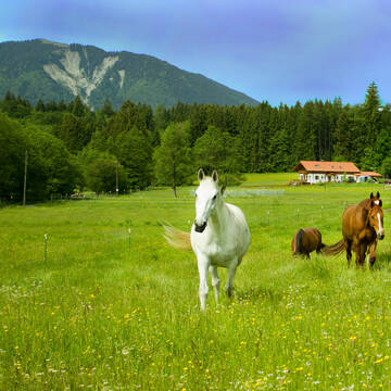


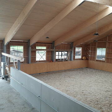
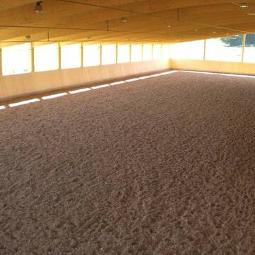
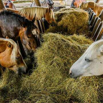
Neuer HIT Aktivstall - Gut Moosrain
Murnau am Staffelsee
Markus-Simson
@Markus-Simson
Freizeitstall
Reitlehrer und -unterricht
Vermieten
Hunde willkommen
Krankenbox
Allergikerstall
Hufrehe geeignet
22 weitere...
aktuell
S
Deprecated: Creation of dynamic property Zend_View_Helper_Ads::$adLink is deprecated in /var/www/stall-frei/htdocs/staging.stall-frei.de/library/Psf/View/Helper/Ads.php on line 108

Neuer HIT Aktivstall - Gut Moosrain
Murnau am Staffelsee
Markus-Simson
@Markus-Simson
Wir bieten Ihnen das HIT Aktivstall Konzept auf dem neuesten Stand in einzigartiger Lage und in einer geschlossenen Anlage:
- Fut
neu
R


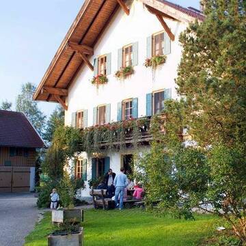
Vollpensionsplatz in Offenstall oder Paddockbox
Obersöchering
Ludwig
@Offenstall21
Hunde willkommen
Paddock
Allergikerstall
bedampftes/gewaschenes Heu
Außenbox mit Paddock
Offenstall
Vollpension
9 weitere...
S


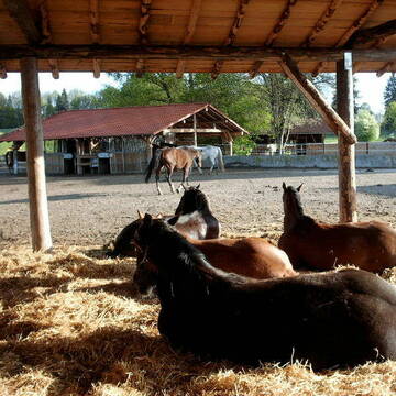
Offenstallplatz in Stutenherde
Großweil
Offenstall-Angerhof
@Offenstall-Angerhof
Freizeitstall
Vermieten
Krankenbox
Longierzirkel/Roundpen
Notfallboxen
5 weitere...
P+
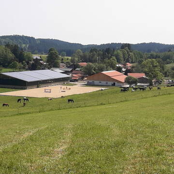
Aktivstall Blaslhof , der Weg lohnt sich!!
Uffing am Staffelsee
Blaslhof Aktivstall
@Blaslhof
Freizeitstall
Gangpferdereiten
Hunde willkommen
Krankenbox
Notfallboxen
Außenbox mit Paddock
Bewegungsstall
22 weitere...
aktuell
S
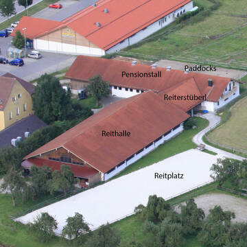
Reitanlage Angerhof
Kochel a. See
Thomas Pohl
@Thomas Pohl
Freizeitstall
Vermieten
Paddock
Parkplatz für Pferdeanhänger
Außenbox mit Paddock
Innenbox
8 weitere...
P

Aktivstall Blaslhof , der Weg lohnt sich!!
Uffing am Staffelsee
Blaslhof Aktivstall
@Blaslhof
Unser HIT Aktivstall ist 2008 mit 5 Stallsternen, der höchstmöglichen Auszeichnung für Artgerechte Pferdehaltung belohnt worde
Traumhafte Offenstallanlage mit 6500m² Paddock
Sindelsdorf
Urthalerhof
@Urthalerhof_Sindelsdorf
Freizeitstall
Gastronomie
Vermieten
Krankenbox
Paddock
Bewegungsstall
Offenstall
16 weitere...
P+

Aktivstall Gaida
Ohlstadt
Aktivstall Gaida
@FamilieGaida
Freizeitstall
Vermieten
Hunde willkommen
Krankenbox
Hufrehe geeignet
Notfallboxen
14 weitere...
P


Schilcherhof Eurasburg
Eurasburg
Kathi Meindl
@Schilcherhof_Eurasburg
Freizeitstall
Gangpferdereiten
Hunde willkommen
Krankenbox
bedampftes/gewaschenes Heu
Hengsthaltung möglich
Außenbox mit Paddock
Außenboxen
24 weitere...
S

Isarhof - Gruppenauslaufstall im Oberen Isartal
Bayern - Wallgau
Isarhof-Curlys
@Isarhof-Curlys
Freizeitstall
Reitlehrer und -unterricht
Vermieten
Hunde willkommen
Krankenbox
Notfallboxen
20 weitere...
P
Leider kein Vorschaubild
Leider kein Vorschaubild
Offenstall Stute
Großweil
Offenstall-Angerhof
@Offenstall-Angerhof
Hunde willkommen
Krankenbox
Notfallboxen
Offenstall
6 weitere...
B
Deprecated: Creation of dynamic property Zend_View::$pageCount is deprecated in /var/www/stall-frei/htdocs/staging.stall-frei.de/library/vendor/shardj/zf1-future/library/Zend/View/Abstract.php on line 308
Deprecated: Creation of dynamic property Zend_View::$itemCountPerPage is deprecated in /var/www/stall-frei/htdocs/staging.stall-frei.de/library/vendor/shardj/zf1-future/library/Zend/View/Abstract.php on line 308
Deprecated: Creation of dynamic property Zend_View::$first is deprecated in /var/www/stall-frei/htdocs/staging.stall-frei.de/library/vendor/shardj/zf1-future/library/Zend/View/Abstract.php on line 308
Deprecated: Creation of dynamic property Zend_View::$current is deprecated in /var/www/stall-frei/htdocs/staging.stall-frei.de/library/vendor/shardj/zf1-future/library/Zend/View/Abstract.php on line 308
Deprecated: Creation of dynamic property Zend_View::$last is deprecated in /var/www/stall-frei/htdocs/staging.stall-frei.de/library/vendor/shardj/zf1-future/library/Zend/View/Abstract.php on line 308
Deprecated: Creation of dynamic property Zend_View::$next is deprecated in /var/www/stall-frei/htdocs/staging.stall-frei.de/library/vendor/shardj/zf1-future/library/Zend/View/Abstract.php on line 308
Deprecated: Creation of dynamic property Zend_View::$pagesInRange is deprecated in /var/www/stall-frei/htdocs/staging.stall-frei.de/library/vendor/shardj/zf1-future/library/Zend/View/Abstract.php on line 308
Deprecated: Creation of dynamic property Zend_View::$firstPageInRange is deprecated in /var/www/stall-frei/htdocs/staging.stall-frei.de/library/vendor/shardj/zf1-future/library/Zend/View/Abstract.php on line 308
Deprecated: Creation of dynamic property Zend_View::$lastPageInRange is deprecated in /var/www/stall-frei/htdocs/staging.stall-frei.de/library/vendor/shardj/zf1-future/library/Zend/View/Abstract.php on line 308
Deprecated: Creation of dynamic property Zend_View::$currentItemCount is deprecated in /var/www/stall-frei/htdocs/staging.stall-frei.de/library/vendor/shardj/zf1-future/library/Zend/View/Abstract.php on line 308
Deprecated: Creation of dynamic property Zend_View::$totalItemCount is deprecated in /var/www/stall-frei/htdocs/staging.stall-frei.de/library/vendor/shardj/zf1-future/library/Zend/View/Abstract.php on line 308
Deprecated: Creation of dynamic property Zend_View::$firstItemNumber is deprecated in /var/www/stall-frei/htdocs/staging.stall-frei.de/library/vendor/shardj/zf1-future/library/Zend/View/Abstract.php on line 308
Deprecated: Creation of dynamic property Zend_View::$lastItemNumber is deprecated in /var/www/stall-frei/htdocs/staging.stall-frei.de/library/vendor/shardj/zf1-future/library/Zend/View/Abstract.php on line 308
Deprecated: Creation of dynamic property Zend_View::$router is deprecated in /var/www/stall-frei/htdocs/staging.stall-frei.de/library/vendor/shardj/zf1-future/library/Zend/View/Abstract.php on line 308
Deprecated: Creation of dynamic property Zend_View::$urlParams is deprecated in /var/www/stall-frei/htdocs/staging.stall-frei.de/library/vendor/shardj/zf1-future/library/Zend/View/Abstract.php on line 308
Deprecated: Creation of dynamic property Zend_View::$showAds is deprecated in /var/www/stall-frei/htdocs/staging.stall-frei.de/library/vendor/shardj/zf1-future/library/Zend/View/Abstract.php on line 308
Deprecated: Creation of dynamic property Zend_View::$objectIds is deprecated in /var/www/stall-frei/htdocs/staging.stall-frei.de/library/vendor/shardj/zf1-future/library/Zend/View/Abstract.php on line 308
Deprecated: Creation of dynamic property Zend_View::$showNavbar is deprecated in /var/www/stall-frei/htdocs/staging.stall-frei.de/library/vendor/shardj/zf1-future/library/Zend/View/Abstract.php on line 308
Deprecated: Creation of dynamic property Zend_View::$showBreadcrumb is deprecated in /var/www/stall-frei/htdocs/staging.stall-frei.de/library/vendor/shardj/zf1-future/library/Zend/View/Abstract.php on line 308
Deprecated: Creation of dynamic property Zend_View::$showFooter is deprecated in /var/www/stall-frei/htdocs/staging.stall-frei.de/library/vendor/shardj/zf1-future/library/Zend/View/Abstract.php on line 308
Deprecated: Creation of dynamic property Zend_View::$showInternalAds is deprecated in /var/www/stall-frei/htdocs/staging.stall-frei.de/library/vendor/shardj/zf1-future/library/Zend/View/Abstract.php on line 308
Deprecated: Creation of dynamic property Zend_View::$blNoContent is deprecated in /var/www/stall-frei/htdocs/staging.stall-frei.de/library/vendor/shardj/zf1-future/library/Zend/View/Abstract.php on line 308
Deprecated: Creation of dynamic property Zend_View::$sMetaDesc is deprecated in /var/www/stall-frei/htdocs/staging.stall-frei.de/library/vendor/shardj/zf1-future/library/Zend/View/Abstract.php on line 308
Deprecated: Creation of dynamic property Zend_View::$useGmaps is deprecated in /var/www/stall-frei/htdocs/staging.stall-frei.de/library/vendor/shardj/zf1-future/library/Zend/View/Abstract.php on line 308
Deprecated: Creation of dynamic property Zend_View::$touches is deprecated in /var/www/stall-frei/htdocs/staging.stall-frei.de/library/vendor/shardj/zf1-future/library/Zend/View/Abstract.php on line 308
Deprecated: Creation of dynamic property Zend_View::$oProject is deprecated in /var/www/stall-frei/htdocs/staging.stall-frei.de/library/vendor/shardj/zf1-future/library/Zend/View/Abstract.php on line 308
Deprecated: Creation of dynamic property Zend_View::$pageHeadline is deprecated in /var/www/stall-frei/htdocs/staging.stall-frei.de/library/vendor/shardj/zf1-future/library/Zend/View/Abstract.php on line 308
Deprecated: Creation of dynamic property Zend_View::$disableLocationField is deprecated in /var/www/stall-frei/htdocs/staging.stall-frei.de/library/vendor/shardj/zf1-future/library/Zend/View/Abstract.php on line 308
Deprecated: Creation of dynamic property Zend_View::$isSearch is deprecated in /var/www/stall-frei/htdocs/staging.stall-frei.de/library/vendor/shardj/zf1-future/library/Zend/View/Abstract.php on line 308
Deprecated: Creation of dynamic property Zend_View::$pageTitle is deprecated in /var/www/stall-frei/htdocs/staging.stall-frei.de/library/vendor/shardj/zf1-future/library/Zend/View/Abstract.php on line 308
Deprecated: Creation of dynamic property Psf_Form_Element_Text::$class is deprecated in /var/www/stall-frei/htdocs/staging.stall-frei.de/library/vendor/shardj/zf1-future/library/Zend/Form/Element.php on line 874
Deprecated: Creation of dynamic property Psf_Form_Element_Text::$size is deprecated in /var/www/stall-frei/htdocs/staging.stall-frei.de/library/vendor/shardj/zf1-future/library/Zend/Form/Element.php on line 874
Deprecated: Creation of dynamic property Psf_Form_Element_Text::$placeholder is deprecated in /var/www/stall-frei/htdocs/staging.stall-frei.de/library/vendor/shardj/zf1-future/library/Zend/Form/Element.php on line 874
Deprecated: Creation of dynamic property Psf_Form_Element_Hidden::$class is deprecated in /var/www/stall-frei/htdocs/staging.stall-frei.de/library/vendor/shardj/zf1-future/library/Zend/Form/Element.php on line 874
Deprecated: Creation of dynamic property Psf_Form_Element_Hidden::$class is deprecated in /var/www/stall-frei/htdocs/staging.stall-frei.de/library/vendor/shardj/zf1-future/library/Zend/Form/Element.php on line 874
Deprecated: Creation of dynamic property Psf_Form_Element_Hidden::$class is deprecated in /var/www/stall-frei/htdocs/staging.stall-frei.de/library/vendor/shardj/zf1-future/library/Zend/Form/Element.php on line 874
Deprecated: Creation of dynamic property Psf_Form_Element_Hidden::$class is deprecated in /var/www/stall-frei/htdocs/staging.stall-frei.de/library/vendor/shardj/zf1-future/library/Zend/Form/Element.php on line 874
Deprecated: Creation of dynamic property Psf_Form_Element_Select::$class is deprecated in /var/www/stall-frei/htdocs/staging.stall-frei.de/library/vendor/shardj/zf1-future/library/Zend/Form/Element.php on line 874
Deprecated: Creation of dynamic property Psf_Form_Element_Select::$class is deprecated in /var/www/stall-frei/htdocs/staging.stall-frei.de/library/vendor/shardj/zf1-future/library/Zend/Form/Element.php on line 874
Deprecated: Creation of dynamic property Psf_Form_Element_Select::$class is deprecated in /var/www/stall-frei/htdocs/staging.stall-frei.de/library/vendor/shardj/zf1-future/library/Zend/Form/Element.php on line 874
Deprecated: Creation of dynamic property Psf_Form_Element_Select::$class is deprecated in /var/www/stall-frei/htdocs/staging.stall-frei.de/library/vendor/shardj/zf1-future/library/Zend/Form/Element.php on line 874
Deprecated: Creation of dynamic property Psf_Form_Element_Text::$class is deprecated in /var/www/stall-frei/htdocs/staging.stall-frei.de/library/vendor/shardj/zf1-future/library/Zend/Form/Element.php on line 874
Deprecated: Creation of dynamic property Psf_Form_Element_Checkbox::$label is deprecated in /var/www/stall-frei/htdocs/staging.stall-frei.de/library/vendor/shardj/zf1-future/library/Zend/Form/Element.php on line 874
Deprecated: Creation of dynamic property Zend_View::$sort is deprecated in /var/www/stall-frei/htdocs/staging.stall-frei.de/library/vendor/shardj/zf1-future/library/Zend/View/Abstract.php on line 308
Deprecated: Creation of dynamic property Zend_View::$searchLocation is deprecated in /var/www/stall-frei/htdocs/staging.stall-frei.de/library/vendor/shardj/zf1-future/library/Zend/View/Abstract.php on line 308
Deprecated: Creation of dynamic property Zend_View::$locationHint is deprecated in /var/www/stall-frei/htdocs/staging.stall-frei.de/library/vendor/shardj/zf1-future/library/Zend/View/Abstract.php on line 308
Psf_GeoCoder_Abstract::getLocation: Urfeld Get Location CachedOrLive
Psf_GeoCoder_Abstract::getCachedOrLive: Urfeld
Psf_GeoCoder_OpenCageData::makeApiRequest: response:
Array
(
[documentation] => https://opencagedata.com/api
[licenses] => Array
(
[0] => Array
(
[name] => see attribution guide
[url] => https://opencagedata.com/credits
)
)
[results] => Array
(
[0] => Array
(
[bounds] => Array
(
[northeast] => Array
(
[lat] => 47.6186951
[lng] => 11.3489642
)
[southwest] => Array
(
[lat] => 47.6150253
[lng] => 11.3413955
)
)
[components] => Array
(
[ISO_3166-1_alpha-2] => DE
[ISO_3166-1_alpha-3] => DEU
[ISO_3166-2] => Array
(
[0] => DE-BY
)
[_category] => place
[_normalized_city] => Kochel am See
[_type] => hamlet
[continent] => Europe
[country] => Deutschland
[country_code] => de
[county] => Landkreis Bad Tölz-Wolfratshausen
[hamlet] => Urfeld
[municipality] => Kochel am See (VGem)
[political_union] => European Union
[state] => Bayern
[state_code] => BY
[village] => Kochel am See
)
[confidence] => 9
[formatted] => Urfeld, Kochel am See, Bayern, Deutschland
[geometry] => Array
(
[lat] => 47.6179377
[lng] => 11.3461766
)
)
[1] => Array
(
[bounds] => Array
(
[northeast] => Array
(
[lat] => 50.8206342
[lng] => 7.0296085
)
[southwest] => Array
(
[lat] => 50.792674
[lng] => 6.9901146
)
)
[components] => Array
(
[ISO_3166-1_alpha-2] => DE
[ISO_3166-1_alpha-3] => DEU
[ISO_3166-2] => Array
(
[0] => DE-NW
)
[_category] => place
[_normalized_city] => Wesseling
[_type] => village
[continent] => Europe
[country] => Deutschland
[country_code] => de
[county] => Rhein-Erft-Kreis
[political_union] => European Union
[state] => Nordrhein-Westfalen
[state_code] => NW
[town] => Wesseling
[village] => Urfeld
)
[confidence] => 7
[formatted] => Urfeld, Nordrhein-Westfalen, Deutschland
[geometry] => Array
(
[lat] => 50.8070486
[lng] => 7.0253106
)
)
[2] => Array
(
[bounds] => Array
(
[northeast] => Array
(
[lat] => 50.8055361
[lng] => 7.0201518
)
[southwest] => Array
(
[lat] => 50.8042539
[lng] => 7.0176891
)
)
[components] => Array
(
[ISO_3166-1_alpha-2] => DE
[ISO_3166-1_alpha-3] => DEU
[ISO_3166-2] => Array
(
[0] => DE-NW
)
[_category] => outdoors/recreation
[_normalized_city] => Wesseling
[_type] => cemetery
[cemetery] => Urfeld
[continent] => Europe
[country] => Deutschland
[country_code] => de
[county] => Rhein-Erft-Kreis
[neighbourhood] => Gemarkung Urfeld
[political_union] => European Union
[postcode] => 50389
[state] => Nordrhein-Westfalen
[state_code] => NW
[town] => Wesseling
[village] => Urfeld
)
[confidence] => 9
[formatted] => Urfeld, 50389 Urfeld, Deutschland
[geometry] => Array
(
[lat] => 50.8046071
[lng] => 7.0189499
)
)
[3] => Array
(
[components] => Array
(
[ISO_3166-1_alpha-2] => FR
[ISO_3166-1_alpha-3] => FRA
[ISO_3166-2] => Array
(
[0] => FR-IDF
[1] => FR-92
)
[_category] => road
[_normalized_city] => Levallois-Perret
[_type] => road
[city] => Levallois-Perret
[continent] => Europe
[country] => France
[country_code] => fr
[county] => Hauts-de-Seine
[local_authority] => Métropole du Grand Paris
[political_union] => European Union
[postcode] => 92300
[road] => Rue Charles Deutschmann
[state] => Île-de-France
[state_code] => IDF
)
[confidence] => 2
[formatted] => Rue Charles Deutschmann, 92300 Levallois-Perret, France
[geometry] => Array
(
[lat] => 48.900049
[lng] => 2.2842
)
)
[4] => Array
(
[components] => Array
(
[ISO_3166-1_alpha-2] => FR
[ISO_3166-1_alpha-3] => FRA
[ISO_3166-2] => Array
(
[0] => FR-ARA
[1] => FR-03
)
[_category] => road
[_normalized_city] => La Chapelaude
[_type] => road
[city] => La Chapelaude
[continent] => Europe
[country] => France
[country_code] => fr
[county] => Allier
[local_authority] => Communauté de communes du Pays d'Huriel
[political_union] => European Union
[postcode] => 03380
[road] => Route d'Huriel
[state] => Auvergne-Rhône-Alpes
[state_code] => ARA
)
[confidence] => 2
[formatted] => Route d'Huriel, 03380 La Chapelaude, France
[geometry] => Array
(
[lat] => 46.415395
[lng] => 2.503036
)
)
[5] => Array
(
[components] => Array
(
[ISO_3166-1_alpha-2] => FR
[ISO_3166-1_alpha-3] => FRA
[ISO_3166-2] => Array
(
[0] => FR-ARA
[1] => FR-03
)
[_category] => road
[_normalized_city] => Huriel
[_type] => road
[city] => Huriel
[continent] => Europe
[country] => France
[country_code] => fr
[county] => Allier
[local_authority] => Communauté de communes du Pays d'Huriel
[political_union] => European Union
[postcode] => 03380
[road] => Route de Mandrant
[state] => Auvergne-Rhône-Alpes
[state_code] => ARA
)
[confidence] => 2
[formatted] => Route de Mandrant, 03380 Huriel, France
[geometry] => Array
(
[lat] => 46.368877
[lng] => 2.449378
)
)
[6] => Array
(
[components] => Array
(
[ISO_3166-1_alpha-2] => FR
[ISO_3166-1_alpha-3] => FRA
[ISO_3166-2] => Array
(
[0] => FR-ARA
[1] => FR-03
)
[_category] => road
[_normalized_city] => Huriel
[_type] => road
[city] => Huriel
[continent] => Europe
[country] => France
[country_code] => fr
[county] => Allier
[local_authority] => Communauté de communes du Pays d'Huriel
[political_union] => European Union
[postcode] => 03380
[road] => Grand Rue
[state] => Auvergne-Rhône-Alpes
[state_code] => ARA
)
[confidence] => 2
[formatted] => Grand Rue, 03380 Huriel, France
[geometry] => Array
(
[lat] => 46.37356
[lng] => 2.477254
)
)
[7] => Array
(
[components] => Array
(
[ISO_3166-1_alpha-2] => FR
[ISO_3166-1_alpha-3] => FRA
[ISO_3166-2] => Array
(
[0] => FR-ARA
[1] => FR-03
)
[_category] => road
[_normalized_city] => Saint-Sauvier
[_type] => road
[city] => Saint-Sauvier
[continent] => Europe
[country] => France
[country_code] => fr
[county] => Allier
[local_authority] => Communauté de communes du Pays d'Huriel
[political_union] => European Union
[postcode] => 03370
[road] => Route d’Huriel
[state] => Auvergne-Rhône-Alpes
[state_code] => ARA
)
[confidence] => 2
[formatted] => Route d’Huriel, 03370 Saint-Sauvier, France
[geometry] => Array
(
[lat] => 46.386263
[lng] => 2.344437
)
)
[8] => Array
(
[components] => Array
(
[ISO_3166-1_alpha-2] => FR
[ISO_3166-1_alpha-3] => FRA
[ISO_3166-2] => Array
(
[0] => FR-ARA
[1] => FR-03
)
[_category] => road
[_normalized_city] => Huriel
[_type] => road
[city] => Huriel
[continent] => Europe
[country] => France
[country_code] => fr
[county] => Allier
[local_authority] => Communauté de communes du Pays d'Huriel
[political_union] => European Union
[postcode] => 03380
[road] => Rue de la Chaux
[state] => Auvergne-Rhône-Alpes
[state_code] => ARA
)
[confidence] => 2
[formatted] => Rue de la Chaux, 03380 Huriel, France
[geometry] => Array
(
[lat] => 46.352297
[lng] => 2.476598
)
)
[9] => Array
(
[components] => Array
(
[ISO_3166-1_alpha-2] => FR
[ISO_3166-1_alpha-3] => FRA
[ISO_3166-2] => Array
(
[0] => FR-ARA
[1] => FR-03
)
[_category] => road
[_normalized_city] => Chambérat
[_type] => road
[city] => Chambérat
[continent] => Europe
[country] => France
[country_code] => fr
[county] => Allier
[local_authority] => Communauté de communes du Pays d'Huriel
[political_union] => European Union
[postcode] => 03370
[road] => Route d’Huriel
[state] => Auvergne-Rhône-Alpes
[state_code] => ARA
)
[confidence] => 2
[formatted] => Route d’Huriel, 03370 Chambérat, France
[geometry] => Array
(
[lat] => 46.408492
[lng] => 2.435902
)
)
)
[status] => Array
(
[code] => 200
[message] => OK
)
[stay_informed] => Array
(
[blog] => https://blog.opencagedata.com
[mastodon] => https://en.osm.town/@opencage
)
[thanks] => For using an OpenCage API
[timestamp] => Array
(
[created_http] => Sun, 08 Feb 2026 10:35:37 GMT
[created_unix] => 1770546937
)
[total_results] => 10
)
Psf_GeoCoder_Abstract::convertLocationResult
{"documentation":"https:\/\/opencagedata.com\/api","licenses":[{"name":"see attribution guide","url":"https:\/\/opencagedata.com\/credits"}],"results":[{"bounds":{"northeast":{"lat":47.6186951,"lng":11.3489642},"southwest":{"lat":47.6150253,"lng":11.3413955}},"components":{"ISO_3166-1_alpha-2":"DE","ISO_3166-1_alpha-3":"DEU","ISO_3166-2":["DE-BY"],"_category":"place","_normalized_city":"Kochel am See","_type":"hamlet","continent":"Europe","country":"Deutschland","country_code":"de","county":"Landkreis Bad T\u00f6lz-Wolfratshausen","hamlet":"Urfeld","municipality":"Kochel am See (VGem)","political_union":"European Union","state":"Bayern","state_code":"BY","village":"Kochel am See"},"confidence":9,"formatted":"Urfeld, Kochel am See, Bayern, Deutschland","geometry":{"lat":47.6179377,"lng":11.3461766}},{"bounds":{"northeast":{"lat":50.8206342,"lng":7.0296085},"southwest":{"lat":50.792674,"lng":6.9901146}},"components":{"ISO_3166-1_alpha-2":"DE","ISO_3166-1_alpha-3":"DEU","ISO_3166-2":["DE-NW"],"_category":"place","_normalized_city":"Wesseling","_type":"village","continent":"Europe","country":"Deutschland","country_code":"de","county":"Rhein-Erft-Kreis","political_union":"European Union","state":"Nordrhein-Westfalen","state_code":"NW","town":"Wesseling","village":"Urfeld"},"confidence":7,"formatted":"Urfeld, Nordrhein-Westfalen, Deutschland","geometry":{"lat":50.8070486,"lng":7.0253106}},{"bounds":{"northeast":{"lat":50.8055361,"lng":7.0201518},"southwest":{"lat":50.8042539,"lng":7.0176891}},"components":{"ISO_3166-1_alpha-2":"DE","ISO_3166-1_alpha-3":"DEU","ISO_3166-2":["DE-NW"],"_category":"outdoors\/recreation","_normalized_city":"Wesseling","_type":"cemetery","cemetery":"Urfeld","continent":"Europe","country":"Deutschland","country_code":"de","county":"Rhein-Erft-Kreis","neighbourhood":"Gemarkung Urfeld","political_union":"European Union","postcode":"50389","state":"Nordrhein-Westfalen","state_code":"NW","town":"Wesseling","village":"Urfeld"},"confidence":9,"formatted":"Urfeld, 50389 Urfeld, Deutschland","geometry":{"lat":50.8046071,"lng":7.0189499}},{"components":{"ISO_3166-1_alpha-2":"FR","ISO_3166-1_alpha-3":"FRA","ISO_3166-2":["FR-IDF","FR-92"],"_category":"road","_normalized_city":"Levallois-Perret","_type":"road","city":"Levallois-Perret","continent":"Europe","country":"France","country_code":"fr","county":"Hauts-de-Seine","local_authority":"M\u00e9tropole du Grand Paris","political_union":"European Union","postcode":"92300","road":"Rue Charles Deutschmann","state":"\u00cele-de-France","state_code":"IDF"},"confidence":2,"formatted":"Rue Charles Deutschmann, 92300 Levallois-Perret, France","geometry":{"lat":48.900049,"lng":2.2842}},{"components":{"ISO_3166-1_alpha-2":"FR","ISO_3166-1_alpha-3":"FRA","ISO_3166-2":["FR-ARA","FR-03"],"_category":"road","_normalized_city":"La Chapelaude","_type":"road","city":"La Chapelaude","continent":"Europe","country":"France","country_code":"fr","county":"Allier","local_authority":"Communaut\u00e9 de communes du Pays d'Huriel","political_union":"European Union","postcode":"03380","road":"Route d'Huriel","state":"Auvergne-Rh\u00f4ne-Alpes","state_code":"ARA"},"confidence":2,"formatted":"Route d'Huriel, 03380 La Chapelaude, France","geometry":{"lat":46.415395,"lng":2.503036}},{"components":{"ISO_3166-1_alpha-2":"FR","ISO_3166-1_alpha-3":"FRA","ISO_3166-2":["FR-ARA","FR-03"],"_category":"road","_normalized_city":"Huriel","_type":"road","city":"Huriel","continent":"Europe","country":"France","country_code":"fr","county":"Allier","local_authority":"Communaut\u00e9 de communes du Pays d'Huriel","political_union":"European Union","postcode":"03380","road":"Route de Mandrant","state":"Auvergne-Rh\u00f4ne-Alpes","state_code":"ARA"},"confidence":2,"formatted":"Route de Mandrant, 03380 Huriel, France","geometry":{"lat":46.368877,"lng":2.449378}},{"components":{"ISO_3166-1_alpha-2":"FR","ISO_3166-1_alpha-3":"FRA","ISO_3166-2":["FR-ARA","FR-03"],"_category":"road","_normalized_city":"Huriel","_type":"road","city":"Huriel","continent":"Europe","country":"France","country_code":"fr","county":"Allier","local_authority":"Communaut\u00e9 de communes du Pays d'Huriel","political_union":"European Union","postcode":"03380","road":"Grand Rue","state":"Auvergne-Rh\u00f4ne-Alpes","state_code":"ARA"},"confidence":2,"formatted":"Grand Rue, 03380 Huriel, France","geometry":{"lat":46.37356,"lng":2.477254}},{"components":{"ISO_3166-1_alpha-2":"FR","ISO_3166-1_alpha-3":"FRA","ISO_3166-2":["FR-ARA","FR-03"],"_category":"road","_normalized_city":"Saint-Sauvier","_type":"road","city":"Saint-Sauvier","continent":"Europe","country":"France","country_code":"fr","county":"Allier","local_authority":"Communaut\u00e9 de communes du Pays d'Huriel","political_union":"European Union","postcode":"03370","road":"Route d\u2019Huriel","state":"Auvergne-Rh\u00f4ne-Alpes","state_code":"ARA"},"confidence":2,"formatted":"Route d\u2019Huriel, 03370 Saint-Sauvier, France","geometry":{"lat":46.386263,"lng":2.344437}},{"components":{"ISO_3166-1_alpha-2":"FR","ISO_3166-1_alpha-3":"FRA","ISO_3166-2":["FR-ARA","FR-03"],"_category":"road","_normalized_city":"Huriel","_type":"road","city":"Huriel","continent":"Europe","country":"France","country_code":"fr","county":"Allier","local_authority":"Communaut\u00e9 de communes du Pays d'Huriel","political_union":"European Union","postcode":"03380","road":"Rue de la Chaux","state":"Auvergne-Rh\u00f4ne-Alpes","state_code":"ARA"},"confidence":2,"formatted":"Rue de la Chaux, 03380 Huriel, France","geometry":{"lat":46.352297,"lng":2.476598}},{"components":{"ISO_3166-1_alpha-2":"FR","ISO_3166-1_alpha-3":"FRA","ISO_3166-2":["FR-ARA","FR-03"],"_category":"road","_normalized_city":"Chamb\u00e9rat","_type":"road","city":"Chamb\u00e9rat","continent":"Europe","country":"France","country_code":"fr","county":"Allier","local_authority":"Communaut\u00e9 de communes du Pays d'Huriel","political_union":"European Union","postcode":"03370","road":"Route d\u2019Huriel","state":"Auvergne-Rh\u00f4ne-Alpes","state_code":"ARA"},"confidence":2,"formatted":"Route d\u2019Huriel, 03370 Chamb\u00e9rat, France","geometry":{"lat":46.408492,"lng":2.435902}}],"status":{"code":200,"message":"OK"},"stay_informed":{"blog":"https:\/\/blog.opencagedata.com","mastodon":"https:\/\/en.osm.town\/@opencage"},"thanks":"For using an OpenCage API","timestamp":{"created_http":"Sun, 08 Feb 2026 10:35:37 GMT","created_unix":1770546937},"total_results":10}Array
(
[0] => stdClass Object
(
[bounds] => stdClass Object
(
[northeast] => stdClass Object
(
[lat] => 47.6186951
[lng] => 11.3489642
)
[southwest] => stdClass Object
(
[lat] => 47.6150253
[lng] => 11.3413955
)
)
[components] => stdClass Object
(
[ISO_3166-1_alpha-2] => DE
[ISO_3166-1_alpha-3] => DEU
[ISO_3166-2] => Array
(
[0] => DE-BY
)
[_category] => place
[_normalized_city] => Kochel am See
[_type] => hamlet
[continent] => Europe
[country] => Deutschland
[country_code] => de
[county] => Landkreis Bad Tölz-Wolfratshausen
[hamlet] => Urfeld
[municipality] => Kochel am See (VGem)
[political_union] => European Union
[state] => Bayern
[state_code] => BY
[village] => Kochel am See
)
[confidence] => 9
[formatted] => Urfeld, Kochel am See, Bayern, Deutschland
[geometry] => stdClass Object
(
[lat] => 47.6179377
[lng] => 11.3461766
)
)
[1] => stdClass Object
(
[bounds] => stdClass Object
(
[northeast] => stdClass Object
(
[lat] => 50.8206342
[lng] => 7.0296085
)
[southwest] => stdClass Object
(
[lat] => 50.792674
[lng] => 6.9901146
)
)
[components] => stdClass Object
(
[ISO_3166-1_alpha-2] => DE
[ISO_3166-1_alpha-3] => DEU
[ISO_3166-2] => Array
(
[0] => DE-NW
)
[_category] => place
[_normalized_city] => Wesseling
[_type] => village
[continent] => Europe
[country] => Deutschland
[country_code] => de
[county] => Rhein-Erft-Kreis
[political_union] => European Union
[state] => Nordrhein-Westfalen
[state_code] => NW
[town] => Wesseling
[village] => Urfeld
)
[confidence] => 7
[formatted] => Urfeld, Nordrhein-Westfalen, Deutschland
[geometry] => stdClass Object
(
[lat] => 50.8070486
[lng] => 7.0253106
)
)
[2] => stdClass Object
(
[bounds] => stdClass Object
(
[northeast] => stdClass Object
(
[lat] => 50.8055361
[lng] => 7.0201518
)
[southwest] => stdClass Object
(
[lat] => 50.8042539
[lng] => 7.0176891
)
)
[components] => stdClass Object
(
[ISO_3166-1_alpha-2] => DE
[ISO_3166-1_alpha-3] => DEU
[ISO_3166-2] => Array
(
[0] => DE-NW
)
[_category] => outdoors/recreation
[_normalized_city] => Wesseling
[_type] => cemetery
[cemetery] => Urfeld
[continent] => Europe
[country] => Deutschland
[country_code] => de
[county] => Rhein-Erft-Kreis
[neighbourhood] => Gemarkung Urfeld
[political_union] => European Union
[postcode] => 50389
[state] => Nordrhein-Westfalen
[state_code] => NW
[town] => Wesseling
[village] => Urfeld
)
[confidence] => 9
[formatted] => Urfeld, 50389 Urfeld, Deutschland
[geometry] => stdClass Object
(
[lat] => 50.8046071
[lng] => 7.0189499
)
)
[3] => stdClass Object
(
[components] => stdClass Object
(
[ISO_3166-1_alpha-2] => FR
[ISO_3166-1_alpha-3] => FRA
[ISO_3166-2] => Array
(
[0] => FR-IDF
[1] => FR-92
)
[_category] => road
[_normalized_city] => Levallois-Perret
[_type] => road
[city] => Levallois-Perret
[continent] => Europe
[country] => France
[country_code] => fr
[county] => Hauts-de-Seine
[local_authority] => Métropole du Grand Paris
[political_union] => European Union
[postcode] => 92300
[road] => Rue Charles Deutschmann
[state] => Île-de-France
[state_code] => IDF
)
[confidence] => 2
[formatted] => Rue Charles Deutschmann, 92300 Levallois-Perret, France
[geometry] => stdClass Object
(
[lat] => 48.900049
[lng] => 2.2842
)
)
[4] => stdClass Object
(
[components] => stdClass Object
(
[ISO_3166-1_alpha-2] => FR
[ISO_3166-1_alpha-3] => FRA
[ISO_3166-2] => Array
(
[0] => FR-ARA
[1] => FR-03
)
[_category] => road
[_normalized_city] => La Chapelaude
[_type] => road
[city] => La Chapelaude
[continent] => Europe
[country] => France
[country_code] => fr
[county] => Allier
[local_authority] => Communauté de communes du Pays d'Huriel
[political_union] => European Union
[postcode] => 03380
[road] => Route d'Huriel
[state] => Auvergne-Rhône-Alpes
[state_code] => ARA
)
[confidence] => 2
[formatted] => Route d'Huriel, 03380 La Chapelaude, France
[geometry] => stdClass Object
(
[lat] => 46.415395
[lng] => 2.503036
)
)
[5] => stdClass Object
(
[components] => stdClass Object
(
[ISO_3166-1_alpha-2] => FR
[ISO_3166-1_alpha-3] => FRA
[ISO_3166-2] => Array
(
[0] => FR-ARA
[1] => FR-03
)
[_category] => road
[_normalized_city] => Huriel
[_type] => road
[city] => Huriel
[continent] => Europe
[country] => France
[country_code] => fr
[county] => Allier
[local_authority] => Communauté de communes du Pays d'Huriel
[political_union] => European Union
[postcode] => 03380
[road] => Route de Mandrant
[state] => Auvergne-Rhône-Alpes
[state_code] => ARA
)
[confidence] => 2
[formatted] => Route de Mandrant, 03380 Huriel, France
[geometry] => stdClass Object
(
[lat] => 46.368877
[lng] => 2.449378
)
)
[6] => stdClass Object
(
[components] => stdClass Object
(
[ISO_3166-1_alpha-2] => FR
[ISO_3166-1_alpha-3] => FRA
[ISO_3166-2] => Array
(
[0] => FR-ARA
[1] => FR-03
)
[_category] => road
[_normalized_city] => Huriel
[_type] => road
[city] => Huriel
[continent] => Europe
[country] => France
[country_code] => fr
[county] => Allier
[local_authority] => Communauté de communes du Pays d'Huriel
[political_union] => European Union
[postcode] => 03380
[road] => Grand Rue
[state] => Auvergne-Rhône-Alpes
[state_code] => ARA
)
[confidence] => 2
[formatted] => Grand Rue, 03380 Huriel, France
[geometry] => stdClass Object
(
[lat] => 46.37356
[lng] => 2.477254
)
)
[7] => stdClass Object
(
[components] => stdClass Object
(
[ISO_3166-1_alpha-2] => FR
[ISO_3166-1_alpha-3] => FRA
[ISO_3166-2] => Array
(
[0] => FR-ARA
[1] => FR-03
)
[_category] => road
[_normalized_city] => Saint-Sauvier
[_type] => road
[city] => Saint-Sauvier
[continent] => Europe
[country] => France
[country_code] => fr
[county] => Allier
[local_authority] => Communauté de communes du Pays d'Huriel
[political_union] => European Union
[postcode] => 03370
[road] => Route d’Huriel
[state] => Auvergne-Rhône-Alpes
[state_code] => ARA
)
[confidence] => 2
[formatted] => Route d’Huriel, 03370 Saint-Sauvier, France
[geometry] => stdClass Object
(
[lat] => 46.386263
[lng] => 2.344437
)
)
[8] => stdClass Object
(
[components] => stdClass Object
(
[ISO_3166-1_alpha-2] => FR
[ISO_3166-1_alpha-3] => FRA
[ISO_3166-2] => Array
(
[0] => FR-ARA
[1] => FR-03
)
[_category] => road
[_normalized_city] => Huriel
[_type] => road
[city] => Huriel
[continent] => Europe
[country] => France
[country_code] => fr
[county] => Allier
[local_authority] => Communauté de communes du Pays d'Huriel
[political_union] => European Union
[postcode] => 03380
[road] => Rue de la Chaux
[state] => Auvergne-Rhône-Alpes
[state_code] => ARA
)
[confidence] => 2
[formatted] => Rue de la Chaux, 03380 Huriel, France
[geometry] => stdClass Object
(
[lat] => 46.352297
[lng] => 2.476598
)
)
[9] => stdClass Object
(
[components] => stdClass Object
(
[ISO_3166-1_alpha-2] => FR
[ISO_3166-1_alpha-3] => FRA
[ISO_3166-2] => Array
(
[0] => FR-ARA
[1] => FR-03
)
[_category] => road
[_normalized_city] => Chambérat
[_type] => road
[city] => Chambérat
[continent] => Europe
[country] => France
[country_code] => fr
[county] => Allier
[local_authority] => Communauté de communes du Pays d'Huriel
[political_union] => European Union
[postcode] => 03370
[road] => Route d’Huriel
[state] => Auvergne-Rhône-Alpes
[state_code] => ARA
)
[confidence] => 2
[formatted] => Route d’Huriel, 03370 Chambérat, France
[geometry] => stdClass Object
(
[lat] => 46.408492
[lng] => 2.435902
)
)
)
Psf_GeoCoder_OpenCageData::getKeyMap: 0
stdClass Object
(
    [bounds] => stdClass Object
        (
            [northeast] => stdClass Object
                (
                    [lat] => 47.6186951
                    [lng] => 11.3489642
                )

            [southwest] => stdClass Object
                (
                    [lat] => 47.6150253
                    [lng] => 11.3413955
                )

        )

    [components] => stdClass Object
        (
            [ISO_3166-1_alpha-2] => DE
            [ISO_3166-1_alpha-3] => DEU
            [ISO_3166-2] => Array
                (
                    [0] => DE-BY
                )

            [_category] => place
            [_normalized_city] => Kochel am See
            [_type] => hamlet
            [continent] => Europe
            [country] => Deutschland
            [country_code] => de
            [county] => Landkreis Bad Tölz-Wolfratshausen
            [hamlet] => Urfeld
            [municipality] => Kochel am See (VGem)
            [political_union] => European Union
            [state] => Bayern
            [state_code] => BY
            [village] => Kochel am See
        )

    [confidence] => 9
    [formatted] => Urfeld, Kochel am See, Bayern, Deutschland
    [geometry] => stdClass Object
        (
            [lat] => 47.6179377
            [lng] => 11.3461766
        )

)
Psf_GeoCoder_OpenCageData::getCounty: Bad Tölz-Wolfratshausen
Psf_GeoCoder_OpenCageData::addMissingData REFETCH!
Array
(
    [address] => Urfeld, Kochel am See, Bayern, Deutschland
    [type] => hamlet
    [street] => Urfeld
    [city] => Kochel am See
    [county] => Bad Tölz-Wolfratshausen
    [state] => Bayern
    [zip] =>
    [country] => Deutschland
    [suburb] =>
    [countrycode] => de
    [latitude] => 47.6179377
    [longitude] => 11.3461766
    [accuracy] => 1
    [confidence] => 9
    [bounds] => stdClass Object
        (
            [northeast] => stdClass Object
                (
                    [lat] => 47.6186951
                    [lng] => 11.3489642
                )

            [southwest] => stdClass Object
                (
                    [lat] => 47.6150253
                    [lng] => 11.3413955
                )

        )

)
reformat!
Array
(
    [address] => Urfeld, Kochel am See, Bayern, Deutschland
    [type] => hamlet
    [street] => Urfeld
    [city] => Kochel am See
    [county] => Bad Tölz-Wolfratshausen
    [state] => Bayern
    [zip] =>
    [country] => Deutschland
    [suburb] =>
    [countrycode] => de
    [latitude] => 47.6179377
    [longitude] => 11.3461766
    [accuracy] => 1
    [confidence] => 9
    [bounds] => stdClass Object
        (
            [northeast] => stdClass Object
                (
                    [lat] => 47.6186951
                    [lng] => 11.3489642
                )

            [southwest] => stdClass Object
                (
                    [lat] => 47.6150253
                    [lng] => 11.3413955
                )

        )

    [place] => Urfeld, Kochel am See, Bayern
    [hash] => 8aca18ffb573c02357bf54500b111432
)
Psf_GeoCoder_OpenCageData::getKeyMap: 1
stdClass Object
(
    [bounds] => stdClass Object
        (
            [northeast] => stdClass Object
                (
                    [lat] => 50.8206342
                    [lng] => 7.0296085
                )

            [southwest] => stdClass Object
                (
                    [lat] => 50.792674
                    [lng] => 6.9901146
                )

        )

    [components] => stdClass Object
        (
            [ISO_3166-1_alpha-2] => DE
            [ISO_3166-1_alpha-3] => DEU
            [ISO_3166-2] => Array
                (
                    [0] => DE-NW
                )

            [_category] => place
            [_normalized_city] => Wesseling
            [_type] => village
            [continent] => Europe
            [country] => Deutschland
            [country_code] => de
            [county] => Rhein-Erft-Kreis
            [political_union] => European Union
            [state] => Nordrhein-Westfalen
            [state_code] => NW
            [town] => Wesseling
            [village] => Urfeld
        )

    [confidence] => 7
    [formatted] => Urfeld, Nordrhein-Westfalen, Deutschland
    [geometry] => stdClass Object
        (
            [lat] => 50.8070486
            [lng] => 7.0253106
        )

)
Psf_GeoCoder_OpenCageData::getCounty: Rhein-Erft-Kreis
Psf_GeoCoder_OpenCageData::addMissingData REFETCH!
Array
(
    [address] => Urfeld, Nordrhein-Westfalen, Deutschland
    [type] => village
    [street] =>
    [city] => Wesseling
    [county] => Rhein-Erft-Kreis
    [state] => Nordrhein-Westfalen
    [zip] =>
    [country] => Deutschland
    [suburb] =>
    [countrycode] => de
    [latitude] => 50.8070486
    [longitude] => 7.0253106
    [accuracy] => 1
    [confidence] => 7
    [bounds] => stdClass Object
        (
            [northeast] => stdClass Object
                (
                    [lat] => 50.8206342
                    [lng] => 7.0296085
                )

            [southwest] => stdClass Object
                (
                    [lat] => 50.792674
                    [lng] => 6.9901146
                )

        )

)
reformat!
Array
(
    [address] => Wesseling
    [type] => village
    [street] =>
    [city] => Wesseling
    [county] => Rhein-Erft-Kreis
    [state] => Nordrhein-Westfalen
    [zip] =>
    [country] => Deutschland
    [suburb] =>
    [countrycode] => de
    [latitude] => 50.8070486
    [longitude] => 7.0253106
    [accuracy] => 1
    [confidence] => 7
    [bounds] => stdClass Object
        (
            [northeast] => stdClass Object
                (
                    [lat] => 50.8206342
                    [lng] => 7.0296085
                )

            [southwest] => stdClass Object
                (
                    [lat] => 50.792674
                    [lng] => 6.9901146
                )

        )

    [place] => Wesseling, Nordrhein-Westfalen
    [hash] => 8f78222414e7e18fcb786c0b1fc05ce9
)
Psf_GeoCoder_OpenCageData::getKeyMap: 2
stdClass Object
(
    [bounds] => stdClass Object
        (
            [northeast] => stdClass Object
                (
                    [lat] => 50.8055361
                    [lng] => 7.0201518
                )

            [southwest] => stdClass Object
                (
                    [lat] => 50.8042539
                    [lng] => 7.0176891
                )

        )

    [components] => stdClass Object
        (
            [ISO_3166-1_alpha-2] => DE
            [ISO_3166-1_alpha-3] => DEU
            [ISO_3166-2] => Array
                (
                    [0] => DE-NW
                )

            [_category] => outdoors/recreation
            [_normalized_city] => Wesseling
            [_type] => cemetery
            [cemetery] => Urfeld
            [continent] => Europe
            [country] => Deutschland
            [country_code] => de
            [county] => Rhein-Erft-Kreis
            [neighbourhood] => Gemarkung Urfeld
            [political_union] => European Union
            [postcode] => 50389
            [state] => Nordrhein-Westfalen
            [state_code] => NW
            [town] => Wesseling
            [village] => Urfeld
        )

    [confidence] => 9
    [formatted] => Urfeld, 50389 Urfeld, Deutschland
    [geometry] => stdClass Object
        (
            [lat] => 50.8046071
            [lng] => 7.0189499
        )

)
Psf_GeoCoder_OpenCageData::getCounty: Rhein-Erft-Kreis
Psf_GeoCoder_OpenCageData::addMissingData REFETCH!
Array
(
    [address] => Urfeld, 50389 Urfeld, Deutschland
    [type] => cemetery
    [street] =>
    [city] => Wesseling
    [county] => Rhein-Erft-Kreis
    [state] => Nordrhein-Westfalen
    [zip] => 50389
    [country] => Deutschland
    [suburb] =>
    [countrycode] => de
    [latitude] => 50.8046071
    [longitude] => 7.0189499
    [accuracy] => 1
    [confidence] => 9
    [bounds] => stdClass Object
        (
            [northeast] => stdClass Object
                (
                    [lat] => 50.8055361
                    [lng] => 7.0201518
                )

            [southwest] => stdClass Object
                (
                    [lat] => 50.8042539
                    [lng] => 7.0176891
                )

        )

)
reformat!
Array
(
    [address] => 50389 Wesseling
    [type] => cemetery
    [street] =>
    [city] => Wesseling
    [county] => Rhein-Erft-Kreis
    [state] => Nordrhein-Westfalen
    [zip] => 50389
    [country] => Deutschland
    [suburb] =>
    [countrycode] => de
    [latitude] => 50.8046071
    [longitude] => 7.0189499
    [accuracy] => 1
    [confidence] => 9
    [bounds] => stdClass Object
        (
            [northeast] => stdClass Object
                (
                    [lat] => 50.8055361
                    [lng] => 7.0201518
                )

            [southwest] => stdClass Object
                (
                    [lat] => 50.8042539
                    [lng] => 7.0176891
                )

        )

    [place] => 50389 Wesseling, Nordrhein-Westfalen
    [hash] => 7e1973431502c75431be1833bf38c280
)
Psf_GeoCoder_OpenCageData::getKeyMap: 3
stdClass Object
(
    [components] => stdClass Object
        (
            [ISO_3166-1_alpha-2] => FR
            [ISO_3166-1_alpha-3] => FRA
            [ISO_3166-2] => Array
                (
                    [0] => FR-IDF
                    [1] => FR-92
                )

            [_category] => road
            [_normalized_city] => Levallois-Perret
            [_type] => road
            [city] => Levallois-Perret
            [continent] => Europe
            [country] => France
            [country_code] => fr
            [county] => Hauts-de-Seine
            [local_authority] => Métropole du Grand Paris
            [political_union] => European Union
            [postcode] => 92300
            [road] => Rue Charles Deutschmann
            [state] => Île-de-France
            [state_code] => IDF
        )

    [confidence] => 2
    [formatted] => Rue Charles Deutschmann, 92300 Levallois-Perret, France
    [geometry] => stdClass Object
        (
            [lat] => 48.900049
            [lng] => 2.2842
        )

)
Psf_GeoCoder_OpenCageData::getCounty: Hauts-de-Seine
Psf_GeoCoder_OpenCageData::addMissingData REFETCH!
Array
(
    [address] => Rue Charles Deutschmann, 92300 Levallois-Perret, France
    [type] => road
    [street] => Rue Charles Deutschmann
    [city] => Levallois-Perret
    [county] => Hauts-de-Seine
    [state] => Île-de-France
    [zip] => 92300
    [country] => France
    [suburb] =>
    [countrycode] => fr
    [latitude] => 48.900049
    [longitude] => 2.2842
    [accuracy] => 1
    [confidence] => 2
    [bounds] =>
)
reformat!
Array
(
    [address] => Rue Charles Deutschmann, 92300 Levallois-Perret, France
    [type] => road
    [street] => Rue Charles Deutschmann
    [city] => Levallois-Perret
    [county] => Hauts-de-Seine
    [state] => Île-de-France
    [zip] => 92300
    [country] => France
    [suburb] =>
    [countrycode] => fr
    [latitude] => 48.900049
    [longitude] => 2.2842
    [accuracy] => 1
    [confidence] => 2
    [bounds] =>
    [place] => Rue Charles Deutschmann, 92300 Levallois-Perret, Île-de-France
    [hash] => b7dc44def3990e8a7eaf18e019eca466
)
Psf_GeoCoder_OpenCageData::getKeyMap: 4
stdClass Object
(
    [components] => stdClass Object
        (
            [ISO_3166-1_alpha-2] => FR
            [ISO_3166-1_alpha-3] => FRA
            [ISO_3166-2] => Array
                (
                    [0] => FR-ARA
                    [1] => FR-03
                )

            [_category] => road
            [_normalized_city] => La Chapelaude
            [_type] => road
            [city] => La Chapelaude
            [continent] => Europe
            [country] => France
            [country_code] => fr
            [county] => Allier
            [local_authority] => Communauté de communes du Pays d'Huriel
            [political_union] => European Union
            [postcode] => 03380
            [road] => Route d'Huriel
            [state] => Auvergne-Rhône-Alpes
            [state_code] => ARA
        )

    [confidence] => 2
    [formatted] => Route d'Huriel, 03380 La Chapelaude, France
    [geometry] => stdClass Object
        (
            [lat] => 46.415395
            [lng] => 2.503036
        )

)
Psf_GeoCoder_OpenCageData::getCounty: Allier
Psf_GeoCoder_OpenCageData::addMissingData REFETCH!
Array
(
    [address] => Route d'Huriel, 03380 La Chapelaude, France
    [type] => road
    [street] => Route d'Huriel
    [city] => La Chapelaude
    [county] => Allier
    [state] => Auvergne-Rhône-Alpes
    [zip] => 03380
    [country] => France
    [suburb] =>
    [countrycode] => fr
    [latitude] => 46.415395
    [longitude] => 2.503036
    [accuracy] => 1
    [confidence] => 2
    [bounds] =>
)
reformat!
Array
(
    [address] => Route d'Huriel, 03380 La Chapelaude, France
    [type] => road
    [street] => Route d'Huriel
    [city] => La Chapelaude
    [county] => Allier
    [state] => Auvergne-Rhône-Alpes
    [zip] => 03380
    [country] => France
    [suburb] =>
    [countrycode] => fr
    [latitude] => 46.415395
    [longitude] => 2.503036
    [accuracy] => 1
    [confidence] => 2
    [bounds] =>
    [place] => Route d'Huriel, 03380 La Chapelaude, Auvergne-Rhône-Alpes
    [hash] => e54358b8e4dc252423a1c8ce22a8fc6d
)
Psf_GeoCoder_OpenCageData::getKeyMap: 5
stdClass Object
(
    [components] => stdClass Object
        (
            [ISO_3166-1_alpha-2] => FR
            [ISO_3166-1_alpha-3] => FRA
            [ISO_3166-2] => Array
                (
                    [0] => FR-ARA
                    [1] => FR-03
                )

            [_category] => road
            [_normalized_city] => Huriel
            [_type] => road
            [city] => Huriel
            [continent] => Europe
            [country] => France
            [country_code] => fr
            [county] => Allier
            [local_authority] => Communauté de communes du Pays d'Huriel
            [political_union] => European Union
            [postcode] => 03380
            [road] => Route de Mandrant
            [state] => Auvergne-Rhône-Alpes
            [state_code] => ARA
        )

    [confidence] => 2
    [formatted] => Route de Mandrant, 03380 Huriel, France
    [geometry] => stdClass Object
        (
            [lat] => 46.368877
            [lng] => 2.449378
        )

)
Psf_GeoCoder_OpenCageData::getCounty: Allier
Psf_GeoCoder_OpenCageData::addMissingData REFETCH!
Array
(
    [address] => Route de Mandrant, 03380 Huriel, France
    [type] => road
    [street] => Route de Mandrant
    [city] => Huriel
    [county] => Allier
    [state] => Auvergne-Rhône-Alpes
    [zip] => 03380
    [country] => France
    [suburb] =>
    [countrycode] => fr
    [latitude] => 46.368877
    [longitude] => 2.449378
    [accuracy] => 1
    [confidence] => 2
    [bounds] =>
)
reformat!
Array
(
    [address] => Route de Mandrant, 03380 Huriel, France
    [type] => road
    [street] => Route de Mandrant
    [city] => Huriel
    [county] => Allier
    [state] => Auvergne-Rhône-Alpes
    [zip] => 03380
    [country] => France
    [suburb] =>
    [countrycode] => fr
    [latitude] => 46.368877
    [longitude] => 2.449378
    [accuracy] => 1
    [confidence] => 2
    [bounds] =>
    [place] => Route de Mandrant, 03380 Huriel, Auvergne-Rhône-Alpes
    [hash] => 7974d2448044599ae692a0f38923cf00
)
Psf_GeoCoder_OpenCageData::getKeyMap: 6
stdClass Object
(
    [components] => stdClass Object
        (
            [ISO_3166-1_alpha-2] => FR
            [ISO_3166-1_alpha-3] => FRA
            [ISO_3166-2] => Array
                (
                    [0] => FR-ARA
                    [1] => FR-03
                )

            [_category] => road
            [_normalized_city] => Huriel
            [_type] => road
            [city] => Huriel
            [continent] => Europe
            [country] => France
            [country_code] => fr
            [county] => Allier
            [local_authority] => Communauté de communes du Pays d'Huriel
            [political_union] => European Union
            [postcode] => 03380
            [road] => Grand Rue
            [state] => Auvergne-Rhône-Alpes
            [state_code] => ARA
        )

    [confidence] => 2
    [formatted] => Grand Rue, 03380 Huriel, France
    [geometry] => stdClass Object
        (
            [lat] => 46.37356
            [lng] => 2.477254
        )

)
Psf_GeoCoder_OpenCageData::getCounty: Allier
Psf_GeoCoder_OpenCageData::addMissingData REFETCH!
Array
(
    [address] => Grand Rue, 03380 Huriel, France
    [type] => road
    [street] => Grand Rue
    [city] => Huriel
    [county] => Allier
    [state] => Auvergne-Rhône-Alpes
    [zip] => 03380
    [country] => France
    [suburb] =>
    [countrycode] => fr
    [latitude] => 46.37356
    [longitude] => 2.477254
    [accuracy] => 1
    [confidence] => 2
    [bounds] =>
)
reformat!
Array
(
    [address] => Grand Rue, 03380 Huriel, France
    [type] => road
    [street] => Grand Rue
    [city] => Huriel
    [county] => Allier
    [state] => Auvergne-Rhône-Alpes
    [zip] => 03380
    [country] => France
    [suburb] =>
    [countrycode] => fr
    [latitude] => 46.37356
    [longitude] => 2.477254
    [accuracy] => 1
    [confidence] => 2
    [bounds] =>
    [place] => Grand Rue, 03380 Huriel, Auvergne-Rhône-Alpes
    [hash] => 6dcf29e11a661e911c2c4999158f3986
)
Psf_GeoCoder_OpenCageData::getKeyMap: 7
stdClass Object
(
    [components] => stdClass Object
        (
            [ISO_3166-1_alpha-2] => FR
            [ISO_3166-1_alpha-3] => FRA
            [ISO_3166-2] => Array
                (
                    [0] => FR-ARA
                    [1] => FR-03
                )

            [_category] => road
            [_normalized_city] => Saint-Sauvier
            [_type] => road
            [city] => Saint-Sauvier
            [continent] => Europe
            [country] => France
            [country_code] => fr
            [county] => Allier
            [local_authority] => Communauté de communes du Pays d'Huriel
            [political_union] => European Union
            [postcode] => 03370
            [road] => Route d’Huriel
            [state] => Auvergne-Rhône-Alpes
            [state_code] => ARA
        )

    [confidence] => 2
    [formatted] => Route d’Huriel, 03370 Saint-Sauvier, France
    [geometry] => stdClass Object
        (
            [lat] => 46.386263
            [lng] => 2.344437
        )

)
Psf_GeoCoder_OpenCageData::getCounty: Allier
Psf_GeoCoder_OpenCageData::addMissingData REFETCH!
Array
(
    [address] => Route d’Huriel, 03370 Saint-Sauvier, France
    [type] => road
    [street] => Route d’Huriel
    [city] => Saint-Sauvier
    [county] => Allier
    [state] => Auvergne-Rhône-Alpes
    [zip] => 03370
    [country] => France
    [suburb] =>
    [countrycode] => fr
    [latitude] => 46.386263
    [longitude] => 2.344437
    [accuracy] => 1
    [confidence] => 2
    [bounds] =>
)
reformat!
Array
(
    [address] => Route d’Huriel, 03370 Saint-Sauvier, France
    [type] => road
    [street] => Route d’Huriel
    [city] => Saint-Sauvier
    [county] => Allier
    [state] => Auvergne-Rhône-Alpes
    [zip] => 03370
    [country] => France
    [suburb] =>
    [countrycode] => fr
    [latitude] => 46.386263
    [longitude] => 2.344437
    [accuracy] => 1
    [confidence] => 2
    [bounds] =>
    [place] => Route d’Huriel, 03370 Saint-Sauvier, Auvergne-Rhône-Alpes
    [hash] => 660e088a8fa782ae740b7a13853044c8
)
Psf_GeoCoder_OpenCageData::getKeyMap: 8
stdClass Object
(
    [components] => stdClass Object
        (
            [ISO_3166-1_alpha-2] => FR
            [ISO_3166-1_alpha-3] => FRA
            [ISO_3166-2] => Array
                (
                    [0] => FR-ARA
                    [1] => FR-03
                )

            [_category] => road
            [_normalized_city] => Huriel
            [_type] => road
            [city] => Huriel
            [continent] => Europe
            [country] => France
            [country_code] => fr
            [county] => Allier
            [local_authority] => Communauté de communes du Pays d'Huriel
            [political_union] => European Union
            [postcode] => 03380
            [road] => Rue de la Chaux
            [state] => Auvergne-Rhône-Alpes
            [state_code] => ARA
        )

    [confidence] => 2
    [formatted] => Rue de la Chaux, 03380 Huriel, France
    [geometry] => stdClass Object
        (
            [lat] => 46.352297
            [lng] => 2.476598
        )

)
Psf_GeoCoder_OpenCageData::getCounty: Allier
Psf_GeoCoder_OpenCageData::addMissingData REFETCH!
Array
(
    [address] => Rue de la Chaux, 03380 Huriel, France
    [type] => road
    [street] => Rue de la Chaux
    [city] => Huriel
    [county] => Allier
    [state] => Auvergne-Rhône-Alpes
    [zip] => 03380
    [country] => France
    [suburb] =>
    [countrycode] => fr
    [latitude] => 46.352297
    [longitude] => 2.476598
    [accuracy] => 1
    [confidence] => 2
    [bounds] =>
)
reformat!
Array
(
    [address] => Rue de la Chaux, 03380 Huriel, France
    [type] => road
    [street] => Rue de la Chaux
    [city] => Huriel
    [county] => Allier
    [state] => Auvergne-Rhône-Alpes
    [zip] => 03380
    [country] => France
    [suburb] =>
    [countrycode] => fr
    [latitude] => 46.352297
    [longitude] => 2.476598
    [accuracy] => 1
    [confidence] => 2
    [bounds] =>
    [place] => Rue de la Chaux, 03380 Huriel, Auvergne-Rhône-Alpes
    [hash] => c683f1ceca3d7fd900c810808fc6ff20
)
Psf_GeoCoder_OpenCageData::getKeyMap: 9
stdClass Object
(
    [components] => stdClass Object
        (
            [ISO_3166-1_alpha-2] => FR
            [ISO_3166-1_alpha-3] => FRA
            [ISO_3166-2] => Array
                (
                    [0] => FR-ARA
                    [1] => FR-03
                )

            [_category] => road
            [_normalized_city] => Chambérat
            [_type] => road
            [city] => Chambérat
            [continent] => Europe
            [country] => France
            [country_code] => fr
            [county] => Allier
            [local_authority] => Communauté de communes du Pays d'Huriel
            [political_union] => European Union
            [postcode] => 03370
            [road] => Route d’Huriel
            [state] => Auvergne-Rhône-Alpes
            [state_code] => ARA
        )

    [confidence] => 2
    [formatted] => Route d’Huriel, 03370 Chambérat, France
    [geometry] => stdClass Object
        (
            [lat] => 46.408492
            [lng] => 2.435902
        )

)
Psf_GeoCoder_OpenCageData::getCounty: Allier
Psf_GeoCoder_OpenCageData::addMissingData REFETCH!
Array
(
    [address] => Route d’Huriel, 03370 Chambérat, France
    [type] => road
    [street] => Route d’Huriel
    [city] => Chambérat
    [county] => Allier
    [state] => Auvergne-Rhône-Alpes
    [zip] => 03370
    [country] => France
    [suburb] =>
    [countrycode] => fr
    [latitude] => 46.408492
    [longitude] => 2.435902
    [accuracy] => 1
    [confidence] => 2
    [bounds] =>
)
reformat!
Array
(
    [address] => Route d’Huriel, 03370 Chambérat, France
    [type] => road
    [street] => Route d’Huriel
    [city] => Chambérat
    [county] => Allier
    [state] => Auvergne-Rhône-Alpes
    [zip] => 03370
    [country] => France
    [suburb] =>
    [countrycode] => fr
    [latitude] => 46.408492
    [longitude] => 2.435902
    [accuracy] => 1
    [confidence] => 2
    [bounds] =>
    [place] => Route d’Huriel, 03370 Chambérat, Auvergne-Rhône-Alpes
    [hash] => 9f0e2efb1f286863dd32e5fbaedccb0b
)
Deprecated: Creation of dynamic property Zend_View::$locationHintStyle is deprecated in /var/www/stall-frei/htdocs/staging.stall-frei.de/library/vendor/shardj/zf1-future/library/Zend/View/Abstract.php on line 308
Deprecated: Creation of dynamic property Zend_View::$adGeoLocation is deprecated in /var/www/stall-frei/htdocs/staging.stall-frei.de/library/vendor/shardj/zf1-future/library/Zend/View/Abstract.php on line 308
Deprecated: Creation of dynamic property Zend_View::$recordCount is deprecated in /var/www/stall-frei/htdocs/staging.stall-frei.de/library/vendor/shardj/zf1-future/library/Zend/View/Abstract.php on line 308
Deprecated: explode(): Passing null to parameter #2 ($string) of type string is deprecated in /var/www/stall-frei/htdocs/staging.stall-frei.de/application/models/SearchAgent.php on line 100
Deprecated: explode(): Passing null to parameter #2 ($string) of type string is deprecated in /var/www/stall-frei/htdocs/staging.stall-frei.de/application/models/SearchAgent.php on line 100
Deprecated: explode(): Passing null to parameter #2 ($string) of type string is deprecated in /var/www/stall-frei/htdocs/staging.stall-frei.de/application/models/SearchAgent.php on line 100
Deprecated: explode(): Passing null to parameter #2 ($string) of type string is deprecated in /var/www/stall-frei/htdocs/staging.stall-frei.de/application/models/SearchAgent.php on line 100
Deprecated: explode(): Passing null to parameter #2 ($string) of type string is deprecated in /var/www/stall-frei/htdocs/staging.stall-frei.de/application/models/SearchAgent.php on line 100
Deprecated: explode(): Passing null to parameter #2 ($string) of type string is deprecated in /var/www/stall-frei/htdocs/staging.stall-frei.de/application/models/SearchAgent.php on line 100
Deprecated: explode(): Passing null to parameter #2 ($string) of type string is deprecated in /var/www/stall-frei/htdocs/staging.stall-frei.de/application/models/SearchAgent.php on line 100
Deprecated: explode(): Passing null to parameter #2 ($string) of type string is deprecated in /var/www/stall-frei/htdocs/staging.stall-frei.de/application/models/SearchAgent.php on line 100
Deprecated: explode(): Passing null to parameter #2 ($string) of type string is deprecated in /var/www/stall-frei/htdocs/staging.stall-frei.de/application/models/SearchAgent.php on line 100
Deprecated: trim(): Passing null to parameter #1 ($string) of type string is deprecated in /var/www/stall-frei/htdocs/staging.stall-frei.de/application/models/Account/Search.php on line 82
Warning: Cannot modify header information - headers already sent by (output started at /var/www/stall-frei/htdocs/staging.stall-frei.de/library/vendor/shardj/zf1-future/library/Zend/View/Abstract.php:308) in /var/www/stall-frei/htdocs/staging.stall-frei.de/application/models/Account/Search.php on line 71
Deprecated: Creation of dynamic property Zend_View::$paginationParams is deprecated in /var/www/stall-frei/htdocs/staging.stall-frei.de/library/vendor/shardj/zf1-future/library/Zend/View/Abstract.php on line 308
Deprecated: Creation of dynamic property Zend_View::$objectPaginator is deprecated in /var/www/stall-frei/htdocs/staging.stall-frei.de/library/vendor/shardj/zf1-future/library/Zend/View/Abstract.php on line 308
Deprecated: Creation of dynamic property Zend_View::$featuredObjects is deprecated in /var/www/stall-frei/htdocs/staging.stall-frei.de/library/vendor/shardj/zf1-future/library/Zend/View/Abstract.php on line 308
Deprecated: Creation of dynamic property Zend_View::$hints is deprecated in /var/www/stall-frei/htdocs/staging.stall-frei.de/library/vendor/shardj/zf1-future/library/Zend/View/Abstract.php on line 308
Deprecated: Creation of dynamic property Zend_View::$attributeHints is deprecated in /var/www/stall-frei/htdocs/staging.stall-frei.de/library/vendor/shardj/zf1-future/library/Zend/View/Abstract.php on line 308
Deprecated: Creation of dynamic property Zend_View::$oSearchForm is deprecated in /var/www/stall-frei/htdocs/staging.stall-frei.de/library/vendor/shardj/zf1-future/library/Zend/View/Abstract.php on line 308