Deprecated: Creation of dynamic property Zend_View::$sMode is deprecated in /var/www/stall-frei/htdocs/staging.stall-frei.de/library/vendor/shardj/zf1-future/library/Zend/View/Abstract.php on line 308
Stallplatz oder Offenstall in Halblech
Gesucht wird in "Auf der Halde, 87642 Halblech, Deutschland"
6.329 Einträge
Deprecated: Creation of dynamic property Zend_View::$listObjects is deprecated in /var/www/stall-frei/htdocs/staging.stall-frei.de/library/vendor/shardj/zf1-future/library/Zend/View/Abstract.php on line 308
Gesponsort


Deprecated: Creation of dynamic property Zend_View::$listMode is deprecated in /var/www/stall-frei/htdocs/staging.stall-frei.de/library/vendor/shardj/zf1-future/library/Zend/View/Abstract.php on line 308
Deprecated: Creation of dynamic property Zend_View::$renderedObjects is deprecated in /var/www/stall-frei/htdocs/staging.stall-frei.de/library/vendor/shardj/zf1-future/library/Zend/View/Abstract.php on line 308
Deprecated: Creation of dynamic property Zend_View::$index is deprecated in /var/www/stall-frei/htdocs/staging.stall-frei.de/library/vendor/shardj/zf1-future/library/Zend/View/Abstract.php on line 308
Deprecated: Creation of dynamic property Zend_View::$displayMode is deprecated in /var/www/stall-frei/htdocs/staging.stall-frei.de/library/vendor/shardj/zf1-future/library/Zend/View/Abstract.php on line 308
Deprecated: Creation of dynamic property Zend_View::$remarketingIds is deprecated in /var/www/stall-frei/htdocs/staging.stall-frei.de/library/vendor/shardj/zf1-future/library/Zend/View/Abstract.php on line 308
Deprecated: Creation of dynamic property Zend_View::$listItem is deprecated in /var/www/stall-frei/htdocs/staging.stall-frei.de/library/vendor/shardj/zf1-future/library/Zend/View/Abstract.php on line 308
Deprecated: Creation of dynamic property Zend_View::$object is deprecated in /var/www/stall-frei/htdocs/staging.stall-frei.de/library/vendor/shardj/zf1-future/library/Zend/View/Abstract.php on line 308
Deprecated: Creation of dynamic property Zend_View::$attributes is deprecated in /var/www/stall-frei/htdocs/staging.stall-frei.de/library/vendor/shardj/zf1-future/library/Zend/View/Abstract.php on line 308


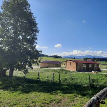
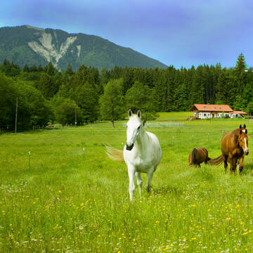
Bewegungs-, Offenstall, Arbeits- und Extreme Trail
Bernbeuren
Fitness-Stall-Badwerk
@Fitness-Stall-Badwerk
Freizeitstall
Geländestrecke
Vermieten
Krankenbox
Longierzirkel/Roundpen
Allergikerstall
Notfallboxen
23 weitere...
ganz aktuell
S
Deprecated: Creation of dynamic property Zend_View_Helper_Ads::$adLink is deprecated in /var/www/stall-frei/htdocs/staging.stall-frei.de/library/Psf/View/Helper/Ads.php on line 108

Futtersack HeuToy, Fressbremse in pink
Mechtersen
STALL-FREIde Marketing
@STALL-FREI-Marketing
Stundenlange Beschäftigung die
Koliken vorbeugt, geringe Staubinhalation mit
steuerbarer Futterentnahme


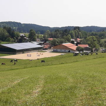
Aktivstall / Paddocktrail im Pfaffenwinkel
Steingaden
Aktivstall-Pfaffenwinkel
@Aktivstall-Pfaffenwinkel
Freizeitstall
Wanderreiten
Vermieten
Hunde willkommen
Krankenbox
Hufrehe geeignet
Notfallboxen
23 weitere...
aktuell
S

Leistung & Pferdepension mit ❤️ im Allgäu
Lechbruck am See
Sportpferdezentrum_Lechbruck
@Sportpferdezentrum_Lechbruck
Pferdeausbildung
Reitlehrer und -unterricht
Vermieten
Hunde willkommen
Krankenbox
Fohlenaufzucht möglich
Hengsthaltung möglich
25 weitere...
aktuell
P
Leider kein Vorschaubild
Leider kein Vorschaubild
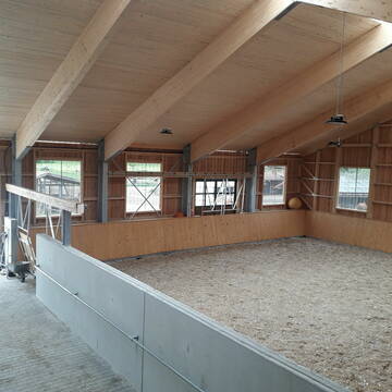
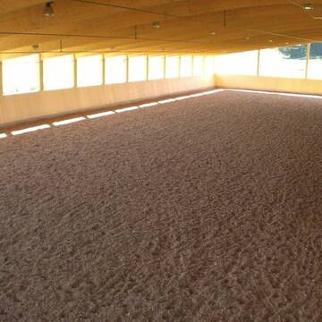
Offenstallplatz frei
Halblech
Petra
@StallEschenberg
Pferdeausbildung
Reitlehrer und -unterricht
Vermieten
Paddock
Reithalle
Notfallboxen
10 weitere...
B

Pferdestall Urspring-Offenstall
Steingaden
Pferdestall-Urspring
@Pferdestall-Urspring
Freizeitstall
Wanderreiten
Hunde willkommen
Krankenbox
Notfallboxen
Offenstall
10 weitere...
P


Offenstall/Paddocktrail
Aitrang
Pferdeparadies
@HofBayrhof
Vermieten
Longierzirkel/Roundpen
Reitplatz (z.B. Dressur, Springen, Reining)
Hufrehe geeignet
Notfallboxen
Offenstall
Paddock Trail
9 weitere...
S


Pensionsstall Gebler Burk
Marktoberdorf
Pensionspferdestall-Gebler
@Pensionspferdestall-Gebler
Freizeitstall
Longierzirkel/Roundpen
Paddock
Außenbox mit Paddock
Vollpension
8 weitere...
P+


Pferdepension Neurieder-moderne Offenstallhaltung
Frankenried
Neurieder
@Neurieder
Freizeitstall
Reitlehrer und -unterricht
Vermieten
Krankenbox
Longierzirkel/Roundpen
Allergikerstall
Gnadenbrothof
21 weitere...
S

Persönlichkeitsentwicklung mit Pferden
Bad Salzuflen
Katja Dors
@Pferdezeiten
Begleite andere auf ihrem Entwicklungsweg und entdecke die transformative Kraft der pferdegestützten Persönlichkeitsentwicklung !
neu
R


Neuer HIT Aktivstall - Gut Moosrain
Murnau am Staffelsee
Markus-Simson
@Markus-Simson
Freizeitstall
Reitlehrer und -unterricht
Vermieten
Hunde willkommen
Krankenbox
Allergikerstall
Hufrehe geeignet
22 weitere...
aktuell
S
Aktivstall Blaslhof , der Weg lohnt sich!!
Uffing am Staffelsee
Blaslhof Aktivstall
@Blaslhof
Freizeitstall
Gangpferdereiten
Hunde willkommen
Krankenbox
Notfallboxen
Außenbox mit Paddock
Bewegungsstall
22 weitere...
aktuell
S
Deprecated: Creation of dynamic property Zend_View::$pageCount is deprecated in /var/www/stall-frei/htdocs/staging.stall-frei.de/library/vendor/shardj/zf1-future/library/Zend/View/Abstract.php on line 308
Deprecated: Creation of dynamic property Zend_View::$itemCountPerPage is deprecated in /var/www/stall-frei/htdocs/staging.stall-frei.de/library/vendor/shardj/zf1-future/library/Zend/View/Abstract.php on line 308
Deprecated: Creation of dynamic property Zend_View::$first is deprecated in /var/www/stall-frei/htdocs/staging.stall-frei.de/library/vendor/shardj/zf1-future/library/Zend/View/Abstract.php on line 308
Deprecated: Creation of dynamic property Zend_View::$current is deprecated in /var/www/stall-frei/htdocs/staging.stall-frei.de/library/vendor/shardj/zf1-future/library/Zend/View/Abstract.php on line 308
Deprecated: Creation of dynamic property Zend_View::$last is deprecated in /var/www/stall-frei/htdocs/staging.stall-frei.de/library/vendor/shardj/zf1-future/library/Zend/View/Abstract.php on line 308
Deprecated: Creation of dynamic property Zend_View::$next is deprecated in /var/www/stall-frei/htdocs/staging.stall-frei.de/library/vendor/shardj/zf1-future/library/Zend/View/Abstract.php on line 308
Deprecated: Creation of dynamic property Zend_View::$pagesInRange is deprecated in /var/www/stall-frei/htdocs/staging.stall-frei.de/library/vendor/shardj/zf1-future/library/Zend/View/Abstract.php on line 308
Deprecated: Creation of dynamic property Zend_View::$firstPageInRange is deprecated in /var/www/stall-frei/htdocs/staging.stall-frei.de/library/vendor/shardj/zf1-future/library/Zend/View/Abstract.php on line 308
Deprecated: Creation of dynamic property Zend_View::$lastPageInRange is deprecated in /var/www/stall-frei/htdocs/staging.stall-frei.de/library/vendor/shardj/zf1-future/library/Zend/View/Abstract.php on line 308
Deprecated: Creation of dynamic property Zend_View::$currentItemCount is deprecated in /var/www/stall-frei/htdocs/staging.stall-frei.de/library/vendor/shardj/zf1-future/library/Zend/View/Abstract.php on line 308
Deprecated: Creation of dynamic property Zend_View::$totalItemCount is deprecated in /var/www/stall-frei/htdocs/staging.stall-frei.de/library/vendor/shardj/zf1-future/library/Zend/View/Abstract.php on line 308
Deprecated: Creation of dynamic property Zend_View::$firstItemNumber is deprecated in /var/www/stall-frei/htdocs/staging.stall-frei.de/library/vendor/shardj/zf1-future/library/Zend/View/Abstract.php on line 308
Deprecated: Creation of dynamic property Zend_View::$lastItemNumber is deprecated in /var/www/stall-frei/htdocs/staging.stall-frei.de/library/vendor/shardj/zf1-future/library/Zend/View/Abstract.php on line 308
Deprecated: Creation of dynamic property Zend_View::$router is deprecated in /var/www/stall-frei/htdocs/staging.stall-frei.de/library/vendor/shardj/zf1-future/library/Zend/View/Abstract.php on line 308
Deprecated: Creation of dynamic property Zend_View::$urlParams is deprecated in /var/www/stall-frei/htdocs/staging.stall-frei.de/library/vendor/shardj/zf1-future/library/Zend/View/Abstract.php on line 308
Deprecated: Creation of dynamic property Zend_View::$showAds is deprecated in /var/www/stall-frei/htdocs/staging.stall-frei.de/library/vendor/shardj/zf1-future/library/Zend/View/Abstract.php on line 308
Deprecated: Creation of dynamic property Zend_View::$objectIds is deprecated in /var/www/stall-frei/htdocs/staging.stall-frei.de/library/vendor/shardj/zf1-future/library/Zend/View/Abstract.php on line 308
Deprecated: Creation of dynamic property Zend_View::$showNavbar is deprecated in /var/www/stall-frei/htdocs/staging.stall-frei.de/library/vendor/shardj/zf1-future/library/Zend/View/Abstract.php on line 308
Deprecated: Creation of dynamic property Zend_View::$showBreadcrumb is deprecated in /var/www/stall-frei/htdocs/staging.stall-frei.de/library/vendor/shardj/zf1-future/library/Zend/View/Abstract.php on line 308
Deprecated: Creation of dynamic property Zend_View::$showFooter is deprecated in /var/www/stall-frei/htdocs/staging.stall-frei.de/library/vendor/shardj/zf1-future/library/Zend/View/Abstract.php on line 308
Deprecated: Creation of dynamic property Zend_View::$showInternalAds is deprecated in /var/www/stall-frei/htdocs/staging.stall-frei.de/library/vendor/shardj/zf1-future/library/Zend/View/Abstract.php on line 308
Deprecated: Creation of dynamic property Zend_View::$blNoContent is deprecated in /var/www/stall-frei/htdocs/staging.stall-frei.de/library/vendor/shardj/zf1-future/library/Zend/View/Abstract.php on line 308
Deprecated: Creation of dynamic property Zend_View::$sMetaDesc is deprecated in /var/www/stall-frei/htdocs/staging.stall-frei.de/library/vendor/shardj/zf1-future/library/Zend/View/Abstract.php on line 308
Deprecated: Creation of dynamic property Zend_View::$useGmaps is deprecated in /var/www/stall-frei/htdocs/staging.stall-frei.de/library/vendor/shardj/zf1-future/library/Zend/View/Abstract.php on line 308
Deprecated: Creation of dynamic property Zend_View::$touches is deprecated in /var/www/stall-frei/htdocs/staging.stall-frei.de/library/vendor/shardj/zf1-future/library/Zend/View/Abstract.php on line 308
Deprecated: Creation of dynamic property Zend_View::$oProject is deprecated in /var/www/stall-frei/htdocs/staging.stall-frei.de/library/vendor/shardj/zf1-future/library/Zend/View/Abstract.php on line 308
Deprecated: Creation of dynamic property Zend_View::$pageHeadline is deprecated in /var/www/stall-frei/htdocs/staging.stall-frei.de/library/vendor/shardj/zf1-future/library/Zend/View/Abstract.php on line 308
Deprecated: Creation of dynamic property Zend_View::$disableLocationField is deprecated in /var/www/stall-frei/htdocs/staging.stall-frei.de/library/vendor/shardj/zf1-future/library/Zend/View/Abstract.php on line 308
Deprecated: Creation of dynamic property Zend_View::$isSearch is deprecated in /var/www/stall-frei/htdocs/staging.stall-frei.de/library/vendor/shardj/zf1-future/library/Zend/View/Abstract.php on line 308
Deprecated: Creation of dynamic property Zend_View::$pageTitle is deprecated in /var/www/stall-frei/htdocs/staging.stall-frei.de/library/vendor/shardj/zf1-future/library/Zend/View/Abstract.php on line 308
Deprecated: Creation of dynamic property Psf_Form_Element_Text::$class is deprecated in /var/www/stall-frei/htdocs/staging.stall-frei.de/library/vendor/shardj/zf1-future/library/Zend/Form/Element.php on line 874
Deprecated: Creation of dynamic property Psf_Form_Element_Text::$size is deprecated in /var/www/stall-frei/htdocs/staging.stall-frei.de/library/vendor/shardj/zf1-future/library/Zend/Form/Element.php on line 874
Deprecated: Creation of dynamic property Psf_Form_Element_Text::$placeholder is deprecated in /var/www/stall-frei/htdocs/staging.stall-frei.de/library/vendor/shardj/zf1-future/library/Zend/Form/Element.php on line 874
Deprecated: Creation of dynamic property Psf_Form_Element_Hidden::$class is deprecated in /var/www/stall-frei/htdocs/staging.stall-frei.de/library/vendor/shardj/zf1-future/library/Zend/Form/Element.php on line 874
Deprecated: Creation of dynamic property Psf_Form_Element_Hidden::$class is deprecated in /var/www/stall-frei/htdocs/staging.stall-frei.de/library/vendor/shardj/zf1-future/library/Zend/Form/Element.php on line 874
Deprecated: Creation of dynamic property Psf_Form_Element_Hidden::$class is deprecated in /var/www/stall-frei/htdocs/staging.stall-frei.de/library/vendor/shardj/zf1-future/library/Zend/Form/Element.php on line 874
Deprecated: Creation of dynamic property Psf_Form_Element_Hidden::$class is deprecated in /var/www/stall-frei/htdocs/staging.stall-frei.de/library/vendor/shardj/zf1-future/library/Zend/Form/Element.php on line 874
Deprecated: Creation of dynamic property Psf_Form_Element_Select::$class is deprecated in /var/www/stall-frei/htdocs/staging.stall-frei.de/library/vendor/shardj/zf1-future/library/Zend/Form/Element.php on line 874
Deprecated: Creation of dynamic property Psf_Form_Element_Select::$class is deprecated in /var/www/stall-frei/htdocs/staging.stall-frei.de/library/vendor/shardj/zf1-future/library/Zend/Form/Element.php on line 874
Deprecated: Creation of dynamic property Psf_Form_Element_Select::$class is deprecated in /var/www/stall-frei/htdocs/staging.stall-frei.de/library/vendor/shardj/zf1-future/library/Zend/Form/Element.php on line 874
Deprecated: Creation of dynamic property Psf_Form_Element_Select::$class is deprecated in /var/www/stall-frei/htdocs/staging.stall-frei.de/library/vendor/shardj/zf1-future/library/Zend/Form/Element.php on line 874
Deprecated: Creation of dynamic property Psf_Form_Element_Text::$class is deprecated in /var/www/stall-frei/htdocs/staging.stall-frei.de/library/vendor/shardj/zf1-future/library/Zend/Form/Element.php on line 874
Deprecated: Creation of dynamic property Psf_Form_Element_Checkbox::$label is deprecated in /var/www/stall-frei/htdocs/staging.stall-frei.de/library/vendor/shardj/zf1-future/library/Zend/Form/Element.php on line 874
Deprecated: Creation of dynamic property Zend_View::$sort is deprecated in /var/www/stall-frei/htdocs/staging.stall-frei.de/library/vendor/shardj/zf1-future/library/Zend/View/Abstract.php on line 308
Deprecated: Creation of dynamic property Zend_View::$searchLocation is deprecated in /var/www/stall-frei/htdocs/staging.stall-frei.de/library/vendor/shardj/zf1-future/library/Zend/View/Abstract.php on line 308
Deprecated: Creation of dynamic property Zend_View::$locationHint is deprecated in /var/www/stall-frei/htdocs/staging.stall-frei.de/library/vendor/shardj/zf1-future/library/Zend/View/Abstract.php on line 308
Psf_GeoCoder_Abstract::getLocation: Auf der Halde Get Location CachedOrLive
Psf_GeoCoder_Abstract::getCachedOrLive: Auf der Halde
Psf_GeoCoder_OpenCageData::makeApiRequest: response:
Array
(
[documentation] => https://opencagedata.com/api
[licenses] => Array
(
[0] => Array
(
[name] => see attribution guide
[url] => https://opencagedata.com/credits
)
)
[results] => Array
(
[0] => Array
(
[bounds] => Array
(
[northeast] => Array
(
[lat] => 47.6302311
[lng] => 10.7704628
)
[southwest] => Array
(
[lat] => 47.6301311
[lng] => 10.7703628
)
)
[components] => Array
(
[ISO_3166-1_alpha-2] => DE
[ISO_3166-1_alpha-3] => DEU
[ISO_3166-2] => Array
(
[0] => DE-BY
)
[_category] => natural/water
[_normalized_city] => Halblech
[_type] => peak
[continent] => Europe
[country] => Deutschland
[country_code] => de
[county] => Landkreis Ostallgäu
[peak] => Auf der Halde
[political_union] => European Union
[postcode] => 87642
[state] => Bayern
[state_code] => BY
[village] => Halblech
)
[confidence] => 9
[formatted] => Auf der Halde, 87642 Halblech, Deutschland
[geometry] => Array
(
[lat] => 47.6301811
[lng] => 10.7704128
)
)
[1] => Array
(
[bounds] => Array
(
[northeast] => Array
(
[lat] => 47.7629869
[lng] => 10.3188515
)
[southwest] => Array
(
[lat] => 47.7229869
[lng] => 10.2788515
)
)
[components] => Array
(
[ISO_3166-1_alpha-2] => DE
[ISO_3166-1_alpha-3] => DEU
[ISO_3166-2] => Array
(
[0] => DE-BY
)
[_category] => place
[_normalized_city] => Kempten (Allgäu)
[_type] => neighbourhood
[continent] => Europe
[country] => Deutschland
[country_code] => de
[political_union] => European Union
[postcode] => 87439
[state] => Bayern
[state_code] => BY
[suburb] => Auf der Halde
[town] => Kempten (Allgäu)
)
[confidence] => 7
[formatted] => 87439 Kempten (Allgäu), Deutschland
[geometry] => Array
(
[lat] => 47.7429869
[lng] => 10.2988515
)
)
[2] => Array
(
[bounds] => Array
(
[northeast] => Array
(
[lat] => 49.6514287
[lng] => 8.3397181
)
[southwest] => Array
(
[lat] => 49.6314287
[lng] => 8.3197181
)
)
[components] => Array
(
[ISO_3166-1_alpha-2] => DE
[ISO_3166-1_alpha-3] => DEU
[ISO_3166-2] => Array
(
[0] => DE-RP
)
[_category] => place
[_normalized_city] => Worms
[_type] => hamlet
[city_district] => Westliche Vororte
[continent] => Europe
[country] => Deutschland
[country_code] => de
[locality] => Auf der Halde
[political_union] => European Union
[postcode] => 67549
[state] => Rheinland-Pfalz
[state_code] => RP
[suburb] => Hochheim
[town] => Worms
)
[confidence] => 8
[formatted] => Auf der Halde, 67549 Worms, Deutschland
[geometry] => Array
(
[lat] => 49.6414287
[lng] => 8.3297181
)
)
[3] => Array
(
[bounds] => Array
(
[northeast] => Array
(
[lat] => 48.9521922
[lng] => 8.0666585
)
[southwest] => Array
(
[lat] => 48.9321922
[lng] => 8.0466585
)
)
[components] => Array
(
[ISO_3166-1_alpha-2] => FR
[ISO_3166-1_alpha-3] => FRA
[ISO_3166-2] => Array
(
[0] => FR-GES
[1] => FR-6AE
[2] => FR-67
)
[_category] => place
[_normalized_city] => Oberlauterbach
[_type] => hamlet
[continent] => Europe
[country] => Frankreich
[country_code] => fr
[county] => Unterelsass
[local_authority] => Communauté de communes de la Plaine du Rhin
[locality] => Auf der Halde
[municipality] => Hagenau-Weißenburg
[political_union] => European Union
[postcode] => 67160
[region] => Metropolitanes Frankreich
[state] => Grand Est
[state_code] => GES
[state_district] => Collectivité européenne d'Alsace
[village] => Oberlauterbach
)
[confidence] => 8
[formatted] => 67160 Oberlauterbach, Frankreich
[geometry] => Array
(
[lat] => 48.9421922
[lng] => 8.0566585
)
)
[4] => Array
(
[bounds] => Array
(
[northeast] => Array
(
[lat] => 47.6724393
[lng] => 9.8662598
)
[southwest] => Array
(
[lat] => 47.6524393
[lng] => 9.8462598
)
)
[components] => Array
(
[ISO_3166-1_alpha-2] => DE
[ISO_3166-1_alpha-3] => DEU
[ISO_3166-2] => Array
(
[0] => DE-BY
)
[_category] => place
[_normalized_city] => Hergatz
[_type] => hamlet
[city] => Hergatz
[continent] => Europe
[country] => Deutschland
[country_code] => de
[county] => Landkreis Lindau
[hamlet] => Engelitz
[locality] => Auf der Halde
[political_union] => European Union
[postcode] => 88145
[state] => Bayern
[state_code] => BY
)
[confidence] => 8
[formatted] => Engelitz, 88145 Hergatz, Deutschland
[geometry] => Array
(
[lat] => 47.6624393
[lng] => 9.8562598
)
)
[5] => Array
(
[bounds] => Array
(
[northeast] => Array
(
[lat] => 48.2985827
[lng] => 8.8735313
)
[southwest] => Array
(
[lat] => 48.2963043
[lng] => 8.8702488
)
)
[components] => Array
(
[ISO_3166-1_alpha-2] => DE
[ISO_3166-1_alpha-3] => DEU
[ISO_3166-2] => Array
(
[0] => DE-BW
)
[_category] => road
[_normalized_city] => Balingen
[_type] => road
[continent] => Europe
[country] => Deutschland
[country_code] => de
[county] => Zollernalbkreis
[municipality] => VVG der Stadt Balingen
[political_union] => European Union
[postcode] => 72336
[road] => Auf der Halde
[road_type] => residential
[state] => Baden-Württemberg
[state_code] => BW
[town] => Balingen
[village] => Engstlatt
)
[confidence] => 9
[formatted] => Auf der Halde, 72336 Engstlatt, Deutschland
[geometry] => Array
(
[lat] => 48.297288
[lng] => 8.8719953
)
)
[6] => Array
(
[bounds] => Array
(
[northeast] => Array
(
[lat] => 47.6369493
[lng] => 9.8151203
)
[southwest] => Array
(
[lat] => 47.6355573
[lng] => 9.8130492
)
)
[components] => Array
(
[ISO_3166-1_alpha-2] => DE
[ISO_3166-1_alpha-3] => DEU
[ISO_3166-2] => Array
(
[0] => DE-BY
)
[_category] => road
[_normalized_city] => Hergensweiler
[_type] => road
[continent] => Europe
[country] => Deutschland
[country_code] => de
[county] => Landkreis Lindau
[hamlet] => Obernützenbrugg
[municipality] => Sigmarszell (VGem)
[political_union] => European Union
[postcode] => 88138
[road] => Auf der Halde
[state] => Bayern
[state_code] => BY
[village] => Hergensweiler
)
[confidence] => 9
[formatted] => Auf der Halde, 88138 Hergensweiler, Deutschland
[geometry] => Array
(
[lat] => 47.636394
[lng] => 9.8140021
)
)
[7] => Array
(
[bounds] => Array
(
[northeast] => Array
(
[lat] => 50.9603199
[lng] => 7.1554779
)
[southwest] => Array
(
[lat] => 50.9590283
[lng] => 7.1534513
)
)
[components] => Array
(
[ISO_3166-1_alpha-2] => DE
[ISO_3166-1_alpha-3] => DEU
[ISO_3166-2] => Array
(
[0] => DE-NW
)
[_category] => road
[_normalized_city] => Bergisch Gladbach
[_type] => road
[city] => Bergisch Gladbach
[continent] => Europe
[country] => Deutschland
[country_code] => de
[county] => Rheinisch-Bergischer Kreis
[political_union] => European Union
[postcode] => 51429
[road] => Auf der Halde
[road_type] => residential
[state] => Nordrhein-Westfalen
[state_code] => NW
[suburb] => Bensberg
)
[confidence] => 9
[formatted] => Auf der Halde, 51429 Bergisch Gladbach, Deutschland
[geometry] => Array
(
[lat] => 50.9596018
[lng] => 7.1544216
)
)
[8] => Array
(
[bounds] => Array
(
[northeast] => Array
(
[lat] => 48.3106072
[lng] => 8.9147079
)
[southwest] => Array
(
[lat] => 48.3088542
[lng] => 8.9137407
)
)
[components] => Array
(
[ISO_3166-1_alpha-2] => DE
[ISO_3166-1_alpha-3] => DEU
[ISO_3166-2] => Array
(
[0] => DE-BW
)
[_category] => road
[_normalized_city] => Bisingen
[_type] => road
[continent] => Europe
[country] => Deutschland
[country_code] => de
[county] => Zollernalbkreis
[municipality] => VVG der Gemeinde Bisingen
[political_union] => European Union
[postcode] => 72406
[road] => Auf der Halde
[road_type] => residential
[state] => Baden-Württemberg
[state_code] => BW
[town] => Bisingen
)
[confidence] => 9
[formatted] => Auf der Halde, 72406 Bisingen, Deutschland
[geometry] => Array
(
[lat] => 48.309894
[lng] => 8.9146524
)
)
[9] => Array
(
[bounds] => Array
(
[northeast] => Array
(
[lat] => 48.7413287
[lng] => 8.6848237
)
[southwest] => Array
(
[lat] => 48.7401588
[lng] => 8.6839828
)
)
[components] => Array
(
[ISO_3166-1_alpha-2] => DE
[ISO_3166-1_alpha-3] => DEU
[ISO_3166-2] => Array
(
[0] => DE-BW
)
[_category] => road
[_normalized_city] => Oberreichenbach
[_type] => road
[city] => Oberreichenbach
[continent] => Europe
[country] => Deutschland
[country_code] => de
[county] => Landkreis Calw
[hamlet] => Eberspiel
[municipality] => VVG der Stadt Calw
[political_union] => European Union
[postcode] => 75394
[road] => Auf der Halde
[road_type] => residential
[state] => Baden-Württemberg
[state_code] => BW
)
[confidence] => 9
[formatted] => Auf der Halde, 75394 Oberreichenbach, Deutschland
[geometry] => Array
(
[lat] => 48.7407257
[lng] => 8.6843745
)
)
)
[status] => Array
(
[code] => 200
[message] => OK
)
[stay_informed] => Array
(
[blog] => https://blog.opencagedata.com
[mastodon] => https://en.osm.town/@opencage
)
[thanks] => For using an OpenCage API
[timestamp] => Array
(
[created_http] => Sun, 08 Feb 2026 17:32:24 GMT
[created_unix] => 1770571944
)
[total_results] => 10
)
Psf_GeoCoder_Abstract::convertLocationResult
{"documentation":"https:\/\/opencagedata.com\/api","licenses":[{"name":"see attribution guide","url":"https:\/\/opencagedata.com\/credits"}],"results":[{"bounds":{"northeast":{"lat":47.6302311,"lng":10.7704628},"southwest":{"lat":47.6301311,"lng":10.7703628}},"components":{"ISO_3166-1_alpha-2":"DE","ISO_3166-1_alpha-3":"DEU","ISO_3166-2":["DE-BY"],"_category":"natural\/water","_normalized_city":"Halblech","_type":"peak","continent":"Europe","country":"Deutschland","country_code":"de","county":"Landkreis Ostallg\u00e4u","peak":"Auf der Halde","political_union":"European Union","postcode":"87642","state":"Bayern","state_code":"BY","village":"Halblech"},"confidence":9,"formatted":"Auf der Halde, 87642 Halblech, Deutschland","geometry":{"lat":47.6301811,"lng":10.7704128}},{"bounds":{"northeast":{"lat":47.7629869,"lng":10.3188515},"southwest":{"lat":47.7229869,"lng":10.2788515}},"components":{"ISO_3166-1_alpha-2":"DE","ISO_3166-1_alpha-3":"DEU","ISO_3166-2":["DE-BY"],"_category":"place","_normalized_city":"Kempten (Allg\u00e4u)","_type":"neighbourhood","continent":"Europe","country":"Deutschland","country_code":"de","political_union":"European Union","postcode":"87439","state":"Bayern","state_code":"BY","suburb":"Auf der Halde","town":"Kempten (Allg\u00e4u)"},"confidence":7,"formatted":"87439 Kempten (Allg\u00e4u), Deutschland","geometry":{"lat":47.7429869,"lng":10.2988515}},{"bounds":{"northeast":{"lat":49.6514287,"lng":8.3397181},"southwest":{"lat":49.6314287,"lng":8.3197181}},"components":{"ISO_3166-1_alpha-2":"DE","ISO_3166-1_alpha-3":"DEU","ISO_3166-2":["DE-RP"],"_category":"place","_normalized_city":"Worms","_type":"hamlet","city_district":"Westliche Vororte","continent":"Europe","country":"Deutschland","country_code":"de","locality":"Auf der Halde","political_union":"European Union","postcode":"67549","state":"Rheinland-Pfalz","state_code":"RP","suburb":"Hochheim","town":"Worms"},"confidence":8,"formatted":"Auf der Halde, 67549 Worms, Deutschland","geometry":{"lat":49.6414287,"lng":8.3297181}},{"bounds":{"northeast":{"lat":48.9521922,"lng":8.0666585},"southwest":{"lat":48.9321922,"lng":8.0466585}},"components":{"ISO_3166-1_alpha-2":"FR","ISO_3166-1_alpha-3":"FRA","ISO_3166-2":["FR-GES","FR-6AE","FR-67"],"_category":"place","_normalized_city":"Oberlauterbach","_type":"hamlet","continent":"Europe","country":"Frankreich","country_code":"fr","county":"Unterelsass","local_authority":"Communaut\u00e9 de communes de la Plaine du Rhin","locality":"Auf der Halde","municipality":"Hagenau-Wei\u00dfenburg","political_union":"European Union","postcode":"67160","region":"Metropolitanes Frankreich","state":"Grand Est","state_code":"GES","state_district":"Collectivit\u00e9 europ\u00e9enne d'Alsace","village":"Oberlauterbach"},"confidence":8,"formatted":"67160 Oberlauterbach, Frankreich","geometry":{"lat":48.9421922,"lng":8.0566585}},{"bounds":{"northeast":{"lat":47.6724393,"lng":9.8662598},"southwest":{"lat":47.6524393,"lng":9.8462598}},"components":{"ISO_3166-1_alpha-2":"DE","ISO_3166-1_alpha-3":"DEU","ISO_3166-2":["DE-BY"],"_category":"place","_normalized_city":"Hergatz","_type":"hamlet","city":"Hergatz","continent":"Europe","country":"Deutschland","country_code":"de","county":"Landkreis Lindau","hamlet":"Engelitz","locality":"Auf der Halde","political_union":"European Union","postcode":"88145","state":"Bayern","state_code":"BY"},"confidence":8,"formatted":"Engelitz, 88145 Hergatz, Deutschland","geometry":{"lat":47.6624393,"lng":9.8562598}},{"bounds":{"northeast":{"lat":48.2985827,"lng":8.8735313},"southwest":{"lat":48.2963043,"lng":8.8702488}},"components":{"ISO_3166-1_alpha-2":"DE","ISO_3166-1_alpha-3":"DEU","ISO_3166-2":["DE-BW"],"_category":"road","_normalized_city":"Balingen","_type":"road","continent":"Europe","country":"Deutschland","country_code":"de","county":"Zollernalbkreis","municipality":"VVG der Stadt Balingen","political_union":"European Union","postcode":"72336","road":"Auf der Halde","road_type":"residential","state":"Baden-W\u00fcrttemberg","state_code":"BW","town":"Balingen","village":"Engstlatt"},"confidence":9,"formatted":"Auf der Halde, 72336 Engstlatt, Deutschland","geometry":{"lat":48.297288,"lng":8.8719953}},{"bounds":{"northeast":{"lat":47.6369493,"lng":9.8151203},"southwest":{"lat":47.6355573,"lng":9.8130492}},"components":{"ISO_3166-1_alpha-2":"DE","ISO_3166-1_alpha-3":"DEU","ISO_3166-2":["DE-BY"],"_category":"road","_normalized_city":"Hergensweiler","_type":"road","continent":"Europe","country":"Deutschland","country_code":"de","county":"Landkreis Lindau","hamlet":"Obern\u00fctzenbrugg","municipality":"Sigmarszell (VGem)","political_union":"European Union","postcode":"88138","road":"Auf der Halde","state":"Bayern","state_code":"BY","village":"Hergensweiler"},"confidence":9,"formatted":"Auf der Halde, 88138 Hergensweiler, Deutschland","geometry":{"lat":47.636394,"lng":9.8140021}},{"bounds":{"northeast":{"lat":50.9603199,"lng":7.1554779},"southwest":{"lat":50.9590283,"lng":7.1534513}},"components":{"ISO_3166-1_alpha-2":"DE","ISO_3166-1_alpha-3":"DEU","ISO_3166-2":["DE-NW"],"_category":"road","_normalized_city":"Bergisch Gladbach","_type":"road","city":"Bergisch Gladbach","continent":"Europe","country":"Deutschland","country_code":"de","county":"Rheinisch-Bergischer Kreis","political_union":"European Union","postcode":"51429","road":"Auf der Halde","road_type":"residential","state":"Nordrhein-Westfalen","state_code":"NW","suburb":"Bensberg"},"confidence":9,"formatted":"Auf der Halde, 51429 Bergisch Gladbach, Deutschland","geometry":{"lat":50.9596018,"lng":7.1544216}},{"bounds":{"northeast":{"lat":48.3106072,"lng":8.9147079},"southwest":{"lat":48.3088542,"lng":8.9137407}},"components":{"ISO_3166-1_alpha-2":"DE","ISO_3166-1_alpha-3":"DEU","ISO_3166-2":["DE-BW"],"_category":"road","_normalized_city":"Bisingen","_type":"road","continent":"Europe","country":"Deutschland","country_code":"de","county":"Zollernalbkreis","municipality":"VVG der Gemeinde Bisingen","political_union":"European Union","postcode":"72406","road":"Auf der Halde","road_type":"residential","state":"Baden-W\u00fcrttemberg","state_code":"BW","town":"Bisingen"},"confidence":9,"formatted":"Auf der Halde, 72406 Bisingen, Deutschland","geometry":{"lat":48.309894,"lng":8.9146524}},{"bounds":{"northeast":{"lat":48.7413287,"lng":8.6848237},"southwest":{"lat":48.7401588,"lng":8.6839828}},"components":{"ISO_3166-1_alpha-2":"DE","ISO_3166-1_alpha-3":"DEU","ISO_3166-2":["DE-BW"],"_category":"road","_normalized_city":"Oberreichenbach","_type":"road","city":"Oberreichenbach","continent":"Europe","country":"Deutschland","country_code":"de","county":"Landkreis Calw","hamlet":"Eberspiel","municipality":"VVG der Stadt Calw","political_union":"European Union","postcode":"75394","road":"Auf der Halde","road_type":"residential","state":"Baden-W\u00fcrttemberg","state_code":"BW"},"confidence":9,"formatted":"Auf der Halde, 75394 Oberreichenbach, Deutschland","geometry":{"lat":48.7407257,"lng":8.6843745}}],"status":{"code":200,"message":"OK"},"stay_informed":{"blog":"https:\/\/blog.opencagedata.com","mastodon":"https:\/\/en.osm.town\/@opencage"},"thanks":"For using an OpenCage API","timestamp":{"created_http":"Sun, 08 Feb 2026 17:32:24 GMT","created_unix":1770571944},"total_results":10}Array
(
[0] => stdClass Object
(
[bounds] => stdClass Object
(
[northeast] => stdClass Object
(
[lat] => 47.6302311
[lng] => 10.7704628
)
[southwest] => stdClass Object
(
[lat] => 47.6301311
[lng] => 10.7703628
)
)
[components] => stdClass Object
(
[ISO_3166-1_alpha-2] => DE
[ISO_3166-1_alpha-3] => DEU
[ISO_3166-2] => Array
(
[0] => DE-BY
)
[_category] => natural/water
[_normalized_city] => Halblech
[_type] => peak
[continent] => Europe
[country] => Deutschland
[country_code] => de
[county] => Landkreis Ostallgäu
[peak] => Auf der Halde
[political_union] => European Union
[postcode] => 87642
[state] => Bayern
[state_code] => BY
[village] => Halblech
)
[confidence] => 9
[formatted] => Auf der Halde, 87642 Halblech, Deutschland
[geometry] => stdClass Object
(
[lat] => 47.6301811
[lng] => 10.7704128
)
)
[1] => stdClass Object
(
[bounds] => stdClass Object
(
[northeast] => stdClass Object
(
[lat] => 47.7629869
[lng] => 10.3188515
)
[southwest] => stdClass Object
(
[lat] => 47.7229869
[lng] => 10.2788515
)
)
[components] => stdClass Object
(
[ISO_3166-1_alpha-2] => DE
[ISO_3166-1_alpha-3] => DEU
[ISO_3166-2] => Array
(
[0] => DE-BY
)
[_category] => place
[_normalized_city] => Kempten (Allgäu)
[_type] => neighbourhood
[continent] => Europe
[country] => Deutschland
[country_code] => de
[political_union] => European Union
[postcode] => 87439
[state] => Bayern
[state_code] => BY
[suburb] => Auf der Halde
[town] => Kempten (Allgäu)
)
[confidence] => 7
[formatted] => 87439 Kempten (Allgäu), Deutschland
[geometry] => stdClass Object
(
[lat] => 47.7429869
[lng] => 10.2988515
)
)
[2] => stdClass Object
(
[bounds] => stdClass Object
(
[northeast] => stdClass Object
(
[lat] => 49.6514287
[lng] => 8.3397181
)
[southwest] => stdClass Object
(
[lat] => 49.6314287
[lng] => 8.3197181
)
)
[components] => stdClass Object
(
[ISO_3166-1_alpha-2] => DE
[ISO_3166-1_alpha-3] => DEU
[ISO_3166-2] => Array
(
[0] => DE-RP
)
[_category] => place
[_normalized_city] => Worms
[_type] => hamlet
[city_district] => Westliche Vororte
[continent] => Europe
[country] => Deutschland
[country_code] => de
[locality] => Auf der Halde
[political_union] => European Union
[postcode] => 67549
[state] => Rheinland-Pfalz
[state_code] => RP
[suburb] => Hochheim
[town] => Worms
)
[confidence] => 8
[formatted] => Auf der Halde, 67549 Worms, Deutschland
[geometry] => stdClass Object
(
[lat] => 49.6414287
[lng] => 8.3297181
)
)
[3] => stdClass Object
(
[bounds] => stdClass Object
(
[northeast] => stdClass Object
(
[lat] => 48.9521922
[lng] => 8.0666585
)
[southwest] => stdClass Object
(
[lat] => 48.9321922
[lng] => 8.0466585
)
)
[components] => stdClass Object
(
[ISO_3166-1_alpha-2] => FR
[ISO_3166-1_alpha-3] => FRA
[ISO_3166-2] => Array
(
[0] => FR-GES
[1] => FR-6AE
[2] => FR-67
)
[_category] => place
[_normalized_city] => Oberlauterbach
[_type] => hamlet
[continent] => Europe
[country] => Frankreich
[country_code] => fr
[county] => Unterelsass
[local_authority] => Communauté de communes de la Plaine du Rhin
[locality] => Auf der Halde
[municipality] => Hagenau-Weißenburg
[political_union] => European Union
[postcode] => 67160
[region] => Metropolitanes Frankreich
[state] => Grand Est
[state_code] => GES
[state_district] => Collectivité européenne d'Alsace
[village] => Oberlauterbach
)
[confidence] => 8
[formatted] => 67160 Oberlauterbach, Frankreich
[geometry] => stdClass Object
(
[lat] => 48.9421922
[lng] => 8.0566585
)
)
[4] => stdClass Object
(
[bounds] => stdClass Object
(
[northeast] => stdClass Object
(
[lat] => 47.6724393
[lng] => 9.8662598
)
[southwest] => stdClass Object
(
[lat] => 47.6524393
[lng] => 9.8462598
)
)
[components] => stdClass Object
(
[ISO_3166-1_alpha-2] => DE
[ISO_3166-1_alpha-3] => DEU
[ISO_3166-2] => Array
(
[0] => DE-BY
)
[_category] => place
[_normalized_city] => Hergatz
[_type] => hamlet
[city] => Hergatz
[continent] => Europe
[country] => Deutschland
[country_code] => de
[county] => Landkreis Lindau
[hamlet] => Engelitz
[locality] => Auf der Halde
[political_union] => European Union
[postcode] => 88145
[state] => Bayern
[state_code] => BY
)
[confidence] => 8
[formatted] => Engelitz, 88145 Hergatz, Deutschland
[geometry] => stdClass Object
(
[lat] => 47.6624393
[lng] => 9.8562598
)
)
[5] => stdClass Object
(
[bounds] => stdClass Object
(
[northeast] => stdClass Object
(
[lat] => 48.2985827
[lng] => 8.8735313
)
[southwest] => stdClass Object
(
[lat] => 48.2963043
[lng] => 8.8702488
)
)
[components] => stdClass Object
(
[ISO_3166-1_alpha-2] => DE
[ISO_3166-1_alpha-3] => DEU
[ISO_3166-2] => Array
(
[0] => DE-BW
)
[_category] => road
[_normalized_city] => Balingen
[_type] => road
[continent] => Europe
[country] => Deutschland
[country_code] => de
[county] => Zollernalbkreis
[municipality] => VVG der Stadt Balingen
[political_union] => European Union
[postcode] => 72336
[road] => Auf der Halde
[road_type] => residential
[state] => Baden-Württemberg
[state_code] => BW
[town] => Balingen
[village] => Engstlatt
)
[confidence] => 9
[formatted] => Auf der Halde, 72336 Engstlatt, Deutschland
[geometry] => stdClass Object
(
[lat] => 48.297288
[lng] => 8.8719953
)
)
[6] => stdClass Object
(
[bounds] => stdClass Object
(
[northeast] => stdClass Object
(
[lat] => 47.6369493
[lng] => 9.8151203
)
[southwest] => stdClass Object
(
[lat] => 47.6355573
[lng] => 9.8130492
)
)
[components] => stdClass Object
(
[ISO_3166-1_alpha-2] => DE
[ISO_3166-1_alpha-3] => DEU
[ISO_3166-2] => Array
(
[0] => DE-BY
)
[_category] => road
[_normalized_city] => Hergensweiler
[_type] => road
[continent] => Europe
[country] => Deutschland
[country_code] => de
[county] => Landkreis Lindau
[hamlet] => Obernützenbrugg
[municipality] => Sigmarszell (VGem)
[political_union] => European Union
[postcode] => 88138
[road] => Auf der Halde
[state] => Bayern
[state_code] => BY
[village] => Hergensweiler
)
[confidence] => 9
[formatted] => Auf der Halde, 88138 Hergensweiler, Deutschland
[geometry] => stdClass Object
(
[lat] => 47.636394
[lng] => 9.8140021
)
)
[7] => stdClass Object
(
[bounds] => stdClass Object
(
[northeast] => stdClass Object
(
[lat] => 50.9603199
[lng] => 7.1554779
)
[southwest] => stdClass Object
(
[lat] => 50.9590283
[lng] => 7.1534513
)
)
[components] => stdClass Object
(
[ISO_3166-1_alpha-2] => DE
[ISO_3166-1_alpha-3] => DEU
[ISO_3166-2] => Array
(
[0] => DE-NW
)
[_category] => road
[_normalized_city] => Bergisch Gladbach
[_type] => road
[city] => Bergisch Gladbach
[continent] => Europe
[country] => Deutschland
[country_code] => de
[county] => Rheinisch-Bergischer Kreis
[political_union] => European Union
[postcode] => 51429
[road] => Auf der Halde
[road_type] => residential
[state] => Nordrhein-Westfalen
[state_code] => NW
[suburb] => Bensberg
)
[confidence] => 9
[formatted] => Auf der Halde, 51429 Bergisch Gladbach, Deutschland
[geometry] => stdClass Object
(
[lat] => 50.9596018
[lng] => 7.1544216
)
)
[8] => stdClass Object
(
[bounds] => stdClass Object
(
[northeast] => stdClass Object
(
[lat] => 48.3106072
[lng] => 8.9147079
)
[southwest] => stdClass Object
(
[lat] => 48.3088542
[lng] => 8.9137407
)
)
[components] => stdClass Object
(
[ISO_3166-1_alpha-2] => DE
[ISO_3166-1_alpha-3] => DEU
[ISO_3166-2] => Array
(
[0] => DE-BW
)
[_category] => road
[_normalized_city] => Bisingen
[_type] => road
[continent] => Europe
[country] => Deutschland
[country_code] => de
[county] => Zollernalbkreis
[municipality] => VVG der Gemeinde Bisingen
[political_union] => European Union
[postcode] => 72406
[road] => Auf der Halde
[road_type] => residential
[state] => Baden-Württemberg
[state_code] => BW
[town] => Bisingen
)
[confidence] => 9
[formatted] => Auf der Halde, 72406 Bisingen, Deutschland
[geometry] => stdClass Object
(
[lat] => 48.309894
[lng] => 8.9146524
)
)
[9] => stdClass Object
(
[bounds] => stdClass Object
(
[northeast] => stdClass Object
(
[lat] => 48.7413287
[lng] => 8.6848237
)
[southwest] => stdClass Object
(
[lat] => 48.7401588
[lng] => 8.6839828
)
)
[components] => stdClass Object
(
[ISO_3166-1_alpha-2] => DE
[ISO_3166-1_alpha-3] => DEU
[ISO_3166-2] => Array
(
[0] => DE-BW
)
[_category] => road
[_normalized_city] => Oberreichenbach
[_type] => road
[city] => Oberreichenbach
[continent] => Europe
[country] => Deutschland
[country_code] => de
[county] => Landkreis Calw
[hamlet] => Eberspiel
[municipality] => VVG der Stadt Calw
[political_union] => European Union
[postcode] => 75394
[road] => Auf der Halde
[road_type] => residential
[state] => Baden-Württemberg
[state_code] => BW
)
[confidence] => 9
[formatted] => Auf der Halde, 75394 Oberreichenbach, Deutschland
[geometry] => stdClass Object
(
[lat] => 48.7407257
[lng] => 8.6843745
)
)
)
Psf_GeoCoder_OpenCageData::getKeyMap: 0
stdClass Object
(
    [bounds] => stdClass Object
        (
            [northeast] => stdClass Object
                (
                    [lat] => 47.6302311
                    [lng] => 10.7704628
                )

            [southwest] => stdClass Object
                (
                    [lat] => 47.6301311
                    [lng] => 10.7703628
                )

        )

    [components] => stdClass Object
        (
            [ISO_3166-1_alpha-2] => DE
            [ISO_3166-1_alpha-3] => DEU
            [ISO_3166-2] => Array
                (
                    [0] => DE-BY
                )

            [_category] => natural/water
            [_normalized_city] => Halblech
            [_type] => peak
            [continent] => Europe
            [country] => Deutschland
            [country_code] => de
            [county] => Landkreis Ostallgäu
            [peak] => Auf der Halde
            [political_union] => European Union
            [postcode] => 87642
            [state] => Bayern
            [state_code] => BY
            [village] => Halblech
        )

    [confidence] => 9
    [formatted] => Auf der Halde, 87642 Halblech, Deutschland
    [geometry] => stdClass Object
        (
            [lat] => 47.6301811
            [lng] => 10.7704128
        )

)
Psf_GeoCoder_OpenCageData::getCounty: Ostallgäu
Psf_GeoCoder_OpenCageData::addMissingData REFETCH!
Array
(
    [address] => Auf der Halde, 87642 Halblech, Deutschland
    [type] => peak
    [street] =>
    [city] => Halblech
    [county] => Ostallgäu
    [state] => Bayern
    [zip] => 87642
    [country] => Deutschland
    [suburb] =>
    [countrycode] => de
    [latitude] => 47.6301811
    [longitude] => 10.7704128
    [accuracy] => 1
    [confidence] => 9
    [bounds] => stdClass Object
        (
            [northeast] => stdClass Object
                (
                    [lat] => 47.6302311
                    [lng] => 10.7704628
                )

            [southwest] => stdClass Object
                (
                    [lat] => 47.6301311
                    [lng] => 10.7703628
                )

        )

)
reformat!
Array
(
    [address] => Auf der Halde, 87642 Halblech, Deutschland
    [type] => peak
    [street] =>
    [city] => Halblech
    [county] => Ostallgäu
    [state] => Bayern
    [zip] => 87642
    [country] => Deutschland
    [suburb] =>
    [countrycode] => de
    [latitude] => 47.6301811
    [longitude] => 10.7704128
    [accuracy] => 1
    [confidence] => 9
    [bounds] => stdClass Object
        (
            [northeast] => stdClass Object
                (
                    [lat] => 47.6302311
                    [lng] => 10.7704628
                )

            [southwest] => stdClass Object
                (
                    [lat] => 47.6301311
                    [lng] => 10.7703628
                )

        )

    [place] => 87642 Halblech, Bayern
    [hash] => a68d91eb5b6b94c011f80e8a45e0ca64
)
Psf_GeoCoder_OpenCageData::getKeyMap: 1
stdClass Object
(
    [bounds] => stdClass Object
        (
            [northeast] => stdClass Object
                (
                    [lat] => 47.7629869
                    [lng] => 10.3188515
                )

            [southwest] => stdClass Object
                (
                    [lat] => 47.7229869
                    [lng] => 10.2788515
                )

        )

    [components] => stdClass Object
        (
            [ISO_3166-1_alpha-2] => DE
            [ISO_3166-1_alpha-3] => DEU
            [ISO_3166-2] => Array
                (
                    [0] => DE-BY
                )

            [_category] => place
            [_normalized_city] => Kempten (Allgäu)
            [_type] => neighbourhood
            [continent] => Europe
            [country] => Deutschland
            [country_code] => de
            [political_union] => European Union
            [postcode] => 87439
            [state] => Bayern
            [state_code] => BY
            [suburb] => Auf der Halde
            [town] => Kempten (Allgäu)
        )

    [confidence] => 7
    [formatted] => 87439 Kempten (Allgäu), Deutschland
    [geometry] => stdClass Object
        (
            [lat] => 47.7429869
            [lng] => 10.2988515
        )

)
Psf_GeoCoder_OpenCageData::getCounty:
Psf_GeoCoder_OpenCageData::addMissingData REFETCH!
Array
(
    [address] => 87439 Kempten (Allgäu), Deutschland
    [type] => neighbourhood
    [street] =>
    [city] => Kempten (Allgäu)
    [county] =>
    [state] => Bayern
    [zip] => 87439
    [country] => Deutschland
    [suburb] => Auf der Halde
    [countrycode] => de
    [latitude] => 47.7429869
    [longitude] => 10.2988515
    [accuracy] => 1
    [confidence] => 7
    [bounds] => stdClass Object
        (
            [northeast] => stdClass Object
                (
                    [lat] => 47.7629869
                    [lng] => 10.3188515
                )

            [southwest] => stdClass Object
                (
                    [lat] => 47.7229869
                    [lng] => 10.2788515
                )

        )

)
reformat!
Array
(
    [address] => 87439 Kempten (Allgäu), Deutschland
    [type] => neighbourhood
    [street] =>
    [city] => Kempten (Allgäu)
    [county] =>
    [state] => Bayern
    [zip] => 87439
    [country] => Deutschland
    [suburb] => Auf der Halde
    [countrycode] => de
    [latitude] => 47.7429869
    [longitude] => 10.2988515
    [accuracy] => 1
    [confidence] => 7
    [bounds] => stdClass Object
        (
            [northeast] => stdClass Object
                (
                    [lat] => 47.7629869
                    [lng] => 10.3188515
                )

            [southwest] => stdClass Object
                (
                    [lat] => 47.7229869
                    [lng] => 10.2788515
                )

        )

    [place] => 87439 Kempten (Allgäu), Bayern
    [hash] => 03ca6ceec2193c463f9ac807a65899b5
)
Psf_GeoCoder_OpenCageData::getKeyMap: 2
stdClass Object
(
    [bounds] => stdClass Object
        (
            [northeast] => stdClass Object
                (
                    [lat] => 49.6514287
                    [lng] => 8.3397181
                )

            [southwest] => stdClass Object
                (
                    [lat] => 49.6314287
                    [lng] => 8.3197181
                )

        )

    [components] => stdClass Object
        (
            [ISO_3166-1_alpha-2] => DE
            [ISO_3166-1_alpha-3] => DEU
            [ISO_3166-2] => Array
                (
                    [0] => DE-RP
                )

            [_category] => place
            [_normalized_city] => Worms
            [_type] => hamlet
            [city_district] => Westliche Vororte
            [continent] => Europe
            [country] => Deutschland
            [country_code] => de
            [locality] => Auf der Halde
            [political_union] => European Union
            [postcode] => 67549
            [state] => Rheinland-Pfalz
            [state_code] => RP
            [suburb] => Hochheim
            [town] => Worms
        )

    [confidence] => 8
    [formatted] => Auf der Halde, 67549 Worms, Deutschland
    [geometry] => stdClass Object
        (
            [lat] => 49.6414287
            [lng] => 8.3297181
        )

)
Psf_GeoCoder_OpenCageData::getCounty:
Psf_GeoCoder_OpenCageData::addMissingData REFETCH!
Array
(
    [address] => Auf der Halde, 67549 Worms, Deutschland
    [type] => hamlet
    [street] =>
    [city] => Worms
    [county] =>
    [state] => Rheinland-Pfalz
    [zip] => 67549
    [country] => Deutschland
    [suburb] => Hochheim
    [countrycode] => de
    [latitude] => 49.6414287
    [longitude] => 8.3297181
    [accuracy] => 1
    [confidence] => 8
    [bounds] => stdClass Object
        (
            [northeast] => stdClass Object
                (
                    [lat] => 49.6514287
                    [lng] => 8.3397181
                )

            [southwest] => stdClass Object
                (
                    [lat] => 49.6314287
                    [lng] => 8.3197181
                )

        )

)
reformat!
Array
(
    [address] => Auf der Halde, 67549 Worms, Deutschland
    [type] => hamlet
    [street] =>
    [city] => Worms
    [county] =>
    [state] => Rheinland-Pfalz
    [zip] => 67549
    [country] => Deutschland
    [suburb] => Hochheim
    [countrycode] => de
    [latitude] => 49.6414287
    [longitude] => 8.3297181
    [accuracy] => 1
    [confidence] => 8
    [bounds] => stdClass Object
        (
            [northeast] => stdClass Object
                (
                    [lat] => 49.6514287
                    [lng] => 8.3397181
                )

            [southwest] => stdClass Object
                (
                    [lat] => 49.6314287
                    [lng] => 8.3197181
                )

        )

    [place] => 67549 Worms, Rheinland-Pfalz
    [hash] => 9841359312f5b530ba32845046248504
)
Psf_GeoCoder_OpenCageData::getKeyMap: 3
stdClass Object
(
    [bounds] => stdClass Object
        (
            [northeast] => stdClass Object
                (
                    [lat] => 48.9521922
                    [lng] => 8.0666585
                )

            [southwest] => stdClass Object
                (
                    [lat] => 48.9321922
                    [lng] => 8.0466585
                )

        )

    [components] => stdClass Object
        (
            [ISO_3166-1_alpha-2] => FR
            [ISO_3166-1_alpha-3] => FRA
            [ISO_3166-2] => Array
                (
                    [0] => FR-GES
                    [1] => FR-6AE
                    [2] => FR-67
                )

            [_category] => place
            [_normalized_city] => Oberlauterbach
            [_type] => hamlet
            [continent] => Europe
            [country] => Frankreich
            [country_code] => fr
            [county] => Unterelsass
            [local_authority] => Communauté de communes de la Plaine du Rhin
            [locality] => Auf der Halde
            [municipality] => Hagenau-Weißenburg
            [political_union] => European Union
            [postcode] => 67160
            [region] => Metropolitanes Frankreich
            [state] => Grand Est
            [state_code] => GES
            [state_district] => Collectivité européenne d'Alsace
            [village] => Oberlauterbach
        )

    [confidence] => 8
    [formatted] => 67160 Oberlauterbach, Frankreich
    [geometry] => stdClass Object
        (
            [lat] => 48.9421922
            [lng] => 8.0566585
        )

)
Psf_GeoCoder_OpenCageData::getCounty: Unterelsass
Psf_GeoCoder_OpenCageData::addMissingData REFETCH!
Array
(
    [address] => 67160 Oberlauterbach, Frankreich
    [type] => hamlet
    [street] =>
    [city] => Oberlauterbach
    [county] => Unterelsass
    [state] => Grand Est
    [zip] => 67160
    [country] => Frankreich
    [suburb] =>
    [countrycode] => fr
    [latitude] => 48.9421922
    [longitude] => 8.0566585
    [accuracy] => 1
    [confidence] => 8
    [bounds] => stdClass Object
        (
            [northeast] => stdClass Object
                (
                    [lat] => 48.9521922
                    [lng] => 8.0666585
                )

            [southwest] => stdClass Object
                (
                    [lat] => 48.9321922
                    [lng] => 8.0466585
                )

        )

)
reformat!
Array
(
    [address] => 67160 Oberlauterbach, Frankreich
    [type] => hamlet
    [street] =>
    [city] => Oberlauterbach
    [county] => Unterelsass
    [state] => Grand Est
    [zip] => 67160
    [country] => Frankreich
    [suburb] =>
    [countrycode] => fr
    [latitude] => 48.9421922
    [longitude] => 8.0566585
    [accuracy] => 1
    [confidence] => 8
    [bounds] => stdClass Object
        (
            [northeast] => stdClass Object
                (
                    [lat] => 48.9521922
                    [lng] => 8.0666585
                )

            [southwest] => stdClass Object
                (
                    [lat] => 48.9321922
                    [lng] => 8.0466585
                )

        )

    [place] => 67160 Oberlauterbach, Grand Est
    [hash] => 718138af8bdbf74dbb483be8a766ff9f
)
Psf_GeoCoder_OpenCageData::getKeyMap: 4
stdClass Object
(
    [bounds] => stdClass Object
        (
            [northeast] => stdClass Object
                (
                    [lat] => 47.6724393
                    [lng] => 9.8662598
                )

            [southwest] => stdClass Object
                (
                    [lat] => 47.6524393
                    [lng] => 9.8462598
                )

        )

    [components] => stdClass Object
        (
            [ISO_3166-1_alpha-2] => DE
            [ISO_3166-1_alpha-3] => DEU
            [ISO_3166-2] => Array
                (
                    [0] => DE-BY
                )

            [_category] => place
            [_normalized_city] => Hergatz
            [_type] => hamlet
            [city] => Hergatz
            [continent] => Europe
            [country] => Deutschland
            [country_code] => de
            [county] => Landkreis Lindau
            [hamlet] => Engelitz
            [locality] => Auf der Halde
            [political_union] => European Union
            [postcode] => 88145
            [state] => Bayern
            [state_code] => BY
        )

    [confidence] => 8
    [formatted] => Engelitz, 88145 Hergatz, Deutschland
    [geometry] => stdClass Object
        (
            [lat] => 47.6624393
            [lng] => 9.8562598
        )

)
Psf_GeoCoder_OpenCageData::getCounty: Lindau
Psf_GeoCoder_OpenCageData::addMissingData REFETCH!
Array
(
    [address] => Engelitz, 88145 Hergatz, Deutschland
    [type] => hamlet
    [street] => Engelitz
    [city] => Hergatz
    [county] => Lindau
    [state] => Bayern
    [zip] => 88145
    [country] => Deutschland
    [suburb] =>
    [countrycode] => de
    [latitude] => 47.6624393
    [longitude] => 9.8562598
    [accuracy] => 1
    [confidence] => 8
    [bounds] => stdClass Object
        (
            [northeast] => stdClass Object
                (
                    [lat] => 47.6724393
                    [lng] => 9.8662598
                )

            [southwest] => stdClass Object
                (
                    [lat] => 47.6524393
                    [lng] => 9.8462598
                )

        )

)
reformat!
Array
(
    [address] => Engelitz, 88145 Hergatz, Deutschland
    [type] => hamlet
    [street] => Engelitz
    [city] => Hergatz
    [county] => Lindau
    [state] => Bayern
    [zip] => 88145
    [country] => Deutschland
    [suburb] =>
    [countrycode] => de
    [latitude] => 47.6624393
    [longitude] => 9.8562598
    [accuracy] => 1
    [confidence] => 8
    [bounds] => stdClass Object
        (
            [northeast] => stdClass Object
                (
                    [lat] => 47.6724393
                    [lng] => 9.8662598
                )

            [southwest] => stdClass Object
                (
                    [lat] => 47.6524393
                    [lng] => 9.8462598
                )

        )

    [place] => Engelitz, 88145 Hergatz, Bayern
    [hash] => bb108bed4c23b8890798bb9e97738bc5
)
Psf_GeoCoder_OpenCageData::getKeyMap: 5
stdClass Object
(
    [bounds] => stdClass Object
        (
            [northeast] => stdClass Object
                (
                    [lat] => 48.2985827
                    [lng] => 8.8735313
                )

            [southwest] => stdClass Object
                (
                    [lat] => 48.2963043
                    [lng] => 8.8702488
                )

        )

    [components] => stdClass Object
        (
            [ISO_3166-1_alpha-2] => DE
            [ISO_3166-1_alpha-3] => DEU
            [ISO_3166-2] => Array
                (
                    [0] => DE-BW
                )

            [_category] => road
            [_normalized_city] => Balingen
            [_type] => road
            [continent] => Europe
            [country] => Deutschland
            [country_code] => de
            [county] => Zollernalbkreis
            [municipality] => VVG der Stadt Balingen
            [political_union] => European Union
            [postcode] => 72336
            [road] => Auf der Halde
            [road_type] => residential
            [state] => Baden-Württemberg
            [state_code] => BW
            [town] => Balingen
            [village] => Engstlatt
        )

    [confidence] => 9
    [formatted] => Auf der Halde, 72336 Engstlatt, Deutschland
    [geometry] => stdClass Object
        (
            [lat] => 48.297288
            [lng] => 8.8719953
        )

)
Psf_GeoCoder_OpenCageData::getCounty: Zollernalbkreis
Psf_GeoCoder_OpenCageData::addMissingData REFETCH!
Array
(
    [address] => Auf der Halde, 72336 Engstlatt, Deutschland
    [type] => road
    [street] => Auf der Halde
    [city] => Balingen
    [county] => Zollernalbkreis
    [state] => Baden-Württemberg
    [zip] => 72336
    [country] => Deutschland
    [suburb] =>
    [countrycode] => de
    [latitude] => 48.297288
    [longitude] => 8.8719953
    [accuracy] => 1
    [confidence] => 9
    [bounds] => stdClass Object
        (
            [northeast] => stdClass Object
                (
                    [lat] => 48.2985827
                    [lng] => 8.8735313
                )

            [southwest] => stdClass Object
                (
                    [lat] => 48.2963043
                    [lng] => 8.8702488
                )

        )

)
reformat!
Array
(
    [address] => Auf der Halde, 72336 Balingen
    [type] => road
    [street] => Auf der Halde
    [city] => Balingen
    [county] => Zollernalbkreis
    [state] => Baden-Württemberg
    [zip] => 72336
    [country] => Deutschland
    [suburb] =>
    [countrycode] => de
    [latitude] => 48.297288
    [longitude] => 8.8719953
    [accuracy] => 1
    [confidence] => 9
    [bounds] => stdClass Object
        (
            [northeast] => stdClass Object
                (
                    [lat] => 48.2985827
                    [lng] => 8.8735313
                )

            [southwest] => stdClass Object
                (
                    [lat] => 48.2963043
                    [lng] => 8.8702488
                )

        )

    [place] => Auf der Halde, 72336 Balingen, Baden-Württemberg
    [hash] => 429679e58da106c7de62bc0dcb0e3c3a
)
Psf_GeoCoder_OpenCageData::getKeyMap: 6
stdClass Object
(
    [bounds] => stdClass Object
        (
            [northeast] => stdClass Object
                (
                    [lat] => 47.6369493
                    [lng] => 9.8151203
                )

            [southwest] => stdClass Object
                (
                    [lat] => 47.6355573
                    [lng] => 9.8130492
                )

        )

    [components] => stdClass Object
        (
            [ISO_3166-1_alpha-2] => DE
            [ISO_3166-1_alpha-3] => DEU
            [ISO_3166-2] => Array
                (
                    [0] => DE-BY
                )

            [_category] => road
            [_normalized_city] => Hergensweiler
            [_type] => road
            [continent] => Europe
            [country] => Deutschland
            [country_code] => de
            [county] => Landkreis Lindau
            [hamlet] => Obernützenbrugg
            [municipality] => Sigmarszell (VGem)
            [political_union] => European Union
            [postcode] => 88138
            [road] => Auf der Halde
            [state] => Bayern
            [state_code] => BY
            [village] => Hergensweiler
        )

    [confidence] => 9
    [formatted] => Auf der Halde, 88138 Hergensweiler, Deutschland
    [geometry] => stdClass Object
        (
            [lat] => 47.636394
            [lng] => 9.8140021
        )

)
Psf_GeoCoder_OpenCageData::getCounty: Lindau
Psf_GeoCoder_OpenCageData::addMissingData REFETCH!
Array
(
    [address] => Auf der Halde, 88138 Hergensweiler, Deutschland
    [type] => road
    [street] => Auf der Halde
    [city] => Hergensweiler
    [county] => Lindau
    [state] => Bayern
    [zip] => 88138
    [country] => Deutschland
    [suburb] =>
    [countrycode] => de
    [latitude] => 47.636394
    [longitude] => 9.8140021
    [accuracy] => 1
    [confidence] => 9
    [bounds] => stdClass Object
        (
            [northeast] => stdClass Object
                (
                    [lat] => 47.6369493
                    [lng] => 9.8151203
                )

            [southwest] => stdClass Object
                (
                    [lat] => 47.6355573
                    [lng] => 9.8130492
                )

        )

)
reformat!
Array
(
    [address] => Auf der Halde, 88138 Hergensweiler, Deutschland
    [type] => road
    [street] => Auf der Halde
    [city] => Hergensweiler
    [county] => Lindau
    [state] => Bayern
    [zip] => 88138
    [country] => Deutschland
    [suburb] =>
    [countrycode] => de
    [latitude] => 47.636394
    [longitude] => 9.8140021
    [accuracy] => 1
    [confidence] => 9
    [bounds] => stdClass Object
        (
            [northeast] => stdClass Object
                (
                    [lat] => 47.6369493
                    [lng] => 9.8151203
                )

            [southwest] => stdClass Object
                (
                    [lat] => 47.6355573
                    [lng] => 9.8130492
                )

        )

    [place] => Auf der Halde, 88138 Hergensweiler, Bayern
    [hash] => e6c5d3d7c4e910b29fff3d0992e4b813
)
Psf_GeoCoder_OpenCageData::getKeyMap: 7
stdClass Object
(
    [bounds] => stdClass Object
        (
            [northeast] => stdClass Object
                (
                    [lat] => 50.9603199
                    [lng] => 7.1554779
                )

            [southwest] => stdClass Object
                (
                    [lat] => 50.9590283
                    [lng] => 7.1534513
                )

        )

    [components] => stdClass Object
        (
            [ISO_3166-1_alpha-2] => DE
            [ISO_3166-1_alpha-3] => DEU
            [ISO_3166-2] => Array
                (
                    [0] => DE-NW
                )

            [_category] => road
            [_normalized_city] => Bergisch Gladbach
            [_type] => road
            [city] => Bergisch Gladbach
            [continent] => Europe
            [country] => Deutschland
            [country_code] => de
            [county] => Rheinisch-Bergischer Kreis
            [political_union] => European Union
            [postcode] => 51429
            [road] => Auf der Halde
            [road_type] => residential
            [state] => Nordrhein-Westfalen
            [state_code] => NW
            [suburb] => Bensberg
        )

    [confidence] => 9
    [formatted] => Auf der Halde, 51429 Bergisch Gladbach, Deutschland
    [geometry] => stdClass Object
        (
            [lat] => 50.9596018
            [lng] => 7.1544216
        )

)
Psf_GeoCoder_OpenCageData::getCounty: Rheinisch-Bergischer Kreis
Psf_GeoCoder_OpenCageData::addMissingData REFETCH!
Array
(
    [address] => Auf der Halde, 51429 Bergisch Gladbach, Deutschland
    [type] => road
    [street] => Auf der Halde
    [city] => Bensberg
    [county] => Rheinisch-Bergischer Kreis
    [state] => Nordrhein-Westfalen
    [zip] => 51429
    [country] => Deutschland
    [suburb] => Bensberg
    [countrycode] => de
    [latitude] => 50.9596018
    [longitude] => 7.1544216
    [accuracy] => 1
    [confidence] => 9
    [bounds] => stdClass Object
        (
            [northeast] => stdClass Object
                (
                    [lat] => 50.9603199
                    [lng] => 7.1554779
                )

            [southwest] => stdClass Object
                (
                    [lat] => 50.9590283
                    [lng] => 7.1534513
                )

        )

)
reformat!
Array
(
    [address] => Auf der Halde, 51429 Bensberg
    [type] => road
    [street] => Auf der Halde
    [city] => Bensberg
    [county] => Rheinisch-Bergischer Kreis
    [state] => Nordrhein-Westfalen
    [zip] => 51429
    [country] => Deutschland
    [suburb] => Bensberg
    [countrycode] => de
    [latitude] => 50.9596018
    [longitude] => 7.1544216
    [accuracy] => 1
    [confidence] => 9
    [bounds] => stdClass Object
        (
            [northeast] => stdClass Object
                (
                    [lat] => 50.9603199
                    [lng] => 7.1554779
                )

            [southwest] => stdClass Object
                (
                    [lat] => 50.9590283
                    [lng] => 7.1534513
                )

        )

    [place] => Auf der Halde, 51429 Bensberg, Nordrhein-Westfalen
    [hash] => 69eb215668751908970b4d9b8c183e02
)
Psf_GeoCoder_OpenCageData::getKeyMap: 8
stdClass Object
(
    [bounds] => stdClass Object
        (
            [northeast] => stdClass Object
                (
                    [lat] => 48.3106072
                    [lng] => 8.9147079
                )

            [southwest] => stdClass Object
                (
                    [lat] => 48.3088542
                    [lng] => 8.9137407
                )

        )

    [components] => stdClass Object
        (
            [ISO_3166-1_alpha-2] => DE
            [ISO_3166-1_alpha-3] => DEU
            [ISO_3166-2] => Array
                (
                    [0] => DE-BW
                )

            [_category] => road
            [_normalized_city] => Bisingen
            [_type] => road
            [continent] => Europe
            [country] => Deutschland
            [country_code] => de
            [county] => Zollernalbkreis
            [municipality] => VVG der Gemeinde Bisingen
            [political_union] => European Union
            [postcode] => 72406
            [road] => Auf der Halde
            [road_type] => residential
            [state] => Baden-Württemberg
            [state_code] => BW
            [town] => Bisingen
        )

    [confidence] => 9
    [formatted] => Auf der Halde, 72406 Bisingen, Deutschland
    [geometry] => stdClass Object
        (
            [lat] => 48.309894
            [lng] => 8.9146524
        )

)
Psf_GeoCoder_OpenCageData::getCounty: Zollernalbkreis
Psf_GeoCoder_OpenCageData::addMissingData REFETCH!
Array
(
    [address] => Auf der Halde, 72406 Bisingen, Deutschland
    [type] => road
    [street] => Auf der Halde
    [city] => Bisingen
    [county] => Zollernalbkreis
    [state] => Baden-Württemberg
    [zip] => 72406
    [country] => Deutschland
    [suburb] =>
    [countrycode] => de
    [latitude] => 48.309894
    [longitude] => 8.9146524
    [accuracy] => 1
    [confidence] => 9
    [bounds] => stdClass Object
        (
            [northeast] => stdClass Object
                (
                    [lat] => 48.3106072
                    [lng] => 8.9147079
                )

            [southwest] => stdClass Object
                (
                    [lat] => 48.3088542
                    [lng] => 8.9137407
                )

        )

)
reformat!
Array
(
    [address] => Auf der Halde, 72406 Bisingen, Deutschland
    [type] => road
    [street] => Auf der Halde
    [city] => Bisingen
    [county] => Zollernalbkreis
    [state] => Baden-Württemberg
    [zip] => 72406
    [country] => Deutschland
    [suburb] =>
    [countrycode] => de
    [latitude] => 48.309894
    [longitude] => 8.9146524
    [accuracy] => 1
    [confidence] => 9
    [bounds] => stdClass Object
        (
            [northeast] => stdClass Object
                (
                    [lat] => 48.3106072
                    [lng] => 8.9147079
                )

            [southwest] => stdClass Object
                (
                    [lat] => 48.3088542
                    [lng] => 8.9137407
                )

        )

    [place] => Auf der Halde, 72406 Bisingen, Baden-Württemberg
    [hash] => ab981d2fe0543f6c72f09753e1528cbe
)
Psf_GeoCoder_OpenCageData::getKeyMap: 9
stdClass Object
(
    [bounds] => stdClass Object
        (
            [northeast] => stdClass Object
                (
                    [lat] => 48.7413287
                    [lng] => 8.6848237
                )

            [southwest] => stdClass Object
                (
                    [lat] => 48.7401588
                    [lng] => 8.6839828
                )

        )

    [components] => stdClass Object
        (
            [ISO_3166-1_alpha-2] => DE
            [ISO_3166-1_alpha-3] => DEU
            [ISO_3166-2] => Array
                (
                    [0] => DE-BW
                )

            [_category] => road
            [_normalized_city] => Oberreichenbach
            [_type] => road
            [city] => Oberreichenbach
            [continent] => Europe
            [country] => Deutschland
            [country_code] => de
            [county] => Landkreis Calw
            [hamlet] => Eberspiel
            [municipality] => VVG der Stadt Calw
            [political_union] => European Union
            [postcode] => 75394
            [road] => Auf der Halde
            [road_type] => residential
            [state] => Baden-Württemberg
            [state_code] => BW
        )

    [confidence] => 9
    [formatted] => Auf der Halde, 75394 Oberreichenbach, Deutschland
    [geometry] => stdClass Object
        (
            [lat] => 48.7407257
            [lng] => 8.6843745
        )

)
Psf_GeoCoder_OpenCageData::getCounty: Calw
Psf_GeoCoder_OpenCageData::addMissingData REFETCH!
Array
(
    [address] => Auf der Halde, 75394 Oberreichenbach, Deutschland
    [type] => road
    [street] => Auf der Halde
    [city] => Oberreichenbach
    [county] => Calw
    [state] => Baden-Württemberg
    [zip] => 75394
    [country] => Deutschland
    [suburb] =>
    [countrycode] => de
    [latitude] => 48.7407257
    [longitude] => 8.6843745
    [accuracy] => 1
    [confidence] => 9
    [bounds] => stdClass Object
        (
            [northeast] => stdClass Object
                (
                    [lat] => 48.7413287
                    [lng] => 8.6848237
                )

            [southwest] => stdClass Object
                (
                    [lat] => 48.7401588
                    [lng] => 8.6839828
                )

        )

)
reformat!
Array
(
    [address] => Auf der Halde, 75394 Oberreichenbach, Deutschland
    [type] => road
    [street] => Auf der Halde
    [city] => Oberreichenbach
    [county] => Calw
    [state] => Baden-Württemberg
    [zip] => 75394
    [country] => Deutschland
    [suburb] =>
    [countrycode] => de
    [latitude] => 48.7407257
    [longitude] => 8.6843745
    [accuracy] => 1
    [confidence] => 9
    [bounds] => stdClass Object
        (
            [northeast] => stdClass Object
                (
                    [lat] => 48.7413287
                    [lng] => 8.6848237
                )

            [southwest] => stdClass Object
                (
                    [lat] => 48.7401588
                    [lng] => 8.6839828
                )

        )

    [place] => Auf der Halde, 75394 Oberreichenbach, Baden-Württemberg
    [hash] => 1b442a8890dd1de3326221f37cb01582
)
Deprecated: Creation of dynamic property Zend_View::$locationHintStyle is deprecated in /var/www/stall-frei/htdocs/staging.stall-frei.de/library/vendor/shardj/zf1-future/library/Zend/View/Abstract.php on line 308
Deprecated: Creation of dynamic property Zend_View::$adGeoLocation is deprecated in /var/www/stall-frei/htdocs/staging.stall-frei.de/library/vendor/shardj/zf1-future/library/Zend/View/Abstract.php on line 308
Deprecated: Creation of dynamic property Zend_View::$recordCount is deprecated in /var/www/stall-frei/htdocs/staging.stall-frei.de/library/vendor/shardj/zf1-future/library/Zend/View/Abstract.php on line 308
Deprecated: explode(): Passing null to parameter #2 ($string) of type string is deprecated in /var/www/stall-frei/htdocs/staging.stall-frei.de/application/models/SearchAgent.php on line 100
Deprecated: explode(): Passing null to parameter #2 ($string) of type string is deprecated in /var/www/stall-frei/htdocs/staging.stall-frei.de/application/models/SearchAgent.php on line 100
Deprecated: explode(): Passing null to parameter #2 ($string) of type string is deprecated in /var/www/stall-frei/htdocs/staging.stall-frei.de/application/models/SearchAgent.php on line 100
Deprecated: explode(): Passing null to parameter #2 ($string) of type string is deprecated in /var/www/stall-frei/htdocs/staging.stall-frei.de/application/models/SearchAgent.php on line 100
Deprecated: explode(): Passing null to parameter #2 ($string) of type string is deprecated in /var/www/stall-frei/htdocs/staging.stall-frei.de/application/models/SearchAgent.php on line 100
Deprecated: explode(): Passing null to parameter #2 ($string) of type string is deprecated in /var/www/stall-frei/htdocs/staging.stall-frei.de/application/models/SearchAgent.php on line 100
Deprecated: explode(): Passing null to parameter #2 ($string) of type string is deprecated in /var/www/stall-frei/htdocs/staging.stall-frei.de/application/models/SearchAgent.php on line 100
Deprecated: explode(): Passing null to parameter #2 ($string) of type string is deprecated in /var/www/stall-frei/htdocs/staging.stall-frei.de/application/models/SearchAgent.php on line 100
Deprecated: explode(): Passing null to parameter #2 ($string) of type string is deprecated in /var/www/stall-frei/htdocs/staging.stall-frei.de/application/models/SearchAgent.php on line 100
Deprecated: trim(): Passing null to parameter #1 ($string) of type string is deprecated in /var/www/stall-frei/htdocs/staging.stall-frei.de/application/models/Account/Search.php on line 82
Warning: Cannot modify header information - headers already sent by (output started at /var/www/stall-frei/htdocs/staging.stall-frei.de/library/vendor/shardj/zf1-future/library/Zend/View/Abstract.php:308) in /var/www/stall-frei/htdocs/staging.stall-frei.de/application/models/Account/Search.php on line 71
Deprecated: Creation of dynamic property Zend_View::$paginationParams is deprecated in /var/www/stall-frei/htdocs/staging.stall-frei.de/library/vendor/shardj/zf1-future/library/Zend/View/Abstract.php on line 308
Deprecated: Creation of dynamic property Zend_View::$objectPaginator is deprecated in /var/www/stall-frei/htdocs/staging.stall-frei.de/library/vendor/shardj/zf1-future/library/Zend/View/Abstract.php on line 308
Deprecated: Creation of dynamic property Zend_View::$featuredObjects is deprecated in /var/www/stall-frei/htdocs/staging.stall-frei.de/library/vendor/shardj/zf1-future/library/Zend/View/Abstract.php on line 308
Deprecated: Creation of dynamic property Zend_View::$hints is deprecated in /var/www/stall-frei/htdocs/staging.stall-frei.de/library/vendor/shardj/zf1-future/library/Zend/View/Abstract.php on line 308
Deprecated: Creation of dynamic property Zend_View::$attributeHints is deprecated in /var/www/stall-frei/htdocs/staging.stall-frei.de/library/vendor/shardj/zf1-future/library/Zend/View/Abstract.php on line 308
Deprecated: Creation of dynamic property Zend_View::$oSearchForm is deprecated in /var/www/stall-frei/htdocs/staging.stall-frei.de/library/vendor/shardj/zf1-future/library/Zend/View/Abstract.php on line 308