Deprecated: Creation of dynamic property Zend_View::$sMode is deprecated in /var/www/stall-frei/htdocs/staging.stall-frei.de/library/vendor/shardj/zf1-future/library/Zend/View/Abstract.php on line 308
Stallplatz oder Offenstall in Boxberg
Gesucht wird in "Löhle, 97944 Boxberg, Deutschland"
6.330 Einträge
Deprecated: Creation of dynamic property Zend_View::$listObjects is deprecated in /var/www/stall-frei/htdocs/staging.stall-frei.de/library/vendor/shardj/zf1-future/library/Zend/View/Abstract.php on line 308
Gesponsort


Deprecated: Creation of dynamic property Zend_View::$listMode is deprecated in /var/www/stall-frei/htdocs/staging.stall-frei.de/library/vendor/shardj/zf1-future/library/Zend/View/Abstract.php on line 308
Deprecated: Creation of dynamic property Zend_View::$renderedObjects is deprecated in /var/www/stall-frei/htdocs/staging.stall-frei.de/library/vendor/shardj/zf1-future/library/Zend/View/Abstract.php on line 308
Deprecated: Creation of dynamic property Zend_View::$index is deprecated in /var/www/stall-frei/htdocs/staging.stall-frei.de/library/vendor/shardj/zf1-future/library/Zend/View/Abstract.php on line 308
Deprecated: Creation of dynamic property Zend_View::$displayMode is deprecated in /var/www/stall-frei/htdocs/staging.stall-frei.de/library/vendor/shardj/zf1-future/library/Zend/View/Abstract.php on line 308
Deprecated: Creation of dynamic property Zend_View::$remarketingIds is deprecated in /var/www/stall-frei/htdocs/staging.stall-frei.de/library/vendor/shardj/zf1-future/library/Zend/View/Abstract.php on line 308
Deprecated: Creation of dynamic property Zend_View::$listItem is deprecated in /var/www/stall-frei/htdocs/staging.stall-frei.de/library/vendor/shardj/zf1-future/library/Zend/View/Abstract.php on line 308
Deprecated: Creation of dynamic property Zend_View::$object is deprecated in /var/www/stall-frei/htdocs/staging.stall-frei.de/library/vendor/shardj/zf1-future/library/Zend/View/Abstract.php on line 308
Deprecated: Creation of dynamic property Zend_View::$attributes is deprecated in /var/www/stall-frei/htdocs/staging.stall-frei.de/library/vendor/shardj/zf1-future/library/Zend/View/Abstract.php on line 308
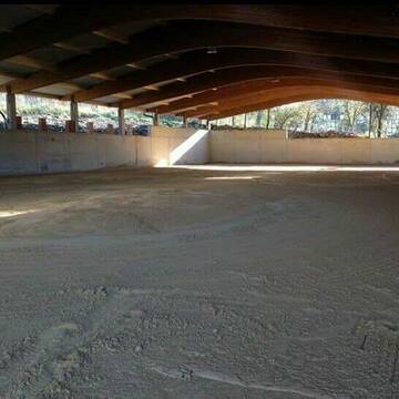
Absofort Boxen frei
Ahorn
Karlheinz Wetterich
@Karlheinz-Wetterich
Freizeitstall
Geländestrecke
Vermieten
Hunde willkommen
Krankenbox
Hengsthaltung möglich
Hufrehe geeignet
21 weitere...
aktuell
P
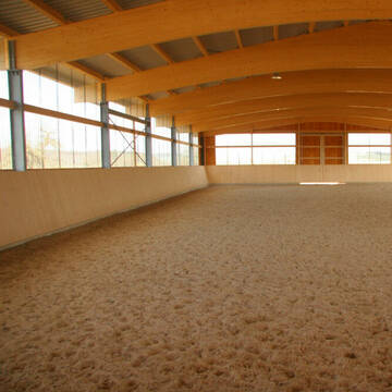
Einzelne Boxen und Häuschen zu vermieten!
Königheim
Reitanlage-Rittershof
@Reitanlage-Rittershof
FN-Mitglied
Freizeitstall
Vermieten
Verpachten
Führanlage
Hunde willkommen
Hengsthaltung möglich
Hufrehe geeignet
28 weitere...
P
Deprecated: Creation of dynamic property Zend_View_Helper_Ads::$adLink is deprecated in /var/www/stall-frei/htdocs/staging.stall-frei.de/library/Psf/View/Helper/Ads.php on line 108

Persönlichkeitsentwicklung mit Pferden
Bad Salzuflen
Katja Dors
@Pferdezeiten
Begleite andere auf ihrem Entwicklungsweg und entdecke die transformative Kraft der pferdegestützten Persönlichkeitsentwicklung !
neu
R

Biete Offenstallplatz mit Box bei Privat
Tauberbischofsheim
Gerd
@Gerdt
Freizeitstall
Geländestrecke
Sattelkammer/Sattelschränke
Sommerweide
Offenstall
Selbstversorgung
1 weitere...
P
Leider kein Vorschaubild
Leider kein Vorschaubild
Aktivstall Schwabhausen(im Internet suchen)
Boxberg- Schwabhausen
Aktivstall Schwabhausen
@FamilieWeber
Freizeitstall
Wanderreiten
Vermieten
Hunde willkommen
Krankenbox
Allergikerstall
Gnadenbrothof
17 weitere...
B
Pferdepension in Bad Mergentheim
Bad Mergentheim
Pferdepension-in-Bad-Mergentheim
@Pferdepension-Bad-Mergentheim
Freizeitstall
Geländestrecke
Vermieten
Hunde willkommen
Longierzirkel/Roundpen
Einhornhaltung möglich
Hengsthaltung möglich
24 weitere...
P
Paddockboxen und Offenstall
Osterburken - Bofsheim
Anita-S
@Anita-S
Longierzirkel/Roundpen
Parkplatz für Pferdeanhänger
Außenbox mit Paddock
Offenstall
Vollpension
7 weitere...
P

Pferdepension Hit Aktivstall Kürmerhof
Hohenkammer
Kuermerhof
@Kuermerhof
*******JETZT NEU MIT ENTSTAUBTEM BIOHEU*********
*******Demnächst mit einem Abenteuerspielplatz für Pferde ( Extrem Trail/Pa
Leider kein Vorschaubild
Leider kein Vorschaubild
Paddockboxen und Offenstallplätze in Vollpension
Höpfingen
Reitstall-Weimer
@Reitstall-Weimer
Freizeitstall
Pferdeausbildung
Vermieten
Hunde willkommen
Longierzirkel/Roundpen
Außenbox mit Paddock
Offenstall
12 weitere...
B

Schöntal-Ranch
Schöntal
Tanja Sautter
@SchoentalRanch
Freizeitstall
Pferdeausbildung
Vermieten
Verpachten
Krankenbox
Paddock
Allergikerstall
bedampftes/gewaschenes Heu
26 weitere...
ganz aktuell
P
Paddockboxen frei, Pferde-Reha, Urlaub Pferd
Buchen
Freckled Rowdy Ranch
@Patricia-Terpilowski
Freizeitstall
Geländestrecke
Vermieten
Hunde willkommen
Krankenbox
Allergikerstall
Hengsthaltung möglich
25 weitere...
P

Offenstallplätze frei für alle
Adelsheim
Assenheimer-Pfeiffer GbR
@Assenheimer-Pfeiffer
FN-Mitglied
Freizeitstall
Vermieten
Hunde willkommen
Krankenbox
Fohlenaufzucht möglich
Gnadenbrothof
22 weitere...
P
Deprecated: Creation of dynamic property Zend_View::$pageCount is deprecated in /var/www/stall-frei/htdocs/staging.stall-frei.de/library/vendor/shardj/zf1-future/library/Zend/View/Abstract.php on line 308
Deprecated: Creation of dynamic property Zend_View::$itemCountPerPage is deprecated in /var/www/stall-frei/htdocs/staging.stall-frei.de/library/vendor/shardj/zf1-future/library/Zend/View/Abstract.php on line 308
Deprecated: Creation of dynamic property Zend_View::$first is deprecated in /var/www/stall-frei/htdocs/staging.stall-frei.de/library/vendor/shardj/zf1-future/library/Zend/View/Abstract.php on line 308
Deprecated: Creation of dynamic property Zend_View::$current is deprecated in /var/www/stall-frei/htdocs/staging.stall-frei.de/library/vendor/shardj/zf1-future/library/Zend/View/Abstract.php on line 308
Deprecated: Creation of dynamic property Zend_View::$last is deprecated in /var/www/stall-frei/htdocs/staging.stall-frei.de/library/vendor/shardj/zf1-future/library/Zend/View/Abstract.php on line 308
Deprecated: Creation of dynamic property Zend_View::$next is deprecated in /var/www/stall-frei/htdocs/staging.stall-frei.de/library/vendor/shardj/zf1-future/library/Zend/View/Abstract.php on line 308
Deprecated: Creation of dynamic property Zend_View::$pagesInRange is deprecated in /var/www/stall-frei/htdocs/staging.stall-frei.de/library/vendor/shardj/zf1-future/library/Zend/View/Abstract.php on line 308
Deprecated: Creation of dynamic property Zend_View::$firstPageInRange is deprecated in /var/www/stall-frei/htdocs/staging.stall-frei.de/library/vendor/shardj/zf1-future/library/Zend/View/Abstract.php on line 308
Deprecated: Creation of dynamic property Zend_View::$lastPageInRange is deprecated in /var/www/stall-frei/htdocs/staging.stall-frei.de/library/vendor/shardj/zf1-future/library/Zend/View/Abstract.php on line 308
Deprecated: Creation of dynamic property Zend_View::$currentItemCount is deprecated in /var/www/stall-frei/htdocs/staging.stall-frei.de/library/vendor/shardj/zf1-future/library/Zend/View/Abstract.php on line 308
Deprecated: Creation of dynamic property Zend_View::$totalItemCount is deprecated in /var/www/stall-frei/htdocs/staging.stall-frei.de/library/vendor/shardj/zf1-future/library/Zend/View/Abstract.php on line 308
Deprecated: Creation of dynamic property Zend_View::$firstItemNumber is deprecated in /var/www/stall-frei/htdocs/staging.stall-frei.de/library/vendor/shardj/zf1-future/library/Zend/View/Abstract.php on line 308
Deprecated: Creation of dynamic property Zend_View::$lastItemNumber is deprecated in /var/www/stall-frei/htdocs/staging.stall-frei.de/library/vendor/shardj/zf1-future/library/Zend/View/Abstract.php on line 308
Deprecated: Creation of dynamic property Zend_View::$router is deprecated in /var/www/stall-frei/htdocs/staging.stall-frei.de/library/vendor/shardj/zf1-future/library/Zend/View/Abstract.php on line 308
Deprecated: Creation of dynamic property Zend_View::$urlParams is deprecated in /var/www/stall-frei/htdocs/staging.stall-frei.de/library/vendor/shardj/zf1-future/library/Zend/View/Abstract.php on line 308
Deprecated: Creation of dynamic property Zend_View::$showAds is deprecated in /var/www/stall-frei/htdocs/staging.stall-frei.de/library/vendor/shardj/zf1-future/library/Zend/View/Abstract.php on line 308
Deprecated: Creation of dynamic property Zend_View::$objectIds is deprecated in /var/www/stall-frei/htdocs/staging.stall-frei.de/library/vendor/shardj/zf1-future/library/Zend/View/Abstract.php on line 308
Deprecated: Creation of dynamic property Zend_View::$showNavbar is deprecated in /var/www/stall-frei/htdocs/staging.stall-frei.de/library/vendor/shardj/zf1-future/library/Zend/View/Abstract.php on line 308
Deprecated: Creation of dynamic property Zend_View::$showBreadcrumb is deprecated in /var/www/stall-frei/htdocs/staging.stall-frei.de/library/vendor/shardj/zf1-future/library/Zend/View/Abstract.php on line 308
Deprecated: Creation of dynamic property Zend_View::$showFooter is deprecated in /var/www/stall-frei/htdocs/staging.stall-frei.de/library/vendor/shardj/zf1-future/library/Zend/View/Abstract.php on line 308
Deprecated: Creation of dynamic property Zend_View::$showInternalAds is deprecated in /var/www/stall-frei/htdocs/staging.stall-frei.de/library/vendor/shardj/zf1-future/library/Zend/View/Abstract.php on line 308
Deprecated: Creation of dynamic property Zend_View::$blNoContent is deprecated in /var/www/stall-frei/htdocs/staging.stall-frei.de/library/vendor/shardj/zf1-future/library/Zend/View/Abstract.php on line 308
Deprecated: Creation of dynamic property Zend_View::$sMetaDesc is deprecated in /var/www/stall-frei/htdocs/staging.stall-frei.de/library/vendor/shardj/zf1-future/library/Zend/View/Abstract.php on line 308
Deprecated: Creation of dynamic property Zend_View::$useGmaps is deprecated in /var/www/stall-frei/htdocs/staging.stall-frei.de/library/vendor/shardj/zf1-future/library/Zend/View/Abstract.php on line 308
Deprecated: Creation of dynamic property Zend_View::$touches is deprecated in /var/www/stall-frei/htdocs/staging.stall-frei.de/library/vendor/shardj/zf1-future/library/Zend/View/Abstract.php on line 308
Deprecated: Creation of dynamic property Zend_View::$oProject is deprecated in /var/www/stall-frei/htdocs/staging.stall-frei.de/library/vendor/shardj/zf1-future/library/Zend/View/Abstract.php on line 308
Deprecated: Creation of dynamic property Zend_View::$pageHeadline is deprecated in /var/www/stall-frei/htdocs/staging.stall-frei.de/library/vendor/shardj/zf1-future/library/Zend/View/Abstract.php on line 308
Deprecated: Creation of dynamic property Zend_View::$disableLocationField is deprecated in /var/www/stall-frei/htdocs/staging.stall-frei.de/library/vendor/shardj/zf1-future/library/Zend/View/Abstract.php on line 308
Deprecated: Creation of dynamic property Zend_View::$isSearch is deprecated in /var/www/stall-frei/htdocs/staging.stall-frei.de/library/vendor/shardj/zf1-future/library/Zend/View/Abstract.php on line 308
Deprecated: Creation of dynamic property Zend_View::$pageTitle is deprecated in /var/www/stall-frei/htdocs/staging.stall-frei.de/library/vendor/shardj/zf1-future/library/Zend/View/Abstract.php on line 308
Deprecated: Creation of dynamic property Psf_Form_Element_Text::$class is deprecated in /var/www/stall-frei/htdocs/staging.stall-frei.de/library/vendor/shardj/zf1-future/library/Zend/Form/Element.php on line 874
Deprecated: Creation of dynamic property Psf_Form_Element_Text::$size is deprecated in /var/www/stall-frei/htdocs/staging.stall-frei.de/library/vendor/shardj/zf1-future/library/Zend/Form/Element.php on line 874
Deprecated: Creation of dynamic property Psf_Form_Element_Text::$placeholder is deprecated in /var/www/stall-frei/htdocs/staging.stall-frei.de/library/vendor/shardj/zf1-future/library/Zend/Form/Element.php on line 874
Deprecated: Creation of dynamic property Psf_Form_Element_Hidden::$class is deprecated in /var/www/stall-frei/htdocs/staging.stall-frei.de/library/vendor/shardj/zf1-future/library/Zend/Form/Element.php on line 874
Deprecated: Creation of dynamic property Psf_Form_Element_Hidden::$class is deprecated in /var/www/stall-frei/htdocs/staging.stall-frei.de/library/vendor/shardj/zf1-future/library/Zend/Form/Element.php on line 874
Deprecated: Creation of dynamic property Psf_Form_Element_Hidden::$class is deprecated in /var/www/stall-frei/htdocs/staging.stall-frei.de/library/vendor/shardj/zf1-future/library/Zend/Form/Element.php on line 874
Deprecated: Creation of dynamic property Psf_Form_Element_Hidden::$class is deprecated in /var/www/stall-frei/htdocs/staging.stall-frei.de/library/vendor/shardj/zf1-future/library/Zend/Form/Element.php on line 874
Deprecated: Creation of dynamic property Psf_Form_Element_Select::$class is deprecated in /var/www/stall-frei/htdocs/staging.stall-frei.de/library/vendor/shardj/zf1-future/library/Zend/Form/Element.php on line 874
Deprecated: Creation of dynamic property Psf_Form_Element_Select::$class is deprecated in /var/www/stall-frei/htdocs/staging.stall-frei.de/library/vendor/shardj/zf1-future/library/Zend/Form/Element.php on line 874
Deprecated: Creation of dynamic property Psf_Form_Element_Select::$class is deprecated in /var/www/stall-frei/htdocs/staging.stall-frei.de/library/vendor/shardj/zf1-future/library/Zend/Form/Element.php on line 874
Deprecated: Creation of dynamic property Psf_Form_Element_Select::$class is deprecated in /var/www/stall-frei/htdocs/staging.stall-frei.de/library/vendor/shardj/zf1-future/library/Zend/Form/Element.php on line 874
Deprecated: Creation of dynamic property Psf_Form_Element_Text::$class is deprecated in /var/www/stall-frei/htdocs/staging.stall-frei.de/library/vendor/shardj/zf1-future/library/Zend/Form/Element.php on line 874
Deprecated: Creation of dynamic property Psf_Form_Element_Checkbox::$label is deprecated in /var/www/stall-frei/htdocs/staging.stall-frei.de/library/vendor/shardj/zf1-future/library/Zend/Form/Element.php on line 874
Deprecated: Creation of dynamic property Zend_View::$sort is deprecated in /var/www/stall-frei/htdocs/staging.stall-frei.de/library/vendor/shardj/zf1-future/library/Zend/View/Abstract.php on line 308
Deprecated: Creation of dynamic property Zend_View::$searchLocation is deprecated in /var/www/stall-frei/htdocs/staging.stall-frei.de/library/vendor/shardj/zf1-future/library/Zend/View/Abstract.php on line 308
Deprecated: Creation of dynamic property Zend_View::$locationHint is deprecated in /var/www/stall-frei/htdocs/staging.stall-frei.de/library/vendor/shardj/zf1-future/library/Zend/View/Abstract.php on line 308
Psf_GeoCoder_Abstract::getLocation: Löhle Get Location CachedOrLive
Psf_GeoCoder_Abstract::getCachedOrLive: Löhle
Psf_GeoCoder_OpenCageData::makeApiRequest: response:
Array
(
[documentation] => https://opencagedata.com/api
[licenses] => Array
(
[0] => Array
(
[name] => see attribution guide
[url] => https://opencagedata.com/credits
)
)
[results] => Array
(
[0] => Array
(
[bounds] => Array
(
[northeast] => Array
(
[lat] => 49.5180382
[lng] => 9.6044649
)
[southwest] => Array
(
[lat] => 49.5179382
[lng] => 9.6043649
)
)
[components] => Array
(
[ISO_3166-1_alpha-2] => DE
[ISO_3166-1_alpha-3] => DEU
[ISO_3166-2] => Array
(
[0] => DE-BW
)
[_category] => natural/water
[_normalized_city] => Boxberg
[_type] => peak
[continent] => Europe
[country] => Deutschland
[country_code] => de
[county] => Main-Tauber-Kreis
[municipality] => VVG der Stadt Boxberg
[peak] => Löhle
[political_union] => European Union
[postcode] => 97944
[state] => Baden-Württemberg
[state_code] => BW
[town] => Boxberg
)
[confidence] => 9
[formatted] => Löhle, 97944 Boxberg, Deutschland
[geometry] => Array
(
[lat] => 49.5179882
[lng] => 9.6044149
)
)
[1] => Array
(
[bounds] => Array
(
[northeast] => Array
(
[lat] => 47.7216829
[lng] => 7.6048883
)
[southwest] => Array
(
[lat] => 47.7215829
[lng] => 7.6047883
)
)
[components] => Array
(
[ISO_3166-1_alpha-2] => DE
[ISO_3166-1_alpha-3] => DEU
[ISO_3166-2] => Array
(
[0] => DE-BW
)
[_category] => natural/water
[_normalized_city] => Kandern
[_type] => peak
[continent] => Europe
[country] => Deutschland
[country_code] => de
[county] => Landkreis Lörrach
[municipality] => VVG der Stadt Kandern
[peak] => Löhle
[political_union] => European Union
[postcode] => 79418
[state] => Baden-Württemberg
[state_code] => BW
[town] => Kandern
)
[confidence] => 9
[formatted] => Löhle, 79418 Kandern, Deutschland
[geometry] => Array
(
[lat] => 47.7216329
[lng] => 7.6048383
)
)
[2] => Array
(
[bounds] => Array
(
[northeast] => Array
(
[lat] => 48.8956121
[lng] => 9.3078193
)
[southwest] => Array
(
[lat] => 48.8955121
[lng] => 9.3077193
)
)
[components] => Array
(
[ISO_3166-1_alpha-2] => DE
[ISO_3166-1_alpha-3] => DEU
[ISO_3166-2] => Array
(
[0] => DE-BW
)
[_category] => natural/water
[_normalized_city] => Waiblingen
[_type] => wood
[continent] => Europe
[country] => Deutschland
[country_code] => de
[county] => Rems-Murr-Kreis
[political_union] => European Union
[postcode] => 71336
[state] => Baden-Württemberg
[state_code] => BW
[town] => Waiblingen
[village] => Bittenfeld
[wood] => Löhle
)
[confidence] => 9
[formatted] => Löhle, 71336 Bittenfeld, Deutschland
[geometry] => Array
(
[lat] => 48.8955621
[lng] => 9.3077693
)
)
[3] => Array
(
[bounds] => Array
(
[northeast] => Array
(
[lat] => 49.0559307
[lng] => 9.7681134
)
[southwest] => Array
(
[lat] => 49.0558307
[lng] => 9.7680134
)
)
[components] => Array
(
[ISO_3166-1_alpha-2] => DE
[ISO_3166-1_alpha-3] => DEU
[ISO_3166-2] => Array
(
[0] => DE-BW
)
[_category] => agriculture
[_normalized_city] => Michelbach an der Bilz
[_type] => farmyard
[continent] => Europe
[country] => Deutschland
[country_code] => de
[county] => Landkreis Schwäbisch Hall
[farmyard] => Landschaftspflegehof
[hamlet] => Buchhorn
[isolated_dwelling] => Löhle
[municipality] => VVG der Stadt Schwäbisch Hall
[political_union] => European Union
[postcode] => 74544
[state] => Baden-Württemberg
[state_code] => BW
[village] => Michelbach an der Bilz
)
[confidence] => 9
[formatted] => Landschaftspflegehof, Löhle, Buchhorn, 74544 Michelbach an der Bilz, Deutschland
[geometry] => Array
(
[lat] => 49.0558807
[lng] => 9.7680634
)
)
[4] => Array
(
[bounds] => Array
(
[northeast] => Array
(
[lat] => 48.894856
[lng] => 9.303758
)
[southwest] => Array
(
[lat] => 48.894756
[lng] => 9.303658
)
)
[components] => Array
(
[ISO_3166-1_alpha-2] => DE
[ISO_3166-1_alpha-3] => DEU
[ISO_3166-2] => Array
(
[0] => DE-BW
)
[_category] => building
[_normalized_city] => Waiblingen
[_type] => building
[continent] => Europe
[country] => Deutschland
[country_code] => de
[county] => Rems-Murr-Kreis
[isolated_dwelling] => Löhle
[political_union] => European Union
[postcode] => 71336
[state] => Baden-Württemberg
[state_code] => BW
[town] => Waiblingen
[village] => Bittenfeld
)
[confidence] => 10
[formatted] => Löhle, 71336 Bittenfeld, Deutschland
[geometry] => Array
(
[lat] => 48.894806
[lng] => 9.303708
)
)
[5] => Array
(
[bounds] => Array
(
[northeast] => Array
(
[lat] => 47.7798331
[lng] => 9.8910739
)
[southwest] => Array
(
[lat] => 47.7797331
[lng] => 9.8909739
)
)
[components] => Array
(
[ISO_3166-1_alpha-2] => DE
[ISO_3166-1_alpha-3] => DEU
[ISO_3166-2] => Array
(
[0] => DE-BW
)
[_category] => building
[_normalized_city] => Kißlegg
[_type] => building
[city] => Kißlegg
[continent] => Europe
[country] => Deutschland
[country_code] => de
[county] => Landkreis Ravensburg
[isolated_dwelling] => Löhle
[political_union] => European Union
[postcode] => 88353
[state] => Baden-Württemberg
[state_code] => BW
)
[confidence] => 10
[formatted] => Löhle, 88353 Kißlegg, Deutschland
[geometry] => Array
(
[lat] => 47.7797831
[lng] => 9.8910239
)
)
[6] => Array
(
[bounds] => Array
(
[northeast] => Array
(
[lat] => 49.4388743
[lng] => 9.8584217
)
[southwest] => Array
(
[lat] => 49.4296715
[lng] => 9.8527318
)
)
[components] => Array
(
[ISO_3166-1_alpha-2] => DE
[ISO_3166-1_alpha-3] => DEU
[ISO_3166-2] => Array
(
[0] => DE-BW
)
[_category] => natural/water
[_normalized_city] => Niederstetten
[_type] => forest
[continent] => Europe
[country] => Deutschland
[country_code] => de
[county] => Main-Tauber-Kreis
[forest] => Löhle
[political_union] => European Union
[postcode] => 97996
[state] => Baden-Württemberg
[state_code] => BW
[town] => Niederstetten
[village] => Herrenzimmern
)
[confidence] => 9
[formatted] => Löhle, 97996 Herrenzimmern, Deutschland
[geometry] => Array
(
[lat] => 49.4339405
[lng] => 9.8553917
)
)
[7] => Array
(
[bounds] => Array
(
[northeast] => Array
(
[lat] => 48.4480359
[lng] => 9.3333346
)
[southwest] => Array
(
[lat] => 48.4420972
[lng] => 9.3261822
)
)
[components] => Array
(
[ISO_3166-1_alpha-2] => DE
[ISO_3166-1_alpha-3] => DEU
[ISO_3166-2] => Array
(
[0] => DE-BW
)
[_category] => natural/water
[_normalized_city] => Würtingen
[_type] => forest
[continent] => Europe
[country] => Deutschland
[country_code] => de
[county] => Landkreis Reutlingen
[forest] => Löhle
[municipality] => St. Johann
[political_union] => European Union
[postcode] => 72813
[state] => Baden-Württemberg
[state_code] => BW
[town] => Würtingen
[village] => Ohnastetten
)
[confidence] => 9
[formatted] => Löhle, 72813 Ohnastetten, Deutschland
[geometry] => Array
(
[lat] => 48.4451568
[lng] => 9.3286727
)
)
[8] => Array
(
[bounds] => Array
(
[northeast] => Array
(
[lat] => 48.9905849
[lng] => 10.3253404
)
[southwest] => Array
(
[lat] => 48.9877194
[lng] => 10.3181177
)
)
[components] => Array
(
[ISO_3166-1_alpha-2] => DE
[ISO_3166-1_alpha-3] => DEU
[ISO_3166-2] => Array
(
[0] => DE-BW
)
[_category] => natural/water
[_normalized_city] => Stödtlen
[_type] => forest
[continent] => Europe
[country] => Deutschland
[country_code] => de
[county] => Ostalbkreis
[forest] => Löhle
[hamlet] => Oberzell
[municipality] => GVV Tannhausen
[political_union] => European Union
[postcode] => 73495
[state] => Baden-Württemberg
[state_code] => BW
[village] => Stödtlen
)
[confidence] => 9
[formatted] => Löhle, Oberzell, 73495 Stödtlen, Deutschland
[geometry] => Array
(
[lat] => 48.9891783
[lng] => 10.3215379
)
)
[9] => Array
(
[bounds] => Array
(
[northeast] => Array
(
[lat] => 49.5119457
[lng] => 9.4906949
)
[southwest] => Array
(
[lat] => 49.5097395
[lng] => 9.4864163
)
)
[components] => Array
(
[ISO_3166-1_alpha-2] => DE
[ISO_3166-1_alpha-3] => DEU
[ISO_3166-2] => Array
(
[0] => DE-BW
)
[_category] => natural/water
[_normalized_city] => Walldürn
[_type] => forest
[continent] => Europe
[country] => Deutschland
[country_code] => de
[county] => Neckar-Odenwald-Kreis
[forest] => Löhle
[hamlet] => Kudach
[municipality] => GVV Hardheim-Walldürn
[political_union] => European Union
[postcode] => 74731
[state] => Baden-Württemberg
[state_code] => BW
[town] => Walldürn
[village] => Altheim
)
[confidence] => 9
[formatted] => Löhle, Kudach, 74731 Altheim, Deutschland
[geometry] => Array
(
[lat] => 49.5109688
[lng] => 9.4884606
)
)
)
[status] => Array
(
[code] => 200
[message] => OK
)
[stay_informed] => Array
(
[blog] => https://blog.opencagedata.com
[mastodon] => https://en.osm.town/@opencage
)
[thanks] => For using an OpenCage API
[timestamp] => Array
(
[created_http] => Sun, 08 Feb 2026 11:38:59 GMT
[created_unix] => 1770550739
)
[total_results] => 10
)
Psf_GeoCoder_Abstract::convertLocationResult
{"documentation":"https:\/\/opencagedata.com\/api","licenses":[{"name":"see attribution guide","url":"https:\/\/opencagedata.com\/credits"}],"results":[{"bounds":{"northeast":{"lat":49.5180382,"lng":9.6044649},"southwest":{"lat":49.5179382,"lng":9.6043649}},"components":{"ISO_3166-1_alpha-2":"DE","ISO_3166-1_alpha-3":"DEU","ISO_3166-2":["DE-BW"],"_category":"natural\/water","_normalized_city":"Boxberg","_type":"peak","continent":"Europe","country":"Deutschland","country_code":"de","county":"Main-Tauber-Kreis","municipality":"VVG der Stadt Boxberg","peak":"L\u00f6hle","political_union":"European Union","postcode":"97944","state":"Baden-W\u00fcrttemberg","state_code":"BW","town":"Boxberg"},"confidence":9,"formatted":"L\u00f6hle, 97944 Boxberg, Deutschland","geometry":{"lat":49.5179882,"lng":9.6044149}},{"bounds":{"northeast":{"lat":47.7216829,"lng":7.6048883},"southwest":{"lat":47.7215829,"lng":7.6047883}},"components":{"ISO_3166-1_alpha-2":"DE","ISO_3166-1_alpha-3":"DEU","ISO_3166-2":["DE-BW"],"_category":"natural\/water","_normalized_city":"Kandern","_type":"peak","continent":"Europe","country":"Deutschland","country_code":"de","county":"Landkreis L\u00f6rrach","municipality":"VVG der Stadt Kandern","peak":"L\u00f6hle","political_union":"European Union","postcode":"79418","state":"Baden-W\u00fcrttemberg","state_code":"BW","town":"Kandern"},"confidence":9,"formatted":"L\u00f6hle, 79418 Kandern, Deutschland","geometry":{"lat":47.7216329,"lng":7.6048383}},{"bounds":{"northeast":{"lat":48.8956121,"lng":9.3078193},"southwest":{"lat":48.8955121,"lng":9.3077193}},"components":{"ISO_3166-1_alpha-2":"DE","ISO_3166-1_alpha-3":"DEU","ISO_3166-2":["DE-BW"],"_category":"natural\/water","_normalized_city":"Waiblingen","_type":"wood","continent":"Europe","country":"Deutschland","country_code":"de","county":"Rems-Murr-Kreis","political_union":"European Union","postcode":"71336","state":"Baden-W\u00fcrttemberg","state_code":"BW","town":"Waiblingen","village":"Bittenfeld","wood":"L\u00f6hle"},"confidence":9,"formatted":"L\u00f6hle, 71336 Bittenfeld, Deutschland","geometry":{"lat":48.8955621,"lng":9.3077693}},{"bounds":{"northeast":{"lat":49.0559307,"lng":9.7681134},"southwest":{"lat":49.0558307,"lng":9.7680134}},"components":{"ISO_3166-1_alpha-2":"DE","ISO_3166-1_alpha-3":"DEU","ISO_3166-2":["DE-BW"],"_category":"agriculture","_normalized_city":"Michelbach an der Bilz","_type":"farmyard","continent":"Europe","country":"Deutschland","country_code":"de","county":"Landkreis Schw\u00e4bisch Hall","farmyard":"Landschaftspflegehof","hamlet":"Buchhorn","isolated_dwelling":"L\u00f6hle","municipality":"VVG der Stadt Schw\u00e4bisch Hall","political_union":"European Union","postcode":"74544","state":"Baden-W\u00fcrttemberg","state_code":"BW","village":"Michelbach an der Bilz"},"confidence":9,"formatted":"Landschaftspflegehof, L\u00f6hle, Buchhorn, 74544 Michelbach an der Bilz, Deutschland","geometry":{"lat":49.0558807,"lng":9.7680634}},{"bounds":{"northeast":{"lat":48.894856,"lng":9.303758},"southwest":{"lat":48.894756,"lng":9.303658}},"components":{"ISO_3166-1_alpha-2":"DE","ISO_3166-1_alpha-3":"DEU","ISO_3166-2":["DE-BW"],"_category":"building","_normalized_city":"Waiblingen","_type":"building","continent":"Europe","country":"Deutschland","country_code":"de","county":"Rems-Murr-Kreis","isolated_dwelling":"L\u00f6hle","political_union":"European Union","postcode":"71336","state":"Baden-W\u00fcrttemberg","state_code":"BW","town":"Waiblingen","village":"Bittenfeld"},"confidence":10,"formatted":"L\u00f6hle, 71336 Bittenfeld, Deutschland","geometry":{"lat":48.894806,"lng":9.303708}},{"bounds":{"northeast":{"lat":47.7798331,"lng":9.8910739},"southwest":{"lat":47.7797331,"lng":9.8909739}},"components":{"ISO_3166-1_alpha-2":"DE","ISO_3166-1_alpha-3":"DEU","ISO_3166-2":["DE-BW"],"_category":"building","_normalized_city":"Ki\u00dflegg","_type":"building","city":"Ki\u00dflegg","continent":"Europe","country":"Deutschland","country_code":"de","county":"Landkreis Ravensburg","isolated_dwelling":"L\u00f6hle","political_union":"European Union","postcode":"88353","state":"Baden-W\u00fcrttemberg","state_code":"BW"},"confidence":10,"formatted":"L\u00f6hle, 88353 Ki\u00dflegg, Deutschland","geometry":{"lat":47.7797831,"lng":9.8910239}},{"bounds":{"northeast":{"lat":49.4388743,"lng":9.8584217},"southwest":{"lat":49.4296715,"lng":9.8527318}},"components":{"ISO_3166-1_alpha-2":"DE","ISO_3166-1_alpha-3":"DEU","ISO_3166-2":["DE-BW"],"_category":"natural\/water","_normalized_city":"Niederstetten","_type":"forest","continent":"Europe","country":"Deutschland","country_code":"de","county":"Main-Tauber-Kreis","forest":"L\u00f6hle","political_union":"European Union","postcode":"97996","state":"Baden-W\u00fcrttemberg","state_code":"BW","town":"Niederstetten","village":"Herrenzimmern"},"confidence":9,"formatted":"L\u00f6hle, 97996 Herrenzimmern, Deutschland","geometry":{"lat":49.4339405,"lng":9.8553917}},{"bounds":{"northeast":{"lat":48.4480359,"lng":9.3333346},"southwest":{"lat":48.4420972,"lng":9.3261822}},"components":{"ISO_3166-1_alpha-2":"DE","ISO_3166-1_alpha-3":"DEU","ISO_3166-2":["DE-BW"],"_category":"natural\/water","_normalized_city":"W\u00fcrtingen","_type":"forest","continent":"Europe","country":"Deutschland","country_code":"de","county":"Landkreis Reutlingen","forest":"L\u00f6hle","municipality":"St. Johann","political_union":"European Union","postcode":"72813","state":"Baden-W\u00fcrttemberg","state_code":"BW","town":"W\u00fcrtingen","village":"Ohnastetten"},"confidence":9,"formatted":"L\u00f6hle, 72813 Ohnastetten, Deutschland","geometry":{"lat":48.4451568,"lng":9.3286727}},{"bounds":{"northeast":{"lat":48.9905849,"lng":10.3253404},"southwest":{"lat":48.9877194,"lng":10.3181177}},"components":{"ISO_3166-1_alpha-2":"DE","ISO_3166-1_alpha-3":"DEU","ISO_3166-2":["DE-BW"],"_category":"natural\/water","_normalized_city":"St\u00f6dtlen","_type":"forest","continent":"Europe","country":"Deutschland","country_code":"de","county":"Ostalbkreis","forest":"L\u00f6hle","hamlet":"Oberzell","municipality":"GVV Tannhausen","political_union":"European Union","postcode":"73495","state":"Baden-W\u00fcrttemberg","state_code":"BW","village":"St\u00f6dtlen"},"confidence":9,"formatted":"L\u00f6hle, Oberzell, 73495 St\u00f6dtlen, Deutschland","geometry":{"lat":48.9891783,"lng":10.3215379}},{"bounds":{"northeast":{"lat":49.5119457,"lng":9.4906949},"southwest":{"lat":49.5097395,"lng":9.4864163}},"components":{"ISO_3166-1_alpha-2":"DE","ISO_3166-1_alpha-3":"DEU","ISO_3166-2":["DE-BW"],"_category":"natural\/water","_normalized_city":"Walld\u00fcrn","_type":"forest","continent":"Europe","country":"Deutschland","country_code":"de","county":"Neckar-Odenwald-Kreis","forest":"L\u00f6hle","hamlet":"Kudach","municipality":"GVV Hardheim-Walld\u00fcrn","political_union":"European Union","postcode":"74731","state":"Baden-W\u00fcrttemberg","state_code":"BW","town":"Walld\u00fcrn","village":"Altheim"},"confidence":9,"formatted":"L\u00f6hle, Kudach, 74731 Altheim, Deutschland","geometry":{"lat":49.5109688,"lng":9.4884606}}],"status":{"code":200,"message":"OK"},"stay_informed":{"blog":"https:\/\/blog.opencagedata.com","mastodon":"https:\/\/en.osm.town\/@opencage"},"thanks":"For using an OpenCage API","timestamp":{"created_http":"Sun, 08 Feb 2026 11:38:59 GMT","created_unix":1770550739},"total_results":10}Array
(
[0] => stdClass Object
(
[bounds] => stdClass Object
(
[northeast] => stdClass Object
(
[lat] => 49.5180382
[lng] => 9.6044649
)
[southwest] => stdClass Object
(
[lat] => 49.5179382
[lng] => 9.6043649
)
)
[components] => stdClass Object
(
[ISO_3166-1_alpha-2] => DE
[ISO_3166-1_alpha-3] => DEU
[ISO_3166-2] => Array
(
[0] => DE-BW
)
[_category] => natural/water
[_normalized_city] => Boxberg
[_type] => peak
[continent] => Europe
[country] => Deutschland
[country_code] => de
[county] => Main-Tauber-Kreis
[municipality] => VVG der Stadt Boxberg
[peak] => Löhle
[political_union] => European Union
[postcode] => 97944
[state] => Baden-Württemberg
[state_code] => BW
[town] => Boxberg
)
[confidence] => 9
[formatted] => Löhle, 97944 Boxberg, Deutschland
[geometry] => stdClass Object
(
[lat] => 49.5179882
[lng] => 9.6044149
)
)
[1] => stdClass Object
(
[bounds] => stdClass Object
(
[northeast] => stdClass Object
(
[lat] => 47.7216829
[lng] => 7.6048883
)
[southwest] => stdClass Object
(
[lat] => 47.7215829
[lng] => 7.6047883
)
)
[components] => stdClass Object
(
[ISO_3166-1_alpha-2] => DE
[ISO_3166-1_alpha-3] => DEU
[ISO_3166-2] => Array
(
[0] => DE-BW
)
[_category] => natural/water
[_normalized_city] => Kandern
[_type] => peak
[continent] => Europe
[country] => Deutschland
[country_code] => de
[county] => Landkreis Lörrach
[municipality] => VVG der Stadt Kandern
[peak] => Löhle
[political_union] => European Union
[postcode] => 79418
[state] => Baden-Württemberg
[state_code] => BW
[town] => Kandern
)
[confidence] => 9
[formatted] => Löhle, 79418 Kandern, Deutschland
[geometry] => stdClass Object
(
[lat] => 47.7216329
[lng] => 7.6048383
)
)
[2] => stdClass Object
(
[bounds] => stdClass Object
(
[northeast] => stdClass Object
(
[lat] => 48.8956121
[lng] => 9.3078193
)
[southwest] => stdClass Object
(
[lat] => 48.8955121
[lng] => 9.3077193
)
)
[components] => stdClass Object
(
[ISO_3166-1_alpha-2] => DE
[ISO_3166-1_alpha-3] => DEU
[ISO_3166-2] => Array
(
[0] => DE-BW
)
[_category] => natural/water
[_normalized_city] => Waiblingen
[_type] => wood
[continent] => Europe
[country] => Deutschland
[country_code] => de
[county] => Rems-Murr-Kreis
[political_union] => European Union
[postcode] => 71336
[state] => Baden-Württemberg
[state_code] => BW
[town] => Waiblingen
[village] => Bittenfeld
[wood] => Löhle
)
[confidence] => 9
[formatted] => Löhle, 71336 Bittenfeld, Deutschland
[geometry] => stdClass Object
(
[lat] => 48.8955621
[lng] => 9.3077693
)
)
[3] => stdClass Object
(
[bounds] => stdClass Object
(
[northeast] => stdClass Object
(
[lat] => 49.0559307
[lng] => 9.7681134
)
[southwest] => stdClass Object
(
[lat] => 49.0558307
[lng] => 9.7680134
)
)
[components] => stdClass Object
(
[ISO_3166-1_alpha-2] => DE
[ISO_3166-1_alpha-3] => DEU
[ISO_3166-2] => Array
(
[0] => DE-BW
)
[_category] => agriculture
[_normalized_city] => Michelbach an der Bilz
[_type] => farmyard
[continent] => Europe
[country] => Deutschland
[country_code] => de
[county] => Landkreis Schwäbisch Hall
[farmyard] => Landschaftspflegehof
[hamlet] => Buchhorn
[isolated_dwelling] => Löhle
[municipality] => VVG der Stadt Schwäbisch Hall
[political_union] => European Union
[postcode] => 74544
[state] => Baden-Württemberg
[state_code] => BW
[village] => Michelbach an der Bilz
)
[confidence] => 9
[formatted] => Landschaftspflegehof, Löhle, Buchhorn, 74544 Michelbach an der Bilz, Deutschland
[geometry] => stdClass Object
(
[lat] => 49.0558807
[lng] => 9.7680634
)
)
[4] => stdClass Object
(
[bounds] => stdClass Object
(
[northeast] => stdClass Object
(
[lat] => 48.894856
[lng] => 9.303758
)
[southwest] => stdClass Object
(
[lat] => 48.894756
[lng] => 9.303658
)
)
[components] => stdClass Object
(
[ISO_3166-1_alpha-2] => DE
[ISO_3166-1_alpha-3] => DEU
[ISO_3166-2] => Array
(
[0] => DE-BW
)
[_category] => building
[_normalized_city] => Waiblingen
[_type] => building
[continent] => Europe
[country] => Deutschland
[country_code] => de
[county] => Rems-Murr-Kreis
[isolated_dwelling] => Löhle
[political_union] => European Union
[postcode] => 71336
[state] => Baden-Württemberg
[state_code] => BW
[town] => Waiblingen
[village] => Bittenfeld
)
[confidence] => 10
[formatted] => Löhle, 71336 Bittenfeld, Deutschland
[geometry] => stdClass Object
(
[lat] => 48.894806
[lng] => 9.303708
)
)
[5] => stdClass Object
(
[bounds] => stdClass Object
(
[northeast] => stdClass Object
(
[lat] => 47.7798331
[lng] => 9.8910739
)
[southwest] => stdClass Object
(
[lat] => 47.7797331
[lng] => 9.8909739
)
)
[components] => stdClass Object
(
[ISO_3166-1_alpha-2] => DE
[ISO_3166-1_alpha-3] => DEU
[ISO_3166-2] => Array
(
[0] => DE-BW
)
[_category] => building
[_normalized_city] => Kißlegg
[_type] => building
[city] => Kißlegg
[continent] => Europe
[country] => Deutschland
[country_code] => de
[county] => Landkreis Ravensburg
[isolated_dwelling] => Löhle
[political_union] => European Union
[postcode] => 88353
[state] => Baden-Württemberg
[state_code] => BW
)
[confidence] => 10
[formatted] => Löhle, 88353 Kißlegg, Deutschland
[geometry] => stdClass Object
(
[lat] => 47.7797831
[lng] => 9.8910239
)
)
[6] => stdClass Object
(
[bounds] => stdClass Object
(
[northeast] => stdClass Object
(
[lat] => 49.4388743
[lng] => 9.8584217
)
[southwest] => stdClass Object
(
[lat] => 49.4296715
[lng] => 9.8527318
)
)
[components] => stdClass Object
(
[ISO_3166-1_alpha-2] => DE
[ISO_3166-1_alpha-3] => DEU
[ISO_3166-2] => Array
(
[0] => DE-BW
)
[_category] => natural/water
[_normalized_city] => Niederstetten
[_type] => forest
[continent] => Europe
[country] => Deutschland
[country_code] => de
[county] => Main-Tauber-Kreis
[forest] => Löhle
[political_union] => European Union
[postcode] => 97996
[state] => Baden-Württemberg
[state_code] => BW
[town] => Niederstetten
[village] => Herrenzimmern
)
[confidence] => 9
[formatted] => Löhle, 97996 Herrenzimmern, Deutschland
[geometry] => stdClass Object
(
[lat] => 49.4339405
[lng] => 9.8553917
)
)
[7] => stdClass Object
(
[bounds] => stdClass Object
(
[northeast] => stdClass Object
(
[lat] => 48.4480359
[lng] => 9.3333346
)
[southwest] => stdClass Object
(
[lat] => 48.4420972
[lng] => 9.3261822
)
)
[components] => stdClass Object
(
[ISO_3166-1_alpha-2] => DE
[ISO_3166-1_alpha-3] => DEU
[ISO_3166-2] => Array
(
[0] => DE-BW
)
[_category] => natural/water
[_normalized_city] => Würtingen
[_type] => forest
[continent] => Europe
[country] => Deutschland
[country_code] => de
[county] => Landkreis Reutlingen
[forest] => Löhle
[municipality] => St. Johann
[political_union] => European Union
[postcode] => 72813
[state] => Baden-Württemberg
[state_code] => BW
[town] => Würtingen
[village] => Ohnastetten
)
[confidence] => 9
[formatted] => Löhle, 72813 Ohnastetten, Deutschland
[geometry] => stdClass Object
(
[lat] => 48.4451568
[lng] => 9.3286727
)
)
[8] => stdClass Object
(
[bounds] => stdClass Object
(
[northeast] => stdClass Object
(
[lat] => 48.9905849
[lng] => 10.3253404
)
[southwest] => stdClass Object
(
[lat] => 48.9877194
[lng] => 10.3181177
)
)
[components] => stdClass Object
(
[ISO_3166-1_alpha-2] => DE
[ISO_3166-1_alpha-3] => DEU
[ISO_3166-2] => Array
(
[0] => DE-BW
)
[_category] => natural/water
[_normalized_city] => Stödtlen
[_type] => forest
[continent] => Europe
[country] => Deutschland
[country_code] => de
[county] => Ostalbkreis
[forest] => Löhle
[hamlet] => Oberzell
[municipality] => GVV Tannhausen
[political_union] => European Union
[postcode] => 73495
[state] => Baden-Württemberg
[state_code] => BW
[village] => Stödtlen
)
[confidence] => 9
[formatted] => Löhle, Oberzell, 73495 Stödtlen, Deutschland
[geometry] => stdClass Object
(
[lat] => 48.9891783
[lng] => 10.3215379
)
)
[9] => stdClass Object
(
[bounds] => stdClass Object
(
[northeast] => stdClass Object
(
[lat] => 49.5119457
[lng] => 9.4906949
)
[southwest] => stdClass Object
(
[lat] => 49.5097395
[lng] => 9.4864163
)
)
[components] => stdClass Object
(
[ISO_3166-1_alpha-2] => DE
[ISO_3166-1_alpha-3] => DEU
[ISO_3166-2] => Array
(
[0] => DE-BW
)
[_category] => natural/water
[_normalized_city] => Walldürn
[_type] => forest
[continent] => Europe
[country] => Deutschland
[country_code] => de
[county] => Neckar-Odenwald-Kreis
[forest] => Löhle
[hamlet] => Kudach
[municipality] => GVV Hardheim-Walldürn
[political_union] => European Union
[postcode] => 74731
[state] => Baden-Württemberg
[state_code] => BW
[town] => Walldürn
[village] => Altheim
)
[confidence] => 9
[formatted] => Löhle, Kudach, 74731 Altheim, Deutschland
[geometry] => stdClass Object
(
[lat] => 49.5109688
[lng] => 9.4884606
)
)
)
Psf_GeoCoder_OpenCageData::getKeyMap: 0
stdClass Object
(
    [bounds] => stdClass Object
        (
            [northeast] => stdClass Object
                (
                    [lat] => 49.5180382
                    [lng] => 9.6044649
                )

            [southwest] => stdClass Object
                (
                    [lat] => 49.5179382
                    [lng] => 9.6043649
                )

        )

    [components] => stdClass Object
        (
            [ISO_3166-1_alpha-2] => DE
            [ISO_3166-1_alpha-3] => DEU
            [ISO_3166-2] => Array
                (
                    [0] => DE-BW
                )

            [_category] => natural/water
            [_normalized_city] => Boxberg
            [_type] => peak
            [continent] => Europe
            [country] => Deutschland
            [country_code] => de
            [county] => Main-Tauber-Kreis
            [municipality] => VVG der Stadt Boxberg
            [peak] => Löhle
            [political_union] => European Union
            [postcode] => 97944
            [state] => Baden-Württemberg
            [state_code] => BW
            [town] => Boxberg
        )

    [confidence] => 9
    [formatted] => Löhle, 97944 Boxberg, Deutschland
    [geometry] => stdClass Object
        (
            [lat] => 49.5179882
            [lng] => 9.6044149
        )

)
Psf_GeoCoder_OpenCageData::getCounty: Main-Tauber-Kreis
Psf_GeoCoder_OpenCageData::addMissingData REFETCH!
Array
(
    [address] => Löhle, 97944 Boxberg, Deutschland
    [type] => peak
    [street] =>
    [city] => Boxberg
    [county] => Main-Tauber-Kreis
    [state] => Baden-Württemberg
    [zip] => 97944
    [country] => Deutschland
    [suburb] =>
    [countrycode] => de
    [latitude] => 49.5179882
    [longitude] => 9.6044149
    [accuracy] => 1
    [confidence] => 9
    [bounds] => stdClass Object
        (
            [northeast] => stdClass Object
                (
                    [lat] => 49.5180382
                    [lng] => 9.6044649
                )

            [southwest] => stdClass Object
                (
                    [lat] => 49.5179382
                    [lng] => 9.6043649
                )

        )

)
reformat!
Array
(
    [address] => Löhle, 97944 Boxberg, Deutschland
    [type] => peak
    [street] =>
    [city] => Boxberg
    [county] => Main-Tauber-Kreis
    [state] => Baden-Württemberg
    [zip] => 97944
    [country] => Deutschland
    [suburb] =>
    [countrycode] => de
    [latitude] => 49.5179882
    [longitude] => 9.6044149
    [accuracy] => 1
    [confidence] => 9
    [bounds] => stdClass Object
        (
            [northeast] => stdClass Object
                (
                    [lat] => 49.5180382
                    [lng] => 9.6044649
                )

            [southwest] => stdClass Object
                (
                    [lat] => 49.5179382
                    [lng] => 9.6043649
                )

        )

    [place] => 97944 Boxberg, Baden-Württemberg
    [hash] => a0c3090106dbfb095d4875f29568bcba
)
Psf_GeoCoder_OpenCageData::getKeyMap: 1
stdClass Object
(
    [bounds] => stdClass Object
        (
            [northeast] => stdClass Object
                (
                    [lat] => 47.7216829
                    [lng] => 7.6048883
                )

            [southwest] => stdClass Object
                (
                    [lat] => 47.7215829
                    [lng] => 7.6047883
                )

        )

    [components] => stdClass Object
        (
            [ISO_3166-1_alpha-2] => DE
            [ISO_3166-1_alpha-3] => DEU
            [ISO_3166-2] => Array
                (
                    [0] => DE-BW
                )

            [_category] => natural/water
            [_normalized_city] => Kandern
            [_type] => peak
            [continent] => Europe
            [country] => Deutschland
            [country_code] => de
            [county] => Landkreis Lörrach
            [municipality] => VVG der Stadt Kandern
            [peak] => Löhle
            [political_union] => European Union
            [postcode] => 79418
            [state] => Baden-Württemberg
            [state_code] => BW
            [town] => Kandern
        )

    [confidence] => 9
    [formatted] => Löhle, 79418 Kandern, Deutschland
    [geometry] => stdClass Object
        (
            [lat] => 47.7216329
            [lng] => 7.6048383
        )

)
Psf_GeoCoder_OpenCageData::getCounty: Lörrach
Psf_GeoCoder_OpenCageData::addMissingData REFETCH!
Array
(
    [address] => Löhle, 79418 Kandern, Deutschland
    [type] => peak
    [street] =>
    [city] => Kandern
    [county] => Lörrach
    [state] => Baden-Württemberg
    [zip] => 79418
    [country] => Deutschland
    [suburb] =>
    [countrycode] => de
    [latitude] => 47.7216329
    [longitude] => 7.6048383
    [accuracy] => 1
    [confidence] => 9
    [bounds] => stdClass Object
        (
            [northeast] => stdClass Object
                (
                    [lat] => 47.7216829
                    [lng] => 7.6048883
                )

            [southwest] => stdClass Object
                (
                    [lat] => 47.7215829
                    [lng] => 7.6047883
                )

        )

)
reformat!
Array
(
    [address] => Löhle, 79418 Kandern, Deutschland
    [type] => peak
    [street] =>
    [city] => Kandern
    [county] => Lörrach
    [state] => Baden-Württemberg
    [zip] => 79418
    [country] => Deutschland
    [suburb] =>
    [countrycode] => de
    [latitude] => 47.7216329
    [longitude] => 7.6048383
    [accuracy] => 1
    [confidence] => 9
    [bounds] => stdClass Object
        (
            [northeast] => stdClass Object
                (
                    [lat] => 47.7216829
                    [lng] => 7.6048883
                )

            [southwest] => stdClass Object
                (
                    [lat] => 47.7215829
                    [lng] => 7.6047883
                )

        )

    [place] => 79418 Kandern, Baden-Württemberg
    [hash] => 0b0d476aab69ab452df32ff8548bc515
)
Psf_GeoCoder_OpenCageData::getKeyMap: 2
stdClass Object
(
    [bounds] => stdClass Object
        (
            [northeast] => stdClass Object
                (
                    [lat] => 48.8956121
                    [lng] => 9.3078193
                )

            [southwest] => stdClass Object
                (
                    [lat] => 48.8955121
                    [lng] => 9.3077193
                )

        )

    [components] => stdClass Object
        (
            [ISO_3166-1_alpha-2] => DE
            [ISO_3166-1_alpha-3] => DEU
            [ISO_3166-2] => Array
                (
                    [0] => DE-BW
                )

            [_category] => natural/water
            [_normalized_city] => Waiblingen
            [_type] => wood
            [continent] => Europe
            [country] => Deutschland
            [country_code] => de
            [county] => Rems-Murr-Kreis
            [political_union] => European Union
            [postcode] => 71336
            [state] => Baden-Württemberg
            [state_code] => BW
            [town] => Waiblingen
            [village] => Bittenfeld
            [wood] => Löhle
        )

    [confidence] => 9
    [formatted] => Löhle, 71336 Bittenfeld, Deutschland
    [geometry] => stdClass Object
        (
            [lat] => 48.8955621
            [lng] => 9.3077693
        )

)
Psf_GeoCoder_OpenCageData::getCounty: Rems-Murr-Kreis
Psf_GeoCoder_OpenCageData::addMissingData REFETCH!
Array
(
    [address] => Löhle, 71336 Bittenfeld, Deutschland
    [type] => wood
    [street] =>
    [city] => Waiblingen
    [county] => Rems-Murr-Kreis
    [state] => Baden-Württemberg
    [zip] => 71336
    [country] => Deutschland
    [suburb] =>
    [countrycode] => de
    [latitude] => 48.8955621
    [longitude] => 9.3077693
    [accuracy] => 1
    [confidence] => 9
    [bounds] => stdClass Object
        (
            [northeast] => stdClass Object
                (
                    [lat] => 48.8956121
                    [lng] => 9.3078193
                )

            [southwest] => stdClass Object
                (
                    [lat] => 48.8955121
                    [lng] => 9.3077193
                )

        )

)
reformat!
Array
(
    [address] => 71336 Waiblingen
    [type] => wood
    [street] =>
    [city] => Waiblingen
    [county] => Rems-Murr-Kreis
    [state] => Baden-Württemberg
    [zip] => 71336
    [country] => Deutschland
    [suburb] =>
    [countrycode] => de
    [latitude] => 48.8955621
    [longitude] => 9.3077693
    [accuracy] => 1
    [confidence] => 9
    [bounds] => stdClass Object
        (
            [northeast] => stdClass Object
                (
                    [lat] => 48.8956121
                    [lng] => 9.3078193
                )

            [southwest] => stdClass Object
                (
                    [lat] => 48.8955121
                    [lng] => 9.3077193
                )

        )

    [place] => 71336 Waiblingen, Baden-Württemberg
    [hash] => abfbe9c06e5cbce4d33e77ef86135262
)
Psf_GeoCoder_OpenCageData::getKeyMap: 3
stdClass Object
(
    [bounds] => stdClass Object
        (
            [northeast] => stdClass Object
                (
                    [lat] => 49.0559307
                    [lng] => 9.7681134
                )

            [southwest] => stdClass Object
                (
                    [lat] => 49.0558307
                    [lng] => 9.7680134
                )

        )

    [components] => stdClass Object
        (
            [ISO_3166-1_alpha-2] => DE
            [ISO_3166-1_alpha-3] => DEU
            [ISO_3166-2] => Array
                (
                    [0] => DE-BW
                )

            [_category] => agriculture
            [_normalized_city] => Michelbach an der Bilz
            [_type] => farmyard
            [continent] => Europe
            [country] => Deutschland
            [country_code] => de
            [county] => Landkreis Schwäbisch Hall
            [farmyard] => Landschaftspflegehof
            [hamlet] => Buchhorn
            [isolated_dwelling] => Löhle
            [municipality] => VVG der Stadt Schwäbisch Hall
            [political_union] => European Union
            [postcode] => 74544
            [state] => Baden-Württemberg
            [state_code] => BW
            [village] => Michelbach an der Bilz
        )

    [confidence] => 9
    [formatted] => Landschaftspflegehof, Löhle, Buchhorn, 74544 Michelbach an der Bilz, Deutschland
    [geometry] => stdClass Object
        (
            [lat] => 49.0558807
            [lng] => 9.7680634
        )

)
Psf_GeoCoder_OpenCageData::getCounty: Schwäbisch Hall
Psf_GeoCoder_OpenCageData::addMissingData REFETCH!
Array
(
    [address] => Landschaftspflegehof, Löhle, Buchhorn, 74544 Michelbach an der Bilz, Deutschland
    [type] => farmyard
    [street] => Buchhorn
    [city] => Michelbach an der Bilz
    [county] => Schwäbisch Hall
    [state] => Baden-Württemberg
    [zip] => 74544
    [country] => Deutschland
    [suburb] =>
    [countrycode] => de
    [latitude] => 49.0558807
    [longitude] => 9.7680634
    [accuracy] => 1
    [confidence] => 9
    [bounds] => stdClass Object
        (
            [northeast] => stdClass Object
                (
                    [lat] => 49.0559307
                    [lng] => 9.7681134
                )

            [southwest] => stdClass Object
                (
                    [lat] => 49.0558307
                    [lng] => 9.7680134
                )

        )

)
reformat!
Array
(
    [address] => Landschaftspflegehof, Löhle, Buchhorn, 74544 Michelbach an der Bilz, Deutschland
    [type] => farmyard
    [street] => Buchhorn
    [city] => Michelbach an der Bilz
    [county] => Schwäbisch Hall
    [state] => Baden-Württemberg
    [zip] => 74544
    [country] => Deutschland
    [suburb] =>
    [countrycode] => de
    [latitude] => 49.0558807
    [longitude] => 9.7680634
    [accuracy] => 1
    [confidence] => 9
    [bounds] => stdClass Object
        (
            [northeast] => stdClass Object
                (
                    [lat] => 49.0559307
                    [lng] => 9.7681134
                )

            [southwest] => stdClass Object
                (
                    [lat] => 49.0558307
                    [lng] => 9.7680134
                )

        )

    [place] => Buchhorn, 74544 Michelbach an der Bilz, Baden-Württemberg
    [hash] => 8d8eb7dd884b2daec51ab48c084ab8eb
)
Psf_GeoCoder_OpenCageData::getKeyMap: 4
stdClass Object
(
    [bounds] => stdClass Object
        (
            [northeast] => stdClass Object
                (
                    [lat] => 48.894856
                    [lng] => 9.303758
                )

            [southwest] => stdClass Object
                (
                    [lat] => 48.894756
                    [lng] => 9.303658
                )

        )

    [components] => stdClass Object
        (
            [ISO_3166-1_alpha-2] => DE
            [ISO_3166-1_alpha-3] => DEU
            [ISO_3166-2] => Array
                (
                    [0] => DE-BW
                )

            [_category] => building
            [_normalized_city] => Waiblingen
            [_type] => building
            [continent] => Europe
            [country] => Deutschland
            [country_code] => de
            [county] => Rems-Murr-Kreis
            [isolated_dwelling] => Löhle
            [political_union] => European Union
            [postcode] => 71336
            [state] => Baden-Württemberg
            [state_code] => BW
            [town] => Waiblingen
            [village] => Bittenfeld
        )

    [confidence] => 10
    [formatted] => Löhle, 71336 Bittenfeld, Deutschland
    [geometry] => stdClass Object
        (
            [lat] => 48.894806
            [lng] => 9.303708
        )

)
Psf_GeoCoder_OpenCageData::getCounty: Rems-Murr-Kreis
Psf_GeoCoder_OpenCageData::addMissingData REFETCH!
Array
(
    [address] => Löhle, 71336 Bittenfeld, Deutschland
    [type] => building
    [street] =>
    [city] => Waiblingen
    [county] => Rems-Murr-Kreis
    [state] => Baden-Württemberg
    [zip] => 71336
    [country] => Deutschland
    [suburb] =>
    [countrycode] => de
    [latitude] => 48.894806
    [longitude] => 9.303708
    [accuracy] => 1
    [confidence] => 10
    [bounds] => stdClass Object
        (
            [northeast] => stdClass Object
                (
                    [lat] => 48.894856
                    [lng] => 9.303758
                )

            [southwest] => stdClass Object
                (
                    [lat] => 48.894756
                    [lng] => 9.303658
                )

        )

)
reformat!
Array
(
    [address] => 71336 Waiblingen
    [type] => building
    [street] =>
    [city] => Waiblingen
    [county] => Rems-Murr-Kreis
    [state] => Baden-Württemberg
    [zip] => 71336
    [country] => Deutschland
    [suburb] =>
    [countrycode] => de
    [latitude] => 48.894806
    [longitude] => 9.303708
    [accuracy] => 1
    [confidence] => 10
    [bounds] => stdClass Object
        (
            [northeast] => stdClass Object
                (
                    [lat] => 48.894856
                    [lng] => 9.303758
                )

            [southwest] => stdClass Object
                (
                    [lat] => 48.894756
                    [lng] => 9.303658
                )

        )

    [place] => 71336 Waiblingen, Baden-Württemberg
    [hash] => abfbe9c06e5cbce4d33e77ef86135262
)
Psf_GeoCoder_OpenCageData::getKeyMap: 5
stdClass Object
(
    [bounds] => stdClass Object
        (
            [northeast] => stdClass Object
                (
                    [lat] => 47.7798331
                    [lng] => 9.8910739
                )

            [southwest] => stdClass Object
                (
                    [lat] => 47.7797331
                    [lng] => 9.8909739
                )

        )

    [components] => stdClass Object
        (
            [ISO_3166-1_alpha-2] => DE
            [ISO_3166-1_alpha-3] => DEU
            [ISO_3166-2] => Array
                (
                    [0] => DE-BW
                )

            [_category] => building
            [_normalized_city] => Kißlegg
            [_type] => building
            [city] => Kißlegg
            [continent] => Europe
            [country] => Deutschland
            [country_code] => de
            [county] => Landkreis Ravensburg
            [isolated_dwelling] => Löhle
            [political_union] => European Union
            [postcode] => 88353
            [state] => Baden-Württemberg
            [state_code] => BW
        )

    [confidence] => 10
    [formatted] => Löhle, 88353 Kißlegg, Deutschland
    [geometry] => stdClass Object
        (
            [lat] => 47.7797831
            [lng] => 9.8910239
        )

)
Psf_GeoCoder_OpenCageData::getCounty: Ravensburg
Psf_GeoCoder_OpenCageData::addMissingData REFETCH!
Array
(
    [address] => Löhle, 88353 Kißlegg, Deutschland
    [type] => building
    [street] =>
    [city] => Kißlegg
    [county] => Ravensburg
    [state] => Baden-Württemberg
    [zip] => 88353
    [country] => Deutschland
    [suburb] =>
    [countrycode] => de
    [latitude] => 47.7797831
    [longitude] => 9.8910239
    [accuracy] => 1
    [confidence] => 10
    [bounds] => stdClass Object
        (
            [northeast] => stdClass Object
                (
                    [lat] => 47.7798331
                    [lng] => 9.8910739
                )

            [southwest] => stdClass Object
                (
                    [lat] => 47.7797331
                    [lng] => 9.8909739
                )

        )

)
reformat!
Array
(
    [address] => Löhle, 88353 Kißlegg, Deutschland
    [type] => building
    [street] =>
    [city] => Kißlegg
    [county] => Ravensburg
    [state] => Baden-Württemberg
    [zip] => 88353
    [country] => Deutschland
    [suburb] =>
    [countrycode] => de
    [latitude] => 47.7797831
    [longitude] => 9.8910239
    [accuracy] => 1
    [confidence] => 10
    [bounds] => stdClass Object
        (
            [northeast] => stdClass Object
                (
                    [lat] => 47.7798331
                    [lng] => 9.8910739
                )

            [southwest] => stdClass Object
                (
                    [lat] => 47.7797331
                    [lng] => 9.8909739
                )

        )

    [place] => 88353 Kißlegg, Baden-Württemberg
    [hash] => e4e6c311be99cce90e2bc75bd560cd4d
)
Psf_GeoCoder_OpenCageData::getKeyMap: 6
stdClass Object
(
    [bounds] => stdClass Object
        (
            [northeast] => stdClass Object
                (
                    [lat] => 49.4388743
                    [lng] => 9.8584217
                )

            [southwest] => stdClass Object
                (
                    [lat] => 49.4296715
                    [lng] => 9.8527318
                )

        )

    [components] => stdClass Object
        (
            [ISO_3166-1_alpha-2] => DE
            [ISO_3166-1_alpha-3] => DEU
            [ISO_3166-2] => Array
                (
                    [0] => DE-BW
                )

            [_category] => natural/water
            [_normalized_city] => Niederstetten
            [_type] => forest
            [continent] => Europe
            [country] => Deutschland
            [country_code] => de
            [county] => Main-Tauber-Kreis
            [forest] => Löhle
            [political_union] => European Union
            [postcode] => 97996
            [state] => Baden-Württemberg
            [state_code] => BW
            [town] => Niederstetten
            [village] => Herrenzimmern
        )

    [confidence] => 9
    [formatted] => Löhle, 97996 Herrenzimmern, Deutschland
    [geometry] => stdClass Object
        (
            [lat] => 49.4339405
            [lng] => 9.8553917
        )

)
Psf_GeoCoder_OpenCageData::getCounty: Main-Tauber-Kreis
Psf_GeoCoder_OpenCageData::addMissingData REFETCH!
Array
(
    [address] => Löhle, 97996 Herrenzimmern, Deutschland
    [type] => forest
    [street] =>
    [city] => Niederstetten
    [county] => Main-Tauber-Kreis
    [state] => Baden-Württemberg
    [zip] => 97996
    [country] => Deutschland
    [suburb] =>
    [countrycode] => de
    [latitude] => 49.4339405
    [longitude] => 9.8553917
    [accuracy] => 1
    [confidence] => 9
    [bounds] => stdClass Object
        (
            [northeast] => stdClass Object
                (
                    [lat] => 49.4388743
                    [lng] => 9.8584217
                )

            [southwest] => stdClass Object
                (
                    [lat] => 49.4296715
                    [lng] => 9.8527318
                )

        )

)
reformat!
Array
(
    [address] => 97996 Niederstetten
    [type] => forest
    [street] =>
    [city] => Niederstetten
    [county] => Main-Tauber-Kreis
    [state] => Baden-Württemberg
    [zip] => 97996
    [country] => Deutschland
    [suburb] =>
    [countrycode] => de
    [latitude] => 49.4339405
    [longitude] => 9.8553917
    [accuracy] => 1
    [confidence] => 9
    [bounds] => stdClass Object
        (
            [northeast] => stdClass Object
                (
                    [lat] => 49.4388743
                    [lng] => 9.8584217
                )

            [southwest] => stdClass Object
                (
                    [lat] => 49.4296715
                    [lng] => 9.8527318
                )

        )

    [place] => 97996 Niederstetten, Baden-Württemberg
    [hash] => c52d0edf4f451dca632bc641fe1322c8
)
Psf_GeoCoder_OpenCageData::getKeyMap: 7
stdClass Object
(
    [bounds] => stdClass Object
        (
            [northeast] => stdClass Object
                (
                    [lat] => 48.4480359
                    [lng] => 9.3333346
                )

            [southwest] => stdClass Object
                (
                    [lat] => 48.4420972
                    [lng] => 9.3261822
                )

        )

    [components] => stdClass Object
        (
            [ISO_3166-1_alpha-2] => DE
            [ISO_3166-1_alpha-3] => DEU
            [ISO_3166-2] => Array
                (
                    [0] => DE-BW
                )

            [_category] => natural/water
            [_normalized_city] => Würtingen
            [_type] => forest
            [continent] => Europe
            [country] => Deutschland
            [country_code] => de
            [county] => Landkreis Reutlingen
            [forest] => Löhle
            [municipality] => St. Johann
            [political_union] => European Union
            [postcode] => 72813
            [state] => Baden-Württemberg
            [state_code] => BW
            [town] => Würtingen
            [village] => Ohnastetten
        )

    [confidence] => 9
    [formatted] => Löhle, 72813 Ohnastetten, Deutschland
    [geometry] => stdClass Object
        (
            [lat] => 48.4451568
            [lng] => 9.3286727
        )

)
Psf_GeoCoder_OpenCageData::getCounty: Reutlingen
Psf_GeoCoder_OpenCageData::addMissingData REFETCH!
Array
(
    [address] => Löhle, 72813 Ohnastetten, Deutschland
    [type] => forest
    [street] =>
    [city] => Würtingen
    [county] => Reutlingen
    [state] => Baden-Württemberg
    [zip] => 72813
    [country] => Deutschland
    [suburb] =>
    [countrycode] => de
    [latitude] => 48.4451568
    [longitude] => 9.3286727
    [accuracy] => 1
    [confidence] => 9
    [bounds] => stdClass Object
        (
            [northeast] => stdClass Object
                (
                    [lat] => 48.4480359
                    [lng] => 9.3333346
                )

            [southwest] => stdClass Object
                (
                    [lat] => 48.4420972
                    [lng] => 9.3261822
                )

        )

)
reformat!
Array
(
    [address] => 72813 Würtingen
    [type] => forest
    [street] =>
    [city] => Würtingen
    [county] => Reutlingen
    [state] => Baden-Württemberg
    [zip] => 72813
    [country] => Deutschland
    [suburb] =>
    [countrycode] => de
    [latitude] => 48.4451568
    [longitude] => 9.3286727
    [accuracy] => 1
    [confidence] => 9
    [bounds] => stdClass Object
        (
            [northeast] => stdClass Object
                (
                    [lat] => 48.4480359
                    [lng] => 9.3333346
                )

            [southwest] => stdClass Object
                (
                    [lat] => 48.4420972
                    [lng] => 9.3261822
                )

        )

    [place] => 72813 Würtingen, Baden-Württemberg
    [hash] => 482503a1efa8b5cee5c920d0c6dc272e
)
Psf_GeoCoder_OpenCageData::getKeyMap: 8
stdClass Object
(
    [bounds] => stdClass Object
        (
            [northeast] => stdClass Object
                (
                    [lat] => 48.9905849
                    [lng] => 10.3253404
                )

            [southwest] => stdClass Object
                (
                    [lat] => 48.9877194
                    [lng] => 10.3181177
                )

        )

    [components] => stdClass Object
        (
            [ISO_3166-1_alpha-2] => DE
            [ISO_3166-1_alpha-3] => DEU
            [ISO_3166-2] => Array
                (
                    [0] => DE-BW
                )

            [_category] => natural/water
            [_normalized_city] => Stödtlen
            [_type] => forest
            [continent] => Europe
            [country] => Deutschland
            [country_code] => de
            [county] => Ostalbkreis
            [forest] => Löhle
            [hamlet] => Oberzell
            [municipality] => GVV Tannhausen
            [political_union] => European Union
            [postcode] => 73495
            [state] => Baden-Württemberg
            [state_code] => BW
            [village] => Stödtlen
        )

    [confidence] => 9
    [formatted] => Löhle, Oberzell, 73495 Stödtlen, Deutschland
    [geometry] => stdClass Object
        (
            [lat] => 48.9891783
            [lng] => 10.3215379
        )

)
Psf_GeoCoder_OpenCageData::getCounty: Ostalbkreis
Psf_GeoCoder_OpenCageData::addMissingData REFETCH!
Array
(
    [address] => Löhle, Oberzell, 73495 Stödtlen, Deutschland
    [type] => forest
    [street] => Oberzell
    [city] => Stödtlen
    [county] => Ostalbkreis
    [state] => Baden-Württemberg
    [zip] => 73495
    [country] => Deutschland
    [suburb] =>
    [countrycode] => de
    [latitude] => 48.9891783
    [longitude] => 10.3215379
    [accuracy] => 1
    [confidence] => 9
    [bounds] => stdClass Object
        (
            [northeast] => stdClass Object
                (
                    [lat] => 48.9905849
                    [lng] => 10.3253404
                )

            [southwest] => stdClass Object
                (
                    [lat] => 48.9877194
                    [lng] => 10.3181177
                )

        )

)
reformat!
Array
(
    [address] => Löhle, Oberzell, 73495 Stödtlen, Deutschland
    [type] => forest
    [street] => Oberzell
    [city] => Stödtlen
    [county] => Ostalbkreis
    [state] => Baden-Württemberg
    [zip] => 73495
    [country] => Deutschland
    [suburb] =>
    [countrycode] => de
    [latitude] => 48.9891783
    [longitude] => 10.3215379
    [accuracy] => 1
    [confidence] => 9
    [bounds] => stdClass Object
        (
            [northeast] => stdClass Object
                (
                    [lat] => 48.9905849
                    [lng] => 10.3253404
                )

            [southwest] => stdClass Object
                (
                    [lat] => 48.9877194
                    [lng] => 10.3181177
                )

        )

    [place] => Oberzell, 73495 Stödtlen, Baden-Württemberg
    [hash] => b3036822fd833e3751623acc933cf27f
)
Psf_GeoCoder_OpenCageData::getKeyMap: 9
stdClass Object
(
    [bounds] => stdClass Object
        (
            [northeast] => stdClass Object
                (
                    [lat] => 49.5119457
                    [lng] => 9.4906949
                )

            [southwest] => stdClass Object
                (
                    [lat] => 49.5097395
                    [lng] => 9.4864163
                )

        )

    [components] => stdClass Object
        (
            [ISO_3166-1_alpha-2] => DE
            [ISO_3166-1_alpha-3] => DEU
            [ISO_3166-2] => Array
                (
                    [0] => DE-BW
                )

            [_category] => natural/water
            [_normalized_city] => Walldürn
            [_type] => forest
            [continent] => Europe
            [country] => Deutschland
            [country_code] => de
            [county] => Neckar-Odenwald-Kreis
            [forest] => Löhle
            [hamlet] => Kudach
            [municipality] => GVV Hardheim-Walldürn
            [political_union] => European Union
            [postcode] => 74731
            [state] => Baden-Württemberg
            [state_code] => BW
            [town] => Walldürn
            [village] => Altheim
        )

    [confidence] => 9
    [formatted] => Löhle, Kudach, 74731 Altheim, Deutschland
    [geometry] => stdClass Object
        (
            [lat] => 49.5109688
            [lng] => 9.4884606
        )

)
Psf_GeoCoder_OpenCageData::getCounty: Neckar-Odenwald-Kreis
Psf_GeoCoder_OpenCageData::addMissingData REFETCH!
Array
(
    [address] => Löhle, Kudach, 74731 Altheim, Deutschland
    [type] => forest
    [street] => Kudach
    [city] => Walldürn
    [county] => Neckar-Odenwald-Kreis
    [state] => Baden-Württemberg
    [zip] => 74731
    [country] => Deutschland
    [suburb] =>
    [countrycode] => de
    [latitude] => 49.5109688
    [longitude] => 9.4884606
    [accuracy] => 1
    [confidence] => 9
    [bounds] => stdClass Object
        (
            [northeast] => stdClass Object
                (
                    [lat] => 49.5119457
                    [lng] => 9.4906949
                )

            [southwest] => stdClass Object
                (
                    [lat] => 49.5097395
                    [lng] => 9.4864163
                )

        )

)
reformat!
Array
(
    [address] => Kudach, 74731 Walldürn
    [type] => forest
    [street] => Kudach
    [city] => Walldürn
    [county] => Neckar-Odenwald-Kreis
    [state] => Baden-Württemberg
    [zip] => 74731
    [country] => Deutschland
    [suburb] =>
    [countrycode] => de
    [latitude] => 49.5109688
    [longitude] => 9.4884606
    [accuracy] => 1
    [confidence] => 9
    [bounds] => stdClass Object
        (
            [northeast] => stdClass Object
                (
                    [lat] => 49.5119457
                    [lng] => 9.4906949
                )

            [southwest] => stdClass Object
                (
                    [lat] => 49.5097395
                    [lng] => 9.4864163
                )

        )

    [place] => Kudach, 74731 Walldürn, Baden-Württemberg
    [hash] => 1f6e5e3e8f8464696c088bef6f076001
)
Deprecated: Creation of dynamic property Zend_View::$locationHintStyle is deprecated in /var/www/stall-frei/htdocs/staging.stall-frei.de/library/vendor/shardj/zf1-future/library/Zend/View/Abstract.php on line 308
Deprecated: Creation of dynamic property Zend_View::$adGeoLocation is deprecated in /var/www/stall-frei/htdocs/staging.stall-frei.de/library/vendor/shardj/zf1-future/library/Zend/View/Abstract.php on line 308
Deprecated: Creation of dynamic property Zend_View::$recordCount is deprecated in /var/www/stall-frei/htdocs/staging.stall-frei.de/library/vendor/shardj/zf1-future/library/Zend/View/Abstract.php on line 308
Deprecated: explode(): Passing null to parameter #2 ($string) of type string is deprecated in /var/www/stall-frei/htdocs/staging.stall-frei.de/application/models/SearchAgent.php on line 100
Deprecated: explode(): Passing null to parameter #2 ($string) of type string is deprecated in /var/www/stall-frei/htdocs/staging.stall-frei.de/application/models/SearchAgent.php on line 100
Deprecated: explode(): Passing null to parameter #2 ($string) of type string is deprecated in /var/www/stall-frei/htdocs/staging.stall-frei.de/application/models/SearchAgent.php on line 100
Deprecated: explode(): Passing null to parameter #2 ($string) of type string is deprecated in /var/www/stall-frei/htdocs/staging.stall-frei.de/application/models/SearchAgent.php on line 100
Deprecated: explode(): Passing null to parameter #2 ($string) of type string is deprecated in /var/www/stall-frei/htdocs/staging.stall-frei.de/application/models/SearchAgent.php on line 100
Deprecated: explode(): Passing null to parameter #2 ($string) of type string is deprecated in /var/www/stall-frei/htdocs/staging.stall-frei.de/application/models/SearchAgent.php on line 100
Deprecated: explode(): Passing null to parameter #2 ($string) of type string is deprecated in /var/www/stall-frei/htdocs/staging.stall-frei.de/application/models/SearchAgent.php on line 100
Deprecated: explode(): Passing null to parameter #2 ($string) of type string is deprecated in /var/www/stall-frei/htdocs/staging.stall-frei.de/application/models/SearchAgent.php on line 100
Deprecated: explode(): Passing null to parameter #2 ($string) of type string is deprecated in /var/www/stall-frei/htdocs/staging.stall-frei.de/application/models/SearchAgent.php on line 100
Deprecated: trim(): Passing null to parameter #1 ($string) of type string is deprecated in /var/www/stall-frei/htdocs/staging.stall-frei.de/application/models/Account/Search.php on line 82
Warning: Cannot modify header information - headers already sent by (output started at /var/www/stall-frei/htdocs/staging.stall-frei.de/library/vendor/shardj/zf1-future/library/Zend/View/Abstract.php:308) in /var/www/stall-frei/htdocs/staging.stall-frei.de/application/models/Account/Search.php on line 71
Deprecated: Creation of dynamic property Zend_View::$paginationParams is deprecated in /var/www/stall-frei/htdocs/staging.stall-frei.de/library/vendor/shardj/zf1-future/library/Zend/View/Abstract.php on line 308
Deprecated: Creation of dynamic property Zend_View::$objectPaginator is deprecated in /var/www/stall-frei/htdocs/staging.stall-frei.de/library/vendor/shardj/zf1-future/library/Zend/View/Abstract.php on line 308
Deprecated: Creation of dynamic property Zend_View::$featuredObjects is deprecated in /var/www/stall-frei/htdocs/staging.stall-frei.de/library/vendor/shardj/zf1-future/library/Zend/View/Abstract.php on line 308
Deprecated: Creation of dynamic property Zend_View::$hints is deprecated in /var/www/stall-frei/htdocs/staging.stall-frei.de/library/vendor/shardj/zf1-future/library/Zend/View/Abstract.php on line 308
Deprecated: Creation of dynamic property Zend_View::$attributeHints is deprecated in /var/www/stall-frei/htdocs/staging.stall-frei.de/library/vendor/shardj/zf1-future/library/Zend/View/Abstract.php on line 308
Deprecated: Creation of dynamic property Zend_View::$oSearchForm is deprecated in /var/www/stall-frei/htdocs/staging.stall-frei.de/library/vendor/shardj/zf1-future/library/Zend/View/Abstract.php on line 308