Deprecated: Creation of dynamic property Zend_View::$sMode is deprecated in /var/www/stall-frei/htdocs/staging.stall-frei.de/library/vendor/shardj/zf1-future/library/Zend/View/Abstract.php on line 308
Stallplatz oder Offenstall in Stücken
Gesucht wird in "Gut Breite, Stücken, Brandenburg, Deutschland"
6.349 Einträge
Deprecated: Creation of dynamic property Zend_View::$listObjects is deprecated in /var/www/stall-frei/htdocs/staging.stall-frei.de/library/vendor/shardj/zf1-future/library/Zend/View/Abstract.php on line 308
Gesponsort


Deprecated: Creation of dynamic property Zend_View::$listMode is deprecated in /var/www/stall-frei/htdocs/staging.stall-frei.de/library/vendor/shardj/zf1-future/library/Zend/View/Abstract.php on line 308
Deprecated: Creation of dynamic property Zend_View::$renderedObjects is deprecated in /var/www/stall-frei/htdocs/staging.stall-frei.de/library/vendor/shardj/zf1-future/library/Zend/View/Abstract.php on line 308
Deprecated: Creation of dynamic property Zend_View::$index is deprecated in /var/www/stall-frei/htdocs/staging.stall-frei.de/library/vendor/shardj/zf1-future/library/Zend/View/Abstract.php on line 308
Deprecated: Creation of dynamic property Zend_View::$displayMode is deprecated in /var/www/stall-frei/htdocs/staging.stall-frei.de/library/vendor/shardj/zf1-future/library/Zend/View/Abstract.php on line 308
Deprecated: Creation of dynamic property Zend_View::$remarketingIds is deprecated in /var/www/stall-frei/htdocs/staging.stall-frei.de/library/vendor/shardj/zf1-future/library/Zend/View/Abstract.php on line 308
Deprecated: Creation of dynamic property Zend_View::$listItem is deprecated in /var/www/stall-frei/htdocs/staging.stall-frei.de/library/vendor/shardj/zf1-future/library/Zend/View/Abstract.php on line 308
Deprecated: Creation of dynamic property Zend_View::$object is deprecated in /var/www/stall-frei/htdocs/staging.stall-frei.de/library/vendor/shardj/zf1-future/library/Zend/View/Abstract.php on line 308
Deprecated: Creation of dynamic property Zend_View::$attributes is deprecated in /var/www/stall-frei/htdocs/staging.stall-frei.de/library/vendor/shardj/zf1-future/library/Zend/View/Abstract.php on line 308


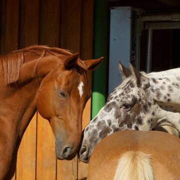
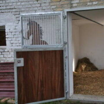
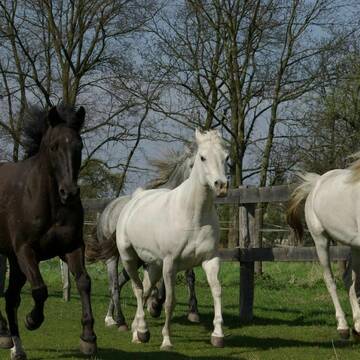
Offenstallplätze / Paddock Trail Plätze frei
Trebbin
Pferdehof Glau GmbH
@Pferdehof-Glau
FN-Mitglied
Freizeitstall
Hunde willkommen
Krankenbox
Allergikerstall
Hufrehe geeignet
Bewegungsstall
Laufstall
24 weitere...
S
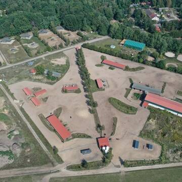
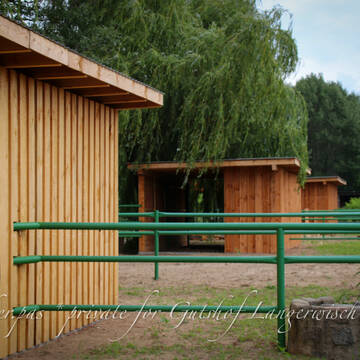
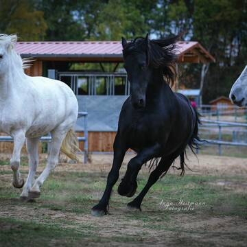
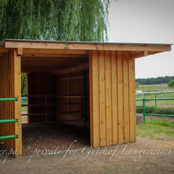
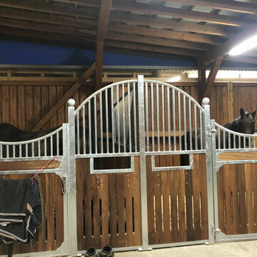
7 goldenen Sterne LAG Stall - Gutshof Langerwisch
Michendorf
Karin-Bildt
@Karin-Bildt
FN-Mitglied
Freizeitstall
Hunde willkommen
Krankenbox
Allergikerstall
Gnadenbrothof
Außenbox mit Paddock
Bewegungsstall
34 weitere...
S
Deprecated: Creation of dynamic property Zend_View_Helper_Ads::$adLink is deprecated in /var/www/stall-frei/htdocs/staging.stall-frei.de/library/Psf/View/Helper/Ads.php on line 108

Futtersack HeuToy, Fressbremse in pink
Mechtersen
STALL-FREIde Marketing
@STALL-FREI-Marketing
Stundenlange Beschäftigung die
Koliken vorbeugt, geringe Staubinhalation mit
steuerbarer Futterentnahme


Familiärer HIT -Aktivstall mit viel Platz
Ludwigsfelde
Dr Katrin Kaufmann
@Juetchendorf
Freizeitstall
VFD-Mitglied
Hunde willkommen
Krankenbox
Notfallboxen
Bewegungsstall
Offenstall
10 weitere...
P+
Therapiestall der besonderen Art für Mensch &...
Trebbin
Claudia-Babst
@Claudia-Babst
Rehabilitationsstall
Reitlehrer und -unterricht
Vermieten
Hunde willkommen
Krankenbox
Allergikerstall
Einhornhaltung möglich
19 weitere...
P+

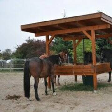
Freie Plätze im Offenstall
Trebbin
Reitstall im Naturpark
@Reitstall-Stangenhagen
Wanderreiten
Vermieten
Hunde willkommen
Krankenbox
Notfallboxen
19 weitere...
neu
P


Aktivtrail Offenstall Pferdeparadies
Dallgow-Döberitz
Christina Schwandt
@Therapiehof_Schwandt
Freizeitstall
Pferdeausbildung
Vermieten
Hunde willkommen
Krankenbox
Fohlenaufzucht möglich
Hufrehe geeignet
23 weitere...
S


Reiterhof Schenkenhorst / Boxen/ Allergikerstall
Stahnsdorf / OT Schenkenhorst
Reiterhof Schenkenhorst
@ReiterhofSchenkenhorst
FN-Mitglied
Freizeitstall
Vermieten
Verpachten
Führanlage
Hunde willkommen
Allergikerstall
28 weitere...
P+

Das Beste für die Hufe
Mechtersen
STALL-FREIde Marketing
@STALL-FREI-Marketing
Hufschmiede und Hufpfleger in Ihrer Nähe
PS-Aktivstall
Nuthetal
PS-Aktivstall-Nudow-GbR
@PS-Aktivstall-Nudow-GbR
Freizeitstall
Geländestrecke
Laufband
Paddock
Bewegungsstall
Laufstall
HIT-Aktivstall
HIT-Offenstall
15 weitere...
P
Pferdegarten La Fourille- Platz für Vollblutarab...
Nuthetal-Nudow
Pferdegarten La Fourille
@Pferdegarten-La-Fourille
Freizeitstall
Gastronomie
Vermieten
Paddock
Pensions- und Gastboxen
Zuchtstutenhaltung möglich
15 weitere...
P
Der Schäferhof - Boxen- und Offenstallplätze fre...
Brandenburg
Der Schäferhof
@Der Schäferhof
FN-Mitglied
Gangpferdereiten
Vermieten
Longierzirkel/Roundpen
Paddock
Außenboxen
Bewegungsstall
20 weitere...
P
Deprecated: Creation of dynamic property Zend_View::$pageCount is deprecated in /var/www/stall-frei/htdocs/staging.stall-frei.de/library/vendor/shardj/zf1-future/library/Zend/View/Abstract.php on line 308
Deprecated: Creation of dynamic property Zend_View::$itemCountPerPage is deprecated in /var/www/stall-frei/htdocs/staging.stall-frei.de/library/vendor/shardj/zf1-future/library/Zend/View/Abstract.php on line 308
Deprecated: Creation of dynamic property Zend_View::$first is deprecated in /var/www/stall-frei/htdocs/staging.stall-frei.de/library/vendor/shardj/zf1-future/library/Zend/View/Abstract.php on line 308
Deprecated: Creation of dynamic property Zend_View::$current is deprecated in /var/www/stall-frei/htdocs/staging.stall-frei.de/library/vendor/shardj/zf1-future/library/Zend/View/Abstract.php on line 308
Deprecated: Creation of dynamic property Zend_View::$last is deprecated in /var/www/stall-frei/htdocs/staging.stall-frei.de/library/vendor/shardj/zf1-future/library/Zend/View/Abstract.php on line 308
Deprecated: Creation of dynamic property Zend_View::$next is deprecated in /var/www/stall-frei/htdocs/staging.stall-frei.de/library/vendor/shardj/zf1-future/library/Zend/View/Abstract.php on line 308
Deprecated: Creation of dynamic property Zend_View::$pagesInRange is deprecated in /var/www/stall-frei/htdocs/staging.stall-frei.de/library/vendor/shardj/zf1-future/library/Zend/View/Abstract.php on line 308
Deprecated: Creation of dynamic property Zend_View::$firstPageInRange is deprecated in /var/www/stall-frei/htdocs/staging.stall-frei.de/library/vendor/shardj/zf1-future/library/Zend/View/Abstract.php on line 308
Deprecated: Creation of dynamic property Zend_View::$lastPageInRange is deprecated in /var/www/stall-frei/htdocs/staging.stall-frei.de/library/vendor/shardj/zf1-future/library/Zend/View/Abstract.php on line 308
Deprecated: Creation of dynamic property Zend_View::$currentItemCount is deprecated in /var/www/stall-frei/htdocs/staging.stall-frei.de/library/vendor/shardj/zf1-future/library/Zend/View/Abstract.php on line 308
Deprecated: Creation of dynamic property Zend_View::$totalItemCount is deprecated in /var/www/stall-frei/htdocs/staging.stall-frei.de/library/vendor/shardj/zf1-future/library/Zend/View/Abstract.php on line 308
Deprecated: Creation of dynamic property Zend_View::$firstItemNumber is deprecated in /var/www/stall-frei/htdocs/staging.stall-frei.de/library/vendor/shardj/zf1-future/library/Zend/View/Abstract.php on line 308
Deprecated: Creation of dynamic property Zend_View::$lastItemNumber is deprecated in /var/www/stall-frei/htdocs/staging.stall-frei.de/library/vendor/shardj/zf1-future/library/Zend/View/Abstract.php on line 308
Deprecated: Creation of dynamic property Zend_View::$router is deprecated in /var/www/stall-frei/htdocs/staging.stall-frei.de/library/vendor/shardj/zf1-future/library/Zend/View/Abstract.php on line 308
Deprecated: Creation of dynamic property Zend_View::$urlParams is deprecated in /var/www/stall-frei/htdocs/staging.stall-frei.de/library/vendor/shardj/zf1-future/library/Zend/View/Abstract.php on line 308
Deprecated: Creation of dynamic property Zend_View::$showAds is deprecated in /var/www/stall-frei/htdocs/staging.stall-frei.de/library/vendor/shardj/zf1-future/library/Zend/View/Abstract.php on line 308
Deprecated: Creation of dynamic property Zend_View::$objectIds is deprecated in /var/www/stall-frei/htdocs/staging.stall-frei.de/library/vendor/shardj/zf1-future/library/Zend/View/Abstract.php on line 308
Deprecated: Creation of dynamic property Zend_View::$showNavbar is deprecated in /var/www/stall-frei/htdocs/staging.stall-frei.de/library/vendor/shardj/zf1-future/library/Zend/View/Abstract.php on line 308
Deprecated: Creation of dynamic property Zend_View::$showBreadcrumb is deprecated in /var/www/stall-frei/htdocs/staging.stall-frei.de/library/vendor/shardj/zf1-future/library/Zend/View/Abstract.php on line 308
Deprecated: Creation of dynamic property Zend_View::$showFooter is deprecated in /var/www/stall-frei/htdocs/staging.stall-frei.de/library/vendor/shardj/zf1-future/library/Zend/View/Abstract.php on line 308
Deprecated: Creation of dynamic property Zend_View::$showInternalAds is deprecated in /var/www/stall-frei/htdocs/staging.stall-frei.de/library/vendor/shardj/zf1-future/library/Zend/View/Abstract.php on line 308
Deprecated: Creation of dynamic property Zend_View::$blNoContent is deprecated in /var/www/stall-frei/htdocs/staging.stall-frei.de/library/vendor/shardj/zf1-future/library/Zend/View/Abstract.php on line 308
Deprecated: Creation of dynamic property Zend_View::$sMetaDesc is deprecated in /var/www/stall-frei/htdocs/staging.stall-frei.de/library/vendor/shardj/zf1-future/library/Zend/View/Abstract.php on line 308
Deprecated: Creation of dynamic property Zend_View::$useGmaps is deprecated in /var/www/stall-frei/htdocs/staging.stall-frei.de/library/vendor/shardj/zf1-future/library/Zend/View/Abstract.php on line 308
Deprecated: Creation of dynamic property Zend_View::$touches is deprecated in /var/www/stall-frei/htdocs/staging.stall-frei.de/library/vendor/shardj/zf1-future/library/Zend/View/Abstract.php on line 308
Deprecated: Creation of dynamic property Zend_View::$oProject is deprecated in /var/www/stall-frei/htdocs/staging.stall-frei.de/library/vendor/shardj/zf1-future/library/Zend/View/Abstract.php on line 308
Deprecated: Creation of dynamic property Zend_View::$pageHeadline is deprecated in /var/www/stall-frei/htdocs/staging.stall-frei.de/library/vendor/shardj/zf1-future/library/Zend/View/Abstract.php on line 308
Deprecated: Creation of dynamic property Zend_View::$disableLocationField is deprecated in /var/www/stall-frei/htdocs/staging.stall-frei.de/library/vendor/shardj/zf1-future/library/Zend/View/Abstract.php on line 308
Deprecated: Creation of dynamic property Zend_View::$isSearch is deprecated in /var/www/stall-frei/htdocs/staging.stall-frei.de/library/vendor/shardj/zf1-future/library/Zend/View/Abstract.php on line 308
Deprecated: Creation of dynamic property Zend_View::$pageTitle is deprecated in /var/www/stall-frei/htdocs/staging.stall-frei.de/library/vendor/shardj/zf1-future/library/Zend/View/Abstract.php on line 308
Deprecated: Creation of dynamic property Psf_Form_Element_Text::$class is deprecated in /var/www/stall-frei/htdocs/staging.stall-frei.de/library/vendor/shardj/zf1-future/library/Zend/Form/Element.php on line 874
Deprecated: Creation of dynamic property Psf_Form_Element_Text::$size is deprecated in /var/www/stall-frei/htdocs/staging.stall-frei.de/library/vendor/shardj/zf1-future/library/Zend/Form/Element.php on line 874
Deprecated: Creation of dynamic property Psf_Form_Element_Text::$placeholder is deprecated in /var/www/stall-frei/htdocs/staging.stall-frei.de/library/vendor/shardj/zf1-future/library/Zend/Form/Element.php on line 874
Deprecated: Creation of dynamic property Psf_Form_Element_Hidden::$class is deprecated in /var/www/stall-frei/htdocs/staging.stall-frei.de/library/vendor/shardj/zf1-future/library/Zend/Form/Element.php on line 874
Deprecated: Creation of dynamic property Psf_Form_Element_Hidden::$class is deprecated in /var/www/stall-frei/htdocs/staging.stall-frei.de/library/vendor/shardj/zf1-future/library/Zend/Form/Element.php on line 874
Deprecated: Creation of dynamic property Psf_Form_Element_Hidden::$class is deprecated in /var/www/stall-frei/htdocs/staging.stall-frei.de/library/vendor/shardj/zf1-future/library/Zend/Form/Element.php on line 874
Deprecated: Creation of dynamic property Psf_Form_Element_Hidden::$class is deprecated in /var/www/stall-frei/htdocs/staging.stall-frei.de/library/vendor/shardj/zf1-future/library/Zend/Form/Element.php on line 874
Deprecated: Creation of dynamic property Psf_Form_Element_Select::$class is deprecated in /var/www/stall-frei/htdocs/staging.stall-frei.de/library/vendor/shardj/zf1-future/library/Zend/Form/Element.php on line 874
Deprecated: Creation of dynamic property Psf_Form_Element_Select::$class is deprecated in /var/www/stall-frei/htdocs/staging.stall-frei.de/library/vendor/shardj/zf1-future/library/Zend/Form/Element.php on line 874
Deprecated: Creation of dynamic property Psf_Form_Element_Select::$class is deprecated in /var/www/stall-frei/htdocs/staging.stall-frei.de/library/vendor/shardj/zf1-future/library/Zend/Form/Element.php on line 874
Deprecated: Creation of dynamic property Psf_Form_Element_Select::$class is deprecated in /var/www/stall-frei/htdocs/staging.stall-frei.de/library/vendor/shardj/zf1-future/library/Zend/Form/Element.php on line 874
Deprecated: Creation of dynamic property Psf_Form_Element_Text::$class is deprecated in /var/www/stall-frei/htdocs/staging.stall-frei.de/library/vendor/shardj/zf1-future/library/Zend/Form/Element.php on line 874
Deprecated: Creation of dynamic property Psf_Form_Element_Checkbox::$label is deprecated in /var/www/stall-frei/htdocs/staging.stall-frei.de/library/vendor/shardj/zf1-future/library/Zend/Form/Element.php on line 874
Deprecated: Creation of dynamic property Zend_View::$sort is deprecated in /var/www/stall-frei/htdocs/staging.stall-frei.de/library/vendor/shardj/zf1-future/library/Zend/View/Abstract.php on line 308
Deprecated: Creation of dynamic property Zend_View::$searchLocation is deprecated in /var/www/stall-frei/htdocs/staging.stall-frei.de/library/vendor/shardj/zf1-future/library/Zend/View/Abstract.php on line 308
Deprecated: Creation of dynamic property Zend_View::$locationHint is deprecated in /var/www/stall-frei/htdocs/staging.stall-frei.de/library/vendor/shardj/zf1-future/library/Zend/View/Abstract.php on line 308
Psf_GeoCoder_Abstract::getLocation: Breite Get Location CachedOrLive
Psf_GeoCoder_Abstract::getCachedOrLive: Breite
Psf_GeoCoder_OpenCageData::makeApiRequest: response:
Array
(
[documentation] => https://opencagedata.com/api
[licenses] => Array
(
[0] => Array
(
[name] => see attribution guide
[url] => https://opencagedata.com/credits
)
)
[results] => Array
(
[0] => Array
(
[bounds] => Array
(
[northeast] => Array
(
[lat] => 52.2555898
[lng] => 13.1285973
)
[southwest] => Array
(
[lat] => 52.2155898
[lng] => 13.0885973
)
)
[components] => Array
(
[ISO_3166-1_alpha-2] => DE
[ISO_3166-1_alpha-3] => DEU
[ISO_3166-2] => Array
(
[0] => DE-BB
)
[_category] => place
[_normalized_city] => Michendorf
[_type] => hamlet
[city] => Michendorf
[continent] => Europe
[country] => Deutschland
[country_code] => de
[county] => Potsdam-Mittelmark
[hamlet] => Gut Breite
[political_union] => European Union
[state] => Brandenburg
[state_code] => BB
[village] => Stücken
)
[confidence] => 7
[formatted] => Gut Breite, Stücken, Brandenburg, Deutschland
[geometry] => Array
(
[lat] => 52.2355898
[lng] => 13.1085973
)
)
[1] => Array
(
[bounds] => Array
(
[northeast] => Array
(
[lat] => 51.0091306
[lng] => 7.1964333
)
[southwest] => Array
(
[lat] => 50.9691306
[lng] => 7.1564333
)
)
[components] => Array
(
[ISO_3166-1_alpha-2] => DE
[ISO_3166-1_alpha-3] => DEU
[ISO_3166-2] => Array
(
[0] => DE-NW
)
[_category] => place
[_normalized_city] => Bergisch Gladbach
[_type] => hamlet
[city] => Bergisch Gladbach
[continent] => Europe
[country] => Deutschland
[country_code] => de
[county] => Rheinisch-Bergischer Kreis
[hamlet] => Breite
[political_union] => European Union
[postcode] => 51429
[state] => Nordrhein-Westfalen
[state_code] => NW
)
[confidence] => 7
[formatted] => Breite, 51429 Bergisch Gladbach, Deutschland
[geometry] => Array
(
[lat] => 50.9891306
[lng] => 7.1764333
)
)
[2] => Array
(
[bounds] => Array
(
[northeast] => Array
(
[lat] => 48.215891
[lng] => 7.9478585
)
[southwest] => Array
(
[lat] => 48.175891
[lng] => 7.9078585
)
)
[components] => Array
(
[ISO_3166-1_alpha-2] => DE
[ISO_3166-1_alpha-3] => DEU
[ISO_3166-2] => Array
(
[0] => DE-BW
)
[_category] => place
[_normalized_city] => Freiamt
[_type] => hamlet
[continent] => Europe
[country] => Deutschland
[country_code] => de
[county] => Landkreis Emmendingen
[hamlet] => Breite
[municipality] => Freiamt
[political_union] => European Union
[postcode] => 79348
[state] => Baden-Württemberg
[state_code] => BW
)
[confidence] => 7
[formatted] => Breite, 79348 Freiamt, Deutschland
[geometry] => Array
(
[lat] => 48.195891
[lng] => 7.9278585
)
)
[3] => Array
(
[bounds] => Array
(
[northeast] => Array
(
[lat] => 48.1704151
[lng] => 7.7605985
)
[southwest] => Array
(
[lat] => 48.1304151
[lng] => 7.7205985
)
)
[components] => Array
(
[ISO_3166-1_alpha-2] => DE
[ISO_3166-1_alpha-3] => DEU
[ISO_3166-2] => Array
(
[0] => DE-BW
)
[_category] => place
[_normalized_city] => Riegel am Kaiserstuhl
[_type] => hamlet
[continent] => Europe
[country] => Deutschland
[country_code] => de
[county] => Landkreis Emmendingen
[hamlet] => Breite
[municipality] => GVV Nördlicher Kaiserstuhl
[political_union] => European Union
[postcode] => 79359
[state] => Baden-Württemberg
[state_code] => BW
[village] => Riegel am Kaiserstuhl
)
[confidence] => 7
[formatted] => Breite, 79359 Riegel am Kaiserstuhl, Deutschland
[geometry] => Array
(
[lat] => 48.1504151
[lng] => 7.7405985
)
)
[4] => Array
(
[bounds] => Array
(
[northeast] => Array
(
[lat] => 54.4430188
[lng] => 13.1489687
)
[southwest] => Array
(
[lat] => 54.4429188
[lng] => 13.1488687
)
)
[components] => Array
(
[ISO_3166-1_alpha-2] => DE
[ISO_3166-1_alpha-3] => DEU
[ISO_3166-2] => Array
(
[0] => DE-MV
)
[_category] => natural/water
[_normalized_city] => Küstengewässer einschließlich Anteil am Festlandsockel
[_type] => water
[city] => Küstengewässer einschließlich Anteil am Festlandsockel
[continent] => Europe
[country] => Deutschland
[country_code] => de
[political_union] => European Union
[state] => Mecklenburg-Vorpommern
[state_code] => MV
[water] => Breite
)
[confidence] => 9
[formatted] => Breite, Küstengewässer einschließlich Anteil am Festlandsockel, Mecklenburg-Vorpommern, Deutschland
[geometry] => Array
(
[lat] => 54.4429688
[lng] => 13.1489187
)
)
[5] => Array
(
[bounds] => Array
(
[northeast] => Array
(
[lat] => 48.2503518
[lng] => 8.5040166
)
[southwest] => Array
(
[lat] => 48.2502518
[lng] => 8.5039166
)
)
[components] => Array
(
[ISO_3166-1_alpha-2] => DE
[ISO_3166-1_alpha-3] => DEU
[ISO_3166-2] => Array
(
[0] => DE-BW
)
[_category] => building
[_normalized_city] => Dunningen
[_type] => building
[city] => Dunningen
[continent] => Europe
[country] => Deutschland
[country_code] => de
[county] => Landkreis Rottweil
[isolated_dwelling] => Breite
[municipality] => VVG der Gemeinde Dunningen
[political_union] => European Union
[postcode] => 78655
[state] => Baden-Württemberg
[state_code] => BW
)
[confidence] => 10
[formatted] => Breite, 78655 Dunningen, Deutschland
[geometry] => Array
(
[lat] => 48.2503018
[lng] => 8.5039666
)
)
[6] => Array
(
[bounds] => Array
(
[northeast] => Array
(
[lat] => 48.4408825
[lng] => 9.9716825
)
[southwest] => Array
(
[lat] => 48.4407825
[lng] => 9.9715825
)
)
[components] => Array
(
[ISO_3166-1_alpha-2] => DE
[ISO_3166-1_alpha-3] => DEU
[ISO_3166-2] => Array
(
[0] => DE-BW
)
[_category] => building
[_normalized_city] => Ulm
[_type] => building
[city] => Ulm
[continent] => Europe
[country] => Deutschland
[country_code] => de
[isolated_dwelling] => Breite
[political_union] => European Union
[postcode] => 89081
[state] => Baden-Württemberg
[state_code] => BW
[village] => Lehr
)
[confidence] => 10
[formatted] => Breite, 89081 Lehr, Deutschland
[geometry] => Array
(
[lat] => 48.4408325
[lng] => 9.9716325
)
)
[7] => Array
(
[bounds] => Array
(
[northeast] => Array
(
[lat] => 47.7983314
[lng] => 9.8463749
)
[southwest] => Array
(
[lat] => 47.7982314
[lng] => 9.8462749
)
)
[components] => Array
(
[ISO_3166-1_alpha-2] => DE
[ISO_3166-1_alpha-3] => DEU
[ISO_3166-2] => Array
(
[0] => DE-BW
)
[_category] => building
[_normalized_city] => Kißlegg
[_type] => building
[city] => Kißlegg
[continent] => Europe
[country] => Deutschland
[country_code] => de
[county] => Landkreis Ravensburg
[hamlet] => Matzenweiler
[isolated_dwelling] => Breite
[political_union] => European Union
[postcode] => 88353
[state] => Baden-Württemberg
[state_code] => BW
)
[confidence] => 10
[formatted] => Breite, Matzenweiler, 88353 Kißlegg, Deutschland
[geometry] => Array
(
[lat] => 47.7982814
[lng] => 9.8463249
)
)
[8] => Array
(
[bounds] => Array
(
[northeast] => Array
(
[lat] => 54.4372286
[lng] => 13.139914
)
[southwest] => Array
(
[lat] => 54.4371286
[lng] => 13.139814
)
)
[components] => Array
(
[ISO_3166-1_alpha-2] => DE
[ISO_3166-1_alpha-3] => DEU
[ISO_3166-2] => Array
(
[0] => DE-MV
)
[_category] => natural/water
[_normalized_city] => Küstengewässer einschließlich Anteil am Festlandsockel
[_type] => bay
[bay] => Breite
[city] => Küstengewässer einschließlich Anteil am Festlandsockel
[continent] => Europe
[country] => Deutschland
[country_code] => de
[political_union] => European Union
[state] => Mecklenburg-Vorpommern
[state_code] => MV
)
[confidence] => 9
[formatted] => Breite, Küstengewässer einschließlich Anteil am Festlandsockel, Mecklenburg-Vorpommern, Deutschland
[geometry] => Array
(
[lat] => 54.4371786
[lng] => 13.139864
)
)
[9] => Array
(
[bounds] => Array
(
[northeast] => Array
(
[lat] => 48.5421327
[lng] => 9.9501759
)
[southwest] => Array
(
[lat] => 48.5367726
[lng] => 9.9370525
)
)
[components] => Array
(
[ISO_3166-1_alpha-2] => DE
[ISO_3166-1_alpha-3] => DEU
[ISO_3166-2] => Array
(
[0] => DE-BW
)
[_category] => agriculture
[_normalized_city] => Lonsee
[_type] => farmland
[city] => Lonsee
[continent] => Europe
[country] => Deutschland
[country_code] => de
[county] => Alb-Donau-Kreis
[farmland] => Breite
[hamlet] => Sinabronn
[municipality] => GVV Lonsee-Amstetten
[political_union] => European Union
[postcode] => 89173
[state] => Baden-Württemberg
[state_code] => BW
[village] => Halzhausen
)
[confidence] => 9
[formatted] => Breite, 89173 Halzhausen, Deutschland
[geometry] => Array
(
[lat] => 48.539433
[lng] => 9.9423379
)
)
)
[status] => Array
(
[code] => 200
[message] => OK
)
[stay_informed] => Array
(
[blog] => https://blog.opencagedata.com
[mastodon] => https://en.osm.town/@opencage
)
[thanks] => For using an OpenCage API
[timestamp] => Array
(
[created_http] => Thu, 05 Feb 2026 07:21:58 GMT
[created_unix] => 1770276118
)
[total_results] => 10
)
Psf_GeoCoder_Abstract::convertLocationResult
{"documentation":"https:\/\/opencagedata.com\/api","licenses":[{"name":"see attribution guide","url":"https:\/\/opencagedata.com\/credits"}],"results":[{"bounds":{"northeast":{"lat":52.2555898,"lng":13.1285973},"southwest":{"lat":52.2155898,"lng":13.0885973}},"components":{"ISO_3166-1_alpha-2":"DE","ISO_3166-1_alpha-3":"DEU","ISO_3166-2":["DE-BB"],"_category":"place","_normalized_city":"Michendorf","_type":"hamlet","city":"Michendorf","continent":"Europe","country":"Deutschland","country_code":"de","county":"Potsdam-Mittelmark","hamlet":"Gut Breite","political_union":"European Union","state":"Brandenburg","state_code":"BB","village":"St\u00fccken"},"confidence":7,"formatted":"Gut Breite, St\u00fccken, Brandenburg, Deutschland","geometry":{"lat":52.2355898,"lng":13.1085973}},{"bounds":{"northeast":{"lat":51.0091306,"lng":7.1964333},"southwest":{"lat":50.9691306,"lng":7.1564333}},"components":{"ISO_3166-1_alpha-2":"DE","ISO_3166-1_alpha-3":"DEU","ISO_3166-2":["DE-NW"],"_category":"place","_normalized_city":"Bergisch Gladbach","_type":"hamlet","city":"Bergisch Gladbach","continent":"Europe","country":"Deutschland","country_code":"de","county":"Rheinisch-Bergischer Kreis","hamlet":"Breite","political_union":"European Union","postcode":"51429","state":"Nordrhein-Westfalen","state_code":"NW"},"confidence":7,"formatted":"Breite, 51429 Bergisch Gladbach, Deutschland","geometry":{"lat":50.9891306,"lng":7.1764333}},{"bounds":{"northeast":{"lat":48.215891,"lng":7.9478585},"southwest":{"lat":48.175891,"lng":7.9078585}},"components":{"ISO_3166-1_alpha-2":"DE","ISO_3166-1_alpha-3":"DEU","ISO_3166-2":["DE-BW"],"_category":"place","_normalized_city":"Freiamt","_type":"hamlet","continent":"Europe","country":"Deutschland","country_code":"de","county":"Landkreis Emmendingen","hamlet":"Breite","municipality":"Freiamt","political_union":"European Union","postcode":"79348","state":"Baden-W\u00fcrttemberg","state_code":"BW"},"confidence":7,"formatted":"Breite, 79348 Freiamt, Deutschland","geometry":{"lat":48.195891,"lng":7.9278585}},{"bounds":{"northeast":{"lat":48.1704151,"lng":7.7605985},"southwest":{"lat":48.1304151,"lng":7.7205985}},"components":{"ISO_3166-1_alpha-2":"DE","ISO_3166-1_alpha-3":"DEU","ISO_3166-2":["DE-BW"],"_category":"place","_normalized_city":"Riegel am Kaiserstuhl","_type":"hamlet","continent":"Europe","country":"Deutschland","country_code":"de","county":"Landkreis Emmendingen","hamlet":"Breite","municipality":"GVV N\u00f6rdlicher Kaiserstuhl","political_union":"European Union","postcode":"79359","state":"Baden-W\u00fcrttemberg","state_code":"BW","village":"Riegel am Kaiserstuhl"},"confidence":7,"formatted":"Breite, 79359 Riegel am Kaiserstuhl, Deutschland","geometry":{"lat":48.1504151,"lng":7.7405985}},{"bounds":{"northeast":{"lat":54.4430188,"lng":13.1489687},"southwest":{"lat":54.4429188,"lng":13.1488687}},"components":{"ISO_3166-1_alpha-2":"DE","ISO_3166-1_alpha-3":"DEU","ISO_3166-2":["DE-MV"],"_category":"natural\/water","_normalized_city":"K\u00fcstengew\u00e4sser einschlie\u00dflich Anteil am Festlandsockel","_type":"water","city":"K\u00fcstengew\u00e4sser einschlie\u00dflich Anteil am Festlandsockel","continent":"Europe","country":"Deutschland","country_code":"de","political_union":"European Union","state":"Mecklenburg-Vorpommern","state_code":"MV","water":"Breite"},"confidence":9,"formatted":"Breite, K\u00fcstengew\u00e4sser einschlie\u00dflich Anteil am Festlandsockel, Mecklenburg-Vorpommern, Deutschland","geometry":{"lat":54.4429688,"lng":13.1489187}},{"bounds":{"northeast":{"lat":48.2503518,"lng":8.5040166},"southwest":{"lat":48.2502518,"lng":8.5039166}},"components":{"ISO_3166-1_alpha-2":"DE","ISO_3166-1_alpha-3":"DEU","ISO_3166-2":["DE-BW"],"_category":"building","_normalized_city":"Dunningen","_type":"building","city":"Dunningen","continent":"Europe","country":"Deutschland","country_code":"de","county":"Landkreis Rottweil","isolated_dwelling":"Breite","municipality":"VVG der Gemeinde Dunningen","political_union":"European Union","postcode":"78655","state":"Baden-W\u00fcrttemberg","state_code":"BW"},"confidence":10,"formatted":"Breite, 78655 Dunningen, Deutschland","geometry":{"lat":48.2503018,"lng":8.5039666}},{"bounds":{"northeast":{"lat":48.4408825,"lng":9.9716825},"southwest":{"lat":48.4407825,"lng":9.9715825}},"components":{"ISO_3166-1_alpha-2":"DE","ISO_3166-1_alpha-3":"DEU","ISO_3166-2":["DE-BW"],"_category":"building","_normalized_city":"Ulm","_type":"building","city":"Ulm","continent":"Europe","country":"Deutschland","country_code":"de","isolated_dwelling":"Breite","political_union":"European Union","postcode":"89081","state":"Baden-W\u00fcrttemberg","state_code":"BW","village":"Lehr"},"confidence":10,"formatted":"Breite, 89081 Lehr, Deutschland","geometry":{"lat":48.4408325,"lng":9.9716325}},{"bounds":{"northeast":{"lat":47.7983314,"lng":9.8463749},"southwest":{"lat":47.7982314,"lng":9.8462749}},"components":{"ISO_3166-1_alpha-2":"DE","ISO_3166-1_alpha-3":"DEU","ISO_3166-2":["DE-BW"],"_category":"building","_normalized_city":"Ki\u00dflegg","_type":"building","city":"Ki\u00dflegg","continent":"Europe","country":"Deutschland","country_code":"de","county":"Landkreis Ravensburg","hamlet":"Matzenweiler","isolated_dwelling":"Breite","political_union":"European Union","postcode":"88353","state":"Baden-W\u00fcrttemberg","state_code":"BW"},"confidence":10,"formatted":"Breite, Matzenweiler, 88353 Ki\u00dflegg, Deutschland","geometry":{"lat":47.7982814,"lng":9.8463249}},{"bounds":{"northeast":{"lat":54.4372286,"lng":13.139914},"southwest":{"lat":54.4371286,"lng":13.139814}},"components":{"ISO_3166-1_alpha-2":"DE","ISO_3166-1_alpha-3":"DEU","ISO_3166-2":["DE-MV"],"_category":"natural\/water","_normalized_city":"K\u00fcstengew\u00e4sser einschlie\u00dflich Anteil am Festlandsockel","_type":"bay","bay":"Breite","city":"K\u00fcstengew\u00e4sser einschlie\u00dflich Anteil am Festlandsockel","continent":"Europe","country":"Deutschland","country_code":"de","political_union":"European Union","state":"Mecklenburg-Vorpommern","state_code":"MV"},"confidence":9,"formatted":"Breite, K\u00fcstengew\u00e4sser einschlie\u00dflich Anteil am Festlandsockel, Mecklenburg-Vorpommern, Deutschland","geometry":{"lat":54.4371786,"lng":13.139864}},{"bounds":{"northeast":{"lat":48.5421327,"lng":9.9501759},"southwest":{"lat":48.5367726,"lng":9.9370525}},"components":{"ISO_3166-1_alpha-2":"DE","ISO_3166-1_alpha-3":"DEU","ISO_3166-2":["DE-BW"],"_category":"agriculture","_normalized_city":"Lonsee","_type":"farmland","city":"Lonsee","continent":"Europe","country":"Deutschland","country_code":"de","county":"Alb-Donau-Kreis","farmland":"Breite","hamlet":"Sinabronn","municipality":"GVV Lonsee-Amstetten","political_union":"European Union","postcode":"89173","state":"Baden-W\u00fcrttemberg","state_code":"BW","village":"Halzhausen"},"confidence":9,"formatted":"Breite, 89173 Halzhausen, Deutschland","geometry":{"lat":48.539433,"lng":9.9423379}}],"status":{"code":200,"message":"OK"},"stay_informed":{"blog":"https:\/\/blog.opencagedata.com","mastodon":"https:\/\/en.osm.town\/@opencage"},"thanks":"For using an OpenCage API","timestamp":{"created_http":"Thu, 05 Feb 2026 07:21:58 GMT","created_unix":1770276118},"total_results":10}Array
(
[0] => stdClass Object
(
[bounds] => stdClass Object
(
[northeast] => stdClass Object
(
[lat] => 52.2555898
[lng] => 13.1285973
)
[southwest] => stdClass Object
(
[lat] => 52.2155898
[lng] => 13.0885973
)
)
[components] => stdClass Object
(
[ISO_3166-1_alpha-2] => DE
[ISO_3166-1_alpha-3] => DEU
[ISO_3166-2] => Array
(
[0] => DE-BB
)
[_category] => place
[_normalized_city] => Michendorf
[_type] => hamlet
[city] => Michendorf
[continent] => Europe
[country] => Deutschland
[country_code] => de
[county] => Potsdam-Mittelmark
[hamlet] => Gut Breite
[political_union] => European Union
[state] => Brandenburg
[state_code] => BB
[village] => Stücken
)
[confidence] => 7
[formatted] => Gut Breite, Stücken, Brandenburg, Deutschland
[geometry] => stdClass Object
(
[lat] => 52.2355898
[lng] => 13.1085973
)
)
[1] => stdClass Object
(
[bounds] => stdClass Object
(
[northeast] => stdClass Object
(
[lat] => 51.0091306
[lng] => 7.1964333
)
[southwest] => stdClass Object
(
[lat] => 50.9691306
[lng] => 7.1564333
)
)
[components] => stdClass Object
(
[ISO_3166-1_alpha-2] => DE
[ISO_3166-1_alpha-3] => DEU
[ISO_3166-2] => Array
(
[0] => DE-NW
)
[_category] => place
[_normalized_city] => Bergisch Gladbach
[_type] => hamlet
[city] => Bergisch Gladbach
[continent] => Europe
[country] => Deutschland
[country_code] => de
[county] => Rheinisch-Bergischer Kreis
[hamlet] => Breite
[political_union] => European Union
[postcode] => 51429
[state] => Nordrhein-Westfalen
[state_code] => NW
)
[confidence] => 7
[formatted] => Breite, 51429 Bergisch Gladbach, Deutschland
[geometry] => stdClass Object
(
[lat] => 50.9891306
[lng] => 7.1764333
)
)
[2] => stdClass Object
(
[bounds] => stdClass Object
(
[northeast] => stdClass Object
(
[lat] => 48.215891
[lng] => 7.9478585
)
[southwest] => stdClass Object
(
[lat] => 48.175891
[lng] => 7.9078585
)
)
[components] => stdClass Object
(
[ISO_3166-1_alpha-2] => DE
[ISO_3166-1_alpha-3] => DEU
[ISO_3166-2] => Array
(
[0] => DE-BW
)
[_category] => place
[_normalized_city] => Freiamt
[_type] => hamlet
[continent] => Europe
[country] => Deutschland
[country_code] => de
[county] => Landkreis Emmendingen
[hamlet] => Breite
[municipality] => Freiamt
[political_union] => European Union
[postcode] => 79348
[state] => Baden-Württemberg
[state_code] => BW
)
[confidence] => 7
[formatted] => Breite, 79348 Freiamt, Deutschland
[geometry] => stdClass Object
(
[lat] => 48.195891
[lng] => 7.9278585
)
)
[3] => stdClass Object
(
[bounds] => stdClass Object
(
[northeast] => stdClass Object
(
[lat] => 48.1704151
[lng] => 7.7605985
)
[southwest] => stdClass Object
(
[lat] => 48.1304151
[lng] => 7.7205985
)
)
[components] => stdClass Object
(
[ISO_3166-1_alpha-2] => DE
[ISO_3166-1_alpha-3] => DEU
[ISO_3166-2] => Array
(
[0] => DE-BW
)
[_category] => place
[_normalized_city] => Riegel am Kaiserstuhl
[_type] => hamlet
[continent] => Europe
[country] => Deutschland
[country_code] => de
[county] => Landkreis Emmendingen
[hamlet] => Breite
[municipality] => GVV Nördlicher Kaiserstuhl
[political_union] => European Union
[postcode] => 79359
[state] => Baden-Württemberg
[state_code] => BW
[village] => Riegel am Kaiserstuhl
)
[confidence] => 7
[formatted] => Breite, 79359 Riegel am Kaiserstuhl, Deutschland
[geometry] => stdClass Object
(
[lat] => 48.1504151
[lng] => 7.7405985
)
)
[4] => stdClass Object
(
[bounds] => stdClass Object
(
[northeast] => stdClass Object
(
[lat] => 54.4430188
[lng] => 13.1489687
)
[southwest] => stdClass Object
(
[lat] => 54.4429188
[lng] => 13.1488687
)
)
[components] => stdClass Object
(
[ISO_3166-1_alpha-2] => DE
[ISO_3166-1_alpha-3] => DEU
[ISO_3166-2] => Array
(
[0] => DE-MV
)
[_category] => natural/water
[_normalized_city] => Küstengewässer einschließlich Anteil am Festlandsockel
[_type] => water
[city] => Küstengewässer einschließlich Anteil am Festlandsockel
[continent] => Europe
[country] => Deutschland
[country_code] => de
[political_union] => European Union
[state] => Mecklenburg-Vorpommern
[state_code] => MV
[water] => Breite
)
[confidence] => 9
[formatted] => Breite, Küstengewässer einschließlich Anteil am Festlandsockel, Mecklenburg-Vorpommern, Deutschland
[geometry] => stdClass Object
(
[lat] => 54.4429688
[lng] => 13.1489187
)
)
[5] => stdClass Object
(
[bounds] => stdClass Object
(
[northeast] => stdClass Object
(
[lat] => 48.2503518
[lng] => 8.5040166
)
[southwest] => stdClass Object
(
[lat] => 48.2502518
[lng] => 8.5039166
)
)
[components] => stdClass Object
(
[ISO_3166-1_alpha-2] => DE
[ISO_3166-1_alpha-3] => DEU
[ISO_3166-2] => Array
(
[0] => DE-BW
)
[_category] => building
[_normalized_city] => Dunningen
[_type] => building
[city] => Dunningen
[continent] => Europe
[country] => Deutschland
[country_code] => de
[county] => Landkreis Rottweil
[isolated_dwelling] => Breite
[municipality] => VVG der Gemeinde Dunningen
[political_union] => European Union
[postcode] => 78655
[state] => Baden-Württemberg
[state_code] => BW
)
[confidence] => 10
[formatted] => Breite, 78655 Dunningen, Deutschland
[geometry] => stdClass Object
(
[lat] => 48.2503018
[lng] => 8.5039666
)
)
[6] => stdClass Object
(
[bounds] => stdClass Object
(
[northeast] => stdClass Object
(
[lat] => 48.4408825
[lng] => 9.9716825
)
[southwest] => stdClass Object
(
[lat] => 48.4407825
[lng] => 9.9715825
)
)
[components] => stdClass Object
(
[ISO_3166-1_alpha-2] => DE
[ISO_3166-1_alpha-3] => DEU
[ISO_3166-2] => Array
(
[0] => DE-BW
)
[_category] => building
[_normalized_city] => Ulm
[_type] => building
[city] => Ulm
[continent] => Europe
[country] => Deutschland
[country_code] => de
[isolated_dwelling] => Breite
[political_union] => European Union
[postcode] => 89081
[state] => Baden-Württemberg
[state_code] => BW
[village] => Lehr
)
[confidence] => 10
[formatted] => Breite, 89081 Lehr, Deutschland
[geometry] => stdClass Object
(
[lat] => 48.4408325
[lng] => 9.9716325
)
)
[7] => stdClass Object
(
[bounds] => stdClass Object
(
[northeast] => stdClass Object
(
[lat] => 47.7983314
[lng] => 9.8463749
)
[southwest] => stdClass Object
(
[lat] => 47.7982314
[lng] => 9.8462749
)
)
[components] => stdClass Object
(
[ISO_3166-1_alpha-2] => DE
[ISO_3166-1_alpha-3] => DEU
[ISO_3166-2] => Array
(
[0] => DE-BW
)
[_category] => building
[_normalized_city] => Kißlegg
[_type] => building
[city] => Kißlegg
[continent] => Europe
[country] => Deutschland
[country_code] => de
[county] => Landkreis Ravensburg
[hamlet] => Matzenweiler
[isolated_dwelling] => Breite
[political_union] => European Union
[postcode] => 88353
[state] => Baden-Württemberg
[state_code] => BW
)
[confidence] => 10
[formatted] => Breite, Matzenweiler, 88353 Kißlegg, Deutschland
[geometry] => stdClass Object
(
[lat] => 47.7982814
[lng] => 9.8463249
)
)
[8] => stdClass Object
(
[bounds] => stdClass Object
(
[northeast] => stdClass Object
(
[lat] => 54.4372286
[lng] => 13.139914
)
[southwest] => stdClass Object
(
[lat] => 54.4371286
[lng] => 13.139814
)
)
[components] => stdClass Object
(
[ISO_3166-1_alpha-2] => DE
[ISO_3166-1_alpha-3] => DEU
[ISO_3166-2] => Array
(
[0] => DE-MV
)
[_category] => natural/water
[_normalized_city] => Küstengewässer einschließlich Anteil am Festlandsockel
[_type] => bay
[bay] => Breite
[city] => Küstengewässer einschließlich Anteil am Festlandsockel
[continent] => Europe
[country] => Deutschland
[country_code] => de
[political_union] => European Union
[state] => Mecklenburg-Vorpommern
[state_code] => MV
)
[confidence] => 9
[formatted] => Breite, Küstengewässer einschließlich Anteil am Festlandsockel, Mecklenburg-Vorpommern, Deutschland
[geometry] => stdClass Object
(
[lat] => 54.4371786
[lng] => 13.139864
)
)
[9] => stdClass Object
(
[bounds] => stdClass Object
(
[northeast] => stdClass Object
(
[lat] => 48.5421327
[lng] => 9.9501759
)
[southwest] => stdClass Object
(
[lat] => 48.5367726
[lng] => 9.9370525
)
)
[components] => stdClass Object
(
[ISO_3166-1_alpha-2] => DE
[ISO_3166-1_alpha-3] => DEU
[ISO_3166-2] => Array
(
[0] => DE-BW
)
[_category] => agriculture
[_normalized_city] => Lonsee
[_type] => farmland
[city] => Lonsee
[continent] => Europe
[country] => Deutschland
[country_code] => de
[county] => Alb-Donau-Kreis
[farmland] => Breite
[hamlet] => Sinabronn
[municipality] => GVV Lonsee-Amstetten
[political_union] => European Union
[postcode] => 89173
[state] => Baden-Württemberg
[state_code] => BW
[village] => Halzhausen
)
[confidence] => 9
[formatted] => Breite, 89173 Halzhausen, Deutschland
[geometry] => stdClass Object
(
[lat] => 48.539433
[lng] => 9.9423379
)
)
)
Psf_GeoCoder_OpenCageData::getKeyMap: 0
stdClass Object
(
    [bounds] => stdClass Object
        (
            [northeast] => stdClass Object
                (
                    [lat] => 52.2555898
                    [lng] => 13.1285973
                )

            [southwest] => stdClass Object
                (
                    [lat] => 52.2155898
                    [lng] => 13.0885973
                )

        )

    [components] => stdClass Object
        (
            [ISO_3166-1_alpha-2] => DE
            [ISO_3166-1_alpha-3] => DEU
            [ISO_3166-2] => Array
                (
                    [0] => DE-BB
                )

            [_category] => place
            [_normalized_city] => Michendorf
            [_type] => hamlet
            [city] => Michendorf
            [continent] => Europe
            [country] => Deutschland
            [country_code] => de
            [county] => Potsdam-Mittelmark
            [hamlet] => Gut Breite
            [political_union] => European Union
            [state] => Brandenburg
            [state_code] => BB
            [village] => Stücken
        )

    [confidence] => 7
    [formatted] => Gut Breite, Stücken, Brandenburg, Deutschland
    [geometry] => stdClass Object
        (
            [lat] => 52.2355898
            [lng] => 13.1085973
        )

)
Psf_GeoCoder_OpenCageData::getCounty: Potsdam-Mittelmark
Psf_GeoCoder_OpenCageData::addMissingData REFETCH!
Array
(
    [address] => Gut Breite, Stücken, Brandenburg, Deutschland
    [type] => hamlet
    [street] => Gut Breite
    [city] => Stücken
    [county] => Potsdam-Mittelmark
    [state] => Brandenburg
    [zip] =>
    [country] => Deutschland
    [suburb] =>
    [countrycode] => de
    [latitude] => 52.2355898
    [longitude] => 13.1085973
    [accuracy] => 1
    [confidence] => 7
    [bounds] => stdClass Object
        (
            [northeast] => stdClass Object
                (
                    [lat] => 52.2555898
                    [lng] => 13.1285973
                )

            [southwest] => stdClass Object
                (
                    [lat] => 52.2155898
                    [lng] => 13.0885973
                )

        )

)
reformat!
Array
(
    [address] => Gut Breite, Stücken, Brandenburg, Deutschland
    [type] => hamlet
    [street] => Gut Breite
    [city] => Stücken
    [county] => Potsdam-Mittelmark
    [state] => Brandenburg
    [zip] =>
    [country] => Deutschland
    [suburb] =>
    [countrycode] => de
    [latitude] => 52.2355898
    [longitude] => 13.1085973
    [accuracy] => 1
    [confidence] => 7
    [bounds] => stdClass Object
        (
            [northeast] => stdClass Object
                (
                    [lat] => 52.2555898
                    [lng] => 13.1285973
                )

            [southwest] => stdClass Object
                (
                    [lat] => 52.2155898
                    [lng] => 13.0885973
                )

        )

    [place] => Gut Breite, Stücken, Brandenburg
    [hash] => 7d3a86e70b4667a5752c2c348bfe4d63
)
Psf_GeoCoder_OpenCageData::getKeyMap: 1
stdClass Object
(
    [bounds] => stdClass Object
        (
            [northeast] => stdClass Object
                (
                    [lat] => 51.0091306
                    [lng] => 7.1964333
                )

            [southwest] => stdClass Object
                (
                    [lat] => 50.9691306
                    [lng] => 7.1564333
                )

        )

    [components] => stdClass Object
        (
            [ISO_3166-1_alpha-2] => DE
            [ISO_3166-1_alpha-3] => DEU
            [ISO_3166-2] => Array
                (
                    [0] => DE-NW
                )

            [_category] => place
            [_normalized_city] => Bergisch Gladbach
            [_type] => hamlet
            [city] => Bergisch Gladbach
            [continent] => Europe
            [country] => Deutschland
            [country_code] => de
            [county] => Rheinisch-Bergischer Kreis
            [hamlet] => Breite
            [political_union] => European Union
            [postcode] => 51429
            [state] => Nordrhein-Westfalen
            [state_code] => NW
        )

    [confidence] => 7
    [formatted] => Breite, 51429 Bergisch Gladbach, Deutschland
    [geometry] => stdClass Object
        (
            [lat] => 50.9891306
            [lng] => 7.1764333
        )

)
Psf_GeoCoder_OpenCageData::getCounty: Rheinisch-Bergischer Kreis
Psf_GeoCoder_OpenCageData::addMissingData REFETCH!
Array
(
    [address] => Breite, 51429 Bergisch Gladbach, Deutschland
    [type] => hamlet
    [street] => Breite
    [city] => Bergisch Gladbach
    [county] => Rheinisch-Bergischer Kreis
    [state] => Nordrhein-Westfalen
    [zip] => 51429
    [country] => Deutschland
    [suburb] =>
    [countrycode] => de
    [latitude] => 50.9891306
    [longitude] => 7.1764333
    [accuracy] => 1
    [confidence] => 7
    [bounds] => stdClass Object
        (
            [northeast] => stdClass Object
                (
                    [lat] => 51.0091306
                    [lng] => 7.1964333
                )

            [southwest] => stdClass Object
                (
                    [lat] => 50.9691306
                    [lng] => 7.1564333
                )

        )

)
reformat!
Array
(
    [address] => Breite, 51429 Bergisch Gladbach, Deutschland
    [type] => hamlet
    [street] => Breite
    [city] => Bergisch Gladbach
    [county] => Rheinisch-Bergischer Kreis
    [state] => Nordrhein-Westfalen
    [zip] => 51429
    [country] => Deutschland
    [suburb] =>
    [countrycode] => de
    [latitude] => 50.9891306
    [longitude] => 7.1764333
    [accuracy] => 1
    [confidence] => 7
    [bounds] => stdClass Object
        (
            [northeast] => stdClass Object
                (
                    [lat] => 51.0091306
                    [lng] => 7.1964333
                )

            [southwest] => stdClass Object
                (
                    [lat] => 50.9691306
                    [lng] => 7.1564333
                )

        )

    [place] => Breite, 51429 Bergisch Gladbach, Nordrhein-Westfalen
    [hash] => 16aaaa25f671bb1ce73fb4e8f918a62d
)
Psf_GeoCoder_OpenCageData::getKeyMap: 2
stdClass Object
(
    [bounds] => stdClass Object
        (
            [northeast] => stdClass Object
                (
                    [lat] => 48.215891
                    [lng] => 7.9478585
                )

            [southwest] => stdClass Object
                (
                    [lat] => 48.175891
                    [lng] => 7.9078585
                )

        )

    [components] => stdClass Object
        (
            [ISO_3166-1_alpha-2] => DE
            [ISO_3166-1_alpha-3] => DEU
            [ISO_3166-2] => Array
                (
                    [0] => DE-BW
                )

            [_category] => place
            [_normalized_city] => Freiamt
            [_type] => hamlet
            [continent] => Europe
            [country] => Deutschland
            [country_code] => de
            [county] => Landkreis Emmendingen
            [hamlet] => Breite
            [municipality] => Freiamt
            [political_union] => European Union
            [postcode] => 79348
            [state] => Baden-Württemberg
            [state_code] => BW
        )

    [confidence] => 7
    [formatted] => Breite, 79348 Freiamt, Deutschland
    [geometry] => stdClass Object
        (
            [lat] => 48.195891
            [lng] => 7.9278585
        )

)
Psf_GeoCoder_OpenCageData::getCounty: Emmendingen
Psf_GeoCoder_OpenCageData::addMissingData REFETCH!
Array
(
    [address] => Breite, 79348 Freiamt, Deutschland
    [type] => hamlet
    [street] => Breite
    [city] =>
    [county] => Emmendingen
    [state] => Baden-Württemberg
    [zip] => 79348
    [country] => Deutschland
    [suburb] =>
    [countrycode] => de
    [latitude] => 48.195891
    [longitude] => 7.9278585
    [accuracy] => 1
    [confidence] => 7
    [bounds] => stdClass Object
        (
            [northeast] => stdClass Object
                (
                    [lat] => 48.215891
                    [lng] => 7.9478585
                )

            [southwest] => stdClass Object
                (
                    [lat] => 48.175891
                    [lng] => 7.9078585
                )

        )

)
reformat!
Array
(
    [address] => Breite, 79348 Freiamt, Deutschland
    [type] => hamlet
    [street] => Breite
    [city] =>
    [county] => Emmendingen
    [state] => Baden-Württemberg
    [zip] => 79348
    [country] => Deutschland
    [suburb] =>
    [countrycode] => de
    [latitude] => 48.195891
    [longitude] => 7.9278585
    [accuracy] => 1
    [confidence] => 7
    [bounds] => stdClass Object
        (
            [northeast] => stdClass Object
                (
                    [lat] => 48.215891
                    [lng] => 7.9478585
                )

            [southwest] => stdClass Object
                (
                    [lat] => 48.175891
                    [lng] => 7.9078585
                )

        )

    [place] => Breite, 79348 , Baden-Württemberg
    [hash] => 65811ad0e6be7f1205a76040fdfe6125
)
Psf_GeoCoder_OpenCageData::getKeyMap: 3
stdClass Object
(
    [bounds] => stdClass Object
        (
            [northeast] => stdClass Object
                (
                    [lat] => 48.1704151
                    [lng] => 7.7605985
                )

            [southwest] => stdClass Object
                (
                    [lat] => 48.1304151
                    [lng] => 7.7205985
                )

        )

    [components] => stdClass Object
        (
            [ISO_3166-1_alpha-2] => DE
            [ISO_3166-1_alpha-3] => DEU
            [ISO_3166-2] => Array
                (
                    [0] => DE-BW
                )

            [_category] => place
            [_normalized_city] => Riegel am Kaiserstuhl
            [_type] => hamlet
            [continent] => Europe
            [country] => Deutschland
            [country_code] => de
            [county] => Landkreis Emmendingen
            [hamlet] => Breite
            [municipality] => GVV Nördlicher Kaiserstuhl
            [political_union] => European Union
            [postcode] => 79359
            [state] => Baden-Württemberg
            [state_code] => BW
            [village] => Riegel am Kaiserstuhl
        )

    [confidence] => 7
    [formatted] => Breite, 79359 Riegel am Kaiserstuhl, Deutschland
    [geometry] => stdClass Object
        (
            [lat] => 48.1504151
            [lng] => 7.7405985
        )

)
Psf_GeoCoder_OpenCageData::getCounty: Emmendingen
Psf_GeoCoder_OpenCageData::addMissingData REFETCH!
Array
(
    [address] => Breite, 79359 Riegel am Kaiserstuhl, Deutschland
    [type] => hamlet
    [street] => Breite
    [city] => Riegel am Kaiserstuhl
    [county] => Emmendingen
    [state] => Baden-Württemberg
    [zip] => 79359
    [country] => Deutschland
    [suburb] =>
    [countrycode] => de
    [latitude] => 48.1504151
    [longitude] => 7.7405985
    [accuracy] => 1
    [confidence] => 7
    [bounds] => stdClass Object
        (
            [northeast] => stdClass Object
                (
                    [lat] => 48.1704151
                    [lng] => 7.7605985
                )

            [southwest] => stdClass Object
                (
                    [lat] => 48.1304151
                    [lng] => 7.7205985
                )

        )

)
reformat!
Array
(
    [address] => Breite, 79359 Riegel am Kaiserstuhl, Deutschland
    [type] => hamlet
    [street] => Breite
    [city] => Riegel am Kaiserstuhl
    [county] => Emmendingen
    [state] => Baden-Württemberg
    [zip] => 79359
    [country] => Deutschland
    [suburb] =>
    [countrycode] => de
    [latitude] => 48.1504151
    [longitude] => 7.7405985
    [accuracy] => 1
    [confidence] => 7
    [bounds] => stdClass Object
        (
            [northeast] => stdClass Object
                (
                    [lat] => 48.1704151
                    [lng] => 7.7605985
                )

            [southwest] => stdClass Object
                (
                    [lat] => 48.1304151
                    [lng] => 7.7205985
                )

        )

    [place] => Breite, 79359 Riegel am Kaiserstuhl, Baden-Württemberg
    [hash] => 5ccd237d81f3cebabbb776ae10520a0d
)
Psf_GeoCoder_OpenCageData::getKeyMap: 4
stdClass Object
(
    [bounds] => stdClass Object
        (
            [northeast] => stdClass Object
                (
                    [lat] => 54.4430188
                    [lng] => 13.1489687
                )

            [southwest] => stdClass Object
                (
                    [lat] => 54.4429188
                    [lng] => 13.1488687
                )

        )

    [components] => stdClass Object
        (
            [ISO_3166-1_alpha-2] => DE
            [ISO_3166-1_alpha-3] => DEU
            [ISO_3166-2] => Array
                (
                    [0] => DE-MV
                )

            [_category] => natural/water
            [_normalized_city] => Küstengewässer einschließlich Anteil am Festlandsockel
            [_type] => water
            [city] => Küstengewässer einschließlich Anteil am Festlandsockel
            [continent] => Europe
            [country] => Deutschland
            [country_code] => de
            [political_union] => European Union
            [state] => Mecklenburg-Vorpommern
            [state_code] => MV
            [water] => Breite
        )

    [confidence] => 9
    [formatted] => Breite, Küstengewässer einschließlich Anteil am Festlandsockel, Mecklenburg-Vorpommern, Deutschland
    [geometry] => stdClass Object
        (
            [lat] => 54.4429688
            [lng] => 13.1489187
        )

)
Psf_GeoCoder_OpenCageData::getCounty: Küstengewässer einschließlich Anteil am Festlandsockel
Psf_GeoCoder_OpenCageData::addMissingData REFETCH!
Array
(
    [address] => Breite, Küstengewässer einschließlich Anteil am Festlandsockel, Mecklenburg-Vorpommern, Deutschland
    [type] => water
    [street] =>
    [city] => Küstengewässer einschließlich Anteil am Festlandsockel
    [county] => Küstengewässer einschließlich Anteil am Festlandsockel
    [state] => Mecklenburg-Vorpommern
    [zip] =>
    [country] => Deutschland
    [suburb] =>
    [countrycode] => de
    [latitude] => 54.4429688
    [longitude] => 13.1489187
    [accuracy] => 1
    [confidence] => 9
    [bounds] => stdClass Object
        (
            [northeast] => stdClass Object
                (
                    [lat] => 54.4430188
                    [lng] => 13.1489687
                )

            [southwest] => stdClass Object
                (
                    [lat] => 54.4429188
                    [lng] => 13.1488687
                )

        )

)
reformat!
Array
(
    [address] => Breite, Küstengewässer einschließlich Anteil am Festlandsockel, Mecklenburg-Vorpommern, Deutschland
    [type] => water
    [street] =>
    [city] => Küstengewässer einschließlich Anteil am Festlandsockel
    [county] => Küstengewässer einschließlich Anteil am Festlandsockel
    [state] => Mecklenburg-Vorpommern
    [zip] =>
    [country] => Deutschland
    [suburb] =>
    [countrycode] => de
    [latitude] => 54.4429688
    [longitude] => 13.1489187
    [accuracy] => 1
    [confidence] => 9
    [bounds] => stdClass Object
        (
            [northeast] => stdClass Object
                (
                    [lat] => 54.4430188
                    [lng] => 13.1489687
                )

            [southwest] => stdClass Object
                (
                    [lat] => 54.4429188
                    [lng] => 13.1488687
                )

        )

    [place] => Küstengewässer einschließlich Anteil am Festlandsockel, Mecklenburg-Vorpommern
    [hash] => dac41ab43079f9a8ad6e14e9e3595c50
)
Psf_GeoCoder_OpenCageData::getKeyMap: 5
stdClass Object
(
    [bounds] => stdClass Object
        (
            [northeast] => stdClass Object
                (
                    [lat] => 48.2503518
                    [lng] => 8.5040166
                )

            [southwest] => stdClass Object
                (
                    [lat] => 48.2502518
                    [lng] => 8.5039166
                )

        )

    [components] => stdClass Object
        (
            [ISO_3166-1_alpha-2] => DE
            [ISO_3166-1_alpha-3] => DEU
            [ISO_3166-2] => Array
                (
                    [0] => DE-BW
                )

            [_category] => building
            [_normalized_city] => Dunningen
            [_type] => building
            [city] => Dunningen
            [continent] => Europe
            [country] => Deutschland
            [country_code] => de
            [county] => Landkreis Rottweil
            [isolated_dwelling] => Breite
            [municipality] => VVG der Gemeinde Dunningen
            [political_union] => European Union
            [postcode] => 78655
            [state] => Baden-Württemberg
            [state_code] => BW
        )

    [confidence] => 10
    [formatted] => Breite, 78655 Dunningen, Deutschland
    [geometry] => stdClass Object
        (
            [lat] => 48.2503018
            [lng] => 8.5039666
        )

)
Psf_GeoCoder_OpenCageData::getCounty: Rottweil
Psf_GeoCoder_OpenCageData::addMissingData REFETCH!
Array
(
    [address] => Breite, 78655 Dunningen, Deutschland
    [type] => building
    [street] =>
    [city] => Dunningen
    [county] => Rottweil
    [state] => Baden-Württemberg
    [zip] => 78655
    [country] => Deutschland
    [suburb] =>
    [countrycode] => de
    [latitude] => 48.2503018
    [longitude] => 8.5039666
    [accuracy] => 1
    [confidence] => 10
    [bounds] => stdClass Object
        (
            [northeast] => stdClass Object
                (
                    [lat] => 48.2503518
                    [lng] => 8.5040166
                )

            [southwest] => stdClass Object
                (
                    [lat] => 48.2502518
                    [lng] => 8.5039166
                )

        )

)
reformat!
Array
(
    [address] => Breite, 78655 Dunningen, Deutschland
    [type] => building
    [street] =>
    [city] => Dunningen
    [county] => Rottweil
    [state] => Baden-Württemberg
    [zip] => 78655
    [country] => Deutschland
    [suburb] =>
    [countrycode] => de
    [latitude] => 48.2503018
    [longitude] => 8.5039666
    [accuracy] => 1
    [confidence] => 10
    [bounds] => stdClass Object
        (
            [northeast] => stdClass Object
                (
                    [lat] => 48.2503518
                    [lng] => 8.5040166
                )

            [southwest] => stdClass Object
                (
                    [lat] => 48.2502518
                    [lng] => 8.5039166
                )

        )

    [place] => 78655 Dunningen, Baden-Württemberg
    [hash] => 500861141100b0dbcf872d739b19cce8
)
Psf_GeoCoder_OpenCageData::getKeyMap: 6
stdClass Object
(
    [bounds] => stdClass Object
        (
            [northeast] => stdClass Object
                (
                    [lat] => 48.4408825
                    [lng] => 9.9716825
                )

            [southwest] => stdClass Object
                (
                    [lat] => 48.4407825
                    [lng] => 9.9715825
                )

        )

    [components] => stdClass Object
        (
            [ISO_3166-1_alpha-2] => DE
            [ISO_3166-1_alpha-3] => DEU
            [ISO_3166-2] => Array
                (
                    [0] => DE-BW
                )

            [_category] => building
            [_normalized_city] => Ulm
            [_type] => building
            [city] => Ulm
            [continent] => Europe
            [country] => Deutschland
            [country_code] => de
            [isolated_dwelling] => Breite
            [political_union] => European Union
            [postcode] => 89081
            [state] => Baden-Württemberg
            [state_code] => BW
            [village] => Lehr
        )

    [confidence] => 10
    [formatted] => Breite, 89081 Lehr, Deutschland
    [geometry] => stdClass Object
        (
            [lat] => 48.4408325
            [lng] => 9.9716325
        )

)
Psf_GeoCoder_OpenCageData::getCounty: Ulm
Psf_GeoCoder_OpenCageData::addMissingData REFETCH!
Array
(
    [address] => Breite, 89081 Lehr, Deutschland
    [type] => building
    [street] =>
    [city] => Lehr
    [county] => Ulm
    [state] => Baden-Württemberg
    [zip] => 89081
    [country] => Deutschland
    [suburb] =>
    [countrycode] => de
    [latitude] => 48.4408325
    [longitude] => 9.9716325
    [accuracy] => 1
    [confidence] => 10
    [bounds] => stdClass Object
        (
            [northeast] => stdClass Object
                (
                    [lat] => 48.4408825
                    [lng] => 9.9716825
                )

            [southwest] => stdClass Object
                (
                    [lat] => 48.4407825
                    [lng] => 9.9715825
                )

        )

)
reformat!
Array
(
    [address] => Breite, 89081 Lehr, Deutschland
    [type] => building
    [street] =>
    [city] => Lehr
    [county] => Ulm
    [state] => Baden-Württemberg
    [zip] => 89081
    [country] => Deutschland
    [suburb] =>
    [countrycode] => de
    [latitude] => 48.4408325
    [longitude] => 9.9716325
    [accuracy] => 1
    [confidence] => 10
    [bounds] => stdClass Object
        (
            [northeast] => stdClass Object
                (
                    [lat] => 48.4408825
                    [lng] => 9.9716825
                )

            [southwest] => stdClass Object
                (
                    [lat] => 48.4407825
                    [lng] => 9.9715825
                )

        )

    [place] => 89081 Lehr, Baden-Württemberg
    [hash] => 830a7a519849b87a22dc4d4c60ba3bc1
)
Psf_GeoCoder_OpenCageData::getKeyMap: 7
stdClass Object
(
    [bounds] => stdClass Object
        (
            [northeast] => stdClass Object
                (
                    [lat] => 47.7983314
                    [lng] => 9.8463749
                )

            [southwest] => stdClass Object
                (
                    [lat] => 47.7982314
                    [lng] => 9.8462749
                )

        )

    [components] => stdClass Object
        (
            [ISO_3166-1_alpha-2] => DE
            [ISO_3166-1_alpha-3] => DEU
            [ISO_3166-2] => Array
                (
                    [0] => DE-BW
                )

            [_category] => building
            [_normalized_city] => Kißlegg
            [_type] => building
            [city] => Kißlegg
            [continent] => Europe
            [country] => Deutschland
            [country_code] => de
            [county] => Landkreis Ravensburg
            [hamlet] => Matzenweiler
            [isolated_dwelling] => Breite
            [political_union] => European Union
            [postcode] => 88353
            [state] => Baden-Württemberg
            [state_code] => BW
        )

    [confidence] => 10
    [formatted] => Breite, Matzenweiler, 88353 Kißlegg, Deutschland
    [geometry] => stdClass Object
        (
            [lat] => 47.7982814
            [lng] => 9.8463249
        )

)
Psf_GeoCoder_OpenCageData::getCounty: Ravensburg
Psf_GeoCoder_OpenCageData::addMissingData REFETCH!
Array
(
    [address] => Breite, Matzenweiler, 88353 Kißlegg, Deutschland
    [type] => building
    [street] => Matzenweiler
    [city] => Kißlegg
    [county] => Ravensburg
    [state] => Baden-Württemberg
    [zip] => 88353
    [country] => Deutschland
    [suburb] =>
    [countrycode] => de
    [latitude] => 47.7982814
    [longitude] => 9.8463249
    [accuracy] => 1
    [confidence] => 10
    [bounds] => stdClass Object
        (
            [northeast] => stdClass Object
                (
                    [lat] => 47.7983314
                    [lng] => 9.8463749
                )

            [southwest] => stdClass Object
                (
                    [lat] => 47.7982314
                    [lng] => 9.8462749
                )

        )

)
reformat!
Array
(
    [address] => Breite, Matzenweiler, 88353 Kißlegg, Deutschland
    [type] => building
    [street] => Matzenweiler
    [city] => Kißlegg
    [county] => Ravensburg
    [state] => Baden-Württemberg
    [zip] => 88353
    [country] => Deutschland
    [suburb] =>
    [countrycode] => de
    [latitude] => 47.7982814
    [longitude] => 9.8463249
    [accuracy] => 1
    [confidence] => 10
    [bounds] => stdClass Object
        (
            [northeast] => stdClass Object
                (
                    [lat] => 47.7983314
                    [lng] => 9.8463749
                )

            [southwest] => stdClass Object
                (
                    [lat] => 47.7982314
                    [lng] => 9.8462749
                )

        )

    [place] => Matzenweiler, 88353 Kißlegg, Baden-Württemberg
    [hash] => c097dba22a8d13425ae254bc73aa1b12
)
Psf_GeoCoder_OpenCageData::getKeyMap: 8
stdClass Object
(
    [bounds] => stdClass Object
        (
            [northeast] => stdClass Object
                (
                    [lat] => 54.4372286
                    [lng] => 13.139914
                )

            [southwest] => stdClass Object
                (
                    [lat] => 54.4371286
                    [lng] => 13.139814
                )

        )

    [components] => stdClass Object
        (
            [ISO_3166-1_alpha-2] => DE
            [ISO_3166-1_alpha-3] => DEU
            [ISO_3166-2] => Array
                (
                    [0] => DE-MV
                )

            [_category] => natural/water
            [_normalized_city] => Küstengewässer einschließlich Anteil am Festlandsockel
            [_type] => bay
            [bay] => Breite
            [city] => Küstengewässer einschließlich Anteil am Festlandsockel
            [continent] => Europe
            [country] => Deutschland
            [country_code] => de
            [political_union] => European Union
            [state] => Mecklenburg-Vorpommern
            [state_code] => MV
        )

    [confidence] => 9
    [formatted] => Breite, Küstengewässer einschließlich Anteil am Festlandsockel, Mecklenburg-Vorpommern, Deutschland
    [geometry] => stdClass Object
        (
            [lat] => 54.4371786
            [lng] => 13.139864
        )

)
Psf_GeoCoder_OpenCageData::getCounty: Küstengewässer einschließlich Anteil am Festlandsockel
Psf_GeoCoder_OpenCageData::addMissingData REFETCH!
Array
(
    [address] => Breite, Küstengewässer einschließlich Anteil am Festlandsockel, Mecklenburg-Vorpommern, Deutschland
    [type] => bay
    [street] =>
    [city] => Küstengewässer einschließlich Anteil am Festlandsockel
    [county] => Küstengewässer einschließlich Anteil am Festlandsockel
    [state] => Mecklenburg-Vorpommern
    [zip] =>
    [country] => Deutschland
    [suburb] =>
    [countrycode] => de
    [latitude] => 54.4371786
    [longitude] => 13.139864
    [accuracy] => 1
    [confidence] => 9
    [bounds] => stdClass Object
        (
            [northeast] => stdClass Object
                (
                    [lat] => 54.4372286
                    [lng] => 13.139914
                )

            [southwest] => stdClass Object
                (
                    [lat] => 54.4371286
                    [lng] => 13.139814
                )

        )

)
reformat!
Array
(
    [address] => Breite, Küstengewässer einschließlich Anteil am Festlandsockel, Mecklenburg-Vorpommern, Deutschland
    [type] => bay
    [street] =>
    [city] => Küstengewässer einschließlich Anteil am Festlandsockel
    [county] => Küstengewässer einschließlich Anteil am Festlandsockel
    [state] => Mecklenburg-Vorpommern
    [zip] =>
    [country] => Deutschland
    [suburb] =>
    [countrycode] => de
    [latitude] => 54.4371786
    [longitude] => 13.139864
    [accuracy] => 1
    [confidence] => 9
    [bounds] => stdClass Object
        (
            [northeast] => stdClass Object
                (
                    [lat] => 54.4372286
                    [lng] => 13.139914
                )

            [southwest] => stdClass Object
                (
                    [lat] => 54.4371286
                    [lng] => 13.139814
                )

        )

    [place] => Küstengewässer einschließlich Anteil am Festlandsockel, Mecklenburg-Vorpommern
    [hash] => dac41ab43079f9a8ad6e14e9e3595c50
)
Psf_GeoCoder_OpenCageData::getKeyMap: 9
stdClass Object
(
    [bounds] => stdClass Object
        (
            [northeast] => stdClass Object
                (
                    [lat] => 48.5421327
                    [lng] => 9.9501759
                )

            [southwest] => stdClass Object
                (
                    [lat] => 48.5367726
                    [lng] => 9.9370525
                )

        )

    [components] => stdClass Object
        (
            [ISO_3166-1_alpha-2] => DE
            [ISO_3166-1_alpha-3] => DEU
            [ISO_3166-2] => Array
                (
                    [0] => DE-BW
                )

            [_category] => agriculture
            [_normalized_city] => Lonsee
            [_type] => farmland
            [city] => Lonsee
            [continent] => Europe
            [country] => Deutschland
            [country_code] => de
            [county] => Alb-Donau-Kreis
            [farmland] => Breite
            [hamlet] => Sinabronn
            [municipality] => GVV Lonsee-Amstetten
            [political_union] => European Union
            [postcode] => 89173
            [state] => Baden-Württemberg
            [state_code] => BW
            [village] => Halzhausen
        )

    [confidence] => 9
    [formatted] => Breite, 89173 Halzhausen, Deutschland
    [geometry] => stdClass Object
        (
            [lat] => 48.539433
            [lng] => 9.9423379
        )

)
Psf_GeoCoder_OpenCageData::getCounty: Alb-Donau-Kreis
Psf_GeoCoder_OpenCageData::addMissingData REFETCH!
Array
(
    [address] => Breite, 89173 Halzhausen, Deutschland
    [type] => farmland
    [street] => Sinabronn
    [city] => Halzhausen
    [county] => Alb-Donau-Kreis
    [state] => Baden-Württemberg
    [zip] => 89173
    [country] => Deutschland
    [suburb] =>
    [countrycode] => de
    [latitude] => 48.539433
    [longitude] => 9.9423379
    [accuracy] => 1
    [confidence] => 9
    [bounds] => stdClass Object
        (
            [northeast] => stdClass Object
                (
                    [lat] => 48.5421327
                    [lng] => 9.9501759
                )

            [southwest] => stdClass Object
                (
                    [lat] => 48.5367726
                    [lng] => 9.9370525
                )

        )

)
reformat!
Array
(
    [address] => Breite, 89173 Halzhausen, Deutschland
    [type] => farmland
    [street] => Sinabronn
    [city] => Halzhausen
    [county] => Alb-Donau-Kreis
    [state] => Baden-Württemberg
    [zip] => 89173
    [country] => Deutschland
    [suburb] =>
    [countrycode] => de
    [latitude] => 48.539433
    [longitude] => 9.9423379
    [accuracy] => 1
    [confidence] => 9
    [bounds] => stdClass Object
        (
            [northeast] => stdClass Object
                (
                    [lat] => 48.5421327
                    [lng] => 9.9501759
                )

            [southwest] => stdClass Object
                (
                    [lat] => 48.5367726
                    [lng] => 9.9370525
                )

        )

    [place] => Sinabronn, 89173 Halzhausen, Baden-Württemberg
    [hash] => 31cec5904b9849ee49c2341c9b48e240
)
Deprecated: Creation of dynamic property Zend_View::$locationHintStyle is deprecated in /var/www/stall-frei/htdocs/staging.stall-frei.de/library/vendor/shardj/zf1-future/library/Zend/View/Abstract.php on line 308
Deprecated: Creation of dynamic property Zend_View::$adGeoLocation is deprecated in /var/www/stall-frei/htdocs/staging.stall-frei.de/library/vendor/shardj/zf1-future/library/Zend/View/Abstract.php on line 308
Deprecated: Creation of dynamic property Zend_View::$recordCount is deprecated in /var/www/stall-frei/htdocs/staging.stall-frei.de/library/vendor/shardj/zf1-future/library/Zend/View/Abstract.php on line 308
Deprecated: explode(): Passing null to parameter #2 ($string) of type string is deprecated in /var/www/stall-frei/htdocs/staging.stall-frei.de/application/models/SearchAgent.php on line 100
Deprecated: explode(): Passing null to parameter #2 ($string) of type string is deprecated in /var/www/stall-frei/htdocs/staging.stall-frei.de/application/models/SearchAgent.php on line 100
Deprecated: explode(): Passing null to parameter #2 ($string) of type string is deprecated in /var/www/stall-frei/htdocs/staging.stall-frei.de/application/models/SearchAgent.php on line 100
Deprecated: explode(): Passing null to parameter #2 ($string) of type string is deprecated in /var/www/stall-frei/htdocs/staging.stall-frei.de/application/models/SearchAgent.php on line 100
Deprecated: explode(): Passing null to parameter #2 ($string) of type string is deprecated in /var/www/stall-frei/htdocs/staging.stall-frei.de/application/models/SearchAgent.php on line 100
Deprecated: explode(): Passing null to parameter #2 ($string) of type string is deprecated in /var/www/stall-frei/htdocs/staging.stall-frei.de/application/models/SearchAgent.php on line 100
Deprecated: explode(): Passing null to parameter #2 ($string) of type string is deprecated in /var/www/stall-frei/htdocs/staging.stall-frei.de/application/models/SearchAgent.php on line 100
Deprecated: explode(): Passing null to parameter #2 ($string) of type string is deprecated in /var/www/stall-frei/htdocs/staging.stall-frei.de/application/models/SearchAgent.php on line 100
Deprecated: explode(): Passing null to parameter #2 ($string) of type string is deprecated in /var/www/stall-frei/htdocs/staging.stall-frei.de/application/models/SearchAgent.php on line 100
Deprecated: trim(): Passing null to parameter #1 ($string) of type string is deprecated in /var/www/stall-frei/htdocs/staging.stall-frei.de/application/models/Account/Search.php on line 82
Warning: Cannot modify header information - headers already sent by (output started at /var/www/stall-frei/htdocs/staging.stall-frei.de/library/vendor/shardj/zf1-future/library/Zend/View/Abstract.php:308) in /var/www/stall-frei/htdocs/staging.stall-frei.de/application/models/Account/Search.php on line 71
Deprecated: Creation of dynamic property Zend_View::$paginationParams is deprecated in /var/www/stall-frei/htdocs/staging.stall-frei.de/library/vendor/shardj/zf1-future/library/Zend/View/Abstract.php on line 308
Deprecated: Creation of dynamic property Zend_View::$objectPaginator is deprecated in /var/www/stall-frei/htdocs/staging.stall-frei.de/library/vendor/shardj/zf1-future/library/Zend/View/Abstract.php on line 308
Deprecated: Creation of dynamic property Zend_View::$featuredObjects is deprecated in /var/www/stall-frei/htdocs/staging.stall-frei.de/library/vendor/shardj/zf1-future/library/Zend/View/Abstract.php on line 308
Deprecated: Creation of dynamic property Zend_View::$hints is deprecated in /var/www/stall-frei/htdocs/staging.stall-frei.de/library/vendor/shardj/zf1-future/library/Zend/View/Abstract.php on line 308
Deprecated: Creation of dynamic property Zend_View::$attributeHints is deprecated in /var/www/stall-frei/htdocs/staging.stall-frei.de/library/vendor/shardj/zf1-future/library/Zend/View/Abstract.php on line 308
Deprecated: Creation of dynamic property Zend_View::$oSearchForm is deprecated in /var/www/stall-frei/htdocs/staging.stall-frei.de/library/vendor/shardj/zf1-future/library/Zend/View/Abstract.php on line 308