Deprecated: Creation of dynamic property Zend_View::$sMode is deprecated in /var/www/stall-frei/htdocs/staging.stall-frei.de/library/vendor/shardj/zf1-future/library/Zend/View/Abstract.php on line 308
Stallplatz oder Offenstall in Kappelen
Gesucht wird in "Rue Oberried, 68510 Kappelen, France"
6.330 Einträge
Deprecated: Creation of dynamic property Zend_View::$listObjects is deprecated in /var/www/stall-frei/htdocs/staging.stall-frei.de/library/vendor/shardj/zf1-future/library/Zend/View/Abstract.php on line 308
Gesponsort


Deprecated: Creation of dynamic property Zend_View::$listMode is deprecated in /var/www/stall-frei/htdocs/staging.stall-frei.de/library/vendor/shardj/zf1-future/library/Zend/View/Abstract.php on line 308
Deprecated: Creation of dynamic property Zend_View::$renderedObjects is deprecated in /var/www/stall-frei/htdocs/staging.stall-frei.de/library/vendor/shardj/zf1-future/library/Zend/View/Abstract.php on line 308
Deprecated: Creation of dynamic property Zend_View::$index is deprecated in /var/www/stall-frei/htdocs/staging.stall-frei.de/library/vendor/shardj/zf1-future/library/Zend/View/Abstract.php on line 308
Deprecated: Creation of dynamic property Zend_View::$displayMode is deprecated in /var/www/stall-frei/htdocs/staging.stall-frei.de/library/vendor/shardj/zf1-future/library/Zend/View/Abstract.php on line 308
Deprecated: Creation of dynamic property Zend_View::$remarketingIds is deprecated in /var/www/stall-frei/htdocs/staging.stall-frei.de/library/vendor/shardj/zf1-future/library/Zend/View/Abstract.php on line 308
Deprecated: Creation of dynamic property Zend_View::$listItem is deprecated in /var/www/stall-frei/htdocs/staging.stall-frei.de/library/vendor/shardj/zf1-future/library/Zend/View/Abstract.php on line 308
Deprecated: Creation of dynamic property Zend_View::$object is deprecated in /var/www/stall-frei/htdocs/staging.stall-frei.de/library/vendor/shardj/zf1-future/library/Zend/View/Abstract.php on line 308
Deprecated: Creation of dynamic property Zend_View::$attributes is deprecated in /var/www/stall-frei/htdocs/staging.stall-frei.de/library/vendor/shardj/zf1-future/library/Zend/View/Abstract.php on line 308

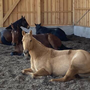
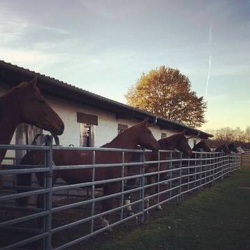
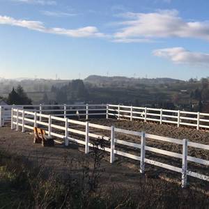
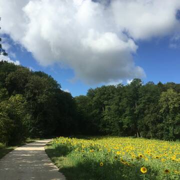
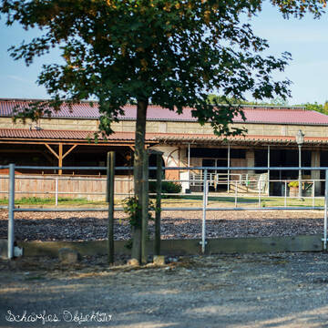
Hit Aktivstall Paulinenhof
Grenzach-Wyhlen
Moench-beate
@Moench-beate
FN-Mitglied
Freizeitstall
Hunde willkommen
Krankenbox
Notfallboxen
Bewegungsstall
Offenstall
16 weitere...
S


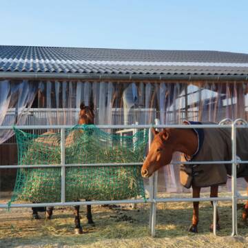
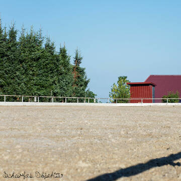
Reitstall Hemmer
Efringen-Kirchen
Jürgen Hemmer Reitlehrer FN
@JuergenHemmerReitlehrerFN
FN-Mitglied
Geländestrecke
Vermieten
Hunde willkommen
Longierzirkel/Roundpen
Außenbox mit Paddock
Außenboxen
15 weitere...
P+
Deprecated: Creation of dynamic property Zend_View_Helper_Ads::$adLink is deprecated in /var/www/stall-frei/htdocs/staging.stall-frei.de/library/Psf/View/Helper/Ads.php on line 108

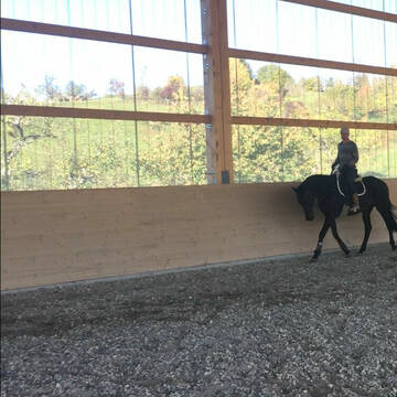
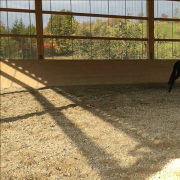
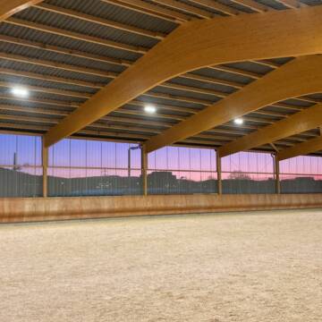
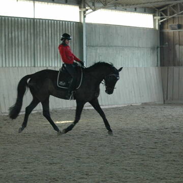
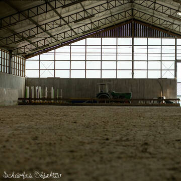
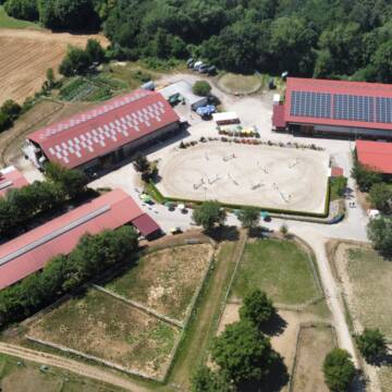
Idyllischer Reitstall mit Reithalle + Reitplatz
Rheinfelden
Elderberry Ranch
@ElderberryRanch
Fahrstall, Kutschwagen
FN-Mitglied
Vermieten
Hunde willkommen
Longierzirkel/Roundpen
Allergikerstall
Einhornhaltung möglich
37 weitere...
S
Reitsportzentrum Lehmann
Weil am Rhein
Peter-Lehmann
@Peter-Lehmann
FN-Mitglied
Gastronomie
Vermieten
Führanlage
Longierzirkel/Roundpen
Außenboxen
Innenbox
13 weitere...
P


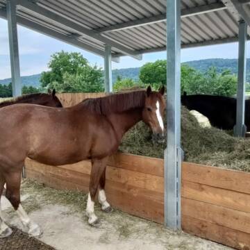
Offenstall - Trail und Weiden - Pferde und Ponies
Lörrach
Quellhof-GmbH
@Quellhof-GmbH
Freizeitstall
Gangpferdereiten
Krankenbox
Laufband
Notfallboxen
Bewegungsstall
Laufstall
11 weitere...
P+

Das Beste für die Hufe
Mechtersen
STALL-FREIde Marketing
@STALL-FREI-Marketing
Hufschmiede und Hufpfleger in Ihrer Nähe
Teilselbstversorgung auf gepflegter Reitanlage
Kandern - Tannenkirch
Thomas-Buck
@Thomas-Buck
Freizeitstall
Reitlehrer und -unterricht
Vermieten
Longierzirkel/Roundpen
Paddock
Außenbox mit Paddock
Außenboxen
12 weitere...
P+
Leider kein Vorschaubild
Leider kein Vorschaubild
Gnadenbrot für Friese Friesenstute Friesenwallach
Eimeldingen
Senioren Friesen-Treff
@Friesen-Treff
Krankenbox
Videoüberwachung
Gnadenbrothof
Hufrehe geeignet
Offenstall
Halbpension
Selbstversorgung
1 weitere...
B
Pensionsplätze frei beim Reiterverein Lörrach e....
Lörrach
Reiterverein Lörrach e.V.
@RVLoerrach
FN-Mitglied
Reitlehrer und -unterricht
Hunde willkommen
Longierzirkel/Roundpen
Außenbox mit Paddock
Außenboxen
Vollpension
9 weitere...
P

XXL- und Paddockboxen auf idyllischer Privatanlage
Lörrach
PRIMEUR Equestrian Centre
@PrimeurEquestrianCentre
Pferdeausbildung
Rehabilitationsstall
Vermieten
Laufband
Paddock
Allergikerstall
Fohlenaufzucht möglich
22 weitere...
P
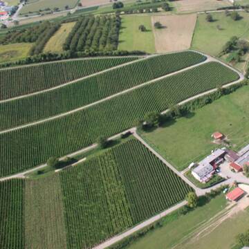
Paradies in den Reben
Schliengen Mauchen
Andreas Krüßelin
@PferdepensionHaldenhofMauchen
Freizeitstall
Geländestrecke
Vermieten
Hunde willkommen
Krankenbox
Notfallboxen
24 weitere...
P
Deprecated: Creation of dynamic property Zend_View::$pageCount is deprecated in /var/www/stall-frei/htdocs/staging.stall-frei.de/library/vendor/shardj/zf1-future/library/Zend/View/Abstract.php on line 308
Deprecated: Creation of dynamic property Zend_View::$itemCountPerPage is deprecated in /var/www/stall-frei/htdocs/staging.stall-frei.de/library/vendor/shardj/zf1-future/library/Zend/View/Abstract.php on line 308
Deprecated: Creation of dynamic property Zend_View::$first is deprecated in /var/www/stall-frei/htdocs/staging.stall-frei.de/library/vendor/shardj/zf1-future/library/Zend/View/Abstract.php on line 308
Deprecated: Creation of dynamic property Zend_View::$current is deprecated in /var/www/stall-frei/htdocs/staging.stall-frei.de/library/vendor/shardj/zf1-future/library/Zend/View/Abstract.php on line 308
Deprecated: Creation of dynamic property Zend_View::$last is deprecated in /var/www/stall-frei/htdocs/staging.stall-frei.de/library/vendor/shardj/zf1-future/library/Zend/View/Abstract.php on line 308
Deprecated: Creation of dynamic property Zend_View::$next is deprecated in /var/www/stall-frei/htdocs/staging.stall-frei.de/library/vendor/shardj/zf1-future/library/Zend/View/Abstract.php on line 308
Deprecated: Creation of dynamic property Zend_View::$pagesInRange is deprecated in /var/www/stall-frei/htdocs/staging.stall-frei.de/library/vendor/shardj/zf1-future/library/Zend/View/Abstract.php on line 308
Deprecated: Creation of dynamic property Zend_View::$firstPageInRange is deprecated in /var/www/stall-frei/htdocs/staging.stall-frei.de/library/vendor/shardj/zf1-future/library/Zend/View/Abstract.php on line 308
Deprecated: Creation of dynamic property Zend_View::$lastPageInRange is deprecated in /var/www/stall-frei/htdocs/staging.stall-frei.de/library/vendor/shardj/zf1-future/library/Zend/View/Abstract.php on line 308
Deprecated: Creation of dynamic property Zend_View::$currentItemCount is deprecated in /var/www/stall-frei/htdocs/staging.stall-frei.de/library/vendor/shardj/zf1-future/library/Zend/View/Abstract.php on line 308
Deprecated: Creation of dynamic property Zend_View::$totalItemCount is deprecated in /var/www/stall-frei/htdocs/staging.stall-frei.de/library/vendor/shardj/zf1-future/library/Zend/View/Abstract.php on line 308
Deprecated: Creation of dynamic property Zend_View::$firstItemNumber is deprecated in /var/www/stall-frei/htdocs/staging.stall-frei.de/library/vendor/shardj/zf1-future/library/Zend/View/Abstract.php on line 308
Deprecated: Creation of dynamic property Zend_View::$lastItemNumber is deprecated in /var/www/stall-frei/htdocs/staging.stall-frei.de/library/vendor/shardj/zf1-future/library/Zend/View/Abstract.php on line 308
Deprecated: Creation of dynamic property Zend_View::$router is deprecated in /var/www/stall-frei/htdocs/staging.stall-frei.de/library/vendor/shardj/zf1-future/library/Zend/View/Abstract.php on line 308
Deprecated: Creation of dynamic property Zend_View::$urlParams is deprecated in /var/www/stall-frei/htdocs/staging.stall-frei.de/library/vendor/shardj/zf1-future/library/Zend/View/Abstract.php on line 308
Deprecated: Creation of dynamic property Zend_View::$showAds is deprecated in /var/www/stall-frei/htdocs/staging.stall-frei.de/library/vendor/shardj/zf1-future/library/Zend/View/Abstract.php on line 308
Deprecated: Creation of dynamic property Zend_View::$objectIds is deprecated in /var/www/stall-frei/htdocs/staging.stall-frei.de/library/vendor/shardj/zf1-future/library/Zend/View/Abstract.php on line 308
Deprecated: Creation of dynamic property Zend_View::$showNavbar is deprecated in /var/www/stall-frei/htdocs/staging.stall-frei.de/library/vendor/shardj/zf1-future/library/Zend/View/Abstract.php on line 308
Deprecated: Creation of dynamic property Zend_View::$showBreadcrumb is deprecated in /var/www/stall-frei/htdocs/staging.stall-frei.de/library/vendor/shardj/zf1-future/library/Zend/View/Abstract.php on line 308
Deprecated: Creation of dynamic property Zend_View::$showFooter is deprecated in /var/www/stall-frei/htdocs/staging.stall-frei.de/library/vendor/shardj/zf1-future/library/Zend/View/Abstract.php on line 308
Deprecated: Creation of dynamic property Zend_View::$showInternalAds is deprecated in /var/www/stall-frei/htdocs/staging.stall-frei.de/library/vendor/shardj/zf1-future/library/Zend/View/Abstract.php on line 308
Deprecated: Creation of dynamic property Zend_View::$blNoContent is deprecated in /var/www/stall-frei/htdocs/staging.stall-frei.de/library/vendor/shardj/zf1-future/library/Zend/View/Abstract.php on line 308
Deprecated: Creation of dynamic property Zend_View::$sMetaDesc is deprecated in /var/www/stall-frei/htdocs/staging.stall-frei.de/library/vendor/shardj/zf1-future/library/Zend/View/Abstract.php on line 308
Deprecated: Creation of dynamic property Zend_View::$useGmaps is deprecated in /var/www/stall-frei/htdocs/staging.stall-frei.de/library/vendor/shardj/zf1-future/library/Zend/View/Abstract.php on line 308
Deprecated: Creation of dynamic property Zend_View::$touches is deprecated in /var/www/stall-frei/htdocs/staging.stall-frei.de/library/vendor/shardj/zf1-future/library/Zend/View/Abstract.php on line 308
Deprecated: Creation of dynamic property Zend_View::$oProject is deprecated in /var/www/stall-frei/htdocs/staging.stall-frei.de/library/vendor/shardj/zf1-future/library/Zend/View/Abstract.php on line 308
Deprecated: Creation of dynamic property Zend_View::$pageHeadline is deprecated in /var/www/stall-frei/htdocs/staging.stall-frei.de/library/vendor/shardj/zf1-future/library/Zend/View/Abstract.php on line 308
Deprecated: Creation of dynamic property Zend_View::$disableLocationField is deprecated in /var/www/stall-frei/htdocs/staging.stall-frei.de/library/vendor/shardj/zf1-future/library/Zend/View/Abstract.php on line 308
Deprecated: Creation of dynamic property Zend_View::$isSearch is deprecated in /var/www/stall-frei/htdocs/staging.stall-frei.de/library/vendor/shardj/zf1-future/library/Zend/View/Abstract.php on line 308
Deprecated: Creation of dynamic property Zend_View::$pageTitle is deprecated in /var/www/stall-frei/htdocs/staging.stall-frei.de/library/vendor/shardj/zf1-future/library/Zend/View/Abstract.php on line 308
Deprecated: Creation of dynamic property Psf_Form_Element_Text::$class is deprecated in /var/www/stall-frei/htdocs/staging.stall-frei.de/library/vendor/shardj/zf1-future/library/Zend/Form/Element.php on line 874
Deprecated: Creation of dynamic property Psf_Form_Element_Text::$size is deprecated in /var/www/stall-frei/htdocs/staging.stall-frei.de/library/vendor/shardj/zf1-future/library/Zend/Form/Element.php on line 874
Deprecated: Creation of dynamic property Psf_Form_Element_Text::$placeholder is deprecated in /var/www/stall-frei/htdocs/staging.stall-frei.de/library/vendor/shardj/zf1-future/library/Zend/Form/Element.php on line 874
Deprecated: Creation of dynamic property Psf_Form_Element_Hidden::$class is deprecated in /var/www/stall-frei/htdocs/staging.stall-frei.de/library/vendor/shardj/zf1-future/library/Zend/Form/Element.php on line 874
Deprecated: Creation of dynamic property Psf_Form_Element_Hidden::$class is deprecated in /var/www/stall-frei/htdocs/staging.stall-frei.de/library/vendor/shardj/zf1-future/library/Zend/Form/Element.php on line 874
Deprecated: Creation of dynamic property Psf_Form_Element_Hidden::$class is deprecated in /var/www/stall-frei/htdocs/staging.stall-frei.de/library/vendor/shardj/zf1-future/library/Zend/Form/Element.php on line 874
Deprecated: Creation of dynamic property Psf_Form_Element_Hidden::$class is deprecated in /var/www/stall-frei/htdocs/staging.stall-frei.de/library/vendor/shardj/zf1-future/library/Zend/Form/Element.php on line 874
Deprecated: Creation of dynamic property Psf_Form_Element_Select::$class is deprecated in /var/www/stall-frei/htdocs/staging.stall-frei.de/library/vendor/shardj/zf1-future/library/Zend/Form/Element.php on line 874
Deprecated: Creation of dynamic property Psf_Form_Element_Select::$class is deprecated in /var/www/stall-frei/htdocs/staging.stall-frei.de/library/vendor/shardj/zf1-future/library/Zend/Form/Element.php on line 874
Deprecated: Creation of dynamic property Psf_Form_Element_Select::$class is deprecated in /var/www/stall-frei/htdocs/staging.stall-frei.de/library/vendor/shardj/zf1-future/library/Zend/Form/Element.php on line 874
Deprecated: Creation of dynamic property Psf_Form_Element_Select::$class is deprecated in /var/www/stall-frei/htdocs/staging.stall-frei.de/library/vendor/shardj/zf1-future/library/Zend/Form/Element.php on line 874
Deprecated: Creation of dynamic property Psf_Form_Element_Text::$class is deprecated in /var/www/stall-frei/htdocs/staging.stall-frei.de/library/vendor/shardj/zf1-future/library/Zend/Form/Element.php on line 874
Deprecated: Creation of dynamic property Psf_Form_Element_Checkbox::$label is deprecated in /var/www/stall-frei/htdocs/staging.stall-frei.de/library/vendor/shardj/zf1-future/library/Zend/Form/Element.php on line 874
Deprecated: Creation of dynamic property Zend_View::$sort is deprecated in /var/www/stall-frei/htdocs/staging.stall-frei.de/library/vendor/shardj/zf1-future/library/Zend/View/Abstract.php on line 308
Deprecated: Creation of dynamic property Zend_View::$searchLocation is deprecated in /var/www/stall-frei/htdocs/staging.stall-frei.de/library/vendor/shardj/zf1-future/library/Zend/View/Abstract.php on line 308
Deprecated: Creation of dynamic property Zend_View::$locationHint is deprecated in /var/www/stall-frei/htdocs/staging.stall-frei.de/library/vendor/shardj/zf1-future/library/Zend/View/Abstract.php on line 308
Psf_GeoCoder_Abstract::getLocation: Gemarkung Oberried Get Location CachedOrLive
Psf_GeoCoder_Abstract::getCachedOrLive: Gemarkung Oberried
Psf_GeoCoder_OpenCageData::makeApiRequest: response:
Array
(
[documentation] => https://opencagedata.com/api
[licenses] => Array
(
[0] => Array
(
[name] => see attribution guide
[url] => https://opencagedata.com/credits
)
)
[results] => Array
(
[0] => Array
(
[components] => Array
(
[ISO_3166-1_alpha-2] => FR
[ISO_3166-1_alpha-3] => FRA
[ISO_3166-2] => Array
(
[0] => FR-GES
[1] => FR-6AE
[2] => FR-68
)
[_category] => road
[_normalized_city] => Kappelen
[_type] => road
[city] => Kappelen
[continent] => Europe
[country] => France
[country_code] => fr
[county] => Haut-Rhin
[local_authority] => Saint-Louis Agglomération
[political_union] => European Union
[postcode] => 68510
[road] => Rue Oberried
[state] => Grand Est
[state_code] => GES
)
[confidence] => 3
[formatted] => Rue Oberried, 68510 Kappelen, France
[geometry] => Array
(
[lat] => 47.611226
[lng] => 7.436022
)
)
[1] => Array
(
[components] => Array
(
[ISO_3166-1_alpha-2] => FR
[ISO_3166-1_alpha-3] => FRA
[ISO_3166-2] => Array
(
[0] => FR-BFC
[1] => FR-25
)
[_category] => road
[_normalized_city] => Les Combes
[_type] => road
[city] => Les Combes
[continent] => Europe
[country] => France
[country_code] => fr
[county] => Doubs
[local_authority] => Communauté de communes du Val de Morteau
[political_union] => European Union
[postcode] => 25500
[road] => L’Obarie
[state] => Bourgogne-Franche-Comté
[state_code] => BFC
)
[confidence] => 2
[formatted] => L’Obarie, 25500 Les Combes, France
[geometry] => Array
(
[lat] => 47.06073
[lng] => 6.543258
)
)
[2] => Array
(
[components] => Array
(
[ISO_3166-1_alpha-2] => FR
[ISO_3166-1_alpha-3] => FRA
[ISO_3166-2] => Array
(
[0] => FR-ARA
[1] => FR-26
)
[_category] => road
[_normalized_city] => Montvendre
[_type] => road
[city] => Montvendre
[continent] => Europe
[country] => France
[country_code] => fr
[county] => Drôme
[local_authority] => Valence Romans Agglo
[political_union] => European Union
[postcode] => 26120
[road] => Route de l'Oberie
[state] => Auvergne-Rhône-Alpes
[state_code] => ARA
)
[confidence] => 2
[formatted] => Route de l'Oberie, 26120 Montvendre, France
[geometry] => Array
(
[lat] => 44.869388
[lng] => 5.006863
)
)
[3] => Array
(
[components] => Array
(
[ISO_3166-1_alpha-2] => YT
[ISO_3166-1_alpha-3] => MYT
[ISO_3166-2] => Array
(
[0] => FR-976
)
[_category] => road
[_normalized_city] => Mtsamboro
[_type] => road
[city] => Mtsamboro
[continent] => Africa
[country] => France
[country_code] => fr
[county] => Mayotte
[local_authority] => Communauté d'agglomération du Grand Nord de Mayotte
[political_union] => European Union
[postcode] => 97630
[road] => Chemin Daday Obera
[state] =>
)
[confidence] => 2
[formatted] => Chemin Daday Obera, 97630 Mtsamboro, France
[geometry] => Array
(
[lat] => -12.688916
[lng] => 45.075897
)
)
[4] => Array
(
[components] => Array
(
[ISO_3166-1_alpha-2] => FR
[ISO_3166-1_alpha-3] => FRA
[ISO_3166-2] => Array
(
[0] => FR-PDL
[1] => FR-72
)
[_category] => road
[_normalized_city] => Sainte-Jamme-sur-Sarthe
[_type] => road
[city] => Sainte-Jamme-sur-Sarthe
[continent] => Europe
[country] => France
[country_code] => fr
[county] => Sarthe
[local_authority] => Communauté de communes Maine Cœur de Sarthe
[political_union] => European Union
[postcode] => 72380
[road] => Chemin de l’Oderie
[state] => Pays de la Loire
[state_code] => PDL
)
[confidence] => 10
[formatted] => Chemin de l’Oderie, 72380 Sainte-Jamme-sur-Sarthe, France
[geometry] => Array
(
[lat] => 48.140873
[lng] => 0.157198
)
)
[5] => Array
(
[components] => Array
(
[ISO_3166-1_alpha-2] => FR
[ISO_3166-1_alpha-3] => FRA
[ISO_3166-2] => Array
(
[0] => FR-NOR
[1] => FR-14
)
[_category] => road
[_normalized_city] => Leffard
[_type] => road
[city] => Leffard
[continent] => Europe
[country] => France
[country_code] => fr
[county] => Calvados
[local_authority] => Communauté de communes du Pays de Falaise
[political_union] => European Union
[postcode] => 14700
[road] => Rue de la Hoberie
[state] => Normandie
[state_code] => NOR
)
[confidence] => 10
[formatted] => Rue de la Hoberie, 14700 Leffard, France
[geometry] => Array
(
[lat] => 48.9292
[lng] => -0.309054
)
)
[6] => Array
(
[components] => Array
(
[ISO_3166-1_alpha-2] => FR
[ISO_3166-1_alpha-3] => FRA
[ISO_3166-2] => Array
(
[0] => FR-PDL
[1] => FR-53
)
[_category] => road
[_normalized_city] => Saint-Mars-sur-la-Futaie
[_type] => road
[city] => Saint-Mars-sur-la-Futaie
[continent] => Europe
[country] => France
[country_code] => fr
[county] => Mayenne
[local_authority] => Communauté de communes du Bocage Mayennais
[political_union] => European Union
[postcode] => 53220
[road] => Impasse de la Hoberie
[state] => Pays de la Loire
[state_code] => PDL
)
[confidence] => 10
[formatted] => Impasse de la Hoberie, 53220 Saint-Mars-sur-la-Futaie, France
[geometry] => Array
(
[lat] => 48.436594
[lng] => -1.048446
)
)
[7] => Array
(
[components] => Array
(
[ISO_3166-1_alpha-2] => FR
[ISO_3166-1_alpha-3] => FRA
[ISO_3166-2] => Array
(
[0] => FR-NOR
[1] => FR-50
)
[_category] => road
[_normalized_city] => Dragey-Ronthon
[_type] => road
[city] => Dragey-Ronthon
[continent] => Europe
[country] => France
[country_code] => fr
[county] => Manche
[local_authority] => Communauté d'agglomération Mont-Saint-Michel-Normandie
[political_union] => European Union
[postcode] => 50530
[road] => Chemin d'Obrey
[state] => Normandie
[state_code] => NOR
)
[confidence] => 10
[formatted] => Chemin d'Obrey, 50530 Dragey-Ronthon, France
[geometry] => Array
(
[lat] => 48.720961
[lng] => -1.511424
)
)
[8] => Array
(
[components] => Array
(
[ISO_3166-1_alpha-2] => FR
[ISO_3166-1_alpha-3] => FRA
[ISO_3166-2] => Array
(
[0] => FR-NOR
[1] => FR-50
)
[_category] => road
[_normalized_city] => Saint-Jean-le-Thomas
[_type] => road
[city] => Saint-Jean-le-Thomas
[continent] => Europe
[country] => France
[country_code] => fr
[county] => Manche
[local_authority] => Communauté d'agglomération Mont-Saint-Michel-Normandie
[political_union] => European Union
[postcode] => 50530
[road] => Chemin d'Obrey
[state] => Normandie
[state_code] => NOR
)
[confidence] => 10
[formatted] => Chemin d'Obrey, 50530 Saint-Jean-le-Thomas, France
[geometry] => Array
(
[lat] => 48.726683
[lng] => -1.513184
)
)
[9] => Array
(
[components] => Array
(
[ISO_3166-1_alpha-2] => FR
[ISO_3166-1_alpha-3] => FRA
[ISO_3166-2] => Array
(
[0] => FR-NOR
[1] => FR-14
)
[_category] => road
[_normalized_city] => Isigny-sur-Mer
[_type] => road
[city] => Isigny-sur-Mer
[continent] => Europe
[country] => France
[country_code] => fr
[county] => Calvados
[local_authority] => Isigny Omaha Intercom
[political_union] => European Union
[postcode] => 14330
[road] => Impasse de la Hoderie
[state] => Normandie
[state_code] => NOR
)
[confidence] => 10
[formatted] => Impasse de la Hoderie, 14330 Isigny-sur-Mer, France
[geometry] => Array
(
[lat] => 49.266161
[lng] => -1.046198
)
)
)
[status] => Array
(
[code] => 200
[message] => OK
)
[stay_informed] => Array
(
[blog] => https://blog.opencagedata.com
[mastodon] => https://en.osm.town/@opencage
)
[thanks] => For using an OpenCage API
[timestamp] => Array
(
[created_http] => Sun, 08 Feb 2026 16:54:44 GMT
[created_unix] => 1770569684
)
[total_results] => 10
)
Psf_GeoCoder_Abstract::convertLocationResult
{"documentation":"https:\/\/opencagedata.com\/api","licenses":[{"name":"see attribution guide","url":"https:\/\/opencagedata.com\/credits"}],"results":[{"components":{"ISO_3166-1_alpha-2":"FR","ISO_3166-1_alpha-3":"FRA","ISO_3166-2":["FR-GES","FR-6AE","FR-68"],"_category":"road","_normalized_city":"Kappelen","_type":"road","city":"Kappelen","continent":"Europe","country":"France","country_code":"fr","county":"Haut-Rhin","local_authority":"Saint-Louis Agglom\u00e9ration","political_union":"European Union","postcode":"68510","road":"Rue Oberried","state":"Grand Est","state_code":"GES"},"confidence":3,"formatted":"Rue Oberried, 68510 Kappelen, France","geometry":{"lat":47.611226,"lng":7.436022}},{"components":{"ISO_3166-1_alpha-2":"FR","ISO_3166-1_alpha-3":"FRA","ISO_3166-2":["FR-BFC","FR-25"],"_category":"road","_normalized_city":"Les Combes","_type":"road","city":"Les Combes","continent":"Europe","country":"France","country_code":"fr","county":"Doubs","local_authority":"Communaut\u00e9 de communes du Val de Morteau","political_union":"European Union","postcode":"25500","road":"L\u2019Obarie","state":"Bourgogne-Franche-Comt\u00e9","state_code":"BFC"},"confidence":2,"formatted":"L\u2019Obarie, 25500 Les Combes, France","geometry":{"lat":47.06073,"lng":6.543258}},{"components":{"ISO_3166-1_alpha-2":"FR","ISO_3166-1_alpha-3":"FRA","ISO_3166-2":["FR-ARA","FR-26"],"_category":"road","_normalized_city":"Montvendre","_type":"road","city":"Montvendre","continent":"Europe","country":"France","country_code":"fr","county":"Dr\u00f4me","local_authority":"Valence Romans Agglo","political_union":"European Union","postcode":"26120","road":"Route de l'Oberie","state":"Auvergne-Rh\u00f4ne-Alpes","state_code":"ARA"},"confidence":2,"formatted":"Route de l'Oberie, 26120 Montvendre, France","geometry":{"lat":44.869388,"lng":5.006863}},{"components":{"ISO_3166-1_alpha-2":"YT","ISO_3166-1_alpha-3":"MYT","ISO_3166-2":["FR-976"],"_category":"road","_normalized_city":"Mtsamboro","_type":"road","city":"Mtsamboro","continent":"Africa","country":"France","country_code":"fr","county":"Mayotte","local_authority":"Communaut\u00e9 d'agglom\u00e9ration du Grand Nord de Mayotte","political_union":"European Union","postcode":"97630","road":"Chemin Daday Obera","state":null},"confidence":2,"formatted":"Chemin Daday Obera, 97630 Mtsamboro, France","geometry":{"lat":-12.688916,"lng":45.075897}},{"components":{"ISO_3166-1_alpha-2":"FR","ISO_3166-1_alpha-3":"FRA","ISO_3166-2":["FR-PDL","FR-72"],"_category":"road","_normalized_city":"Sainte-Jamme-sur-Sarthe","_type":"road","city":"Sainte-Jamme-sur-Sarthe","continent":"Europe","country":"France","country_code":"fr","county":"Sarthe","local_authority":"Communaut\u00e9 de communes Maine C\u0153ur de Sarthe","political_union":"European Union","postcode":"72380","road":"Chemin de l\u2019Oderie","state":"Pays de la Loire","state_code":"PDL"},"confidence":10,"formatted":"Chemin de l\u2019Oderie, 72380 Sainte-Jamme-sur-Sarthe, France","geometry":{"lat":48.140873,"lng":0.157198}},{"components":{"ISO_3166-1_alpha-2":"FR","ISO_3166-1_alpha-3":"FRA","ISO_3166-2":["FR-NOR","FR-14"],"_category":"road","_normalized_city":"Leffard","_type":"road","city":"Leffard","continent":"Europe","country":"France","country_code":"fr","county":"Calvados","local_authority":"Communaut\u00e9 de communes du Pays de Falaise","political_union":"European Union","postcode":"14700","road":"Rue de la Hoberie","state":"Normandie","state_code":"NOR"},"confidence":10,"formatted":"Rue de la Hoberie, 14700 Leffard, France","geometry":{"lat":48.9292,"lng":-0.309054}},{"components":{"ISO_3166-1_alpha-2":"FR","ISO_3166-1_alpha-3":"FRA","ISO_3166-2":["FR-PDL","FR-53"],"_category":"road","_normalized_city":"Saint-Mars-sur-la-Futaie","_type":"road","city":"Saint-Mars-sur-la-Futaie","continent":"Europe","country":"France","country_code":"fr","county":"Mayenne","local_authority":"Communaut\u00e9 de communes du Bocage Mayennais","political_union":"European Union","postcode":"53220","road":"Impasse de la Hoberie","state":"Pays de la Loire","state_code":"PDL"},"confidence":10,"formatted":"Impasse de la Hoberie, 53220 Saint-Mars-sur-la-Futaie, France","geometry":{"lat":48.436594,"lng":-1.048446}},{"components":{"ISO_3166-1_alpha-2":"FR","ISO_3166-1_alpha-3":"FRA","ISO_3166-2":["FR-NOR","FR-50"],"_category":"road","_normalized_city":"Dragey-Ronthon","_type":"road","city":"Dragey-Ronthon","continent":"Europe","country":"France","country_code":"fr","county":"Manche","local_authority":"Communaut\u00e9 d'agglom\u00e9ration Mont-Saint-Michel-Normandie","political_union":"European Union","postcode":"50530","road":"Chemin d'Obrey","state":"Normandie","state_code":"NOR"},"confidence":10,"formatted":"Chemin d'Obrey, 50530 Dragey-Ronthon, France","geometry":{"lat":48.720961,"lng":-1.511424}},{"components":{"ISO_3166-1_alpha-2":"FR","ISO_3166-1_alpha-3":"FRA","ISO_3166-2":["FR-NOR","FR-50"],"_category":"road","_normalized_city":"Saint-Jean-le-Thomas","_type":"road","city":"Saint-Jean-le-Thomas","continent":"Europe","country":"France","country_code":"fr","county":"Manche","local_authority":"Communaut\u00e9 d'agglom\u00e9ration Mont-Saint-Michel-Normandie","political_union":"European Union","postcode":"50530","road":"Chemin d'Obrey","state":"Normandie","state_code":"NOR"},"confidence":10,"formatted":"Chemin d'Obrey, 50530 Saint-Jean-le-Thomas, France","geometry":{"lat":48.726683,"lng":-1.513184}},{"components":{"ISO_3166-1_alpha-2":"FR","ISO_3166-1_alpha-3":"FRA","ISO_3166-2":["FR-NOR","FR-14"],"_category":"road","_normalized_city":"Isigny-sur-Mer","_type":"road","city":"Isigny-sur-Mer","continent":"Europe","country":"France","country_code":"fr","county":"Calvados","local_authority":"Isigny Omaha Intercom","political_union":"European Union","postcode":"14330","road":"Impasse de la Hoderie","state":"Normandie","state_code":"NOR"},"confidence":10,"formatted":"Impasse de la Hoderie, 14330 Isigny-sur-Mer, France","geometry":{"lat":49.266161,"lng":-1.046198}}],"status":{"code":200,"message":"OK"},"stay_informed":{"blog":"https:\/\/blog.opencagedata.com","mastodon":"https:\/\/en.osm.town\/@opencage"},"thanks":"For using an OpenCage API","timestamp":{"created_http":"Sun, 08 Feb 2026 16:54:44 GMT","created_unix":1770569684},"total_results":10}Array
(
[0] => stdClass Object
(
[components] => stdClass Object
(
[ISO_3166-1_alpha-2] => FR
[ISO_3166-1_alpha-3] => FRA
[ISO_3166-2] => Array
(
[0] => FR-GES
[1] => FR-6AE
[2] => FR-68
)
[_category] => road
[_normalized_city] => Kappelen
[_type] => road
[city] => Kappelen
[continent] => Europe
[country] => France
[country_code] => fr
[county] => Haut-Rhin
[local_authority] => Saint-Louis Agglomération
[political_union] => European Union
[postcode] => 68510
[road] => Rue Oberried
[state] => Grand Est
[state_code] => GES
)
[confidence] => 3
[formatted] => Rue Oberried, 68510 Kappelen, France
[geometry] => stdClass Object
(
[lat] => 47.611226
[lng] => 7.436022
)
)
[1] => stdClass Object
(
[components] => stdClass Object
(
[ISO_3166-1_alpha-2] => FR
[ISO_3166-1_alpha-3] => FRA
[ISO_3166-2] => Array
(
[0] => FR-BFC
[1] => FR-25
)
[_category] => road
[_normalized_city] => Les Combes
[_type] => road
[city] => Les Combes
[continent] => Europe
[country] => France
[country_code] => fr
[county] => Doubs
[local_authority] => Communauté de communes du Val de Morteau
[political_union] => European Union
[postcode] => 25500
[road] => L’Obarie
[state] => Bourgogne-Franche-Comté
[state_code] => BFC
)
[confidence] => 2
[formatted] => L’Obarie, 25500 Les Combes, France
[geometry] => stdClass Object
(
[lat] => 47.06073
[lng] => 6.543258
)
)
[2] => stdClass Object
(
[components] => stdClass Object
(
[ISO_3166-1_alpha-2] => FR
[ISO_3166-1_alpha-3] => FRA
[ISO_3166-2] => Array
(
[0] => FR-ARA
[1] => FR-26
)
[_category] => road
[_normalized_city] => Montvendre
[_type] => road
[city] => Montvendre
[continent] => Europe
[country] => France
[country_code] => fr
[county] => Drôme
[local_authority] => Valence Romans Agglo
[political_union] => European Union
[postcode] => 26120
[road] => Route de l'Oberie
[state] => Auvergne-Rhône-Alpes
[state_code] => ARA
)
[confidence] => 2
[formatted] => Route de l'Oberie, 26120 Montvendre, France
[geometry] => stdClass Object
(
[lat] => 44.869388
[lng] => 5.006863
)
)
[3] => stdClass Object
(
[components] => stdClass Object
(
[ISO_3166-1_alpha-2] => YT
[ISO_3166-1_alpha-3] => MYT
[ISO_3166-2] => Array
(
[0] => FR-976
)
[_category] => road
[_normalized_city] => Mtsamboro
[_type] => road
[city] => Mtsamboro
[continent] => Africa
[country] => France
[country_code] => fr
[county] => Mayotte
[local_authority] => Communauté d'agglomération du Grand Nord de Mayotte
[political_union] => European Union
[postcode] => 97630
[road] => Chemin Daday Obera
[state] =>
)
[confidence] => 2
[formatted] => Chemin Daday Obera, 97630 Mtsamboro, France
[geometry] => stdClass Object
(
[lat] => -12.688916
[lng] => 45.075897
)
)
[4] => stdClass Object
(
[components] => stdClass Object
(
[ISO_3166-1_alpha-2] => FR
[ISO_3166-1_alpha-3] => FRA
[ISO_3166-2] => Array
(
[0] => FR-PDL
[1] => FR-72
)
[_category] => road
[_normalized_city] => Sainte-Jamme-sur-Sarthe
[_type] => road
[city] => Sainte-Jamme-sur-Sarthe
[continent] => Europe
[country] => France
[country_code] => fr
[county] => Sarthe
[local_authority] => Communauté de communes Maine Cœur de Sarthe
[political_union] => European Union
[postcode] => 72380
[road] => Chemin de l’Oderie
[state] => Pays de la Loire
[state_code] => PDL
)
[confidence] => 10
[formatted] => Chemin de l’Oderie, 72380 Sainte-Jamme-sur-Sarthe, France
[geometry] => stdClass Object
(
[lat] => 48.140873
[lng] => 0.157198
)
)
[5] => stdClass Object
(
[components] => stdClass Object
(
[ISO_3166-1_alpha-2] => FR
[ISO_3166-1_alpha-3] => FRA
[ISO_3166-2] => Array
(
[0] => FR-NOR
[1] => FR-14
)
[_category] => road
[_normalized_city] => Leffard
[_type] => road
[city] => Leffard
[continent] => Europe
[country] => France
[country_code] => fr
[county] => Calvados
[local_authority] => Communauté de communes du Pays de Falaise
[political_union] => European Union
[postcode] => 14700
[road] => Rue de la Hoberie
[state] => Normandie
[state_code] => NOR
)
[confidence] => 10
[formatted] => Rue de la Hoberie, 14700 Leffard, France
[geometry] => stdClass Object
(
[lat] => 48.9292
[lng] => -0.309054
)
)
[6] => stdClass Object
(
[components] => stdClass Object
(
[ISO_3166-1_alpha-2] => FR
[ISO_3166-1_alpha-3] => FRA
[ISO_3166-2] => Array
(
[0] => FR-PDL
[1] => FR-53
)
[_category] => road
[_normalized_city] => Saint-Mars-sur-la-Futaie
[_type] => road
[city] => Saint-Mars-sur-la-Futaie
[continent] => Europe
[country] => France
[country_code] => fr
[county] => Mayenne
[local_authority] => Communauté de communes du Bocage Mayennais
[political_union] => European Union
[postcode] => 53220
[road] => Impasse de la Hoberie
[state] => Pays de la Loire
[state_code] => PDL
)
[confidence] => 10
[formatted] => Impasse de la Hoberie, 53220 Saint-Mars-sur-la-Futaie, France
[geometry] => stdClass Object
(
[lat] => 48.436594
[lng] => -1.048446
)
)
[7] => stdClass Object
(
[components] => stdClass Object
(
[ISO_3166-1_alpha-2] => FR
[ISO_3166-1_alpha-3] => FRA
[ISO_3166-2] => Array
(
[0] => FR-NOR
[1] => FR-50
)
[_category] => road
[_normalized_city] => Dragey-Ronthon
[_type] => road
[city] => Dragey-Ronthon
[continent] => Europe
[country] => France
[country_code] => fr
[county] => Manche
[local_authority] => Communauté d'agglomération Mont-Saint-Michel-Normandie
[political_union] => European Union
[postcode] => 50530
[road] => Chemin d'Obrey
[state] => Normandie
[state_code] => NOR
)
[confidence] => 10
[formatted] => Chemin d'Obrey, 50530 Dragey-Ronthon, France
[geometry] => stdClass Object
(
[lat] => 48.720961
[lng] => -1.511424
)
)
[8] => stdClass Object
(
[components] => stdClass Object
(
[ISO_3166-1_alpha-2] => FR
[ISO_3166-1_alpha-3] => FRA
[ISO_3166-2] => Array
(
[0] => FR-NOR
[1] => FR-50
)
[_category] => road
[_normalized_city] => Saint-Jean-le-Thomas
[_type] => road
[city] => Saint-Jean-le-Thomas
[continent] => Europe
[country] => France
[country_code] => fr
[county] => Manche
[local_authority] => Communauté d'agglomération Mont-Saint-Michel-Normandie
[political_union] => European Union
[postcode] => 50530
[road] => Chemin d'Obrey
[state] => Normandie
[state_code] => NOR
)
[confidence] => 10
[formatted] => Chemin d'Obrey, 50530 Saint-Jean-le-Thomas, France
[geometry] => stdClass Object
(
[lat] => 48.726683
[lng] => -1.513184
)
)
[9] => stdClass Object
(
[components] => stdClass Object
(
[ISO_3166-1_alpha-2] => FR
[ISO_3166-1_alpha-3] => FRA
[ISO_3166-2] => Array
(
[0] => FR-NOR
[1] => FR-14
)
[_category] => road
[_normalized_city] => Isigny-sur-Mer
[_type] => road
[city] => Isigny-sur-Mer
[continent] => Europe
[country] => France
[country_code] => fr
[county] => Calvados
[local_authority] => Isigny Omaha Intercom
[political_union] => European Union
[postcode] => 14330
[road] => Impasse de la Hoderie
[state] => Normandie
[state_code] => NOR
)
[confidence] => 10
[formatted] => Impasse de la Hoderie, 14330 Isigny-sur-Mer, France
[geometry] => stdClass Object
(
[lat] => 49.266161
[lng] => -1.046198
)
)
)
Psf_GeoCoder_OpenCageData::getKeyMap: 0
stdClass Object
(
    [components] => stdClass Object
        (
            [ISO_3166-1_alpha-2] => FR
            [ISO_3166-1_alpha-3] => FRA
            [ISO_3166-2] => Array
                (
                    [0] => FR-GES
                    [1] => FR-6AE
                    [2] => FR-68
                )

            [_category] => road
            [_normalized_city] => Kappelen
            [_type] => road
            [city] => Kappelen
            [continent] => Europe
            [country] => France
            [country_code] => fr
            [county] => Haut-Rhin
            [local_authority] => Saint-Louis Agglomération
            [political_union] => European Union
            [postcode] => 68510
            [road] => Rue Oberried
            [state] => Grand Est
            [state_code] => GES
        )

    [confidence] => 3
    [formatted] => Rue Oberried, 68510 Kappelen, France
    [geometry] => stdClass Object
        (
            [lat] => 47.611226
            [lng] => 7.436022
        )

)
Psf_GeoCoder_OpenCageData::getCounty: Haut-Rhin
Psf_GeoCoder_OpenCageData::addMissingData REFETCH!
Array
(
    [address] => Rue Oberried, 68510 Kappelen, France
    [type] => road
    [street] => Rue Oberried
    [city] => Kappelen
    [county] => Haut-Rhin
    [state] => Grand Est
    [zip] => 68510
    [country] => France
    [suburb] =>
    [countrycode] => fr
    [latitude] => 47.611226
    [longitude] => 7.436022
    [accuracy] => 1
    [confidence] => 3
    [bounds] =>
)
reformat!
Array
(
    [address] => Rue Oberried, 68510 Kappelen, France
    [type] => road
    [street] => Rue Oberried
    [city] => Kappelen
    [county] => Haut-Rhin
    [state] => Grand Est
    [zip] => 68510
    [country] => France
    [suburb] =>
    [countrycode] => fr
    [latitude] => 47.611226
    [longitude] => 7.436022
    [accuracy] => 1
    [confidence] => 3
    [bounds] =>
    [place] => Rue Oberried, 68510 Kappelen, Grand Est
    [hash] => 2461a65103dad1eab86068c01a6d9fd4
)
Psf_GeoCoder_OpenCageData::getKeyMap: 1
stdClass Object
(
    [components] => stdClass Object
        (
            [ISO_3166-1_alpha-2] => FR
            [ISO_3166-1_alpha-3] => FRA
            [ISO_3166-2] => Array
                (
                    [0] => FR-BFC
                    [1] => FR-25
                )

            [_category] => road
            [_normalized_city] => Les Combes
            [_type] => road
            [city] => Les Combes
            [continent] => Europe
            [country] => France
            [country_code] => fr
            [county] => Doubs
            [local_authority] => Communauté de communes du Val de Morteau
            [political_union] => European Union
            [postcode] => 25500
            [road] => L’Obarie
            [state] => Bourgogne-Franche-Comté
            [state_code] => BFC
        )

    [confidence] => 2
    [formatted] => L’Obarie, 25500 Les Combes, France
    [geometry] => stdClass Object
        (
            [lat] => 47.06073
            [lng] => 6.543258
        )

)
Psf_GeoCoder_OpenCageData::getCounty: Doubs
Psf_GeoCoder_OpenCageData::addMissingData REFETCH!
Array
(
    [address] => L’Obarie, 25500 Les Combes, France
    [type] => road
    [street] => L’Obarie
    [city] => Les Combes
    [county] => Doubs
    [state] => Bourgogne-Franche-Comté
    [zip] => 25500
    [country] => France
    [suburb] =>
    [countrycode] => fr
    [latitude] => 47.06073
    [longitude] => 6.543258
    [accuracy] => 1
    [confidence] => 2
    [bounds] =>
)
reformat!
Array
(
    [address] => L’Obarie, 25500 Les Combes, France
    [type] => road
    [street] => L’Obarie
    [city] => Les Combes
    [county] => Doubs
    [state] => Bourgogne-Franche-Comté
    [zip] => 25500
    [country] => France
    [suburb] =>
    [countrycode] => fr
    [latitude] => 47.06073
    [longitude] => 6.543258
    [accuracy] => 1
    [confidence] => 2
    [bounds] =>
    [place] => L’Obarie, 25500 Les Combes, Bourgogne-Franche-Comté
    [hash] => e7a36614055525213f9a62103661ef8d
)
Psf_GeoCoder_OpenCageData::getKeyMap: 2
stdClass Object
(
    [components] => stdClass Object
        (
            [ISO_3166-1_alpha-2] => FR
            [ISO_3166-1_alpha-3] => FRA
            [ISO_3166-2] => Array
                (
                    [0] => FR-ARA
                    [1] => FR-26
                )

            [_category] => road
            [_normalized_city] => Montvendre
            [_type] => road
            [city] => Montvendre
            [continent] => Europe
            [country] => France
            [country_code] => fr
            [county] => Drôme
            [local_authority] => Valence Romans Agglo
            [political_union] => European Union
            [postcode] => 26120
            [road] => Route de l'Oberie
            [state] => Auvergne-Rhône-Alpes
            [state_code] => ARA
        )

    [confidence] => 2
    [formatted] => Route de l'Oberie, 26120 Montvendre, France
    [geometry] => stdClass Object
        (
            [lat] => 44.869388
            [lng] => 5.006863
        )

)
Psf_GeoCoder_OpenCageData::getCounty: Drôme
Psf_GeoCoder_OpenCageData::addMissingData REFETCH!
Array
(
    [address] => Route de l'Oberie, 26120 Montvendre, France
    [type] => road
    [street] => Route de l'Oberie
    [city] => Montvendre
    [county] => Drôme
    [state] => Auvergne-Rhône-Alpes
    [zip] => 26120
    [country] => France
    [suburb] =>
    [countrycode] => fr
    [latitude] => 44.869388
    [longitude] => 5.006863
    [accuracy] => 1
    [confidence] => 2
    [bounds] =>
)
reformat!
Array
(
    [address] => Route de l'Oberie, 26120 Montvendre, France
    [type] => road
    [street] => Route de l'Oberie
    [city] => Montvendre
    [county] => Drôme
    [state] => Auvergne-Rhône-Alpes
    [zip] => 26120
    [country] => France
    [suburb] =>
    [countrycode] => fr
    [latitude] => 44.869388
    [longitude] => 5.006863
    [accuracy] => 1
    [confidence] => 2
    [bounds] =>
    [place] => Route de l'Oberie, 26120 Montvendre, Auvergne-Rhône-Alpes
    [hash] => 642261eabf890a9c63196168bf88b3da
)
Psf_GeoCoder_OpenCageData::getKeyMap: 3
stdClass Object
(
    [components] => stdClass Object
        (
            [ISO_3166-1_alpha-2] => YT
            [ISO_3166-1_alpha-3] => MYT
            [ISO_3166-2] => Array
                (
                    [0] => FR-976
                )

            [_category] => road
            [_normalized_city] => Mtsamboro
            [_type] => road
            [city] => Mtsamboro
            [continent] => Africa
            [country] => France
            [country_code] => fr
            [county] => Mayotte
            [local_authority] => Communauté d'agglomération du Grand Nord de Mayotte
            [political_union] => European Union
            [postcode] => 97630
            [road] => Chemin Daday Obera
            [state] =>
        )

    [confidence] => 2
    [formatted] => Chemin Daday Obera, 97630 Mtsamboro, France
    [geometry] => stdClass Object
        (
            [lat] => -12.688916
            [lng] => 45.075897
        )

)
Psf_GeoCoder_OpenCageData::getCounty: Mayotte
Psf_GeoCoder_OpenCageData::addMissingData REFETCH!
Array
(
    [address] => Chemin Daday Obera, 97630 Mtsamboro, France
    [type] => road
    [street] => Chemin Daday Obera
    [city] => Mtsamboro
    [county] => Mayotte
    [state] =>
    [zip] => 97630
    [country] => France
    [suburb] =>
    [countrycode] => fr
    [latitude] => -12.688916
    [longitude] => 45.075897
    [accuracy] => 1
    [confidence] => 2
    [bounds] =>
)
reformat!
Array
(
    [address] => Chemin Daday Obera, 97630 Mtsamboro, France
    [type] => road
    [street] => Chemin Daday Obera
    [city] => Mtsamboro
    [county] => Mayotte
    [state] =>
    [zip] => 97630
    [country] => France
    [suburb] =>
    [countrycode] => fr
    [latitude] => -12.688916
    [longitude] => 45.075897
    [accuracy] => 1
    [confidence] => 2
    [bounds] =>
    [place] => Chemin Daday Obera, 97630 Mtsamboro, France
    [hash] => 952914d8eb3cd435408d25afef9468ee
)
Psf_GeoCoder_OpenCageData::getKeyMap: 4
stdClass Object
(
    [components] => stdClass Object
        (
            [ISO_3166-1_alpha-2] => FR
            [ISO_3166-1_alpha-3] => FRA
            [ISO_3166-2] => Array
                (
                    [0] => FR-PDL
                    [1] => FR-72
                )

            [_category] => road
            [_normalized_city] => Sainte-Jamme-sur-Sarthe
            [_type] => road
            [city] => Sainte-Jamme-sur-Sarthe
            [continent] => Europe
            [country] => France
            [country_code] => fr
            [county] => Sarthe
            [local_authority] => Communauté de communes Maine Cœur de Sarthe
            [political_union] => European Union
            [postcode] => 72380
            [road] => Chemin de l’Oderie
            [state] => Pays de la Loire
            [state_code] => PDL
        )

    [confidence] => 10
    [formatted] => Chemin de l’Oderie, 72380 Sainte-Jamme-sur-Sarthe, France
    [geometry] => stdClass Object
        (
            [lat] => 48.140873
            [lng] => 0.157198
        )

)
Psf_GeoCoder_OpenCageData::getCounty: Sarthe
Psf_GeoCoder_OpenCageData::addMissingData REFETCH!
Array
(
    [address] => Chemin de l’Oderie, 72380 Sainte-Jamme-sur-Sarthe, France
    [type] => road
    [street] => Chemin de l’Oderie
    [city] => Sainte-Jamme-sur-Sarthe
    [county] => Sarthe
    [state] => Pays de la Loire
    [zip] => 72380
    [country] => France
    [suburb] =>
    [countrycode] => fr
    [latitude] => 48.140873
    [longitude] => 0.157198
    [accuracy] => 1
    [confidence] => 10
    [bounds] =>
)
reformat!
Array
(
    [address] => Chemin de l’Oderie, 72380 Sainte-Jamme-sur-Sarthe, France
    [type] => road
    [street] => Chemin de l’Oderie
    [city] => Sainte-Jamme-sur-Sarthe
    [county] => Sarthe
    [state] => Pays de la Loire
    [zip] => 72380
    [country] => France
    [suburb] =>
    [countrycode] => fr
    [latitude] => 48.140873
    [longitude] => 0.157198
    [accuracy] => 1
    [confidence] => 10
    [bounds] =>
    [place] => Chemin de l’Oderie, 72380 Sainte-Jamme-sur-Sarthe, Pays de la Loire
    [hash] => 5c03470f20449109c5d6e25337abfa57
)
Psf_GeoCoder_OpenCageData::getKeyMap: 5
stdClass Object
(
    [components] => stdClass Object
        (
            [ISO_3166-1_alpha-2] => FR
            [ISO_3166-1_alpha-3] => FRA
            [ISO_3166-2] => Array
                (
                    [0] => FR-NOR
                    [1] => FR-14
                )

            [_category] => road
            [_normalized_city] => Leffard
            [_type] => road
            [city] => Leffard
            [continent] => Europe
            [country] => France
            [country_code] => fr
            [county] => Calvados
            [local_authority] => Communauté de communes du Pays de Falaise
            [political_union] => European Union
            [postcode] => 14700
            [road] => Rue de la Hoberie
            [state] => Normandie
            [state_code] => NOR
        )

    [confidence] => 10
    [formatted] => Rue de la Hoberie, 14700 Leffard, France
    [geometry] => stdClass Object
        (
            [lat] => 48.9292
            [lng] => -0.309054
        )

)
Psf_GeoCoder_OpenCageData::getCounty: Calvados
Psf_GeoCoder_OpenCageData::addMissingData REFETCH!
Array
(
    [address] => Rue de la Hoberie, 14700 Leffard, France
    [type] => road
    [street] => Rue de la Hoberie
    [city] => Leffard
    [county] => Calvados
    [state] => Normandie
    [zip] => 14700
    [country] => France
    [suburb] =>
    [countrycode] => fr
    [latitude] => 48.9292
    [longitude] => -0.309054
    [accuracy] => 1
    [confidence] => 10
    [bounds] =>
)
reformat!
Array
(
    [address] => Rue de la Hoberie, 14700 Leffard, France
    [type] => road
    [street] => Rue de la Hoberie
    [city] => Leffard
    [county] => Calvados
    [state] => Normandie
    [zip] => 14700
    [country] => France
    [suburb] =>
    [countrycode] => fr
    [latitude] => 48.9292
    [longitude] => -0.309054
    [accuracy] => 1
    [confidence] => 10
    [bounds] =>
    [place] => Rue de la Hoberie, 14700 Leffard, Normandie
    [hash] => 13ee84ebe21b28fcaec07d37dd2506bc
)
Psf_GeoCoder_OpenCageData::getKeyMap: 6
stdClass Object
(
    [components] => stdClass Object
        (
            [ISO_3166-1_alpha-2] => FR
            [ISO_3166-1_alpha-3] => FRA
            [ISO_3166-2] => Array
                (
                    [0] => FR-PDL
                    [1] => FR-53
                )

            [_category] => road
            [_normalized_city] => Saint-Mars-sur-la-Futaie
            [_type] => road
            [city] => Saint-Mars-sur-la-Futaie
            [continent] => Europe
            [country] => France
            [country_code] => fr
            [county] => Mayenne
            [local_authority] => Communauté de communes du Bocage Mayennais
            [political_union] => European Union
            [postcode] => 53220
            [road] => Impasse de la Hoberie
            [state] => Pays de la Loire
            [state_code] => PDL
        )

    [confidence] => 10
    [formatted] => Impasse de la Hoberie, 53220 Saint-Mars-sur-la-Futaie, France
    [geometry] => stdClass Object
        (
            [lat] => 48.436594
            [lng] => -1.048446
        )

)
Psf_GeoCoder_OpenCageData::getCounty: Mayenne
Psf_GeoCoder_OpenCageData::addMissingData REFETCH!
Array
(
    [address] => Impasse de la Hoberie, 53220 Saint-Mars-sur-la-Futaie, France
    [type] => road
    [street] => Impasse de la Hoberie
    [city] => Saint-Mars-sur-la-Futaie
    [county] => Mayenne
    [state] => Pays de la Loire
    [zip] => 53220
    [country] => France
    [suburb] =>
    [countrycode] => fr
    [latitude] => 48.436594
    [longitude] => -1.048446
    [accuracy] => 1
    [confidence] => 10
    [bounds] =>
)
reformat!
Array
(
    [address] => Impasse de la Hoberie, 53220 Saint-Mars-sur-la-Futaie, France
    [type] => road
    [street] => Impasse de la Hoberie
    [city] => Saint-Mars-sur-la-Futaie
    [county] => Mayenne
    [state] => Pays de la Loire
    [zip] => 53220
    [country] => France
    [suburb] =>
    [countrycode] => fr
    [latitude] => 48.436594
    [longitude] => -1.048446
    [accuracy] => 1
    [confidence] => 10
    [bounds] =>
    [place] => Impasse de la Hoberie, 53220 Saint-Mars-sur-la-Futaie, Pays de la Loire
    [hash] => d2e9579d1e4d24d1c7437837b31287e3
)
Psf_GeoCoder_OpenCageData::getKeyMap: 7
stdClass Object
(
    [components] => stdClass Object
        (
            [ISO_3166-1_alpha-2] => FR
            [ISO_3166-1_alpha-3] => FRA
            [ISO_3166-2] => Array
                (
                    [0] => FR-NOR
                    [1] => FR-50
                )

            [_category] => road
            [_normalized_city] => Dragey-Ronthon
            [_type] => road
            [city] => Dragey-Ronthon
            [continent] => Europe
            [country] => France
            [country_code] => fr
            [county] => Manche
            [local_authority] => Communauté d'agglomération Mont-Saint-Michel-Normandie
            [political_union] => European Union
            [postcode] => 50530
            [road] => Chemin d'Obrey
            [state] => Normandie
            [state_code] => NOR
        )

    [confidence] => 10
    [formatted] => Chemin d'Obrey, 50530 Dragey-Ronthon, France
    [geometry] => stdClass Object
        (
            [lat] => 48.720961
            [lng] => -1.511424
        )

)
Psf_GeoCoder_OpenCageData::getCounty: Manche
Psf_GeoCoder_OpenCageData::addMissingData REFETCH!
Array
(
    [address] => Chemin d'Obrey, 50530 Dragey-Ronthon, France
    [type] => road
    [street] => Chemin d'Obrey
    [city] => Dragey-Ronthon
    [county] => Manche
    [state] => Normandie
    [zip] => 50530
    [country] => France
    [suburb] =>
    [countrycode] => fr
    [latitude] => 48.720961
    [longitude] => -1.511424
    [accuracy] => 1
    [confidence] => 10
    [bounds] =>
)
reformat!
Array
(
    [address] => Chemin d'Obrey, 50530 Dragey-Ronthon, France
    [type] => road
    [street] => Chemin d'Obrey
    [city] => Dragey-Ronthon
    [county] => Manche
    [state] => Normandie
    [zip] => 50530
    [country] => France
    [suburb] =>
    [countrycode] => fr
    [latitude] => 48.720961
    [longitude] => -1.511424
    [accuracy] => 1
    [confidence] => 10
    [bounds] =>
    [place] => Chemin d'Obrey, 50530 Dragey-Ronthon, Normandie
    [hash] => b142b39f47ecaafef2d2e04d6da8131b
)
Psf_GeoCoder_OpenCageData::getKeyMap: 8
stdClass Object
(
    [components] => stdClass Object
        (
            [ISO_3166-1_alpha-2] => FR
            [ISO_3166-1_alpha-3] => FRA
            [ISO_3166-2] => Array
                (
                    [0] => FR-NOR
                    [1] => FR-50
                )

            [_category] => road
            [_normalized_city] => Saint-Jean-le-Thomas
            [_type] => road
            [city] => Saint-Jean-le-Thomas
            [continent] => Europe
            [country] => France
            [country_code] => fr
            [county] => Manche
            [local_authority] => Communauté d'agglomération Mont-Saint-Michel-Normandie
            [political_union] => European Union
            [postcode] => 50530
            [road] => Chemin d'Obrey
            [state] => Normandie
            [state_code] => NOR
        )

    [confidence] => 10
    [formatted] => Chemin d'Obrey, 50530 Saint-Jean-le-Thomas, France
    [geometry] => stdClass Object
        (
            [lat] => 48.726683
            [lng] => -1.513184
        )

)
Psf_GeoCoder_OpenCageData::getCounty: Manche
Psf_GeoCoder_OpenCageData::addMissingData REFETCH!
Array
(
    [address] => Chemin d'Obrey, 50530 Saint-Jean-le-Thomas, France
    [type] => road
    [street] => Chemin d'Obrey
    [city] => Saint-Jean-le-Thomas
    [county] => Manche
    [state] => Normandie
    [zip] => 50530
    [country] => France
    [suburb] =>
    [countrycode] => fr
    [latitude] => 48.726683
    [longitude] => -1.513184
    [accuracy] => 1
    [confidence] => 10
    [bounds] =>
)
reformat!
Array
(
    [address] => Chemin d'Obrey, 50530 Saint-Jean-le-Thomas, France
    [type] => road
    [street] => Chemin d'Obrey
    [city] => Saint-Jean-le-Thomas
    [county] => Manche
    [state] => Normandie
    [zip] => 50530
    [country] => France
    [suburb] =>
    [countrycode] => fr
    [latitude] => 48.726683
    [longitude] => -1.513184
    [accuracy] => 1
    [confidence] => 10
    [bounds] =>
    [place] => Chemin d'Obrey, 50530 Saint-Jean-le-Thomas, Normandie
    [hash] => cffab619883ce77b2b37f5343885ce12
)
Psf_GeoCoder_OpenCageData::getKeyMap: 9
stdClass Object
(
    [components] => stdClass Object
        (
            [ISO_3166-1_alpha-2] => FR
            [ISO_3166-1_alpha-3] => FRA
            [ISO_3166-2] => Array
                (
                    [0] => FR-NOR
                    [1] => FR-14
                )

            [_category] => road
            [_normalized_city] => Isigny-sur-Mer
            [_type] => road
            [city] => Isigny-sur-Mer
            [continent] => Europe
            [country] => France
            [country_code] => fr
            [county] => Calvados
            [local_authority] => Isigny Omaha Intercom
            [political_union] => European Union
            [postcode] => 14330
            [road] => Impasse de la Hoderie
            [state] => Normandie
            [state_code] => NOR
        )

    [confidence] => 10
    [formatted] => Impasse de la Hoderie, 14330 Isigny-sur-Mer, France
    [geometry] => stdClass Object
        (
            [lat] => 49.266161
            [lng] => -1.046198
        )

)
Psf_GeoCoder_OpenCageData::getCounty: Calvados
Psf_GeoCoder_OpenCageData::addMissingData REFETCH!
Array
(
    [address] => Impasse de la Hoderie, 14330 Isigny-sur-Mer, France
    [type] => road
    [street] => Impasse de la Hoderie
    [city] => Isigny-sur-Mer
    [county] => Calvados
    [state] => Normandie
    [zip] => 14330
    [country] => France
    [suburb] =>
    [countrycode] => fr
    [latitude] => 49.266161
    [longitude] => -1.046198
    [accuracy] => 1
    [confidence] => 10
    [bounds] =>
)
reformat!
Array
(
    [address] => Impasse de la Hoderie, 14330 Isigny-sur-Mer, France
    [type] => road
    [street] => Impasse de la Hoderie
    [city] => Isigny-sur-Mer
    [county] => Calvados
    [state] => Normandie
    [zip] => 14330
    [country] => France
    [suburb] =>
    [countrycode] => fr
    [latitude] => 49.266161
    [longitude] => -1.046198
    [accuracy] => 1
    [confidence] => 10
    [bounds] =>
    [place] => Impasse de la Hoderie, 14330 Isigny-sur-Mer, Normandie
    [hash] => c6e5017818dac9c60f928edbb6ee296b
)
Deprecated: Creation of dynamic property Zend_View::$locationHintStyle is deprecated in /var/www/stall-frei/htdocs/staging.stall-frei.de/library/vendor/shardj/zf1-future/library/Zend/View/Abstract.php on line 308
Deprecated: Creation of dynamic property Zend_View::$adGeoLocation is deprecated in /var/www/stall-frei/htdocs/staging.stall-frei.de/library/vendor/shardj/zf1-future/library/Zend/View/Abstract.php on line 308
Deprecated: Creation of dynamic property Zend_View::$recordCount is deprecated in /var/www/stall-frei/htdocs/staging.stall-frei.de/library/vendor/shardj/zf1-future/library/Zend/View/Abstract.php on line 308
Deprecated: explode(): Passing null to parameter #2 ($string) of type string is deprecated in /var/www/stall-frei/htdocs/staging.stall-frei.de/application/models/SearchAgent.php on line 100
Deprecated: explode(): Passing null to parameter #2 ($string) of type string is deprecated in /var/www/stall-frei/htdocs/staging.stall-frei.de/application/models/SearchAgent.php on line 100
Deprecated: explode(): Passing null to parameter #2 ($string) of type string is deprecated in /var/www/stall-frei/htdocs/staging.stall-frei.de/application/models/SearchAgent.php on line 100
Deprecated: explode(): Passing null to parameter #2 ($string) of type string is deprecated in /var/www/stall-frei/htdocs/staging.stall-frei.de/application/models/SearchAgent.php on line 100
Deprecated: explode(): Passing null to parameter #2 ($string) of type string is deprecated in /var/www/stall-frei/htdocs/staging.stall-frei.de/application/models/SearchAgent.php on line 100
Deprecated: explode(): Passing null to parameter #2 ($string) of type string is deprecated in /var/www/stall-frei/htdocs/staging.stall-frei.de/application/models/SearchAgent.php on line 100
Deprecated: explode(): Passing null to parameter #2 ($string) of type string is deprecated in /var/www/stall-frei/htdocs/staging.stall-frei.de/application/models/SearchAgent.php on line 100
Deprecated: explode(): Passing null to parameter #2 ($string) of type string is deprecated in /var/www/stall-frei/htdocs/staging.stall-frei.de/application/models/SearchAgent.php on line 100
Deprecated: explode(): Passing null to parameter #2 ($string) of type string is deprecated in /var/www/stall-frei/htdocs/staging.stall-frei.de/application/models/SearchAgent.php on line 100
Deprecated: trim(): Passing null to parameter #1 ($string) of type string is deprecated in /var/www/stall-frei/htdocs/staging.stall-frei.de/application/models/Account/Search.php on line 82
Warning: Cannot modify header information - headers already sent by (output started at /var/www/stall-frei/htdocs/staging.stall-frei.de/library/vendor/shardj/zf1-future/library/Zend/View/Abstract.php:308) in /var/www/stall-frei/htdocs/staging.stall-frei.de/application/models/Account/Search.php on line 71
Deprecated: Creation of dynamic property Zend_View::$paginationParams is deprecated in /var/www/stall-frei/htdocs/staging.stall-frei.de/library/vendor/shardj/zf1-future/library/Zend/View/Abstract.php on line 308
Deprecated: Creation of dynamic property Zend_View::$objectPaginator is deprecated in /var/www/stall-frei/htdocs/staging.stall-frei.de/library/vendor/shardj/zf1-future/library/Zend/View/Abstract.php on line 308
Deprecated: Creation of dynamic property Zend_View::$featuredObjects is deprecated in /var/www/stall-frei/htdocs/staging.stall-frei.de/library/vendor/shardj/zf1-future/library/Zend/View/Abstract.php on line 308
Deprecated: Creation of dynamic property Zend_View::$hints is deprecated in /var/www/stall-frei/htdocs/staging.stall-frei.de/library/vendor/shardj/zf1-future/library/Zend/View/Abstract.php on line 308
Deprecated: Creation of dynamic property Zend_View::$attributeHints is deprecated in /var/www/stall-frei/htdocs/staging.stall-frei.de/library/vendor/shardj/zf1-future/library/Zend/View/Abstract.php on line 308
Deprecated: Creation of dynamic property Zend_View::$oSearchForm is deprecated in /var/www/stall-frei/htdocs/staging.stall-frei.de/library/vendor/shardj/zf1-future/library/Zend/View/Abstract.php on line 308