Deprecated: Creation of dynamic property Zend_View::$sMode is deprecated in /var/www/stall-frei/htdocs/staging.stall-frei.de/library/vendor/shardj/zf1-future/library/Zend/View/Abstract.php on line 308
Stallplatz oder Offenstall in Westendorf
Gesucht wird in "Im Hart, 87679 Westendorf, Deutschland"
6.333 Einträge
Deprecated: Creation of dynamic property Zend_View::$listObjects is deprecated in /var/www/stall-frei/htdocs/staging.stall-frei.de/library/vendor/shardj/zf1-future/library/Zend/View/Abstract.php on line 308
Gesponsort


Deprecated: Creation of dynamic property Zend_View::$listMode is deprecated in /var/www/stall-frei/htdocs/staging.stall-frei.de/library/vendor/shardj/zf1-future/library/Zend/View/Abstract.php on line 308
Deprecated: Creation of dynamic property Zend_View::$renderedObjects is deprecated in /var/www/stall-frei/htdocs/staging.stall-frei.de/library/vendor/shardj/zf1-future/library/Zend/View/Abstract.php on line 308
Deprecated: Creation of dynamic property Zend_View::$index is deprecated in /var/www/stall-frei/htdocs/staging.stall-frei.de/library/vendor/shardj/zf1-future/library/Zend/View/Abstract.php on line 308
Deprecated: Creation of dynamic property Zend_View::$displayMode is deprecated in /var/www/stall-frei/htdocs/staging.stall-frei.de/library/vendor/shardj/zf1-future/library/Zend/View/Abstract.php on line 308
Deprecated: Creation of dynamic property Zend_View::$remarketingIds is deprecated in /var/www/stall-frei/htdocs/staging.stall-frei.de/library/vendor/shardj/zf1-future/library/Zend/View/Abstract.php on line 308
Deprecated: Creation of dynamic property Zend_View::$listItem is deprecated in /var/www/stall-frei/htdocs/staging.stall-frei.de/library/vendor/shardj/zf1-future/library/Zend/View/Abstract.php on line 308
Deprecated: Creation of dynamic property Zend_View::$object is deprecated in /var/www/stall-frei/htdocs/staging.stall-frei.de/library/vendor/shardj/zf1-future/library/Zend/View/Abstract.php on line 308
Deprecated: Creation of dynamic property Zend_View::$attributes is deprecated in /var/www/stall-frei/htdocs/staging.stall-frei.de/library/vendor/shardj/zf1-future/library/Zend/View/Abstract.php on line 308

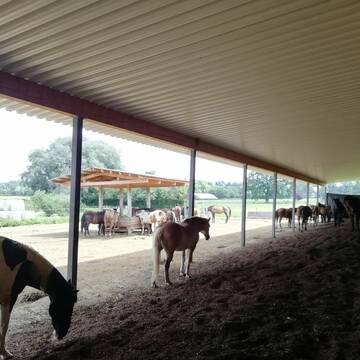


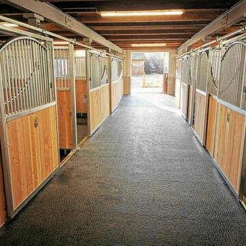
Pferdepension Neurieder-moderne Offenstallhaltung
Frankenried
Neurieder
@Neurieder
Freizeitstall
Reitlehrer und -unterricht
Vermieten
Krankenbox
Longierzirkel/Roundpen
Allergikerstall
Gnadenbrothof
21 weitere...
S
Deprecated: Creation of dynamic property Zend_View_Helper_Ads::$adLink is deprecated in /var/www/stall-frei/htdocs/staging.stall-frei.de/library/Psf/View/Helper/Ads.php on line 108

Frisches Stroh zu verkaufen!
Mechtersen
STALL-FREIde Marketing
@STALL-FREI-Marketing
Kaufe frisches Stroh für dein Pferd!


Reitsportzentrum Honsolgen
Buchloe
Reitsportzentrum-Honsolgen
@Reitsportzentrum-Honsolgen
Freizeitstall
Pferdeausbildung
Vermieten
Führanlage
Krankenbox
Hengsthaltung möglich
Hufrehe geeignet
15 weitere...
S
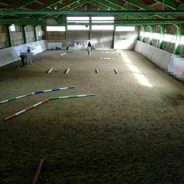
Dressurstall Gestüt alte Mühle Dösingen
Dösingen
Cronauer-andy
@Cronauer-andy
Reitlehrer und -unterricht
Vermieten
Longierzirkel/Roundpen
Parkplatz für Pferdeanhänger
Notfallboxen
14 weitere...
P


Offenstall/Paddocktrail
Aitrang
Pferdeparadies
@HofBayrhof
Vermieten
Longierzirkel/Roundpen
Reitplatz (z.B. Dressur, Springen, Reining)
Hufrehe geeignet
Notfallboxen
Offenstall
Paddock Trail
9 weitere...
S

Stalltrakt zu vermieten!
Blonhofen
M. Unterstein
@PferdezentrumKaltental
Freizeitstall
Pferdeausbildung
Vermieten
Führanlage
Krankenbox
Allergikerstall
bedampftes/gewaschenes Heu
35 weitere...
P

Pferdepension Hit Aktivstall Kürmerhof
Hohenkammer
Kuermerhof
@Kuermerhof
*******JETZT NEU MIT ENTSTAUBTEM BIOHEU*********
*******Demnächst mit einem Abenteuerspielplatz für Pferde ( Extrem Trail/Pa

Pferdepension Bernt
Oberostendorf
Markus und Laura Bernt
@Pferdepension-Bernt
Freizeitstall
Reitlehrer und -unterricht
Vermieten
Hunde willkommen
Krankenbox
Notfallboxen
17 weitere...
P


Bewegungs-, Offenstall, Arbeits- und Extreme Trail
Bernbeuren
Fitness-Stall-Badwerk
@Fitness-Stall-Badwerk
Freizeitstall
Geländestrecke
Vermieten
Krankenbox
Longierzirkel/Roundpen
Allergikerstall
Notfallboxen
23 weitere...
ganz aktuell
S
Pferdepension Trautwein
Stöttwang
pferdepension-trautwein
@pferdepension-trautwein
FN-Mitglied
Freizeitstall
Hunde willkommen
Krankenbox
Hengsthaltung möglich
Zuchtstutenhaltung möglich
Außenbox mit Paddock
Außenboxen
22 weitere...
aktuell
P


Waldblickhof Honsolgen
Honsolgen
Zech
@Waldblickhof
Freizeitstall
Hunde willkommen
Krankenbox
Hufrehe geeignet
Notfallboxen
Bewegungsstall
Laufstall
11 weitere...
P+


Waldblickhof Honsolgen
Honsolgen
Zech
@Waldblickhof
Freizeitstall
Hunde willkommen
Krankenbox
Bewegungsstall
Offenstall
Vollpension
7 weitere...
P+
Deprecated: Creation of dynamic property Zend_View::$pageCount is deprecated in /var/www/stall-frei/htdocs/staging.stall-frei.de/library/vendor/shardj/zf1-future/library/Zend/View/Abstract.php on line 308
Deprecated: Creation of dynamic property Zend_View::$itemCountPerPage is deprecated in /var/www/stall-frei/htdocs/staging.stall-frei.de/library/vendor/shardj/zf1-future/library/Zend/View/Abstract.php on line 308
Deprecated: Creation of dynamic property Zend_View::$first is deprecated in /var/www/stall-frei/htdocs/staging.stall-frei.de/library/vendor/shardj/zf1-future/library/Zend/View/Abstract.php on line 308
Deprecated: Creation of dynamic property Zend_View::$current is deprecated in /var/www/stall-frei/htdocs/staging.stall-frei.de/library/vendor/shardj/zf1-future/library/Zend/View/Abstract.php on line 308
Deprecated: Creation of dynamic property Zend_View::$last is deprecated in /var/www/stall-frei/htdocs/staging.stall-frei.de/library/vendor/shardj/zf1-future/library/Zend/View/Abstract.php on line 308
Deprecated: Creation of dynamic property Zend_View::$next is deprecated in /var/www/stall-frei/htdocs/staging.stall-frei.de/library/vendor/shardj/zf1-future/library/Zend/View/Abstract.php on line 308
Deprecated: Creation of dynamic property Zend_View::$pagesInRange is deprecated in /var/www/stall-frei/htdocs/staging.stall-frei.de/library/vendor/shardj/zf1-future/library/Zend/View/Abstract.php on line 308
Deprecated: Creation of dynamic property Zend_View::$firstPageInRange is deprecated in /var/www/stall-frei/htdocs/staging.stall-frei.de/library/vendor/shardj/zf1-future/library/Zend/View/Abstract.php on line 308
Deprecated: Creation of dynamic property Zend_View::$lastPageInRange is deprecated in /var/www/stall-frei/htdocs/staging.stall-frei.de/library/vendor/shardj/zf1-future/library/Zend/View/Abstract.php on line 308
Deprecated: Creation of dynamic property Zend_View::$currentItemCount is deprecated in /var/www/stall-frei/htdocs/staging.stall-frei.de/library/vendor/shardj/zf1-future/library/Zend/View/Abstract.php on line 308
Deprecated: Creation of dynamic property Zend_View::$totalItemCount is deprecated in /var/www/stall-frei/htdocs/staging.stall-frei.de/library/vendor/shardj/zf1-future/library/Zend/View/Abstract.php on line 308
Deprecated: Creation of dynamic property Zend_View::$firstItemNumber is deprecated in /var/www/stall-frei/htdocs/staging.stall-frei.de/library/vendor/shardj/zf1-future/library/Zend/View/Abstract.php on line 308
Deprecated: Creation of dynamic property Zend_View::$lastItemNumber is deprecated in /var/www/stall-frei/htdocs/staging.stall-frei.de/library/vendor/shardj/zf1-future/library/Zend/View/Abstract.php on line 308
Deprecated: Creation of dynamic property Zend_View::$router is deprecated in /var/www/stall-frei/htdocs/staging.stall-frei.de/library/vendor/shardj/zf1-future/library/Zend/View/Abstract.php on line 308
Deprecated: Creation of dynamic property Zend_View::$urlParams is deprecated in /var/www/stall-frei/htdocs/staging.stall-frei.de/library/vendor/shardj/zf1-future/library/Zend/View/Abstract.php on line 308
Deprecated: Creation of dynamic property Zend_View::$showAds is deprecated in /var/www/stall-frei/htdocs/staging.stall-frei.de/library/vendor/shardj/zf1-future/library/Zend/View/Abstract.php on line 308
Deprecated: Creation of dynamic property Zend_View::$objectIds is deprecated in /var/www/stall-frei/htdocs/staging.stall-frei.de/library/vendor/shardj/zf1-future/library/Zend/View/Abstract.php on line 308
Deprecated: Creation of dynamic property Zend_View::$showNavbar is deprecated in /var/www/stall-frei/htdocs/staging.stall-frei.de/library/vendor/shardj/zf1-future/library/Zend/View/Abstract.php on line 308
Deprecated: Creation of dynamic property Zend_View::$showBreadcrumb is deprecated in /var/www/stall-frei/htdocs/staging.stall-frei.de/library/vendor/shardj/zf1-future/library/Zend/View/Abstract.php on line 308
Deprecated: Creation of dynamic property Zend_View::$showFooter is deprecated in /var/www/stall-frei/htdocs/staging.stall-frei.de/library/vendor/shardj/zf1-future/library/Zend/View/Abstract.php on line 308
Deprecated: Creation of dynamic property Zend_View::$showInternalAds is deprecated in /var/www/stall-frei/htdocs/staging.stall-frei.de/library/vendor/shardj/zf1-future/library/Zend/View/Abstract.php on line 308
Deprecated: Creation of dynamic property Zend_View::$blNoContent is deprecated in /var/www/stall-frei/htdocs/staging.stall-frei.de/library/vendor/shardj/zf1-future/library/Zend/View/Abstract.php on line 308
Deprecated: Creation of dynamic property Zend_View::$sMetaDesc is deprecated in /var/www/stall-frei/htdocs/staging.stall-frei.de/library/vendor/shardj/zf1-future/library/Zend/View/Abstract.php on line 308
Deprecated: Creation of dynamic property Zend_View::$useGmaps is deprecated in /var/www/stall-frei/htdocs/staging.stall-frei.de/library/vendor/shardj/zf1-future/library/Zend/View/Abstract.php on line 308
Deprecated: Creation of dynamic property Zend_View::$touches is deprecated in /var/www/stall-frei/htdocs/staging.stall-frei.de/library/vendor/shardj/zf1-future/library/Zend/View/Abstract.php on line 308
Deprecated: Creation of dynamic property Zend_View::$oProject is deprecated in /var/www/stall-frei/htdocs/staging.stall-frei.de/library/vendor/shardj/zf1-future/library/Zend/View/Abstract.php on line 308
Deprecated: Creation of dynamic property Zend_View::$pageHeadline is deprecated in /var/www/stall-frei/htdocs/staging.stall-frei.de/library/vendor/shardj/zf1-future/library/Zend/View/Abstract.php on line 308
Deprecated: Creation of dynamic property Zend_View::$disableLocationField is deprecated in /var/www/stall-frei/htdocs/staging.stall-frei.de/library/vendor/shardj/zf1-future/library/Zend/View/Abstract.php on line 308
Deprecated: Creation of dynamic property Zend_View::$isSearch is deprecated in /var/www/stall-frei/htdocs/staging.stall-frei.de/library/vendor/shardj/zf1-future/library/Zend/View/Abstract.php on line 308
Deprecated: Creation of dynamic property Zend_View::$pageTitle is deprecated in /var/www/stall-frei/htdocs/staging.stall-frei.de/library/vendor/shardj/zf1-future/library/Zend/View/Abstract.php on line 308
Deprecated: Creation of dynamic property Psf_Form_Element_Text::$class is deprecated in /var/www/stall-frei/htdocs/staging.stall-frei.de/library/vendor/shardj/zf1-future/library/Zend/Form/Element.php on line 874
Deprecated: Creation of dynamic property Psf_Form_Element_Text::$size is deprecated in /var/www/stall-frei/htdocs/staging.stall-frei.de/library/vendor/shardj/zf1-future/library/Zend/Form/Element.php on line 874
Deprecated: Creation of dynamic property Psf_Form_Element_Text::$placeholder is deprecated in /var/www/stall-frei/htdocs/staging.stall-frei.de/library/vendor/shardj/zf1-future/library/Zend/Form/Element.php on line 874
Deprecated: Creation of dynamic property Psf_Form_Element_Hidden::$class is deprecated in /var/www/stall-frei/htdocs/staging.stall-frei.de/library/vendor/shardj/zf1-future/library/Zend/Form/Element.php on line 874
Deprecated: Creation of dynamic property Psf_Form_Element_Hidden::$class is deprecated in /var/www/stall-frei/htdocs/staging.stall-frei.de/library/vendor/shardj/zf1-future/library/Zend/Form/Element.php on line 874
Deprecated: Creation of dynamic property Psf_Form_Element_Hidden::$class is deprecated in /var/www/stall-frei/htdocs/staging.stall-frei.de/library/vendor/shardj/zf1-future/library/Zend/Form/Element.php on line 874
Deprecated: Creation of dynamic property Psf_Form_Element_Hidden::$class is deprecated in /var/www/stall-frei/htdocs/staging.stall-frei.de/library/vendor/shardj/zf1-future/library/Zend/Form/Element.php on line 874
Deprecated: Creation of dynamic property Psf_Form_Element_Select::$class is deprecated in /var/www/stall-frei/htdocs/staging.stall-frei.de/library/vendor/shardj/zf1-future/library/Zend/Form/Element.php on line 874
Deprecated: Creation of dynamic property Psf_Form_Element_Select::$class is deprecated in /var/www/stall-frei/htdocs/staging.stall-frei.de/library/vendor/shardj/zf1-future/library/Zend/Form/Element.php on line 874
Deprecated: Creation of dynamic property Psf_Form_Element_Select::$class is deprecated in /var/www/stall-frei/htdocs/staging.stall-frei.de/library/vendor/shardj/zf1-future/library/Zend/Form/Element.php on line 874
Deprecated: Creation of dynamic property Psf_Form_Element_Select::$class is deprecated in /var/www/stall-frei/htdocs/staging.stall-frei.de/library/vendor/shardj/zf1-future/library/Zend/Form/Element.php on line 874
Deprecated: Creation of dynamic property Psf_Form_Element_Text::$class is deprecated in /var/www/stall-frei/htdocs/staging.stall-frei.de/library/vendor/shardj/zf1-future/library/Zend/Form/Element.php on line 874
Deprecated: Creation of dynamic property Psf_Form_Element_Checkbox::$label is deprecated in /var/www/stall-frei/htdocs/staging.stall-frei.de/library/vendor/shardj/zf1-future/library/Zend/Form/Element.php on line 874
Deprecated: Creation of dynamic property Zend_View::$sort is deprecated in /var/www/stall-frei/htdocs/staging.stall-frei.de/library/vendor/shardj/zf1-future/library/Zend/View/Abstract.php on line 308
Deprecated: Creation of dynamic property Zend_View::$searchLocation is deprecated in /var/www/stall-frei/htdocs/staging.stall-frei.de/library/vendor/shardj/zf1-future/library/Zend/View/Abstract.php on line 308
Deprecated: Creation of dynamic property Zend_View::$locationHint is deprecated in /var/www/stall-frei/htdocs/staging.stall-frei.de/library/vendor/shardj/zf1-future/library/Zend/View/Abstract.php on line 308
Psf_GeoCoder_Abstract::getLocation: Im Hart Get Location CachedOrLive
Psf_GeoCoder_Abstract::getCachedOrLive: Im Hart
Psf_GeoCoder_OpenCageData::makeApiRequest: response:
Array
(
[documentation] => https://opencagedata.com/api
[licenses] => Array
(
[0] => Array
(
[name] => see attribution guide
[url] => https://opencagedata.com/credits
)
)
[results] => Array
(
[0] => Array
(
[bounds] => Array
(
[northeast] => Array
(
[lat] => 47.9521569
[lng] => 10.7206555
)
[southwest] => Array
(
[lat] => 47.9121569
[lng] => 10.6806555
)
)
[components] => Array
(
[ISO_3166-1_alpha-2] => DE
[ISO_3166-1_alpha-3] => DEU
[ISO_3166-2] => Array
(
[0] => DE-BY
)
[_category] => place
[_normalized_city] => Westendorf
[_type] => hamlet
[continent] => Europe
[country] => Deutschland
[country_code] => de
[county] => Landkreis Ostallgäu
[hamlet] => Im Hart
[municipality] => Westendorf (VGem)
[political_union] => European Union
[postcode] => 87679
[state] => Bayern
[state_code] => BY
[village] => Westendorf
)
[confidence] => 7
[formatted] => Im Hart, 87679 Westendorf, Deutschland
[geometry] => Array
(
[lat] => 47.9321569
[lng] => 10.7006555
)
)
[1] => Array
(
[bounds] => Array
(
[northeast] => Array
(
[lat] => 47.9353559
[lng] => 10.6910113
)
[southwest] => Array
(
[lat] => 47.9352559
[lng] => 10.6909113
)
)
[components] => Array
(
[ISO_3166-1_alpha-2] => DE
[ISO_3166-1_alpha-3] => DEU
[ISO_3166-2] => Array
(
[0] => DE-BY
)
[_category] => building
[_normalized_city] => Westendorf
[_type] => building
[continent] => Europe
[country] => Deutschland
[country_code] => de
[county] => Landkreis Ostallgäu
[isolated_dwelling] => Im Hart
[municipality] => Westendorf (VGem)
[political_union] => European Union
[postcode] => 87679
[state] => Bayern
[state_code] => BY
[village] => Westendorf
)
[confidence] => 10
[formatted] => Im Hart, 87679 Westendorf, Deutschland
[geometry] => Array
(
[lat] => 47.9353059
[lng] => 10.6909613
)
)
[2] => Array
(
[bounds] => Array
(
[northeast] => Array
(
[lat] => 48.7298503
[lng] => 9.2232325
)
[southwest] => Array
(
[lat] => 48.7283457
[lng] => 9.2207392
)
)
[components] => Array
(
[ISO_3166-1_alpha-2] => DE
[ISO_3166-1_alpha-3] => DEU
[ISO_3166-2] => Array
(
[0] => DE-BW
)
[_category] => agriculture
[_normalized_city] => Ostfildern
[_type] => farmyard
[continent] => Europe
[country] => Deutschland
[country_code] => de
[county] => Landkreis Esslingen
[farmyard] => Im Hart
[municipality] => Ostfildern
[political_union] => European Union
[postcode] => 73760
[state] => Baden-Württemberg
[state_code] => BW
)
[confidence] => 9
[formatted] => Im Hart, 73760 Ostfildern, Deutschland
[geometry] => Array
(
[lat] => 48.7291589
[lng] => 9.2214438
)
)
[3] => Array
(
[bounds] => Array
(
[northeast] => Array
(
[lat] => 47.8930008
[lng] => 16.125615
)
[southwest] => Array
(
[lat] => 47.8730008
[lng] => 16.105615
)
)
[components] => Array
(
[ISO_3166-1_alpha-2] => AT
[ISO_3166-1_alpha-3] => AUT
[ISO_3166-2] => Array
(
[0] => AT-3
)
[_category] => place
[_normalized_city] => Markt Piesting
[_type] => hamlet
[continent] => Europe
[country] => Österreich
[country_code] => at
[county] => Bezirk Wiener Neustadt
[locality] => Im Hart
[political_union] => European Union
[postcode] => 2753
[state] => Niederösterreich
[state_code] => 3
[suburb] => Katastralgemeinde Piesting
[village] => Markt Piesting
)
[confidence] => 8
[formatted] => Im Hart, 2753 Markt Piesting, Österreich
[geometry] => Array
(
[lat] => 47.8830008
[lng] => 16.115615
)
)
[4] => Array
(
[bounds] => Array
(
[northeast] => Array
(
[lat] => 48.013109
[lng] => 10.2720527
)
[southwest] => Array
(
[lat] => 48.0094836
[lng] => 10.2682079
)
)
[components] => Array
(
[ISO_3166-1_alpha-2] => DE
[ISO_3166-1_alpha-3] => DEU
[ISO_3166-2] => Array
(
[0] => DE-BY
)
[_category] => road
[_normalized_city] => Ungerhausen
[_type] => road
[continent] => Europe
[country] => Deutschland
[country_code] => de
[county] => Landkreis Unterallgäu
[hamlet] => Ungerhausen-Bahnhof
[municipality] => Memmingerberg
[political_union] => European Union
[postcode] => 87781
[road] => Im Hart
[road_type] => residential
[state] => Bayern
[state_code] => BY
[village] => Ungerhausen
)
[confidence] => 9
[formatted] => Im Hart, 87781 Ungerhausen, Deutschland
[geometry] => Array
(
[lat] => 48.010814
[lng] => 10.2696948
)
)
[5] => Array
(
[bounds] => Array
(
[northeast] => Array
(
[lat] => 48.0934516
[lng] => 14.0484203
)
[southwest] => Array
(
[lat] => 48.0914837
[lng] => 14.0420249
)
)
[components] => Array
(
[ISO_3166-1_alpha-2] => AT
[ISO_3166-1_alpha-3] => AUT
[ISO_3166-2] => Array
(
[0] => AT-4
)
[_category] => road
[_normalized_city] => Sattledt
[_type] => road
[continent] => Europe
[country] => Österreich
[country_code] => at
[county] => Bezirk Wels-Land
[political_union] => European Union
[postcode] => 4642
[road] => Im Hart
[state] => Oberösterreich
[state_code] => 4
[village] => Sattledt
)
[confidence] => 9
[formatted] => Im Hart, 4642 Sattledt, Österreich
[geometry] => Array
(
[lat] => 48.0927798
[lng] => 14.0450011
)
)
[6] => Array
(
[bounds] => Array
(
[northeast] => Array
(
[lat] => 48.6898646
[lng] => 9.9238185
)
[southwest] => Array
(
[lat] => 48.6882842
[lng] => 9.9213716
)
)
[components] => Array
(
[ISO_3166-1_alpha-2] => DE
[ISO_3166-1_alpha-3] => DEU
[ISO_3166-2] => Array
(
[0] => DE-BW
)
[_category] => road
[_normalized_city] => Böhmenkirch
[_type] => road
[continent] => Europe
[country] => Deutschland
[country_code] => de
[county] => Landkreis Göppingen
[political_union] => European Union
[postcode] => 89558
[road] => Im Hart
[road_type] => residential
[state] => Baden-Württemberg
[state_code] => BW
[village] => Böhmenkirch
)
[confidence] => 9
[formatted] => Im Hart, 89558 Böhmenkirch, Deutschland
[geometry] => Array
(
[lat] => 48.6890744
[lng] => 9.9225951
)
)
[7] => Array
(
[bounds] => Array
(
[northeast] => Array
(
[lat] => 48.1237846
[lng] => 11.3719587
)
[southwest] => Array
(
[lat] => 48.1209309
[lng] => 11.3706137
)
)
[components] => Array
(
[ISO_3166-1_alpha-2] => DE
[ISO_3166-1_alpha-3] => DEU
[ISO_3166-2] => Array
(
[0] => DE-BY
)
[_category] => road
[_normalized_city] => Germering
[_type] => road
[continent] => Europe
[country] => Deutschland
[country_code] => de
[county] => Landkreis Fürstenfeldbruck
[political_union] => European Union
[postcode] => 82110
[road] => Im Hart
[road_type] => residential
[state] => Bayern
[state_code] => BY
[suburb] => Unterpfaffenhofen
[town] => Germering
)
[confidence] => 9
[formatted] => Im Hart, 82110 Germering, Deutschland
[geometry] => Array
(
[lat] => 48.122354
[lng] => 11.3712783
)
)
[8] => Array
(
[bounds] => Array
(
[northeast] => Array
(
[lat] => 48.6911242
[lng] => 9.9213716
)
[southwest] => Array
(
[lat] => 48.6898646
[lng] => 9.9202258
)
)
[components] => Array
(
[ISO_3166-1_alpha-2] => DE
[ISO_3166-1_alpha-3] => DEU
[ISO_3166-2] => Array
(
[0] => DE-BW
)
[_category] => road
[_normalized_city] => Böhmenkirch
[_type] => road
[city] => Böhmenkirch
[continent] => Europe
[country] => Deutschland
[country_code] => de
[county] => Landkreis Göppingen
[political_union] => European Union
[postcode] => 89558
[road] => Im Hart
[road_type] => residential
[state] => Baden-Württemberg
[state_code] => BW
[village] => Treffelhausen
)
[confidence] => 9
[formatted] => Im Hart, 89558 Treffelhausen, Deutschland
[geometry] => Array
(
[lat] => 48.6904945
[lng] => 9.9204254
)
)
[9] => Array
(
[components] => Array
(
[ISO_3166-1_alpha-2] => FR
[ISO_3166-1_alpha-3] => FRA
[ISO_3166-2] => Array
(
[0] => FR-IDF
[1] => FR-77
)
[_category] => road
[_normalized_city] => Champs-sur-Marne
[_type] => road
[city] => Champs-sur-Marne
[continent] => Europe
[country] => France
[country_code] => fr
[county] => Seine-et-Marne
[local_authority] => Communauté d'agglomération Paris - Vallée de la Marne
[political_union] => European Union
[postcode] => 77420
[road] => Rue Emile Hart
[state] => Île-de-France
[state_code] => IDF
)
[confidence] => 2
[formatted] => Rue Emile Hart, 77420 Champs-sur-Marne, France
[geometry] => Array
(
[lat] => 48.851887
[lng] => 2.600938
)
)
)
[status] => Array
(
[code] => 200
[message] => OK
)
[stay_informed] => Array
(
[blog] => https://blog.opencagedata.com
[mastodon] => https://en.osm.town/@opencage
)
[thanks] => For using an OpenCage API
[timestamp] => Array
(
[created_http] => Mon, 09 Feb 2026 02:09:19 GMT
[created_unix] => 1770602959
)
[total_results] => 10
)
Psf_GeoCoder_Abstract::convertLocationResult
{"documentation":"https:\/\/opencagedata.com\/api","licenses":[{"name":"see attribution guide","url":"https:\/\/opencagedata.com\/credits"}],"results":[{"bounds":{"northeast":{"lat":47.9521569,"lng":10.7206555},"southwest":{"lat":47.9121569,"lng":10.6806555}},"components":{"ISO_3166-1_alpha-2":"DE","ISO_3166-1_alpha-3":"DEU","ISO_3166-2":["DE-BY"],"_category":"place","_normalized_city":"Westendorf","_type":"hamlet","continent":"Europe","country":"Deutschland","country_code":"de","county":"Landkreis Ostallg\u00e4u","hamlet":"Im Hart","municipality":"Westendorf (VGem)","political_union":"European Union","postcode":"87679","state":"Bayern","state_code":"BY","village":"Westendorf"},"confidence":7,"formatted":"Im Hart, 87679 Westendorf, Deutschland","geometry":{"lat":47.9321569,"lng":10.7006555}},{"bounds":{"northeast":{"lat":47.9353559,"lng":10.6910113},"southwest":{"lat":47.9352559,"lng":10.6909113}},"components":{"ISO_3166-1_alpha-2":"DE","ISO_3166-1_alpha-3":"DEU","ISO_3166-2":["DE-BY"],"_category":"building","_normalized_city":"Westendorf","_type":"building","continent":"Europe","country":"Deutschland","country_code":"de","county":"Landkreis Ostallg\u00e4u","isolated_dwelling":"Im Hart","municipality":"Westendorf (VGem)","political_union":"European Union","postcode":"87679","state":"Bayern","state_code":"BY","village":"Westendorf"},"confidence":10,"formatted":"Im Hart, 87679 Westendorf, Deutschland","geometry":{"lat":47.9353059,"lng":10.6909613}},{"bounds":{"northeast":{"lat":48.7298503,"lng":9.2232325},"southwest":{"lat":48.7283457,"lng":9.2207392}},"components":{"ISO_3166-1_alpha-2":"DE","ISO_3166-1_alpha-3":"DEU","ISO_3166-2":["DE-BW"],"_category":"agriculture","_normalized_city":"Ostfildern","_type":"farmyard","continent":"Europe","country":"Deutschland","country_code":"de","county":"Landkreis Esslingen","farmyard":"Im Hart","municipality":"Ostfildern","political_union":"European Union","postcode":"73760","state":"Baden-W\u00fcrttemberg","state_code":"BW"},"confidence":9,"formatted":"Im Hart, 73760 Ostfildern, Deutschland","geometry":{"lat":48.7291589,"lng":9.2214438}},{"bounds":{"northeast":{"lat":47.8930008,"lng":16.125615},"southwest":{"lat":47.8730008,"lng":16.105615}},"components":{"ISO_3166-1_alpha-2":"AT","ISO_3166-1_alpha-3":"AUT","ISO_3166-2":["AT-3"],"_category":"place","_normalized_city":"Markt Piesting","_type":"hamlet","continent":"Europe","country":"\u00d6sterreich","country_code":"at","county":"Bezirk Wiener Neustadt","locality":"Im Hart","political_union":"European Union","postcode":"2753","state":"Nieder\u00f6sterreich","state_code":"3","suburb":"Katastralgemeinde Piesting","village":"Markt Piesting"},"confidence":8,"formatted":"Im Hart, 2753 Markt Piesting, \u00d6sterreich","geometry":{"lat":47.8830008,"lng":16.115615}},{"bounds":{"northeast":{"lat":48.013109,"lng":10.2720527},"southwest":{"lat":48.0094836,"lng":10.2682079}},"components":{"ISO_3166-1_alpha-2":"DE","ISO_3166-1_alpha-3":"DEU","ISO_3166-2":["DE-BY"],"_category":"road","_normalized_city":"Ungerhausen","_type":"road","continent":"Europe","country":"Deutschland","country_code":"de","county":"Landkreis Unterallg\u00e4u","hamlet":"Ungerhausen-Bahnhof","municipality":"Memmingerberg","political_union":"European Union","postcode":"87781","road":"Im Hart","road_type":"residential","state":"Bayern","state_code":"BY","village":"Ungerhausen"},"confidence":9,"formatted":"Im Hart, 87781 Ungerhausen, Deutschland","geometry":{"lat":48.010814,"lng":10.2696948}},{"bounds":{"northeast":{"lat":48.0934516,"lng":14.0484203},"southwest":{"lat":48.0914837,"lng":14.0420249}},"components":{"ISO_3166-1_alpha-2":"AT","ISO_3166-1_alpha-3":"AUT","ISO_3166-2":["AT-4"],"_category":"road","_normalized_city":"Sattledt","_type":"road","continent":"Europe","country":"\u00d6sterreich","country_code":"at","county":"Bezirk Wels-Land","political_union":"European Union","postcode":"4642","road":"Im Hart","state":"Ober\u00f6sterreich","state_code":"4","village":"Sattledt"},"confidence":9,"formatted":"Im Hart, 4642 Sattledt, \u00d6sterreich","geometry":{"lat":48.0927798,"lng":14.0450011}},{"bounds":{"northeast":{"lat":48.6898646,"lng":9.9238185},"southwest":{"lat":48.6882842,"lng":9.9213716}},"components":{"ISO_3166-1_alpha-2":"DE","ISO_3166-1_alpha-3":"DEU","ISO_3166-2":["DE-BW"],"_category":"road","_normalized_city":"B\u00f6hmenkirch","_type":"road","continent":"Europe","country":"Deutschland","country_code":"de","county":"Landkreis G\u00f6ppingen","political_union":"European Union","postcode":"89558","road":"Im Hart","road_type":"residential","state":"Baden-W\u00fcrttemberg","state_code":"BW","village":"B\u00f6hmenkirch"},"confidence":9,"formatted":"Im Hart, 89558 B\u00f6hmenkirch, Deutschland","geometry":{"lat":48.6890744,"lng":9.9225951}},{"bounds":{"northeast":{"lat":48.1237846,"lng":11.3719587},"southwest":{"lat":48.1209309,"lng":11.3706137}},"components":{"ISO_3166-1_alpha-2":"DE","ISO_3166-1_alpha-3":"DEU","ISO_3166-2":["DE-BY"],"_category":"road","_normalized_city":"Germering","_type":"road","continent":"Europe","country":"Deutschland","country_code":"de","county":"Landkreis F\u00fcrstenfeldbruck","political_union":"European Union","postcode":"82110","road":"Im Hart","road_type":"residential","state":"Bayern","state_code":"BY","suburb":"Unterpfaffenhofen","town":"Germering"},"confidence":9,"formatted":"Im Hart, 82110 Germering, Deutschland","geometry":{"lat":48.122354,"lng":11.3712783}},{"bounds":{"northeast":{"lat":48.6911242,"lng":9.9213716},"southwest":{"lat":48.6898646,"lng":9.9202258}},"components":{"ISO_3166-1_alpha-2":"DE","ISO_3166-1_alpha-3":"DEU","ISO_3166-2":["DE-BW"],"_category":"road","_normalized_city":"B\u00f6hmenkirch","_type":"road","city":"B\u00f6hmenkirch","continent":"Europe","country":"Deutschland","country_code":"de","county":"Landkreis G\u00f6ppingen","political_union":"European Union","postcode":"89558","road":"Im Hart","road_type":"residential","state":"Baden-W\u00fcrttemberg","state_code":"BW","village":"Treffelhausen"},"confidence":9,"formatted":"Im Hart, 89558 Treffelhausen, Deutschland","geometry":{"lat":48.6904945,"lng":9.9204254}},{"components":{"ISO_3166-1_alpha-2":"FR","ISO_3166-1_alpha-3":"FRA","ISO_3166-2":["FR-IDF","FR-77"],"_category":"road","_normalized_city":"Champs-sur-Marne","_type":"road","city":"Champs-sur-Marne","continent":"Europe","country":"France","country_code":"fr","county":"Seine-et-Marne","local_authority":"Communaut\u00e9 d'agglom\u00e9ration Paris - Vall\u00e9e de la Marne","political_union":"European Union","postcode":"77420","road":"Rue Emile Hart","state":"\u00cele-de-France","state_code":"IDF"},"confidence":2,"formatted":"Rue Emile Hart, 77420 Champs-sur-Marne, France","geometry":{"lat":48.851887,"lng":2.600938}}],"status":{"code":200,"message":"OK"},"stay_informed":{"blog":"https:\/\/blog.opencagedata.com","mastodon":"https:\/\/en.osm.town\/@opencage"},"thanks":"For using an OpenCage API","timestamp":{"created_http":"Mon, 09 Feb 2026 02:09:19 GMT","created_unix":1770602959},"total_results":10}Array
(
[0] => stdClass Object
(
[bounds] => stdClass Object
(
[northeast] => stdClass Object
(
[lat] => 47.9521569
[lng] => 10.7206555
)
[southwest] => stdClass Object
(
[lat] => 47.9121569
[lng] => 10.6806555
)
)
[components] => stdClass Object
(
[ISO_3166-1_alpha-2] => DE
[ISO_3166-1_alpha-3] => DEU
[ISO_3166-2] => Array
(
[0] => DE-BY
)
[_category] => place
[_normalized_city] => Westendorf
[_type] => hamlet
[continent] => Europe
[country] => Deutschland
[country_code] => de
[county] => Landkreis Ostallgäu
[hamlet] => Im Hart
[municipality] => Westendorf (VGem)
[political_union] => European Union
[postcode] => 87679
[state] => Bayern
[state_code] => BY
[village] => Westendorf
)
[confidence] => 7
[formatted] => Im Hart, 87679 Westendorf, Deutschland
[geometry] => stdClass Object
(
[lat] => 47.9321569
[lng] => 10.7006555
)
)
[1] => stdClass Object
(
[bounds] => stdClass Object
(
[northeast] => stdClass Object
(
[lat] => 47.9353559
[lng] => 10.6910113
)
[southwest] => stdClass Object
(
[lat] => 47.9352559
[lng] => 10.6909113
)
)
[components] => stdClass Object
(
[ISO_3166-1_alpha-2] => DE
[ISO_3166-1_alpha-3] => DEU
[ISO_3166-2] => Array
(
[0] => DE-BY
)
[_category] => building
[_normalized_city] => Westendorf
[_type] => building
[continent] => Europe
[country] => Deutschland
[country_code] => de
[county] => Landkreis Ostallgäu
[isolated_dwelling] => Im Hart
[municipality] => Westendorf (VGem)
[political_union] => European Union
[postcode] => 87679
[state] => Bayern
[state_code] => BY
[village] => Westendorf
)
[confidence] => 10
[formatted] => Im Hart, 87679 Westendorf, Deutschland
[geometry] => stdClass Object
(
[lat] => 47.9353059
[lng] => 10.6909613
)
)
[2] => stdClass Object
(
[bounds] => stdClass Object
(
[northeast] => stdClass Object
(
[lat] => 48.7298503
[lng] => 9.2232325
)
[southwest] => stdClass Object
(
[lat] => 48.7283457
[lng] => 9.2207392
)
)
[components] => stdClass Object
(
[ISO_3166-1_alpha-2] => DE
[ISO_3166-1_alpha-3] => DEU
[ISO_3166-2] => Array
(
[0] => DE-BW
)
[_category] => agriculture
[_normalized_city] => Ostfildern
[_type] => farmyard
[continent] => Europe
[country] => Deutschland
[country_code] => de
[county] => Landkreis Esslingen
[farmyard] => Im Hart
[municipality] => Ostfildern
[political_union] => European Union
[postcode] => 73760
[state] => Baden-Württemberg
[state_code] => BW
)
[confidence] => 9
[formatted] => Im Hart, 73760 Ostfildern, Deutschland
[geometry] => stdClass Object
(
[lat] => 48.7291589
[lng] => 9.2214438
)
)
[3] => stdClass Object
(
[bounds] => stdClass Object
(
[northeast] => stdClass Object
(
[lat] => 47.8930008
[lng] => 16.125615
)
[southwest] => stdClass Object
(
[lat] => 47.8730008
[lng] => 16.105615
)
)
[components] => stdClass Object
(
[ISO_3166-1_alpha-2] => AT
[ISO_3166-1_alpha-3] => AUT
[ISO_3166-2] => Array
(
[0] => AT-3
)
[_category] => place
[_normalized_city] => Markt Piesting
[_type] => hamlet
[continent] => Europe
[country] => Österreich
[country_code] => at
[county] => Bezirk Wiener Neustadt
[locality] => Im Hart
[political_union] => European Union
[postcode] => 2753
[state] => Niederösterreich
[state_code] => 3
[suburb] => Katastralgemeinde Piesting
[village] => Markt Piesting
)
[confidence] => 8
[formatted] => Im Hart, 2753 Markt Piesting, Österreich
[geometry] => stdClass Object
(
[lat] => 47.8830008
[lng] => 16.115615
)
)
[4] => stdClass Object
(
[bounds] => stdClass Object
(
[northeast] => stdClass Object
(
[lat] => 48.013109
[lng] => 10.2720527
)
[southwest] => stdClass Object
(
[lat] => 48.0094836
[lng] => 10.2682079
)
)
[components] => stdClass Object
(
[ISO_3166-1_alpha-2] => DE
[ISO_3166-1_alpha-3] => DEU
[ISO_3166-2] => Array
(
[0] => DE-BY
)
[_category] => road
[_normalized_city] => Ungerhausen
[_type] => road
[continent] => Europe
[country] => Deutschland
[country_code] => de
[county] => Landkreis Unterallgäu
[hamlet] => Ungerhausen-Bahnhof
[municipality] => Memmingerberg
[political_union] => European Union
[postcode] => 87781
[road] => Im Hart
[road_type] => residential
[state] => Bayern
[state_code] => BY
[village] => Ungerhausen
)
[confidence] => 9
[formatted] => Im Hart, 87781 Ungerhausen, Deutschland
[geometry] => stdClass Object
(
[lat] => 48.010814
[lng] => 10.2696948
)
)
[5] => stdClass Object
(
[bounds] => stdClass Object
(
[northeast] => stdClass Object
(
[lat] => 48.0934516
[lng] => 14.0484203
)
[southwest] => stdClass Object
(
[lat] => 48.0914837
[lng] => 14.0420249
)
)
[components] => stdClass Object
(
[ISO_3166-1_alpha-2] => AT
[ISO_3166-1_alpha-3] => AUT
[ISO_3166-2] => Array
(
[0] => AT-4
)
[_category] => road
[_normalized_city] => Sattledt
[_type] => road
[continent] => Europe
[country] => Österreich
[country_code] => at
[county] => Bezirk Wels-Land
[political_union] => European Union
[postcode] => 4642
[road] => Im Hart
[state] => Oberösterreich
[state_code] => 4
[village] => Sattledt
)
[confidence] => 9
[formatted] => Im Hart, 4642 Sattledt, Österreich
[geometry] => stdClass Object
(
[lat] => 48.0927798
[lng] => 14.0450011
)
)
[6] => stdClass Object
(
[bounds] => stdClass Object
(
[northeast] => stdClass Object
(
[lat] => 48.6898646
[lng] => 9.9238185
)
[southwest] => stdClass Object
(
[lat] => 48.6882842
[lng] => 9.9213716
)
)
[components] => stdClass Object
(
[ISO_3166-1_alpha-2] => DE
[ISO_3166-1_alpha-3] => DEU
[ISO_3166-2] => Array
(
[0] => DE-BW
)
[_category] => road
[_normalized_city] => Böhmenkirch
[_type] => road
[continent] => Europe
[country] => Deutschland
[country_code] => de
[county] => Landkreis Göppingen
[political_union] => European Union
[postcode] => 89558
[road] => Im Hart
[road_type] => residential
[state] => Baden-Württemberg
[state_code] => BW
[village] => Böhmenkirch
)
[confidence] => 9
[formatted] => Im Hart, 89558 Böhmenkirch, Deutschland
[geometry] => stdClass Object
(
[lat] => 48.6890744
[lng] => 9.9225951
)
)
[7] => stdClass Object
(
[bounds] => stdClass Object
(
[northeast] => stdClass Object
(
[lat] => 48.1237846
[lng] => 11.3719587
)
[southwest] => stdClass Object
(
[lat] => 48.1209309
[lng] => 11.3706137
)
)
[components] => stdClass Object
(
[ISO_3166-1_alpha-2] => DE
[ISO_3166-1_alpha-3] => DEU
[ISO_3166-2] => Array
(
[0] => DE-BY
)
[_category] => road
[_normalized_city] => Germering
[_type] => road
[continent] => Europe
[country] => Deutschland
[country_code] => de
[county] => Landkreis Fürstenfeldbruck
[political_union] => European Union
[postcode] => 82110
[road] => Im Hart
[road_type] => residential
[state] => Bayern
[state_code] => BY
[suburb] => Unterpfaffenhofen
[town] => Germering
)
[confidence] => 9
[formatted] => Im Hart, 82110 Germering, Deutschland
[geometry] => stdClass Object
(
[lat] => 48.122354
[lng] => 11.3712783
)
)
[8] => stdClass Object
(
[bounds] => stdClass Object
(
[northeast] => stdClass Object
(
[lat] => 48.6911242
[lng] => 9.9213716
)
[southwest] => stdClass Object
(
[lat] => 48.6898646
[lng] => 9.9202258
)
)
[components] => stdClass Object
(
[ISO_3166-1_alpha-2] => DE
[ISO_3166-1_alpha-3] => DEU
[ISO_3166-2] => Array
(
[0] => DE-BW
)
[_category] => road
[_normalized_city] => Böhmenkirch
[_type] => road
[city] => Böhmenkirch
[continent] => Europe
[country] => Deutschland
[country_code] => de
[county] => Landkreis Göppingen
[political_union] => European Union
[postcode] => 89558
[road] => Im Hart
[road_type] => residential
[state] => Baden-Württemberg
[state_code] => BW
[village] => Treffelhausen
)
[confidence] => 9
[formatted] => Im Hart, 89558 Treffelhausen, Deutschland
[geometry] => stdClass Object
(
[lat] => 48.6904945
[lng] => 9.9204254
)
)
[9] => stdClass Object
(
[components] => stdClass Object
(
[ISO_3166-1_alpha-2] => FR
[ISO_3166-1_alpha-3] => FRA
[ISO_3166-2] => Array
(
[0] => FR-IDF
[1] => FR-77
)
[_category] => road
[_normalized_city] => Champs-sur-Marne
[_type] => road
[city] => Champs-sur-Marne
[continent] => Europe
[country] => France
[country_code] => fr
[county] => Seine-et-Marne
[local_authority] => Communauté d'agglomération Paris - Vallée de la Marne
[political_union] => European Union
[postcode] => 77420
[road] => Rue Emile Hart
[state] => Île-de-France
[state_code] => IDF
)
[confidence] => 2
[formatted] => Rue Emile Hart, 77420 Champs-sur-Marne, France
[geometry] => stdClass Object
(
[lat] => 48.851887
[lng] => 2.600938
)
)
)
Psf_GeoCoder_OpenCageData::getKeyMap: 0
stdClass Object
(
    [bounds] => stdClass Object
        (
            [northeast] => stdClass Object
                (
                    [lat] => 47.9521569
                    [lng] => 10.7206555
                )

            [southwest] => stdClass Object
                (
                    [lat] => 47.9121569
                    [lng] => 10.6806555
                )

        )

    [components] => stdClass Object
        (
            [ISO_3166-1_alpha-2] => DE
            [ISO_3166-1_alpha-3] => DEU
            [ISO_3166-2] => Array
                (
                    [0] => DE-BY
                )

            [_category] => place
            [_normalized_city] => Westendorf
            [_type] => hamlet
            [continent] => Europe
            [country] => Deutschland
            [country_code] => de
            [county] => Landkreis Ostallgäu
            [hamlet] => Im Hart
            [municipality] => Westendorf (VGem)
            [political_union] => European Union
            [postcode] => 87679
            [state] => Bayern
            [state_code] => BY
            [village] => Westendorf
        )

    [confidence] => 7
    [formatted] => Im Hart, 87679 Westendorf, Deutschland
    [geometry] => stdClass Object
        (
            [lat] => 47.9321569
            [lng] => 10.7006555
        )

)
Psf_GeoCoder_OpenCageData::getCounty: Ostallgäu
Psf_GeoCoder_OpenCageData::addMissingData REFETCH!
Array
(
    [address] => Im Hart, 87679 Westendorf, Deutschland
    [type] => hamlet
    [street] => Im Hart
    [city] => Westendorf
    [county] => Ostallgäu
    [state] => Bayern
    [zip] => 87679
    [country] => Deutschland
    [suburb] =>
    [countrycode] => de
    [latitude] => 47.9321569
    [longitude] => 10.7006555
    [accuracy] => 1
    [confidence] => 7
    [bounds] => stdClass Object
        (
            [northeast] => stdClass Object
                (
                    [lat] => 47.9521569
                    [lng] => 10.7206555
                )

            [southwest] => stdClass Object
                (
                    [lat] => 47.9121569
                    [lng] => 10.6806555
                )

        )

)
reformat!
Array
(
    [address] => Im Hart, 87679 Westendorf, Deutschland
    [type] => hamlet
    [street] => Im Hart
    [city] => Westendorf
    [county] => Ostallgäu
    [state] => Bayern
    [zip] => 87679
    [country] => Deutschland
    [suburb] =>
    [countrycode] => de
    [latitude] => 47.9321569
    [longitude] => 10.7006555
    [accuracy] => 1
    [confidence] => 7
    [bounds] => stdClass Object
        (
            [northeast] => stdClass Object
                (
                    [lat] => 47.9521569
                    [lng] => 10.7206555
                )

            [southwest] => stdClass Object
                (
                    [lat] => 47.9121569
                    [lng] => 10.6806555
                )

        )

    [place] => Im Hart, 87679 Westendorf, Bayern
    [hash] => 010325868bd50bad19b5581f836a01cc
)
Psf_GeoCoder_OpenCageData::getKeyMap: 1
stdClass Object
(
    [bounds] => stdClass Object
        (
            [northeast] => stdClass Object
                (
                    [lat] => 47.9353559
                    [lng] => 10.6910113
                )

            [southwest] => stdClass Object
                (
                    [lat] => 47.9352559
                    [lng] => 10.6909113
                )

        )

    [components] => stdClass Object
        (
            [ISO_3166-1_alpha-2] => DE
            [ISO_3166-1_alpha-3] => DEU
            [ISO_3166-2] => Array
                (
                    [0] => DE-BY
                )

            [_category] => building
            [_normalized_city] => Westendorf
            [_type] => building
            [continent] => Europe
            [country] => Deutschland
            [country_code] => de
            [county] => Landkreis Ostallgäu
            [isolated_dwelling] => Im Hart
            [municipality] => Westendorf (VGem)
            [political_union] => European Union
            [postcode] => 87679
            [state] => Bayern
            [state_code] => BY
            [village] => Westendorf
        )

    [confidence] => 10
    [formatted] => Im Hart, 87679 Westendorf, Deutschland
    [geometry] => stdClass Object
        (
            [lat] => 47.9353059
            [lng] => 10.6909613
        )

)
Psf_GeoCoder_OpenCageData::getCounty: Ostallgäu
Psf_GeoCoder_OpenCageData::addMissingData REFETCH!
Array
(
    [address] => Im Hart, 87679 Westendorf, Deutschland
    [type] => building
    [street] =>
    [city] => Westendorf
    [county] => Ostallgäu
    [state] => Bayern
    [zip] => 87679
    [country] => Deutschland
    [suburb] =>
    [countrycode] => de
    [latitude] => 47.9353059
    [longitude] => 10.6909613
    [accuracy] => 1
    [confidence] => 10
    [bounds] => stdClass Object
        (
            [northeast] => stdClass Object
                (
                    [lat] => 47.9353559
                    [lng] => 10.6910113
                )

            [southwest] => stdClass Object
                (
                    [lat] => 47.9352559
                    [lng] => 10.6909113
                )

        )

)
reformat!
Array
(
    [address] => Im Hart, 87679 Westendorf, Deutschland
    [type] => building
    [street] =>
    [city] => Westendorf
    [county] => Ostallgäu
    [state] => Bayern
    [zip] => 87679
    [country] => Deutschland
    [suburb] =>
    [countrycode] => de
    [latitude] => 47.9353059
    [longitude] => 10.6909613
    [accuracy] => 1
    [confidence] => 10
    [bounds] => stdClass Object
        (
            [northeast] => stdClass Object
                (
                    [lat] => 47.9353559
                    [lng] => 10.6910113
                )

            [southwest] => stdClass Object
                (
                    [lat] => 47.9352559
                    [lng] => 10.6909113
                )

        )

    [place] => 87679 Westendorf, Bayern
    [hash] => 8e13f9500c82a6bf27f8a6eb6ff4e599
)
Psf_GeoCoder_OpenCageData::getKeyMap: 2
stdClass Object
(
    [bounds] => stdClass Object
        (
            [northeast] => stdClass Object
                (
                    [lat] => 48.7298503
                    [lng] => 9.2232325
                )

            [southwest] => stdClass Object
                (
                    [lat] => 48.7283457
                    [lng] => 9.2207392
                )

        )

    [components] => stdClass Object
        (
            [ISO_3166-1_alpha-2] => DE
            [ISO_3166-1_alpha-3] => DEU
            [ISO_3166-2] => Array
                (
                    [0] => DE-BW
                )

            [_category] => agriculture
            [_normalized_city] => Ostfildern
            [_type] => farmyard
            [continent] => Europe
            [country] => Deutschland
            [country_code] => de
            [county] => Landkreis Esslingen
            [farmyard] => Im Hart
            [municipality] => Ostfildern
            [political_union] => European Union
            [postcode] => 73760
            [state] => Baden-Württemberg
            [state_code] => BW
        )

    [confidence] => 9
    [formatted] => Im Hart, 73760 Ostfildern, Deutschland
    [geometry] => stdClass Object
        (
            [lat] => 48.7291589
            [lng] => 9.2214438
        )

)
Psf_GeoCoder_OpenCageData::getCounty: Esslingen
Psf_GeoCoder_OpenCageData::addMissingData REFETCH!
Array
(
    [address] => Im Hart, 73760 Ostfildern, Deutschland
    [type] => farmyard
    [street] =>
    [city] =>
    [county] => Esslingen
    [state] => Baden-Württemberg
    [zip] => 73760
    [country] => Deutschland
    [suburb] =>
    [countrycode] => de
    [latitude] => 48.7291589
    [longitude] => 9.2214438
    [accuracy] => 1
    [confidence] => 9
    [bounds] => stdClass Object
        (
            [northeast] => stdClass Object
                (
                    [lat] => 48.7298503
                    [lng] => 9.2232325
                )

            [southwest] => stdClass Object
                (
                    [lat] => 48.7283457
                    [lng] => 9.2207392
                )

        )

)
reformat!
Array
(
    [address] => Im Hart, 73760 Ostfildern, Deutschland
    [type] => farmyard
    [street] =>
    [city] =>
    [county] => Esslingen
    [state] => Baden-Württemberg
    [zip] => 73760
    [country] => Deutschland
    [suburb] =>
    [countrycode] => de
    [latitude] => 48.7291589
    [longitude] => 9.2214438
    [accuracy] => 1
    [confidence] => 9
    [bounds] => stdClass Object
        (
            [northeast] => stdClass Object
                (
                    [lat] => 48.7298503
                    [lng] => 9.2232325
                )

            [southwest] => stdClass Object
                (
                    [lat] => 48.7283457
                    [lng] => 9.2207392
                )

        )

    [place] => 73760 , Baden-Württemberg
    [hash] => 08eda8ee53f146e93c6053ad083da643
)
Psf_GeoCoder_OpenCageData::getKeyMap: 3
stdClass Object
(
    [bounds] => stdClass Object
        (
            [northeast] => stdClass Object
                (
                    [lat] => 47.8930008
                    [lng] => 16.125615
                )

            [southwest] => stdClass Object
                (
                    [lat] => 47.8730008
                    [lng] => 16.105615
                )

        )

    [components] => stdClass Object
        (
            [ISO_3166-1_alpha-2] => AT
            [ISO_3166-1_alpha-3] => AUT
            [ISO_3166-2] => Array
                (
                    [0] => AT-3
                )

            [_category] => place
            [_normalized_city] => Markt Piesting
            [_type] => hamlet
            [continent] => Europe
            [country] => Österreich
            [country_code] => at
            [county] => Bezirk Wiener Neustadt
            [locality] => Im Hart
            [political_union] => European Union
            [postcode] => 2753
            [state] => Niederösterreich
            [state_code] => 3
            [suburb] => Katastralgemeinde Piesting
            [village] => Markt Piesting
        )

    [confidence] => 8
    [formatted] => Im Hart, 2753 Markt Piesting, Österreich
    [geometry] => stdClass Object
        (
            [lat] => 47.8830008
            [lng] => 16.115615
        )

)
Psf_GeoCoder_OpenCageData::getCounty: Bezirk Wiener Neustadt
Psf_GeoCoder_OpenCageData::addMissingData REFETCH!
Array
(
    [address] => Im Hart, 2753 Markt Piesting, Österreich
    [type] => hamlet
    [street] =>
    [city] => Markt Piesting
    [county] => Bezirk Wiener Neustadt
    [state] => Niederösterreich
    [zip] => 2753
    [country] => Österreich
    [suburb] => Katastralgemeinde Piesting
    [countrycode] => at
    [latitude] => 47.8830008
    [longitude] => 16.115615
    [accuracy] => 1
    [confidence] => 8
    [bounds] => stdClass Object
        (
            [northeast] => stdClass Object
                (
                    [lat] => 47.8930008
                    [lng] => 16.125615
                )

            [southwest] => stdClass Object
                (
                    [lat] => 47.8730008
                    [lng] => 16.105615
                )

        )

)
reformat!
Array
(
    [address] => Im Hart, 2753 Markt Piesting, Österreich
    [type] => hamlet
    [street] =>
    [city] => Markt Piesting
    [county] => Bezirk Wiener Neustadt
    [state] => Niederösterreich
    [zip] => 2753
    [country] => Österreich
    [suburb] => Katastralgemeinde Piesting
    [countrycode] => at
    [latitude] => 47.8830008
    [longitude] => 16.115615
    [accuracy] => 1
    [confidence] => 8
    [bounds] => stdClass Object
        (
            [northeast] => stdClass Object
                (
                    [lat] => 47.8930008
                    [lng] => 16.125615
                )

            [southwest] => stdClass Object
                (
                    [lat] => 47.8730008
                    [lng] => 16.105615
                )

        )

    [place] => 2753 Markt Piesting, Niederösterreich
    [hash] => 4b1e55759853e8a2ead41c8913363c6c
)
Psf_GeoCoder_OpenCageData::getKeyMap: 4
stdClass Object
(
    [bounds] => stdClass Object
        (
            [northeast] => stdClass Object
                (
                    [lat] => 48.013109
                    [lng] => 10.2720527
                )

            [southwest] => stdClass Object
                (
                    [lat] => 48.0094836
                    [lng] => 10.2682079
                )

        )

    [components] => stdClass Object
        (
            [ISO_3166-1_alpha-2] => DE
            [ISO_3166-1_alpha-3] => DEU
            [ISO_3166-2] => Array
                (
                    [0] => DE-BY
                )

            [_category] => road
            [_normalized_city] => Ungerhausen
            [_type] => road
            [continent] => Europe
            [country] => Deutschland
            [country_code] => de
            [county] => Landkreis Unterallgäu
            [hamlet] => Ungerhausen-Bahnhof
            [municipality] => Memmingerberg
            [political_union] => European Union
            [postcode] => 87781
            [road] => Im Hart
            [road_type] => residential
            [state] => Bayern
            [state_code] => BY
            [village] => Ungerhausen
        )

    [confidence] => 9
    [formatted] => Im Hart, 87781 Ungerhausen, Deutschland
    [geometry] => stdClass Object
        (
            [lat] => 48.010814
            [lng] => 10.2696948
        )

)
Psf_GeoCoder_OpenCageData::getCounty: Unterallgäu
Psf_GeoCoder_OpenCageData::addMissingData REFETCH!
Array
(
    [address] => Im Hart, 87781 Ungerhausen, Deutschland
    [type] => road
    [street] => Im Hart
    [city] => Ungerhausen
    [county] => Unterallgäu
    [state] => Bayern
    [zip] => 87781
    [country] => Deutschland
    [suburb] =>
    [countrycode] => de
    [latitude] => 48.010814
    [longitude] => 10.2696948
    [accuracy] => 1
    [confidence] => 9
    [bounds] => stdClass Object
        (
            [northeast] => stdClass Object
                (
                    [lat] => 48.013109
                    [lng] => 10.2720527
                )

            [southwest] => stdClass Object
                (
                    [lat] => 48.0094836
                    [lng] => 10.2682079
                )

        )

)
reformat!
Array
(
    [address] => Im Hart, 87781 Ungerhausen, Deutschland
    [type] => road
    [street] => Im Hart
    [city] => Ungerhausen
    [county] => Unterallgäu
    [state] => Bayern
    [zip] => 87781
    [country] => Deutschland
    [suburb] =>
    [countrycode] => de
    [latitude] => 48.010814
    [longitude] => 10.2696948
    [accuracy] => 1
    [confidence] => 9
    [bounds] => stdClass Object
        (
            [northeast] => stdClass Object
                (
                    [lat] => 48.013109
                    [lng] => 10.2720527
                )

            [southwest] => stdClass Object
                (
                    [lat] => 48.0094836
                    [lng] => 10.2682079
                )

        )

    [place] => Im Hart, 87781 Ungerhausen, Bayern
    [hash] => 0929db13a8e804c3f60f73732c902830
)
Psf_GeoCoder_OpenCageData::getKeyMap: 5
stdClass Object
(
    [bounds] => stdClass Object
        (
            [northeast] => stdClass Object
                (
                    [lat] => 48.0934516
                    [lng] => 14.0484203
                )

            [southwest] => stdClass Object
                (
                    [lat] => 48.0914837
                    [lng] => 14.0420249
                )

        )

    [components] => stdClass Object
        (
            [ISO_3166-1_alpha-2] => AT
            [ISO_3166-1_alpha-3] => AUT
            [ISO_3166-2] => Array
                (
                    [0] => AT-4
                )

            [_category] => road
            [_normalized_city] => Sattledt
            [_type] => road
            [continent] => Europe
            [country] => Österreich
            [country_code] => at
            [county] => Bezirk Wels-Land
            [political_union] => European Union
            [postcode] => 4642
            [road] => Im Hart
            [state] => Oberösterreich
            [state_code] => 4
            [village] => Sattledt
        )

    [confidence] => 9
    [formatted] => Im Hart, 4642 Sattledt, Österreich
    [geometry] => stdClass Object
        (
            [lat] => 48.0927798
            [lng] => 14.0450011
        )

)
Psf_GeoCoder_OpenCageData::getCounty: Bezirk Wels-Land
Psf_GeoCoder_OpenCageData::addMissingData REFETCH!
Array
(
    [address] => Im Hart, 4642 Sattledt, Österreich
    [type] => road
    [street] => Im Hart
    [city] => Sattledt
    [county] => Bezirk Wels-Land
    [state] => Oberösterreich
    [zip] => 4642
    [country] => Österreich
    [suburb] =>
    [countrycode] => at
    [latitude] => 48.0927798
    [longitude] => 14.0450011
    [accuracy] => 1
    [confidence] => 9
    [bounds] => stdClass Object
        (
            [northeast] => stdClass Object
                (
                    [lat] => 48.0934516
                    [lng] => 14.0484203
                )

            [southwest] => stdClass Object
                (
                    [lat] => 48.0914837
                    [lng] => 14.0420249
                )

        )

)
reformat!
Array
(
    [address] => Im Hart, 4642 Sattledt, Österreich
    [type] => road
    [street] => Im Hart
    [city] => Sattledt
    [county] => Bezirk Wels-Land
    [state] => Oberösterreich
    [zip] => 4642
    [country] => Österreich
    [suburb] =>
    [countrycode] => at
    [latitude] => 48.0927798
    [longitude] => 14.0450011
    [accuracy] => 1
    [confidence] => 9
    [bounds] => stdClass Object
        (
            [northeast] => stdClass Object
                (
                    [lat] => 48.0934516
                    [lng] => 14.0484203
                )

            [southwest] => stdClass Object
                (
                    [lat] => 48.0914837
                    [lng] => 14.0420249
                )

        )

    [place] => Im Hart, 4642 Sattledt, Oberösterreich
    [hash] => 9446e1212227aa287de3ed6a091400db
)
Psf_GeoCoder_OpenCageData::getKeyMap: 6
stdClass Object
(
    [bounds] => stdClass Object
        (
            [northeast] => stdClass Object
                (
                    [lat] => 48.6898646
                    [lng] => 9.9238185
                )

            [southwest] => stdClass Object
                (
                    [lat] => 48.6882842
                    [lng] => 9.9213716
                )

        )

    [components] => stdClass Object
        (
            [ISO_3166-1_alpha-2] => DE
            [ISO_3166-1_alpha-3] => DEU
            [ISO_3166-2] => Array
                (
                    [0] => DE-BW
                )

            [_category] => road
            [_normalized_city] => Böhmenkirch
            [_type] => road
            [continent] => Europe
            [country] => Deutschland
            [country_code] => de
            [county] => Landkreis Göppingen
            [political_union] => European Union
            [postcode] => 89558
            [road] => Im Hart
            [road_type] => residential
            [state] => Baden-Württemberg
            [state_code] => BW
            [village] => Böhmenkirch
        )

    [confidence] => 9
    [formatted] => Im Hart, 89558 Böhmenkirch, Deutschland
    [geometry] => stdClass Object
        (
            [lat] => 48.6890744
            [lng] => 9.9225951
        )

)
Psf_GeoCoder_OpenCageData::getCounty: Göppingen
Psf_GeoCoder_OpenCageData::addMissingData REFETCH!
Array
(
    [address] => Im Hart, 89558 Böhmenkirch, Deutschland
    [type] => road
    [street] => Im Hart
    [city] => Böhmenkirch
    [county] => Göppingen
    [state] => Baden-Württemberg
    [zip] => 89558
    [country] => Deutschland
    [suburb] =>
    [countrycode] => de
    [latitude] => 48.6890744
    [longitude] => 9.9225951
    [accuracy] => 1
    [confidence] => 9
    [bounds] => stdClass Object
        (
            [northeast] => stdClass Object
                (
                    [lat] => 48.6898646
                    [lng] => 9.9238185
                )

            [southwest] => stdClass Object
                (
                    [lat] => 48.6882842
                    [lng] => 9.9213716
                )

        )

)
reformat!
Array
(
    [address] => Im Hart, 89558 Böhmenkirch, Deutschland
    [type] => road
    [street] => Im Hart
    [city] => Böhmenkirch
    [county] => Göppingen
    [state] => Baden-Württemberg
    [zip] => 89558
    [country] => Deutschland
    [suburb] =>
    [countrycode] => de
    [latitude] => 48.6890744
    [longitude] => 9.9225951
    [accuracy] => 1
    [confidence] => 9
    [bounds] => stdClass Object
        (
            [northeast] => stdClass Object
                (
                    [lat] => 48.6898646
                    [lng] => 9.9238185
                )

            [southwest] => stdClass Object
                (
                    [lat] => 48.6882842
                    [lng] => 9.9213716
                )

        )

    [place] => Im Hart, 89558 Böhmenkirch, Baden-Württemberg
    [hash] => 87f2f46e5fe136cf66d50dd53db150b6
)
Psf_GeoCoder_OpenCageData::getKeyMap: 7
stdClass Object
(
    [bounds] => stdClass Object
        (
            [northeast] => stdClass Object
                (
                    [lat] => 48.1237846
                    [lng] => 11.3719587
                )

            [southwest] => stdClass Object
                (
                    [lat] => 48.1209309
                    [lng] => 11.3706137
                )

        )

    [components] => stdClass Object
        (
            [ISO_3166-1_alpha-2] => DE
            [ISO_3166-1_alpha-3] => DEU
            [ISO_3166-2] => Array
                (
                    [0] => DE-BY
                )

            [_category] => road
            [_normalized_city] => Germering
            [_type] => road
            [continent] => Europe
            [country] => Deutschland
            [country_code] => de
            [county] => Landkreis Fürstenfeldbruck
            [political_union] => European Union
            [postcode] => 82110
            [road] => Im Hart
            [road_type] => residential
            [state] => Bayern
            [state_code] => BY
            [suburb] => Unterpfaffenhofen
            [town] => Germering
        )

    [confidence] => 9
    [formatted] => Im Hart, 82110 Germering, Deutschland
    [geometry] => stdClass Object
        (
            [lat] => 48.122354
            [lng] => 11.3712783
        )

)
Psf_GeoCoder_OpenCageData::getCounty: Fürstenfeldbruck
Psf_GeoCoder_OpenCageData::addMissingData REFETCH!
Array
(
    [address] => Im Hart, 82110 Germering, Deutschland
    [type] => road
    [street] => Im Hart
    [city] => Germering
    [county] => Fürstenfeldbruck
    [state] => Bayern
    [zip] => 82110
    [country] => Deutschland
    [suburb] => Unterpfaffenhofen
    [countrycode] => de
    [latitude] => 48.122354
    [longitude] => 11.3712783
    [accuracy] => 1
    [confidence] => 9
    [bounds] => stdClass Object
        (
            [northeast] => stdClass Object
                (
                    [lat] => 48.1237846
                    [lng] => 11.3719587
                )

            [southwest] => stdClass Object
                (
                    [lat] => 48.1209309
                    [lng] => 11.3706137
                )

        )

)
reformat!
Array
(
    [address] => Im Hart, 82110 Germering, Deutschland
    [type] => road
    [street] => Im Hart
    [city] => Germering
    [county] => Fürstenfeldbruck
    [state] => Bayern
    [zip] => 82110
    [country] => Deutschland
    [suburb] => Unterpfaffenhofen
    [countrycode] => de
    [latitude] => 48.122354
    [longitude] => 11.3712783
    [accuracy] => 1
    [confidence] => 9
    [bounds] => stdClass Object
        (
            [northeast] => stdClass Object
                (
                    [lat] => 48.1237846
                    [lng] => 11.3719587
                )

            [southwest] => stdClass Object
                (
                    [lat] => 48.1209309
                    [lng] => 11.3706137
                )

        )

    [place] => Im Hart, 82110 Germering, Bayern
    [hash] => 557fc76704fb2dd7e1e754ee5b91ef0e
)
Psf_GeoCoder_OpenCageData::getKeyMap: 8
stdClass Object
(
    [bounds] => stdClass Object
        (
            [northeast] => stdClass Object
                (
                    [lat] => 48.6911242
                    [lng] => 9.9213716
                )

            [southwest] => stdClass Object
                (
                    [lat] => 48.6898646
                    [lng] => 9.9202258
                )

        )

    [components] => stdClass Object
        (
            [ISO_3166-1_alpha-2] => DE
            [ISO_3166-1_alpha-3] => DEU
            [ISO_3166-2] => Array
                (
                    [0] => DE-BW
                )

            [_category] => road
            [_normalized_city] => Böhmenkirch
            [_type] => road
            [city] => Böhmenkirch
            [continent] => Europe
            [country] => Deutschland
            [country_code] => de
            [county] => Landkreis Göppingen
            [political_union] => European Union
            [postcode] => 89558
            [road] => Im Hart
            [road_type] => residential
            [state] => Baden-Württemberg
            [state_code] => BW
            [village] => Treffelhausen
        )

    [confidence] => 9
    [formatted] => Im Hart, 89558 Treffelhausen, Deutschland
    [geometry] => stdClass Object
        (
            [lat] => 48.6904945
            [lng] => 9.9204254
        )

)
Psf_GeoCoder_OpenCageData::getCounty: Göppingen
Psf_GeoCoder_OpenCageData::addMissingData REFETCH!
Array
(
    [address] => Im Hart, 89558 Treffelhausen, Deutschland
    [type] => road
    [street] => Im Hart
    [city] => Treffelhausen
    [county] => Göppingen
    [state] => Baden-Württemberg
    [zip] => 89558
    [country] => Deutschland
    [suburb] =>
    [countrycode] => de
    [latitude] => 48.6904945
    [longitude] => 9.9204254
    [accuracy] => 1
    [confidence] => 9
    [bounds] => stdClass Object
        (
            [northeast] => stdClass Object
                (
                    [lat] => 48.6911242
                    [lng] => 9.9213716
                )

            [southwest] => stdClass Object
                (
                    [lat] => 48.6898646
                    [lng] => 9.9202258
                )

        )

)
reformat!
Array
(
    [address] => Im Hart, 89558 Treffelhausen, Deutschland
    [type] => road
    [street] => Im Hart
    [city] => Treffelhausen
    [county] => Göppingen
    [state] => Baden-Württemberg
    [zip] => 89558
    [country] => Deutschland
    [suburb] =>
    [countrycode] => de
    [latitude] => 48.6904945
    [longitude] => 9.9204254
    [accuracy] => 1
    [confidence] => 9
    [bounds] => stdClass Object
        (
            [northeast] => stdClass Object
                (
                    [lat] => 48.6911242
                    [lng] => 9.9213716
                )

            [southwest] => stdClass Object
                (
                    [lat] => 48.6898646
                    [lng] => 9.9202258
                )

        )

    [place] => Im Hart, 89558 Treffelhausen, Baden-Württemberg
    [hash] => 60b0a9c91c5f21a3682a51dd46351abf
)
Psf_GeoCoder_OpenCageData::getKeyMap: 9
stdClass Object
(
    [components] => stdClass Object
        (
            [ISO_3166-1_alpha-2] => FR
            [ISO_3166-1_alpha-3] => FRA
            [ISO_3166-2] => Array
                (
                    [0] => FR-IDF
                    [1] => FR-77
                )

            [_category] => road
            [_normalized_city] => Champs-sur-Marne
            [_type] => road
            [city] => Champs-sur-Marne
            [continent] => Europe
            [country] => France
            [country_code] => fr
            [county] => Seine-et-Marne
            [local_authority] => Communauté d'agglomération Paris - Vallée de la Marne
            [political_union] => European Union
            [postcode] => 77420
            [road] => Rue Emile Hart
            [state] => Île-de-France
            [state_code] => IDF
        )

    [confidence] => 2
    [formatted] => Rue Emile Hart, 77420 Champs-sur-Marne, France
    [geometry] => stdClass Object
        (
            [lat] => 48.851887
            [lng] => 2.600938
        )

)
Psf_GeoCoder_OpenCageData::getCounty: Seine-et-Marne
Psf_GeoCoder_OpenCageData::addMissingData REFETCH!
Array
(
    [address] => Rue Emile Hart, 77420 Champs-sur-Marne, France
    [type] => road
    [street] => Rue Emile Hart
    [city] => Champs-sur-Marne
    [county] => Seine-et-Marne
    [state] => Île-de-France
    [zip] => 77420
    [country] => France
    [suburb] =>
    [countrycode] => fr
    [latitude] => 48.851887
    [longitude] => 2.600938
    [accuracy] => 1
    [confidence] => 2
    [bounds] =>
)
reformat!
Array
(
    [address] => Rue Emile Hart, 77420 Champs-sur-Marne, France
    [type] => road
    [street] => Rue Emile Hart
    [city] => Champs-sur-Marne
    [county] => Seine-et-Marne
    [state] => Île-de-France
    [zip] => 77420
    [country] => France
    [suburb] =>
    [countrycode] => fr
    [latitude] => 48.851887
    [longitude] => 2.600938
    [accuracy] => 1
    [confidence] => 2
    [bounds] =>
    [place] => Rue Emile Hart, 77420 Champs-sur-Marne, Île-de-France
    [hash] => 616f4456dadaded7734043d9999d7682
)
Deprecated: Creation of dynamic property Zend_View::$locationHintStyle is deprecated in /var/www/stall-frei/htdocs/staging.stall-frei.de/library/vendor/shardj/zf1-future/library/Zend/View/Abstract.php on line 308
Deprecated: Creation of dynamic property Zend_View::$adGeoLocation is deprecated in /var/www/stall-frei/htdocs/staging.stall-frei.de/library/vendor/shardj/zf1-future/library/Zend/View/Abstract.php on line 308
Deprecated: Creation of dynamic property Zend_View::$recordCount is deprecated in /var/www/stall-frei/htdocs/staging.stall-frei.de/library/vendor/shardj/zf1-future/library/Zend/View/Abstract.php on line 308
Deprecated: explode(): Passing null to parameter #2 ($string) of type string is deprecated in /var/www/stall-frei/htdocs/staging.stall-frei.de/application/models/SearchAgent.php on line 100
Deprecated: explode(): Passing null to parameter #2 ($string) of type string is deprecated in /var/www/stall-frei/htdocs/staging.stall-frei.de/application/models/SearchAgent.php on line 100
Deprecated: explode(): Passing null to parameter #2 ($string) of type string is deprecated in /var/www/stall-frei/htdocs/staging.stall-frei.de/application/models/SearchAgent.php on line 100
Deprecated: explode(): Passing null to parameter #2 ($string) of type string is deprecated in /var/www/stall-frei/htdocs/staging.stall-frei.de/application/models/SearchAgent.php on line 100
Deprecated: explode(): Passing null to parameter #2 ($string) of type string is deprecated in /var/www/stall-frei/htdocs/staging.stall-frei.de/application/models/SearchAgent.php on line 100
Deprecated: explode(): Passing null to parameter #2 ($string) of type string is deprecated in /var/www/stall-frei/htdocs/staging.stall-frei.de/application/models/SearchAgent.php on line 100
Deprecated: explode(): Passing null to parameter #2 ($string) of type string is deprecated in /var/www/stall-frei/htdocs/staging.stall-frei.de/application/models/SearchAgent.php on line 100
Deprecated: explode(): Passing null to parameter #2 ($string) of type string is deprecated in /var/www/stall-frei/htdocs/staging.stall-frei.de/application/models/SearchAgent.php on line 100
Deprecated: explode(): Passing null to parameter #2 ($string) of type string is deprecated in /var/www/stall-frei/htdocs/staging.stall-frei.de/application/models/SearchAgent.php on line 100
Deprecated: trim(): Passing null to parameter #1 ($string) of type string is deprecated in /var/www/stall-frei/htdocs/staging.stall-frei.de/application/models/Account/Search.php on line 82
Warning: Cannot modify header information - headers already sent by (output started at /var/www/stall-frei/htdocs/staging.stall-frei.de/library/vendor/shardj/zf1-future/library/Zend/View/Abstract.php:308) in /var/www/stall-frei/htdocs/staging.stall-frei.de/application/models/Account/Search.php on line 71
Deprecated: Creation of dynamic property Zend_View::$paginationParams is deprecated in /var/www/stall-frei/htdocs/staging.stall-frei.de/library/vendor/shardj/zf1-future/library/Zend/View/Abstract.php on line 308
Deprecated: Creation of dynamic property Zend_View::$objectPaginator is deprecated in /var/www/stall-frei/htdocs/staging.stall-frei.de/library/vendor/shardj/zf1-future/library/Zend/View/Abstract.php on line 308
Deprecated: Creation of dynamic property Zend_View::$featuredObjects is deprecated in /var/www/stall-frei/htdocs/staging.stall-frei.de/library/vendor/shardj/zf1-future/library/Zend/View/Abstract.php on line 308
Deprecated: Creation of dynamic property Zend_View::$hints is deprecated in /var/www/stall-frei/htdocs/staging.stall-frei.de/library/vendor/shardj/zf1-future/library/Zend/View/Abstract.php on line 308
Deprecated: Creation of dynamic property Zend_View::$attributeHints is deprecated in /var/www/stall-frei/htdocs/staging.stall-frei.de/library/vendor/shardj/zf1-future/library/Zend/View/Abstract.php on line 308
Deprecated: Creation of dynamic property Zend_View::$oSearchForm is deprecated in /var/www/stall-frei/htdocs/staging.stall-frei.de/library/vendor/shardj/zf1-future/library/Zend/View/Abstract.php on line 308